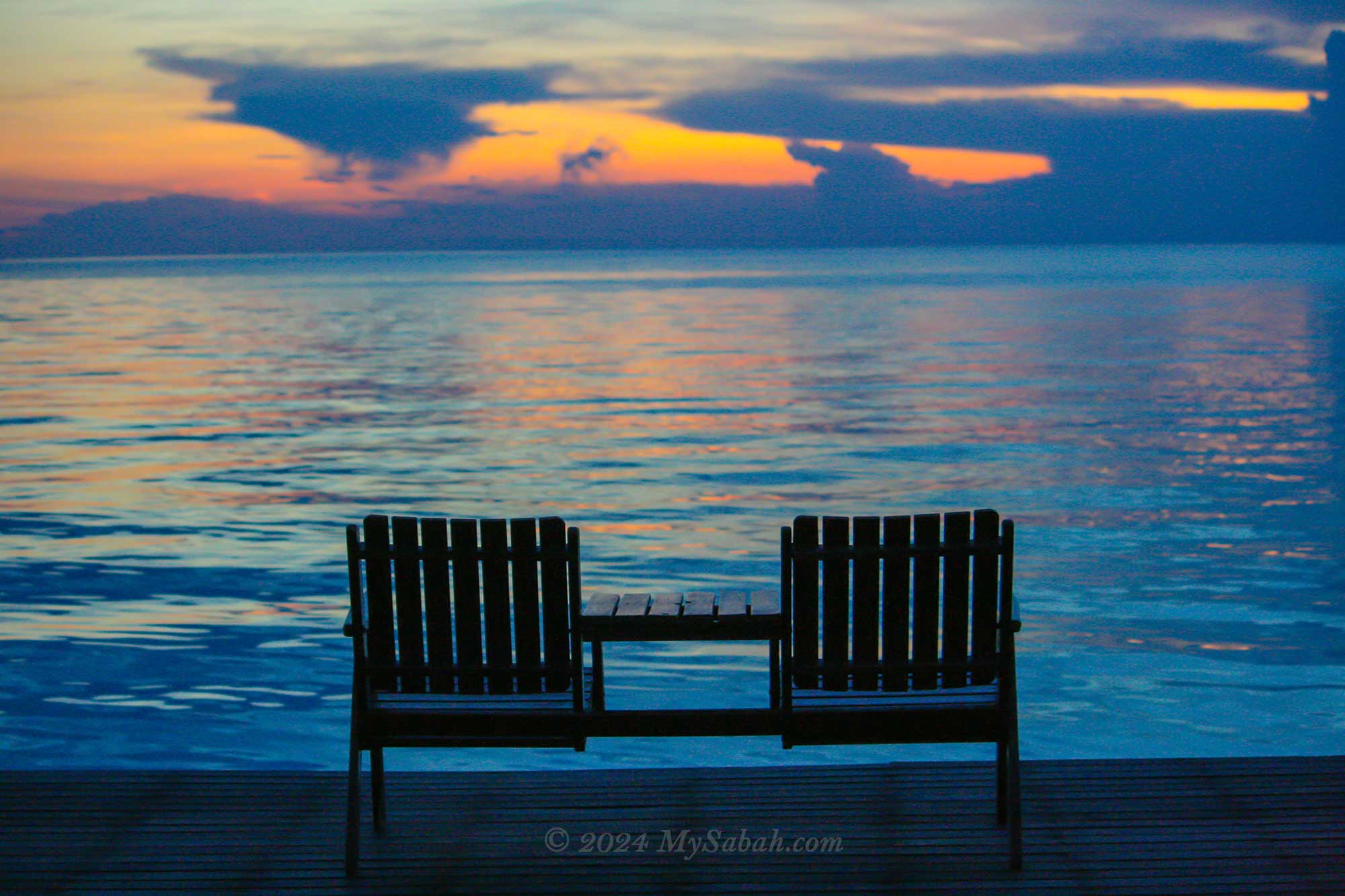
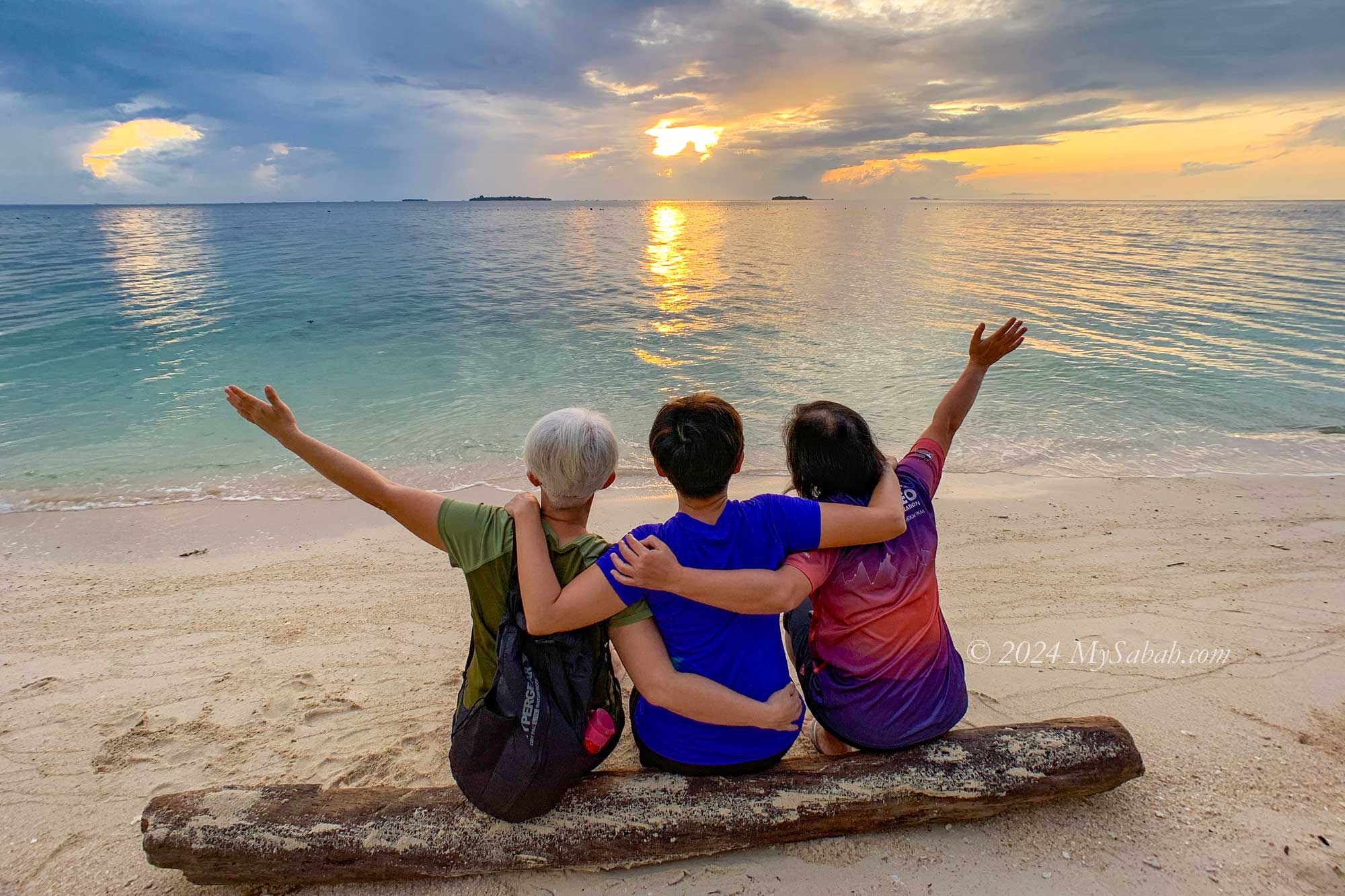
Who can resist the allure of tranquil seas and pristine white sandy beaches found on tropical islands? Sabah, often dubbed the “Maldives of South East Asia,” boasts numerous scenic islands ready to enchant tourists. Below, we present the top 10 islands (not in any order) in Sabah. Each island possesses its own unique features and beauty, showcasing the remarkable diversity of landscapes these islands offer.
1. Sipadan Island
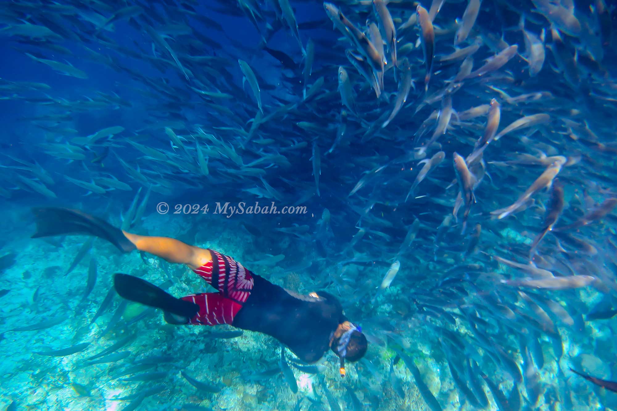
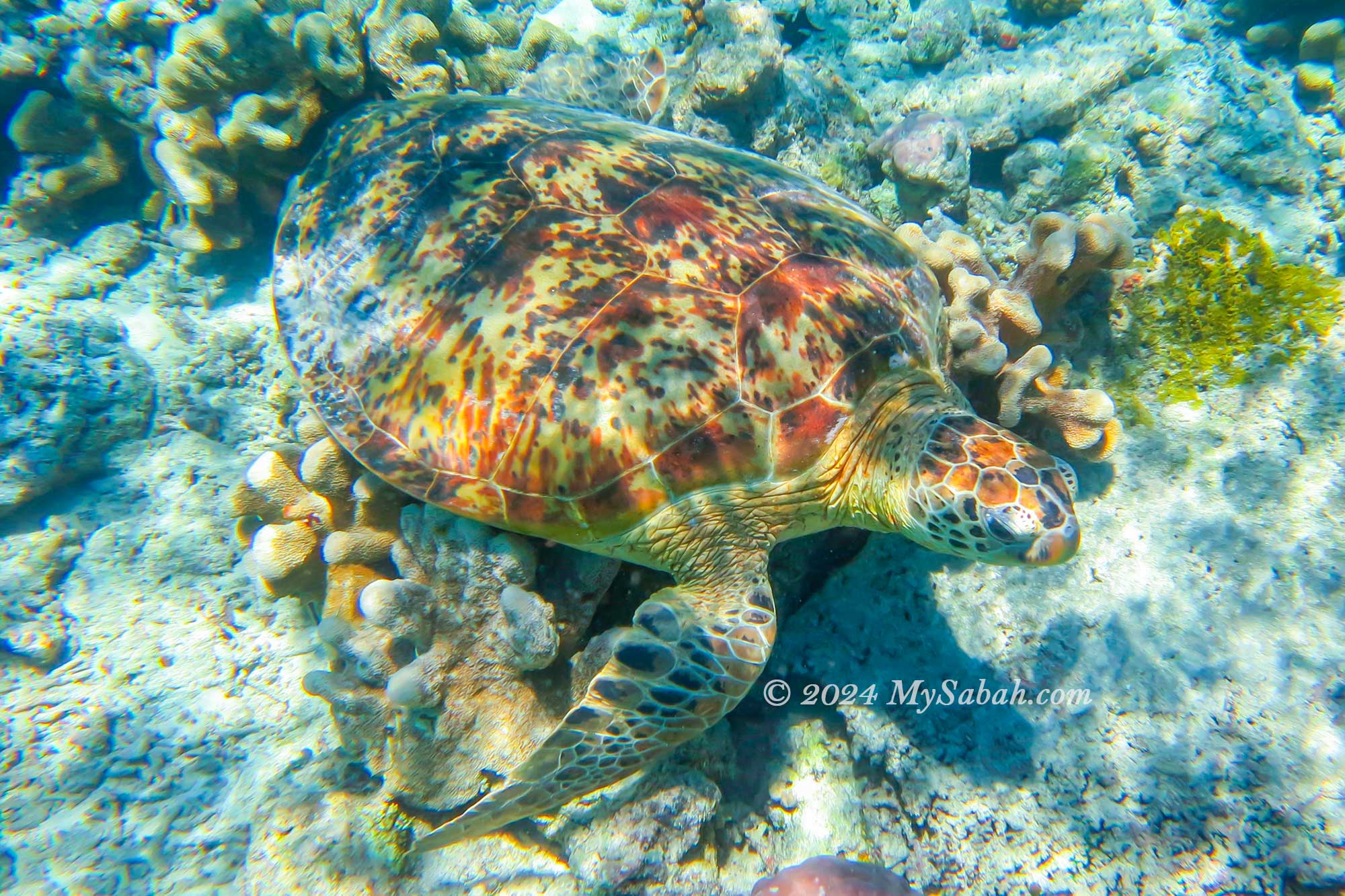
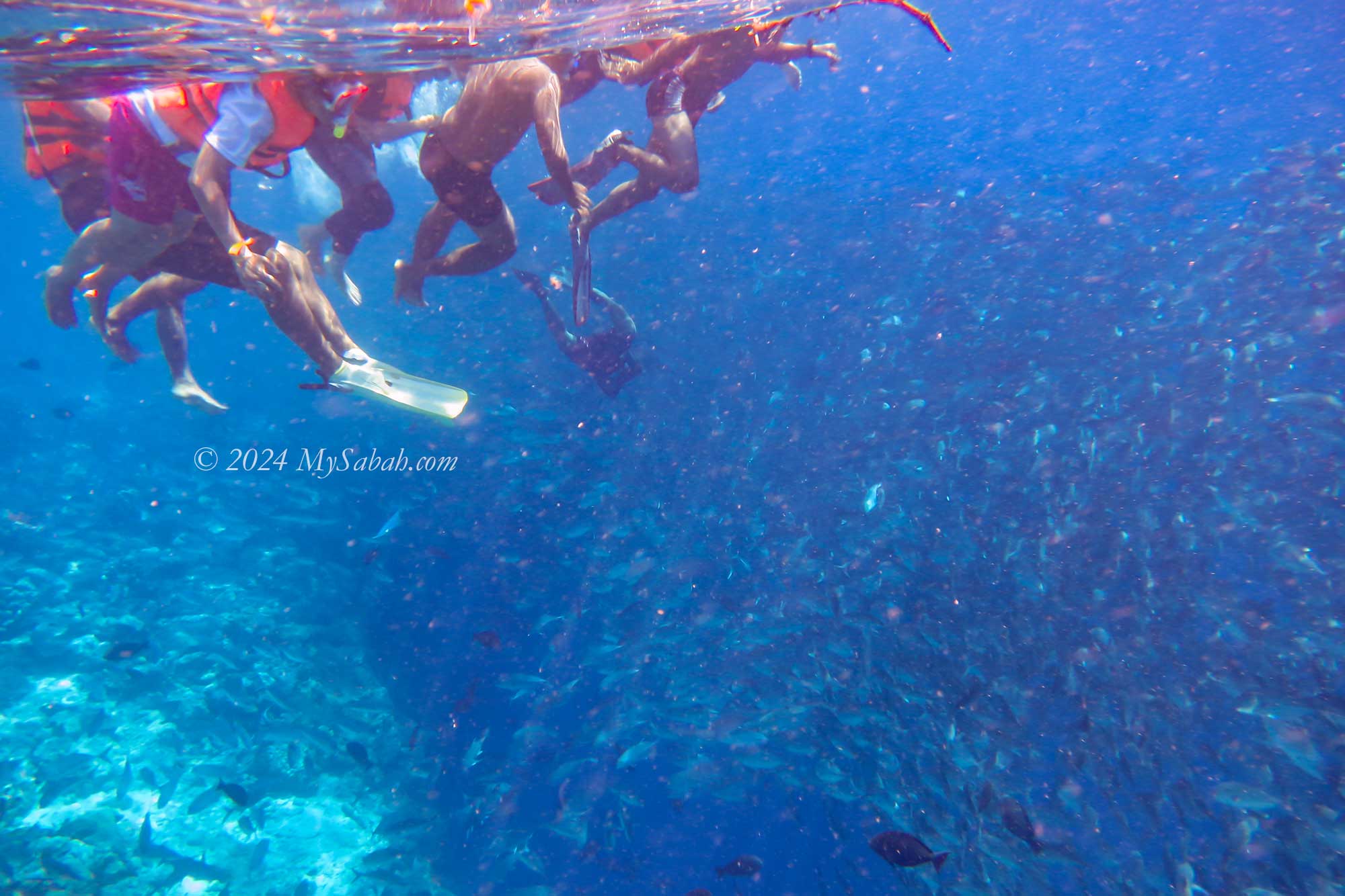
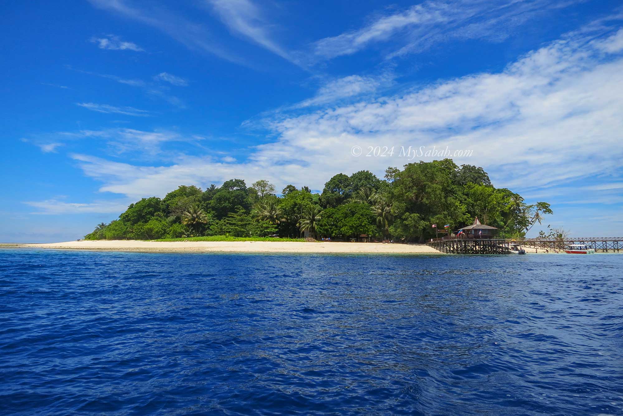
Sipadan Island is one of the top diving sites in the world. As the only oceanic island of Malaysia, it has garnered significant recognition, having been featured multiple times in National Geographic and Discovery Channels. Diving enthusiasts are in for a treat, with the opportunity to spot over 10 sea turtles on a single dive.
Snorkelling at Sipadan Island
Sea turtles are everywhere around Sipadan Island
Thousands of jackfish swimming under our feet.
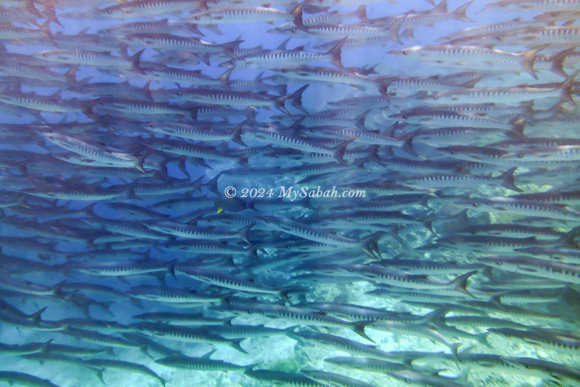
School of Barracudas
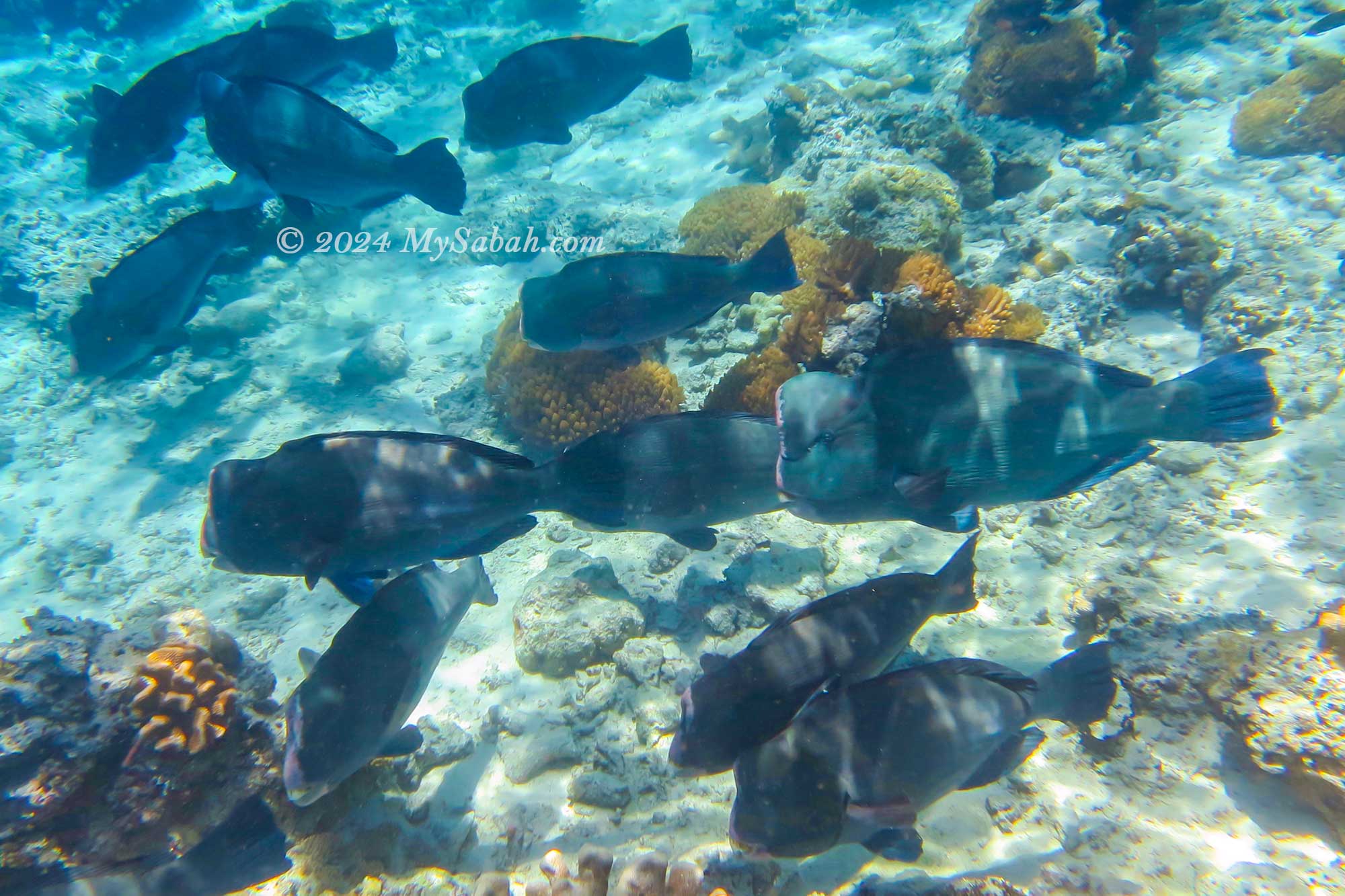
Bumphead parrotfish
Sipadan Island is the only oceanic island of Malaysia.
1 / 6
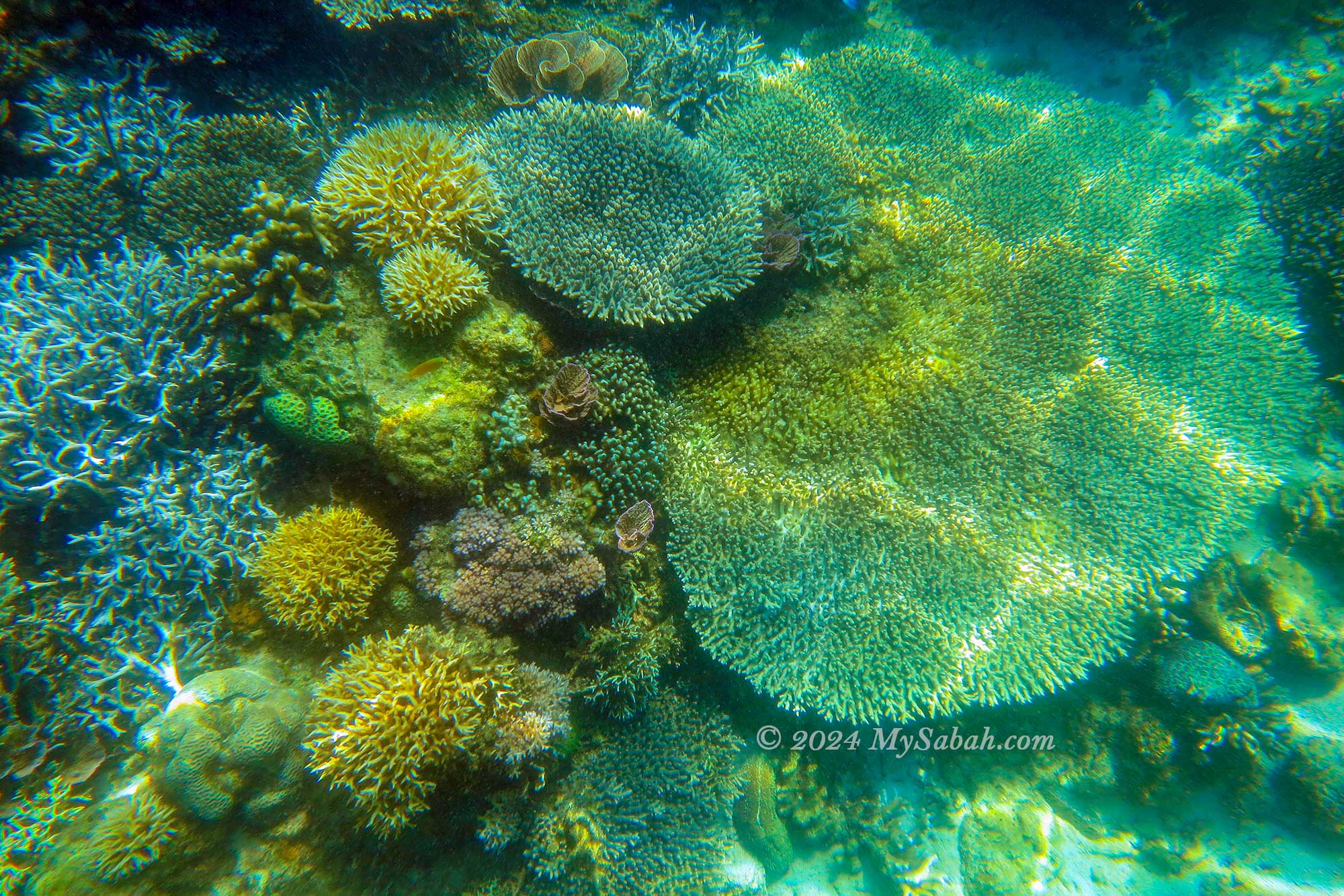
However, the real thrill lies in witnessing the barracuda tornado. Divers exploring the hanging garden dive site are greeted by a breathtaking array of colourful soft and hard corals. Read More or Book a Tour (Use Promo Code MYSABAH for Special Discount)
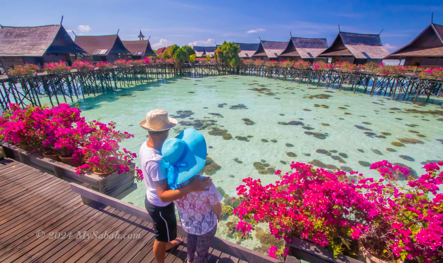
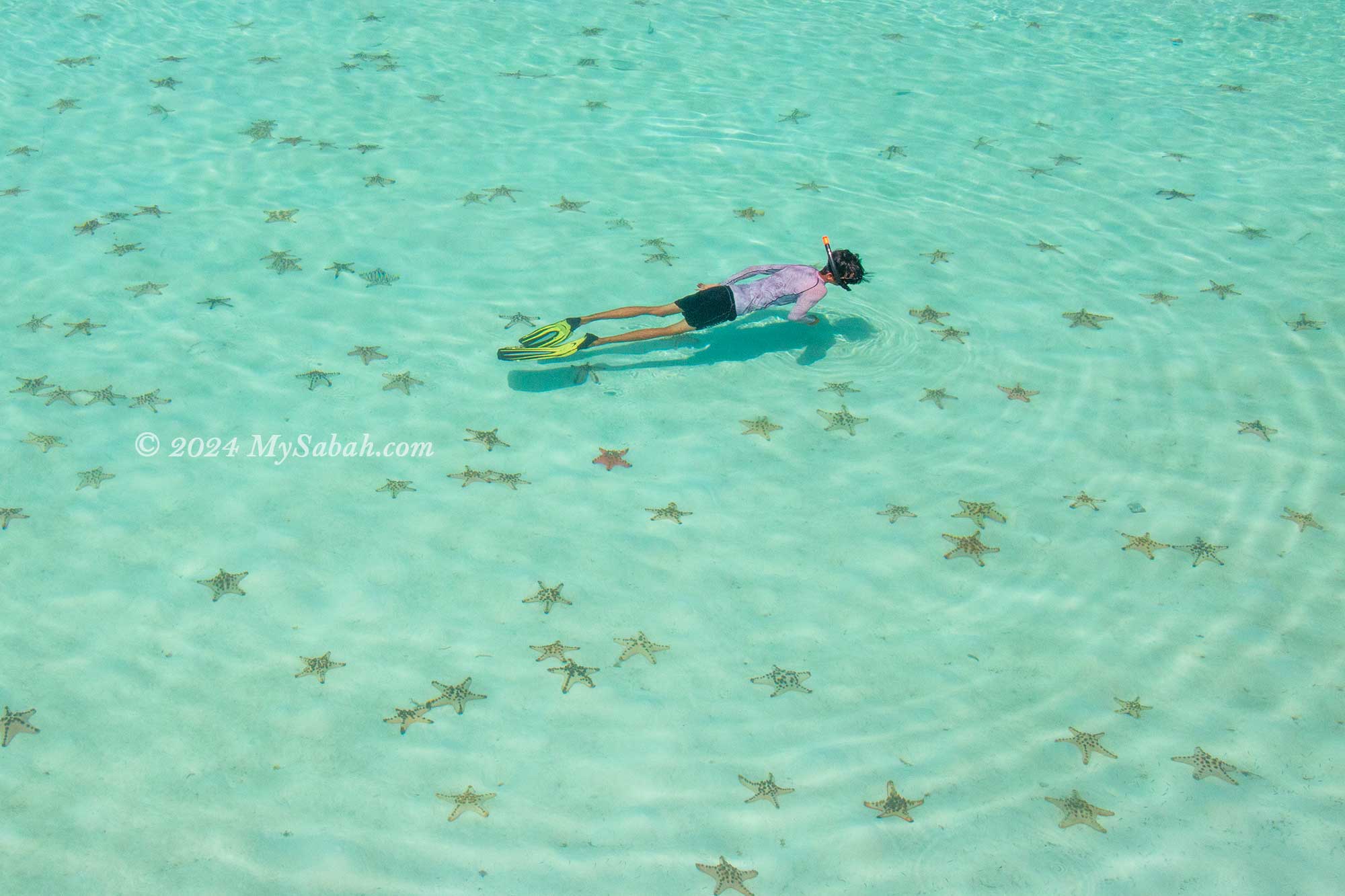
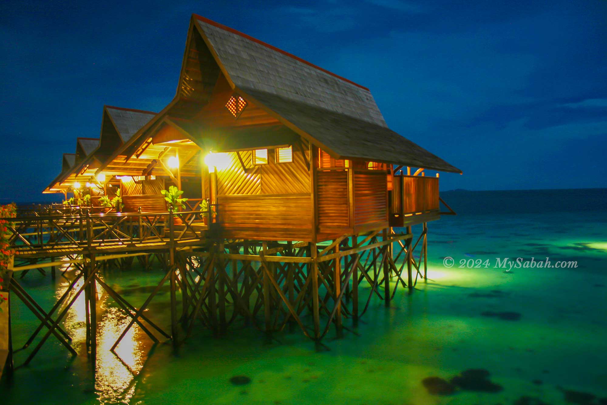
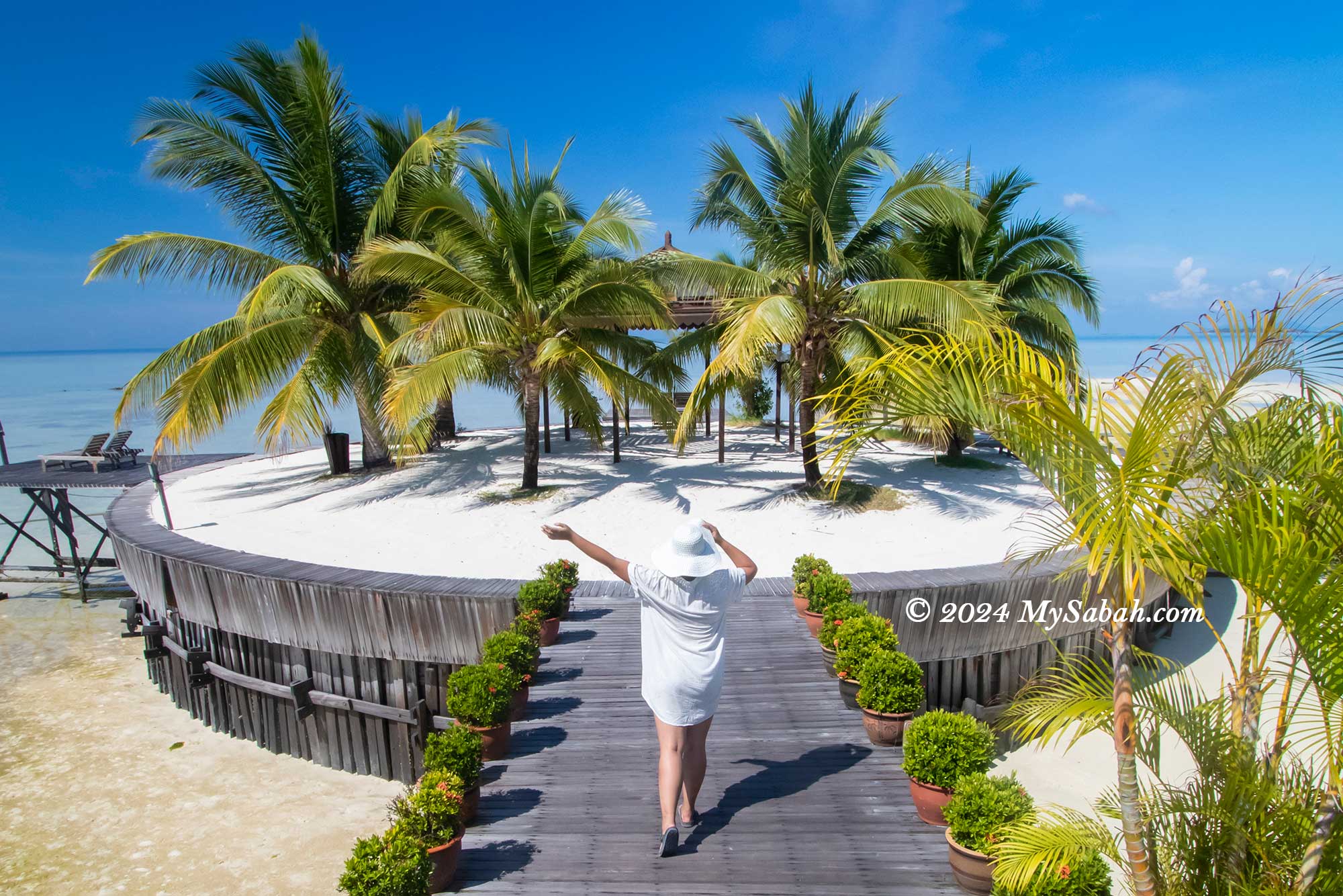
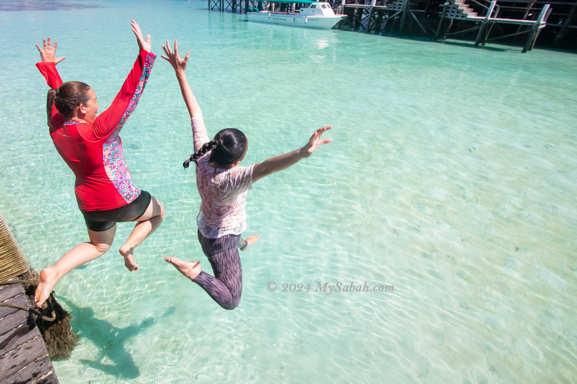
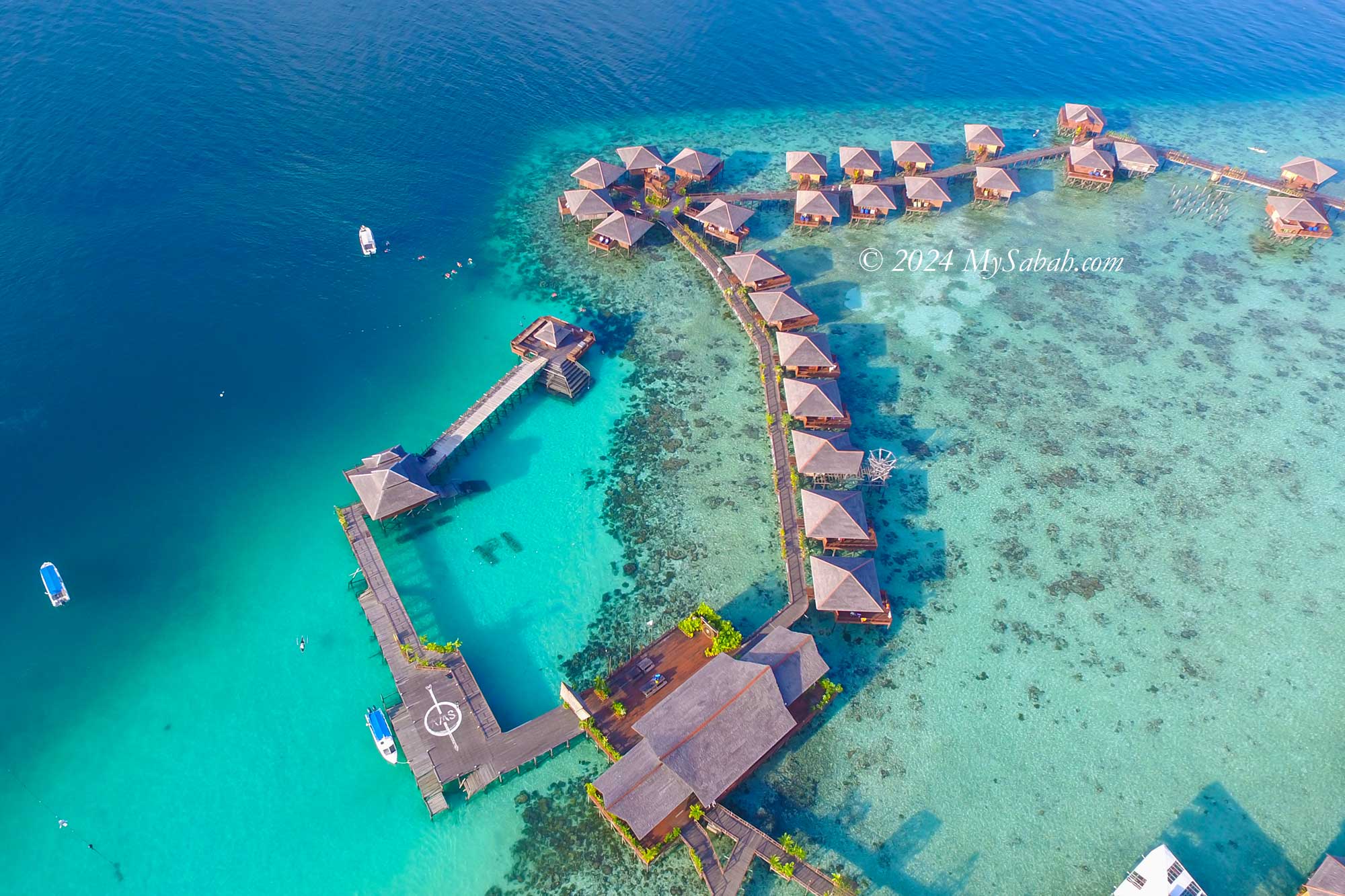
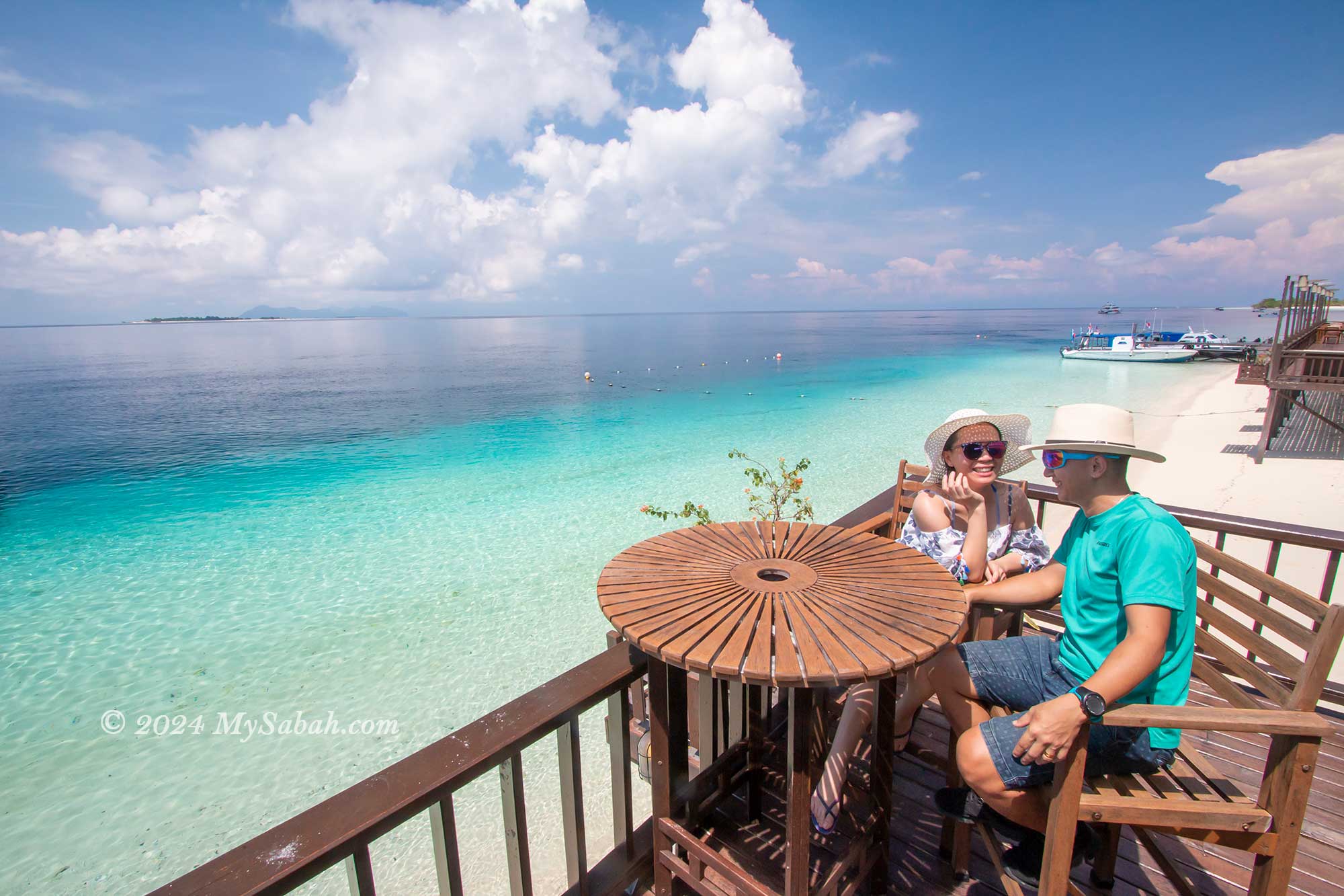
2. Kapalai Island
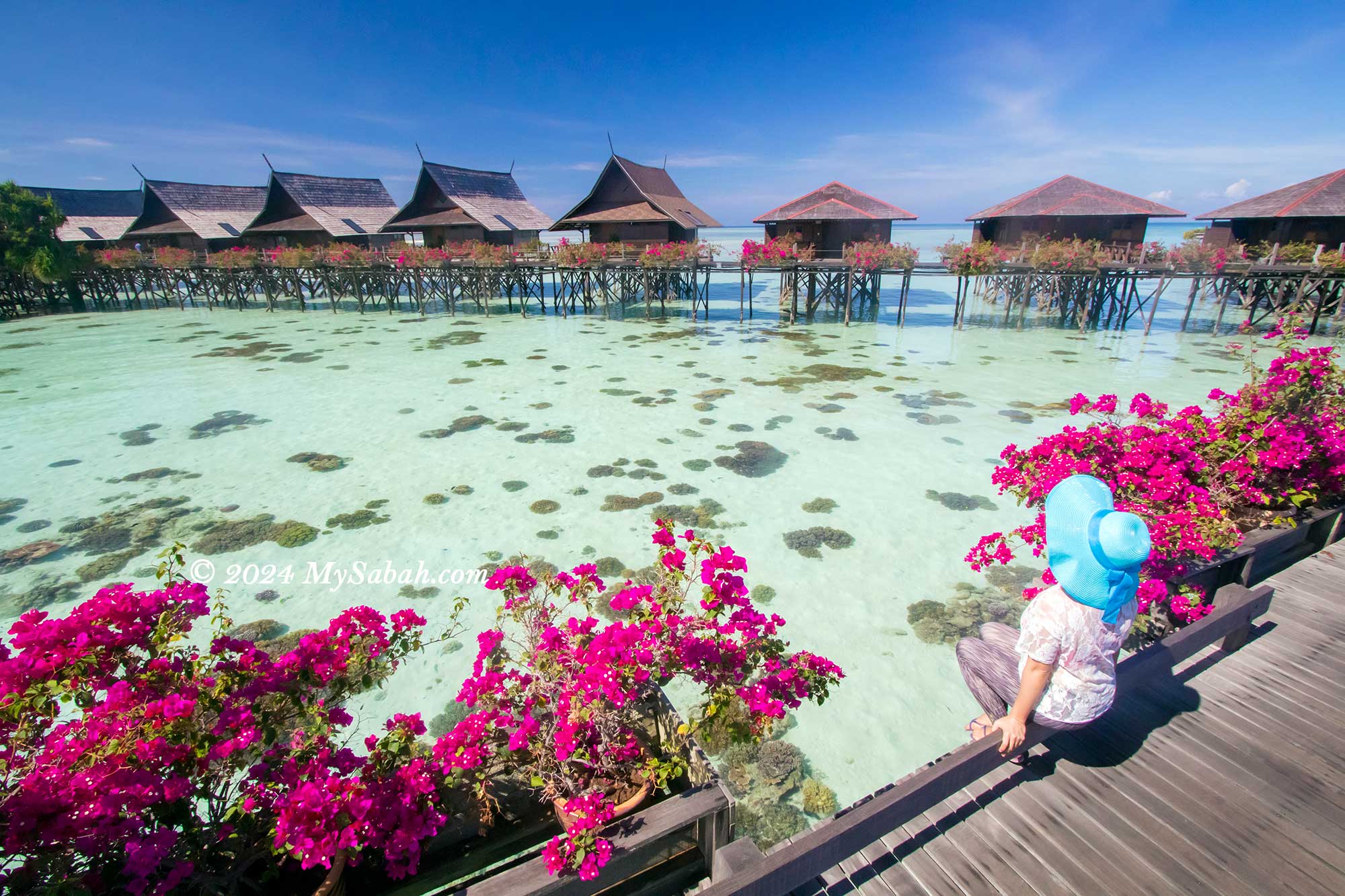
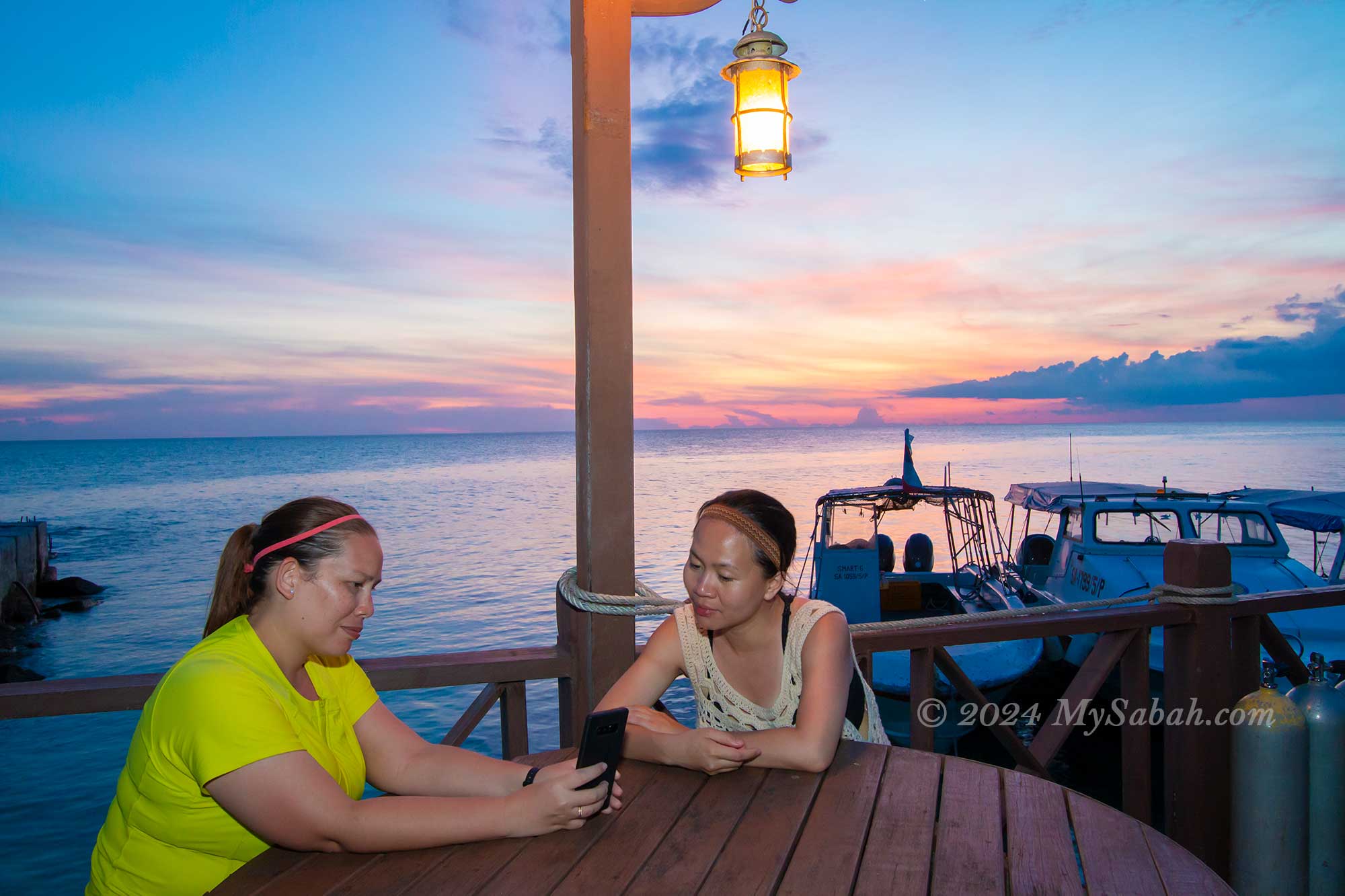
Nestled in the Celebes Sea off the coast of Semporna, Kapalai Island is a true gem. Its remote location lends it an otherworldly charm, making visitors feel as though they’ve stumbled upon a hidden paradise. One of its most enchanting features is its “magical” beach, which only emerges during low tide, adding to its mystique. It’s no wonder that the water bungalow resort on this island is consistently fully booked during peak seasons.
Kapalai Island Resort
Snorkelling with starfishes at Kapalai Island
Kapalai Island at night
Coconut beach of Kapalai Island
Jumping into the sea of Kapalai Island
Sunset at Kapalai Island
2 / 6
During the day, visitors can relax on beach chairs, soaking in the stunning sea views. As night falls, a magical scene unfolds beneath the boardwalk, with turtles and various sea creatures foraging, providing an unforgettable experience for those lucky enough to witness it. Read More or Book a Tour (Use Promo Code MYSABAH for Special Discount)
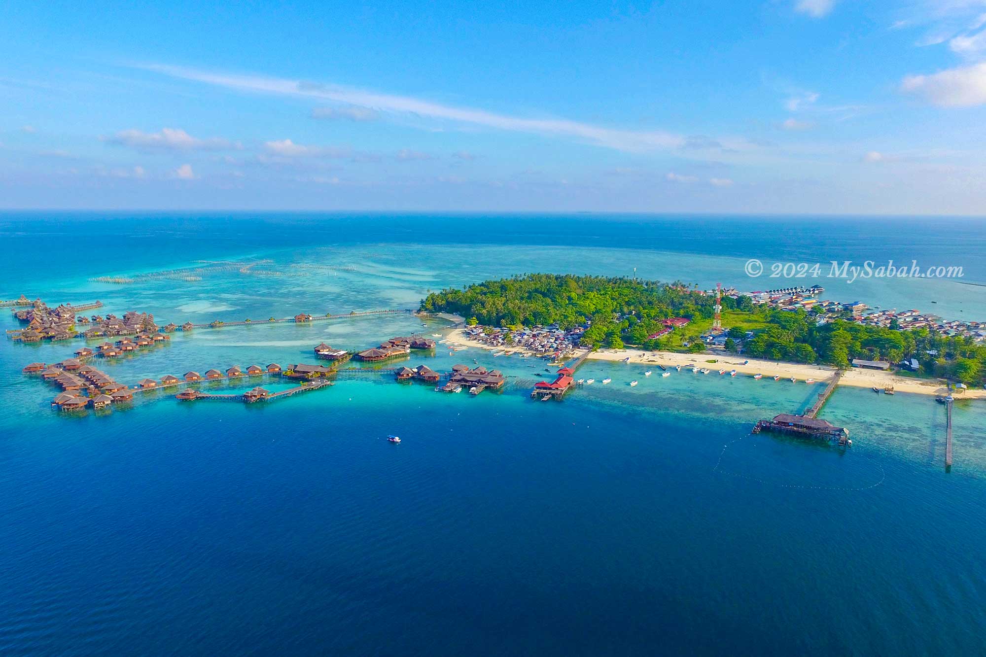
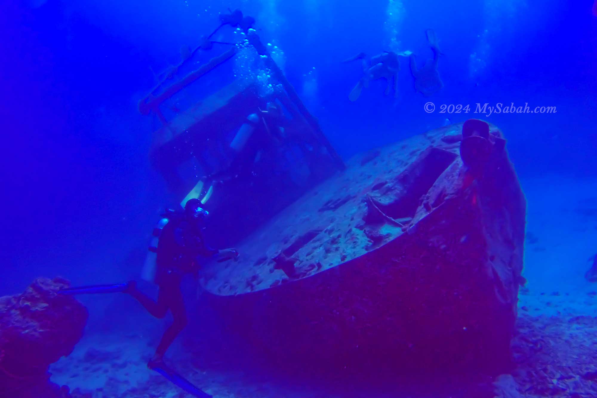
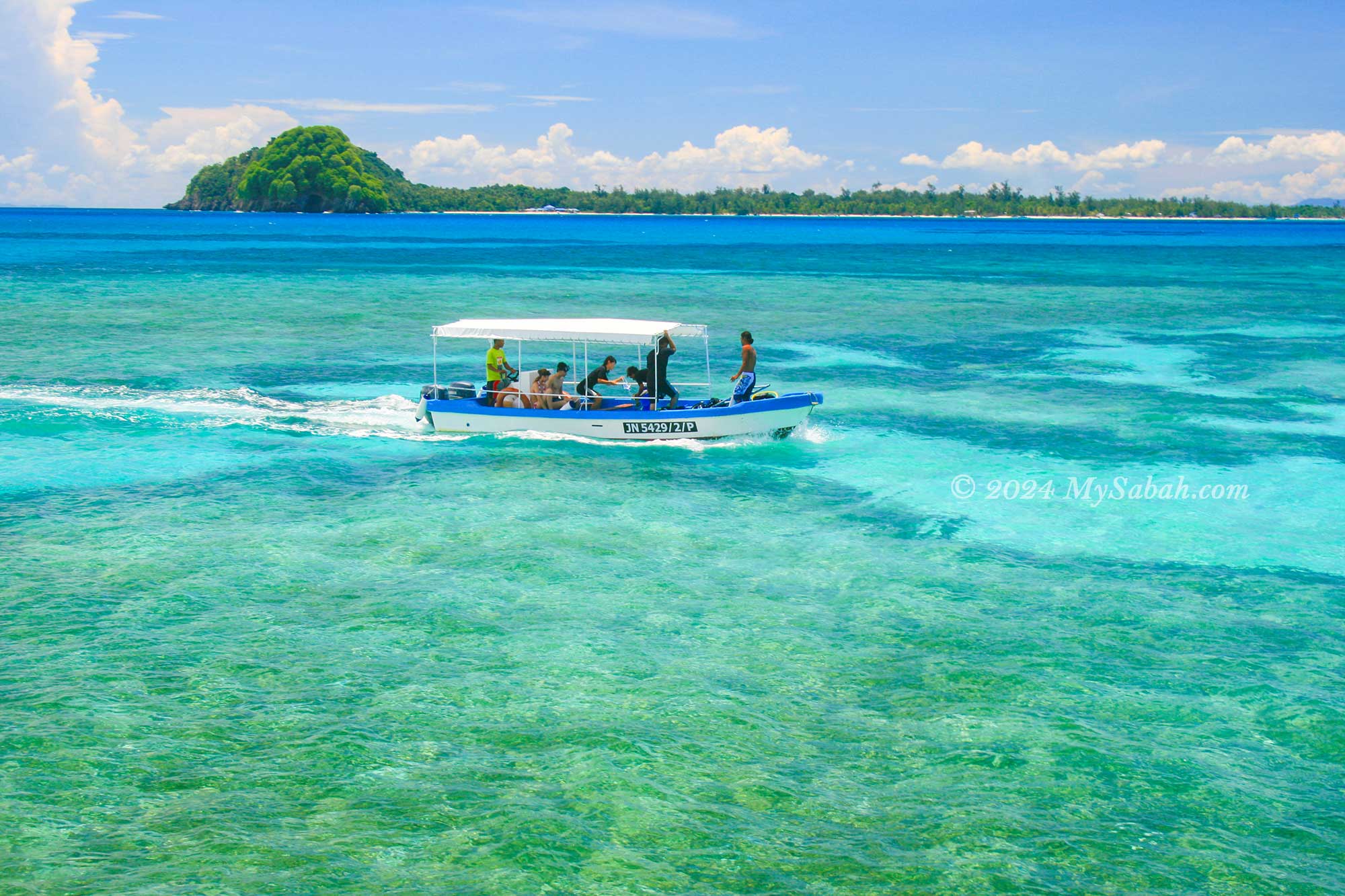
3. Mabul Island
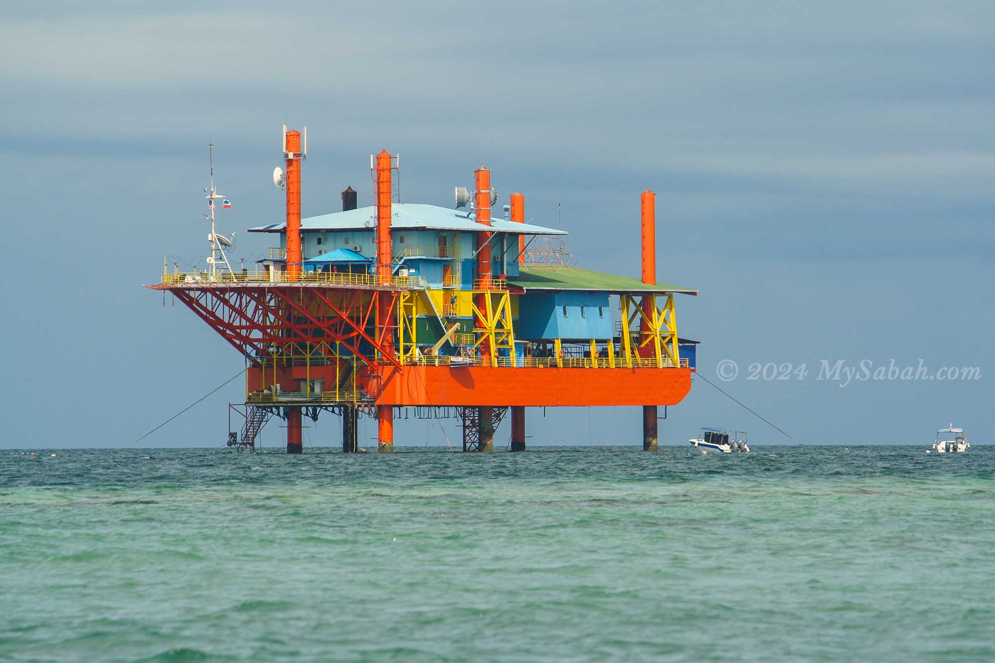
Situated closest to Sipadan, Mabul Island boasts a rich tapestry of coral and stands as one of Malaysia’s premier muck diving sites. Underwater photographers will find themselves in paradise, with an abundance of sea critters such as nudibranchs and flatworms, some of which are yet to be named. Encounters with turtles, giant groupers, sharks, and rays are commonplace in these waters.
Water Bungalow of Mabul Island
Morning walk on Mabul Island
Aerial view of Mabul Island
Sunset of Mabul Island
Oil rig repurposed by Seaventures as a dive centre
Accommodation options on the island cater to a diverse range of travellers, from budget lodges to luxurious 5-star water bungalow resorts, ensuring that there’s something for everyone, whether it’s honeymooners, scuba divers, or backpackers. Read More or Book a Tour (Use Promo Code MYSABAH for Special Discount)
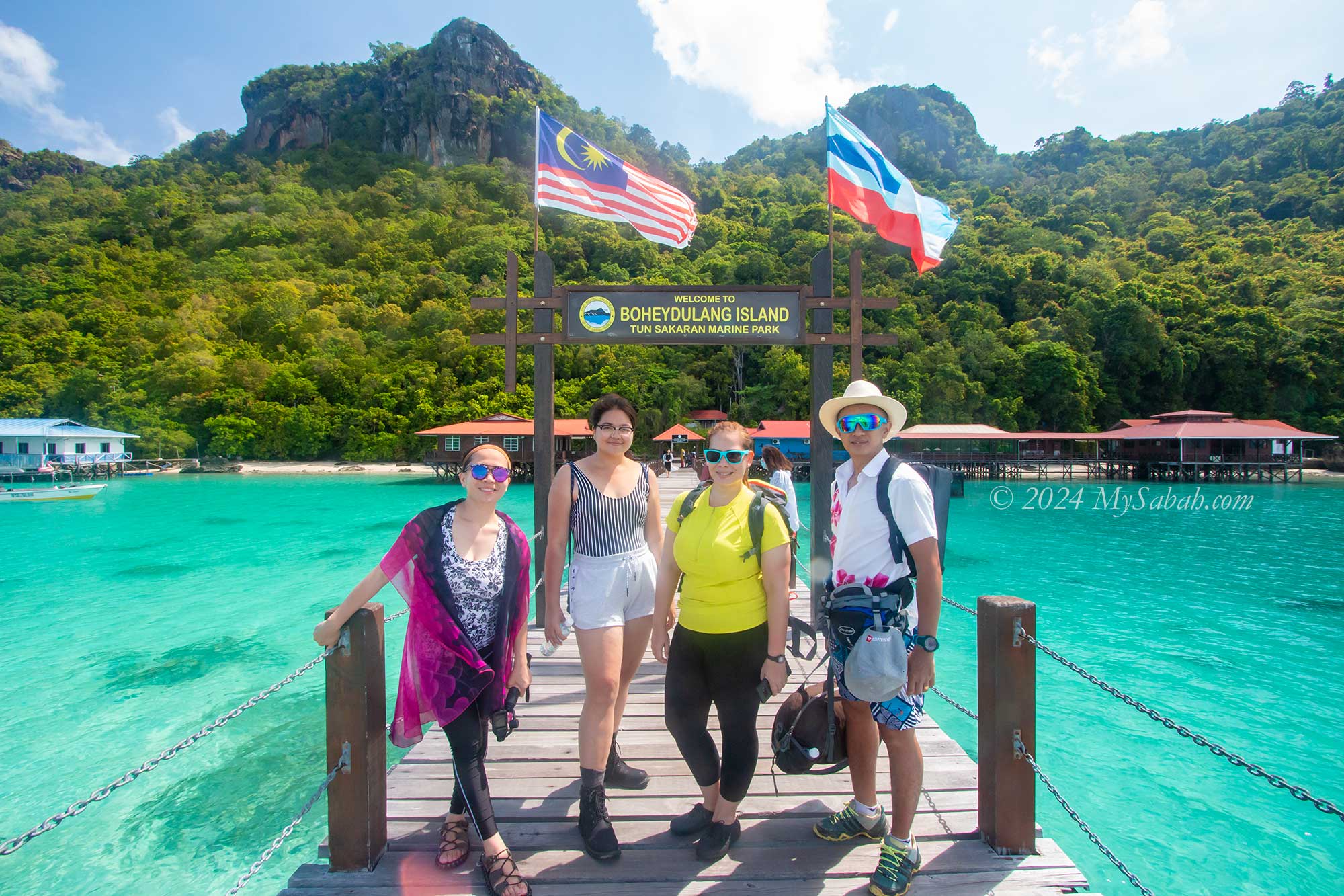
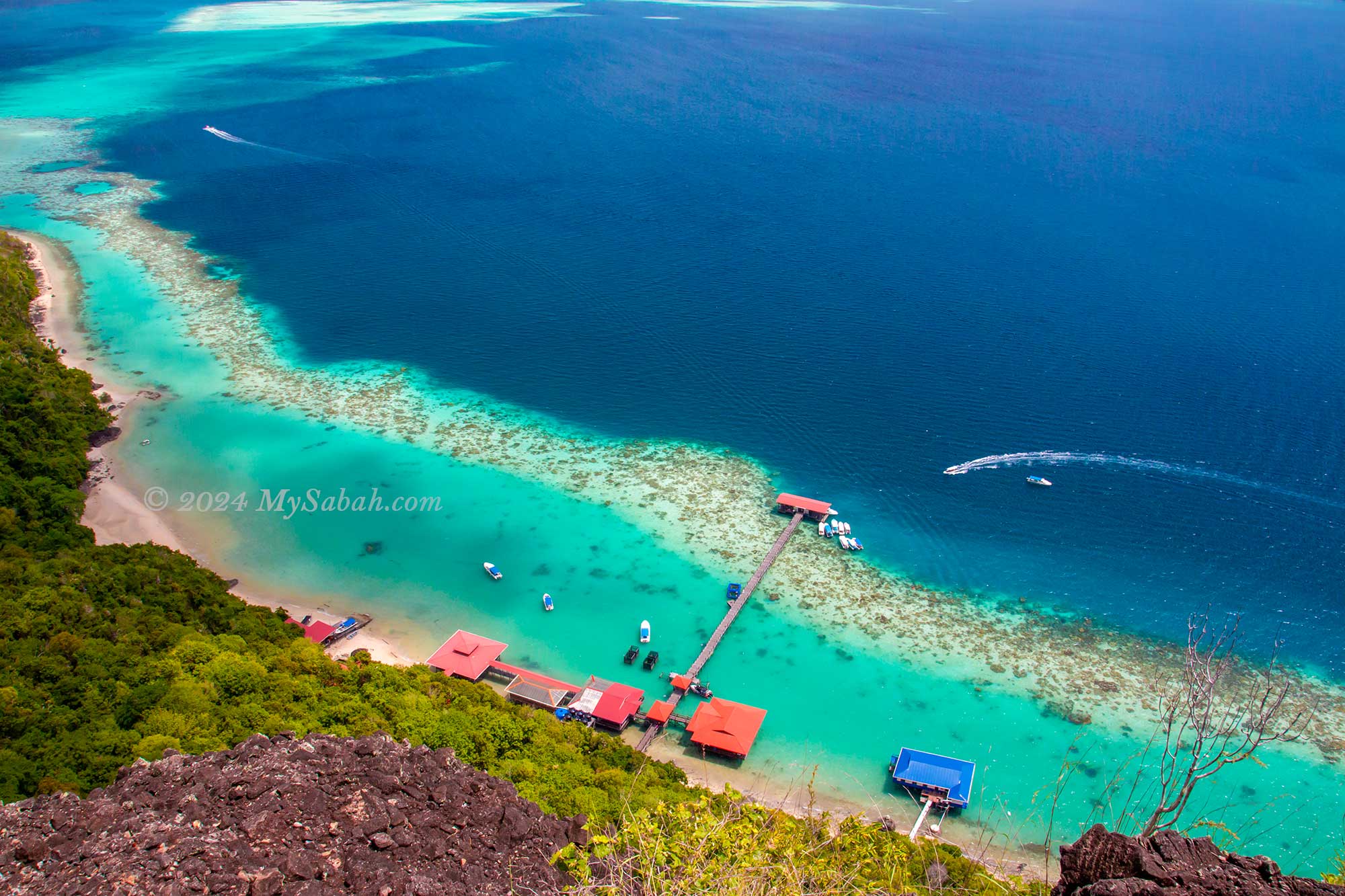
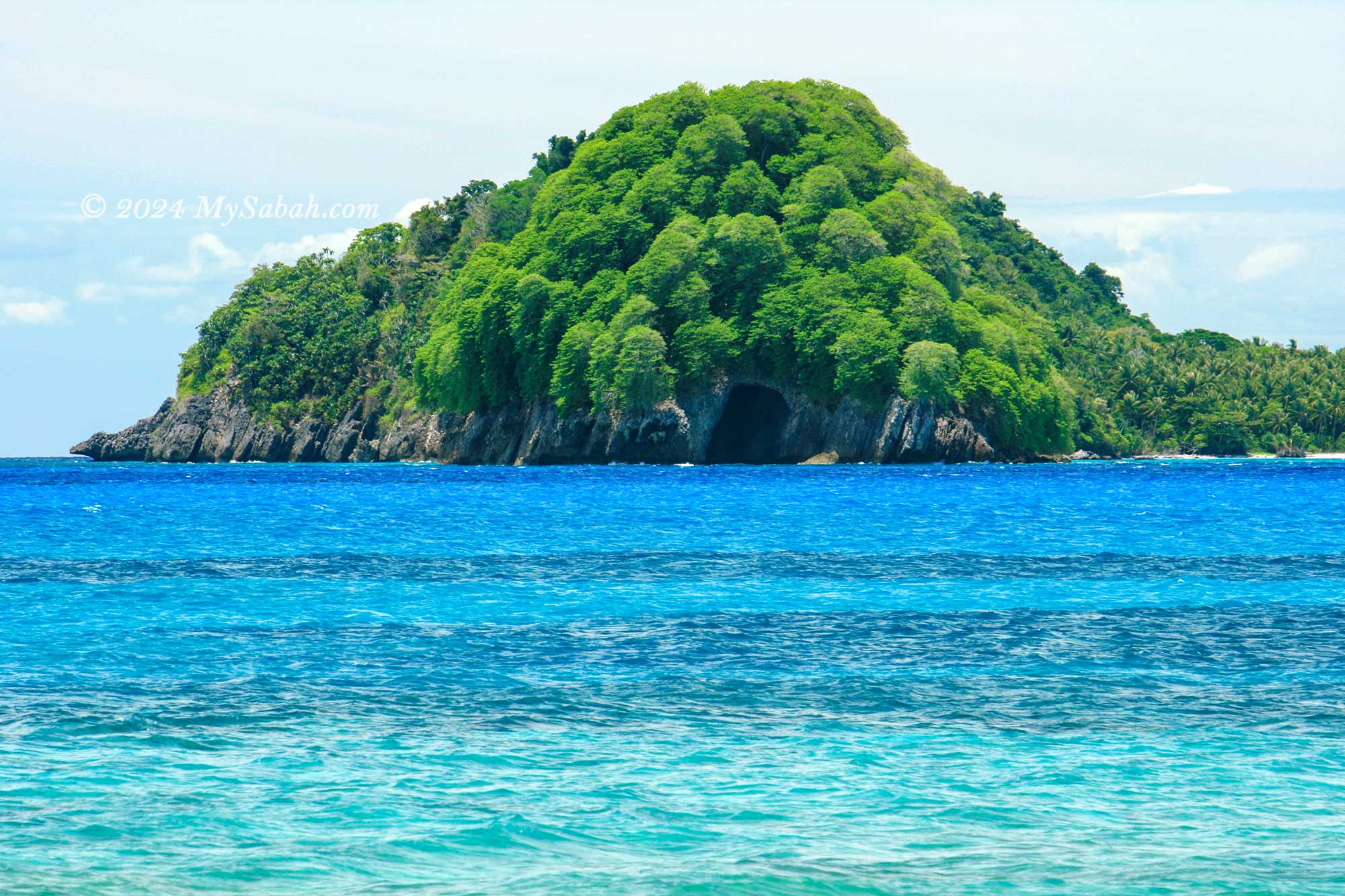
4. Boheydulang
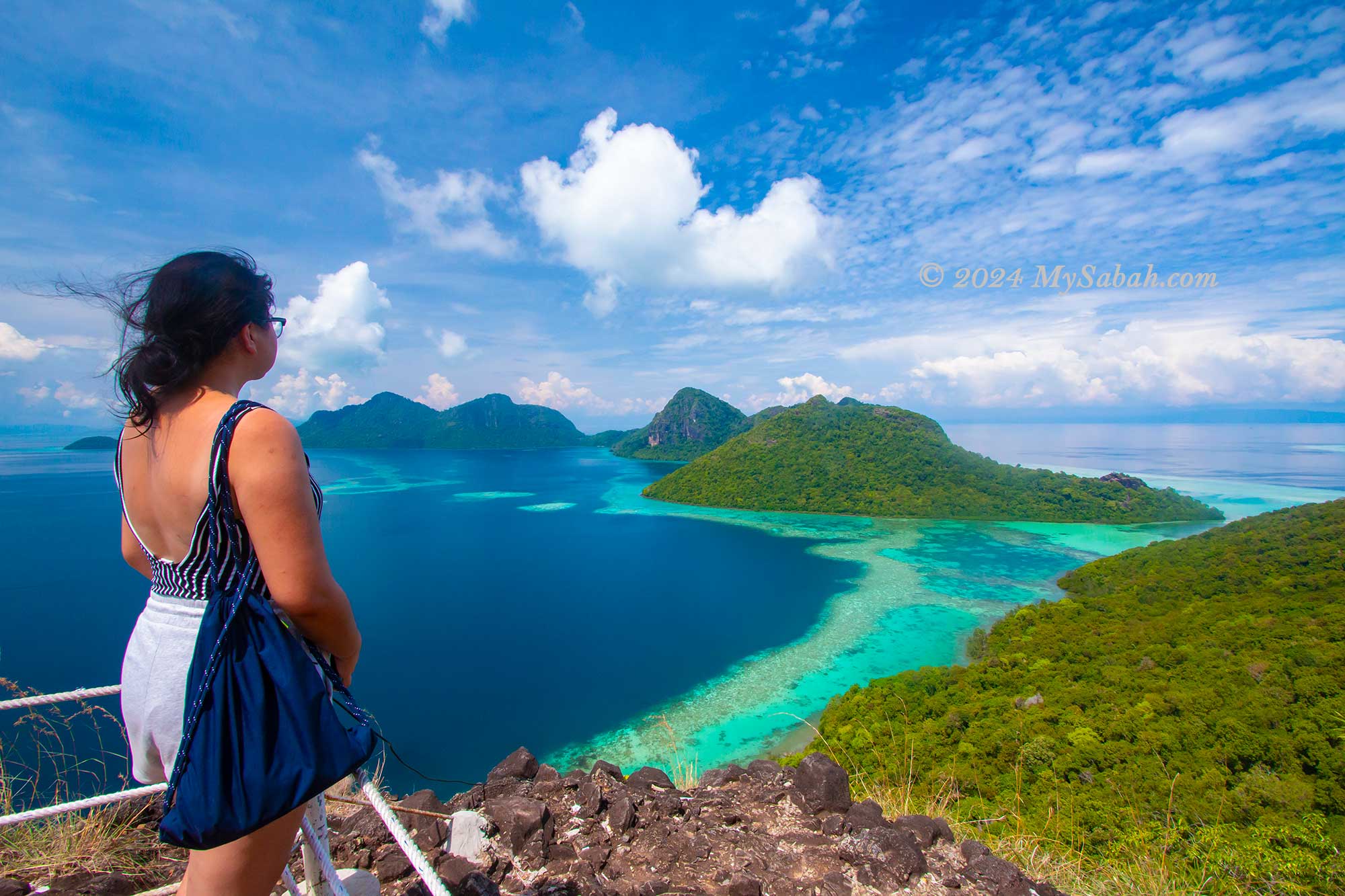
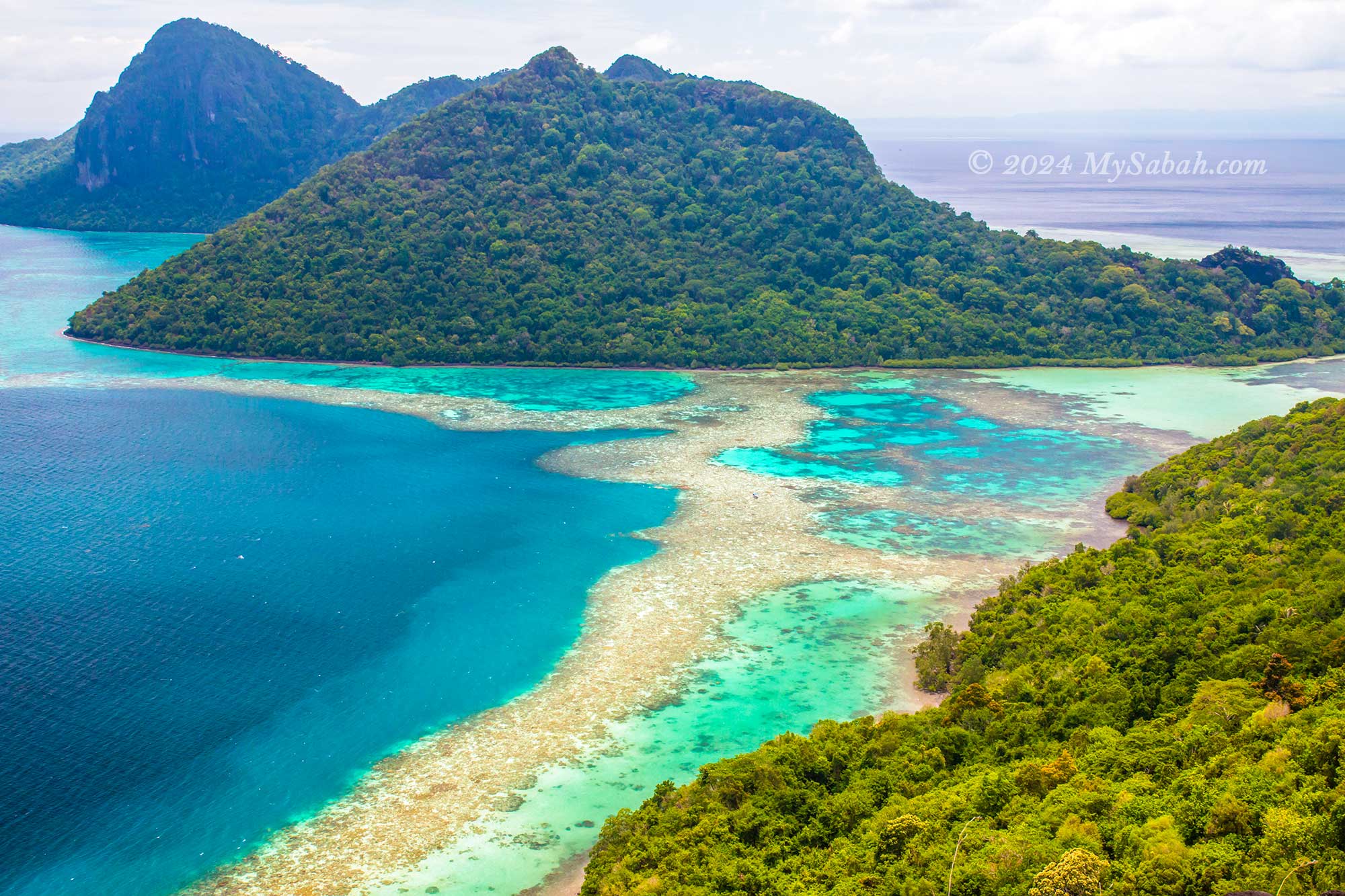
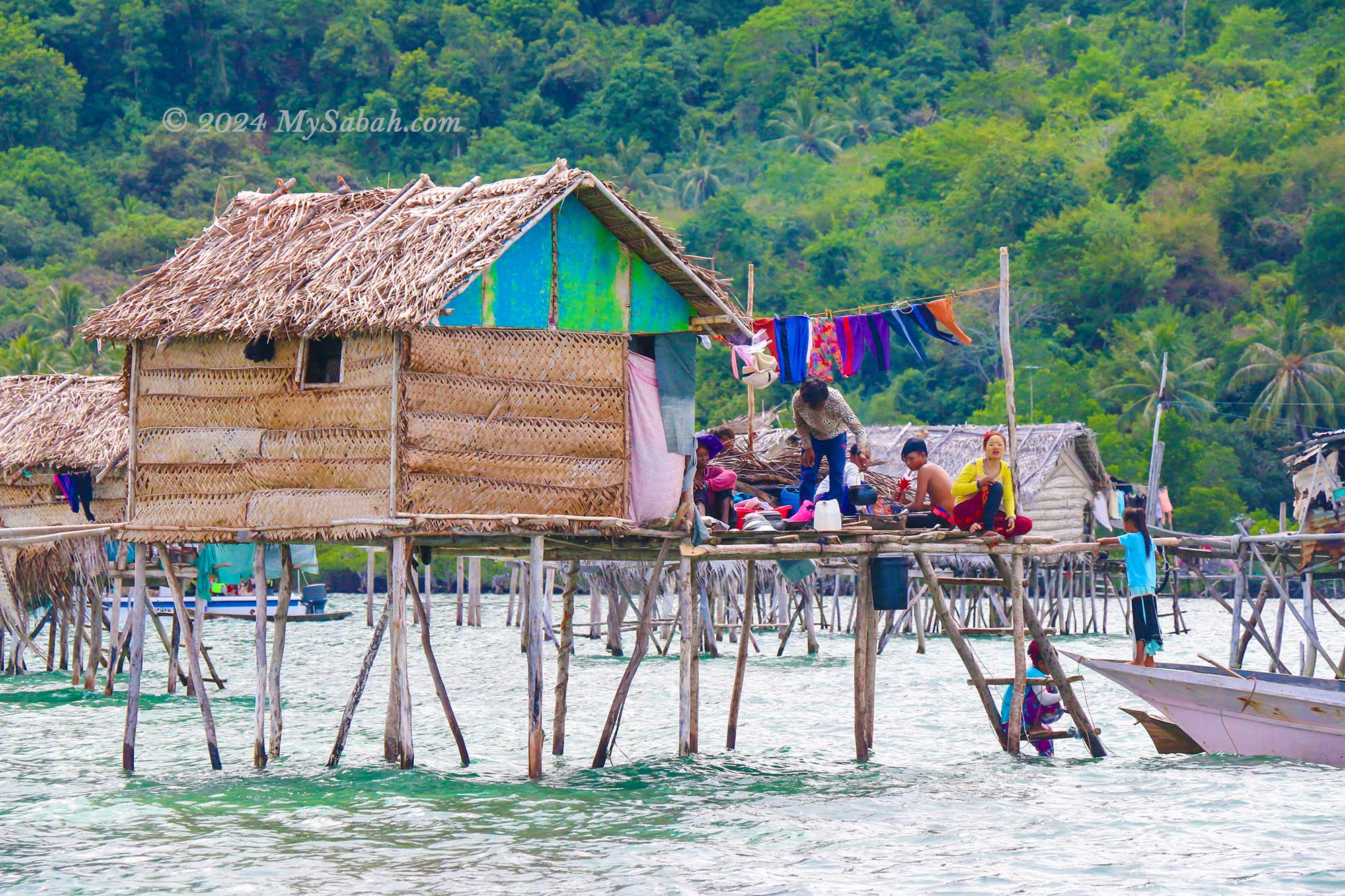
Dubbed the “Pearl Island,” Boheydulang boasts some of the most breathtaking sea views in Sabah. Situated within the Semporna Islands Park, renowned for its rich marine ecology, Boheydulang is the remnant of an ancient volcano that erupted 2.5 million years ago. The sea villages surrounding Boheydulang serve as favourite photography spots for world-renowned photographers, adding to the island’s allure. Read More or Book a Tour (Use Promo Code MYSABAH for Special Discount)
Enjoy the panoramic view of Tun Sakaran Marine Park on top of Bohey Dulang Island
These islands were used to be part of an ancient volcano rim
Jetty of Boheydulang Island
The jetty of Bohey Dulang Island
The water village of Sea Bajau people
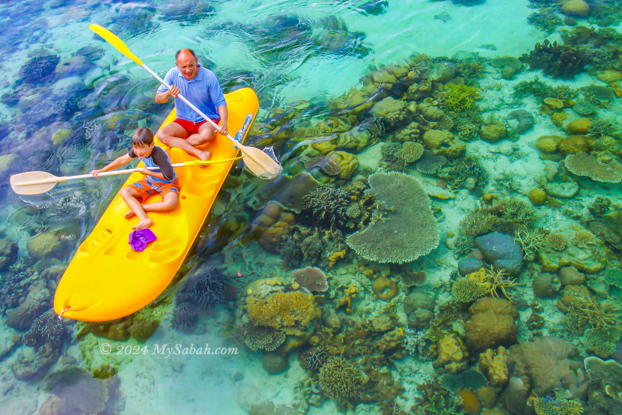
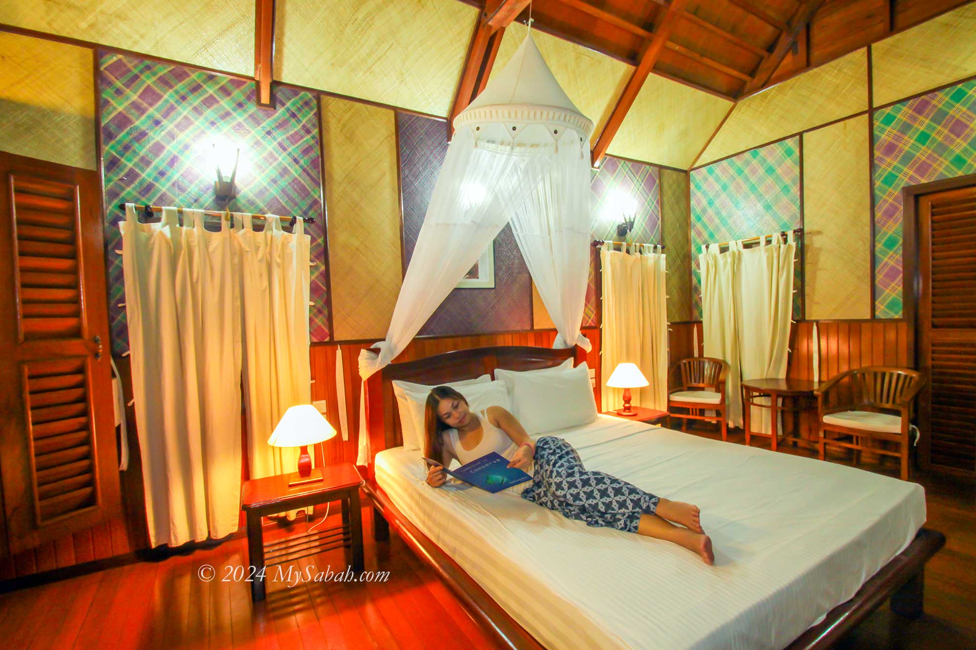
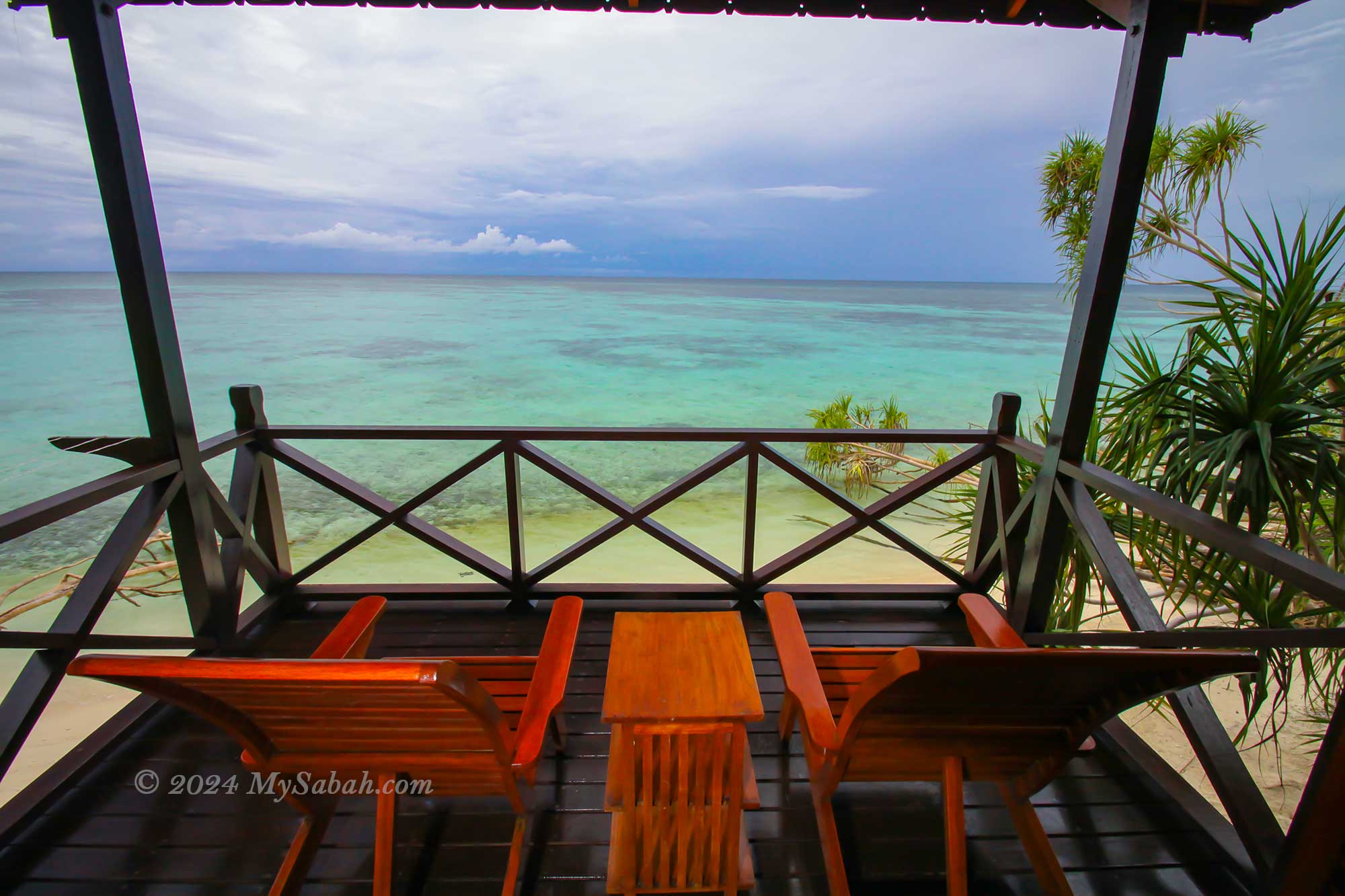
5. Lankayan Island
Well-known for its whale shark sightings and turtle nesting grounds, Lankayan Island offers a slice of paradise. Stay in the sea-facing chalets, and wake up to the sight of numerous fishes, turtles, and baby sharks gracefully swimming in front of your balcony each morning. A short walk leads you to the inviting beach, perfect for a refreshing swim. As a private island, Lankayan ensures a tranquil holiday experience, free from the disruptions of noisy strangers. Read More or Book a Tour (Use Promo Code MYSABAH for Special Discount)
Holiday on Lankayan Island
Releasing turtle hatchlings
Kayaking on Lankayan Island
Room of Lankayan Island Resort
Balcony with sea view
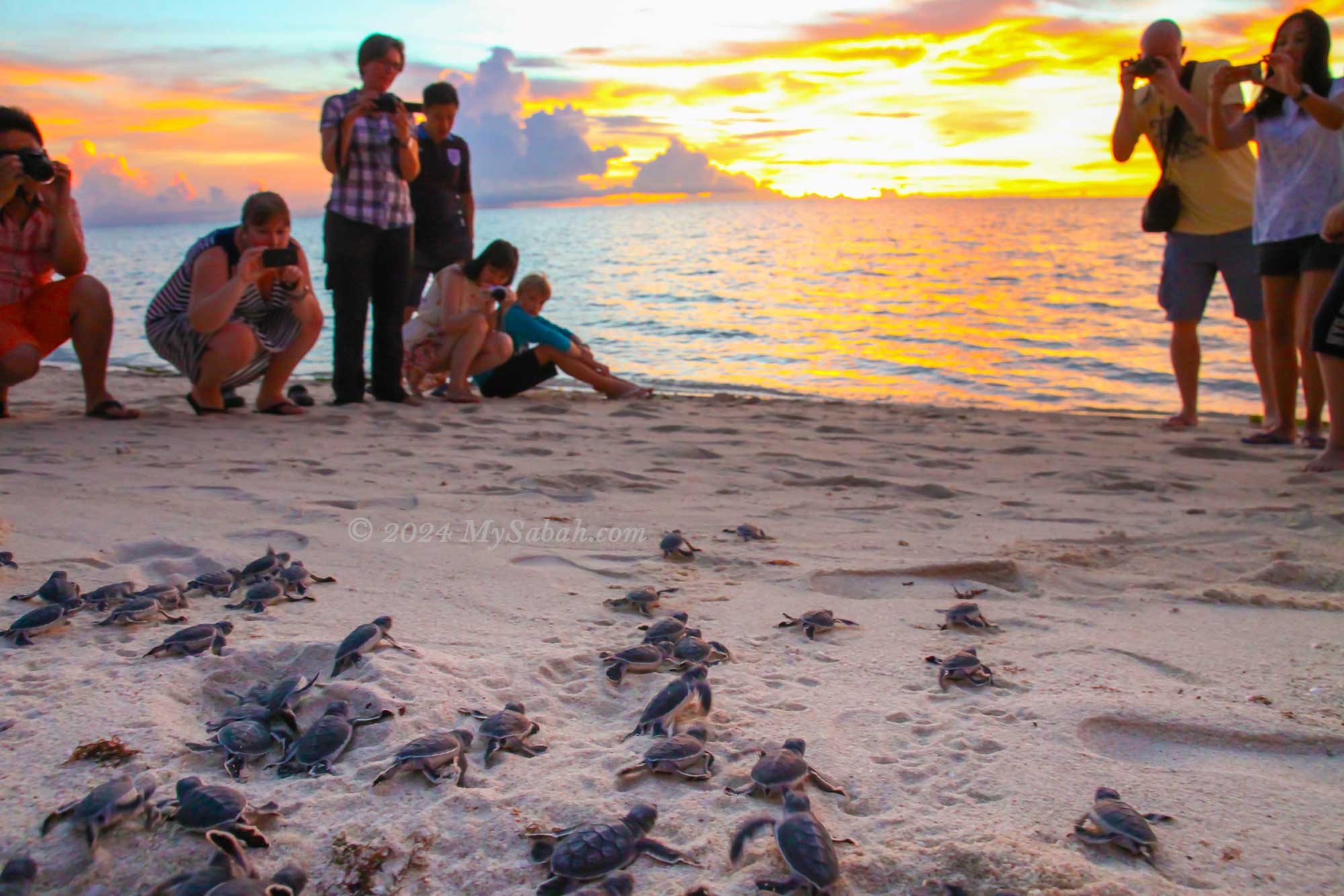
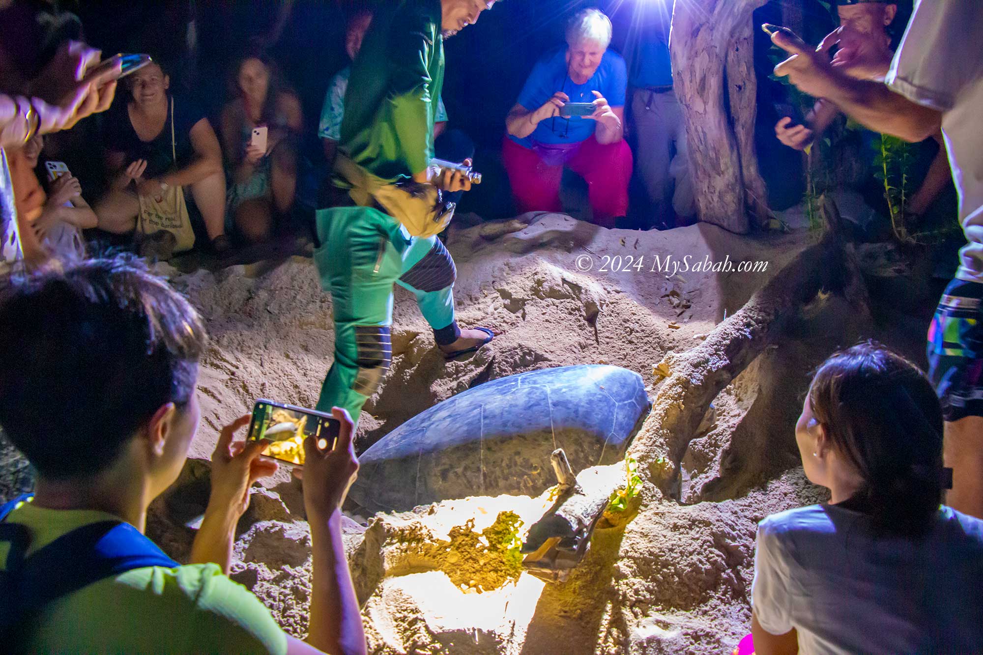
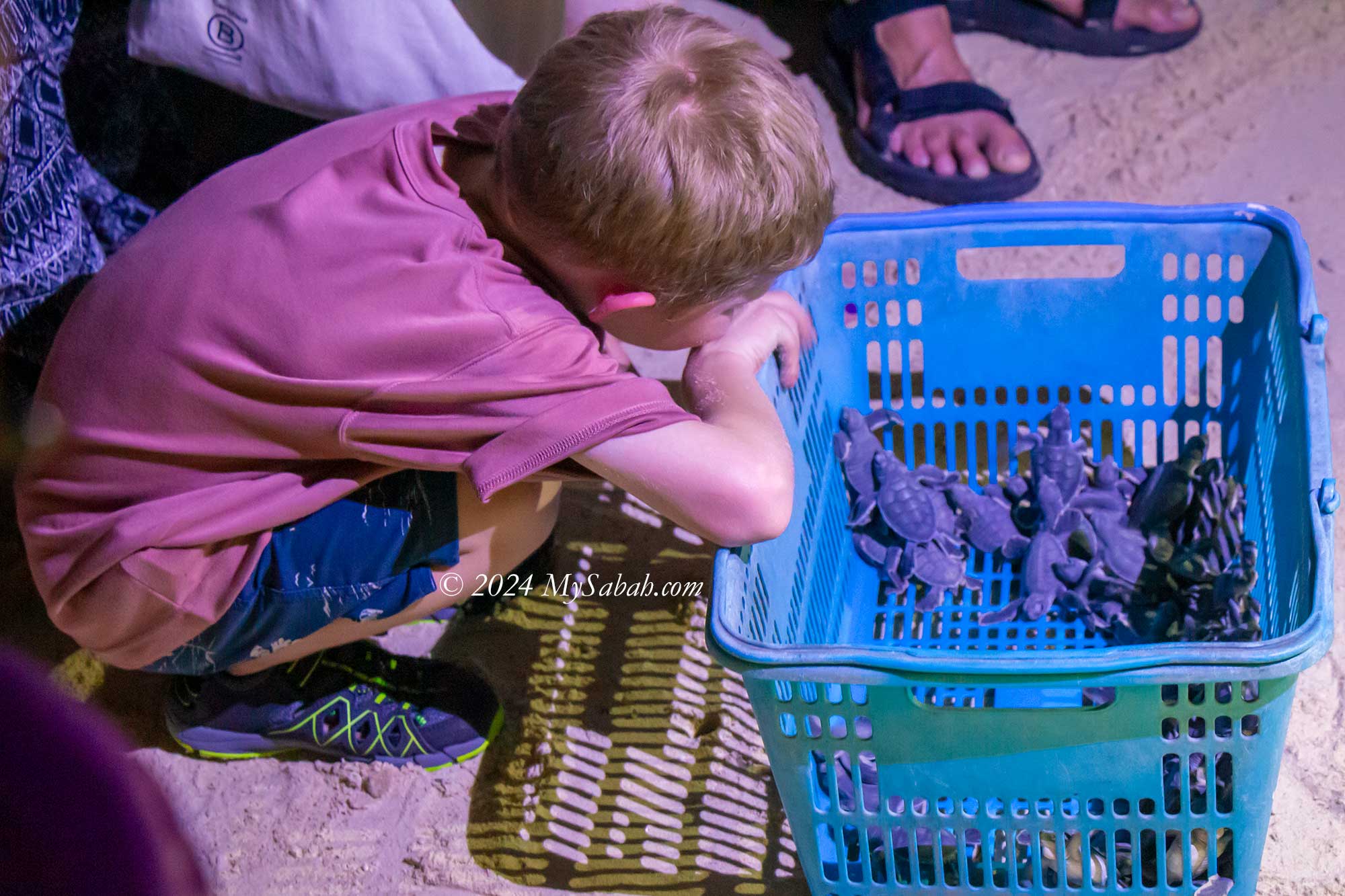
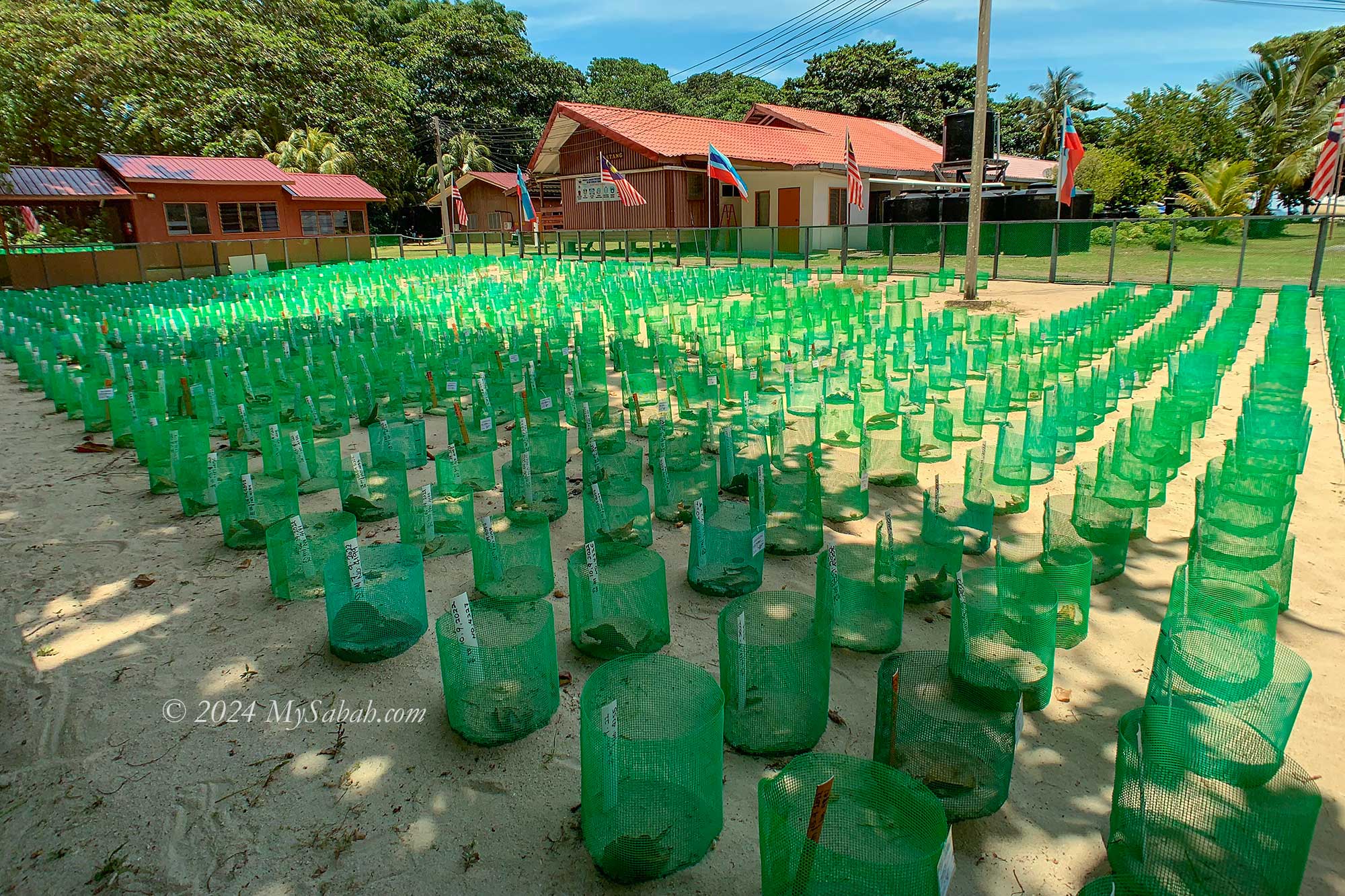
6. Selingan Turtle Island
Turtles, among the oldest and most captivating marine creatures, find their sanctuary on Selingan Turtle Island. Each year, hundreds, sometimes thousands, of sea turtles embark on remarkable journeys spanning hundreds of miles to return to the very island where they were born—a testament to Selingan’s significance in turtle conservation.
Turtle nesting on the beach of Selingan Island
Nice beach of Selingan Island
Prepare to release turtle hatchlings
Turtle hatchery on Selingan Island. You can adopt the nest.
Sunrise at Selingan Island
Here, visitors have the unique opportunity to witness mother turtles laying eggs up close and even participate in the adoption of the hatchlings, offering an unforgettable experience steeped in nature’s wonders. Read More or Book a Tour (Use Promo Code MYSABAH for Special Discount)
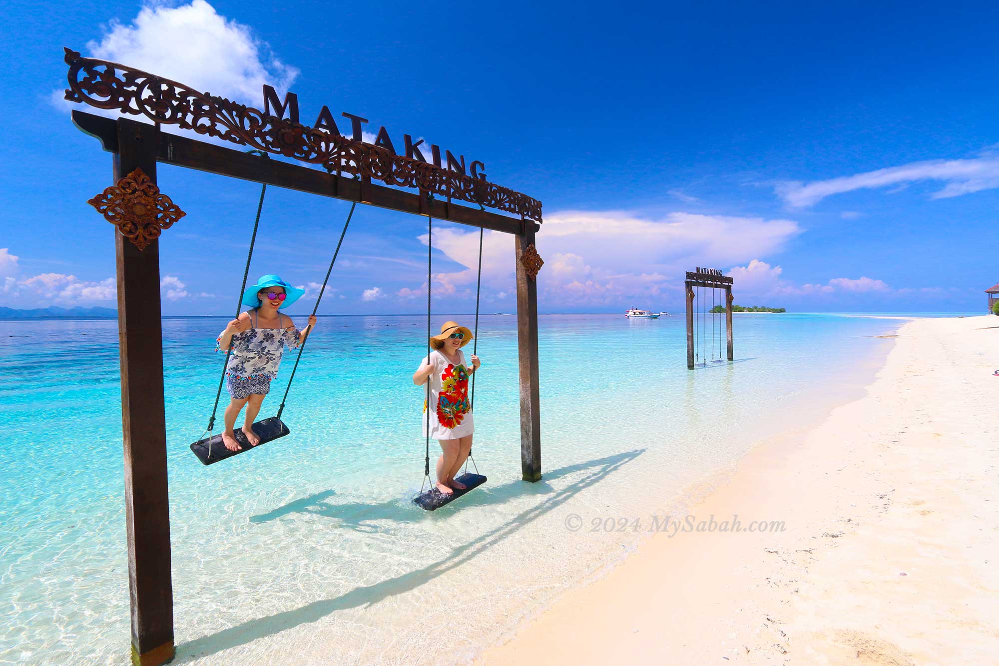
7. Mataking Island
Mataking Island is tailor-made for a romantic island getaway, making it a sought-after honeymoon destination for Europeans. This picturesque tropical paradise boasts white sandy beaches, crystal-clear waters, breathtaking sunsets, and luxurious resorts. Couples can choose to exchange vows underwater or in the charming island chapel, adding a touch of magic to their special day.
Mataking Island is one of the best island destinations of Sabah
Swing on the beach of Mataking Island
Honeymoon couples at Mataking Island Resort
Sea view of Mataking Island
Underwater mailbox of Mataking Island
For scuba diving enthusiasts, don’t miss the chance to send a postcard from the underwater postbox, a unique experience offered by Mataking Island, home to the deepest mailbox in the world. Read More or Book a Tour (Use Promo Code MYSABAH for Special Discount)
8. Mantanani Island
Mantanani Island, often referred to as the Mermaid Island, owes its nickname to the presence of a friendly dugong residing in its waters. As visitors approach the turquoise sea surrounding Mantanani, they are immediately enchanted by its dreamlike beauty. Whether lounging in the island resorts or lodges, snorkelling, fishing, diving, or simply strolling along the beach, there’s no shortage of activities to enjoy. Who knows? You might even catch a glimpse of a mermaid. Read More or Book a Tour (Use Promo Code MYSABAH for Special Discount)
Mantanani Island receives many international tourists too.
The sea colours of Mantanani Island is stunning
Lungisan Island of Mantanani
Mantanani Island is also known as Mermaid Island
Snorkelling on Mantanani Island
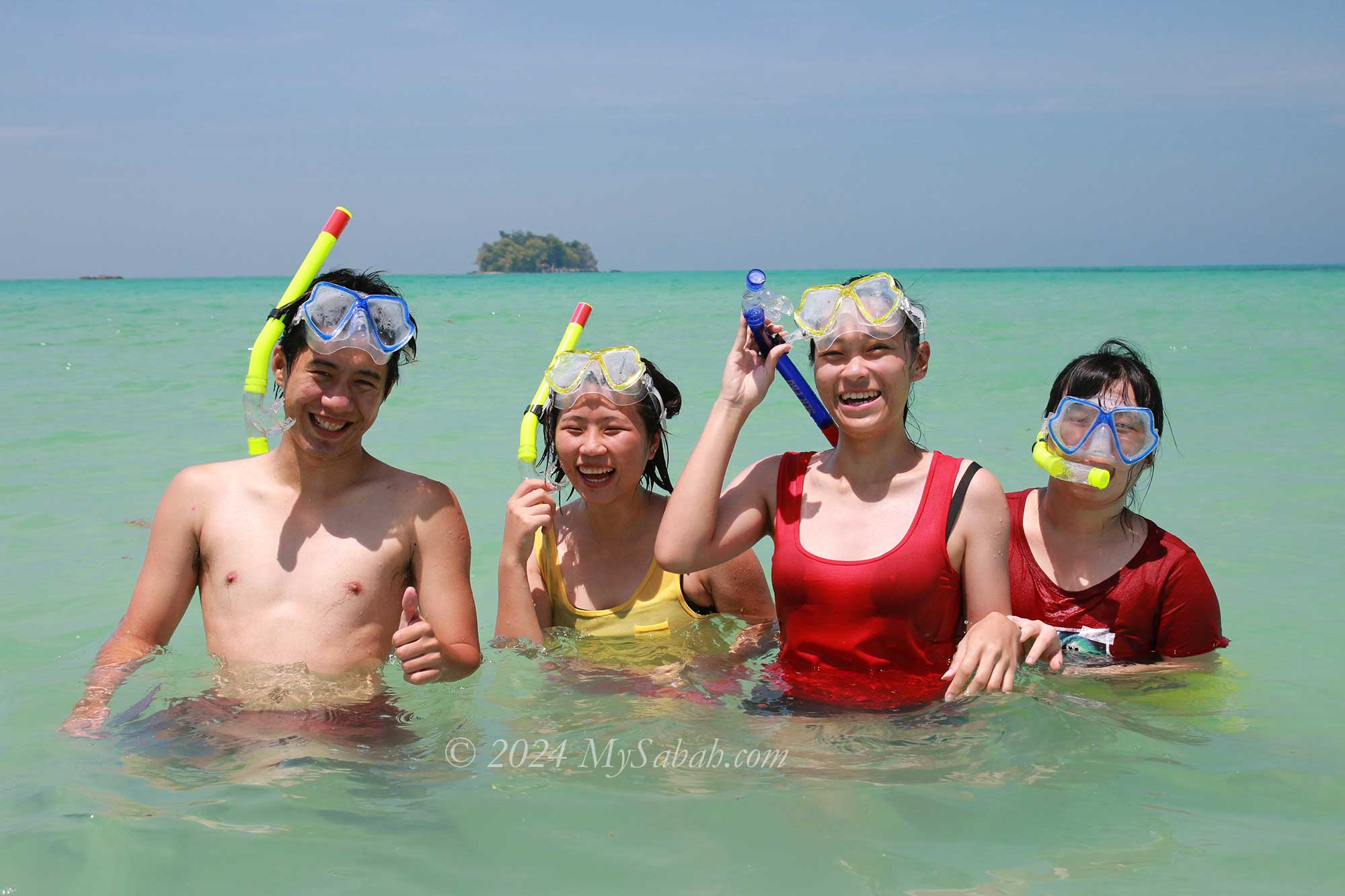
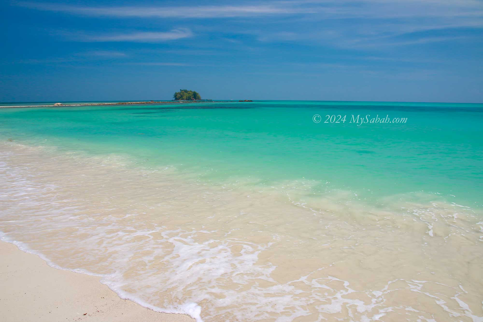
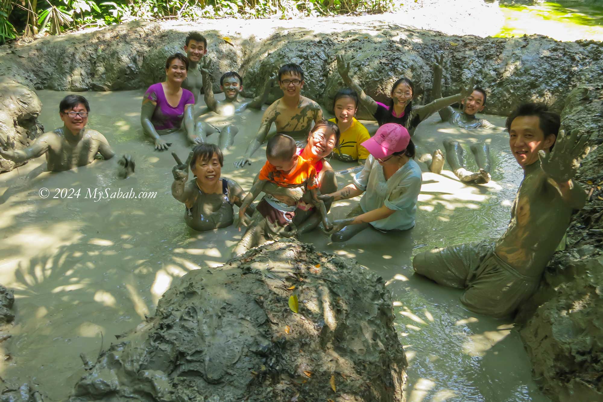
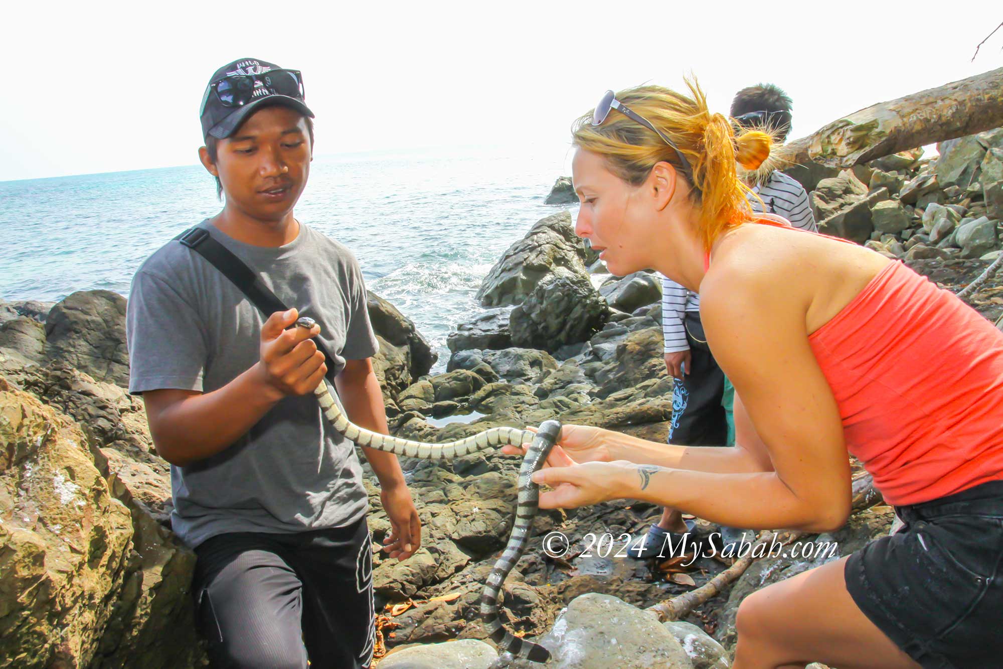
9. Pulau Tiga
Pulau Tiga gained fame as the filming location for the first TV reality show, “Survivor.” This island stands out as one of Sabah’s most unique marine parks, boasting a mud volcano and Snake Island among its attractions. Yet, its true allure lies in the untouched, snow-white beaches of Sands Spit Island.
Beach of Pulau Tiga Island
Snorkeling on Pulau Tiga Island
Sands Spit Island (Pulau Kalampunian Besar) of Pulau Tiga Marine Park
Mud volcano bath on Pulau Tiga
Sea snake of Snake Island (Pulau Tiga)
The main island, cloaked in dense forest, teems with diverse wildlife. Hikers can uncover hidden coves and secluded beaches along the network of nature trails, promising delightful discoveries at every turn. Read More or Book a Tour (Use Promo Code MYSABAH for Special Discount)
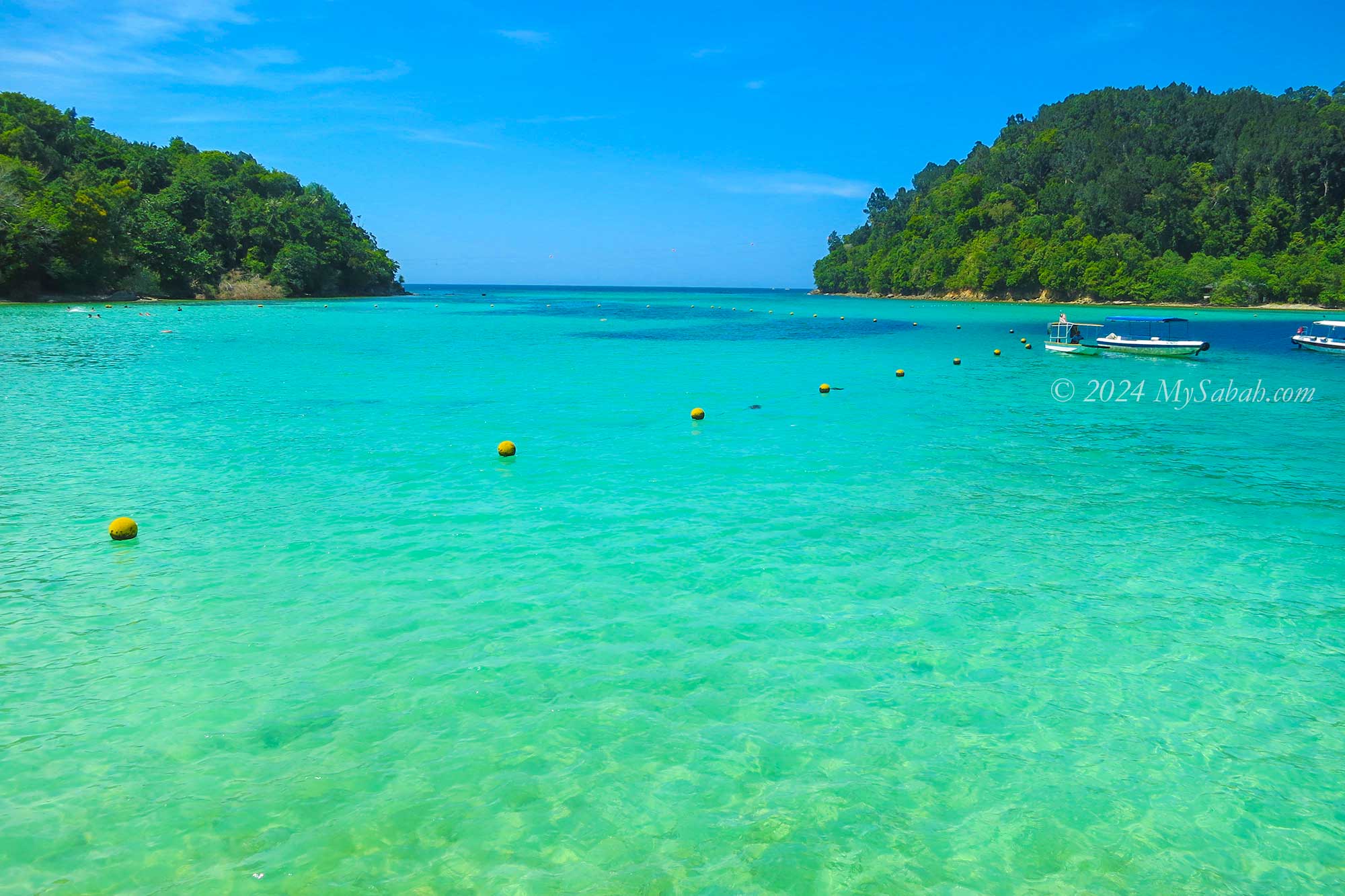
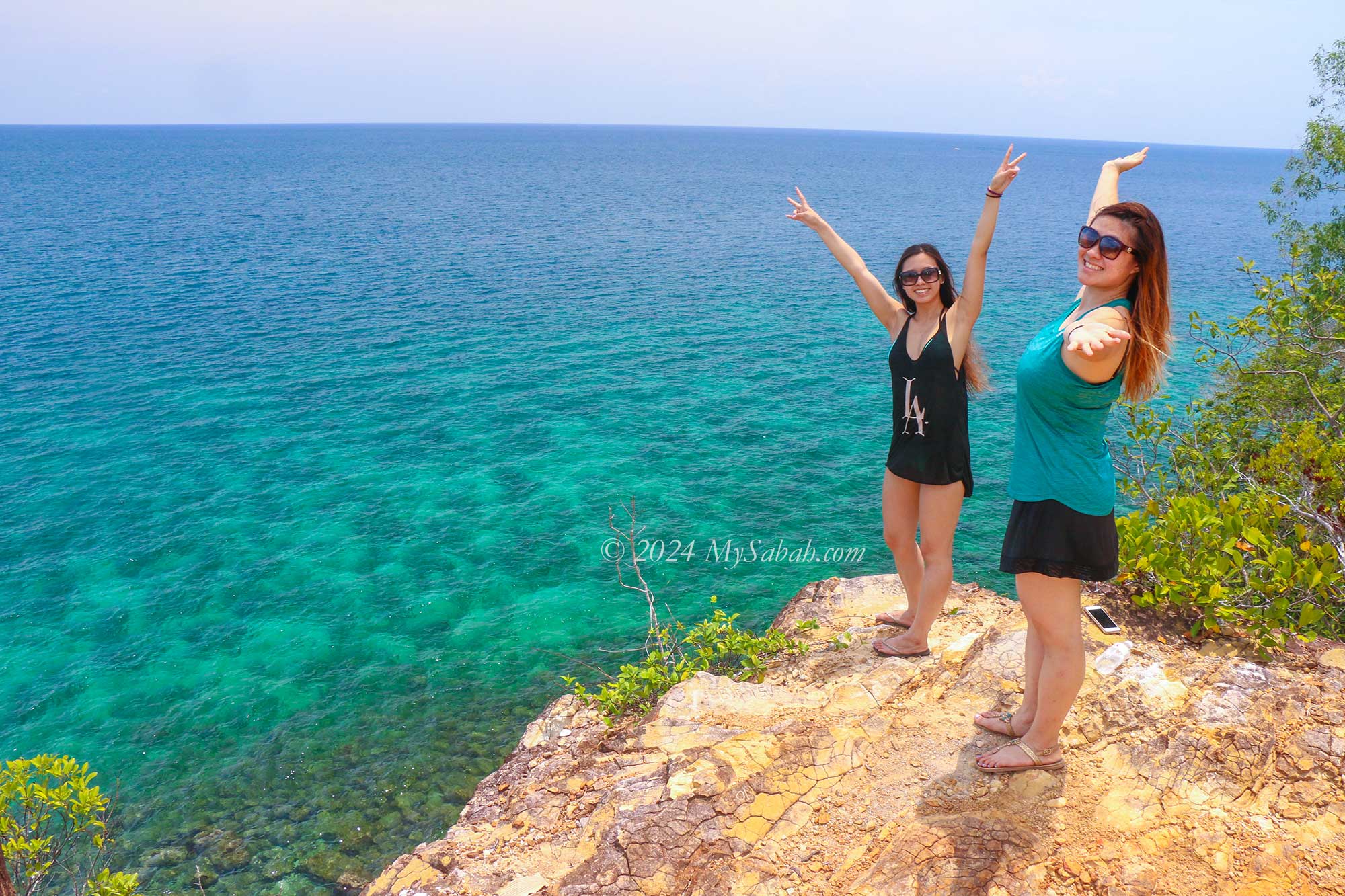
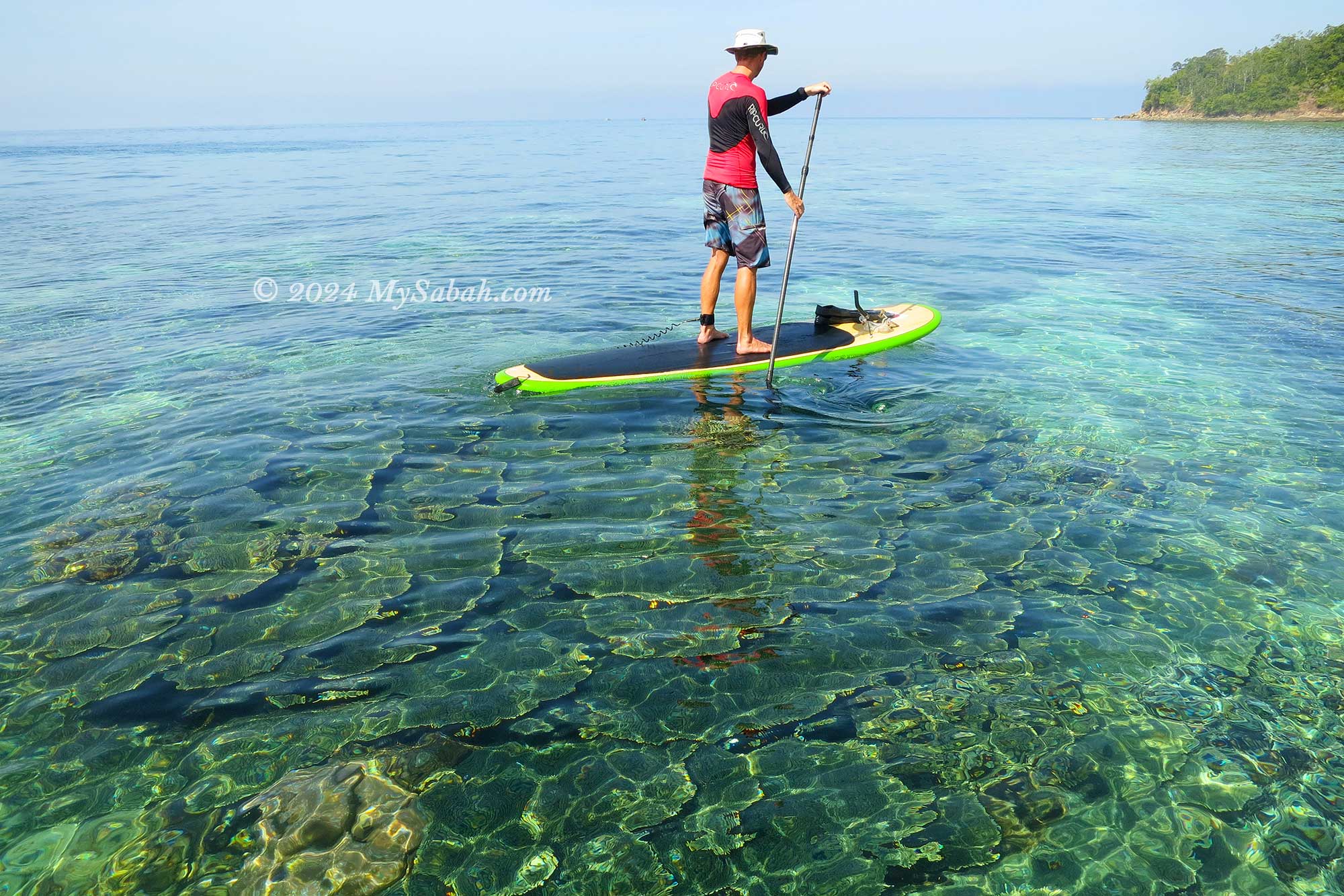
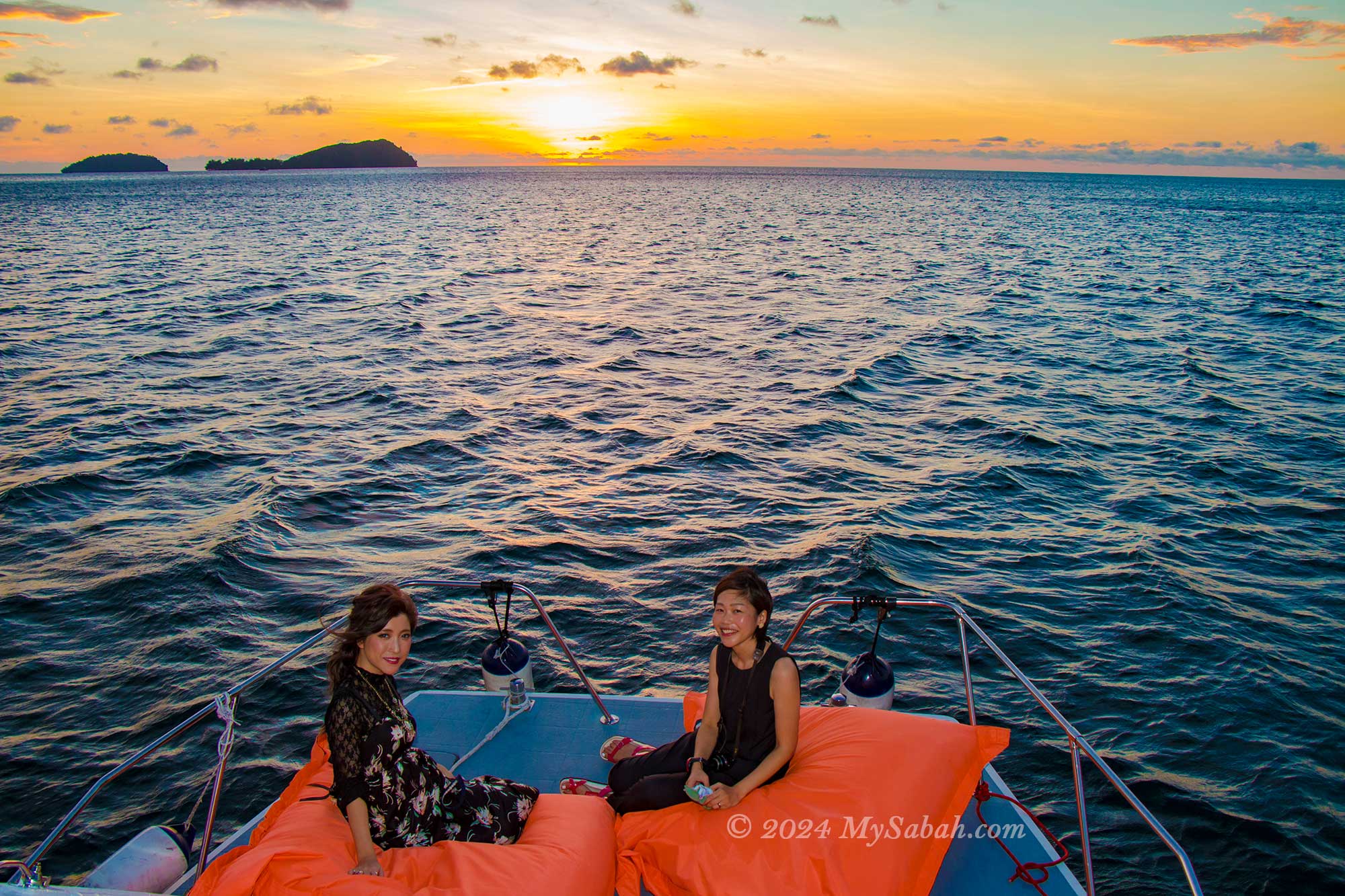
10. Sapi Island
Just a 15-minute boat ride from Kota Kinabalu City, the capital of Sabah, lies Sapi Island. Despite its modest size, this island boasts crystal-clear waters and an abundance of marine life, surpassing its neighbouring islands. While tourists may initially feel a tinge of apprehension at the sight of harmless wild boars and monitor lizards roaming the island, they quickly come to cherish such authentic encounters with nature. Read More or Book a Tour (Use Promo Code MYSABAH for Special Discount)
Sapi Island is situated in Tunku Abdul Rahman Marine Park
A secret cliff behind Sapi Island
Stand-up Paddleboarding on Sapi Island
Sunset cruise around Sapi Island
Corals of Sapi Island
Other Islands of Sabah
Sabah is home to nearly 400 islands, each with its own unique charm, but only a select few are developed for tourism purposes. Below is a list of other islands that travellers can explore:
These islands offer diverse experiences ranging from pristine beaches and vibrant marine life to cultural encounters and outdoor adventures, making them ideal destinations for travellers seeking unforgettable experiences in Sabah.
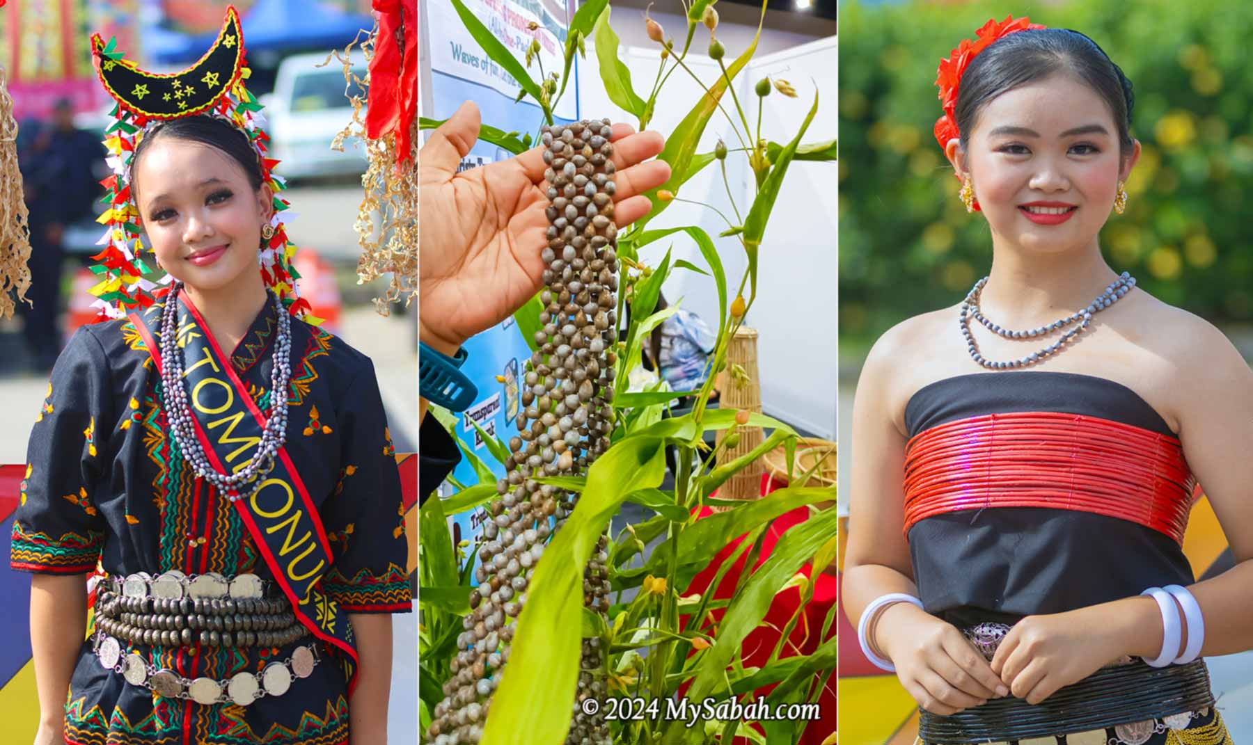
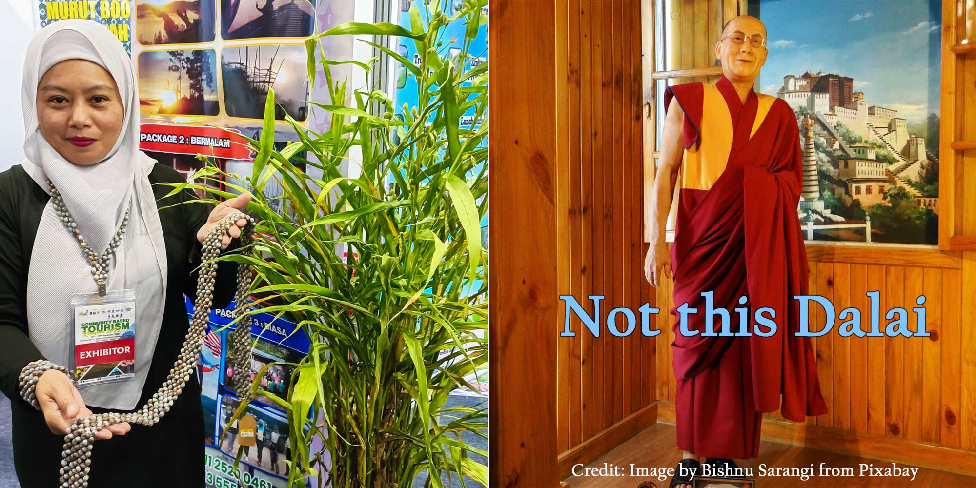
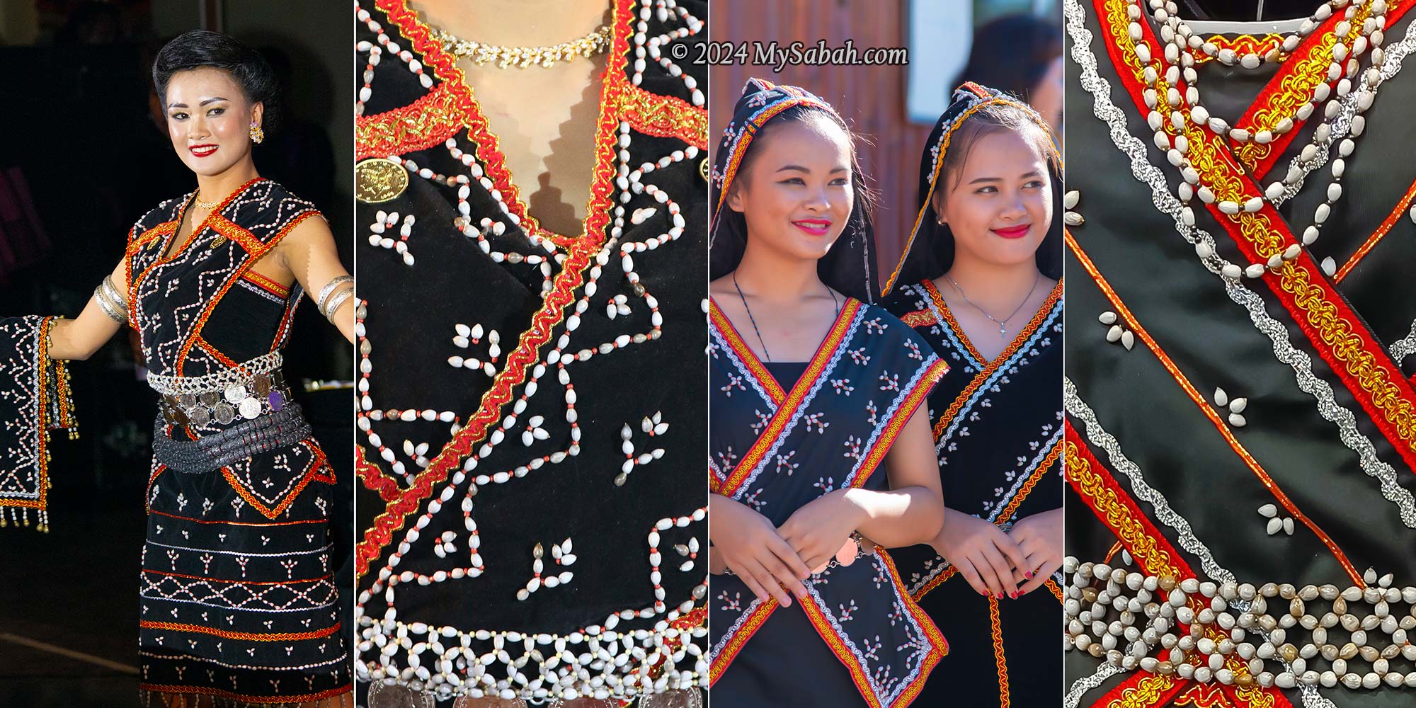
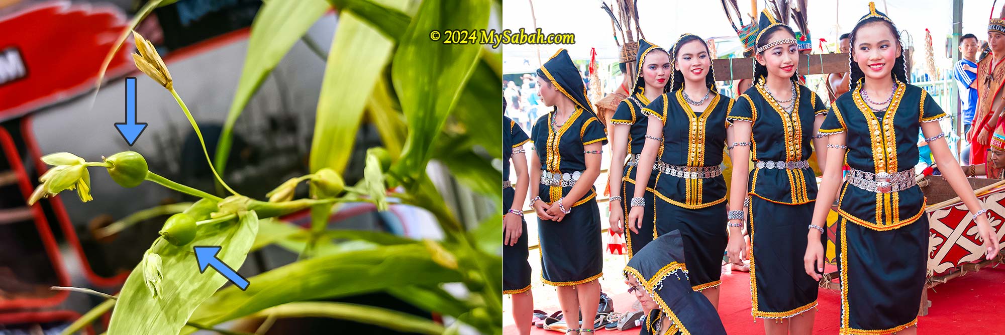
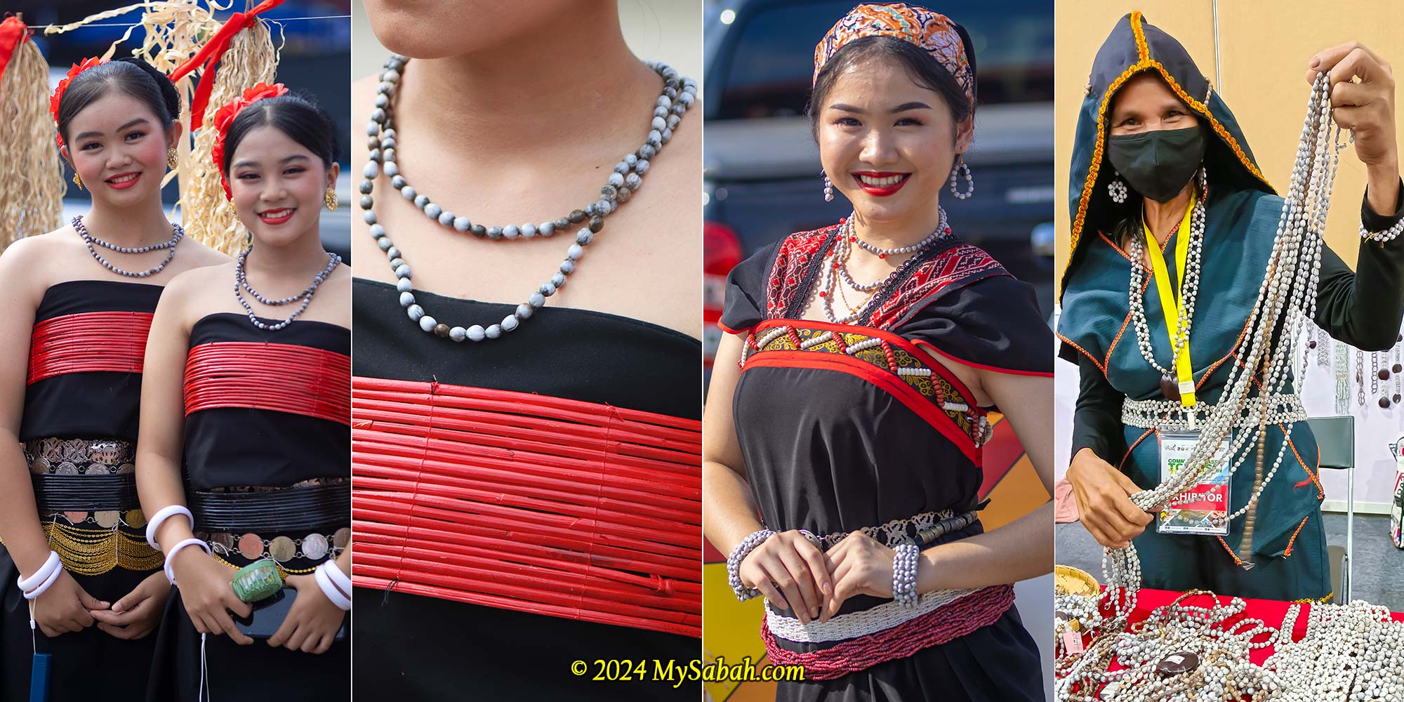
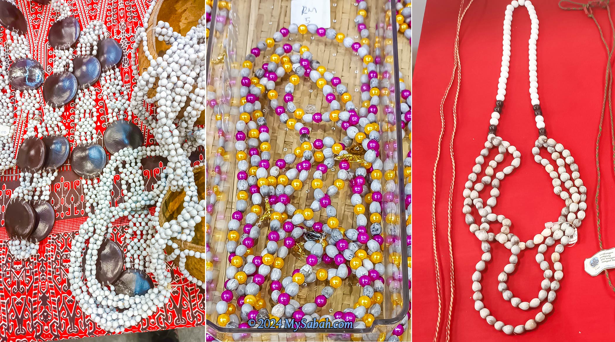
Job’s Tears, also known as adlay or adlay millet, is locally referred to as Dalai or Jelai in Sabah. This plant looks like a cross between corn and grass, and its hard-shelled, woody seeds are nicknamed the “Pearls of the Borneo Jungle” (Mutiara Rimba) due to its glossy surface and teardrop shape, providing a glimmering touch to ornaments. It has been utilized in traditional medicine, food, and crafts for centuries and is often associated with good luck, prosperity, and spiritual healing.
Left: Dalai plant and the seeds. Right: This is not the Dalai we are talking about (Photo credit: Image by Bishnu Sarangi from Pixabay).
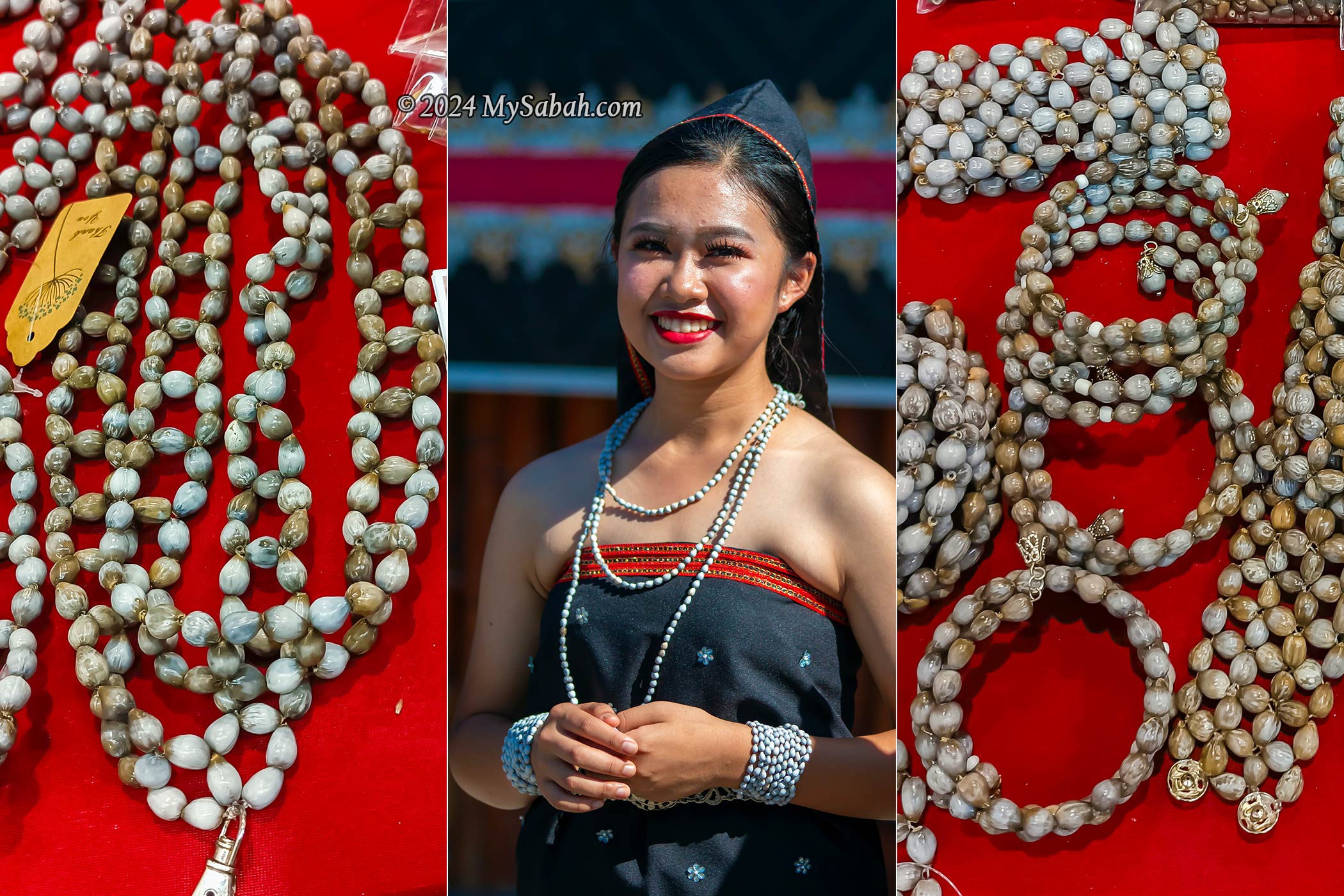
The Dalai plant is a tall, grain-bearing, perennial tropical plant scientifically known as Coix Lacryma-Jobi. The wild variety, Coix lacryma-jobi var. lacryma-jobi, has hard-shelled pseudocarps. The Dalai seeds naturally come with pre-existing holes, eliminating the need for artificial puncturing. The beads are strung together to to create various crafts, including rosaries (prayer beads), jewelry, bead curtains, and fashion accessories.
Job’s tears have historically been used as beads to make necklaces and other traditional accessories.
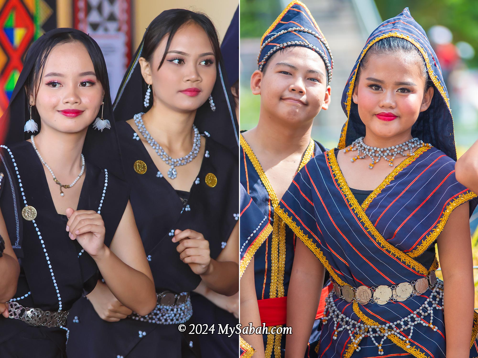
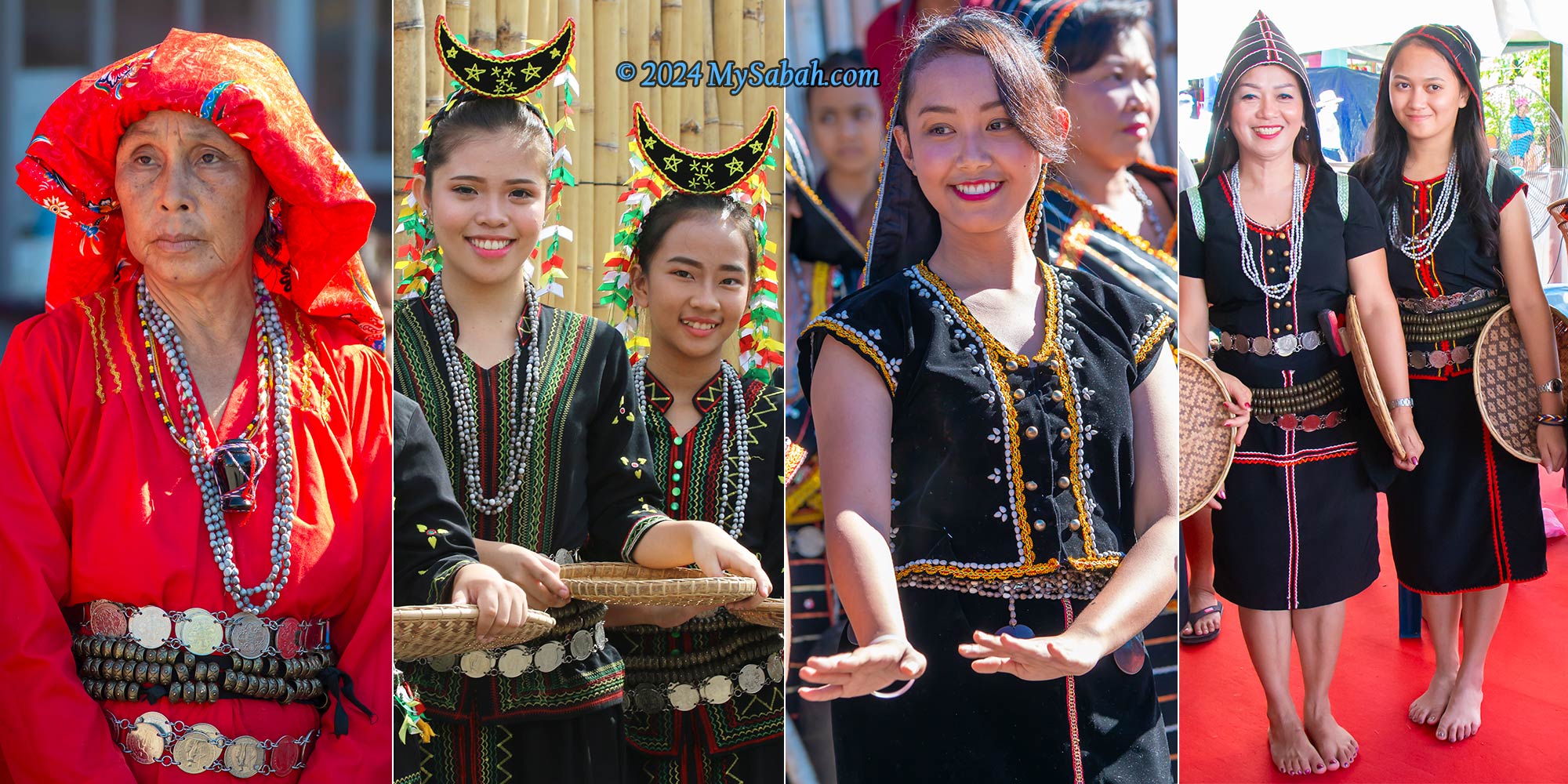
Artisans have been using Dalai beads in jewelry since 3000 B.C. Dalai has a long history as part of indigenous fashion in Sabah. I’ve observed Dalai seeds being used in the traditional costumes of the Dusun Kiulu, Dusun Liwan, Dusun Tindal, Dusun Tagahas, Dusun Malapih, and Tombonuo, the native tribes from the western and northern parts of Sabah. Dalai is primarily worn as accessories, such as necklaces, bracelets and belts. According to Wikipedia, other Borneo tribes such as Dayak, Kelabit and Kayan also use Job’s tears in their costumes.
Sinulamba dress of Dusun Kiulu decorated by Dalai seeds
The Dusun from Kiulu use Dalai extensively in the embroidery and decoration of their Sinulamba dress, one of the most unique garments and heritages in Sabah. The Sunduk, a hood covering the head or hair, represents the dignity of a woman, while the Kurilib, cross shoulder sashes, symbolize a loving woman.
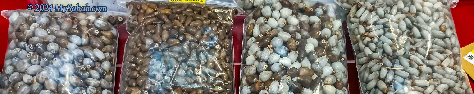
Dusun from Kiulu and TamparuliLeft: Dalai seeds will turn grey or brown colour when they are ripe. Right: Dusun Malapih from Papar
The variations in shades of grey and beige give Dalai seeds a natural appearance. Over time, Dalai seeds become shinier when in contact with the skin of their owners. For instance, rosaries made with Dalai beads may transition from a light grey to a shiny, warm chestnut brown color after being held many times during prayers. Saint Teresa of Calcutta was known to pray with Dalai rosaries.
Dalai necklaces, bracelets and earrings of Dusun Tindal
While Job’s Tears grains can be consumed as a cereal, such usage is not widespread in Sabah. The cultivated varieties, known for their soft shells, are more preferred for food. Job’s Tears is also commonly sold as Chinese pearl barley. Additionally, some Kadazandusun communities in Sabah make a decoction from Dalai leaves as a traditional herbal remedy for treating coughs or fevers.
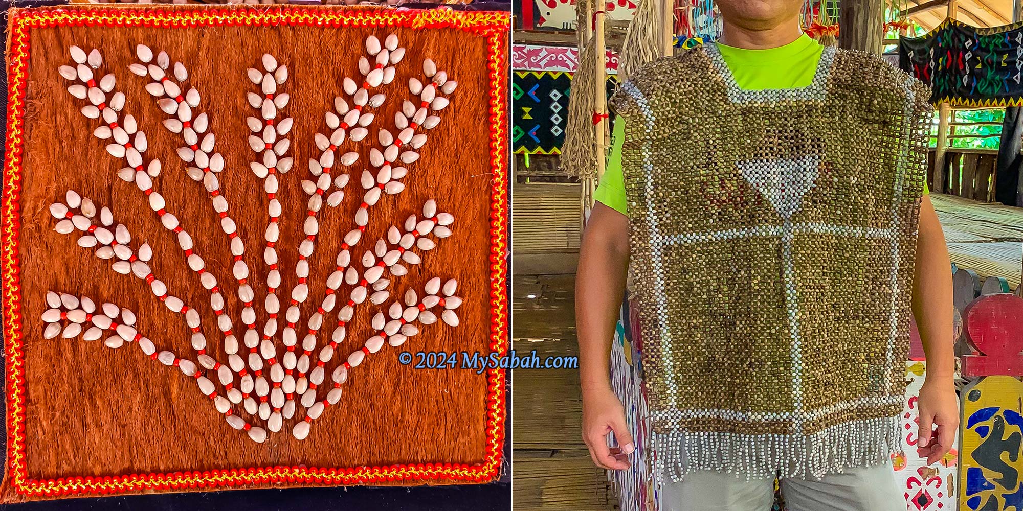
Dalai seeds can mix with other beads and materials to make beautiful crafts.
Dalai is a fast-growing and easy-to-cultivate plant that demands minimal water and fertilizer. It can reach a height of about six feet and thrive in various soil types and climates. Germination typically occurs as early as seven days after sowing, with flowering taking approximately five months.
From left to right: Tombonuo Bobolian, Tombonuo girls, Dusun Kiulu and Dusun Tagahas (from Kota Marudu)
Job’s Tears derives its name from the story of the prophet Job, as mentioned in the Bible and the Quran. Job, a devout follower of God/Allah, faced a challenge to his faith when Satan caused him to lose his wealth, children, and health. Despite enduring a life of misery, Job did not complain. Throughout his ordeal, he remained steadfast in his belief and continued to love God as always. In the end, God rewarded Job with more than he had before. According to legend, when the tears of Job touched the soil, tall grasses sprouted, bearing oval seeds resembling his tears. This is how the name ‘Job’s Tears’ came about.
Creative designs of Dalai seeds. The dalai suit at the right is created by Madam Jusnah Jinos from Kg Bitoon (Ranau).
Dalai seeds come in over 10 variations of colors, shapes, and sizes, such as Tuntul, Watu, Oitom, providing artisans with ample creative possibilities in design. For more information on buying, planting, or learning about Dalai, you can contact the following groups via their Facebook pages:
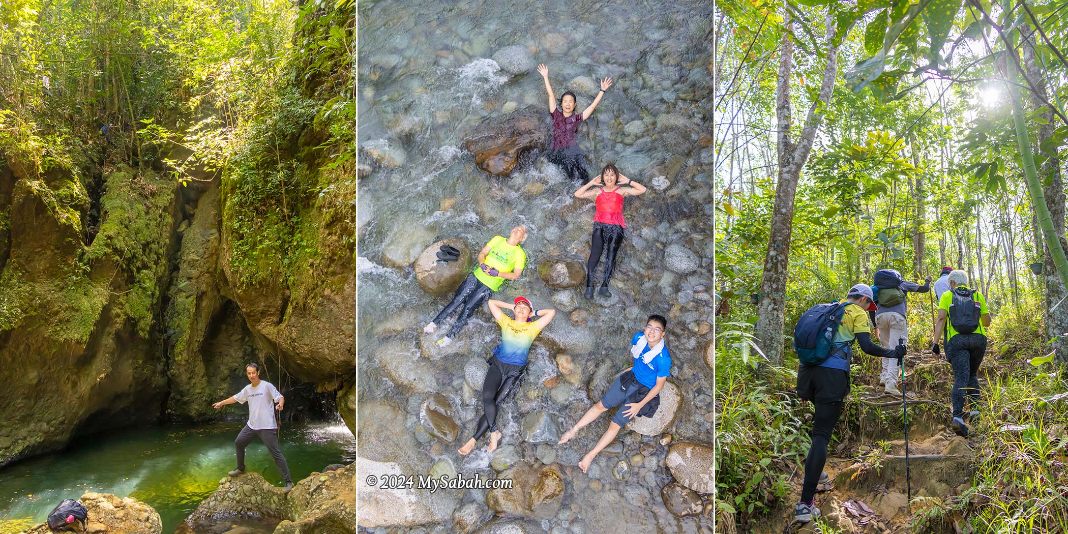
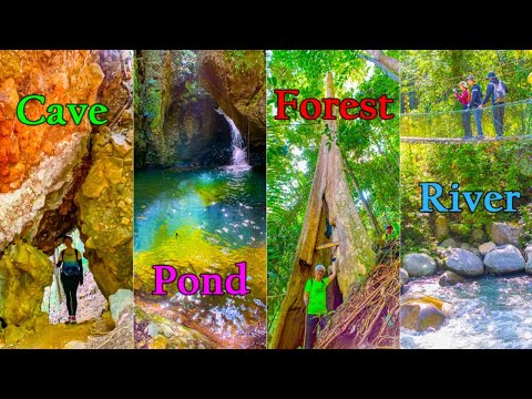
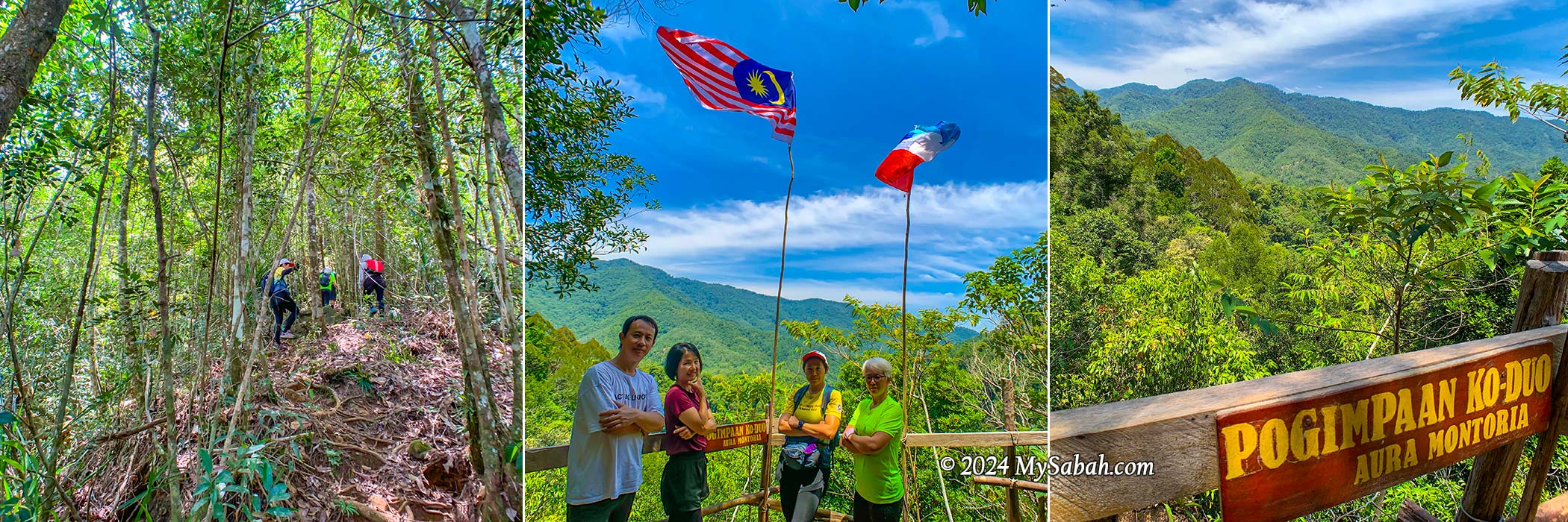
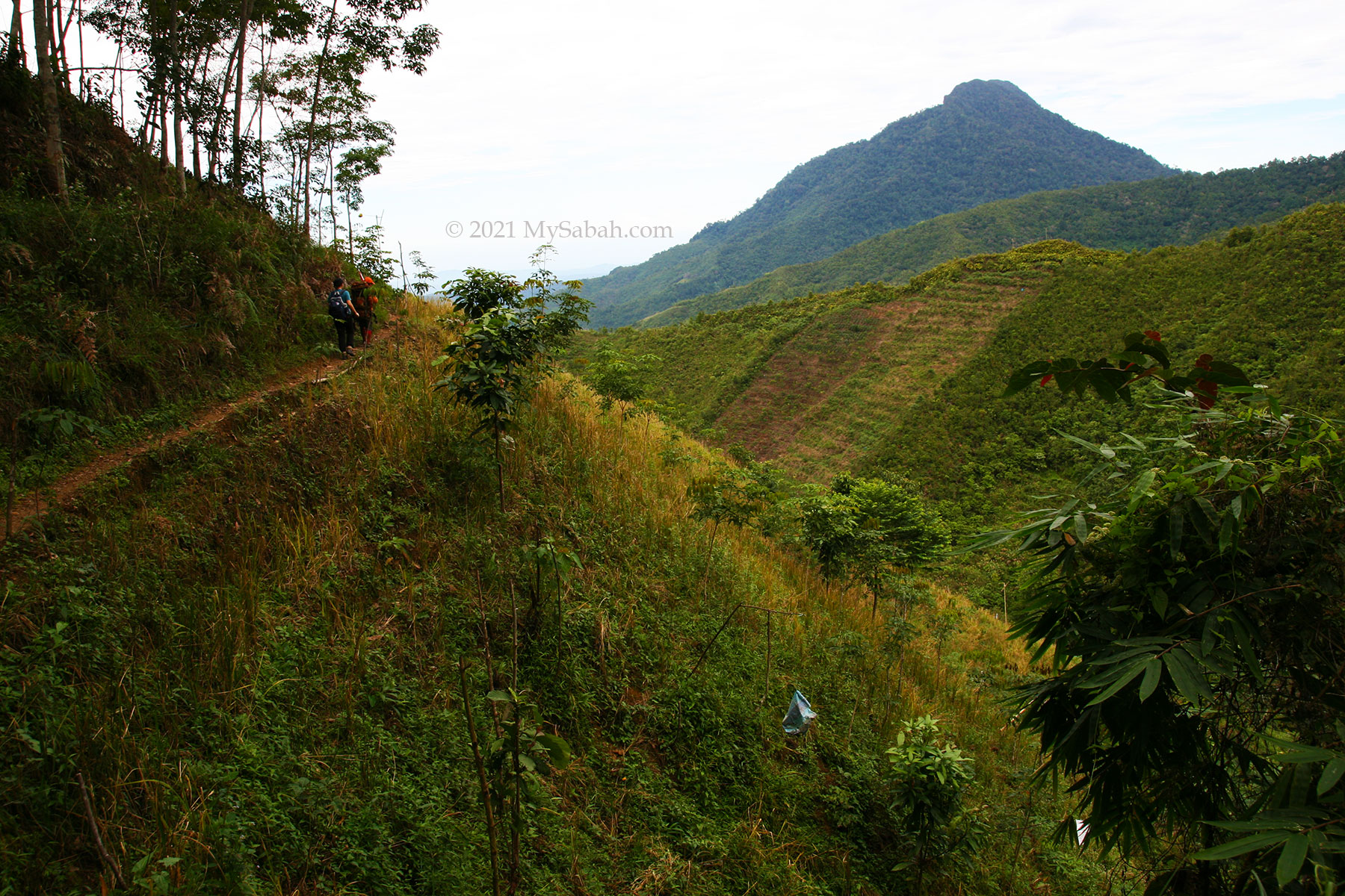
Aura Montoria is touted as one of Sabah’s top hiking spots, and after experiencing it firsthand, I don’t think it’s overrated. Hiking here offers an incredible opportunity to immerse in Borneo’s diverse landscapes. Beyond a mere walk, it’s an exciting exploration of caves, rock formations, rivers, waterfalls, ponds, and lush rainforests—truly a collection of natural wonders waiting to be discovered.
You like the element of soil, rock, water or wood? You can enjoy all these nature wonders in Aura Montoria.
About Aura Montoria
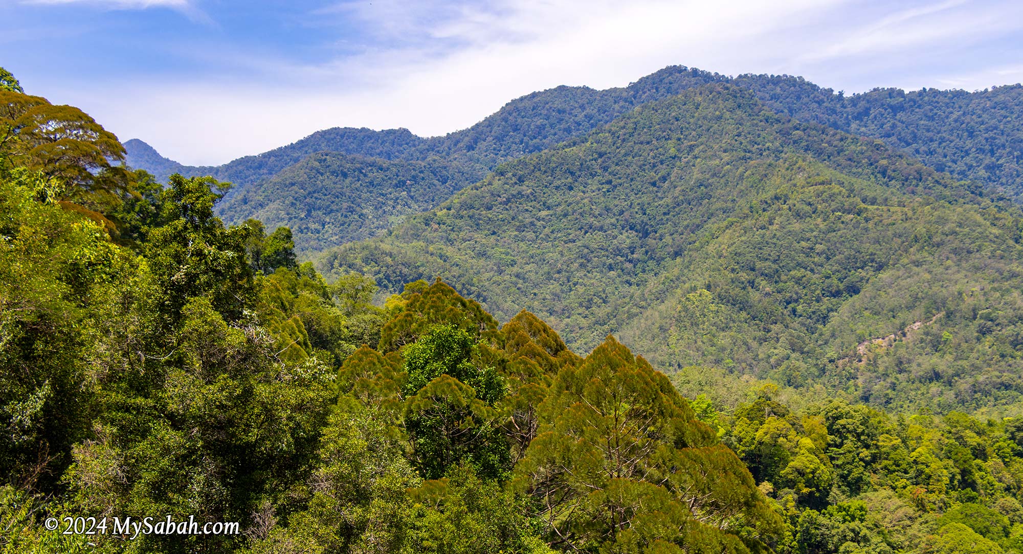
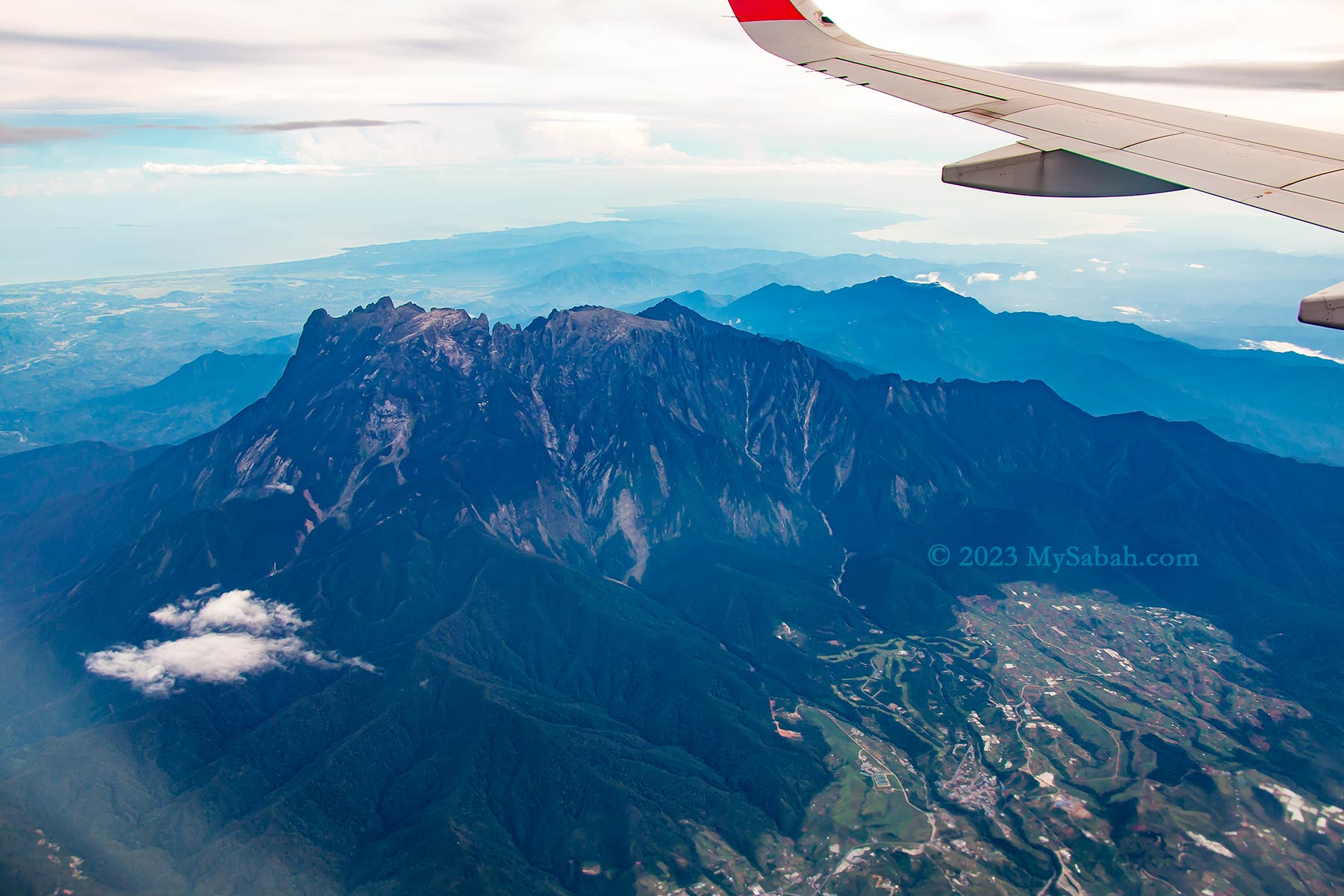
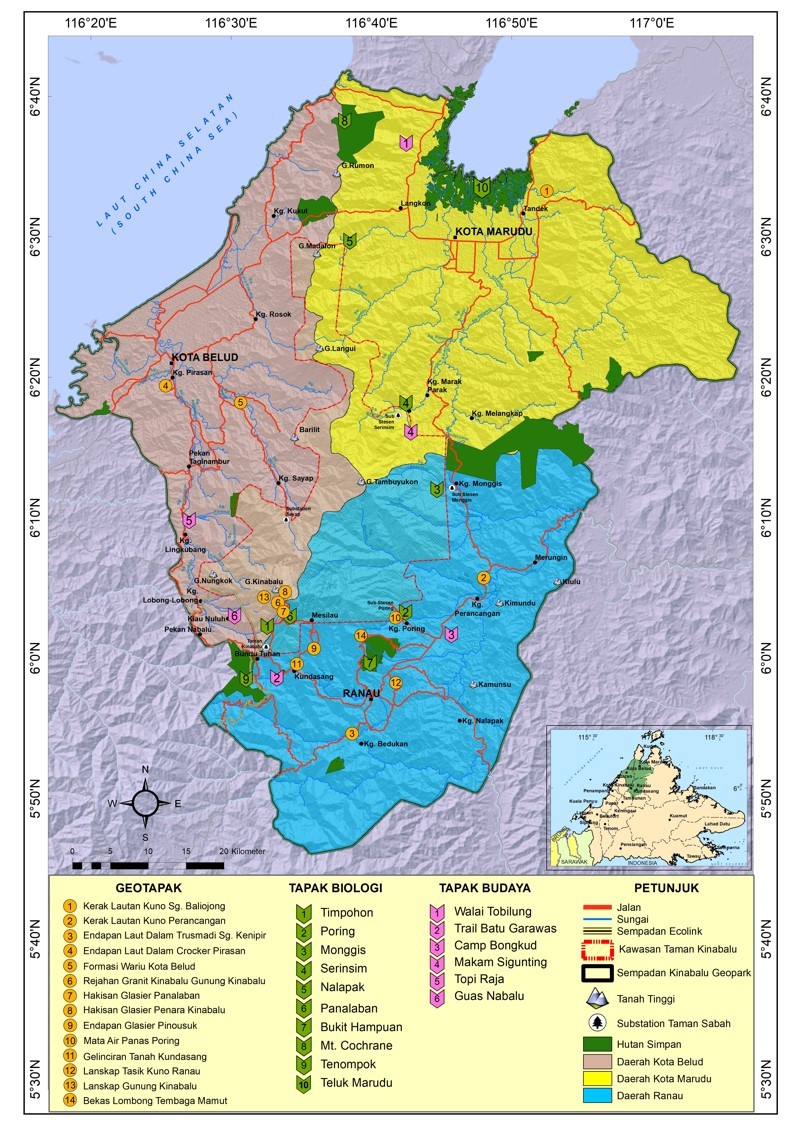
You might know about the Kinabalu Park HQ situated on Mount Kinabalu‘s southern side, easily reachable from Kundasang. However, tucked behind Malaysia’s highest peak lies Aura Montoria to the north, an enchanting hilly terrain located in Kampung Sayap (Kampung means Village) of Kota Belud, and part of the 4,750 km² Kinabalu UNESCO Global Geopark. It’s just a stone’s throw away from the Sayap Substation, snugly positioned on the west side of Kinabalu Park.
The cavities in sandstone structure create many natural caves and ponds in Aura Montoria
Aura Montoria owes its name to a winding tree vine known as Pokok Ponoriawon by the Dusun Tindal people. This vine, adorned with long thorns, grows along the riverbank, drawing a variety of birds during its flowering season. The locals named the area Montoria, a shortened version of Pokok Ponoriawon. Enchanted by its beauty, they added “Aura” to create Aura Montoria, capturing the site’s radiant charm.
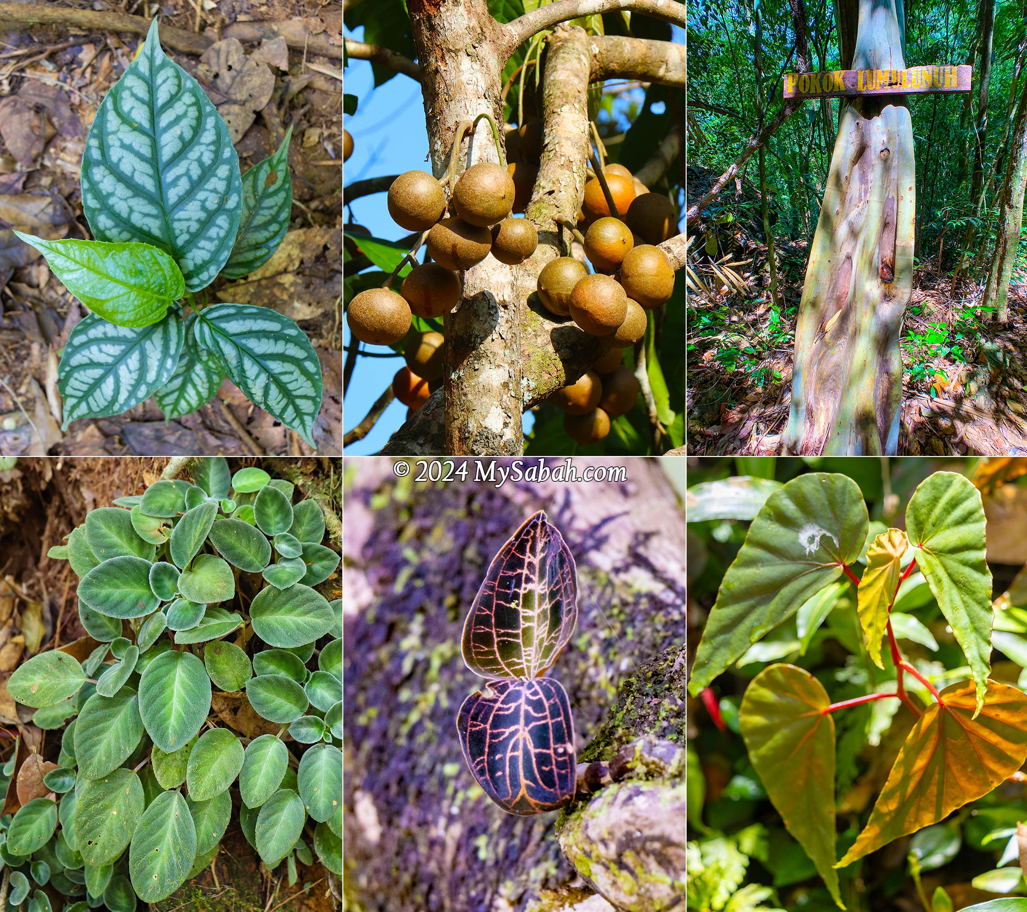
Aura Montoria is rich in flora too, e.g. begonia, bark-less eucalyptus tree, jewel orchid, and tampoi fruit in this picture
A Geotourism Destination
Couples always promise to each other, “I will love you to the time of the seas run dry and the rocks crumble,” as if such changes are impossible. But Aura Montoria will prove them wrong. Here, among the rolling hills and rock fragments, you’ll find evidence of a time when this land lay beneath the sea, some 20 million years ago. The geological morphology of the Aura Montoria is mainly featured by sedimentary rocks from the Crocker Formation, formed in a deep-sea basin during the middle Oligocene to early Miocene period, roughly 28 to 23 million years ago.
Aura Montoria was under the sea more than 20 million years ago
Around 17 to 10 million years ago, a tectonic collision uplifted most parts of Sabah, including Aura Montoria. This followed by geological processes like folding and faulting, raising the sandstones and shales of Aura Montoria’s sedimentary layers to the surface. Over millions of years, erosion and compaction shaped these deposits, forming the striking ridges, valleys, and unique rock formations that grace Aura Montoria today.
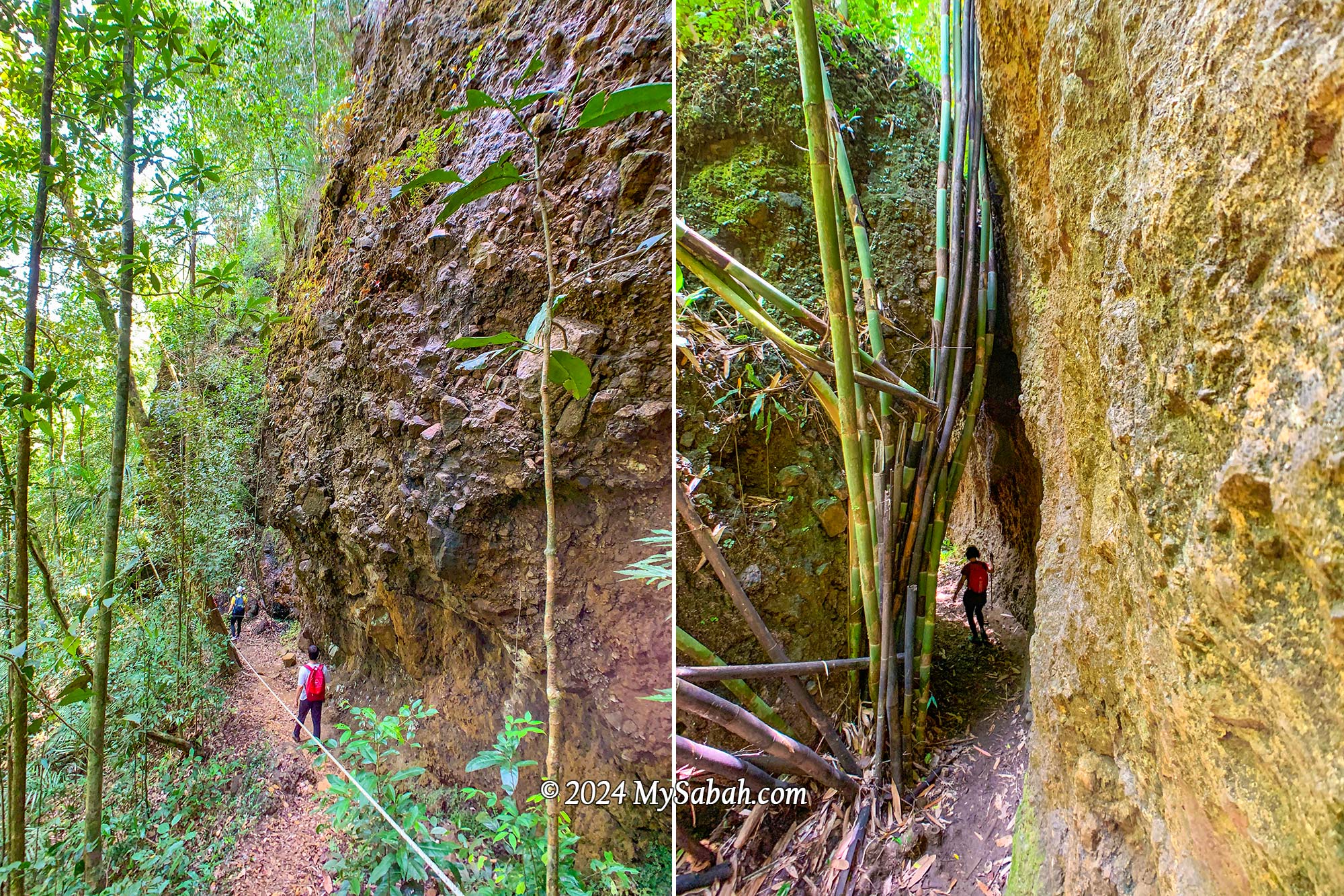
The landscape of Aura Montoria is dominated by sedimentary rocks such as sandstones, shales, and conglomerate that were deposited in the ancient seabed more than 20 million years ago. They look like compacted rocks glued by cement.
Granite boulders and rock walls dot this area, likely carried by glaciers from Mount Kinabalu to the foothills near Aura Montoria. Therefore, hikers will find fascination in the remnants of an ancient ocean floor and traces from the Pleistocene Ice Age, dating back millions of years.
Starting point of hiking in Aura Montoria. The 6-km trail takes about 6 hours to finish (include lunch and break)
Hiking (A Walk-Through)
The hiking trail spans a 6-kilometer loop, winding through varied and uneven terrain where the flowing rivers and waterfalls shower you with negative ions, the forest fills your lungs with fresh air, and sunlight provides a serotonin boost. All these combine to energize you and uplift your mood. Given the prevalent depression among younger generations, it’s no surprise that hashtags like silent walking, soft hiking, and rucking are trending in the Gen Z community. Visit Aura Montoria, I would advise them.
The hike typically lasts around 6 hours at a leisurely pace. The trail poses a moderate challenge to beginners, involving some scrambling and balancing over rocks and roots along slopes situated between 200 to 400 meters above sea level. While leeches aren’t commonly encountered, parts of the trail can be slippery, making sturdy hiking shoes crucial. Carrying mosquito repellent is essential for a more comfortable hike.
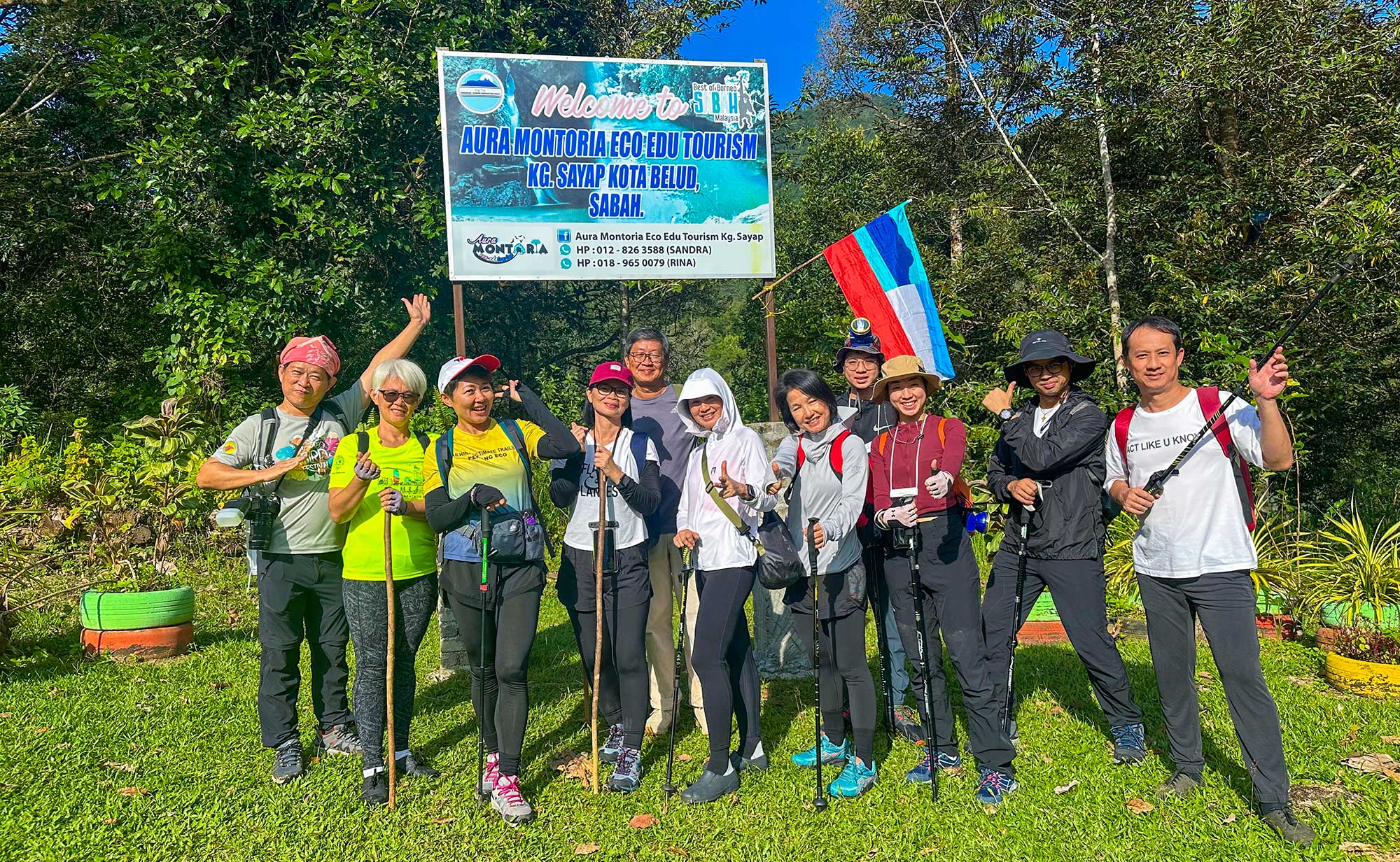
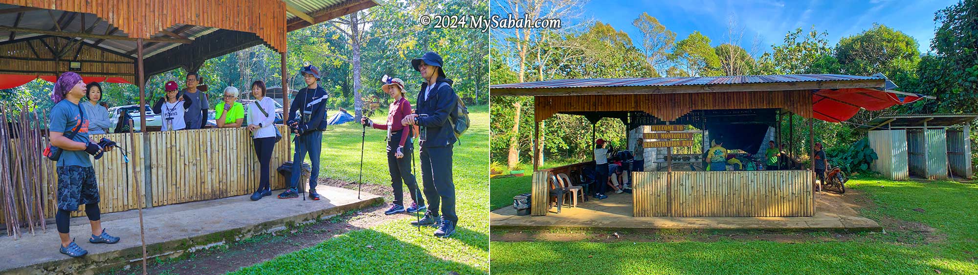
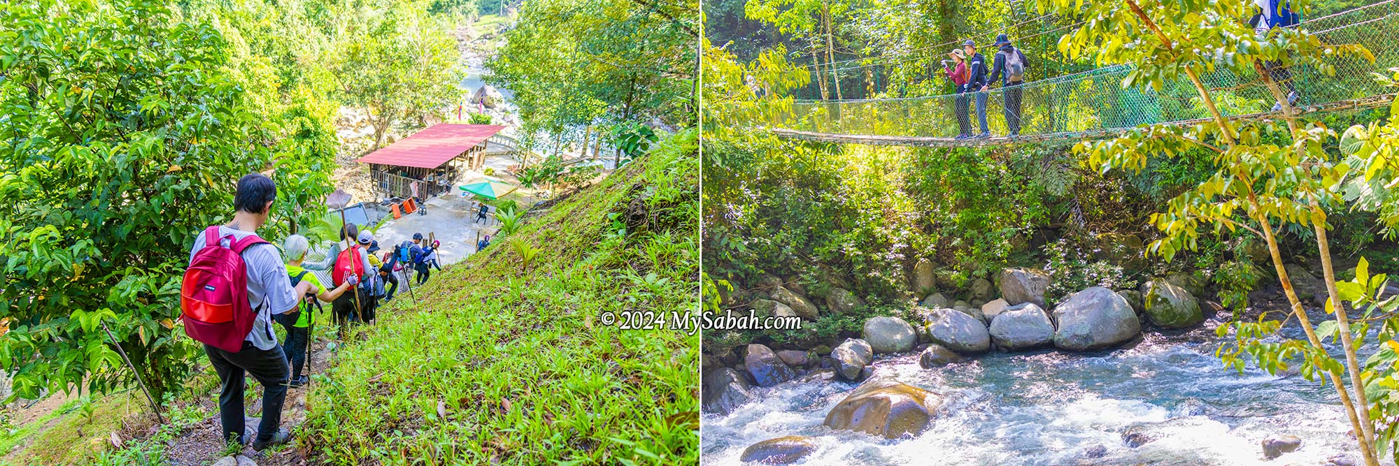
Briefing by our guide, Kunan, at the registration hut before the hike. There are a few simple toilets. You can change your cloth and take a shower there after the hike.
We met our guides (Kunan and Kiwi) at the registration hut inside a village plantation, for a short briefing before our hike began at 8:30 am (finishing around 2:30 pm). The first part of the trail is a pleasant one-kilometre walk through the countryside. In just 15 minutes, we passed through rubber and pineapple plantations and made our way downhill to a resting hut by the river, which is where the loop trail starts and ends.
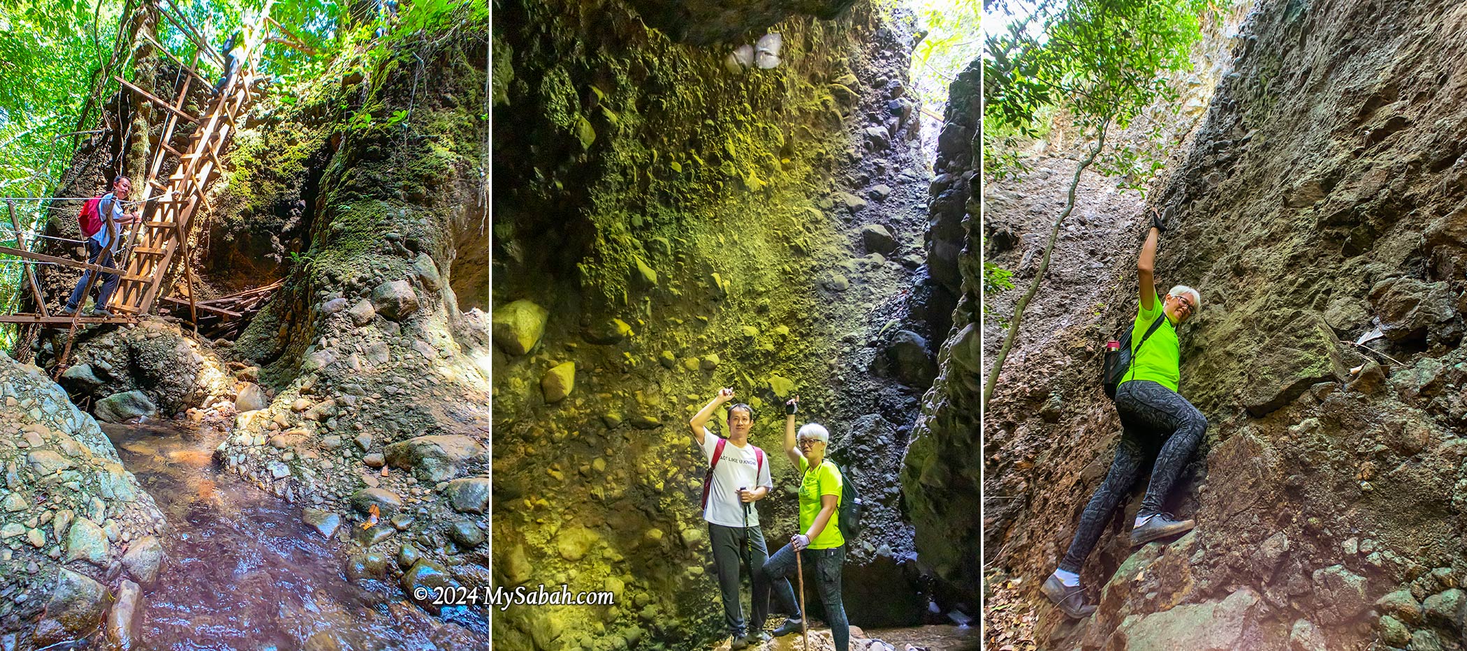
Hanging Bridge
As we crossed the suspension bridge, I was impressed by the pristine river underneath, a tributary of the Wariu River that eventually merges with the Kadamaian River downstream—this is one of Kota Belud’s biggest rivers. Reports indicate it’s a class I river in terms of water quality, and rich in oxygen. It’s a refreshing spot, with temperatures hovering around a cool 25-27°C, perfect for a revitalizing shower after a lengthy hike.
Left: the hut is the starting point of the loop trail. Right: the river under suspension bridge is a great spot to take shower after a long hike
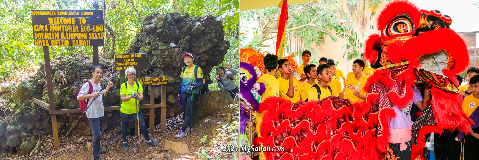
Lion Rock (Batu Gung-Gung Cha)
Following a brief ascent over a small hill known as the “Path of One Thousand Steps,” we encountered the first marvel: the Lion Rock. Locally referred to as Batu Gung-Gung Cha (Batu means Rock), this rock formation likely earned its name due to its resemblance to a lion and its association with the resounding tones of gongs and cymbals.
The Lion Rock (Batu Gung-Gung Cha) that reminds us of the noisy lion dance
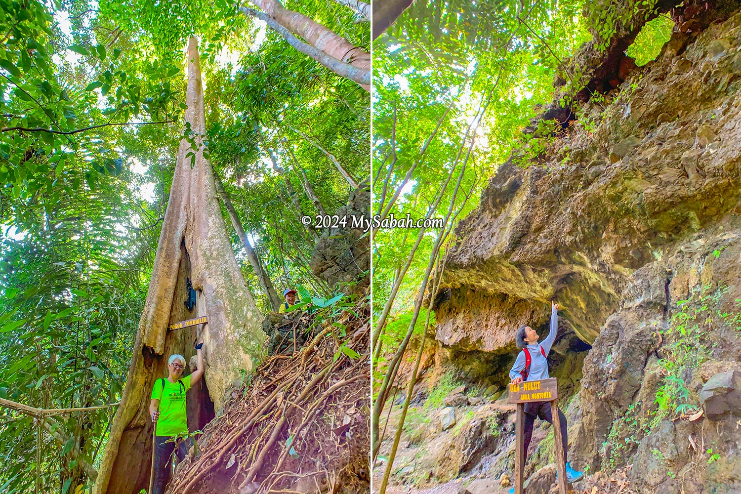
Tree Hole (Pokok Tomboilik)
As the deafening chirps of cicadas and the lively calls of birds surrounded us, it was evident we’d ventured into the jungle—a regenerated secondary rainforest in good condition, thanks to the dense canopy providing ample shade that shields us from the sun. A highlight of the trek was squeezing through a tree hole in a giant tree known as Pokok Tomboilik. Just a heads-up, if you’re a bigger person with a hefty backpack, you might get stuck in the hole.
Left: passing through a big tree hole. Right: The Mouth Cave looks like a dinosaur head from this angle
Mouth Cave (Gua Mulut)
Our next destination was quite a sight—a massive overhanging cave resembling the head of a dinosaur when seen from a certain angle. This cave is just one of many hidden within the area, adding to its allure as a fascinating geological site boasting various cave formations.
Gua Mulut (Mouth Cave) is an overhanging cave that resembles a big mouth
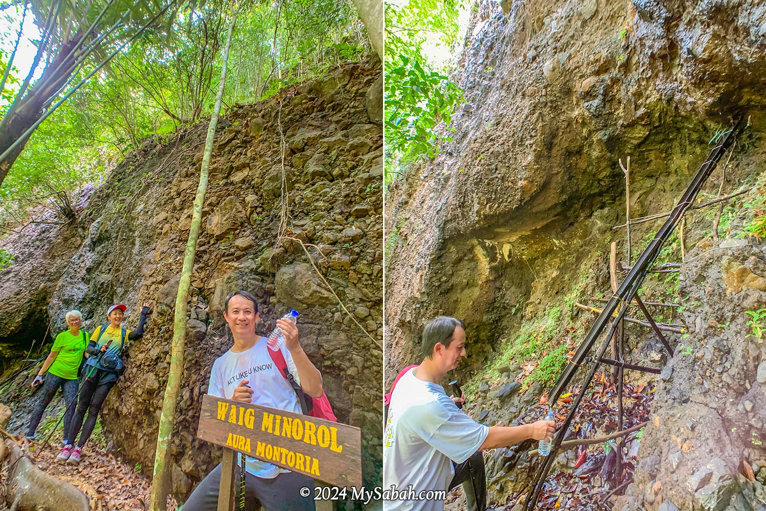
Natural Spring Water (Waig Minorol)
Close to the Mouth Cave, there are freshwater springs with water oozing out of the rocks. The sandstone, which is an excellent aquifer due to its high porosity and permeability, functions as groundwater reservoir that never run dry even during dry spells. I had a sip, and the mineral-rich water tasted wonderfully fresh, cool, and clean—no strange odors at all.
The spring water from the sandstone never dries up even during drought
Wongking Cave
Along the trail, we encountered stunning rock walls formed from conglomerate—a mix of sedimentary rocks in various sizes and shapes glued together by finer materials such as sand, silt, or clay. Some of these formations were covered with epiliths such as white mold and green mosses, adding to their beauty.
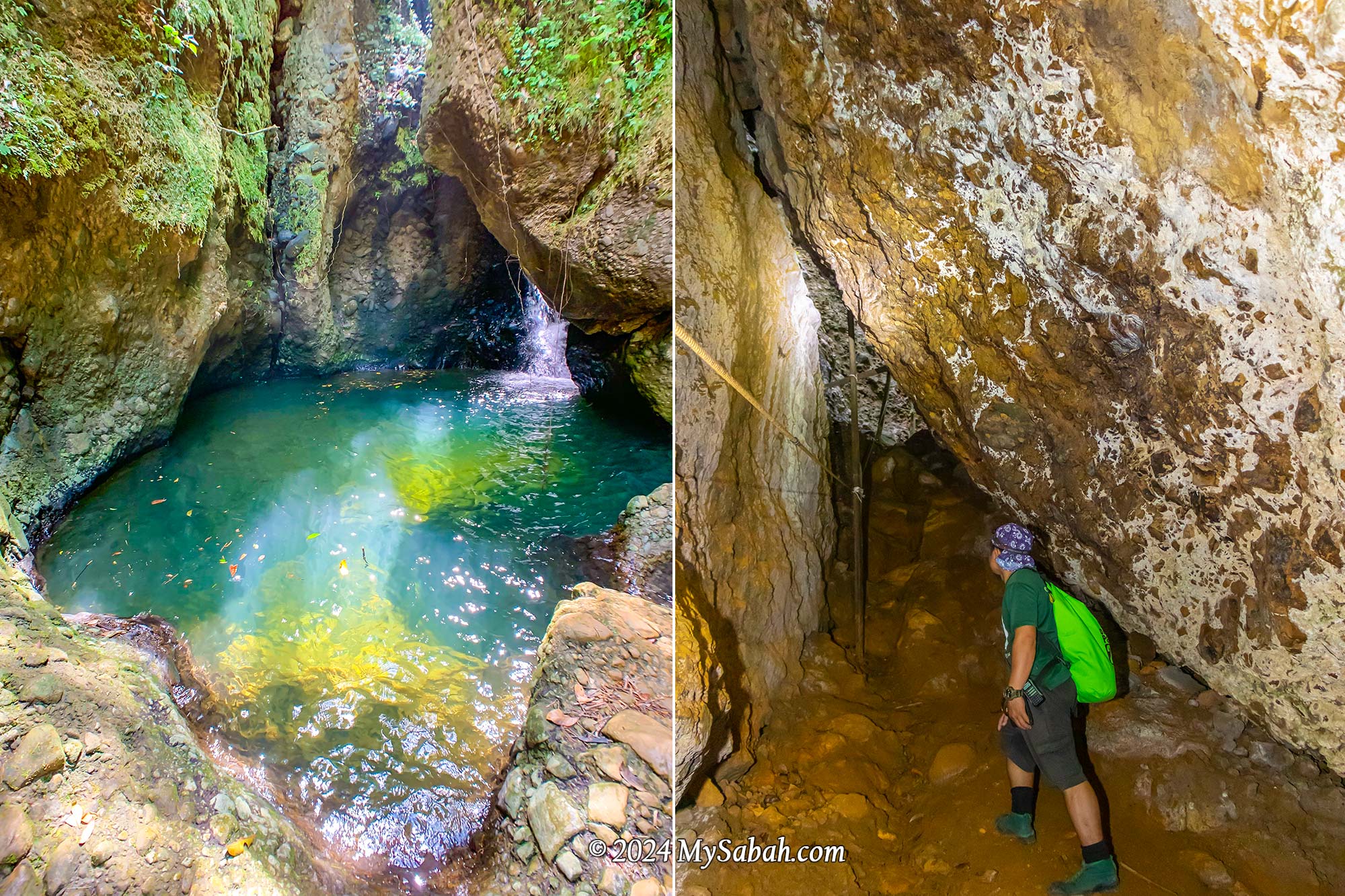
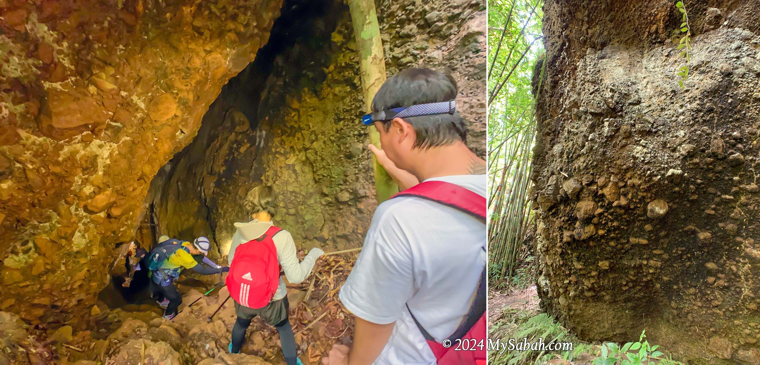
Left: Entering Wongking Cave. You need a LED headlamp for caving. Right: conglomerate rock wall
Descending into the depths, we ventured into the dark Wongking Cave. With our guides leading the way, both ahead and behind us, we felt safe exploring the underground cave. Don’t forget to bring a LED headlamp or flashlight for your caving adventure.
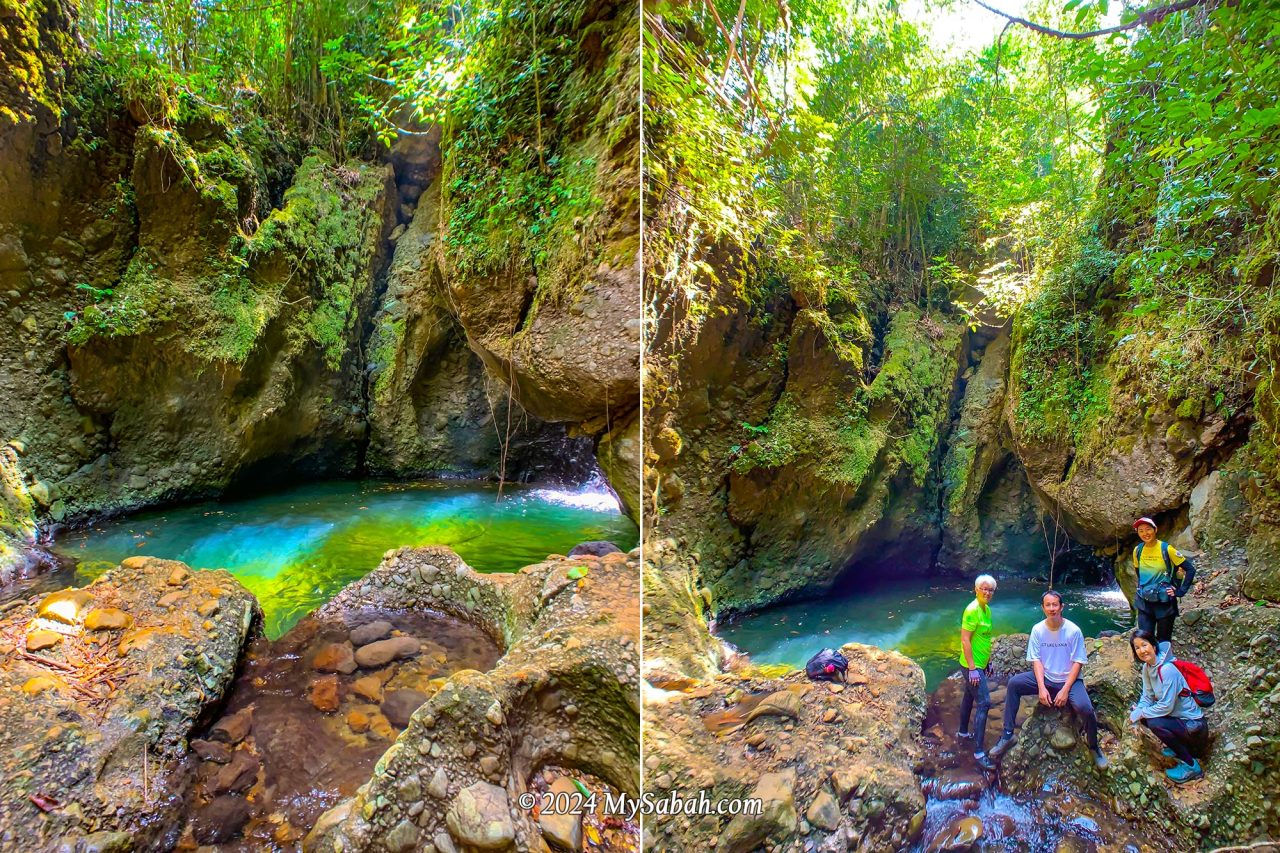
Rock Pond (Liogu Ourod)
This is the highlight I was most excited about. The oval-shaped rock pond is fed by a mountain stream and takes on a mesmerizing emerald hue when sunlight dances upon its surface. It resembles the mythical magic pool believed to restore youth to those who drink or bathe in its waters. Be careful when you move around there because the rock surface is very slippery.
Liogu Ourod, the natural rock pond filled with mountain water
Bat Cave (Gua Pungit)
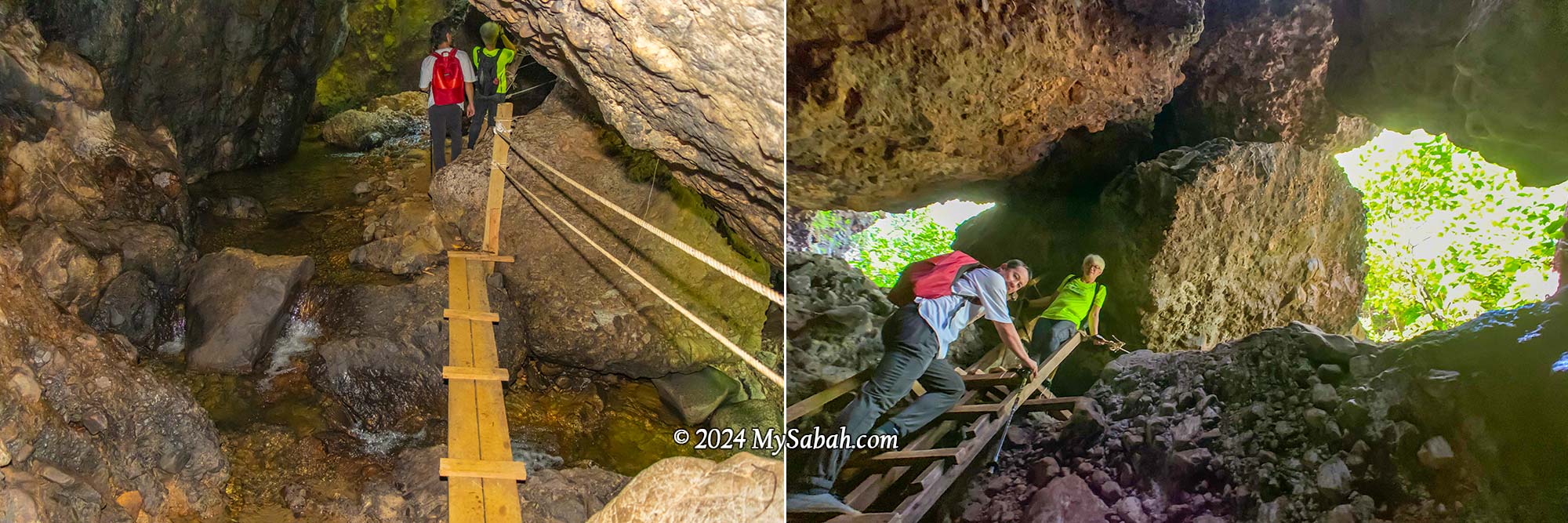
Venturing into another mountain cave, we discovered a stream flowing within. Natural light poured in through the cave’s opening on top, which also served as an entrance and exit for its inhabitants, like bats. Making the exploration easier, there were ropes and ladders available to facilitate movement in and out of the cave.
The Bat Cave with an underground stream
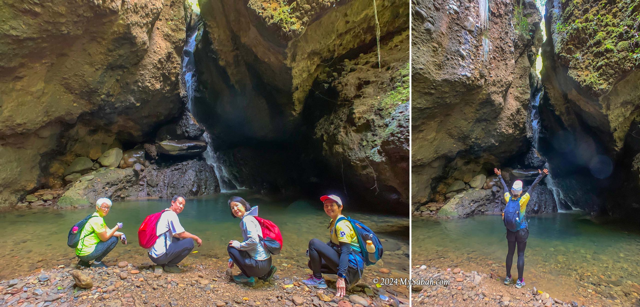
Waterfall Cave (Wasai ID Gua)
Each cave here holds its own surprises, and this one didn’t disappoint, featuring a hidden waterfall. No matter how scorching the day, this cooling cave provides the perfect refuge. With numerous caves and pristine water sources, I can’t help but wonder if cavemen once called this place home. To top it off, this cave even boasts a pond teeming with fishes.
Waterfall in a cave. There are many fishes in the pond. You can bring some pellets to feed them.
Lookout Point (Pogimpaan Ko-Duo)
Ok enough with dark caves, next we ascended higher ground where a viewpoint platform awaited. The sight of the lush forest and rolling hills was simply breathtaking. The gentle breeze was incredibly calming, prompting us to pause for a snack break on the wooden platform. It’s about 11am so we were a bit hungry.
Climbing to the lookout point on the hill. The trail is quite steep.
Marathon Trail via Rock Walls
Following a short rest, we headed down to the valley, tracing our path alongside rock walls. Among the rugged conglomerate formations, I spotted creamy rock walls composed of granite. These walls, formed from solidified molten rock that intruded into the ancient sediments, serve as reminders of tectonic activities here.
Sandstone and granite rock walls of Aura Montoria
Riverside Camp
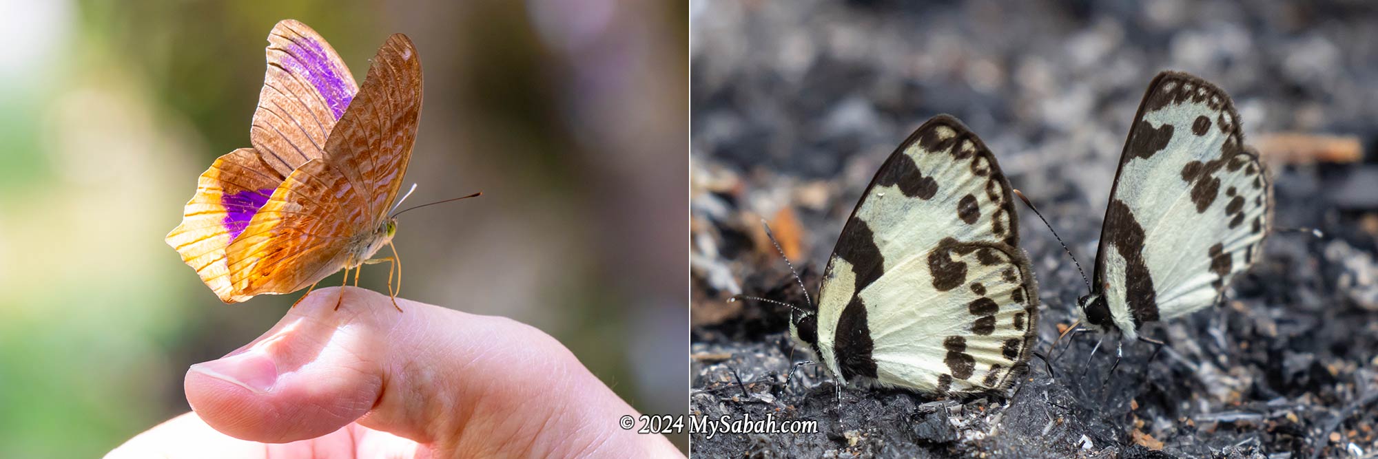
Finally, we reached the camp next to a tranquil river with a rocky bed, where we indulged in linopot lunch (rice wrapped in leaves). A few unique butterflies, including the iconic Rajah Birdwing, fluttered about the riverbank. This spot offers camping, swimming, and tubing activities, and you can throw a BBQ party.
River campsite and linopot (rice wrapped in leaf). Basic camping amenities such as tables and toilets are available here.
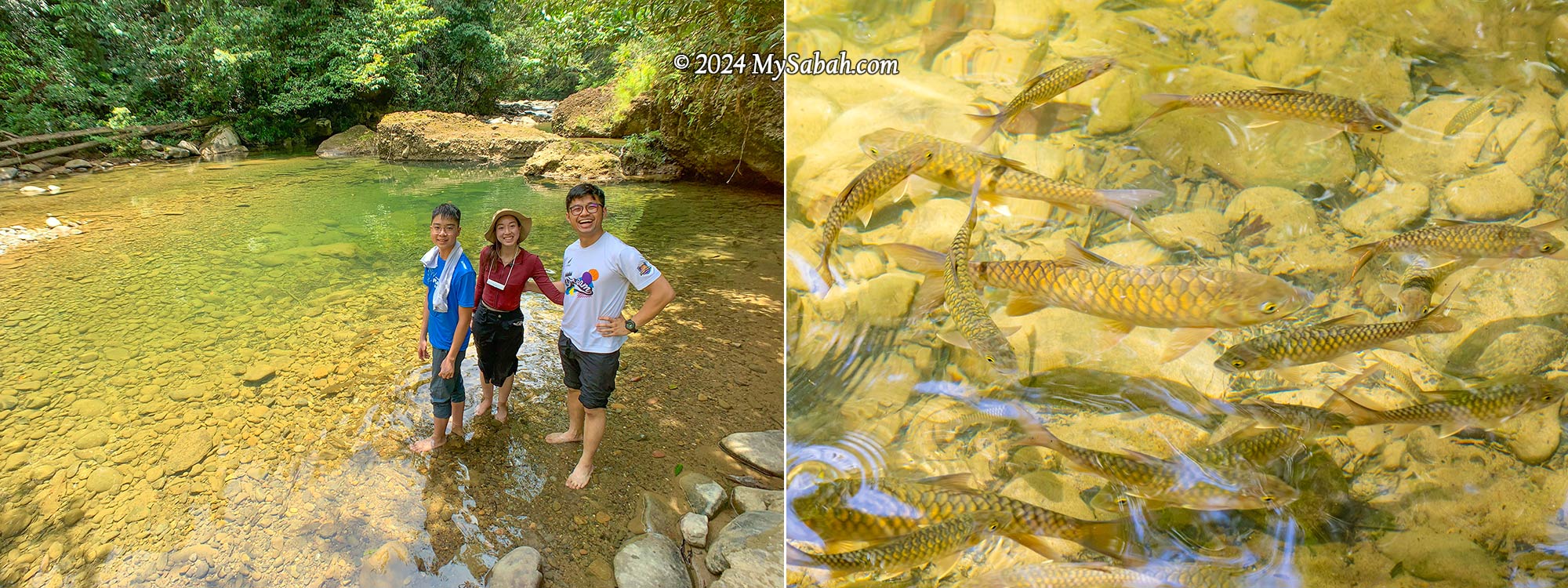
Nature enthusiasts will find themselves captivated by Aura Montoria’s diverse landscapes. Keep an eye out for its rich flora, such as begonias and orchids, which are among the highlights. While most people relaxed at the camp, some enjoyed a free fish massage from the docile mahseer (Local Name: Ikan Kelah).
The river and mahseer fishes (Species: Tor duoronensis) at the campsite
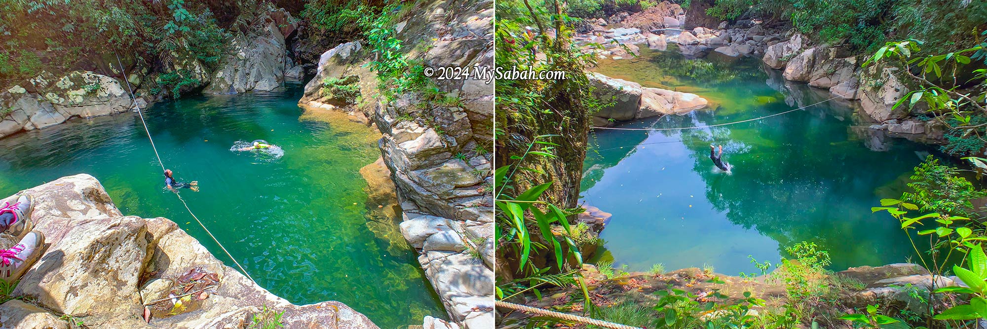
Green Lake (Liogu Otomou)
The adventure isn’t quite done yet! Our final destination is the Green Lake, a serene pond embraced by whitish boulders, with a depth of about 10 feet. For those seeking an extra adrenaline rush at the tail end of a long hike, you can take a leap into the river from higher ground nearby.
Liogu Otomou, a green lake-like river zone enclosed by rocky riverbank
How to Get There
Aura Montoria (see Location Map) is situated in Kampung Sayap, approximately 26 kilometers from Kota Belud, famously known as the Cowboy Town of Sabah. The journey from Kota Kinabalu City (KK) to Kota Belud, around an hour by car, is easily accessible via highways and paved roads. However, the 27-kilometer stretch from Kota Belud to Aura Montoria is predominantly gravel and dirt roads, making a 4-wheel-drive preferable as it can be challenging for sedan or saloon cars to traverse.
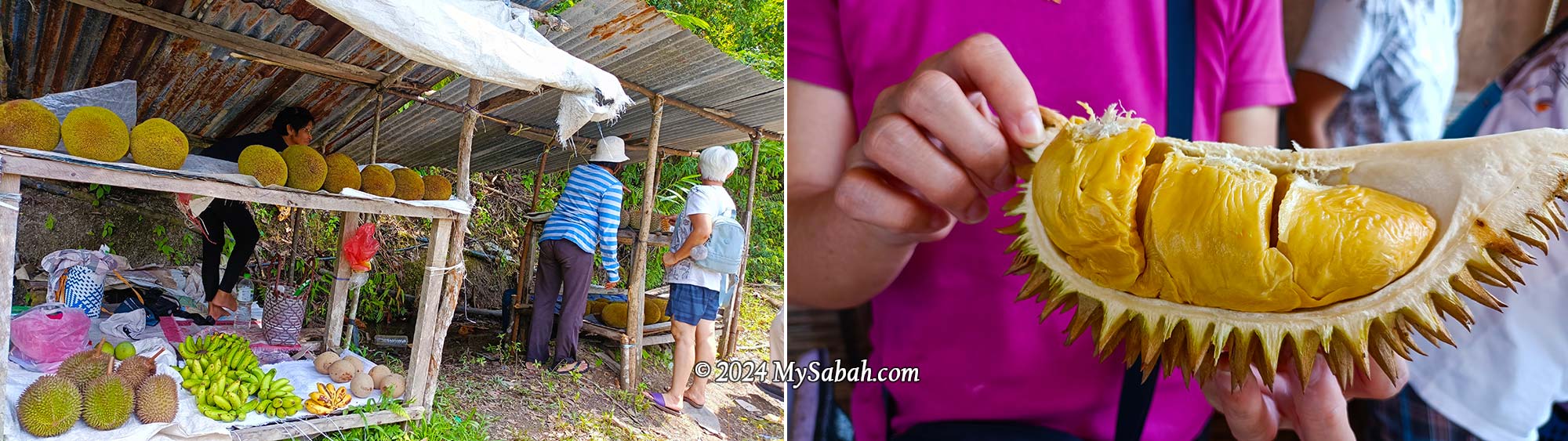
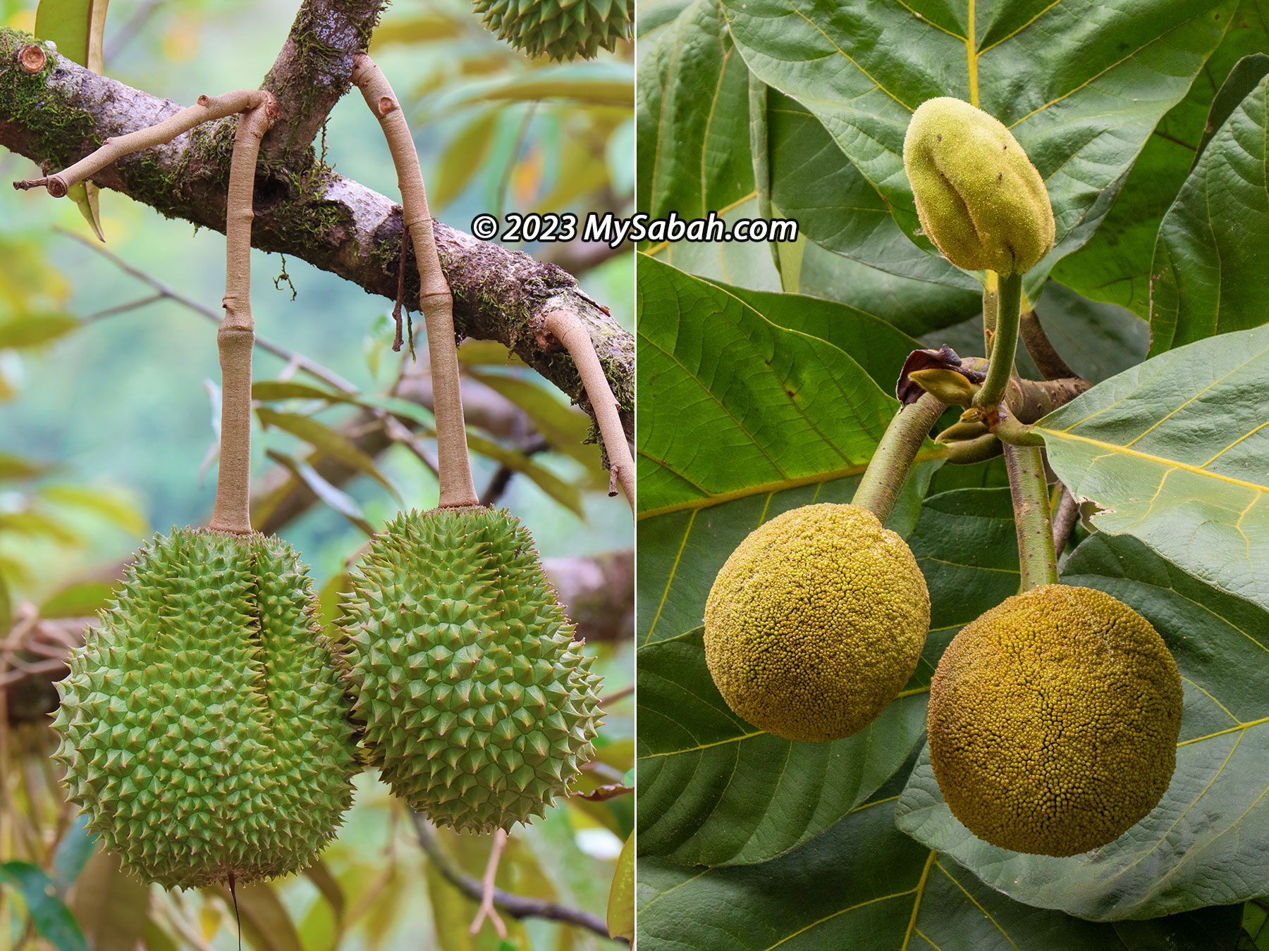
Fruit stall at the roadside of Kampung Sayap. You would find durian and tarap during fruiting season.
If you’re traveling from KK, expect a journey of over two hours. During the durian fruiting season (around August and September), if you’re a durian lover, plan for additional travel time as you might be tempted to stop in Kampung Sayap to shop for cheap durian, pineapples, and tarap. Hence, staying overnight in a nearby homestay like Porohon Garden Lodge is highly recommended. This way, you can avoid the rush and enjoy a leisurely start to your adventure without the need for a long early morning drive.
About Kampung Sayap
The majority of Kampung Sayap’s population comprises the Dusun Tindal community, mainly engaged in farming activities. Originally known as Kampung Minangkob, the name translates to “valley surrounded by hills.” Many years ago, a British military officer visited the village, he rested by a river that was nearly covered with dry leaves because of the drought that time.
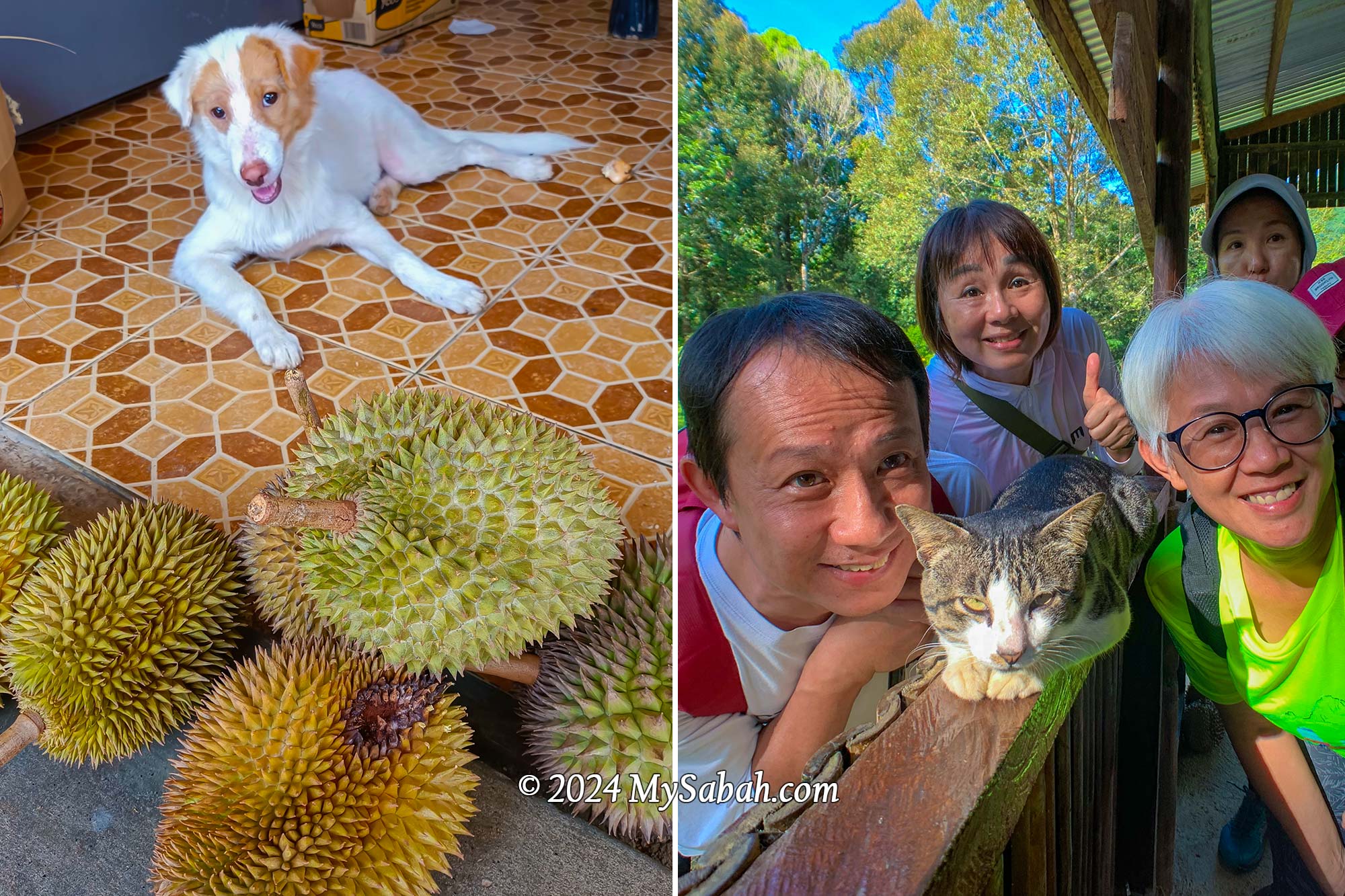
Dog and cat of Kampung Sayap. In the photos are Si Putih (dog) and Stim (cat), they love durian. Here are the proof of Si Putih and Stim eating durians (click the links for video)
Then the British asked a villager, “what is the word for dry leaves in Dusun language?” The villager replied that it was “sahap” (dry leaves). Unfortunately, the officer misheard sahap as sayap (which means wings in English) and document it in his diary. Due to that incident, Kampung Minangkob was renamed to Kampung Sayap.
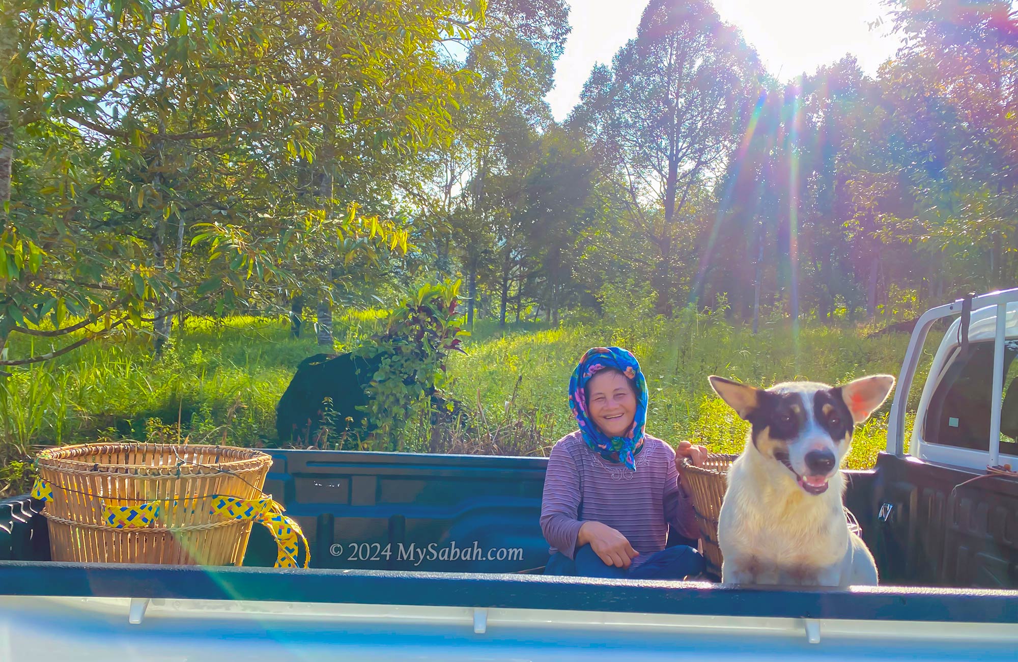
A friendly villager and her dog on the way to their farm in a lovely morning. Note the traditional wakid bamboo baskets in the car and the durian plantation behind them.
Fees and Contacts
The half-day, 6-kilometer hiking tour is priced at RM35 per person for locals and RM80 per person for non-Malaysians. For a group of up to 5 people, the guide fee per group is RM50 for locals and RM100 for non-Malaysians. Food is not included in the cost (but available as an add-on). If needed, you can hire a porter at a rate of RM5 per kilogram to carry your belongings.
Butterflies at the river of Aura Montoria. Left: Terinos clarissa praestigiosa, Right: Bornean Straight Pierrot (Caleta manovus)
A local guide is mandatory for hiking in Aura Montoria. To inquire about updated rates or book a hiking trip in Aura Montoria, you can contact the operator through the following channels: Phone (Whatsapp):+60-136262793 (Madam Sandra Idiam), +60-189650079 (Madam Rina Maratun) Facebook:Aura Montoria Eko-Edu Tourism Kg Sayap Kota Belud Sabah
Things to Bring
Having the following items handy will ensure a more comfortable and enjoyable hiking experience at Aura Montoria! The most important of all is to wear the right hiking gear: quick-dry clothes and good hiking shoes.
Backpack
Drinking Water
Raincoat / Poncho
Insect Repellent
Sunblock Lotion / Spray
Snacks / Energy Bar
Swimwear / Sarong
Extra clothing and towel
Hiking pole
Plastic Bag for soiled clothing
Cash
Optional: dry bag, portable power bank, hat
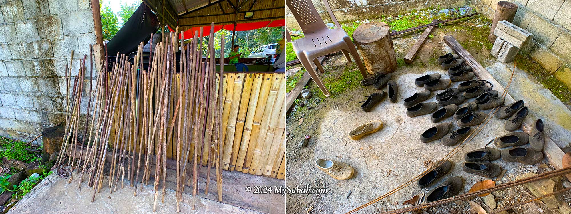
You can rent walking sticks, swimming goggles, Adidas Kampung (waterproof rubber shoes for hiking) for a small fee.
Walking sticks and Adidas Kampung shoes for rent. Adidas Kampung is made of rubber and waterproof, it’s the favourite hiking shoes of locals because it works well on muddy and slippery ground.
Special thanks to Puan Rina Maratun for sharing the backstories of Aura Montoria and Kampung Sayap. I also refer to the book “A Scientific Journey Through Borneo; Sayap-Kinabalu Park Sabah” written by ISMAIL, Ghazally; BIN DIN, Laily and published in 1995.
Photos taken in Kota Belud, Sabah, Malaysia Borneo
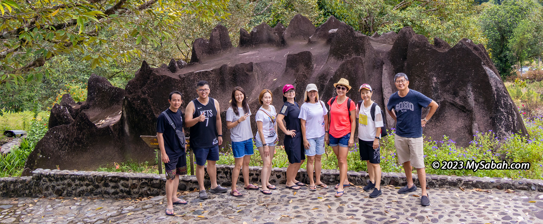
Sabah people were so excited to see Agong (King of Malaysia) who toured around Sabah recently. A lyrics in our national anthem says “Rahmat bahagia. Tuhan kurniakan Raja kita selamat bertakhta” which means “With God’s blessings of grace and happiness, may our King be safely enthroned.” Malaysians really love their king. A king rock in Sabah would amaze them?
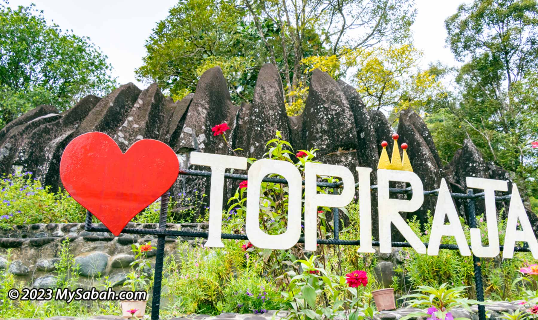
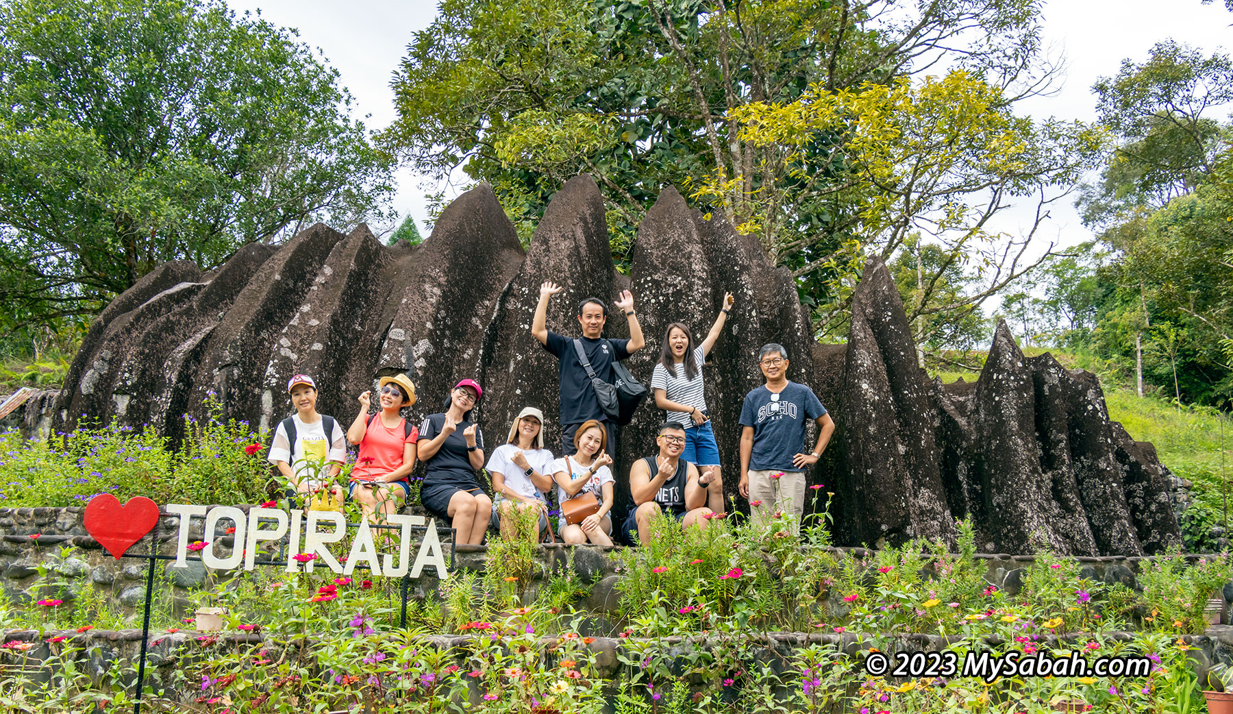
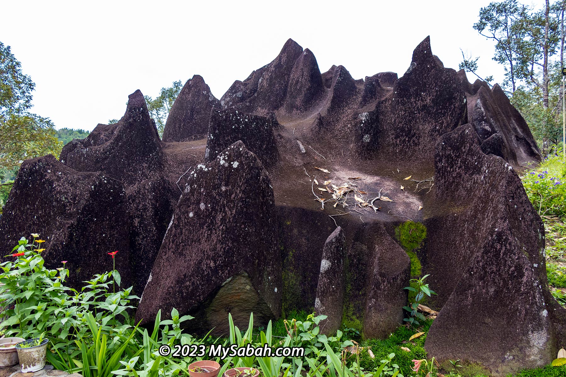
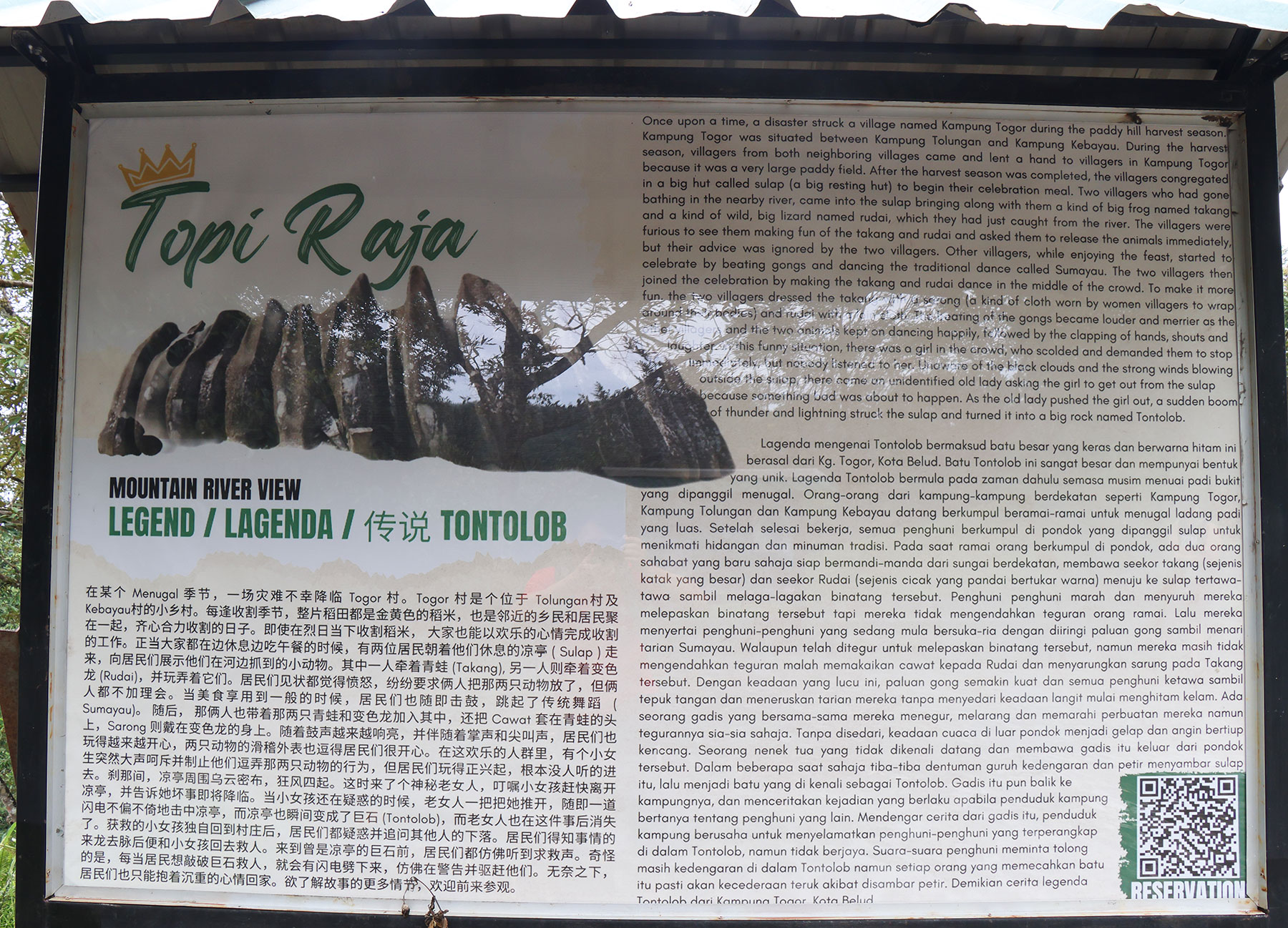
Topi Raja literally means ‘King’s Crown’. It’s 100% made by nature.
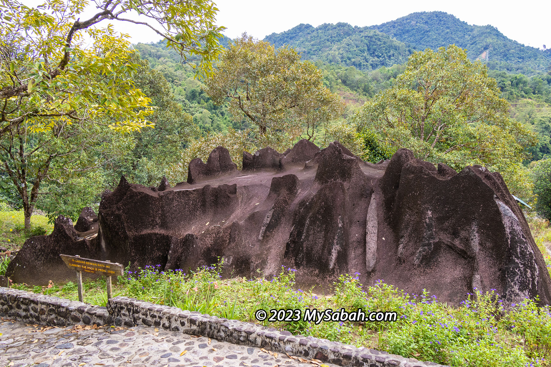
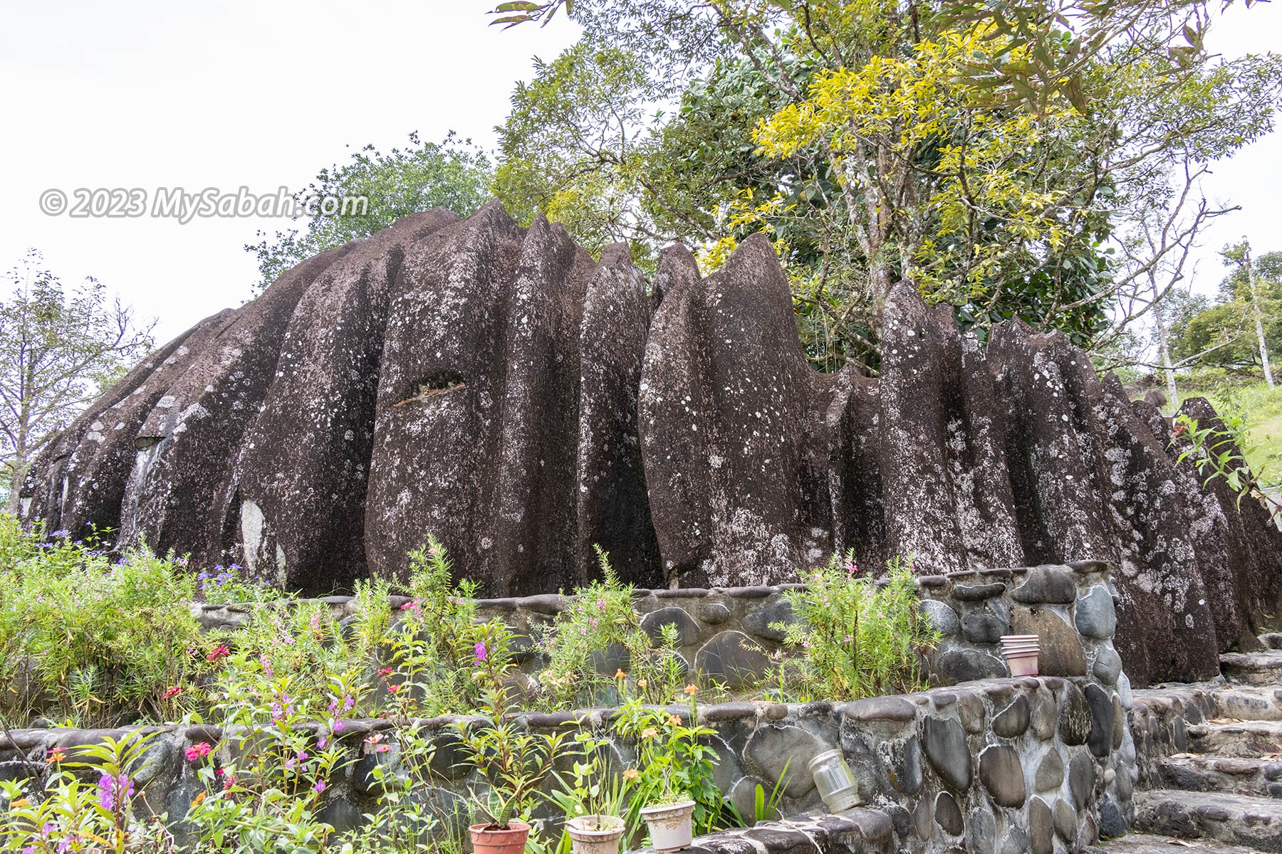
The majestic Mount Kinabalu, the highest mountain of Malaysia, crafted a giant crown with fire, ice and water thousand of years ago. It’s “Topi Raja” (translated as King’s Crown in English), a granite boulder located in Kampung Lingkungan (Kampung means Village), Kota Belud. Topi Raja got this name because its pointy spikes that looks like a crown. Some say Topi Raja also resembles a dinosaur with spikes on its back.
The top of Topi Raja also looks like the slates on the back of a Stegosaurus dinosaur
The Origin of Topi Raja
Granite rock is formed from hot magma that slowly cooled far below the Earth’s surface. Topi Raja was lifted to the surface as part of Mount Kinabalu about 7 to 9 million years ago. Until 10,000 years ago, the end of the ice age, this huge granite boulder was swept down Mount Kinabalu by the force of melting glaciers to Kota Belud, got buried underground. Then powerful flushes of subsurface water (e.g. ground water) after heavy rain eroded this weathered rock creating those sharp spikes.
The jagged peaks on Mount KInabalu is the work of glacial erosion during ice age. Kota Belud is at the left side of this photo.
Actually the similar boulder is also found in Kampung Podos, Kampung Sayap, Kampung Langat, and Kampung Lobong-Lobong in Kota Belud. However, only Topi Raja is listed as one of the 30 geosites of Kinabalu Geopark because of its cultural heritage value.
Location map of 30 geosites (with geological, biological or cultural heritage value) under Kinabalu UNESCO Global Geopark
You may ask, why cultural value and not geological value? Because the story of Topi Raja teaches an important moral lesson that reflects the value of Sabah natives.
The Legend of Topi Raja
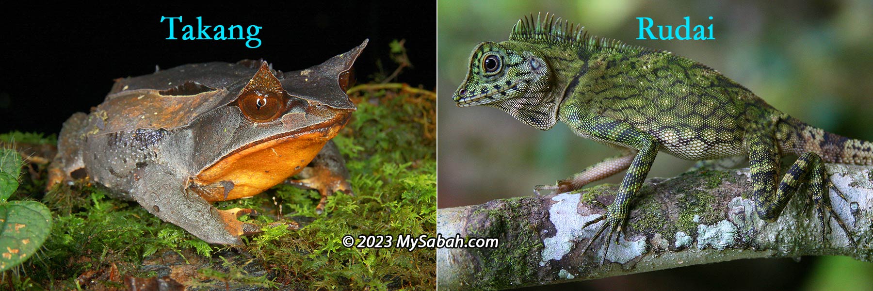
During a harvest season at the large paddy field of Kampung Togor (Kampung is Village in Malay language), villagers from neighboring Kampung Tolungan and Kampung Kebayau came to help Kampung Togor on harvesting. After they finished works, they congregated and feast in a big hut called sulap (a big resting hut) to celebrate. Two villagers, who bathed in the nearby river, brought back a takang (a kind of big frog) and a rudai (a big lizard that can change colours) that they caught at the river.
Climbing on Topi Raja is prohibited. Please respect it like a king.
The villagers were furious to see them making fun of the takang and rudai and asked them to free the animals at once, but their advice was ignored by the two villagers. Other villagers, while enjoying the feast, started to celebrate by beating gongs and dancing the traditional dance called Sumayau. The two villagers then joined the celebration by making the takang and rudai dance in the middle of the crowd.
Takang (horned frog) and Rudai (lizard). Did Takang escape, take the crown and become a Frog Prince? I don’t know.
For more party fun, these two villagers dressed the takang with a sarong (a kind of cloth worn by women villagers to wrap around their bodies) and rudai with a cawat (loin cloth). The beating of the gongs got louder and merrier as the villagers and the two animals kept on dancing, the amused villagers clapped, shouted and laughed.
Groundwater erosion led to the formation of craggy grooves on Topi Raja. This process is similar to the formation of the sharp spikes on limestone rocks such as the Mulu Pinnacles in Sarawak.
Unhappy of this situation, a girl among them scolded and demanded the villagers to stop this farce immediately, but nobody listened to her. Then black clouds approached and strong winds blowing outside the sulap, a mysterious old lady appeared and asked the girl to leave the sulap because something bad was about to happen. As the old lady pushed the girl out, a sudden boom of thunder and lightning struck the sulap and turned it into a big rock named Tontolob.
Topi Raja is a granitic boulder eroded from Mount Kinabalu and transported down the mountain by moving glaciers about 10,000 years ago.
The girl returned to her village and told the villagers what was happening. Though they heard the cry for help in the rock, they failed to rescue the people trapped inside, because whoever tried to break the big rock would be hit by lightning and injured badly. The villagers who rocked and rolled with the poor animals turned into rock forever.
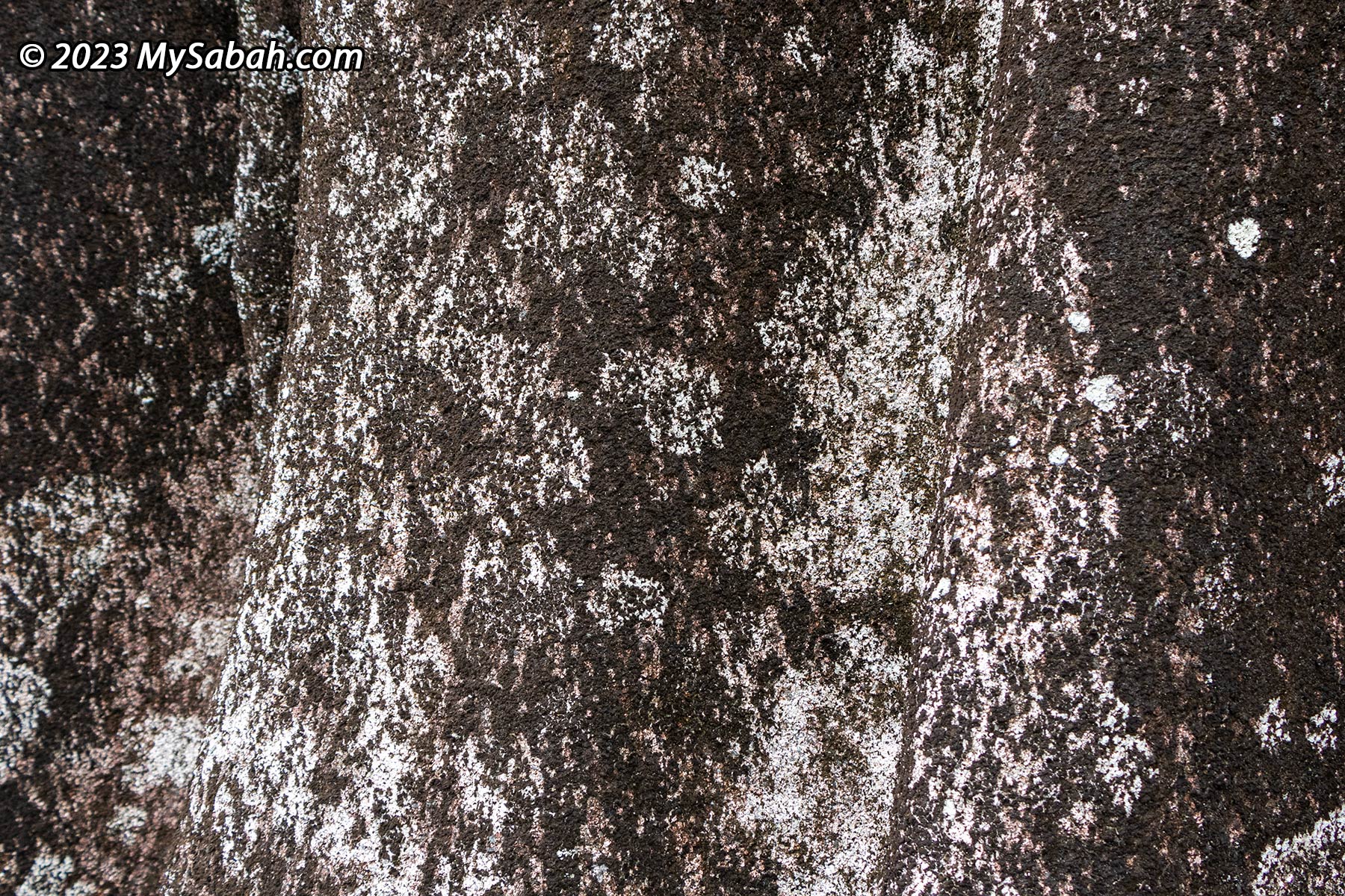
White mold on granite. Granite is commonly used in construction and building materials because it is a hard and tough rock.
The lesson is – never make fun of animals, which is a taboo in the cultures of Kadazandusun and Murut people in Sabah. In our belief, people who do this will anger the God. Batu Punggul pinnacle also has a similar story that involves a dog and chicken, and Watu Monontian (pregnant woman) stone is a result of forcing dogs and cats to dance.
Visit Topi Raja
Topi Raja is highly accessible by paved road (see Location Map), about 27 KM from Kota Belud town and 79 KM away from Kota Kinabalu City. The rock is situated on a 9-acre private land owned by a couple, Mr. Hsu Han Chun and Madam Agnes, who bought this land in 1961 and developed it into a recreation site named Topi Raja Mountain River View since 2014.
Fruits at Topi Raja Mountain River View. You would see durian and tarap fruits if you visit at the right time.
The entry fee to Topi Raja, which comes with a welcome drink, is RM5 per person. Besides photo taking with Topi Raja, you can visit around this place to explore the hanging bridge, swimming and fish feeding at river (but don’t catch any frog and lizard), garden and orchard (durian, tarap, pineapple, sacha inchi, etc.). You must apply mosquito repellent though.
Information board about the legend of Topi Raja in 3 languages (English, Malay and Chinese)
The place is completed with amenities (e.g. toilet, dining hall, cafe, gazebo, camping ground) and accommodation for tourists. For group activities. You may contact the owner in advance to prepare the services for you.
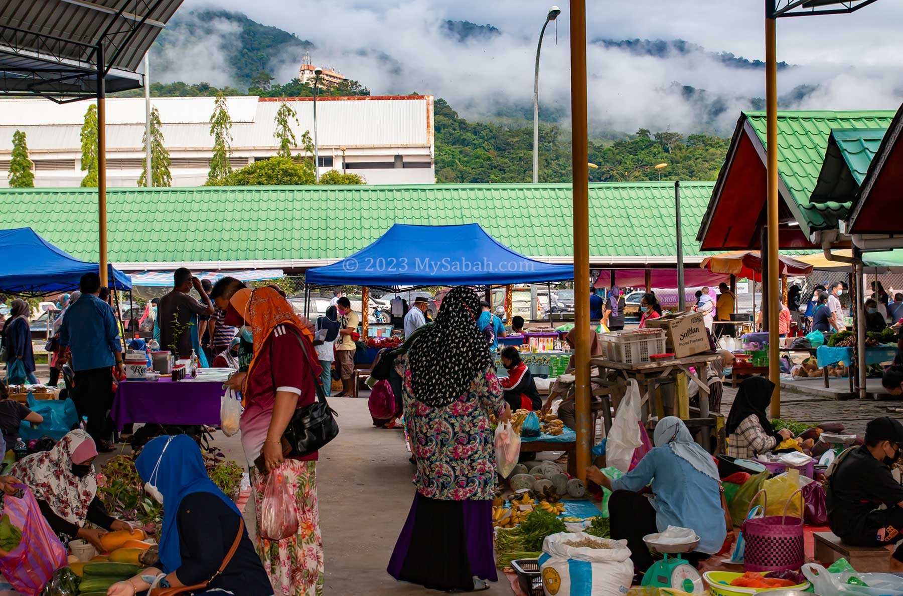
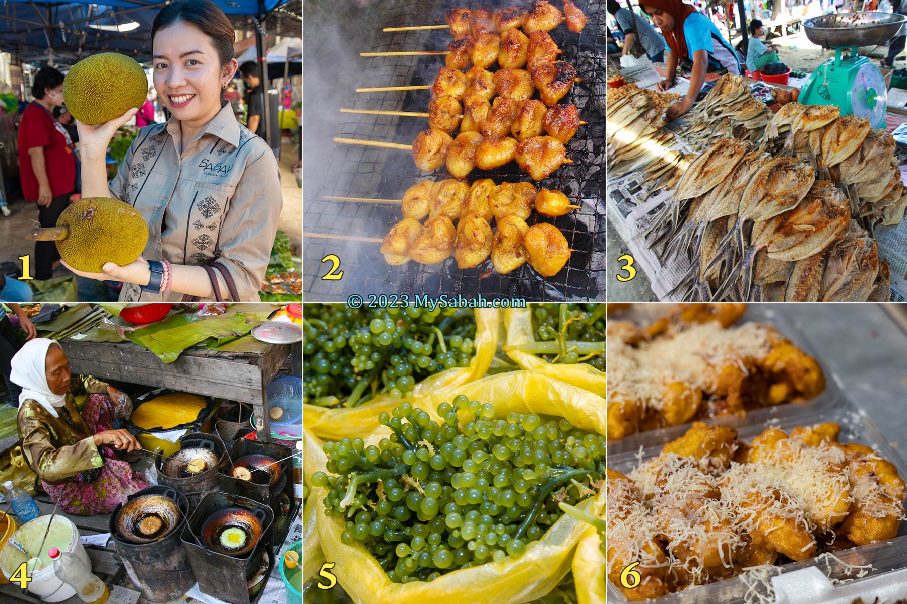
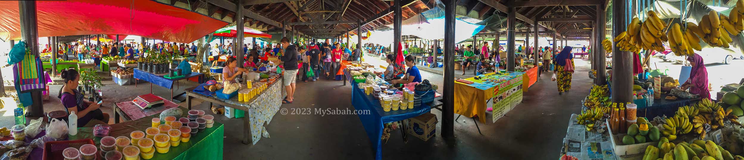
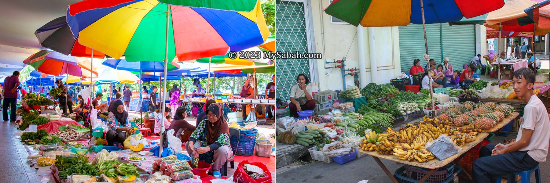
If you want to travel smart in Sabah, do not miss Tamu, the weekly (sometimes twice or thrice weekly) open-air native market in outskirts of Sabah. It’ll feel like a food and treasure hunting tour.
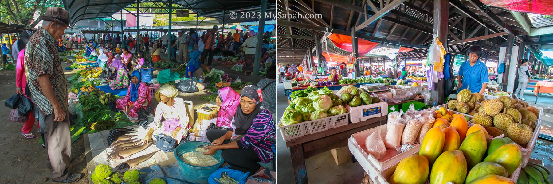
The beautiful tamu market of Tenom town. It’s just behind the central market in town centre.
The name tamu derives from the Malay word bertemu which means ‘to meet’ and it has been a place of congregation for farmers, fishermen, craftsman and traders for over 145 years. In old days there was no supermarket, so every districts held a weekly tamu for local villagers to meet, shop, and trade their produces at a designated location.
The colourful tamu of Sabah. Tamu are called differently by different ethnic groups in Sabah. The Dusun and Rungus people call it “Badi” while it is known as “Semio” by the Bajau people in Kota Belud. In the Tuaran district, it’s also called “Buul” for smaller native markets.
History of Tamu
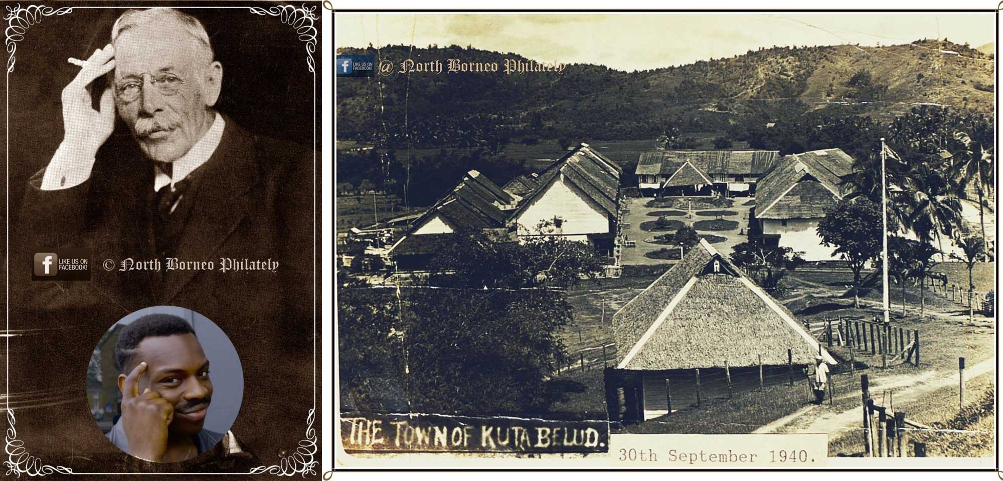
The first tamu of Sabah was started on 13 December 1878 in Kota Belud (Kampung Siasai) by William Pretyman, a political agent of British North Borneo (now Sabah). In his diary, William said the locals from different tribes were so excited to see the first tamu ground in preparation and kept on asking him the opening day of tamu. It’s a huge success as each ethnic group can offer certain goods that others don’t have. For example, a Dusun farmer can sell rice to a Bajau fisherman who would buy or barter trade it with fishes. Merchants from China and Brunei and also sourced many local products from tamu.
Left: the white man is William Pretyman. Look like a smart dude. Right: a photo of Kota Belud in 1940, taken by W.K.C. Wookey (courtesy of The Sabah State Archives). Both photos are from the Facebook of North Borneo Philately
The same goes to fruits & vegetables, traditional herbs, seafood, livestock, bushmeat, beeswax, textile, crafts and wide array of other produces, some carried by villagers walking over 10 KM to the marketplace. British rulers were also happy that different tribes could do business peacefully at tamu though tribal conflicts were common during that time. Brawls and weapons are prohibited in tamu. British officers also used tamu as a place to distribute news. Locals people from different villages mingled and exchanged news at tamu too. Though British had left Sabah in 1963, tamu is still an integral part of rural economy.
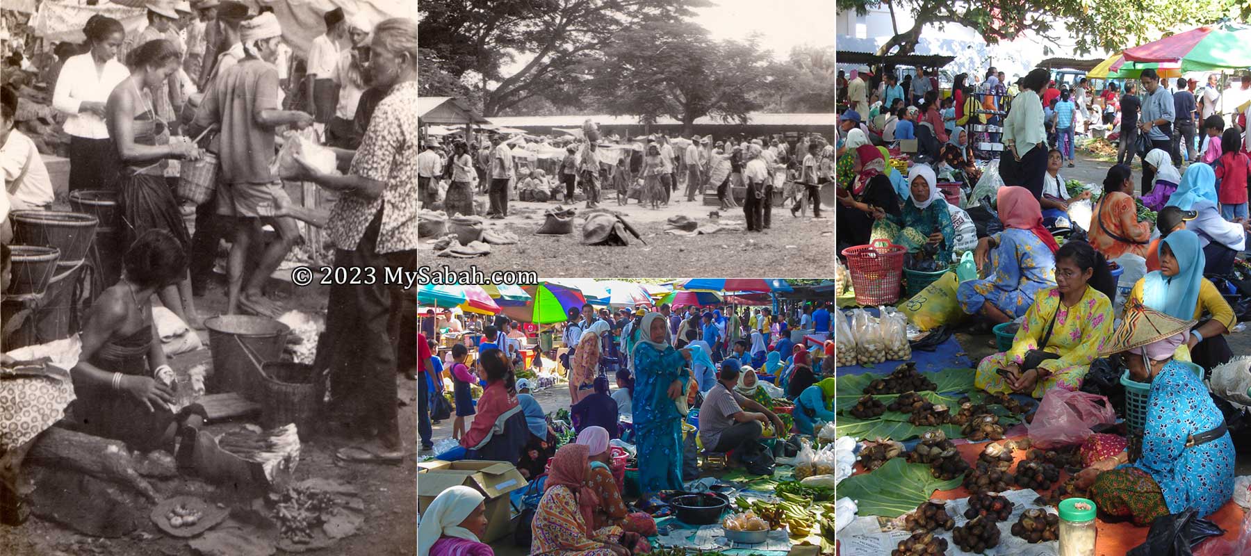
Past (1970s) Vs Present Tamu of Kota Belud
Why Tamu is Fun for Tourists
What’s the point of visiting a new place if you don’t experience any cultural shock? Your travel agents always “protect” you from something that you aren’t accustomed to. For example, if you are a European, they will never serve you durian fruit. If you are a Korean tourist, they will make sure that your plate always has Kimchi. You don’t eat and live like a Sabahan.
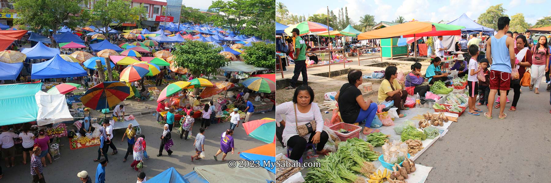
Tourists shopping at tamu of Keningau (left) and Papar (right) towns
A tamu provides an authentic encounter with the rich cultural, culinary and traditional aspects of the lives of Sabah’s many ethnic groups. The best ways to enjoy a tamu tour are:
Explore some interesting or “weird” items. Feel the sights, sounds and smells of tamu.
Sample local snacks, pastries, cakes, fruits, food and drink.
Interact with the local people. Observe what they do, e.g. chewing betel nuts and carrying stuffs in traditional baskets
Shop for souvenirs, handicrafts, tapestry, trinklets and other handmade crafts.
Vendors of the tamu of Papar, Keningau and Bongawan. The locals could be a bit shy but they are friendly people.
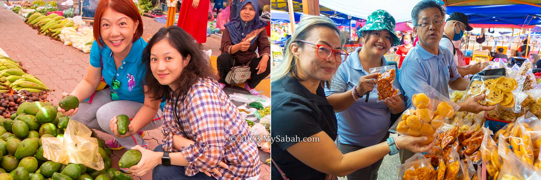
The bonus is you could get something cheaper than normal retail prices, if you are good at haggling. You are helping the small sellers too, like an elder villager or a start-up baker who needs extra income to support their families.
What to Buy
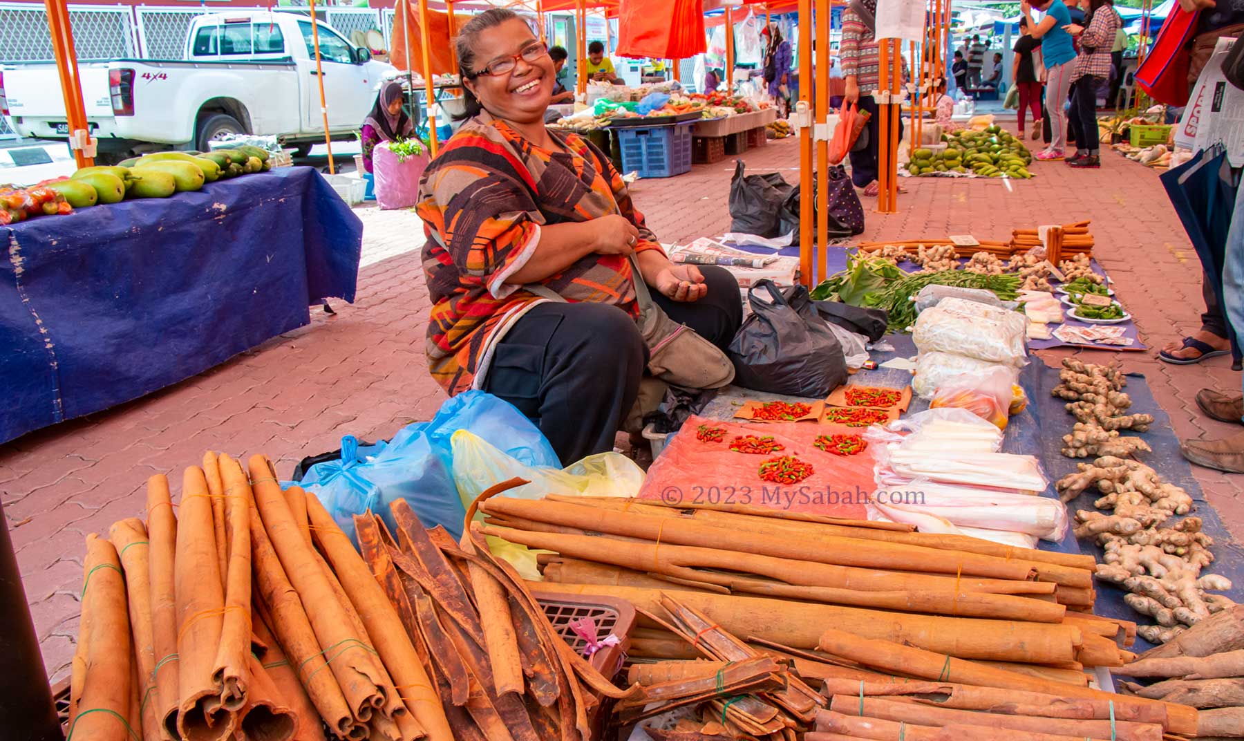
Every tamu are selling different things, based on the composition of local ethnic groups, agriculture and cultures. For example, Kundasang tamu is popular for highland vegetables, and Keningau tamu is the best place to buy hill paddy and cinnamon.
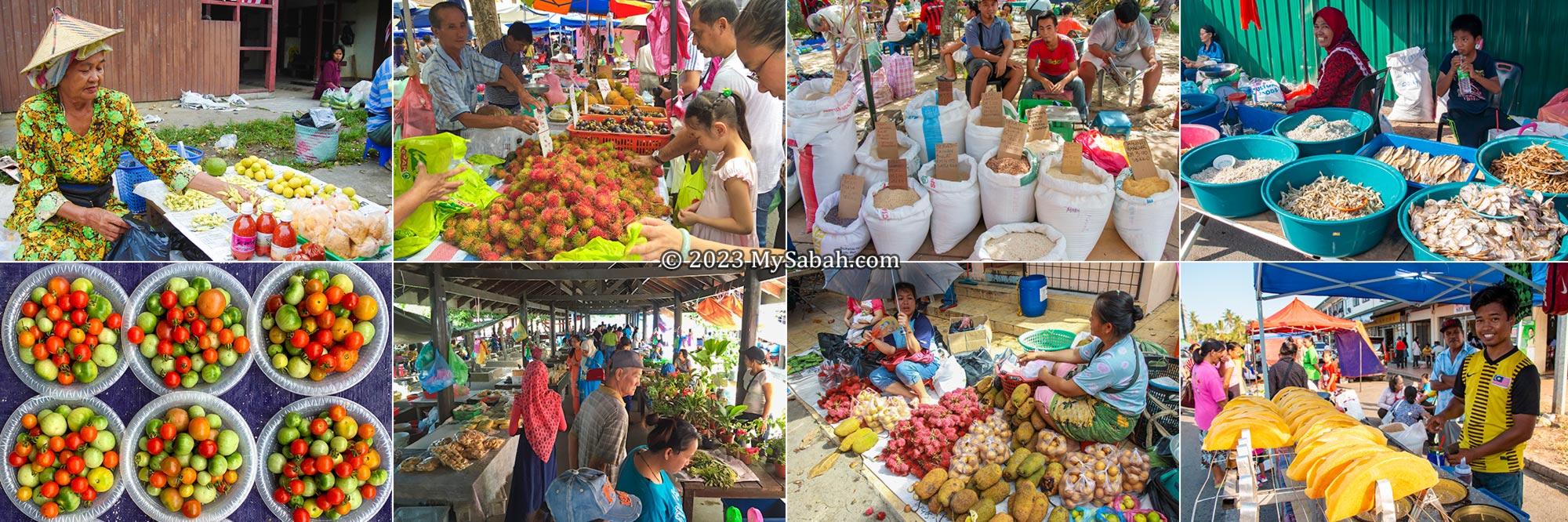
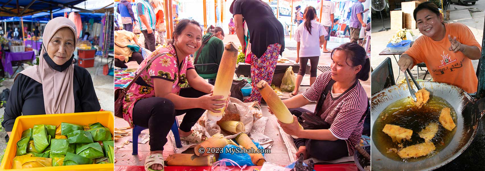
Things to buy or try at tamu. 1. Tarap fruit (seasonal), 2. Chicken tail satay, 3. Salted fishes, 4. Penjaram cake, 5. Latok seaweed (or sea grapes), 6. Fried banana fritters with cheese (pisang goreng cheese)
The following are some good (safe) starters for first-time visitors (Note: some fruits are seasonal):
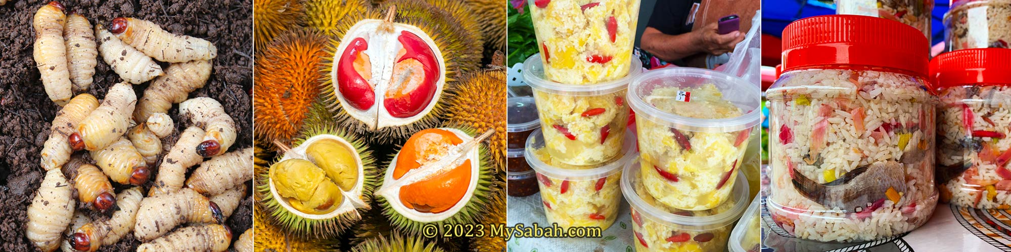
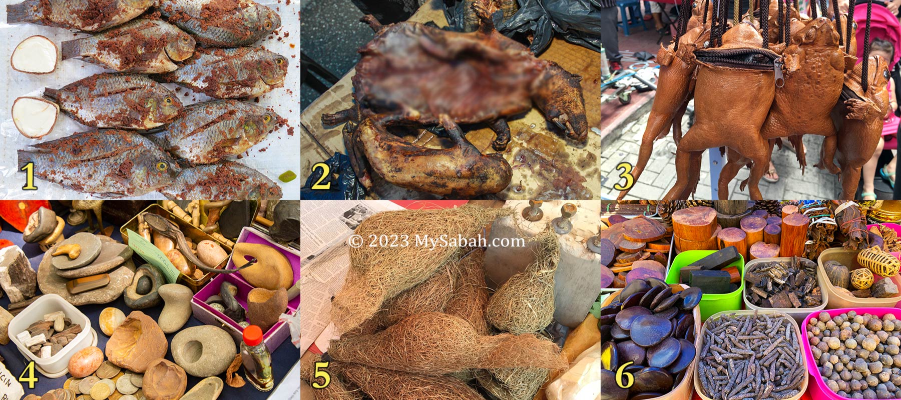
Expect to see something unexpected at tamu of Sabah, for examples, 1. Fishes fermented by grounded pangi seeds (look dirty but very delicious actually), 2. Bush meat, 3. Giant toad purse, 4. Magic rocks? 5. Weaver bird nests, 6. Various wood and herbs
Tamu sells mainly locally-grown fruits & vegetables, meat and poultry, fresh and dried seafood, food and snacks, but you still can find almost everything at tamu such as herbs, tobacco rolls, toy, shoes, clothing, flowers, pet, electronics, gadgets, tool kits, kitchenware, jewelry, accessories and imported goods. When there was almost no restriction in the past, I could even find protected wildlife (e.g. slow loris, pangolin, turtle eggs) for sale at tamu.
Best Tamu to Visit
No two tamu are the same. Every tamu is unique and has its own charm. If I must recommend one or two tamu, I will go for tamu of Kota Belud and Donggongon town. I also had a wonderful time at the tamu of Tenom, Tuaran and Keningau.
Tamu of Kota Belud (left) and Donggongon (right)
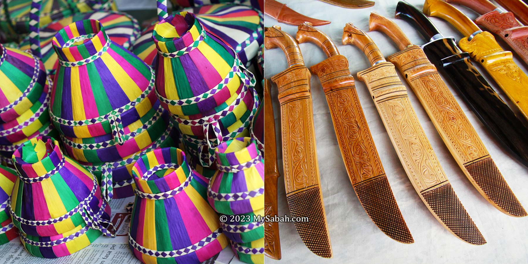
Kota Belud Tamu is the mother of all tamu. Most of the sellers there are Bajau people, the Cowboys of the East, and they are very skillful in making yummy snacks and colourful handicrafts. Walking around the Kota Belud tamu, you would notice the vibrant colours tudung duang, a popular handicraft made of dried screwpine leaves and used as a food cover. The Bajau is also well-known for making of intricately designed parang (machete).
The best time to visit Kota Belud tamu is during Tamu Besar Kota Belud, an annual cultural carnival in October, with an exciting line-up of activities such as dance performances, cultural shows, traditional games, buffalo races and horse-riding parade.
Tudung duang (left) and machetes (right) made by Bajau people
Only 8.5 KM away from Kota Kinabalu City, Donggongon is an important town of Kadazandusun, the largest indigenous people of Sabah. Donggongon Tamu takes place every Thursday and Friday (6am-6pm). The Donggongon Tamu offers a myriad of merchandises, ranging from local delicacies and handicrafts to fresh vegetable produce and livestock. Both villagers and city people love to shop here, turning this marketplace to a bustling trade and cultural hub that is unique to the Penampang district.
Tamu of Donggongon is open from 6am to 6pm every Thursday and Friday. Actually the market has started in the evening of Wednesday.
Gaya Street Sunday Market in the city centre of Kota Kinabalu is also the favourite open-air market of tourists. Technically, it is not a true tamu. Instead of selling raw vegetables and meat, the vendors sell mostly finished products that target at tourists and city folks. Anyway, it’s worth checking out.
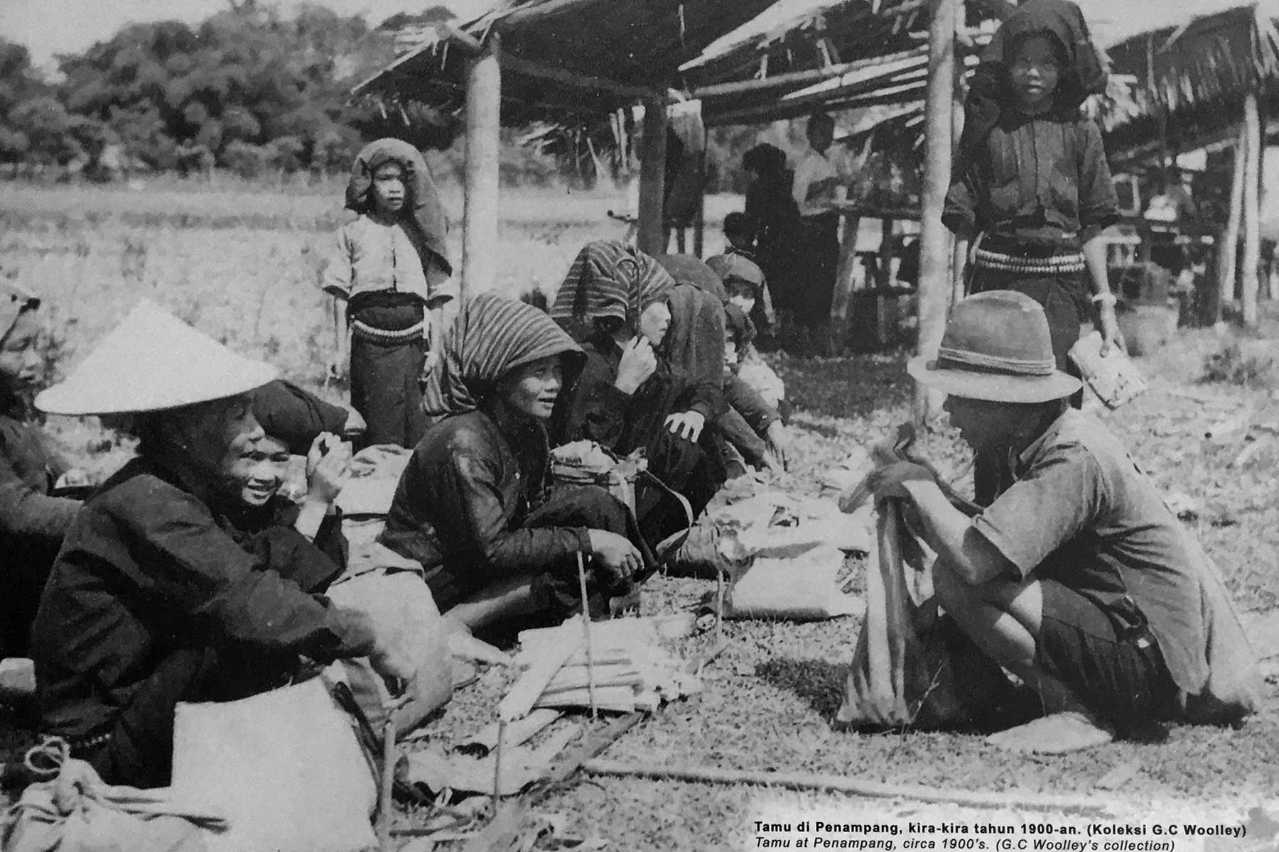
Photo of Penampang tamu taken by G. C. Woolley more than a hundred years ago
Tamu ground of larger towns have overhead roof, sheltered stalls and cement floor, so you don’t need to shop under the hot sun or walk on the mud after rain. For other tamu, all the traders need are just a parasol or a shade under big tree, and a ground or pavement to lay their items. Some tourists may enjoy the feeling of such a rustic tamu.
Opening Days of Tamu
Sabah has over 40 tamu in different towns and districts today. Most tamu open as early as 6am and close by 12pm. Different districts has different tamu days, here’s the list of their opening days (some open more than once a week).
Keningau, Kota Belud, Kota Kinabalu (Gaya Street), Kota Marudu, Membakut (new township), Papar, Putatan, Sook, Tambunan, Telupid, Tuaran
Opening days of tamu in Sabah
Tamu of Keningau (left) and Bongawan (right)
Just a trivia for those who are interested in local history. If you look around tamu ground, you would find a medium or big old rock that symbolizes the “contract” among tribes to guarantee honesty, fairness and trust, and to punish those who cheat, quarrel or swear within tamu market.
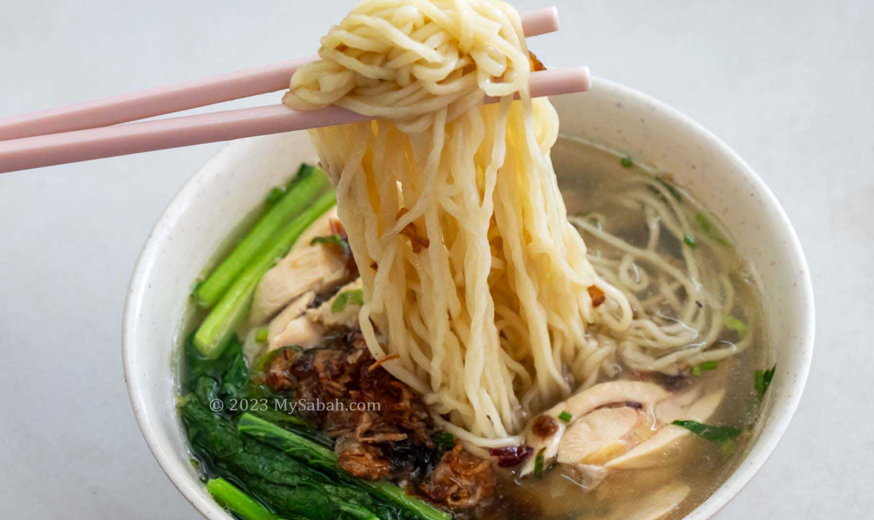
Good food doesn’t need any advertising because by words of mouth, eventually everyone will come for it. Mee Sup Kota Belud (or Mee Sup KB in short) is one of them. I had first taste of this delicious noodle soup in Kota Belud town more than 10 years ago, in a food stall behind the Bangunan Usia building. Only the local folks know this “hidden” corner. Now Mee Sup KB is well-known and even available in some cities of Peninsular Malaysia.
Mee Sup Kota Belud is the iconic noodle of Kota Belud
Mee Sup Kota Belud literally means Kota Belud Noodle Soup, which is named after Kota Belud, a small town about 60 Kilometres away from Kota Kinabalu City (KK). Mee Sup Kota Belud is like the noodle soup version of the famous Hainanese Chicken Rice, which allows you to taste the flavour of chicken fully.
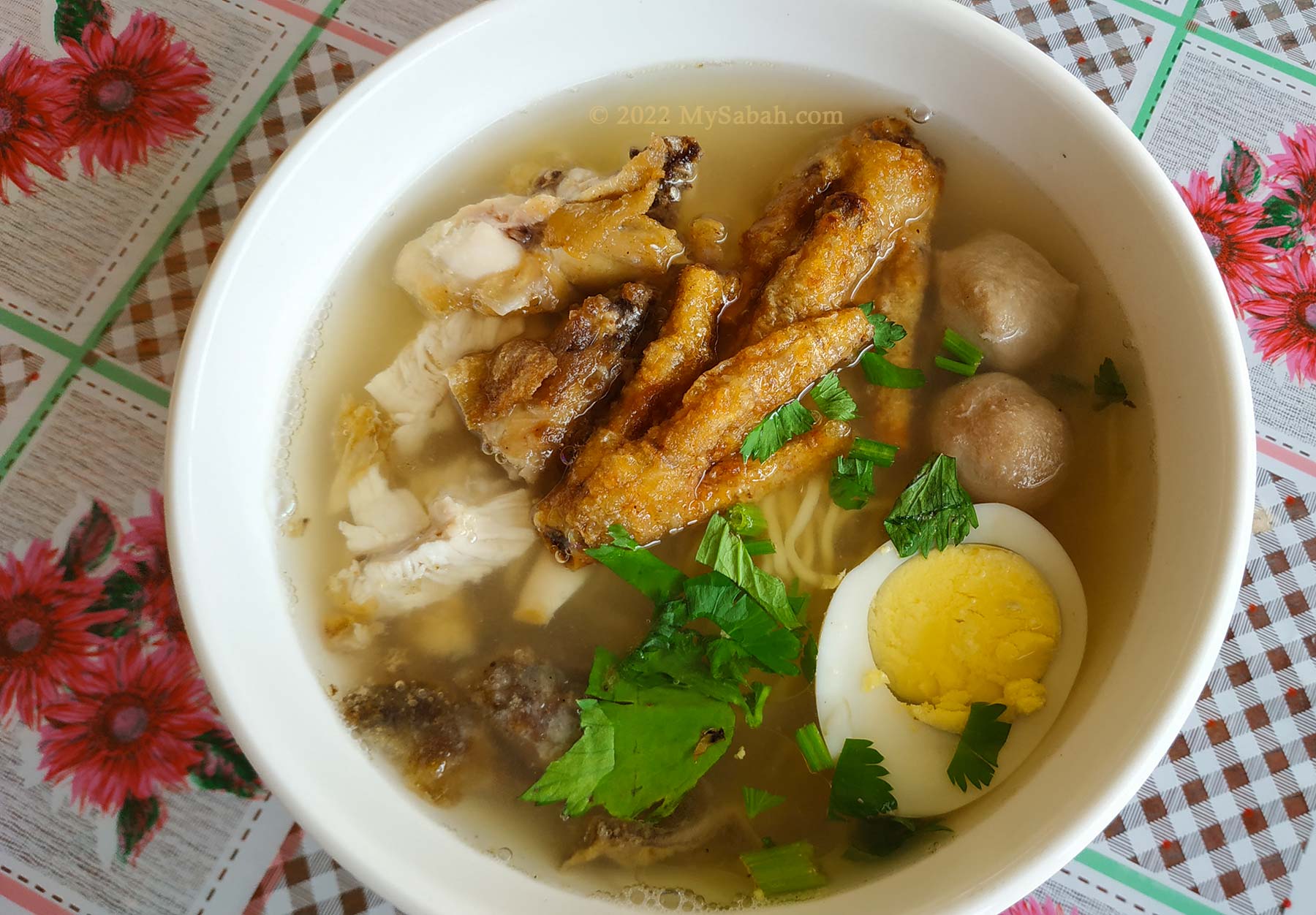
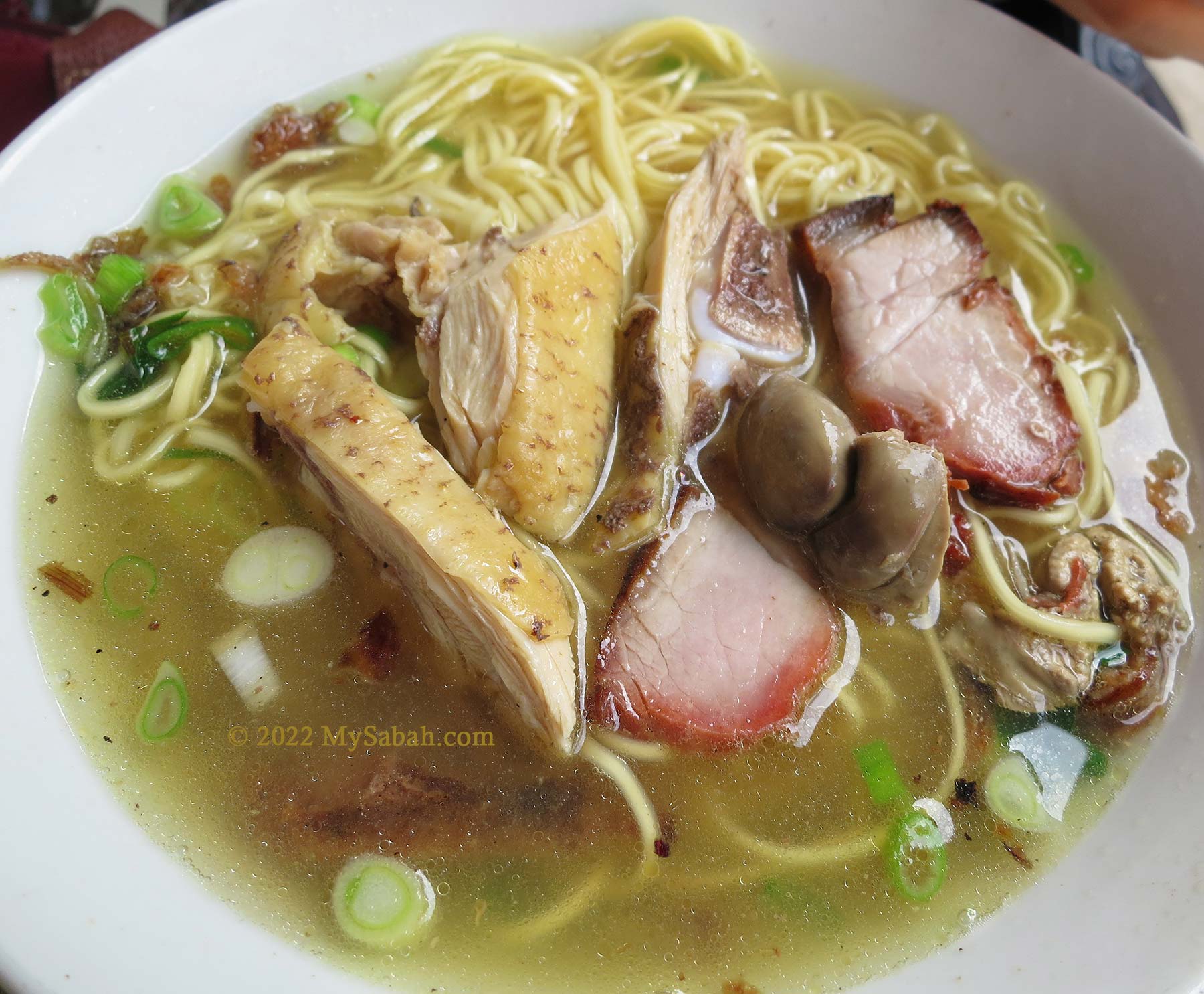
Mee Sup Kota Belud (Kota Belud Noodle Soup) with egg, chicken feet and meatballs
There are four things that make Mee Sup Kota Belud so mouth-watering: 1) savoury chicken soup, 2) aromatic fried shallot, 3) tender chicken meat, and 4) noodle that absorbs all the goodness in soup. It tastes the best when fresh drumstick and vegetables are used.
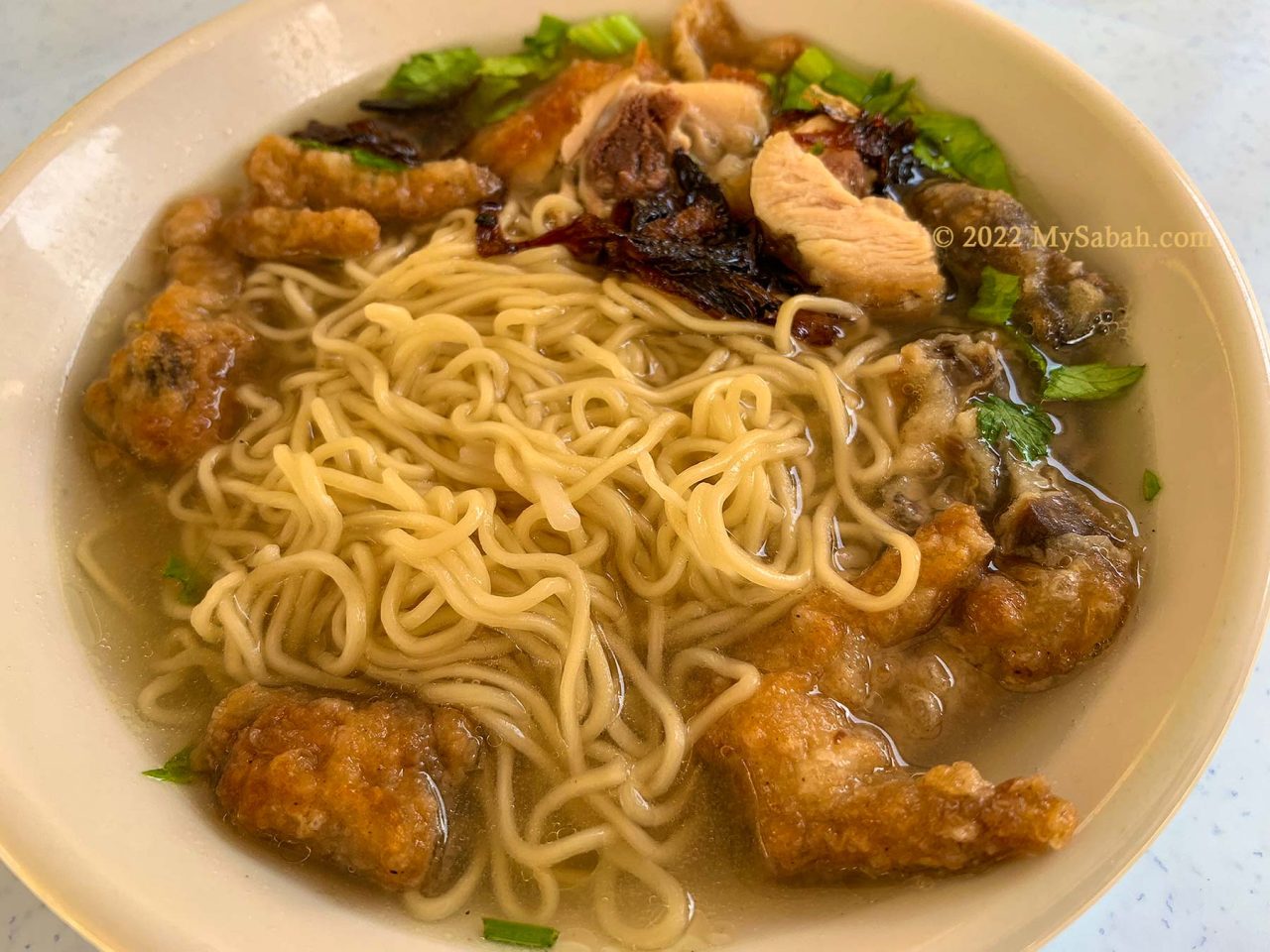
Mee Sup Kota Belud with Cha-Shao (barbecued pork) slices, chicken meat and chicken heart
Mee Sup Kota Belud is quite simple to prepare. The most important part is the chicken soup. Chicken meat is boiled in hot water first. Then ginger, pepper, lemongrass, garlic, chicken stock / bouillon cubes and a bit of MSG would be added to the soup to enrich the flavours. Lastly, hot soup is poured on the noodle and chicken meat, with some fried shallot on top as a finishing touch.
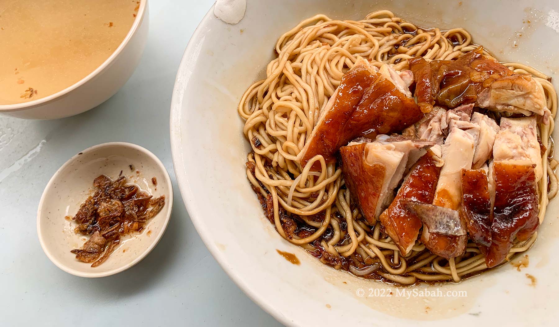
Mee Sup Kota Belud of konlou (dry) type (without soup)
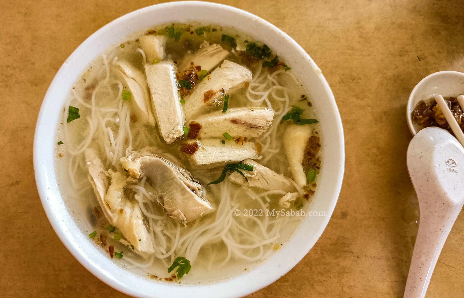
The classic Mee Sup Kota Belud, which is served with yellow noodle and chicken pieces in soup is the style I love. Some shops add cha-shao, meatballs, boiled egg, chicken feet, chicken heart, or green vegetable leaf to create a more fancy dish. You also can order Kota Belud Noodle Soup in konlou (dry) or mee hon (rice noodle) style.
Mee Sup Kota Belud (mee hoon or rice noodle type)
Adding a bit of calamansi lime juice (limau kasturi), coriander, or chili sauce can spice up your noodle soup too.
Best Mee Sup Kota Belud
The following are the recommended shops for Mee Sup KB, based on public reviews and rating.
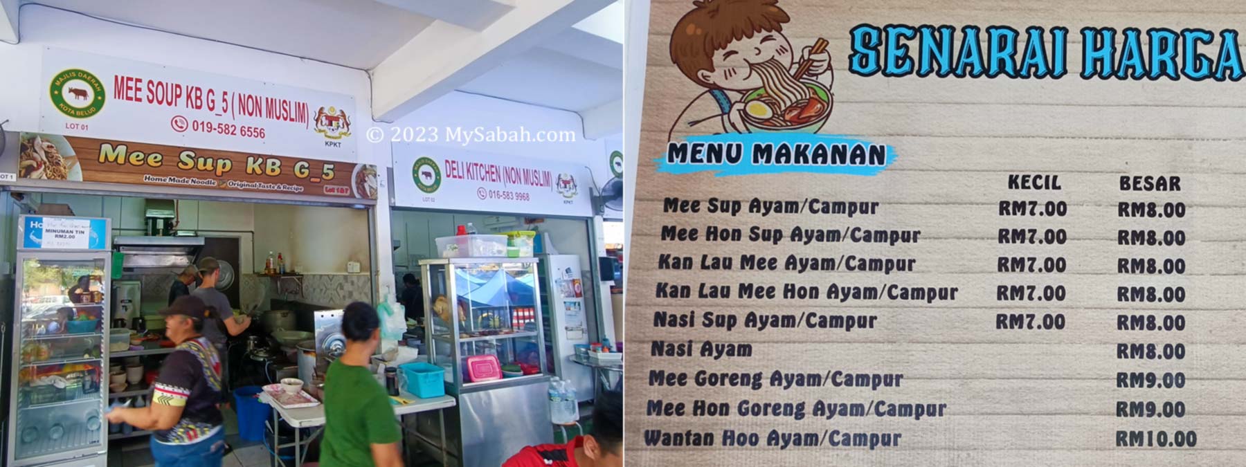
1. Kota Belud Town
You can have the authentic Mee Sup KB in a few places of Kota Belud, for examples, the food stalls at Bazar Rakyat Kota Belud (Location Map) and Sunday Tamu Market (Location Map).
Left: one of the food stalls at Bazar Rakyat Kota Belud. Right: menu and price list of noodles
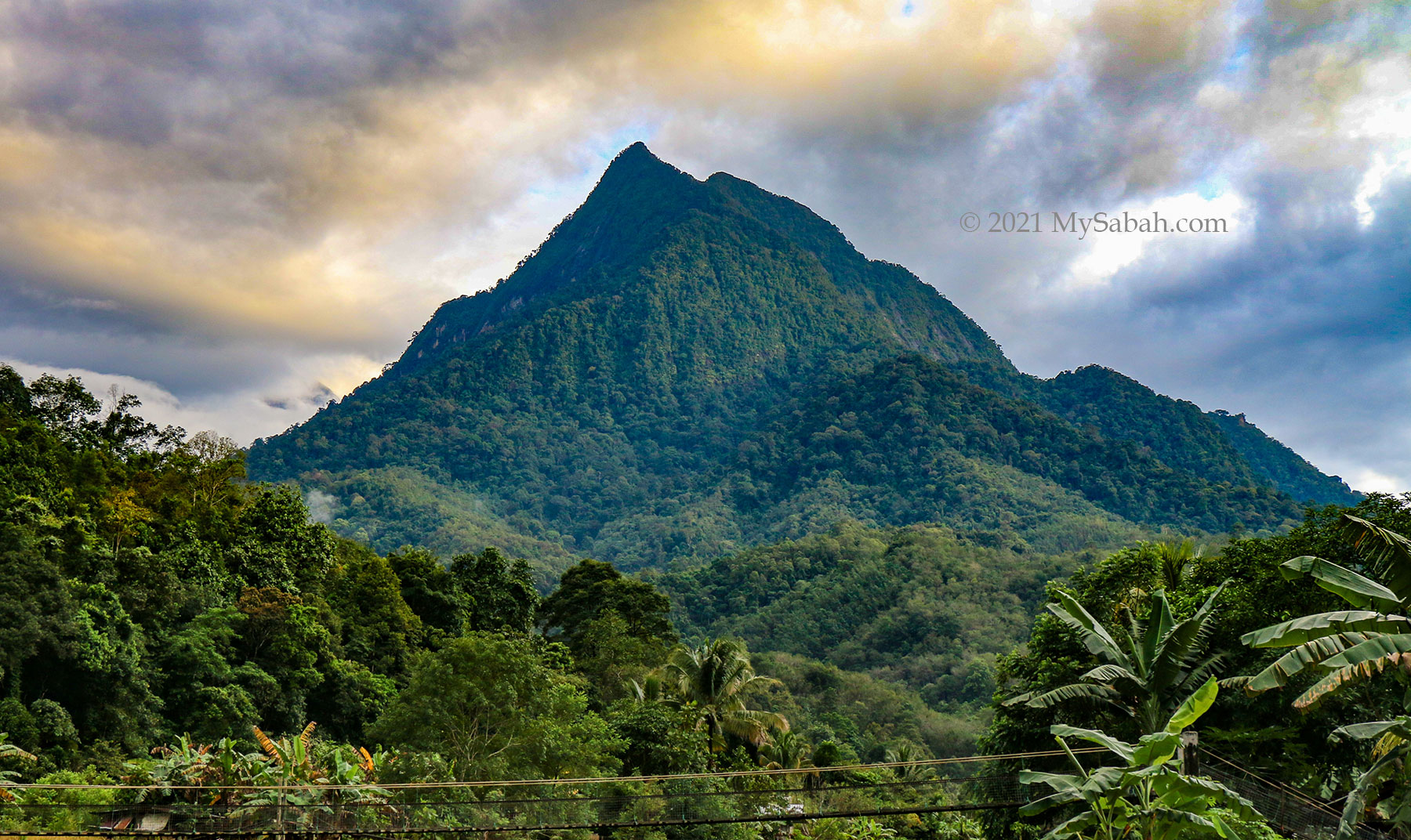
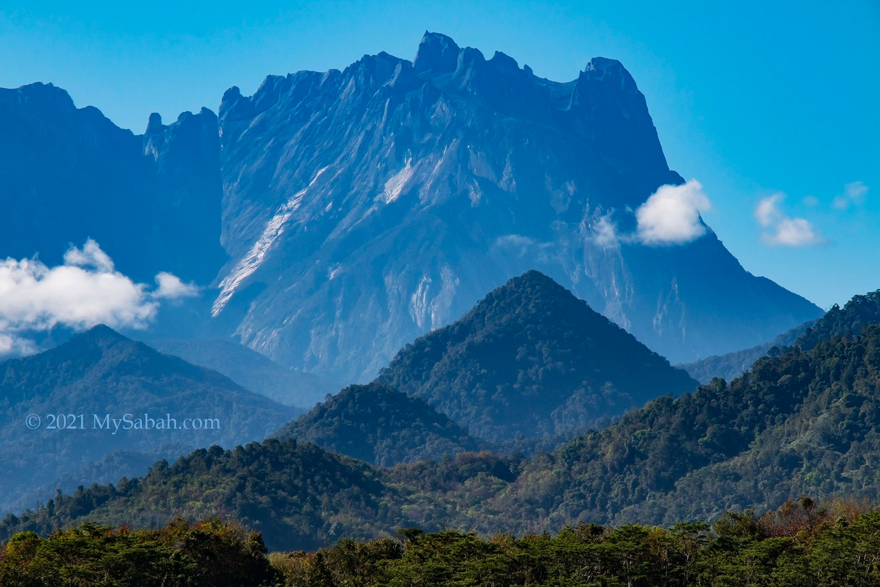
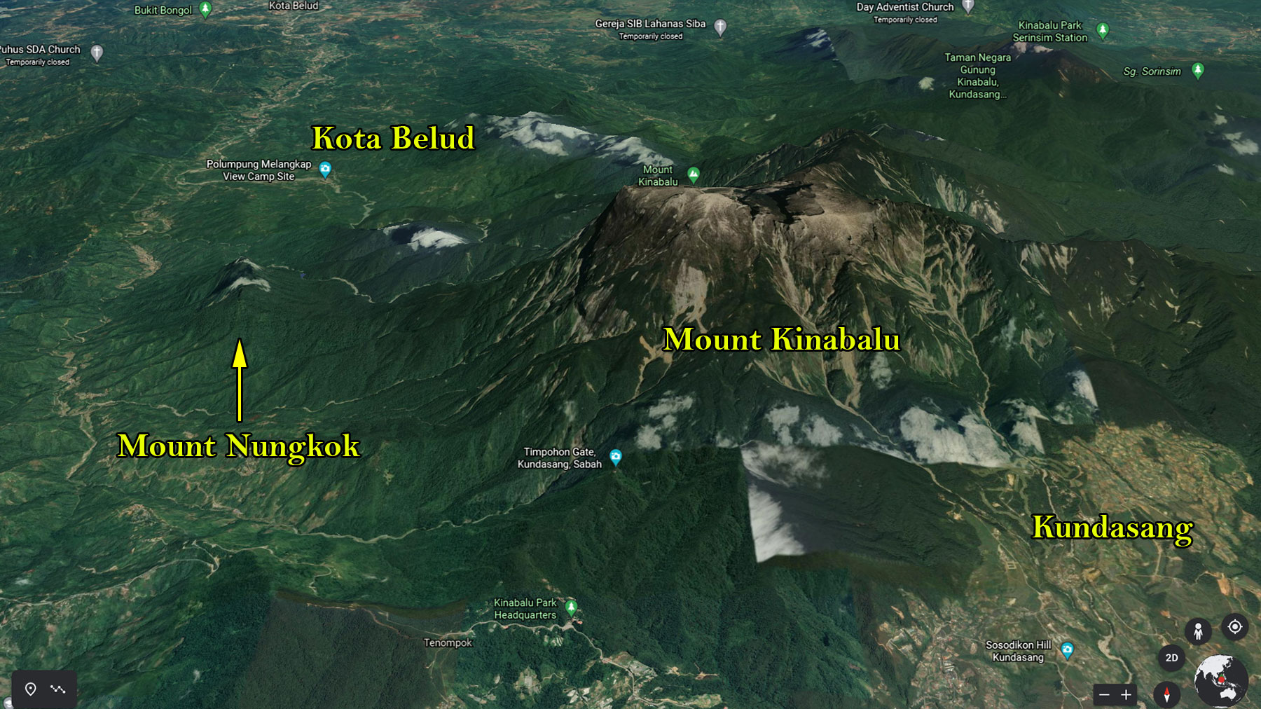
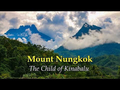
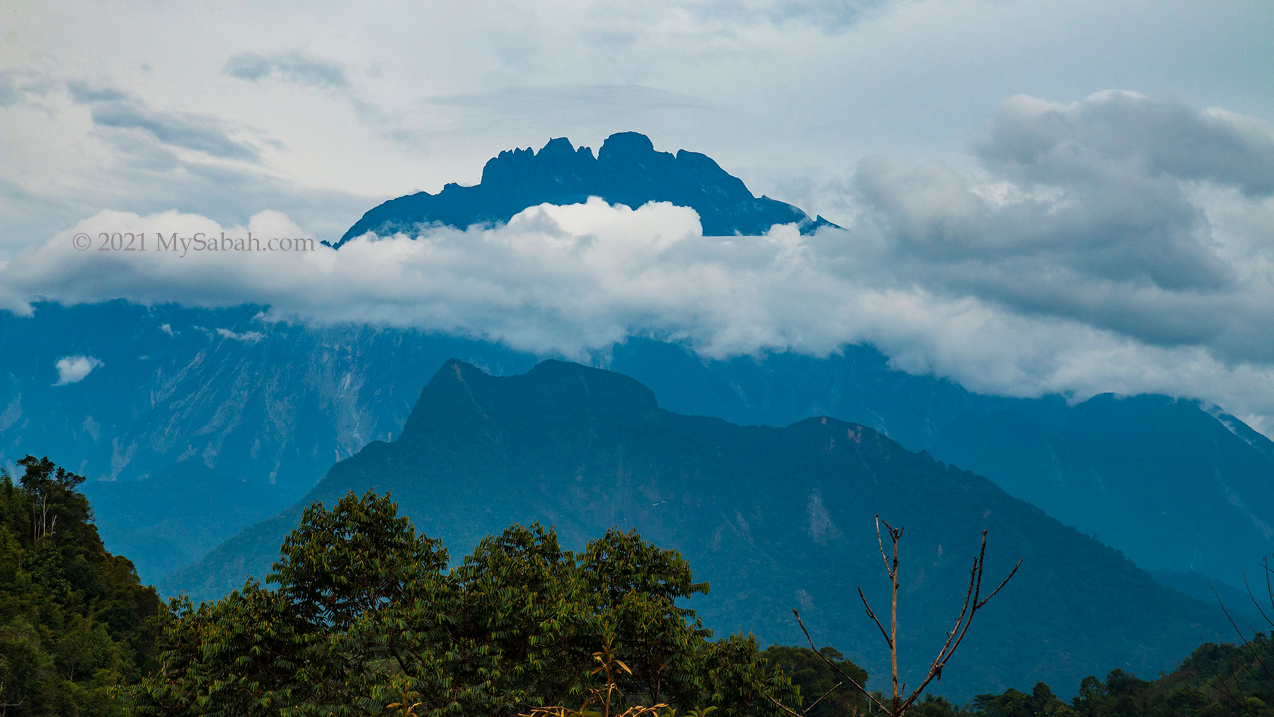
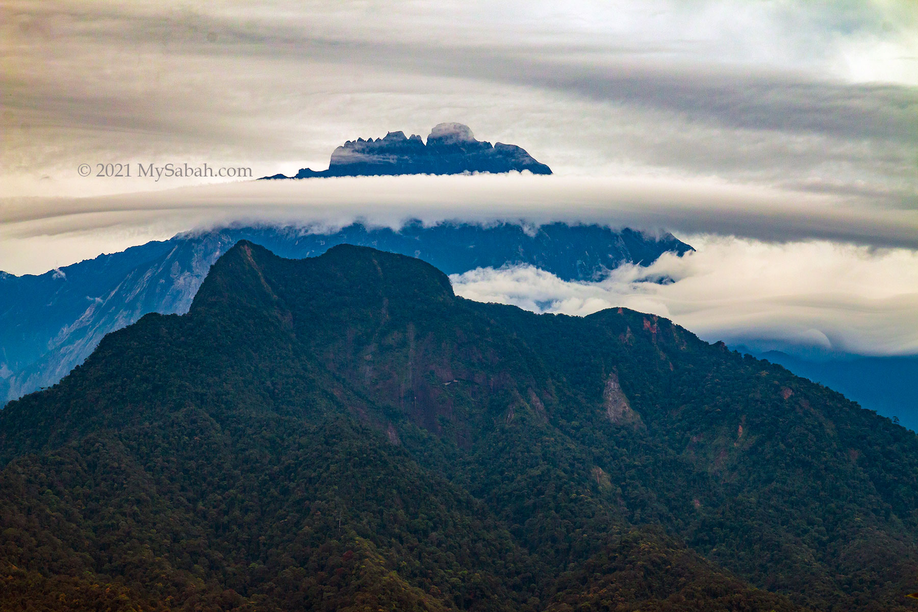
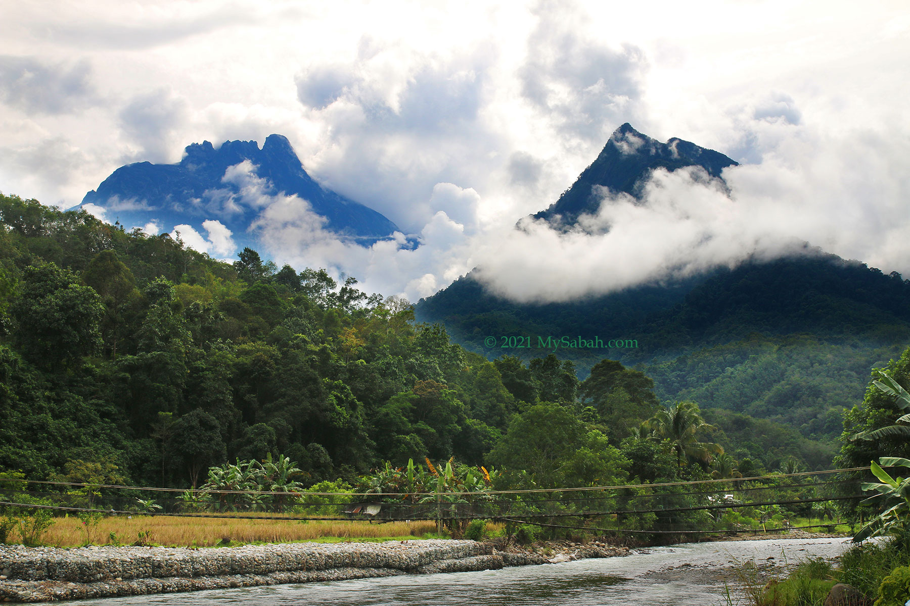
Mount Kinabalu is the highest mountain of Malaysia and Borneo. One of its legend says a woman was turned into Mount Kinabalu by her grief because after many years of waiting, her Chinese husband never returned, thus another nickname for Mount Kinabalu is China widow mountain. The story doesn’t end there. After she becomes rock, another mountain born in her village. That’s Mount Nungkok (Gunung Nungkok in local language), which is also known as Anak Kinabalu, means the Child of Kinabalu.
The distance between Mount Nungkok and Mount Kinabalu is less than 9 Kilometres.
Standing at less than half the height of Mount Kinabalu which is less than 9 Kilometres away, Mount Nungkok does look like a baby sitting at the feet of majestic Mount Kinabalu. Looking from the angle of Kota Belud, the ancient gateway to climb Mount Kinabalu, these two mountains are positioned side by side like twin mountains. No wonder people think they are parent and kid. When Mount Kinabalu is hidden in the cloud, Nungkok is sometimes mistaken as Kinabalu by non-locals.
Mount Nungkok is also part of Kinabalu Park, the first UNESCO Natural Heritage of Malaysia.
However, Mount Nungkok is not as famous as its parent and still a mysterious mountain. Same as Mount Kinabalu, Mount Nungkok is also part of Kinabalu National Park and have its flora and fauna fully protected by conservation laws. Climbers would spot blooming rafflesia flower, exotic orchid and endemic pitcher plant on this mountain, as well as wildlife such as deer and binturong bearcat. In the past someone mined gold in this mountain. I was told by village folk that there is a bat cave in Mount Nungkok too.
Mount Nungkok is located on the western side Mount Kinabalu near Kota Belud, so it is not visible in Kundasang and Ranau town at the east side.
Viewpoints for Mount Nungkok
The most interesting feature of Mount Nungkok is – it differs in shape if viewed from different locations, as shown in the time-lapse video below (I used over 1,200 photos to create this 4K video so please watch):
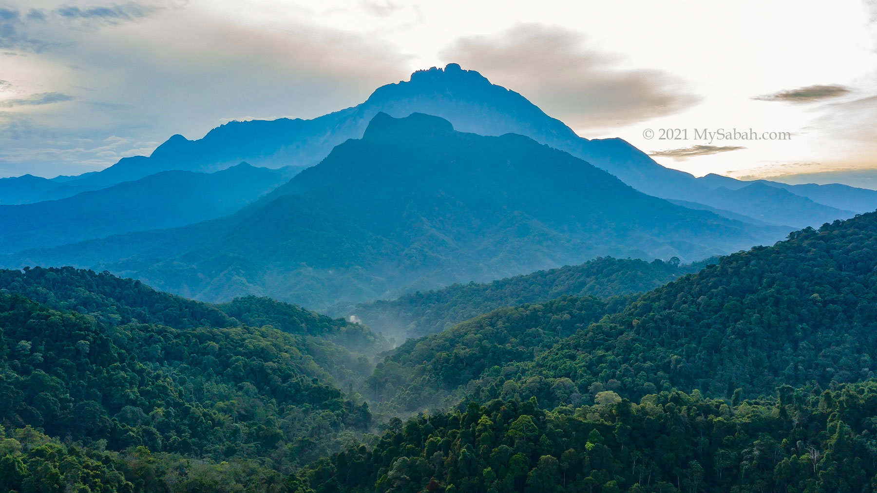
You don’t need to travel more than two hours to have a spectacular view of Anak Kinabalu. You have better chance of seeing it before 8am during fair weather, both mountains covered in dense mist after 9am in most days.
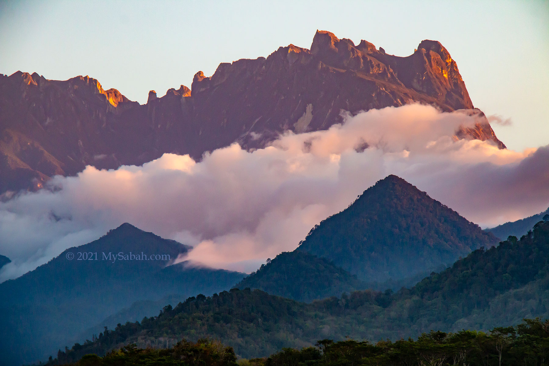
Mount Kinabalu and Mount Nungkok lit up by the afternoon sunlight. The mountains would turn reddish during sunset.
1. Kota Belud
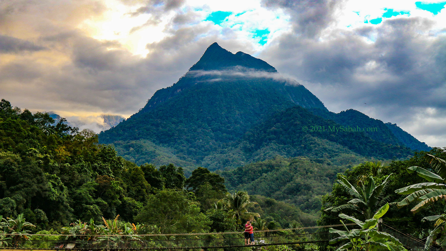
The view of Mount Nungkok is the most prominent in Kota Belud district, especially at Kampung Tambatuon village, where you can see both mountains up-close. There are dozens of homestay and camping ground around Kota Belud, in case you love mountain and countryside view so much.
Mount Nungkok (Gunung Nungkok) is also known as Anak Kinabalu (Child of Kinabalu). Note the couple taking selfie on the hanging bridge of Tambatuon Village.
In Tambatuon, Mount Nungkok looks like a pyramid mountain with pointy peak. I always imagine that I stand on that tip, it must be a great feeling up there.
View of Mount Nungkok at Tegudon Tourism Village (Kota Belud)
You also can have a clear view of Mount Nungkok at Tegudon Tourism Village and Kampung Kiau.
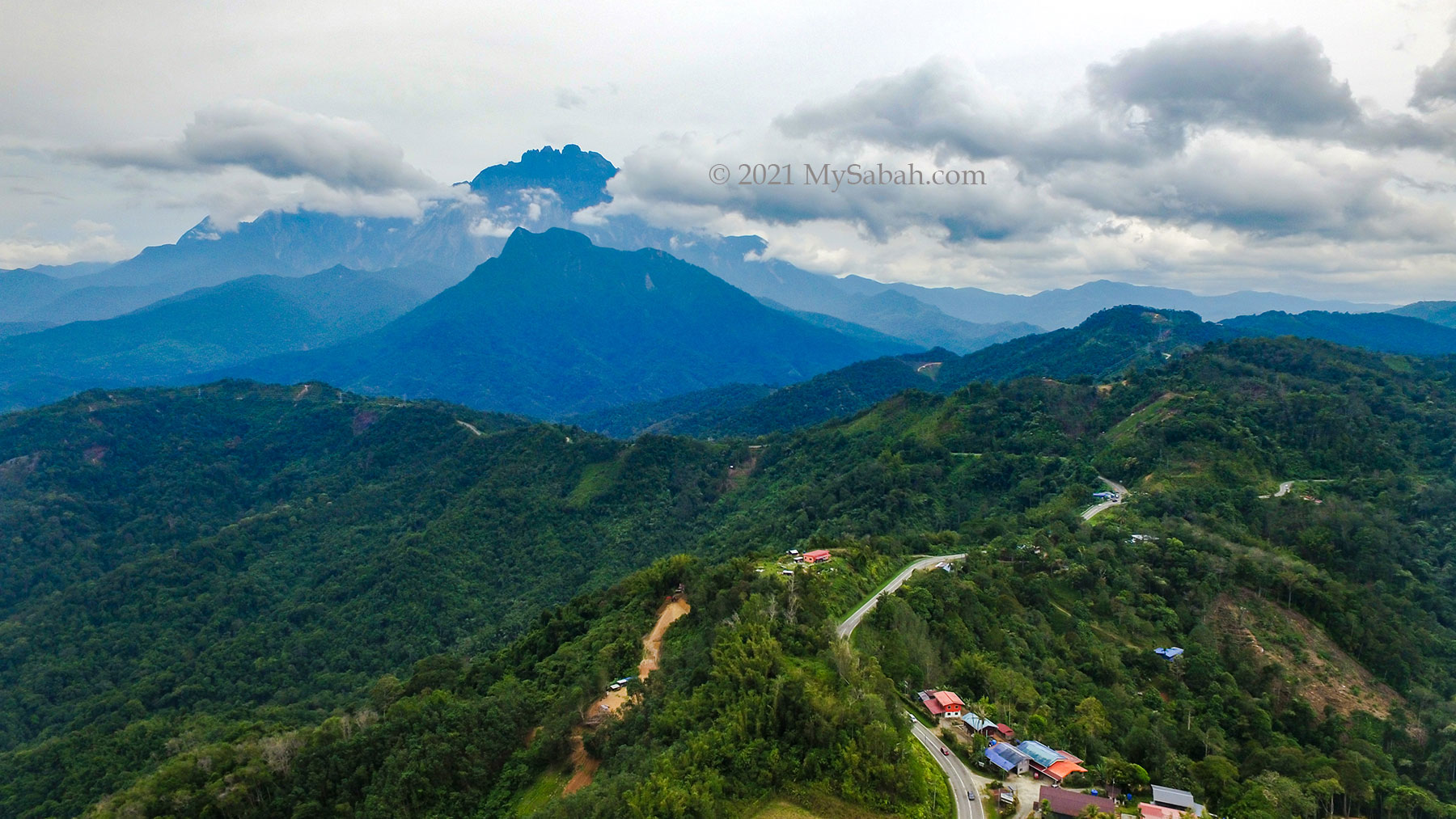
2. Kota Kinabalu-Tamparuli-Ranau Highway
This is the most convenient option and can be a fun stop for your road trip to Kinabalu Park, Nabalu or Kundasang. For only an hour of driving on a paved road that connects Kota Kinabalu (KK) to Ranau town, you can see Mount Kinabalu and Mount Nungkok from inside your car.
In clear day, you can see Mount Kinabalu and Mount Nungkok from the KK-Ranau highway.
The best viewpoint is along the road about 38 to 42 Kilometres before Ranau town. However, most of the time the view is obstructed by trees and knolls, you can park at one of three toilet stops listed below and use their platforms for an open view. They open from 6:30am to 5pm. The fee to use their toilet is RM0.50. Snacks and drink are available for sale.
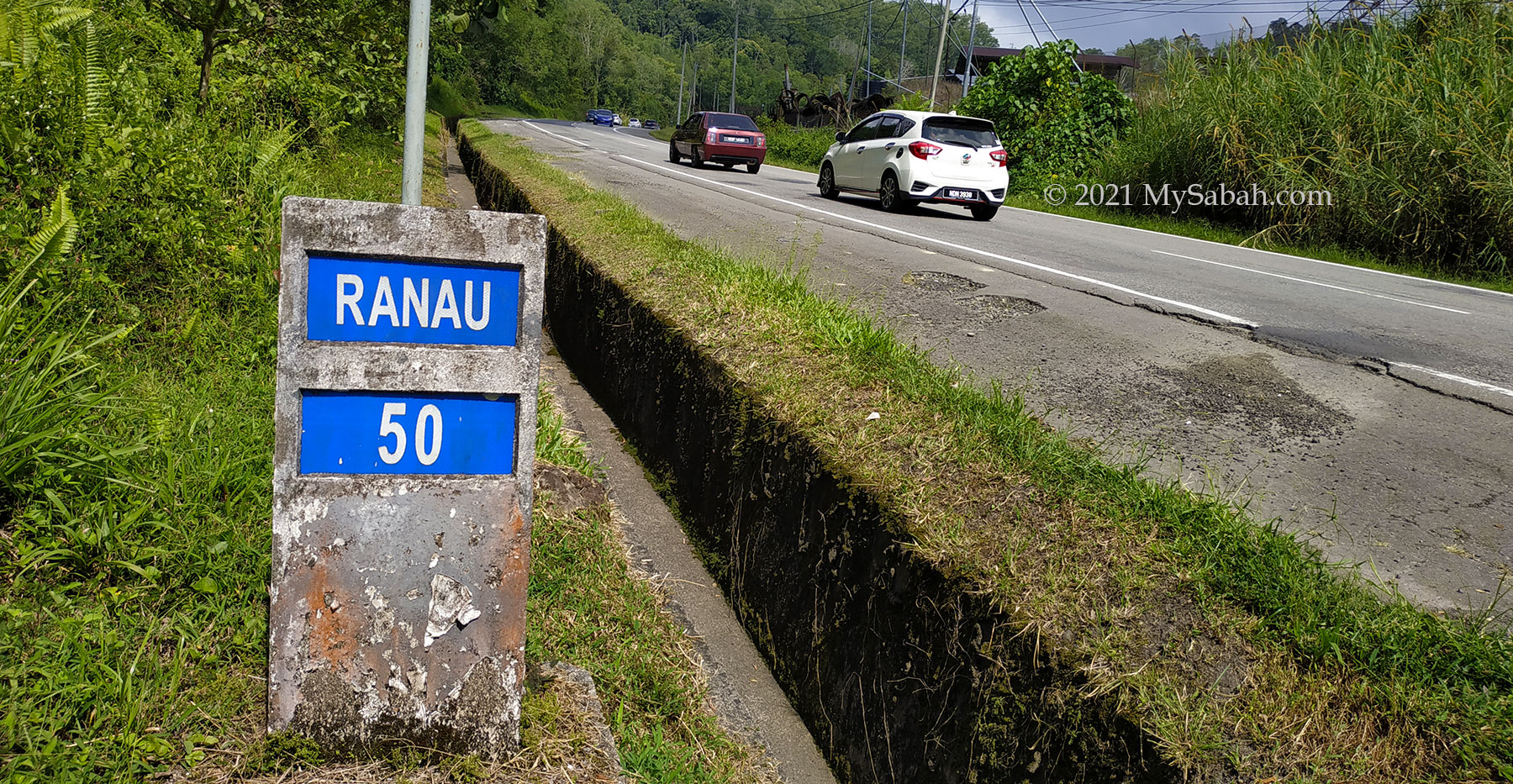
The milestone used in Sabah road. For example, this milestone shows the remaining distance to Ranau town is 50 Kilometres. I’m using this to mark the locations and section of the KK-Ranau main road.
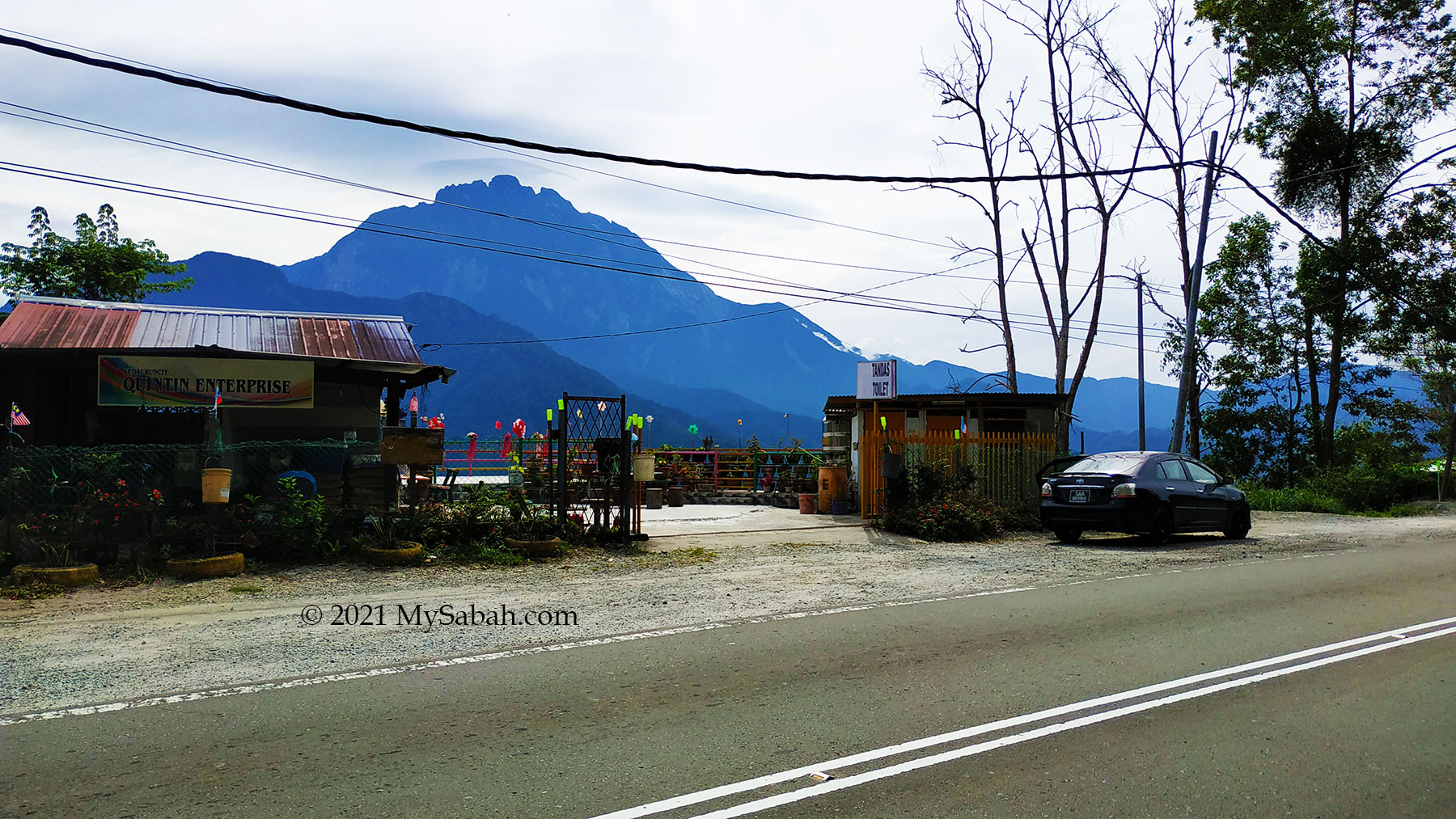
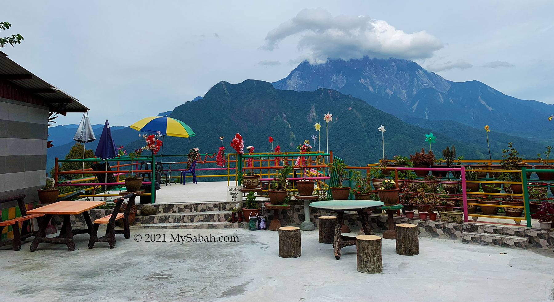
1. Quintin Enterprise
Location: 42 KM before Ranau (GPS: 6.088557883280411, 116.43687023602439, see Location Map)
View Point at Quintin Enterprise shop about 42 Kilometres before Ranau town
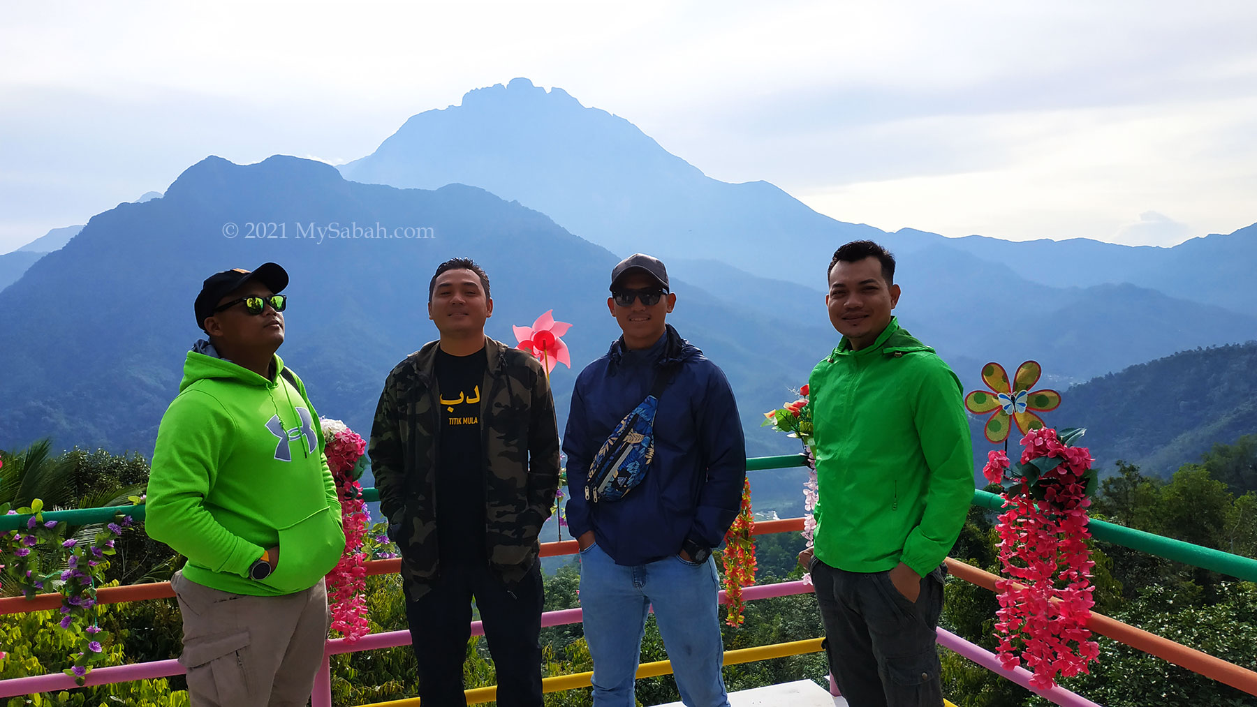
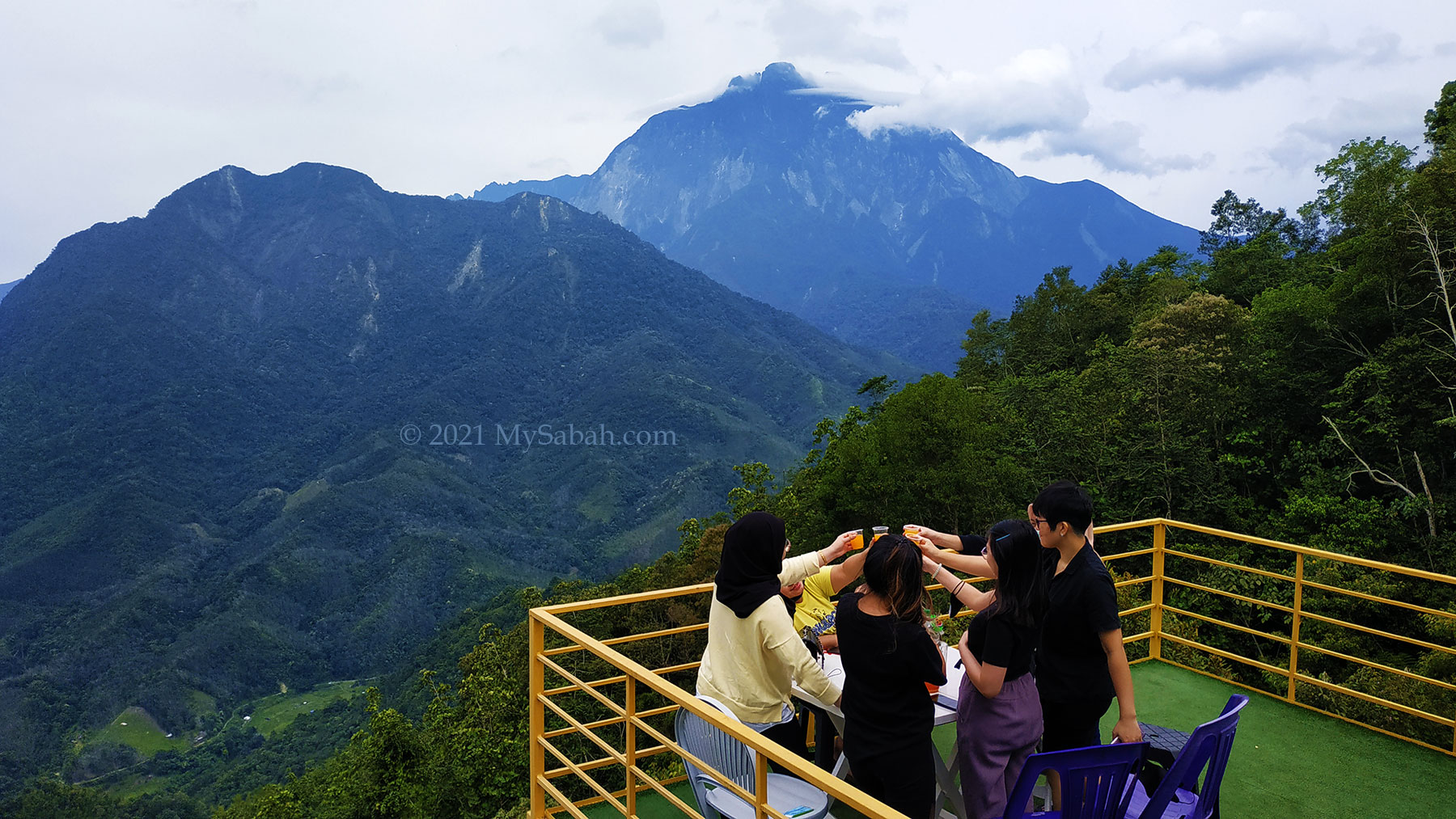
Besides toilet and a grocery store, this stop has a decorated and Instagramable platform (entry fee is RM1 per person) for a wide and nice open view of Mount Kinabalu and Nungkok. This platform is great for launching and landing my drone safely too.
View point platform of Quintin Enterprise. You can get yourself a cup of hot coffee and sit there to appreciate the view.Tourists enjoy the twin mountains view on the platform
2. Peranggi View Point
Location: 40 KM before Ranau (GPS: 6.076247258484695, 116.44161145366436, see Location Map)
Toilet stop and grocery shop at Peranggi View Point (in Kampung Kaung Lapai) about 40 Kilometres before Ranau town
Peranggi View Point is a bigger area with many parking lots. They have small grocery store and canteen that sell snacks, buns and drink.
The viewpoint platform of Peranggi View Point
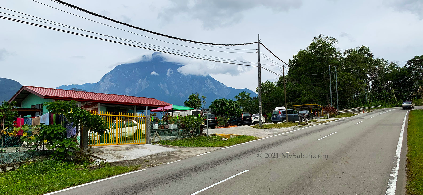
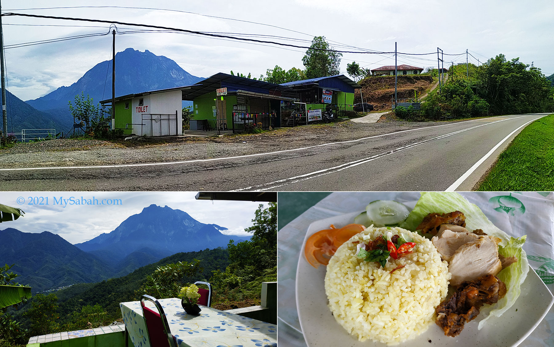
3. Gerai Anna
Location: 38 KM before Ranau (GPS: 6.054505309728095, 116.4479594934989, see Location Map)
Toilet stop of Gerai Anna and Kitchen De Aman about 38 Kilometres before Ranau town. You can enjoy the nice view of Mount Nungkok while dining at Kitchen De Aman.
This site has a restaurant where you can order simple dishes such as chicken rice and fried noodle. The picturesque mountain view at dining area is a bonus.
My favourite spot is near the Kota Belud to Ranau junction (GPS: 6.104156379447983, 116.42378880340594, see Location Map), where both mountains are aligned in center and seem really near to each other.
The KK-Ranau road section about 38 to 42 Kilometres before Ranau offers a good view of Mount Nungkok.
As the KK-Ranau main road is on the highland, you will have a bird’s-eye view of both mountains. From this side, Mount Nungkok is a forested mountain with blunt top. You can see the exposed granite near its top, a result of the landslides caused by earthquake in 2015.
Climbing Mount Nungkok
Mount Nungkok was used to be off-limit to the public as it’s a fully-protected park managed by Sabah Parks. Started in 2017, climbing is allowed for visitors with a permit and licensed guides from the Park. Only up to 15 climbers are allowed per day.
View of Mount Nungkok at Kampung Kiau Nuluh village
Even though Mount Nungkok is about 1,652 Metres (5,420 feet) tall and far lower than Mount Kinabalu (4,095 Metres / 13,435 feet), the climb is more challenging due to its steepness, even to experienced hikers.
Mount Kinabalu and Mount Nungkok, like parent and child. View from Kota Belud junction on KK-Ranau road.
Based on what I found on the Internet, there are three peaks on Mount Nungkok. The highest peak is not open to climbers. There are two climbing routes that started from two different locations in Kota Belud and lead to the other two peaks. You can book the climb with the homestay operators in the villages.
Route No.1: Tambatuon
This is the more popular choice and it can be a day trip. The starting point is in Kampung Tambatuon village about 6.2 KM away from Mount Nungkok. Climbers who are not in a rush would spend a night in the local homestay operated by Tambatuon Eco Tourism Community and start the climb in next morning.
View of Mount Kinabalu (left) and Mount Nungkok (right) at Kampung Tambatuon village of Kota Belud
First the climbers will be transferred by 4-wheel drive to the starting point about 3 KM away around 5am. The summit trail is about 3.43 KM one way, and you can reach the peak at 1,652 Metres (5,420 feet) after 4 to 8 hours, depends on your fitness. For more details, you may check out the blog here and there, and the video of the climb.
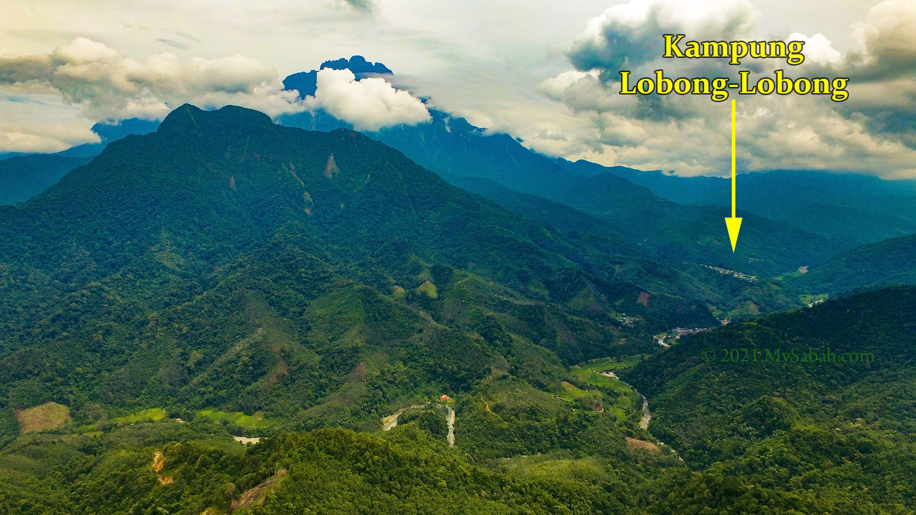
Route No.2: Lobong-Lobong
This route takes 2 days 1 night and the total climbing distance is 8.8 KM one way. In day 1, climbers start their climb from Kampung Lobong-Lobong village (or Tanak Nabalu) to reach base camp about 4.4 KM away. After camping there for a night, they continue to climb another 4.4 KM to reach the peak at 1,574 Metres (5,164 feet).
Location of Kampung Lobong-Lobong, one of the starting points to climb Mount Nungkok.
The Lobong-Lobong route takes longer time but it offers more nature experience. For more info, you can watch the walk-through videos (4-minute and 14-minute versions).
Hope I will climb Mount Nungkok one day and blog more about its natural treasures. For now, I just admire its beauty from a distance.
Photos taken in Kota Belud, Sabah, Malaysia Borneo
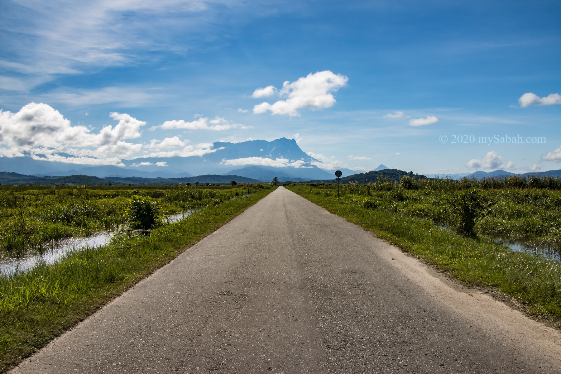
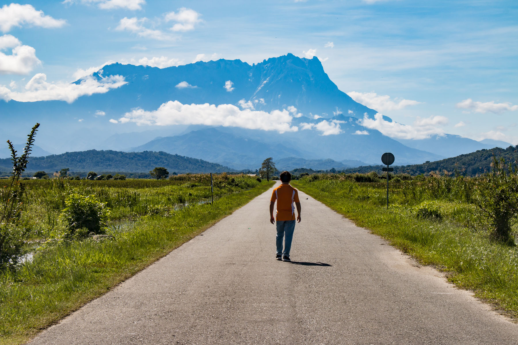
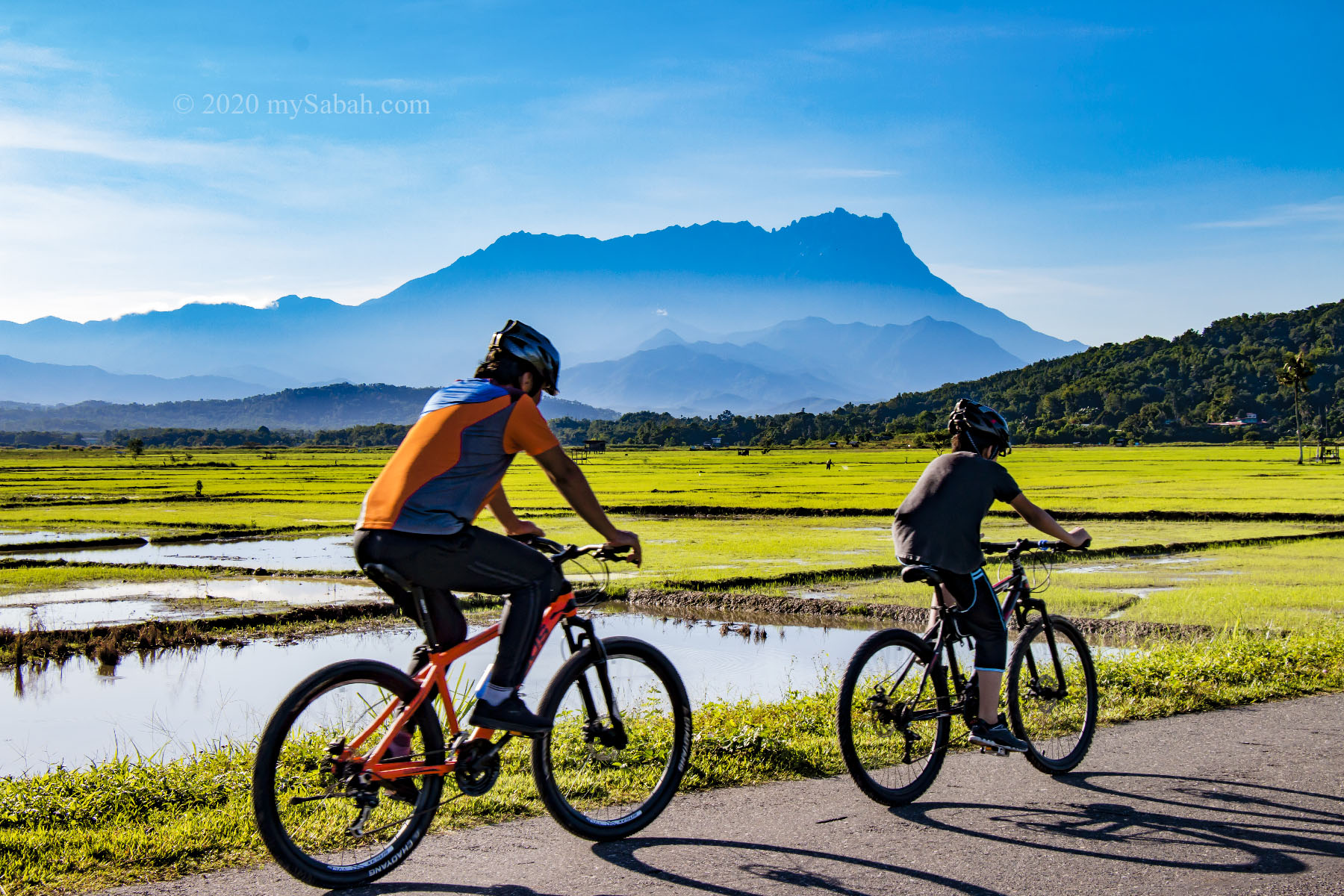
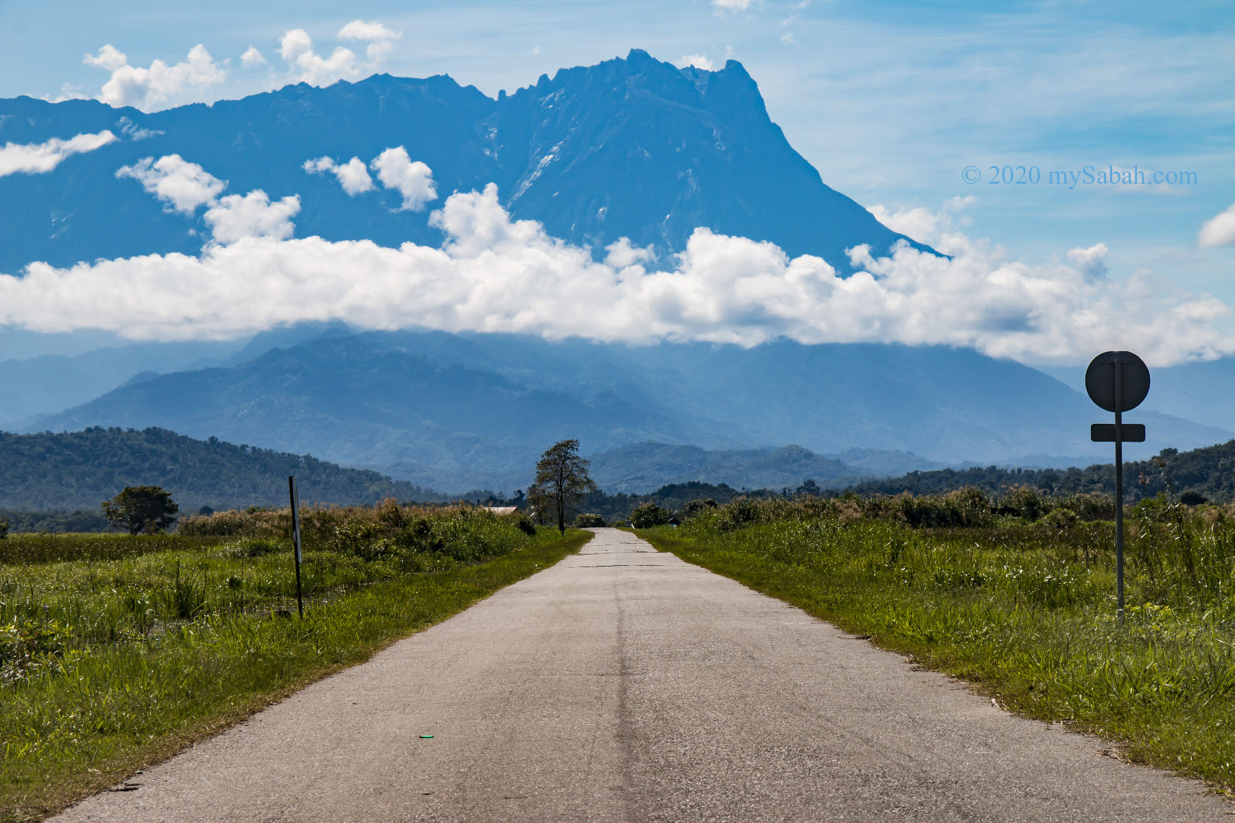
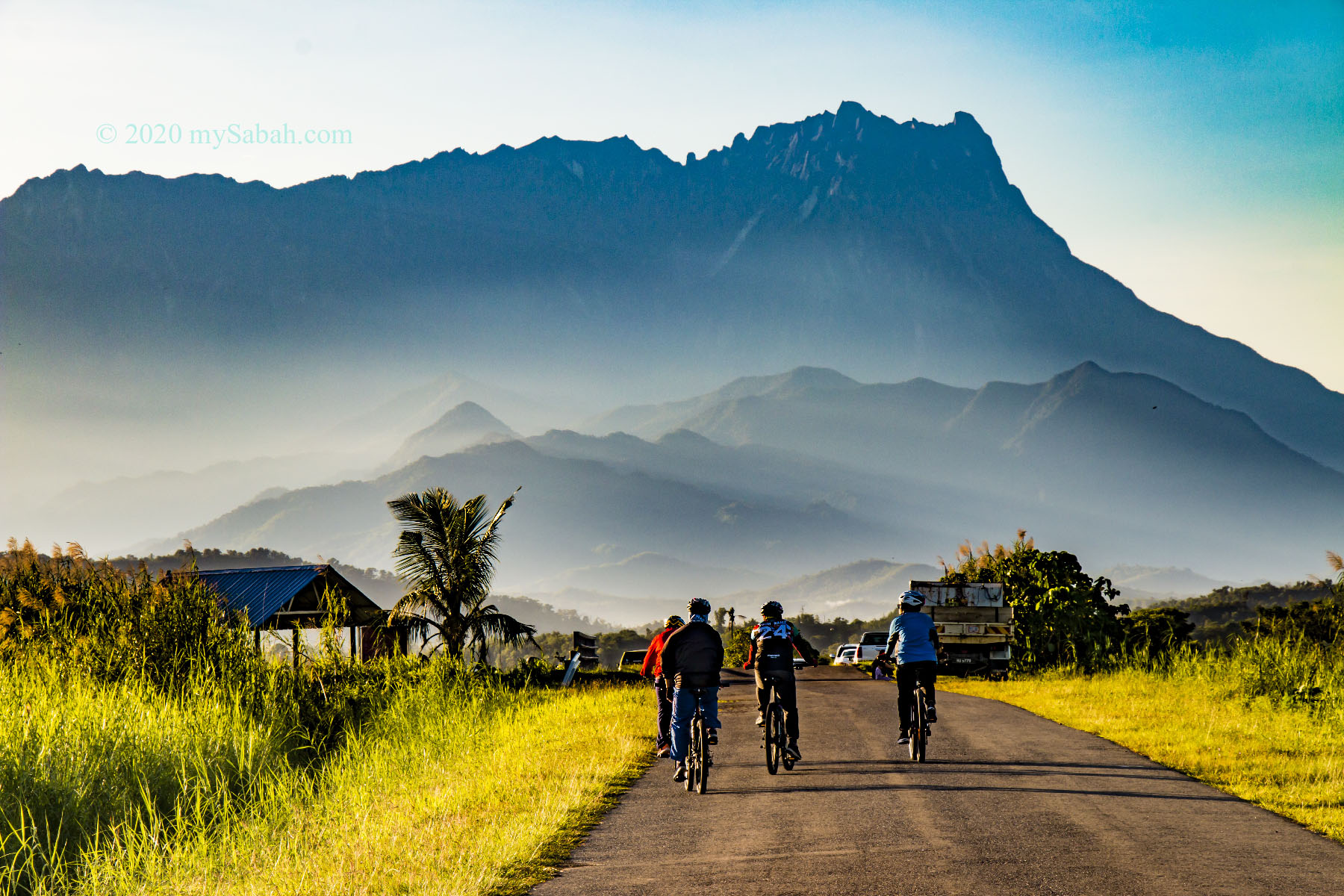
Mount Kinabalu is splendid but it is so high and so challenging to climb. I bet sometimes Sabah people think, “isn’t it nice if we can drive all the way up to its peak?” No way this gonna to happen but you can imagine such thing somewhere in Kota Belud. Check out the photo below. The road looks like a highway straight to Mount Kinabalu (Of course it won’t lead you to the top).
900-Meter-long straight road to Mount Kinabalu
This scenery is so astonishing and clean, but rare, because there is no utility pole and building around. Many are impressed by this view on social media and eager to find out the location of this 900-Metre-long straight road, but got no clear direction. Allow me to reveal the exact spot. It is at Jalan Tempasuk Sangkir (Tempasuk Sangkir Road) of Kota Belud and its GPS is 6.406023, 116.456794 (View Location Map or Street View). This is not a busy road, so you can stand in the middle to take photo, but please always keep an eye for the incoming traffic.
Lonely me walking on the road.
However, for the Mount Kinabalu view, you need to be there by 8am or earlier (it takes me around 80 minutes to get there from Kota Kinabalu City). The mountain would be totally hidden in dense cloud after 10am unless you are lucky.
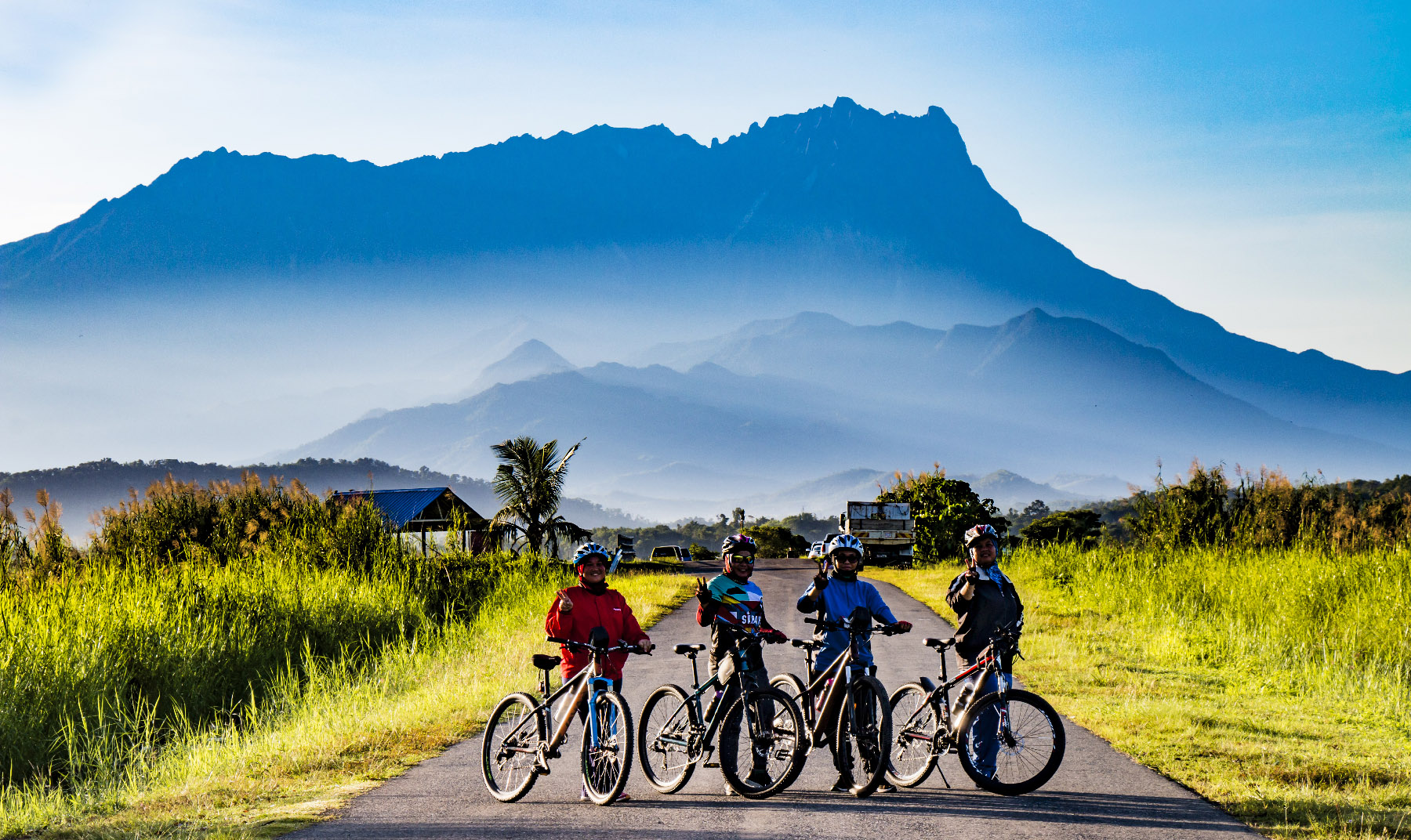
The road at Tempasuk Plains is a hot spot for cycling
I reached there around 7am. To my surprise, the road was full of joggers and cyclists who enjoyed the scenic view while they were working out. Some local farmers started their busy day in paddy fields too, so there were many cars parked along the road.
You have higher chance of seeing Mount Kinabalu in early morningJoggers enjoy the nice view of paddy fields and Mount Kinabalu
Note to Photographers: Most of them would leave when the place getting warm after 8:30am. Useful to know if you want your photos stay clear of people and cars. The sunrise is next to the mountain, so your photos would get back-light if you face the mountain. You can get more balanced exposure around 4pm, and pray that Mount Kinabalu is still visible (about 25% chance).
Aerial shot of the road to Mt. Kinabalu
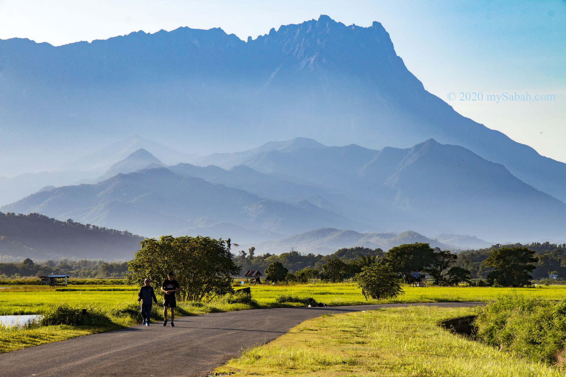
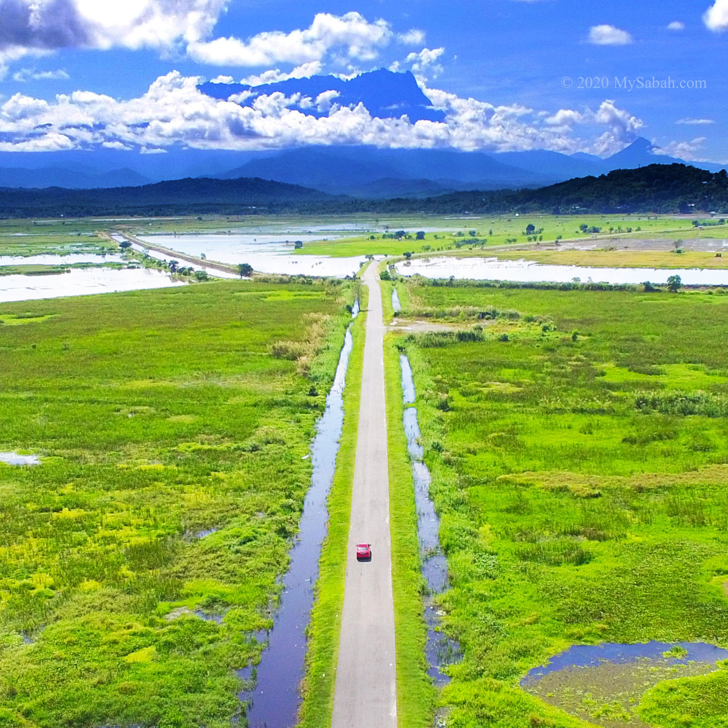
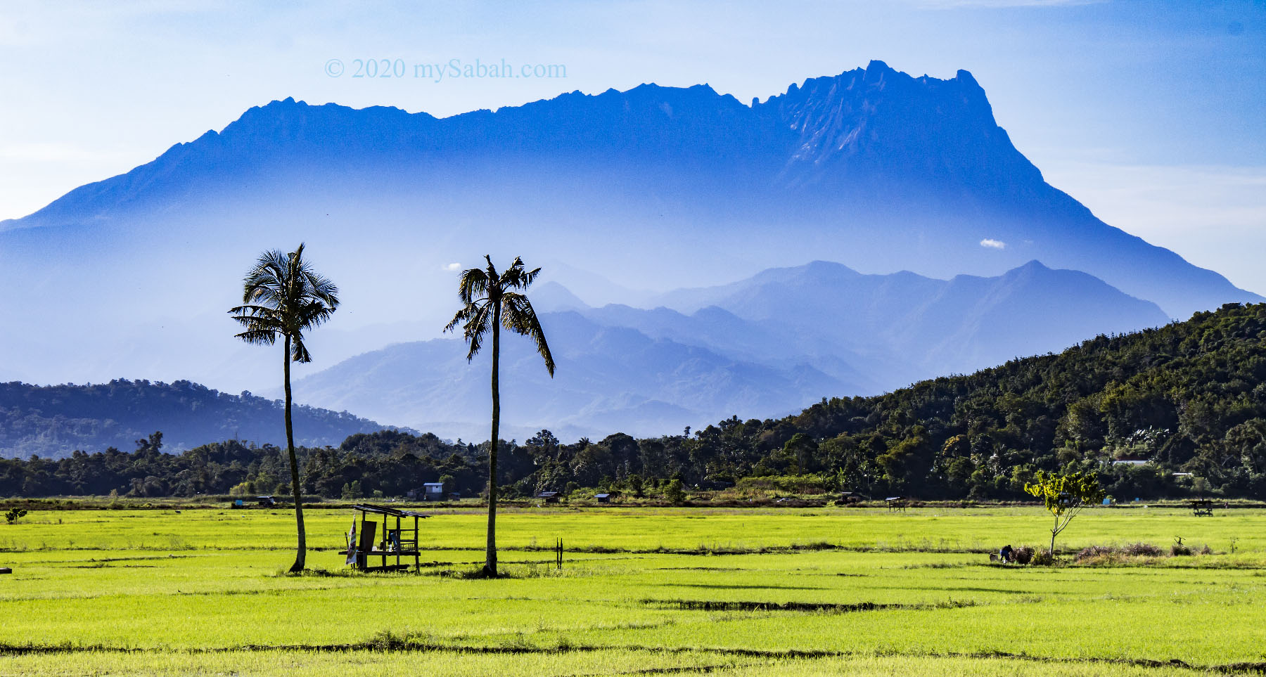
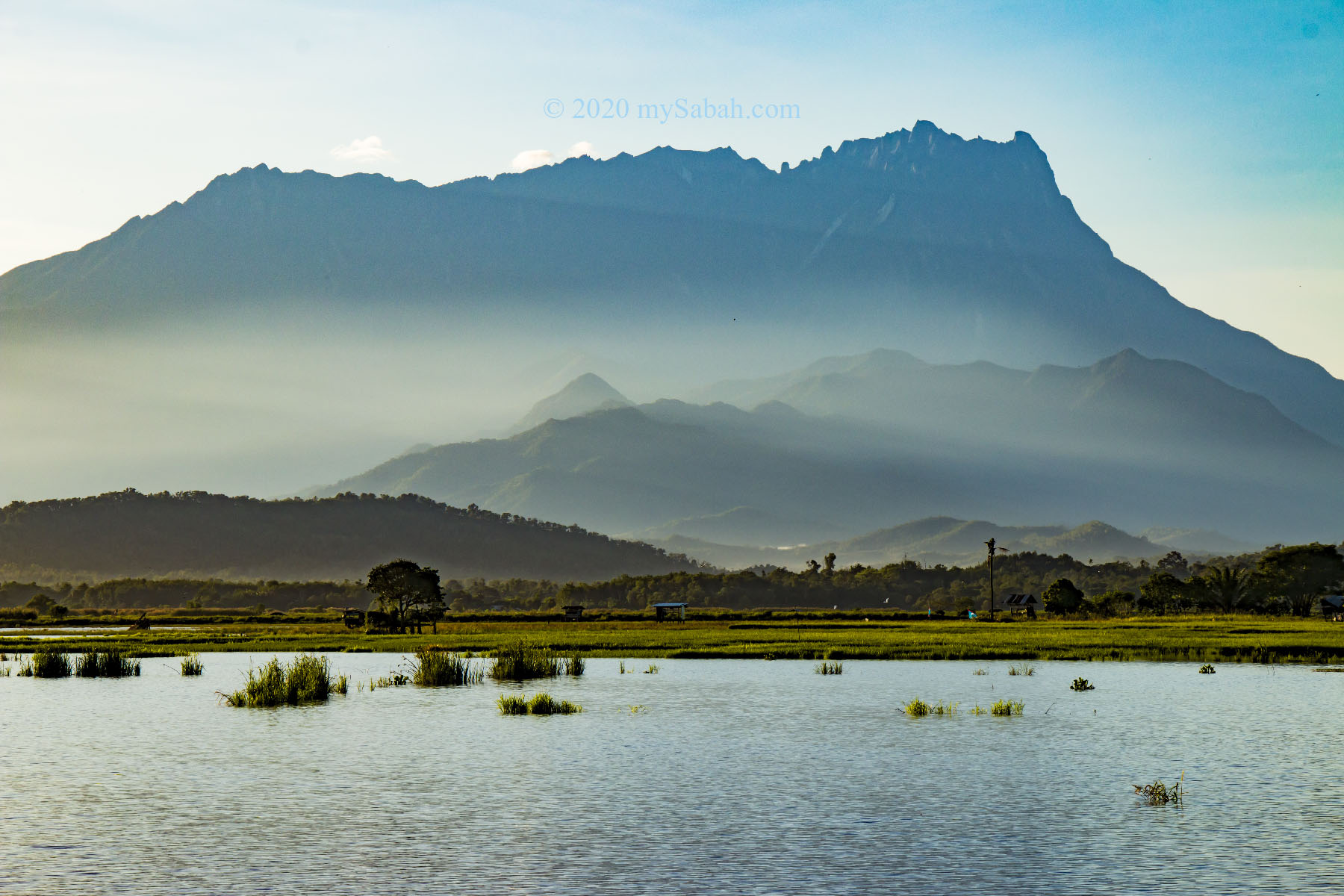
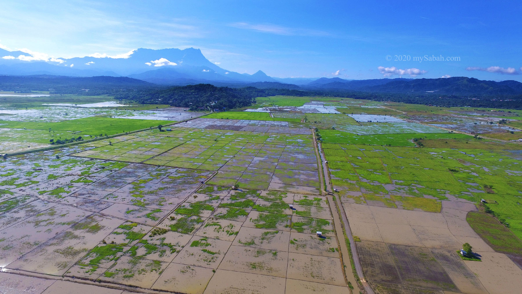
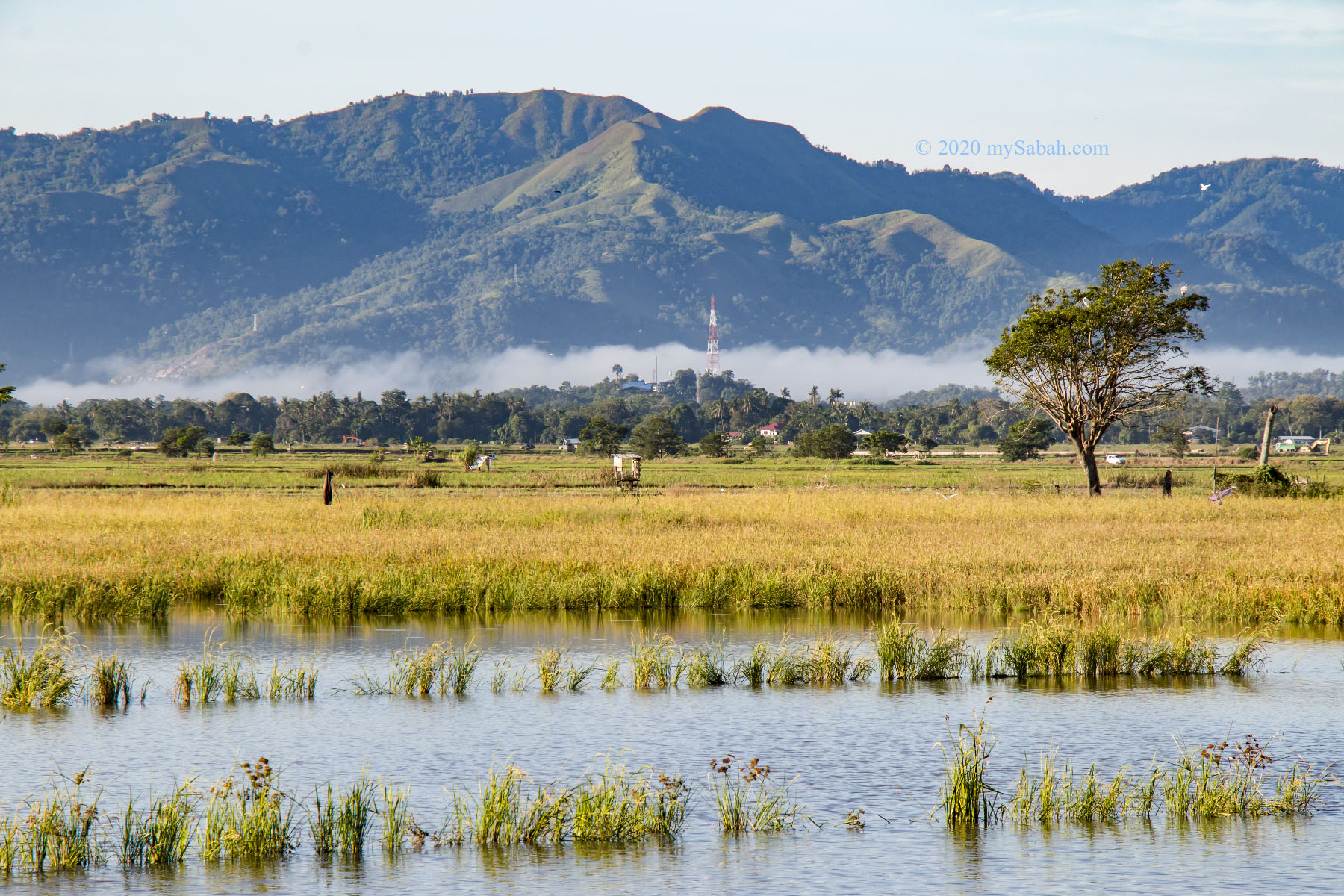
This area is called Tempasuk Plains, a pleasant location to drive or walk around to appreciate the beautiful countryside and paddy fields of Sabah. Please note this big plain offers little shade. Do bring water and umbrella if you plan to take a stroll there.
Tempasuk Plains is also a great photography site for countryside of Sabah
Wait, it doesn’t end here. Tempasuk Plains has another spectacular sight!
Birdwatching at Tempasuk Plains
Bring a binocular! When you approach Tempasuk Plains, it’s hard not to notice that there are hundred of birds foraging in paddy fields and wetlands there. In fact, Tempasuk Plains is the best place in Borneo to see migrant waterbirds and raptors from October to April, according to the book “Phillipps’ Field Guide to the Birds of Borneo” written by Quentin Phillipps and Karen Phillipps, the best selling bird-watching guide book on Borneo birds.
Tempasuk Plains is an important wetland and stopover for migrant birds
To escape the cold, a total of 244 migrant bird species and about 15 millions of them fly thousand of miles from Siberia and North East Asia (e.g. Russia, China, Japan, Korea) to Borneo when it’s winter in Northern Hemisphere. Nearly 100 species land and rest in Tempasuk Plains, where they find abundant food, for example, fishes and insects, turning Tempasuk Plains into a busy airport (probably the birds think that long road is an airstrip, just kidding). They will fly home once the cold season in their homeland is over.
Ten of thousands of migrant birds from North East Asia visit Tempasuk Plains every year
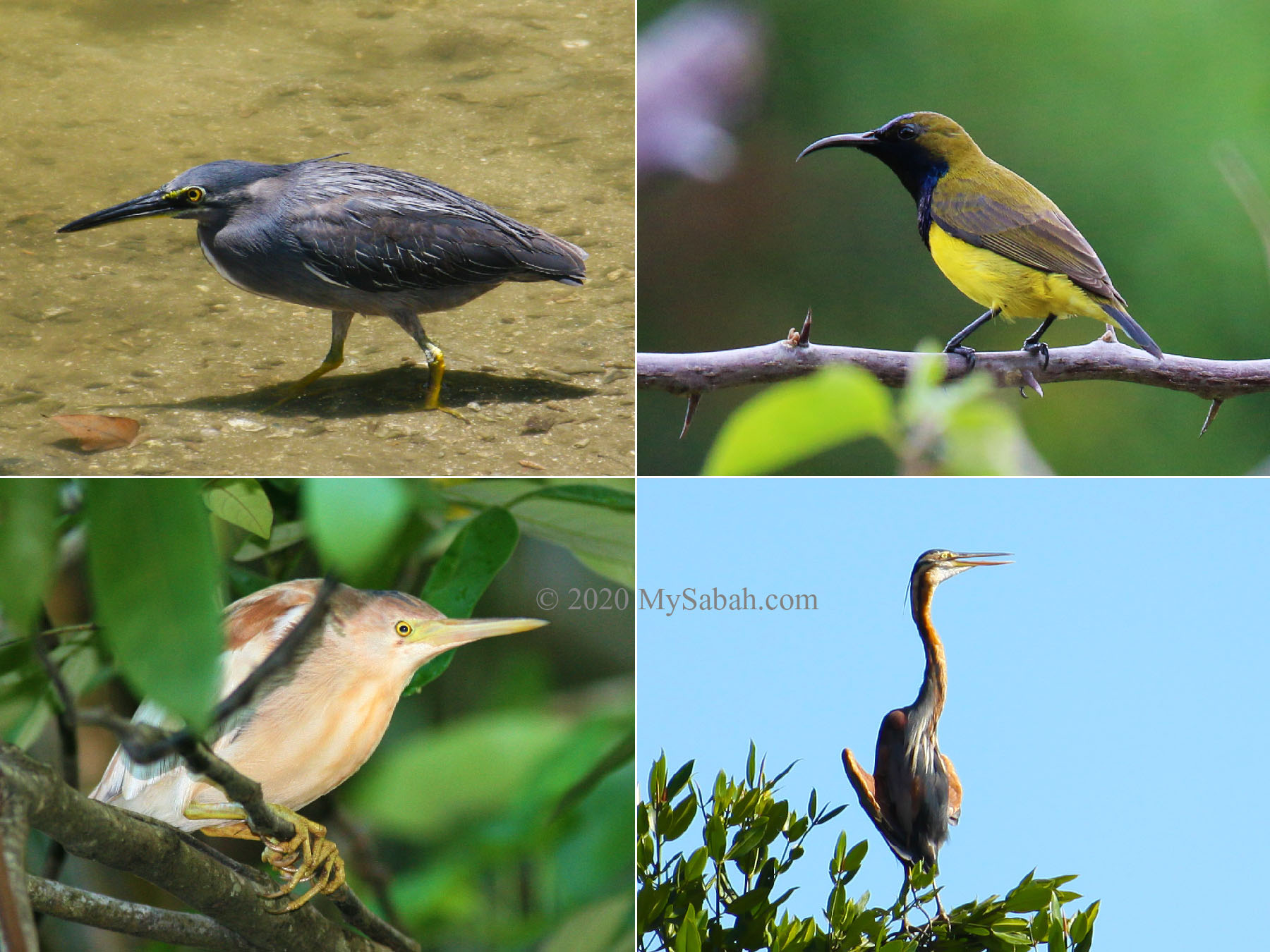
The special migrant birds at Tempasuk include raptors such as Peregrine, Mash Harrier, Black-winged Kite and Kestrel, and rare visitors like wild ducks, Pratincoles, Hoopoe, Ruddy Kingfisher, Black Drongo. In Dec 2021, a rare Black-faced spoonbill was spotted here. Avid birders will look for Grass Owl and skulking warblers too. Other common migrant birds like Egrets, Sandpipers, long-toed stint, Whiskered tern, Black-winged Stilt, and Greenshank are just everywhere. The high diversity of birds makes this plain one of the favourite spots of bird photographers.
Tempasuk Plains offers variety of habitat for birds, for example, paddy fields, swamps, lake, rivers, grassland, low hills.
Tempasuk Plains is part of Kota Belud Bird Sanctuary, which is approximately 12,200 ha (about 122 Square Kilometres) in size, a stopover for half a million migrant birds, and house 127 bird species in different habitats such as swamps, mudflats, coastal grassland, paddy field, mangrove, low hills, and open countryside in Kota Belud.
Countryside view of Tempasuk Plains
To spot more exciting bird species, you could explore this sanctuary with a bird guide. Personally I recommend Jason and Ceekay, both are my friends who have over 20 years of birding experience.
Some resident birds at Tempasuk Plains
Even during non-peak months for migrant birds, birders still can find many resident birds in Tempasuk, to name a few, White-breasted Waterhen, Dusky Munia, spotted Dove, Oriental Darter, Swamphern, Striated Grassbird, Common Moorhen, and Heron. Some migrant birds have become resident too, e.g. great egret, honey buzzard, Peregrine Falcon, Ruddy Kingfisher and Brown Flycatcher. Beginner birders will be overjoyed to write off a long list of birds from their bucket list.
Instead of taking only a few photos there, now you have more reasons to visit Tempasuk. Would you bring a binocular or bicycle?
Many locals cycle and jog around Tempasuk Plains in the morning hence many cars parked along the road
Photos taken in Kota Belud, Sabah, Malaysia Borneo