 by
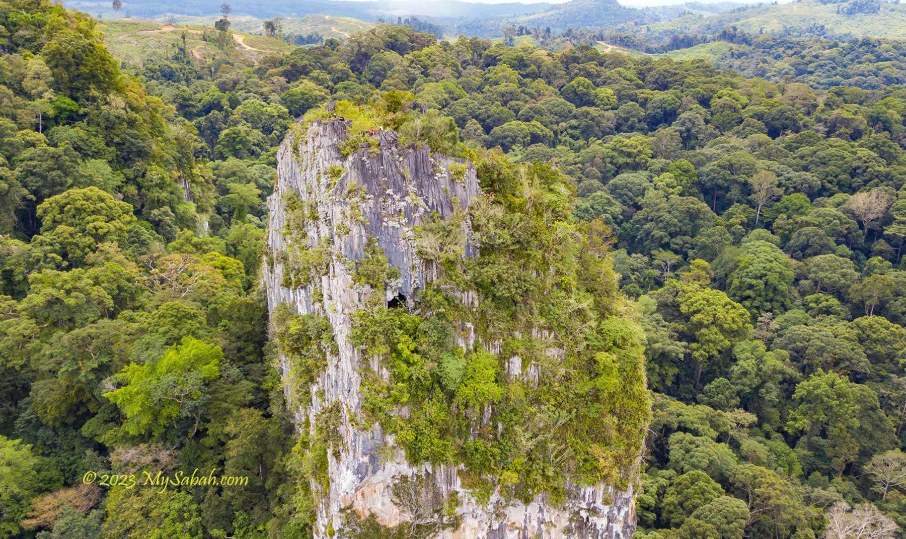
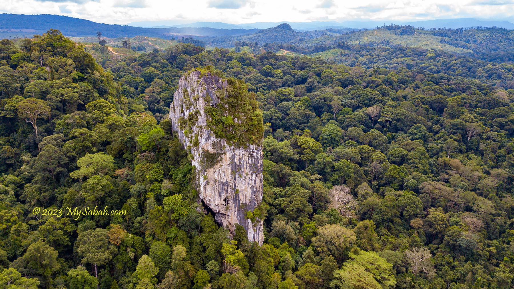
by I was awed by the majestic Batu Punggul, a 220-Metre-high limestone pinnacle in Sapulut, in the interior of Sabah, Malaysia. Before it’s open to tourists in 1992, Batu Punggul is a sacred hill that is only mentioned in the books of Borneo adventurers. Its photograph looks like a giant tombstone standing tall above the mysterious rainforest.
According to the legend of Murut people, Batu Punggul is a petrified longhouse, the result of a punishment by God to the people who mocked animals. The hill was used to be so high that it covered the sky until someone chopped it down and only its stump remains. Punggul means stump in Murut language hence Batu Punggul means stump-like rock.
Put aside its terrifying myth, Batu Punggul is the most unique and stunning pinnacle among the 218 limestone outcrops in Sabah. My late father had climbed Batu Punggul, so I followed his footsteps, to understand why his eyes sparkled whenever he talked about Batu Punggul. Though climbing this vertical hill sounds challenging, I’m sure most of you can conquer it.
About Batu Punggul
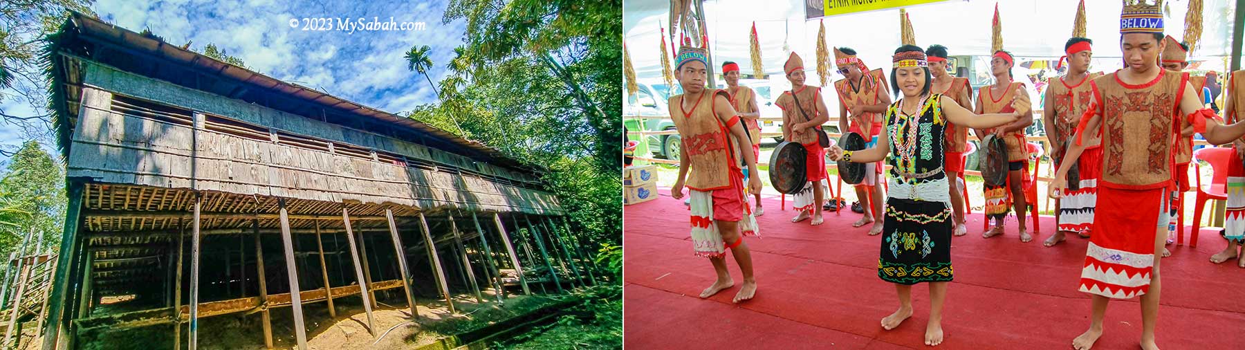
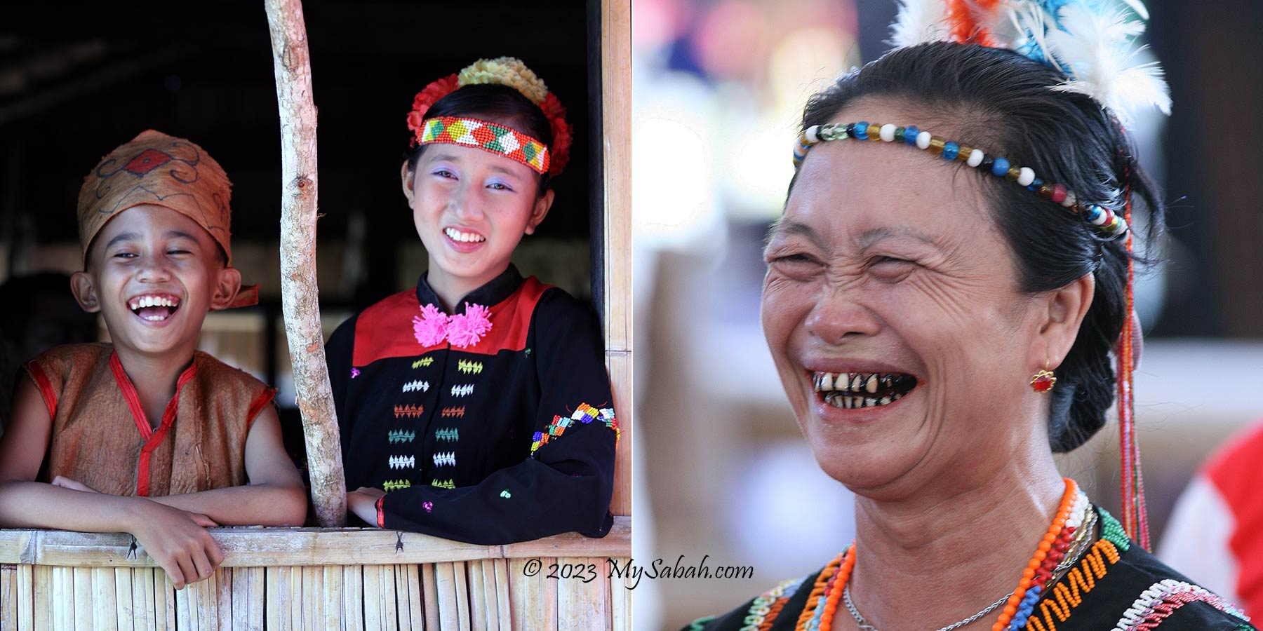
Batu Punggul is no ordinary hill because of its cultural and ecological values. Batu Punggul has been a legendary and sacred place to Murut people, the third largest indigenous group of Sabah. The locals respect Batu Punggul and have many stories about it.
The most popular story on the formation of Batu Punggul is about two Murut longhouses, namely, Punggul and Tinagas, with Sapulut River ran between these two villages in the past. One day the people of Punggul longhouse had no fire to cook, so they asked Tinagas longhouse on the other side for fire. At first the Tinagas people tied a bundle of fire on the head of a dog and let it swam across the river. A big wave came and put out the fire. People of both longhouses laughed.
Then the Tinagas people tied the fire on a cock and made it flied across the river to deliver the fire. But the river was too wide. The cock fell into the river. Everyone laughed again. Later someone mocked a leech that perched on a jar to drink tapai (rice or tapioca wine). Making fun of animals is a taboo in Murut. Their misbehavior angered the God Aki Kaulung, who turned these people and their longhouses into rocks immediately.


After the punishment, Batu Punggul became a very tall limestone rock that blocked the sun and obstructed the sunlight needed for crops to grow, so a young man chopped down Batu Punggul. When the hill fell, it broke into smaller rocks which scattered along the downstream of Sapulut River. The Batu Punggul was left with a “stump” that we see today.
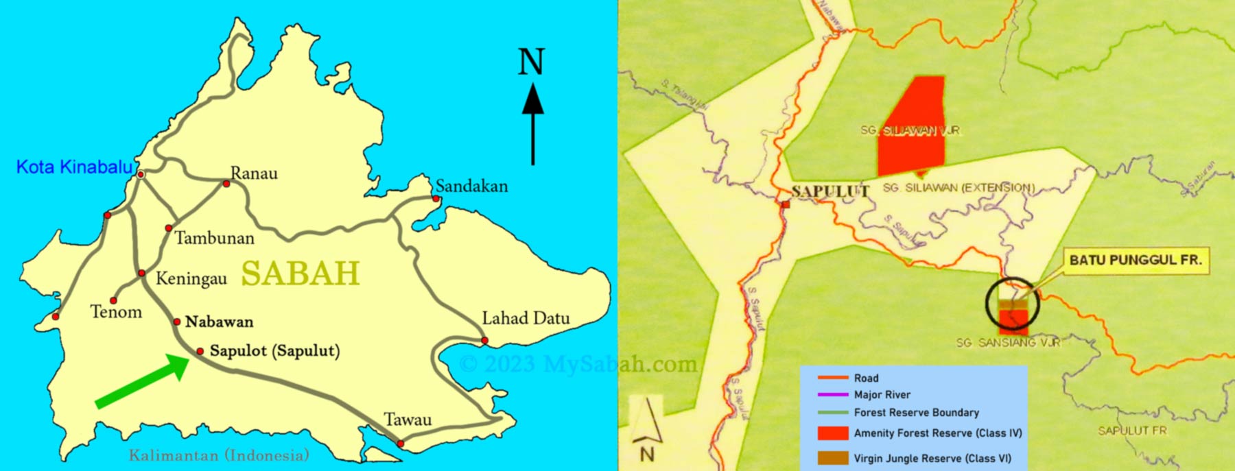
Batu Punggul is located within the Batu Punggul Forest Reserve (see Location Map) in the interior of Sabah, about 110 KM south of Keningau town. When logging was rampant in 1980s, Dr. Richard Gunting saved Batu Punggul and its surrounding forest from deforestation in 1986. In 2009, Batu Punggul Forest Reserve was gazetted as an Amenity Forest Reserve (Class IV), covering an area of 150 hectares (1.5 Square Kilometre).
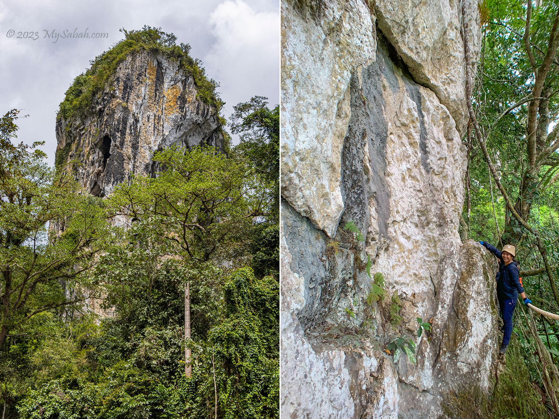
Limestone is a type of rock that forms underwater from the structures of living organisms like coral and shells millions of years ago. When Borneo island raised from the ocean floor, a series of tectonic movements by earth lifted the limestone of Batu Punggul above the ground. It’s a blessing that Batu Punggul still survives today, when 32 (23%) of limestone outcrops in Sabah are being quarried for cement production.
Tour to Batu Punggul
In the past, without the Keningau-Tawau highway, visitors had to withstand four or more hours of boat ride to reach Batu Punggul. Now climbing Batu Punggul can be a day trip (though an overnight trip is recommended). You can book the tour with Borneo Outback Tours (see their contact info near the end). The following is a walkthrough of my trip to Batu Punggul, which consists of river cruise, hiking and climbing.
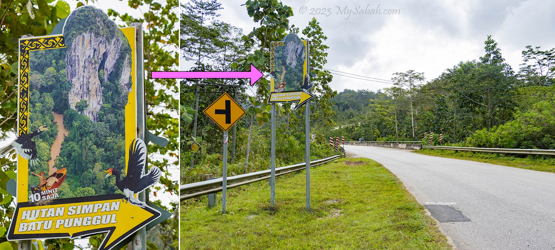
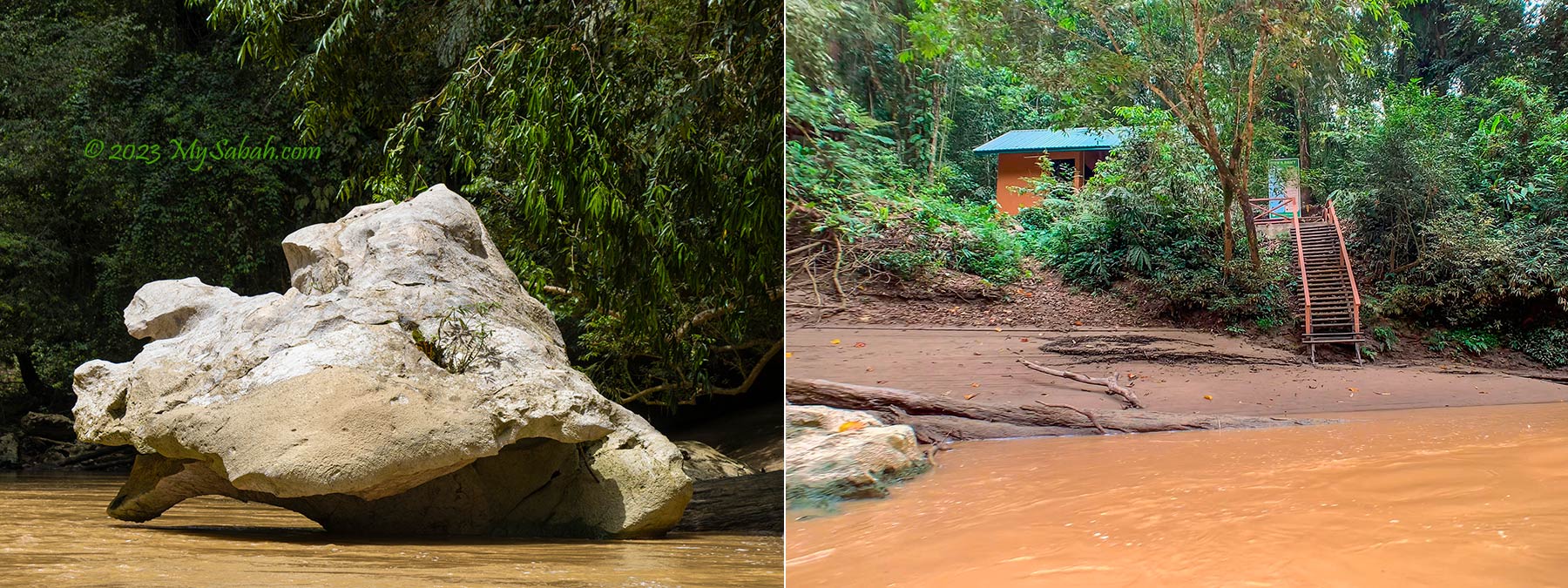
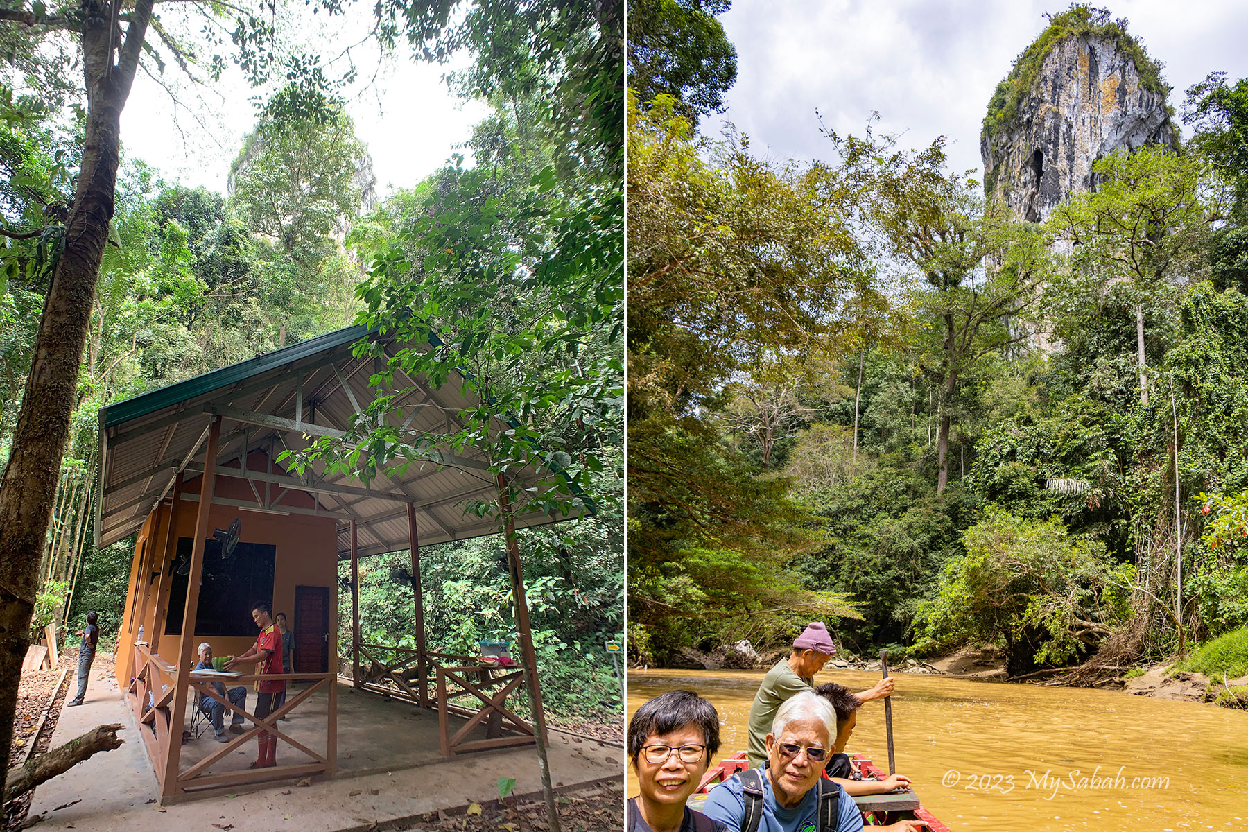
The starting point of the tour is at Kampung Tataluan village in Sapulut (see Location Map). My journey starts with a morning river cruise on a wooden longboat from the Tataluan jetty around 9am. I see a lot of rocks along the river, which are said the chips from the fallen hill. The rocks of the poor dog and cock can be seen at the river too.
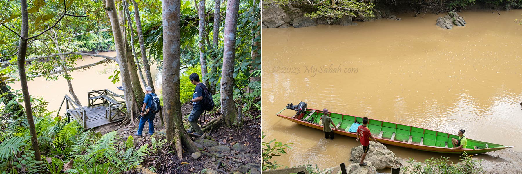
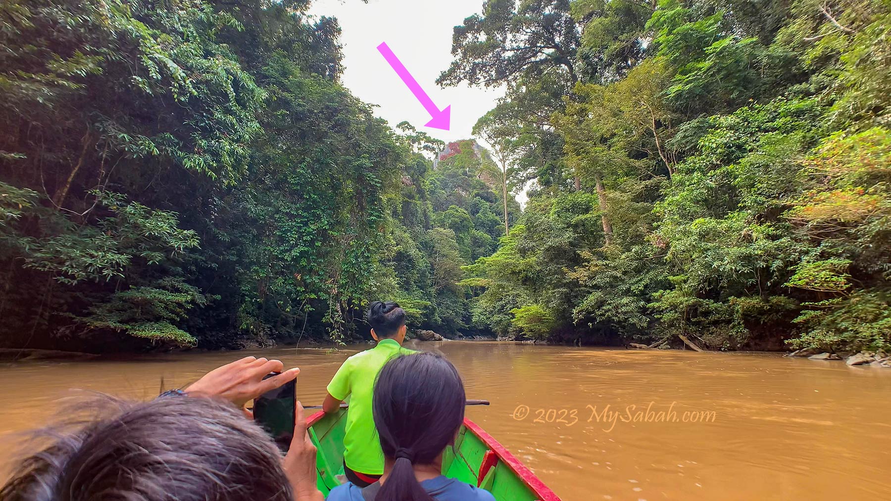
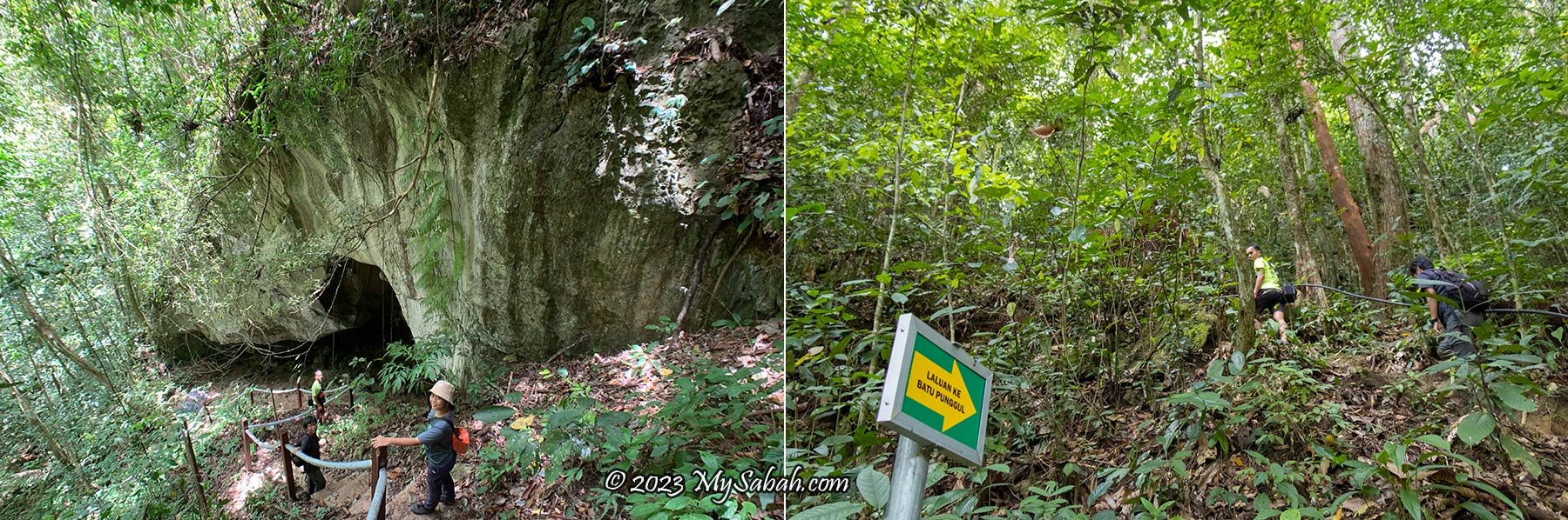
The river is flanked by dense forest. After a few minutes, I see Batu Punggul from a distance. Its presence is so powerful and spiritual that I got goosebumps. In 10 minutes, the boat reaches the entrance to Batu Punggul Forest Reserve. After a short briefing at the reception building of Sabah Forestry Department, we start walking to the starting point of the climb.
Walking to the Foothill of Batu Punggul
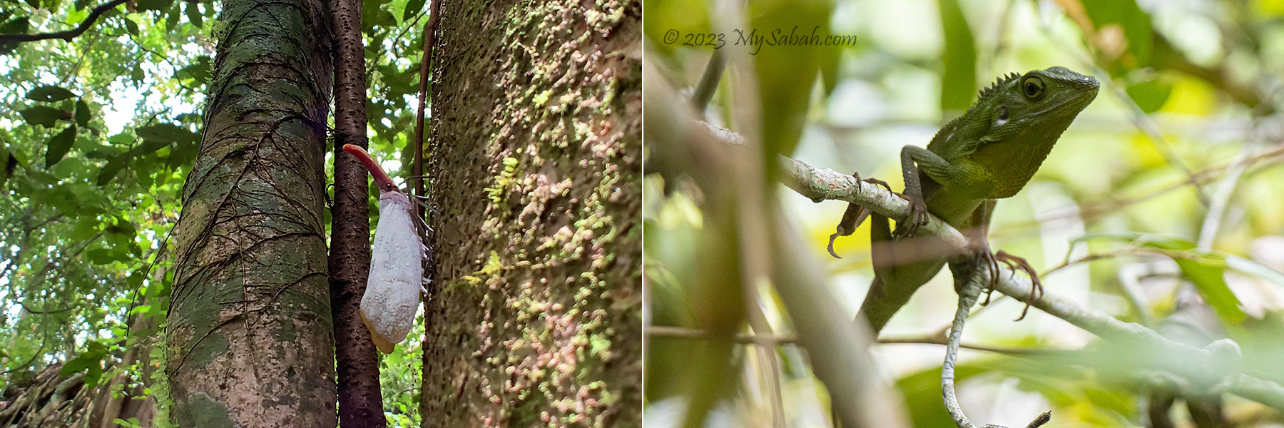
The hike from the jetty to the foothill of Batu Punggul takes about 30 minutes. This tropical rainforest is mostly untouched like a virgin forest. For the lucky visitors, they would see blooming rafflesia flower (Species: Rafflesia keithii). 596 taxa of plants are recorded in this forest and 20 of them are endemic to Sabah, and four of them are totally protected plant species.
Majority of the trail is ascending path. It’s not very steep but quite a workout in this warm and humid forest. Leeches would be around during wet season, so you would need to wear anti-leech socks. I don’t find any leech in my visit. The dense trees shade us from the heat. It’s noisy in here because of the loud cicada calls everywhere.
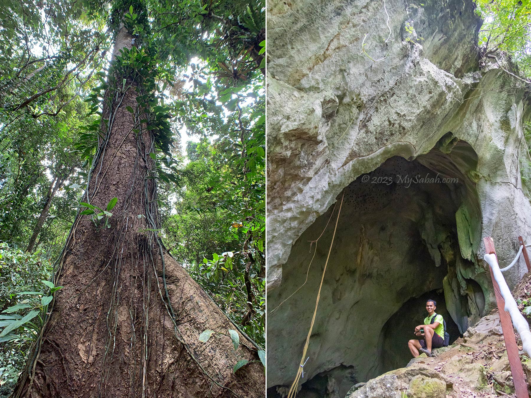
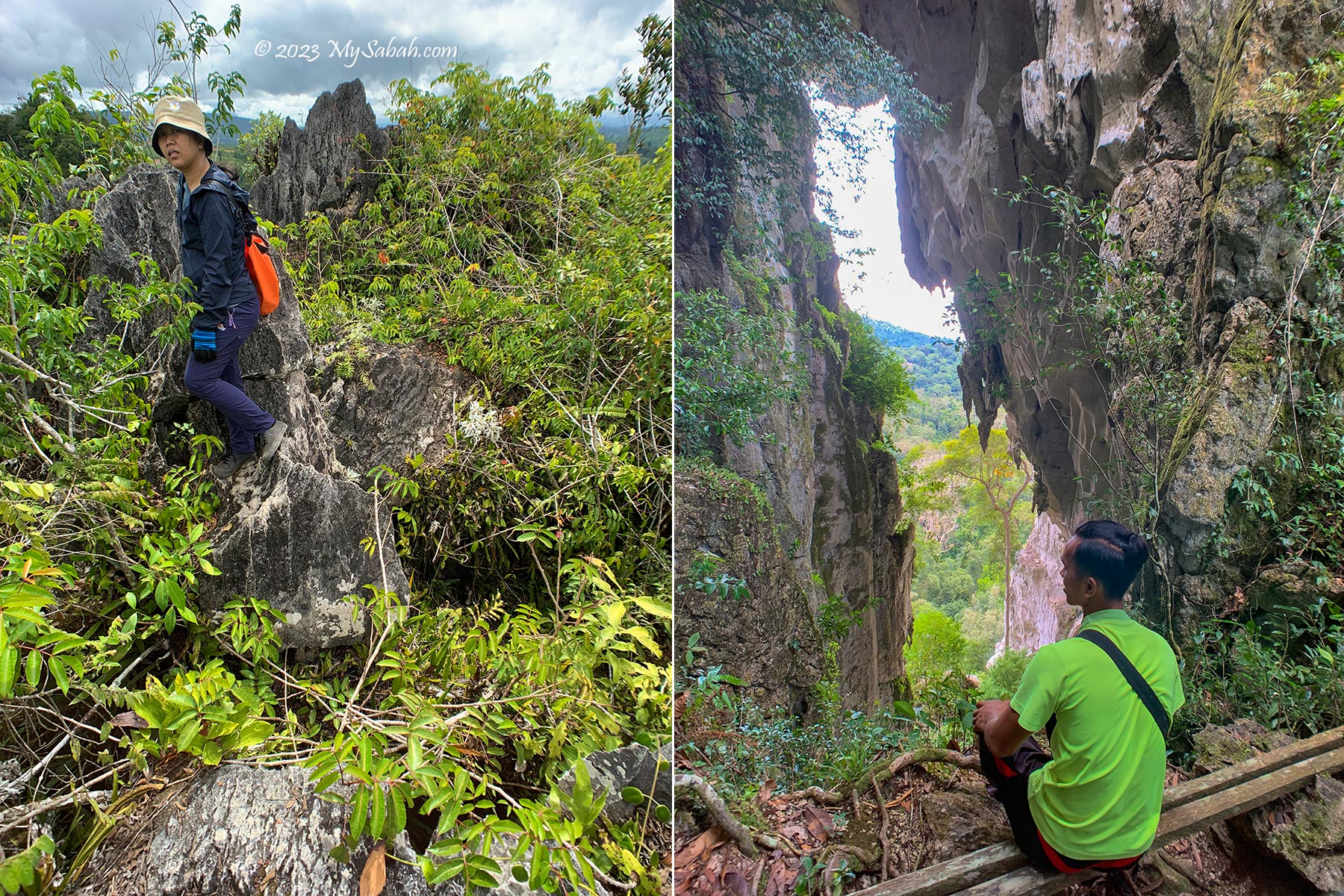
15 minutes later I reach a big cave. Visitors can enter the cave chamber to see some interesting limestone formations that resemble household items such as jar, the belongings of the longhouse inhabitants. There are a few limestone cave networks (e.g. Batu Tinahas Cave) in this forest reserve for those who are keen in caving.
Climbing Batu Punggul
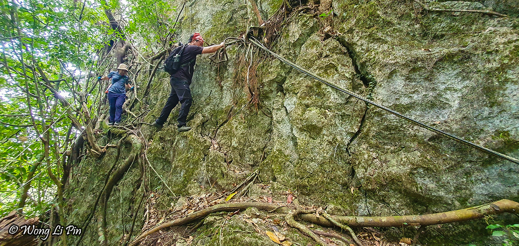
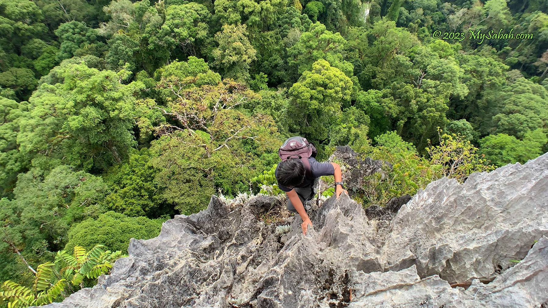
Finally we arrive the starting point of the climb. To cut down weight, you can leave the unnecessary items here, e.g. portable charger, hiking pole (pack them all in a plastic bag in case it rains). I only climb with a small backpack that carries a 1-Litre water bottle, raincoat and camera. I strongly advise you to apply sunblock lotion before the climb because it’s really hot up there.
The starting point is already a test of bravery. You need to traverse sideway to cross a vertical wall. A misstep will be hazardous to your health. You can stop here if you don’t feel confident. Anyway, it’s a great photography spot to take photos that shock your mom.
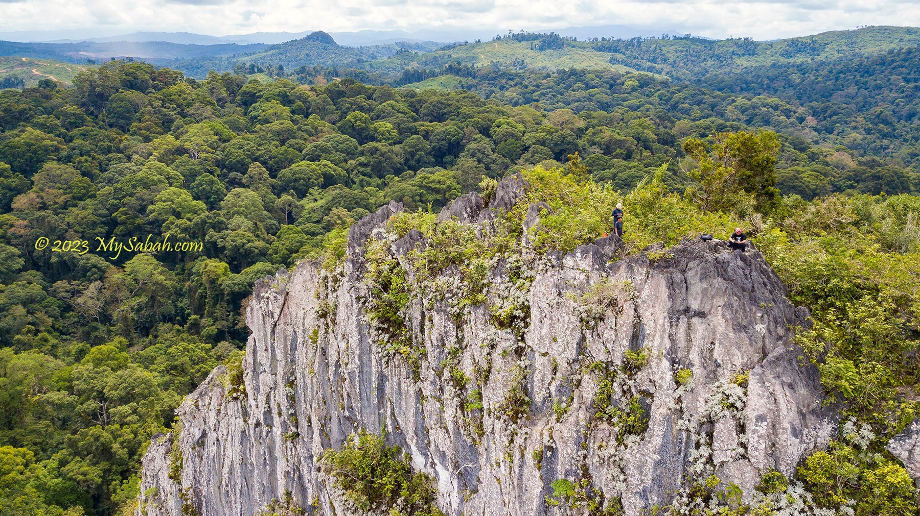
The climb to the summit takes 45 minutes to an hour. Most people can reach the peak successfully if they are reasonably fit. You don’t need to be a trained rock climber, but some hiking experience and upper body strength (and courage!) would help a lot. The oldest climber who reaches the top of Batu Punggul is 74 years old.
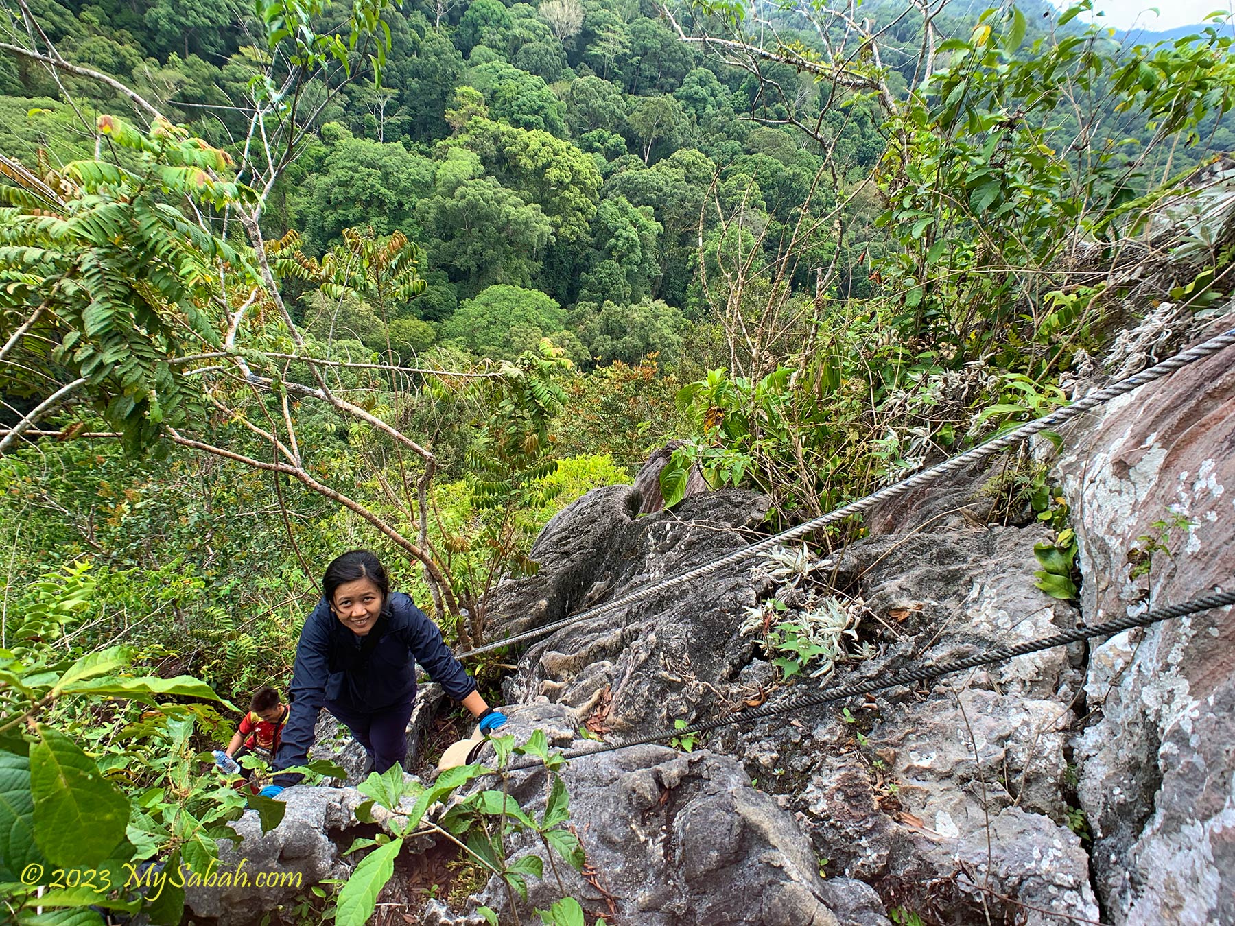
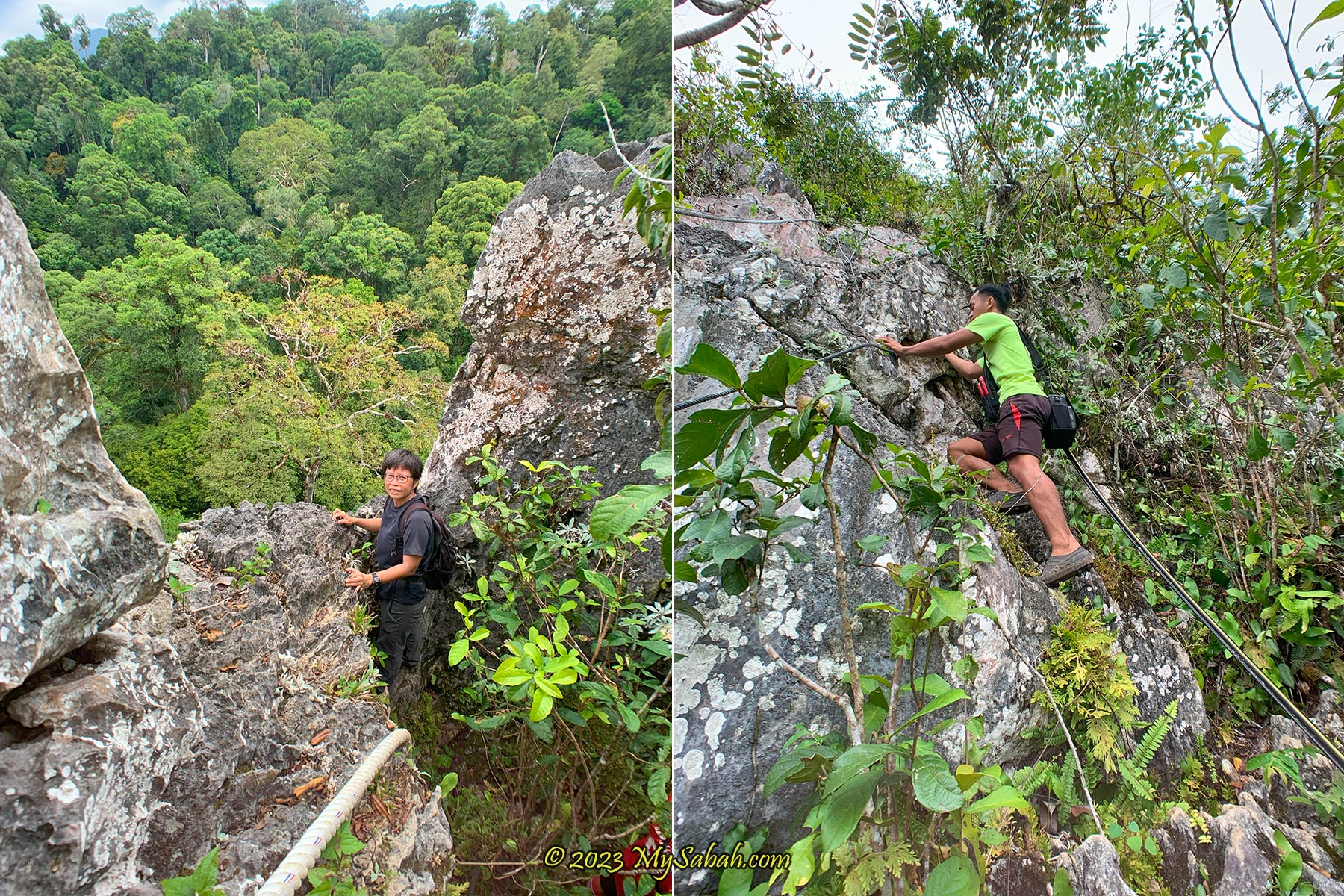
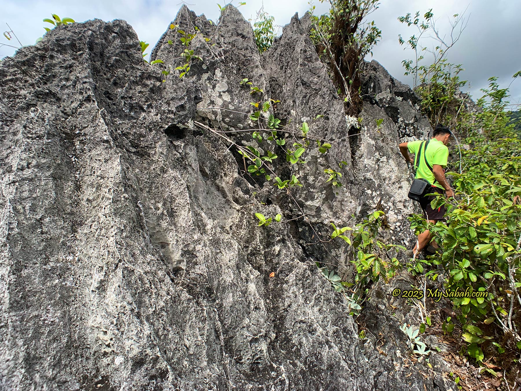
The climbing trail is uneven and nearly vertical most of the time. With the help of ropes and cables, I move up slowly on steep boulder cliffs, looking for holes, dents and protrusions, on crevice, jagged edges, and cliff bands as handholds or footholds. The most tricky part is to climb over a few mildly overhanging rocks. The path is so narrow that I can only rest in standing position or leaning to the rocks, as there isn’t enough space to sit down.
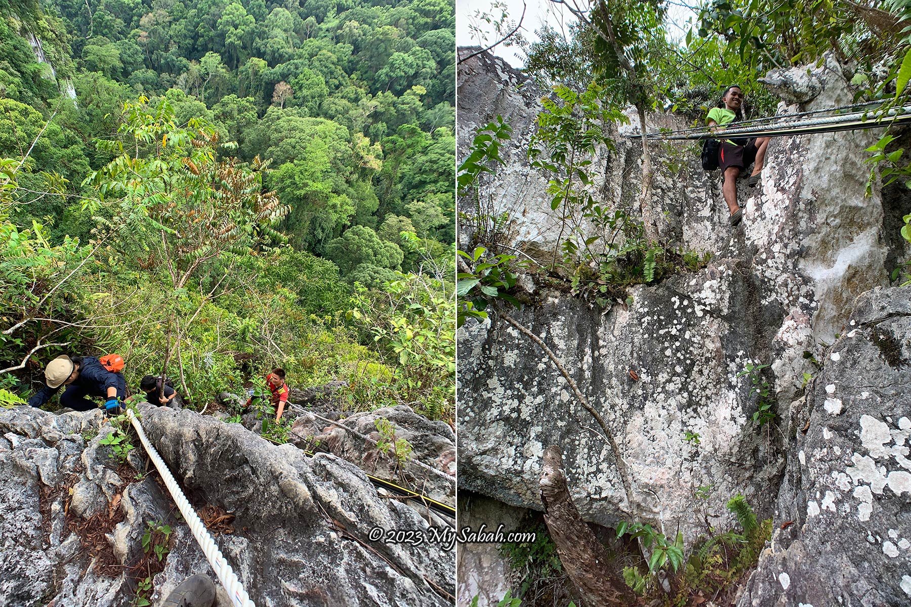
The limestones are hard and sharp with rough surface, good for solid grips but it would scratch your skin. You are better off wearing gloves. I climb without one and get a minor cut on finger. The local believes that if you bleed in your first climb, the spirit is telling you that you will live a long life.
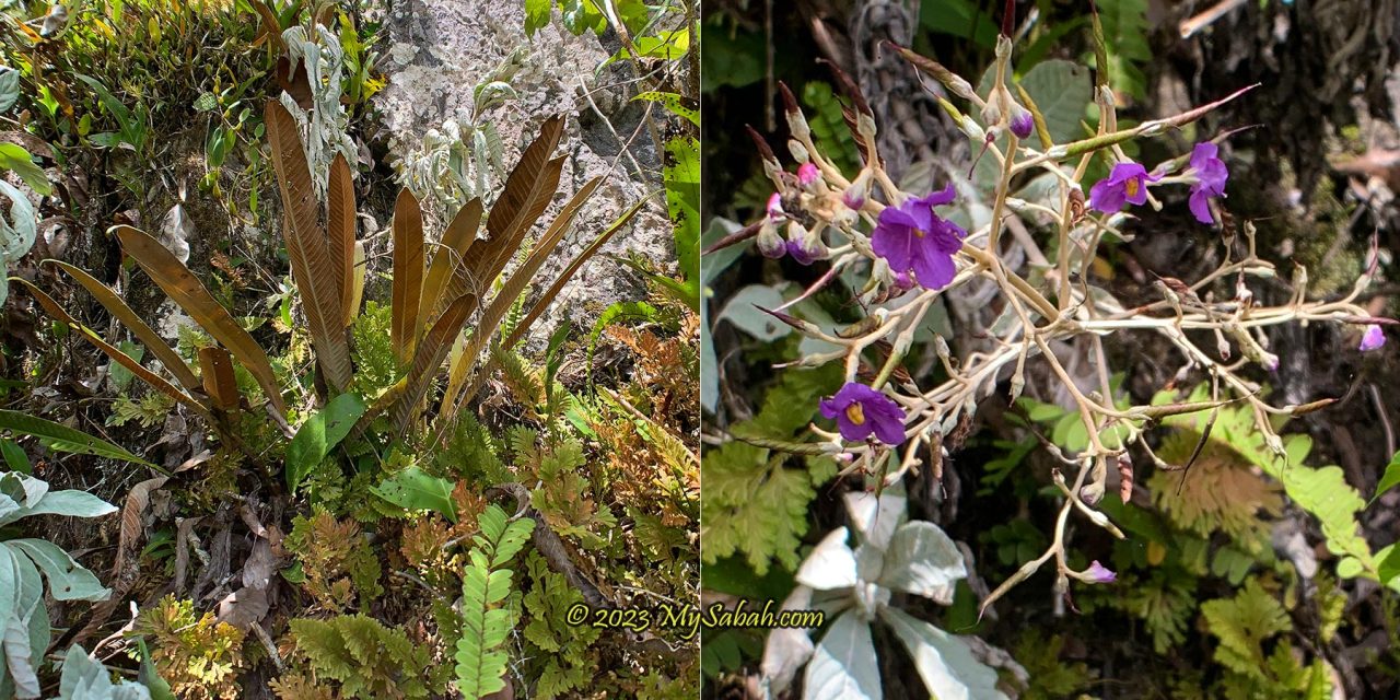
The vegetation changes from lowland rainforest to limestone forest, which is predominantly made up of small trees, shrubs and rich herbaceous layers. In Sabah, some of the more common plant species which grow on limestone are begonias (Begonia spp.), Paraboea sp., some ferns and aroids. Among the limestone endemic plant species that occur on Batu Punggul limestone are Tainia ponggolensis (orchid) and Begonia amphioxus. I do spend some time admiring the interesting plant and flowers.
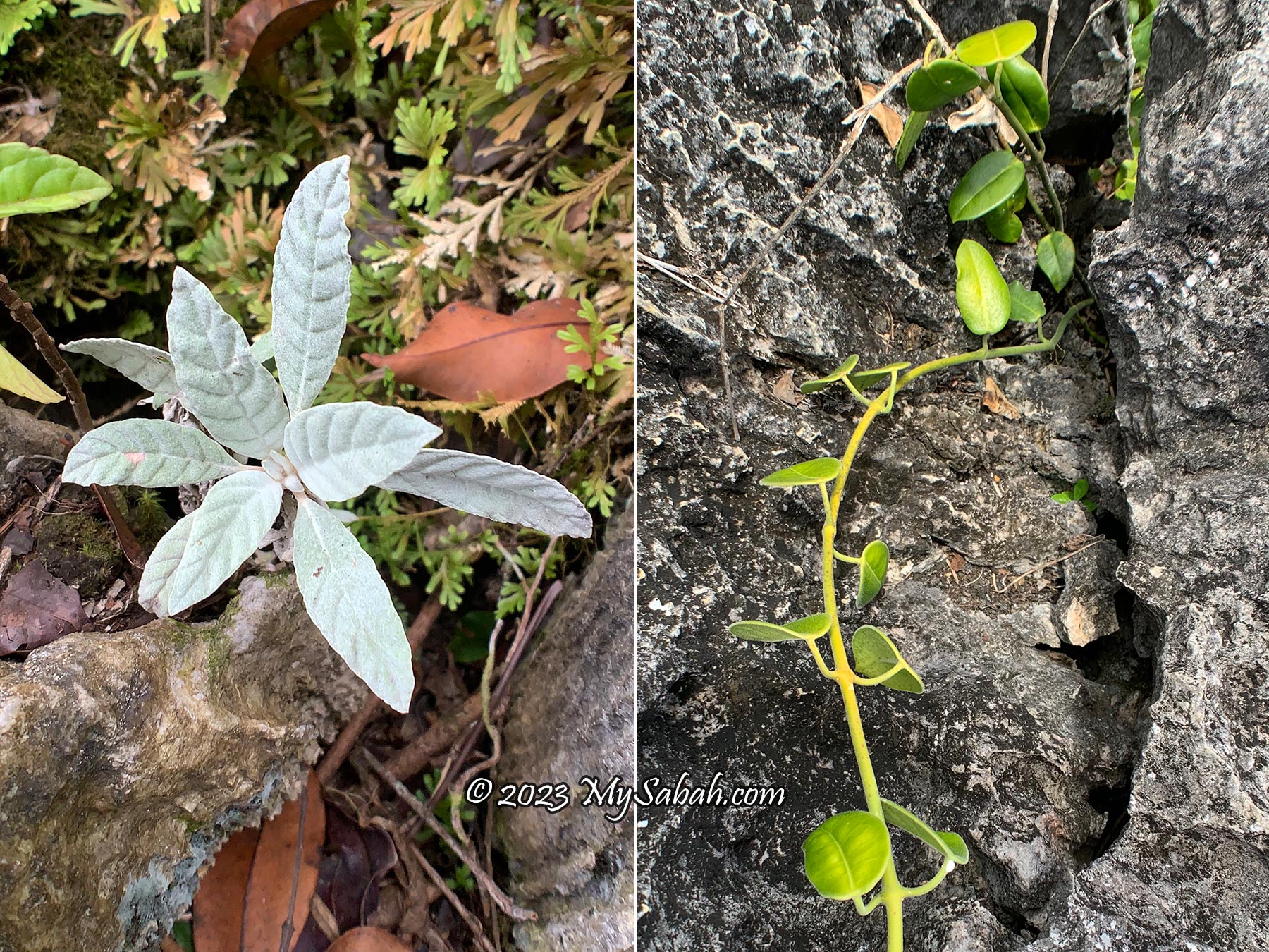
I see a lot of whitish plant grows on the limestone. According to the locals, it’s called tawawo. You can put its leaves inside hunting rifle or wallet as a lucky charm. If tawawo is plucked in the morning, it will emit a soothing scent by 2 or 3pm. Give it to a girl. If she smells the aromatic scent, she will fall in love with you, they say.
We have three guides (Jariah, Josyen and Rosdin) who always keep an eye on us and tell us where to put our feet. Batu Punggul looks dangerous but it’s not really dangerous if you are careful. No severe injury occurs on this pinnacle before. Whatever, it’s still nerve-wracking when I’m crossing a few sections that are only one step away from a hundred-metre fall. My legs shiver whenever I see the cliff below my feet.
The limestones are greyish white in the beginning. As we move closer to the peak, they are darker in colour due to weathering. The biggest challenge of this climb is not the steepness, but dehydration and heat exhaustion. My best advices for you are: bring more water, apply sunscreen, wear comfortable outdoor clothing and a pair of good hiking / climbing shoes. e.g. Adidas Kampung.
On the top, watch out for a gap called Tapikon Ansawoh, which means “the place where husband and wife jump across”. The story is – a newly married couple was climbing Batu Punggul. When they came to this gap, the sweet husband stretched his legs across the opening, to let his wife walking on them to cross. However, his legs slipped because of her weight and both of them fell into the gap.
Finally I reach the highest point at 10:50am. It’s such a heroic moment, as if I unlock an achievement. Batu Punggul has no official height, but it is estimated that Batu Punggul is between 200 to 240 Metres high. From the top I have a panoramic view of Labang Valley, Batu Punggul forest reserve, Sungai Sansiang Virgin Forest Reserve, Sapulut River and the forested Batu Tinahas (another petrified longhouse). The locals have the custom of making a wish or throwing away misfortune (buang batang) on the peak. Feel free to try it.
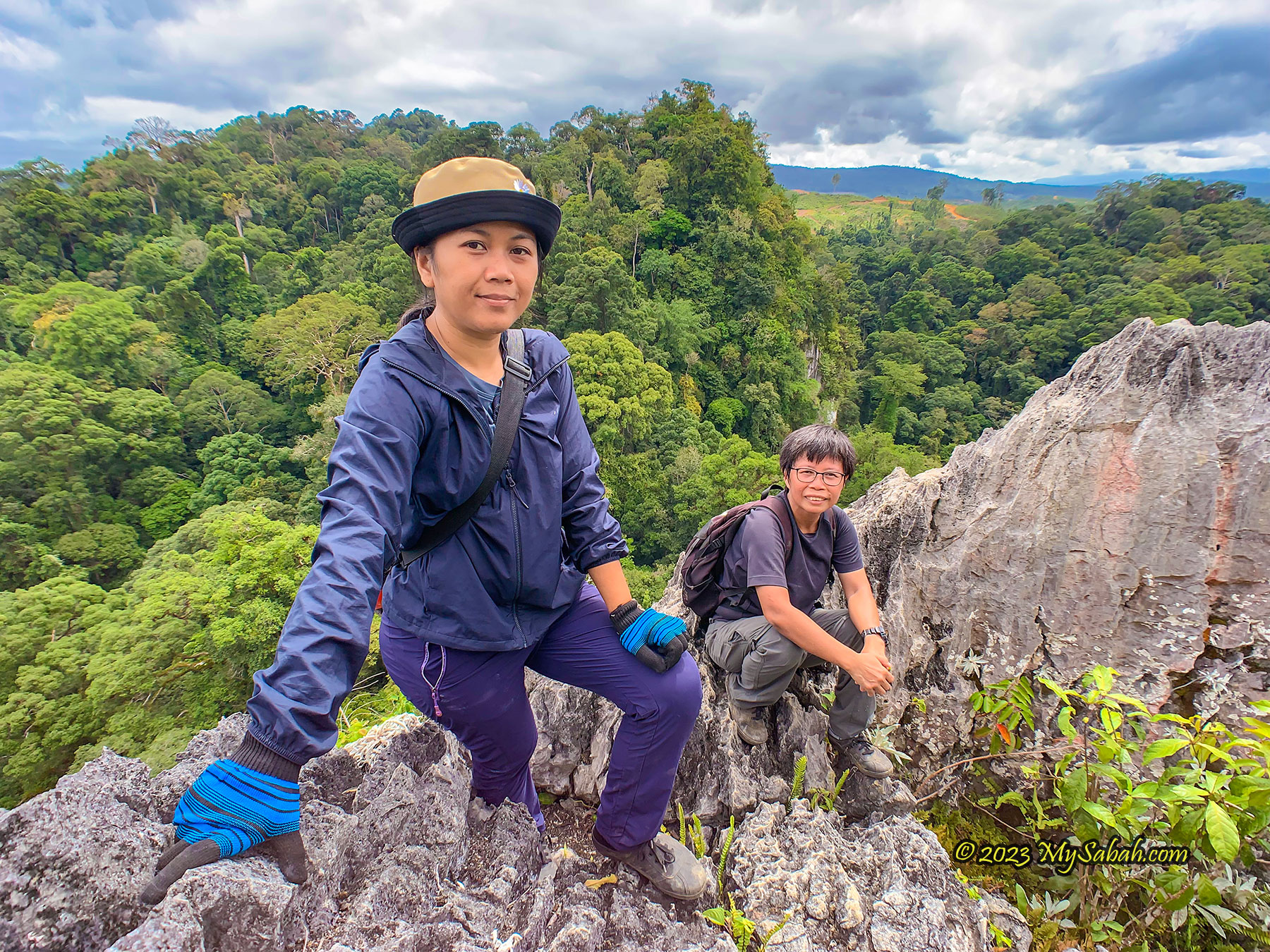
There is no tree on the peak to shade us from the scorching sun, so we don’t stay long, otherwise it would be cool to have our lunch on top with the scenic view. Descending is more difficult. Initially we plan to picnic at the pebble beach (river bank) after the climb, but the water level is too high. Therefore, we have some juicy watermelon at the jetty, a great refreshment to supplement ourselves with some sugar and electrolytes after heavy sweating.
About Sapulut (or Sapulot)
Sapulut is under the Nabawan district of Sabah interior. It is accessible by highway between Keningau and Tawau (part of Pan-Borneo Highway).
For a tour in Sapulut and Batu Punggul, you can contact Borneo Outback Tours Sdn Bhd (Licenses: Co. No. 846369-H / KPK / LN:9247) at:
Website: www.borneo.tours
Facebook: orou.sapulot
Instagram: @orousapulot
Phone: +60 19 2277077 (Whatsapp), +60 87 337 277
Address: A-7-2, Apollo Atrium, 89008 Keningau, Sabah, Malaysia
The tourism operations in Sapulut are managed by Orou Sapulot (means the Sun of Sapulot), a community based project to promote tourism and in sustainable manner.
References
For more information about Batu Punggul, you may check out the following materials:
- Jojo M. Fung, SJ (1998). “The Legendary Batu Punggul.” Sabah Society Journal, Vol. 15 (1998) 59-73
- Thor-Seng Liew, Junn-Kitt Foon, Gopalasamy Reuben Clements (2021). Conservation of Limestone Ecosystems of Malaysia, Part I and VII . Institute for Tropical Biology and Conservation, Universiti Malaysia Sabah, Kota Kinabalu
- RTM TV1 (Rancangan Rentas Peribumi). (2019, August 23). Kehidupan Masyarakat dan Kepercayaan Suku Kaum Murut Tagol di Batu Punggul dan Kampung Tataluan, Nabawan Sabah. [Video]. YouTube. https://www.youtube.com/watch?v=mh2v40ytG1U
Photos taken in Sapulut , Sabah, Malaysia Borneo
Upon reaching this void, the amiable husband extended his legs to allow his wife crossed.