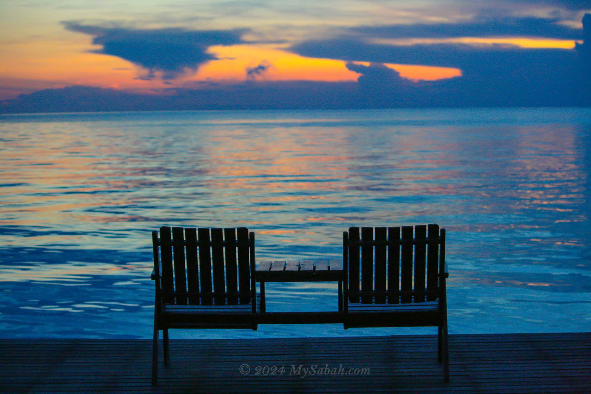
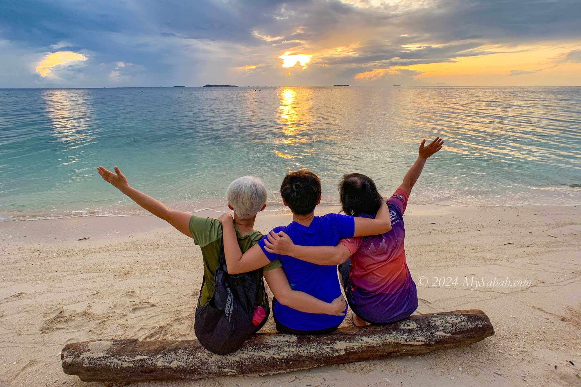
Who can resist the allure of tranquil seas and pristine white sandy beaches found on tropical islands? Sabah, often dubbed the “Maldives of South East Asia,” boasts numerous scenic islands ready to enchant tourists. Below, we present the top 10 islands (not in any order) in Sabah. Each island possesses its own unique features and beauty, showcasing the remarkable diversity of landscapes these islands offer.
1. Sipadan Island
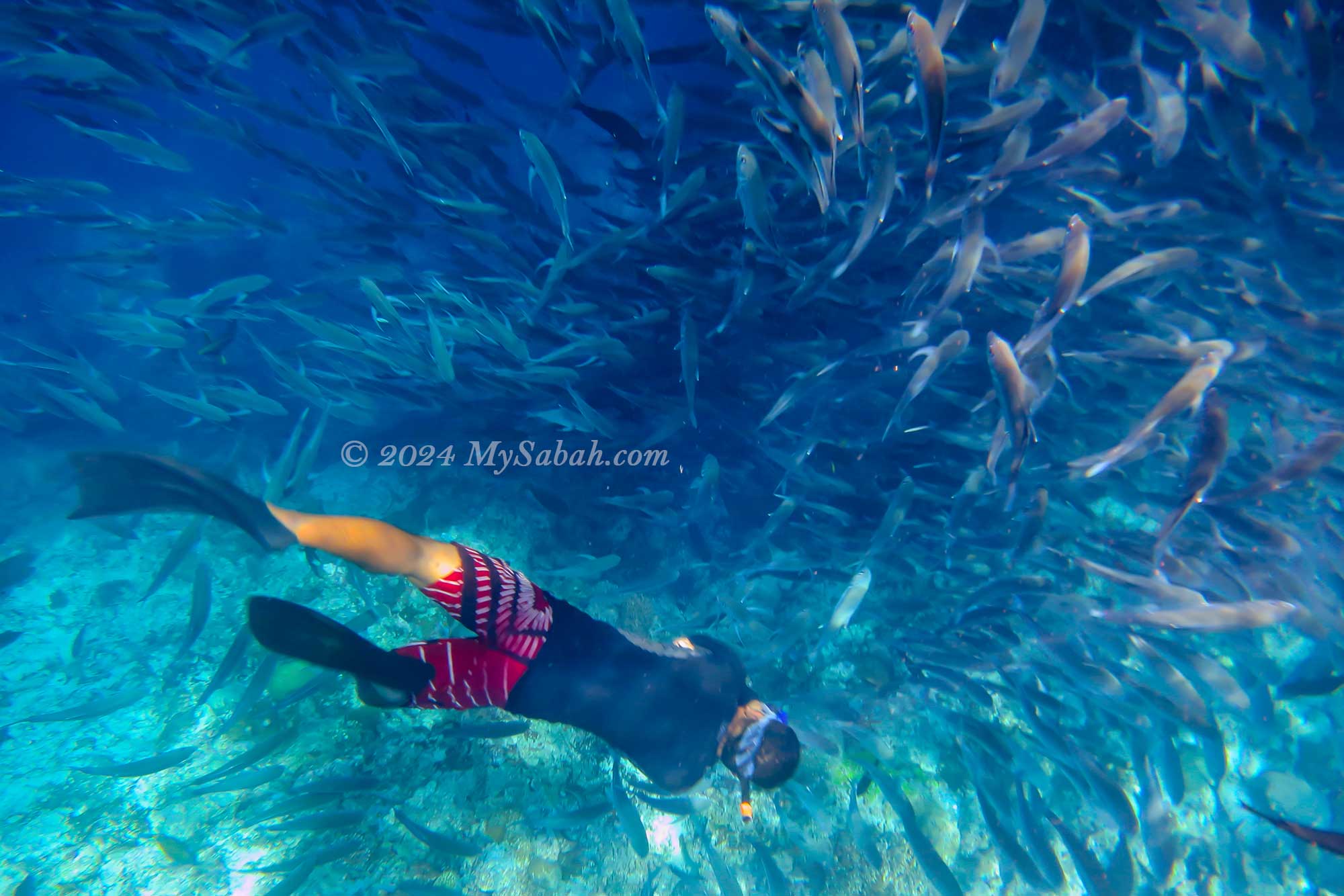
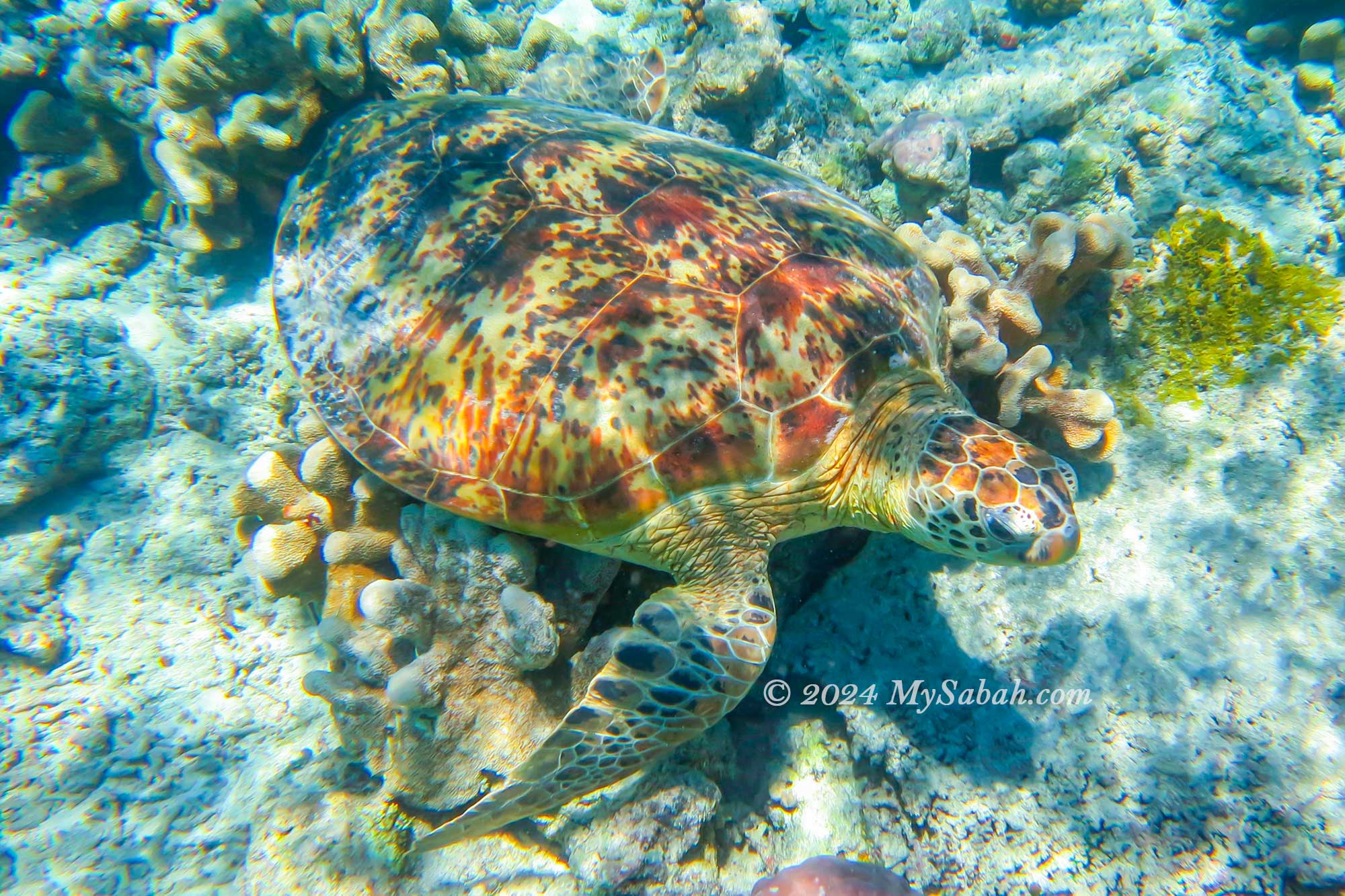
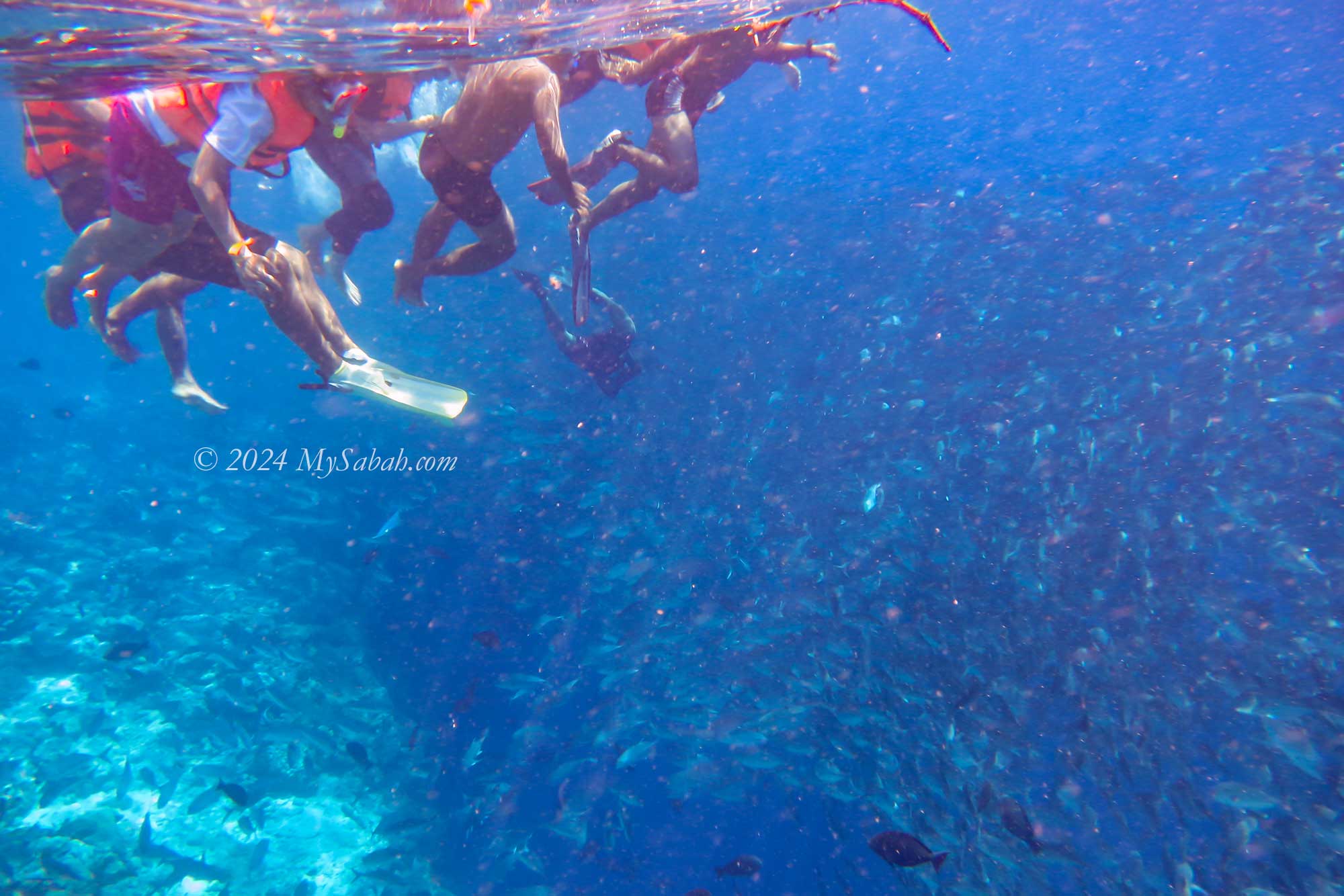
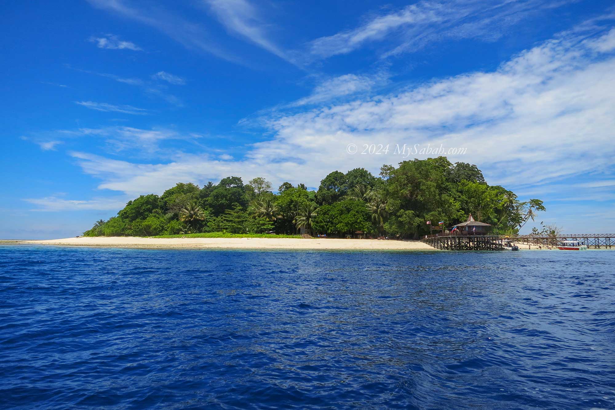
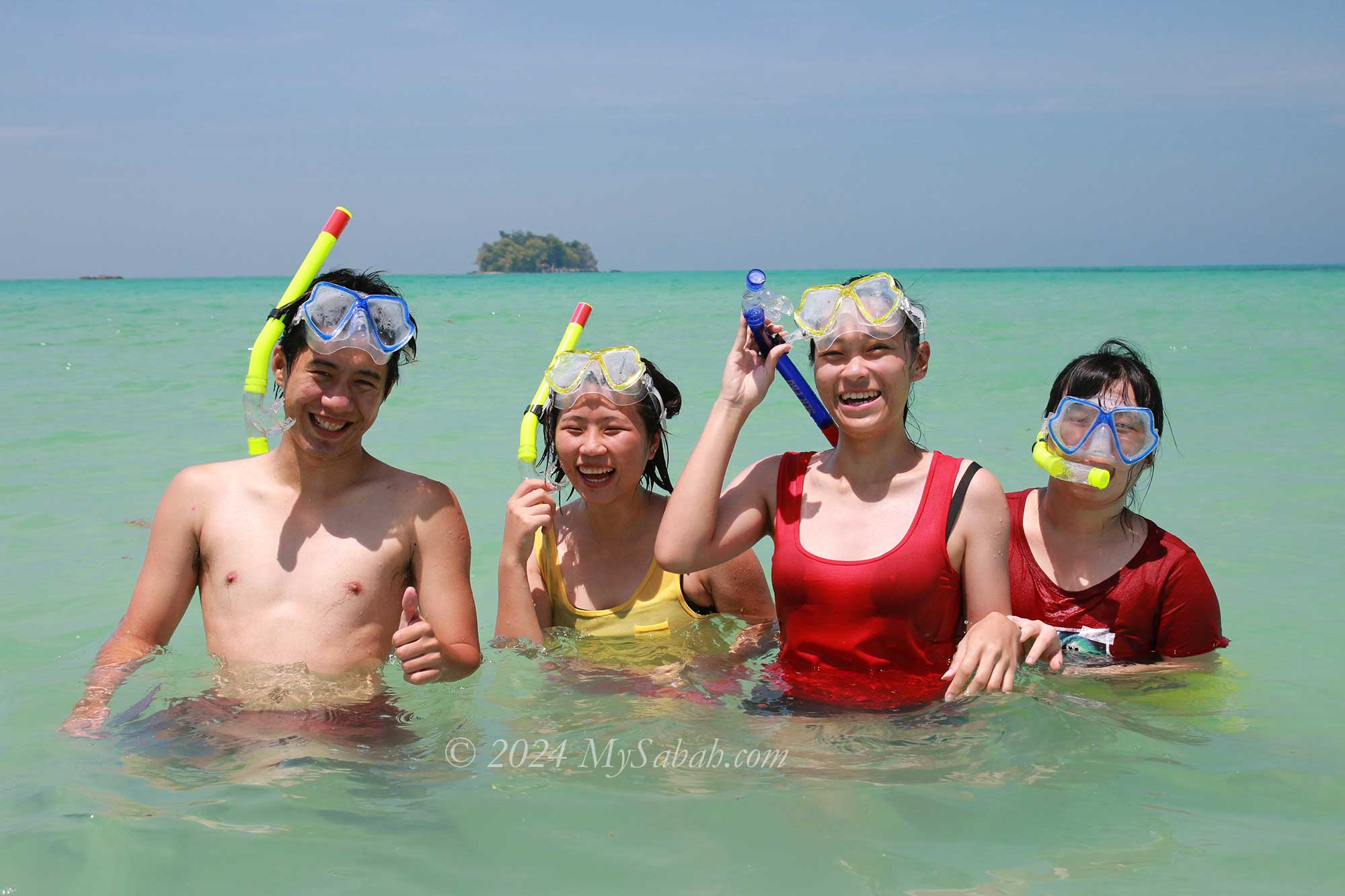
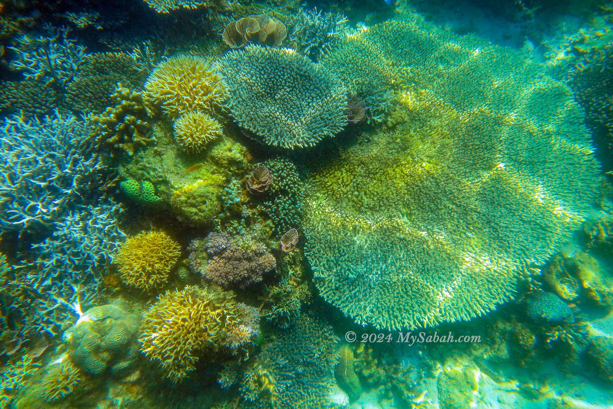
Sipadan Island is one of the top diving sites in the world. As the only oceanic island of Malaysia, it has garnered significant recognition, having been featured multiple times in National Geographic and Discovery Channels. Diving enthusiasts are in for a treat, with the opportunity to spot over 10 sea turtles on a single dive.
Snorkelling at Sipadan Island
Sea turtles are everywhere around Sipadan Island
Thousands of jackfish swimming under our feet.
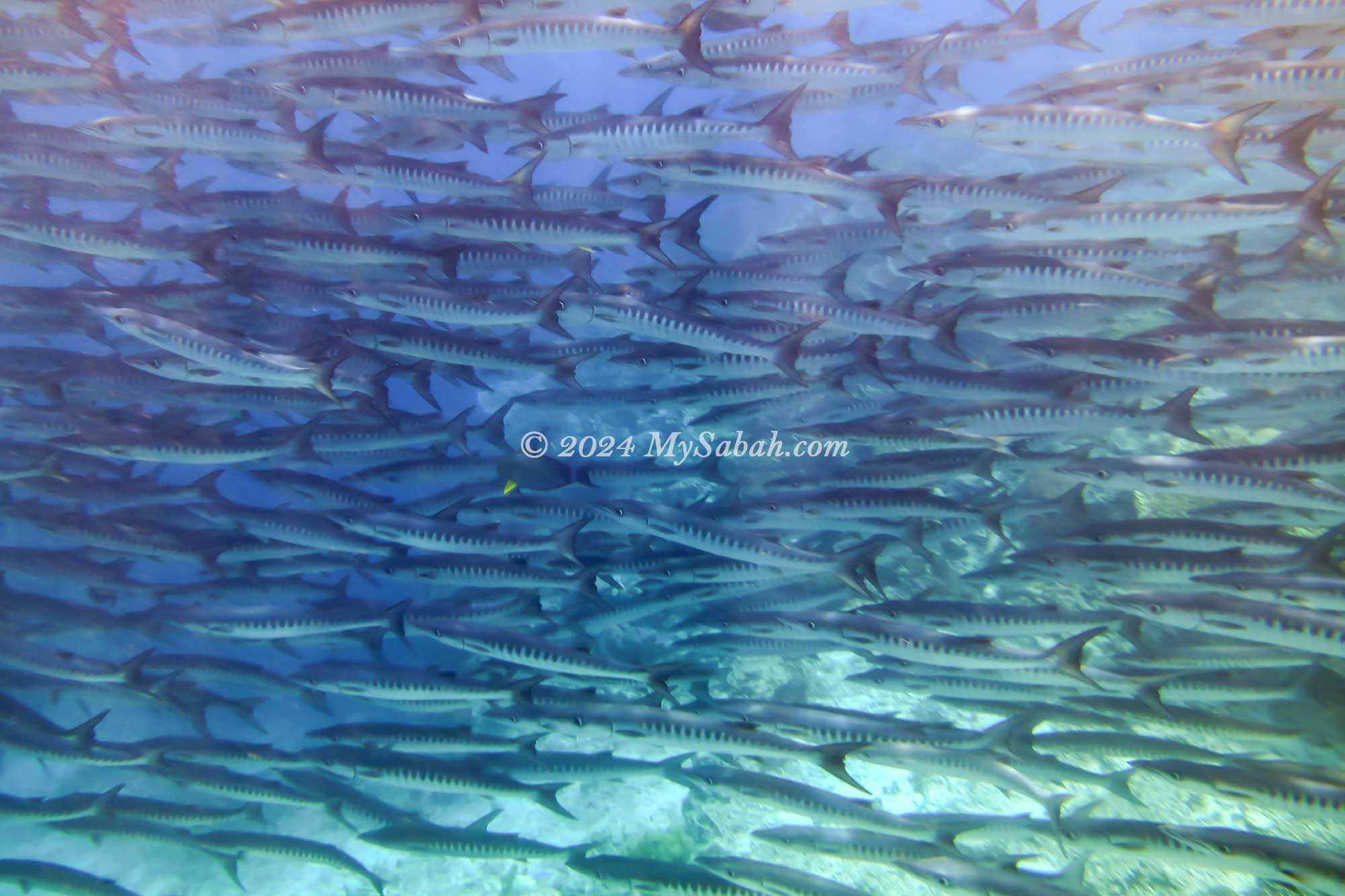
School of Barracudas
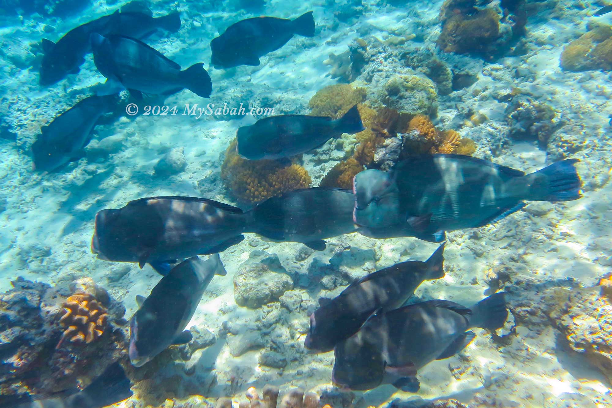
Bumphead parrotfish
Sipadan Island is the only oceanic island of Malaysia.
1 / 6
However, the real thrill lies in witnessing the barracuda tornado. Divers exploring the hanging garden dive site are greeted by a breathtaking array of colourful soft and hard corals. Read More or Book a Tour (Use Promo Code MYSABAH for Special Discount)
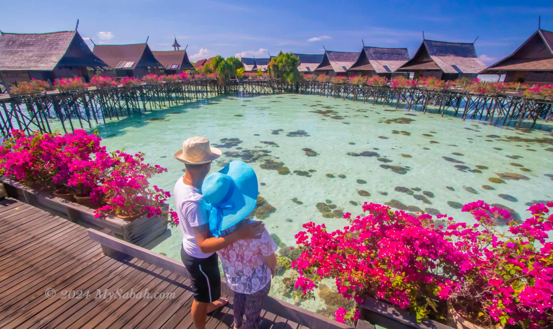
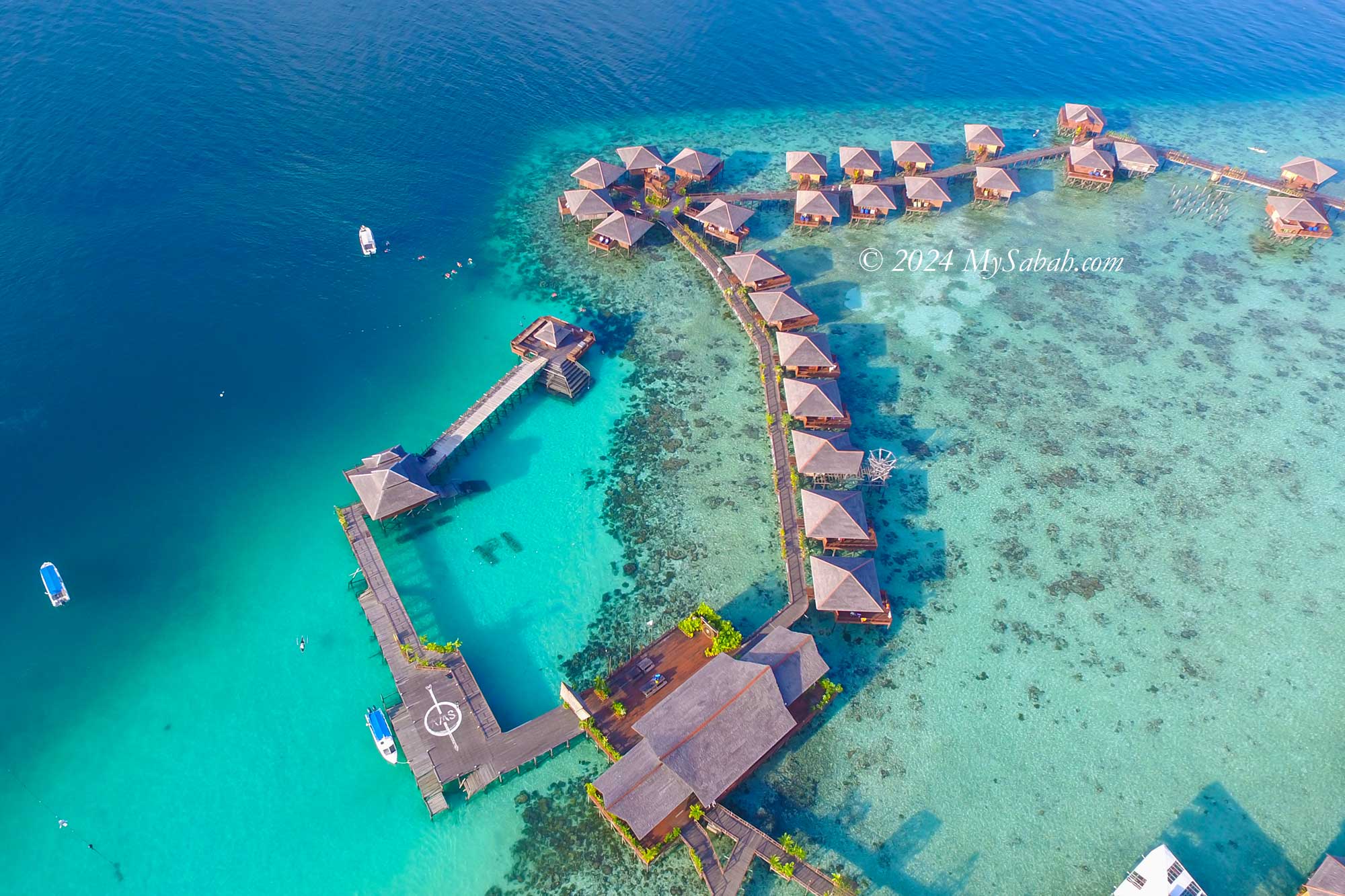
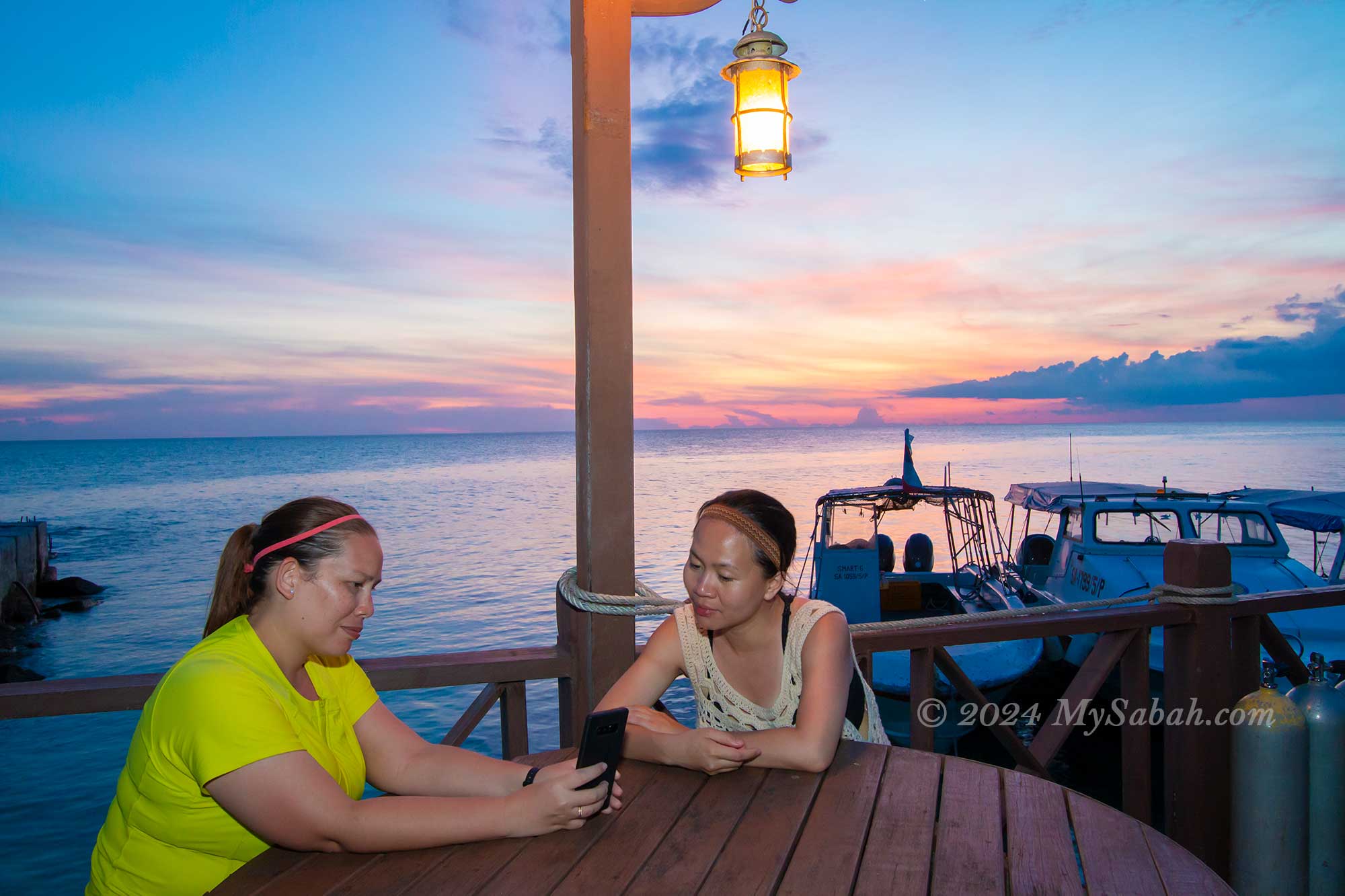
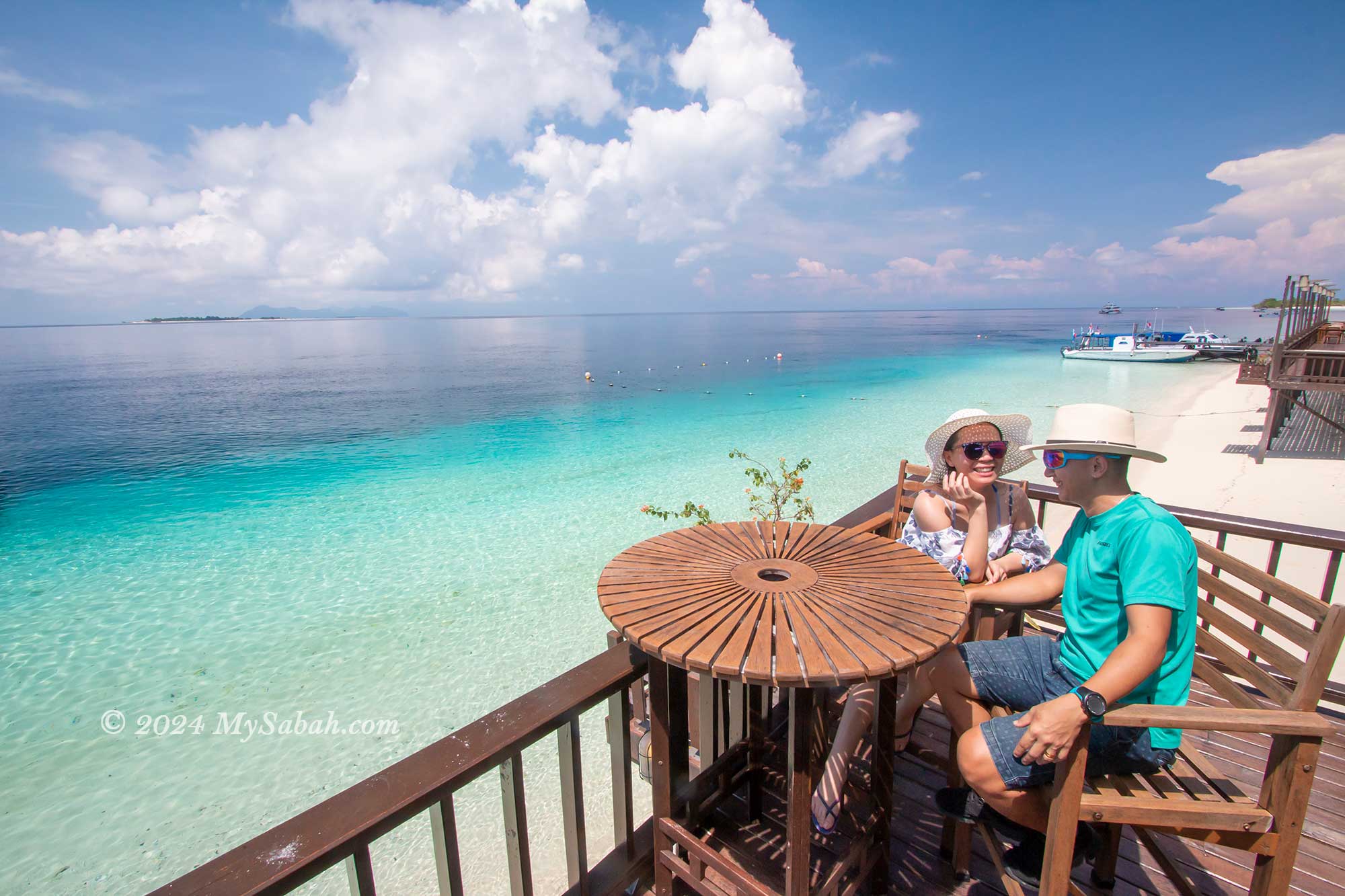
2. Kapalai Island
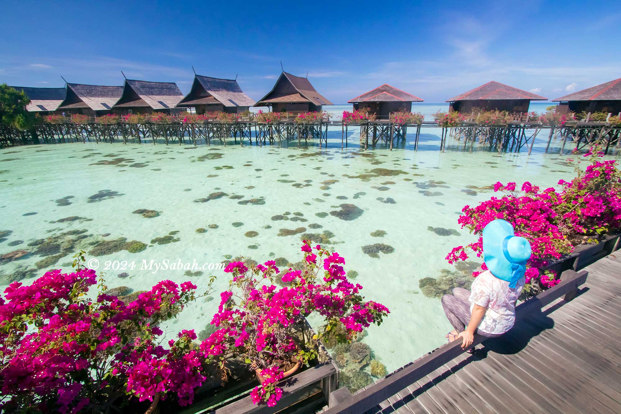
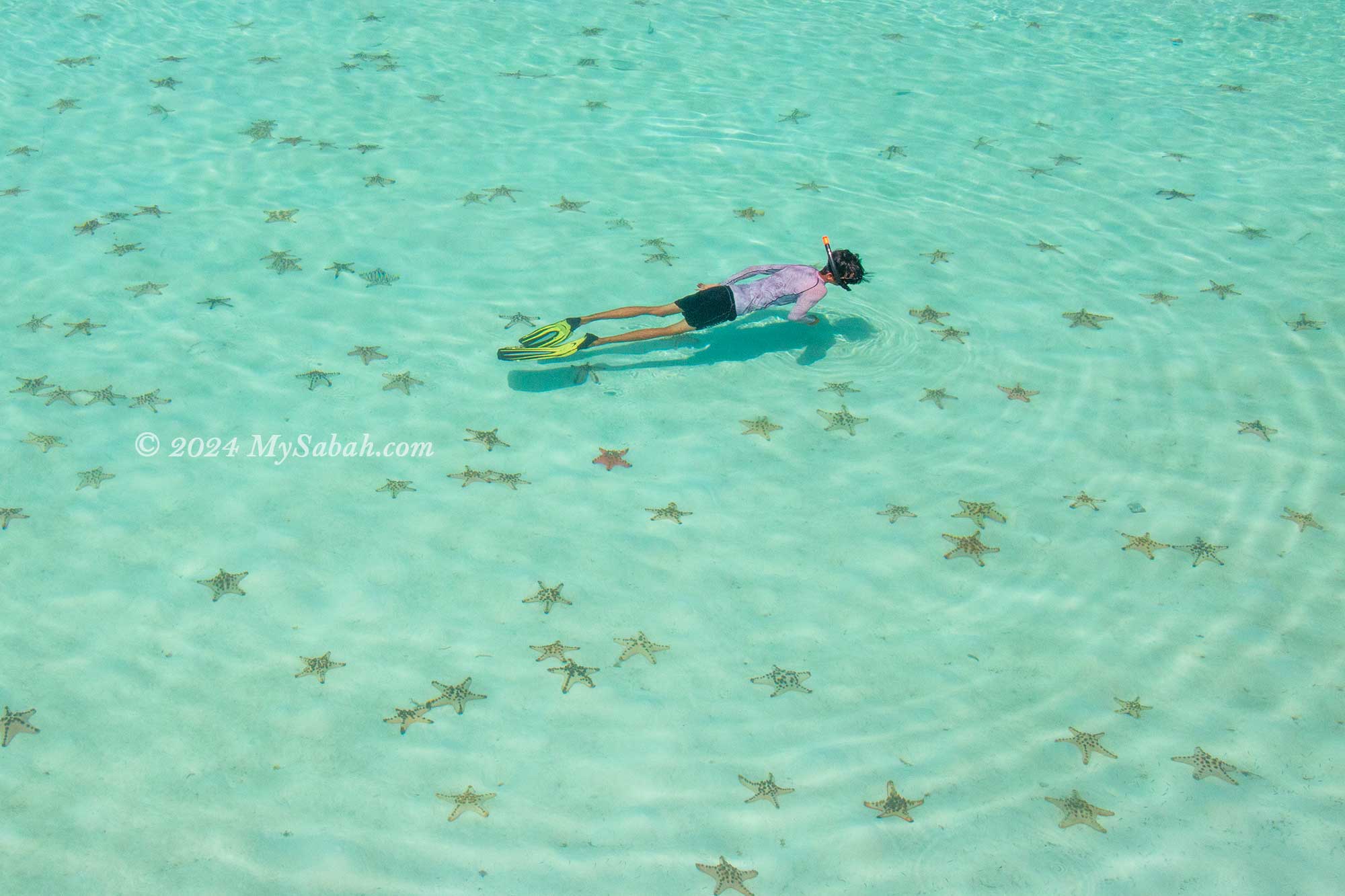
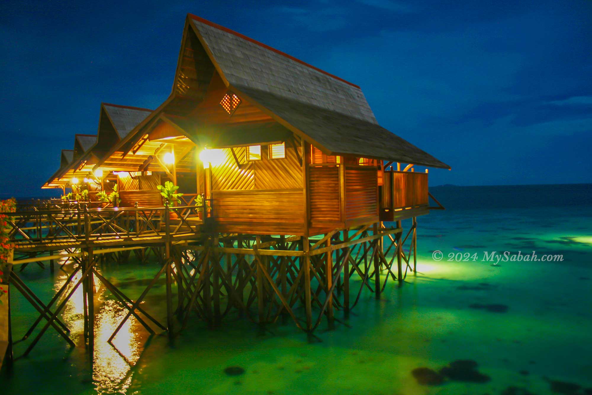
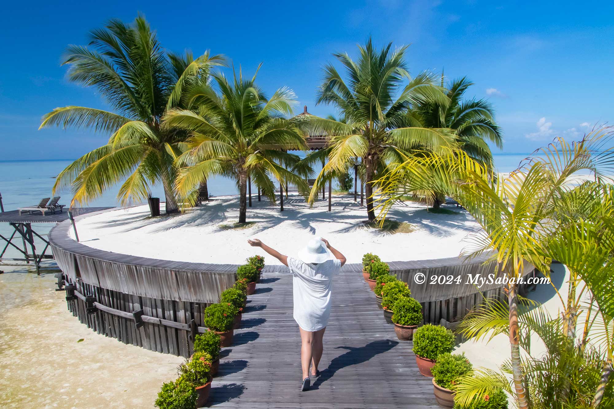
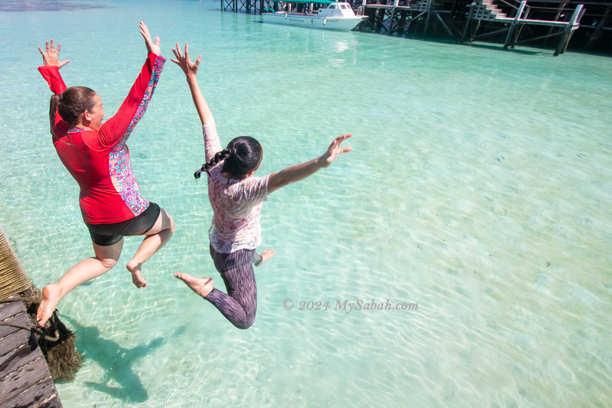
Nestled in the Celebes Sea off the coast of Semporna, Kapalai Island is a true gem. Its remote location lends it an otherworldly charm, making visitors feel as though they’ve stumbled upon a hidden paradise. One of its most enchanting features is its “magical” beach, which only emerges during low tide, adding to its mystique. It’s no wonder that the water bungalow resort on this island is consistently fully booked during peak seasons.
Kapalai Island Resort
Snorkelling with starfishes at Kapalai Island
Kapalai Island at night
Coconut beach of Kapalai Island
Jumping into the sea of Kapalai Island
Sunset at Kapalai Island
2 / 6
During the day, visitors can relax on beach chairs, soaking in the stunning sea views. As night falls, a magical scene unfolds beneath the boardwalk, with turtles and various sea creatures foraging, providing an unforgettable experience for those lucky enough to witness it. Read More or Book a Tour (Use Promo Code MYSABAH for Special Discount)
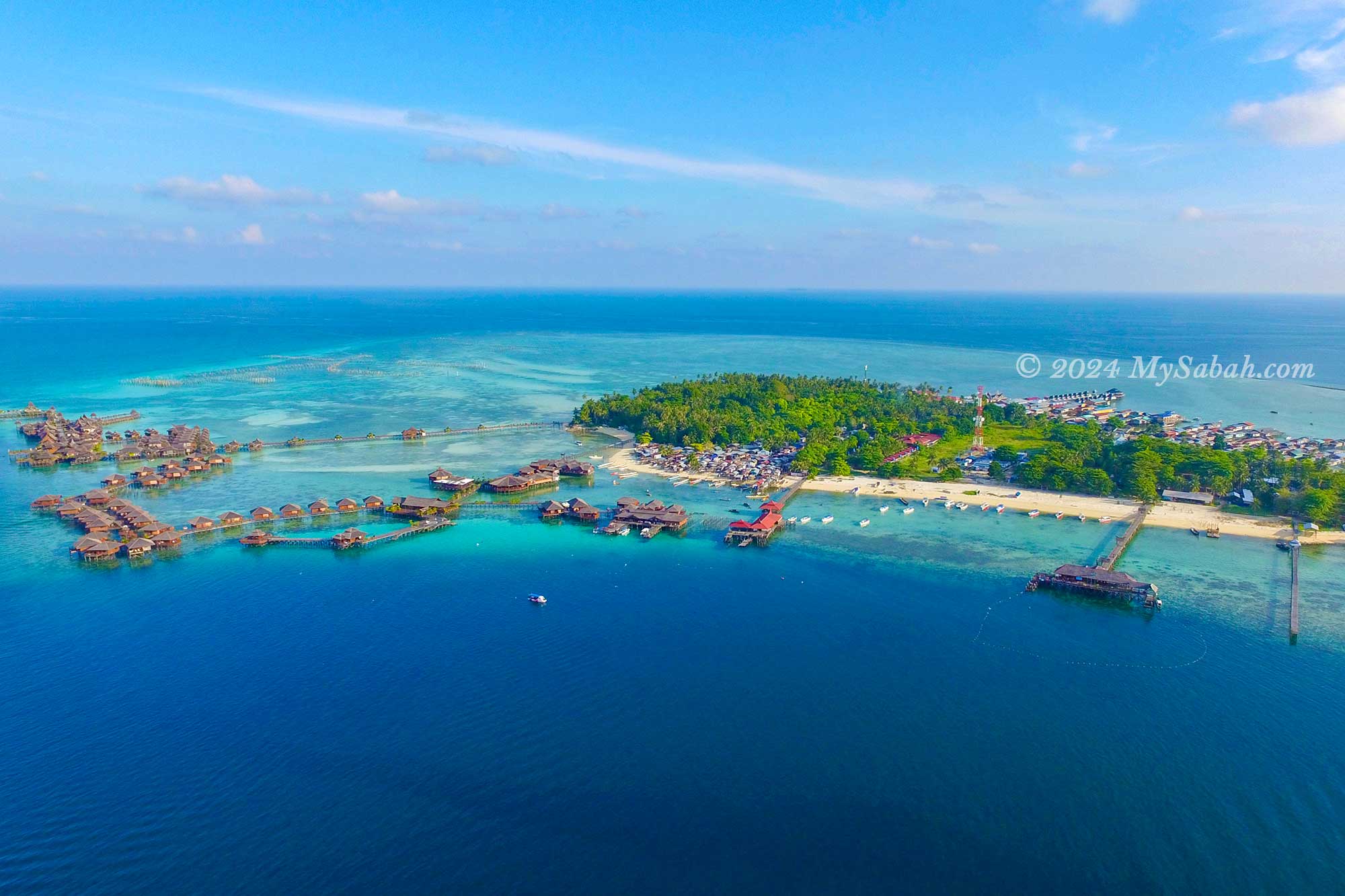
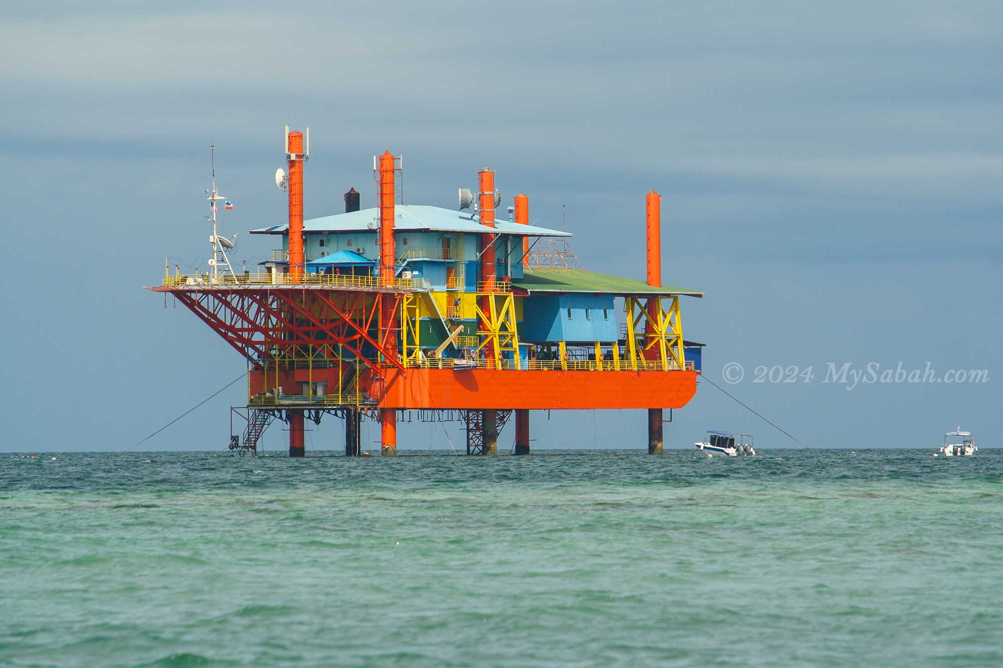
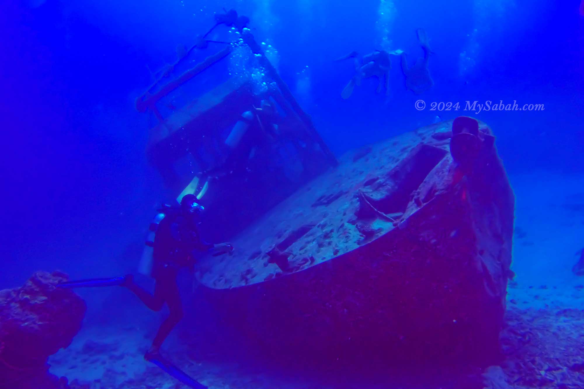
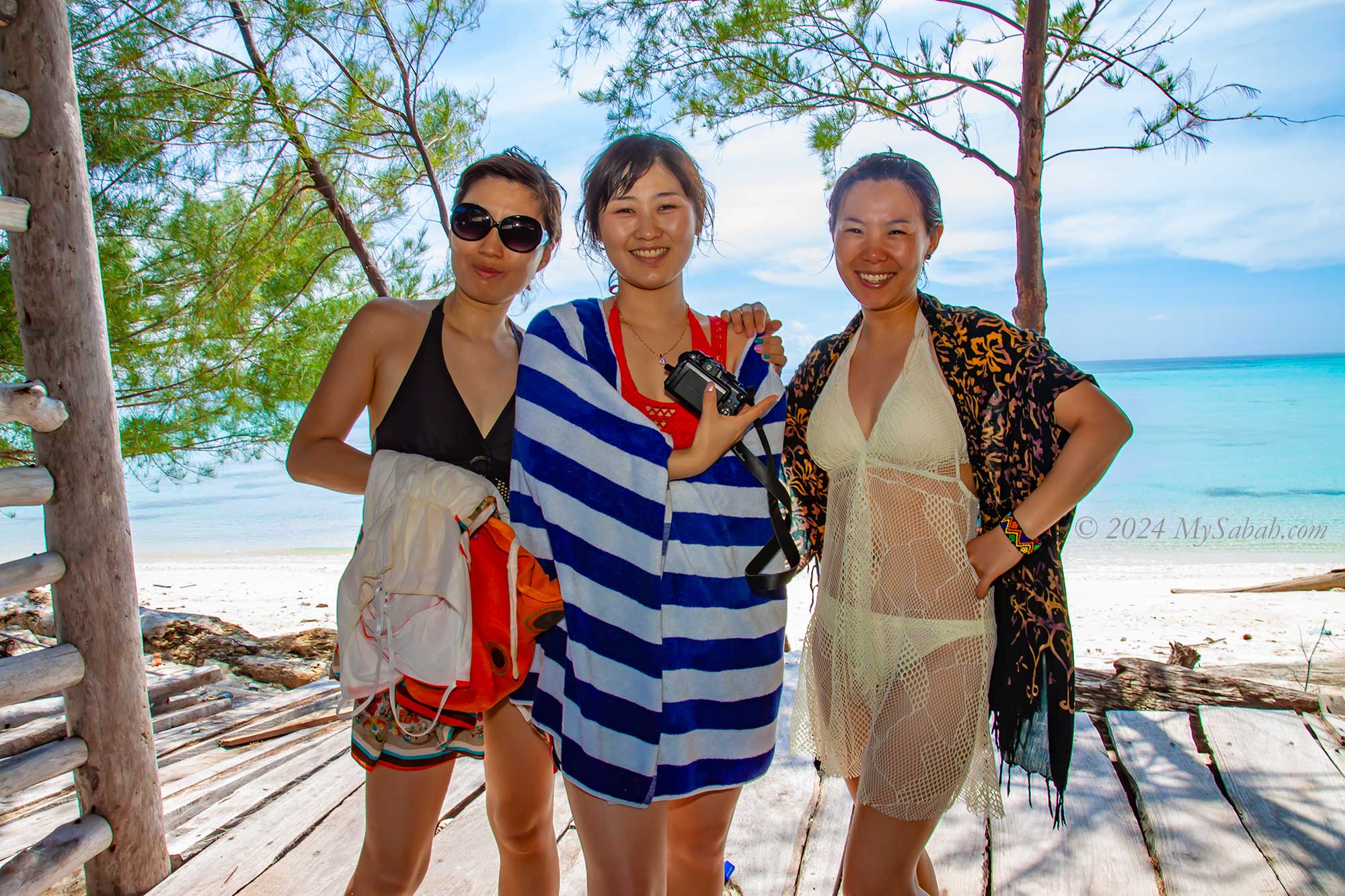
3. Mabul Island
Situated closest to Sipadan, Mabul Island boasts a rich tapestry of coral and stands as one of Malaysia’s premier muck diving sites. Underwater photographers will find themselves in paradise, with an abundance of sea critters such as nudibranchs and flatworms, some of which are yet to be named. Encounters with turtles, giant groupers, sharks, and rays are commonplace in these waters.
Water Bungalow of Mabul Island
Morning walk on Mabul Island
Aerial view of Mabul Island
Sunset of Mabul Island
Oil rig repurposed by Seaventures as a dive centre
Accommodation options on the island cater to a diverse range of travellers, from budget lodges to luxurious 5-star water bungalow resorts, ensuring that there’s something for everyone, whether it’s honeymooners, scuba divers, or backpackers. Read More or Book a Tour (Use Promo Code MYSABAH for Special Discount)
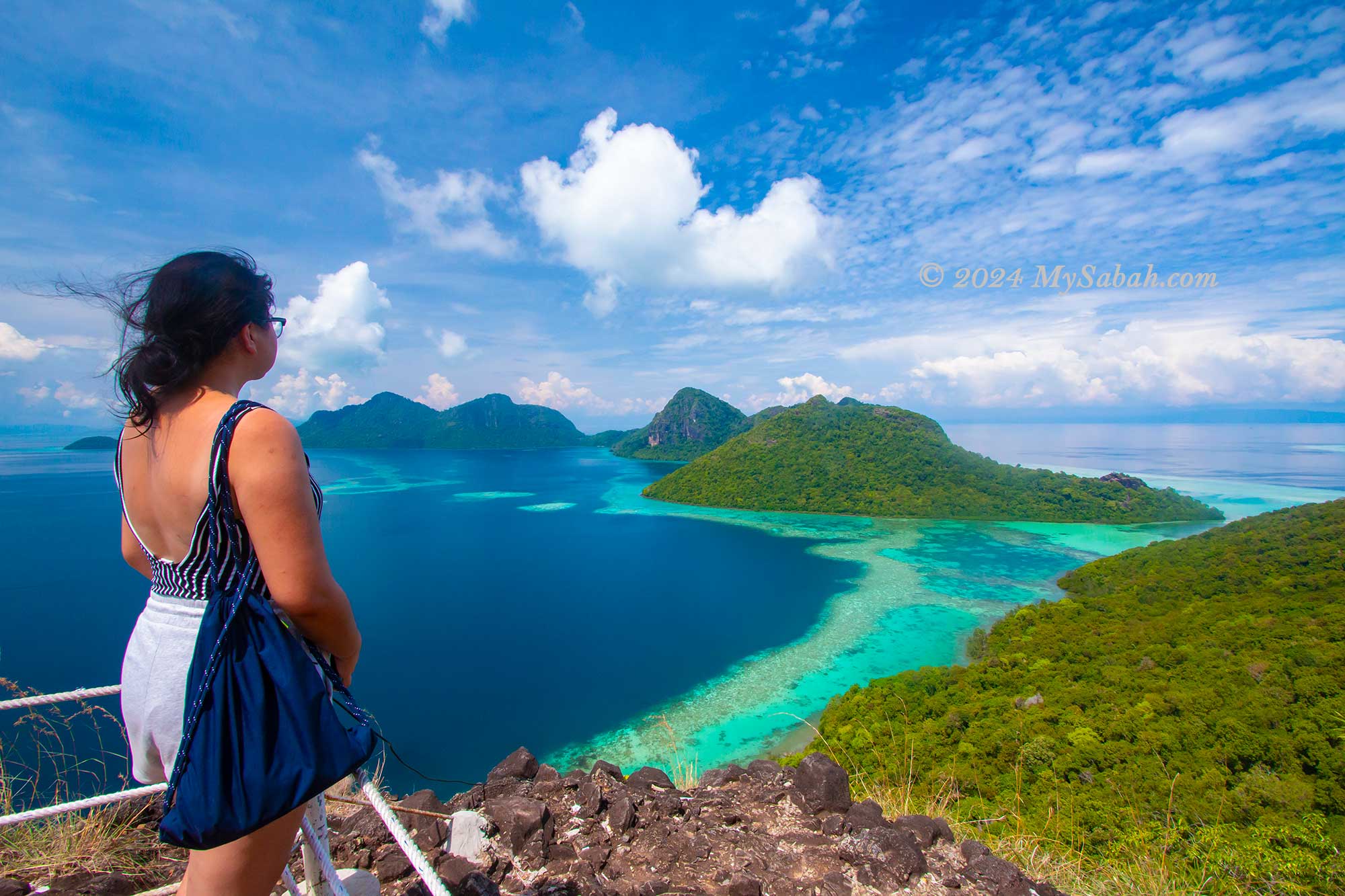
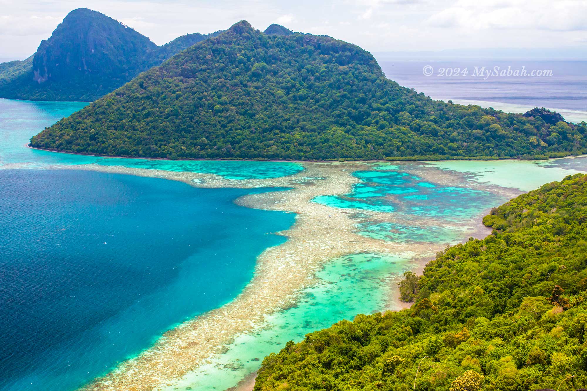
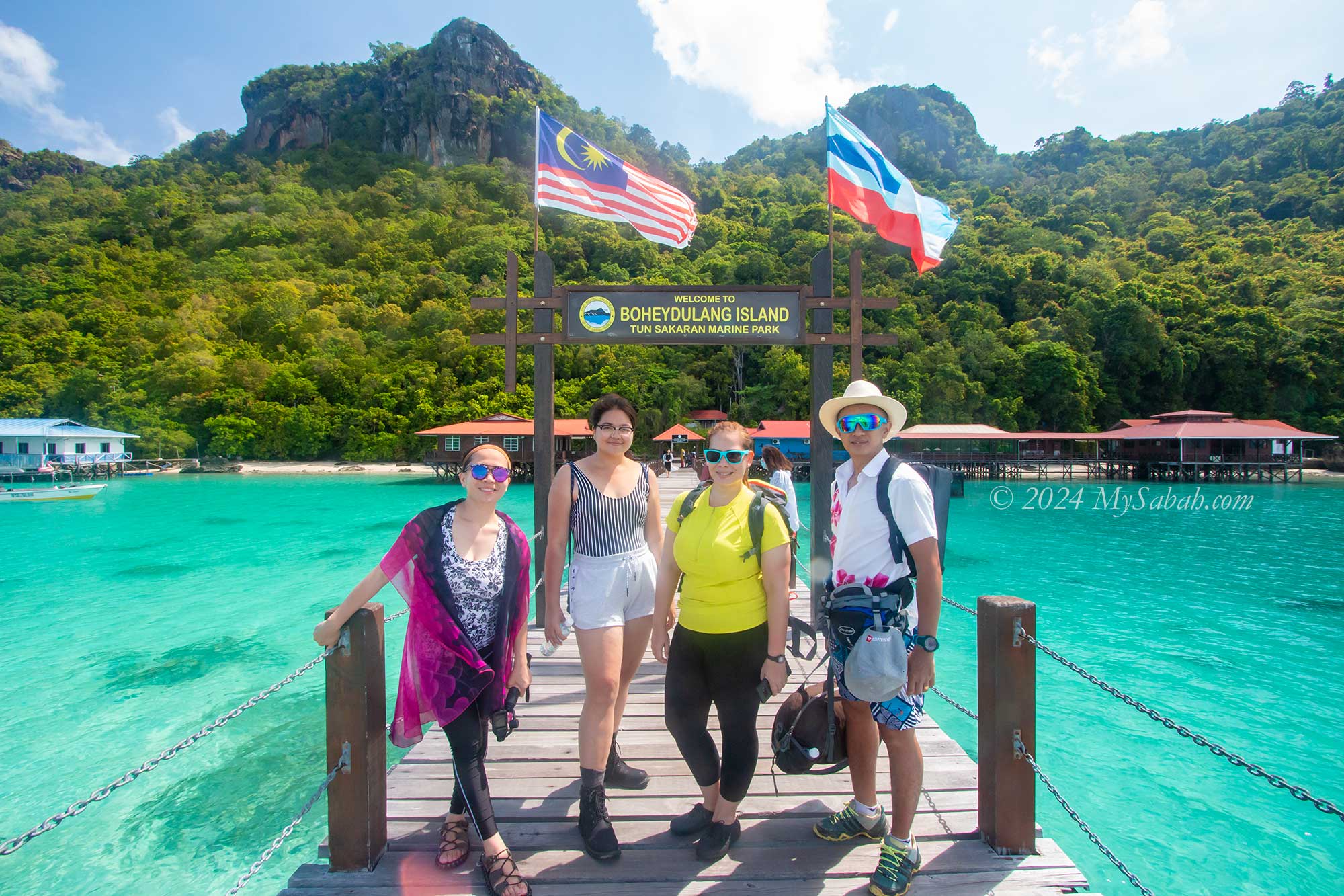
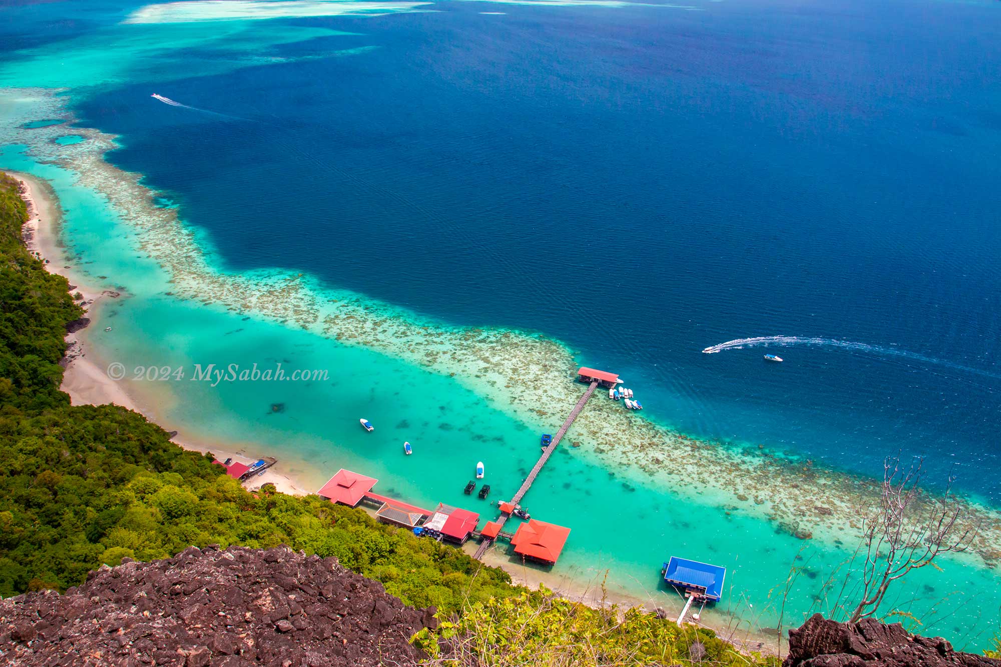
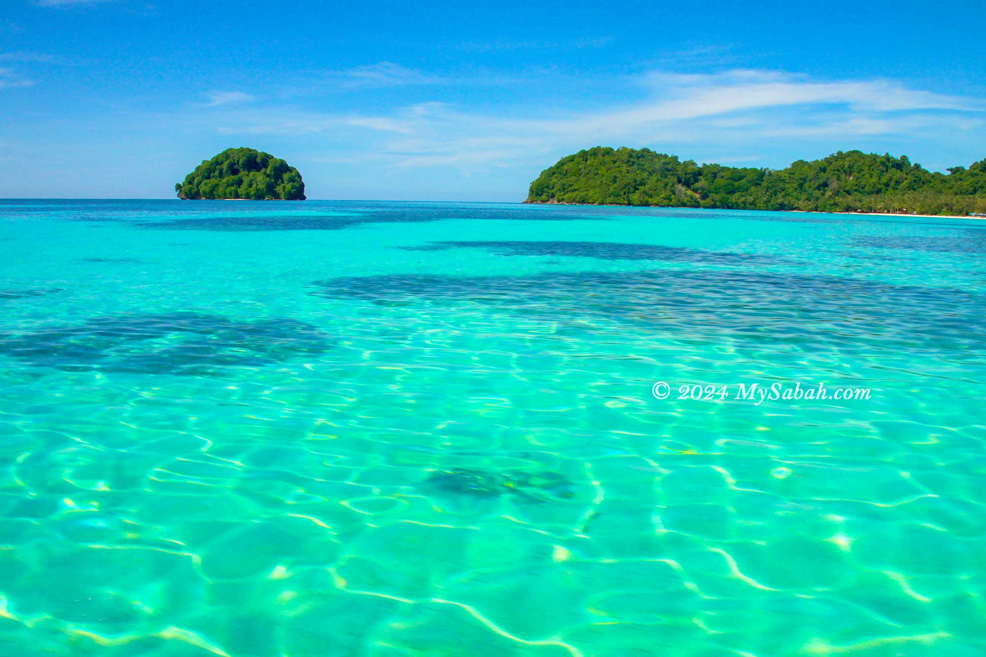
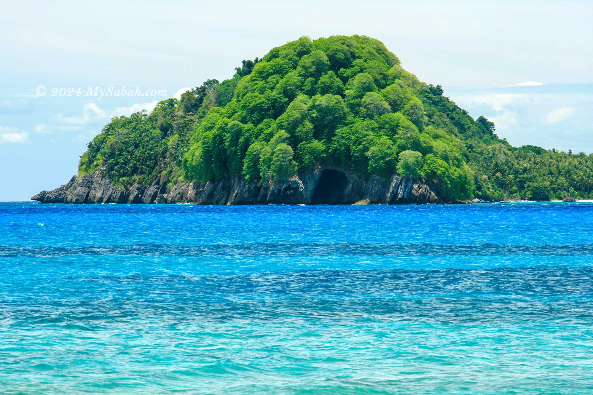
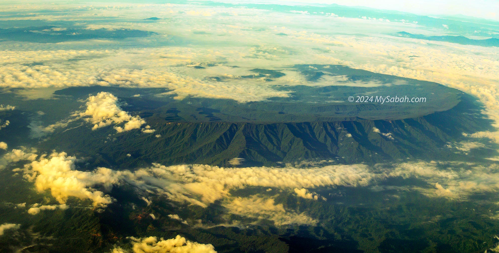
4. Boheydulang
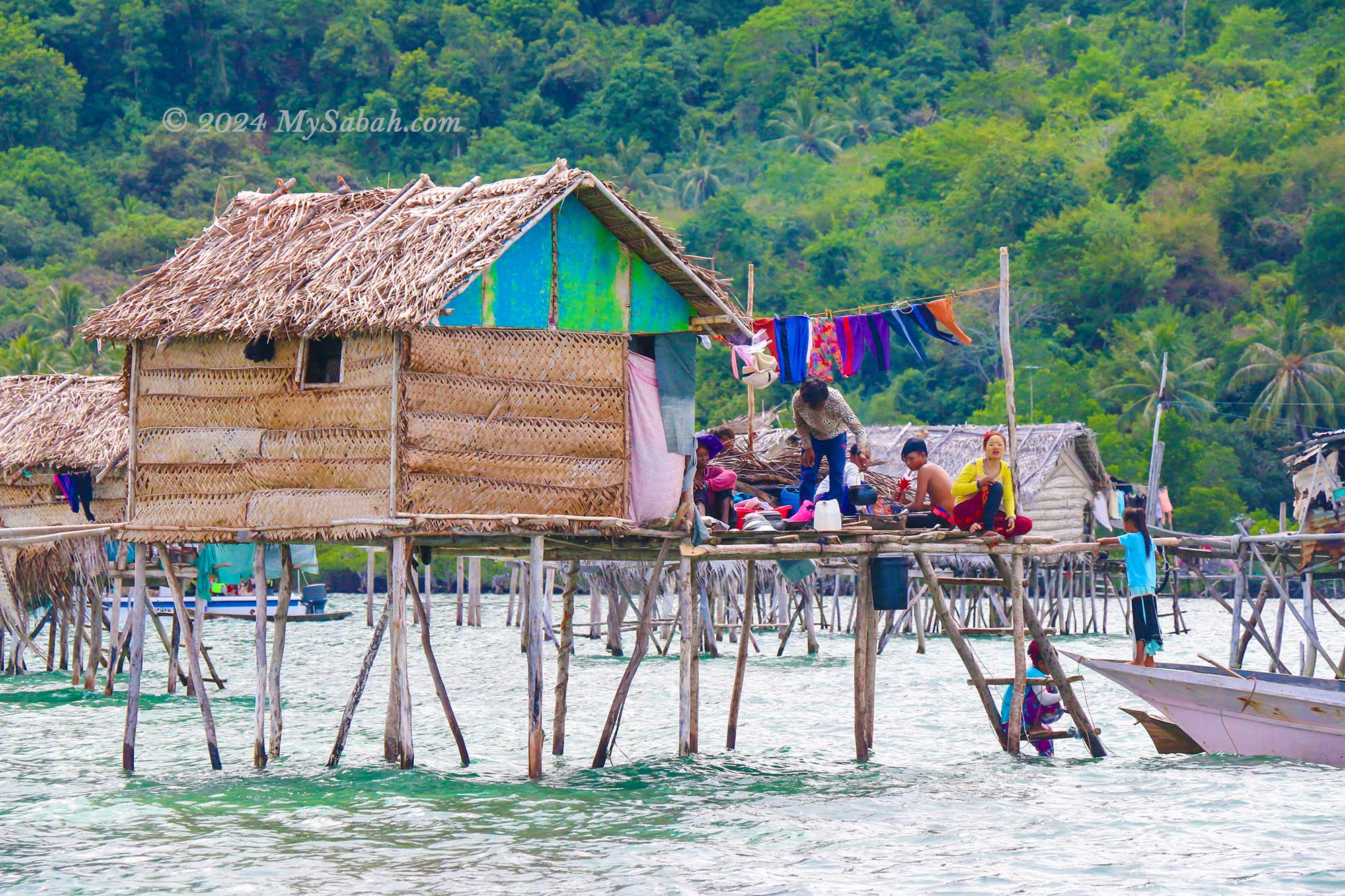
Dubbed the “Pearl Island,” Boheydulang boasts some of the most breathtaking sea views in Sabah. Situated within the Semporna Islands Park, renowned for its rich marine ecology, Boheydulang is the remnant of an ancient volcano that erupted 2.5 million years ago. The sea villages surrounding Boheydulang serve as favourite photography spots for world-renowned photographers, adding to the island’s allure. Read More or Book a Tour (Use Promo Code MYSABAH for Special Discount)
Enjoy the panoramic view of Tun Sakaran Marine Park on top of Bohey Dulang Island
These islands were used to be part of an ancient volcano rim
Jetty of Boheydulang Island
The jetty of Bohey Dulang Island
The water village of Sea Bajau people
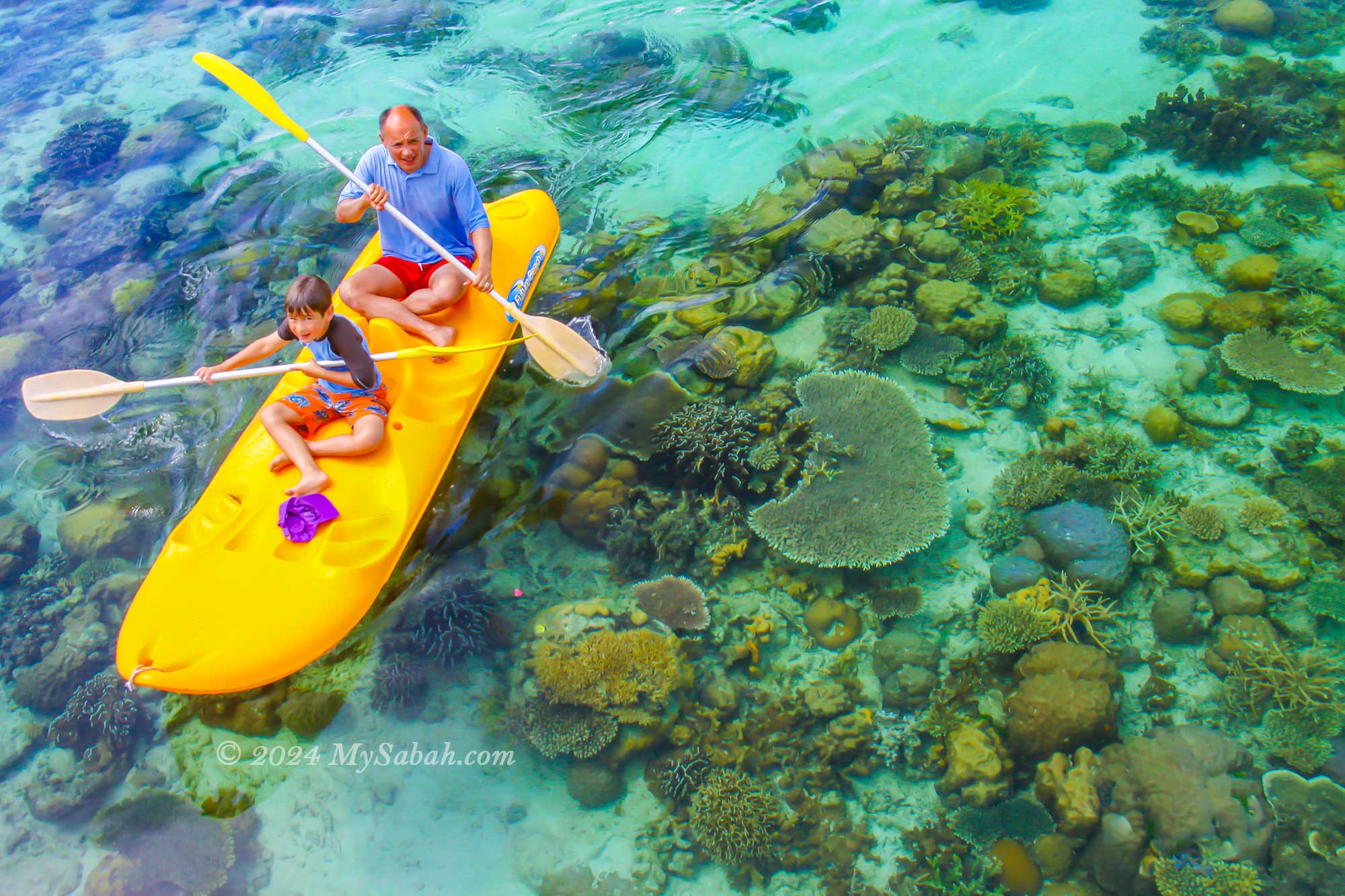
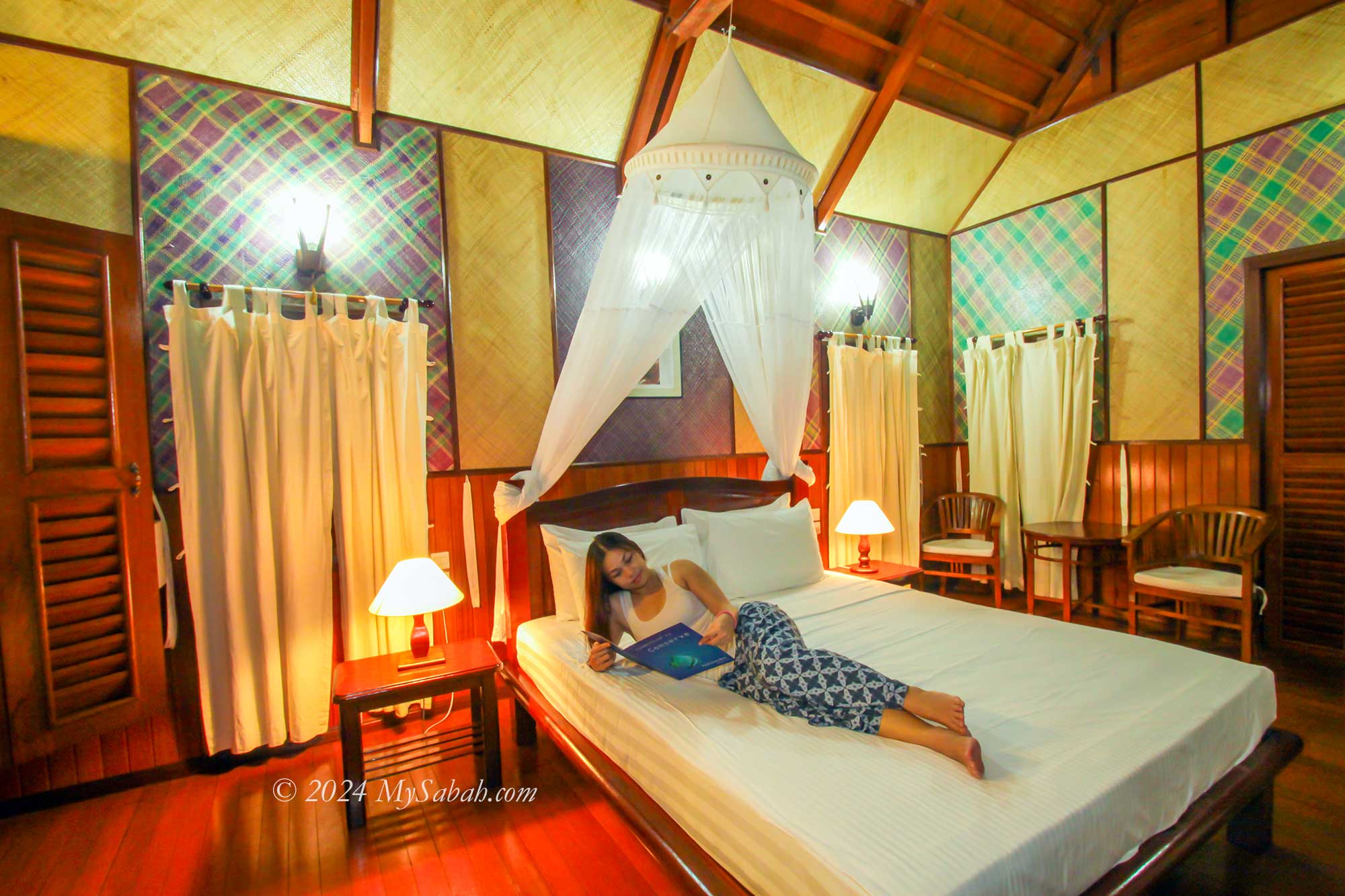
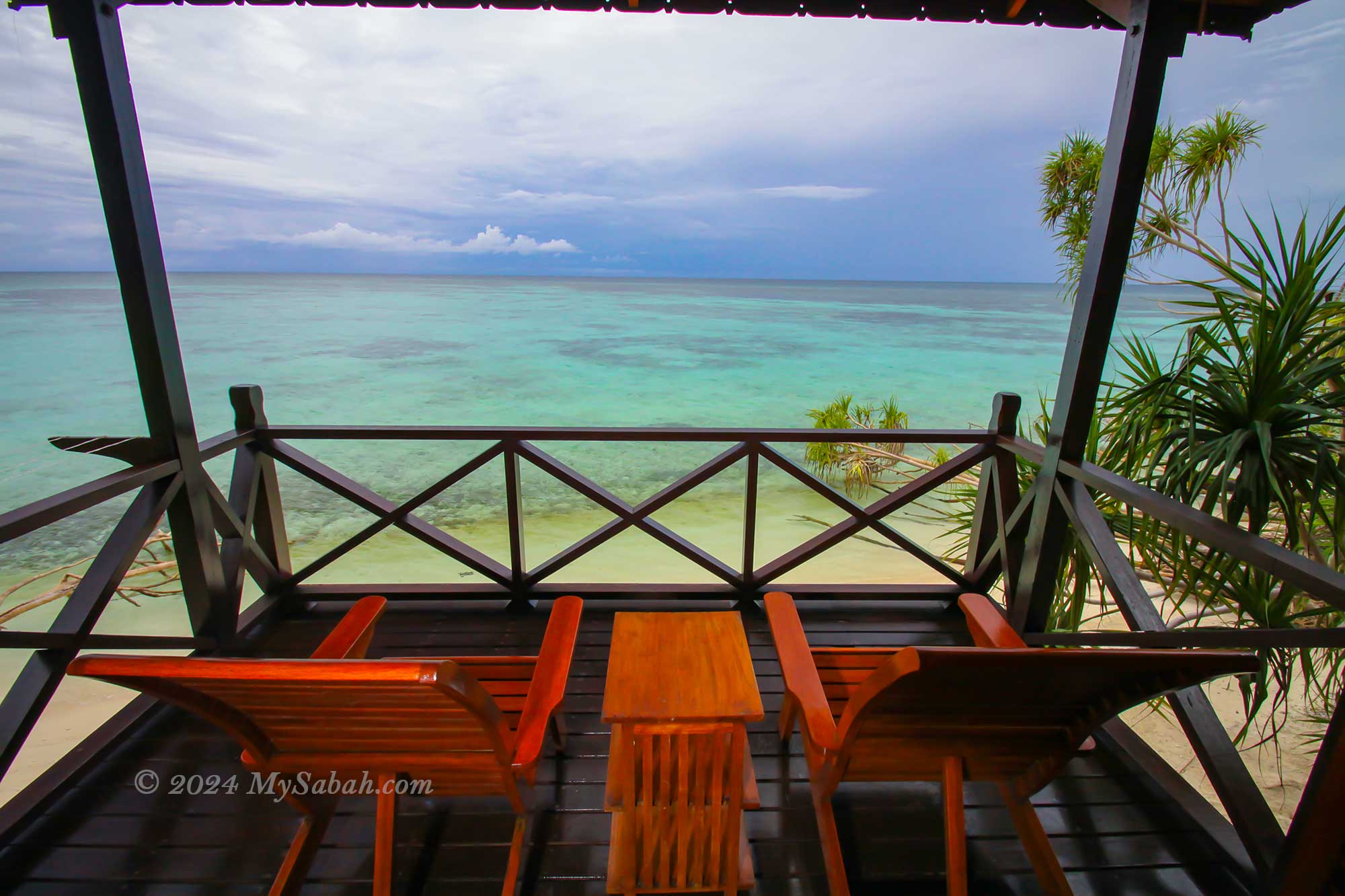
5. Lankayan Island
Well-known for its whale shark sightings and turtle nesting grounds, Lankayan Island offers a slice of paradise. Stay in the sea-facing chalets, and wake up to the sight of numerous fishes, turtles, and baby sharks gracefully swimming in front of your balcony each morning. A short walk leads you to the inviting beach, perfect for a refreshing swim. As a private island, Lankayan ensures a tranquil holiday experience, free from the disruptions of noisy strangers. Read More or Book a Tour (Use Promo Code MYSABAH for Special Discount)
Holiday on Lankayan Island
Releasing turtle hatchlings
Kayaking on Lankayan Island
Room of Lankayan Island Resort
Balcony with sea view
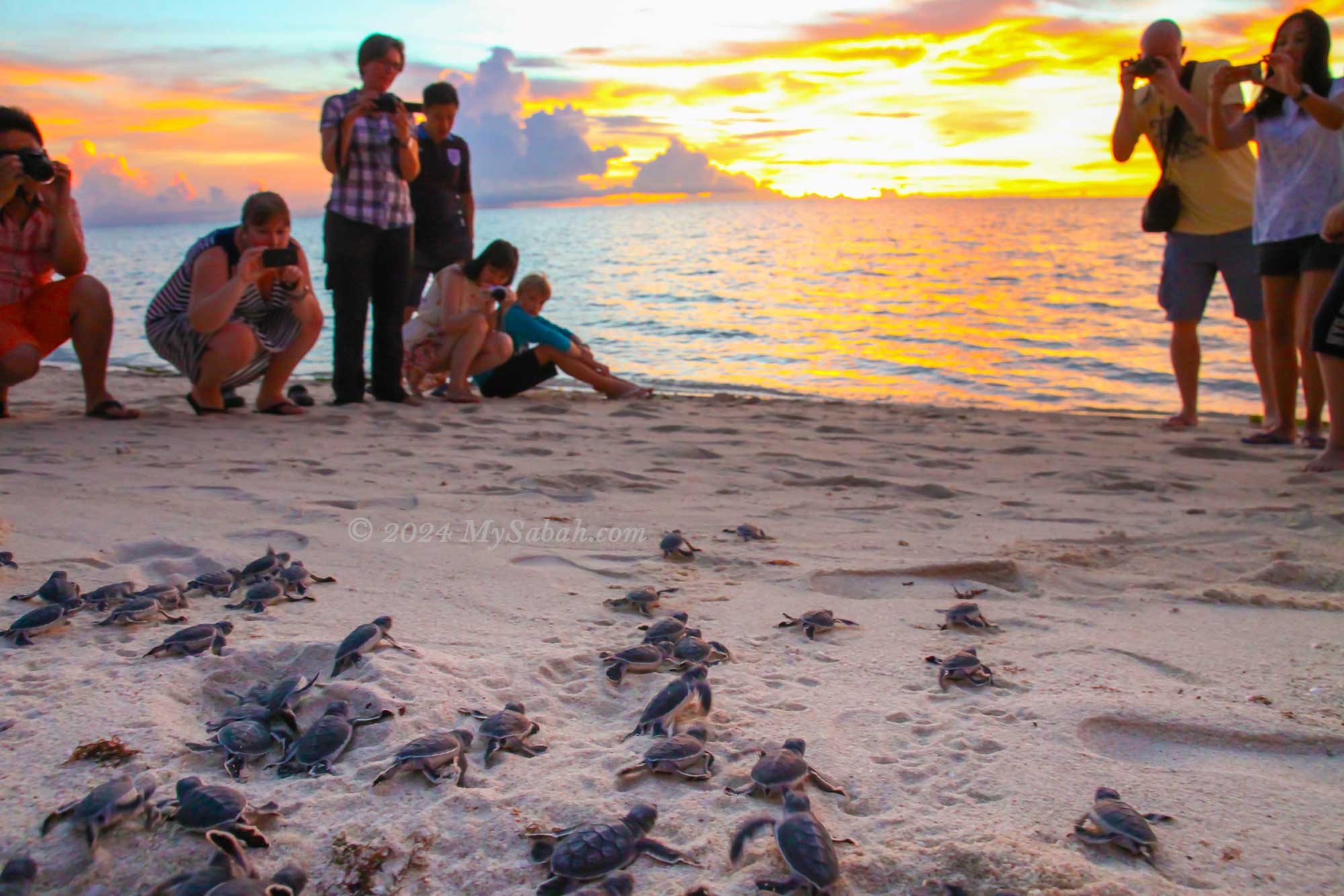
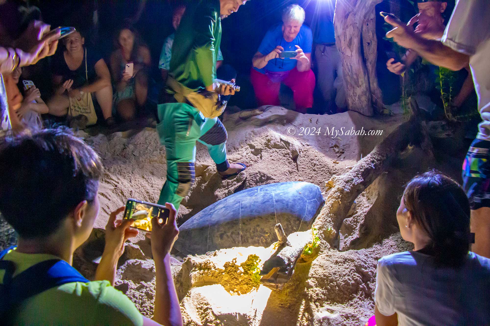
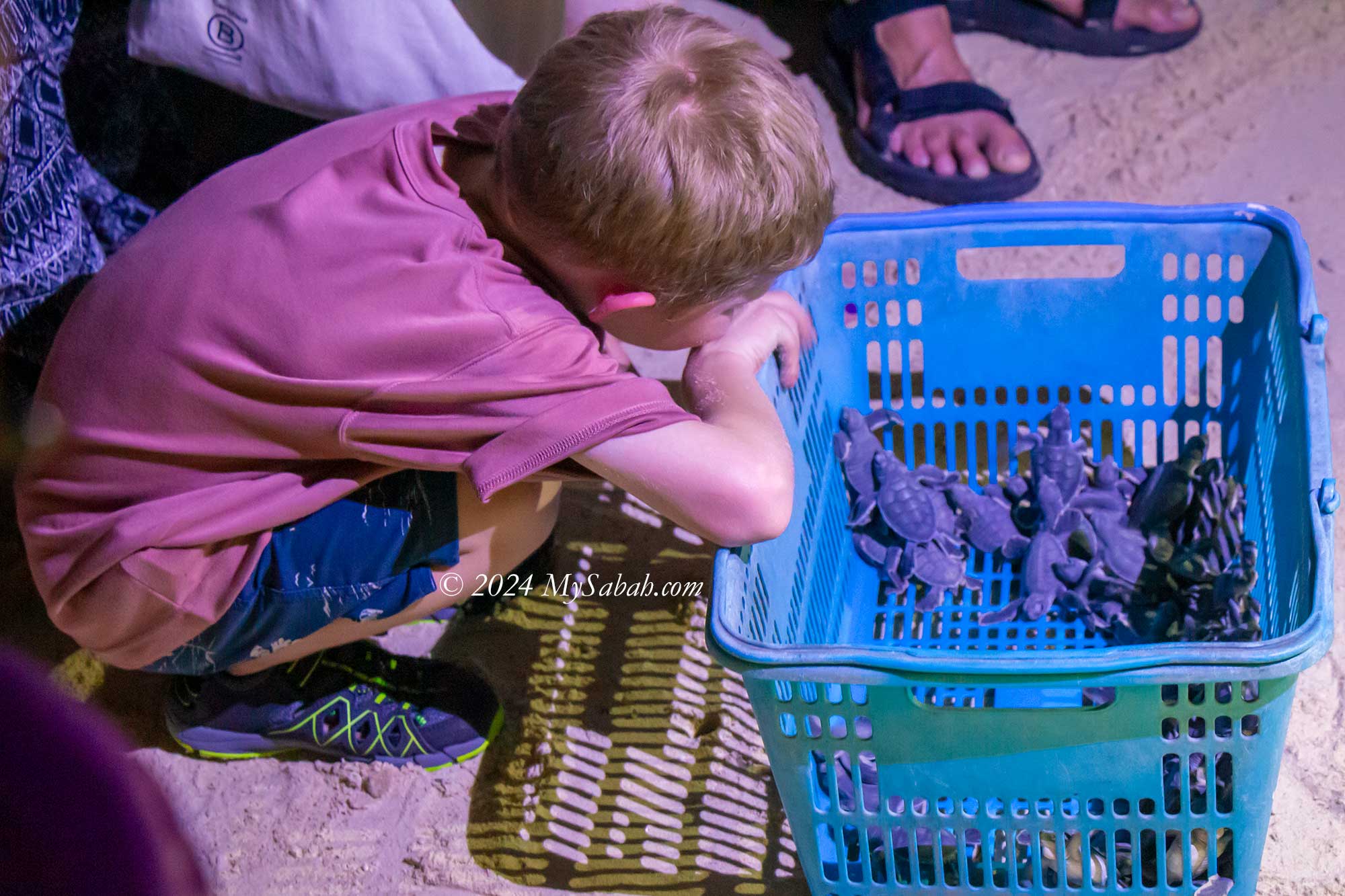
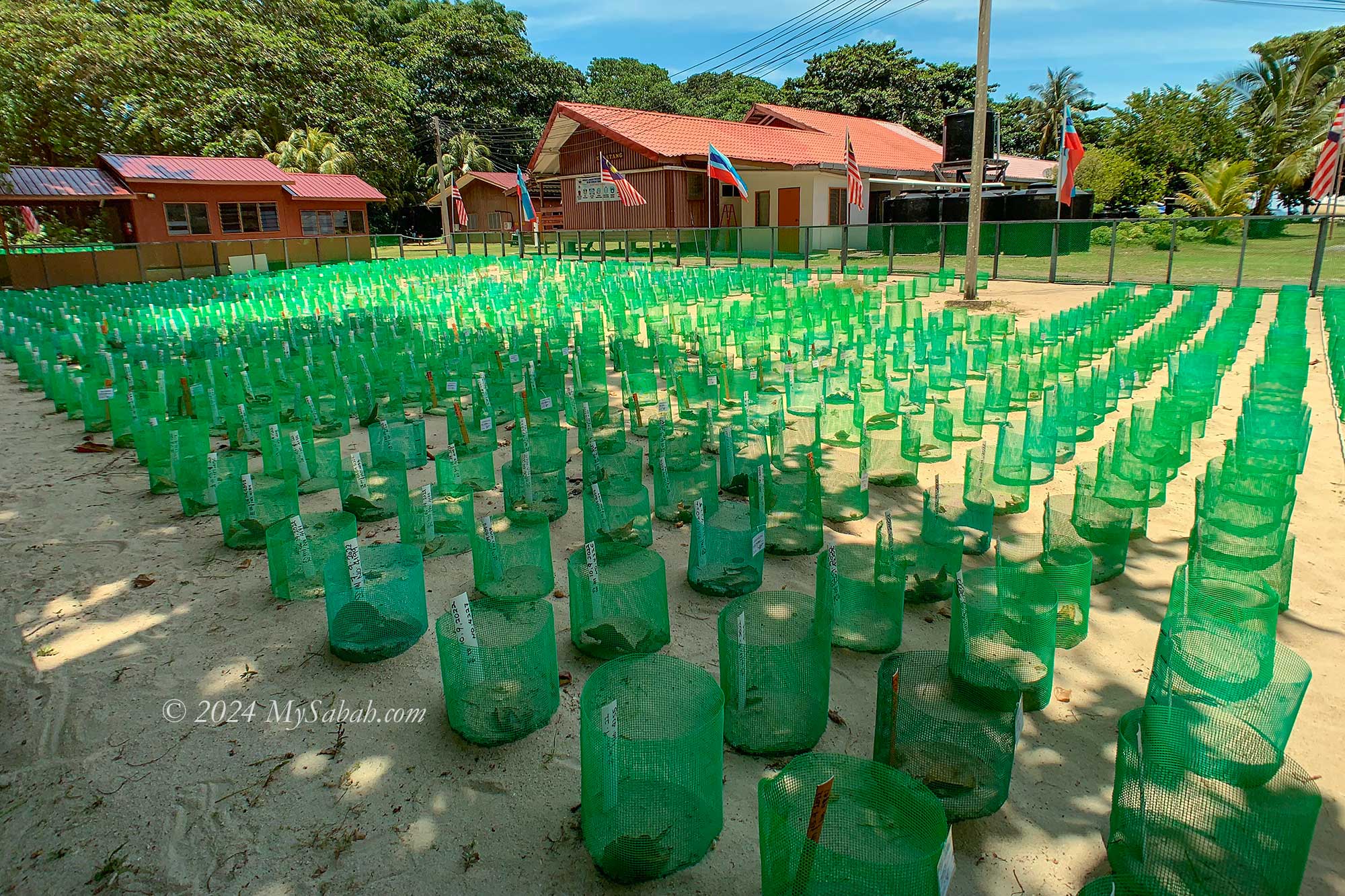
6. Selingan Turtle Island
Turtles, among the oldest and most captivating marine creatures, find their sanctuary on Selingan Turtle Island. Each year, hundreds, sometimes thousands, of sea turtles embark on remarkable journeys spanning hundreds of miles to return to the very island where they were born—a testament to Selingan’s significance in turtle conservation.
Turtle nesting on the beach of Selingan Island
Nice beach of Selingan Island
Prepare to release turtle hatchlings
Turtle hatchery on Selingan Island. You can adopt the nest.
Sunrise at Selingan Island
Here, visitors have the unique opportunity to witness mother turtles laying eggs up close and even participate in the adoption of the hatchlings, offering an unforgettable experience steeped in nature’s wonders. Read More or Book a Tour (Use Promo Code MYSABAH for Special Discount)
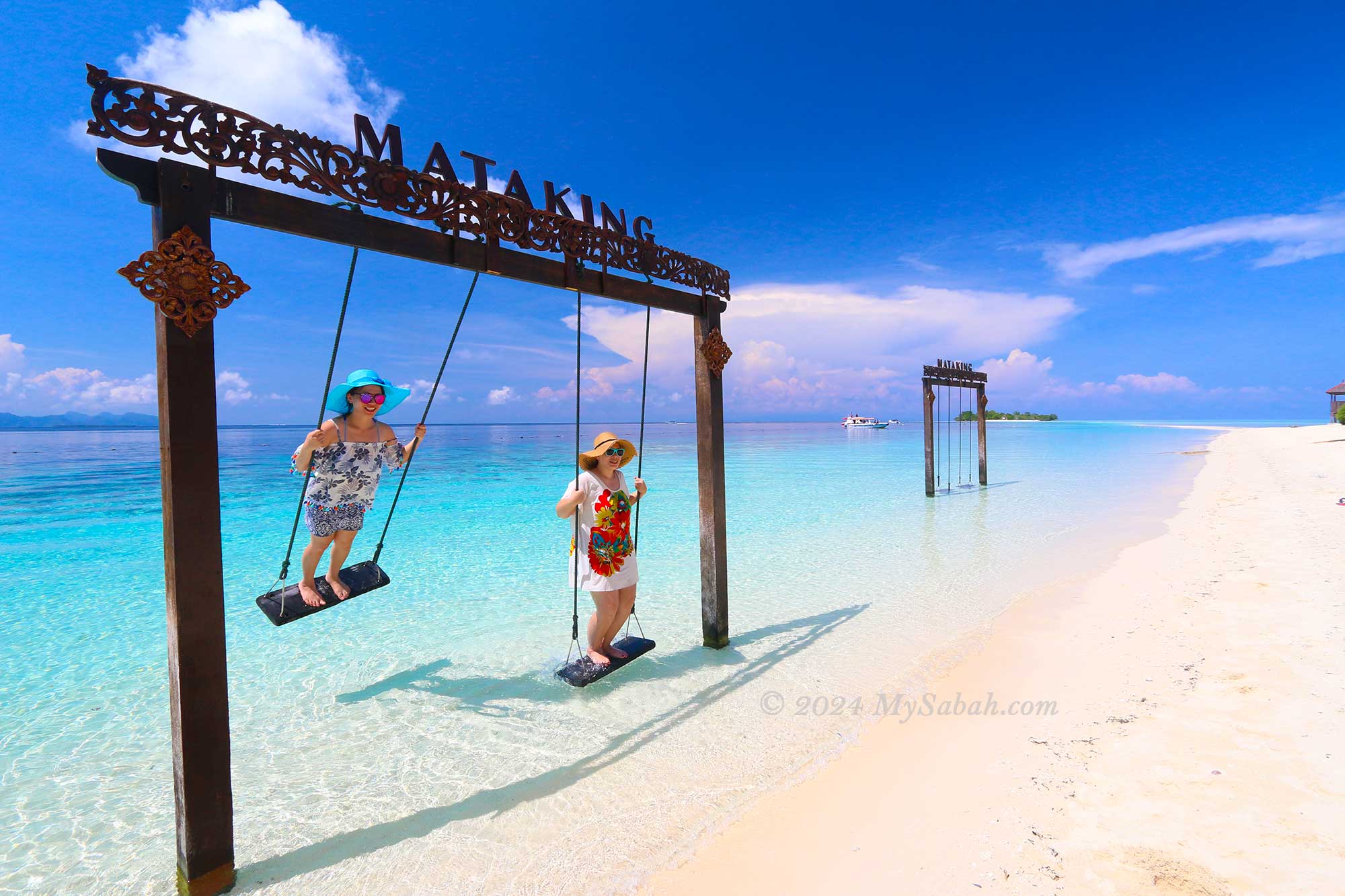
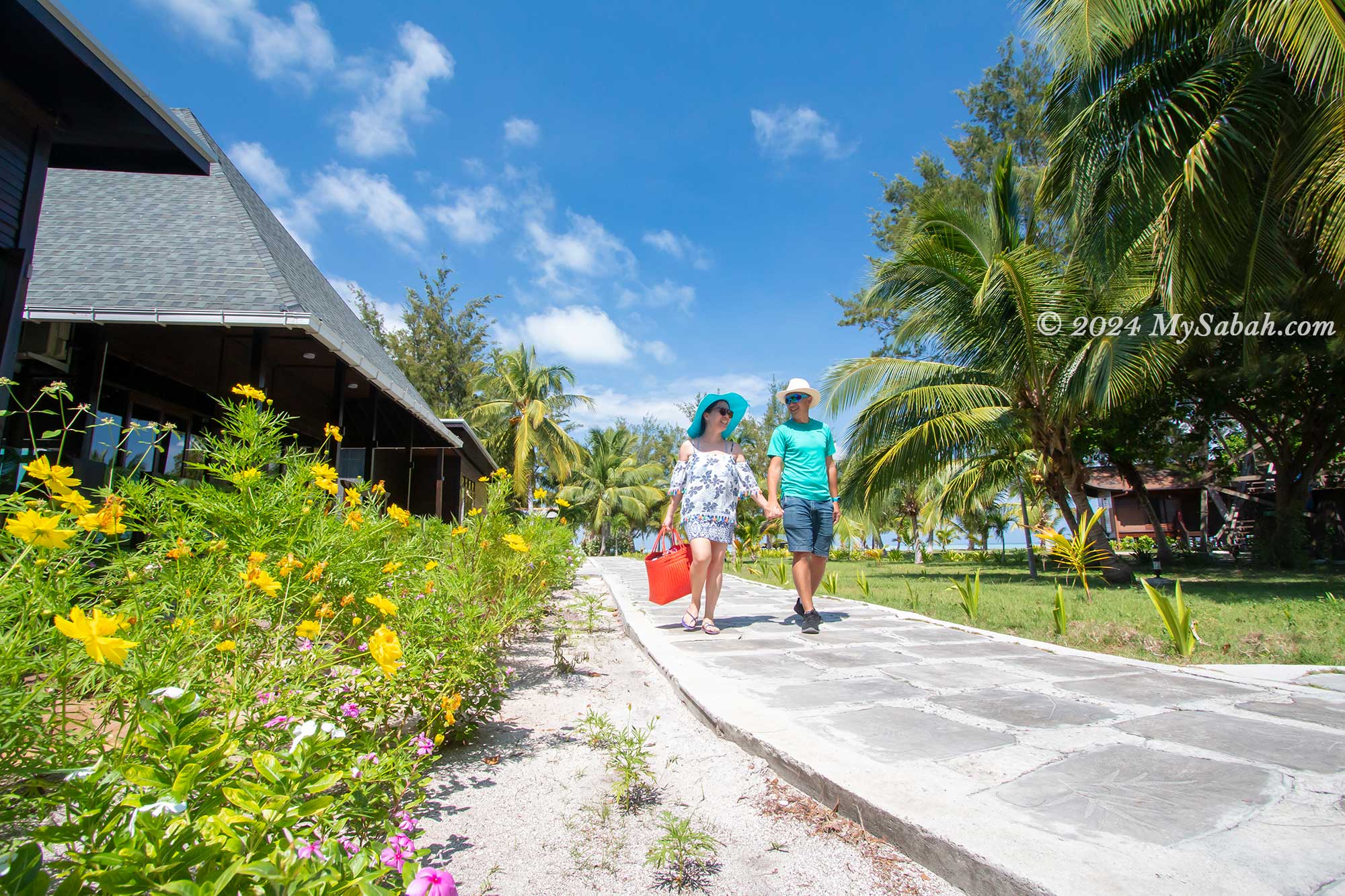
7. Mataking Island
Mataking Island is tailor-made for a romantic island getaway, making it a sought-after honeymoon destination for Europeans. This picturesque tropical paradise boasts white sandy beaches, crystal-clear waters, breathtaking sunsets, and luxurious resorts. Couples can choose to exchange vows underwater or in the charming island chapel, adding a touch of magic to their special day.
Mataking Island is one of the best island destinations of Sabah
Swing on the beach of Mataking Island
Honeymoon couples at Mataking Island Resort
Sea view of Mataking Island
Underwater mailbox of Mataking Island
For scuba diving enthusiasts, don’t miss the chance to send a postcard from the underwater postbox, a unique experience offered by Mataking Island, home to the deepest mailbox in the world. Read More or Book a Tour (Use Promo Code MYSABAH for Special Discount)
8. Mantanani Island
Mantanani Island, often referred to as the Mermaid Island, owes its nickname to the presence of a friendly dugong residing in its waters. As visitors approach the turquoise sea surrounding Mantanani, they are immediately enchanted by its dreamlike beauty. Whether lounging in the island resorts or lodges, snorkelling, fishing, diving, or simply strolling along the beach, there’s no shortage of activities to enjoy. Who knows? You might even catch a glimpse of a mermaid. Read More or Book a Tour (Use Promo Code MYSABAH for Special Discount)
Mantanani Island receives many international tourists too.
The sea colours of Mantanani Island is stunning
Lungisan Island of Mantanani
Mantanani Island is also known as Mermaid Island
Snorkelling on Mantanani Island
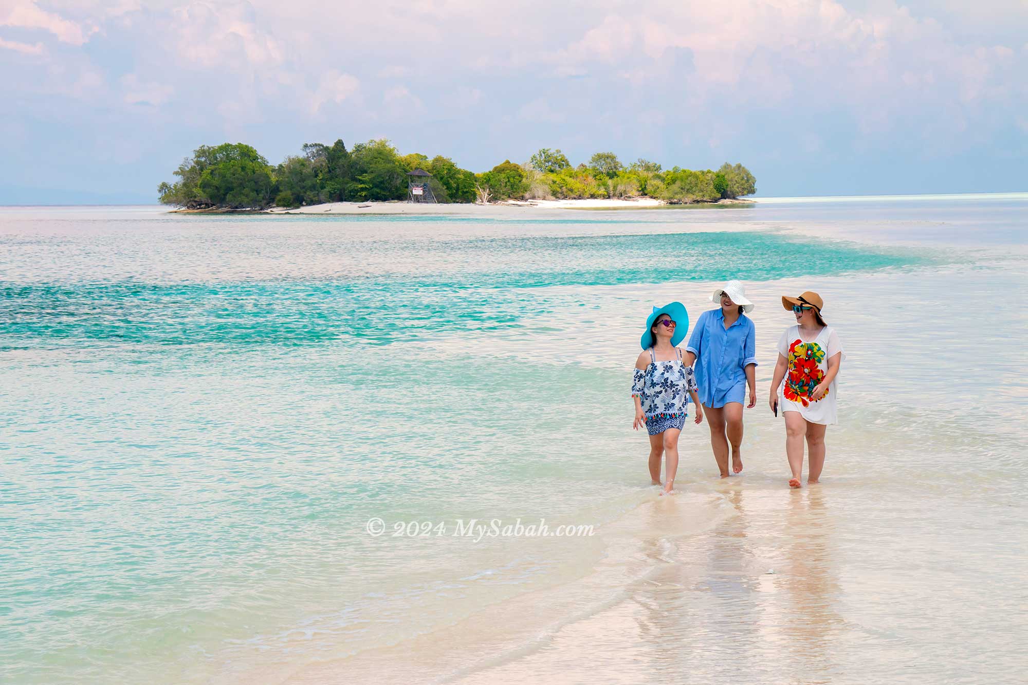
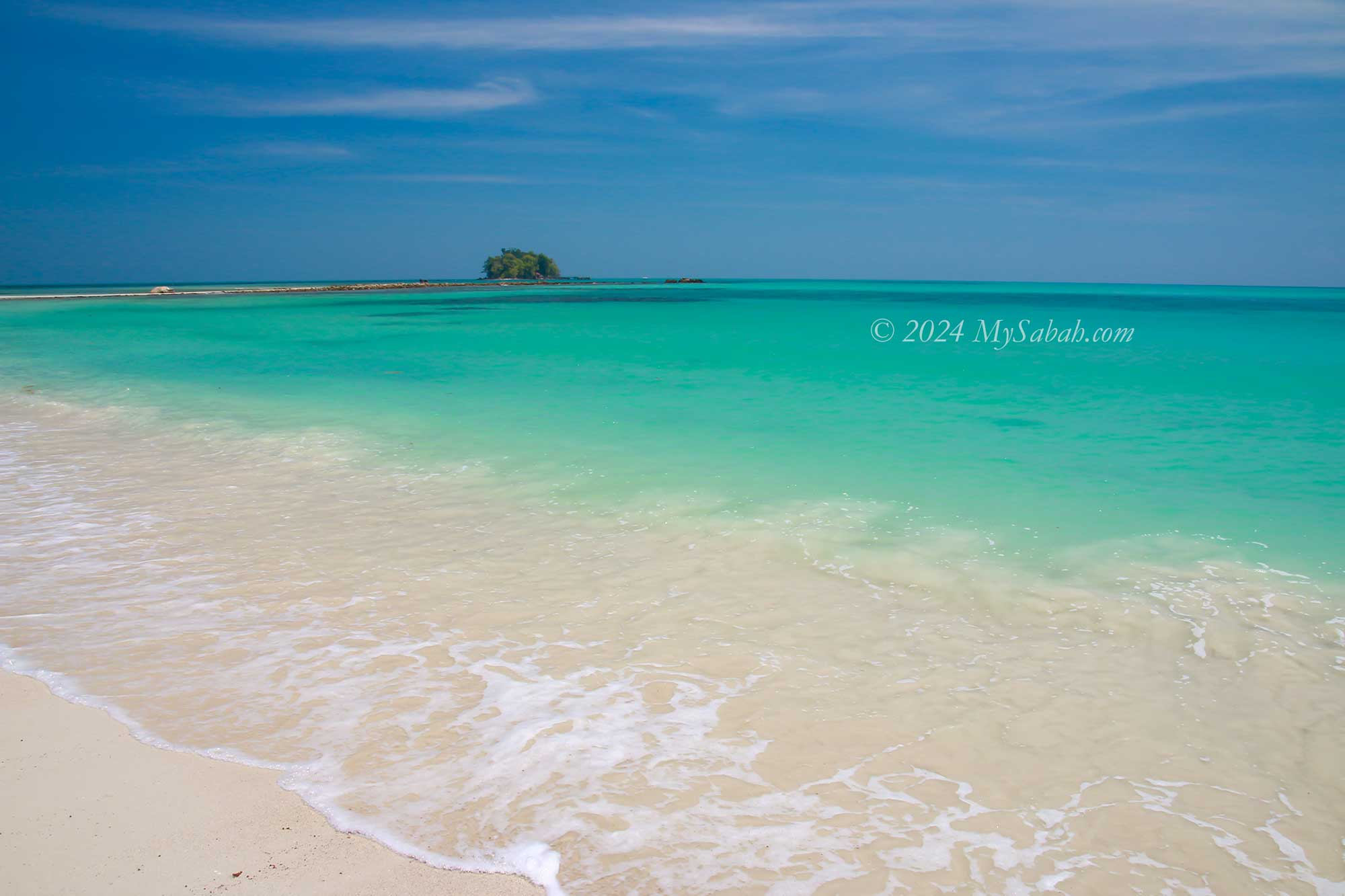
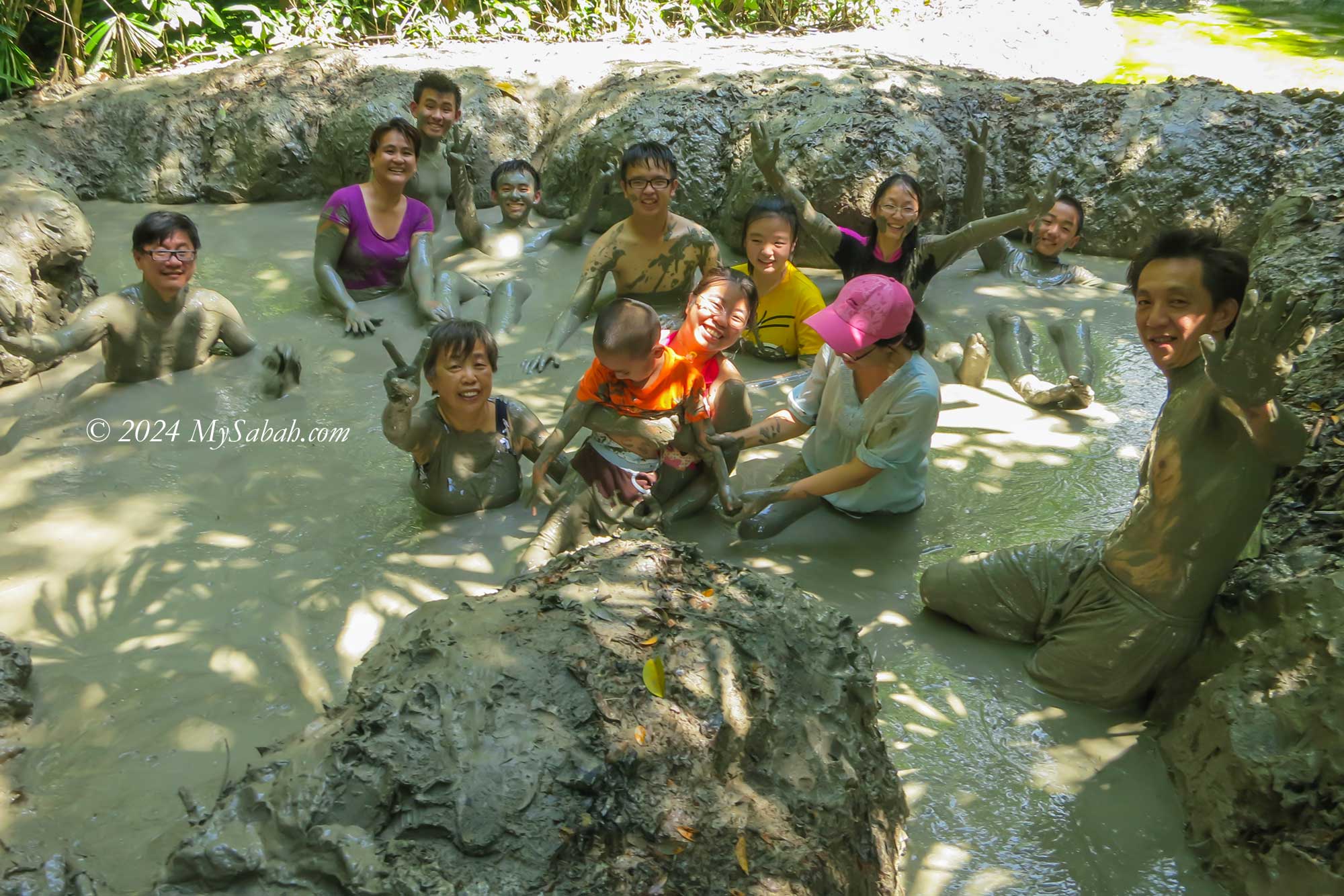
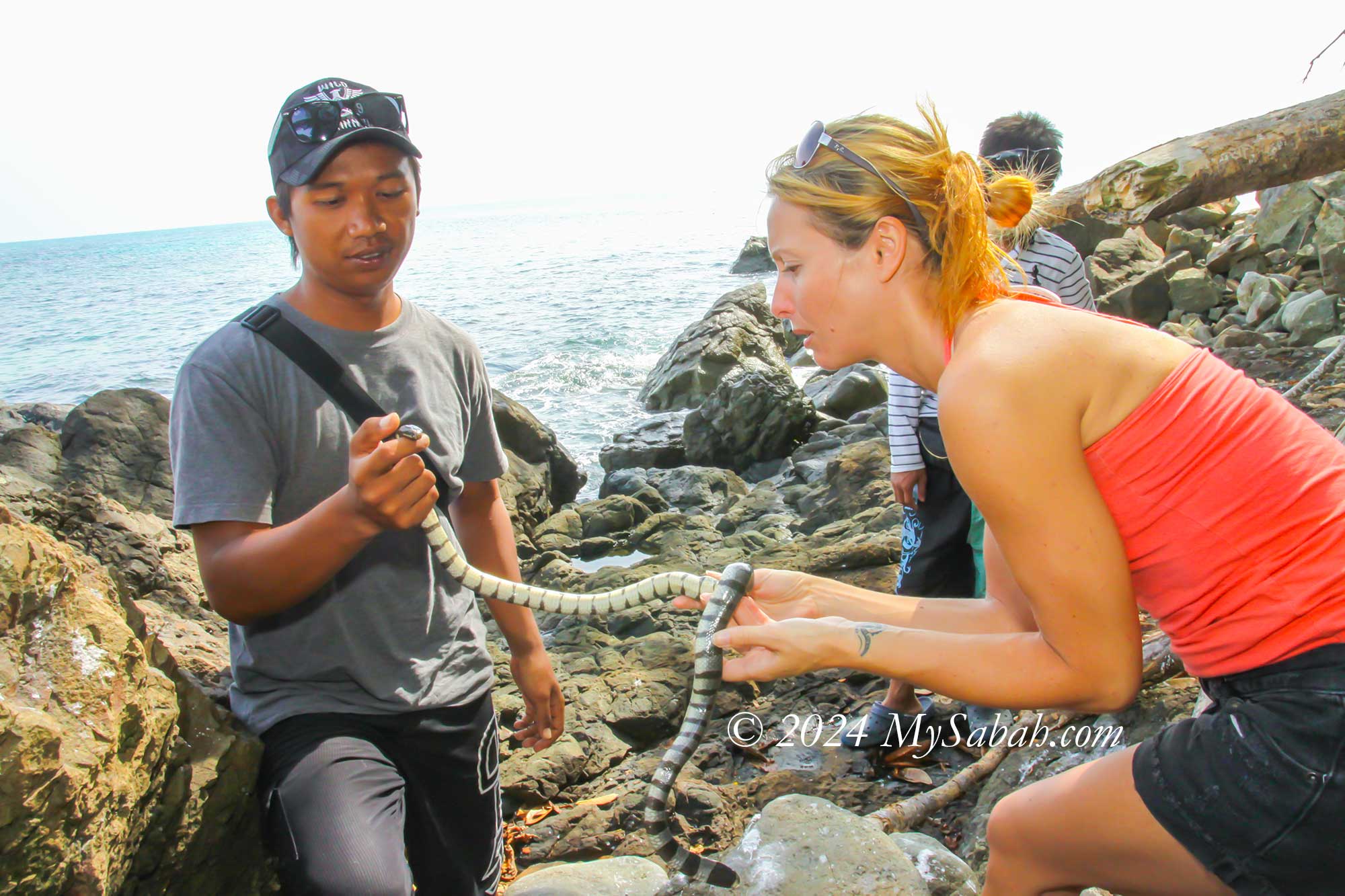
9. Pulau Tiga
Pulau Tiga gained fame as the filming location for the first TV reality show, “Survivor.” This island stands out as one of Sabah’s most unique marine parks, boasting a mud volcano and Snake Island among its attractions. Yet, its true allure lies in the untouched, snow-white beaches of Sands Spit Island.
Beach of Pulau Tiga Island
Snorkeling on Pulau Tiga Island
Sands Spit Island (Pulau Kalampunian Besar) of Pulau Tiga Marine Park
Mud volcano bath on Pulau Tiga
Sea snake of Snake Island (Pulau Tiga)
The main island, cloaked in dense forest, teems with diverse wildlife. Hikers can uncover hidden coves and secluded beaches along the network of nature trails, promising delightful discoveries at every turn. Read More or Book a Tour (Use Promo Code MYSABAH for Special Discount)
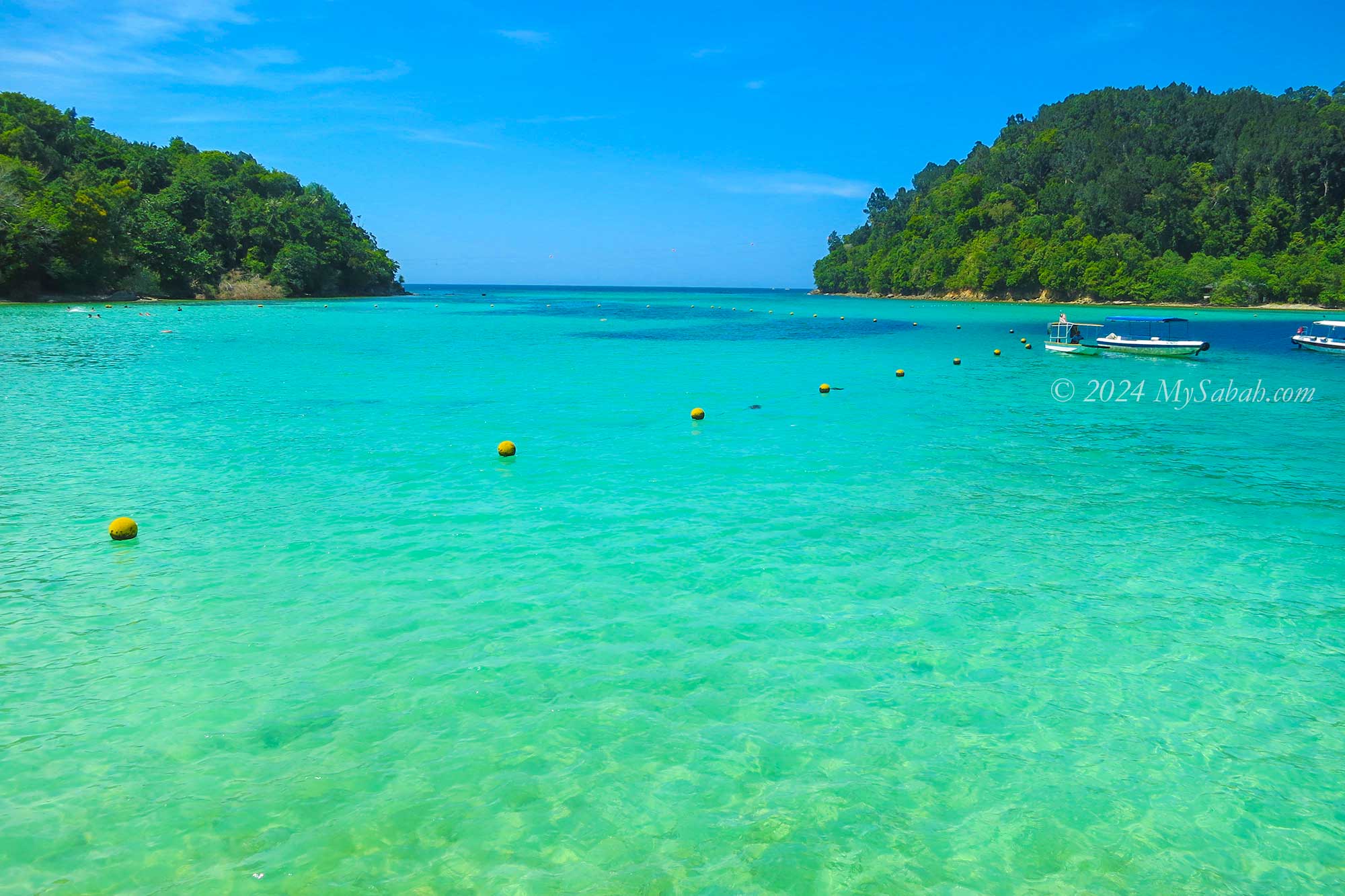
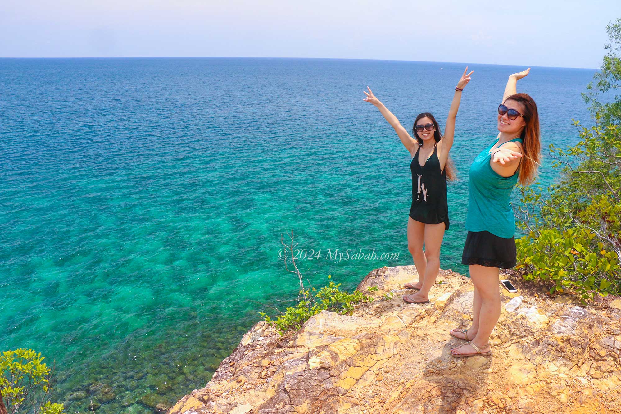
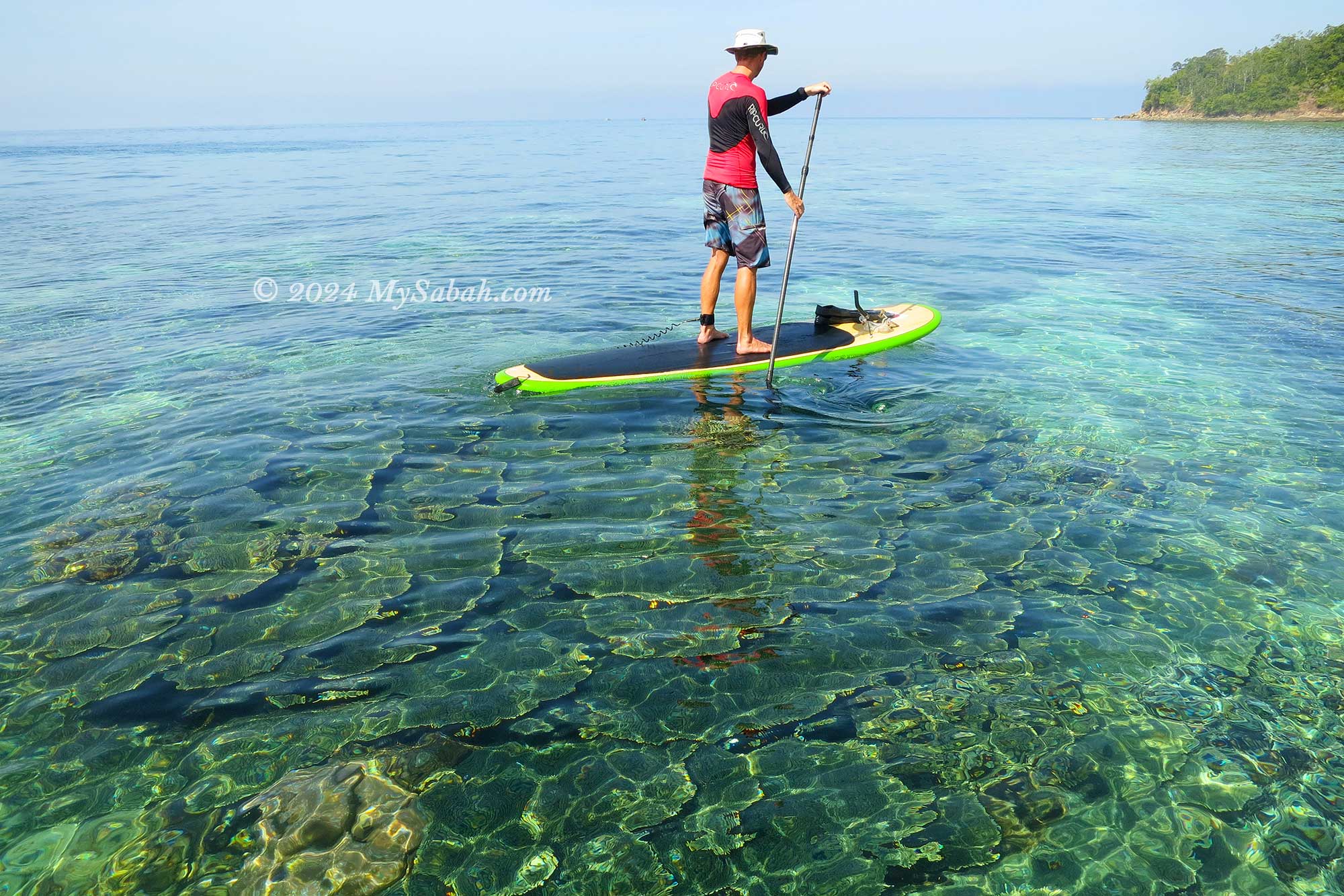
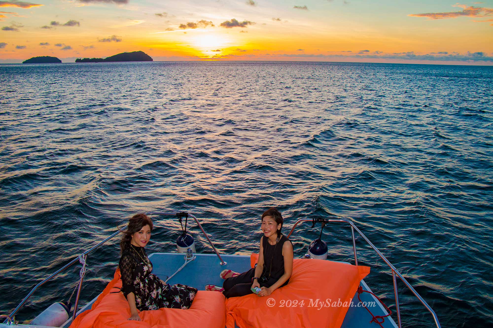
10. Sapi Island
Just a 15-minute boat ride from Kota Kinabalu City, the capital of Sabah, lies Sapi Island. Despite its modest size, this island boasts crystal-clear waters and an abundance of marine life, surpassing its neighbouring islands. While tourists may initially feel a tinge of apprehension at the sight of harmless wild boars and monitor lizards roaming the island, they quickly come to cherish such authentic encounters with nature. Read More or Book a Tour (Use Promo Code MYSABAH for Special Discount)
Sapi Island is situated in Tunku Abdul Rahman Marine Park
A secret cliff behind Sapi Island
Stand-up Paddleboarding on Sapi Island
Sunset cruise around Sapi Island
Corals of Sapi Island
Other Islands of Sabah
Sabah is home to nearly 400 islands, each with its own unique charm, but only a select few are developed for tourism purposes. Below is a list of other islands that travellers can explore:
These islands offer diverse experiences ranging from pristine beaches and vibrant marine life to cultural encounters and outdoor adventures, making them ideal destinations for travellers seeking unforgettable experiences in Sabah.
Isn’t the feeling of nostalgia wonderful? Whether it’s listening to oldies songs, donning vintage fashion, or gazing at black-and-white photographs, it’s like taking a journey back in time—a journey filled with fond memories and reflections on history.
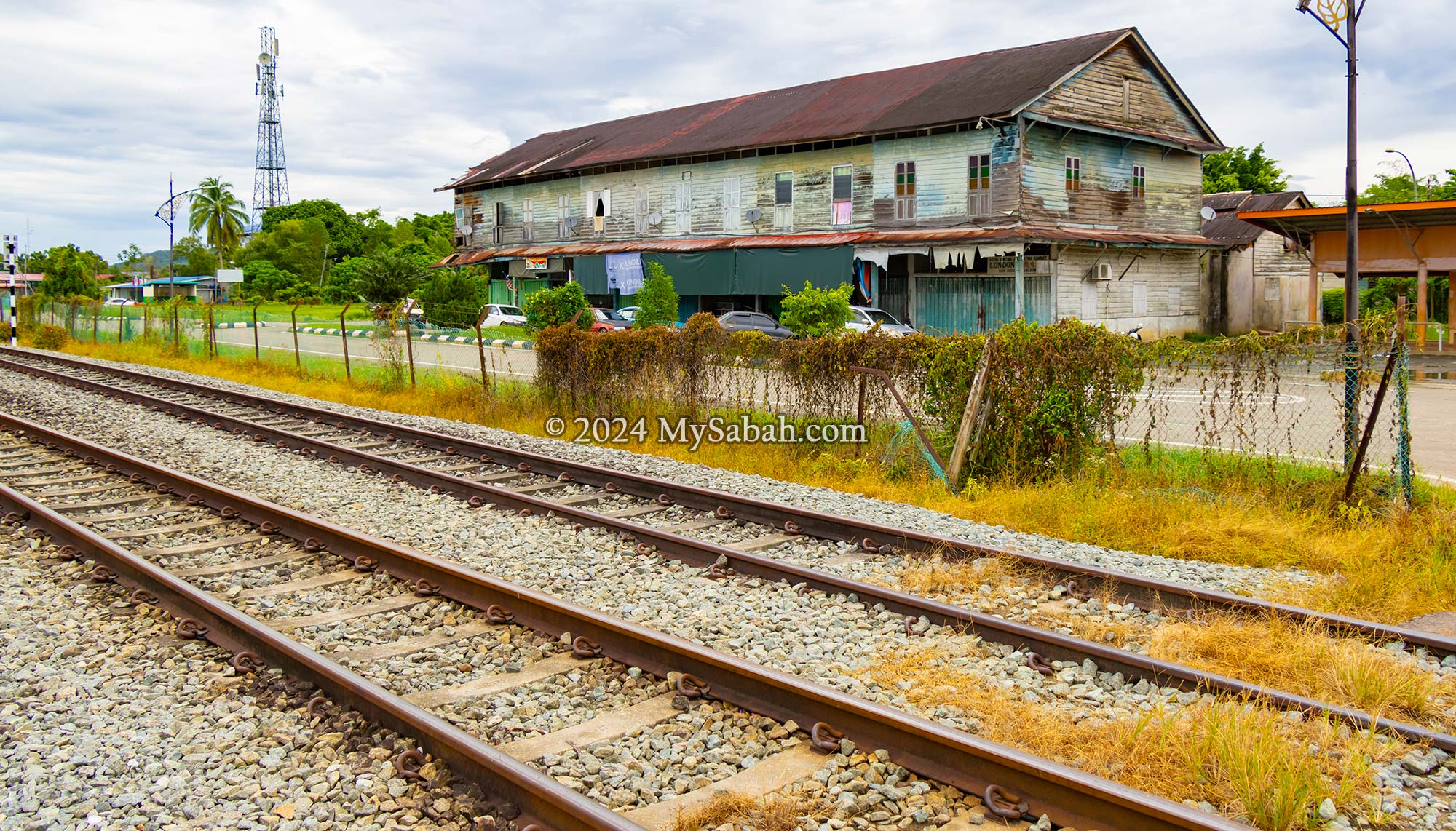
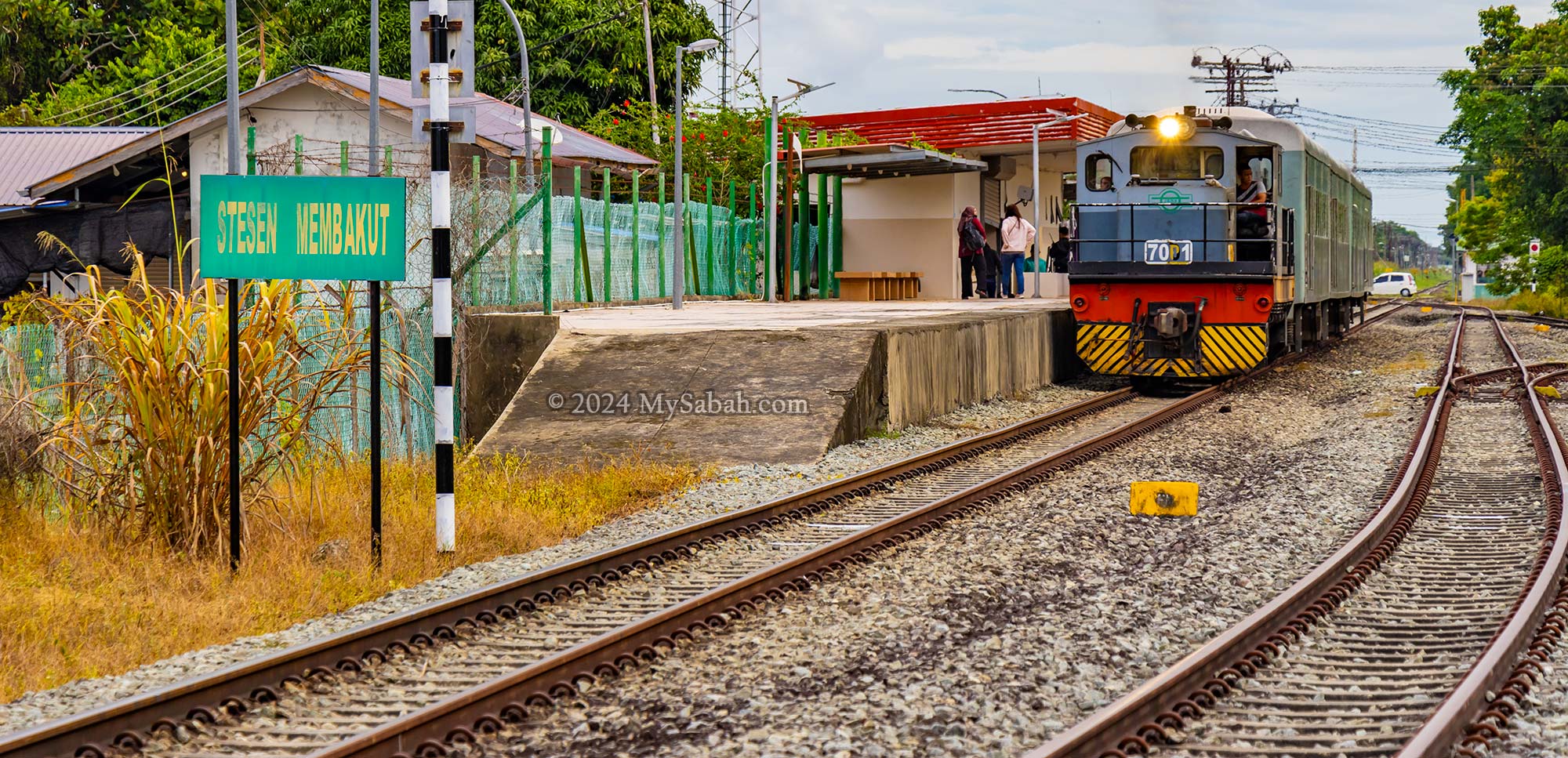
The train still passes by Membakut town every day, just like it did a century ago. However, Membakut has since transformed into a quiet rustic town, especially since the highway became the preferred means of transportation.
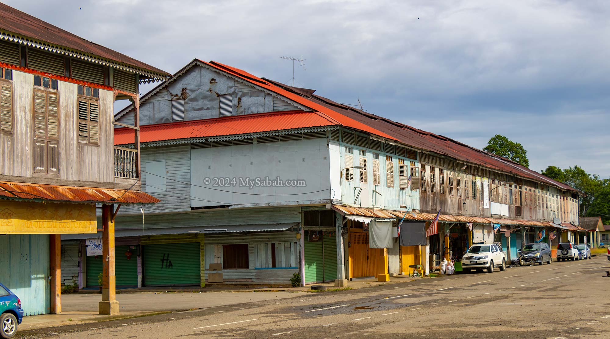
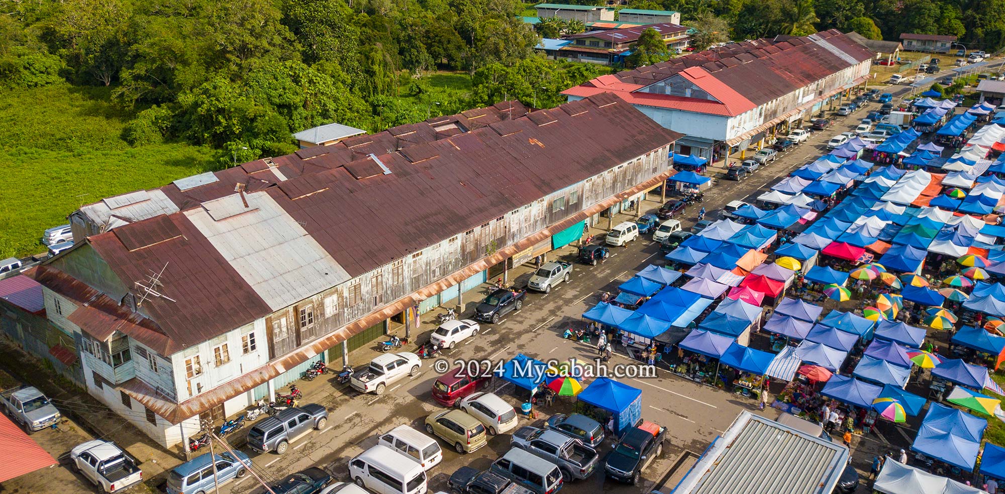
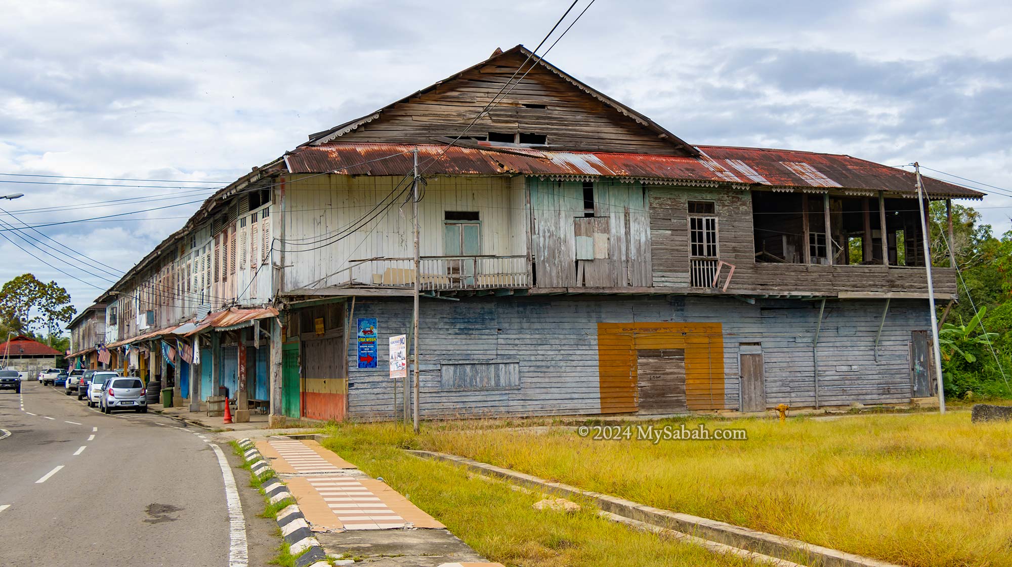
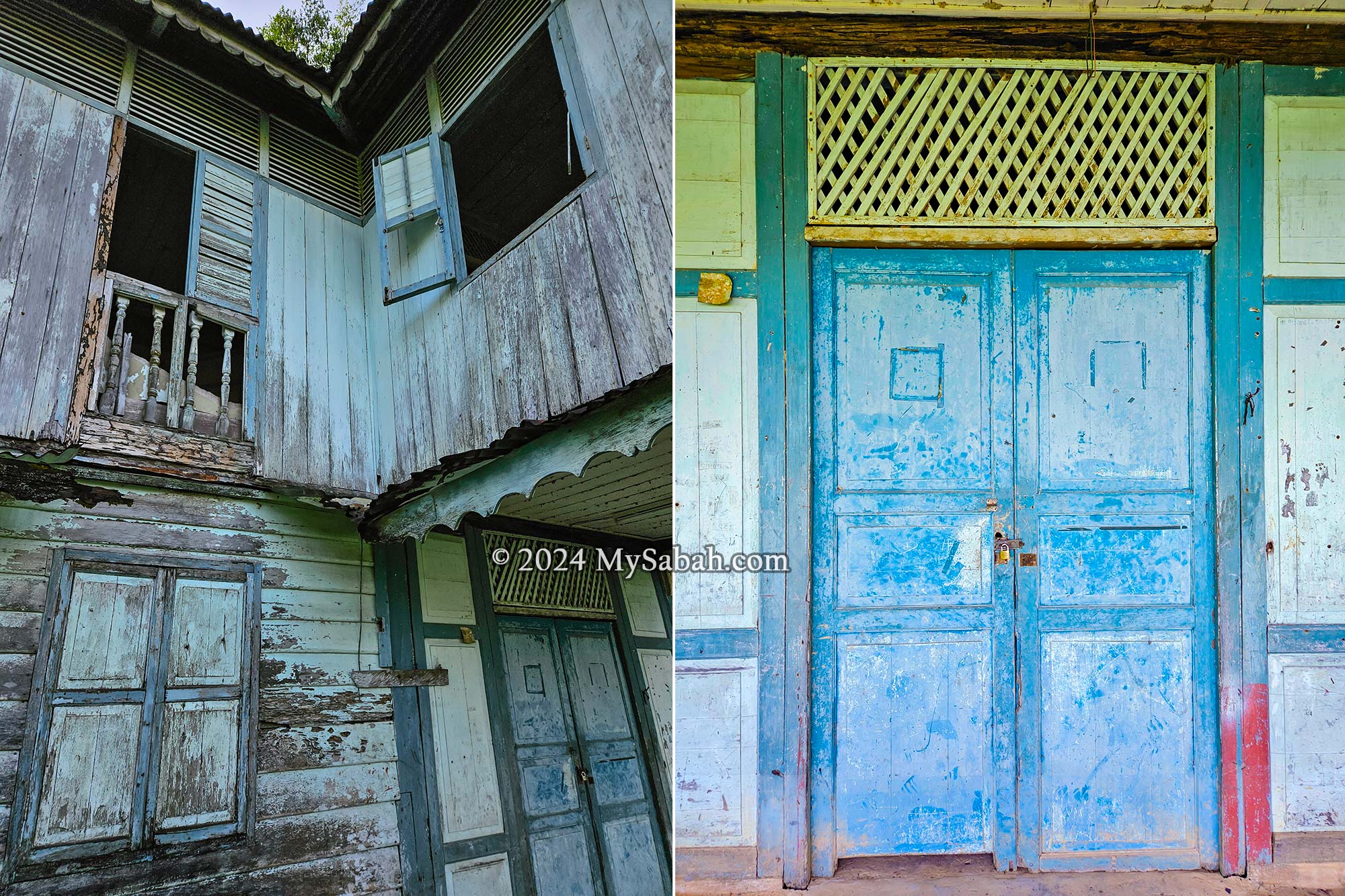
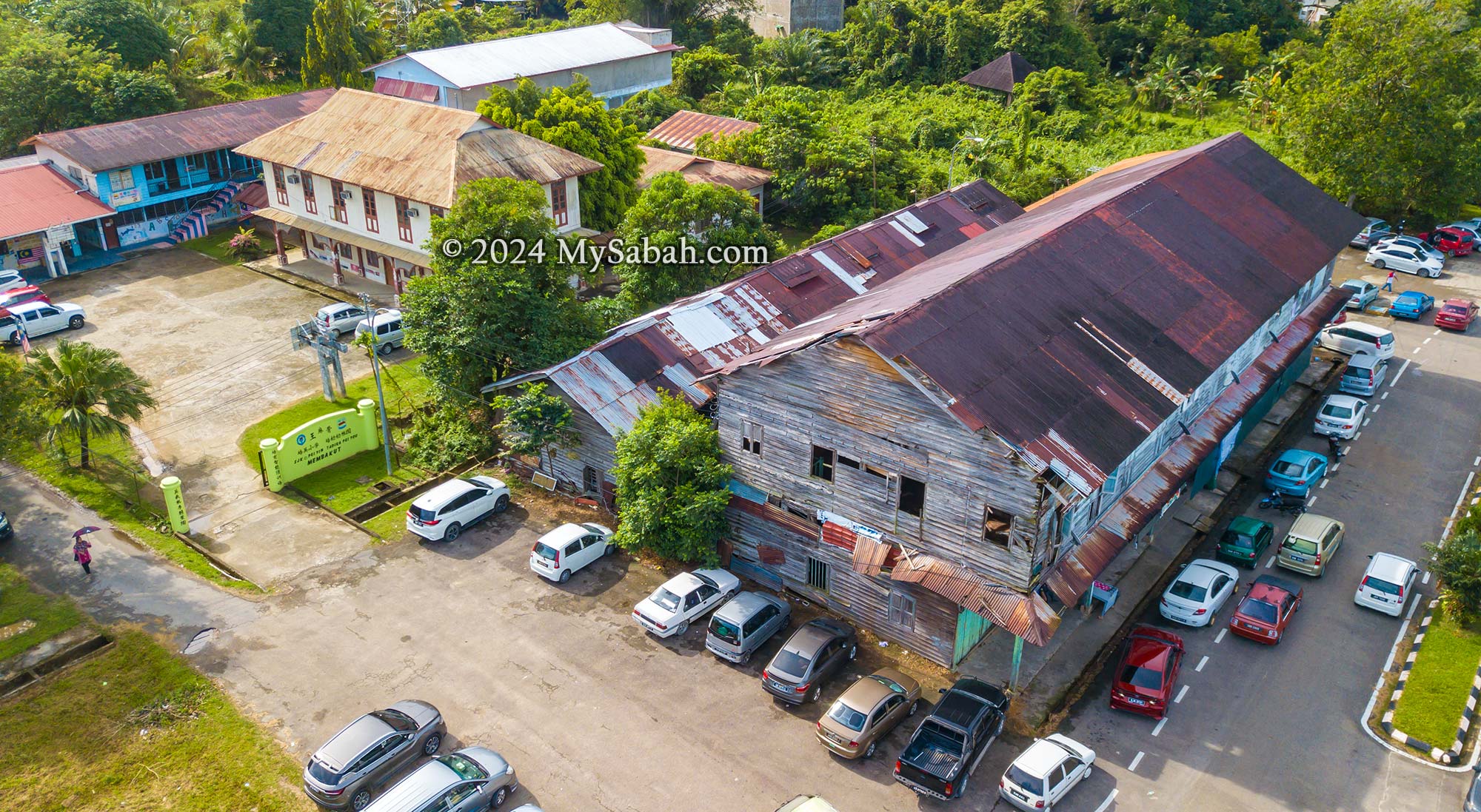
Amidst the rising tide of featureless cement buildings in Sabah, one can’t help but appreciate the nostalgic charm of the pre-World War II and post-war wooden shophouses in Membakut town. These colonial relics, meticulously preserved on the West Coast, stand as enduring testaments to Sabah’s past. Constructed during the British colonial era, these shophouses line up parallel to the railway, once vital arteries for transporting agricultural goods along the west coast route to the port of Jesselton, now known as Kota Kinabalu City (KK in short).
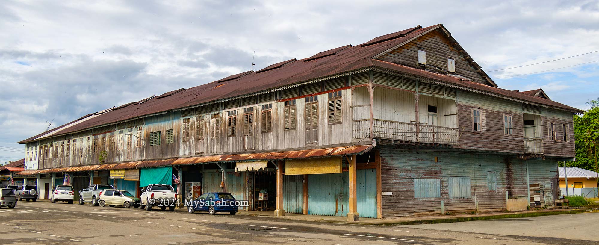
A pre-WWII shophouse. The township of Membakut was blooming during the 1920s-late 1930s due to the railway and agriculture.
Pre-War Shophouses
Dating back to the 1930s North Borneo era, two wooden shophouses in Membakut serve as captivating relics of the past, offering a window into the bustling railway station and vibrant town life of yesteryears. Positioned adjacent to these pre-war structures stands a post-war shophouse, constructed in the early 1950s, along with several other century-old buildings, all clustered within a mere 200-metre radius.
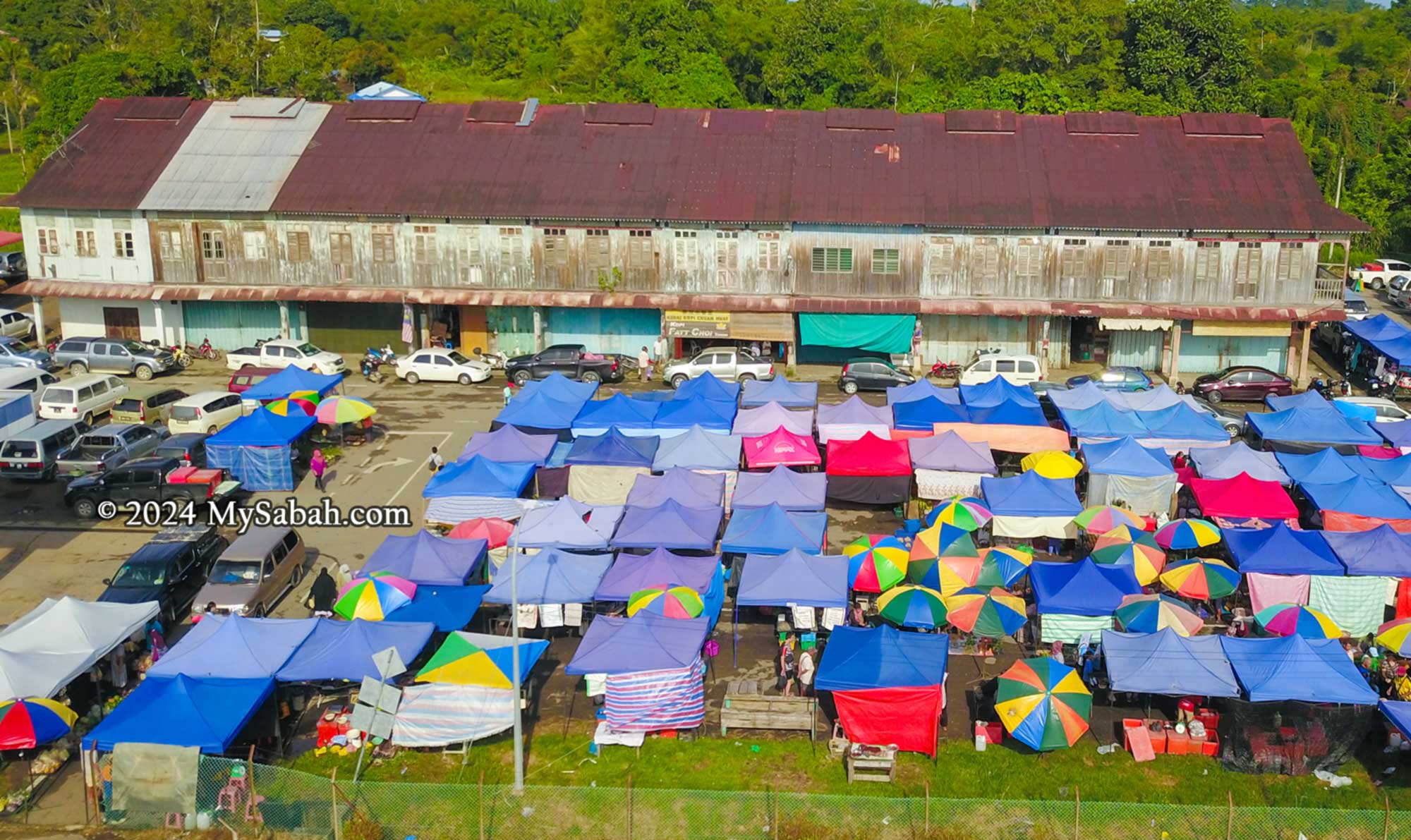
Two Pre-WWII shophouses and weekly tamu market at Membakut old township
Membakut, situated along the 134-kilometre railway line, was a vital stop on the North Borneo railway (now Sabah State Railway) during its peak. The ornate bargeboards adorning Membakut’s wooden shophouses bear testimony to the town’s erstwhile prosperity. These architectural details, meticulously crafted, reflect a bygone era when the railway was at the heart of the township’s economy. Remarkably, the railway still operates today as Borneo’s sole rail network.
Membakut old township’s main buildings consist of pre-WWII shop rows with decorative bargeboards
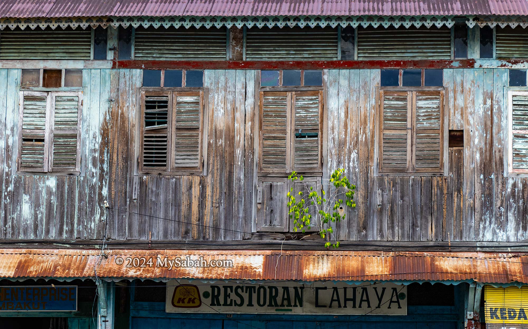
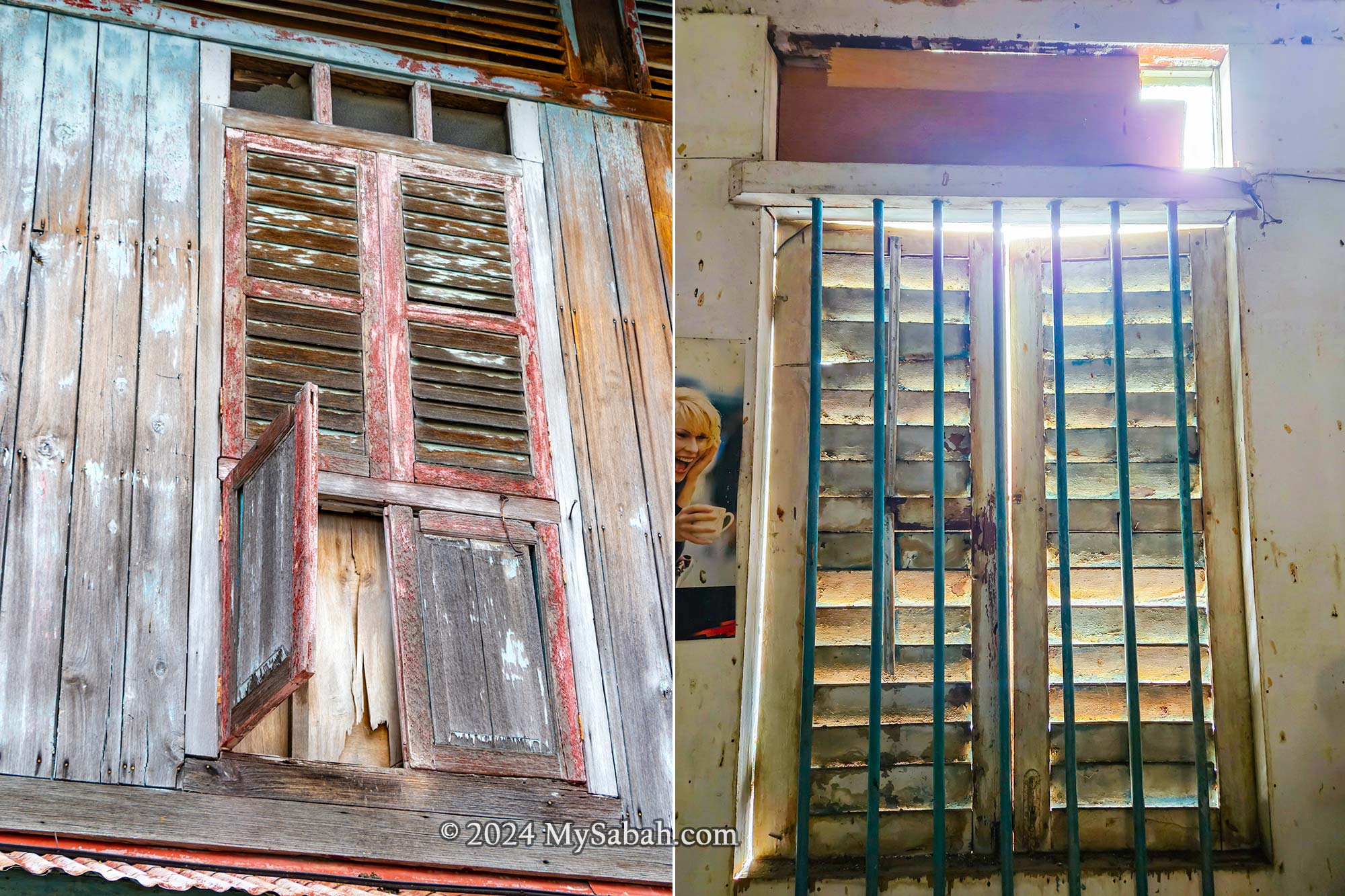
Century-old wooden houses, such as those in Membakut, are characterized by intricate hand-crafted embellishments, including decorative trim, carved woodwork, and ornate moldings. The original facade of the pre-WWII Membakut shophouses boasts louvered casement windows, complemented by half-doors at the shoplot’s center. Transom openings above each window ensure ample natural light floods the upper floors, even when the louvred panels are closed.
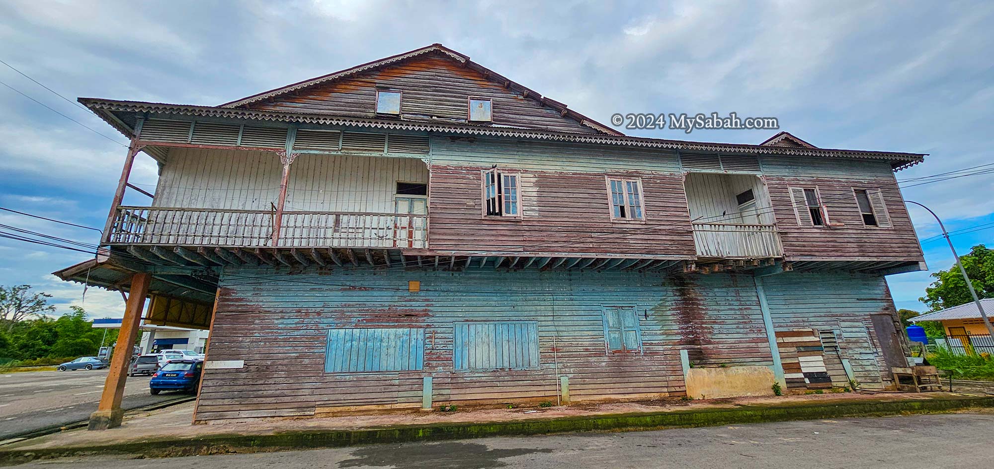
Dilapidated balconies decorated with louvered panels and small British Victorian brackets.
Turning to the side elevation of the pre-WWII Membakut shophouses reveals extended upper floors, complete with a main verandah at the front and a secondary one at the rear. This dual-purpose structure—part shop on the ground level, part residence above—epitomizes the essence of a shophouse.
Louvered casement windows of the Pre-WWII shophouse. Transom openings above each window allow more sunlight to enter.
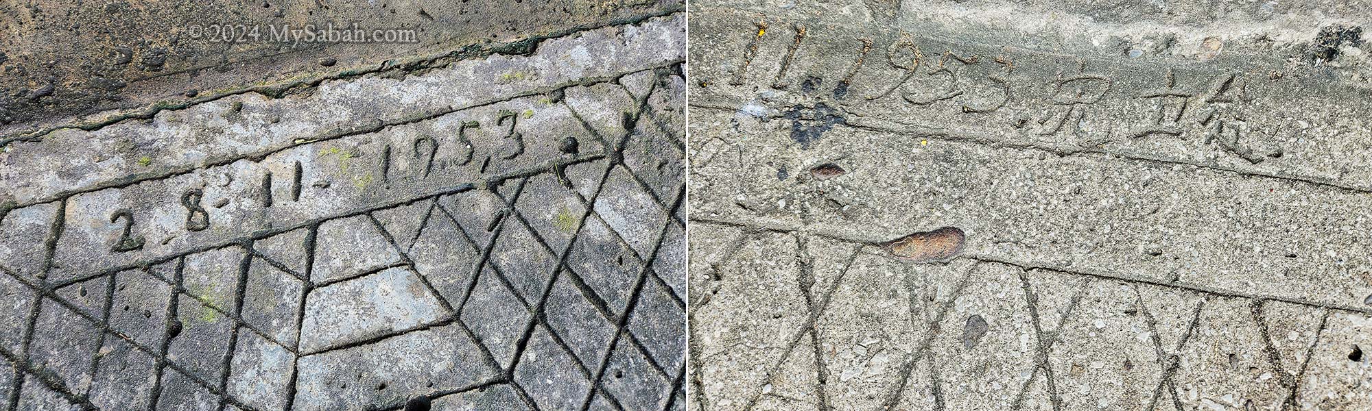
While concrete etchings suggest the construction year of 1932, there is ambiguity surrounding whether this date denotes the building’s inception or merely an upgrade to the pavement. Consequently, the true age of these pre-WWII shophouses may exceed the indicated date significantly.
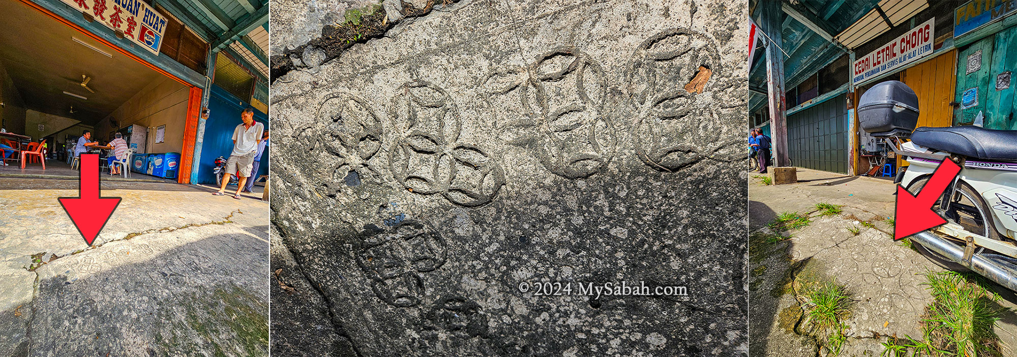
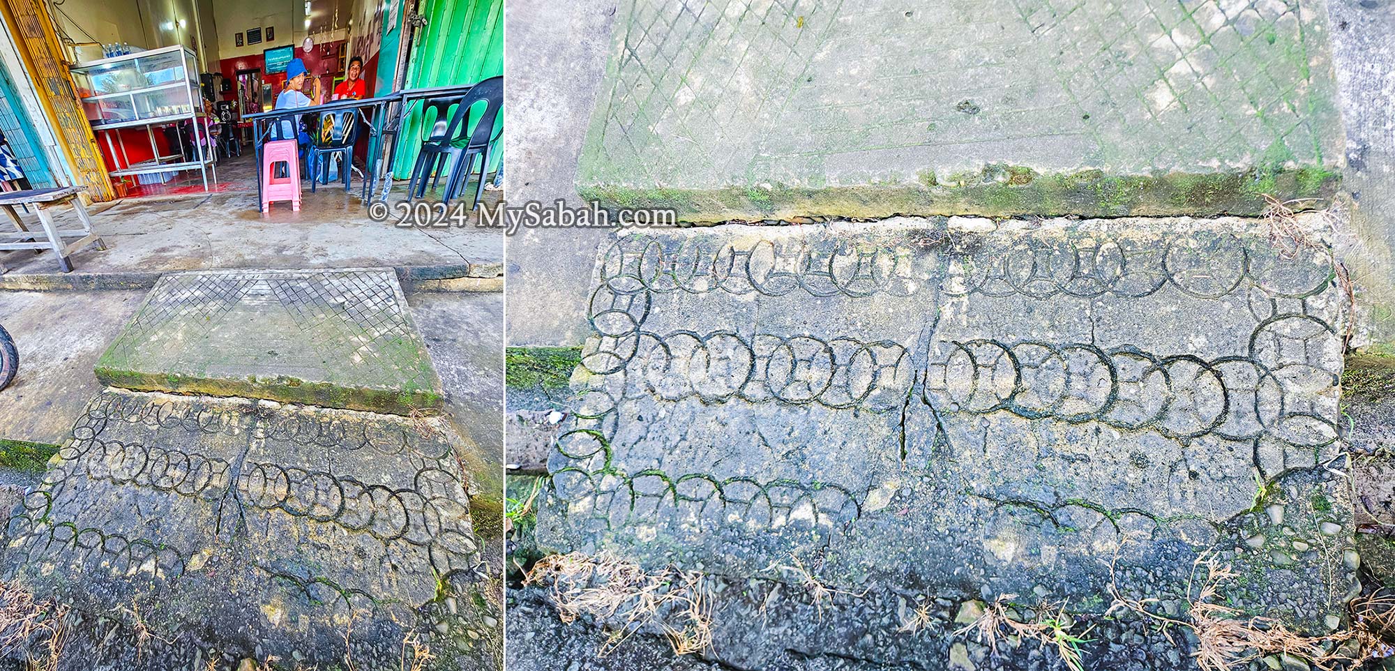
Don’t forget to look at the floor. Etchings of old Chinese coins (a symbol of wealth) on the concrete pavement slabs of Pre-war shophouses in Membakut
The Interior
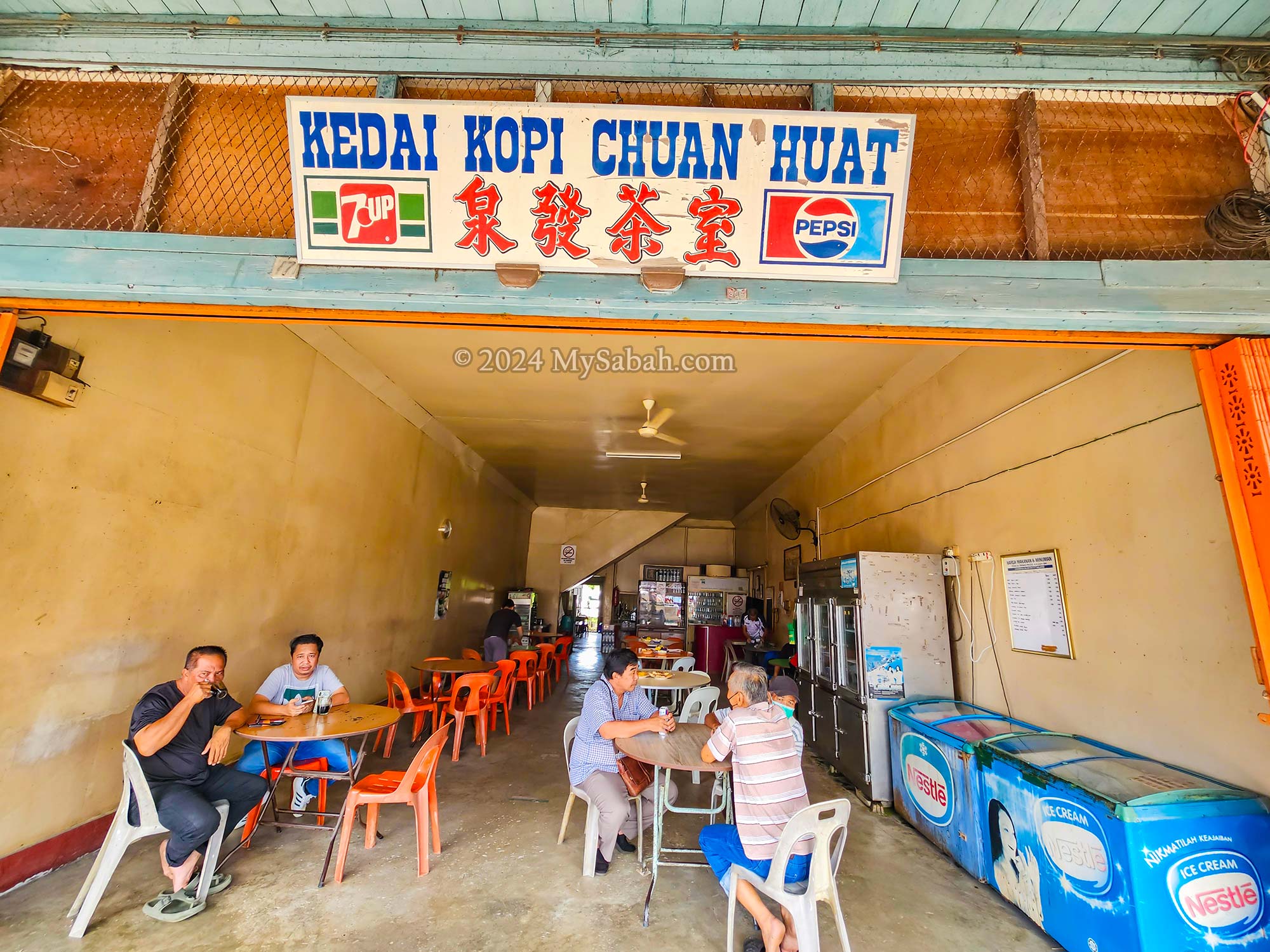
After exploring the old buildings and tamu markets, my friends and I grabbed breakfast at Kedai Kopi Chuan Huat, a Chinese coffee shop in one of the pre-war buildings. The Teo family, who run the place, noticed our interest in the architecture and kindly gave us a quick tour of their shophouse.
Kedai Kopi Chuan Huat (泉发茶室) is one of the few shops that remain open in the old shophouses of Membakut.
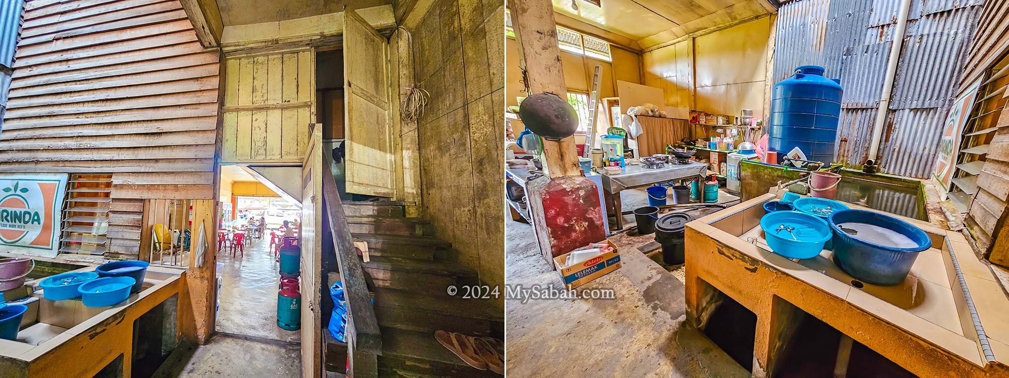
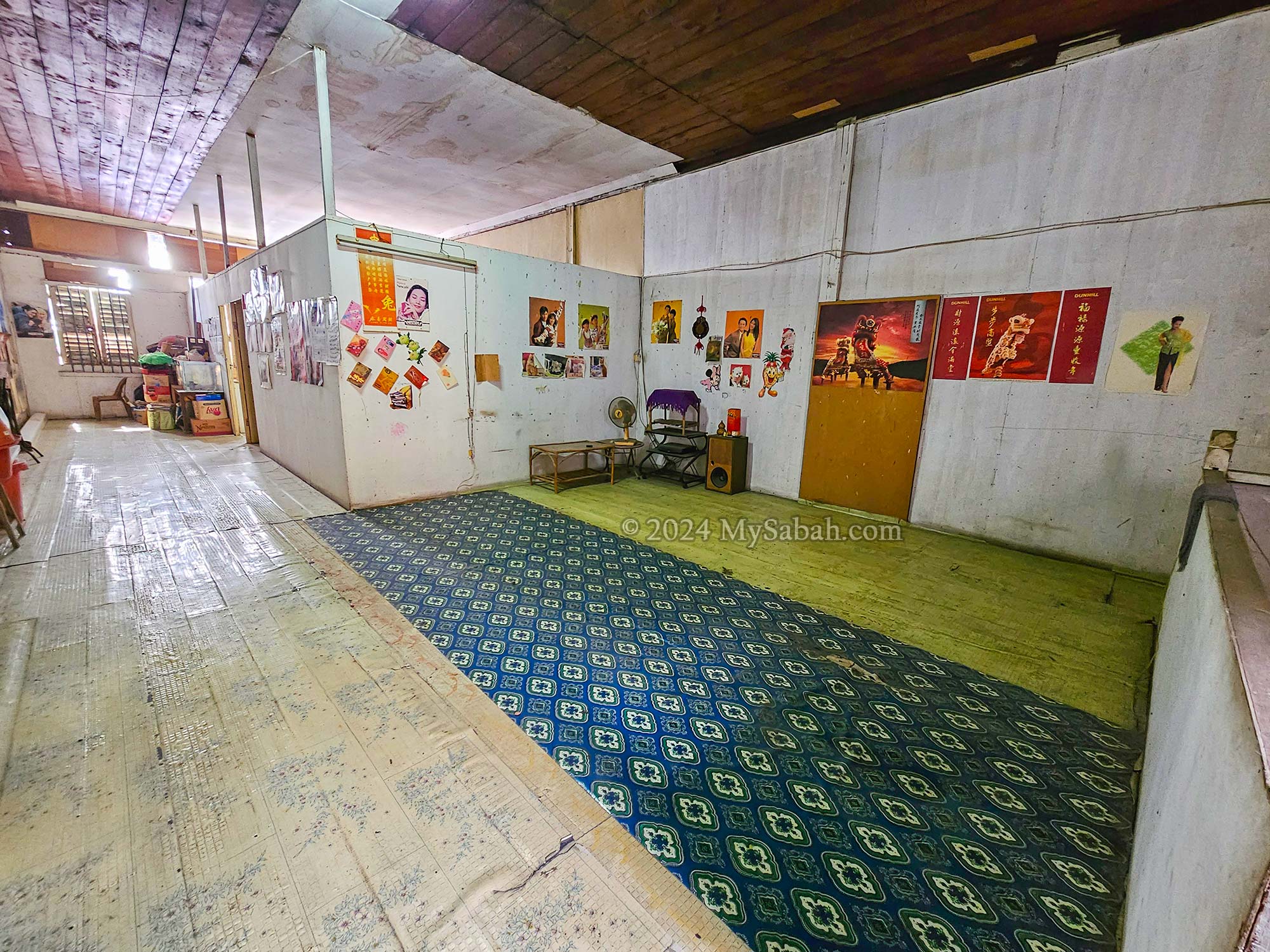
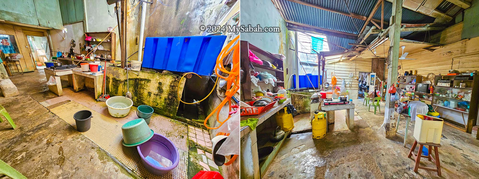
Traditional Sabah shophouses from the British colonial era typically have two levels. The ground floor serves as the shop, while the kitchen, airwell, and toilet are at the back. Floods were common back then, hence the lower level’s concrete floor.
Each unit of Membakut shophouse usually comprises a shop area, airwell and kitchen on the ground floor.
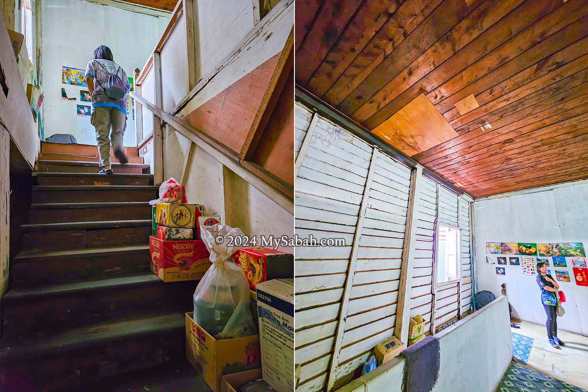
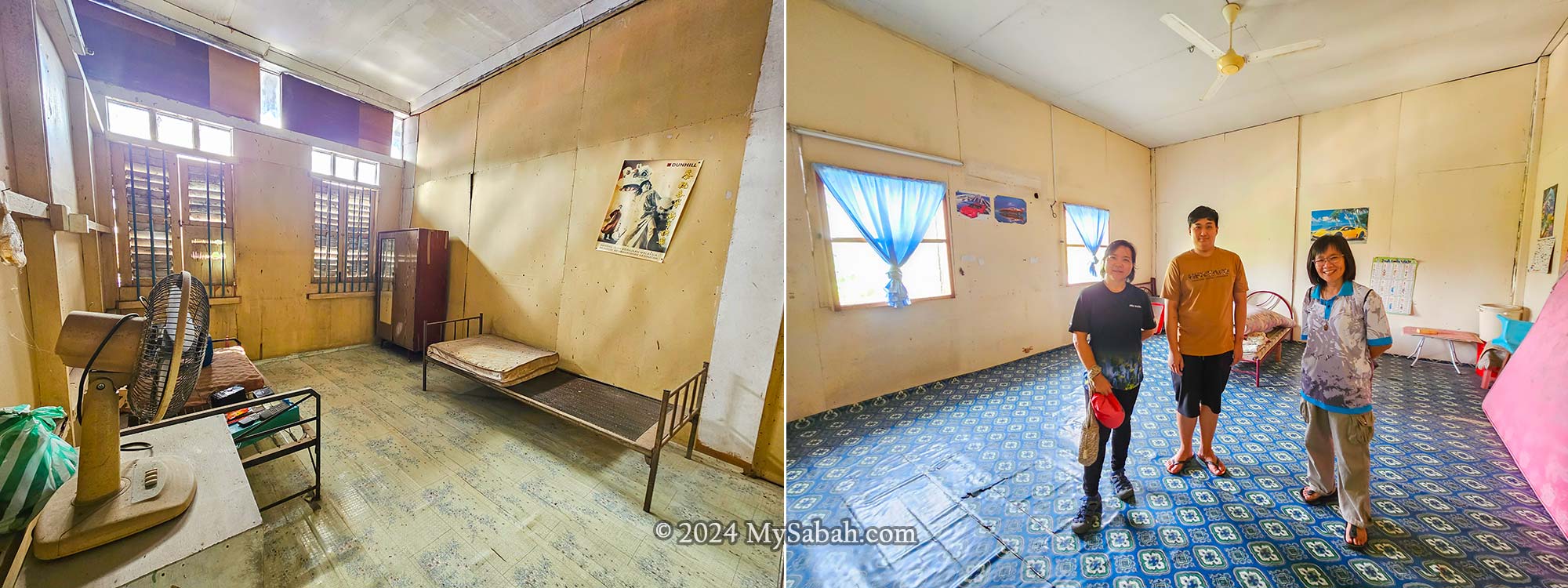
We climbed a covered staircase to the living quarters upstairs. Because of its age, the fire department advises against living here. So, most people have moved out, and their shops are closed. A few still run businesses downstairs, but no one lives above anymore.
Left: staircase to the upper floor. Right: the wooden structures of upper floor.
Walking upstairs felt like stepping into the past. I felt a sense of déjà vu, recalling childhood memories spent in similar buildings where my great-grandparents lived.
The upper floor of a shophouse unit can accommodate 3 bedrooms, a living space and an internal airwell. Room placement varies from one shophouse to another.
The creaky floorboards whispered tales of the past as we explored rooms filled with vintage furnishings and memorabilia. In a world of sleek modernity, there’s something charming about embracing the old-fashioned.
The rooms in the upper floor of a pre-WWII shophouse in Membakut. The guy in the middle is a member of the Teo family.
For today’s generation used to modern construction materials like cement and glass, these old timber buildings offer a glimpse into the past—a reminder of past craftsmanship and architectural ingenuity.
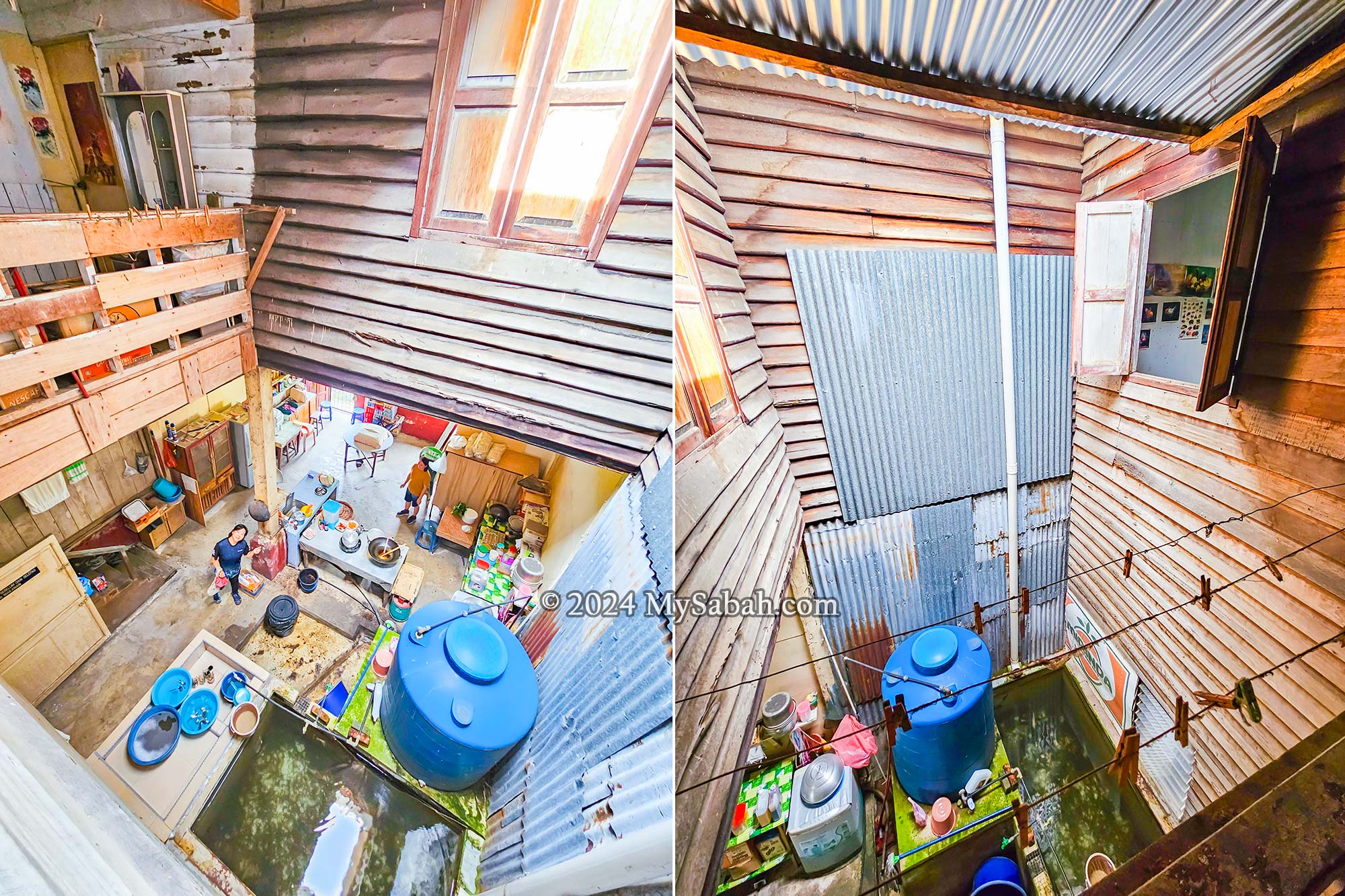
View into the internal airwell, showing the walk way to the open kitchen area, water storage tank, washing and drying areas.
As we wandered through the upper floor, glimpses into the internal airwell and kitchen area gave us a peek into the lives of past residents. The layout encouraged interaction between floors, with voices echoing throughout the house.
The Importance of Old Buildings
Destinations like France, Thailand, and India draw throngs of tourists thanks to their rich cultural and historical heritage. Borneo is a “brand” renowned for its natural beauty and adventurous tales of European explorers. Yet, without historical relics, Sabah risks losing its distinctive Bornean identity.
One of the pre-war shophouses in Membakut old township. It’s not in good shape.
The colonial buildings in Membakut, adorned with lattice-framed arches and bargeboards, serve as potential models for architectural restoration. These structures, bearing the “North Borneo” timestamp, hold immense historical and tourism value that warrants preservation.
Outside and inside view of the old louvered casement windows. Rounded metal bars are an added security feature for the window frame.
In West Coast of Sabah, landmarks from the British era have largely vanished, leaving only a handful of colonial buildings standing—now in a state of ‘critically endangered.’ While we can build new hotels, shopping malls, and high-rises, we can’t build an old building.
Unfortunately, existing old buildings face threats from fire and termites. Without proper preservation efforts and modern firefighting systems, they stand vulnerable and wait helplessly for a final blow. A post-war shophouse in Membakut succumbed to flames in 2011, while a colonial-era building dating back to the 1900s in Kimanis was reduced to rubble by tropical storm “Kompasu” a decade later.
Other old buildings nearby the Pre-war shophouses of Membakut town
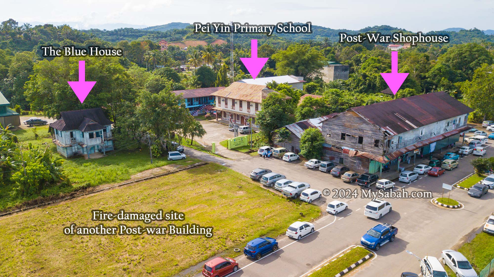
On the opposite side of the train tracks lie a row of post-war shophouses. Adjacent to these stands Pei Yin Primary School, another colonial gem. Facing the school sits a small abandoned house known as the ‘Blue House.’
Post-War Shophouse
Situated on the far side of the railway tracks, the post-WWII shophouse, built in the early 1950s, once formed part of a twin row. Tragically, a fire destroyed one of these shophouses in 2011. The loss of a priceless heritage can’t be measured by monetary value.
This post-WWII shophouse built in the early 1950s is situated on the opposite side of the pre-WWII shophouses in Membakut.
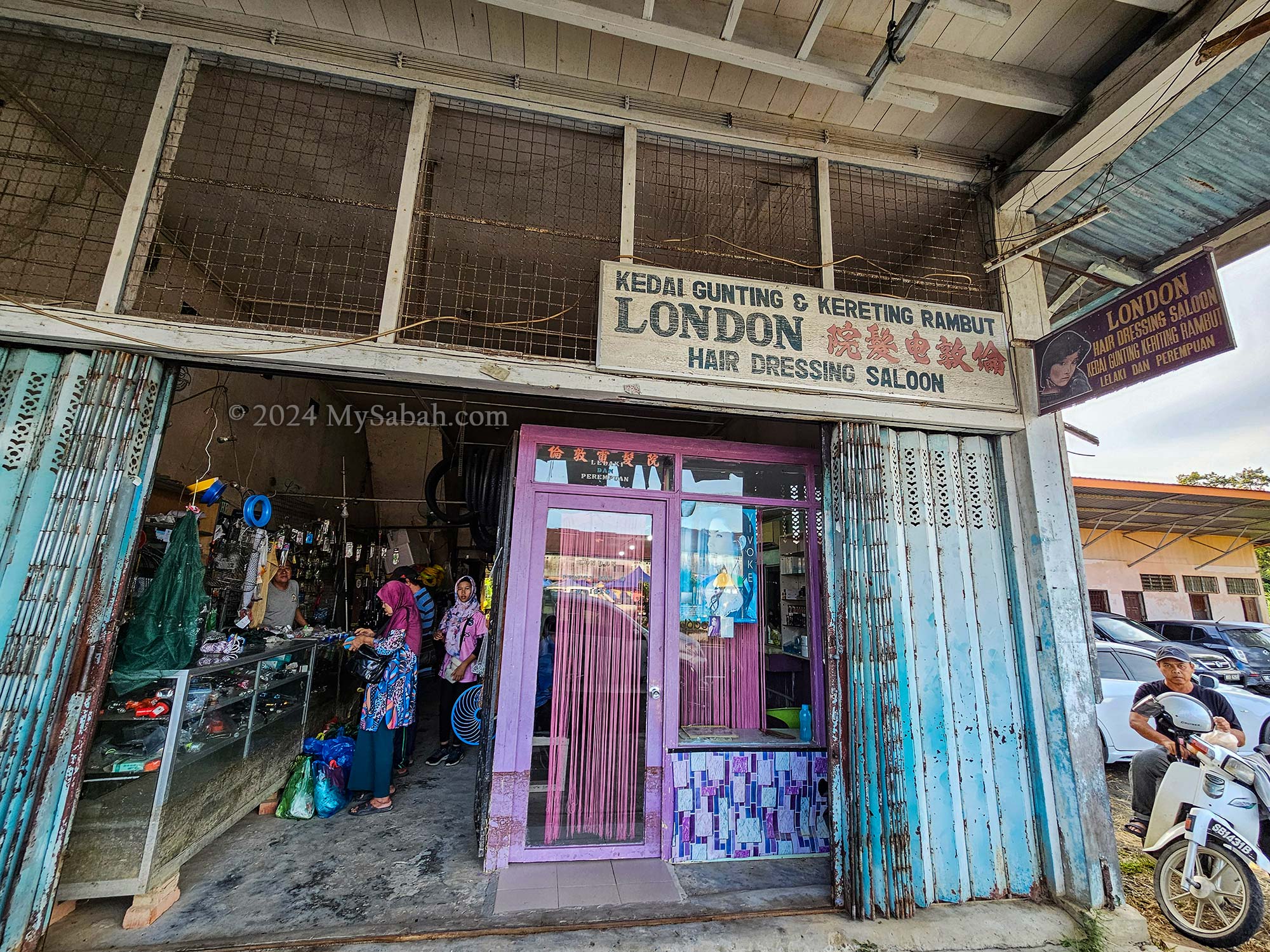
Despite being two decades younger than its pre-war counterparts, this shophouse embodies the distinctive characteristics of North Borneo colonial architecture. Vintage signboards and timber folding doors adorn the shoplots, providing picturesque backdrops for nostalgic photographs.
An old shop in the post-war shophouse of Membakut town
Amidst our exploration, the friendly locals observed our wanderings with smiles, eager to share tales and stories into Membakut’s rich history. From their faces, I can see that they are really proud of their heritage buildings.
The kitchen area behind the shop of a post-war shophouse in MembakutEtching on the concrete pavement slabs of post-war shophouse with the annotations ’28-11-1953′ and ‘11.1953 完竣’. 完竣 is a Chinese word that means completed.
We stumbled upon several concrete pavement slabs adorned with etchings of Chinese coins—a symbol of good fortune and prosperity. Two of these slabs bore the annotation ‘1953,’ a testament to the enduring legacy of the Membakut post-war shophouse since its establishment.
Concrete pavement slab in front of one of the Membakut’s post-war shophouse decorated with etchings of Chinese coins, a symbol of good luck and prosperity.
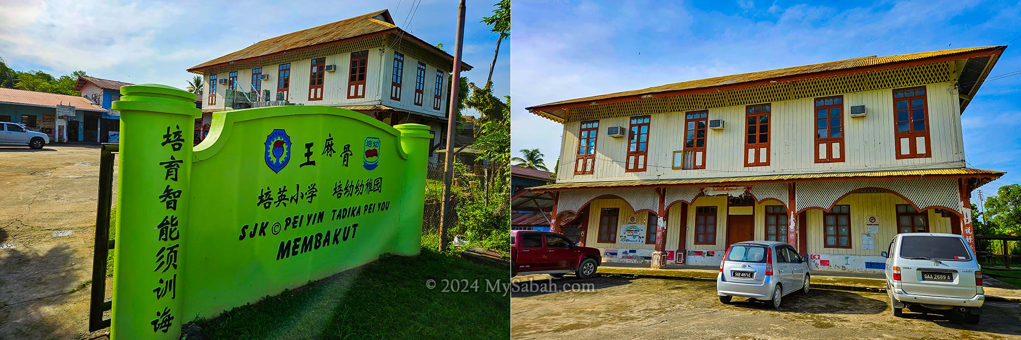
Pei Yin Primary School (培英小学)
The striking red and white façade of Pei Yin Primary School bears distinctive features of colonial architecture. Notably, the intricate stone posts adorning the building’s design mirror those found on the ruins of the Old Welfare Building—a popular site for street art in Kota Kinabalu City today.
Pei Yin Primary School believed to have been built between the 1910s – 1930s.
Pei Yin Primary School believed to have been built between the 1910s – 1930s, so it can be over 100 years old. Taking a moment to admire its architectural details, I marveled at the bargeboard motifs gracing the roof and the uniquely designed ‘cloud arched’ lattice frame of its front facade. It was a school day, the sounds of students reading aloud and playing echoed from within the classrooms.
The uniquely-designed ‘cloud arched’ lattice frame of the Pei Yin Primary School’s front facade is a distinctive feature of this colonial building.
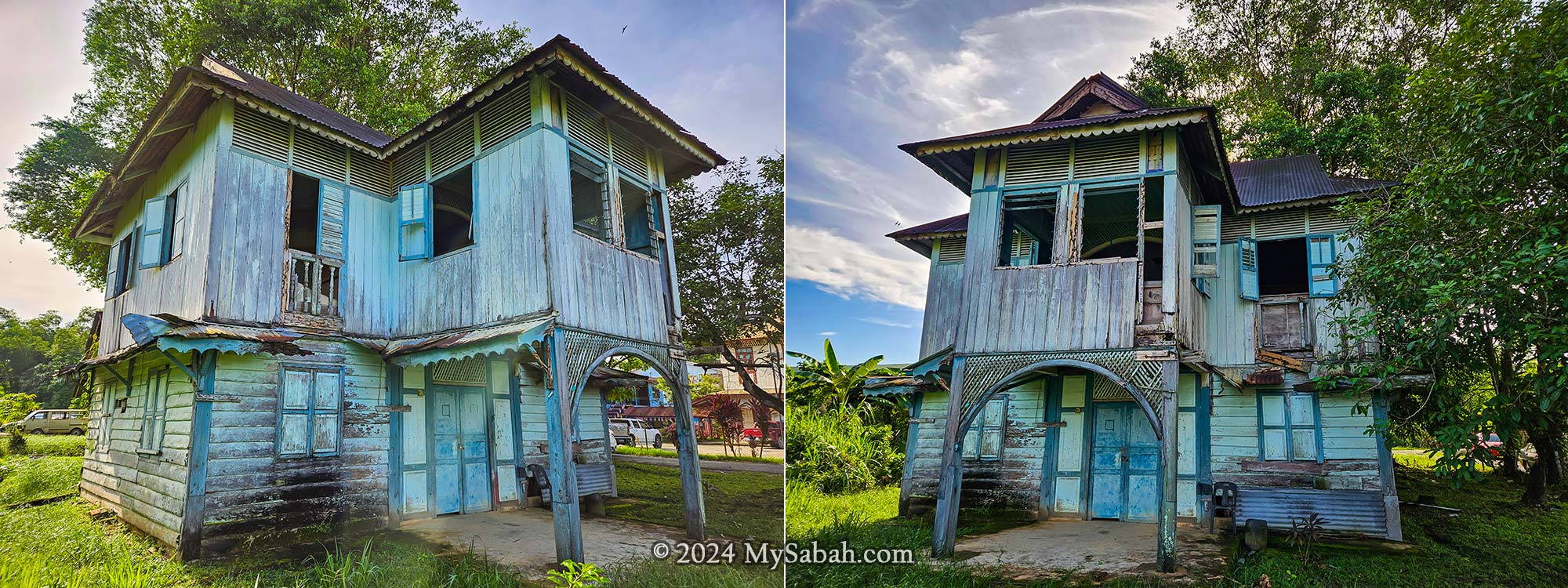
The Blue House
Directly opposite Pei Yin Primary School stands an abandoned pre-WWII residence affectionately known as ‘the Blue House.’ Likely a colonial dwelling, this building likely served as living quarters for past teachers.
This abandoned pre-WWII Blue House is probably the former home of a teacher
The door was locked, so we stood outside admiring the weathered textures of the arched lattice frame, the intricate bargeboard patterns adorning the lower roof overhangs, and the ornamental pendant details of the arch frame.
Devoid of any historical identity and relics, Sabah would become a ‘faceless’ state.
The History of Membakut Town
The development of infrastructure in Membakut township owes much to the bustling business activities of the Chinese community, who settled in the area during the early 1900s to 1920s. Throughout the 1920s to the late 1930s, Membakut rose to prominence, boasting a diverse population that included Bruneians, Chinese, Kadazans, Dusuns, Paitans, Javanese, Bisayas, and others. This vibrant mix of ethnicities engaged in various agricultural pursuits such as rice paddy cultivation, rubber tapping, and fishing, with their produce being traded via the North Borneo railway to neighbouring settlements.
The people of Membakut: Dusun Tangaa’ (left) and Orang Brunei (right) from Membakut
Datuk Teo Chin Ping, affectionately known as ‘Datuk Akong’ among locals, shares memories of Membakut from around 70 years ago. At that time, the township was home to approximately 300 to 400 households. The Hakka predominantly worked as farmers, cultivating rubber and citrus fruits, while the Hokkien managed grocery stores, and the Hainanese operated restaurants. Meanwhile, indigenous people were involved in paddy, tapioca, and sago cultivation, as well as fishing. Intermarriages between Chinese and native communities were common, and all races lived together like one big family.
The Origin of the Name “Membakut”
Membakut derives its name from the local Bruneian dialect, where “Bakut” translates to “Fort,” so the term “Membakut” literally means “to make a fort.” Carmelita, a resident of Kg Limpayau, recounts various versions of how the name “Membakut” originated. According to her mother, Rupinah Mikil, early settlers from Brunei referred to the place as “Buah Bakut”.
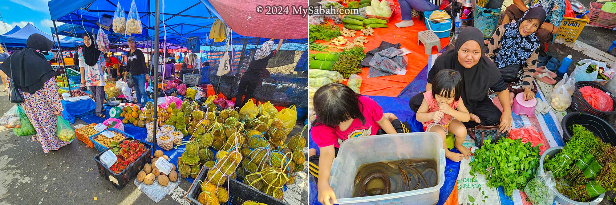
Tamu market of Membakut is held on every Wednesday (old township) and Sunday (new township). During fruiting season, the Tamu is flooded with all kinds of fruits from Durian, Rambutan, Bambangan, Tarap to jackfruits.
Another version suggests that the name stems from the word “Mamadakut,” derived from the Kadazan term for “the process of gathering Sago from its trunk.” Membakut was once abundant with Sago plants, making sago gathering a prevalent activity. It’s likely that the similarity in sound between “Mamadakut” and “Membakut” led to the adoption of the latter as the name for the area.
Stories of Membakut
This article might be getting a bit lengthy, but if you’ve made it this far, I’m guessing you’re quite the history enthusiast. So, here are two interesting stories about Membakut for your enjoyment.
1) Borneo Railway, Take Me Home
Datuk Teo Chin Ping from Membakut shared a story about the railway during an interview with See Hua Newspaper. During World War II, when Borneo was occupied by the Japanese, Datuk Teo was working as forced labor for Japanese forces to build and maintain the airport in Tanjung Aru. One fateful day, Teo and his friend overheard news that the Japanese were going to execute someone. Driven by curiosity, they walked from the airport to Petagas on foot. Around noon, they climbed a tree and witnessed the brutal killing by the Japanese from a distance (probably the event at Petagas War Memorial).
The colonial buildings of West Coast are focused along the train stops, with rows of shophouses on both sides.
They were completely shocked and worried that they would be the next victims, so they decided to run away from the Japanese. However, they were young boys who didn’t know the way home and had no adults to help them. Then they came up with a plan. Since they had been sent to Tanjung Aru by train, they reasoned that they could reach home by following the railway track in the opposite direction. One day, they left the work site after 5 pm and followed the railroad. For your information, the distance between Tanjung Aru and Membakut is about 70 kilometers, so it’s a long walk.
Teo and his friend followed the railway track to go home. (AI photo)
They continued walking along the railway. When they reached the Pengalat tunnel, it was pitch dark inside. Worried about snakes, they beat around with tree branches and burnt the fat of a wild boar as a torch. Finally, they arrived at Kampung Brunei of Membakut at dawn. They jumped into the river and took a shortcut to get home. Datuk Teo was afraid that the Japanese would come after him, so he hid at home until the war was over. Fortunately, he remained safe and witnessed Borneo being liberated by the Allies.
Aerial view of the Pei Yin School (left) and Post-War shophouse (right) in Membakut
2) My Love is a ‘Member Cute’
Here’s another “romantic” story from Mr. Rimo Pirin, a singer from Kg Dungau. During the war, there was this British soldier who fell in love with a local girl. They didn’t have much time together because he was always on the move and didn’t stay long in one place. After the war, he came back to Borneo, hoping to find her. But here’s the kicker: he couldn’t remember her name, just that she was adorable. So, he kept calling her “a member cute.” The villagers were puzzled with such name but helped him anyway. The story is pretty amusing, so they’ve been talking about it for fun ever since.
How to Get There
Membakut is located in the Papar District, approximately 80 kilometers south of Kota Kinabalu, the capital city of Sabah. The town’s old shophouses and buildings are situated in the old township (Pekan Lama. See Location Map) and can be easily reached via asphalt roads.
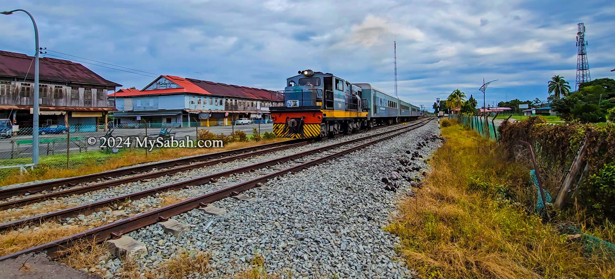
The train station of Membakut town. Some locals still use this railway for their daily commute.
Alternatively, you can opt for a scenic train journey from Tanjung Aru train station to Membakut. Along the railway route, you’ll enjoy picturesque countryside views and pass by various historical landmarks, including the colonial buildings of Kinarut and the Papar iron bridge.
References
Book: Sokial, Richard Nelson. Colonial Townships in Sabah: West Coast. Sabah, Malaysia: Homeland Publisher Sdn Bhd, 2012. (I highly recommend this book if you want in-depth information of colonial building in west coast of Sabah)
Newspaper Article (Daily Express): Binisol, Lorena. “Membakut history and popular Tamu.” Daily Express, September 8, 2019. https://www.dailyexpress.com.my/read/3168/membakut-history-and-popular-tamu/.
Newspaper Article (See Hua Daily News): “王麻骨闻人张正平 述说故乡事迹.” See Hua Daily News (诗华日报), January 14, 2020. https://news.seehua.com/post/515791.
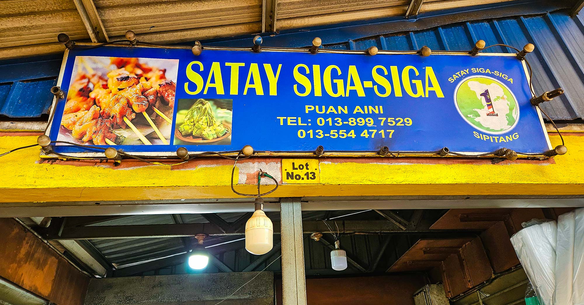
The scent of a particular perfume could remind you of someone you love, while the aroma of sizzling satay smoke transports me back to the tantalizing taste of satay in Sipitang town. Considered the best satay in Sabah, Sipitang Satay is the town’s trademark food, just like how we have Tenom Coffee and Tuaran Noodle in Sabah.
Sipitang, the biggest town near the Sabah-Sarawak border in Malaysia, is a popular pitstop for travelers heading between Sabah, Sarawak, and Brunei. Despite its small-town charm with no fancy malls or hotels, it’s a favorite spot to take a break, grab some delicious satay, and enjoy the coastal views after a long drive. And it’s from here that the fame of Sipitang Satay has spread across Borneo.
A friendly tourist from Brunei who visits Sipitang quite often for the yummy satay, so Sipitang Satay has become known “internationally” because Bruneians also love it.
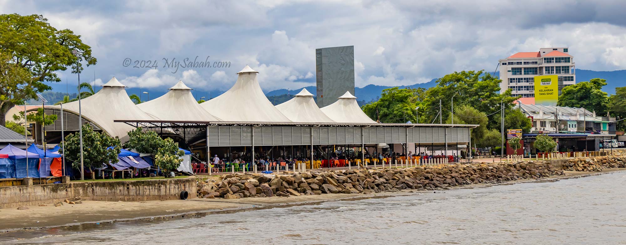
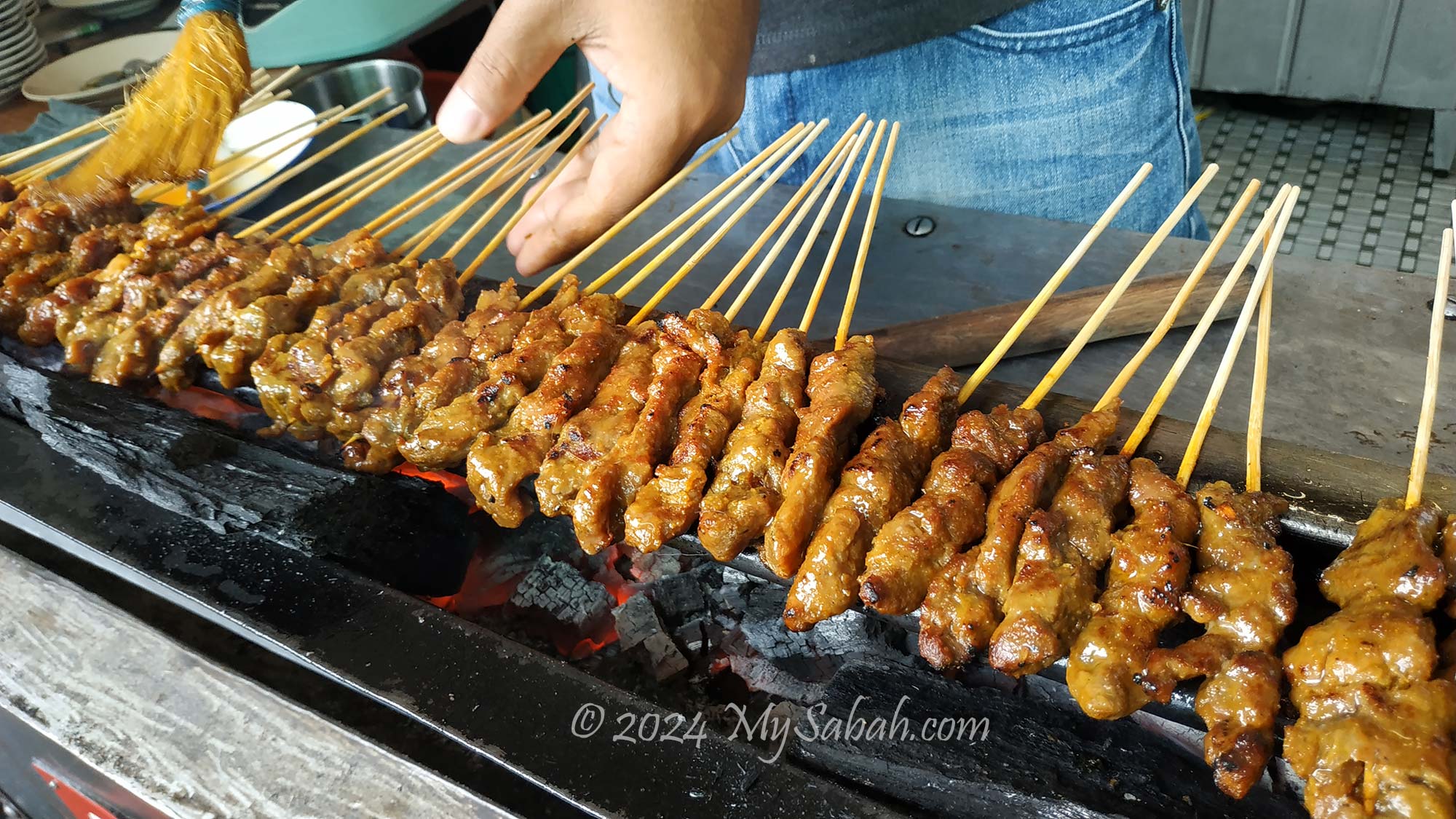
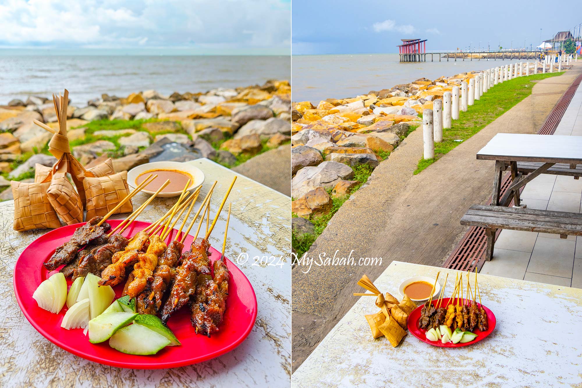
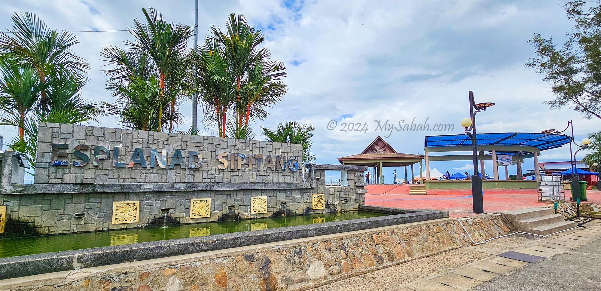
To uncover the secrets behind Sipitang Satay’s irresistible flavour, I embarked on a nearly three-hour drive from KK to Sipitang. As I arrived in Sipitang around noon, the tantalizing aroma of grilled satay filled the air, a signature scent of the town. Following the trail of smoke, I made my way to a bustling hawker centre housed in a white-roofed building at the esplanade.
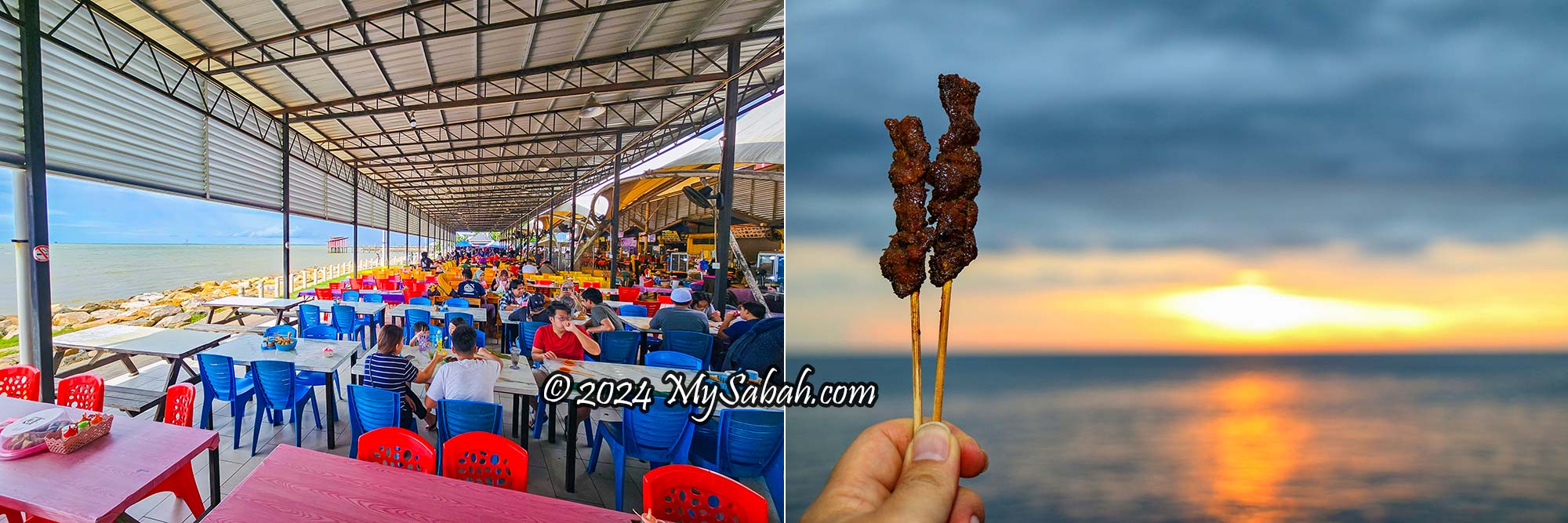
The hawker center at Sipitang Esplanade. Now, diners can enjoy satay sheltered from the hot sun and rain.
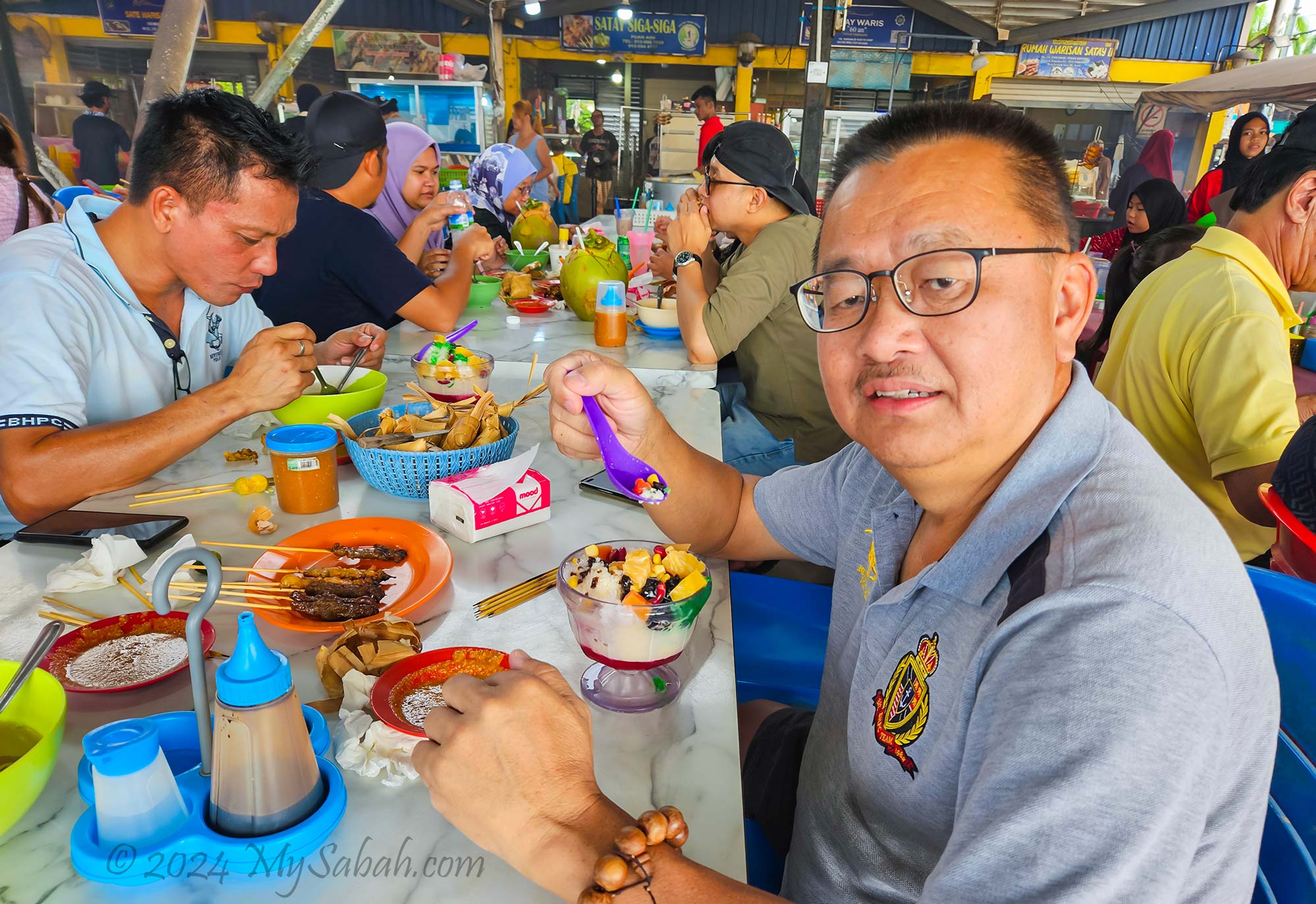
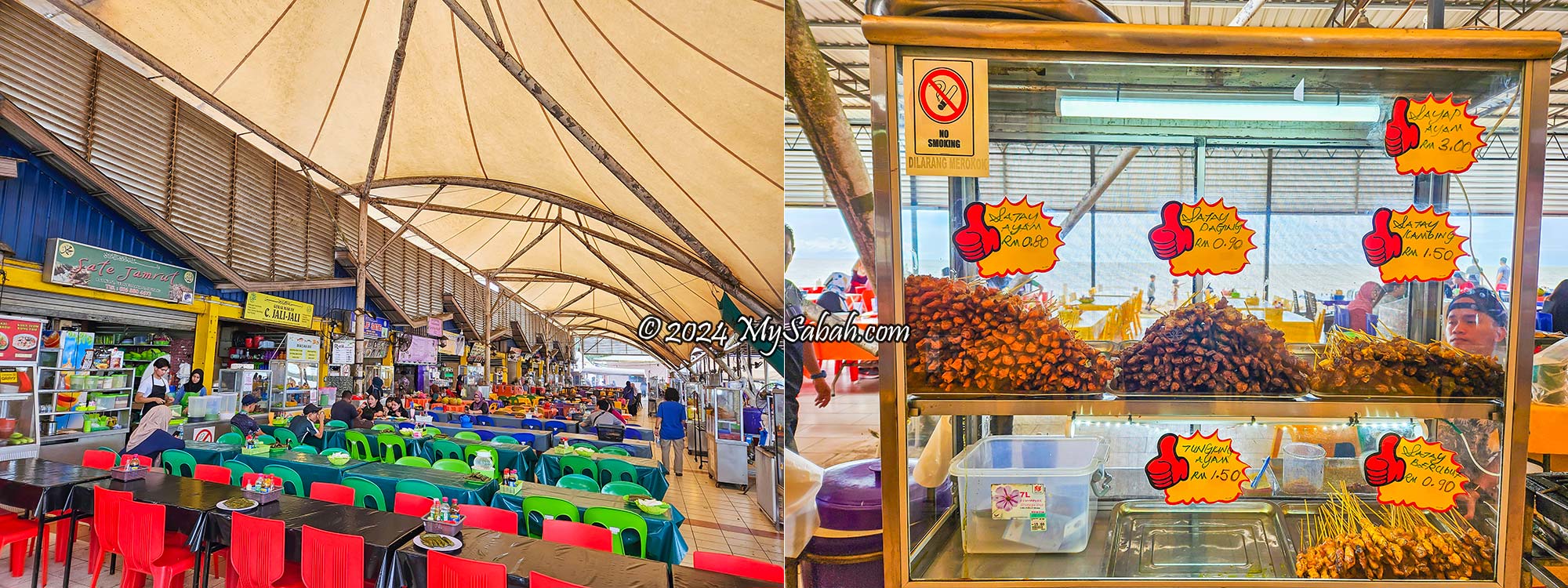
At the hawker centre, rows of colourful tables and chairs were occupied by approximately 20 stalls offering an array of satay and other local delicacies. It was a hub where one could indulge in three iconic Malaysian foods: satay, ketupat, and ABC (Mixed Ice Dessert). The tantalising aroma, enticing appearance, and sizzling sounds of the satay set my stomach rumbling. Legend has it that no one leaves this satay kingdom with an empty stomach, so I knew I had to eat.
Satay stalls of Sipitang town. They also sells variety of halal food such as chicken wings and noodles.
About Satay
For those unfamiliar with Malaysia’s most popular street food, satay (also known as sate or satai in Malay) originated from Java, Indonesia, and has existed since the 15th century. It’s a Southeast Asian form of kebab made from seasoned, skewered, and barbecued meat, typically served with a side sauce. Each country has its own unique way of preparing satay.
Satay is the most popular street food of Malaysia.
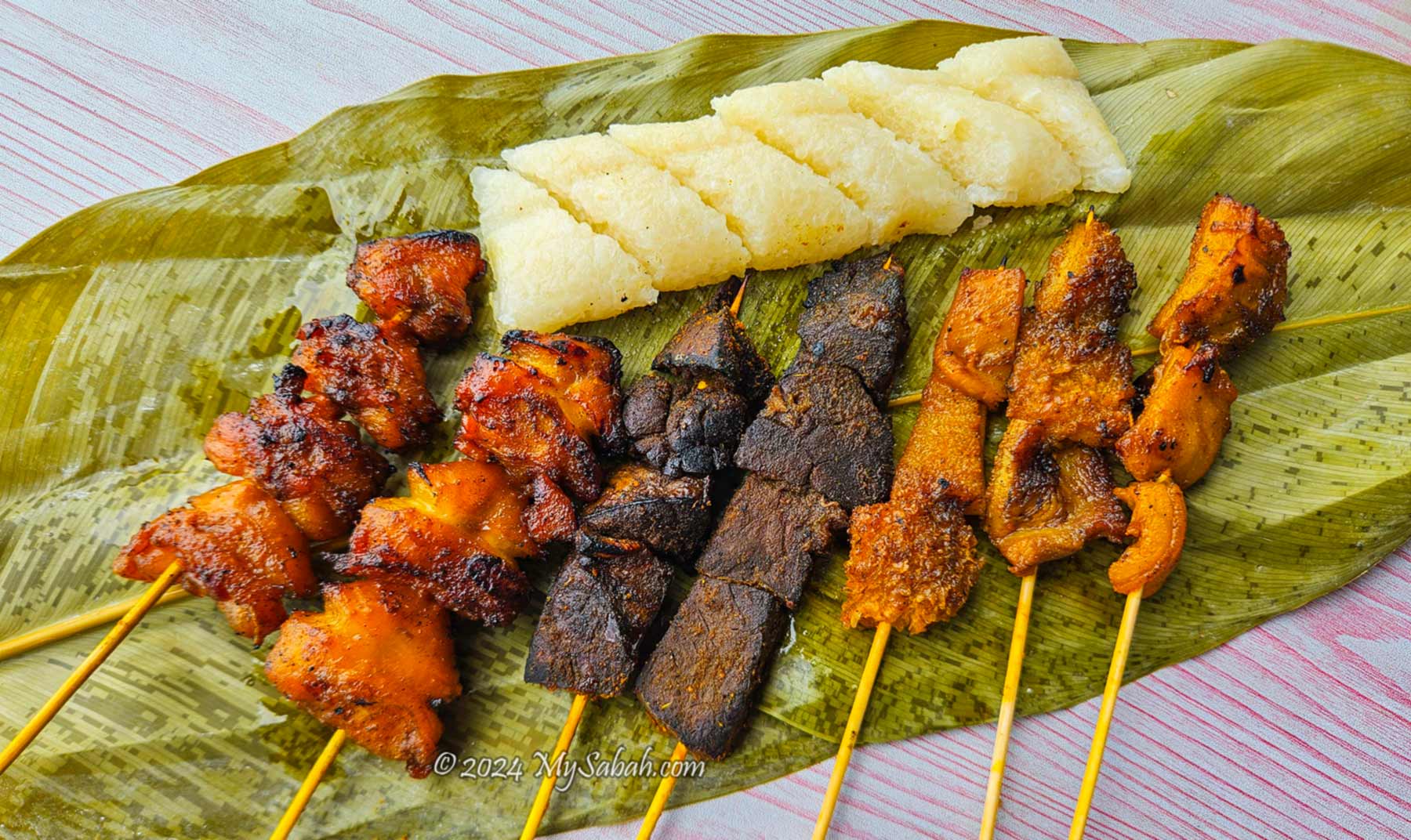
Malaysian satay is crafted from tender and juicy diced or sliced pieces of marinated chicken, beef, or lamb (or mutton). These meat pieces are skewered and barbecued over charcoal embers, imparting a delightful smoky and tangy flavour.
Beef Satay, Chicken Satay, and Lamb Satay are the three most popular types of Malaysian satay.
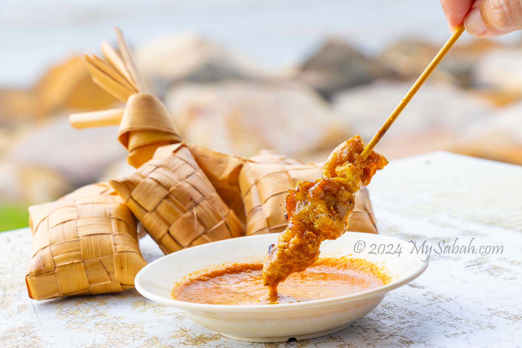
To fully savour your satay experience, dip each skewer into the thick peanut sauce (or satay sauce), which is considered the soul of satay. The savoury meat pairs wonderfully with the sweet and creamy sauce, enhancing the overall flavour and mouthfeel of the dish. The satay sauce typically comprises ground toasted peanuts, spices, and sugar. A well-made homemade peanut sauce can greatly enhance the taste of your satay.
Satay is best served with peanut sauce; they are a perfect pair.
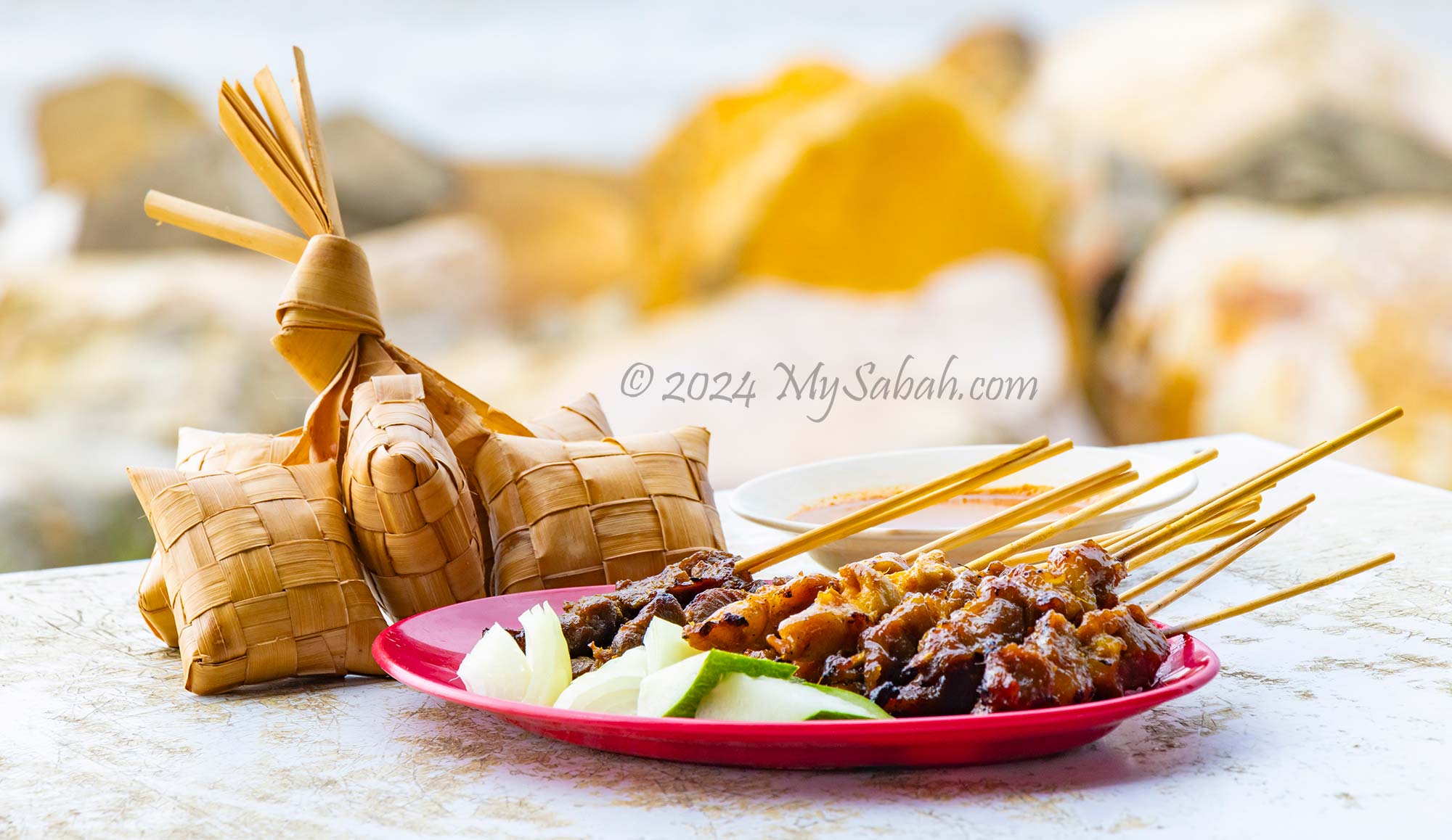
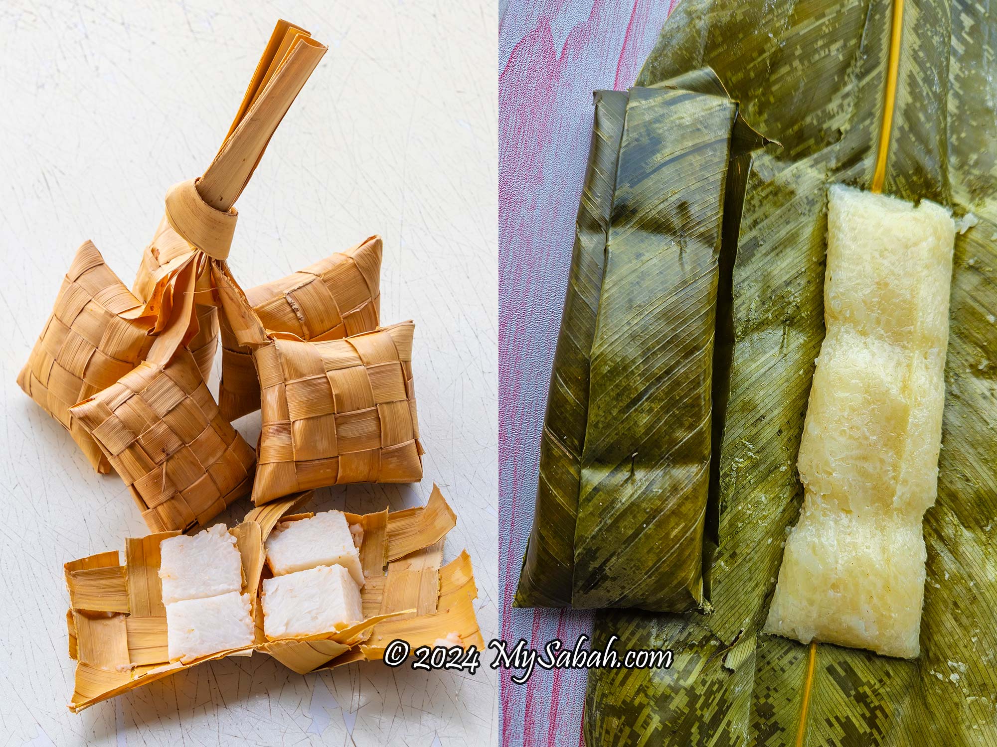
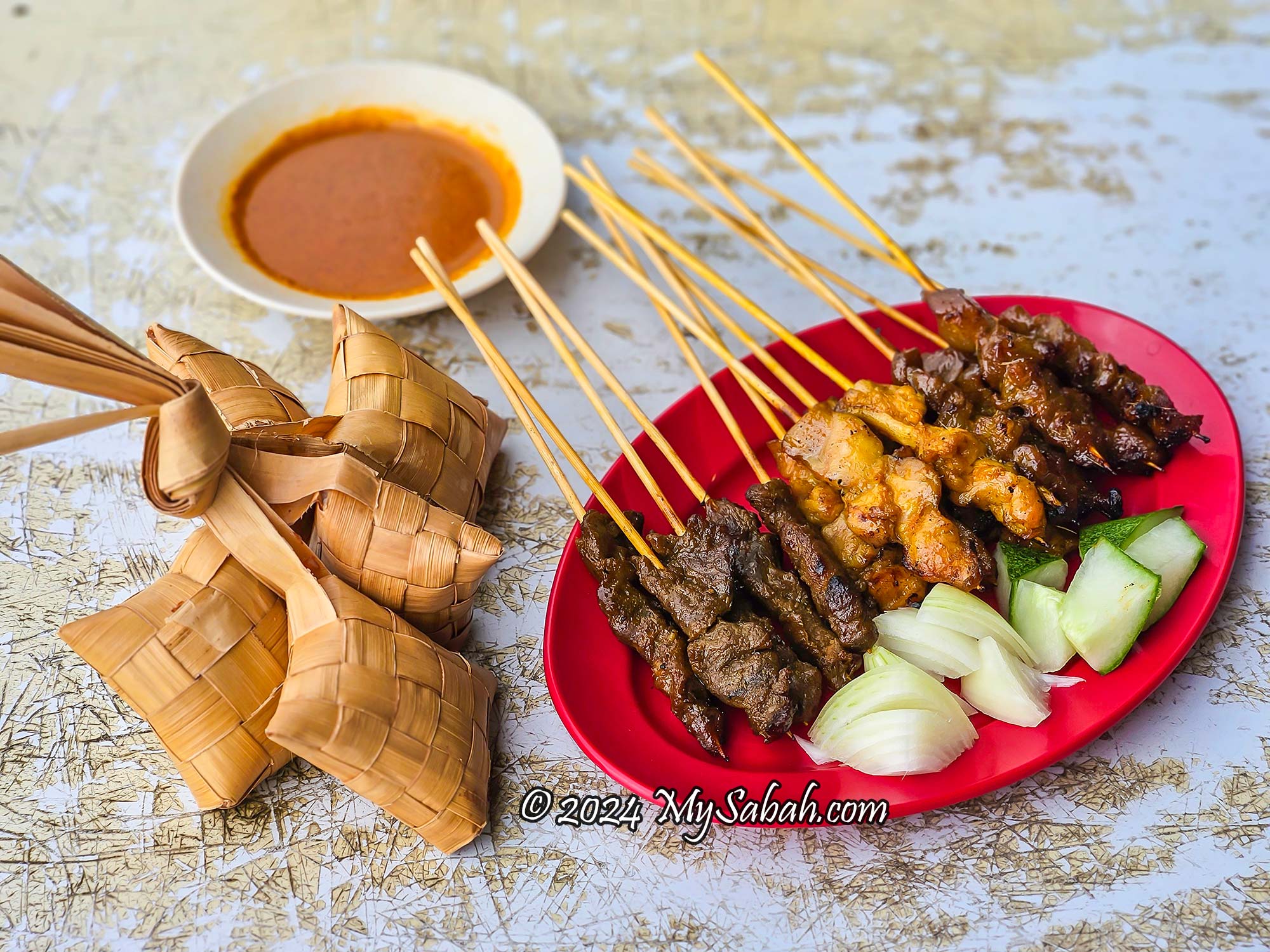
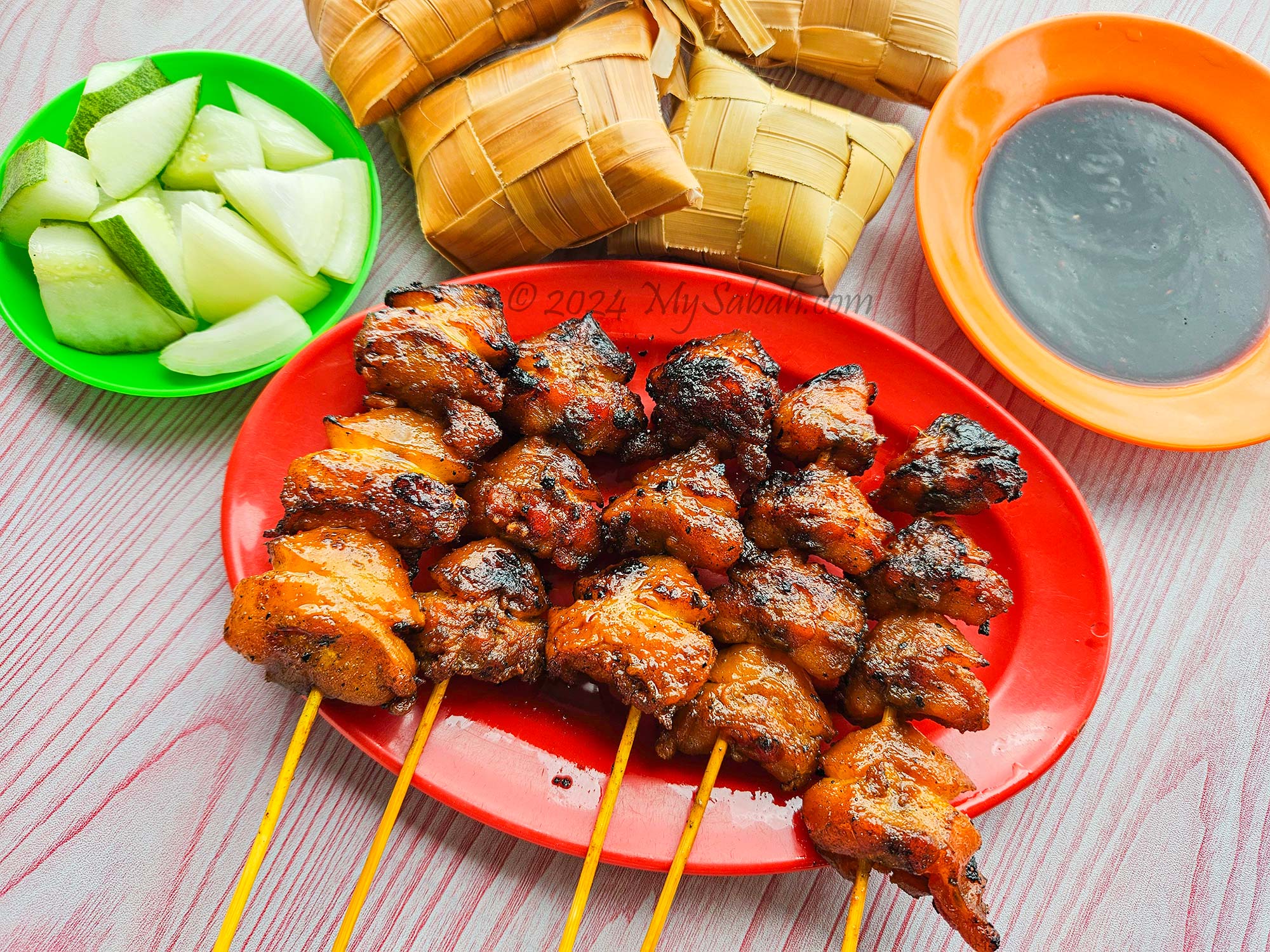
For a satisfying meal, accompany your satay with ketupat or kelupis rice cakes. Ketupat is compressed rice wrapped in coconut fronds, while kelupis is a traditional and sweet delicacy of the Orang Brunei of Sabah, made from glutinous rice and wrapped in leaves.
Ketupat (left) and Kelupis (right) are traditional Malaysian rice cakes. Both are delicious when dipped with peanut sauce.
To complement your satay, diced cucumber and onions serve as refreshing condiments, helping to reduce the oily feel on your taste buds. While these vegetables are not typically provided by default at Sipitang stalls, you can always request them. The owner of Satay Siga-Siga kindly provided us with some for photography purposes.
Satay being BBQ’d over the grill stove. The aromatic smoke is a crowd magnet.
I highly recommend Satay Siga-Siga (they didn’t pay me to say this). You can verify my recommendation by checking out other online reviews. The seats at Satay Siga-Siga are always the first to be fully occupied, and even Bruneians know them.
Satay Siga-Siga serves excellent satay, highly recommended by me and many others.
Types of Sipitang Satay
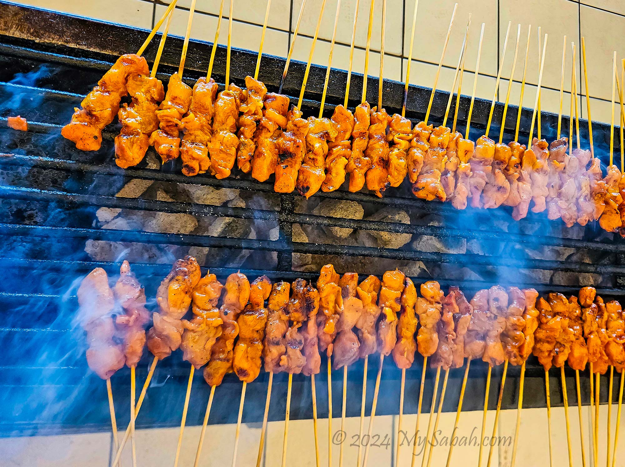
There are three main types of satay: beef (sate daging), chicken (sate ayam), and lamb (sate kambing), which are the best-selling varieties. Beef satay (sate daging) is favoured for its rich flavour and texture. Chicken satay (sate ayam) appeals to those who prefer tender white meat. Lamb satay (sate kambing) boasts the strongest flavour, ideal for those who appreciate its distinct goaty aroma, though it’s the most expensive option.
Platter of beef, chicken and lamb satay. Nice to meat you. Beef and Chicken Satay cost RM0.80 to RM1.00 each, while Lamb Satay is priced at RM1.50 to RM2.00. Different stalls may have varying selling prices. (Prices are accurate as of January 2024 and may vary in the future).
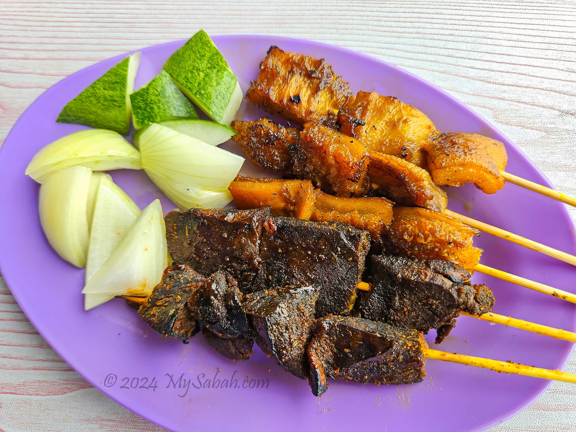
Another popular satay variety is Sate Tungking/Tongkeng/Buntut (chicken tail satay). Initially, the idea of eating ‘chicken butt’ may seem off-putting, but I became a fan after my first taste. While chicken tail is quite fatty, its meat is incredibly tender. The fat of Sate Buntut is grilled until it’s slightly burnt and crispy on the outside, allowing you to enjoy the juicy and springy meat. I usually only have 1 or 2 skewers before it starts feeling too greasy.
The oily chicken tail satay goes well with the sweet and spicy dark sauce. These satay are overcooked though. Sate Buntut costs about RM1.50 each.
Sate Berubut (Beef Tripe Satay) and Hati Buyah (Beef Lungs Satay) taste like a soft version of jerky. While they offer interesting textures, I personally don’t find them very appetising, especially without seasoning. In fact, they can be rather bland. These varieties are definitely an acquired taste and may not be a safe choice for those who dislike offal. It’s worth noting that they often cost the same or even more than the more well-liked varieties of satay.
Sate Berubut (Beef Tripe Satay) and Sate Hati Buyah (Beef Lungs Satay). They cost from RM1.00 to RM1.50 each.
Why Sipitang Satay Tastes So Good?
The delicious taste of Sipitang Satay is only half of the story. Science can explain why Sipitang Satay stands out compared to equally good satay made elsewhere. Professor Charles Spence unraveled some of these secrets in his book ‘Gastrophysics: The New Science of Eating.’ Big firms like Nestle and PepsiCo also employ his formula to stimulate you to buy more.
No other satay experience compares to enjoying it with a sea view in Sipitang.
Over 20 years of research by Professor Charles Spence reveals that eating is a multisensory experience, engaging tastes, sights, sounds, smells, and emotions. These senses collectively shape our perception of food and contribute to the pleasure it brings. For instance, food may taste bland on airplanes due to the dampening effect of dry air, engine noise, low cabin pressure, and confined space on our senses.
Food tastes better when we’re relaxed and dining in a pleasant environment like by the seaside at sunset.
The multisensory atmosphere of Sipitang town is shaped by several factors:
Emotions: Many visitors to Sipitang are holidaymakers with their families, and their relaxed and positive moods heighten their senses, enhancing their enjoyment of the satay.
Sights: The breathtaking panoramic sea view and stunning sunset at Sipitang Esplanade add to the overall experience.
Sounds: The soothing sea breeze and gentle lull of the waves create a relaxing auditory backdrop.
Smells: The tantalising aroma of sizzling satay permeates the air, further enriching the sensory experience.
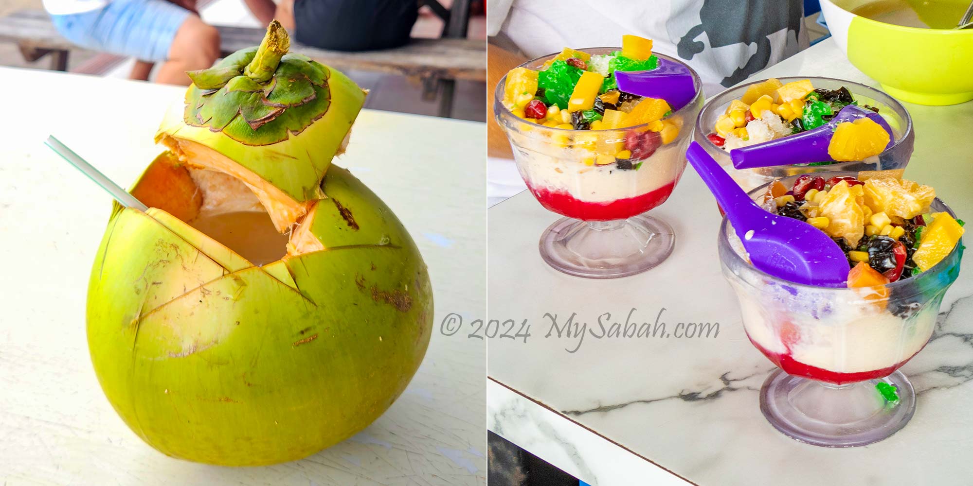
You also can order other food and drink at the hawker centre. e.g. Coconut juice (left) and Ais Batu Campur, the Mixed Ice Dessert (right)
Fine dining restaurants use classy background music, expensive cutlery, fancy decorations, and creative plating to offer a multisensory dining experience, so they can charge you three-digit prices for a meal. In contrast, the one-dollar satay in Sipitang is truly a steal for foodies.
After enjoying your satay, take a leisurely stroll at Sipitang Esplanade to soak in the beautiful view.
How to Get There
To get to the hawker centre selling Sipitang Satay, head approximately 140 km south of Kota Kinabalu City (KK) to the esplanade in the centre of Sipitang town (see Location Map or Street Map). The drive takes about 2 hours and 40 minutes on asphalt roads of fair condition.
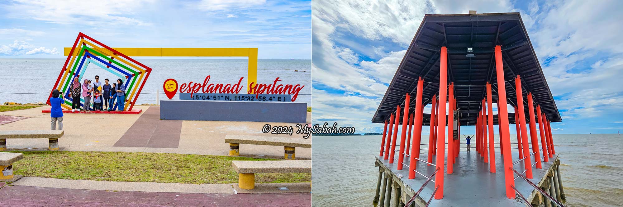
Sipitang Esplanade in the town centre
As it’s a long journey, consider turning it into a road trip and exploring other towns such as Papar, Bongawan and Beaufort along the way. Keep in mind that during school holidays, Sipitang Satay may sell out earlier than usual.
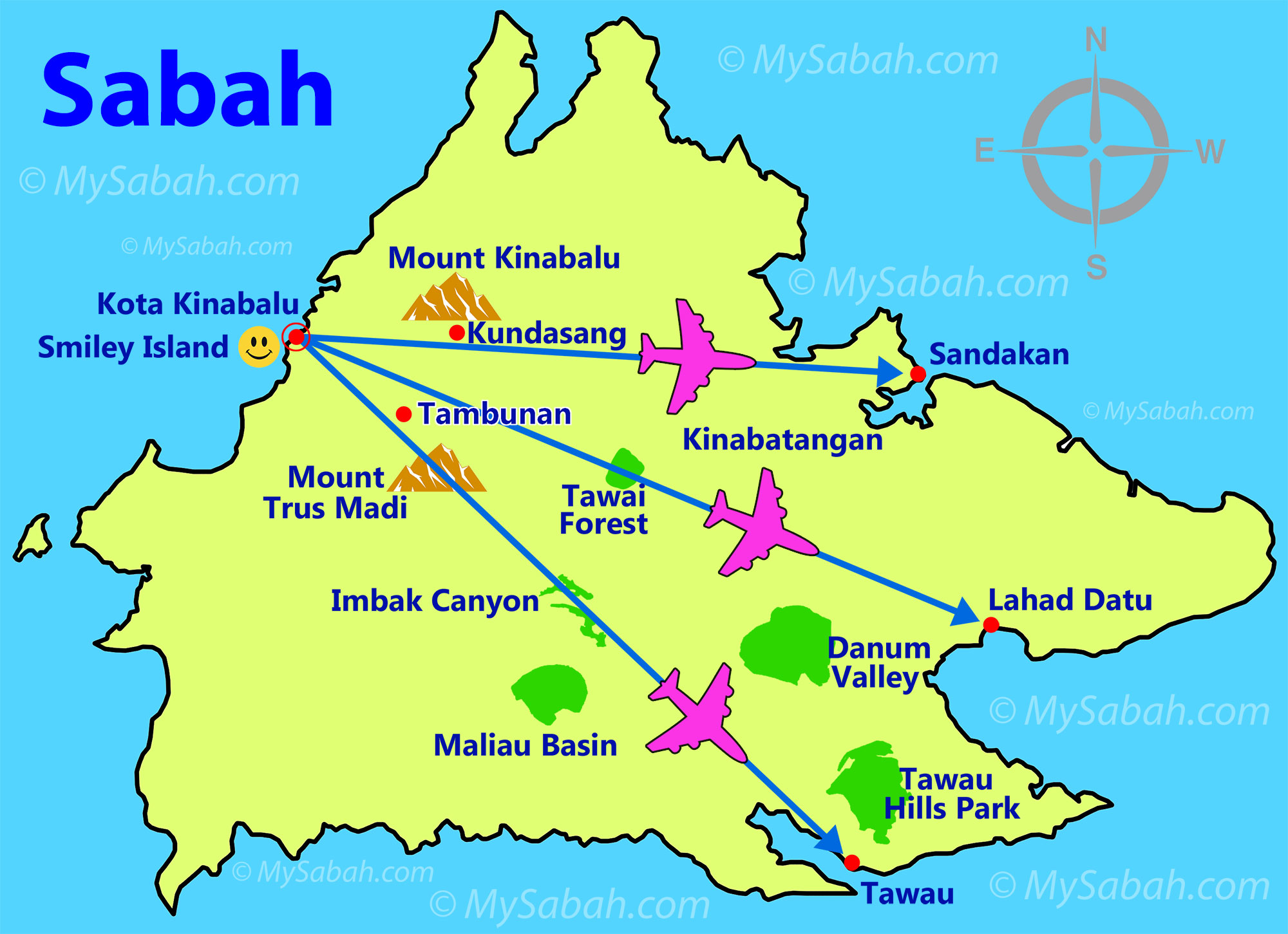
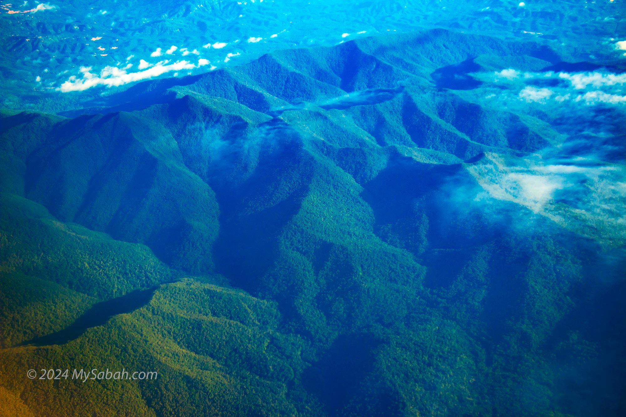
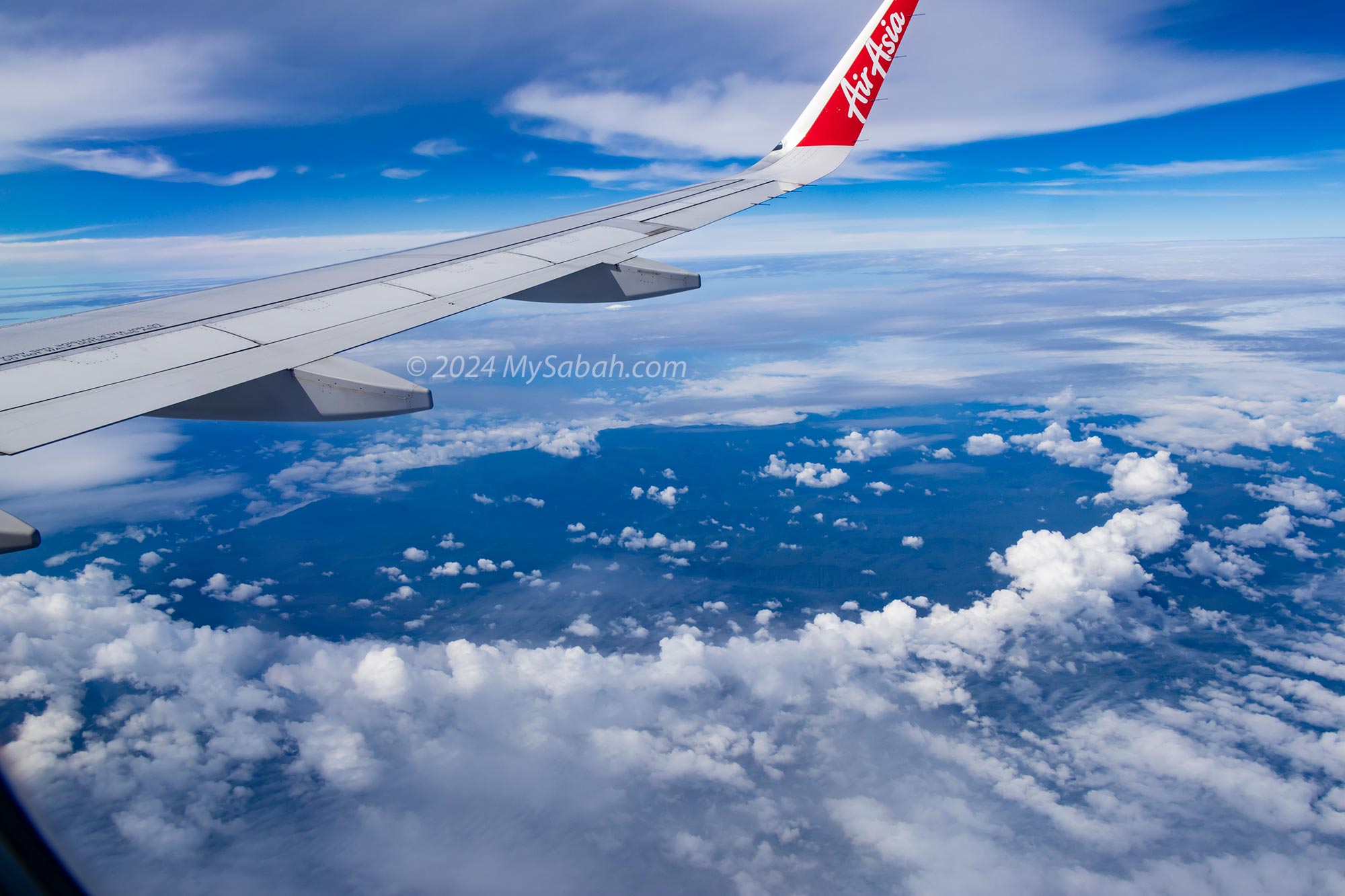
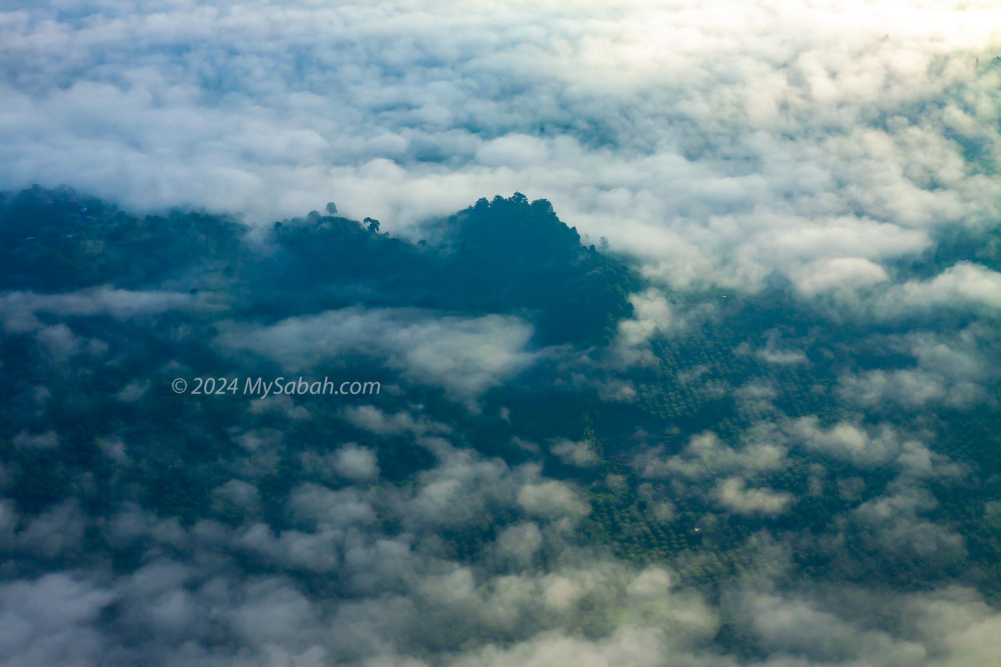
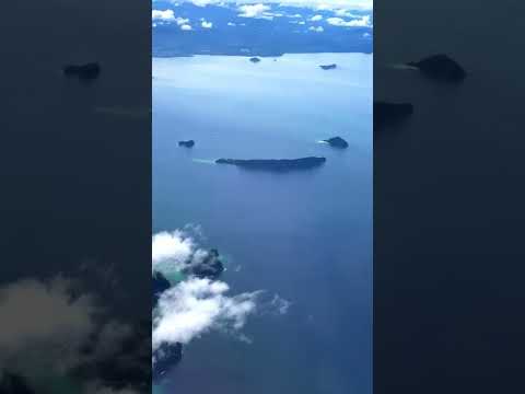
Sabah, often referred to as the land below the wind, is a mesmerizing mountainous state in Malaysia. Its breathtaking landscapes are easily recognised from the planes soaring through the skies. Even on short flights from Kota Kinabalu City (KK) to destinations like Sandakan, Tawau, and Lahad Datu, which take less than an hour, the journey is an exhilarating experience from takeoff to landing, offering a plethora of sights to behold.
Route map of domestic flights in Sabah, from Kota Kinabalu City to Sandakan, Lahad Datu and Tawau, and the landmarks and towns that they pass through. The actual paths are not necessary a straight line.
The side of the plane you select, whether right or left, determines your in-flight views. Below are the routes starting from Kota Kinabalu City (KK), so consider this guide when choosing your window seat. If you’re heading to KK, opt for the opposite side for optimal views.
Kota Kinabalu to Sandakan
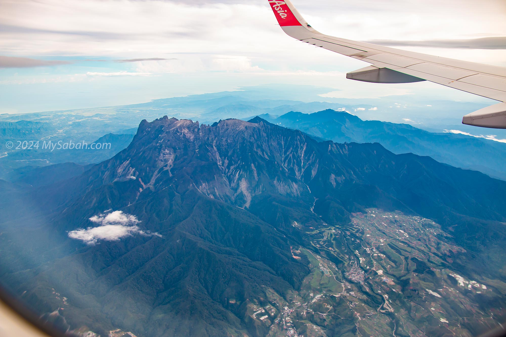
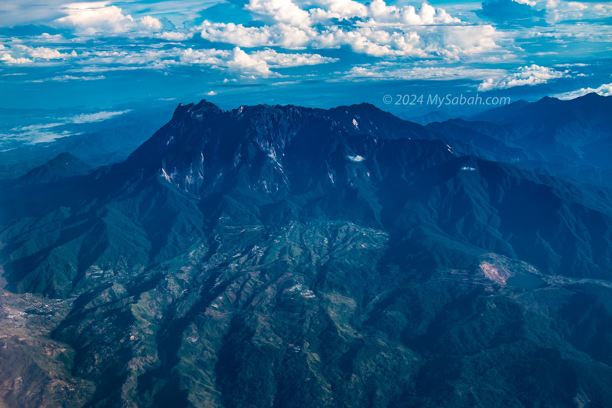
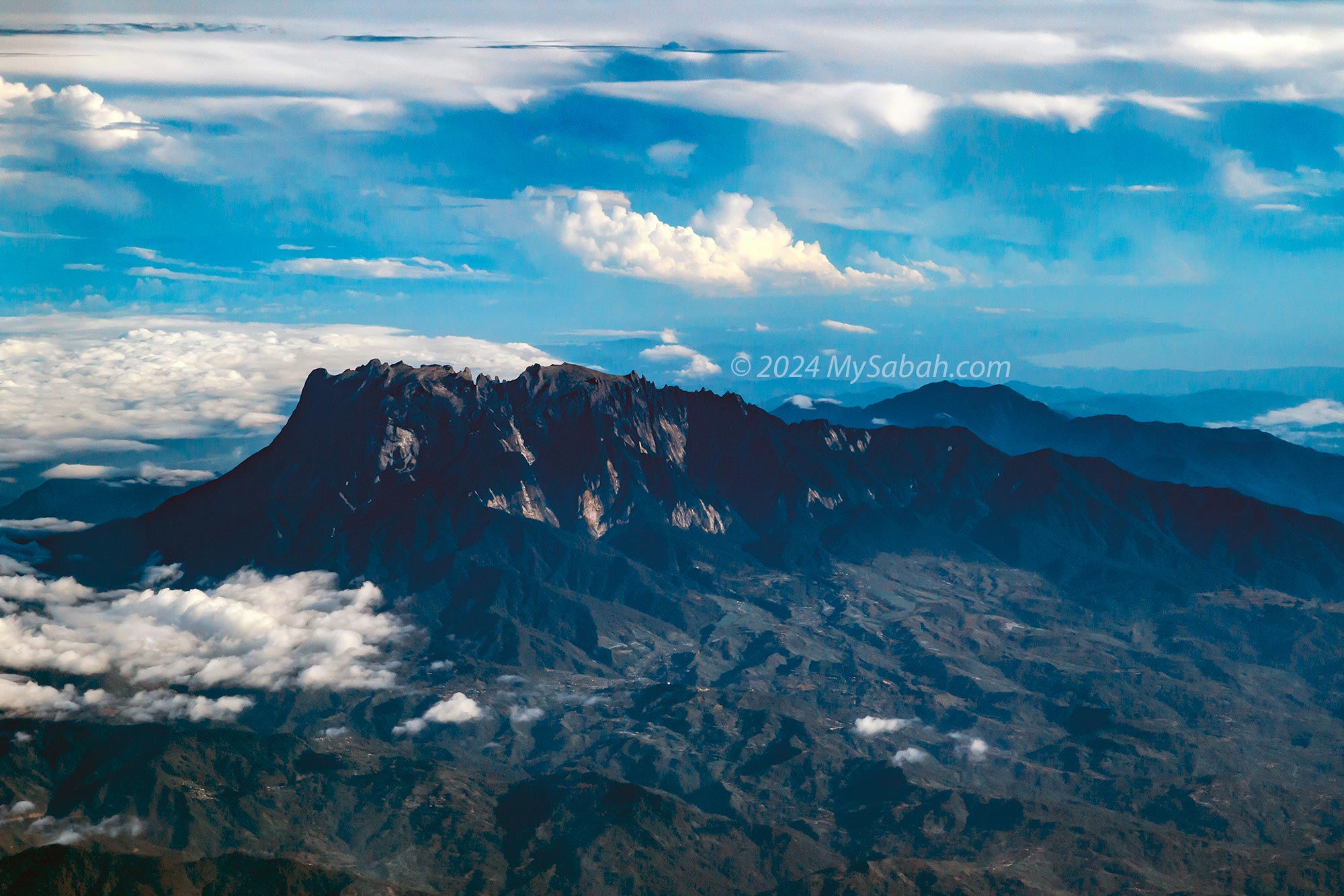
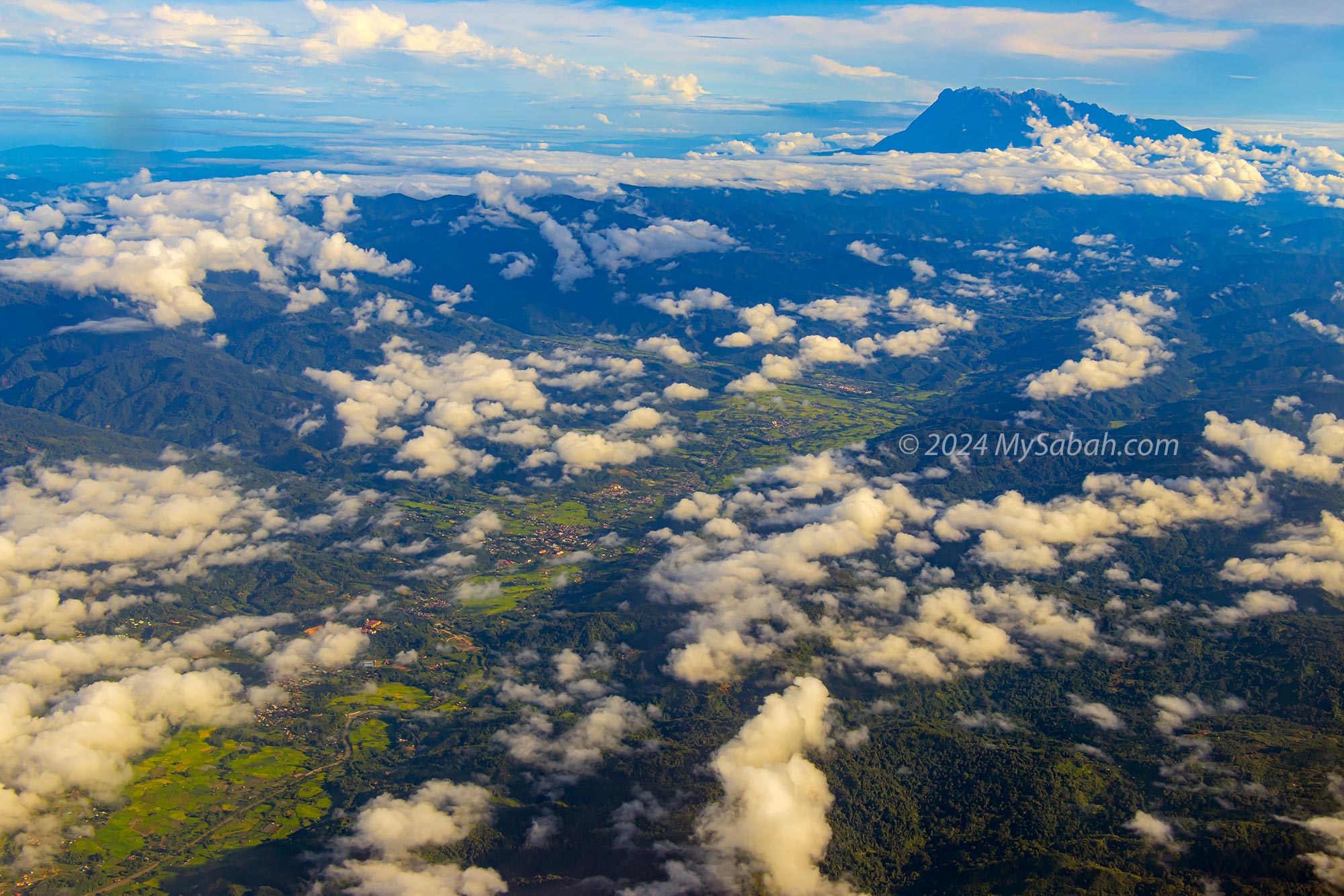
The left-side view of the KK to Sandakan flight provides the closest vantage point to Mount Kinabalu, Malaysia’s highest mountain, and the town of Kundasang at its foothill during domestic flights.
The best aerial view of Mount Kinabalu and Kundasang town can be seen from the planes flying between Kota Kinabalu and Sandakan.
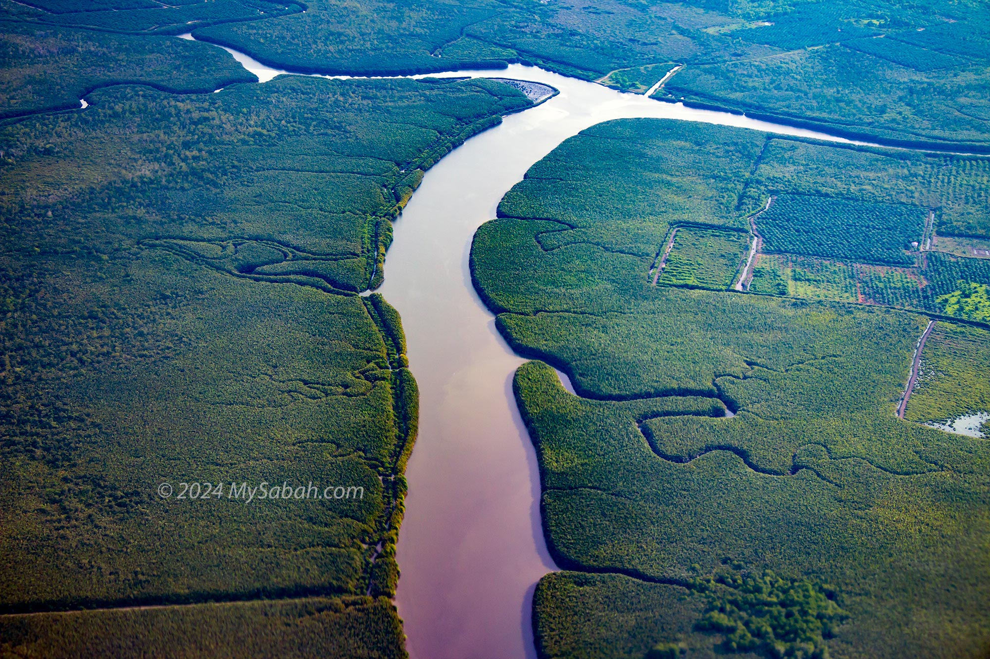
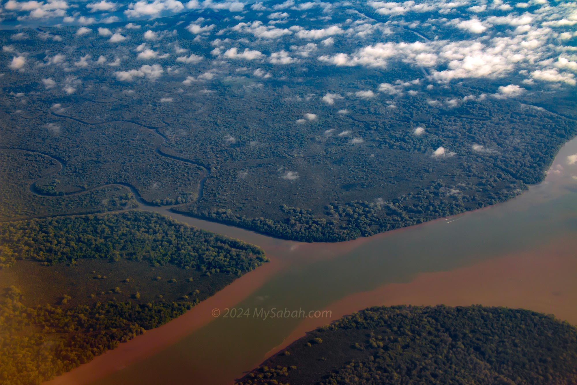
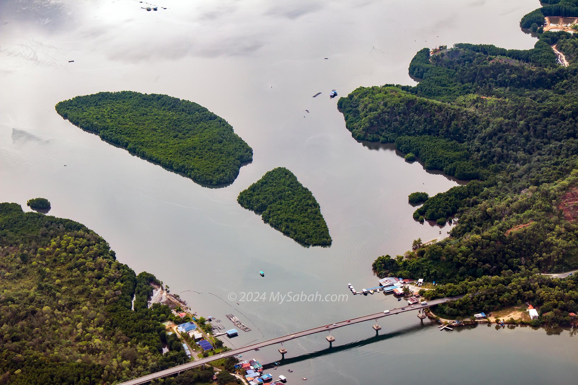
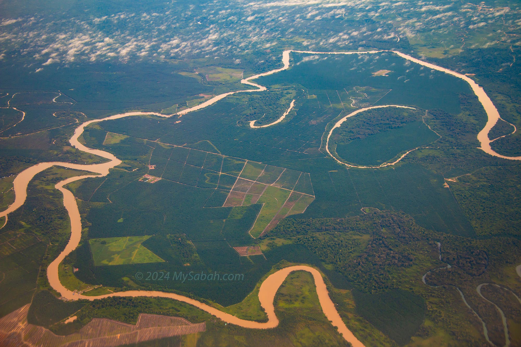
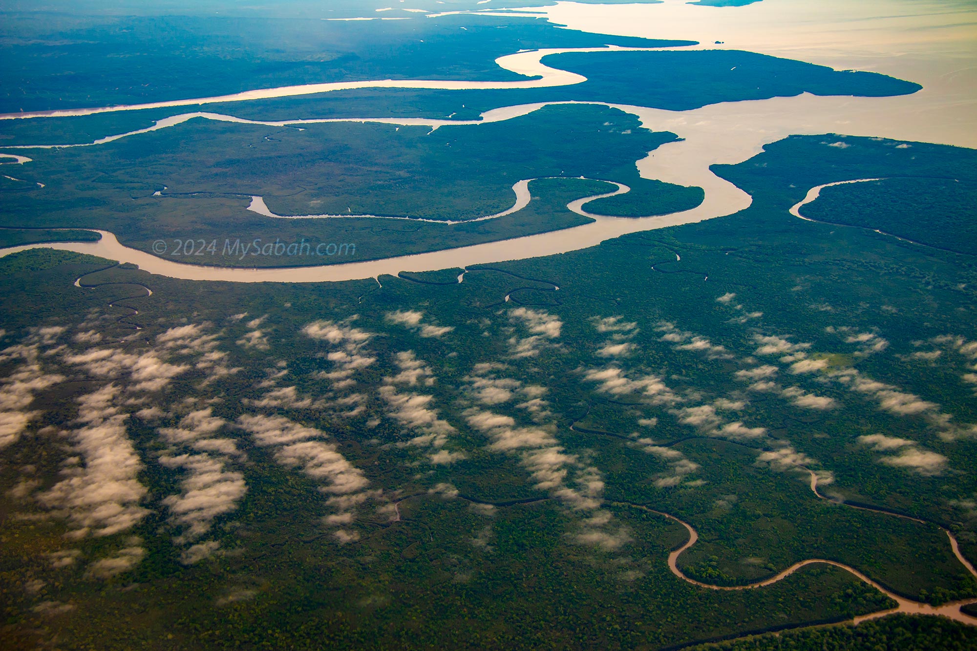
As your plane approaches Sandakan city, the left side also affords a superior view of the Kinabatangan floodplains, recognized as the largest RAMSAR site in Malaysia—a wetland celebrated for its ecological and biodiversity significance. On the return journey from Sandakan to Kota Kinabalu, make sure to switch to the right side for the optimal view.
Kinabatangan River is the second longest river of Malaysia
Tawai Forest Reserve under the plane flying to Sandakan
Kinabatangan Floodplains of Sandakan
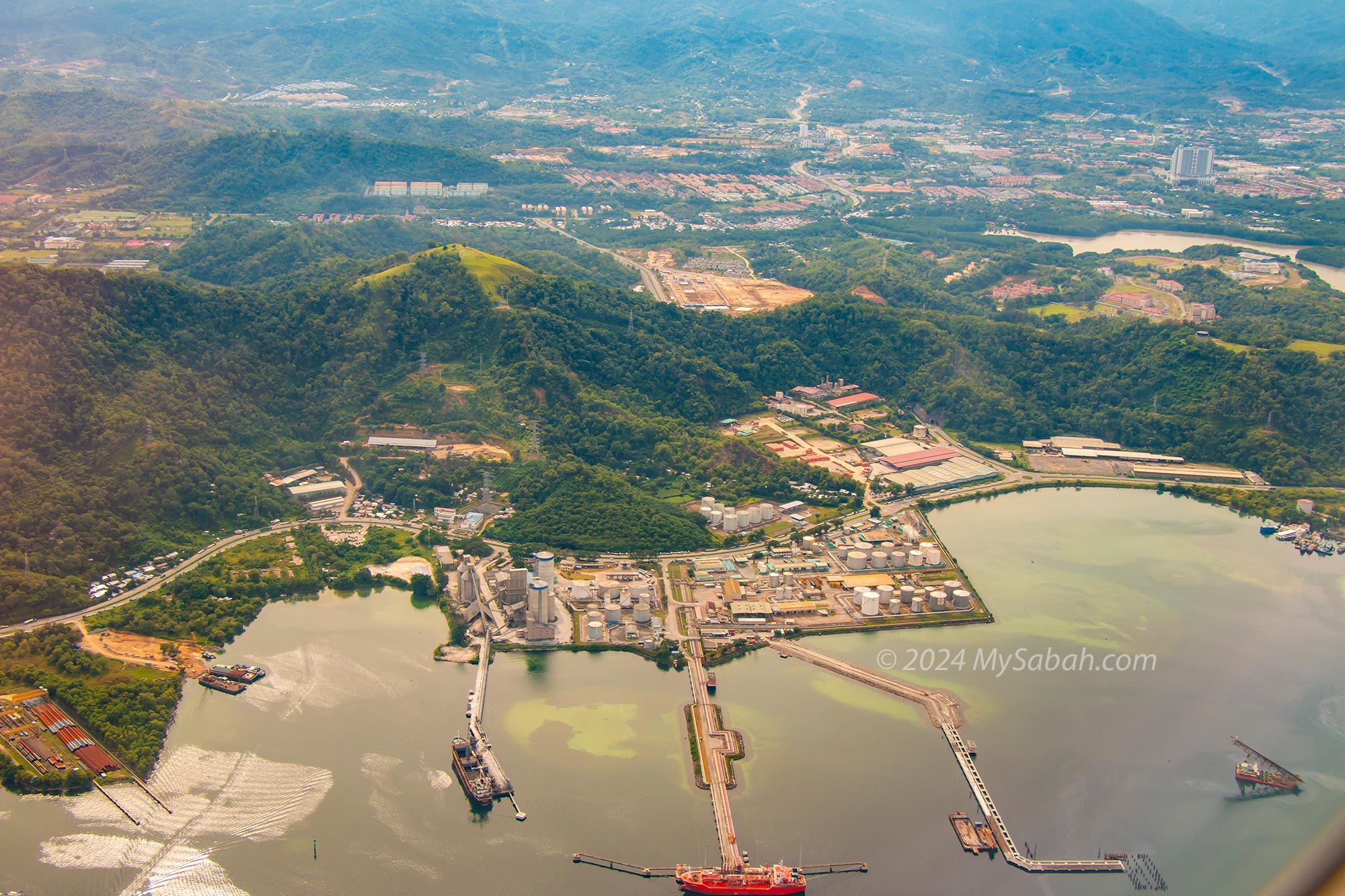
Sepangar (or Sapangar) Port and Bald Hill (a.k.a. Bukit Botak / Bukit Gundul / Bukit Gentisan)
For planes heading to east coast, you need to sit on the left side to see Mount Kinabalu. The plane passes by this majestic mountain in about 10 minutes.
Gayang Bridge and river in Tuaran
Sepangar / Sapangar Port and Navy Base in Menggatal
Kinabatangan River is the largest Ramsar site of Malaysia, a wetland site designated to be of international importance under the Ramsar Convention.
Kinabatangan River is 560 KM in length, making it the second longest river of Malaysia
11 / 9
Kota Kinabalu to Tawau
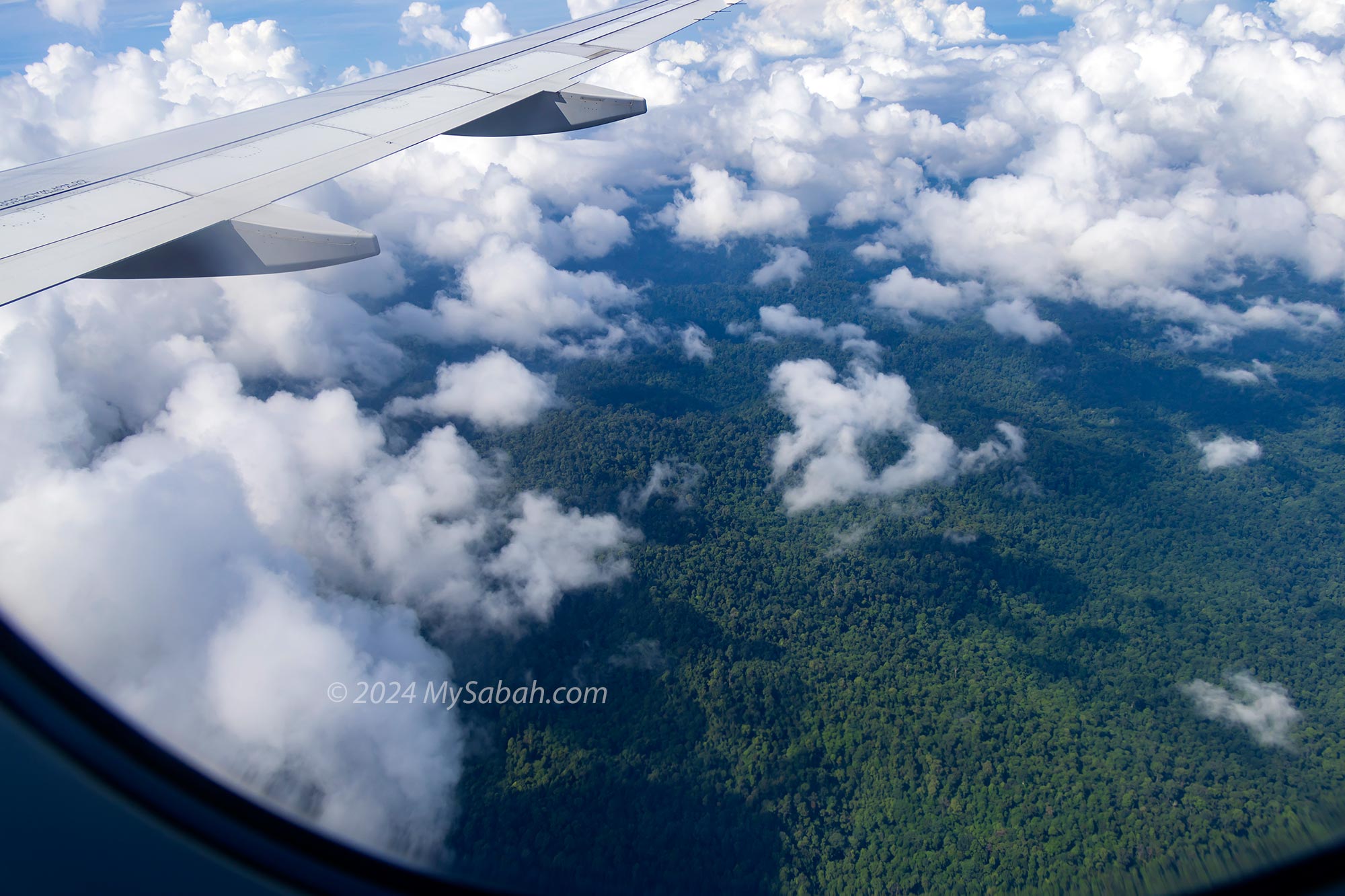
Though the KK to Tawau flight is farther away from Mount Kinabalu, this route offers much more to see. Passengers seated on the left side will still catch a glimpse of Mount Kinabalu. Additionally, as the plane passes by Tawau Hills Park, fortunate passengers on the left side may witness the ancient volcanic mouth of Mount Maria amidst the dense Borneo rainforest.
I once captured 20 panoramic photos of Maliau Basin and stitched them together to create this breathtaking panoramic shot, making it one of the best aerial photos I’ve taken.
For those frequent local travelers who might be accustomed to the sight of Mount Kinabalu, consider switching to the right side during the KK to Tawau flight. From this perspective, you might be treated to a view of Maliau Basin, also known as Sabah’s Lost World. This geological wonder resembles a vast meteorite crater when viewed from the sky. However, keep in mind that luck plays a role as Maliau Basin is often shrouded in clouds.
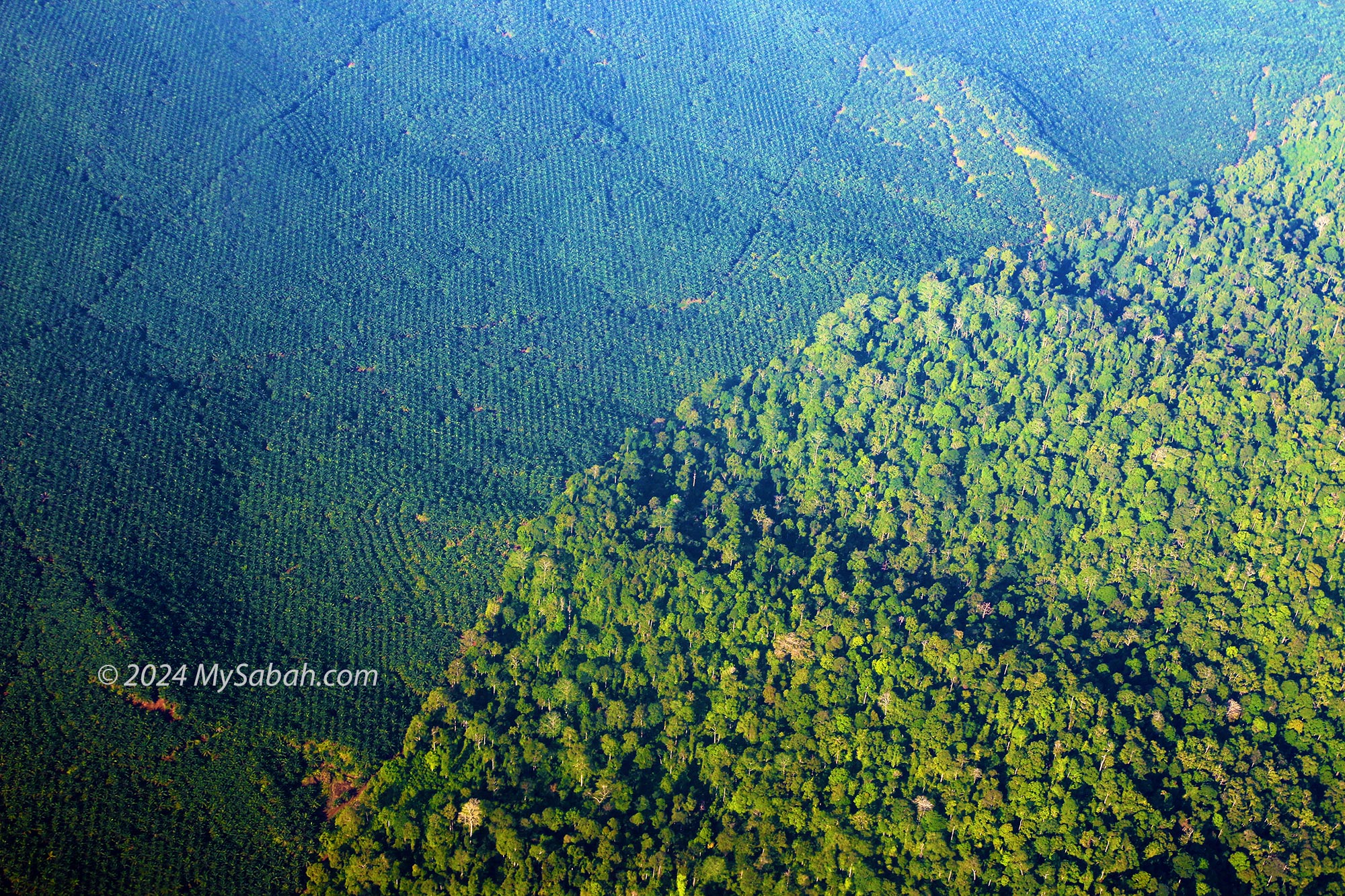
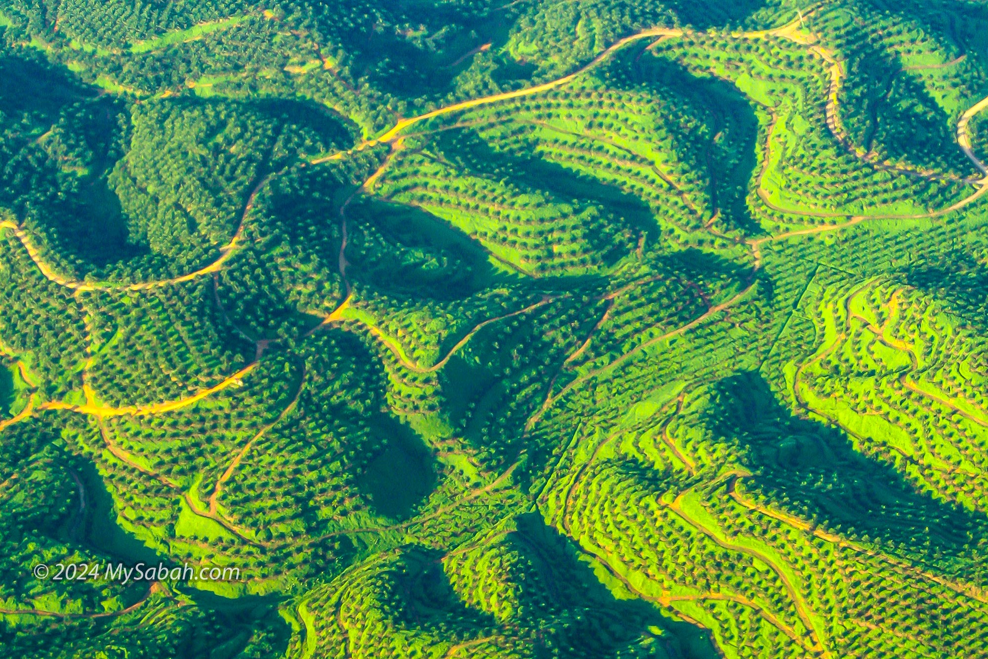
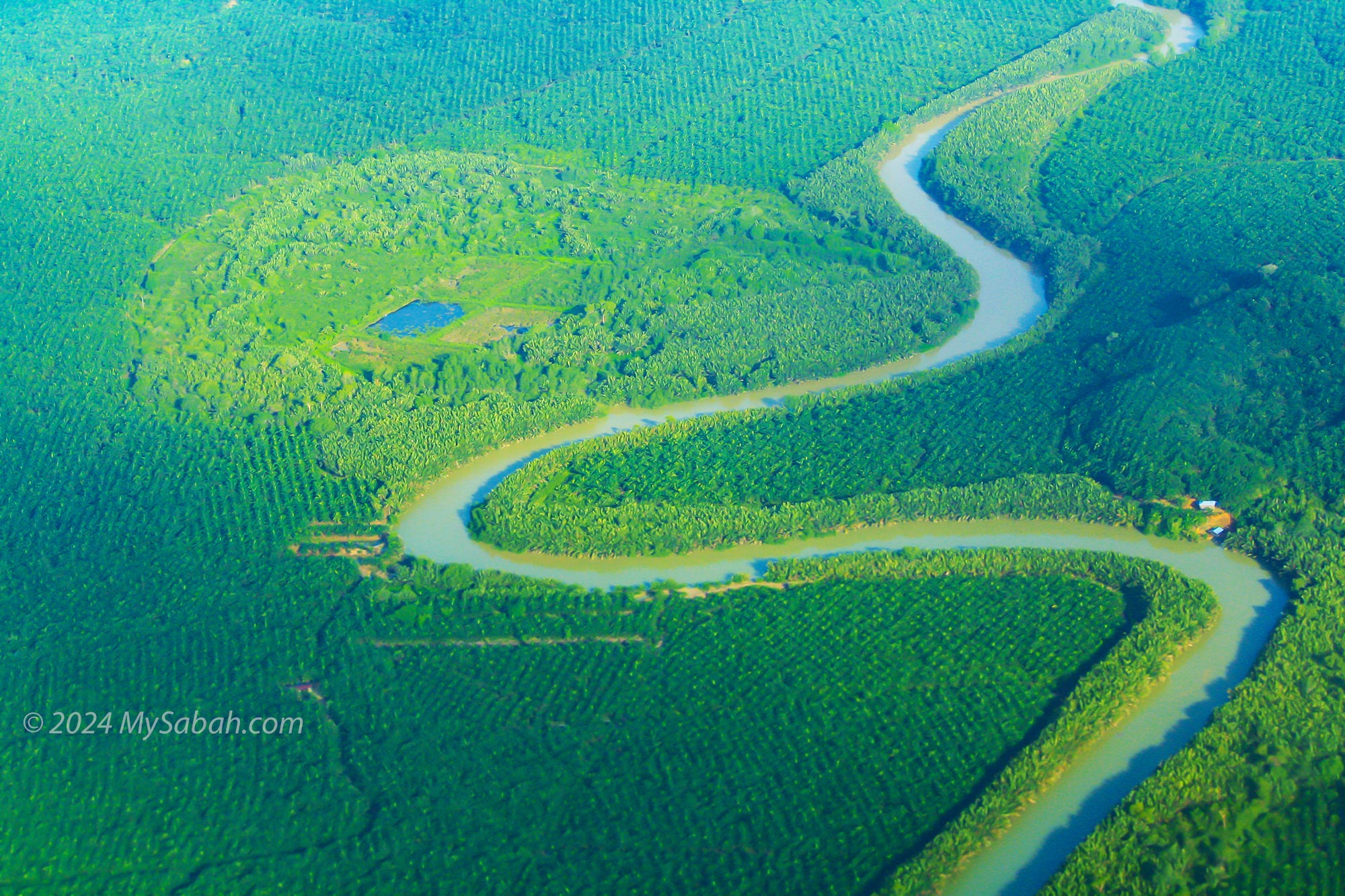
Oil Palm Vs Rainforest
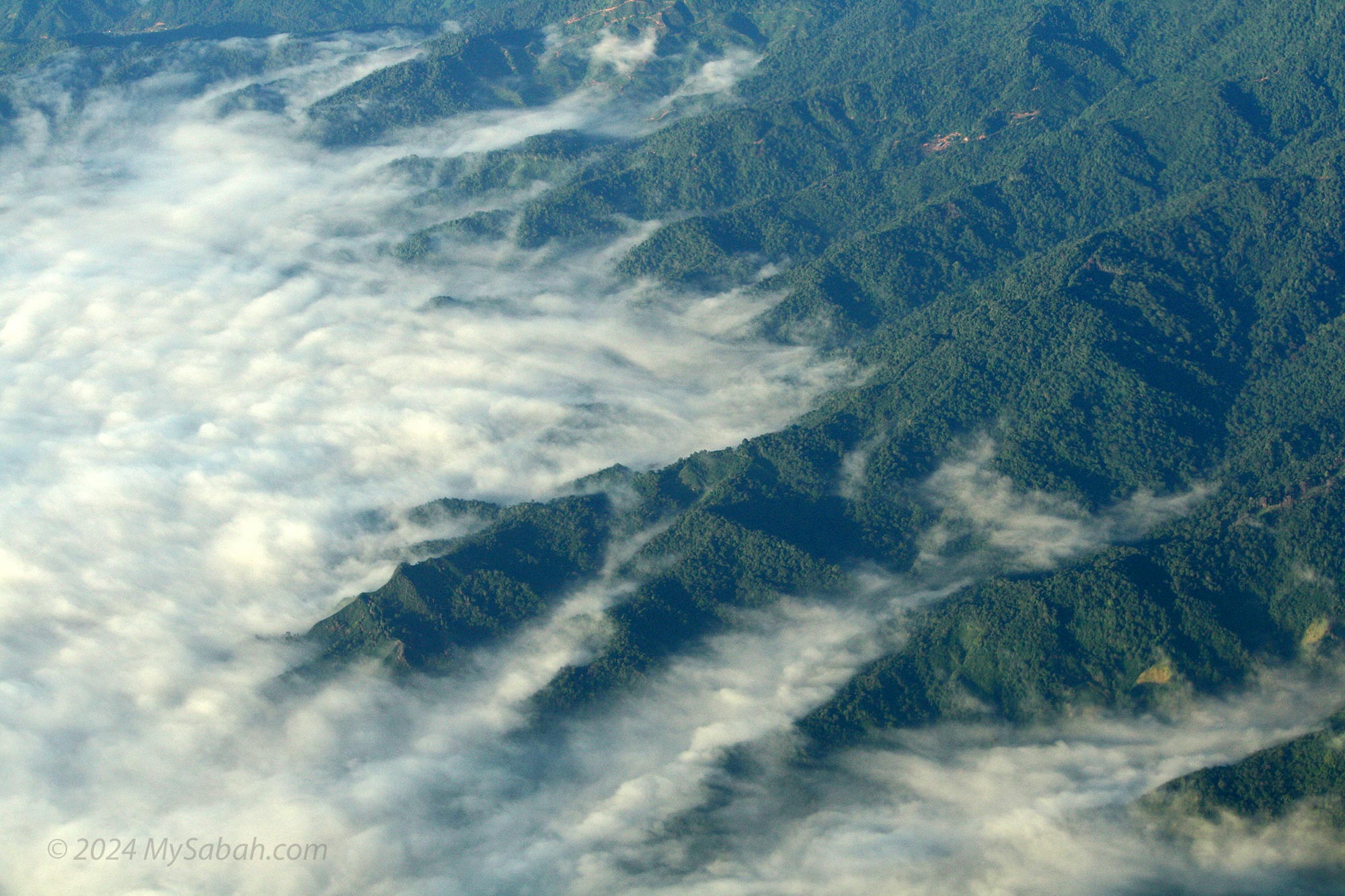
Crocker Range in morning mist
View of Mount Kinabalu from the flight to Tawau
Maliau Basin, aka Sabah’s Lost World, encircled by cloud
Can you spot the volcanic crater in Tawau Hills Park?
Oil palm plantation of Tawau
Nypa swamp surrounded by oil palm
12 / 7
No matter which side you sit on, as the plane approaches Tawau, you’ll see vast expanses of oil palm plantations, with pockets of forests nestled within them.
Kota Kinabalu to Lahad Datu
The view from the flight from KK to Lahad Datu is not bad at all. On clear days, passengers on the left side are treated to the majestic sight of Mount Kinabalu in the background, with the picturesque paddy fields of Tambunan, often referred to as the Switzerland of the East, in the foreground.
View of Mount Kinabalu and Tambunan from the plane. You can see the valley with green paddy fields.
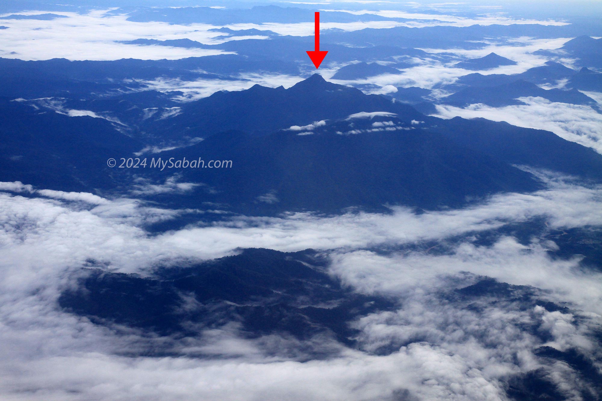
However, if you find yourself seated on the right side, don’t be disappointed. You’ll have the privilege of gazing at the multi-peaked Mount Trus Madi, the second-highest mountain in Malaysia. Additionally, the right side offers a bird’s-eye view of Danum Valley, one of the oldest rainforests in the world.
Mount Trus Madi (or Trusmadi), the second highest mountain of Malaysia. It’s a bit difficult to spot this mountain.
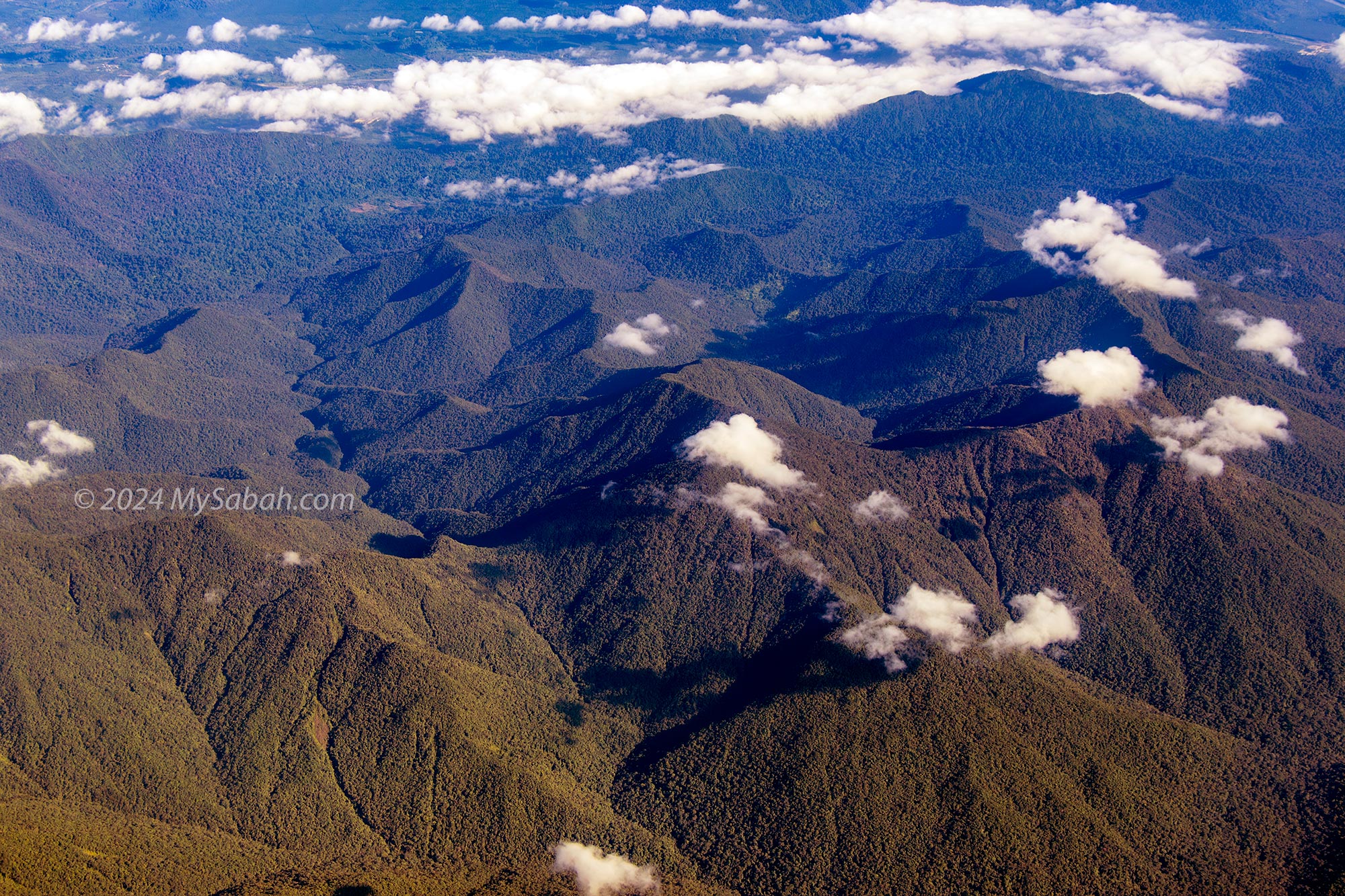
The lush and hilly Tawai Forest Reserve in Telupid
Taking off from KKIA airport. You can see Mount Kinabalu at the right.
A small forest surrounded by oil palm in Lahad Datu
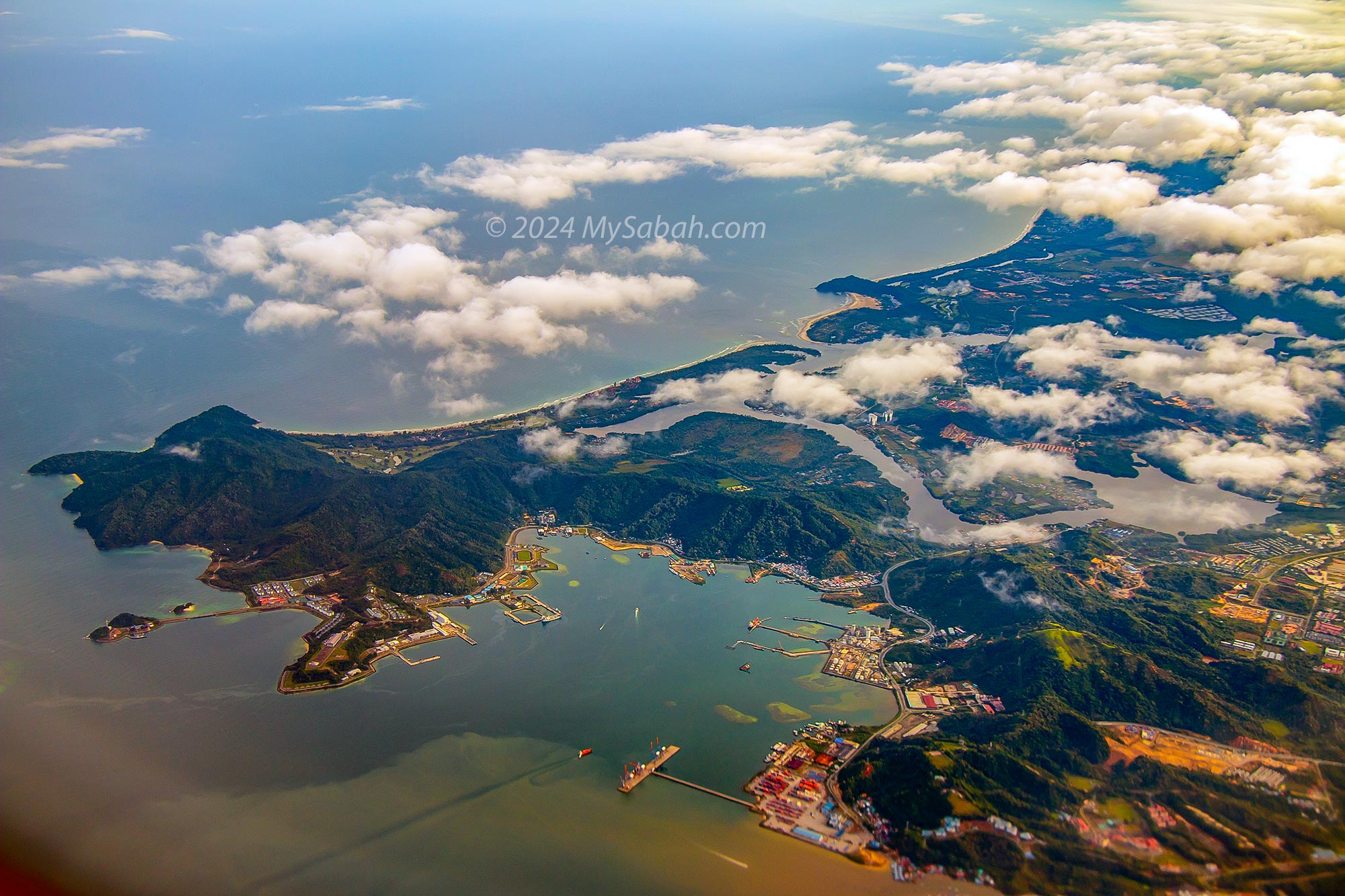
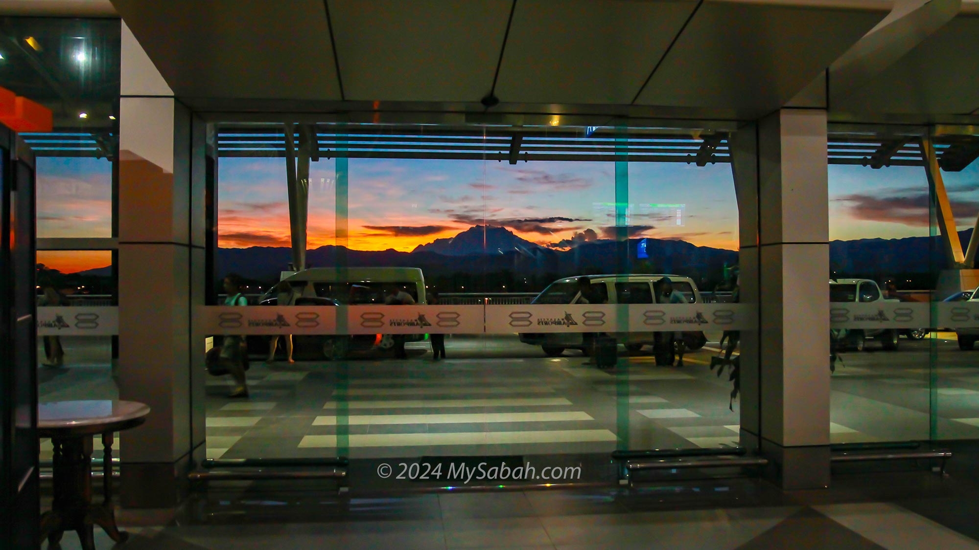
To Kota Kinabalu City
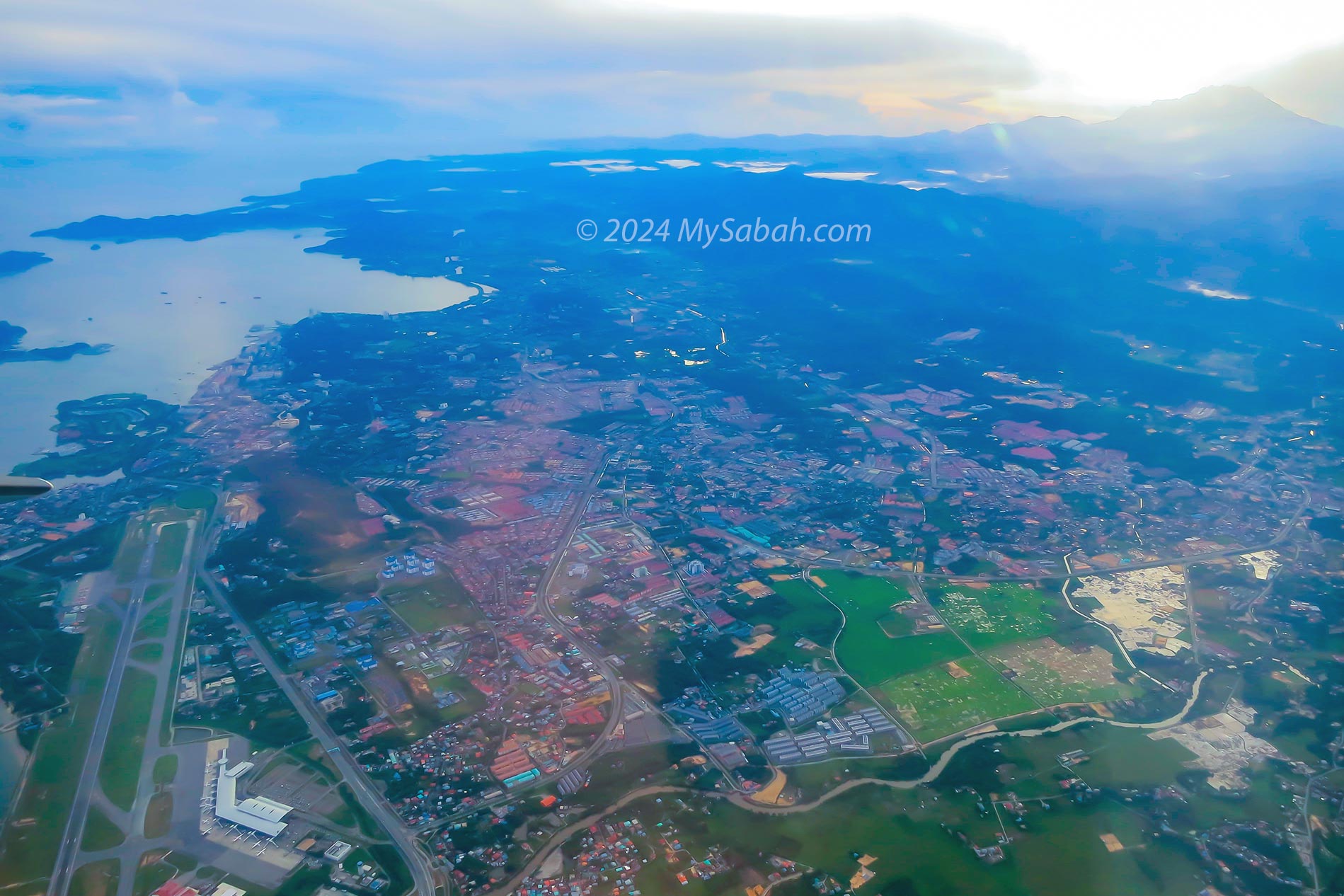
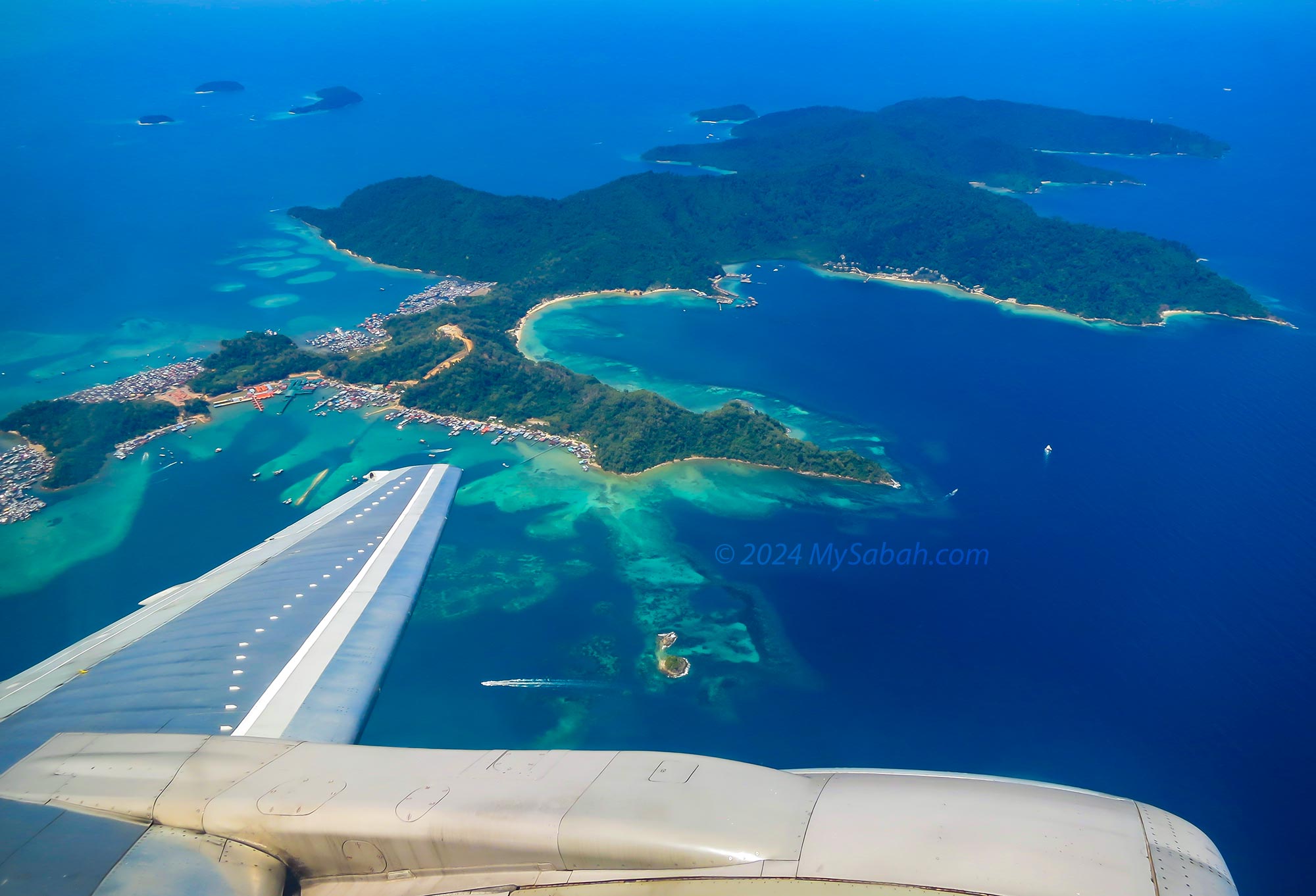
Planes destined to land at Kota Kinabalu International Airport (KKIA) treat passengers to a scenic journey along the coastline of KK City. During this approach, travelers are afforded views of popular landmarks, including the islands of Tunku Abdul Rahman Marine Park, Sabah International Convention Centre (SICC), Jesselton Point, the bustling Waterfront, the iconic Sabah State Mosque, Sutera Harbour, and Tanjung Aru Beach.
Gaya Island is the largest island of Tunku Abdul Rahman Marine Park off Kota Kinabalu City
For first-time visitors to Sabah, this aerial route along the coastline of KK city centre provides an excellent preview of the charm and vibrancy awaiting them in this captivating destination. It sets the tone for an exciting and memorable experience in Sabah.
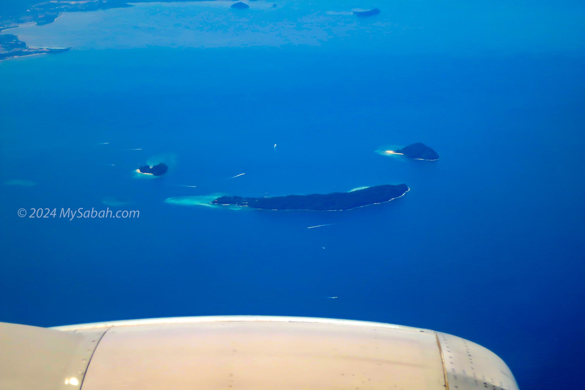
Kota Kinabalu to Kuala Lumpur
For flights departing from Kota Kinabalu International Airport (KKIA) bound for destinations outside of Sabah (e.g. Kuala Lumpur), they often make a turn around Gaya Island. If you happen to be seated on the left side, you’ll have a higher chance of spotting the “Smiley Islands” formed by the arrangement of Manukan, Sulug, and Mamutik Islands.
The Smiley Islands, next to Gaya Island, is formed by a group of islands (i.e. Manukan, Mamutik and Sulug).
General Tips
Choose daytime flights for better lighting. There is no aurora borealis in Sabah so nothing for you to see in night flight.
For photography enthusiasts, pay a little fee for a window seat located near the front or rear of the aircraft to minimize wing obstructions.
Larger aircraft, such as the Boeing 737, offer better views compared to smaller ones like the turboprops commonly used by MASwings.
The multi-layered windowpane will impact the quality of your photos, resulting in haziness, blurriness, or distorted colors. Using a professional camera to shoot in RAW format will help you a lot in the post-processing.
Keep your expectation low. Just sit back, relax, and let the beauty of Sabah unfold beneath your wings.
You can see Mount Kinabalu clearly at KKIA (Kota Kinabalu International Airport) especially in the morning.
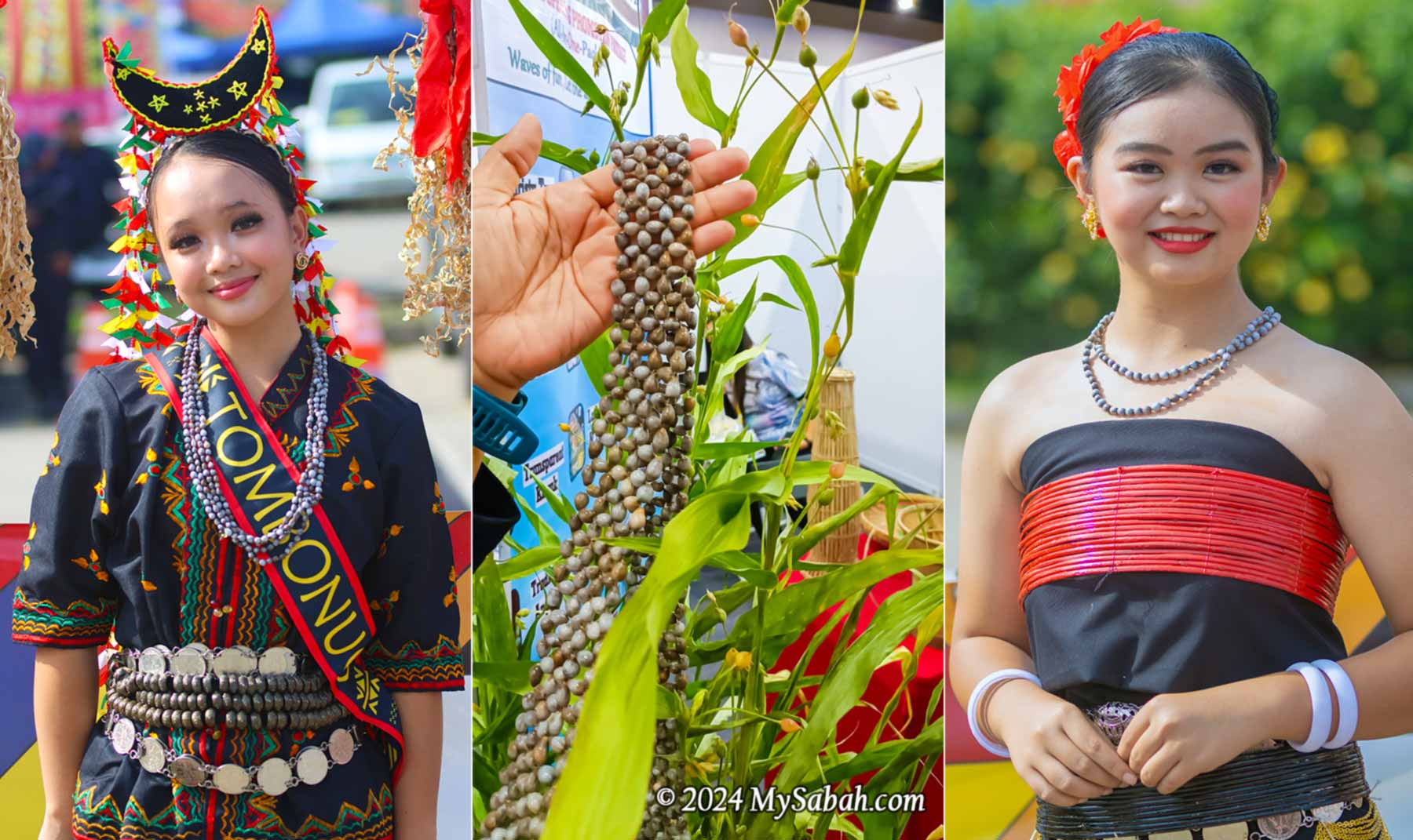
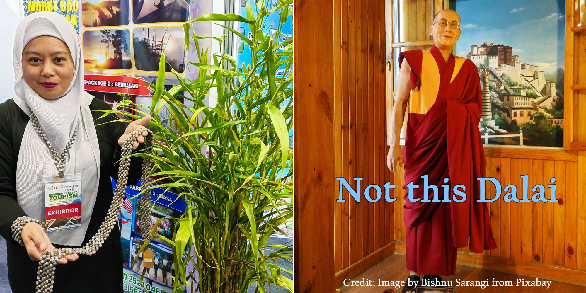
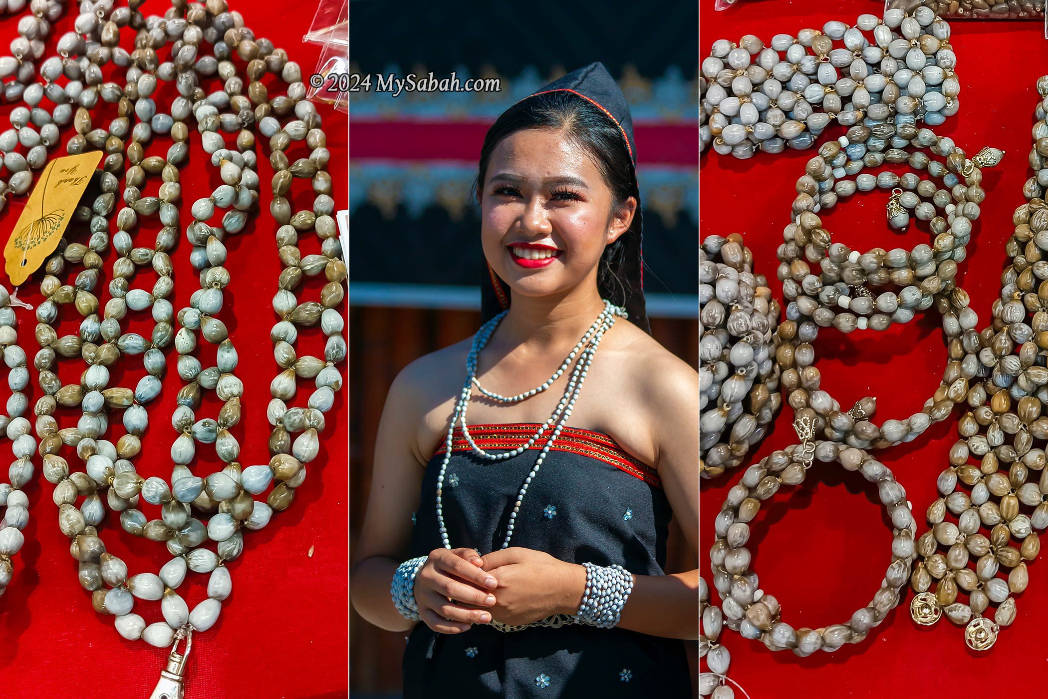
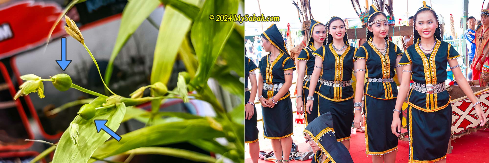
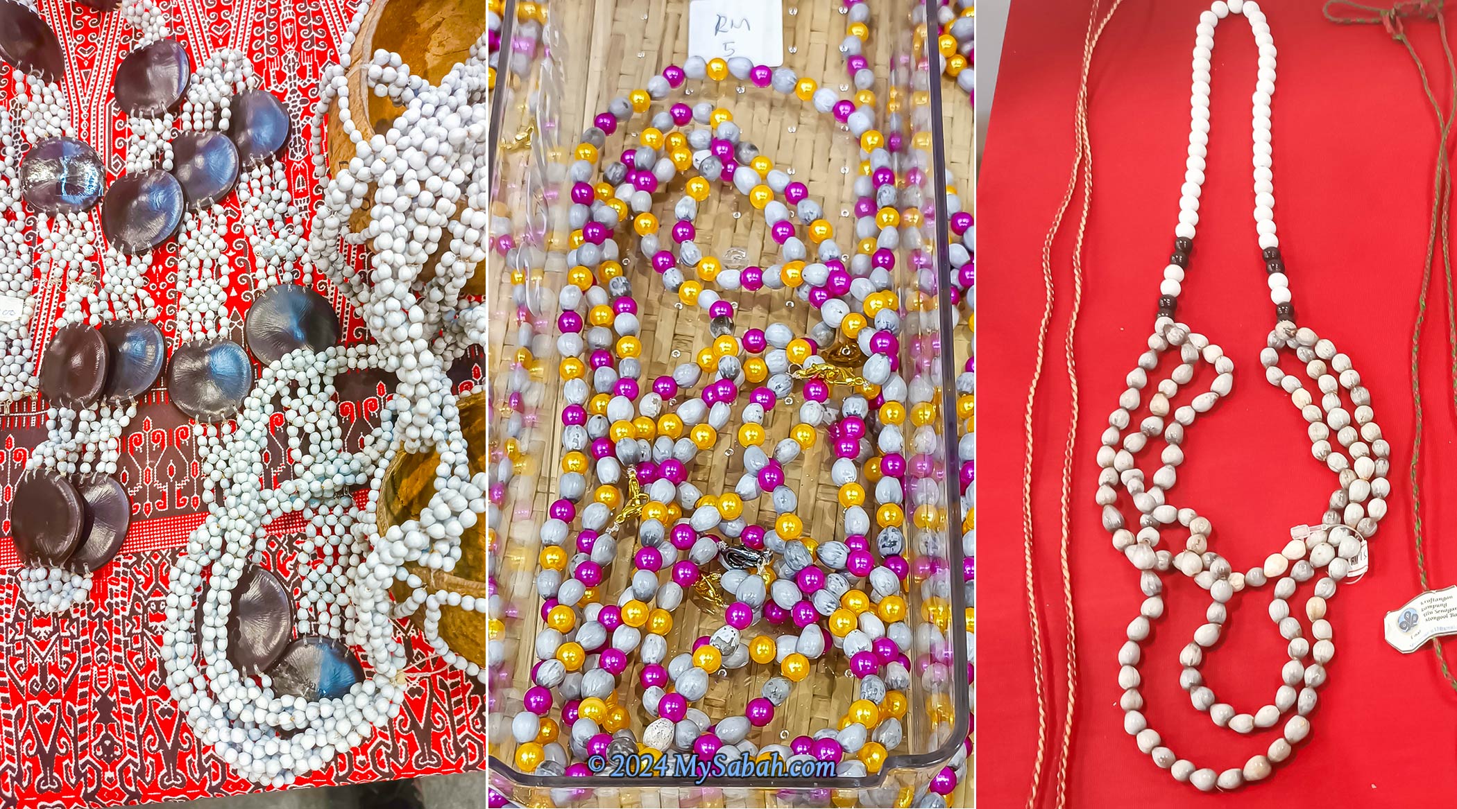
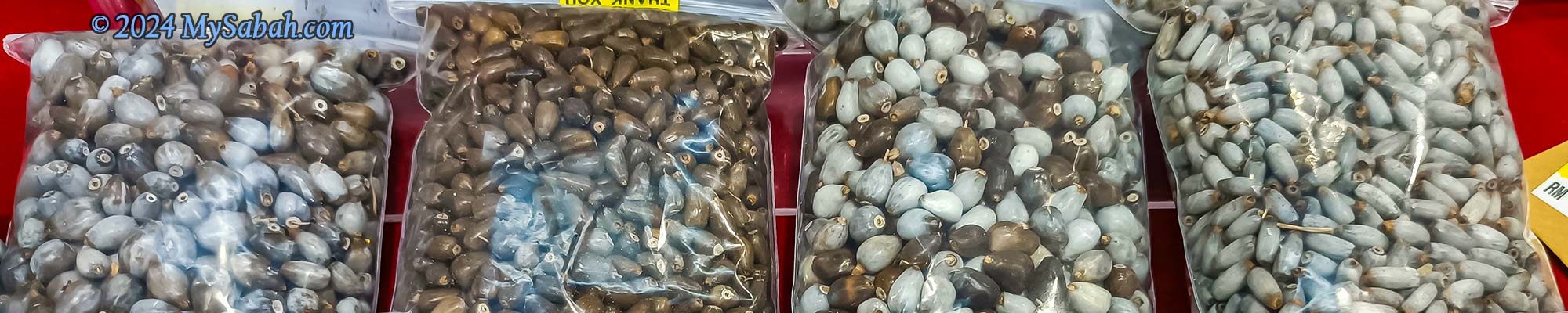
Job’s Tears, also known as adlay or adlay millet, is locally referred to as Dalai or Jelai in Sabah. This plant looks like a cross between corn and grass, and its hard-shelled, woody seeds are nicknamed the “Pearls of the Borneo Jungle” (Mutiara Rimba) due to its glossy surface and teardrop shape, providing a glimmering touch to ornaments. It has been utilized in traditional medicine, food, and crafts for centuries and is often associated with good luck, prosperity, and spiritual healing.
Left: Dalai plant and the seeds. Right: This is not the Dalai we are talking about (Photo credit: Image by Bishnu Sarangi from Pixabay).
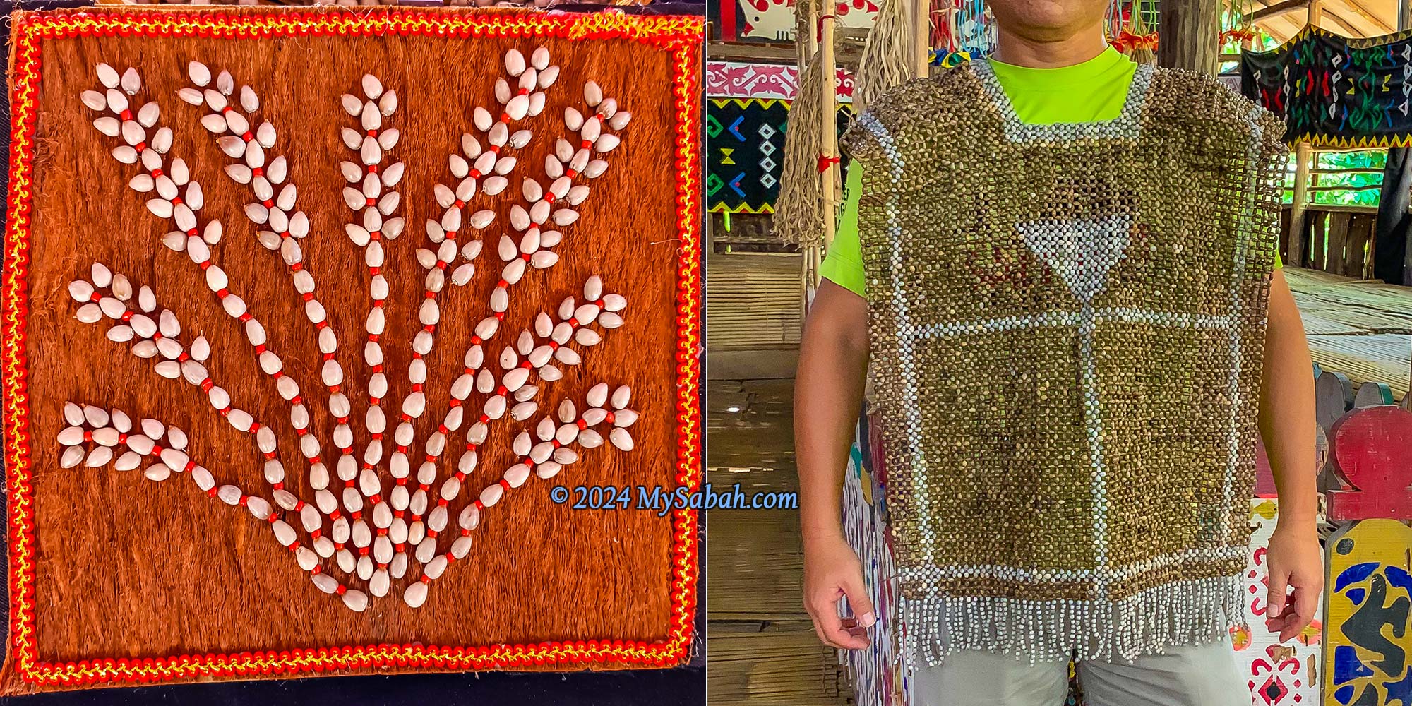
The Dalai plant is a tall, grain-bearing, perennial tropical plant scientifically known as Coix Lacryma-Jobi. The wild variety, Coix lacryma-jobi var. lacryma-jobi, has hard-shelled pseudocarps. The Dalai seeds naturally come with pre-existing holes, eliminating the need for artificial puncturing. The beads are strung together to to create various crafts, including rosaries (prayer beads), jewelry, bead curtains, and fashion accessories.
Job’s tears have historically been used as beads to make necklaces and other traditional accessories.
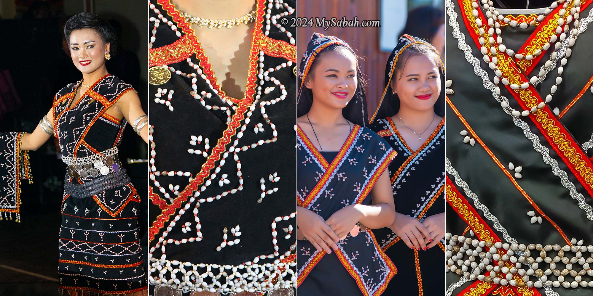
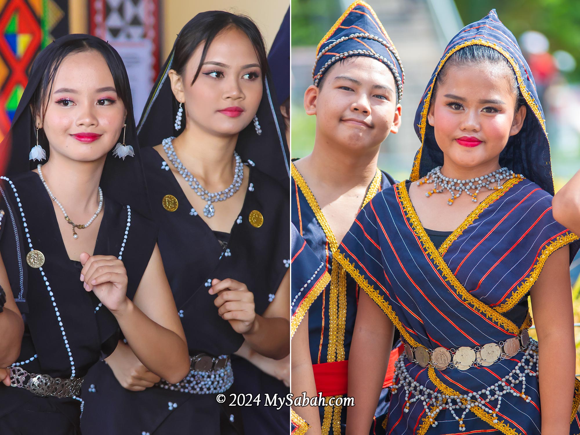
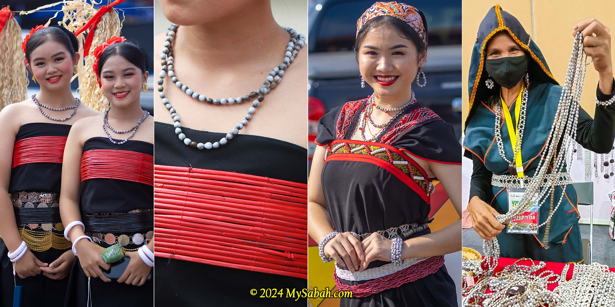
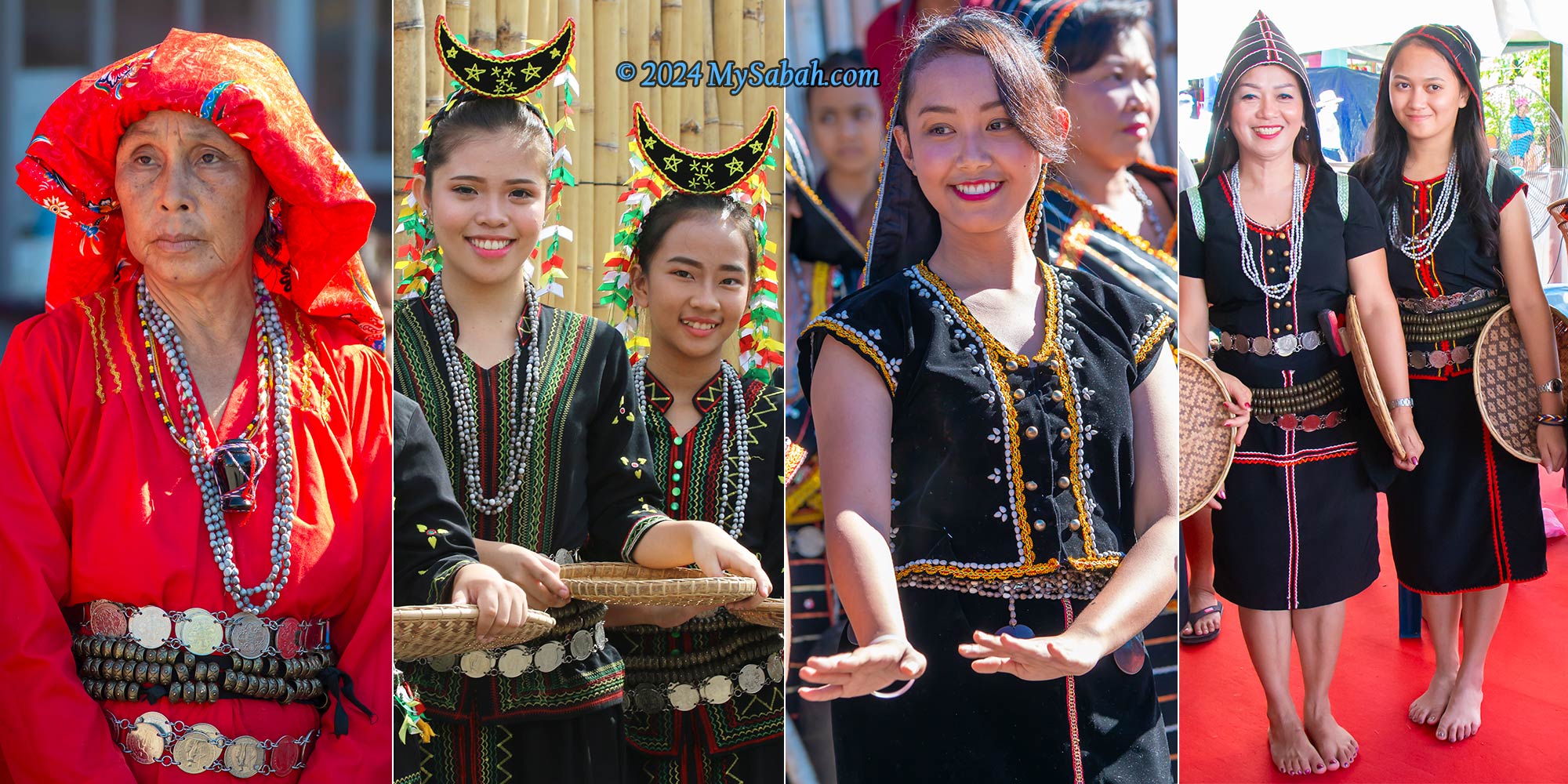
Artisans have been using Dalai beads in jewelry since 3000 B.C. Dalai has a long history as part of indigenous fashion in Sabah. I’ve observed Dalai seeds being used in the traditional costumes of the Dusun Kiulu, Dusun Liwan, Dusun Tindal, Dusun Tagahas, Dusun Malapih, and Tombonuo, the native tribes from the western and northern parts of Sabah. Dalai is primarily worn as accessories, such as necklaces, bracelets and belts. According to Wikipedia, other Borneo tribes such as Dayak, Kelabit and Kayan also use Job’s tears in their costumes.
Sinulamba dress of Dusun Kiulu decorated by Dalai seeds
The Dusun from Kiulu use Dalai extensively in the embroidery and decoration of their Sinulamba dress, one of the most unique garments and heritages in Sabah. The Sunduk, a hood covering the head or hair, represents the dignity of a woman, while the Kurilib, cross shoulder sashes, symbolize a loving woman.
Dusun from Kiulu and TamparuliLeft: Dalai seeds will turn grey or brown colour when they are ripe. Right: Dusun Malapih from Papar
The variations in shades of grey and beige give Dalai seeds a natural appearance. Over time, Dalai seeds become shinier when in contact with the skin of their owners. For instance, rosaries made with Dalai beads may transition from a light grey to a shiny, warm chestnut brown color after being held many times during prayers. Saint Teresa of Calcutta was known to pray with Dalai rosaries.
Dalai necklaces, bracelets and earrings of Dusun Tindal
While Job’s Tears grains can be consumed as a cereal, such usage is not widespread in Sabah. The cultivated varieties, known for their soft shells, are more preferred for food. Job’s Tears is also commonly sold as Chinese pearl barley. Additionally, some Kadazandusun communities in Sabah make a decoction from Dalai leaves as a traditional herbal remedy for treating coughs or fevers.
Dalai seeds can mix with other beads and materials to make beautiful crafts.
Dalai is a fast-growing and easy-to-cultivate plant that demands minimal water and fertilizer. It can reach a height of about six feet and thrive in various soil types and climates. Germination typically occurs as early as seven days after sowing, with flowering taking approximately five months.
From left to right: Tombonuo Bobolian, Tombonuo girls, Dusun Kiulu and Dusun Tagahas (from Kota Marudu)
Job’s Tears derives its name from the story of the prophet Job, as mentioned in the Bible and the Quran. Job, a devout follower of God/Allah, faced a challenge to his faith when Satan caused him to lose his wealth, children, and health. Despite enduring a life of misery, Job did not complain. Throughout his ordeal, he remained steadfast in his belief and continued to love God as always. In the end, God rewarded Job with more than he had before. According to legend, when the tears of Job touched the soil, tall grasses sprouted, bearing oval seeds resembling his tears. This is how the name ‘Job’s Tears’ came about.
Creative designs of Dalai seeds. The dalai suit at the right is created by Madam Jusnah Jinos from Kg Bitoon (Ranau).
Dalai seeds come in over 10 variations of colors, shapes, and sizes, such as Tuntul, Watu, Oitom, providing artisans with ample creative possibilities in design. For more information on buying, planting, or learning about Dalai, you can contact the following groups via their Facebook pages:
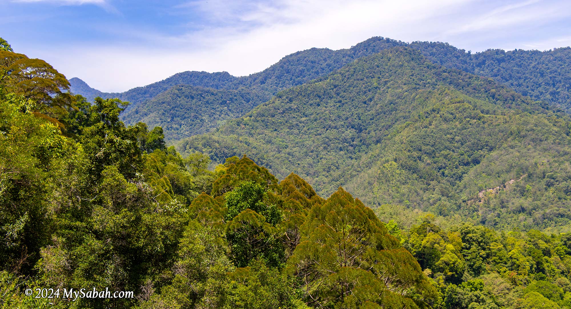
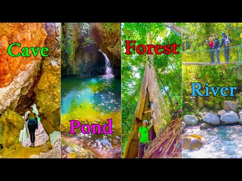
Aura Montoria is touted as one of Sabah’s top hiking spots, and after experiencing it firsthand, I don’t think it’s overrated. Hiking here offers an incredible opportunity to immerse in Borneo’s diverse landscapes. Beyond a mere walk, it’s an exciting exploration of caves, rock formations, rivers, waterfalls, ponds, and lush rainforests—truly a collection of natural wonders waiting to be discovered.
You like the element of soil, rock, water or wood? You can enjoy all these nature wonders in Aura Montoria.
About Aura Montoria
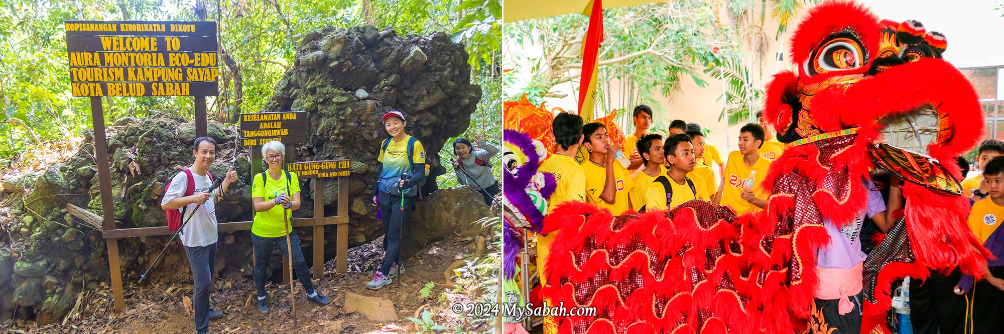
You might know about the Kinabalu Park HQ situated on Mount Kinabalu‘s southern side, easily reachable from Kundasang. However, tucked behind Malaysia’s highest peak lies Aura Montoria to the north, an enchanting hilly terrain located in Kampung Sayap (Kampung means Village) of Kota Belud, and part of the 4,750 km² Kinabalu UNESCO Global Geopark. It’s just a stone’s throw away from the Sayap Substation, snugly positioned on the west side of Kinabalu Park.
The cavities in sandstone structure create many natural caves and ponds in Aura Montoria
Aura Montoria owes its name to a winding tree vine known as Pokok Ponoriawon by the Dusun Tindal people. This vine, adorned with long thorns, grows along the riverbank, drawing a variety of birds during its flowering season. The locals named the area Montoria, a shortened version of Pokok Ponoriawon. Enchanted by its beauty, they added “Aura” to create Aura Montoria, capturing the site’s radiant charm.
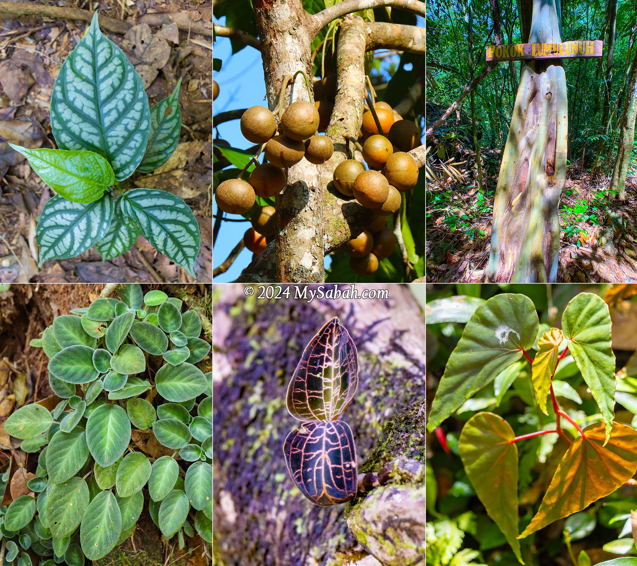
Aura Montoria is rich in flora too, e.g. begonia, bark-less eucalyptus tree, jewel orchid, and tampoi fruit in this picture
A Geotourism Destination
Couples always promise to each other, “I will love you to the time of the seas run dry and the rocks crumble,” as if such changes are impossible. But Aura Montoria will prove them wrong. Here, among the rolling hills and rock fragments, you’ll find evidence of a time when this land lay beneath the sea, some 20 million years ago. The geological morphology of the Aura Montoria is mainly featured by sedimentary rocks from the Crocker Formation, formed in a deep-sea basin during the middle Oligocene to early Miocene period, roughly 28 to 23 million years ago.
Aura Montoria was under the sea more than 20 million years ago
Around 17 to 10 million years ago, a tectonic collision uplifted most parts of Sabah, including Aura Montoria. This followed by geological processes like folding and faulting, raising the sandstones and shales of Aura Montoria’s sedimentary layers to the surface. Over millions of years, erosion and compaction shaped these deposits, forming the striking ridges, valleys, and unique rock formations that grace Aura Montoria today.
The landscape of Aura Montoria is dominated by sedimentary rocks such as sandstones, shales, and conglomerate that were deposited in the ancient seabed more than 20 million years ago. They look like compacted rocks glued by cement.
Granite boulders and rock walls dot this area, likely carried by glaciers from Mount Kinabalu to the foothills near Aura Montoria. Therefore, hikers will find fascination in the remnants of an ancient ocean floor and traces from the Pleistocene Ice Age, dating back millions of years.
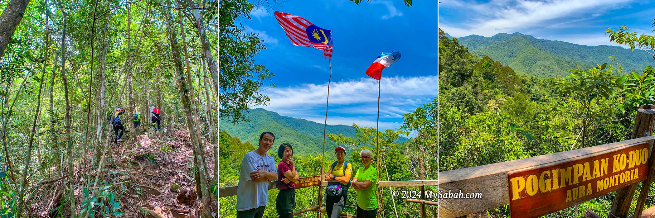
Starting point of hiking in Aura Montoria. The 6-km trail takes about 6 hours to finish (include lunch and break)
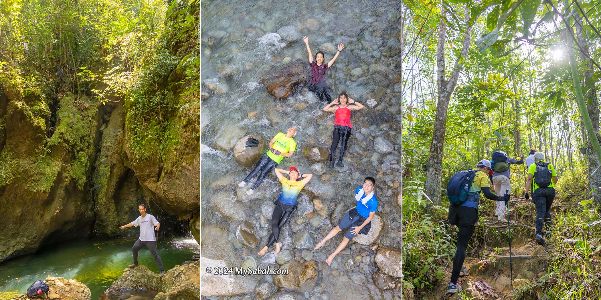
Hiking (A Walk-Through)
The hiking trail spans a 6-kilometer loop, winding through varied and uneven terrain where the flowing rivers and waterfalls shower you with negative ions, the forest fills your lungs with fresh air, and sunlight provides a serotonin boost. All these combine to energize you and uplift your mood. Given the prevalent depression among younger generations, it’s no surprise that hashtags like silent walking, soft hiking, and rucking are trending in the Gen Z community. Visit Aura Montoria, I would advise them.
The hike typically lasts around 6 hours at a leisurely pace. The trail poses a moderate challenge to beginners, involving some scrambling and balancing over rocks and roots along slopes situated between 200 to 400 meters above sea level. While leeches aren’t commonly encountered, parts of the trail can be slippery, making sturdy hiking shoes crucial. Carrying mosquito repellent is essential for a more comfortable hike.
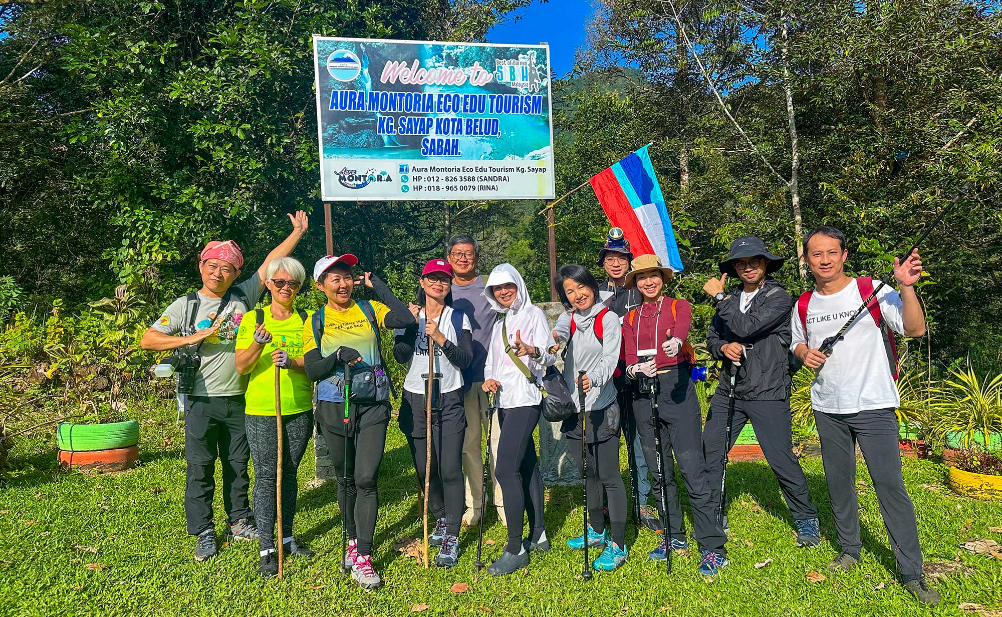
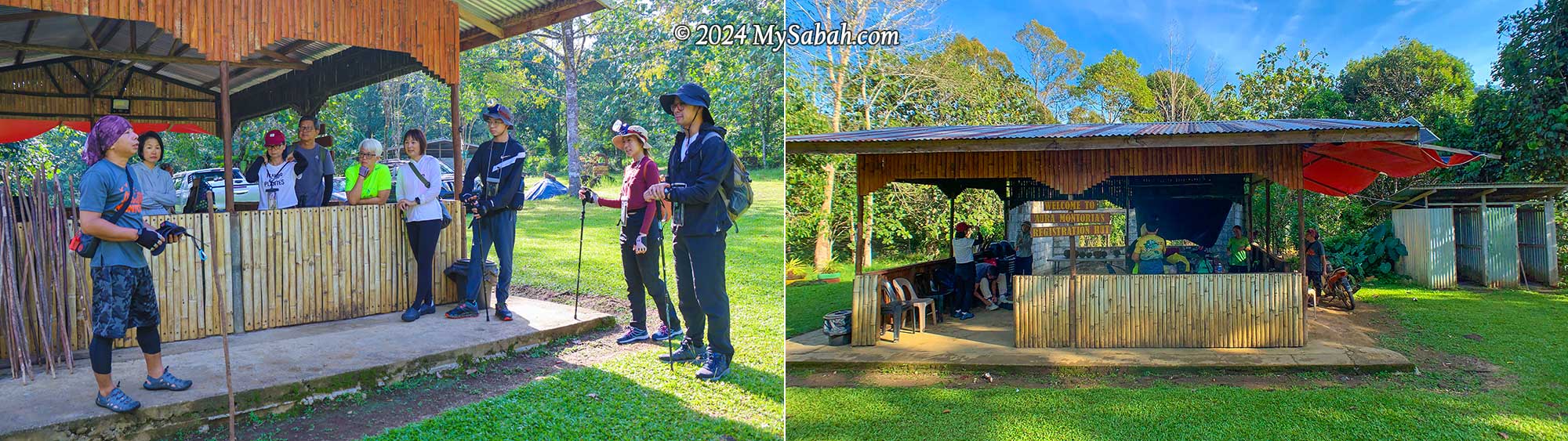
Briefing by our guide, Kunan, at the registration hut before the hike. There are a few simple toilets. You can change your cloth and take a shower there after the hike.
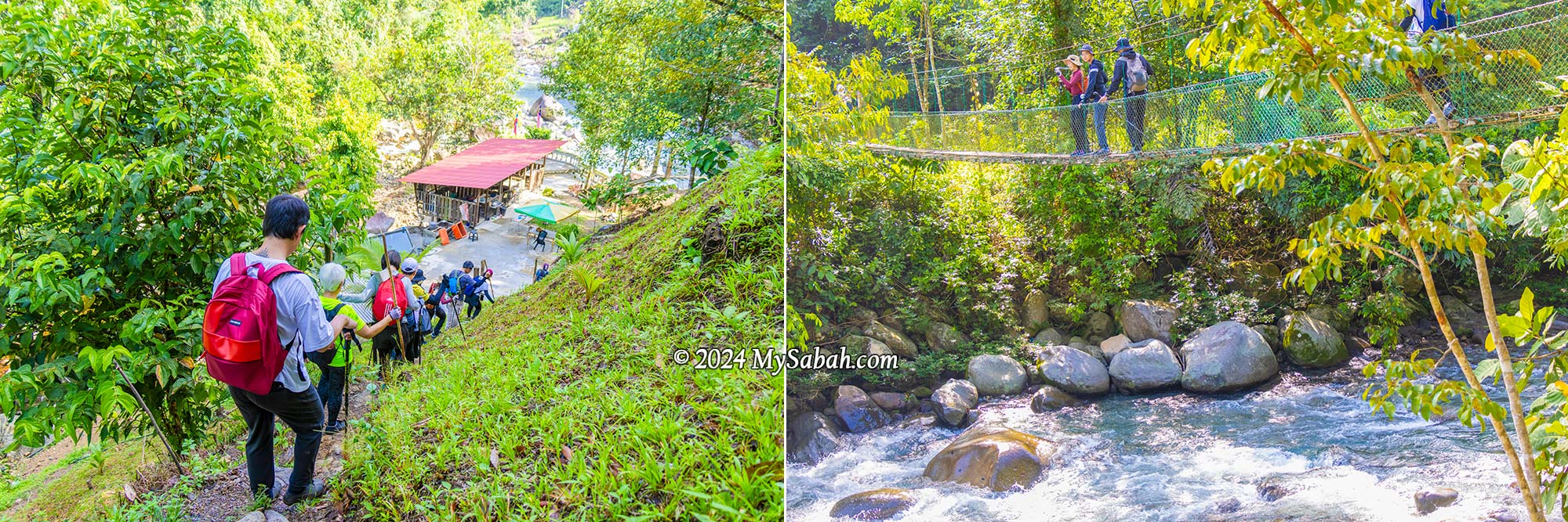
We met our guides (Kunan and Kiwi) at the registration hut inside a village plantation, for a short briefing before our hike began at 8:30 am (finishing around 2:30 pm). The first part of the trail is a pleasant one-kilometre walk through the countryside. In just 15 minutes, we passed through rubber and pineapple plantations and made our way downhill to a resting hut by the river, which is where the loop trail starts and ends.
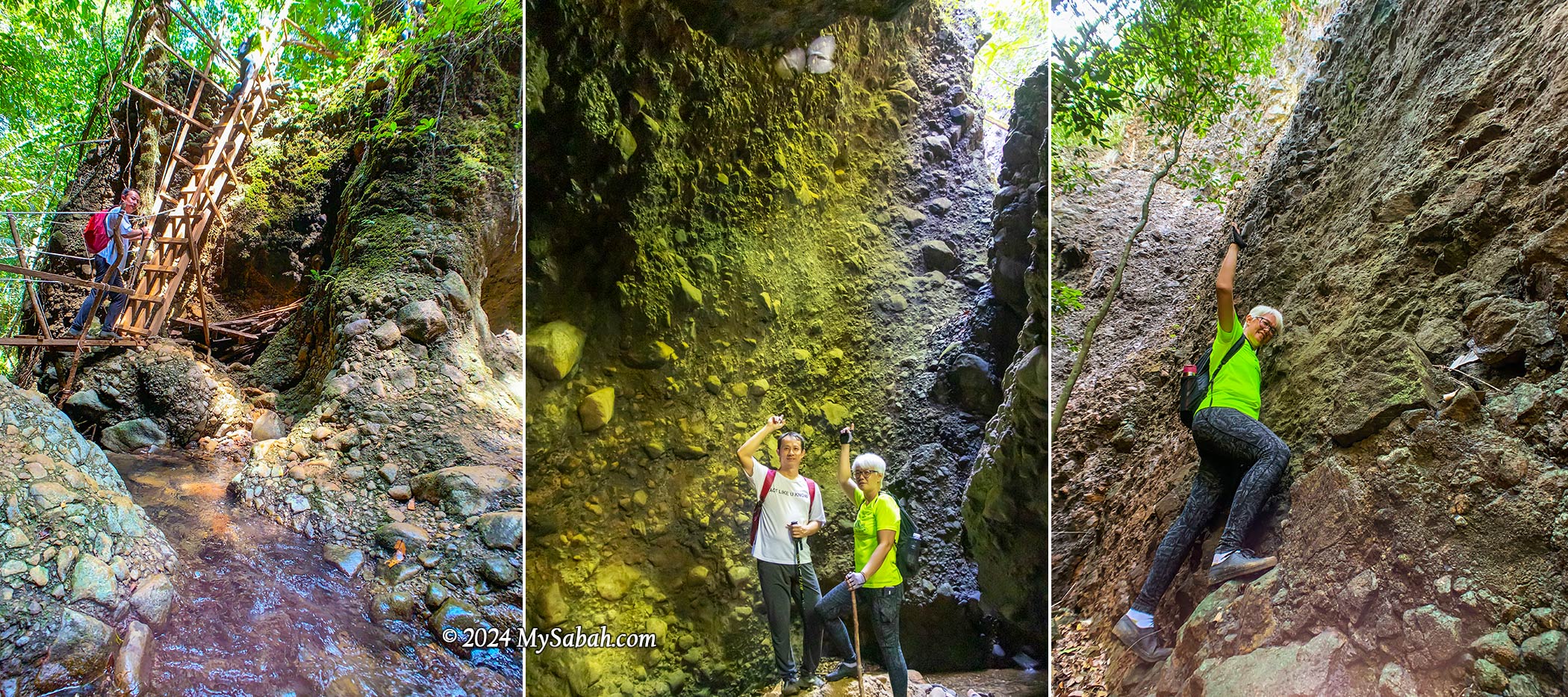
Hanging Bridge
As we crossed the suspension bridge, I was impressed by the pristine river underneath, a tributary of the Wariu River that eventually merges with the Kadamaian River downstream—this is one of Kota Belud’s biggest rivers. Reports indicate it’s a class I river in terms of water quality, and rich in oxygen. It’s a refreshing spot, with temperatures hovering around a cool 25-27°C, perfect for a revitalizing shower after a lengthy hike.
Left: the hut is the starting point of the loop trail. Right: the river under suspension bridge is a great spot to take shower after a long hike
Lion Rock (Batu Gung-Gung Cha)
Following a brief ascent over a small hill known as the “Path of One Thousand Steps,” we encountered the first marvel: the Lion Rock. Locally referred to as Batu Gung-Gung Cha (Batu means Rock), this rock formation likely earned its name due to its resemblance to a lion and its association with the resounding tones of gongs and cymbals.
The Lion Rock (Batu Gung-Gung Cha) that reminds us of the noisy lion dance
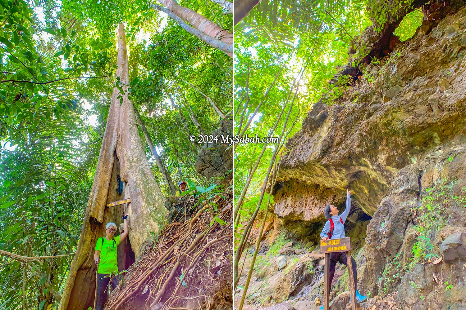
Tree Hole (Pokok Tomboilik)
As the deafening chirps of cicadas and the lively calls of birds surrounded us, it was evident we’d ventured into the jungle—a regenerated secondary rainforest in good condition, thanks to the dense canopy providing ample shade that shields us from the sun. A highlight of the trek was squeezing through a tree hole in a giant tree known as Pokok Tomboilik. Just a heads-up, if you’re a bigger person with a hefty backpack, you might get stuck in the hole.
Left: passing through a big tree hole. Right: The Mouth Cave looks like a dinosaur head from this angle
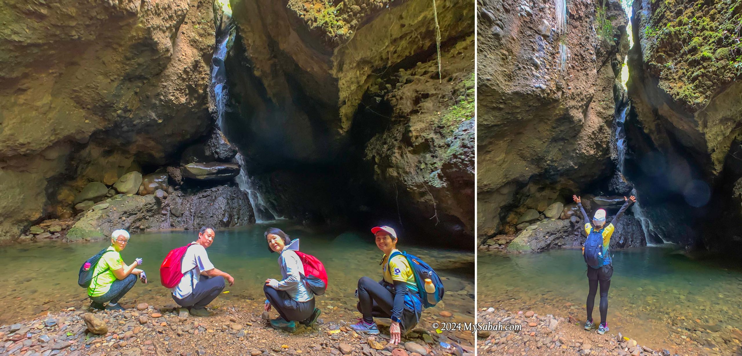
Mouth Cave (Gua Mulut)
Our next destination was quite a sight—a massive overhanging cave resembling the head of a dinosaur when seen from a certain angle. This cave is just one of many hidden within the area, adding to its allure as a fascinating geological site boasting various cave formations.
Gua Mulut (Mouth Cave) is an overhanging cave that resembles a big mouth
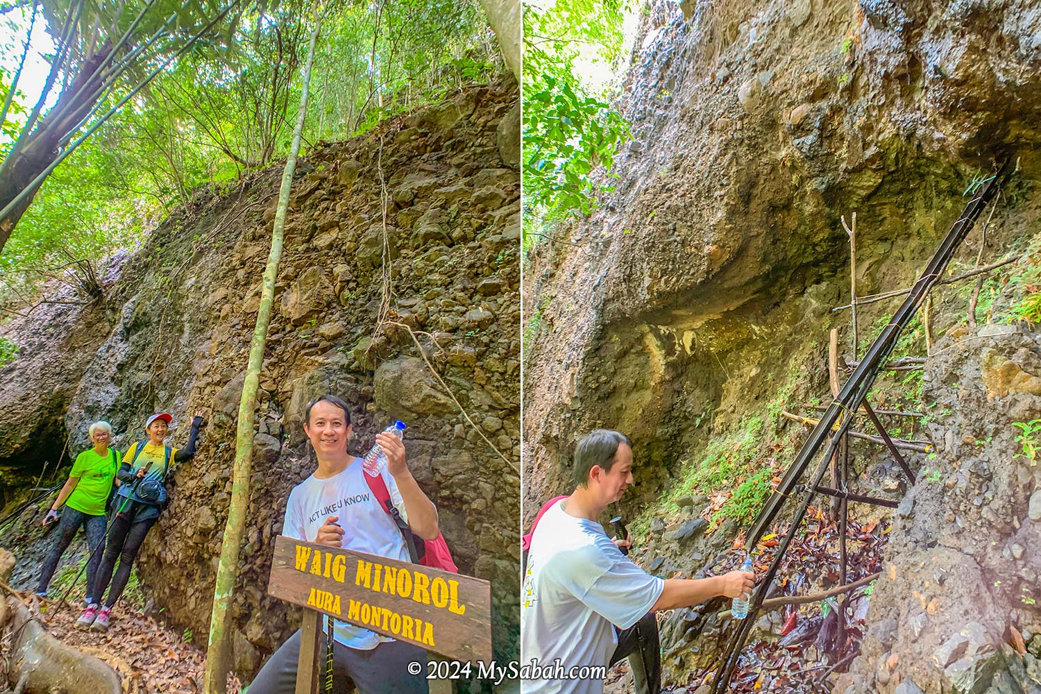
Natural Spring Water (Waig Minorol)
Close to the Mouth Cave, there are freshwater springs with water oozing out of the rocks. The sandstone, which is an excellent aquifer due to its high porosity and permeability, functions as groundwater reservoir that never run dry even during dry spells. I had a sip, and the mineral-rich water tasted wonderfully fresh, cool, and clean—no strange odors at all.
The spring water from the sandstone never dries up even during drought
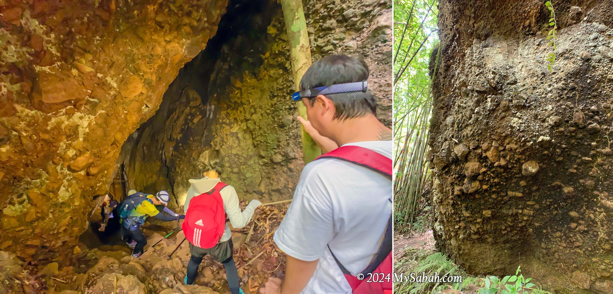
Wongking Cave
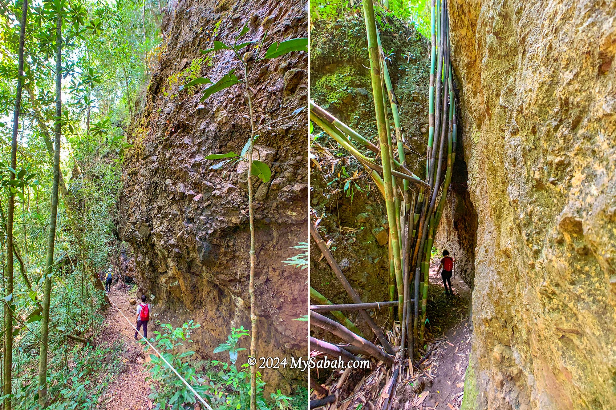
Along the trail, we encountered stunning rock walls formed from conglomerate—a mix of sedimentary rocks in various sizes and shapes glued together by finer materials such as sand, silt, or clay. Some of these formations were covered with epiliths such as white mold and green mosses, adding to their beauty.
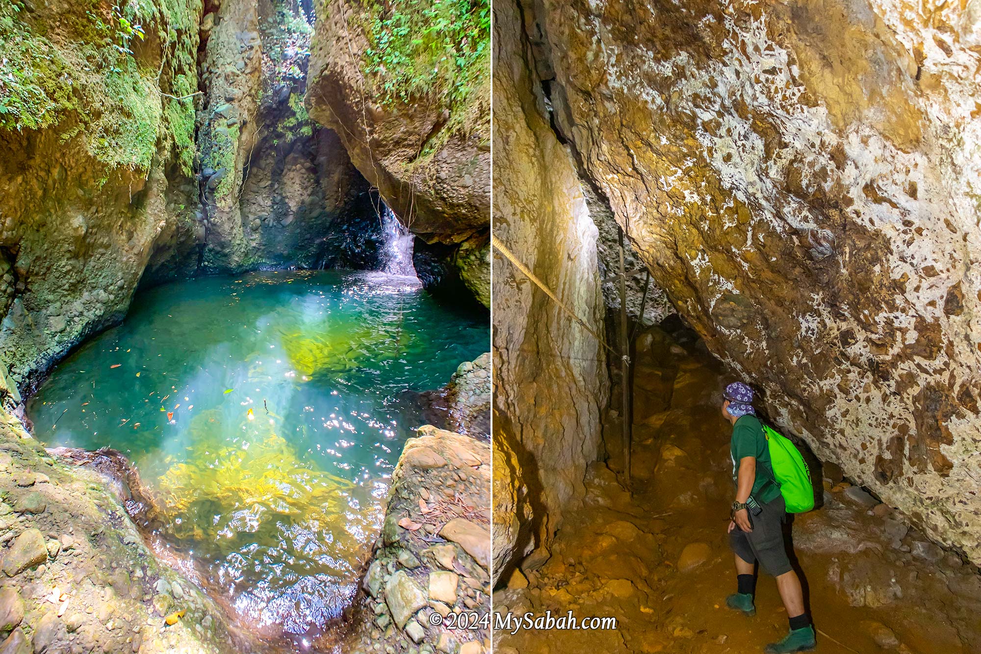
Left: Entering Wongking Cave. You need a LED headlamp for caving. Right: conglomerate rock wall
Descending into the depths, we ventured into the dark Wongking Cave. With our guides leading the way, both ahead and behind us, we felt safe exploring the underground cave. Don’t forget to bring a LED headlamp or flashlight for your caving adventure.
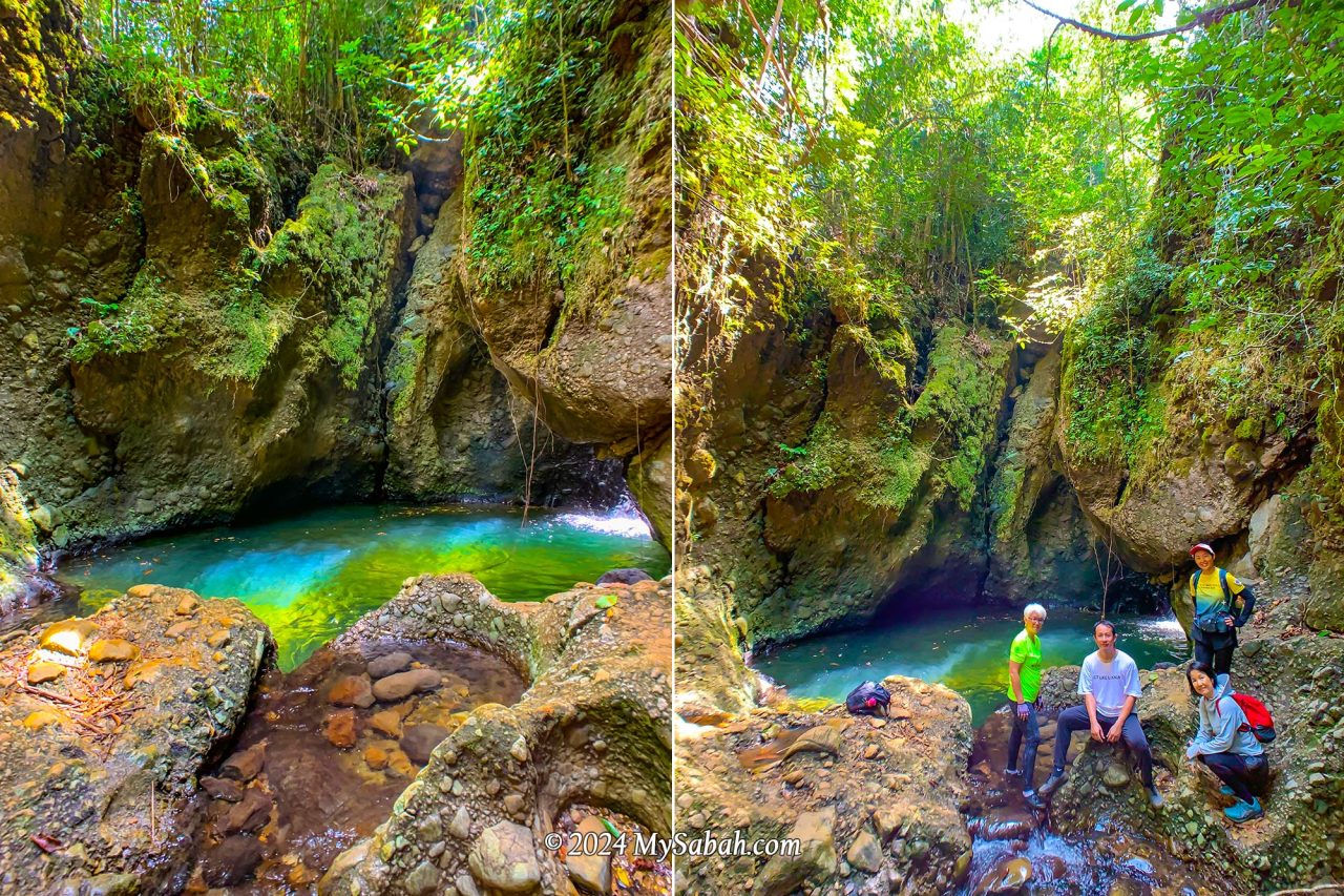
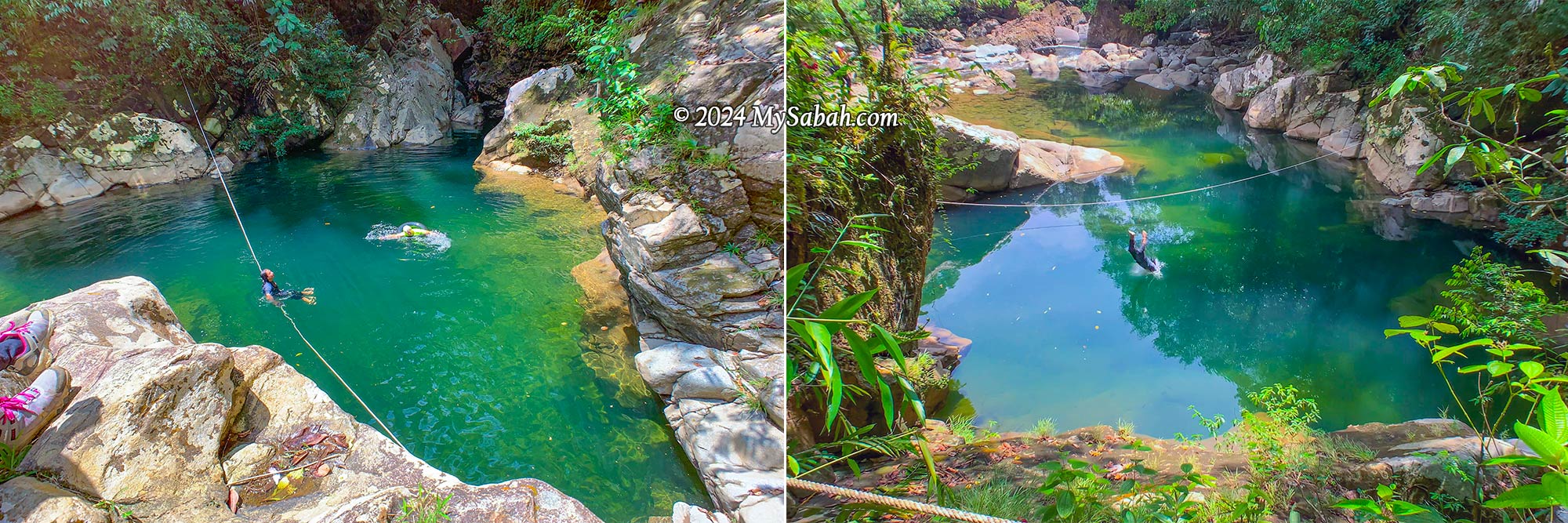
Rock Pond (Liogu Ourod)
This is the highlight I was most excited about. The oval-shaped rock pond is fed by a mountain stream and takes on a mesmerizing emerald hue when sunlight dances upon its surface. It resembles the mythical magic pool believed to restore youth to those who drink or bathe in its waters. Be careful when you move around there because the rock surface is very slippery.
Liogu Ourod, the natural rock pond filled with mountain water
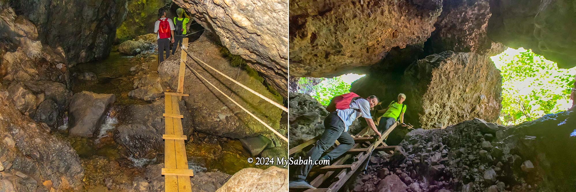
Bat Cave (Gua Pungit)
Venturing into another mountain cave, we discovered a stream flowing within. Natural light poured in through the cave’s opening on top, which also served as an entrance and exit for its inhabitants, like bats. Making the exploration easier, there were ropes and ladders available to facilitate movement in and out of the cave.
The Bat Cave with an underground stream
Waterfall Cave (Wasai ID Gua)
Each cave here holds its own surprises, and this one didn’t disappoint, featuring a hidden waterfall. No matter how scorching the day, this cooling cave provides the perfect refuge. With numerous caves and pristine water sources, I can’t help but wonder if cavemen once called this place home. To top it off, this cave even boasts a pond teeming with fishes.
Waterfall in a cave. There are many fishes in the pond. You can bring some pellets to feed them.
Lookout Point (Pogimpaan Ko-Duo)
Ok enough with dark caves, next we ascended higher ground where a viewpoint platform awaited. The sight of the lush forest and rolling hills was simply breathtaking. The gentle breeze was incredibly calming, prompting us to pause for a snack break on the wooden platform. It’s about 11am so we were a bit hungry.
Climbing to the lookout point on the hill. The trail is quite steep.
Marathon Trail via Rock Walls
Following a short rest, we headed down to the valley, tracing our path alongside rock walls. Among the rugged conglomerate formations, I spotted creamy rock walls composed of granite. These walls, formed from solidified molten rock that intruded into the ancient sediments, serve as reminders of tectonic activities here.
Sandstone and granite rock walls of Aura Montoria
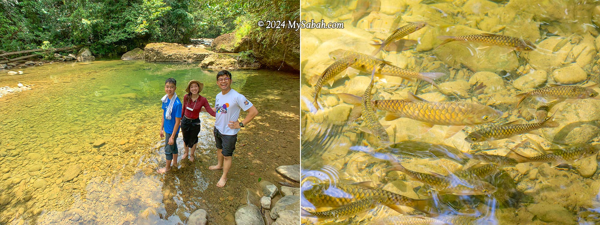
Riverside Camp
Finally, we reached the camp next to a tranquil river with a rocky bed, where we indulged in linopot lunch (rice wrapped in leaves). A few unique butterflies, including the iconic Rajah Birdwing, fluttered about the riverbank. This spot offers camping, swimming, and tubing activities, and you can throw a BBQ party.
River campsite and linopot (rice wrapped in leaf). Basic camping amenities such as tables and toilets are available here.
Nature enthusiasts will find themselves captivated by Aura Montoria’s diverse landscapes. Keep an eye out for its rich flora, such as begonias and orchids, which are among the highlights. While most people relaxed at the camp, some enjoyed a free fish massage from the docile mahseer (Local Name: Ikan Kelah).
The river and mahseer fishes (Species: Tor duoronensis) at the campsite
Green Lake (Liogu Otomou)
The adventure isn’t quite done yet! Our final destination is the Green Lake, a serene pond embraced by whitish boulders, with a depth of about 10 feet. For those seeking an extra adrenaline rush at the tail end of a long hike, you can take a leap into the river from higher ground nearby.
Liogu Otomou, a green lake-like river zone enclosed by rocky riverbank
How to Get There
Aura Montoria (see Location Map) is situated in Kampung Sayap, approximately 26 kilometers from Kota Belud, famously known as the Cowboy Town of Sabah. The journey from Kota Kinabalu City (KK) to Kota Belud, around an hour by car, is easily accessible via highways and paved roads. However, the 27-kilometer stretch from Kota Belud to Aura Montoria is predominantly gravel and dirt roads, making a 4-wheel-drive preferable as it can be challenging for sedan or saloon cars to traverse.
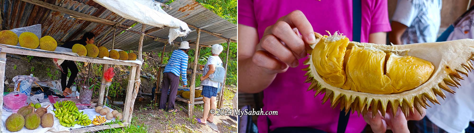
Fruit stall at the roadside of Kampung Sayap. You would find durian and tarap during fruiting season.
If you’re traveling from KK, expect a journey of over two hours. During the durian fruiting season (around August and September), if you’re a durian lover, plan for additional travel time as you might be tempted to stop in Kampung Sayap to shop for cheap durian, pineapples, and tarap. Hence, staying overnight in a nearby homestay like Porohon Garden Lodge is highly recommended. This way, you can avoid the rush and enjoy a leisurely start to your adventure without the need for a long early morning drive.
About Kampung Sayap
The majority of Kampung Sayap’s population comprises the Dusun Tindal community, mainly engaged in farming activities. Originally known as Kampung Minangkob, the name translates to “valley surrounded by hills.” Many years ago, a British military officer visited the village, he rested by a river that was nearly covered with dry leaves because of the drought that time.
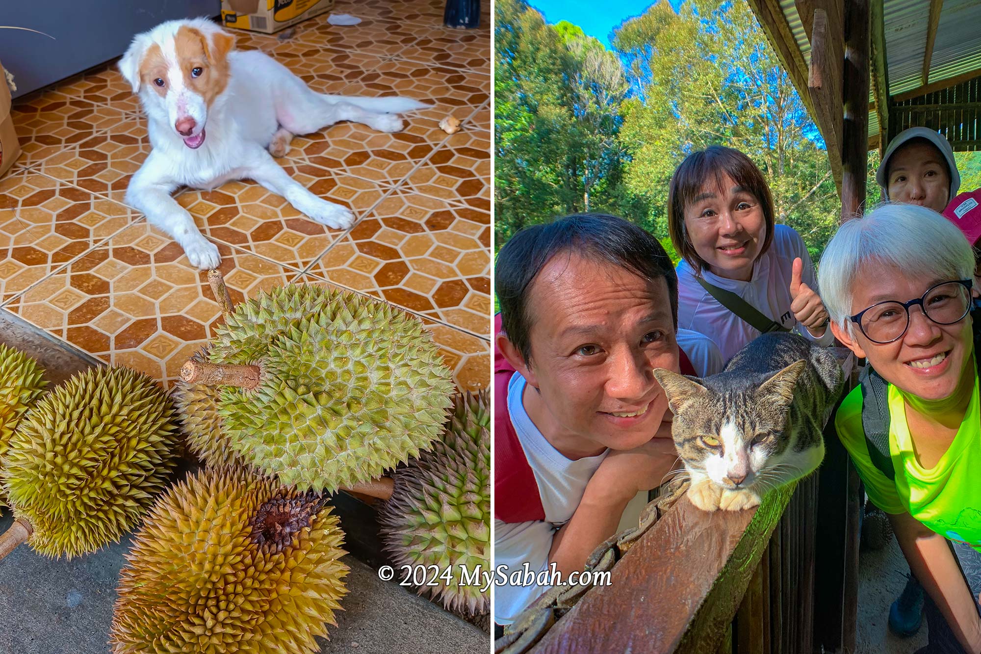
Dog and cat of Kampung Sayap. In the photos are Si Putih (dog) and Stim (cat), they love durian. Here are the proof of Si Putih and Stim eating durians (click the links for video)
Then the British asked a villager, “what is the word for dry leaves in Dusun language?” The villager replied that it was “sahap” (dry leaves). Unfortunately, the officer misheard sahap as sayap (which means wings in Malay) and document it in his diary. Due to that incident, Kampung Minangkob was renamed to Kampung Sayap.
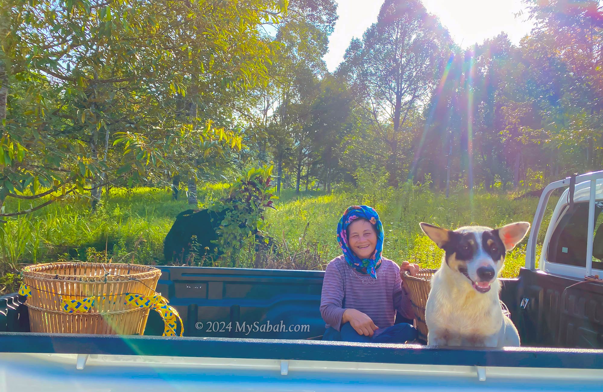
A friendly villager and her dog on the way to their farm in a lovely morning. Note the traditional wakid bamboo baskets in the car and the durian plantation behind them.
Fees and Contacts
The half-day, 6-kilometer hiking tour is priced at RM35 per person for locals and RM80 per person for non-Malaysians. For a group of up to 5 people, the guide fee per group is RM50 for locals and RM100 for non-Malaysians. Food is not included in the cost (but available as an add-on). If needed, you can hire a porter at a rate of RM5 per kilogram to carry your belongings.
Butterflies at the river of Aura Montoria. Left: Terinos clarissa praestigiosa, Right: Bornean Straight Pierrot (Caleta manovus)
A local guide is mandatory for hiking in Aura Montoria. To inquire about updated rates or book a hiking trip in Aura Montoria, you can contact the operator through the following channels: Phone (Whatsapp):+60-136262793 (Madam Sandra Idiam), +60-189650079 (Madam Rina Maratun) Facebook:Aura Montoria Eko-Edu Tourism Kg Sayap Kota Belud Sabah
Things to Bring
Having the following items handy will ensure a more comfortable and enjoyable hiking experience at Aura Montoria! The most important of all is to wear the right hiking gear: quick-dry clothes and good hiking shoes.
Backpack
Drinking Water
Raincoat / Poncho
Insect Repellent
Sunblock Lotion / Spray
Snacks / Energy Bar
Swimwear / Sarong
Extra clothing and towel
Hiking pole
Plastic Bag for soiled clothing
Cash
Optional: dry bag, portable power bank, hat
You can rent walking sticks, swimming goggles, Adidas Kampung (waterproof rubber shoes for hiking) for a small fee.
Walking sticks and Adidas Kampung shoes for rent. Adidas Kampung is made of rubber and waterproof, it’s the favourite hiking shoes of locals because it works well on muddy and slippery ground.
Special thanks to Puan Rina Maratun for sharing the backstories of Aura Montoria and Kampung Sayap. I also refer to the book “A Scientific Journey Through Borneo; Sayap-Kinabalu Park Sabah” written by ISMAIL, Ghazally; BIN DIN, Laily and published in 1995.
Photos taken in Kota Belud, Sabah, Malaysia Borneo
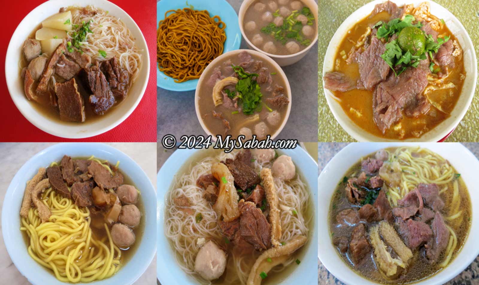
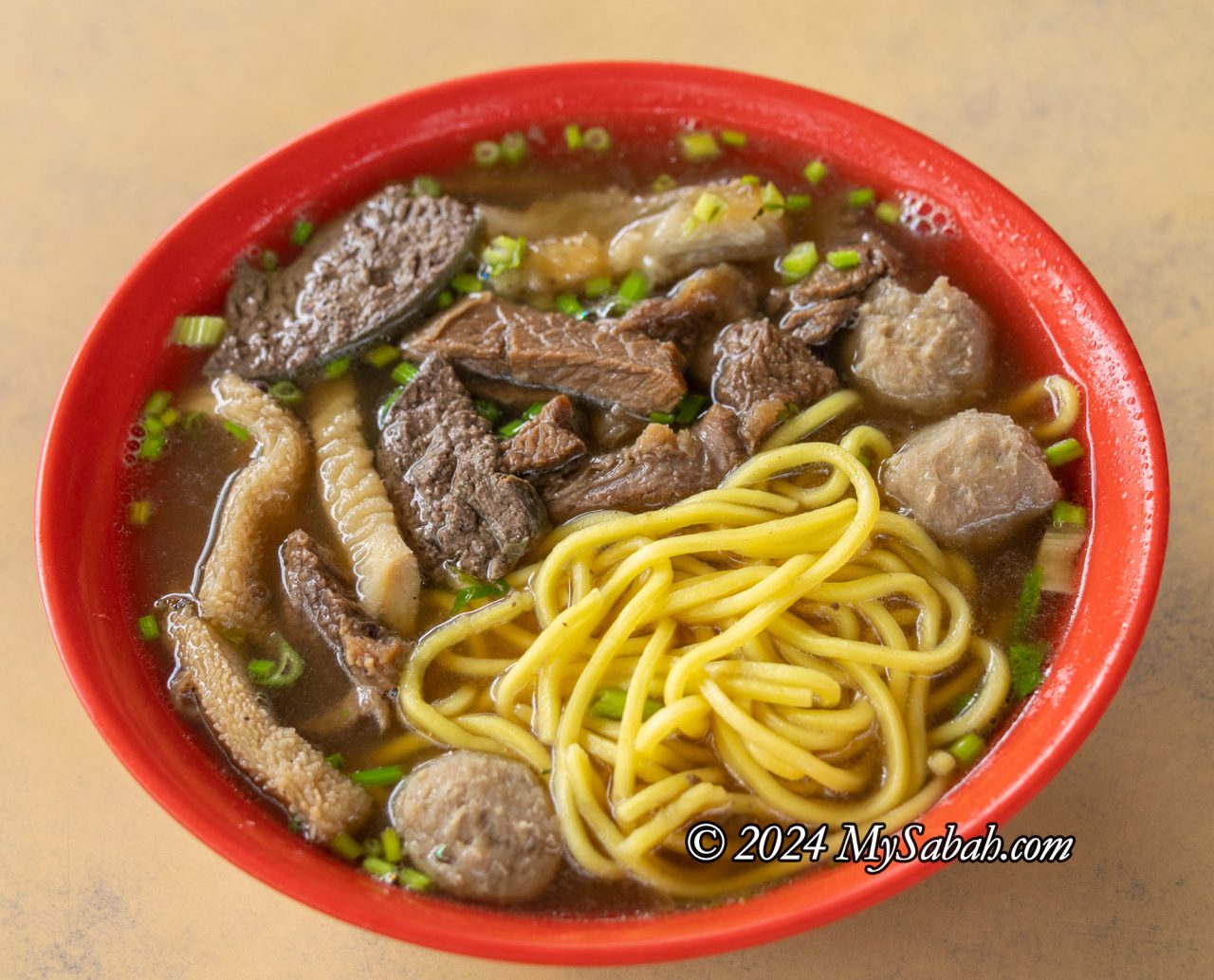
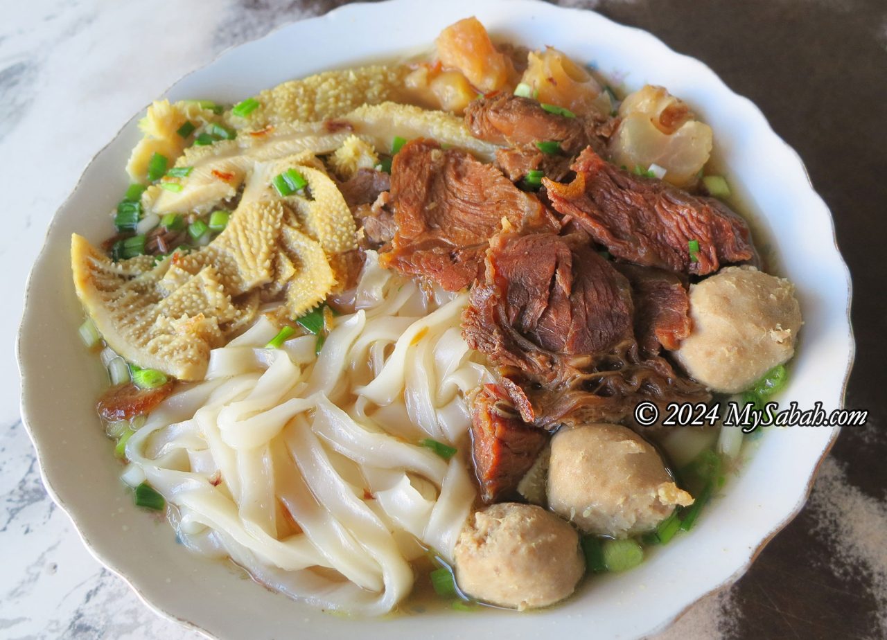
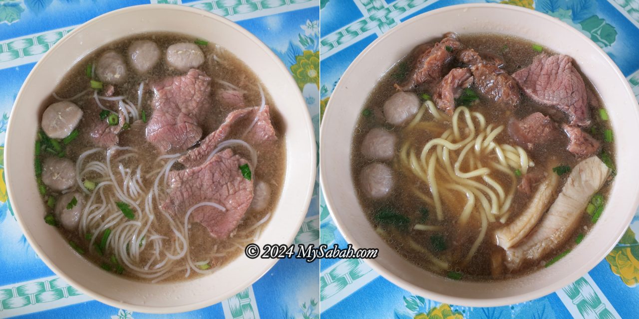
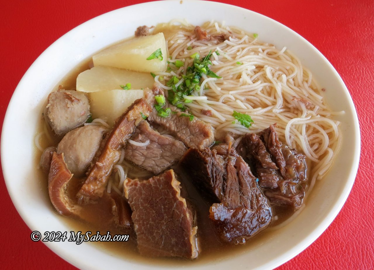
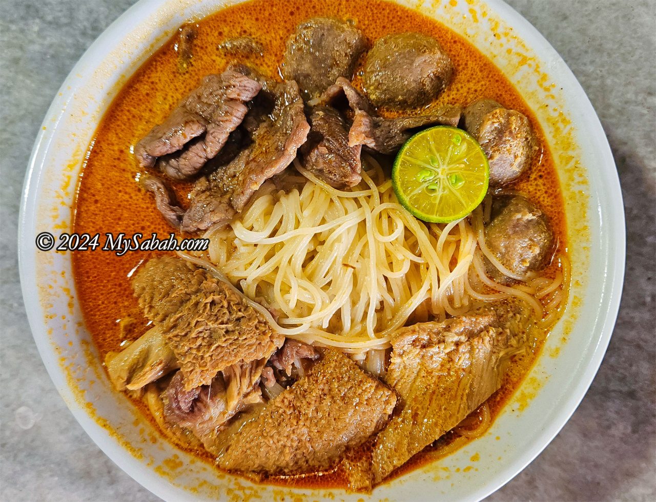
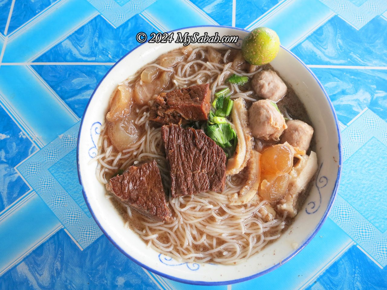
Your gastronomic journey in Sabah is incomplete without Ngiu Chap (or Ngau Chap). Ngiu Chap literally means “Mixed Beef”, which is a mix of beef and its innards such as stew meat, meat ball, tendon, liver, heart, tripe, intestine, tongue, and omasum, usually served with noodles in thick beef broth.
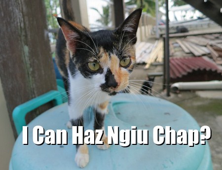
Pic: Sabah LOL Cats. World is hell without Ngiu Chap.. Just kidding.
Though Ngiu Chap is the signature and favorite noodle soup of Sabahans, not all restaurants cook very good Ngiu Chap. Some of them even add excessive Ajinomoto (MSG) into the soup. After the meal, you will be so thirsty that you need to drink gallons of water. Below is a list of Best restaurants to enjoy Sabah Ngiu Chap in different styles, recommended by the locals and I have personally tried them all. As everyone has different taste, the following list is not in any order.
1. Traditional Style – Kedai Kopi Loi Hin (来兴茶室)
Kedai Kopi Loi Hin has been making one of the best Ngiu Chap in Sabah for over half a century. This restaurant is one of the “100 Best Coffee Shops of Malaysia” recommended by Tourism Malaysia. Location: Donggogon, Kota Kinabalu city » Read more about Kedai Kopi Loi Hin…
2. Hainan Style – Kedai Cheng Wah (精华冰室)
Opened by a Hainanese in 1961, the Ngiu Chap of Kedai Cheng Wah is still one of our favorite after 50 years. This restaurant is run by Wong family, and eat out there is like enjoying a nice meal cooked by your mom. Location: Lido Penampang, Kota Kinabalu city » Read more about Kedai Cheng Wah…
3. Sabah Style – Nyuk Pau Ngau Chap Menggatal (玉宝茶室)
When people talk about yummy Ngiu Chap, you will always hear the name “Menggatal Ngiu Chap”. Nyuk Pau started with one restaurant in Menggatal town (Kedai Kopi Nyuk Pau Baru) 25 years ago, and now it has franchises in Sabah and West Malaysia. Location:Menggatal, Kota Kinabalu
4. West Malaysia Style – Kah Hiong Ngiu Chap (家乡牛什)
Kah Hiong Ngiu Chap is the most popular Ngiu Chap of Sabah. Not only their Ngiu Chap tastes good, they also serve Ngiu Chap in variety of styles. This restaurant was featured by Axian (Jason Yeoh), in his famous food programme Taste with Jason (阿贤人情味). Location:Kolam Centre, Kota Kinabalu » Read more about Kah Hiong Ngiu Chap…
5. Laksa Style – Yii Siang Hainan Ngiu Chap (忆香海南牛什)
Almost all my friends recommend the Laksa Ngiu Chap at Yii Siang. The serving portions are generous, and the shop is always packed during lunch hours. Their Laksa Ngiu Chap is delicious and creamy, thanks to the addition of coconut milk. Interestingly, it’s not spicy at all! Location:Kolombong, Kota Kinabalu
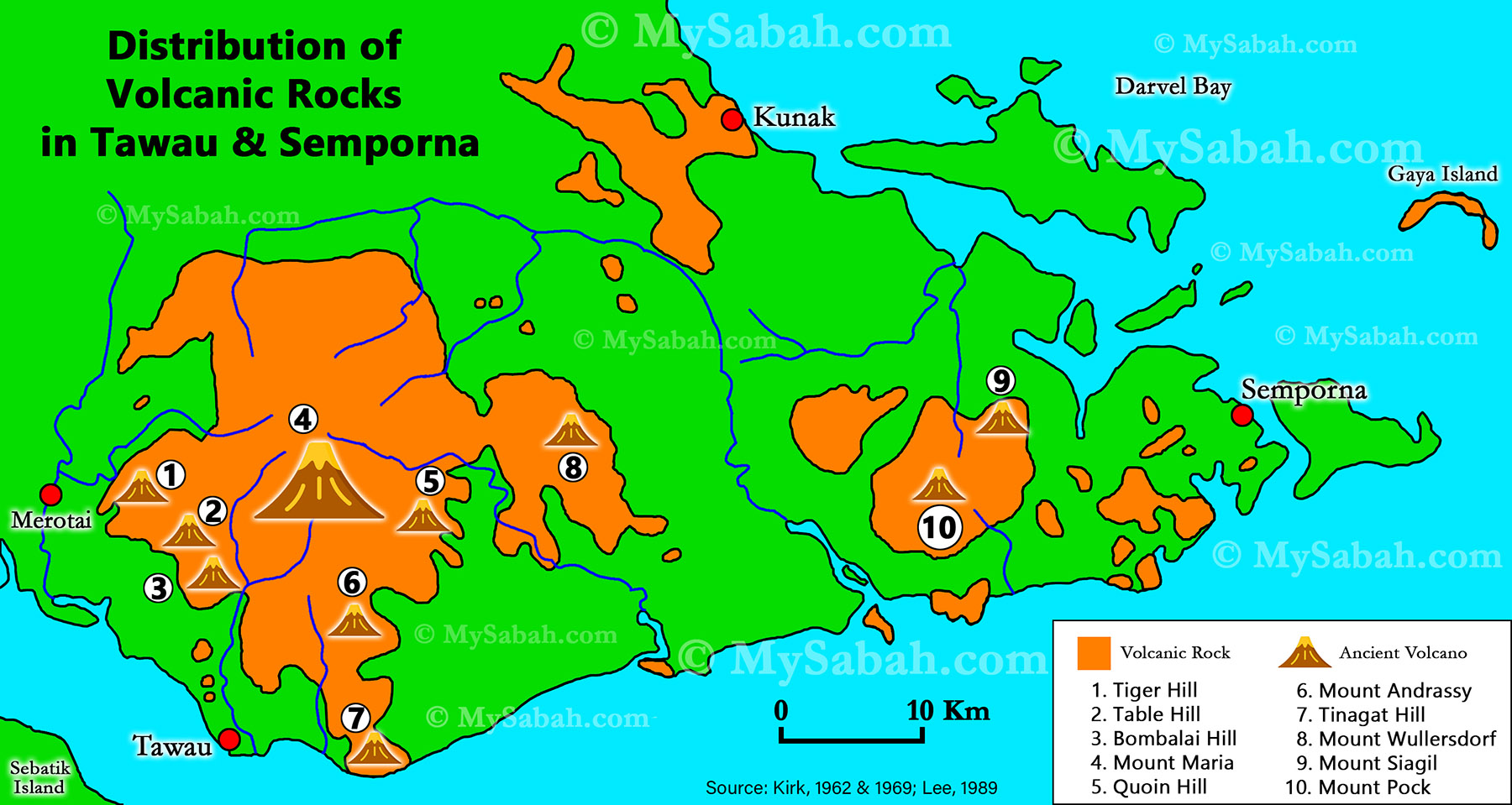
Mount Kinabalu is the sacred mountain of Sabah’s indigenous people. During the active volcanic period from the Early Miocene to the Pleistocene in the eastern part of Sabah, did the people from that era worship these volcanoes? Currently, all volcanoes in Sabah are extinct, and many people are unaware that Tawau has at least 10 volcanoes that became extinct approximately 12,000 years ago. Anyway, a dead volcano is still a volcano. Climbing to the summit of a volcano fulfills my interests in its geological, spiritual, and ecological features.
Distribution of volcanic rocks and ancient volcanoes in Tawau and Semporna (south-east of Sabah). Tinagat Hill is No.7 on the map.
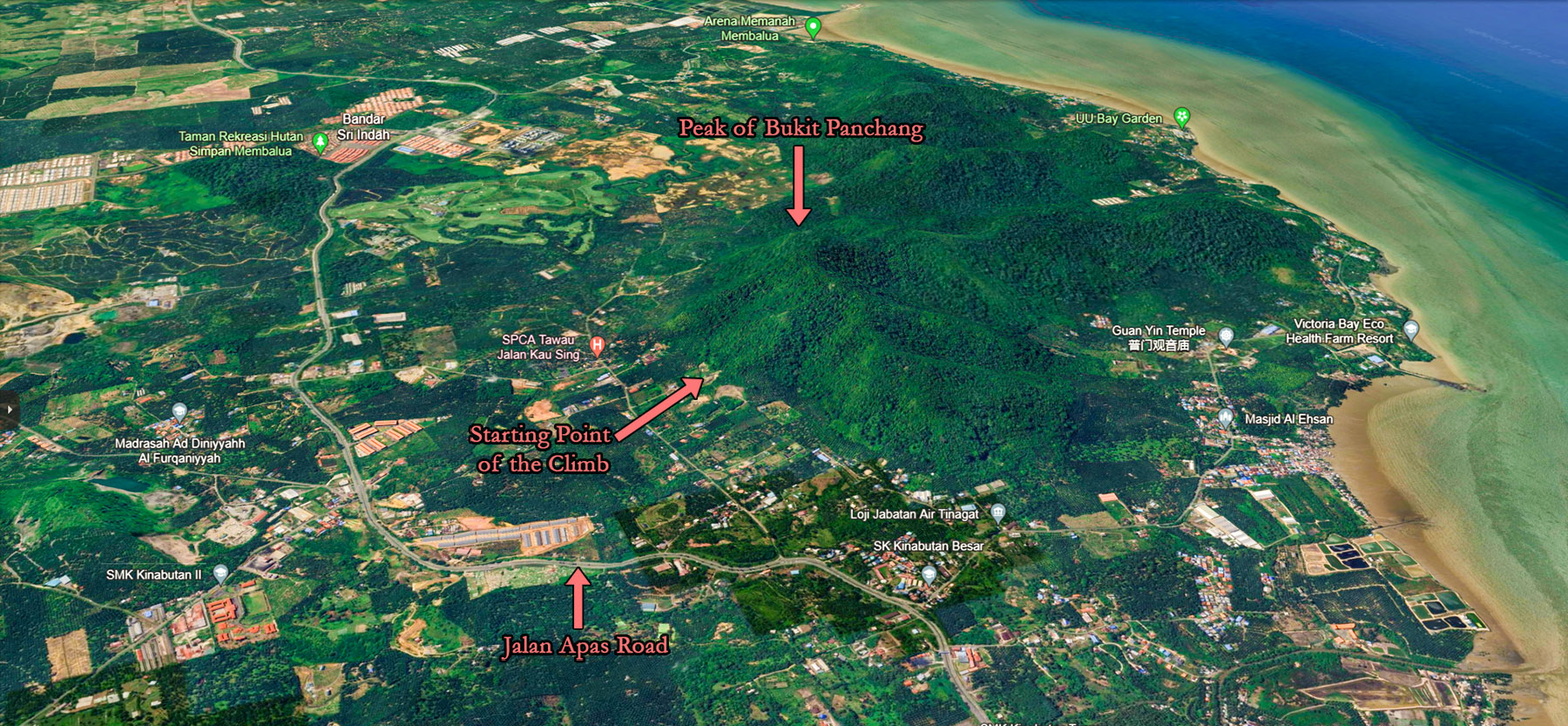
Bukit Panchang (or Panchang Hill, where ‘Bukit’ means ‘Hill’) is the fifth Sabah volcano I’ve climbed, following Bombalai Hill, Mount Wullersdorf, Bukit Tengkorak and Bohey Dulang. Situated in the Tinagat Forest Reserve, Bukit Panchang or Bukit Panchang Tinagat is less than 10 kilometers away from Tawau town.
Tinagat Forest in morning mist
About Tinagat Forest Reserve
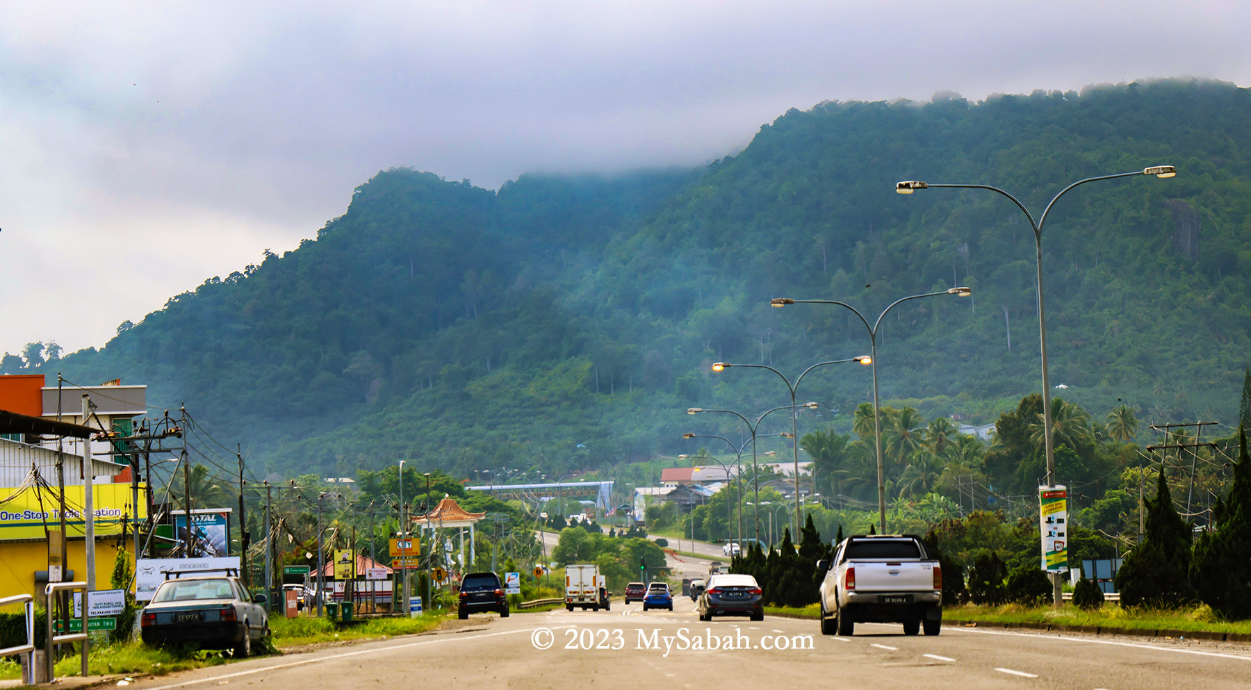
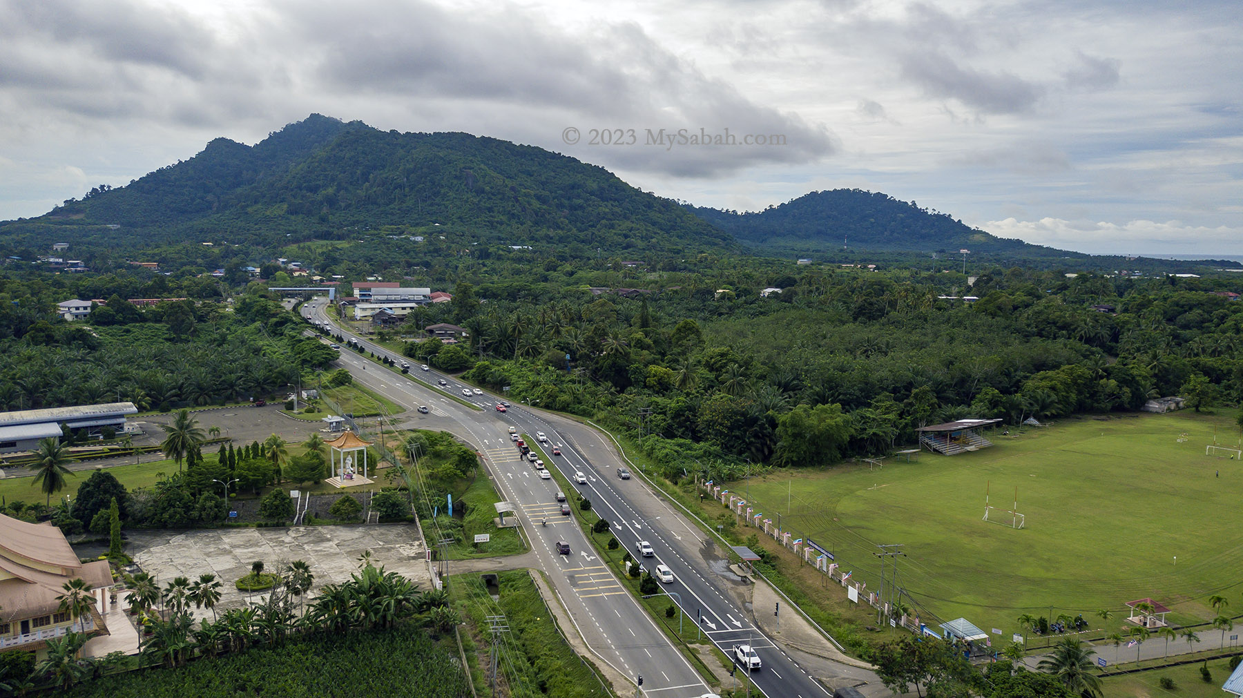
Managed by the Sabah Forestry Department, Tinagat Forest Reserve is classified as a Class-1 (fully protected) forest reserve, covering an area of 1,011 hectares (or 10.11 square kilometers). Traveling along Jalan Apas, one of Tawau’s main roads, in the morning, you’ll witness this lush hilly forest veiled in mist. Amidst the extensive conversion of land around Tawau into oil palm plantations, Tinagat Forest Reserve stands as one of the few remaining forested areas near the town.
3D map of Tinagat forest reserve and its surrounding
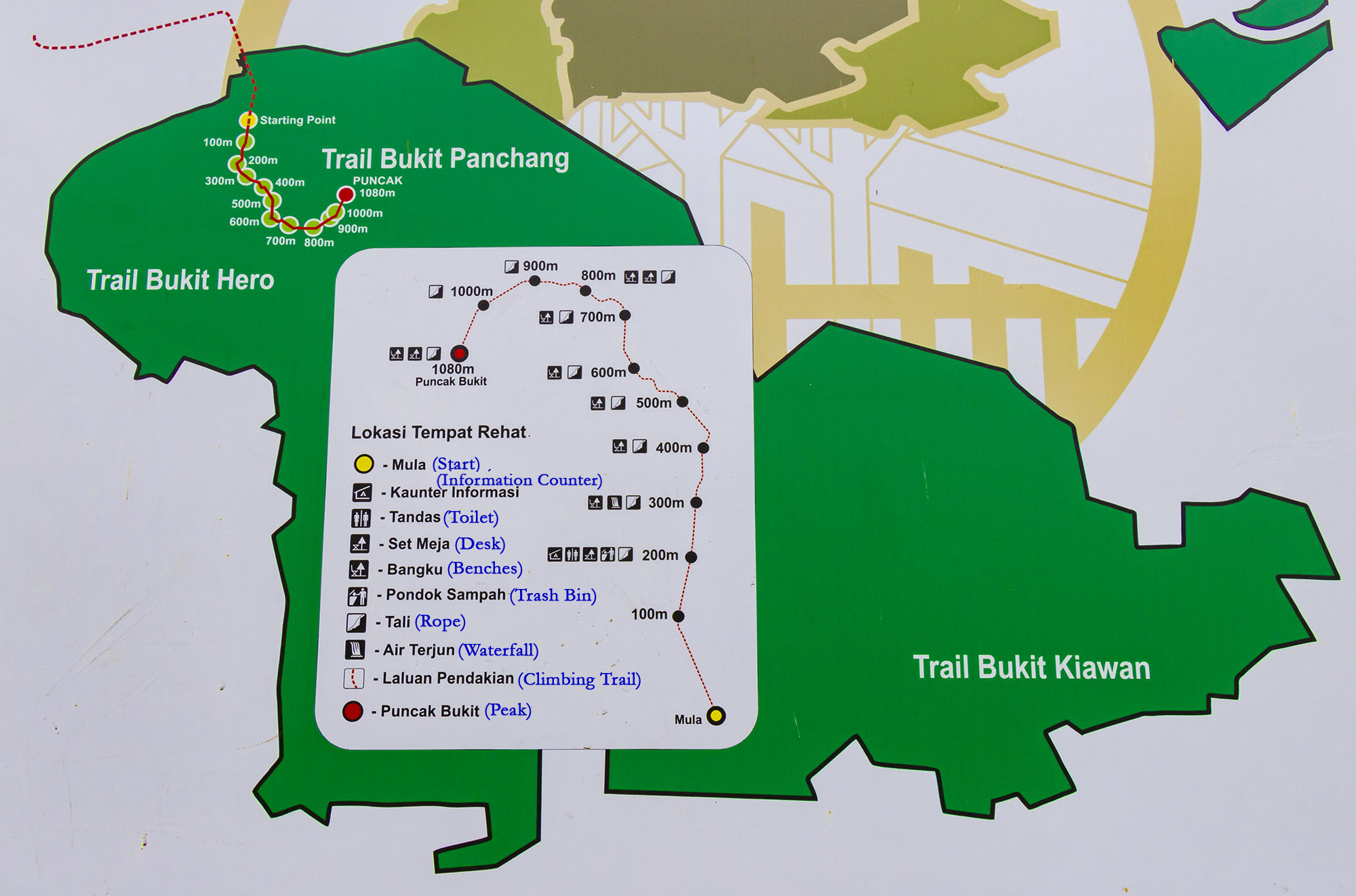
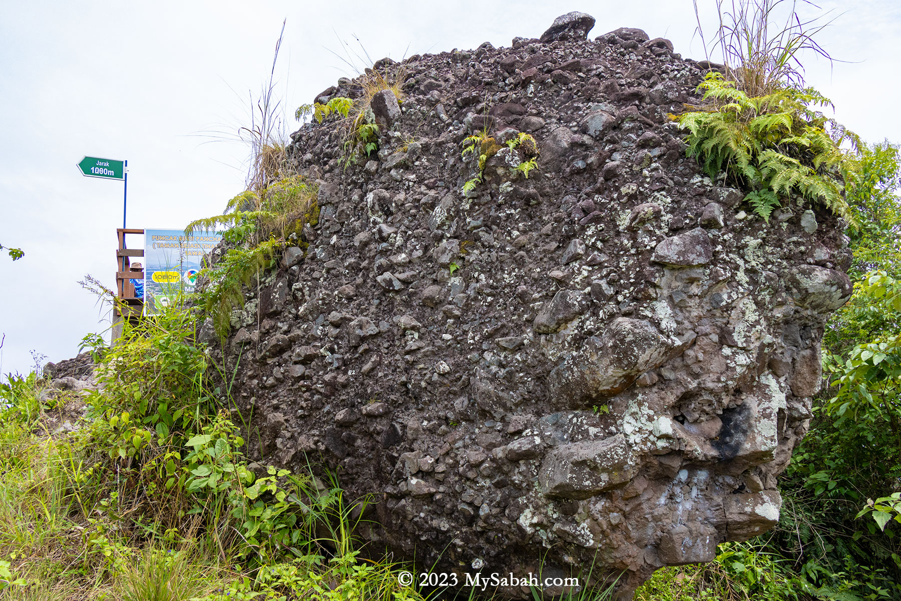
Tinagat essentially represents a multi-peaked ancient volcano blanketed by dense forest cover. Remarkably, numerous climbing trails lead to various peaks on this hill. Among them, Bukit Panchang claims the highest altitude at 398 meters (1,306 feet). Bukit Panchang is probably a new official name, as many locals used to call it Bukit Kinabutan or Bukit Tinagat. Other notable peaks within the Tinagat Forest Reserve include Bukit 38, Bukit Akar, Hero Hill (Batu Payung), Bukit Kayawan, and Bukit Kiawan.
The trail map of Bukit Panchang in Tinagat Forest Reserve (English translation in blue colour). There are more than one hill in this forest.
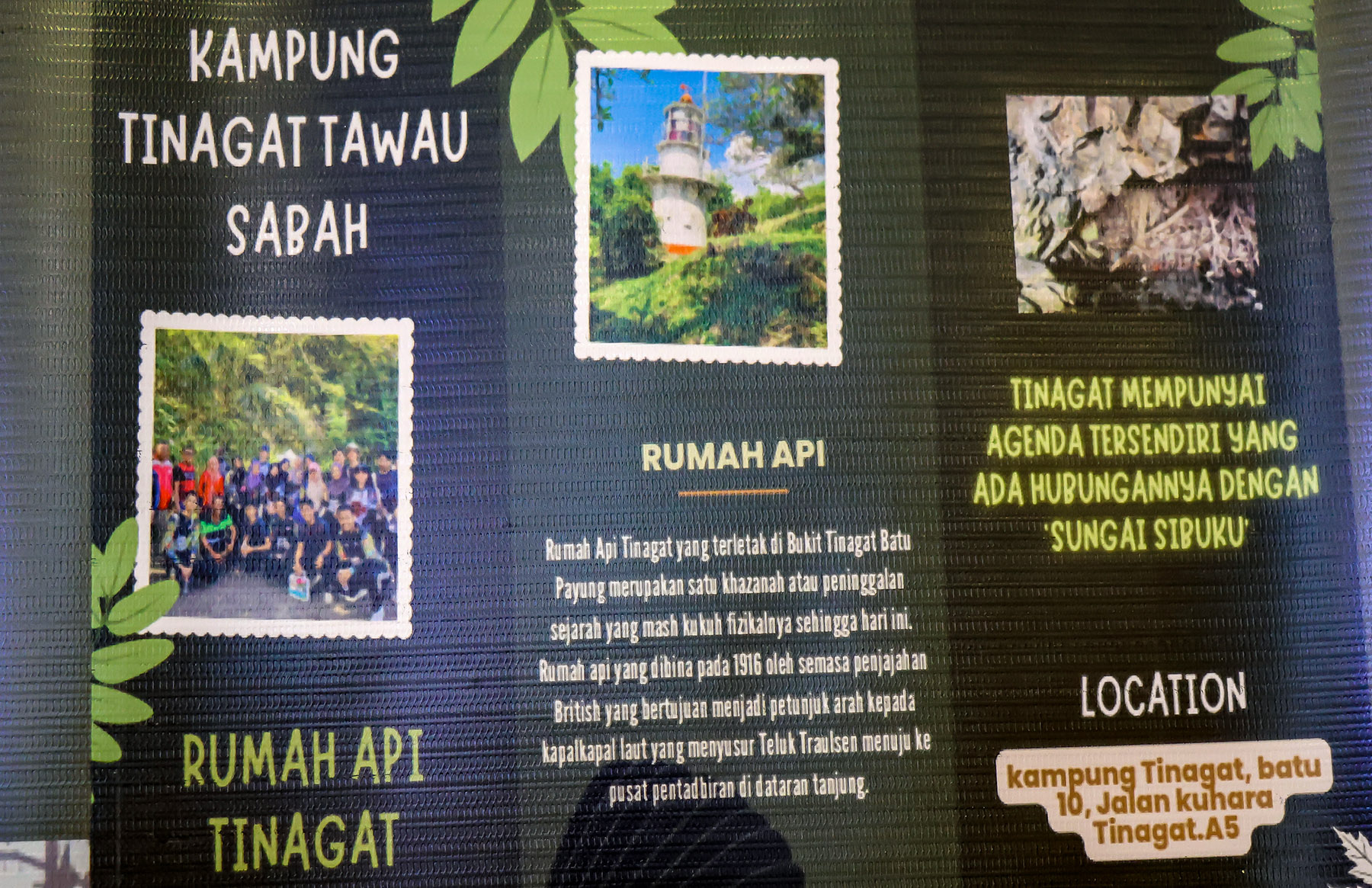
A century-old lighthouse (Rumah Api Batu Tinagat), constructed by the British colonial government in 1916, stands at the foothills facing the sea. This 9-meter-high Batu Tinagat Lighthouse is currently a restricted area. However, PELKO (Pelancongan Komuniti Tawau, associated with Politeknik Tawau) suggests that it will soon be accessible to tourists. On 23rd February 2018, Batu Tinagat Lighthouse was among the 24 heritage sites in the state officially designated by Sabah’s State Heritage Council under the new enactment of the ‘State Heritage Enactment 2017’.
View of Tinagat Forest Reserve from the Jalan Apas Road near to Tawau town
Not far from the Batu Tinagat Lighthouse lies Batu Payung (literally meaning Umbrella Rock), which is tied to a legend that lends Tinagat its name (Tinagat translates to ‘Cut Down’ in the Tidung language). According to the tale, long ago, a young farmer encountered seven heavenly princesses bathing along the beach. Captivated by their beauty, he devised a plan to win one of them over by stealing her clothes. Unable to locate her dress, the youngest princess was stranded on Earth. Eventually, she married the young man and bore him a child.
PELKO (Tawau Community Tourism) is planning to develop and promote the attractions in Tinagat
One day, during a festival, the princess was invited to perform a dance. As she danced in her old attire, hidden from her until then, her body began to levitate and ascended to the top of Batu Payung. In a desperate attempt to get her back, her husband cut down the rock, but she continued to soar away. All that remained was a message she left behind: ‘Please take care of our child. If he cries, bring him to Sungai Sibuku (Sibuku River).’
A walk-through video of climbing Bukit Panchang
Climbing Bukit Panchang
Bukit Panchang is steep but not too difficult to climb. The trail to the peak spans about 1,080 metres one way, typically taking around an hour to complete. Your climb will start with a steep slope, sorry, no warm-up for you.
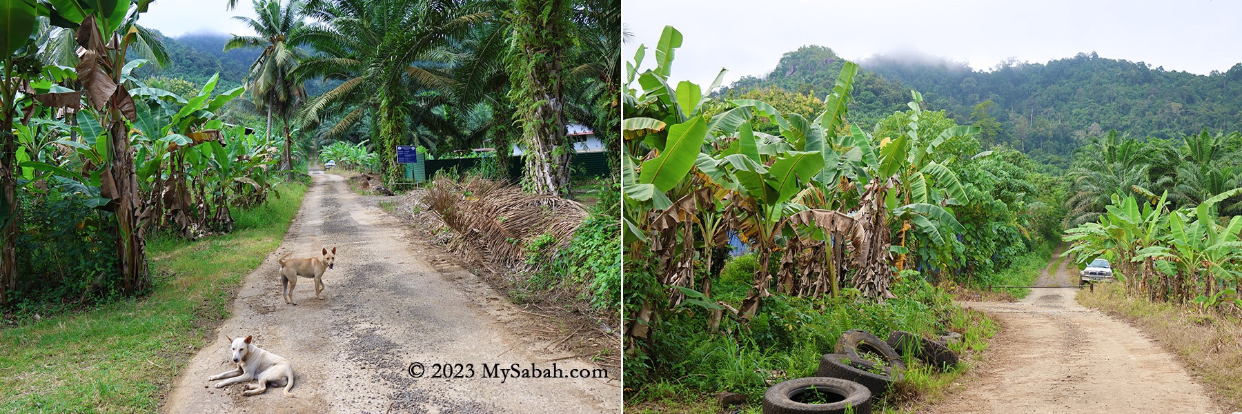
Starting point from the junction No.10. You can see the forested hill ahead of you. If you are afraid of dog, you may go in group or bring a hiking stick. These dogs were friendly to me when I communicated with positive gesture and voice.
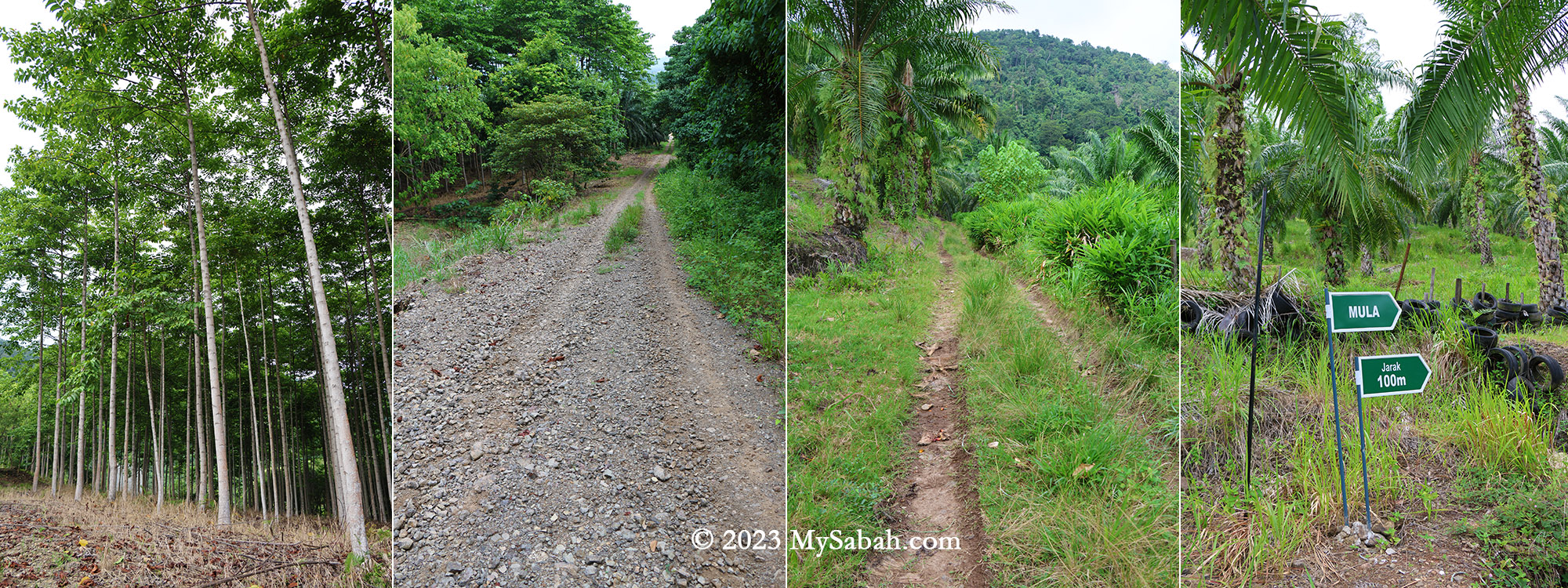
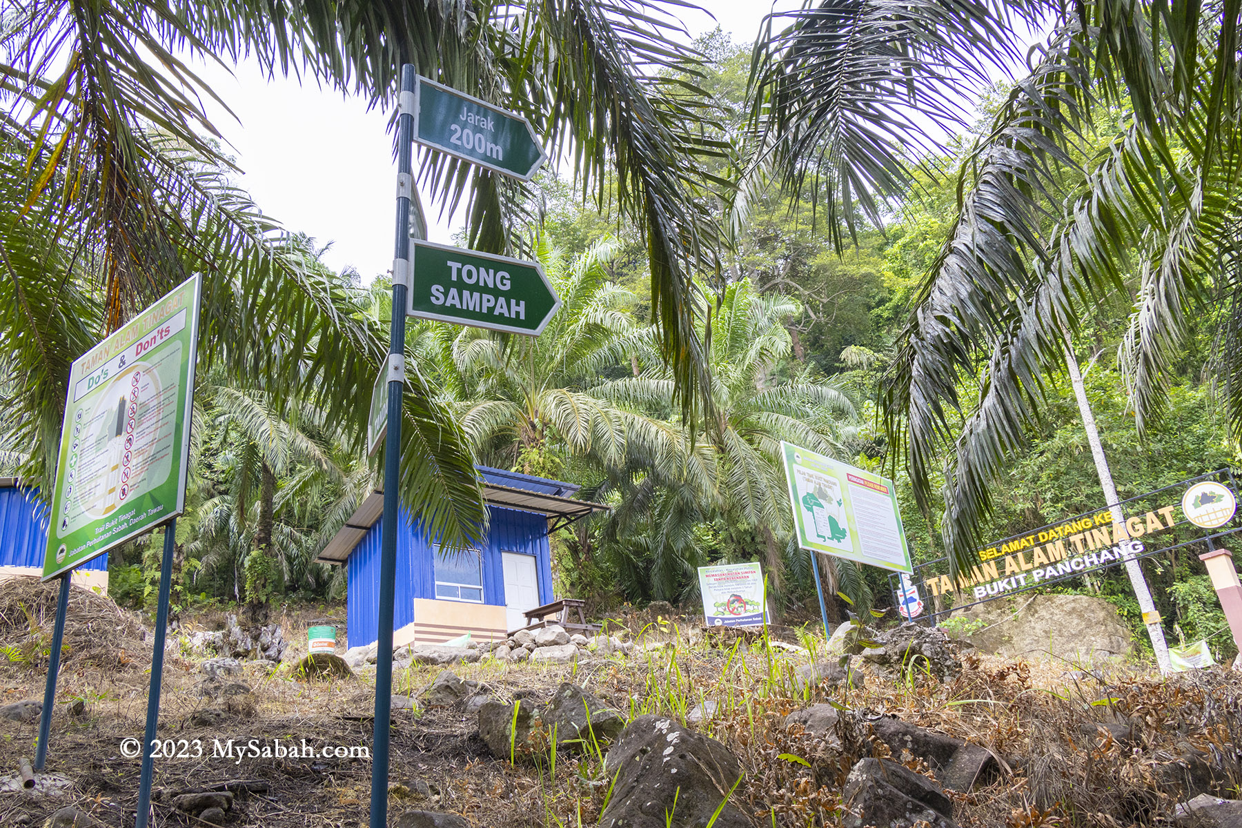
Initially, a 200-metre walk on a gravel road within an oil palm plantation leads to the Sabah Forestry station (or checkpoint) at the foothill. Here, they’ve established amenities like toilets and gazebos. Beware of village dogs, though I found them quite friendly.
The small road to the Sabah Forestry station. You will pass through oil palm, rubber, coconut and banana plantation. You are almost there if you see the signages at the right. (Mula = Start, Jarak = Distance)
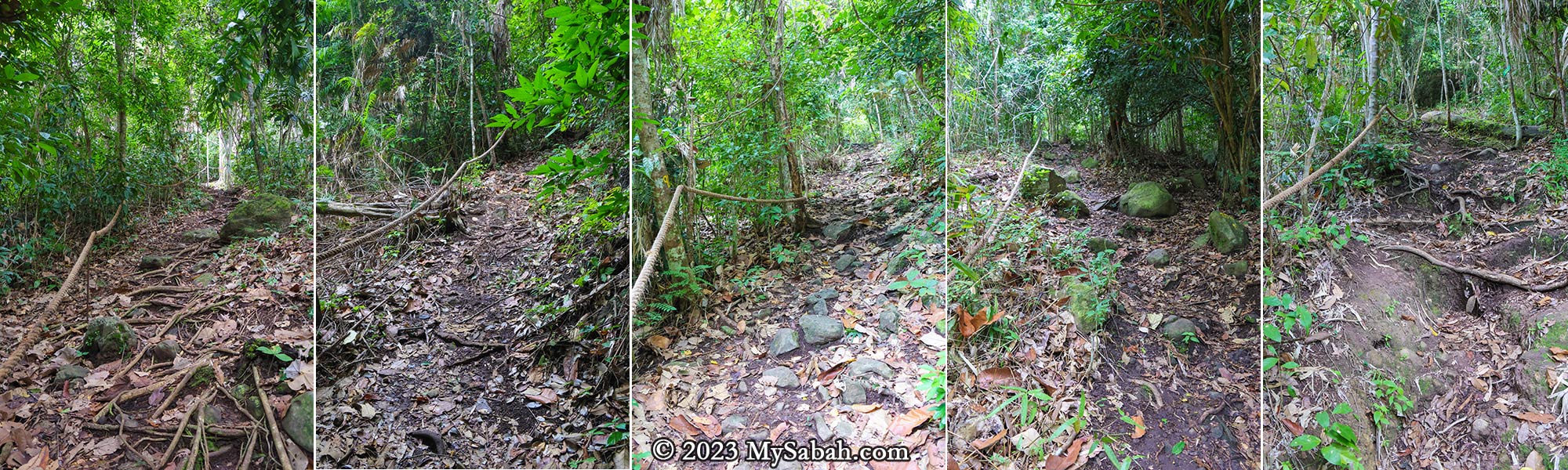
Thanks to the dense forest, the trail offers ample shade. Approximately 90% of the time is spent ascending, with mild to steep slopes. Tawau hikers often describe climbing steep hill as ‘feeling like Panchang,’ signifying its steepness.
Sabah Forestry station or checkpoint at the foothill of Bukit Panchang. Toilet and gazebo are available here.
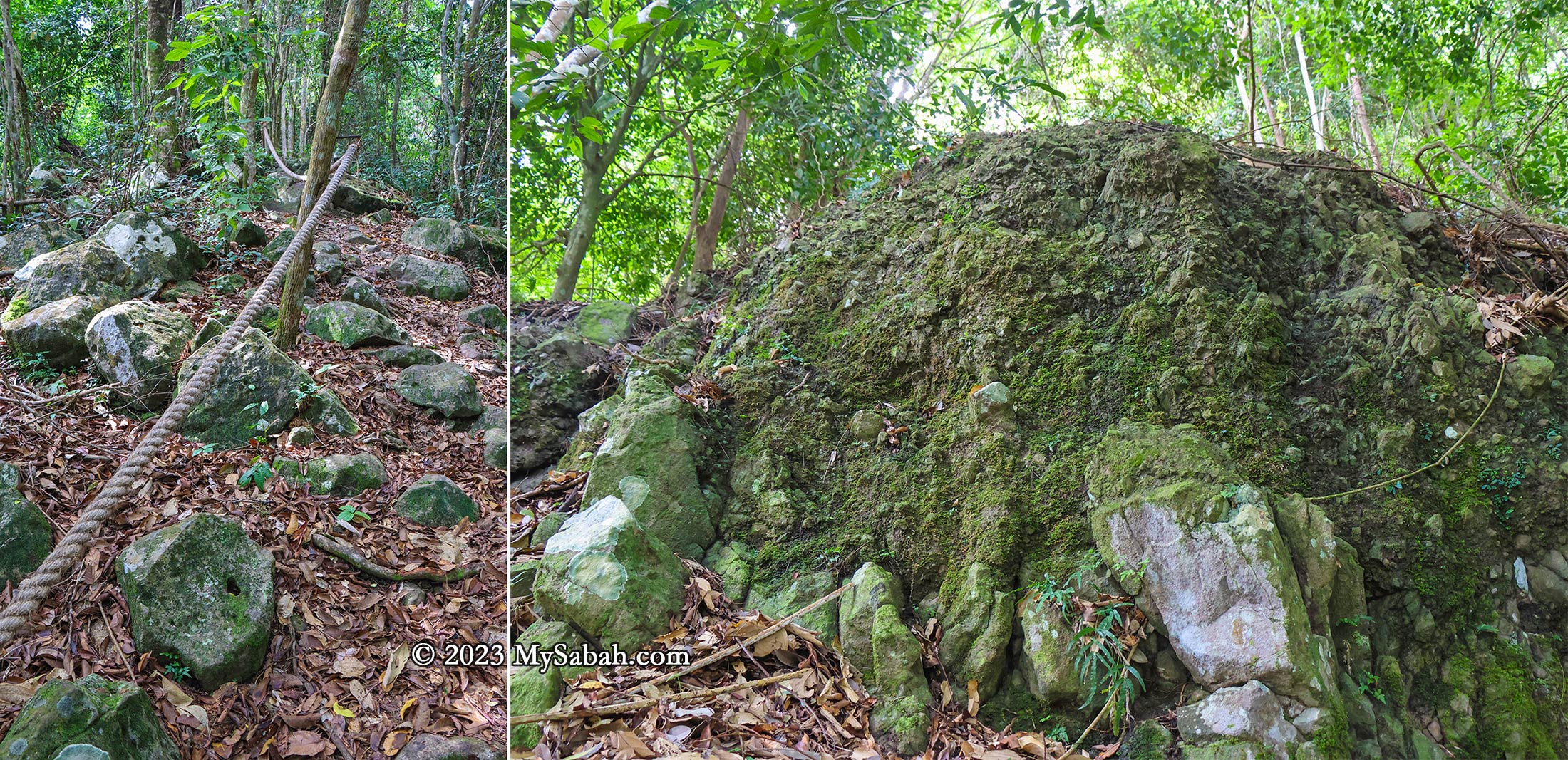
The most challenging segment involves a 200-metre-long steep boulder section at the trail’s onset. After rainfall, this section transforms into a waterfall, so I strongly advise against attempting the climb during the wet season.
The starting point of the climb at the Sabah Forestry Department station
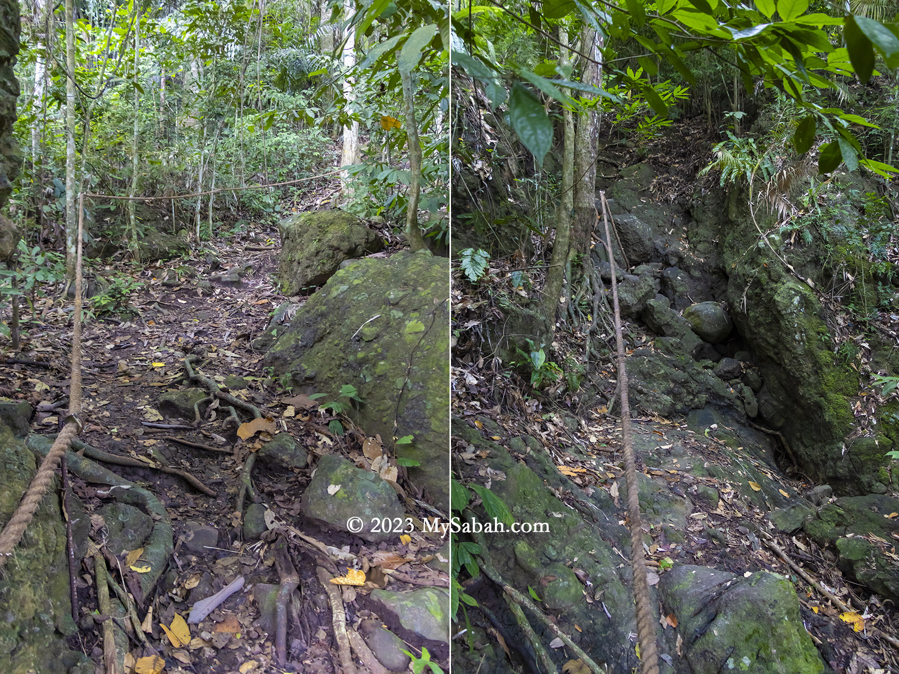
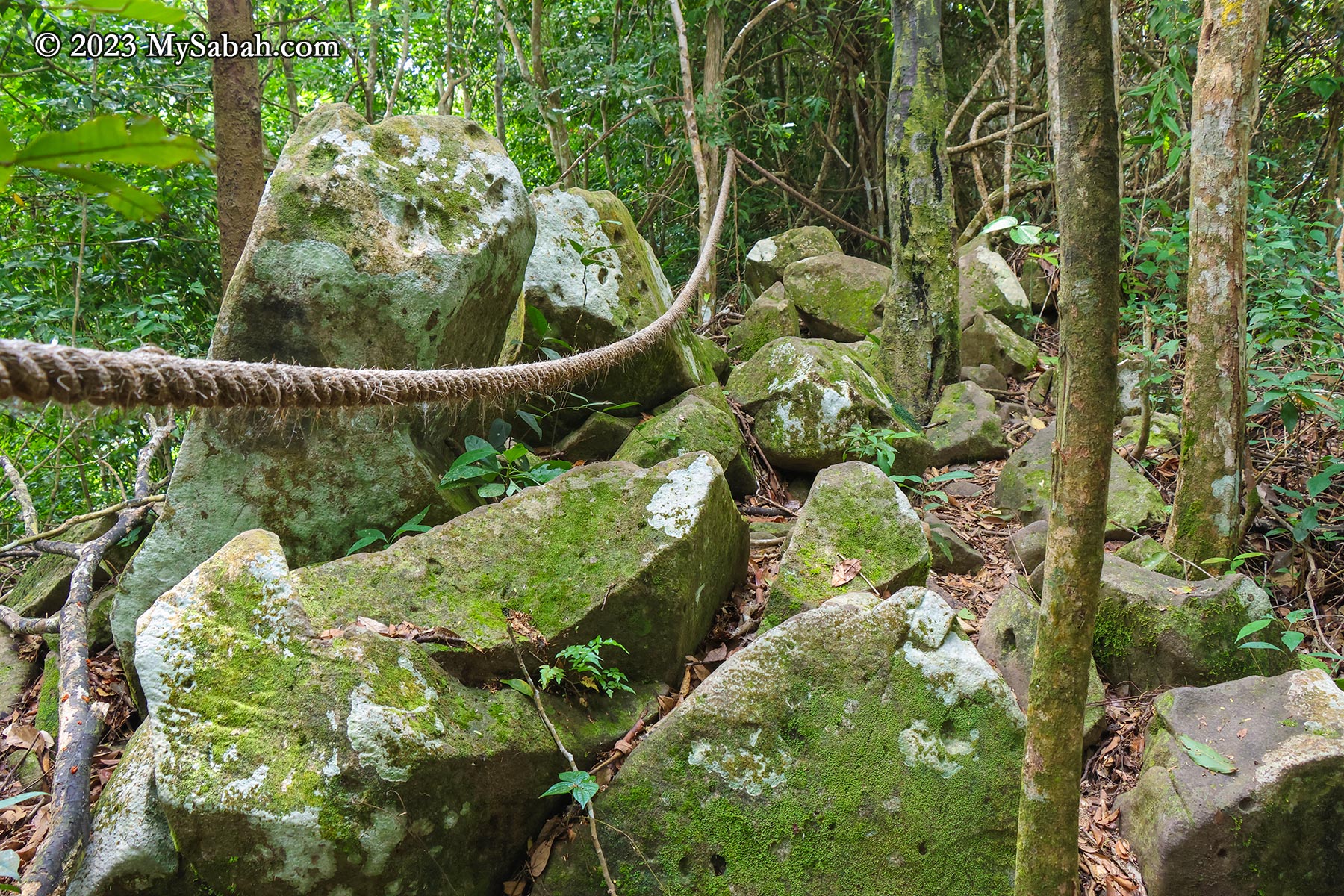
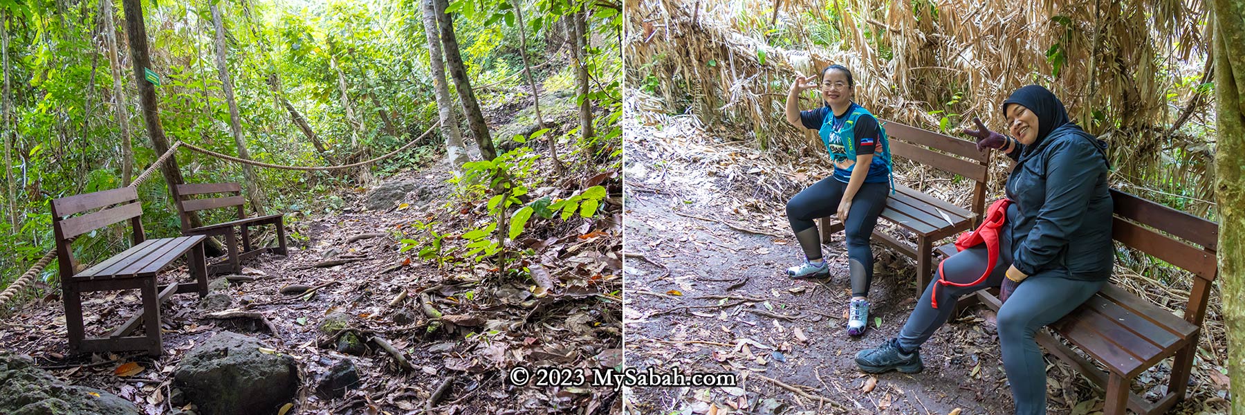
Throughout the climb, numerous exposed volcanic rocks and rockfaces remain visible, indicating Bukit Panchang was used to be a rocky hill. Rope supports are placed along the trail, providing climbing aid. The ropes also serve as guides leading to the summit. Distance markers every 100 meters serve as motivational checkpoints, and some spots have benches for resting. Fortunately, there are no leeches.
Left: start of the climbing trail. Right: the waterfall trail is the steepest section
In 2021, four kindergarten teachers lost their way in the Tinagat forest, but were thankfully rescued the following day. As a safety precaution, the Sabah Forestry Department now requires hikers to enlist a ranger’s guidance. Personally, I believe the hike isn’t dangerous if one exercises caution.
The Vegetations
After volcanic activity stopped thousands of years ago, this hill is covered with trees and plants that thrived in its fertile volcanic soil. While many perceive trees as mere providers of oxygen, the reality is that a rainforest hosts a multitude of plants offering food, medicinal properties, timber, firewood, and more.
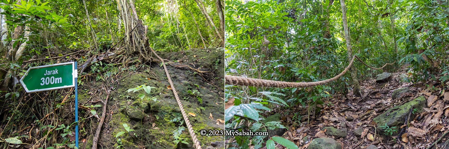
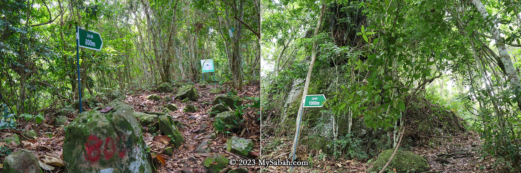
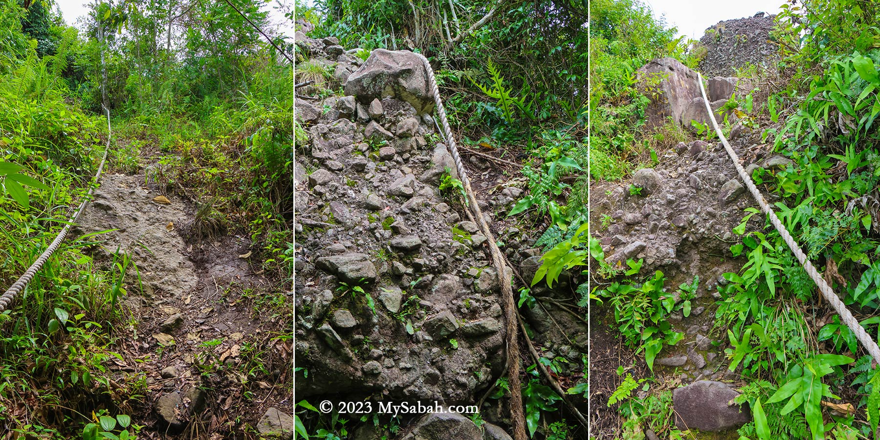
Distance marker and rope support. The total climbing distance to the peak is 1,080 metres one way. The distance marker shows you how many metres you have climbed (Jarak = Distance).
The forest covering the Tinagat hills primarily consists of mixed dipterocarp forest, a typical rainforest found in the hills of Borneo. However, the trees here tend to be relatively smaller, possibly due to the thin layer of soil.
The steep climbing trail of Bukit Panchang. Basically it’s up-up-up all the way and only slightly better after 750 metres.
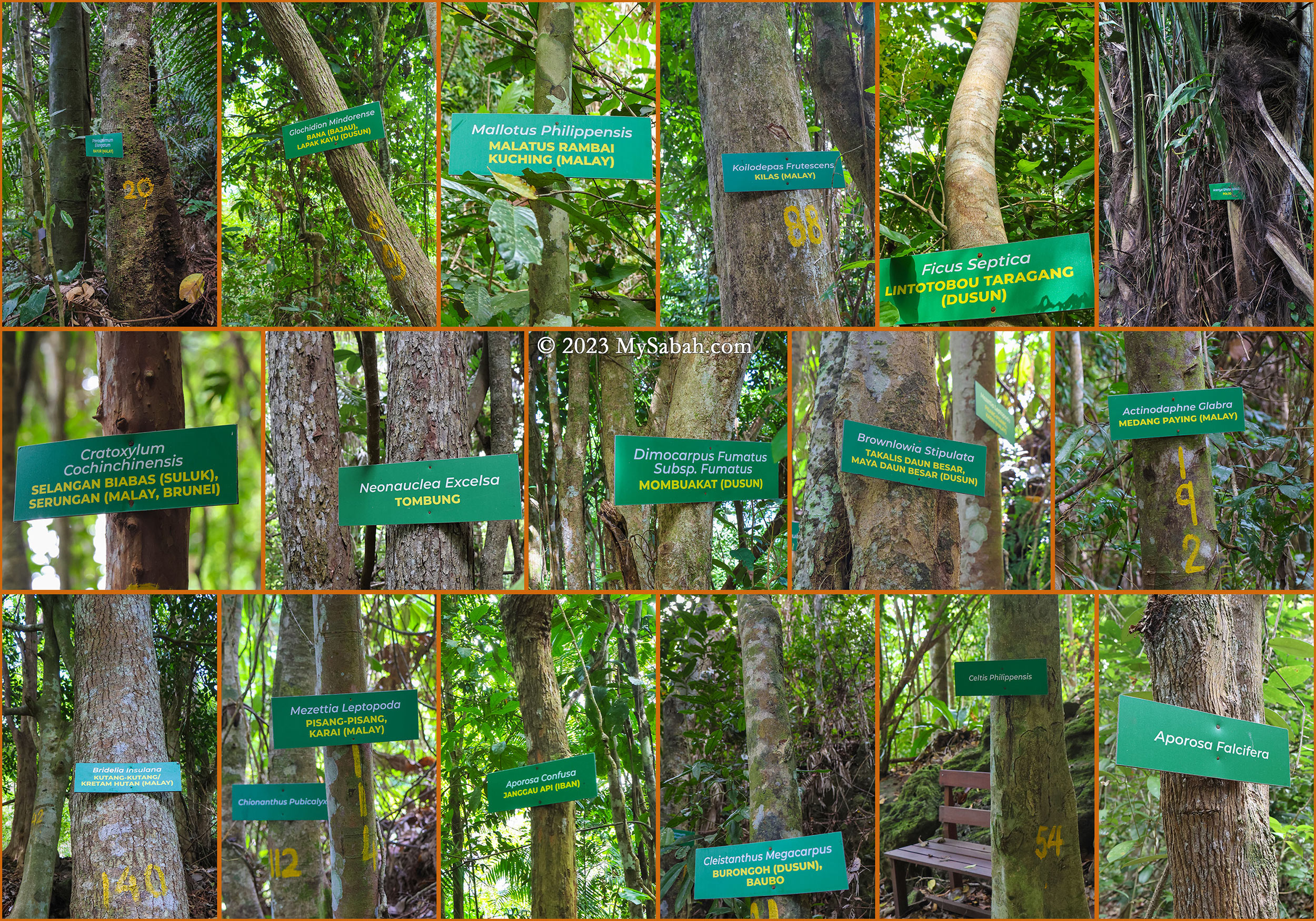
Along the trail to the peak, 30 or more trees are labeled with their scientific and local names. Providing additional information on these labels would greatly benefit non-botanist visitors, who want to learn more about the diverse flora present. I list a few trees that are interesting and useful.
The trees on Bukit Panchang of Tinagat Forest Reserve
Arenga undulatifolia (Polod) is a tree that can feed and kill. Its fruits are poisonous but the apical bud (known as a ‘palm heart’) is edible. The petioles and midribs are used to make darts for blowpipes.
Cratoxylum cochinchinensis, known as Selangan Biabas (Suluk) or Serungan (Malay, Brunei) is probably the most useful tree. Its timber, traded under the name ‘derum,’ is prized for medium to heavy construction. Additionally, its young fruit and shoots are edible, while the young leaves serve as a tea substitute. Its roots, bark, and twigs can treat colds and diarrhea.
Celtis philippensis offers a versatile range of applications: the seed oil finds use in producing lubricants and soap. Its bark supplies valuable fibers utilized in crafting ropes and paper. Furthermore, the wood is used in making poles, tool handles, beams, joists, rafters, cheap furniture, box lumber, and as fuel.
The trail is less steep after 800 metres (Jarak = Distance)
During World War II, villagers relied on their resourcefulness and the abundance of the forest. Many could retreat deep into the jungle, hiding for months as they relied on the forest for sustenance and survival.
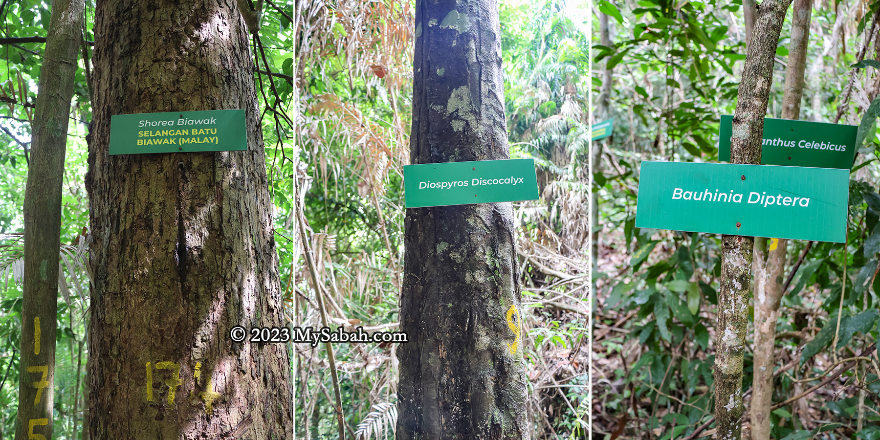
Endemic trees of Borneo on Bukit Panchang
There are five or more trees endemic to Borneo on this hill.
Shorea biawak, known as Selangan Batu Biawak in Malay, is assessed as Endangered. It yields quality wood used in handicrafts.
Diospyros discocalyx, deriving its specific epithet from the Latin for ‘disc-shaped calyx,’ thrives in lowland mixed dipterocarp forests
Bauhinia diptera is a climbing shrub primarily found in the wet tropical biome.
Chionanthus pubicalyx is endemic specifically to Borneo.
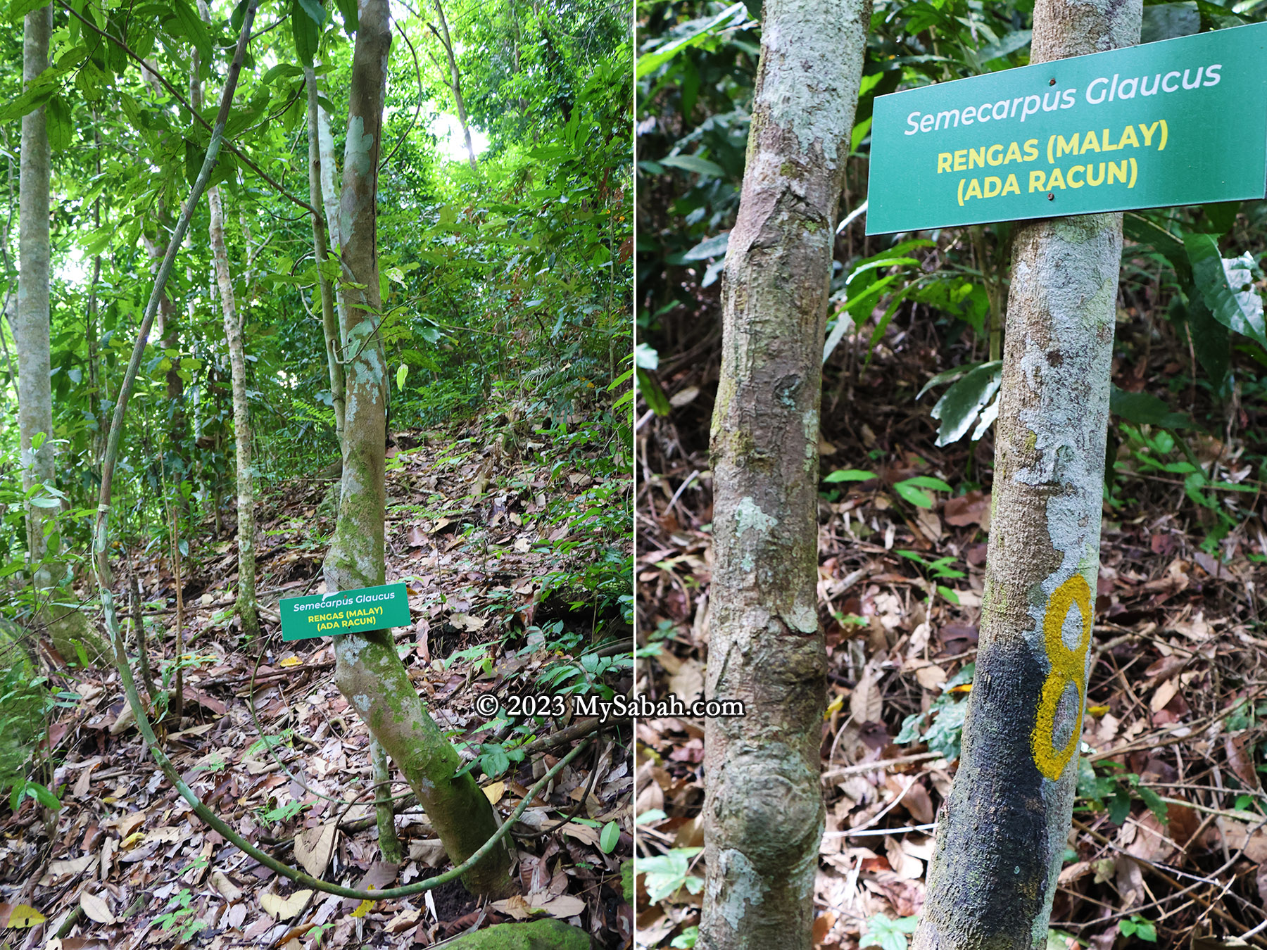
Semecarpus glaucus (Rengas) is a poisonous plant you should avoid. (Ada Racun = Is Poisonous)
For hikers, they need to be cautious to a tree called Semecarpus glaucus (locally referred to as Rengas in Malay). Avoid touching this tree or its sap, as it can lead to severe skin irritations such as rashes and itching.
The exposed volcanic rocks along the trail. Many are weathered and covered by green moss.
Reaching the Peak
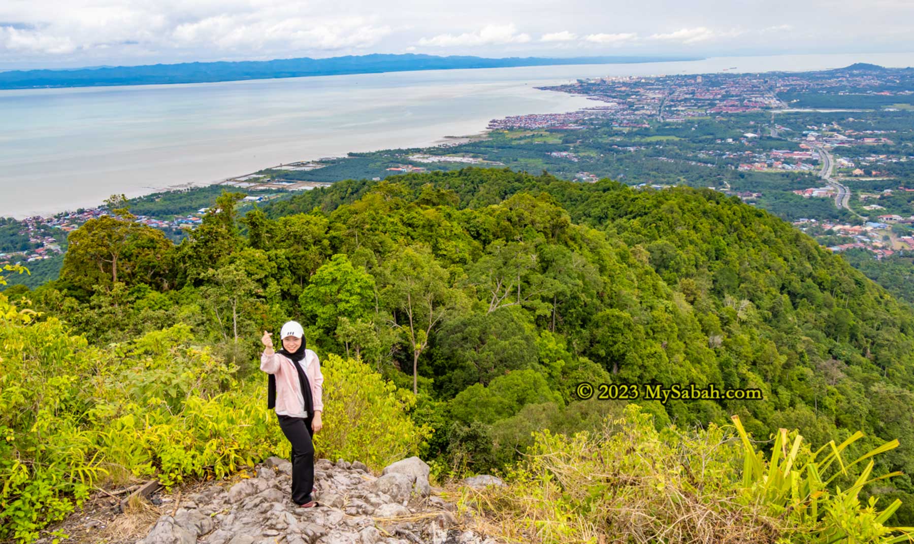
As I approached the peak, the trail’s inclination gradually eased, transitioning into a gentle ridge walk leading to the summit of Bukit Panchang. Hikers who had reached earlier cheered to show encouragement. Among them were Suzan and Priscilla, local regulars who’ve conquered most of Tawau’s hills and mountains.
Big volcanic rocks near the peak
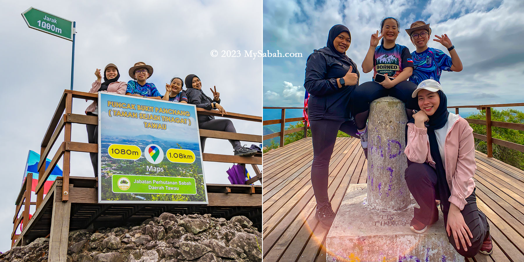
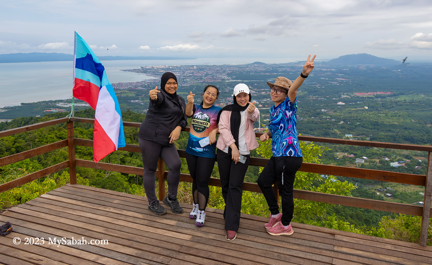
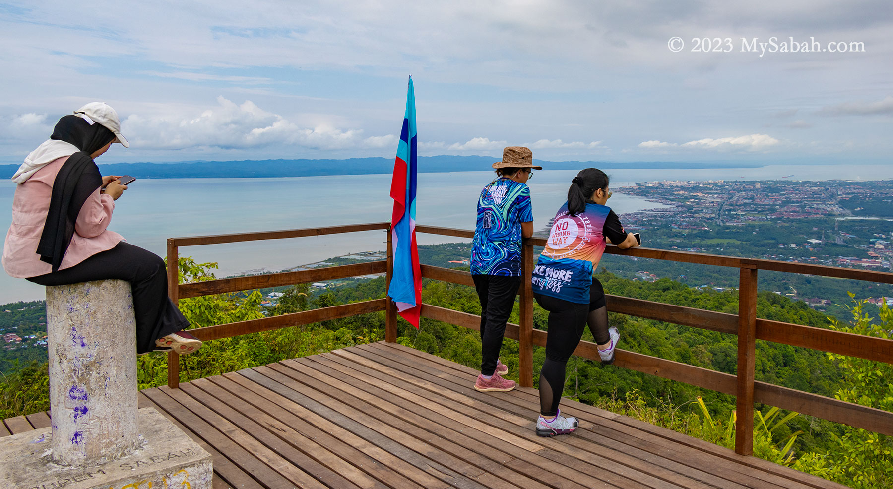
At the peak, a raised wooden platform awaited, inviting a well-deserved rest and the chance to savor the victorious moment from an elevated vantage point. Not gonna lie, the 270 degree panoramic view on the peak is breathtaking. To the left lies the Celebes Sea, while to the right unfolds Tawau town and its surrounding plain. Notably, the sight extends to Pulau Sebatik, an island situated 13 kilometers away, shared nearly evenly between Malaysia and Indonesia.
The last 80 metres of climbing to the peak
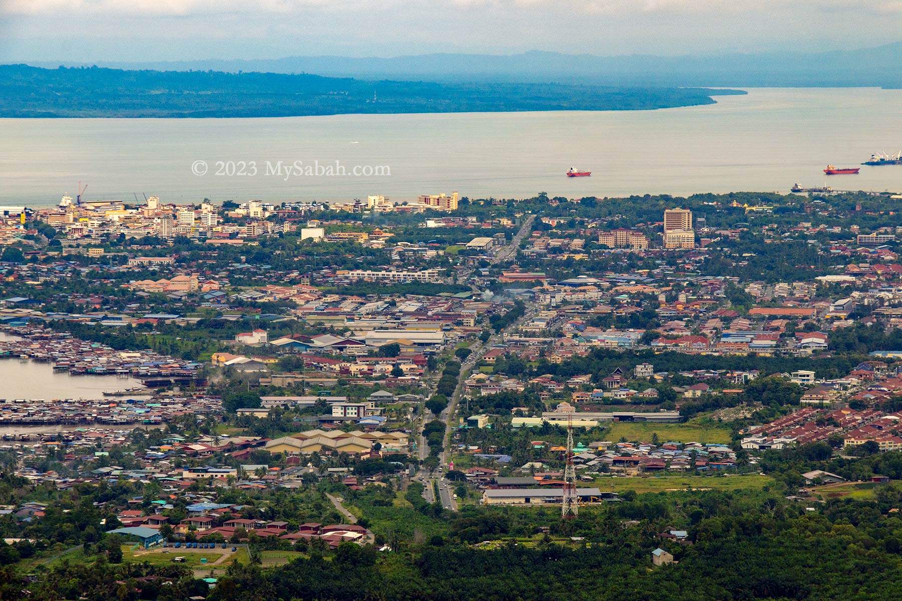
Despite being only 9 kilometers away, Tawau town remains clearly visible even during hazy days. Beyond this bustling coastal town sprawls an extensive area dominated by oil palm plantations, residential areas, and notable landmarks like the Shan-Shui Golf & Country Club.
Group photos on the wooden platform and next to the trigonometrical point on the peak
At 398 meters (1,306 feet) above ground level, the peak of Bukit Panchang offers a higher vantage point compared to both the KL Tower and the Eiffel Tower.
Meeting other hikers on the peak
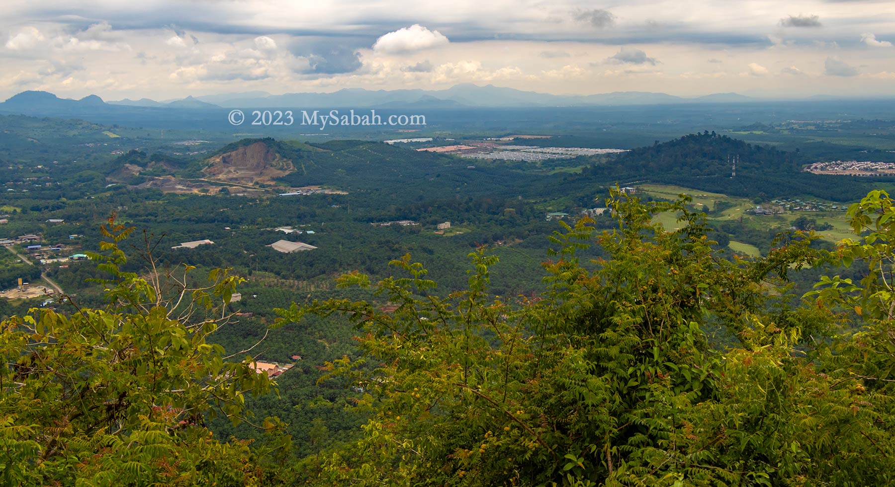
Nestled within this plain are a handful of isolated forested hills, awkwardly encircled by expanses of oil palm. These remaining green hills—Bukit Gemok, Tiger Hill, and Membalua Forest Reserve—stand as vestiges of a volcanic past. I earnestly hope that the people of Tawau will endeavor to protect these fragmented forests, preserving their essence as remnants of past volcanic activity.
View of Tawau town, Celebes Sea and Sebatik Island from the top of Bukit PanchangSadly there is a hill being quarried. You can see Shan-Shui Golf & Country Club at the right.
How to get there
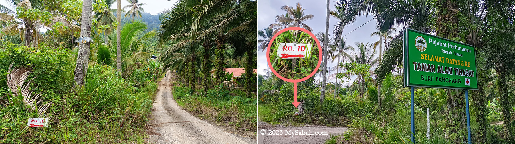
To embark on the Bukit Panchang ascent, navigate towards Tawau town’s Jalan Apas road until reaching Mile 6.5 (Batu 6.5). Look for the junction marked by a white cement signage adorned with prominent red lettering that reads ‘Selamat Datang Ke Kau Sing (高昇)’—translated as ‘Welcome to Kau Sing.’ Turn into this junction to proceed onto a narrow and straight road.
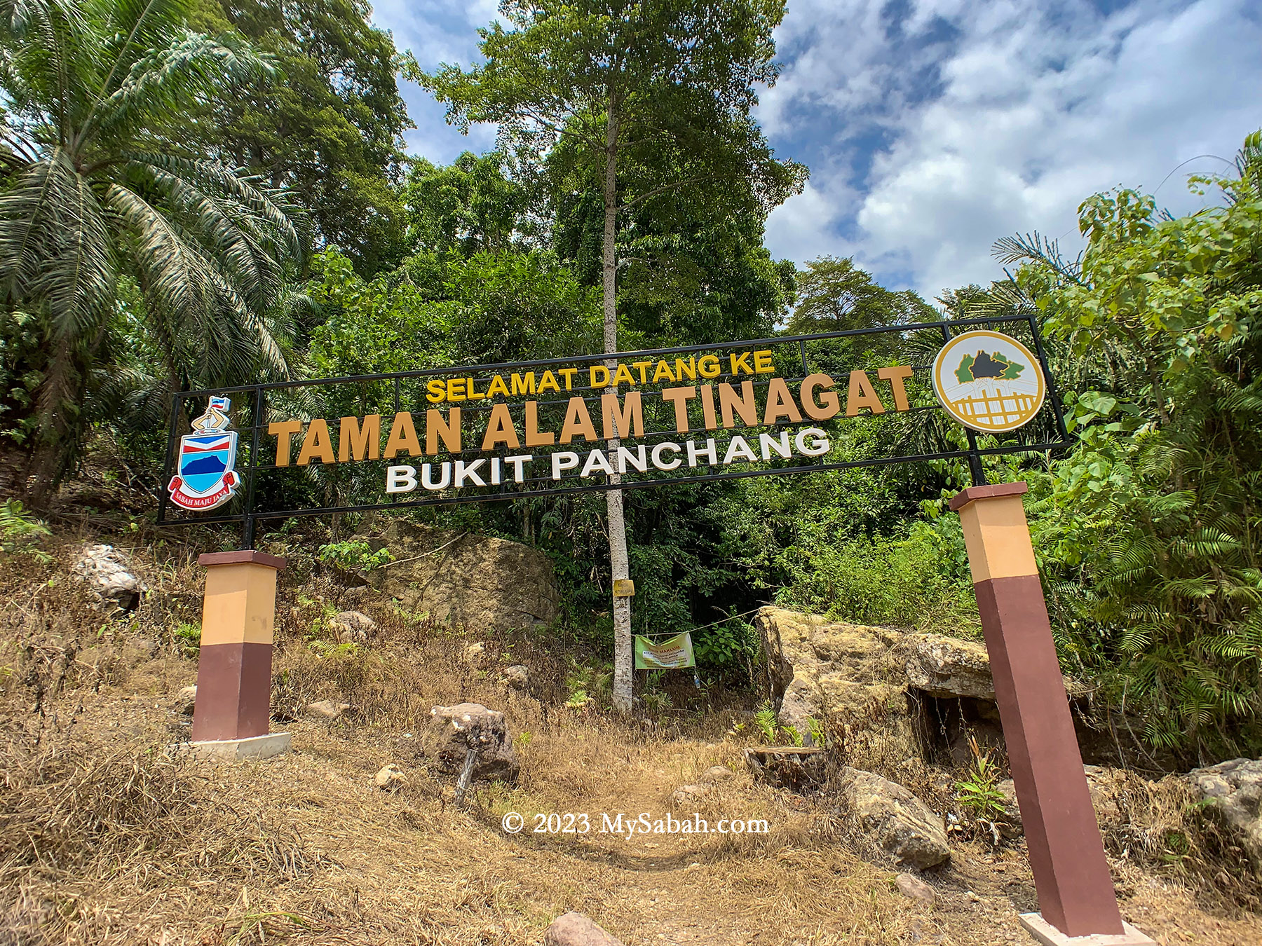
Junction No. 10 and the signboard of Bukit Panchang at the starting point
As you drive, maintain a slow pace and keep an eye out on the right-hand side for a small junction labeled No. 10. Adjacent to it (see Location Map), there’s a coloured signboard displaying ‘Taman Alam Tinagat’ (means Tinagat Nature Park). Park your car safely along the roadside, then proceed by foot towards the junction featuring a gravel path that leads directly to the foothill (forest station).
The plain behind Tawau town
Upon entry at the Sabah Forestry station, visitors are required to pay an entry fee of RM5 for Malaysians and RM15 for foreigners. Additionally, hiring a guide is mandatory at RM50, and one guide can accompany up to five climbers. For optimal savings, a team of five climbers can share the cost of one guide. Even solo climbers must pay the full RM50 fee for a guide.
Viewpoint platform and trig point on the top of Bukit Panchang
Unauthorized entry is considered illegal encroachment and can result in severe penalties. Offenders could face fines up to RM50,000, imprisonment for up to 3 years, or both.
A huge volcanic boulder on the peak of Bukit Panchang
Tinagat was once a popular hiking destination among locals. However, the number of regular visitors has significantly declined due to the added guide fee. While Bombalai Hill could be a viable alternative, its distance from Tawau town makes it less accessible for many.