Tag Archives: history

Antanom Museum (Muzium Antanom Tenom)

Antanom Museum, the History of British Vs. Borneo Headhunters

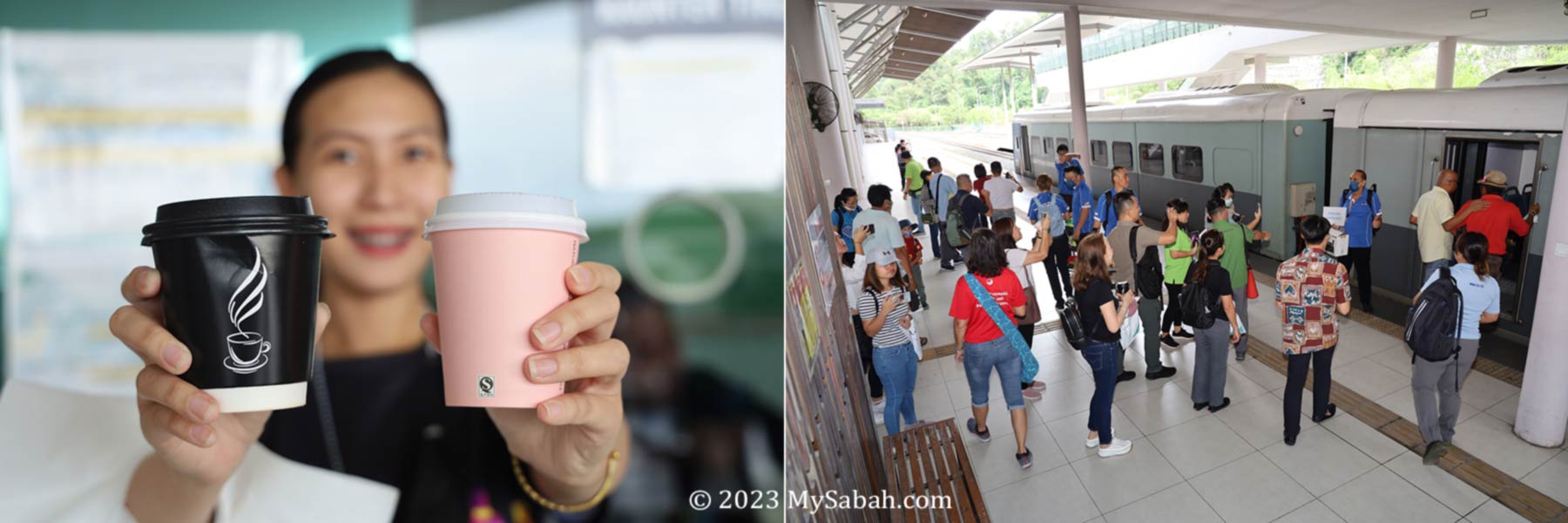
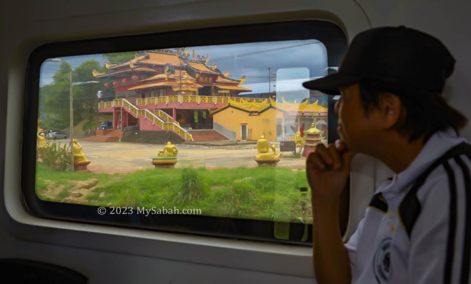
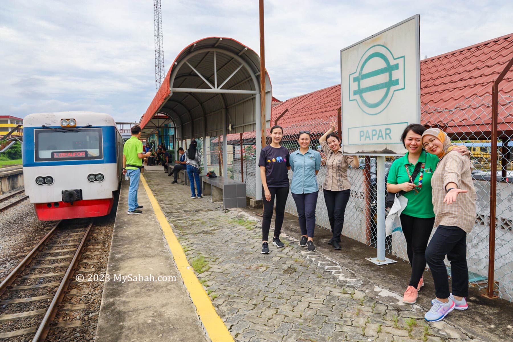
Tenom, nestled in the rustic interior of Sabah, serves as the terminus for Borneo’s railway, and is renowned for the beloved Tenom Coffee, a favorite among both Sabahans and tourists. Interestingly, both the coffee and the railway have roots dating back to the colonial era, introduced by the British over a century ago.

Padas River is the most important river of Tenom. It floods huge catchment area of 3,500 square miles and brings new layer of fertile alluvial soils after it recedes.

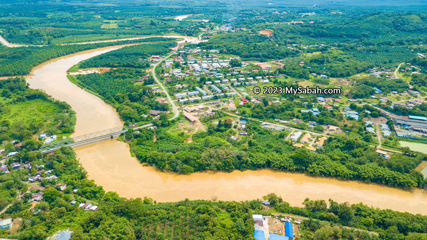
Before the British arrived, Tenom was merely a burial ground along a stream at Padas River, known to the Murut villagers as “Tanam.” Recognizing the fertility of the alluvial soil left by the river’s floods, the British “tanam” (means plant in Malay language, pun intended) some cash crops such as tobacco, rubber and coffee in the 1880s.

Left: Tenom during 1910. Right: Tanam, the burial ground of the Murut

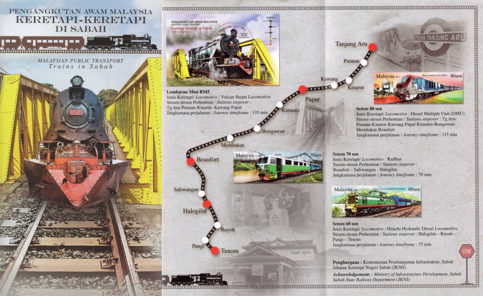
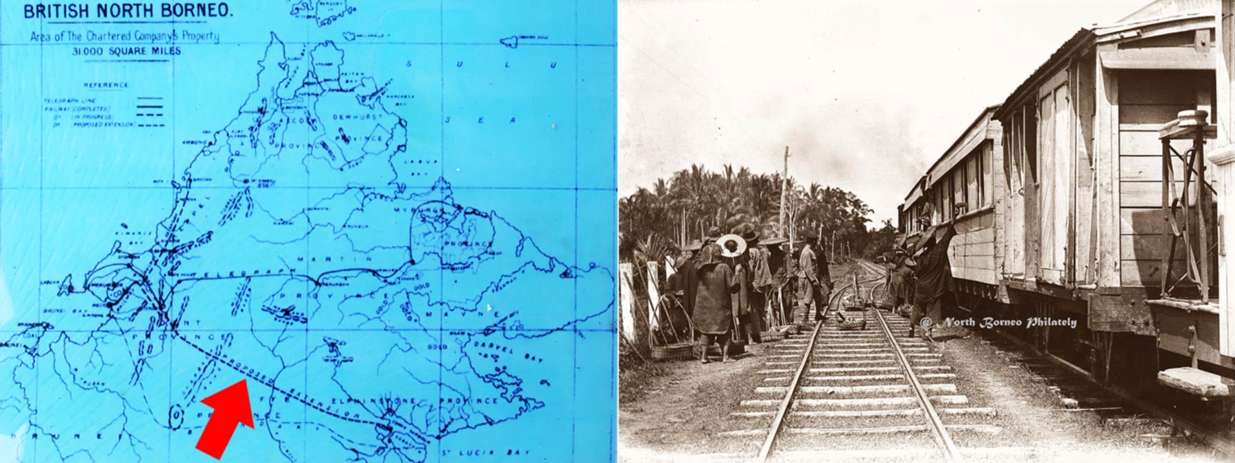
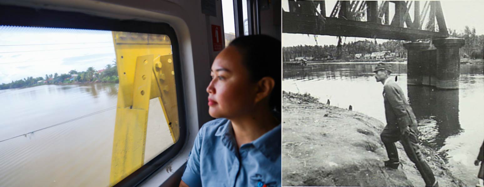
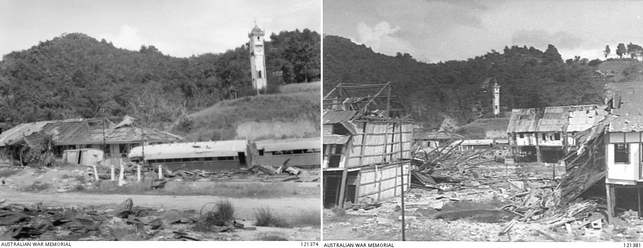
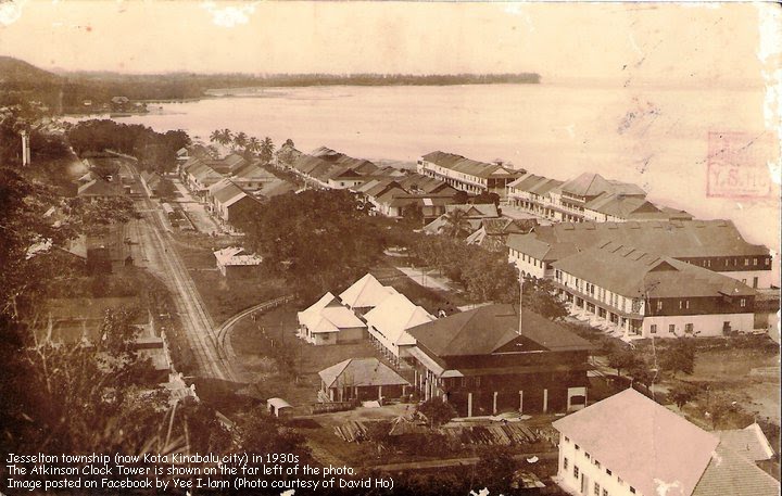
Therefore, a heavy duty transport was badly needed to ferry tons of products from the interior to Jesselton (now Kota Kinabalu City) about 150 Kilometres away, led to the completion of a 48-kilometer railway connecting Tenom to the coastal area’s main railway in 1905. However, improved accessibility triggered more conflicts between the white settlers and the Murut, former fearsome headhunters of Borneo, turning Tenom into one of Sabah’s most storied towns.

Old photograph of train terminal in Tenom

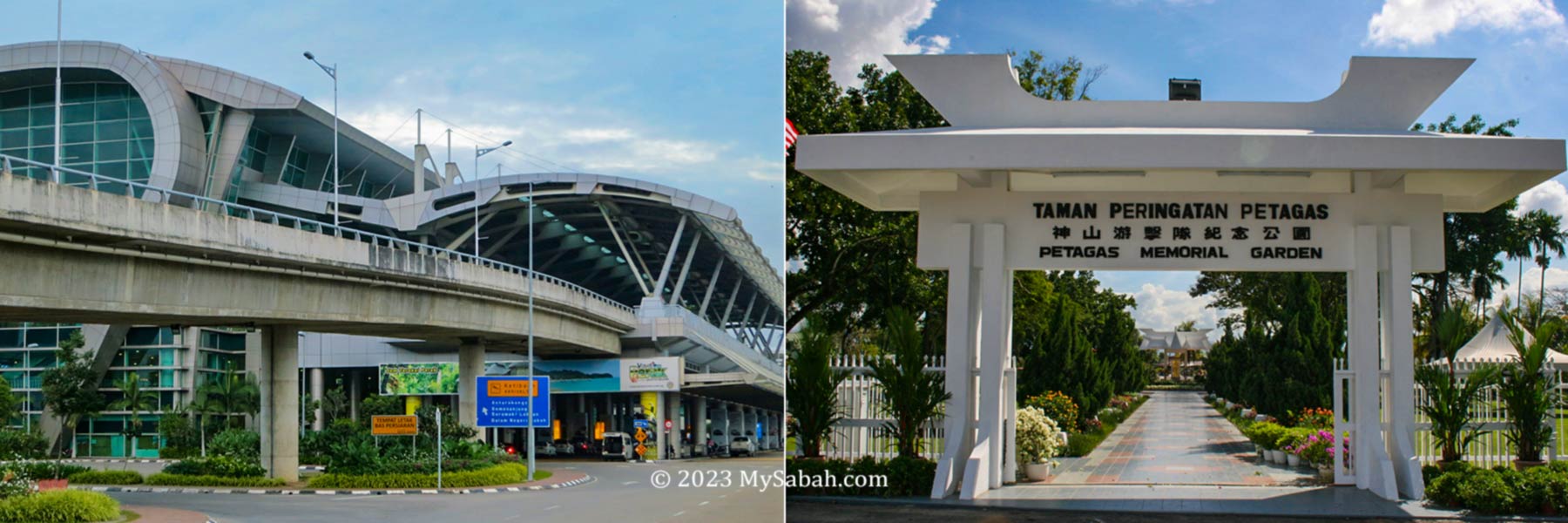
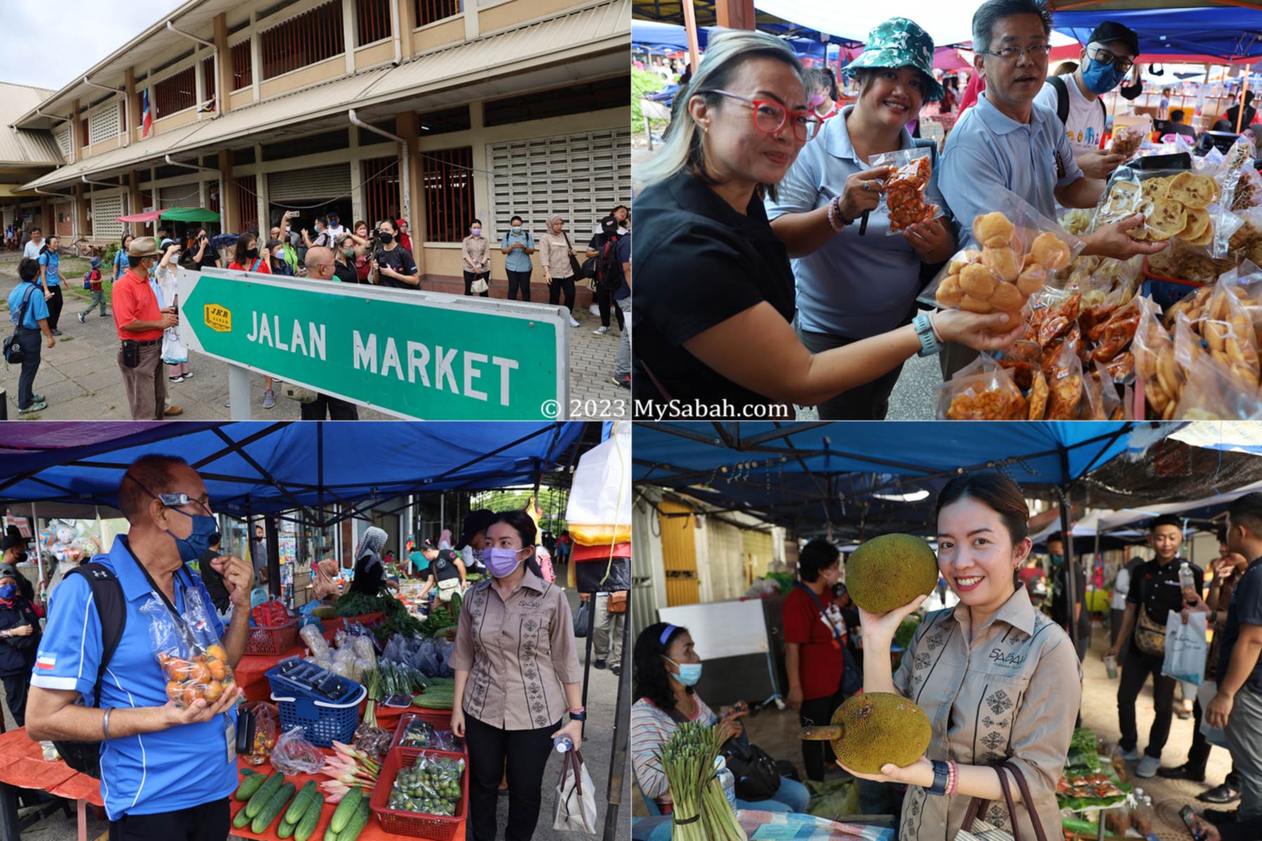
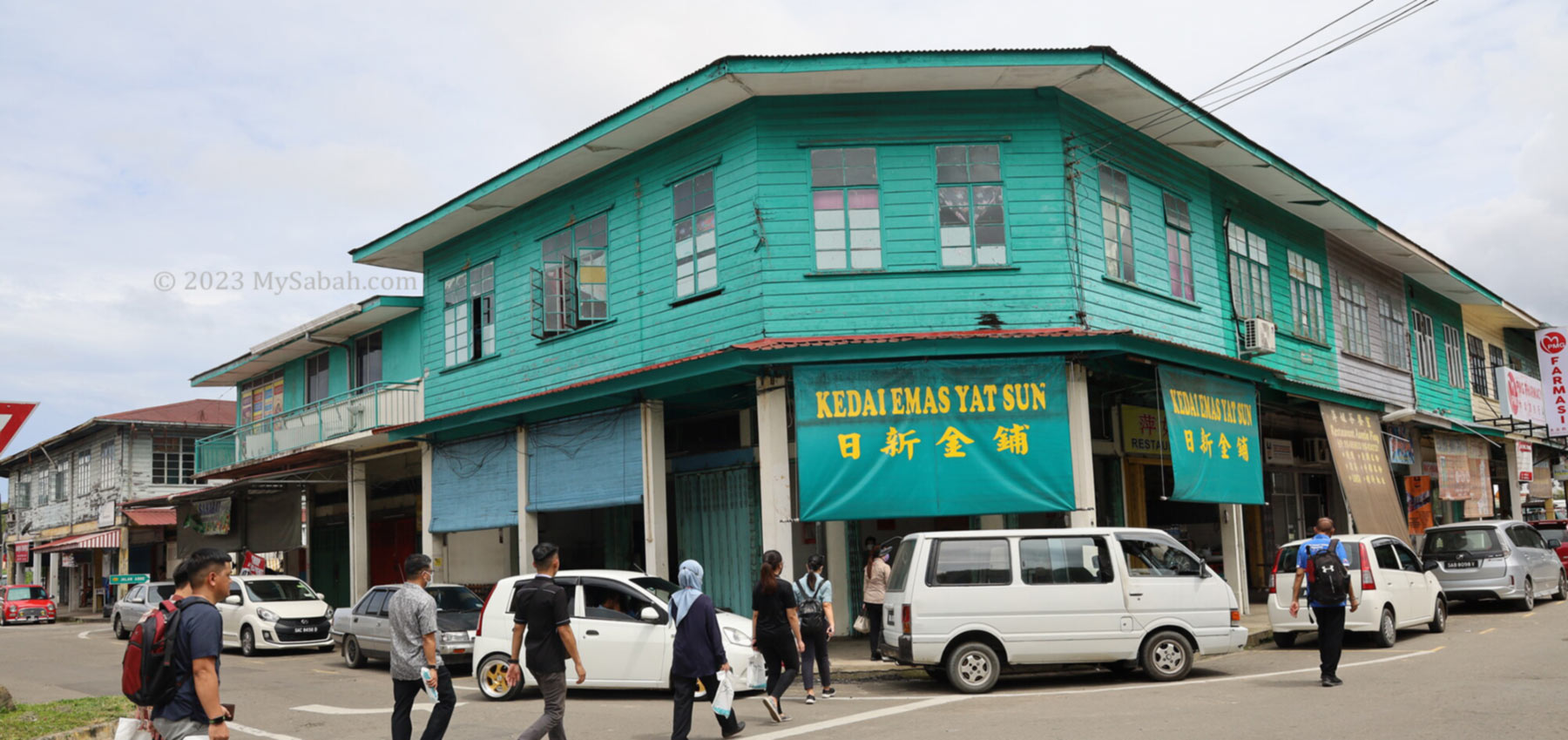
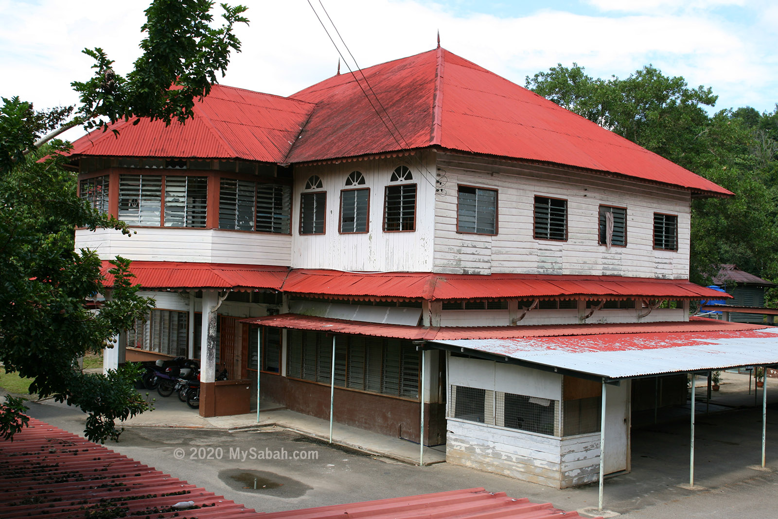
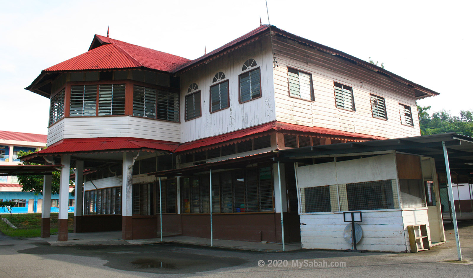
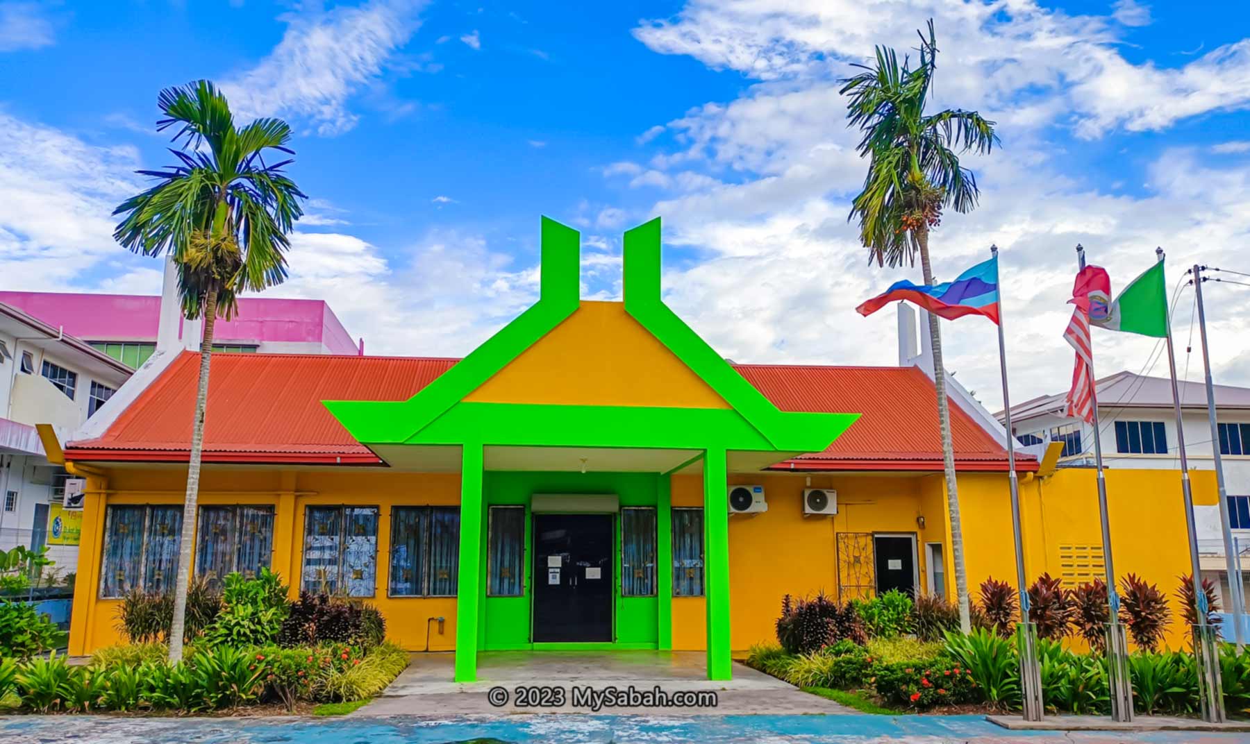
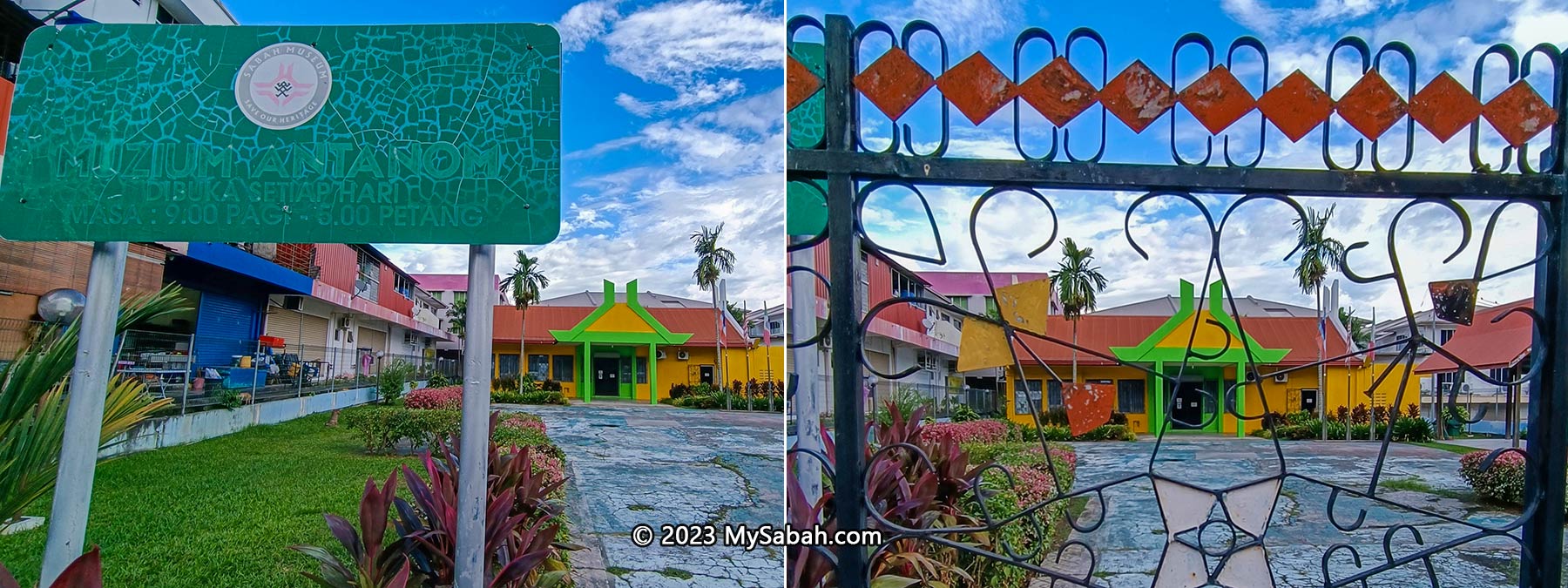
After you enjoy the popular Tenom dishes such as maize chicken and spring rolls, take a stroll through Tenom town. At the town center stands the Antanom Museum, named after Ontoros Antanom, the renowned Murut warrior. Functioning as a community museum, it features a small gallery showcasing the historical traces of the British, Murut, Chinese, and Japanese in Tenom.

Antanom Museum (Local Name: Muzium Antanom)

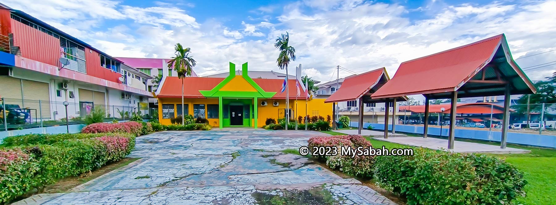
Established in 2009 on the grounds of a former European cemetery, the air-conditioned museum offers visitors a comfortable space to explore information and nostalgic photographs displayed on rows of exhibit panels. Most writings are accompanied by English translations.

Exhibition panels and gallery in the hall of Antanom Museum

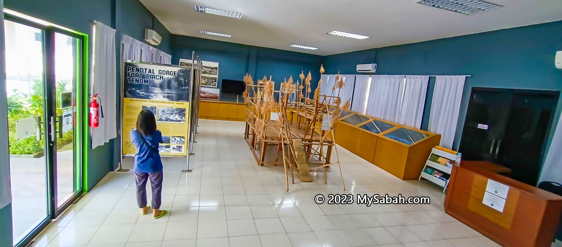
While the size of the museum hall is less than that of a basketball court, a casual browse takes around 30 minutes. However, for those deeply interested in detailed exploration, it may extend beyond an hour. The museum exhibits fall into five main categories.

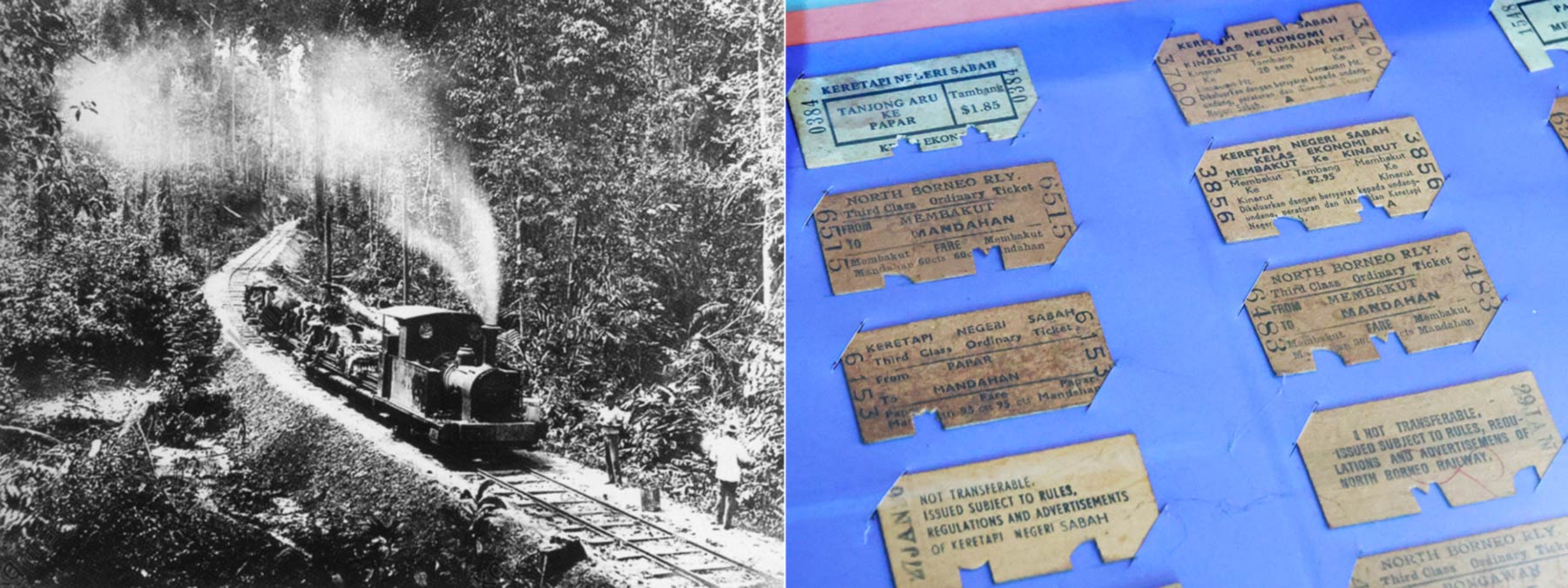
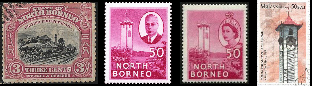
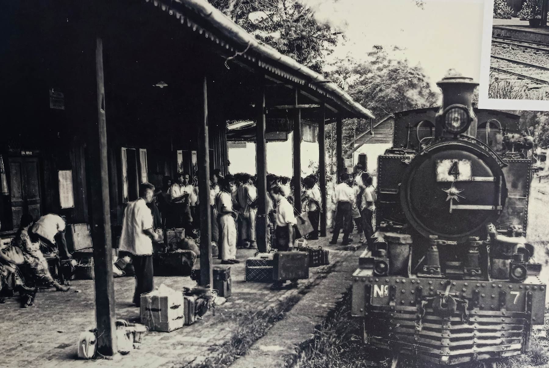
1) History of North Borneo Railway

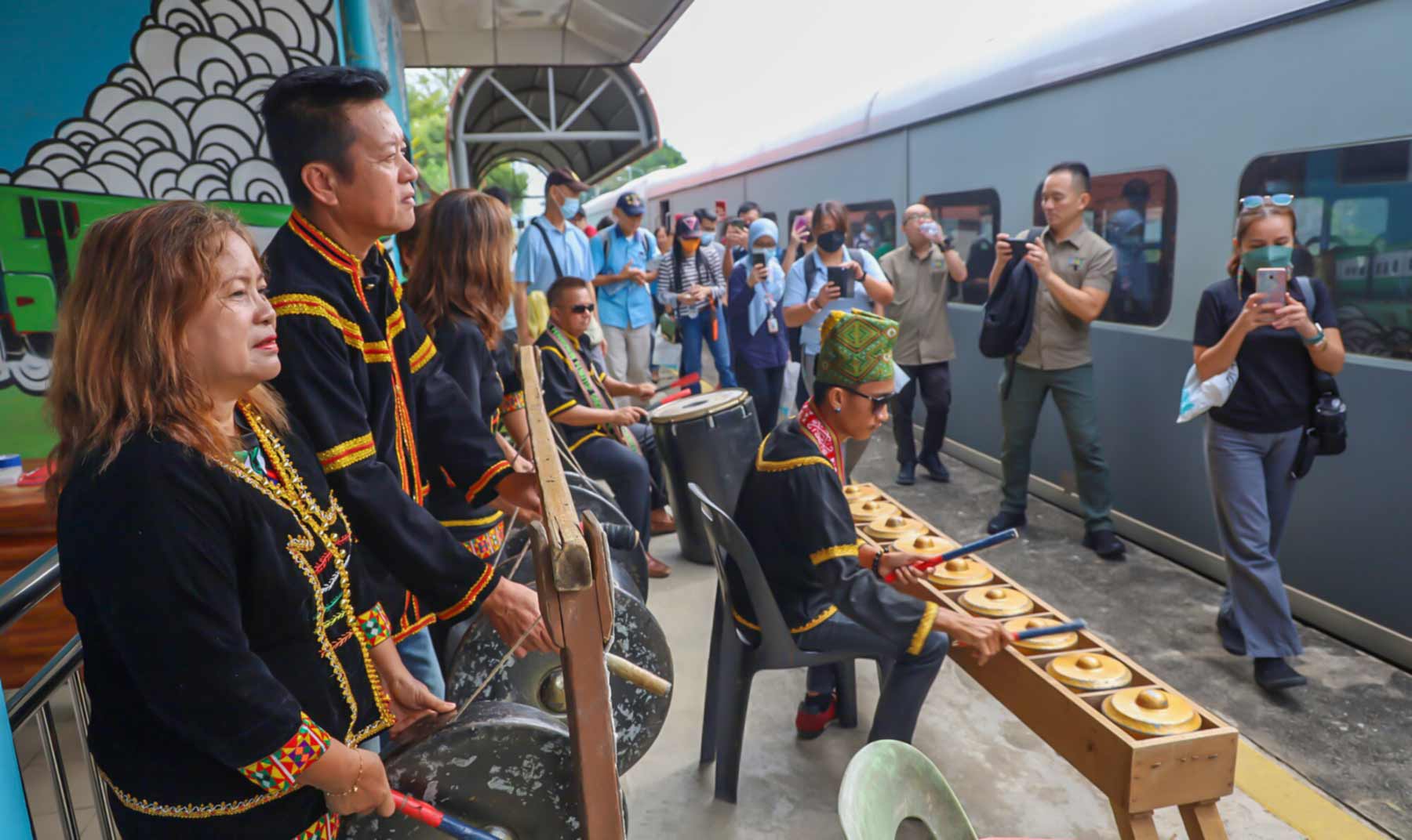
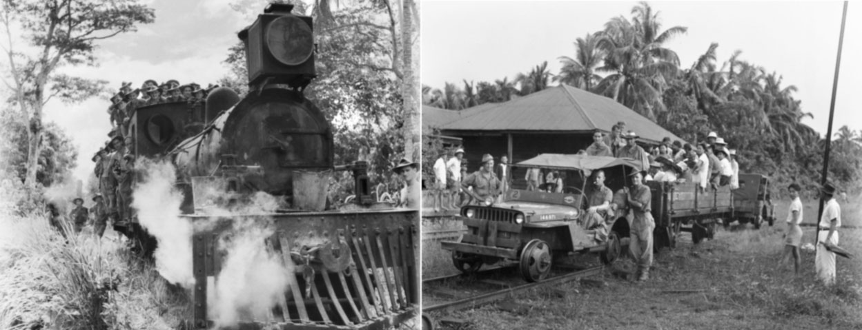
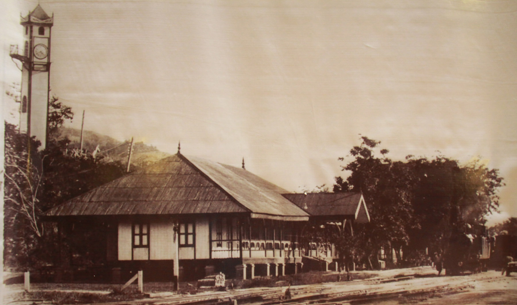
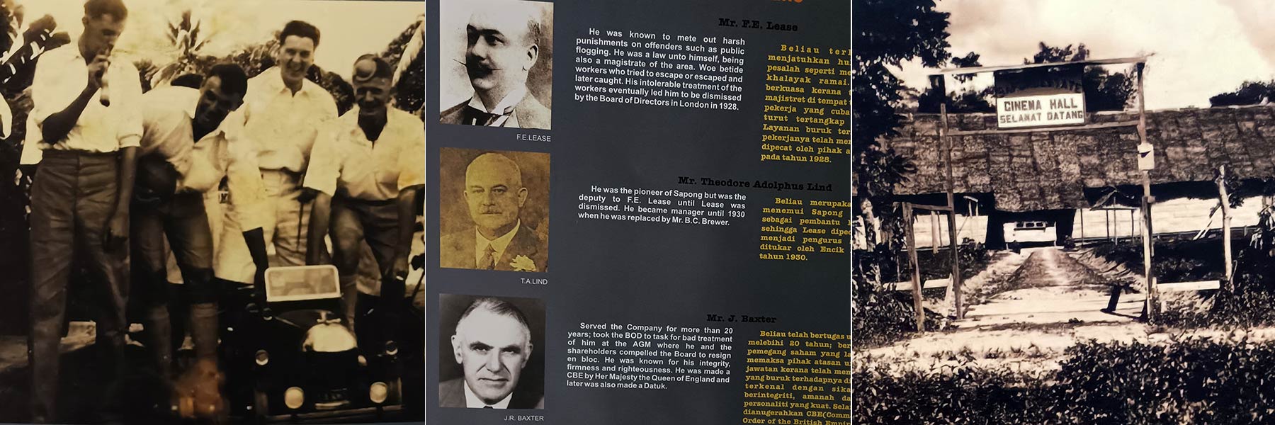
Learn about the legacy of the British colony in Sabah through the prominent railway network. The first railway in North Borneo began in 1886 near Weston, serving as Sabah’s economic lifeline. In 1905, Tenom joined the backbone railway of the more prosperous west coast, facilitating the transport of agriculture products.

Pictures of North Borneo train stations and locomotive models in the past

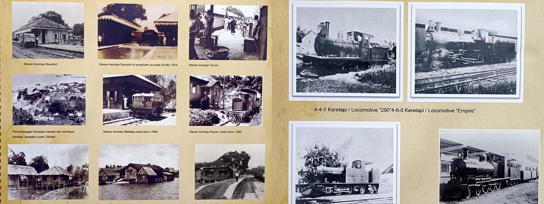
For the next 60 years, this railway was the only mean of transport from the interior to the west coast. Loads after loads of tobacco, coffee, soy beans, fruits and rubber were able to be delivered from Tenom to the port of Jesselton. Because the natives were exposed to the civilized west, they learnt to use money and dress more decently.

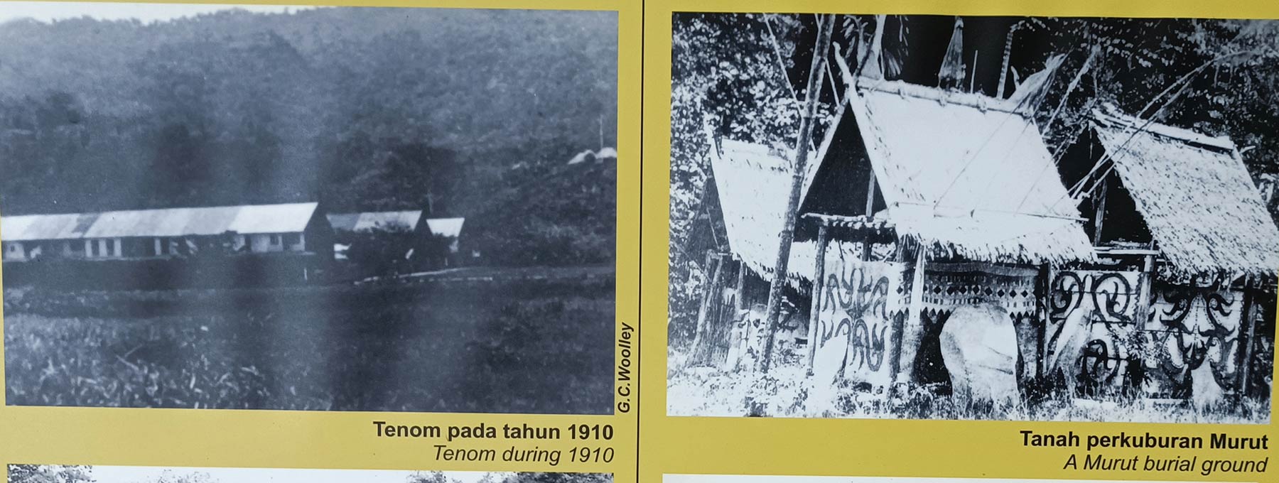
2) Down Memory Lane Tenom

Discover the evolution of Tenom, officially named in 1906. Before that, it was known as Fort Birch, named after Governor E.W. Birch (1901-1904). Some believe that Tenom was used to be an ancient lake, then Padas River cut a gorge that drained away the water, leaving behind nutrient-rich and moist alluvial soil that is perfect for planting.

Exhibition on history of Tenom

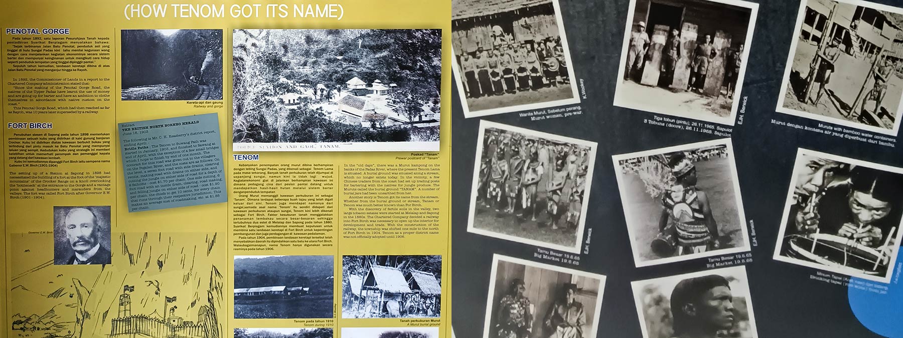
In 18th century, British, German and Dutch planters developed Tenom as a farming district. In 1915, 5,000 Chinese and 5,000 Javanese were imported as labours to work there. It’s a huge number, consider the population of North Borneo population that time was only 70,000. During World War II, Japanese built a military HQ in Tenom in early 1944, with 30,000 Japanese billeted in the estate.

Some interesting photos of the past. From left: Christmas Party in 1930s, British managers, cinema in Sapong (1950s)

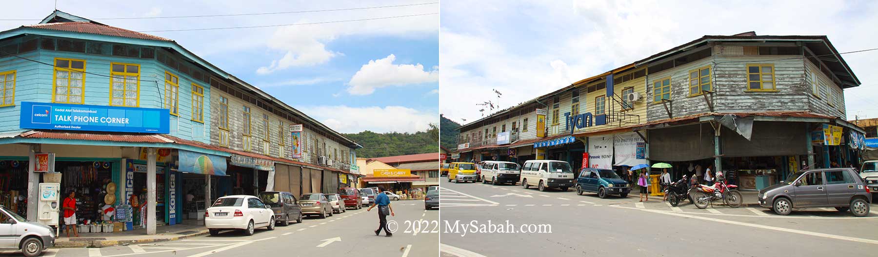
This section presents various aspects of Tenom’s history, covering people, landmarks, plantations, sports, festivals, old shoplots, and events.

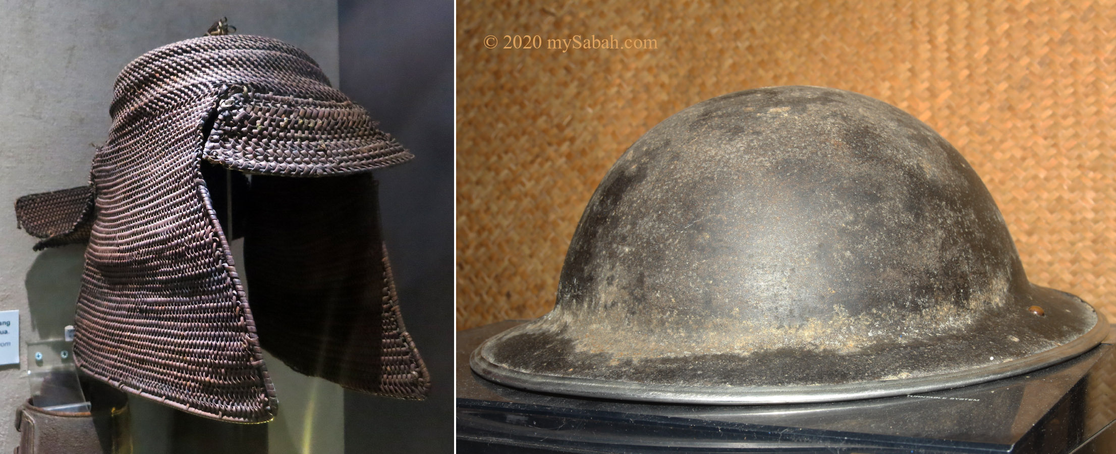
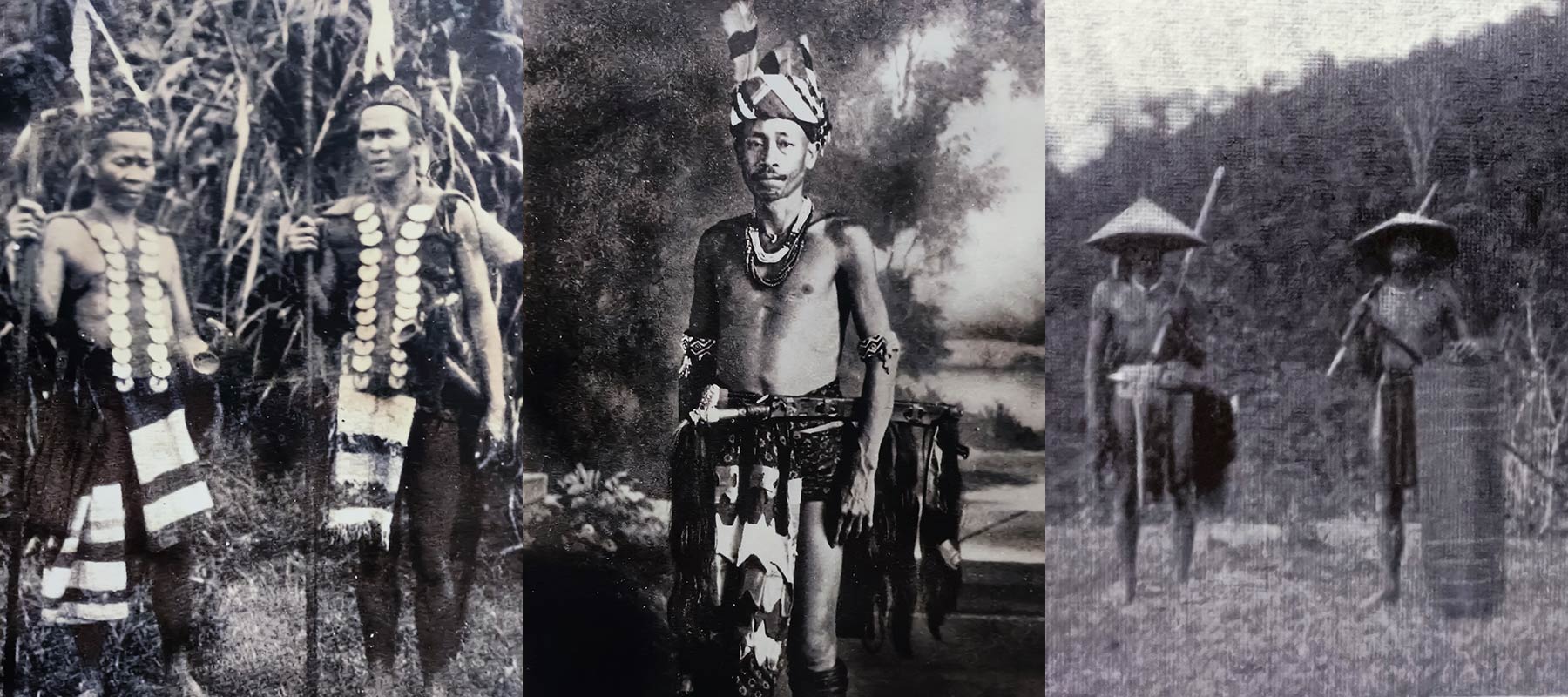
3) Dark History of Headhunting

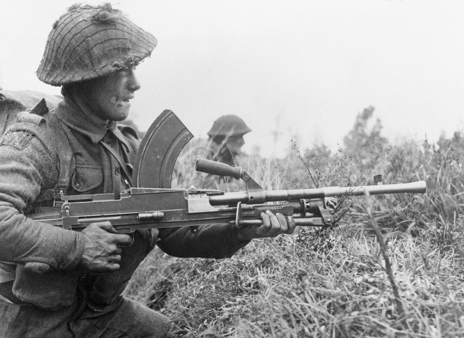
You want to be respected? You want a wife? If you were a Murut man more than 150 years ago, you must bring back the heads of the enemies to earn them. Before British government banned headhunting in 1883, owning many skulls was a status of bravery among Murut, who believed that by doing so, they would possess the power of the victims.

The headhunting section in Antanom Museum

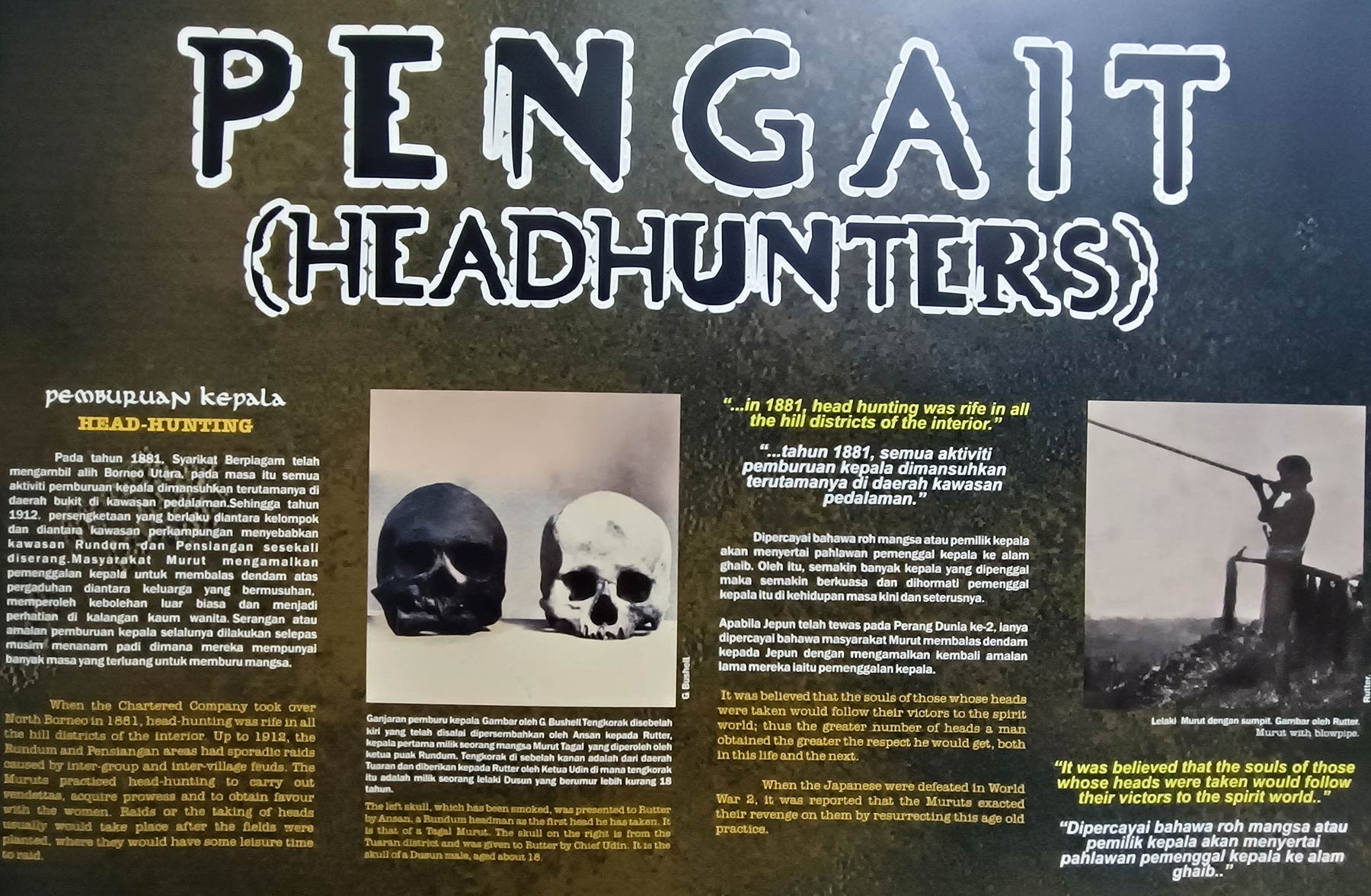
However, many natives still practiced headhunting even after the ban. They went headhunting when they needed sacrifice for a new bridge, house, or farmland. It’s cool that this museum has good collection of the photos of headhunters with their “trophies”.

Old photos of Murut people proudly showing the skull like a trophy

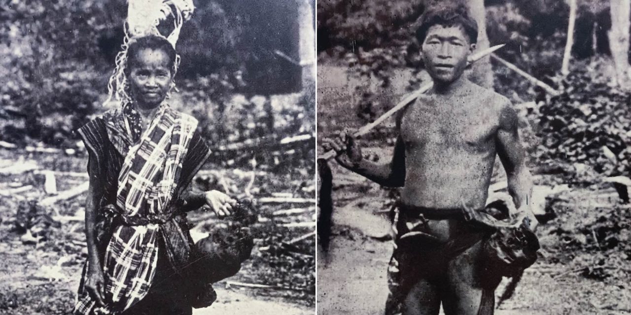
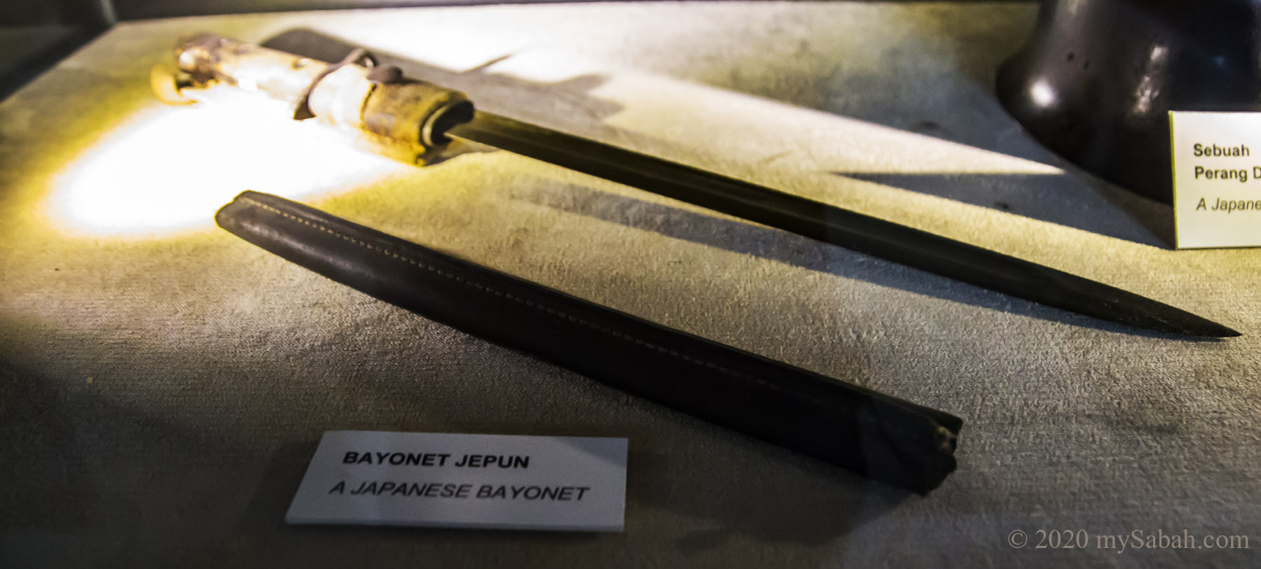
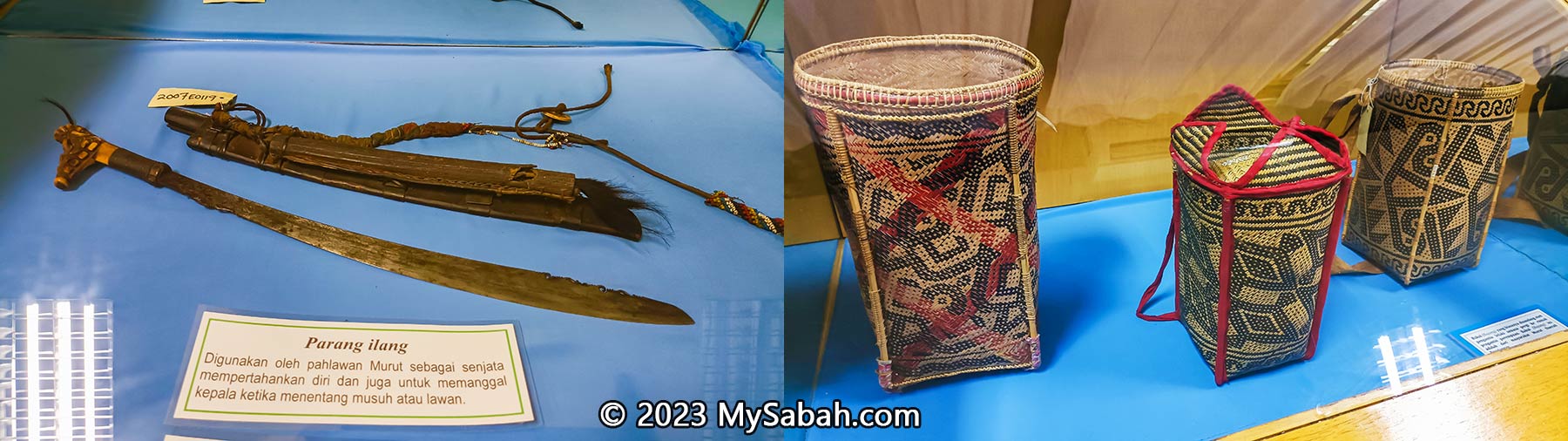
The gallery also highlights mysterious landmarks associated with headhunting and displays headhunting weapons such as swords, blowpipes, and poison darts.

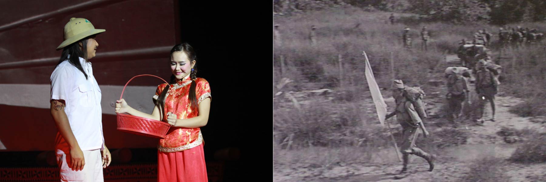
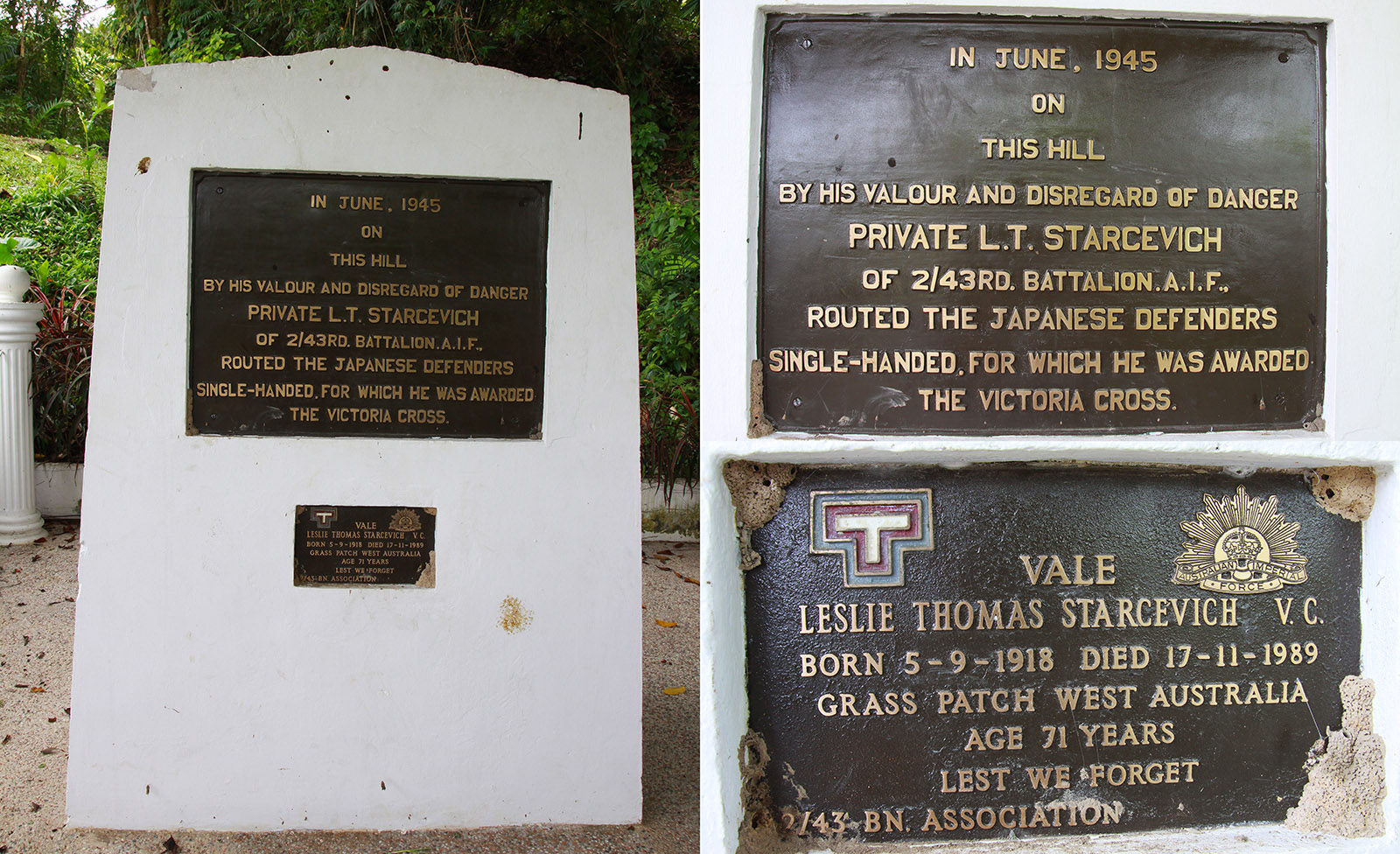
4) Ontoros Antanom and Rundum Uprising

Explore Tenom as the stronghold of Muruts, the third largest indigenous group in Sabah. They were enraged by the meddlesome British who stepped into their land and imposed all sorts of laws and taxes that they never heard of, just to list some, poll tax, tapai (wine) tax, forest clearance tax, headhunting ban, and forced labour. These regulations affected the cores of their culture and livelihood.

The story of Ontoros Antanom and Rundum Uprising 1915 is one of the most important chapters in Sabah history

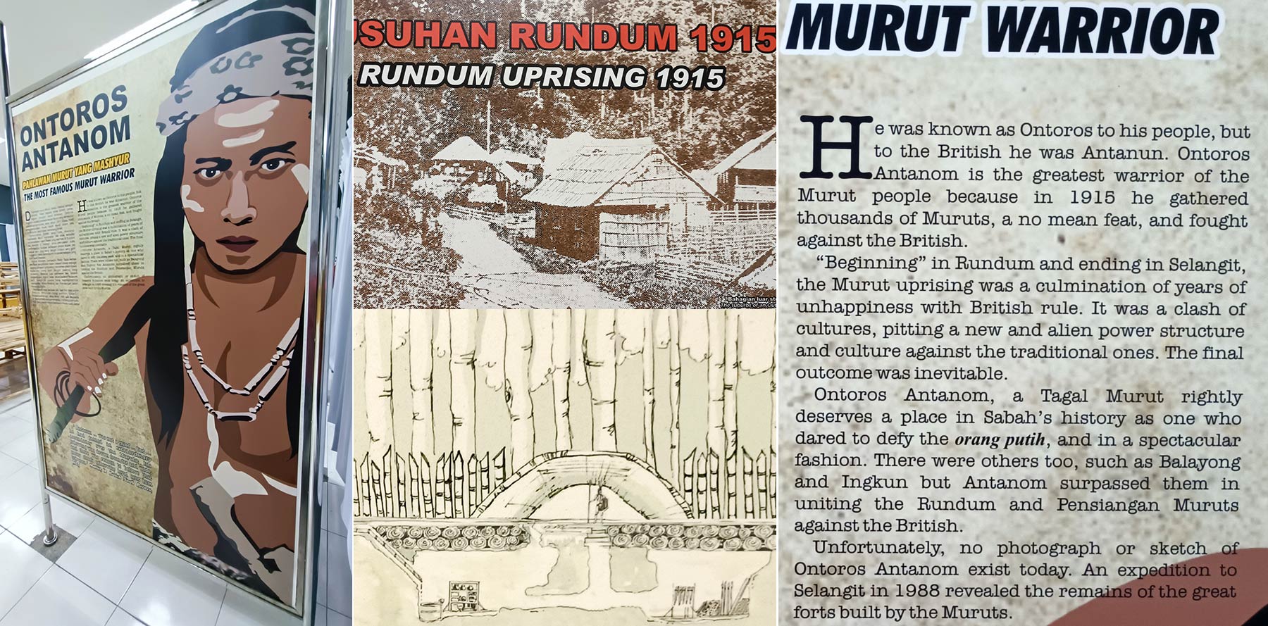
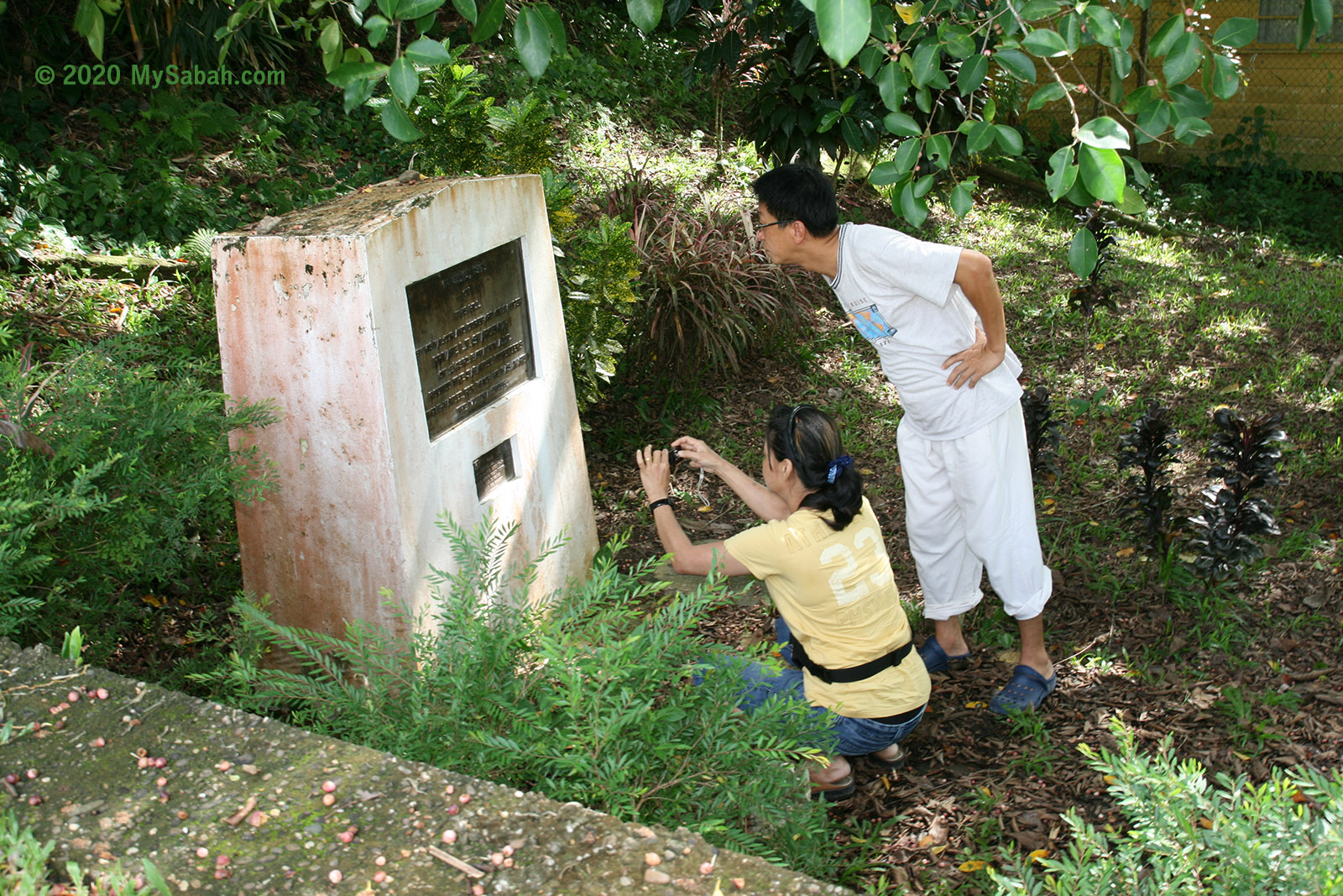
Under the leadership of Ontoros Antanom, thousands of Murut warriors from different tribes were united and attacked the British office in Rundum in Feb 1915. The rebellion lasted about two months until Antanom was captured and executed on 17 April on the same year. Rundum Uprising is one of the biggest battles in Sabah history. Though Antanom lost, he is honoured as the hero of Sabah, and his legend is being told in this museum.

British force was facing about 2,000 Murut fighters like these in Rundum Uprising

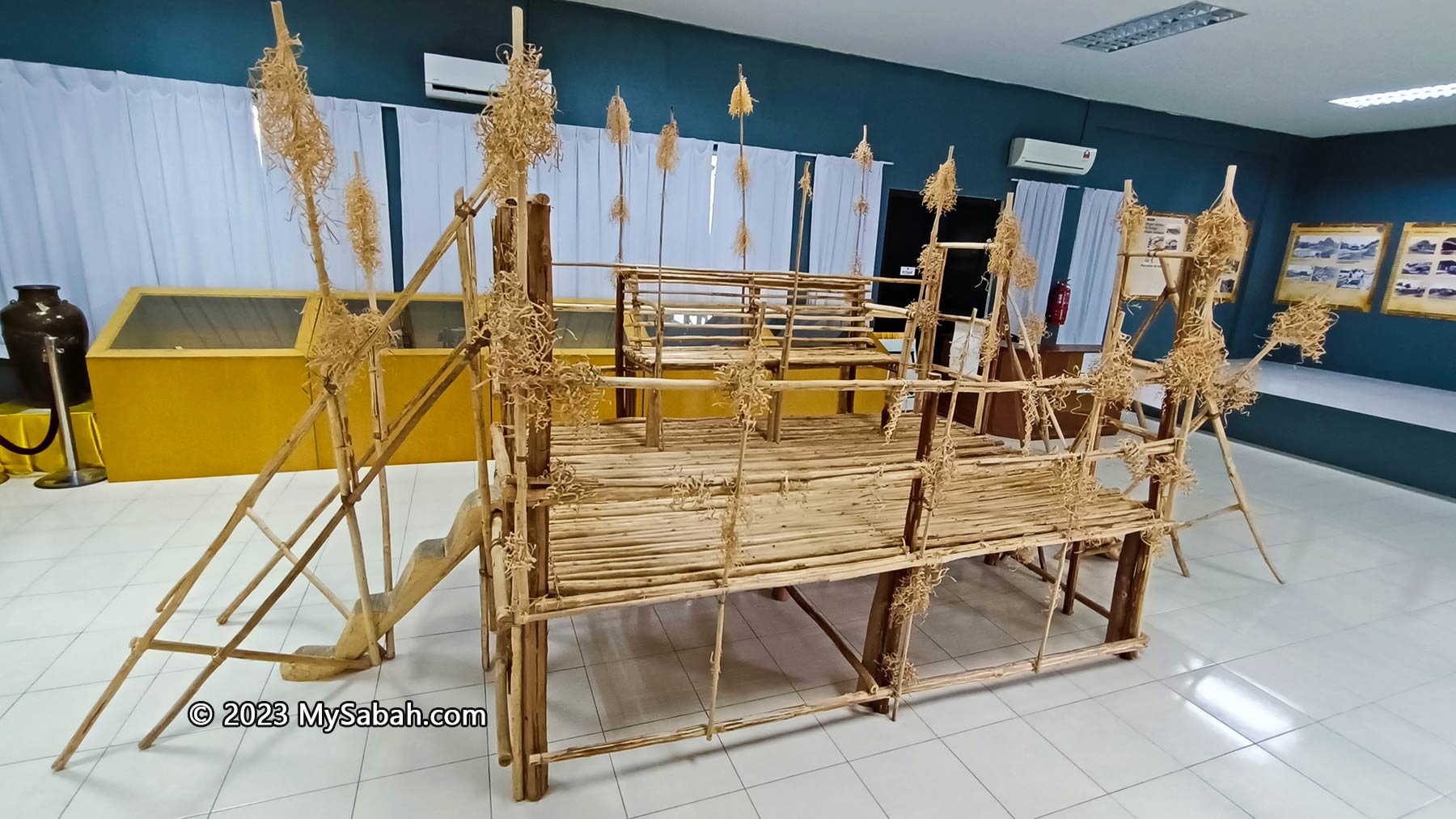
5) Artifacts and Handicrafts

In the middle of the hall is a wooden platform called Sangiang, the seats for wedding couple of Murut Tahol. Though it is made of from tikalis wood bound with rattan vines, the price of sitting on it is exorbitant, as the groom would need to pay his debt throughout his lifetime. In addition to bride price, the man needs to pay for the week-long feast.

Sangiang, a wooden throne for the wedding couples of Murut

At a corner are some handicrafts and artifacts on display. Murut women are skillful in making handicrafts with intricate patterns and elaborative weaving from basic materials such as bamboo and rattan. Just spend some time to appreciate the basket, mats and hats they make. Intrigued by the headhunting stories? Check out the headhunting sword and blowpipe. The antique ceramic jar may look ordinary but it’s a highly priced heirloom in the past.
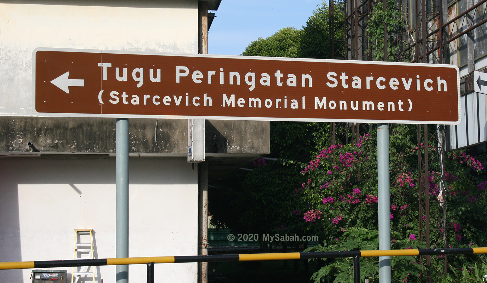
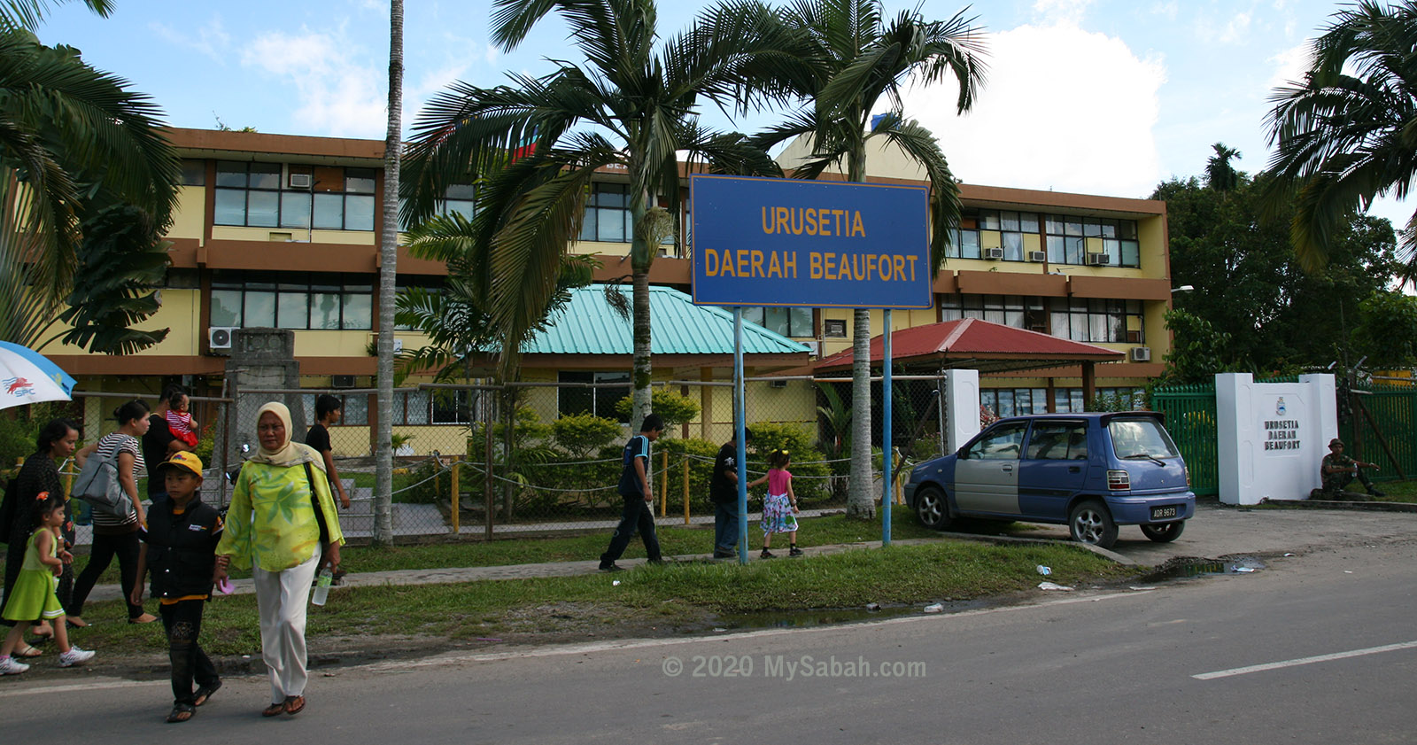
Some artifacts and handicrafts displayed in the glass cases

How to Get There

Antanom Museum is located in the town centre of Tenom (see Location Map) and highly accessible by asphalt road. It’s open from 9am to 5pm every day. The entrance is free.

Normal tourists would not notice Antanom Museum because the gate is closed and the signage wears out

Tel: (+60) 087-339126
E-mail: Muzium.Sabah@sabah.gov.my
Facebook: @muzium.sabah.1
Website: museum.sabah.gov.my

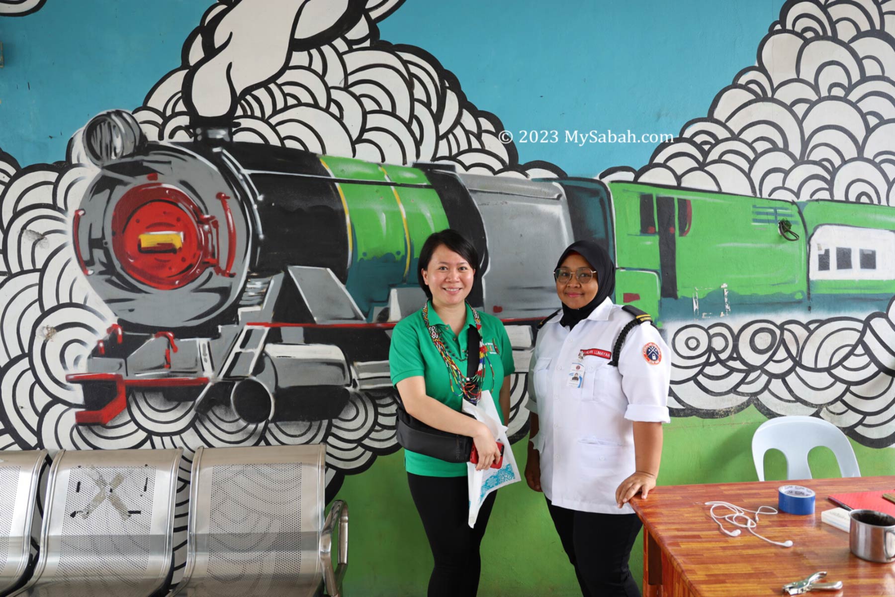
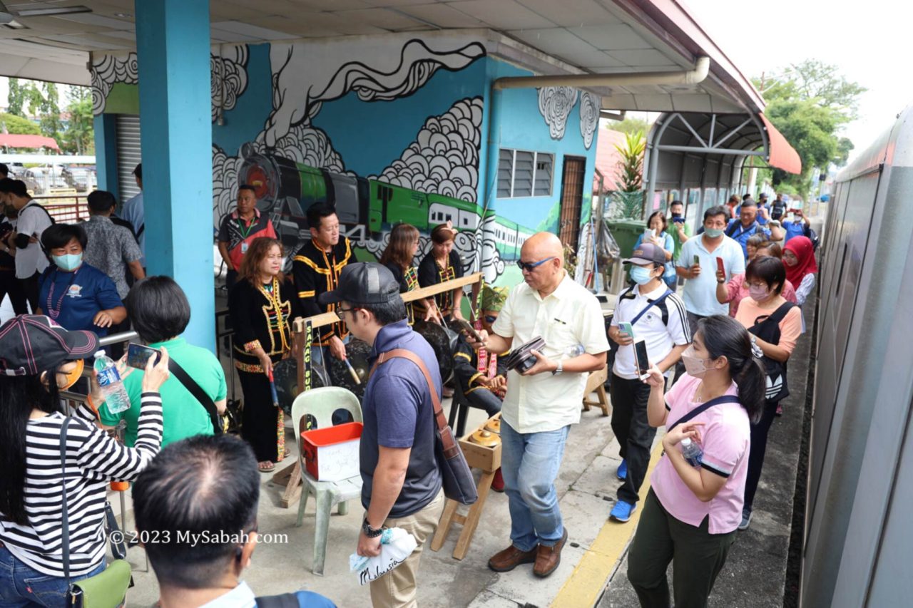
Photos taken in Tenom, Sabah, Malaysia Borneo

North Borneo Train Tour down memory lane

From 1888 to 1963, Sabah (then North Borneo) was colonized by British empire, as part of their economy plan to build a kingdom that never sleeps. The construction of railway in 1896 is a major development that transformed the wild West Coast of Sabah into a belt of prosperity.

Left: The first train in North Borneo (photo taken on 3 Feb 1898). Right: the train tickets of old days (displayed in the Train Gallery of Sabah Museum)

Having more productive lands means earning more wealth, the 134-kilometre Borneo railway helps to open up more lands and forms the lifeline of west coast. Cargo after cargo of tobacco, rubber, paddy, coffee, timber and other agricultural products were transported from the fertile inland to the harbour of Jesselton (now Kota Kinabalu City or KK). Colonial townships such as Kinarut, Papar, Beaufort and Tenom also sprouted up along the railway.

Stamps of “Trains in Sabah”, issued on 28 Dec 2015 by POS Malaysia. The yellow steel bridge in background is a historical structure in Papar town.

The success of the tobacco industry between 1880 and early 1890 created a high demand for land, so was the rubber bloom in early 1900s. Thousands of China immigrants were imported into North Borneo in early 19th century to construct the railway and to farm on the new lands. North Borneo Railway has been operating until today and still remain as the only railway on Borneo island.

Left: the train service would be extended to Tawau in east coast in initial plan. Right: Food sellers (usually selling boiled eggs and dumpling) at the Papar train station (photo taken by G.C. Woolley on 27 May 1910)

Though it’s renamed to Sabah State Railway after the formation of Malaysia, locals always view it as a legacy of British. Our great grandparent generations always have a lot of stories to share about the locomotive steamer, which holds a special place in their hearts. Indeed, North Borneo railway is a memory lane with history that involves Bruneians, British, Japanese, Australians and forebears of Sabah Chinese.

The hundred-year-old North Borneo railway is a memory lane full of stories

“It is a well known fact that wherever the British went, they planted flowering trees as well as built railway lines.” — Chung Mui Kong, “Little Snapshots”

North Borneo Train Tour

Though Sabah’s railway towns are quiet and peaceful places nowadays, they were flourishing and eventful towns in the past. The North Borneo Train Tour is like a time machine trip that brings you back to these places full of stories, some with tears and blood. The locals can join this nostalgia and fun ride to learn the past.

Left: coffee break before departure. Right: start of North Borneo train tour to experience the bygone era of British North Borneo

If you haven’t been on a train ride, it’s a must-try (do bring your kids). The half-day tour starts at 8am at Tanjung Aru train station. Before boarding you will enjoy some Sabah coffee and light refreshment. Professional tour guide(s) will join you onboard as the storytellers who connect you to the happening along the railway.

Professional tour guide sharing the stories and history of North Borneo railway and towns

The passenger carriages are air-conditioned with comfortable seats. You can enjoy the scenic countryside view through the glass window. In old days, the passengers would not wear white shirt because it would be smeared by ashes from steam engine that was powered by burning firewood. The following are some interesting landmarks and major happening being shared.

“If history were taught in the form of stories, it would never be forgotten.” — Rudyard Kipling

Petagas

The Kota Kinabalu International Airport (KKIA) would be the first landmark that catches your attention. KKIA receives million of visitors every year and it is the busiest airport on Borneo island. Over 90% of tourists come to Sabah by air.

Left: Kota Kinabalu International Airport (KKIA). Right: Petagas Memorial Garden

Opposite to KKIA is Petagas War Memorial Garden with temple-like white arch. In 1944 during World War II, a group of 176 Kinabalu guerilla members launched Double-Tenth Revolt to fight Japanese for control over Jesselton. Unfortunately, their victory didn’t sustain, and they were captured and transferred by this railway to this memorial site to be executed on 21 Jan 1944.

Kinarut

The name Kinarut derived from the words ‘China Road’. From the train, you can see the large Tien Nam Shi Toaism Temple (镇南寺) that worships Guang Ze Zun Wang (广泽尊王). Chinese immigrants didn’t have an easy life in Borneo. In some estates, their mortality rate could reach 40% due to ill treatment and poor living environment. Religion would offer them some comfort.

Tien Nam Shi Temple (镇南寺) of Kinarut

From Kinarut, you will start to see more old wooden shoplots. Most residents are Kadazan, Dusun, Bajau, Bruneian Malay and Chinese, they constitute the main coastal tribes on the west coast of Sabah.

Left: The North Borneo train was an important transportation during World War II. Right: a jeep train carrying troops and locals at Kinarut station

Kinarut is like a nobody town today but it was once an important base of Brunei Kingdom. In the late 17th century, due to civil war, Sultan Abdul Hakkul Mubin fled to Sabah and built a base in Kinarut. He remained there for ten years as the Sultan of Kinarut, and with the help from local Bajau and Dusun people, he managed to counter several attacks from Sultan Muhyiddin. The remains of his fort still can be seen in Kinarut river during low tide.

Kawang

In 1885, a group of British officials were on a hunt to search for a Murut chief called Kandurong. At that time, Kinarut was still under the Brunei sultanate, and there were tensions between the British officials and Kawang villagers.

Mural at Papar train station. The train in the drawing is an old locomotive powered by steam and made by Leeds (England).

They were ambushed and attacked by the local Bajau villagers. Five members of the police force lost their lives, which included Captain de Fontaine, Dr Fraser, Jemadhar Asa Singh and two Sikh officers. The De Fontaine Monument was elected in Kawang as a remembrance of this incident.

Papar cultural troupe welcomes the passengers of North Borneo train tour with traditional music

Papar

The final stop of this train tour is Papar town, which is one of the oldest settlement and the most multi-racial town of Sabah’s West Coast. The name Papar is derived from the Brunei word meaning flat and sloping land. Papar was used to be the rice bowl of Sabah. Before British came, it’s a slave trade centre.

Left: The yellow steel bridge is the iconic landmark of Papar town. Right: Colonel S. Iemura represented the Imperial Japanese Army surrendering to the Australian force on 15 Sep 1945 at the Papar bridge.

You know you have arrived Papar town when you see the yellow steel-concrete bridge that crosses a wide river. Under the welcoming music from local Kadazan Papar people, everyone can walk out of the train to breathe some fresh air in Papar town, where you will have lunch before heading back to KK on the same train.

Arrive Papar train station for sightseeing in Papar town

Your tour guide will lead you on the sightseeing. The most fun part is to explore the local market. If the tour is on Thursday, the weekly tamu market would turn this peaceful town into a busy marketplace, where you can shop for variety of local produces, snacks, food and fruits. I can assure you that you would not want to leave with empty hand or stomach.

Walking and shopping at the Central Market and Tamu Market in Papar town centre

The post-war shophouses are another historical heritage of Papar. The typical shophouses consists of one or two rows, either linked or individual structures spread along a linear arrangement. Some are still using traditional bamboo blinds and signboards from 60s and 70s.

The Post-War wooden shoplots in Papar town

The shophouses are mostly occupied by Chinese settlers. The shops are in ground floor, and the families live on upper floor. You just have to be there to feel the retro vibes. Just grab your coffee or lunch at one of the kopitiam (coffee shop) there. Personally I recommend Liang Yung Hua Restaurant (梁荣华饭店), a Chinese restaurant more than 80 years old.

Restaurant and food booths in Papar town

After a delightful lunch and sightseeing in Papar town, you will head back to KK train station. For Sabahans, this historical tour will give you a fresh look into your local history, you will never look at these places the same way again.

Left: a stray cat that has a Pringles face found near Papar market. Right: Tama, the station master of Kishi Station (Japan). Picture source: Wikipedia. Probably we can promote our cat too. Just a thought.

Join the Tour

North Borneo train tour is available every day except Sunday. Besides this tour, the agent also organizes train trip to Beaufort and Tenom. Tour guides speaking in English, Chinese or Malay are available.

Promotion flyers of North Borneo Train Tour in English and Chinese. Please check their official sites for latest information.

To book a North Borneo train tour, you may contact or follow the agent via the following channels:

Website: northborneotraintour.com
Facebook: North-Borneo-Train-Tour
Phone (Whatsapp): +60 12-8028824
E-mail: sales@northborneotraintour.com

Photos taken in Sabah, Malaysia Borneo

Sam Sing Kung, the Temple of the Three Saints

Our world changes so fast nowadays. We may not even remember or recognise something created 10 years old. In Sandakan, there is a Sabah temple that remains standing after 130 years. Built in 1887, Sam Sing Kung (Chinese Name: 三聖宮) Temple is the 3rd oldest Chinese temple in Sandakan. It was facing the sea in the beginning, and now it’s facing and blessing the Sandakan City.

Sam Sing Kung Temple (三聖宮), the third oldest Chinese temple of Sandakan. The oldest temple is Goddess of Mercy Temple (1868), followed by Tam-Kung Temple (譚公祖廟) built in 1876.

Sam Sing Kung witnesses the history of Sandakan, from the era of North Borneo (now Sabah) colony, formation of Malaysia in 1963, to a famous nature tourism destination of Borneo today. Sam Sing Kung is also one of the attractions in Sandakan Heritage Trail.

Entrance to Sam Sing Kung Temple (三聖宮)

The temple was built by the four Chinese communities, namely the Hakka, Cantonese, Hainanese and Teochew, mainly from the Guangdong Province of China. In late 19th century, thousands of Chinese admitted by British rulers to work as labourers, farmers, and merchants to develop Sabah. As the old saying goes, “wherever there is Chinese, there is temple,” naturally these Chinese immigrants also brought in their religions and established Sam Sing Kung as a religious centre in Sandakan, which is also known as the “Little Hong Kong” .

Altars of Lord Guan (关云长), Goddess of Tin Hou (天后 / 妈祖), and Min Cheong Emperor (文昌帝君)

Deities in Sam Sing Kung

Literally Sam Sing Kung means the Temple of the Three Saints, who are:

  1. Lord Guan (关圣帝君) – Saint of Righteousness, a symbol of justice and loyalty
  2. Mazu (天后妈祖) – Worshipped by fishermen (especially Hokkiens) and seafarers for protection
  3. Wenchang Emperor (文昌帝君) – Wanna do well in exam, or your children are addicted to gaming? Let him helps
Left: tablet that records the history and story of Sam Sing Kung Temple. Right: Front door of Sam Sing Kung Temple

The three saints are great combination because they can answer prayers on prosperity, peace and protection, and health, which cover most wishes of their followers. There are other deities that serve more specific roles. For example, if you want to have a baby, you may ask the Gold Flower Goddess (金花娘娘 / 送子娘娘), or me.

Guanyin (观音), Buddha (佛祖), and the Bodhisattva of the Great Vow (地藏王菩萨)

Sam Sing Kung is a Taoist temple that practices polytheism, which believes that there are multiple gods or deities, they are like the officers of heaven and underworld. About 20 deities are sitting in Sam Sing Kung, to name a few, Confucius (孔夫子), God of Earth (福德), Protector of Carpenters and Construction (鲁班先师), and City God (城隍爷). Taoism and Buddhism have been influencing each other for thousand of year in China, so you can find altars of Buddha such as Guanyin in this temple.

Left: Lukang Shigandang (石敢当) that drives evil spirits away. Right: list of deities seated in the temple

Artifacts

Sam Sing Kung is truly a temple of memories and heritages. Many items, from desk, bell, calligraphy, pillar beam, divine poems board to plaques are artifacts with historical values. Even after a century, Sam Sing Kung is still a popular temple for local devotees, who visit this temple for blessing and divination, like what their great grandparents used to do.

In the middle is the palanquin of Mazu, which is as old as the temple. At the right is the time stamp of the palanquin.

When you enter the main door, you would see the palanquin of Mazu, which is used in Chingay parade and is as old as the temple. Another interesting antique is a bronze chime bell donated by the first Kapitan Cina of Sandakan, Fung Ming Shan (馮銘山) about 100 years ago. Kapitan is a leader officially appointed by British rulers to look after the local Chinese community.

The drawing of Qilin (Chinese Unicorn) on top of banner seems really old.

Feel free to tour around or light up some incense sticks to worship the deities (if you are a believer). The staffs there are accustomed to tourists and would share some stories with you. This temple seems like an ideal filming location of mid-twentieth century drama due to its nostalgia vibe.

How to get there

Sam Sing Kung Temple is located at the edge of the town field at Singapore Road (Jalan Singapura), in the city centre of Sandakan (see Location Map). e-Hailing service (e.g. Grab) is readily available in the city, in case you need one.

A quick tour in Sam Sing Kung Temple

Photos taken in Sandakan, Sabah, Malaysia Borneo

Jambatan Tamparuli, the most famous bridge of Sabah

My first experience of crossing the Tamparuli hanging bridge was scary. I was frightened by the raging yellow river under my feet and cried loudly. My parents tried to coax me to move on but failed. Then my father asked me to close my eyes, and he carried me to other end of the bridge. I was about 6 or 7 years old that time. :-p

Left: signage to Tamparuli Bridge. Right: Kadazandusun girls crossing a hanging bridge carefully

The 200-Metre-long Tamparuli Suspension Bridge is made famous by the Kadazandusun (biggest indigenous tribe of Sabah) folk song “Jambatan Tamparuli” (jambatan means bridge) written by Justin Lusah in 1977. It’s also known as the Lover’s Bridge because of a heartbroken love story.

Walking on the Tamparuli Bridge. At the right is the busy Tamu market and Bukit Perahu (Ruhiang Hill). You also can see the tip of Mount Kinabalu behind the hill.

The romantic Jambatan Tamparuli song is in Kadazandusun language. Thanks to Ben Godomon! Below is his translation of the lyrics or you can listen to the Kadazandusun and Chinese versions of Jambatan Tamparuli performed by Cozzi Chong (雁卿), a popular Sino-Kadazan singer from Sabah:


I’m making a “Pak Pak” sound
As I walk along the bridge
The bridge of Tamparuli
while wearing high-heeled shoes

[Note: a proper name for high-heeled shoes for men is probably “Cuban Heels”]

As I walk along the bridge
The Bridge of Tamparuli
I’m making a “Pak Pak” sound
while wearing high-heeled shoes

But damn my shoes
they fell off the bridge
only socks are left
which I brought home

[Note: “silaka” is “celaka” in Malay : “damn” is the closest equivalent to English that I can think of]

On Wednesday
It’s the Tamu in Tamparuli
I go around the shops
Looking for high-heeled shoes

[Note: “Tamu” of course means “weekly open market” as is practised in Sabah]


Whenever listening to this song, I would visualize a lady walking carefully on the wobbly hanging bridge without her shoes. The holes between the planks can trap high heels so ladies please beware. However, this is not the same hanging bridge that inspired Justin Lusah to write the song. The “original” hanging bridge was washed away by flood in 1999.

Music performance by Persatuan Seni Budaya Tuaran (Tuaran Cultural and Art Association). You would find them play Jambatan Tamparuli at the Tamparuli Bridge.

You could have a nice view of surrounding of Tamparuli town on Tamparuli Suspension Bridge. The highest point is Ruhiang Hill (Bukit Perahu), a spot for hiking and paragliding during weekends. Mt. Kinabalu, the highest mountain of Malaysia, would show her face in good weather. On every Wednesday, there is a tamu (weekly open market, as described by the song) at Tamparuli town too.

Tamparuli Bridge with Linangkit and Lelawangan motif, the unique textile patterns of Lotud and Bajau respectively.

In 2021, Tamparuli Bridge received a facelift under the Linangkit Mural and Lelewangan Jambatan Gantung Tamparuli project. The artwork is completed by Tujuh Tompinai or 7T (means seven friends or teachers in Dusun language). The support posts and walls of the bridge are decorated with Linangkit motif and giant mural.

Mural of Tamparuli Bridge depicts the stories, legend, cultures and attractions of Tamparuli, an artwork of Tujuh Tompinai or 7T team (led by Saidina Atiman).

The top part of mural (see picture above) shows a group of Tantagas, the high priest of Lotud tribe and their world view – the end of the river is the edge of our world. The bottom mural displays the people (Lotud, Bajau, Chinese) and attractions (Bukit Perahu, Rumah Terbalik (Upside Down House), Murug Turug Waterfall, JonGrapevines & Figs Garden) of Tamparuli. Right mural represents the legend of Solungkoi. Left mural is to commemorate two brave British soldiers.

British Monument at Tamparuli Bridge. The inscription on the plaque says: This plaque is erected in Memory of: Private J.W.N. Hall RAMC and Driver D.C. Cooper RASC who lost their lives on 18th May 1960 in trying to save the life of a woman of Kampong Sayap, Kota Belud.
(RAMC = Royal Army Medical Corps, RASC = Royal Army Service Corps)

In 1960, two British soldiers lost their lives when they tried to save the life of a woman from Kota Belud. Their Land Rover was swept by strong currents while crossing the old Tamparuli Bridge and three of them drowned. You can find the plaque about the incident behind the fruit & vegetables market near the bridge.

Tourists looking at the fishes under the Tamparuli Bridge

Unlike the traditional hanging bridge, the new bridge is supported by concrete pillars and steel cables, so rock solid that you can bring a full cup of coffee walking nearly 200 Meters to another end without spilling a drop. Not only that, there is mesh wire covering the lower part of the boardwalk, so it’s impossible to drop your shoe like the lady in the song, unless you purposely throw it into the river.

Left: story of Solungkoi. Middle: drawing about the song Jambatan Tamparuli. Right: playing the music on the bridge

Nonetheless, the construction of old Tamparuli bridge posed a big challenge to British engineers in 1930s because it’s always destroyed by flood. Bobolian (local high priest) said that Tambuakar, the river spirit, was angry with the building of new bridge. To appease the spirit, a human sacrifice was demanded.

Old and new Tamparuli Bridges

Therefore, a fair maiden named Solungkoi was put into a jar and buried alive under the first pole of the bridge. After the offering, the bridge lasts until today, though it’s flooded by the rising river occasionally. Legend says the British engineer was in love with Solungkoi, making their love story sounds more tragic.

Old post-war shoplots of Tamparuli town

After you cross the bridge, you may take a walk in Tamparuli to get nostalgia with those old wooden shoplots of post-war era in town. For tourists who head to Kinabalu Park or Kiulu white water rafting, this is a nice mid-point to stop for a tea break and try the delicious Tamparuli fried noodle.

Another hanging bridge not far away from Tamparuli town

Photos taken in Tamparuli, Sabah, Malaysia Borneo

Sulug Island, the Darkest Island in KK

Sulug Island (Local Name: Pulau Sulug) is a forgotten island. As one of the five islands of Tunku Abdul Rahman Marine Park (TARP) off Kota Kinabalu City (KK), it receives 0 tourist, compared to other four islands that are visited by nearly half a million tourists annually during peak years.

The white sandy beach of Sulug Island

Gaya, Manukan, Sapi and Mamutik Island have complete amenities for tourists. However, there is nothing on Sulug Island, not even a jetty and toilet.

Sulug Island is incredibly beautiful and pristine. The moment you land on its soft sandy beach and see the emerald seawater, you would wish that you discovered this secret island earlier. For many years, this island is hidden fairly well from the tourism map. You may wonder why.

About Sulug Island

Sulug Island is the second smallest island (20 acres or 8.1 hectares in size) of Tunku Abdul Rahman Marine Park, which is managed by Sabah Parks. It’s used to be a shelter for the Suluk or Tausug tribe refugees in the past hence the name Sulug. In Bajau language, Sulug means current, and also another term for group of Suluk tribes.

Sulug Island (Pulau Sulug) is one of the five islands of Tunku Abdul Rahman Marine Park off Kota Kinabalu City. It is the second smallest island (20 acres or 8.1 hectares), 33% larger than the smallest Mamutik Island (15-acre or 6.1 hectares).

The most unique feature of Sulug Island is its long sand spit, like an island sticking its tongue out. The rest of the island is fully covered in lush forest. From the sky, Sulug Island looks like a broccoli.

More than 70 years ago, Sulug Island had a fishing village for about a hundred Bajau Ubian people (more stories on this later). It’s a miracle that such an amazing island is uninhabited and undeveloped, consider it’s only 5 Kilometres away from KK. Actually, there was a resort on Sulug but was destroyed by wind decades ago.

The long sandspit beach is a feature of Sulug Island. It can change shape and direction in different time of the year because of sea and wind actions.

Wanna go there? No, you can’t because Sulug Island is not open to public. I was able to “sneak” into Sulug island in 2006 because the ban wasn’t strict then. Even so, at first the boatman was reluctant to bring me there because Sulug wasn’t a popular choice and sending only one passenger to Sulug was less profitable. Last month I joined a dark tourism program and overnight on Sulug Island, now I can write more about it.

The Beach of Sulug Island

The beach of Sulug Island is untouched so it’s full of coral fragments and seashells washed ashore (sadly, so are some garbage). The long strip of white sandy beach is vast and extend far to the sea, more than 120 metres long and about 30 to 40 metres wide. Other than the beach area, other sides of Sulug Island are rocky beach or cliff.

Left: The crystal clear water and nice beach of Sulug Island. Right: you can see Manukan Island here

This sand spit beach would shift direction and change shape from time to time due to wind and wave actions. The strip can become shorter, wider or bent sometimes. That affects the depth of the seawater that flanks the beach, so be careful, it can be shallow today but turn into deep water in your next visit.

The beach on Sulug Island changes shape occasionally, like a licking tongue. (satellite photos by Google Earth)

However, the open area of the beach is not a right spot to setup your camp. Your tent would be blown away or flooded if a rainstorm hits. A patch of tall casuarina trees at the shore offers some good covers for dozen of camping tents, but be prepared for some itchy sandfly bites in the shaded area.

The sand, corals and drift wood on the beach of Sulug Island

Anyway, this breezy beach is perfect for picnicking and sun tanning, especially for beach-goers who prefer a secluded and tranquil seaside outing. In 2015, two female foreign tourists felt so free in Sulug that they went topless and became a local news headline. Nude sunbathing is a No-No in Malaysia.

Left: seashells and corals of Sulug Island. Right: the rocky shore of Sulug Island

Too bad no bikini girl with me. The drift wood and log laying around on the beach are excellent spots for taking photos. The sandy side of Sulug Island is facing east so you can see sunrise over KK and Mount Kinabalu in the morning, another great chance to bag some cool pictures.

You can see Mount Kinabalu, Mamutik Island, and sunrise view of Kota Kinabalu City from Sulug Island

Watch your steps when you bath, so you won’t step on the graves submerged in the sea. These graves belong to the past villagers and used to be on the land before the beach erosion. Some locals found human bones in the sea and have collected and took most of them away. At night hermit crabs would be everywhere, and some of them grow to fist size!

In the wood near the beach you would see some ruins of the abandoned resort, which are mostly engulfed by the trees and vegetation.

The Island Forest

Except the beach, the whole Sulug Island is covered by undisturbed old secondary forest. There is a gradual slope from the beach to the forested ridge at the back of Sulug Island, which is about a hundred metres high.

Sulug Island has a few popular dive sites such as North Sulug Reef

To explore the forest, you can start hiking from the wood behind the beach. On the way, you will find some traces of past human settlement such as old well and graves. The walk is about 1 kilometre in distance. The trail is narrow and not maintained regularly. Since it’s not well-trodden and has no clear marker, you could lose your way, so never go alone.

Left: dense forest of Sulug Island. Middle: sun rays through the tree gaps. Right: an old well of the bygone village

The forest is mostly island vegetation dominated by tall and slender trees, with figs, sparrow’s mango, and tembusu trees among them. The dense undergrowth such as palm, ferns, creeping vines, rattan (some are spiky) and shrubs would slow you down. The sea view is obstructed by dense tree lines so don’t expect any nice view on the top.

Near the end of the loop trail is a slippery descending route to the rocky beach, where you would see interesting plant like Pandanus (screwpine) that bears fruits look like pineapples. Surprisingly, I find no coconut tree on Sulug Island.

A Haunted Island?

Most KK folks believe that Sulug is a ghost island and a burial ground. When I was a boy, my late father owned a speedboat but never wanted to land on Sulug. We only passed by and looked at Sulug Island from the sea, I still can recall the loud cicada song on this empty island that gave a spooky vibe.

The ruins that I saw in 2006 are almost completely engulfed by the forest and sea after 16 years

If you talk to the locals, this island is not short of paranormal stories. Remember the resort I mentioned? Some guests experienced strange things such as the light turned on and off by itself. Or they were sleeping in their room but ended up laying outside in the next morning. Nobody would challenge you if you list Sulug Island as one of the 10 most haunted places in KK.

Some graves (at yellow pointer) are submerged in the water due to the beach erosion

The more recent case is a group of campers on Sulug Island were so freaked out because their tents were shaken by invisible hands. Apparently there may be some resentful spirits lingering on the island. They might relate to the following tragedy that makes Sulug earning the title of “The Darkest Island in KK”.

The most common unexplainable case is – one of your important items goes missing on the island, you search high and low but can’t find it. Don’t worry. It will reappear miraculously by itself later, at a place that you had checked. I’ve heard stories of missing vaper, cooking salt and mahjong tile.

Dark History of Sulug Island

During World War II, Sabah was occupied by the Japanese between 1942 and 1945. To overthrow the Japanese invaders, Albert Kwok (Chinese name: 郭益南) formed Kinabalu Guerrillas and led an uprising on 10 October 1943, which is known as Double Tenth Revolt. The islanders from Sulug and other islands launched the attack from the sea. They landed on Beach Road (Jalan Pantai) and the wharf. Then they attacked the military stations and set fire to the customs sheds. The rebellion killed about 50 enemies and the guerrillas took over KK (formerly Jesselton) successfully.

Unfortunately, without any backup by the ally, the victory of Kinabalu guerrillas is short-lived. Soon Japanese mobilised their main force from Kuching (Sarawak) and regained control of KK. The Japanese knew that islanders were involved in the revolt of October and planned to take revenge.

The name of Orang Tua Panglima Ali, the headman of Sulug Island, is engraved on the plaque of the monument in Petagas Memorial Garden.

A week after the uprising, an expedition force under the command of Lieutenant Ogata arrested Orang Tua Panglima Ali (or Ali Imam Abbas Sani. Orang Tua means village elder / head), the headman of Sulug Island and about 10 of his men. They were taken to the mainland via Kinarut from where they were made to walk to Jesselton with their hands tied. Panglima Ali was imprisoned at Batu Tiga and later executed together with other guerrilla members at Petagas on 21 January 1944.

Two weeks later, 30 Japanese soldiers and 20 native policemen came to Sulug Island. The Japanese machine-gunned the inhabitants, setting fire to all the houses on the island. They shot the men running out of their houses. Some villagers tried to fight back and wounded a few Japanese. The Japanese soon overcame this resistance and killed or captured all the men whom they could find.

Left: Sulug Island is nicknamed as the darkest island in Kota Kinabalu because of its tragic history. The signboard is drawn by Kartunis Binjai. Right: a news in The Straits Times on 28 October 1951 called Sulug the Widow’s Island

Of 114 people living on Sulug Island, 54 were killed and 60 survived. Thirty women and children were exiled to Bongawan as the forced labour in the paddy fields, and 25 of them died from malnutrition and ill treatment. No adult male of Sulug Island survived. When the British landed there in 1945, they found only women and children. An 11-year-old boy became the headman and featured in the article “Widow’s Island” on The Straits Times newspaper on 28 October 1951.

The islanders suffered severely from reprisals. Besides Sulug, the massacre also occurred in other islands such as Mantanani. Hundreds of islanders died but only about 50 of the them are listed in the monument of Petagas Memorial Garden with other Chinese, Bajau and Kadazandusun warriors.

Reference Books

  1. “One Crowded Moment Of Glory” by Danny Wong Tze Ken, University of Malaya Press (2019)
  2. “Kinabalu Guerrillas, An account of the Double-Tenth Rising against the Japanese Invaders in North Borneo” by Maxwell Hall, Opus Publications (2009).

How to get there

The GPS location of Sulug Island is 5.95931591065662, 115.9950597329908 (see Location Map). As there is no amenities, Sulug Island is not meant to be a tourist destination. Entry to the island is forbidden, unless you get the permission from Sabah Parks (Though I saw some tourists land on the island by chartered boat, probably without the knowledge of Sabah Parks). If you really want to visit Sulug, the following are some ways.

1. Dark Tourism

Sulug Island is special because the event is an important chapter of Sabah history during WWII. All races were working together to fight for the freedom of Sabah. A local club Dark Tourism Sabah has been promoting Sulug Island as a dark tourism destination. Sometimes they organise trip to Sulug Island, but not on regular basis. You can follow their social media for updates. Please note Dark Tourism is not entirely about ghost hunting. The group focuses more on telling the sad stories of a location.

Camping on Sulug Island under the shade of Casuarina trees. Taken in Dark Tourism Workshop

2. Scuba Diving

The beauty of Sulug Island is not merely on its surface. A few dive sites such as Sulug North Reef is one of the top 10 diving spots in TARP. Scuba divers can sign up for leisure boat dives around Sulug with the local dive operators. The average depth is 15 metres (49.2 ft) with good visibility (10 to 20 metres). Possible sighting includes turtles, nudibranch, frogfish, lion fish, giant clam, school of yellowback / blueback fusiliers, barracuda, and rich variety of soft and hard corals such as sea whips and barrel sponge. Clement Lee, a local hardcore diver, even found Rhinopias (scorpionfish) and Hairy Shrimp in the water of Sulug.

3. Standup Paddleboarding (SUP)

SUP is fun and getting popular in Sabah. Sometimes the participants take off from Kinabalu Yacht Club of Tanjung Aru Beach and paddle 5 to 6 km to reach Sulug Island. I saw the photos in the Facebook of Borneo Paddle Monkeys. I’m not sure how often they do this. You can contact Borneo Paddle Monkeys for information.

Tourists are forbidden to land on Sulug Island without permission by the Sabah Parks.

Anyway, you can always visit four other islands in the marine park for a more comfortable travel experience.

My Thoughts

Sulug Island is gorgeous but deserted, so a lot of investors think we should do something about it. The primary goal of a marine park is to conserve the local flora and fauna by protecting and nurturing their ecosystem and habitats. One of the best strategies is to leave them alone, and let them stay free from the destruction by human activities. Therefore, it’s not an utmost priority to develop every beautiful islands we have, which would degrade the natural environment.

Scuba divers on a training at Sulug Island (note the four people between the boats)

In 2019, a Japanese firm proposed to build high-end floating chalets on Sulug Island. I don’t know what’s your take. The soldiers from their country committed a serious war crime on Sulug Island. Building a Japanese resort on the graves of WWII victims? Sound like a slap in the faces of those islander heroes. Yes, I agree that this is history and we should move on. However, we can forgive, but NEVER FORGET. Anyway, a WWII monument on Sulug Island would be very much appreciated though.

Photos taken in Kota Kinabalu, Sabah, Malaysia Borneo

Atkinson Clock Tower, the oldest building of Kota Kinabalu City

Atkinson Clock Tower is the oldest man-made structure in Kota Kinabalu City (KK), capital of Sabah, Malaysia. On 20 April 1905, everyone in Jesselton town (now KK) started to hear this new ivory-color tower chimed every hour. After 115 years, it would have rang over 1 millions times if it never stops. Nowadays Atkinson Clock Tower is the most popular landmark of KK and highly valued for its good representation of British Colonial architecture design.

Picture of Atkinson Clock Tower in 1915. The building is the HQ of North Borneo Railway (no longer there today). Photo courtesy of Sabah State Archives

KK is blessed to have Atkinson Clock Tower. However, it exists due to a sad incident. It was built to commemorate a British, Francis George Atkinson, the first District Officer of Jesselton township, who passed away on this day (6 December) in 1902 because of malaria. Under the support of British government, his friends, colleagues, and mother (Mary Edith Atkinson) raised fund to “erect a handsome Clock Tower as a local Memorial”.

The street opposite Atkinson Clock Tower is Gaya Street, the oldest street of KK

Why choose clock tower as a memorial? Probably it is meant to tell everyone to move on, and the ticking will go on like the heart beat of Atkinson. Symbolically this district officer hasn’t retired and still serving us until today. He has been with us to witness Jesselton bombarded in World War 2, announcement of Malaysia formation in 1963, and the growth of KK from a small village to a bustling city. This 48-foot clock tower was also a beacon to guide the ships to KK harbour. Now Atkinson becomes a “tourism ambassador”, as his clock tower is a main attraction of KK city tour.

The old and new look of Atkinson Clock Tower (1930 vs 1959)

If we visit historical cities such as Rome and Venice, we would be blown away by their classical architecture and nostalgia ambience, as if we enter another time space. Without any trace of bygone era, KK City would be just another featureless concrete jungle without soul. Though there are a lot of far older building in the world, none of them can replace Atkinson Tower, which is timeless and unique.

The wind vane that points to four directions: Utara (North), Selatan (South), Timur (East), and Barat (West)

10 Interesting Facts about Atkinson Clock Tower

  1. Atkinson Clock Tower is one of the 3 pre-war building left in KK (others are Old Pos Office and Welfare Building), all are British colonial structures. Sabah State Museum gazetted it as a cultural heritage site in 1998.
  2. Its clock is operated on dial, cog and pendulum, and needs to be wound up every 6 days by a watchsmith to keep it running. Yick Ming Watch Dealer in Sinsuran has been doing this since 1946.
  3. Atkinson Clock Tower was hit by stray bullets and shrapnel in WW2. The marks are still visible inside the tower. You can check out the blog of Rungitom, who shows some excellent photographs and details of the interior.
  4. The chimes come from a big brass bell, which is oxidized but can sound really loud after polished.
  5. Atkinson Clock Tower was illuminated at night to act as a light beacon for ships to enter Jesselton port in the early 1900s.
The brass bell of Atkinson Clock Tower. Photo by Rungitom
  1. You can find picture of Atkinson Clock Tower in four stamps of North Borneo (now Sabah) and Malaysia. (issued in 1918, 1950, 1954, and 2007)
  2. The tower was first built using Mirabau (Merbau) wood and it’s a non-nails structure, then it was replaced by Salangan Batu wood in the 1960s.
  3. After major renovation and repair in 1959, for celebration of Jesselton’s Diamond Jubilee (60th anniversary of establishment of KK in 1899), Atkinson Clock Tower got a new look.
  4. The old documentary reported the cause of Atkinson’s death as “Borneo Fever”. Actually it is Malaria, a disease spread by mosquito and responsible for over 400,000 deaths globally every year.
  5. The little garden with flowers and ornamental plant around the tower is called Ann’s Garden or Inner Wheel Club Garden. It is open in 1961 by Inner Wheel Club of Kota Kinabalu (IWCKK). They also painted rose mural on the stone steps leading to the clock tower.
Picture of Atkinson Clock Tower on the stamps of North Borneo and Malaysia

About Francis George Atkinson

Francis George Atkinson was born on 15 September 1875 and was appointed as the first District Officer of Jesselton in January 1901. He was popular among the government people and was fondly known as “West Coast Atky”. Only 16 months in office, he was infected by malaria, and the fever attack caused a heart failure that took his life on 6 December 1902. He was buried in Labuan.

Atkinson Clock Tower was lit up at night as a navigation guide for ships in early 1900

His untimely decease was officially announced in The Straits Times newspaper on 10 January 1903. The British North Borneo Herald pays the following tribute to his memory:

“By the death of Mr. Atkinson the Government is robbed of one of its best officials and each member of the service loses a friend and companion; for everyone knew “West Coast Atky” and all loved him. Amongst the Juniors of the service – and, like those whom the gods love, he died young, – Mr. Atkinson was regarded with a species of hero worship, as the mainliest of them all, and his fine physique and handsome presence were their pride and admiration. It is no mere assertion to say he had no enemies, and it is equally true that he was the most popular official in the service. Like most physically strong men his good temper and generosity of heart were proverbial and many a time has his heavy hand been stayed by dint of those good qualities from punishing the evil-doer.”

Left: North Borneo Railway HQ destroyed by bomb, Right: Jesselton town after bombing in World War II. Both photos taken on 6 Oct 1945. You can see the damaged Atkinson Clock Tower in the background. Photo courtesy of Australian War Memorial

From the description, you can tell that Atkinson is a friendly, sociable and good-looking young man. He setup the sanitary system to take care of the rubbish and cleanliness of Jesselton, and allocated lands to the natives to build their temple, mosque and church. It’s so devastating that this nice and unmarried young guy died at age of 28. His mother Mary Edith Atkinson gave a two-faced clock to Jesselton town as a tribute to the memory of her son, then they decided to build a clock tower memorial as a remembrance.

Photo of Jesselton (now Kota Kinabalu) in 1930s. Note the clock tower at far left. Photo of David Ho

“We only have one life and one body to care of, and we better do it right. You never know what tomorrow may bring and so we better live this life the best we can and be grateful for everything we have.” — Novak Djokovic

Atkinson Clock Tower is located on a knoll next to KK Police Station

Atkinson Clock Tower is located in KK city centre, about 3 minutes walk from the Gaya Street. Its GPS location is 5.98216, 116.07730 (View Location Map).

Photos taken in Kota Kinabalu, Sabah, Malaysia Borneo

World War II Memorials in Sabah

Many wish to be Mulan, who kicks the butt of enemies and bring honour to her family. However, the reality is, most people went to war didn’t end well. That’s why Chinese says, “the making of a hero is built on thousands of skulls”. Even Sun Tzu, a military tactician who wrote The Art of War, thinks the best strategy is to defeat the enemy without a battle. In short, war is miserable, the Second World War is the worst and we must not forget that.

Roll of Honour in memorials

Lest We Forget (Meaning: It should not be forgotten)

Sabah is devastated by WWII too. About 16 percent (estimated) of the population of Sabah was killed during three years of Japanese occupation. Therefore, to prevent the repeat of history, a memorial is a visual reminder of the painful lesson and to commemorate those who fought for peace. Every monument is a storyteller, whispering the event happened at its place.

Hat / Helmet of Japanese (left) and Australian (right) soldiers in the Second World War

Sandakan Death Marches

Most WWII memorials in Sabah are centred around Death Marches, the most infamous wartime tragedy in Sabah. After North Borneo (now Sabah) fell to the Japanese Imperial Army in early 1942, over 2,400 Australian and British soldiers were imprisoned in Prison of War (POW) camp in Sandakan. They were forced to do labor work but treated violently and not given enough food. By September 1944, each man received only 5 to 7 ounces of rice per day!

POW route of Sandakan Death Marches

Between January and June 1945, fearing the approaching of Allies invasion, the Japanese army made 750 British and 1,650 Australians POW to walk 250 Kilometres from Sandakan to Ranau on foot, in three groups. Majority were in bad shape but had to carry the supplies and ammunition to trek through the hills and jungles. The enemy beat or kill those who fell behind or tried to escape. Only six Australian POW survived Death Marches by the end of war because they escaped and rescued by the locals. You can check out the website of Lynette Ramsay Silver, an Australian historian, for more reading.

List of World War II Memorials in Sabah

The following is a list of the Second World War memorials in Sabah. Most of them are built at the actual site where the events took place. Some memorials have become the popular landmarks in local.

1. Sandakan Memorial Park

Location: Sandakan (GPS: 5.886966, 118.046781, View Map)

Open in 1999, Sandakan Memorial Park is built on the former ground of the Sandakan WW2 POW camp, which imprisoned about 2,500 British and Australians by 1943 (some were from Singapore and Java). In 1945, Death Marches started in this camp. By the time the POW reached Ranau, most of them already died on the way. This memorial park is well-managed and has a gallery on the Death Marches, wartime relics and a scale model of the original Camp.

Memorial service for WWII is held in Sandakan Memorial Park on 15 August every year.

Sandakan Memorial Park is the No.1 war memorial of Sabah to visit. Memorial services are held annually in this park on 25 April and 15 August for Anzac Day (an acronym for the Australian and New Zealand Army Corps) and Sandakan Day (same day as Victory over Japan Day) respectively.

Monument, wartime relics (excavator) and Death Marches gallery in Sandakan Memorial Park

2. Kundasang War Memorial

Location: Kundasang (GPS: 5.987052, 116.576250, View Map)

As the end point of the Death Marches, Kundasang War Memorial is dedicated to the British and Australian soldiers who perished in the Sandakan POW camp and their Death Marches from Sandakan to Ranau. I think Kundasang War Memorial is the most beautiful war memorial park of Sabah. It looks like a castle on a knoll.

Kundasang War Memorial is the ending point of 250-Kilometre Death Marches (from Sandakan to Ranau)

This 60-year-old memorial has four gardens, namely, The Australian Garden, English Rose Garden, Borneo Garden and the Contemplation Garden. There is information booth to learn more about the Death Marches and stories about it.

English Rose Garden (left) and Australian Garden (right) in Kundasang War Memorial

3. Last POW Camp Memorial

Location: Ranau (GPS: 5.908950, 116.649047, View Map)

The Last POW Camp Memorial is the final station of the Death Marches. In June 1945, 189 men who survived the Death Marches were kept in this camp near Liwagu Valley. However, they all died later, except four who escaped.

The 1,047 stones on the ground are from the Liwagu River near the camp, each represents a POW. The four rocks on top of the monument represent the four survivors (who escaped).

The monument is a stele of concrete on a large concrete surface that embedded with 1,047 river stones, each symbolise individual prisoner of war who died before or after they reached this site.

Japanese bayonet used in the Second World War. It is a symbol of brutality.

4. Keningau War Memorial

Location: Keningau (GPS: 5.350833, 116.167502, View Map)

Keningau War Memorial is also known as Cho Huan Lai Memorial, which is erected on the spot where five civilians who were executed on 6th July 1945. They were Mr. Cho Huan Lai (Chinese Name: 卓还来), Council for Republic of China; Dr. V. A. Stookes, a medical practitioner, Sandakan; Mr. C. D. Le Gros Clark, Chief Secretary, Government of Sarawak; Mr. W. H. Webber, a Civil Engineer from Manila; Mr. D. Macdonald, a Planter from Kuching, Sarawak.

Keningau War Memorial with inscription that reads “秉忠蹈義 卓領事暨同難四人紀念碑” (Monument to Cho, Consul, and his four colleagues)

Cho is a respectable man admired by the local Chinese. Japanese kept trying to convince Cho to work with them, so they can control the Chinese community. Cho refused. He had the chance to flee when he was detained by the Japanese. However, he worried that the local Chinese would be punished for that, so he chose to stay and was executed with his British and American colleagues near the former airfield of Keningau. On 31 July every year the locals would gather here to pay tribute. You can read more about the story of Cho in this article (in Chinese).

5. Petagas War Memorial Garden

Location: Kota Kinabalu (GPS: 5.921095, 116.053994, View Map)

This is one of the most heroic uprising of Sabahans fought against Japanese occupying forces. Led by Albert Kwok, 324 members of the Kinabalu Guerillas, most were machete-armed men, launched Double Tenth Revolt on 9th October 1943. The surprise attack killed dozens of Japanese and the guerillas gained control of Jesselton (now Kota Kinabalu) and Tuaran for 2 days. However, they were rounded up by the Japanese reinforcement later and massacred on 21 January 1944.

Front of Petagas Memorial Garden with signage in Malay, Chinese and English languages

The park is now a nice memorial garden built exactly on the site where they were machine-gun down and beheaded. In the centre of the park is a 7-foot marble memorial stone bearing an epitaph for the Kinabalu Guerillas and a plaque listing the names of the fallen heroes, which consists of Chinese and various ethnic groups. Memorial services and wreath laying ceremony are carried out here on 21 January every year. Read more Double Tenth Revolt…

Petagas War Memorial Garden. The enclosed grass area is where the members of Kinabalu Guerillas killed and buried. The metal plates on four sides of the monument are information about the massacre and its background (in Malay, Chinese and English languages), and an epitaph with roll of honour.

“We don’t know them all but we owe them all.”

6. Starcevich VC Memorial

Location: Beaufort (GPS: 5.343299, 115.746632, View Map)

In June 1945, Australian forces landed in Sabah and proceeded to attack Japanese troops in Beaufort town, a strategic base for liberation campaign. On 27 June, Australian 2/32nd and 2/43rd Battalion began their assault and faced strong resistance from Japanese on a forested slope.

Starcevich VC Memorial in Beaufort town

Seeing his comrades pinned down by heavy machine gun fire, Tom Starcevich charged forward and eliminated four enemy posts almost single-handedly. For his bravery, Starcevich was awarded the Victoria Cross medal (the highest honour in Australian military). The citizens of Beaufort erected a monument at the battle site as a gratitude to the Australian warriors. Read more about his story…

Because of his courage in Beaufort battle, Tom Starcevich was awarded the Victoria Cross (VC), the highest and most prestigious award for Australian forces that time.

7. Sandakan Massacre Memorial

Location: Sandakan (GPS: 5.843336, 118.120428, View Map)

During WW2, Japanese viewed Malaysian Chinese as a thorn in the flesh because they funded China in war against Japanese invasion. After they took over Sabah, they kept an eye on Chinese and found out 30 Chinese meeting US soldiers after a raid on 27 May 1945.

Sandakan Massacre Memorial. Photo by CEphoto, Uwe Aranas (source)

On the same day, they arrested and executed these Chinese, most of them are local elite of an underground movement. One of them is Khoo Kim Cheng, a Chinese community leader in Sandakan. The Sandakan Massacre Memorial was built on the spot where the massacre took place.

8. Sandakan War Monument

Location: Sandakan (GPS: 5.840774, 118.116106, View Map)

The Sandakan War Monument is established by the British and located in Sandakan town (near Sandakan Heritage Museum), to commemorate the citizens who lost their lives during the Second World War. Now it’s one of the historical points of the Sandakan Heritage Trails.

Sandakan War Monuments in old (left) and new (right) locations

The English inscription on the monument reads: “This Site Is Set Apart For A Memorial In Honour Of Those Citizens Of This Town Who By Reason Of Their Loyalty Lost Their Lives During The Japanese Occupation 19th Jan. 1942 – 17th Oct. 1945”.

9. Quailey’s Hill Memorial

Location: Ranau (GPS: 5.945264, 116.780766, View Map)

Quailey’s Hill Memorial is built for remembrance of an Australian POW, Allan Quailey who was killed by the Japanese guards on 16 February 1945 during the first Sandakan Death Marches because he was unable to walk anymore. He was one of the 2,428 Australian and British POW who died at Sandakan, Ranau or Death Marches.

Quailey’s Hill Memorial inside Sabah Tea Garden

In 2005, Lynette Silver identified the spot inside Sabah Tea Garden, where he spent his last moment of life. On 14 July 2007, the monument was inaugurated there.

Allan Quailey Clarence was buried as an unknown soldier until his identity is recovered in 1999.

10. North Borneo War Monument

Location: Kota Kinabalu (GPS: 5.981641, 116.074699, View Map)

The North Borneo War Monument was erected on 8 May 1923 during British colony, making it the oldest war monument in Sabah. It was a memorial to mourn the fallen British soldiers during the First World War, then extended to include the Australian soldiers in World War II, and later also the Malaysian armed force sacrificed in the Indonesia–Malaysia confrontation between 1963 and 1966.

A cannon base was placed about 3 metres from the obelisk, but replaced by plaque (It used to be a cannon model).

This 3-in-1 obelisk monument is located in city centre of Kota Kinabalu, in front of KK City Council (DBKK) building.

A bamboo replica of North Borneo War Monument shows its original design and location in Gaya Street. The monument is moved to Tugu Street about 100 Metres away.

11. Gunner Cleary Memorial

Location: Ranau (GPS: 5.937199, 116.669373, View Map)

This memorial is built on the actual spot where an Australian POW, Albert Neil Cleary passed away. Neil Cleary ran away from Ranau camp and was recaptured. The Japanese guards chained him to a post and tortured him for 11 days without any food or water. He finally died at age 22 on 20 March 1945, after such a long, painful and slow suffering. Gunner Cleary Memorial is adjacent to the Sidang Injil Borneo (SIB) church near to Ranau town.

Gunner Cleary Memorial. Photo by CEphoto, Uwe Aranas / CC-BY-SA-3.0 (source)

Everyone, even the enemies, has a family waiting for their return. Nobody wants war, only extremists glorify wars and love to create conflicts. The past generations had paid for our peace and freedom with their tears and lives. After a visit to a memorial, I would not complain about my life.

Photos taken in Sabah, Malaysia Borneo

Starcevich Memorial Monument

Hey Sabahans, do you know any Australian hero? What? Chris Hemsworth? I’m talking about real hero, not movie star. This Aussie hero doesn’t use any hammer, he fought for us to free Sabah in World War II. After knowing the story of Tom Starcevich here, do say thank you to your Australian friends when you visit the land of kangaroo next time.

Background

During World War II, Sabah was invaded and occupied by Japanese. In June of 1945, Australian forces launched the campaign to liberate Borneo. The Australian 2/32nd and 2/43rd Battalion began their attack on 27 June against the 386th Japanese Independent Infantry Battalion under Major Kimura Jiro. Beaufort was a strategic town because its railway situated between Kota Kinabalu (then Jesselton) in the north and Tenom in interior. Losing Beaufort would be a big blow to the enemy because that will cut off the supply and aid from outside. The Japanese knew this too, so they defended Beaufort stubbornly. After days of heavy fighting, the Japanese retreated to the forested slope behind the town and setup a few machine gun posts in high ground.

Entrance to Starcevich Memorial Monument

In a hail of bullets, Tom Starcevich risked his life and fought uphill to wipe out four machine gun posts and 12 enemies almost single-handed. Because of his bravery, he was awarded Victoria Cross, the highest decoration for gallantry “in the face of the enemy” that can be awarded to members of British and Commonwealth armed forces, equivalent to Medal of Honor for United States I think. The battle between Australian and Japanese forces in Beaufort, from 26 to 29 June 1945, is one of the most intense but important fight in Sabah. 2/43rd Battalion, where Starcevich belongs, lost 13 men killed and 30 wounded. The numbers could be more if Starcevich wasn’t there.

Starcevich Memorial Monument

To commemorate Starcevich and this event, Starcevich Memorial Monument is erected at the battle site and open to public (free entry). The memorial site has turned into a small garden and visitors can see the information panel at the entrance, which says, “During June 1945 the Australian 9th Division launched one of the war’s final campaigns with a series of landings around Brunei Bay. Having met limited resistance, the Australians quickly secured Labuan and Muar islands and the town of Brunei on the mainland. They then turned their attention to the operation’s second phase. Among their objectives were the towns of Weston and Beaufort.

Plaque with information on the battle in Beaufort town

Members of the 2/32nd Battalion landed at Weston on 16 June but found no Japanese in the vicinity. The rest of the battalion followed the next day while elements of the 2/43rd Battalion and the 2/11th Commando Squadron landed at nearby Mempakul.

Photos of Leslie Thomas Starcevich. Can you recognize him in the group photo? (Pictures source)

Patrols exploring the approaches to Beaufort over the following days often encountered Japanese and on 27 June the 2/32nd and 2/43rd Battalions began their assault. Approaching along the river, the railway track from Weston and across the boggy ground leading inland towards Beaufort some companies moved to cut off the main avenues of enemy retreat while one company advanced into the town.

Starcevich Memorial Stone is built where the battle took place

By early on the evening of 27 June soldiers of the 2/43rd Battalion had fought their way into Beaufort while Australian companies positioned outside the town engaged those trying to escape. The following morning as Australian troops patrolled the surrounding jungle Private Tom Starcevich, his platoon under Japanese machine gun fire, stood and firing his Bren gun from the hip destroyed four machine gun posts in two separate actions. For his bravery Starcevich received the Victoria Cross.

Starcevich Memorial Monument is to commemorate Leslie Thomas Starcevich for his bravery in World War II

The strongest pocket of Japanese resistance outside the town was brought under artillery and mortar fire on the night of 28/29 June and many of those who fled were halted by waiting Australians. The Australians established a defensive line to Beaufort’s east, the town was secure but patrols continued to clash for days afterwards.

This memorial is dedicated to the memory of Private Tom Starcevich, of the 2/43rd Australian Infantry Battalion, who was awarded the Victoria Cross, on 28 June 1945, for most conspicuous gallantry in the presence of the enemy.”

Equivalent to Medal of Honor of USA, Victoria Cross is the highest award for brave Australians

The following are more details of the conflict from Australian Dictionary of Biography:

“On 27-28 June it (2/43rd Battalion) attacked the town of Beaufort. Approaching a thickly wooded spur, Starcevich’s company encountered the enemy at a position where movement off the single track was difficult and hazardous. The leading platoon found the enemy well dug in and, as the Japanese in the first post opened fire, Starcevich moved through the forward scouts firing his Bren-gun from the hip and silencing the post. Fired upon immediately by a second light machine-gun emplacement, he coolly changed his magazine, advanced upon this post and, standing in full view of the gunners, destroyed it. Encountering a third post, he and a fellow soldier moved forward and kept the post quiet with a hail of fire. For this outstanding display of gallantry he was awarded the Victoria Cross in November. After the war the people of Beaufort erected a memorial to Starcevich and named the jungle track ‘VC Road’.”

Bren gun, the light machine guns used by Starcevich (picture source)

Starcevich is a Bren-gunner in his team. The Bren gun is a light machine guns made by Britain in the 1930s and used in various roles until 1992. It has an effective range of around 550 Metres. You can mount Bren gun on a tripod or vehicle, or fire it from a prone position with a bipod. From what I read, shooting it from the hip like Rambo is Australian style of firing Bren Gun, badass huh. I would not want to be in front even if I play video war game, where I can respawn and retry until succeed. He is really an action hero.

The Monument

The memorial stone is in the form of a stele of about one metre in height. The cross section is rectangular; the stele tapers upward slightly and is topped by a flat top. On the front with two bronze plates inserted and the inscription on top plate reads “In June 1945, on this hill, by his valour and disregard of danger, Private L.T Starcevich of 2/43rd Battalion A.I.F (Australian Imperial Forces), routed the Japanese defenders single-handed, for which he was awarded the Victoria Cross.”

Starcevich Memorial Stone and inscription on it

The lower sheet is an obituary that says, “Vale Leslie Thomas Starcevich V.C. Born 5-9-1918 Died 17-11-1989. Grass Patch West Australia. Age 71 Years. Lest we Forget. 2/43 BN. Association.”

How to get there

The memorial site is at the edge of Beaufort town and next to a government building named “Urusetia Daerah Beaufort”. Beaufort town is about 97 Kilometre south of Kota Kinabalu City and highly accessible by highway and paved roads.

Look for this brown signage to Starcevich Memorial Monument in Beaufort town

Starcevich Monument wasn’t listed in Google map many years ago, so it took me quite a long time to locate it. Now it’s super easy with navigation apps such as Google Map.
GPS: 5.343301, 115.746622 (see Location Map or Street View)

Beaufort District Secretariat building (Bangunan Urusetia Daerah Beaufort)

Once you reach Urusetia Daerah Beaufort, turn into the small road named Jalan Tugu at the right, you will spot the monument at your right after 50 Metres.

The location of Starcevich Memorial Monument (yellow pointer) next to Urusetia Daerah Beaufort building

For a deeper feel of the conflict, you can walk up the slope. The hill and forest are still mostly intact. The narrow jungle track is a paved road today.

Starcevich fought this way up to eliminate 4 machine gun posts
The slope where Japanese setup machine gun posts. Dangerous!
Starcevich Memorial Monument is right next to the Tugu Road (Jalan Tugu)
Starcevich Memorial Site in year 2008

Trivia

  1. Tom Starcevich (Full Name: Leslie Thomas Starcevich) was born on 5 September 1918 in Western Australia.
  2. He never came back to Sabah after the war.
  3. Tom Starcevich is a modest and serious man with a liking for music, he was described as ‘a good mate, with a quiet smile and dry sense of humour’, who enjoyed sharing a few beers with old comrades.
  4. Tom Starcevich VC was a quietly capable man, not given to volatility or vulgarity and not easily provoked. His daughter Lynette Starcevich said, “Dad wasn’t very comfortable with the attention. The VC was for everyone in his battalion who didn’t come back or wasn’t recognised for their courage.”
  5. His brother, Stan Starcevich said, “as far as Tom was concerned, he didn’t think it was a big deal, he just thought he was doing the job he was supposed to be doing.”
  6. “Tom didn’t do it for himself, he didn’t do it for glory, he did it for his mates.” – Michael Madden, author of The Victoria Cross – Australia Remembers
  7. After taking over Beaufort, Australian troop organised a Beaufort Children’s Carnival on 8 August for the locals.
  8. Besides Starcevich Memorial Monument in Sabah, there are two Starcevich memorial sites in Australia, one is Grass Patch (Mallee) Starcevich VC Memorial in Grass Patch, and another one is Tom Starcevich Memorial Park in Canberra.
Starcevich VC Memorial in Australia (Grass Patch, WA). Picture by Henry Moulds
This building in Beaufort was used as a hospital by Japanese during WW2 and now gazetted by Sabah State Museum

FYI, if you visit Starcevich Memorial Monument in Beaufort, you may check out a pre-war building, which was built in 1929, inside the campus of SJK (C) Kung Ming Beaufort (a local Chinese primary school, Chinese Name: 保佛公民小学), which is a short walk away from the memorial. According to the locals, Japanese used this building as a hospital during WW2, and now it’s gazetted as a heritage building by Sabah Museum. They also told me that some people, who have the ability to see “other” world, could see “spiritual things” follow the Japanese tourists.

It’s one of the oldest building in Beaufort town

Photos taken in Beaufort, Sabah, Malaysia Borneo