 by
by Google Maps makes our lives�easier. Even as a local, there are so many places that I don’t know in Sabah. Now I can locate any unfamiliar places by looking up its exact location in Google Maps, without asking anyone for direction (and to avoid being embarrassed by friends who like to tease, “Huh? You don’t know where is this place meh? Are you really from Sabah?”)
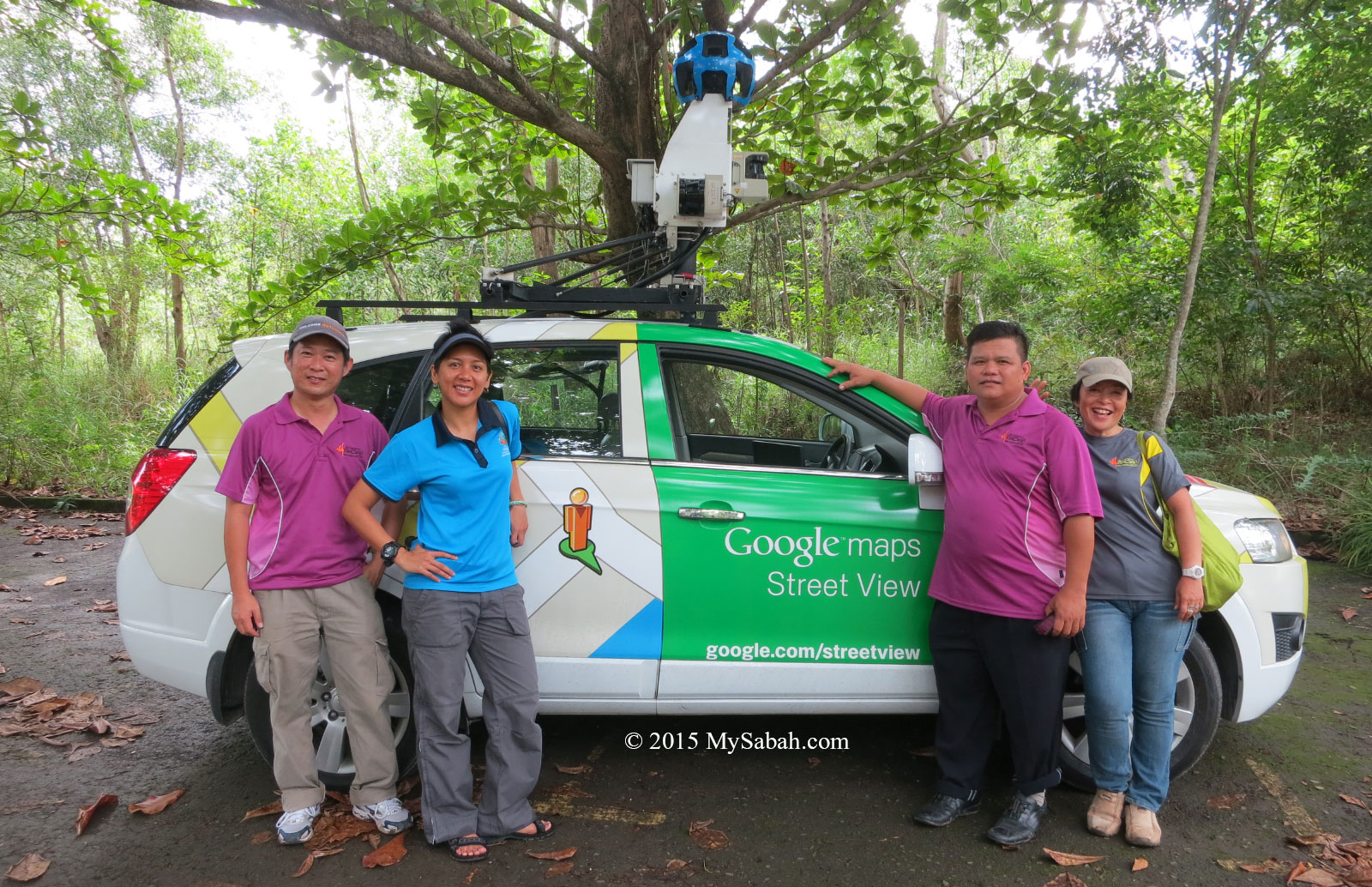
In Oct 2014, many people saw a strange car topped with ball-shaped equipment and navigated every corner of our street. Its photos were widely shared and discussed on local social media but few people knew what it did exactly.
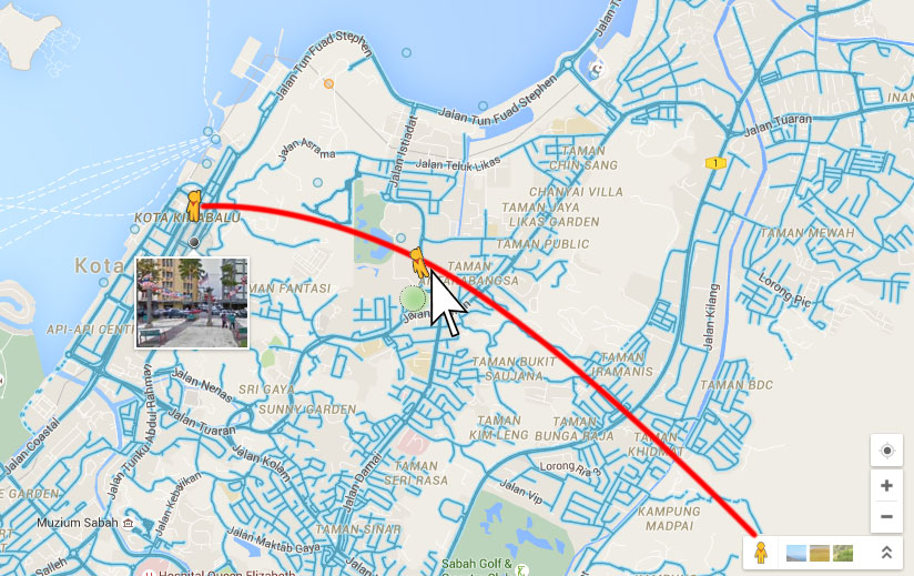
It was a Google Car that recorded 360° view of Sabah streets, and it has covered 80 percent of East Malaysia’s public roads. The Street View Imagery of Sabah is available since July 2015 in Google Maps. Just drag the orange “Pegman” icon on the bottom-right of the map (see picture above) onto a blue highlighted street. I can even see my house and dog in this 3D map, so cool and fun!
For locations that were inaccessible by car, Google team sent someone to record the view on foot by Google Trekker, a wearable backpack mounted camera system. The Google Trekker team only captured 15 popular attractions of Sabah, and their 360° view are now available online too. To save your time, I list these destinations and link to their Street View below:
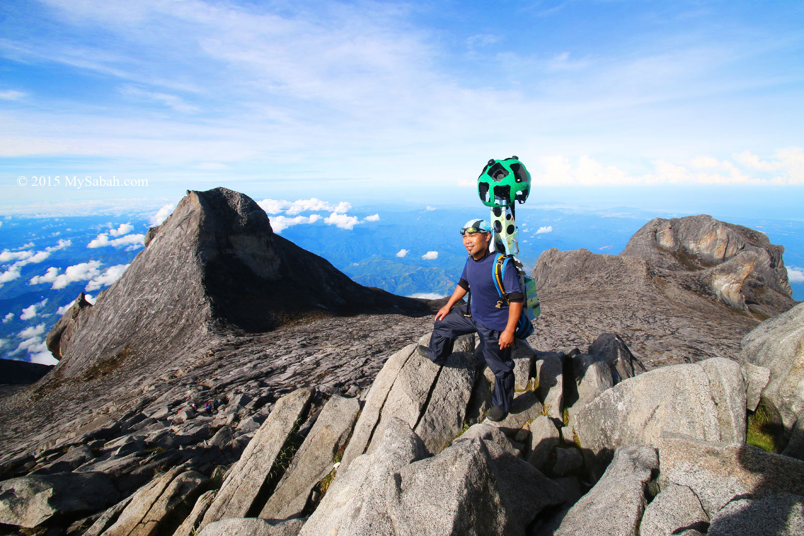
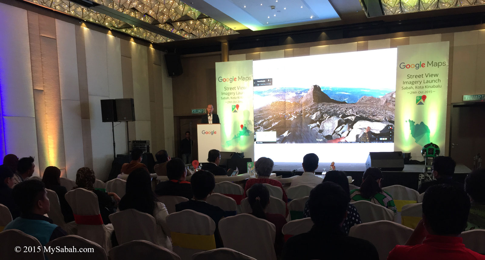
1. Mount Kinabalu
Mount Kinabalu is the highest mountain of Malaysia and situated in Kinabalu Park, an UNESCO World Heritage Site.
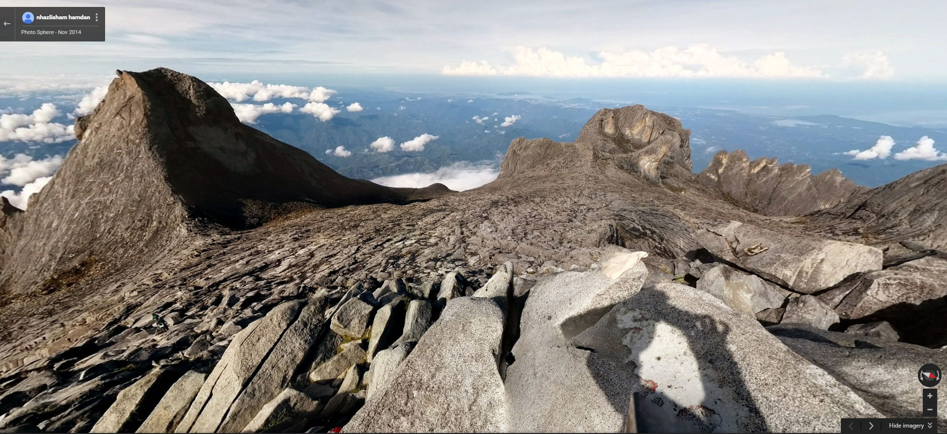
Note: This Street View was created before the earthquake on 5 Jun 2015, which damaged the Mesilau trail and part of the old summit trail. The map may be outdated but the scenery and trail remain quite the same near the summit area.
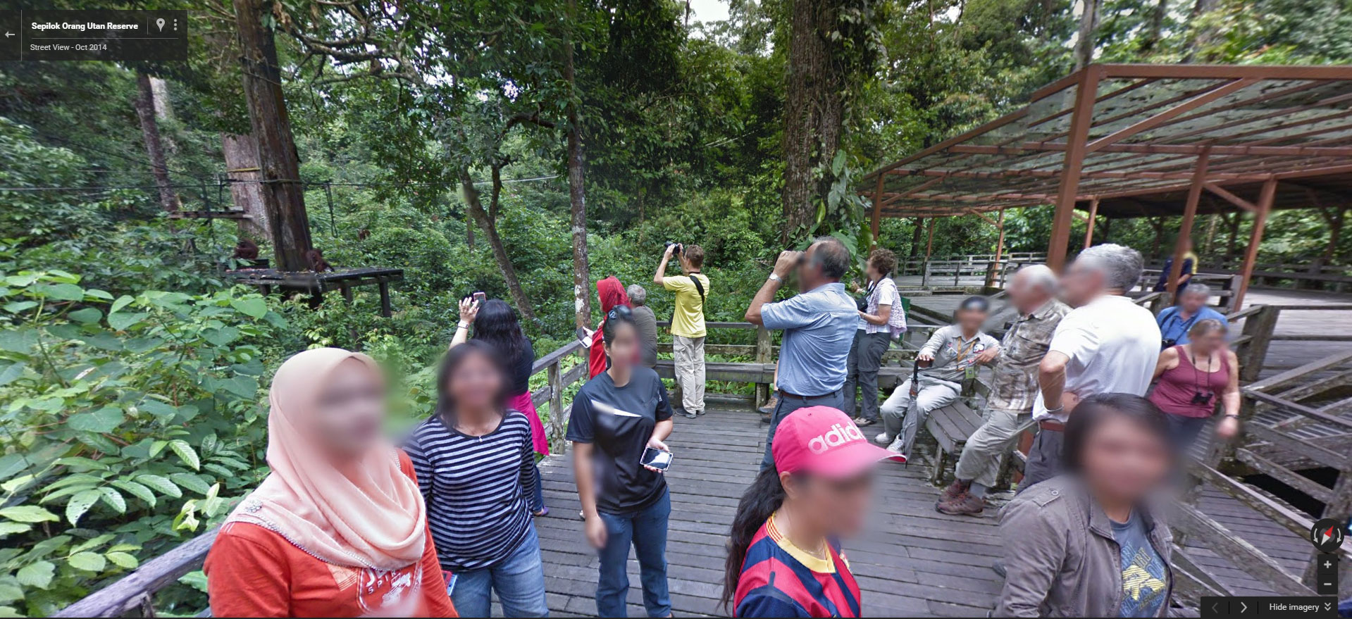
2. Sepilok Orangutan Rehabilitation Center
Sepilok Orangutan Rehabilitation Center is one of the oldest and most established orangutan nurseries in the world. It’s the No.1 tourist destination of Sandakan.
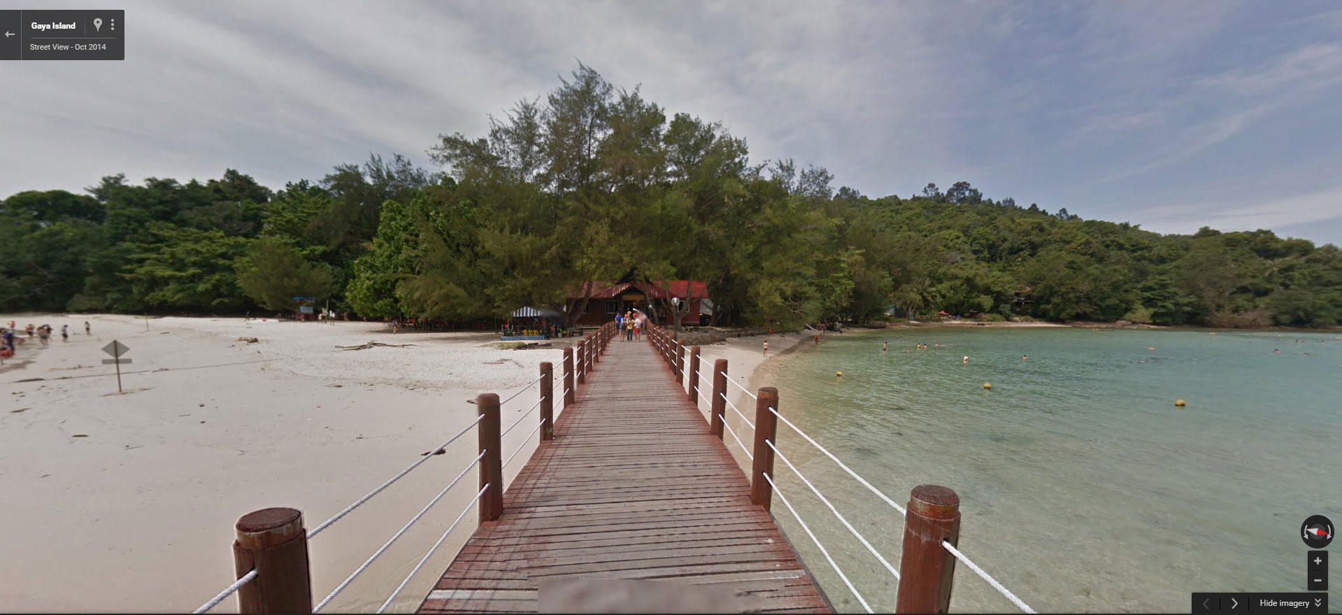
3. Sapi and Gaya Islands
Sapi and Gaya Islands are only 15 minutes away by boat from Kota Kinabalu City (KK), and the top island destination near KK.
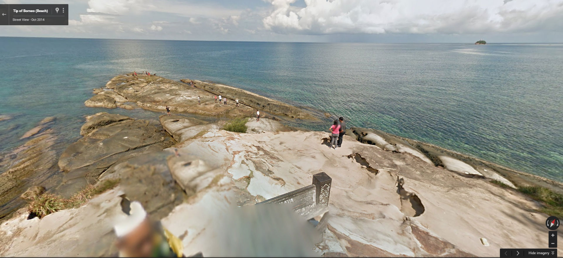
4. Tip of Borneo
Located at most northern spot of Sabah, Tip of Borneo is a meeting place of South China Sea and Sulu Sea. People visit this place for its scenic view and nice sandy beach.
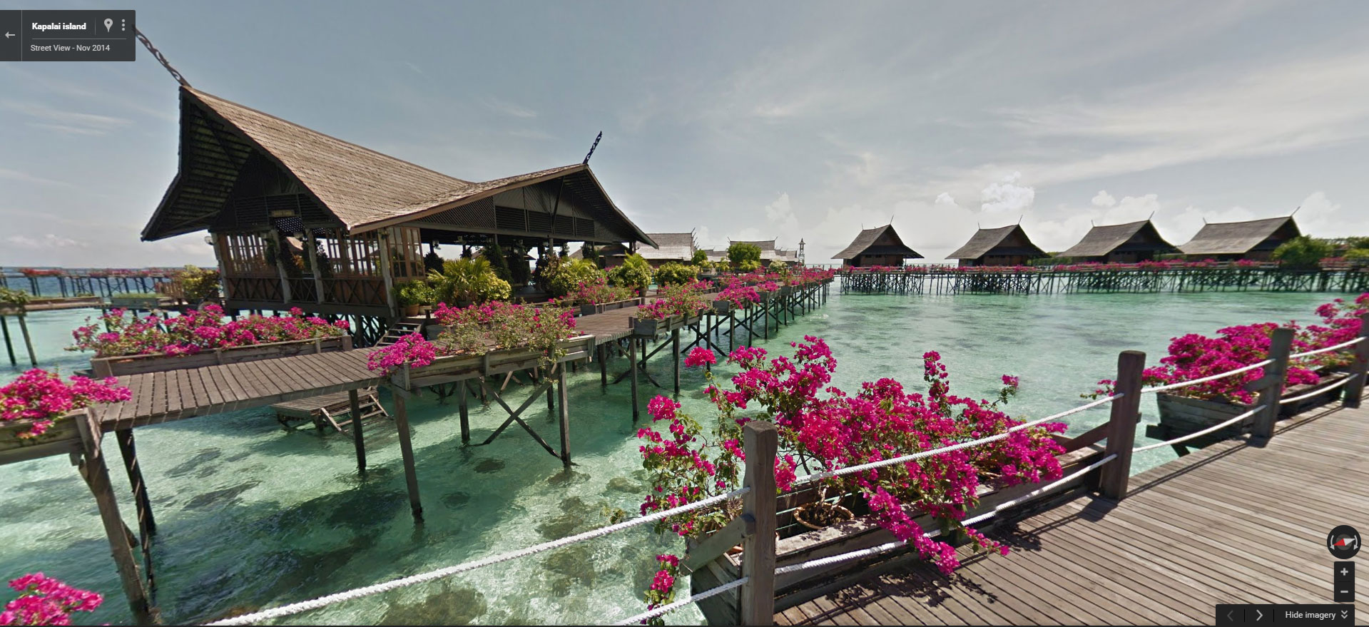
5. Kapalai Island
When talking about honeymoon in Sabah, Kapalai Island is always one of the best choices for a romantic holiday.
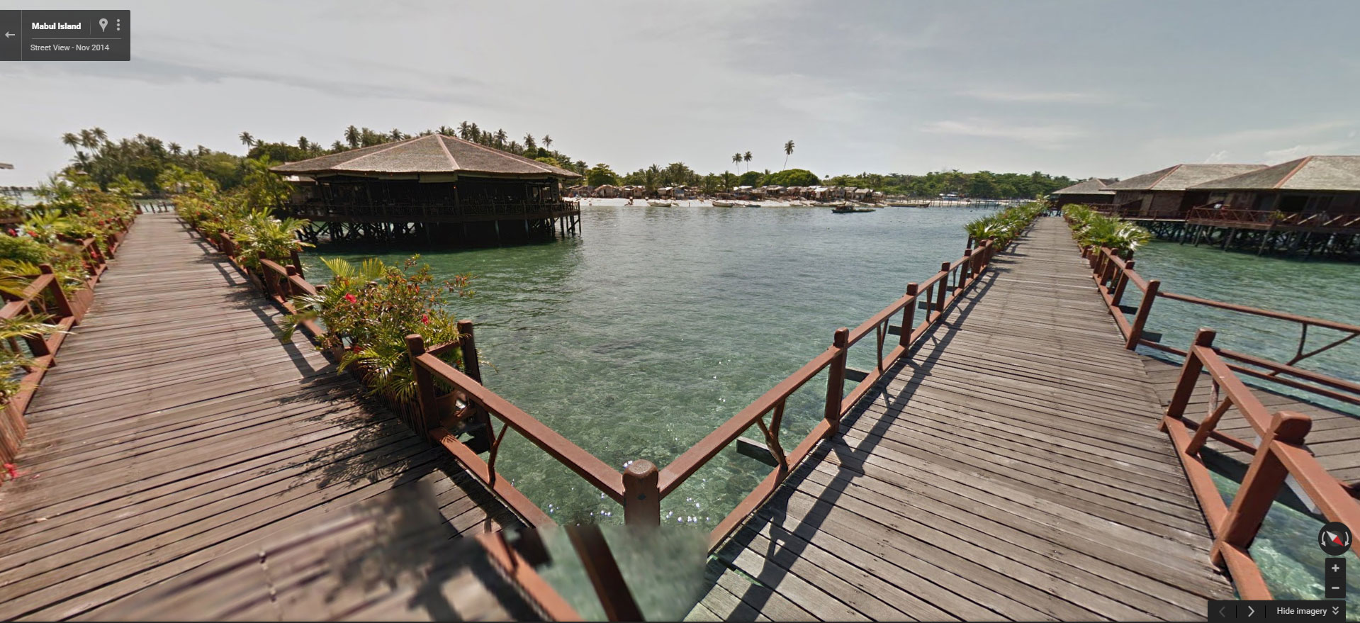
6. Mabul Island
As Mabul Island is near to Sipadan Island, it’s viewed as an “Accommodation Island”, but avid underwater photographers know that Mabul is an excellent spot to look for interesting and rare macro sea lives.
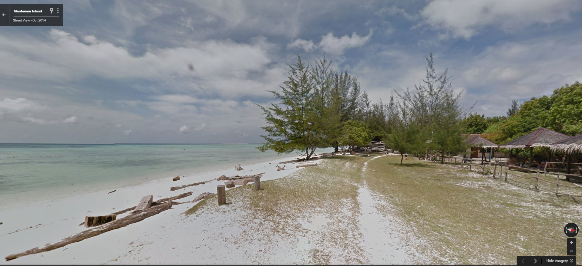
7. Mantanani Island
Mantanani Island is also known as Mermaid Island. It is one of the favourite islands of tourists because of its crystal clear sea water and white sandy beach.
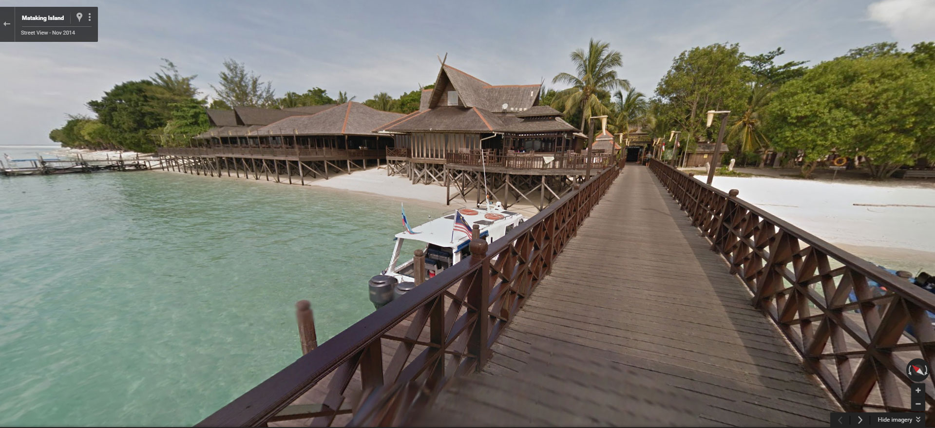
8. Mataking Island
Mataking Island is popular among Europeans as a destination for making baby. Everything seems so perfect on this island of romance.
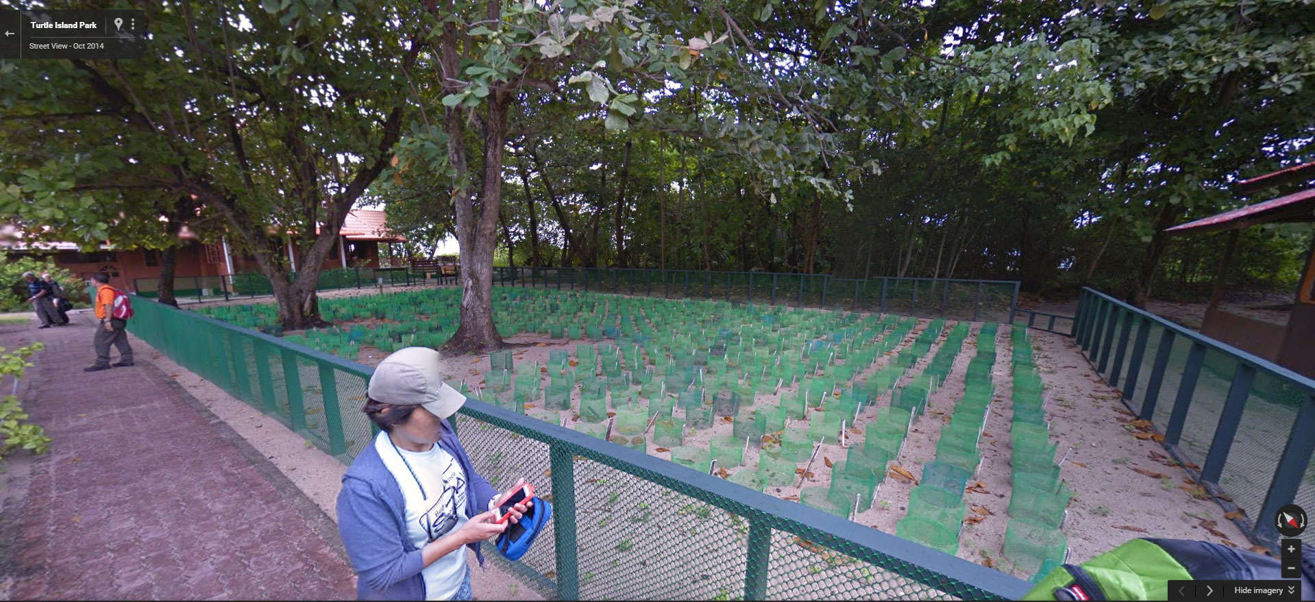
9. Turtle Islands Park
Turtle nesting happens every day on this island, so its chalets are always fully booked. Anyway, you still can visit Turtle Island “virtually”.
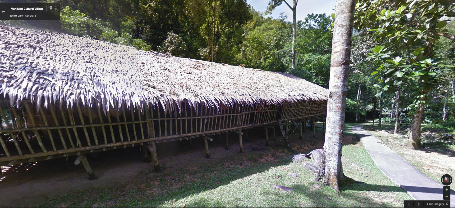
10. Mari-Mari Cultural Village
Mari-Mari Cultural Village allows you to experience the culture, food and lifestyle of 5 indigenous groups in Sabah.
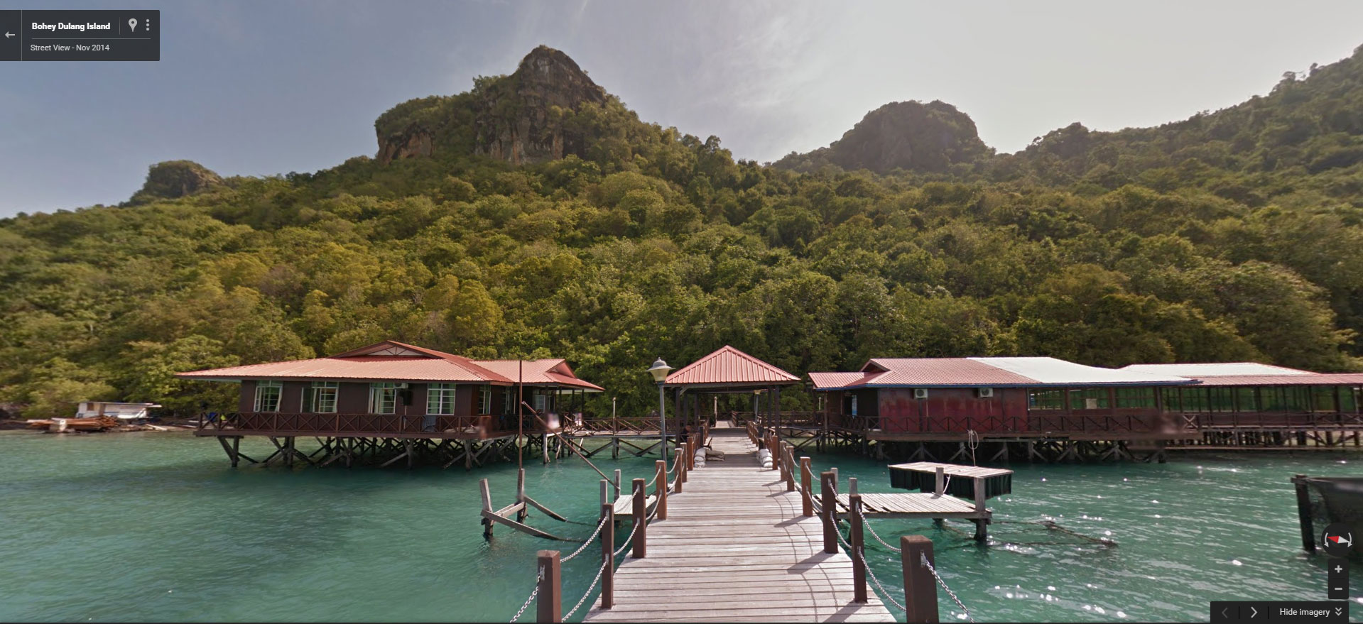
11. Bohey Dulang Island
Bohey Dulang Island is the remnant of an ancient super volcano erupted 2.5 million years ago.
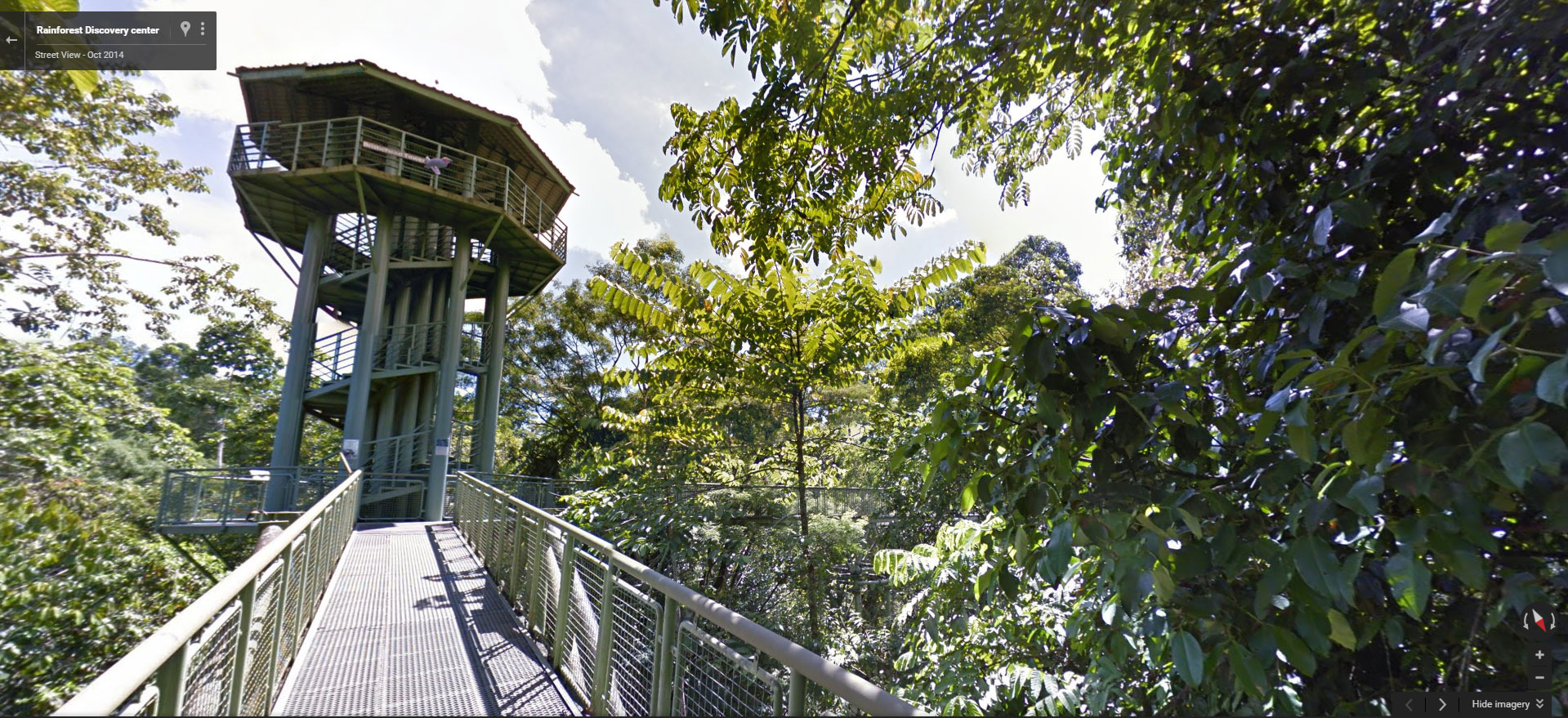
12. Rainforest Discovery Center
The canopy walkway of Rainforest Discovery Center is great for bird watching and sighting of wildlife lives in Borneo rainforest.
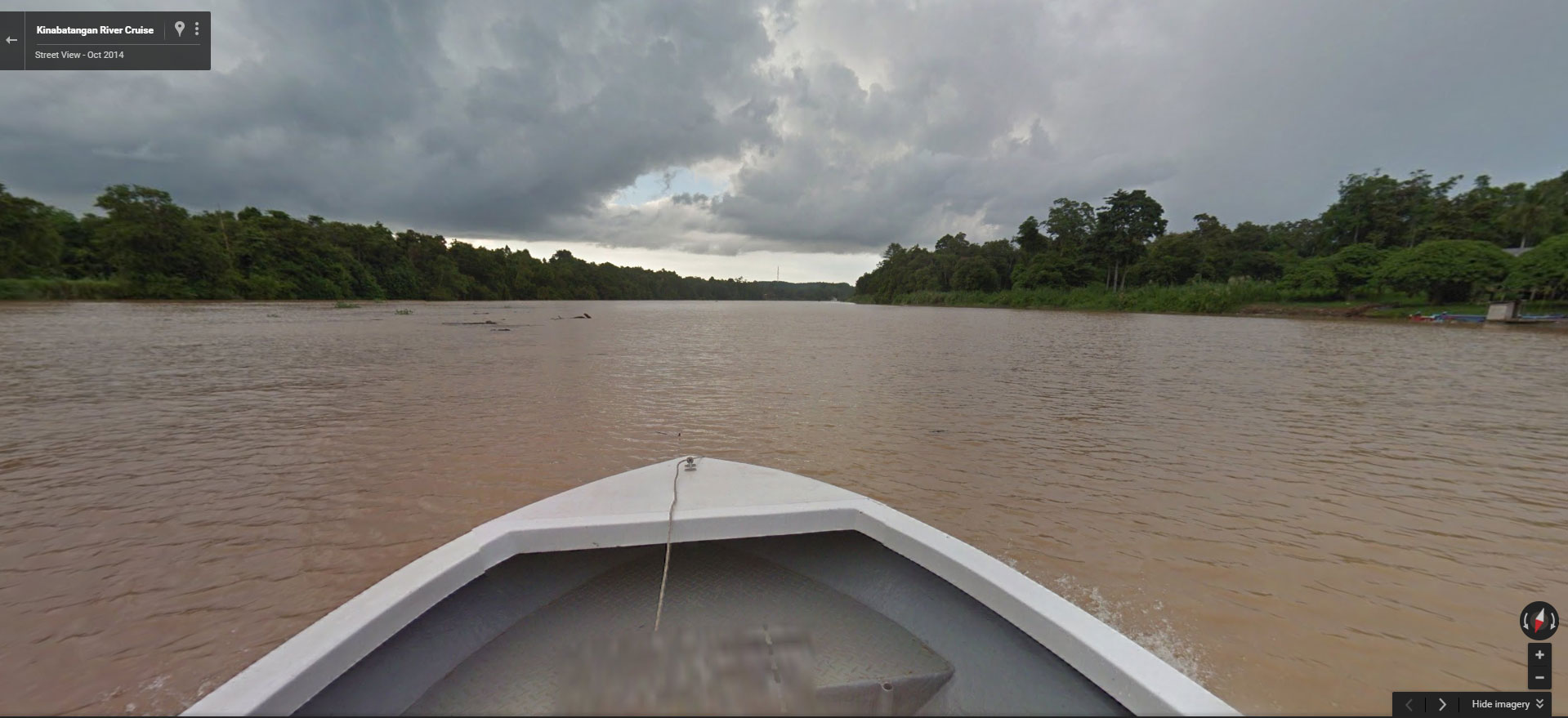
13. Kinabatangan River
Kinabatangan River is the longest river of Sabah and the best wildlife sanctuary of Borneo’s endemic animals.
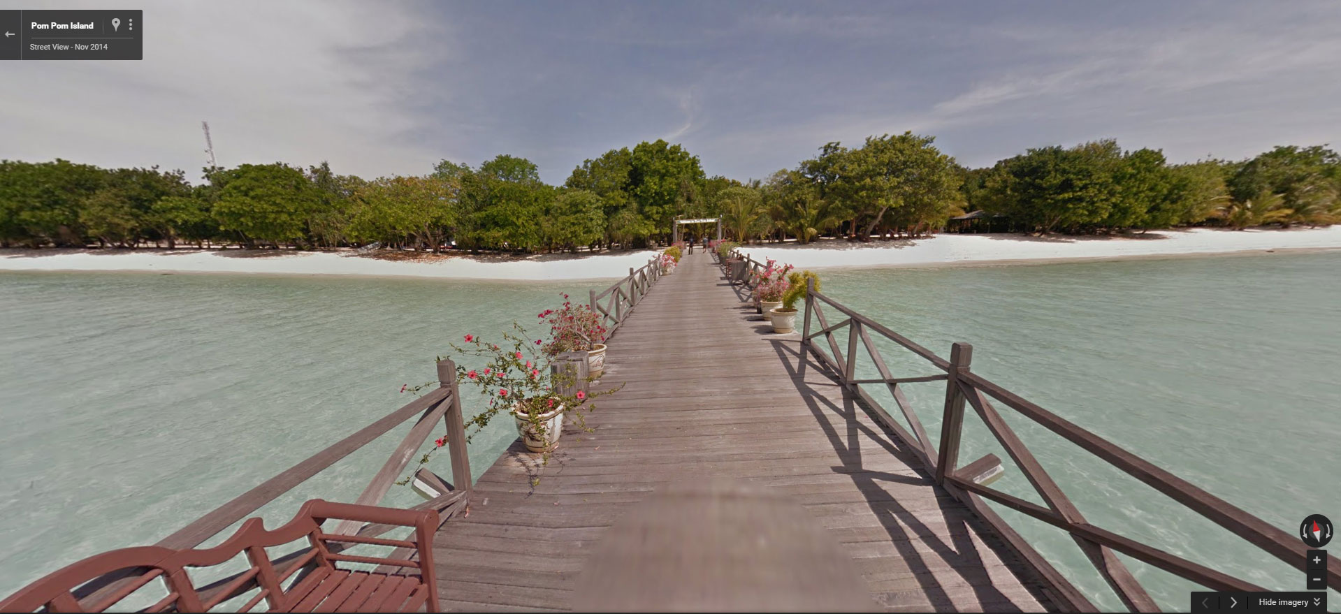
14. Pom-Pom Island
So you want a holiday with blue sky, sandy beach and turquoise sea huh? Go to Pom-Pom Island then.
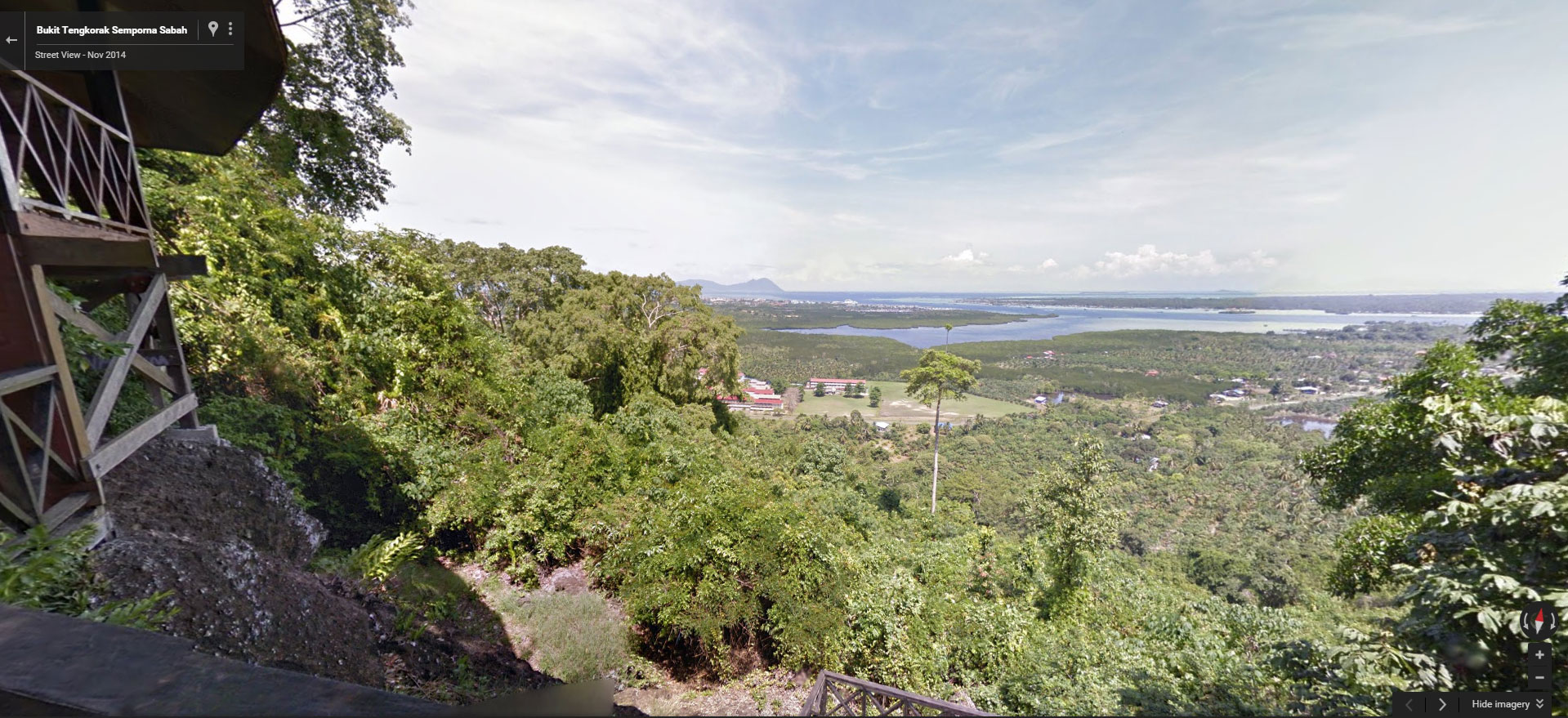
15. Bukit Tengkorak (Skull Hill)
Bukit Tengkorak is the largest pottery making site in Southeast Asia during the Neolithic period. You can get a panoramic view of Semporna town from the top (or by Street View).
Street View Project in Sabah
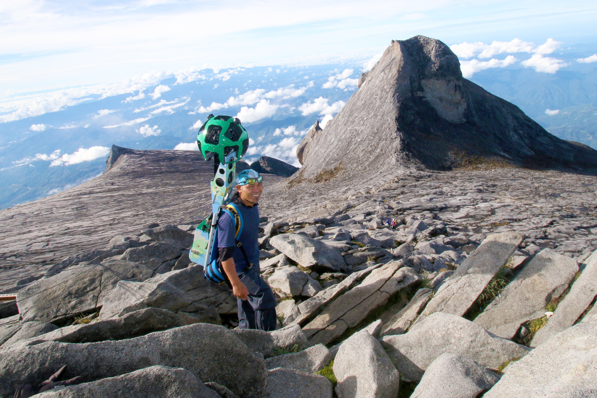
Sabah Tourism Board was working with Google led by Nhazlisham Hamdan for roads and trails mapping in Oct-Dec 2014. I was in the project team and received basic training on Google Trekker. Google Trekker consists of hard disk, batteries, GPS device and dozens of camera shooting at different angles.
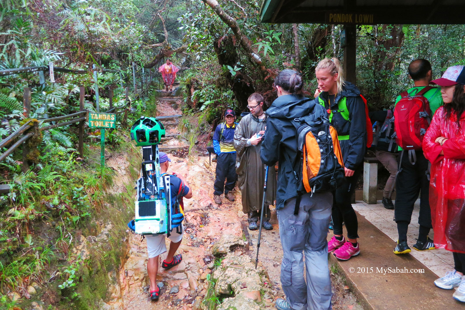
The highlight of this project is to record the imagery of summit trail to Mt. Kinabalu. The Google Trekker weighs nearly 20 Kg. There is no way normal person can carry this heavy gear to the top of the highest mountain of Malaysia, so we hire a few mountain guides for the job. It was early Nov but rainy season started a month earlier than expected. We captured both Timpohon and Mesilau Trails. However, due to heavy rain and fog, part of the imagery along these trails isn’t the best view.
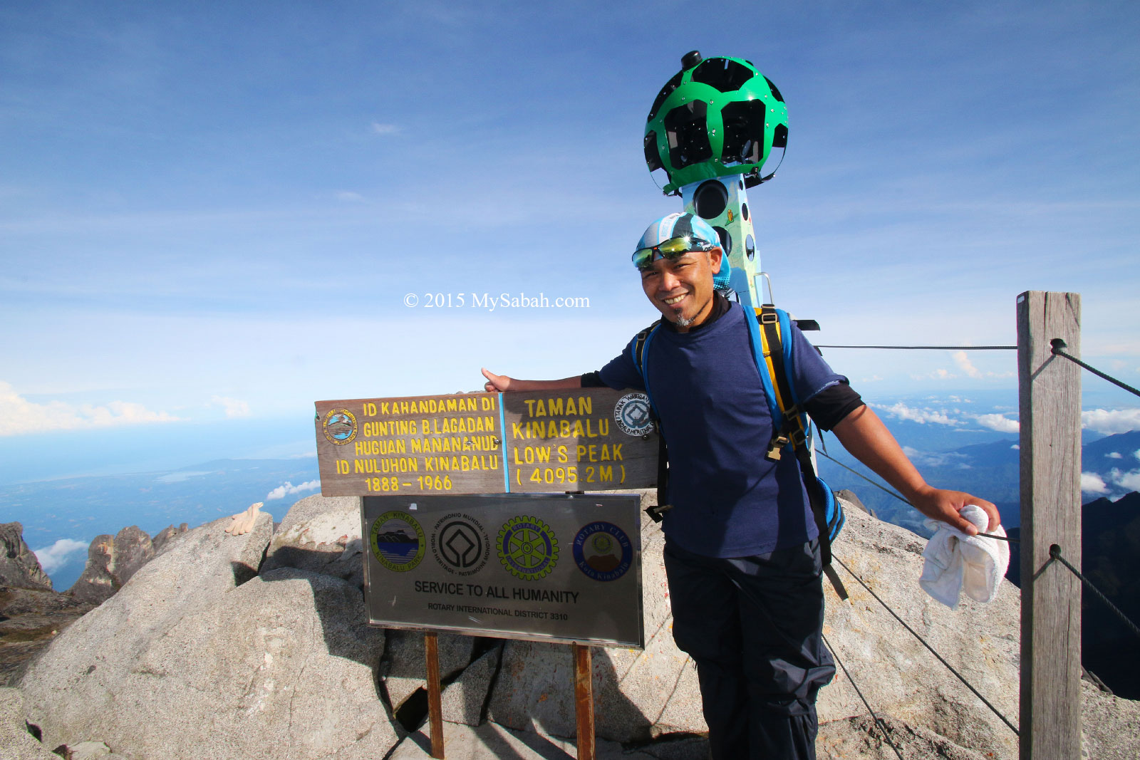
Luckily the weather was perfect when we recorded the area near the summit in the morning. On 5 June 2015, a 6.0-magnitude earthquake destroyed part of the summit trails. Mesilau Trail is closed until now. Half of the the trail from Laban Rata to the summit has been replaced by a new route named Ranau Trail. I think Google will come back again to record the new trail.
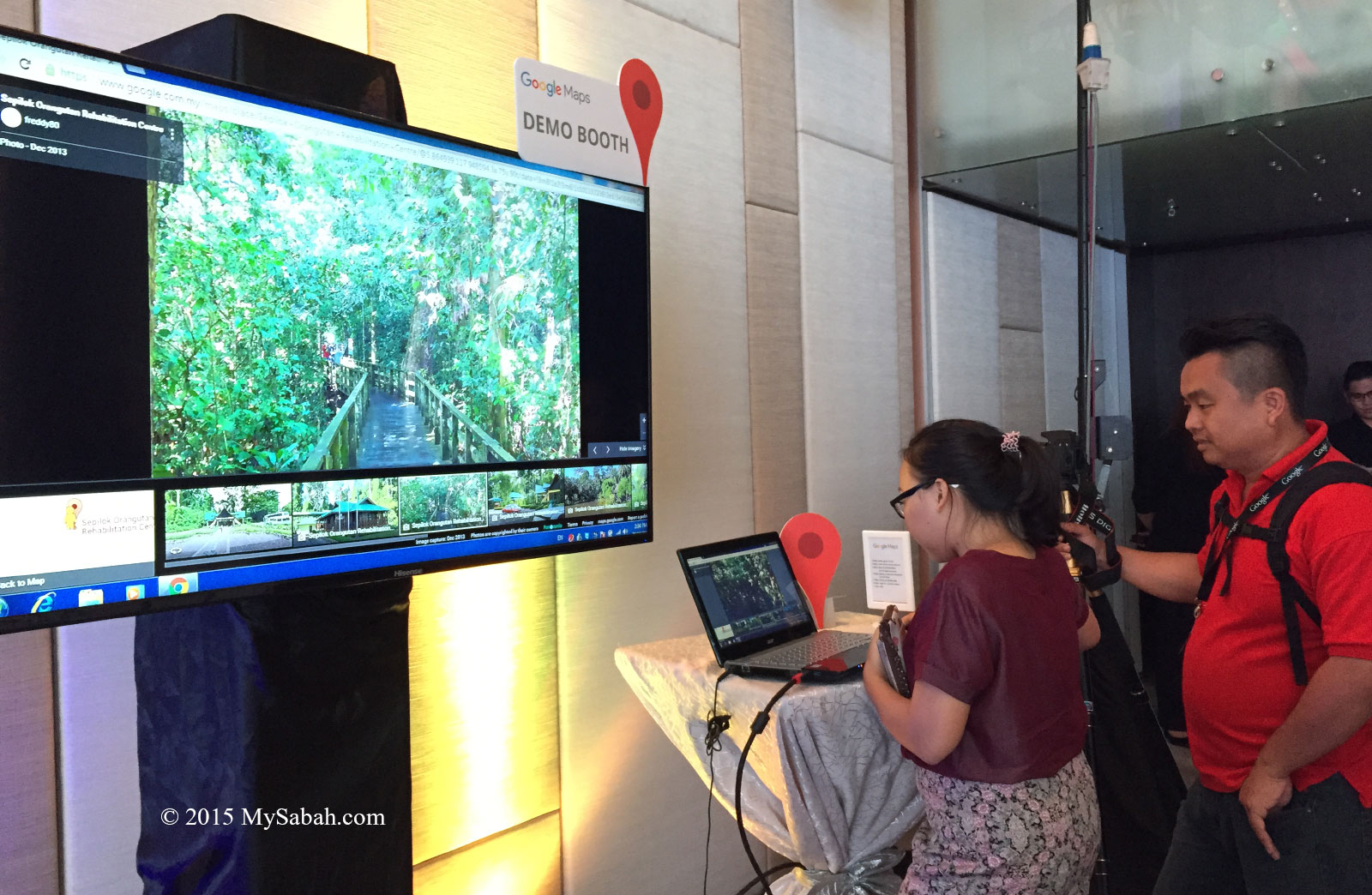
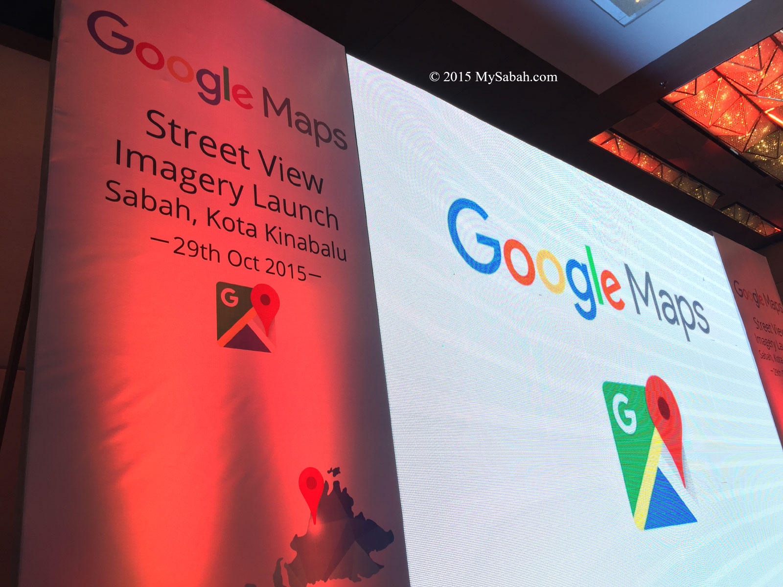
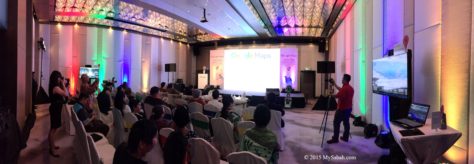
After a year of waiting, finally the Street View of Sabah was ready for launching by Datuk Seri Panglima Masidi Manjun (Minister of Tourism, Culture and Environment Sabah) on 29 Oct 2015 at Le Meridien Hotel, KK. The following are some photos of the event.
The street view of our landmark attractions is a boon to our tourism because tourists can “preview” important Sabah destinations.
The project doesn’t stop there. Google will come back to Sabah to record updated imagery whenever necessary.
Below is a video taken on Mt. Kinabalu for the launching:
Photos taken in Sabah, Malaysia Borneo
awesome! i hope Google Street View will come back to record latest view of streets and places at Sabah because there are so many new development happened in our state
I’m sure they will. It’s also time for them to record the new climbing route to the summit of Mt. Kinabalu.