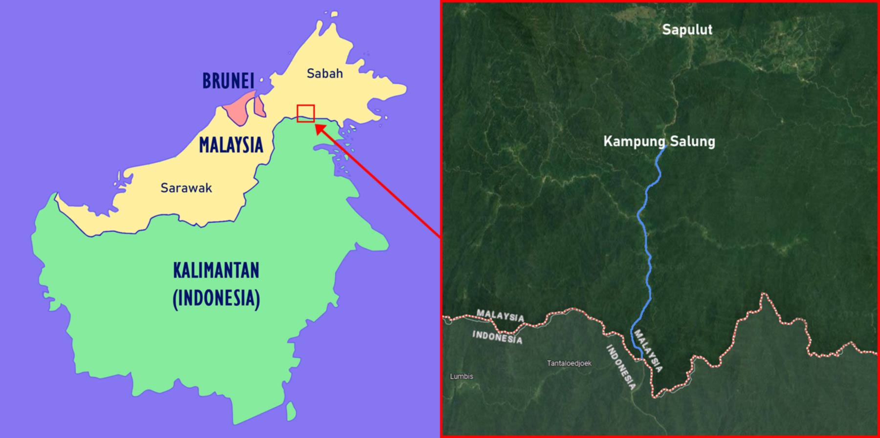
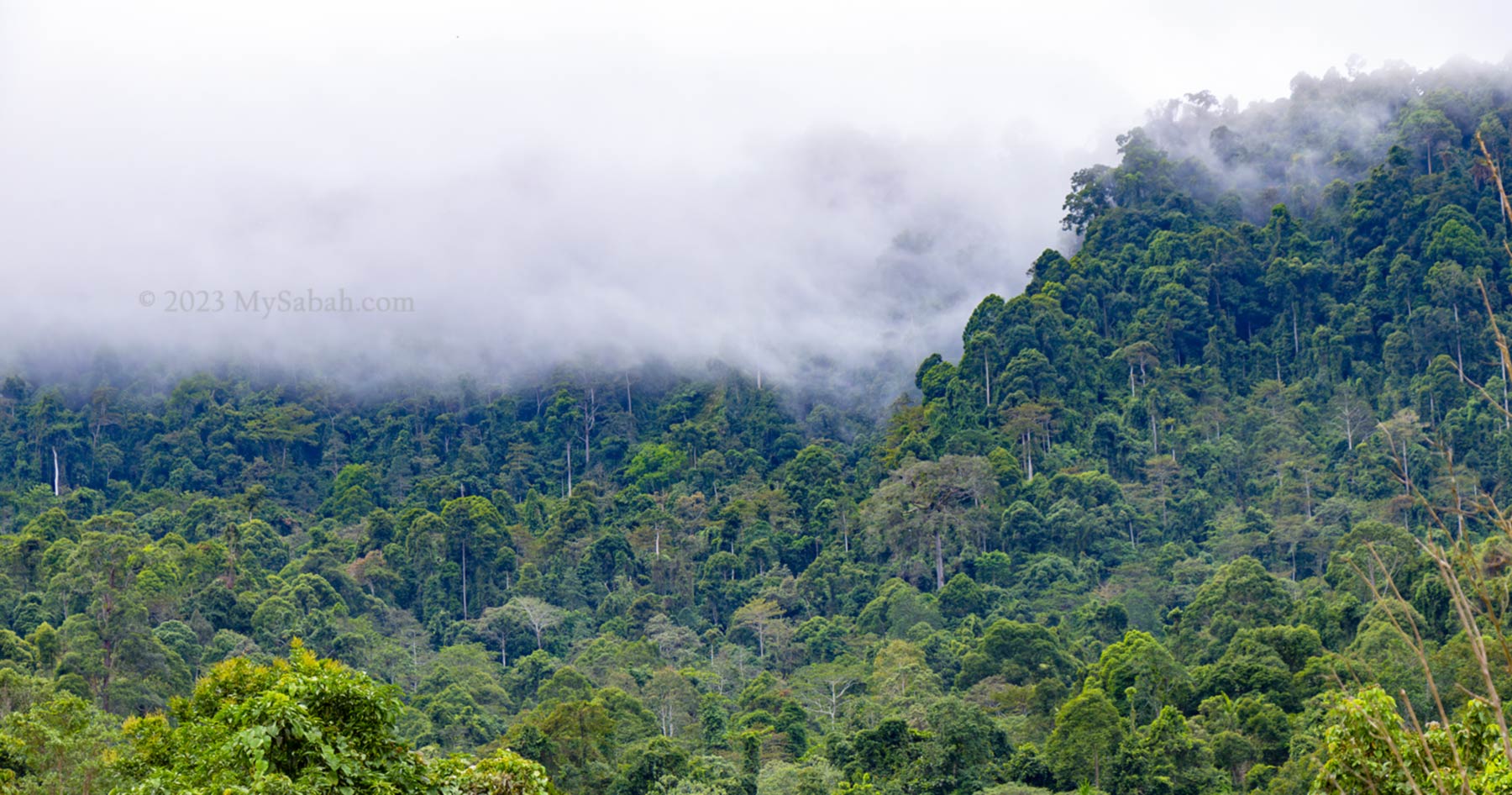
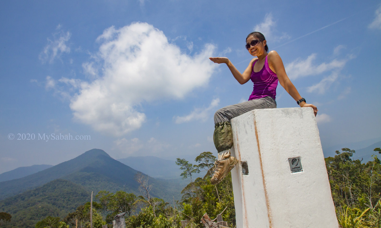
Borneo Island is the third largest island in the world, and its territory is shared by three countries, i.e. Malaysia (Sabah & Sarawak States), Indonesia, and Brunei. Though the land border of Sabah and Kalimantan (Indonesian portion of Borneo) spans more than 300 KM, there is no highway to connect both sides.
Left: Map of Borneo and its countries. Right: river passage from Sapulut to Kalimantan (North Kalimantan Province)
However, for thousand of years, people of Sabah have been going in and out of Kalimantan freely. Dense forest and treacherous terrain form the natural barriers between Malaysian and Indonesian Borneo, but human can get around these by network of rivers that cover the inland of Borneo. For example, you can reach Kalimantan from Sapulut, a small district in Sabah interior.
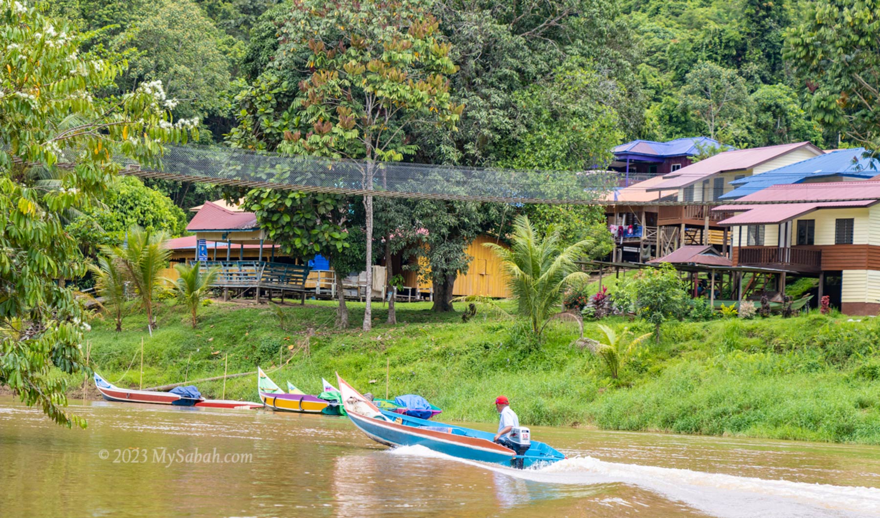
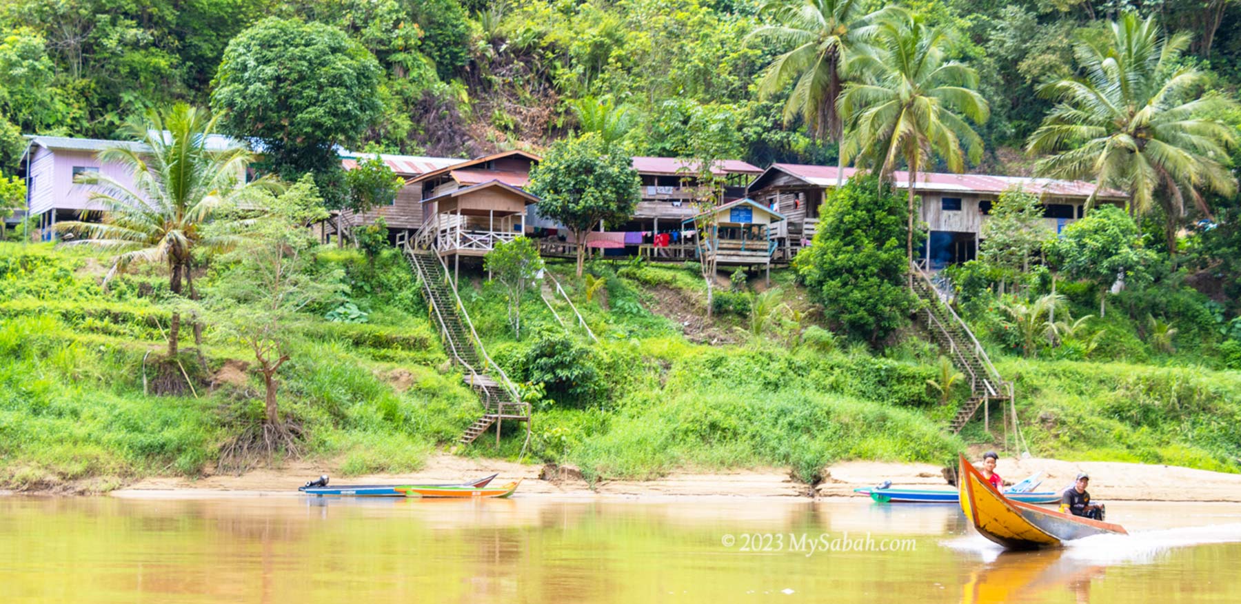
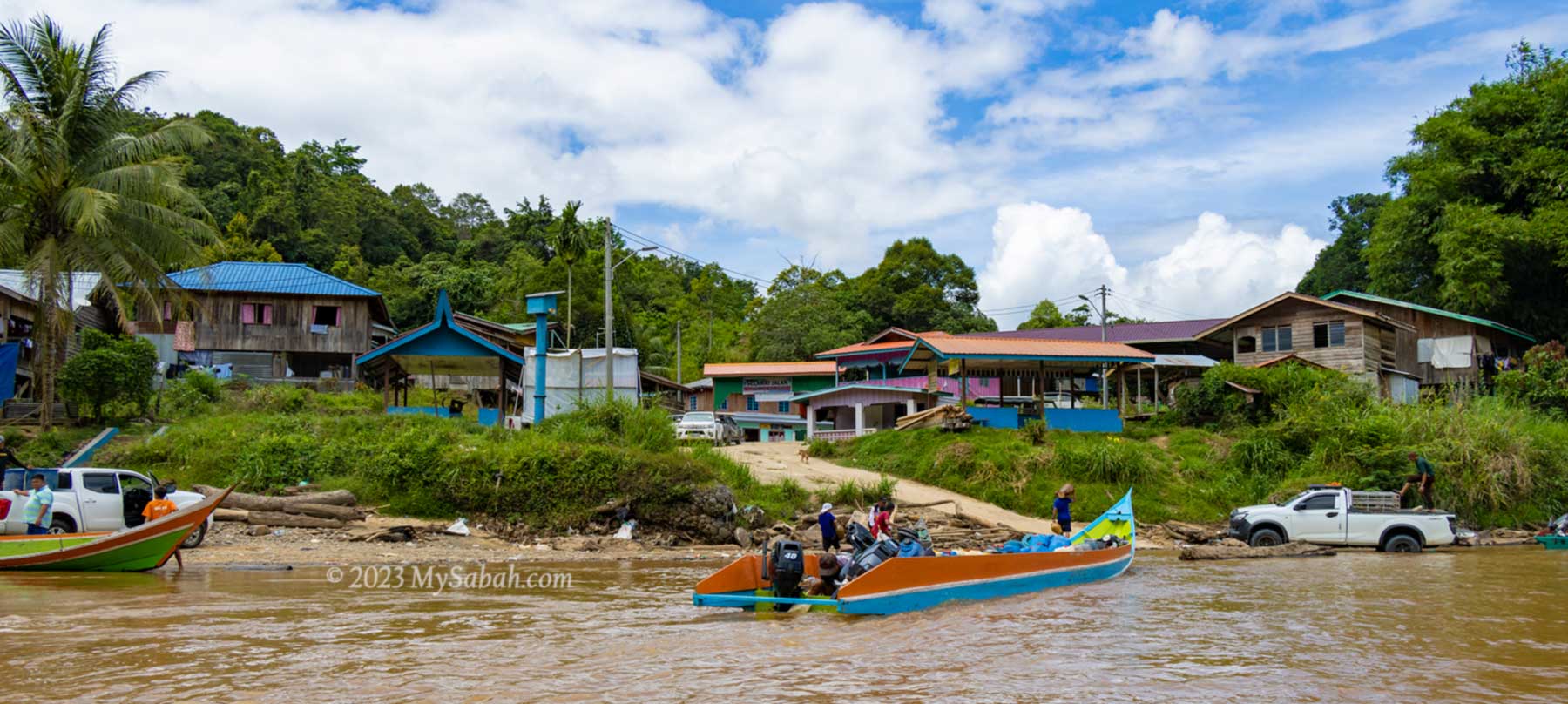
Village next to the river
I’ve tried the boat ride from Sabah to Kalimantan, which takes only 1.5 hours, to experience the ancient river passage in the Heart of Borneo. Overall, it’s a fun river cruise to explore the scenic countryside of two countries. Please read on if you want to know how I travelled between two countries in half a day.
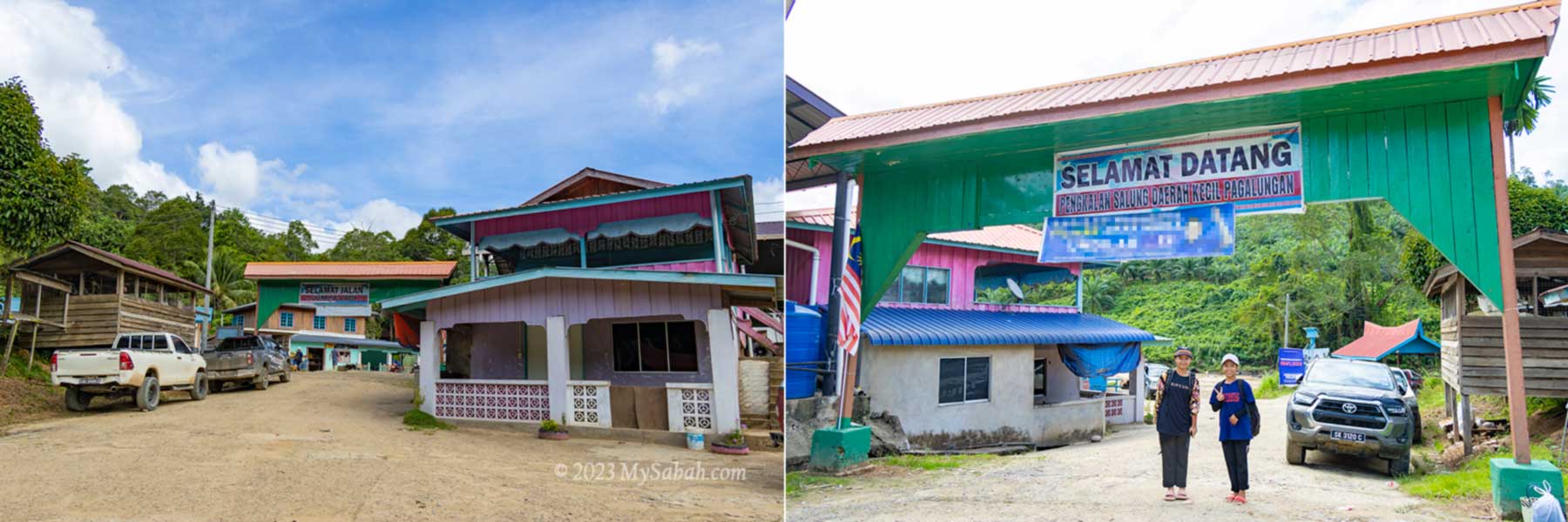
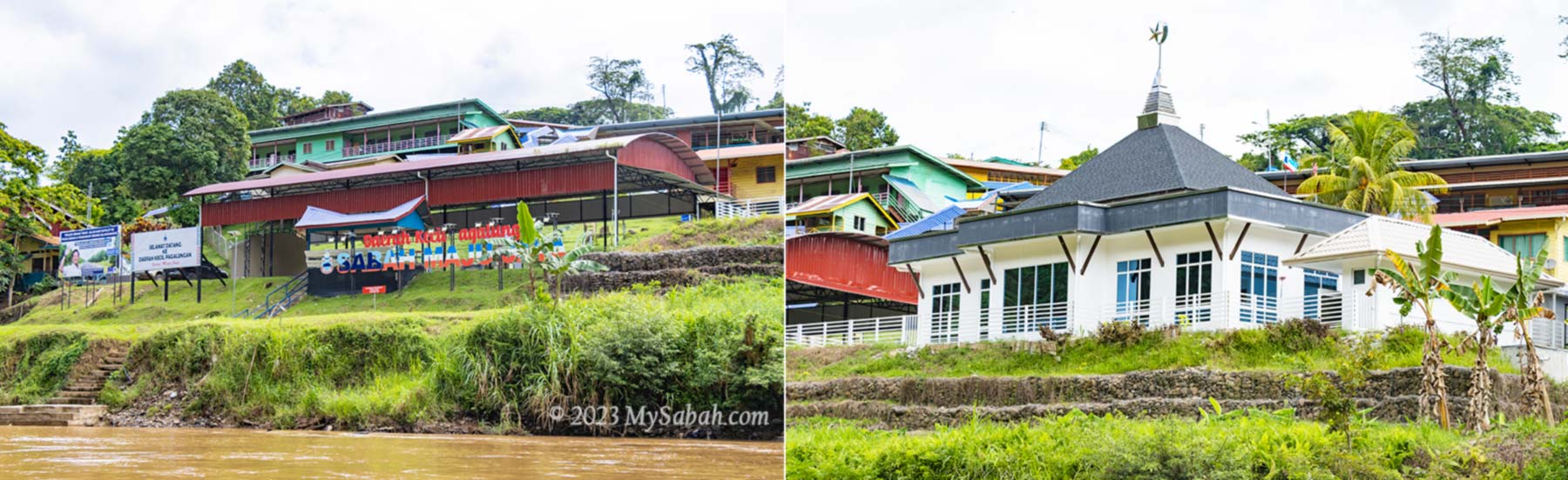
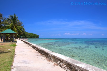
Kampung Salung Jetty
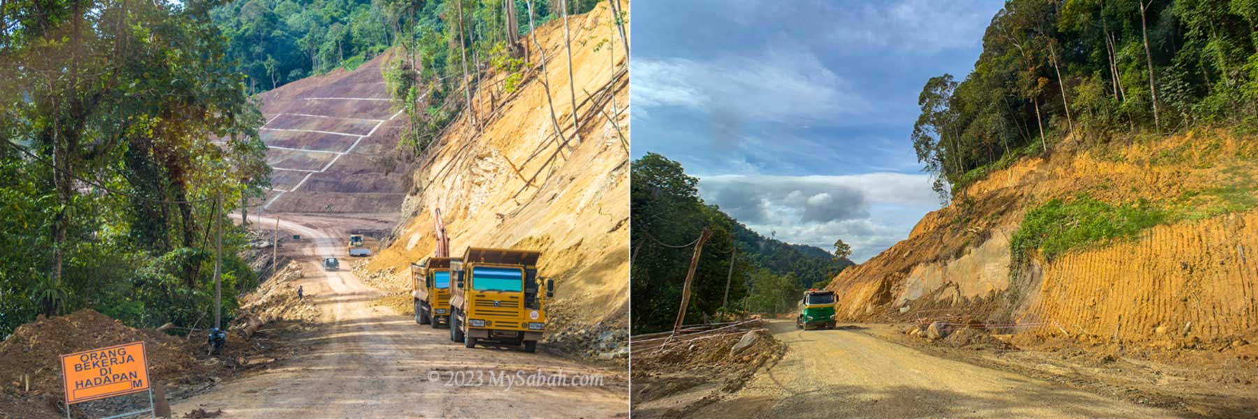
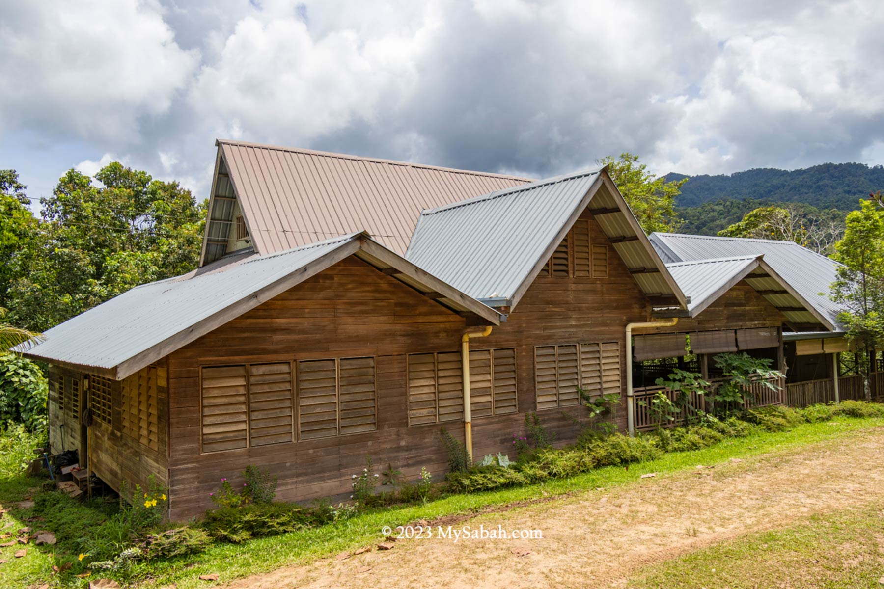
First we drive about an hour on the gravel road from Sapulut town to the jetty of Kampung Salung (Kampung means Village). On the way, you would see dozers and trucks are busy upgrading the 38-Kilometre road from Sapulut to Pagalungan town. Salung Village is somewhere in the midpoint.
Road between Sapulut and Pagalungan town under construction
The road is located near the Sapulut River, which flows to Kalimantan. As Sapulut is a mountainous region, road is expensive to construct. Though this road may eventually connect to Kalimantan, that would be an ambitious project that needs a lot of time and fund to complete.
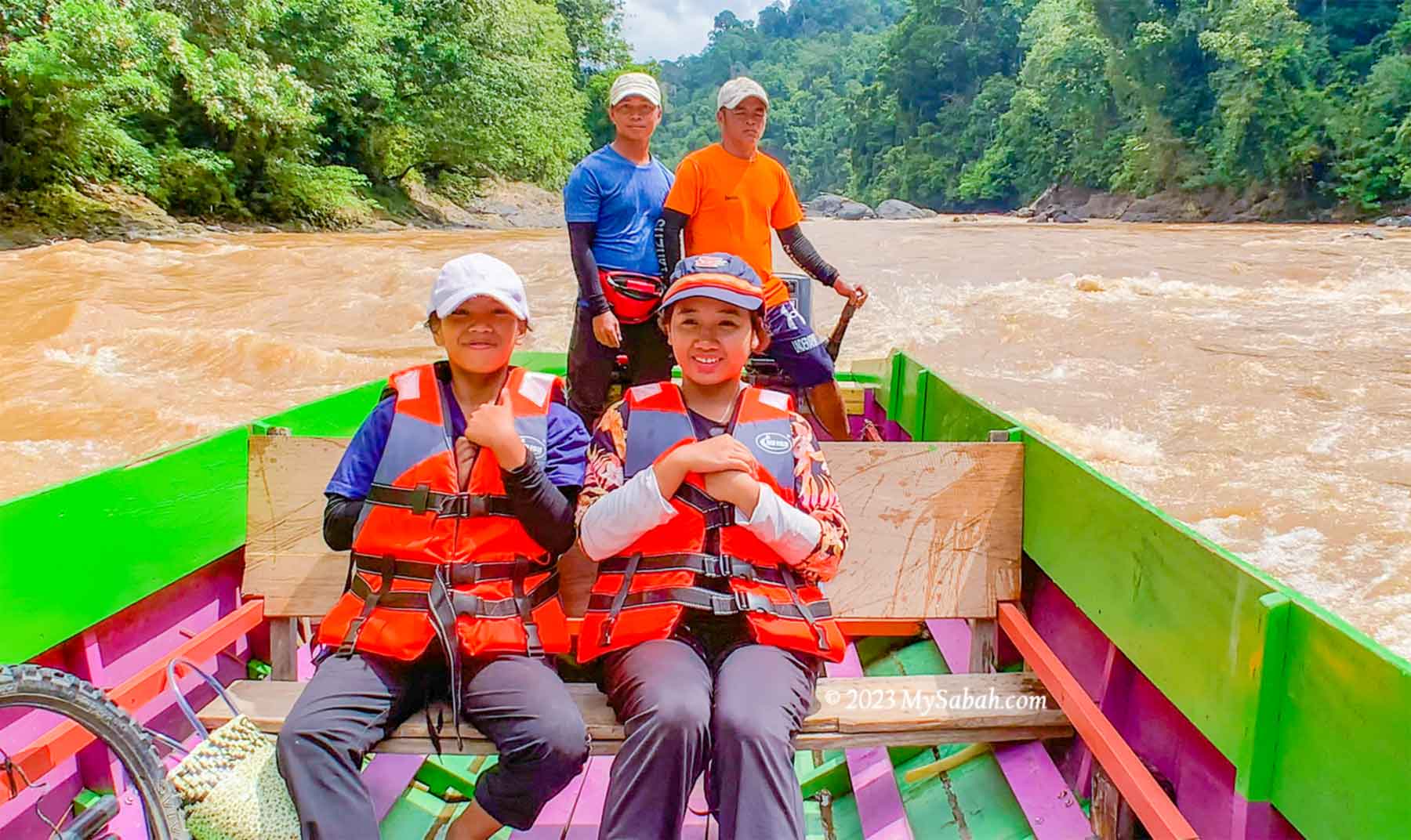
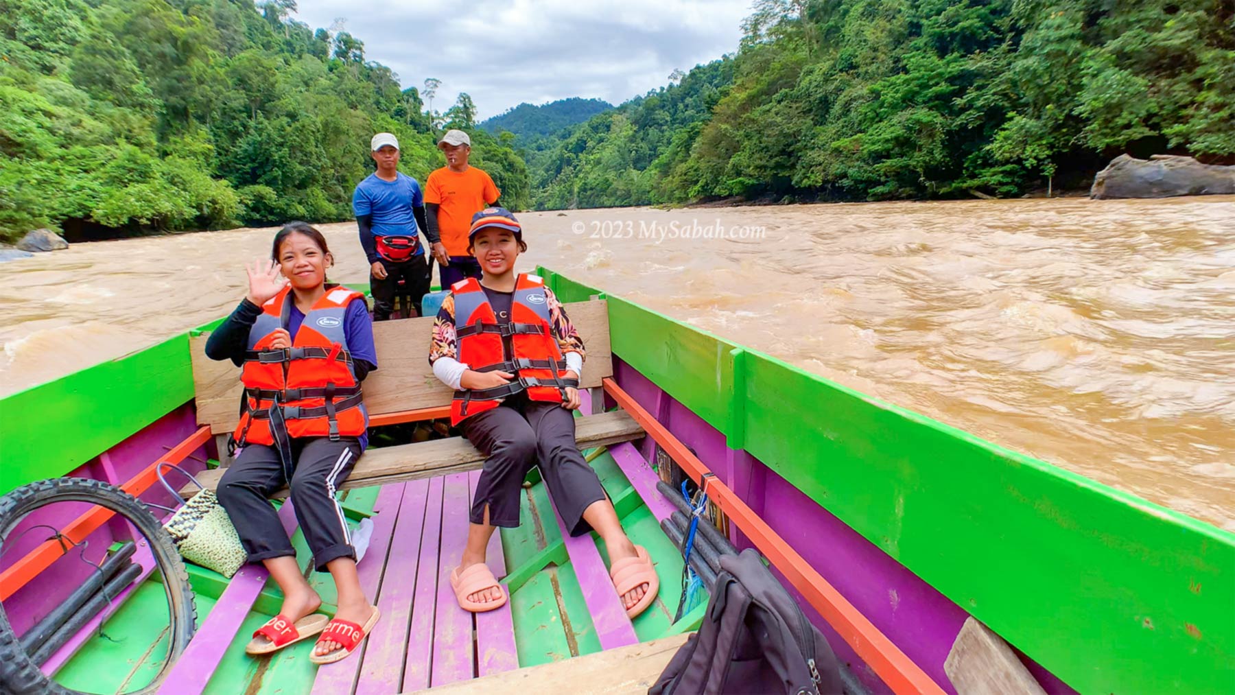
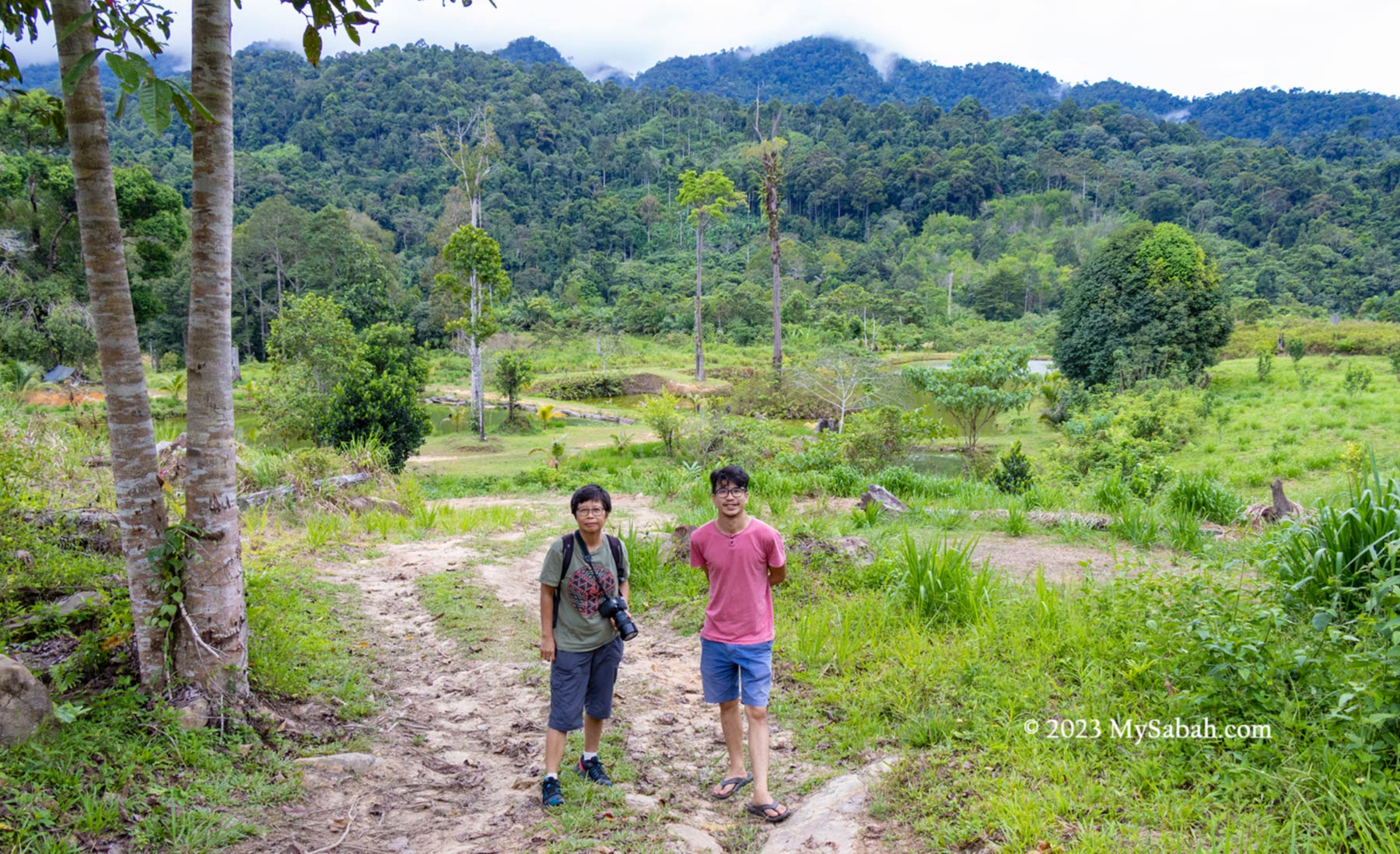
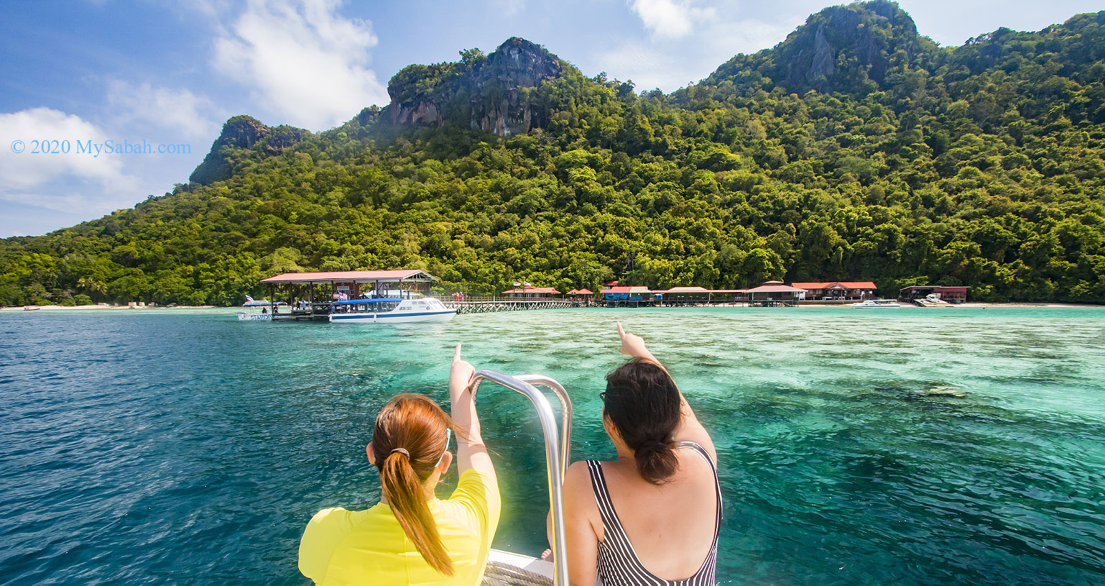
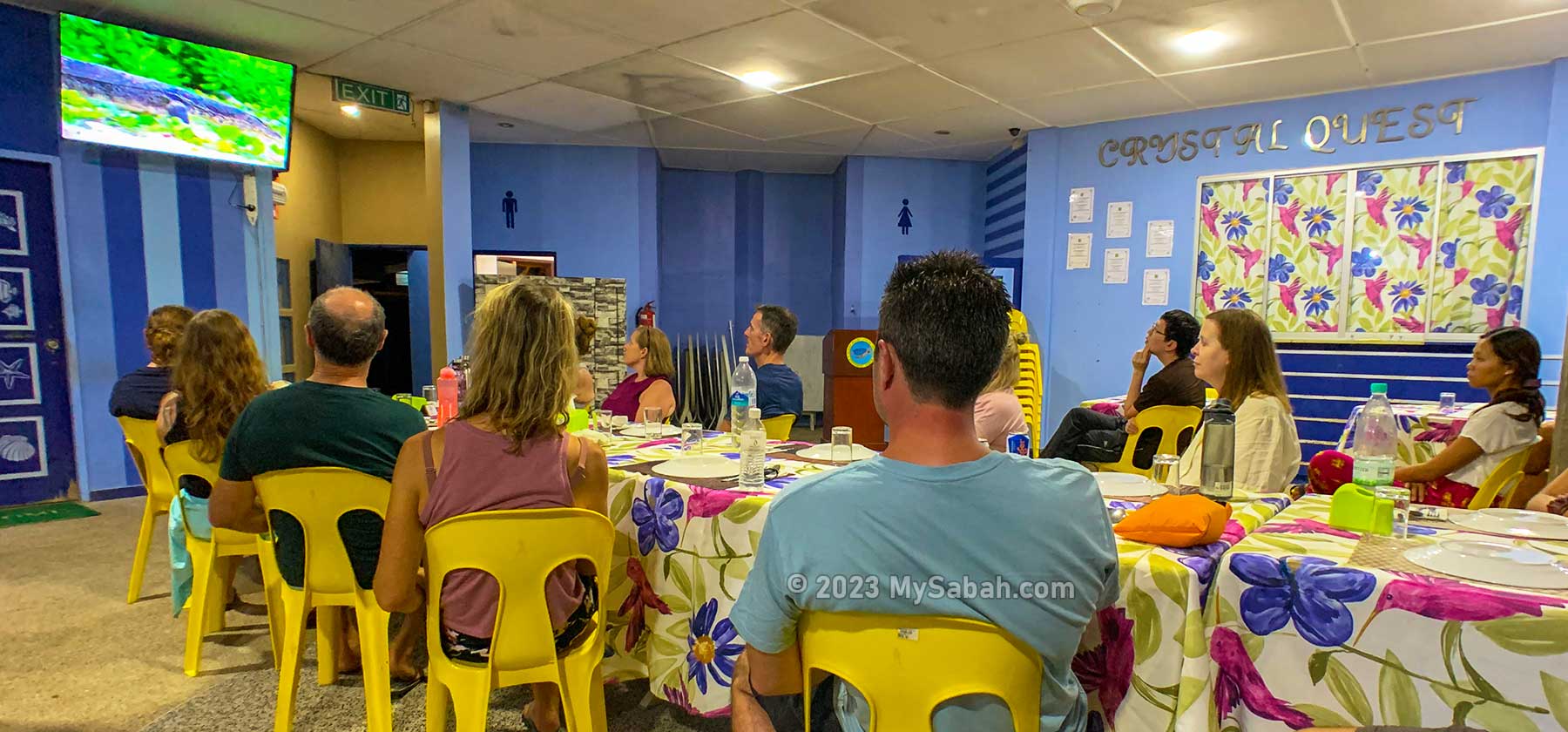
Kampung Salung, starting point of the river cruise. Mia and Barbara follow us for the rapid shooting.
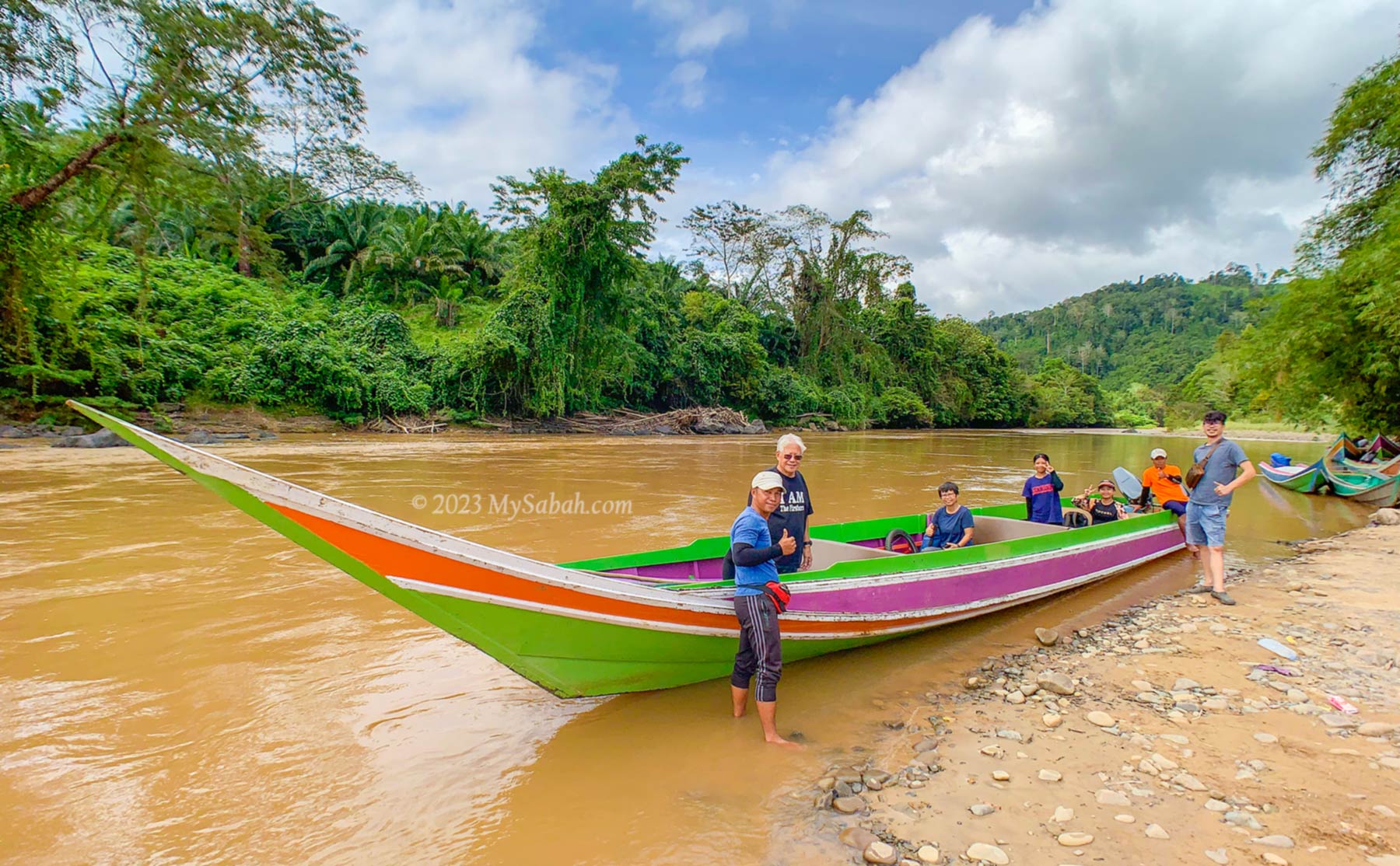
Kampung Salung is a peaceful village next to a big river. After we park our car and take a toilet break, we depart at 10am on a 20-feet-long traditional wooden boat that is powered by two engines.
Ready to depart from Kampung Salung jetty on a twin engine long boat
A 7-minute video to show you what you would see in the river cruise
Going to Kalimantan, the Indonesian Borneo
The name Kalimantan is derived from the Sanskrit word Kalamanthana, which means “burning weather island”, because of its warm and humid tropical climate. As the boat has no sun cover (Bimini top), applying sunblock lotion will prevent sunburnt.
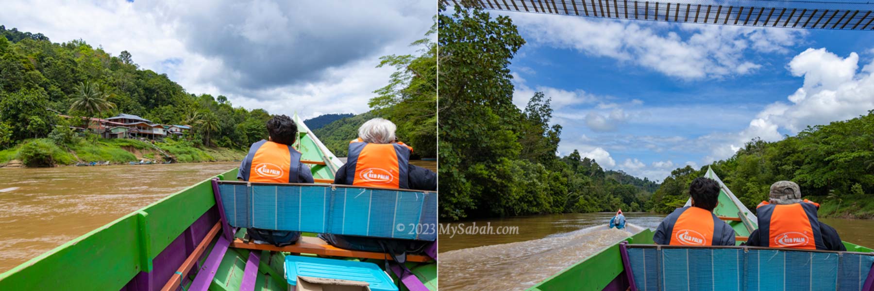
Village and nature view along the river. In front seat are Virgil (left) and Dr. Richard (right)
When the long boat speeds and glides on the river, it’s breezy, too comfortable for a nap, but I was busy being thrilled by the scenic view along the river.
A peek to the stilt houses and lifestyle of locals
Joining me are Dr. Richard and his son, Virgil from Orou Sapulut, Ms Wong from media and two local girls, Mia and Barbara. The ladies and me are first timers on a boat trip to Kalimantan.
Barbara (left) and Mia (right) seem to enjoy the ride
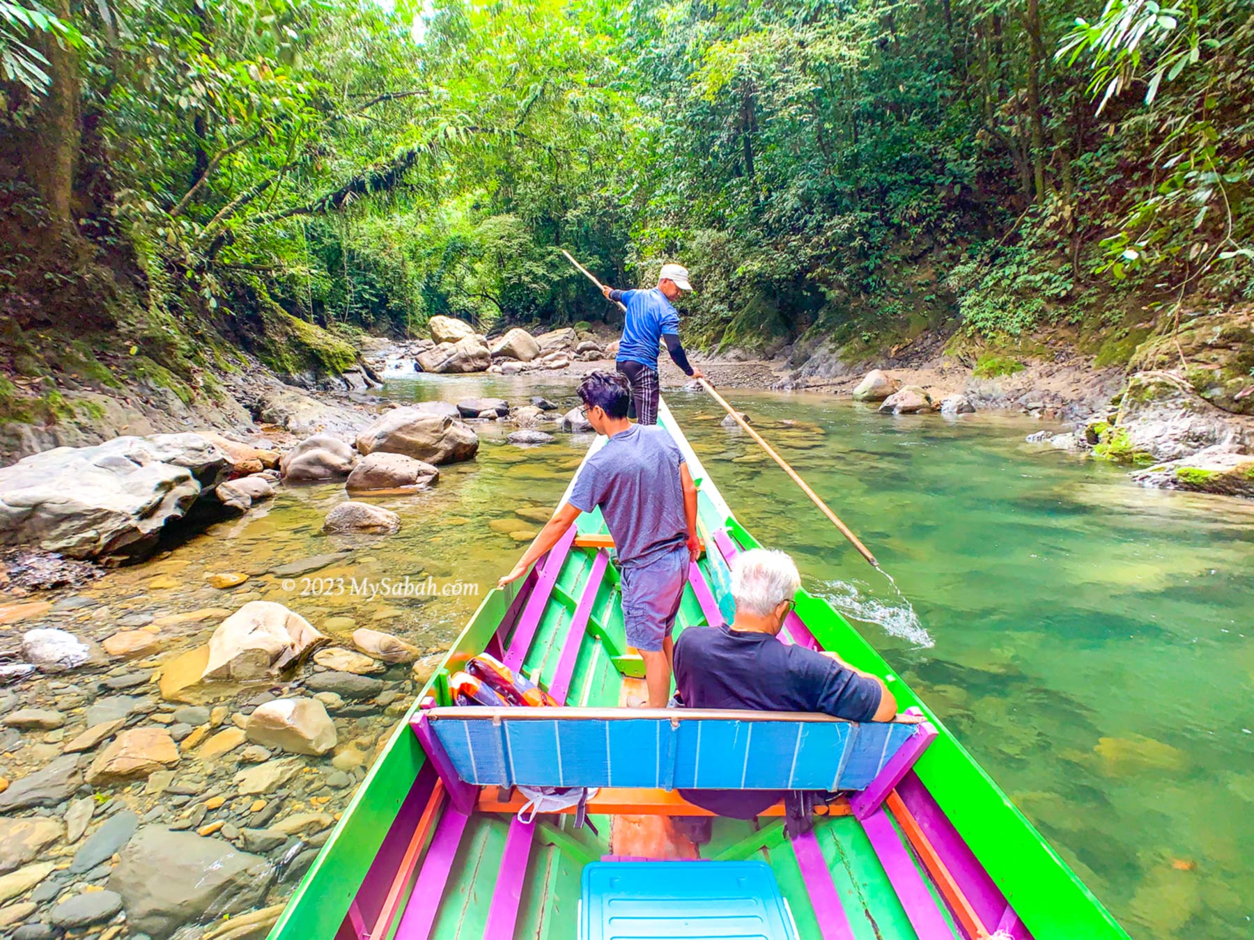
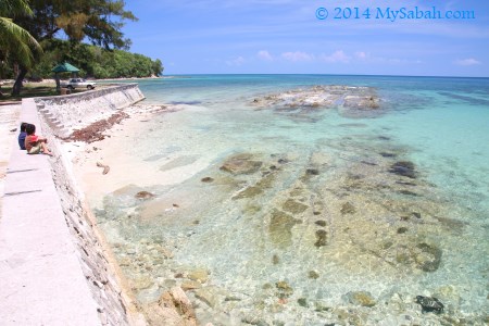
It takes about 1.5 hours to travel about 25 KM from Salung Jetty to Kalimantan border. The river is about 20-50 metres wide, part of it could be shallow during drought and you would need to get into water to push the boat.
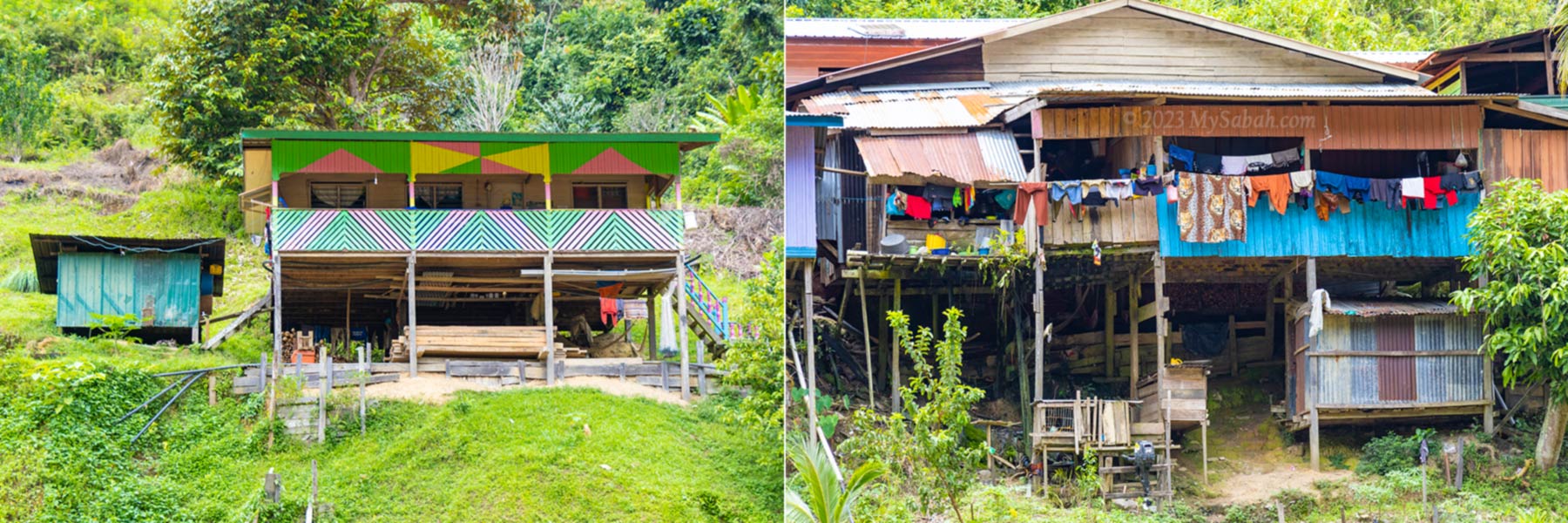
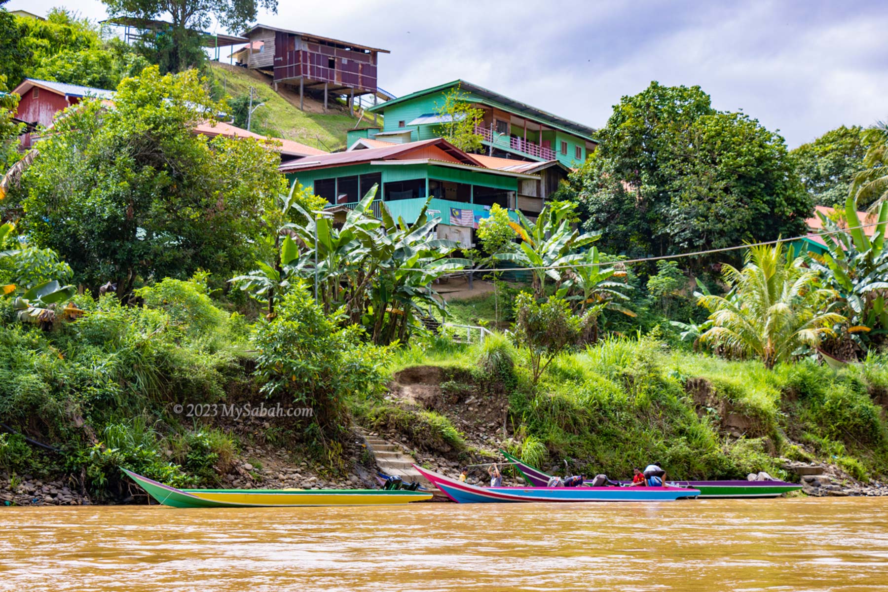
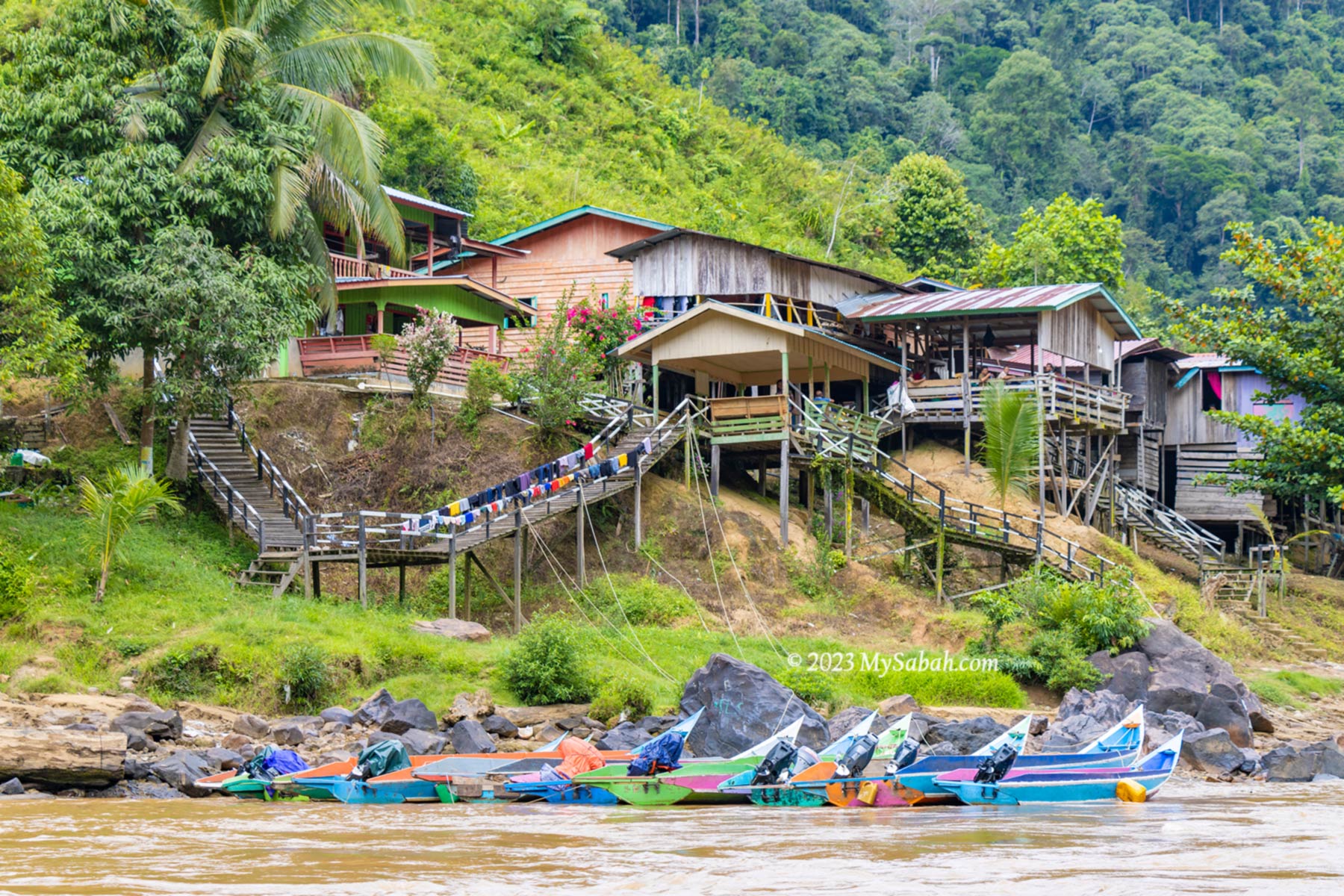
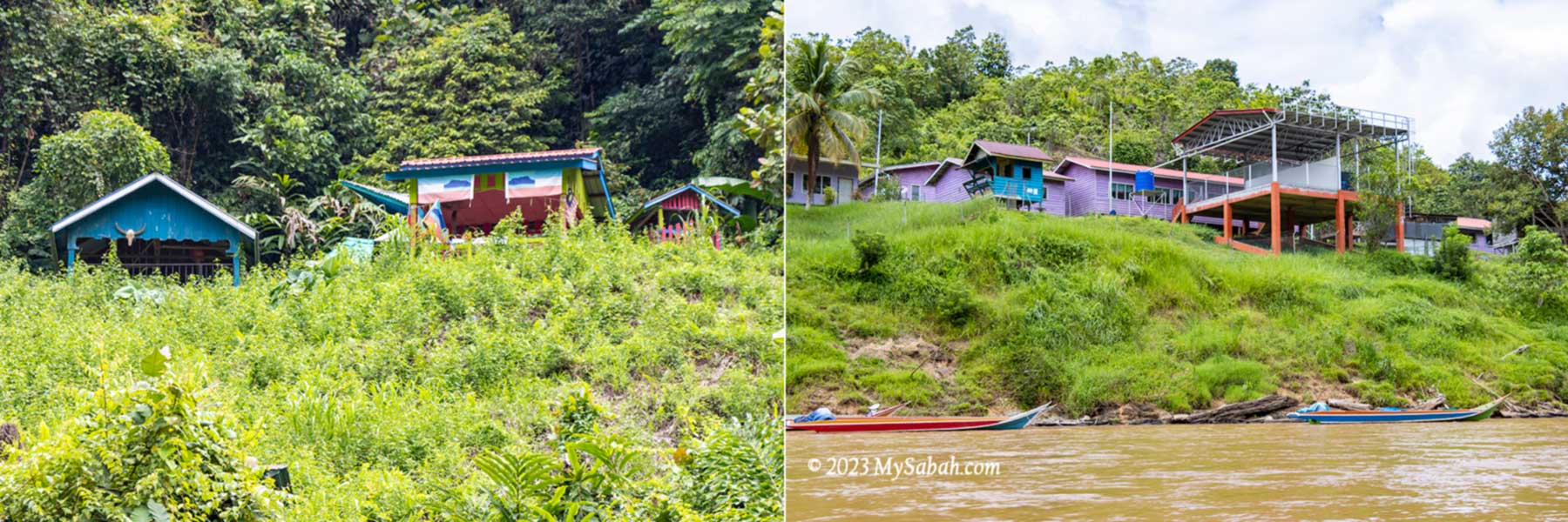
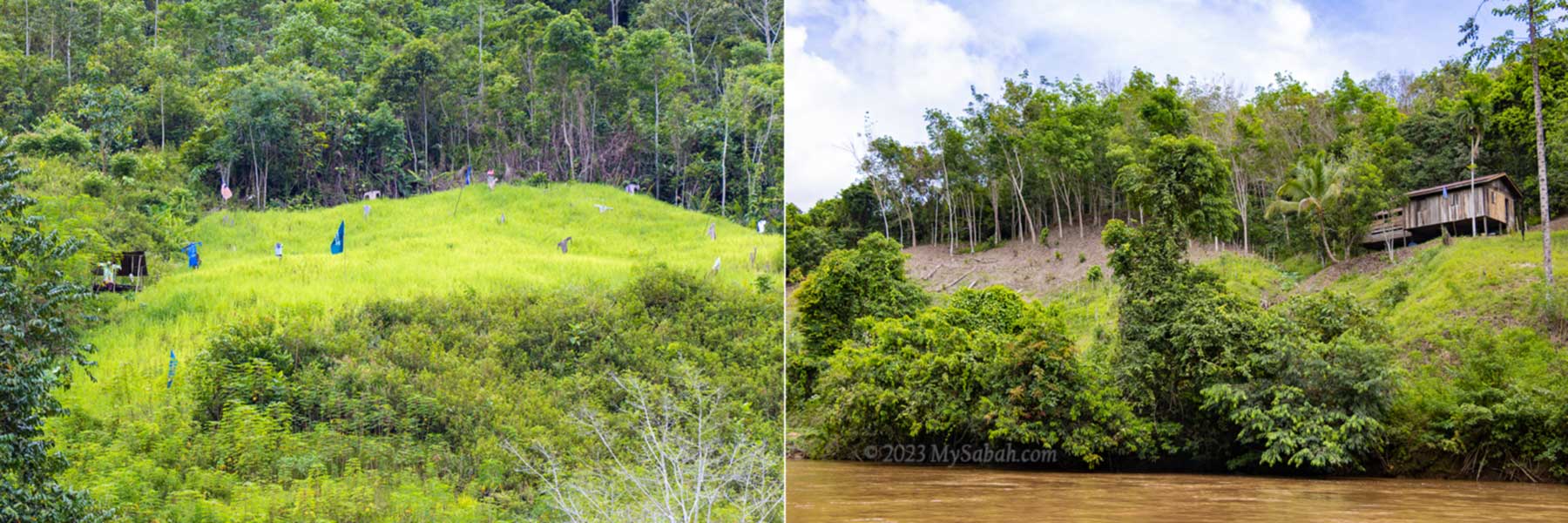
Longhouses and building on the slope
The land at both sides of the river is mostly lush forest, slopes and high ground, where villagers build their houses, schools and farms. The riverside view is interesting as our boat passed by many longhouses and villages such as Kampung Binanding, Kampung Silungai and Kampung Babalitan. Virgil said he saw a group of hunting dogs chasing a deer at the river once.
Longhouses and boats parking at the river is a common view
Most of the population along the river are Murut, which means “the People of the Hill”, and they are the third largest indigenous people of Sabah. Majority of them here are farmers, fishermen and hunters. Travel agents like to advertise Murut as the descendants of headhunters. Nowadays most of them are educated and live a modern life just like others. Many are converted to Christians or Muslims too.
Left: Traditional graves of Murut. Right: Sekolah Kebangsaan Babalitan (school)
Part of the forested hills are clear for planting hill paddy, tapioca, banana, rubber and other crops. Many Murut live in longhouse and I see almost every house has more than one boat parked on the river.
Pagalungan township and the mosque
Anyway, when the new road to Pagalungan town is fully upgraded, longhouses at river side would be gone slowly when more people move to roadside for better accessibility.
Left: hill paddy. Right: rubber plantation
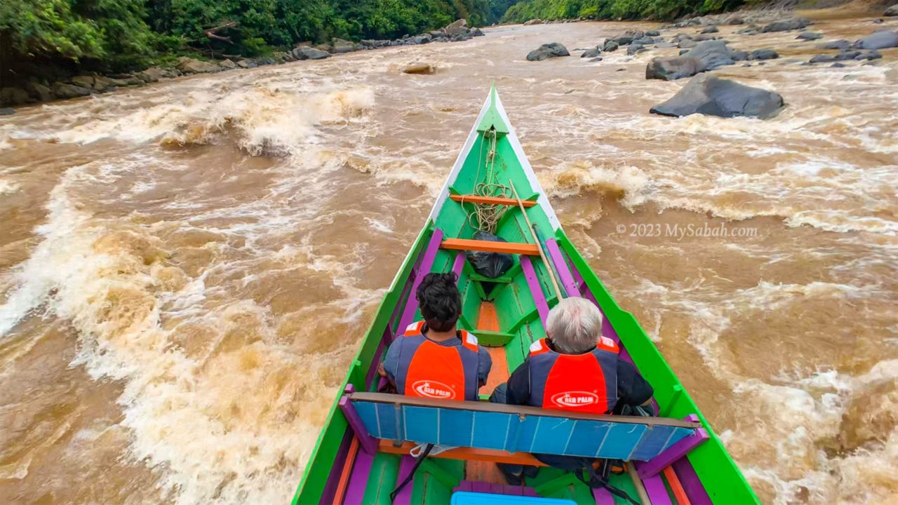
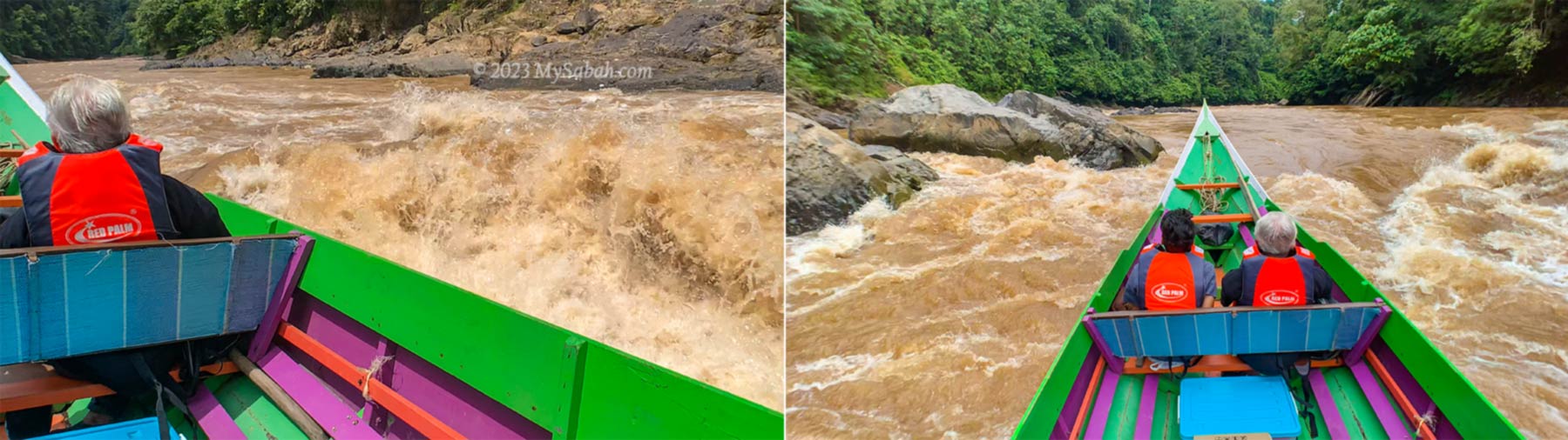
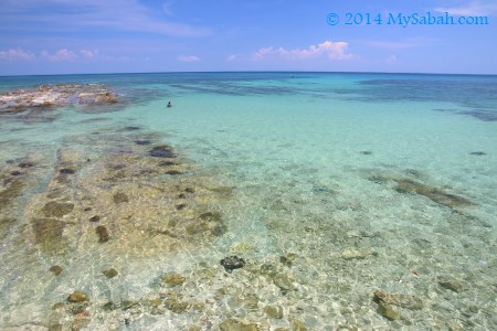
In general, the river is calm, only a few sections are slightly bumpy due to the swift rapids, I’m only hit by the splashes twice. We go through more than 10 rapids and pass through the narrow gaps between boulders couple of times.
Long boat cutting through the strong rapid
The boatmen are really skillful and experienced, so our boat navigate in the raging currents smoothly. So that’s why they call it rapid shooting huh. I really appreciate that whenever my camera points at something, the boatman will slow down the boat until I’m done shooting.
Scary or thrilling moments? Left: big waves hitting the boat, Right: speeding toward the boulders in a rapid
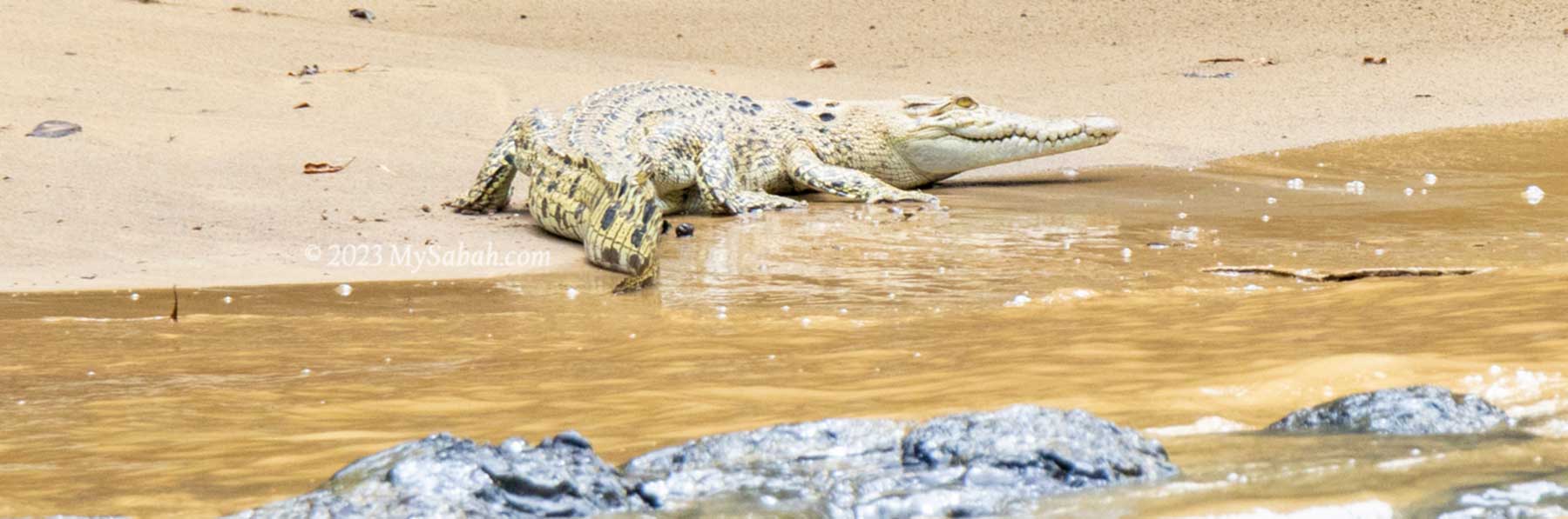
We have our life vests on and feel totally safe. By the way, swimming in this river isn’t a great idea as there are crocodiles. We find only one juvenile crocodile resting on the river bank anyway.
A juvenile crocodile (species: Crocodylus siamensis) on the river bank
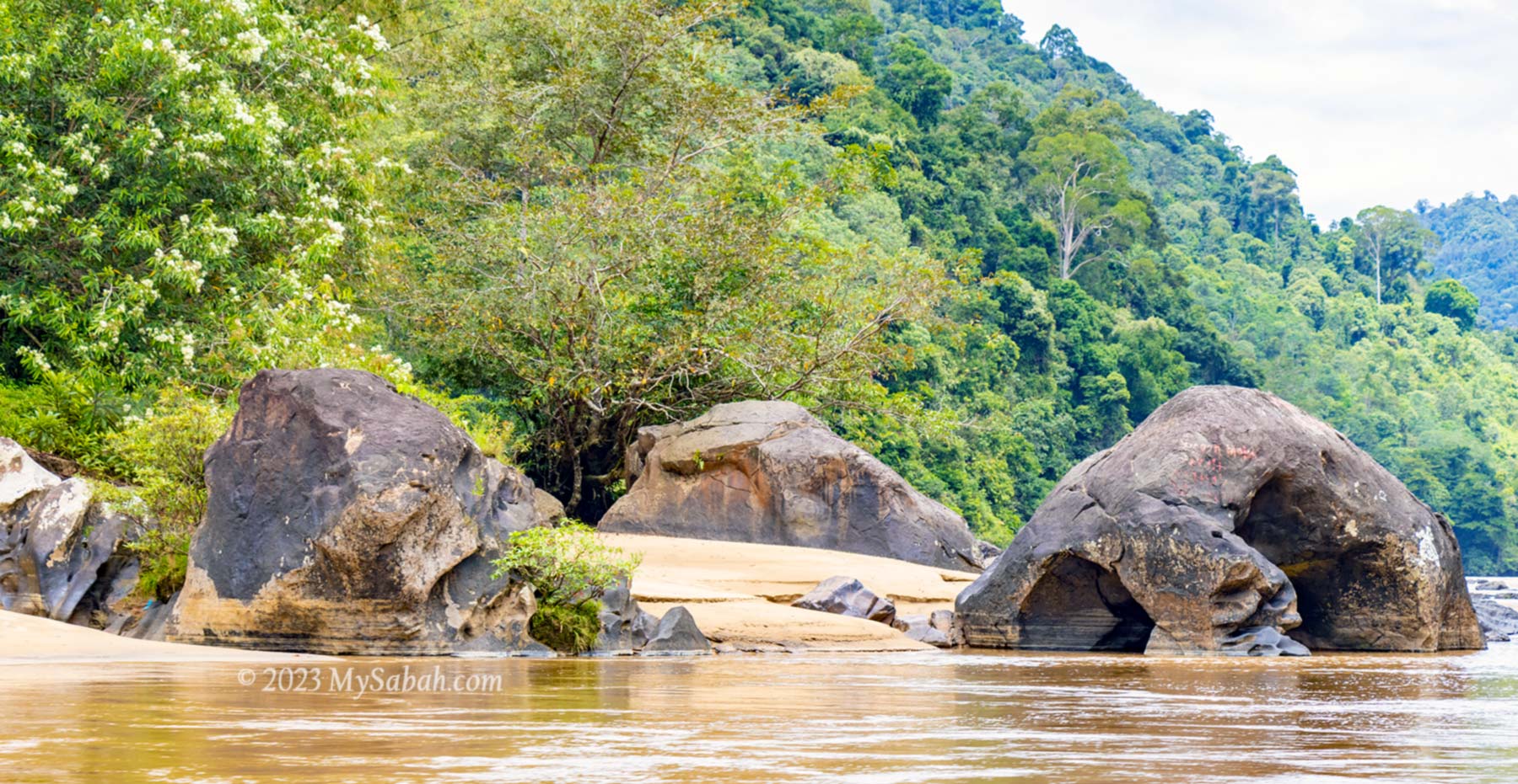
We see a lot of volcanic rocks and boulders of different shapes on the river bank. They are probably 4 or 5 million years old, giving this river more vibes of ancestry. Some rocks look like an animal and probably have a story to tell.
Volcanic rocks at the river
Crossing the Border
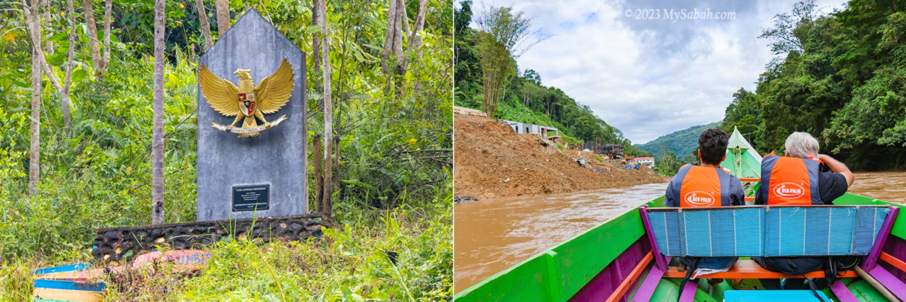
After passing by Bantul, the last Malaysian village before Kalimantan, we see the Garuda Pancasila monument, the National emblem of Indonesia. I know we have arrived Kalimantan.
Left: National emblem of Indonesia. Right: CIQS complex of Indonesia is under construction
Unlike other border controls that are usually guarded by unfriendly armed force and officers, there is no fence and checkpoint that stops our boat. We just go in like an outlaw. However, such relaxation is only applicable to Malaysians. They would stop foreigners to enter even if they have a passport.
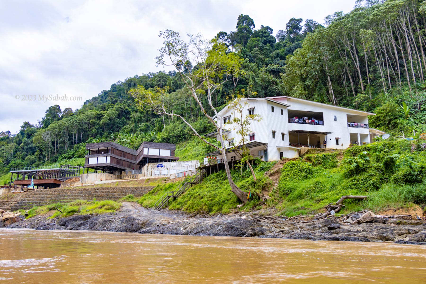
CIQS (Customs, Immigration, Quarantine and Security complex) of Indonesia at the Kalimantan border
They are probably watching us but too busy working on some modern structures. According to Virgil, Indonesia is building a CIQS complex (Customs, Immigration, Quarantine and Security complex) there. It’ll be finished in 1.5 years, and operational in 2 years.
It’s my first visit to Indonesia but there is no proof on paper. When their CIQS is ready, I want them to stamp on my passport, and I would spend a few days in Kalimantan. Currently the proper way to enter Kalimantan from Sabah by water is taking a ferry from Tawau town and land on Nunukan or Tarakan of North Kalimantan Province.
Most of the villagers are Murut people who have been staying here for thousand of years
In fact, there were time when Borneo was under one ruler or government (e.g. Brunei Kingdom and British North Borneo Colony) so there was no boundary. People could move freely between Sabah and Kalimantan during that period.
After “trespassing” Kalimantan for a short distance, we make a U-turn at the Luyu rapid and head back to Sabah. Return trip will take 2 hours, longer time because the boat goes against the river current.
River Picnic
I know we will have our lunch picnic by the river but didn’t expect it comes with a surprise. The colour of main river is like milk tea, a characteristics of the downstream river, which collects silt washed down to the water on its course.
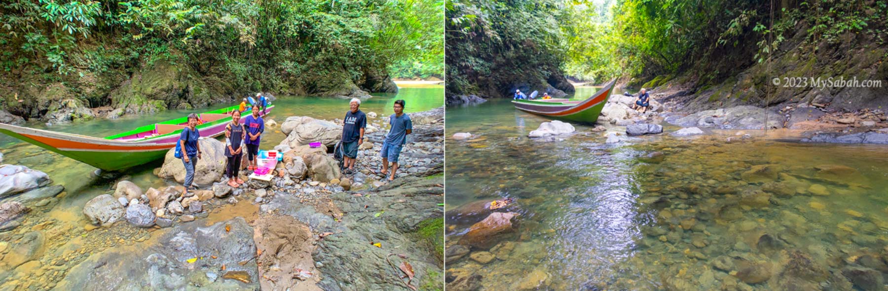
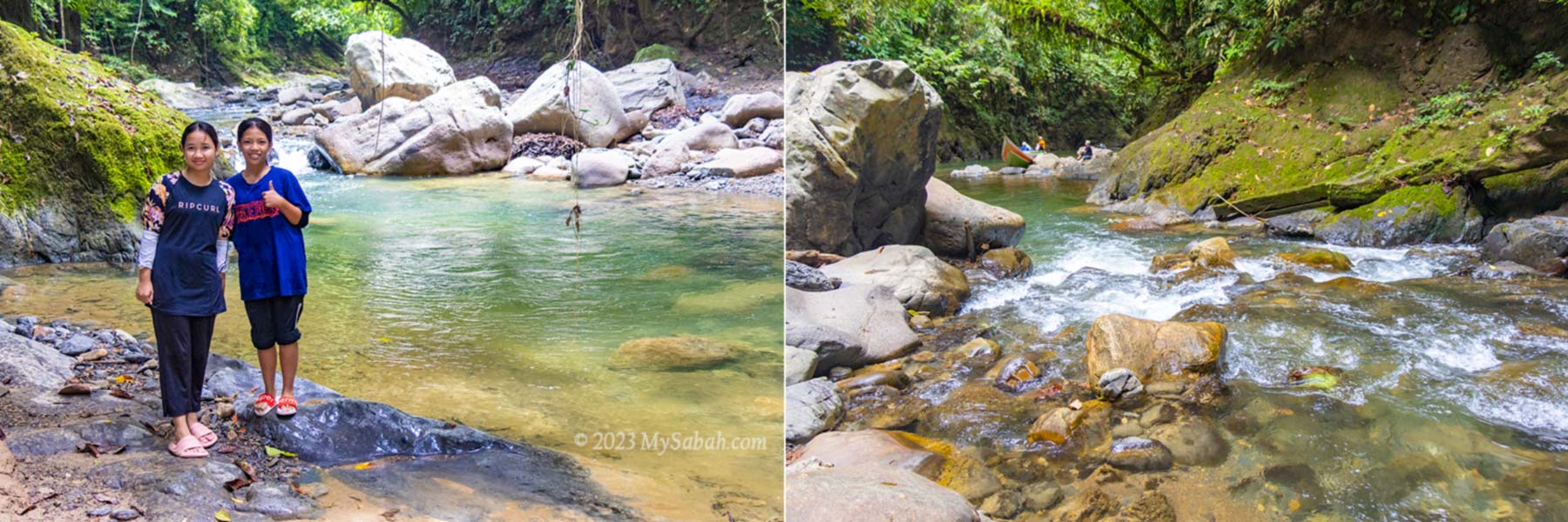
Entering Sumandapiravuhus River
When our boat enters a tributary of the big river, I look at the water in disbelief because it’s crystal clear. “This is Sumandapiravuhus River. We will have our lunch here.” Dr. Richard says. He smiles at me, as if he knows that I’m impressed by the beautiful river.
Sumandapiravuhus River. Far behind is the exit to main river
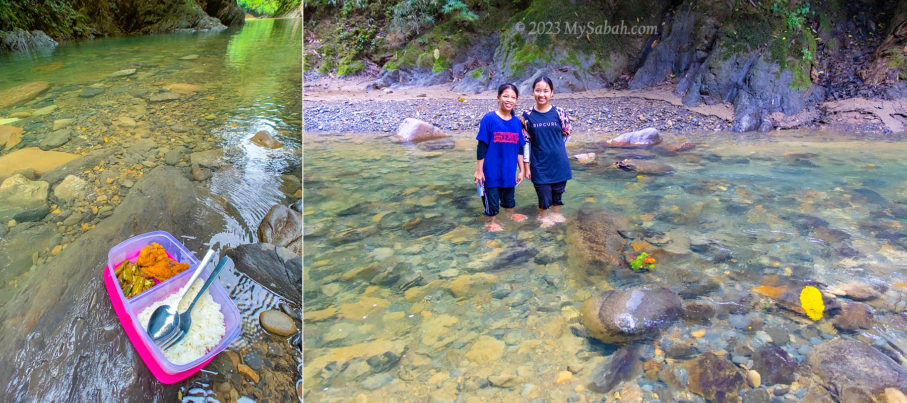
I don’t know how they find this perfect spot for picnic. The surrounding dense trees shade us from the hot sun, and our presence spooks a flock of Bushy-crested hornbill flying over the canopy. I sit on a rock, soak my feet in the cool water, and enjoy my lunch and soda drink.
Lunch picnic at Sumandapiravuhus River
Too bad I don’t have any swim wear with me or it’ll be refreshing to bath in this clean river. Well, maybe next time.
Returning to the Kampung Salung Jetty by 1pm
About Sapulut (or Sapulot)
For a tour in Sapulut, you can contact Borneo Outback Tours Sdn Bhd (Licenses: Co. No. 846369-H / KPK / LN:9247) at: Website:www.borneo.tours Facebook:orou.sapulot Instagram:@orousapulot Phone:+60 19 2277077 (Whatsapp), +60 87 337 277 Address: A-7-2, Apollo Atrium, 89008 Keningau, Sabah, Malaysia
Crystal clear water of Sumandapiravuhus River is so inviting. You can bath in the river or small waterfall there.
The tourism operations in Sapulot are managed by Orou Sapulot (means the Sun of Sapulot), a community based project to promote tourism and in sustainable manner.
Most Asian parents want their children to become a doctor, engineer, lawyer, or land on other money-making careers. Farmer is rarely on the list, as they thought farmers earn very little. However, the global price hike of food in recent years shows that food is king and agriculture has a bright future. Furthermore, Sabah is not lack of fertile land.
Left: group photo with Dr. Richard Gunting (middle) at roundabout of Nabawan town. Right: his durian plantation in integrated agriculture farm
As a PhD holder in agriculture economy, Dr. Richard Gunting knows the economy of farming. He showed me a simple math that answers why many traditional farmers of Sabah are poor. For example, rubber plantation only generates RM4,800 of income per hectare every year. After deducting the cost such as labour and fertilizers, not much profit is left. Oil palm is RM17,000/hectare per year, decent but we can do much better.
A visit to an integrated silviculture farm in Sapulut. Left is Ms Wong from media and right is Virgil, the son of Dr. Richard
Let’s look at other crops. Cocoa is twice the income of oil palm. A hectare of durian such as Musang King and Black Thorn can bring you RM155,000 and RM300,000 of revenue per year respectively. Agarwood (gaharu) is also a high-value tree. The strategy is to maximise the value (income) for every hectare of land as well as maintaining the highest biodiversity via integrated agriculture, which creates multiple revenue streams that are more profitable than monocrop plantation.
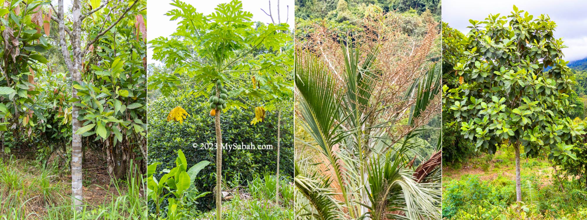
Example of mixing trees in integrated agriculture. At the left is an agarwood (gaharu), a.k.a. Wood of God, its oil is worth like gold.
To inspire the locals to become ‘Rich Dads’ in farming practices, Dr. Richard is an advocate of integrated agriculture (or integrated silviculture), which can potentially generate 8 times more income than oil palm. Such farm is a mix of trees and other cash crops such as cocoa, durian, agarwood, pineapples, coffee, pandan, vanilla, cempedak, jackfruit, coconut, langsar, tarap and sago. On the other hand, small scale monoculture makes ‘Poor Dads’, the subsistence farmers.
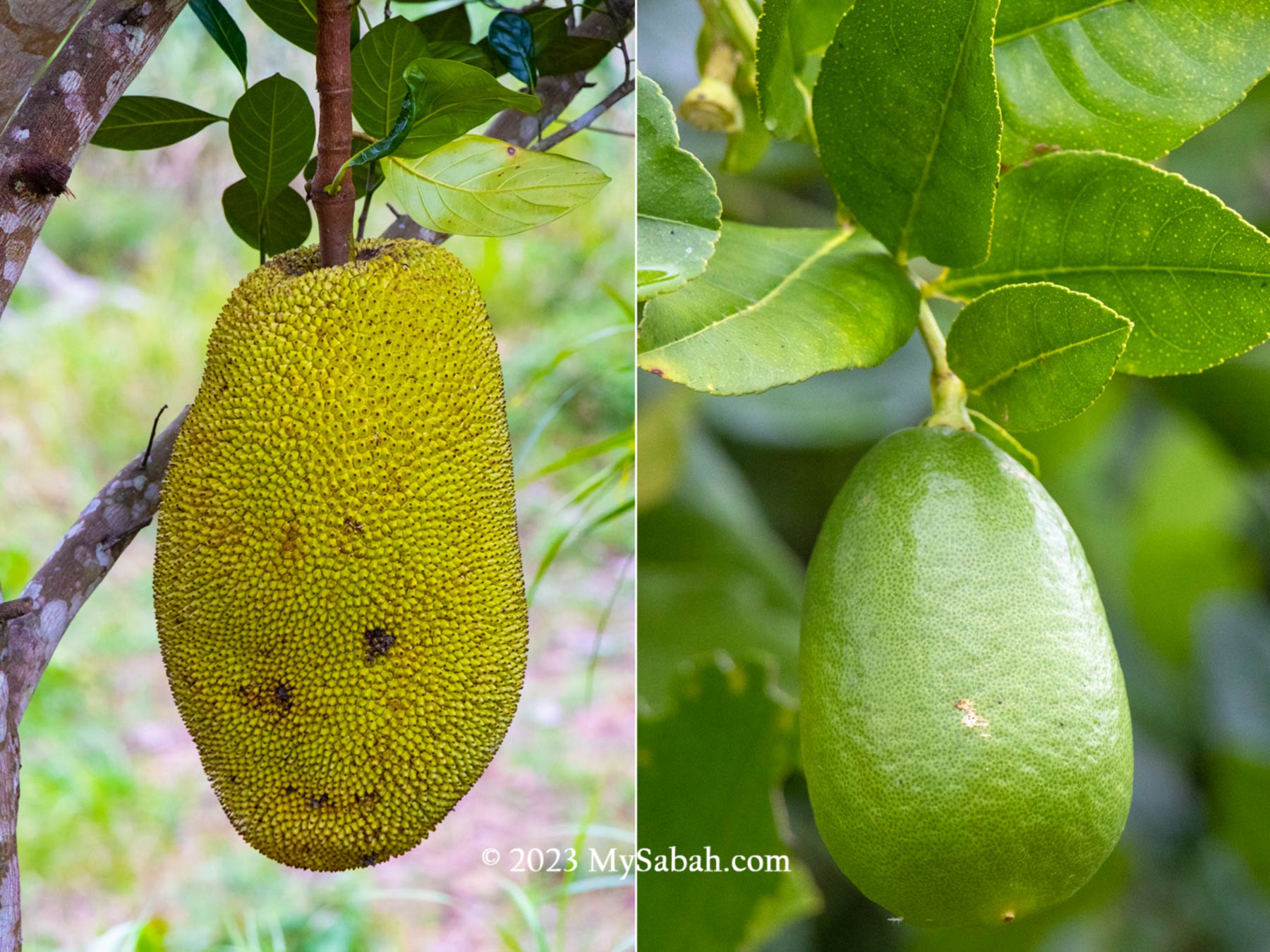
Fruits from integrated agriculture are another income sources besides food crops and timbers.
Integrated agriculture is more friendly to the nature. A researcher, who has visited the farm of Dr. Richard, was impressed by the biodiversity there, which is 2 to 3 times more than a typical Sabah farm. The forested land has healthier soil and some crops need shade to grow well.
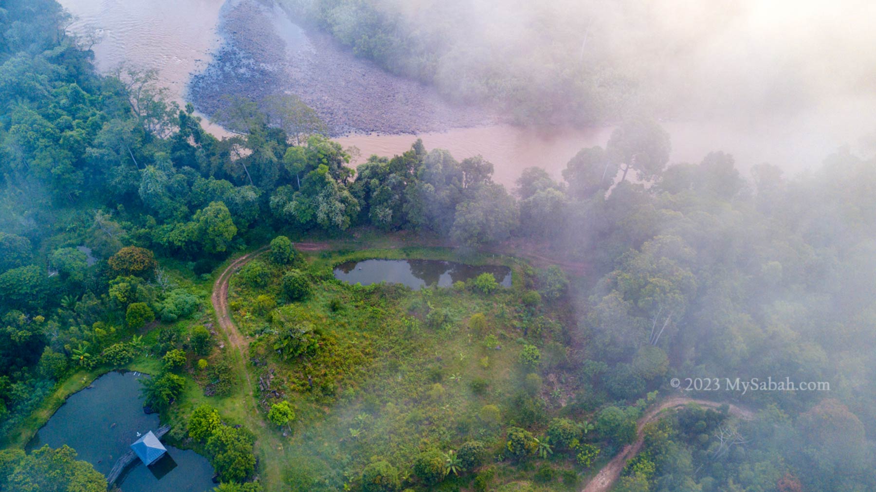
Sapulut River and the farm of MunorAulai Guesthouse. Note the river bank is protected by dense wood to prevent soil erosion and pollution.
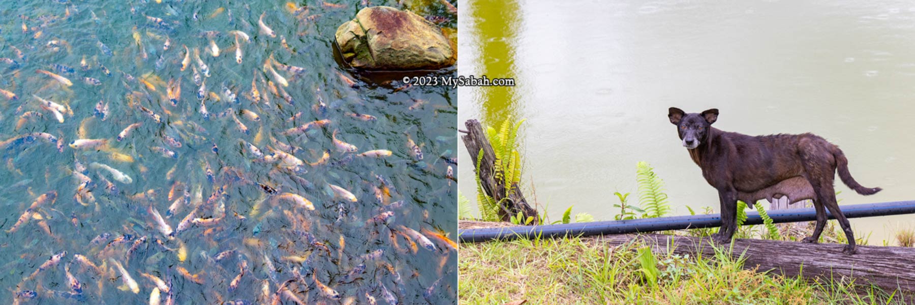
Besides crops, you can raise poultry, livestock (e.g. goats, pigs) and fishes on idle land that is not suitable for planting (I’m thinking of stingless bee (kelulut) farming). At the moment, Dr. Richard’s farm has a few fish ponds for thousand of pelian (Malaysian mahseer or River Carp), jelawat (Hoven’s carp or sultan fish) and tilapia fishes ready to meet the good demand of market.
Left: land that’s not suitable for planting is converted to fish ponds. Right: Virgil showed us the fish pond at MunorAulai
Do you know that eight out of 10 poorest districts of Malaysia are in Sabah? Dr. Richard hopes the wide adoption of integrated agriculture will turn the poor farmers into rich farmers in least developed districts. If every farmers know this wealth building formula, they can ‘grow money on trees’. This model works well for native title land, which is usually 10 hectares in size or less. 70% of native land are idle. Imagine the benefits it’ll bring.
Left: thousand of Jelawat and tilapia fishes in the pond. Right: this village dog has been hunting for the fishes in the pond. Yes, dogs eat fishes, and Virgil caught her stealing fishes in a video.
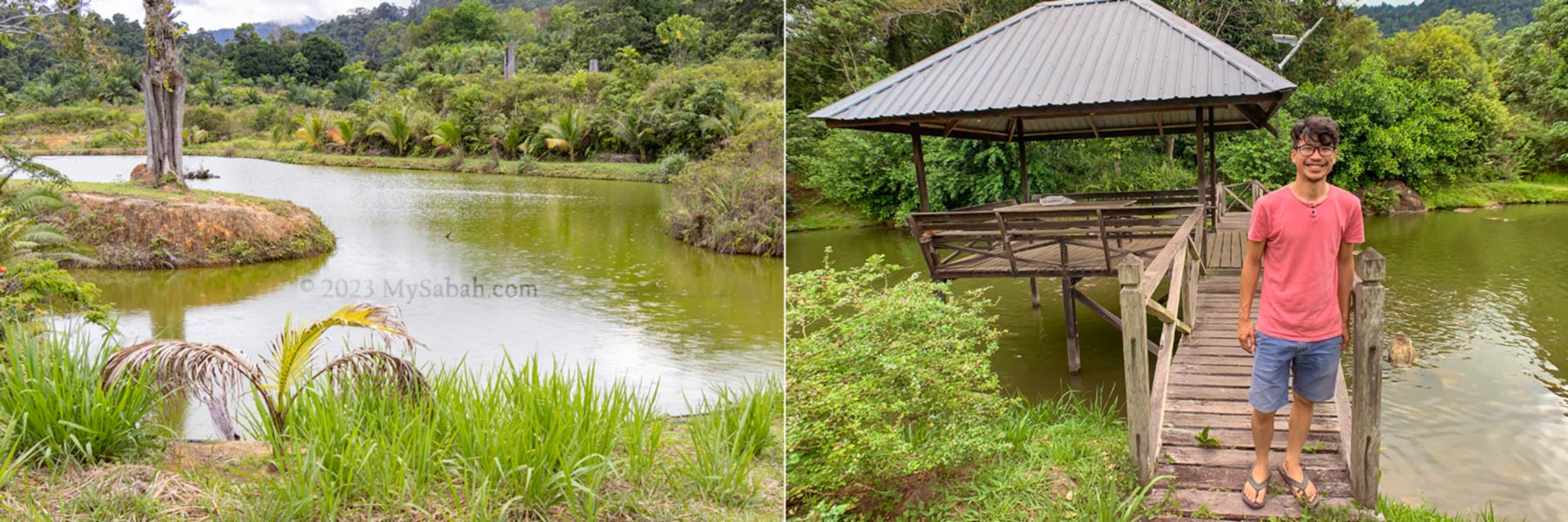
MunorAulai Guesthouse
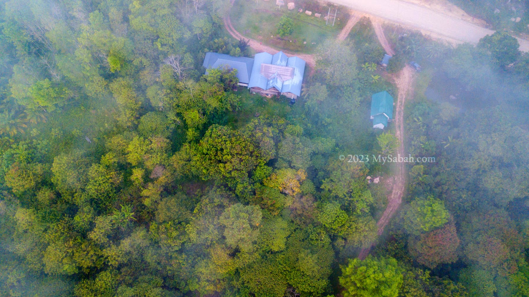
For the proof of concept on integrated agriculture, Dr. Richard allocates 10 hectares of land in Sapulot (or Sapulut) for this farming technique and build MunorAulai Guesthouse there for visitors to experience farmstay and witness the result of integrated agriculture. Integrated agriculture is supported by WWF and Sabah government. It’ll become a trend because its approaches are friendly to the environment and ecosystems.
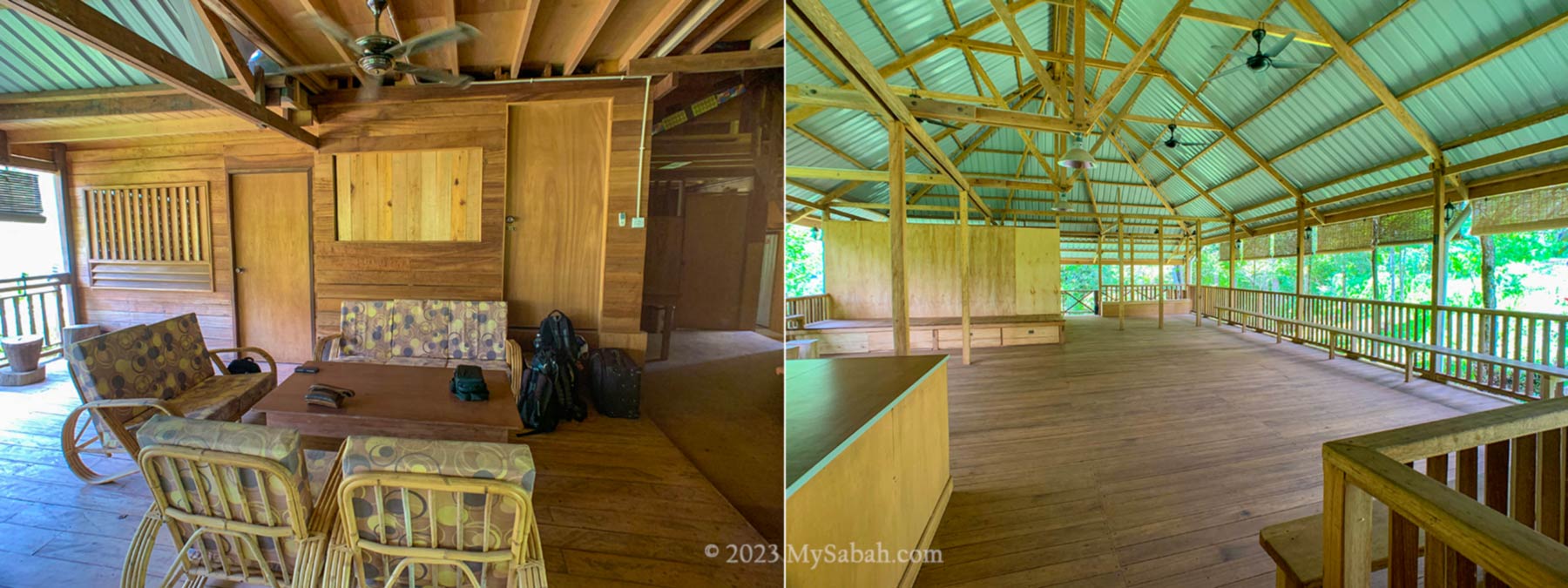
MunorAulai Guesthouse can accommodate up to 25 people. 10 to 12 people is the ideal group size.
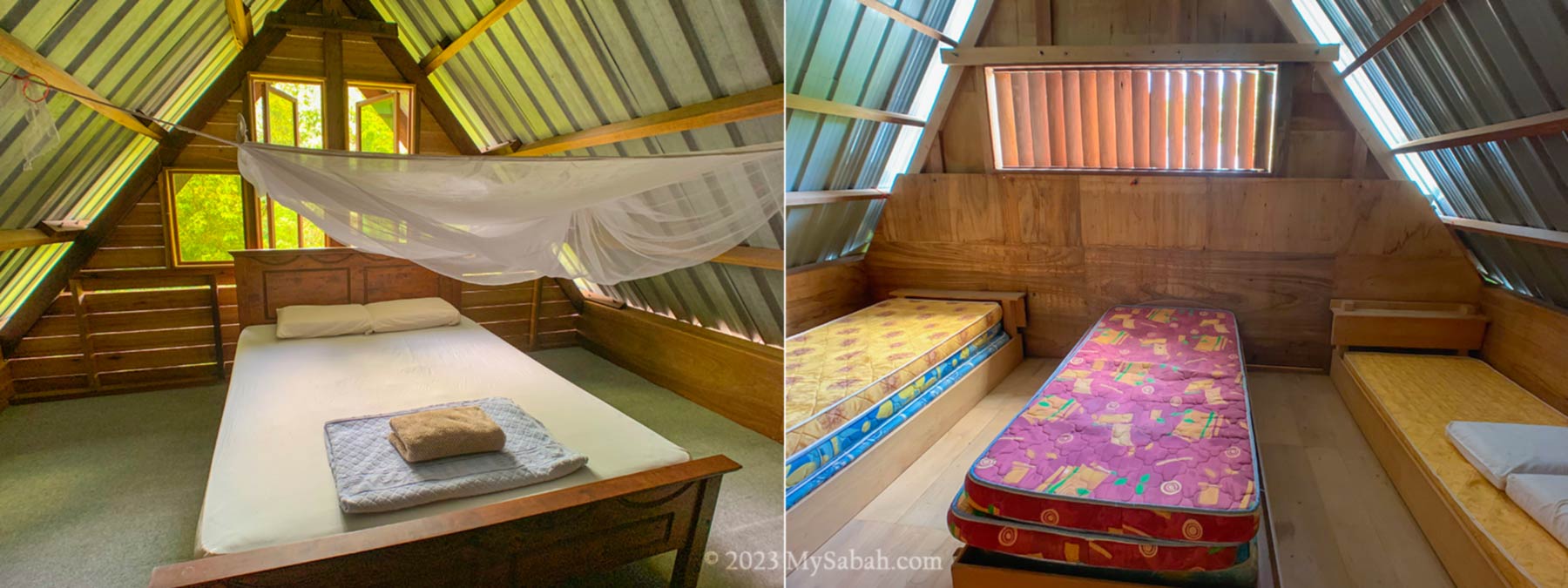
When Dr. Richard walked around his farm, a small and colourful Munor, a bird of omen, followed him around and chirping positive messages, so he named the place as MunorAulai (means it’s auspicious by Munor bird). MunorAulai is equipped with toilets, showers (water heater available), activity hall and a simple lounge. They have clean bedrooms (with fan and power point) to accommodate about 12 to 25 people.
Bedrooms of MunorAulai Guesthouse
You will feel exclusive at MunorAulai Guesthouse because it’s Murut customary to serve their guests with hearts. Murut is the third largest indigenous group of Sabah. Though Murut people are portrayed as the descendants of fearsome headhunters, they are the friendliest when come to hospitality.
Lounge and activity hall of MunorAulai Guesthouse
At MunorAulai Guesthouse, you will eat, drink, party and dance like a Murut. The following are my experience at MunorAulai. I felt like I was living in a traditional longhouse of Murut.
Misty farm of MunorAulai Guesthouse. It’s a nice place for a morning walk.
Drinking Party
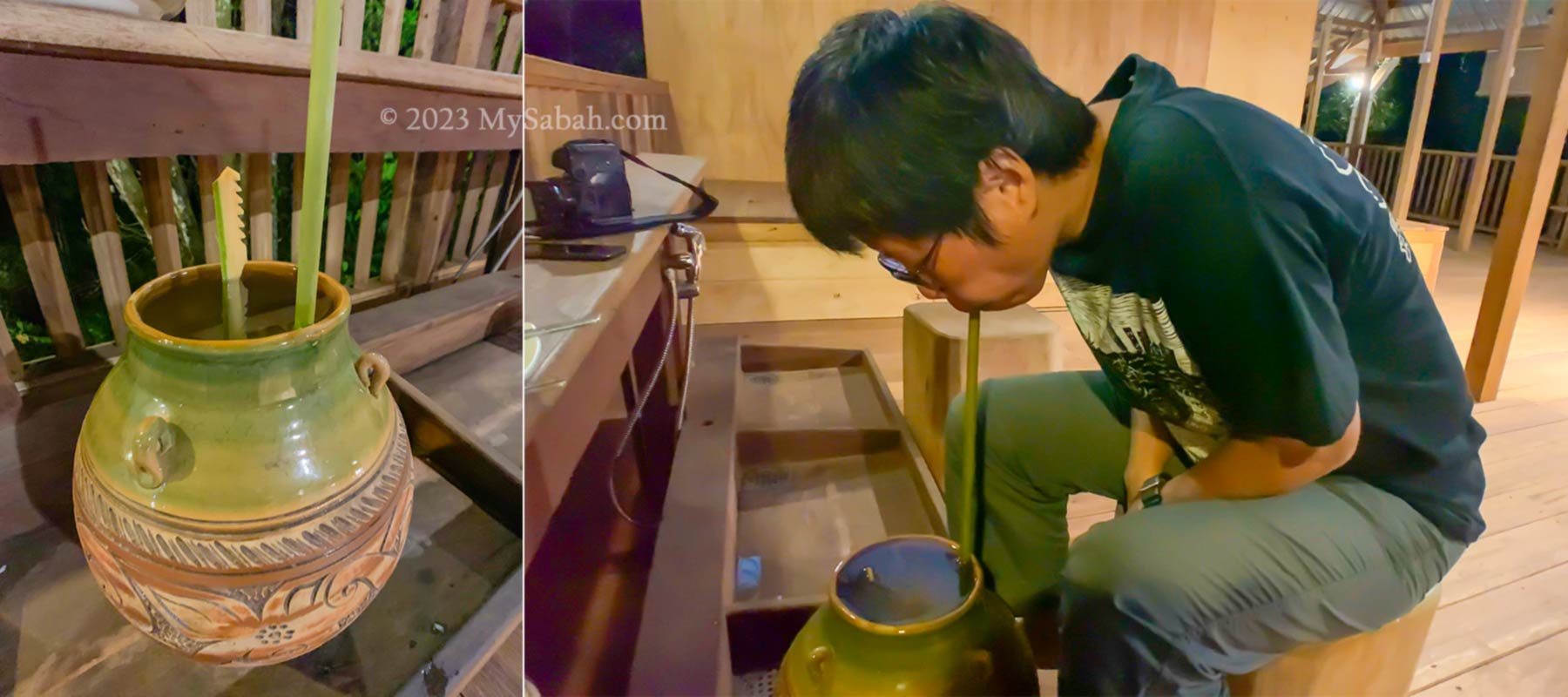
Tapai, a home-brew Sabah wine made from rice or tapioca fermented in a jar, is the soul of Murut people. Tapai is prepared by the villagers in accordance to their strict customs abiding to all taboo belief being passed down through generations.
Murut has a special way of enjoying Tapai together during social occasions, and it’s an honour to be invited to this hundred-year-old merrymaking tradition. It’s really fun if you have this drinking party with a group of friends.
Tapai drinking challenge. Everyone takes turn to sip the wine from jar.
Tapai is served right from the fermentation jar. After unsealed, a marker and a bamboo straw are inserted into the jar. Everyone will take turn to sip tapai until the liquid level drops to the marking. You can take small bites of comfort food along.
Good tapai is sweet and sour, with a bit of bitter taste. Tapai is quite potent. Even after first or second round, it warms my body and I start to get high. Many guests love this unforgettable drinking marathon and bonding experience with their friends.
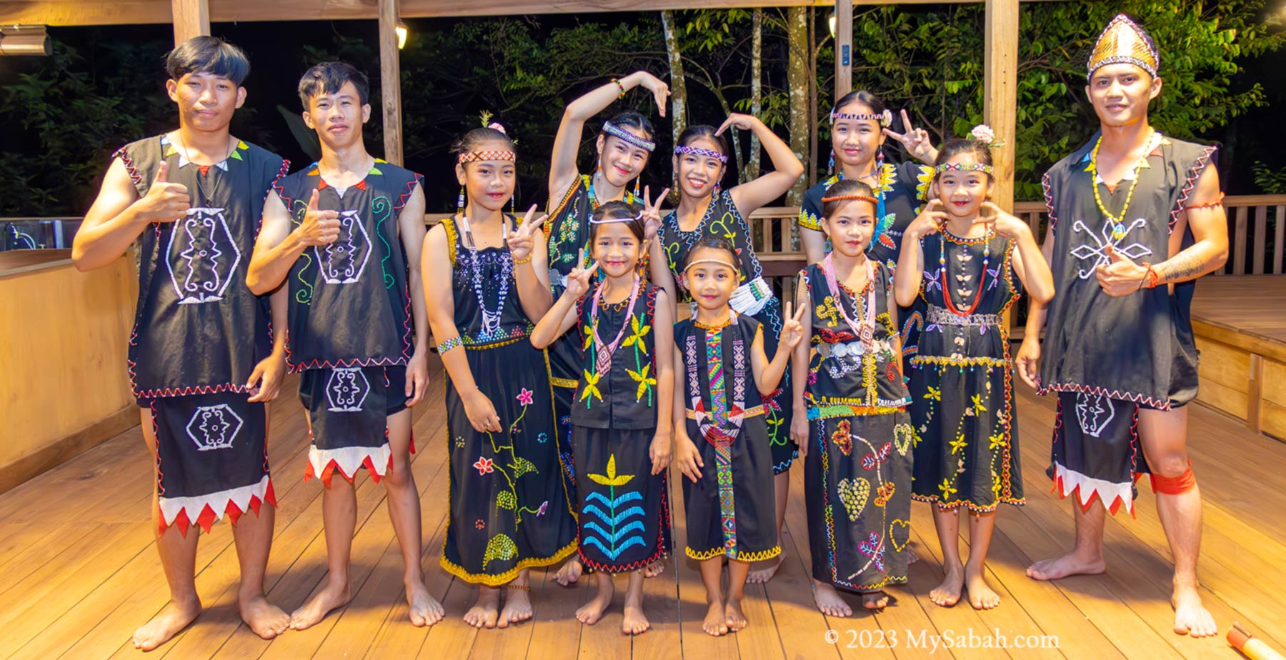
Cultural Show
A party isn’t a party without dance and music. The local youth and children will perform traditional Murut dance to welcome and entertain the guests. During my visit, my heart melts when I see two of the dancers are only 5 years old. They dress in traditional Murut costumes and dance gracefully under the gong music.
Children and youth Murut dancers of Sapolut
The highlight is the magunatip bamboo dance. Dancers follow the rhythm to place their feet between the clapping bamboo poles and get out before the poles close the gaps. The tempo of gong beating and clapping will go faster and faster, and dancers have to be agile to avoid their feet being trapped.
You can watch this video to see how funny I danced
Guests will be invited to try out the bamboo dance. After some drinking, I was leaping like a headless monkey and being clapped by bamboo again and again. Everyone laugh and we have a wonderful time. Goodness, it’s really a good exercise.
Food
Murut mean it when they welcome a visitor. To make sure the guests are well-fed, Murut host would cook the last chicken they have. They also would not eat before the guests are done with the meals first. I always have a happy full stomach at MunorAulai Guesthouse.
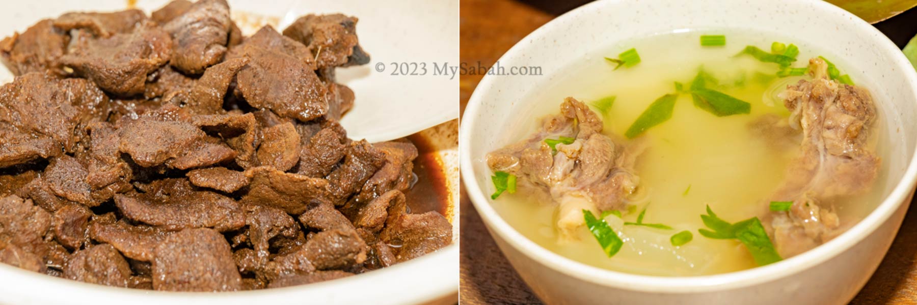
Deer meat and soup
To be honest, their cook never disappoints me. I sample a good variety of delicacies and Murut dishes. Some are fresh fruits and vegetables from their farm. I appreciate their home style cooking with balanced diet, simple and tasty, and in big quantity.
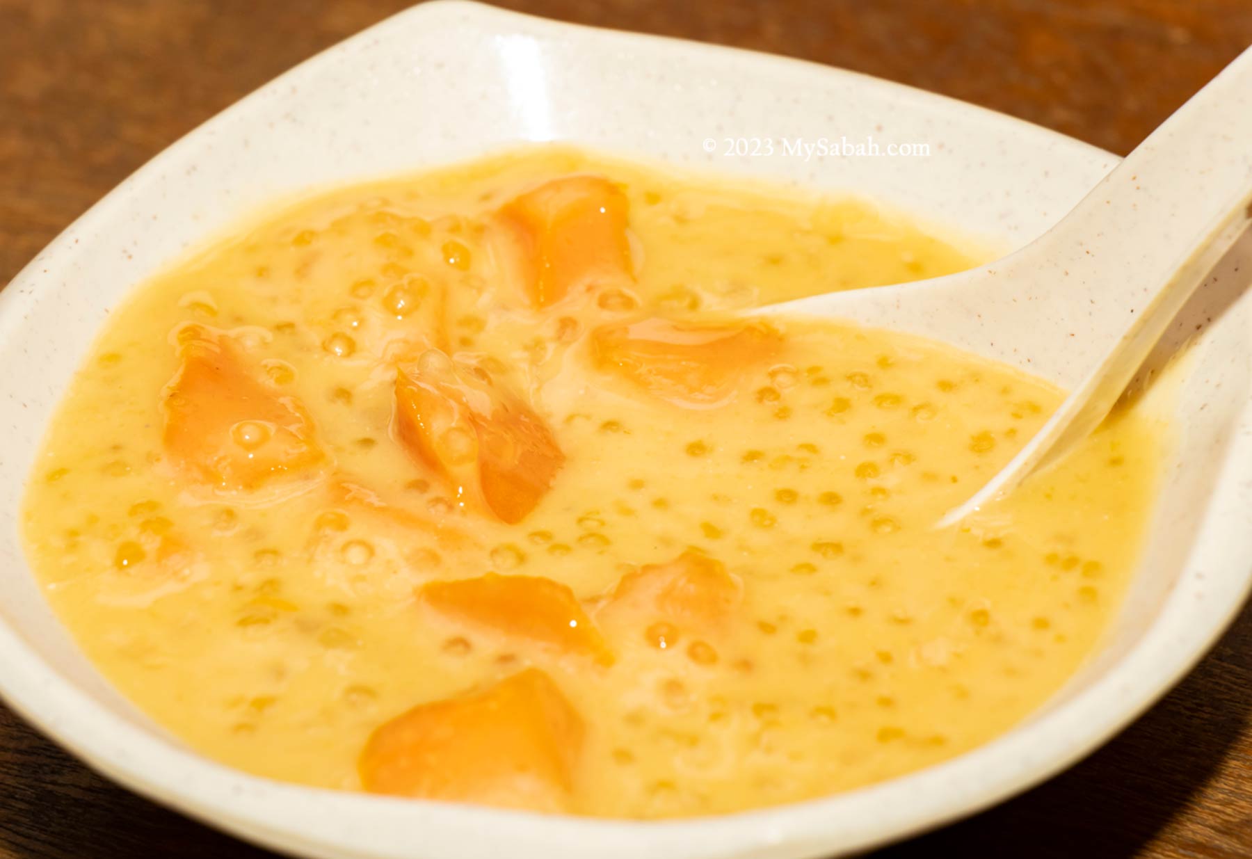
Kinurutuk, a sweet and smooth Murut dessert made with tapioca starch, coconut milk, brown sugar and sago
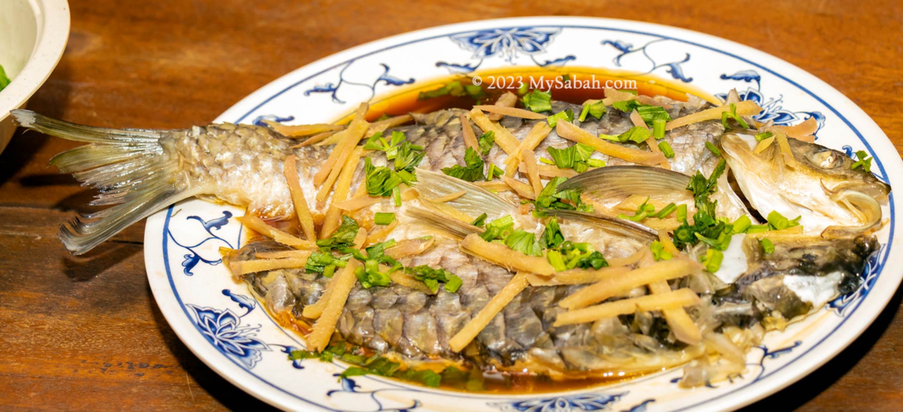
One of my favourite is the steamed pelian, the most delicious freshwater fish of Sabah. Its meat is sweet, tender and fatty, even the scales are edible. Pelian is similar to Empurau, the most expensive freshwater fish of Malaysia. I love their deer meats too.
Steamed pelian, one of the most tasty freshwater fishes. Even its scales are edible.
This is just the first stop of my journey in Sapulot. Sapulot was used to be the land of headhunters in the past. Headhunting is long gone, so now we can travel freely in Sapulot. I can’t wait to show you some beautiful places that were once a sacred ground. In fact, many tourists from USA and Europe have visited Sapulut for a raw Borneo experience.
About Sapulot (or Sapulut)
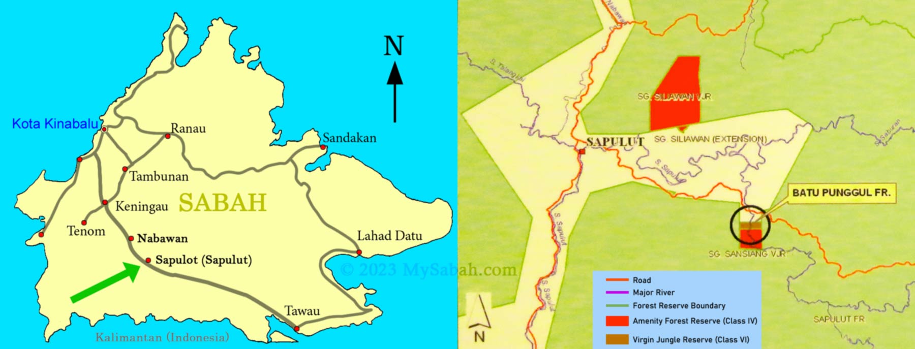
Sapulut is a small district of Sabah interior about 47 KM away from Nabawan town (217 KM away from Kota Kinabalu City. Accessible by paved road). Most of the population in Sapulot are Murut. Sapulot (or Sapulut) means “sticky” in Murut language because the Sapulut River takes longer time to clear when it turns murky after rain.
Location map of Sapulot and its surrounding
For a tour in Sapulut, you can contact Borneo Outback Tours Sdn Bhd (Licenses: Co. No. 846369-H / KPK / LN:9247) at: Website:www.borneo.tours Facebook:orou.sapulot Instagram:@orousapulot Phone:+60 19 2277077 (Whatsapp), +60 87 337 277 Address: A-7-2, Apollo Atrium, 89008 Keningau, Sabah, Malaysia
The tourism operations in Sapulot are managed by Orou Sapulot (means the Sun of Sapulot), a community based project to promote tourism and in sustainable manner.
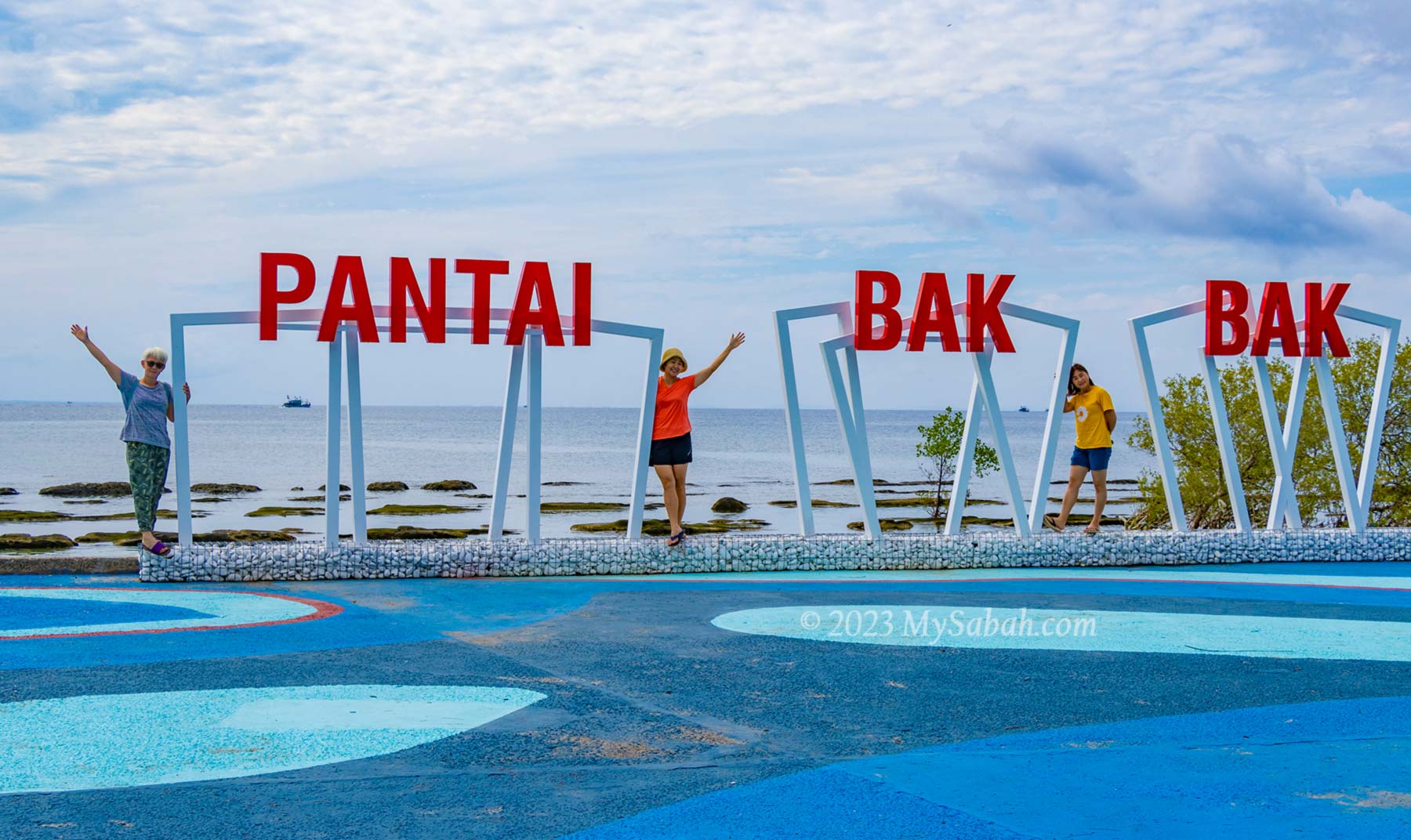
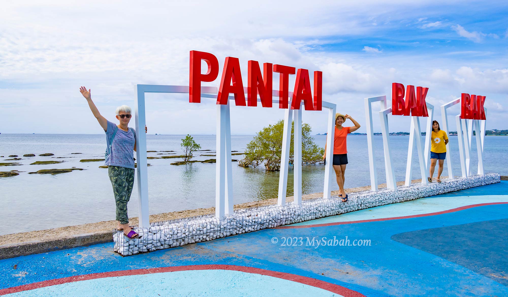
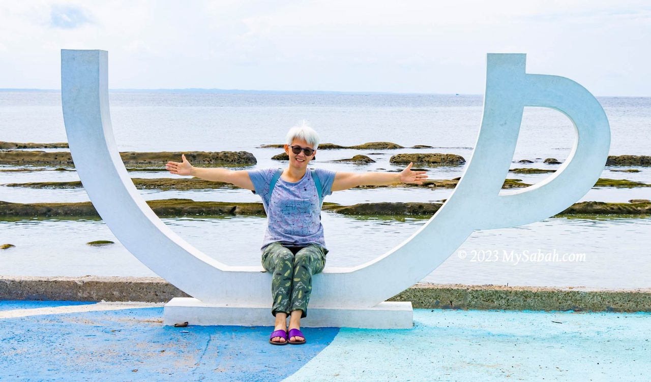
Kudat district at the north of Sabah has some finest beaches of Borneo. For example, Tip of Borneo (a.k.a. Tanjung Simpang Mengayau) is a popular tourist destination due to its breathtaking beach and sea view. If you ask the locals in Kudat town, they would recommend Bak Bak Beach (Local Name: Pantai Bak Bak) too, which is the nearest beach to Kudat (11 KM away to the north).
New landmark sign of Bak Bak Beach (Pantai Bak Bak), installed in 2023
Pic: panoramic photo of Bak-Bak Beach
To go to the beach, you will pass by the junction to Bak Bak Beach (Note the signage reads “Jalan Bak-Bak” at your right, see the location map of the junction), when you are on the way to the Tip of Borneo. After 4 KM, you will see the beautiful Bak Bak Beach (See Location Map of Bak Bak Beach).
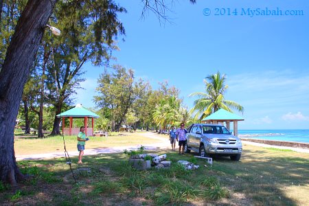
Local Chinese calls Bak Bak Beach “石码头海滩”, which means Rock Jetty. It is a rocky beach, but I didn’t see any jetty though. I read somewhere that mentions Bak Bak Beach was used to be a busy port in the past. We enjoyed the gentle sea breeze under the shades of swaying casuarina trees.
The sea water is crystal clear and shallow, and seem like you can walk all the way 100 Meters away from shore. During high tide, it is great for swimming. If you really want white sandy beach, you can continue to drive 4 KM along the road. When you come to a junction, turn to right and you will reach a deserted beach named Pasir Putih (means white sand) after 400 Meters. Pasir Putih is a more inviting spot for swimmers.
Am I your cup of tea?
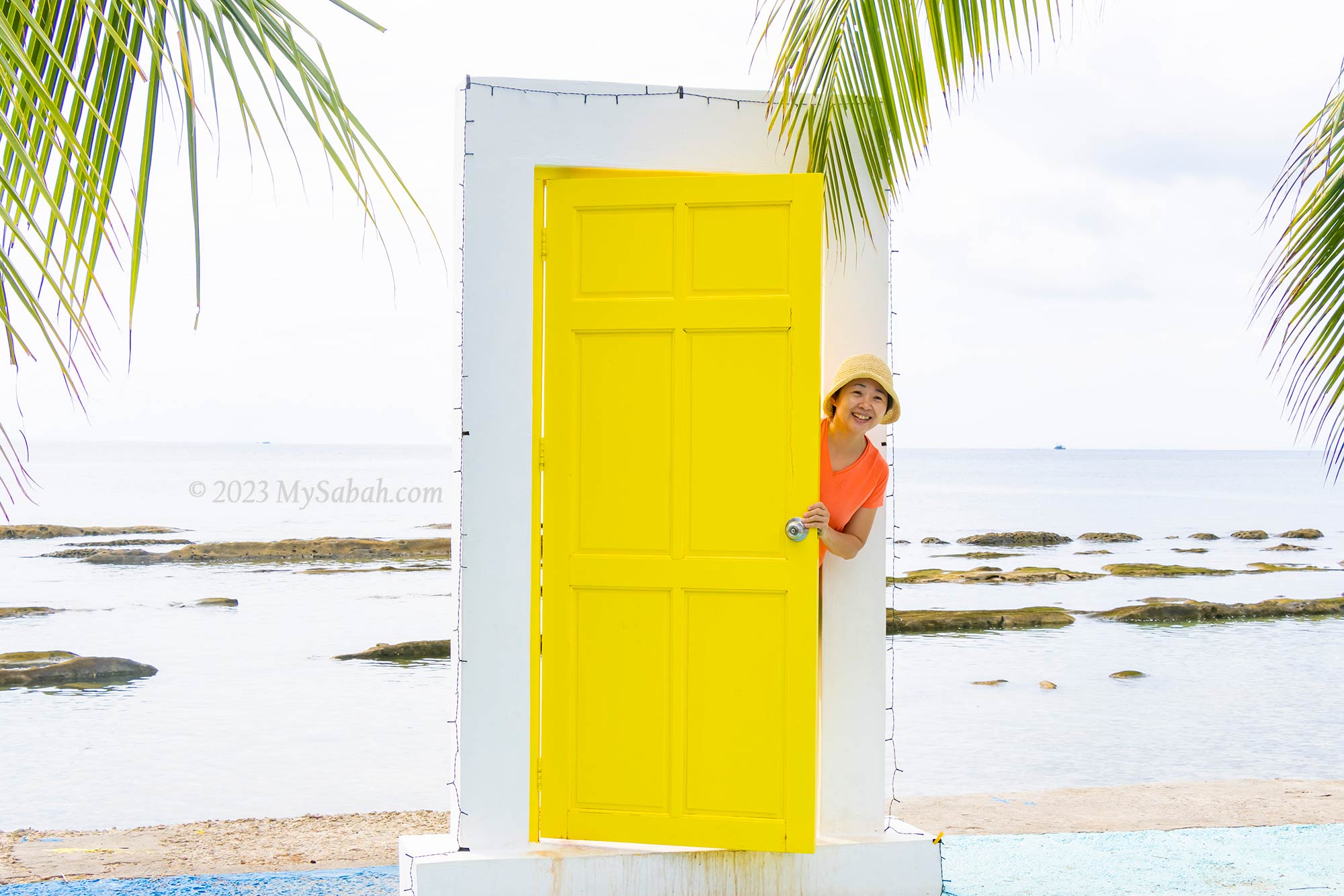
The beach had a facelift in early 2023 and added some colourful decoration and photo booth structure at the beach. There is a restaurant that is open from 11am to 5pm. Public toilet is available too.
We visited the beach in Saturday noon and it was quiet, only one family hanging around with kids. We learn later that this place is only crowded with locals on weekends. Anyway, looking at the shelters, tables and barbecue areas, Bak Bak Beach is also a nice site for picnic and dating.
Door to the Bak Bak Beach?
Have you been to Bak Bak Beach? Please tell me more about it in comment section below.
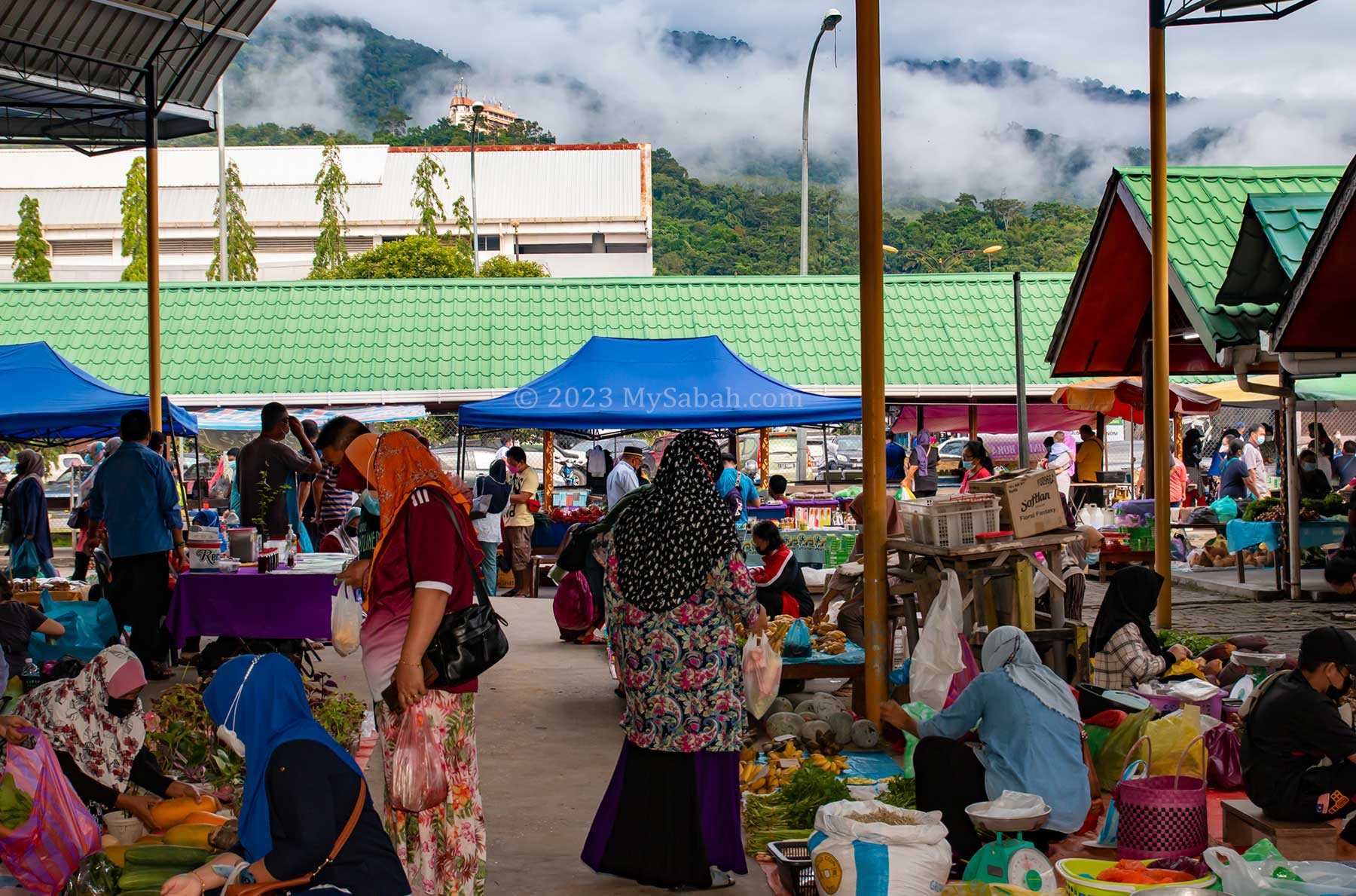
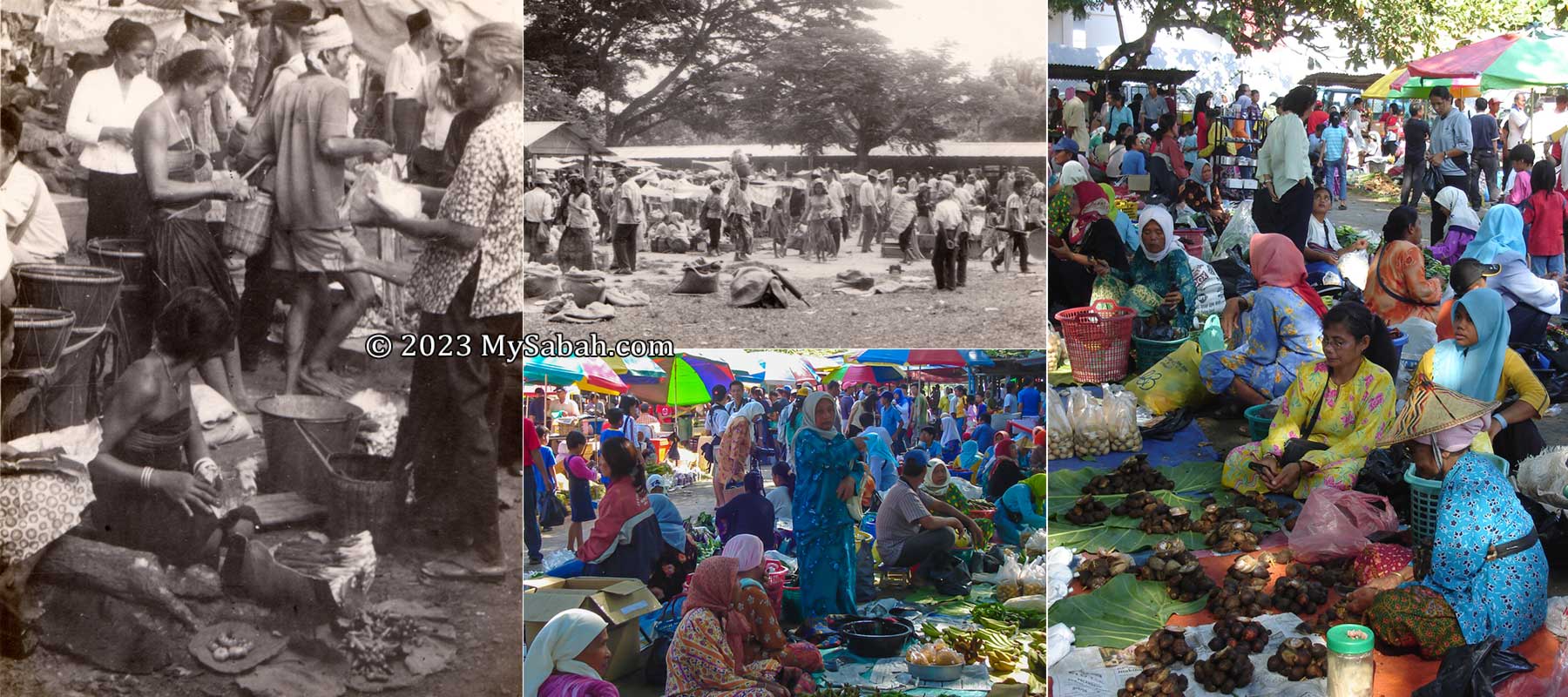
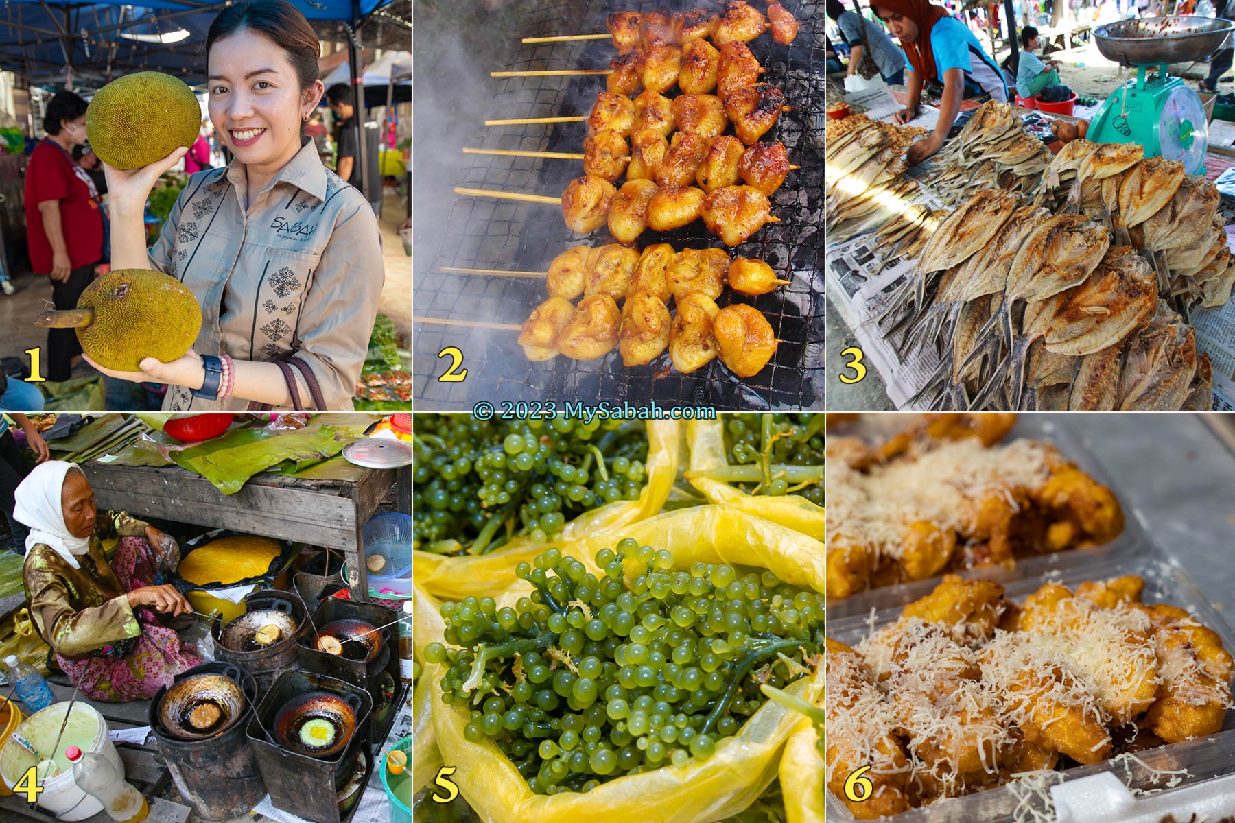
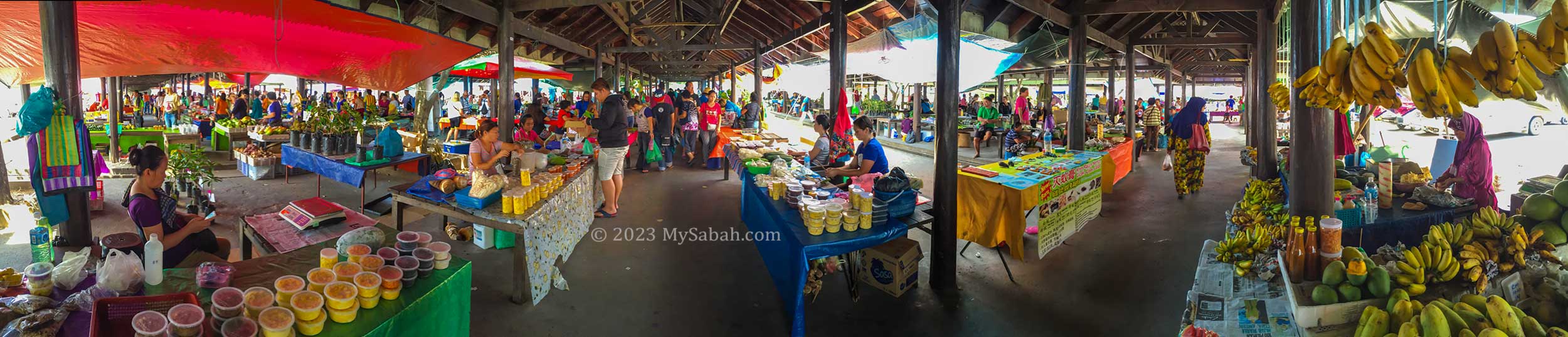
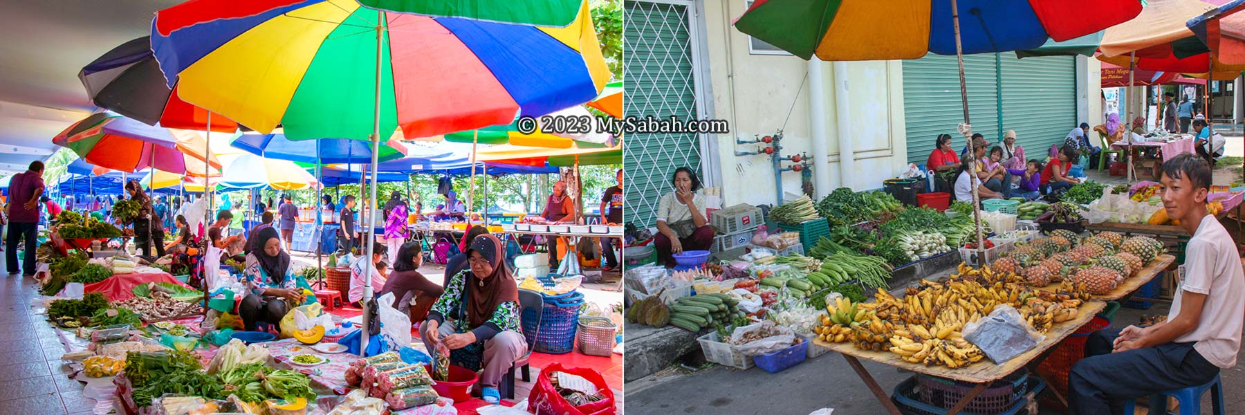
If you want to travel smart in Sabah, do not miss Tamu, the weekly (sometimes twice or thrice weekly) open-air native market in outskirts of Sabah. It’ll feel like a food and treasure hunting tour.
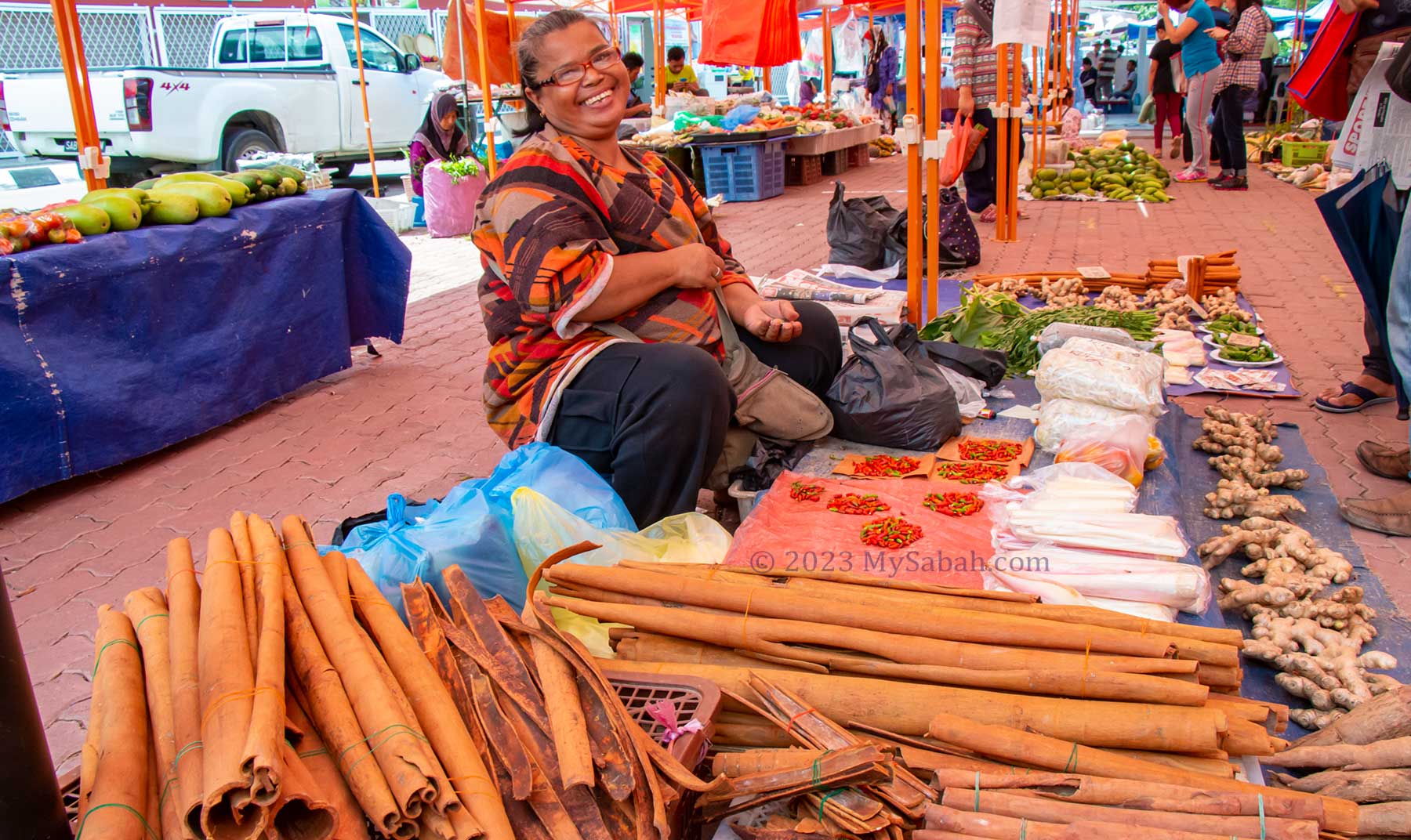
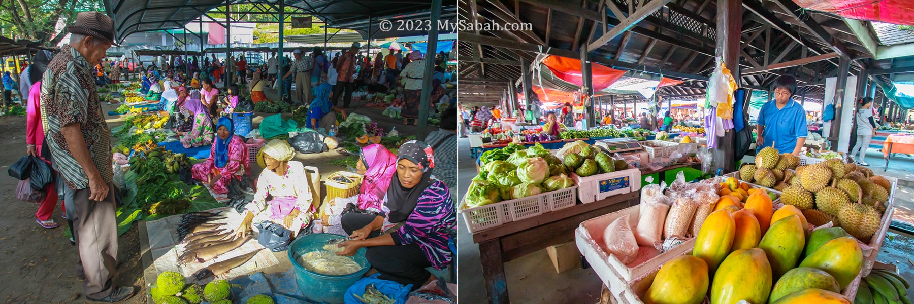
The beautiful tamu market of Tenom town. It’s just behind the central market in town centre.
The name tamu derives from the Malay word bertemu which means ‘to meet’ and it has been a place of congregation for farmers, fishermen, craftsman and traders for over 145 years. In old days there was no supermarket, so every districts held a weekly tamu for local villagers to meet, shop, and trade their produces at a designated location.
The colourful tamu of Sabah. Tamu are called differently by different ethnic groups in Sabah. The Dusun and Rungus people call it “Badi” while it is known as “Semio” by the Bajau people in Kota Belud. In the Tuaran district, it’s also called “Buul” for smaller native markets.
History of Tamu
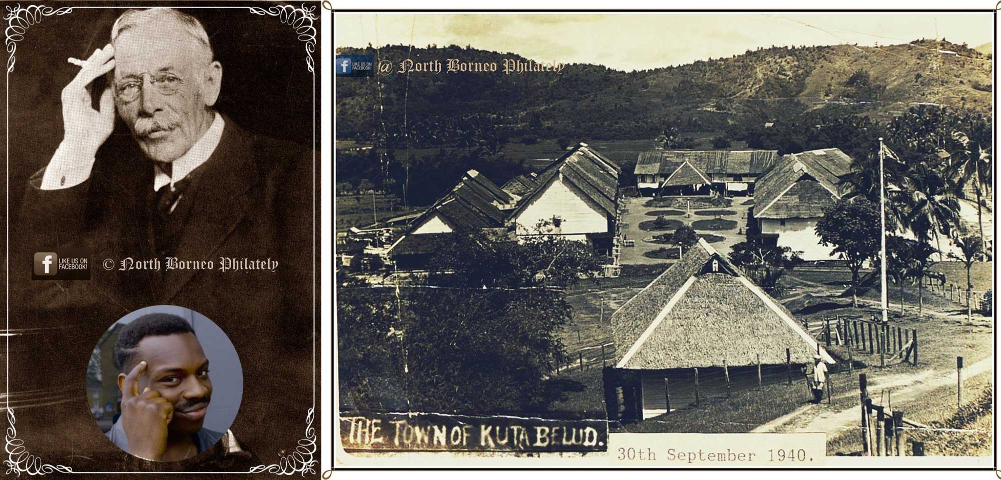
The first tamu of Sabah was started on 13 December 1878 in Kota Belud (Kampung Siasai) by William Pretyman, a political agent of British North Borneo (now Sabah). In his diary, William said the locals from different tribes were so excited to see the first tamu ground in preparation and kept on asking him the opening day of tamu. It’s a huge success as each ethnic group can offer certain goods that others don’t have. For example, a Dusun farmer can sell rice to a Bajau fisherman who would buy or barter trade it with fishes. Merchants from China and Brunei and also sourced many local products from tamu.
Left: the white man is William Pretyman. Look like a smart dude. Right: a photo of Kota Belud in 1940, taken by W.K.C. Wookey (courtesy of The Sabah State Archives). Both photos are from the Facebook of North Borneo Philately
The same goes to fruits & vegetables, traditional herbs, seafood, livestock, bushmeat, beeswax, textile, crafts and wide array of other produces, some carried by villagers walking over 10 KM to the marketplace. British rulers were also happy that different tribes could do business peacefully at tamu though tribal conflicts were common during that time. Brawls and weapons are prohibited in tamu. British officers also used tamu as a place to distribute news. Locals people from different villages mingled and exchanged news at tamu too. Though British had left Sabah in 1963, tamu is still an integral part of rural economy.
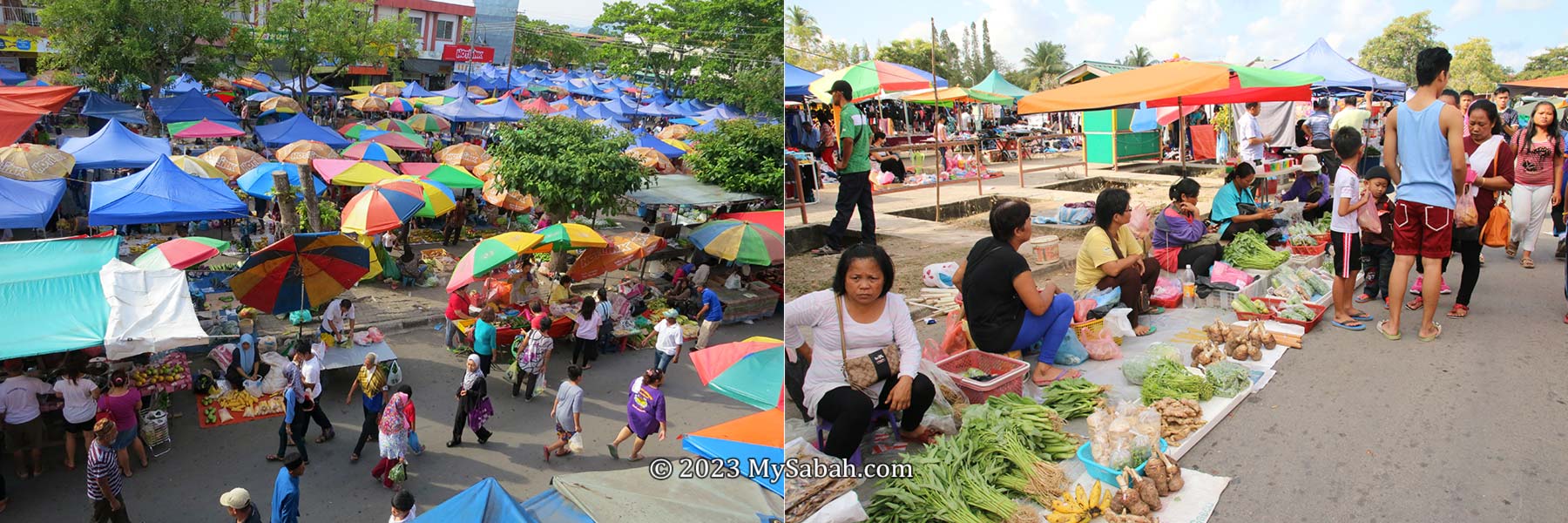
Past (1970s) Vs Present Tamu of Kota Belud
Why Tamu is Fun for Tourists
What’s the point of visiting a new place if you don’t experience any cultural shock? Your travel agents always “protect” you from something that you aren’t accustomed to. For example, if you are a European, they will never serve you durian fruit. If you are a Korean tourist, they will make sure that your plate always has Kimchi. You don’t eat and live like a Sabahan.
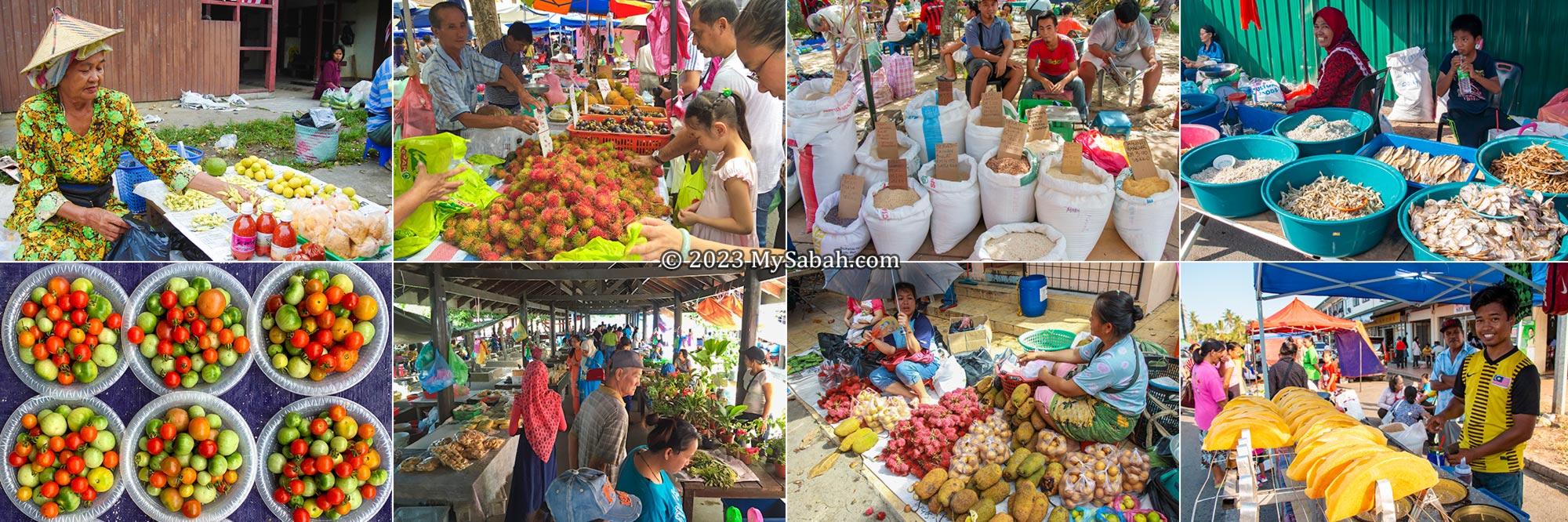
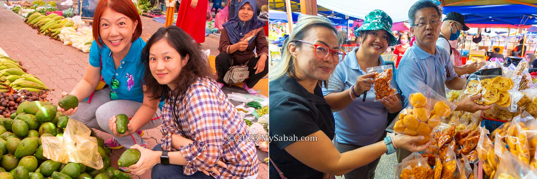
Tourists shopping at tamu of Keningau (left) and Papar (right) towns
A tamu provides an authentic encounter with the rich cultural, culinary and traditional aspects of the lives of Sabah’s many ethnic groups. The best ways to enjoy a tamu tour are:
Explore some interesting or “weird” items. Feel the sights, sounds and smells of tamu.
Sample local snacks, pastries, cakes, fruits, food and drink.
Interact with the local people. Observe what they do, e.g. chewing betel nuts and carrying stuffs in traditional baskets
Shop for souvenirs, handicrafts, tapestry, trinklets and other handmade crafts.
Vendors of the tamu of Papar, Keningau and Bongawan. The locals could be a bit shy but they are friendly people.
The bonus is you could get something cheaper than normal retail prices, if you are good at haggling. You are helping the small sellers too, like an elder villager or a start-up baker who needs extra income to support their families.
What to Buy
Every tamu are selling different things, based on the composition of local ethnic groups, agriculture and cultures. For example, Kundasang tamu is popular for highland vegetables, and Keningau tamu is the best place to buy hill paddy and cinnamon.
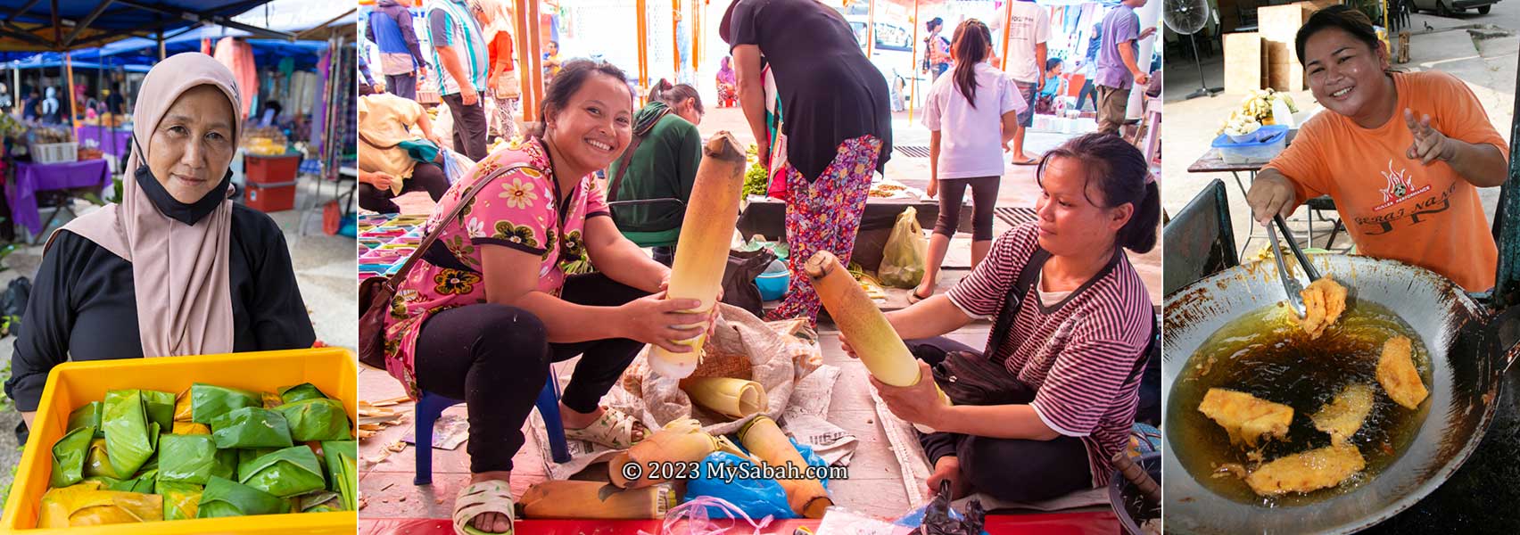
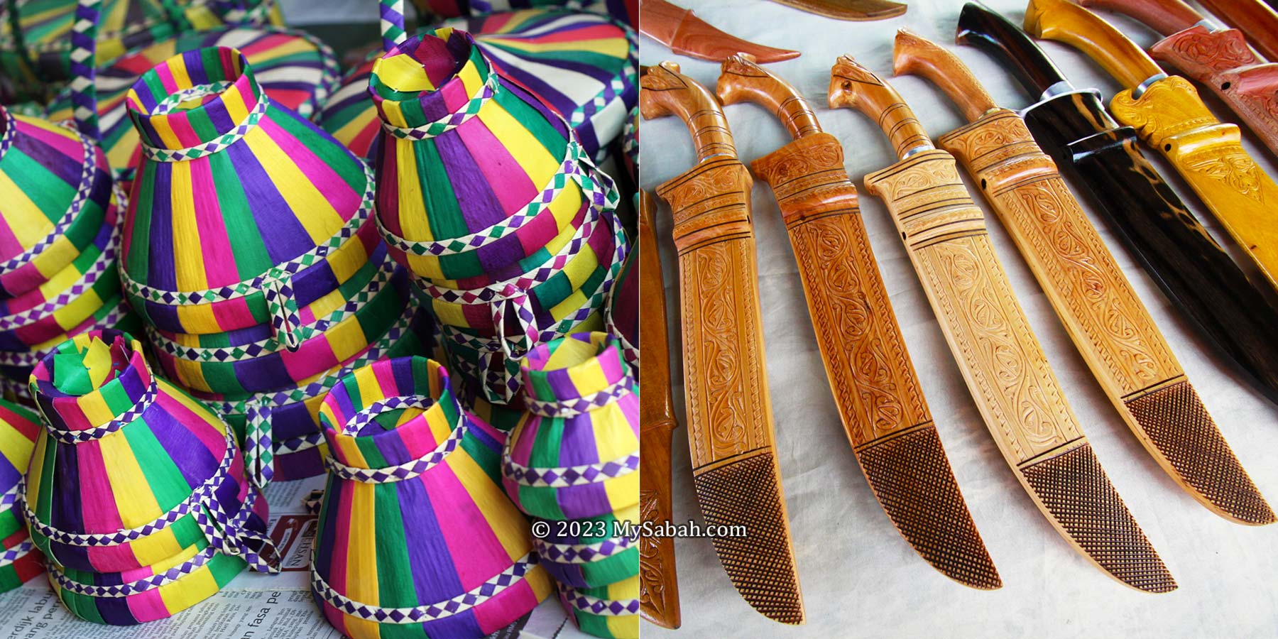
Things to buy or try at tamu. 1. Tarap fruit (seasonal), 2. Chicken tail satay, 3. Salted fishes, 4. Penjaram cake, 5. Latok seaweed (or sea grapes), 6. Fried banana fritters with cheese (pisang goreng cheese)
The following are some good (safe) starters for first-time visitors (Note: some fruits are seasonal):
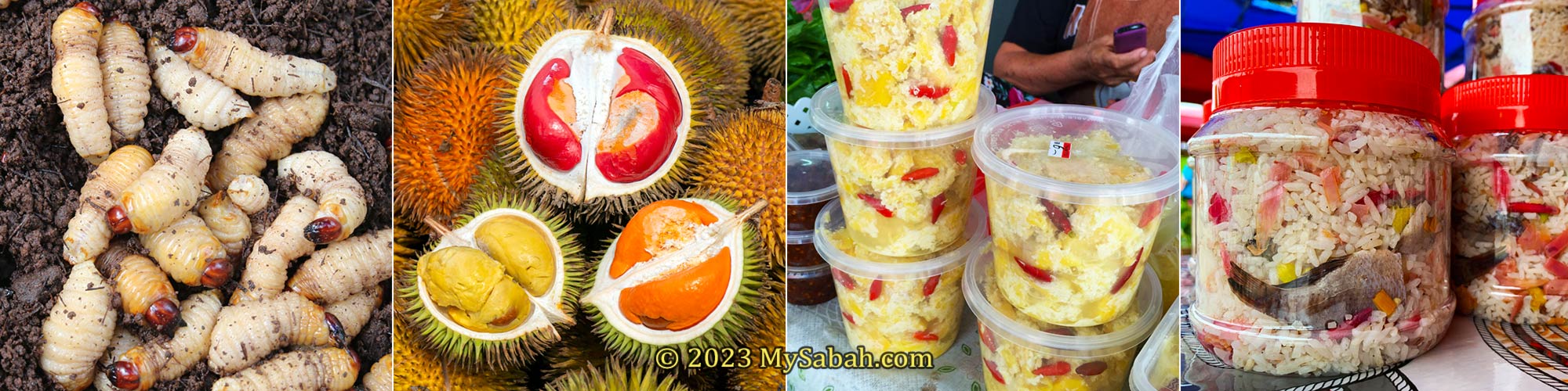
Expect to see something unexpected at tamu of Sabah, for examples, 1. Fishes fermented by grounded pangi seeds (look dirty but very delicious actually), 2. Bush meat, 3. Giant toad purse, 4. Magic rocks? 5. Weaver bird nests, 6. Various wood and herbs
Tamu sells mainly locally-grown fruits & vegetables, meat and poultry, fresh and dried seafood, food and snacks, but you still can find almost everything at tamu such as herbs, tobacco rolls, toy, shoes, clothing, flowers, pet, electronics, gadgets, tool kits, kitchenware, jewelry, accessories and imported goods. When there was almost no restriction in the past, I could even find protected wildlife (e.g. slow loris, pangolin, turtle eggs) for sale at tamu.
Best Tamu to Visit
No two tamu are the same. Every tamu is unique and has its own charm. If I must recommend one or two tamu, I will go for tamu of Kota Belud and Donggongon town. I also had a wonderful time at the tamu of Tenom, Tuaran and Keningau.
Tamu of Kota Belud (left) and Donggongon (right)
Kota Belud Tamu is the mother of all tamu. Most of the sellers there are Bajau people, the Cowboys of the East, and they are very skillful in making yummy snacks and colourful handicrafts. Walking around the Kota Belud tamu, you would notice the vibrant colours tudung duang, a popular handicraft made of dried screwpine leaves and used as a food cover. The Bajau is also well-known for making of intricately designed parang (machete).
The best time to visit Kota Belud tamu is during Tamu Besar Kota Belud, an annual cultural carnival in October, with an exciting line-up of activities such as dance performances, cultural shows, traditional games, buffalo races and horse-riding parade.
Tudung duang (left) and machetes (right) made by Bajau people
Only 8.5 KM away from Kota Kinabalu City, Donggongon is an important town of Kadazandusun, the largest indigenous people of Sabah. Donggongon Tamu takes place every Thursday and Friday (6am-6pm). The Donggongon Tamu offers a myriad of merchandises, ranging from local delicacies and handicrafts to fresh vegetable produce and livestock. Both villagers and city people love to shop here, turning this marketplace to a bustling trade and cultural hub that is unique to the Penampang district.
Tamu of Donggongon is open from 6am to 6pm every Thursday and Friday. Actually the market has started in the evening of Wednesday.
Gaya Street Sunday Market in the city centre of Kota Kinabalu is also the favourite open-air market of tourists. Technically, it is not a true tamu. Instead of selling raw vegetables and meat, the vendors sell mostly finished products that target at tourists and city folks. Anyway, it’s worth checking out.
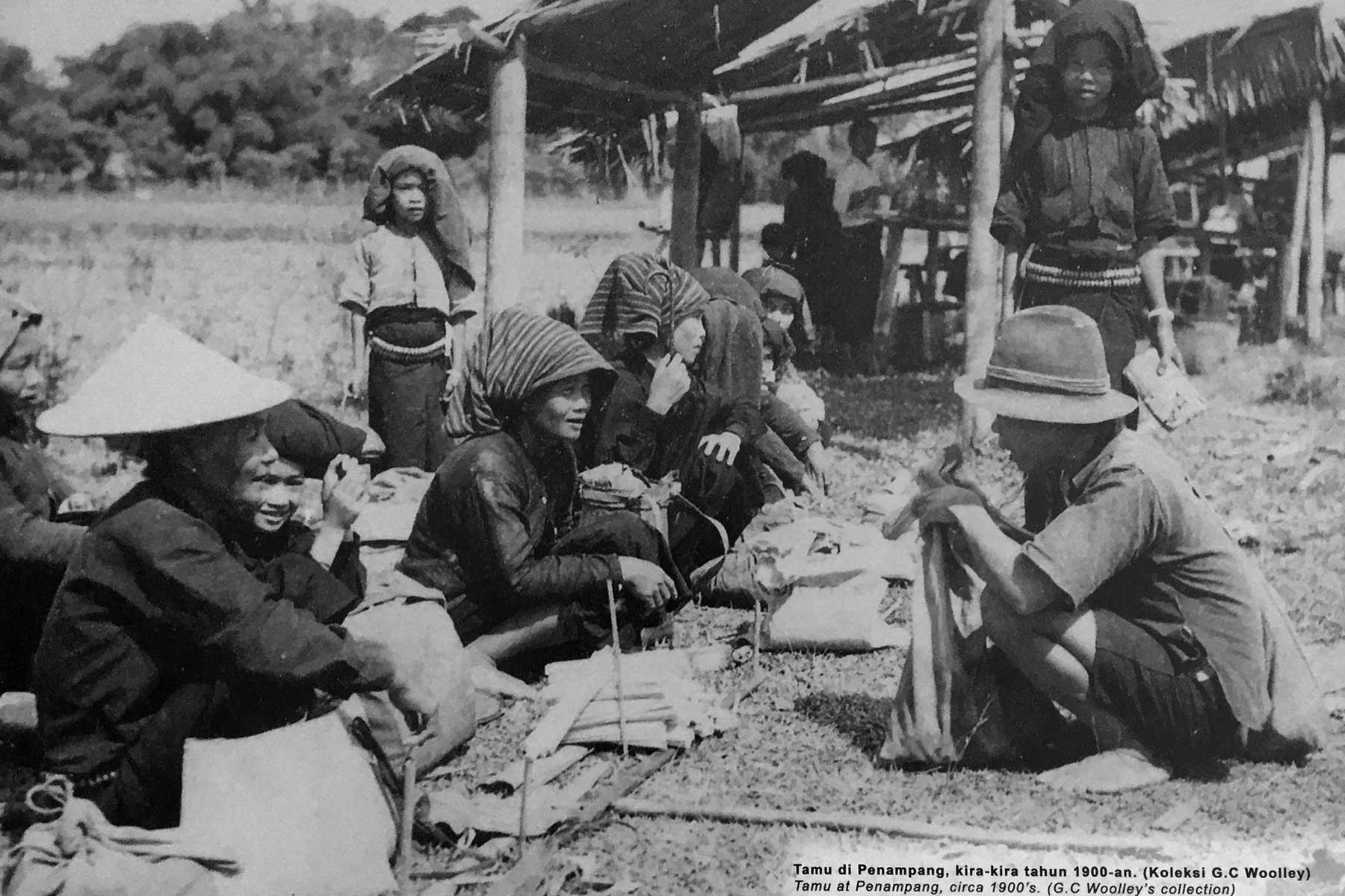
Photo of Penampang tamu taken by G. C. Woolley more than a hundred years ago
Tamu ground of larger towns have overhead roof, sheltered stalls and cement floor, so you don’t need to shop under the hot sun or walk on the mud after rain. For other tamu, all the traders need are just a parasol or a shade under big tree, and a ground or pavement to lay their items. Some tourists may enjoy the feeling of such a rustic tamu.
Opening Days of Tamu
Sabah has over 40 tamu in different towns and districts today. Most tamu open as early as 6am and close by 12pm. Different districts has different tamu days, here’s the list of their opening days (some open more than once a week).
Keningau, Kota Belud, Kota Kinabalu (Gaya Street), Kota Marudu, Membakut (new township), Papar, Putatan, Sook, Tambunan, Telupid, Tuaran
Opening days of tamu in Sabah
Tamu of Keningau (left) and Bongawan (right)
Just a trivia for those who are interested in local history. If you look around tamu ground, you would find a medium or big old rock that symbolizes the “contract” among tribes to guarantee honesty, fairness and trust, and to punish those who cheat, quarrel or swear within tamu market.
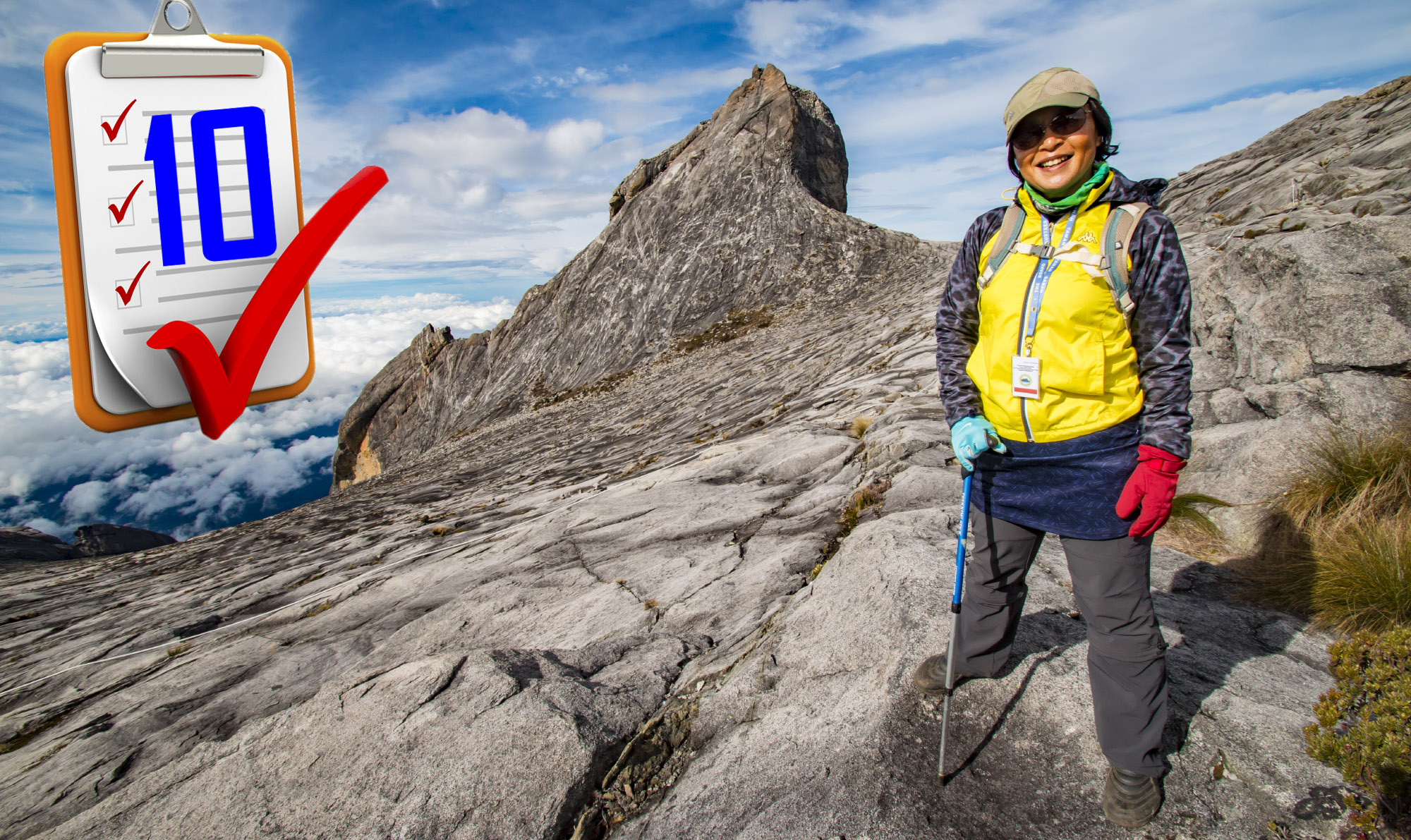
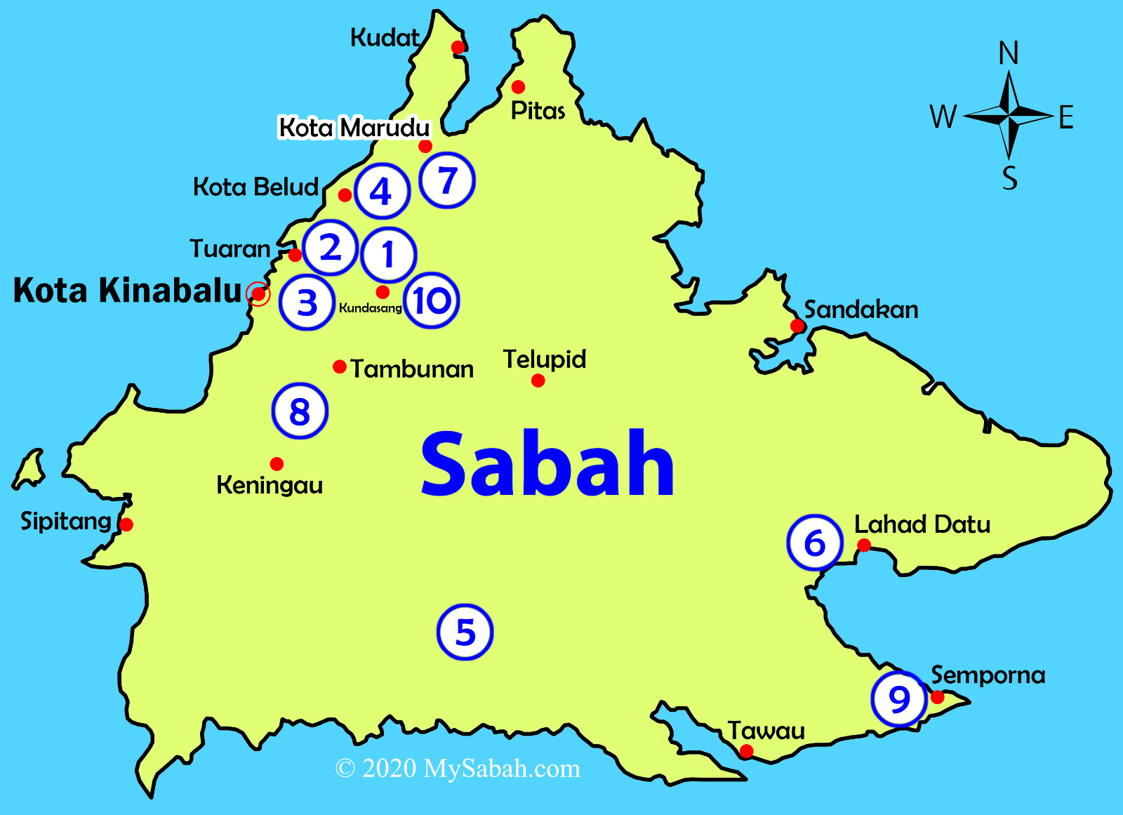
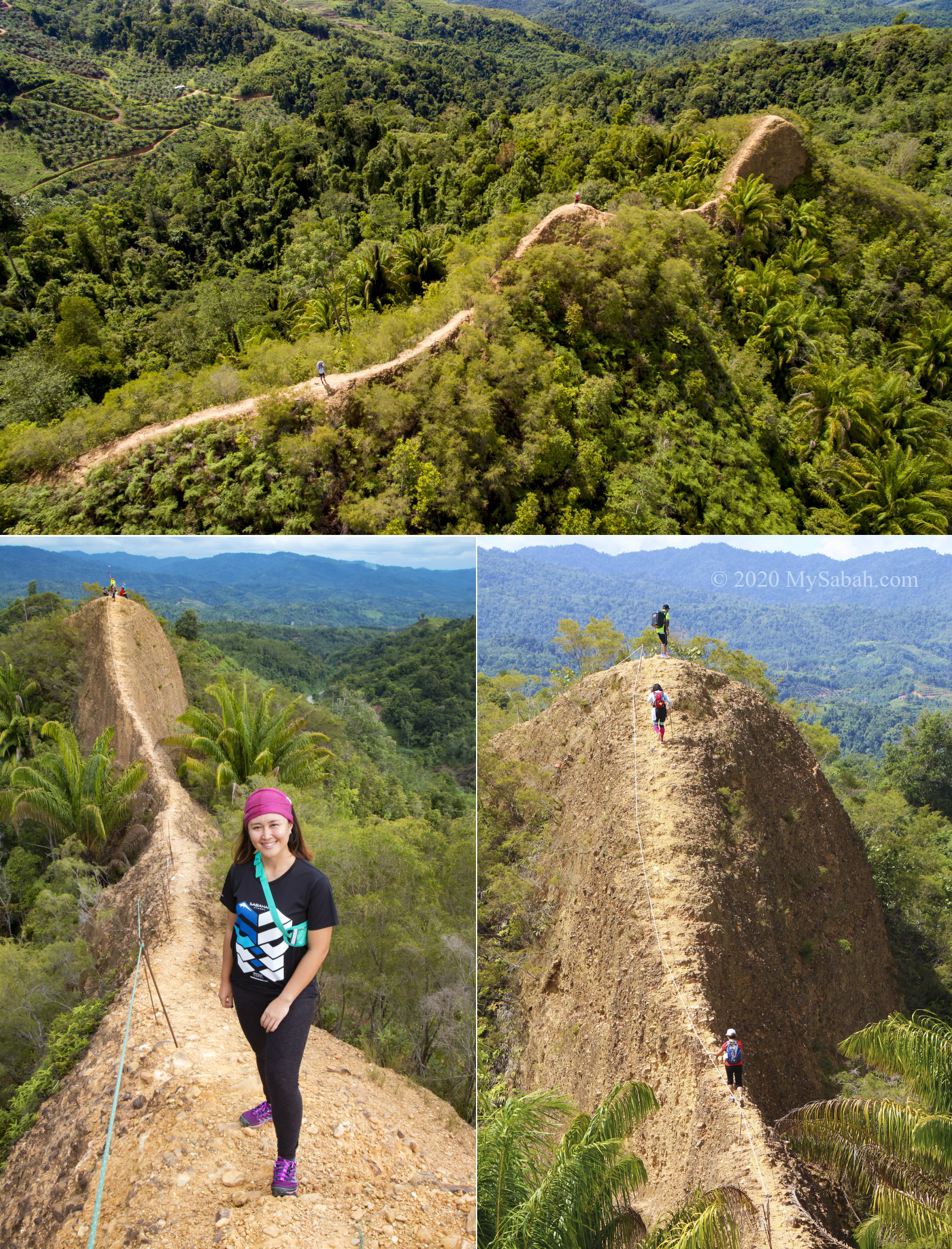
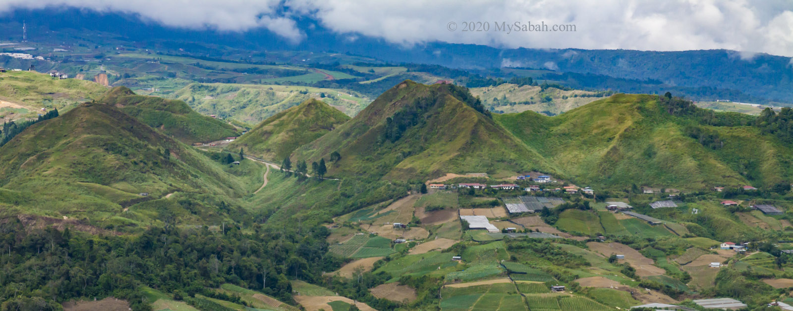
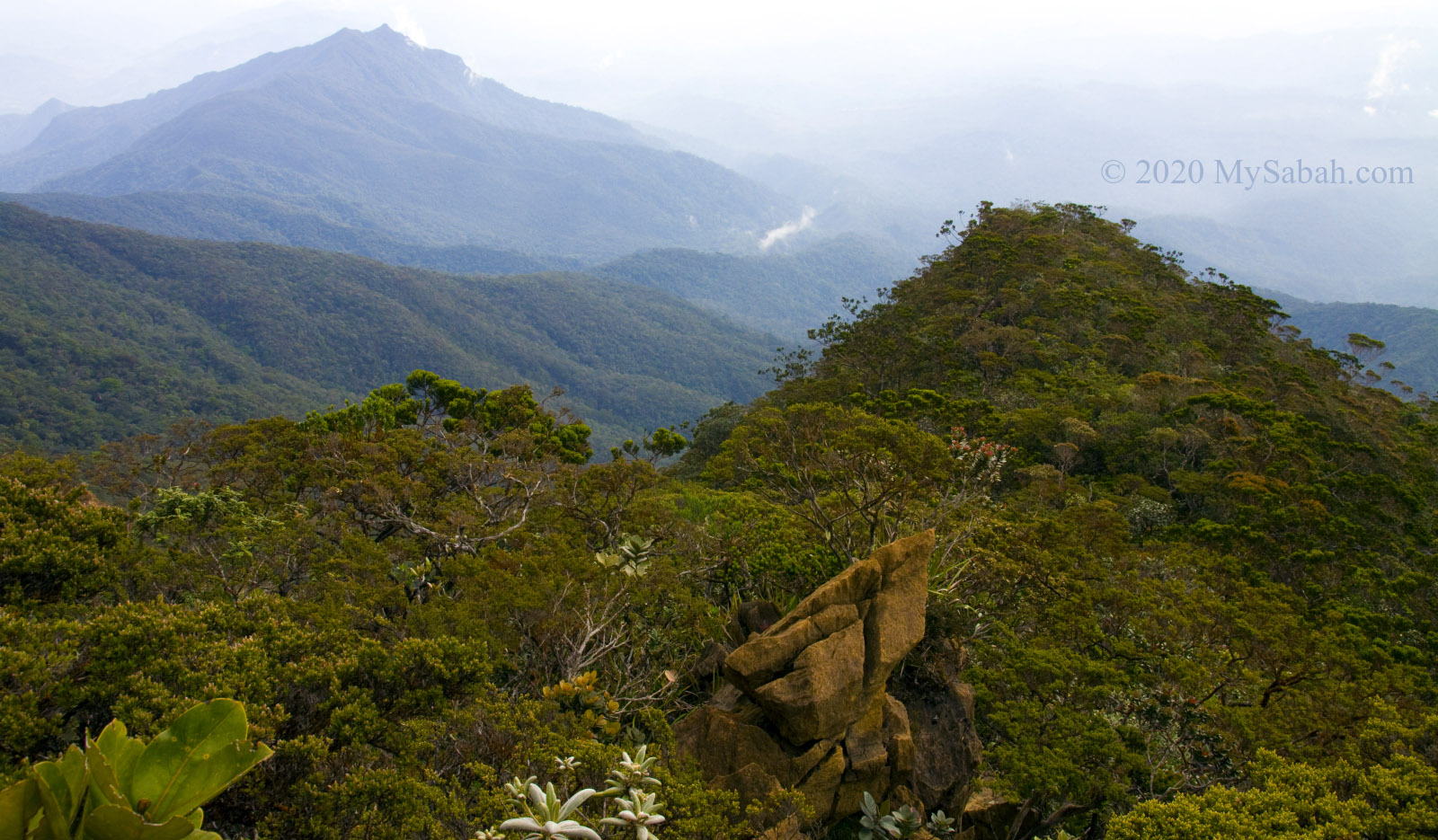
Sabah is a state of hundred mountains, and the top five highest mountains of Malaysia are located in Sabah, i.e. (1st) Mount Kinabalu, (2nd) Mount Trus Madi, (3rd) Mount Sinsing, (4th) Mount Tambuyukon, (5th) Mount Kaingaran. Climbers and hikers will be spoiled with choices, as every hills and mountains here have different characteristics in terms of geology, landscape and biodiversity. For example, today you can climb a mountain with dense rainforest cover, then tomorrow challenge a limestone pinnacle with bald rockface. The following is a list of 10 most unique hills and mountains in Sabah for a diverse climbing experience. Please note gunung and bukit mean mountain and hill in Malay language respectively.
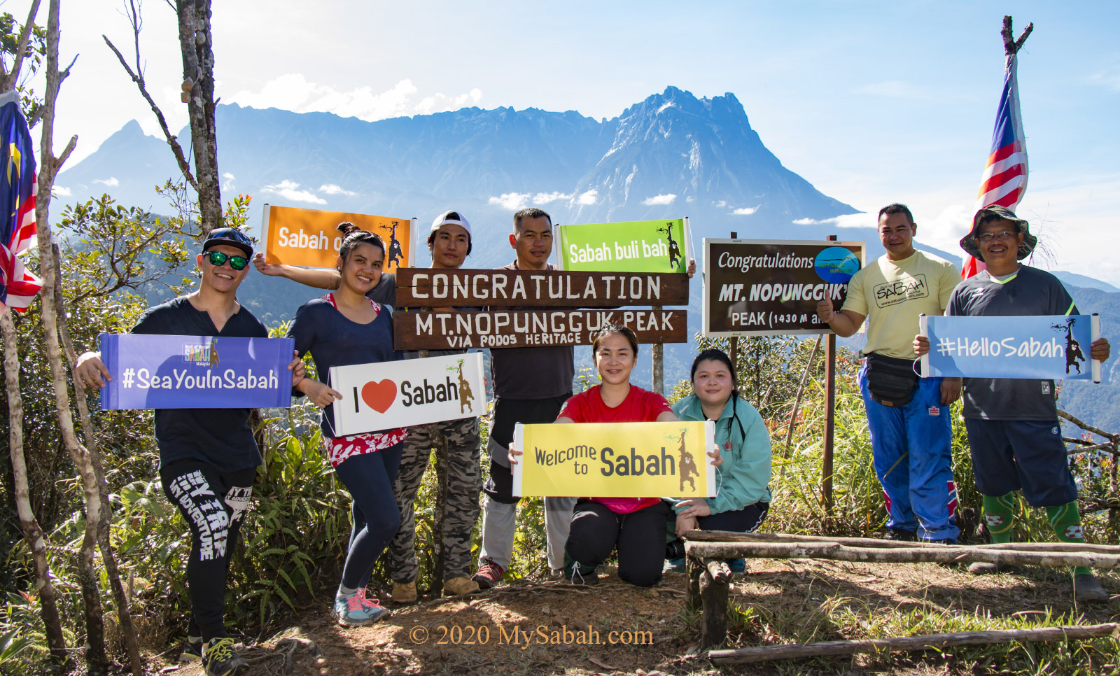
Location of (1) Mount Kinabalu, (2) Bukit Perahu, (3) Bukit Kokol, (4) Bukit Bongol, (5) Batu Punggul, (6) Mount Silam, (7) Mount Nombuyukong, (8) Bukit Lugas, (9) Bukit Tengkorak, and (10) Maragang Hill
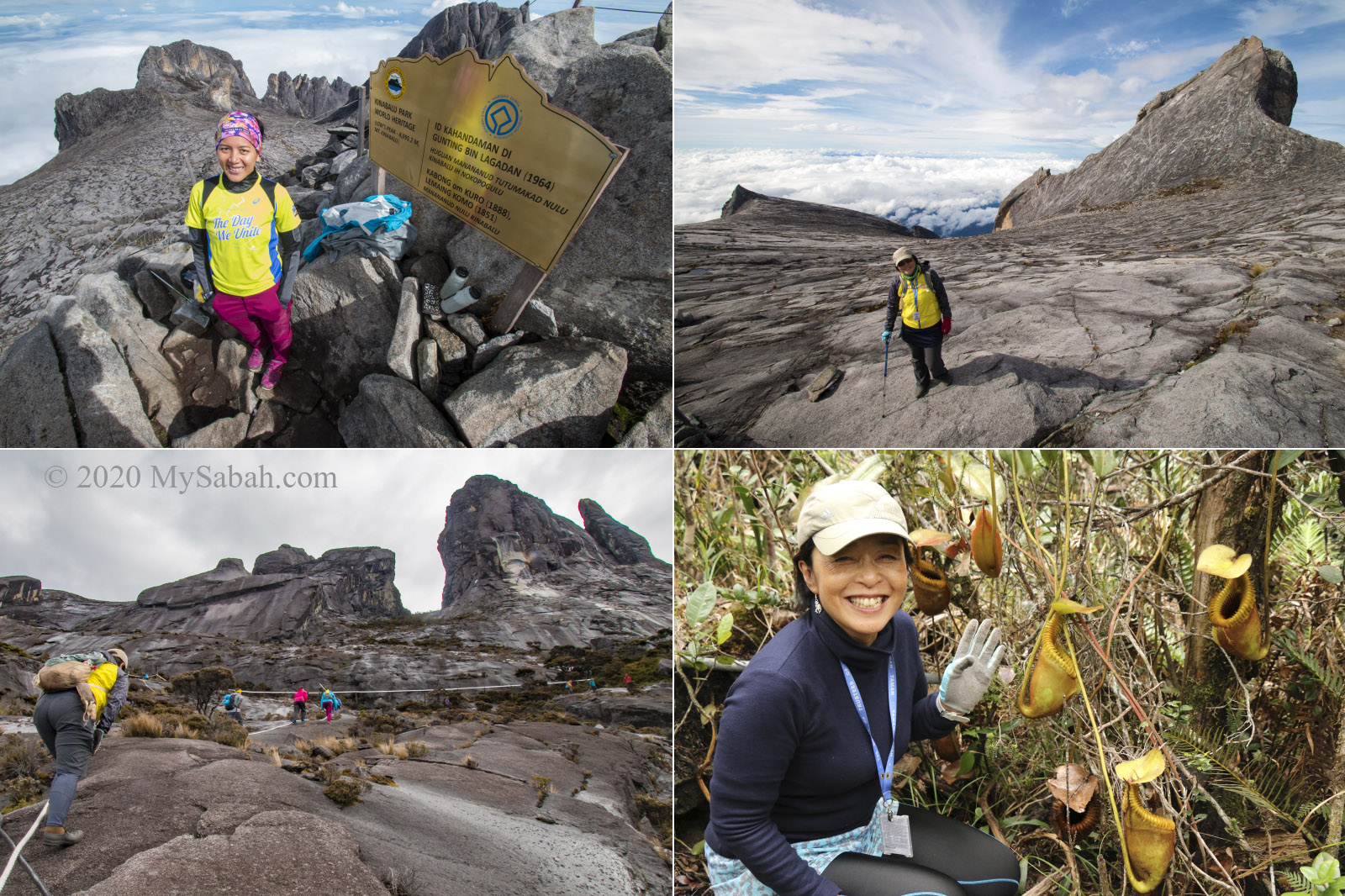
As the first UNESCO World Heritage Site and the highest mountain of Malaysia, Mount Kinabalu is the No.1 tourist destination of Sabah. Mount Kinabalu is 700 million years old, and a snow-capped mountain during ice age back in 30,000 years ago. Today climbers still can see the ancient traces and jagged peaks carved by glacier near the summit.
Mount Kinabalu is so prominent that you can see her in most parts of Sabah (even Sandakan in East Coast)
But what truly makes Mount Kinabalu special is its cloud forest which is high in plant endemism. On the way up, you would see bright-colored pitcher plant and rare orchid next to the trail. The majestic Mount Kinabalu is undoubtedly one of the most beautiful places in Malaysia. The climb is about 8.7 Kilometres in distance and usually take 2 days 1 night. More Info…
Conquering Mount Kinabalu is in the bucket list of most Malaysians
The locals say there are two ships stranded on the cone-shaped Ruhiang Hill. Actually they are two huge boulders that look like ships. The climb takes less than an hour.
For this view, you need to reach the top of Bukit Perahu before 8am. Mount Kinabalu would be covered in mist after 9pm
Early birds who reach the peak in early morning would be rewarded by the breathtaking view of Mount Kinabalu on a sea of cloud. I can’t help to imagine that I can get on a big ship to sail to Mount Kinabalu on the cloud. After the climb, the bonus is to eat Tamparuli Fried Noodle in Tamparuli town. More Info…
You would find many locals climbing Ruhiang Hill (Bukit Perahu) during weekends. See the ship-like boulder?
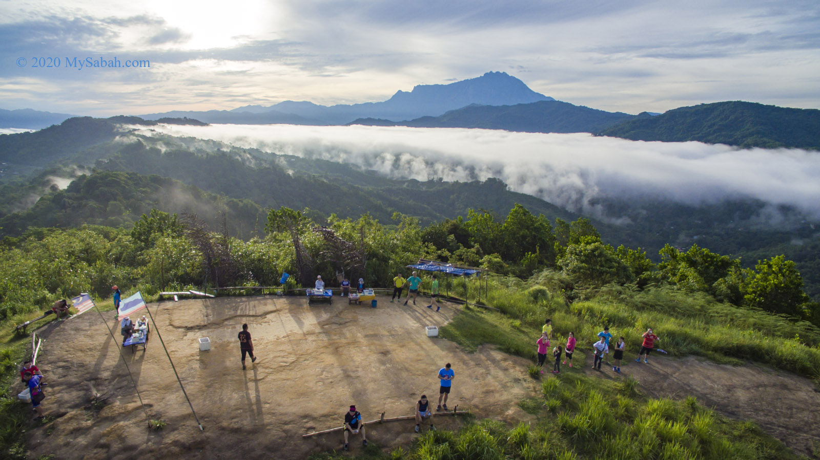
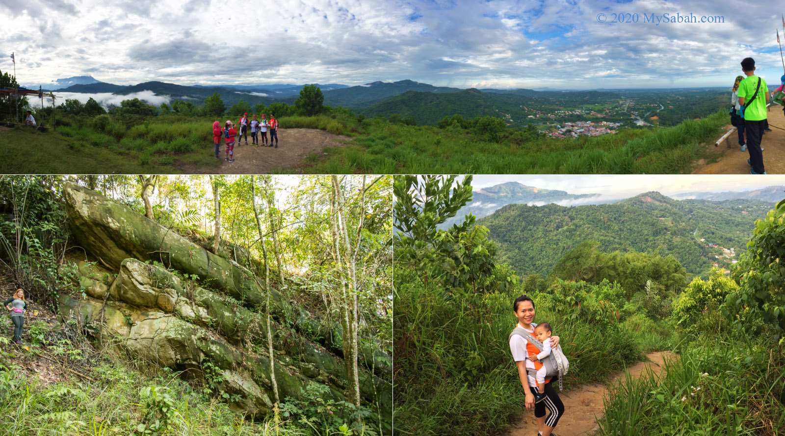
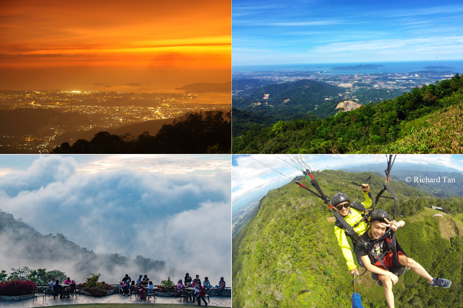
Two cool things draw many visitors to unwind on Kokol Hill. It is the nearest spot to escape the heat of Kota Kinabalu city, and its magnificent sunset view. You can just drive up there without climbing at all. If life is tough, have a cup of hot coffee in cooling breeze of Kokol Hill and enjoy the scenic view of Kota Kinabalu city and islands far away. To really free your mind, try paragliding on Kokol Hill. More Info…
The nice view, cooling temperature and paragliding are the highlight of Kokol Hill (Bukit Hill)
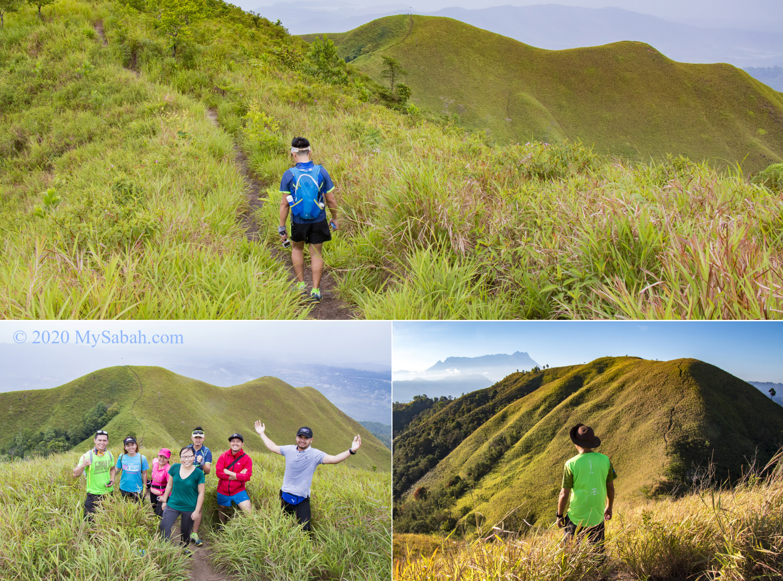
Want a fun hike with a group of friends? I heard a lot of praises about Bukit Bongol. The slopes are mostly gentle and the trail is less challenging. The whole hill is carpeted by grass, which is green in wet months and yellowish during drought, a spectacular scenery you all won’t forget. Climb to the high point before 9am and you would be lucky to see Mount Kinabalu, a perfect backdrop for your Instagram shots. More Info…
Bukit Bongol in Kota Belud is the most grassy hill of Sabah
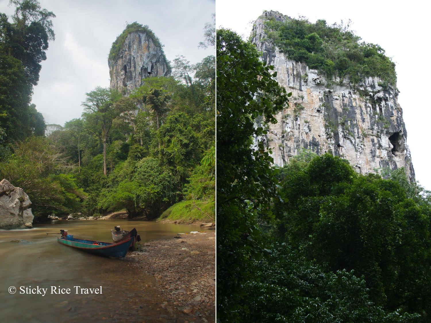
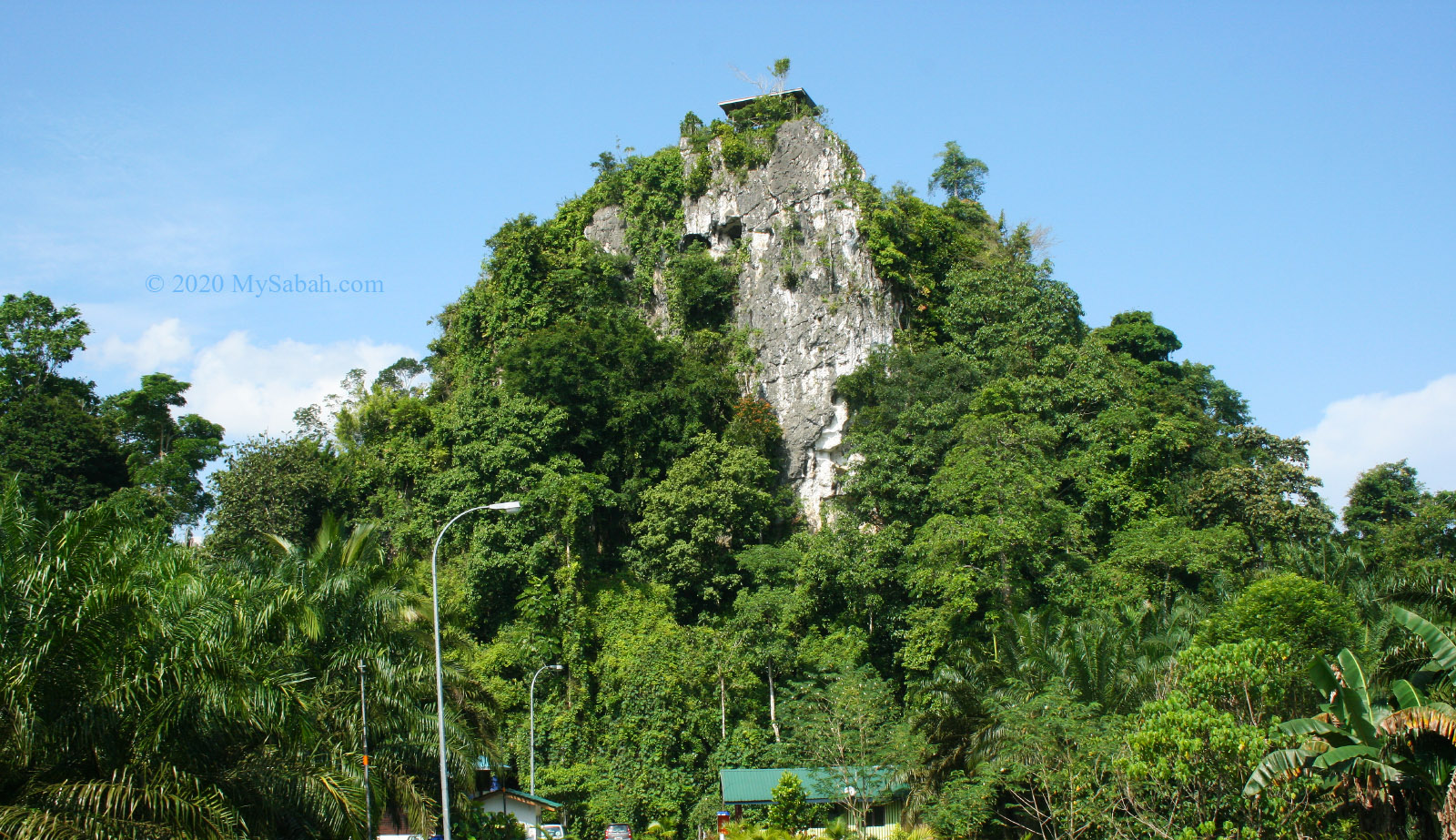
Located in interior, where Murut headhunters roamed in the past, Batu Punggul is the most mysterious hill of Sabah. Legend says this limestone pinnacle is a longhouse being turned into rock by angry God because the villagers made fun of the animals. At the foothill there is a cave where you can find the “fossilized furniture” such as jar and table. Climbing this vertical 800-feet limestone pinnacle will peak your adrenaline rush, and nobody will question your bravery if you can conquer Batu Punggul. More Info…
Batu Punggul is a 800-feet limestone pinnacle in Sabah interior. Photo (left) by Sticky Rice Travel
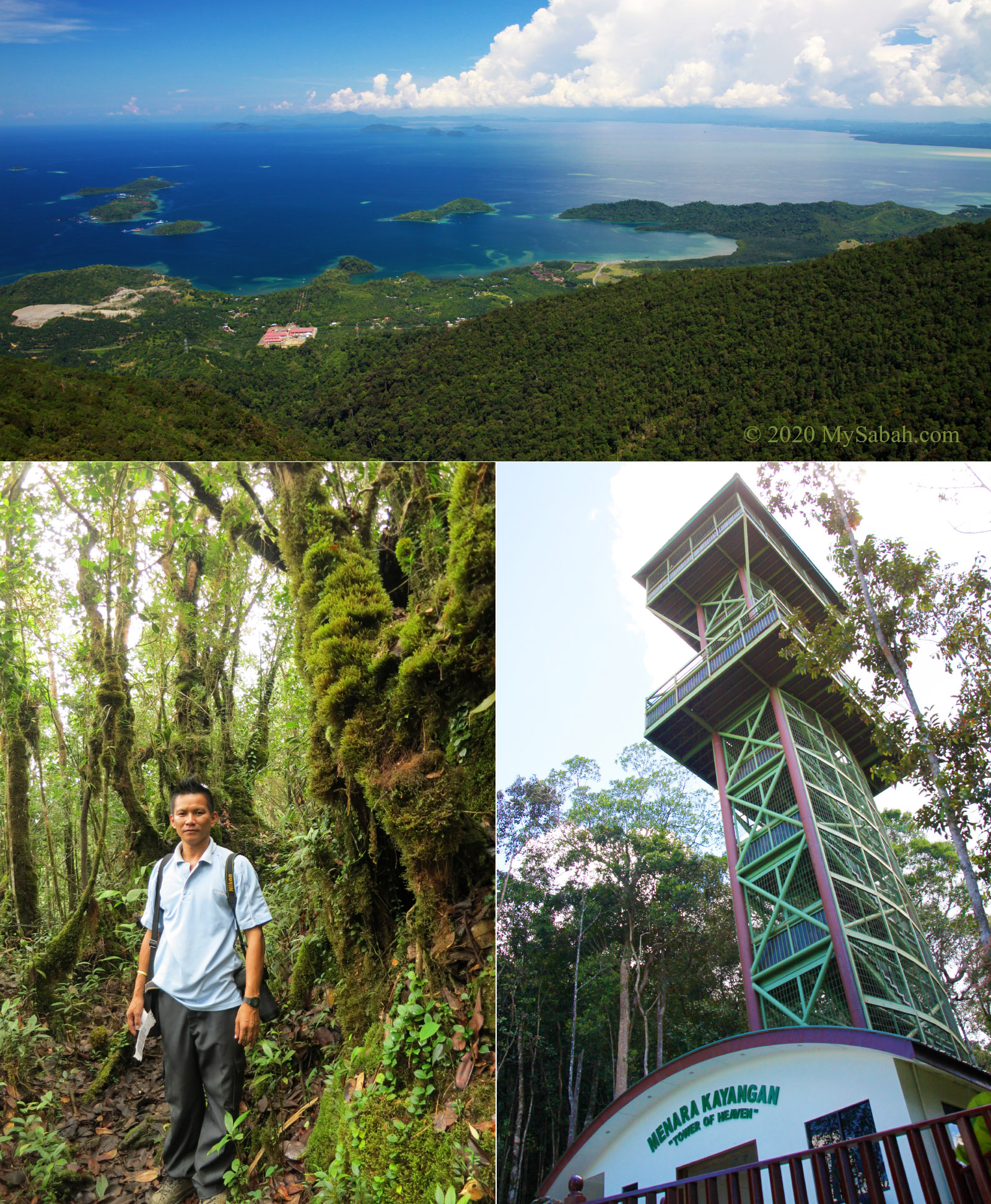
You don’t need to get on a plane to have a bird-eye view of this beautiful land. Just visit the tower of heaven on Mount Silam, where you can see the picturesque scenery of Darvel Bay. The air up there is refreshing and the peak is covered in fog sometimes. Beside the tower is a nature trail that leads you to an alien world filled with mossy forest, forest crabs, rare orchid, pitcher plant, etc. More Info…
The view of Darvel Bay, mossy forest and Tower of Heaven on Mount Silam
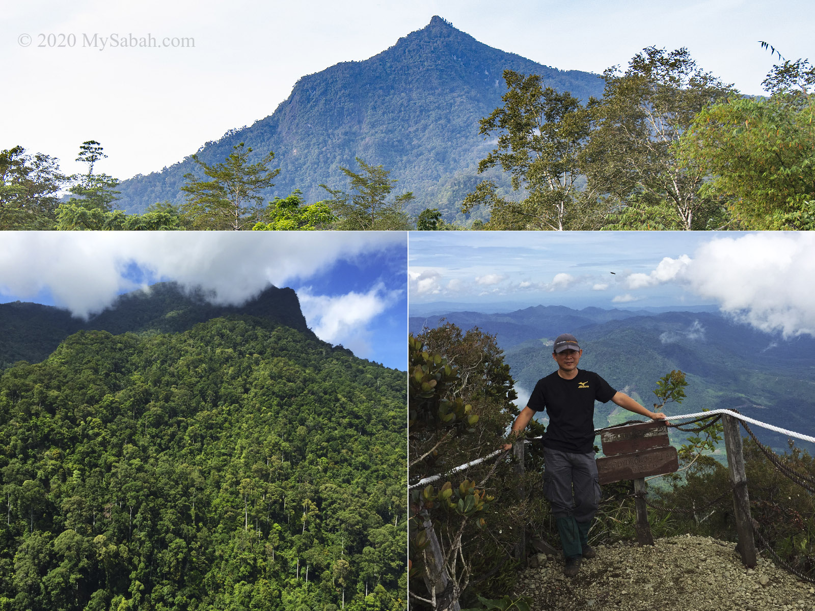
Mount Nombuyukong is another mountain in north of Kinabalu Park. Its pointy peak kind of triggering my insect-like instinct that motivates me to crawl to its tip. The climb is quite challenging but takes only half a day. This is a forested mountain for nature lovers who appreciate the fauna and flora in tropical rainforest of Borneo. You won’t be disappointed when you see so many interesting fungus, flowers, trees, and birds along the way. More Info…
Mount Nombuyukong is one of the mountains in Kinabalu Park (Serinsim Substation, Kota Marudu)
This is a great example to inspire a person that he doesn’t need to be tall to be attractive, if he has awesome characteristics. Bukit Lugas is just a small hill, but it has an impressive ridge that looks like dragon spine. Though the narrow path is a nightmare for people with acrophobia, they still want to try it. Anyway, it is safer than it seems. This hidden dragon is exposed when its pictures went viral a few years ago. More Info…
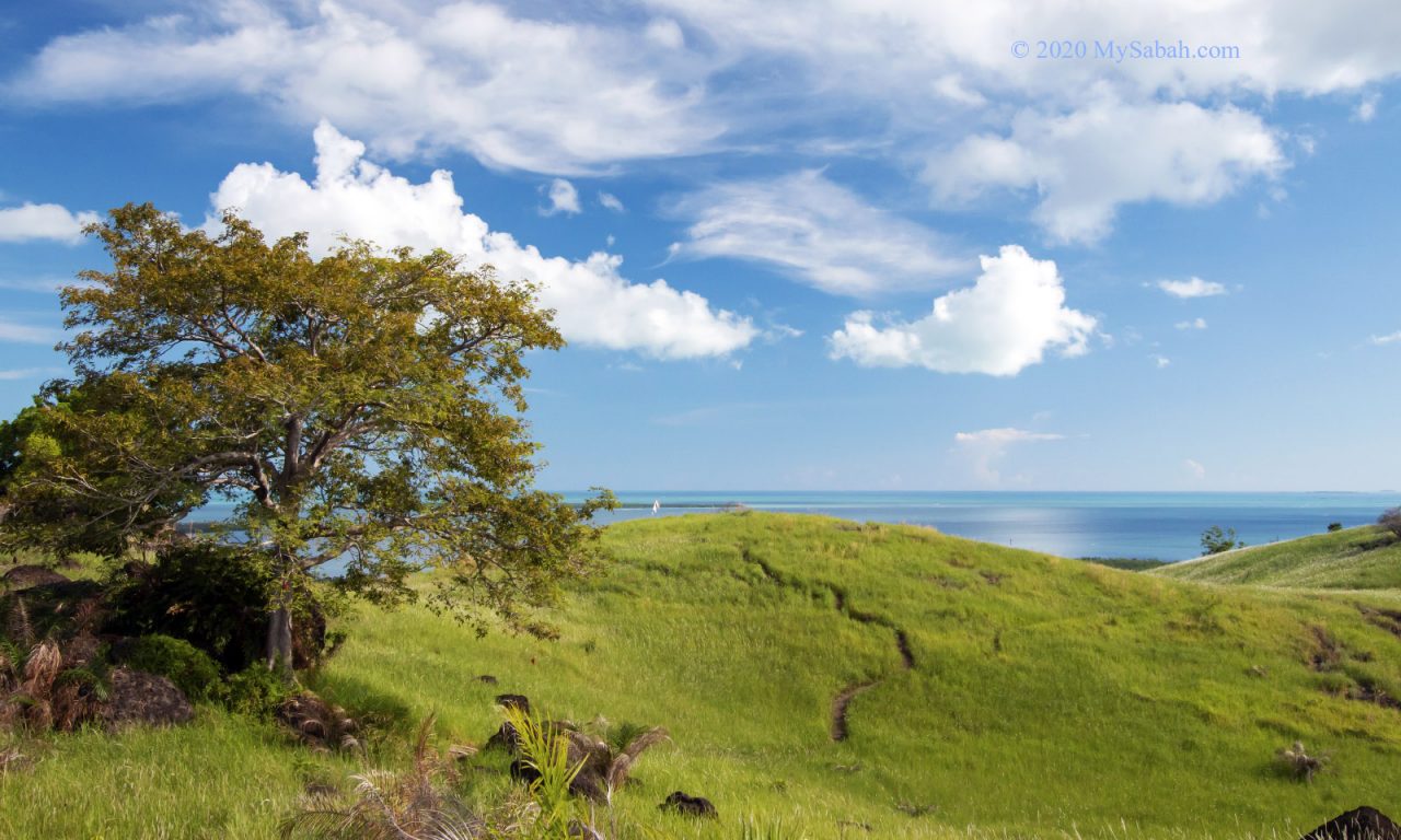
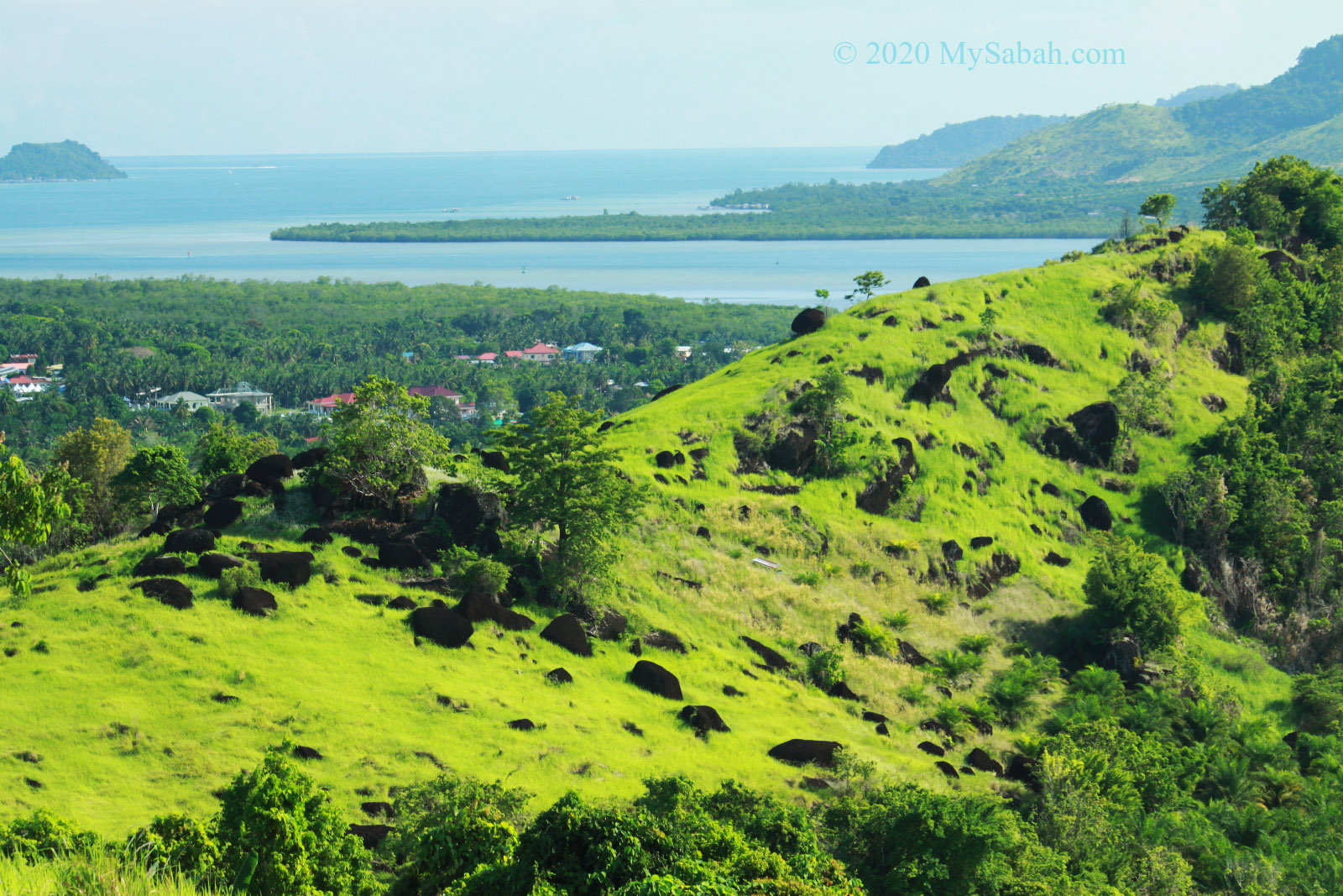
Bukit Tengkorak is part of an ancient volcanic rim (about 2 KM in diameter) and the largest pottery making site in Southeast Asia during the Neolithic period (about 3,000 years ago). It is estimated that more than 6 million prehistoric potsherds found on this hill, and you would see hundred of pottery potsherds on the way up.
Beautiful grassland on Bukit Tengkorak (Skull Hill)
On top of this hill, you can have a panoramic view of Semporna town and islands. You can go further behind to explore the grassy knolls dotted with black volcanic rocks, to bag some amazing profile photos. More Info…
Black volcanic rocks on Bukit Tengkorak (Skull Hill)
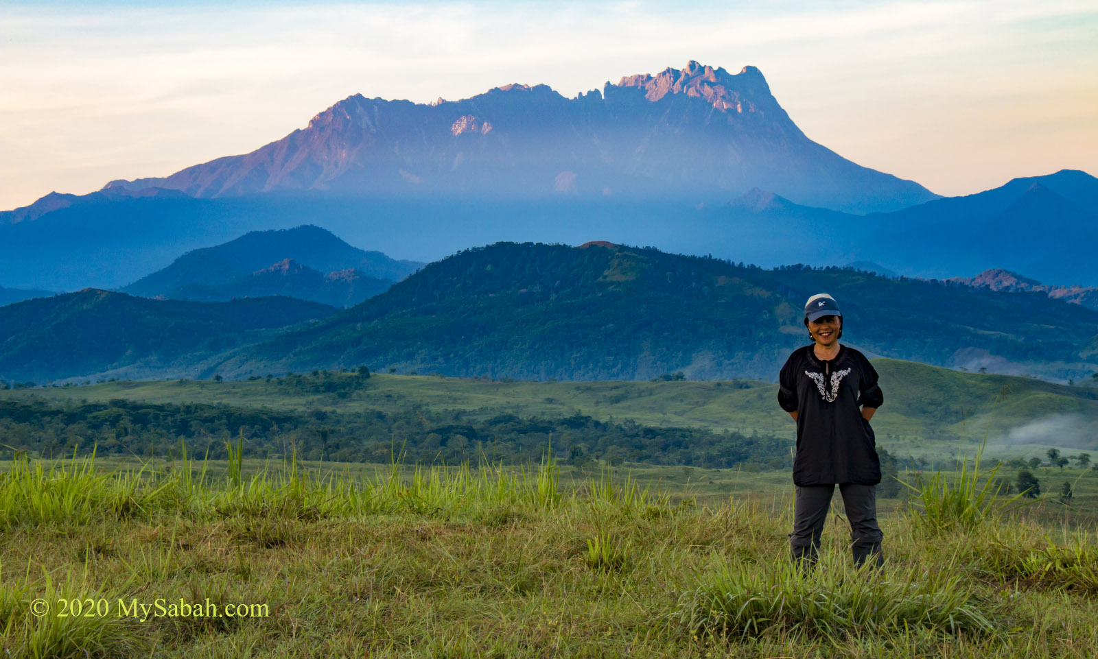
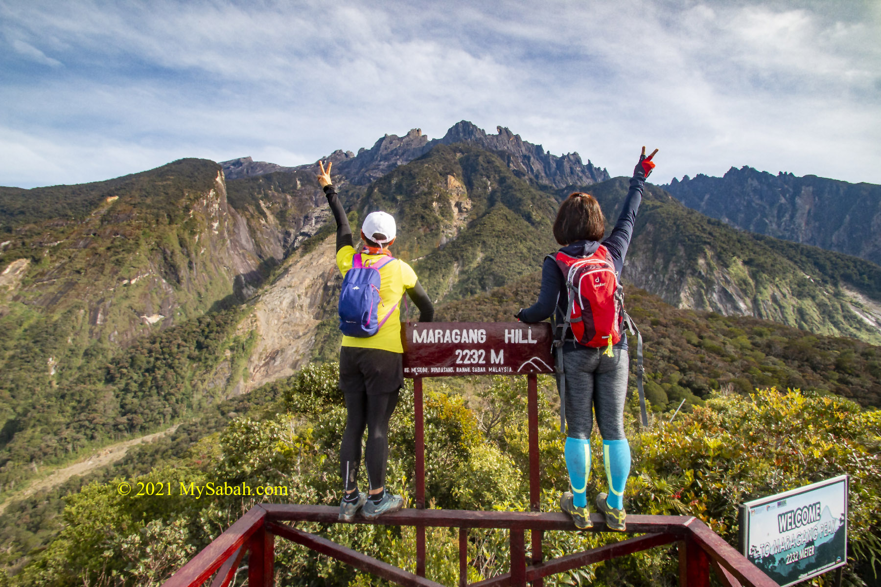
The distance between the peaks of Mount Kinabalu and Maragang Hill is only 5 Kilometres! This makes Maragang Hill the best viewpoint for the highest mountain of Malaysia. The viewing platform on the peak allows you to capture Mount Kinabalu, lush montane forest and blue sky in one frame.
Looking at Mount Kinabalu from Maragang Hill
The 4-Kilometre climb is fairly easy and takes only an hour. A camping site is available nearby for those who want to stay back for stargazing. More Info…
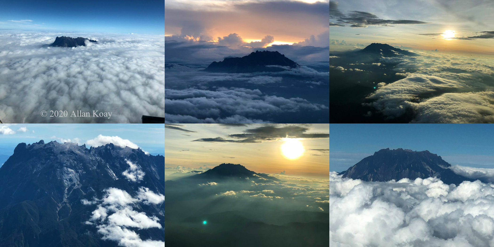
View of Mount Kinabalu from cockpit. Photos courtesy of Allan Koay
List of Hills and Mountains in Sabah
The list doesn’t end here. The following is a list of over 140 hills / mountains grouped by city and towns. Please note that not all of them are tourist-ready. Some destinations would require you to hire a guide or apply an entry permit. I try to link them to some useful websites (informative articles are so hard to come by nowadays). Please note the height is measured from sea level (above sea level or asl).
It would take you almost 3 years to conquer all of them, even if you climb a new one every week, and there are probably hundred more new mountains to be added to this list in future. For every mountain that we conquer, it’s like making a new friend and you will always want to go back again. Stay safe and happy climbing!
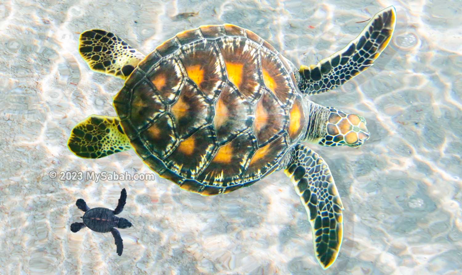
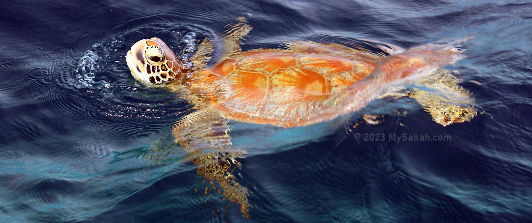
About 110 million years ago, when dinosaurs were ruling the Earth, a marine creature has existed in the ocean. They survived the predation of Megalodon (a 20-metre-long, the biggest extinct shark) and live until today. It’s the sea turtle, some species can live more than 100 years old.
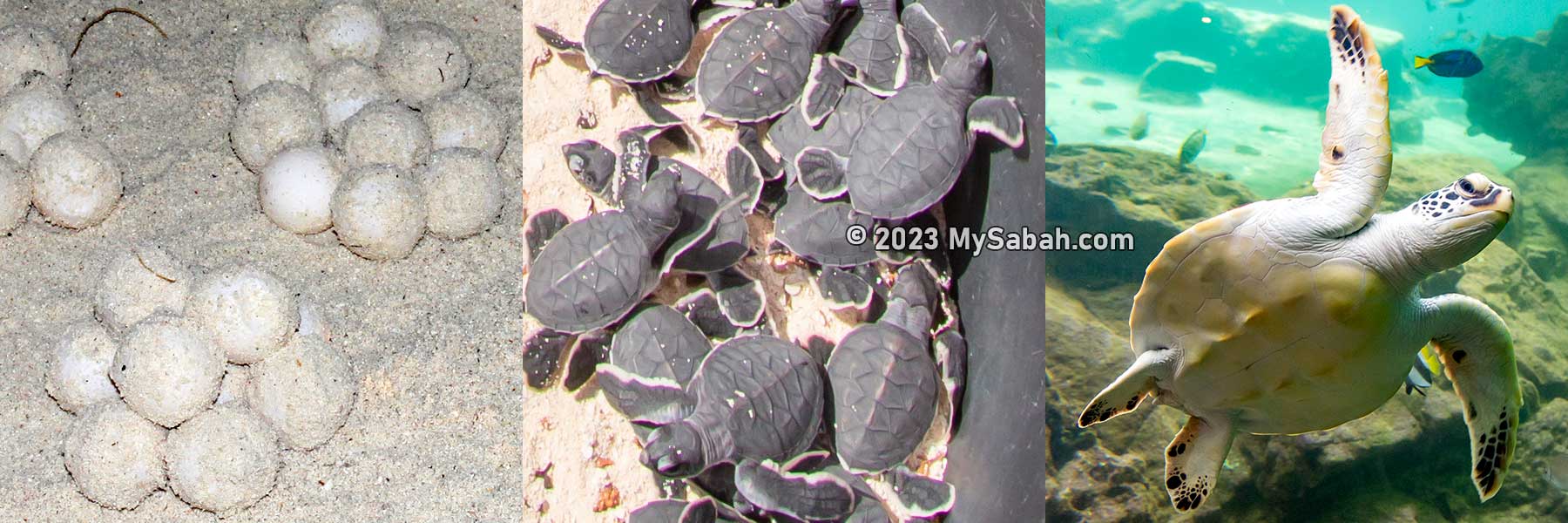
You can see three stages of turtle life on Selingan Island
However, without any protection, human can wipe out this ancient animal in 20 years. Luckily, sea turtles are fully protected in Sabah, as well as their main nesting grounds in Sulu Sea, the Turtle Islands Park, which is about 40 kilometers to the north of Sandakan of Sabah (Malaysia).
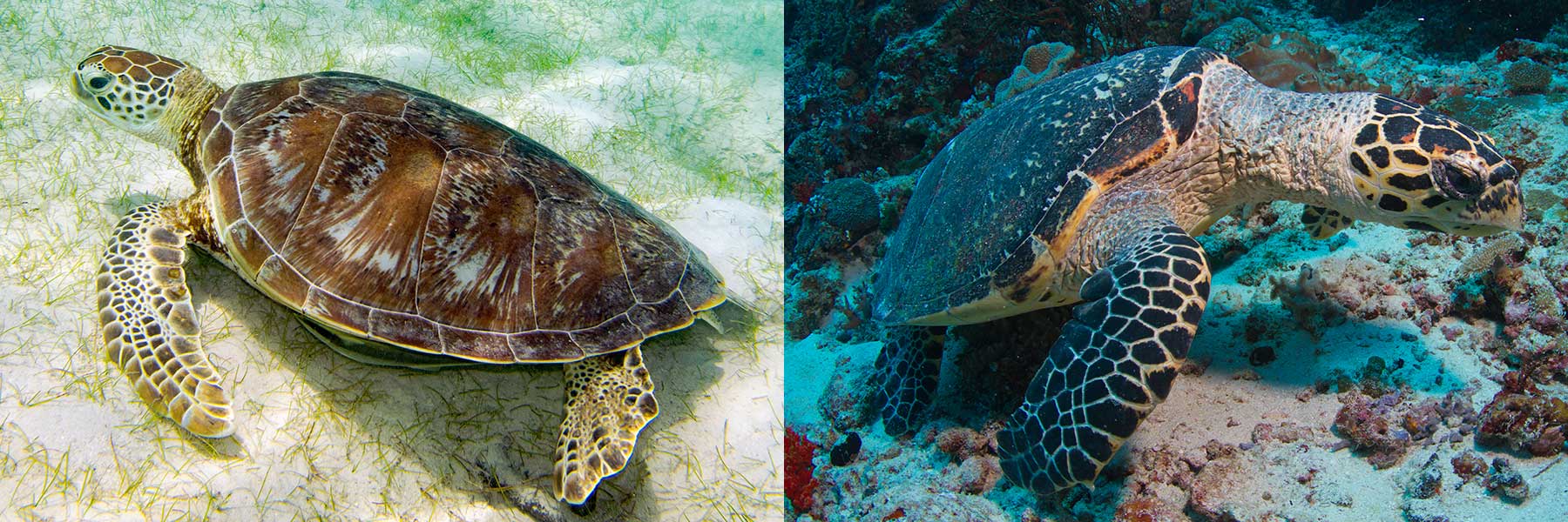
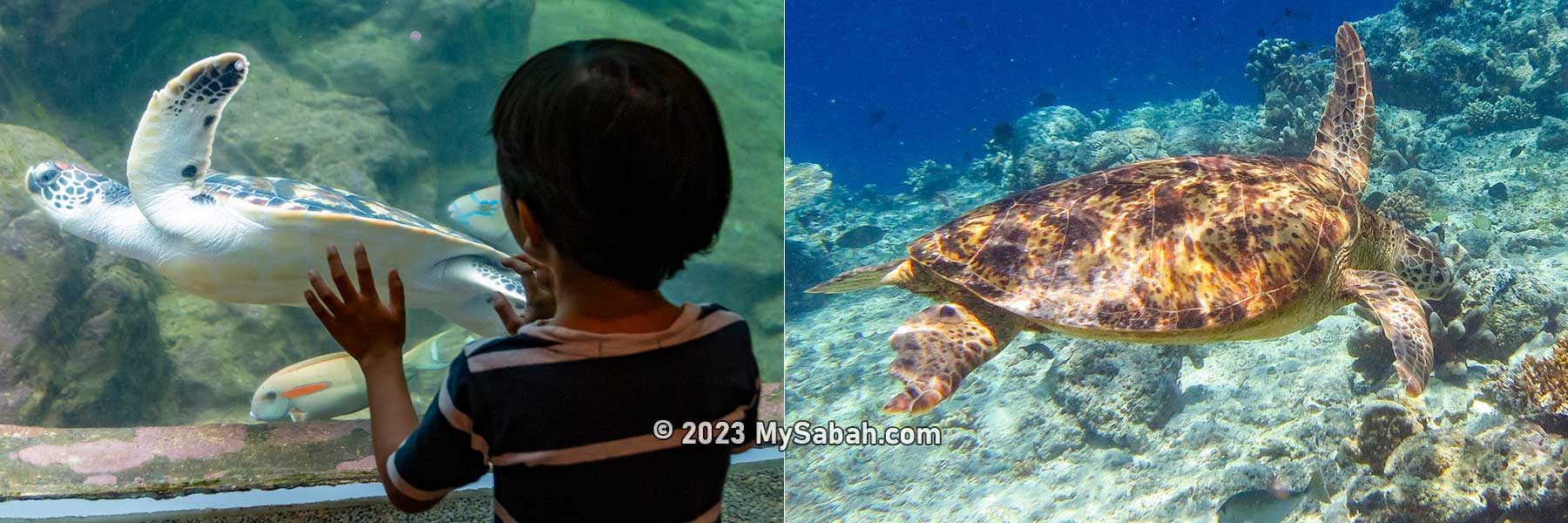
Two sea turtle species of Sabah. Left: Green Turtle (Chelonia mydas). Right: Hawksbill Turtle (Eretmochelys imbricata). Can you spot their differences? (Photo Credit: Green turtle by Paul Asman and Jill Lenoble, Hawksbill Turtle by Tchami)
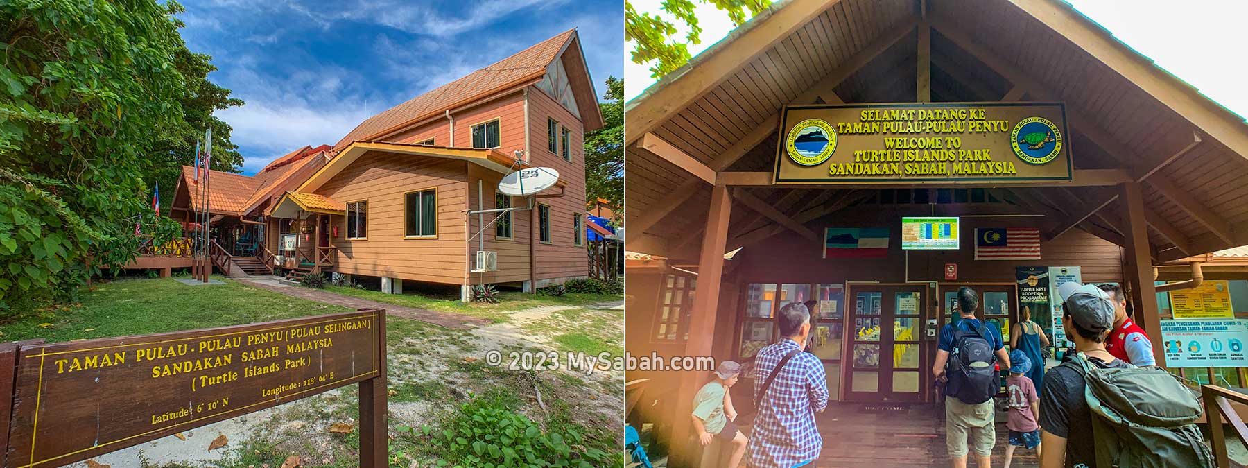
Turtle Islands Park comprises the islands of Selingan (8.1ha), Gulisaan (1.6ha) and Bakkungaan Kecil (8.5ha), covering a protected area of some 1,740 hectares, of which 18.2 hectares are on land while 1,721.8 hectares at sea.
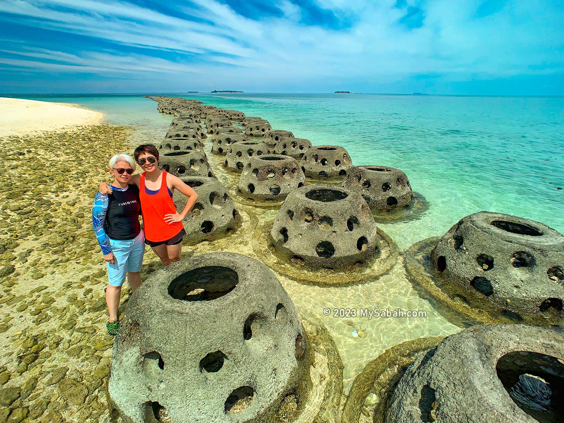
Beach of Selingan Island protected by reef balls (to stop beach erosion)
Only Selingan Island, which provides accommodation and basic facilities, is open to tourists, who will witness three stages of a turtle life by looking at the hatchery for the eggs, releasing of hatchlings and nesting of mother turtles in close distance.
Why Protect Sea Turtles?
Turtles don’t beat up villains like what Ninja Turtles do, but they are unsung heroes of maintaining a healthy coral reef ecosystem and food chain balance in the ocean. For example, a Leatherback Sea Turtle can consume 200 kg of jellyfish a day. Green turtles graze on seagrass to stop the overgrown sea meadows that obstruct the sunlight to seabed.
Sea turtles have existed on earth for over 100 million years. But human can wipe them out in one or two generations. Then our children only can see this ancient animal in an aquarium.
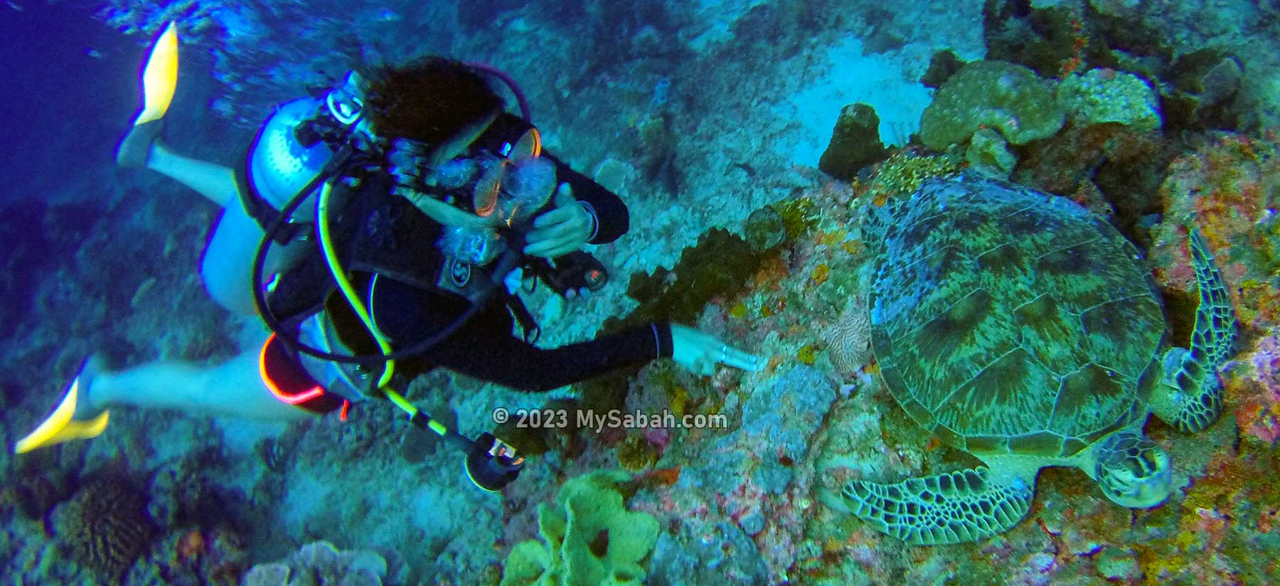
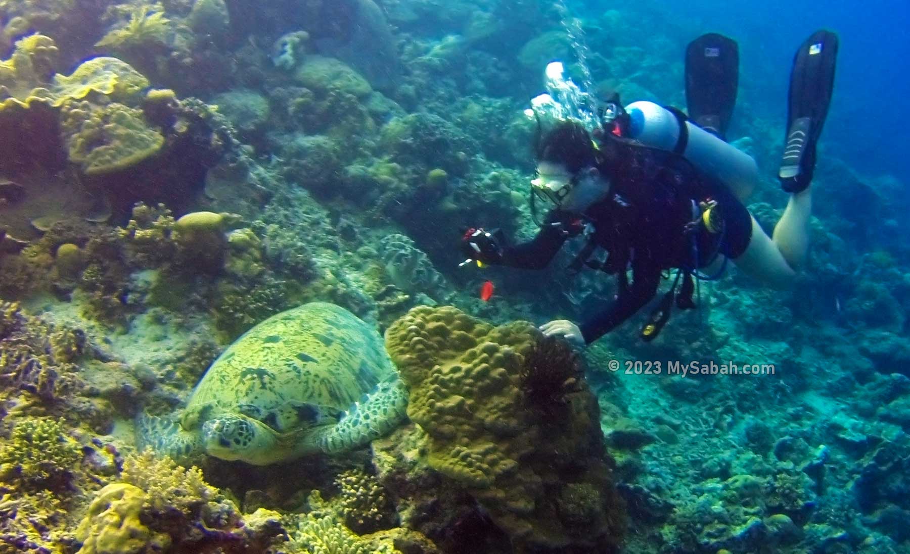
Sea Turtles are also the important assets of tourism in Sabah. Diving with gentle sea turtles is one of the most exciting experience, and scuba divers can see more than 10 turtles whenever they dive at Sipadan Island, the top dive sites of Malaysia.
Sea turtles are also important for tourism because tourists love to see them, especially scuba divers
Unfortunately, all seven species of sea turtles are on the endangered list (IUCN Red List). Four of the seven extant species of marine turtles occur in Malaysia (leatherback, green turtle, hawksbill and olive ridley). Selingan Island is a safe haven for the endangered green turtle (Chelonia mydas) and hawksbill turtle (Eretmochelys imbricata).
A Painful Lesson
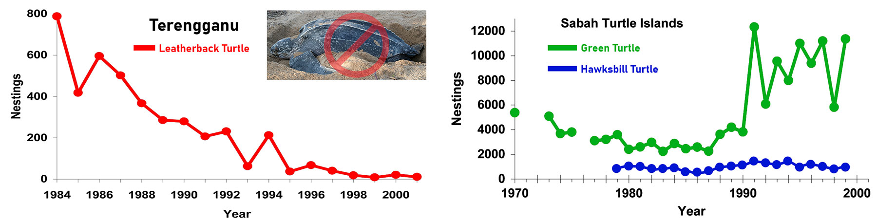
In the 1950s, about 10,000 leatherback turtle nesting were recorded annually in Terengganu state. Nevertheless, in 1980s, I had been hearing bad things such as people turned the turtles over, sat on them to take pictures and even took their eggs. The mother turtles couldn’t lay their eggs in peace, the consequence is no more landing of leatherbacks there after 2006.
Nesting trends of sea turtles in Sabah and Terengganu. Left: Leatherback turtles in Terengganu. Right: Green and Hawksbill Turtles in Turtle Islands Park of Sabah. Without conservation, leatherback turtle is extinct in Peninsular Malaysia.
Terengganu government tried to curb the collection of turtle eggs in 2005 but it’s too late too little. Though leatherback is sighted occasionally after 2015, there is no hope to recover the past glory as one of the world’s largest nesting grounds of leatherback turtles. WWF Malaysia states that the leatherback turtle population in Malaysia has plummeted by more than 99 percent since the 1960s.
Four species of sea turtles found in Malaysia are Leatherback turtle, Green turtle, Hawksbill turtle and Olive ridley turtle. They are all endangered species. In Sabah, they are fully protected by laws (Wildlife Conservation Enactment 1997). Offender could face a fine of up to RM250,000 or imprisonment of up to five years, or both.
Therefore, it’s significant that Sabah gazetted Turtle Island Parks as a turtle sanctuary on 1 Oct 1977, which stops the declining trend of green and hawksbill turtles population in Sabah.
Visit Selingan Island
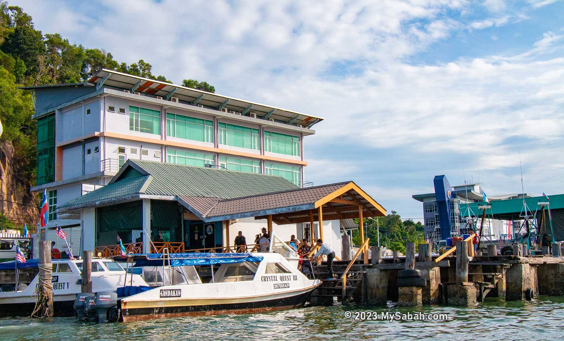
Selingan, the turtle island of Sabah, is the place where turtles and tourists meet. To visit Selingan Island, visitors need to contact Crystal Quest (Website: turtleisland.com.my, Facebook: Turtleislandresortsandakan, Phone (Whatsapp): +60 11-51665923) to book a 2-day-1-night tour, which is a full board package that covers land / sea transportation, permit, accommodation and meals.
Sabah Parks jetty in Sandakan City is the departure point to the Turtle Islands Park (Selingan)
Turtle Islands Park is managed by Sabah Parks, but they are focus on conservation and offload the tour booking and activities to Crystal Quest. The island sets a limit of maximum 50 tourists per day, so the tour to Selingan is always full. You better book this popular trip a few months in advance.
The main office and dining hall on Selingan Island
The Itinerary in Brief: 9:15am Register at Sabah Parks jetty 10:00am Depart to Selingan by boat 11:15am Arrive Selingan, check-in and have lunch 6:30pm Visit Exhibition Hall 7:30pm Dinner. After that wait for turtle landing and releasing of hatchlings Day 2 7:00am Check-out, breakfast and leave Selingan
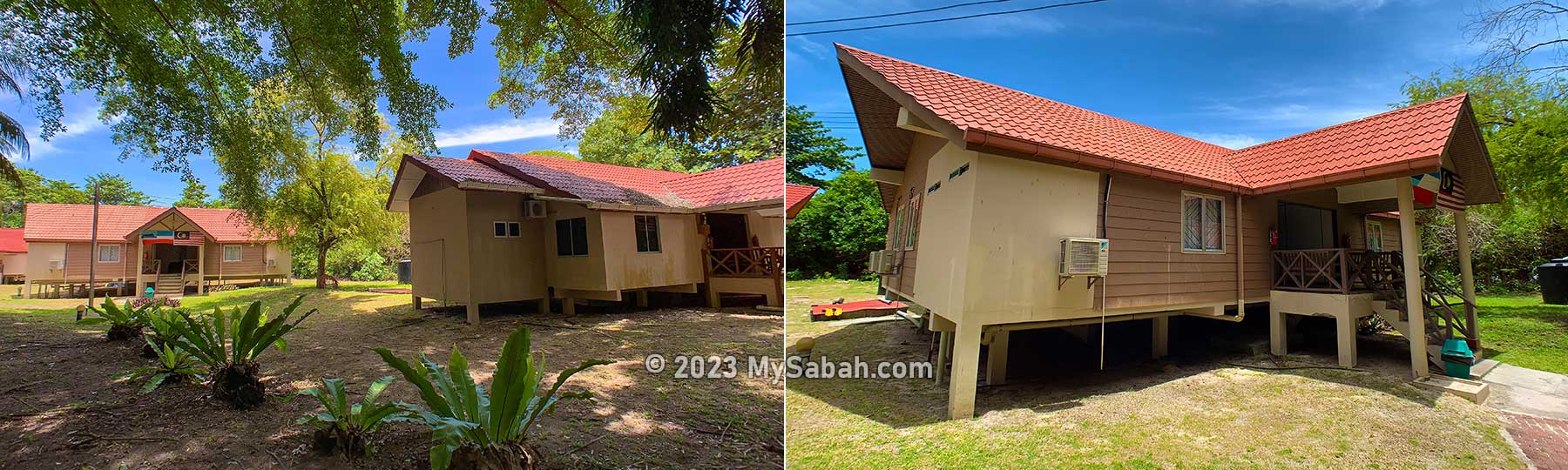
Only Selingan Island has chalets for tourists
The peak nesting months for Green turtle are from April to August, and for the Hawksbill turtle is between January to June. Overall, for Selingan the peak time is during April – August. Turtle landing on Selingan is almost guaranteed every day, so you don’t really need to pick a best time to visit.
You can watch this video for a quick overview of the tour to Selingan
Note: It’s a family and muslim friendly tour. English is spoken for non-Malaysian tourists.
The Turtle Hatchery
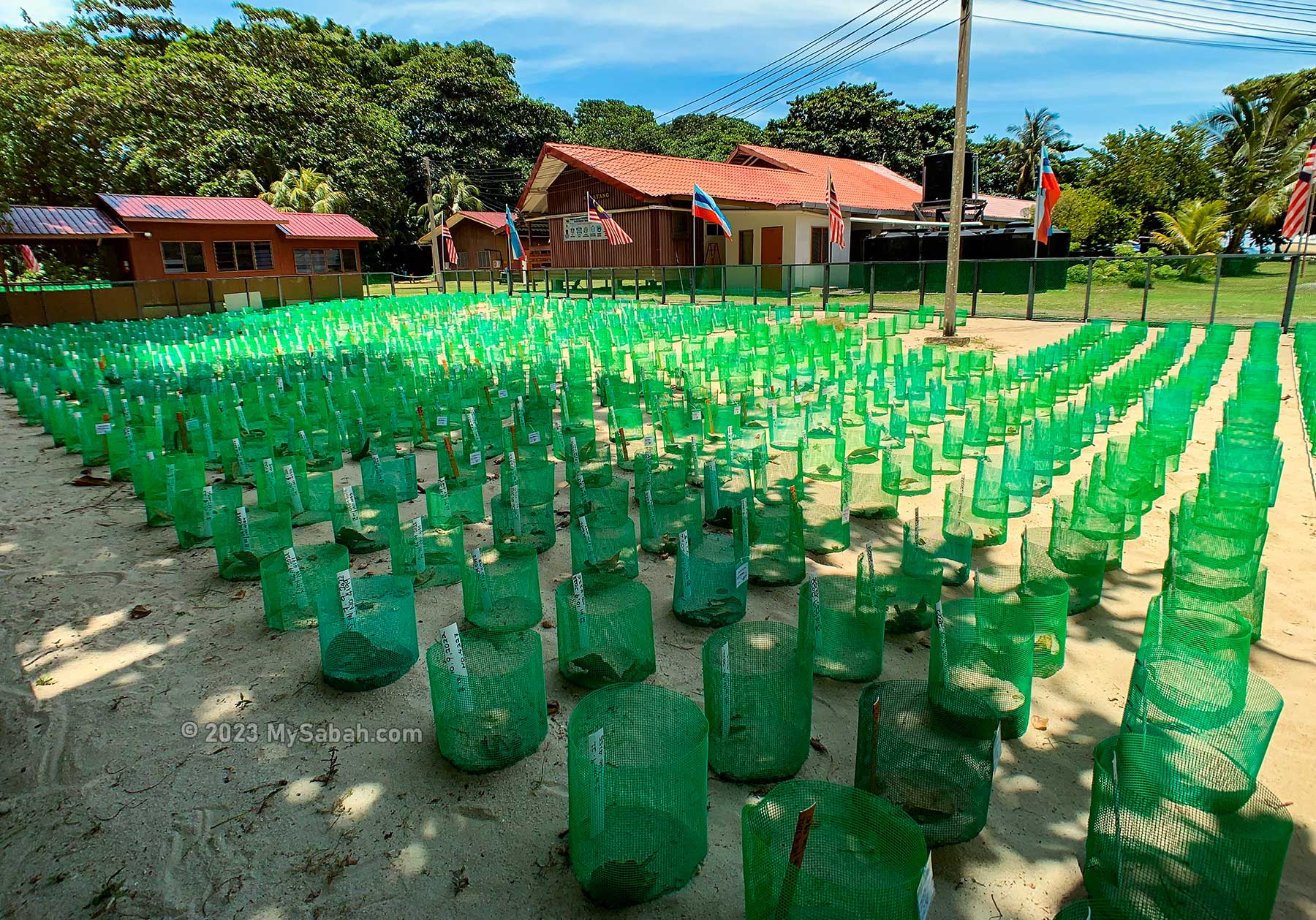
The first thing that you would notice on Selingan Island is the turtle hatchery zones with thousand of turtle nests fenced by green mesh net, which keeps away the predators such as monitor lizards, rodents and crabs. A well-protected nest has a hatch rate of above 80%.
Turtle hatchery on Selingan Island. The temperature determines the gender of the hatchlings, so part of them are placed under the shade, which provides higher chance to hatch male turtles.
The first turtle hatchery was built on Pulau Selingaan in 1966, followed by Pulau Bakkungan Kecil and Pulau Gulisaan in 1968. But the hatchery on the smallest island, Gulisaan, closed in 2015 due to beach erosion.
The total number of turtle eggs collected in the Turtle Islands Park from 1979 to 2016 is 22,449,572 eggs, namely 10,428,711 (46%) on Selingan Island, 6,381,682 (28%) on Bakkungan Kecil Island, and 5,629,179 (25%) on Gulisaan Island.
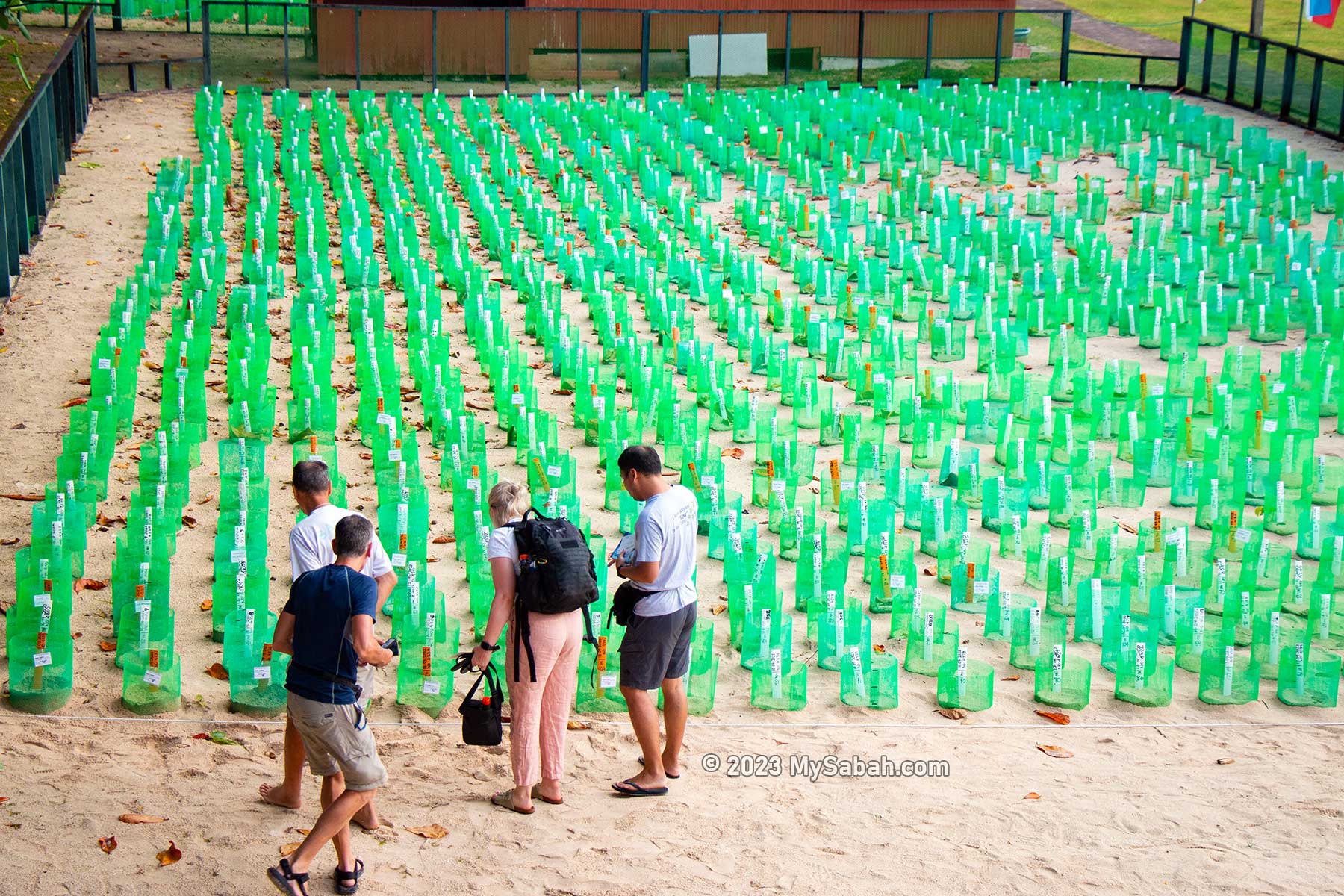
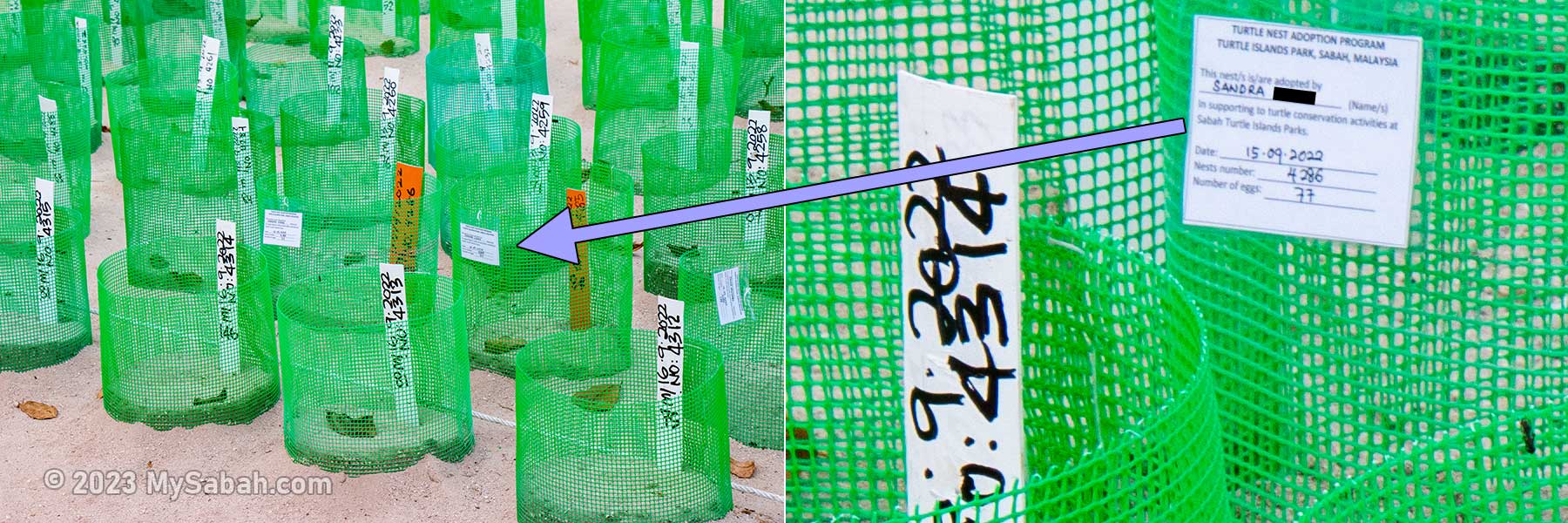
Tourists looking at their adopted turtle nests. You can participate in the Turtle Nest Adoption Program by donating RM100 to adopt a turtle nest.
The sex of baby turtles depends on the nest temperature. Warmer nests can lead to hatching of more female babies, while cooler nests lead to more males, so you would see some hatcheries are placed under the cooler shade. Without such measure, overwhelming majority of the hatchlings would be female due to global warming.
You can adopt a turtle nest. Your name will be labelled on the nest that you adopt.
Turtle Nest Adoption Program
You can adopt a turtle nest at RM100 (about USD27). Each sponsor will receive the following as an appreciation:
Have your name displayed on the nest’s label
A certificate of adoption
A Turtle Nest Adoption T-Shirt
You will be informed via e-mail when the eggs in your adopted nest hatch.
Other Turtle Hatcheries in Sabah
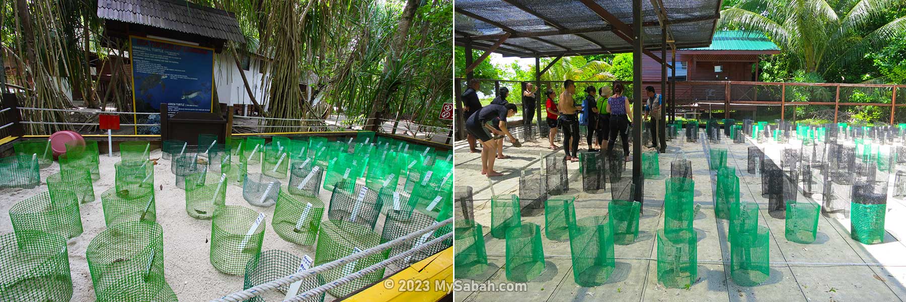
The combined island size of Turtle Islands Park is only 18.2 hectares, which is smaller than Manukan Island (20.6 hectares). We can save more turtles if we build more hatcheries because Sabah has 394 islands and nearly 1,000 miles of coastline.
Turtle hatcheries of Lankayan (left) and Sipadan Island (right)
In fact, some Sabah islands such as Libaran, Lankayan, Mabul, Mataking, Sipadan and Dinawan have small turtle hatcheries built under the support of resorts, government and local communities. For example, Libaran Island has released more than 42,000 baby turtles since 2010.
Accommodation on Selingan
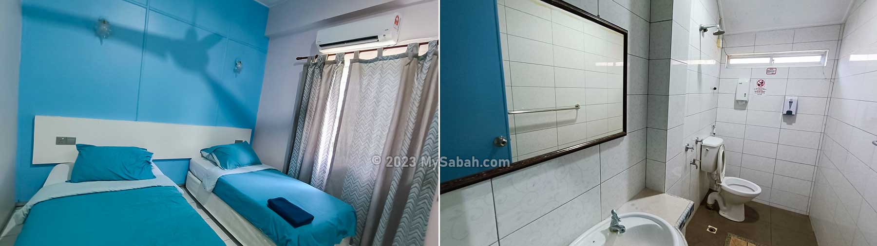
A few chalets are available for tourists. Most of the rooms are twin standard bed room, which is clean and comfortable, so is the attached bathroom cum toilet. Electricity is available 24 by 7 to power the air conditioning and ceiling fan. Towel and shower gel are provided.
Twin bedroom and attached bathroom of Selingan Turtle Island Chalet. Towel, shower gel, air-conditioning, ceiling fan and toilet are provided.
Beach of Selingan
The beautiful white sandy beach of Selingan is a bonus of the tour. The beach is kept in clean and pristine state, the way mother turtles love it. What turtles need is just a simple and natural beach for nesting. Sadly, nowadays most beaches are either having too many rubbish or people.
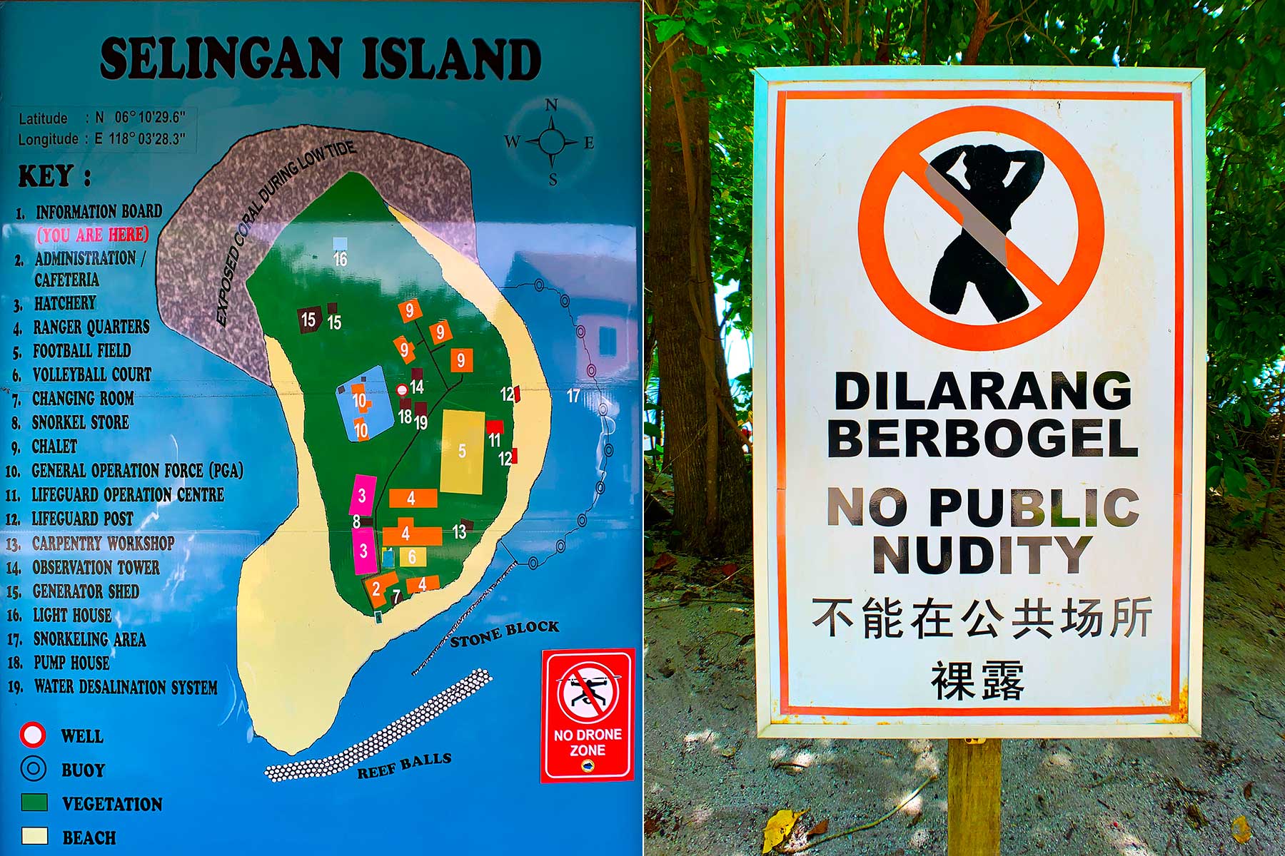
Left: site map of Selingan Island, Right: No nudity warning sign at the beach
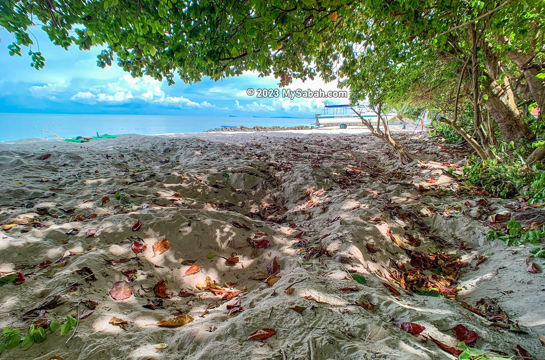
After lunch you will have plenty of free and easy time until dinner time. It takes less than an hour to walk one around of the island. North side of the island is rocky shore, so I only explored the sandy beach. I saw hundred of holes dug by the turtles for laying eggs, and the tyre-like tracks they left on the beach.
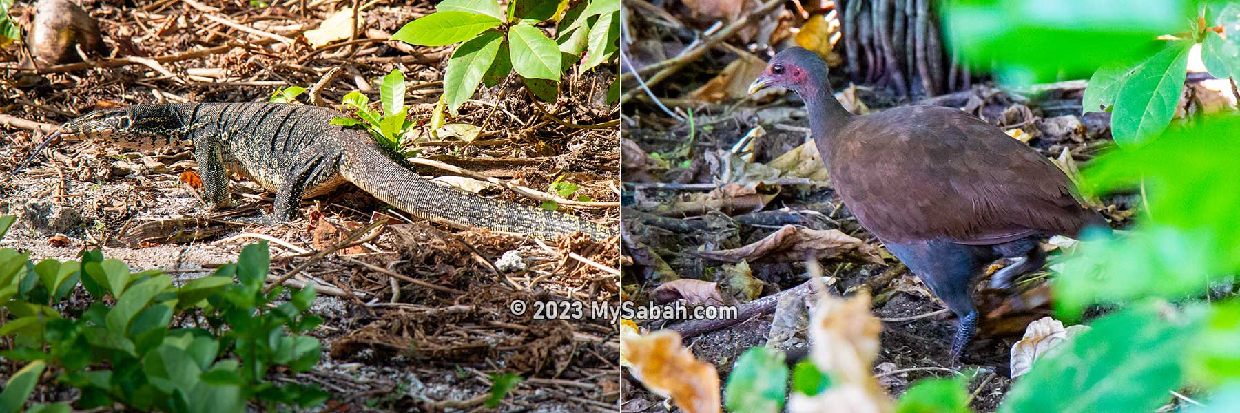
Monitor lizard and Philippine megapode are two common residents on Selingan Island
Do apply mosquito repellent before you walk in the wood. The three most common animals on Selingan are the roaming monitor lizards (harmless unless provoked), Philippines megapodes (or Tabon scrubfowl) busy scratching soil for food, and hermit crabs (most active at night).
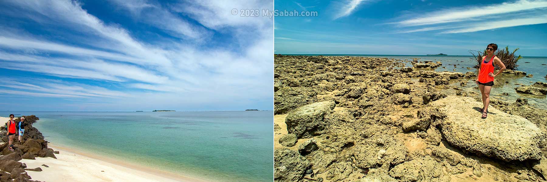
The sandy beach and rocky beach on Selingan Island
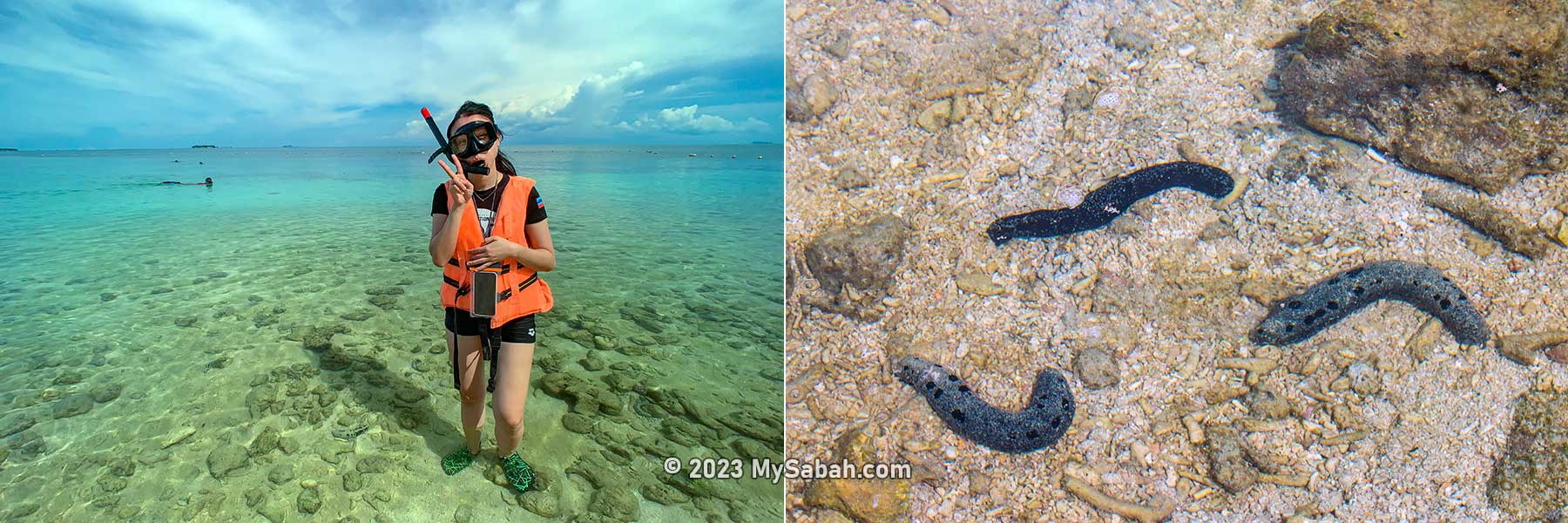
The favourite afternoon activity of tourists is snorkeling (gears available for rent on Selingan). Only the beach on the east side of Selingan is open for tourists to swim and snorkel because of the calm and shallow sea. There are life guards on duty at the beach from 8:30am to 5:30pm. You can sunbathe in sexy bikini, but no topless and nude please.
Left: snorkeling on Selingan Island. Right: sea cucumbers. There are probably thousand of sea cucumbers in the shallow sea of Selingan.
From the beach, you can see Lihiman and Great Bakkungaan Islands of the Philippines only 6 Kilometres away. They are the “Philippines side” of the turtle island park. Turtle island parks from Malaysia and Philippines establishes the Turtle Islands Heritage Protected Area (TIHPA), the world’s first transborder programme between two countries to conserve sea turtles and their habitats in the Sulu Sea since May 1996.
You can see the islands of Philippines from Selingan. They are also part of the Turtle Islands Heritage Protected Area (TIHPA), the world’s first trans-border protected area for marine turtle. Left: Lihiman Island, Right: Great Bakungan Island at the left and Pulau Bakkungaan Kecil (of Sabah) at the right
The sea water is crystal clear and inviting to beachgoers who want to swim between Malaysia and Philippines water. The sea floor is rocky so a pair of water shoes would help. I saw hundred of sea cucumbers near the shore. The corals and macro lives in deeper water are spectacular. During low tide, avoid snorkel too close to the sharp corals or you would risk getting cut.
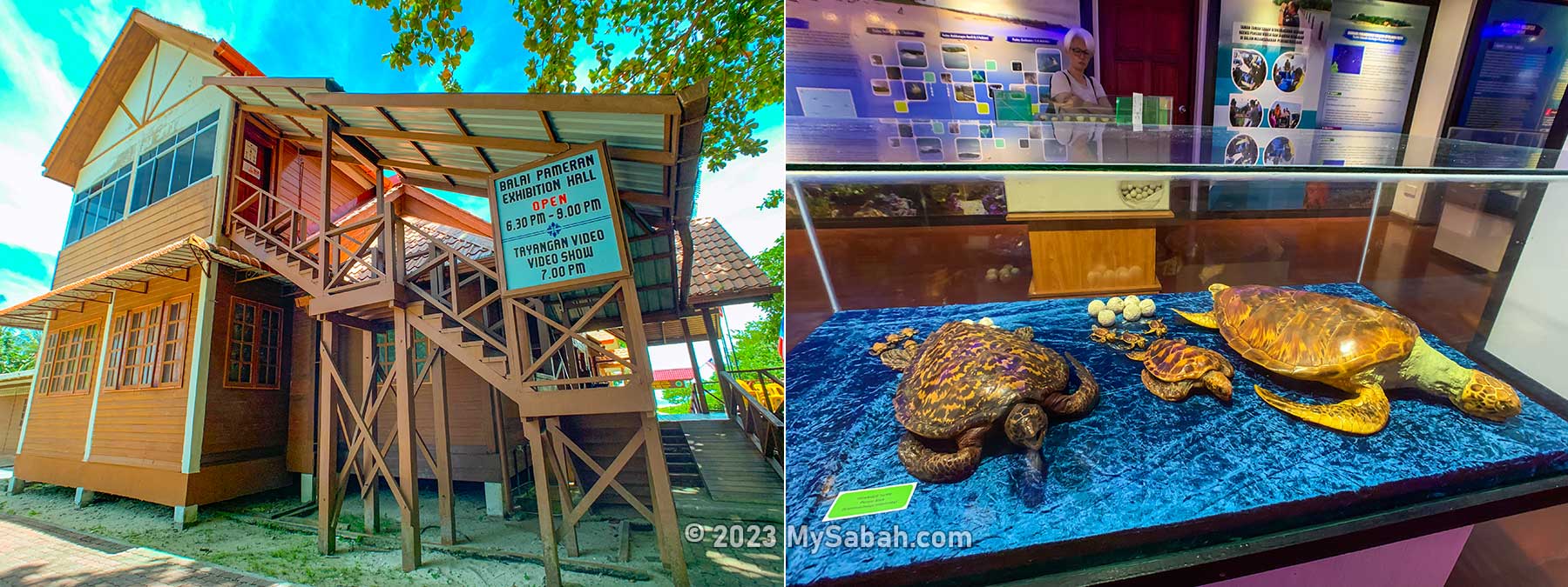
The Exhibition Hall of Turtle Islands Park on Selingan Island. It is open from 6:30pm to 9pm.
Exhibition Hall
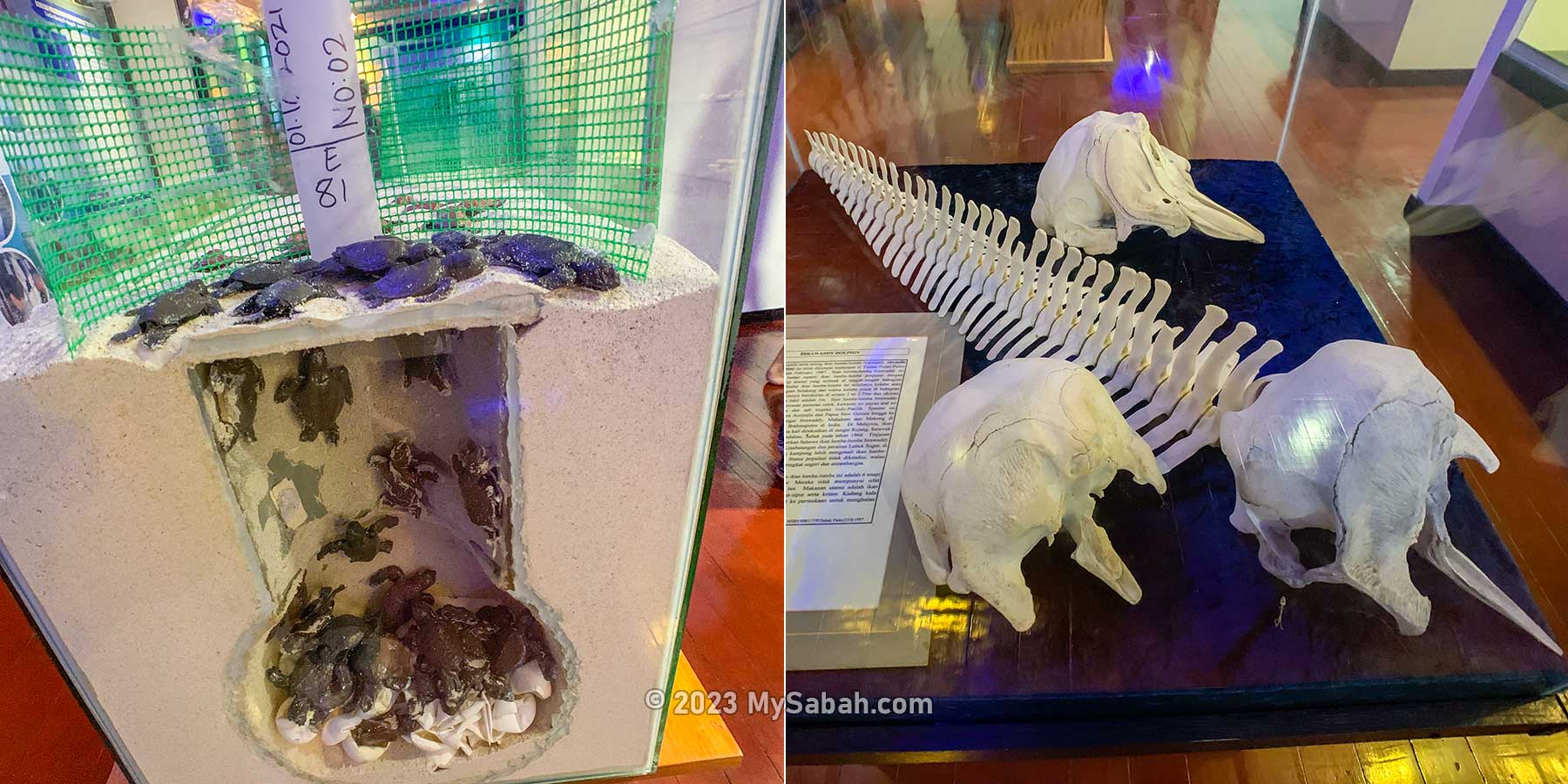
No walking on the beach is allowed after 6pm, as the turtles would land anytime. You may visit the small exhibition hall, which is open from 6:30pm to 9pm. Some photographs, specimens and skeleton of marine animals such as turtle, dolphin and giant seashells are displayed.
Items displayed in the exhibition hall of Selingan Island. Left: model of a turtle hatchery, Right: skeleton of Irrawaddy dolphins
The labels and information are written in Malaysian and English, for you to learn about the sea turtles and the conservation projects of Turtle Islands Park. This short visit is a good time filler before dinner. Halal / Muslim-friendly food is served. If you are a vegetarian, you can inform the operator of your food preference in advance.
Turtle Nesting
After dinner at 7:30pm, everyone was asked to sit and wait in the dining hall for the highlight activity. Based on the landing records from 1981 to 2016 of the Park, a total of 85,870 unique turtles have been marked involving 81,149 (94.5%) green turtles and 4,721 (5.5%) hawksbill turtles. The Olive Ridley turtle (Lepidochelys olivacea) rarely comes here (only 6 landing).
After dinner, tourists wait in the dining hall for the tour to see nesting turtle
The number of turtle landings at the Turtle Island Park has increased to between 6,000 to 15,000 annually since 1991. The highest number of turtle landing was 15,219 nests in 2011. It’s safe to say that Turtle Islands Park is one of the most important nesting sites for green turtles in the world.
Green Turtles lay about 120 eggs while a Hawksbill can lay up to 160 eggs on average. Batches of 50 – 80 eggs are the most common.
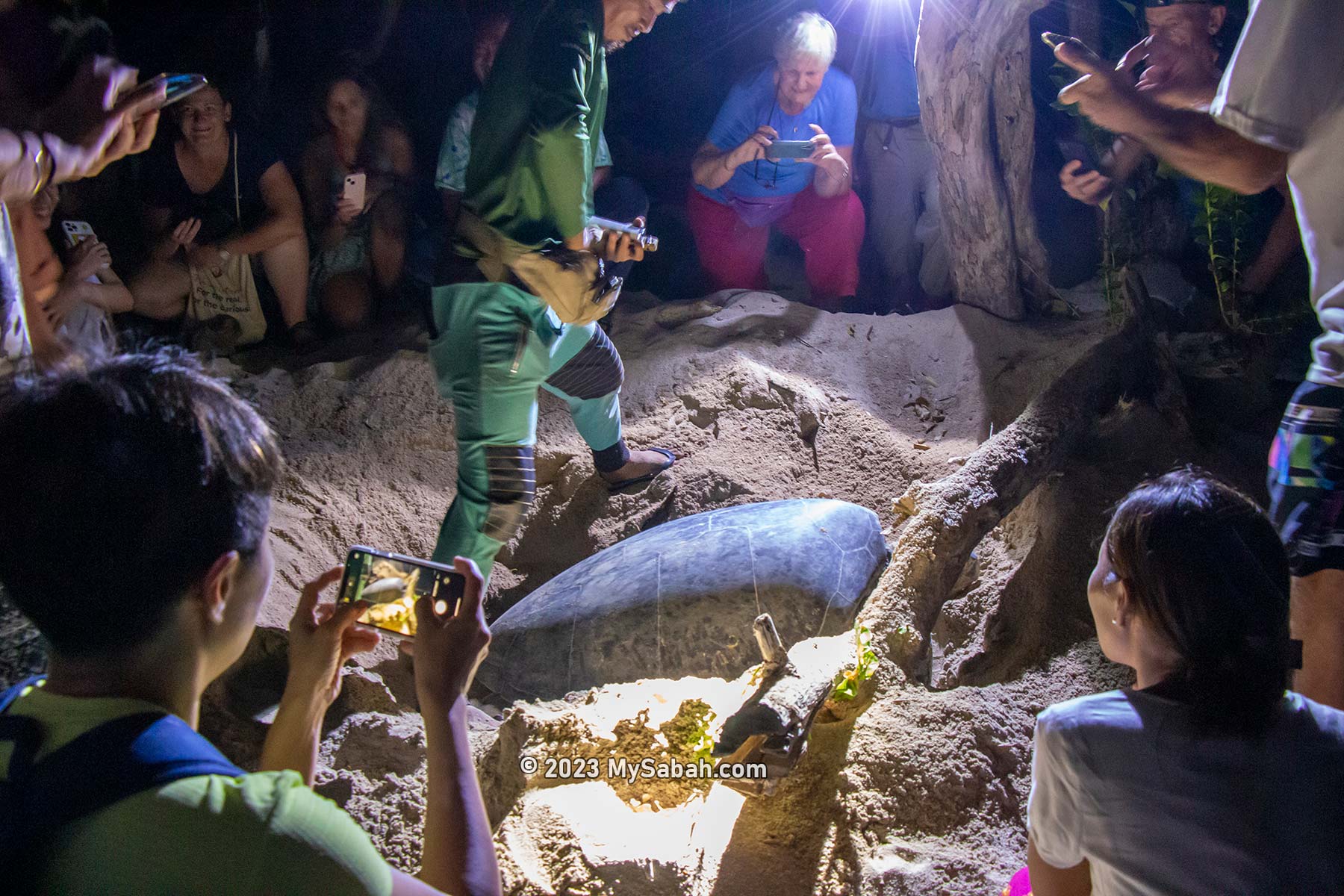
The wait took less than an hour. Around 8pm, the ranger brought us to the beach where mother turtle nested. It’s only a 10-minute walk, but we were so enthusiastic and brisk walking behind the dim flash light of the rangers. We were requested to keep quiet and turn off our torch, or the excessive noise and light would stress the sensitive mother turtle and turn it away.
Nesting pits dug by the sea turtles for laying their eggs on the beach. These holes are everywhere on the sandy beach of Selingan Island.
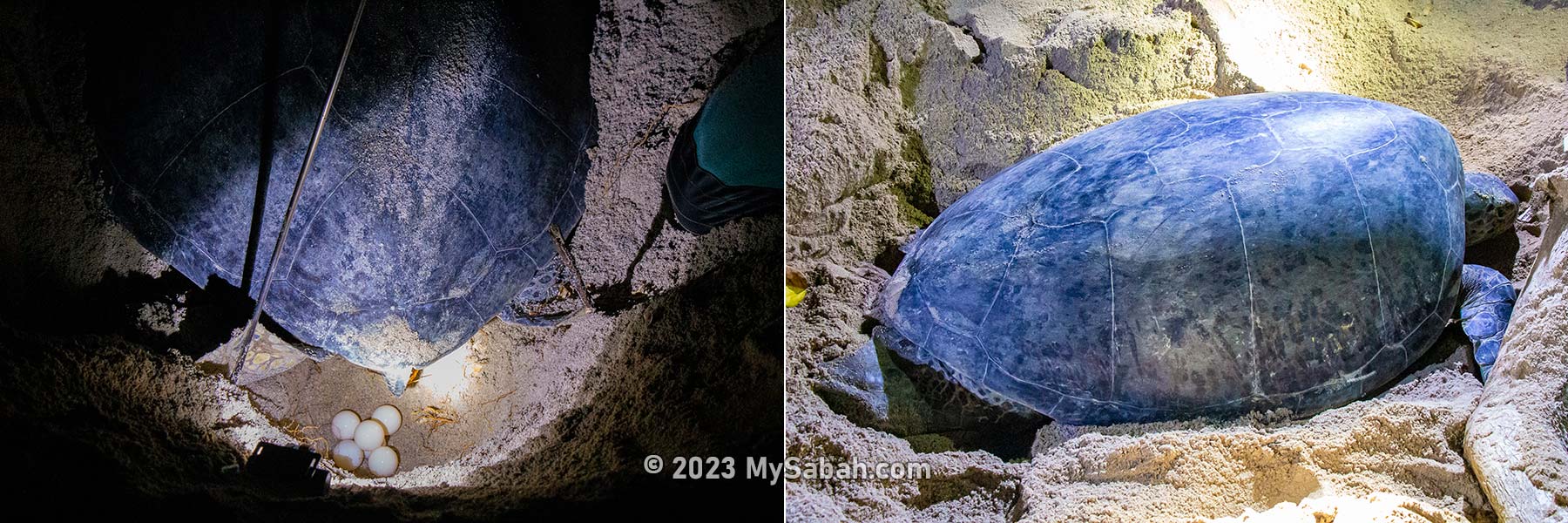
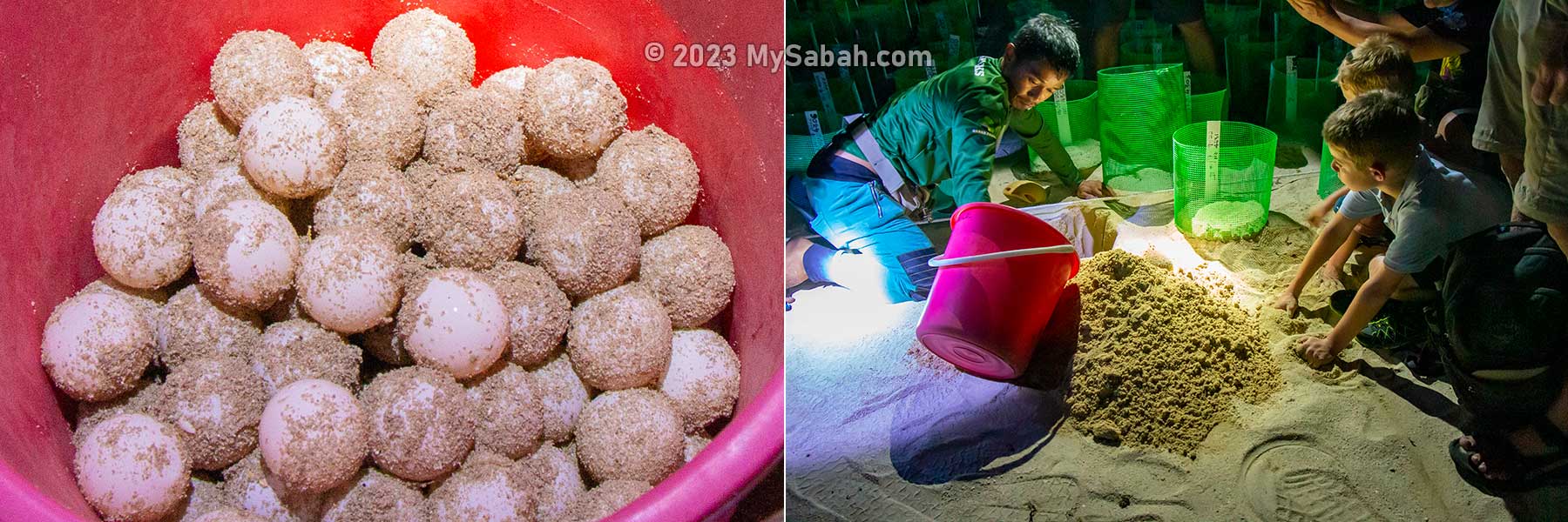
By the time we got there, a green turtle had already dug a 16-inch-deep hole in the sand near vegetation line (above high water mark) and started laying eggs. We gathered around the turtle and looking at clutch of ivory-color and perfectly round eggs being laid into the pit.
Tourists gather next to the nesting site of a mother turtle
Everyone was given turn to shoot photos (extra torch, flash light and video taking are prohibited) so we didn’t need to elbow others to move to the front for the best angle. But we still need to keep a distance from the turtle.
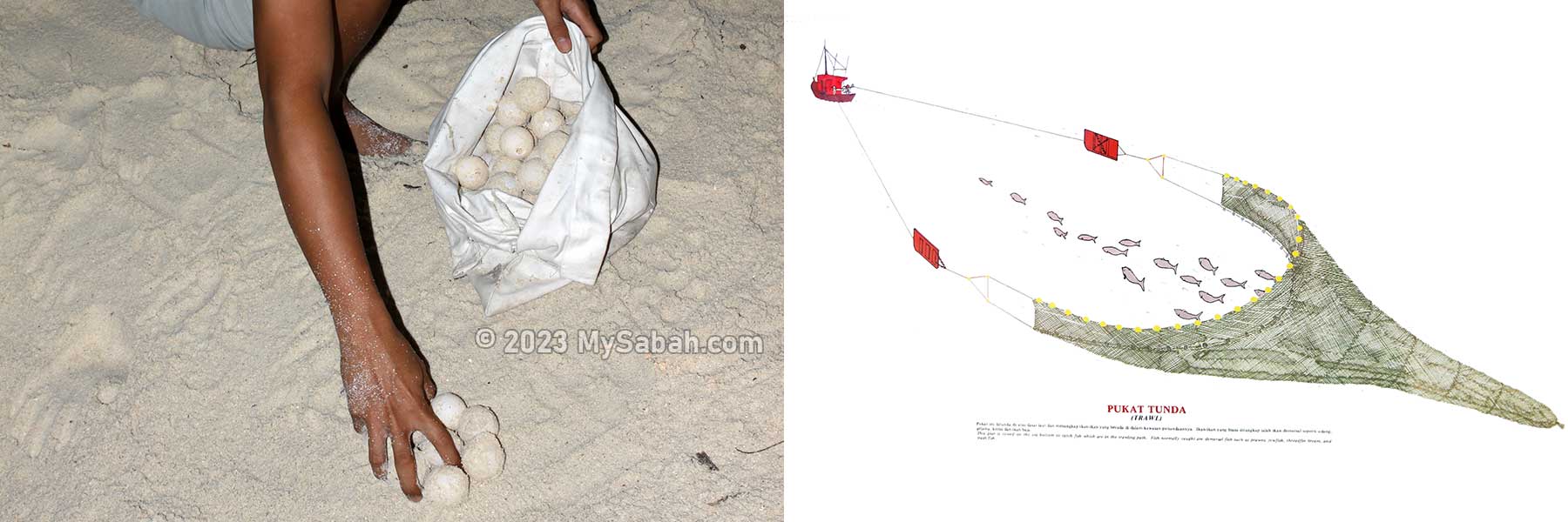
The nesting usually takes 30 to 60 minutes. The clutch size varies between 40 – 200 eggs but batches of 50 – 80 are the most common. After the mother turtle was done with nesting, the ranger collected her fresh eggs into a bucket.
The fresh turtle eggs look like ping-pong balls. They are transferred to the turtle hatchery for better protection.
We followed the ranger to the turtle hatchery, where he buried the new turtle eggs for incubation. The nest is labelled with date, clutch size and serial number. These are what rangers do until dawn when they find new nests during night patrol.
Releasing Baby Turtles
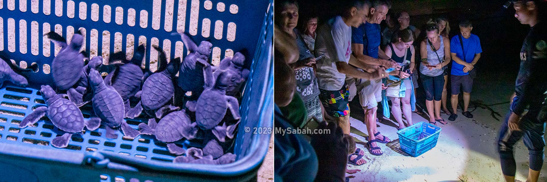
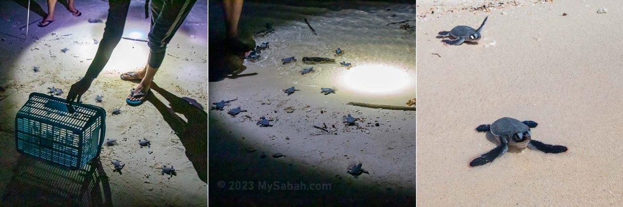
The next program is the releasing of baby turtles to the wild. Turtle eggs take about two months to hatch. Once they emerge from the sand, the ranger will put them in a basket ready for releasing at night later.
Newly hatched baby turtles got photographed by excited tourists before their release
Everyone walked to the beach. The baby turtles were so cute and we were in a photo frenzy. Before the release, we were instructed to stand still because the small turtles would run all over the beach and around our feet.
A sleeping sea turtle can remain underwater for 4 to 7 hours
The ranger pointed the torch to the sea, to guide the hatchlings to enter the water. Baby turtles normally use the brightest horizon as clues to find the ocean. Artificial lights would distract them from finding their way, so coastal reclamation is a threat to their habitat.
You might ask, isn’t it easier to pour them all into the water? Sea turtles can sense the Earth’s magnetic field and use it as an internal compass. Release them on the beach would help them to register the magnetic signature of their birthplace, so they will come back to lay eggs in future.
Releasing of baby turtles on the beach. The female turtles would come back to the same beach to lay eggs after 20 years.
During their lifetime, sea turtles will travel thousands of miles across the oceans. It’s remarkable that adult turtles can use the Earth’s magnetic field as a global GPS to navigate back home for laying eggs.
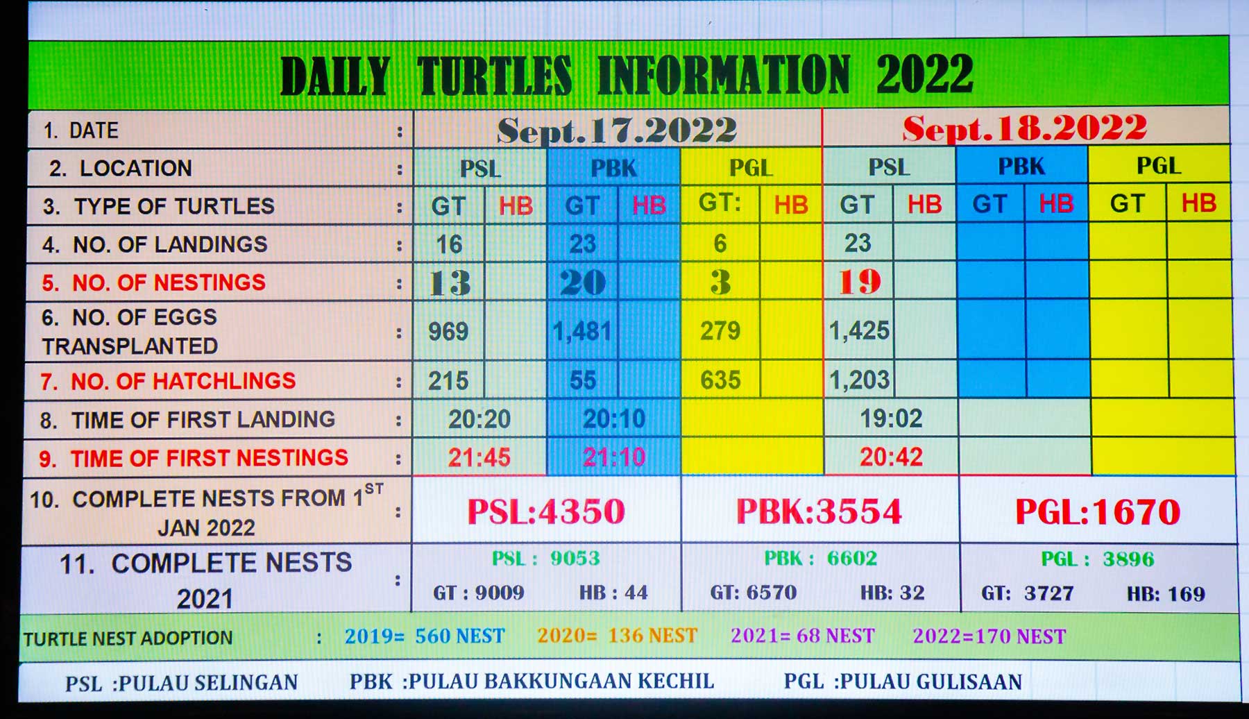
Daily scoreboard of records on turtle landing and number of eggs collected. (GT = Green Turtle, HB = Hawksbill Turtle)
About 22 million hatchlings from over 315,000 turtle nests have been released into the sea from 1979 up to 2023 (1st quarter) in Turtle Islands Park (94% are green turtles, 6% are Hawksbills). The number is impressive but only one in 1,000 hatchlings would survive to adulthood. Every egg counts.
Starry sky of Selingan Island, which is free of air and light pollution
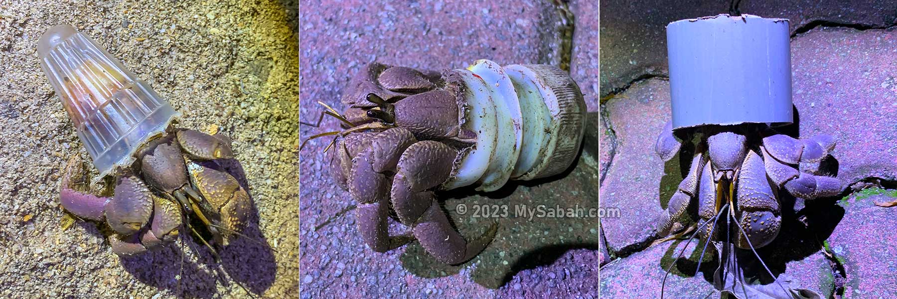
The releasing is the last activity of our tour. Most of the light was off and we were not permitted to wander near the beach until 6am next day, to avoid disturbing the landing of turtles. Without light pollution, the starry sky on Selingan was stunning. Many hermit crabs crawled out in the night. It’s funny but worrying to see that many hermit crabs used plastic waste as their shelter instead of normal seashells.
Hermit crabs use plastic waste as their shelters. This bizarre adaptation is getting common as more beaches are polluted.
People told me that Selingan Island is haunted. The rangers also shared some paranormal activities that they experienced during night patrol. Sometimes they heard people whispering but there was nobody around. One of the most terrifying story is – they saw huge shadow of turtle stood up in the sea. I’m not sure if these are fake stories to discourage tourists from going to the beach at night. I’ll leave it to you to find out. I had a good sleep there anyway.
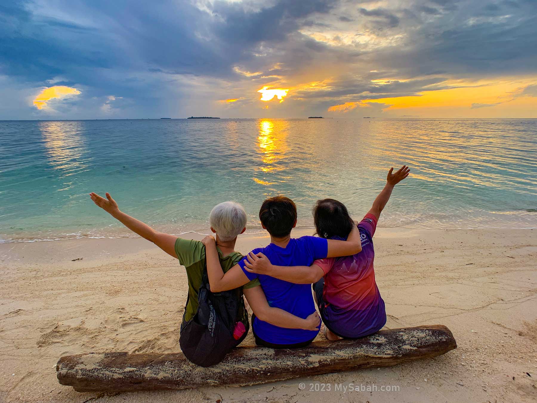
Beautiful sunrise at Selingan Island
Before we left Selingan next morning, we caught the nice sunrise view over the Philippines islands. Overall, this is a leisure and educational tour that I would highly recommend to someone who love turtles and tropical islands.
What to Bring
The following are some necessary or useful items for the trip:
Sunblock lotion / spray
Sunglasses & hat
Swimwear or beachwear (e.g. swimsuit, bikini, rough guard)
Beach mat
Cash
Passport / MyKad
Water in refillable bottle
Insect repellent
Light clothing (e.g. T-Shirt, short)
Slipper / Sandal
Toiletries (toothbrush, toothpaste, face wash, soap, shampoo, toilet paper)
Camera & spare batteries / memory cards
Mobile / Cell phone and charger
Portable power bank and charging cable
Torch / Flashlight
Optional: dry bag (water-proof), goggles, waterproof casing for phone / camera, snorkelling gears (mask, snorkel, fins, life vest), water shoes, personal medicines
Note: you can rent the snorkelling gears on Selingan.
Challenges
Having turtle hatcheries and conservation acts are not enough to stop sea turtles from extinction, unless the threats below are mitigated effectively.
Not all Malaysian states ban the consumption of turtle eggs
Poaching of turtle and its eggs
Between 2,000-3,000 turtles are trapped as bycatch of commercial fishing in Malaysia every year
At least half of all sea turtles have already consumed plastic, which is hazardous to their health
Coastal development destroys the nesting beach of turtles
Threats to marine turtles include poaching of turtle eggs, and thousands of turtles trapped and drowned in the net of fishing trawlers every year
Bajau is the second largest indigenous group of Sabah. Without Bajau, the cultural world of Sabah would be a lot less colourful, because Bajau people are famous for using bold bright colours in their traditional costumes and handicrafts. Bajau has about 13 subethnic, including the Ubian, Sama, Simunul, Tolen, Pala’u, and Sikubung, all of which are named according to their place of origin or current regions.
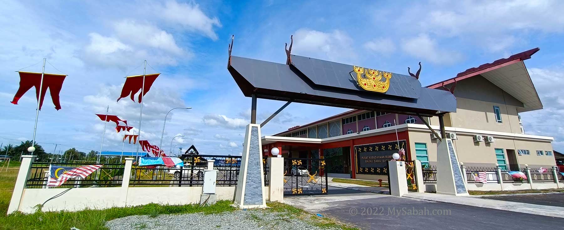
Sabah Bajau Sama Cultural Centre (Pusat Kebudayaan Rumpun Bajau Sama Sabah) was officially opened on 21 August 2022. The area takes about 1.4 Hectares.
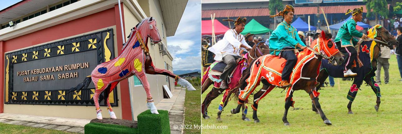
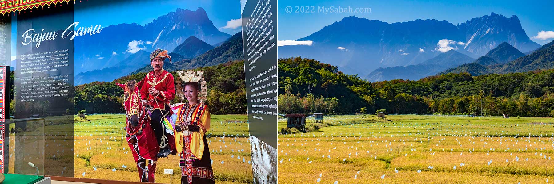
Bajau Sama (or Bajau Samah) mainly resides in West coast of Sabah (Malaysia), especially Kota Belud and Tuaran districts. They are also known as the Cowboys of the East because of their excellent horsemanship.
Sabah Bajau Sama Cultural Centre
To preserve their cultural heritages, the building of RM7.5-million Sabah Bajau Sama Cultural Centre (Local Name: Pusat Kebudayaan Persatuan Rumpun Bajau Sama Sabah) was completed in 2022 and open to visitors who want to see the vibrant cultures of Bajau Sama, who is widely recognised as the colourful, festive, and musical people.
Bajau Sama is also known as the Cowboys of the East because of their excellent equine skills
Gallery, the little world of Bajau Sama
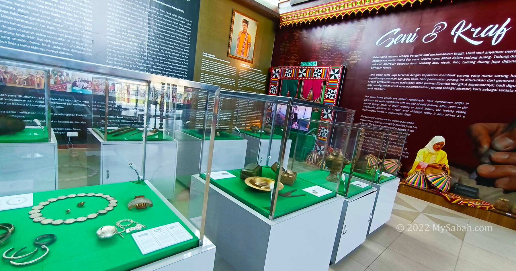
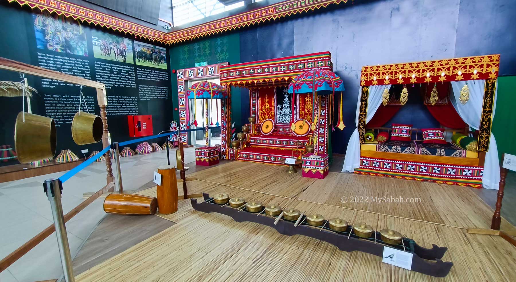
The gallery of Sabah Bajau Sama Cultural Centre is the highlight. It shows everything about Bajau Sama, from handicrafts, motif, musical instruments, wedding decoration, antique to clothing. Photo-taking is allowed in the gallery.
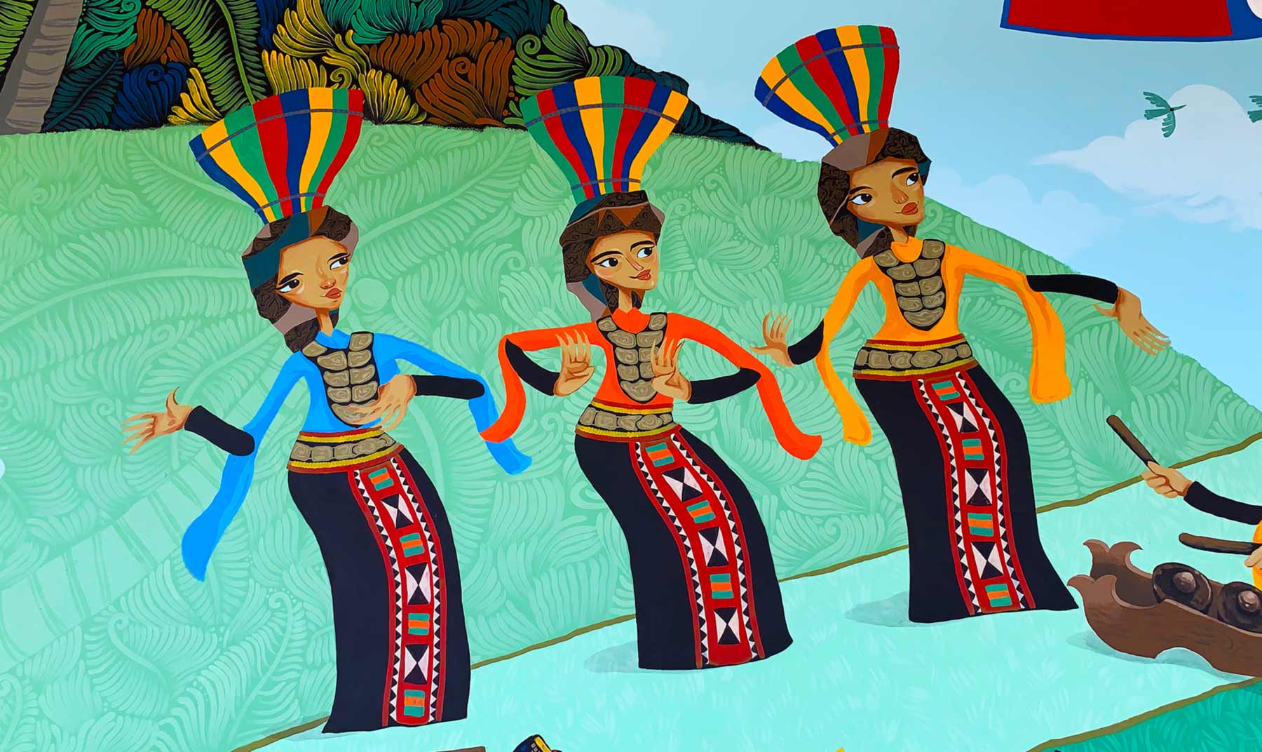
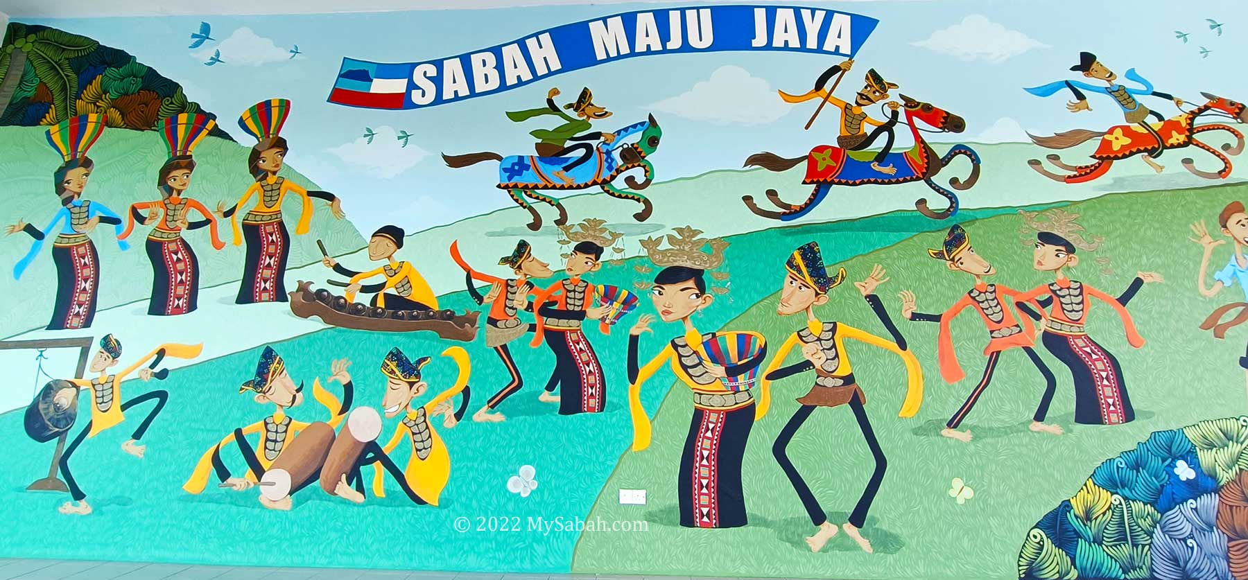
This beautiful mural at Sabah Bajau Sama Cultural Centre summarises many cultural elements of Bajau Sama
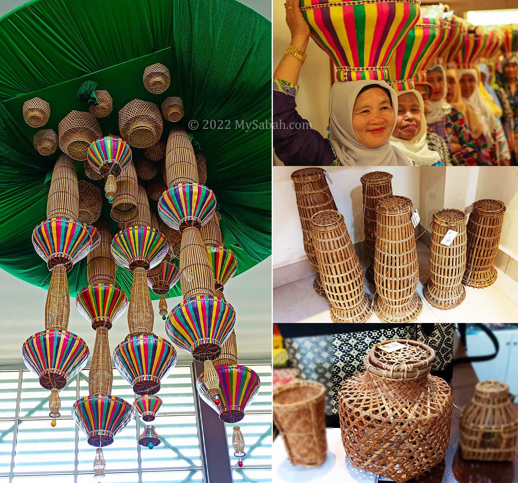
As the most colourful tribe of Sabah, Bajau Sama uses bright yellow, red, blue and green as the main colours. Majority of the bright-coloured Sabah handicrafts such as Serdang boxes and Tudung Duang (food cover / basket) are made by Bajau Sama.
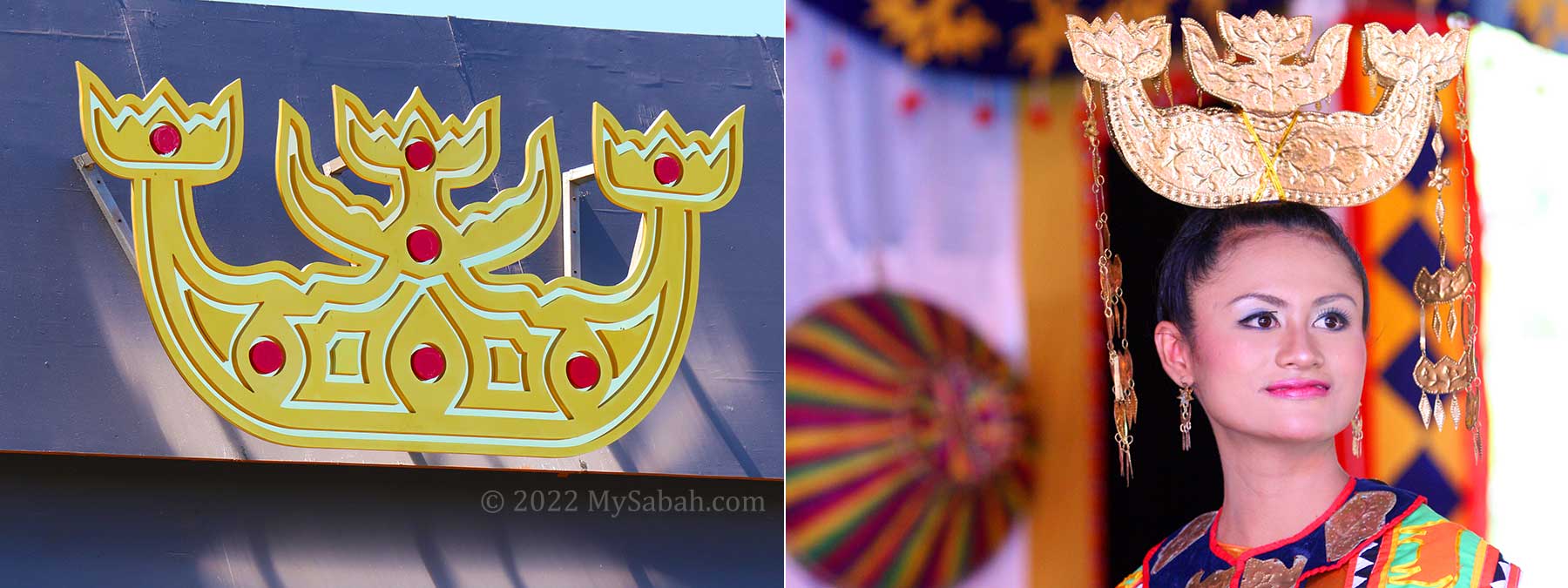
Serimpak or Serempak is the unique headgear of Bajau Sama women
Bajau people are not only skillful in handwoven crafts, they are also good in making different kinds of parang (machete) with traditional methods, the hilt and sheath are carved out of wood with beautiful motif on them.
Copperware exhibition in the galley of Sabah Bajau Sama Cultural Centre
The place is air-conditioned and has clean toilet. You can enjoy listening to the soothing Betitik music while you are doing your business.
The gallery uses four of my photos. One of them is the big Mount Kinabalu backdrop. I’m so excited about it. Thank you Haw for choosing my works.
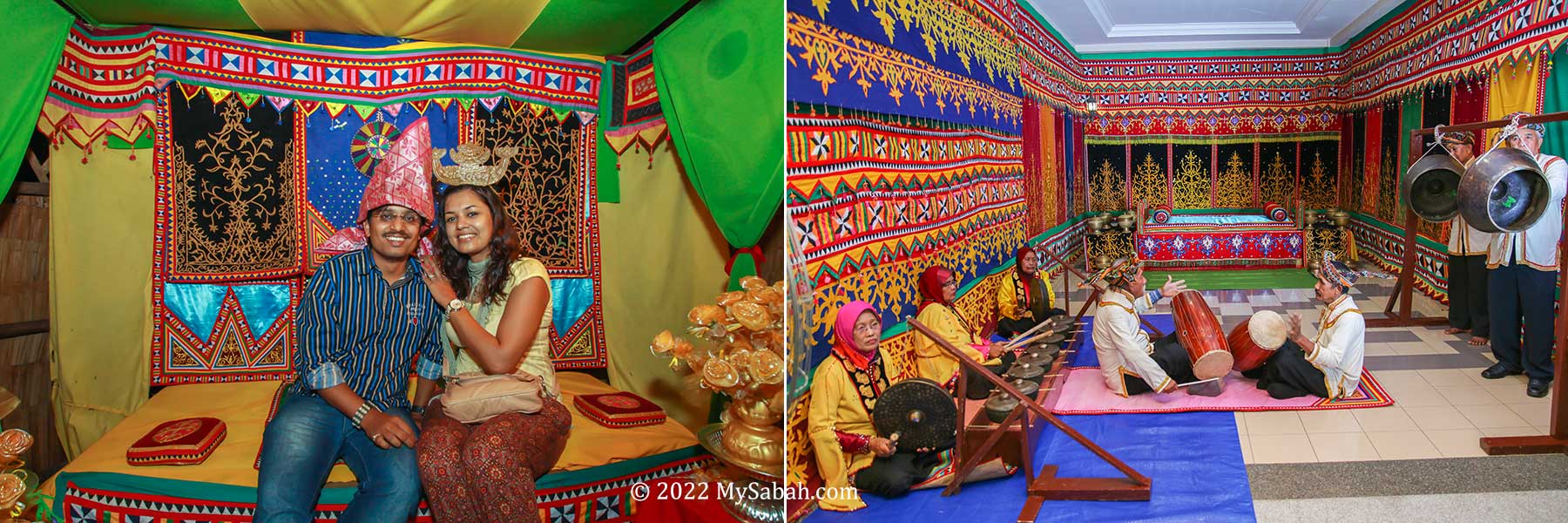
Musical instruments and wedding display of Bajau Sama
The most colourful section is the display of their wedding dais and bed. The wedding of Bajau is a glamorous affair with up to seven ceremonies. Sometimes it’s so splendour that it looks like a royal wedding.
A conceptual chandelier piece that features the Togong (Bubu fish trap), chicken cage and Tudung Duang (food cover) as main subjects
The chandelier hanging on top is quite a masterpiece by Sabah Art Gallery team. It’s a conceptual chandelier that features Bubu (fish traps) and Duang (food basket). The meaning is to illustrate the importance of preserving the Bajau Sama’s heritage craft because it sheds light to the culture and way of life of their ancestors.
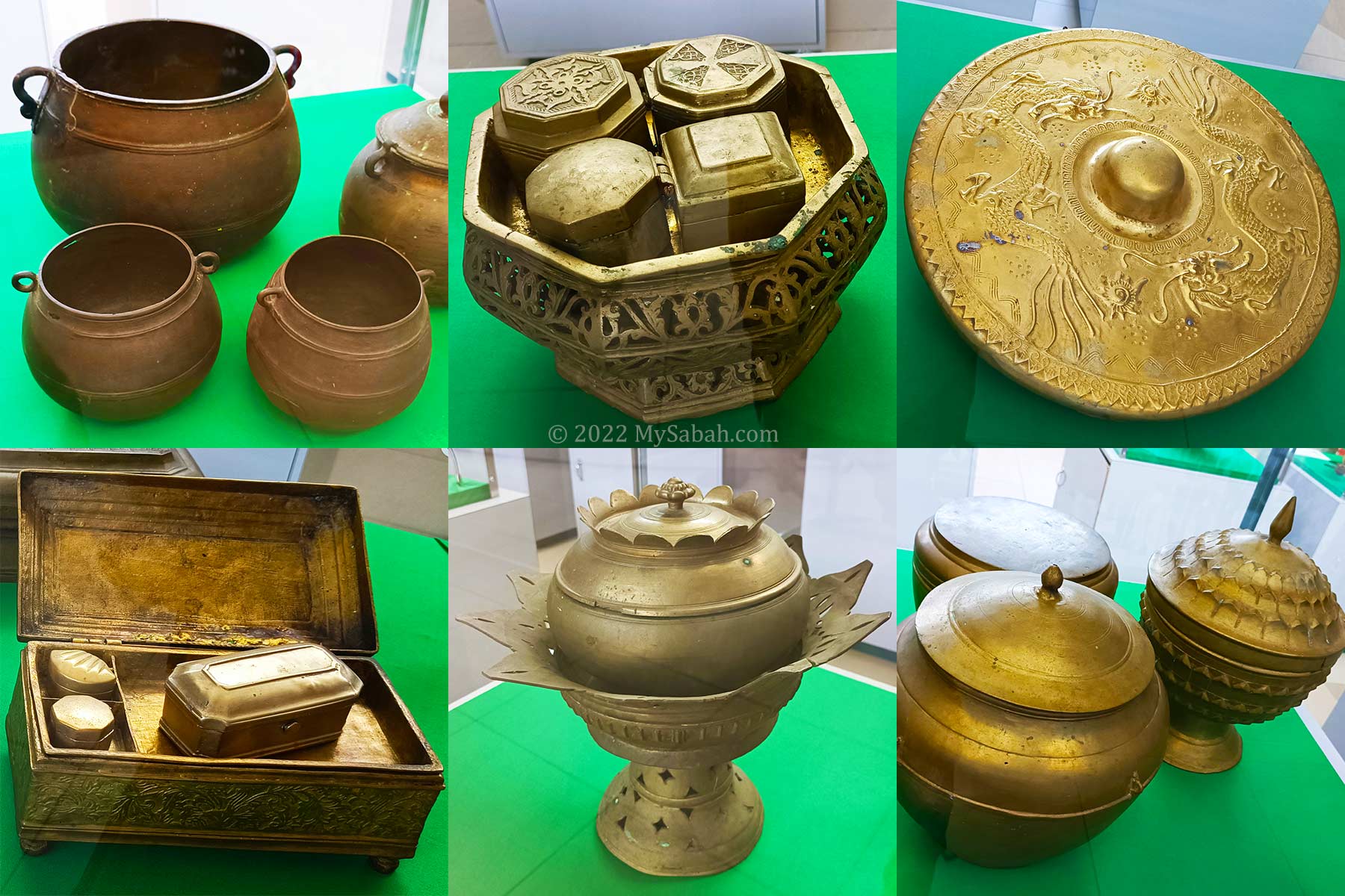
Brassware and bronzeware of Bajau, one of the most prosperous race in Sabah.
One of the main sections is the exhibition of various antique and metal wares made of Bronze, Copper and Brass. Besides striking colours, Bajau Sama is really fond of shiny objects too. They seem to have copper items for everything they use, for examples, Betel nut containers, plate, cookware, kettle, tray, accessories, fingernail caps, measurement cup. Having these items is a show of wealth and can be passed on as dowry and heirloom.
The information panel is available in both English and Malaysia languages, for visitors to learn about the exhibited items. If you want a guided tour, the following is the schedule for the best time to visit.
Day
Morning
Afternoon
Monday
Closed
Friday
9am
2pm
Other Days
10am
2pm
Schedule of Guided Tour
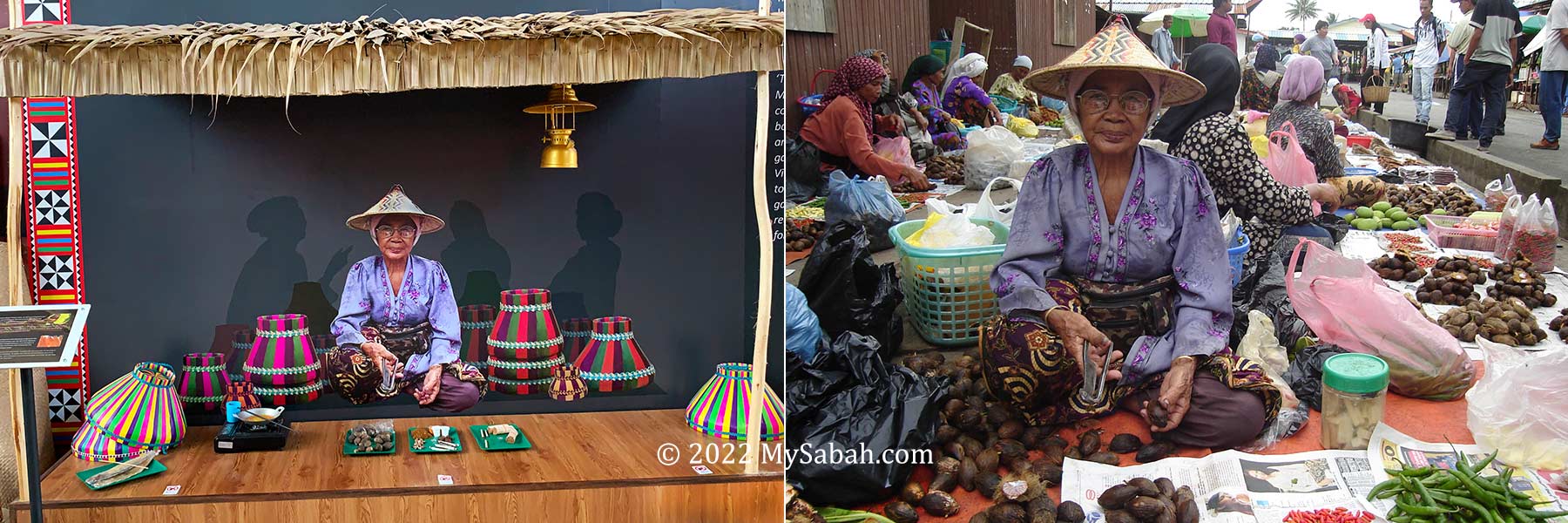
Photo of a grandma at Kota Belud Tamu, taken by me in year 2005. A French tourist said he saw her eyes blinked.
Overall, this Centre is a good starting point to see the culture of Land Bajau (Sea Bajau is totally different). The human photos in this article are not taken at the Centre.
Traditional Bajau Houses
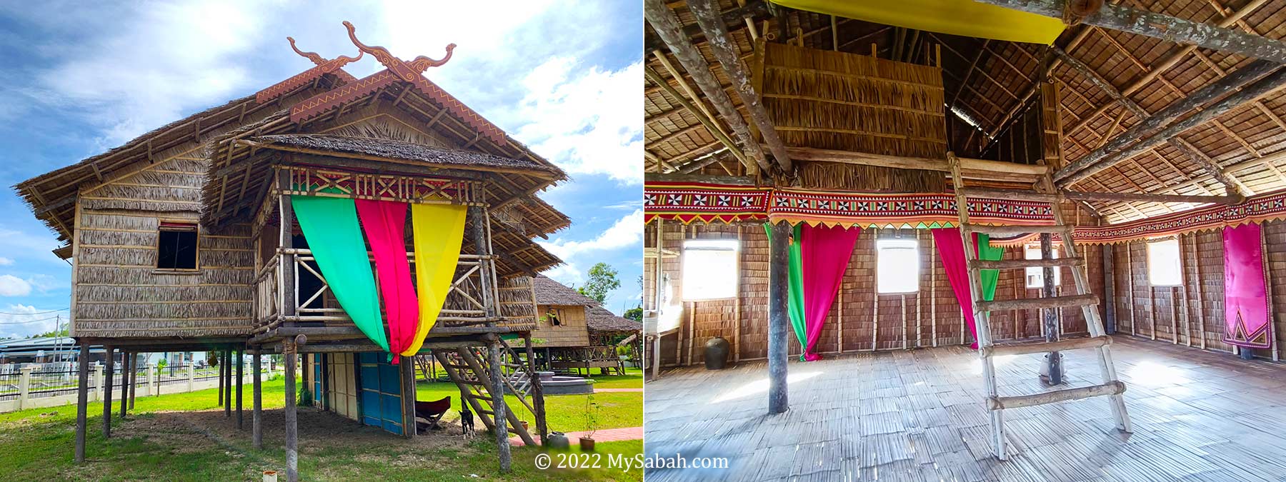
You may explore the two traditional Bajau houses (farmer and fisherman) behind the main building. Such wooden houses are getting rare when most people prefer brick and mortar building nowadays. There is a mini herbs garden there too.
Traditional Bajau house at Sabah Bajau Sama Cultural Centre. The chamber on top is the small room for maiden. The ladder is removed after they go to bed.
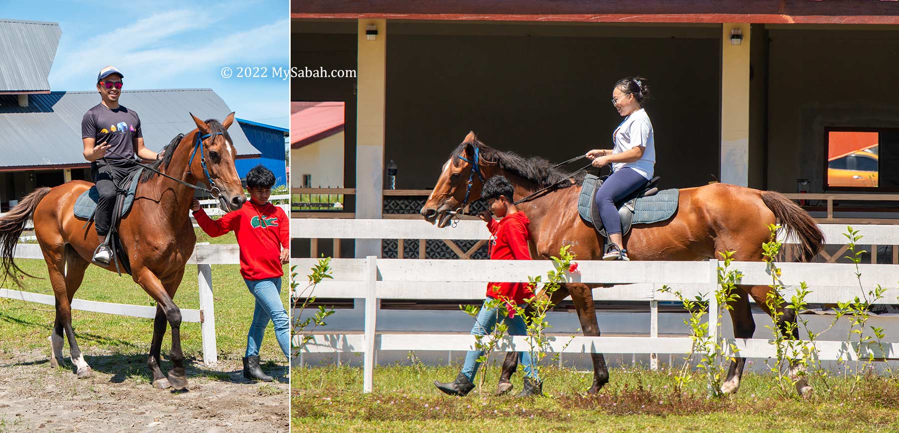
Horse Riding
You can try out horse riding at the Centre. A staff will company you and the horse for a safe stroll around the track.
Horse riding at Sabah Bajau Sama Cultural Centre
Bajau Sama are skilled horse riders and love their horses. During festivals such as Tamu Besar (grand open market) in Kota Belud, Bajau horsemen wear traditional costumes in the parade, and their horses wear colourful clothing steeds too. It’s like dressing up your pet in next level up.
Other Activities
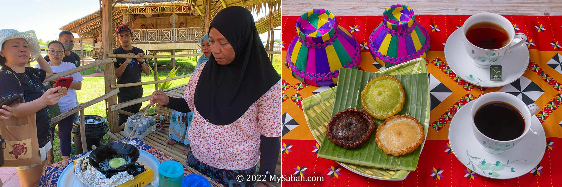
Normally, there is no Bajau people dressed in traditional costumes stationed at the Centre to show some actions. For a more complete cultural experience, you may come in group and add in some activities (fees applicable and need to book in advance) such as Penjaram cooking demo and food sampling (RM150) and cultural dance (RM1,000 to RM2,000).
Pinjaram (or penyaram) cooking demo. Pinjaram is a famous snack of Bajau Sama. Some call it UFO Cake
FYI, Penjaram (or UFO Cake) is a popular Bajau snack, and Limbai is the iconic dance of Bajau Sama.
Other Services / Facilities
The Centre is suitable for hosting events such as wedding, meeting and gathering. The outdoor stage, main hall, conference room, chairs and desks are available for rent for a fee.
Left: tourists try Bajau style wedding. Right: Betitik music of Bajau
Tickets and Opening Hours
Visitor Type
Malaysian
Non-Malaysian
Adult
RM10
RM15
Child (4-12 years old)
RM5
RM10
Senior (60 and above)
RM5
RM10
Baby (below 4)
Free
Free
Ticket prices to enter the gallery
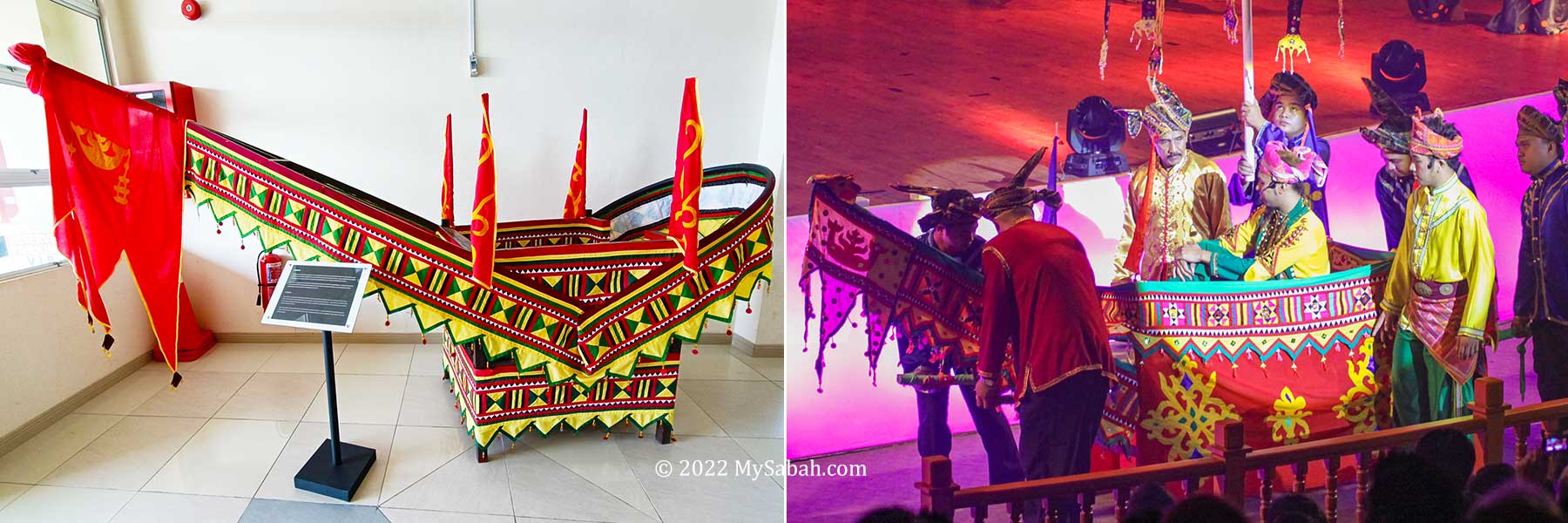
Usungan is an ornately decorated palanquin that is used to transport the groom during wedding ceremony
Opening Hours
Monday
Closed
Tuesday, Wednesday, Thursday, Saturday, Sunday, Public Holidays
8am-12pm and 2pm-4:30pm
Friday
8am-11:30am and 2pm-4:30pm
Operating time of Sabah Bajau Sama Cultural Centre
Bajau Sama girl on a horse decorated in Bajau fashion
How to get there
Sabah Bajau Sama Cultural Centre is in Tuaran and about 34 Kilometres from Kota Kinabalu City. You can reach there within an hour by driving on asphalt road. Address: Komplex Budaya PKRBSS, Kampung Lok Batik, Tuaran, Sabah, Malaysia GPS:6.1659205915238955, 116.18589156295744
Biola and Parang of Bajau
Cultural heritage, be it tangible or intangible, is an important asset of a race, so it’s crucial to preserve and document our indigenous cultures, to get some protection against culture appropriation. Large international companies such as Dior would steal the ideas of native art pieces and claim that’s their original concept.
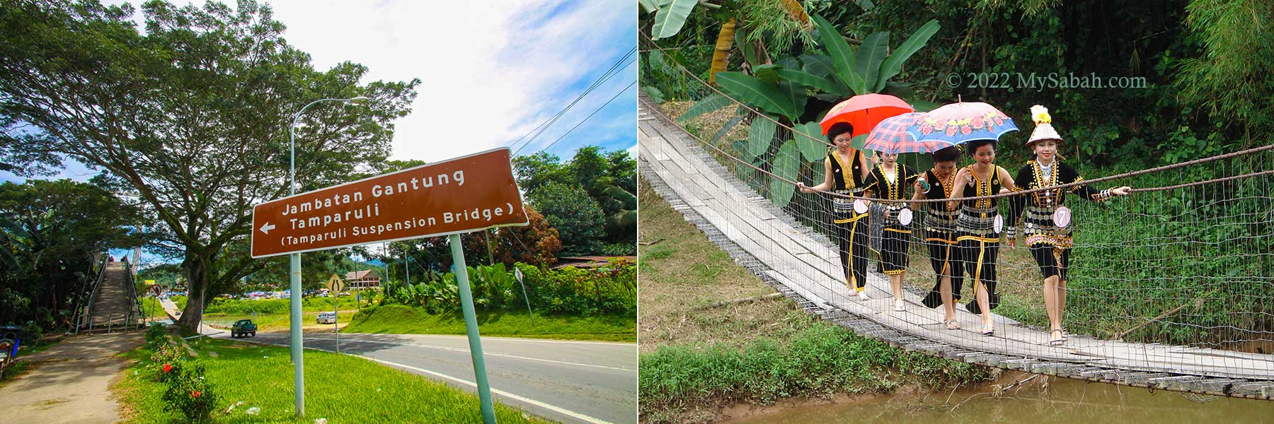
My first experience of crossing the Tamparuli hanging bridge was scary. I was frightened by the raging yellow river under my feet and cried loudly. My parents tried to coax me to move on but failed. Then my father asked me to close my eyes, and he carried me to other end of the bridge. I was about 6 or 7 years old that time. :-p
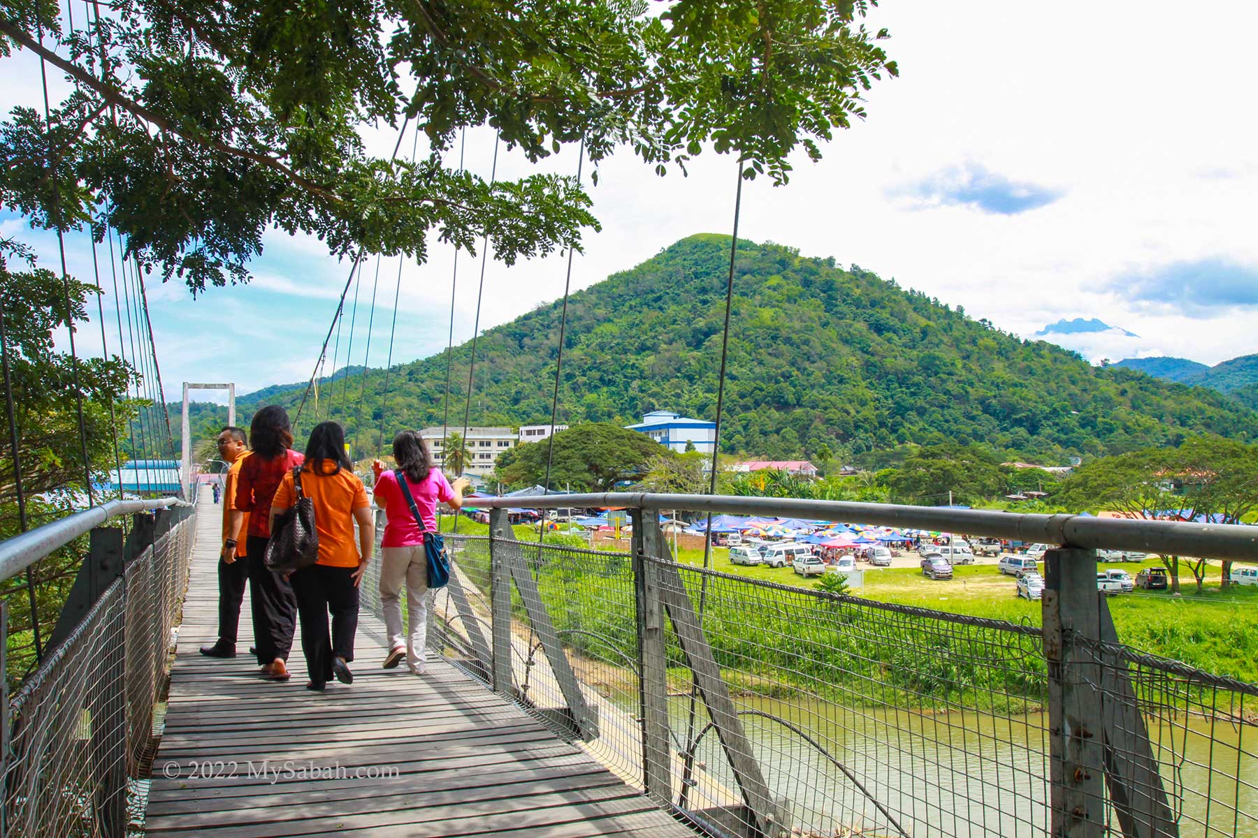
Left: signage to Tamparuli Bridge. Right: Kadazandusun girls crossing a hanging bridge carefully
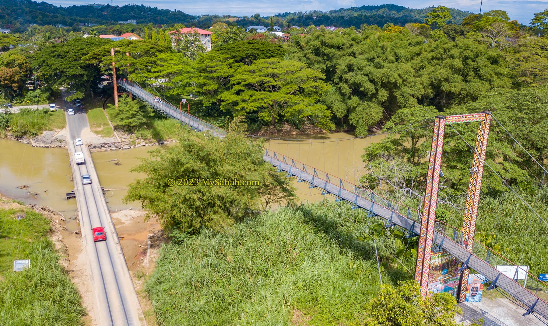
The 200-Metre-long Tamparuli Suspension Bridge is made famous by the Kadazandusun (biggest indigenous tribe of Sabah) folk song “Jambatan Tamparuli” (jambatan means bridge) written by Justin Lusah in 1977. It’s also known as the Lover’s Bridge because of a heartbroken love story.
Walking on the Tamparuli Bridge. At the right is the busy Tamu market and Bukit Perahu (Ruhiang Hill). You also can see the tip of Mount Kinabalu behind the hill.
The romantic Jambatan Tamparuli song is in Kadazandusun language. Thanks to Ben Godomon! Below is his translation of the lyrics or you can listen to the Kadazandusun and Chinese versions of Jambatan Tamparuli performed by Cozzi Chong (雁卿), a popular Sino-Kadazan singer from Sabah:
I’m making a “Pak Pak” sound As I walk along the bridge The bridge of Tamparuli while wearing high-heeled shoes
[Note: a proper name for high-heeled shoes for men is probably “Cuban Heels”]
As I walk along the bridge The Bridge of Tamparuli I’m making a “Pak Pak” sound while wearing high-heeled shoes
But damn my shoes they fell off the bridge only socks are left which I brought home
[Note: “silaka” is “celaka” in Malay : “damn” is the closest equivalent to English that I can think of]
On Wednesday It’s the Tamu in Tamparuli I go around the shops Looking for high-heeled shoes
[Note: “Tamu” of course means “weekly open market” as is practised in Sabah]
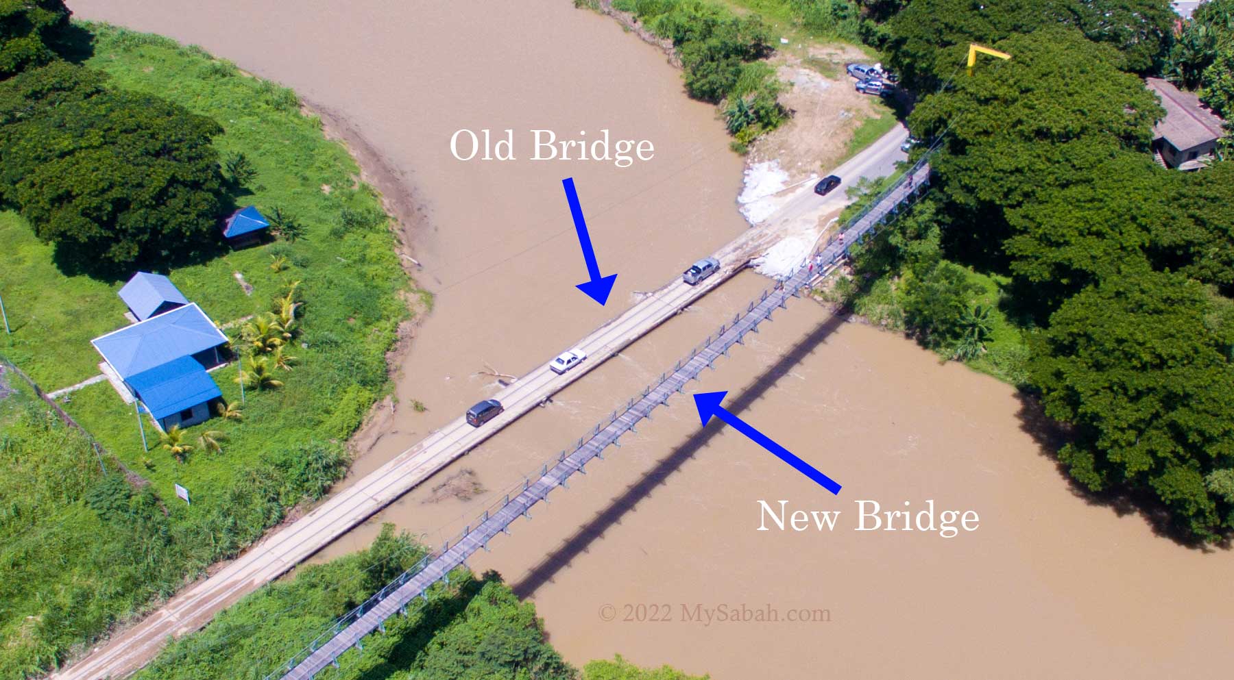
Whenever listening to this song, I would visualize a lady walking carefully on the wobbly hanging bridge without her shoes. The holes between the planks can trap high heels so ladies please beware. However, this is not the same hanging bridge that inspired Justin Lusah to write the song. The “original” hanging bridge was washed away by flood in 1999.
You could have a nice view of surrounding of Tamparuli town on Tamparuli Suspension Bridge. The highest point is Ruhiang Hill (Bukit Perahu), a spot for hiking and paragliding during weekends. Mt. Kinabalu, the highest mountain of Malaysia, would show her face in good weather. On every Wednesday, there is a tamu (weekly open market, as described by the song) at Tamparuli town too.
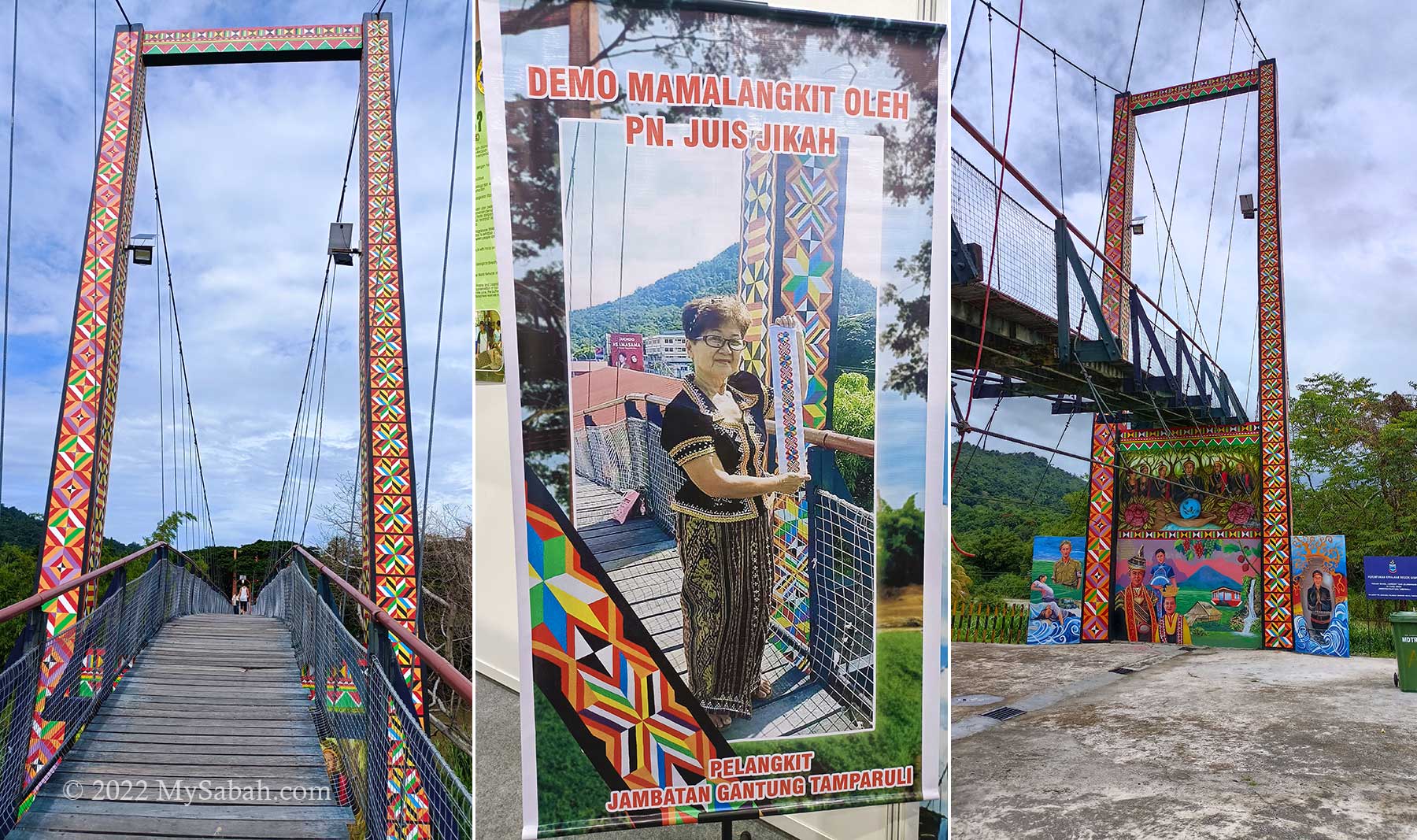
Tamparuli Bridge with Linangkit and Lelawangan motif, the unique textile patterns of Lotud and Bajau respectively.
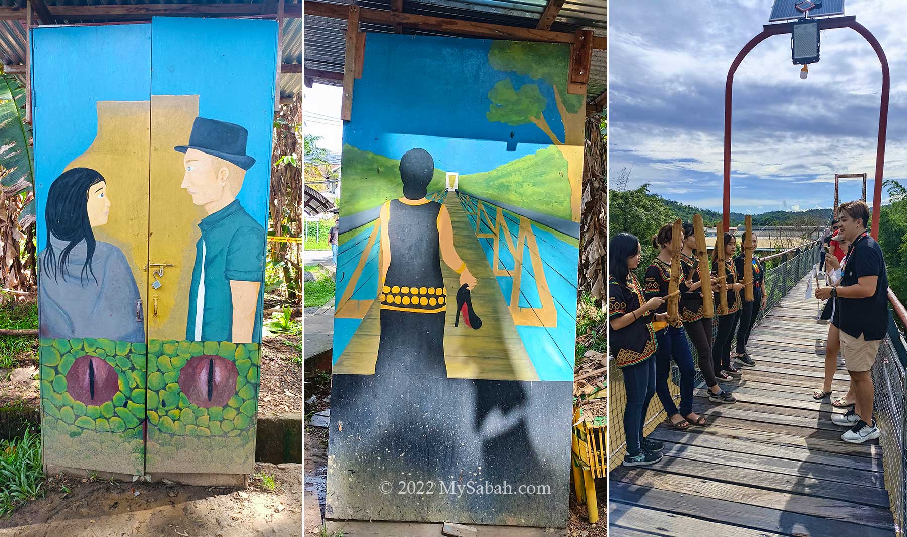
In 2021, Tamparuli Bridge received a facelift under the Linangkit Mural and Lelewangan Jambatan Gantung Tamparuli project. The artwork is completed by Tujuh Tompinai or 7T (means seven friends or teachers in Dusun language). The support posts and walls of the bridge are decorated with Linangkit motif and giant mural.
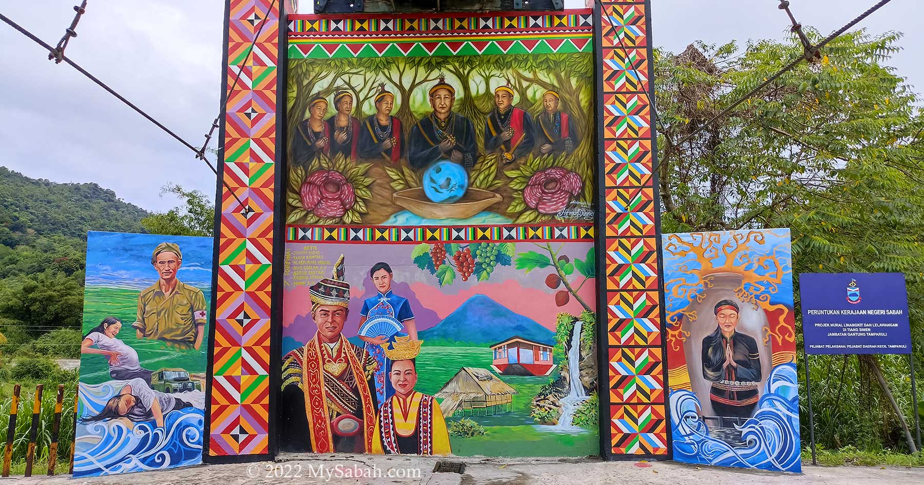
Mural of Tamparuli Bridge depicts the stories, legend, cultures and attractions of Tamparuli, an artwork of Tujuh Tompinai or 7T team (led by Saidina Atiman).
The top part of mural (see picture above) shows a group of Tantagas, the high priest of Lotud tribe and their world view – the end of the river is the edge of our world. The bottom mural displays the people (Lotud, Bajau, Chinese) and attractions (Bukit Perahu, Rumah Terbalik (Upside Down House), Murug Turug Waterfall, JonGrapevines & Figs Garden) of Tamparuli. Right mural represents the legend of Solungkoi. Left mural is to commemorate two brave British soldiers.
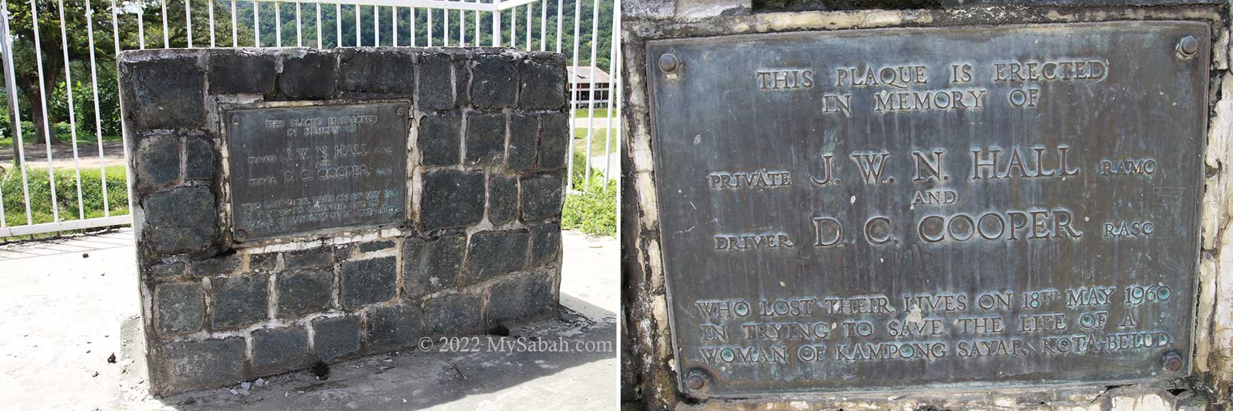
British Monument at Tamparuli Bridge. The inscription on the plaque says: This plaque is erected in Memory of: Private J.W.N. Hall RAMC and Driver D.C. Cooper RASC who lost their lives on 18th May 1960 in trying to save the life of a woman of Kampong Sayap, Kota Belud. (RAMC = Royal Army Medical Corps, RASC = Royal Army Service Corps)
In 1960, two British soldiers lost their lives when they tried to save the life of a woman from Kota Belud. Their Land Rover was swept by strong currents while crossing the old Tamparuli Bridge and three of them drowned. You can find the plaque about the incident behind the fruit & vegetables market near the bridge.
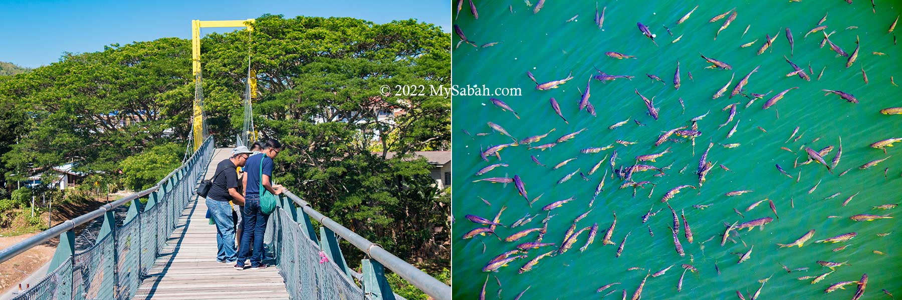
Tourists looking at the fishes under the Tamparuli Bridge
Unlike the traditional hanging bridge, the new bridge is supported by concrete pillars and steel cables, so rock solid that you can bring a full cup of coffee walking nearly 200 Meters to another end without spilling a drop. Not only that, there is mesh wire covering the lower part of the boardwalk, so it’s impossible to drop your shoe like the lady in the song, unless you purposely throw it into the river.
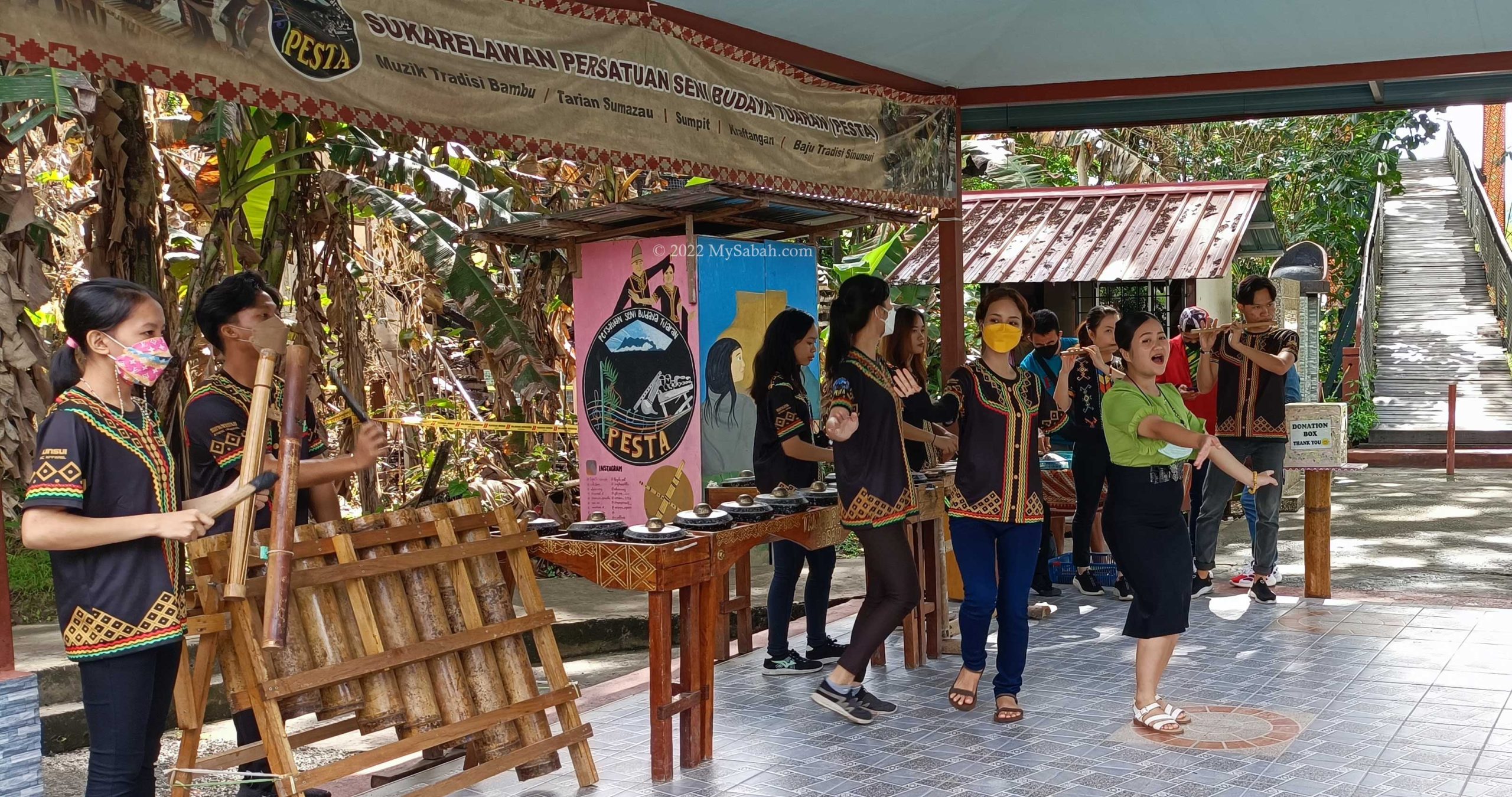
Left: story of Solungkoi. Middle: drawing about the song Jambatan Tamparuli. Right: playing the music on the bridge
Nonetheless, the construction of old Tamparuli bridge posed a big challenge to British engineers in 1930s because it’s always destroyed by flood. Bobolian (local high priest) said that Tambuakar, the river spirit, was angry with the building of new bridge. To appease the spirit, a human sacrifice was demanded.
Old and new Tamparuli Bridges
Therefore, a fair maiden named Solungkoi was put into a jar and buried alive under the first pole of the bridge. After the offering, the bridge lasts until today, though it’s flooded by the rising river occasionally. Legend says the British engineer was in love with Solungkoi, making their love story sounds more tragic.
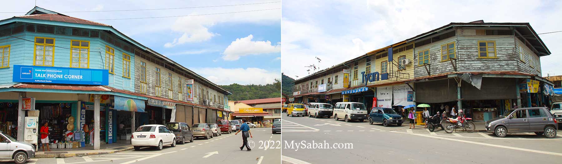
Old post-war shoplots of Tamparuli town
After you cross the bridge, you may take a walk in Tamparuli to get nostalgia with those old wooden shoplots of post-war era in town. For tourists who head to Kinabalu Park or Kiulu white water rafting, this is a nice mid-point to stop for a tea break and try the delicious Tamparuli fried noodle.
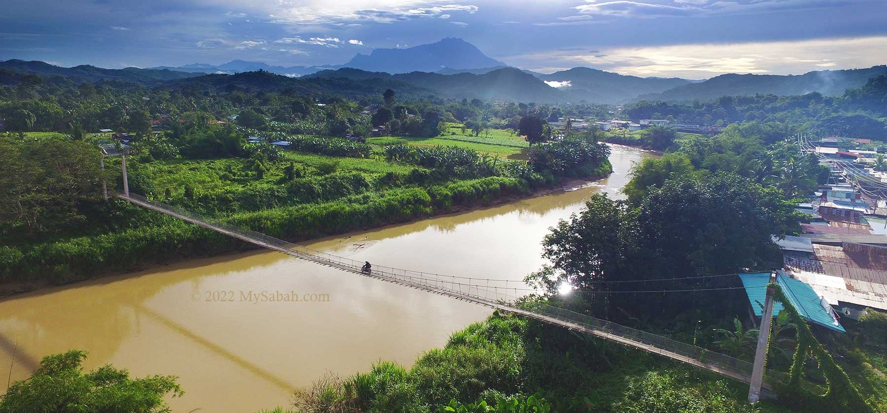
Another hanging bridge not far away from Tamparuli town