Tag Archives: Tambunan

Mount Trusmadi

Guide to Climbing Mt. Trusmadi (Mt. Trus Madi)

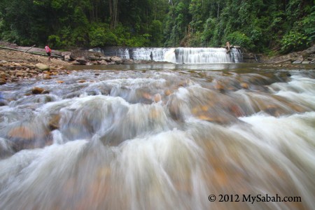
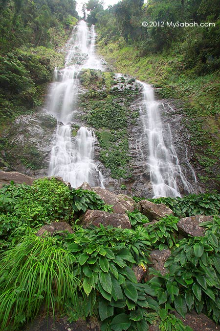
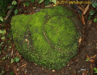
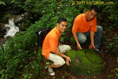
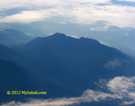
Mount Trus Madi (or Mt. Trusmadi) is the second highest mountain (2,642 Meters or 8,668 ft) of Malaysia. Albeit 1,453 Meters lower than Mount Kinabalu (4,095 Meters), climbing Mt. Trusmadi is more challenging, so it offers a thrilling experience for adventure seekers. Many tourists who have conquered Mt. Kinabalu are also keen to give it a try. If you are physically fit and exercise regularly, you would find Mt. Trus Madi is very climbable even though the trail is less tourist-friendly.

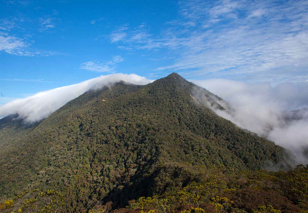
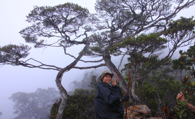
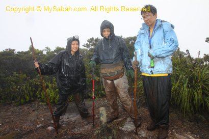
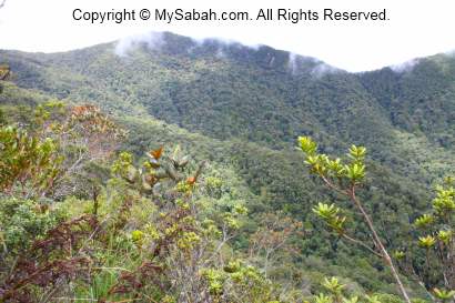
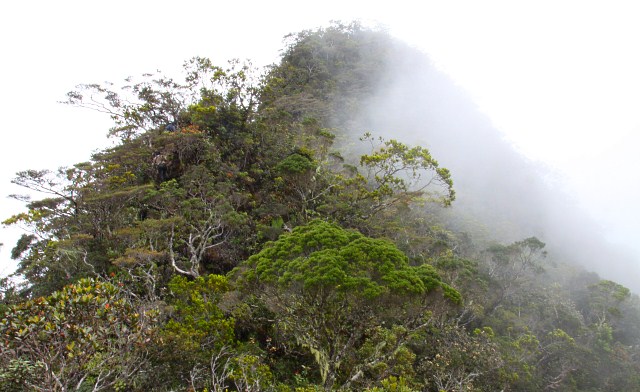
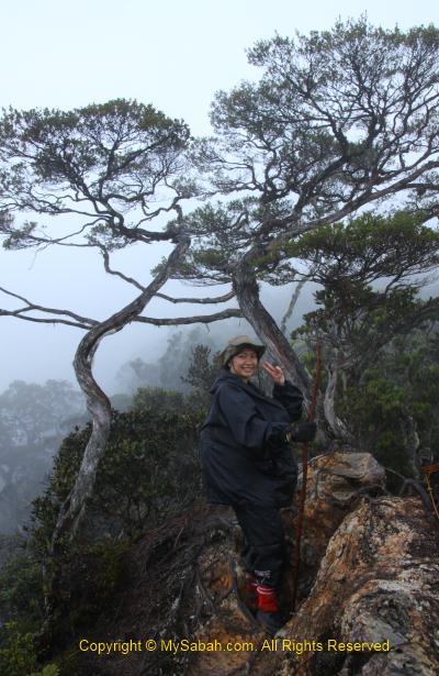
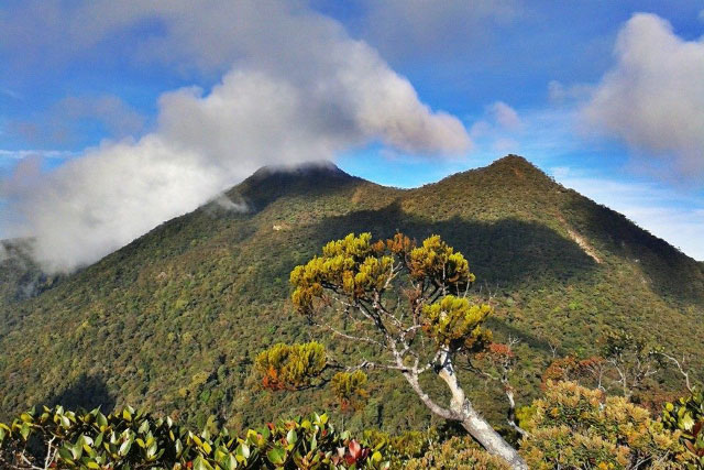
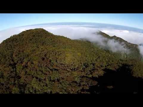
The peaks of Mt. Trus Madi

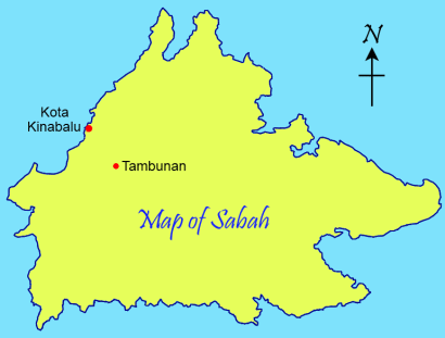
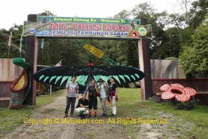
The facilities of Trusmadi have improved tremendously in past few years (especially the Tambunan side), so it has become a hot destination. Mt. Trus Madi is located in Trus Madi Forest Reserve (Code: FMU-10 = Forest Management Unit No.10), so you need to apply entry permit from Sabah Forestry Department for the climb. This article provides the most complete and updated information to help you planning the climb.

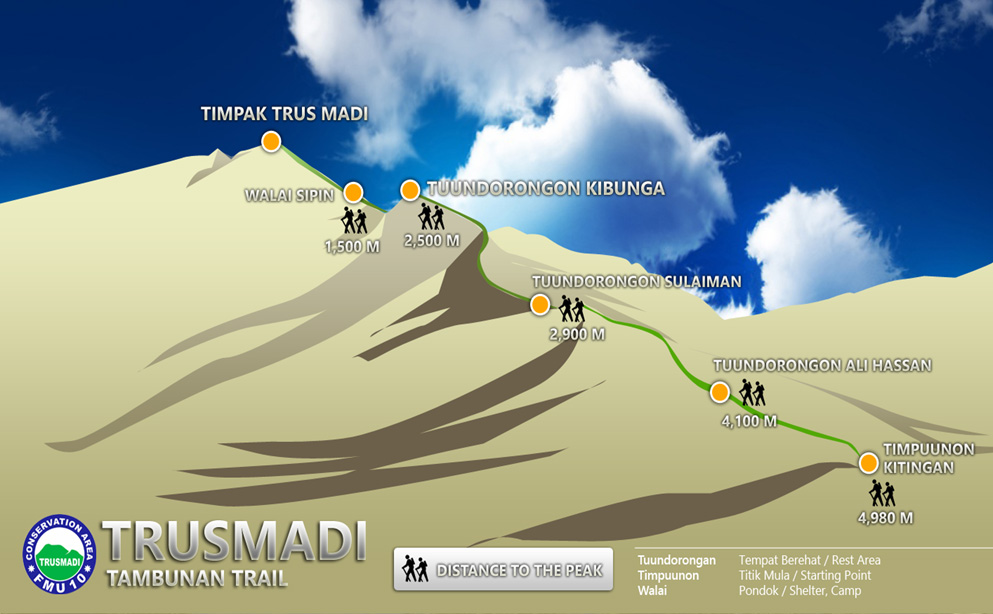
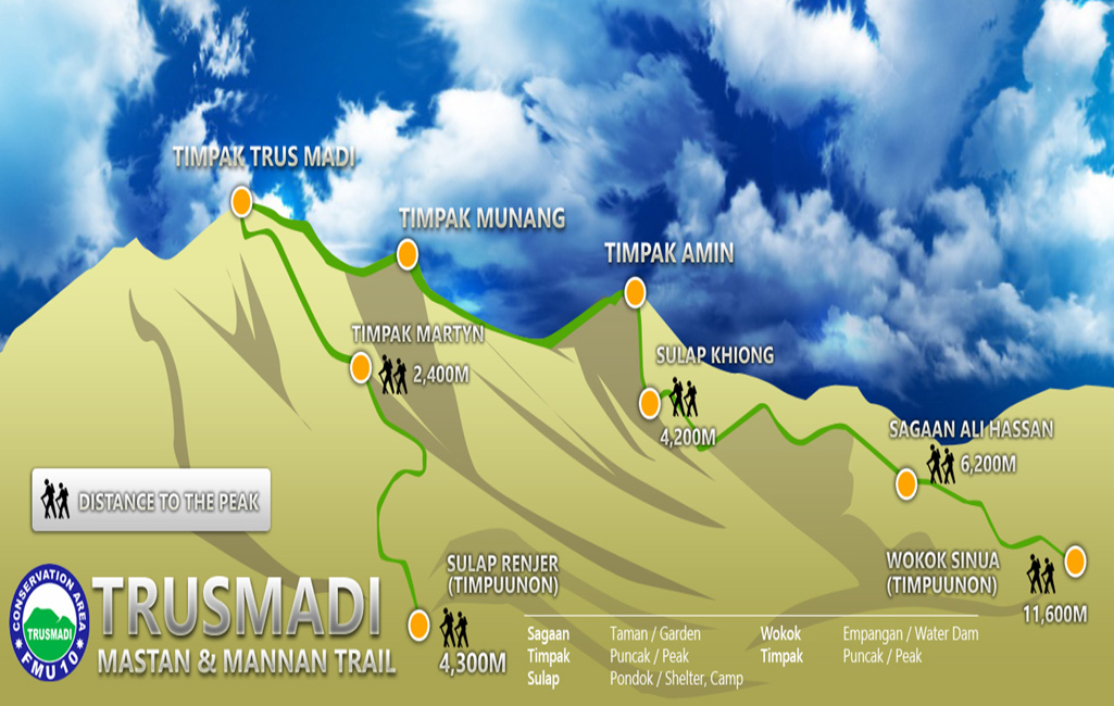
Overview of 3 Summit Trails to Mt. Trus Madi

Climbing Mt. Trus Madi can be done in 2 to 4 days, depends on the trail you pick. There are three summit trails that lead to the highest peak of Mt. Trus Madi, i.e.:

  1. Kaingaran Trail in Tambunan
  2. Mannan Trail in Keningau
  3. Mastan Trail in Sook

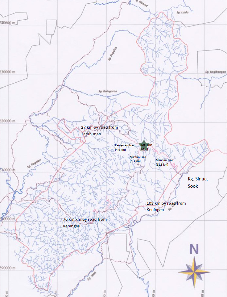
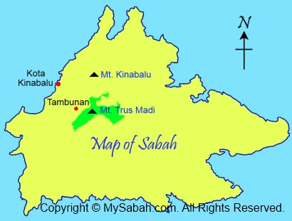
Location map of Mt. Trus Madi & starting points of 3 summit trails

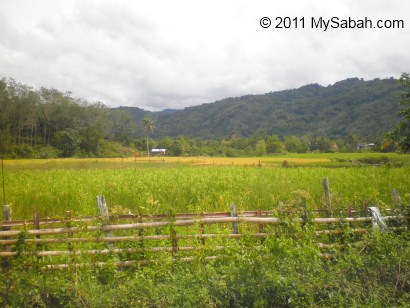
These trails have different climbing distance, starting point, road accessibility, level of difficulty and facilities on the mountain. Picking the trail is your first step to plan the climb. Kaingaran Trail (Tambunan) is the most popular choice because its climbing distance is shorter (4.9 KM) and the facilities are the most developed. Mannan Trail (Keningau) is the second best choice. Though the climb takes 4 days, the view along the trail is more beautiful and you don’t need a 4-Wheel Drive.

The following table is a comparison of three trails (can click to enlarge):

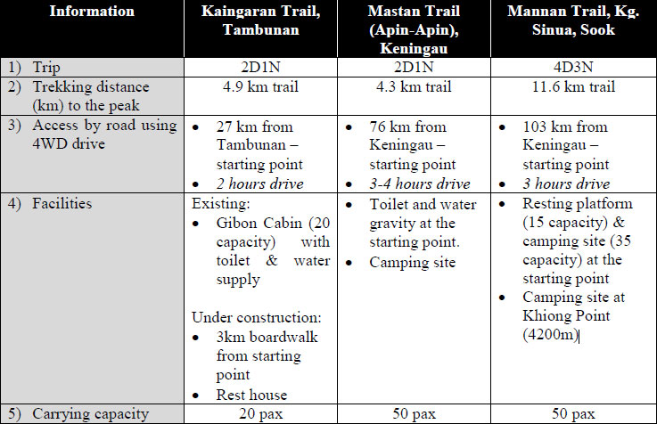
Table: Comparison of 3 summit trails to Mt. Trus Madi

Since these three summit trails are connected to one another on the summit, you also can choose to ascend and descend to different points for more fun. For example, you can climb up the mountain via Kaingaran Trail from Tambunan, but climb down via Mannan Trail to Keningau, if you are able to arrange your return transport waits at other end.

Below are more detail reviews of three summit trails to Mt. Trusmadi:

1. Kaingaran Trail

Kaingaran Trail is the oldest and most developed trail. I climbed Mt. Trus Madi via this trail in year 2010. However, the climb is much more enjoyable and easier nowadays because of upgraded trail and accommodation.

Kaingaran Trail of Tambunan

Climbing Distance: 4.9 KM (require 2 day 1 night)
Location: Tambunan District
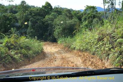
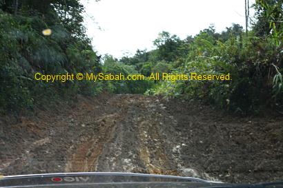
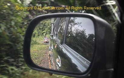
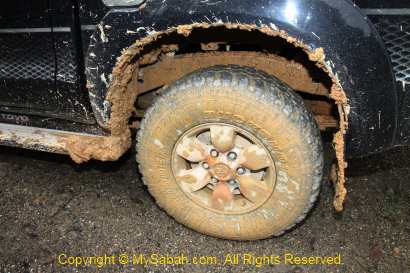
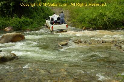
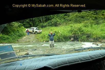
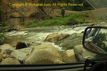
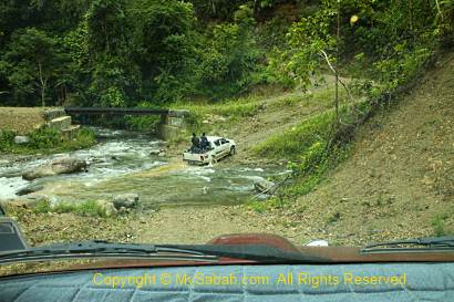
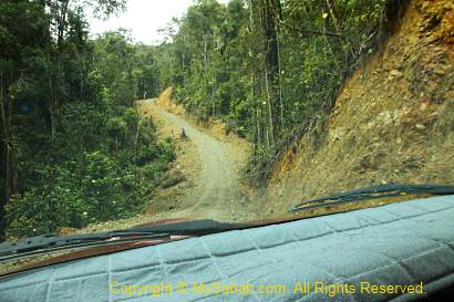
Starting Point: 27 Km (2.5 hours drive) from Tambunan Town (mainly gravel road. The last 6 KM road trip needs 4-Wheel Drive)
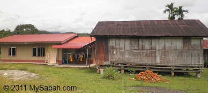
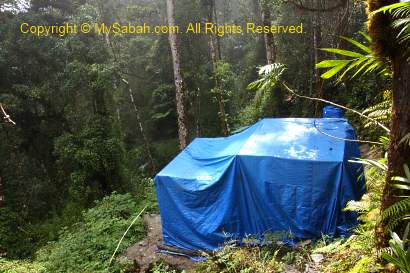
Accommodation: Mirad Irad Base Camp (foothill), Rest House (at 2.9 KM of mountain trail)

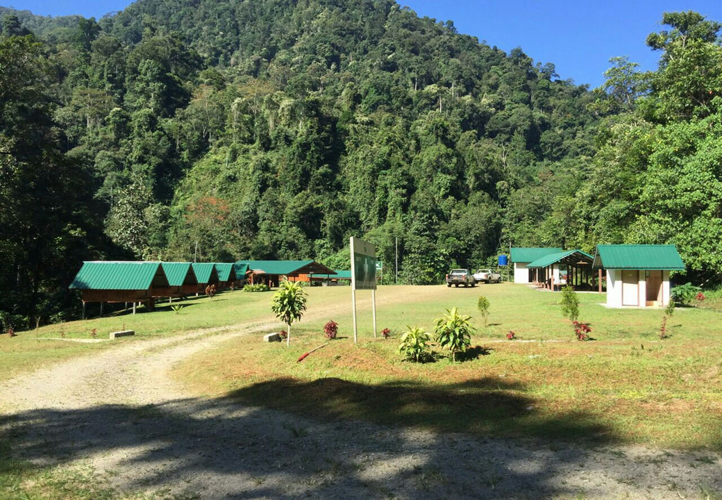
Mirad Irad Base Camp of Mt. Trus Madi in Tambunan

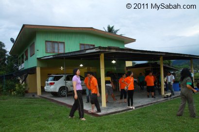
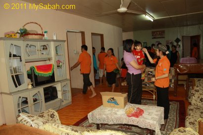
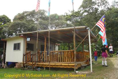
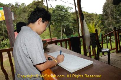
You can spend one extra night at Mirad Irad Base Camp of Mt. Trus Madi (7 KM before starting point (20 min drive) and 900 Meters above sea level), if you want to start your climb very early in next morning. The accommodation at Base Camp can accommodate 24 people, and camping (Fee: RM10) is allowed. The room rate is RM20 per night per person. Please note you MUST book 1 month in advance.

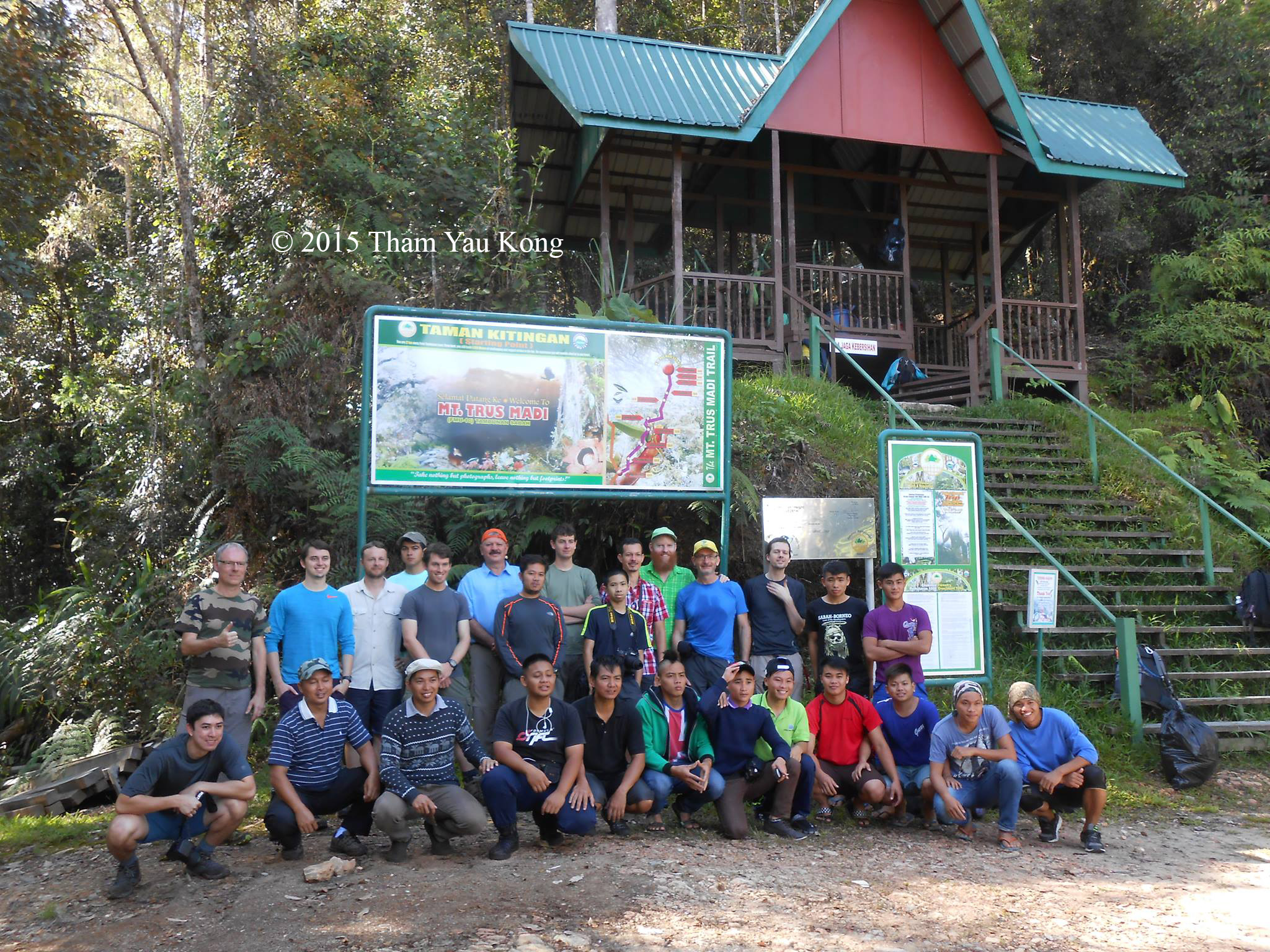
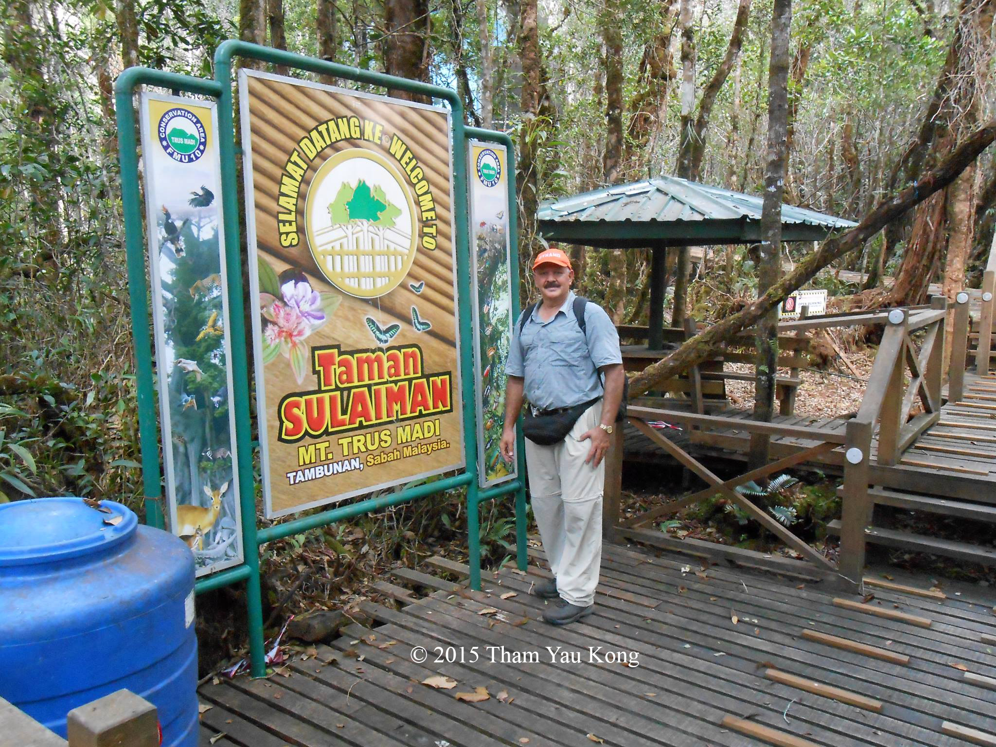
Taman Kitingan: Starting point in Tambunan (Kaingaran Trail)

If you start your climb on day 1 from Kota Kinabalu City (KK), you need to drive about 4 hours from KK to starting point in Tambunan, very likely you will start your climb around noon, which is kind of late. That’s why some climbers prefer to stay an extra night in Mirad Irad Base camp or hotel in Tambunan.

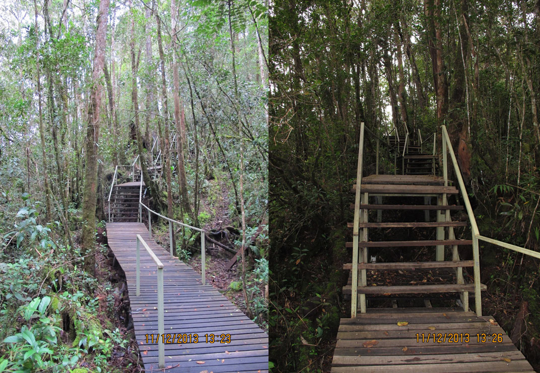
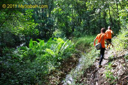
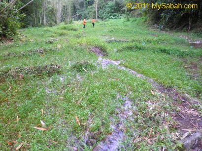
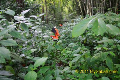
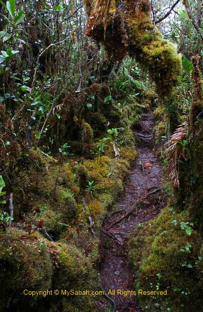
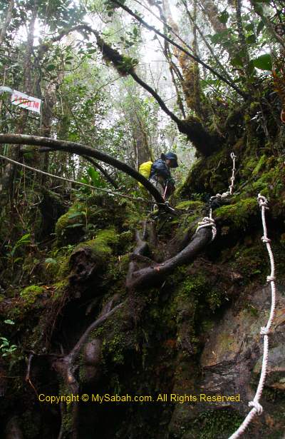
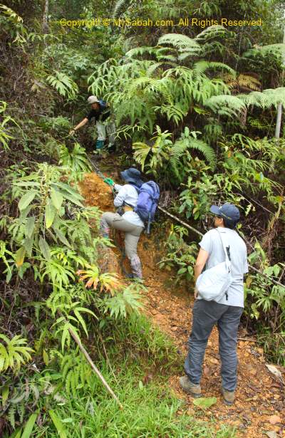
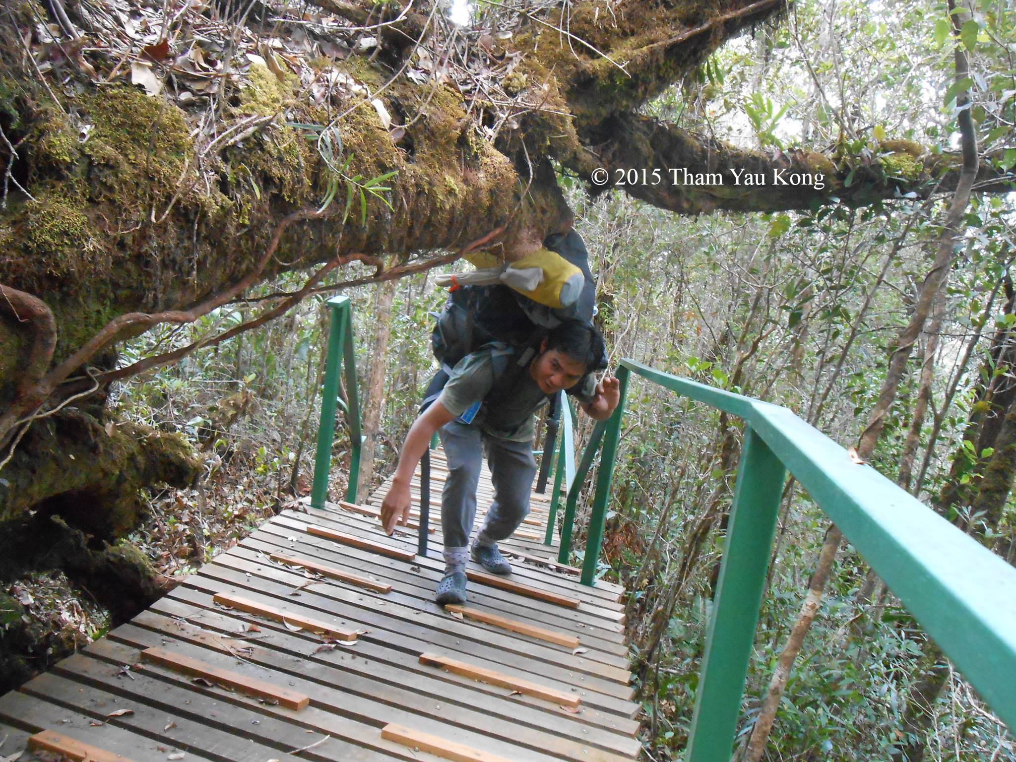
Plank walk & boardwalk in summit trail at Tambunan (Kaingaran Trail)

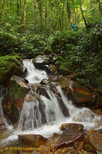
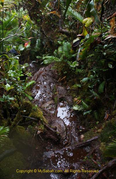
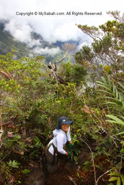
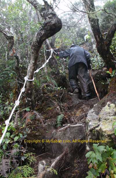
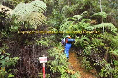
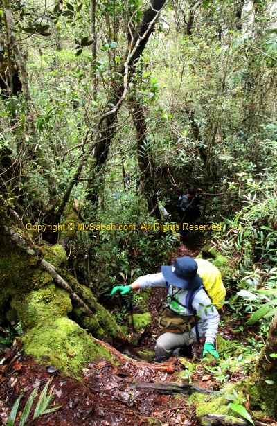
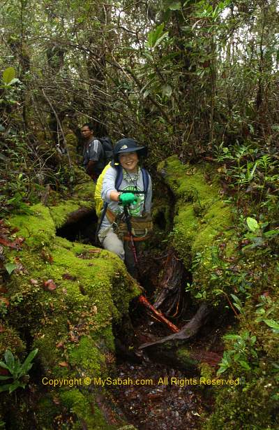
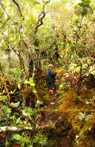
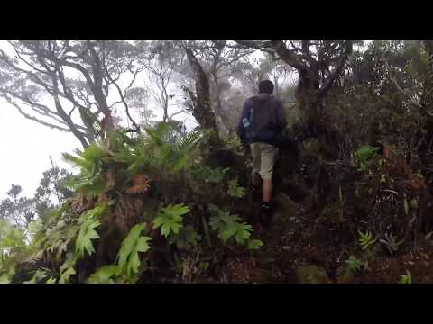
The first 3 KM of Kaingaran Trail is boardwalk. It’s leech-free and makes climbing more like hiking.

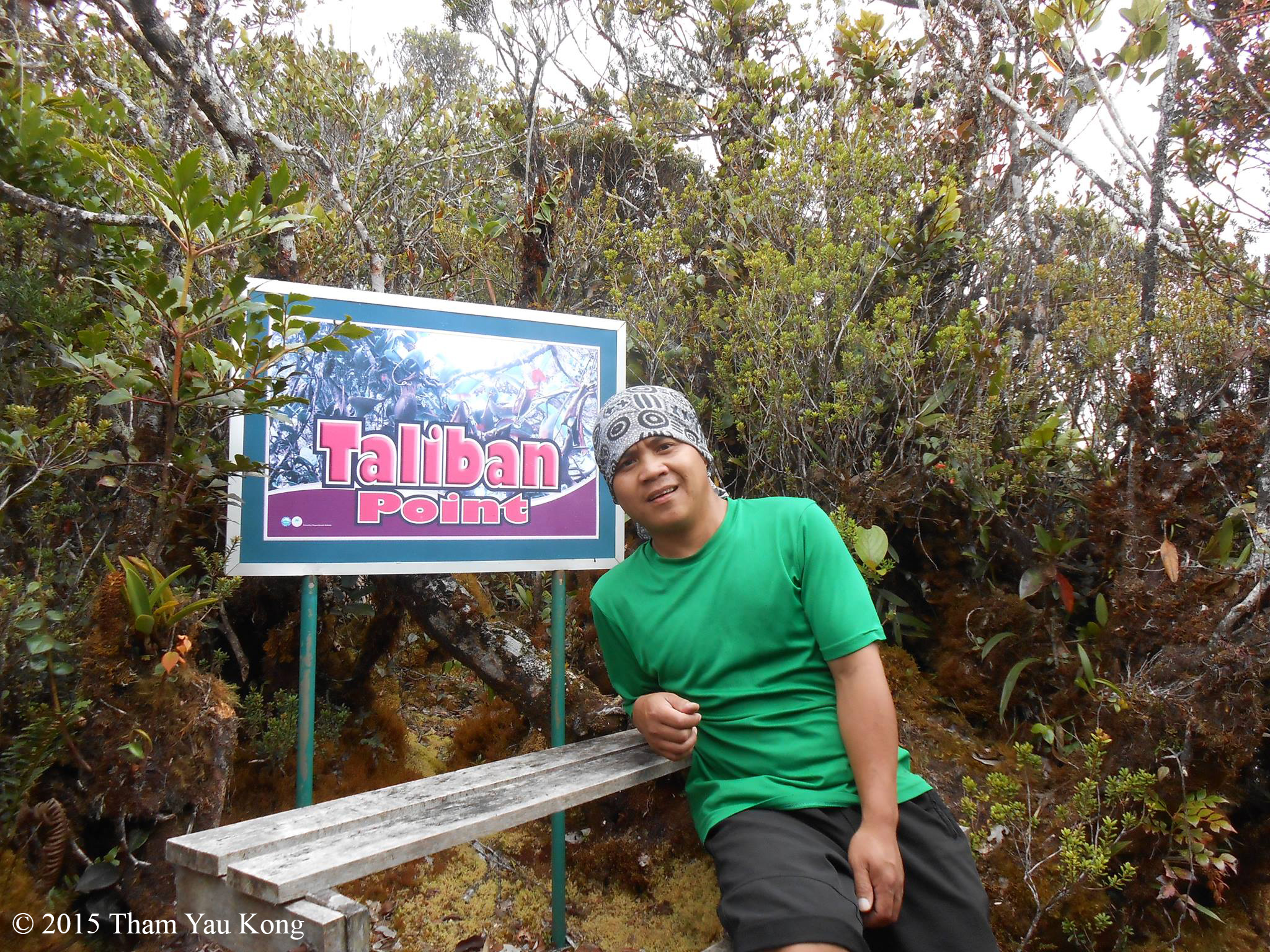
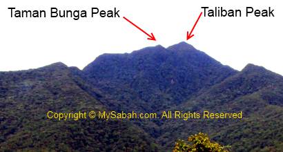
Taliban Point, which is named after OKK Taliban, the 1st native chief of Tambunan and has nothing to do with terrorist.

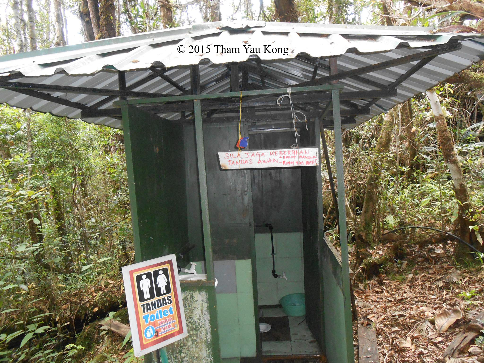
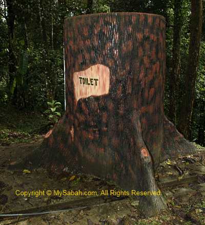
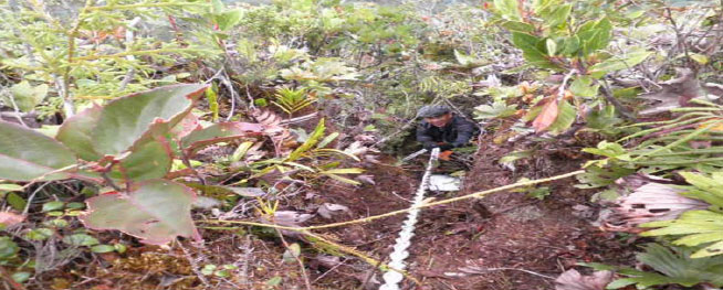
Toilet in summit trail to Mt. Trus Madi

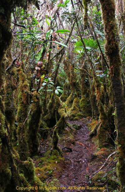
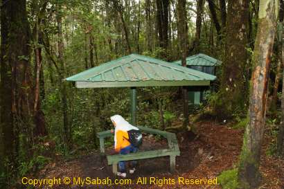
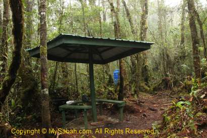
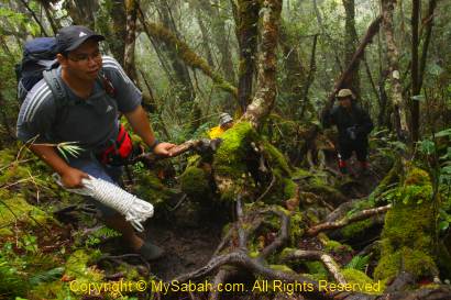
One of the shelters in Kaingaran Trail (Tambunan)

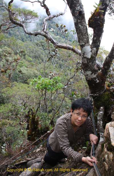
Summit trail to Mt. Trus Madi (Kaingaran Trail, Tambunan)

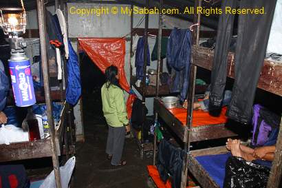
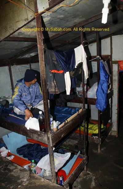
Mt. Trus Madi Rest House (only available for Kaingaran Trail)

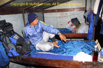
There is only one accommodation on Mt. Trus Madi and about 2.9 KM away from the summit. The Rest House has 5 rooms, each with 4 bunk beds, and able to host 20 people at a time. The fee per person is RM20-RM100 per night per bed. The amenities are quite basic, water supply and lighting are available.

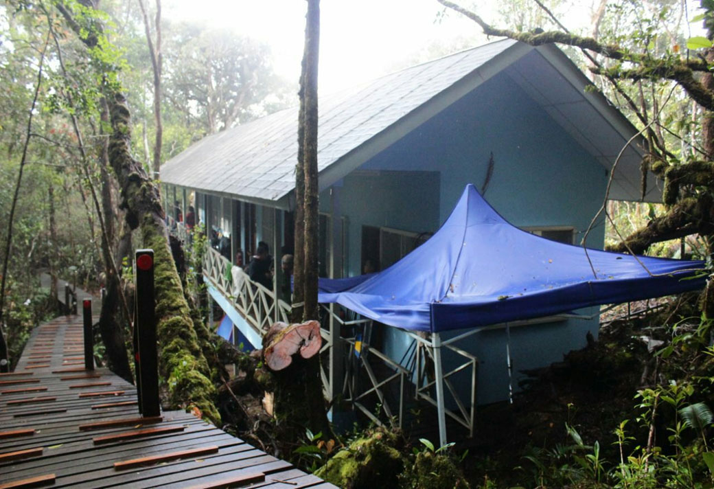
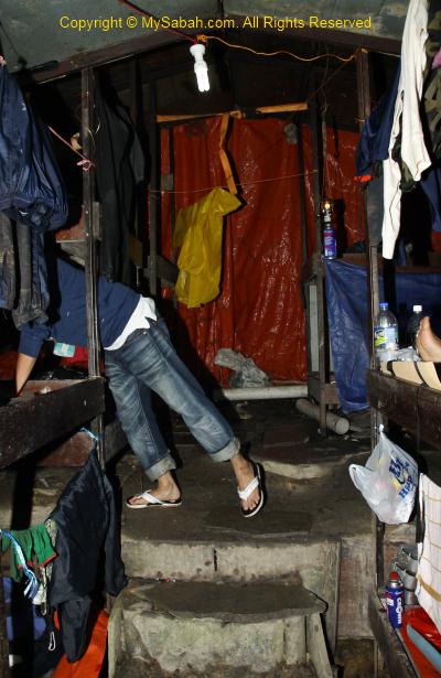
Mt. Trus Madi Rest House looks like a long house

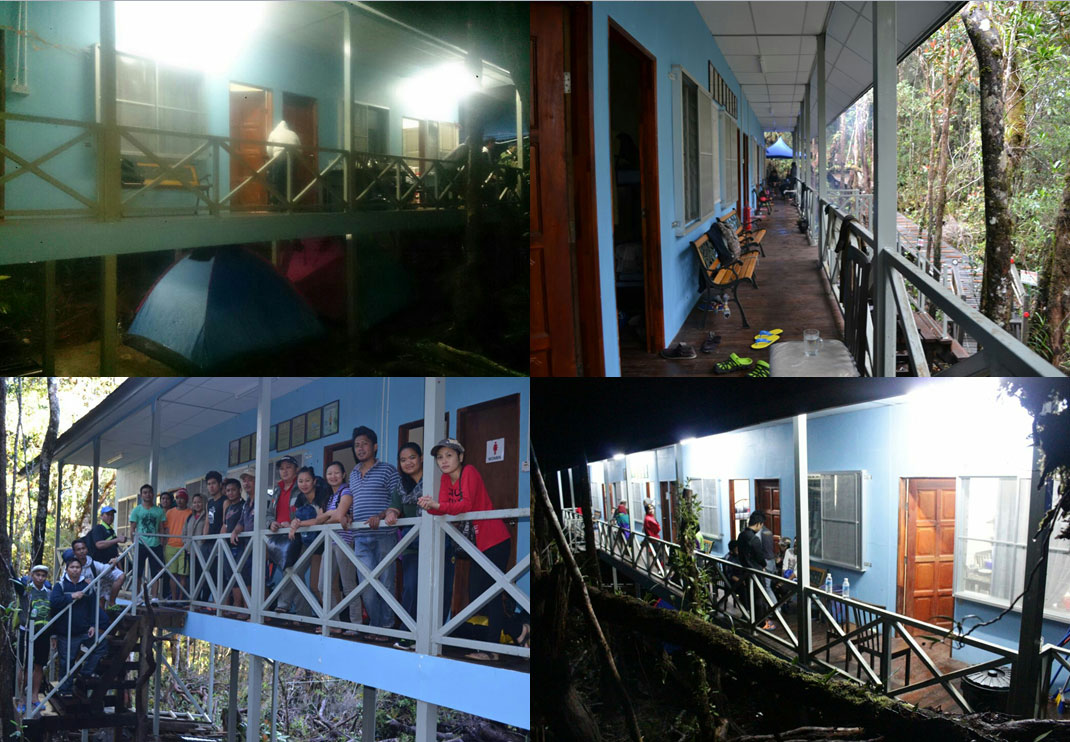
Accommodation on Mt. Trus Madi. Guide and Porter camp under the Rest House if the rooms are full.

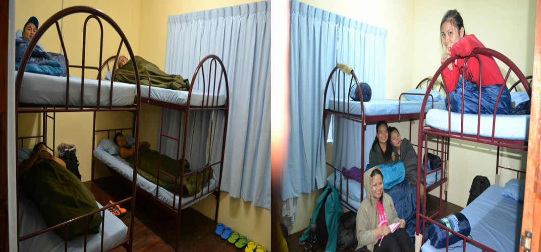
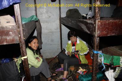
Bunk beds in Rest House. It costs RM20-100 per night per person.

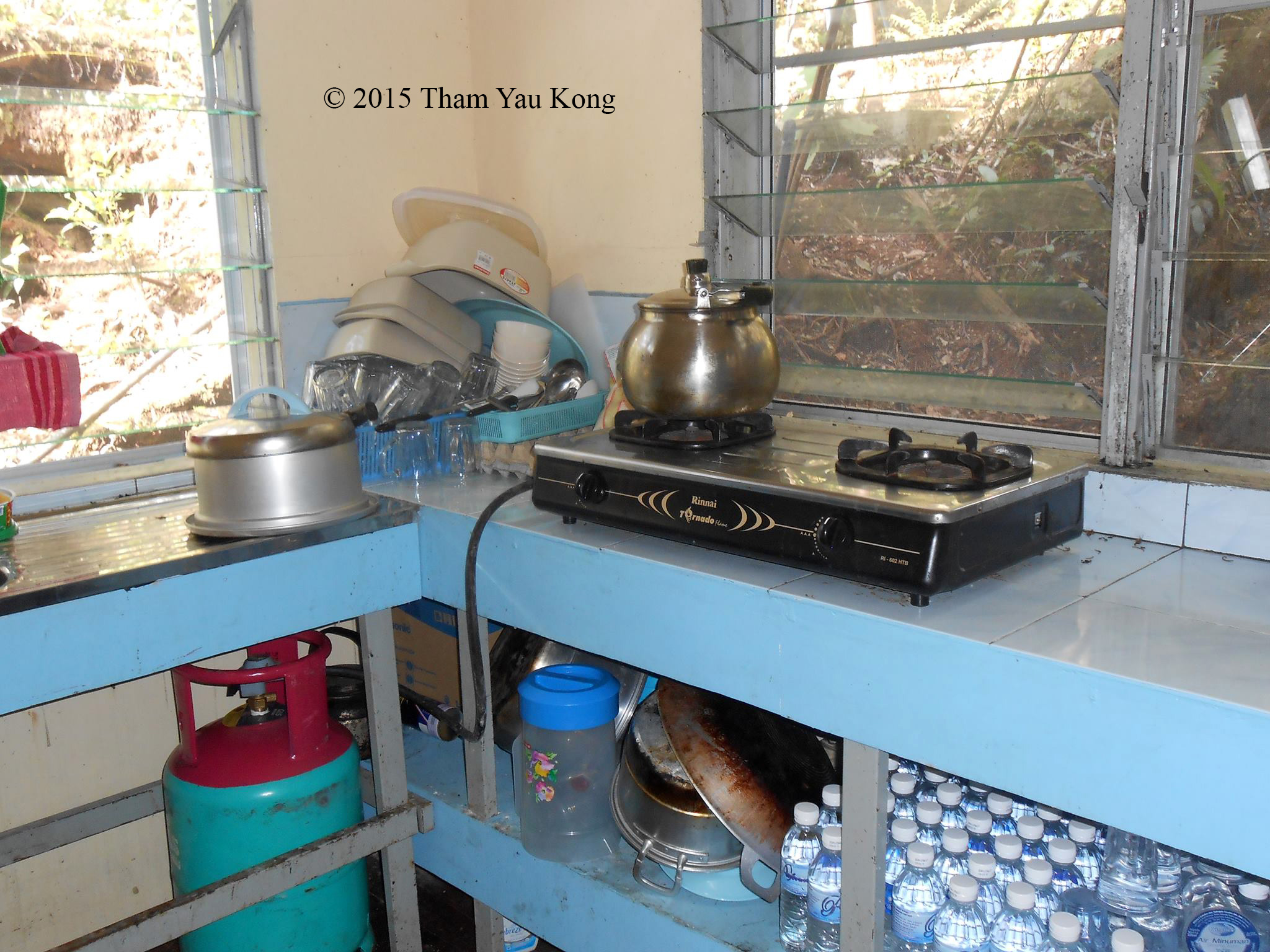
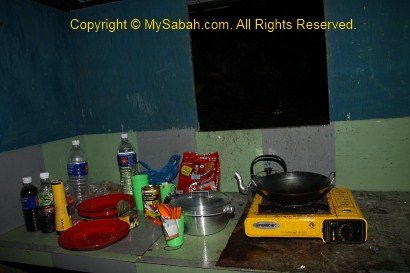
Kitchen of the Rest House. only tour operator can cook.

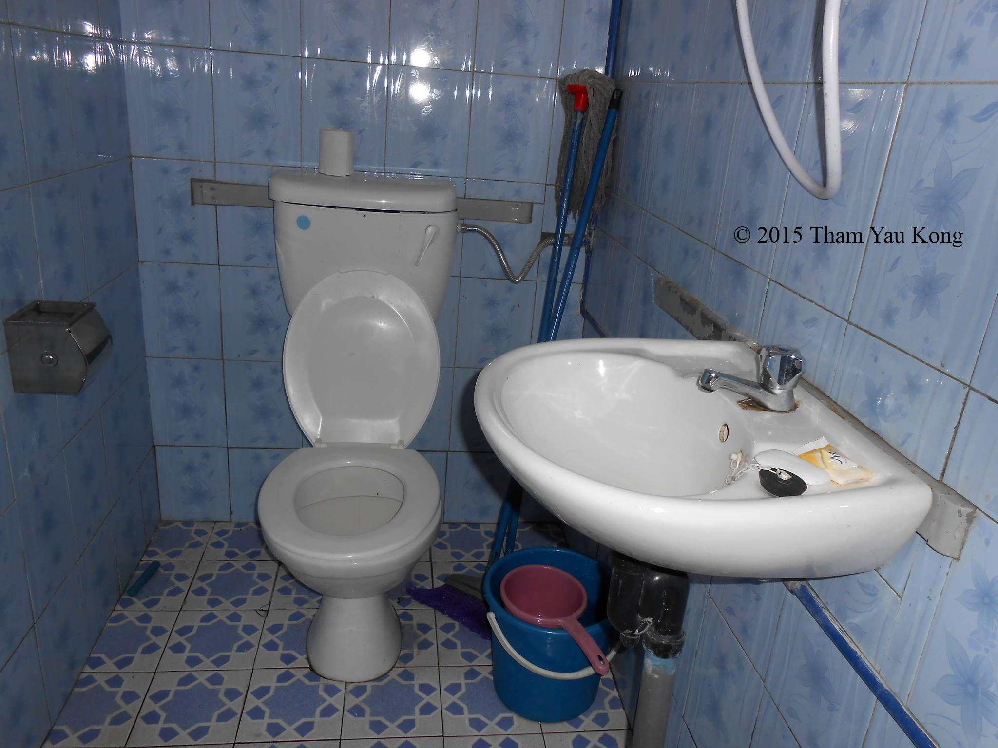
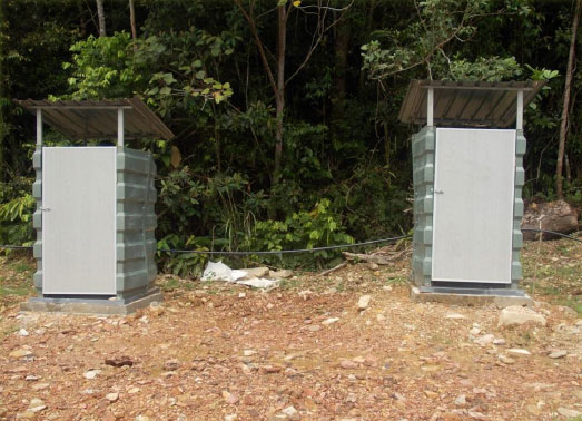
Toilet of the Rest House

Rest House on Mt. Trus Madi

The following video gives a good overview of Kaingaran Trail, with a lot of aerial views of Mirad Irad Base Camp, Mt. Trusmadi Rest House and the summit:

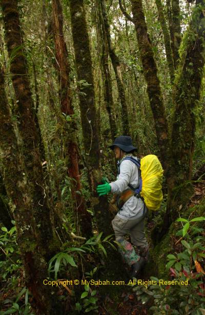
The next two trails are relatively new and located in Keningau District (Sook is a sub-district of Keningau).

Mastan (left) and Mannan (right) Trails at Keningau District

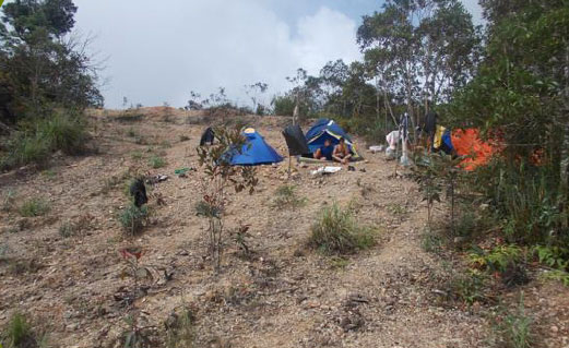
There is no accommodation in Mastan and Mannan Trails, so you will need to bring your own camping and cooking gears. This means you need to carry more weight, making the climb tougher. You can hire porters to share your burden. The camping fees are RM3 and RM5 for Malaysian and foreigner respectively.

2. Mannan Trail

Though Mannan Trail takes the longest time (4 day 3 night), many adventurers love its scenic view and pristine route. Another advantage is – you don’t need a 4-wheel drive to travel to the starting point.

View of Mt Trus Madi from Kg. Sinua (KM2.4 point to summit)

Climbing Distance: 11.6 KM (require 4 day 3 night)
Location: Sinua Village (Kampung Sinua), Sook (Keningau District)
Starting Point: 103 KM of paved road (3 hours drive) from Keningau Town. Good road condition. No need 4-Wheel Drive.
Accommodation: Camping and Resting Platform only

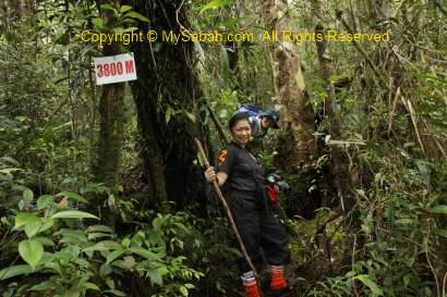
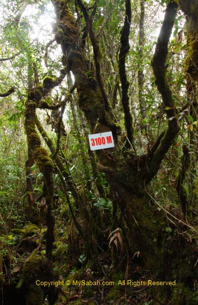
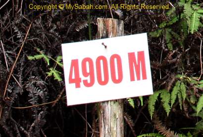
K.S. Khiong Point (4,200M) of Mannan Trail, one of the camping sites

The GoPro video below gives you a good idea of trail condition in Mannan Trail:

If you want the most detail video walk-through, you may check out the 56-minute video below:

3. Mastan Trail

Mastan Trail is very “raw” and the least developed. I have very little information about this trail. Judging from the map, Mastan Trail is the shortest (4.3 KM) but the steepest. You see, Mastan Trail is only 600 Meters shorter than Kaingaran Trail (Tambunan), which has far better trail and facilities, of course most climbers will go for the more relaxing option.

Taman Bunga (Garden Peak) of Mastan Trail

Climbing Distance: 4.3 KM (require 2 day 1 night)
Location: Apin-Apin, Keningau District
Starting Point: 76 KM (4 hours drive) from Keningau Town. Bad road, accessible only by 4-Wheel Drive.
Accommodation: Camping

Toilets in Mastan Trail

Some village folks there have been doing day climb via this trail. Anyway, if you have only 2 days and want to see the most of Mt. Trus Madi, you may ascend via Kaingaran Trail on day 1 and descend via Mastan Trail on day 2.
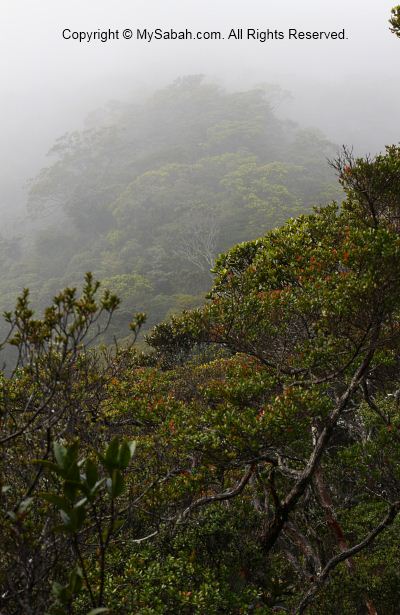
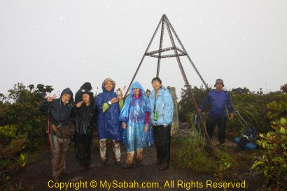
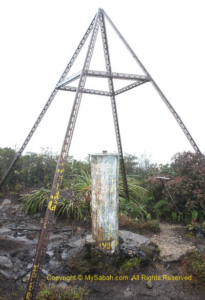
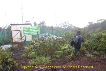
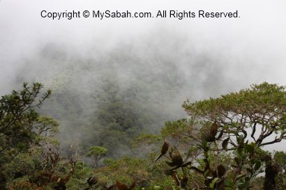
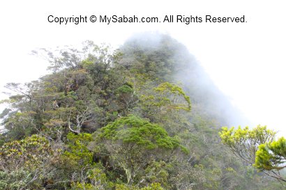
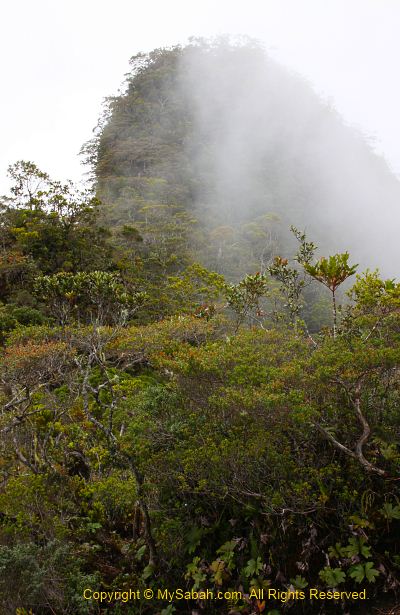
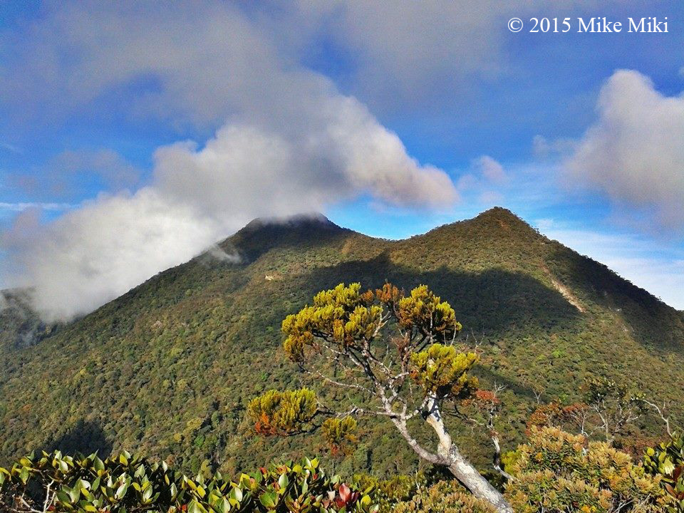
The Summit

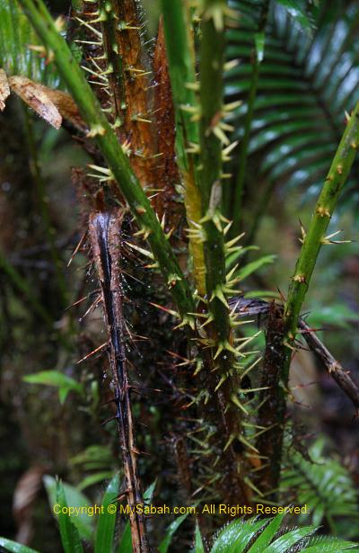
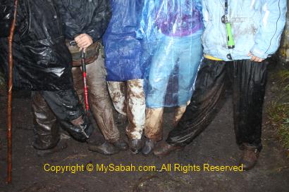
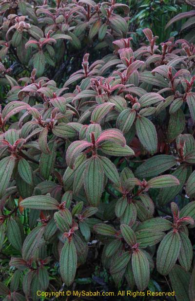
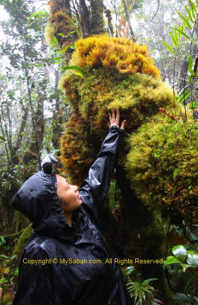
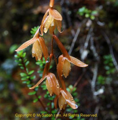
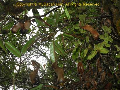
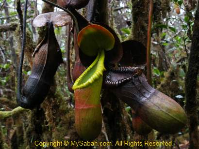
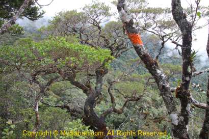
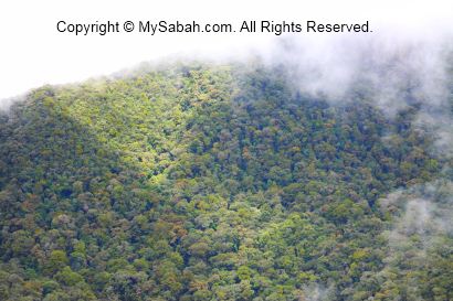
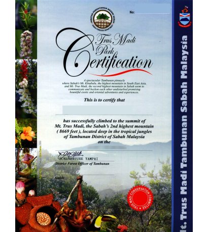
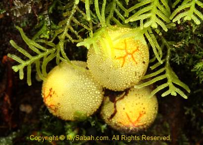
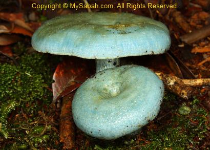
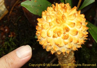
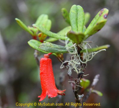
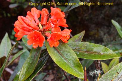
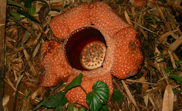
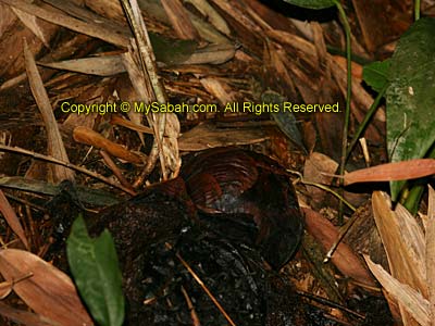
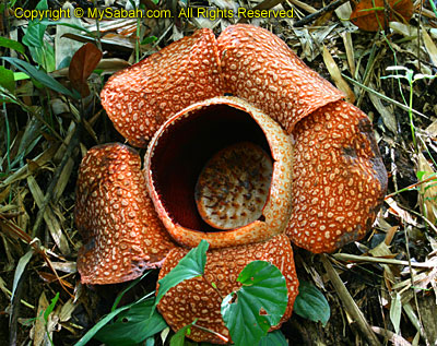
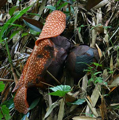
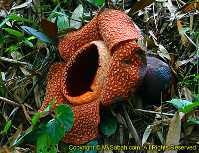
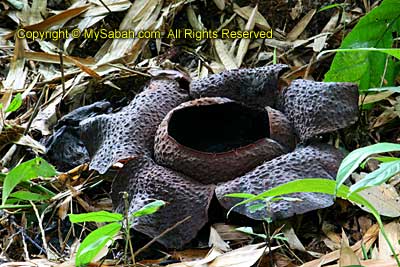
The flora of Trusmadi is very diverse and fascinating, where almost 600 species of 160 families of plants have been recorded here. Remember to get your certificate if you make it to the top (RM10 fee applies).

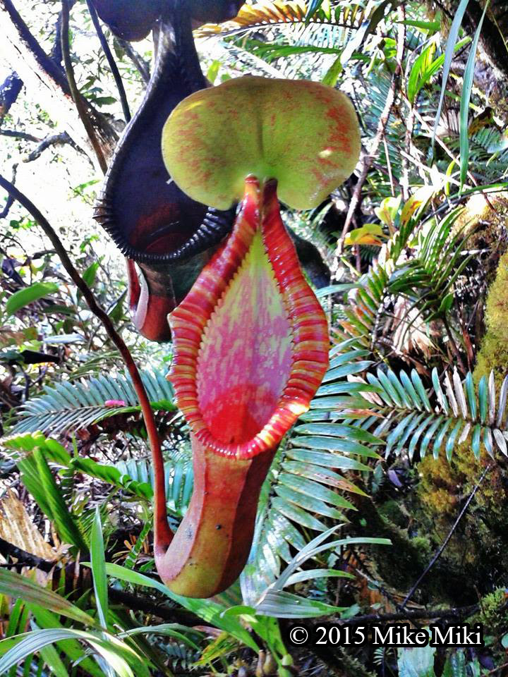
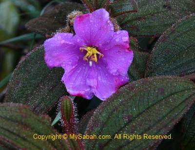
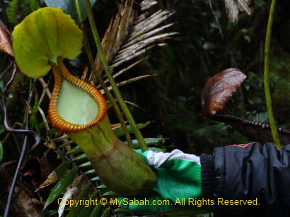
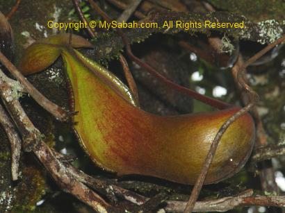
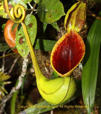
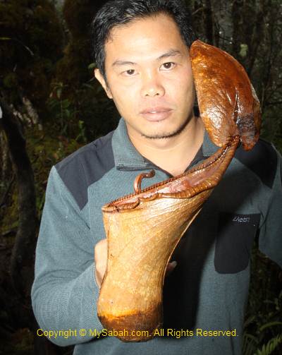
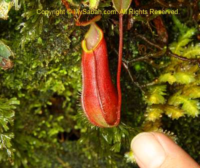
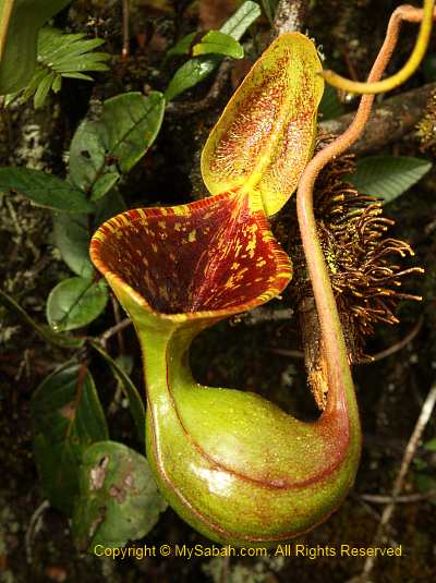
Nepenthes Trusmadiensis is a pitcher plant endemic to Mt. Trus Madi

Nepenthes trusmadiensis is the natural hybrid between Nepenthes lowii and Nepenthes macrophylla, you would see it when you are close to the summit.

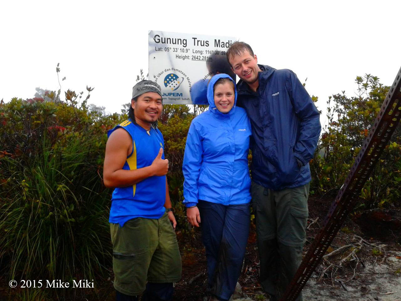
The highest point of Mt. Trus Madi (2,642 Meters)

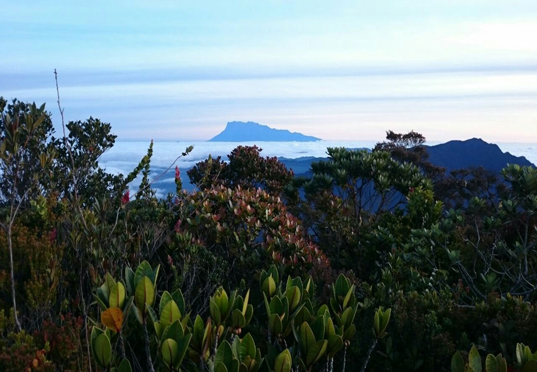
You can see Mt. Kinabalu clearly on Mt. Trus Madi

When you reach the summit of Mount Trusmadi at dawn, if the weather is good, you will be mesmerized by a breath-taking view of Mount Kinabalu, which lies about 40 KM to the north.

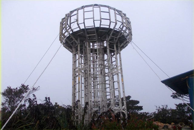
New! 5-Meter Viewpoint Tower 100 Meter from the summit of Mt. Trus Madi (at Jiran Point)

How much does the climbing trip cost?

The total fee varies greatly, depending on the trail and services that you select. Below is a list of basic fees (in Malaysian Ringgit (MYR)).

Malaysian Foreigner
Climb Permit 30 80
Entrance Fee 5 15
Vehicle Permit 100 100
Accommodation (1 night)* 100 100
Forestry Guide (2 days) 100 200
TOTAL: 335 (≈USD$95) 495 (≈USD$140)

*For Rest House only. Replace this with camping fee if you don’t use Tambunan trail

The final cost can range from RM400 to RM800 per person, after you include other variable and optional fees such as rental of 4-Wheel Drive (RM800/day per car), insurance, transport (gasoline), food & personal supplies, porter, certificate (RM10), etc. You can save more money by going in group, so you can split the cost on transportation and guide fee.

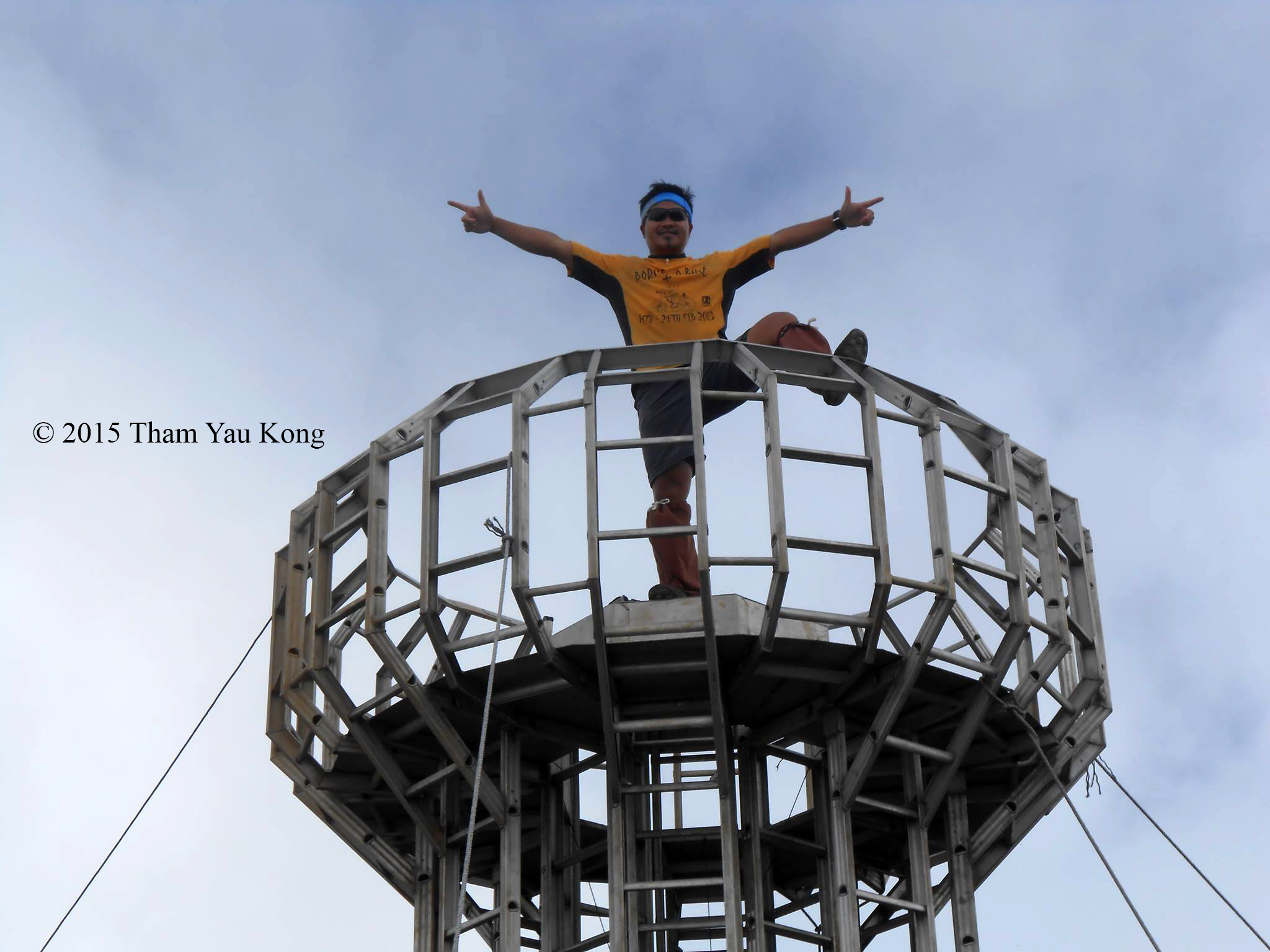
Enjoying the mountain view from the tower

If you have more questions, you may contact the Forestry Officers listed below:

1. Tambunan

Contact Person: Mr. Saleh Intang, District Forestry Officer (“DFO”) of Tambunan
Address: Pejabat Perhutanan Daerah Tambunan, Peti Surat No 64, 89657, Tambunan, Sabah, Malaysia
Tel: +60 88-899589
Fax: +60 88-899588
E-mail: saleh.intang@sabah.gov.my

2. Keningau / Sook

Contact Person: Mr. Azman Said, District Forestry Officer (“DFO”) of Keningau
Address: Pejabat Perhutanan Daerah Keningau, Peti Surat No 88, 89007, Keningau, Sabah, Malaysia
Tel: +60 87-331203
Fax: +60 87-338721
E-mail: azman.said@sabah.gov.my

Tour Operators

If your budget permits, you should consider hiring a tour operator to arrange the climbing trip for you. The cost will be higher, but they will save you the problems on paperwork (permit), 4-wheel drive transport, camping, cooking, etc. I strongly recommend the following tour operators, who are experienced in adventure trips:

1. TYK Adventure Tours

Address: Block E, Lot 38, 2nd Floor, Damai Plaza IV, Luyang, Kota Kinabalu, Sabah, Malaysia
Tel: +60 88-232821
Website: www.tykadventuretours.com
E-mail: thamyaukong@gmail.com
Fax: +60 88-232827

2. Mount Trusmadi Travel & Tour Tambunan

Address: Lot No. 5, Kedai Tepi Sungai Tondulu, Majlis Daerah Tambunan, 89657 Tambunan, Sabah, Malaysia
Tel: +60 87–771312
Mobile Phone: +60 19-8831568
E-mail: widuresorttbn@yahoo.com

By the way, currently Sabah Forestry Department only has 16 mountain guides. During peak season, they may not have enough manpower to guide the climbers. They would disapprove your climb in that case. Therefore, I advise you to register a few months before the climb, to secure the limited capacity.

Useful Slides

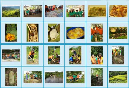
Most of the information here is extracted from the following slides by Sabah Tourism Board and Sabah Forestry Department. You may download them for further reading. Also special thanks to Mr. Tham Yau Kong and Mike Miki from TYK Adventure Tours for contributing the photos. (Note: some info is inconsistent in different slides. I’ll correct them once I confirm the details).

Overview of Mt. Trusmadi, e.g. photos of road condition, starting points, accommodations, facilities, itineraries.

Useful info for planning the tour, e.g. booking and reservation procedures, various fees (permit, entrance, forestry guides), application forms and checklist of Things to Bring.

This slide contains some latest photos of the trails.

Please feel free to leave your question in comment section below, I’ll try my best to answer.

Photos taken in Sabah, Malaysia Borneo

Top 10 Waterfalls of Sabah

The mountainous terrain of Sabah makes us the land of waterfalls. There are thousands of waterfalls in Sabah forest, most are waiting for explorers to name them. Looking at waterfall can calm our minds better than watching the whirling movement in washing machine. So I compile a list of Sabah’s Top 10 Waterfalls for those who want to enjoy heavy doses of negative ions.


Pic: the location of Top 10 Sabah waterfalls.

Besides Scale, this waterfall ranking is also based on Popularity, Accessibility and Travel Experience. That’s why some giant waterfalls are not listed. For example, though Kadamaian Waterfall is the highest waterfall of Sabah, it is too difficult to get there. Please note that most height measurement is by estimation.

No. 10. Kiansom Waterfall

Location: Inanam, Kota Kinabalu
Height: 7-Meter (23 Feet)

Yes, I know, Kiansom is the smallest waterfall in the top 10 list. It is listed because it is the most famous, accessible and visited waterfall in Kota Kinabalu city. I can’t exclude the waterfall that everyone loves.
» Read more about Kiansom Waterfall…

No. 9. Gelas Waterfall

Location: Tawau Hills Park, Tawau
Height: 12 Meters (40 Feet)

Gelas Waterfall is situated in Tawau Hills Park, a lush rainforest zone and source of five rivers. Hiking to Gelas Waterfall is a pleasure to nature lovers, and you also can soak in sulphurous hot springs in the park.
» Read more about Gelas Waterfall…

No. 8. Tawai Waterfall

Location: Tawai Forest Reserve, Telupid
Height: 95 Meters (311 Feet)

Tawai Waterfall is the least-known waterfall, but its view is so spectacular that it will blow you away. The area around this waterfall is full of Borneo pitcher plant. Denmark’s biggest television network, Tv2, has chosen this waterfall for filming of “Girls Off The Beaten Track”.
» Read more about Tawai Waterfall…

No. 7. Madai Falls

Location: Madai-Baturong Forest Reserve, Kunak
Height: 40 Meter (131 Feet)

Madai Falls is probably the first Sabah waterfall visited by human, maybe a caveman about 28,000 years ago. I’m not joking. Archaeologists say Madai-Baturong has the oldest human settlement of Sabah. I believe stone-age people love waterfalls as much as we do.
» Read more about Madai Falls…

No. 6. Fairy Waterfall

Location: Danum Valley, Lahad Datu
Height: 27 Meters (89 Feet)

This shy Fairy Waterfall is hiding deep inside the 130-million Borneo rainforest of Danum Valley. The photo here may not look impressive because it was taken during prolonged drought. Danum Valley will be nominated as the next UNESCO World Heritage Site of Sabah/Borneo.
» Read more about Fairy Waterfall…

No. 5. Fefukan Waterfall

Location: Long Pasia
Wide: 20 Meters (66 Feet)

To see Fefukan, Travellers need to hike a long way to the Heart of Borneo, making it the most remote and least visited waterfall in my list. Camping next to this waterfall is one of my most unforgettable experience. Lucky visitors would see blooming rafflesia around there.
» Read more about Fefukan Waterfall…

No. 4. Mahua Waterfall

Location: Tambunan
Height: 17 Meters (55 Feet)

As part of the Crocker Range Park, Mahua Waterfall is protected as a water catchment area. Hence, visitors can enjoy cooling and refreshing water from clean mountain stream. On the way to Mahua Waterfall, you may drop by Tambunan Rafflesia Center to check if you are lucky enough to see a blooming rafflesia.
» Read more about Mahua Waterfall…

No. 3. Imbak Falls

Location: The Heart of Sabah, Tongod
Wide: 30-Meter (98 Feet)


Even though Imbak Falls is only 6 Meters (20 feet) high, it is the widest waterfall of Sabah. I just love sitting in the river, as the strong current turns its waterfall pond into a Jacuzzi bath area.
» Read more about Imbak Falls…

No. 2. Langanan Waterfall

Location: Poring, Kinabalu Park
Height: 120 Meters (394 Feet)

Located in Poring Hot Springs, the most popular destination of Sabah and 1st UNESCO World Heritage Site of Malaysia, the majestic view of 120-Meter-tall Langanan Waterfall is only saved for those visitors who are keen to hike nearly 4 Kilometers (2.3 Miles). It is more enjoyable to soak yourself in the hot spring after a long walk in the jungle.
» Read more about Langanan Waterfall…

No. 1. Maliau Falls

Location: Maliau Basin, Tawau
Height (of the highest tier): 28-Meter (92 Feet)

Here you go. The No.1 Waterfall of Sabah is the 7-tier Maliau Falls in Maliau Basin, Sabah’s Lost World. To see Maliau Falls, you need to trek 2 days on the treacherous relief and pass through miles and miles of dense pristine rainforest.


With over 30 waterfalls (and counting), Maliau Basin is also known as the Capital of Waterfalls, and Maliau Falls is the most breath-taking among them. Another feature of this waterfall is its tea-color water, which is caused by plant tannin released from heath forest upstream. The magnificent Maliau Falls will leave a beautiful memory in you, a scene that you like to replay in mind from time to time.
» Read more about Maliau Falls…

Which Waterfall is your Favorite?

Do you agree with the Top 10 Waterfalls list? Please vote for your favorite waterfall below. I would love to see if everyone shares the same view. You can even add new waterfall if your favorite is not in the list.

[listly id=”2Tj” layout=”full”]

Below is a montage of Top 10 Sabah Waterfalls (Click it for bigger picture). You may share it in your Facebook.

Thanks to readers who link to me.

Waterfall Safety

Accident is like winning lottery, we get it when we are least expecting it. Waterfall is an inviting dead trap that takes countless lives (especially over-excited kids). Please pay attention to the following precaution if you want to “play” with waterfall:

  1. Don’t swim near to the waterfall. The waterfall pond can be deep, with unseen swift currents underneath.
  2. Don’t climb to the top of waterfall, as the rocks there are usually slippery.
  3. Don’t stand under the waterfall. Even a small stone fallen high from top can cause severe injury.
  4. During wet season, watch out for flash flood. Flash flood can occur even if there is no rain downstream.
  5. Teachers, if you plan to bring a group of pupils to swim at waterfall, equip yourself with lifebuoy, rope and CPR knowledge.

If you know any nice waterfall around your hometown, please share with us by posting the photo in comment box below.

“Life is like a waterfall, it is always moving and there is always an uneven flow to it.” – SooHoo

Photos taken in Sabah, Malaysia Borneo

Blooming Rafflesia, biggest flower in the world!

It’s a lucky moment that I have been waiting for. Blooming rafflesia! Not one flower but two, which is very rare.

On the way to Poring Hot Springs, there are a few families which have rafflesia grows on their land. Whenever there is any rafflesia blooming, they will erect a banner next to the roadside to announce it. However, rafflesia has no predictable blooming season and its flower can last only 6 days, so the tourists need luck for such amazing sight.


Above: another rafflesia garden in Poring. Most gardens are only a few minutes walk to the blooming spots.


Last week there was a twin-blooming of rafflesia keithii (the largest rafflesia species of Sabah) in Hamilin Rafflesia Garden near Poring. You need to pay an entrance fee (RM20 or USD6 for locals, RM30 or USD9 for foreign tourist) to see the rafflesia.


Here you go, the blooming rafflesia. The rafflesia takes 6 to 9 months to bloom from bud (like human baby isn’t it?). See the big cabbage-like bud under the rafflesia? It blooms on next day!


Twin blooming is already rare. And one of them has 6 fleshy petals (normal is 5)!!! That was one time they have 3 rafflesia bloomed at the same time. The flower usually opens at night and the petals take about 24 to 48 hours to fully extend.

You may watch the video of twin-blooming below:


Another angle of the blooming. The flower is about 73 CM in diameter. Rafflesia keithii can grow up to 80 CM.


The flower of rafflesia can last about 6 days. The best viewing time is from day 1 to 3. On 4th day, you can see that the flower turns darker and not that pretty. It’ll wither faster if the weather is bad or the flower is exposed under direct sunlight. That’s why there is a netting on top to protect it from rain and sunlight.


They fence the area so the tourists only can see the flower from a distance. The over-excited tourists always want to take photo next to rafflesia flower and they will step on the fragile rafflesia seedling under the soil.


If you look carefully, you will see vines and buds in the garden. The vine is tetrastigma, the host plant of rafflesia. Rafflesia is parasitic flower that absorbs all the nutrients from its host. Please note that rafflesia has no leaf, stem and true root.


Ms Hamilin started this garden with only 2 or 3 rafflesia buds. After 10 years of conservation, now her garden has about 30 rafflesia buds! During my visit, I saw over 40 tourists paid to see this flower in a day. If you do good to the environment, it’ll repay you handsomely. Another good thing is – their rafflesia seeds will spread to nearby houses so other villagers can benefit from extra income as well. I wish I have rafflesia grows in my house too. They even have dogs protect the rafflesia at night to prevent someone stealing the flower.


Above: close-up of rafflesia


Rafflesia is also known as “Corpse Flower” because its flower smells like rotting flesh. They say the smell is the strongest from 6am to 7am (early morning).


The odor of decay will attract insects such as fly, which transports pollen from male to female flowers. I saw a number of flies busy around.


Since flies love stinky rafflesia, I draw a comic for that. Yeah, I know my drawing s*ck..


Above: the life cycle of rafflesia. In first stage, it emerges like a swollen stem about as big as a thumb, and bloom after 9 months.


Rafflesia flower is totally wither after a week of blooming, but this doesn’t mean that it’s dead.


Instead, it starts to bear fruit (if fertilized), become ripen after 6 to 8 months, then ready to be dispersed. The germination will take more than 3 years and very little is known about the reproduction process.

Rafflesia Gardens of Sabah (rafflesia keithii)

There are a few sites in Sabah where you can see rafflesia. The place with best chance is the area around Poring.

As I said, you need luck to see the blooming. Below are the numbers that you can call before you visit, or Facebook to check for blooming update. Upon request, most of them are keen to sms or text you to inform you about the blooming. However, the following phone numbers may have changed. If one number doesn’t work, just try another:

  1. Adenna Rafflesia Garden (Poring): Tel (mobile): +60 19-8011602, +60 13-8754254. Facebook
  2. Vivian Rafflesia Garden (Poring): Tel (mobile): +60 19-8935751
  3. L&J Rafflesia Garden. Facebook
  4. Mt Kinabalu Bongol Rafflesia Garden. Facebook
  5. Parul Rafflesia Garden (Poring): Mobile: +60 13-5539537 (Parul), +60 19-8014743 (Julineh), +60 13-3317840 (Chalyn)
  6. Heavennie Rafflesia Garden (Poring): Tel (mobile): +60 14-5674398, +60 12-9857753
  7. Kampung Kokob (Ranau): Tel: +60 17-8380878 (mobile), +60 88-875114 (house)
  8. Hamilin Rafflesia Garden (Poring): Tel (mobile): +60 13-5482314, +60 19-8707963
  9. Esther Rafflesia Garden (Poring): Tel (mobile): +60 14-5576201
  10. Napalus Rafflesia (Poring): Tel (mobile): +60 13-8742681
  11. Poring Hot Springs: Tel: +60 88-878801 (sometimes blooming is announced in Facebook of Sabah Parks)
  12. Crocker Range Park (Keningau): Tel (mobile): +60 19-809 8683

If none of the sites above have blooming rafflesia, you may check with Sabah Agriculture Park and Perkasa Hotel in Tenom (but the chance is slim).

Rafflesia pricei, the second largest species in Sabah, is in Tambunan. You may read this blog for more info or check the Facebook of Sabah Forestry Department for update on blooming.

Related Posts
Rafflesia pricei & tengku-adlinii
Biggest flower in Sabah

Photos taken in Poring, Sabah, Malaysia Borneo

Tambunan, Switzerland of the East

If you ask the locals about their impression of Tambunan town, most will answer, “a hilly and tranquil place with beautiful rice fields and surrounded by lush forest.” To me, Tambunan is like a pretty but introvert girl who is shy away from strangers. Only when you care to know her better, you will uncover her hidden gems and fall in love with her.


Above: traditional vs modern houses in Tambunan.


Indeed, Tambunan is so quiet that it gets the least attention from tourists. Tambunan is about 80 Kilometers from Kota Kinabalu city. I went there with a group of friends earlier this month, for a 1-day-1-night homestay program in Tambunan.


There was a twin blooming of rafflesia in Rafflesia Information Center so we dropped by to have a look. You need pure luck to see the blooming of rafflesia coz it has no predictable blooming period and its flower only lasts 6 days. Twin blooming is very rare.


15 Kilometers before Tambunan town, you will see a balustrade at the left of the road, that’s a nice view point of Tambunan Valley with lush paddy fields. By now, you should understand why some calls Tambunan as the “Switzerland of the East”.


Then we come to Timbou Village (Kampung Timbou), which is a homestay venue a few Kilometers away from Tambunan. Datuk Joanna, the coordinator of Tambunan Homestay, introduces us to the guides and villagers of the local community.


They are celebrating Rainforest Festival here, so there is a traditional food competition in their community hall.


We are so lucky that we can sample all traditional dishes prepared by their local best cooks. Frankly, I didn’t have high expectation about those indigenous food coz they are mainly vegetables. But I was wrong. The fresh vegetables taste so delicious that we finish them within 10 minutes and everyone is hungry for more!


To appreciate the traditional music, we are also invited to learn to play gong. It is not as hard as it looks. In 5 minutes, we form a new gong team, haha. You may watch the video below to see our new band in action:

A grandpa and grandma also joined the fun by playing Sompoton (a traditional music instrument of Sabah). Look at the video below. They are so cute.


What I like most is the tree planting program with the community of homestay. Not only they learn the importance of trees, tourists are also welcome to participate in this environmental project, so they can leave something good behind after the visit.


Above: we plant the trees then harvest their fruits in next minute. Just kidding..

Tambunan is also a land full of legend. Every village has its own stories. Like the “pregnant woman” stone (named as “Watu Monontian” in Dusun language) below in Timbou Village. Our guide (and local historian), Regina (right), says, according to local legend, the God turned a pregnant woman into a stone. More on this story later.


As you can see in photo above, the stone really looks like a pregnant woman. I believe this story coz my mom told me that I came from a stone. 😛 This stone was used to be in standing position. But the buffaloes rubbed their bodies on this stone to ease the itch, so it fell one day.


To explore more about the legend of pregnant woman stone, we visit the site where the curse of God started, Wasai Kiukad Waterfall.


However, to reach Wasai Kiukad Waterfall, we need to walk more than 1 hour in a dense secondary forest in Timbou Village. Our destination is a sacred spot with spiritual power, so we are advised not to shout or litter during jungle trekking, or we will be penalized by flood, and only the Bobolian (local priest) can appease the spirits.


The jungle trail is not tourist-friendly. Due to rainy month, part of the trail is really muddy and we need to cross a few streams. Like the photo above, it looks like a grass land, but it has become a “marshland” after heavy rain. At first, I tried to avoid getting wet feet. After my feet sank into deep mud a few times, well, I just forget it. Nobody can stay clean and dry anyway.


When we move deeper into the forest, we see more shrubs and bamboo. There are brown leeches around and some of us are bitten by these little blood suckers. The trail is not challenging but quite tiring. In my heart, I already say, “it’s better to be something really good or I’ll bash the guides.”


After 70 minutes, we reached the site. I didn’t know I had arrived because nobody cheered after the end of long trekking. Everyone avoid making noise to anger the God, as if we are walking into a church. Then I saw a stone “table”. In fact, we also see other stones that look like furniture around this area.

Ms. Kimoi Rugasa (you had seen her in Sompoton video above), a 76-year-old senior from Timbou Village, told me the story about this mysterious site. In the old headhunting era, there was a longhouse situated here. The villagers got really drunk during a festival, so they made fun of animals. They made their dogs and cats danced. Such action angered the God so he sent a heavy storm to flood the longhouse and turned everything into stone. Though a pregnant woman escaped and ran to Timbou Village, she was also turned into a stone, the one that I mention earlier.


Above: a stone that looks like Gong (named Batu Gong). To me, it looks like the shell of a giant snail though. Don’t beat it or do anything funny to it, or you will be penalized by flood, the locals say.


Behind them is the Wasai Kiukad Waterfall.


Above: Wasai Kiukad Waterfall. This place is considered sacred and nobody is allowed to swim here. The water is so clean that you can drink it.


Above: a pile of boulders that locals believe was once a longhouse. That reminds me of Batu Punggul which shares the similar story.


Above: a weird rock in the stream. Look like a snake head?


As it starts to rain, we didn’t stay long, so we leave the forest ASAP. We are transferred to a local family in Keranan Village of Tambunan. Tonight we call it our home.


The “real” homestay of Malaysia is NOT a cheap accommodation with bed & breakfast only. You will stay with a local family house, which is certified by Tourism Malaysia to participate in homestay program. Tourists will live with the family like a friend, not a hotel guest, though the family provides food and bed. The family will make friend and interact with the tourists too, sometimes teaching them farming or making handicraft.


Giro and his sister Katherine are our host. They are really kind and make us feeling at home. Their house and room are very clean too. After having dinner and a couple of rice wine with them, we have a good sleep.


Next morning on our way back to Kota Kinabalu, we drop by a roadside stall (10 Kilometers from Tambunan) to buy some local fruits and fresh vegetables.


FYI, the famous product of Tambunan is Tuhau (pronounced Do-How), a type of sour appetizer made from plant of ginger family. You can find it everywhere in Tambunan.


Tuhau is the favorite food of indigenous people. Actually I dislike it in first try coz it tastes like stink bug. After trying Tuhau a few more times, I can accept it. Well, you should try it at least once, who knows you will like it.

More Photos

You may check out my photo album if you want to see more nice pictures:

Related posts:
Rafflesia Information Center
Mount Trus Madi, the second highest mountain of Malaysia
Mahua Waterfall
Batu Gong (Music Rock)
Kipandi Buttrefly Park

Photos taken in Tambunan, Sabah, Malaysia Borneo

Climbing Mount Trus Madi, the 2nd highest mountain of Malaysia – Part 3 of 3

Continued from Part 2… (Note: The trail & accommodation have improved a lot after 2014. Please check out my latest Guide on Climbing Mt. Trusmadi.)

Day 3

Though I didn’t sleep well, my muscles were able to relax and recover. I advise climbers to invest in a good (=expensive) backpack that can spread the weight evenly, otherwise you would have back pain like me. Everyone waked up at 2am, after having some cookies and instant noodles (with curry meat, sardine and tuna) as breakfast, we packed and headed to the summit at 3am. If plan went well, we could reach the summit before 6am to watch the sunrise.

Conquering Mt. Trus Madi

The morning was total darkness. With the aid of LED headlight, I could only see a few feet in front of me. We were only 1.5 KM away from the summit, but most of the trail was over 50 degree of steepness. Certain section was impossible to climb without the help of ropes. My head even knocked on overhanging branches a few times. When I tried to grab anything along the steep trail to support myself, I felt a sharp pain and found that I grabbed on a thorny rattan. This sinister plant is so abundant along the trail to the summit.

>> Click Here to see more photos of Mt. Trus Madi

With heavy camera, tripod, drinking water, etc., I had over 5Kg of weight on my back so I moved very slowly. Near the top of Taliban Peak, I could see the streetlight of Keningau town far away, it was so beautiful. Thanks to the stupid La Nina phenomenon, it has been raining all night and the trail became muddy and slippery. That’s no way we could avoid contact with mud, so our pants were dirty.

>> Click Here to see more photos of Mt. Trus Madi

Finally I reached the summit around 6:30am. I didn’t feel excited. Instead, I was glad that it was over. I looked around and found that none of us was clean, our jeans were full of mud stains.


Above: group photo on the summit.

>> Click Here to see more photos of Mt. Trus Madi

Someone say climbers will be rewarded by the beautiful sunset and close view of Mt. Kinabalu (only 40 KM away). Due to the heavy rain and dense fog, we saw nothing. According to the book “Mountains of Malaysia” by John Brigss, Mt. Trus Madi has “The most beautiful mountains view in Malaysia”.


Above: a marker that divides Mt. Trus Madi into Tambunan and Keningau districts

Since we were there anyway, we took some happy faces group photos. FYI, due to a nearby repeater, your mobile phone may get full bar of signal. You can call your love one to say that you call her/him from the top of Mt. Trus Madi. It may sound romantic too if you jump off the peak to prove your love, lol. Or at least you can post an update to your Facebook or Twitter.


Above: Yayasan Sabah repeater. Some say this area is haunted by spirit of a porter who died of malaria

The Summit

The guide showed us a unique plant (Melastoma minahanse) below, it is only found on Mt. Trus Madi and Papua New Guinea. Apart from Myrtaceae, the summit vegetation is dominated by small, leathery-leafed shrubs such as from the families of Ericaeae, Theaceae, Podocarpaceae.


Above: Melastoma minahanse, this plant only found in Trus Madi and Papua New Guinea

>> Click Here to see more photos of Mt. Trus Madi

The most special plant community of Trus Madi is the scrub community on the summit. The mix of the montane and subalpine species growing on the summit is unique to Mt. Trus Madi. The shrub species that occur separately as montane and subalpine elements on Mt. Kinabalu are condensed into the same habitat on Trus Madi, and this results in such high species richness. Such coexistence of ecologically divergent species is not found on Mt. Kinabalu!

Descending

We only stayed about 20 minutes on the summit, then we descended to the cabin. I was not in a mood to rush home, so I walked slowly and took photos on the way. The mossy jungle of upper montane forest looked like an alien world, as one said, we were like entering the world of “Lord of the Rings” movie. Characterized by persistent, frequent or seasonal low-level cloud cover, this moist forest is part of the cloud forest zone. You can see abundance of mosses covering the ground and vegetation, so it is also known as mossy forest.

>> Click Here to see more photos of Mt. Trus Madi

I also photographed some orchid and rhododendron flowers that are only found in higher altitude. The flowers look so nice with raindrops on them. I was told that a Proboscis Monkey was once spotted at 2,000 M above sea level. That’s so unusual, as this monkey only lives around mangrove forest.

>> Click Here to see more photos of Mt. Trus Madi

Endemic Pitcher Plant

You must check out the Nepenthes macrophylla pitcher plant here, which is a montane species endemic to the upper slopes of Trus Madi. There are so many of them along the trail from summit to the cabin, like a pitcher plant garden.

Later we found a Nepenthes xTrusmadiensis pitcher plant on top of a tree near our cabin. Limited to summit ridge from elevations of 2,500 to 2,600 M, Nepenthes xTrusmadiensis is the natural hybrid of Nepenthes lowii and Nepenthes macrophylla. Sadly, this biggest hybrid species is under threat and getting scarce, because tourists pluck them.


Above: Nepenthes xTrusmadiensis on the tree

>> Click Here to see more photos of Mt. Trus Madi

We packed our stuffs and left the cabin at 10am and descend to the starting point. The rain has stopped and we could get a clear view of the surrounding mountains. Trus Madi Range is 80 KM in length, so long and vast that it covers Tambunan, Keningau and Ranau districts. The misty mountain range of Mt. Trus Madi looks like the backbone of a huge green dragon starts and ends in nowhere. I missed this view the previous day due to the dense mist and heavy rain, so I kept shooting photos.


Above: Nepenthes lowii


Above: Nepenthes macrophylla


Above: Nepenthes xTrusmadiensis (hybrid of Nepenthes lowii and macrophylla)

>> Click Here to see more photos of Mt. Trus Madi

Going Home

I took more than 5 hours to reach the starting point of Mt. Trus Madi from the cabin (3.4 KM). When I was about 30 minutes to the Starting Point, I heard a lady screamed in front. But there was no person in front of me. I ran quickly to check but found nobody. The scream was so loud and clear, so I am sure it was not an illusion. Some say the jungle spirit played a trick on me when I was alone. It still remains as a question mark to me.

>> Click Here to see more photos of Mt. Trus Madi

Whatever, I was back home in one piece later. Weeks later I was informed by one of the lady climbers that she was pregnant during the climb (she also didn’t know). Phew… that makes me sweat.

May be Mt. Trus Madi does not have astonishing and magnificent landscape like Mt. Kinabalu, but its pristine and unique flora beats Mt. Kinabalu. In fact, Mt. Trus Madi has the potential to become the next UNESCO World Heritage Site of Sabah. It is a must-go for nature lovers.

Lastly, a special thanks to our ethnobotanist guide, Julius Kulip, for identification of the plant species and being our nice company. Julius is one of the few plant experts who is very knowledgeable about Trus Madi and even wrote a few publications about it. I also used some of his info in this blog.

>> Click Here to see more photos of Mt. Trus Madi

If you are interested in climbing Mt. Trus Madi, the info below might be useful for you.

Planning the Climb

Mt. Trus Madi is a Class 1 protected forest reserve (FMU 10) managed by the Sabah Forestry Department, so you need to apply for the permit to climb. Please note that only a maximum of 16 people (include guide & porter) are allowed to overnight on the mountain every day, so you may need to book the date earlier. Sabah Forestry Department will charge various fees such as Entry Permit, 4-Wheel Drive entry permit, forestry guide, certificate, etc. The rate is higher for foreigner tourists.

>> Click Here to see more photos of Mt. Trus Madi

One Forestry Guide is required (compulsory) for every 5 or less climbers. For example, you need to hire two forestry guides if you have 7 people in a group. The Forestry Guides are not Tour Guides, they only monitor the tourists (some tourists like to steal the precious Gaharu wood and rare orchids in Trus Madi forest) and take care of their safety.

Working out the budget is a difficult task. Fortunately, the tour operator can register and pay Forestry Department on your behalf, but for a service fee. Usually the tour operator provides the 4-wheel drive transport (a must), 1-night accommodation in Tambunan town, tour guide, insurance, porters and cook, so the cost can vary, depending on what you need and how big is your group (minimum 3 persons. bigger group can get better rate).

>> Click Here to see more photos of Mt. Trus Madi

You can contact TYK Adventure Tours (Tel: (60 88) 232821 / 238702, email: tykadto@gmail.com, website: www.tykadventuretours.com) directly for the tour package.

>> Click Here to see more photos of Mt. Trus Madi

Though you can hire porter to carry your bag, you better improve your physical fitness by exercise regularly before the climb. If you think climbing Mt. Kinabalu is hard, don’t even think about Mt. Trus Madi!

>> Click Here to see more photos of Mt. Trus Madi

Things to Bring

  • Sleeping bag (temperature can drop to 10°C at night)
  • Backpack (with rain cover)
  • Raincoat / poncho
  • LED Headlamp
  • Warm clothing such as wind breaker / jacket / sweater
  • Spare clothing & small towel (in case you get wet or dirty)
  • Hand gloves (for climbing with ropes)
  • Water (1 Litre): you can refill water in resting hut and cabin, so don’t carry too much (heavy!).
  • Toilet paper
  • Food & Cooking Utensils such as portable gas stove and pot (if you cook your meal)
  • Dining set (spoon, plate, cup)
  • Camera & spare batteries
  • Comfortable trekking shoes (Addidas Kampung rubber shoe is the best!)
  • Plastic bag (to store rubbish. Leave nothing behind!)
  • Optional: trekking pole, medicines (for headache, minor wound), deep heat spray (relieve muscle pain), energy bars, rehydration salt


Above: for climbers who make it to the top, they will earn a beautiful certificate issued by Sabah Forestry Department

>> Click Here to see more photos of Mt. Trus Madi

The lighter your bag is, the better. In long hours of climbing, every pound counts. You can hire a porter to carry your bag (up to 20 Kg) for about RM150 to 200 per trip. If you spend a night in Tambunan, you can leave those unnecessary things such as used clothing behind.

Good Luck!

Photos taken in Tambunan, Sabah, Malaysia Borneo

Climbing Mount Trus Madi, the 2nd highest mountain of Malaysia – Part 2 of 3

Continued from Part 1… (Note: The trail & accommodation have improved a lot after 2014. Please check out my latest Guide on Climbing Mt. Trusmadi.)

Start Climbing

After a group photo at the Starting Point, we started to climb at 10:30am. It was about 26° Celsius and the air was misty and refreshing. It was mainly uphill trail but not very steep. Thick layer of green moss blanket is everywhere on the floor (survival tip: you can lick the water on the wet moss blanket as the last resort, if you run out of water).

>> Click Here to see more photos of Mt. Trus Madi

Summit Trail

We began our climb in a hill mixed dipterocarp forest, characterized by closed-canopy forest with taller trees. Due to the moist environment, you can see many lichens, liverwort and algae plant. The hill forest is dominated mainly by dipterocarp of genus Shorea, and understorey plants dominated by Rubiaceae with 16 species.

>> Click Here to see more photos of Mt. Trus Madi

The dim and humid environment also promotes the growth of mushroom and fungus. We saw many of them in different colours and size along the trail. The most special one is the blue mushroom, which is only found in Mt. Trus Madi. Unlike the summit trail of Mt. Kinabalu, the trail is heavily foliaged and we are surrounded by dense vegetation most of the time. The nature trail is narrow, no boardwalk and hand rail, and a lot of overhanging trees and entangled roots. You have to watch your head and steps carefully.

>> Click Here to see more photos of Mt. Trus Madi

Lower Montane Forest

The lower slopes represent a transition zone where dipterocarp species mixed freely with hill non-dipterocarp species. This gradually gives way to lower montane forest vegetation between 1,500 and 2,000 M asl, which is dominated by tree species belonging to families of Fagaceae and Lauraceae, and also the altitude where two species of rafflesia are found (rafflesia tengku adlinii & keithii). More standing trees are densely covered with epiphytic mosses. We saw some orchids (Eria, Dendrochilim, etc.). The flowering season of orchid is from November to December, so we did not see many orchid flowers. Nepenthes tentaculata (small pitcher plant) is quite common here.

>> Click Here to see more photos of Mt. Trus Madi

As we moved up, the decreasing number (remaining distance to summit in Meters) on signage motivated us. I also stopped frequently to photograph the interesting plant, most looked new to me. There are two resting huts on the way, one after 1 KM, and another one after 2 KM. You can use the small toilet next to the hut. Water tanks filled with river water are available at the huts if you want to refill your bottle. The water is uncooked but taste really sweet, cold and fresh!

>> Click Here to see more photos of Mt. Trus Madi

When we had our pack lunch at second hut, we were saying that the first 2 KM was not that challenging and thought that it would be the same later. We were wrong. The last 1.4 KM of trail after second hut was where the nightmare began. The trail was getting steep and required the use of fixed ropes. Then it rained on and off, turning the trail into muddy and slippery path. Luckily, for the first day, we only needed to reach the cabin (1.5 KM away from summit) to stay a night.

>> Click Here to see more photos of Mt. Trus Madi

We spotted some friendly and colourful birds. One of them is Mountain Black-eye, which is endemic to montane zone 1,800 M above sea level. Some of them were probably Kinabalu Friendly Warblers. The guide said if we sat still for a while, many curious birds would come near us.

Multi-Peak Challenge

What makes Mt. Trus Madi so tough is its “multi-peak” terrain. To reach the summit of Mt. Trus Madi, there are at least 3 peaks you can’t avoid, namely, Taman Bunga (Flower Garden) Peak, Taliban Peak (which is named after the first Native Chief in Tambunan and has nothing to do with terrorist) and Trus Madi Peak. Slopes become steeper closer to the peaks. When you climb to the top of a peak, you will see another peak in front, you conquer it, then you will see another peak in front again. Taliban Peak is slightly lower than the highest Trus Madi Peak, so someone call it a “faked summit”. There are many ascending as well as descending trail. The descending is not easier than ascending.


Above: the peaks of Mt. Trus Madi. The highest peak is not visible from this side.

>> Click Here to see more photos of Mt. Trus Madi

The guide also showed us some old trails to Mt. Trus Madi. They looked so narrow, steep and dangerous. The old trail has a few narrow ridge walk with deep drop at both sides. If you slip, nobody will see where you are (no kidding).

The Taman Bunga (Flower Garden) Peak

Though I sound like being tortured, I have a lot of fun in fact. 500M before the cabin (at 2,000M signage), you will enter Taman Bunga Peak, which means Flower Garden. It is an Upper Montane zone about 2,300M asl and a natural garden full of flora. This is one of the few places where you can see the rare pitcher plant, Nepenthes lowii, everywhere. Kinabalu Park was used to have a lot of lowii but most of them were killed by a prolong drought in late 90.


Above: Taman Bunga Peak in mist

>> Click Here to see more photos of Mt. Trus Madi

The showiest flower is the bell-shaped rhododendron flower. Wild orchid is easy to find here. Lichen, which is a composite organism of a fungus and a green alga, is abundant around, an evident of zero pollution. I also found many other interesting plants that I’ve never seen. According to the guide, there are different flowering seasons, so you would see different things in every few months.

>> Click Here to see more photos of Mt. Trus Madi

Our cabin is only 500 Meters away from Taman Bunga Peak. As the rain was getting heavier and the day was turning dark, I speed up my walk and reached the cabin by 6pm. Normal people would reach the cabin latest by 5pm. I was slow because I stopped many times to take photos.

The Cabin

We would spend a night in the cabin in first day. The cabin is built at 2,400 Meters above sea level in year 2008, and the summit is only 1.5 KM away. There are about 7 bunk beds (14 beds) in the cabin. The beds have no mattress and blanket, so you must bring your own sleeping bag. On the bed is a layer of canvas with a zinc plate underneath. Even a bit of movement on the bed will create loud noise, like you are sleeping on a zinc roof, very annoying.

>> Click Here to see more photos of Mt. Trus Madi

Though this cabin looks more like a refugee camp, it is better than nothing coz it is warmer than sleeping in camp. The bed is quite small too, even for a short guy like me. After putting my backpack and camera bag on the bed, there was not enough room for me to fully extend my legs.

Most of us were cold and wet. Our cook prepared some rice with sardine and black bean salty fish for us as dinner. Though there is a small kitchen next to the cabin, there is nothing inside. We need to carry our own cooking utensils, gas stove, plate, pot, spoon and cup ourselves. I felt better after sipping some hot coffee. There is a gravity pipe that brings river water to a tap, so I could refill my bottle with water. Trust me, the water here tastes far more better than our tap water that is full of chlorine smell. There is a toilet not far from the cabin, but none of us wanted to take a shower as the water was freezing cold.

>> Click Here to see more photos of Mt. Trus Madi

The guide burnt the mosquito coil to chase away a small and yellow flying bug called Agas. Agas is an insect that sucks your blood and leave an itchy bite mark. Another pest is the mice that running and fighting under our beds and I could hear them all night. The porter had to hang the food high, so these mice couldn’t steal it.


Above: kitchen next to the cabin. Behind is the camp of porters

>> Click Here to see more photos of Mt. Trus Madi

We were all exhausted and we had to wake up at 2am the next day, so we went to bed early. When I almost fell in sleep, I was splashed by cold dripping water. I checked the ceiling for water leaking but found no crack. Due to the warmer temperature in cabin, water condensation formed on the cold ceiling. For every few minutes, the water droplet dropped on my face. I tried to move my position but still could not avoid the dripping water. The strong smell of mosquito coil also choked me. So for the whole night, I laid on the bed listening to mouse fighting and heavy rain. Not only that, my bags were all wet in next day.

Read Next Article (Part 3)…

Photos taken in Tambunan, Sabah, Malaysia Borneo

Climbing Mount Trus Madi, the 2nd highest mountain of Malaysia – Part 1 of 3

(Note: The trail & accommodation have improved a lot after 2014. Please check out my latest Guide on Climbing Mt. Trusmadi.) God really blesses Sabah, because the top 3 highest mountains of Malaysia are in Sabah. I guess the highest mountain, Mount Kinabalu (height: 4,095M), is no stranger to Sabahans. Many even climb it more than once. But most of us haven’t tried to climb the second highest mountain of Malaysia, Mt. Trus Madi (height: 2,642 Meters or 8,668 feet).

>> Click Here to see more photos of Mt. Trus Madi

Lack of promotion is responsible for lack of visitors to Mt. Trus Madi. Another reason is – the climb is so challenging that someone even call Trus Madi “Terus Mati” (mean “Die Straight” in Malay language). Of course it is only a joke, as accident in climbing Mt. Trus Madi is rare. Though 1,453 Meters lower than Mt. Kinabalu, Mt. Trus Madi is harder to conquer. Some say if the trail to Mt. Kinabalu is a highway, Trus Madi trail is a countryside road then. The climbers have to be reasonably fit. Personally I would not recommend people younger than 15 years or older than 60 years to challenge the real “mountain power” of Mt. Trus Madi.

>> Click Here to see more photos of Mt. Trus Madi

Earlier this month, I climbed Mt. Trus Madi with 5 ladies and all of us made it to the top, despite the poor weather. Thanks to the Internet, I can bring my photos and experience to your screen. I strongly recommend Mt. Trus Madi to hardcore hikers and nature lovers. You will be dearly impressed by the pristine conditions of Mt. Trus Madi. At least you will be proud of yourself for conquering this mountain.

About Mt. Trus Madi

The name “Trus Madi” is originated from the Dusun words “pinotorusan Madi”. Pinotorusan means Hunting Ground and Madi is the name of a hunter who was used to hunt in Trus Madi. Due to higher altitude, the temperature on the mountain is about 10 to 25 degree Celsius. The flora of Trus Madi is very rich and unique. About 600 species in 160 families of plants were recorded in forest here.

>> Click Here to see more photos of Mt. Trus Madi

Mt. Trus Madi encompasses 5 different types of vegetations, i.e. lowland mixed dipterocarp (427-600M), hill mixed dipterocarp forest (600M – 1,500M), lower montane forest (1,500M -2,000M), upper montane forest (2,000M – 2,500M), and summit scrub (2,500M – 2,640M). You will pass through all these vegetation zones during the climb. The hybrid vegetation of montane forest and summit scrub is so unique that it is not even found on Mt. Kinabalu!

The Itinerary

The climb will take 3 days 2 nights. The climb starts in Tambunan (90 KM away from Kota Kinabalu). You can choose not to overnight in Tambunan town, but you need to move early at 6am from Kota Kinabalu, to drive 1.5 hours to meet the tour operator in Tambunan town before 8am. Below is the standard itinerary:

DAY 1
5:00pm Depart to Tambunan (from Kota Kinabalu city)
6:30pm Arrive Tambunan town & overnight there
DAY 2
7:00am Breakfast
8:00am Briefing and preparation
8:30am Depart to Mt. Trus Madi’s Starting Point by 4-Wheel
9:30am Arrive Forestry Check Point Gate & Register
9:45am Proceed to Starting Point
10:30am Starting climbing Mt. Trus Madi (3.4 KM). Lunch enroute
5:00pm Arrive Cabin
7:00pm Dinner
9:00pm Overnight at cabin
DAY 3
2:00am Wake up call
2:30am Breakfast
3:00am Ascend to summit (1.5KM)
5.30am Reach summit to view sunrise
7:00am Descend to cabin
9:00am Arrive Cabin. Tea break & Packing
10:00am Descend to Starting Point
4:00pm Arrive Starting Point and proceed to Kota Kinabalu
6:30pm Arrive Kota Kinabalu

For the first day, I stayed in a resort in Tambunan. Its service sucks so bad that I don’t want to mention its name here, coz I don’t want to promote this stupid resort.

Day 2

The next day I wake up around 7am to get prepared for the climb. After I had my breakfast at 8am, the guide and porters met us at the resort. After a short briefing and loading my bags to their 4-wheel, we headed to the starting point of the climb at 8:30am.

Going to Starting Point

The road, mainly gravel and muddy path, to the starting point is about 30 KM away from Tambunan. The mud is the soft, sticky, smooth and slippery yellow clay soil, so the road is only accessible by four-wheel drive. The engine of our 4-wheel roared and tried really hard to catch very bit of the almost inexistent fiction.

>> Click Here to see more photos of Mt. Trus Madi

On the muddy road, the car was like gliding and skiing on the mud, and swing violently in zig-zag like a wild bull. The steep slope with loose pebbles also posed a challenge. Our highly-skilled 4-wheel driver shifted gear quickly back and forth, to fight for every inch forward. To be frank, I was freak out. I held the handler so hard that as if I was giving birth a baby. May be I can call it an adventure.

>> Click Here to see more photos of Mt. Trus Madi

After 35 minutes, we reached the gate of the Forestry Check Point, where everyone was required to register. We also used the “tree” toilet there. It is a man-made structure, not a real tree.

>> Click Here to see more photos of Mt. Trus Madi

After taking a group photo at the gate, we continued our 4-wheel journey to the starting point. After the checkpoint, the ride was not that bumpy. But then I was terrified when the driver attempted to cross the river. I started to have horrifying imagination of our car being swept away by the river. My worry was needless and we crossed two rivers without any problem. Only now I truly realize the power of 4-wheel drive. Since 4-wheel is meant for adventurers, I wonder why those old aunties and uncles drive 4-wheel in city only and keep it so clean?!!

>> Click Here to see more photos of Mt. Trus Madi

After 40 minutes, we arrived the starting point of the climb. There is nothing there except a “4900 M” signage, which means we are 4.9KM (4,900 Meters) away from the summit of Mt. Trus Madi. 4.9 KM sounds like a short distance on flat ground, but it is not the case for the rugged terrain. They say this is a new starting point, which cut down the distance by 2 hours (about 3 to 4 KM). Many say we would see many blood-sucking leeches at the Starting Point, but luckily we didn’t see any.

>> Click Here to see more photos of Mt. Trus Madi

Read Next Article (Part 2)…

Photos taken in Tambunan, Sabah, Malaysia Borneo

Rafflesia – the Biggest flower in Sabah

After the hunt for rafflesia pricei in Tambunan, this time I targeted at the biggest rafflesia in Sabah, rafflesia keithii, which grows in elevation of about 400 Metres. The rafflesia garden of Kg. Kokob (Kokob Village), which is only 9KM away from Ranau town, is my most recommended site, coz it is more accessible and save me the trouble of hour of jungle trekking. To get there, just take a mini-bus in bus terminal of Ranau town, and the ticket is about RM2 to 3 one way. Every driver knows where is Kokob.

Usually they will put up a banner at the roadside if there is any blooming. The blooming time of rafflesia is unpredictable and the flower can last less than a week. In fact, it starts to show sign of withering in 4th day. You should ask the bus driver to drop you right in front of the garden. I was dropped in the village function, so I had to walk 500 M uphill, where the fierce village dogs roamed. They didn’t seem to welcome tourist, so it was quite scary. At the end you will see a “Y” function, just take the one at the right and you will reach the garden shortly.

Surprisingly, the sign pointing to a house. The moment I stepped in, Pauline, the daughter of the owner (Mr. Kundong Ransiki), came out of the house for me, as if she always kept an eye at the door. Before that, I was told that the villager cut the rafflesia and plant it there. As a matter of fact, the rafflesia garden behind the house is a natural habitat certified by Sabah Parks in 2006. She brought me to the garden behind the house and introduced a bit about rafflesia. Entrance fee is RM10 for Malaysians, RM20 for foreigner (someone said you can try to negotiate for RM15). At the entrance, you can see some Tetrastigma vines, the host of rafflesia.

Rafflesia flower blooms here, in average, once every 1 or 2 months. Before you go, you can call +60 17-8380878 or 088-875114 to confirm if there is any blooming. On the guest book, I could see many names of foreigner tourist$. Wow, I hope rafflesia can grow in my backyard too, so I can “goyang kaki” (doing nothing) and collect money. Actually they also take care of the rafflesia, like watering them in dry season. I saw an umbrella in the garden. She said she used it to cover the flower when raining. Even so, sometimes the flower can’t make it.

Their garden is very small and grown with many bamboo. You can smell something like dead rat and hear flies flying around. That’s the bad smell of rafflesia to attract flies to transport its pollens for pollination. That’s why it has a nickname “corpse flower.”

Just look around, you would find some reddish-brown cabbage-like buds on the ground. Those are what will turn into rafflesia flower, after 9 to 15 months, even longer than bearing a human baby! However, the wildlife such as rodents would eat this juicy bud and kill it. Moreover, the logging also pushes rafflesia to extinction. As rafflesia is protected species in Sabah, you could be jailed for cutting it.

Boardwalk is built to prevent the flowers from eating the tourists. Just kidding, the boardwalk prevents the over-excited tourists will come to the flower and crush the fragile buds under the soil. You know lah, Malaysians got very itchy hands and they love to touch thing even if they don’t plan to buy it. The petal is also sensitive to touch that causes it turns black.

Here you go, the photos of blooming rafflesia keithii, which is about 80cm in diameter and biggest flower in Sabah. Rafflesia keithii was named after Henry George Keith. When he discovered this magnificent and stink flower, he gave it to his wife, Agnes Keith. The flower was so smelly that she couldn’t bear it. So she moved out of the house and spent a few months living in upwind. Later she wrote a book that called “the land below the wind.” Yeah, not a funny joke.

Rafflesia keithii also can be found in Poring, Crocker Range and Tenom Agriculture Park. But Kokob is the most accessible place. When I enjoyed watching the flower, some Japanese tourists and locals started to flow in. Some came with big travel bus.

Beauty doesn’t last forever, so is rafflesia. After a few days, it will wither and dry up totally. Anyway, no worry, I saw 2 to 3 buds that would bloom in next 1 or 2 month.

Damn… the chee-bye raining days are coming again. don’t know if I can go outing again. 🙁

Related post:
Rafflesia Pricei
Twin blooming of rafflesia

Photos taken in Ranau, Sabah, Malaysia Borneo