 by
by If you are on the way to Sepangar, you would notice a beautiful green hill with “bald” top. That’s why the locals call it “Bukit Gundul” (or Bukit Botak), which means Bald Hill. As Gundul Hill is so different from other surrounding hills with lush trees, I joined a hiking trip to explore it last month.
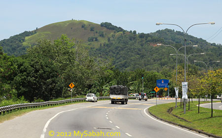
Above: view of Gundul Hill from the road
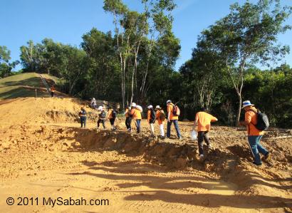
There are two starting points to climb Gundul Hill, one from UiTM campus, another from a construction site, the one that we used. Since both points are inside private land, you need to ask for permission from owner to enter. The hill is a state land (owned by government).
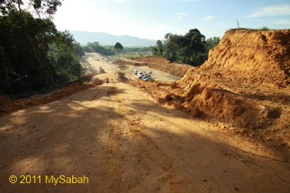
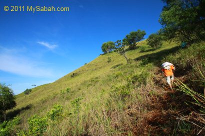
Above: the starting point of our climb from a construction site. You can see our cars parked very far below.
There are very few shades along the trail so we started our hiking at 7:30 early in the morning, before the scorching sun rising high.

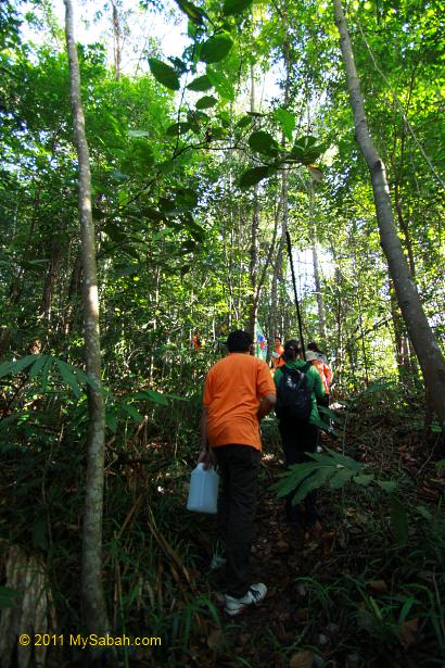
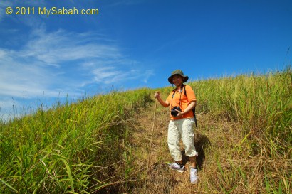
At first we walked 15 minutes in a wood at the foothill. Watch your steps as snake might be lurking around here. No, there is no forest leech.
Very soon we walked out of the wood and exposed to hash sunlight. It’s a good idea to bring an umbrella with you. At least put on your sun block.
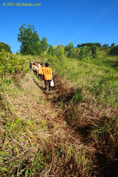
The hiking trail is mild in steepness. The length of trail is about 1.5 Kilometers and takes less than an hour. It is not challenging but can be tiring. The main problem is the heat. Do bring 1 Litre of water with you to fight the dehydration.
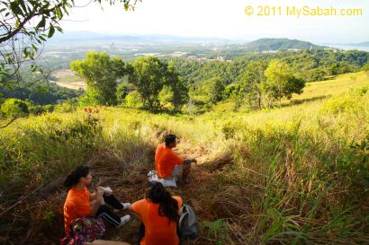
Beware of sun stroke too. We take a rest whenever we find a shade to cool off our bodies. Despite the hot day, breeze is here to comfort.
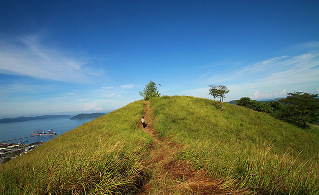
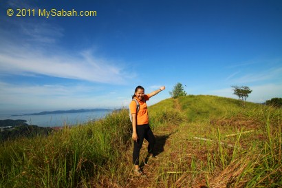
We already can see the sea of Sepangar Bay and UMS mosque from the slope. The grass land looks like flat area. In fact, the elephant grass is as tall as our chest. Nobody can explain why there are so few trees on Gundul Hill. We saw pitcher plant, which grows on soil with poor nutrients. May be that’s why.
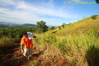
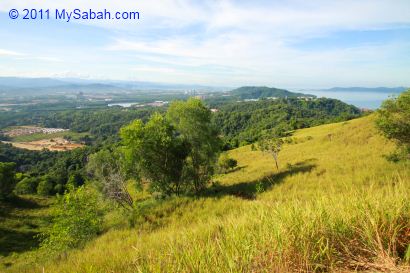
The view near the top is one of my favorite. It looks like a meeting point of blue sky and green hill, lovely.. Such scene is so unlike Sabah.
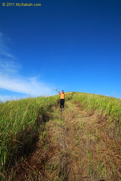
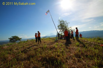
The last 500-Meter path is on a double-humped knoll.
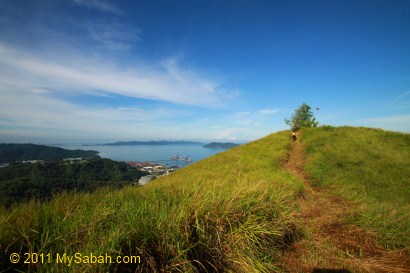
Above: see the little bamboo tree in front? That’s the highest point of Gundul Hill.
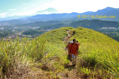
Above: turn around I can see the Mt. Kinabalu, the highest mountain of Malaysia.
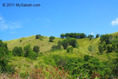
Bukit Gundul really lives up to its name (Bald Hill). There is no tree except a small bamboo tree on top of hill. All of us try to squeeze into the little shade offered by that small bamboo tree.
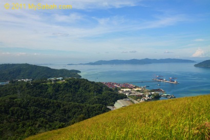
The view from the top of Gundul Hill is impressive! The hill is surrounded by forest, hills, sea, lake, mangrove and housing areas. We can see the port and navy base of Sepangar Bay. The height of Bukit Gundul is only 200 Meters, quite a small effort to get such a beautiful view.
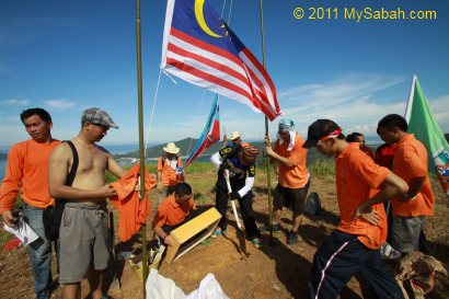
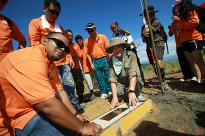
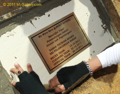
To mark our “conquer” of Gundul Hill, we installed Sabah & Malaysia flags and plaque on the hill.
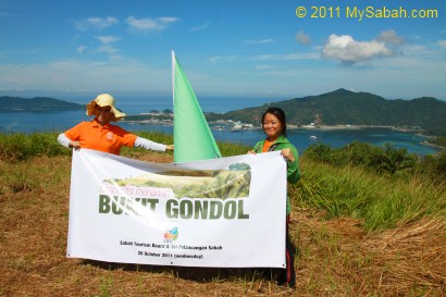
After a few rounds of group photo taking, we left Gundul Hill at 10am. Bukit Gundul is really a good place for a short hike. It is only known among a small group of local hikers. However, no travel agent offers tour package to climb this hill, so you have to organize the trip yourself.
You may watch the 40-sec video below to see the surrounding of Gundul Hill. You will see Malaysia Tourism Minister checked us out in a helicopter too:
More Photos
You may check out my photo album if you want to see more nice pictures:
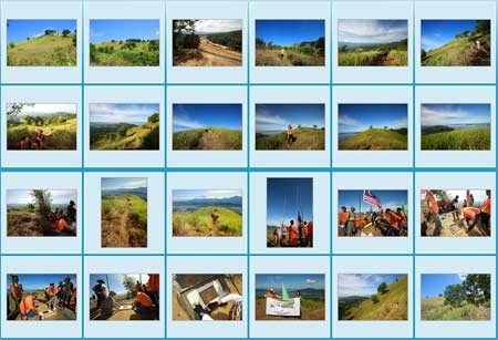
Photos taken in Sepangar, Sabah, Malaysia Borneo
Can you be more specific about the path to the top mountain? Last few weeks, my friend and i were there struggling to find a way up the mountain. Please provide a proper path with map. Thank you.
Dear Don, as mentioned in my blog, the starting point is inside private property and you CAN’T enter without permission. Please contact UMS (University Malaysia Sabah) for the access.
Thanks for your reply, Can i have their contact number or any contact person? based on the map (http://wikimapia.org/#lat=6.0671162&lon=116.1426544&z=15&l=0&m=b) it is UiTM not UMS, are you sure is UMS? the other day, we went inside Lokub Village but it is a dead end inside. We tried another way up through Lokbuno (upper left), beside Sepangar bay oil terminal also no use. So desperate to go up that Gondol Hill!