Category Archives: Mountains

Darvel Bay

Tower of Heaven at the Mouth of Borneo

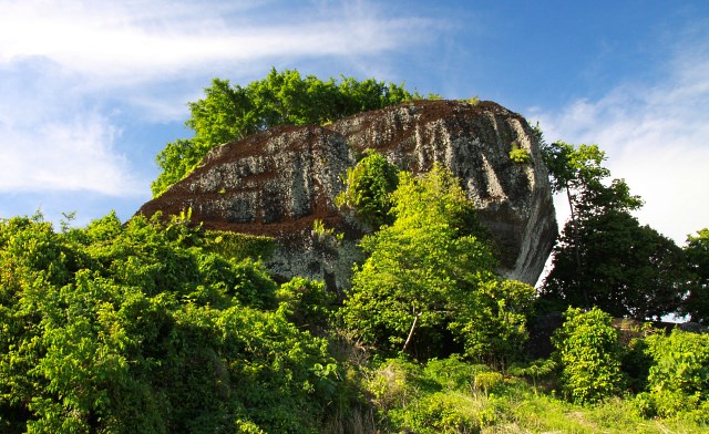
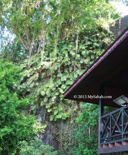
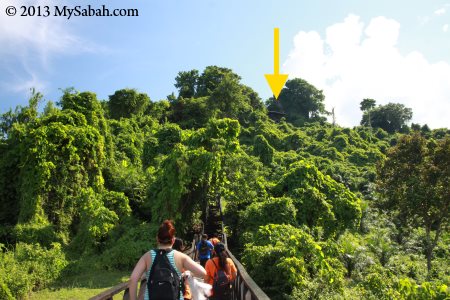
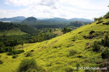
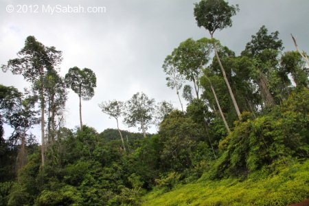
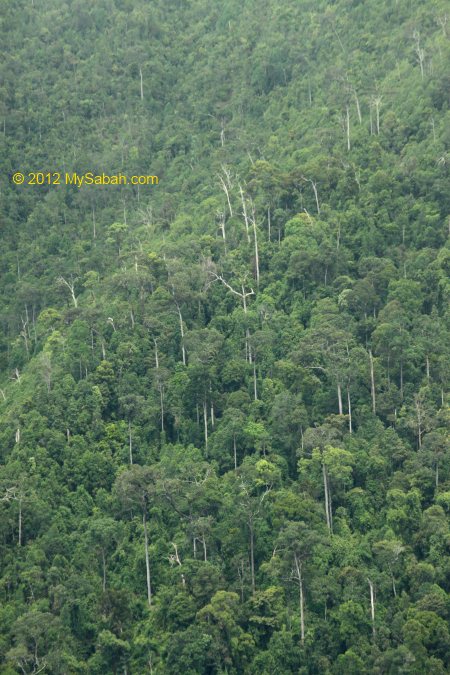
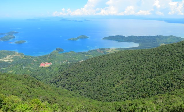
Looking at the increasing luxurious condominium built on the hill of our city, you will have no doubt that people are willing to pay a lot for scenic view from the top. For Lahad Datu town of Sabah, the best view point will be on Mount Silam, which is only 10 Kilometers away and one of the highest place in this district. From its top, you can have a bird’s eye view of Lahad Datu town and its surrounding mountains, forest and the beautiful Darvel Bay.


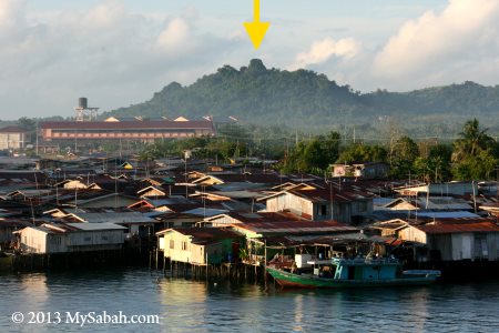
Pic: Mt. Silam is not far away from Lahad Datu.

Luckily, Mt. Silam is not developed into a condo area for the rich. Instead, it is part of the Class-1 Sapagaya Forest Reserve fully protected by Sabah Forestry Department (SFD). Not only that, SFD also builds an observation tower on Mt. Silam, name it as “Tower of Heaven” (Menara Kayangan in Malay language) and open it to public in year 2012.

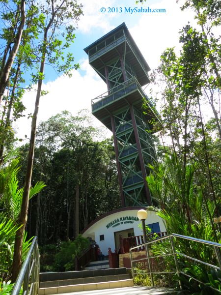
Tower of Heaven (Menara Kayangan) is 33-Meter tall (about 108 feet) and located at 620 Meters above sea level on Mount Silam. The tower is a very solid building supported by steel and cement structure, and able to hold up to 30 visitors. As this is a forested high ground, the air here is cooling and refreshing. You will feel so comfortable that you want to stay longer for the nice air and view.


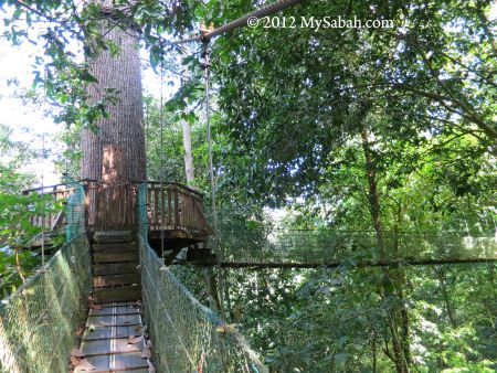
Pic: the entrance to the top of tower, but no hurry…


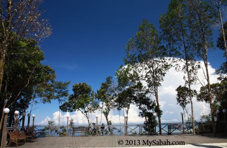
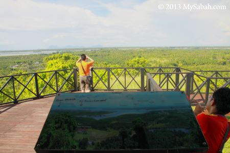
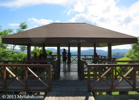
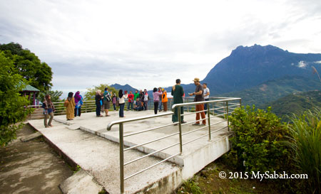
For those who don’t want to climb 8 floors of staircase to the top, they can check out the viewing platform in front of the tower.


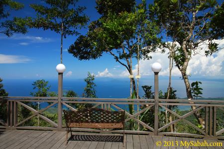
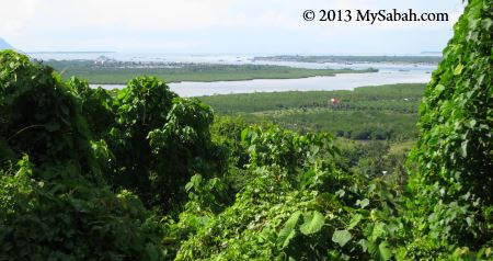
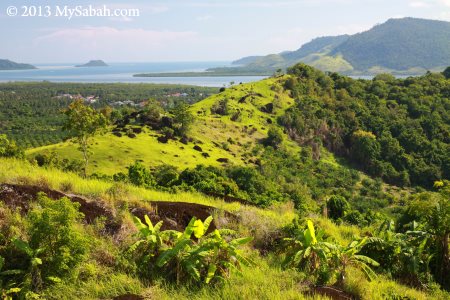
Oh dear, I can sit here whole day for the spectacular view of Darvel Bay and its islands.


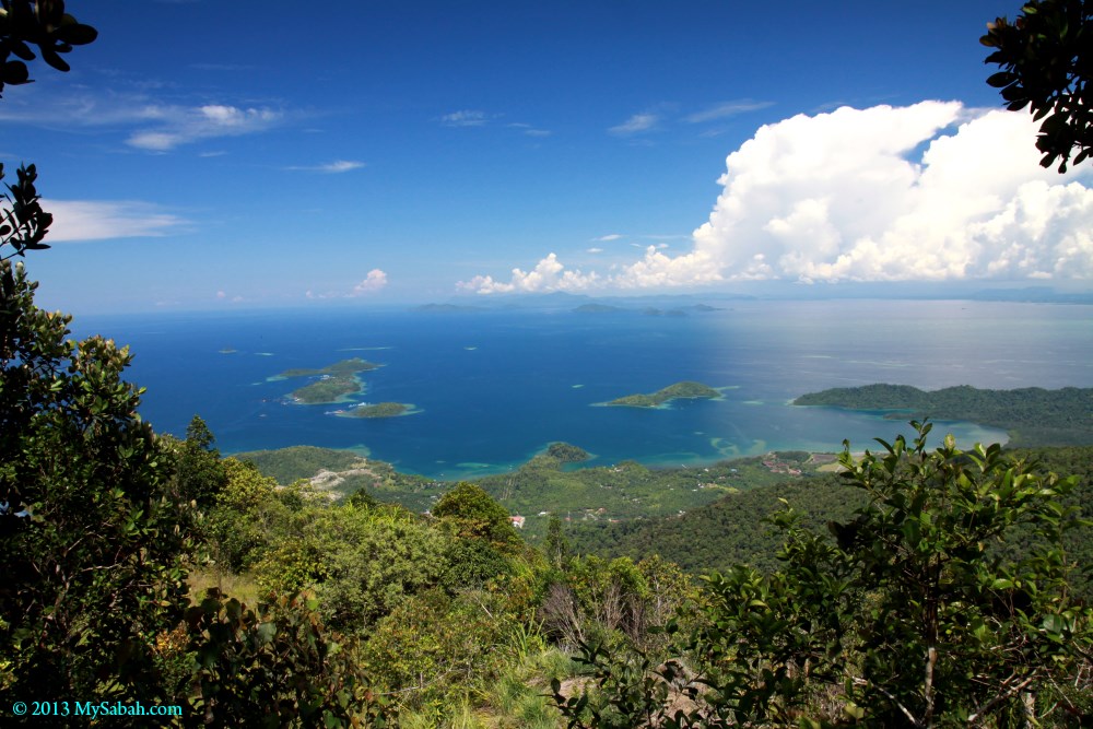
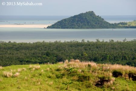
Pic: Darvel Bay and the islands

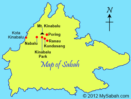
If you wonder why I call Darvel Bay the “Mouth of Borneo”, you may look at the map below:

View My Sabah Map in a larger map


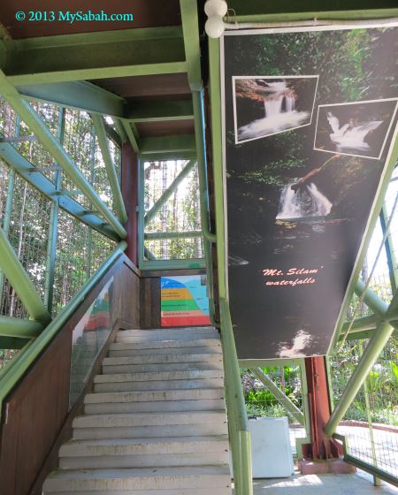
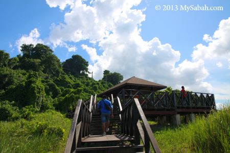
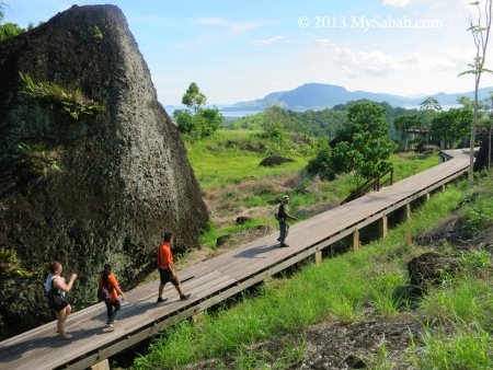
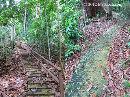
Now going to the tower for the best view up there… It takes less than 10 minutes to reach the top. Sorry, there is no elevator / lift.


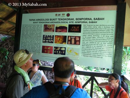
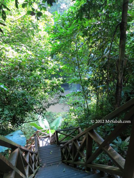
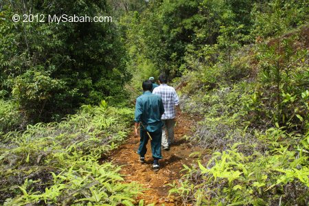
Along the stairway are some posters with information and photographs about Mt. Silam. Just take your time and walk up slowly.


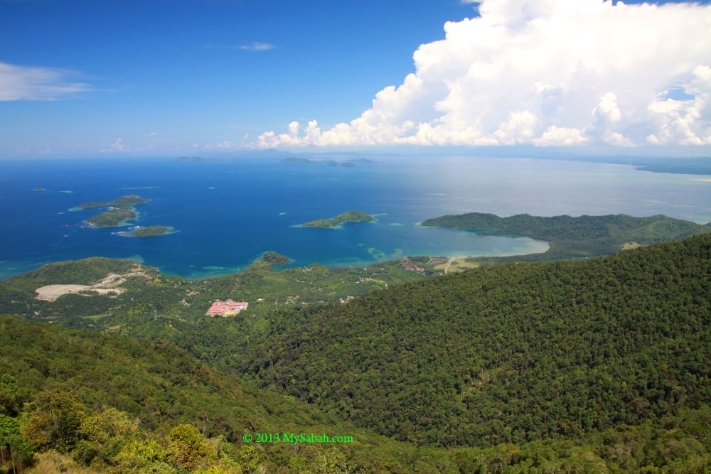
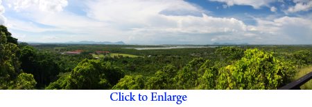
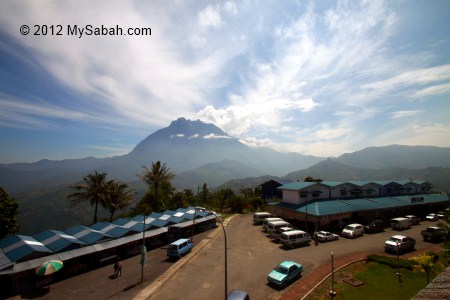
Here you go. The heavenly view from Tower of Heaven.


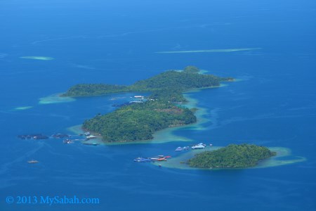
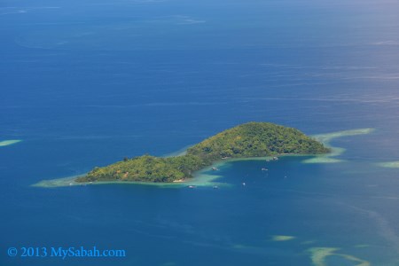
Overlooking the islands. These are big islands but they look so small from the tower.


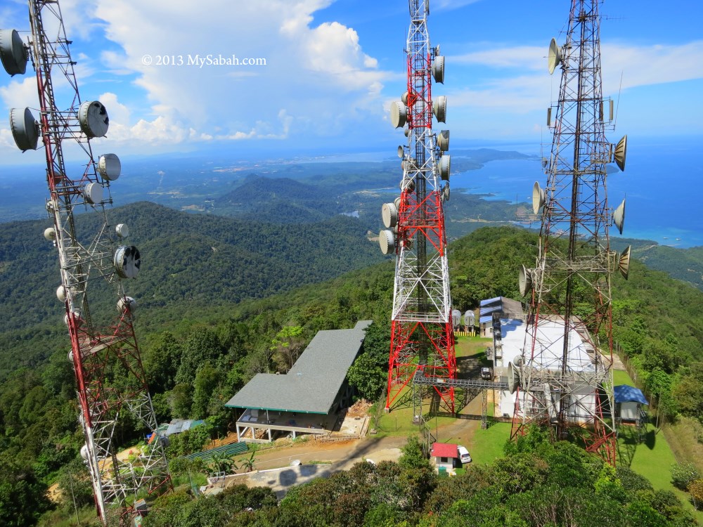
Pic: the telecommuncation towers next to Tower of Heaven. You can see Lahad Datu town far behind them.

For a virtual walking tour of the tower, you may watch the 3-min video below:


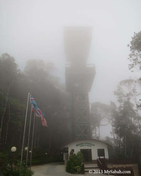
Sometimes Mt. Silam would be enveloped by dense mist, then you can’t see anything from top. This can happen anytime.


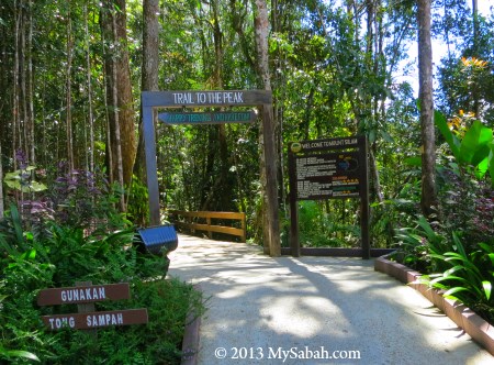
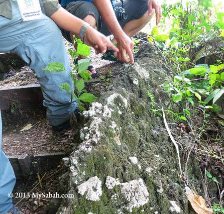
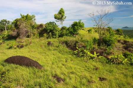
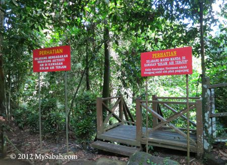
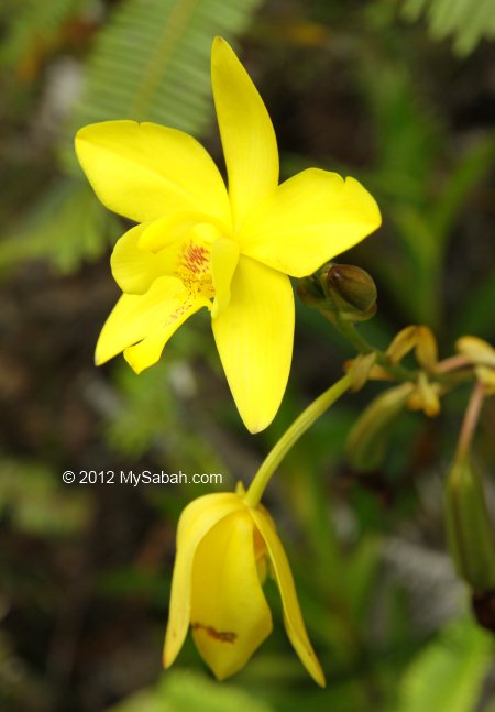
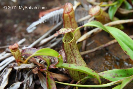
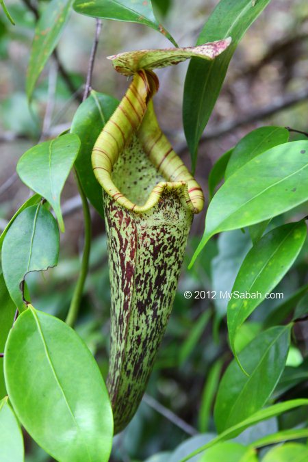
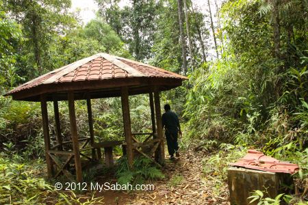
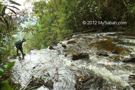
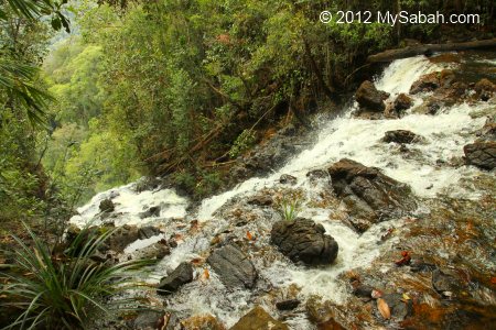
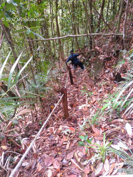
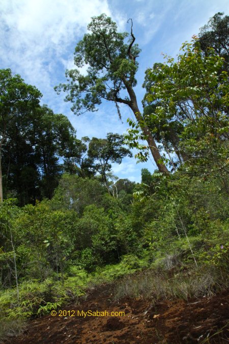
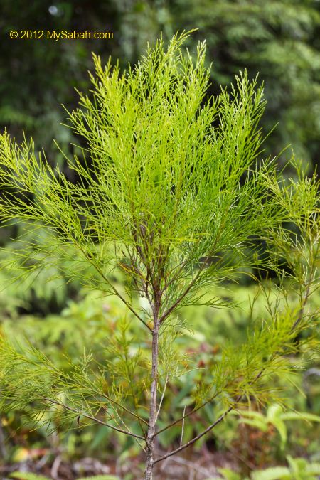
If you want to appreciate the nature of Mt. Silam, there is a forest trail behind the tower that leads you to its peak (height: 844 Meters). You may read my next post on climbing Mt. Silam.


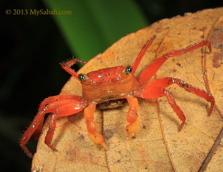
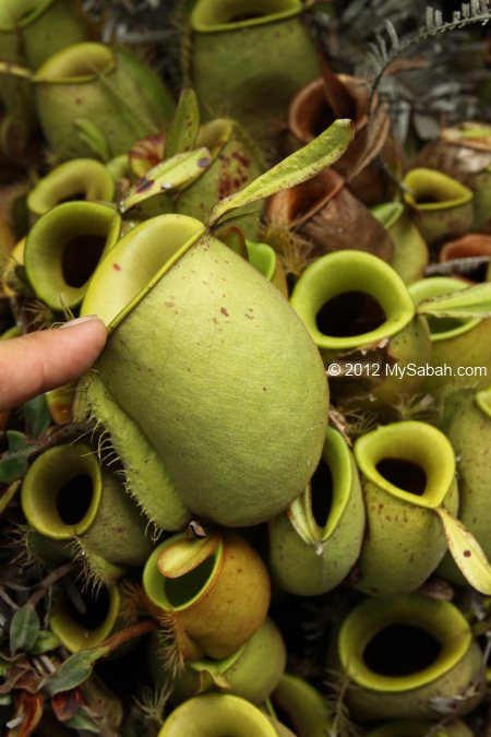
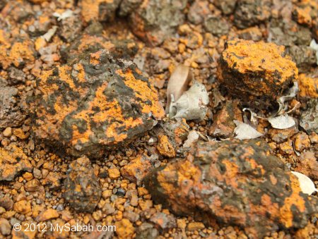
Lucky visitors would see the lovely, small and orange-red Silam Crab (Species: Geosesarma aurantium) in the wood near the tower. It is endemic to Sabah and only found on Mt. Silam!


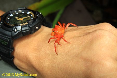
Silam Crab is a land crab that can be found up to the peak of Mt. Silam (884 Meters). Usually you could see them come up foraging among leaf litter after rain.


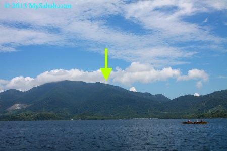
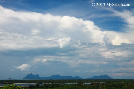
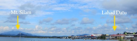
Pic: you also can see Mt. Silam from the sea of Darvel Bay. The tower is clearly visible during good weather.


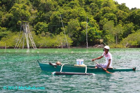
Pic: Darvel Bay is rich in seafood and an important fishing zone of Sabah.


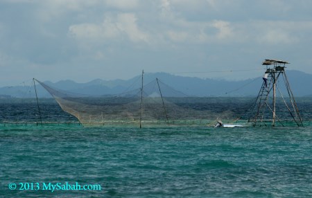
Pic: a fishing structure (called Bagang locally) near an island in Darvel Bay.

How to get there

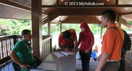
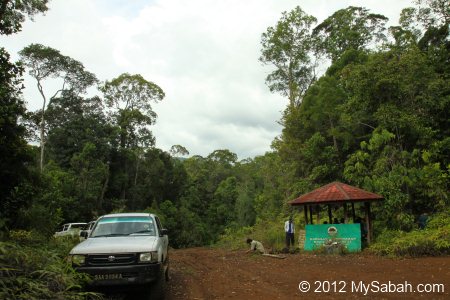
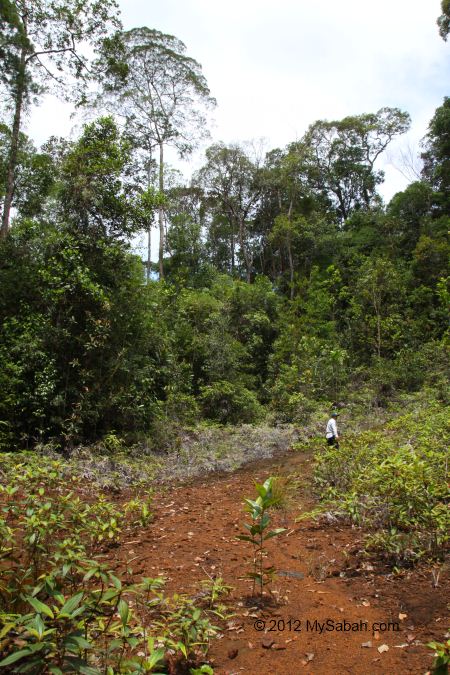
There is no public transport to Tower of Heaven but you can go there by taxi. The entrance is next to the Lahad Datu-Tawau highway about 10 KM from Lahad Datu town. For tourists who visit Danum Valley, they will pass by this junction, so it is a convenient stop for a short tour (and toilet break).


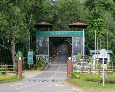
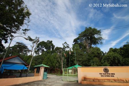
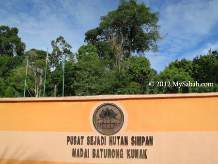
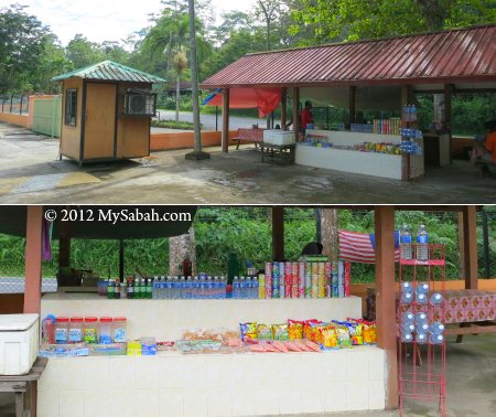
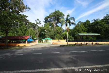
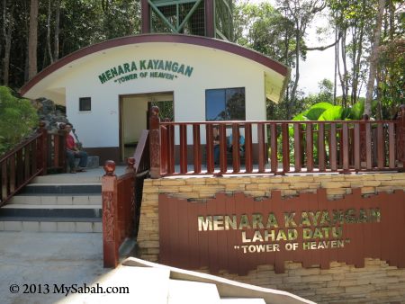
Pic: the entrance (see location map) and ticket counter of Tower of Heaven. Note the sign on arch says “Menara Kayangan”, instead of “Tower of Heaven”.

The ticket costs RM2 (≈USD0.60) for adult, RM1 for child (≈USD0.30). They open from 8am to 5pm daily.


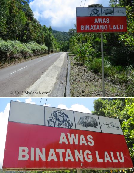
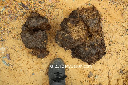
Pic: the sign reads “Beware of animal crossing”. I saw some pig-tailed macaques wandering here in the morning.

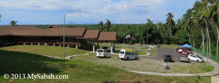
After the entrance, you need to drive another 10 KM uphill to the tower on a sealed road.


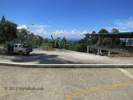
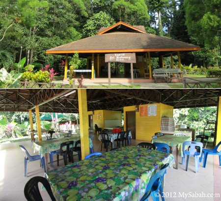
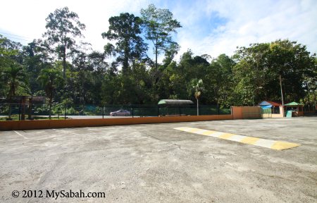
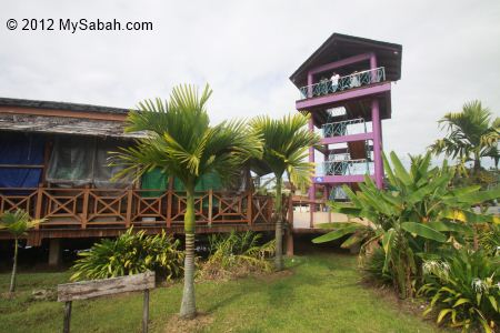
Pic: parking lot near the tower. At the right is a restaurant under construction.


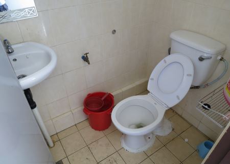
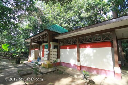
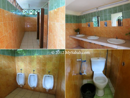
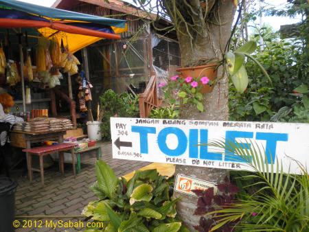
Pic: there is a male and female toilet at the base of the tower. Clean but quite small (note the door almost touches the basin).


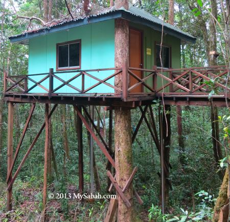
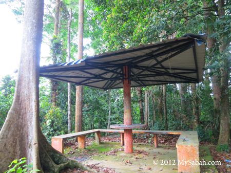
FYI, if you would like to spend a night on Mt. Silam, there are a hostel (accommodate 4 guests) and a resthouse (accommodate up to 10 guests) near the tower. You may contact Sabah Forestry Department (Tel: +60 89 242500) for more info or booking.

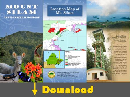
Besides the tower, there are many other things to explore on Mt. Silam, you may download the pamphlet below (published by SFD) for further reading:

Anyone plans to go after reading this?

Related Post
Climbing Mt. Silam

Photos taken in Lahad Datu, Sabah, Malaysia Borneo

Treasure Hunt on Skull Hill (Bukit Tengkorak) of Sabah

Semporna town is Sabah’s gateway to world-class dive sites such as Sipadan. Every year ten of thousand of tourists come to Semporna, but most head straight to the islands and never visit Bukit Tengkorak (literally means Skull Hill), without knowing that they miss an attraction which is an ancient volcanic rim and the largest pottery making site in Southeast Asia during the Neolithic period. From its top, you also can enjoy a breathtaking view of Semporna and its islands.


Pic: you can see Bukit Tengkorak from Semporna town


Pic: archaeological museum (left) and coconut stall (right) at the entrance of Bukit Tengkorak

Bukit Tengkorak is only about 10 Kilometres away from Semporna town and the tour takes less than 2 hours, so I can’t find any reason not to drop by. The archaeological museum is a gallery with prehistoric artefacts. The entry is free. For a better experience, you would need a tour guide who can tell you the interesting features of this place.


The admission is free, but you need to register before entering the archaeological heritage site.


Pic: this is the wooden staircase to reach the top of 500-feet-high Bukit Tengkorak, where the excavation site is located. According to my tour guide, Kenneth, it is exactly 610 steps one way. Sound taxing but I went slow and didn’t feel really tired. There are some hungry mosquitoes around foothill, so please bring your insect repellent.


As you will walk under hot sun, you may apply sunblock lotion in advance. Bring some water with you, and raincoat, just in case. There are 4 shelters along the way, where you can rest and enjoy the beautiful view.


In the shelter, you may read the interpretation board (written in English and Malay) about the history of Bukit Tengkorak.

Bukit Tengkorak is one of the largest pottery making sites in Southeast Asia during the Neolithic period (about 3,000 years ago, between 4340 BC and 50 BC). Not only that, research also shows that people traveling between Borneo and New Britain in Melanesia (near Papua New Guinea), which was one of the longest trade routes (3,500 KM) in the world during that period. Archaeologists believe such long-distance sea trade and migration route left behind what is known as the Lapita culture of pottery, tools and ornaments. The old pottery manufacturing technology is still being used by the Bajau community in Semporna today.


Pic: before reaching the highest point, you already can see Semporna town. Seafest Hotel is clearly visible. Human has existed in Semporna since Paleolithic Period (about 10,000 years ago).


Pic: due to the volcanic soil, the vegetation on this hill is different from other parts of Sabah.


Pic: granite embedded in volcanic rock, an interesting geological trait on this hill.


You will find many pottery sherds along the way. It is estimated that more than 6 million prehistoric potsherds can be found all over this hill. Researchers also find large number of seashells covering Skull Hill. Some says they are washed up to the hill by super Tsunami, some says these are leftover discarded by ancestors.


Pic: the third shelter with open and wide view


The third shelter has an observatory platform, where you can have a panoramic view of Semporna and its surrounding area. In clear day, you can see Mabul Island.

You may watch the 1-min video below for the nice view:


Pic: The “Sleeping Old Man” islands, which is officially known as Semporna Islands Park or Tun Sakaran Marine Park, the largest marine park of Malaysia so far. It is a remnant of a huge volcanic explosion about 5 million years ago.


Pic: a huge limestone boulder next to shelter. I could sense that “something” was watching us.


Pic: we were moving toward the top. The last half of the hike is under the tree shade, so it is not too bad.


Finally, we were welcome by a congratulatory signboard on the top. Now we are 500 feet (152 Metres) above sea level. It takes only 30 minutes for anyone reasonably fit to get up here. FYI, there is no restaurant and toilet on the hill top.

I’m curious why ancestors want to live so high up on the hill. Some says high ground is more secure and this foothill has large clay deposit for making pottery.

Archaeological Heritage Site

Bukit Tengkorak is an important archaeological site in Southeast Asia because artefacts discovered here supports new hypothesis on ancient human migration.


Pic: Historians unearthed thousands of prehistoric pottery with various types of decorations in layers of ash here. This cave was probably a remnant of open kiln for firing pottery.


Pic: the excavation in year 2008


Pic: the items found on Bukit Tengkorak. I snapped these pictures on info board. They say the best pieces were transferred to Sabah Museum.


Pic: fragments of decorated pottery made using fingernails, shells and wood materials.

Besides hundreds of thousands of pieces of prehistoric pottery decorated with intricate patterns, another unique discovery from this hill is stone tools made of chert, agate and obsidian. Food remains comprising animal and fish bones and shellfish are also found.

Ancient Volcanic Rim

Ok, let’s close the boring history textbook and let me show you the opposite side of this hill. Now, open the geography textbook LOL.

Bukit Tengkorak is actually part of the exposed rim of an ancient volcanic crater about 2 KM in diameter. The rock formation at Bukit Tengkorak consists of volcanic breccia, mostly andesitic rocks, and is believed to be the remnants of past volcanic eruptions which occurred during the Pliocene Period (5.3 to 1.8 million years ago).


Pic: Kenneth showed us a totally different world behind the hill


Pic: the last shelter

As Bukit Tengkorak is not a popular destination, there were only 9,000 visitors in year 2010. Anyway, because of its nice scenery (and quietness), Bukit Tengkorak has become a hot dating spot of local couples. Our visit may have interrupted a lot of intimate interactions there. Just kidding.


This forested hill is covered by grassland and surrounded by numerous isolated hills and mountains. I really love the green view (though the oil palm plantation spoils the view a bit).


I’ve travelled in most part of Sabah, but this place is so different. Though I didn’t find any treasure, the picturesque scenes are for me to keep in memory forever.


See the ridge dotted by dark boulders at a distance? It is the rim of a huge ancient volcano.


The dark boulders are volcanic rocks which are formed million years ago.


Pic: close-up of a volcanic rock


Pic: the huge boulder reminds me of Ayers Rock in Australia


I think geologists would be very interested in Bukit Tengkorak, as they can find volcanic rock, limestone, sandstone and granite in this hill.

Archaeological Museum of Bukit Tengkorak

For scuba divers who have enough of Nemo and corals deep underwater at islands of Semporna, a visit to Bukit Tengkorak is a great way to see Semporna high on a hill during long wait of preflight surface interval. For bird watchers, you have a good chance to spot Hooded Pitta.

How to Get There

Bukit Tengkorak is located at Jalan Tampi-Tampi (Tampi-Tampi Road), only 10 minutes drive away from Semporna town. When you approach SMK Agama Tun Sakaran school, look for the wooden arch next to the road. Just turn to that junction and you will reach the site in a few minutes (See location map).

Opening Hours: 9.00 am – 5.00 pm daily
Correspondence Address: Bukit Tengkorak Archaeological Site, C/O Muzium Wilayah Pantai Timur, 2nd Floor, Wisma Warisan, 90000 Sandakan, Sabah, Malaysia.
Tel: (+60) 089–222679
Contact Person: Mr. Juanis Ogak (East Coast Museum Curator)
Email: Juanis.Ogak@sabah.gov.my, Muzium.Sabah@sabah.gov.my

More Photos

Created with flickr badge.

Photos taken in Semporna, Sabah, Malaysia Borneo

Top 10 Waterfalls of Sabah

The mountainous terrain of Sabah makes us the land of waterfalls. There are thousands of waterfalls in Sabah forest, most are waiting for explorers to name them. Looking at waterfall can calm our minds better than watching the whirling movement in washing machine. So I compile a list of Sabah’s Top 10 Waterfalls for those who want to enjoy heavy doses of negative ions.


Pic: the location of Top 10 Sabah waterfalls.

Besides Scale, this waterfall ranking is also based on Popularity, Accessibility and Travel Experience. That’s why some giant waterfalls are not listed. For example, though Kadamaian Waterfall is the highest waterfall of Sabah, it is too difficult to get there. Please note that most height measurement is by estimation.

No. 10. Kiansom Waterfall

Location: Inanam, Kota Kinabalu
Height: 7-Meter (23 Feet)

Yes, I know, Kiansom is the smallest waterfall in the top 10 list. It is listed because it is the most famous, accessible and visited waterfall in Kota Kinabalu city. I can’t exclude the waterfall that everyone loves.
» Read more about Kiansom Waterfall…

No. 9. Gelas Waterfall

Location: Tawau Hills Park, Tawau
Height: 12 Meters (40 Feet)

Gelas Waterfall is situated in Tawau Hills Park, a lush rainforest zone and source of five rivers. Hiking to Gelas Waterfall is a pleasure to nature lovers, and you also can soak in sulphurous hot springs in the park.
» Read more about Gelas Waterfall…

No. 8. Tawai Waterfall

Location: Tawai Forest Reserve, Telupid
Height: 95 Meters (311 Feet)

Tawai Waterfall is the least-known waterfall, but its view is so spectacular that it will blow you away. The area around this waterfall is full of Borneo pitcher plant. Denmark’s biggest television network, Tv2, has chosen this waterfall for filming of “Girls Off The Beaten Track”.
» Read more about Tawai Waterfall…

No. 7. Madai Falls

Location: Madai-Baturong Forest Reserve, Kunak
Height: 40 Meter (131 Feet)

Madai Falls is probably the first Sabah waterfall visited by human, maybe a caveman about 28,000 years ago. I’m not joking. Archaeologists say Madai-Baturong has the oldest human settlement of Sabah. I believe stone-age people love waterfalls as much as we do.
» Read more about Madai Falls…

No. 6. Fairy Waterfall

Location: Danum Valley, Lahad Datu
Height: 27 Meters (89 Feet)

This shy Fairy Waterfall is hiding deep inside the 130-million Borneo rainforest of Danum Valley. The photo here may not look impressive because it was taken during prolonged drought. Danum Valley will be nominated as the next UNESCO World Heritage Site of Sabah/Borneo.
» Read more about Fairy Waterfall…

No. 5. Fefukan Waterfall

Location: Long Pasia
Wide: 20 Meters (66 Feet)

To see Fefukan, Travellers need to hike a long way to the Heart of Borneo, making it the most remote and least visited waterfall in my list. Camping next to this waterfall is one of my most unforgettable experience. Lucky visitors would see blooming rafflesia around there.
» Read more about Fefukan Waterfall…

No. 4. Mahua Waterfall

Location: Tambunan
Height: 17 Meters (55 Feet)

As part of the Crocker Range Park, Mahua Waterfall is protected as a water catchment area. Hence, visitors can enjoy cooling and refreshing water from clean mountain stream. On the way to Mahua Waterfall, you may drop by Tambunan Rafflesia Center to check if you are lucky enough to see a blooming rafflesia.
» Read more about Mahua Waterfall…

No. 3. Imbak Falls

Location: The Heart of Sabah, Tongod
Wide: 30-Meter (98 Feet)


Even though Imbak Falls is only 6 Meters (20 feet) high, it is the widest waterfall of Sabah. I just love sitting in the river, as the strong current turns its waterfall pond into a Jacuzzi bath area.
» Read more about Imbak Falls…

No. 2. Langanan Waterfall

Location: Poring, Kinabalu Park
Height: 120 Meters (394 Feet)

Located in Poring Hot Springs, the most popular destination of Sabah and 1st UNESCO World Heritage Site of Malaysia, the majestic view of 120-Meter-tall Langanan Waterfall is only saved for those visitors who are keen to hike nearly 4 Kilometers (2.3 Miles). It is more enjoyable to soak yourself in the hot spring after a long walk in the jungle.
» Read more about Langanan Waterfall…

No. 1. Maliau Falls

Location: Maliau Basin, Tawau
Height (of the highest tier): 28-Meter (92 Feet)

Here you go. The No.1 Waterfall of Sabah is the 7-tier Maliau Falls in Maliau Basin, Sabah’s Lost World. To see Maliau Falls, you need to trek 2 days on the treacherous relief and pass through miles and miles of dense pristine rainforest.


With over 30 waterfalls (and counting), Maliau Basin is also known as the Capital of Waterfalls, and Maliau Falls is the most breath-taking among them. Another feature of this waterfall is its tea-color water, which is caused by plant tannin released from heath forest upstream. The magnificent Maliau Falls will leave a beautiful memory in you, a scene that you like to replay in mind from time to time.
» Read more about Maliau Falls…

Which Waterfall is your Favorite?

Do you agree with the Top 10 Waterfalls list? Please vote for your favorite waterfall below. I would love to see if everyone shares the same view. You can even add new waterfall if your favorite is not in the list.

[listly id=”2Tj” layout=”full”]

Below is a montage of Top 10 Sabah Waterfalls (Click it for bigger picture). You may share it in your Facebook.

Thanks to readers who link to me.

Waterfall Safety

Accident is like winning lottery, we get it when we are least expecting it. Waterfall is an inviting dead trap that takes countless lives (especially over-excited kids). Please pay attention to the following precaution if you want to “play” with waterfall:

  1. Don’t swim near to the waterfall. The waterfall pond can be deep, with unseen swift currents underneath.
  2. Don’t climb to the top of waterfall, as the rocks there are usually slippery.
  3. Don’t stand under the waterfall. Even a small stone fallen high from top can cause severe injury.
  4. During wet season, watch out for flash flood. Flash flood can occur even if there is no rain downstream.
  5. Teachers, if you plan to bring a group of pupils to swim at waterfall, equip yourself with lifebuoy, rope and CPR knowledge.

If you know any nice waterfall around your hometown, please share with us by posting the photo in comment box below.

“Life is like a waterfall, it is always moving and there is always an uneven flow to it.” – SooHoo

Photos taken in Sabah, Malaysia Borneo

Top 10 Adventures of Sabah

Ssshhhh…. below is the list of Top 10 Adventures in Sabah, don’t tell your mom you will do it. Anyway, you can call yourself a true man if you are able to complete all these hardcore activities. 🙂

Sabah is really a land of Borneo adventures. Adventurers can choose to die explore in our ancient rainforest, high mountains, deep ocean, biodiversified wetlands, etc. :-p

Vote or Recommend your Favorite Adventures

Your vote and comment will perfect the list, so please feel free to contribute to this open list.

[listly id=”2AB” layout=”full”]

You are welcome to add new item to this list too. However, please allow me to remove item that is irrelevant or unfit for this category. Thank You~

Other Sabah’s Top 10

Madai Waterfall and Tongkat Ali Hill of Kunak, Sabah

Waterfall is a delightful view and always be part of the painting about paradise. The bigger it is, the happier the visitors. That’s how the 40-Meter Madai Waterfall drew me to Kunak, a small town in Lahad Datu district. In fact, many European and Asian tourists had come for it. I have visited many waterfalls of Sabah, and Madai Fall is one of the most impressive.


The 5-storey high Madai Waterfall is located in 3,436.50-Hectare Madai Baturong Virgin Forest Reserve Nature Center, which is managed by the Sabah Forestry Department and opened to the public since 1999. Madai Cave is also part of this reserve.


Pic: Madai Waterfall is inside Pusat Sejadi Hutan Simpan Madai Baturong (Madai Baturong Forest Reserve Nature Center) of Kunak.

As Madai-Baturong Forest Reserve Nature Center is a public park, anyone can pay a small entrance fee to enjoy Madai Waterfall. Below is the ticket rate:

  • Malaysian: Adult: MYR2.00 (≈USD0.66); Below 18: MYR1 (≈USD0.33)
  • Foreigner: Adult: MYR5.00 (≈USD1.66); Below 18: MYR2 (≈USD0.66)

Madai Waterfall

Madai Waterfall is very accessible. It is so near that you can hear it, once you walk into the park. Remember to bring insect repellent, as mosquitoes might be around.


Pic: the wooden staircase to Madai Fall.


It is only a 1-minute walk. The boardwalk is quite steep, be careful..


Pic: huge Alocasia odora next to staircase. This plant has the largest undivided leaf in the world.


Pic: Madai Waterfall in the sight!


Pic: the “twin” Madai Waterfall. After heavy rain, both will merge into one huge vertical fall. Though the water is murky, it is clean and cooling.


Due to the powerful splash, the air was filled with flying droplets. When the morning light shined through them, it created fascinating rays of light. Such a lovely view.


Pic: the warning sign near the Madai Fall.

Any water activity such as swimming is prohibited, because the waterfall pond is deep. Basically, this waterfall is meant to be watched only. Anyway, you can soak your feet in the shallow water, like most people do. Anything beyond that is on your own risk. There is no lifeguard around to stop you or to save you.


However, some visitors can’t resist to take a swim under this beautiful waterfall. A ranger told me that he saw a very deep hole in the center of waterfall pond after a 8-month drought. Madai is in a limestone area, so I wonder if this hole connects to an underground cave or river. Well, I’m just guessing.

Want to see Madai Waterfall in motion? You may watch the 90-sec video below:


During weekends and holiday, many locals come here to swim and picnic. Some of them taking bath (with soap) or washing their dirty plates in the stream, which flows to Tingkayu River. It’s not right.. 🙁


Pic: dense moss behind the Madai Fall.


The park opens from 8am to 5pm every day. The waterfall is quite crowded afternoon.


Pic: gold found at Madai Fall?

Wishing Tree

Besides Madai Waterfall, I found an interesting tree in Madai-Baturong Nature Center. The local calls it a “Wishing Tree” (Pokok Hajat).


Pic: the wishing tree is standing near the entrance of canopy walk.


It is a tall tree, which is locally known as “Kayu Ara” (Ficus species, Moraceae). Many birds will gather on this tree during its fruiting season.


Every ribbon on the tree root is a wish of the asker. Probably it works, so there are hundred of ribbons on this wishing tree.


Whatever, it is a tall and magnificent tree to look at. I wish it will stay strong and healthy forever.

Bukit Tongkat Ali

Bukit Tongkat Ali (Tongkat Ali Hill) is another attraction in Madai Baturong Forest Reserve. This hill is named after a herb Tongkat Ali (species: Eurycoma longifolia, Nicknamed “Asian Viagra”), which is famous for the medicinal properties of its root that can increase testosterone level and treat erectile dysfunction.


Pic: Tongkat Ali tree


Visitors can hike to Bukit Tongkat Ali via a 1 KM trail in the park. When you enter the park, just turn right and follow a small road that leads you to a small bridge and rest shelter. The trail starts at a paved path behind the shelter.


Though the trail is less than 1 KM, it is steep and tiring. The trail is paved with cement. It is supposed to be a good idea. However, the moss cover on the cement becomes so slippery that, after rain, the trail turns into a skating route. In some sections of the trail, I had to hug the hand rail to descend carefully.


Pic: the last shelter on top of Bukit Tongkat Ali (Height: 169 Meters).

I was told that Bukit Tongkat Ali was abundant with wild Tongkat Ali, but I only saw one or two. Probably some impotent visitors pluck it. I was also told that I could see Madai Hill from the top of Bukit Tongkat Ali, but such view was obstructed by dense trees.

Sorry to say, spending nearly 2 hours walking up and down Bukit Tongkat Ali is simply a waste of time.

Public Amenities

Madai Baturong Nature Center have some basic amenities in place for visitors.


Currently (as of Nov 2012), the canopy walk is closed for maintenance until further notice. Too bad, this 119-Meter long and 40-Meter high canopy walk, which is connected to three giant rainforest trees (Seraya Urat Mata, Oba Suluk and Merbau species), is a main attraction of the park, besides Madai Waterfall.


Pic: public toilet


The toilet is very clean and deserves MYR0.30 (≈USD0.10) per entry.


Pic: the Canteen (named Kantin Sri Baturong Madai) in the park

This canteen sells common food items such as fried rice and noodles, as well as cold and hot drink. It was closed for holiday during my visit.


Pic: there is another small food stall near the gate, but they are selling drink and light snack only.


Pic: (left) shower and changing room, (right) Muslim prayer rooms or Surau


Pic: ample parking space for 20 to 30 cars.

Their rest house is closed and the Exhibition Hall is not ready (as of Nov 2012). You still can camp in the park for a small fee (MYR3 for Malaysian, MYR5 for foreigner). I hope they will upgrade the facilities and amenities there ASAP to attract more tourists.

Wildlife

I heard hornbill near Madai Waterfall. At night, there are mouse deer wandering in the park too. The rangers mentioned a bird with a funny local name “Burung Kopi Susu” (Milk Coffee Bird). According to them, this is a small black bird with white stripes on its wings. This bird is common there and can be seen around 5pm. It sings very well, so people trap and trade them as pet. I wonder what bird it is. Magpie Robin?


Pic: Is Magpie Robin the “Milk Coffee Bird”?

How to Get There

Going to Madai-Baturong Forest Reserve Nature Center is easy but far. Madai Waterfall is 15 KM north of Kunak town and 71 KM southwest of Lahad Datu.


Pic: Madai-Baturong Nature Center is just next to the Lahad Datu↔Tawau highway.

By Bus: If you take Long-Distance Bus from Kota Kinabalu city to Kunak or Tawau, you can ask your bus driver to drop you right in front of the park, which is at the roadside (15 KM before Kunak). The bus fare is MYR50 (≈USD16.67) one way and the ride takes 8 hours.

By Flight: Take a 45-minute flight from Kota Kinabalu to Lahad Datu, then spend an hour on taxi to reach the park.

Below is the location map of the park:

View My Sabah Map in a larger map

For more information, you may contact Kunak Regional Forestry Office:
Address: P.O.Box No 2, 91207 Kunak, Sabah, Malaysia.
Tel: +60 89-851863

Photos taken in Kunak, Sabah, Malaysia Borneo

The Most Beautiful Thing (Ultra Trail Run)

It’s probably my boldest, but right decision to participate in 50 KM Ultra Trail Run of The Most Beautiful Thing (TMBT) in Kundasang on 15 Sep, a marathon that most people think is for masochists only. Unlike ordinary marathon, which is carried out on nice road and constant environment, ultra trail runners are exposed to various adverse factors such as extreme cold/heat, challenging terrain and uneven road surface, thereby making the race more difficult.


Pic: group photo with runner friends in the briefing the day before the race. It’s me at the left.


Pic: lady runners can’t wait to start the grueling run of 50 KM / 100 KM. From the left: Velerie, Georgina and Hana. What is more beautiful than being fit?

Though this is only the second time Sabah Adventure Challenge organizes this race, this year we have 470 participants running in 25KM, 50KM and 100KM categories. Due to lack of training, I’m very apprehensive on the race day. To make matter worse, I find that my hydration bladder leaks. Though uncertainty is more thrilling, I don’t expect this sort of surprise. >.<
As Sabah is at the “tail” of approaching Philippines typhoon, it rained heavily in the previous night. It’s a windy, cloudy and chilling morning but perfect as a race day. The high-spirited runners gather at an abandoned soccer field opposite to Kundasang War Memorial, and we started to run at 7.30am.


Pic: trail map of 50 KM category (WS = Water Station)

The trail map above shall give you a good idea of the 50KM-route and terrain that I’ve gone through. The 1st KM is downhill paved road, a very relaxing start. Most runners are smart not to run at this point. Soon we come to a steep slope where I sweat profusely before 3rd KM. “So tiring.. Can I make it?” I already worry in early stage. Luckily, we reach a flat gravel road and my “engine” starts to warm-up.


Pic: a nice runner I meet along the way. Later I know from the organizer that he is Kevin Loh. He suffers a terrible back spasm later, so painful that he can’t stand straight. He struggles for 50% of the race course and manages to complete his 100KM before cut off time. Such strong persistence is what we call the spirit of true athlete! Double Thumb-up!

The scenery is beautiful along the way, and I can’t help to stop occasionally to take snapshots. The weather is great, so is the mountain view, and I see the majestic Mt. Kinabalu up-close half of the time. The reason they name this race as The Most Beautiful Thing (TMBT) is because the runners will see beautiful people, villages, forest, farm, garden, mountain, etc. during the marathon. I wish to photograph all of them but too bad I’m in a hurry and later so tired to move even my fingers. Stopping too often will affect my stamina too.


Part of our trail is next to vegetables plantation. The villagers and farmers are very friendly and very generous for their smiles. I wave back countless time to the local people and children. I love everything I see, from the picturesque village farm, to the cute puppies and goats. I’ve been consuming vegetables from Kundasang, but that’s the first time I see the plantation.


FYI, due to landslide in the original route at Kiau Village (Kota Belud), the organizer changes the route to Kundasang this year.


Fortunately, the countryside road here is quite flat and the soil path is soft, so my legs can rest a bit. However, I still have to maintain a fast pace in order to finish my 50 KM run within 15 hours (cut off time).


For 50 KM race course, there are 5 Water Stations (WS), which is about 10 KM apart and where we can refill our water. It is like taking me a century to reach the 1st Water Station at 10th KM, 4 more to go… The sunlight is getting harsh, so I apply sun-block lotion to prevent sunburn.


After this, it’s a long and steep paved road, even cars find it difficult to speed. I felt so heavy walking on it.


Pic: a pine tree corridor. Some runners still have the energy to collect and carry the pine fruits here.


Pic: Mt. Kinabalu with lush forest of Kinabalu Park


Though most forest in Kundasang is clear for agriculture, the forest reserve of Kinabalu Park is still intact, as witnessed in photo above.


Pic: the 2nd Water Station & Check Point at 18th KM.
I had power bar and drink water mixed with rehydration salt here. I feel energetic again in minutes and move on.


After 2nd check point, I’m walking on open gravel road. Without any tree around acting as windshield, the wind is so strong. Furthermore, the wind works against me by blowing dust toward my face, causing me to slow down.


Finally, I reach the 27th KM Check Point & Water Station. 50KM runners must complete 27 KM within 7.5 hours to be qualified. I sign-in there at 1:50PM, before the cut-off time at 3pm. Feeling relief, I have my lunch break there. A runner sitting next to me can’t continue because he suffers from severe knee pain, so sad..


I only stay briefly at Water Station 3, because I have less than 5 hours of daylight for my remaining 23 KM trail. After this check point, I come to open gravel road again. 30 or more percent of my race course is on gravel road. Now the runners are split quite far apart, so I’m alone looking anxiously for next trail marker. The time is pressing so I can’t afford to lose my way.


The sky is clear and the scorching sunlight shines on me, but I don’t feel warm in the cooling breeze of Kundasang highland. The long walk on descending gravel road takes its toll on my knee. I can feel my knee pain is getting intense after every Kilometer. I rely a lot on my walking pole to shift my weight to reduce the impact on my knee. My heart sinks when a village boy tells me that the next Water Station is still very far ahead, and he is right.


Oh gosh, my knee is biting me.. Thanks Daniel (at left in picture above) saves me by sharing his pain killer pill.


Thinking that I would run on soft and muddy surface, I make a huge mistake by choosing “Adidas Kampung”, a water-proof rubber shoes without cushion. The 10+ KM gravel road is a stony carpet of undesirable reflexology for my feet. I have to walk cautiously on clear ground to avoid stepping on small stones. However, my socks still wear out and I can feel blisters are forming on my feet. Some runners look at my shoes and ask, “how could you survive that far with such shoes?” Well, I take it as a compliment. 🙂


Anyway, I can’t recall how many times I swear in my mind before I see the 4th Water Station at 38th KM at last. A medic team is there to treat my blisters. Though this is the second last check point, my nightmare is far from over yet. Now fatigue is a smaller problem compared to my knee pain. I have doubt if I can make it but I don’t want to give up.

The next 5 KM between 40th and 45th KM is an upward and straight jungle path flanked by dense shrubs. It is quite a horror to see this trail is leading “infinitely” to the hill. Good news is – the night falls, so I’m no longer seeing the dreadful way far ahead. I almost can’t feel my legs like a walking dead. Being very near to my breaking point, negativity kicks in and I become so frustrated of this whole thing. Without any target to avenge my anger, I blame the organizer (sorry, sorry, sorry!) for making the last few KM so miserable.:-p


Pic: me, at finishing point, after nearly 14 hours of trail run.

Finally, I see the dim light of last Water Station at 45.5 KM. I’m overjoyed, not because of the free water, it means I’m less than 5 KM to the Finish Point! I’m so happy that it’s a flat road to the ending point. And yes, I complete my 50 KM trail at 9:08pm, before the 15-hour cut off time. I know my completion time is not impressive but I’m glad I have set a personal record for myself, with a happy soul and painful body.


Pic: shortly after my arrival, Jiri Vjistein from Czech Republic finishes his 100 KM and wins 2nd place. Goodness, he is not a human!


Pic: in contrast, this is how I look, due to lack of training.

My face and body is covered in dust, as if I walk out of a grave. I even got a few messages from friends asking if I survive. Whatever, my family will hear me moaning while walking up and down the staircase for the next few days.


Pic: my 50 KM Finisher Medal, a reminder of my little victory and big pain.

You may notice the phrase “We are with you Rainty” on the certificate. Rainty Teoh is a local runner who signed up for TMBT 50km and has been training hard for it. However, she has been diagnosed with Breast Cancer and has to withdraw from this event. Get well soon Rainty and best wishes to you.

Below is a 1-min video that I took during the ultra trail run:

Click Here for wider video

So anyone wants to test his physical and mental limit? You don’t need to wait one year for this ultra trail run. Sabah Adventure Challenge will organize another ultra run in different location in 2013. Just visit their website at www.sabahadventurechallenge.com for more info. Good Luck! For more photos and stories, you may check out their Facebook.

Photos taken in Kundasang, Sabah, Malaysia Borneo

Gigantic Tawai Waterfall in Telupid, the Heart of Sabah

I love waterfall and I couldn’t wait to see the 95-Meter tall Tawai Waterfall, the biggest waterfall in the Heart of Sabah, after my friend told me about it. Tawai Waterfall is located inside the 22,697-ha Tawai Forest Reserve, a 1st-class protected forest managed by Telupid Forestry Department. You must apply a permit from Sabah Forestry Department HQ before entering this protected area.


To reach this destination, first I needed to drive 200 KM from Kota Kinabalu city to Telupid town, which took me about 4 hours driving on a paved road. There is no gasoline station after Ranau, so make sure you fill up your oil tank. To go to Tawai Waterfall from Telupid, you need 4-wheel drive, as it is only accessible via gravel and muddy road.


Luckily it was weekday and the forestry officers also planned to collect seedling and patrol in Tawai forest, so I just followed their vehicle. Otherwise I had to pay nearly RM1,000 to charter a 4WD and guide. The journey is nearly 3 hours one way and part of the road is steep and muddy. We departed in the morning so we could get back before dark.


Our 4WD crossed 3 rivers easily, as they are not deep during dry season. According to the forestry staffs, the old route to Tawai Waterfall took less than an hour, but a bridge was collapsed and they waited for the fund to repair it. Therefore, we had to take the alternative longer route, like a big U-turn, to enter the place from behind.


I had travelled to almost every corner of Sabah, so nothing in Sabah is really new to me. However, during this long ride, I found that I was in a totally strange environment. The vegetation is so different and the “rusty” soil is reddish in color, so I joked to others, “Are we on Mars planet now?”


The forest is blanketed by ferns and dominated by shrubs shorter than 10 Meters, with low number of tall trees scattered around. They told me these are the characteristics of Ultramafic Forest. More on this topic later.


The new and long route passed through other forest reserves such as Deramakot, Tangkulap and Pinangah. Tawai forest is somewhat connected to Kinabatangan, the wildlife sanctuary in Sandakan, so we saw many fresh elephant dropping along our way. I saw a big wild boar and another car spotted a king cobra. The ranger says orangutan also exists in Tawai, I’m so happy to know that.


Pic: starting point of the walk to Tawai Waterfall.

Finally we reached the starting point of the walk before noon. We parked our cars there and walked to the waterfall. I could hear that it is very near and hidden behind the dense wood.


Once I stepped out of my car, my eyes and camera were getting very busy, because I was dearly amazed by what I saw.

Pitcher Plant Garden

There are pitcher plant (Nepenthes) everywhere! They grow among the dense fern plant, on the ground and shrubs.


Every step I took, I saw a new pitcher plant, so I kept stopping and taking photos while the rest had to wait for me. That’s so crazy.


Tawai also has very high density of nepenthes like the heath forest (Kerangas) of Maliau Basin, but both sites have different variety.


In a few minutes, I saw Nepenthes rafflesiana, Nepenthes ampullaria, Nepenthes gracilis, and other probable hybrids. Next time I want to camp here to see more!

Hello… Tawai Waterfall!

Though I was so obsessed with the pitcher plant, I had to catch up with the rest to Tawai Waterfall.


At first, we went to see the top of Tawai Waterfall.


The walk to the top of Tawai Waterfall is only 5 minutes away. There is a shelter near the waterfall.


There is another smaller waterfall (Meliau Waterfall) about 1-hour trekking from here, but we were short of time (and energy) to explore it. Actually Forestry department calls Tawai as Waterfall A and Meliau as Waterfall B.


What I saw was just a river flew to a cliff. From this location, you can’t see the end and tell that it’s a huge waterfall ahead. The edge is so steep and dangerous to explore.


After the “sneak peek”, we took another 300-Meter trail that descends 70 Meters to a viewing point where we could see the whole waterfall.


The climb only takes 20 minutes, but the trail is very steep with uneven surface. I can’t make it without the rope support. The rangers warned me that the rope is nearly 10 years old and it might snap. We just proceeded slowly and cautiously. Luckily the rope is still very strong.


The rope is so old that, over time it slowly embedded into the tree that it lean against, as if someone drills a hole on the tree to install the rope railing. Once the budget is available, they want to build proper facilities such as stairway and toilet for visitors. For now, it is not ready for normal tourists.


Tawai Waterfall in the view. See how small the people are?


So here is the moment, the gigantic Tawai Waterfall right in front of my eyes!


The splash is so strong that it creates a rainbow.


Tons of unpolluted water flowing through pristine forest, what a view! You can watch the 1-min video below to get a feel of it:

Click Here to watch wider video


Pic: Mr. Ismailey, the Telupid District Forestry Officer, with the Tawai Waterfall.

Mr. Ismailey is a nice and adventurous gentleman. He has a vision to turn Tawai into a new nature attraction. Thank you for sharing the beauty of Tawai with me. I also want to thank other Sabah forestry staffs, Bonaventure, Matthew, Micheal, James, Awang and Mohammad for their hospitality. Thank you Datuk Sam (Director of Sabah Forestry Department) for the permit.

Below is the location map of Tawai Waterfall:


View My Sabah Map in a larger map

Ultramafic Forest

Ok, now come back to Ultramafic Forest. After the visit, I think the ultramafic forest is more significant than the waterfall. We can find bigger waterfalls all over the world, but our ultramafic forest is more unique and one of the least studied terrestrial ecosystems in Borneo.


Ultramafic rocks are formed at very high temperatures and pressures in the absence of water, during the process of upwelling of magma and the cooling of the oceanic crust. The soils of ultramafic zone contain magnesium, chromium, cobalt and nickel, which are toxic to most plant and infertile for agricultural purposes. That explains why pitcher plant, which grows well on soils poor of nutrients such as phosphorus, potassium and calcium, flourishes here.


The ultramafic forest occupies about 3,500 Sq. KM, or 4.6 % of the total land area of Sabah. As a result of the soil conditions, the trees in ultramafic forest are relatively shorter than rainforest. The lack of tall timbers allows this forest gets away from logging, and over 60% of the Tawai Forest Reserve in Telupid is still in pristine condition.


Only certain plant species adapt to such soil. 11 unique plants that are endemic to the ultramafic areas are found in Tawai Forest Reserve, and five are recorded only from Tawai and nowhere else in the world.


The ultramafic forest of Tawai can be sub-divided to Lowland Ultramafic Forest (23%), Upland Ultramafic Forest (49%), Lower Montane Ultramafic Forest (5%) and Ultramafic Heath Forest. This may sound meaningless to you, but it is an exciting playground for naturalists and researchers who love to see unique vegetation of Borneo.


Pic: Sembilu, is endemic to Borneo and abundant in Tawai.


Besides the special forest, more than 100 bird species are found in Tawai and bird watchers have started exploring this area and hope to rediscover birds not documented in Sabah. 26 mammals such as wild boars, barking deer (payau), mouse deer, Red leaf monkeys, clouded leopards and gibbons live in Tawai.


I’m glad that Sabah Forestry Department has gazetted Tawai Forest Reserve as protected forest. Otherwise it would have been engulfed by oil palm plantation.

To visit Tawai Forest Reserve, you need to get a permit from Sabah Forestry Department. The tourist infrastructure there is not ready and they are limiting access to this forest, to avoid any damage caused by recreational activities. In other words, no guarantee they will grant you the entry.

More Photos

You may check out my photo album if you want to see more nice pictures:

Photos taken in Telupid, Sabah, Malaysia Borneo

Nabalu, the mid-way stop to Kinabalu Park

Pekan Nabalu (“pekan” means town) is used to be a “toilet stop” for tourists heading to Kinabalu Park. Now this small town is flourishing and become a “must stop” for tourists.

Pekan Nabalu is only 12 KM before Kinabalu Park, so a lot of tourists stop here for toilet break or breakfast. Tourist buses love to stop here due to the ample and spacious parking space in Nabalu.


However, there are more reasons why tourists like to stop here but not other places.

Location of Nabalu:


View My Sabah Map in a larger map

Reason 1: View of Mt. Kinabalu

The 15-Meter watch tower of Nabalu is so prominent at the roadside that every motorist passing by will notice it. Nabalu town is one of the best spots to see Mt. Kinabalu and its adjacent landscape. Tour Guides also like to bring climbers here for a “preview” of the mountain before the climb.


Above: the view of Mt. Kinabalu from watch tower


At the edge of the town there is also a platform to see Mt. Kinabalu. It’s an ideal photography point to use Mt. Kinabalu as your backdrop, as there is nothing obstruct the view, no tall trees, no electricity wire, etc. The mountain also looks very close as if you can hug it.


However, Mt. Kinabalu is covered in mist most of the time, so you need to be lucky to get a clear view of it. You will have better chance if you get there before 8am or 9am and the weather is good.


Above: group selfie with Mt. Kinabalu


Above: The information board at the platform to show you what peaks you are looking at.


Above: a lovely morning view of Mt. Kinabalu from Nabalu

Reason 2: Local Handicraft & Food Markets

Another reason that draws the tourists is the handicraft and food markets in Nabalu. The price is cheaper than city, provided that you have good bargaining skill. Don’t be shy to ask for discount.


Above: a corner of the food market


You can find rich variety of local food and produces. Almost every type of fruits, vegetables and snacks are available in the food market of Nabalu.


Above: honey with bee nest for RM85 (≈USD26)!


Above: hill paddy in 5 colors, RM5 per pack (≈USD1.50). The seller says the 1st one (from left) has aroma of maize, and the 3rd one is Pandan favor.


Above: local peanut


Above: they even have wild durian if you come at right season

There is a building with tons of handicraft and souvenirs line up in its 50-Meter long verandah. Being bombarded by so many colorful and beautiful items, very few tourists can resist not buying anything.

The shops sell almost any item that you can name, e.g. T-shirt, bags, stationary, key-chain, refrig magnet, puff toy, batik cloth, hats, baskets, purses, handicraft, photo frames, bead work, postcards. The things pile up like factory outlet and you will be spoiled with choices. Remember, ask for discount.

Reason 3: The Toilet

The last reason, but not the least, is the toilet. Though it’s not a 5-star toilet, it’s reasonably clean. The air in Nabalu is cool and refreshing, so it’s nice to take a short walk and stretch your muscle, after sitting so long in the car.


Above: public toilet, RM0.30 per entry (≈USD0.10)

Photos taken in Kota Belud, Sabah, Malaysia Borneo