Photo Gallery & 360° View of Mount Kinabalu
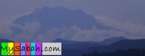 I have climbed the Mount Kinabalu the third time in September.
During the trip, I have taken over 200 photos along the Summit Trail and share them all in this web site.
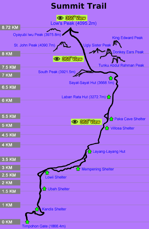
At the right is the map of the 8.72 KM summit trail to Mount Kinabalu. I have categorized the photo gallery
into 4 groups:
I have climbed the Mount Kinabalu the third time in September.
During the trip, I have taken over 200 photos along the Summit Trail and share them all in this web site.
At the right is the map of the 8.72 KM summit trail to Mount Kinabalu. I have categorized the photo gallery
into 4 groups:
- Photo Gallery 1: What you would see between 0 KM and 2 KM (until Lowii Shelter).
- Photo Gallery 2: What you would see between 2 KM and 4 KM (until Layang-Layang Hut).
- Photo Gallery 3: What you would see between 4 KM and 6 KM (until Laban Rata Resthouse).
- Photo Gallery 4: What you would see between 6 KM and 8.72 KM (until the Summit, Low's Peak).
Another good news is -- this is the FIRST time you can enjoy the Mount Kinabalu's magnificient scenery
in 360 degree, as if you are standing there looking at the surrounding. Just click the
![]() icon
on the map to enjoy the view.
icon
on the map to enjoy the view.
 |
   
|