 by
by Clouds seem to have unlimited forms. Actually they do have patterns, some are stunning to look at and try to tell (or warn) us about the weather. Let me show you eight types of interesting cloud types in Sabah and learn about their meteorological terms. After this you will be able to read the clouds like a farmer.
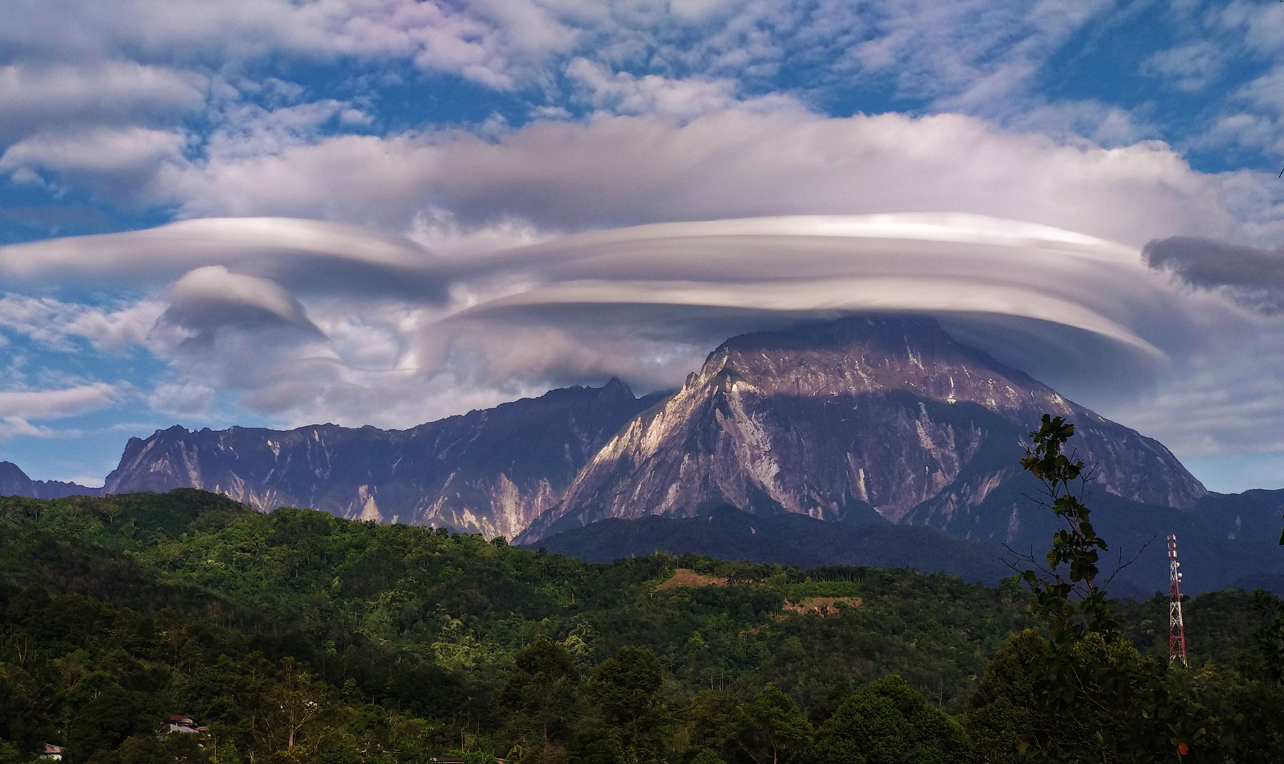
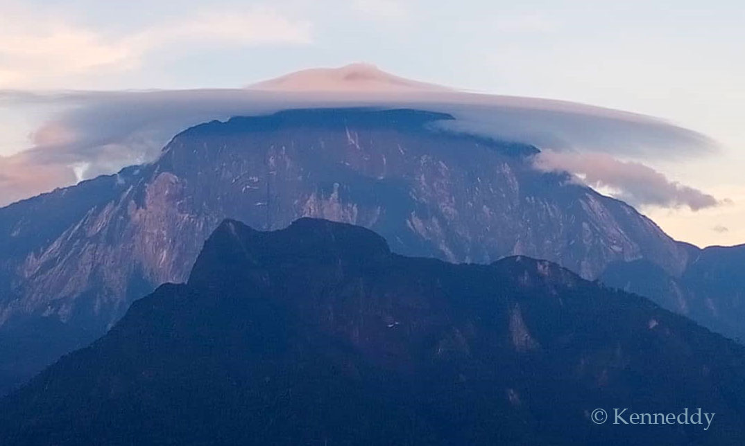
1. Lenticular Clouds
Sometimes a saucer-shaped cloud hovers like a UFO over the summit of Mount Kinabalu, as if the mountain is wearing a hat. It’s lenticular cloud, also known as UFO clouds and Wave clouds. To foodies, it might look like someone spray whipped cream on top of our mountain.
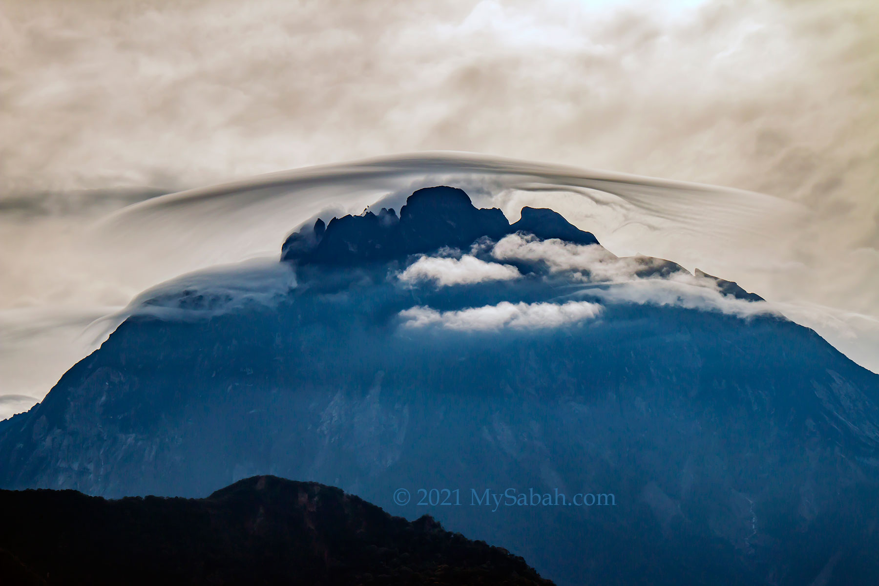
When local villagers see huge lenticular cloud on Mount Kinabalu, they know a drought is coming, and it’s time to put on their hats and work on the field. The lowland would experience hot days. However, to climbers, it’s freezing cold near the peaks.
Lenticular clouds are formed when warm and humid air flows through the cold mountain top. The air was pushed up and meet the cool temperature higher up, which causes the moisture in the air condensed to form clouds. If more wind keeps feeding damp air to the mountain, more clouds will form and pile on top of each layer like a stack of pancakes.
Though a lenticular cloud looks like still cloud, it’s constantly spinning and create strong turbulence. Aircraft would avoid flying near this windy cloud.
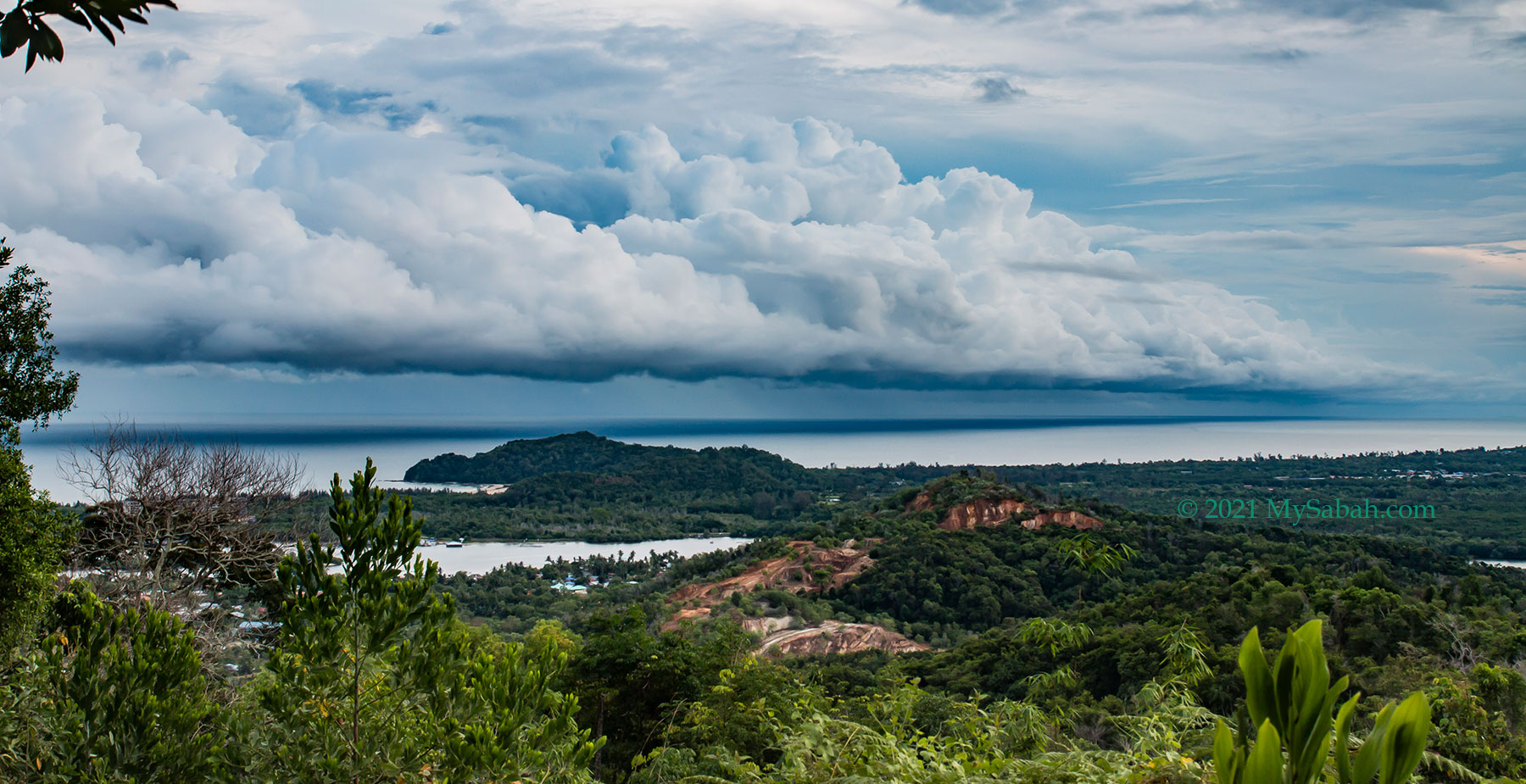
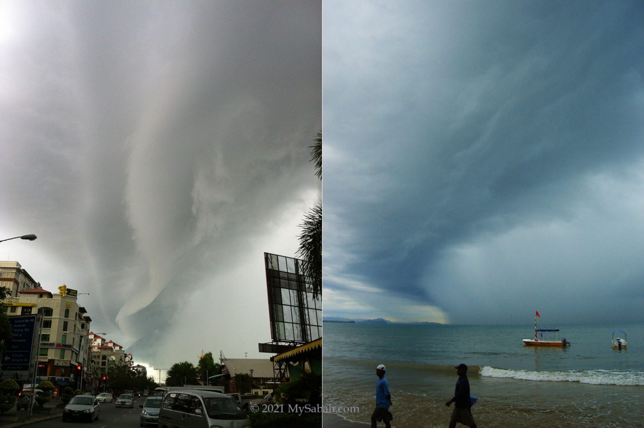
2. Shelf Clouds / Squall Line
Shelf cloud is the most recognisable cloud in Sabah. This cloud is a low and horizontal squall line of thunderstorms that is more commonly seen during Southwest Monsoon between June and September. Whenever we see shelf cloud coming, we will run for shelter before the strong wind and heavy rain start.

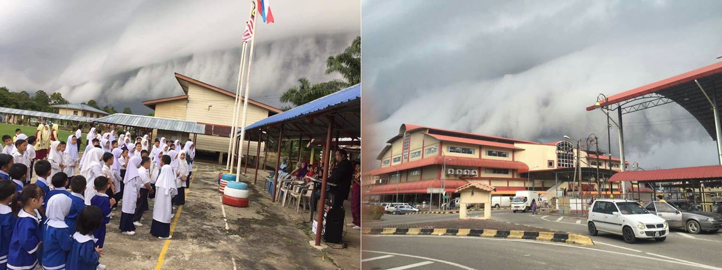
As most Sabah populations are concentrated around coastal cities, shelf cloud is nothing new to us. However, shelf clouds can be intimidating and ominous when it is massive, like the one freaked out everyone on 1 Jul 2022 and 12 Jun 2012, and made news headline in Sabah.
Shelf cloud can stretch for dozens of kilometres. Usually it develops during night on the sea, and sweeps landward in the morning. The cloud generates gusty wind up to 50 km/hour and rough seas with 3.5 Metres high waves. The abundant rainfall it carries could cause flood.
3. Mammatus Clouds
This cloud is quite rare and I only see it once or twice per year. It is my favourite because its distinctive bulbous protrusions looks like smooth and bubbly cotton balls. On 6 August 2021, I was happy to photograph one when the cloud was lit up beautifully by sunset.
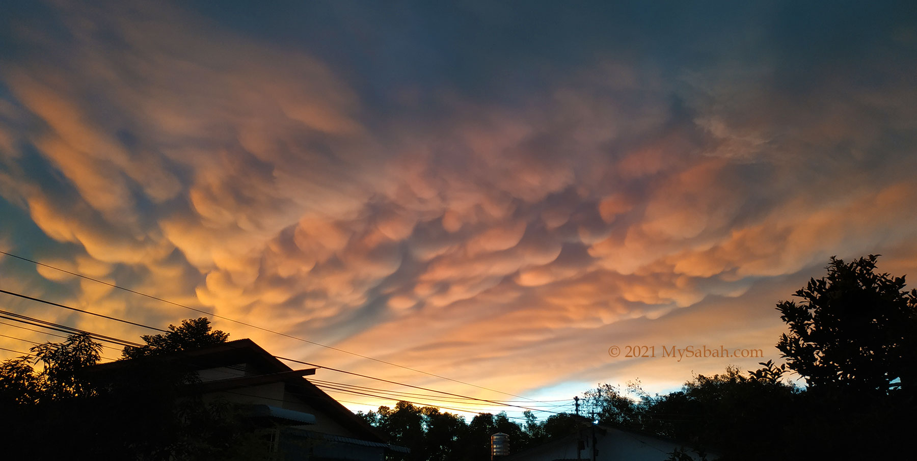
A bit of research told me that it is Mammatus, also known as mammatocumulus, which means “mammary cloud” or “breast cloud” in Latin word. I never view Mammatus cloud as a “tits cloud”. Anyway, it does resemble cow’s udders.
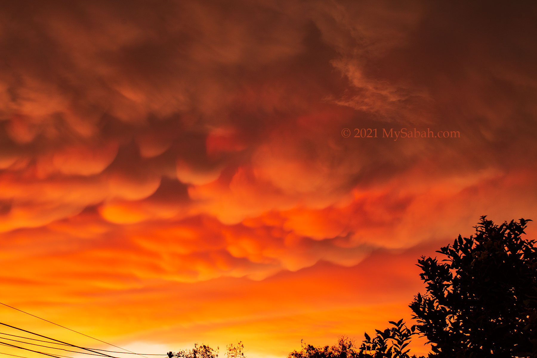
Mammatus clouds form when the ice crystals in the clouds vaporize in an unstable atmosphere. The cold and denser air sinks in pockets and creates a series of bulges or pouches emerging from the base of a cloud.
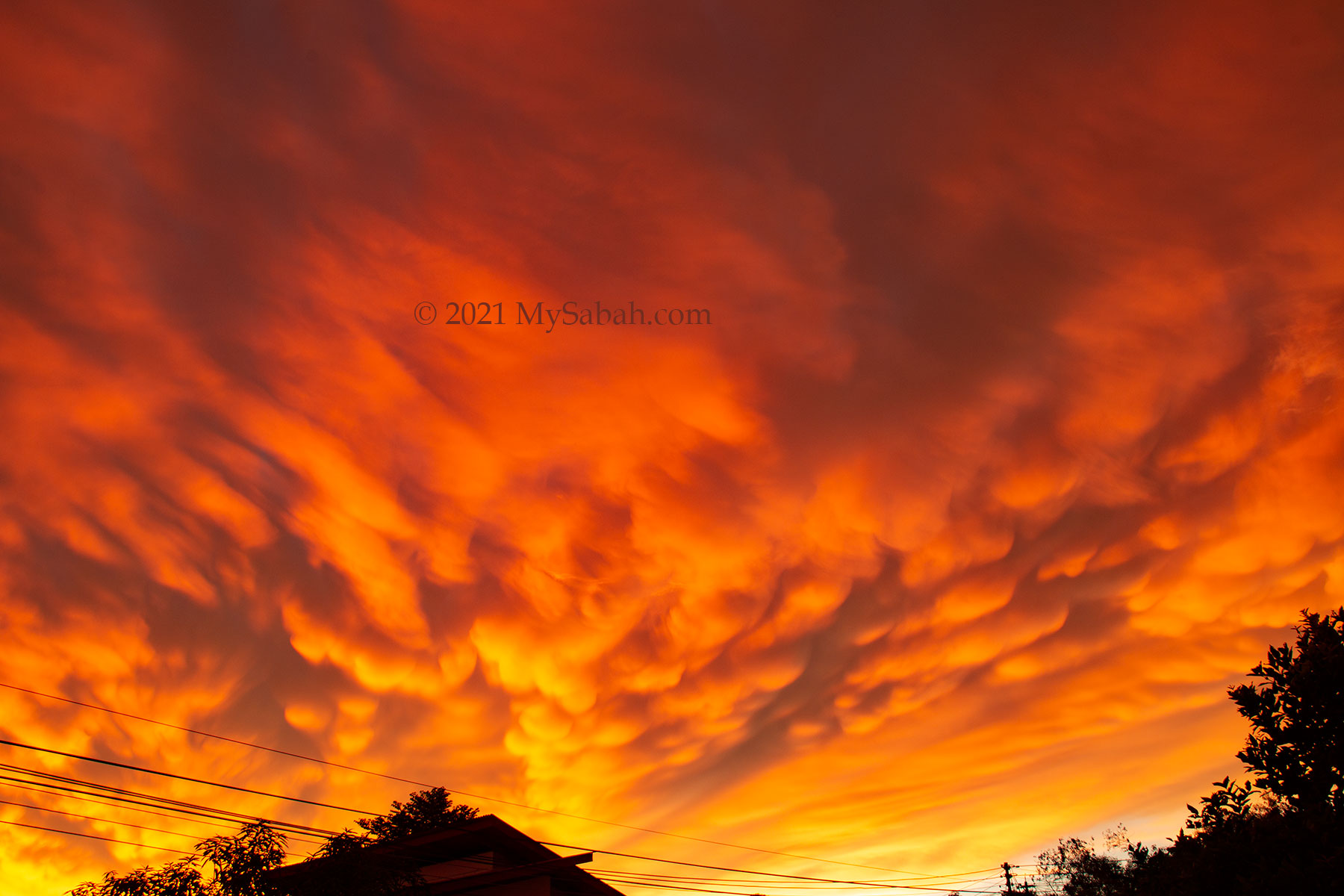
Mammatus cloud is a sign of an approaching stormy weather or there is a thunderstorm happens nearby.
4. Cirrocumulus
When hundreds of miniature cloud puffs (cloudlets) of cirrocumulus cloud spread out evenly, it creates the most poetic view of the sky. Cirrocumulus is high level cloud that is consisted mainly of ice crystals and floats above 20,000 feet during fair weather.
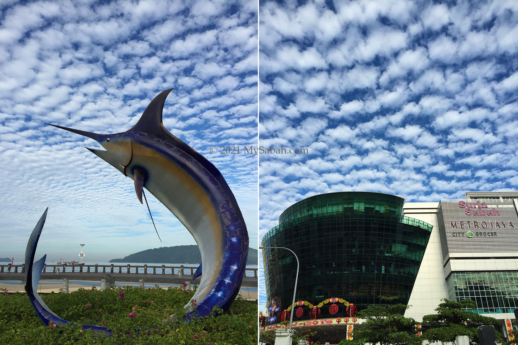
Cirrocumulus cloud is also called ‘Mackerel Sky’ because it looks like fish scales when grayish shades present.
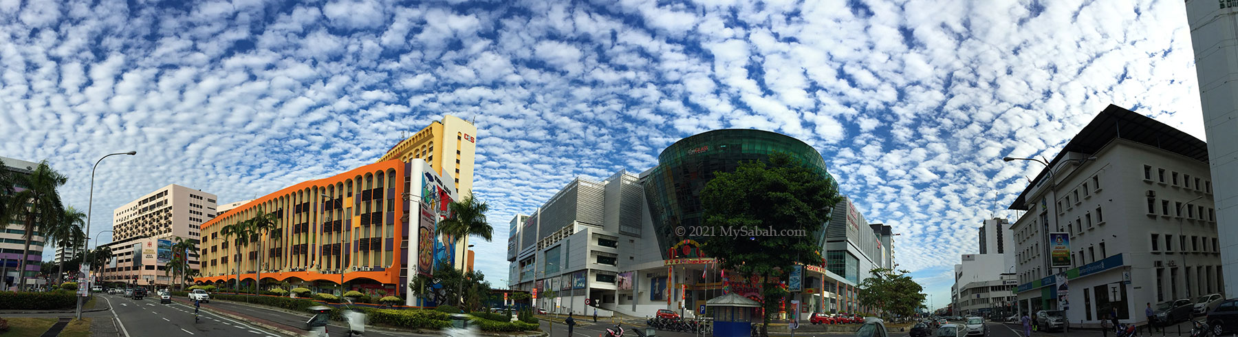
As a photographer, I’m always thrilled to see cirrocumulus cloud in late afternoon, because I can get the most dramatic sunset shots when the clouds are coloured by the twilight, as shown in the photos below.
5. Burning / Flaming Cloud
Burning or flaming cloud is not a meteorological term for cloud. Sometimes the colours of clouds turn reddish and golden during sunset, as if they are on fire hence the name. I spent over two months to photograph sunset at the same spot in Kota Kinabalu City, and you can see that Sabah sunset has rich variety of colours such as red, orange, yellow, pink and purple.

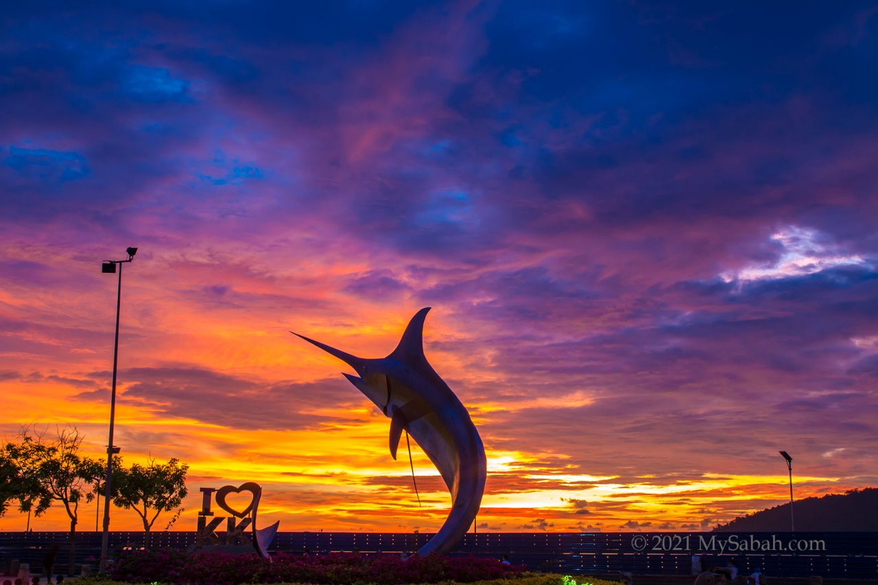
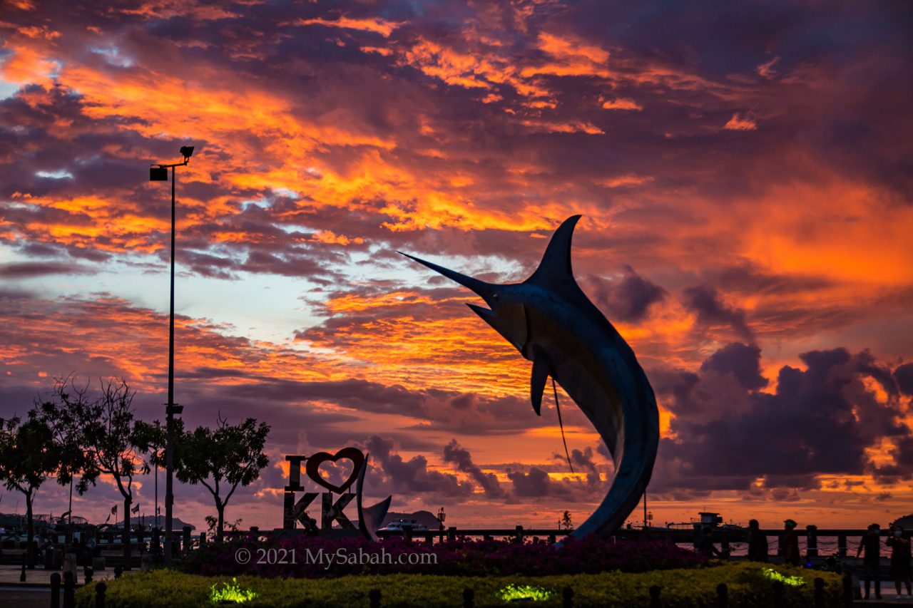
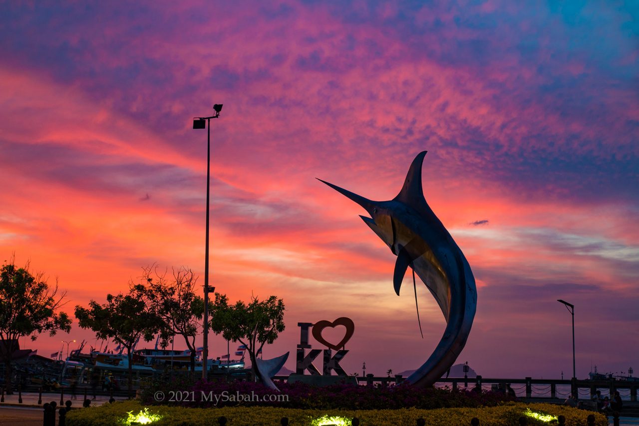
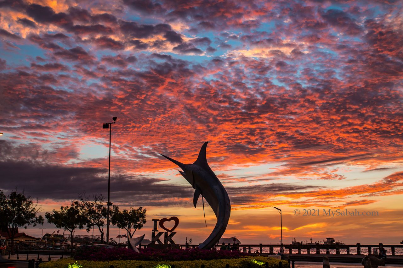
The clouds and the mix of colours really turn Sabah sunset into a marvelous scene of nature. However, you need some luck (and persistence) to hunt for a burning cloud sunset. Half of the time my camera lens only see a gloomy sky.
6. Cirrus
In sunny days, you would see strands of wispy and feathery clouds high in the sky. These cirrus clouds are named after the Latin word meaning “curl of hair”.
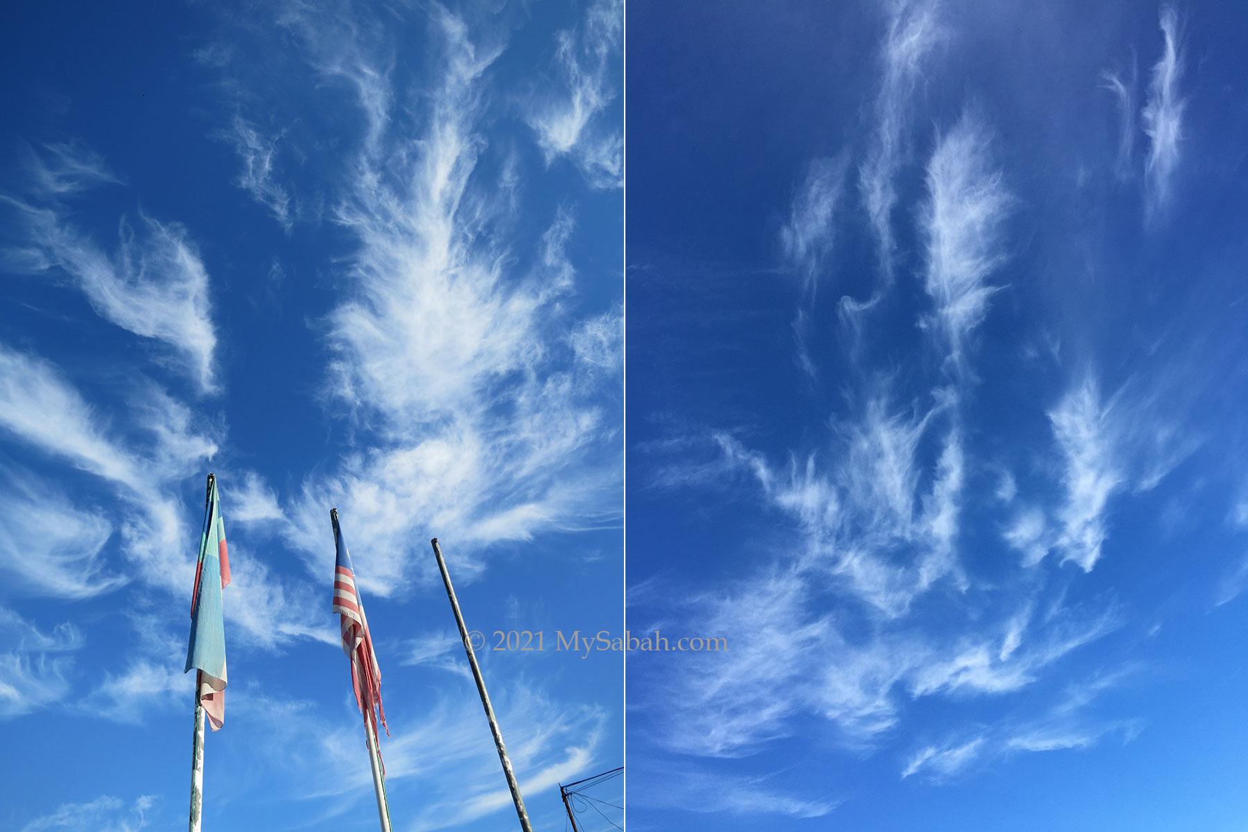
Circus clouds form at the highest altitudes (about 15,000 feet) in the troposphere so they are composed entirely of ice crystals. Then strong winds shred these clouds apart, giving them hair-like appearance.
7. Iridescent Clouds or Irisation
Irisation is an uncommon optical phenomenon named after the Greek goddess Iris, goddess of rainbows. When sunlight is diffracted through tiny ice crystals or water droplets in the thin cloud, the scattering light produces rainbow-like iridescent clouds, a type of photometeor.
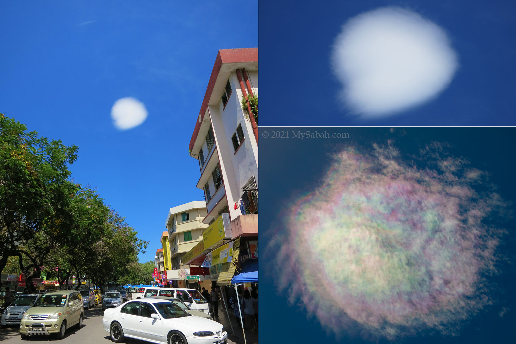
Normally iridescence happens near the sun. The colours can be very vivid and similar to mother-of-pearl. In Chinese mythology, rainbow cloud is the transport for deities (for example, Sun Wukong the Monkey King).
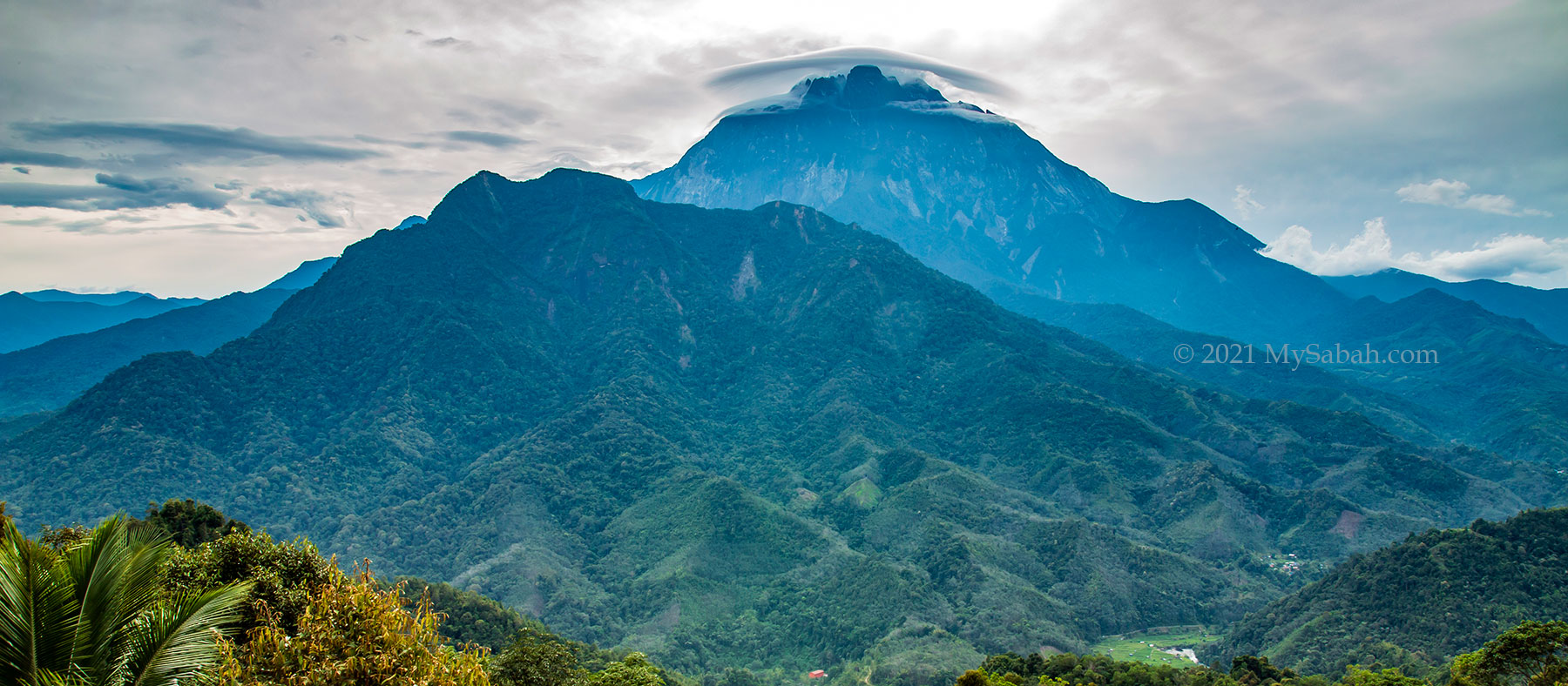
8. Cap Cloud (Pileus)
Sometimes clouds can be “fashionable” and wear a type of accessory cloud named Cap cloud or Pileus cloud, which is a small, lenticular cloud on top of a cloud. Cap cloud usually lasts only a few minutes and it’s an indicator of oncoming storms.
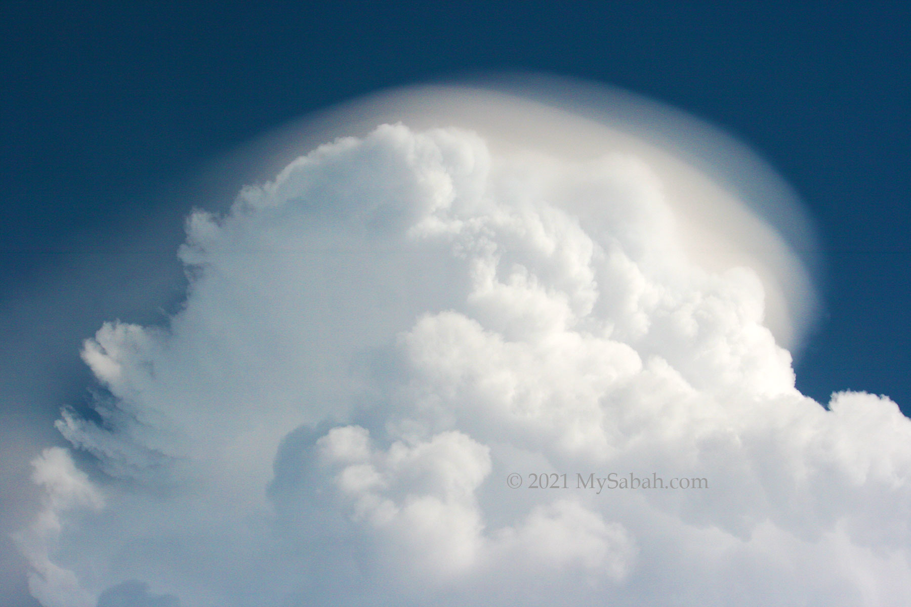
The presence of cap cloud shows that the cloud underneath is highly unstable due to strong updraft and heavy moisture, and the parent could rapidly develop into a rain cloud.
To relax and appreciate the wonderful things around us, it’s nice to “stop and smell the roses” occasionally. According to NASA, about 67% of Earth’s surface is covered by clouds at anytime, and most of them is concentrated near Equator, that’s where we live. Therefore, it is more practical to stop and look at the sky in Sabah. Don’t you think so?
Photos taken in Sabah, Malaysia Borneo


Very nice, brings back memories of my visits to East Malaysia. Bagus
Thank you Hans
Excellent article and beautiful photos. Thank you for the information.
Hi Albert, thanks for dropping by. 😀
Very interesting topic to write about. Loved the pics and description of various clouds.
Thank you ^^