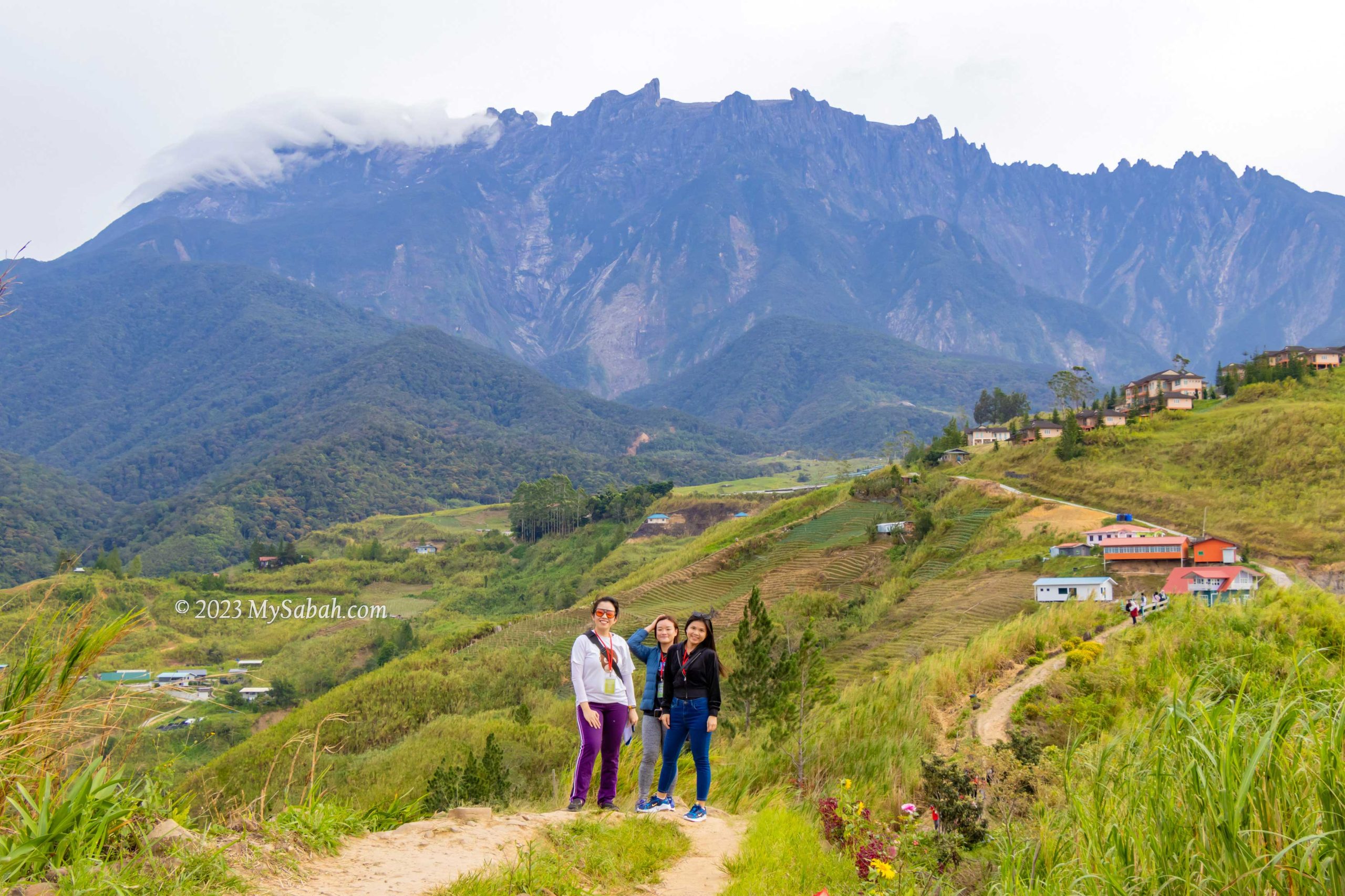
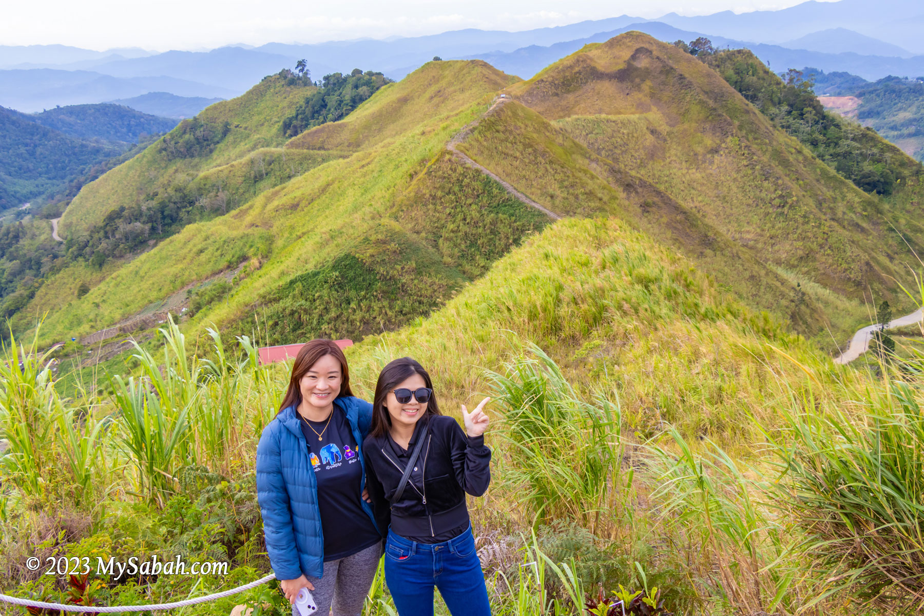
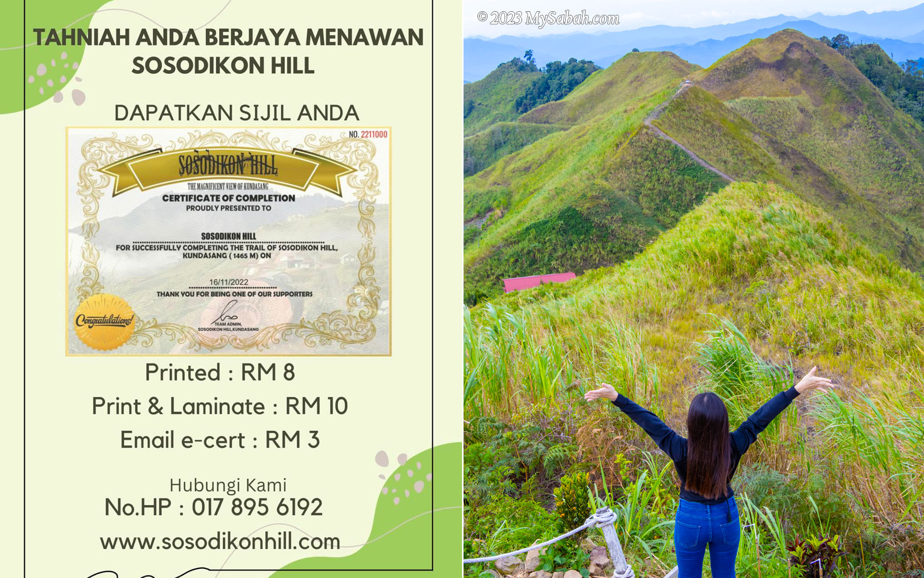
In only 10 minutes, you can conquer a peak that is higher than the highest mountain of Johor, Penang, Melaka, Negeri Sembilan, and Perlis States. I’m talking about Sosodikon Hill in Kundasang of Sabah, Malaysia. Anyway, most people climb Sosodikon Hill for the rewarding view, not the height.
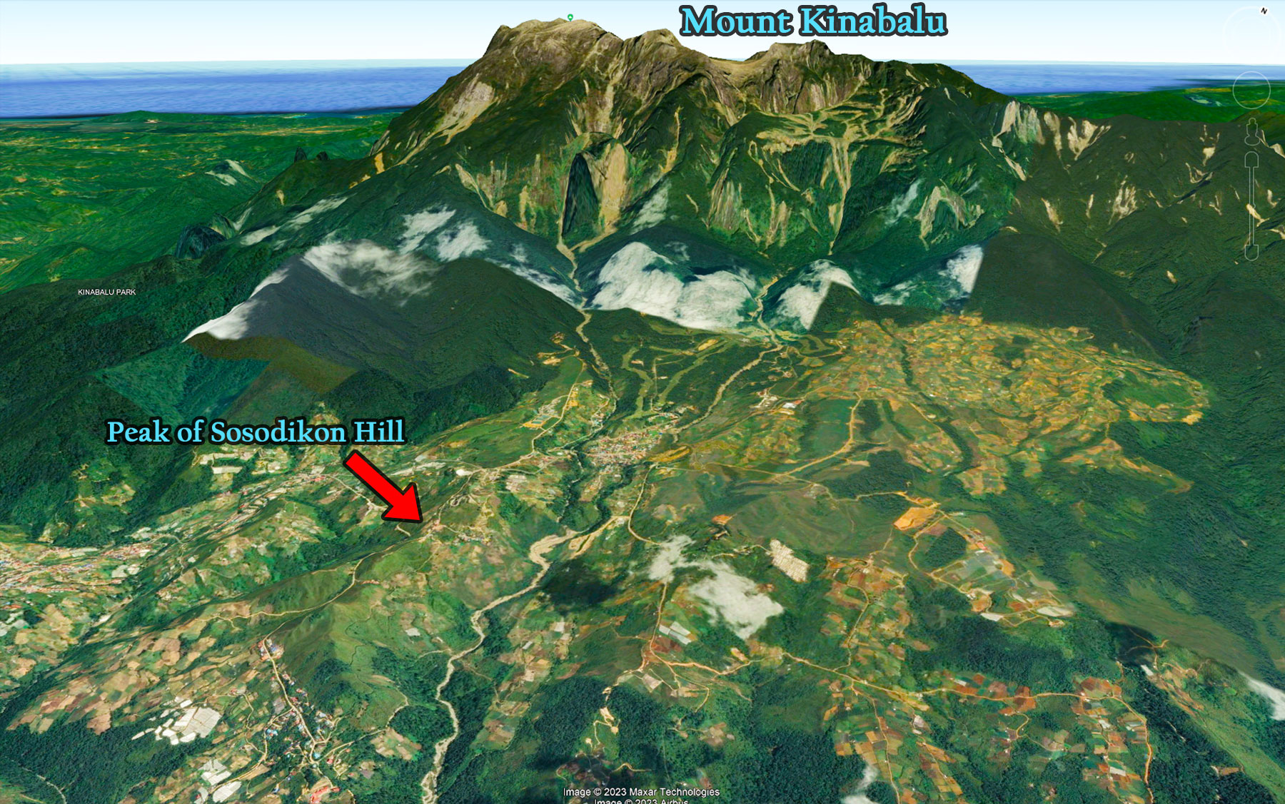
Location of the peak of Sosodikon Hill. The hill itself is on a highland that has an altitude higher than many mountains in Malaysia.
At an elevation of about 1,300 Metres (4,265 ft), Kundasang is the highest town of Malaysia. Kundasang is also the closest town to Mount Kinabalu, the highest mountain of Malaysia, and only 6 kilometres away from Kinabalu National Park, the second UNESCO Global Geopark of Malaysia. Coupled with cooling weather, this highland town is a popular vacation spot for local and foreign tourists.
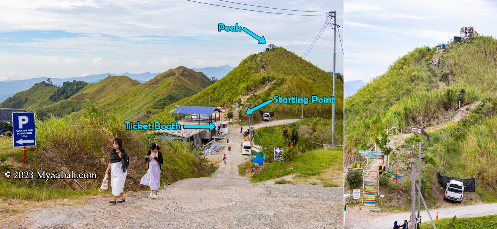
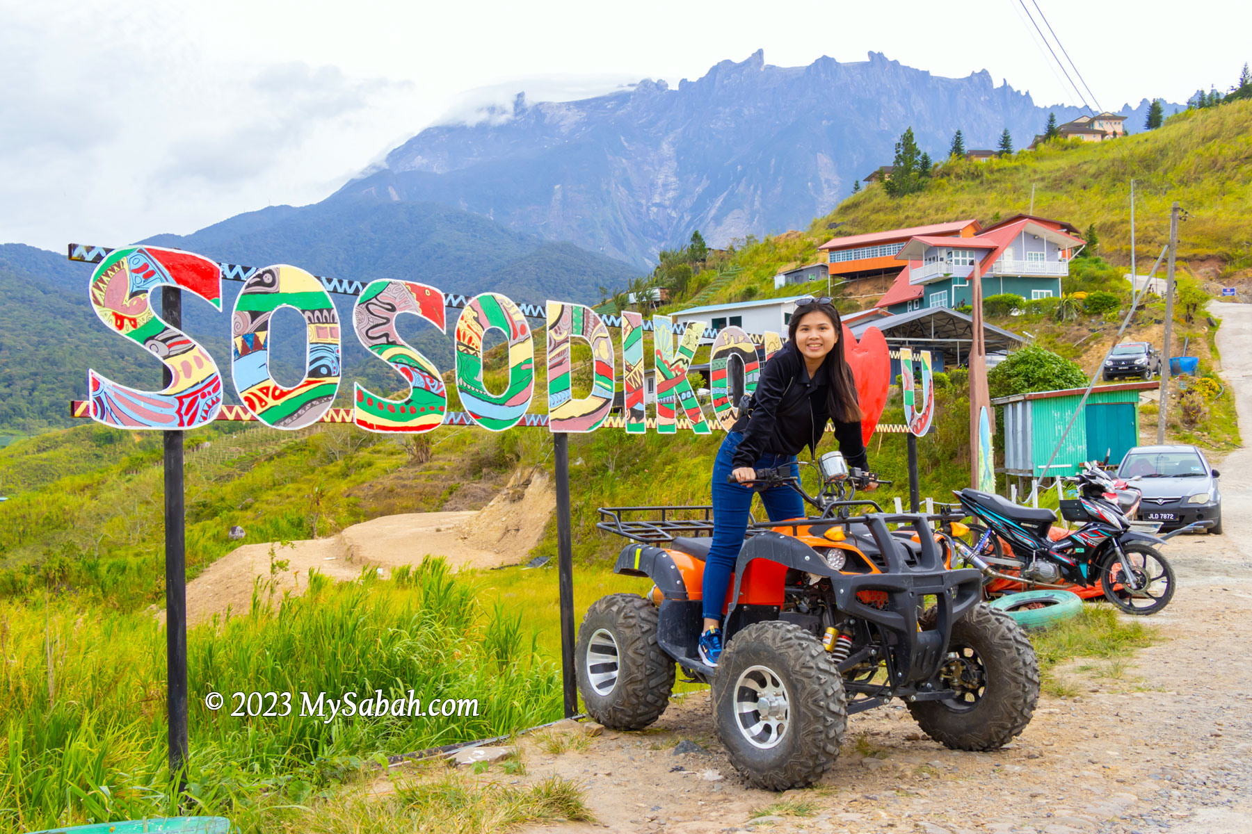
Parking, starting point and ticket booth at Sosodikon Hill, which is situated on a gently-sloped plain of Pinousuk tilloid deposits originating from glacial-eroded boulders during the last ice age about 10,000 years ago in the tropical region.
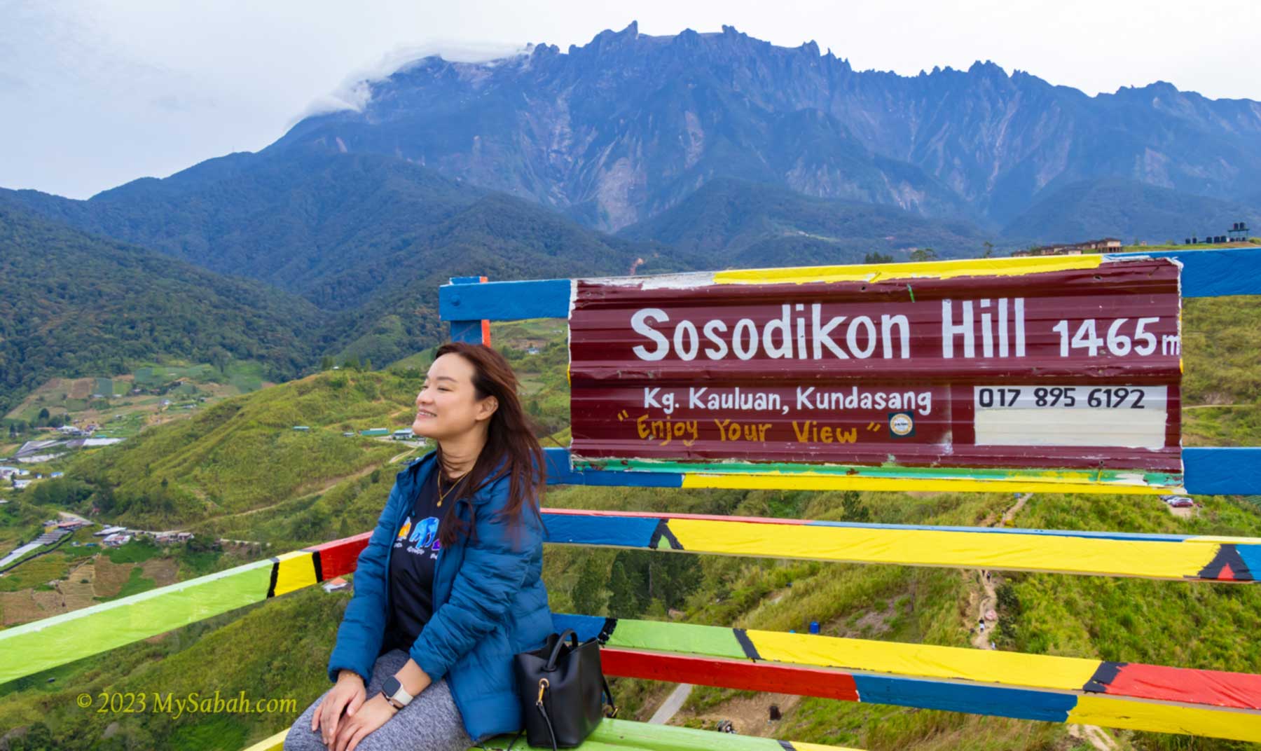
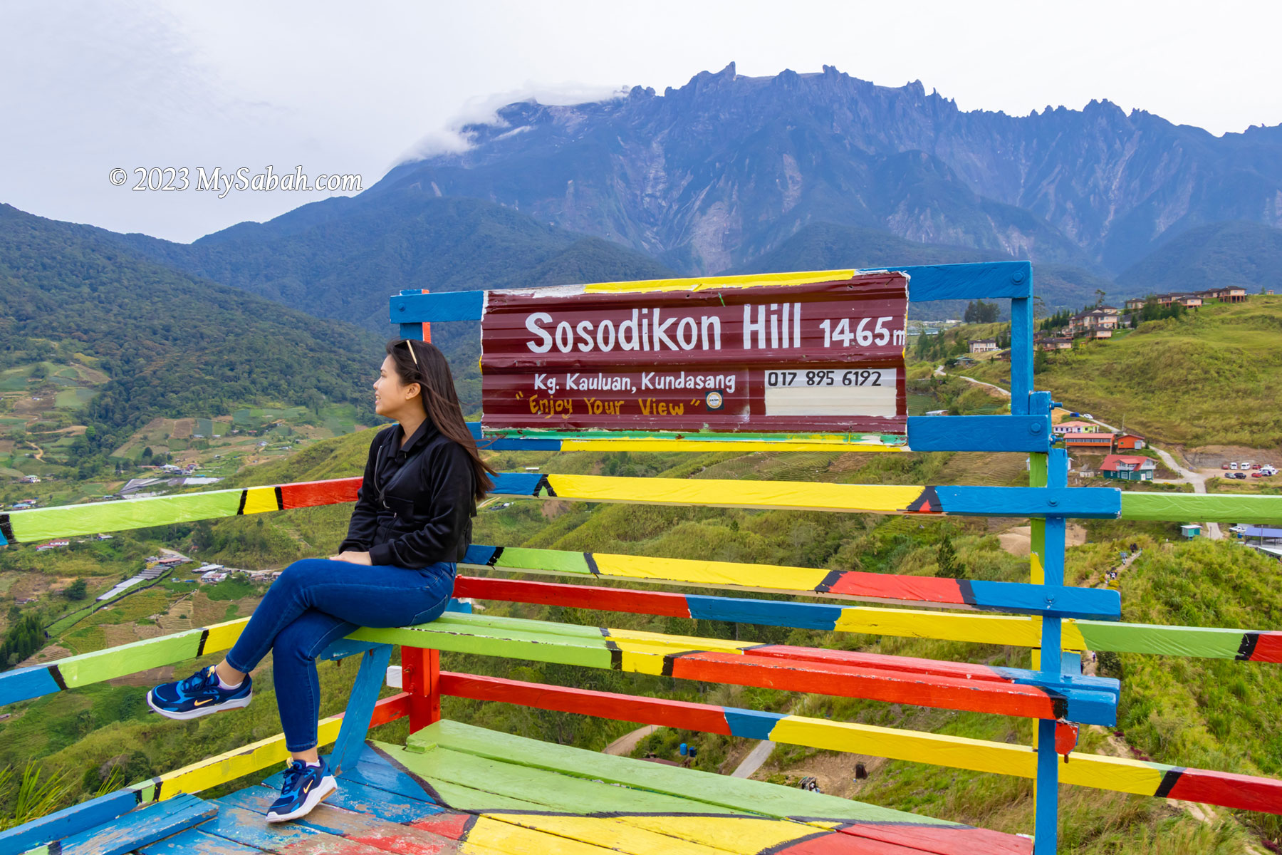
The altitude of Sosodikon Hill is 1,465 Metres (4,806 ft) above sea level. Sound really tall right? Actually, if measured from its foothill, Sosodikon Hill is only about 70 Metres (230 ft) tall. Nevertheless, its peak allows you to have a panoramic view of Mount Kinabalu and Kundasang Valley.
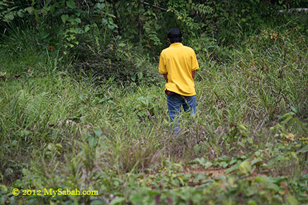
Starting point of the hike to Sosodikon Hill
Some local Chinese like to make fun of the name “Sosodikon” because it sounds like “傻傻地看” (means staring foolishly) in Hakka dialect (no offense). Actually Sosodikon means “a place for laying traps” in Dusun language. When Sosodikon Hill was covered by thick forest in the past, the villagers frequently set traps there to hunt for wildlife such as deer and birds.
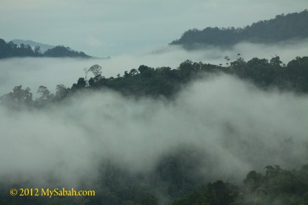
In clear day you can see Mount Kinabalu in the morning, before it’s covered by cloud after 8am
Is Sosodikon Hill worth a visit? Yes, if you love to take some beautiful photos of Mount Kinabalu and Kundasang Valley. You can frame a lot of things in the photos taken from the highest point of Kundasang. After all, the hike is so easy and take less than 15 minutes.
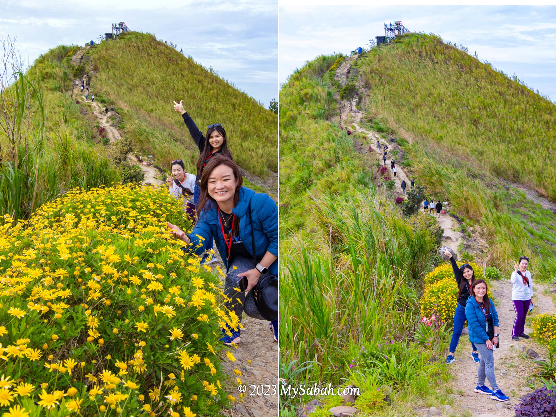
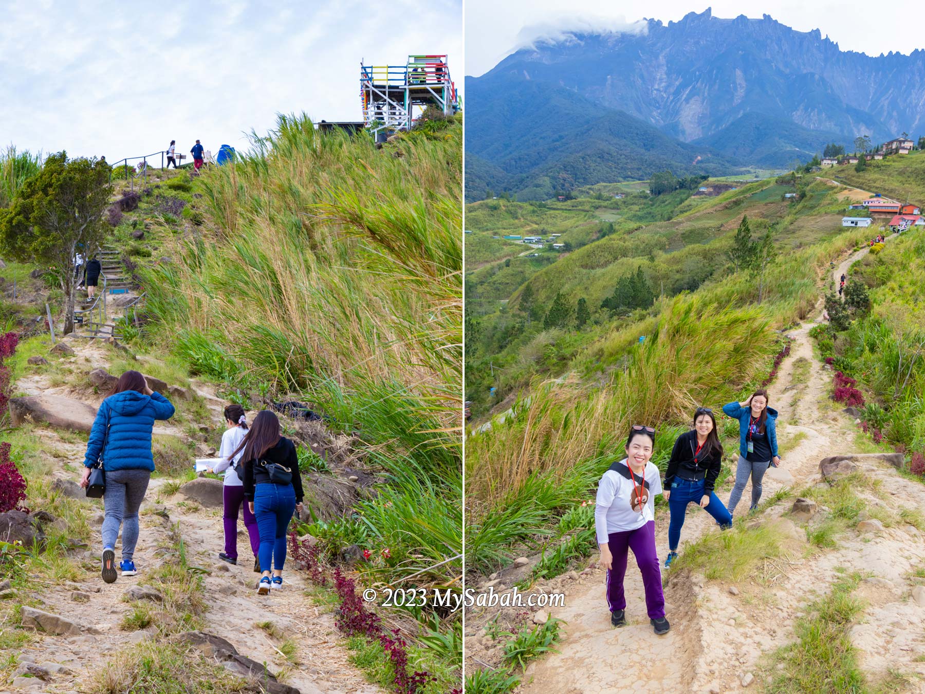
Do slow down to appreciate the flowers and ornamental plants along the trail
However, you are advised to reach the peak before 8am, the time Mount Kinabalu is still visible. In most days, Mount Kinabalu would be covered by dense cloud after 9am. If it’s misty or raining, climbing Sosodikon Hill may not worth your time.
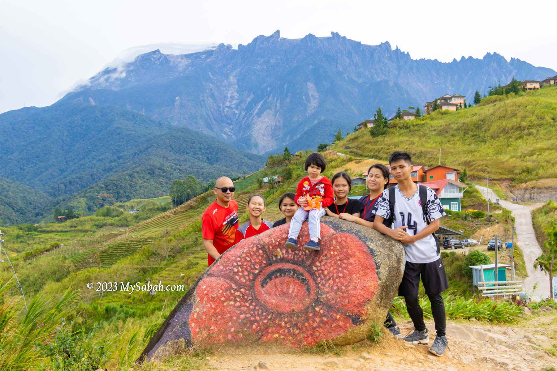
Rock painted with rafflesia flower on the trail
Sosodikon Hill (see Location Map) is about 98 Kilometres from Kota Kinabalu City and quite accessible. If you plan to visit DESA dairy farm, you may include Sosodikon Hill in your itinerary as both places are near to each other. The road to the starting point is mainly paved road in ok condition. The last 800 Metres away from the main road to the starting point is a narrow cement and gravel road (no 4WD required).
It takes only 15 minutes or less to reach the peak of Sosodikon Hill
There are some parking spaces for cars within walking distance to the ticket booth, which is open from 6am to 5pm every day. You will be given a pass card after you pay the entrance fee, then you can start climbing the hill. No guide is required. The following is the entrance fee per person in Malaysian Ringgit:
Malaysian Adult (13 years old and above): RM5.00
Malaysian Child (7-12 years old): RM3.00
Foreigner Adult: RM10.00
Foreigner Child: RM5.00
Free admission for children 6 years old and below
Walk-in tourist is welcomed and no advance booking is needed. You may use the small toilet next to the booth before or after the hike.
Pyramid Hills at another side of Sosodikon Hill
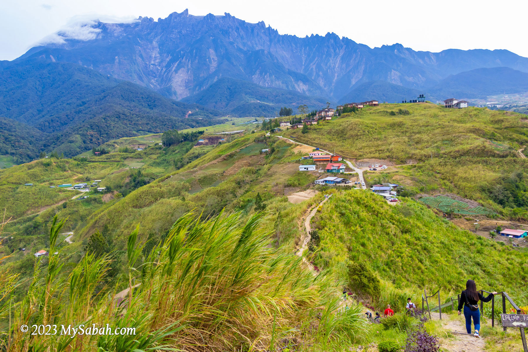
The 300-metre trail to the peak is a well trodden soil path. As the trail isn’t very steep, you can walk up, without much climbing, to reach the peak between 10 to 15 minutes. Though it’s an easy short hike, you may walk slowly to enjoy the view. They planted some flowers and installed some decorations along the way.
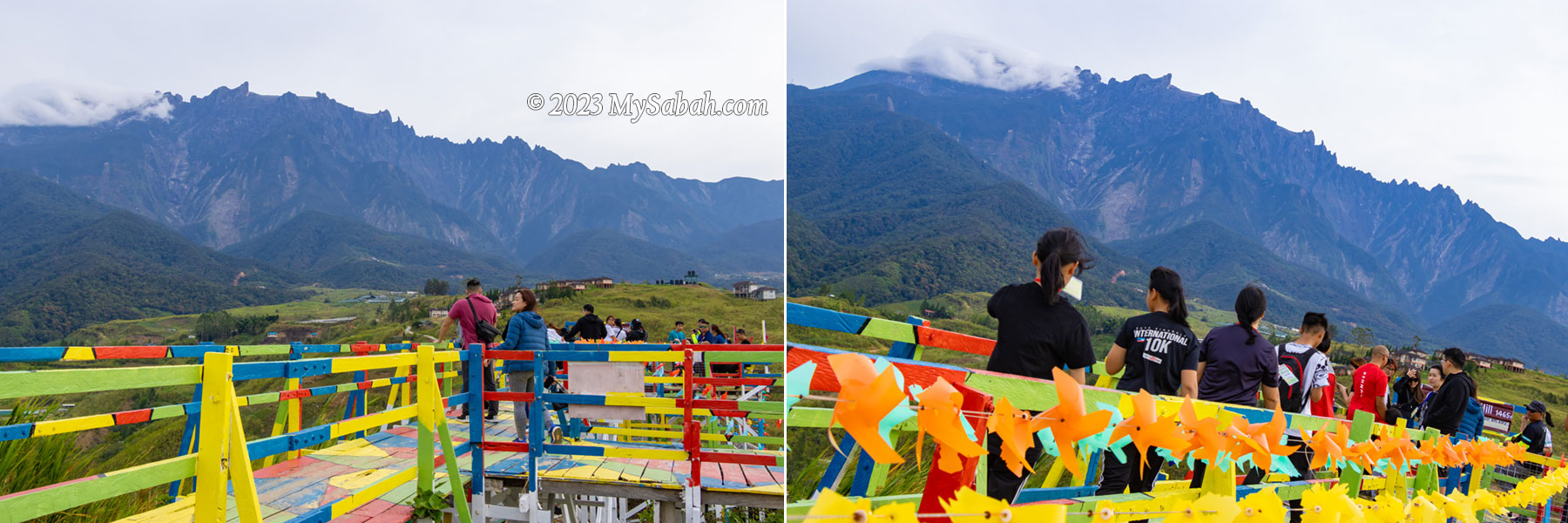
Viewpoint platform on the peak of Sosodikon Hill. It could be a long queue during weekends and holidays.
The view of Mount Kinabalu was so breathtaking that I kept stopping to take some photos. The view got nicer and nicer when I was moving up. The weather was cooling and the morning sunlight was soft. This hill is mainly grassy slope with very few trees that offer shade, so you better apply sunscreen if you climb in the afternoon. It’s quite windy on top so please put on a jacket for a more comfortable walk.
Enjoy the view on the peak of Sosodikon Hill
The ending point is a colourful wooden platform with boardwalk on the highest point, where you can have a 360° view of Kundasang Valley under the majestic Mount Kinabalu.
View from the peak of Sosodikon Hill. The light blue building is the starting point.
Besides Mount Kinabalu, the rolling Pyramid Hills at another side is scenic as well. Pyramid Hills is an example of triangular facets (or faceted spur), a geomorphic feature produced by active fault movements that started 15 million years ago from the ongoing collision in Sabah. Stream erosion passing through the fault scarps create the triangular-shaped cliff face.
You can order the certificate of conquering Sosodikon Hill. For achiever only!
Unfortunately, some farmland has creeped into the foothill of Pyramid Hills. I hope the locals will spare these green hills from agriculture and development. In fact, due to land clearing, the temperature of Kundasang has risen to 18 to 30 Celsius now, compared to 10-18 Celsius before 1990. People should learn not to repeat the bad consequences that happen to the overdeveloped Cameron Highlands in Peninsular Malaysia.
You can try the ATV (all-terrain vehicle) at the foothill of Sosodikon Hill
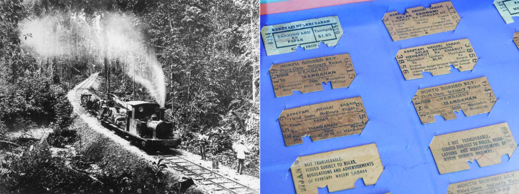
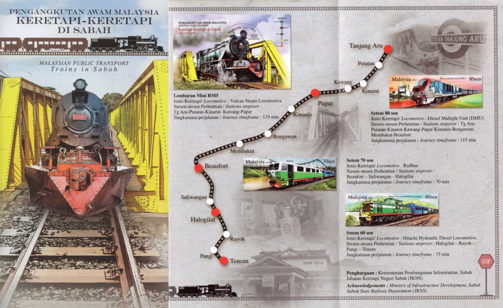
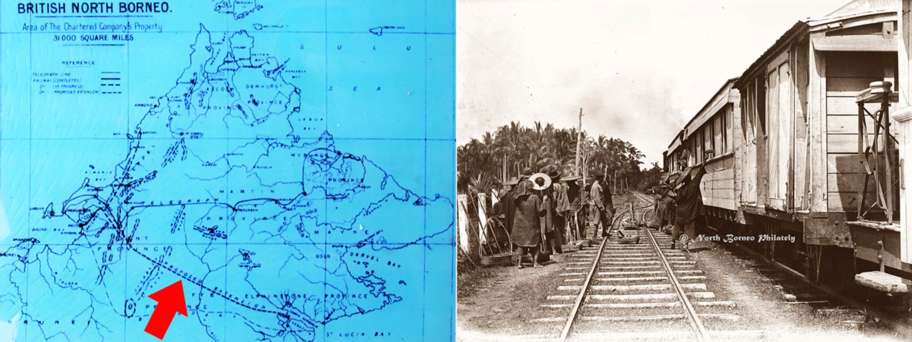
From 1888 to 1963, Sabah (then North Borneo) was colonized by British empire, as part of their economy plan to build a kingdom that never sleeps. The construction of railway in 1896 is a major development that transformed the wild West Coast of Sabah into a belt of prosperity.
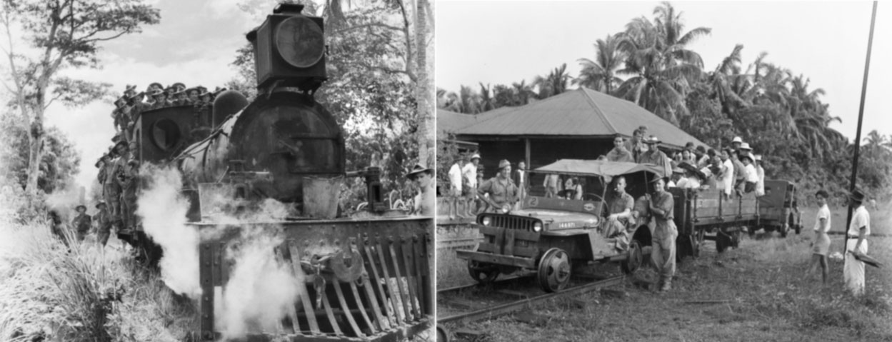
Left: The first train in North Borneo (photo taken on 3 Feb 1898). Right: the train tickets of old days (displayed in the Train Gallery of Sabah Museum)
Having more productive lands means earning more wealth, the 134-kilometre Borneo railway helps to open up more lands and forms the lifeline of west coast. Cargo after cargo of tobacco, rubber, paddy, coffee, timber and other agricultural products were transported from the fertile inland to the harbour of Jesselton (now Kota Kinabalu City or KK). Colonial townships such as Kinarut, Papar, Beaufort and Tenom also sprouted up along the railway.
Stamps of “Trains in Sabah”, issued on 28 Dec 2015 by POS Malaysia. The yellow steel bridge in background is a historical structure in Papar town.
The success of the tobacco industry between 1880 and early 1890 created a high demand for land, so was the rubber bloom in early 1900s. Thousands of China immigrants were imported into North Borneo in early 19th century to construct the railway and to farm on the new lands. North Borneo Railway has been operating until today and still remain as the only railway on Borneo island.
Left: the train service would be extended to Tawau in east coast in initial plan. Right: Food sellers (usually selling boiled eggs and dumpling) at the Papar train station (photo taken by G.C. Woolley on 27 May 1910)
Though it’s renamed to Sabah State Railway after the formation of Malaysia, locals always view it as a legacy of British. Our great grandparent generations always have a lot of stories to share about the locomotive steamer, which holds a special place in their hearts. Indeed, North Borneo railway is a memory lane with history that involves Bruneians, British, Japanese, Australians and forebears of Sabah Chinese.
The hundred-year-old North Borneo railway is a memory lane full of stories
“It is a well known fact that wherever the British went, they planted flowering trees as well as built railway lines.” — Chung Mui Kong, “Little Snapshots”
North Borneo Train Tour
Though Sabah’s railway towns are quiet and peaceful places nowadays, they were flourishing and eventful towns in the past. The North Borneo Train Tour is like a time machine trip that brings you back to these places full of stories, some with tears and blood. The locals can join this nostalgia and fun ride to learn the past.
Left: coffee break before departure. Right: start of North Borneo train tour to experience the bygone era of British North Borneo
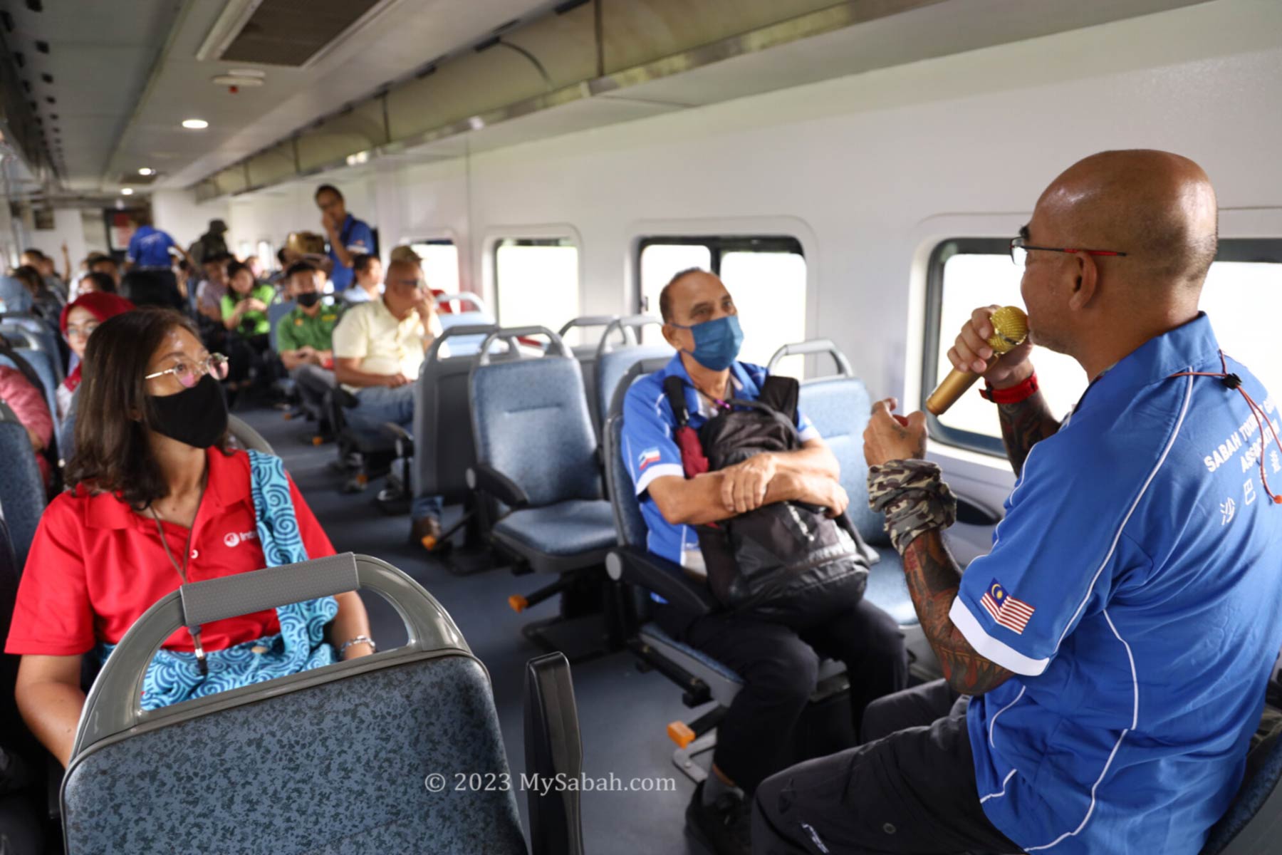
If you haven’t been on a train ride, it’s a must-try (do bring your kids). The half-day tour starts at 8am at Tanjung Aru train station. Before boarding you will enjoy some Sabah coffee and light refreshment. Professional tour guide(s) will join you onboard as the storytellers who connect you to the happening along the railway.
Professional tour guide sharing the stories and history of North Borneo railway and towns
The passenger carriages are air-conditioned with comfortable seats. You can enjoy the scenic countryside view through the glass window. In old days, the passengers would not wear white shirt because it would be smeared by ashes from steam engine that was powered by burning firewood. The following are some interesting landmarks and major happening being shared.
“If history were taught in the form of stories, it would never be forgotten.” — Rudyard Kipling
Petagas
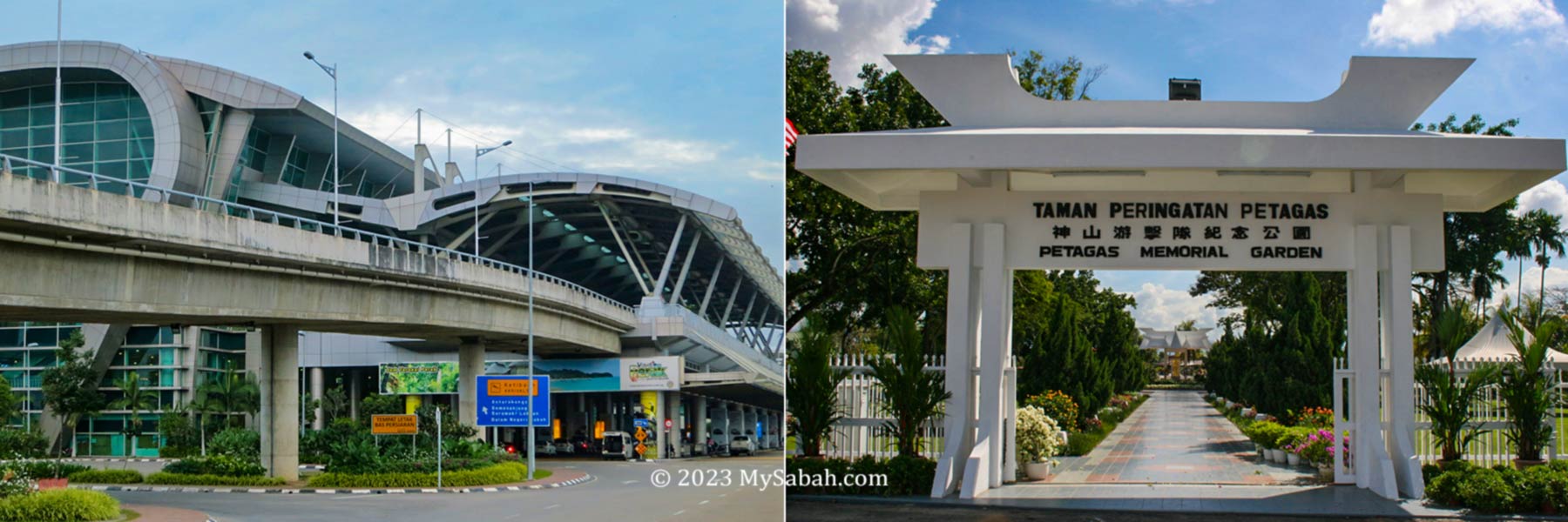
The Kota Kinabalu International Airport (KKIA) would be the first landmark that catches your attention. KKIA receives million of visitors every year and it is the busiest airport on Borneo island. Over 90% of tourists come to Sabah by air.
Left: Kota Kinabalu International Airport (KKIA). Right: Petagas Memorial Garden
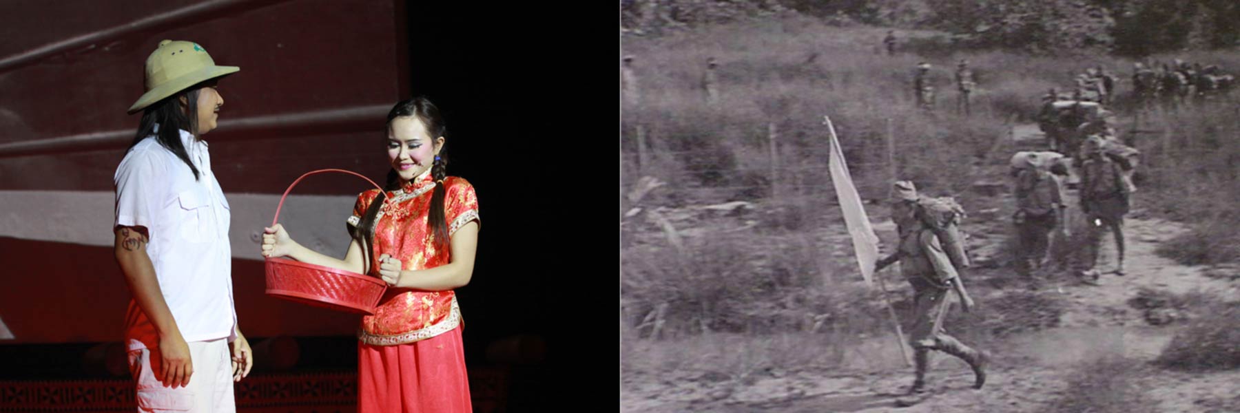
Opposite to KKIA is Petagas War Memorial Garden with temple-like white arch. In 1944 during World War II, a group of 176 Kinabalu guerilla members launched Double-Tenth Revolt to fight Japanese for control over Jesselton. Unfortunately, their victory didn’t sustain, and they were captured and transferred by this railway to this memorial site to be executed on 21 Jan 1944.
Kinarut
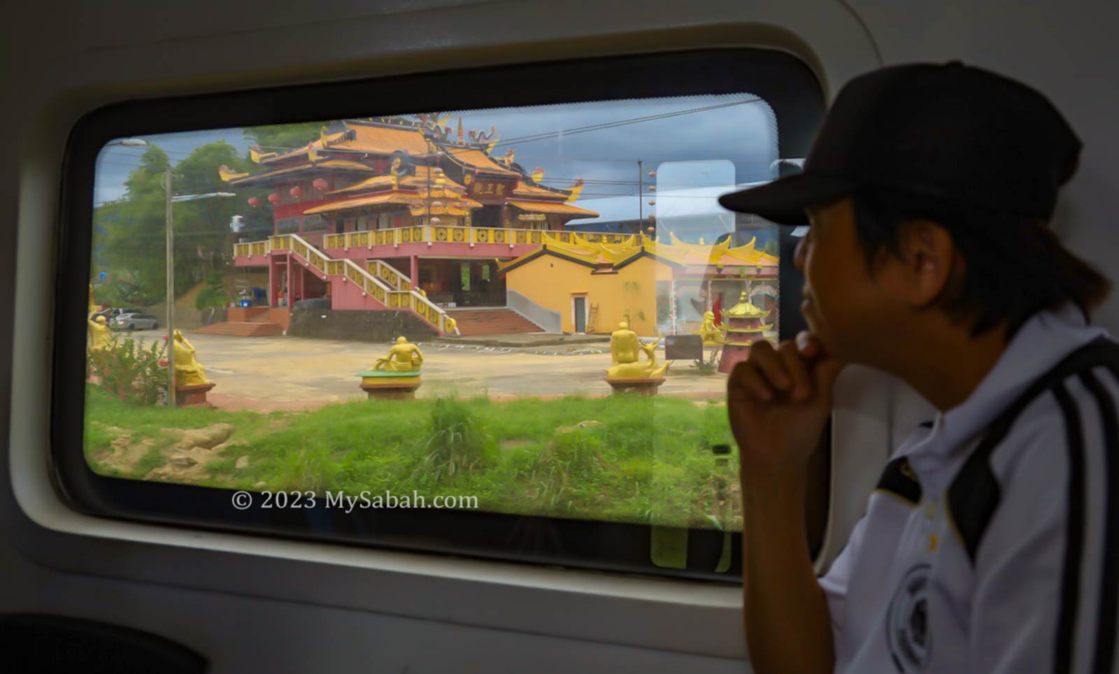
The name Kinarut derived from the words ‘China Road’. From the train, you can see the large Tien Nam Shi Toaism Temple (镇南寺) that worships Guang Ze Zun Wang (广泽尊王). Chinese immigrants didn’t have an easy life in Borneo. In some estates, their mortality rate could reach 40% due to ill treatment and poor living environment. Religion would offer them some comfort.
Tien Nam Shi Temple (镇南寺) of Kinarut
From Kinarut, you will start to see more old wooden shoplots. Most residents are Kadazan, Dusun, Bajau, Bruneian Malay and Chinese, they constitute the main coastal tribes on the west coast of Sabah.
Left: The North Borneo train was an important transportation during World War II. Right: a jeep train carrying troops and locals at Kinarut station
Kinarut is like a nobody town today but it was once an important base of Brunei Kingdom. In the late 17th century, due to civil war, Sultan Abdul Hakkul Mubin fled to Sabah and built a base in Kinarut. He remained there for ten years as the Sultan of Kinarut, and with the help from local Bajau and Dusun people, he managed to counter several attacks from Sultan Muhyiddin. The remains of his fort still can be seen in Kinarut river during low tide.
Kawang
In 1885, a group of British officials were on a hunt to search for a Murut chief called Kandurong. At that time, Kinarut was still under the Brunei sultanate, and there were tensions between the British officials and Kawang villagers.
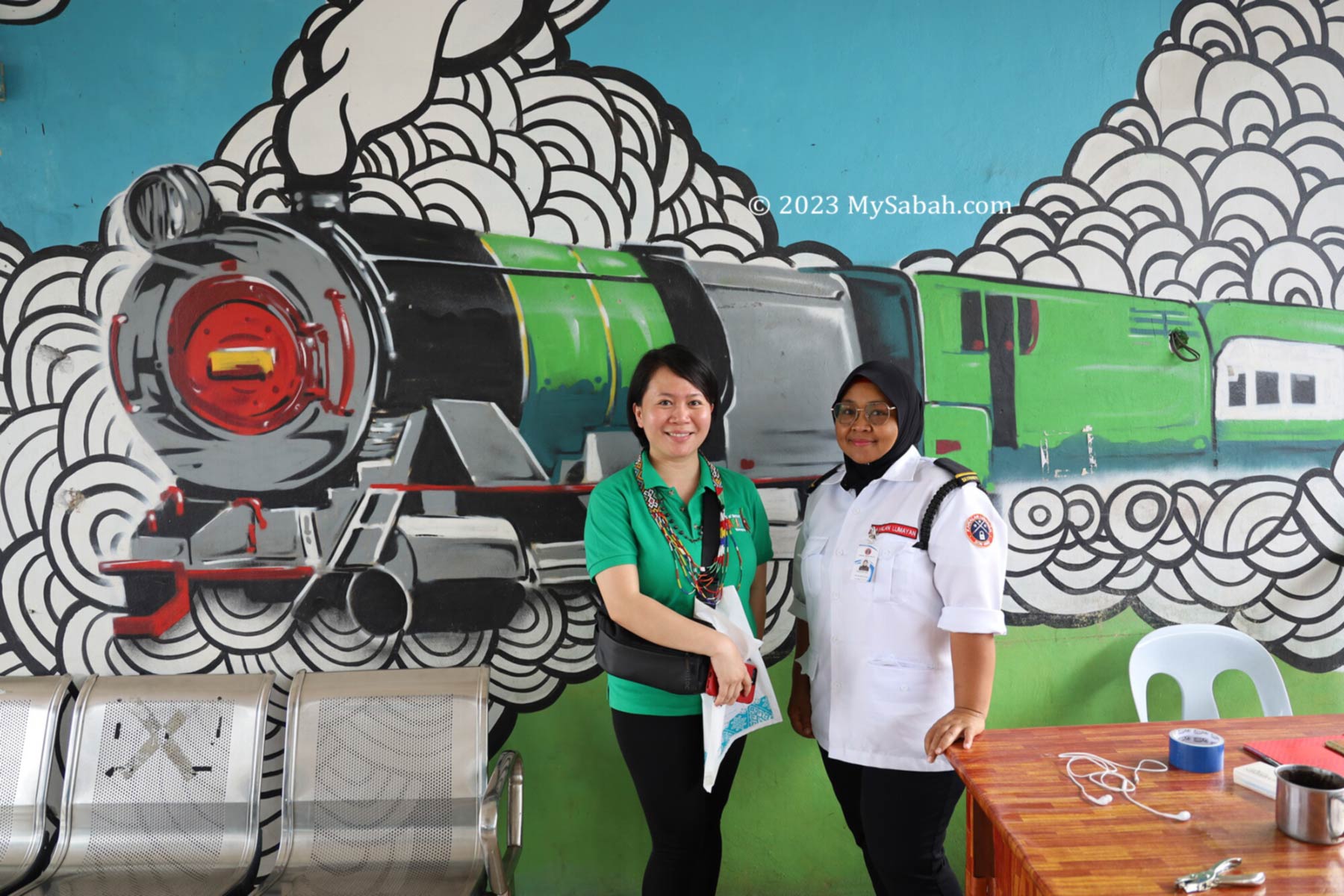
Mural at Papar train station. The train in the drawing is an old locomotive powered by steam and made by Leeds (England).
They were ambushed and attacked by the local Bajau villagers. Five members of the police force lost their lives, which included Captain de Fontaine, Dr Fraser, Jemadhar Asa Singh and two Sikh officers. The De Fontaine Monument was elected in Kawang as a remembrance of this incident.
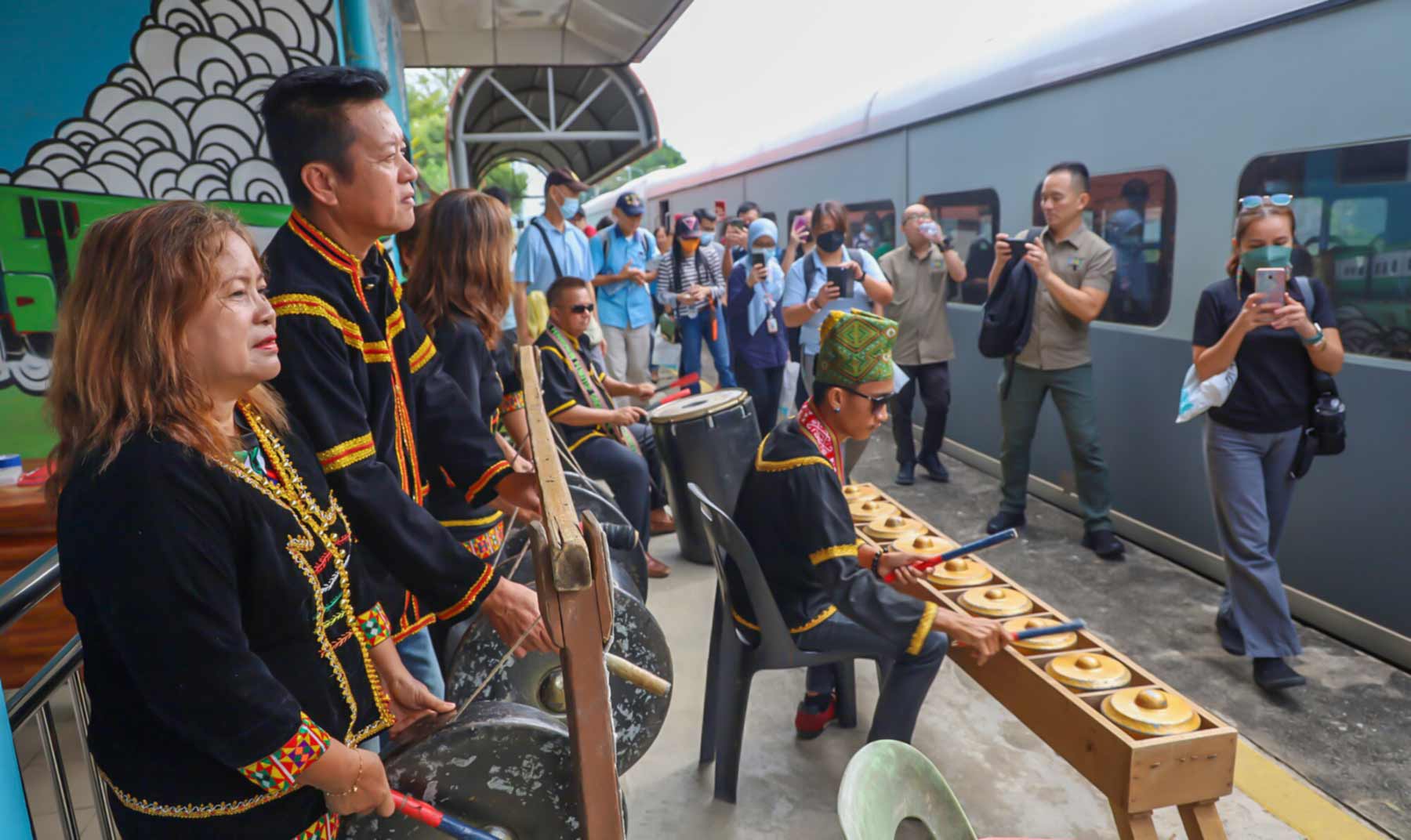
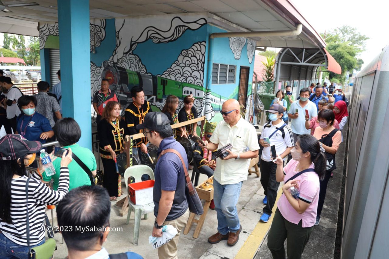
Papar cultural troupe welcomes the passengers of North Borneo train tour with traditional music
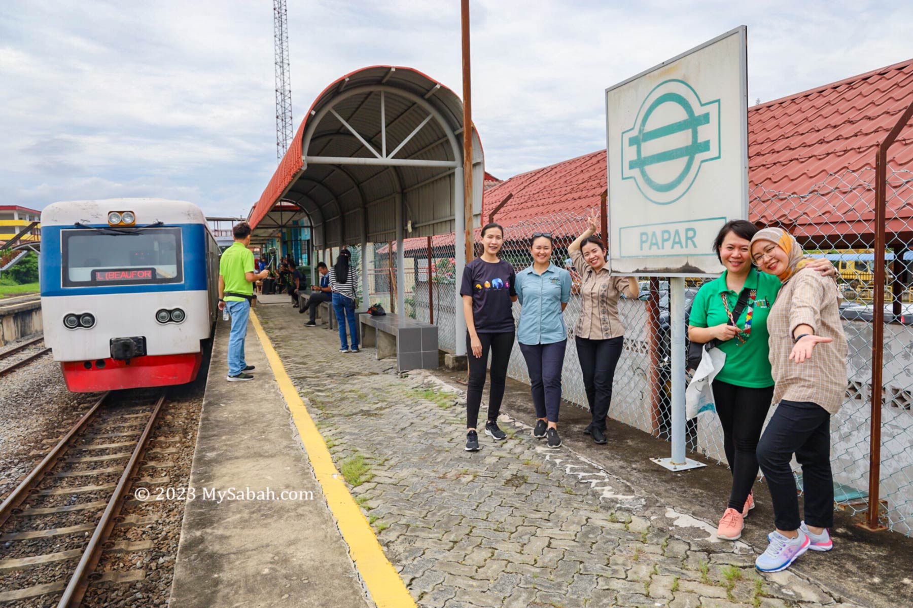
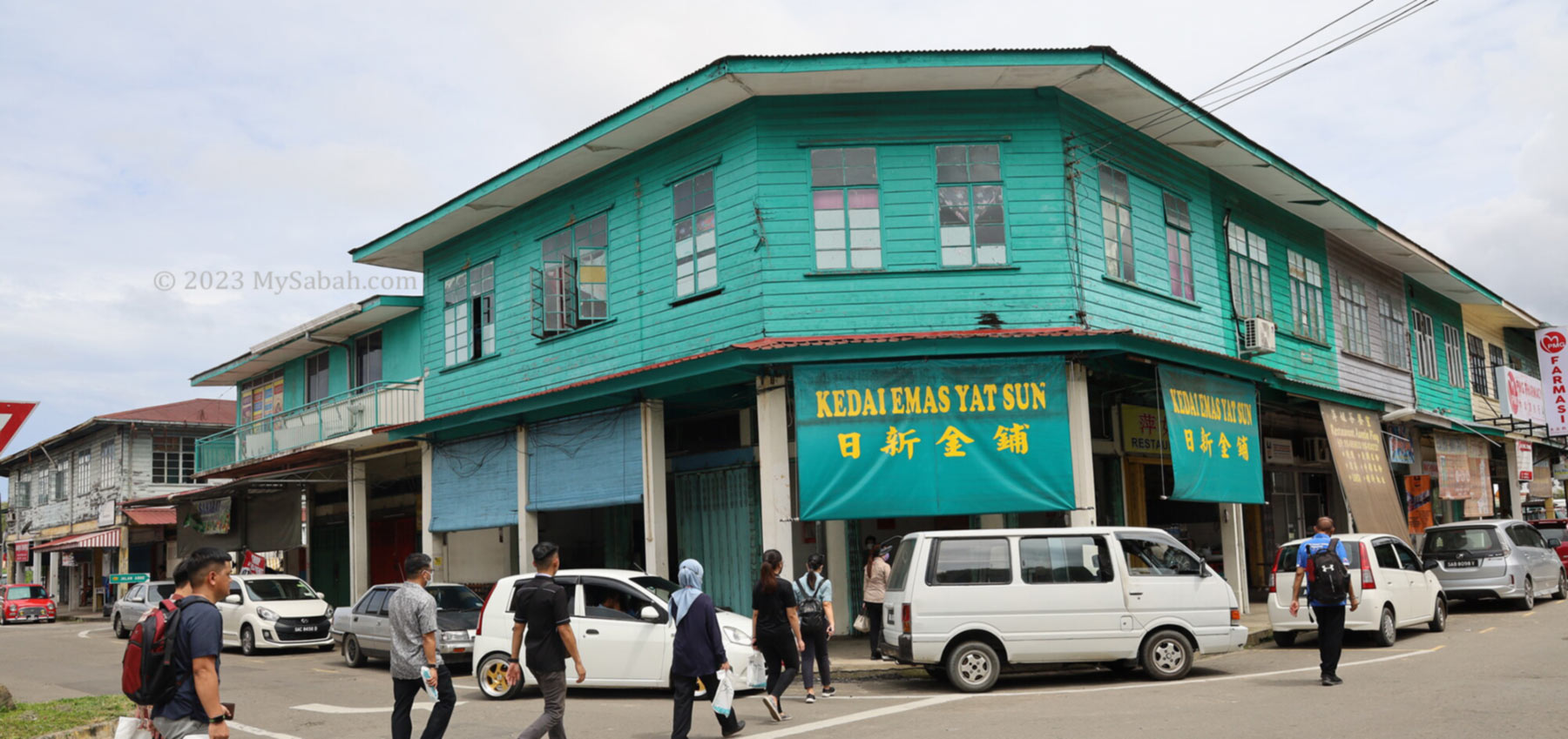
Papar
The final stop of this train tour is Papar town, which is one of the oldest settlement and the most multi-racial town of Sabah’s West Coast. The name Papar is derived from the Brunei word meaning flat and sloping land. Papar was used to be the rice bowl of Sabah. Before British came, it’s a slave trade centre.
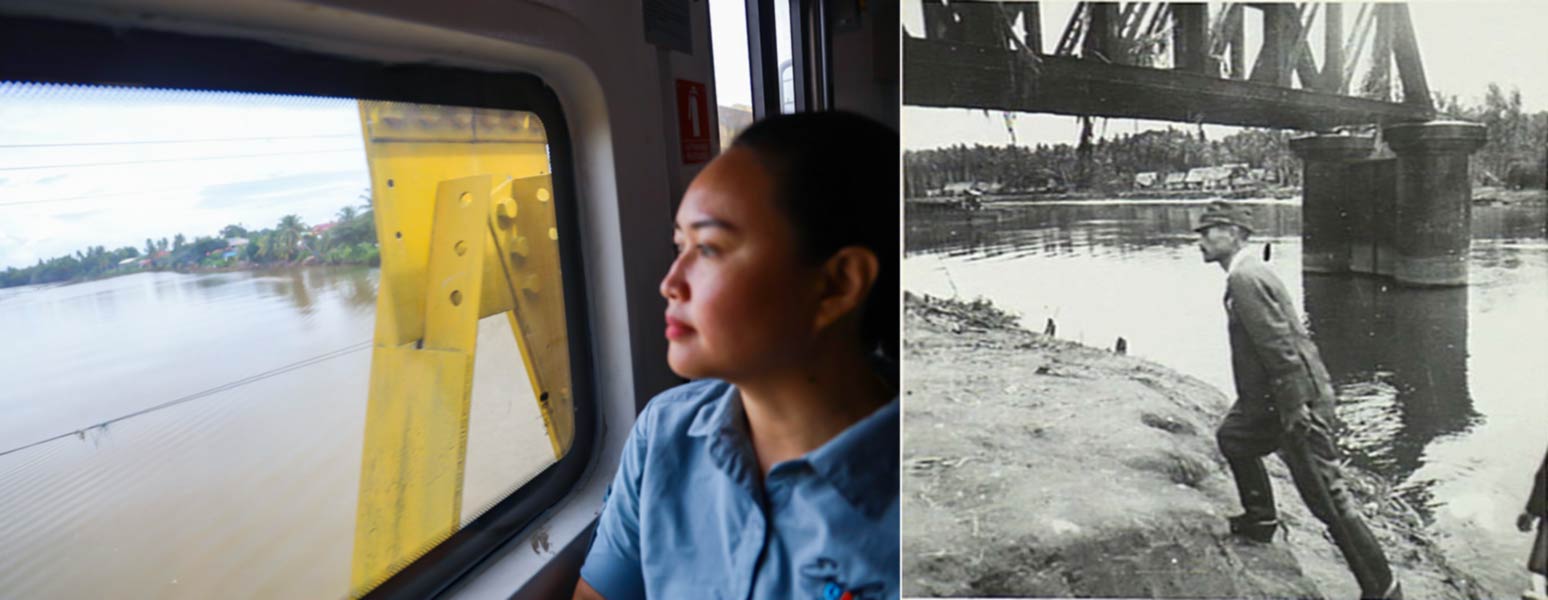
Left: The yellow steel bridge is the iconic landmark of Papar town. Right: Colonel S. Iemura represented the Imperial Japanese Army surrendering to the Australian force on 15 Sep 1945 at the Papar bridge.
You know you have arrived Papar town when you see the yellow steel-concrete bridge that crosses a wide river. Under the welcoming music from local Kadazan Papar people, everyone can walk out of the train to breathe some fresh air in Papar town, where you will have lunch before heading back to KK on the same train.
Arrive Papar train station for sightseeing in Papar town
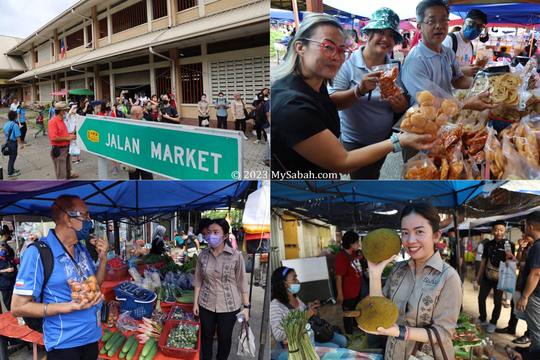
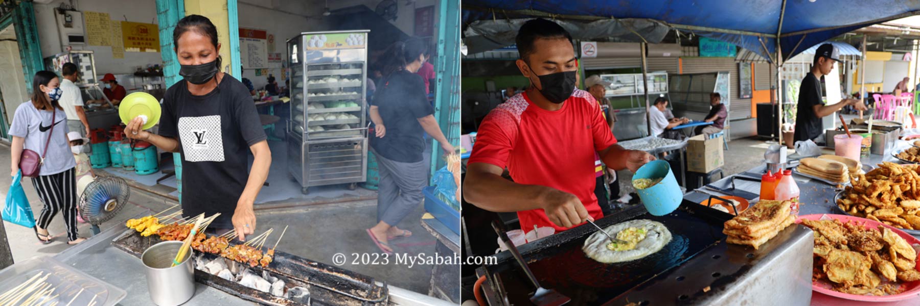
Your tour guide will lead you on the sightseeing. The most fun part is to explore the local market. If the tour is on Thursday, the weekly tamu market would turn this peaceful town into a busy marketplace, where you can shop for variety of local produces, snacks, food and fruits. I can assure you that you would not want to leave with empty hand or stomach.
Walking and shopping at the Central Market and Tamu Market in Papar town centre
The post-war shophouses are another historical heritage of Papar. The typical shophouses consists of one or two rows, either linked or individual structures spread along a linear arrangement. Some are still using traditional bamboo blinds and signboards from 60s and 70s.
The Post-War wooden shoplots in Papar town
The shophouses are mostly occupied by Chinese settlers. The shops are in ground floor, and the families live on upper floor. You just have to be there to feel the retro vibes. Just grab your coffee or lunch at one of the kopitiam (coffee shop) there. Personally I recommend Liang Yung Hua Restaurant (梁荣华饭店), a Chinese restaurant more than 80 years old.
Restaurant and food booths in Papar town
After a delightful lunch and sightseeing in Papar town, you will head back to KK train station. For Sabahans, this historical tour will give you a fresh look into your local history, you will never look at these places the same way again.
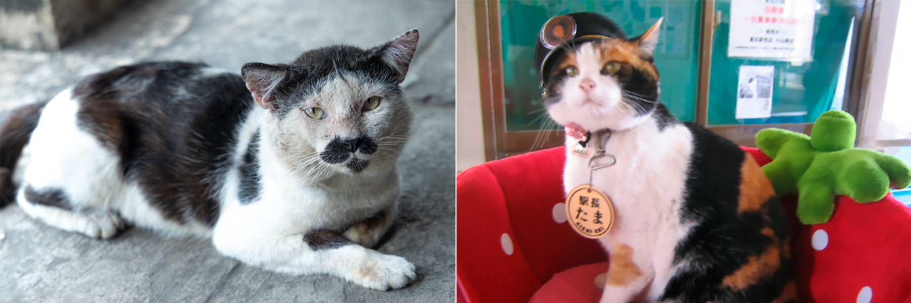
Left: a stray cat that has a Pringles face found near Papar market. Right: Tama, the station master of Kishi Station (Japan). Picture source: Wikipedia. Probably we can promote our cat too. Just a thought.
Join the Tour
North Borneo train tour is available every day except Sunday. Besides this tour, the agent also organizes train trip to Beaufort and Tenom. Tour guides speaking in English, Chinese or Malay are available.
Promotion flyers of North Borneo Train Tour in English and Chinese. Please check their official sites for latest information.
To book a North Borneo train tour, you may contact or follow the agent via the following channels:
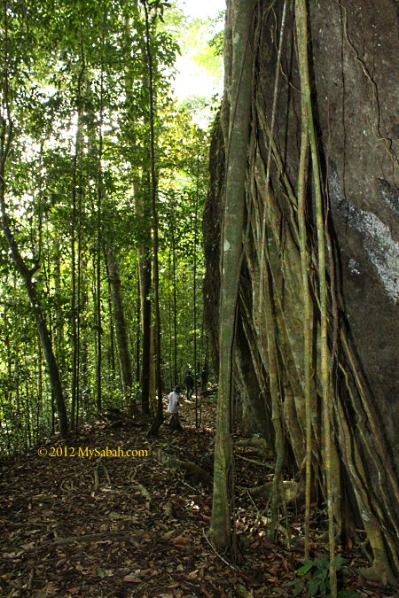
Now is Hungry Ghost Month, so it’s a good time to talk about the spiritual world. Borneo forest was used to be the most mysterious area on earth, only adventurers dared to explore it. Today, even tourists can visit our forest, but it is still full of mystery and many visitors have unexplainable experience.
Like Indians who believe everything has a soul, the locals believe the forest is the world of spirits. Therefore, we have a set of rules to follow when we go into the forest, especially the undisturbed forest. I hear many scary stories of someone whom I know breaking the rules. Below is a list of 10 Big No-No in Borneo forest.
1. Don’t Pee Everywhere
Old folks would advise you to say “Excuse Me” before you pee in the jungle, though there is nobody around. This is to inform the “invisible” entity to give way, so you won’t pee on them. Btw, any language will work as “they” can read your mind. I have relatives who didn’t believe this and one of them even purposely peed at the grave. So, at night he saw a man standing next to his bed and stared at him angrily. He was terrified for a few days until he went to the site to apologize, then the spirit left.
Never pee at termite nest, big tree and boulder, which can be the home of the spirits. Peeing at river and stream is not a good idea too. Urinate at sacred sites such as Mt. Kinabalu can bring serious consequences, case in point, a group of 10 disrespectful foreign tourists were blamed for causing a magnitude 6 earthquake. Most people think that it’s only a coincidence, but they get more angry with these fools anyway.
2. Don’t be Busybody
Our forest is rich in biodiversity, so is the forms of spirit. If you see, hear and smell something weird or unknown in the forest, just keep quiet and move on. For example, you would smell something stink or fragrant, so strong that as if it’s just next to you, or you might suddenly feel a chill in your spine for no reason.
Do NOT mention it or ask your friend what it is. It’s probably a spirit comes to check you out or tries to play a trick to lure you. If you respond, it’ll follow you. If you ignore it, it’ll vanish. My ex-classmates didn’t ignore this at Kinabalu Park, so they found 2 “extra” misty human figures in group photo. Some of my friends even hear someone calling their names or foot steps behind. No matter what, don’t go off-trail to investigate. Curiosity kills the cat.
3. Don’t Make Noise
Whoever enters the forest is an outsider invading the territory of the spirits. Usually they don’t bother until someone disturbs them with noise. If you have been to Mt. Kinabalu, you would recall your guide advised you not to be noisy. According to the locals, Mt. Kinabalu is the resting place of the death.
Student is the most annoying group. Despite advised by guide, they are negligent and soon forget about it. Then the mountain is echoed with their loud noise and laughter. Then later at night, some of them would be harassed by black shadow during bedtime. I had heard so many cases like this.
4. Don’t Swear
Jungle trekking can be unpleasant to most people, as Borneo forest is dark, warm and humid. People start to complain when they sweat profusely or get tired. Remember, something is seeing you and hearing you. Your negative attitude will be a magnet for negative energy and that includes bad luck. Sooner or later, you would see the whiner getting into trouble such as a bad fall.
Your positive qi (energy) is your best defense. Keep swearing doesn’t help, it will only worsen the situation.
5. Don’t Joke
If you see anything ugly or funny in a forest, don’t make fun or laugh at it. I know a fellow from Kuala Penyu who laughed at an ugly old tree, then he lost in jungle and almost died of dehydration. According to him, he followed his “friend” in front of him, but his friend didn’t talk and respond to him. Actually it was a spirit that disguised as his friend and made him lost in the wood.
6. Don’t Bring Raw Meat
Most local hunters know this rule. The locals tell me that meat, especially raw pork and salted fishes, will attract something undesirable. I heard story of a driver who kept raw wild boar meat in the car felt that the car became “heavy” when he drove on winding roads next to the forest of Tambunan. One of my friends even saw a tall and black human figure with red eyes at roadside of Papar.
For local people who hike a lot in Sabah forest, they would know the popular taboo named Kopunan. In the forest, you are not supposed to mention any food that is not available there, not even joke about it, for example, saying something like “Hey, is there any burger here? I wish I have a cold bottle of Coca-Cola with me.” Doing so will generate an unfulfilled desire and that negativity will bring bad luck.
7. Don’t Disturb Anything
Leave everything in place as it is. Take nothing but photograph. Keep in mind that the forest is the property of others. That’s why workers of logging companies are strong believers of Feng Shui and God of Earth (Dato). You can see them worship Dato (拿督公 in Chinese) in their forest campsites. The spirits hate the loggers so much that the workers need the protection from the God of Earth.
Pic: God of Earth (Dato) is widely worshiped in construction & logging sites of Sabah
If you have to take something, ask for permission (say to the air), and you better leave something behind as an “exchange”. However, if you take anything in national park, no matter it is live or dead specimen, it’s stealing and you will be fined RM1,000 or more. So just don’t do it.
8. Don’t Sleep Anywhere
Based on common belief of locals, Bambangan, Banana, Banyan and Bamboo are the most haunted trees of Borneo. There are many ghost stories related to these trees too. If you camp in the jungle, stay far away from them.
I have a friend who was a girl scout and camped a lot in the wilderness. She said one day a hammock next to a banana tree spin like crazy and freak out everyone. Personally I saw fireball with tail hovering in bamboo forest. My late grandmother said it’s the spirit of the newly deceased.
9. Don’t Make Fun of Wildlife
Every living thing is the “citizen” of the forest. It is understandable that people may consume them for living, but it is unforgivable to torture or make fun of them. I was told that a group of hunters caught a monkey in Trus Madi. They put cigarette in the mouth of the dead monkey and had good laugh of it. That night an unusual strong wind blew away their camp.
10. Beware of River
Without pollution, the river in deep jungle is crystal clean and we will swim. Be careful, my Long Pasia guide warned. Before entering the water in remote area, we should throw lime or a pinch of salt into the river to cleanse it. During camping, he also advised us not to sleep in parallel direction with the river. Or we would find that we are relocated to another location in next morning. This has happened to his guests. Weird huh?
Call me superstitious if you want. Well, many broke the rule but nothing bad happened to them, so you can remain skeptical. Anyway, the rules are easy and won’t cost you anything. Four rules have something to do with our mouth, so just shut up in the forest, haha.
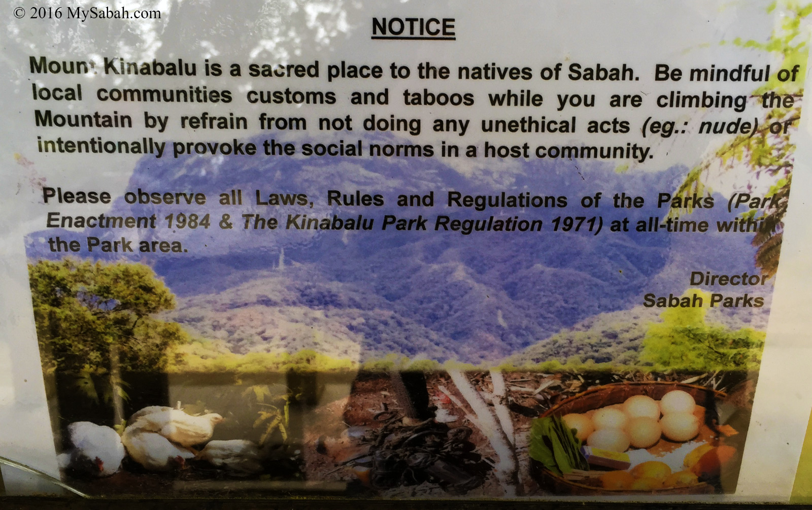
This notice in Kinabalu Park reminds “naughty” tourists to behave themselves.
For those who don’t listen to the old folks, they would experience bad consequences such as incubus and sickness. In serious case, it could be bad weather, accident, lost in jungle or being haunted. Though most Sabahans are converted to Christians or Muslims, most of us believe there is another kind of energy living in the forest. Another reason to follow the rules is to show that you respect the cultures and belief of locals, no matter you believe it or not.
I’ve walked hundred Kilometers in forest and never harassed by any spirit. Just Respect the forest. Before I enter any forest, I “talk” to them, saying that I’m just a friendly visitor and don’t mean to disturb them. When I walk in the jungle, I praise everything I see and thank them for the nice surrounding. In almost every case, the moment I walked out of jungle, it rained, as if they waited until I finished my journey. It happens so many times that I can’t believe it’s just a coincidence. I’m trying to say, they will be nice to you if you respect them.
If you enter a remote pristine forest, it’s also advisable to bring a local villager / guide with you. The spirits would be less hostile if they see you coming with someone they know. For safety reason, the locals know the place well too. Do you know the locals appease the spirits of Mt. Kinabalu annually, to protect the climbers?
Pic: making offering to mountain spirit with 7 betel nuts, eggs, tobacco rolls and chicken
For high-risk expedition, you can request a local shaman (locally known as Bomoh) or high priest (Bobolian) to appease the spirits for a smooth journey. They also can neutralize the curse or chase away the evil spirits, in case you get one from the forest. However, if you don’t feel alright after a jungle trip, the first thing you should do is to see a doctor instead of Bomoh. It could be allergy, food poisoning, viral infection, Malaria, etc., a 99% chance that there is a scientific explanation.
Pic: a Bobolian
Hey, please share with me if you got any story ok. 🙂
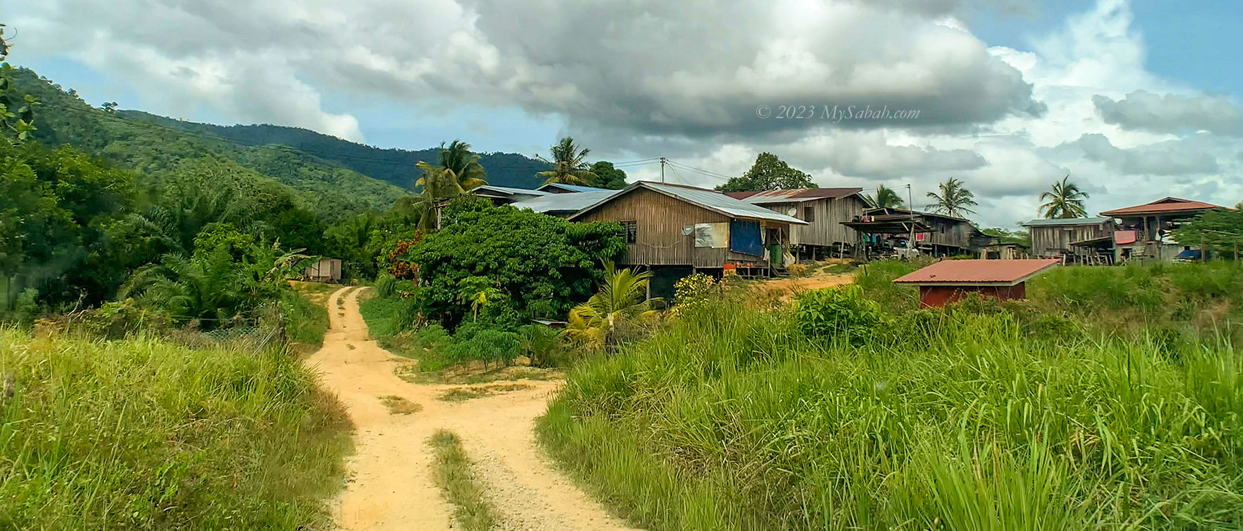
Papar is a quiet and peaceful town about 38 Kilometres away from Kota Kinabalu City. The locals in Papar are mainly Kadazan Papar and Orang Brunei people who make some special delicacies.
1. Tapai Papar
From the name, you would think that it is the famous rice wine of Sabah. “Tapai Papar” cake is made by Orang Brunei lives in Laut Village of Papar.
Tapai Papar from Kampung Laut, Papar
Definitely it does not look like Tapai wine, but it really smells and tastes like Tapai, and really sweet too. They said they mixed the yeast with the cooked rice, then left it overnight, to produce the sweet taste and Tapai scent. Interesting huh..
The sweet rice of Tapai Papar
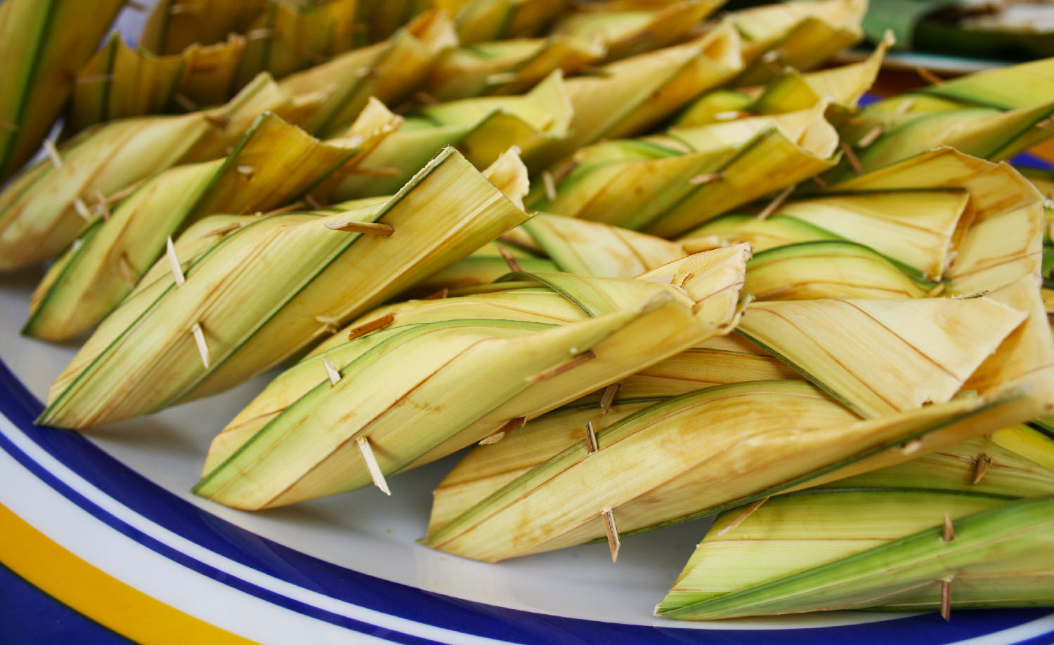
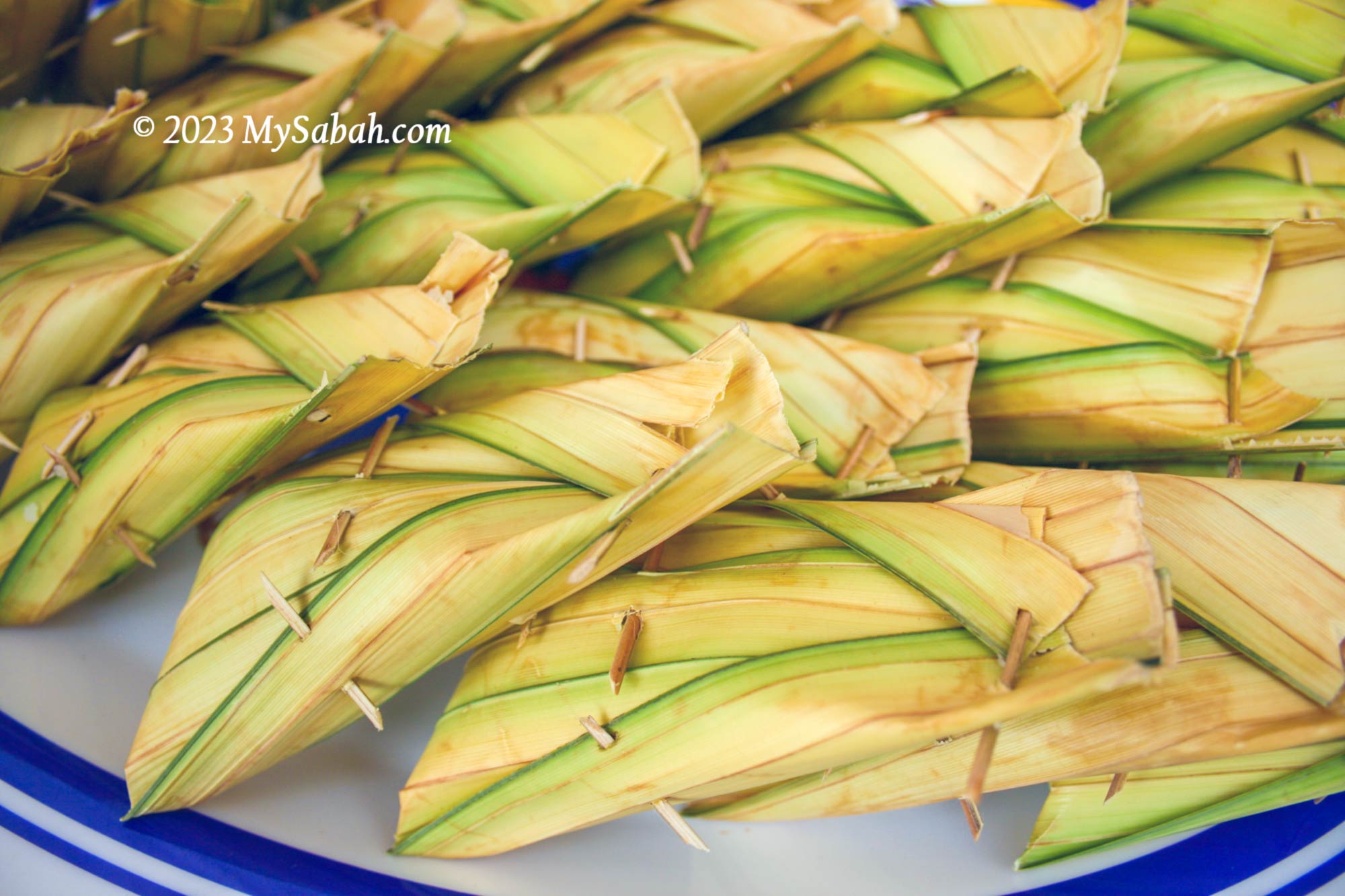
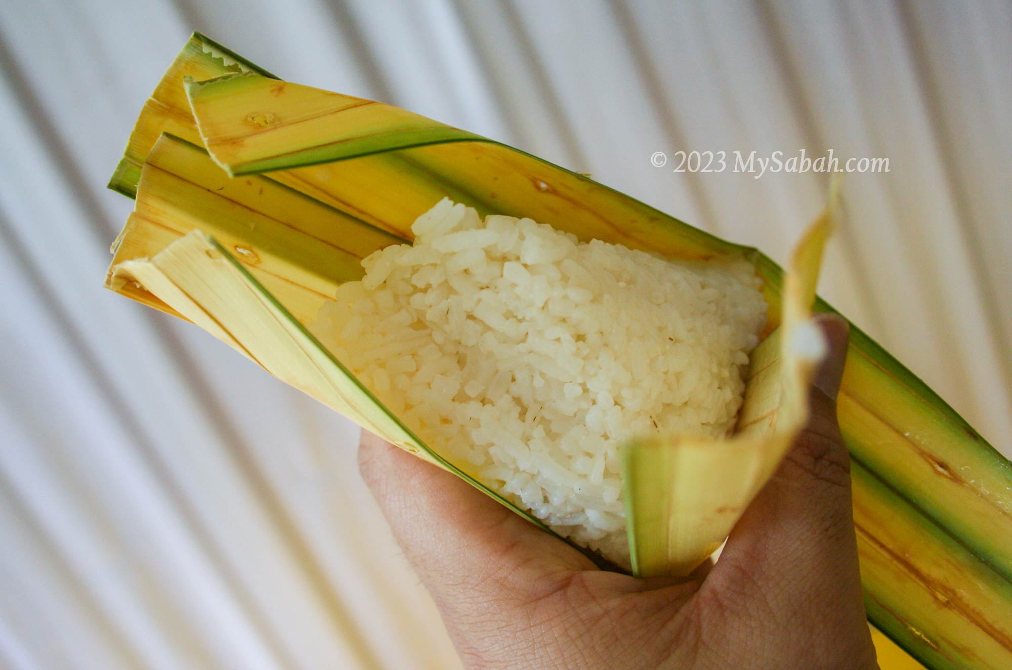
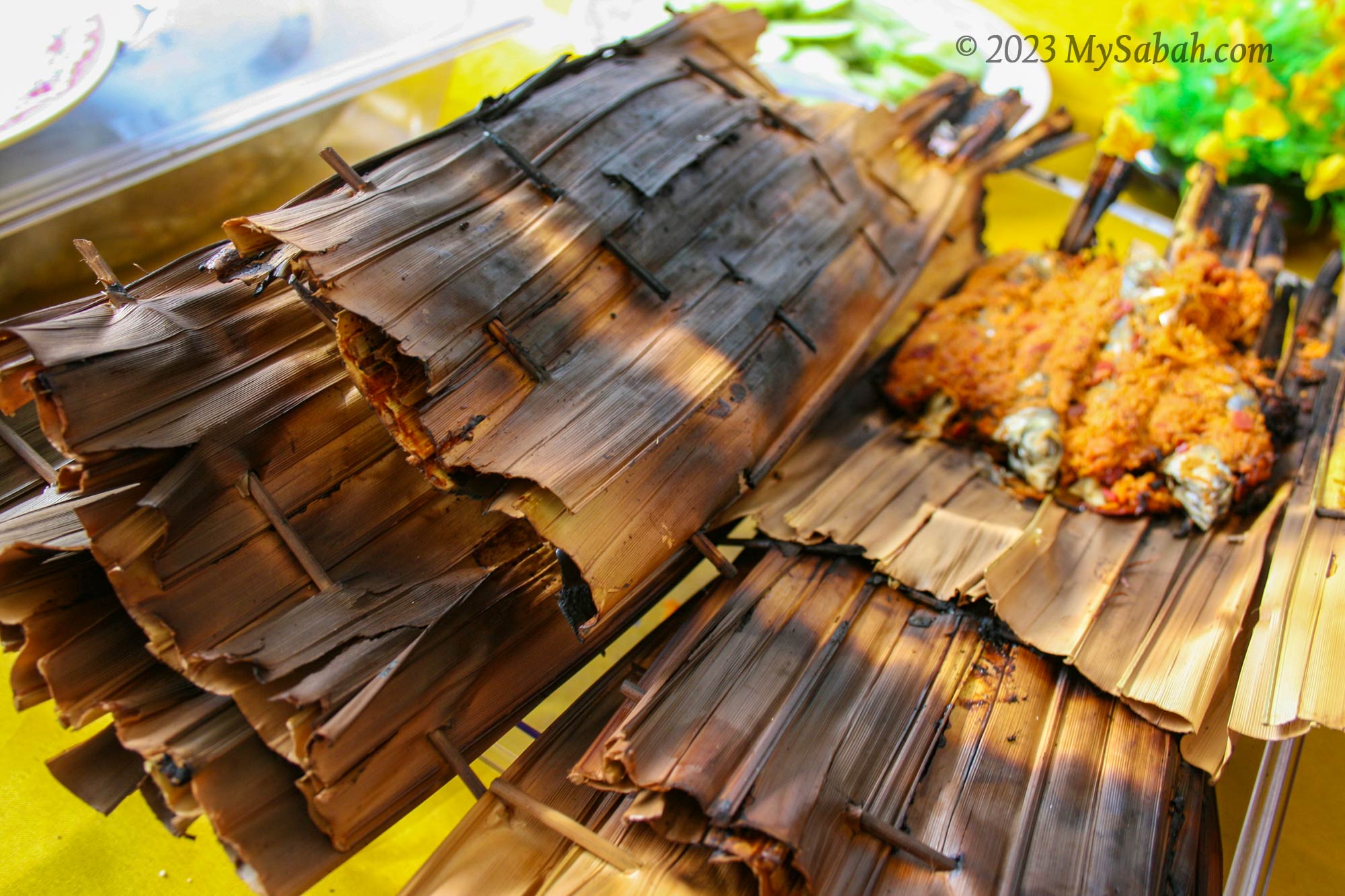
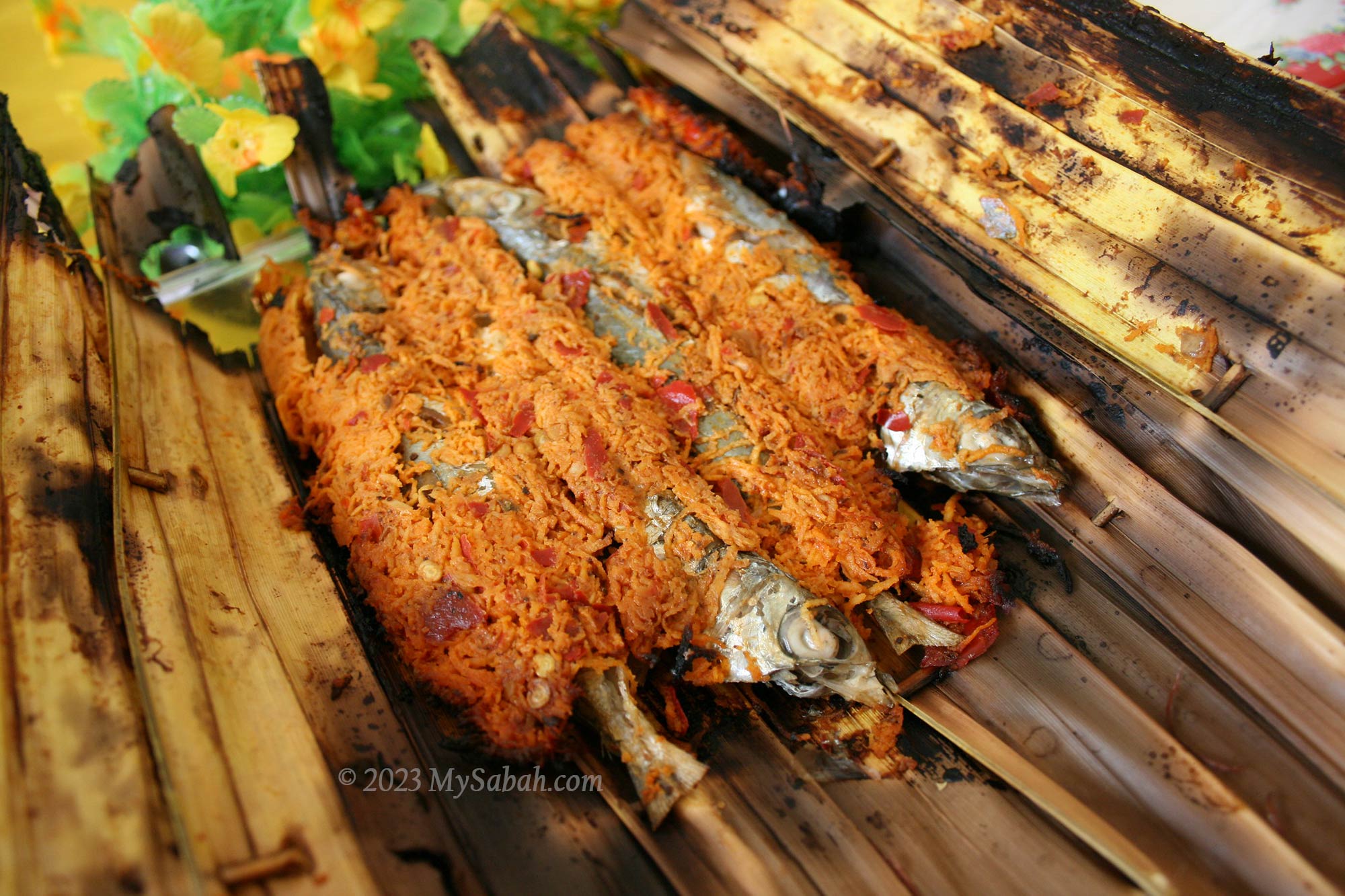
2. Lauk Pais
I also tried their BBQ Fish, named Lauk Pais, which is Basung or Pinaasakan fish wrapped and grilled in leaves.
The fishes were fresh and sweet, and tasted a bit spicy. Yum, yum…
Lauk Pais, grilled basung fish wrapped in leave
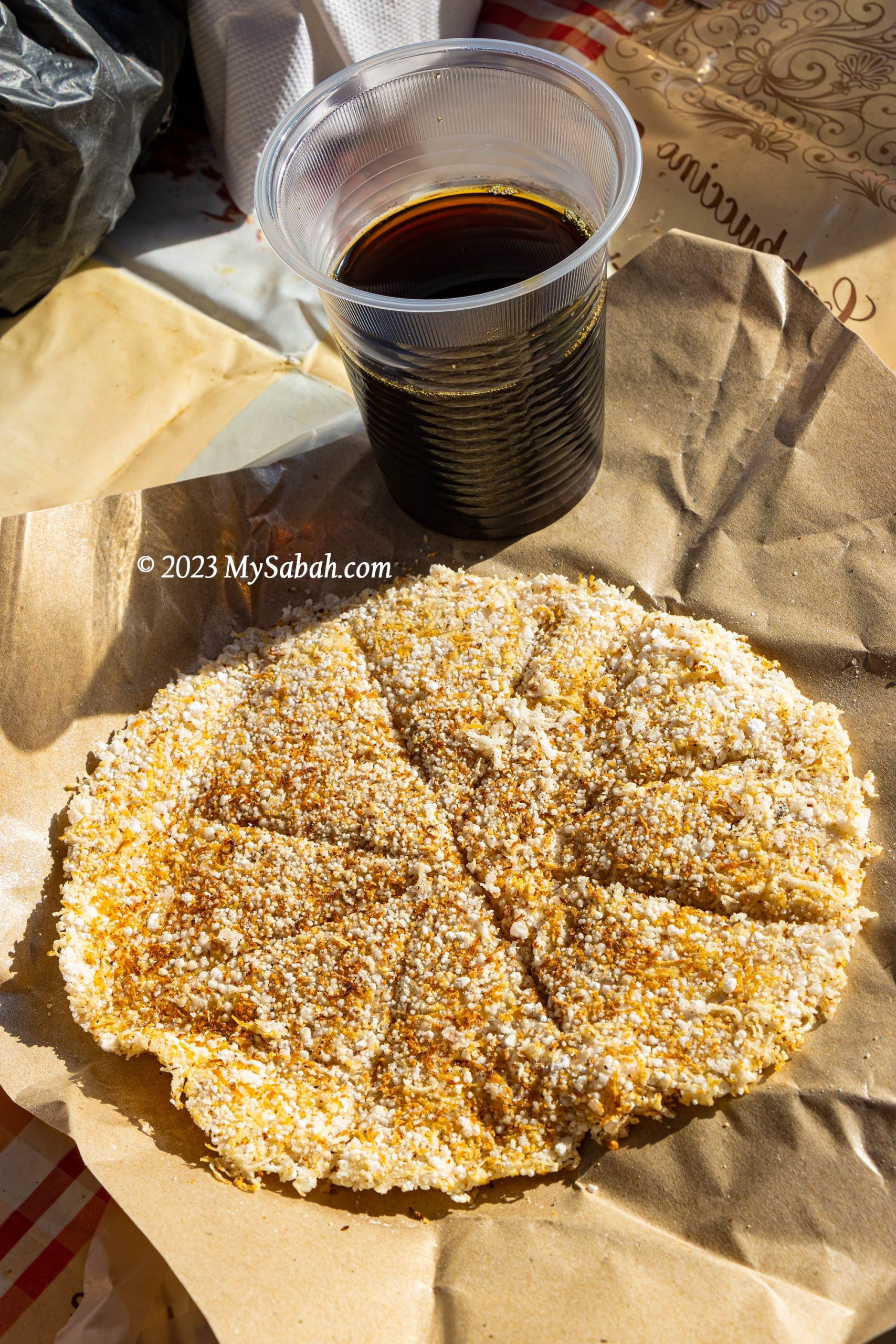
3. Pinompol, the Papar Pizza
The main ingredient of Pinompol is desiccated coconut, which is fried and mixed with sago powder and sugar. It’s cooked until golden brown to release the pleasing coconut aroma. No oil is added. You can watch the video on how Pinompol is made. The taste is sweet and soft with crusty surface.
Pinompol is one of the traditional food that is not commonly appreciated by the young generations, so not many people know about it.
Pinompol goes well with hot coffee. You can add honey, cheese, mayonnaise or sliced bananas for extra flavours. This snack is homemade for self-consumption and not commonly sold in market. You can get Pinompol at Koposizon Homestay Papar.
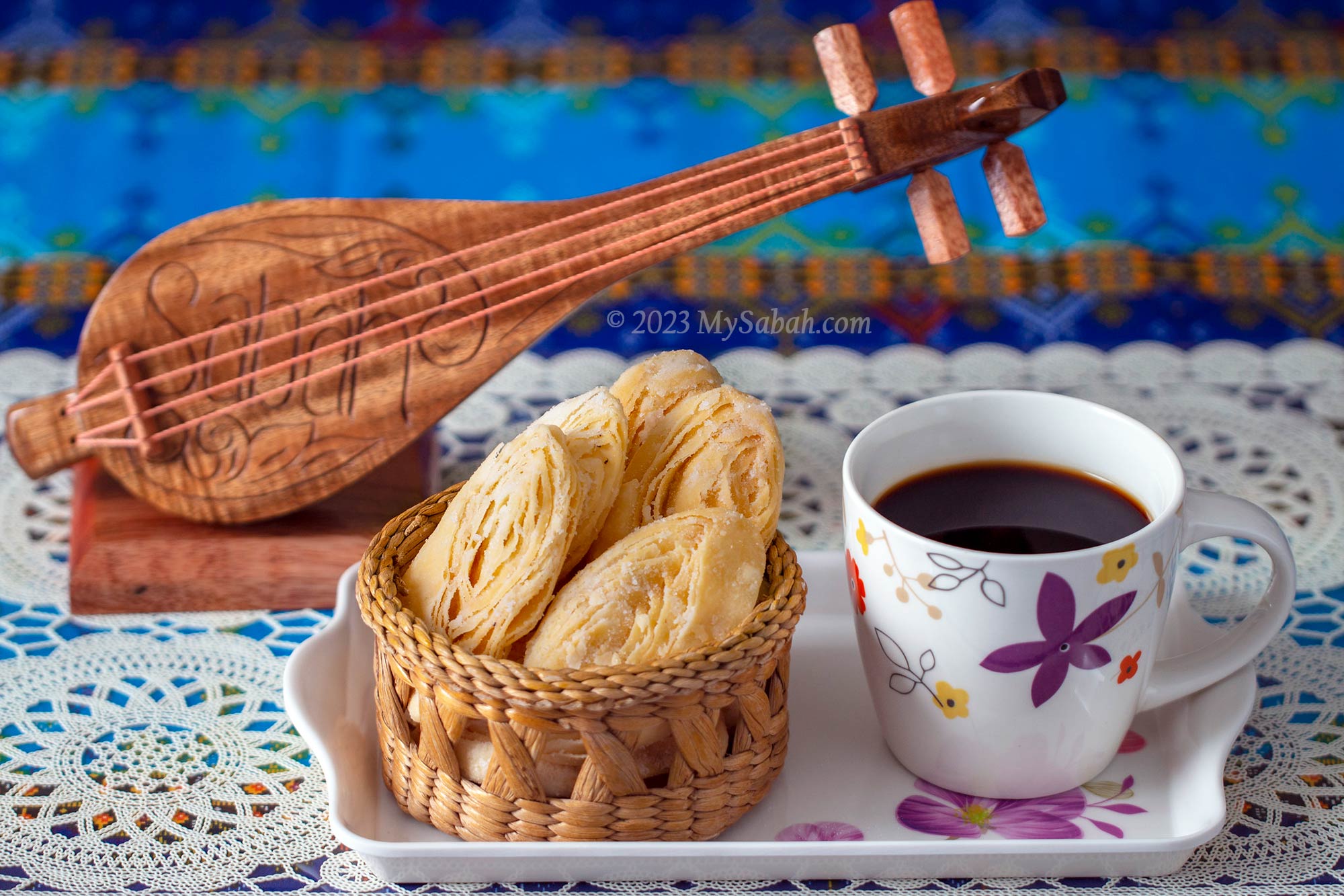
4. Kuih Lidah
Kiuh Lidah, literally means Tongue Cake, is a traditional sweet snack of Bruneian Malay in Papar, the southeast part of Sabah, Malaysia. Also known as Kuih Tiram (Oyster Cake), Kuih Lidah is one of the best selling snacks of Sabah and getting popular throughout Malaysia.
Kuih Lidah with coated sugar and milk powder, is paired well with hot tea or coffee
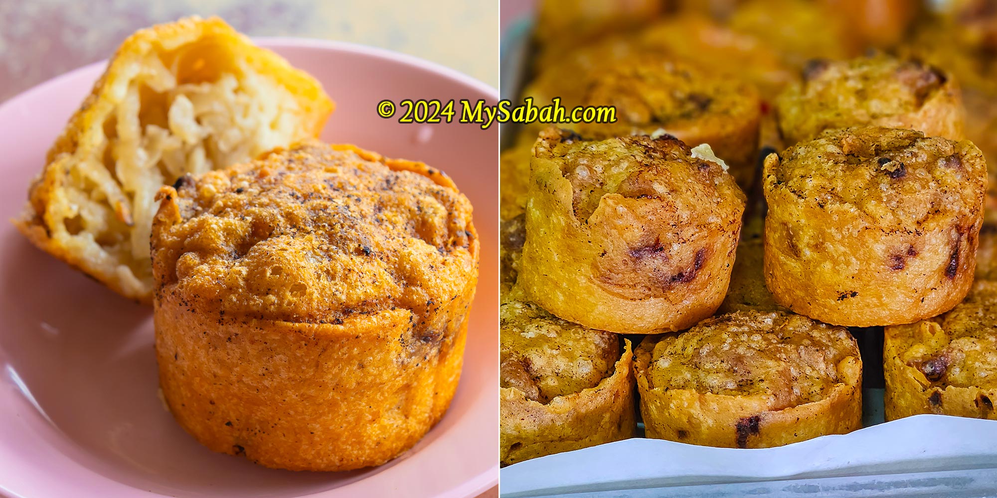
5. Kuih Sayur
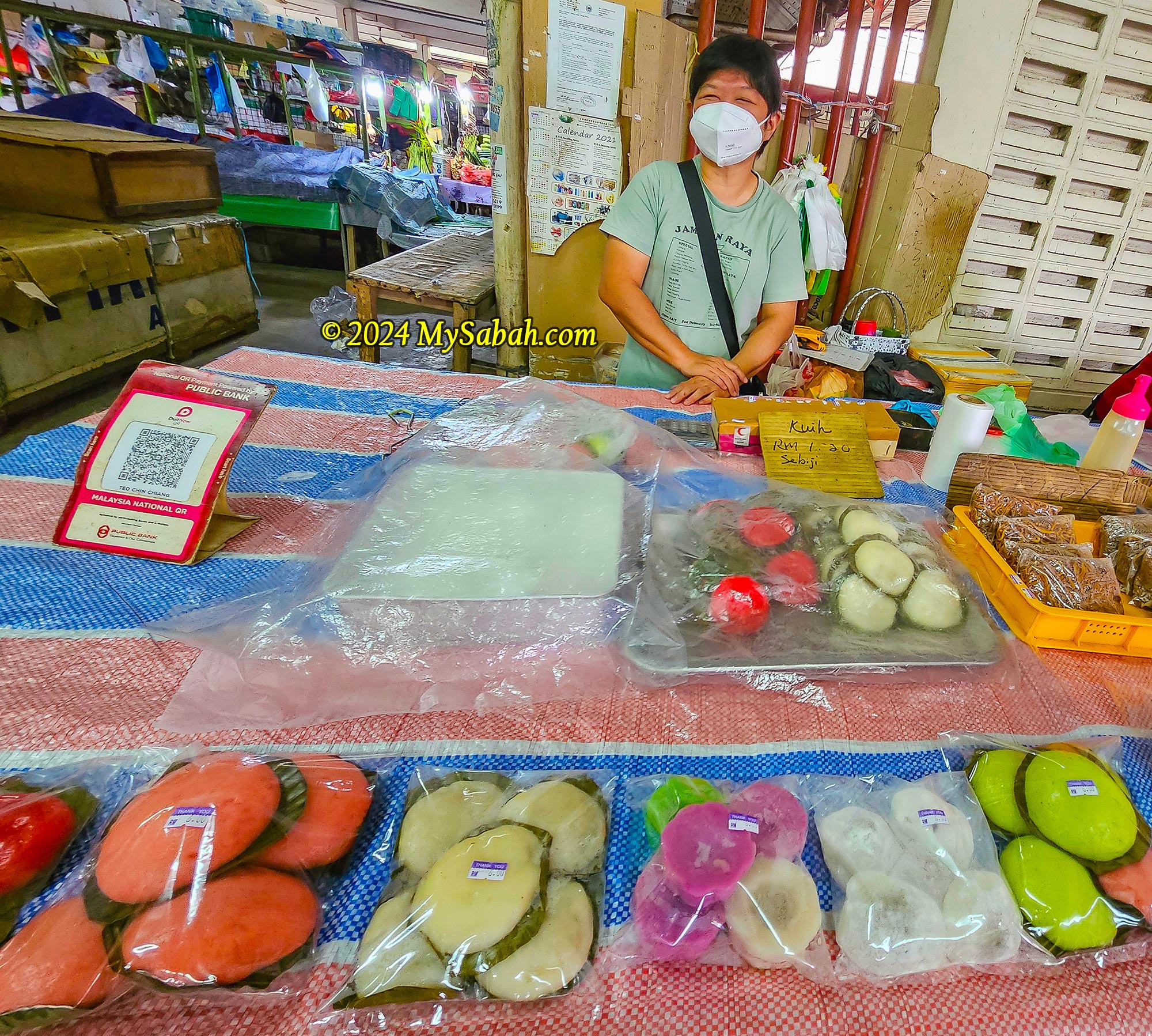
Kuih Sayur is a popular savory pastry from Papar. Not many outsiders know about it, as this delicious treat is always sold out. Due to its shape, it is called ‘wheel pastry’ (车轮饼) or ‘little fried jicama’ (炸葛仔) by the Chinese, and some also refer to it as ‘Tin Can Pastry’ (罐头饼).
Kuih Sayur is made from flour fried to an appetizing brown color with a crunchy crust, and it is filled with soft, grated jicama inside, which tastes similar to Ham Sui Gok (咸水角), another famous pastry.
Madam Teo and the pastries she sells
Madam Teo and her family have been selling Kuih Sayur for about 70 years, and the recipe comes from her grandmother who hailed from Yongchun County (永春县) of China. Kuih Sayur is priced at RM1.20 each. Madam Teo’s stall in Papar Central Market (Pasar Am Papar) also sells a variety of other kuih and pastries every day from 6am to 11am, except Mondays.
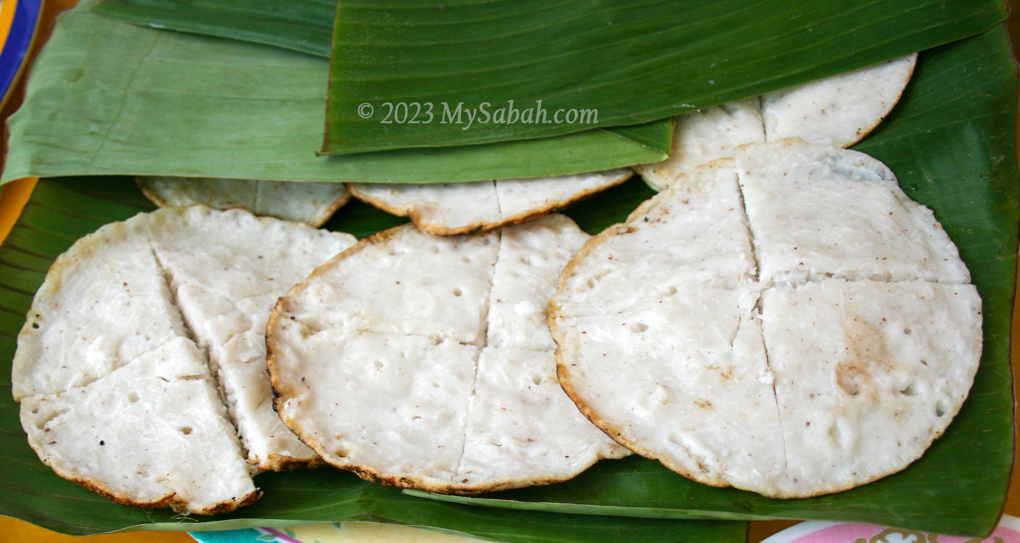
6. Surabai
Surabai looks like a steamed rice pancake. Anyone can tell me more?
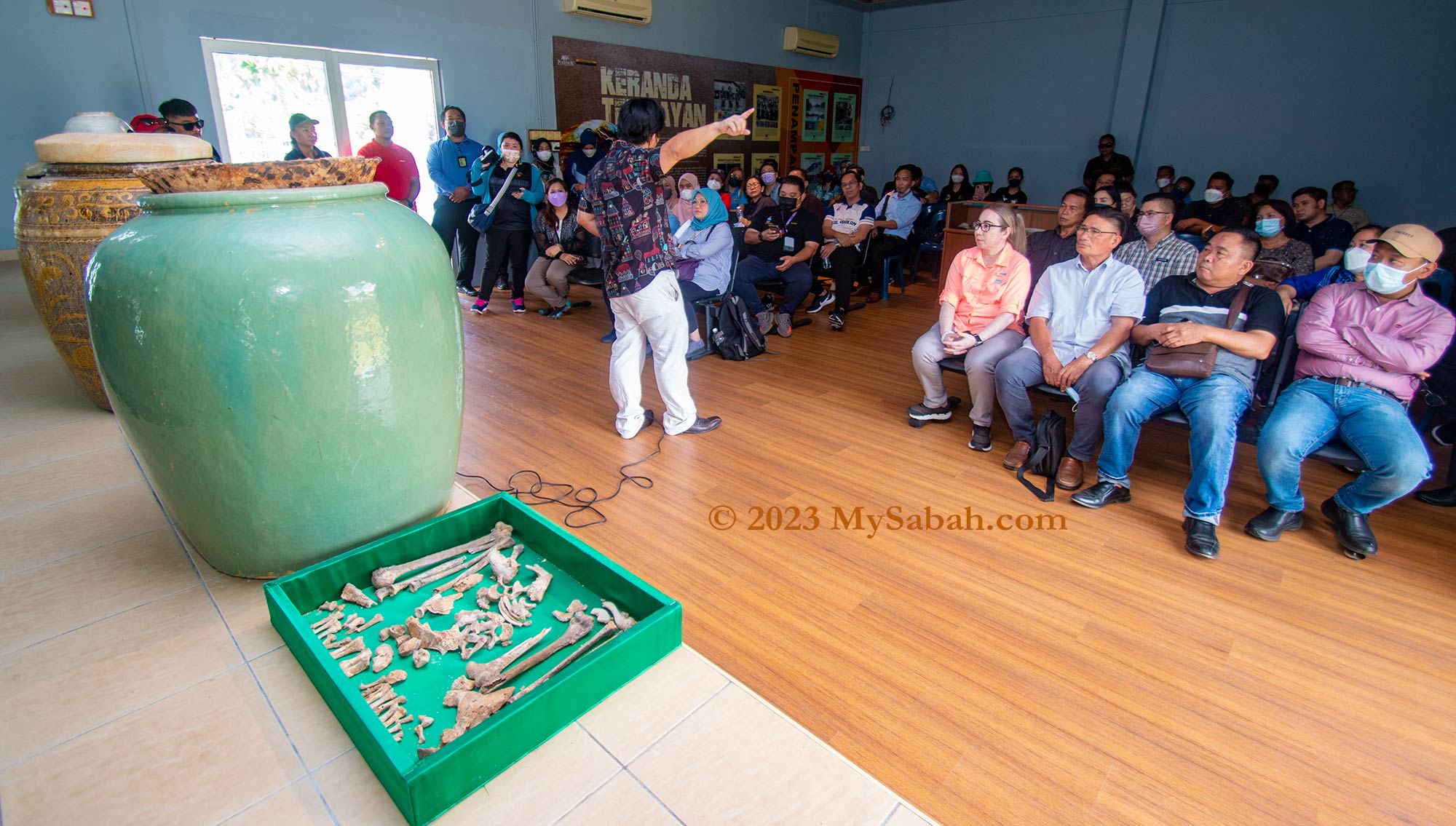
In the year 2000, an unexpected discovery unfolded at Pogunon Village, nestled on the outskirts of Kota Kinabalu City, leaving the entire Sabah astounded. The unearthing of an ancient cemetery reignited the recollections of burial and megalithic cultures prevalent in Sabah.
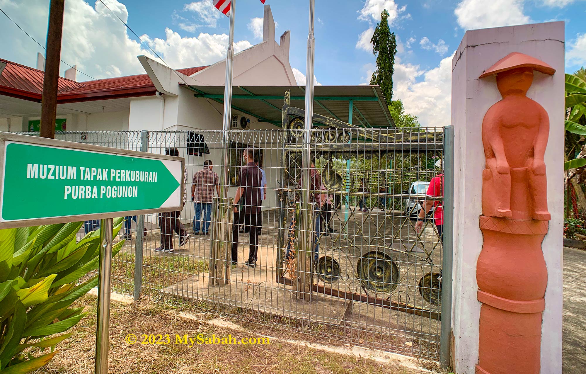
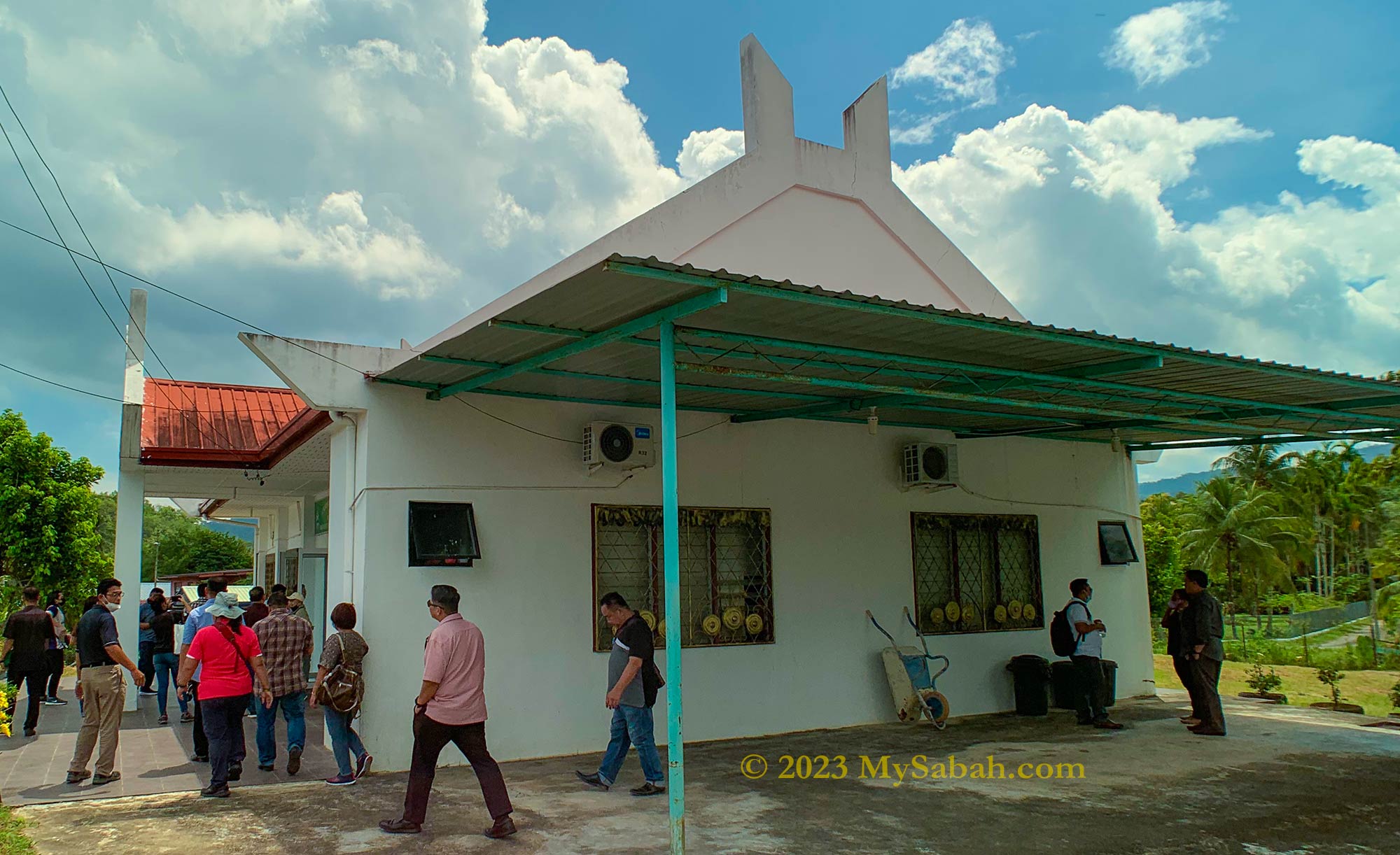
Entrance to Pogunon Community Museum. The entry is free.
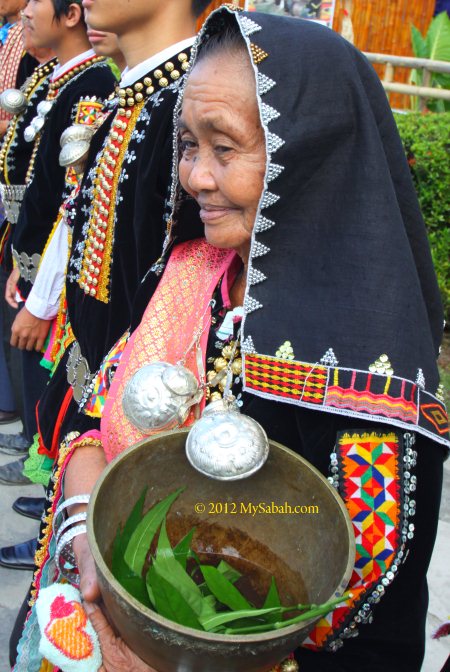
Standing on this hallowed ground, the Pogunon Community Museum (known as Muzium Komuniti Pogunon or Muzium Tapak Perkuburan Purba Pogunon in Malay) invites visitors to behold the burial jars and old graves, while delving into the haunting tales of headhunting and the revered Bobohizan, the high priestess of the Kadazan people, who once graced this site.
The exhibition hall of Pogunon Community Museum is about the size of a basketball court and has air-conditioning.
Pogunon is named after a native plant, Sorim Pogun. It also means “bekas yang ditinggalkan”, which is translated as “the traces left behind.” because in old days this village was in war, the villagers were ambushed and fled into forest, then came back next day.
Discovery of the Pogunon Cemetery
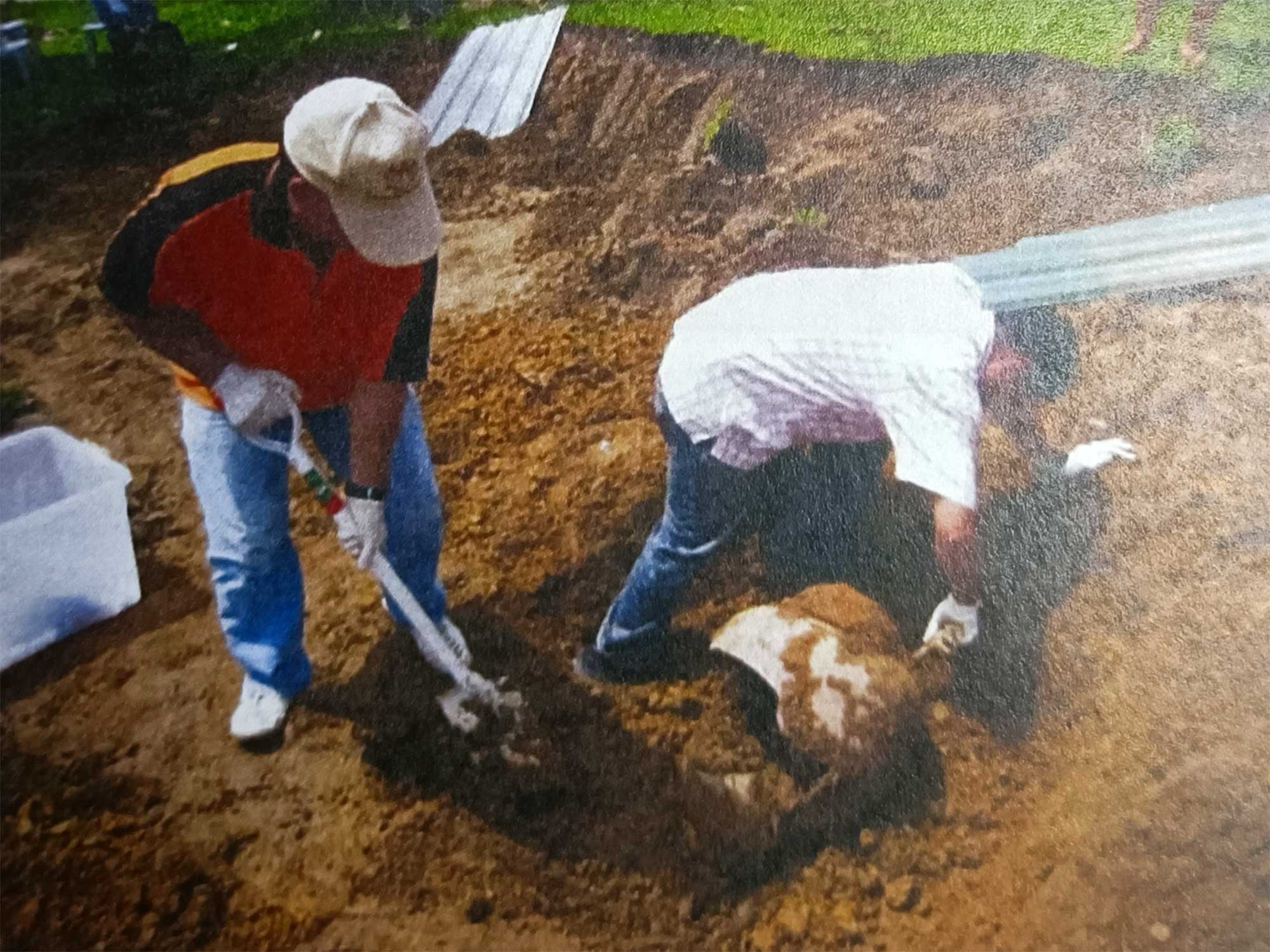
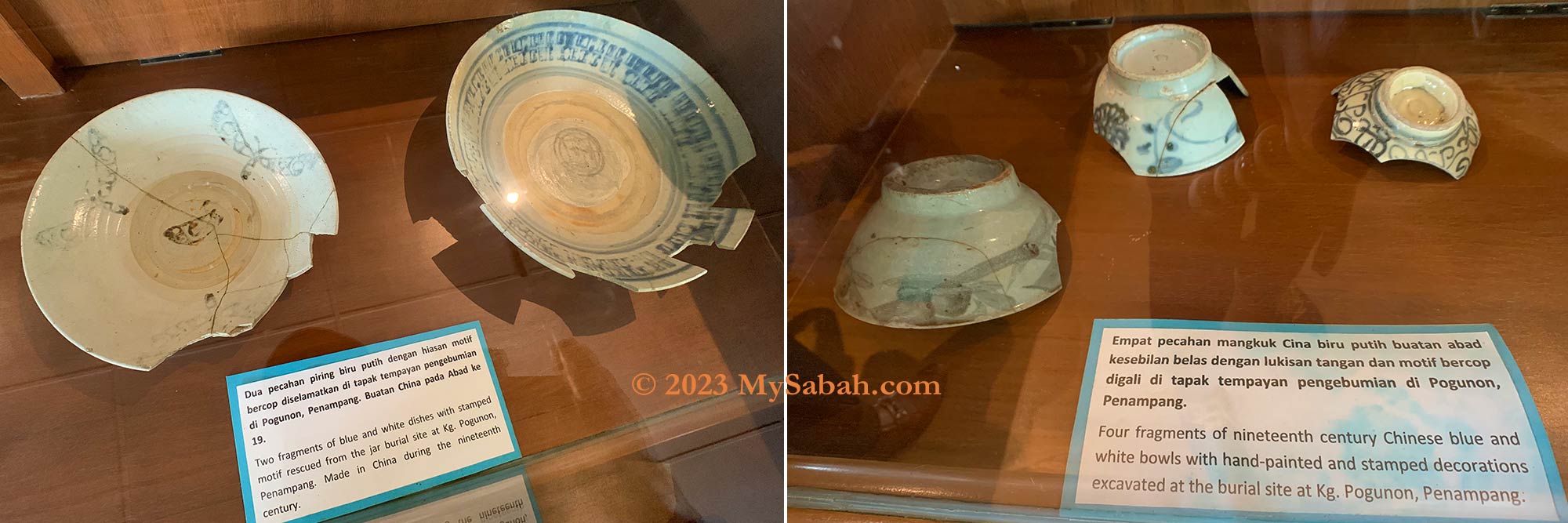
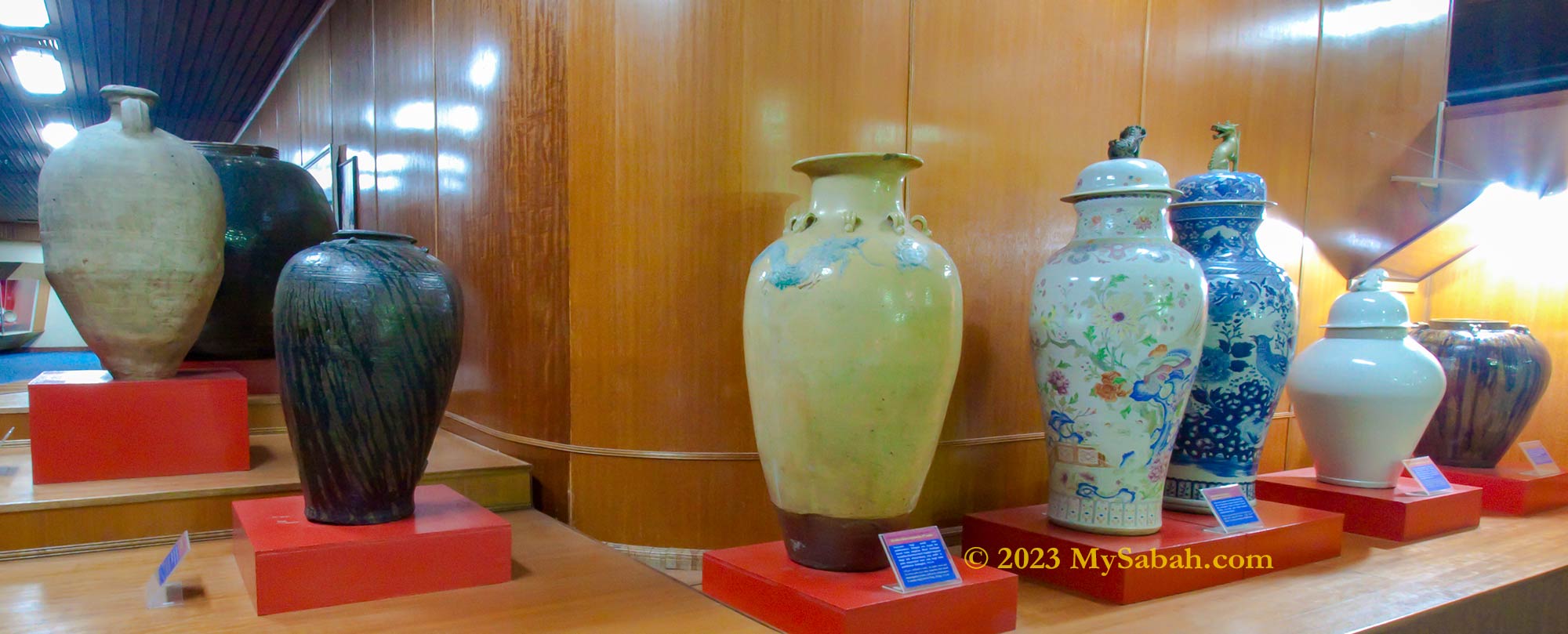
In January 2000, the construction of KEMAS Kindergarten building at Pogunon Village (or Kampung Pogunon) led to the finding of four burial jars (three of them are complete and have human bones in them), blue-and-white plates, and bowls. These ceramics originated from China between the 16th and 19th centuries.
Sabah Museum carried out excavations at Pogunon in 2000, 2007 and 2008 to rescue the buried heritages. (Photo Credit: Sabah Museum)
Further excavations conducted by Sabah Museum dug up thirteen ancient burial jars from an old graveyard in front of the St. Joseph Chapel in the same village. The lidded burial pots contain artifacts such as coins dating back to 1885, bangle, belt (himpogot) made from ancient silver coins, jewelry and decorated ceramics.
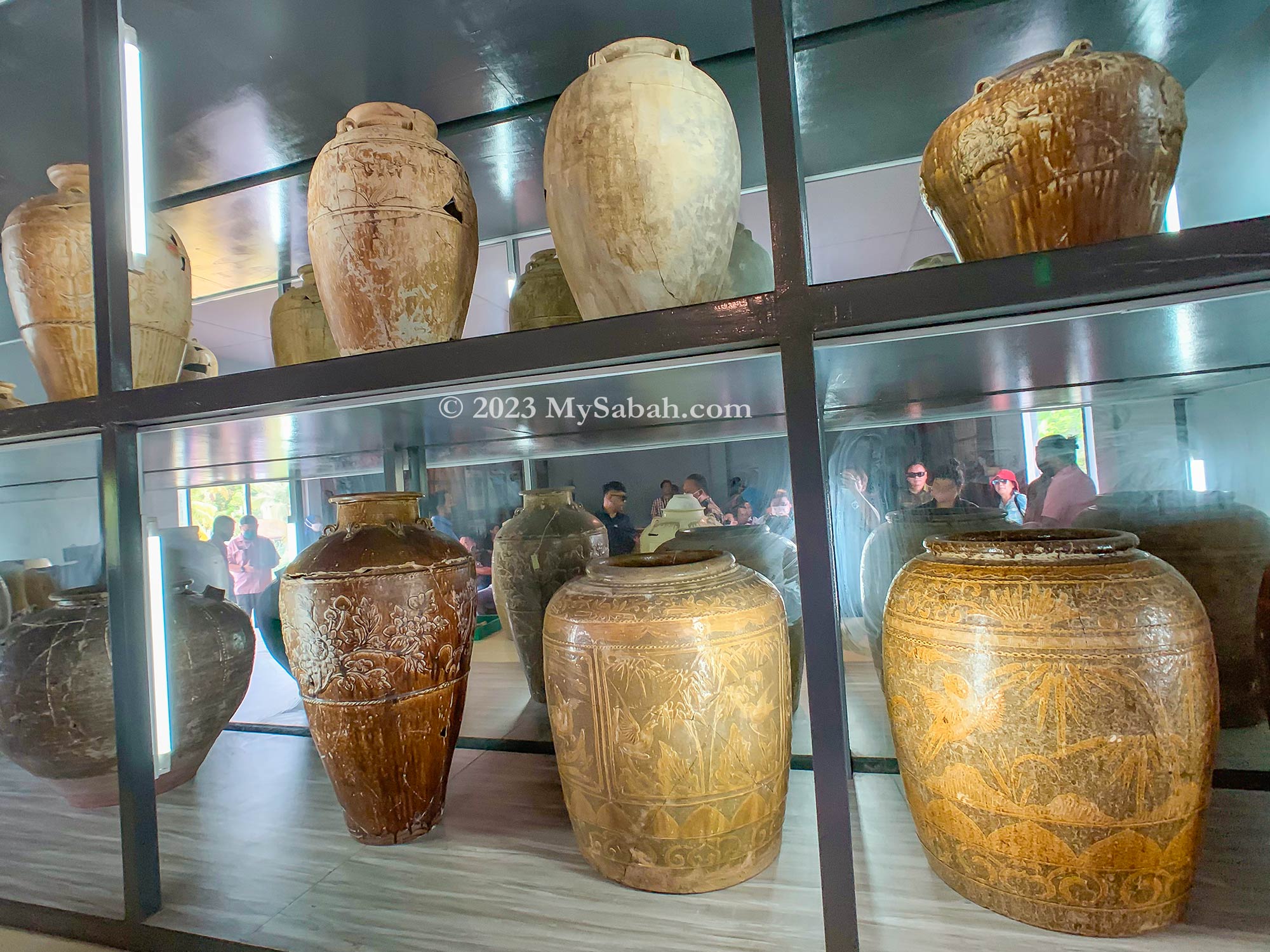
Ancient burial jars exhibited in Sabah Museum. The one at the right is from Pogunon.
The people buried in jars are usually those who have high social status such as Bobohizans and headhunter warriors, so this cemetery is important in cultural anthropology. Some graves belong to the ancestors of the current generations living in Pogunon. In fact, 60% of this village is an ancient burial ground.
Pogunon Community Museum is open from Monday to Saturday, from 9am to 5pm. It’s closed on Sunday and public holidays.
The site is gazetted in 2000 to protect this ancient graveyard and its megaliths, which served as grave markers. Pogunon Community Museum is built in situ in 2004 to showcase its artifacts and history.
The Past of Pogunon Village
Though Kampung Pogunon is a quiet village nowadays, it’s quite a happening place in the past. The small village is situated on the flat plains under Crocker Range and next to a river, so it was a suitable meeting point for mountain and coastal tribes, who used to barter trade with one another. For example, Bajau people from seaside can exchange for forest stuffs with Dusun from the interior with seafood.
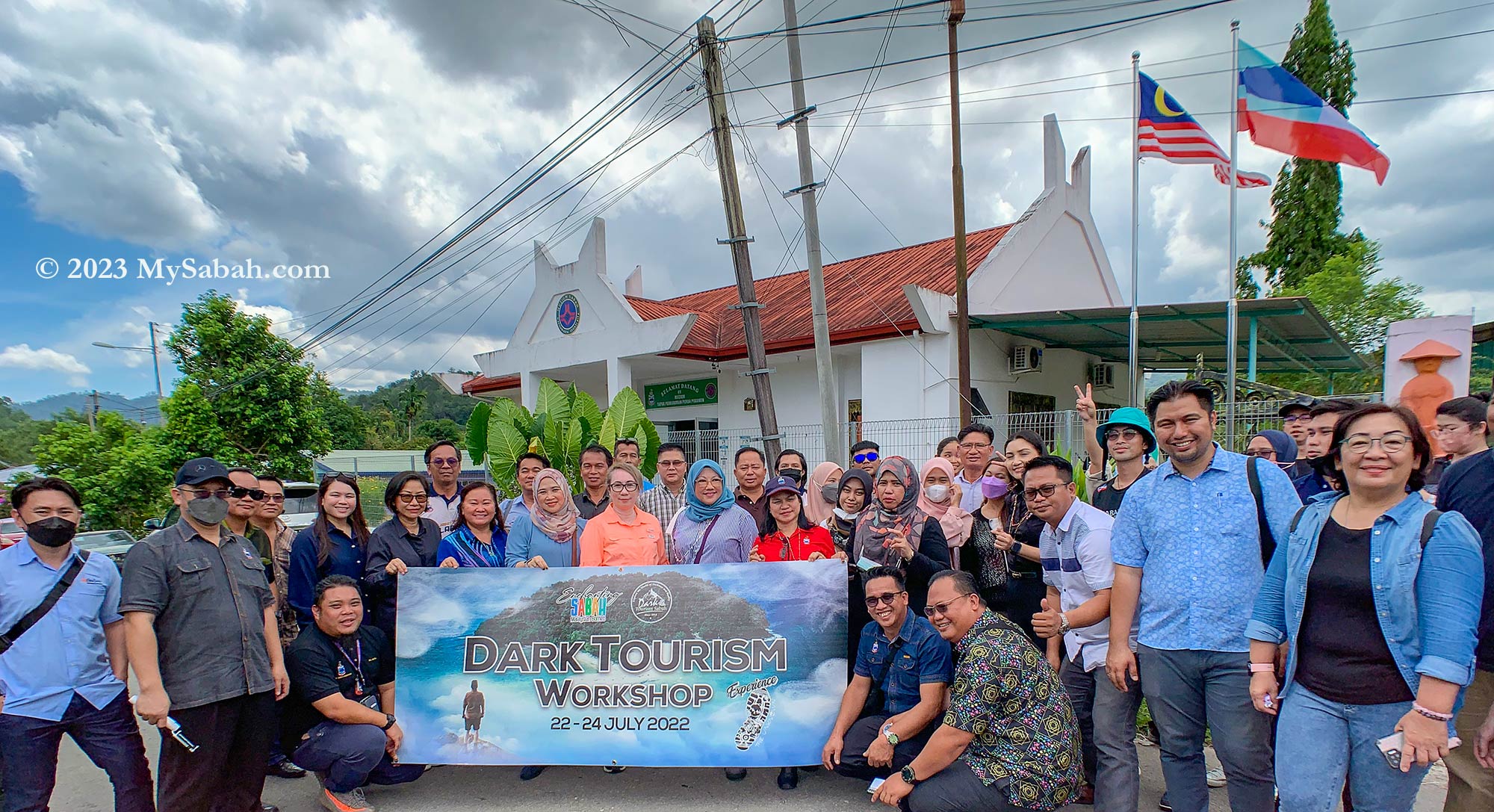
Group visit to Pogunon Museum by participants of Sabah Dark Tourism workshop. This museum is listed as one of the attractions of dark tourism.
An article dated 1st July 1884 on North Borneo Herald newspaper stated that Pogunon was the largest tamu (native market) in west coast that time. The tamu of Pogunon was held every 10 days and is considered as one of the earliest known tamu. Some inhabitants were wealthy because of this blooming marketplace.
Old ceramic plates and bowls that were buried with the jars
Now, here comes the interesting and important part, there were Chinese merchants who also traded in this tamu market. Their ships brought in some China products such as ceramic jars, plates, crocks, dishware and other ornaments, which were used for exchanging herbs, spices, hardwood, agarwood, resin and even birds feathers from the locals. This explains where the Chinese jars of Pogunon coming from. Some of the Chinese married the native Dusun and settled in Sabah. Therefore, almost every villagers in Pogunon Village have Chinese connection.
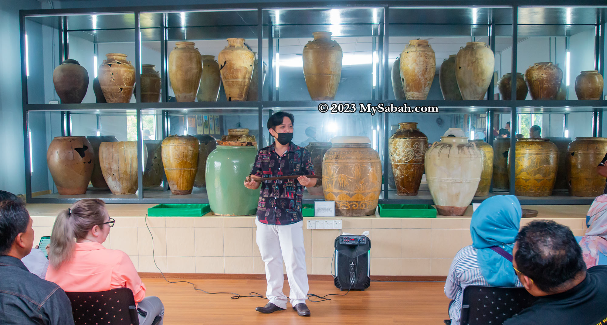
Burial Jars
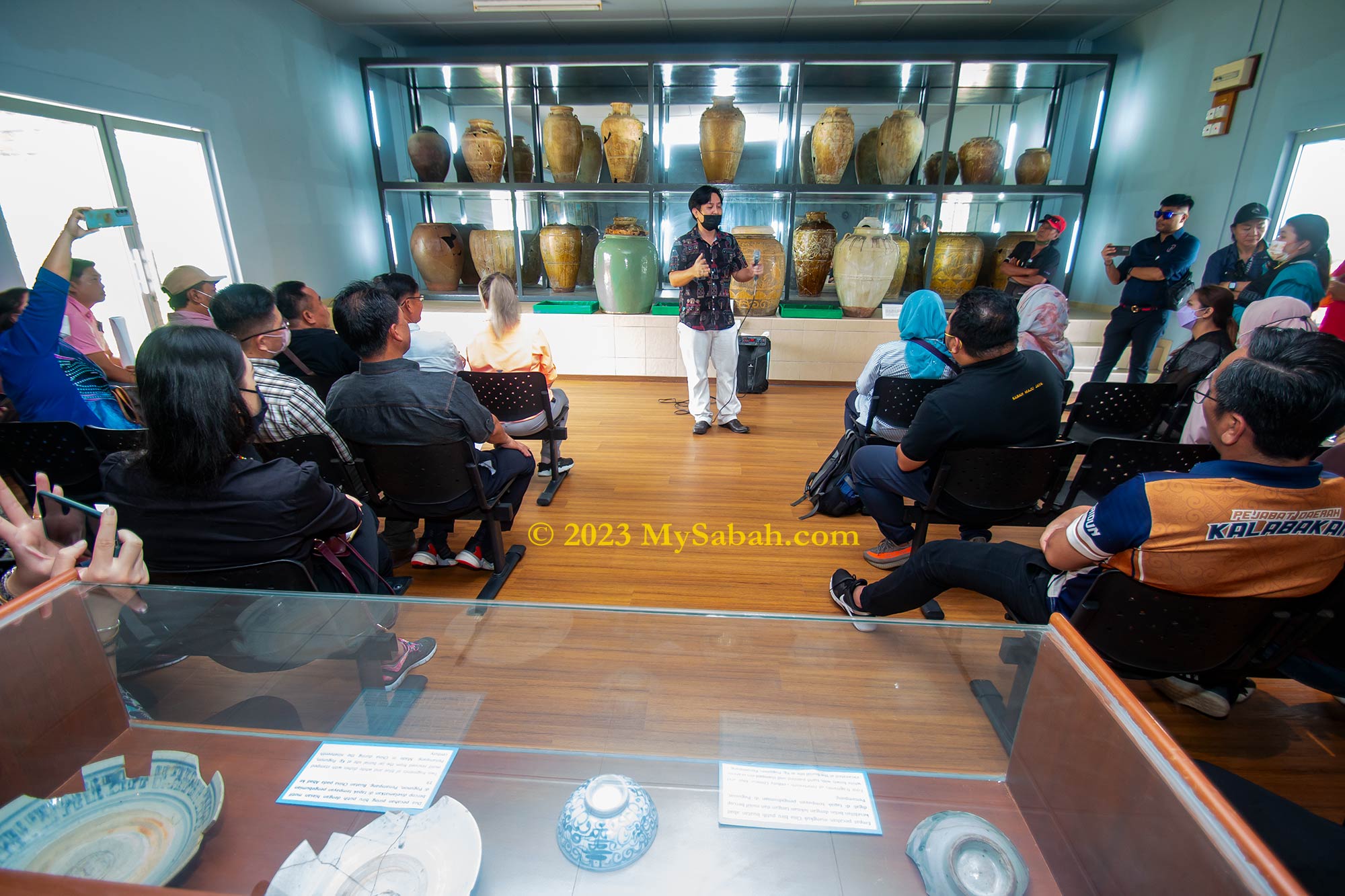
There is a collection of about 20 burial jars in different size and designs being displayed in the exhibition hall of Pogunon Museum, together with other artifacts such as plates, skeleton and headhunting sword. On the walls are information boards with photographs and description, in English and Malay, on the burial and megalithic cultures of Sabah Borneo.
Collection of burial jars at Pogunon Community Museum
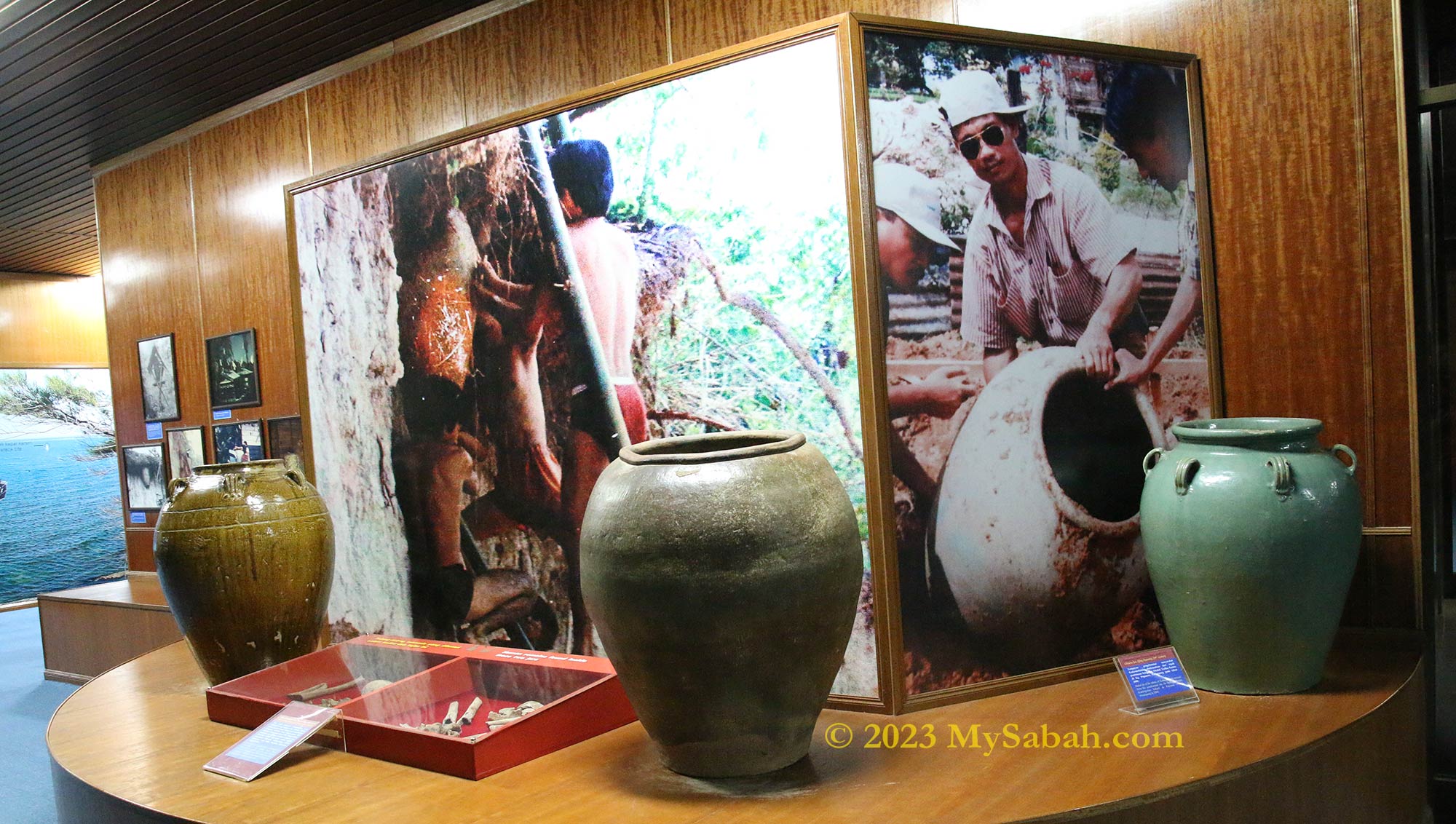
In old days, Kadazandusun, the largest indigenous group of Sabah, has been practicing burial by jars (jar is locally known as tajau) for centuries. The natives believed that jar is the home and shelter for the deceased in the next world. The dead body was stored in fetal position in a large jar, normally at least a metre in height. If the mouth of jar was too narrow, they would cut the jar in half along the rim, so they could fit the corpse inside and joined the pieces again.
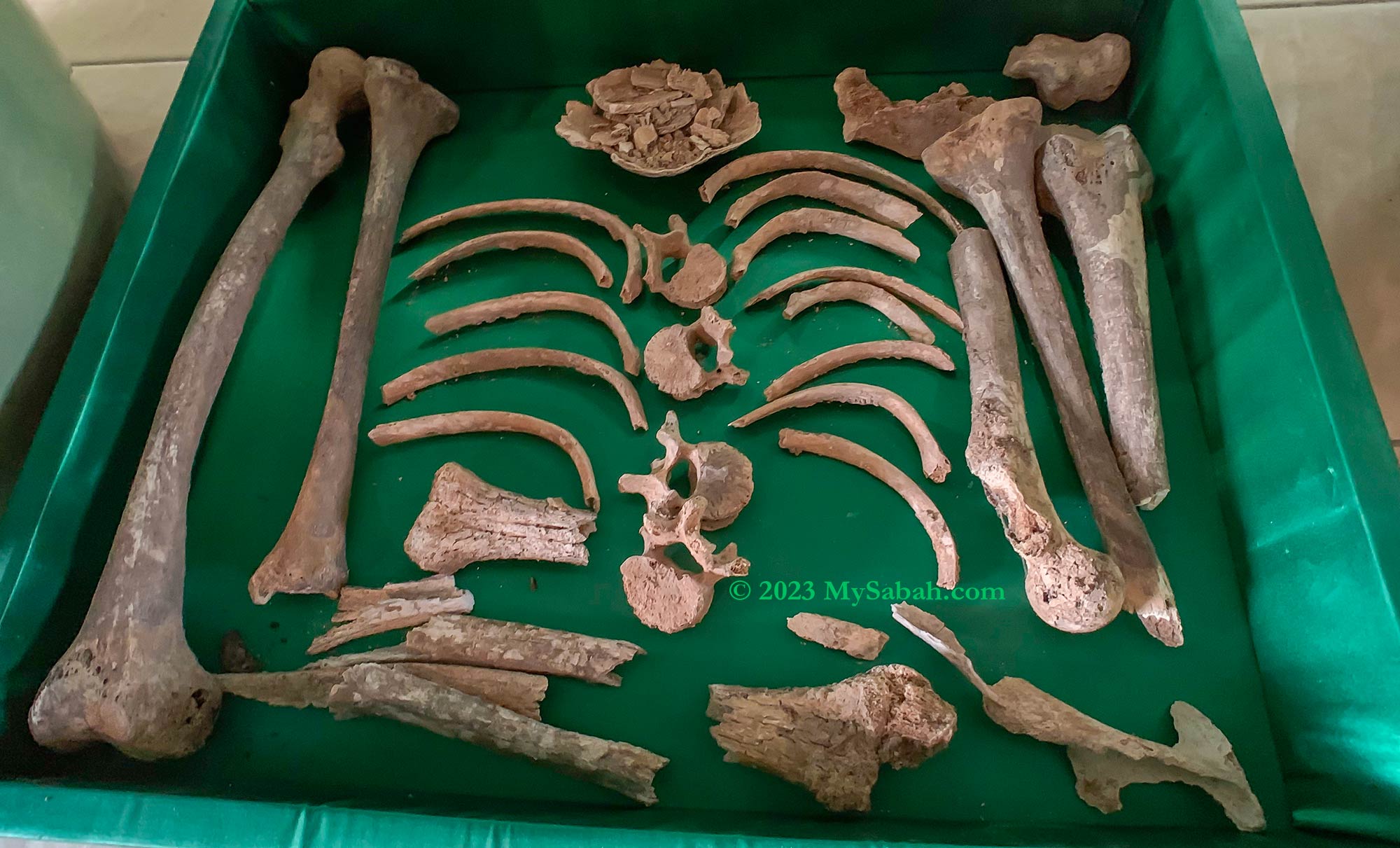
Skeleton remains in the burial jar of Pogunon
Favourite personal adornments and belongings of the deceased like plate, bowl, ceramic, silver coin belts, ring, button, necklace, beads, bracelet, and shoes would be placed in the jar too. The mouth of the jar was then sealed with a plate and resin or bee wax. For leaders or village heads, gong would be used as the cover. Lastly the burial ceremony was completed with rituals and prayers led by Bobohizan.
Antique jars of Sabah from China, Thailand, Vietnam, and other countries (photo in Sabah Museum). The oldest China ceramic found in Sabah is from Song Dynasty period (960-1279).
Ceramic jar was a luxury item, so burial by jar is only for the prestigious people. Majority of ceramic jars at Pogunon belong to headhunters and Bobohizans. The commoners were normally buried in bamboo or wooden casket, or cheap (brown) earthen jars. The most expensive jars are from China, especially those with beautiful engraved or embossed patterns. The oldest jar found in Pogunon is about 800 years old (and is given to Sabah Museum).
It’s a special experience to listen to the ancestor stories that happened right under our feet.
Owning one or more big and beautiful jar was a sign of wealth, probably same as owning a designer handbag from Hermès Birkin today. The valuable ceramic jars from Pogunon are in blue and white, or five colours, which were made during Yuan (1271-1368) and Ming (1368-1644) Dynasty periods in China. The locals also used jars for many purposes, for example, heirloom, currency for trading, storage, brewing wine, dowry.
Video of a 2-minute tour at Pogunon Museum
The location of the burial jar is often marked by a rock that served as a tombstone, so it’s easier for the family to locate.
Gravestone and Megalithic Culture
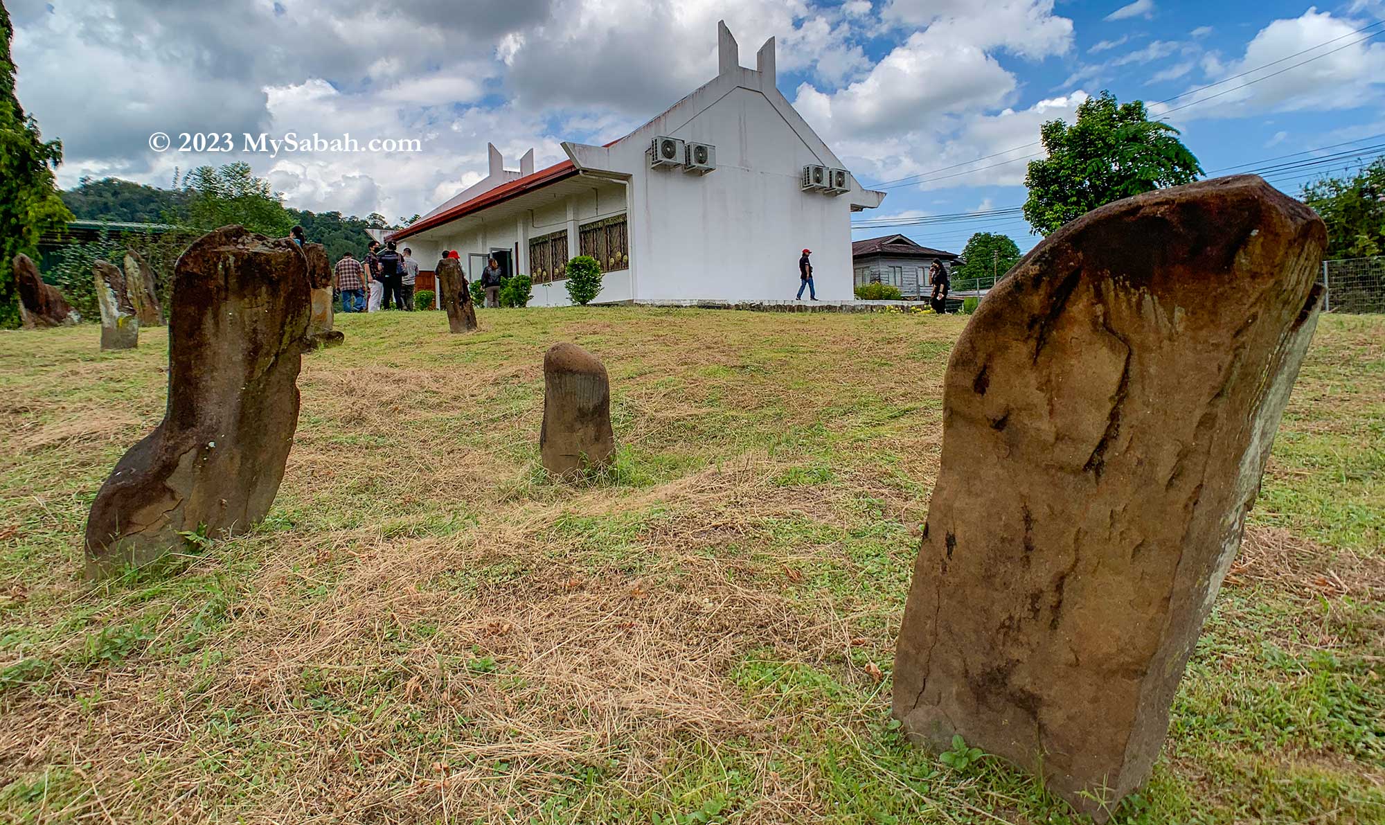
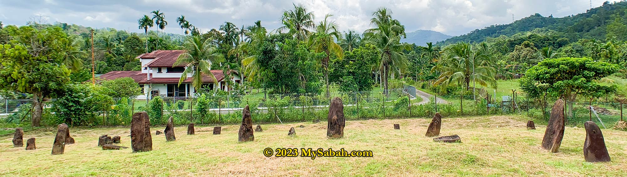
There are 32 sandstone markers (menhirs) of various size and shapes at the compound of Pogunon, each marks the final resting place, and to indicate the gender and age of the persons being buried. Megalithic practices in Sabah existed from 15th century to the end of 19th century.
Rock markers of ancient graves at Pogunon Museum. There are about 30 of them here in different sizes and shapes. The megalithic tradition is used as an intermediary to their ancestors because they believe their ancestors can bless them from another world.
In megalithic culture of Sabah, a rock could be a grave or territory marker, a memorial, or an oath stone. In fact, the name Penampang, the district where Pogunon is situated, originates from the Kadazan word pampang, which means a big rock.
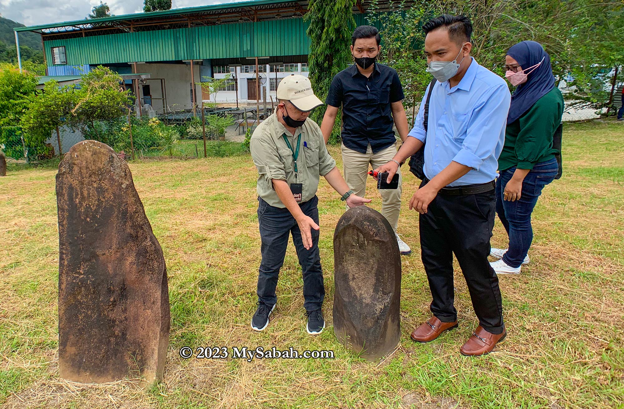
You can tell the gender of the buried from the shapes of their grave markers. The left one belongs to a male, while the right one with rounded top belongs to a female.
At Pogunon cemetery, larger rock is an indicator that the buried is of high status. There is one small rock near the edge that might belong to an infant who probably died in miscarriage. In general, the ‘male’ rocks have rough edges, with angular and pointy top, while the ‘female’ rocks are round and smooth at the top.
The menhirs in Sabah are found in several districts, with the largest deposits found in Penampang, Putatan, Kinarut and Tambunan.
Headhunting History
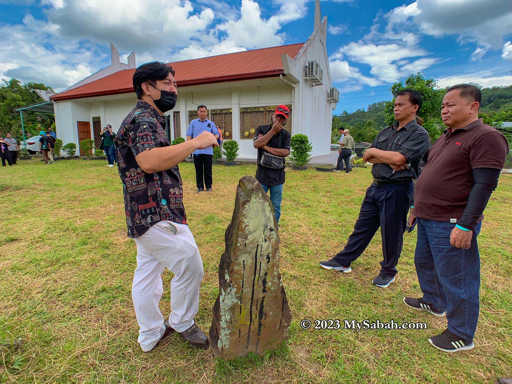
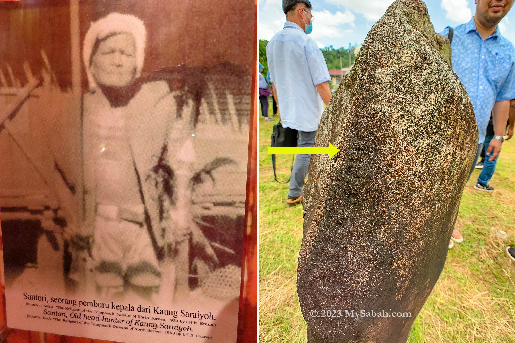
Check out a few larger stone markers at Pogunon and you will find a few of them have notches carved into the side. These are the menhirs of headhunter warriors and the notches indicating the number of heads they took during their lifetime.
Left: old photograph of a Dusun headhunter. Right: The number of the notches on the tombstone represents the number of heads taken by the deceased.
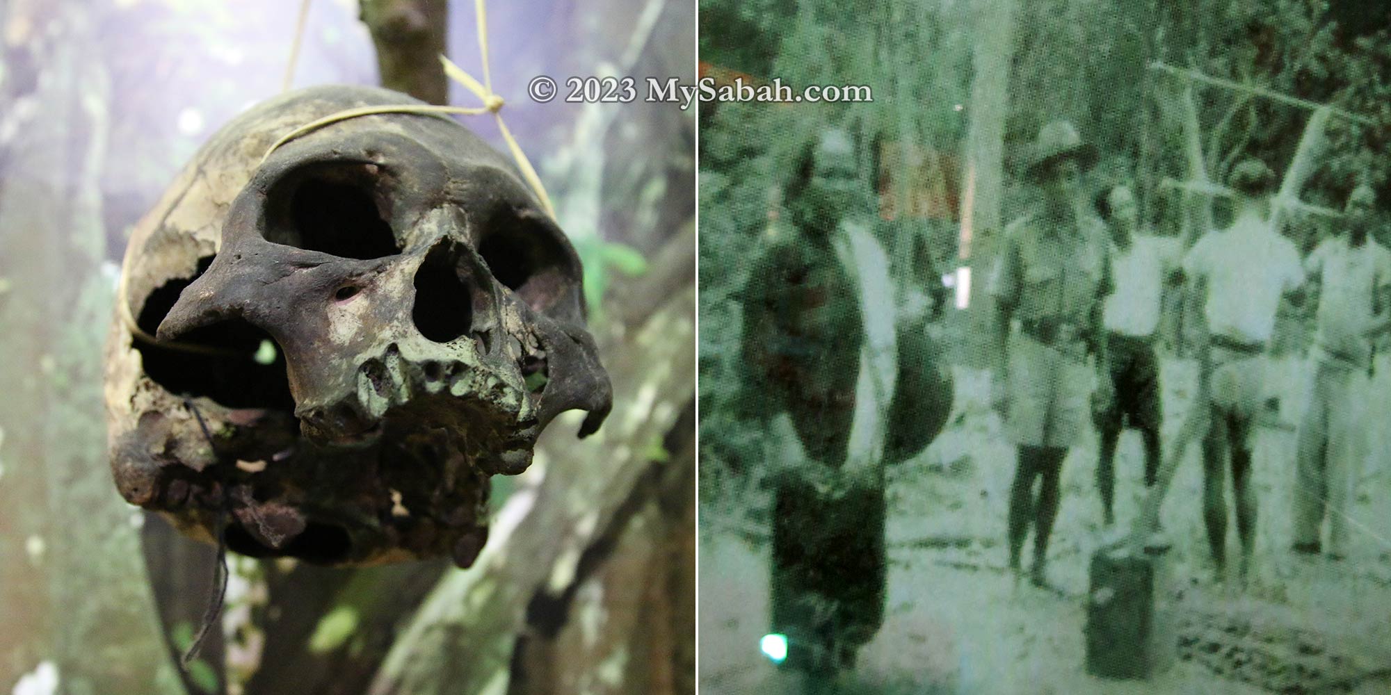
Pogunon was the gateway between highland and plains hence making this place a war zone among the neighbouring tribes. Headhunters believed that they could capture the power and spirits of the beheaded. Owning many enemy skulls was a sign of bravery and strength.
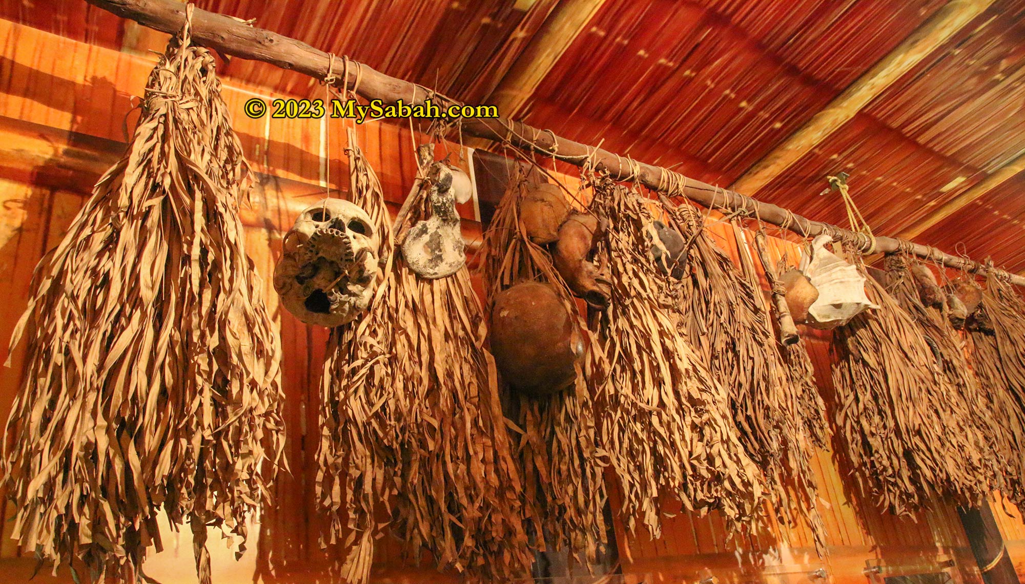
Enemy skulls were proudly displayed in longhouse as the trophy of the headhunters
Therefore, skulls were placed and hung everywhere in Pogunon during the headhunting era. Bobohizans there were chanting day and night to appease the spirits of the skulls. The skulls were said to move even on a windless night to warn of imminent attacks. They could even made war cry to scare off the invading enemies.
Museum staff (James) sharing the stories of headhunting and Bobohizans
The tour to Pogunon Museum is perfected by the storytelling of the museum staff, James. His stories are so intriguing and vivid that you can visualize what was going on. One of the stories being a Bobohizan ambushed and beheaded the Japanese soldiers at night during World War II. She was never caught of the assassination.
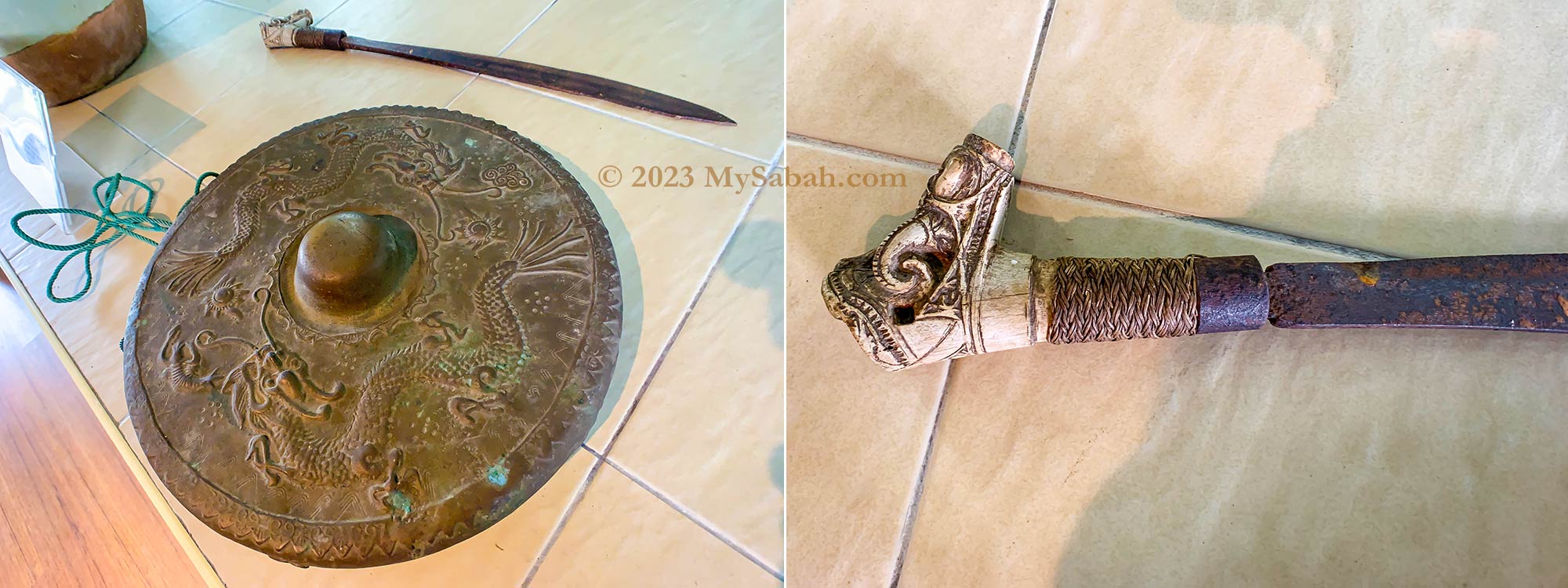
Left: sword and gong. Right: real headhunting sword with Dayak decoration. The sword can’t be buried with its headhunter master, as the next world has no war. People with weak spirits are advised not to touch this sword or they would be possessed.
A headhunting sword owned by a late Bobohizan is another highlight of this museum. The hilt of this Gayang sword is made from a deer’s antlers and has Dayak-styled designs and motifs engraved on it. This sword took many lives including the Japanese.
Left: skulls displayed in Sabah Museum. Right: old photograph of people dismantled the hut used for hanging heads
Pogunon Village was used to be a stronghold of the old belief and headhunting culture, before the arrival of British and their religion. When British ruler started banning headhunting in 1883, countless number of skulls were burnt, buried or thrown away by the villagers, which marked the end of headhunting era.
How to get there
Since Pogunon Museum operated in April 2009, it has received thousands of tourists, historians, researchers, enthusiasts, and students. The entry is free. This museum is situated at Pogunon Village of Penampang district, and highly accessible by car. It’s about 11 km from Kota Kinabalu City and 3 km from Donggongon town. The junction to Pogunon is located at the Penampang-Tambunan road. If you use navigation apps such as Waze, set your destination to Muzium Komuniti Pogunon.
Junction to Pogunon Village (Kampung Pogunon) in Penampang
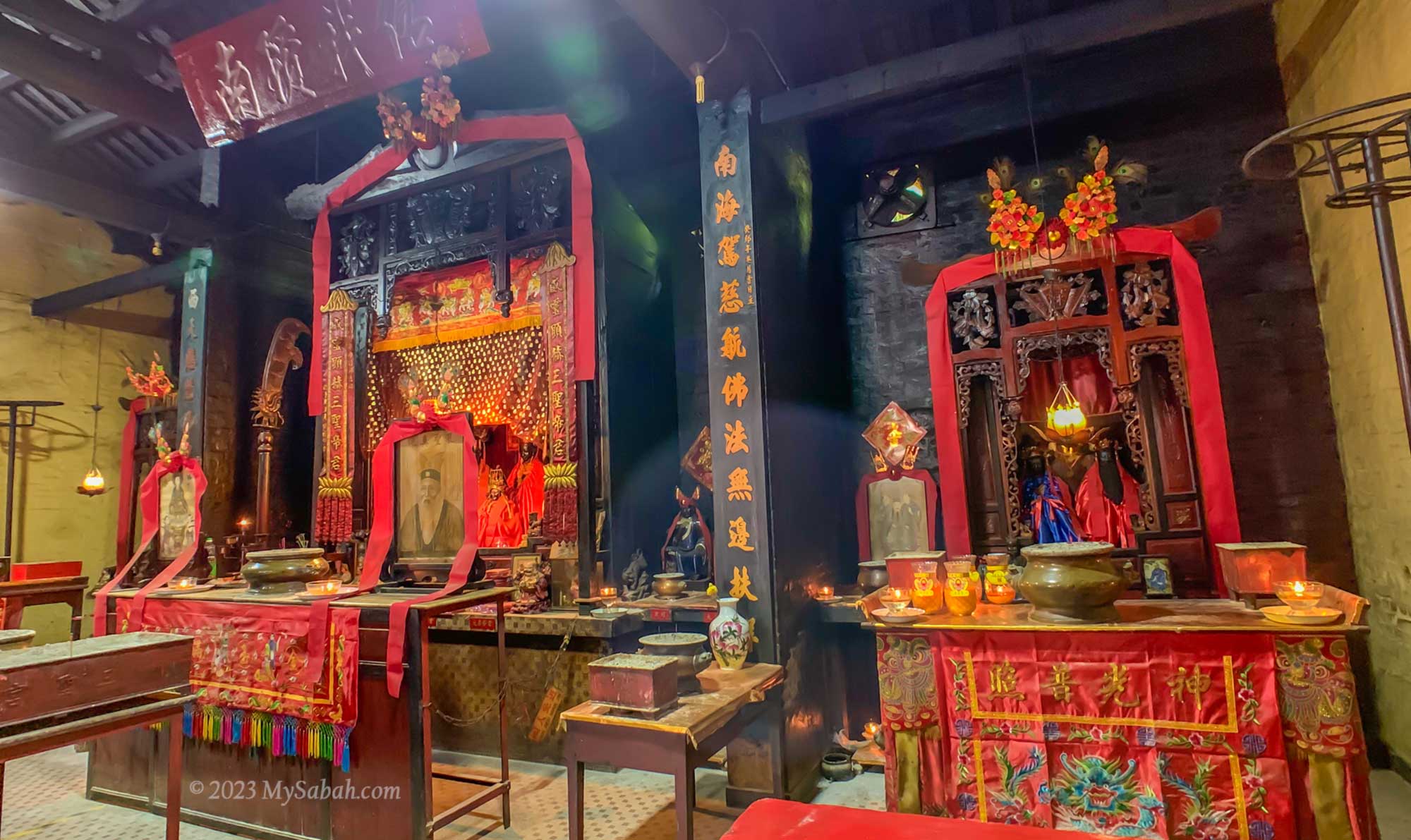
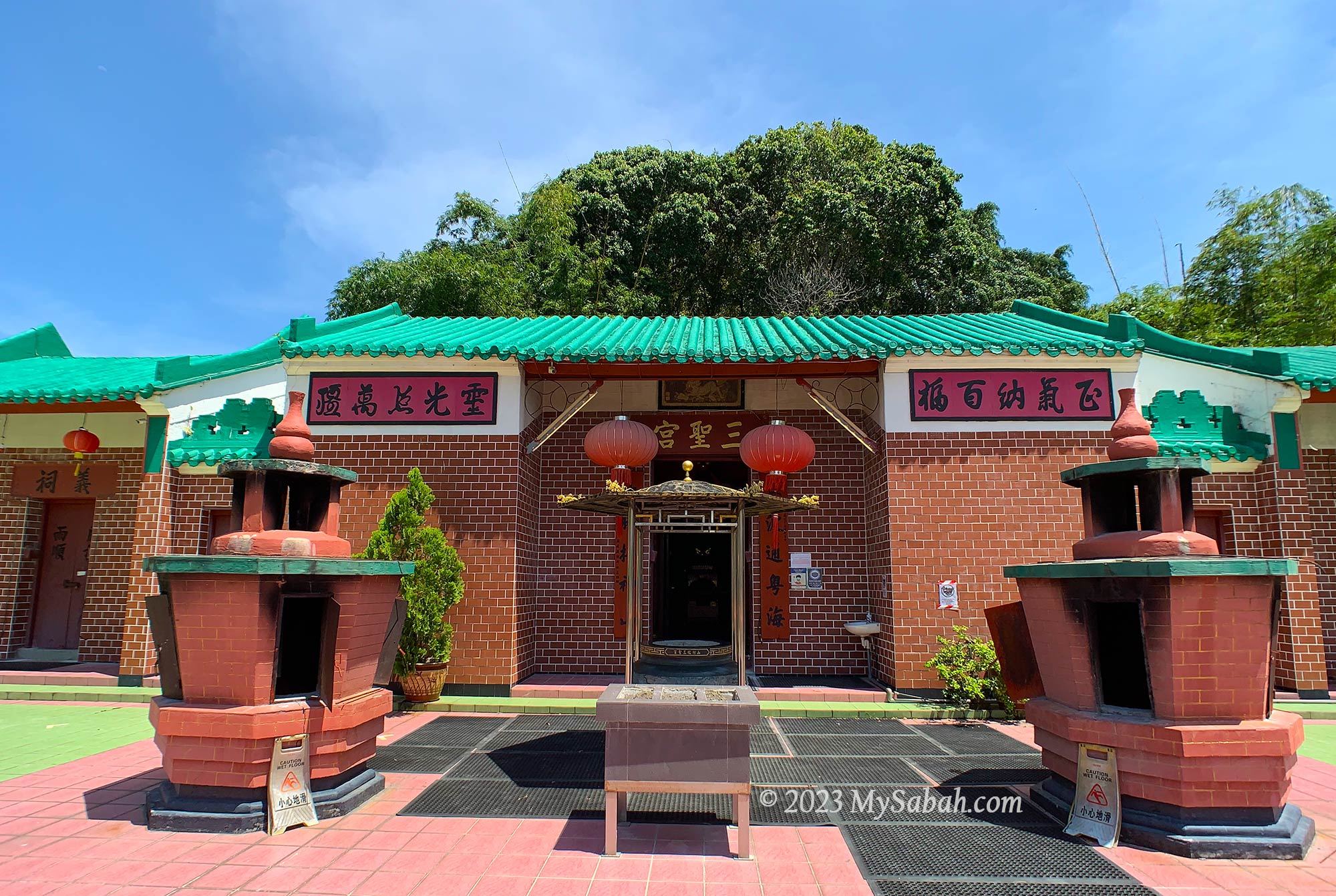
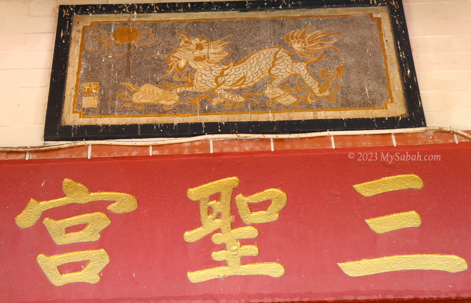
Our world changes so fast nowadays. We may not even remember or recognise something created 10 years old. In Sandakan, there is a Sabah temple that remains standing after 130 years. Built in 1887, Sam Sing Kung (Chinese Name: 三聖宮) Temple is the 3rd oldest Chinese temple in Sandakan. It was facing the sea in the beginning, and now it’s facing and blessing the Sandakan City.
Sam Sing Kung Temple (三聖宮), the third oldest Chinese temple of Sandakan. The oldest temple is Goddess of Mercy Temple (1868), followed by Tam-Kung Temple (譚公祖廟) built in 1876.
Sam Sing Kung witnesses the history of Sandakan, from the era of North Borneo (now Sabah) colony, formation of Malaysia in 1963, to a famous nature tourism destination of Borneo today. Sam Sing Kung is also one of the attractions in Sandakan Heritage Trail.
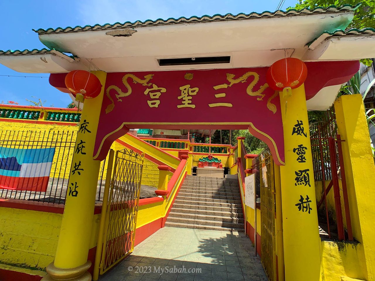
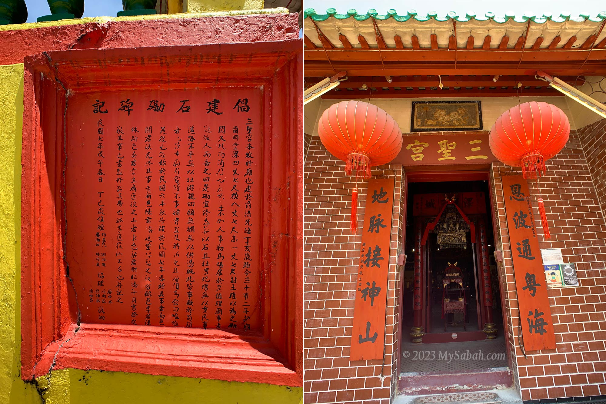
Entrance to Sam Sing Kung Temple (三聖宮)
The temple was built by the four Chinese communities, namely the Hakka, Cantonese, Hainanese and Teochew, mainly from the Guangdong Province of China. In late 19th century, thousands of Chinese admitted by British rulers to work as labourers, farmers, and merchants to develop Sabah. As the old saying goes, “wherever there is Chinese, there is temple,” naturally these Chinese immigrants also brought in their religions and established Sam Sing Kung as a religious centre in Sandakan, which is also known as the “Little Hong Kong” .
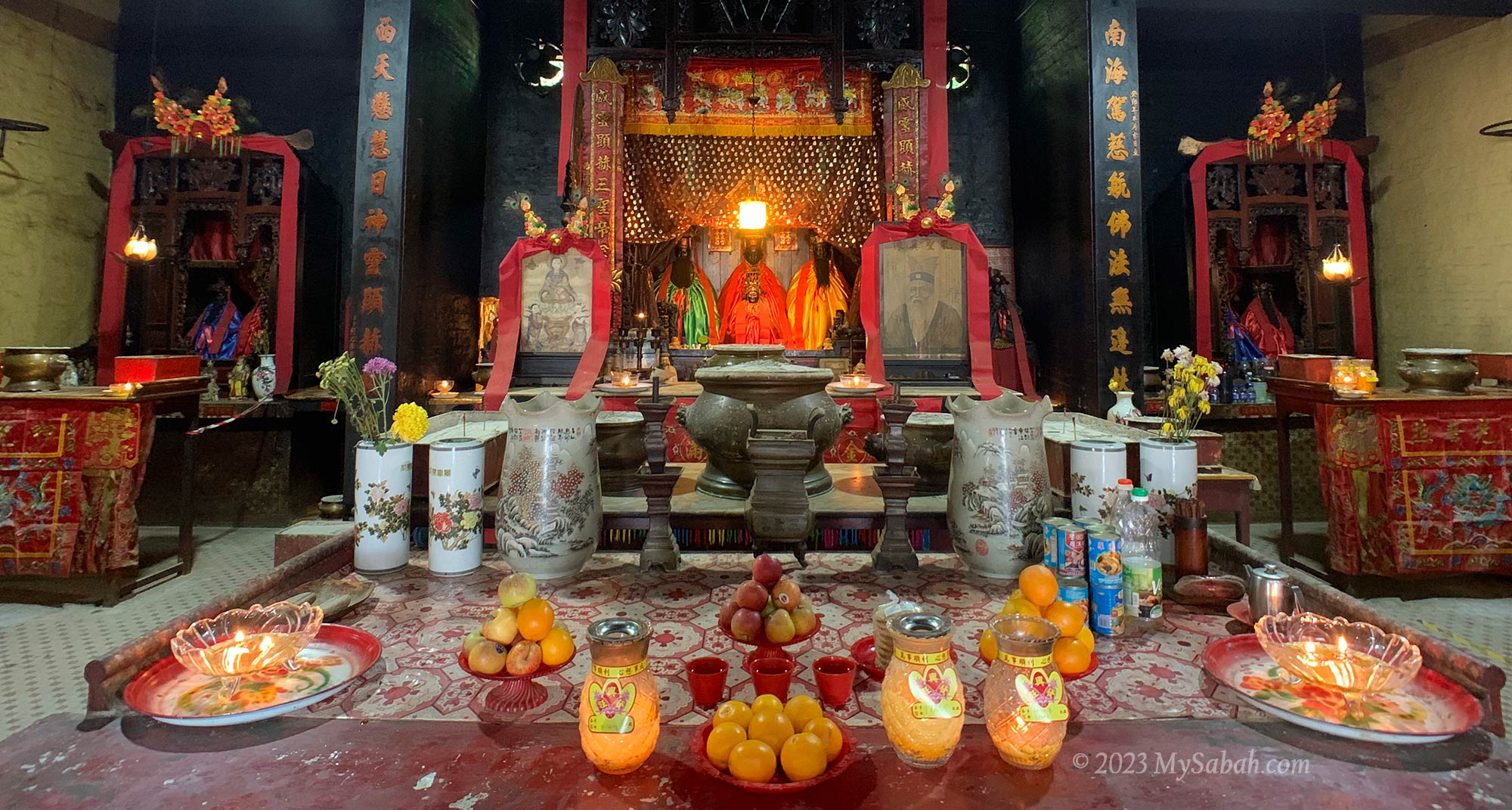
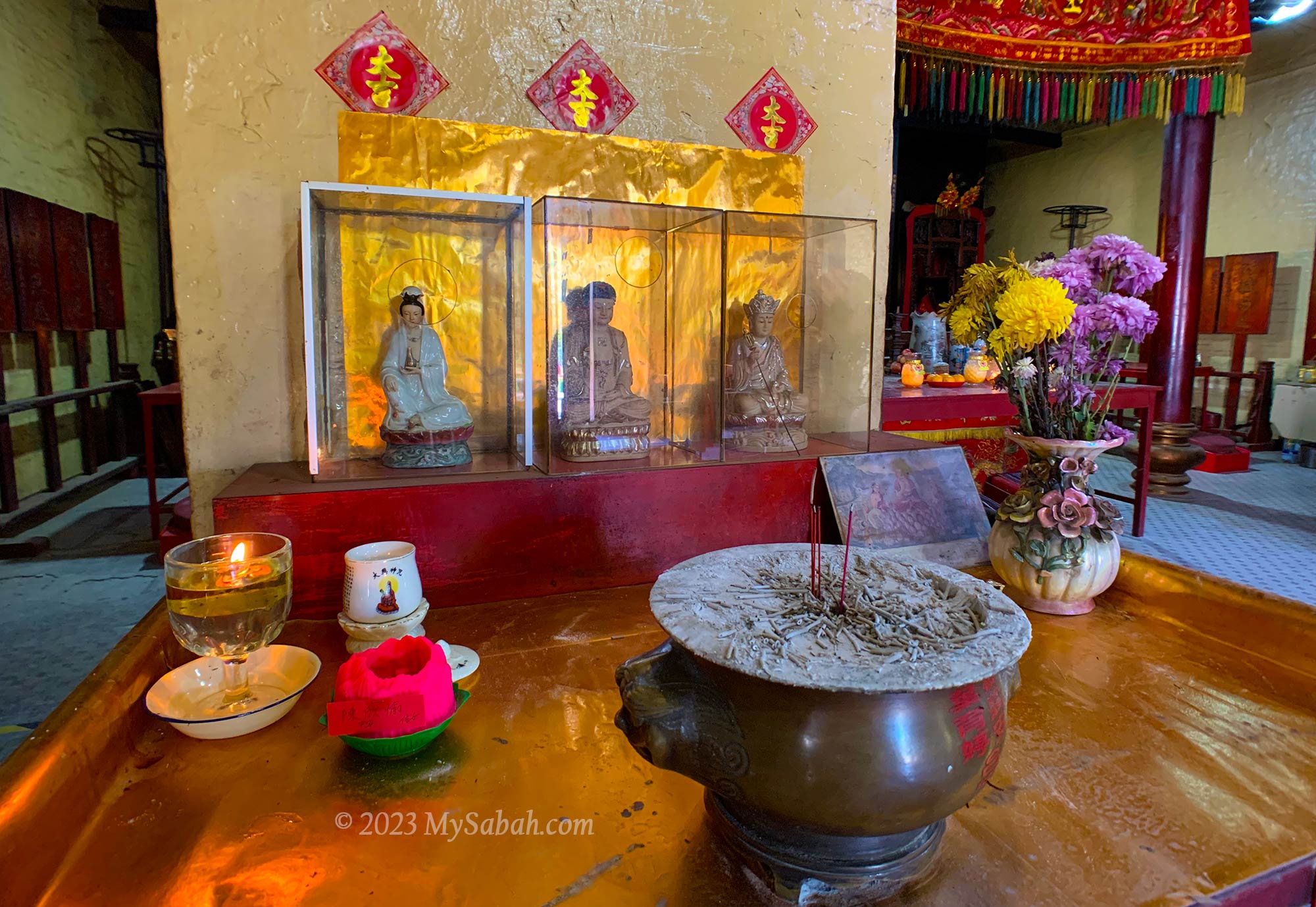
Altars of Lord Guan (关云长), Goddess of Tin Hou (天后 / 妈祖), and Min Cheong Emperor (文昌帝君)
Deities in Sam Sing Kung
Literally Sam Sing Kung means the Temple of the Three Saints, who are:
Lord Guan (关圣帝君) – Saint of Righteousness, a symbol of justice and loyalty
Mazu (天后妈祖) – Worshipped by fishermen (especially Hokkiens) and seafarers for protection
Wenchang Emperor (文昌帝君) – Wanna do well in exam, or your children are addicted to gaming? Let him helps
Left: tablet that records the history and story of Sam Sing Kung Temple. Right: Front door of Sam Sing Kung Temple
The three saints are great combination because they can answer prayers on prosperity, peace and protection, and health, which cover most wishes of their followers. There are other deities that serve more specific roles. For example, if you want to have a baby, you may ask the Gold Flower Goddess (金花娘娘 / 送子娘娘), or me.
Guanyin (观音), Buddha (佛祖), and the Bodhisattva of the Great Vow (地藏王菩萨)
Sam Sing Kung is a Taoist temple that practices polytheism, which believes that there are multiple gods or deities, they are like the officers of heaven and underworld. About 20 deities are sitting in Sam Sing Kung, to name a few, Confucius (孔夫子), God of Earth (福德), Protector of Carpenters and Construction (鲁班先师), and City God (城隍爷). Taoism and Buddhism have been influencing each other for thousand of year in China, so you can find altars of Buddha such as Guanyin in this temple.
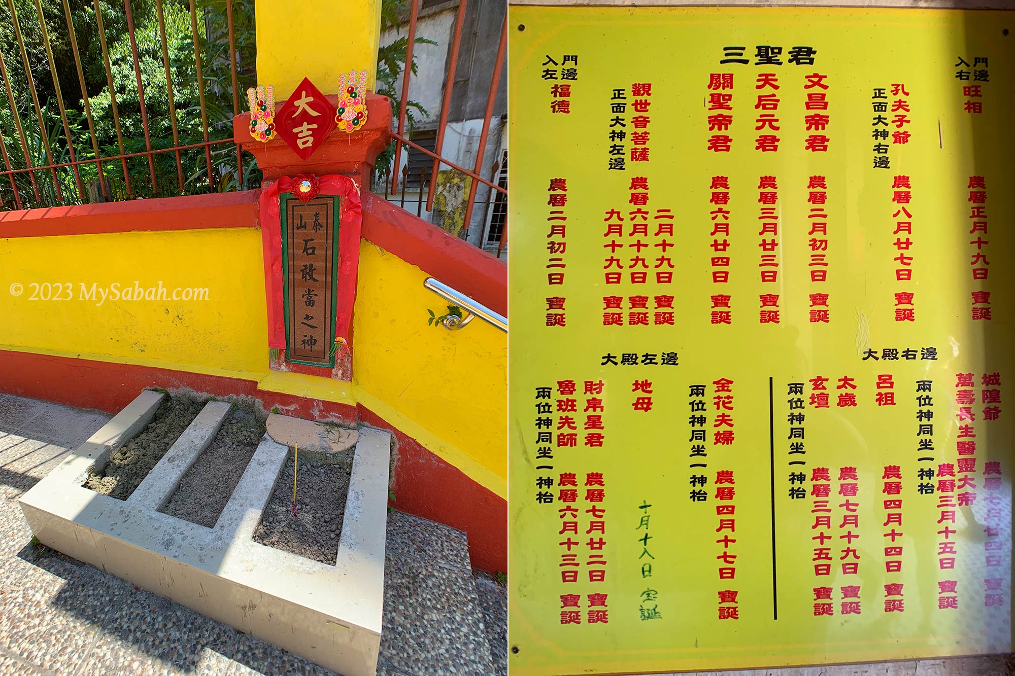
Left: Lukang Shigandang (石敢当) that drives evil spirits away. Right: list of deities seated in the temple
Artifacts
Sam Sing Kung is truly a temple of memories and heritages. Many items, from desk, bell, calligraphy, pillar beam, divine poems board to plaques are artifacts with historical values. Even after a century, Sam Sing Kung is still a popular temple for local devotees, who visit this temple for blessing and divination, like what their great grandparents used to do.
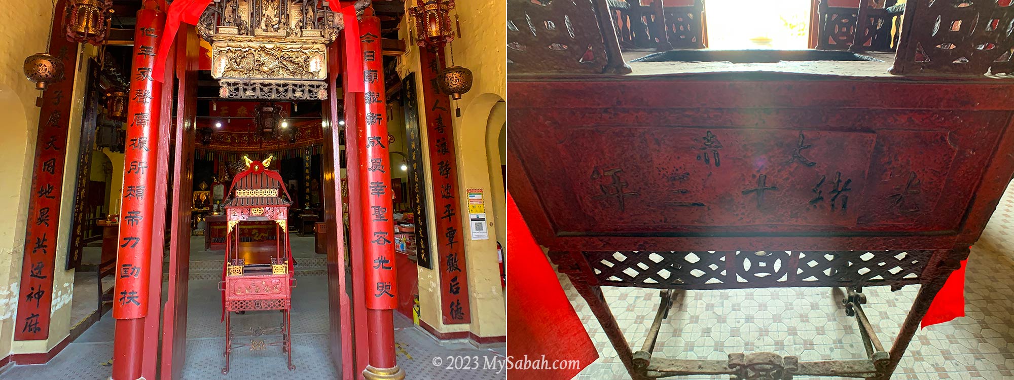
In the middle is the palanquin of Mazu, which is as old as the temple. At the right is the time stamp of the palanquin.
When you enter the main door, you would see the palanquin of Mazu, which is used in Chingay parade and is as old as the temple. Another interesting antique is a bronze chime bell donated by the first Kapitan Cina of Sandakan, Fung Ming Shan (馮銘山) about 100 years ago. Kapitan is a leader officially appointed by British rulers to look after the local Chinese community.
The drawing of Qilin (Chinese Unicorn) on top of banner seems really old.
Feel free to tour around or light up some incense sticks to worship the deities (if you are a believer). The staffs there are accustomed to tourists and would share some stories with you. This temple seems like an ideal filming location of mid-twentieth century drama due to its nostalgia vibe.
How to get there
Sam Sing Kung Temple is located at the edge of the town field at Singapore Road (Jalan Singapura), in the city centre of Sandakan (see Location Map). e-Hailing service (e.g. Grab) is readily available in the city, in case you need one.
Why I have poop on my bed if I’m in a dream of taking a dump, but wake up empty-handed when I dream about treasure? I’m so envy of Aki Korom, who was really getting something priceless, as promised in his dream. This is a true story happened in Sapulut, a district in the interior of Sabah.
The Discovery of Pungiton Cave
More than 50 years ago, the young Aki Korom was sleeping near the river with a few friends. In his dream, a tall man approached him and said, “come, let me show you something interesting.” Aki Korom followed him and they reached a large cave. The fairy said, “if you can find this cave, it’s yours to own.” He added, “however, there is a dragon guardian looks after this cave. You must not cause a ripple in the river when you go to the cave, or you will awaken the lurking dragon.” Aki Korom waked up and felt the dream was so real. His friends didn’t have the same dream though.
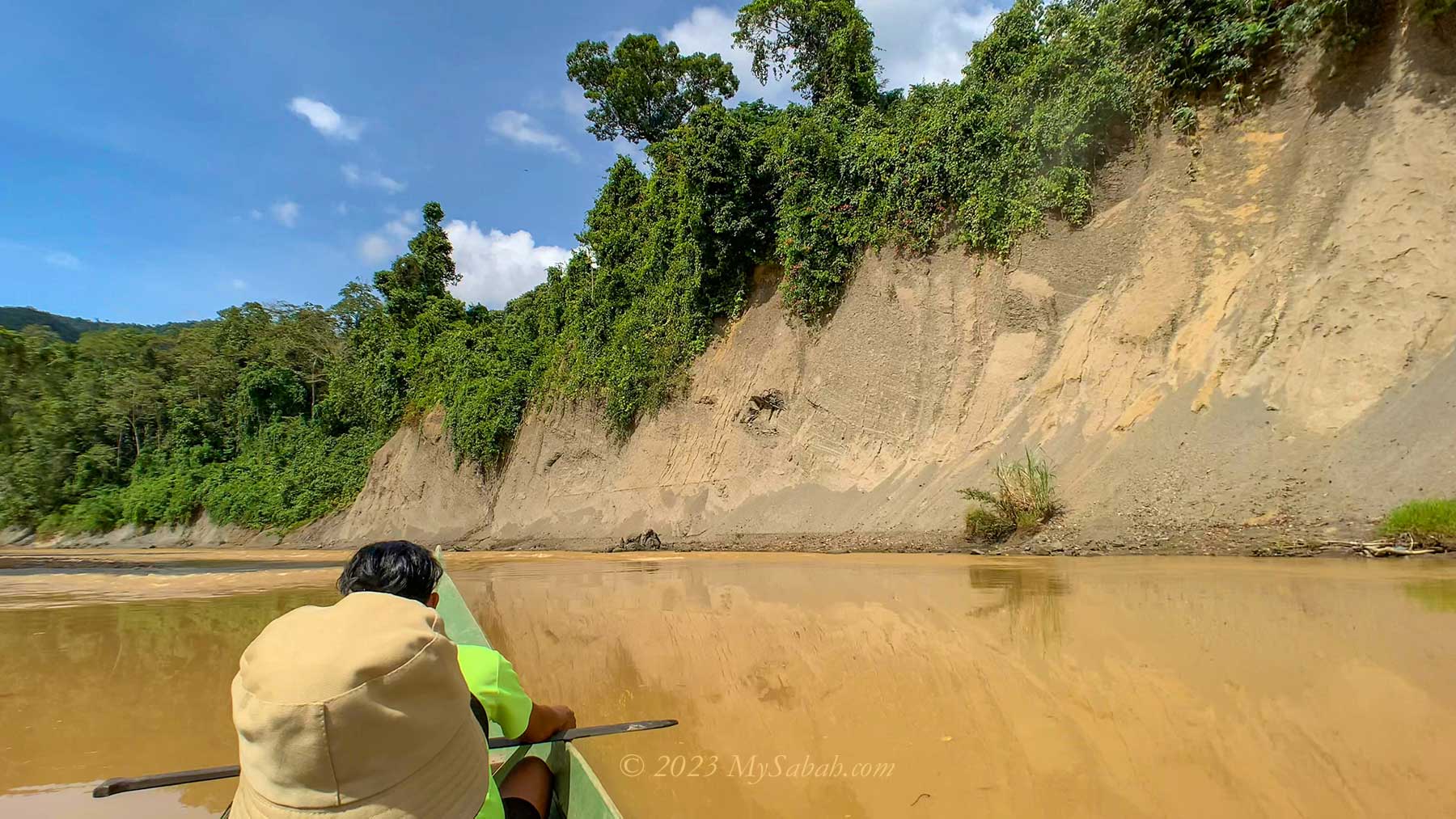
Boat transfer to Pungiton Camp from Labang Village in Sapulut
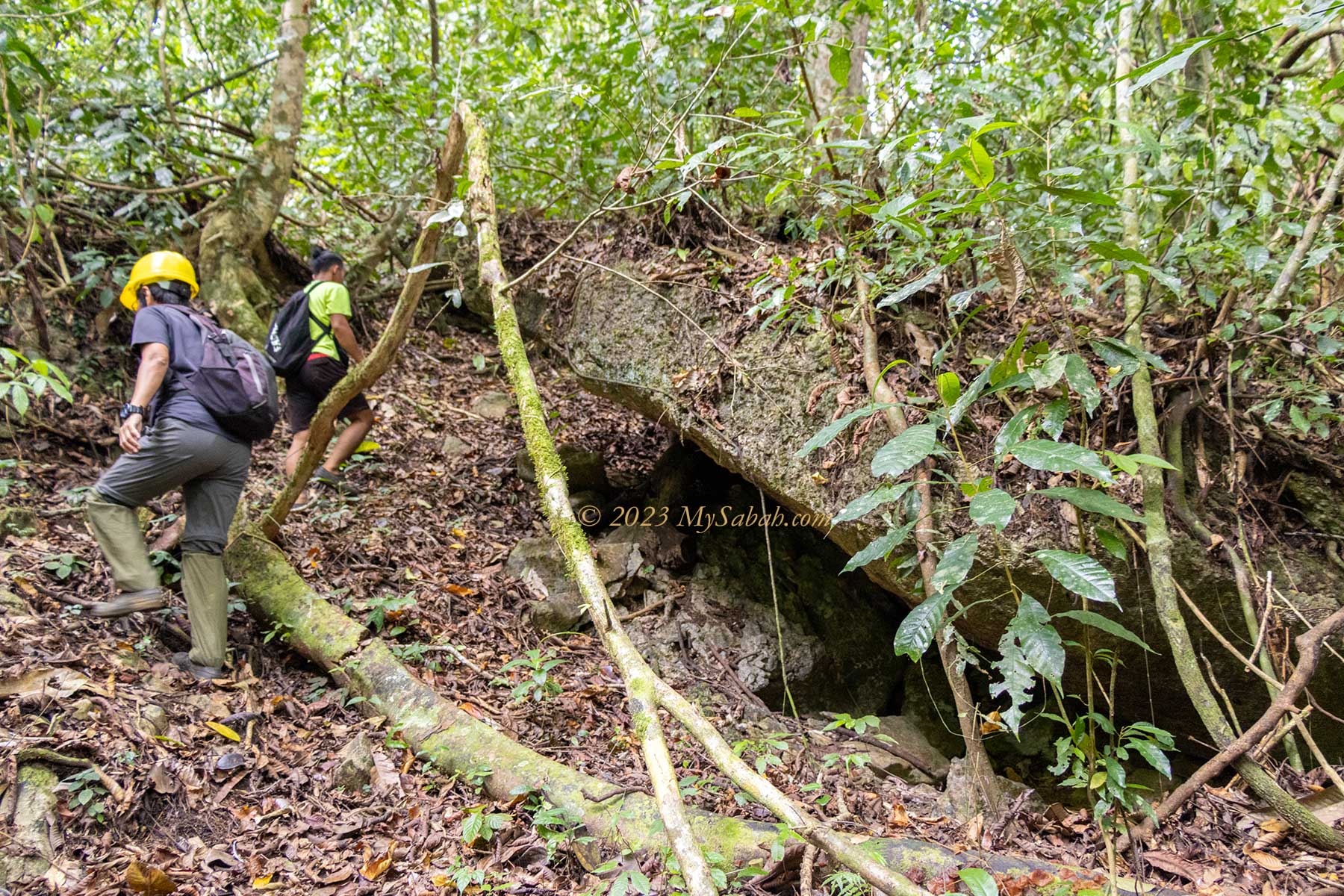
Aki Korom believed in what he dreamed and decided to locate the hidden cave. He went with a boat. A big log in the river was blocking his way. He remembered what the tall man taught, so he dragged the boat to move pass it quietly, without disturbing the dragon in the water. After some search in the forest, he found the limestone cave, which is the Pungiton Cave today. The cave was abundant with edible bird nests and big mushroom!
Pungiton Cave is named after bats, which are abundant inside the cave. But no Batman in this batcave.
Pungiton means bat in Murut language because this cave has a lot of bats. Pungiton Cave is still a secretive cave even after half a century of its discovery. Though its location is no longer a secret, nobody is able to reach the end of this cave, according to some villagers who have spent two or three days exploring deep in the cave before. Some say Pungiton Cave may link to another cave system on the opposite side of the hill. Instead of two days, I spent only 2 hours to explore Pungiton Cave but already impressed by its rich variety of cave features.
Pungiton Cave is like an isolated temple frozen in time. Cave always appears in adventure and horror stories. More than half of the windfall treasures in movies are found in a cave.
Aki Korom had a big heart. He was willing to share the cave with other villagers. He also turned down an offer by a mining company that wanted to quarry the limestone. I guess that’s why the fairy chose him.
You can watch this 4-minute video to hear and see everything in motions.
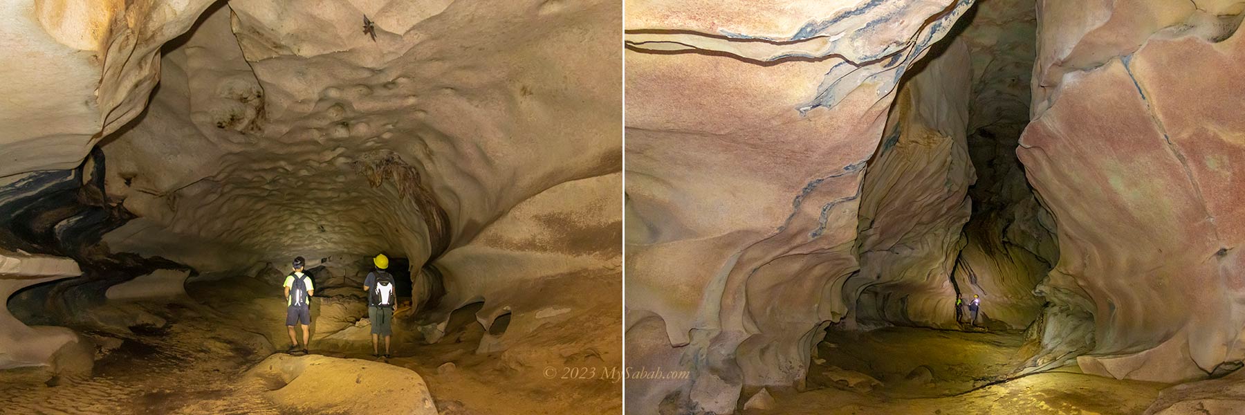
Overall, Pungiton Cave is a pristine and marvelous cave to explore. The caving experience there is 100% nature and you can check out various interesting rock formations closely. No creepy bug crawling all over the cave and no foul smell. Majority of the trail is soil ground or uneven surface scattered with debris, not difficult for beginners to walk on. The only so-called challenging part is climbing up a 20-feet slope with a rope.
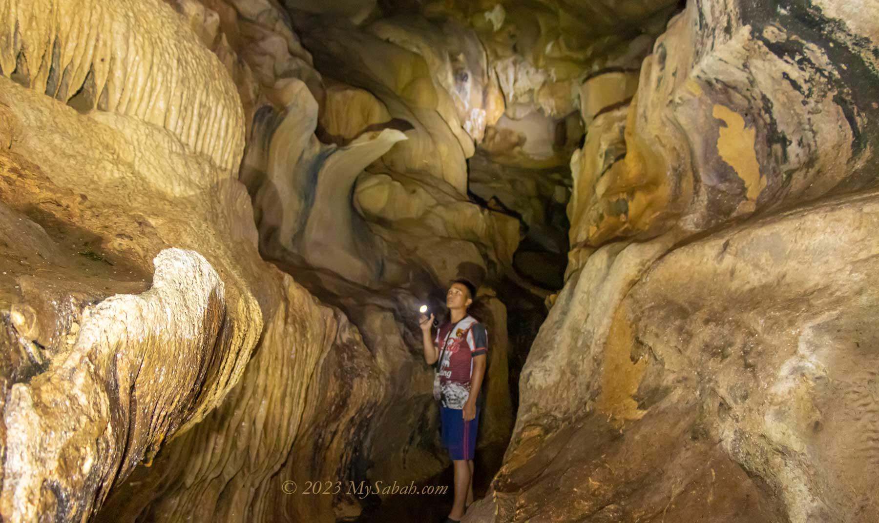
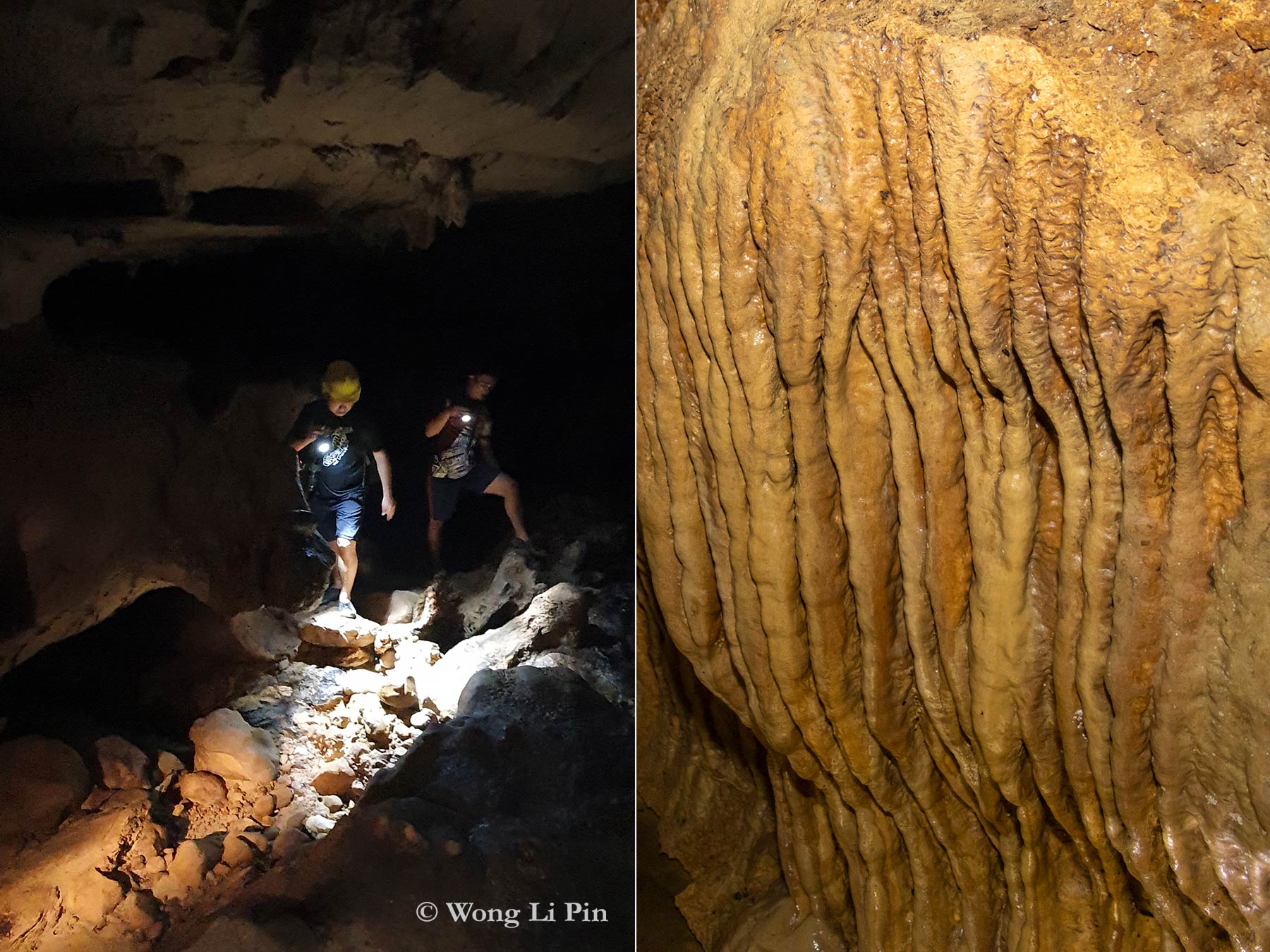
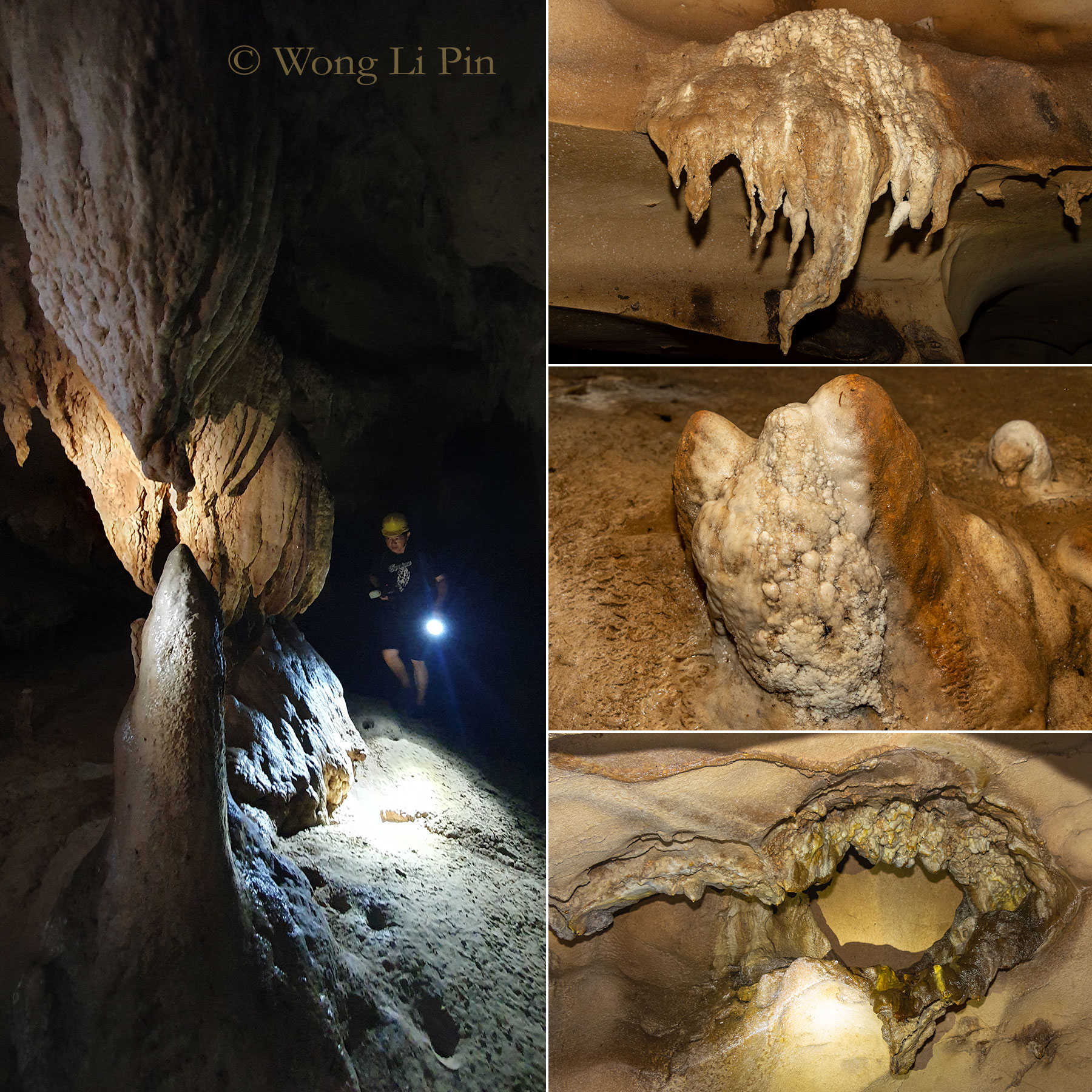
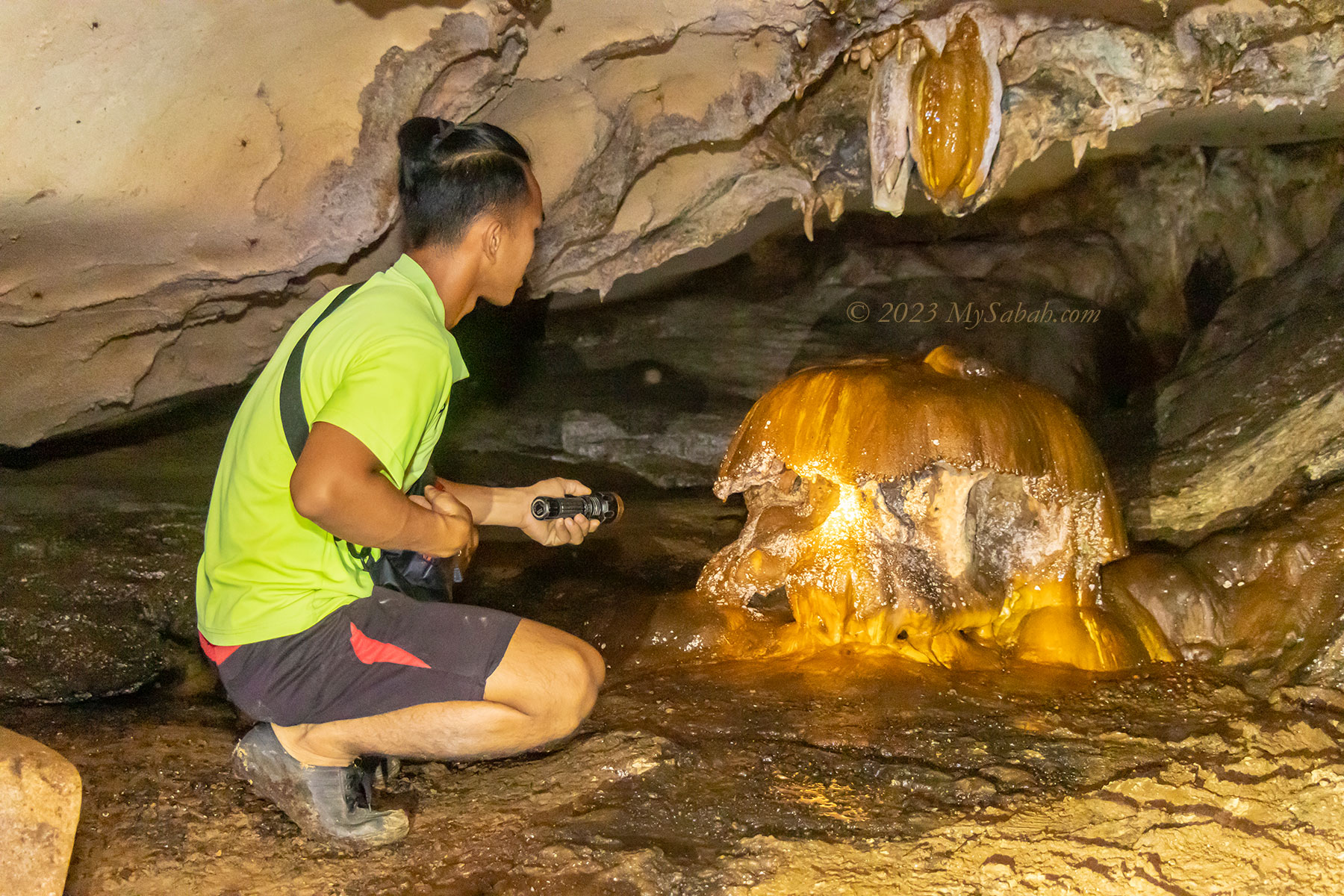
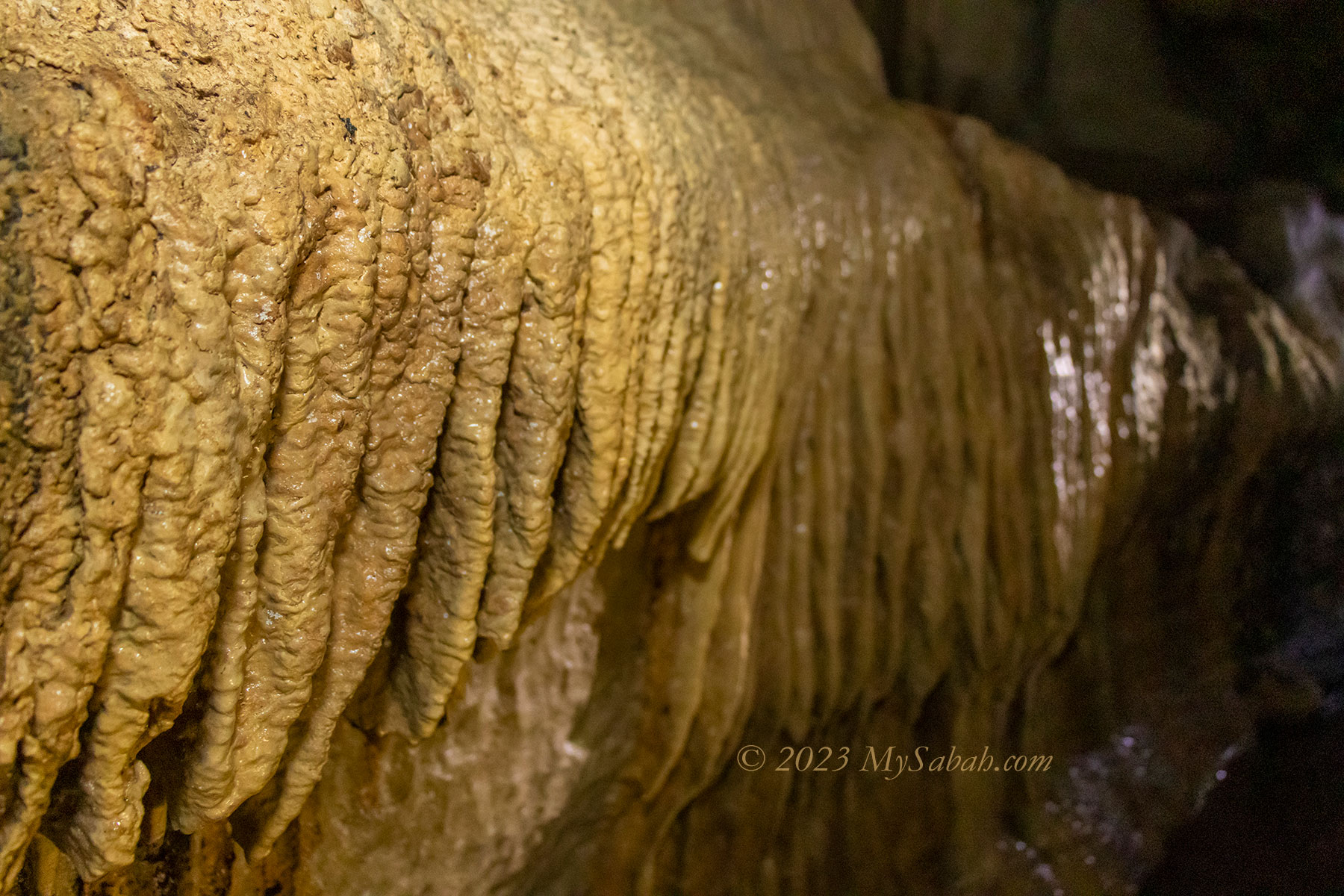
Left: me exploring Pungiton Cave in the dark. Right: Flowstones, sheets of calcium carbonate on the cave walls
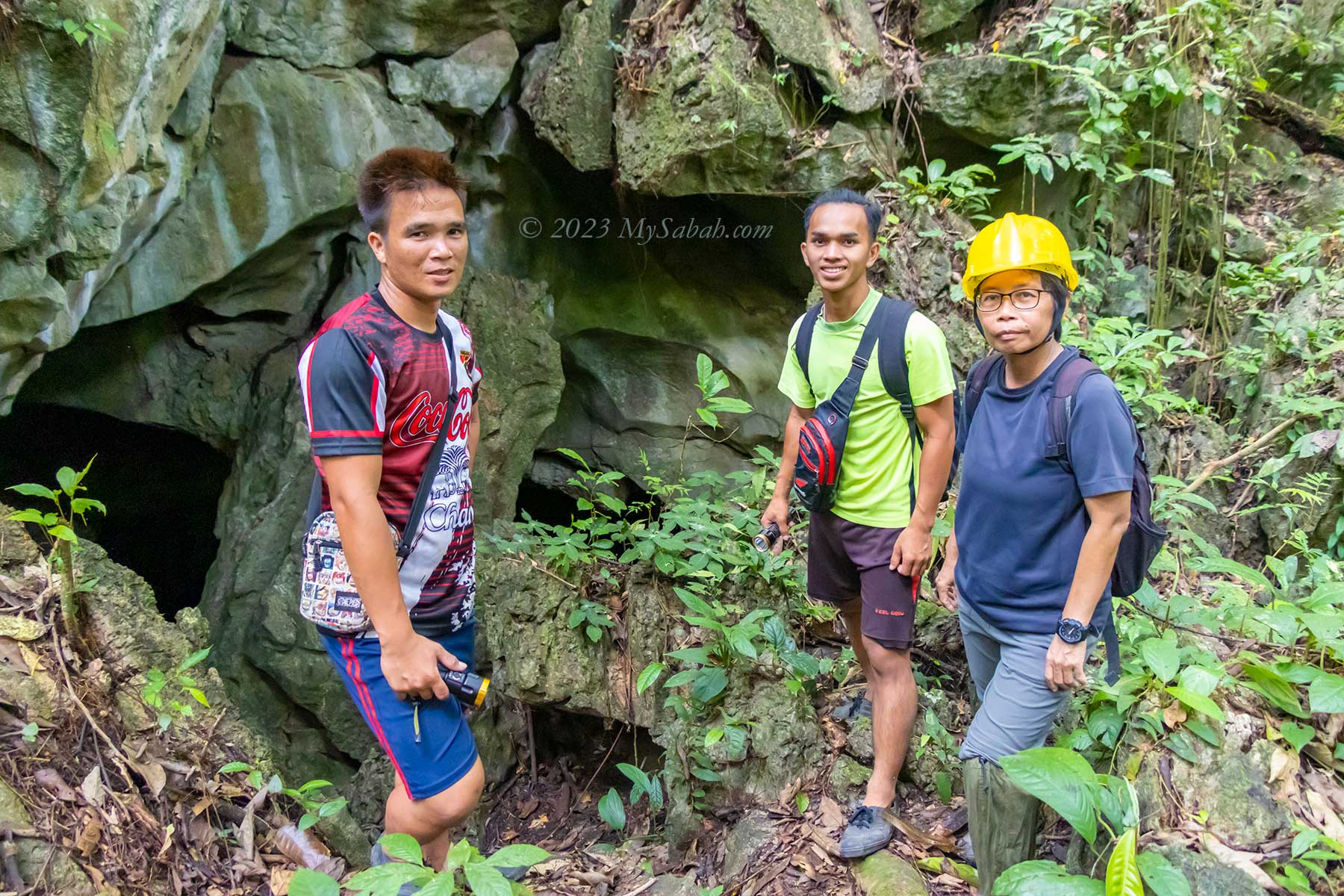
Pungiton Cave is a multi-levelled limestone cave. Hiring a guide is a must so you won’t lose your way in the cave. We start by exploring the wet cave in lower level then move up to the dry cave. It takes only 15 to 20 minutes to walk to the cave entrance from our camp (Pungiton Camp).
Underground Water Cave
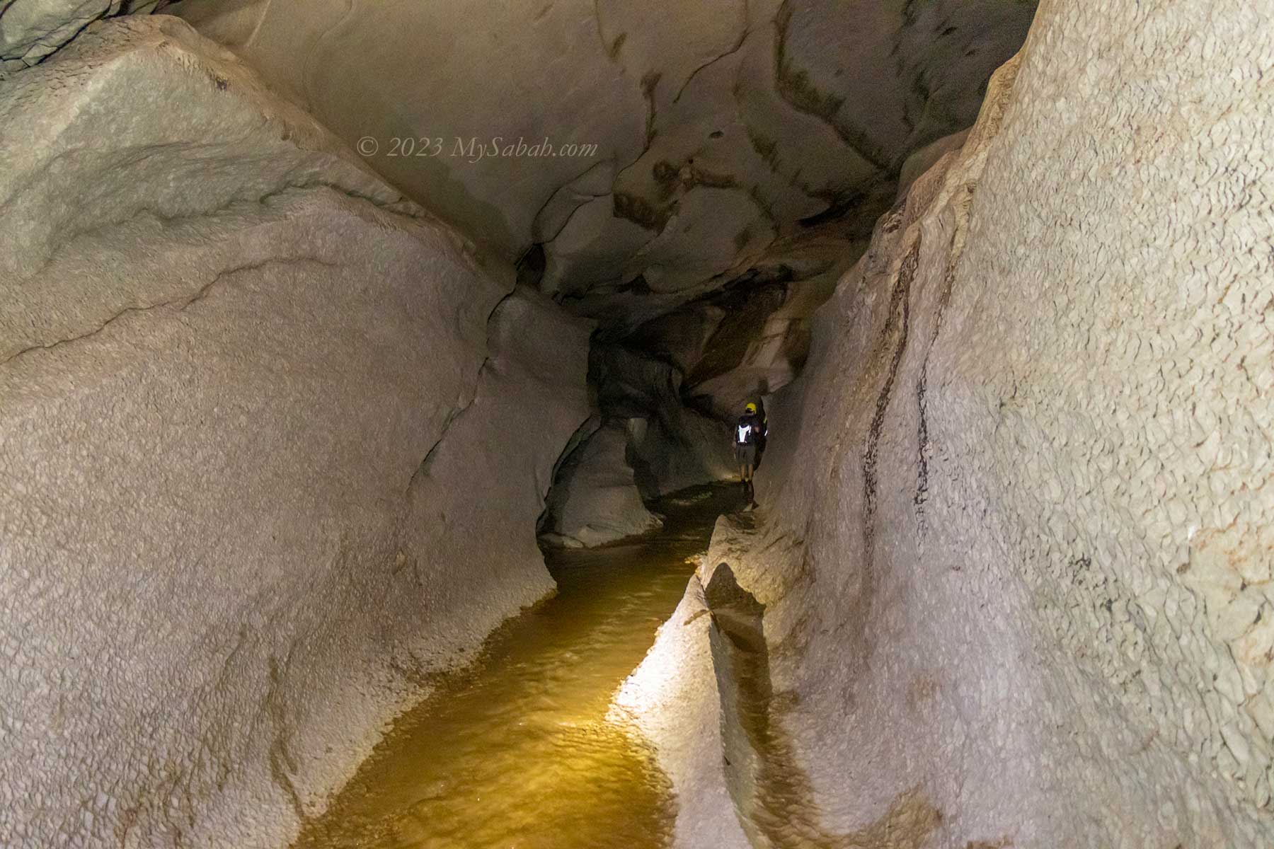
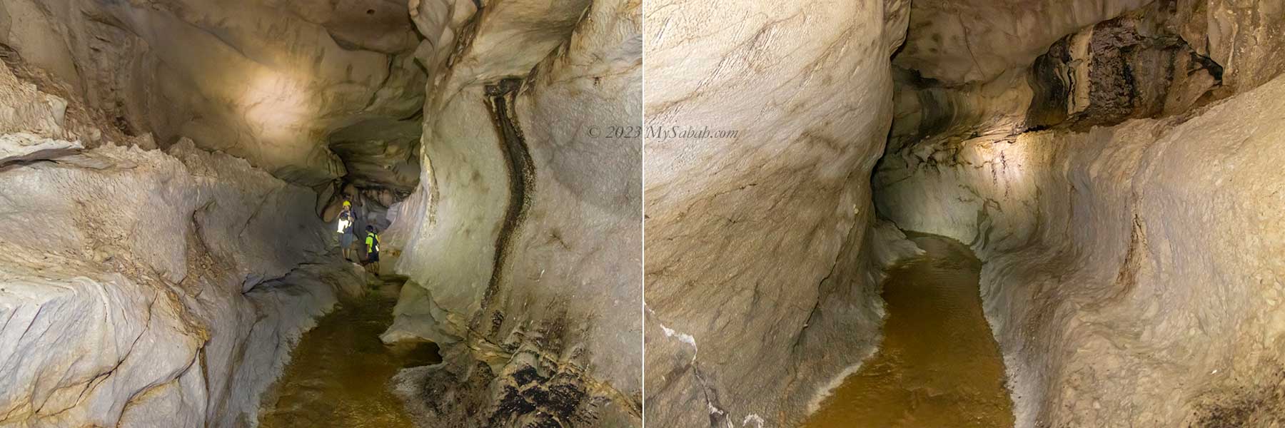
At the the cave entrance, I already can hear the running water below. It’s a 20-meter descend via a narrow hole. The sound of water is getting louder, then we reach a winding cave tunnel with a running stream, a characteristics of aquatic or wet cave. Walking in the long and narrow tunnel in a wet cave is like navigating inside the body of a giant snake.
Hiking 15 minutes to the Pungiton Cave in tropical rainforest. I see many limestones along the trail. Leech may present.
Don’t freak out with the idea of walking in a cave filled with water. In normal days, the water in Pungiton Cave only reaches my knee at most. The deepest it can go is up to waist level during rainy season. The guides would skip the wet cave if the cave is too flooded. We wear a helmet to protect our heads, in case we fall on a rock or bump into rock ceiling.
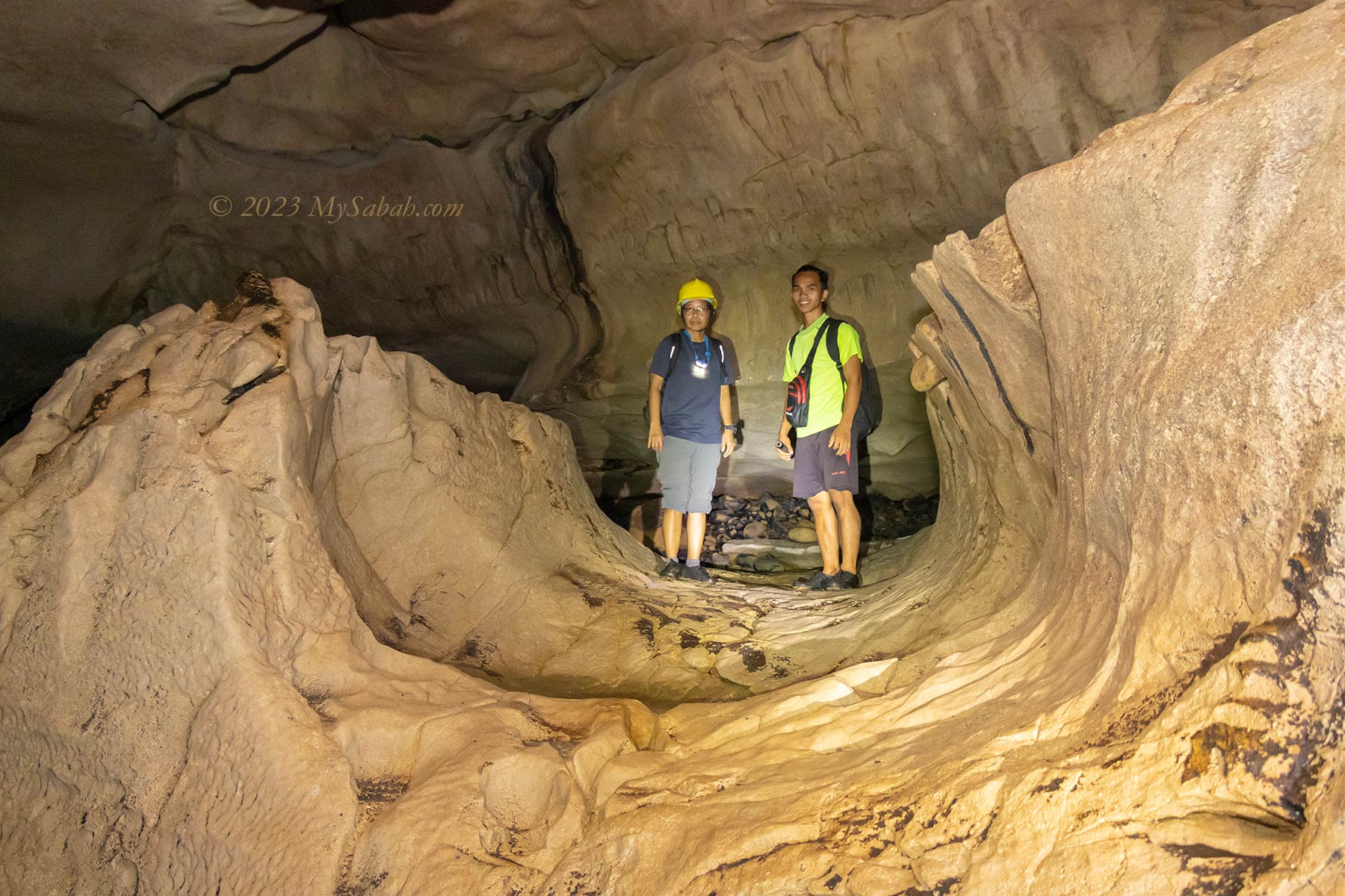
Entrance to Pungiton Cave. From left: Rosdin and Josyen (guides), Ms Wong Li Pin (media)
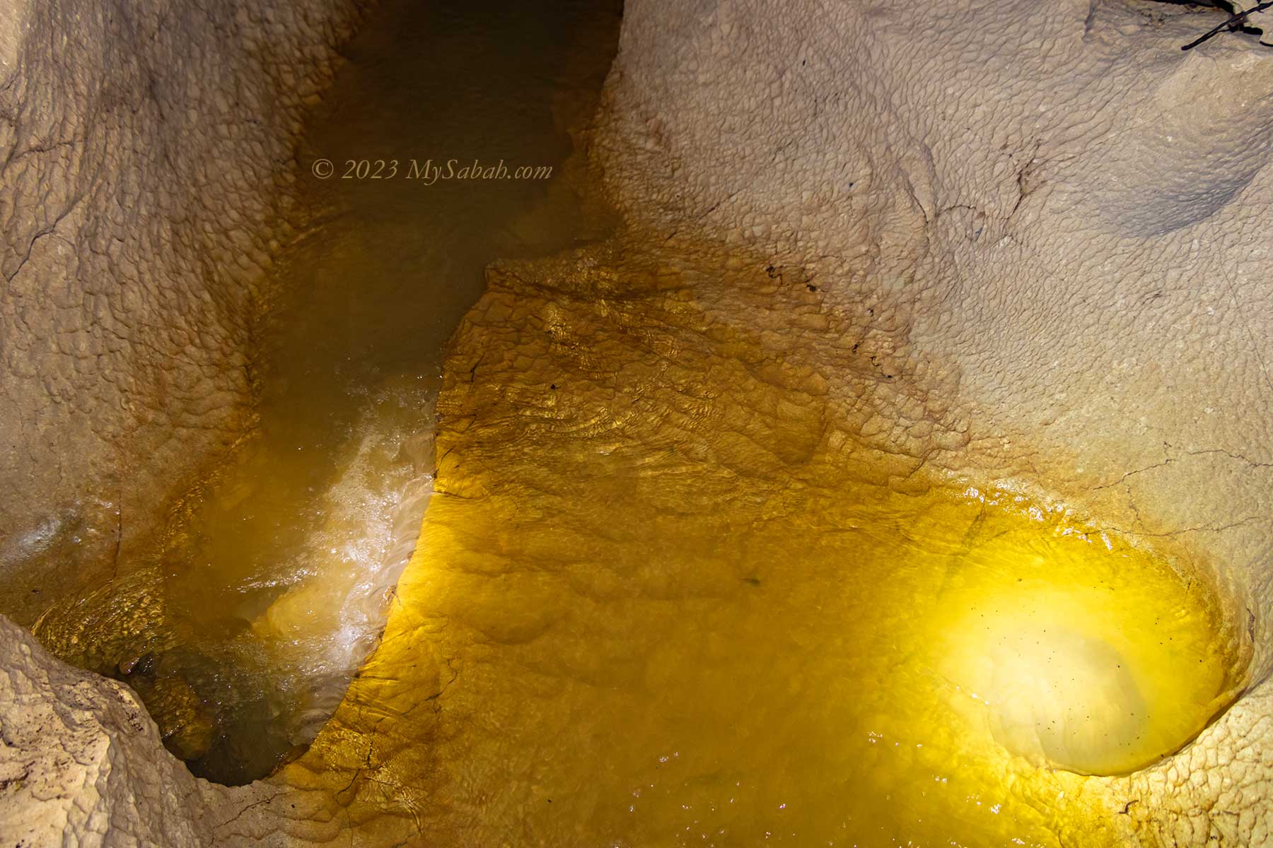
Slowly my eyes adjust to the darkness. We walk along the stream between the whitish walls of limestone. The water is quite clear and shallow. We avoid stepping into the murky water that may have a hole underneath. To keep dry, we try to walk along the edge of the stream, but I would occasionally soak my feet to enjoy the cooling water. The running water creates a noticeable cool air flow as if the cave is breathing.
Wet cave of Pungiton Cave. Note the scalloped wall at the right with ripple pattern, an ancient mark of the water movement.
The stream is weak and small, but if you did pay attention in your geography class during high school, you would know that the limestone cave is a work of water. The rainwater absorbs CO₂ in the atmosphere and forms a mildly acidic water. This water flows through the limestone and slowly erodes the rocks. Over million of years, continual water or seepage craves out a hole, next a cavity, and then a cave. Pungiton Cave is probably about 20 millions years ago. It’s not officially studied and mapped by any geologist yet, so this number is just a wild guess.
Long underground water tunnel of Pungiton Cave. It’s about 400 Meters long and flows deep into the cave.
On the roof and wall of the wet cave are many round dents or depressions in rippled pattern, these ancient traces of water movement provide some hints on the direction and speed of water flow in passages in the past.
The running stream in the wet cave of Pungiton Cave. Cave with creeks, groundwater, or springs are known as aquatic or wet caves.
A powerful torch will improve your caving experience. Thanks to my new flashlight (Max Output: 2,100 Lumens), its light beam is so bright that it lit up the surrounding. This allows me to take better cave photos in dim environment.
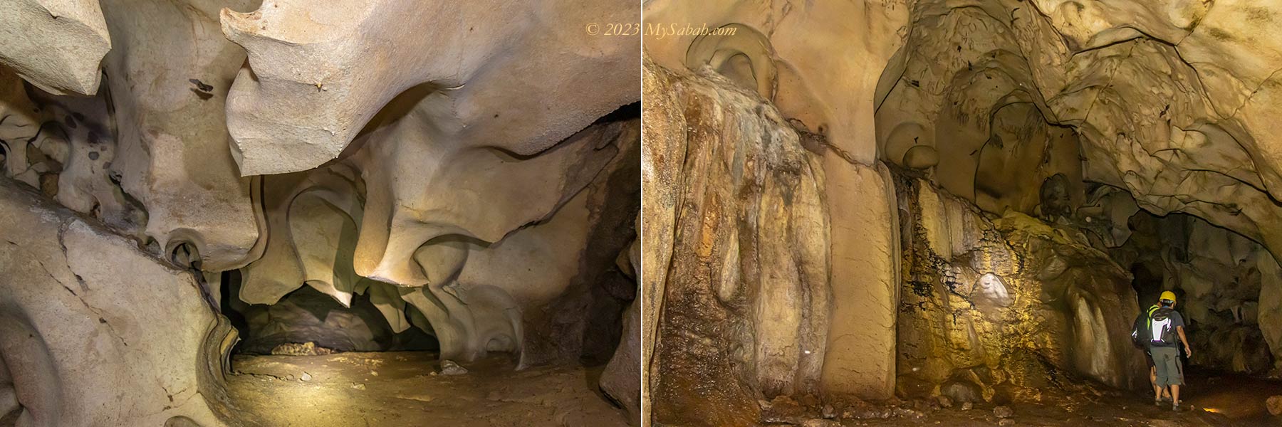
Limestone Art in Pungiton Cave
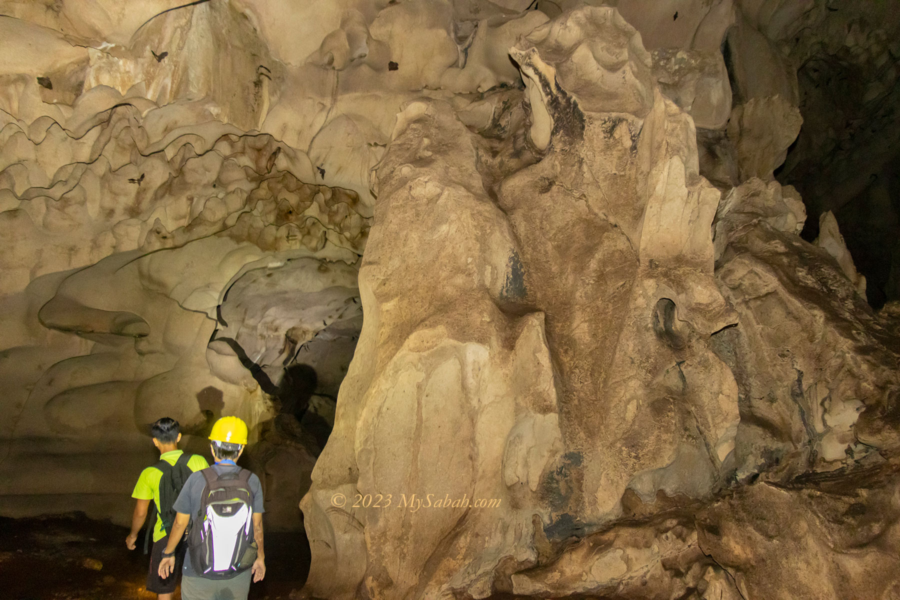
Half an hour later, we climb up to the dry surface, where the cave starts to get more interesting. I see many natural sculptures created by water, which must have taken thousand of years to form. Basically it’s a gallery of timeless water art.
A U-shaped rock formation near the end of wet cave
The ceiling height of Pungiton Cave is about 3 to 12 Meters most of the time. The space is wide enough not to trigger any claustrophobia. There is no boardwalk, only ropes and ladder are available for hard to climb sections. Along the way I see many holes, opening, junctions and gaps that probably connect to other chambers or network. Without a guide, I would lose my way.
Who knows you might find Japanese treasure here, or hear boss music playing. 😀
In the past, there were many taboos to visit Pungiton Cave, for example, you should not wear red. Now the cave is an attraction opens to tourists, and many old rules aren’t relevant anymore. However, please be respectful and don’t do or say anything offensive in the cave. The locals believe that there are spirits lingering in the cave, and they dislike to be disturbed.
Variety of “limestone art” in Pungiton Cave
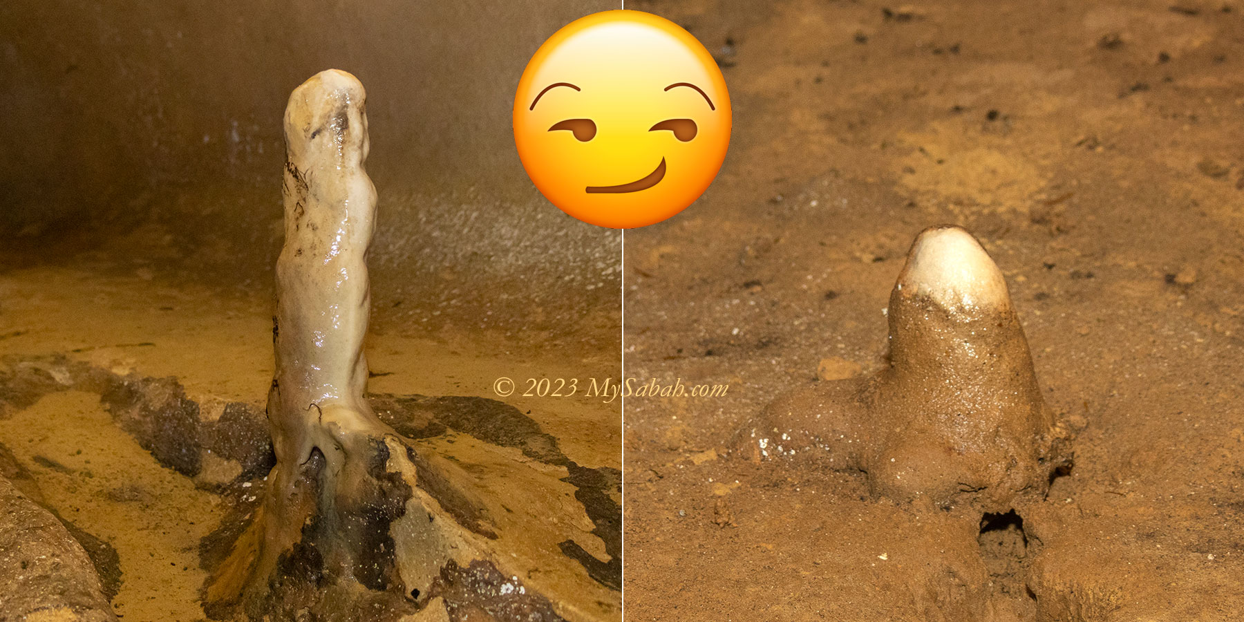
A BIG NO-NO is touching the rock formations, especially stalagmites and stalactites. Most of them are still growing at a rate of 0.13 mm (0.0051 inches) a year. They would turn dark and stop growing if contaminated by acidic oil from our fingers. Watch your steps too. One foot of stalagmite would need over 2,000 years to grow, but we can destroy it in a split second.
Big vs Small Stalagmites. The term stalagmite comes from the Greek word stalagma, which means “dripping”.
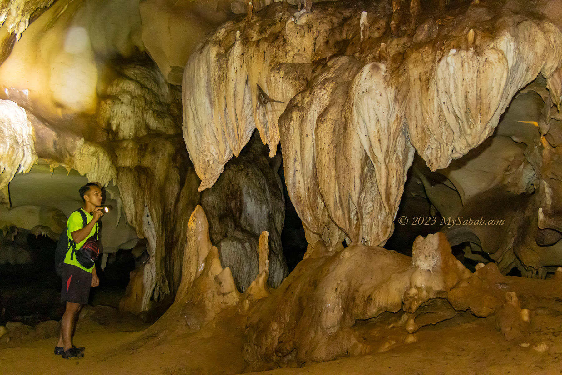
One thing I really admire Pungiton Cave is the diversity of cave features. Of course this cave is not as gigantic as those in the famous Mulu National Park. But it’s not short of wonders. The following are some interesting and peculiar cave features that I find in Pungiton Cave.
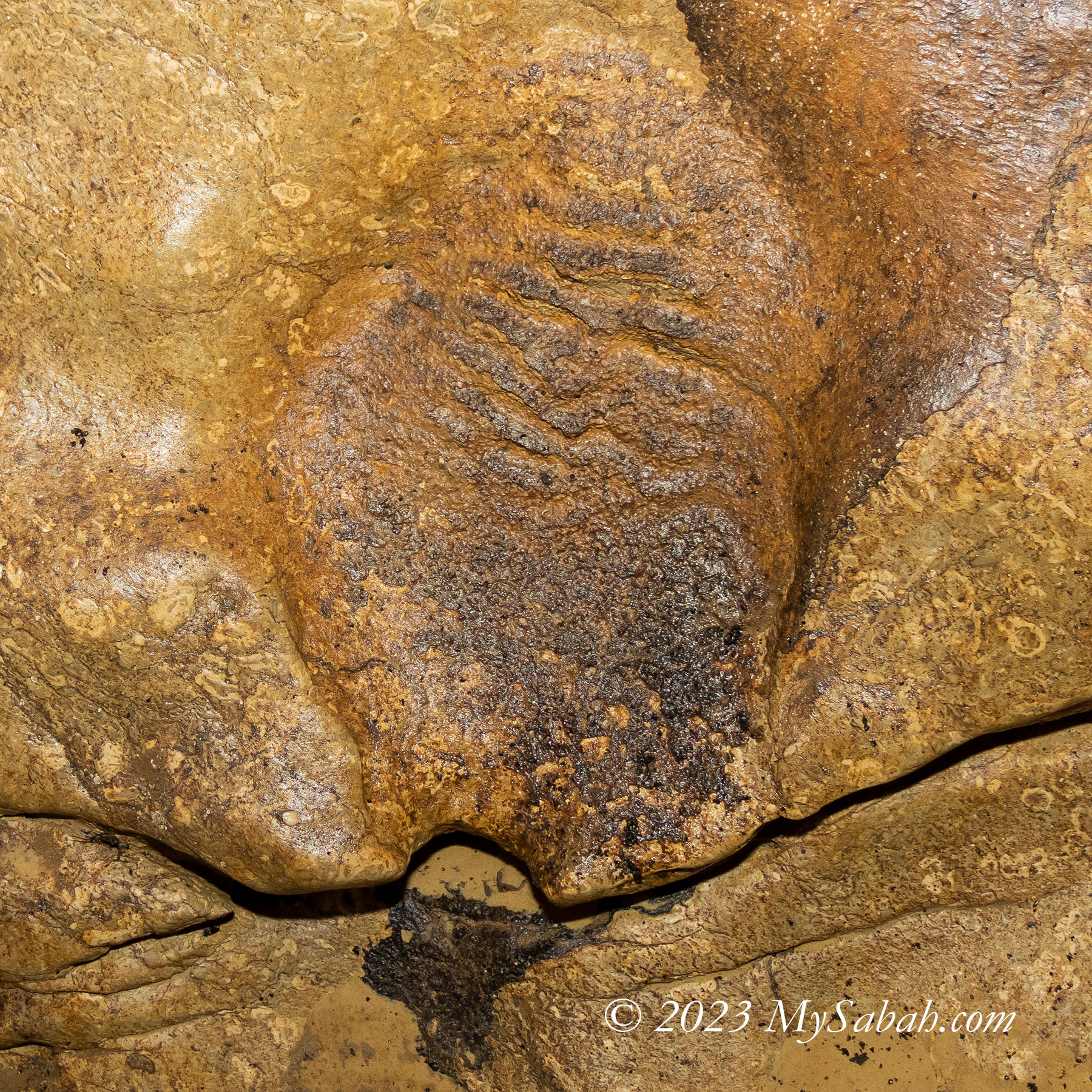
Left: the cave looks like the throat of a dragon. Right: the limestone in flesh color.
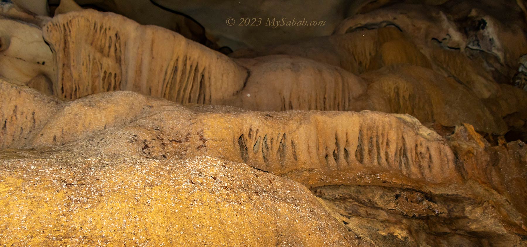
Stalagmites and stalactites are the most well-known cave features. They are icicle-shaped deposits that form when water dissolves limestone, and drips through cave roofs and onto the floors. The re-deposits calcium carbonate gradually builds up and grows on the ceilings or floors and become mound-shaped rock formation that called stalactites and stalagmites respectively.
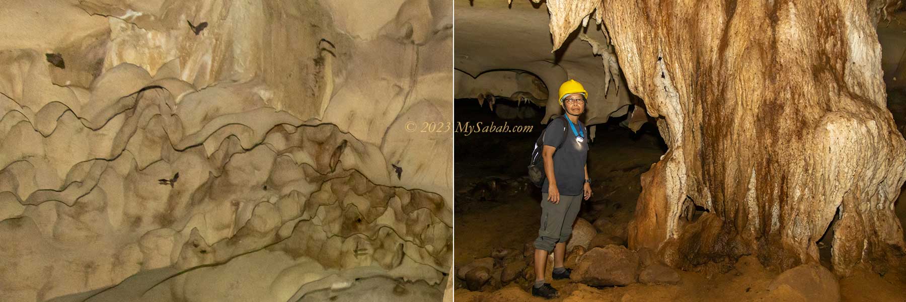
The magnificent stalagmites and stalactites of Pungiton Cave. A column is forming in the middle section.
When the upward-growing stalagmites meet and connect with the downward-growing stalactites in the middle, they eventually fuse and form a column, and some columns look like carved pillars.
A mushroom-like rock. I don’t what’s the name of such formation.
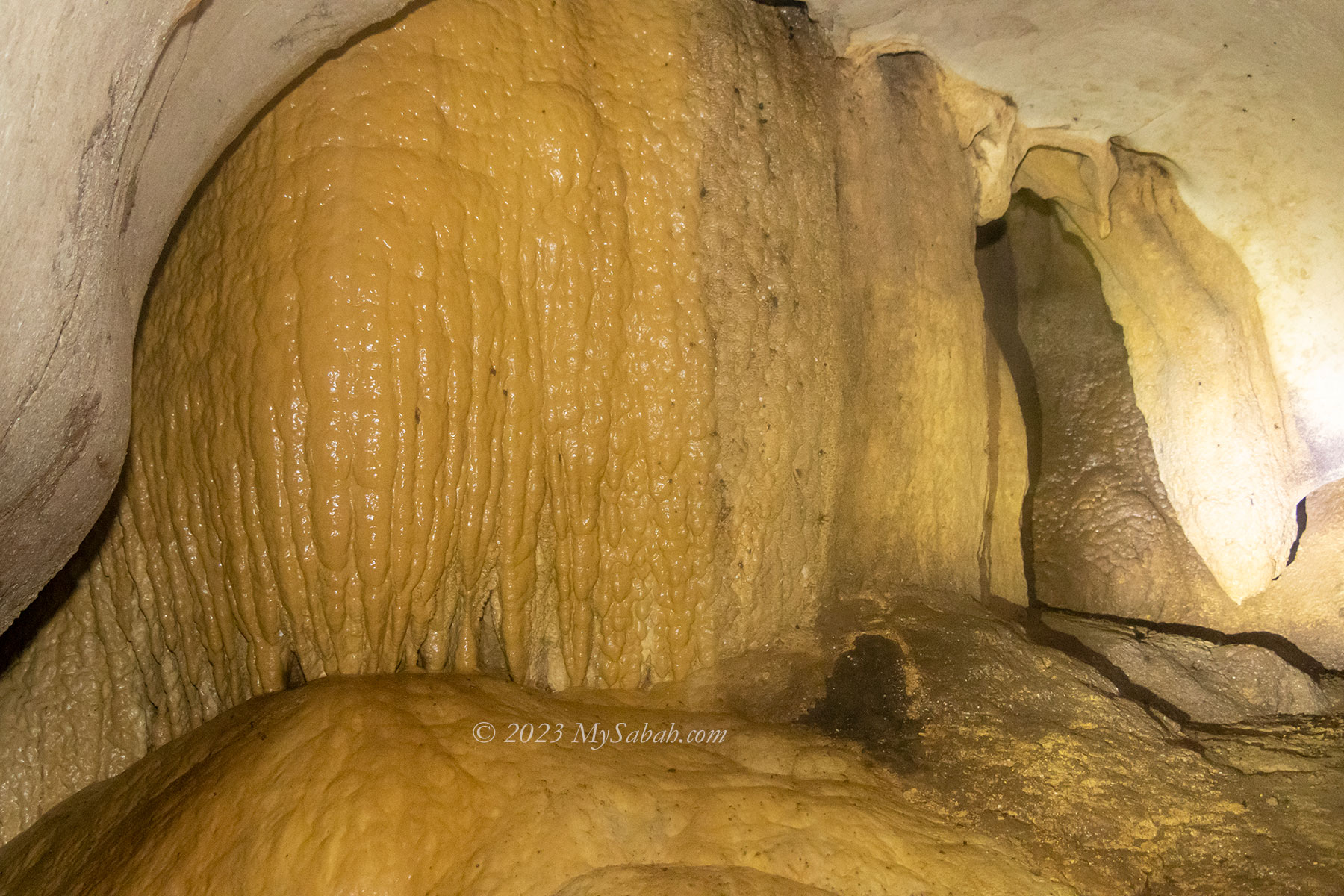
Flowstones are sheets of calcium carbonate on the walls or floor of a cave formed from a gradual flow of water over a relatively broad area along cave wall. The final form are curtain-like sheaves along ledges, better known as draperies.
Flowstones formed from a gradual flow of water over a relatively broad area along cave wall.
There are also some strange, branch-like helictites that grows in a twisted, curled fashion, as a result of minimal water seepage.
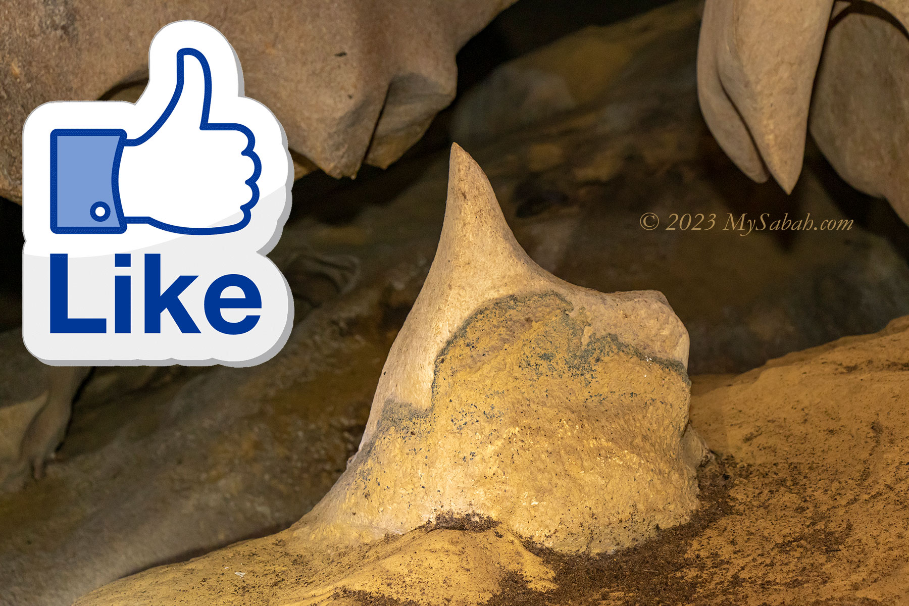
A rock that looks like the thumbs-up Like of Facebook
Rimstone dams form along floors where calcite-rich water continues to flow over the edge of the pools.
Rimstone dams are formed by overflowing calcite-rich water from the pools.
Near the exit there is a wide chamber with wind movement. I can vaguely hear something that sounds like whispering. But there are no other people around or outside. You may watch my video to hear the strange noise.
Limestone consists of coral and marine fossils, which can be as old as 40 million years.
Interesting Fauna in Pungiton Cave
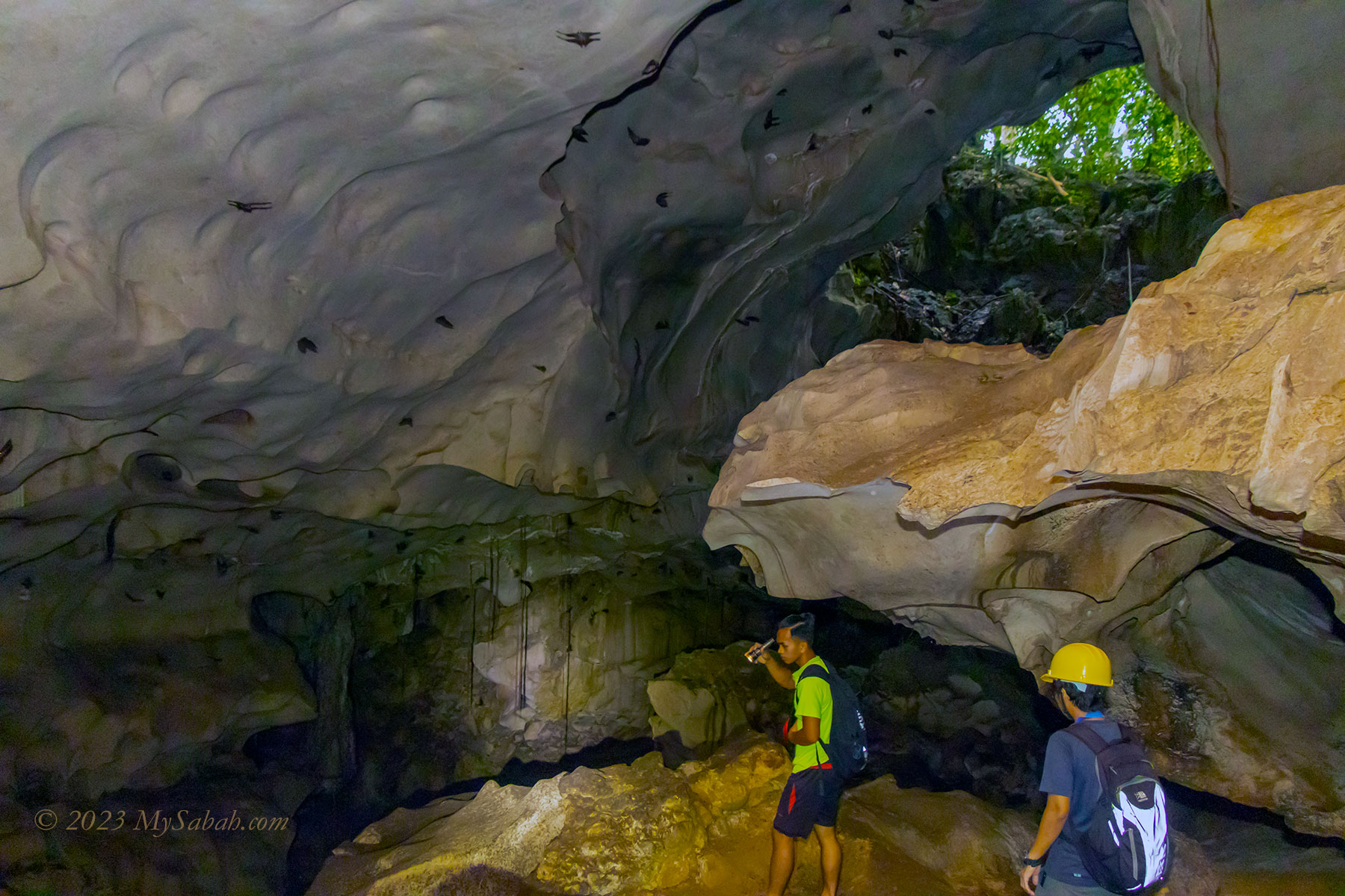
Cave is a dark world but not lifeless. Some animals use darkness as a protection and choose cave as their habitats. The most common dweller of cave is bat. They say the bats in Pungiton Cave is larger and screech like monkey, and the locals eat them.
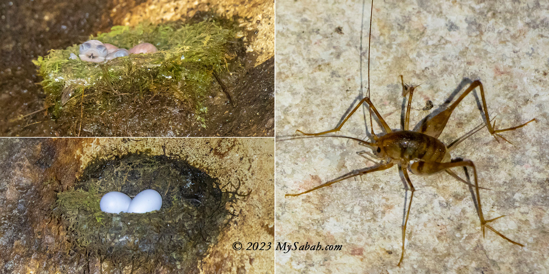
Left: hatchling and eggs of cave swiftlet. Right: cave cricket
Swiftlets also live here, among them is edible-nest swiftlet, which builds nest in the cave. These swiftlets can use echo-location like bats, to help them navigate deeper into the cave. Edible bird nest is an expensive delicate, so their nests are harvested heavily and very few of them left.
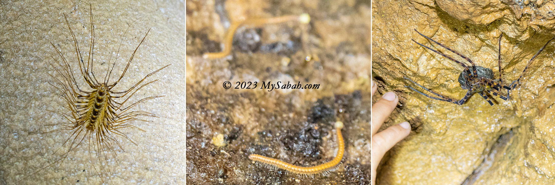
Bugs in Pungiton Cave. From left: Cave Centipede, Unknown Millipedes, large Huntsman Spider with egg sack
We come across a few mass of guano under the congregating bats, it’s a mixture of dropping of bats and birds. Sometimes guano can accumulate to a few feet deep over a long period. I walk on them and it feels like stepping on a soft carpet. It has mild ammonia smell. Cockroaches like to feed on guano but I only see one here. Guano is an excellent fertilizer because it’s rich in nitrogen, phosphate, and potassium, and some people get rich by selling guano.
Left: bats on the roof of Pungiton Cave. They are everywhere. Right: thousand-year-old rock formation
If Pungiton Cave is managed sustainably since the beginning, edible bird nests and guano would generate continuous cashflow for the villagers until today. Unfortunately, half a century ago, people didn’t realize the importance of conservation. Anyway, the cave itself is an eco-treasure and quite well-preserved.
Curtain-like draperies in the cave
I see some leggy cave centipedes on the rock wall, they run for shelter in the dark whenever my light points at them. Other bugs I see are the silky thread traps of glow worms, egg-eating cave cricket, and a huge Huntsman spider hugging an egg sack.
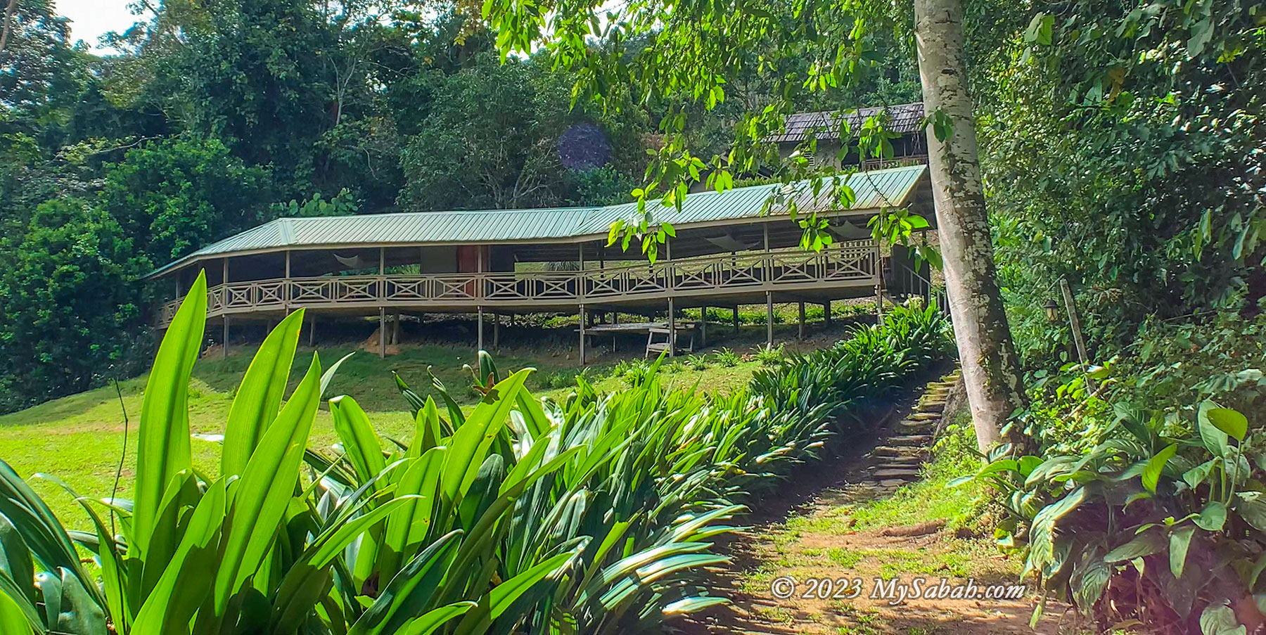
Pungiton Camp
To perfect your caving experience, you can spend a night or two at Pungiton Camp, a longhouse style accommodation near Labang River. Pungiton Cave is only a 15-minute walk away from the camp. After the adventure, you can have a nice meal and shower at the camp. If it’s new moon, you would see Milky Way on the starry sky. The place is warm during daytime but getting cooler in late night.
Pungiton Camp is a wooden longhouse on stilt. It can accommodate about 20 visitors. The small building behind it are the where the toilets, kitchen and dining area located.
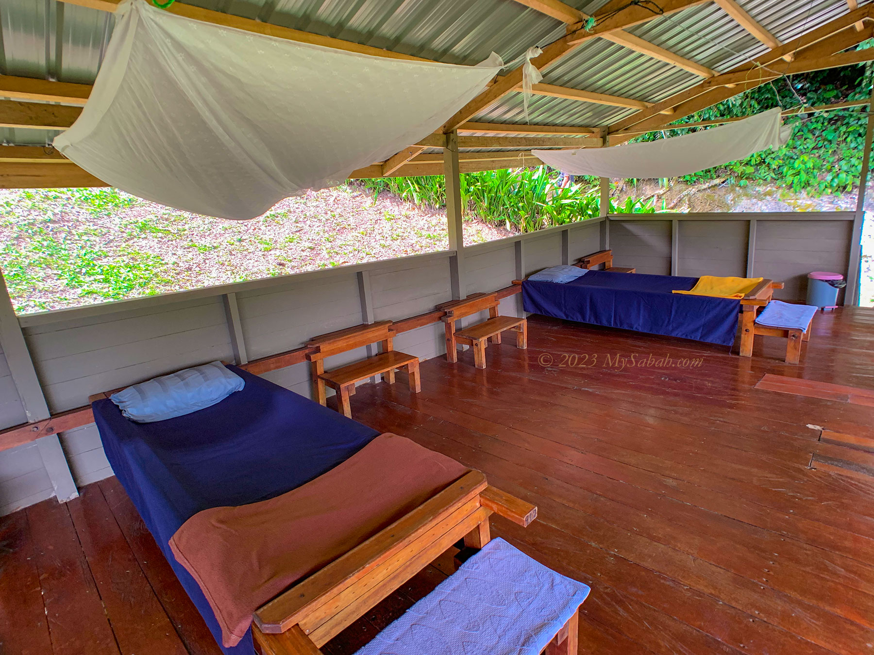
Pungiton Camp can accommodate about 20 people and is equipped with canvas beds (with mosquito net), bathroom (hot shower available!), toilet, and dining area. The sleeping area is an open and corridor-like layout with beds. Electricity is available from evening to early morning, but the power point is only available at dining area.
Beds of Pungiton Camp. Blanket, pillow, towel and step stool are provided.
How to Get There
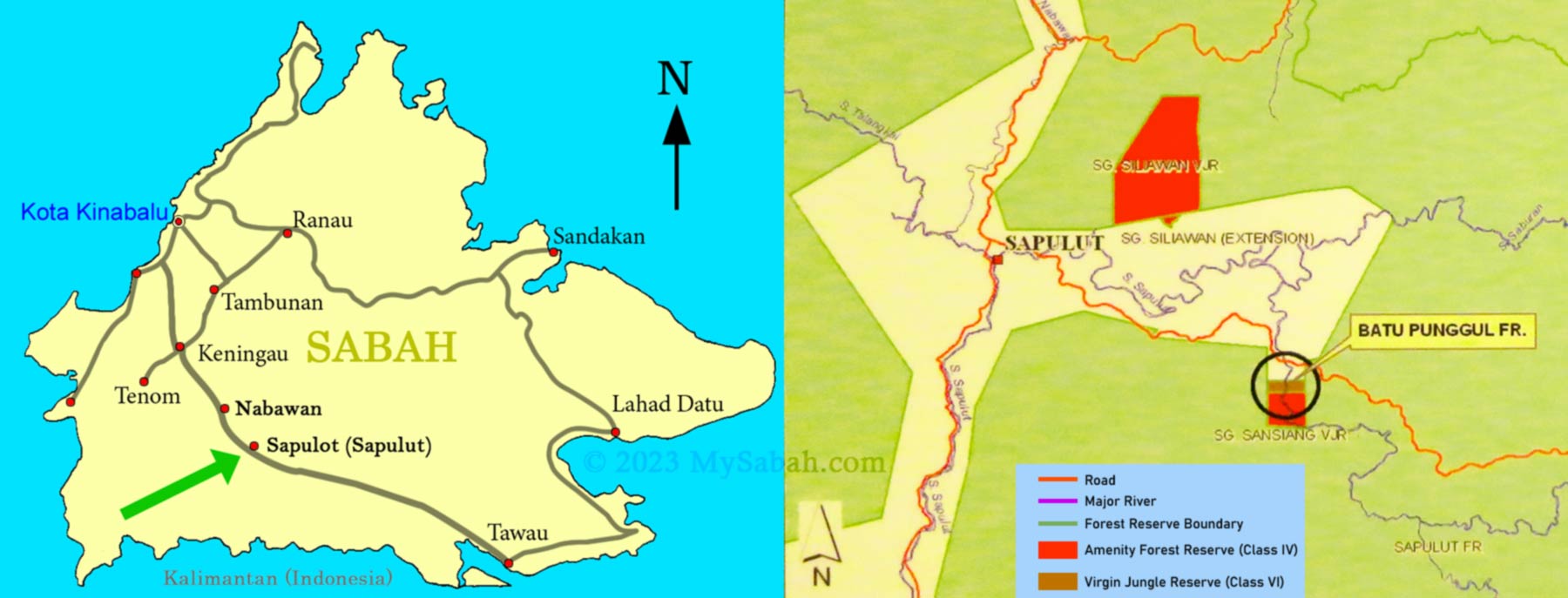
Pungiton Cave is located in Sapulut, a small district of Sabah interior about 110 KM away from Keningau town and 217 KM away from Kota Kinabalu City. Sapulut is accessible by highway between Keningau and Tawau (part of Pan-Borneo Highway).
Location map of Sapulot and its surrounding
To visit Pungiton Cave, you can contact Borneo Outback Tours Sdn Bhd (Licenses: Co. No. 846369-H / KPK / LN:9247). They will arrange the land & boat transfer and accommodation (Pungiton Camp) for you. Website:www.borneo.tours Facebook:orou.sapulot Instagram:@orousapulot Phone:+60 19 2277077 (Whatsapp), +60 87 337 277 Address: A-7-2, Apollo Atrium, 89008 Keningau, Sabah, Malaysia
Kampung Labang (village) of Sapulut, the starting point of the boat ride to Pungiton Camp.
The tourism operations in Sapulut are managed by Orou Sapulot (means the Sun of Sapulot), a community based project to promote tourism and in sustainable manner.
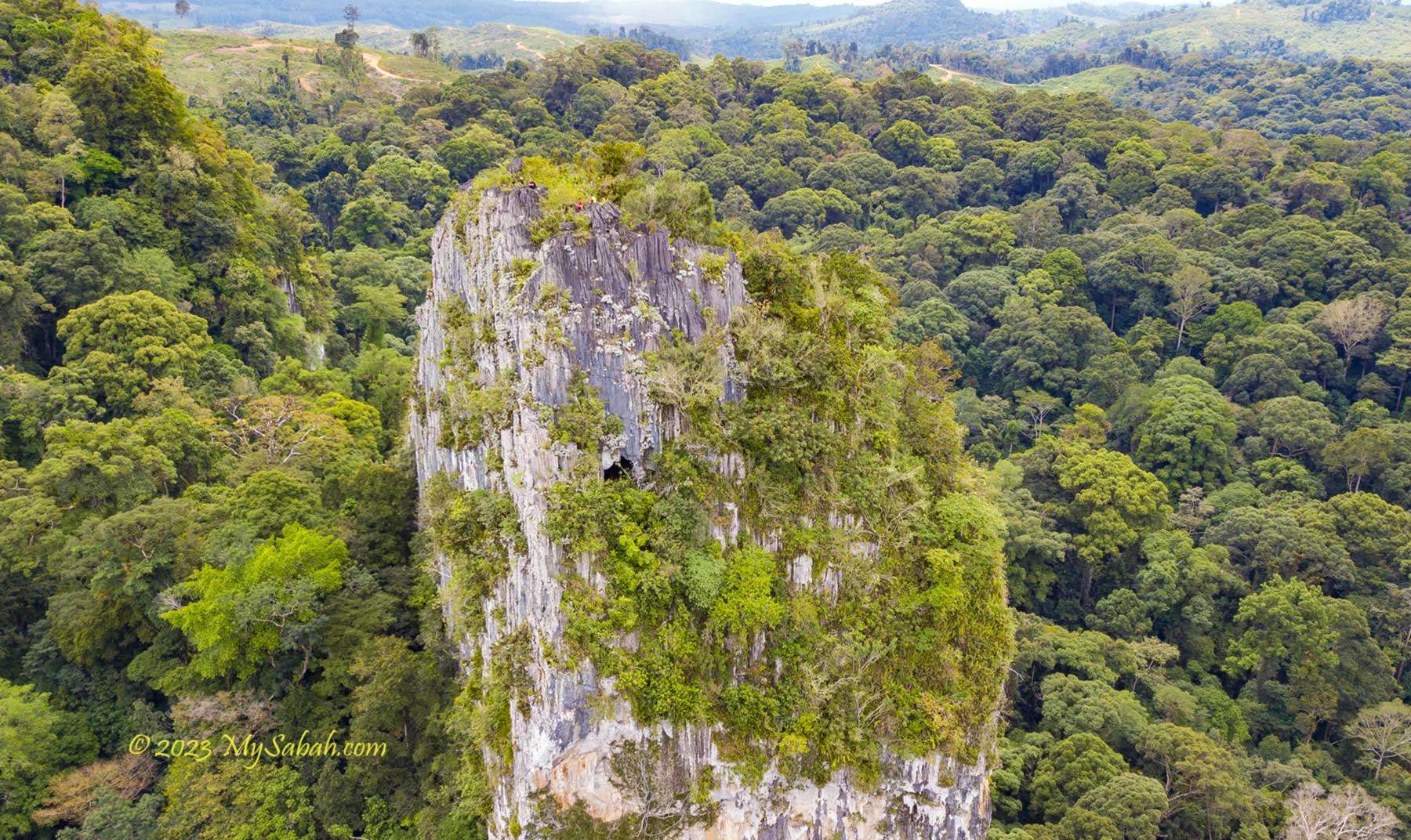
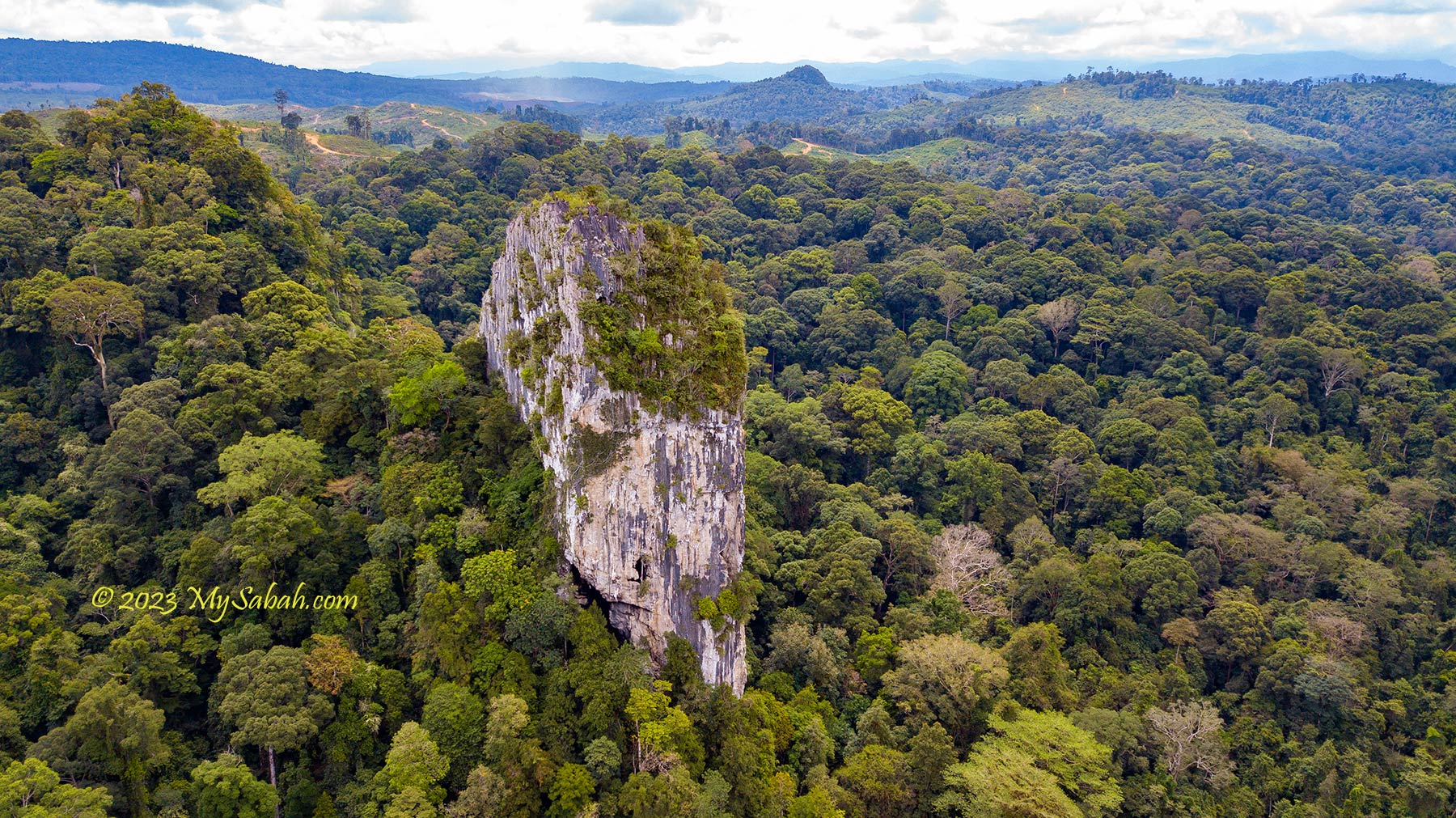
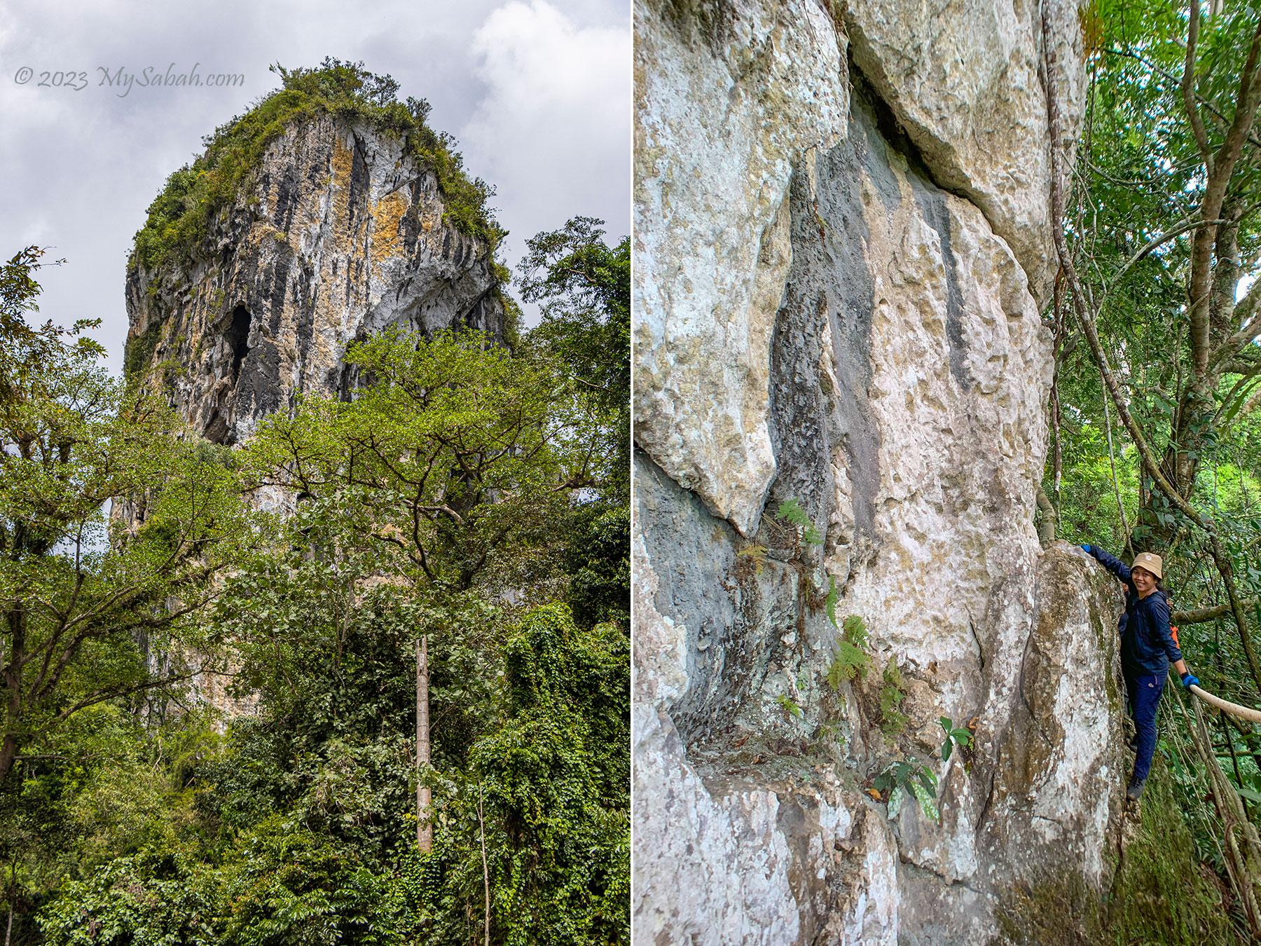
I was awed by the majestic Batu Punggul, a 220-Metre-high limestone pinnacle in Sapulut, in the interior of Sabah, Malaysia. Before it’s open to tourists in 1992, Batu Punggul is a sacred hill that is only mentioned in the books of Borneo adventurers. Its photograph looks like a giant tombstone standing tall above the mysterious rainforest.
There are 1,393 limestone outcrops or hills in Malaysia, with 911 of them located in Peninsular Malaysia, while 482 are in Sabah and Sarawak.
According to the legend of Murut people, Batu Punggul is a petrified longhouse, the result of a punishment by God to the people who mocked animals. The hill was used to be so high that it covered the sky until someone chopped it down and only its stump remains. Punggul means stump in Murut language hence Batu Punggul means stump-like rock.
There are a total of 218 limestone outcrops in Sabah. Of these outcrops, 149 are in the districts of Kinabatangan, Kudat and Lahad Datu.
Put aside its terrifying myth, Batu Punggul is the most unique and stunning pinnacle among the 218 limestone outcrops in Sabah. My late father had climbed Batu Punggul, so I followed his footsteps, to understand why his eyes sparkled whenever he talked about Batu Punggul. Though climbing this vertical hill sounds challenging, I’m sure most of you can conquer it.
About Batu Punggul
Batu Punggul is no ordinary hill because of its cultural and ecological values. Batu Punggul has been a legendary and sacred place to Murut people, the third largest indigenous group of Sabah. The locals respect Batu Punggul and have many stories about it.
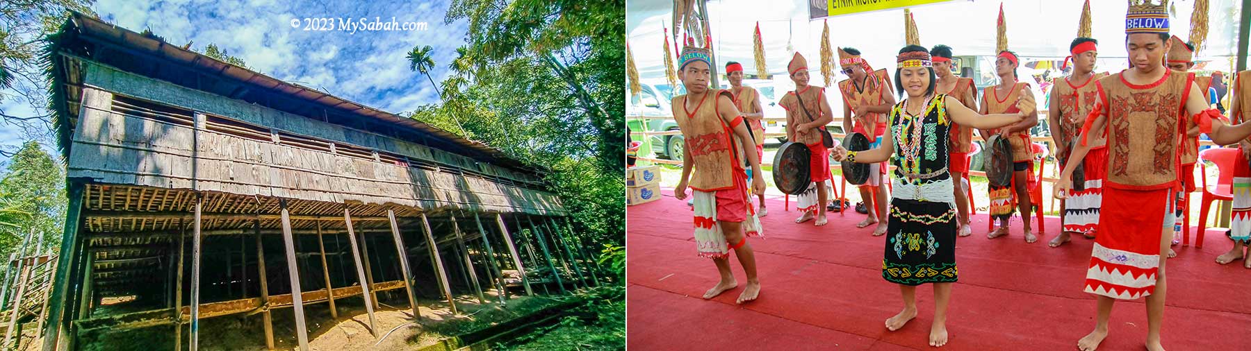
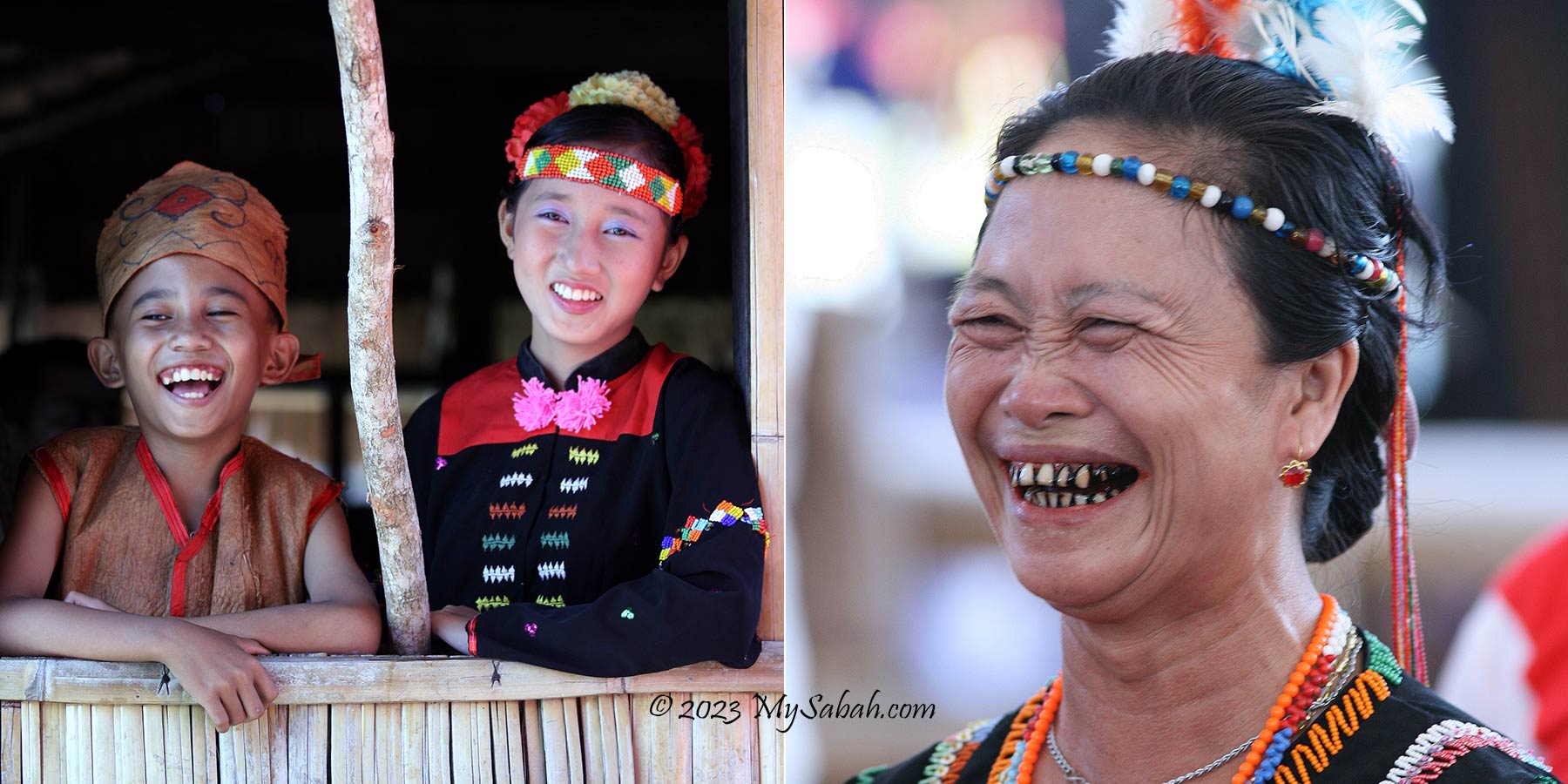
Murut people and the traditional Murut longhouse, which can accommodate a number of families or even a village.
The most popular story on the formation of Batu Punggul is about two Murut longhouses, namely, Punggul and Tinagas, with Sapulut River ran between these two villages in the past. One day the people of Punggul longhouse had no fire to cook, so they asked Tinagas longhouse on the other side for fire. At first the Tinagas people tied a bundle of fire on the head of a dog and let it swam across the river. A big wave came and put out the fire. People of both longhouses laughed.
The villagers were laughing at the unlucky animals, but their God didn’t think that it’s funny.
Then the Tinagas people tied the fire on a cock and made it flied across the river to deliver the fire. But the river was too wide. The cock fell into the river. Everyone laughed again. Later someone mocked a leech that perched on a jar to drink tapai (rice or tapioca wine). Making fun of animals is a taboo in Murut. Their misbehavior angered the God Aki Kaulung, who turned these people and their longhouses into rocks immediately.
Making harmless fun to animals is probably acceptable in some cultures, but a big No-No to Murut people. (I need to clarify that the owner of this dog really loves his pet.)
After the punishment, Batu Punggul became a very tall limestone rock that blocked the sun and obstructed the sunlight needed for crops to grow, so a young man chopped down Batu Punggul. When the hill fell, it broke into smaller rocks which scattered along the downstream of Sapulut River. The Batu Punggul was left with a “stump” that we see today.
Location map of Sapulut and Batu Punggul. The adjacent Sungai Sansiang Virgin Forest Reserve covers an area of about 344 ha.
Batu Punggul is located within the Batu Punggul Forest Reserve (see Location Map) in the interior of Sabah, about 110 KM south of Keningau town. When logging was rampant in 1980s, Dr. Richard Gunting saved Batu Punggul and its surrounding forest from deforestation in 1986. In 2009, Batu Punggul Forest Reserve was gazetted as an Amenity Forest Reserve (Class IV), covering an area of 150 hectares (1.5 Square Kilometre).
Batu Punggul is a limestone pinnacle and a sacred hill for the locals. The girl at the right is Jariah, one of the guides.
Limestone is a type of rock that forms underwater from the structures of living organisms like coral and shells millions of years ago. When Borneo island raised from the ocean floor, a series of tectonic movements by earth lifted the limestone of Batu Punggul above the ground. It’s a blessing that Batu Punggul still survives today, when 32 (23%) of limestone outcrops in Sabah are being quarried for cement production.
You can read on or watch this video for a walkthrough of the climbing trip.
Tour to Batu Punggul
In the past, without the Keningau-Tawau highway, visitors had to withstand four or more hours of boat ride to reach Batu Punggul. Now climbing Batu Punggul can be a day trip (though an overnight trip is recommended). You can book the tour with Borneo Outback Tours (see their contact info near the end). The following is a walkthrough of my trip to Batu Punggul, which consists of river cruise, hiking and climbing.
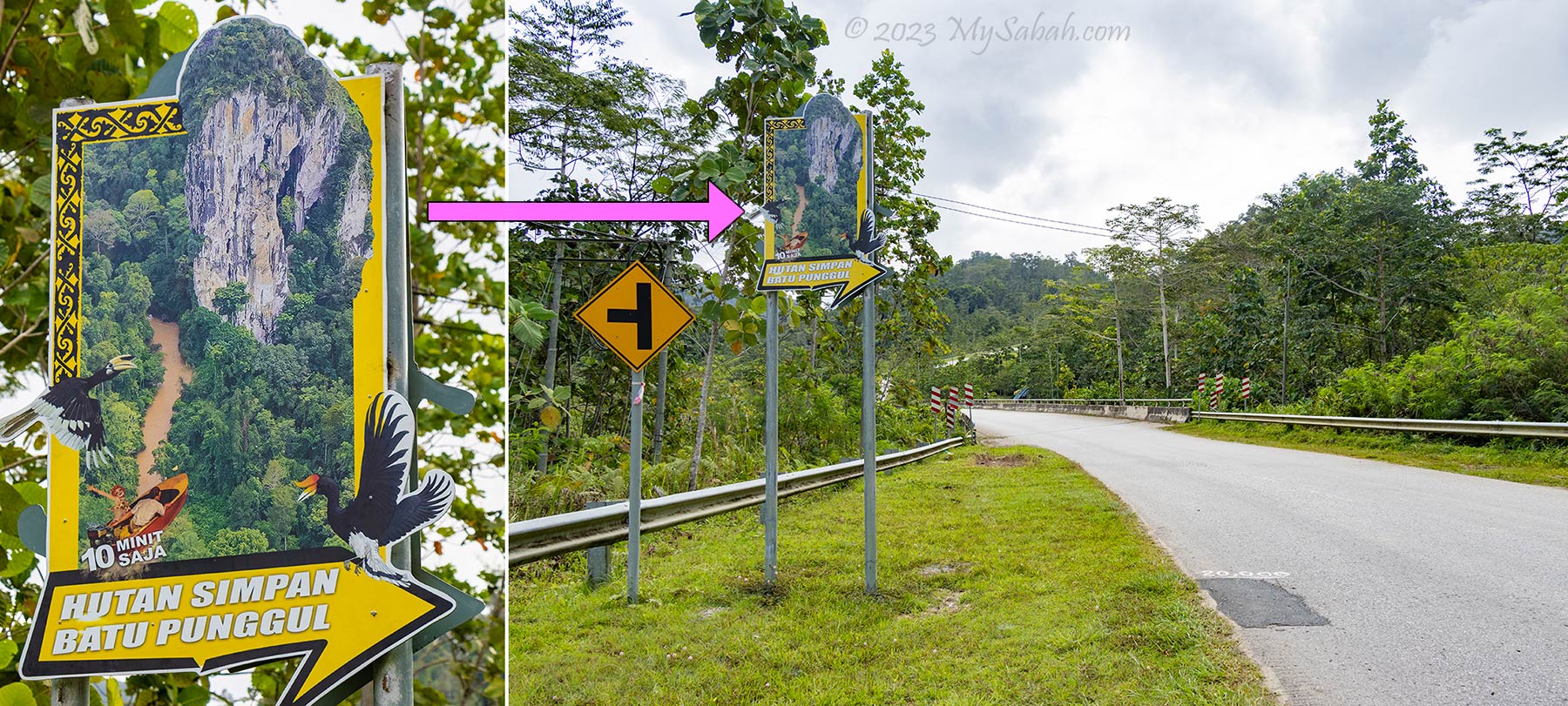
Signage of Batu Punggul at Tataluan Village, next to the Keningau-Tawau road in Sapulut
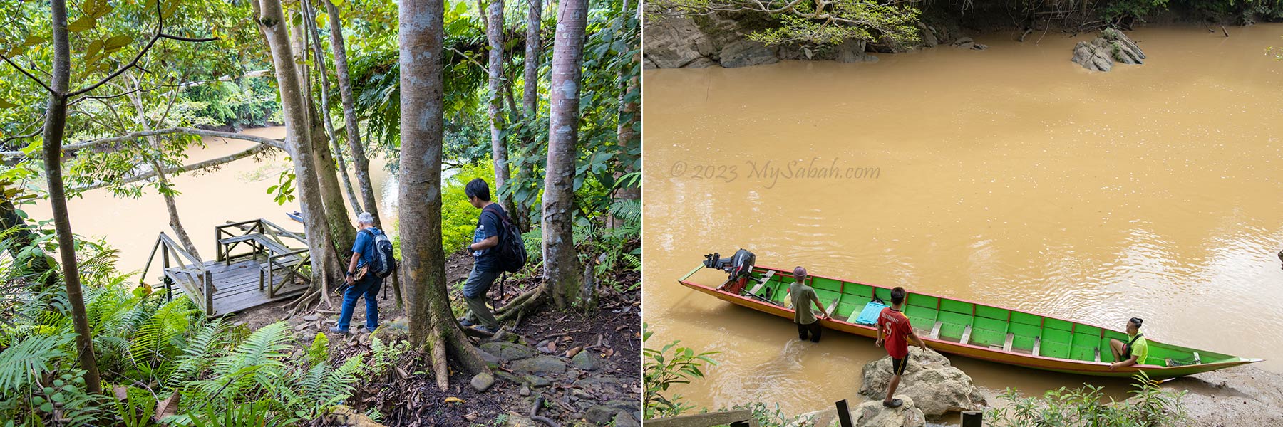
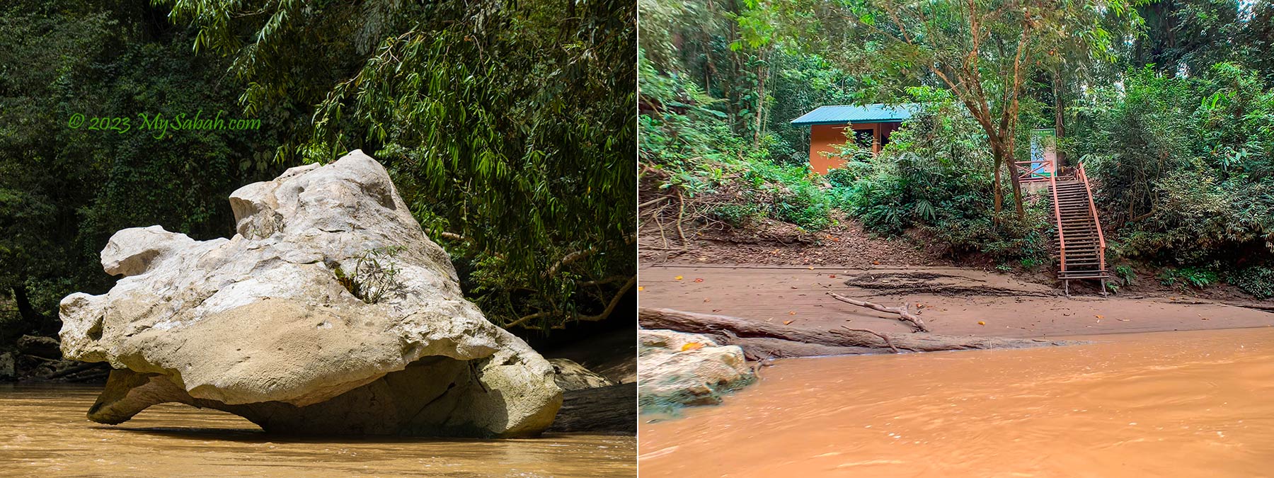
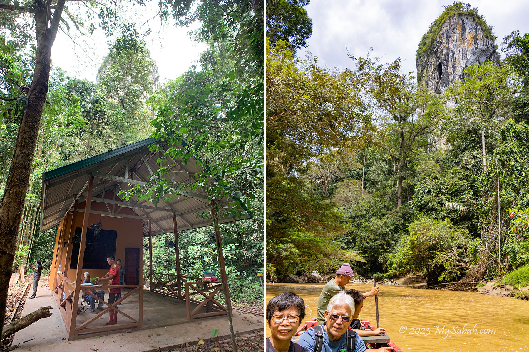
The starting point of the tour is at Kampung Tataluan village in Sapulut (see Location Map). My journey starts with a morning river cruise on a wooden longboat from the Tataluan jetty around 9am. I see a lot of rocks along the river, which are said the chips from the fallen hill. The rocks of the poor dog and cock can be seen at the river too.
Taking a boat from the jetty of Kampung Tataluan to Batu Punggul. There is a small toilet before the jetty.
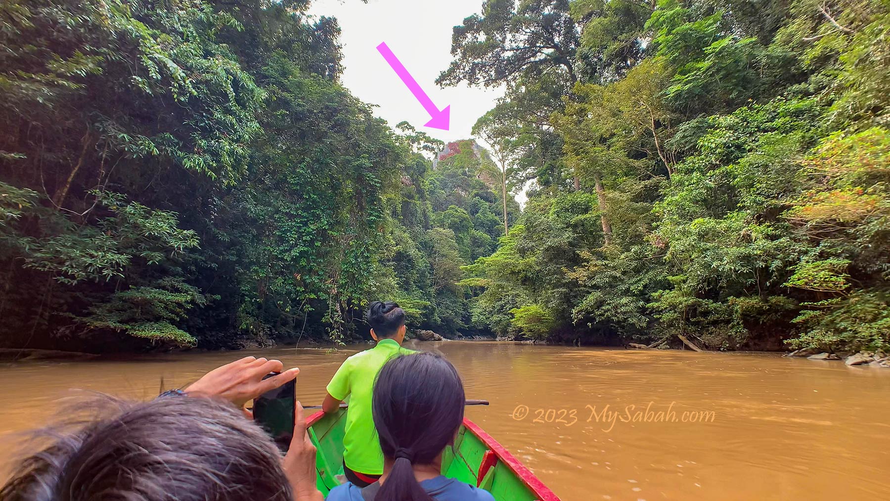
The river is flanked by dense forest. After a few minutes, I see Batu Punggul from a distance. Its presence is so powerful and spiritual that I got goosebumps. In 10 minutes, the boat reaches the entrance to Batu Punggul Forest Reserve. After a short briefing at the reception building of Sabah Forestry Department, we start walking to the starting point of the climb.
View of Batu Punggul from the boat. With me are Dr. Richard Gunting, Ms Wong from media and 3 guides from Orou Sapulot.
Walking to the Foothill of Batu Punggul
The hike from the jetty to the foothill of Batu Punggul takes about 30 minutes. This tropical rainforest is mostly untouched like a virgin forest. For the lucky visitors, they would see blooming rafflesia flower (Species: Rafflesia keithii). 596 taxa of plants are recorded in this forest and 20 of them are endemic to Sabah, and four of them are totally protected plant species.
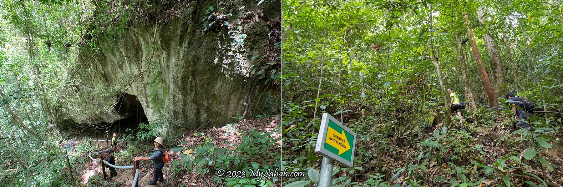
Left: the Dog Rock at the river. Right: Entrance to Batu Punggul Forest Reserve
Majority of the trail is ascending path. It’s not very steep but quite a workout in this warm and humid forest. Leeches would be around during wet season, so you would need to wear anti-leech socks. I don’t find any leech in my visit. The dense trees shade us from the heat. It’s noisy in here because of the loud cicada calls everywhere.
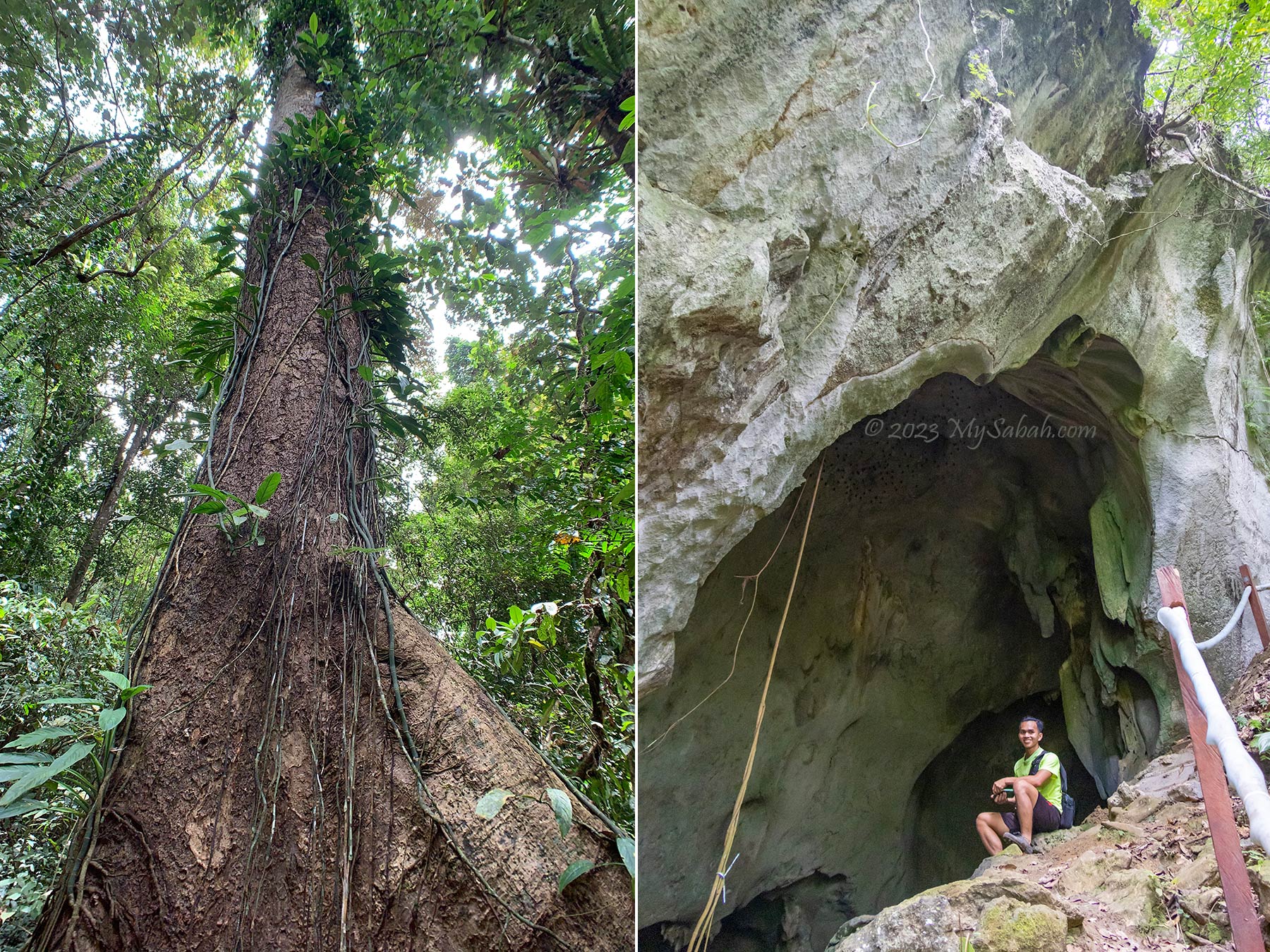
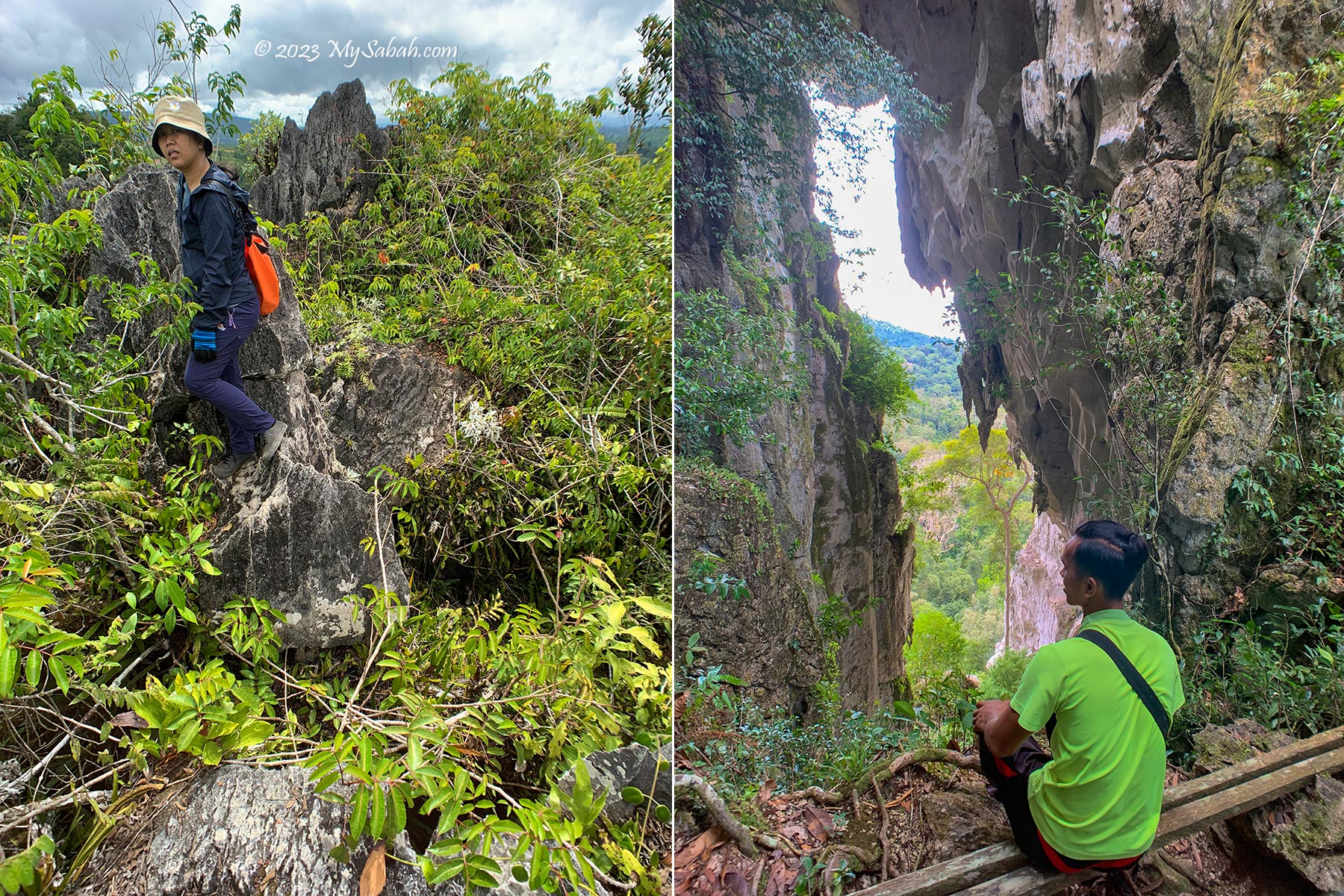
Big tree and cave in Batu Punggul Forest Reserve. Numerous plants found in and around cave entrances are endemic to limestone. The cave was used as a refuge by the Muruts in times of wars and epidemics. The guy at the right is Josyen.
15 minutes later I reach a big cave. Visitors can enter the cave chamber to see some interesting limestone formations that resemble household items such as jar, the belongings of the longhouse inhabitants. There are a few limestone cave networks (e.g. Batu Tinahas Cave) in this forest reserve for those who are keen in caving.
Batu Punggul Forest Reserve is under the administration of the Tibow District Forestry Office (Sabah Forestry Department).
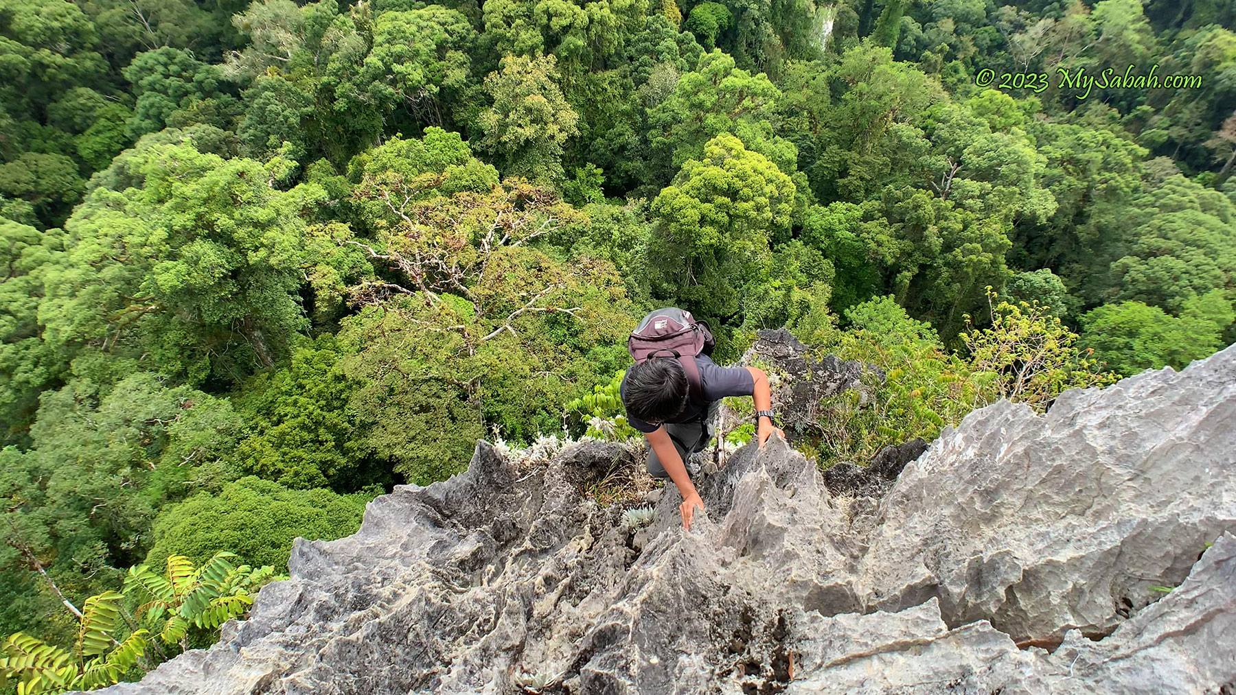
Climbing Batu Punggul
Finally we arrive the starting point of the climb. To cut down weight, you can leave the unnecessary items here, e.g. portable charger, hiking pole (pack them all in a plastic bag in case it rains). I only climb with a small backpack that carries a 1-Litre water bottle, raincoat and camera. I strongly advise you to apply sunblock lotion before the climb because it’s really hot up there.
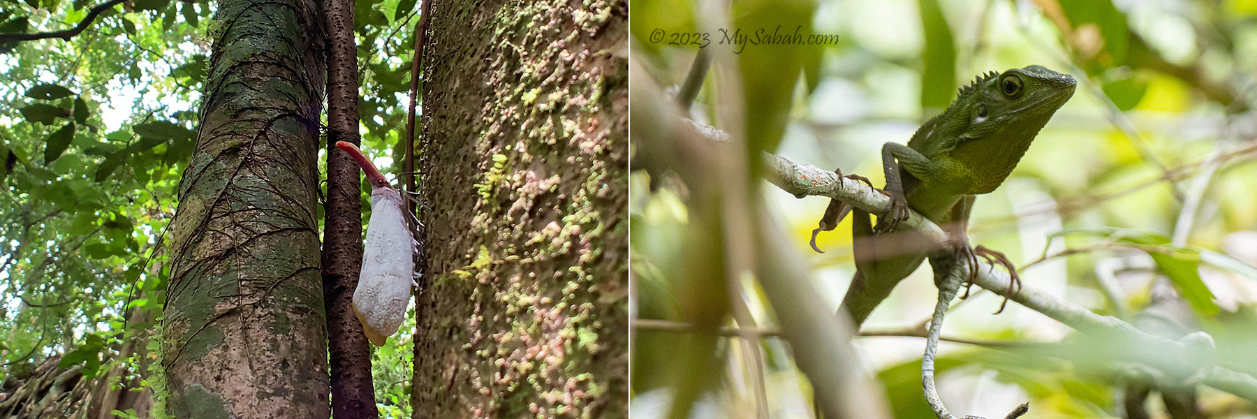
Left: This white lantern bug (Species: Pyrops sultanus) is endemic to Borneo. Right: We saw this crested green lizard twice back and forth. It changed from green to black colour.
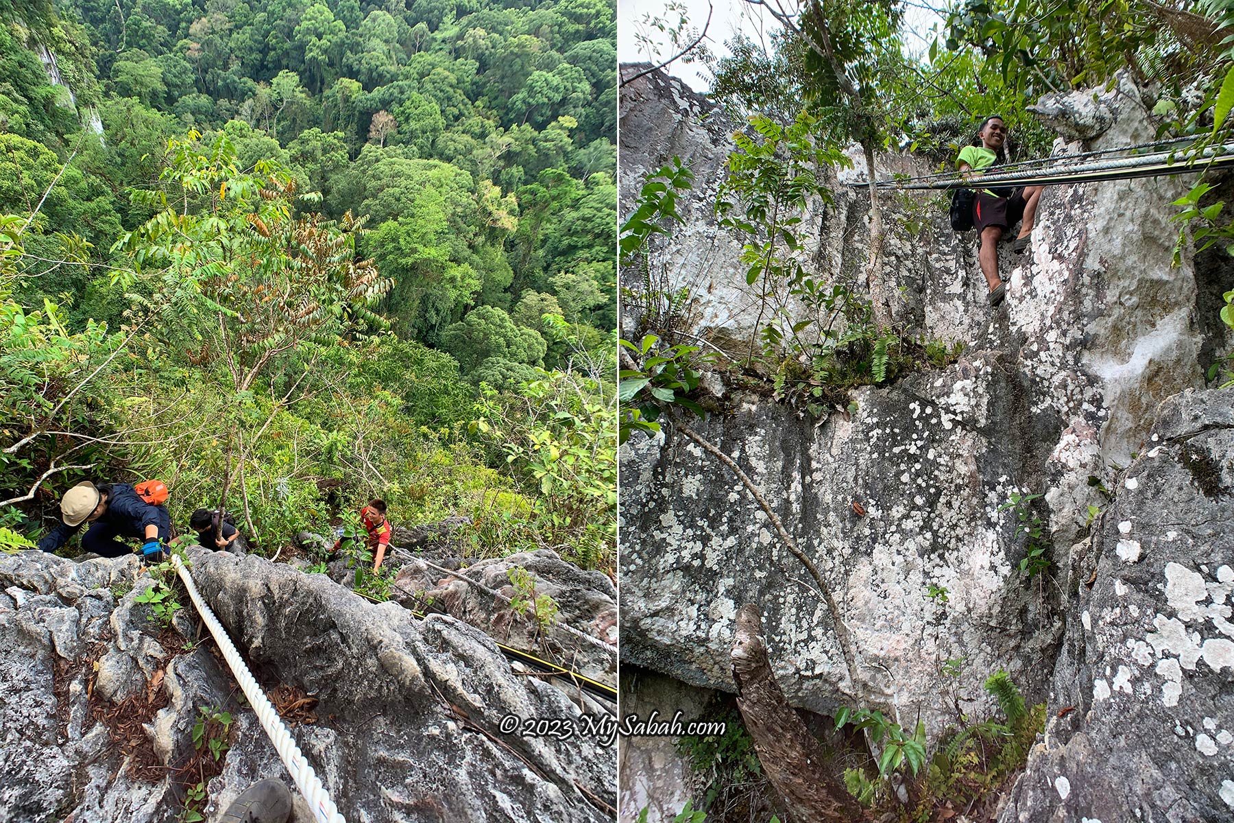
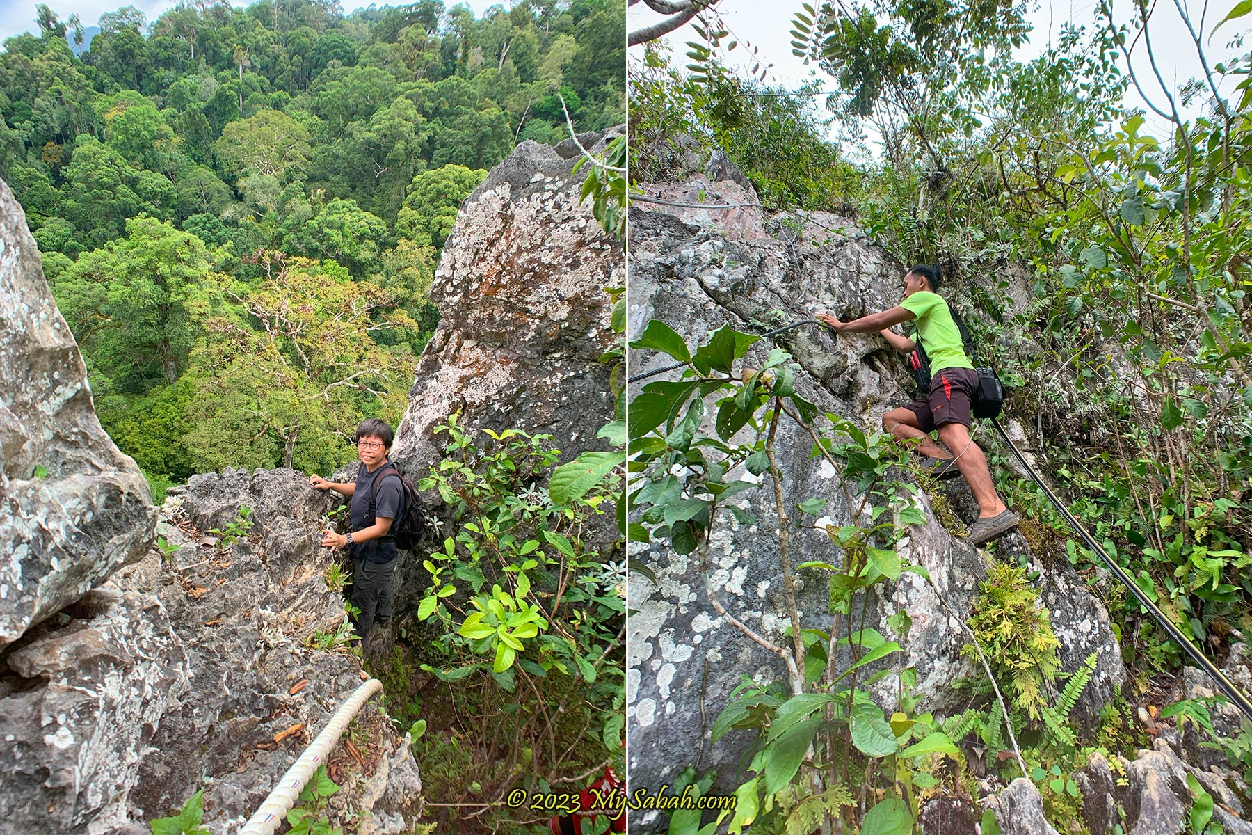
The starting point is already a test of bravery. You need to traverse sideway to cross a vertical wall. A misstep will be hazardous to your health. You can stop here if you don’t feel confident. Anyway, it’s a great photography spot to take photos that shock your mom.
The scary crossing at the starting point. It’s me in black clothing. Bravery is more useful than climbing skill in this trip.
The climb to the summit takes 45 minutes to an hour. Most people can reach the peak successfully if they are reasonably fit. You don’t need to be a trained rock climber, but some hiking experience and upper body strength (and courage!) would help a lot. The oldest climber who reaches the top of Batu Punggul is 74 years old.
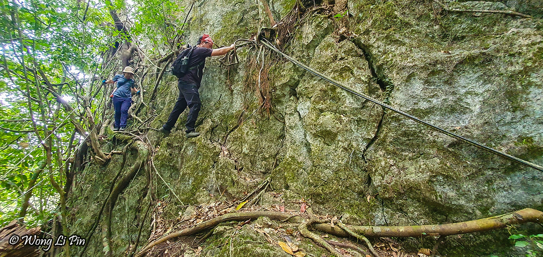
The only available climbing aid are ropes and cables. Jariah looks tired.
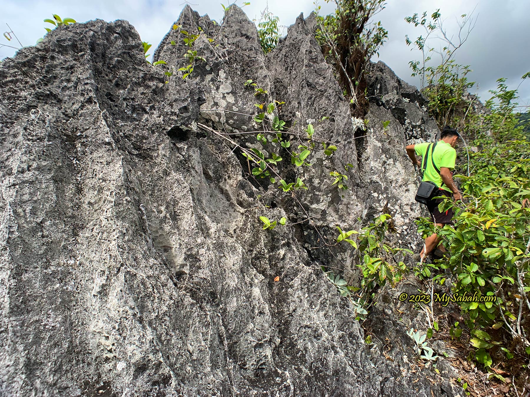
The climbing trail is uneven and nearly vertical most of the time. With the help of ropes and cables, I move up slowly on steep boulder cliffs, looking for holes, dents and protrusions, on crevice, jagged edges, and cliff bands as handholds or footholds. The most tricky part is to climb over a few mildly overhanging rocks. The path is so narrow that I can only rest in standing position or leaning to the rocks, as there isn’t enough space to sit down.
Climbing the vertical limestone cliffs of Batu Punggul. Josyen is smiling, as if the climb is too easy for him.
The limestones are hard and sharp with rough surface, good for solid grips but it would scratch your skin. You are better off wearing gloves. I climb without one and get a minor cut on finger. The local believes that if you bleed in your first climb, the spirit is telling you that you will live a long life.
Normally it takes 45 minute to an hour to reach the top of Batu Punggul, depend on your fitness. At the left is Ms Wong Li Pin from media.
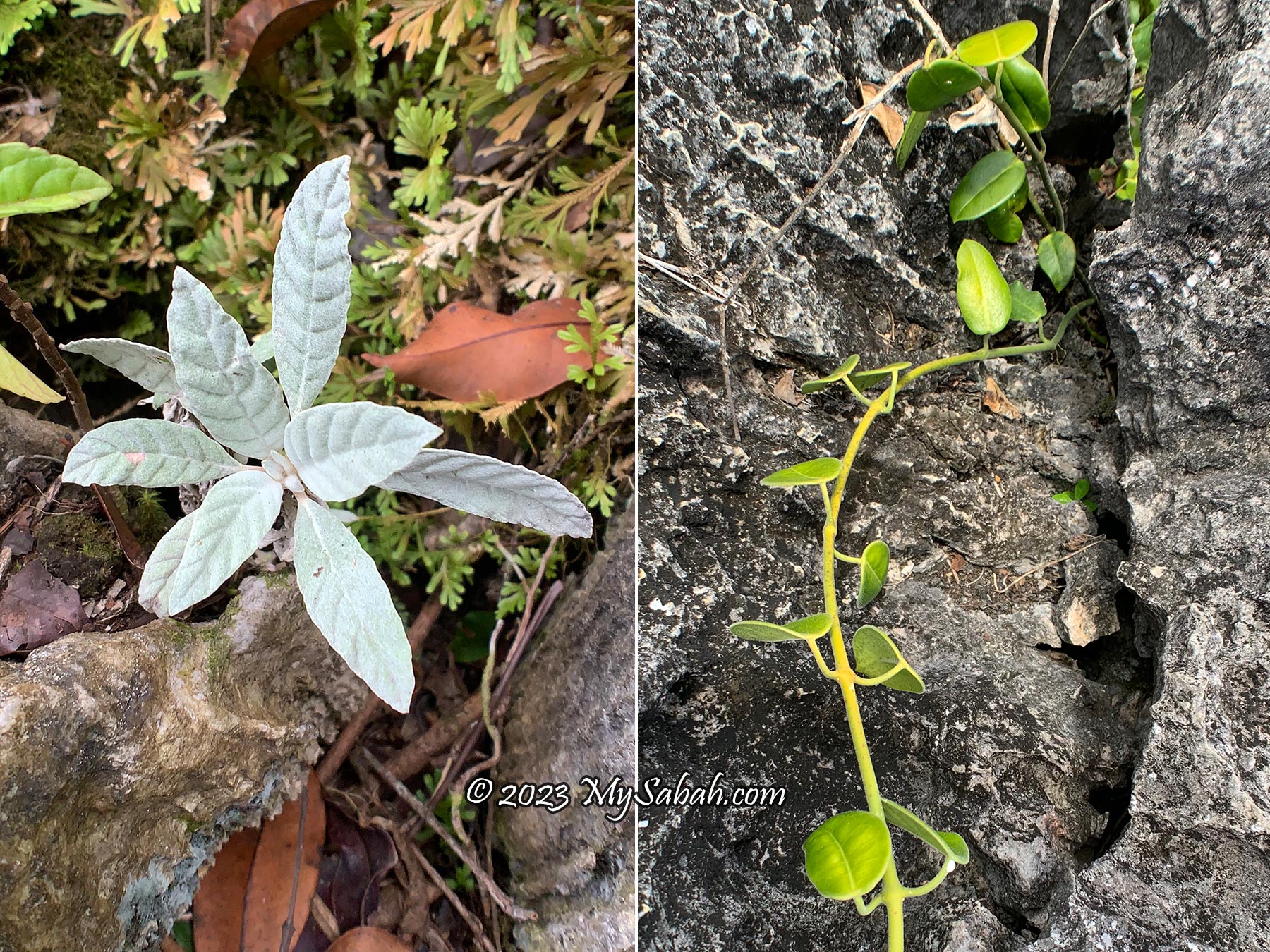
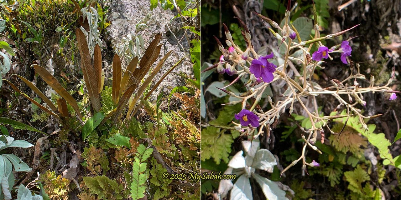
The vegetation changes from lowland rainforest to limestone forest, which is predominantly made up of small trees, shrubs and rich herbaceous layers. In Sabah, some of the more common plant species which grow on limestone are begonias (Begonia spp.), Paraboea sp., some ferns and aroids. Among the limestone endemic plant species that occur on Batu Punggul limestone are Tainia ponggolensis (orchid) and Begonia amphioxus. I do spend some time admiring the interesting plant and flowers.
Left: the silvery lucky plant, tawawo, probably a Bluemae. Right: Salung tangi, a magical ingredient for making love potion
I see a lot of whitish plant grows on the limestone. According to the locals, it’s called tawawo. You can put its leaves inside hunting rifle or wallet as a lucky charm. If tawawo is plucked in the morning, it will emit a soothing scent by 2 or 3pm. Give it to a girl. If she smells the aromatic scent, she will fall in love with you, they say.
Interesting plant and flower that grow on limestone of Batu Punggul. Note: plucking plant is forbidden in forest reserves.
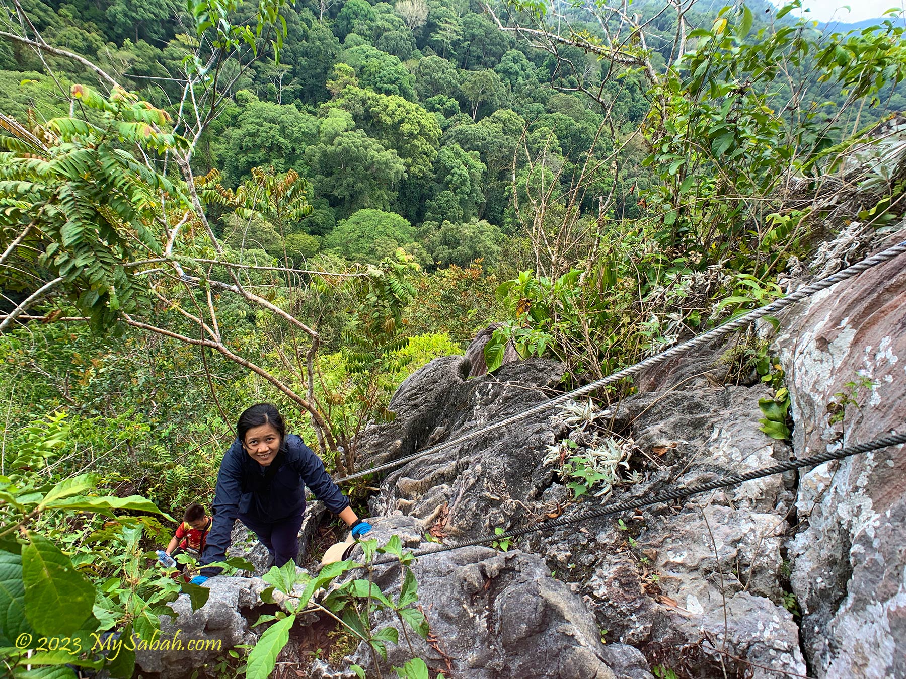
We have three guides (Jariah, Josyen and Rosdin) who always keep an eye on us and tell us where to put our feet. Batu Punggul looks dangerous but it’s not really dangerous if you are careful. No severe injury occurs on this pinnacle before. Whatever, it’s still nerve-wracking when I’m crossing a few sections that are only one step away from a hundred-metre fall. My legs shiver whenever I see the cliff below my feet.
The hundred-metre drop is just next to the climber, one of the frightening moments.
The limestones are greyish white in the beginning. As we move closer to the peak, they are darker in colour due to weathering. The biggest challenge of this climb is not the steepness, but dehydration and heat exhaustion. My best advices for you are: bring more water, apply sunscreen, wear comfortable outdoor clothing and a pair of good hiking / climbing shoes. e.g. Adidas Kampung.
The blade-like limestones on top of Batu Punggul. The highest point is less than 30 Metres away from here.
On the top, watch out for a gap called Tapikon Ansawoh, which means “the place where husband and wife jump across”. The story is – a newly married couple was climbing Batu Punggul. When they came to this gap, the sweet husband stretched his legs across the opening, to let his wife walking on them to cross. However, his legs slipped because of her weight and both of them fell into the gap.
Watch out for this gap covered by plant. If you fall into that hole, the person at the right will see you free falling in the opening.
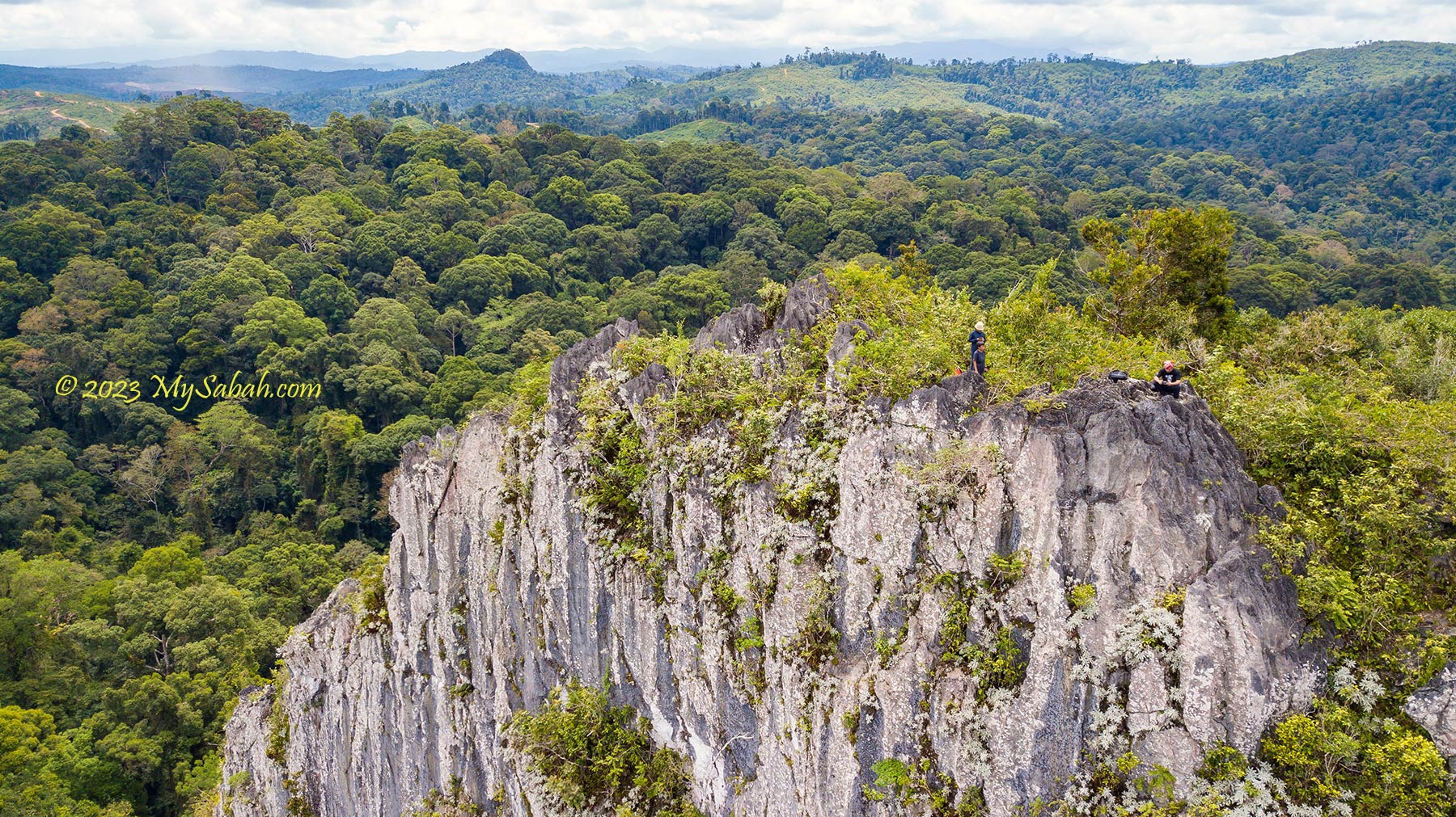
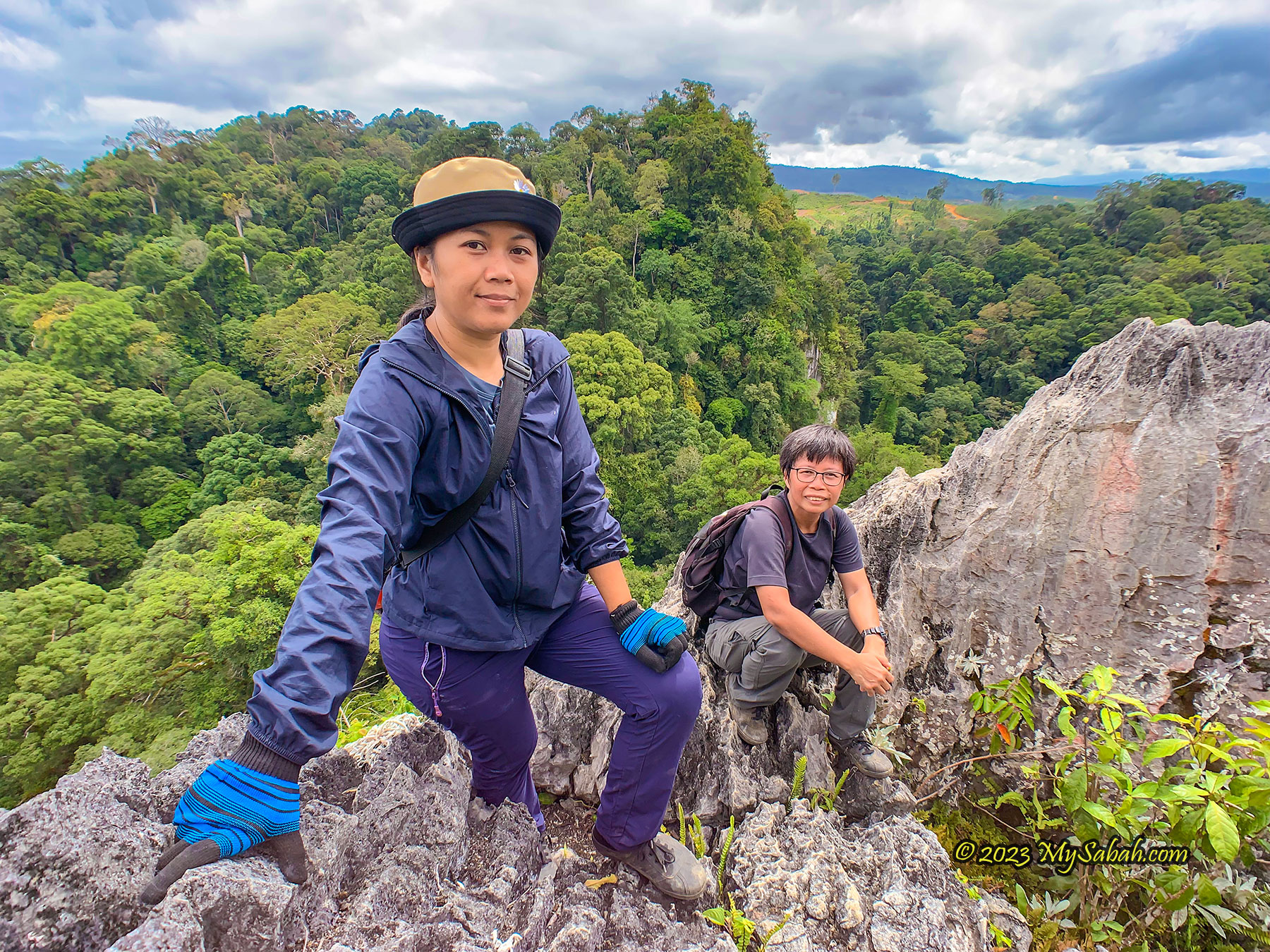
Finally I reach the highest point at 10:50am. It’s such a heroic moment, as if I unlock an achievement. Batu Punggul has no official height, but it is estimated that Batu Punggul is between 200 to 240 Metres high. From the top I have a panoramic view of Labang Valley, Batu Punggul forest reserve, Sungai Sansiang Virgin Forest Reserve, Sapulut River and the forested Batu Tinahas (another petrified longhouse). The locals have the custom of making a wish or throwing away misfortune (buang batang) on the peak. Feel free to try it.
We make it to the top! The high point far behind is Batu Tinahas (another petrified longhouse in the legend) covered by lush forest. In the photo are Jariah from Orou Sapluot (left) and Ms Wong Li Pin from media (right).
There is no tree on the peak to shade us from the scorching sun, so we don’t stay long, otherwise it would be cool to have our lunch on top with the scenic view. Descending is more difficult. Initially we plan to picnic at the pebble beach (river bank) after the climb, but the water level is too high. Therefore, we have some juicy watermelon at the jetty, a great refreshment to supplement ourselves with some sugar and electrolytes after heavy sweating.
Left: eating watermelon after the climb. Right: view of Batu Punggul from upstream Sapulut River. In front of me are Ms Wong and Dr. Richard.
About Sapulut (or Sapulot)
Sapulut is under the Nabawan district of Sabah interior. It is accessible by highway between Keningau and Tawau (part of Pan-Borneo Highway).
For a tour in Sapulut and Batu Punggul, you can contact Borneo Outback Tours Sdn Bhd (Licenses: Co. No. 846369-H / KPK / LN:9247) at: Website:www.borneo.tours Facebook:orou.sapulot Instagram:@orousapulot Phone:+60 19 2277077 (Whatsapp), +60 87 337 277 Address: A-7-2, Apollo Atrium, 89008 Keningau, Sabah, Malaysia
The tourism operations in Sapulut are managed by Orou Sapulot (means the Sun of Sapulot), a community based project to promote tourism and in sustainable manner.
References
For more information about Batu Punggul, you may check out the following materials:
Jojo M. Fung, SJ (1998). “The Legendary Batu Punggul.” Sabah Society Journal, Vol. 15 (1998) 59-73
Thor-Seng Liew, Junn-Kitt Foon, Gopalasamy Reuben Clements (2021). Conservation of Limestone Ecosystems of Malaysia, Part I and VII . Institute for Tropical Biology and Conservation, Universiti Malaysia Sabah, Kota Kinabalu
RTM TV1 (Rancangan Rentas Peribumi). (2019, August 23). Kehidupan Masyarakat dan Kepercayaan Suku Kaum Murut Tagol di Batu Punggul dan Kampung Tataluan, Nabawan Sabah. [Video]. YouTube. https://www.youtube.com/watch?v=mh2v40ytG1U