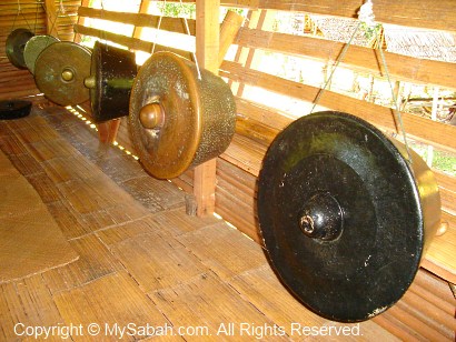
Years ago I was told by a friend about the amazing Batu Gong (Music Rock) in Kampung Solibog (Solibog Village) of Tambunan. In Malay language, Batu means Rock and Gong is an idiophones musical instrument. Gong (photo below) is made of galvanized iron sheets and a backbone traditional music instrument for indigenous tribes of Sabah. In fact, gong is also commonly found in South East Asia countries such as the Philippines, Indonesia and Brunei.
Our people play gong in important social events such as wedding, festivals and celebrations. Usually gongs in various sizes were beaten by a group of players, in different rhythm to produce a harmonious orchestra. If you hit Batu Gong, it also produces sounds resemble to gong.
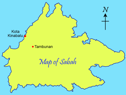
To see Batu Gong, I drove 1.5 hours to Tambunan town, which is about 81 KM away from Kota Kinabalu. I asked the Tambunan people how to get there. Though most of them know about Batu Gong, they don’t know the exact location. They only gave me a vague direction and advised me to ask the villagers when I passed by a golf course.
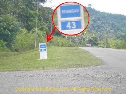
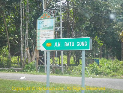
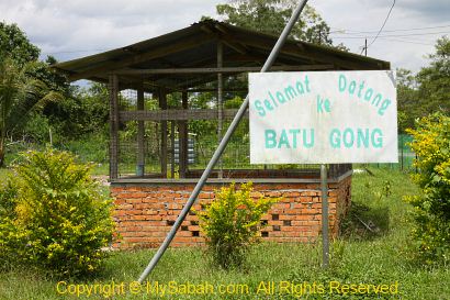
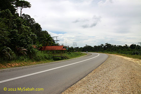
Going from the main road of Tambunan to the direction of Keningau town for about 7 KM, you will see a golf course named TNGC (Tambunan Golf & Country Club) at the left of the road within 10 minutes. Then turn left to a junction just before the milestone labeled “Keningau 43” (see photo above).
At this junction, you will also see the street sign “JLN. BATU GONG” (Batu Gong Road) with a signpost that reads “Golf View Villa” behind (see photo above). Just follow the small road.
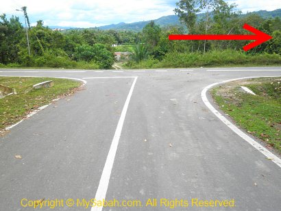
After a while, I reached a T junction. I turned to right and it is a correct way. The GPS location of Batu Gong is 5.623135, 116.339694 (see Location Map or Street View)
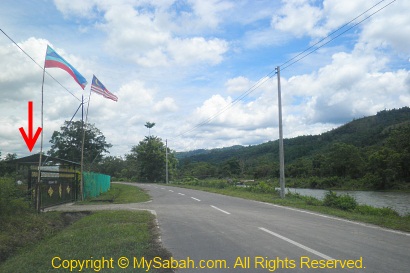
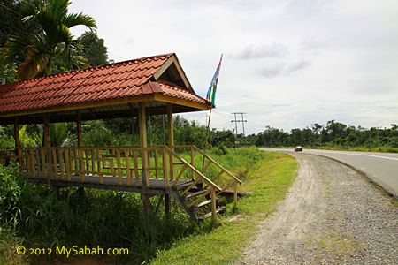
Minutes later I came to the road with river at the right. I drove slowly and saw a white sign “Batu Gong” behind a gate at my left.
Location of Batu Gong
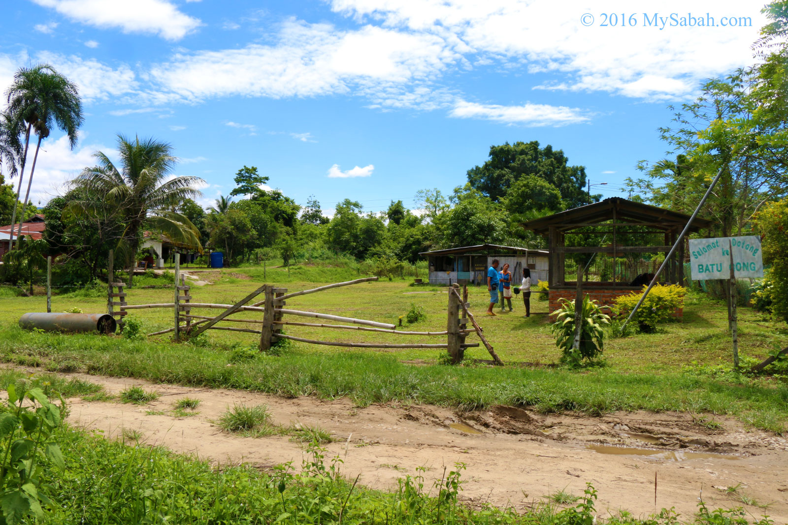
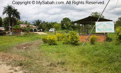
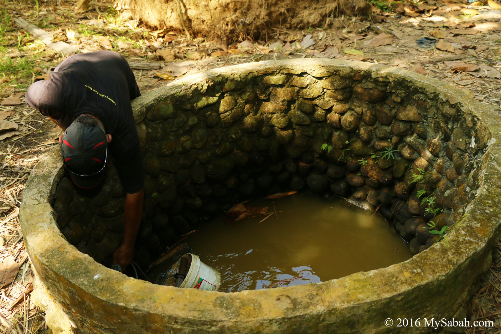
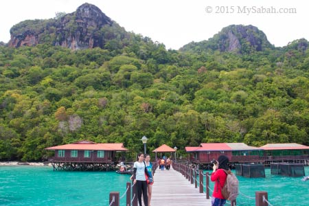
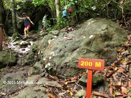
Pretty sure that I found the place. I parked my car and walked to the gate. I was a bit surprised that Batu Gong is inside a private housing area.
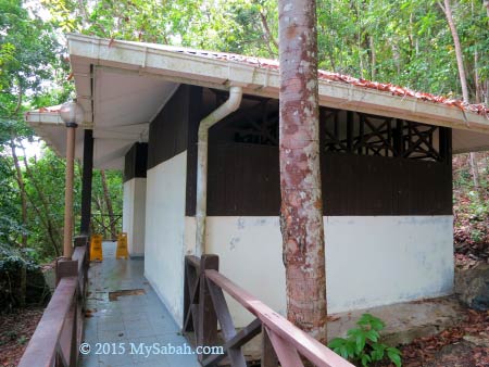
Though a bit hesitated, I opened the gate to enter. Then I saw a hut with a sign “Selamat Datang Ke Batu Gong” (Welcome to Batu Gong). Since it says Welcome, I guess it’s ok to go in.
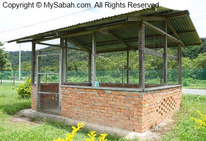
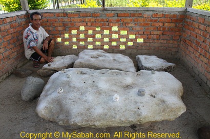
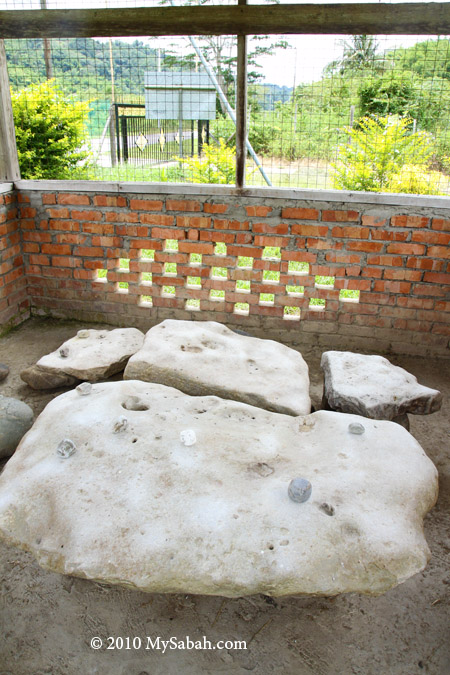
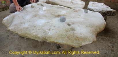
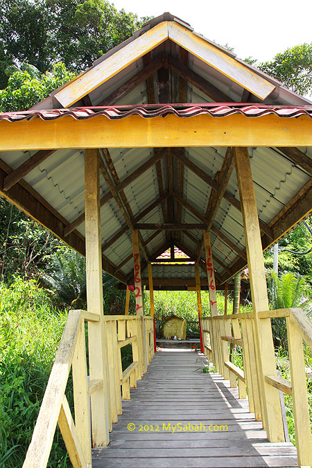
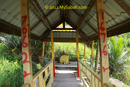
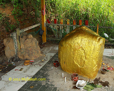
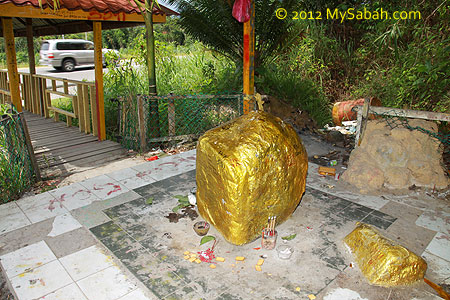
Here it is! They store Batu Gong inside a simple hut built with zinc roof, brick wall and iron fence.
Looking into the hut, I was happy to see Batu Gong inside.
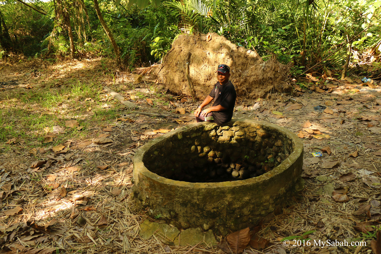
However, this place is a private property, probably I should ask for owner’s approval to enter. I walked to a house nearby. I met the owner, Uncle Yaman, and introduced myself.
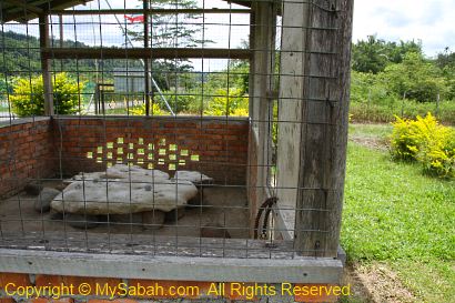
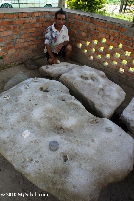
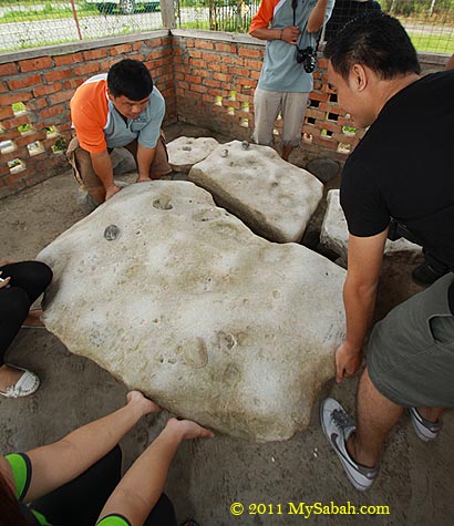
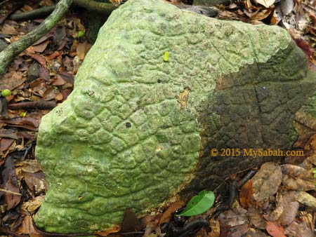
Uncle Yaman is very friendly and more than happy to show me his Batu Gong. The Batu Gong are a few boulders that look like natural ordinary rocks. Judging by their look, I can’t spot anything unusual. The discovery of Batu Gong is also by accident.
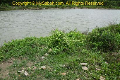
According to Yaman, there was a straightening project of Pegalan River in front of his house in year 1995. A few boulders were dug out from the river and placed at the river bank. Nobody bothered about those rocks.
Some village kids like to bathe in this river. Then one day, the adults found that the kids playing with the boulder by hitting it with stone, to produce Gong-like sound. They were so amazed by these magic rocks, so they relocated them to his house for everyone to see.
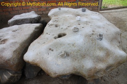
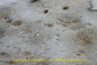
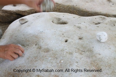
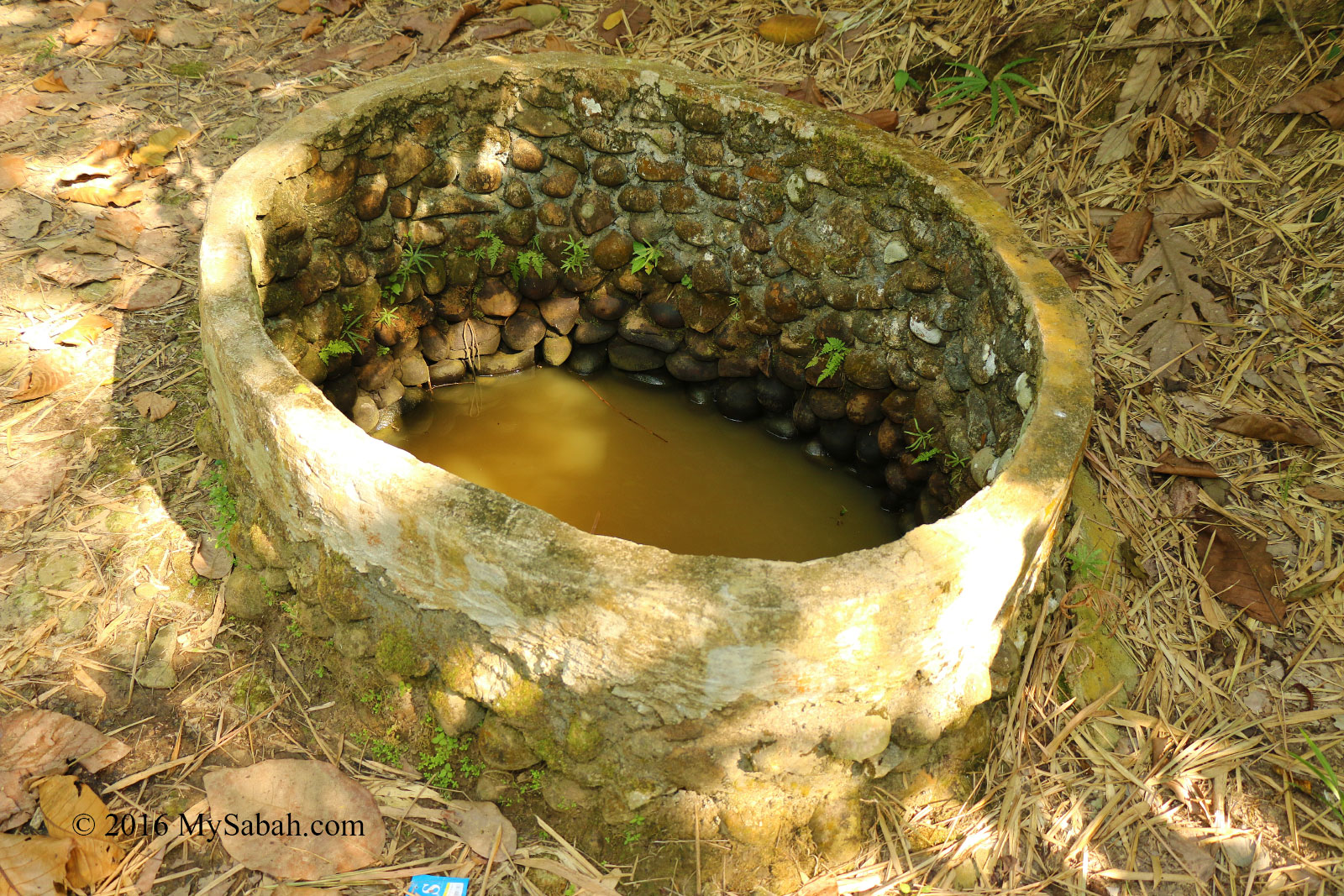
Above: a closer look of the rock. Can you see anything special? Yaman said a Japanese scientist came here before to check out Batu Gong. This scientist believes Batu Gong has high level of iron, thereby giving it a metal property.
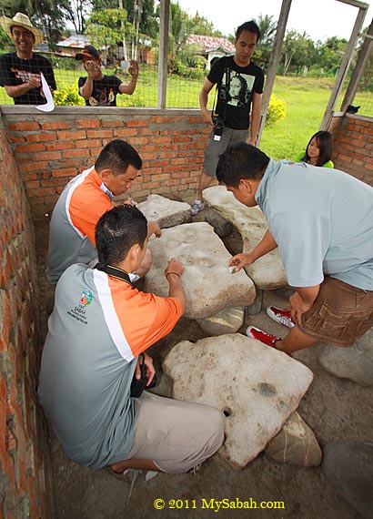
Above: so heavy, 3 men also can’t lift it.
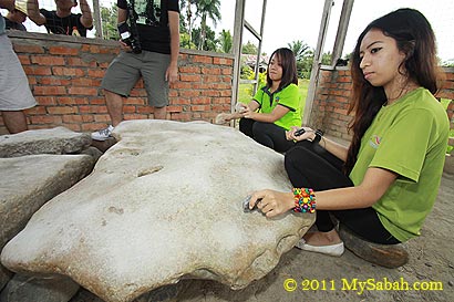
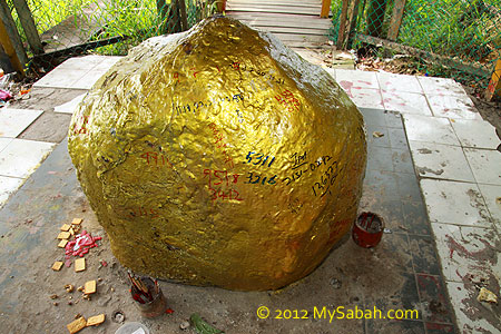
There was someone offered to buy Batu Gong, but the villagers refused, as Batu Gong is such a unique and priceless natural wonder. See 8 small stones on Batu Gong? Batu Gong can produce 8 different tones. Each stone places on the spot that has a unique tone (but a few tones sound the same to me).
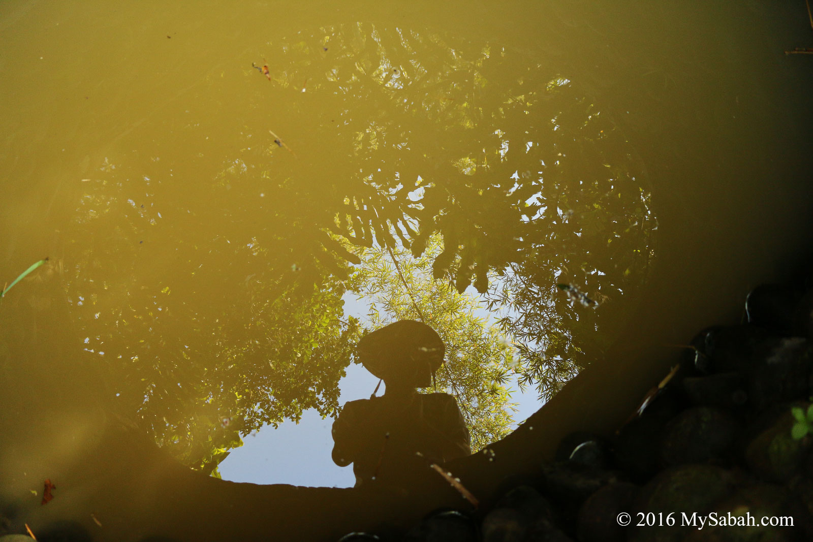
Traveling nearly 100 KM to see Batu Gong, I already couldn’t wait to beat it hard.
Wow, I can’t believe it. When being hit, Batu Gong sounds like gong (but not very much). Its sounds are crisp and high-pitched. Just imagine you hit the iron bar with a small hammer. My sense of rhythm is poor, anyway, I had so much fun hitting different spots to hear different tones. You can watch the video below to see what I mean. Near the end of video, I also include the sound and music of real gong for you to compare.
I always wanted to see Batu Gong years ago. I only did it after I got my compact camera with HD movie recording function, because I could not show the sounds with photos.
Above: the river where Batu Gong was found. This river is just in front the house of Uncle Yaman. 15 years ago, a project changed the course of this river to free up some land, which included the current housing area of Uncle Yaman. During rainy season, this overflow river still can flood the road next to it, in case you wonder why Yaman built his house so far away from the gate.
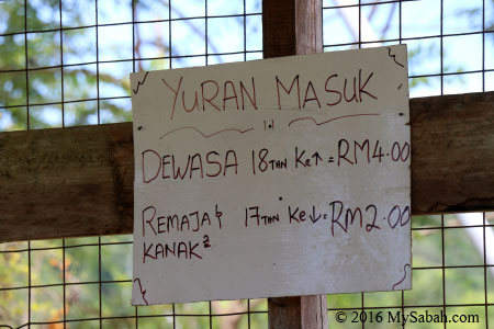
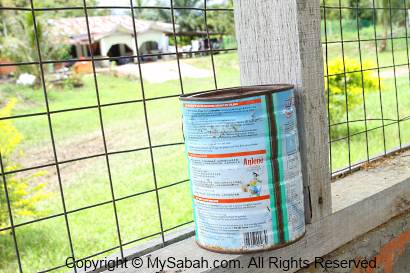
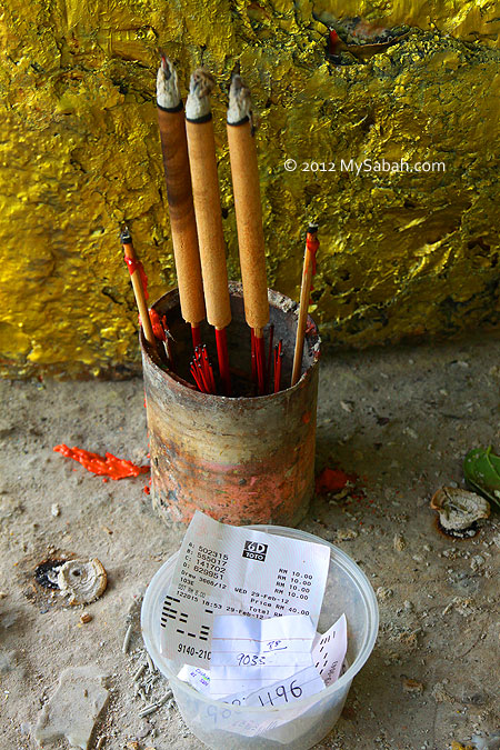
Ticket Fees (written in Malay): Adult (18 and above): RM4.00 (≈US$1), Kid (below 18): RM2.00 (≈US$0.50). Note: rates as of May 2016
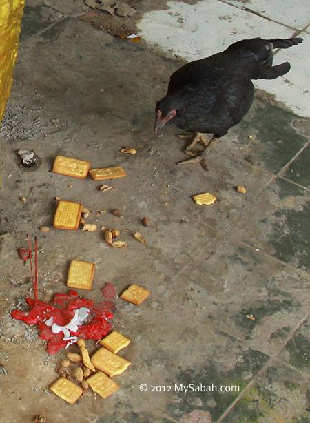
Above: to show some appreciation, you can put money in this rusted tin. Of course you can give more.
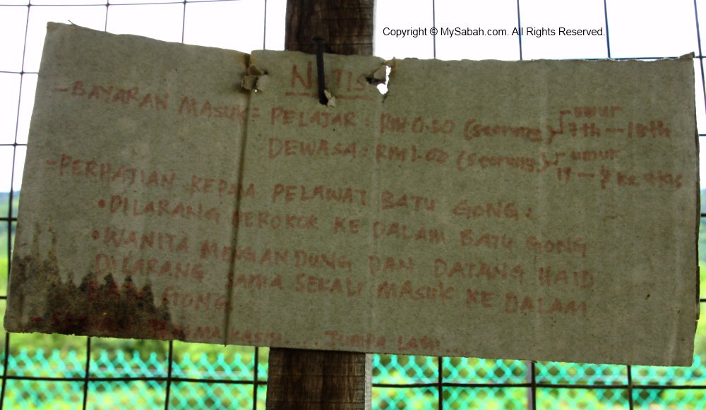
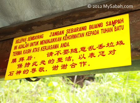
There is a notice in the hut (no longer there, as of May 2016). I didn’t pay much attention to it until I opened the photos later at home. These are “visiting rules” written in Malay language. The first one says “No Smoking”, which is understandable as the holes on Batu Gong look like convenient ash tray. The second rule is odd, it says “Woman in pregnancy and menstruation are prohibited to enter”. Probably Batu Gong is considered as a sacred rock with spirit resides in it?
Just an extra info, music rocks like Batu Gong are also found in Kg. Baginda of Keningau, but I haven’t seen it yet.
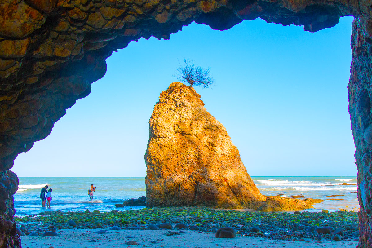
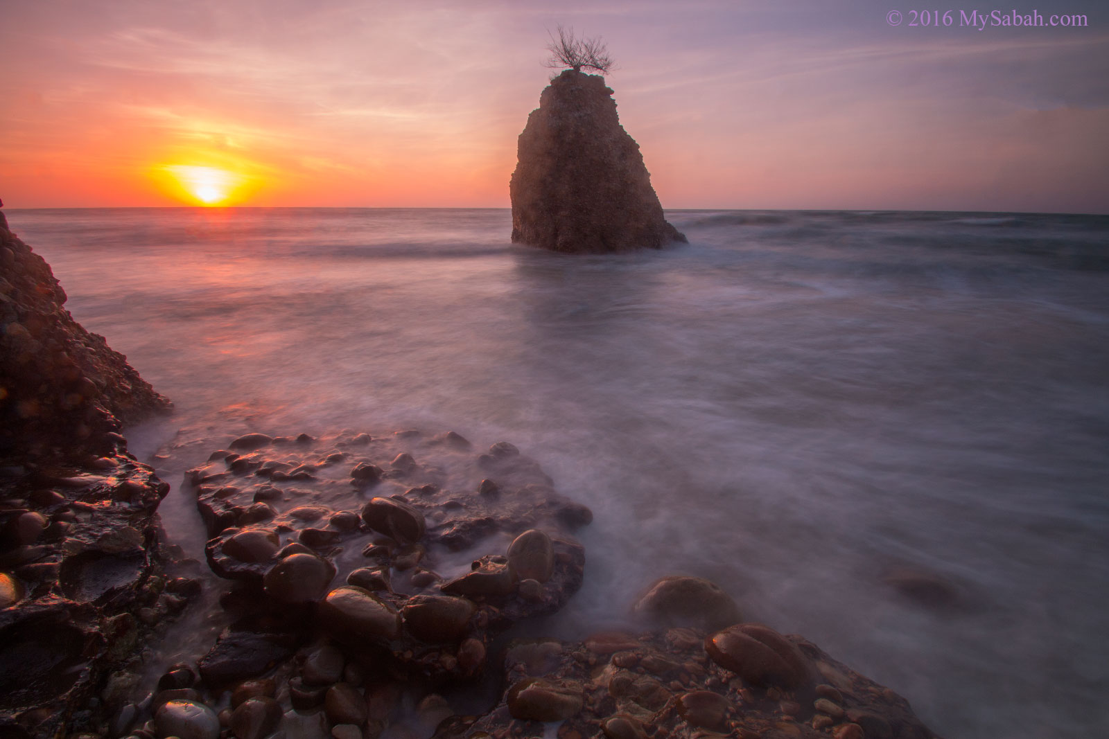
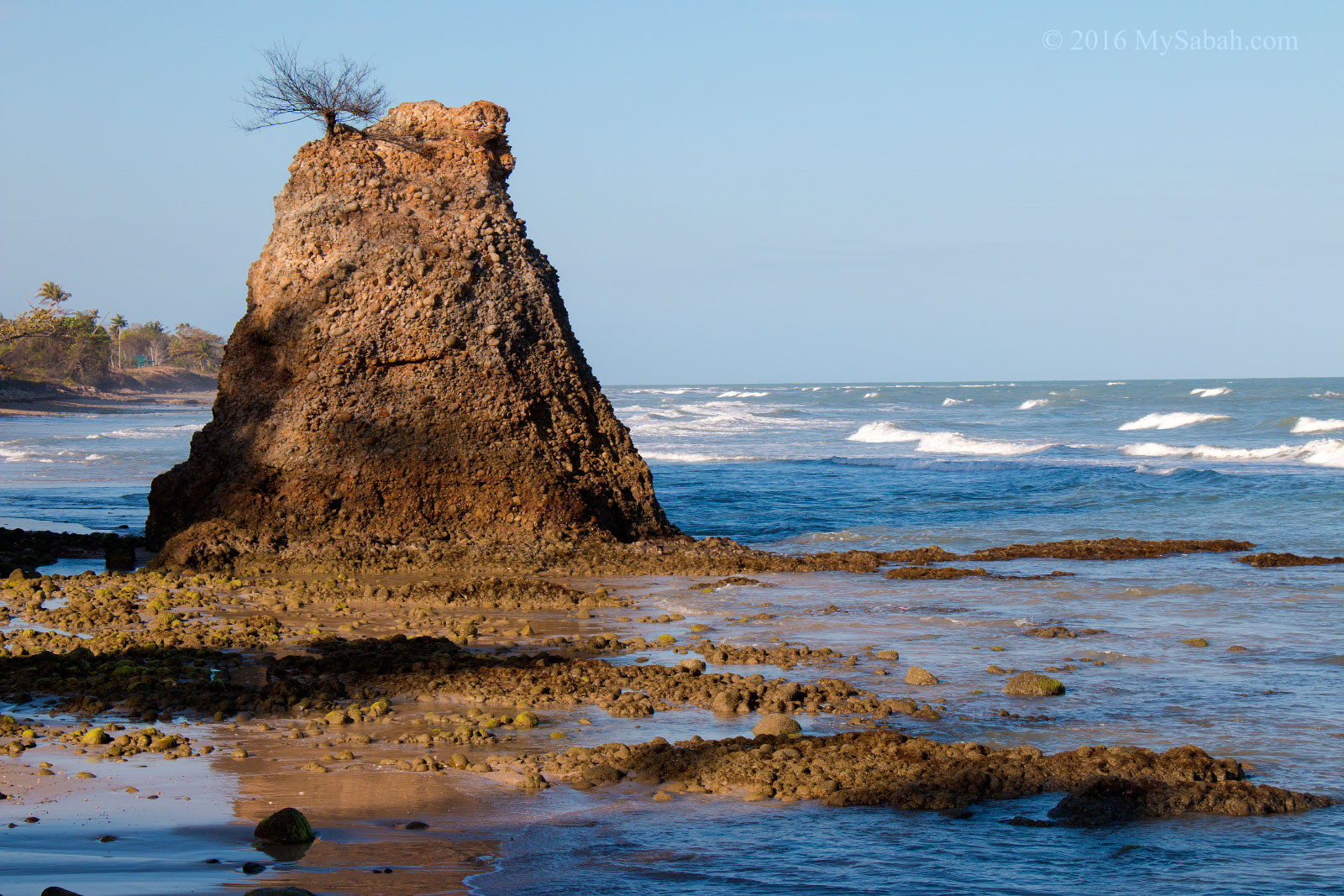
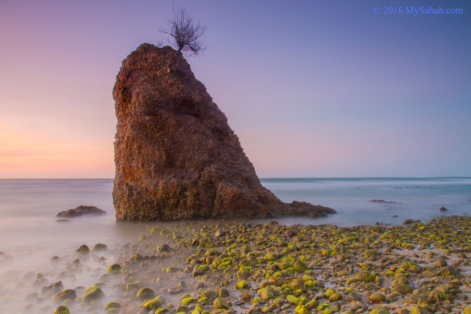
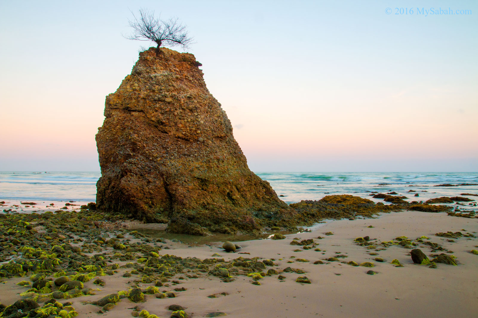
I was astonished when a famous photographer from West Malaysia showed me some stunning photos of Batu Luang, a bell-shaped rock located in a beach of Kuala Penyu. Batu means “Rock” in Malay language, and Batu Luang means “Luang Rock” literally.
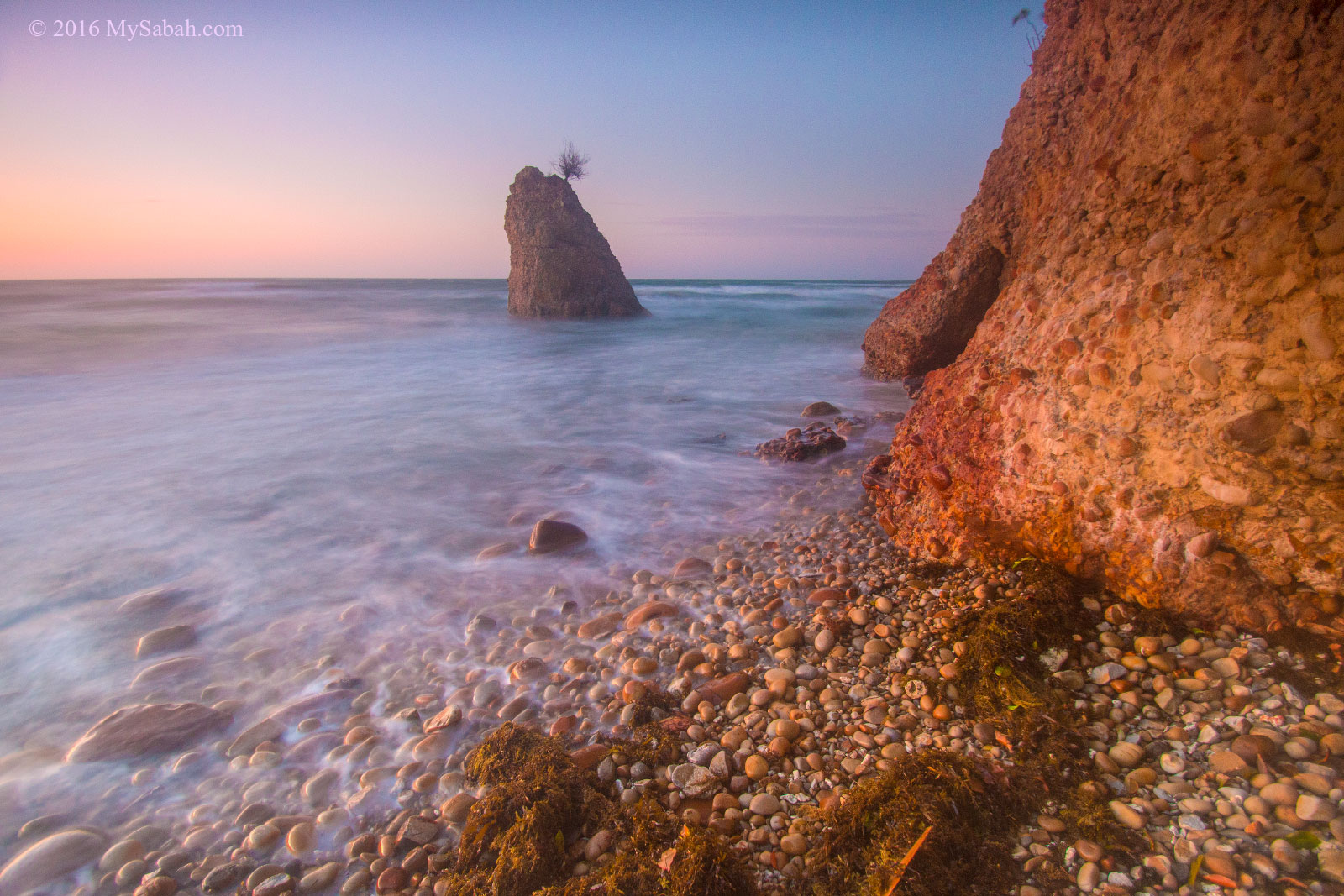
Batu Luang is surrounded by mossy green rocks, sea, pebbles, rusty-red rockface, and caves, when one or more of these being framed into a photo during orange-hued dusk, you will get one of the most amazing sunset shots of Sabah.
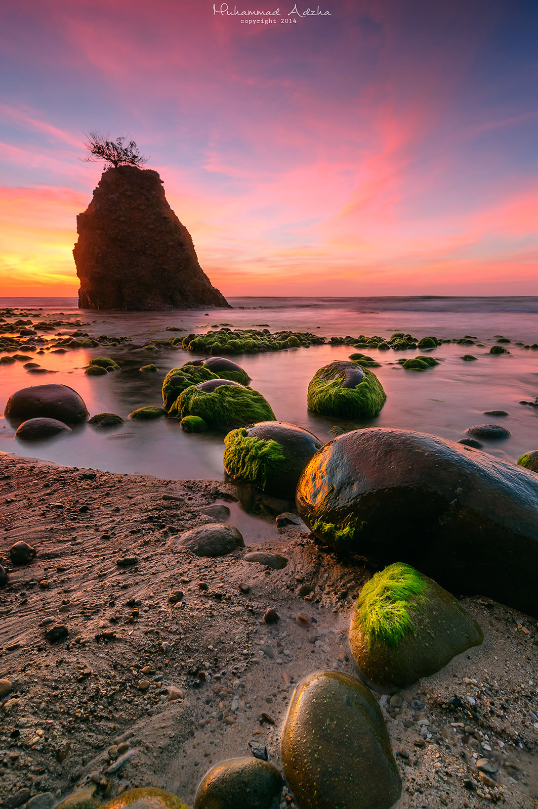
Nice sunset at Batu Luang (high tide)
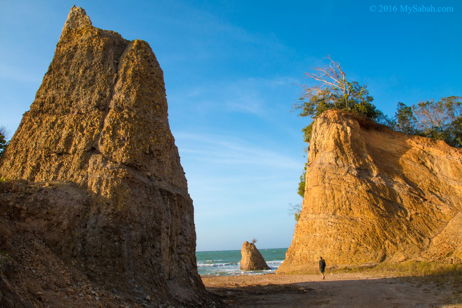
It is funny that it’s non-Sabahan who introduced Batu Luang to me. Anyway, I’m excited to check out Batu Luang near Tempurong Beach (or Pantai Tempurung). The rock is very accessible and near to the main road in Tempurung Village.
Walking to Batu Luang. The hills at both sides look like a giant gate, or the parents of little Batu Luang
The beach and hills are covered by cobbles and pebbles
Batu Luang Beach
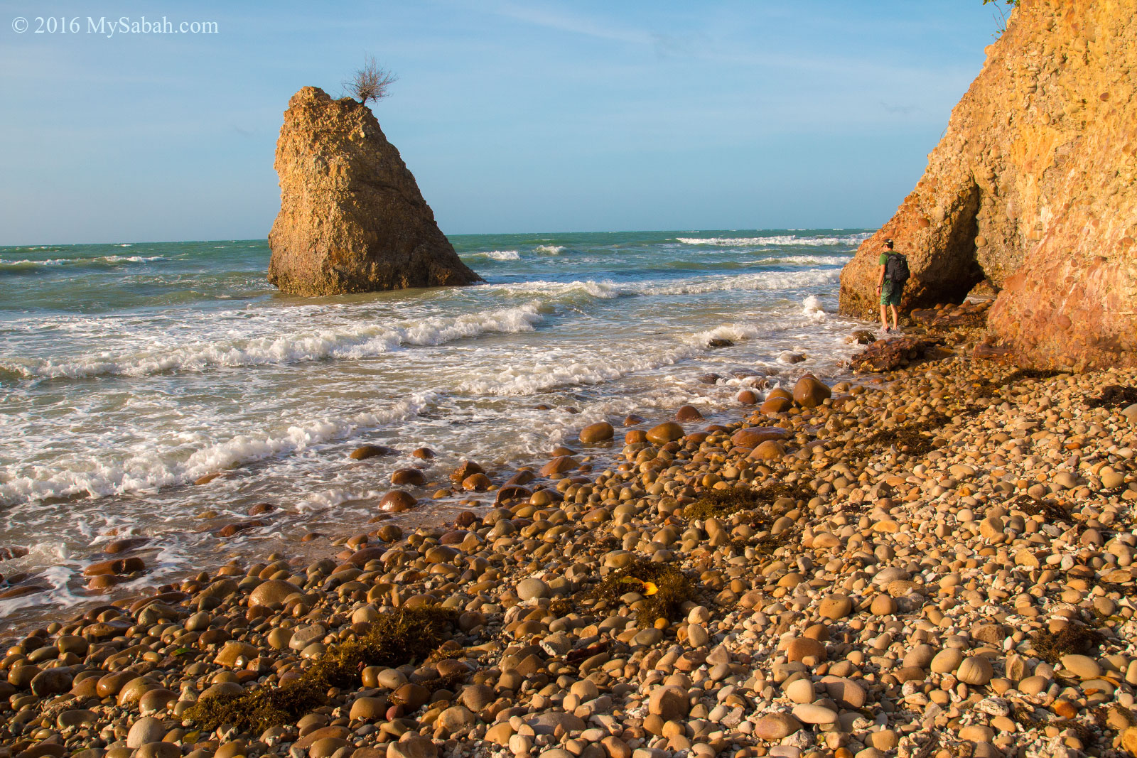
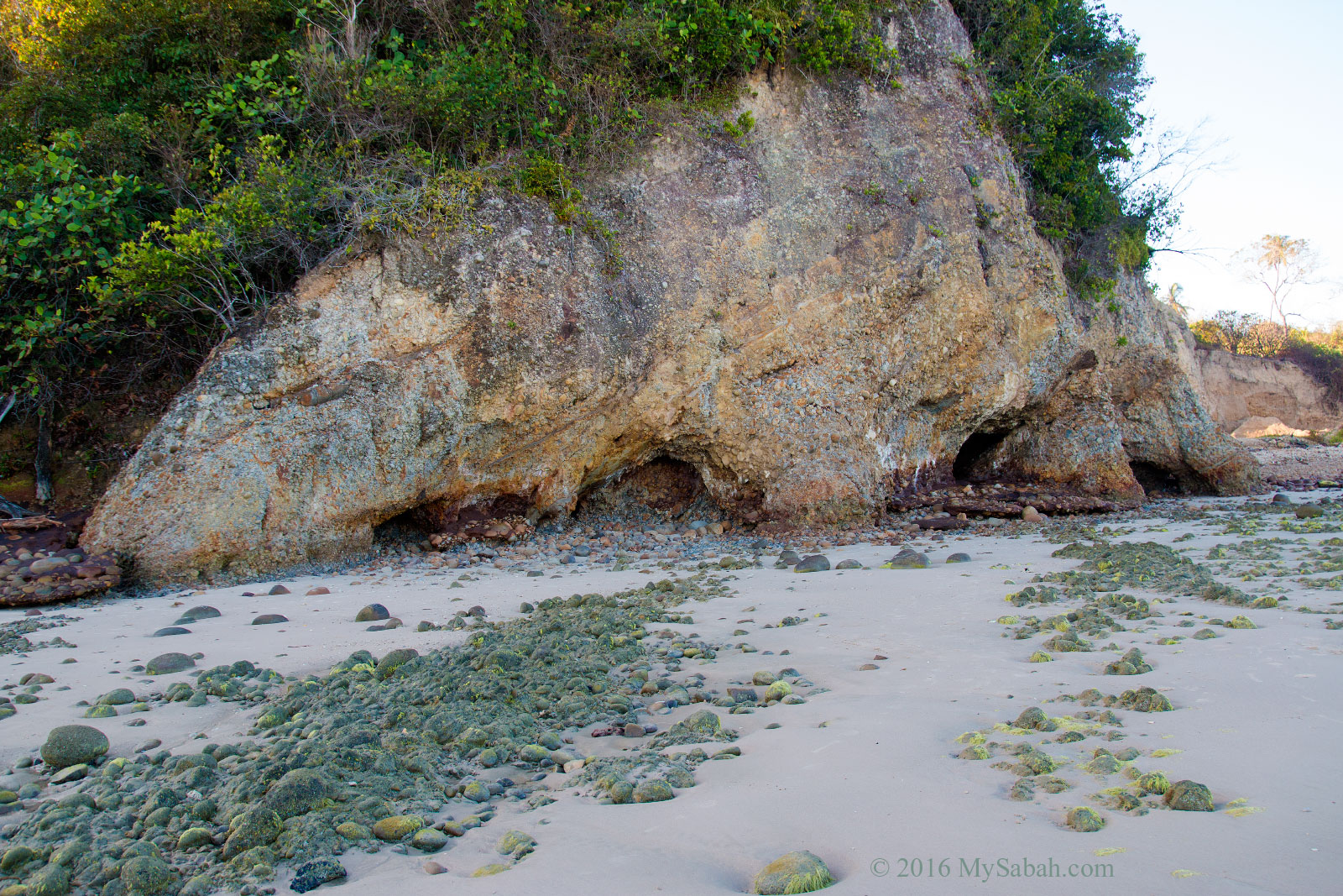
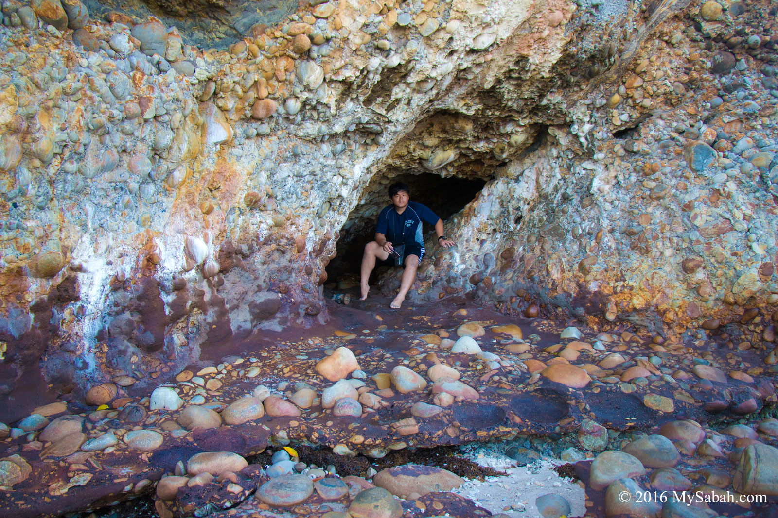
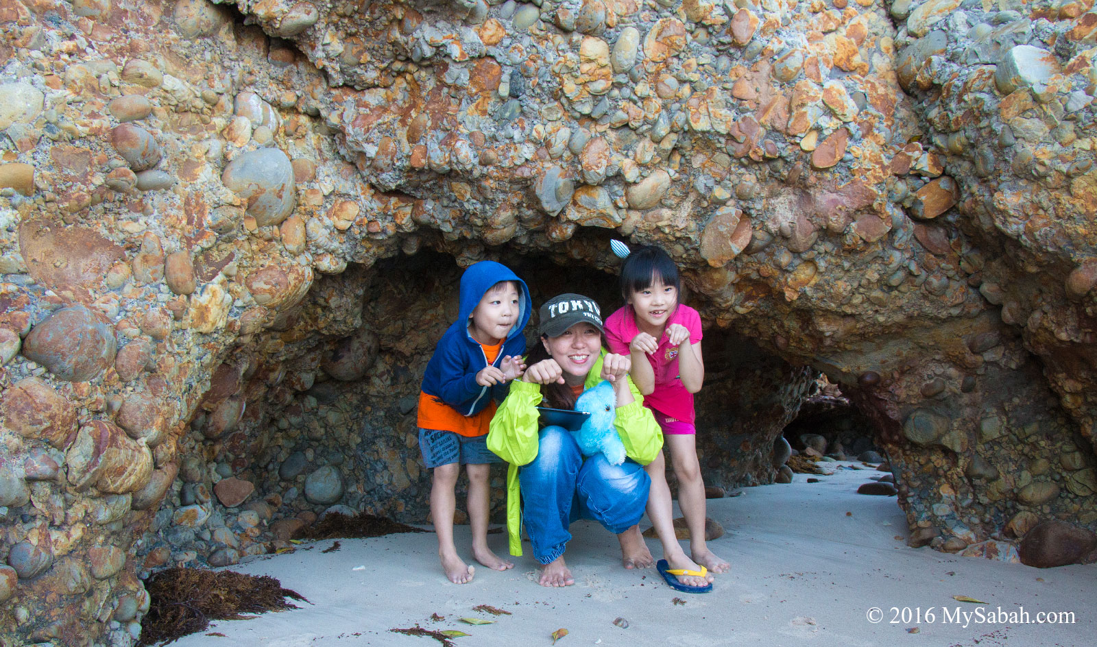
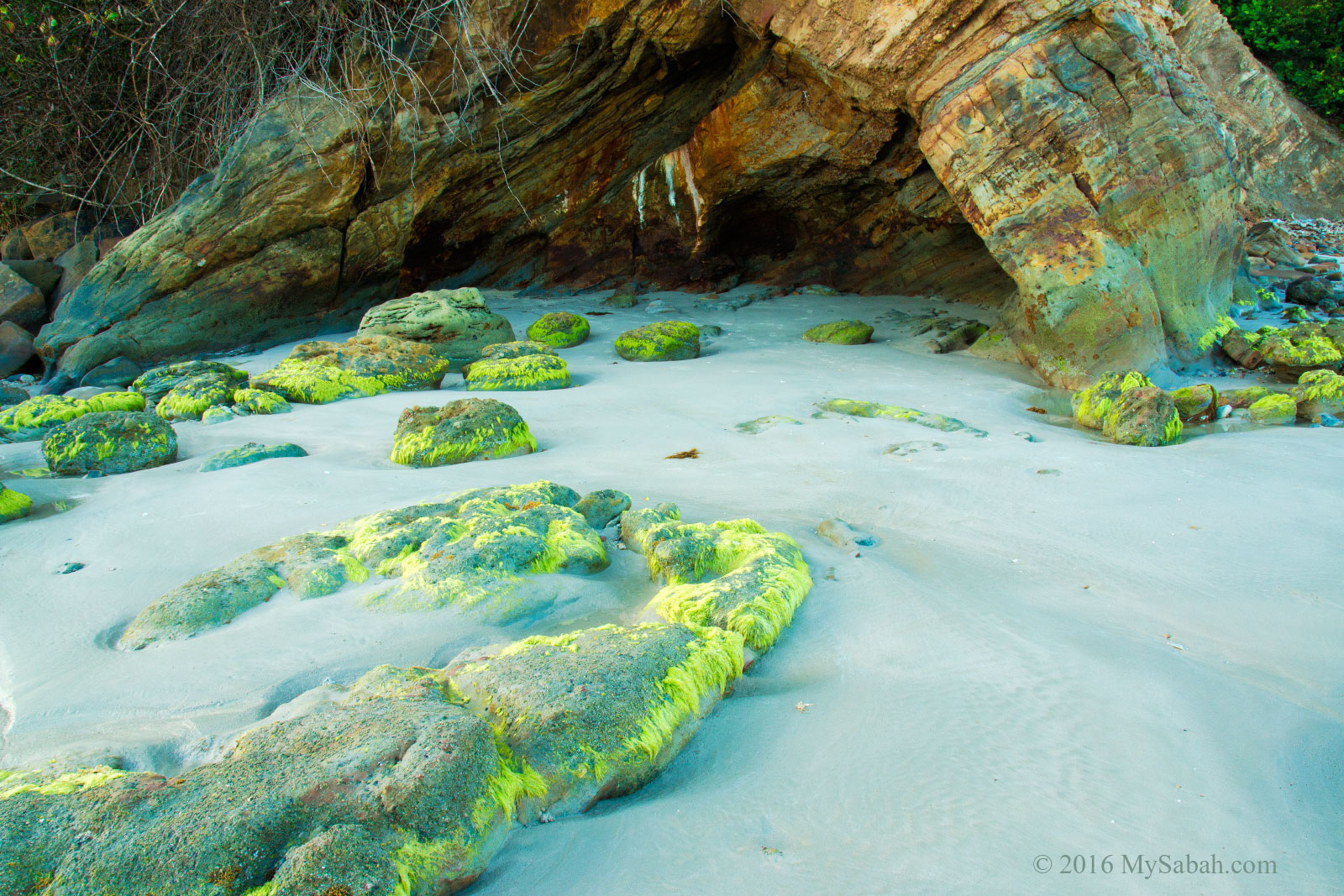
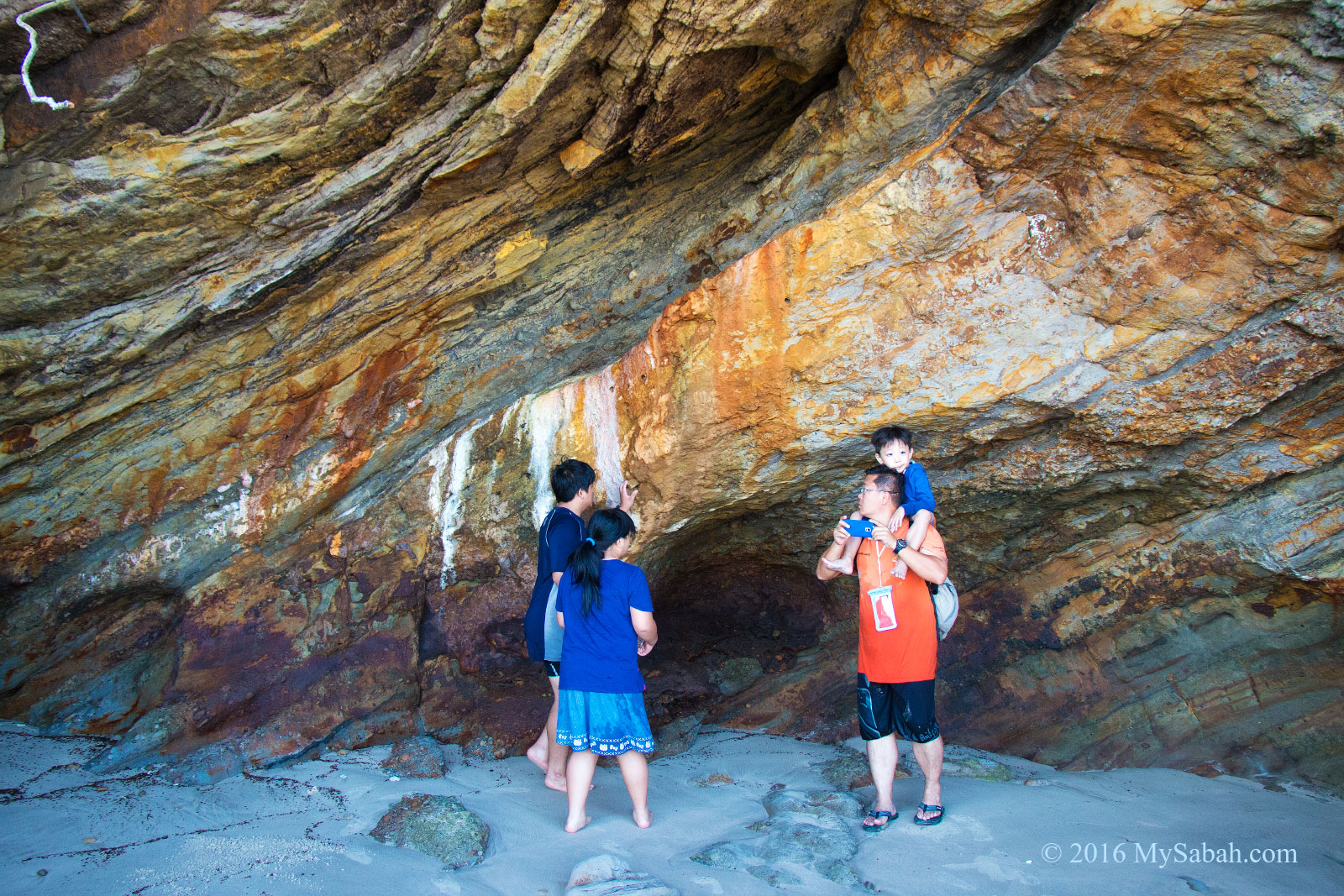
The view is better than what I saw in the photos online, which show only a small part of the beach. The beach and rockfaces are covered by pebbles in different size and shapes. There are 5 or 6 caves at the base of the hills there. The biggest cave can fit in 10 or more people, other caves are more like a hole.
The pebble beach and cave around Batu Luang
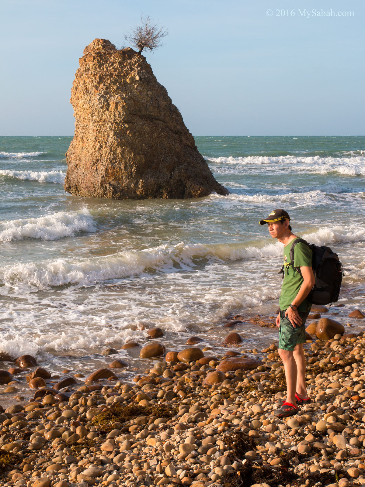
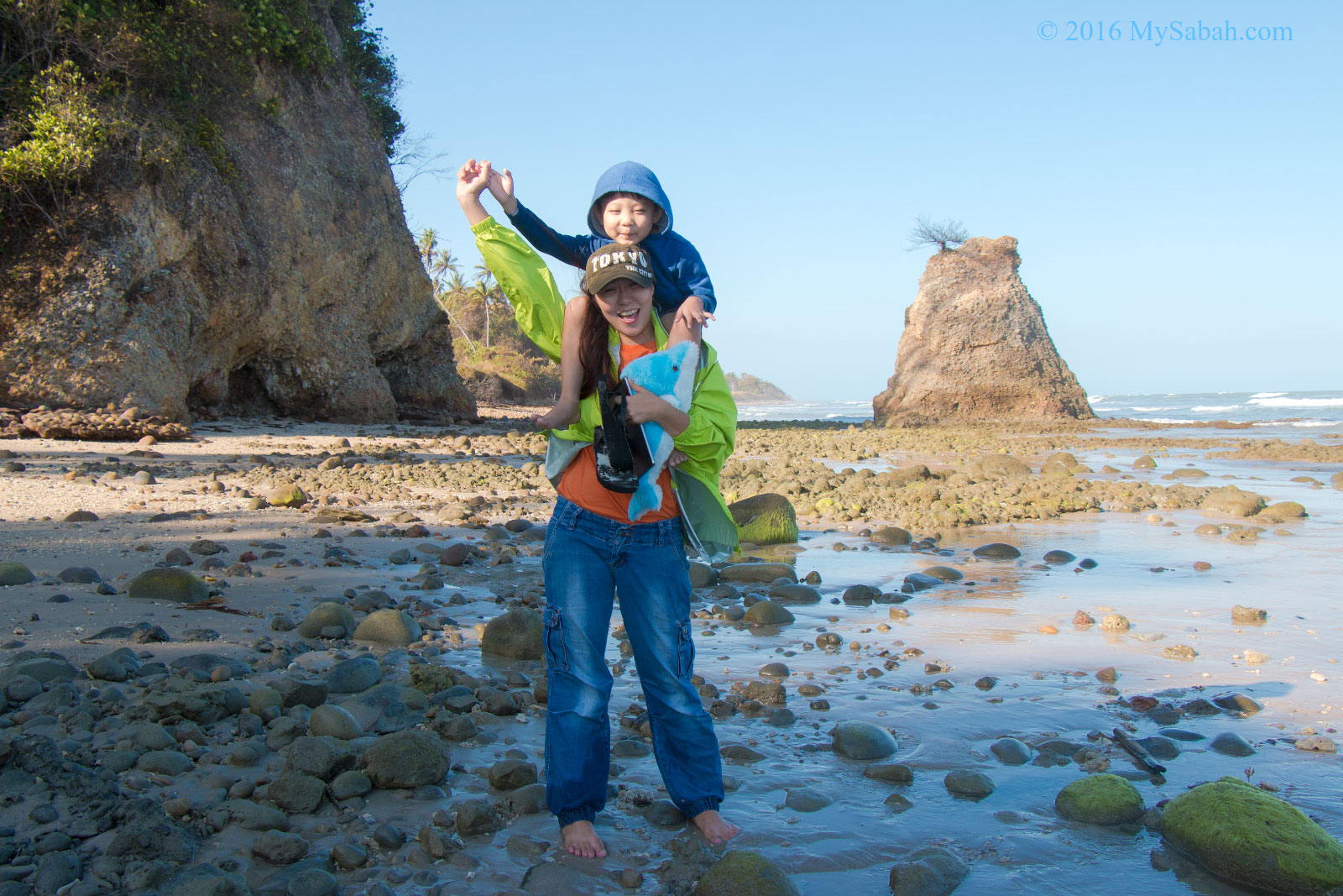
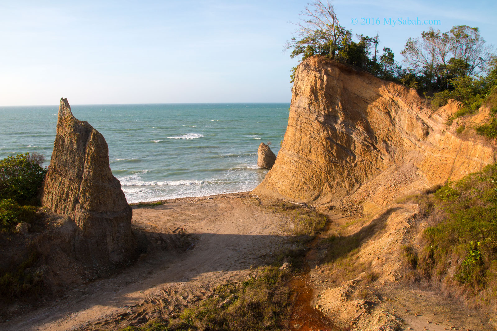
Batu Luang may look small in photos. Actually it’s over 12 Meters high and the only big rock standing in the sea (as far as we can see).
Small caves at the base of hill, created by coastal erosion
Though Batu Luang is a new hot spot for local photographers, there is no hotel, restaurant, parking lots and toilet nearby. Occasionally you would see some local youngsters frolicking there in hot days, or a few photographers taking photos during dusk, Most of the time you would be the only one at the beach.
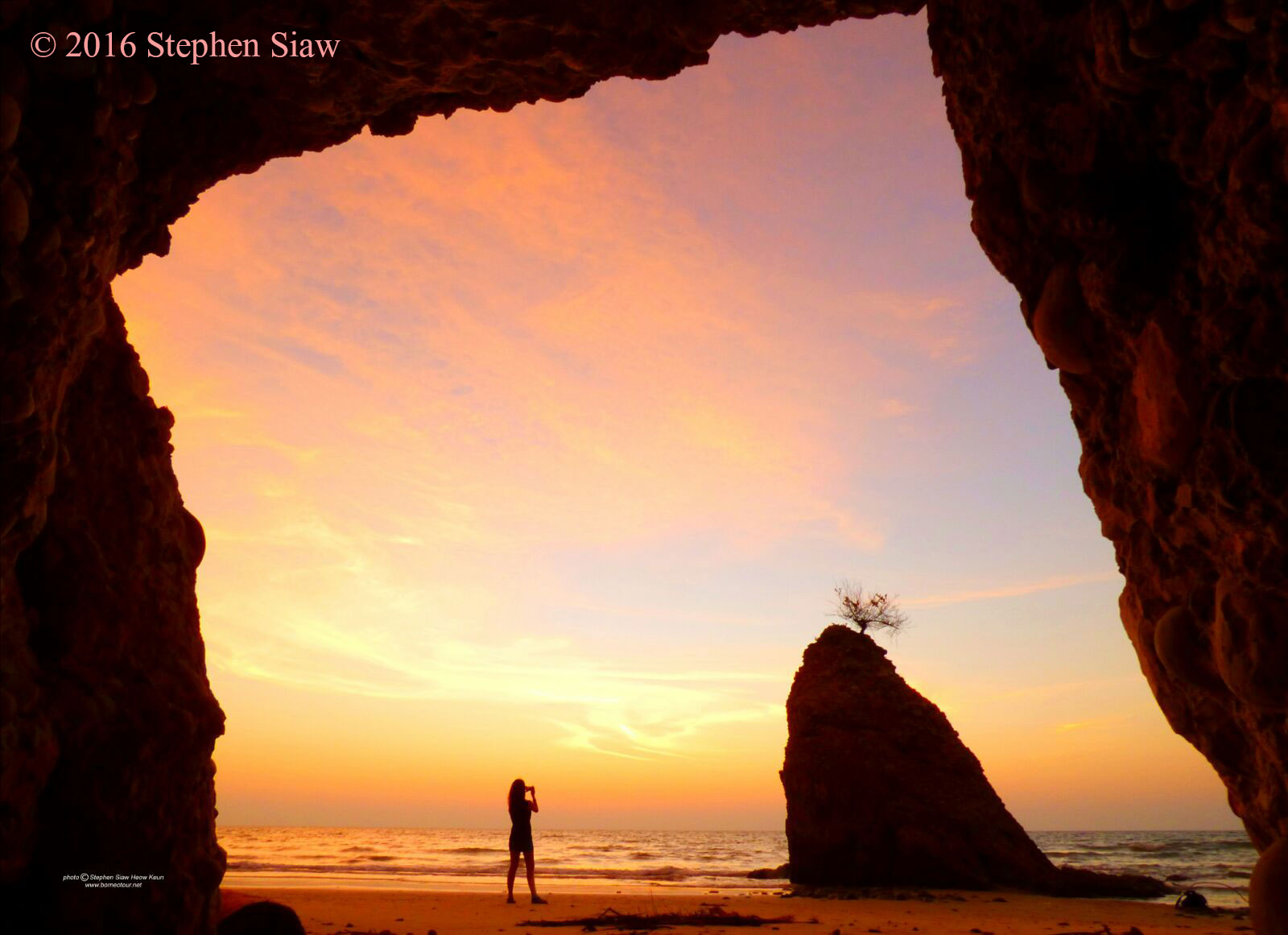
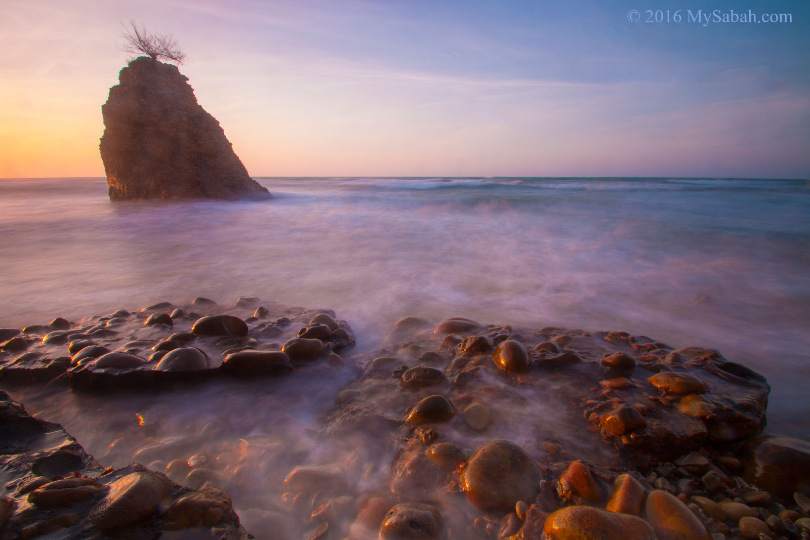
Splendid twilight hour at Batu Luang
Therefore, Batu Luang Beach retains its beauty of untouched nature. It has some special geological features which are uncommon in Sabah. For example, the rustic-red color of the rockfaces are so magnificent when they are painted over by golden sun ray in late afternoon.
Legend of Batu Luang
The beautiful Batu Luang has a tragic story about a newly-wed couple. Many years ago in Kuala Penyu, after the wedding celebration at the bride’s home, the couple walked to the house of bridegroom with their families in a fine morning. When they were approaching Batu Luang, the sky turned dark, and they were hit by heavy rainstorm.
Batu Luang rock in the morning
Therefore, they ran and took shelter in a cave at Batu Luang. When the storm was over, the group moved out from the cave. The couple was the last to exit. Suddenly, the cave collapsed and closed, the bride was the last person on the way out. The bridegroom grabbed her hands trying to pull her out. Unfortunately, her hands slipped and left the wedding ring in the hand of her husband. She was sealed in the cave forever.
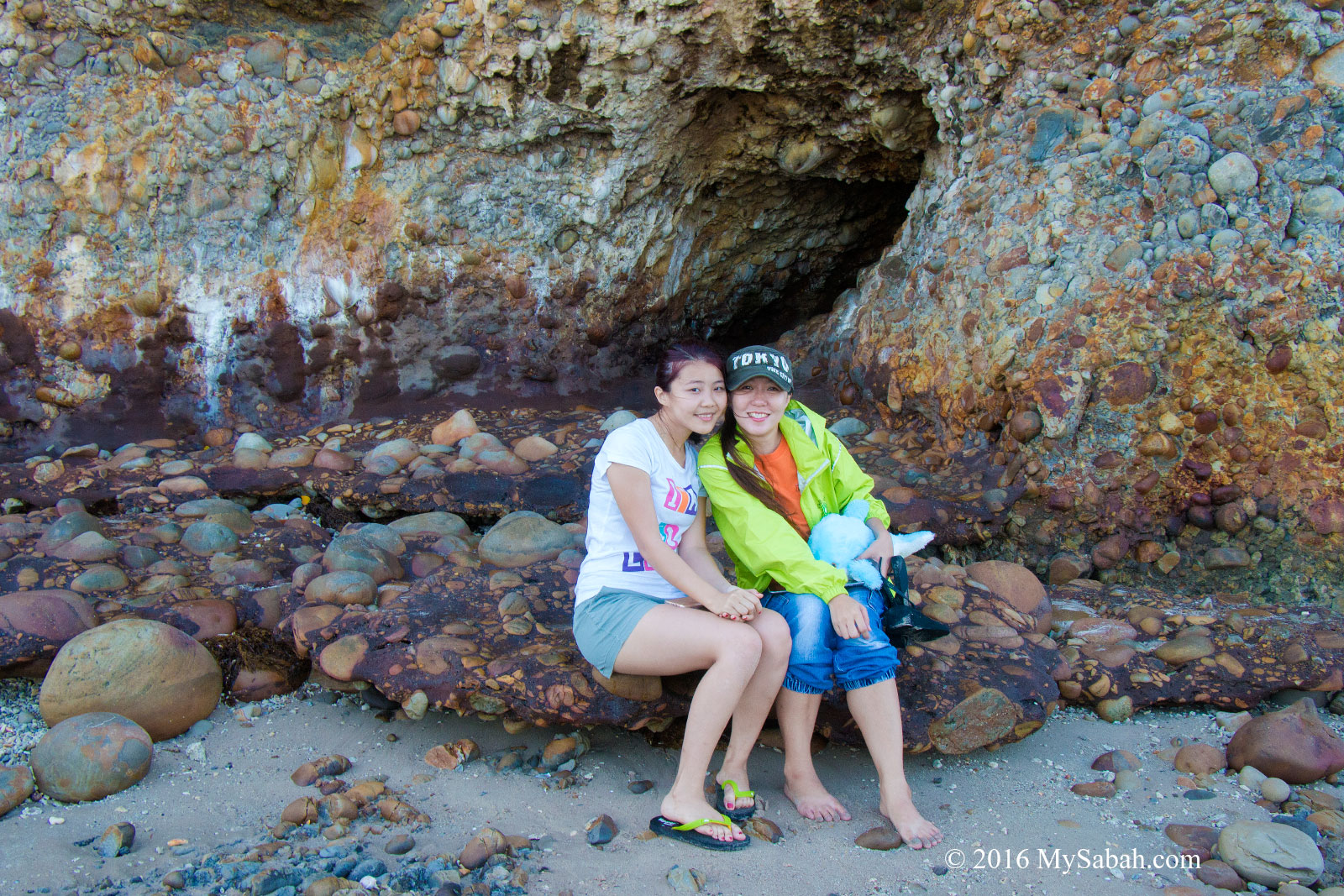
Ladies at Batu Luang Beach (better stay away from the cave LOL)
The locals say sometimes they can hear woman crying inside the rock at night. So sad… On positive side, the bridegroom doesn’t need to buy a new wedding ring if he remarries.
View of Batu Luang rock from inside a cave
According to a local blog by Muzaffar Libon Jueh, there is a part two for this story. The bride was trapped in the cave and alive. The villagers tried everything to open the cave but unsuccessful. Then a bird flied by and chirped, like saying, “Poke with a needle then it’ll open.” However, the people there just scoffed and ignored it. After 7 days of trying, the villagers gave up, so was the bride. She handed over the wedding ring to her husband through a small opening, asking him to forget her. She was then locked inside forever and marry to the guardian spirit of the cave, and became an angel named Kasum. If you bump into a pretty girl playing at Ara tree on top of the hill near Batu Luang, she could be Kasum.
However, this sounds like a “modern” legend because Sabah had no such thing as wedding ring a few hundred years ago. Very likely parents make up this story to scare children, so they won’t go playing around Batu Luang, which can be dangerous due to a few reasons. The water at Batu Luang Beach can be quite deep during high tide, and the current is strong.
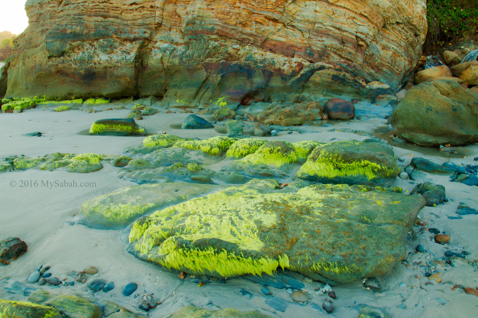
Interesting rock formation and rocks covered by green algae
Furthermore, they could be hit by falling rocks from the loose rockface above. Our people also believe exploring cave would disturb the “Bogeymen” dwells inside, hence the warning they would be eaten alive by cave and become the next Batu Luang.
A Beach that Rocks
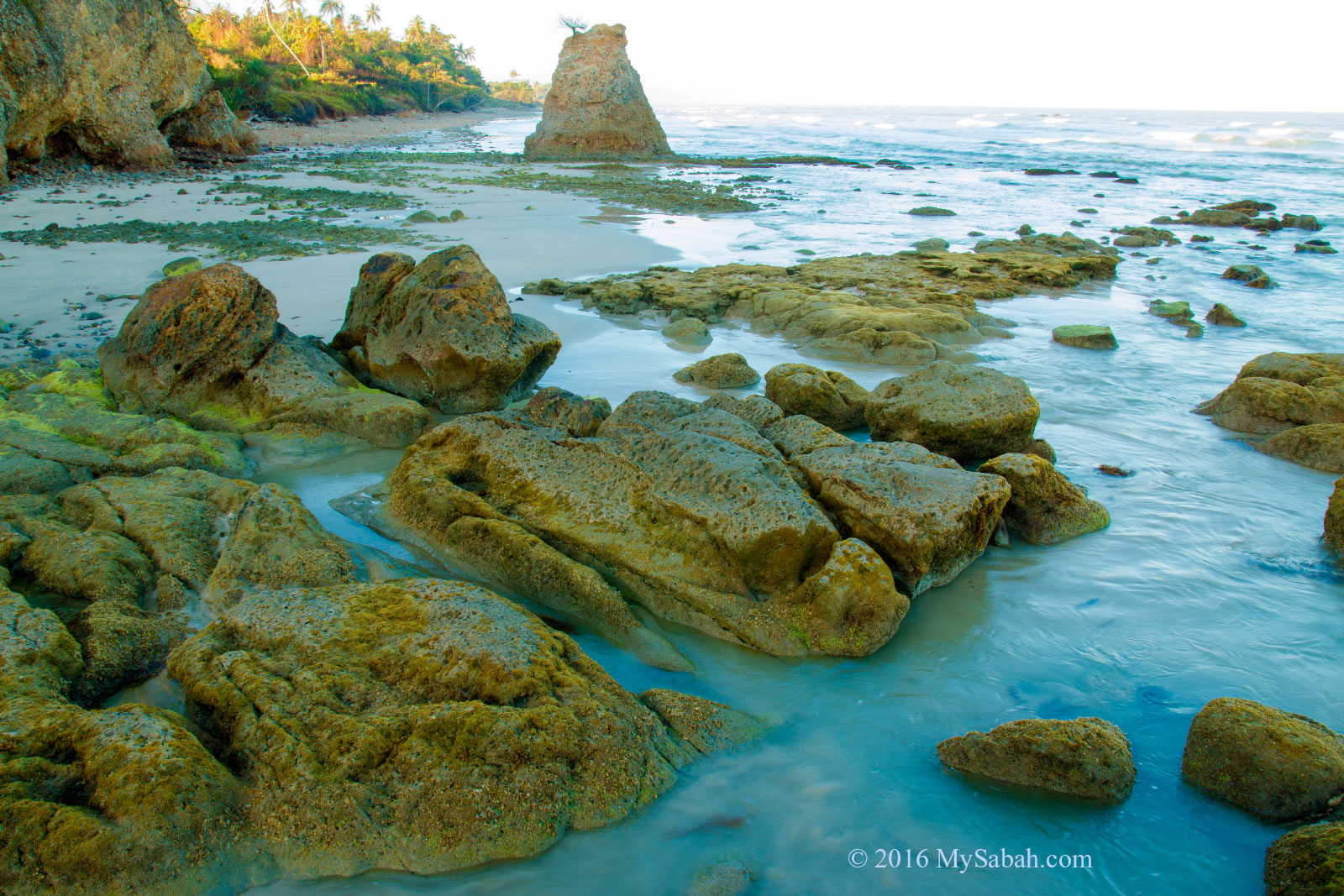
Batu Luang is not the only interesting rock here. Just look around and you will be fascinated by variety of rocks at the shore.
Shingle beach of Batu Luang
Most of the rocks at Batu Luang Beach are cobble with round edges, after being moved and tumbled by sea waves over time.
Batu Luang and surrounding pebbles covered by green algae
The most intriguing rocks are those covered with green algae. These rocks are only present from January to June, the months when monsoon washes away the sand that buries them.
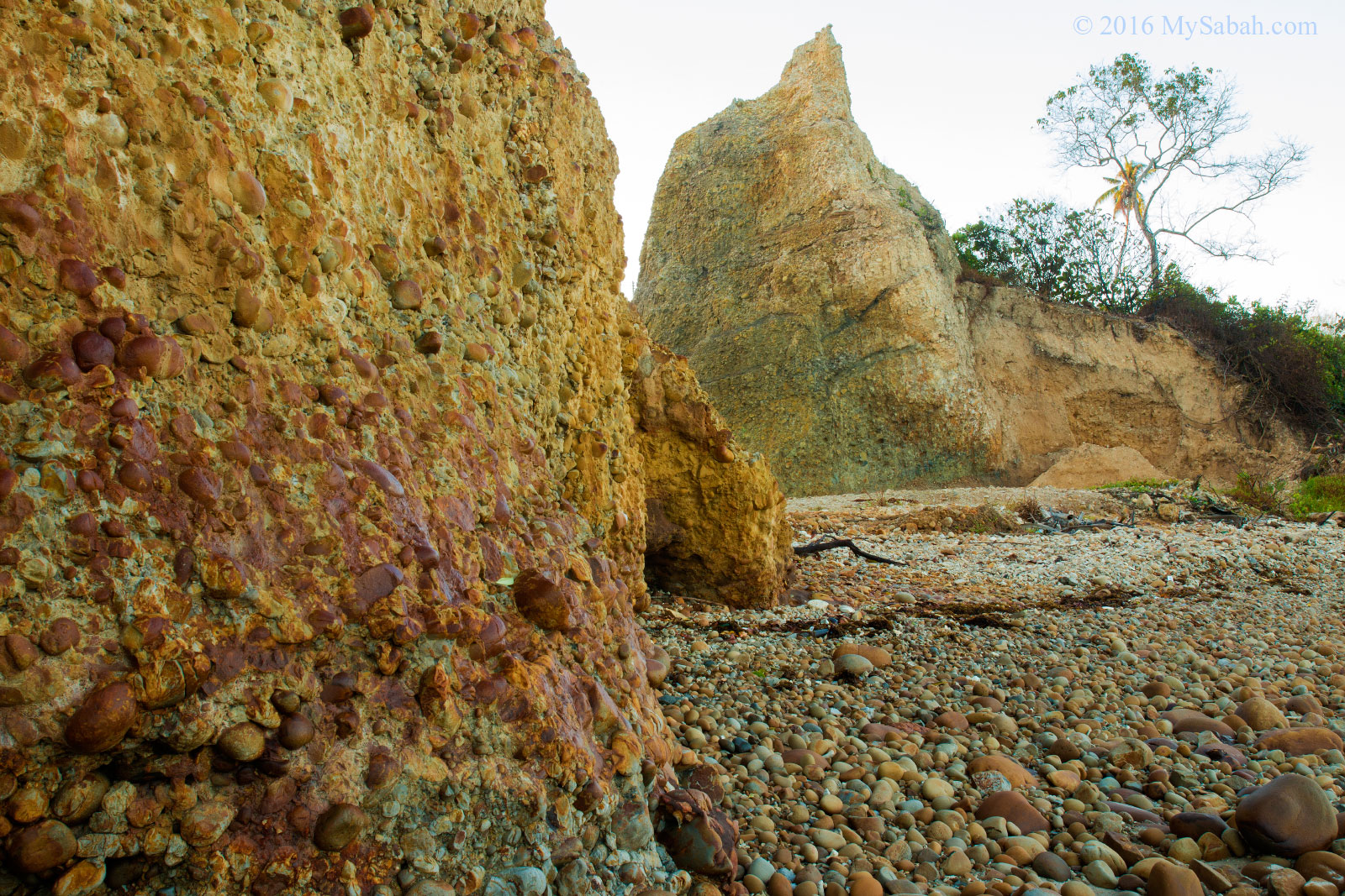
Cool conglomerate near Batu Luang
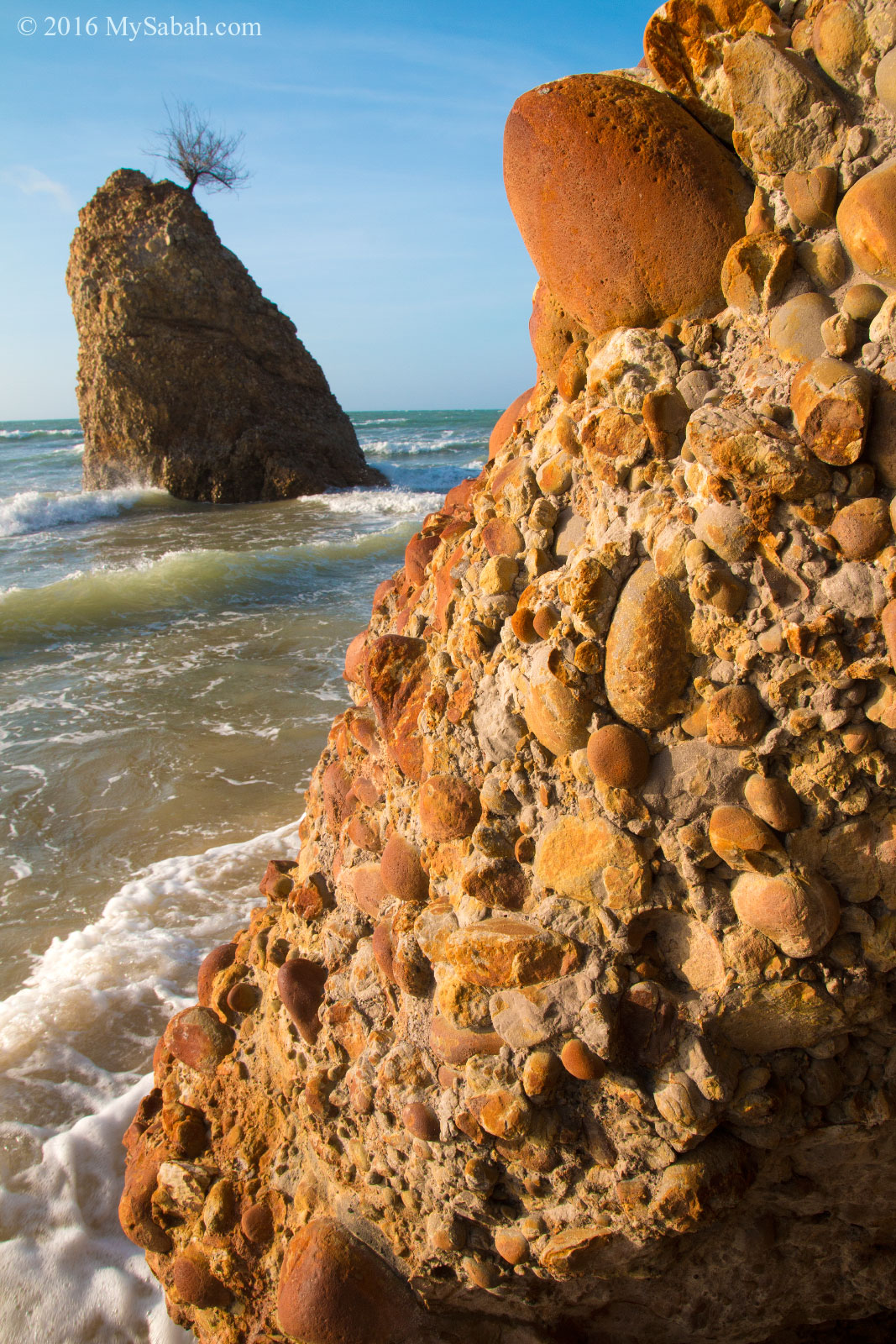
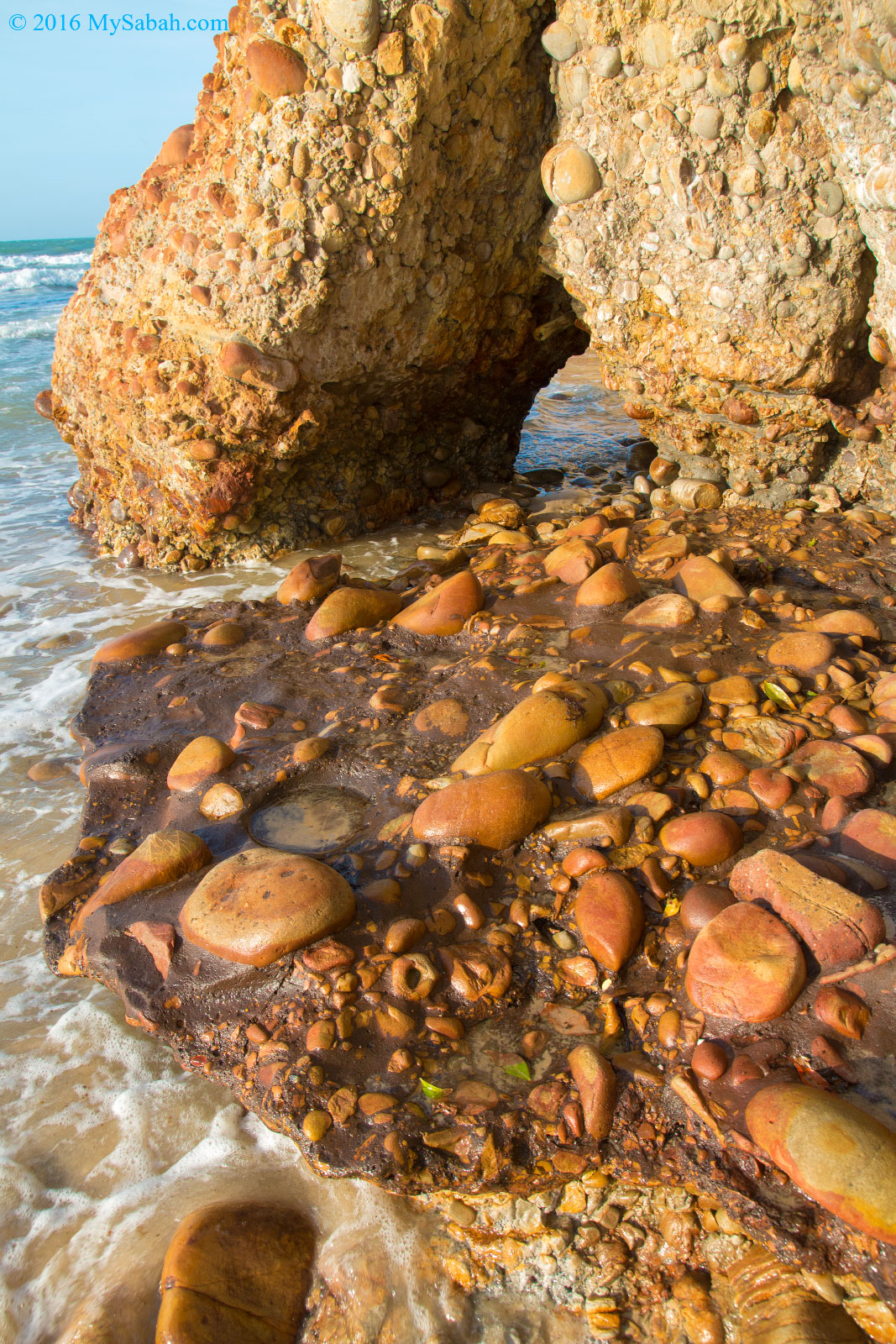
The conglomerate deposit on rockface and the beach is another highlight of Batu Luang Beach. Conglomerate is made up of rounded pebbles glued together, formed by the lithification of cobble-size rocks and gravel.
The rockface and caves of Batu Luang are unique
To me, the conglomerate cemented with round pebbles looks like dinosaur eggs fossils. This is the first time I see such rock formation in Sabah.
Batu Luang during high tide (with conglomerate rocks in foreground)
The conglomerate is really nice, like a piece of art, so I joked to my friends that I wanted to bring some home. The moment I finished talking, a few rocks fell right in front of me. We have to watch our mouth in the wild, because “something” might be listening. Ok then, I took nothing but photograph.
Mimic the expression of the rock |-O
Tour around Batu Luang
Batu Luang is a public beach, so anyone can go there. It’s safe for children to explore around under the care of adults.
Batu Luang during sunrise
The only problem is the tiny blood-sucking sandfly. Its bite can stay itchy for days. Try to cover as much exposed skin as you can. There are not many sandfly anyway.
Sunset shot at Batu Luang Beach
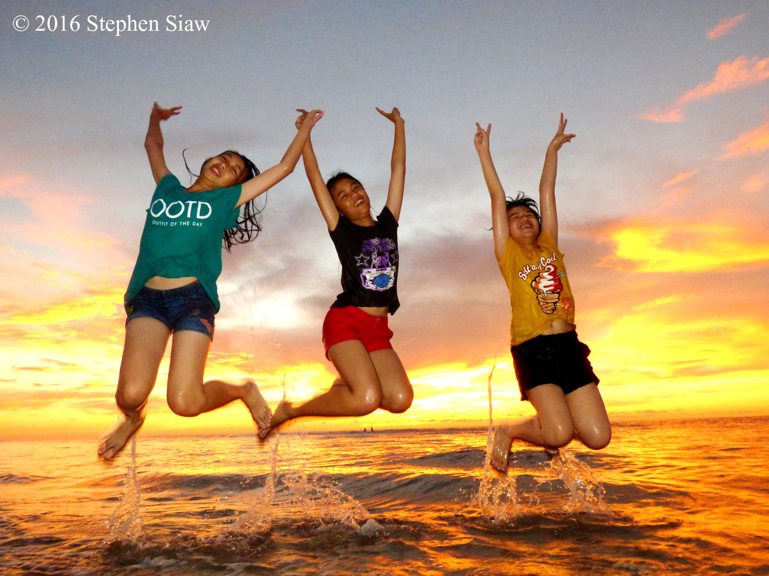
If weather permits, you can have wonderful picture and welfie moment during sunset.
Beach around Batu Luang
Part of the beach is rocky, so you better wear shoes.
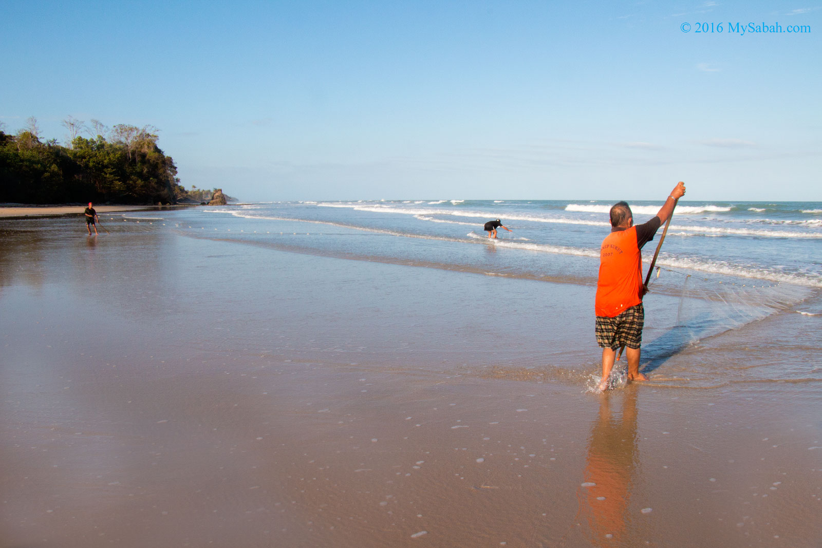
Villagers fishing at Tempurong Beach
There are a few villagers living near to the beach. You might find them catching fishes in the morning.
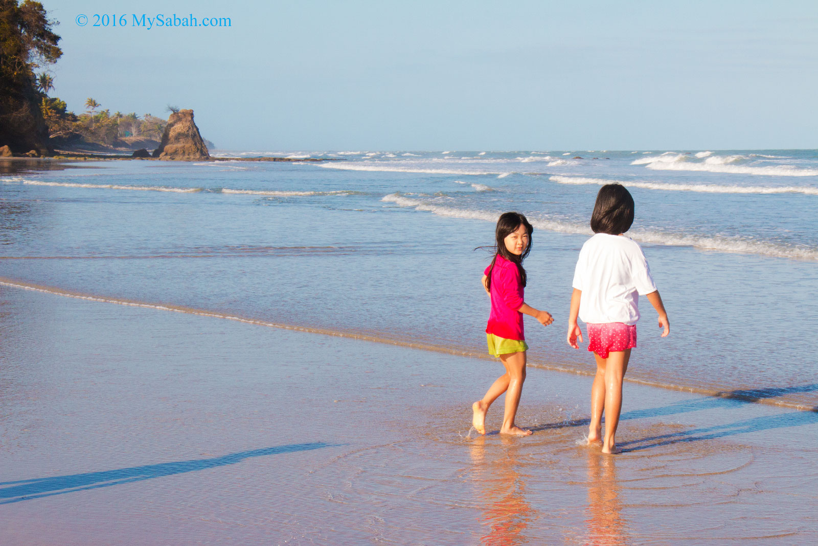
Children stroll on the beach
At another side of Batu Luang is a vast area of sandy beach. The waves are quite strong, so don’t go too far away from shore.
Family fun at Tempurong Beach and Batu Luang
Beautiful rockface and cave
The old folks say there was used to be a deep cave at Batu Luang in the past, which they believe hidden with a lot of treasures, but the cave has disappeared. You may try your luck there. Just watch out for falling rocks when you explore the caves.
There are many small caves around Batu Luang
The biggest cave at Batu Luang Beach
Exploring the big cave
How to get there
Batu Luang is about 120 Km away from Kota Kinabalu City (KK) and 14 Km away from Kuala Penyu town. Its GPS location is 5.524541, 115.523986 (see Location Map or 3D Street View).
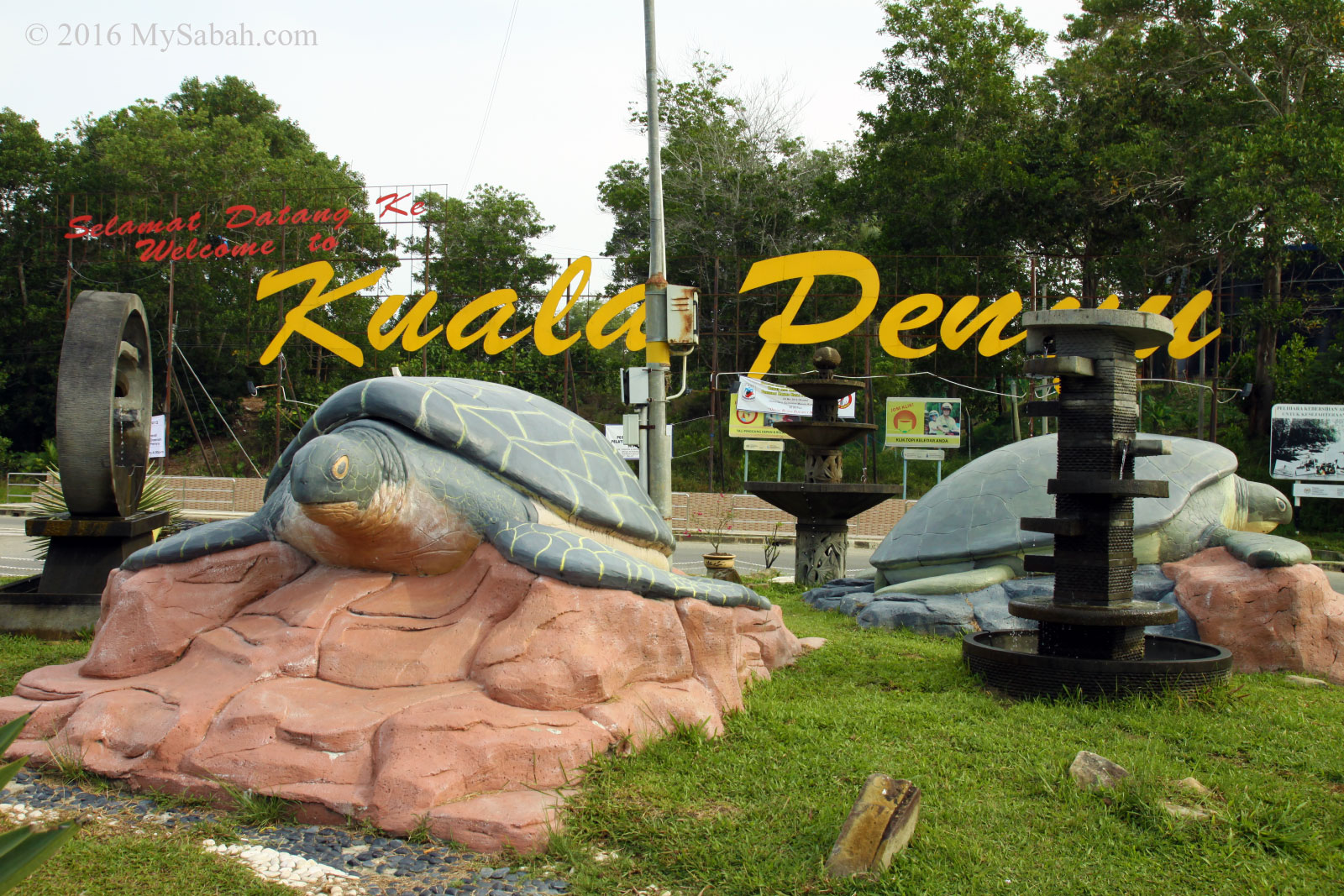
Turtle roundabout before Kuala Penyu town
There is no public transport that reaches Batu Luang, so you have to get a taxi or drive on your own for 2 hours. If you depart from KK, you will reach a roundabout with turtle statues (about 10 Km before Kuala Penyu town). Turn left to the direction of Menumbuk.
Junction to Batu Luang
After 1.5 Km, turn right to the junction with the signs (see photo above) that read “JLN Kasugira BT Luang” and “Selemat Datang ke Kg. Gorowot” (opposite to Rumbia Information Center).
You can see Batu Luang from the road
Then follow the road sign to Tempurung Golden Beach Resort, and you will see Batu Luang at your left after 4 to 5 KM. The place is highly accessible by asphalt road in good condition. You can park your car at the roadside and walk 100 Meters to the beach.
Photos taken in Kuala Penyu, Sabah, Malaysia Borneo
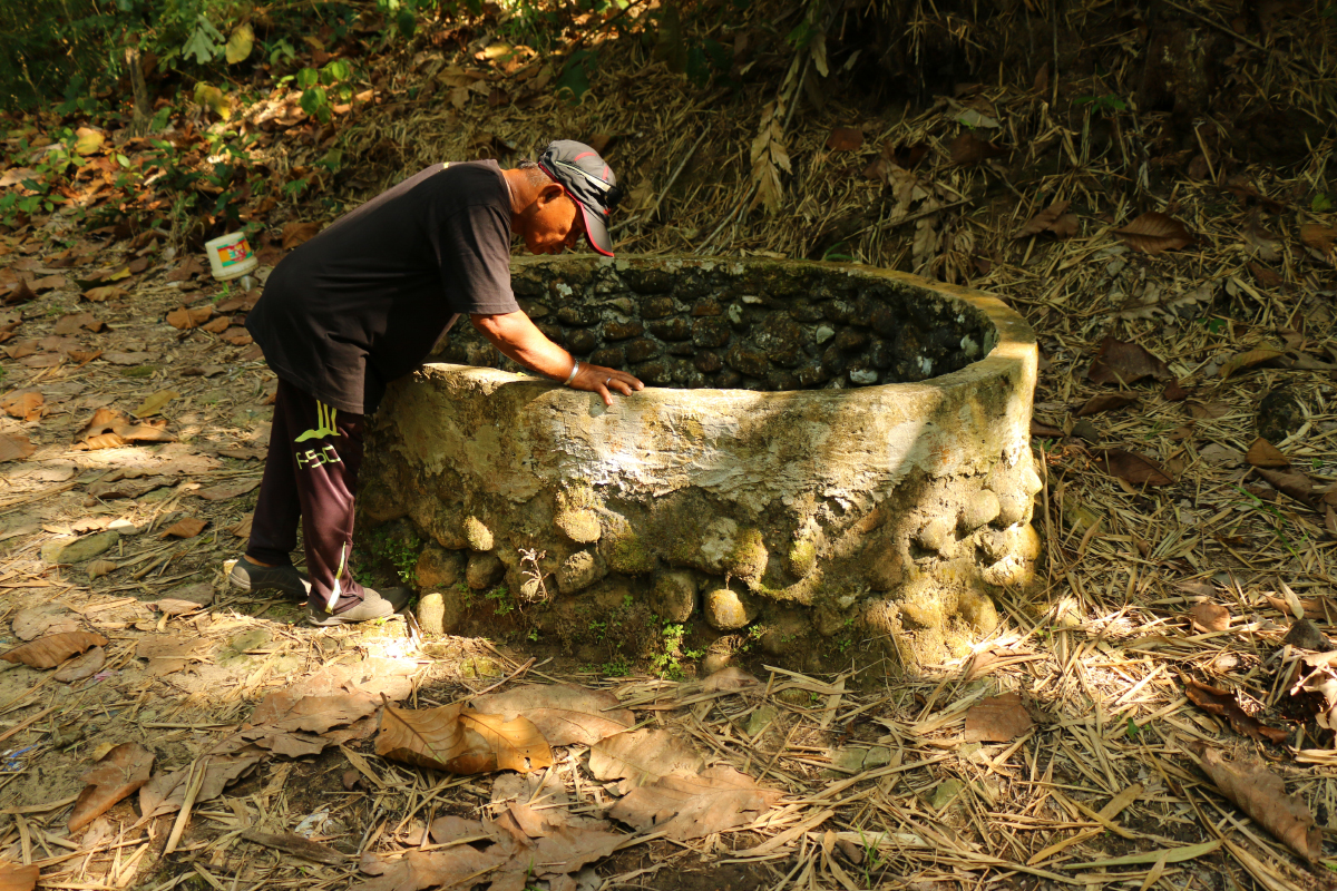
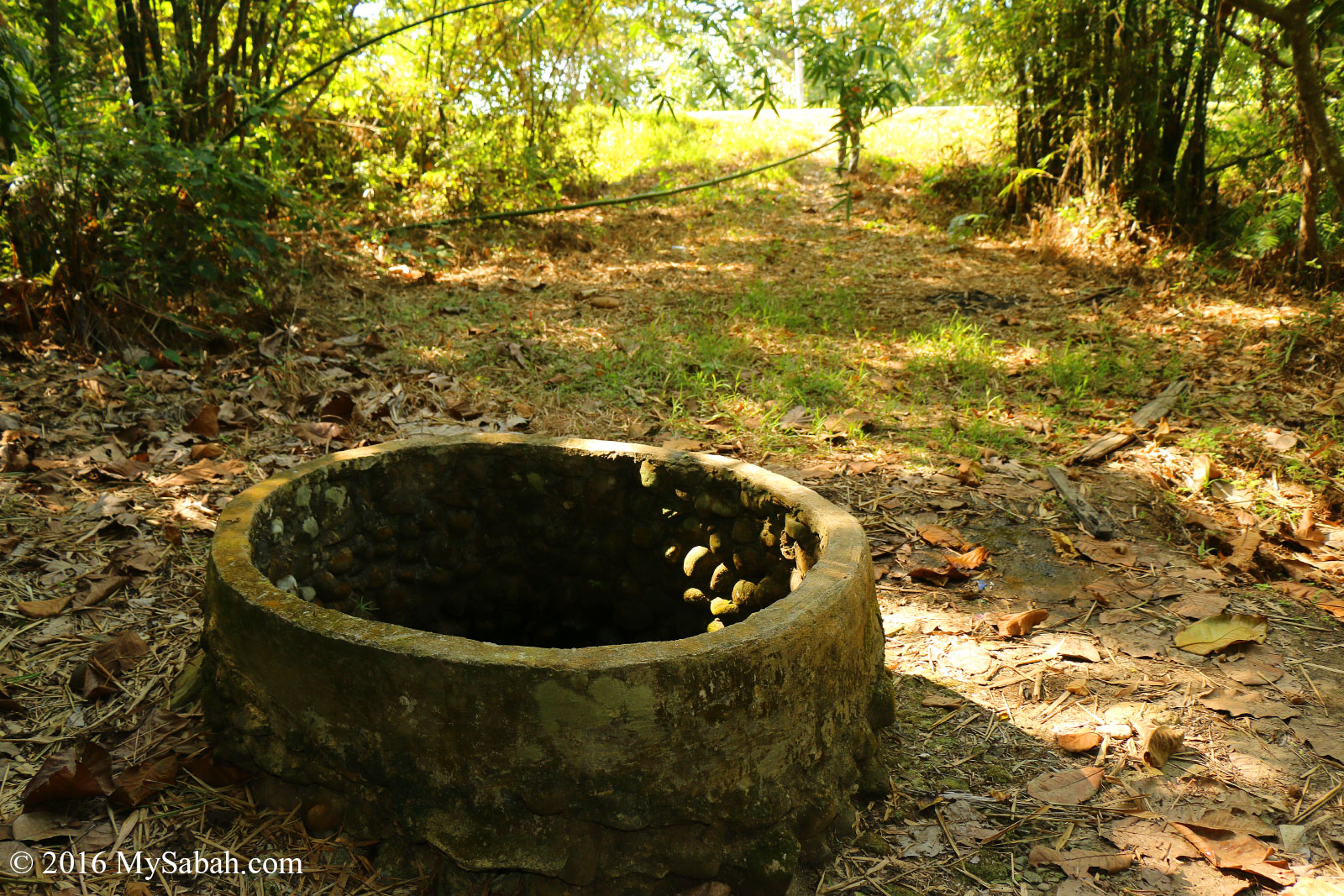
Whenever you visit a new place in Sabah, especially in countryside, ask the locals. They would share some interesting stories or legend about their village. For Kampung Tempurong (Tempurong Village) in Kuala Penyu, I was excited to know this village has a healing well that still exists.
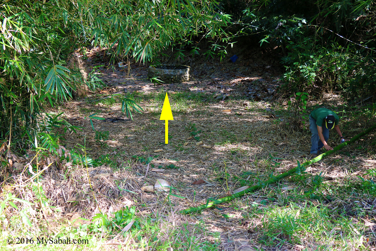
The healing well is not far from the road
Kampung Tempurong is about 15 KM away from Kuala Penyu town, and the healing well is next to Jalan Kekapor – Temporong. Its GPS Coordinates is 5.529614, 115.533864 (see Location Map or Street View).
Healing Well of Kuala Penyu
When the village was hit by drought about a hundred years ago, an Arabian prophet came and asked the villagers to dig a well at this location. This well provided enough fresh water for the whole village.
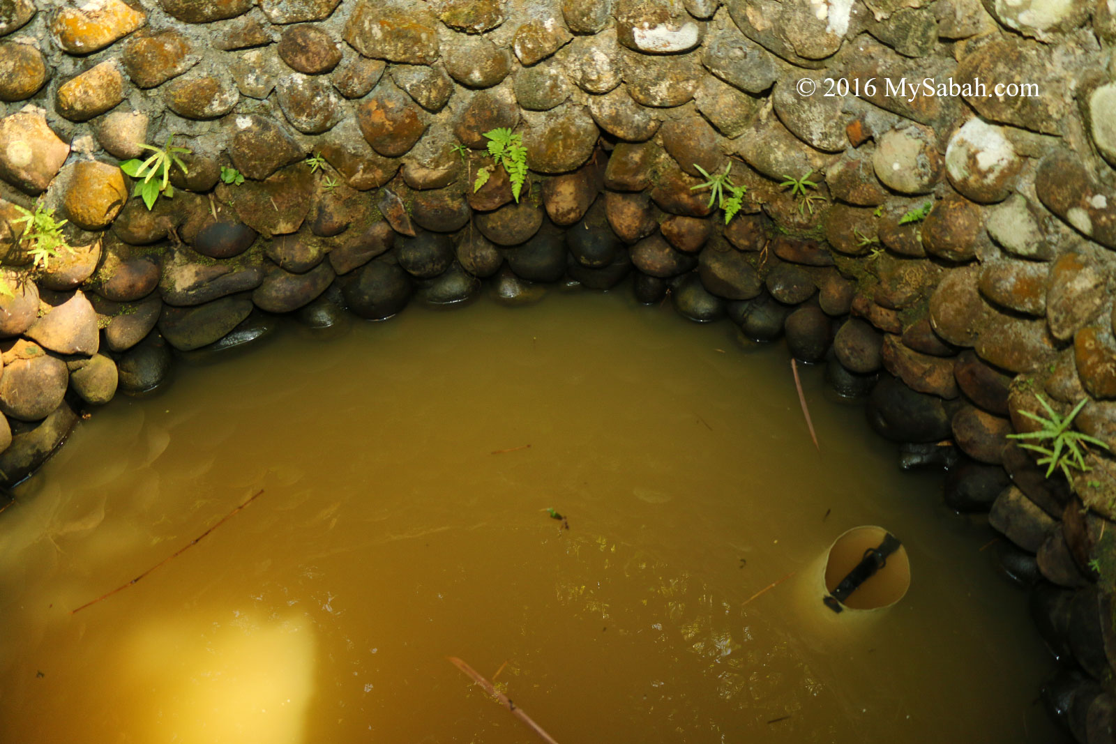
You can drink or take shower with this water
The well never dries up even during drought season. Even if people emptied the well, it would be filled with water again in next day. The villagers had been using this well before tap water is available.
This well was the main water source for villagers before tap water is available
The people also believe that by drinking or taking shower with water from this well, any sickness will be healed. A local said a villager cured his children who were used to have asthma with water from this well.
Villagers believe the water from this healing well can cure various kinds of sickness
The Healing Well is accessible by public and not fenced, so anyone can go there to collect water as they wish. Just be respectful and keep the area clean.
The Healing Well never goes dry
I was told that I can drink the water from this well unboiled. To be honest, the water is murky, so I didn’t dare to try. Probably next time.
Reflection of me in the well
Even the origin of the name of Kampung Tempurong has a story. The village of “Tempurong” (means Coconut Shell in Malay words) was initially called Tanah Merah (means Red Soil literally). In 1800s, a villager found a coconut shell at the seashore, and it’s engraved with holy verses of the Al-Quran. The village took it as a sign from God and unanimously agreed to change the name of the village to Tempurong, because they believed this would bring good fortune to the villagers. This place is really blessed by Allah, I think.
Photos taken in Kuala Penyu, Sabah, Malaysia Borneo
Walk into any coffee shop in Sabah, and you would quickly learn�that Chinese Teh Ping (Iced Chinese Tea), Teh-C Ping (Iced Milk Tea), Lemon Teh (Lemon Tea), Teh Tarik (Pulled Tea) are commonly ordered beverages among locals.
Sabah Tea
Our friends�from Peninsular Malaysia are always surprised�to find that Sabahans are fond of tea break and high tea too. Besides asking our friends to go Yamcha (drink tea), Sabahans would say “Let’s go High-Tea” too. Tea drinking is definitely part of our culture, and it fits well into our laid-back lifestyle.
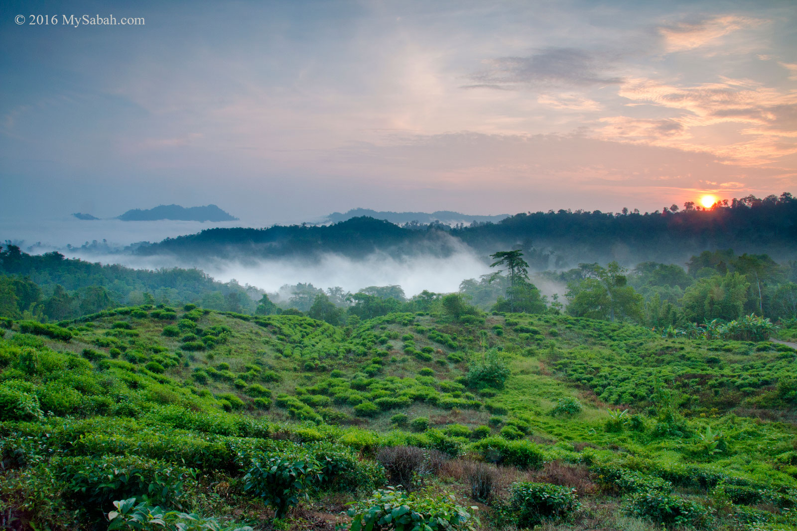
Sabah Tea Plantation during sunrise
“Tea drinkers take a break; coffee drinkers need a break.”
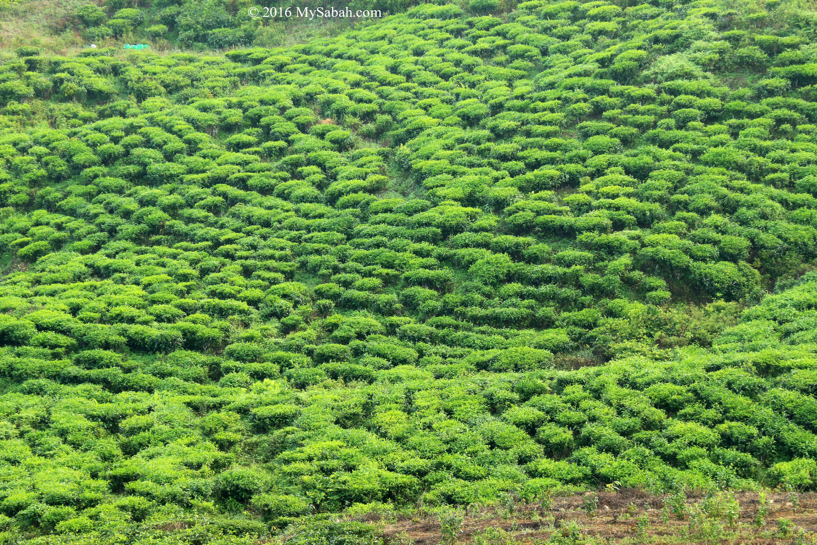
Not only that, Sabah also has its own local tea brand named Sabah Tea, which has established since 1978. Sabah Tea Garden is the only organic tea farm in Borneo. The tea leaves from its 2,480 hectare plantation are 100% pesticide free.
Variety of Sabah Tea products
Anyway, you don’t need to be a tea lover�to enjoy a trip to Sabah Tea Garden. Located 692 Metres above sea level, the cooling highland of Sabah Tea is an ideal place to escape the hot weather of cities.
Sabah Tea Garden is the largest commercial tea plantation in Borneo, and now they produce eight flavors of tea, namely, cinnamon, ginger, geranium, pandan, tongkat ali, lemongrass, and misai kucing (cat’s whiskers). I tried their Pandan-flavor Pulled Tea (Teh Tarik Pandan) and I really love its�rich flavor, a must-try!
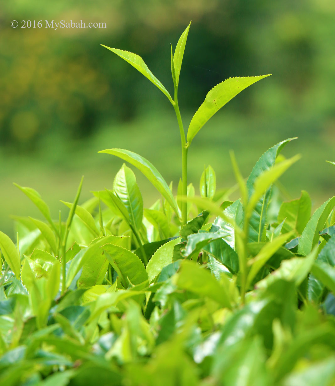
Fresh tea leaves
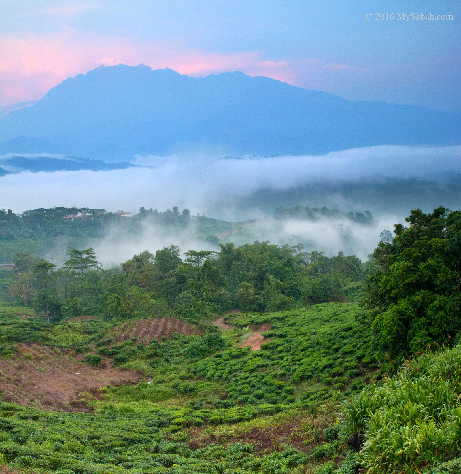
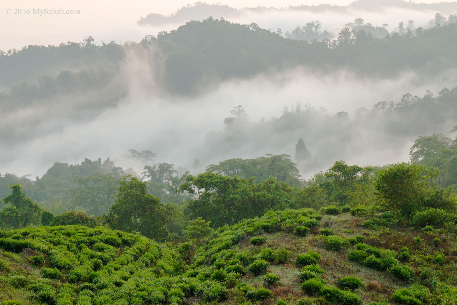
Sabah Tea Garden has one of the most beautiful plantations in Sabah. Just take a morning walk during sunrise time�around Sabah Tea, you will see the breath-taking view of misty rainforest around the lush tea plantation with majestic Mt. Kinabalu as the backdrop.
Sabah Tea plantation under Mt. Kinabalu
However, Sabah Tea Garden is more than a tea plantation with scenic view. They have successfully turned Sabah Tea into a recreational and educational site, which is friendly for family and student groups. Whether they have�a day trip or overnight stay at Sabah Tea, there are so many things visitors can do there.
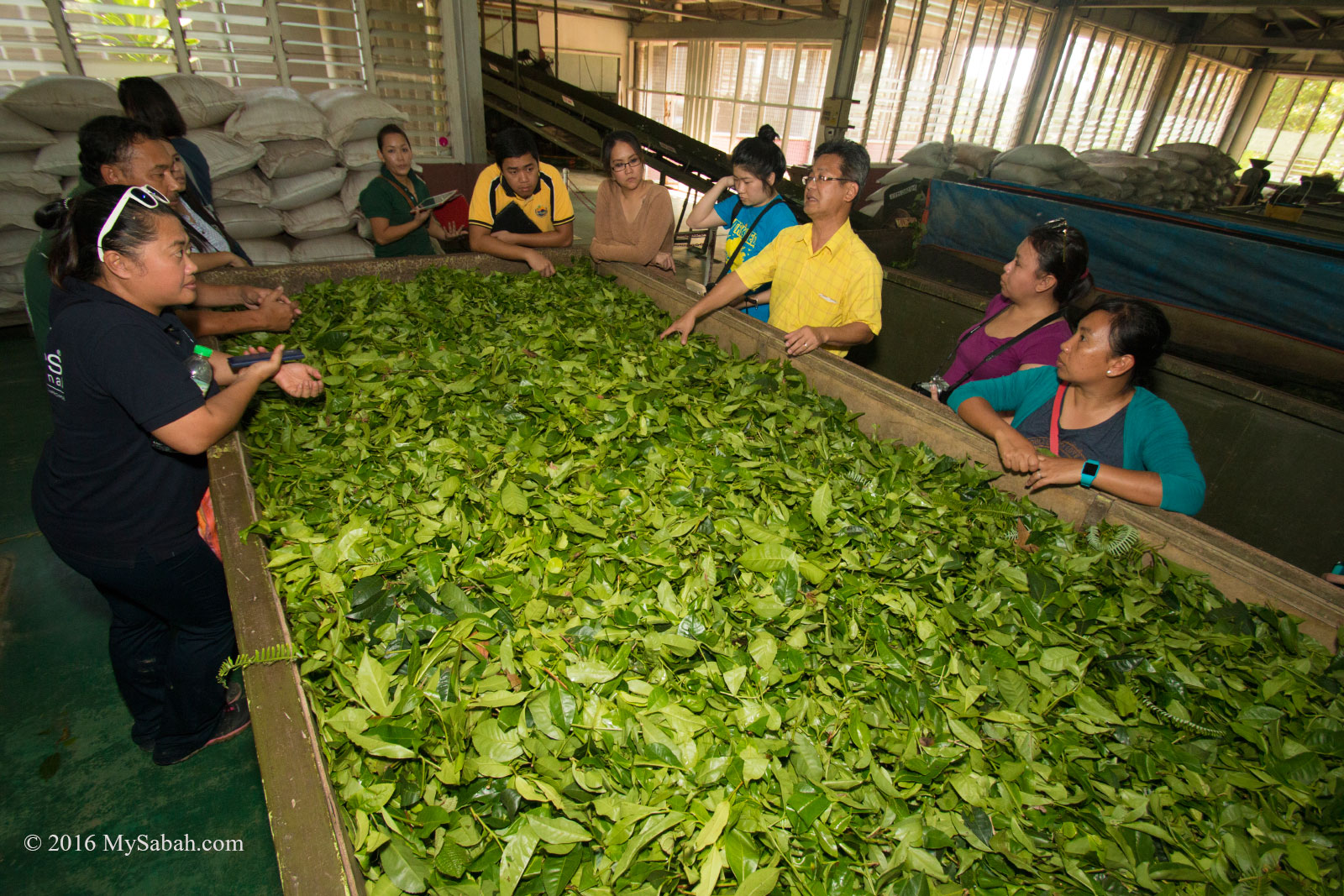
Tea processing in factory
If you only plan for a short educational visit, you can pay a small fee to join one of the following day tour at Tea Factory. Note the best time to visit is between 8am-12pm (Mon-Sat) and Tea factory tour is not available on major Public Holidays:
RM7 (?US$1.75): 30-min Factory Tour for Primary School students
RM14 (?US$3.50): 45-min Guided Tour of the Tea Factory
RM17.50 – RM42 (?US$4.38 – 10.50): 1.5-hour factory tour with tea tasting (with Sandwiches, Tea Bites, or Set Lunch)
Visiting Sabah Tea Factory
Accommodations
For an “anti-oxidizing” trip by fresh air and tea, I would recommend you to spend a night or two at Sabah Tea. They have two types of accommodations:
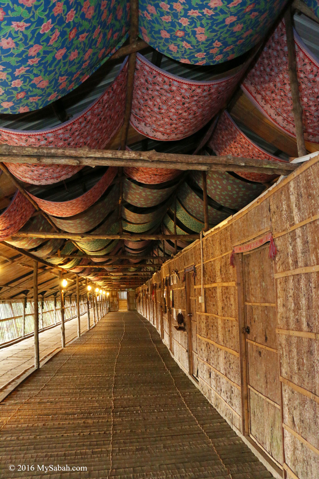
Longhouse: 25 rooms (triple sharing), can fit 75 people at a time. 14 shower rooms, 6 toilets.
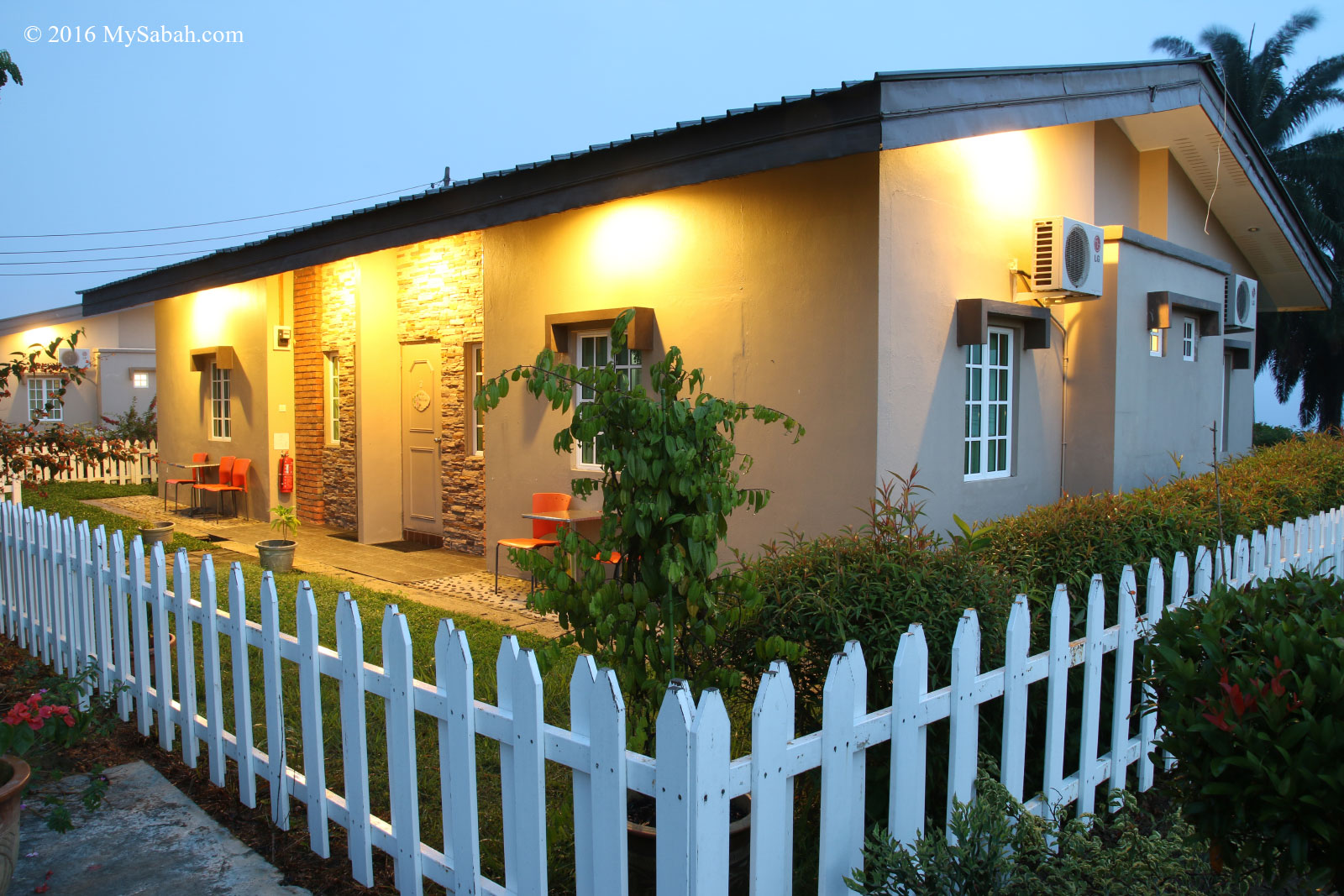
English Cottages (4 units): total of 16 rooms (1 queen bed + 1 twin bed), can host 48 people. Air-conditioning, Hot Shower and TV available
Longhouse accommodation of Sabah Tea
Cottage of Sabah Tea
The cottages at Sabah Tea Garden are named after colorful personalities in Sabah’s colonial past. The cottage where I stayed was named after Lofty Hodges, an Australian hero who rescued the survivors of Death March during World War II.
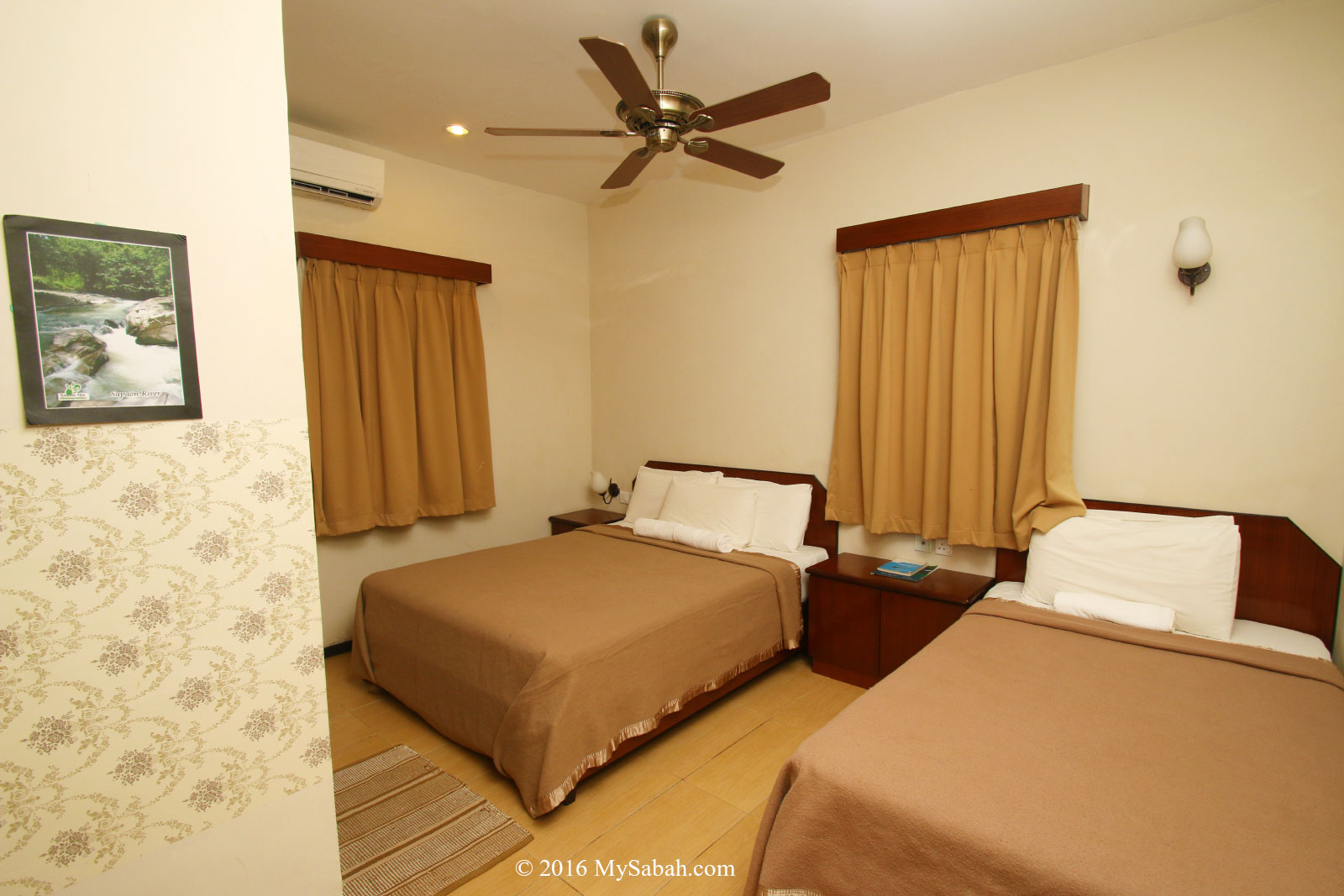
Bedroom of Sabah Tea Cottage
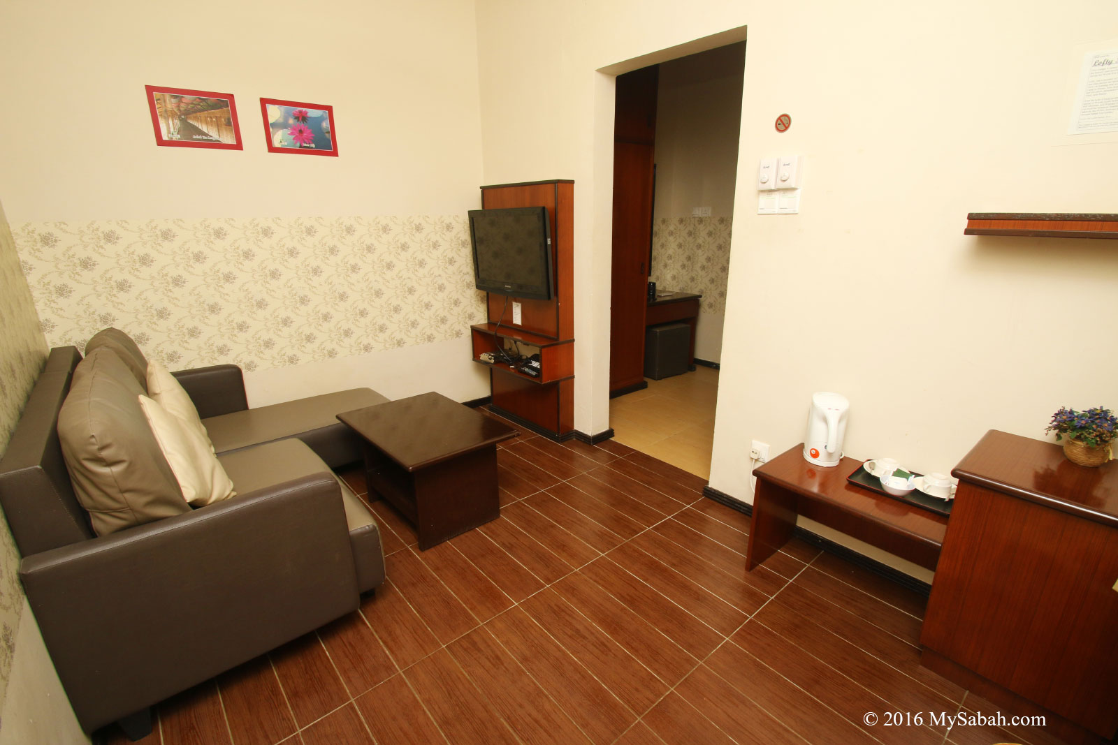
Living Room of Sabah Tea Cottage
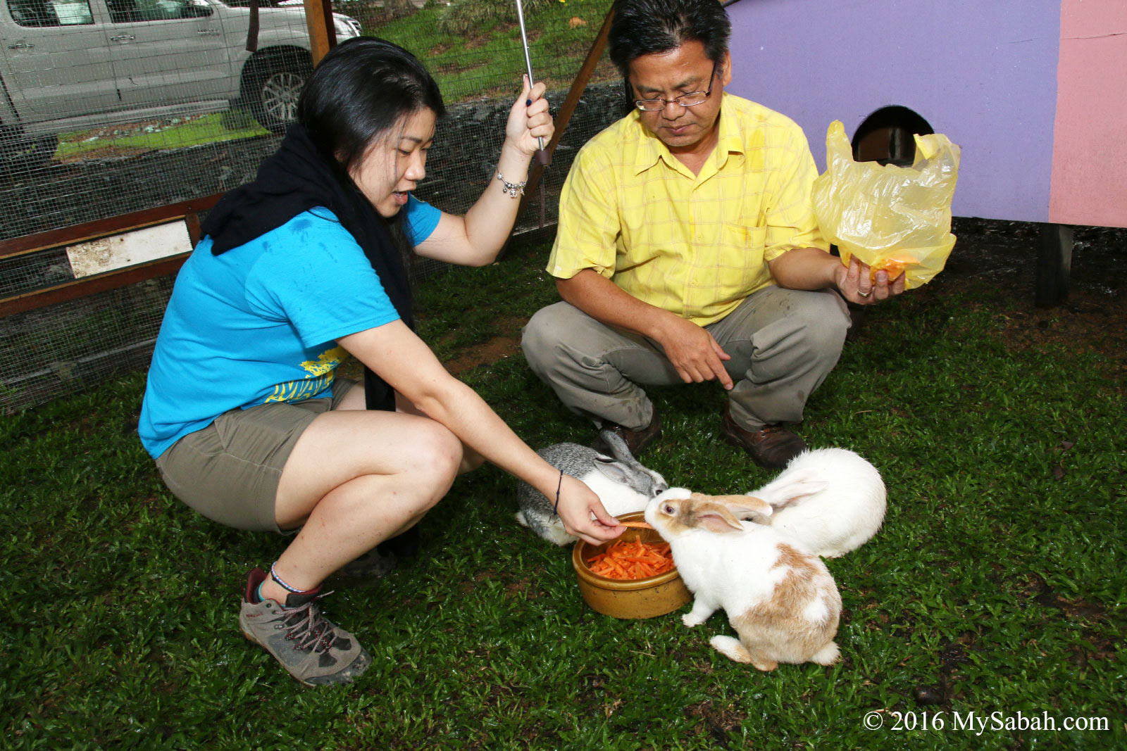
Sabah Tea put some good efforts to create a farmstay experience. They have flowers and herbs, colorful ornaments, fish pond and Bunny Villa (rabbits) in the plantation, all these small and big things make this�place fun to explore.
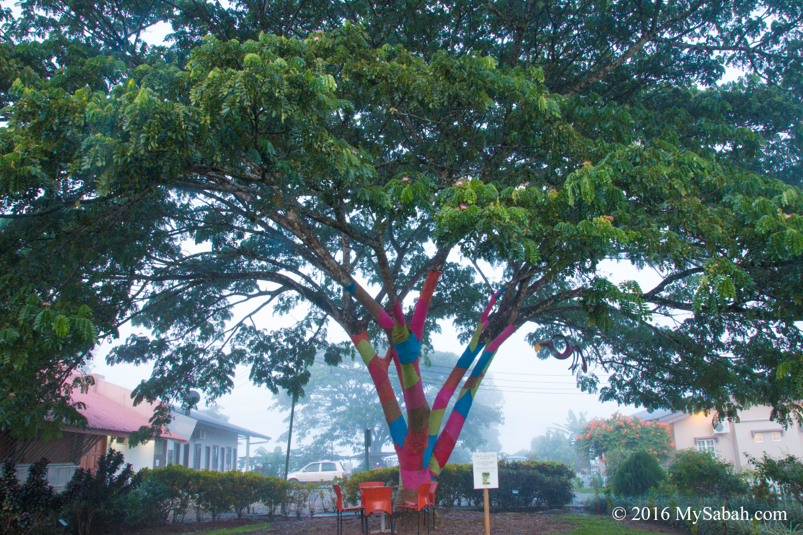
Coloured Tree showcases the United Colours of Sabah which underlines the social fabric of the local communities.
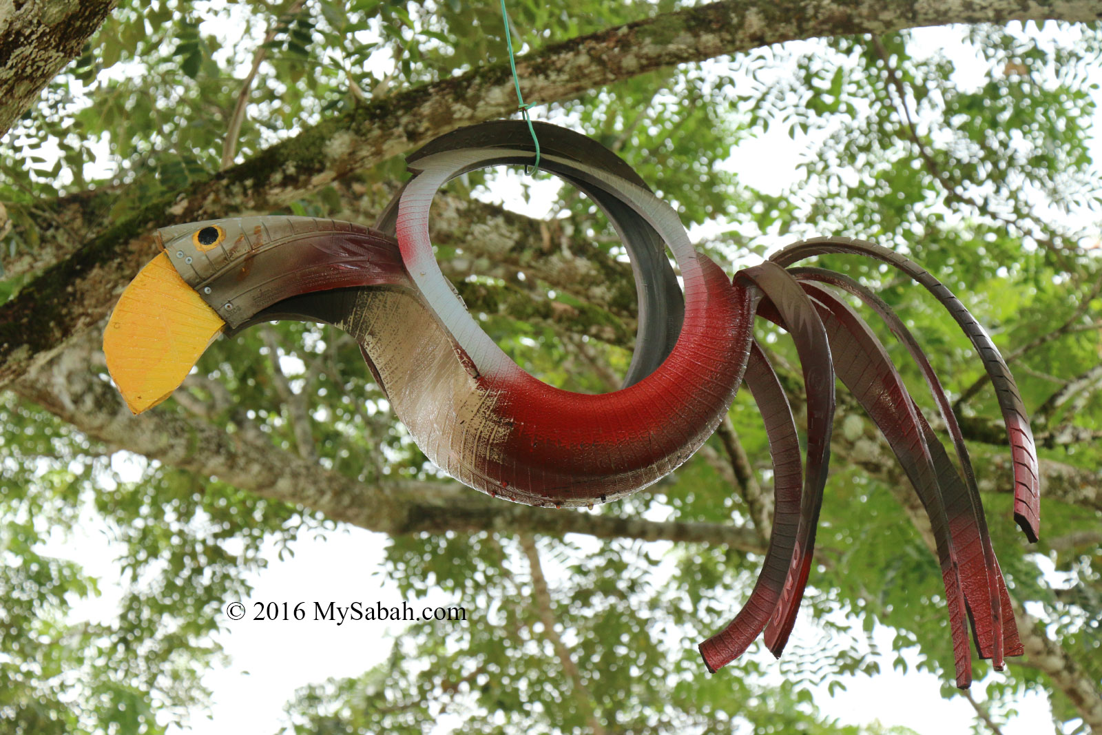
Hornbill made of used tyre
Feeding rabbits of Sabah Tea. Each rabbit has a nickname such as Tennie, Ah Beng, Bala and Puteri.
Tea Adventure
Tea drinking has over 3,000 years of history, so it’s good to know more about this most consumed beverage next to water. Sabah Tea Garden offers “The Journey of the Tea” tour for visitors who want to learn how tea is processed.
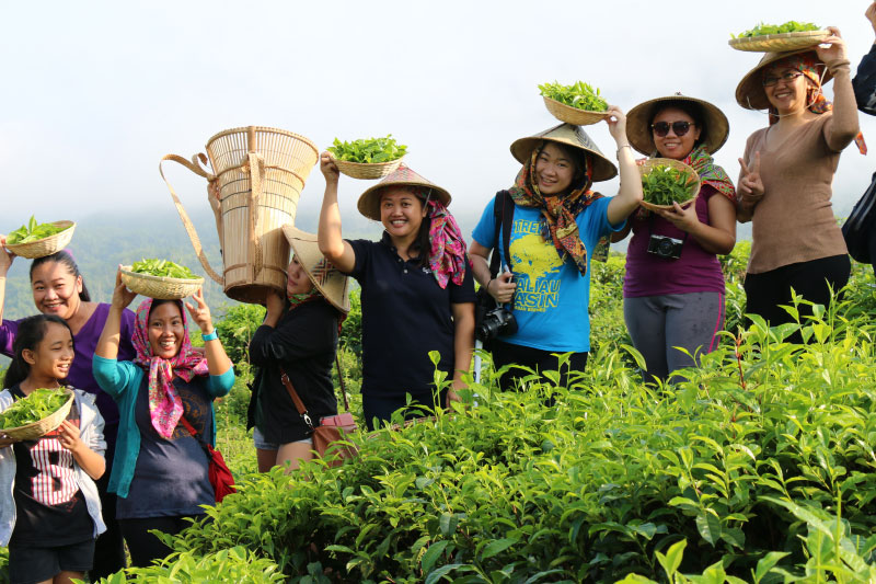
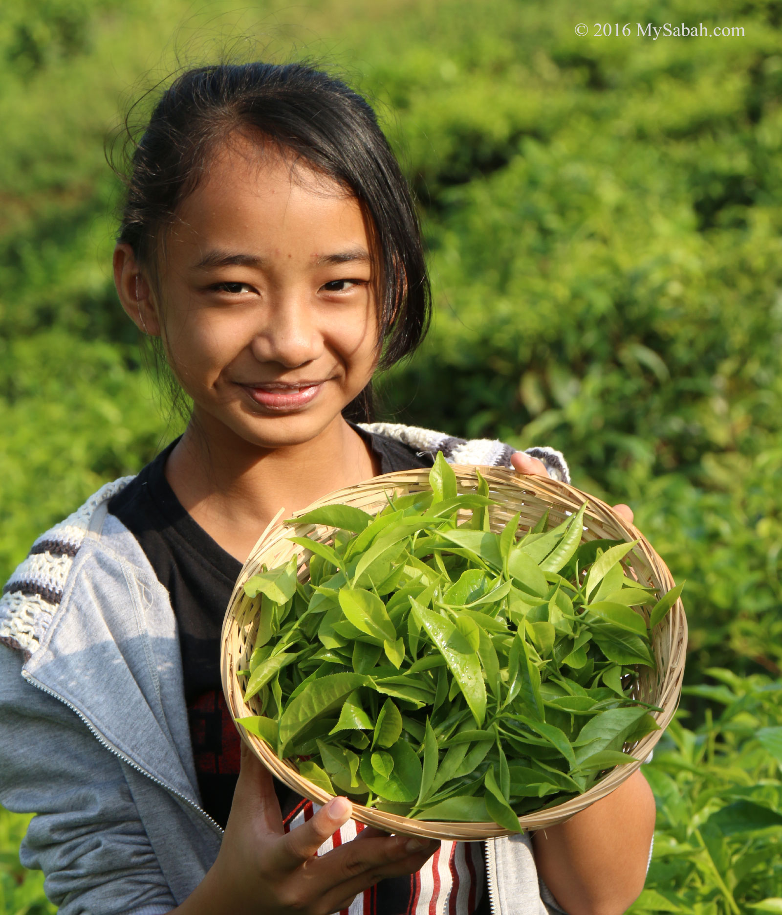
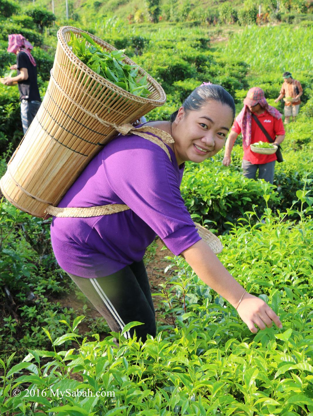
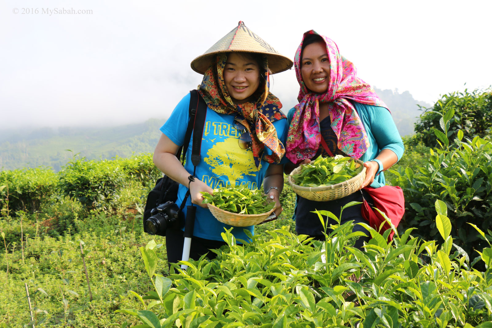
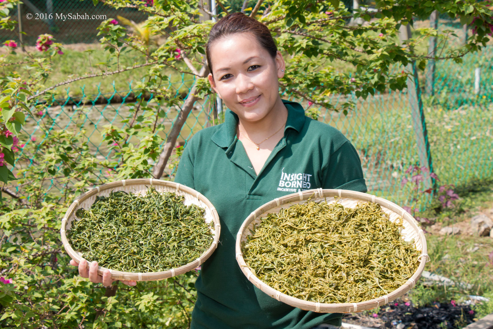
Harvesting tea leaves
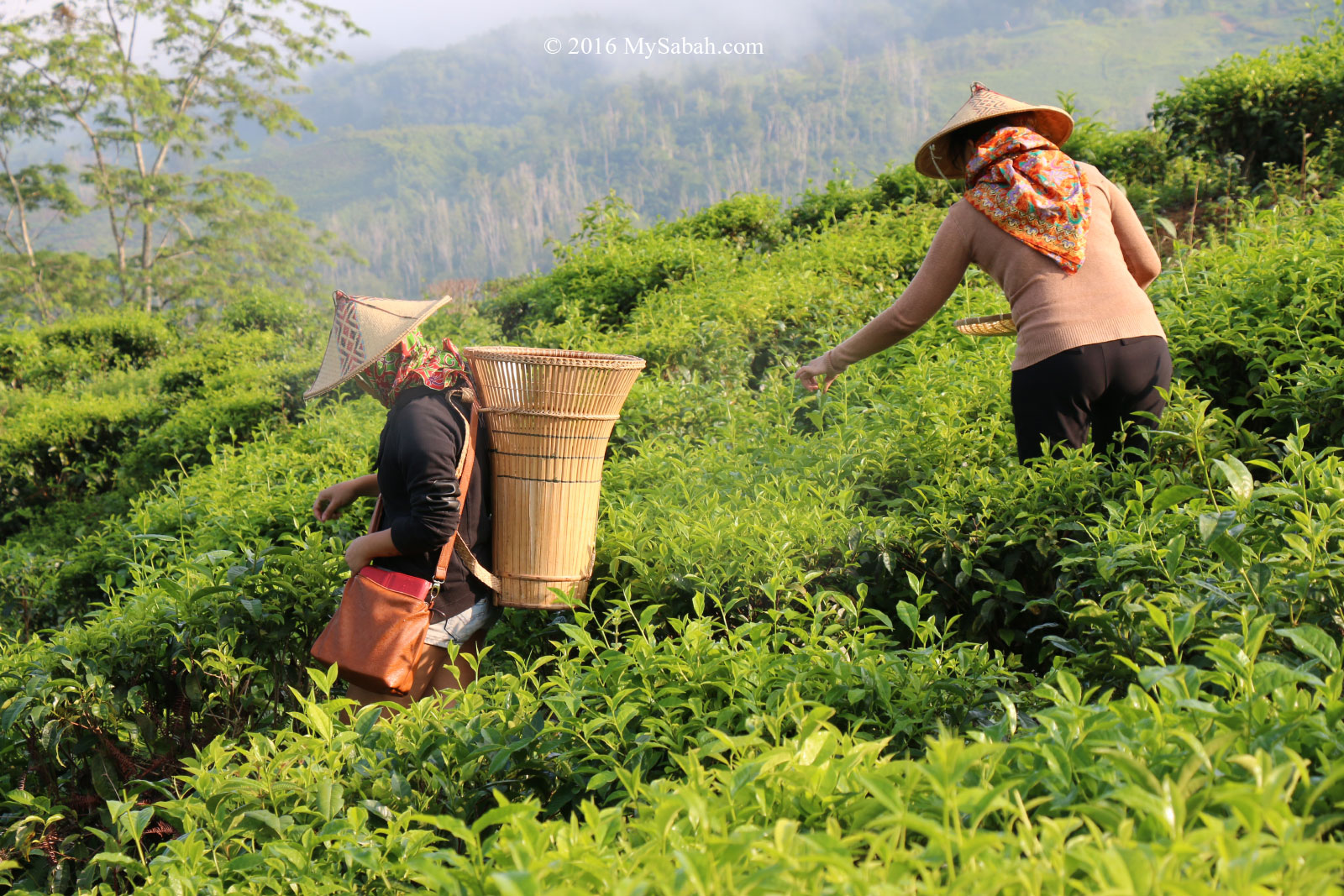
Collecting tea leaves with Wakid�basket
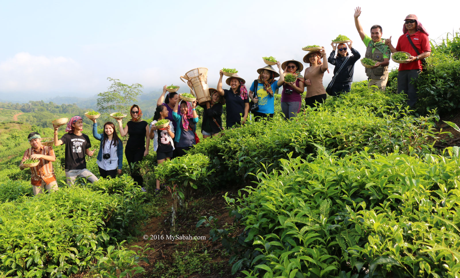
Participants of Tea Adventure will have a chance to harvest, process and sample the tea from their 1,000 acres tea plantation. They will provide you native hat and wakid (basket), then brief you the right�way to pluck the tea leaves and buds. Did you know an experienced tea picker can collect about 32 Kg of tea in a day, which is enough to make 14,000 cups of tea!
Tea harvesting at Sabah Tea
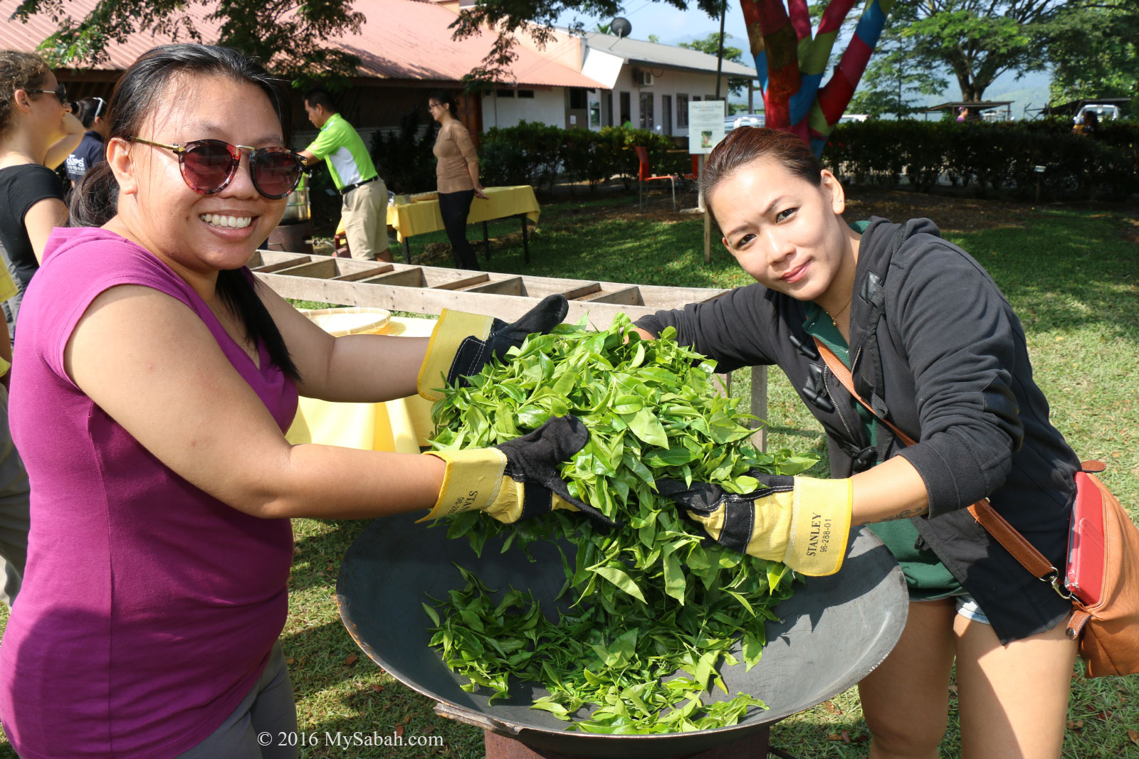
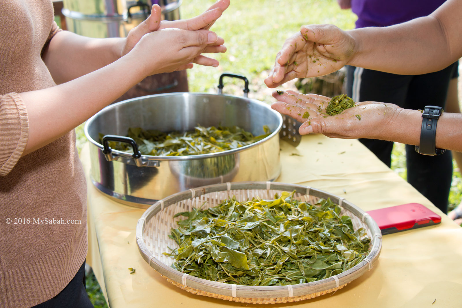
After harvesting the tea leaves for an hour of fun, you can leave your freshly collected leaves dry and wither. Then you will use them�to make Oolong and Green Tea the old-fashioned way later.
Fun with tea harvesting
Oolong Tea is semi-fermented and Green Tea is unfermented, and their processing steps are different.
Drying the tea leaves
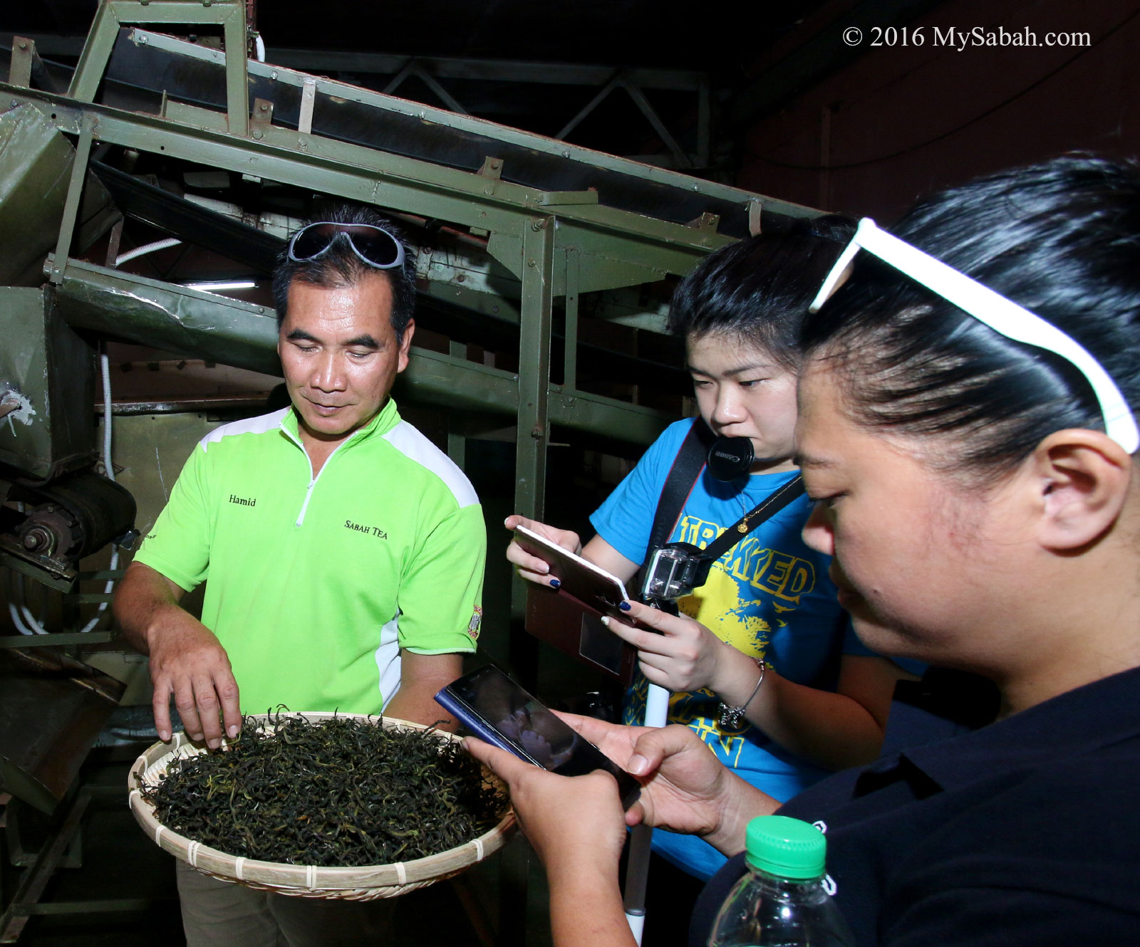
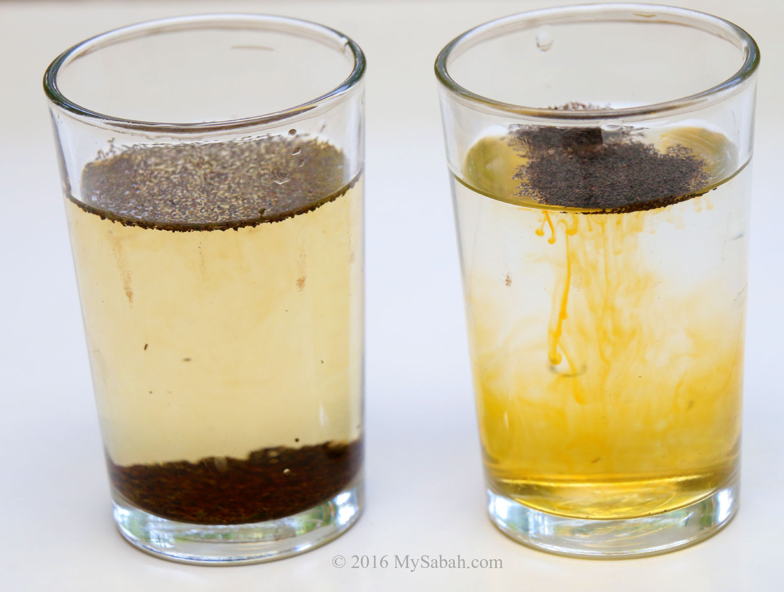
For Oolong, the tea leaves are left oxidized before they are roasted in wok, while Green Tea is cooked in steamer.
Oolong and Green Tea
The end result is Green Tea will have milder taste and more astringent than Oolong Tea, which is in light brown color, with richer and stronger flavor. The participants will sample both tea and learn the difference.
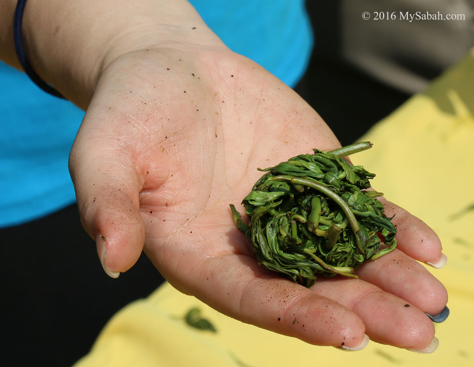
Making tea balls
Tea ball
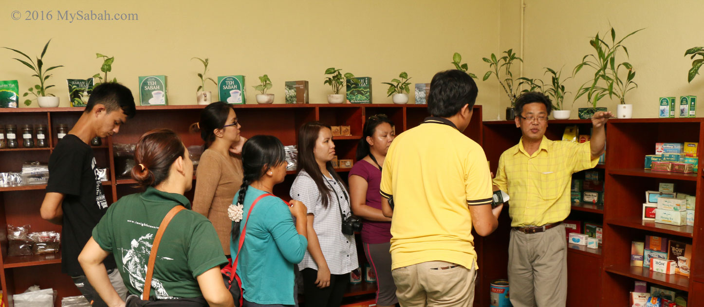
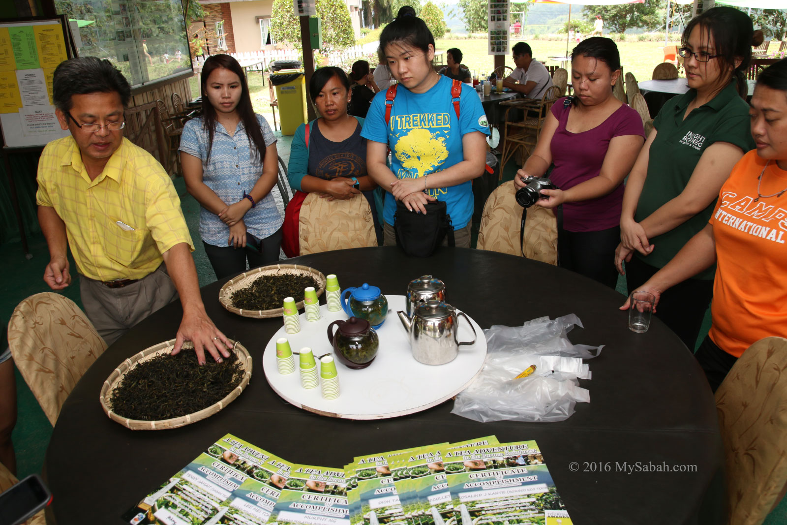
Their staffs are very keen to share their tea knowledge. They also conduct tea talk for you to gain a better understanding of tea culture. Who knows your appreciation and enjoyment on drinking tea will go up next level.
Tea laboratory of Sabah Tea
Can you tell which tea is of better quality? (The one at the right has too much coloring, bad..)
Tea sampling
Other Activities
I was also�impressed by a full array of activities at Sabah Tea Garden available from day to night.
Misty forest near Sabah Tea
The forest, hill and river adjacent to Sabah Tea are in clean and pristine condition, and we can enjoy many types of nature based activities.�For example, you can hike to the hill, trek in rainforest, swim in the river (if you can stand the cold!), mountain biking and even camp around.
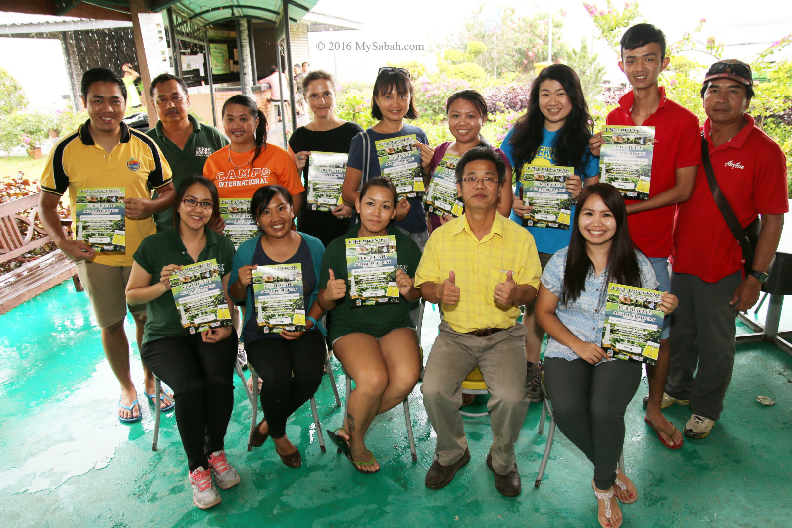
Group photo after taking part in Tea Adventure Programme
If you love wildlife, Sabah Tea Garden is a good site for bird-watching and night walk for spotting insects too.
Fun game after dinner
Sabah Tea Garden is also able to organize team building, game challenges, obstacle course�and various group activities for corporate retreats (for a minimum of 15 people).
“Tea” Cuisines
Tea can be used in food too. You can try such dishes at Sabah Tea, like their chicken soup cooked with vegetables and young tea leaves, and one-of-a-kind�dessert, Tea pancake with honey.
Sabah Tea Chicken Soup
Sabah Tea Pancakes
Others local dishes are also available at Sabah Tea, just to list some, Fish with Bambangan (this Fruit only found in Sabah), Tuhau Beef (Sabah’s Wild Ginger Beef), Sabah Tea Black Pepper Lamb, Butter Prawns and Soy Sauce Free Range Chicken.
Restaurant and Gift Shop of Sabah Tea
Local cuisines at Sabah Tea
Yes, the food are delicious.
Sabah Legend Tour
Kadazandusun is the largest indigenous group of Sabah. Their legend says Nunuk Ragang is where Kadazandusun people originated, and everything begins with a father and his 3 sons, who later split and migrated to different parts of Sabah and formed three main tribes (namely, Rungus, Kadazan, Dusun).
Tour about Sabah culture and legend
At Sabah Tea, the story-telling starts in their Rungus longhouse. Ruby, their staff showed us the traditional clothes, baskets, handicrafts, farming tools, hat, mats, beads and musical instrument displayed in the hallway, to introduce the interesting culture of each tribe.
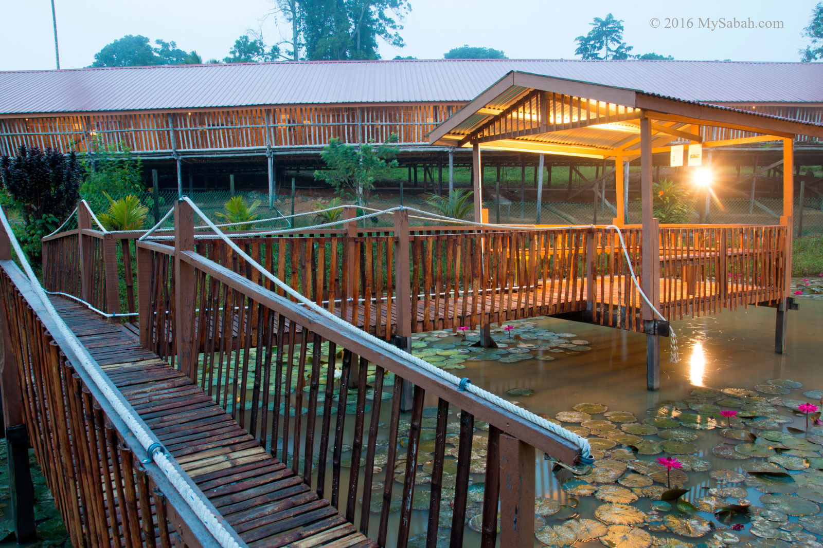
Pond next to Sabah Tea longhouse
Below is the contact of Sabah Tea Garden: Address (see Location Map): KM 18, Jalan Ranau / Sandakan, Kampung Nalapak, Ranau (2.5-hours Drive from Kota Kinabalu City) E-mail:info@sabahtea.net Tel:+60 88-440882 (KK Office), +60 88-879220 (Sabah Tea Site) Opening Hours: 8am to 4:30pm (best to visit before noon) Website:www.sabahtea.com.my Facebook:SabahTea Fax: +60 88-440886
You may check out my photo album for more photos of Sabah Tea.
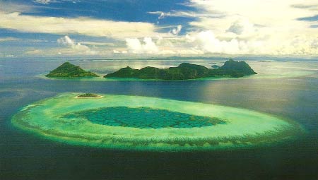
My urge to visit Bohey Dulang Island started with a photo seven years ago. “Nice painting!” I praised a big drawing of islands hanging in the office of my friend. “Actually it’s a PHOTO taken in Sabah,” he replied. I was stunned. The islands look so surreal, such place doesn’t even seem exist. After some lookup in local bookstore, I found that it is the photo of Tun Sakaran Marine Park (or Semporna Islands Park) taken by Michael Patrick Wong.
Pic: aerial photo of Tun Sakaran Park by Michael Patrick Wong
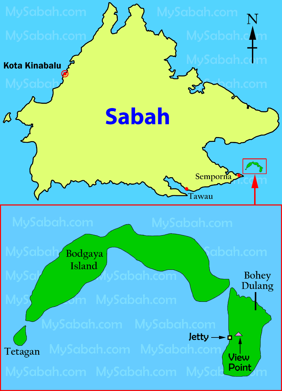
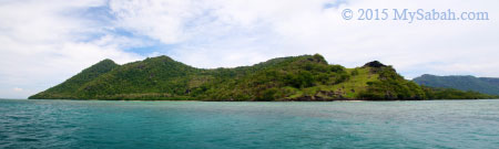
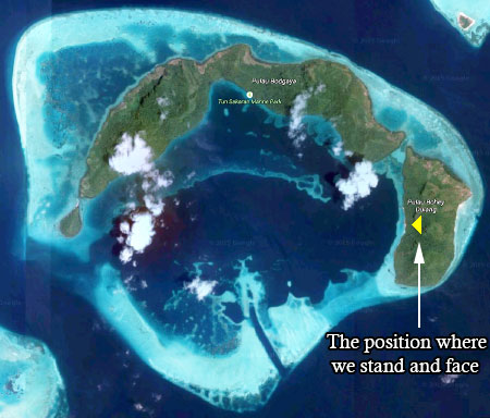
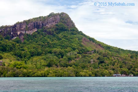
Tun Sakaran Marine Park (TSMP) is located off Semporna at east coast of Sabah and comprises of eight islands – Bohey Dulang, Bodgaya, Tetagan, Sebangkat, Selakan, Maiga, Sibuan and Mantabuan, covering a total land and sea areas of 350 km?.
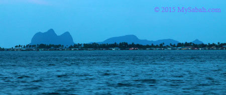
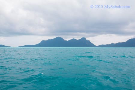
Pic: view of Tun Sakaran Marine Park from Semporna town. Locals call it Sleeping Old Man and I guess you can see why.
TSMP is the largest marine park in Sabah (but will be superseded by 1-million-hectare Tun Mustapha Marine Park soon). I was also told that you can get a fascinating view of TSMP (they call it one of the most beautiful views of Sabah) from the peak of Bohey Dulang Island.
Below is the location map of TSMP. You also can see it in Google Map:
Every now and then I contacted some travel agents for a trip to this park, but they all wanted me to charter the whole boat (for nearly a thousand bucks) if I traveled solo, so the plan was held indefinitely until last month Edward from Borneo Star Cruise texted me, “bro, I’ll visit Bohey Dulang tomorrow. You want to join?” Of course I was more than happy to tag along!
About Bohey Dulang Island
Bohey Dulang (or Boheydulong, Bohaydulong) is the second largest island (size: 313 hectares) of TSMP and about 23 Km away from Semporna. Legend says there lives a beautiful princess named Salamia from Bum-Bum Island. Her family hid her on Bohey Dulang, to avoid a forced marriage by a notorious Sultan from the southern Philippines.
Pic: drama about Princess Salamia in Sabah Fest 2010.
However, she vanished a few days later and believed to be hidden by the spirits of this island and turned into a fairy. Even nowadays, local people say they can hear Princess Salamia singing and her dog barking during the night of full moon. Occasionally, she is seen walking around the island.
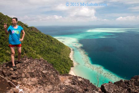
Pic: Bohey Dulang Island
The name Bohey Dulang is derived from bohi (bohey) meaning water and dulang meaning pools or depressions in Bajau language. This may refer to series of oval rock pools, roughly 2-3 m across, along the small waterfalls and main freshwater stream on the eastern side of the island.
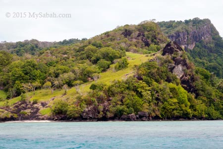
Pic: East side of Bohey Dulang Island
People say these pools are a source of drinking water for Princess Salamia. A document reports a large cave (40 M high and over 20 M long) is situated on the east side of this island too. Could it be the home of Princess Salamia? I wonder.
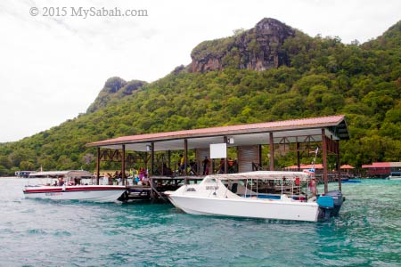
Day Trip to Bohey Dulang
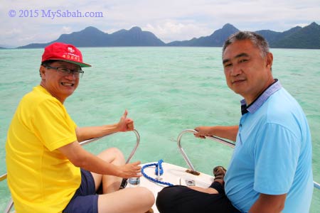
Ok, back to my tour. Edward and I were taking a boat from Semporna town around 11am. The weather was good and we approached TSMP in 15 minutes. The Best Time to visit Bohey Dulang are from February to April (the dry months). If you visit during wetter months like July, August, December and January, your trip would have higher chance of being spoiled by heavy rainstorm of monsoon seasons, or not, depending on your luck. The park would close the climbing trail if the weather doesn’t seem good (even if it’s cloudy and no rain).
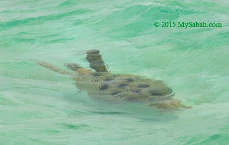
Our boatman showed us a “secret passage” where we could see dozen of sea turtles. We cruised slowly on the sea near TSMP. It was low tide and the water was crystal clear. We could see large area of corals and white sand under the ocean.
Then we did see over 10 sea turtles passed by our catamaran one by one. Gee… though turtles look heavy and clumsy, they swim as fast as a torpedo in the water. I totally fall in love with the beautiful nature and romantic legend of this island.
You may ask, “this magical destination should have become very famous for a long time. Why it only rises as a new attraction in recent years?” Good question. In 1963, Bohey Dulang was leased to Kaya Pearl Company to establish the first pearl cultivation center in Malaysia. The island was heavily guarded by armed personnel and stranger was strictly forbidden to enter the island. That’s why Bohey Dulang is nicknamed as the Pearl Island or Treasure Island.
Then the pearl farm was closed in 1993. In 2004, Bohey Dulang, with seven other islands, is gazetted as ?Tun Sakaran Marine Park? (TSMP) by the Sabah Government. As a national park and by word of mouth, it gains more exposure and now it receives hundred of tourists every day.
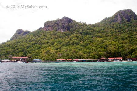
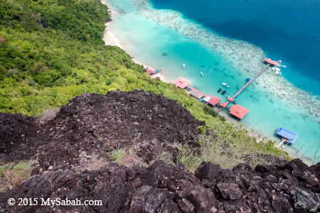
TSMP is managed by Sabah Parks and they have an office and giant clam nursery on Bohey Dulang. Visitors are required to get a permit from them before entering the island. I hope they will make it a public park soon, so tourists only require to buy ticket to enter. Furthermore, Bohey Dulang needs more tourism amenities such as restaurant, watersport center and resort.
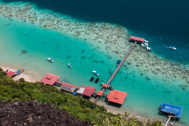
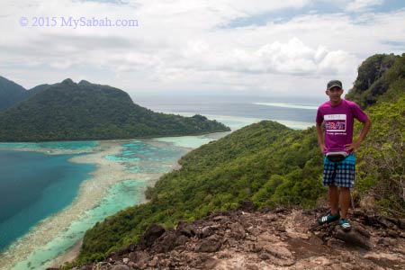
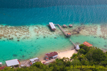
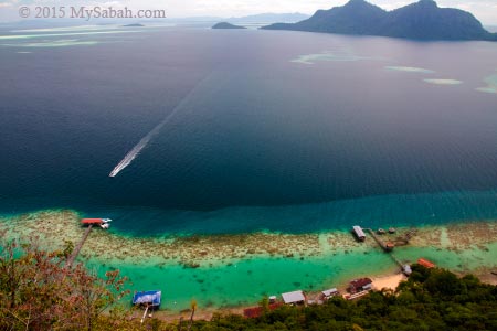
From the jetty, you can see the peak (at left in photo above) that is used as the view point for scenery of TSMP.
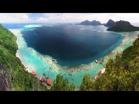
For a fast overview of Bohey Dulang, you may watch the short video below:
Hiking to the peak
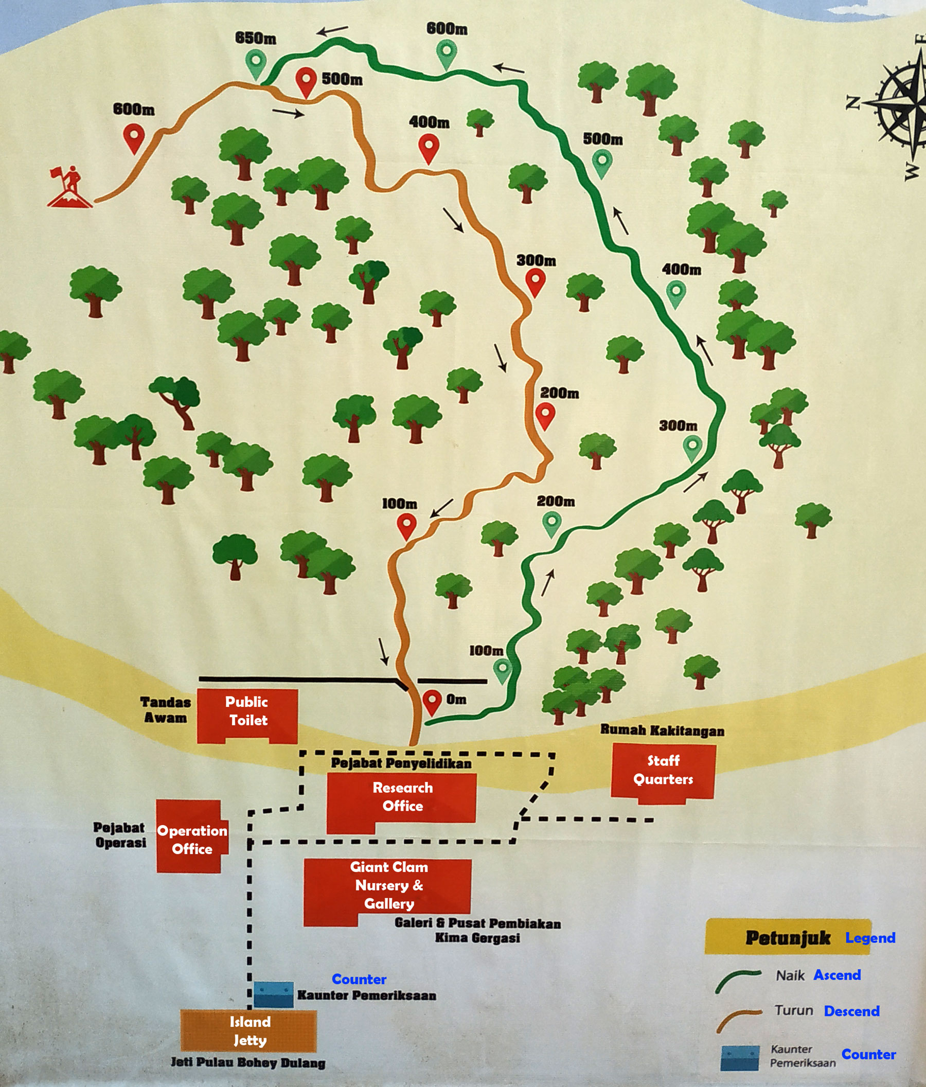
You need to ascend a 800-Meter nature trail to reach the peak with a height of 353 Meters, which normally takes 40 minutes. The climb can be a bit challenging after rain, because some steep areas will become slippery and muddy. Do wear proper walking shoe, I strongly advise against flip-flop. The park will make it compulsory to rent a pair of hiking shoes from them for RM5, if you don’t wear the proper shoes. It’s warm and humid in the forest and hot on the peak, so please bring some drinking water.
Trail map of Bohey Dulang Island (with English translation)
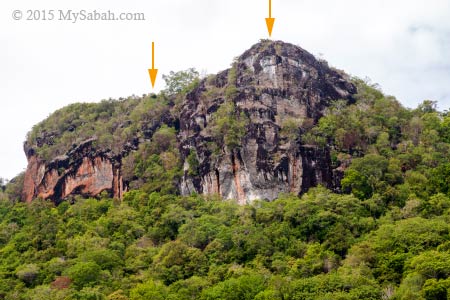
Pic: the view points on the peak. The trail will lead you to the one at right, you can walk 20 Meters to the view point at the left for better sight. The dark grey rocks that form the high cliffs and large shore outcrops are mainly volcanic rocks of late Tertiary (Pliocene) and Quaternary periods. It’s unique because Semporna peninsula is the only place in Sabah where you can see these rocks.
There is a small toilet at the beginning of the trail. It is not so clean and well-maintained, but usable.
Limited supports such as boardwalk, handrails, ropes, stairway and plank path are available to make your climb easier, but you will walk on soil and rocky path most of the time and busy grabbing the small trees along the trail for support. For safety, a Sabah Parks guide will escort you on the way. Just go slow and everyone can make it quite easily.
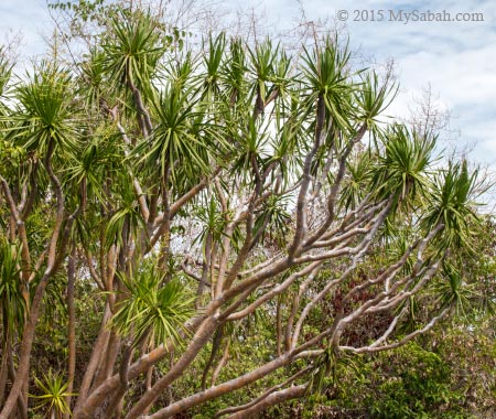
Like other islands in TSMP, Bohey Dulang has one of the most unique and unusual plant communities in Borneo, especially coastal forest and scrub vegetation. Some plant species here are regional endemic to Semporna islands and Philippines, and not found in other locations of Borneo, for example, rare Paraboea leopoldii on cliff faces, Dracaena multiflora monocot, palm-like Cycas rumphii, cactus-like succulent Euphorbia lacei and trichoglottis geminata, a rare epiphytic orchid grows on volcanic rock.
I was looking for Selaginella tamariscina, a small plant of 4-5 cm high like a miniature tree fern. Its leafy distal branches curls inwards under hot sunlight but flattened during rain. This cute plant is a new record to Borneo, and it grows on exposed to partially shaded, gently sloping rockfaces of this island.
We saw probably nearly a hundred tourists on the way down. They looked tired but really happy. Some even encouraged us, “move on, you are close!”, “it’s awesome up there!”, “it is worth the effort.” A rain earlier turned part of the trail into creeks. Many tourists took off their flip-flop and descended barefooted, when their shoes were too slippery to hold their feet. I sweated a lot but the soothing sea breeze prevented me from overheat.
Wildlife such as long-tailed macaque and otter also live on this island but not in great number. A total of 48 bird species comprising mainly resident birds have been recorded around Bohey Dulang. The notable bird species are Metallic Pigeon (Columba vitiensis), Nicobar Pigeon (Caloenas nicobarica), Tabon Scrubfowl and Pied Hornbill. I saw more mosquitoes than other animals though. The good news is – there is no leech.
Pic: They call this ladder between boulders “Stairway to Heaven.” You should feel joyful when you reach here. Not because you will go to heaven, the peak is only a very short walk away now.
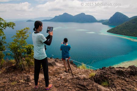
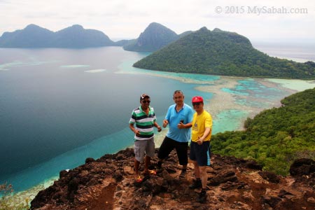
Finally I came to a flat ground and saw the light in front. I could tell the amazing scenery was waiting for me outside the dense bushes.
Hooray…!!! After a taxing climb, it’s time to enjoy the wonderful view and stay as long as you want.
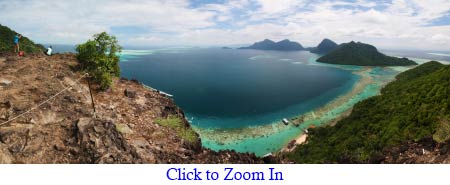
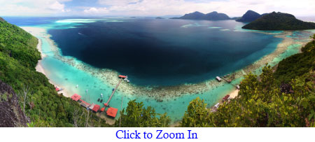
The Most Beautiful Seaview of Sabah
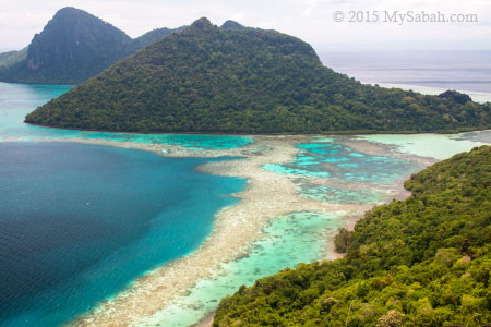
On top of Bohey Dulang, you can have a bird-eye view of the sapphire-colored Bodgaya Lagoon embraced by emerald forest of three central islands (Bodgaya, Bohey Dulang and Tetagan), the only islands in Sabah made of volcanic rock and part of the Sulu volcanic chain. In fact, the lagoon, which is about 6.5 Km across, is a crater of an ancient volcano erupted 2.5 million years ago.
The central islands are the remnants of a Quaternary volcanic crater rim. Part of the “rim” is dissected and inundated by the sea but you can see it from its curved reef formation. I was standing on top of an extinct volcano. You may look at the satellite photo below for a clearer view of the rim.
Pic: I could see our boat at the jetty. All boats look like tiny toy from a height of over 260 Meters. The highest point of Bohey Dulang is 353 Meters and situated further south. They might open a new trail to there in future.
Pic: abandoned pearl farm
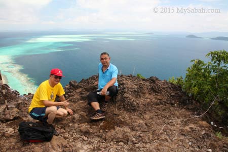
It’s noon time and most tourists have descended. The rest of us were happy to take hundred of photos. They didn’t build any fence, so be careful when you stand on the uneven surface of the cliffs.
Pic: To your right you can see the 120-Meter long channel between Bodgaya Island and Bohey Dulang. Bodgaya means “impressive mountain” in Bajau language, and it’s the largest island (795 ha) in TSMP and about 8 Km long. You also can see its highest peak, Mt Bodgaya, which is 455 Meters high.
If you say Bohey Dulang has the most beautiful sea view in Sabah, those who had been there won’t argue with you. You may forget many things in life over time, but you will always remember the breathtaking seascape of Bohey Dulang.
For the best view, you need to walk another 20 Meters to your right for second view point, which offers a truly panoramic view (like photo above). You would miss this spot if nobody tells you. This is the favorite spot of landscape photographers to capture the circular shape of the lagoon and “50 shades of blue” colors.
The volcanic rocks and mixture of Bornean and Philippines flora make this park looks a bit “exotic” even to Malaysians. Like the yacca-like Dracaena multiflora in photo above. It is common in summit scrub here but do you know that it’s only found in Philippines and Semporna Islands Park?
It’s hard to say goodbye to Princess Salamia and her lovely islands in Celebes Sea, which can match the beauty of Caribbean Sea.
How to get there
A day trip to Bohey Dulang is possible even if you stay in Kota Kinabalu City (KK). Just take a 50-min morning flight from KK to Tawau City, upon arrival get a 1-hour land transport to Semporna town, then the park is only 20 minutes away by boat. The earliest flight to Tawau departs at 7:25am, and last flight back to KK is at 7:45pm. Both direct routes are served by Malaysia Airlines and available every day. You may use Google Flight to check out the latest prices and other flight alternatives. Please note you need a permit from Sabah Parks prior to visit the island.
Starting on 1 Feb 2016, visitor will need to pay for entrance ticket to this island (which they call Conservation Fee):
Ticket Rates (in MYR Malaysian Ringgit)
Conservation Fee (to Tun Sakaran Marine Park)
Adult
Below 18
Below 12
60 & Above
Malaysian
RM8
RM5
Free
Free
Non-Malaysian
RM20
RM12
RM12
RM20
Climbing Fee (Bohey Dulang)
Adult
Below 18
Below 12
60 & Above
Malaysian
RM20
RM10
Free
Free
Non-Malaysian
RM50
RM30
RM30
RM50
Fees to climb Bohey Dulang, rates with effect from 1 Jan 2023
Please feel free to contact Borneo Star Cruise for more info: E-mail:info@borneostarcruise.com Phone (24×7): +60 17-820 7911 (also reachable by Text, WhatsApp, Viber, LINE) Facebook:Borneo-Starcruise-Sdn-Bhd
Other Activities
Besides sightseeing at Bohey Dulang, there are a few other activities you can do around Tun Sakaran Marine Park (TSMP).
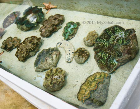
1. Visit Giant Clam Nursery
Due to overfishing, giant clams are highly endangered. TSMP is a refuge for seven species of giant clams (Tridacnidae and Hippopusporcellanus species).
Sabah Parks has a giant clam nursery and hatchery center on Bohey Dulang, where they breed and propagate giant clams inside and outside the Park. The display and settlement tank area, which houses a few species of giant clam (may not open to public and tourists). It’s possible to arrange an educational tour to visit their lab and research center.
2. Snorkeling & Diving
TSMP is located in Coral Triangle (a.k.a. Amazon of the Sea), which supports one of the richest marine ecological zones in Malaysia. 528 species of coral reef fish are found in the park, much more than Sipadan Island (409), Redang (209) and Tioman (233). Teeming with over 320 species of hard and soft corals, and variety of sea creatures such as eagle rays, barracuda, turtles and nudibranchs, this park is getting well-known as a scuba diving and snorkeling site.
Mantabuan Island has the best concentration of corals and marine lives. Sibuan Island is featured as one of the 101 Best Beaches of Malaysia. Therefore, both islands are the favorite picks of travel agents to impress their guests.
3. Photography
You are wrong if you think that TSMP is only about nature. Many world-renowned photographers have visited this park for human interest shots here and won some international awards. Around the islands, there are about 10 villages of Bajau Laut (a.k.a. Sea Gypsies) people living either in temporary shacks or in their boats. They maintain very traditional lifestyles and possibly the only nomadic seafarers left in the world.
Most of them are fishermen in hardcore poverty. However, when their primitive houses, nude children and pristine sea are being framed into a photo, its visual impact is so overwhelming and so out of this world (though it’s a sad reality). Whenever I drop by Semporna, I never fail to see a few boatloads of photographers heading to TSMP.
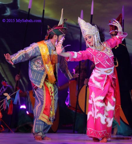
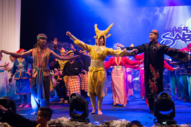
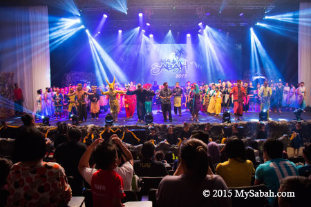
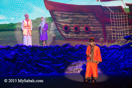
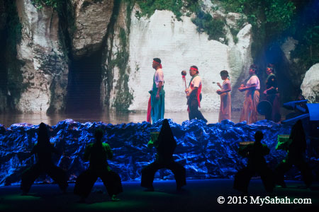
Travel back in time and delve into the stories and legends surrounding Sabah’s caves through AGOP (means Caves) � this year’s Sabah Fest presentation. The musical performance AGOP will be held from the 1st to 3rd of May at the Auditorium of Kompleks JKKN Sabah at 8:00pm.
The following photos were taken during the final rehearsal.
This three-day event will also highlight Sabah’s rich cultural heritage through a handicraft and traditional food showcase from 4pm to 10pm at the venue’s grounds.
The focus of this year’s Sabah Fest is a celebration of another important icon of ancient Sabah which thrives today as a living tradition and that is none other than Sabah’s mysterious caves. Widely known as AGOP by many communities on the east coast, ‘AGOP’ translates to the word ‘cave’ in the Orang Sungai, Dusun Begak and Dusun Subpan dialect.
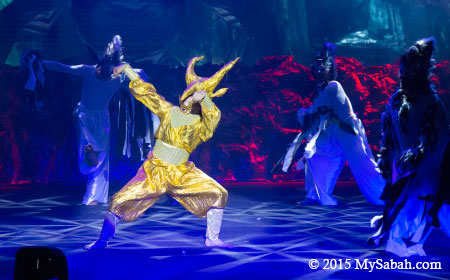
Pic: the legend of golden deer of Madai Cave
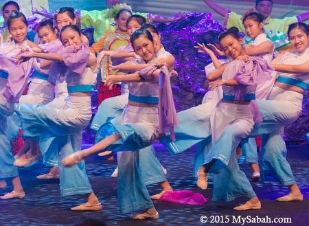
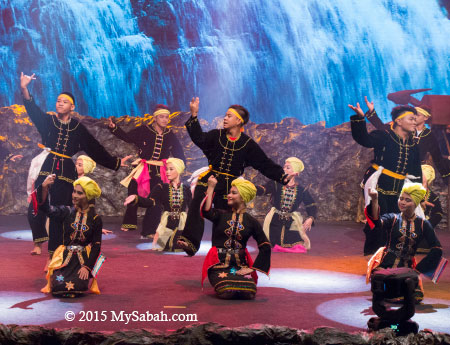
Pic: arrival of Chinese fleet to Sabah. Great performance by KK High School
The celebration of Agop this year takes us on an expedition mostly to the east coast of Sabah to sample the charms of the communities � Ida’an, Orang Sungai, Dusun Begak and Dusun Subpan- who identify with the ancient cave culture and related on-going traditions and practices.
Pic: Dusun Melangkap from Kota Belud
The musical theatre also highlights the role of Admiral Cheng Ho of the Ming Dynasty who came across the highly valued birds’ nests and presented them as a gift to the Emperor.
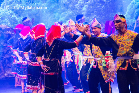
Other rarely seen groups such as the Tidong of Tawau, Dusun Sandayoh of Paitan and Dusun Melangkap of Kota Belud have been invited to perform and display their culture and musical traditions at this year’s Sabah Fest.
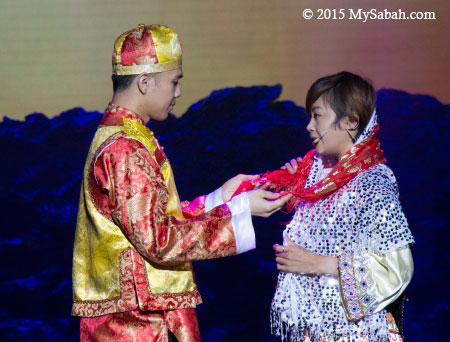
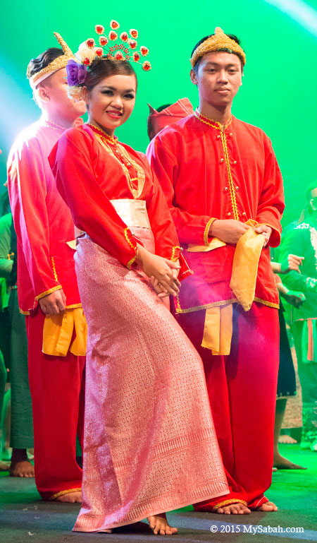
Pic: romance triangle. Who will win her heart?
This year’s production is made possible with the involvement of some 350 people, including 140 performers from 7 ethnic groups who hail from 5 districts around Sabah.
From Lahad Datu are the Dusun Subpan from Kampung Segama, Dusun Begak from Tungku and Ida’an from Kampung Sepagaya.
Pic: Ida’an from Lahad Datu
Also represented are the Orang Sungai from Sandakan, Tidung from Tawau, Dusun Sandayoh from Paitan and Dusun Melangkap from Kota Belud; each showcasing their cultural identity through song and dance.
Sabah Fest is made grander with a 100-strong welcoming troupe playing the tagunggak and Murut gong as guests arrive. Also performing are 80 dancers from around Kota Kinabalu private and non-governmental organizations, schools and universities, namely Universiti Malaysia Sabah (UMS), KK High School, SK Stella Maris Tanjung Aru and SM Maktab Sabah.
Pic: Sabah Fest 2015 uncovers the local rituals, legend and belief about caves
Don’t miss this annual premier event, showcasing Sabah’s vibrant cultural heritage, history and tradition in the form of thrilling theatrical performances, dance and music. Find out more at www.sabahfest.com.
Tickets for the stage performance are available at RM50 per show. Show starts at 8:00pm. Tickets are available for sale at the ticket counter of auditorium. For more information on the event, please contact Francesca Lydia, Event Executive, Sri Pelancongan Sabah at +60 88-232121, email info@sabahtourism.com.
A car accident always causes traffic jam on the road of Sabah because many cars will slow down to copy the car plate number for buying “4D”. 4D means 4-digit lottery games (also known as Cash 4, Pick 4, and Play 4 overseas. Local Chinese calls it “??”), the favorite lottery type of Sabah people. You just select a 4-digit number from 0000 to 9999 then bet on it. Though most Malaysians hate mathematics class, 4D is the coolest number game for us.
Yes, we all knows that the chance of winning is slim. More likely it’s money wasted but somehow it’s a nice form of mental entertainment, and hey, for RM1.15, you can’t even buy a coke, so it’s not really a big lost. In many cases, we will shout at the result in delight “OH XYZ, I only miss by one number!” and smile to one another, as if we are one step closer to our dream. Some don’t play lottery and say “not buying is winning”. Well, if you never try, for sure the next million-dollar jackpot winner is never you. “No try No luck”.
Sabahans are so obsessed with 4D that if you tell them, “I saw a ghost last night.” ALL of us will reply spontaneously, “Did you ask him for 4D number?” So funny.. Anyway, some gamblers do summon the ghost for numbers.
Would you ask a ghost for lottery number?
For unknown reason, Chinese thinks that windfall is controlled by spiritual world. If your luck comes, a hidden force will hint you via different channels, for example, plate number of a car in accident, numbers appear in your dream, and any number shown up in unusual occasion.
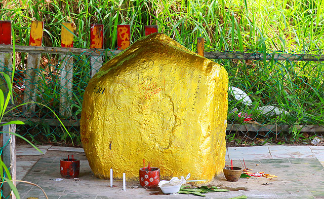
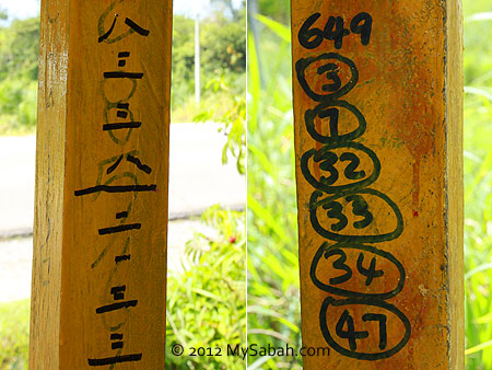
When I was in Beaufort town, the locals told me that there is an amazing “Lottery Rock” (Chinese calls it “???”) that answers the prayer of gamblers, and some of them really won lottery. Based on very limited info, I tried to look for this rock which is located between Beaufort and Sipitang. After asking two villagers during the search, finally I found it a few KM before the junction to Weston town.
FYI, this rock is about 27 Kilometers (KM) away from Beaufort. When you head to Sipitang from Beaufort, just pay attention at the left side of the road after you pass by SK Maraba school and see the “25 Sipitang” signage. You will see a boardwalk shortly, like photos above.
Below is the location map of its exact location: View My Sabah Map in a larger map
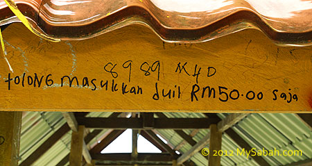
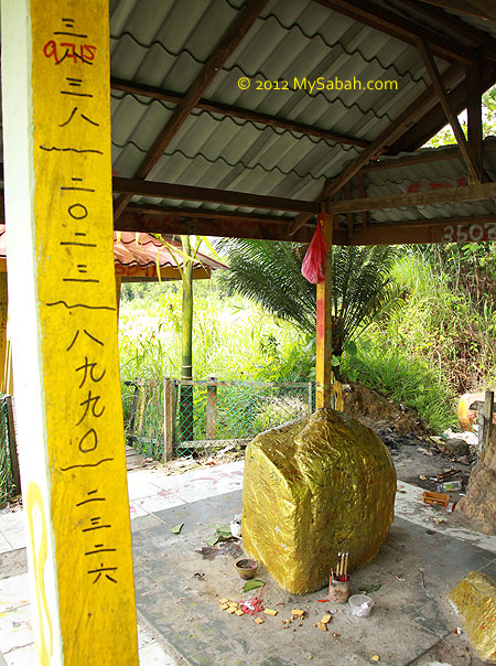
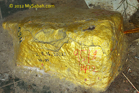
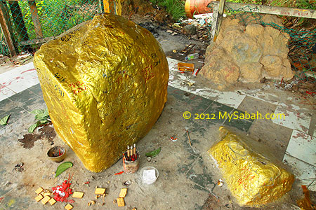
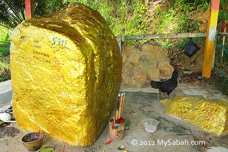
The shaded boardwalk will lead you to the golden Lottery Rock. This is an impressive big structure for an “unnamed” god. Even the God of Earth usually gets a 2×2 feet altar. To repay Lottery Rock for helping them to win lottery, the gamblers build wooden shelter, boardwalk, cement foundation, floor tiles, etc. for it.
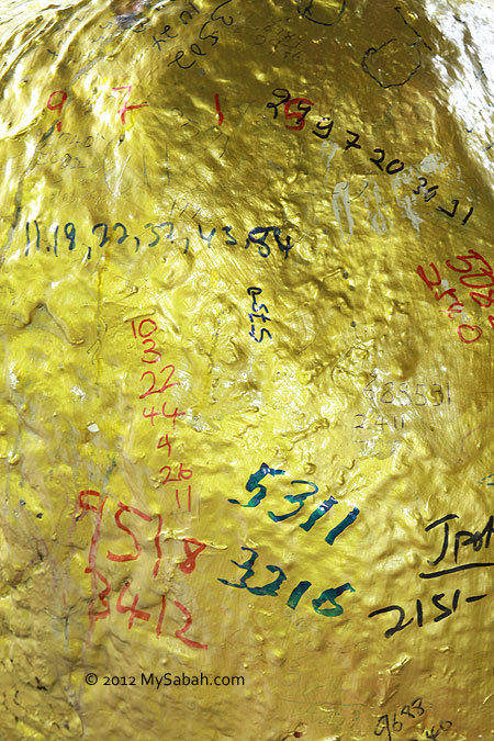
I started to see scribbling of numbers the moment I walked in.
They even paint the Lottery Rock with shiny golden paint, so don’t get mistaken that it’s a gold rock ok, LOL.
Got any lucky number in mind? Just write it and make a wish.
Don’t limit yourself to 4D numbers. You may try jackpot numbers too. I guess Lottery Rock can read numbers in Chinese?
Since Lottery Rock has magical power, I believe it can understand your request in Malay language too.
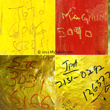
You may see words like TOTO, Magnum, Lotto88 and STC (Sandakan Turf Club). These are the names of lottery companies. To make the job of Lottery Rock easier, it’s nice that some specified the company and even the draw date. Otherwise you will have to buy the same number from 4 companies, just to be safe.
The surface of Lottery Rock is full of 4D, 6D and jackpot numbers. I was told that whenever someone win big prize, he/she will repaint the rock with different color. When the rock surface is out of space, people will write the numbers everywhere in the hut. Do take note that if you win the lottery but you break your promise to the rock, you will be hit by bad luck, in serious case, death.
Even the small rock next to Lottery Rock also benefits from its fame.
See the termite nest next to the rock? People believe termite nest is a sign of presence of god.
When I was busy in photo-taking alone, I saw smoke coming from the rock and I heard something moving behind the rock. I felt a chill on my spine.
Phew… it was just a chicken behind the rock.
And the smoke was coming from the burning incense. Look at the 6D and 4D numbers in the container.
Actually the chicken was enjoying the biscuit, the offering left by the gambler for the rock. The left eye of this chicken is blind.
There are other offering such as betel nuts and leaves.
However, those offering accumulate and rot, turning this place into a smelly dumping ground.
The notice sign reads, “To show your respect to the god of rock, please keep this place clean and don’t litter after worship. Thank you for your cooperation.”
Ok, you might be curious, how did an ordinary rock become a popular magical rock?
Someone say, in the past, to construct the road between Beaufort and Sipitang, a group of workers moved away a rock that obstructed the way. However, later they discovered this rock came back to its original location. There are many taboo in construction industry, they believe this rock is occupied with spirit and shall not be moved. When a termite nest appeared next to it, people think this rock may bring wealth, so they prayed for winning lottery. And some did win, the rock becomes famous, so more and more people worship it until today.
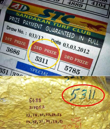
Though I was hanging there for less than an hour, there were already two cars stopped by to visit and worship this rock. One of them told me that a number “5311” written on the rock won 2nd prize, by his friend the previous day. That’s why he also comes here to worship the rock. I checked the newspaper and he was right. If you pay attention to all my photos above, you would have noticed that 5311 appears 4 times in different spots.
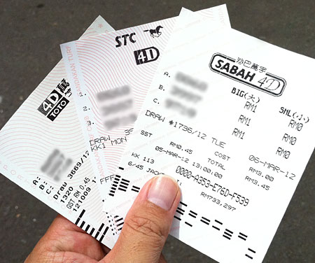
Ok, as I was there, why don’t I also try my luck? I bought lottery tickets for 3 numbers, I never win a lottery in my life, please wish me luck. XD
If you ask the locals about their impression of Tambunan town, most will answer, “a hilly and tranquil place with beautiful rice fields and surrounded by lush forest.” To me, Tambunan is like a pretty but introvert girl who is shy away from strangers. Only when you care to know her better, you will uncover her hidden gems and fall in love with her.
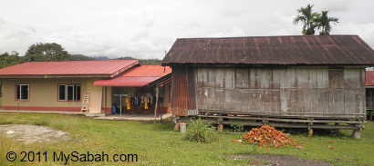
Above: traditional vs modern houses in Tambunan.
Indeed, Tambunan is so quiet that it gets the least attention from tourists. Tambunan is about 80 Kilometers from Kota Kinabalu city. I went there with a group of friends earlier this month, for a 1-day-1-night homestay program in Tambunan.
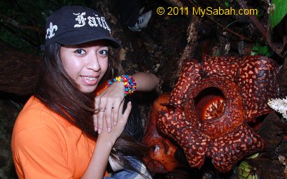
There was a twin blooming of rafflesia in Rafflesia Information Center so we dropped by to have a look. You need pure luck to see the blooming of rafflesia coz it has no predictable blooming period and its flower only lasts 6 days. Twin blooming is very rare.
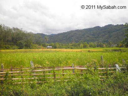
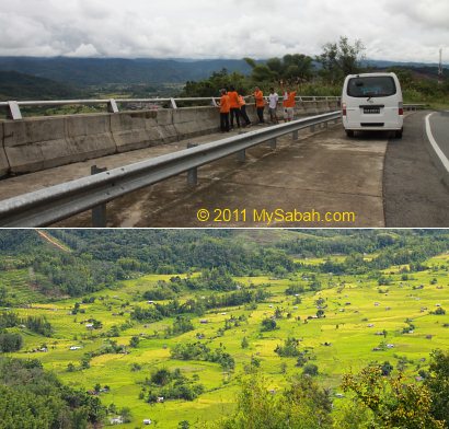
15 Kilometers before Tambunan town, you will see a balustrade at the left of the road, that’s a nice view point of Tambunan Valley with lush paddy fields. By now, you should understand why some calls Tambunan as the “Switzerland of the East”.
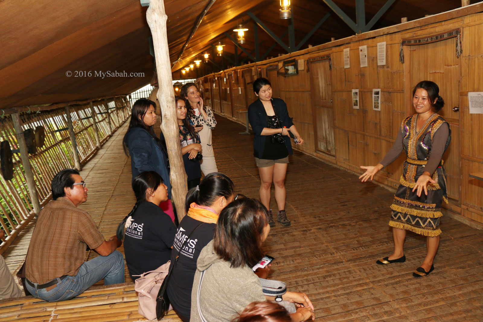
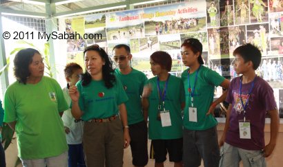
Then we come to Timbou Village (Kampung Timbou), which is a homestay venue a few Kilometers away from Tambunan. Datuk Joanna, the coordinator of Tambunan Homestay, introduces us to the guides and villagers of the local community.
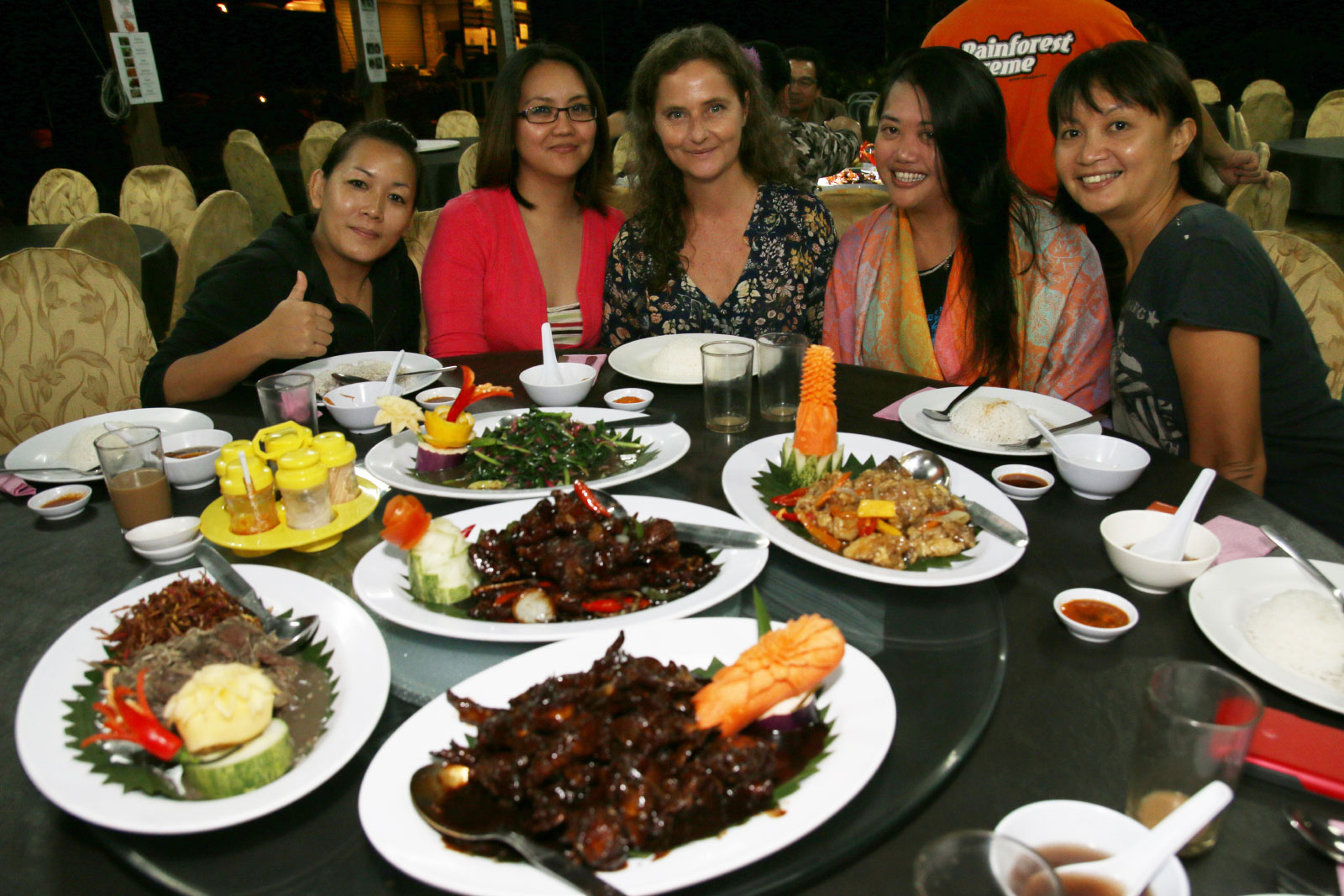
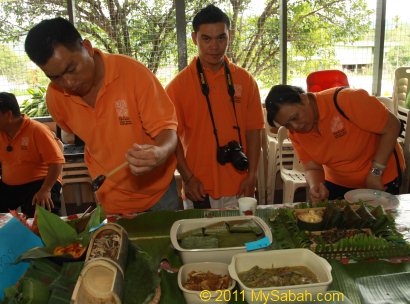
They are celebrating Rainforest Festival here, so there is a traditional food competition in their community hall.
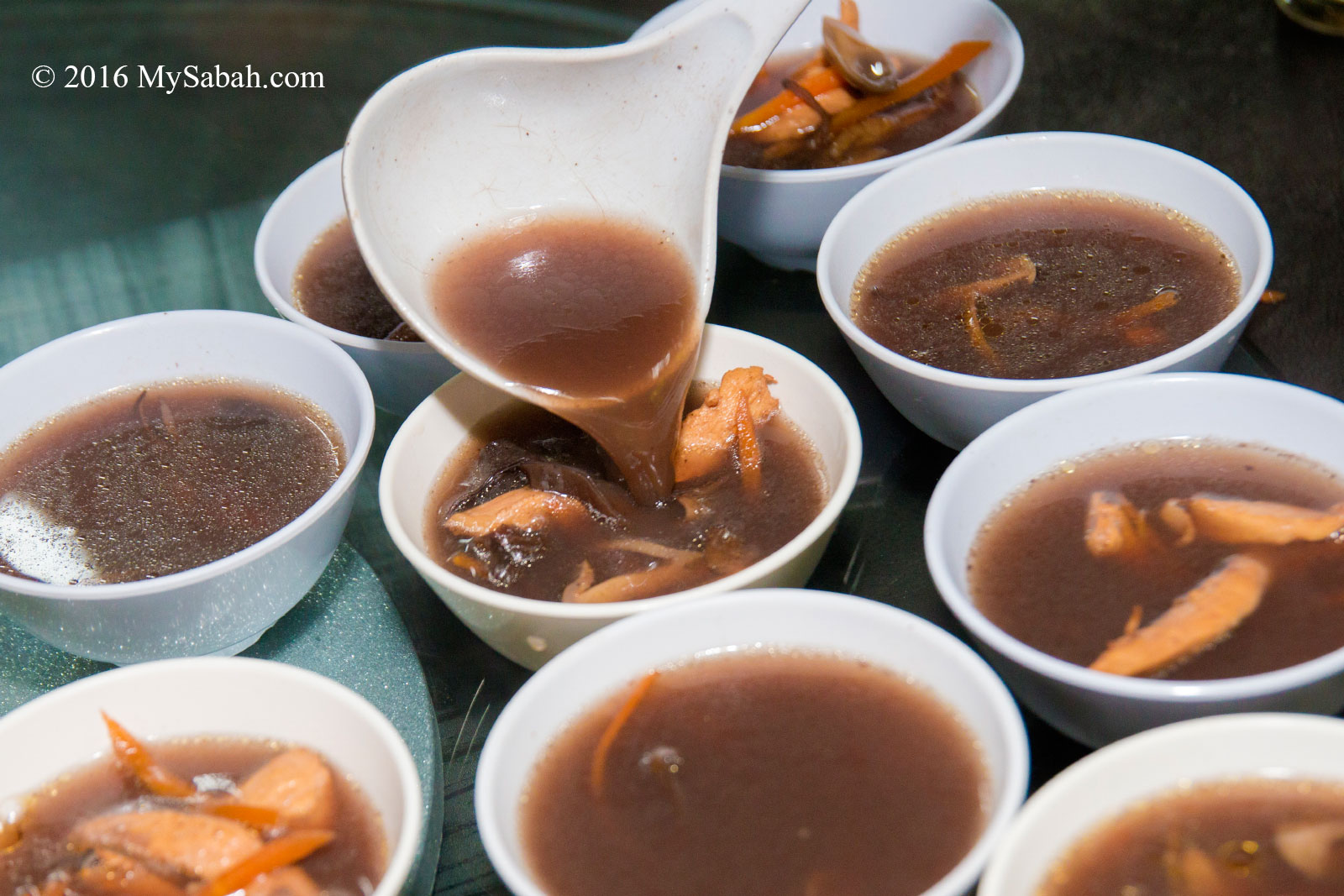
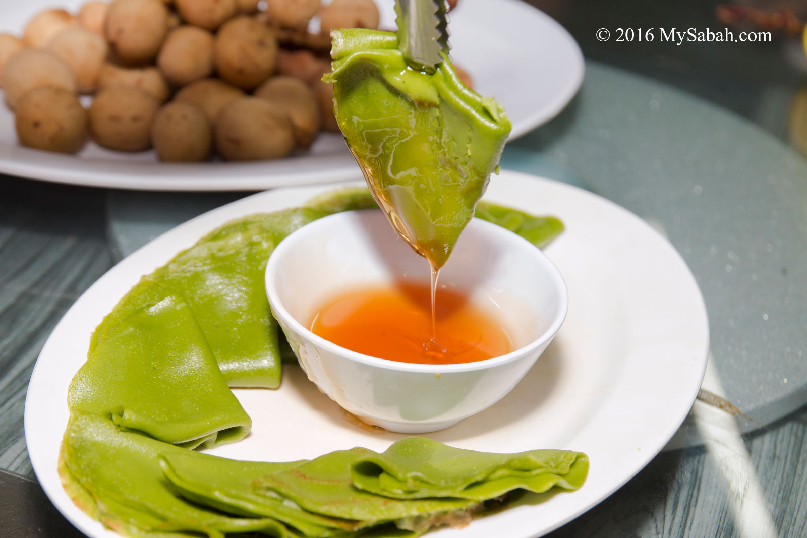
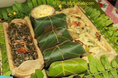
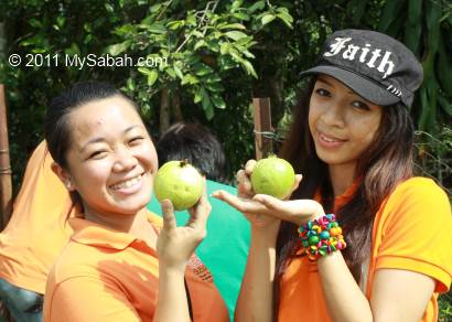
We are so lucky that we can sample all traditional dishes prepared by their local best cooks. Frankly, I didn’t have high expectation about those indigenous food coz they are mainly vegetables. But I was wrong. The fresh vegetables taste so delicious that we finish them within 10 minutes and everyone is hungry for more!
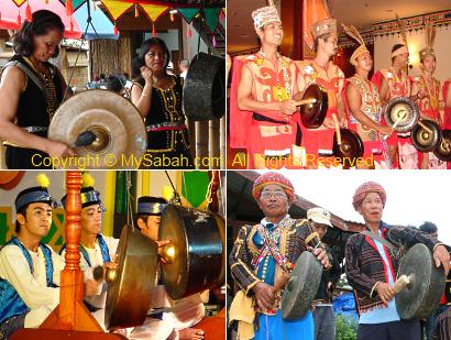
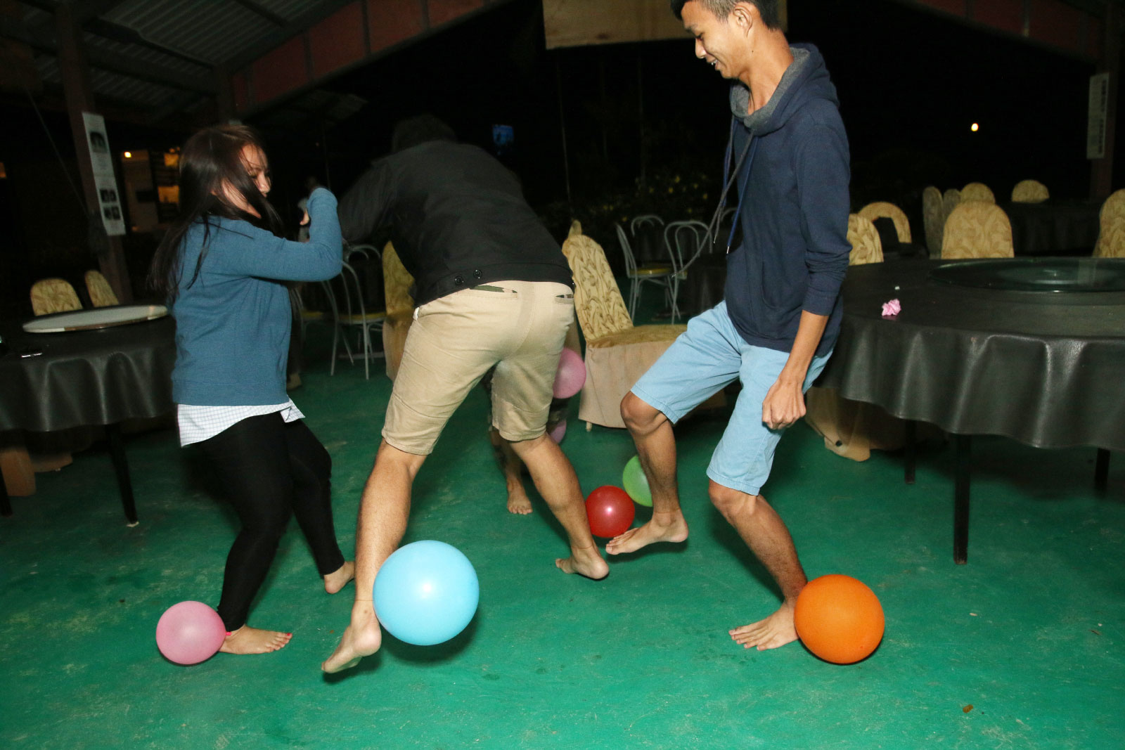
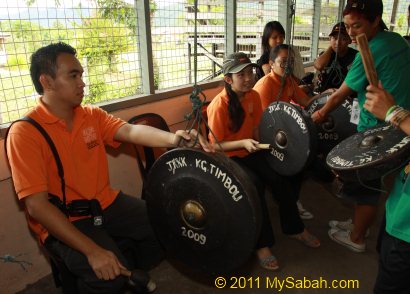
To appreciate the traditional music, we are also invited to learn to play gong. It is not as hard as it looks. In 5 minutes, we form a new gong team, haha. You may watch the video below to see our new band in action:
A grandpa and grandma also joined the fun by playing Sompoton (a traditional music instrument of Sabah). Look at the video below. They are so cute.
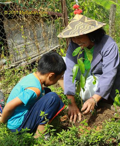
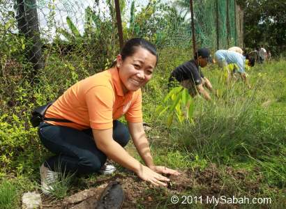
What I like most is the tree planting program with the community of homestay. Not only they learn the importance of trees, tourists are also welcome to participate in this environmental project, so they can leave something good behind after the visit.
Above: we plant the trees then harvest their fruits in next minute. Just kidding..
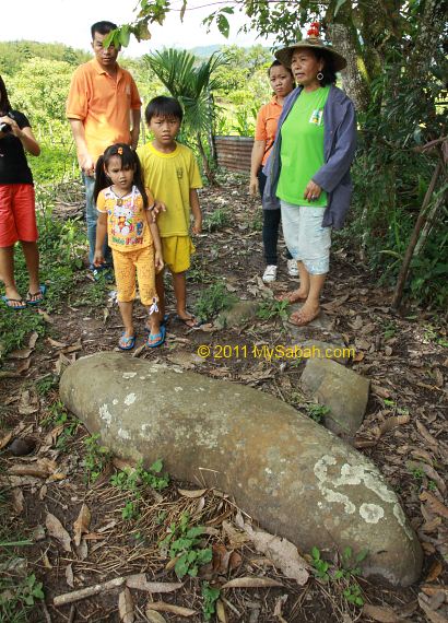
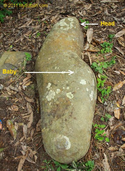
Tambunan is also a land full of legend. Every village has its own stories. Like the “pregnant woman” stone (named as “Watu Monontian” in Dusun language) below in Timbou Village. Our guide (and local historian), Regina (right), says, according to local legend, the God turned a pregnant woman into a stone. More on this story later.
As you can see in photo above, the stone really looks like a pregnant woman. I believe this story coz my mom told me that I came from a stone. 😛 This stone was used to be in standing position. But the buffaloes rubbed their bodies on this stone to ease the itch, so it fell one day.
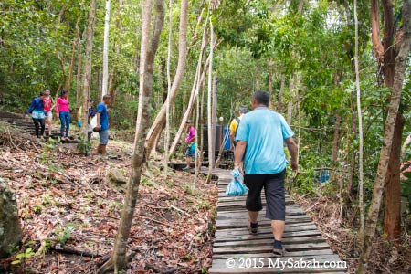
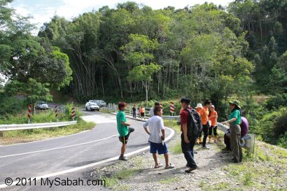
To explore more about the legend of pregnant woman stone, we visit the site where the curse of God started, Wasai Kiukad Waterfall.
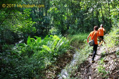
However, to reach Wasai Kiukad Waterfall, we need to walk more than 1 hour in a dense secondary forest in Timbou Village. Our destination is a sacred spot with spiritual power, so we are advised not to shout or litter during jungle trekking, or we will be penalized by flood, and only the Bobolian (local priest) can appease the spirits.
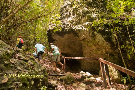
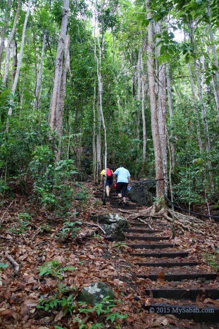
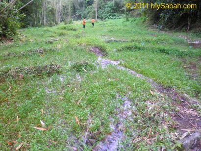
The jungle trail is not tourist-friendly. Due to rainy month, part of the trail is really muddy and we need to cross a few streams. Like the photo above, it looks like a grass land, but it has become a “marshland” after heavy rain. At first, I tried to avoid getting wet feet. After my feet sank into deep mud a few times, well, I just forget it. Nobody can stay clean and dry anyway.
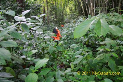
When we move deeper into the forest, we see more shrubs and bamboo. There are brown leeches around and some of us are bitten by these little blood suckers. The trail is not challenging but quite tiring. In my heart, I already say, “it’s better to be something really good or I’ll bash the guides.”
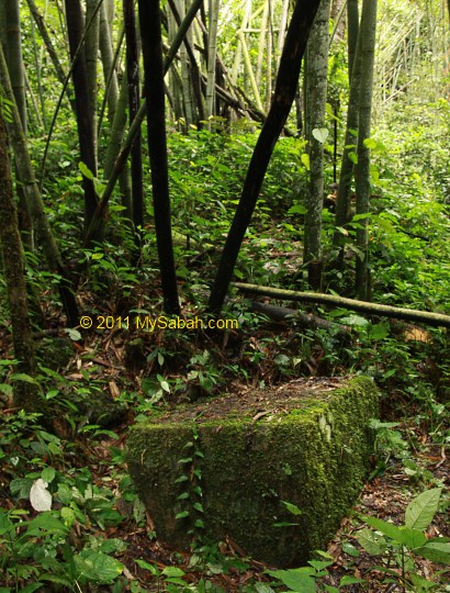
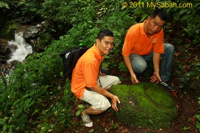
After 70 minutes, we reached the site. I didn’t know I had arrived because nobody cheered after the end of long trekking. Everyone avoid making noise to anger the God, as if we are walking into a church. Then I saw a stone “table”. In fact, we also see other stones that look like furniture around this area.
Ms. Kimoi Rugasa (you had seen her in Sompoton video above), a 76-year-old senior from Timbou Village, told me the story about this mysterious site. In the old headhunting era, there was a longhouse situated here. The villagers got really drunk during a festival, so they made fun of animals. They made their dogs and cats danced. Such action angered the God so he sent a heavy storm to flood the longhouse and turned everything into stone. Though a pregnant woman escaped and ran to Timbou Village, she was also turned into a stone, the one that I mention earlier.
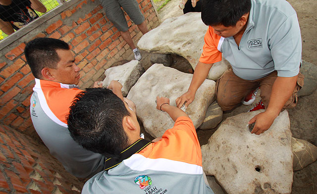
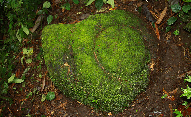
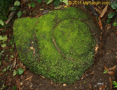
Above: a stone that looks like Gong (named Batu Gong). To me, it looks like the shell of a giant snail though. Don’t beat it or do anything funny to it, or you will be penalized by flood, the locals say.
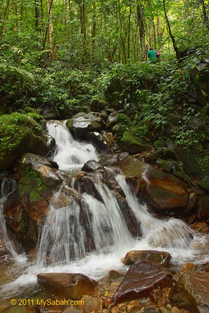
Behind them is the Wasai Kiukad Waterfall.
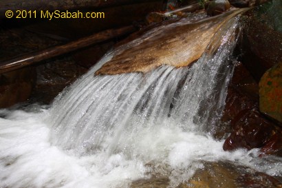
Above: Wasai Kiukad Waterfall. This place is considered sacred and nobody is allowed to swim here. The water is so clean that you can drink it.
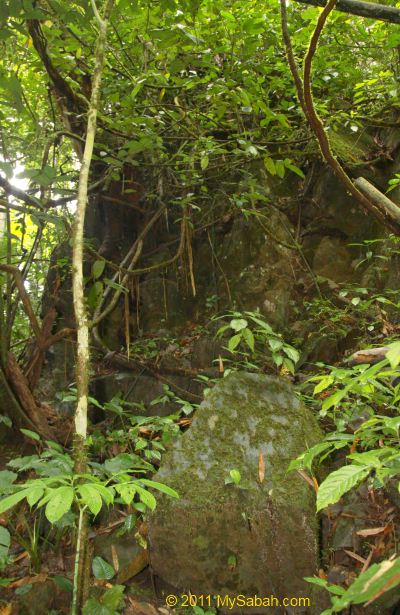
Above: a pile of boulders that locals believe was once a longhouse. That reminds me of Batu Punggul which shares the similar story.
Above: a weird rock in the stream. Look like a snake head?
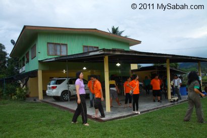
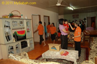
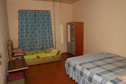
As it starts to rain, we didn’t stay long, so we leave the forest ASAP. We are transferred to a local family in Keranan Village of Tambunan. Tonight we call it our home.
The “real” homestay of Malaysia is NOT a cheap accommodation with bed & breakfast only. You will stay with a local family house, which is certified by Tourism Malaysia to participate in homestay program. Tourists will live with the family like a friend, not a hotel guest, though the family provides food and bed. The family will make friend and interact with the tourists too, sometimes teaching them farming or making handicraft.
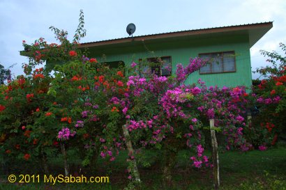
Giro and his sister Katherine are our host. They are really kind and make us feeling at home. Their house and room are very clean too. After having dinner and a couple of rice wine with them, we have a good sleep.
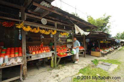
Next morning on our way back to Kota Kinabalu, we drop by a roadside stall (10 Kilometers from Tambunan) to buy some local fruits and fresh vegetables.
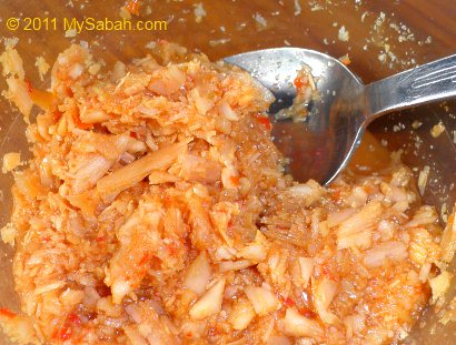
FYI, the famous product of Tambunan is Tuhau (pronounced Do-How), a type of sour appetizer made from plant of ginger family. You can find it everywhere in Tambunan.
Tuhau is the favorite food of indigenous people. Actually I dislike it in first try coz it tastes like stink bug. After trying Tuhau a few more times, I can accept it. Well, you should try it at least once, who knows you will like it.