Tag Archives: jungle trekking

Taralamas River Canyon

Taralamas River Canyon, the Magic of Water

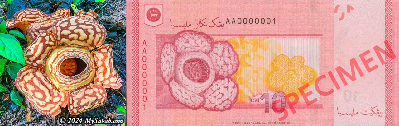
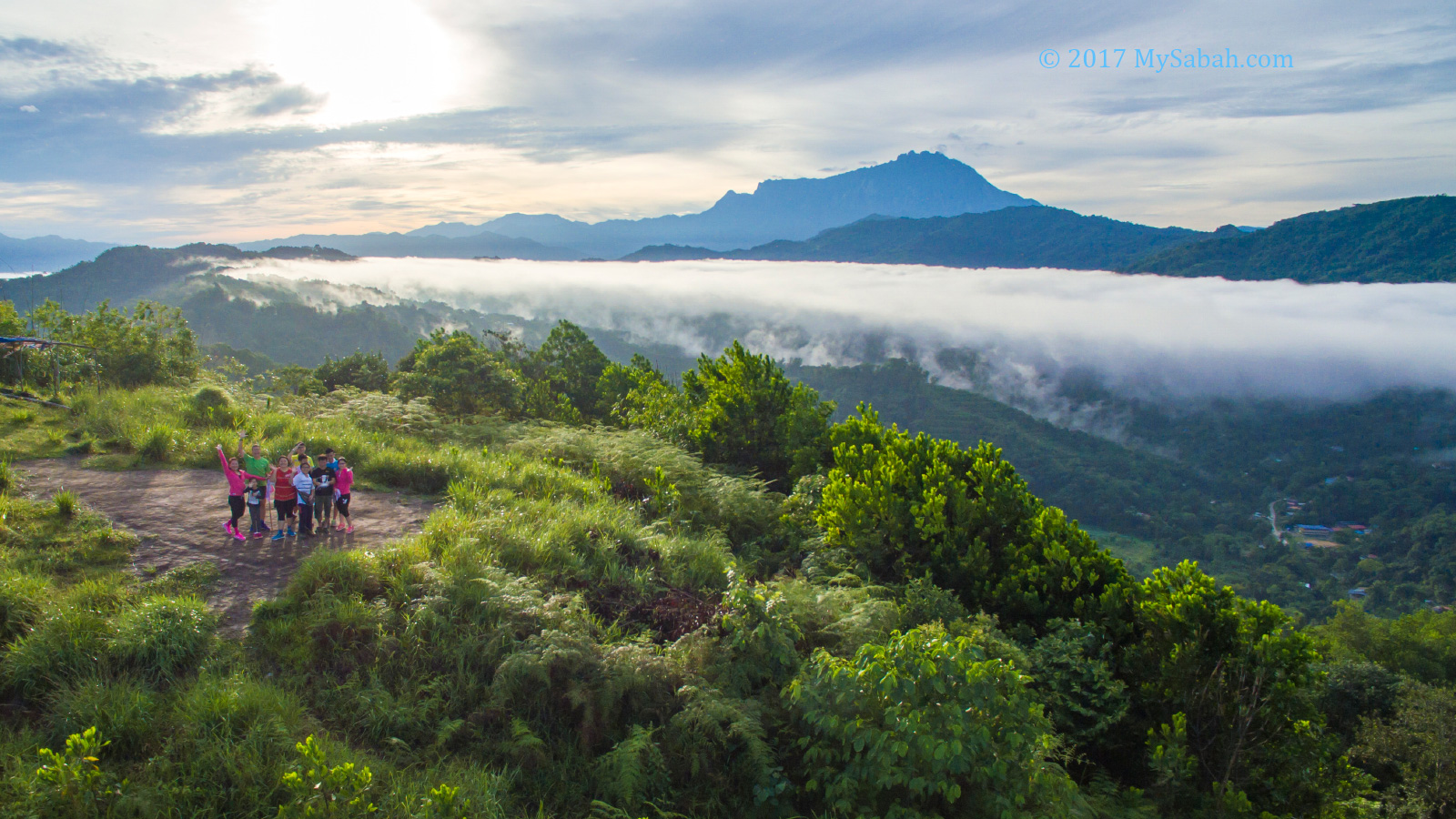
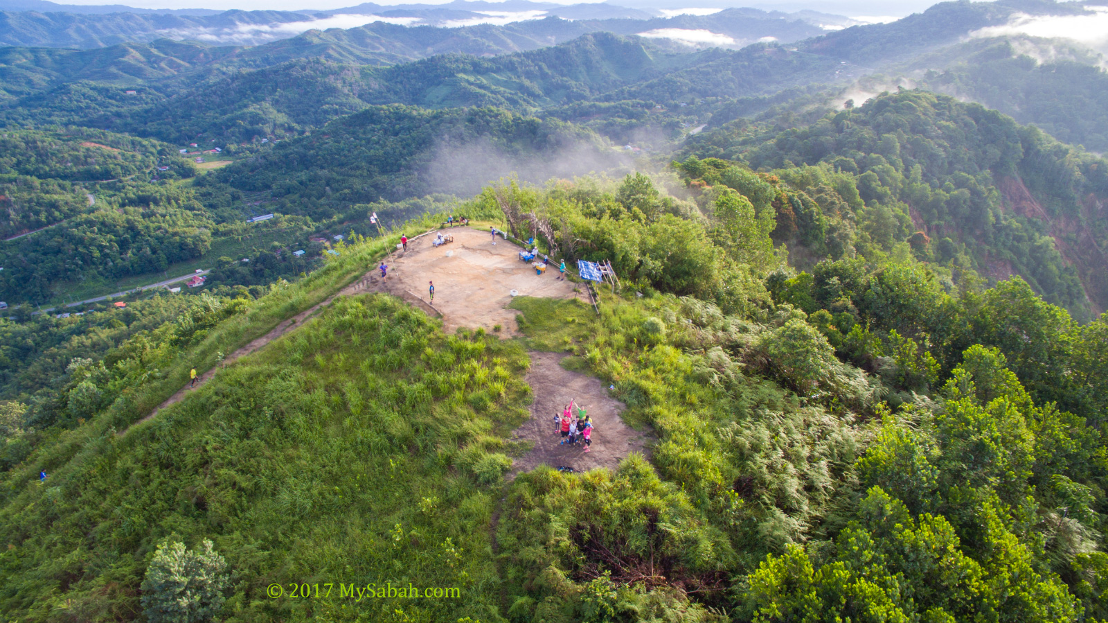
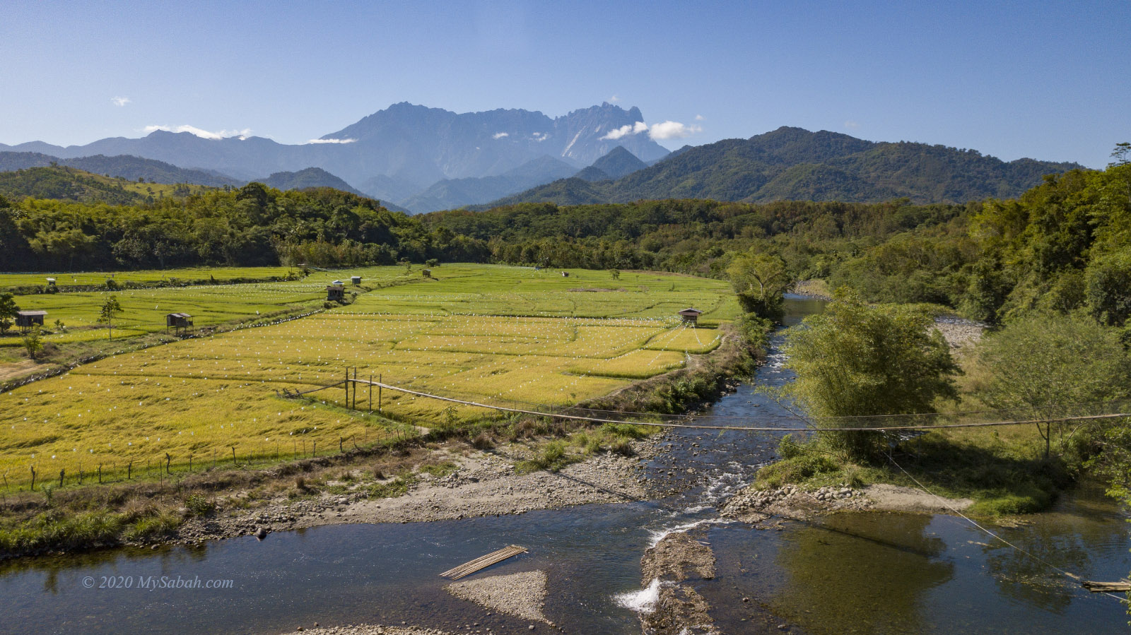
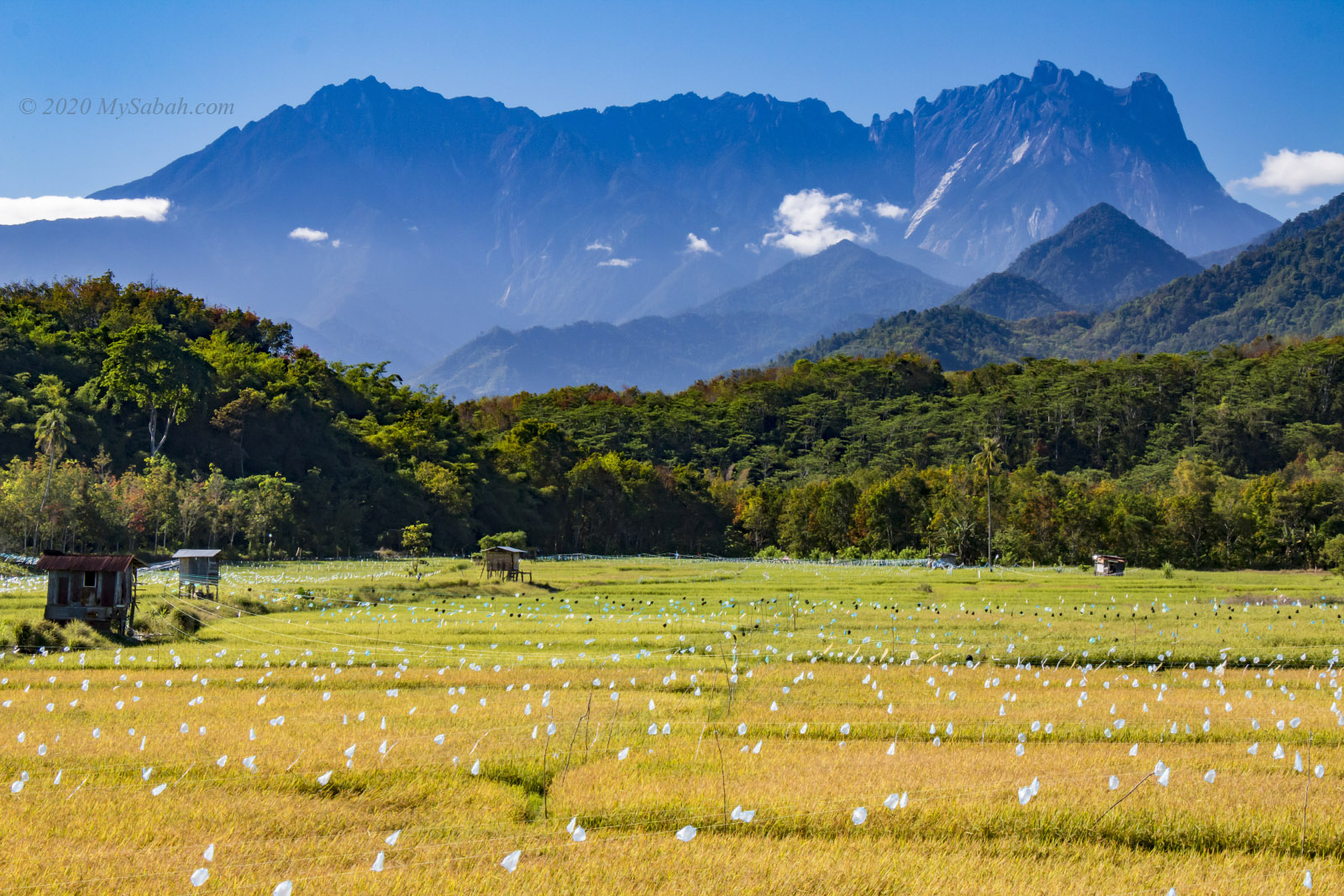
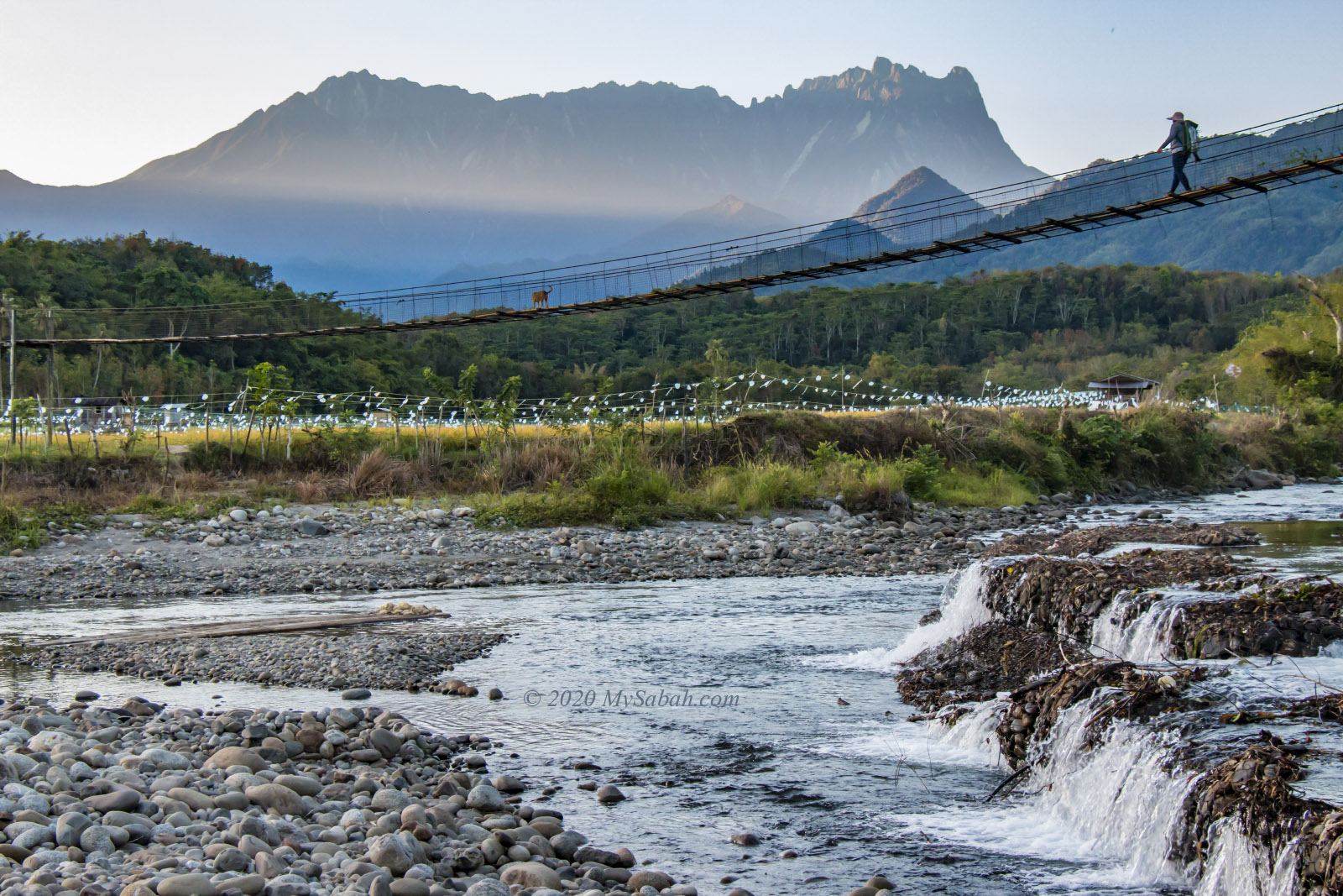
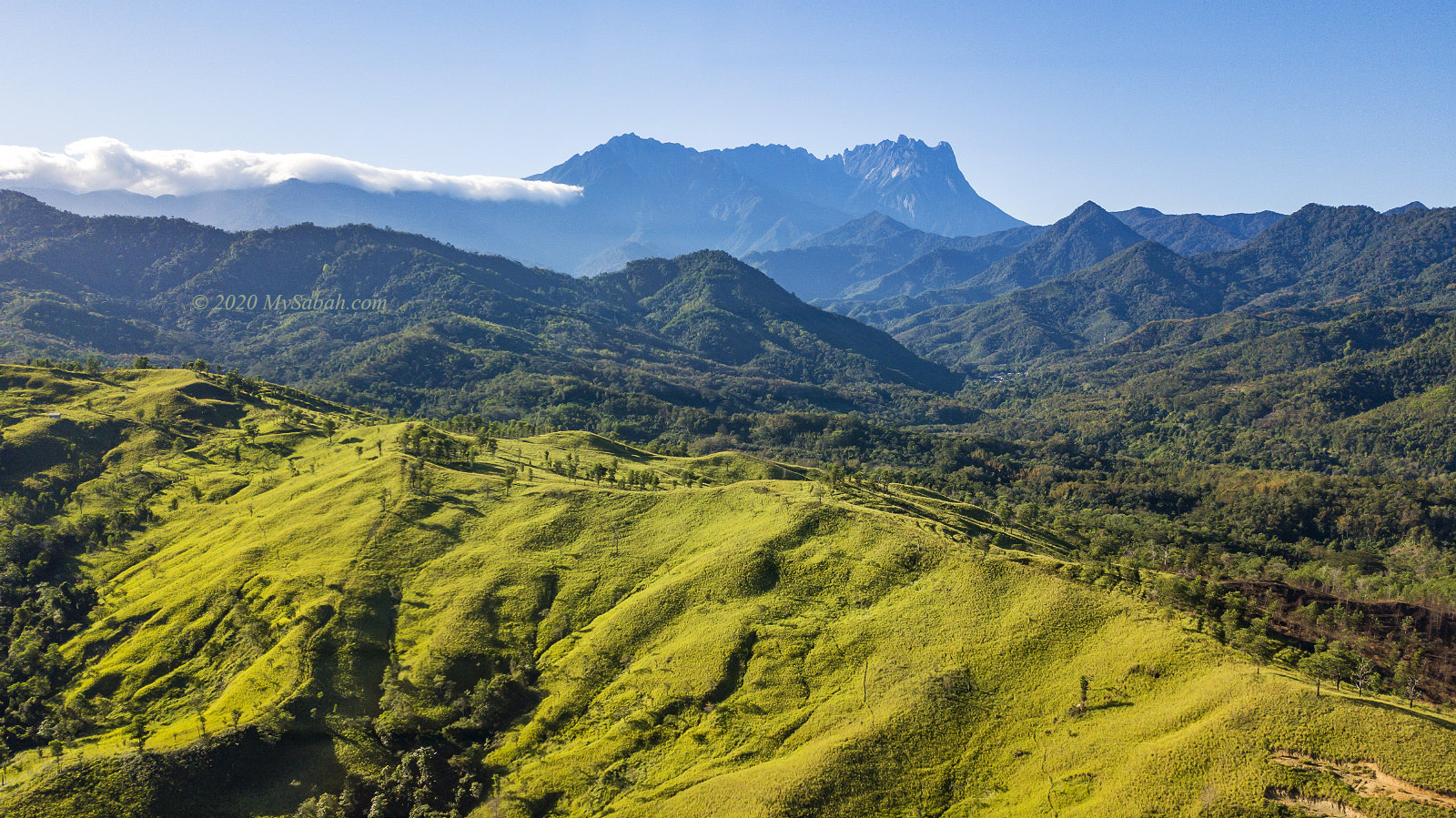
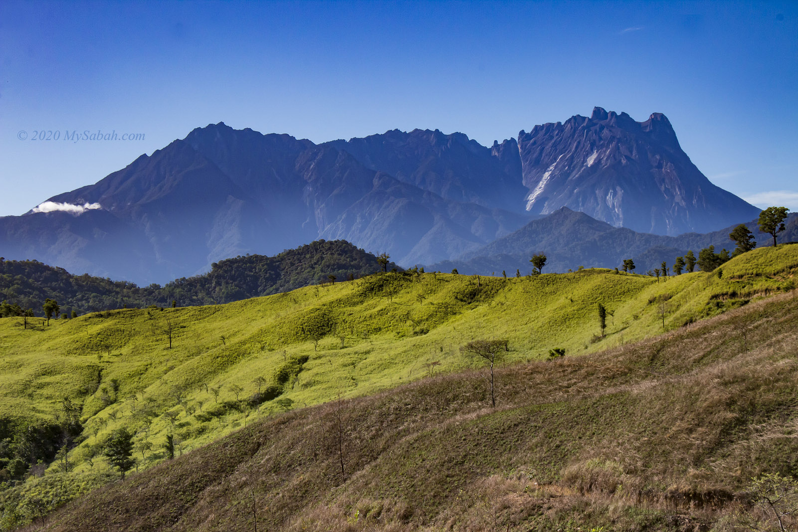
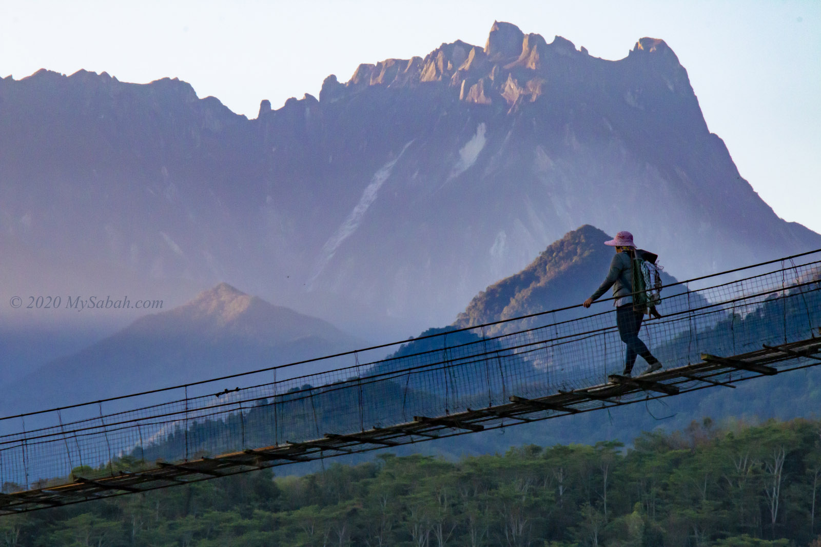
Living in a stressful world, we need a place to wash away our worries. Scientific studies show that being near water gives us a powerful mental health boost. How about a water therapy at Taralamas River Canyon (also known as Tolungan Daralamas River Canyon), a 15-million-year-old canyon that is hidden deep inside the rainforest of Sabah? Its unique geological feature is a wow factor to visitors. Most people decide to visit Taralamas just by looking at its photos.

Taralamas River Canyon lit by the afternoon light

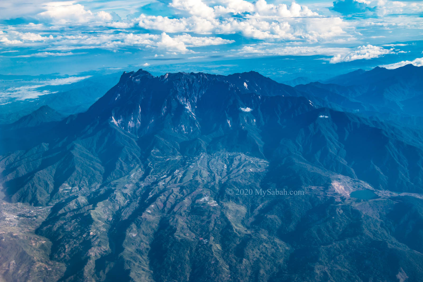
Taralamas River Canyon, which is formed earlier than Mount Kinabalu, is a work of water erosion. It’s a great canyon, though it’s not as big as Grand Canyon. Besides the interesting landscape, a trip to Taralamas allows you to enjoy various nature-based activities such as hiking, picnic and swimming that cover forest, river, waterfall and hill.

Standard Itinerary

Most visitors prefer a day trip at Taralamas River Canyon. The following is the standard itinerary (shortest trail). Please note you need to book the tour in advance. Walk-in tourists may not be accepted.

Walking on the village road and jungle trail in Tiang Lama Village
  • 5am: Depart from Kota Kinabalu City (KK)
  • 8am: Arrive Tiang Lama Village (in Ranau) and start hiking (3 KM)
  • 10am: Reach Taralamas River Canyon (Lunch and river canyon walk there)
  • 12pm: Going back to the Starting Point
  • 2pm: Return to KK
  • 6pm: Arrive KK

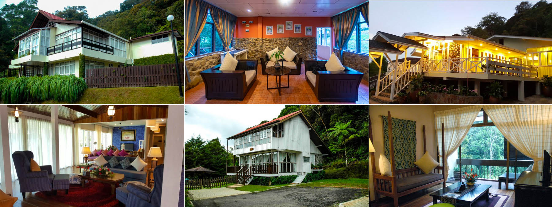
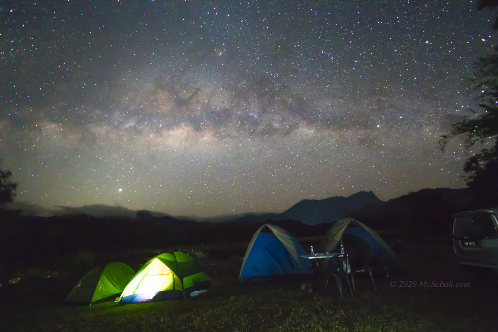
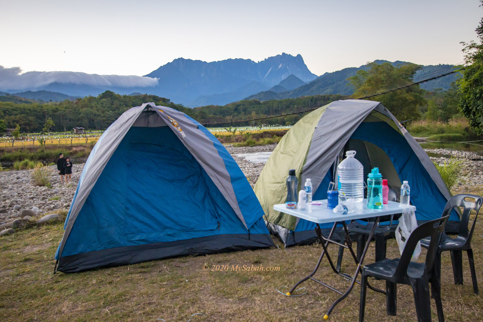
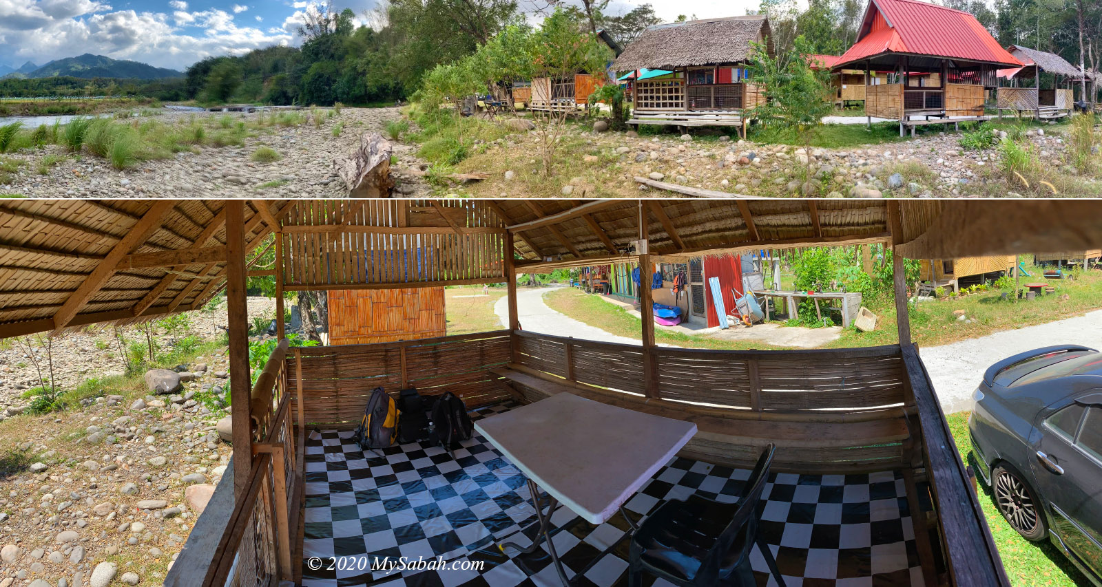
The downside of day trip is more than 7 hours of driving back and forth. You can consider spending a night in homestay of Tiang Lama (walking distance to the starting point) for a more relaxing experience.

Entering Taralamas River Canyon

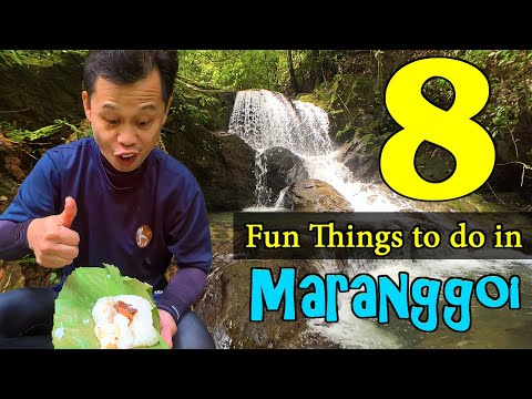
Below is a useful walk-through with photos, or you can watch the video below:

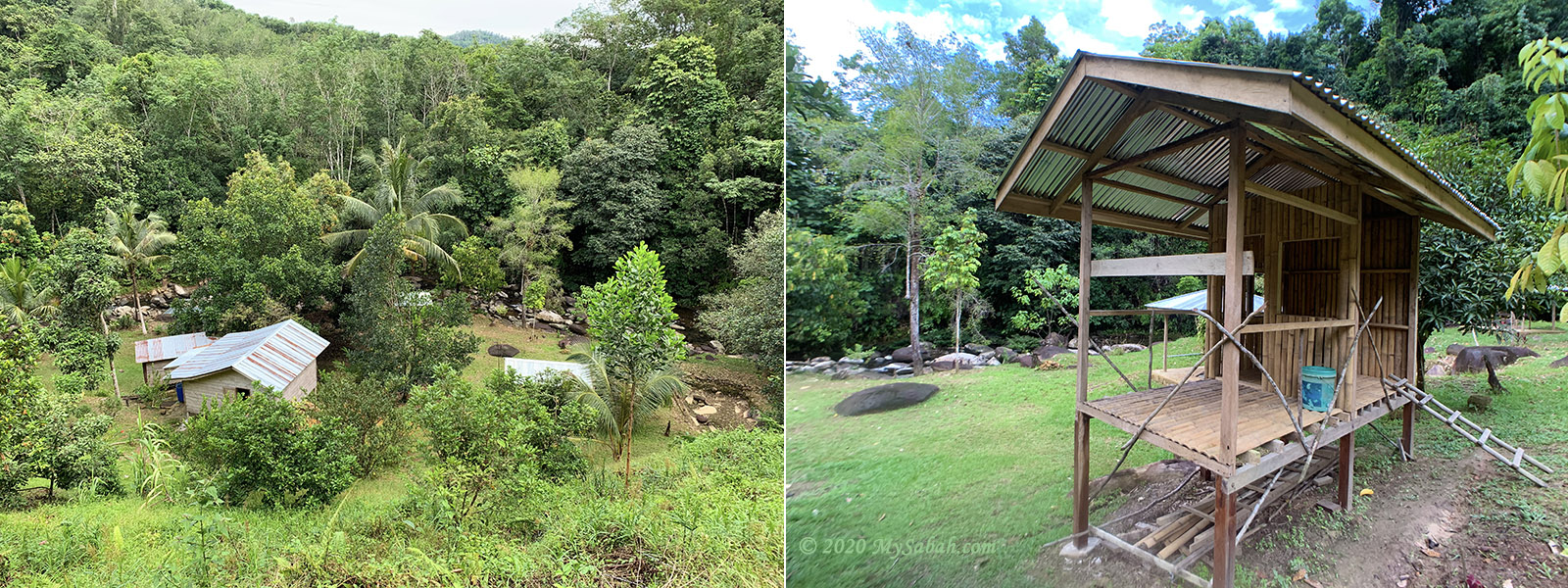
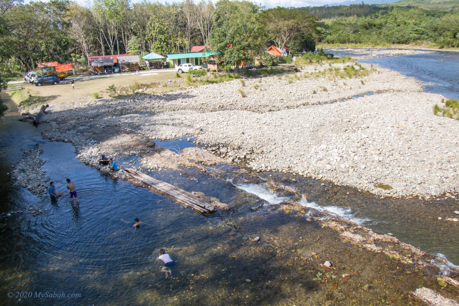
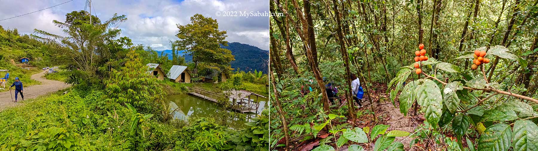
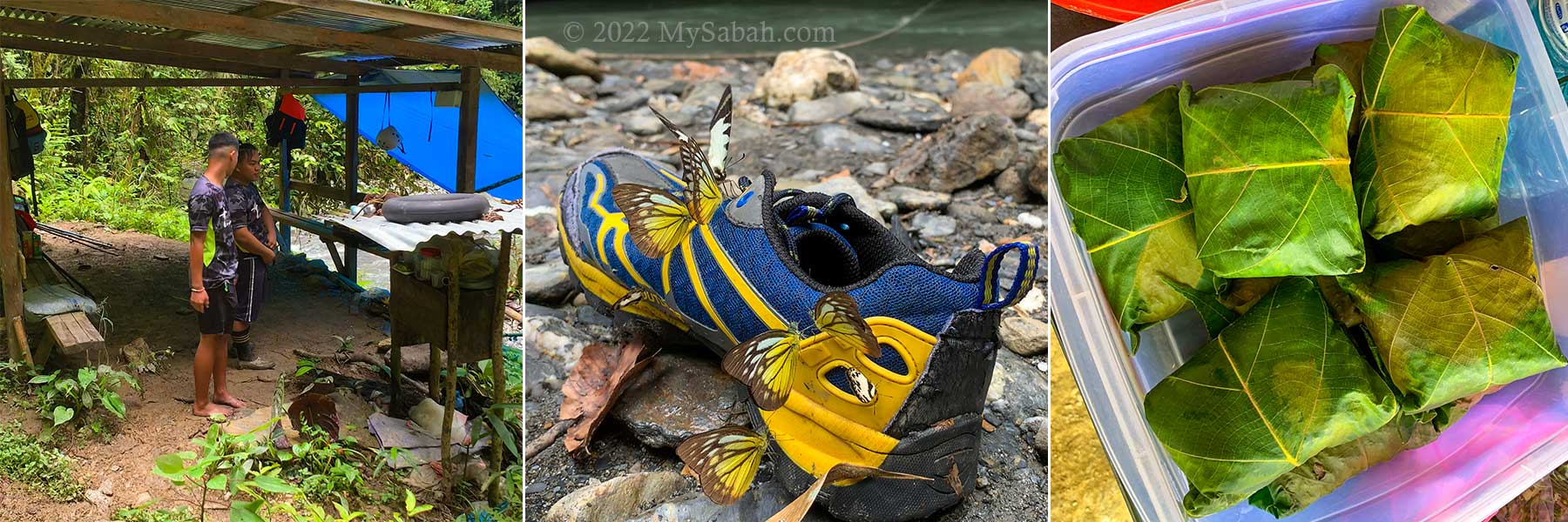
Gather at Starting Point (at Tiang Lama Village)

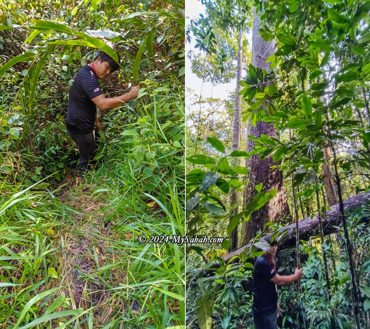
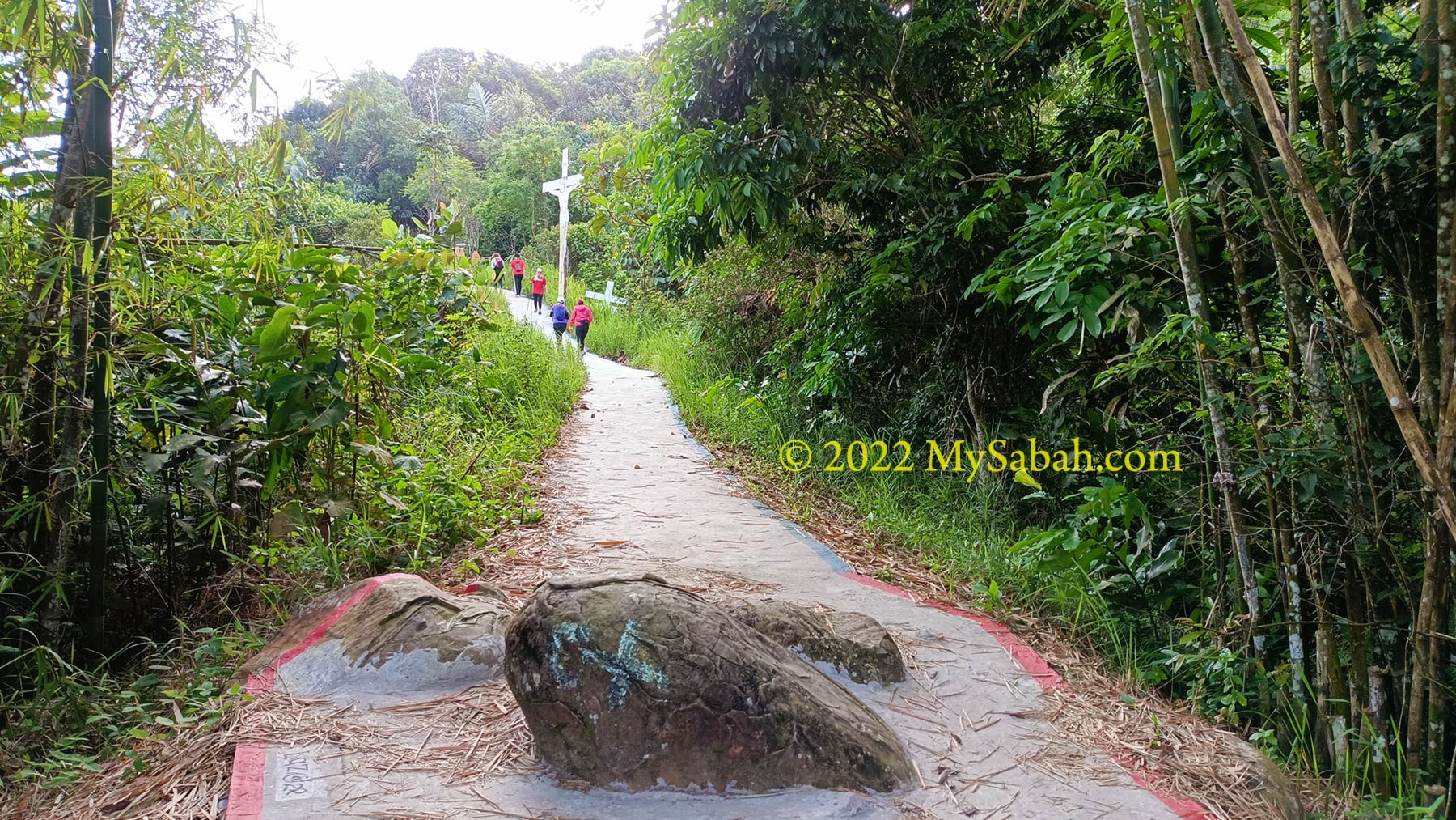
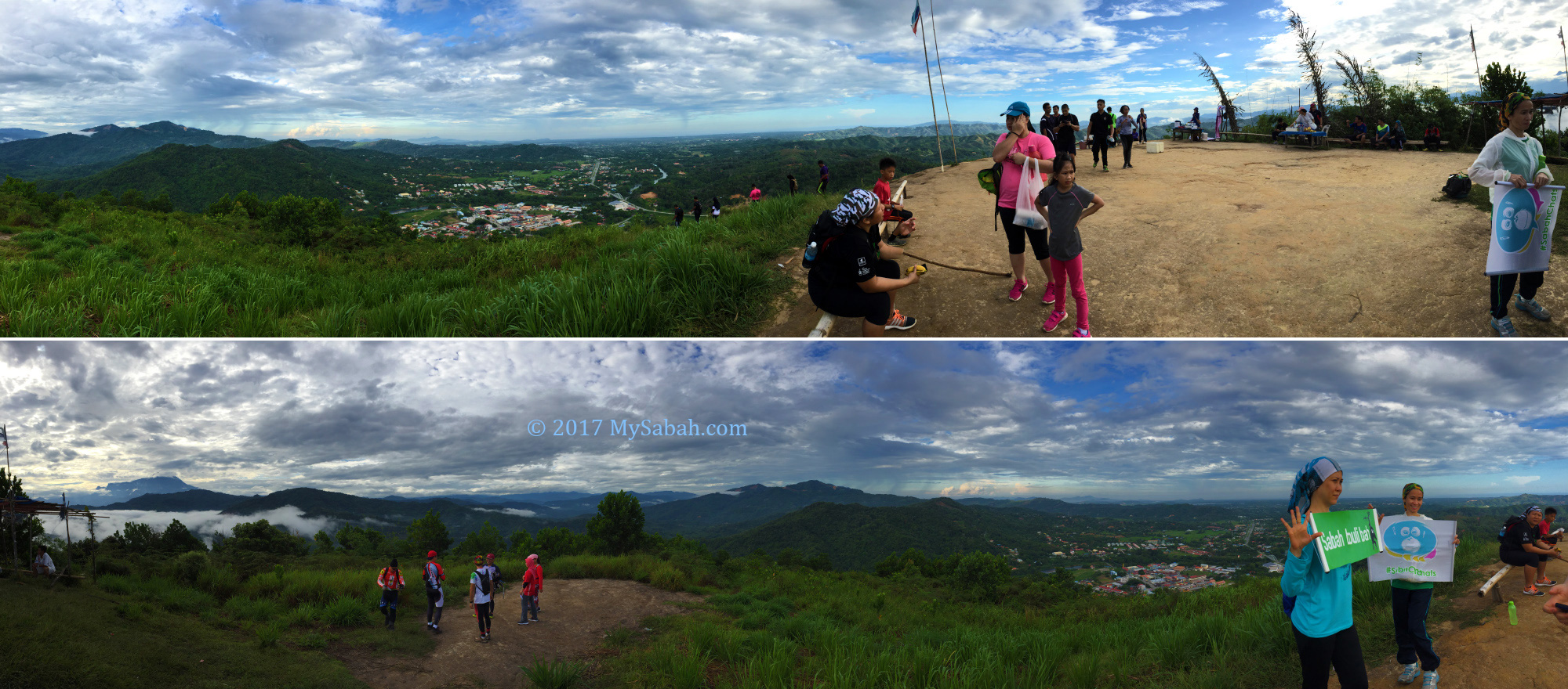
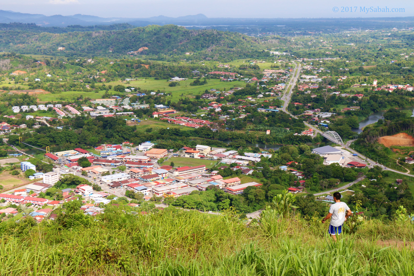
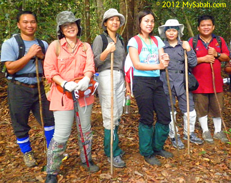
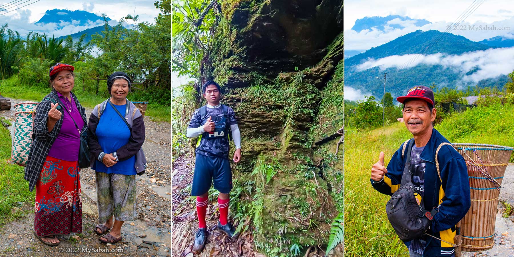
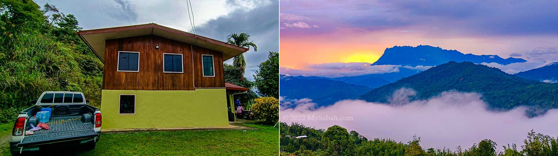
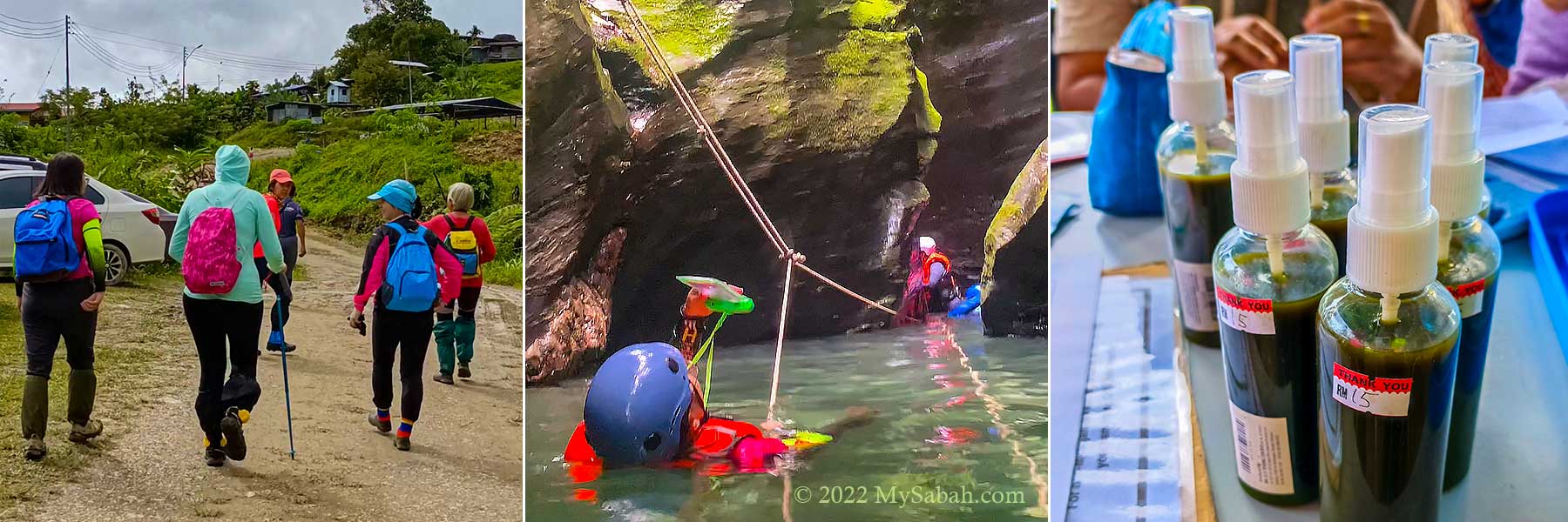
The starting point of the hike is at the Community Hall near the end of Tiang Lama Village (or Kampung Tiang Lama) in Ranau district. Group of hikers congregate there between 7am and 9am. It’s better to start hiking in early morning, as it’s more likely to rain in the afternoon.

Starting point of the hike to Taralamas River Canyon

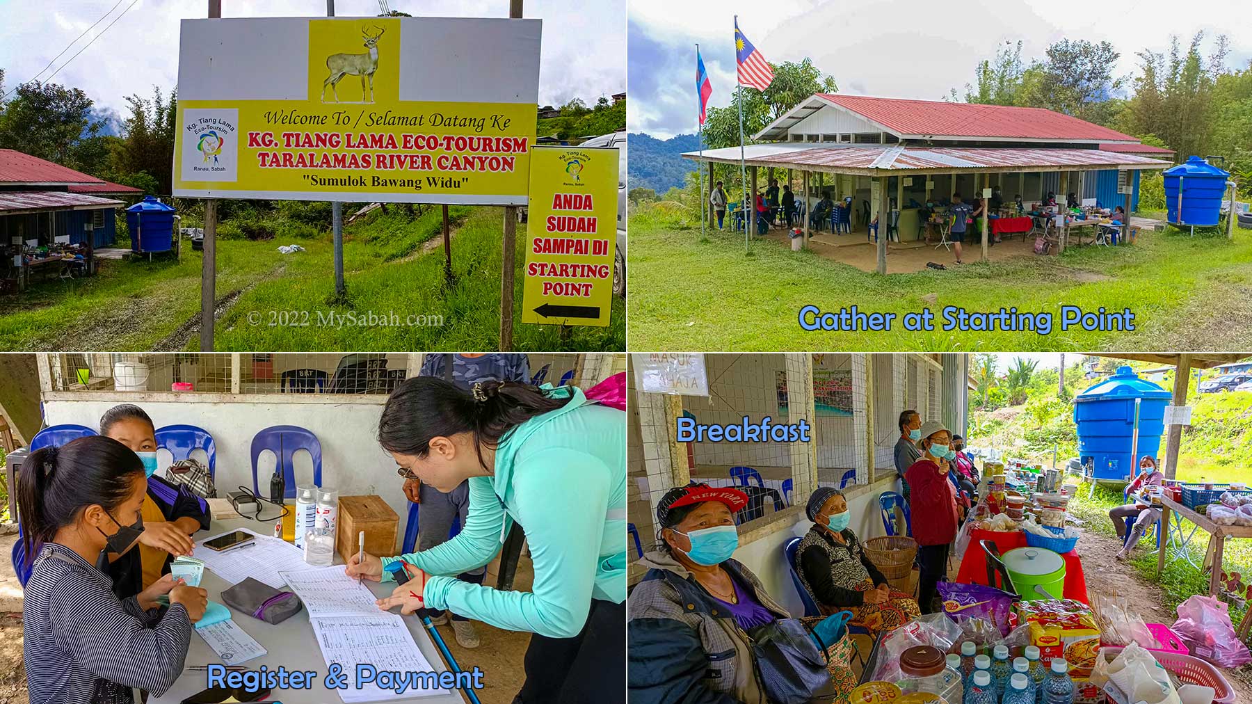
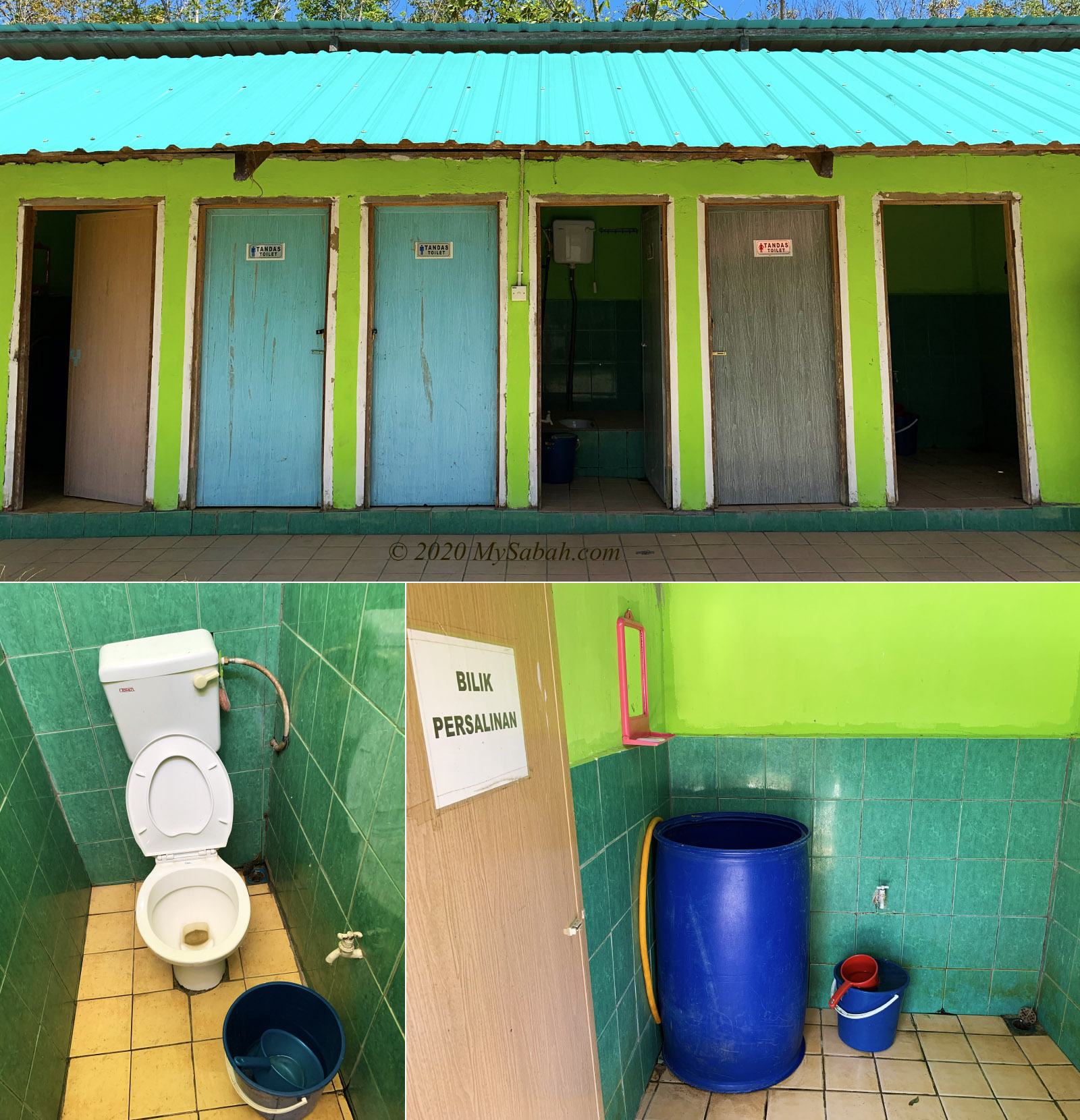
After you register and pay the operator, a village guide will be assigned to your group. Most guides are youngsters from the village. There is a small toilet near the hall, in case you want to relieve yourself before the 2-hour hike. A short briefing on Do & Don’t will be given before the hike begins.

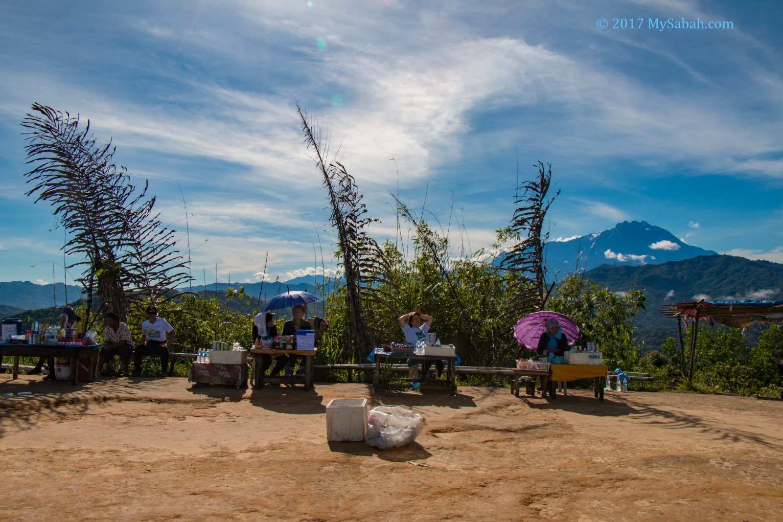
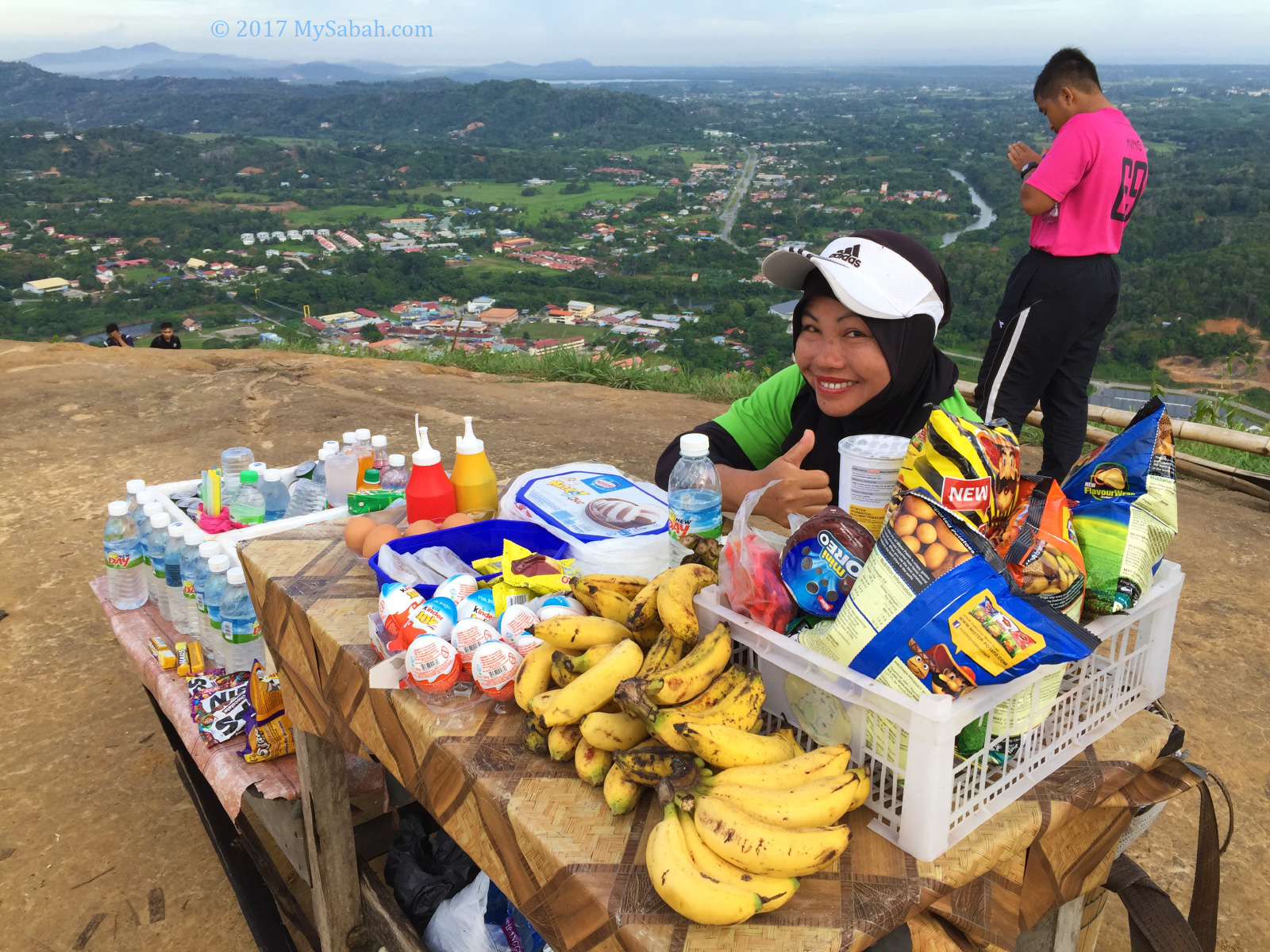
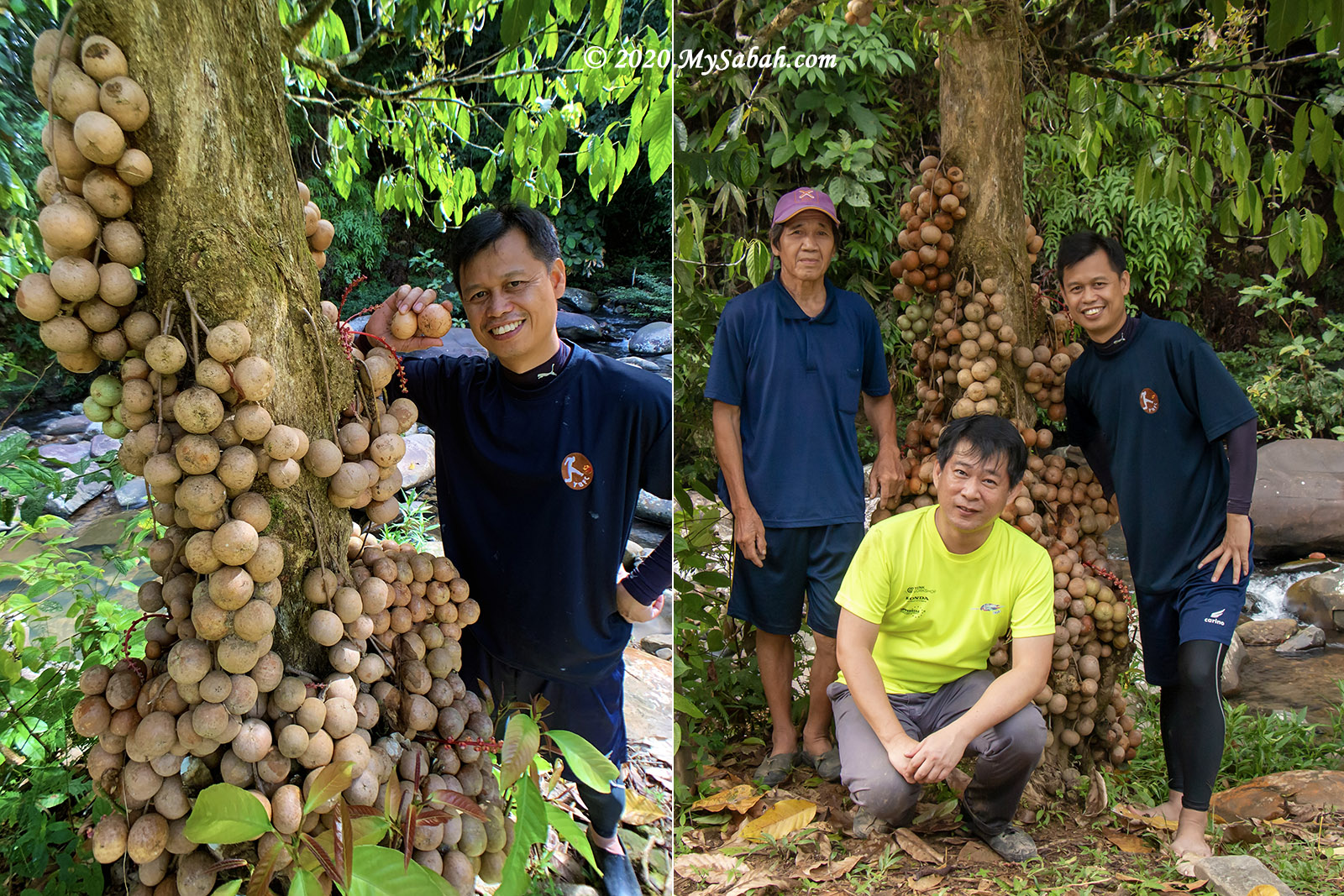
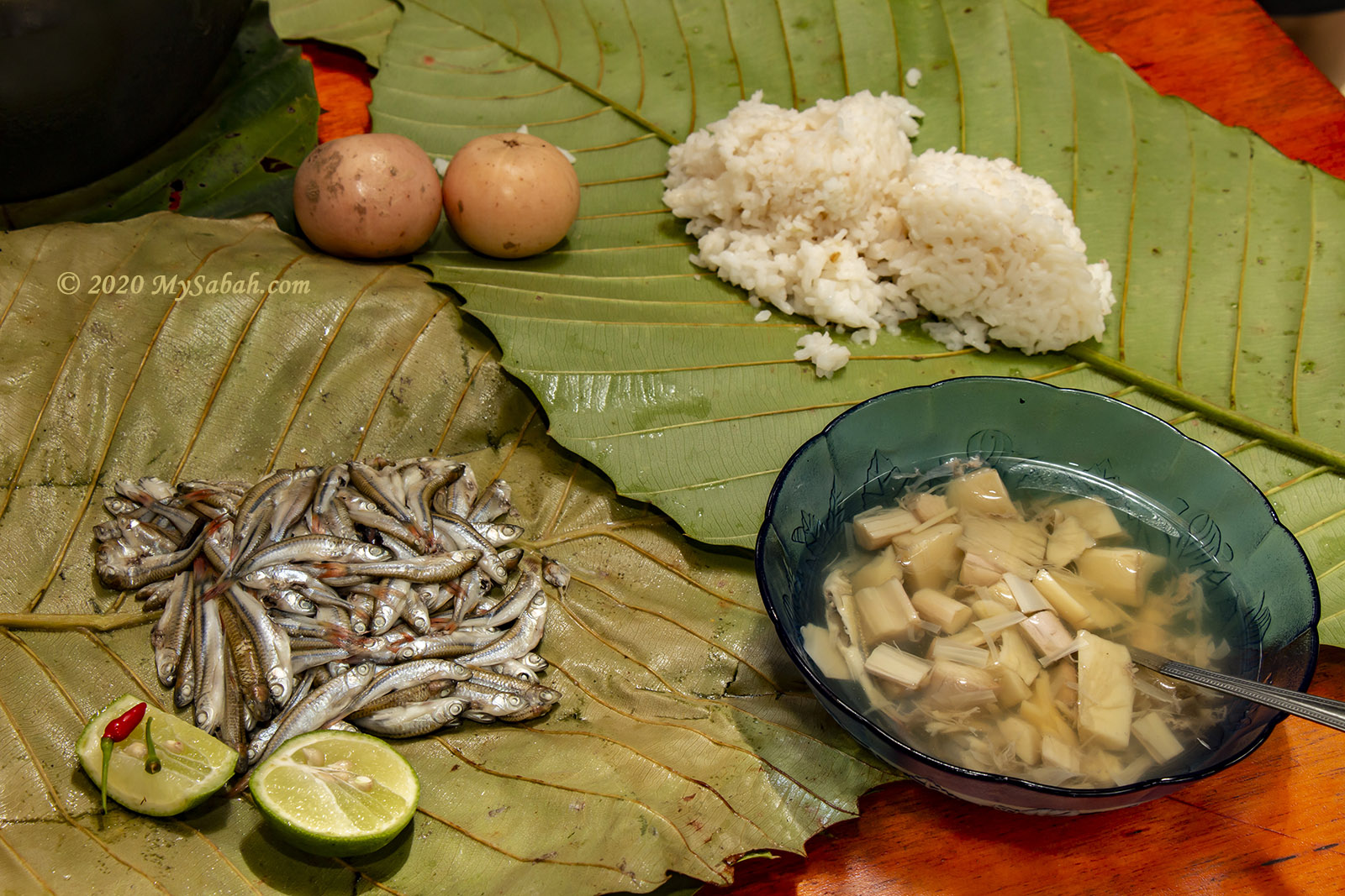
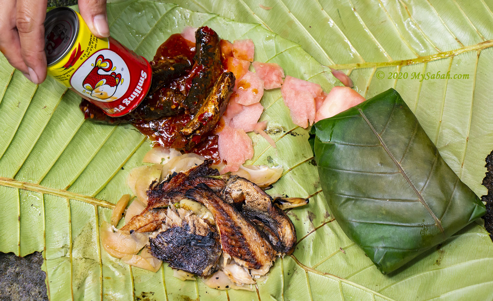
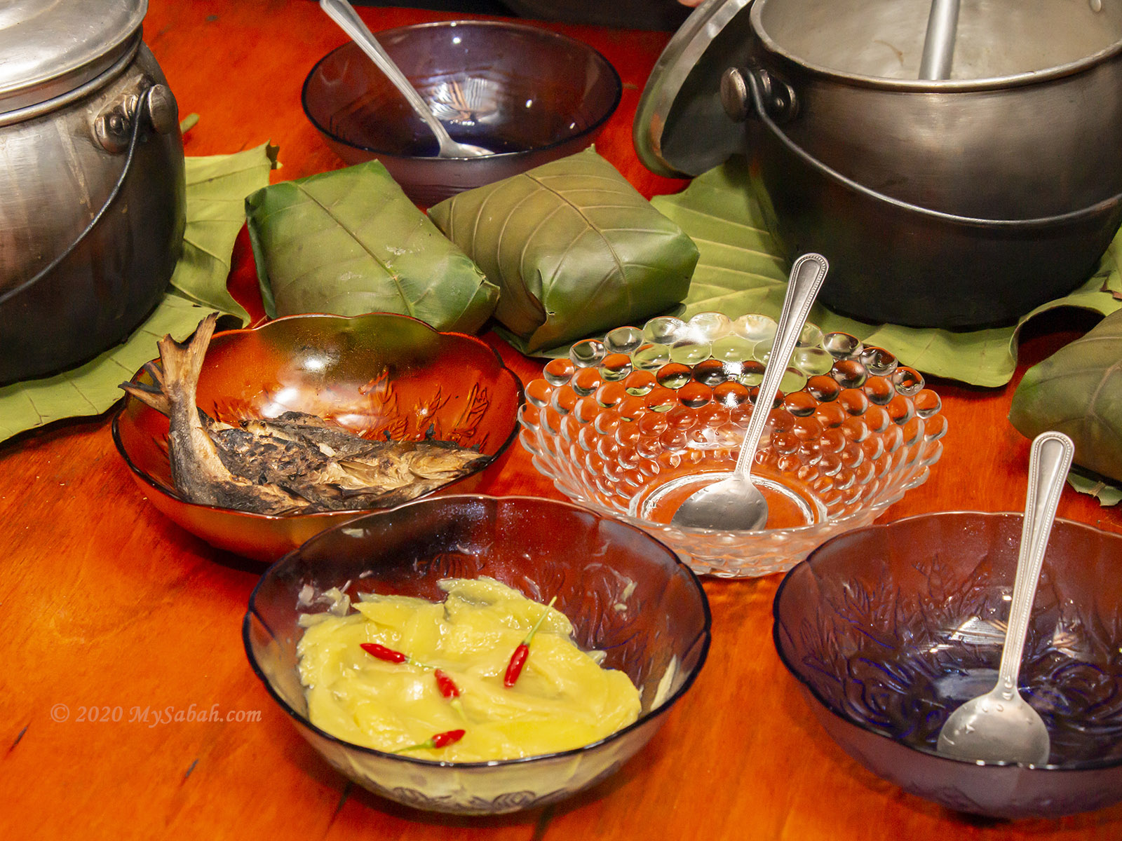
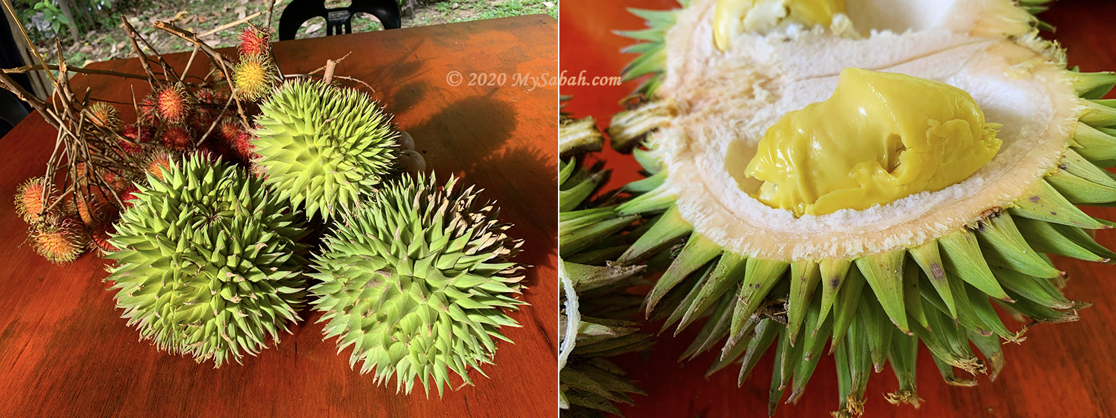
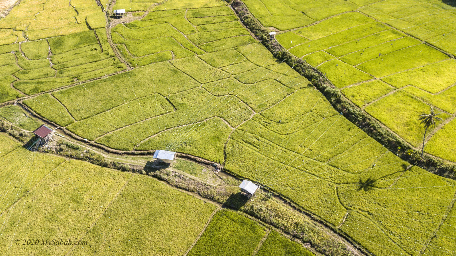
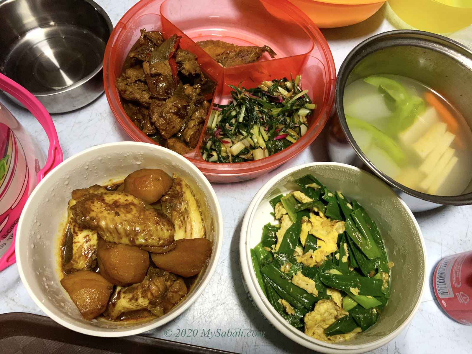
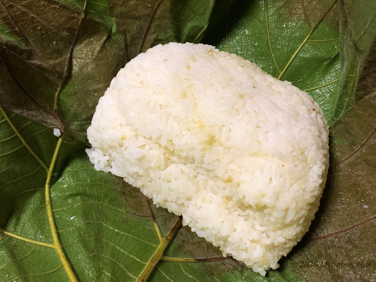
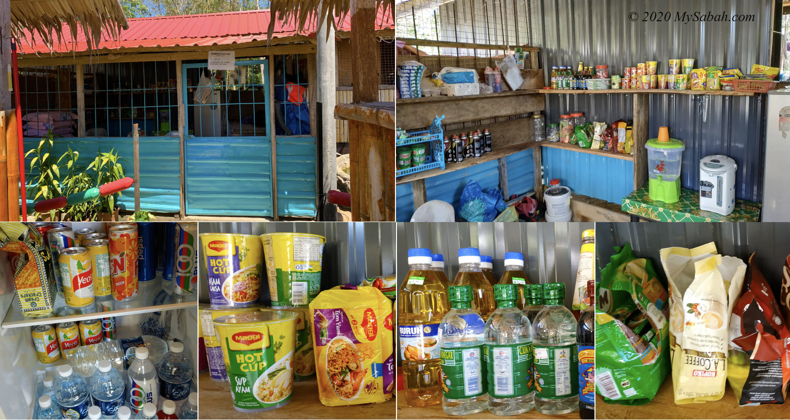
At the hall are some stalls that sell food, (e.g. fried noodle, linopot packed rice, instant noodle, snacks, biscuit, pinjaram, hinompuka, traditional kuih), drink, fruits and vegetables. You can have your breakfast there and buy packed lunch from the villagers, as there is no restaurant at the canyon.

Start hiking to Taralamas River Canyon in the morning

The stalls are also around in the afternoon, so you can buy some fresh produce at a very reasonable or cheap price, before you head home. Depending on the season, you would find different fruits and vegetables such as durian, tuhau and rambutan.

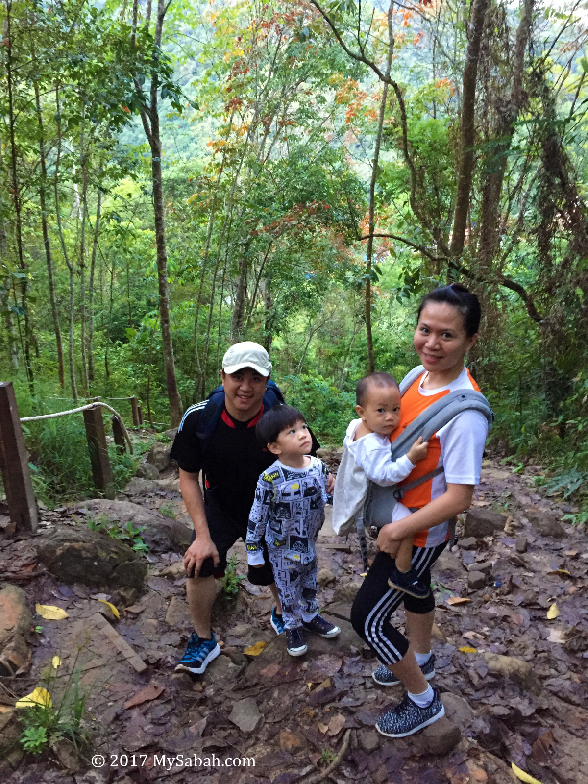
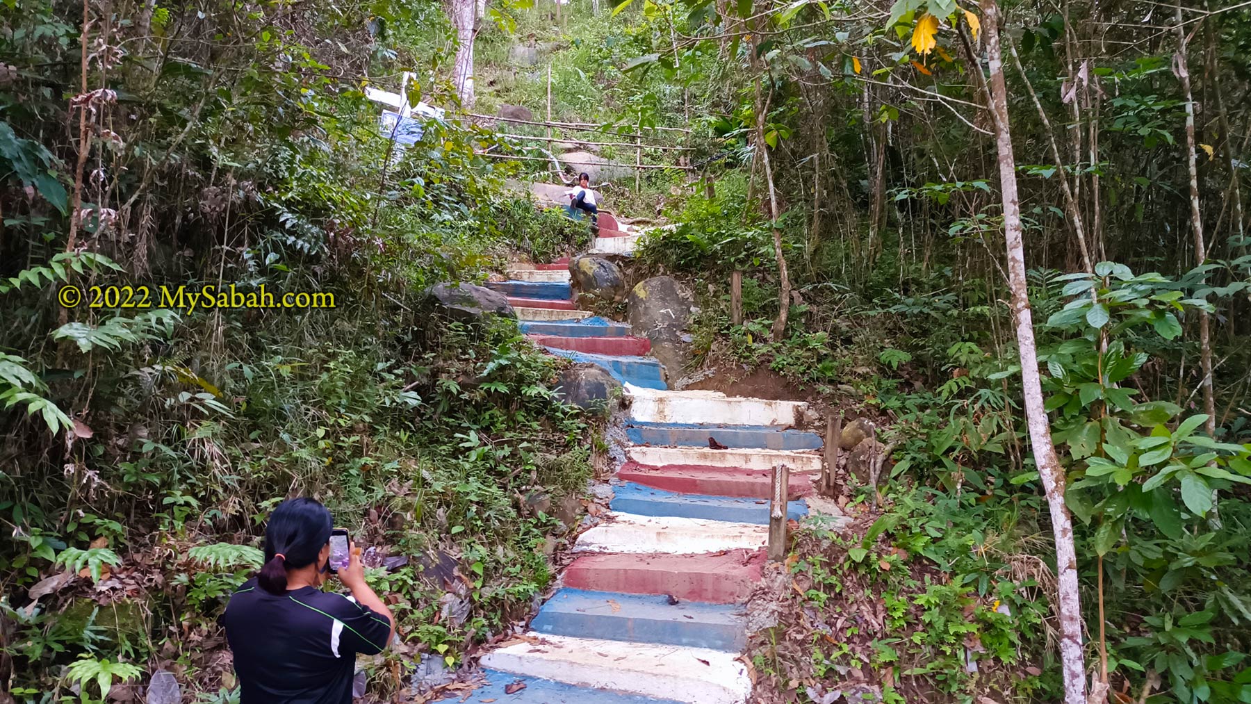
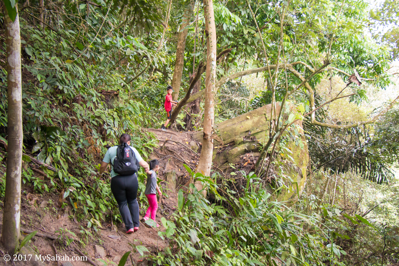
Hiking to Taralamas River Canyon

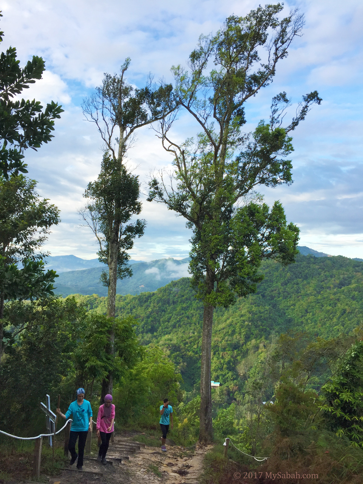
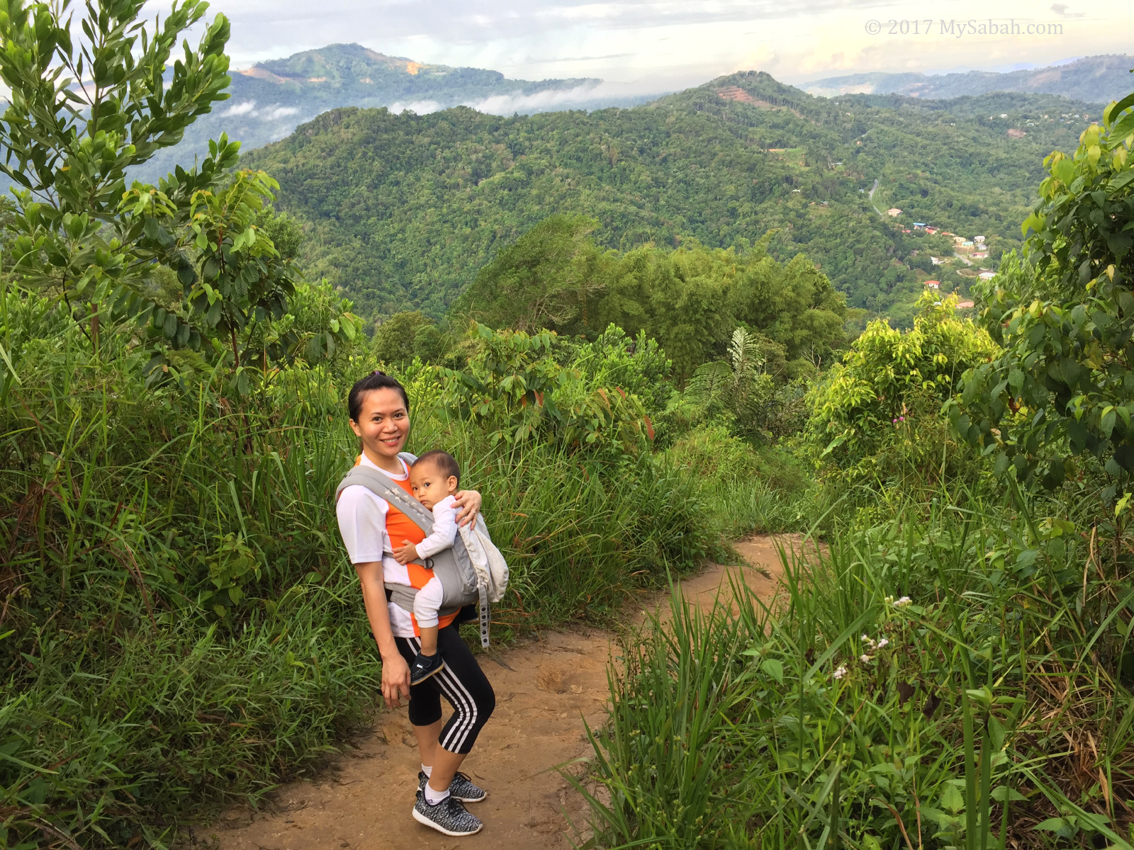
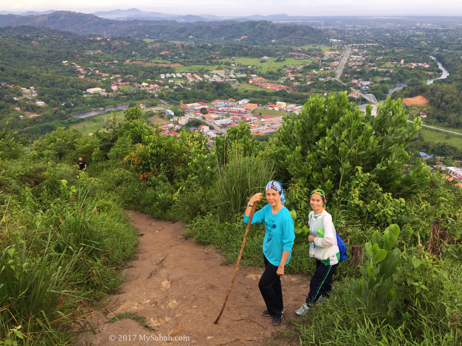
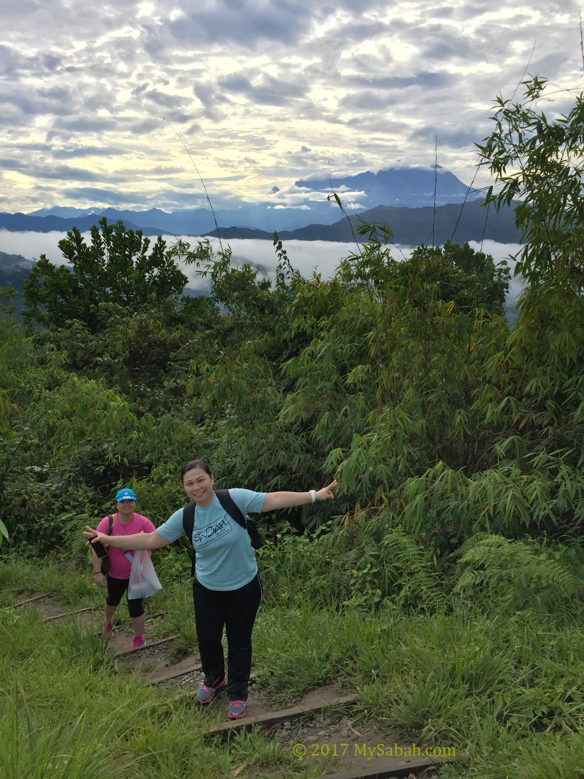
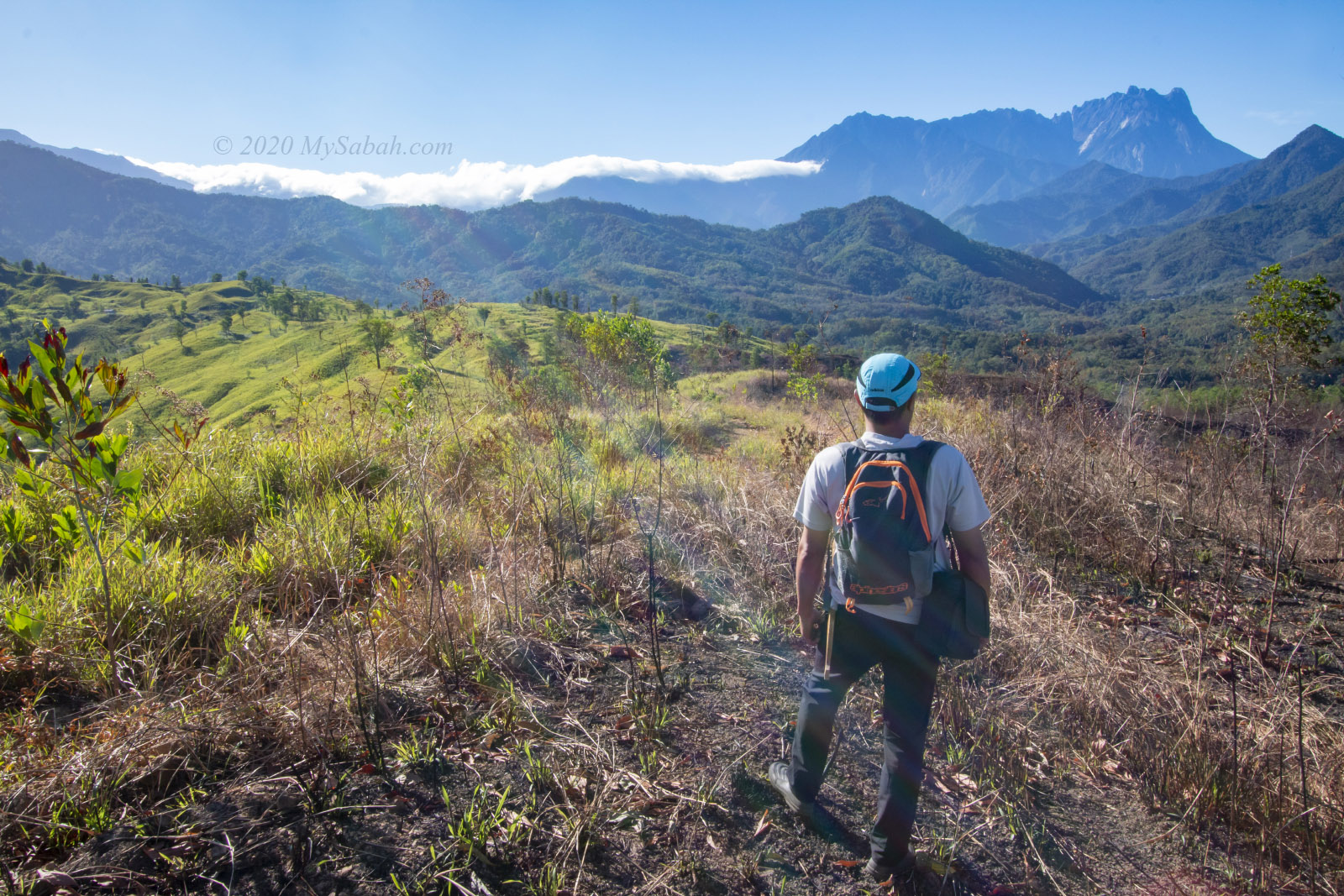
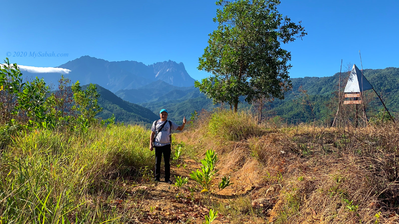
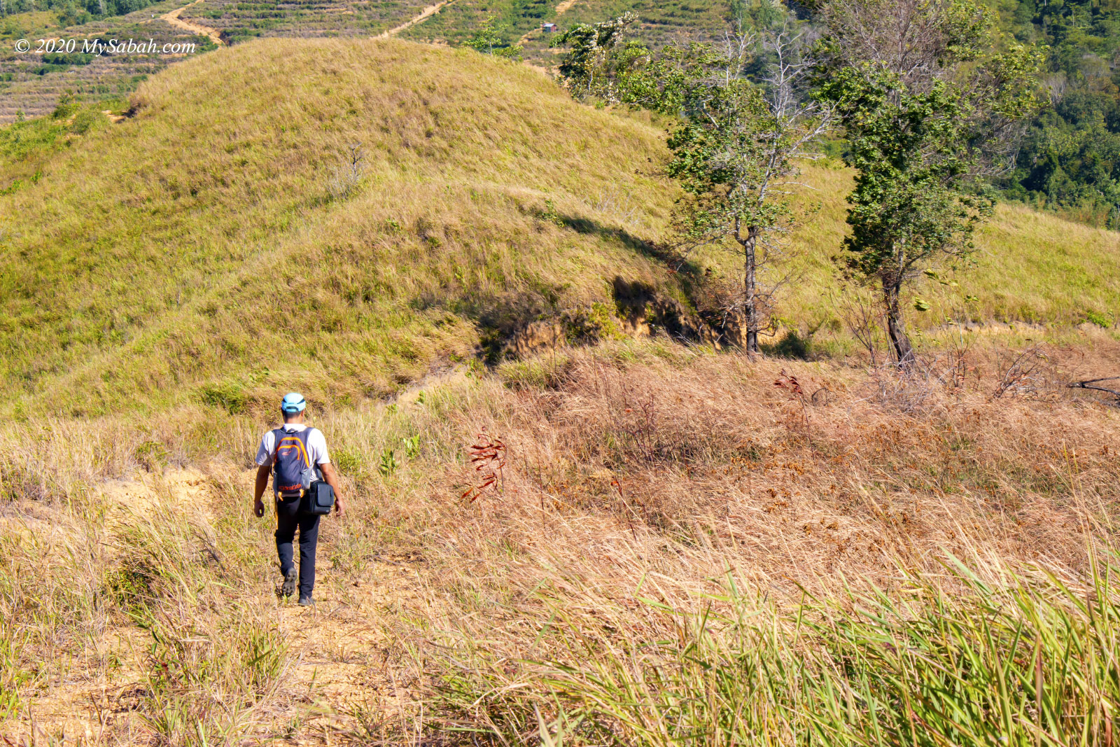
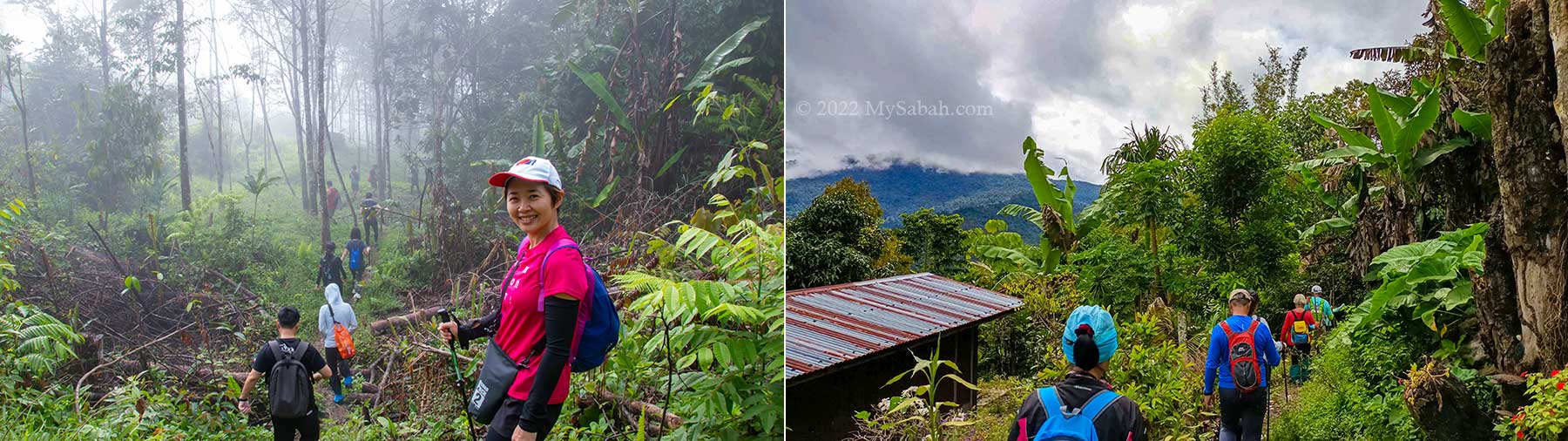
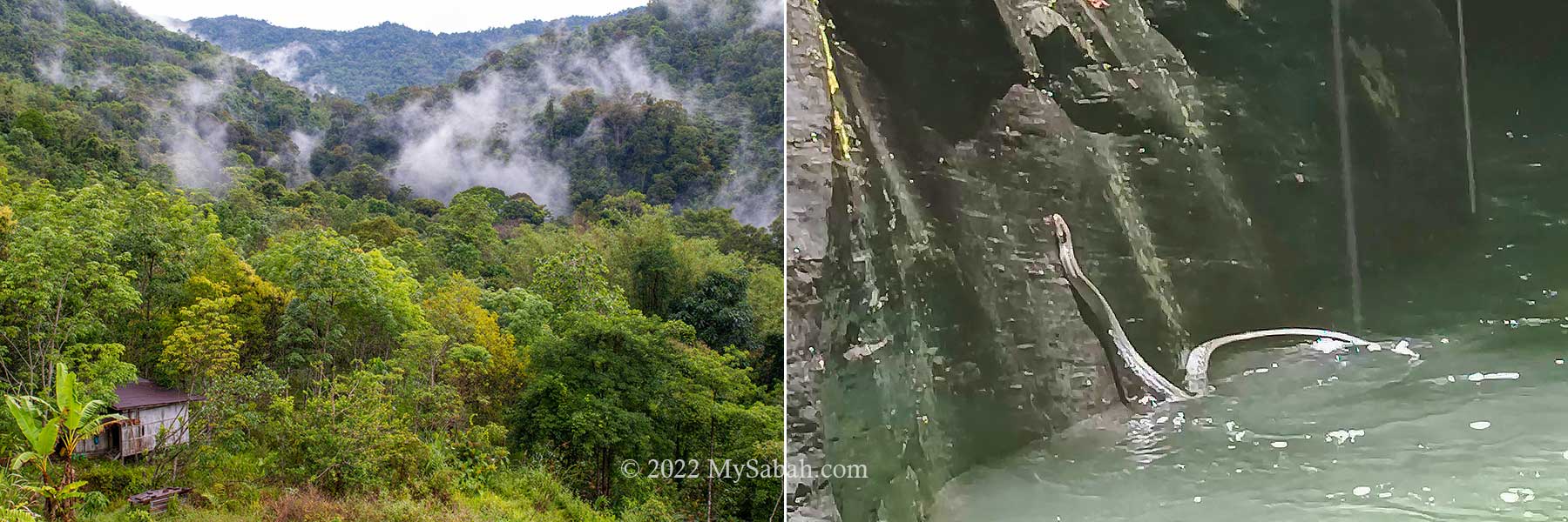
Once everyone is prepared, we start hiking from the village. The morning at Tiang Lama Village is cooling and refreshing. Within minutes we come to the plantation in the mist.

Left: muddy trail, Middle: bamboo bridge, Right: trail near the local plantation

The temperature is about 25°C. You might need a jacket to keep warm in the beginning. Very soon you would feel warm after some walk among the dense shrubs and trees.

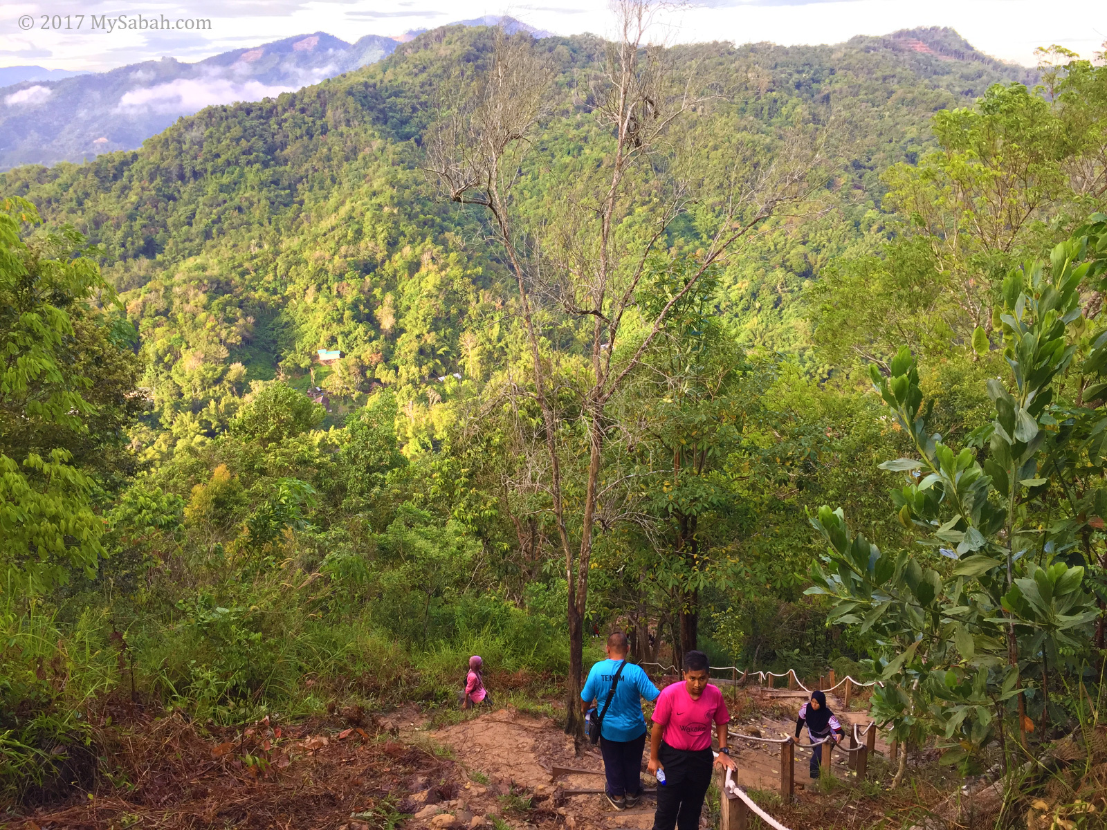
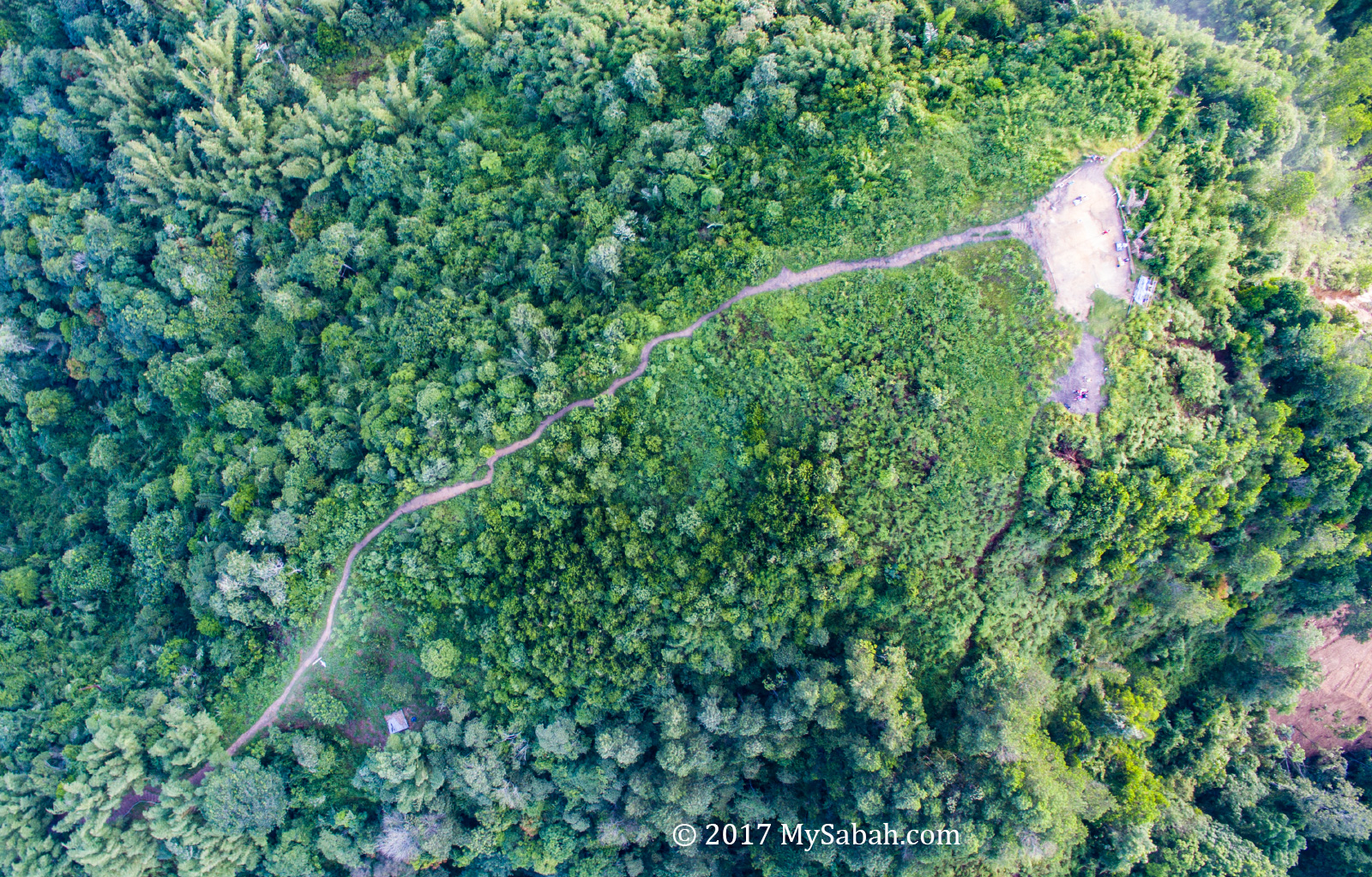
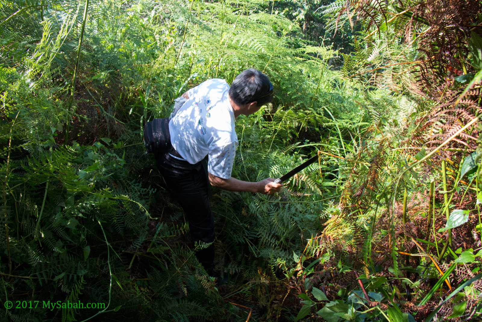
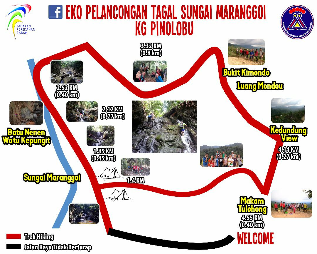
We choose the standard loop trail, which is 6 KM back and forth and the shortest hiking distance. If you want to visit the Sadoron Waterfall, it’ll be a total of 8 KM walk.

One way distance to the river canyon is about 3 Kilometres. The signage says follow your pace but don’t be slow.

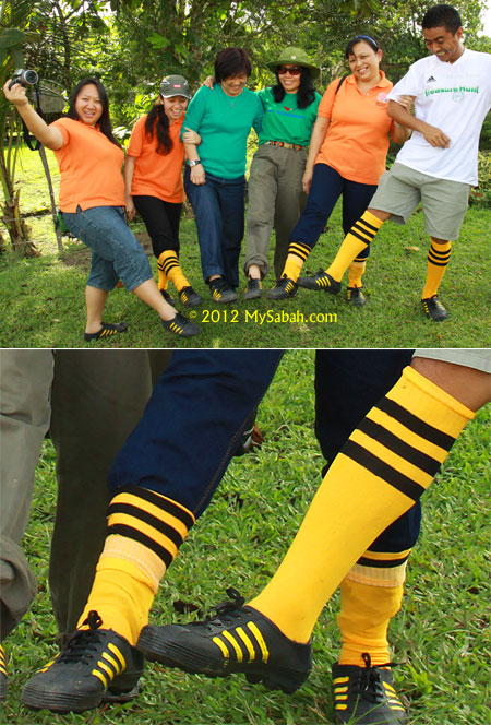
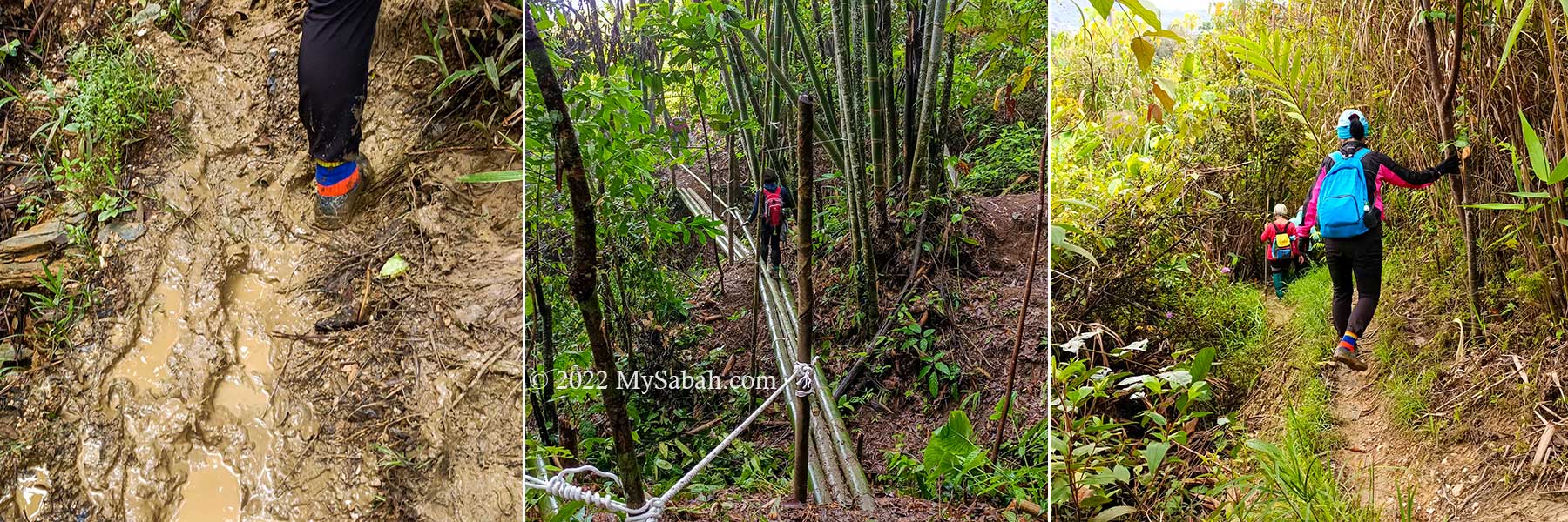
Everyone start out dry and high in spirit. Just don’t expect to come out dry since you would face muddy trail, river canyon walk or rain later. Waterproof shoes such as Adidas Kampung would help a lot. Very likely you will need an extra pair of dry socks.

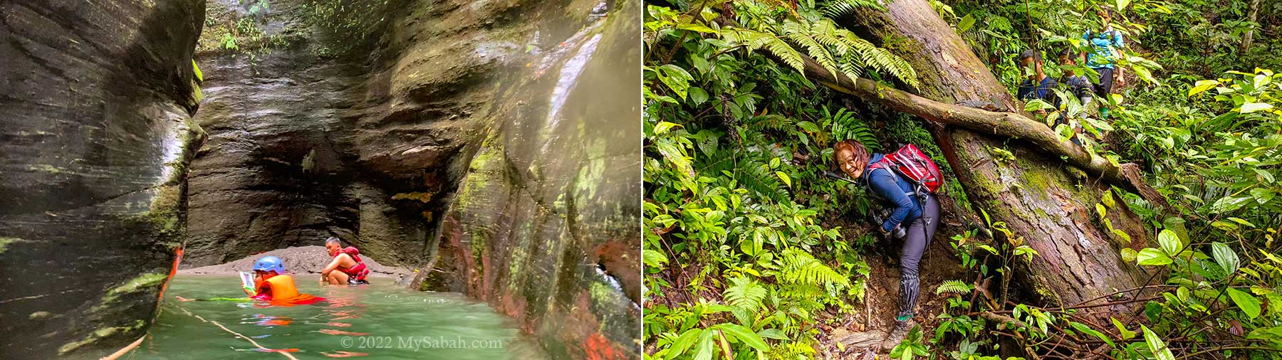
The trail is well-trodden. I’ve been to Taralamas twice and the muddy trail in the first 30 minutes is quite a drag, because the slippery trail on uneven ground can slow you down.

Interesting flora along the trail. Left: an ornamental plant (Alocasia cuprea), Middle: tall bamboo, Right: Begonia

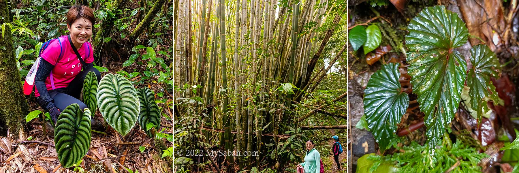
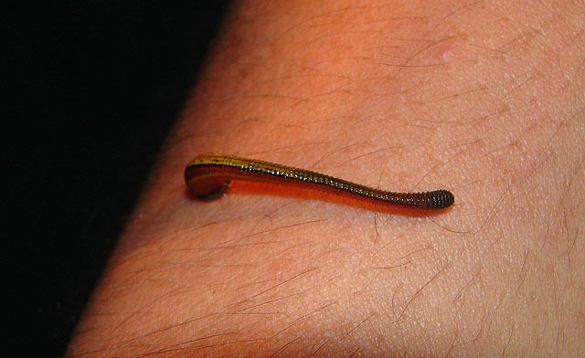
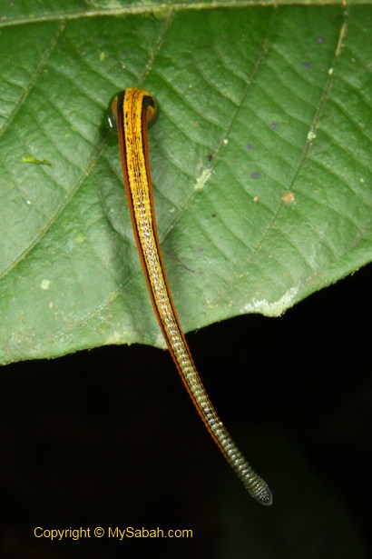
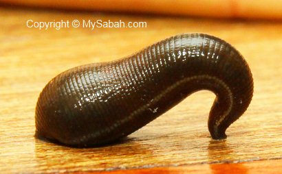
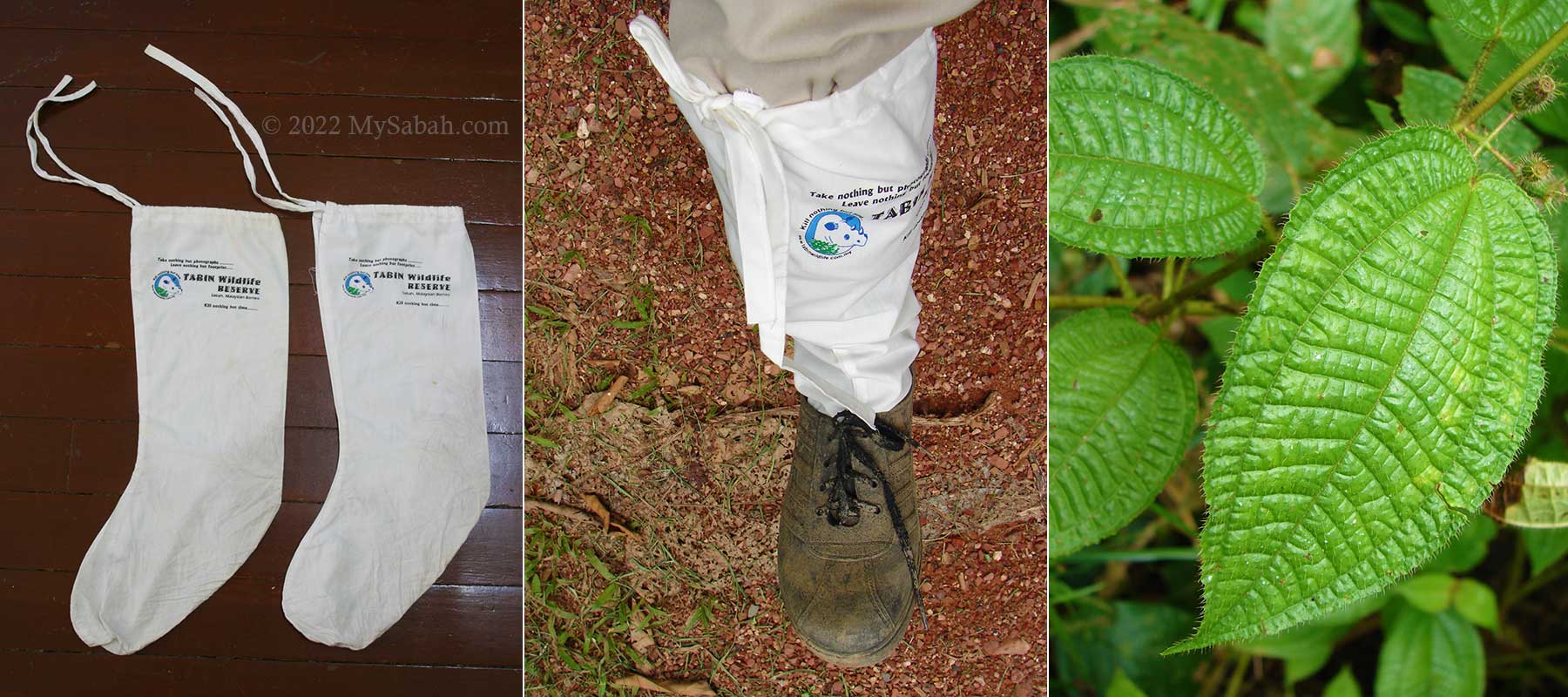
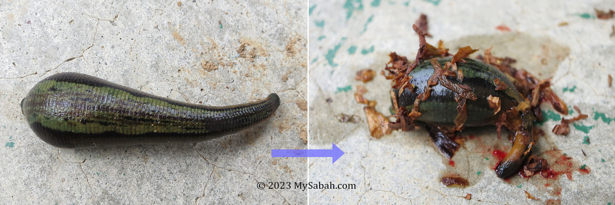
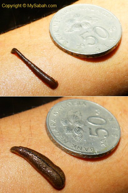
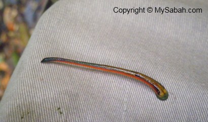
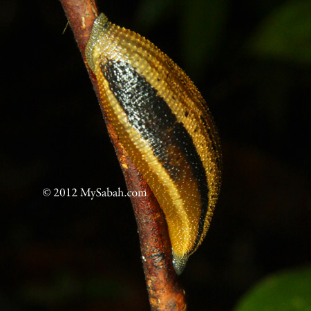
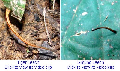
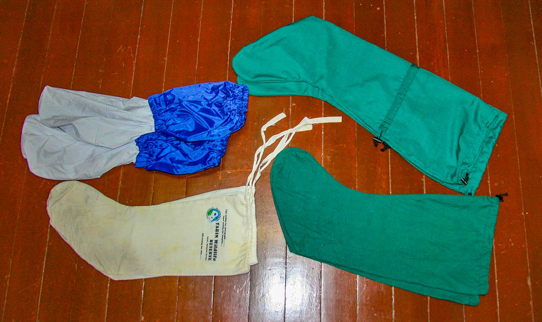
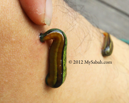
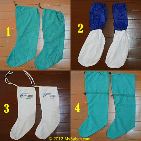
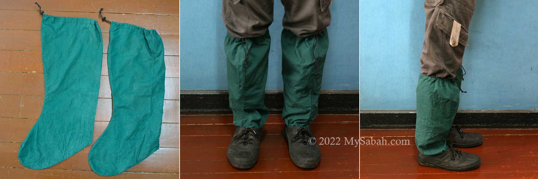
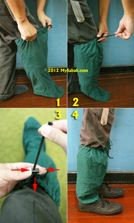
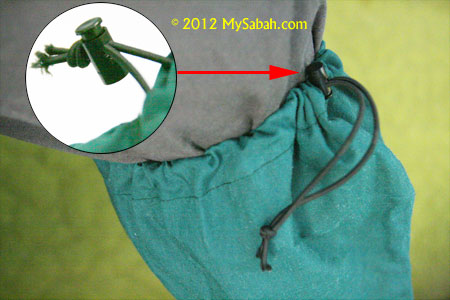
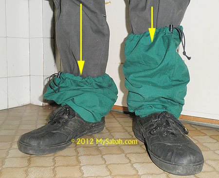
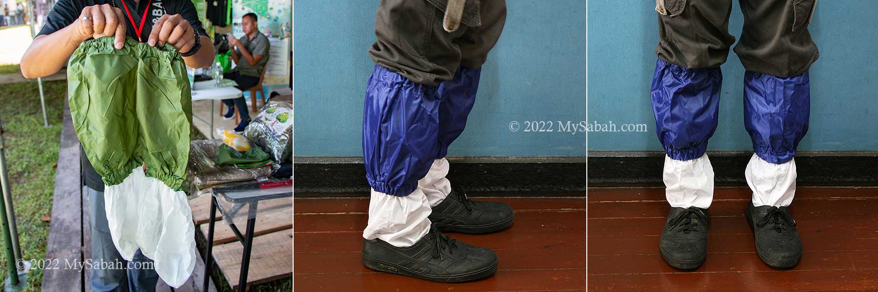
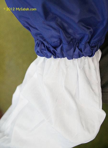
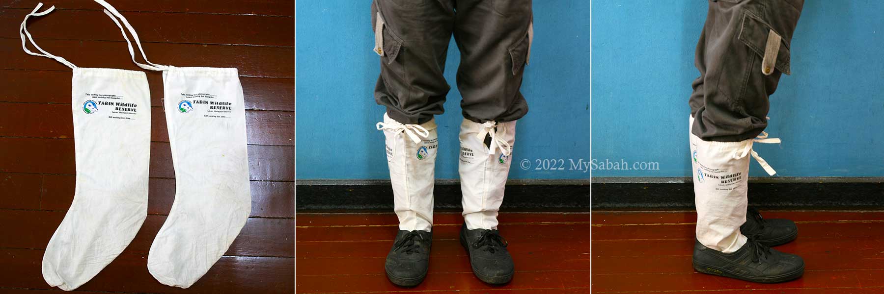
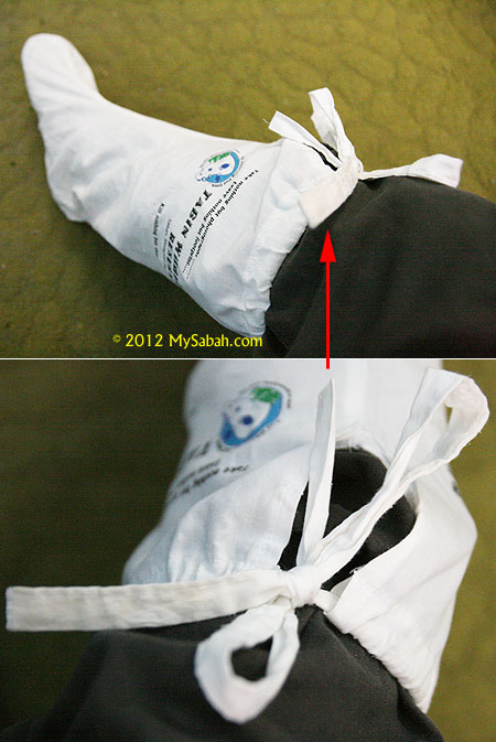
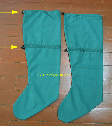
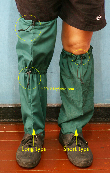
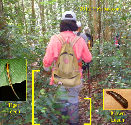
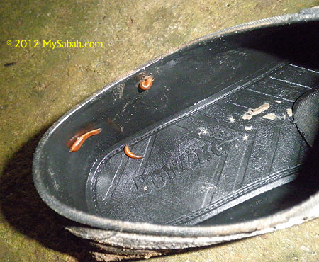
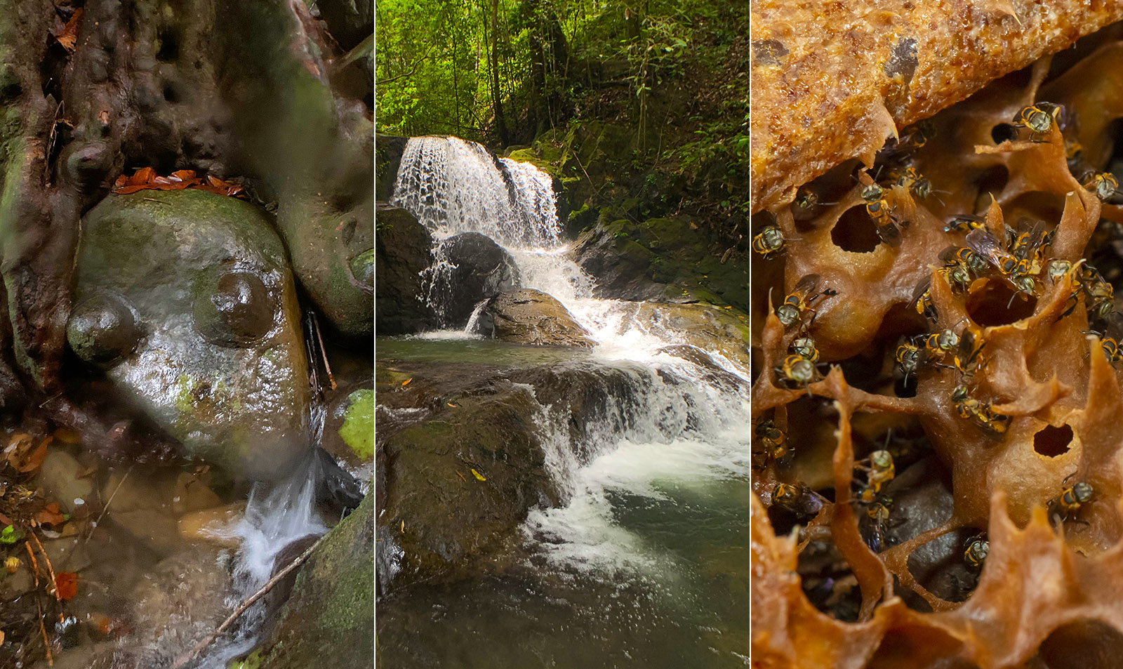
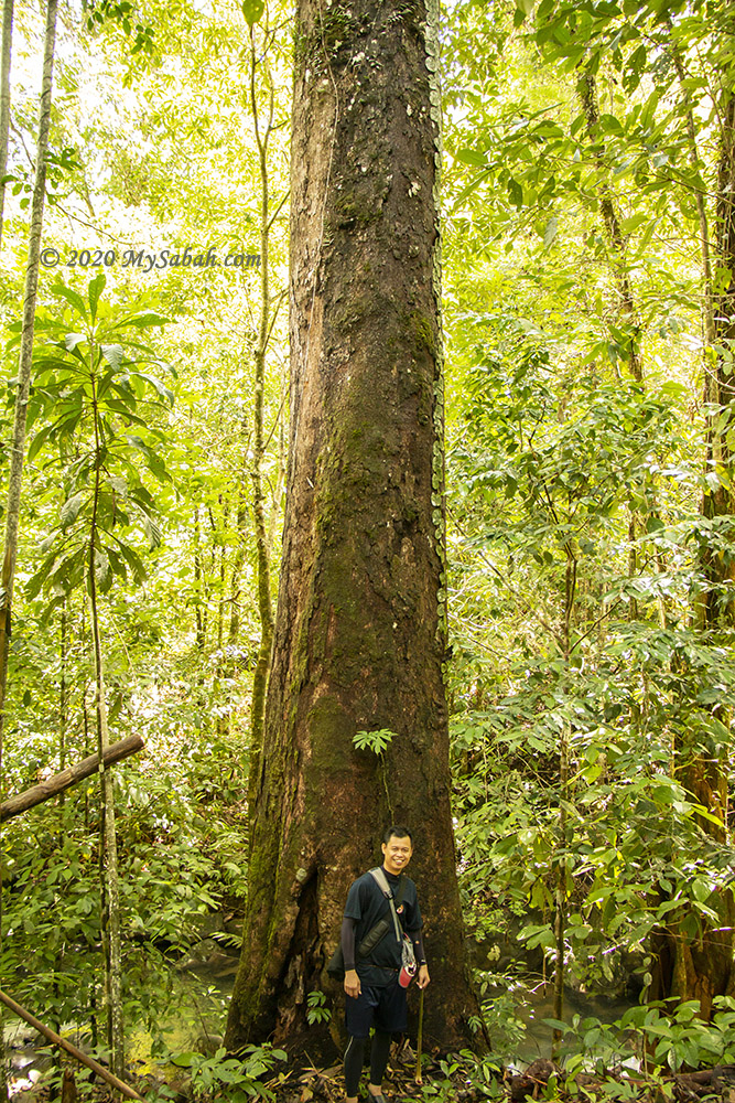
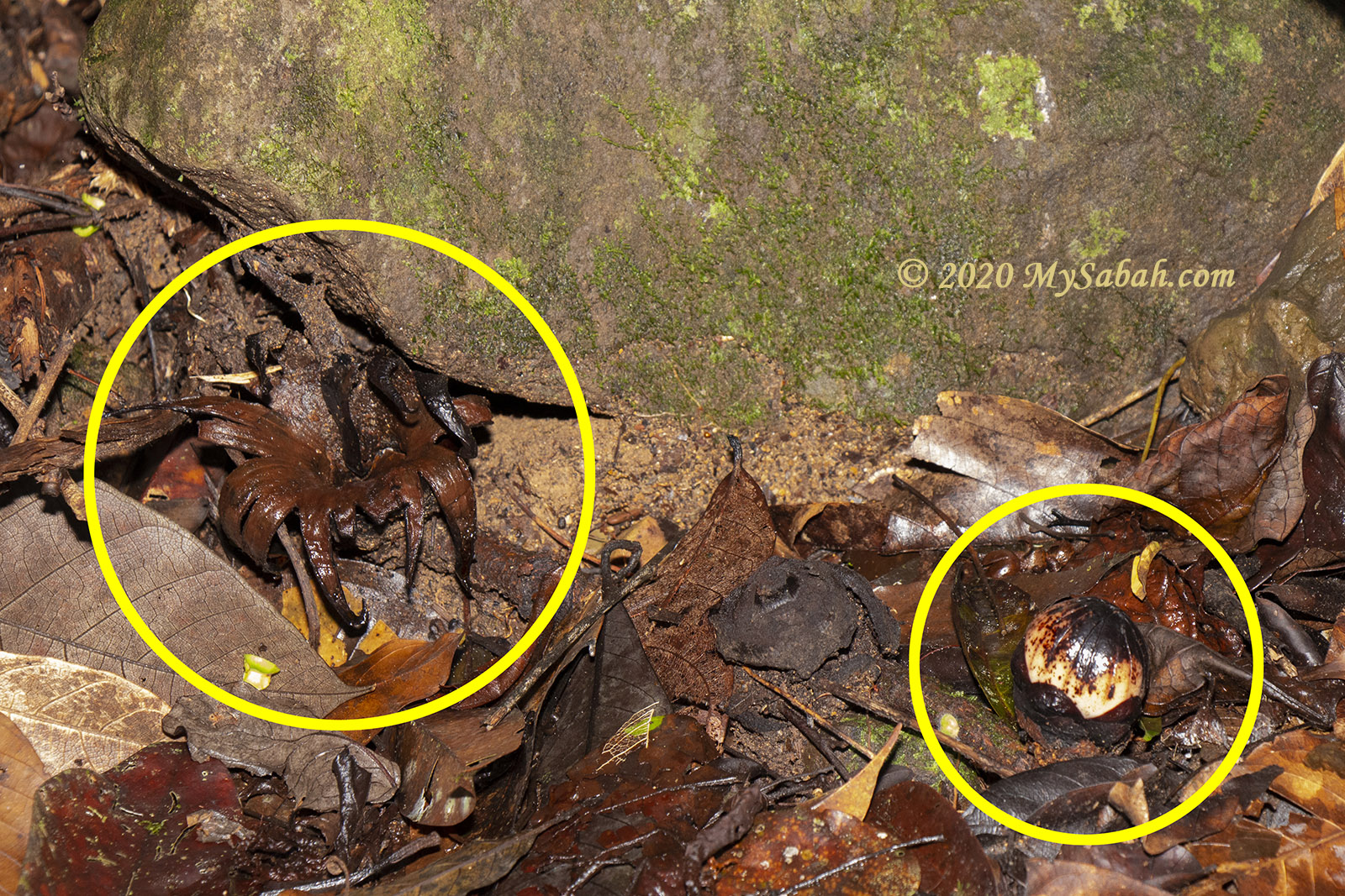
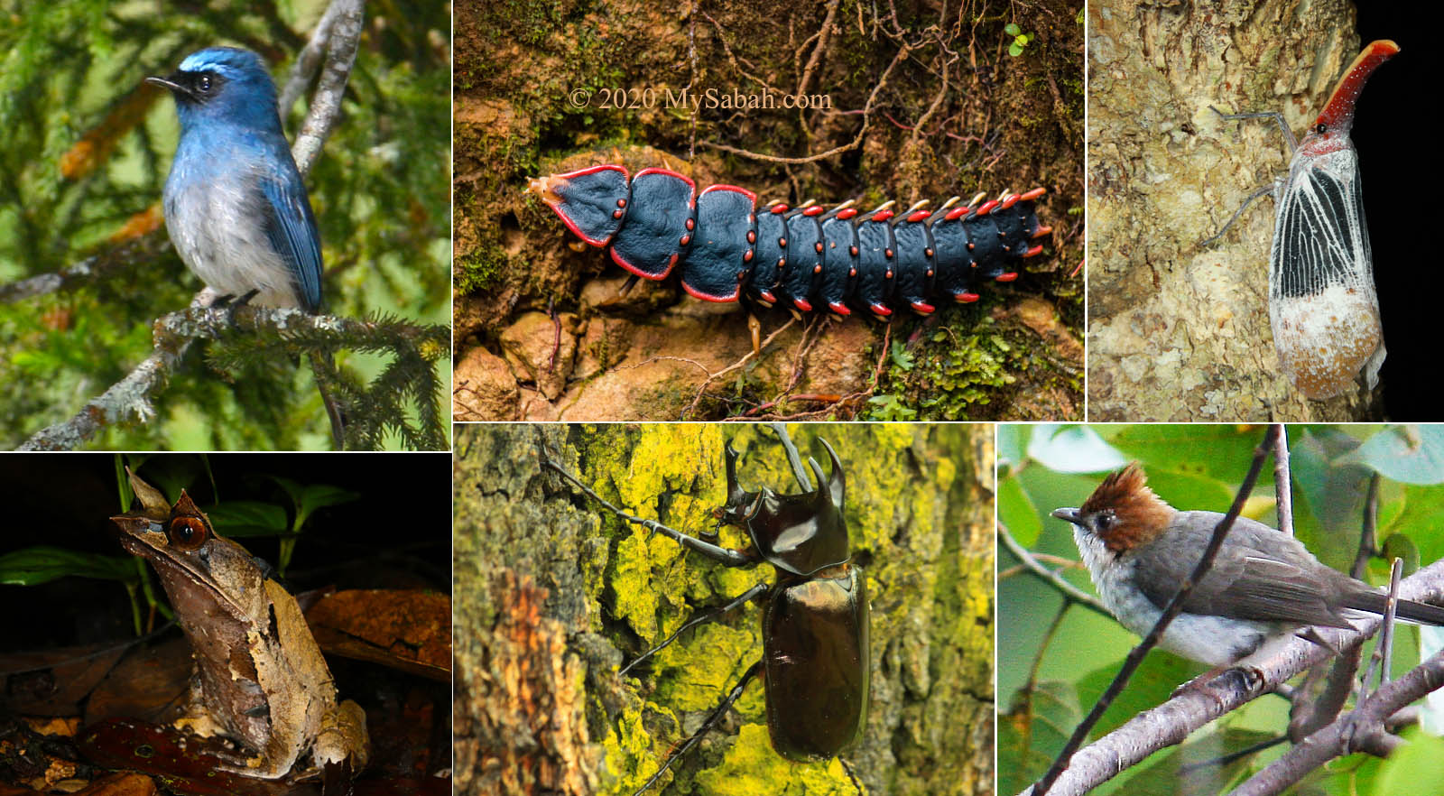
After one KM, you will enter the secondary rainforest. If you are lucky, you would see flock of Rhinocerus hornbill flying over the canopy. There are some leeches but only a handful of them. Wearing anti-leech socks will keep them at bay. The deer fly is more annoying when they find you by the smell of your sweat. The presence of blood sucking bugs means the forest is rich with wildlife.

The view at the highest point of the hike. The last line of the signage says patient is a virtue.

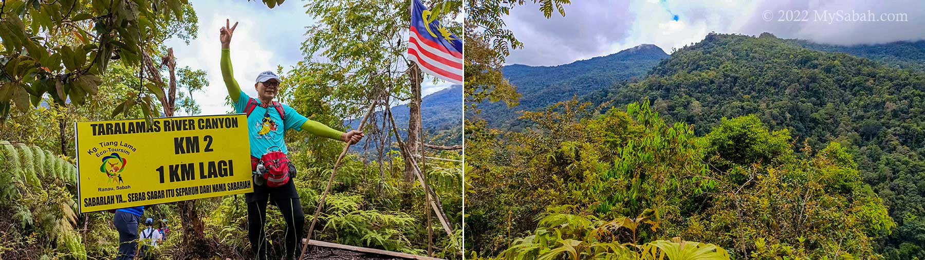
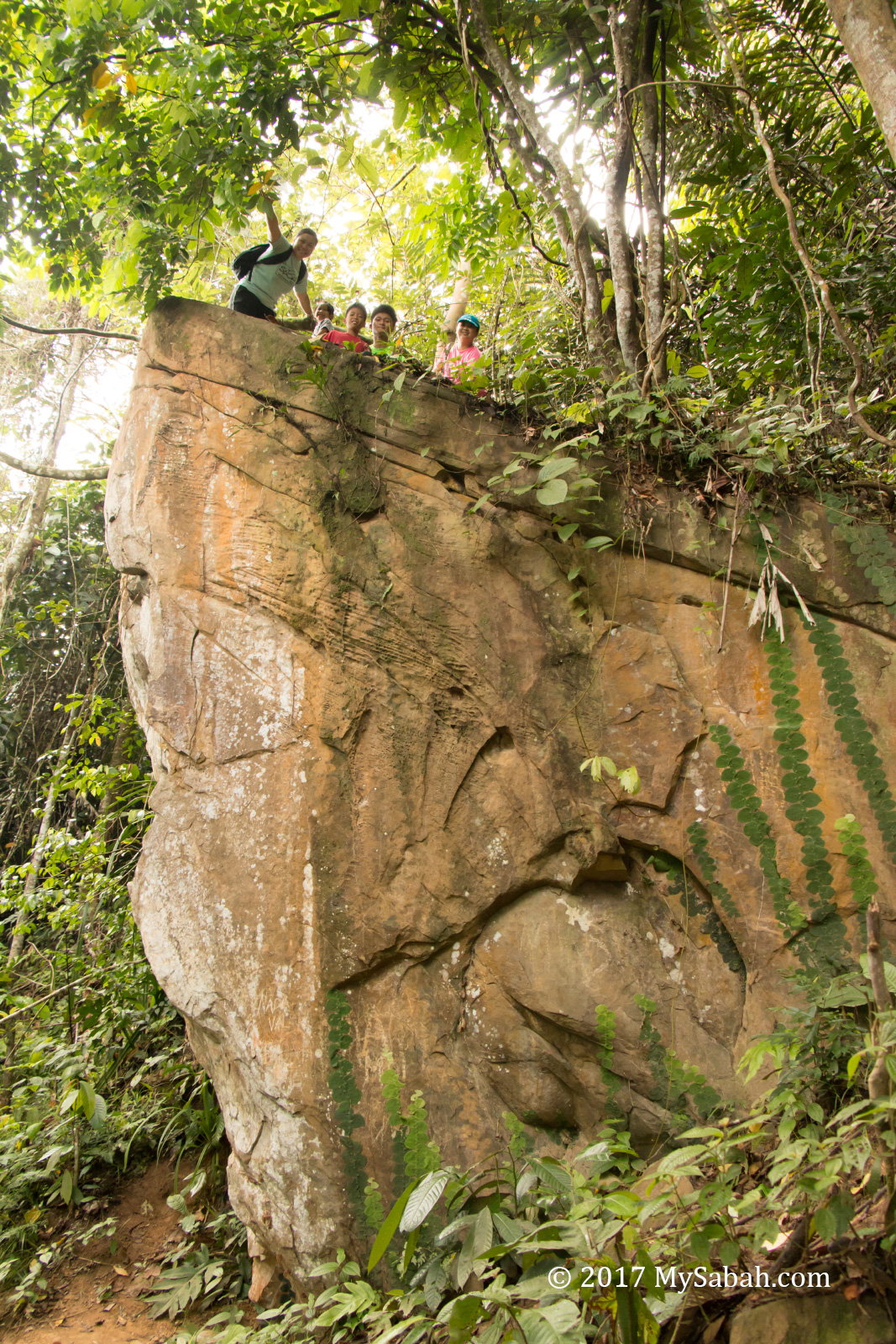
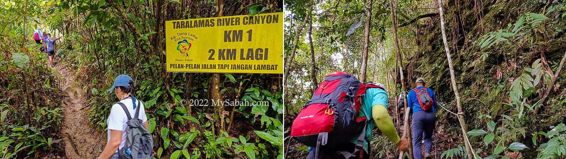
Normally it takes about 1.5 hours to reach the river canyon 3 KM away. Overall the trail is not very challenging. Accident is rare. Only the one KM before the canyon is steep. The difficult sections have rope support. Ladies would need gloves to protect their skin while using the coarse ropes.

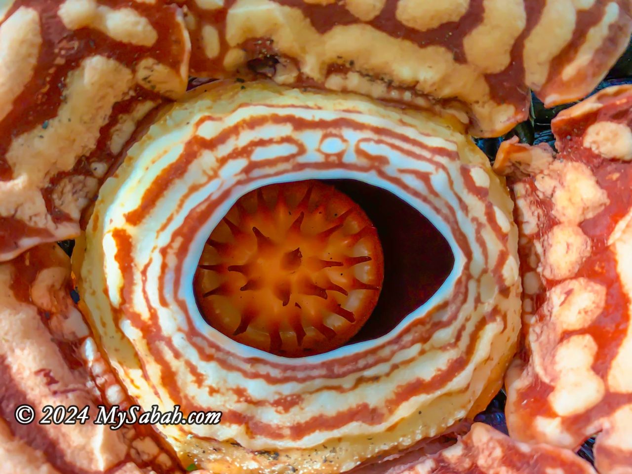
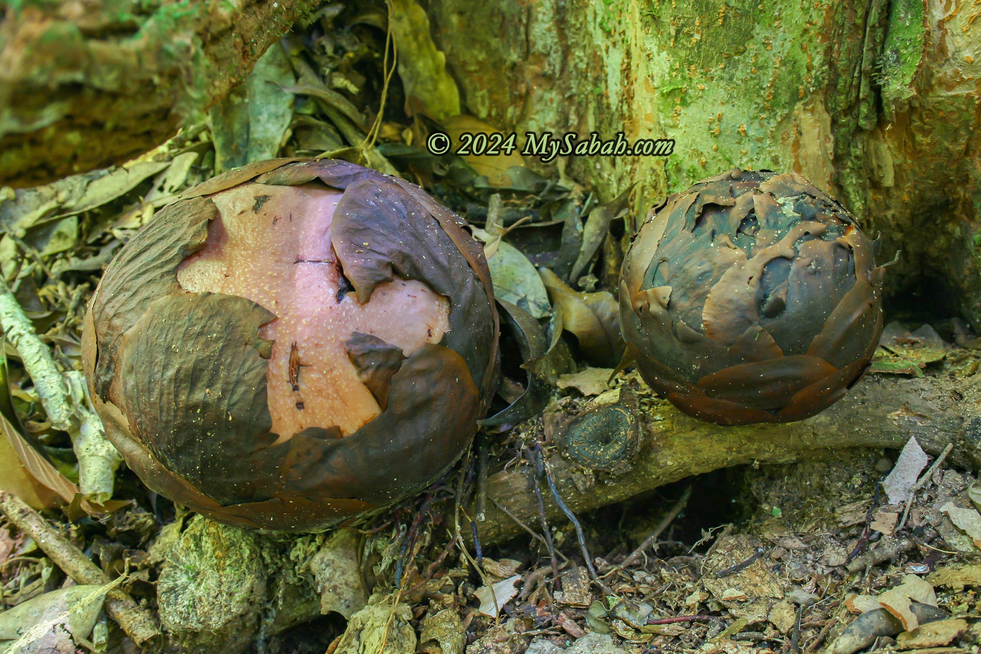
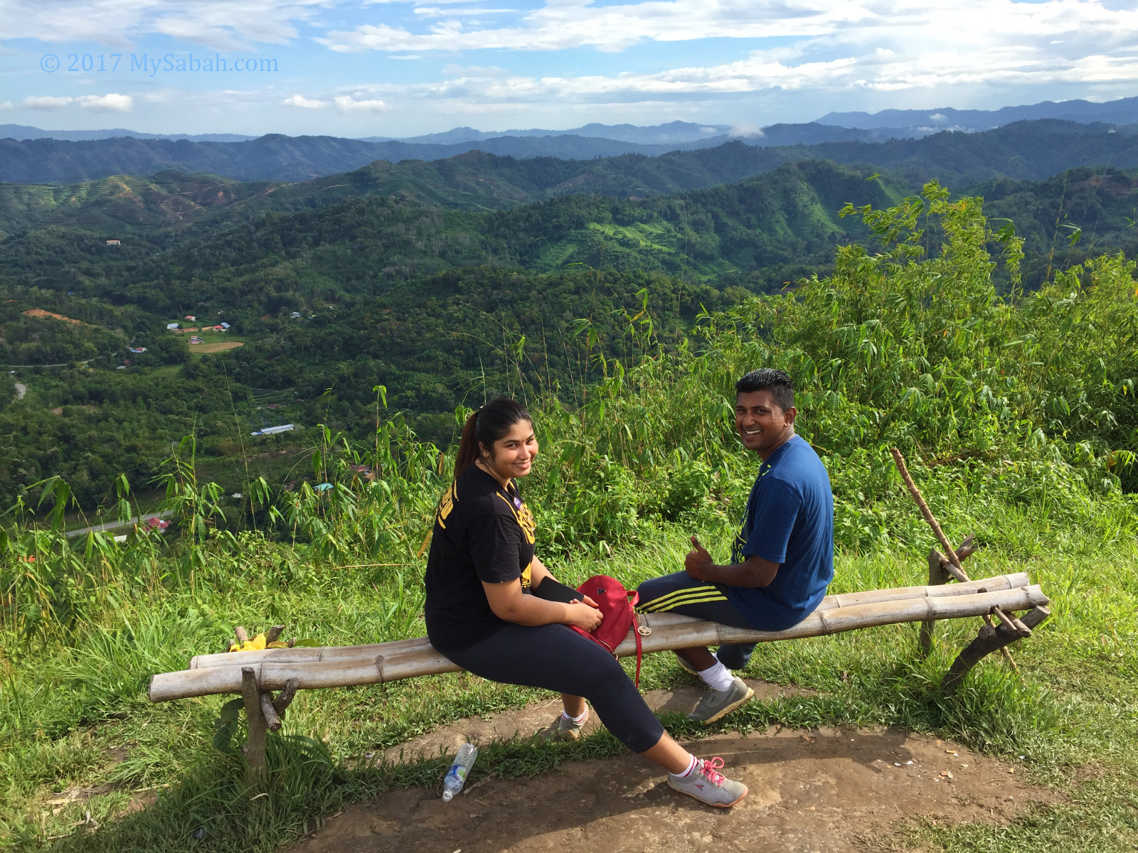
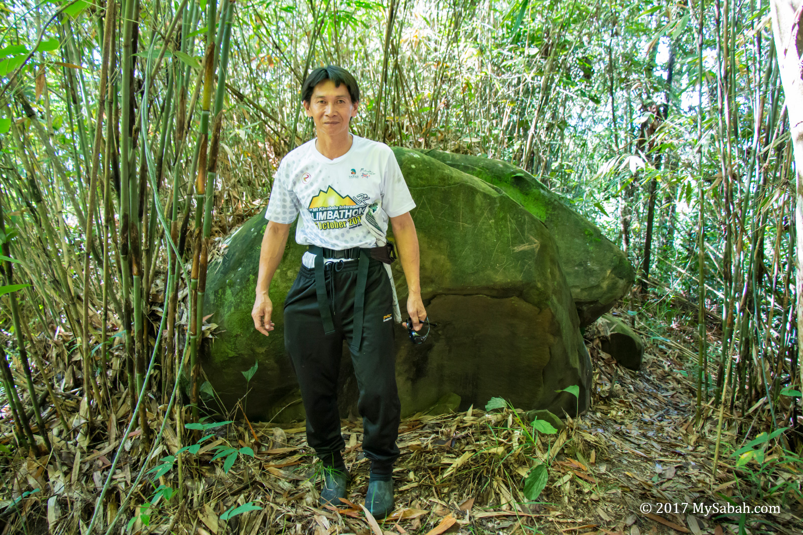
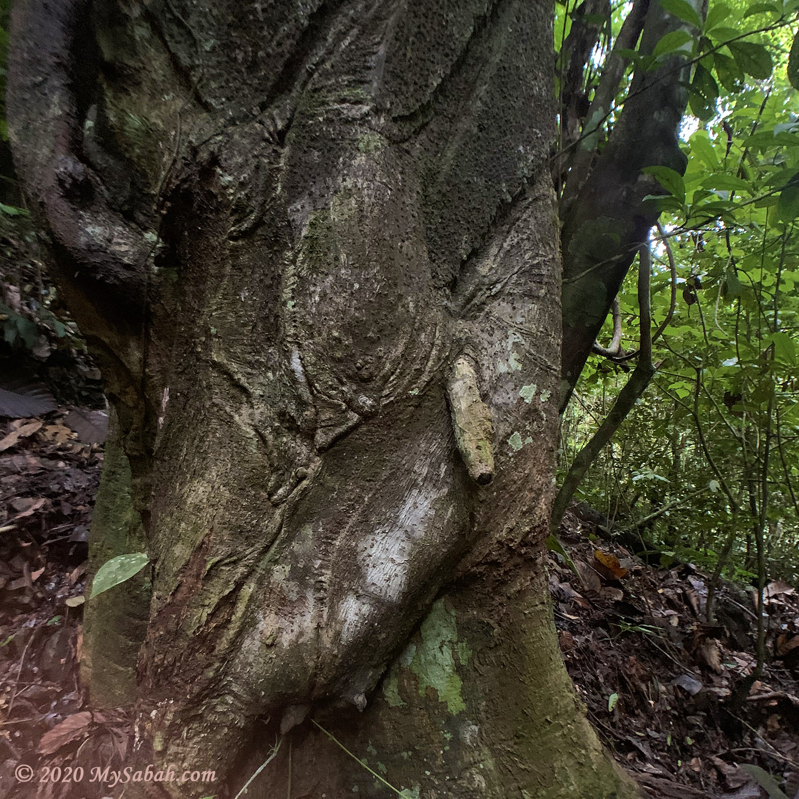
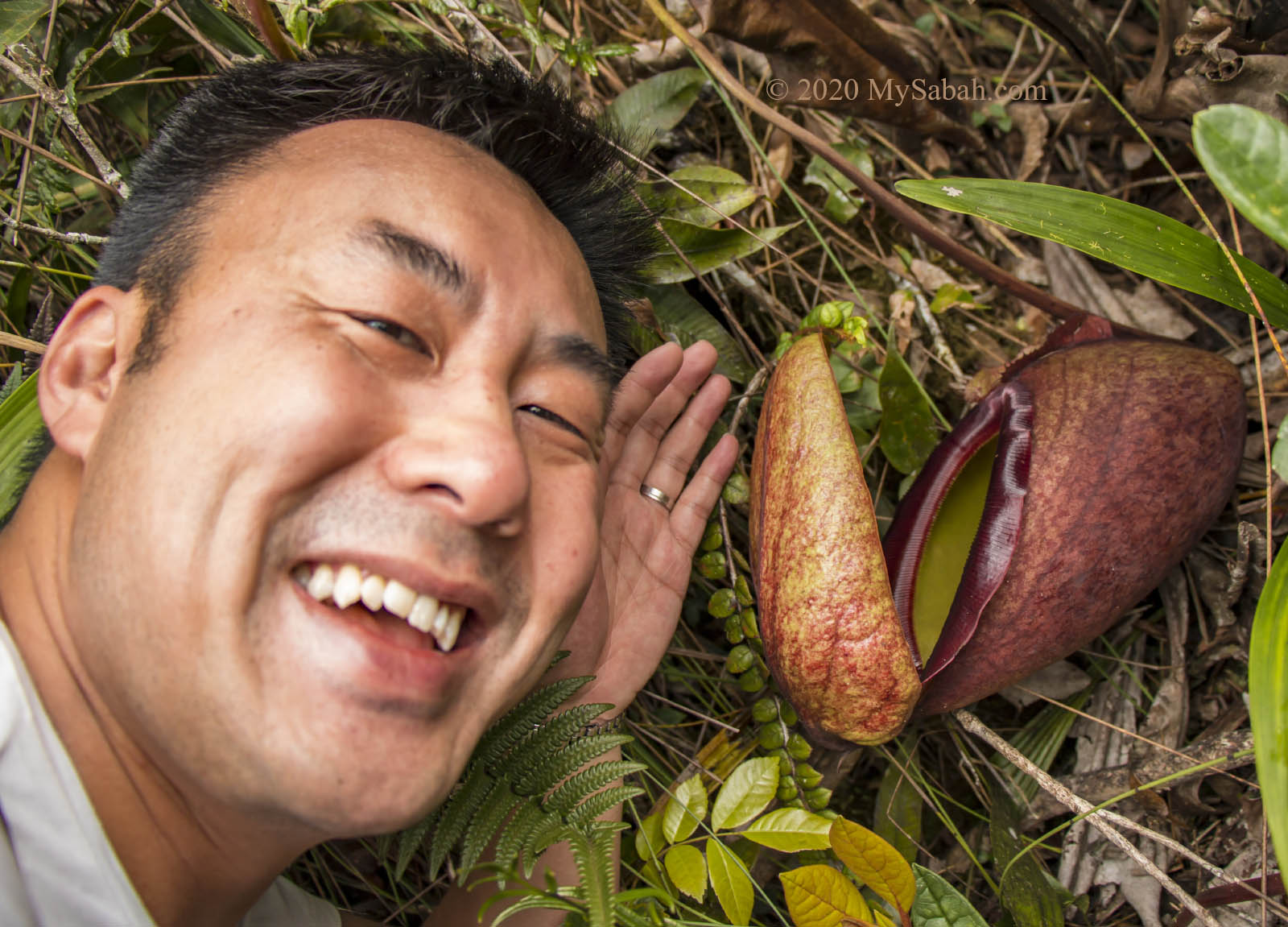
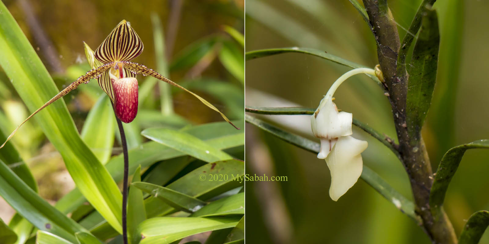
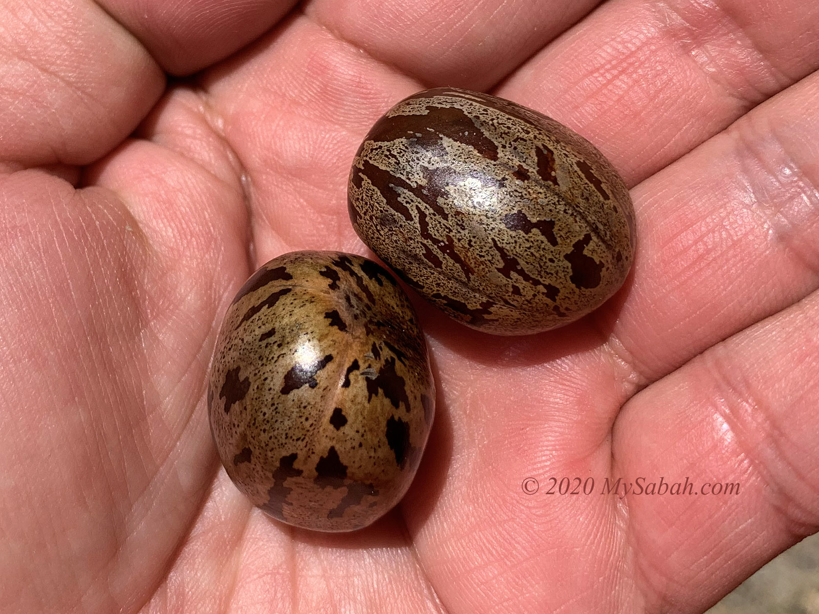
Anyway, you don’t need to rush. Just enjoy the view along the trail. I’ve seen Alocasia cuprea (ornmental plant), bamboo groves, Begonia, mushroom, fungus, big fern tree, and many unknown flora.

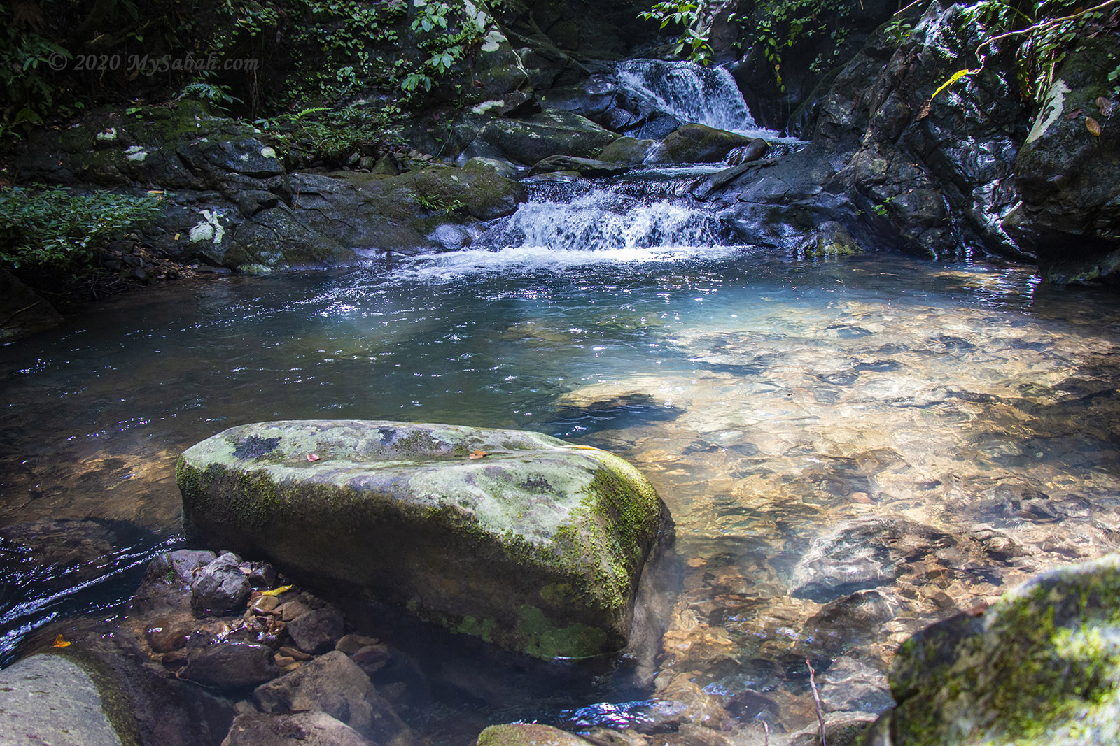
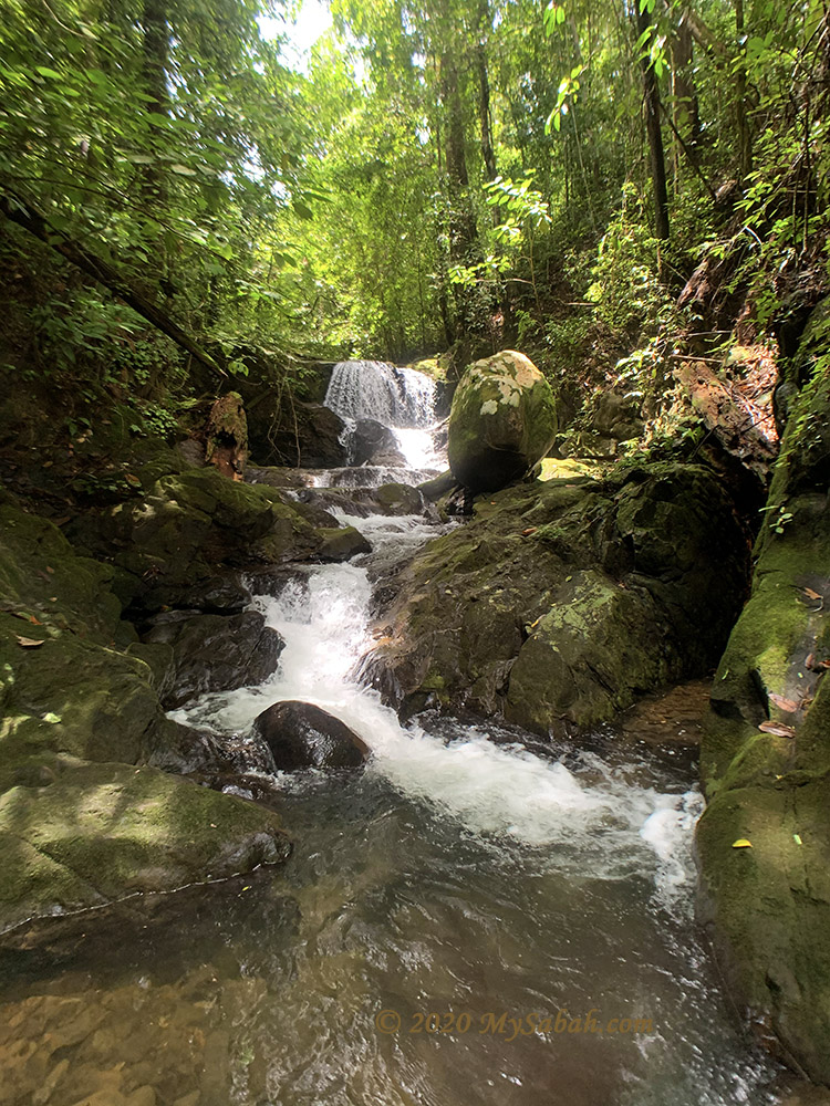
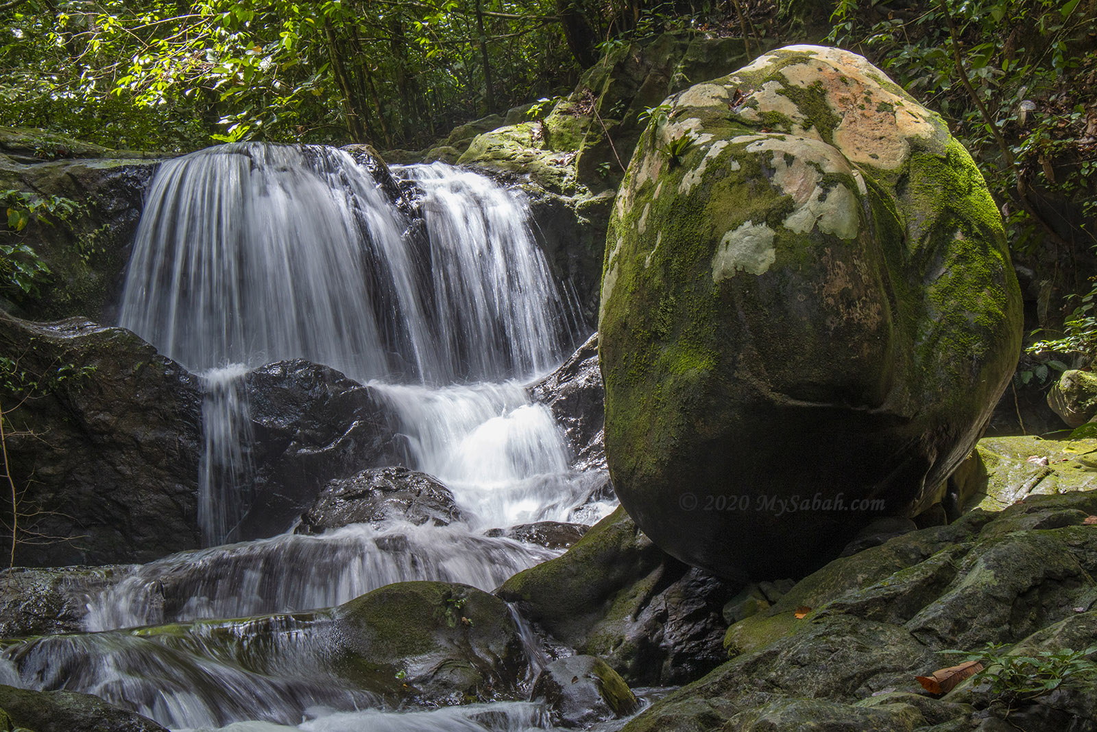
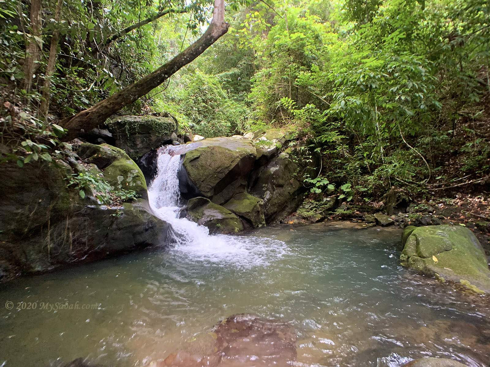
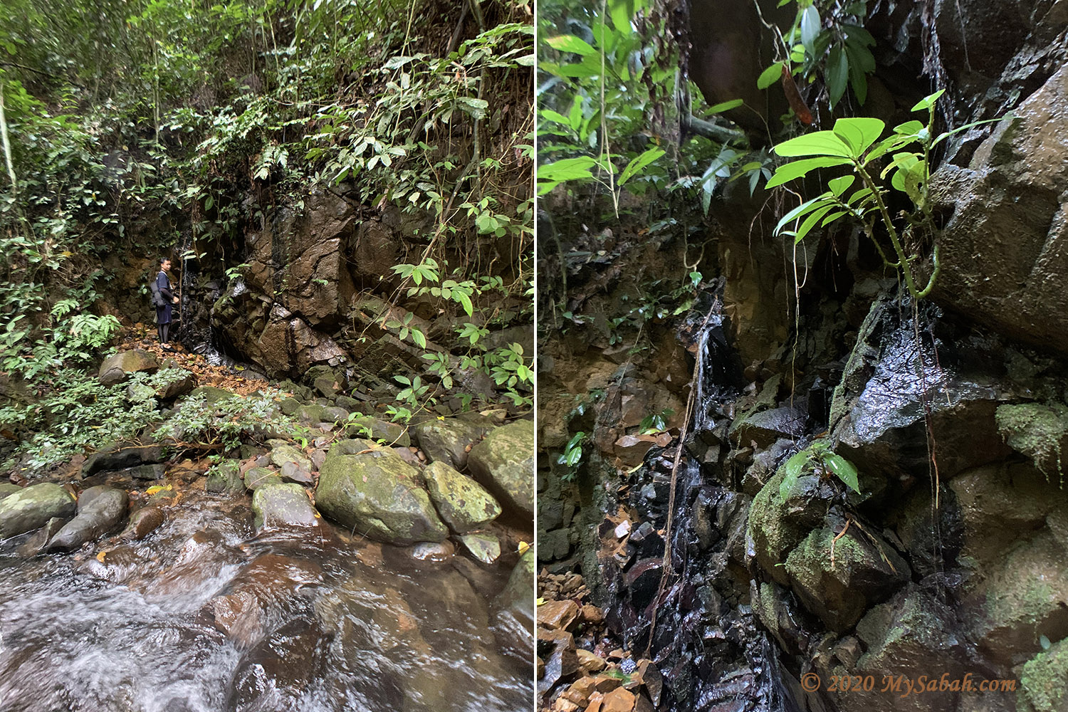
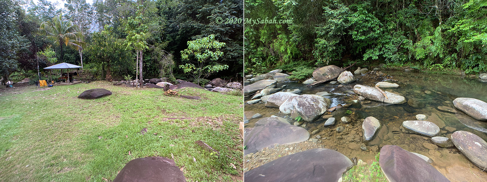
Reaching the River Canyon

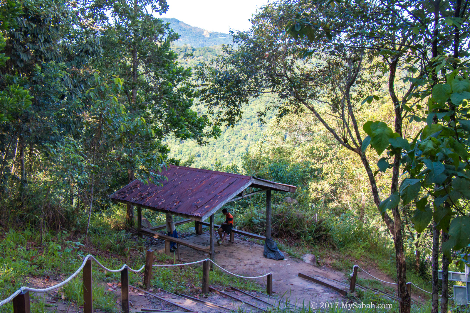
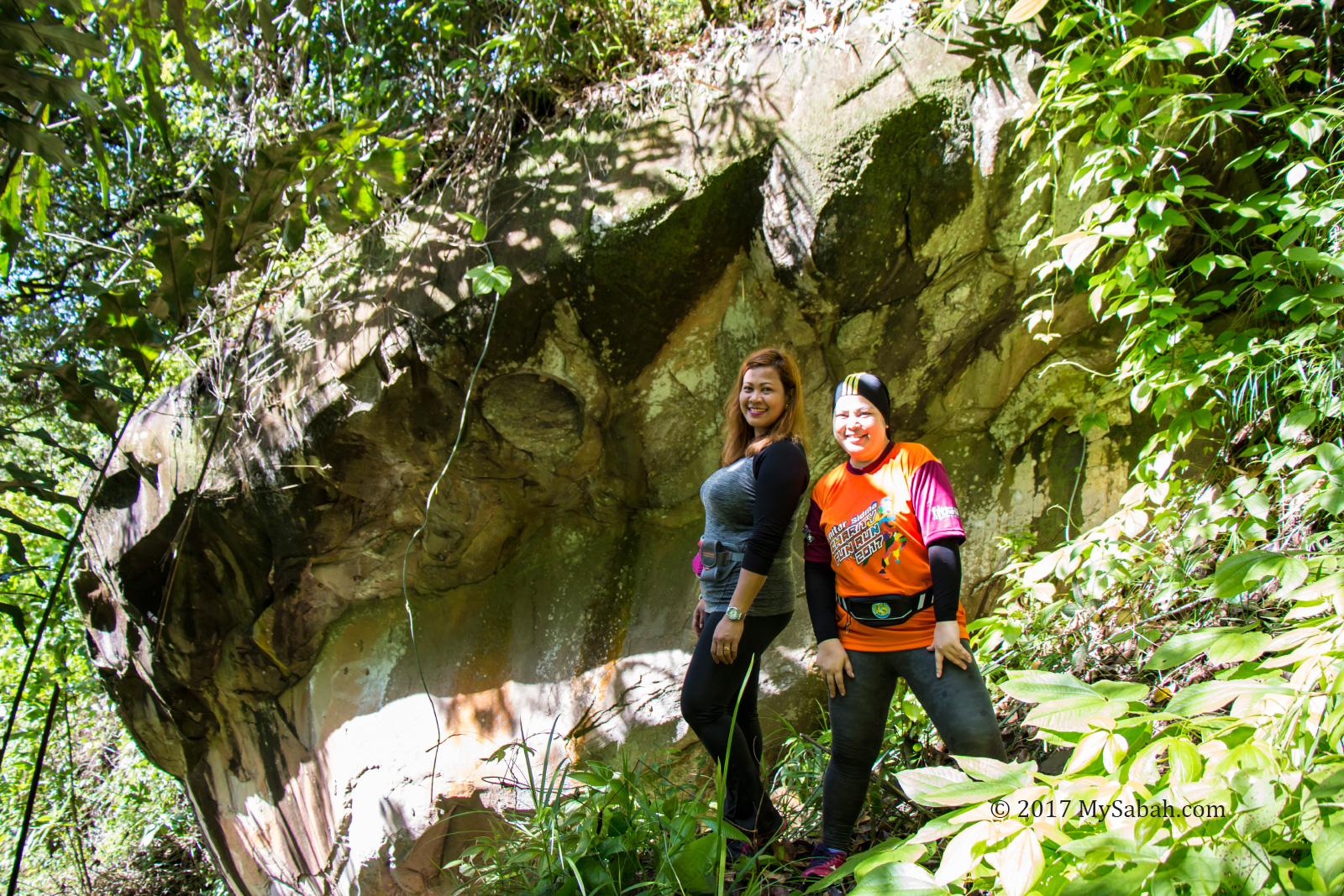
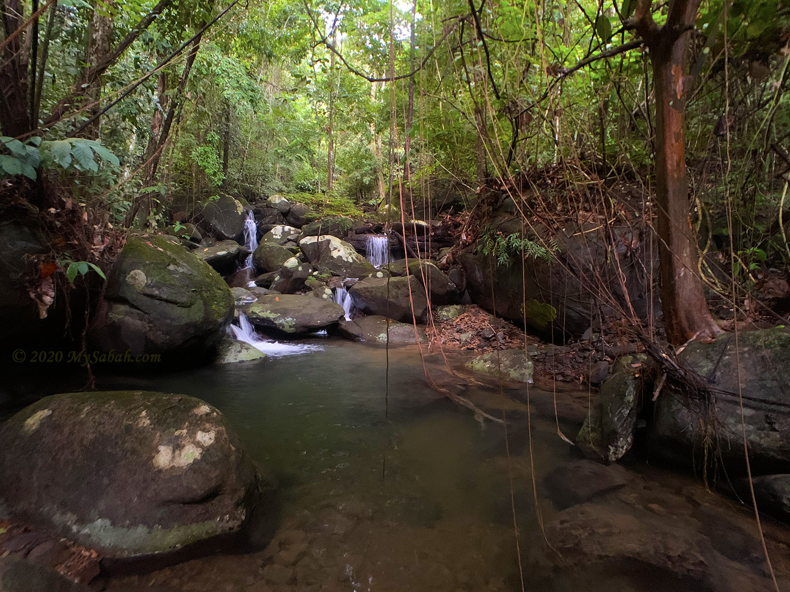
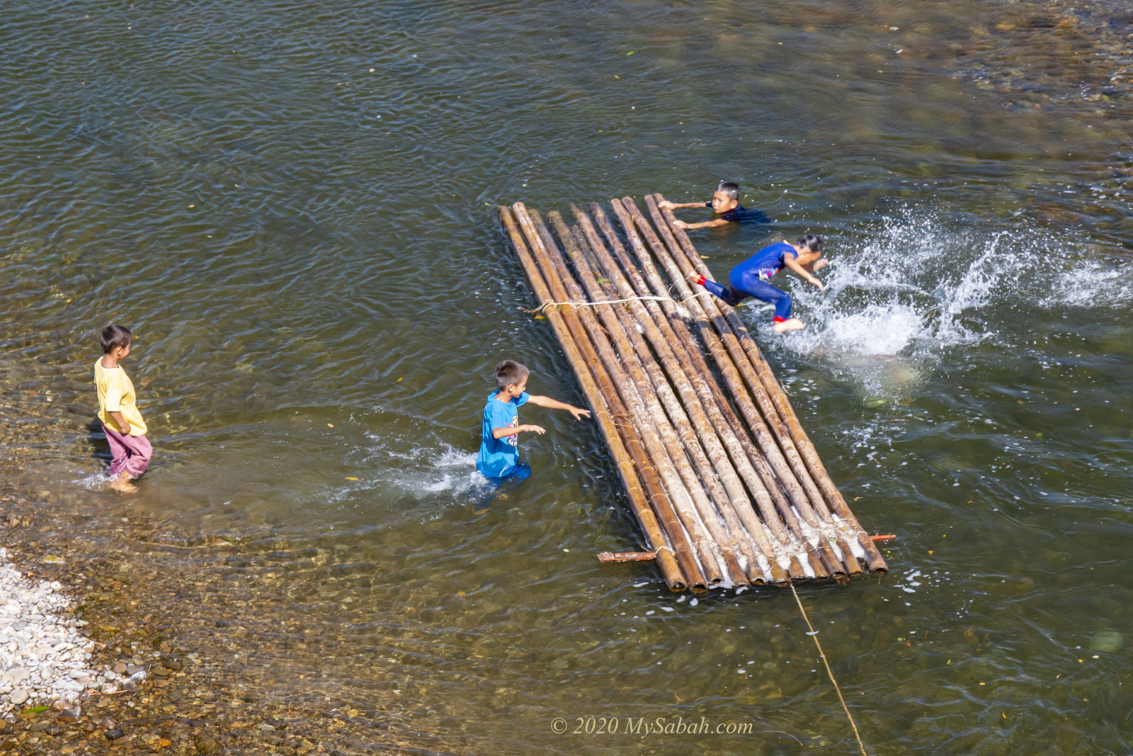
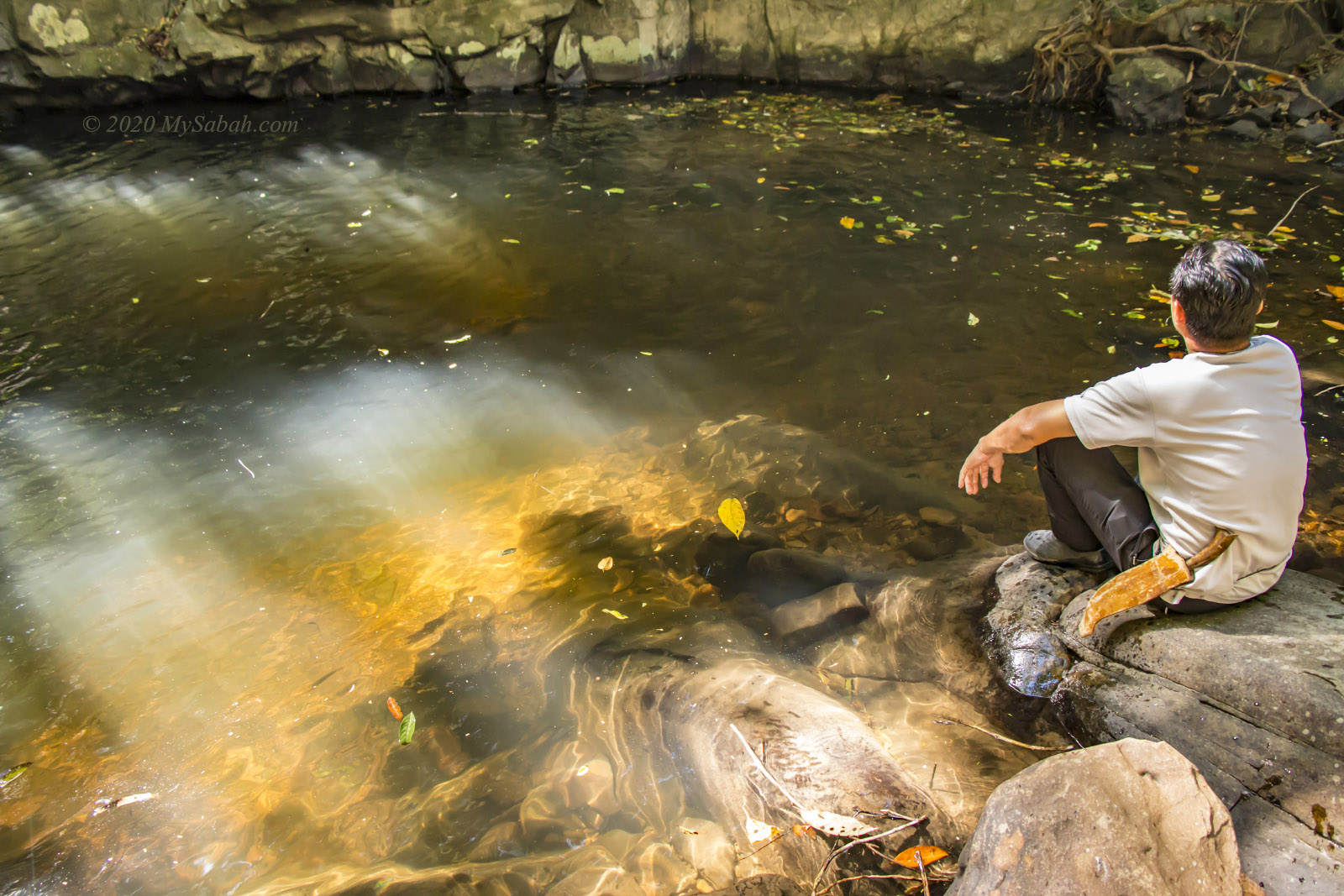
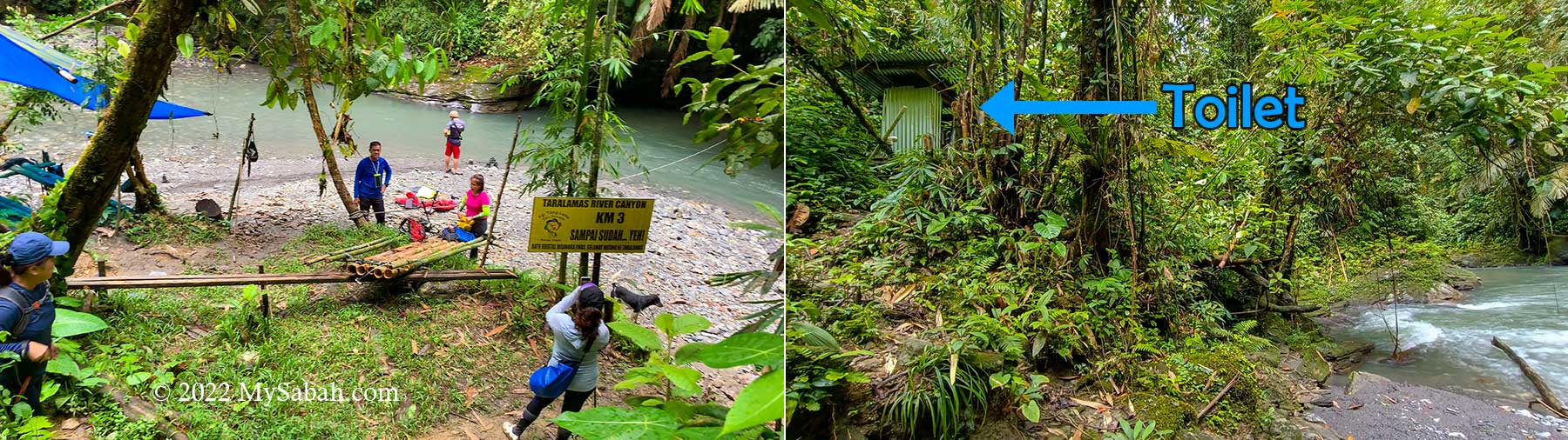
After 3 KM, you will reach the river bank of Widu River. You are probably very excited, but please keep quiet. Making noise in the forest are taboos.

You can place your bag and belonging under the canvas shelter in case it rains. There is a small toilet nearby for you to change or doing your business.

Left: reaching the Taralamas River Canyon, Right: toilet next to the river

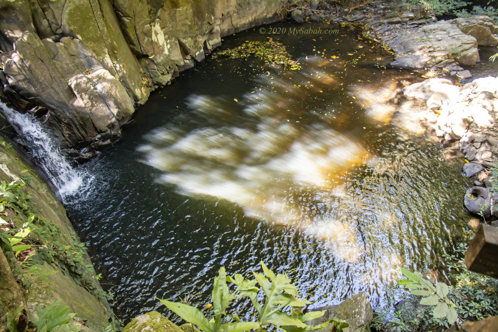
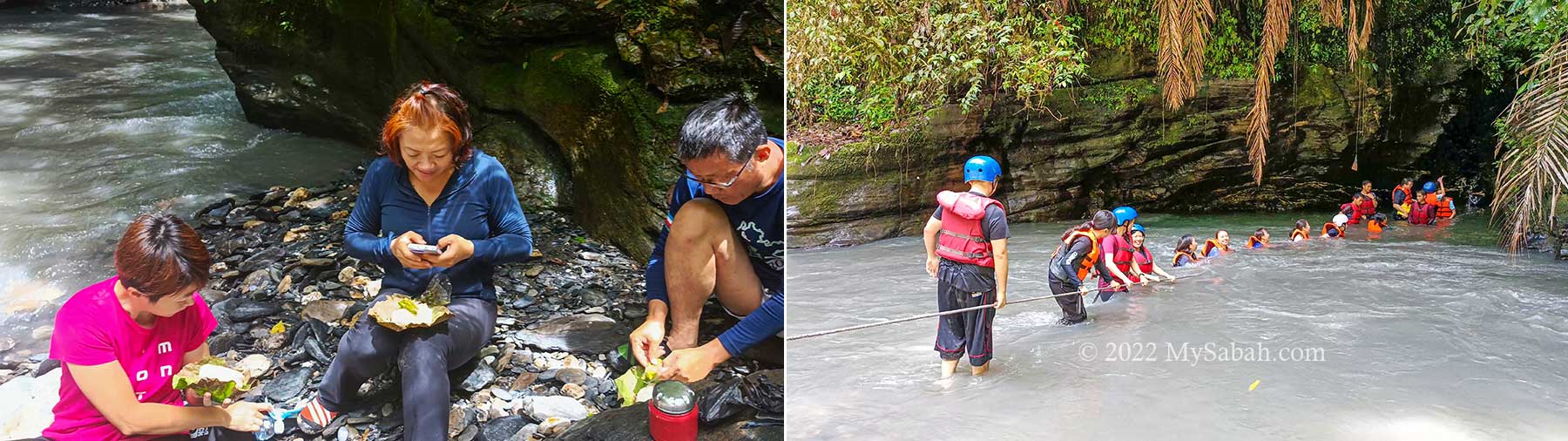
One of my favourite moment is to enjoy my linopot lunch by the river. During dry season, the river water is clear with emerald colour. I’m always tempted to collect the beautiful blue-grayish river rocks but this is forbidden (and would bring bad luck).

Some insects such as butterflies and bees attracted by our sweat. They land on our skin to harvest salt, which is a vital but rare mineral in the jungle. The bees won’t sting you unless provoked. But be careful and bring medicines (to treat anaphylactic shock) if you are allergic to bee stung.

Left: enjoy Linopot packed lunch next to the river, Right: crossing the river to enter the canyon

Butterflies are more timid and would target the fresh mud on our shoes. Entomologists will be pleased to find Borneo endemic species among them, for example, Bornean swallowtail (Graphium stratiotes) and Bornean sawtooth (Prioneris cornelia). I also see Bornean Straight Pierrot (Caleta manovus), Orange Gull (Cepora judith hespera), Grass Yellow, Green Dragontail, Mormon, and Common Cruiser at the river bank.

Left: shelter at the river side, Middle: butterflies attracted by smelly shoes, Right: Linopot packed rice

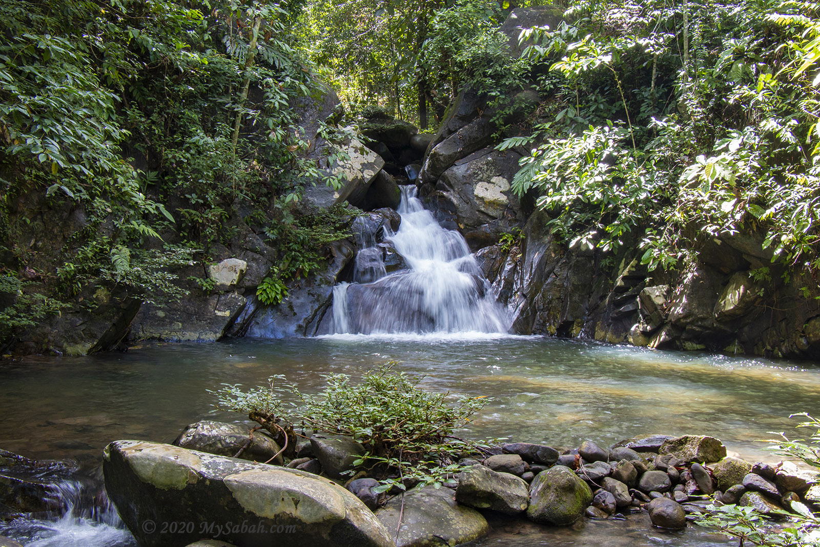
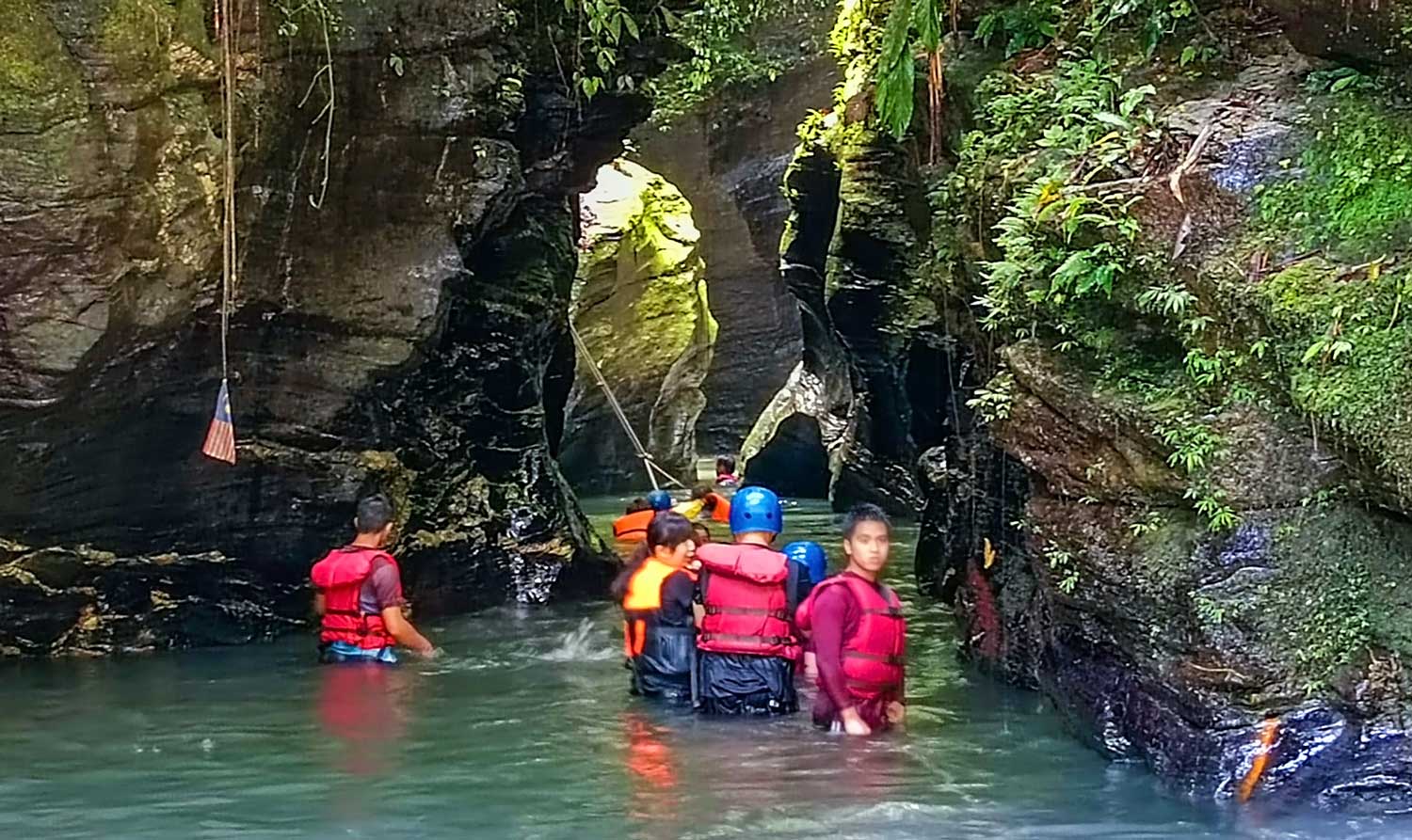
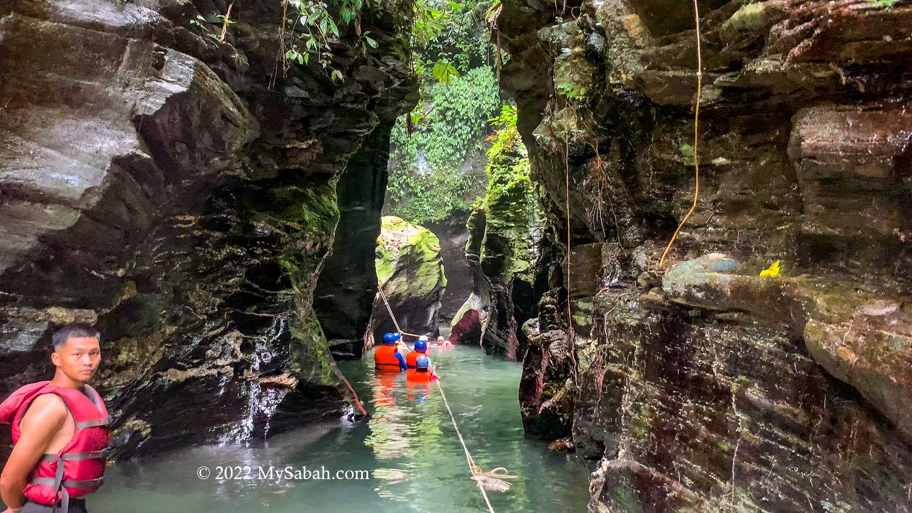
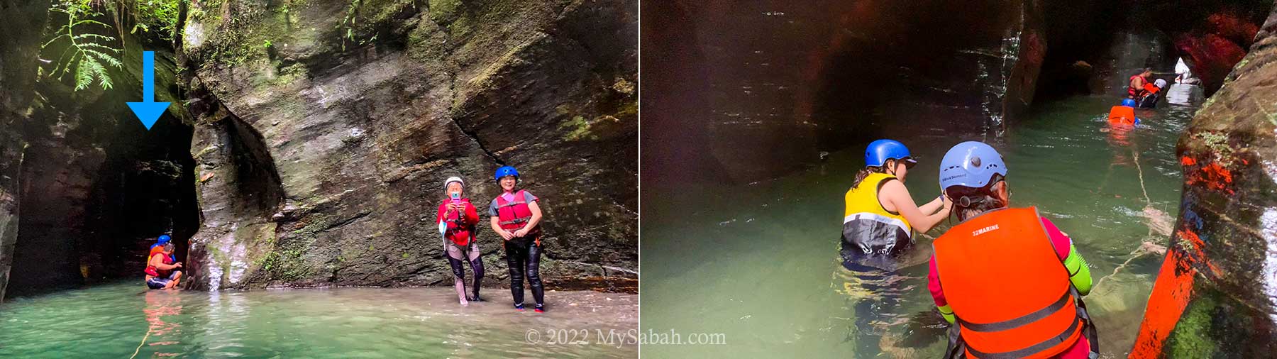
The gap of the river canyon is only 2 to 5 Metres width, and there are more than 30 visitors. Therefore, we take turn to go in, to avoid overcrowding. Usually the walk in river canyon takes about an hour.

Enter the River Canyon

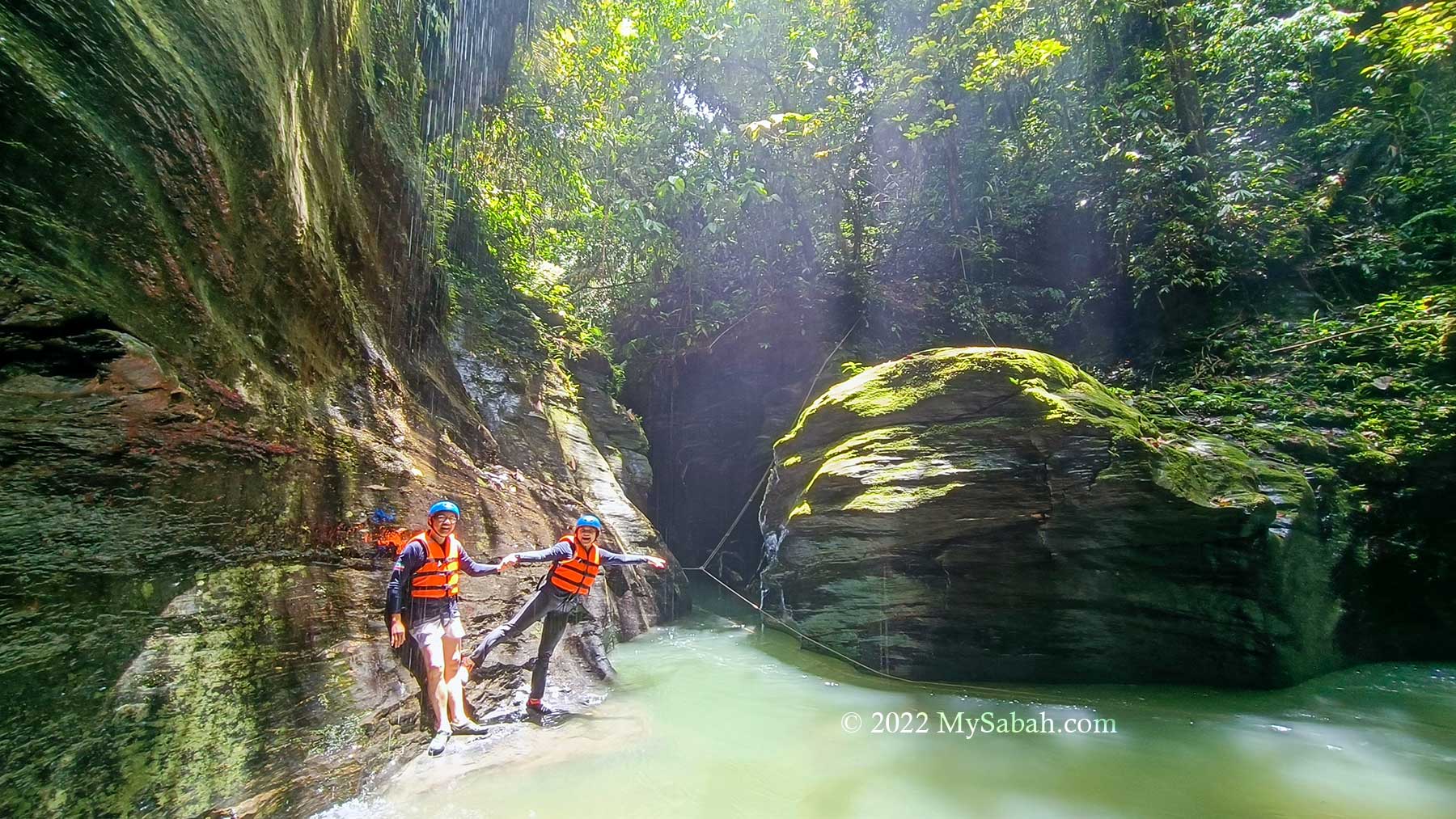
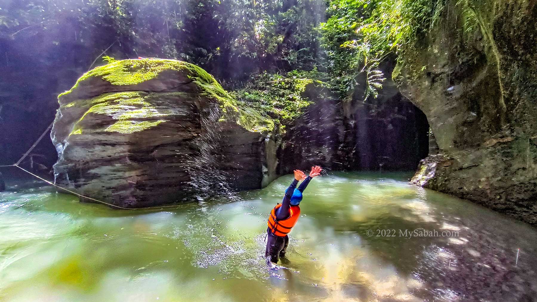
Finally it’s my turn. We are required to put on a life vest and a helmet to protect us from drowning and falling rocks. The canyon is about 150 Metres long. However, in most cases, the guide would bring you up to 120 Metres. You can fully explore it only when the water is very shallow in dry days.

The beginning of the river canyon walk

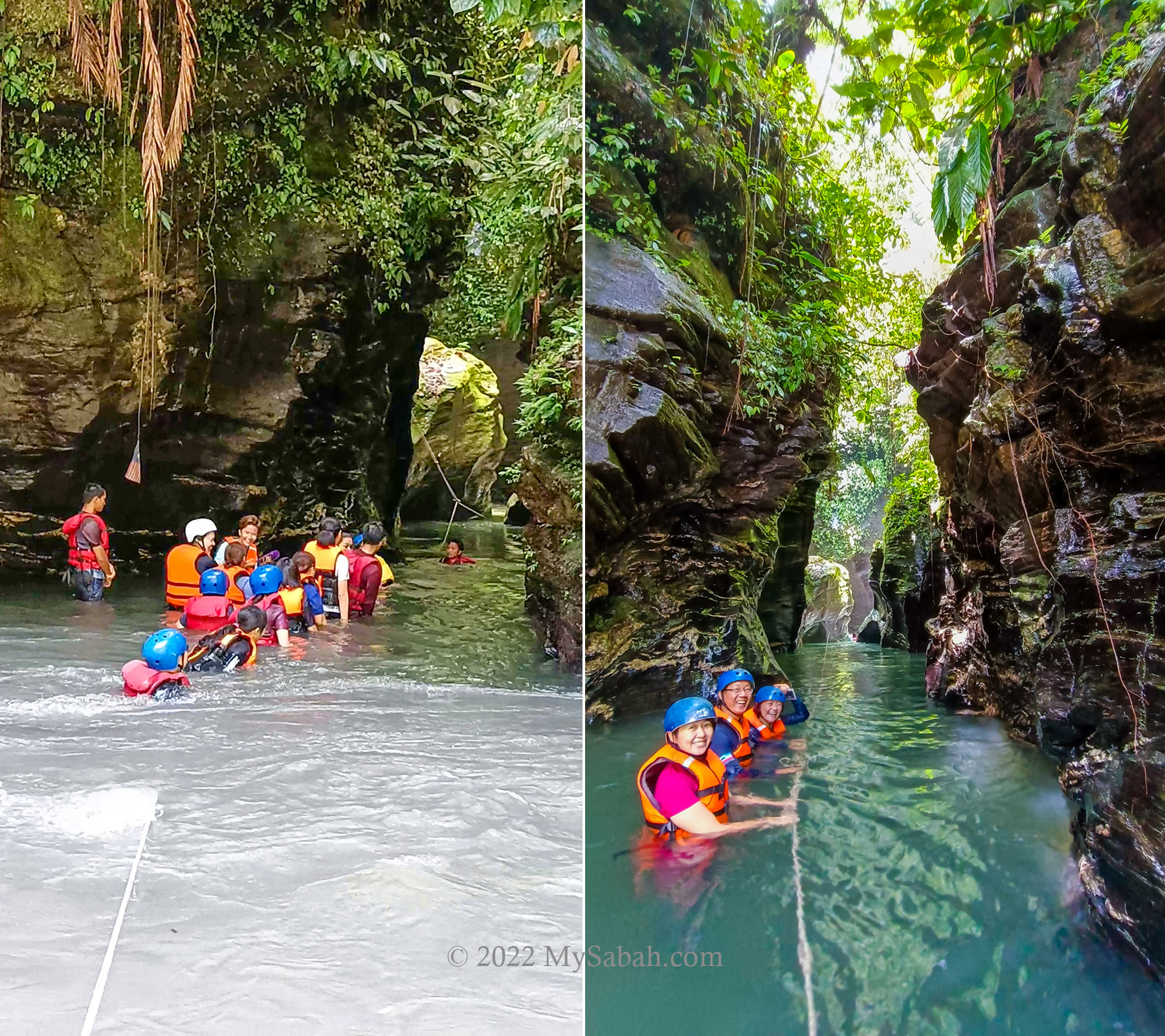
I cross the river to enter the canyon at the other side. The temperature of the water is about 25°C degrees, it’s cold but probably not enough to cause hyperthermia, unless you stay for long hours. It’s bearable once my body gets used to it.

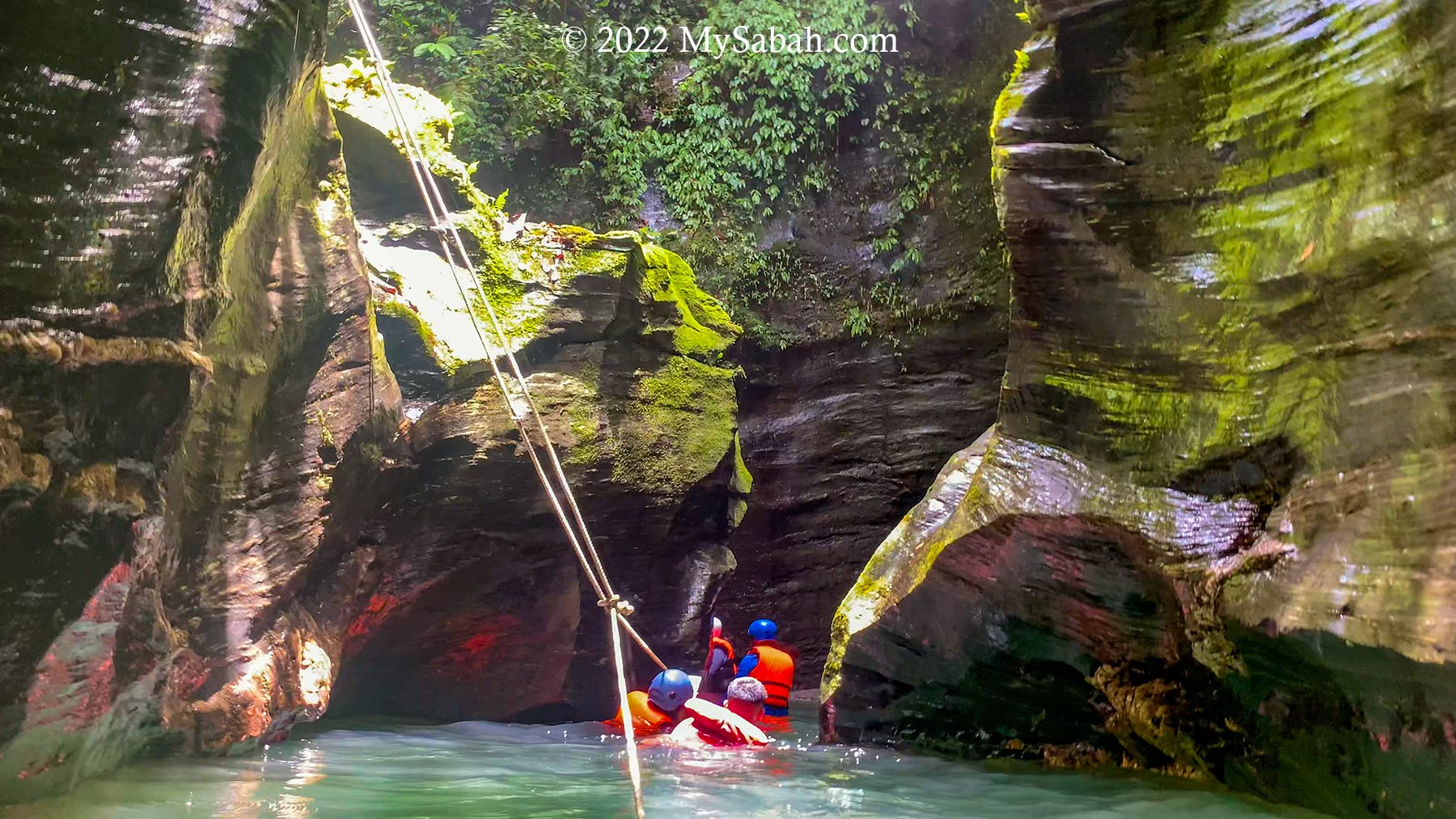
During drought season, you can walk across the river easily. It rained the night before, so the river reaches my chest level and the current is quite swift. I hold on the guiding rope to move to the entrance of the canyon, and fight another stream coming out from there.

Left: the river is deep during wet season, Right: the brightest section of Taralamas River Canyon

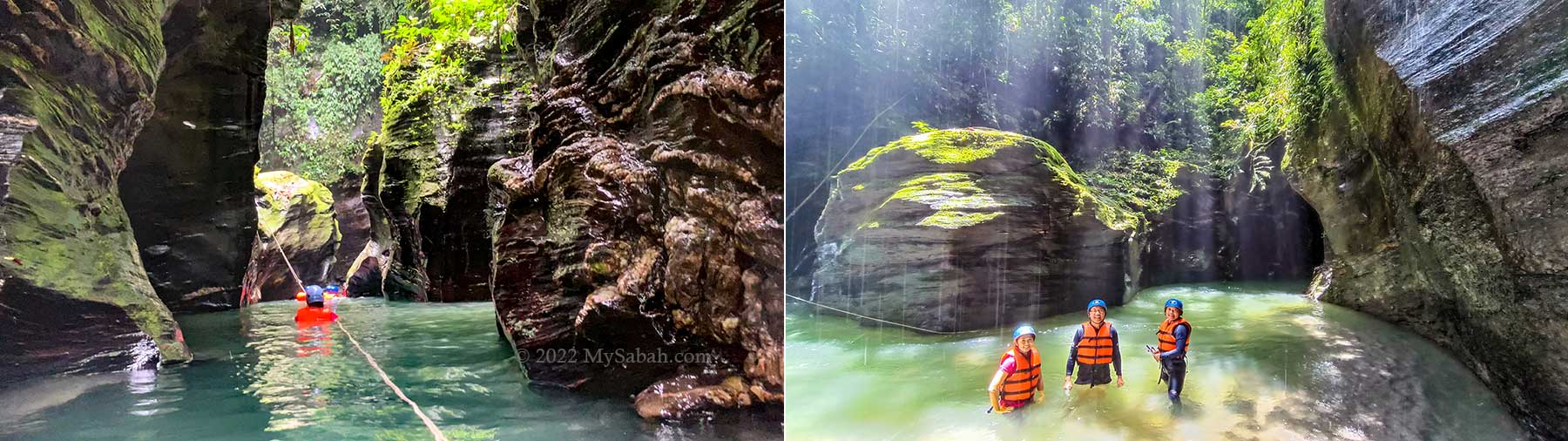
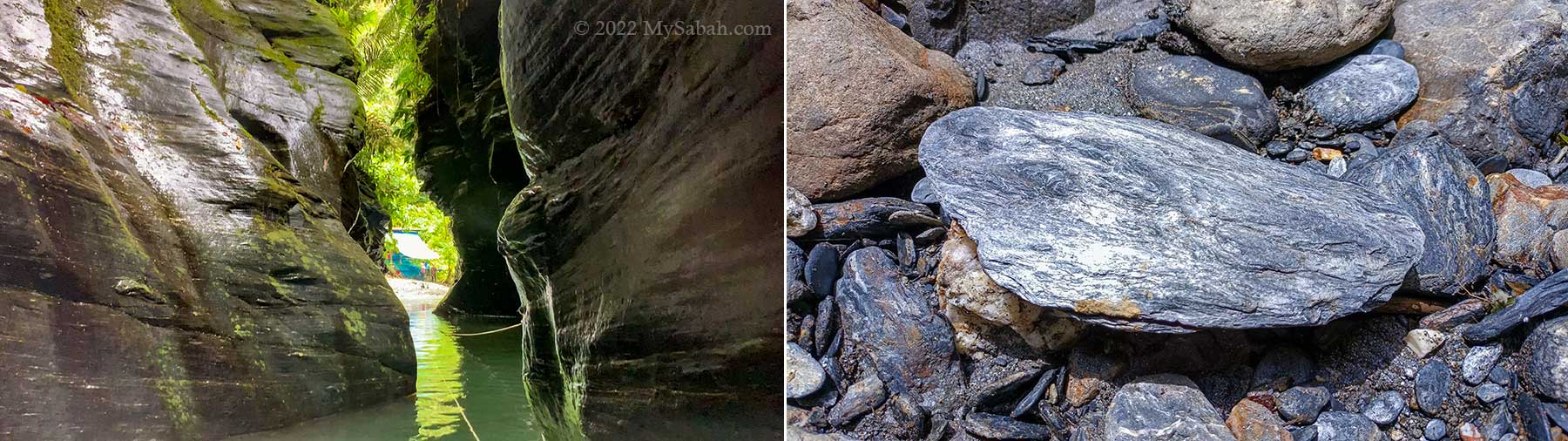
Though I struggle a bit with the cold and strong current, I feel no regret the moment I see the gorgeous rock walls in the canyon. Like most people say, it looks so unreal and doesn’t resemble any place in Sabah.

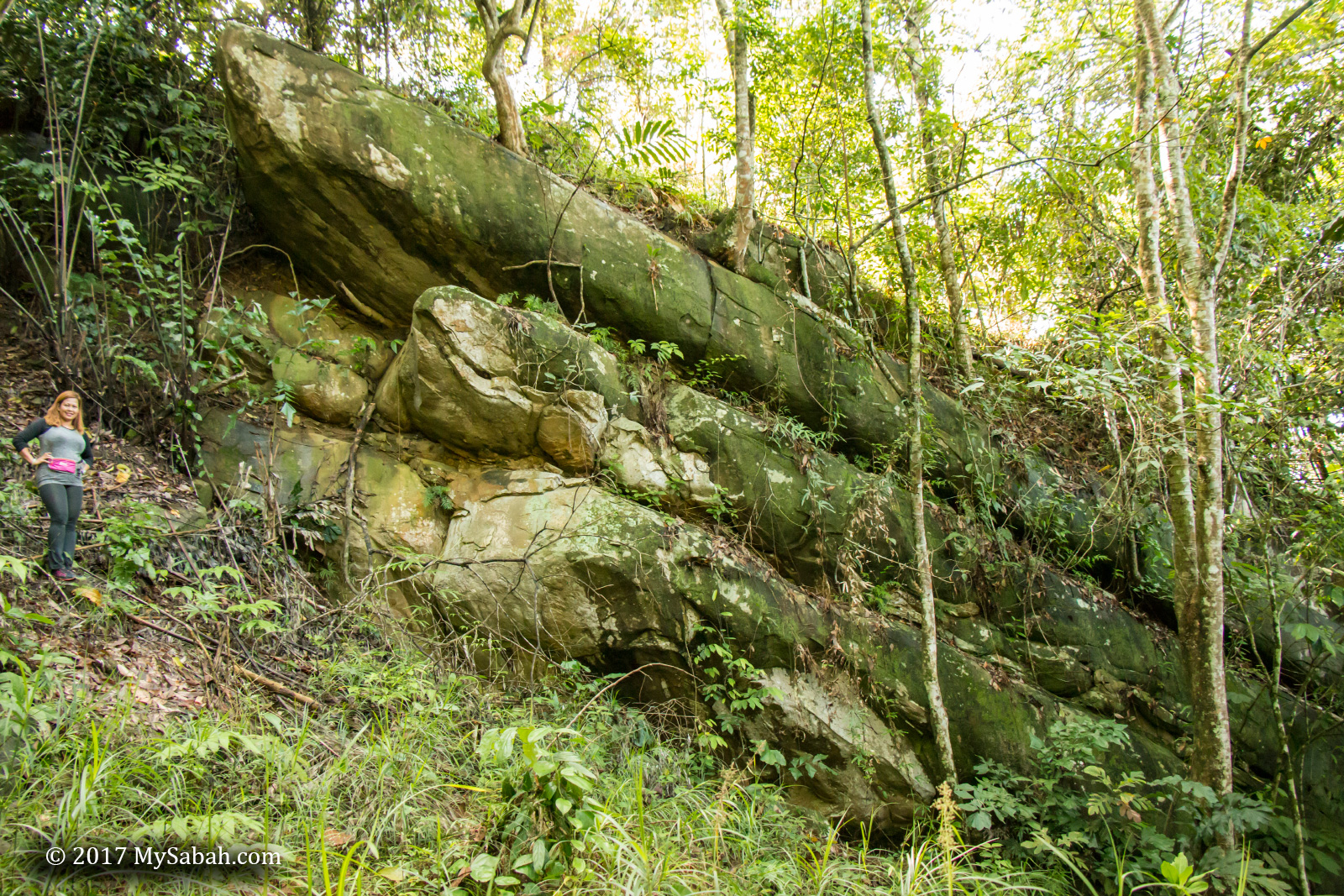
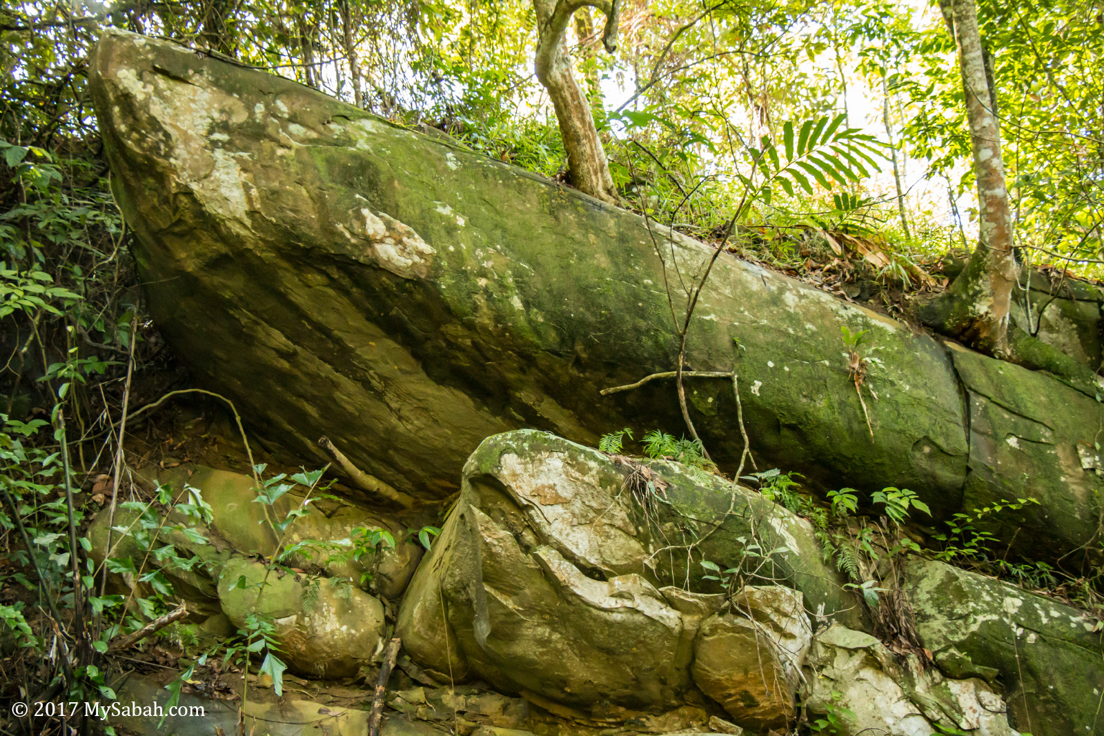
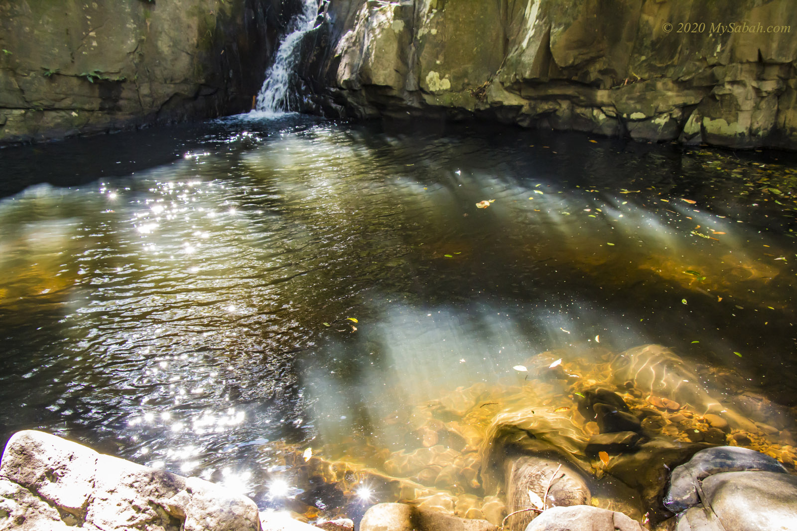
The rock walls in the canyon marked with layers horizontally, a characteristic of sedimentary rock. I feel like being sandwiched between two giant chocolate crepe cakes of 2 to 5 floors high. The walls are comprised of rock layers that are stacked and deposited since 60 millions years ago. After river flows on these rocks for million of years, it carves out the Taralamas River Canyon today. The wall surface is so smooth that I can see my reflection.

For a moment the river canyon looks like a romantic paradise

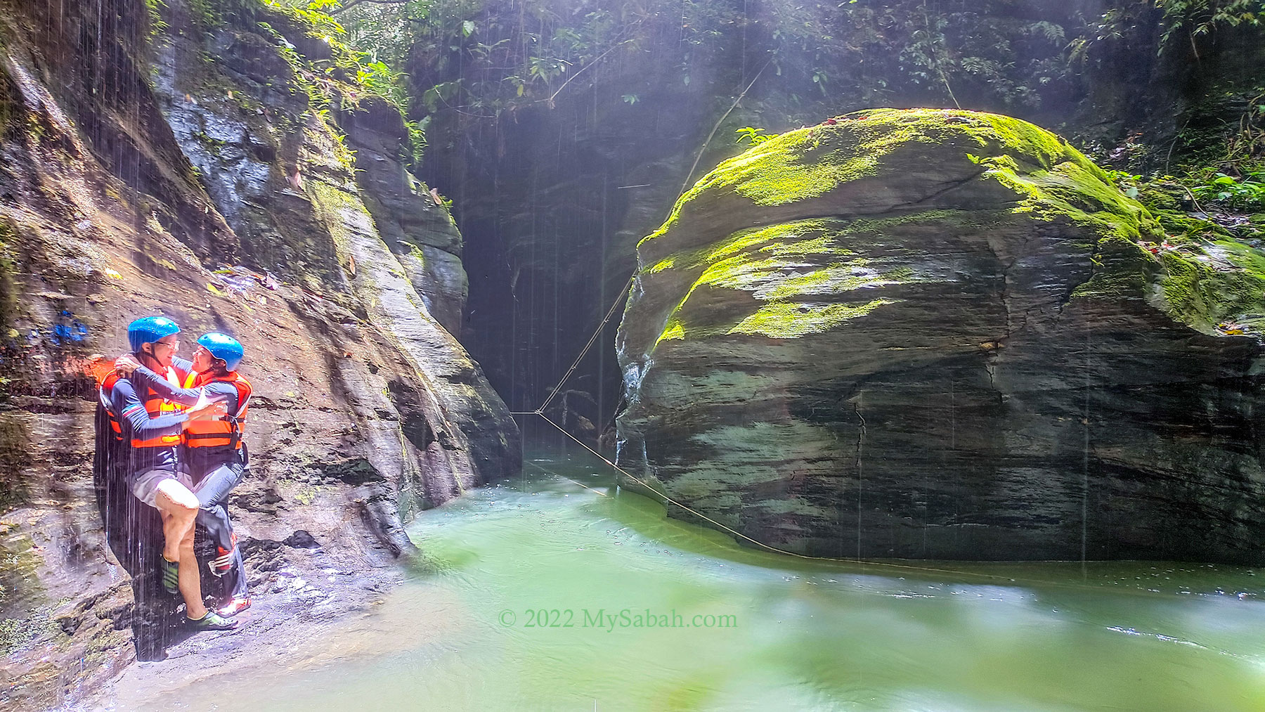
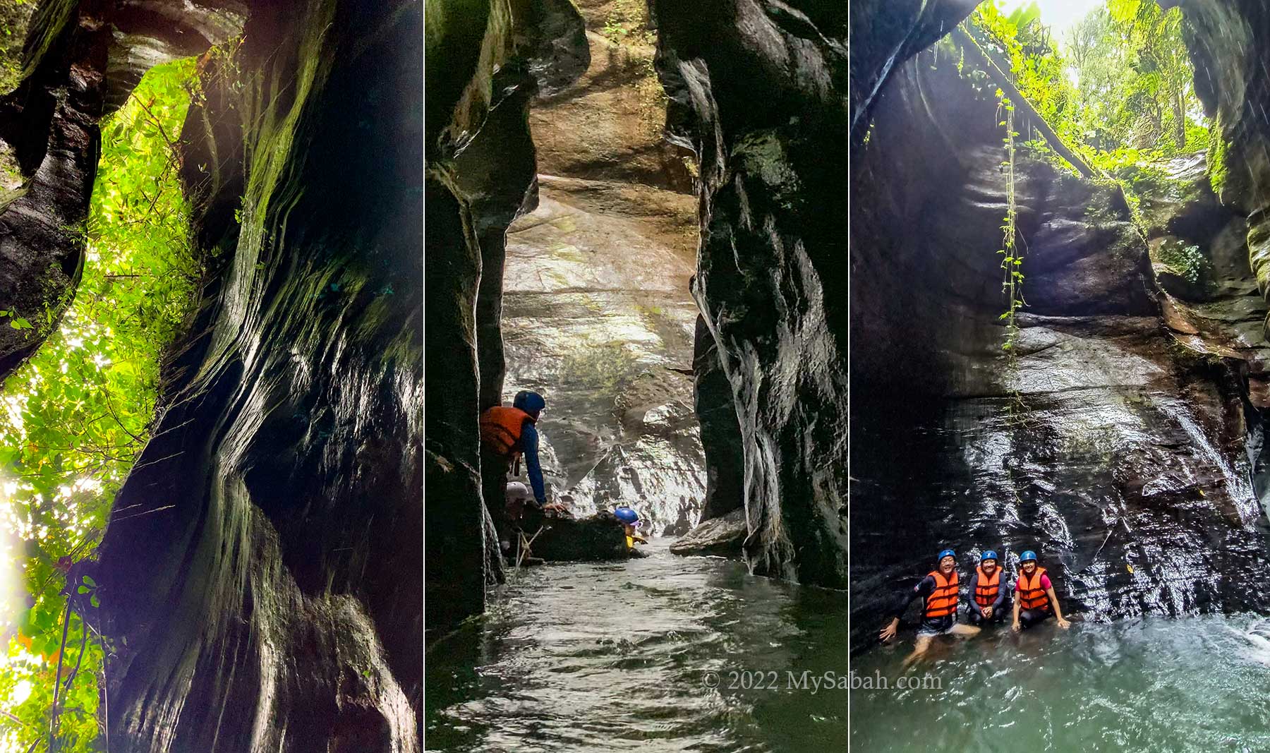
Part of the river is as deep as 9 feet. I float on the water and use the rope to move forward slowly. I look up and see the sky through the narrow opening, which is partially shielded by the translucent green leaves. Some big rocks in the canyon really look like petrified wood. I thought it was wood until my toes kick it.

Entrance to explore the deeper and darker canyon section

The first half of the river canyon is the best section for photo-taking because it’s relatively well-lighted and some rocks are coloured by green moss. About 40 Metres into the canyon is a wide open area with sandy bank where you can stand. I take a break there and photograph some pictures when the afternoon sun on top brightens up the canyon.

The narrow passage of Taralamas River Canyon

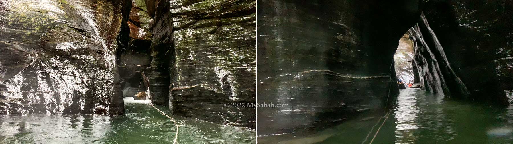
Then I continue to explore the canyon. The deeper side of the canyon is dark and narrow, almost like a cave tunnel, it’s a bit scary actually. Large volume of water squeezes through this narrow tunnel and pushes me with force.

I climb over a few mini waterfalls to go further inside, like a rat crawling against the running water in the pipe. Behind each waterfall is a chamber-like space with opening on top. The rain starts to flood the canyon, so our guide advises us to leave before the bad weather hit us. Exit the canyon is easy as we follow the current.

The ending section of Taralamas River Canyon. Actually you still can explore further up.

At last we hike back to the starting point and it is pouring rain on the way. None of us was dry. After some clean-up at the community hall, we return to KK. I’ve visited the canyon twice but more than happy to come back again.

Geology of Taralamas River Canyon

On social media, you may have seen tons of posts that praise the beauty of Taralamas River Canyon, but nobody tells you why it is so special. I did some homework by asking Professor Dr. Felix Tongkul, an expert in geology.

The unique rock structure of Taralamas River Canyon

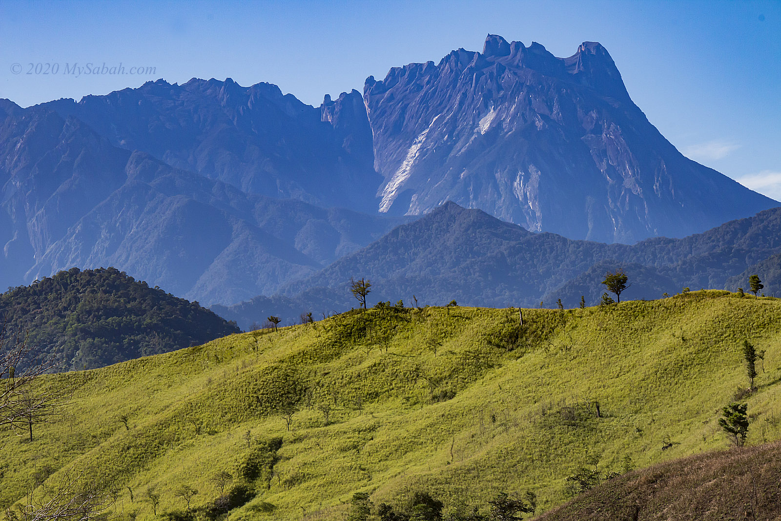
According to Dr. Felix, technically Taralamas is a small river canyon. It was formed by stream erosion along a vertical fracture on the sedimentary rock sequence of the Trusmadi Formation. The sedimentary rock sequence comprising of dark shales and thin sandstones that were deposited about 60 million years ago in a deep sea area. The canyon itself was formed much later after the sedimentary rock sequence were uplifted and exposed on land about 15 million years ago. (Me: Wow, this canyon exists about 7 million years earlier than Mount Kinabalu.)

Left: smooth rockface of the canyon, Right: the bluish-gray stones on the riverside

Dr. Felix also said that there are other small canyons in Sabah too, but they are quite inaccessible. One such canyon can be found along Baliojong River in Kampung Togudon, Tandek in Kota Marudu. In terms of geological significance, Taralamas tells the geological history of Sabah during the Paleogene Period and illustrates the ongoing geomorphological process that shapes the surface of the earth. (Me: It’s also an extraordinary geotourism destination.)

Stories of Taralamas

My first impression of Taralamas is its hauntingly beautiful and mysterious vibe. Locals believe that some guardian spirits are living in this canyon. They don’t appreciate noisy people and dogs.

The big rock at the left looks like the face of a beast

Mr. David Julian, the founder of Tiang Lama Village Ecotourism, has been working on the tourism project there since 2019. He shared some stories of Taralamas with me. He thinks this canyon was probably discovered by the villagers who fished and hunted around Widu River in 1930s.

Left: misty forest of Tiang Lama village, Right: snake swimming in river canyon

The name “Taralamas” originated from the local word Dalamas, which means wall of big rocks at the river, or tall and slippery giant rocks along the river. Before Taralamas was open to tourists, it’s a fishing ground of the villagers.

People of Tiang Lama Village. Most of them are Dusun, the largest native group of Sabah.

Though the river there is teeming with fishes, the spirits can make fishermen go home empty-handed. Therefore, before the villagers catching the fishes together, their Bobolians (high priest) would perform a ritual to request for a bountiful caught permitted by the bunian (elf). As most villagers are converted to Christians or Muslims nowadays, they are no longer doing this, but they still remain respectful to the spirits in the canyon. That’s why shouting, cursing and offensive behaviours are not acceptable at Taralamas.

Playing in water and forest

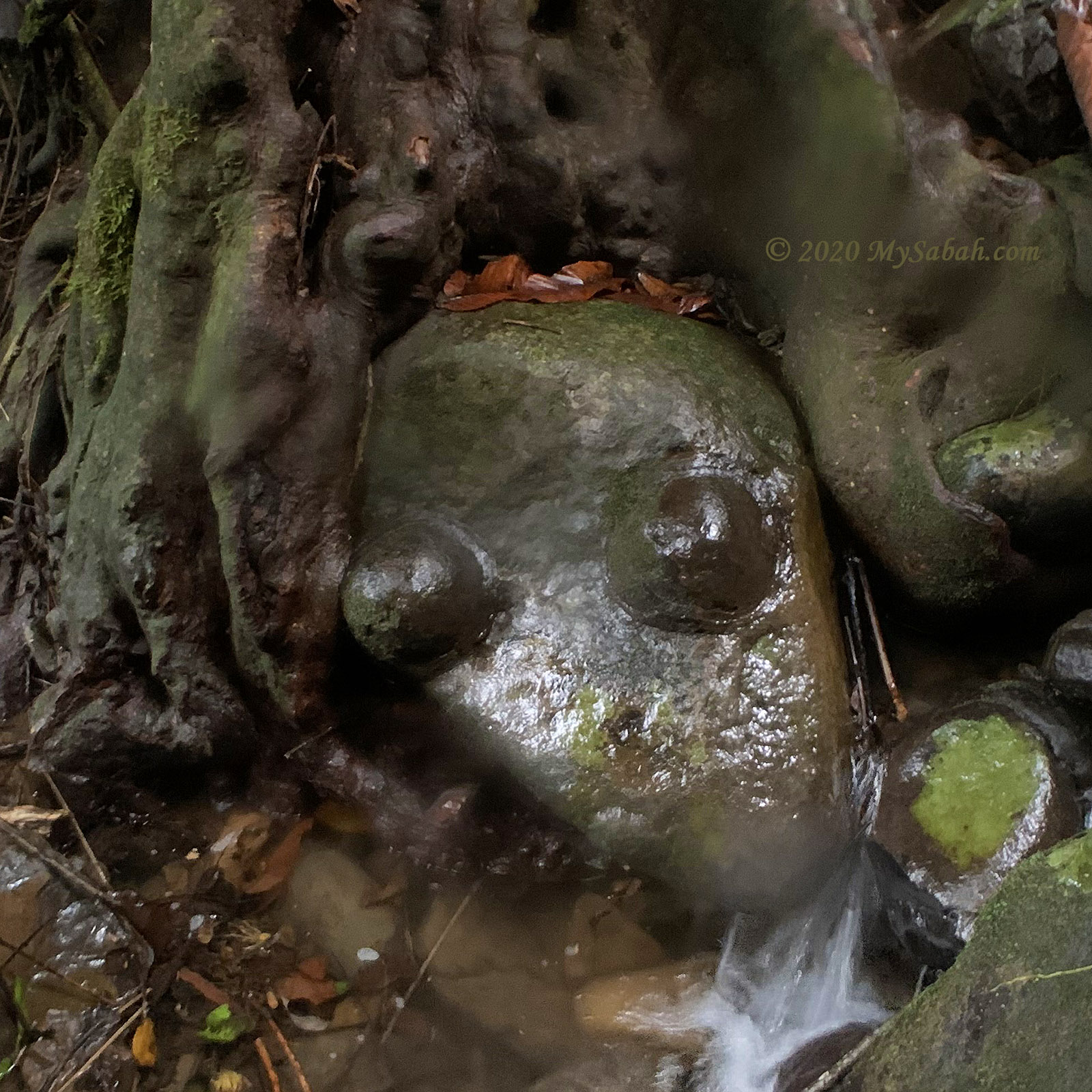
Another story is a group of hunters were chasing a deer at Taralamas. A dog and deer fell into the canyon. When the hunters went down to search in the river, they were shocked to find that the dog and deer have turned into rocks and sticked on the wall of Taralamas River Canyon. The figures are still there, but faded now due to water erosion.

Fees & Booking Info

To visit Taralamas River Canyon, you can book the tour online with one of the village operators listed below. Both operators offer different packages and services. Besides entrance and guiding fees, you can order add-on such as packed meals, transportation and homestay / camping. And hardcore hikers can opt for the longer trails (8km and 12km) to visit Sadoron Waterfall and Gibai Peak.

Left: Mimpori Nature Homestay, Right: sunset view of Mount Kinabalu at Tiang Lama Village

1) Noponu Adventure Center

Website (booking): noponu.com
Facebook: @noponucamp
E-mail: davidjulian5583@gmail.com
Phone: +60 19-5803558

2) Tolungan Daralamas River Canyon

Website (booking): tntdaralamas.com
Facebook: @taralamasofficial
E-mail: tntdaralamas@gmail.com
Phone: +60 19-5826269, +60 13-2343949

Note: They would cancel the tour if the weather is bad (canyon flooded). If you plan to overnight in Tiang Lama Village, do bring some warm clothing. It’s very cold at night (about 16°C).
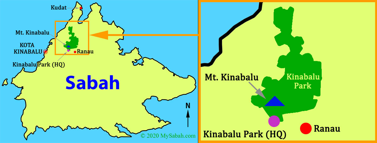
How to get there

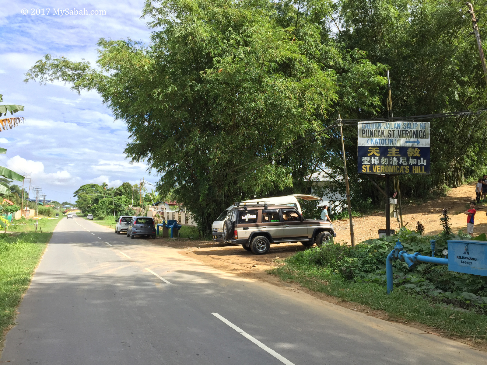
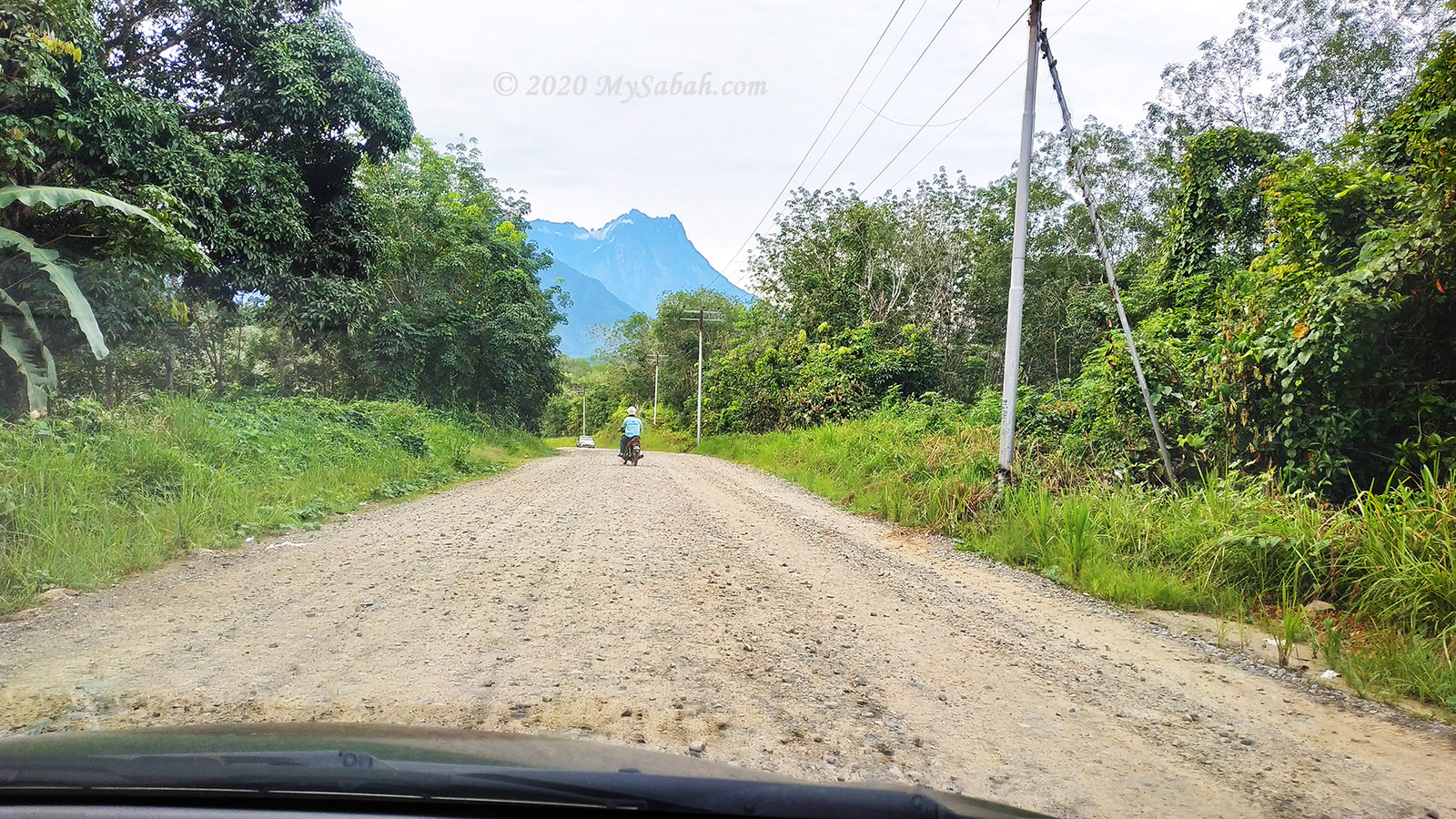
Tiang Lama Village is a remote site located between Ranau and Tambunan districts. If you depart from Kota Kinabalu City, the driving distance is about 170 Kilometres (or 106 miles). The last 25 KM to the village is a gravel road, while the rest is paved road in ok condition. It takes 3.5 or more hours to reach the village by car. For day trip, you better move as early as 5am.

Left: 4-wheel-drive is the best transport to Tiang Lama, Right: van stranded in muddy road

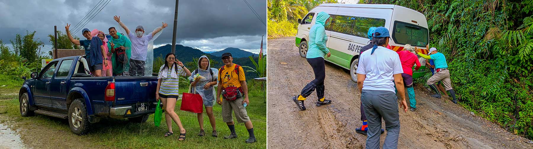
The junction (GPS: 5.858062880692335, 116.50639939196654, see Location Map) to Tiang Lama is next to the main road between Ranau and Tambunan towns. The 25-km gravel road is muddy after rain, so getting there by 4-wheel drive is highly advisable. Or you may book the transportation with the operator, who can pick you up in Ranau or Tambunan town.

Things to Bring

The following is a list of recommended items to bring for day trip. It’s for your reference only, you may not need them all.

Left: outfit for the hike, Middle: waterproof casing for phone, Right: leech repellent
  • Drinking water & bottle
  • Backpack with rain cover
  • Dry bag
  • Raincoat / poncho
  • Cash
  • Jacket or windbreaker
  • Gloves (for using ropes)
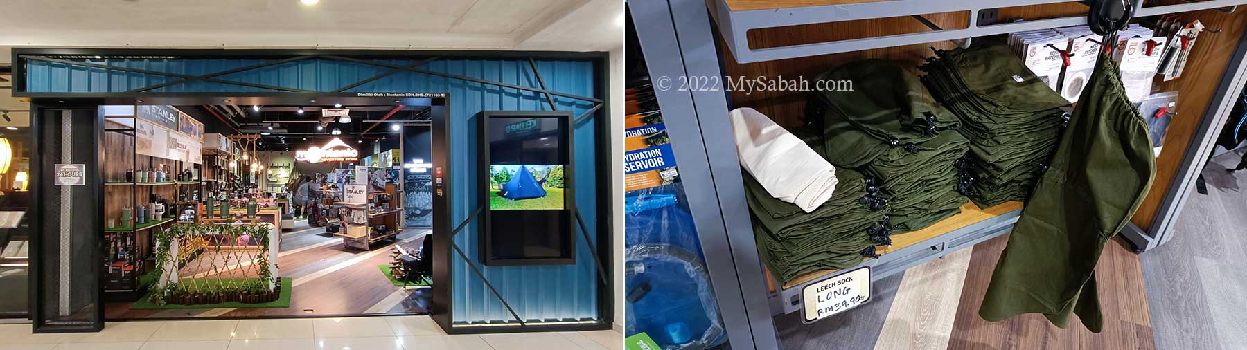
  • Anti-leech socks
  • Waterproof casing for phone or camera
  • Power bank and charger cable
  • Swimwear / Spare clothing
  • Towel
  • Extra socks
  • Plastic bag (to store wet or soiled clothing)
  • Toilet paper
  • Tissue paper or wet wipe
  • Hiking sticks
  • Insect repellent
  • Optional: Lunch Box + spoon, energy bar / snacks, personal medicines, hat, sunglasses, sunblock lotion

Photos taken in Ranau, Sabah, Malaysia Borneo

Rafflesia flowers of Sabah

I have been waiting for the blooming of Rafflesia flower. I went to Tambunan Rafflesia Information Centre in August last year, but came back empty-handed (I mean no photograph). Rafflesia is the biggest flower in the world and out of 15 species, only 3 species are found in Sabah. You also can find rafflesia flower in Sumatran, Peninsular Malaysia, Java and Philippines.

Rafflesia display at Rafflesia Information Centre in Tambunan

Rafflesia arnoldii species, with 90 cm in diameter, is the biggest flower in the world. Too bad it does not live in Sabah. I am tired of hearing tour operators advertise we have the biggest flower. Just to get the fact right.

Rafflesia pricei is the second largest rafflesia species of Sabah

Tambunan’s Rafflesia Information Centre is about 80 KM away from Kota Kinabalu city. However, you will be driving on a long and winding road on the hilly area. Unless you own a powerful 4-wheel, otherwise you will need about 2 hours to reach there. There is an exhibition hall that shows some info of rafflesia species. The centre opens at 9am daily and close at 5pm every day. So don’t be late.

Information panel on different species of rafflesia flower

Only Rafflesia pricei, about 30 cm in diameter (max. 45 CM) and second largest species in Sabah, is found in the Tambunan forest reserve about 1,200 – 1,400 Meters above sea level. Daily sighting is not guaranteed and in fact consider rare. many small brownish protuberances (bud) of rafflesia can be seen on the forest ground. The seed will need 6 to 7 months to grow! Rats and other animals would feed on this juicy bud thereby adding the rate of fatality. It is difficult than bearing a human baby.

Close up of rafflesia pricei

Rafflesia is a parasite plant that hosts on the vine of Tetrastigma. Rafflesia is a single flower with no stem, leaf, or root; it is smelly like rotten meat. Rafflesia pricei is not as stinky as Rafflesia keithii. But when I get very close and sniff, I still can smell the unpleasant odor. Rafflesia relies on this smell to attract insects, such as flies, to carry on pollination.

Buds of rafflesia pricei

The photo above shows the reddish-brown cabbage-like protuberances of rafflesia. As you can see, they grow on a vine. A few months later, their flower will bloom at night, showing their fleshy petals (perigone lobes) like the picture of Rafflesia price below. The whole plant is a bit soft and looks like a plastic flower. I like its beautiful white patchy pattern. I was excited because this was my first time seeing a blooming rafflesia.

The Rafflesia Azlanii species featured on the RM10 Malaysian banknote was first discovered in the Royal Belum Forest Reserve of Perak. It looks quite similar to our Rafflesia pricei (left).

Last Saturday there were two blooming of rafflesia pricei, one was 3 days old, another one 6 days. I was very lucky because one of the blooming rafflesia is only 10 minutes walk into the forest, and there was no forest leech due to the dry season now. The worst experience will be walking in the trail for an hour and get annoyed by the little blood sucking slimy leeches throughout the trekking. The extra water, raincoat and leech sock that I carried were needless.

Follow the guide into the forest to look for the blooming rafflesia flower. If you are lucky, it’ll be a short walk.

When I was busy photographing the rafflesia, the park ranger kept on asking if I would use the photos for filming. If the photos are for commercial use and I photograph it for very long, I would have to pay RM3,000 (USD900) for such purpose. According to him, a Korean even paid RM2,500 (WOW!) to picture this magnificent flower. Rafflesia pricei is pricey to photograph then. Well, I drove here for 2 hours and paid RM50 entrance fee, there was no way I would take two shots and left. I was done with the priceless moment anyway.

The blooming of the rafflesia flower lasts about six days. Days 2 and 3 are the best viewing times. The flower would turn dark and show signs of withering from day four onward.

Just for your info, the blooming flower will last only 1 to 5 days. On 6th day, the petals will dry up, and the whole plant will wither in the next few days. By the time you read this, the pretty rafflesia flower I saw last week should have gone. Before you visit, please call the center to see if there is any blooming. When I left, two tourist buses had come in; the travel agent was quite well-informed. When there is no blooming, the whole place is like yours.

For other two species, Rafflesia keithii, with 80cm in diameter, is the biggest species in Sabah. You can see them in Poring, Crocker Range Park, Sabah Agriculture Park (Tenom), and Lohan. If I am not mistaken, Keith, the person that discovered Rafflesia keithii, is the husband of Agnes Keith, the author who named Sabah “The land below the wind.”

Models of different rafflesia flower species from other regions

Rafflesia tengku-adlinii, with 20cm in diameter, is the smallest but the rarest rafflesia that can only be found in eastern slope of Trus Madi range and Lutong Mountain (of Maliau Basin) in interior Sabah. If you are able to show me its blooming, I will not hesitate to pay you handsomely!

Rafflesia tengku-adlinii is the rarest and smallest rafflesia species of Sabah.

Due to forest clearing for logging and agriculture, sighting rafflesia depends on luck. I hope we can grow them in the nursery. Some villagers are unhappy to see Rafflesia flowers. They would remove it to prevent their land is gazetted as a protected forest reserve. I also hope Sabah Parks can create a web page that announces the blooming of rafflesia so more tourists will come to the sighting. I have no doubt the interest is strong.

Blooming Info

Sighting of blooming rafflesia needs luck. To avoid disappointment, before you visit Rafflesia Information Centre in Tambunan (see Location Map), you can check for blooming information with Sabah Forestry Department:
Facebook: sabahforestrydepartment (they will update their Facebook if there is blooming)
Tel: +60 19-5383992 (mobile), +60 88-899589 (office)
Mobile Phone: +60 11-33912760, +60 16-8878110, +60 11-26883441, +60 16-8346396, +60 11-31445985, +60 14-8694419
Email: rafflesia.info@gmail.com

VisitorAdultChildGuiding Fee
MalaysianRM5RM3RM50 for 5 people
ForeignerRM15RM7RM100 for 5 people
Please note entrance fee applies. To see rafflesia flower, you need to pay guiding fee (can be shared by 5 people). Rates as of Mar 2024

Related posts
Biggest flower in Sabah
Twin blooming of rafflesia

Photos taken in Tambunan, Sabah, Malaysia Borneo

Ruhiang Hill (Bukit Perahu) and Ship Rocks

Does Noah’s ark really exist? I don’t know, but I was told that near Tamparuli town, there are rocks that resemble a vessel stranded on a hill named Bukit Perahu (also known as Ruhiang Hill). I guess that’s how Bukit Perahu got its name, as Perahu means Boat and Bukit means Hill in Malay language.

Bukit Perahu (or Ruhiang Hill) is next to Tamparuli town (left)

Many also say the top of Bukit Perahu has one of the most spectacular views of Mt. Kinabalu (the highest mountain of Malaysia).

Majestic Mount Kinabalu and Bukit Perahu (lower left)

One day I finally managed to get up early in the morning, headed to Tamparuli, which was 30 KM away from Kota Kinabalu City, then climbed up to the peak of Bukit Perahu.

The beautiful sea of cloud will disperse after the sun comes up, so you better reach the peak as early as possible.
Hikers relax and enjoy the morning view on Bukit Perahu

What they said was true. The scenery is so exceptional that I climbed it again the following week with my drone to photograph some aerial shots.

The friends of this family want to climb Bukit Perahu after they see this awesome shot

During good weather in early morning, you would see Mt. Kinabalu like floating on sea of cloud. Someone come very early to catch the sunrise around 6am for the best view. If you go late, say after 8:30am, the sea of cloud would disperse and envelope Mt. Kinabalu.

This family photo tells you that the climb is not overly challenging.

Bukit Perahu is only 300 Metres high. The hiking distance to the top is about 800 Metres and normally takes about 35 minutes, depend on your fitness. Some sections of the trail is a little steep. Overall the climb isn’t challenging.

The total distance to the peak is about 800 Meters

The Climb

The starting point of the climb is near to the roadside in Tamparuli (later I tell you how to get there). It’s a public area and you aren’t required to pay any entrance fee. The trail is well-marked and there are many hikers around in the morning, so you won’t lose your way.

Bukit Perahu is also one of the best paragliding sites.

Looking from far away, Bukit Perahu is a cone shaped hill with gentle slope, but the route is a bit steeper than we think. The 800-Metre trail is fully paved by cement from the start to the end (peak), so no more slippery soil trail after rain.

The trail to the peak of Bukit Perahu is now fully (100%!) paved by cement now. The photo at the left was taken in year 2017.

Note: The photos that show nature trail here are the old photos, the peak can be reached by stairway now. Do expect some human traffic during weekends, as everyone uses the same trail for ascend and descend.

Roman Catholic uses the route to the peak as the Way of the Cross (or Stations of the Cross). You will see 14 crosses along the way, with photo and description about the suffering of Jesus Christ carrying a cross to his crucifixion.

The local Catholics make this trail the Station of the Cross (or Way of Sorrows). Along the trail you will see a total of 14 cross signage with picture and text depicting Jesus Christ on the day of his crucifixion.

Most of the time you walk under the shade.

Most of the time the dense trees shaded me from sunlight, and the cool morning breeze stopped me from overheat, so it’s quite a pleasant walk.

Very green surrounding around the peak

The stairway prevents climbers and hikers from walking on the slippery trail and boulders. However, someone say that the new cemented path is losing a bit of touch with nature.

The stairway makes the climb less challenging but a bit more tiring.

After moving higher up, I could see Tamparuli town and surrounding hills with lush forest, the more I ascended, the nicer the view.

Gazebo in the midway

I took a short break in a gazebo next to cross No. 10. I was halfway there.

Last 200 Meters to the peak
When you see the 14th cross and the big cross, you are only 200 Meters away from the peak

After the last cross, I reached an open area with soil trail pounded solid by thousands of footsteps of hikers.

Almost reaching the hilltop
The view on top of Bukit Perahu

On the hilltop were some relaxing hikers enjoyed the panoramic view of Tamparuli town, rolling green hills and Mt. Kinabalu.

Hikers enjoying the scenic view
The hawkers sell stuffs from early morning to 9 or 10am on the peak

Hungry? Thirsty? A few hawkers were selling drink, snacks and fruit (the prices are higher, consider the labour work to carry these things up to the hill, e.g. a tin of 100Plus sold for RM3.00).

You can buy some drink, snack, chips and fruit on the hill
You can have a bird eye view of Tamparuli from the top of the hill
The only shade you can find on hilltop.

The Boat Rocks

I tried to locate the two boat rocks that earn Bukit Perahu the name. Please note the trails to the rocks may not be well-maintained and covered by dense grass.

Looking for the boat rock

The smaller one is nearer and the entrance is at the left hand side (when you face Mt. Kinabalu).

On the way to the smaller boat rock

It’s quite an easy walk on a small trail and I saw the boat rock within 10 minutes. It really looks like the front of ship (bow).

This rock looks like a sinking ship

The bigger one is another story. The entrance is at the right. When I asked the locals for direction, they looked concern, as if it’s a bad idea. They warned me that the trail is not in good condition.

Azlan clearing the bush that blocks the trail

I just proceeded anyway and walked into the wood, just after 15 Metres a dense bush was in my way, I was stuck. Luckily, Azlan, a local from Tamparuli, came to “rescue” by using his machete to clear the trail.

On the way to the biggest boat rock

I followed Azlan to pass through the dense wood and narrow steep trail. Azlan climbs this hill regularly so he knows the place really well. In fact, he is the one who opens the trail to the big boat rock. He said he had cleared the trail in Jan but the undergrowth flourished again.

Azlan is the one who opens the trail to the huge boat rock.

After 23 minutes of painfully slow move on steep and slippery trail, Azlan stopped at a big rock and said “It’s here.” I didn’t see any boat rock. He added, “You are on top of the boat rock. You need to descend to the side to have a better look.”

Big boat rock

He is right. At one side, the boat rock looks like the hull of a cargo ship. I don’t really recommend you visit this rock due to safety. If you must go, bring insect repellant.

This boat rock is really huge. Did you see the “snake head rock”?

Then we descend to another side. From this angle, the rock really looks like a ship that has 3 layers of decks. Two ladies, Zoom and Farah were following us, I included them in the photos so you can see the scale.

Closer look of the boat rock

Azlan is a civil servant working in Tuaran. Though he is 52 years old, he remains very fit and climb Bukit Perahu up and down 5 times to train for climbathon (mountain race).

How to get there

When you reach Tamparuli town, which is about 30 minutes by car from Kota Kinabalu City, turn to Jalan Tamparuli Togop Road (see Street View map) beside the police station.

The starting point of the hike is next to the road. Note the signage that reads Puncak St. Veronica

Just follow the road for about 300 Metres, the starting point will be at at your left (see Street View map, GPS Coordinate: 6.131424, 116.273830). If you come in the morning during weekends, you would see many cars parked at the roadside.

At the starting point, there is a sign that reads “Laluan Jalan Salip ke Puncak St. Veronica” (translated as: Way of the Cross to St. Veronica Peak). There is a house there so be quiet. There is no toilet at Bukit Perahu so you better relieve yourself somewhere else before the climb.

Photos taken in Tamparuli, Sabah, Malaysia Borneo

How to prevent leech bite?

Some of us might get bitten by leeches when we trek in the Malaysia forest. Leeches don’t kill but they are extremely irritating and disgusting blood suckers. I was first bitten by the forest leech when I was on the way to Poring waterfall. I still hate leech bite, so I never stop asking the experienced trekkers how to avoid leech bite. Below are some of the tips that I’ve collected so far.


Above: Tiger leech gets its name from its orange stripes


Above: a fully-fed happy brown leech

6 Ways to Prevent Leech Bite

1. Anti-Leech Socks

Anti-Leech sock is the MOST effective way of preventing leech bite. It does not contain any chemical to drive away the leech. Basically it is just an oversized sock that you wear it over your trousers as outer layer to cover the opening of your sock and jean. If a leech crawls on your leech sock, then you can spot it and get rid of it. FYI, you can buy anti-leech socks online shop such as Shopee (search by keywords “leech socks”).

Left & Middle: anti-leech socks cover the opening of your trousers. Right: Herb that can stop the bleeding caused by leech bite.

Click Here to read “How to use and where to buy anti-leech sock?” if you want to get a pair of leech socks

2. Tobacco Sock

Tobacco can kill leech in minutes. Spend a few dollars to buy some grinded tobacco leaves from the tamu or pasar (local market). Put it in a container and soak it in water (but not too much). Soak the socks in the tobacco water overnight. Leave the socks dry up next day. If you wear the sock, leech may crawl on it but it’ll halt moving after a while due to the poisoning by tobacco.

To see if tobacco can kill leech, I sprinkled some tobacco leaves on a leech and it died within a minute.

3. Dettol

Heard this from the villagers in Long Pasia. During World War II, people were wondering how the Japanese soldiers bear the leech bites in jungle warfare. Later they learn that the army applied Dettol on their hands, necks and legs. The strong smell kept the leeches away. However, if you go for wildlife watching, I won’t advise you to do this because your smell will scare away all the wildlife hundred feet away.


Above: the body size of leech can double or even triple after sucking blood. One full meal can last it for several months.

4. Lady’s Stockings

I heard from someone that there is a scientist in Danum Valley, who enters the forest frequently for research and seldom got leech bite, though he wears short pant. His secret is to wear the stockings (yes, the pantyhose used by lady).

5. Insecticide Socks

I got this tip from a friend who works for a lumbering company. Just got a pair of long soccer socks, like the one wore by ah pak (old uncles) for jogging. Wear it all the way up to your knee (also cover the opening of your jean). Then spray Baygon brand insecticide on the sock and shoe. FYI, other brands such as Ridsect does not work well. The leech dies almost instantly the moment it touches your shoe or sock.


Pic: Baygon insect (pest) spray, only some supermarkets or stores selling it.

6. Insect Repellent

The easiest way is to buy a bottle of Mosi-Guard at Guardian (also available in other local pharmacy / drugstore) and spray it on your shoes and socks. It is an insect repellent but its eucalyptus extract can prevent mosquito, as well as leech attack up to 6 hours. Insect repellent with DEET is also effective but it is very hard to find here (probably local restriction on such chemical). You may click the picture below to read the article:


Above: Mosi-Guard insect repellent also can repel leeches. You can find it in many pharmacy shops in Sabah.

I spray Mosi-Guard insect repellent on my shoes and anti-leech socks, and I almost got 0 leech bite during jungle trekking in most leech-infested area of Borneo. This repellent only makes you smell terrible to the leeches. A few stubborn leeches still want to get on your shoes but most of them won’t move on.

More Useful Facts

1. Leeches live in humid area. So you can expect more leeches near the river and during the rainy session. The forest that has more wildlife tend to have more leeches too. Leeches not only hide on the ground, you also can find them on the leaves and twigs of low shrub. Leech is the most abundant in lowland forest. I encounter leeches in altitude of 800 Meters above sea level, but the number is a lot lesser. However, in drought season, you may not see a single leech in the forest.


Above: tiger leech can attack you from any direction.

2. Some says, if you walk in group, the people at the front have less chance of getting leech bite, most victims are people at the back. Leech is sensitive to body heat and vibration. The first person passing by will “wake” them up, making them active and look for the next comers. Well, based on my experience, everyone has equal chance. In fact, first person gets very high chance of leech bite because he always has to stop to wait for the slow movers behind, giving leeches more time to crawl onto his body.

3. Leech is blind and likes to bite warmer area (due to thinner skin) such as armpit, skin between toes and butt. That’s why I hate it. It loves sensitive spots. You better wear long sleeve and tuck in your t-shirt. How does it gain access to your butt? For example, fashionable girls who like low cut jean, or you do your no.2 in the forest. Whatever, just don’t bite my balls.

4. Some may tell you that leech can leap / jump to you. It’s just an exaggeration from people who are so afraid of leeches so their imagination goes wild. Leeches only can crawl. That’s it. I have walked hundred of Kilometers of forest trail and never see any leech that can jump.

5. Someone even say if you cut a leech into half. Each half will grow into a new leech. It’s bullshit. I tried that before. The leech just turned pale and died.

6. I don’t believe the widely circulated non-sense + scary leech stories such as leeches grow in your brain. But I do believe that if you let leech got into your nose, it will live inside permanently due to free flow of food supply. My mom personally saw this happened to one of her dogs. Avoid washing your face in forest stream and don’t swim in still water.


Pic: fully-fed tiger leech sleeping on a twig

I was bitten by leech. What should I do? OH NO, Help!!! I’m going to die!

Don’t panic, don’t scream. It’s just a bug as weak as mosquito. If you are bitten by a leech, do not try to pull it away by force. This would leave permanent scar on your perfect skin. You can apply salt, tobacco, eucalyptus oil, lime fruit juice, tiger balm or medicated oil (e.g. Minyak Kapak or 驱风油) on it and it will shrivel and drop. Or just let it finishes its meal and drop off itself. The last resort is to put your finger on your skin next to its oral sucker, then gently (but firmly) slide your fingernail toward its mouth to detach it from your skin.


Above: bleeding caused by leech bites. Look scary, but from their smiles, you know it is no big deal. Just treat it as a leech therapy. You won’t bleed to dead anyway. Leech also doesn’t carry any disease and poison.

Due to anticoagulant to facilitate blood flowing, leech bite will cause your wound to bleed for hour but it will stop eventually. A guide taught me to stick a small pieces of paper on the wound to speed up the clotting and it works! Apply anti-septic cream on the wound to prevent infection and you will be fine. Keep your wound dry and clean. It will itch for a few days before fully healed, but don’t scratch it.

Types of Forest Leeches

There are 2 types of leeches in Borneo rainforest, namely, tiger leech (species: Haemadipsa picta) and brown leech (species: Haemadipsa zeylanica). The Tiger Leech can extend its body more than 6cm long, while Brown (ground) Leech is much more smaller, only about 2 cm. The bite of tiger leech is sharp & painful (like 5 mosquitoes bite you on same spot). If brown leech bites you, you may not feel anything at all, due to the anesthetic chemical in its saliva.

Related Post
How to use and where to buy an anti-leech sock?

How to use and where to buy anti-leech sock?

The 130-million-year rainforest of Borneo is older than Amazon, but there is one small bug that scares its visitors. Like other rainforest in South East Asia, the best lowland forest of Malaysia is always infested with forest leeches, the little wiggling and slimy blood suckers, which are extremely persistent to crawl onto your naked skin for a feast.


Their bite is nothing more than a minor cut, but the anti-clotting agent in their saliva causes you to bleed profusely for hour, some find the bloody view a terrifying experience. I was always shocked by the screaming of the girls who find leech on their skin, so I decide to write this guide.


Leech sucks, so how to prevent being leeched? The MOST EFFECTIVE way to prevent leech bite is by wearing anti-leech socks or leech-proof socks (leech socks in short), as shown in the photo above. Leech socks have become a standard part of the outfit for jungle trekking in Borneo.

So you want a leech sock huh?

There are 4 types of leech socks (see following photo). In most cases, you only need to pick type no.1 or 2. Type 3 and 4 are less common and listed here FYI only:

Please see photo above for numbering.
No.1: Elastic-strap leech socks – most commonly used.
No.2: “Deluxe” leech socks – expensive but the best.
No.3: String leech socks – old fashion but still in use.
No.4: Long leech socks – same as No.1 but longer.

Though look different, all of them employ the same simple mechanism to keep leeches at bay. Basically they are just oversized socks for you wear over the trousers, to block leeches from accessing your skin from the opening of your trousers.

1. Elastic-strap Leech Socks

A pair costs RM18 to RM24 (USD5-USD6.50) and made of cotton cloth. It is the most commonly used. If you don’t want to read further, just buy this one.

Most common type of anti-leech socks

FYI, you can buy anti-leech socks at online shop such as Shopee (search by keywords “leech socks”).


To use it (it is easier to wear it in sitting position), (1) wear it like socks all the way up but at outer layer, so you can cover the opening of your pant. (2) Then pull the elastic strap to tighten and seal the opening. (3) Note the adjustment knot to control the tightness of the strap. (4) repeat the steps for another foot and put on your hiking boot or shoes.


Keep your legs comfortable, an extremely strong tight is not necessary. I know you worry that leech might sneak in through the sealed opening but that’s very unlikely. The closed loop of the strap always hooks on something in forest, so you may want to hide it behind the socks.

Below is a 1-min video to show you how to wear this anti-leech sock:

The Good: reasonable price and comfortable to wear.

The Bad: during long walk, the socks will slide down gradually. You have to pull it up regularly. It is made of cotton cloth, so it gets wet easily during rain or if the trail is muddy.

2. Deluxe Leech Socks (Water Resistant)

A pair costs RM38 (USD11.50) and made of nylon material (upper part) and linen cloth (lower part). I call it “Deluxe” because it is very expensive.

Water resistant anti-leech socks


Just wear it like other leech sock. This leech sock has internal elastic grip on top and bottom of the nylon (blue part), so you don’t need to tie any string. But I find it a bit tight though. Maybe it’s new.


Above: close-up of Deluxe Leech Socks

You may watch the 1-min video below to see Deluxe Leech Socks:

Personally, I think this is the BEST leech sock, due to the reasons below.
The Good: The materials are more water-resistant and durable. That means the socks can be cleaned (e.g. mud) and dried quickly. This is important for long period of jungle trip, because wet sock is very hard to dry up in humid forest of Borneo. The double grip points also keep the leech sock in position.

The Bad: the most expensive type. For that price, you can buy two pairs of other leech socks.

3. String Leech Socks

A pair costs RM15 (?USD4.50) and made of cotton cloth too. This design is phasing out and replaced by Elastic-strap Leech Socks.

String leech socks


The design is similar to other cotton leech socks. Since it has no elastic grip, you need to tie a noose on the cord to seal the opening, like how you tie shoe lace.

The Good: cheaper. If you know the right technique to tie the knot, the socks won’t slide down.

The Bad: The strap is not elastic so you have to tighten it stronger to hold the sock in place. However, this causes extra stress and discomfort to my skin. After long day of jungle trekking, it will leave thin lines of bruises on my skin at the strap area.

4. Long Leech Socks

A pair costs RM34 (?USD9) and made of cotton cloth.


In general, it is same as Elastic-strap Leech Socks, but it is a few inches longer and have two elastic straps.


To compare the difference, I wear both long and short leech socks, as shown in photo above. I think it’s for people who wear short pants.

The funny thing is – leech sock is for leech-phobia tourists. Our local people don’t wear leech socks. Those villagers who always go in and out forest normally wear long soccer socks, less effective (60-70% leech proof) but costs only a few dollars. In fact, most of them don’t really bother about leeches.


If you can’t find any leech socks for sale, you can use soccer socks instead, which is readily available and cheap. Make sure you get the long one with very tight weaving that leaves no tiny seam for leech to wiggle its way in. The soft-bodied leech only needs a loose hole as tiny as pencil tip to puncture your skin for blood.

Does anti-leech sock make me 100% leech-proof?

Good question! The answer is NO. But it’s 90% leech-proof and does make a big difference. To understand why, you need to know how leeches “attack”.


There are 2 types of leeches in Borneo jungle, namely, Tiger Leech and Brown Leech. Brown leeches are smaller and usually active on ground level with wet leaf litter. Occasionally you may see it crawling on grass. When it crawls on your leech socks, you can just flick it off. Brown leech can be fend off easily by leech socks.

However, for tiger leech which is bigger and active from ground to waist level, you have to be vigilant all the time. Especially in wet season, tiger leeches will hide and wait in the leaves and twigs of shrubs along the trail. If your body touches the bushes, you will pick up tiger leeches on your legs or waist. The leeches will crawl up and look for exposed skin on upper part of your body, for example, armpit, neck and belly. Leech socks won’t work in this case. So you need to keep an eye on your body (or ask your buddy to check regularly). Anyway, just avoid contacting any low shrub and you shall be safe.


When leeches crawl to your leech socks, 90% of them will go inside your shoes. Leech dislikes dry surface so the dry cloth of leech sock deters them slightly. You will find half-death leeches in your shoes. But it is different story when it rains and your leech sock is wet.

Where to buy leech socks?

You can buy them in online shops such as Shopee and Lazada (search by keywords: “leech socks”).

There are also a few places in Kota Kinabalu where you can find anti-leech socks. I only name two shops here. When you buy leech sock, check the sewing and make sure there is no hole on the socks.

Montanic Adventure Store

Montanic Adventure Store is on the second floor of Suria Sabah shopping mall (in Kota Kinabalu City).

Montanic Adventure Store in Suria Sabah Shopping Mall and the anti-leech socks (Elastic-strap Leech Socks and Long Leech Socks) they sell.

Below is their contact:
Address: 2-78, 2nd Floor Suria Sabah Shopping Mall, 88000 Kota Kinabalu, Sabah, Malaysia.
Tel: +60 88-274538
Facebook: @MontanicSuria

Some popular nature destinations such as Tabin Wildlife Reserve and Danum Valley also sell leech socks in their souvenir shops, but at higher price. Please share with us here if you know any other shop selling leech socks.

To learn more tips to combat leeches, you may Click Here to read “How to prevent leech bite?”.

Photos taken in Sabah, Malaysia Borneo

Boobs Rock, Waterfalls and Black Honeybees at Maranggoi, Kota Belud

This year I celebrated my birthday differently. No Internet, no birthday cake, and no cozy bed. For me, to feel great being alive is to do something I love. Touching some boobs would be awesome, so this birthday wish brings me to Batu Nenen (Boobs Rock) in Maranggoi of Kota Belud.

(Left) Photos next to a Liposu fruit tree. (Right) Oh dear I am (in middle) so fat. At the right is Risin (my guide) and left is Uncle Sinuar (cook)

About Maranggoi and Pinolobu

Located in Pinolobu Village (Kampung Pinolobu), Maranggoi Eco Tourism is a new destination of rural tourism, which promotes travelling in countryside of Sabah. This village is blessed with forest, waterfalls, spring water and clean river. Maranggoi is the name of the river, which is named after a missing young man Maranggoi, who used to collect resin in forest around that river. But one time he didn’t return home after 3 days, which he normally did. The villagers went out looking for him and shouted his name, but they only found the cigarette butt Maranggoi left.

Trail Map of Maranggoi (Source)

Kampung Pinolobu is a village about 17 Kilometres away from Kota Belud town. Pinolobu means breaking into a new frontier. Most of the population in Pinolobu Village is Dusun Tindal people and majority of them are farmers. Fruits and crops are everywhere in Pinolobu, to list a few, tapioca, pineapple, mango, rambutan, durian, sweet potato, and rubber. The entire village is built on hill area. To move around neighbourhood, you would need to walk up and down some slopes.

Visit the Boobs Rock (Batu Nenen)

Last month I booked a 2-day-1-night tour with the operator of Maranggoi. I drove 2 hours from Kota Kinabalu to Kampung Pinolobu. I was a bit worried about the bad weather lately, and wished the sky would be kind to me on my birthday. Luckily, the day was clear in the morning and by 7:30am I met Risin, who was my guide. Risin is married with 4 kids and own a farm in Kampung Pinolobu.

River pond with crystal clear water

After a light breakfast in a local shop, we headed to the starting point of jungle trekking, to visit four waterfalls and Boobs Rock in Maranggoi. The hike started in the base camp, which is nearby the first waterfall, Wasai Telupid. Telupid is the name of a rare exotic tree that bears sour fruit, its leaf also has strong flavor of sour, and both can make mouth watering pickle and food.

First waterfall (Telupid Waterfall) in Maranggoi river trail

To reach Batu Nenen, We needed to walk over 2 KM along Maranggoi River and passed by a few waterfalls. As this is upstream, the boulders are huge and the stream is crystal clear. Risin says there is no more village upriver so the water is unpolluted. Maranggoi River also seldom floods, even in rainy season. Do bring swimwear if you want to enjoy the clean and cooling water. All waterfall ponds are shallow and safe for a soak.

Telupid tree, a rather rare and exotic tree with edible sour fruits and leaves

The nature trail to Boobs Rock is pretty challenging for tourists who are not used to jungle trekking. We have to cross a few streams and climbed over many slippery boulders (Do expect to get wet until knee level). Besides, half of the time I walked on narrow soil trail along the side of the slope, a misstep could cause a bad fall down the slope. Most of the steep sections don’t have rope or rail support. Landslides blocked our way a few times, and we had to clear another path to get around them. Just to warn you that this is a rugged trail. Most visitors can do it but casual tourists would feel uncomfortable.

Left: zombie forest ants infected by parasitic fungus (commonly known as Cordyceps). Right: big caterpillar

Due to hunting activity, no big wildlife is spotted, so forest leech is absent too. We did see some fresh holes dug by wild boars foraging for food. According to Risin, Konexer captured the video of a Tufted Ground Squirrel (species: Rheithrosciurus macrotis) in camera trap there. Tufted Ground Squirrel is also known as Vampire Squirrel, it’s very rare and endemic to Borneo. It has the world’s fluffiest tail.

Bat Cave under the boulder

The riverine zone is a regenerated secondary forest with dense undergrowth. Risin shows me some interesting trees and herb that we spotted along the trail. Some fruit trees have spread into this forest, like rambutan, tarap, and cempedak. We passed through quite a number of farmland and rubber plantation in forest edge but didn’t see anyone else though.

Withered flower (left) and bud (right) of Rhizanthes lowii

The most exciting plant I saw is Rhizanthes lowii, which is endemic to Borneo and a parasitic flowering plant without leaves, stems, and roots. Rhizanthes is a corpse flower same family as rafflesia flower. Its flower lasts only a few days. Though I saw only the withered flower and bud, this is already worth my trip.

Gotokon Waterfall at Maranggoi River

After 1.84 Kilometre, we arrived the second waterfall, Gotokon Waterfall, which is a cascading waterfalls with the highest tier around 4 Metres in height. Personally I think it’s the most beautiful waterfall in Maranggoi river. Gotokon is derived from the term that describes the action (Togop) of scratching tree bark to collect sap. The sap is sticky and can be used as strong glue for bird trap.

Gotokon Waterfall is about 1.85 KM away from campsite

The next waterfall, Ronggu Waterfall, is less than 400 Metres ahead. Because I kept stopping for pictures so we were slow and it’s already 12:33pm, so we decided to have our lunch next to this waterfall. Risin brought some rice and traditional side dishes. We sat on the rocks and enjoyed our food.

Ronggu Waterfall (about 2.12 KM away from campsite)

We continued our hike after lunch. Within 15 minutes, we approached a rockface with flowing water. Probably due to the natural minerals, the water leaves a black trail on the surface it flows through. Risin says, “this is spring water (mata air) that percolates through rocks! We have a few spring water sources around Maranggoi. They never dry up even during drought. Instead, they even overflow in dry season occasionally. Sometimes I bring buckets of natural water from Maranggoi to my twin daughters who study in Tamparuli because they are not used to drinking the chlorinated water in town.”

Natural spring water coming out from the rocks next to Maranggoi River. Note the picture at the right, the mineral deposits in the spring water turn rocks into dark color

Finally, we made it to Batu Nenen (Boobs Rock) at 1:33pm. The local myth mentions about Batu Hujan (Rock Rain), which is a display of the wrath of God. Everything hit by this rain will turn into rock. The Boobs Rock was probably an unlucky woman hit by the rock rain, but no confirmation about its origin. When I wanted to have some quality time with the boobs rock, heavy downpour suddenly came. We left in a hurry. Bummer!

Boobs Rock (Batu Nenen)
Risin enjoyed grabbing Boobs Rock (Batu Nenen) lol
A strange tree near to Batu Nenen (Boobs Rock). It looks like p….

We walked back to the village. After nearly 2 hours I saw rows of whitish trunks of rubber trees, I knew we were home.

Watu Kepungit Waterfall looks mythical with the vines

What I Ate

I like to acquire new tastes so I requested them to provide local meals. Their traditional village food is not bad, as it is freshly caught or harvested locally and not high in fat and sugar. White rice is always the “main course”. The rice is compacted and wrapped in big Doringin (Dillenia beccariana) leaf and they call this rice pack linopot. Farmers always carry linopot to the field because such packing prevents the rice from spoiling fast.

Breakfast

I had some Linuput rempis (fishes wrapped and cooked in multiple layers of doringin leaves). The small fishes are from the river next to our camp. “Palm heart” soup is new to me, the soft core of palm trees such as banana and coconut are edible.

Breakfast: Linuput rempis, palm core soup and white rice . There are two liposu fruits at the back.

Lunch

These are what I ate at the waterfall. I love sour food so the liposu fruit has become my new favorite. The fruits are cut into slices, red color is the raw pulp and whitish color ones are smoked liposu.

Lunch at waterfall: salty fishes, canned spicy fishes, sour liposu fruit slices and wrapped rice (Linopot)

Dinner

Rice with Bahu (Mango pickle with red chili) and raw tarap soup. The older the Bahu mango, the more sour it is. The seeds of tarap fruits are edible and taste like peanut.

Dinner: Linopot (wrapped rice), Bahu (mango pickle) and salted fishes

Fruits

The highlight is Sukang durian, a mini durian grows in the wild but now also widely cultivated in Sabah orchard. The fruit is smaller but creamy and meaty. The durian aroma isn’t too overpower. Besides, I also bought 7 Kilograms of rambutan fruit (RM3/Kg) from a villager. I’m lucky because it is fruiting season.

Rambutan fruit and yummy Sukang durian

Second day of the my trip is to tour around Kampung Pinolobu, a relaxing day.

Stingless Bee (Kelulut) Farm

Stingless bees are also honey producer. It’s called Kelulut in Malay language but sounds similar to something negative in local language, so the local people prefer to call it Tantadan. Stingless bees don’t sting and Kelulut honey can fetch higher price than normal honey, so more and more villagers rear stingless bees at home.

Visit Stingless Bee (Kelulut) Farm in Kampung Pinolobu, Kota Belud

I visited an organic stingless bee farm that is built by local community in Pinolobu Village. There are 75 bee houses in the farm. If they include bee houses of whole village, there will be a total of over 300. Each hive produces about 2 Kg of honey per month, and it is sold for RM20 per 100 grams, a good side income.

This kelulut farm is placed under the rambutan fruit trees and next to clusters of Honolulu creeper flowers (air mata puteri), the preferred host plant for the stingless bees. Sometimes beekeepers feed the bees with rambutan and banana fruit if the bees can’t go out harvesting nectar during rainy season.

There are about 75 Stingless Bee (Kelulut) houses in this farm

Stingless bees are a lot smaller than honeybees, so they can access tiny flowers and extract more nutrients. They build their nests in tree hollows and crevices. When the villagers find their hives in the wild, they would cut the log section that contains the nest and transfer them to the bee house. This has to be done at night, after all the worker bees return to their nest.

The taste of kelulut honey varies in flavour depend on fruit and flowers they visit. In general, kelulut honey is sourish sweet, usually sweetness is the base taste, with a bit of sourness or bitter, or a mix of all, sometimes with a hint of fruit aroma. The colour of the stingless bee honey can be yellow, brown and even pink (rare and more expensive but no difference in nutrients).

Stingless bees store their honey in the containers called honey pots. The fun part of the visit is to sip the honey from these pots with a straw. The stingless bee honey is sticky so I need to suck harder. It’s sourish sweet, with a bit of durian aroma.

Sipping honey from Kelulut nest

This stingless bee farm has more than 6 species of stingless bees. Heterotrigona itama and Geniotrigona thoracica are the preferred species for beekeeping, as they are more productive. I was attacked by a swarm of Lophotrigona canifrons when I got too close to their nest for filming. Their bite is like ant bite, not really hurt but definitely unpleasant to have the bees all over your face lol.

Risin says a teaspoon of kelulut honey twice a day can improve the immunity system. If you want to learn more about kelulut honey and beekeeping, you may check out my last post.

Burung Jinak (Tamed Birds)

The last stop is to check out the tamed birds. There are 5 or more wild Magpie robin that can be hand-fed. The villager just brings some mealworms and whistle to call them. The birds gathered and chirped on a tree nearby. Then the birds fly to him and pick up the worms from his hand. It took them some years to gain trust from these wild birds.

Calling and hand-feeding wild magpie robin birds

I’ve been feeding some feral pigeons for a long time. Even today they still don’t want to befriend me. So the lesson is – only nicely treat those who appreciate your friendship. Some freeloaders are just takers and don’t deserve to be your friend.

Camping Grounds

There are two camping grounds in Maranggoi. Bunti Campsite has better environment and facilities. Wasai Telupid Campsite is quite basic (shelter and toilet only) but it offers more camping experience, and it’s a short walk to a beautiful waterfall. Mosquitoes may present during dusk. Insect repellent and mosquito coil would be useful. The night is quite cooling like air-conditioning. Do bring a good sleeping bag, mat and some warm clothing. Both campsites have no phone service (only weak signal of Digi in higher ground).

Bunti Campsite. The big building is the house of Uncle Sinuar. I overnight in the small hut (picture at the right)

I was staying in Bunti Campsite, which is well maintained by Uncle Sinuar. He also cooked for my meals with produces / caught from his farm and river. This 70-year-old and friendly villager is still active in farming. He worked as a carpenter before, so he builds all the hut and gazebo there himself. Visitors can choose to sleep in camping tent or the hut.

Camping ground and river (where I bath) at Bunti Campsite

Booking and Contact

You can find more information and photos in their Facebook page @ Maranggoi. It’s more fun to camp with a group of friends. Below is the price list for your perusal (rates as of August 2020).

Entrance Fee

Adult: RM3.00
Senior (65 and above): Free
Child (7-12 years old): RM2.00
Child (Below 7): Free

Activity Fee

Hiking: RM5.00
Visit Stingless Bee Farm: RM5.00
Camping: RM7.00/Night (bring your own camping tent)
Camping Tent Rental: RM15.00/unit

For full-day or overnight trip, you may consider the following packages. I was going for package no.2. For further information or booking, please call or Whatsapp 0111-514-7226 (Risin Ituk), 0111-530-7865 (Jalni), 019-880-3344 (Lazrus)

Package 1 (Preface)

  • Price: RM56.00 per person / 1 Day
  • Hiking & jungle trekking (4 Waterfalls)
  • Stingless honey bee farm visit
  • Fish feeding
  • Lunch
  • Guide(s)
  • Certificate

Package 2 (Night with Maranggoi)

  • Price: RM100 per person / 2 Days 1 Night
  • Hiking & jungle trekking (4 Waterfalls)
  • Breakfast, lunch, dinner
  • Stingless honey bee farm visit
  • Cultural night
  • Fish feeding
  • Guide(s)
  • Certificate

Package 3 (Maranggoi Outdoor / Survival package)

  • Price: RM150 per person / 2 Days 1 Night
  • Hiking & jungle trekking (4 Waterfalls)
  • Camping
  • Bonfire
  • Night hiking (optional)
  • Cultural night (optional)
  • Guide(s)
  • Rice (provided)
  • Certificate
  • Gathering foods from the river and forest

How to get there

Maranggoi is situated in Kampung Pinolobu (GPS: 6.254638, 116.490666, see Location Map) of Kota Belud district and about 84 Kilometres away from Kota Kinabalu city (2 hours by driving). There is paved road in good condition from Kota Kinabalu to this village, except the last 7KM of gravel road (still accessible by sedan). Or you can request them to pick you up in Kota Belud town or Kota Kinabalu city.

Gravel road to Maranggoi Eco Tourism site (Kampung Pinolobu)

Photos taken in Kota Belud, Sabah, Malaysia Borneo

Best things to do in Kinabalu Park

Kinabalu Park (Local Name: Taman Kinabalu) or Kinabalu National Park is the No.1 choice if you ask tour agents what’s the most recommended attraction in Sabah. Standing at 4,095.2 Metres (13,435 Feet) in Kinabalu Park, Mount Kinabalu is the highest mountain of Malaysia and in travel list of Malaysia climbers. Besides being a must-visit destination of Sabah, the pleasing temperature from 15°C to 24°C (60°F – 78°F) already draws a lot of tourists to this highland park in Kundasang / Ranau district.

Location of Kinabalu Park and its Headquarter

To get the best experience from this UNESCO World Heritage Site (and UNESCO Global Geopark), here is a complete travel guide to show you the top things to do in Kinabalu National Park.

Mount Kinabalu is part of Kinabalu National Park, the first UNESCO World Heritage Site of Malaysia

About Kinabalu Park

Kinabalu National Park covers an area of 754 square kilometres and became Malaysia’s first UNESCO World Heritage Site in December 2000 for its outstanding universal values in terms of biodiversity. Kinabalu National Park is out of the world because of its many unique features not found in other parts of Malaysia.

Subalphine scrubs on Mount Kinabalu. Only in Sabah!

10 Cool Things about Kinabalu Park

  1. Mount Kinabalu is one of the most beautiful nature attractions of Malaysia and an icon of Sabah.
  2. Kinabalu Park is hotspot of Borneo megadiversity that hosts more than 4,500 species of flora and fauna. Some are not documented.
  3. The largest pitcher plant in the world is Nepenthes rajah, which can trap a rat and only lives in Kinabalu National Park.
  4. Kinabalu Park is bigger than Singapore.
  5. About 1,000 orchid species are found here, and over 12% are endemic species.
  6. Located at 3,272 metres above sea level, Panalaban (Laban Rata) has the highest accommodation and highest post box in Malaysia.
  7. Rafflesia keithii, which can grow up to one metre in diameter, is the largest flower of Sabah.
  8. Mount Kinabalu has distinct vegetation zones in different altitude, for example, lowland dipterocarp forest, montane forest and subalpine zone (only found in Sabah).
  9. Kinabalu Park is a top birdwatching site.
  10. Many interesting Borneo wildlife live in Kinabalu Park, to list a few, Wallace’s Flying Frog, Ninja Slug that shoots love darts.

“Kinabalu is a scenic wonder, a test for mountaineers from the amateur to the skilled rock climber, a holiday from the hot lowlands, and botanically a paradise.” — E.J.H. Corner

Kinabalu Park Headquarter

The starting point of all activities in Kinabalu Park is its Sabah Parks headquarters in southern boundary, situated at 1,563 metres (5,128 feet) above sea level in Kundasang. It is accessible by driving nearly 2 hours for about 89 Kilometres, from Kota Kinabalu on the road in good condition. You can walk to most facilities and accommodation from the headquarter, or drive inside the park.

Administration building (left) and ticket booth (right) at the entrance of Kinabalu Park

Next to the ticket booth at the entrance, the administration building consists of reception counter for guests to check-in to their accommodation in Kinabalu Park, and registration counters for climbers to register and make payment. In early morning, you would see climbers gather around this area to meet their mountain guides and porters for final preparation, before they are transferred by vehicle to Timpohon Gate, the starting point of the climb about 5 KM away.

Entrance and parking area of Kinabalu Park

There are two restaurants, Liwagu Restaurant and Balsam Cafe, which serve western and oriental food, in buffet and ala carte style. The food is great but a bit expensive. More economic choices are available just outside the park.

Top Activities at Kinabalu Park

Besides Mt. Kinabalu, the recreational and accommodation zones inside the park offer a wide range of nature-based activities to nature lovers, whether they want something leisure or adventurous.

1. Climbing Mount Kinabalu (Gunung Kinabalu)

Conquering Mount Kinabalu is the highlight. More than 45,000 tourists climb this granite mountain every year, and most of them love the scenery and challenge. The view along the summit trail is breathtaking. Imagine the feeling you stand above the cloud like the king of the world. It’s really a once in a lifetime experience.

Climbing Mount Kinabalu is the most popular activity of Kinabalu Park

Normally the climb takes two days and one night. In day one, you ascend 6 KM to Panalaban (previously known as Laban Rata), where you spend a night, then continue the last 2.7-Kilometre climb to the summit at 2am next morning. The accommodation on the mountain is always full, so you must book 6 months in advance. For Sabahans, they can register with Sabah Parks. For other climbers, they can book the climb with Sutera Sanctuary Lodges.

On the summit (Low’s Peak) of Mount Kinabalu. Behind us is the Low’s Gully.

FYI, you can send a postcard from the highest postbox of Malaysia at Panalaban. » Read more about How to Climb Mount Kinabalu.

Via Ferrata

For those daredevils who are not afraid of height and want more spectacular view, the must-try is Mountain TORQ, the world’s highest and Asia’s first Via Ferrata. Put on the gears and take the ‘iron road’ at 3,200m to 3,800m above sea level to move to the peak. Or you may sign up for an alpine rock climbing course too.

Via Ferrata, the Iron Road on Mount Kinabalu

2. Hiking / Jungle Trekking

Kinabalu Park is more than just Mount Kinabalu. What makes Kinabalu Park truly shines are the eco-treasure in its forest. There are 326 bird and around 100 mammal species live in Kinabalu Park. In the vicinity of Kinabalu Park Headquarter is dense lower montane forest, a mossy cloud jungle which looks like an alien world.

Jungle trekking in mountain forest of Kinabalu National Park

Walk into this playground of naturalist and plant enthusiasts and you would spot animals such as mountain squirrel, gliding lizard, lantern bug, pitcher plant, rhinoceros beetle and trilobite; and endemic plant such as pink Kinabalu Balsam, gigantic tree fern, snowy white Borneo Rhododendron and jewel orchid.

Nature Trails of Kinabalu Park

You are free to explore the nine nature trails in Kinabalu Park HQ, which take 15 minutes to three hours one way. For a casual walk, Personally I recommend Silau-Silau trail that starts from Multi-Purpose Hall. Liwagu Trail (5.5 KM one way) is the longest but the most rewarding. If you want the shortest trail, Bundu Tuhan View Trail is only 224 metres one way.

Layout and trail map of Kinabalu Park Complex

A few trails such as Bukit Ular has leeches, in case you mind. Hire a knowledgeable tour guide to go with you, they are good at spotting birds and critters. » Read more about Jungle Trekking in Kinabalu Park

Bird Watching

Kinabalu National Park is internationally recognized as an Important Bird Area (IBA), especially for mountainous (montane) birds, a total of 58 species with 17 are endemic, and 262 of other residents bird species. Take a binocular and walk in Silau-Silau and Bukit Tupai trails in the morning, you would spot special birds such as Bornean Treepie and Chestnut-crested Yuhina. Sometimes you would find a group of Crimson-headed Partridge (wild chicken) forages next to you.

Wildlife of Kinabalu Park

High on the bucket list of birdwatchers is sighting of endemic birds like Sunda Whistling Thrush, iridescent green Whitehead’s Broadbill, Whitehead’s Trogon, Mountain Serpent-eagle and Bornean Green Magpie. The best birdwatching location of Kinabalu Park is along the road towards Sabah Electricity Board’s Power Station at 1,800 M (6,000 feet).

3. Mount Kinabalu Botanical Garden

This garden behind Liwagu Restaurant is really underrated. Kinabalu Park has more than 4,500 species of flora and fauna and many are endemic to this park only. A visit to Kinabalu National Park is incomplete if you can’t even name 3 special plant there.

Nepenthes rajah is the largest pitcher plant in the world and only found in Kinabalu Park

Mount Kinabalu Botanical Garden has very interesting and representative collection of plant, flowers and herbs from Kinabalu Park. The garden offers daily guided tours at 9am, 12pm and 3pm (for a small fee). The guide (can speak English and Malay) will share some cool stories on selected plant.

Rothschild slipper orchid (left) is also known as Gold of Kinabalu, and “Santa Claus” orchid (right)

You definitely don’t want to miss the rare plant such as Rothschild Slipper Orchid and Nepenthes rajah, which can fetch very high price in black market. » Read more about Mount Kinabalu Botanical Garden

4. Staycation in Nature Resorts

The accommodation inside Kinabalu Park Headquarter is managed by a private company called Sutera Sanctuary Lodges. You can choose different type of rooms, from chalet, villa, lodge to hostel, depends on your budget. The price ranges from RM125 for a hostel room to RM14,400 for the most lavished Rajah Lodge.

Variety of accommodation in Kinabalu Park. Photo Credit: Sutera Sanctuary Lodges

You can book the room in their booking website. Just key in the date and it will show you the availability and rate of the accommodation. Below is a quick look of the price range (Room / Lodge for 2 to 6 guests). Prices may vary depend on season.

  • Rock Twin Share Hostel: RM125 – RM390
  • Hill Lodge: RM150 – RM550
  • Liwagu Suite: RM300 – RM850
  • Nepenthes Lodge: RM350 – RM1,320
  • The Peak Lodge: RM400 – RM1,800
  • Nepenthes Villa: RM550 – RM2,800
  • Summit Lodge: RM550 – RM2,800
  • Garden Lodge: RM1,400 – RM2,800
  • Kinabalu Lodge: RM5,256 – RM7,200
  • Rajah Lodge: RM10,512 – RM14,400

Grace Hostel (with 20 Dormitory Bunk Beds) is not listed in their booking site. You may call them for details:
Sutera Sanctuary Lodges
Address: G.15, Ground Floor, Wisma Sabah, 88000 Kota Kinabalu, Sabah, Malaysia.
Phone: +60 88-487466, +60 17-8332766
E-mail: info@suterasanctuarylodges.com
Website: suterasanctuarylodges.com.my

A garden theme lodge in Mesilau

If you are very cost conscious, there are dozens of affordable accommodation very near to Kinabalu Park. With rich variety of choices like hotels, hostels, resorts, hill lodges around Kundasang, Ranau and Mesilau, you can pick the one that gives more bang for your bucks. Many even have better Mount Kinabalu view. My personal favourite is Kinabalu Pine Resort.

Park Fees & Opening Hours

Kinabalu Park opens from 7am to 7pm daily. You need to purchase ticket at the entrance at the following rates:

Malaysian
18 years old and aboveRM10.00
Below 18RM5.00
Below 12 years old / Above 60 / HandicappedFree
Non-Malaysian
18 years old and aboveRM50.00
Below 18RM25.00
Conservation Fee (ticket) with effect from 1 Jan 2023

Tip: You can reuse the ticket in Poring Hot Springs on the same day.

Kinabalu National Park (Taman Nasional Kinabalu)

What to Bring

For non-climbers, bring jacket, poncho / umbrella, drinking water, cash and MyKad (or Passport), and wear comfortable walking shoes. Temperature in Kinabalu Park can drop below 16°C sometimes.

How to get there

Drive there yourself is the best option. It’ll be so easy with navigation apps like Waze (Where to: Kinabalu Park or see Location Map). You can park your car inside or outside the park. You will pass by Tamparuli town on the way. Do stop by for a breakfast and try the famous Tamparuli Mee (noodle).

Mini-bus station near Padang Merdeka Field in Kota Kinabalu City Centre

By Bus: take a mini-bus that goes to Ranau from bus station near Padang Merdeka Field in Kota Kinabalu City Centre. The fee costs about RM20 one way. The mini-bus will move once it’s full with passengers. Be there as early as 7am because first departure fills up faster. Ask the bus driver to drop you in front of Kinabalu Park. 5 or 6-seat Limo is also available on sharing basis for around RM35 one way.

Taxi / Grab: If you plan to visit other places in Kundasang besides Kinabalu Park, you better charter a taxi or Grab to save time.

Nearby Attractions

A visit to Kinabalu Park and Poring Hot Springs is enough to keep you busy for a day trip, which is what most tourists do. However, to have a more enjoyable and relax trip, I advise you to spend a night or two around Kinabalu Park to cover more places of interest mentioned below.

1. Poring Hot Spring, Canopy Walk

About 40 KM away from Kinabalu Park Headquarter, Poring is also part of Kinabalu Park. You can reuse the Kinabalu Park ticket to visit Poring on the same day. Poring is above 400 Metres above sea level, so it’s warmer than Kinabalu Park. The popular activities there are soaking in their sulphurous hot springs and a thrilling walk on the 40-metre-high canopy walkway.

Poring Hot Springs
Canopy Walk and Langanan Waterfall in Poring

2. Rafflesia Flower

On your way to Poring Hot Springs, keep an eye on roadside. In lucky day, you would see banner that announces the blooming of rafflesia. Rafflesia is a parasitic huge flower without root, leaf and stem. The blooming is rare and lasts only 6 days. The flower looks best in second and third day of blooming and starts to turn dark after that.

Roadside notice of blooming rafflesia flower
Blooming rafflesia (species: Rafflesia keithii), the largest flower of Sabah

Stop for the rafflesia site where tourist bus parks because travel agents always pick the site with the most beautiful bloom. The entry fee is about RM20 (negotiable) and camera fee will add another RM10.

3. DESA Cattle Farm in Mesilau

This is a family-friendly destination. Your kids will love it. Go to Mesilau to see milk cows feeding on green pasture under Mount Kinabalu. You would think that you are in New Zealand.

DESA Cattle Farm in Mesilau
Feeding little lamb and trying the ice cream in DESA Cattle Farm

DESA is the producer of Sabah cow (and goat) milk. You must try their gelato or yogurt ice cream, and check out the milking station. After that, go to the barn to milk or hand feeding the cute baby cows and little lambs. » Read more about DESA Cattle Farm

4. Kundasang War Memorial

Even if you are not a history buff, you will appreciate the beautiful gardens of Kundasang War Memorial. During World War II, 1,787 Australian and 641 British prisoners of war died when they were forced by Japanese to walk 265 KM from Sandakan to Ranau, an infamous event called Death March.

Beautiful garden of Kundasang War Memorial

To commemorate the soldiers, Kundasang War Memorial is built with four garden themes, namely, Australian Garden, English Rose Garden, Borneo Garden and the Contemplation Garden. Visitors can stroll in this memorial to learn and feel the historic past of the Death March, and leave with a deeper appreciation of peace and freedom.

5. Nabalu Town

It’s hard not to notice this busy town packed with tourists, when you are 12 KM before Kinabalu Park. Most people like to stop briefly in this town for a short (toilet) break after a long drive.

Mount Kinabalu viewing platform of Nabalu Town
Shopping in local market of Nabalu Town

At the end is an observatory platform for visitors to selfie with Mount Kinabalu. There is a long house piled with tons of souvenirs for you to shop and bargain. The little fruit and vegetables market there also draws many people to sample some local fruits such as tarap and langsat. » Read more about Nabalu

6. Paragliding in Lohan

Need some adrenaline rush to feel great being alive? Paragliding at Lohan is for you then. At the junction to Poring Hot Springs, you can turn to Lohan Hill for an exciting ride. Pay around RM200+ for a 5 to 7 minute tandem ride to fly like a bird and enjoy the wonderful aerial view of hilly countryside. You need to book the flight in advance. » Read more about Paragliding in Lohan

Paragliding in Lohan near Ranau town

7. Climbing Maragang Hill

Located in Mesilau (near Kundasang), Maragang Hill is 2,232 Meters high and a new climbing destination that is gaining  popularity really fast. The climb is an easy 1.6-Kilometer hike to the peak and takes only half-day. On the peak of Maragang Hill, you can have one of the closest and most magnificent view of Mount Kinabalu.  » Read more about Climbing Maragang Hill

Hiking only 1.6 Kilometers to get this view? It’s a steal!

8. Kundasang fruit and vegetables market

This one is the favourite part of mothers. On the way back to Kota Kinabalu, stop by the Kundasang market to buy some fresh fruits and vegetables. Local snacks are popular buy too. You know it’s the right place to shop when you see so many mom around.

9. Climbing Sosodikon Hill

Sosodikon Hill in Kundasang is only 70 Metres tall. Climbing to its peak takes less than 15 minutes and you can have a breathtaking panoramic view of Kundasang Valley from the top. » Read more about Climbing Sosodikon Hill

Climbing to the peak of Sosodikon Hill takes less than 15 minutes and everyone can do it.

Photos taken in Sabah, Malaysia Borneo

Sabah’s Best Camping Experience at Tegudon Tourism Village

If there is a Most Scenic Campsite award of Sabah, I’ll not hesitate to present it to Tegudon Tourism Village (TTV) in Kota Belud, Sabah, Malaysia. TTV is a campground with countryside theme. Every morning campers are greeted by Mount Kinabalu, the highest mountain of Malaysia. In the afternoon, you can swim with the fishes in the cooling river nearby. And the sunset over lush paddy field is a sight to behold. At night, you can sleep under the Milky Way.

Beautiful scenery of Tegudon Tourism Village

Countryside Theme

In native language (Dusun Tindal), Tegudon means snare trap. The super kampung (village) view of Tegudon Tourism Village consists of paddy field, mountain, hill, river, forest, waterfall, hanging bridge and starry night, the most complete features not found elsewhere.

Kota Belud is the rice bowl of Sabah

The “Village” is a riverside camping area with 9 wooden huts and a camping ground next to a river and paddy field, which is green in the months of January, February, August and September (subject to change), but still Insta-worthy when it is golden color in other time.

Mount Kinabalu and paddy field

In the morning, you would see local farmers carry basket and walk on the 150-Meter-long wobbly hanging bridge to their paddy field. Sometimes cows and buffalo passby the village and chirping free-range chicken forage outside your camp. All these little things reminds you that you are in a village.

Morning view of Tegudon Tourism Village
River and Tegudon Tourism Village (in background)
Children playing with bamboo raft

Though Sabah has warm climate, our river is always cooling, even in hot day. You don’t need to worry about utility bill, just jump into the Tondidigon River there to enjoy the unlimited clean water. This river is a tagal (no fishing) zone to conserve native freshwater fish species such as Pelian. Fyi, you can rent a kayak (MYR20/Hour) or tube float for more fun.

Starry night at Tegudon Tourism Village

The 2-minute video below gives you an overview of Tegudon (my first 4K video!):

Bukit Bendera (Flag Hill)

Blue Mountain is famous in Australia. Our Mount Kinabalu is an enormous blue mountain too. Tegudon is one of the best spots to see Mt. Kinabalu up-close because Kota Belud is the ancient gateway to Mt. Kinabalu.

Hiking to Bukit Bendera (Flag Hill)

Mount Kinabalu is such a prominent landscape. Any photo with it as background will look great, so I want to photograph her in different spots for some fresh angles. From the photos online, I know the peak of Bukit Bendera (literally means Flag Hill) near Tegudon has one of the most beautiful but less-seen view of Mt. Kinabalu.

Found these beautiful rubber tree seeds on the way. It brings back my childhood memory.

Normally the best time to see Mount Kinabalu is in early morning, before she is hidden in cloud after 8am, so I decided to start climbing as early as possible. Tegudon Tourism Village arranged a friendly guide, Matthew, to accompany me, because there is no signage or marker to show the way.

On the peak of Bukit Bendera (peak marker at the right)

We started hiking at 6:30am, shortly after the sunrise. We passed through paddy field, forest, rubber plantation, and a few streams. In the beginning the trail is quite flat and under tree shade. They advise to start hiking before 8:30am to avoid the hot sun.

Aerial view of Bukit Bendera

When we were getting near to the peak, we came to an open space with panoramic view of hills and grassland. The last 1 km is a few 25 inclination slopes and mostly gravel road dotted with rocks that have glittering silica grains on them.

Mount Kinabalu behind the hills near Bukit Bendera

We reached the peak of Bukit Bendera by 7:48am. The height of Bukit Bendera is about 960 feet (293 Meters). It’s not very challenging and no climbing is required. We were very lucky that day, the sky was so clear that Mt. Kinabalu could be seen clearly until 10am. The scenery of Mt. Kinabalu with rolling green hills in front is breathtaking. Matthew was apologetic for some burn marks on the hill caused by forest fire in drought. It’s ok bro.

Wasai Waterfall

After taking some photos on Bukit Bendera, we continued to walk to Wasai Waterfall, which is only a Kilometre away and mostly descending route with a few steep sections that need rope support.

Walking to Wasai Waterfall

We arrived Wasai Waterfall after 45 minutes. Another group of visitors also joined us 20 minutes later. A few of them were wearing short and slippers, I’m trying to say the hike is not difficult.

Morning view of Wasai Waterfall

The deepest part of waterfall pond is about 7 to 8 feet deep. The water is clean and clear, safe for a swim. I sat on a rock, admiring the look of sun-ray beaming into the water. After some rest, we return to the camp before noon.

Wasai Waterfall

The guide fee is MYR50 for a 1 to 5 people group (Route: Tegudon Camp ? Bukit Bendera ? Wasai Waterfall ? Tegudon Camp). They say the loop trail is 12 Kilometres in distance. If you trust my experience, the round trip to Bukit Bendera and Wasai Waterfall is no more than 8 KM.

Morning sun-ray beams through the clear water of Wasai Waterfall

Camping & Hut

TTV can accommodate up to 100 campers at a time (fit 50 people comfortably). To camp in Tegudon Tourism Village, you can choose to stay in camping tent or wooden hut. The rental fee for hut is MYR15 per day, and the check-in/out time is 5:00pm. Currently 9 huts are available, and more are under construction.

Camping ground of Tegudon Tourism Village

If you don’t bring your own camping tent, you can rent one at TTV with the following size and rates:
2 people = MYR20
3 people = MYR30
4 people = MYR35
6 people = MYR40
The entrance fee is MYR3 (Malaysian Adult), MYR1 (Malaysian Kid (7-12 years)), MYR7 (Non-Malaysian Adult) or MYR3 (Non-Malaysian Kid) per person. Overnight camping fee is MYR7 (Malaysian Adult), MYR3 (Malaysian Kid (13-18 years)), MYR13 (Non-Malaysian Adult) or MYR7 (Non-Malaysian Kid (7-12 years)) per person. Please visit their Facebook for most updated and complete prices.

External and inside views of the hut

I prefer hut because I need a lot of space for photography equipment. And it is very tiring for me to keep crawling in and out small camping tent to take my camera. The floor of the hut is a bit dusty so you better bring a mat.

The hut is about 10×7 feet in space. It has a long bench (too narrow to sleep on), a fluorescent lamp and a power point to charge your phone and power bank. You can bring a multi-plug so you can charge more than one electronic device at a time.

One power point is available in the hut

The hut is unfurnished, but they are kind to provide me a plastic chair and desk. There are staffs on duty between 8am to 5pm in the camp if you need anything. If you stay in hut, you better buy some mosquito coils (and lighter) from them before night, for a good sleep.

Farmer crossing bridge to paddy field in the morning

During my stay, it was very cooling and windy at night due to Northeast Monsoon. I couldn’t believe I was shivering. Therefore, you better bring some warm clothing just in case. Anyway, my wooden hut was sturdy against strong wind, I didn’t feel any shake.

Meals

If you don’t want to cook and plan to BBQ, you can request TTV to provide food (need to book in advance). I must say their food is underrated, and I was so looking forward to every meal.

Yummy meal provided by Tegudon Tourism Village

The menu may vary. Usually breakfast consists of fried noodle, boiled egg, Milo (chocolate hot drink), hot water in thermos flask and some snacks such as donuts and bun. For lunch and dinner, normally it’s white rice, 2 vegetables, 1 meat/fish dish, soup, and a 500-ML bottle of drinking water. The serving is quite big portion.

Rice wrapped in big leaf (called Linopot)

The dishes are same as what the locals eat, very balance diet. I’m happy to avoid high fat and sugar food. The white rice is SOooooo good! The cook says it is from that paddy field next door and would be more aromatic if it’s freshly harvested. It’s available for sale there too.

BBQ pit

Below is the prices and meal times (rates as of Mar 2020):

  • Breakfast: MYR7 (6:45am)
  • Lunch: MYR12 (12:30pm)
  • Dinner: MYR12 (6:30pm)

Amenities

There are shared toilet and bathroom (with male / female sections) in campsite. Sorry no water heater. You would dance a bit if you are not used to cold shower.

Toilet and bathroom

You can buy some common items in the sundry shop of TTV, for example, drinking water, cold carbonated drink, cookies, instant noodle, 3-in-1 instant drink, soap, detergent, tooth paste, cooking oil, tomato / soya sauce, and mosquito coil, at reasonable price. I can’t find any beer though.

Sundry shop of Tegudon Tourism Village and the things they sell.

So basically you can just go to TTV without bringing anything except clothing, sleeping bag and some toiletries. You can buy and rent almost everything you need there, before the sundry shop there closes at 5pm.

How to Get there

You can book everything with them via Facebook Messenger. They usually can confirm within an hour. They can understand and reply in English. Below are their contact:

Facebook: tegudontourismvillage
Instagram: @tegudontourismvillage
Phone (Whatsapp): +60 13-6024089 (Liko), +60 11-16035532 (Mathew)
E-mail: barrazz_89@yahoo.com
GPS: 6.289767, 116.523219 (See Location Map)

You can have different view of Mount Kinabalu at TTV

Driving to this campsite from Kota Kinabalu city takes about 2 hours (for 80 KM). You can get there easily by using mobile apps such as Waze or Google Map (search for Tegudon Tourism Village). The road is paved and in good condition. You also can park next to your camp / hut.

Things to Bring

  • Clothing
  • Sleeping bag
  • Swim wear
  • Jacket
  • Towel
  • Toiletries: soap, tooth brush, tooth paste, tissue paper / toilet roll
  • Drinking water
  • Flashlight
  • Sunblock lotion
  • Insect repellent
  • Mosquito coin and lighter
  • Sandal / Slipper
  • Raincoat / Umbrella
  • Power bank and Charger

Optional:

  • Dry Bag
  • Multi-plug
  • Food
  • Snacks and Energy Bars
  • Spoon, Fork, Lunch Box, Cup
  • Pen & notepad

Photos taken in Kota Belud, Sabah, Malaysia Borneo