 by
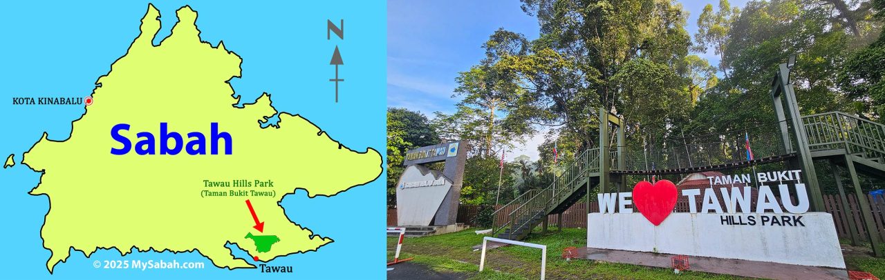
by It is human nature to chase whatever is big and shiny. Popular attractions eventually become crowded or expensive. Sometimes we secretly hope the places we love never become like that. This is how I feel about Tawau Hills Park (Taman Bukit Tawau).
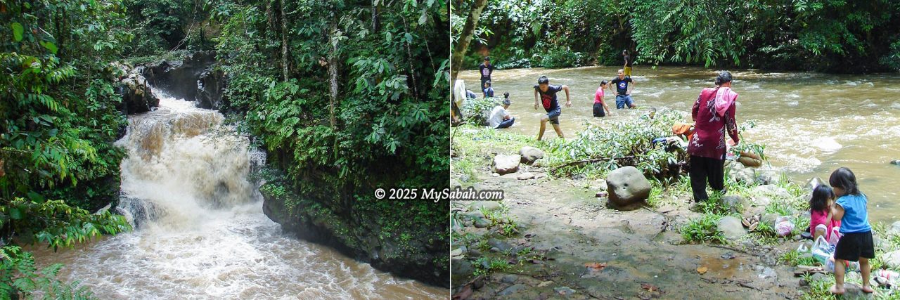
Climbing Mount Magdalena (Gunung Magdalena) and Mount Lucia (Gunung Lucia) in Tawau Hills Park had been on my bucket list for years. In September 2025, I finally ticked them off. Although Taman Bukit Tawau is an eco-treasure, many locals still view it simply as a place to swim on a hot day. It’s like having a whole chicken but only eating the feet.
Why Climb Mount Magdalena and Mount Lucia?
The park is a naturalist’s utopia: lush rainforests, crystal-clear rivers, teeming wildlife, and towering trees. The Three Sisters Mountains, Magdalena, Lucia, and Maria, rise over the highlands and call out to adventurous climbers.
1) Tawau’s Highest Peaks
True to its name, Tawau Hills Park is a mountainous area, home to Tawau’s three highest peaks: Mount Magdalena (1,280 m or 4,199 ft), Mount Lucia (1,240 m or 4,068 ft), and Mount Maria (1,020 m or 3,346 ft). They are only one-third the height of Mount Kinabalu, but these three sister mountains are no pushover.
2) Green Volcano Mountains
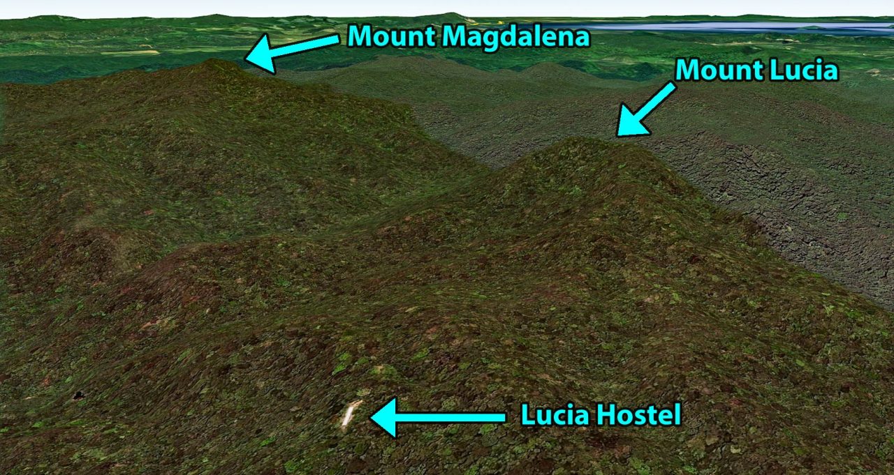
Tawau is Malaysia’s only division with volcanoes. Mount Magdalena and Mount Lucia are extinct and buried under millions of years of rainforest, giving them a lush, green “volcano crown.”
3) Rich Biodiversity
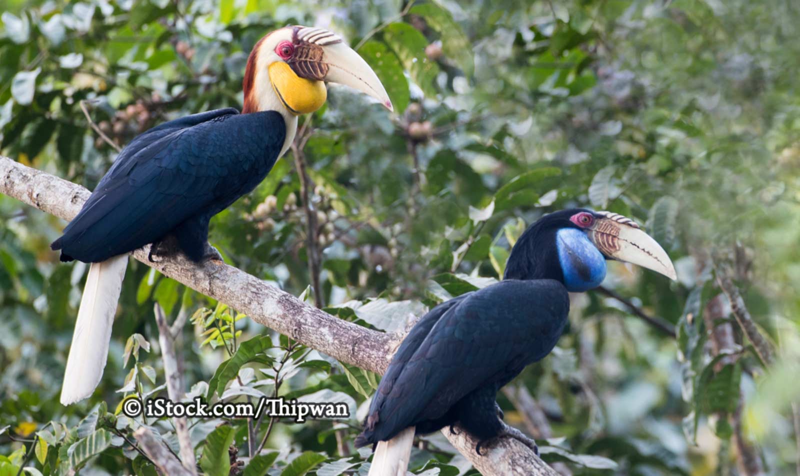
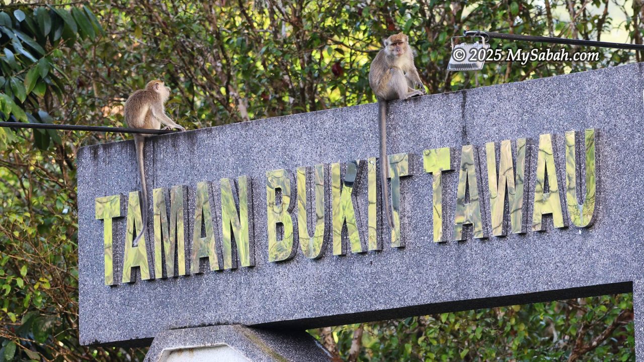
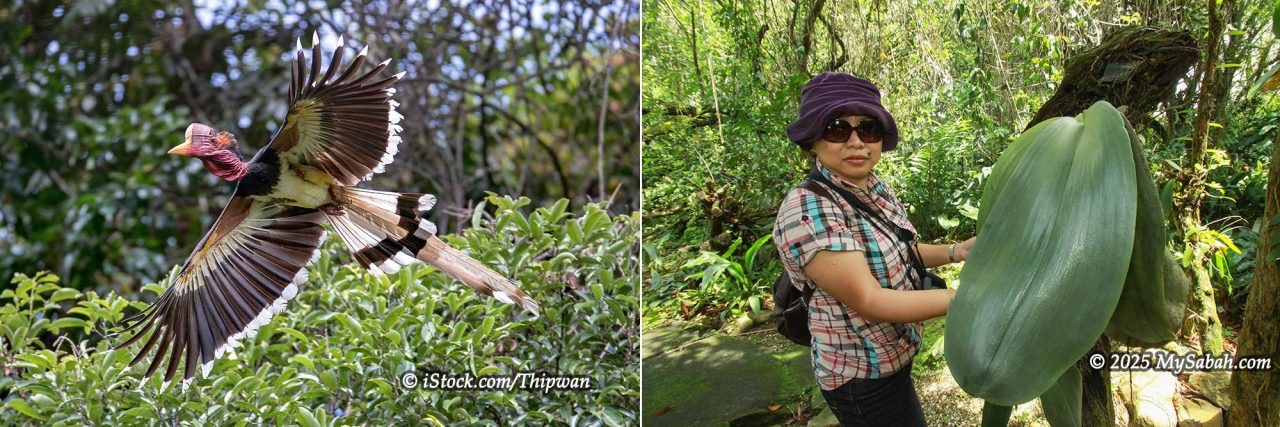
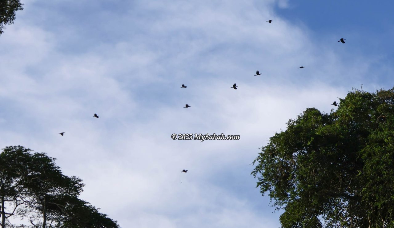
This park is a protected water catchment area fed by seven rivers. Water brings life; combined with fertile volcanic soil, flora and fauna thrive across nearly 28,000 hectares of undisturbed rainforest. Tawau Hills Park is home to rare wildlife such as the Clouded Leopard, Helmeted Hornbill, Hose’s Civet, and the Sabah Grey Langur. It also shelters some of the tallest tropical trees on Earth, more than 150 orchid species, and over 338 bird species.

Overview of the Climb
The following was my itinerary. Overall, the climb was not tough for a seasoned hiker, except for the trail from the hostel to the peak of Mount Magdalena, which is not very tourist-friendly.
| Hiking Trail | Distance (one way) | Difficulty* |
|---|---|---|
| Day 1: Hike to Lucia Hostel (accommodation) | 10.55 KM | 5.2/10 |
| Day 2: Climb Mount Magdalena | 6.45 KM | 6.6/10 |
| Day 3: Climb Mount Lucia | 1.75 KM | 2.2/10 |
| Day 4: Descend and go home | 10.55 KM | 3.5/10 |
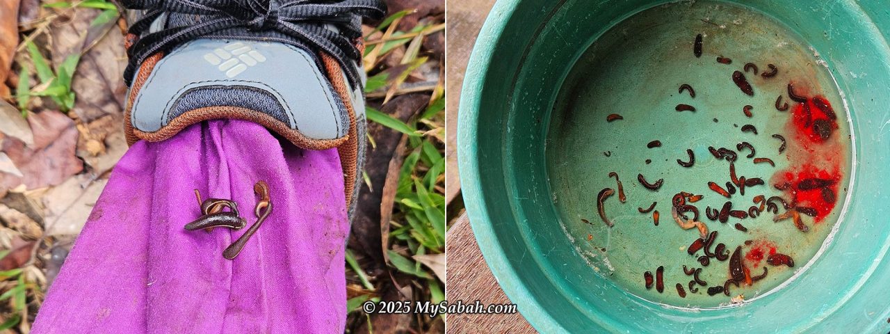
For a more leisurely trip, the popular option is to tackle Mount Lucia over two days (or even as a day trip). Hardcore trail runners can complete the three sister mountains in two or three days. Be warned: the summit trails are heavily lurked with leeches. Expect their kisses!
Walkthrough of the Climb
Below is the most detailed guide to climbing Mount Magdalena and Mount Lucia.
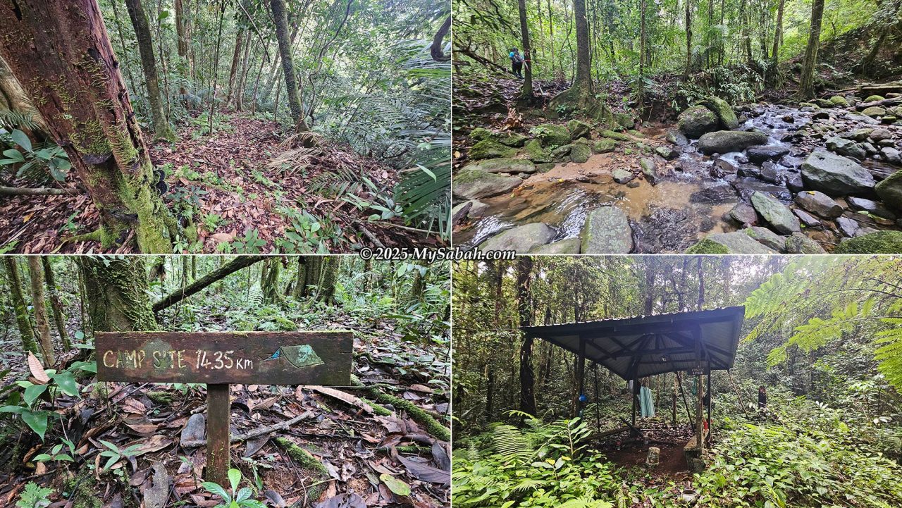
Day 1: The Long Hike to Lucia Hostel (10.55 km)
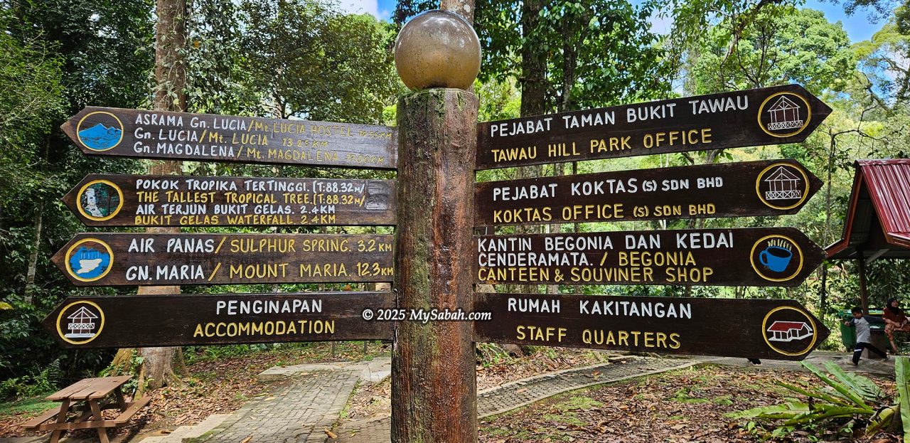
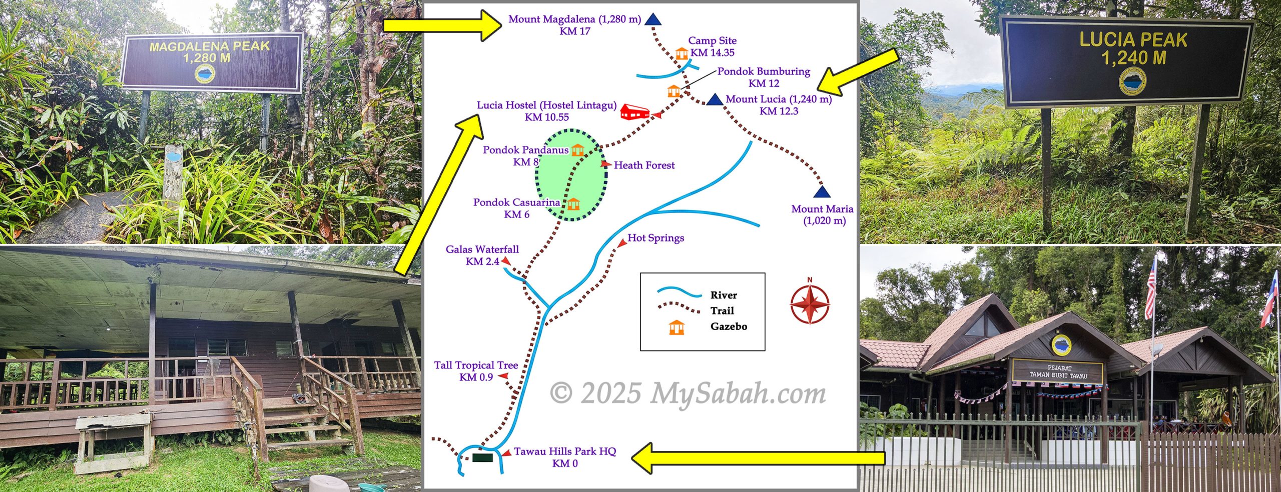
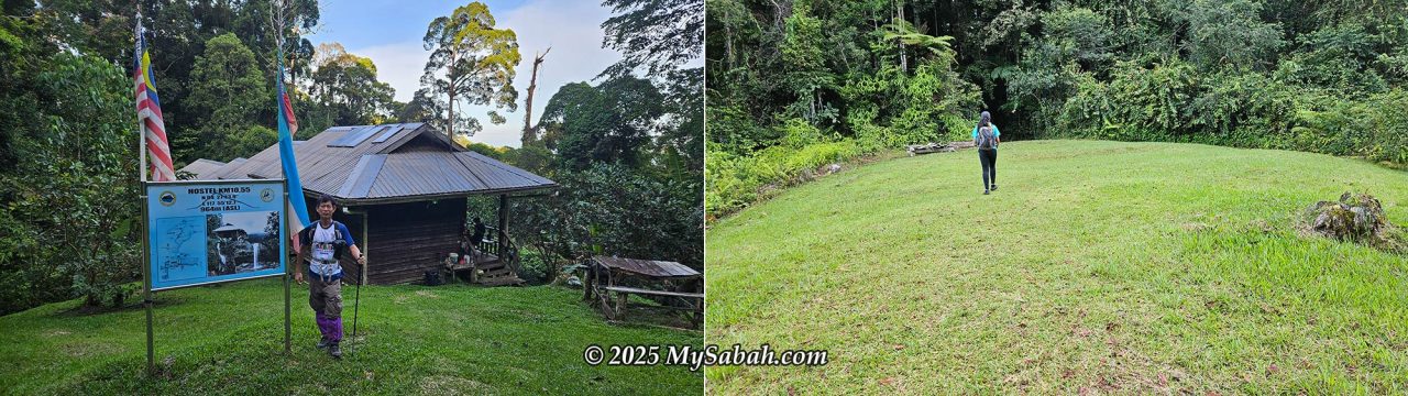
Day 1 required a 10.55 km hike to Lucia Hostel (Hostel Lintagu), a mountain accommodation at 862m above sea level (See Location Map), which served as my base camp for the next three nights.
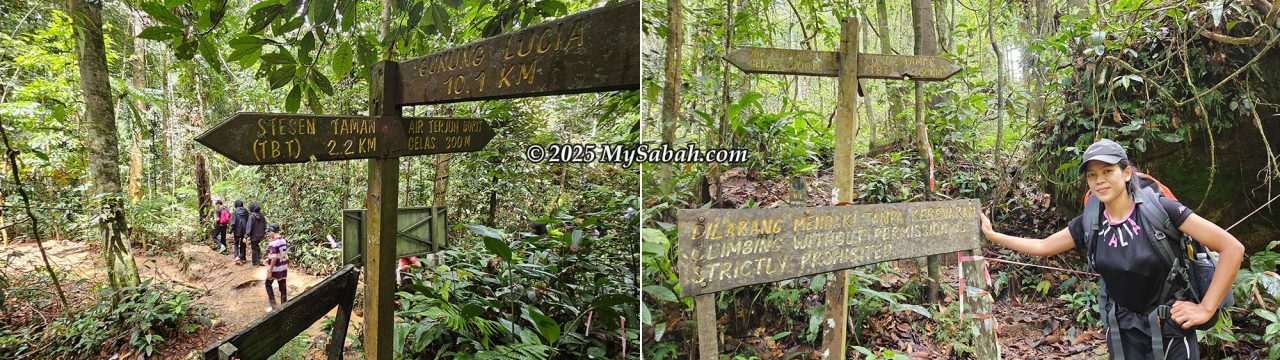
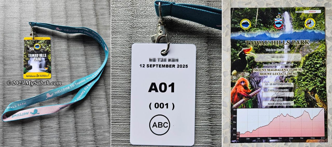
Since Tawau Hills Park is a protected forest reserve, a permit and a mountain guide are mandatory for climbing the mountains. Registration is done at the park office (KM 0). Before the office opened at 8 am, I had some fried noodles for breakfast at the canteen (Kantin Begonia). It was drizzling, making me anxious to start the climb ASAP before the weather deteriorated. After meeting my mountain guide, Ms. Rina, weighing my 6 kg bag for the porter, making the payment, and collecting my climber ID card, we set off around 9 am. I expected to reach the hostel around 3 pm. Noticing my worry, the park staff reassured me: “Don’t worry. Today is an easy one.”
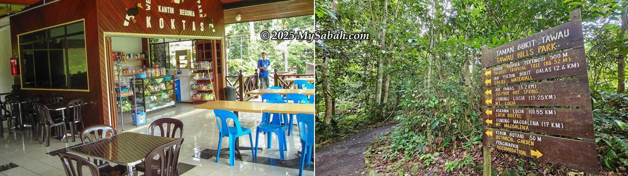
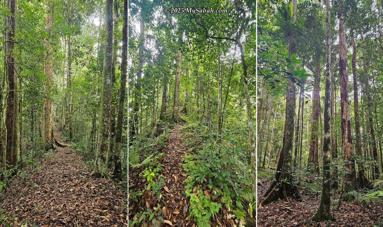
Our hike began on the trail leading to the Galas Waterfall. After walking on 2.2 KM of flat, well-trodden path, we reached the junction toward Mount Magdalena, a spot I had passed 15 years ago, wondering what lay beyond. Now, I was finally finding out.
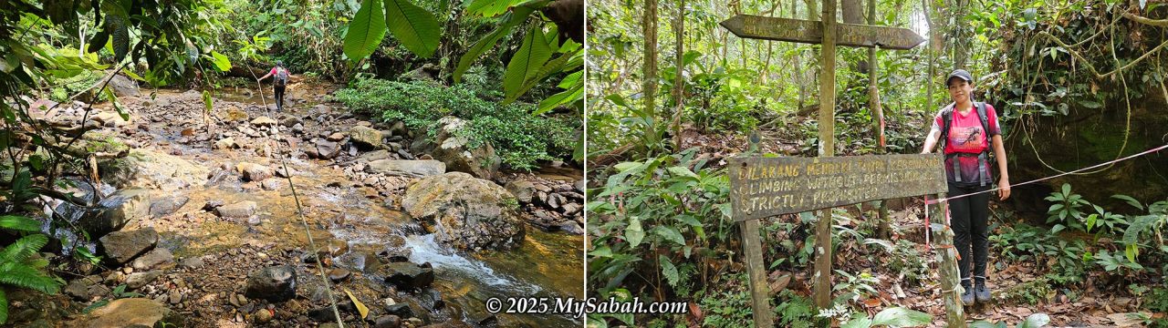
Beyond this junction, the trail immediately became more demanding, characterized by frequent transitions between inclines and gentle slopes. We encountered numerous short but steep uphill sections, particularly around the 3 km mark, where the trail pitched up to a 45° incline for about 120 meters, and again before KM 4, hitting up to 50° incline for 200 meters.
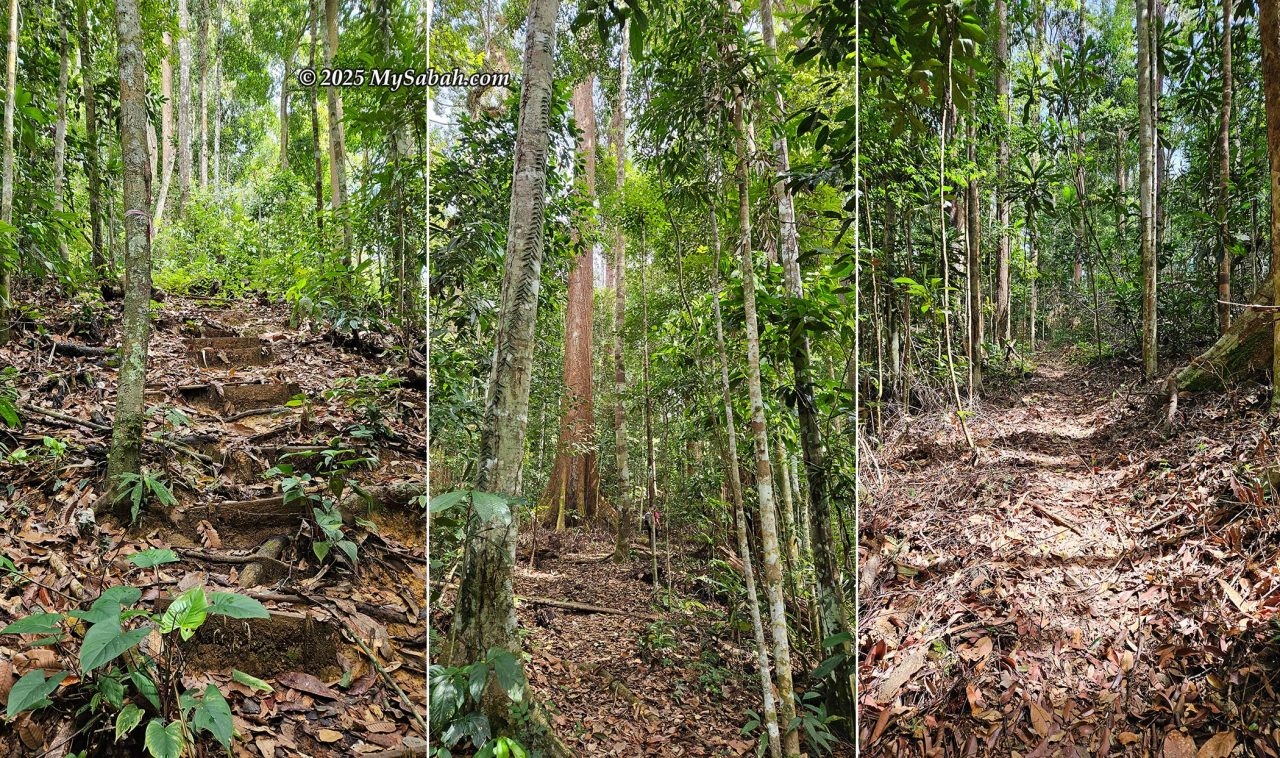
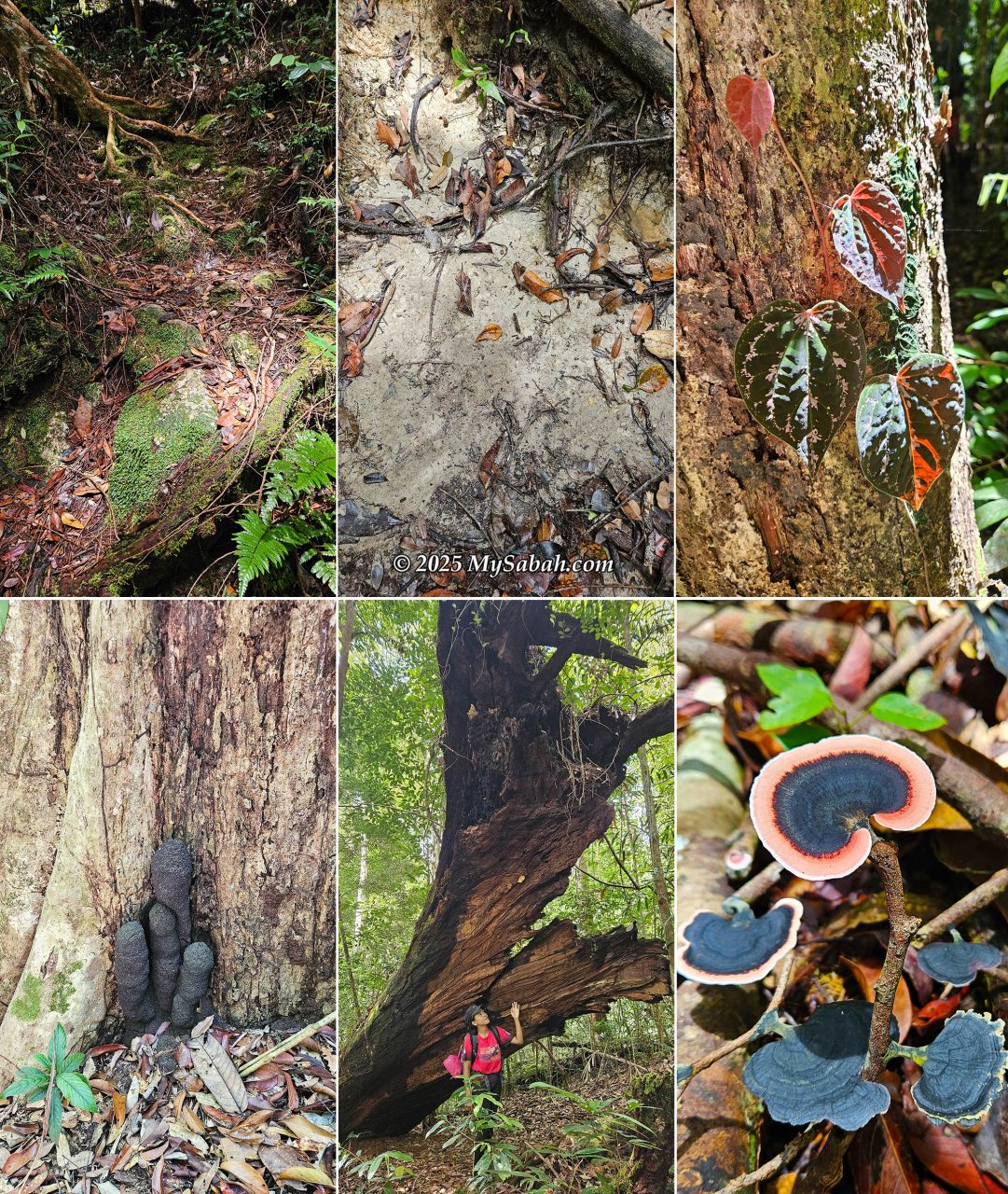
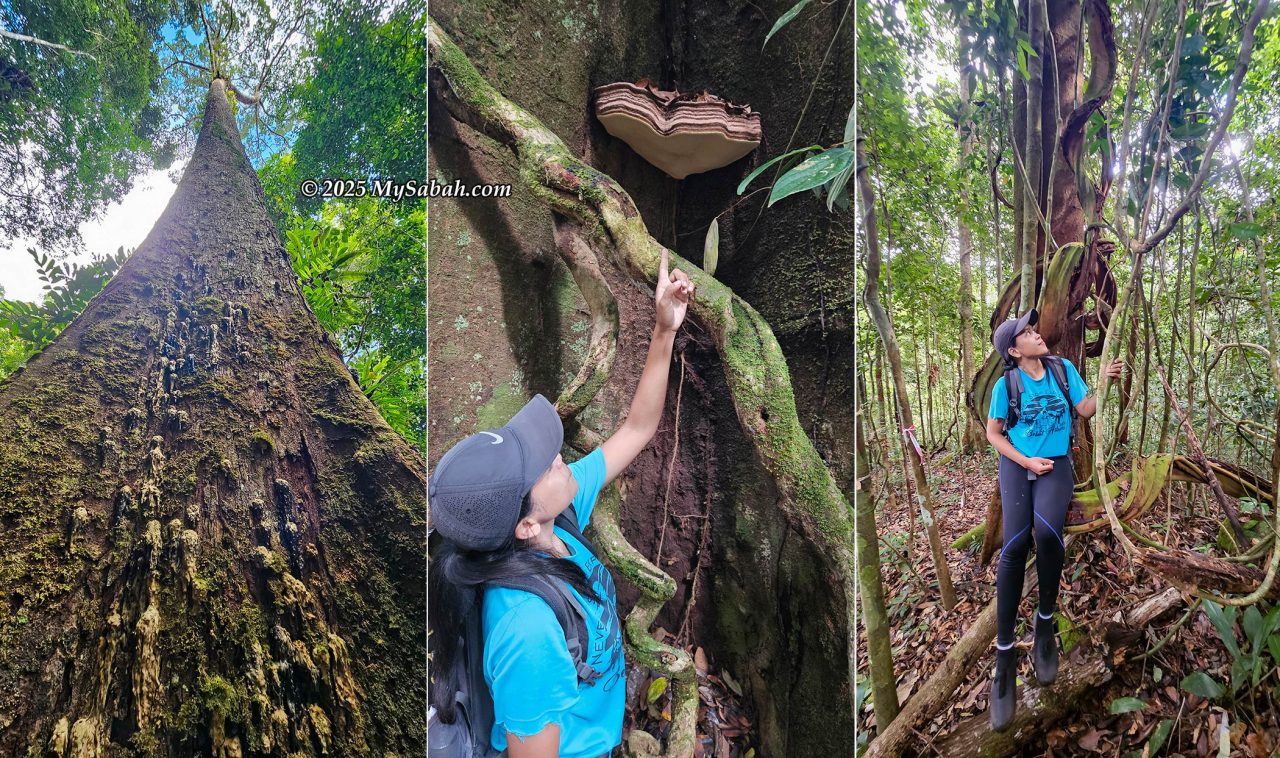
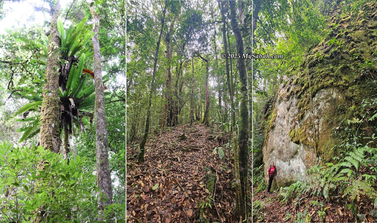
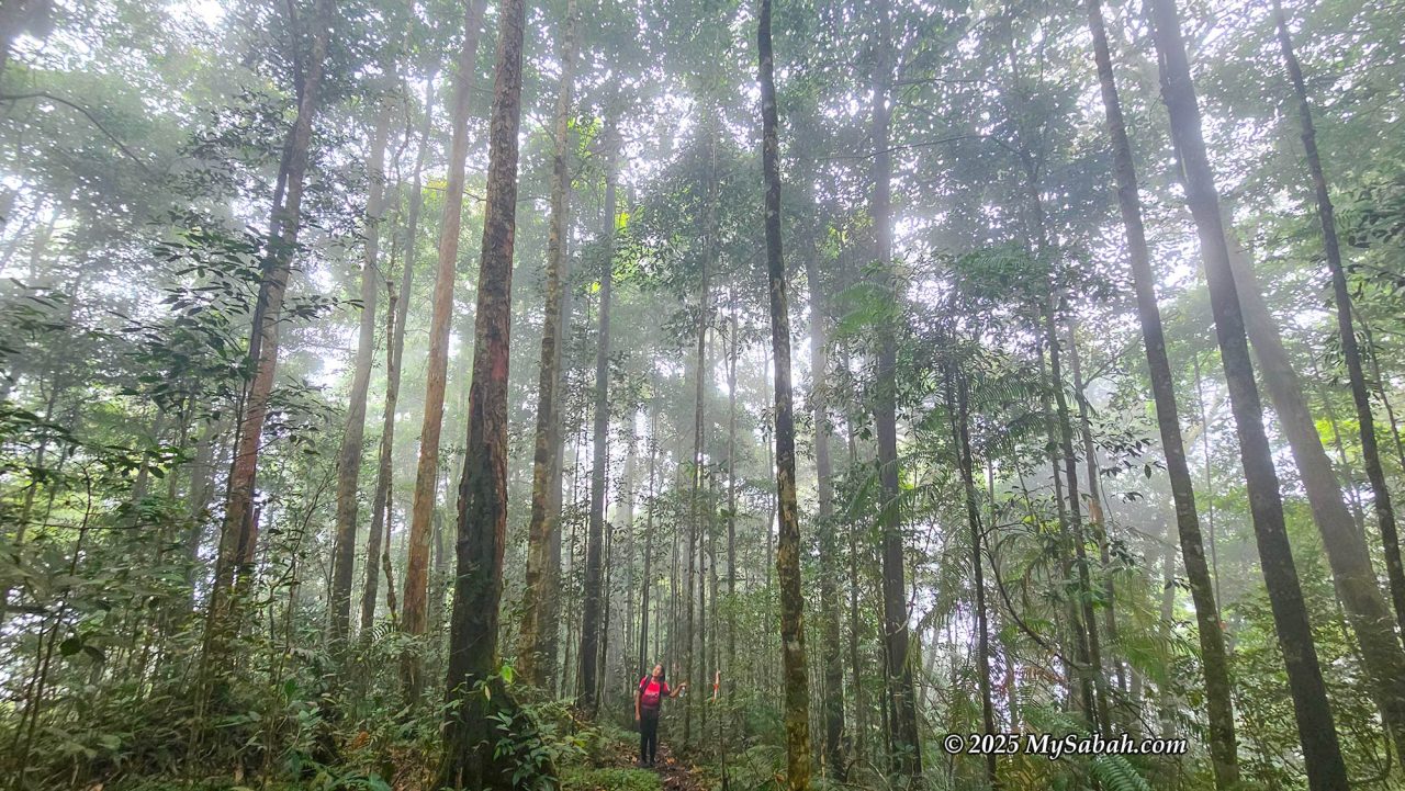
Tawau Hills Park consists mainly of lowland and hill rainforest. The trail is wide and easily walkable, even serving as a racing track for the annual Tropical Rainforest Run. The rainforest at higher altitudes remains mainly pristine primary forest. We saw many huge trees along the trail, explaining why Tawau Hills Park hosts so many hornbills, which nest in the crevices of these massive trees.
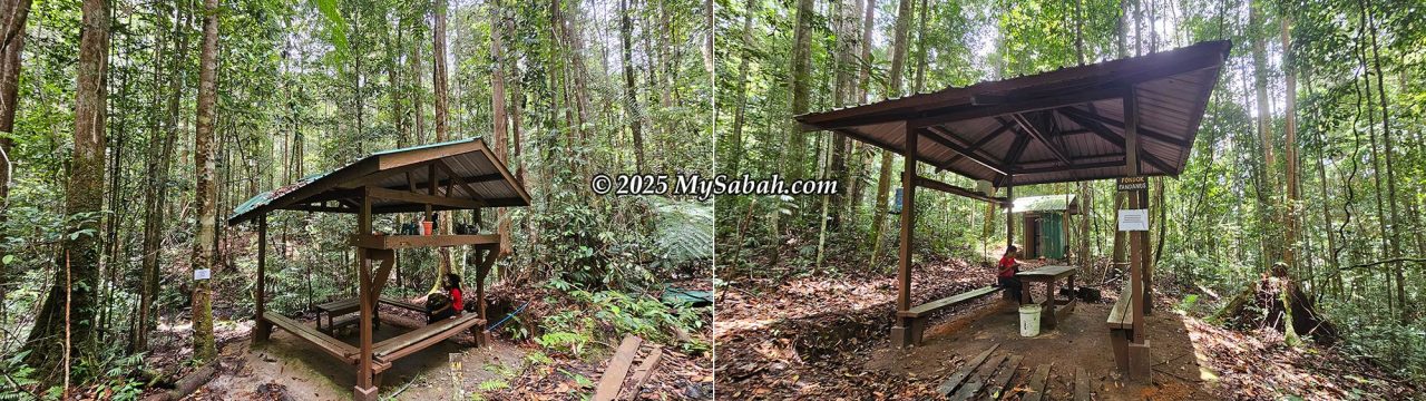
For the middle portion of the hike (KM 4.5 to KM 8), the trail became notably easier, often remaining flat or featuring gentle 10° to 30° slopes, offering a welcome respite. Near KM 6, the environment changed as we entered the heath forest (Kerangas) zone, characterized by sandy, spongy, and mossy ground. We paused at two gazebos: Pondok Casuarina at KM 6 and Pondok Pandanus at KM 8, where we stopped for lunch.
Even though we were deep inside the jungle, I twice smelled delicious food, as if someone was cooking nearby. This immediately brought to mind Malaysian folklore about the human-like Orang Bunian (forest spirits) who reside in remote areas. Their villages exist in a hidden realm, invisible and inaccessible to ordinary humans. It is believed they lure people into their space with the scent of food. Locals speculate that those who went missing in the forest may have been trapped by the Orang Bunian. This legend reminds me of the mystical, isolated Scottish village named Brigadoon, which opens every 100 years.
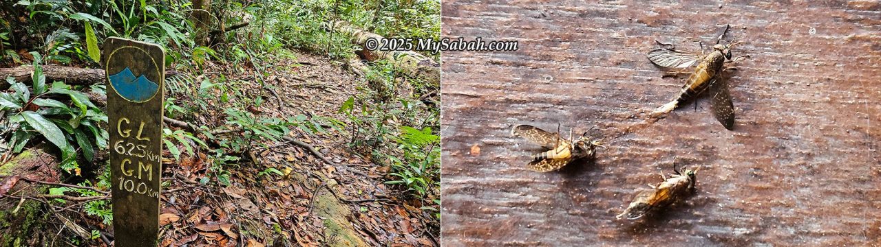
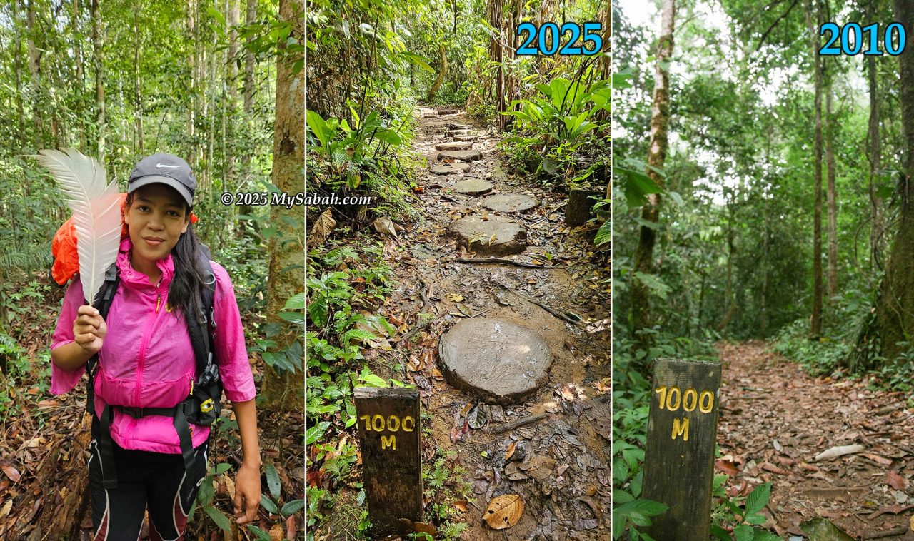
The tropical heat and humidity made me sweat nonstop, which quickly attracted a few annoying deer flies. These dark, agile insects feed on warm blood and kept circling me, landing again and again to test their chances. They were incredibly persistent; if I didn’t swat them, they delivered a sharp, painful bite. I had to smack more than five of them before I finally applied insect repellent, which thankfully kept the rest away. Luckily, there were very few leeches on Day 1, but deer fly bites are definitely worse.
After lunch at Pondok Pandanus at KM 8, the final stretch toward Lucia Hostel was steady and pleasant. The forest grew denser, with many large and ancient trees lining the trail. Throughout the day, we were treated to the sounds of the forest, including the calls of the Helmeted Hornbill and Great Argus. The slopes gradually increased again, peaking at a few steep, short climbs of up to 50° or 60°.
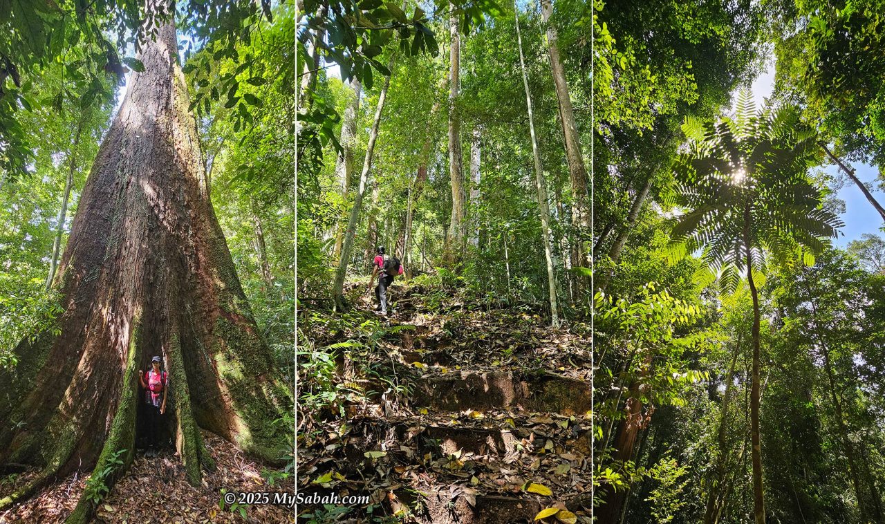
Just 200 meters before reaching our destination, we took a brief detour to explore a large tree at a junction. Finally, after photographing the tree, we faced the very last challenge: a short, steep uphill climb of 50° to 60° incline that led directly to Lucia Hostel, which we reached at 2:35 pm.
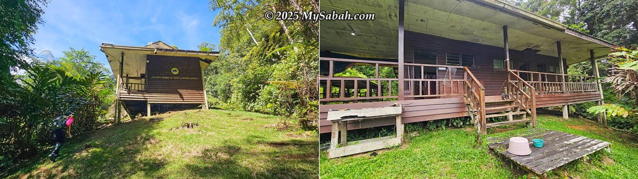
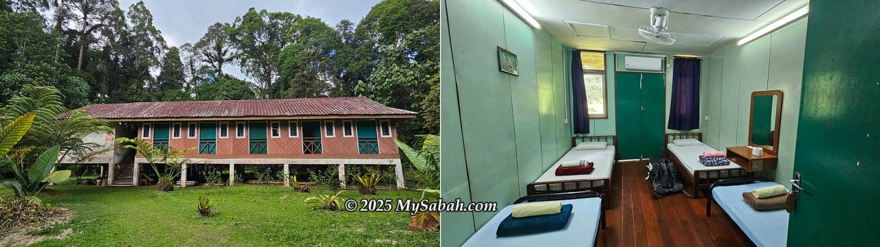
Lucia Hostel (Hostel Lintagu)
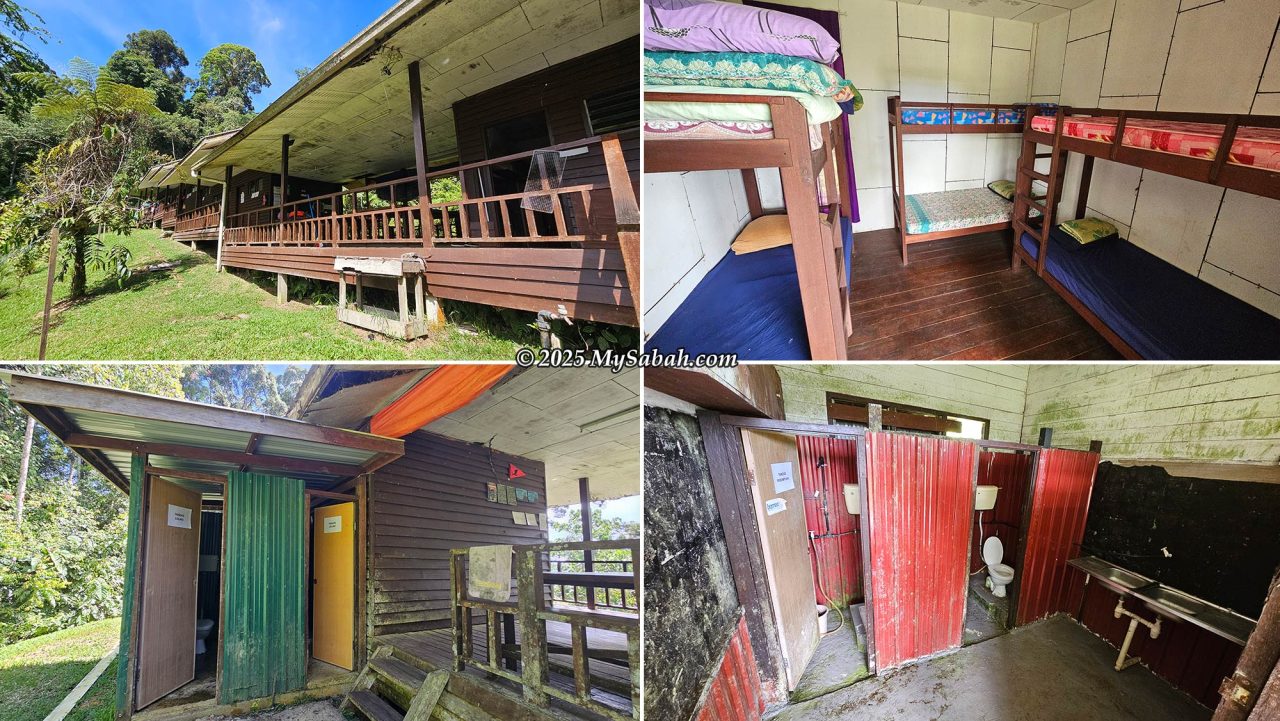
Lucia Hostel and Hostel Lintagu are names for the same accommodation, situated on the slope of Mount Lucia. Located 6.45 km before the peak of Mount Magdalena, the hostel is a spacious, long wooden building featuring five rooms, each equipped with six bunk beds (complete with mattress, pillow, and blanket). On one occasion, Rina brought 70 students up here; when the hostel was full, some had to camp outside.
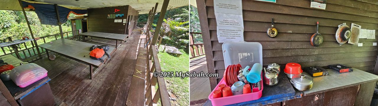
The hostel comes with basic cooking facilities such as utensils, cutlery, and portable gas stoves, along with a communal dining area, shared bathrooms for men and women, and a simple sitting space. There is no electricity, so do not expect hot showers or WiFi. Solar panels power lighting at night, and there is no phone reception or Internet signal at all. If you plan to cook, remember to bring your own gas cartridges.
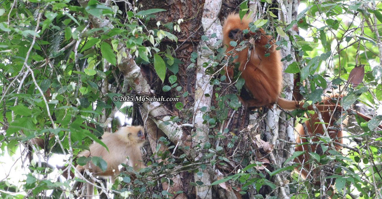
It is wise to bathe before the temperature drops to around 20 °C in the evening, unless you prefer cold water. When rain started falling in the late afternoon, the air turned cool quickly. I put on a jacket, made a hot cup of coffee, and enjoyed the forest view. When the sun briefly came out, birds and butterflies became active again. Some hikers have reported spotting Bay Cats and Tufted Ground Squirrels near the hostel; both endemic mammals are so rare that only a handful of photos exist.
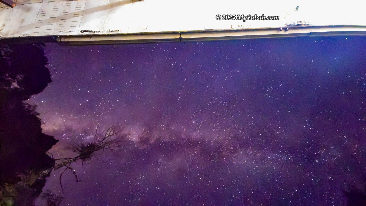
Night arrived with no wildlife sightings for me, though airplanes could be heard regularly passing overhead, as this forest lies beneath a busy flight path. I found myself wishing the benches had backrests to ease my sore back. Then something bright caught my eye. I stepped outside and looked up; it was the Milky Way. Without light pollution, the stars were so vivid that even my phone camera could capture them clearly!
Day 2: The Battle With Mount Magdalena (6.45 km one way)
Today was the most challenging part of the climb, so we set off earlier. If I failed to reach the peak before 12:30 pm, the mountain guide would stop the ascent and ask me to turn back. If everything went according to plan, we would return to the hostel by 4 or 5 pm. I brought my flashlight in case we did not make it back before sunset.
The 6.45 km trail from the hostel to Mount Magdalena follows rugged W-shaped terrain, making both the ascent and descent equally punishing. The climb from Lucia Hostel begins at 7 am, starting from KM 10.55. The trail wastes no time in showing its difficulty: it opens with a steep 50° slope for the first 50 meters, leading to a small helipad on flat ground.
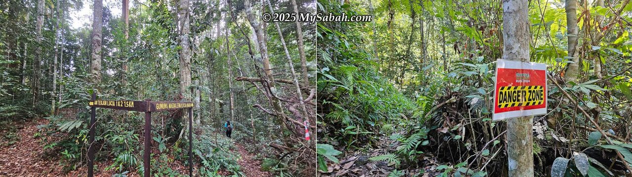
After that brief relief, the path becomes a mix of demanding inclines and ridge walks with gradients of 40° to 60 °. After covering 1.45 km, the trail reaches the KM 5 marker, following a narrow ridge with cliffs on both sides and a posted danger zone. Along this early stretch, the forest offers small highlights such as an orangutan nest perched high on a tree.
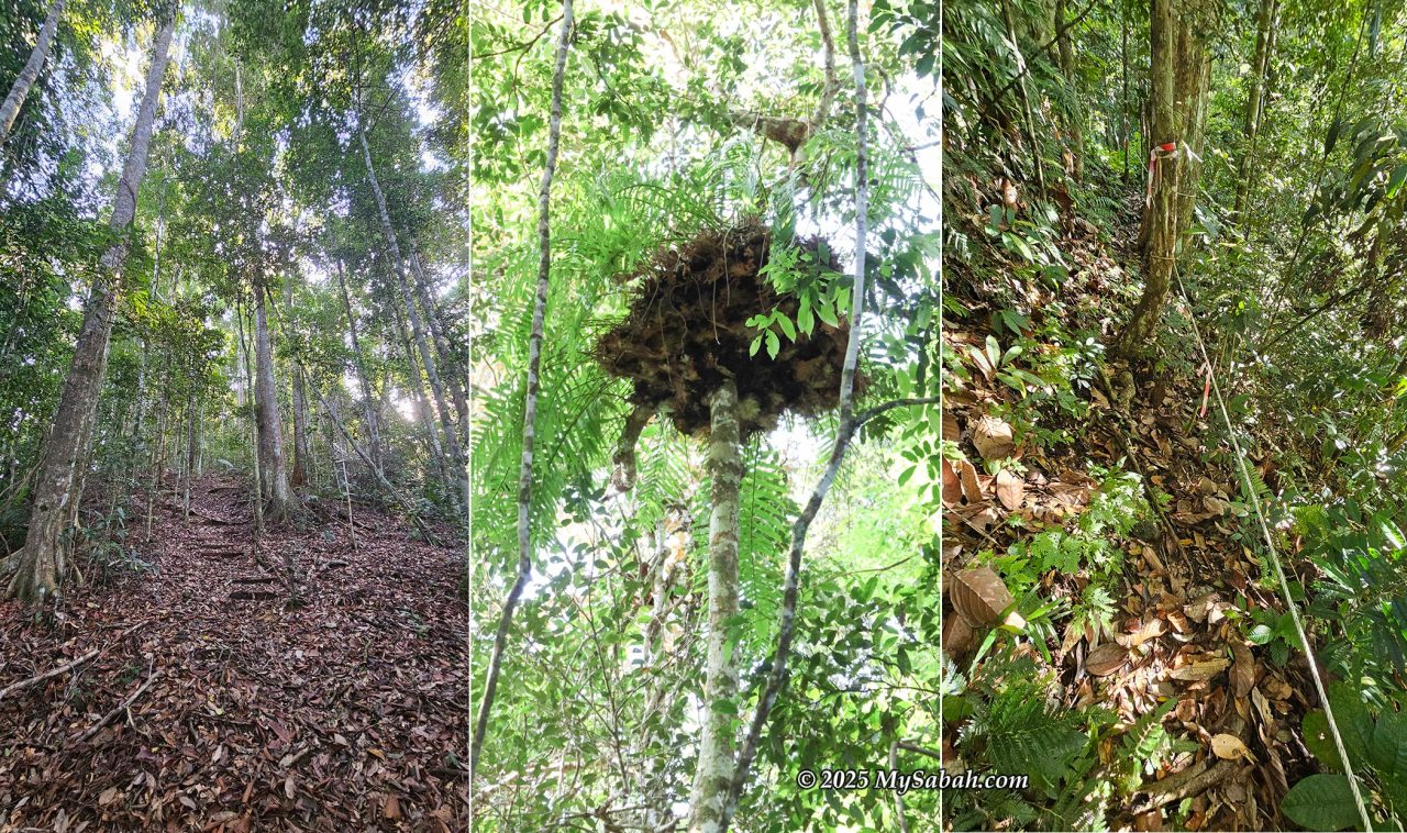
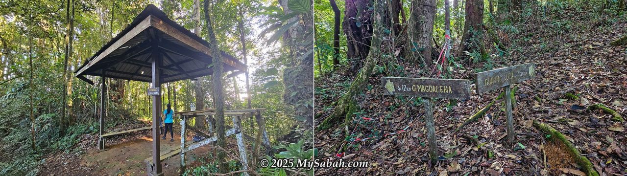
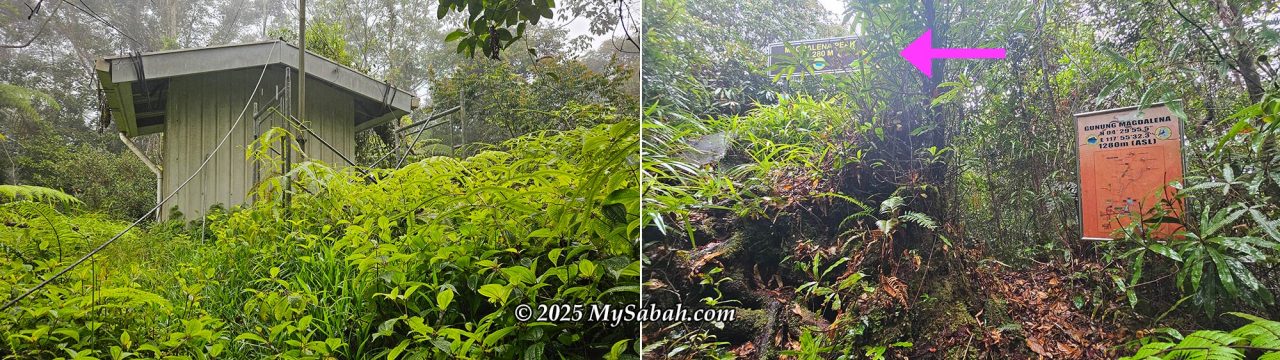
Around 8 am, the trail reaches Pondok Bumburing, a gazebo with a toilet, after a combination of flat ground and uphill slopes of up to 50°. A few minutes later, a junction appears: right to Mount Lucia and left to Mount Magdalena. Choosing the Magdalena route leads to a long, muddy descent of about 300 meters with rope-supported sections, eventually reaching flat ground again.
The Last 3 KM to the Peak
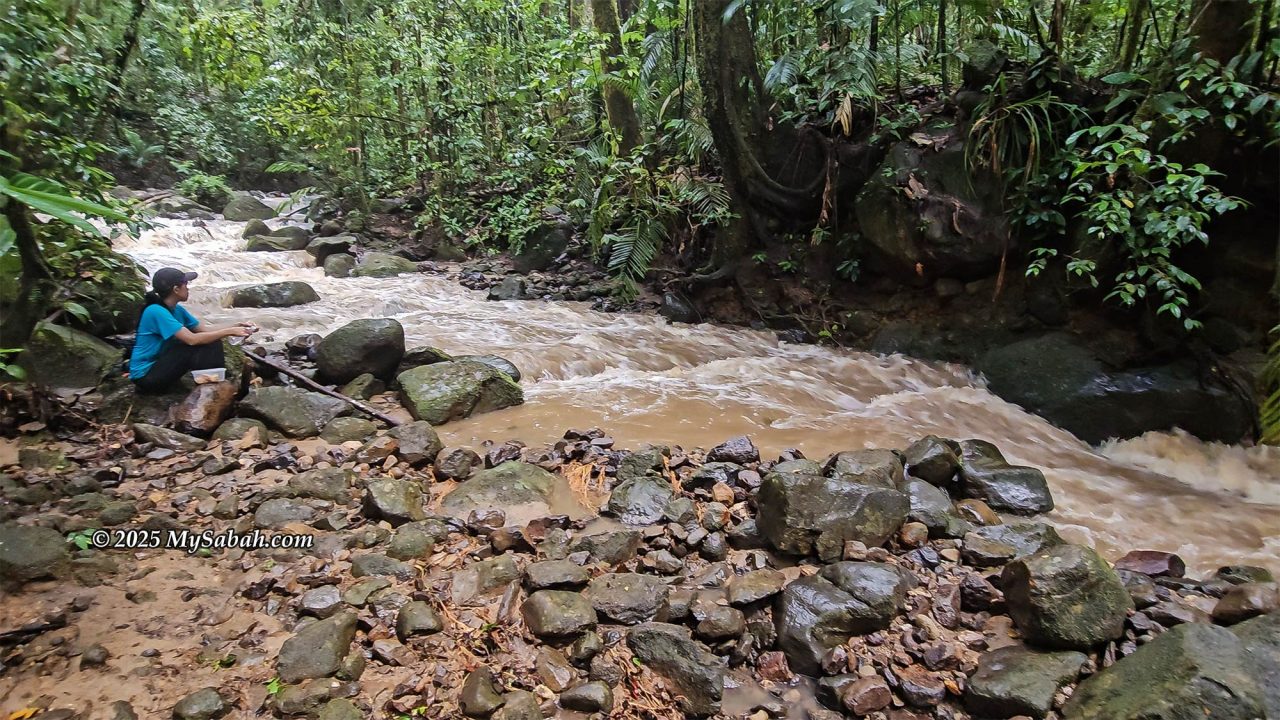
The following section becomes riskier. Steep downhill paths with rope assistance lead into rocky, slippery terrain, where flowing water runs. By 9 am, the trail reaches the 3 km remaining marker. Past this point, the climb alternates between hilly terrain and additional descents, with the calls of gibbons echoing from the forest. After crossing two small rivers, the trail reaches Pondok Liposu, a ranger campsite located at the lowest point of the col.
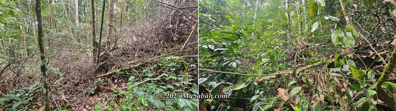
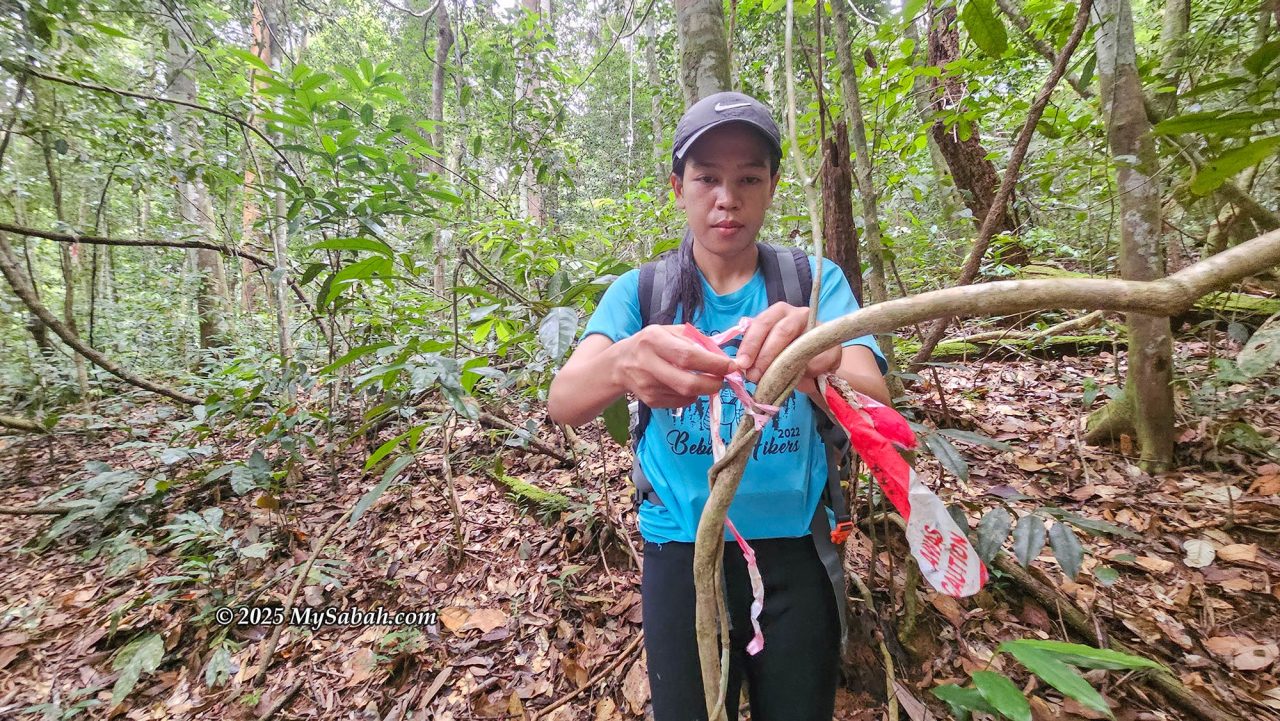
Beyond Pondok Liposu, the journey grows mentally exhausting. Markers and safety tape grow sparse and unclear, and several fallen trees block the way. Navigating around the debris risks losing the trail entirely. The remaining 2.5 km consists mainly of hilly terrain with 20° to 30° inclines, interrupted by short, punishing 50° to 70 ° slopes. Near the peak, hikers must descend into a deep V-shaped dip before climbing steeply back up.
Fighting My Way to the Peak
At 11 am, heavy rain begins. Shrubs tear through my raincoat, and dense vegetation brushes against my body, collecting leeches. Somewhere in the chaos, a leopard cat dashes for cover. By 11:32 am, the 500-meter marker appears, signaling the final half kilometer. 10 minutes later, the trail passes a small repeater hut surrounded by dense undergrowth, where finding the correct path requires slow, deliberate searching.
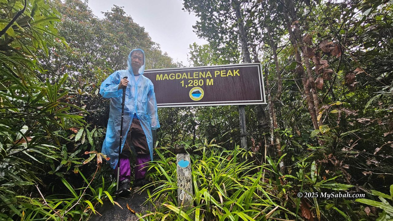
Finally, I reached the peak of Mount Magdalena (KM 17) at 12:04 pm. The summit sits on a slippery boulder inside dense forest with no open view, but reaching it after hours of steep, confusing, rain-soaked terrain feels like a hard-fought victory. Even the mountain guide quietly celebrated, as this was her first successful summit of the year.
Landslide and Flash Flood!
I stayed at the summit for only five minutes before beginning the descent. The weather was bad, raising the risk of landslides, falling trees, and flooding. As expected, all of these hazards appeared on the way down. One section had a landslide, leaving the ground churned up with deep mud, and at one point, an arm-sized branch crashed to the ground barely 20 feet ahead of me.
The downpour never stopped. Some stretches of the trail turned into flowing streams. The two small streams we had crossed earlier swelled into fast, murky rivers that cut off our return route. We waited and had lunch beside the river, hoping the flood would subside, but the water remained high. Eventually, Rina decided we needed to push forward, so we crossed slowly and carefully, feeling our way through the opaque water to avoid stepping into unexpected depth.
On a clear day with proper trail maintenance, the climb would probably have been 20% easier, and I might have had enough energy to detour to Mount Lucia on the return trip. I later reported the trail conditions to Sabah Parks and hope improvements can be made. Despite everything, we managed to reach the hostel around 4 pm.
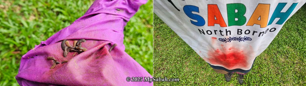
The moment I arrived, I began removing leeches. I pulled about 70 of them from my shoes and shirt and counted over ten bites. My T-shirt looked as if I had been stabbed, with patches of blood everywhere. After a cold shower and some band-aids on the wounds, I finally felt relieved that the most challenging climb of the trip was behind me.
A friendly Malay couple from Terengganu were staying at the hostel too. Seeing how exhausted I was, they kindly offered me warm soup and biscuits, which felt like restoring five points to my life bar. They had just arrived and planned to climb Mount Magdalena the next day, continue to Mount Lucia on the second day, and finish by descending via Mount Maria. Both of them were experienced and active hikers who had summited many mountains in Malaysia, including Mount Sinsing in 2022. They said they loved Sabah’s forests because the trees are impressively large.
Day 3: Climbing Mount Lucia (1.75 km one way)
Compared to Mount Magdalena, climbing Mount Lucia felt like a pleasant stroll. The trail is only 1.75 km one way and is far better maintained, making the entire ascent much easier. I woke up to the morning calls of gibbons, feeling relaxed and refreshed as I stepped out onto the veranda. That calm moment ended quickly when a sudden, sharp pain shot through my right foot, as if I had stepped on a needle. It turned out to be a fishhook ant, giving me a firm reminder that I was still very much in wild territory.
I began the ascent to Mount Lucia at 8 am. With only 1.75 km to the summit, the trail felt refreshingly manageable compared to the previous day’s ordeal. By 9:14 am, I reached the junction where the peak was just 370 meters away. The path continued briefly on flat ground before rising into a steep 50° to 60° slope that soon eased into a gentler incline.
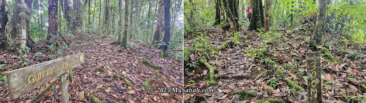
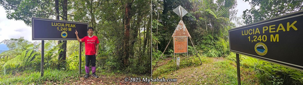
With 300 meters left to go, the trail dipped slightly, passed a large boulder, and then climbed again at about a 45° angle. At 9:32 am, I arrived at the summit of Mount Lucia (KM 12.3). The peak is a spacious flat area marked by a summit signboard and a trigonometric station. Reaching the top filled me with a quiet sense of achievement. After two demanding days, I had now summited both Mount Magdalena and Mount Lucia.
Rain clouds began rolling in soon after, wrapping the peak in a thick, fast-moving layer of fog that dimmed the forest in every direction. Rina mentioned that sometimes the fog becomes so dense that she needs a flashlight even during daytime. We did not stay long, choosing to descend before the weather turned again.
Not long after leaving the summit, rain began to fall again, so I picked up my pace and managed to return to the hostel before 11 am. The weather eventually cleared, and the afternoon sun broke through. A few skinks emerged to bask just a few feet away, enjoying the warmth. I hung my wet clothes outside to dry, which immediately attracted several butterflies gathering salt from the fabric.
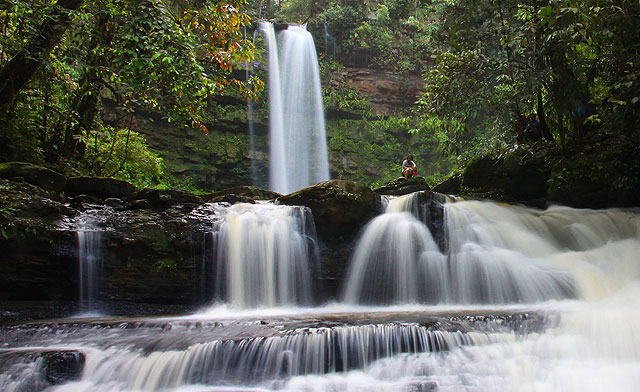
My original plan was to continue to Mount Maria after climbing Mount Lucia, but the unstable weather and risky trail conditions convinced me to cancel that idea. There is a waterfall trail about 800 meters from the hostel that forms a 1.5 km loop and features two waterfalls, with the larger one standing about 30 to 40 feet tall. Unfortunately, that trail is also prone to landslides and flooding, so Rina advised against visiting it. I suspected that whenever Rina is around, rain will follow because her name already contains every letter of the word RAIN.
With my plans altered, I suddenly had the rest of the day free, which felt well earned after the previous climbs. Rain came and went throughout the afternoon. If the weather had been better, I would have grabbed my camera and gone searching for rare wildlife to photograph. Even so, enjoying coffee while watching hornbills soar through the forest was a peaceful reward, followed by an evening orchestra of six o’clock cicadas and singing frogs.
Day 4: Descending Home (10.55 km)
The final day greeted me with clear blue sky and bright sunshine. After breakfast, I packed my things and began the descent at 8 am. Most of the trail was either gently sloping or flat, so I let gravity do the work and moved quickly.
Surprisingly, the most challenging section turned out to be the last two kilometers. Since it was the school holiday, many students were visiting Galas Waterfall, and the soil on the flat section had been trampled into a wet, slippery layer of muddy clay.
Unfortunately, where people go, rubbish follows. Rina and I picked up litter scattered along the trail and the recreational spots. Judging from the candy wrappers, empty plastic cups, and chip packets, most of the rubbish likely came from the student groups. I could not help wondering about the habits of our younger generation. Are they devolving? Once again, it showed that many locals do not appreciate or value this park as they should.
I finally returned to the starting point around 12 pm. Even so, my story with the three sister mountains is not finished. I will return for Mount Maria.
How to Book
Tawau Hills Park is a fully protected area, so climbing its mountains requires a permit and a mountain guide, and staying at the mountain accommodation must be booked with Sabah Parks in advance. You can find the contact and latest information on the official Sabah Parks website.
Cost of Climbing
| Conservation Fee | ||
| Malaysian | Adult: RM6 | Below 18: RM5 |
| Non-Malaysian | Adult: RM20 | Below 18: RM12 |
| Climb Permit | Single Peak | Multi-Peak |
| Malaysian (adult) | RM25 | RM60 |
| Malaysian (below 18) | RM10 | RM25 |
| Non-Malaysian (adult) | RM50 | RM150 |
| Non-Malaysian (below 18) | RM20 | RM60 |
| Mountain Guide | RM150 per day | |
| Insurance | RM7 per day | |
| Accommodation (Lucia Hostel) | RM20 per day | |
| Camping | Malaysian: RM10 per day | Non-Malaysian: RM20 per day |
| Porter (optional) | RM10 per Kilogram (Kg) | |
| Climb Certificate (optional) | Multi-Peak: RM10, Mount Magdelena: RM10, Mount Lucia: RM7, Mount Maria: RM5 | |
Notes
- All payments are cashless (e.g., eWallet, Credit Card, Debit Card), except for the mountain guide and porter fees, which must be paid in cash.
- Hiring a mountain guide is mandatory. Each guide can take up to three climbers. The ideal group size is three people so the guide fee can be shared.
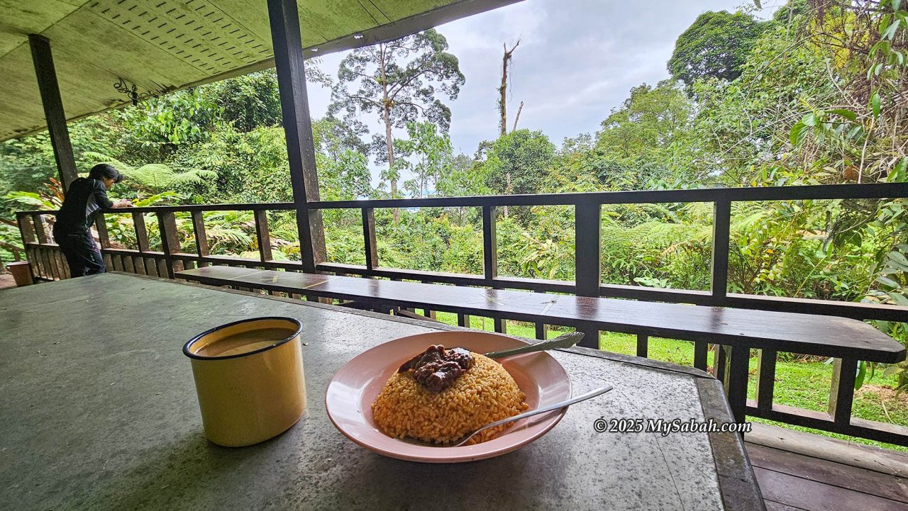
- There are no restaurants or cafes at the mountain hostel. Bring your own food, such as bread, rice, or noodles.
- If you plan to stay at Bombalai Jungle Lodge at the park headquarters, you can book through 1StopBorneo Wildlife and join their fun activities (birdwatching, hiking, night walk, herping). I highly recommend you to spend a few days in the park with them.
Things to Bring
- Cash
- Identity card (e.g., MyKad or passport)
- Phone and camera
- Power bank and charging cable
- Backpack with rain cover
- Raincoat
- Water bottle and drinking water
- Leak-proof lunch box and cutlery for packed meals
- Anti-Leech socks
- Insect repellent
- Flashlight or LED headlamp (with spare batteries)
- Snacks and energy bars
- Food and drinks (bread, rice, noodles, coffee/tea, etc.)
- Cooking supplies: gas cartridge for the portable stove at the hostel
- Toiletries: soap, toothpaste and brush, toilet paper, facewash
- Extra clothing, underwear, towel, and socks
- Jacket or windbreaker
- Water-resistant hiking shoes
- Hiking stick or trekking poles
- Gloves
- Personal first aid kit: band-aids, antiseptic cream, painkillers, blister pads
- Plastic bags for trash and soiled clothing
Tip: Wrap your belongings in plastic bags inside your backpack for extra protection against rain.
Photos taken in Tawau, Sabah, Malaysia Borneo