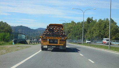
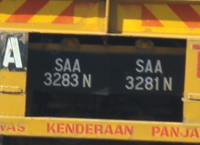
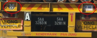
Please pardon my ignorance, coz this is the first time I see this. I noticed an unusual truck when I drove along the Lok Kawi Beach.
As you know, every vehicle has only one registered plate number, no matter how big and small it is.
This long truck has 2 car plate numbers?!! Why ah? Probably this vehicle has two driver seats or it is meant to confuse the police? I might be drunk but my camera proves that my vision is Ok. I didn’t overtake this truck to see its plate in front. Who knows it may have two different plate numbers in front too, lol.
Another funny thing is – it also seems to have two set of speed limits? Left side is 50 KM/H and right side is 60 and 70 KM/H? Anyone can explain? I’m interested in getting two plate numbers for my car too.
It has been a long time I didn’t update this blog. I suffered high fever (viral infection) and allegic to medicine for 10 days. I still feel weak until now..
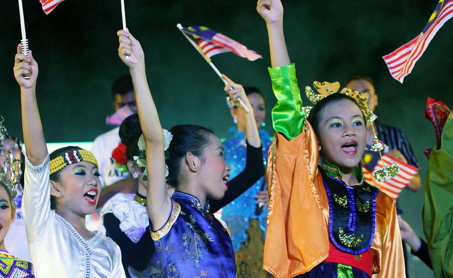
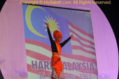
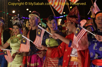
Malaysia gains its independence on 31 August 1957. We celebrate this date as National Day every year. However, to Sabah people, 16 September 1963 (a.k.a. Malaysia Day) is more matter. Sabah never “joined” Malaysia. We “formed” Malaysia with Malaya and Sarawak. Since I was a little boy, I have been hearing Sabah people complain that federal government didn’t value the meaning of Sep 16.
After 47 years, we had our first national-level celebration of Malaysia Day on last Thursday at Padang Merdeka of Kota Kinabalu, Sabah. Well, we all know why. Barisan Nasional (BN) lost a lot of seats in 308 election. Sabah and Sarawak, the “deposit” of BN votes, have become the feet of BN. They can no longer afford to ignore our voices. Whatever, at least we have one more public holiday added to the calendar. Hope everyone is happy now.
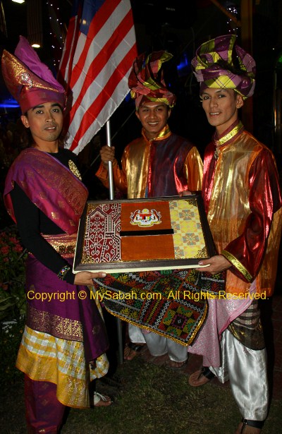
Of course I didn’t miss the first celebration of Malaysia Day. I was quite interested in photographing the first Malaysia Day Signing Ceremony. The Malaysia Day Book has 100 pages, to be signed annually for 100 years of Malaysia Day (if our country lasts that long).
Every government function starts with political propaganda. Prime Minister was trying to market 1Malaysia concept, though Sabah has been long practicing it.
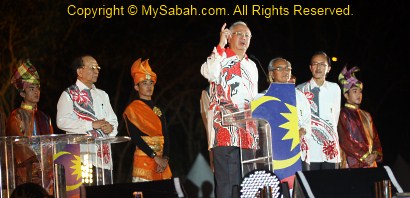
Prime Minister started the first signing of Malaysia Day Book. There were dozens of photographers and media went after this shot. Luckily I also got mine.
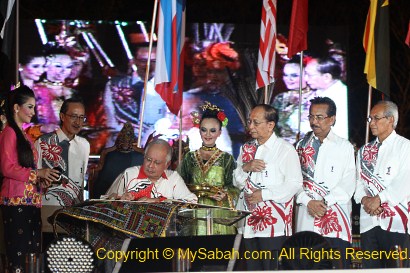
Next is Sabah Chief Minister. Should be a great remembrance for him before retirement…
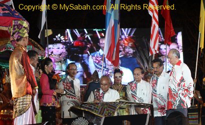
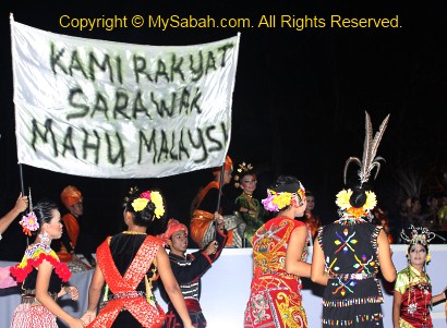
Signed by Deputy Chief Minister of Sarawak. Hope their CM will also retire soon. Poor Penan people..
Signed by the Sabah minister of tourism (also the organizer).
Signing Ceremony done. This book will be kept in the museum.
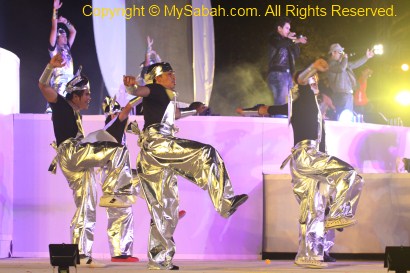
Performance followed, to show the past, present and future of Malaysia.
Since Malaysia Day is more for East Malaysians, the show had a lot of cultural elements of Sabah and Sarawak. It’s really a Sabahan event coz the audiences left many rubbish behind, despite repeated advices from the organizer, a true reflection of Sabah people. If we don’t like people say we live on trees, please behave like a civilized human. Personally I also have seen many rich people throw rubbish out of the car windows of their expensive cars.
It has been raining every late afternoon. Fortunately the weather was ok that day. The heavy rain came 1 hour after the end of show. Then it rains again every evening until today.
There were too many media and photographers around, so my movement was very restricted. I could only take photos from the side.
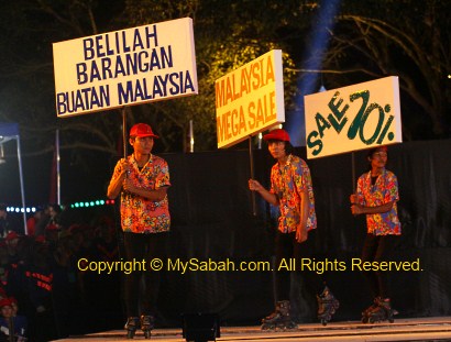
Buy expensive and inferior Malaysia products! Do we have choices, other than Proton, StreamyX, Bernas and SESB?
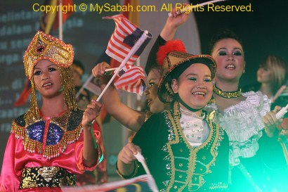
Overall the show was ok. But the venue is terrible, too small. Imagine thousands of people flooded the area no bigger than a football field. But this venue is the place where Malaysia was declared. Hopefully next year they will hold the event in Likas Stadium. I was a bit surprised that there was no lion dance.
Photos taken in Kota Kinabalu, Sabah, Malaysia Borneo
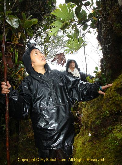
Though I didn’t sleep well, my muscles were able to relax and recover. I advise climbers to invest in a good (=expensive) backpack that can spread the weight evenly, otherwise you would have back pain like me. Everyone waked up at 2am, after having some cookies and instant noodles (with curry meat, sardine and tuna) as breakfast, we packed and headed to the summit at 3am. If plan went well, we could reach the summit before 6am to watch the sunrise.
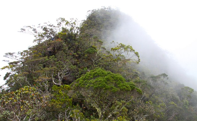
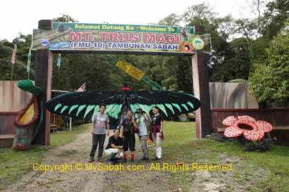
Conquering Mt. Trus Madi
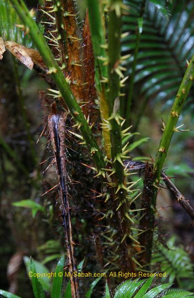
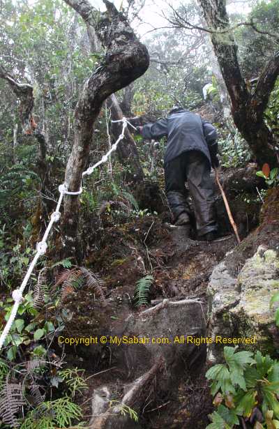
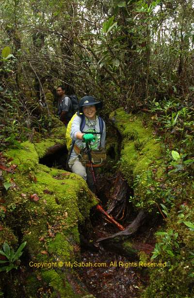
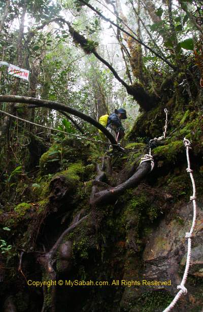
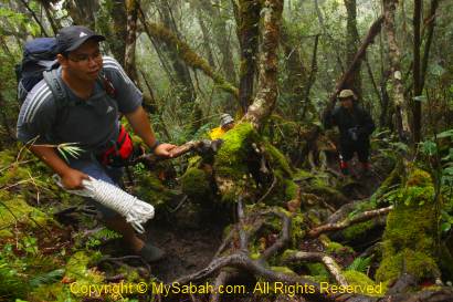
The morning was total darkness. With the aid of LED headlight, I could only see a few feet in front of me. We were only 1.5 KM away from the summit, but most of the trail was over 50 degree of steepness. Certain section was impossible to climb without the help of ropes. My head even knocked on overhanging branches a few times. When I tried to grab anything along the steep trail to support myself, I felt a sharp pain and found that I grabbed on a thorny rattan. This sinister plant is so abundant along the trail to the summit.
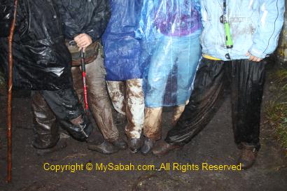
With heavy camera, tripod, drinking water, etc., I had over 5Kg of weight on my back so I moved very slowly. Near the top of Taliban Peak, I could see the streetlight of Keningau town far away, it was so beautiful. Thanks to the stupid La Nina phenomenon, it has been raining all night and the trail became muddy and slippery. That’s no way we could avoid contact with mud, so our pants were dirty.
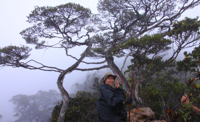
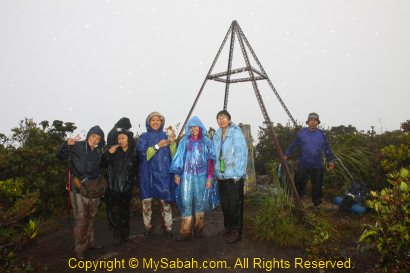
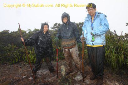
Finally I reached the summit around 6:30am. I didn’t feel excited. Instead, I was glad that it was over. I looked around and found that none of us was clean, our jeans were full of mud stains.
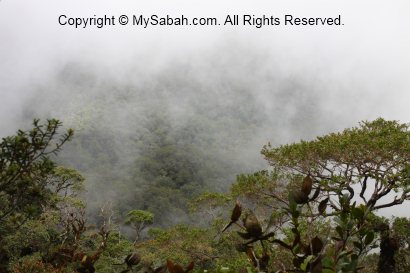
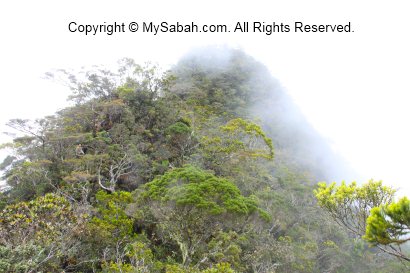
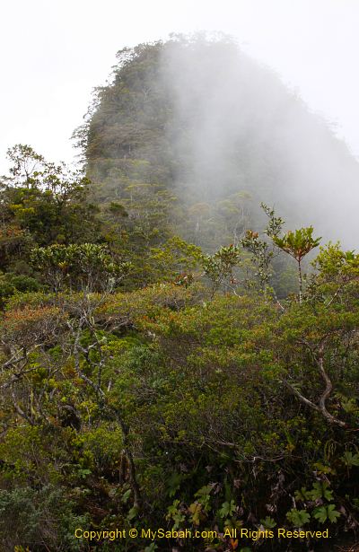
Someone say climbers will be rewarded by the beautiful sunset and close view of Mt. Kinabalu (only 40 KM away). Due to the heavy rain and dense fog, we saw nothing. According to the book “Mountains of Malaysia” by John Brigss, Mt. Trus Madi has “The most beautiful mountains view in Malaysia”.
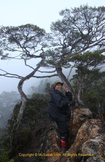
Above: a marker that divides Mt. Trus Madi into Tambunan and Keningau districts
Since we were there anyway, we took some happy faces group photos. FYI, due to a nearby repeater, your mobile phone may get full bar of signal. You can call your love one to say that you call her/him from the top of Mt. Trus Madi. It may sound romantic too if you jump off the peak to prove your love, lol. Or at least you can post an update to your Facebook or Twitter.
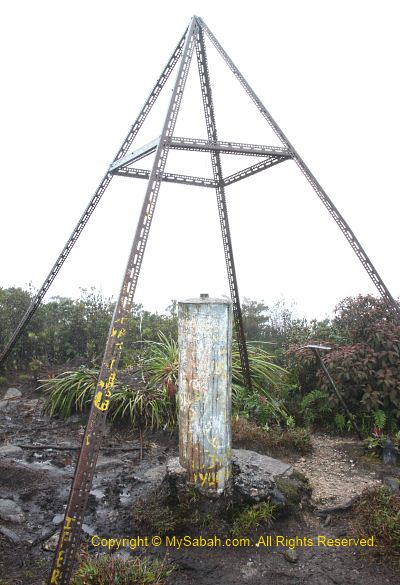
Above: Yayasan Sabah repeater. Some say this area is haunted by spirit of a porter who died of malaria
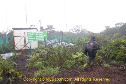
The Summit
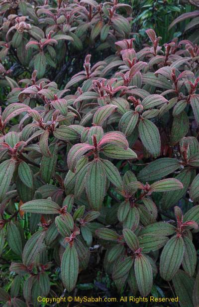
The guide showed us a unique plant (Melastoma minahanse) below, it is only found on Mt. Trus Madi and Papua New Guinea. Apart from Myrtaceae, the summit vegetation is dominated by small, leathery-leafed shrubs such as from the families of Ericaeae, Theaceae, Podocarpaceae.
Above: Melastoma minahanse, this plant only found in Trus Madi and Papua New Guinea
The most special plant community of Trus Madi is the scrub community on the summit. The mix of the montane and subalpine species growing on the summit is unique to Mt. Trus Madi. The shrub species that occur separately as montane and subalpine elements on Mt. Kinabalu are condensed into the same habitat on Trus Madi, and this results in such high species richness. Such coexistence of ecologically divergent species is not found on Mt. Kinabalu!
Descending
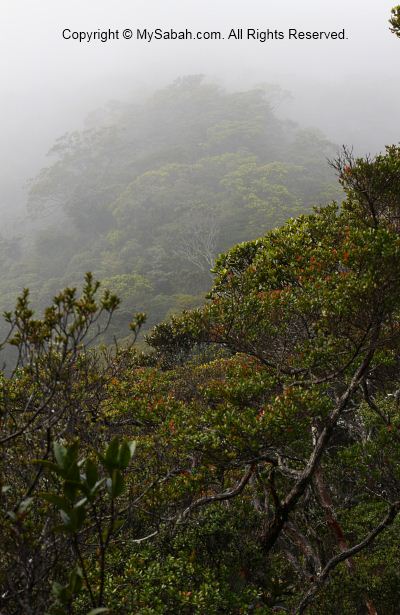
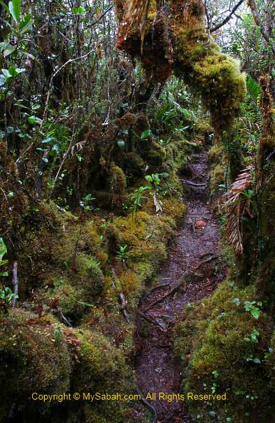
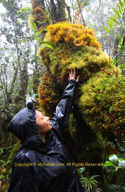
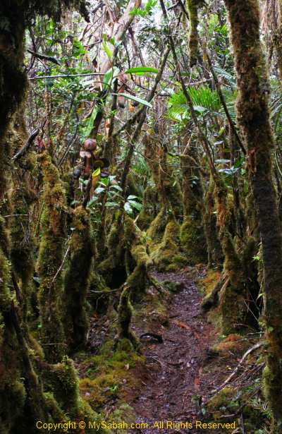
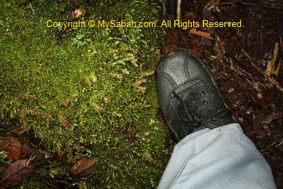
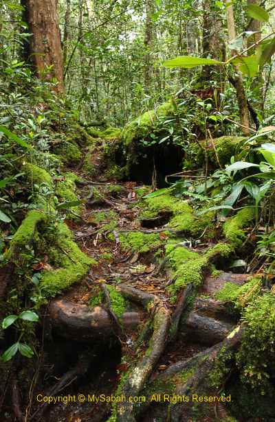
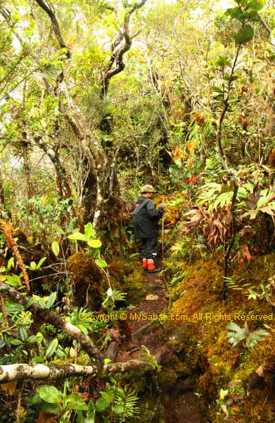
We only stayed about 20 minutes on the summit, then we descended to the cabin. I was not in a mood to rush home, so I walked slowly and took photos on the way. The mossy jungle of upper montane forest looked like an alien world, as one said, we were like entering the world of “Lord of the Rings” movie. Characterized by persistent, frequent or seasonal low-level cloud cover, this moist forest is part of the cloud forest zone. You can see abundance of mosses covering the ground and vegetation, so it is also known as mossy forest.
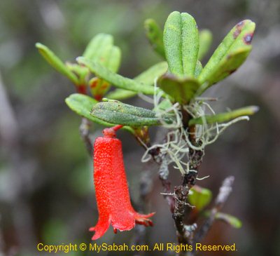
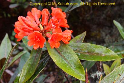
I also photographed some orchid and rhododendron flowers that are only found in higher altitude. The flowers look so nice with raindrops on them. I was told that a Proboscis Monkey was once spotted at 2,000 M above sea level. That’s so unusual, as this monkey only lives around mangrove forest.
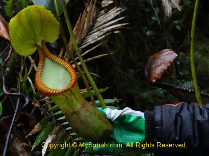
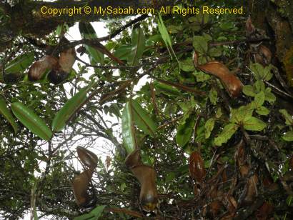
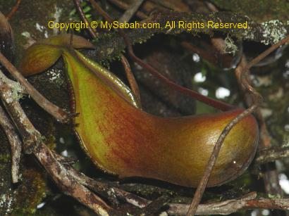
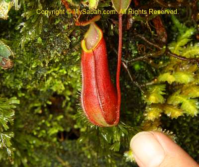
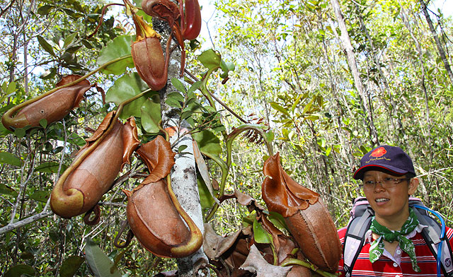
You must check out the Nepenthes macrophylla pitcher plant here, which is a montane species endemic to the upper slopes of Trus Madi. There are so many of them along the trail from summit to the cabin, like a pitcher plant garden.
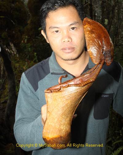
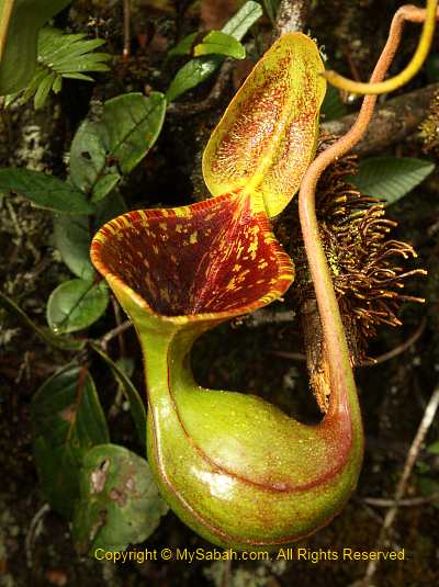
Later we found a Nepenthes xTrusmadiensis pitcher plant on top of a tree near our cabin. Limited to summit ridge from elevations of 2,500 to 2,600 M, Nepenthes xTrusmadiensis is the natural hybrid of Nepenthes lowii and Nepenthes macrophylla. Sadly, this biggest hybrid species is under threat and getting scarce, because tourists pluck them.
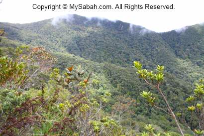
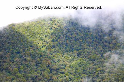
We packed our stuffs and left the cabin at 10am and descend to the starting point. The rain has stopped and we could get a clear view of the surrounding mountains. Trus Madi Range is 80 KM in length, so long and vast that it covers Tambunan, Keningau and Ranau districts. The misty mountain range of Mt. Trus Madi looks like the backbone of a huge green dragon starts and ends in nowhere. I missed this view the previous day due to the dense mist and heavy rain, so I kept shooting photos.
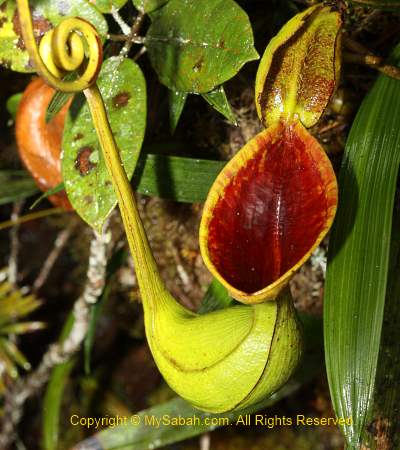
Above: Nepenthes lowii
Above: Nepenthes macrophylla
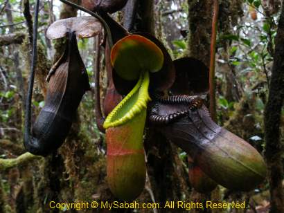
Above: Nepenthes xTrusmadiensis (hybrid of Nepenthes lowii and macrophylla)
I took more than 5 hours to reach the starting point of Mt. Trus Madi from the cabin (3.4 KM). When I was about 30 minutes to the Starting Point, I heard a lady screamed in front. But there was no person in front of me. I ran quickly to check but found nobody. The scream was so loud and clear, so I am sure it was not an illusion. Some say the jungle spirit played a trick on me when I was alone. It still remains as a question mark to me.
Whatever, I was back home in one piece later. Weeks later I was informed by one of the lady climbers that she was pregnant during the climb (she also didn’t know). Phew… that makes me sweat.
May be Mt. Trus Madi does not have astonishing and magnificent landscape like Mt. Kinabalu, but its pristine and unique flora beats Mt. Kinabalu. In fact, Mt. Trus Madi has the potential to become the next UNESCO World Heritage Site of Sabah. It is a must-go for nature lovers.
Lastly, a special thanks to our ethnobotanist guide, Julius Kulip, for identification of the plant species and being our nice company. Julius is one of the few plant experts who is very knowledgeable about Trus Madi and even wrote a few publications about it. I also used some of his info in this blog.
If you are interested in climbing Mt. Trus Madi, the info below might be useful for you.
Planning the Climb
Mt. Trus Madi is a Class 1 protected forest reserve (FMU 10) managed by the Sabah Forestry Department, so you need to apply for the permit to climb. Please note that only a maximum of 16 people (include guide & porter) are allowed to overnight on the mountain every day, so you may need to book the date earlier. Sabah Forestry Department will charge various fees such as Entry Permit, 4-Wheel Drive entry permit, forestry guide, certificate, etc. The rate is higher for foreigner tourists.
One Forestry Guide is required (compulsory) for every 5 or less climbers. For example, you need to hire two forestry guides if you have 7 people in a group. The Forestry Guides are not Tour Guides, they only monitor the tourists (some tourists like to steal the precious Gaharu wood and rare orchids in Trus Madi forest) and take care of their safety.
Working out the budget is a difficult task. Fortunately, the tour operator can register and pay Forestry Department on your behalf, but for a service fee. Usually the tour operator provides the 4-wheel drive transport (a must), 1-night accommodation in Tambunan town, tour guide, insurance, porters and cook, so the cost can vary, depending on what you need and how big is your group (minimum 3 persons. bigger group can get better rate).
Though you can hire porter to carry your bag, you better improve your physical fitness by exercise regularly before the climb. If you think climbing Mt. Kinabalu is hard, don’t even think about Mt. Trus Madi!
The lighter your bag is, the better. In long hours of climbing, every pound counts. You can hire a porter to carry your bag (up to 20 Kg) for about RM150 to 200 per trip. If you spend a night in Tambunan, you can leave those unnecessary things such as used clothing behind.
After a group photo at the Starting Point, we started to climb at 10:30am. It was about 26° Celsius and the air was misty and refreshing. It was mainly uphill trail but not very steep. Thick layer of green moss blanket is everywhere on the floor (survival tip: you can lick the water on the wet moss blanket as the last resort, if you run out of water).
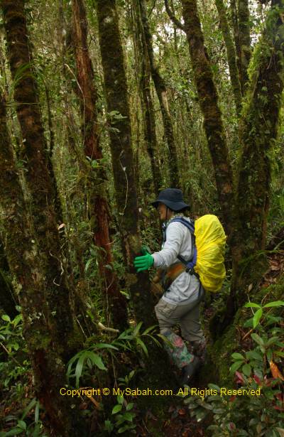
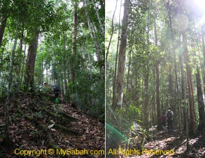
We began our climb in a hill mixed dipterocarp forest, characterized by closed-canopy forest with taller trees. Due to the moist environment, you can see many lichens, liverwort and algae plant. The hill forest is dominated mainly by dipterocarp of genus Shorea, and understorey plants dominated by Rubiaceae with 16 species.
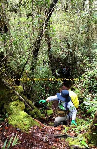
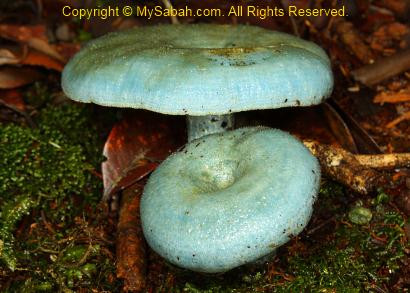
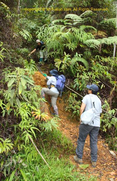
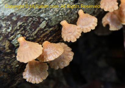
The dim and humid environment also promotes the growth of mushroom and fungus. We saw many of them in different colours and size along the trail. The most special one is the blue mushroom, which is only found in Mt. Trus Madi. Unlike the summit trail of Mt. Kinabalu, the trail is heavily foliaged and we are surrounded by dense vegetation most of the time. The nature trail is narrow, no boardwalk and hand rail, and a lot of overhanging trees and entangled roots. You have to watch your head and steps carefully.
The lower slopes represent a transition zone where dipterocarp species mixed freely with hill non-dipterocarp species. This gradually gives way to lower montane forest vegetation between 1,500 and 2,000 M asl, which is dominated by tree species belonging to families of Fagaceae and Lauraceae, and also the altitude where two species of rafflesia are found (rafflesia tengku adlinii & keithii). More standing trees are densely covered with epiphytic mosses. We saw some orchids (Eria, Dendrochilim, etc.). The flowering season of orchid is from November to December, so we did not see many orchid flowers. Nepenthes tentaculata (small pitcher plant) is quite common here.
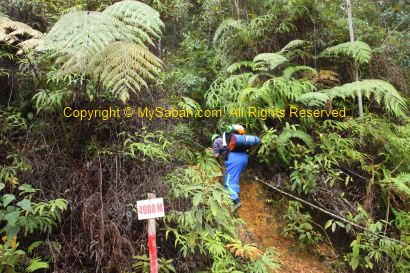
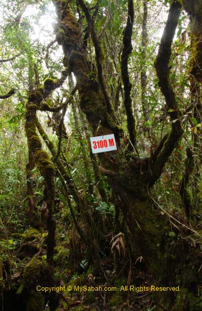
As we moved up, the decreasing number (remaining distance to summit in Meters) on signage motivated us. I also stopped frequently to photograph the interesting plant, most looked new to me. There are two resting huts on the way, one after 1 KM, and another one after 2 KM. You can use the small toilet next to the hut. Water tanks filled with river water are available at the huts if you want to refill your bottle. The water is uncooked but taste really sweet, cold and fresh!
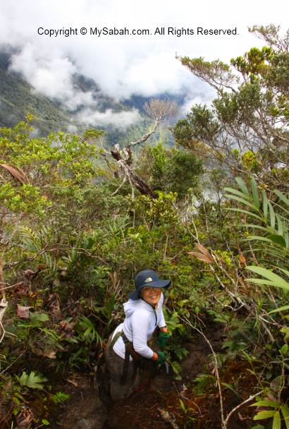
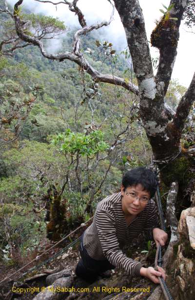
When we had our pack lunch at second hut, we were saying that the first 2 KM was not that challenging and thought that it would be the same later. We were wrong. The last 1.4 KM of trail after second hut was where the nightmare began. The trail was getting steep and required the use of fixed ropes. Then it rained on and off, turning the trail into muddy and slippery path. Luckily, for the first day, we only needed to reach the cabin (1.5 KM away from summit) to stay a night.
We spotted some friendly and colourful birds. One of them is Mountain Black-eye, which is endemic to montane zone 1,800 M above sea level. Some of them were probably Kinabalu Friendly Warblers. The guide said if we sat still for a while, many curious birds would come near us.
Multi-Peak Challenge
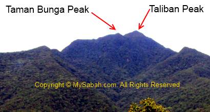
What makes Mt. Trus Madi so tough is its “multi-peak” terrain. To reach the summit of Mt. Trus Madi, there are at least 3 peaks you can’t avoid, namely, Taman Bunga (Flower Garden) Peak, Taliban Peak (which is named after the first Native Chief in Tambunan and has nothing to do with terrorist) and Trus Madi Peak. Slopes become steeper closer to the peaks. When you climb to the top of a peak, you will see another peak in front, you conquer it, then you will see another peak in front again. Taliban Peak is slightly lower than the highest Trus Madi Peak, so someone call it a “faked summit”. There are many ascending as well as descending trail. The descending is not easier than ascending.
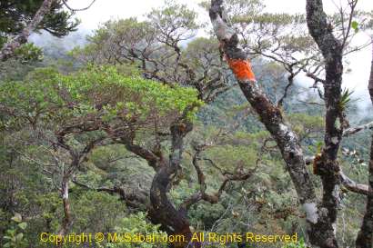
Above: the peaks of Mt. Trus Madi. The highest peak is not visible from this side.
The guide also showed us some old trails to Mt. Trus Madi. They looked so narrow, steep and dangerous. The old trail has a few narrow ridge walk with deep drop at both sides. If you slip, nobody will see where you are (no kidding).
The Taman Bunga (Flower Garden) Peak
Though I sound like being tortured, I have a lot of fun in fact. 500M before the cabin (at 2,000M signage), you will enter Taman Bunga Peak, which means Flower Garden. It is an Upper Montane zone about 2,300M asl and a natural garden full of flora. This is one of the few places where you can see the rare pitcher plant, Nepenthes lowii, everywhere. Kinabalu Park was used to have a lot of lowii but most of them were killed by a prolong drought in late 90.
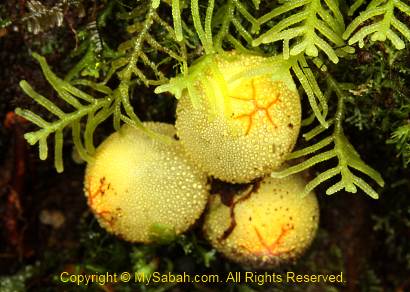
The showiest flower is the bell-shaped rhododendron flower. Wild orchid is easy to find here. Lichen, which is a composite organism of a fungus and a green alga, is abundant around, an evident of zero pollution. I also found many other interesting plants that I’ve never seen. According to the guide, there are different flowering seasons, so you would see different things in every few months.
Our cabin is only 500 Meters away from Taman Bunga Peak. As the rain was getting heavier and the day was turning dark, I speed up my walk and reached the cabin by 6pm. Normal people would reach the cabin latest by 5pm. I was slow because I stopped many times to take photos.
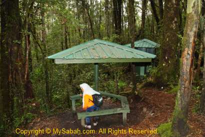
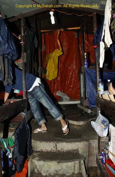
The Cabin
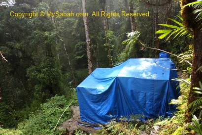
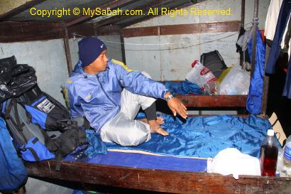
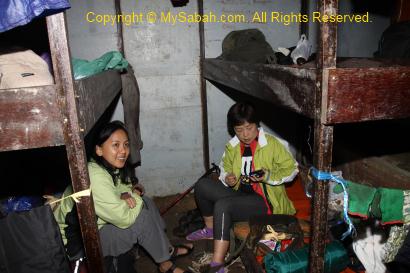
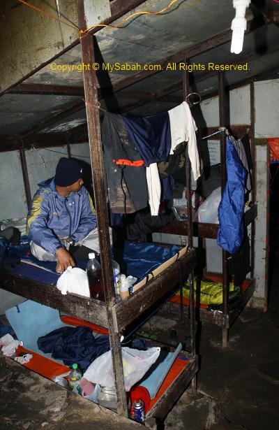
We would spend a night in the cabin in first day. The cabin is built at 2,400 Meters above sea level in year 2008, and the summit is only 1.5 KM away. There are about 7 bunk beds (14 beds) in the cabin. The beds have no mattress and blanket, so you must bring your own sleeping bag. On the bed is a layer of canvas with a zinc plate underneath. Even a bit of movement on the bed will create loud noise, like you are sleeping on a zinc roof, very annoying.
Though this cabin looks more like a refugee camp, it is better than nothing coz it is warmer than sleeping in camp. The bed is quite small too, even for a short guy like me. After putting my backpack and camera bag on the bed, there was not enough room for me to fully extend my legs.
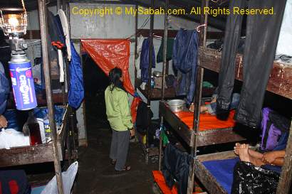
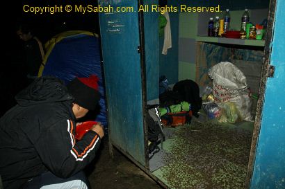
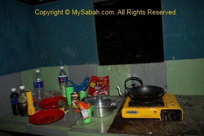
Most of us were cold and wet. Our cook prepared some rice with sardine and black bean salty fish for us as dinner. Though there is a small kitchen next to the cabin, there is nothing inside. We need to carry our own cooking utensils, gas stove, plate, pot, spoon and cup ourselves. I felt better after sipping some hot coffee. There is a gravity pipe that brings river water to a tap, so I could refill my bottle with water. Trust me, the water here tastes far more better than our tap water that is full of chlorine smell. There is a toilet not far from the cabin, but none of us wanted to take a shower as the water was freezing cold.
The guide burnt the mosquito coil to chase away a small and yellow flying bug called Agas. Agas is an insect that sucks your blood and leave an itchy bite mark. Another pest is the mice that running and fighting under our beds and I could hear them all night. The porter had to hang the food high, so these mice couldn’t steal it.
Above: kitchen next to the cabin. Behind is the camp of porters
We were all exhausted and we had to wake up at 2am the next day, so we went to bed early. When I almost fell in sleep, I was splashed by cold dripping water. I checked the ceiling for water leaking but found no crack. Due to the warmer temperature in cabin, water condensation formed on the cold ceiling. For every few minutes, the water droplet dropped on my face. I tried to move my position but still could not avoid the dripping water. The strong smell of mosquito coil also choked me. So for the whole night, I laid on the bed listening to mouse fighting and heavy rain. Not only that, my bags were all wet in next day.
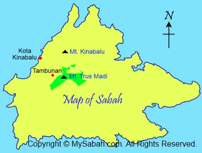
(Note: The trail & accommodation have improved a lot after 2014. Please check out my latest Guide on Climbing Mt. Trusmadi.) God really blesses Sabah, because the top 3 highest mountains of Malaysia are in Sabah. I guess the highest mountain, Mount Kinabalu (height: 4,095M), is no stranger to Sabahans. Many even climb it more than once. But most of us haven’t tried to climb the second highest mountain of Malaysia, Mt. Trus Madi (height: 2,642 Meters or 8,668 feet).
Lack of promotion is responsible for lack of visitors to Mt. Trus Madi. Another reason is – the climb is so challenging that someone even call Trus Madi “Terus Mati” (mean “Die Straight” in Malay language). Of course it is only a joke, as accident in climbing Mt. Trus Madi is rare. Though 1,453 Meters lower than Mt. Kinabalu, Mt. Trus Madi is harder to conquer. Some say if the trail to Mt. Kinabalu is a highway, Trus Madi trail is a countryside road then. The climbers have to be reasonably fit. Personally I would not recommend people younger than 15 years or older than 60 years to challenge the real “mountain power” of Mt. Trus Madi.
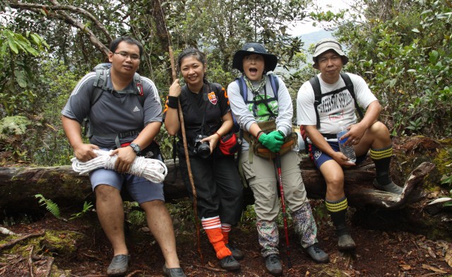
Earlier this month, I climbed Mt. Trus Madi with 5 ladies and all of us made it to the top, despite the poor weather. Thanks to the Internet, I can bring my photos and experience to your screen. I strongly recommend Mt. Trus Madi to hardcore hikers and nature lovers. You will be dearly impressed by the pristine conditions of Mt. Trus Madi. At least you will be proud of yourself for conquering this mountain.
About Mt. Trus Madi
The name “Trus Madi” is originated from the Dusun words “pinotorusan Madi”. Pinotorusan means Hunting Ground and Madi is the name of a hunter who was used to hunt in Trus Madi. Due to higher altitude, the temperature on the mountain is about 10 to 25 degree Celsius. The flora of Trus Madi is very rich and unique. About 600 species in 160 families of plants were recorded in forest here.
Mt. Trus Madi encompasses 5 different types of vegetations, i.e. lowland mixed dipterocarp (427-600M), hill mixed dipterocarp forest (600M – 1,500M), lower montane forest (1,500M -2,000M), upper montane forest (2,000M – 2,500M), and summit scrub (2,500M – 2,640M). You will pass through all these vegetation zones during the climb. The hybrid vegetation of montane forest and summit scrub is so unique that it is not even found on Mt. Kinabalu!
The Itinerary
The climb will take 3 days 2 nights. The climb starts in Tambunan (90 KM away from Kota Kinabalu). You can choose not to overnight in Tambunan town, but you need to move early at 6am from Kota Kinabalu, to drive 1.5 hours to meet the tour operator in Tambunan town before 8am. Below is the standard itinerary:
DAY 1
5:00pm
Depart to Tambunan (from Kota Kinabalu city)
6:30pm
Arrive Tambunan town & overnight there
DAY 2
7:00am
Breakfast
8:00am
Briefing and preparation
8:30am
Depart to Mt. Trus Madi’s Starting Point by 4-Wheel
Arrive Starting Point and proceed to Kota Kinabalu
6:30pm
Arrive Kota Kinabalu
For the first day, I stayed in a resort in Tambunan. Its service sucks so bad that I don’t want to mention its name here, coz I don’t want to promote this stupid resort.
Day 2
The next day I wake up around 7am to get prepared for the climb. After I had my breakfast at 8am, the guide and porters met us at the resort. After a short briefing and loading my bags to their 4-wheel, we headed to the starting point of the climb at 8:30am.
Going to Starting Point
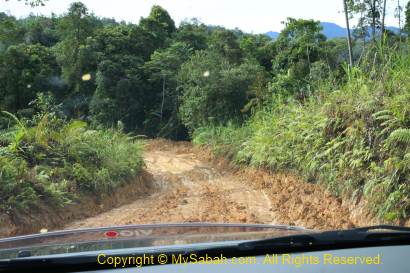
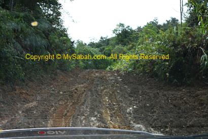
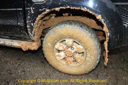
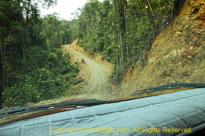
The road, mainly gravel and muddy path, to the starting point is about 30 KM away from Tambunan. The mud is the soft, sticky, smooth and slippery yellow clay soil, so the road is only accessible by four-wheel drive. The engine of our 4-wheel roared and tried really hard to catch very bit of the almost inexistent fiction.
On the muddy road, the car was like gliding and skiing on the mud, and swing violently in zig-zag like a wild bull. The steep slope with loose pebbles also posed a challenge. Our highly-skilled 4-wheel driver shifted gear quickly back and forth, to fight for every inch forward. To be frank, I was freak out. I held the handler so hard that as if I was giving birth a baby. May be I can call it an adventure.
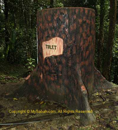
After 35 minutes, we reached the gate of the Forestry Check Point, where everyone was required to register. We also used the “tree” toilet there. It is a man-made structure, not a real tree.
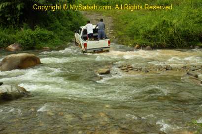
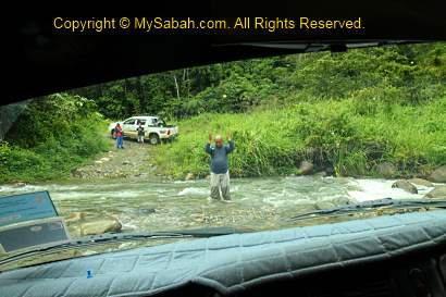
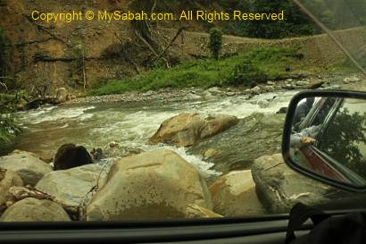
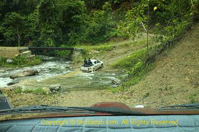
After taking a group photo at the gate, we continued our 4-wheel journey to the starting point. After the checkpoint, the ride was not that bumpy. But then I was terrified when the driver attempted to cross the river. I started to have horrifying imagination of our car being swept away by the river. My worry was needless and we crossed two rivers without any problem. Only now I truly realize the power of 4-wheel drive. Since 4-wheel is meant for adventurers, I wonder why those old aunties and uncles drive 4-wheel in city only and keep it so clean?!!
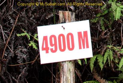
After 40 minutes, we arrived the starting point of the climb. There is nothing there except a “4900 M” signage, which means we are 4.9KM (4,900 Meters) away from the summit of Mt. Trus Madi. 4.9 KM sounds like a short distance on flat ground, but it is not the case for the rugged terrain. They say this is a new starting point, which cut down the distance by 2 hours (about 3 to 4 KM). Many say we would see many blood-sucking leeches at the Starting Point, but luckily we didn’t see any.
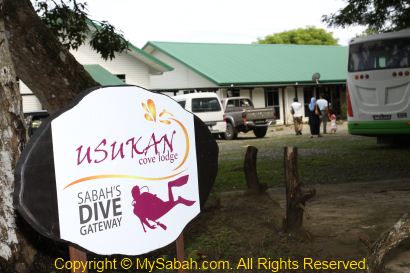
“A bay full of corals” is my first impression of Usukan Cove in Kota Belud district. In fact, the rich diversity and density of corals in Usukan Cove reminds me of Tunku Abdul Rahman Marine Park 30 years ago, the time when the corals were in pristine conditions and found in shallow water only a few feet away from the sandy beach, before they were spoiled by thousands of tourists nowadays…
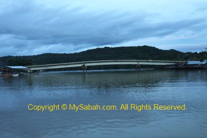
To go there from Kota Kinabalu, just drive in the direction to Kota Belud town. After an hour, you will arrive a roundabout, just follow the brown signage that says “Jeti Ke Pulau Mantanani” (Jetty to Mantanani Island). Then you will see second roundabout (Kuala Abai), follow the junction at the left, and you will arrive the entrance of Usukan Cove Lodge within 10 minutes.
On the way, you will pass by a white steel bridge built by Japanese to transport the copper that they collected from Mamut Minefield about 30 years ago. The locals call it the “Japanese Bridge”. The funny thing is – it is a one-way bridge in arch shape. Cars entering from both directions can’t see each other until one of them reaches the top. One car has to give way (by reversing back) to the car that comes up to the top first. The traffic volume is low so the locals seem to get used to such inconvenience.
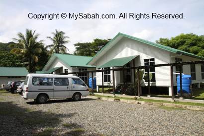
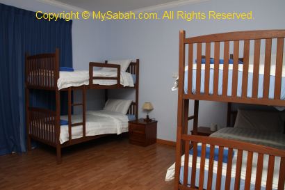
Usukan Cove Lodge offers basic and economic accommodation, from bunk-bed room (2 to 4 beds) to sea front twin-bed room (Online Booking available). These building were used to be the staff quarter of Shell who has oil rig off Mantanani Island. A tour operator took over it in March this year and turned it into a lodge. Though the rooms have no attached bathroom cum toilet, they are clean and cosy. The lodge is able to host maximum of 50 people, so it is a suitable school retreat location. Many European tourists also like this quiet place, because other islands such as Sapi and Manukan are too crowded and noisy to them. But frankly, the beach area there is quite small.
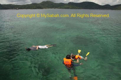
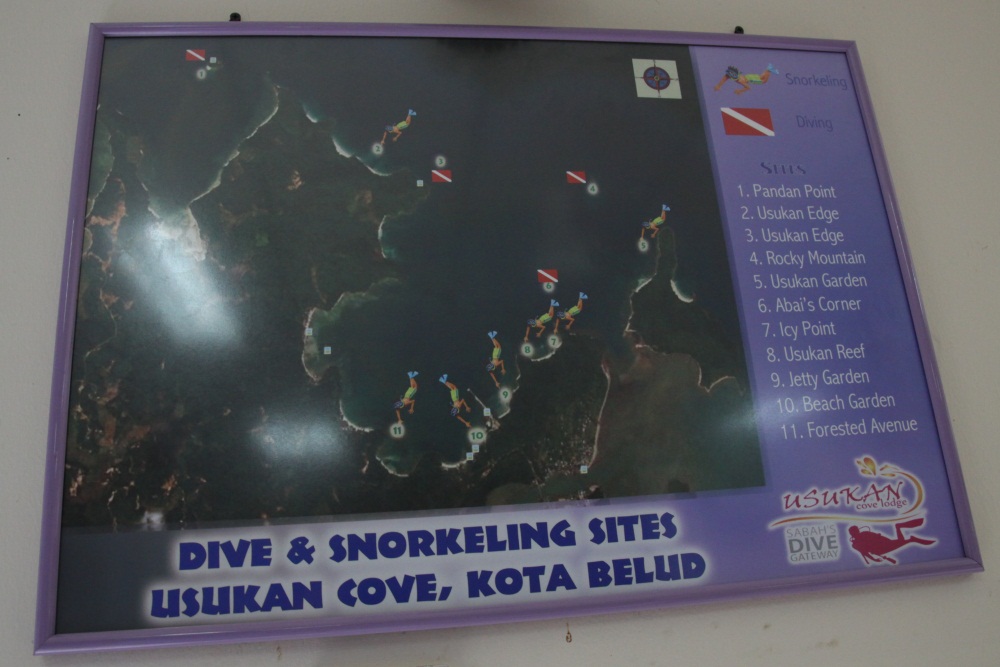
Snorkelling is the best choice of activity due to the rich corals in Usukan. Diving is available but you should not expect “too high” coz in rainy season, the flowing river nearby would make the sea water a bit murky and poor in visibility. One of the highlight is the “Christmas Tree” coral, which I believe is a tubeworm. Turtles and seahorses were spotted here before but not common. There are about 4 dive sites in Usukan, and 3 wreck diving sites for advanced divers.
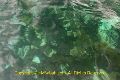
The density and size of the coral reef is remarkable. The boat dropped me in Usukan Reef and Icy Point for the snorkelling. The Usukan Reef mainly consists of hard corals. Each species seems like gathering in large clusters. I saw large areas of big plate corals and stag-horn corals. In Icy Point, I also saw mainly hard corals, with more mix of soft corals and sea grass. The sea water in Icy Point is a bit funny. In one spot I felt warm, but moving a few Metres away I would feel cool, probably that’s why they call it Icy Point. The corals come in different shapes, like big boulders, brain, hand, pyramid, sponge and flower. Though the shore is quite a distance away, the water was shallow and the corals grew quite tall. I had to be careful so I would not destroy the corals by accident.
Above: Diving / Snorkelling sites of Usukan Cove
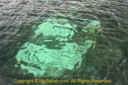
The sad thing I noticed was the coral bleaching. About 10% of corals here were showing sign of bleaching. You can even see these white spots (bleached corals) clearly from the boat. This was not present two months ago. I saw a big and white “coral tree” underwater. Its look was so stunning, like a big snowy tree with ice branches. But the corals were dead actually, a heart-broken but beautiful scene.
Due to global warming, the corals of Peninsular Malaysia are badly affected and they have to close down 12 dive sites. Now the coral bleaching is slowly spreading to Sabah. It is not a local issue, as other Sabah islands in west coast (in South China Sea) are also facing the same problem. In fact, the pollution from our mainland has been stressing the corals, global warming is just the last stack of grass that crushes the camel.
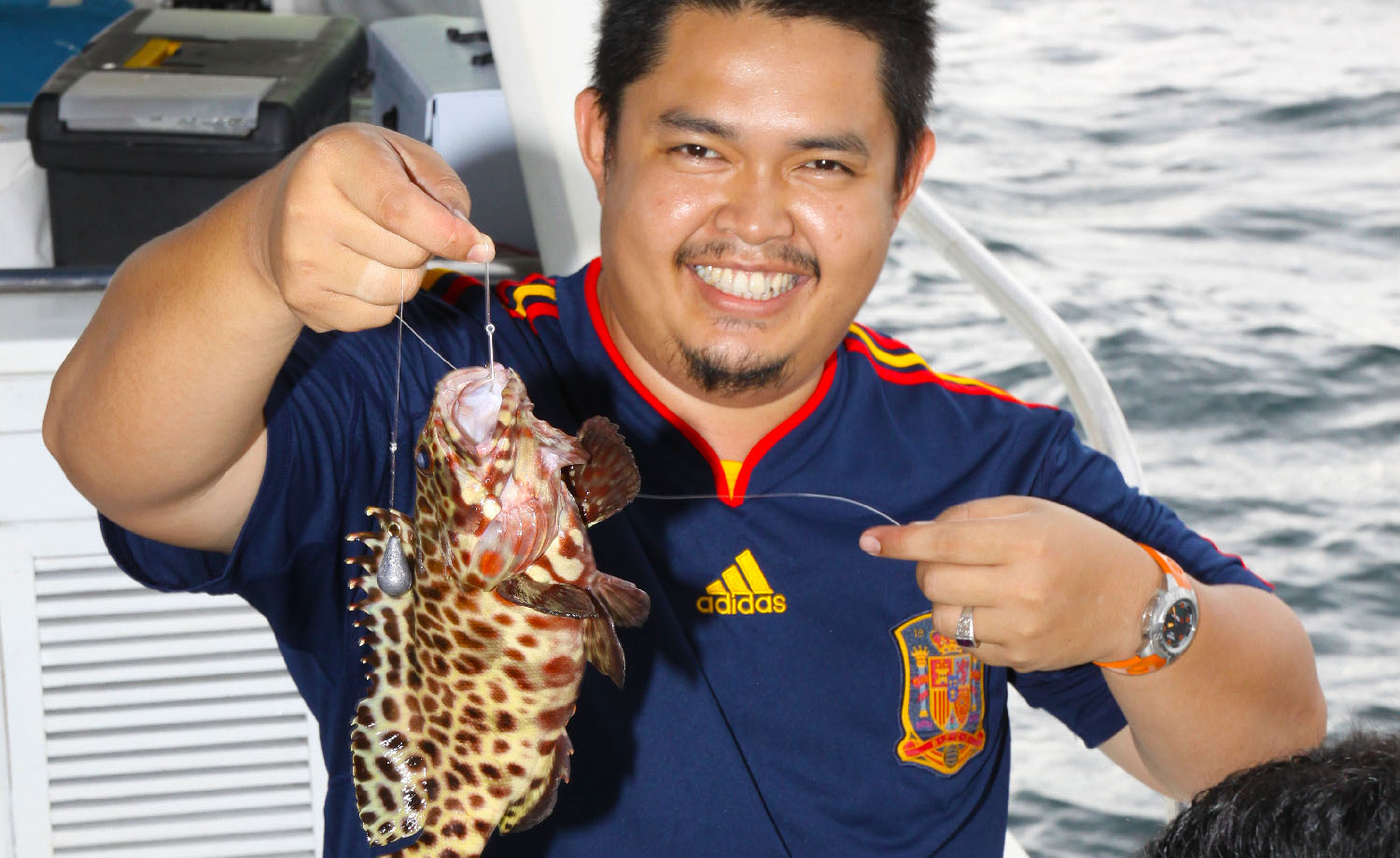
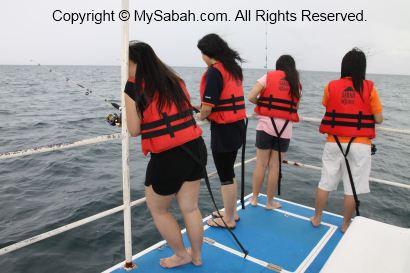
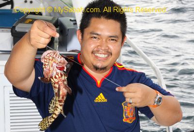
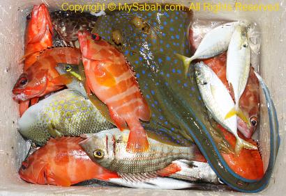
Then I went “deep sea fishing” in the sea 20 minutes off Usukan Cove by boat. Ehem… it was only 14 Meters in depth, not really deep. The “real” deep fish fishing is going for the depth of over 30 Meters. This tour operator does take hardcore anglers to real deep sea but that’s another package. It was so nice that the workers prepared everything for us, the fishing rod, hook and bait, making our lives so easy.
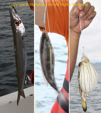
Can you believe it? In 3 minutes, we got our first fish! I thought we were only lucky. But from there on, we got fish in every 3 minutes. That’s not my case though. At first my fishing line entangled, then my fishing hook stuck in a rock, no fish for 30 minutes but the bait was gone, my fishing became “feeding fish”. Then a worker taught me a tip, I had to release my fishing hook all the way down to the bottom, not letting it dragged in the mid water or surface.
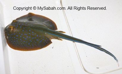
Above: blue-dotted stingray that has venomous sting
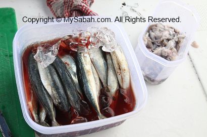
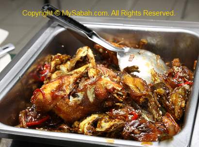
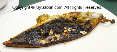
The tip really worked! Within 20 minutes, I got 3 fishes, two blacktip groupers (red color) and a Jackfish (silver color). One of us even got a puffer fish and another got blue-dotted stingray. The capture of blue-dotted stingray caused a brief moment of fear onboard coz its sting is venomous. I’m not sure about other countries, stingray is considered a delicacy in Sabah. Its meat is quite delicious if you don’t mind it gets a weird “chemical” taste (can mix it with lime juice to cover the smell). The sea was a bit choppy, so I walked like a drunken man on the deck. Btw, it is perfect to enjoy some beer while fishing. After an hour of fishing, we returned to Usukan Cove Lodge with our fruitful caught and they cooked the fishes for us.
Above: They cooked our caught as dinner. I hope this is steamed though.
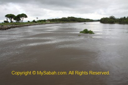
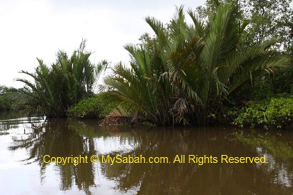
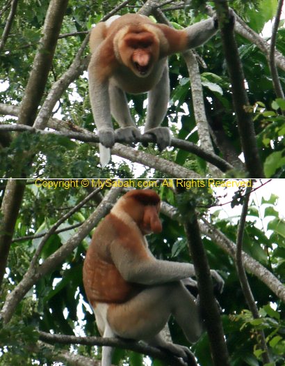
We started our river cruise at Kawa-Kawa River at 4PM, to look for playboy of Borneo. I mean the Proboscis Monkey, which has many wives and always in “ready” mode to mate. On one side of this 15-Meter-wide river is human settlement and another side is mainly mangrove and nipah forest. Since the proboscis monkeys are used to people, they are relatively less elusive and we can get really close to them.
Proboscis Monkey has the habit of spending the night on the trees next to the river in the evening. For them, riverside is the safest site to stay away from predators at night. About 4 to 5 herds of Proboscis Monkey were spotted at Kawa-Kawa River. But there is no guarantee we can see them. Luckily we found 3 groups of them despite the poor weather.
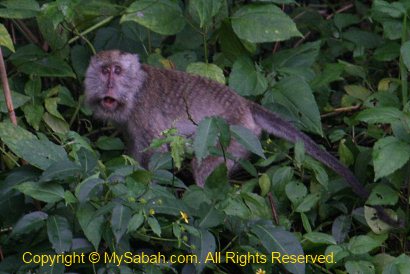
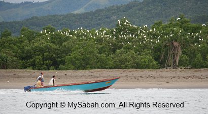
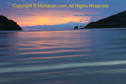
Besides long-nosed monkeys, we also saw crab-eating macaque (long-tailed macaque), monitor lizard and many birds such as oriental darter, white-bellied sea eagle, little heron, blue-throated bee eater, white-collar kingfisher, frigate, doves, egrets and bulbul. After we exited the estuary of Kawa-Kawa River and on the way to Abai River, we were rewarded by the magic moment of the sunset.
Above: a male proboscis monkey showed warning then ignored us
Then we proceeded to the mangrove forest of Abai River to look at firefly around 6:40pm. Normally there should be hundreds of them. Unfortunately, that night was rainy and bright with moonlight, the most inactive time for firefly, so we only spotted a few twinkling fireflies in the riverside. Weather is not something we can control so nevermind then. Anyway, I had so much fun that day and would call it an excellent trip.
You can skip this if you are not interested in visiting Maliau Basin. This is the last blog entry for my Maliau Basin trip. It is more like some post mortem records that might be useful for anyone who plans a trip to Maliau Basin.
Notes for Travellers
You need to be reasonably fit to go to Maliau Basin. The terrain is rugged and trail is not tourist-friendly. If you are too exhausted, you won’t be able to enjoy the view. You don’t need to be as strong as a hunk. A few months of regular exercise before the trip will help a lot.
Control your water ration during jungle trekking. Sip a bit for every 500 Meters to 1 KM. If you take big quantity of water at a time and you sweat heavily, your body will ask for more water, drinking too much then you will sweat more and lose more body salt. Later you will find that no matter how much you drink, your body is getting weaker. At last, you run out of water and suffer dehydration. Bring a few packs of rehydration salt (costs only RM0.50 per pack) with you to replenish salt if necessary.
Reduce the weight that you carry. For example, I had only 2 set of clothing in 6 days. I wear the “dirty set” during daytime trekking, wash it in the evening and leave it to dry over the night, and another “clean set” is for bed time.
You can save some $ if you don’t ask the travel agent to cook for you. In that case, you must have a good cook in your team, and that person should be an experienced cook who can plan the menu and ration the food quantity accordingly. It’s stressful if everyone is really tired and hungry but doesn’t know how to cook a proper meal.
The trip will be much more enjoyable if there is a botanist, birdwatcher or naturalist joining you, as they can point out all the unique things in Maliau Basin. It is quite a sad thing to pass by those rare flora & fauna, without knowing that they are worth a closer look. The rangers speak very limited English. I’m afraid they can’t tell you much unless you can speak our local language.
Start the trekking early in the morning and walk slow. You can walk slowly if you start early. Besides, it is a bit warm in the afternoon. Even the most photogenic place will look less ideal for photography if we get there in the afternoon, due to the harsh afternoon light.
I will go to Maliau Basin again. Next time I want to visit (1) the 12 hectares Linumunsut freshwater Lake, (2) Takob-Akob Waterfall, and (3) Garden of Eden (currently inaccessible due to land erosion. They say it looks like Japanese garden full of flower).
There are only 5 ways to get cheaper tour package to Maliau Basin:- (1) going in big group, you can get nearly 50% discount if your group is big, say, 10 people. (2) DIY. Try to do everything yourself, e.g., cook your own meal, use own transport, don’t use porter. (3) Write-in to Yayasan Sabah (Management of Maliau) to waive various fees such as permit, photography and guide. You can try this if you organise trip for education, tourism, government or NGO sector. But no guarantee they will approve. (4) Malaysians get cheaper price than foreigners. For those foreigners who like to complain about the discriminating pricing, well, many Malaysians study in overseas universities and pay expensive school fees in “international rate” for a few years. I don’t see any problem to charge foreigner tourists for higher price. (5) The prices offer by different travel agents in different time can vary greatly. You need to shop around for the best deal. But cheap doesn’t mean good. You have to be careful of the hidden cost.
Notes for Photographers
Below are some advices for the photographers. Even compact camera users will find the guide below contains very useful tips:
You need a permit to photograph in Maliau Basin. Mine was waived so I am not sure how much it costs. But I heard that it is very expensive. Anyway, it may sound unreasonable to stop a tourist to take photo, so I don’t know how strict this is enforced. Do ask if you want to photograph Maliau.
Tripod is a must, though it adds extra weight to your back. You will really appreciate it for waterfall and landscape shots. Under the forest canopy is also a dark world. My sturdy Manfratto tripod is 2 Kg. At first I bought a mini 1Kg-tripod to replace it. Then I decided to bring the best tripod. My extra effort did pay off.
If possible, organise the trip with a group of photographers. If you go to Maliau Basin with ordinary travellers, they will not wait for you to setup tripod and spend a long time to shoot an object. Non-photographers are also lack of motivation to wake up and move earlier, so you cannot earn more time for taking photos along the trail.
Taking photos needs a lot of energy. Exercise as much as possible, to make sure you are physically fit. If you are really fit, you can afford to stop by to photograph, then catching up with the group who always leaves you behind. Do not forget you need to carry heavy camera and tripod.
Use LCD Screen Protector for the LCD of your camera. It is only RM50 (about USD$15). I am glad I did because it did stop a severe damage to my LCD. In long hours of jungle trekking and climbing in hostile terrain, bad thing can happen to your camera anytime. Just treat this RM50 as an insurance for your fragile camera.
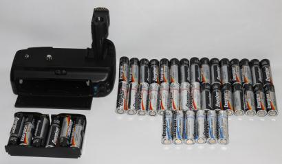
Bring spare batteries, and a lot of them. Instead of spending a few thousands to buy too many DSLR camera batteries, you can buy a battery grip, which costs RM300 to RM500 (about USD$90 – 160), then buy many AA batteries, which can be used for your camera (and external flash). For this 6-day-5-night trip, I finished all 50 AA batteries. In Maliau Basin (except Maliau Basin Studies Center), the camps have no power point for you to recharge your batteries.
Get the best AA batteries. I was using Energizer brand AA batteries. I found that its Ultimate Lithium battery (blue & silver color) can last 3 to 4 times longer than its ordinary alkaline battery (black color). Though Ultimate Lithium battery is very expensive (RM8 each) compared to ordinary black Energizer battery (RM2 each), I recommend you to cut down your weight by using more Ultimate Lithium batteries. Though holding more power, surprisingly this Lithium battery is half the weight of ordinary alkaline battery. I was annoyed that 6 ordinary alkaline batteries (for battery grip) could not last even one day.
Bring more memory cards. Without enough memory card, extra batteries are also useless. It’s better to have spare memory cards, especially if you shoot in RAW format. The less you worry about memory constraint, the more you shoot and the more likely you will get more good photos. Make sure you format the cards before the trip. Instead of buying one big memory card, it is safer to buy a few smaller cards. For example, it is better to buy two 8GB cards than one 16GB card. If your single big memory card damages, you lose all eggs in a basket.
You can hire a porter to carry your camera bag. But you should keep some spare memory cards and batteries with you. The porters understand very limited English. Even though I instructed them a few times to stay close with me, they “disappear” when I was out of memory card or battery!
Raincoat is necessary. Raining is very common in Maliau. In case of rain, the raincoat will protect your camera from the rain. And make sure your camera bag comes with a rain cover. If your porter carries your camera bag, show them the rain cover so they know how to keep your camera bag dry in rain.
If you are interested to go to Maliau Basin, you may contact Borneo Nature Tours for more info.
Photos taken in Maliau Basin, Sabah, Malaysia Borneo
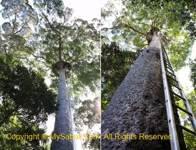
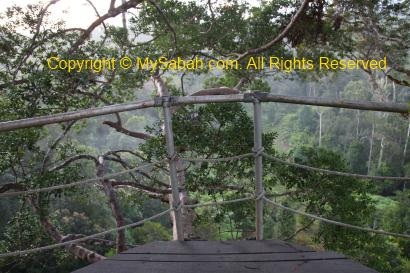
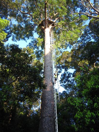
I wake up early at 5am in day 5, when others are still in their dream. Next to the Nepenthes Camp is an observation platform on top of a 33-Meter Agathis borneensis tree. I want to climb up there early to see the sunrise.
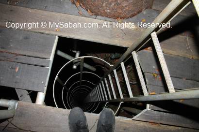
Soon Mr. J and Mr. T also wake up to join me. Ms. S doesn’t join coz she has issue with the height and says there is no way she will do it. It is already frightening just looking at this tall tree. Anyway, adventure is doing something that scares you. At 5:15am, one by one, we climb up to the tree top with aluminum ladder that fixed to the tree body.
Imagine you climb a ladder to the top of a building over 10 floors high in the dark (about same height as the Karamunsing Complex in Kota Kinabalu). This is the second scariest climb that I attempt so far (the first is Batu Punggul). A misstep and you will be a free falling object for hundred feet.
One good thing to climb in the dark is, you can’t see anything under your feet, so it is not that terrifying. Mr. T and J got up there first. I hang the camera and tripod over my shoulder and move up carefully. After a few days of holding camera to take thousand of photos, my fingers are really painful. The extra camera weight also makes my legs tired and shivers. I have to stop a few times to rest. Finally, I reach the top within 10 minutes.
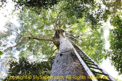
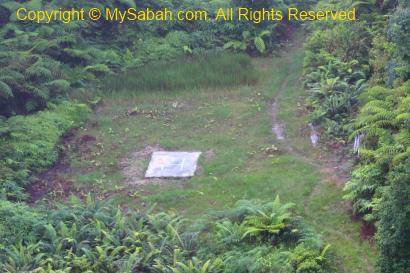
Above: a helipad not far away from Nepenthes Camp
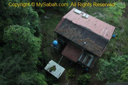
Above: Nepenthes Camp looks so small from top. You can see the solar panel on the roof.
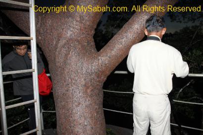
Strictly speaking, the observation tower is only a wooden platform on top of a tall tree. It is not really a tower. The structure is fenced and solid enough to take 5 to 6 persons. It is 5:40am. We look out from this platform and see that our house is so small under our feet. We also admire and appreciate the pretty Agathis borneensis tree that house the structure.
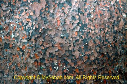
Above: the beautiful skin of Agathis borneensis tree, note the pocked-marked, greyish-reddish bark.
Above: Mr. J waits to video sunrise
The sunrise comes at 6:10am. The surrounding and the trees are painted with golden hue of colors. The birds also start their days. Many colourful birds such as Iora and Scarlet Minivet gather around the canopy of this tree. This platform is quite a nice bird watching spot. We climb down at 6:40am for breakfast, when the sunrise show is over. Damn it! I find a crack on the LCD protector. Luckily it helps to block the damage to LCD which would cost hundreds to fix.
Above: Mr. T climbing down
Above: it’s me climbing down the tree
Back to Maliau Basin Studies Centre (MBSC)
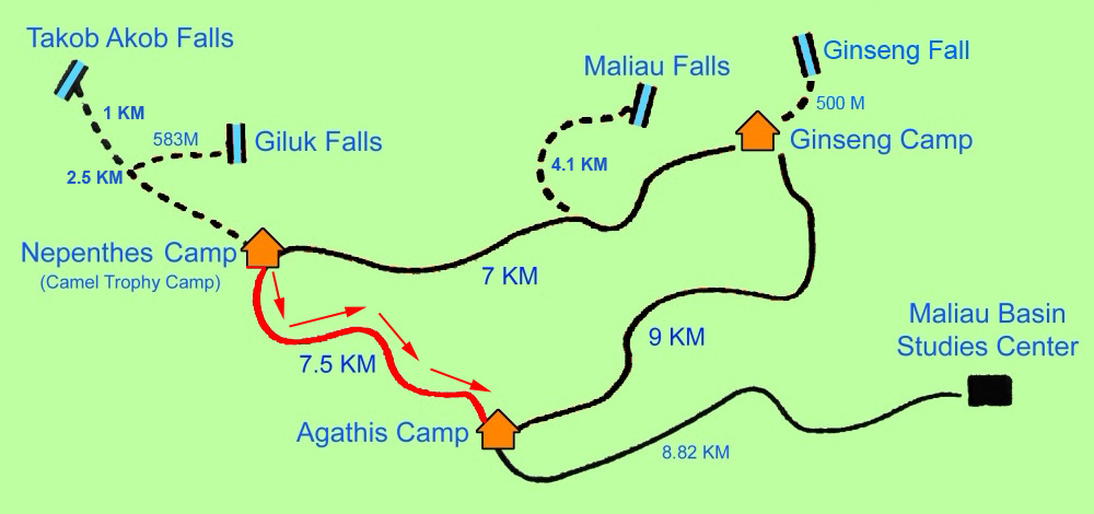
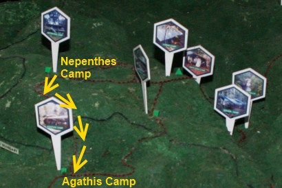
We are very relaxing today, coz we will leave the total wilderness of Maliau Basin and the trail is mostly descending (easy) path. Even though I am cut off from civilisation for many days, I don’t really feel homesick, it’s a sad day for me actually. After we have our breakfast, we depart at 8:30am to Agathis Camp, which is 7.5 KM away and a move from 1,005 to 421 Meters above sea level.
Above: trail in red is our path to Agathis Camp today
Above: the trail in 3D model
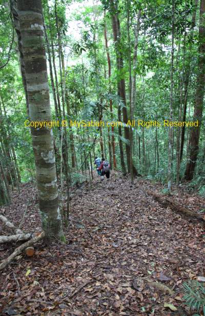
The guides warn us about the steep downhill trail and we should “brake” always and don’t run too fast. And they are right. The descending trail is not easy and it does not make us move faster, and it poses another challenge. There is no way you can tell if the soil is soft or solid until you step on it. The slope area is dangerous coz the soil is soft and slippery. The slippery “trap” is so evil coz the mud layer is just thin enough to make you slip, but not deep enough to hold your foot. I have to make sure both of my hands are supported by a rope or tree before I take the next step. I can survive a fall but my camera might not. Just be careful of the precipitous hills…
Over the days, I discover a special ability of women. They just can’t stop talking, during trekking, eating and sleeping, ALL the time. I am already out of breath trekking and they still talk to me. At the end, I just pretend I don’t hear them. Sorry, I am just too tired.
Above: lookout point, where you can see Maliau rim through gap between the trees.
Since this is the last jungle trekking of our trip, we just walk slowly, open all our senses and enjoy the surrounding view. We saw a family of 3 Bornean gibbons swings on tree branches. Red & Hose’s Leaf Monkeys (langurs) and Bornean gibbons are very common primates in Maliau. We also hear the distinct calls of Black & Yellow Broadbill and Bornean Bristlehead, and also the loud pecking noise of a woodpecker. Then Mr. T is very excited and shows me a flower of Dendrobium cinnabarinum. He says this flower is very rare, the two (all) varieties are found in Maliau Basin only.
Above: flower of Dendrobium cinnabarinum.
Finally at 12:30pm, we arrive Agathis Camp, where we have our pack-lunch. We are asked to take a shower and put on clean clothing, before we are allowed to sit in the beloved 4-wheel of the guide. Then we leave Agathis Camp and go to the hostel of MBSC, where we will spend the last night in Maliau Basin. After staying 3 days in jungle camp, the hostel is really a 5-star accommodation to us now. The guides and porters are very happy too coz now they can watch World Cup 2010 in MBSC.
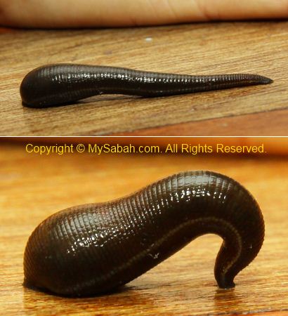
Above: don’t know who brings this tiger leech back to the hostel. It is fully fed with 1 year worth of meal, so fat… lol
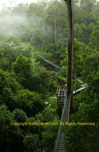
Skybridge (Canopy Walk)
You are wrong if you think we are holidayers who can sit still for day doing nothing. After we unpack our bags in hostel, we start to get restless and want to go to Skybridge (suspension bridges built between tall trees high above the ground). It rains heavily in the afternoon so we go around 4PM.
The Skybridge is only a 10-minute drive from MBSC. Constructed in April 2007 and linked up with about 8 super tall trees (Uratmata, Sepatir, Merbau and Seraya), Skybridge is the second longest canopy walk of Sabah, with a length of 293.8 Meters (Highest Point: 21.35 Meters).
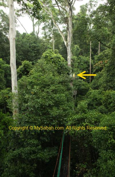
Above: can you see them? They look so small…
Maliau Basin is an Important Birding Area. More than 290 bird species are found here, with more than 20 are endemic to Borneo, and 26% are listed as threaten or near-threaten by IUCN. Here you can find all 8 species of hornbill of Borneo, 6 species of kingfishers and all 9 species of Bornean barbets. We see fruits of fig species (Ficus), which is the favourite of hornbills, who visit as many as 240 species of fruit trees. We spend an hour here and back to hostel later.
Above: fruit of Ficus tree
Above: a weird praying mantis looking at us
Night Safari
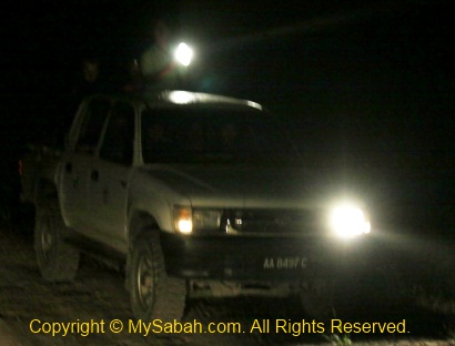
Tonight we have a night safari at 8pm. We just sit on the jeep and let the guide scans for wildlife by using a spotlight. If the guide spots anything, the car will stop and he will show and tell us what we see. This is highly depends on luck. In bad day, you would see nothing.
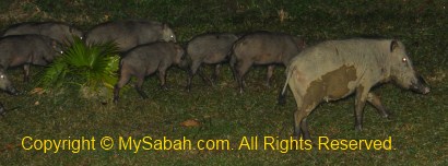
Above: this wild boar (Sus barbatus) always comes to MBSC. She got 8 babies.
During an hour of fun drive, we see Malay Civet cat, Sambar Deer (cervus unicolor), Flying Squirrel, Rhinoceros Hornbill and Buffy Fish Owl.
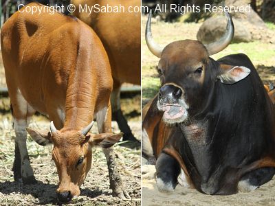
We have been seeing the fresh dung of Banteng and elephants and hope to see them tonight, but too bad none of them turn up. Anyway, below are their photos for you to know how they look like.
Above: Banteng (Bos javanicus), Asian Wild Cattle or Bornean Wild Ox, known as Tembadau locally. Left is the female and right is male Banteng. Banteng is extinct in West Malaysia (since 1950) and Sarawak (since 1980). It was used to be the favourite game species of hunters but now it is endangered and protected in Sabah. The domesticated Banteng becomes Bali cattle. Note the white “stockings” on the legs. About 15 to 20 Banteng are recorded in Maliau.
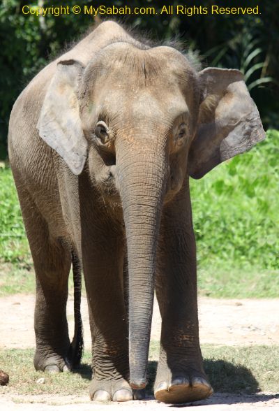
Above: Pygmy elephant of Borneo is the smallest elephant species in the world.
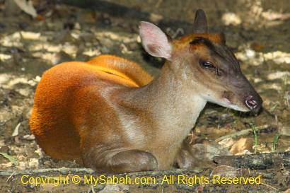
Above: Common barking deer (Red Muntjac), known as Kijang locally. It can grow in length up to 98 to 111 cm, a height of 50 cm and a weight of 15 to 35 Kg. You can buy its meat as it is still the game species.
FYI, all 5 cat species (i.e. flat-headed cat, marbled cat, bay cat, leopard cat, clouded leopard) of Sabah are found around Maliau Basin. They are very elusive and secretive animals active at night, so they are very hard to spot.
Finally, we have joined all the programme In Maliau Basin and will go back to Kota Kinabalu tomorrow. But there is still one more unplanned programme waits for us tomorrow.