 by
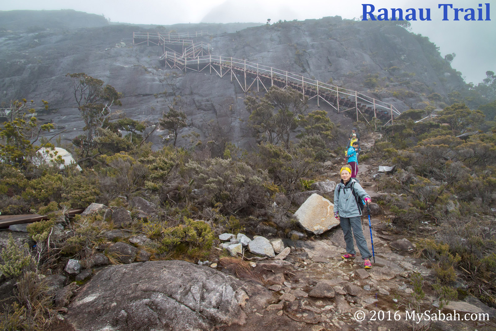
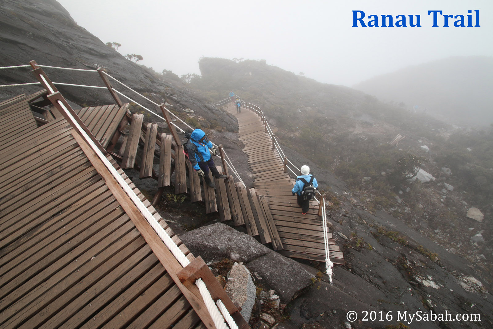
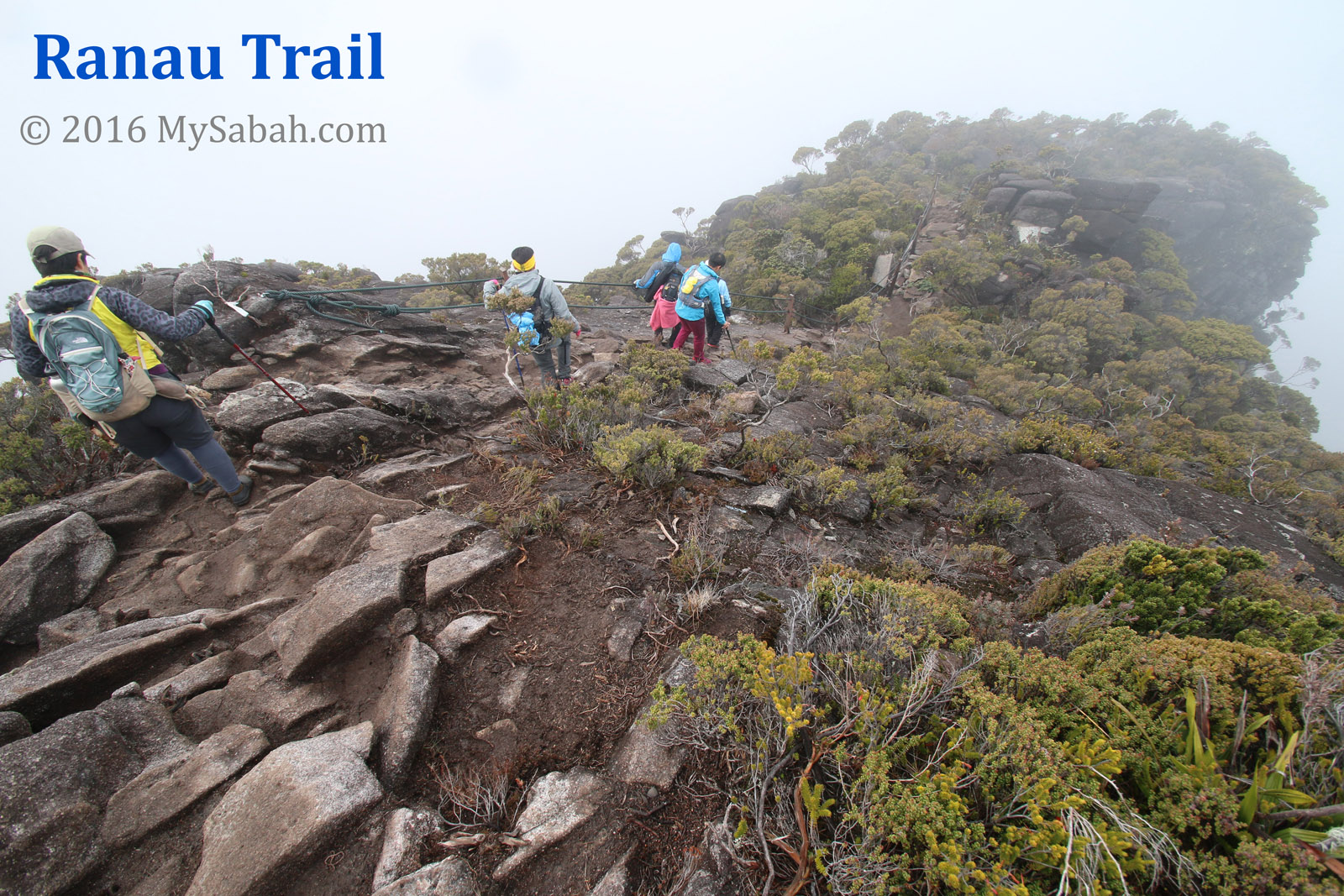
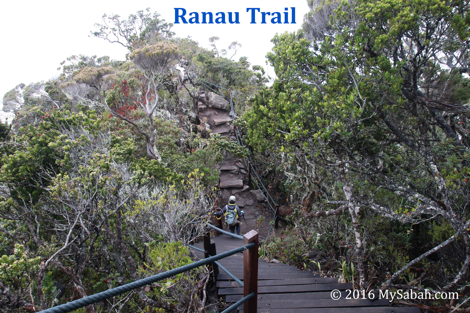
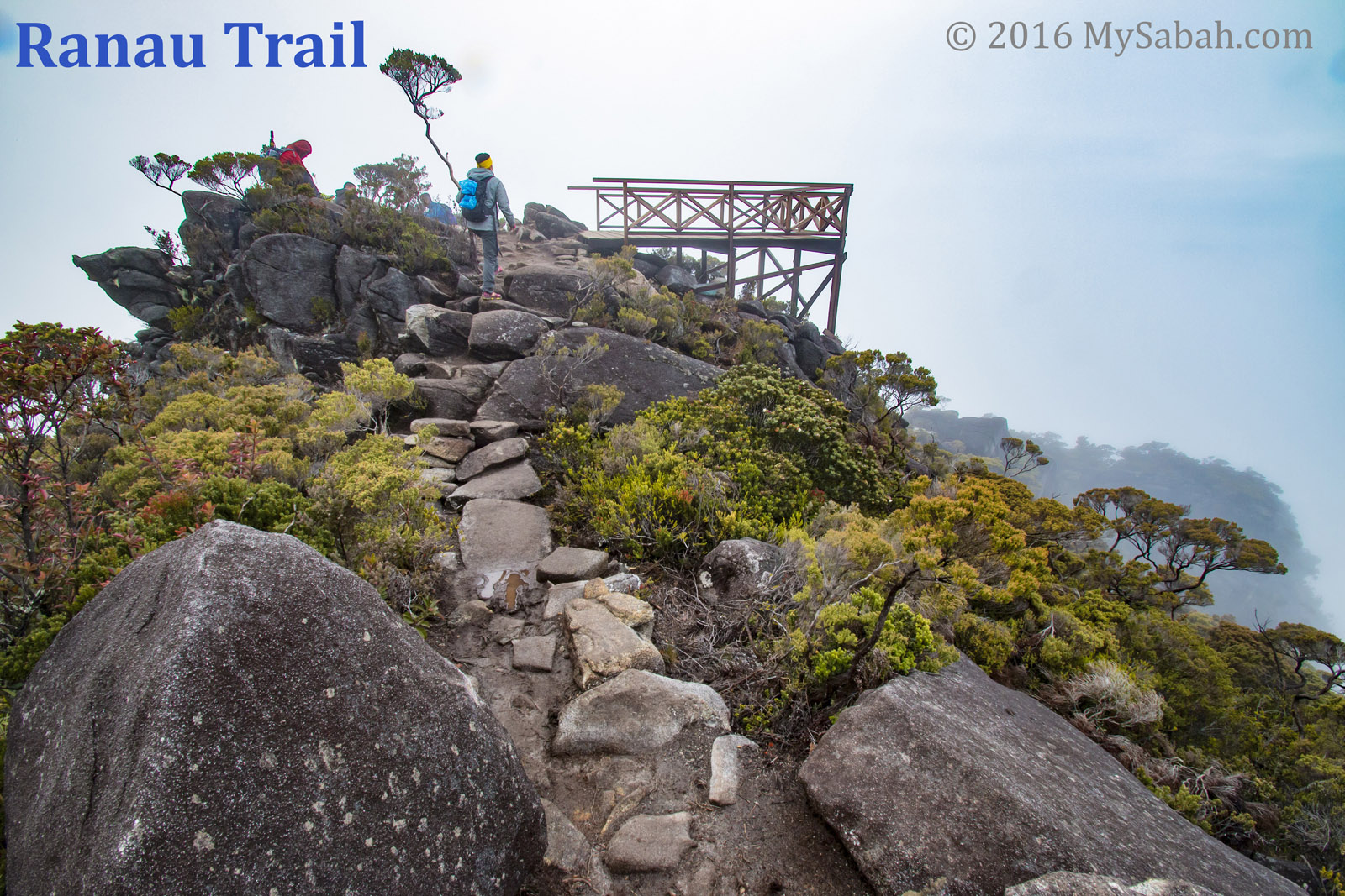
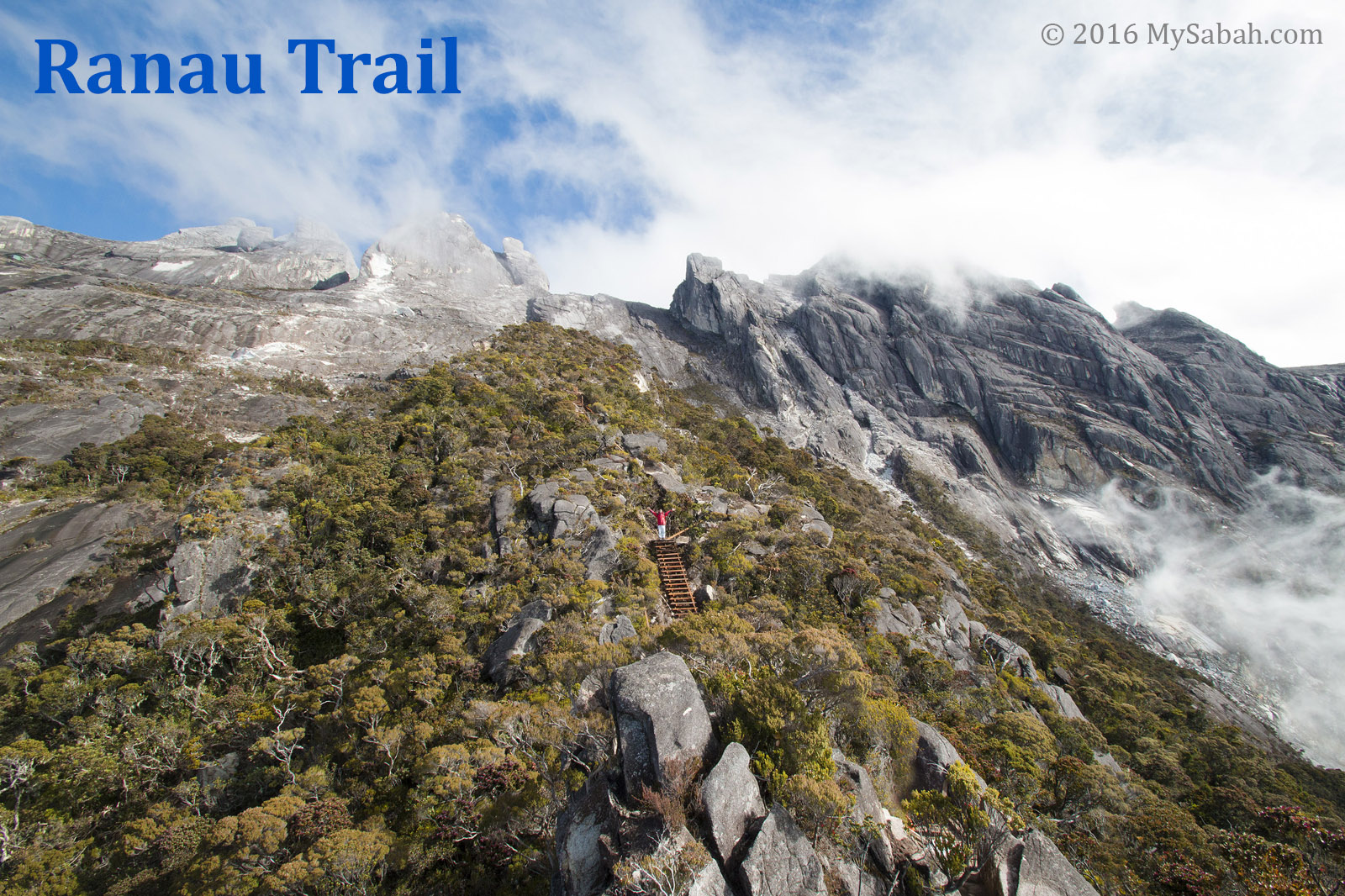
by A 6.0 magnitude earthquake on 5 June 2015 destroyed part of the old summit trails on Mt. Kinabalu. On 1 Dec 2015, a new summit trail named Ranau Trail is open and becomes the Standard trail to climb Mt. Kinabalu until now, and I had covered this trail in detail in my article “How to Climb Mount Kinabalu and How Much it Cost?”.
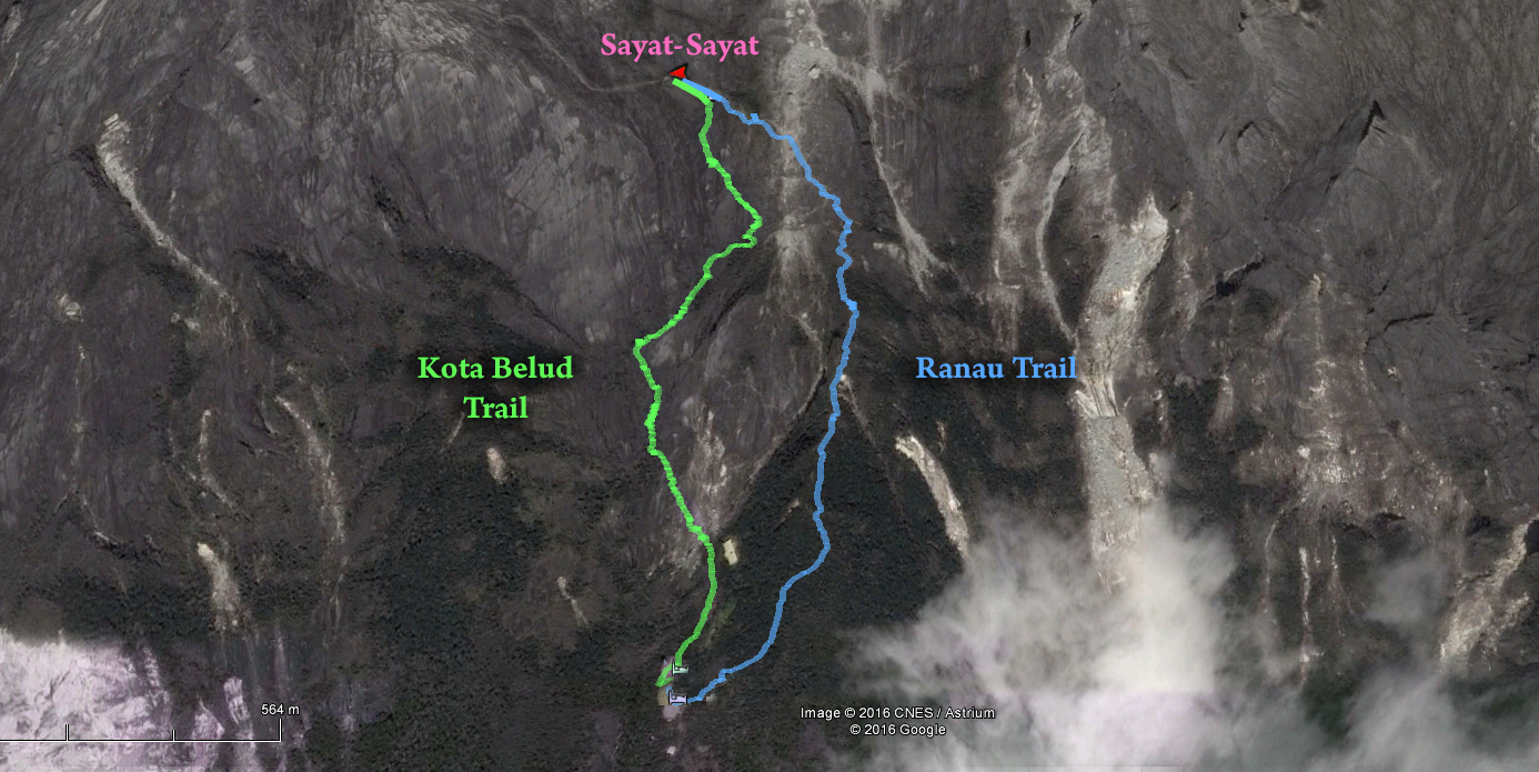
Kota Belud Trail
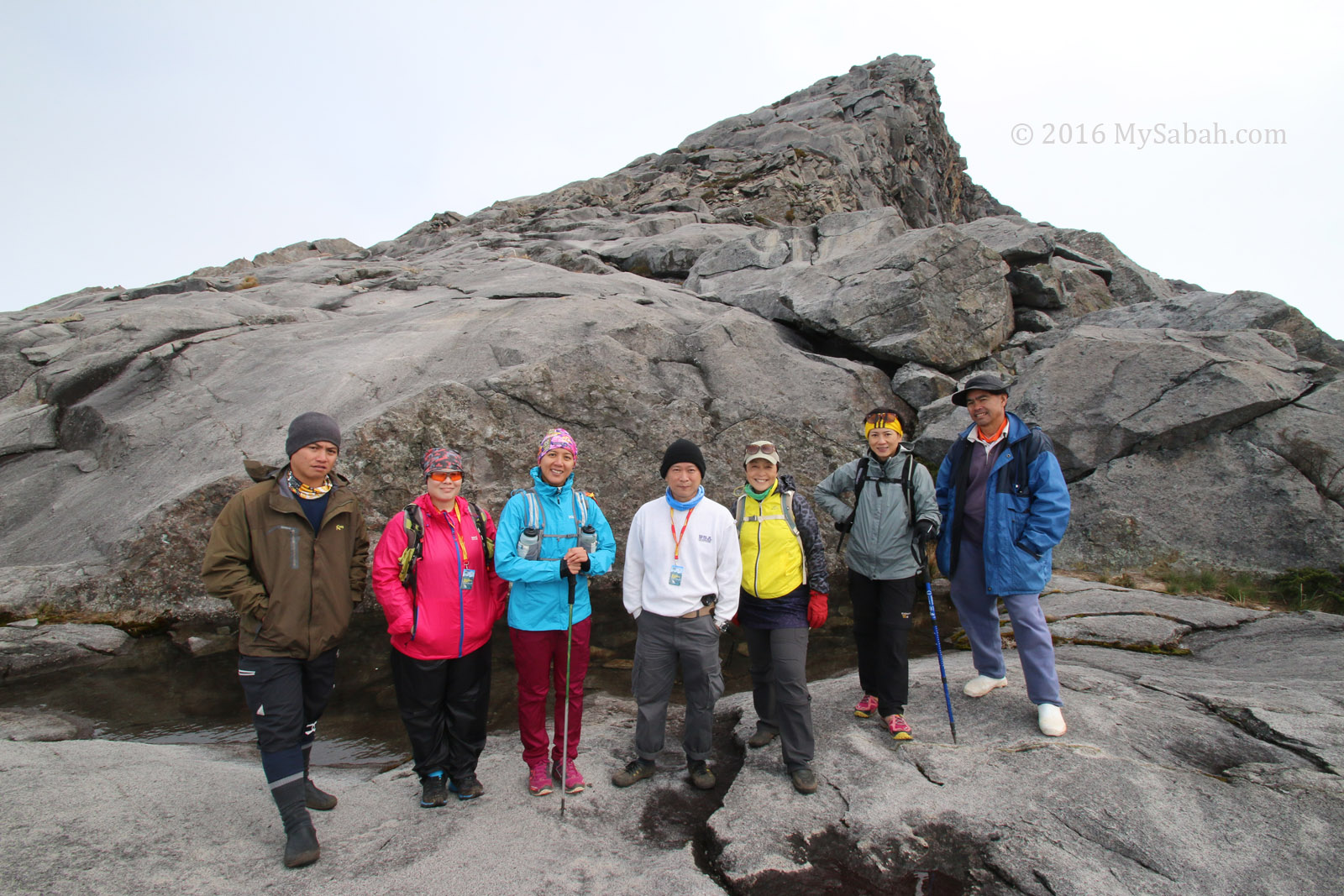
The second new trail called Kota Belud Trail is open on 9 Dec 2016. I had climbed it three months ago (with special permit by Sabah Parks, as it wasn’t open to public that time), and this post will give you an overall of this new trail.
1. Kota Belud Trail is 170 Metres longer than Ranau (Standard) Trail
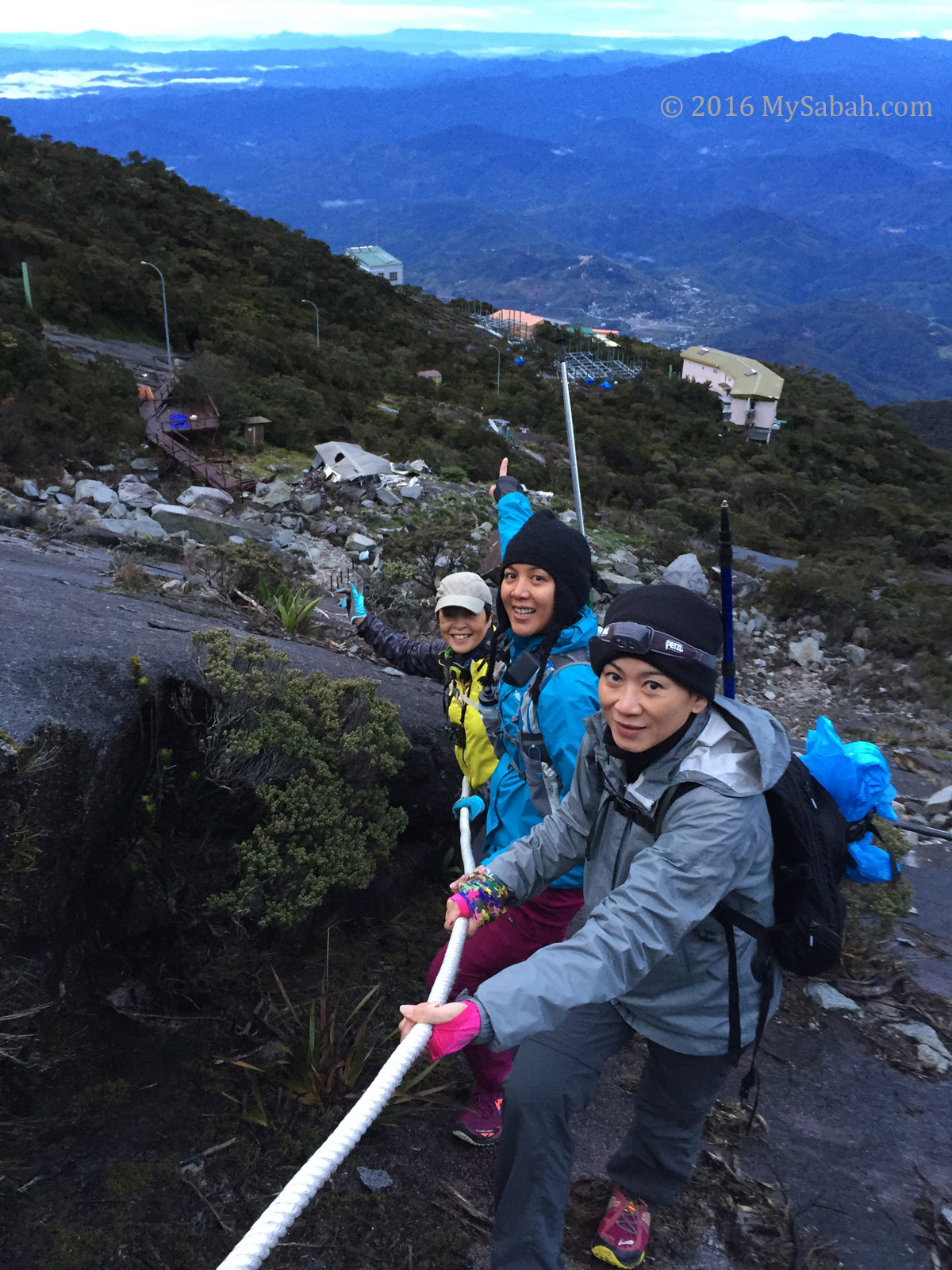
The one-way distance (from Timpohon Gate starting point to the Summit) of Kota Belud Trail is 8.97 KM, while Ranau Trail is 8.8 KM. The starting point of Kota Belud Trail is next to Gunting Lagadan Hut and Panar Laban Hut, while Ranau Trail is started behind the Pendant Hut.
Kota Belud trail doesn’t start at Kota Belud town, and Ranau Trail doesn’t start from Ranau town too. You can see these districts from the trails on mountain hence their names. Both trails start at Laban Rata and end at Sayat-Sayat checkpoint.
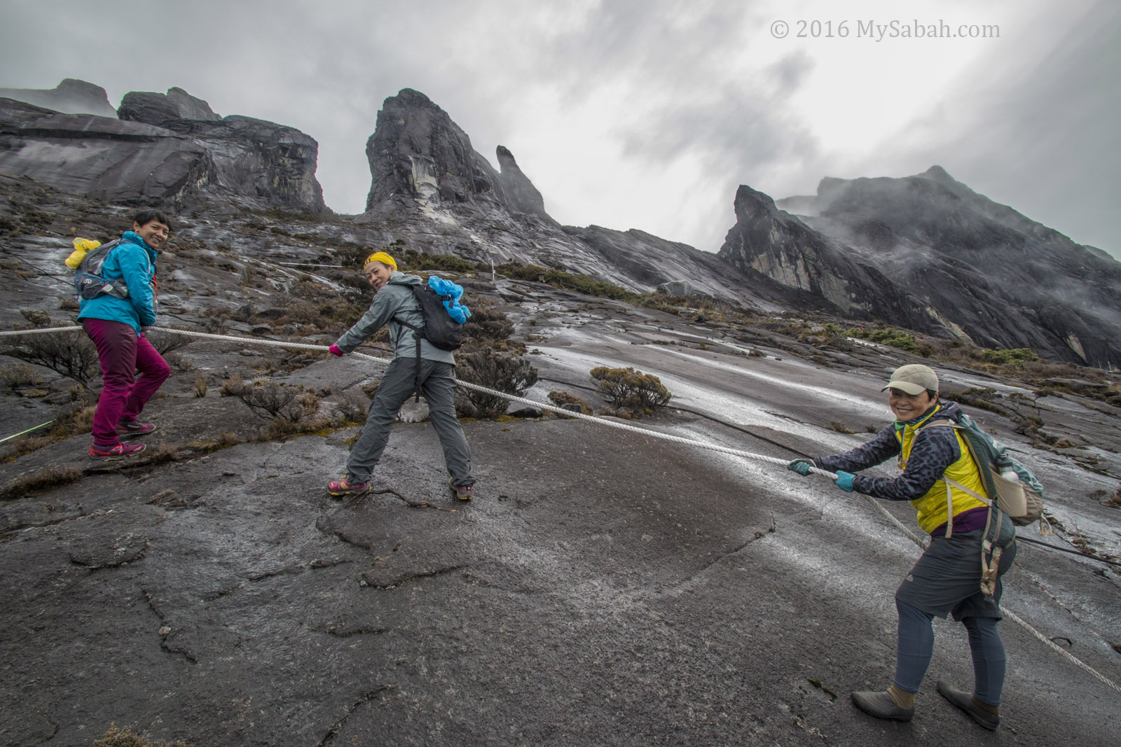
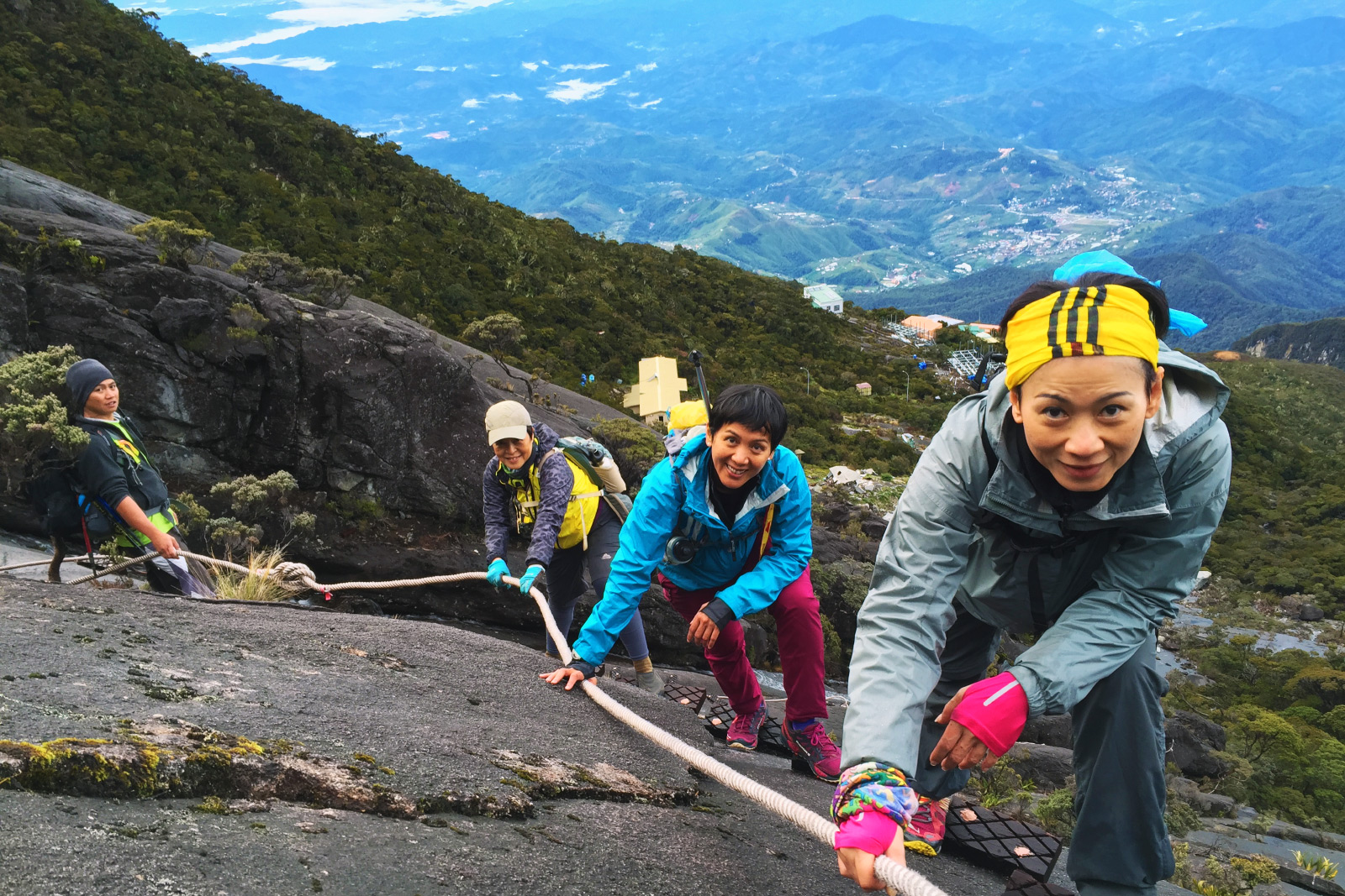
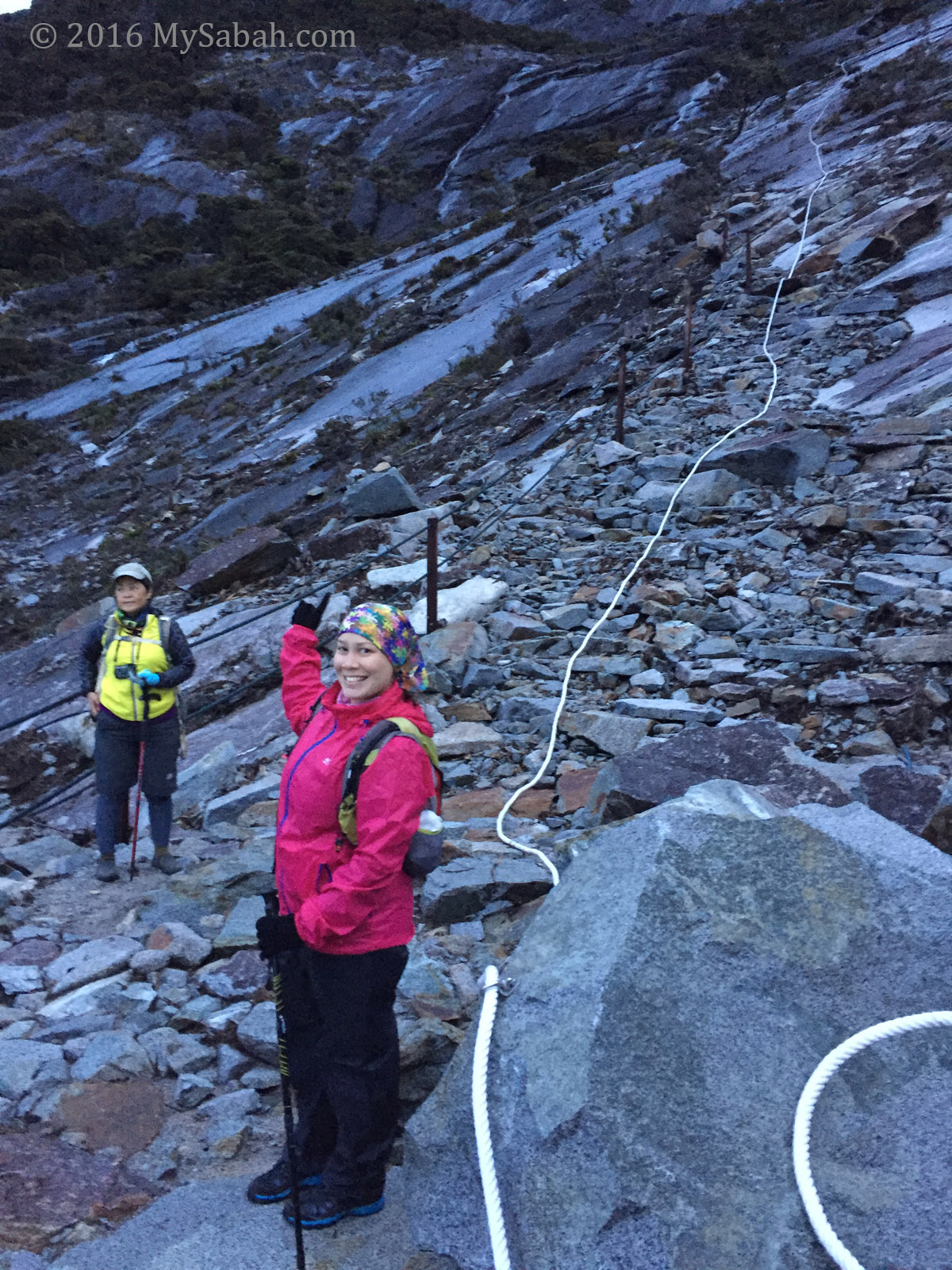
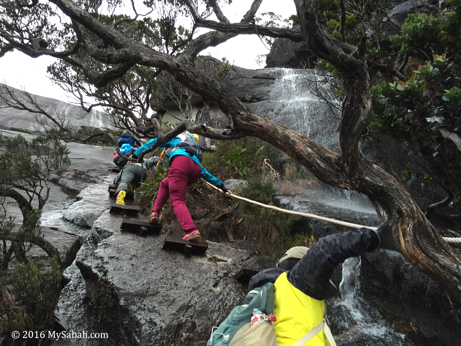
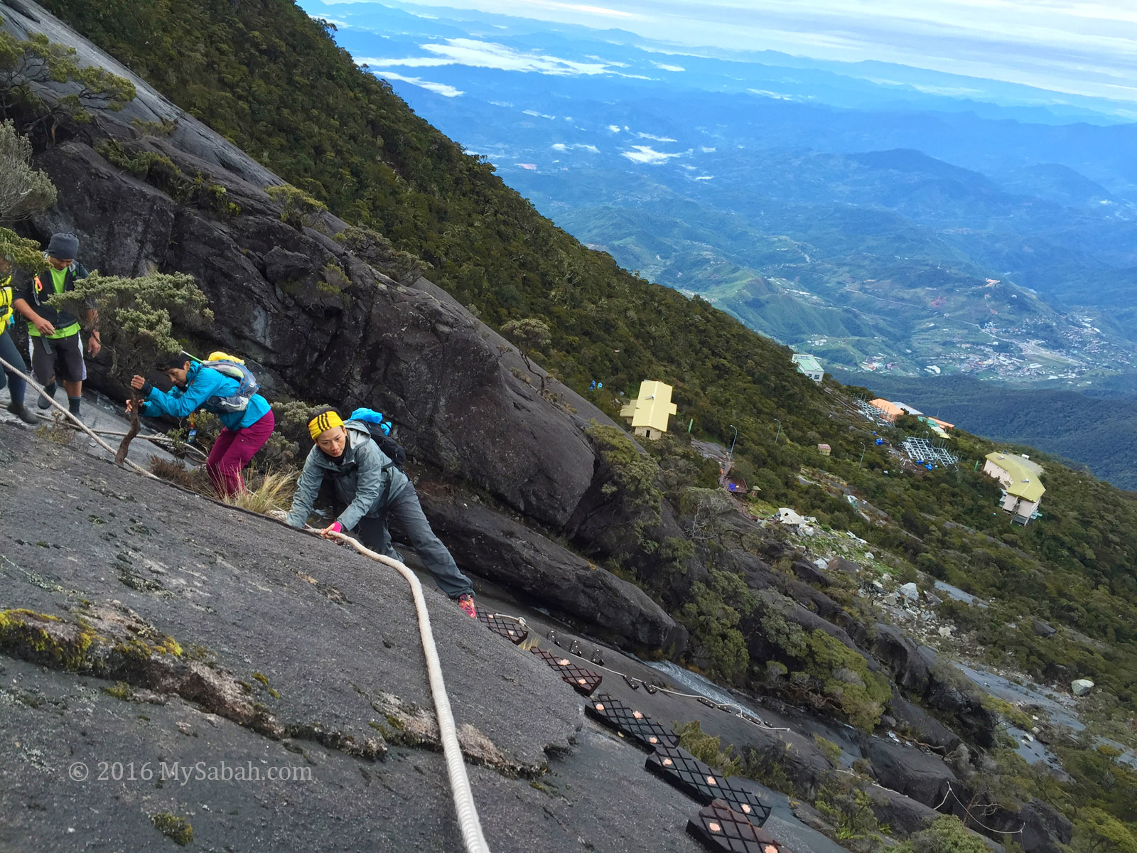
2. Kota Belud Trail is more Challenging than Ranau Trail
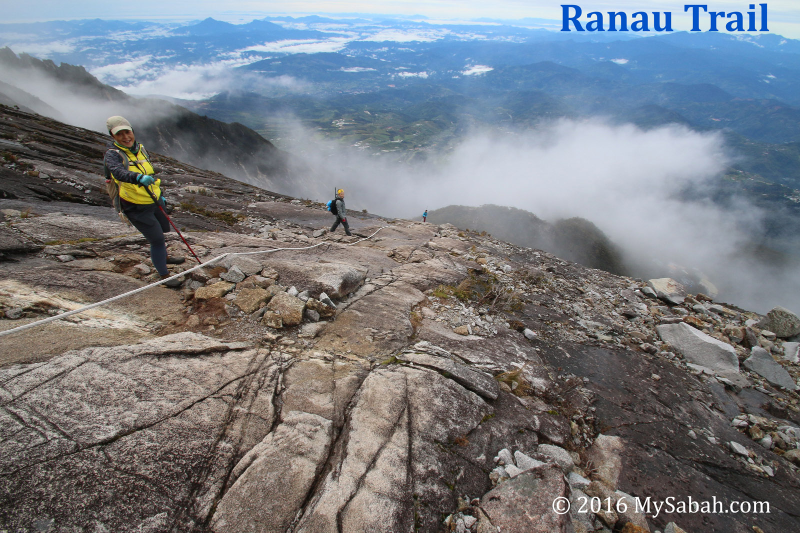
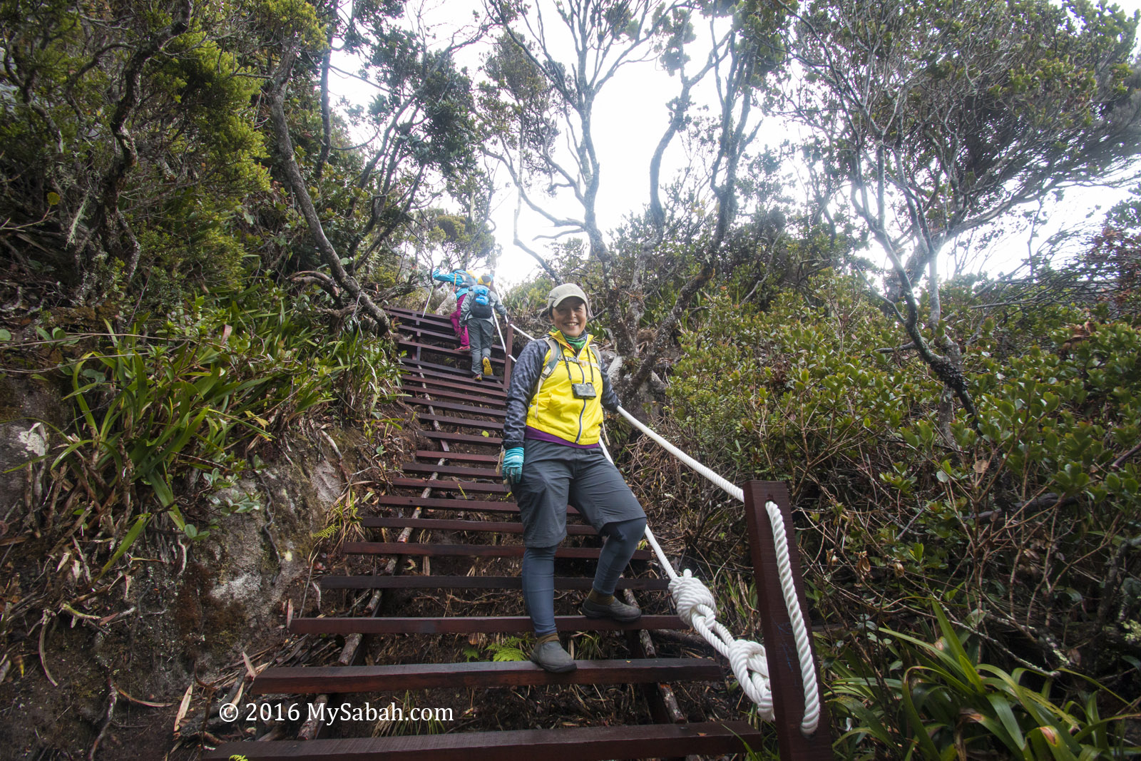
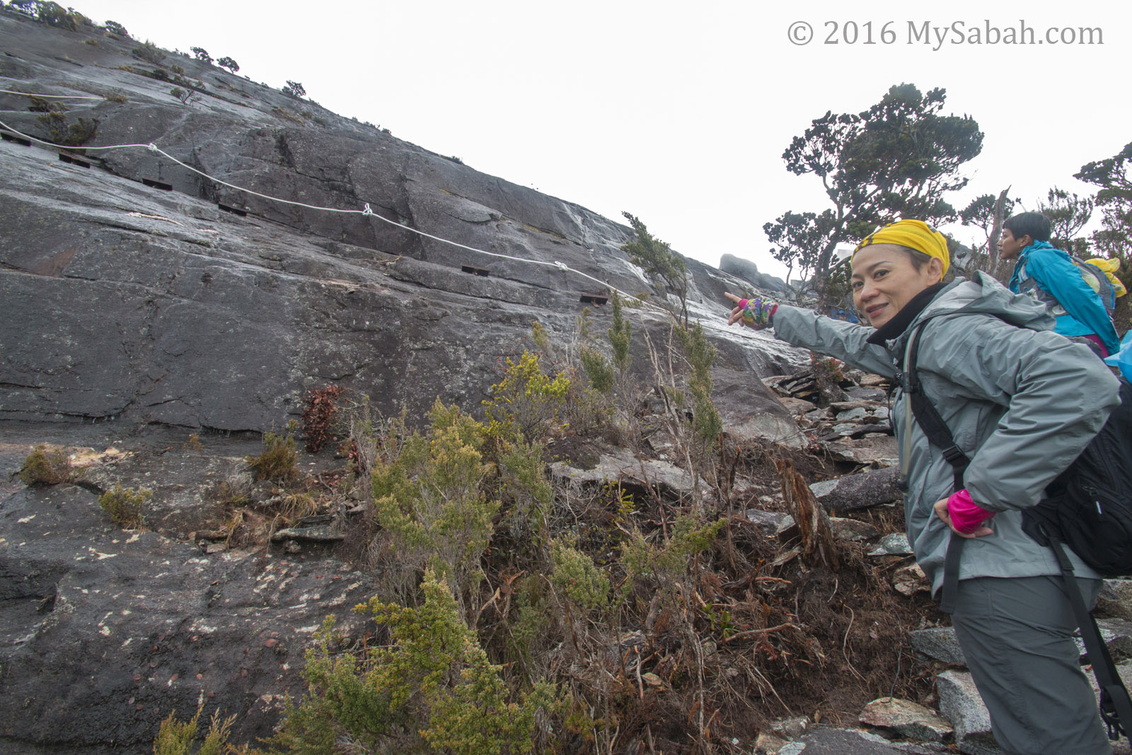
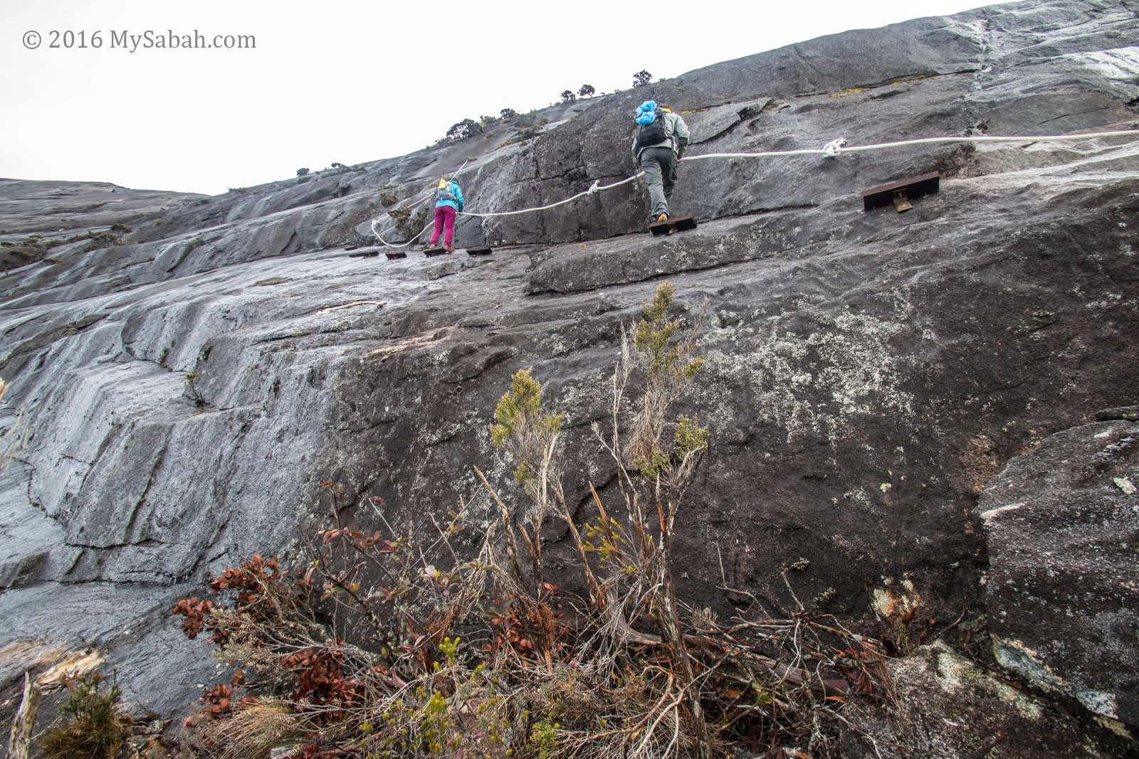
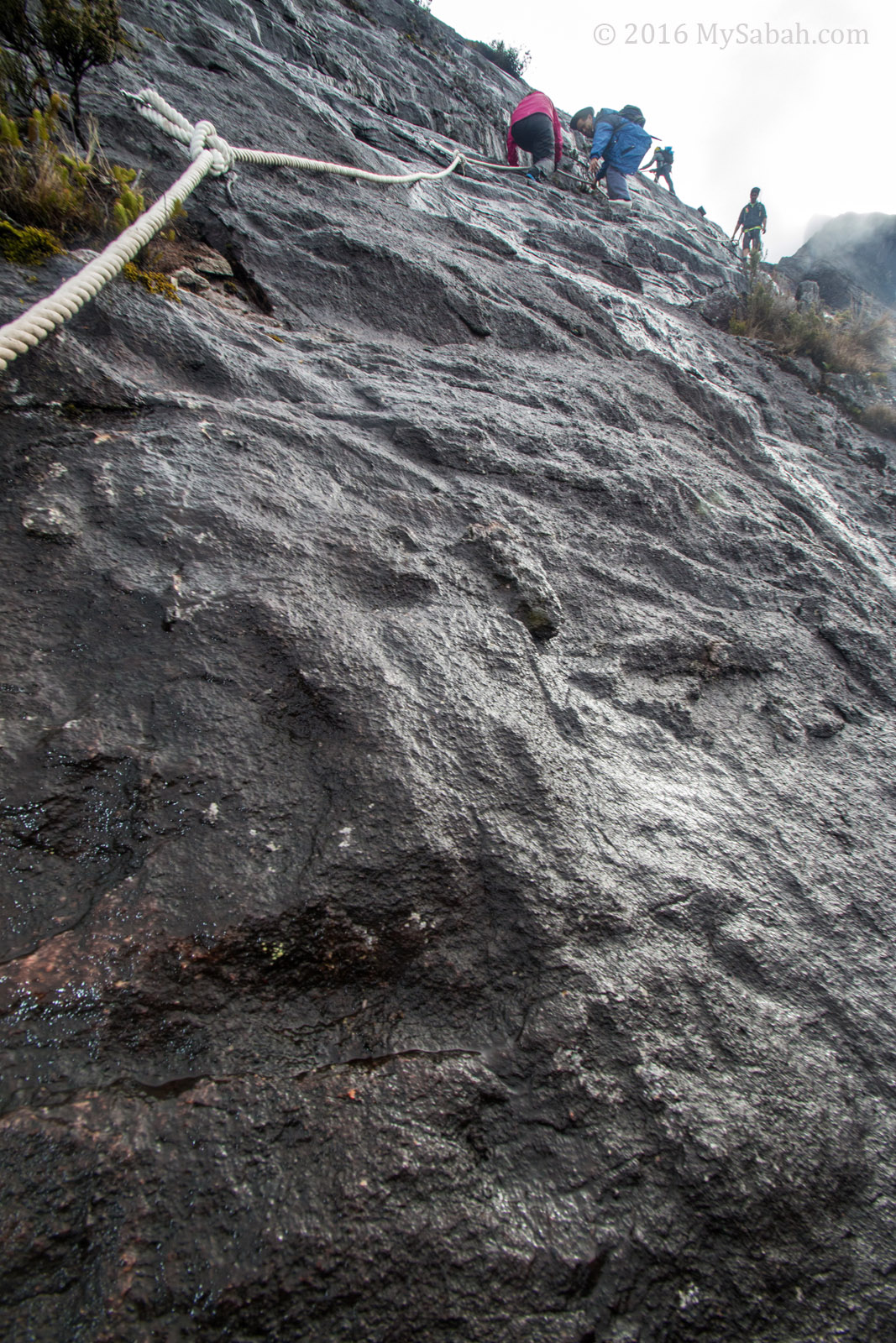
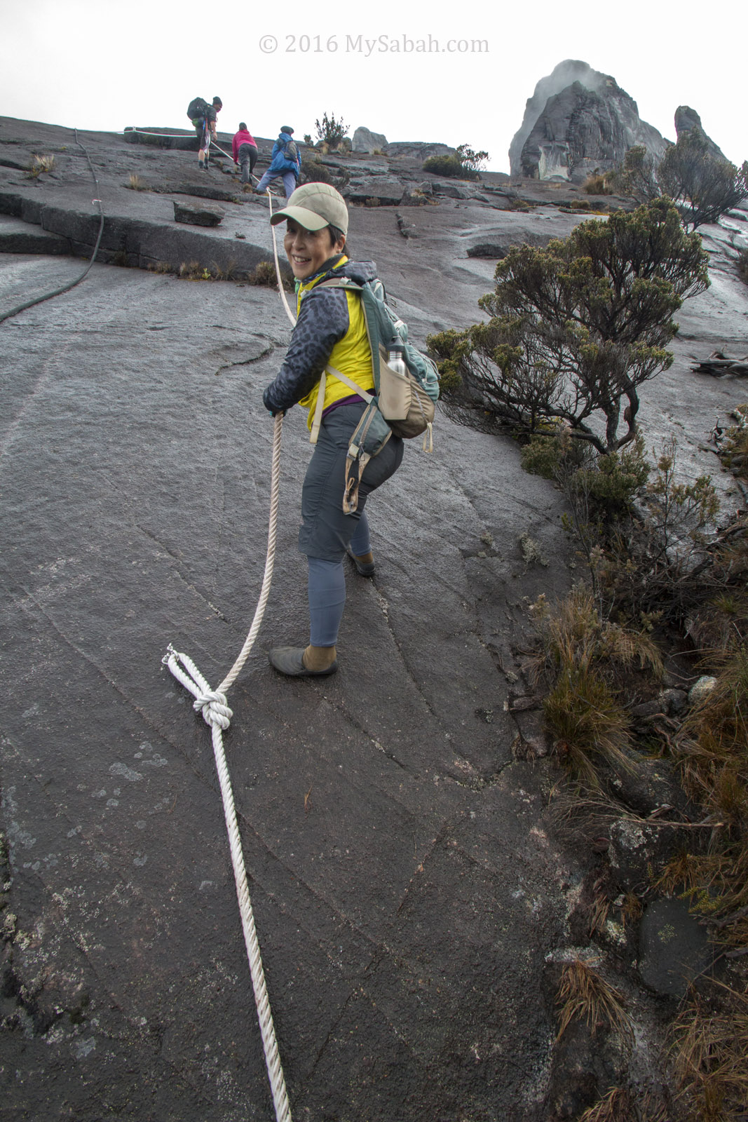
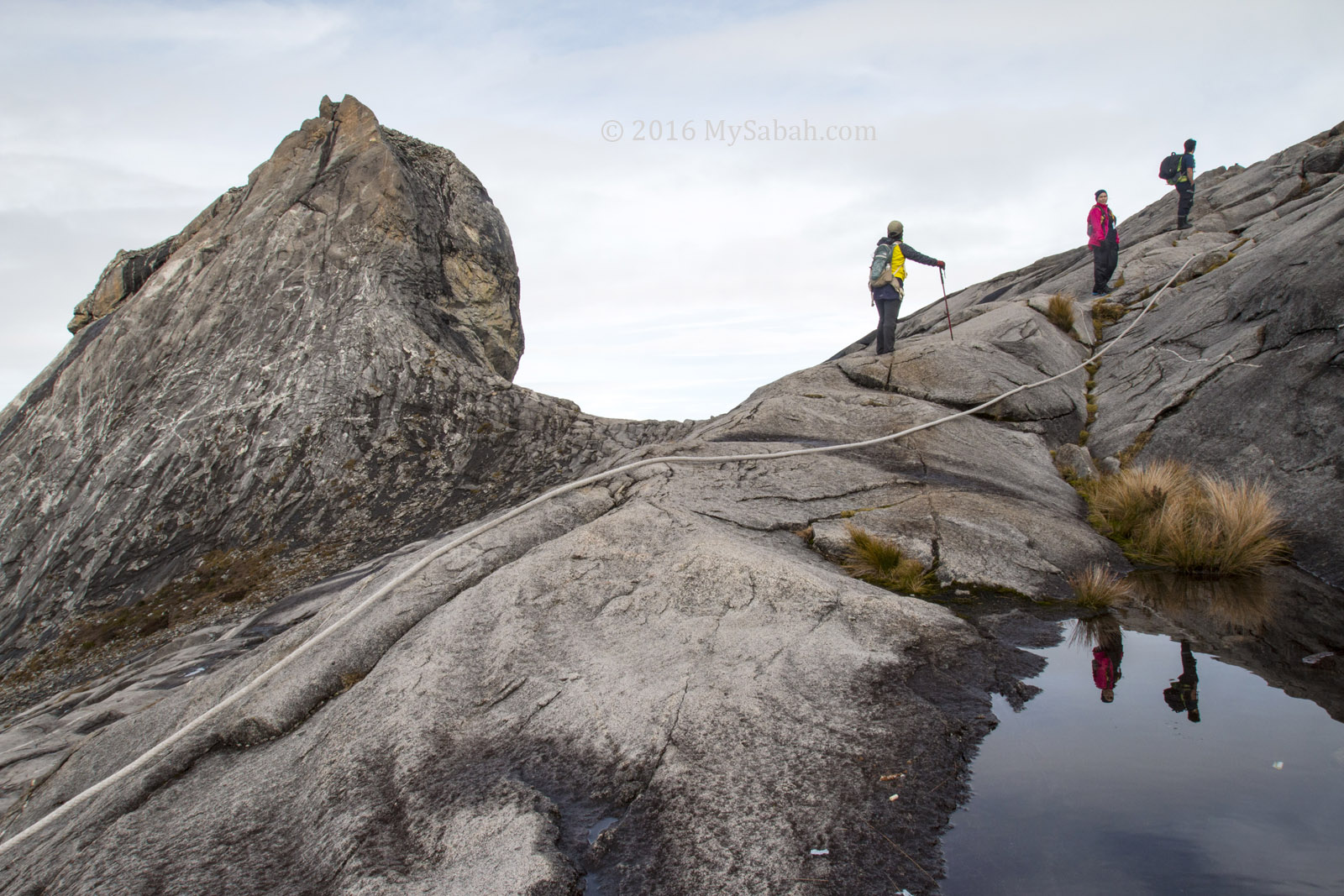
Ranau Trail is more tourist-friendly and safer because there are a lot of staircase and climbing aid. Kota Belud Trail is quite “raw” with limited support, so it is meant for adventurers who want to do real climbing. You need to be quite fit, and more upper body strength is required for climbing at the steep section.
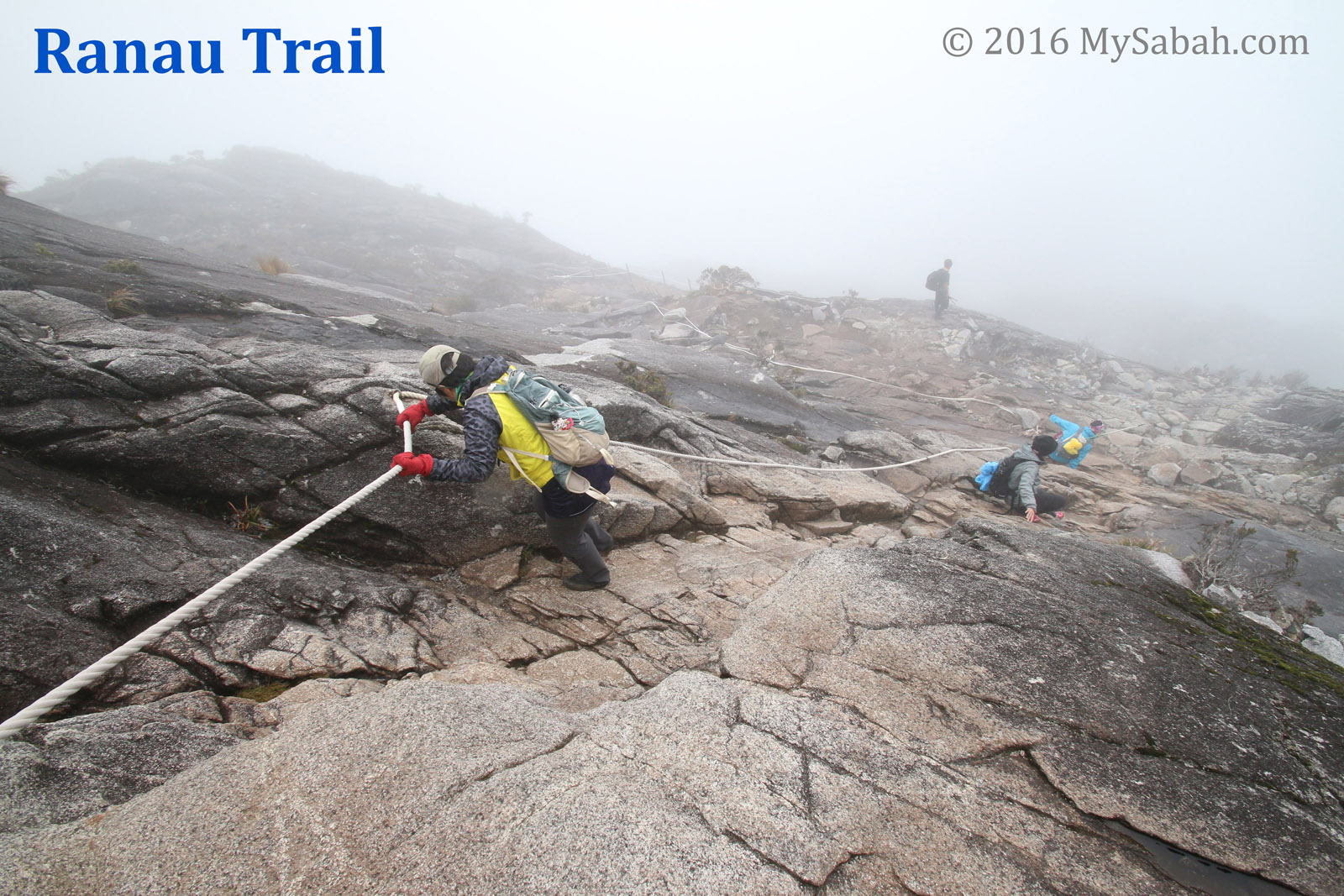
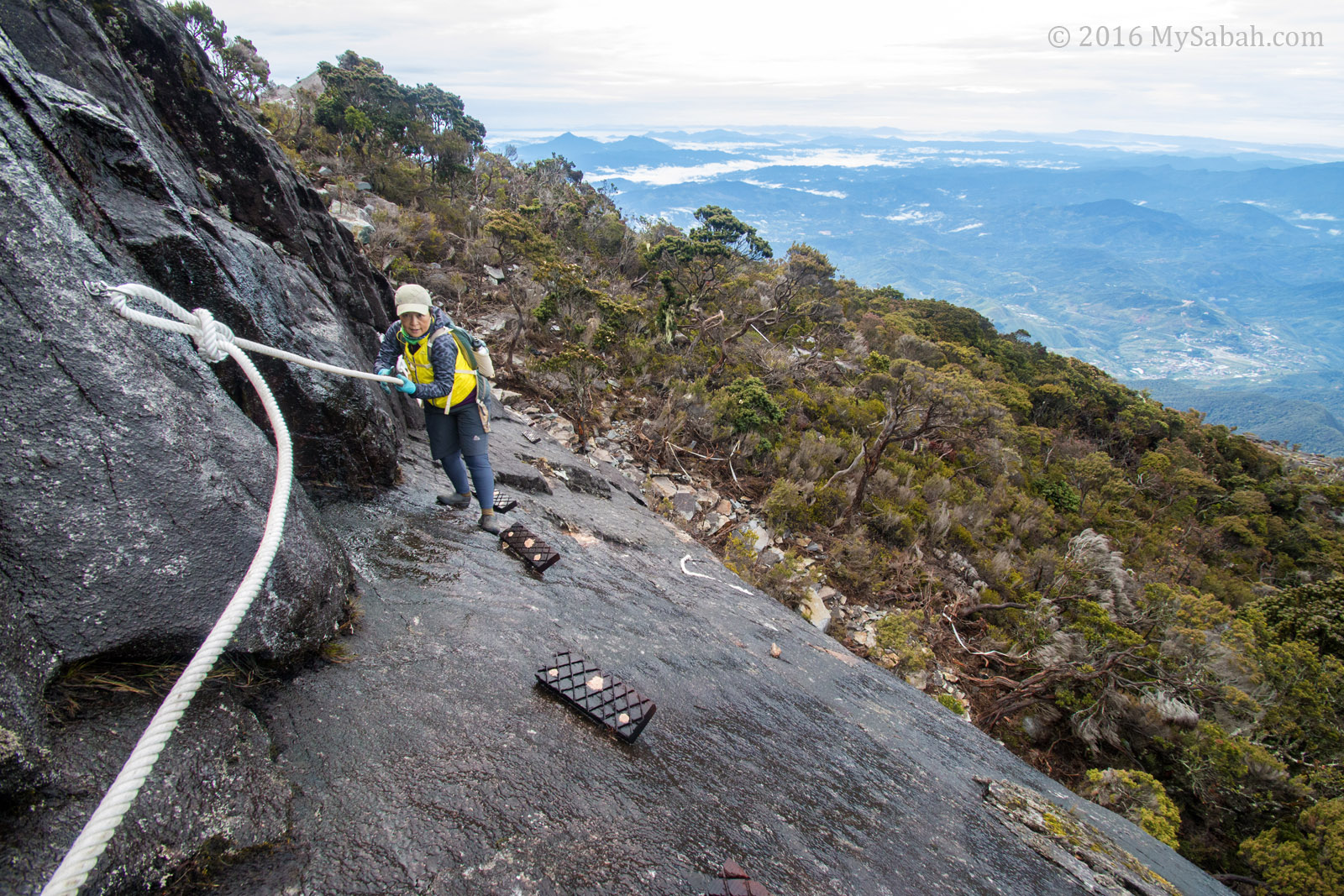
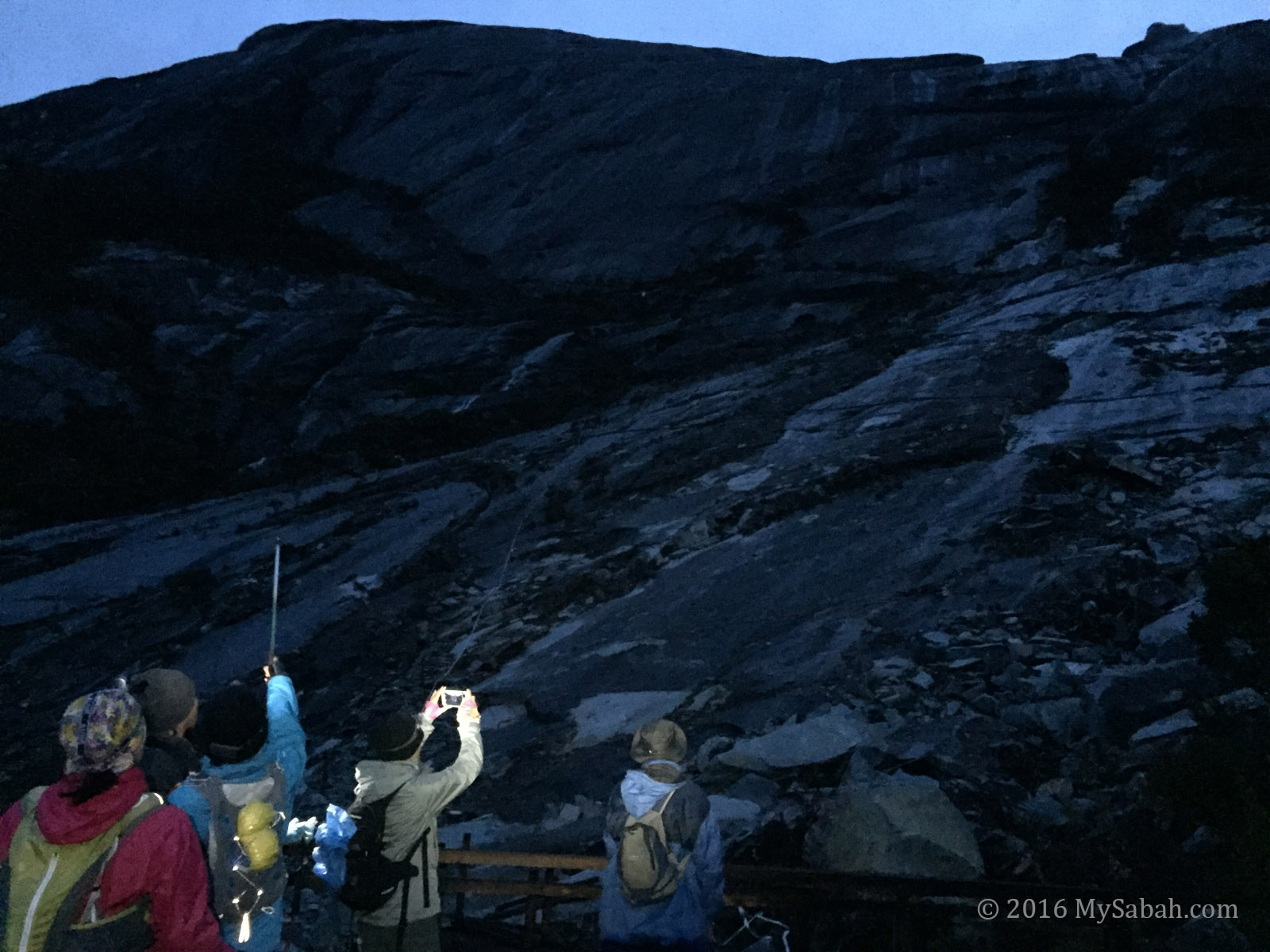
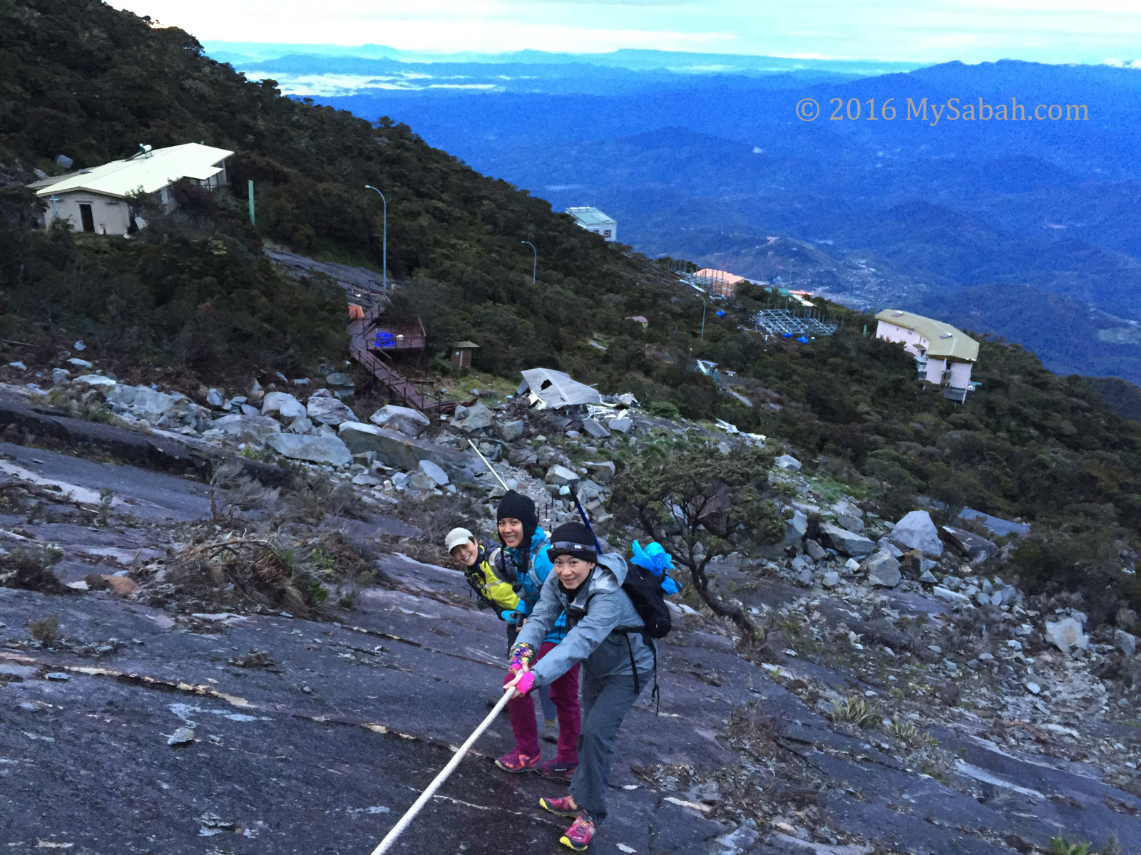
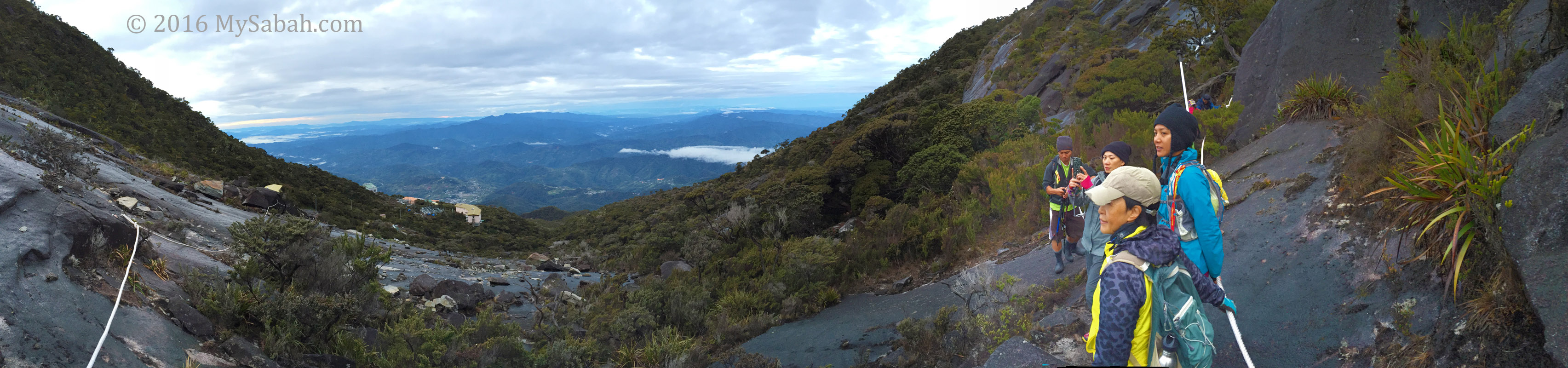
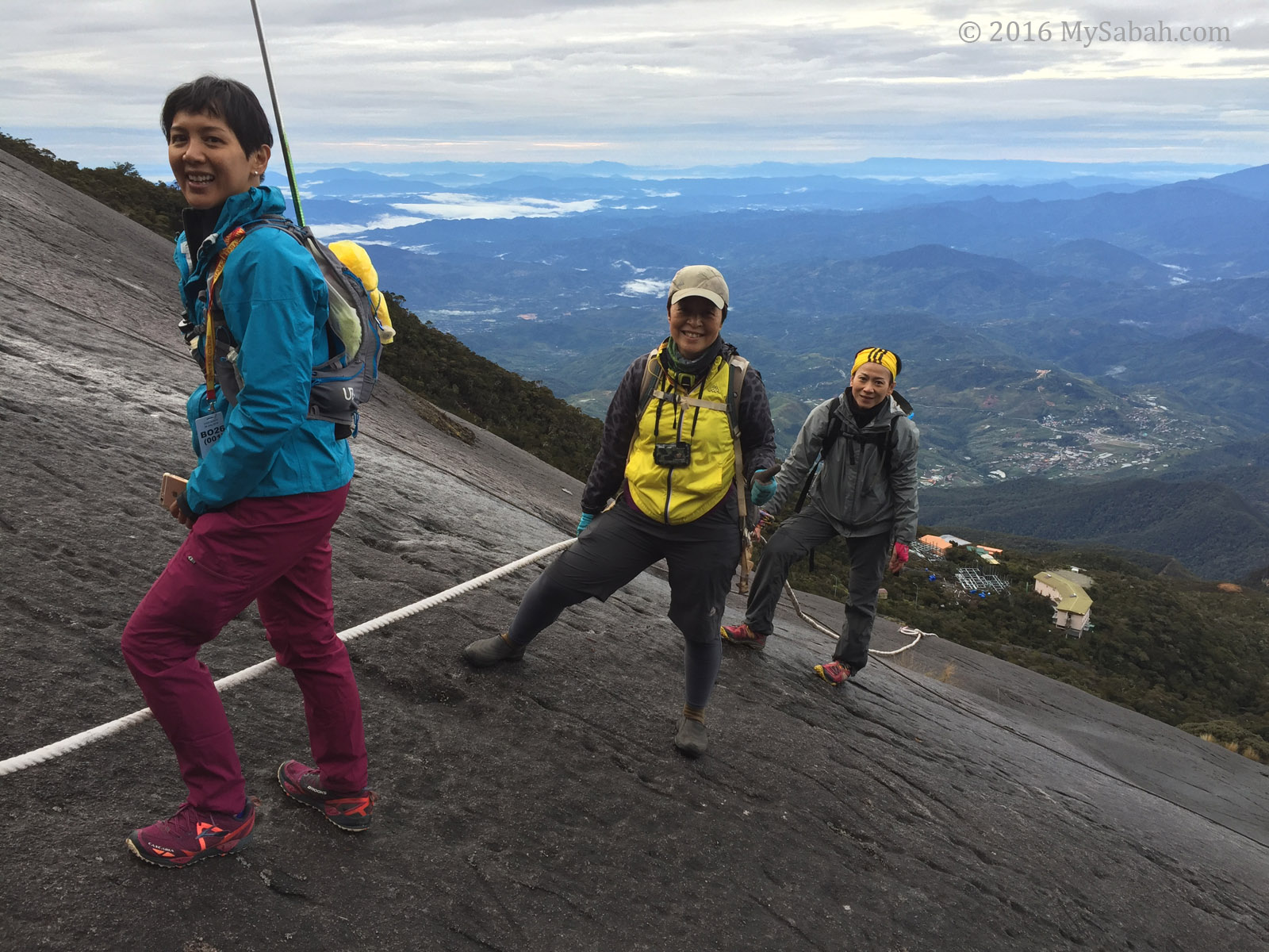
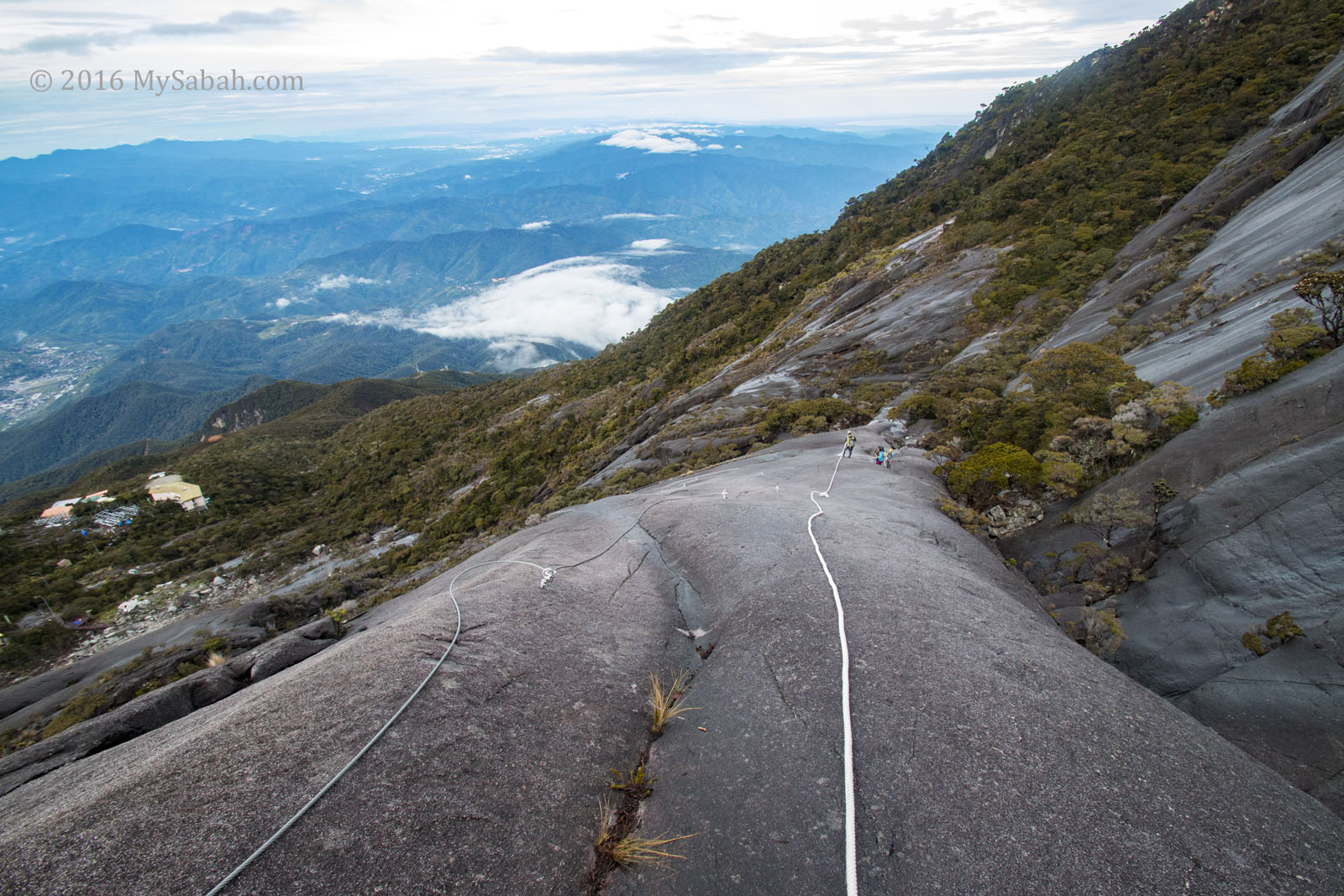
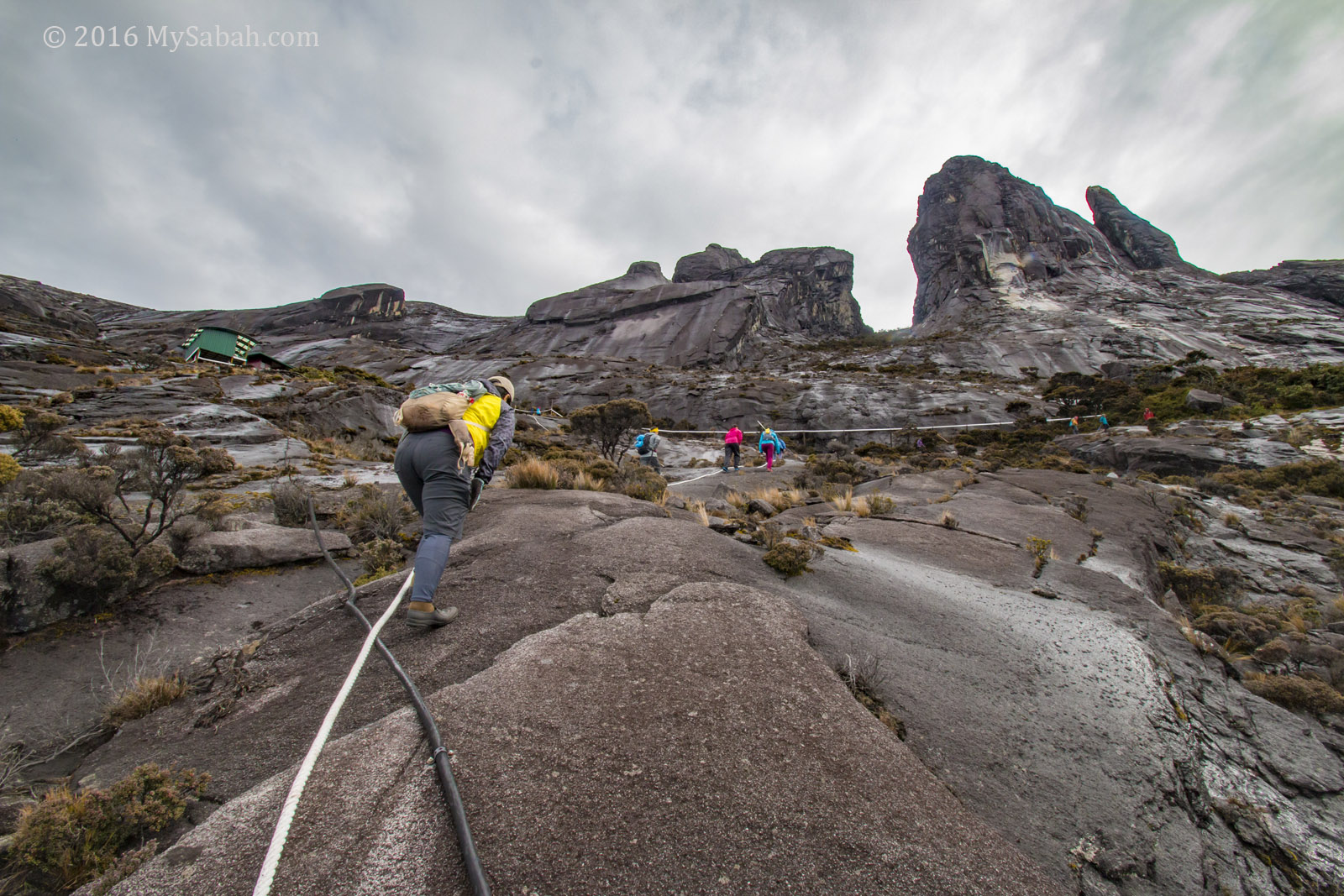
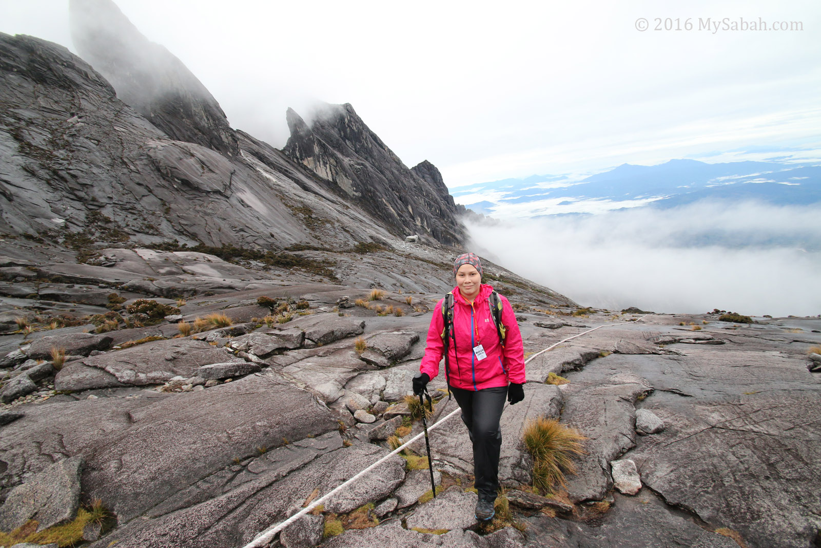
3. Kota Belud Trail is more Rocky
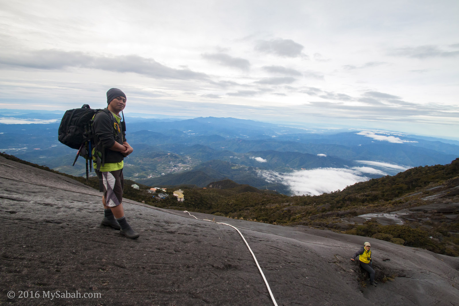
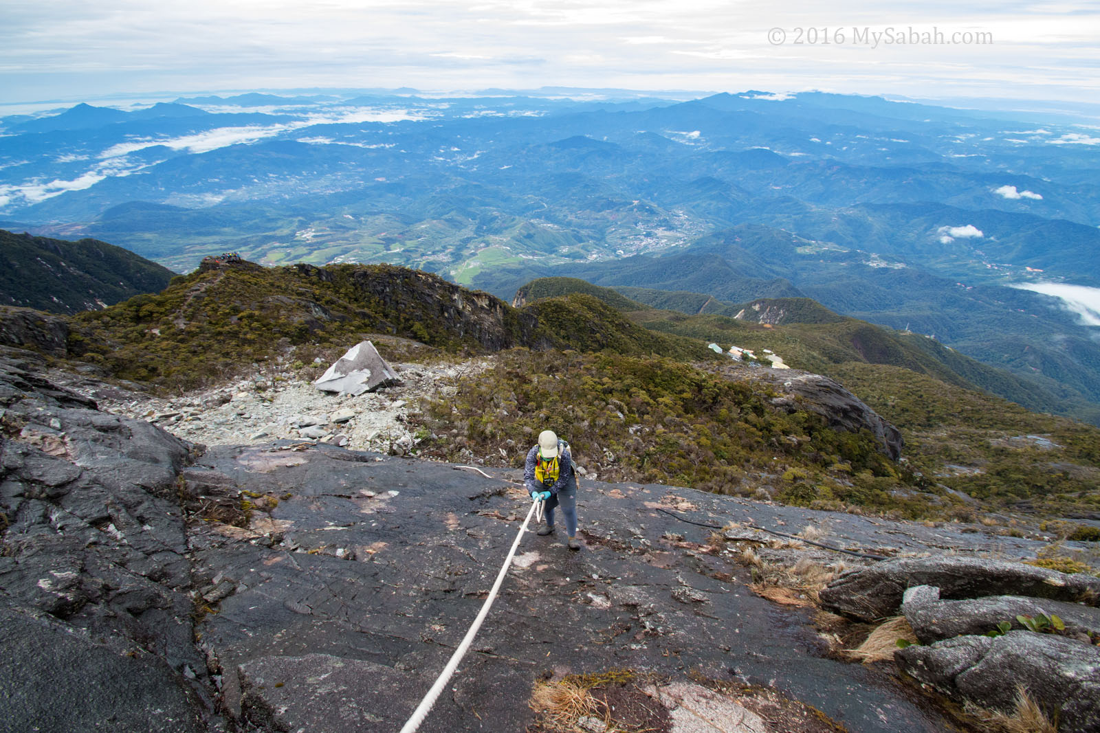
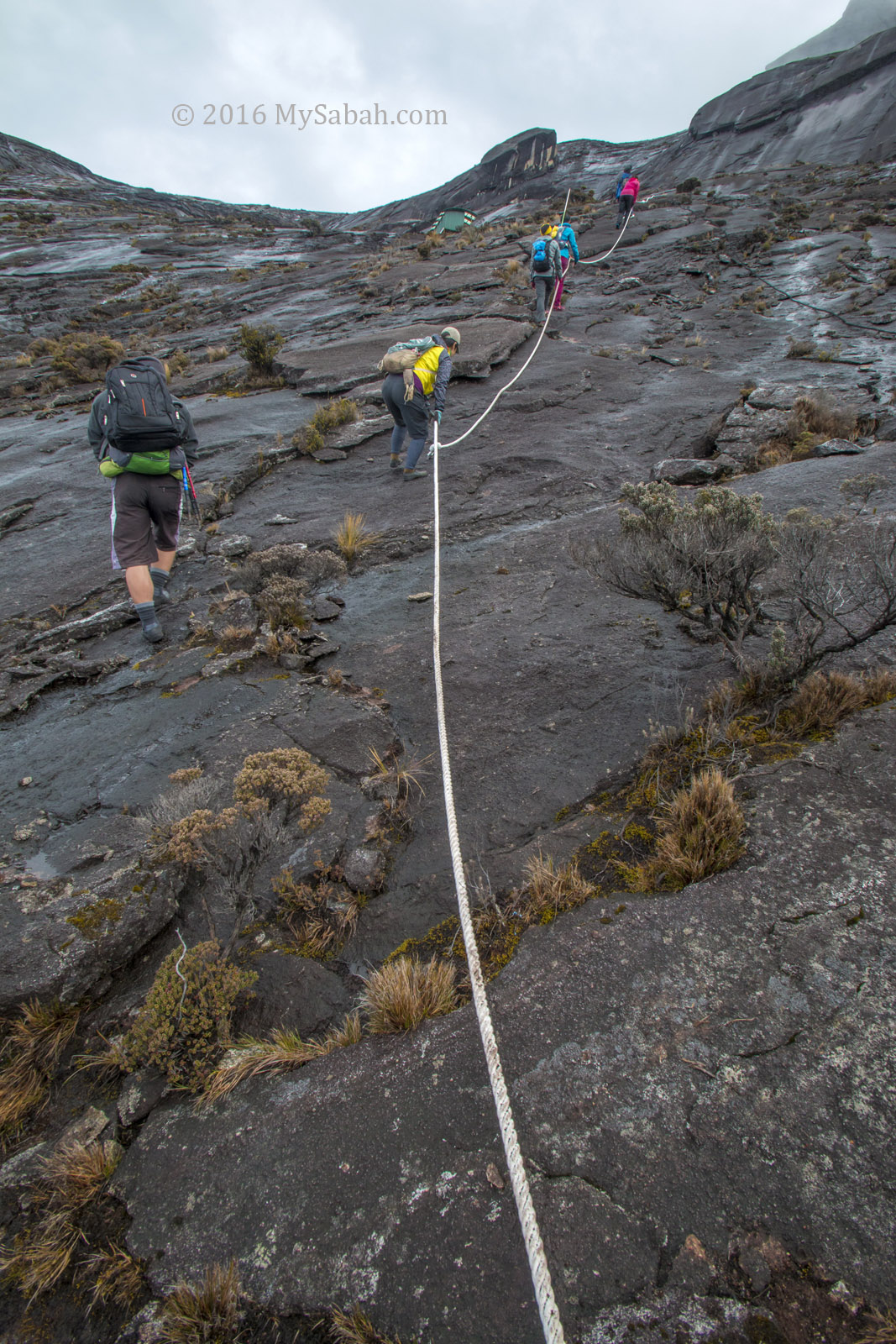
Most of the time you will walk on rock face and rocky ground, while Ranau Trail is flanked by dense vegetation most of the time.

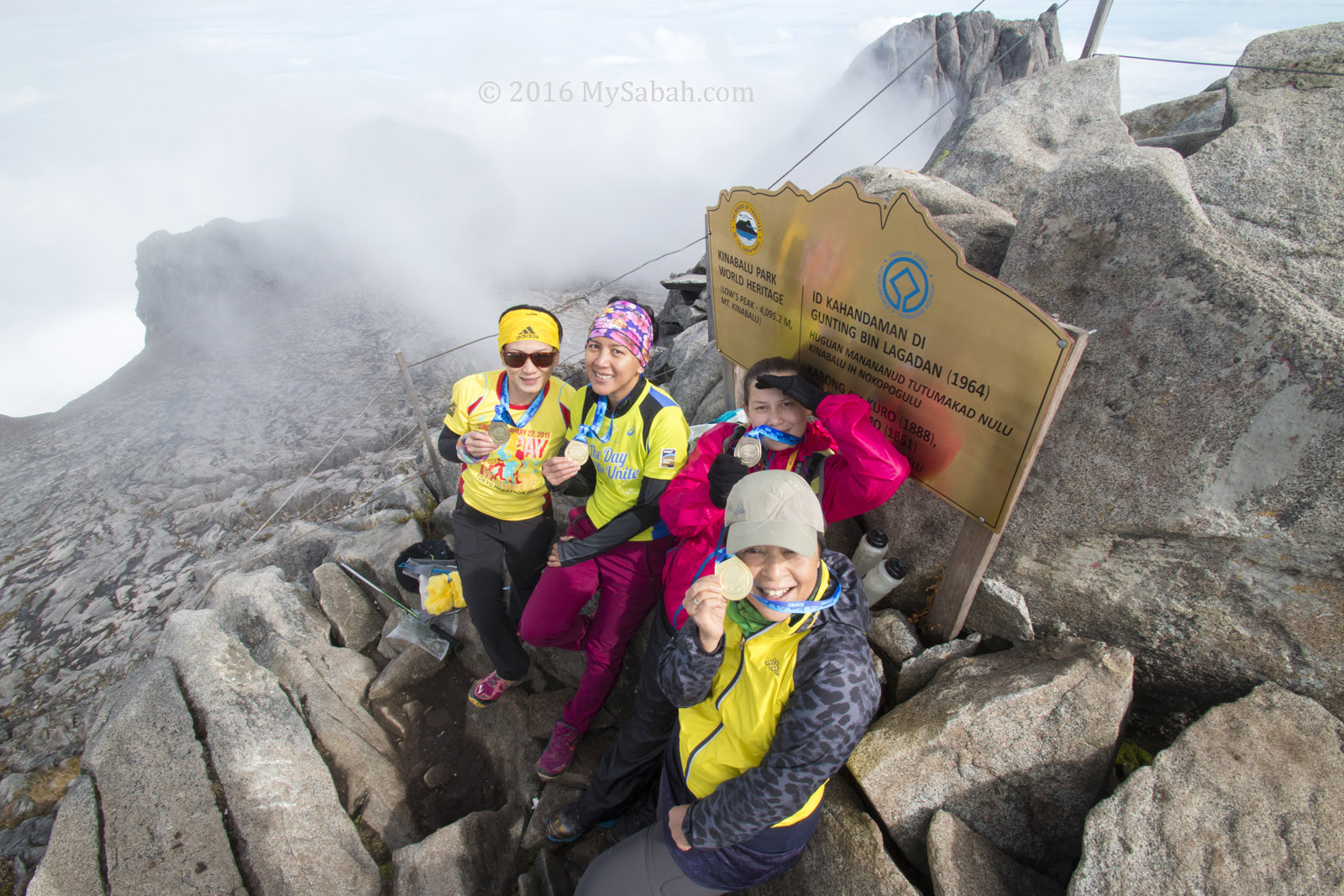
4. Both trails start at Panalaban (then Laban Rata) and meet at Sayat-Sayat
Sayat-Sayat is a checkpoint 1.6 KM before the summit. The following routes are unchanged (before and after the earthquake):
- Timpohon Gate (Starting Point) → Panalaban (Laban Rata, the location of midway accommodation): 6 KM
- Sayat-Sayat Checkpoint → Summit: 1.6 KM
5. Both trails have very different scenery
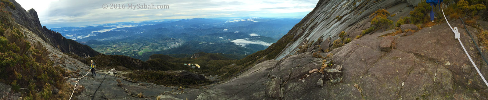
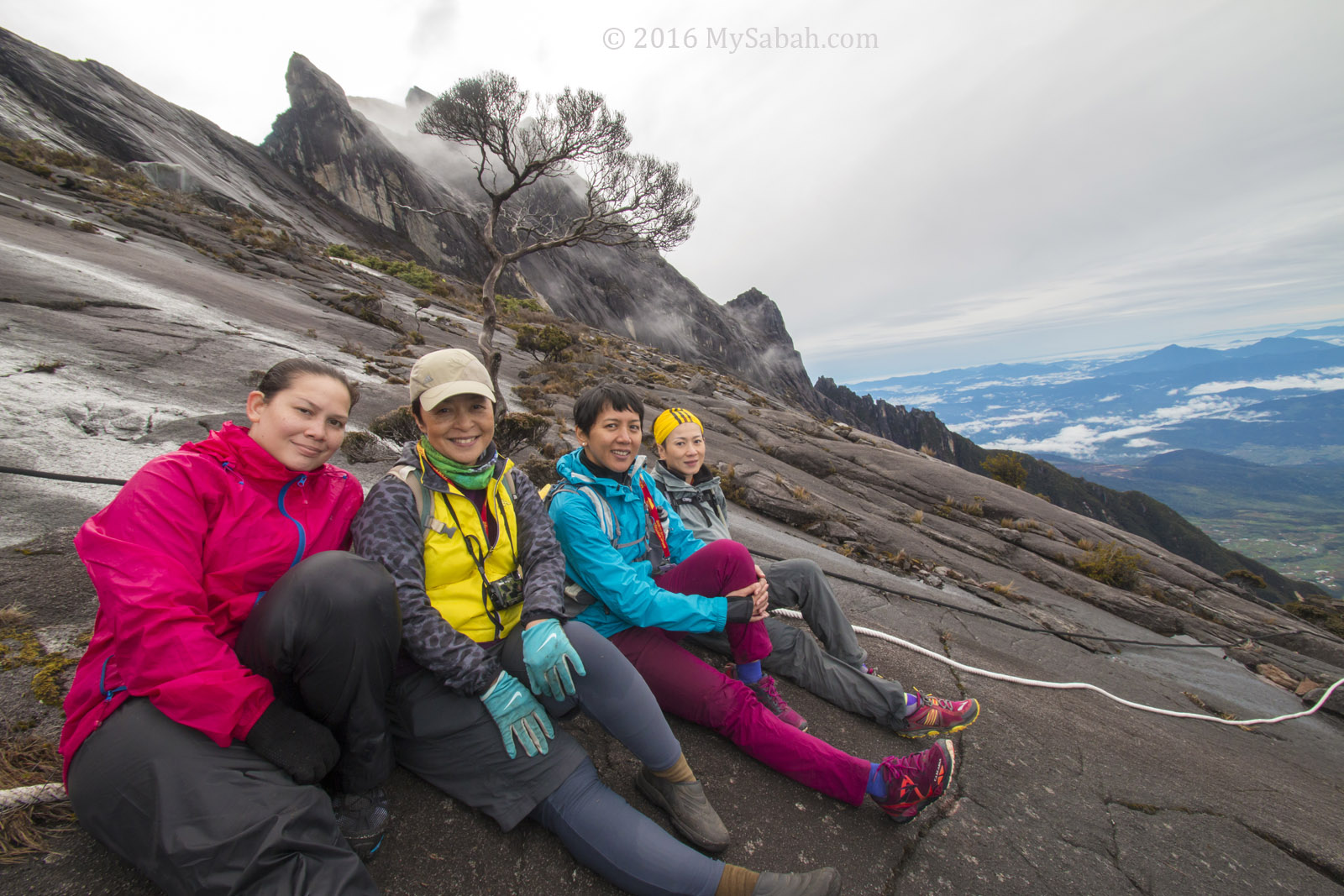
Climbing via Ranau Trail is like walking in a garden because climbers will see many flora along the way. On Kota Belud Trail, you climb on bare rock face most of the time, but the panoramic view of the landscape is magnificent!
Below is a table to summarize the differences between these two summit trails:
| Ranau Trail (Standard) | Kota Belud Trail | |
| Distance (one way) | 8.8 KM | 8.97 KM |
| Difficulty | Easy. Many staircases. Relatively less steep | Steep and challenging. Limited climbing aid. |
| Features | Dense and rich variety of summit vegetation along the trail | Route on rock face and rocky ground. Beautiful panoramic view. |
You know what. You can get better idea by watching the following video of Kota Belud trail. It shows our climb from the starting point to the summit. You can jump to 3:27 to see Kota Belud Trail:
The following is a photo walk-through of Kota Belud trail in chronological order:
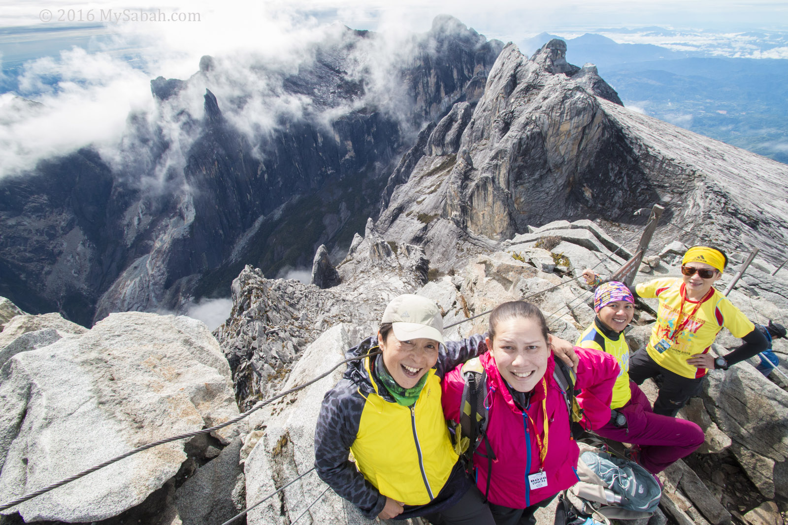
Both Kota Belud and Ranau trails end and meet at Sayat-Sayat Checkpoint.
At the moment, I’m not sure if we will need special permit or requirement to climb Mt. Kinabalu via Kota Belud Trail. If this trail is open to public, you can get the most fun by ascending via Kota Belud Trail and descending via Ranau Trail. I’ll update this post when I get the latest information.
Photos taken on Mount Kinabalu, Sabah, Malaysia Borneo

wow! the new trails was being named after districts in Sabah, such as Ranau and Kota Belud. Awesome!