There are around 3,000 species of cicadas worldwide, with approximately 150 species found in Malaysia alone. Sabah, in particular, has over 80 described cicada species. These fascinating creatures come in various sizes, spanning from 15 mm to 70 mm (0.6 to 2.76 in inches) in length. In the lush forests of Sabah, their melodious chorus often fills the air.
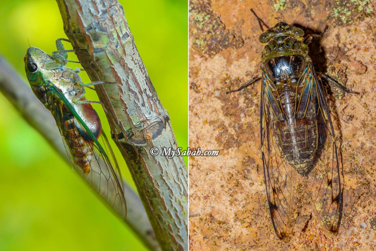
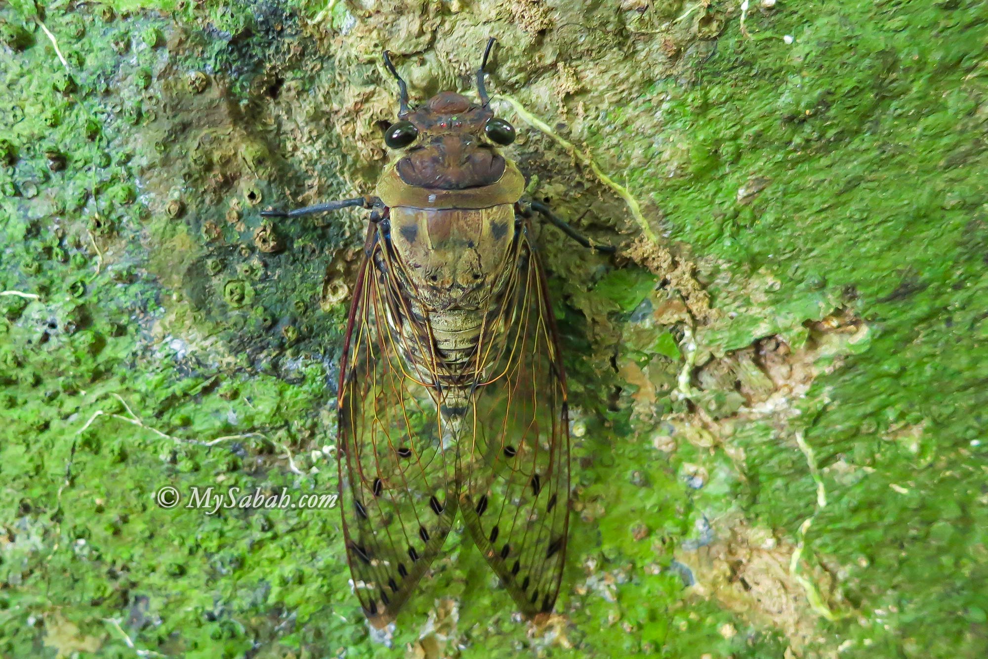
Left: Mangrove Cicada, Purana. Right: Forest Cicada, Platylomia spinosa. Cicadas of Southeast Asia have a life cycle of one to three years.
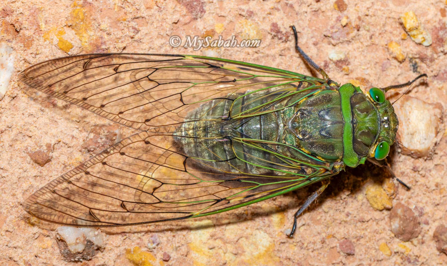
Did you know that only male cicadas can sing? Cicada can produce a sound exceeding 100 decibels, which is technically loud enough to cause permanent hearing loss if it sings right outside your ear. The giant cicada, Megapomponia merula, also known as the 6’o Clock Cicada, is the loudest cicada in Borneo (Click Here to hear its orchestra). In Peninsular Malaysia, its slightly larger cousin, Megapomponia imperatoria, is dubbed the 7 o’clock Cicada, as it gets darker later in this part of the country.
Megapomponia merula, also known as the 6’o Clock Cicada, is the largest cicada in Borneo
The swarming season for cicadas in Malaysia is typically from March to May. Cicadas spend their entire life cycle underground, emerging only in adulthood to breed. After laying their eggs in the soil, cicadas’ nymphs hatch and spend several years underground, burrowing as deep as 1 to 2.5 meters, where they feed on tree sap.
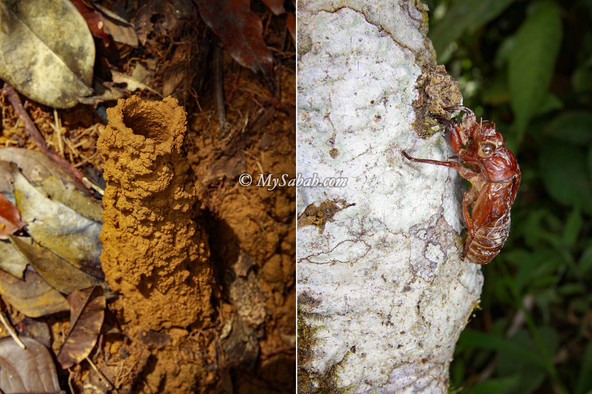
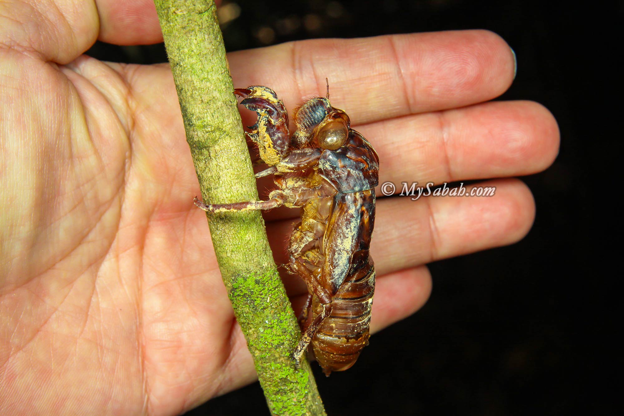
Left: A cicada mud tower on the forest floor. Cicada nymphs construct mud towers above ground in order to aerate their burrows. In the final nymphal instar, they construct an exit tunnel to the surface and emerge. Right: An exuvium or nymphal skin of a cicada on a tree trunk
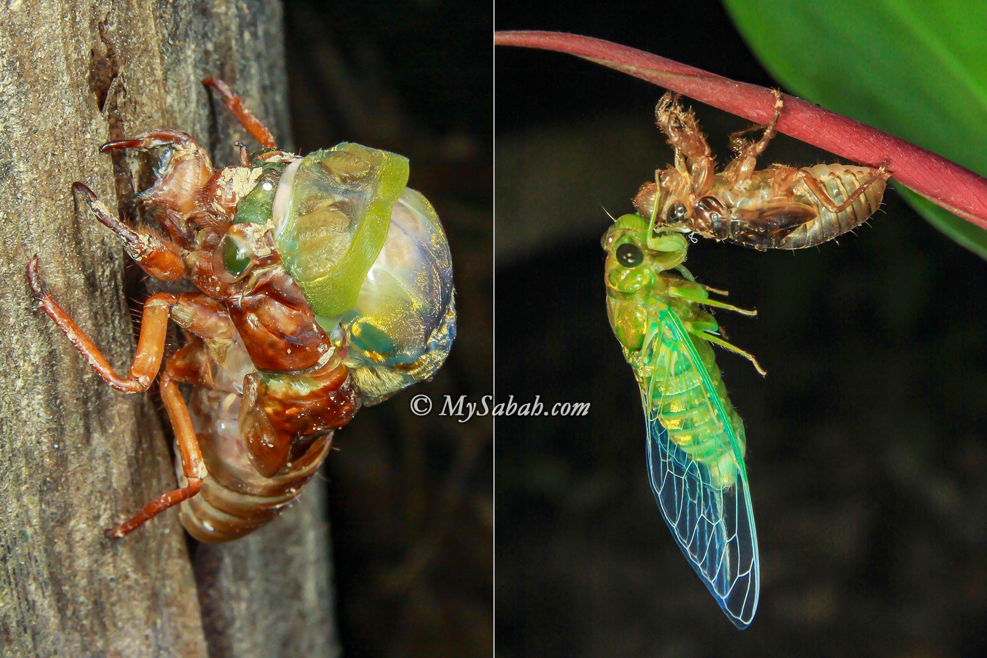
When they reach their final nymphal instar, they dig an exit tunnel to the surface and emerge. Once above ground, they ascend a nearby plant, shed their skin, and emerge as adults. In forested areas, you’ll often find many of these abandoned skins clinging to tree bark. Interestingly, these dry skins are utilized in certain Chinese medicines for their cooling effect.
Cicada nymphal skins are used in traditional Chinese folk medicine to remove heatiness
Local Chinese tradition holds a belief that when a person passes away, their spirit rides on a cicada (or moth or other insects) to visit the family on the seventh day to bid farewell before departing to the afterlife. As a result, it is taboo to harm any insect during this period.
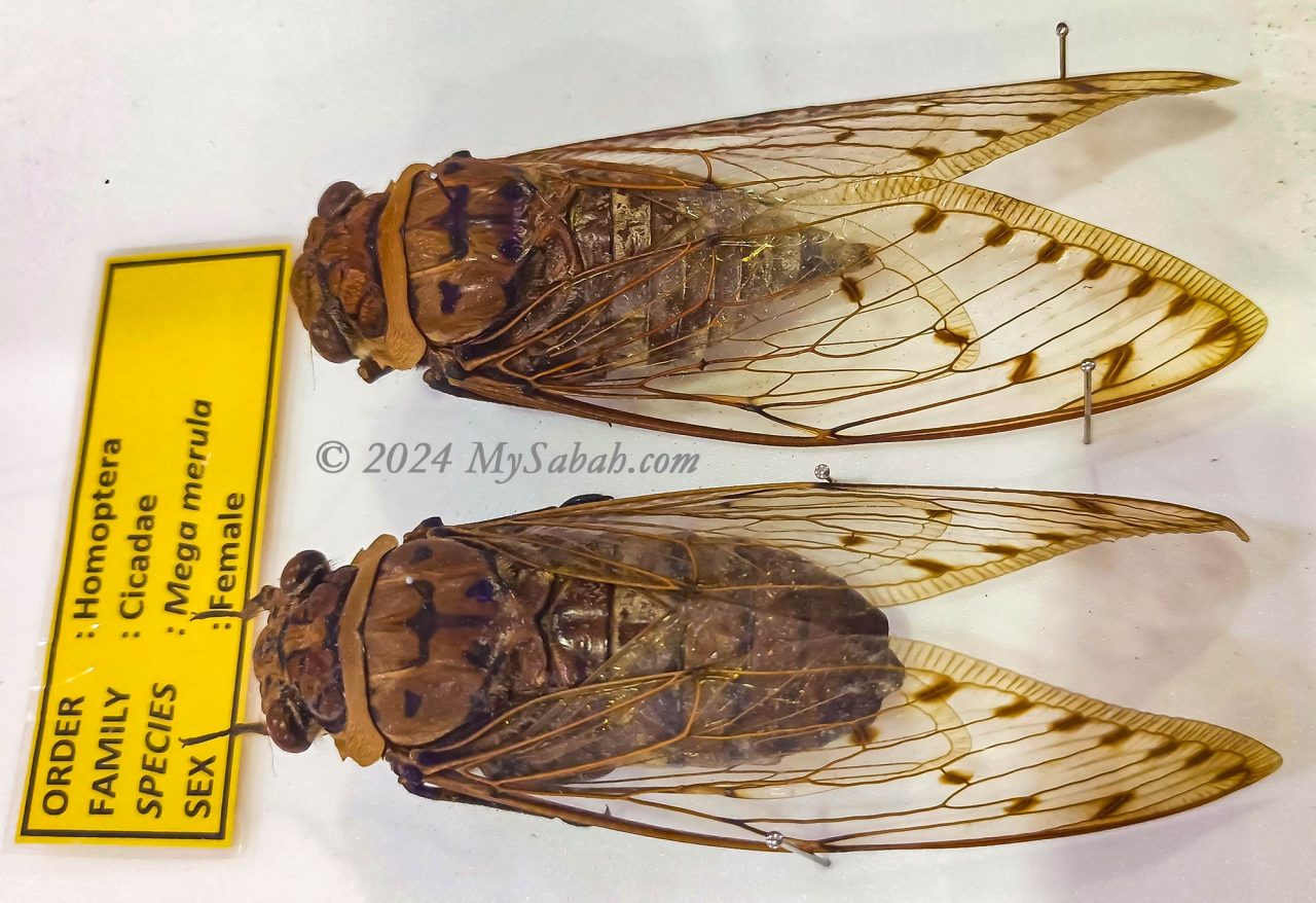
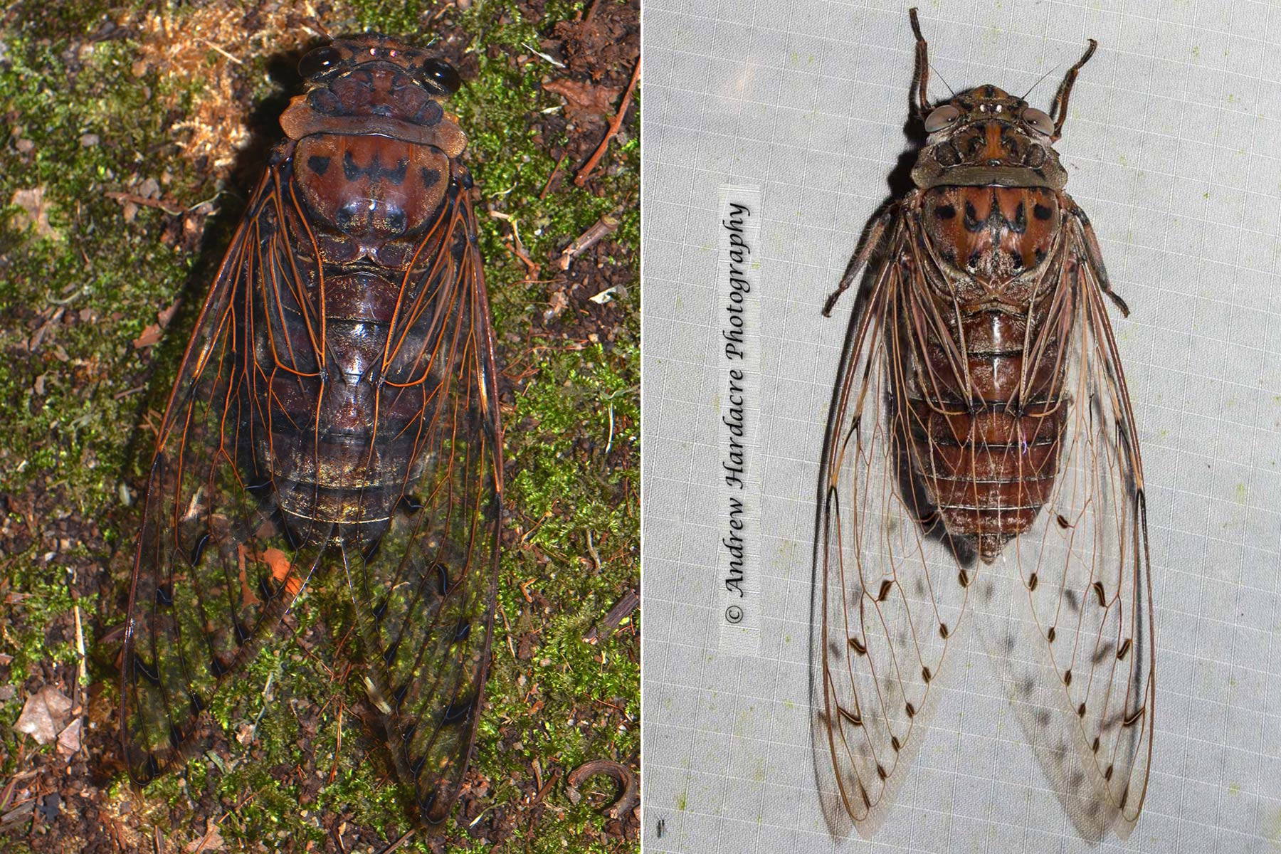
In Malay, cicada are known as ‘riang-riang’ while in Dusun, they are called ‘tengir’ or ‘taviu’. The empress cicada, scientifically known as Megapomponia imperatoria, is the world’s largest cicada found in Malaysia. It can grow up to 8 cm long with a wingspan of 20 cm
Throughout history, the cicada has symbolized resurrection, immortality, spiritual realization, and ecstasy. In ancient Greek and Roman cultures, they were considered sacred to Apollo and associated with the ecstatic singing of the Dionysian Bacchae and Maenads.
Cicadas shed their skins on a nearby plant for the last time and emerge as adults. The exuviae or nymphal skins are normally left clinging to the bark of the tree.
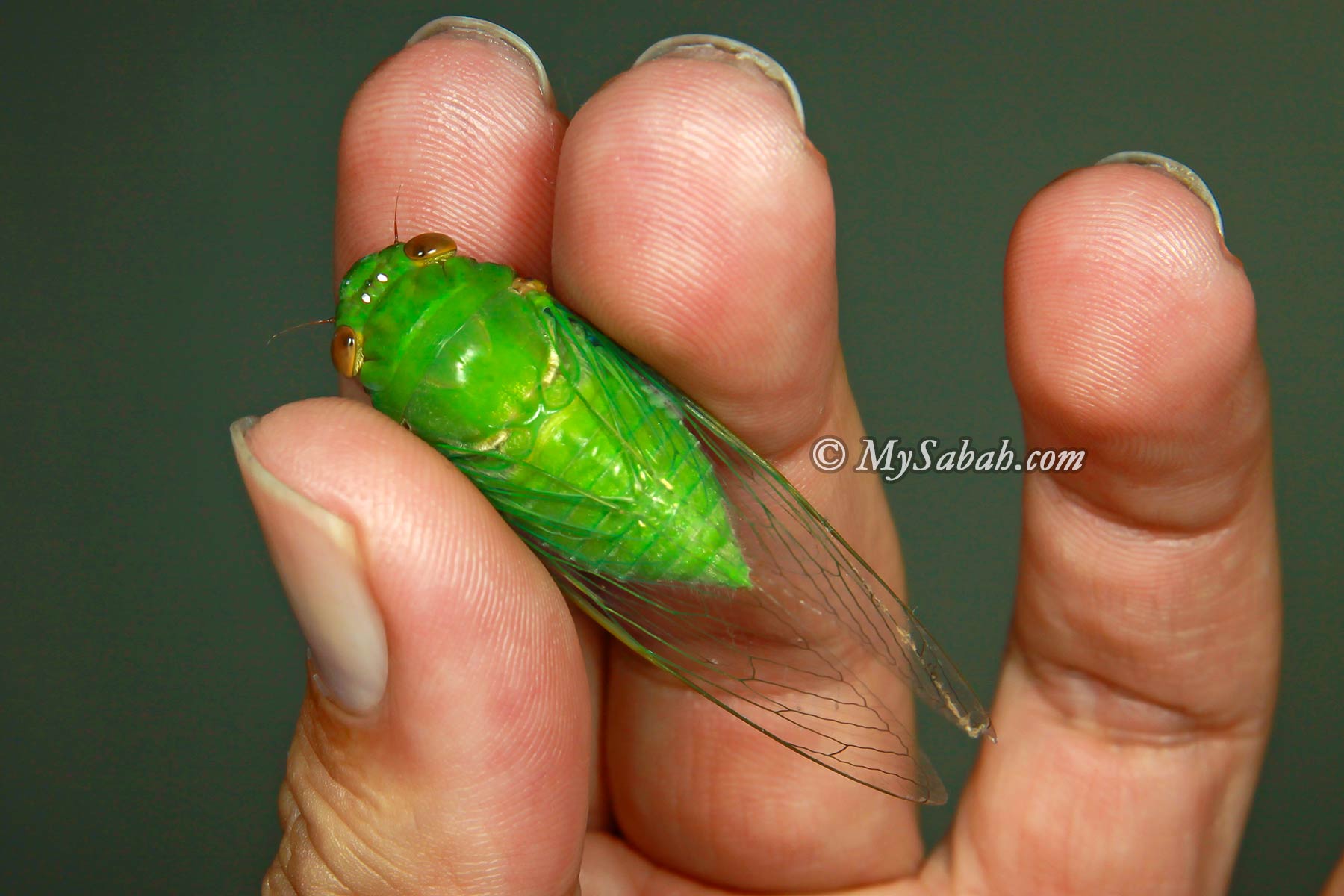
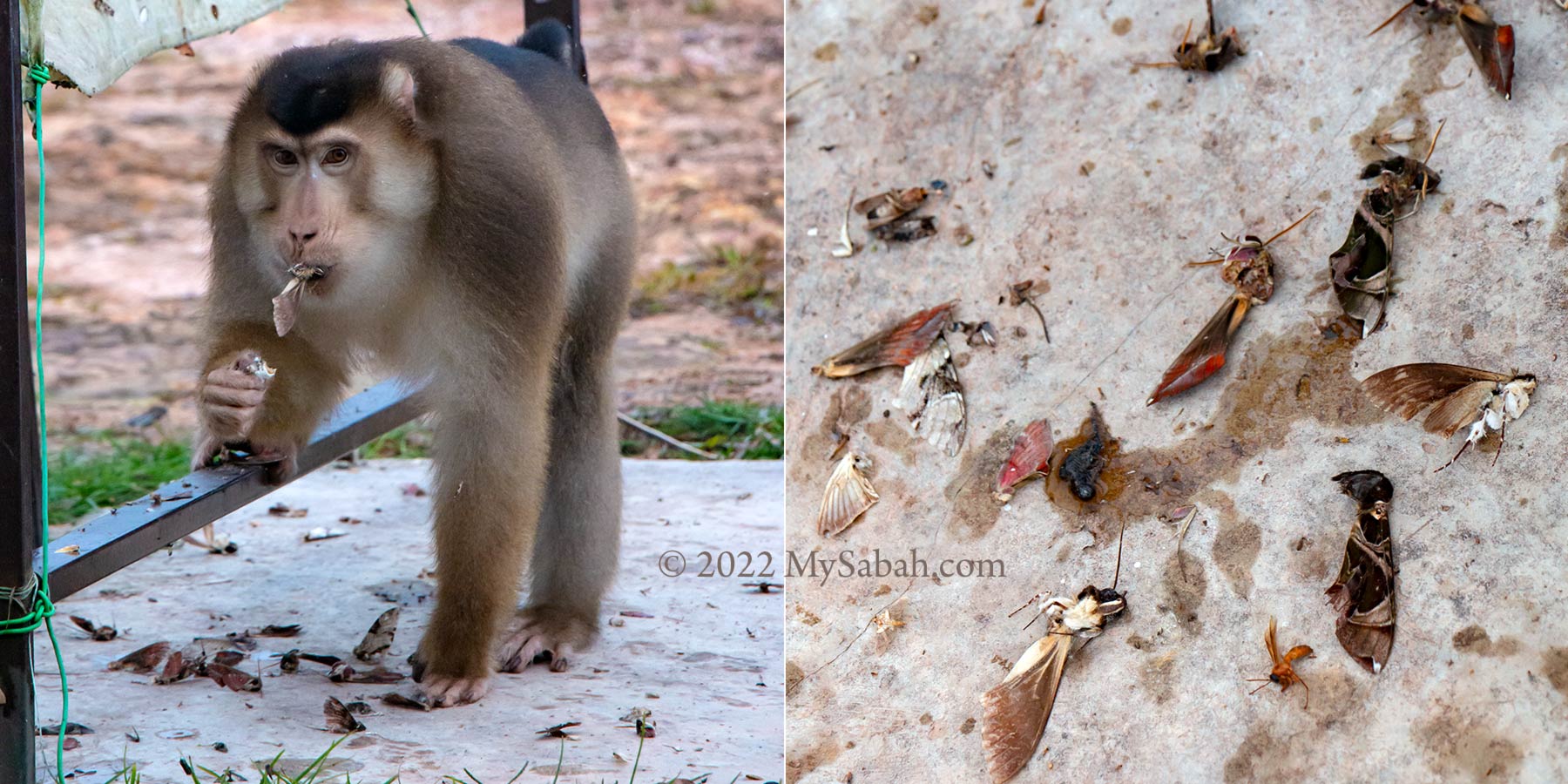
Some Sabah natives, particularly those from the interior, consume cicadas, especially the green varieties. These cicadas are typically roasted over a fire and have their hard exoskeleton removed before consumption. Alternatively, they may be stir-fried until they turn yellow. Some people even dig out the cicada nymph, which is said to have about 20 of them under the chimney. Interestingly, some refer to cicadas as the ‘Shrimps of the Land,’ suggesting they might be tasty.
The Green Cicada, Dundubia vaginata. It’s an edible species. While most species are considered edible, there is an exception for the black and brown cicadas with yellow stripes.
According to Dr. Azman Sulaiman, a researcher at the UKM Centre for Insect Systematics Entomology, cicadas are considered relatively clean compared to other insects, although some may carry parasites. In 2012, scientists discovered that cicada wings possess antimicrobial properties due to microstructures called nanopillars, which effectively shred various harmful bacteria.
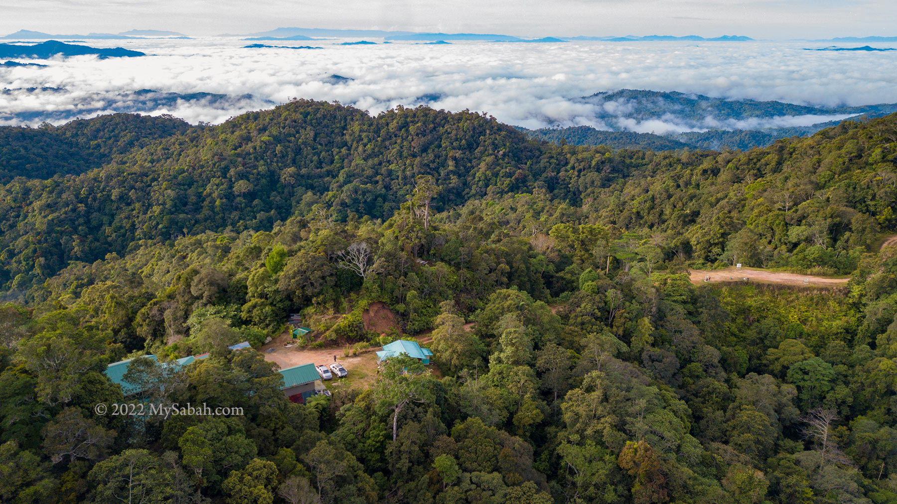
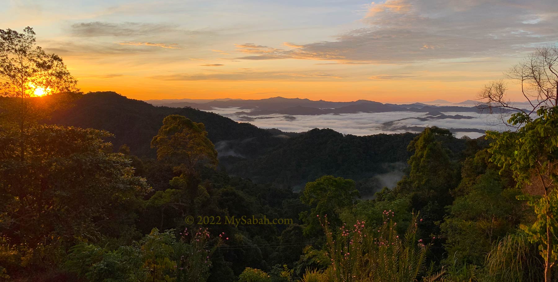
Aura Montoria is touted as one of Sabah’s top hiking spots, and after experiencing it firsthand, I don’t think it’s overrated. Hiking here offers an incredible opportunity to immerse in Borneo’s diverse landscapes. Beyond a mere walk, it’s an exciting exploration of caves, rock formations, rivers, waterfalls, ponds, and lush rainforests—truly a collection of natural wonders waiting to be discovered.
You like the element of soil, rock, water or wood? You can enjoy all these nature wonders in Aura Montoria.
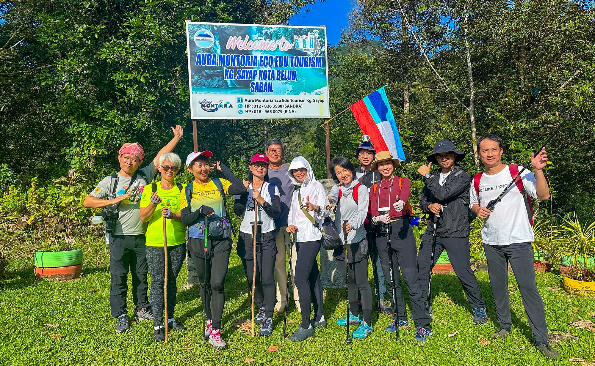
About Aura Montoria
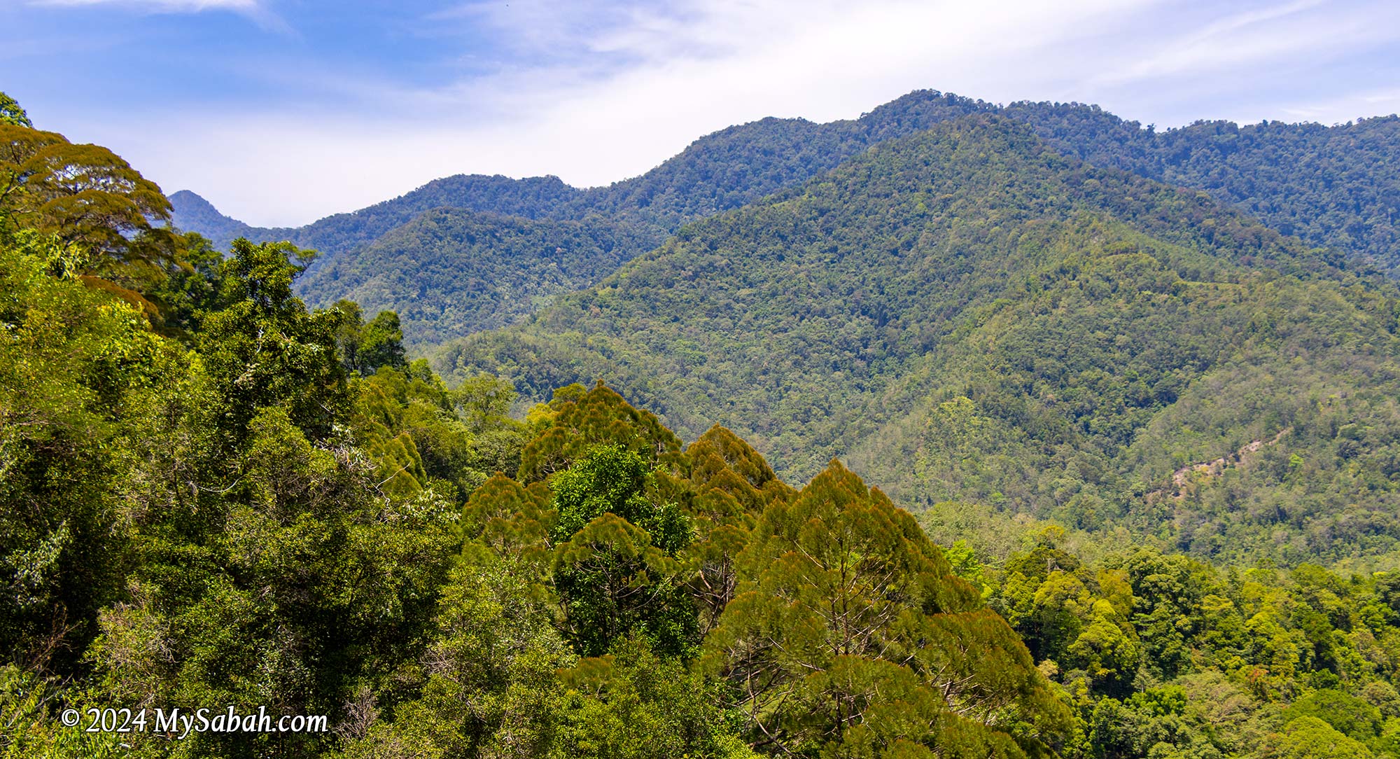
You might know about the Kinabalu Park HQ situated on Mount Kinabalu‘s southern side, easily reachable from Kundasang. However, tucked behind Malaysia’s highest peak lies Aura Montoria to the north, an enchanting hilly terrain located in Kampung Sayap (Kampung means Village) of Kota Belud, and part of the 4,750 km² Kinabalu UNESCO Global Geopark. It’s just a stone’s throw away from the Sayap Substation, snugly positioned on the west side of Kinabalu Park.
The cavities in sandstone structure create many natural caves and ponds in Aura Montoria
Aura Montoria owes its name to a winding tree vine known as Pokok Ponoriawon by the Dusun Tindal people. This vine, adorned with long thorns, grows along the riverbank, drawing a variety of birds during its flowering season. The locals named the area Montoria, a shortened version of Pokok Ponoriawon. Enchanted by its beauty, they added “Aura” to create Aura Montoria, capturing the site’s radiant charm.
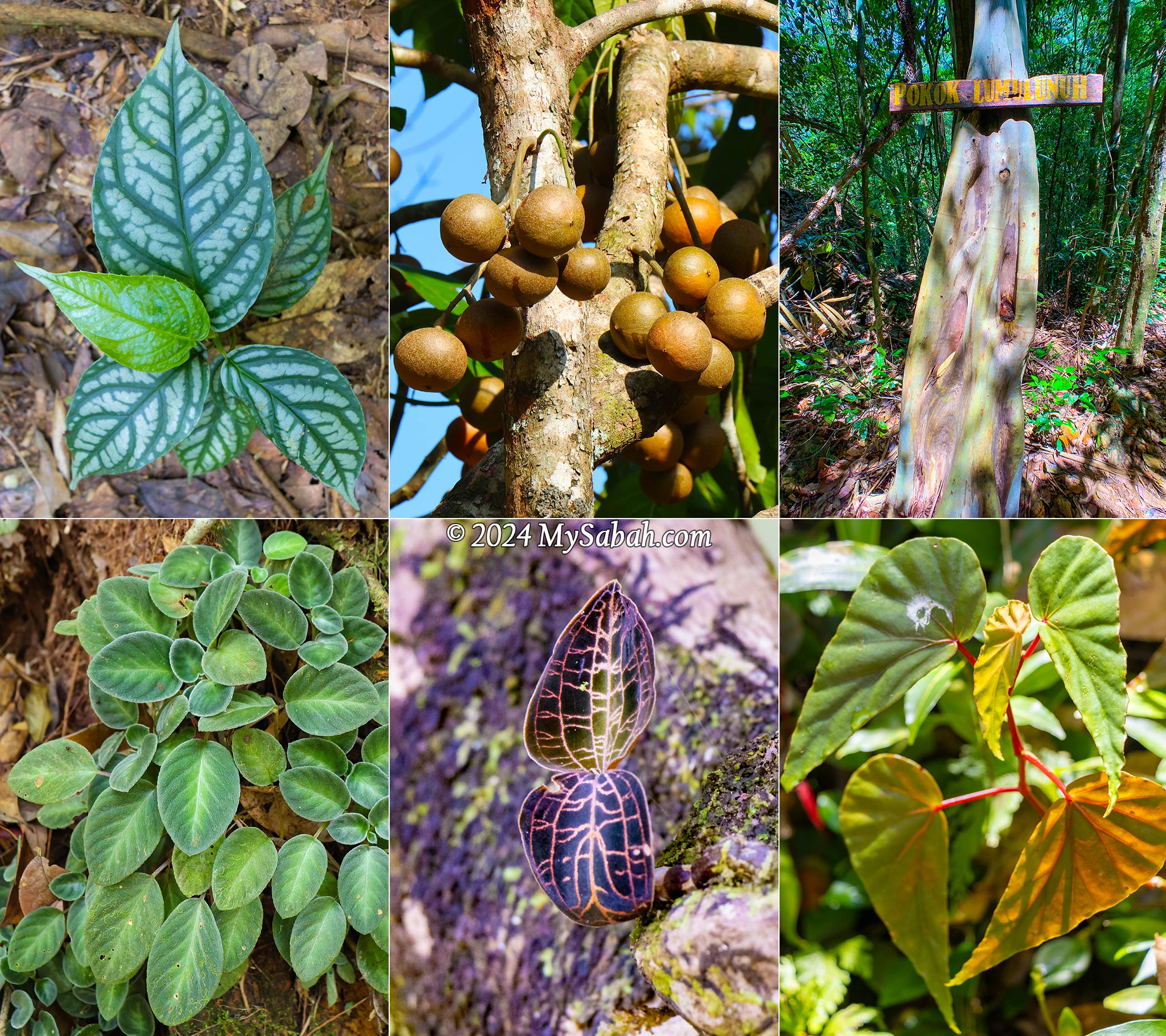
Aura Montoria is rich in flora too, e.g. begonia, bark-less eucalyptus tree, jewel orchid, and tampoi fruit in this picture
A Geotourism Destination
Couples always promise to each other, “I will love you to the time of the seas run dry and the rocks crumble,” as if such changes are impossible. But Aura Montoria will prove them wrong. Here, among the rolling hills and rock fragments, you’ll find evidence of a time when this land lay beneath the sea, some 20 million years ago. The geological morphology of the Aura Montoria is mainly featured by sedimentary rocks from the Crocker Formation, formed in a deep-sea basin during the middle Oligocene to early Miocene period, roughly 28 to 23 million years ago.
Aura Montoria was under the sea more than 20 million years ago
Around 17 to 10 million years ago, a tectonic collision uplifted most parts of Sabah, including Aura Montoria. This followed by geological processes like folding and faulting, raising the sandstones and shales of Aura Montoria’s sedimentary layers to the surface. Over millions of years, erosion and compaction shaped these deposits, forming the striking ridges, valleys, and unique rock formations that grace Aura Montoria today.
The landscape of Aura Montoria is dominated by sedimentary rocks such as sandstones, shales, and conglomerate that were deposited in the ancient seabed more than 20 million years ago. They look like compacted rocks glued by cement.
Granite boulders and rock walls dot this area, likely carried by glaciers from Mount Kinabalu to the foothills near Aura Montoria. Therefore, hikers will find fascination in the remnants of an ancient ocean floor and traces from the Pleistocene Ice Age, dating back millions of years.
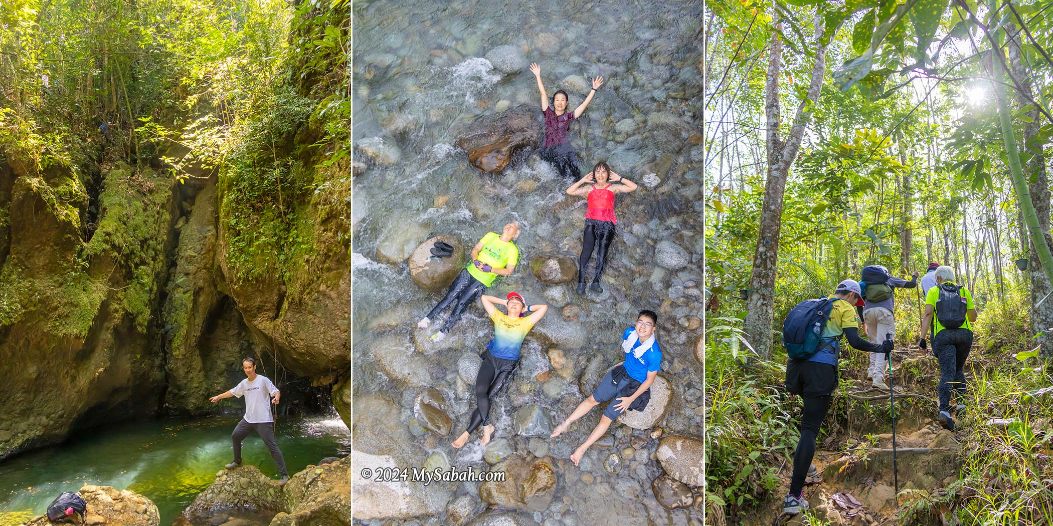
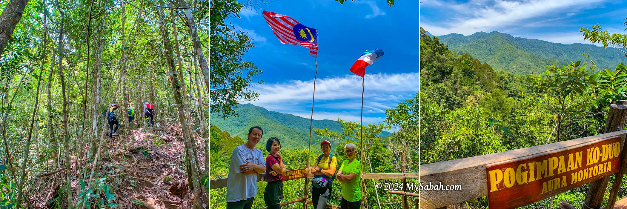
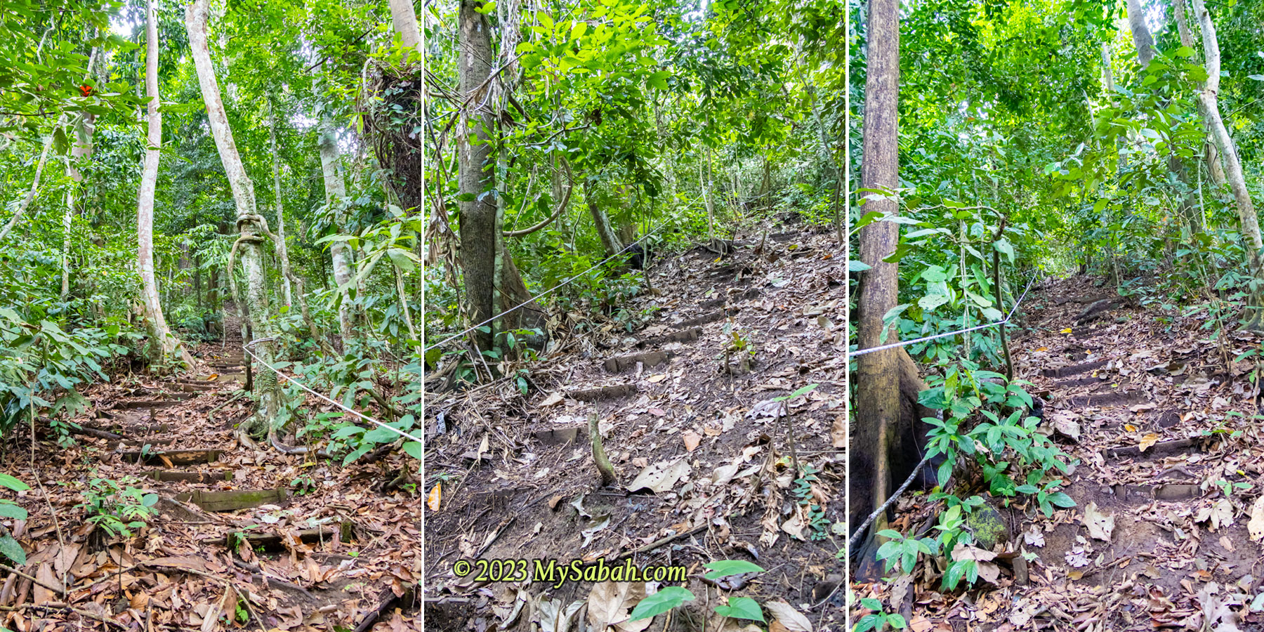
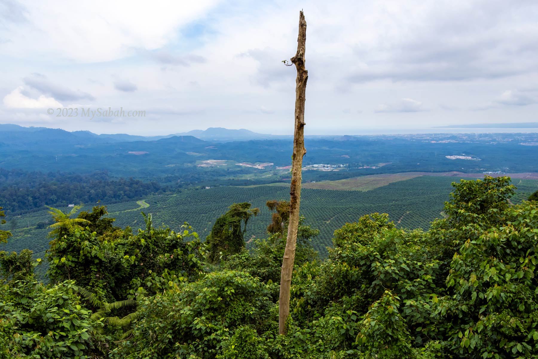
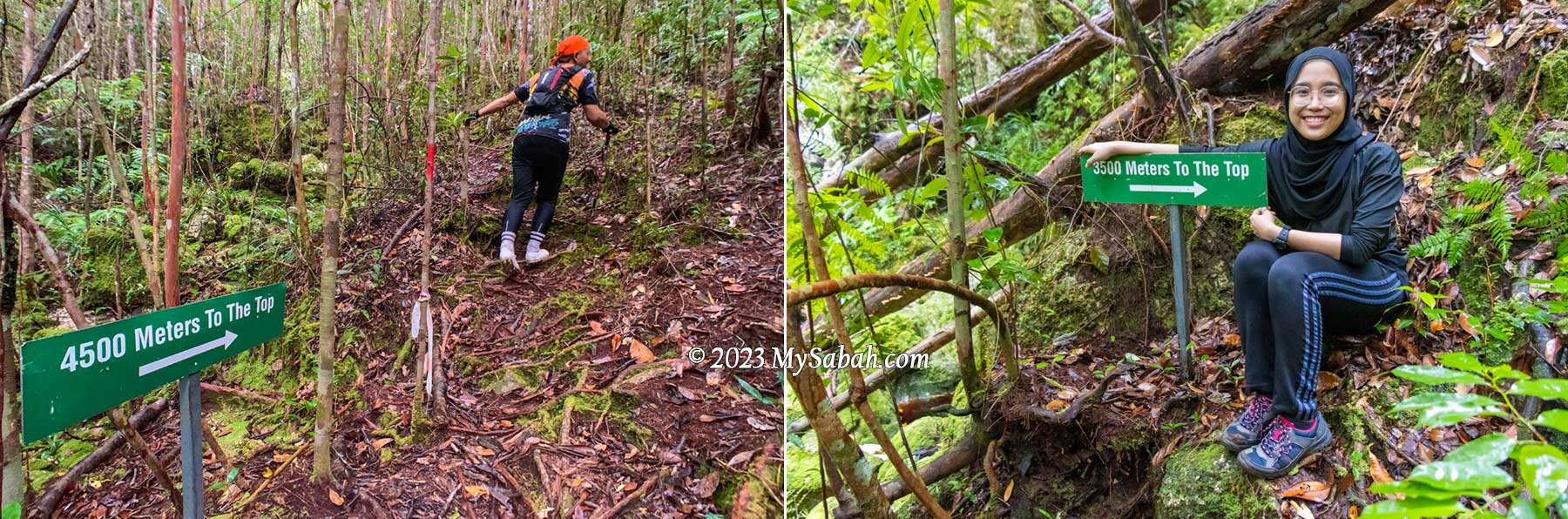
Starting point of hiking in Aura Montoria. The 6-km trail takes about 6 hours to finish (include lunch and break)
Hiking (A Walk-Through)
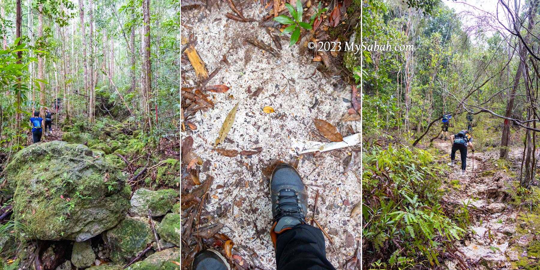
The hiking trail spans a 6-kilometer loop, winding through varied and uneven terrain where the flowing rivers and waterfalls shower you with negative ions, the forest fills your lungs with fresh air, and sunlight provides a serotonin boost. All these combine to energize you and uplift your mood. Given the prevalent depression among younger generations, it’s no surprise that hashtags like silent walking, soft hiking, and rucking are trending in the Gen Z community. Visit Aura Montoria, I would advise them.
The hike typically lasts around 6 hours at a leisurely pace. The trail poses a moderate challenge to beginners, involving some scrambling and balancing over rocks and roots along slopes situated between 200 to 400 meters above sea level. While leeches aren’t commonly encountered, parts of the trail can be slippery, making sturdy hiking shoes crucial. Carrying mosquito repellent is essential for a more comfortable hike.
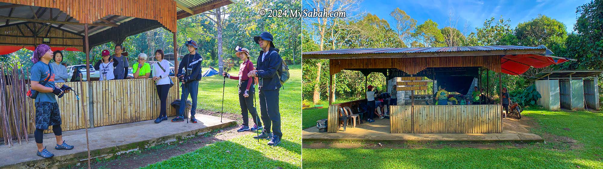
Briefing by our guide, Kunan, at the registration hut before the hike. There are a few simple toilets. You can change your cloth and take a shower there after the hike.
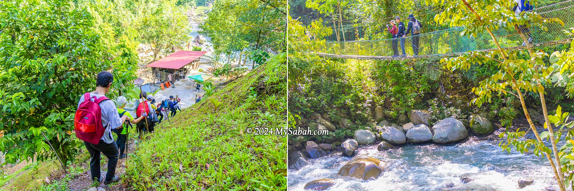
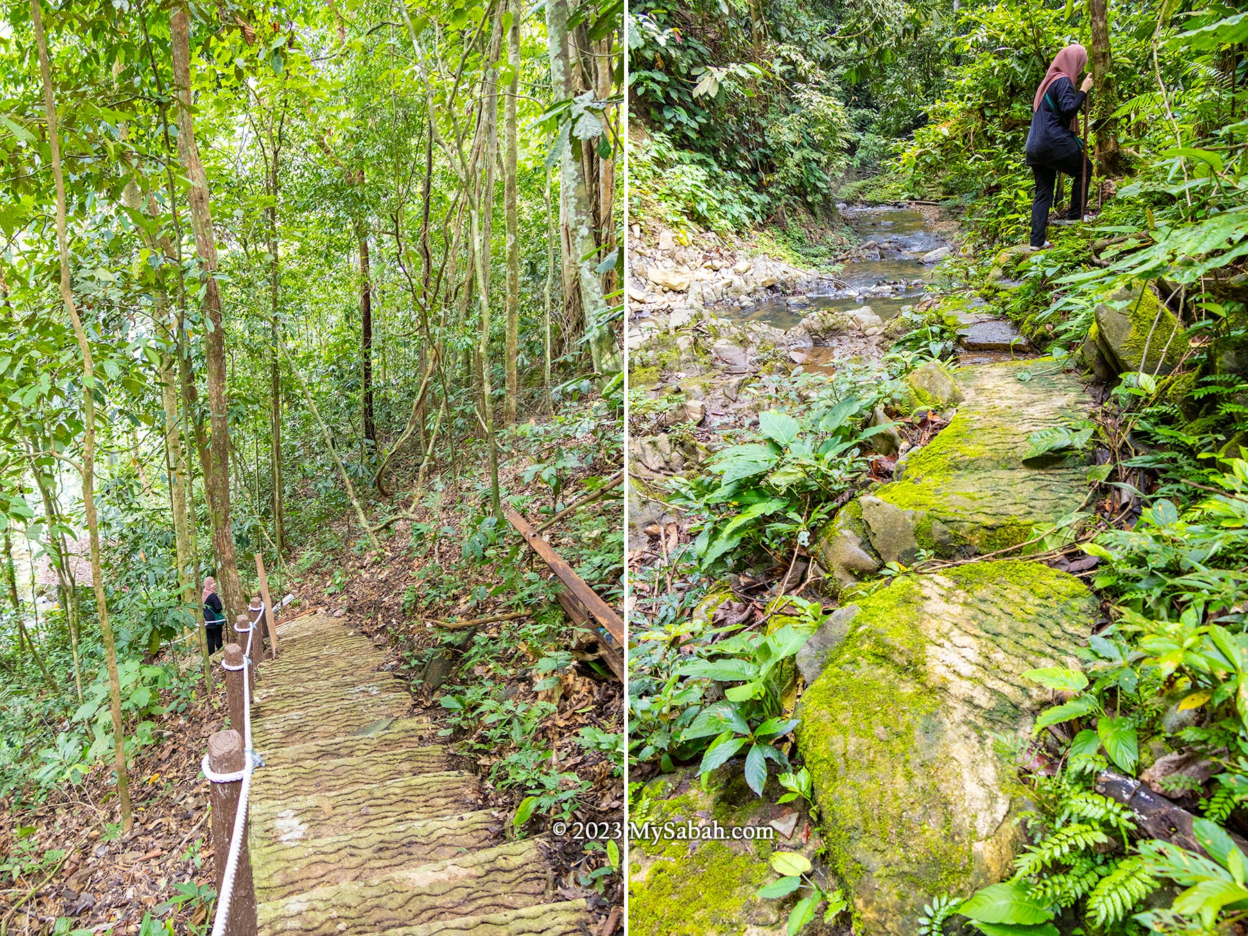
We met our guides (Kunan and Kiwi) at the registration hut inside a village plantation, for a short briefing before our hike began at 8:30 am (finishing around 2:30 pm). The first part of the trail is a pleasant one-kilometre walk through the countryside. In just 15 minutes, we passed through rubber and pineapple plantations and made our way downhill to a resting hut by the river, which is where the loop trail starts and ends.
Hanging Bridge
As we crossed the suspension bridge, I was impressed by the pristine river underneath, a tributary of the Wariu River that eventually merges with the Kadamaian River downstream—this is one of Kota Belud’s biggest rivers. Reports indicate it’s a class I river in terms of water quality, and rich in oxygen. It’s a refreshing spot, with temperatures hovering around a cool 25-27°C, perfect for a revitalizing shower after a lengthy hike.
Left: the hut is the starting point of the loop trail. Right: the river under suspension bridge is a great spot to take shower after a long hike
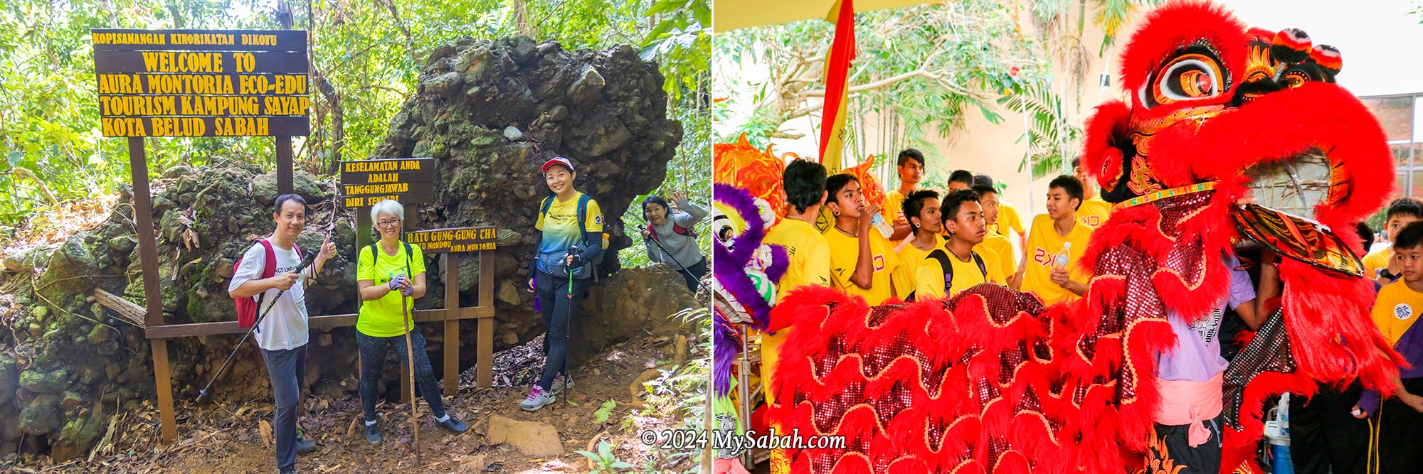
Lion Rock (Batu Gung-Gung Cha)
Following a brief ascent over a small hill known as the “Path of One Thousand Steps,” we encountered the first marvel: the Lion Rock. Locally referred to as Batu Gung-Gung Cha (Batu means Rock), this rock formation likely earned its name due to its resemblance to a lion and its association with the resounding tones of gongs and cymbals.
The Lion Rock (Batu Gung-Gung Cha) that reminds us of the noisy lion dance
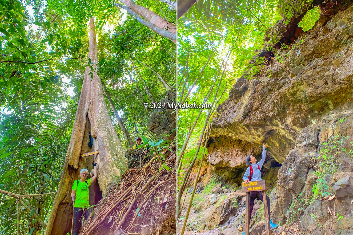
Tree Hole (Pokok Tomboilik)
As the deafening chirps of cicadas and the lively calls of birds surrounded us, it was evident we’d ventured into the jungle—a regenerated secondary rainforest in good condition, thanks to the dense canopy providing ample shade that shields us from the sun. A highlight of the trek was squeezing through a tree hole in a giant tree known as Pokok Tomboilik. Just a heads-up, if you’re a bigger person with a hefty backpack, you might get stuck in the hole.
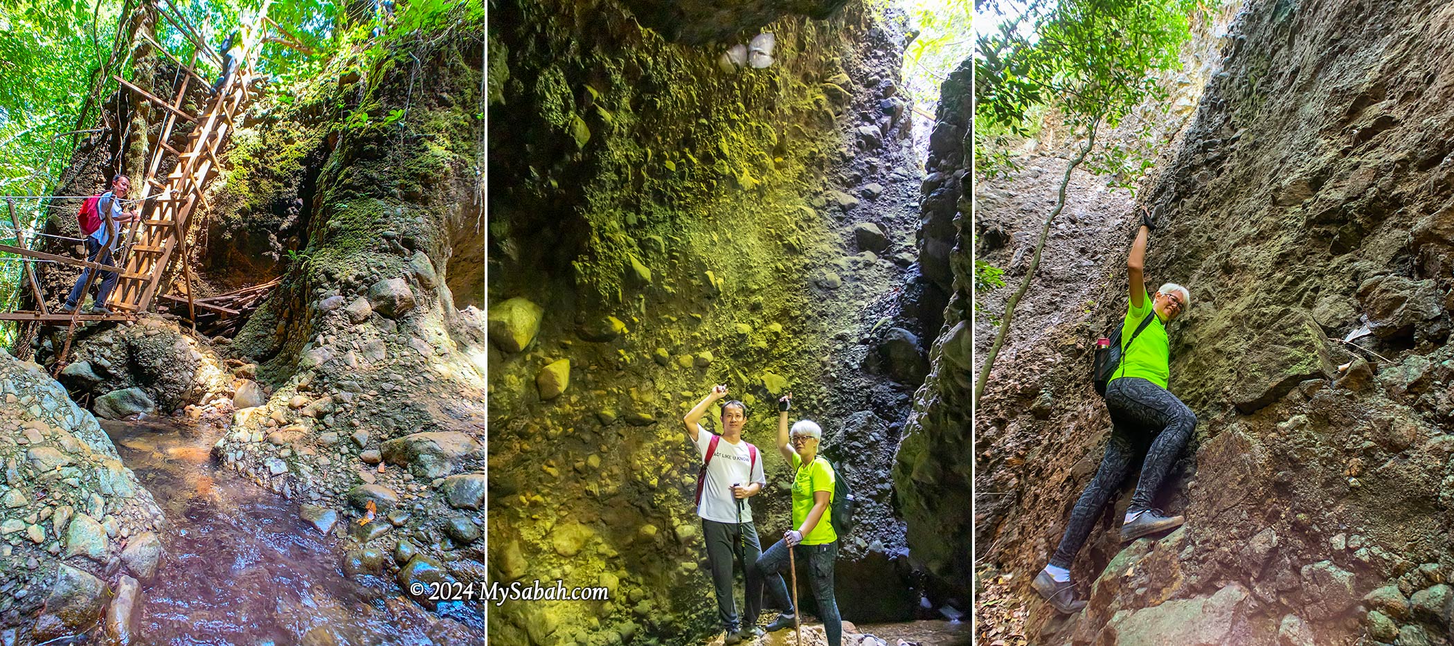
Left: passing through a big tree hole. Right: The Mouth Cave looks like a dinosaur head from this angle
Mouth Cave (Gua Mulut)
Our next destination was quite a sight—a massive overhanging cave resembling the head of a dinosaur when seen from a certain angle. This cave is just one of many hidden within the area, adding to its allure as a fascinating geological site boasting various cave formations.
Gua Mulut (Mouth Cave) is an overhanging cave that resembles a big mouth
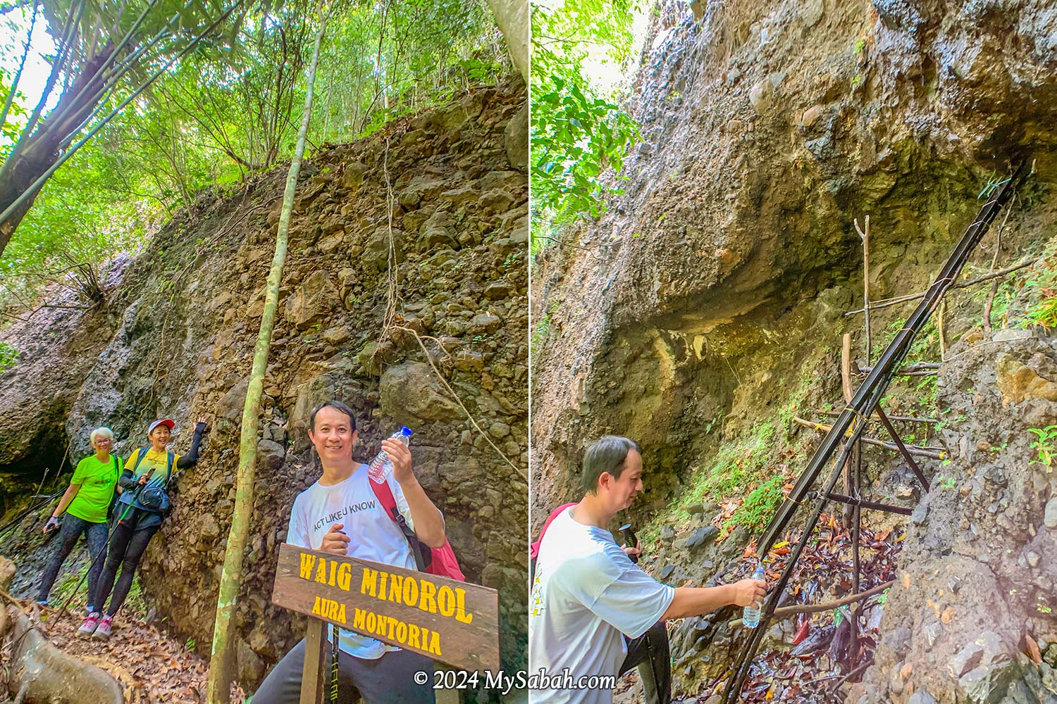
Natural Spring Water (Waig Minorol)
Close to the Mouth Cave, there are freshwater springs with water oozing out of the rocks. The sandstone, which is an excellent aquifer due to its high porosity and permeability, functions as groundwater reservoir that never run dry even during dry spells. I had a sip, and the mineral-rich water tasted wonderfully fresh, cool, and clean—no strange odors at all.
The spring water from the sandstone never dries up even during drought
Wongking Cave
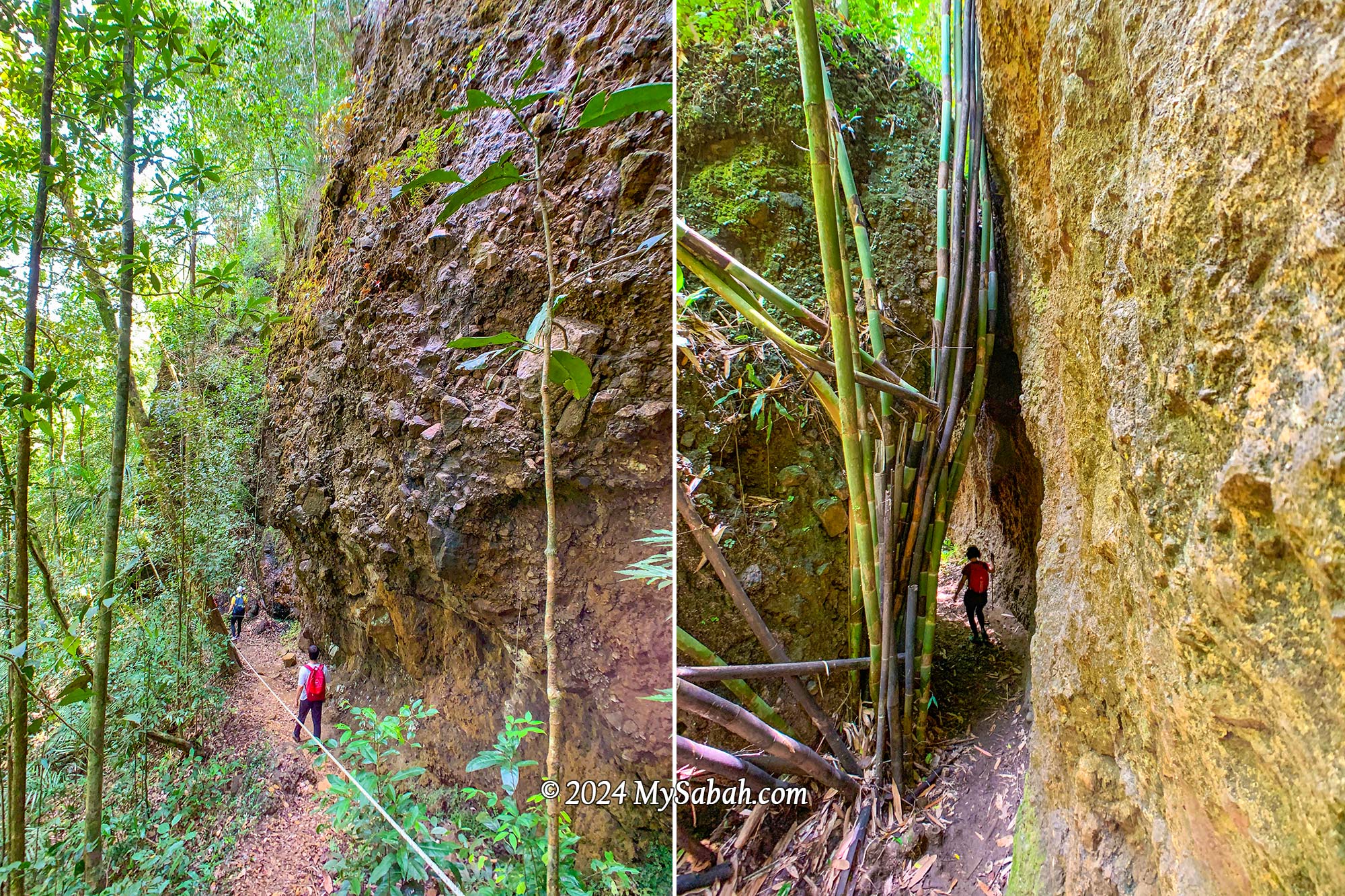
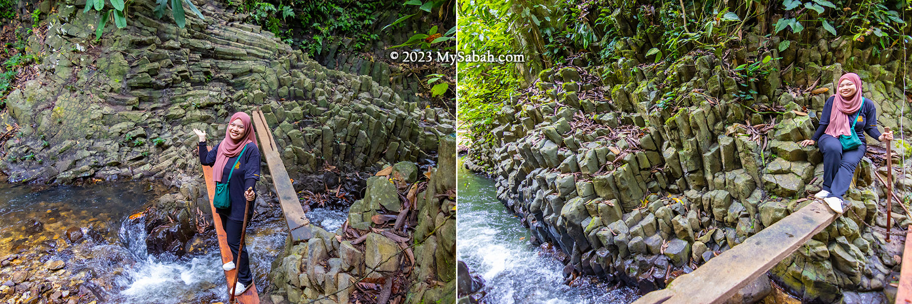
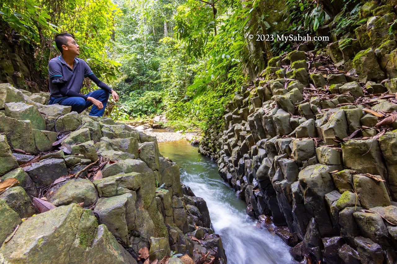
Along the trail, we encountered stunning rock walls formed from conglomerate—a mix of sedimentary rocks in various sizes and shapes glued together by finer materials such as sand, silt, or clay. Some of these formations were covered with epiliths such as white mold and green mosses, adding to their beauty.
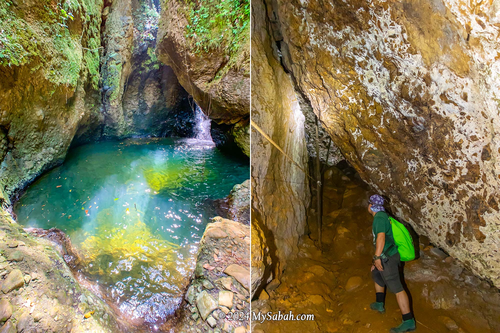
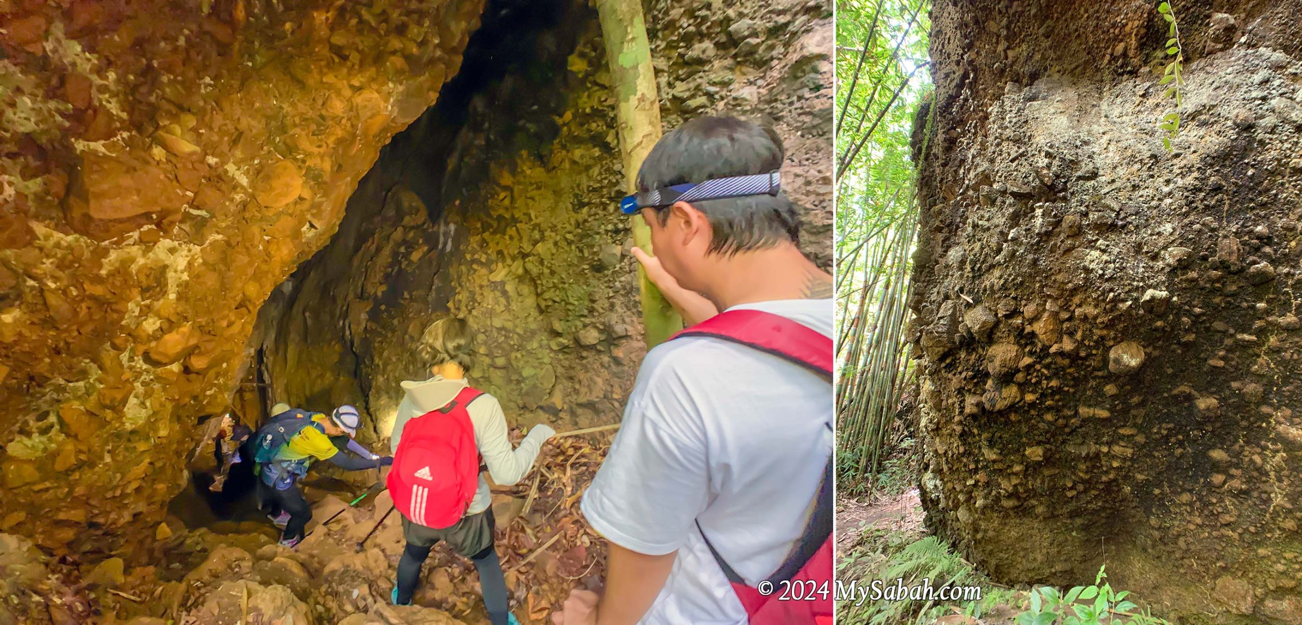
Left: Entering Wongking Cave. You need a LED headlamp for caving. Right: conglomerate rock wall
Descending into the depths, we ventured into the dark Wongking Cave. With our guides leading the way, both ahead and behind us, we felt safe exploring the underground cave. Don’t forget to bring a LED headlamp or flashlight for your caving adventure.
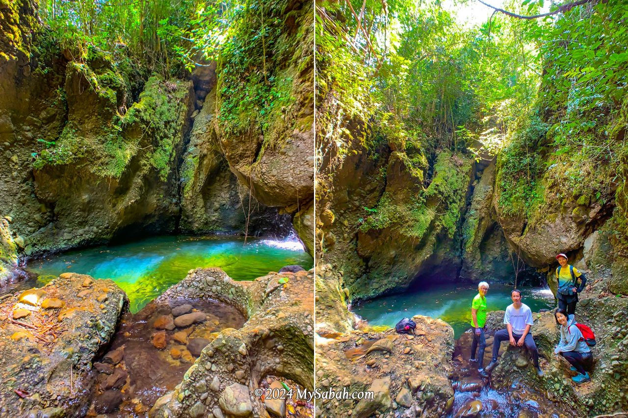
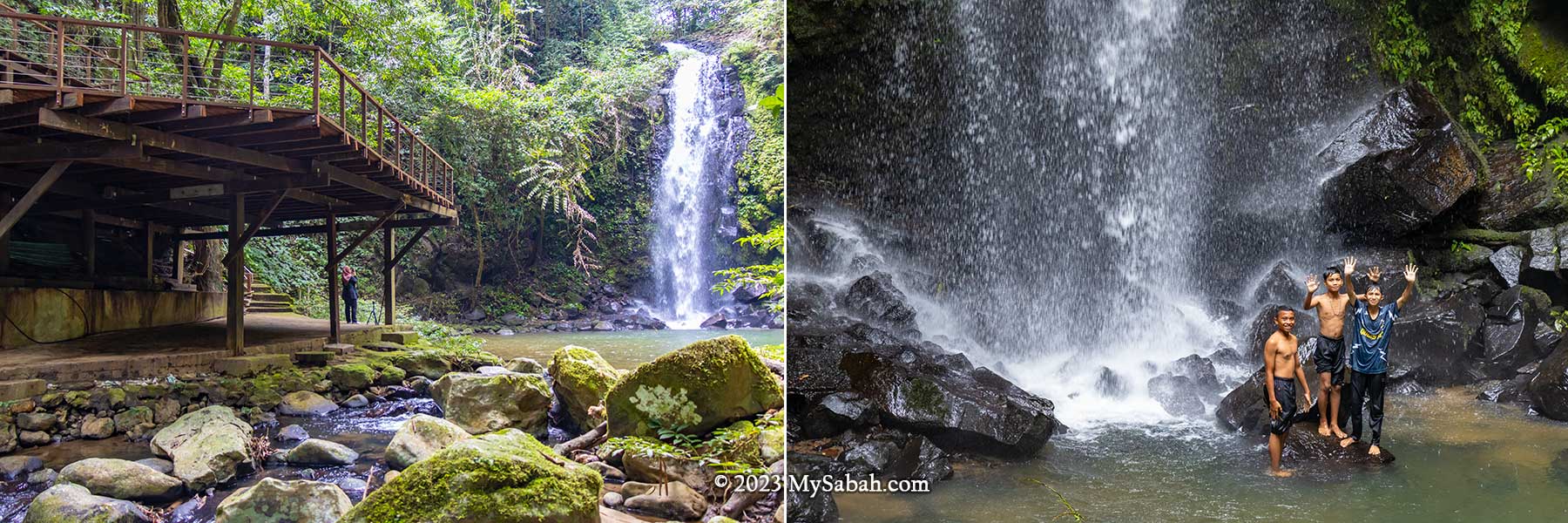
Rock Pond (Liogu Ourod)
This is the highlight I was most excited about. The oval-shaped rock pond is fed by a mountain stream and takes on a mesmerizing emerald hue when sunlight dances upon its surface. It resembles the mythical magic pool believed to restore youth to those who drink or bathe in its waters. Be careful when you move around there because the rock surface is very slippery.
Liogu Ourod, the natural rock pond filled with mountain water
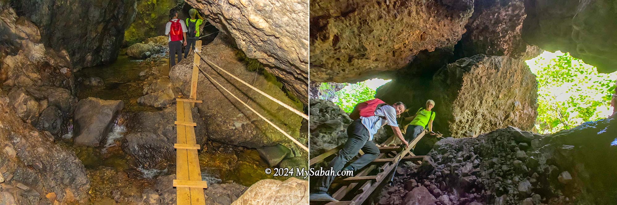
Bat Cave (Gua Pungit)
Venturing into another mountain cave, we discovered a stream flowing within. Natural light poured in through the cave’s opening on top, which also served as an entrance and exit for its inhabitants, like bats. Making the exploration easier, there were ropes and ladders available to facilitate movement in and out of the cave.
The Bat Cave with an underground stream
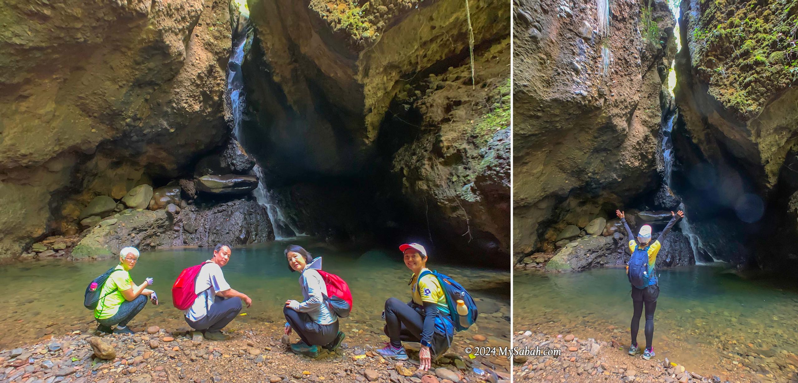
Waterfall Cave (Wasai ID Gua)
Each cave here holds its own surprises, and this one didn’t disappoint, featuring a hidden waterfall. No matter how scorching the day, this cooling cave provides the perfect refuge. With numerous caves and pristine water sources, I can’t help but wonder if cavemen once called this place home. To top it off, this cave even boasts a pond teeming with fishes.
Waterfall in a cave. There are many fishes in the pond. You can bring some pellets to feed them.
Lookout Point (Pogimpaan Ko-Duo)
Ok enough with dark caves, next we ascended higher ground where a viewpoint platform awaited. The sight of the lush forest and rolling hills was simply breathtaking. The gentle breeze was incredibly calming, prompting us to pause for a snack break on the wooden platform. It’s about 11am so we were a bit hungry.
Climbing to the lookout point on the hill. The trail is quite steep.
Marathon Trail via Rock Walls
Following a short rest, we headed down to the valley, tracing our path alongside rock walls. Among the rugged conglomerate formations, I spotted creamy rock walls composed of granite. These walls, formed from solidified molten rock that intruded into the ancient sediments, serve as reminders of tectonic activities here.
Sandstone and granite rock walls of Aura Montoria
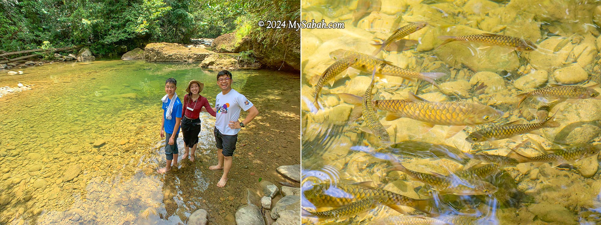
Riverside Camp
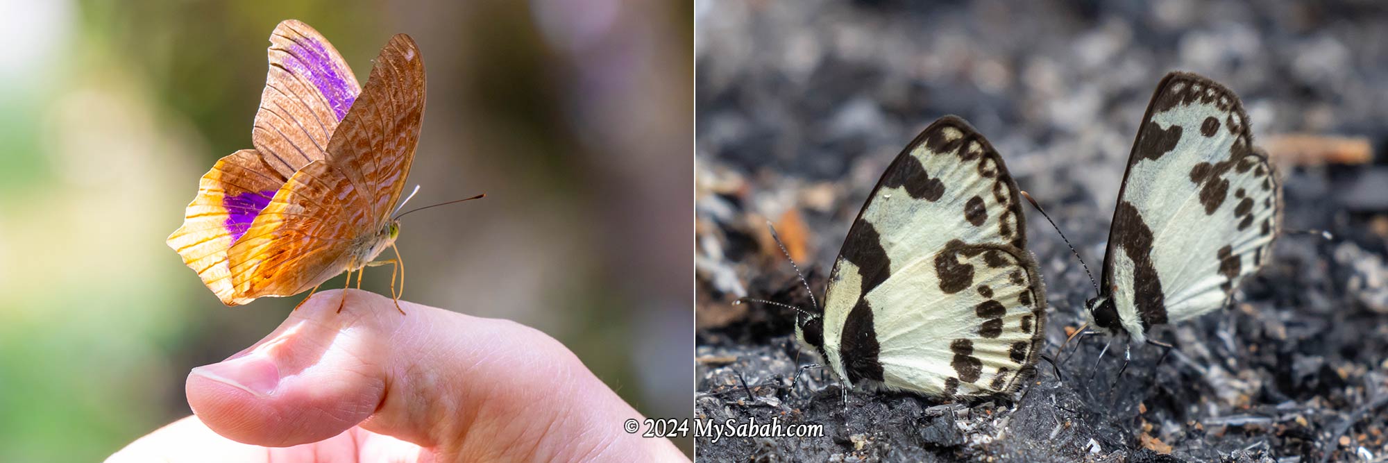
Finally, we reached the camp next to a tranquil river with a rocky bed, where we indulged in linopot lunch (rice wrapped in leaves). A few unique butterflies, including the iconic Rajah Birdwing, fluttered about the riverbank. This spot offers camping, swimming, and tubing activities, and you can throw a BBQ party.
River campsite and linopot (rice wrapped in leaf). Basic camping amenities such as tables and toilets are available here.
Nature enthusiasts will find themselves captivated by Aura Montoria’s diverse landscapes. Keep an eye out for its rich flora, such as begonias and orchids, which are among the highlights. While most people relaxed at the camp, some enjoyed a free fish massage from the docile mahseer (Local Name: Ikan Kelah).
The river and mahseer fishes (Species: Tor duoronensis) at the campsite
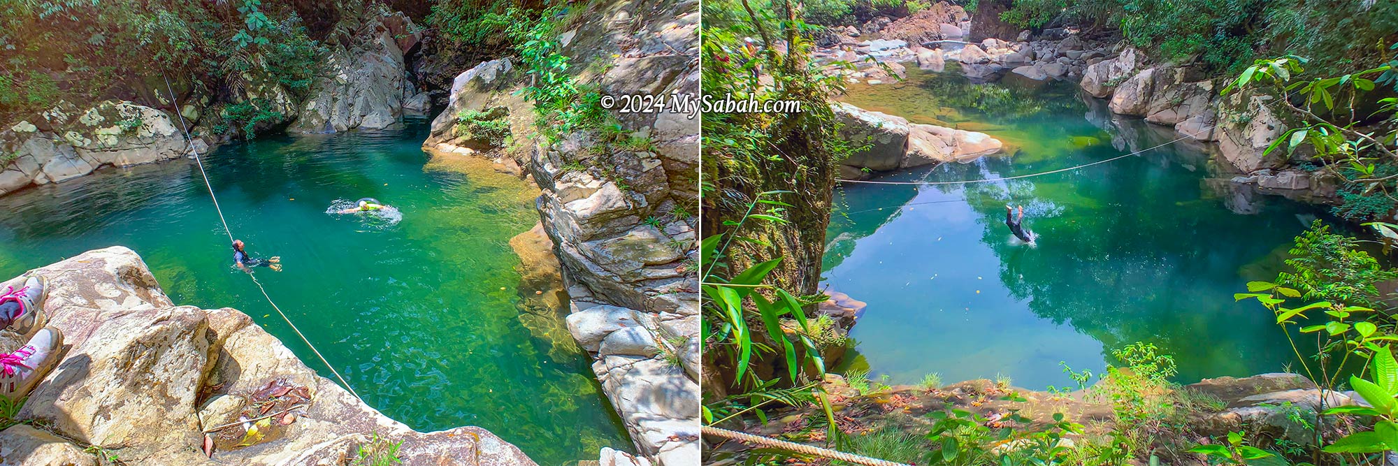
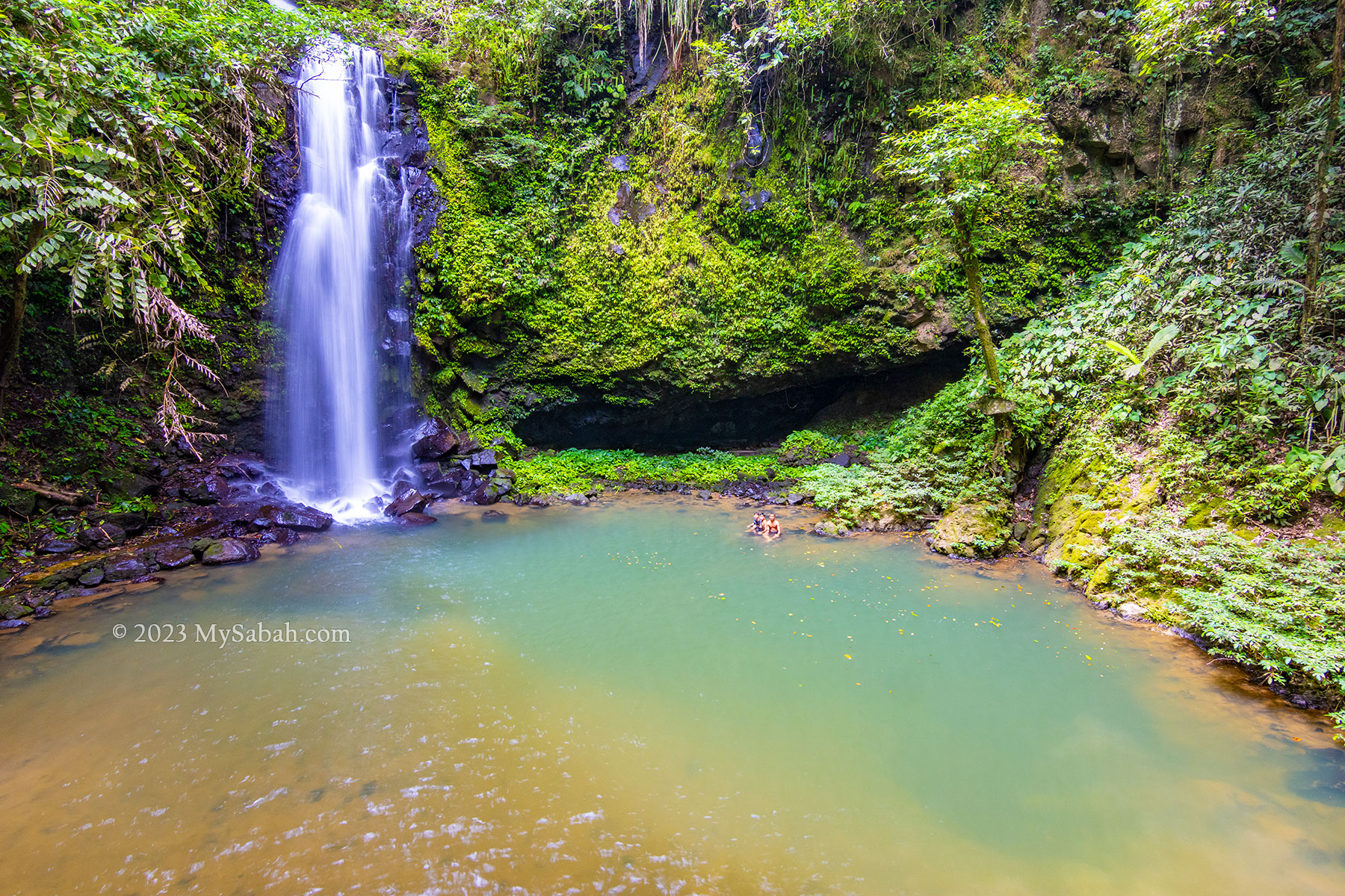
Green Lake (Liogu Otomou)
The adventure isn’t quite done yet! Our final destination is the Green Lake, a serene pond embraced by whitish boulders, with a depth of about 10 feet. For those seeking an extra adrenaline rush at the tail end of a long hike, you can take a leap into the river from higher ground nearby.
Liogu Otomou, a green lake-like river zone enclosed by rocky riverbank
How to Get There
Aura Montoria (see Location Map) is situated in Kampung Sayap, approximately 26 kilometers from Kota Belud, famously known as the Cowboy Town of Sabah. The journey from Kota Kinabalu City (KK) to Kota Belud, around an hour by car, is easily accessible via highways and paved roads. However, the 27-kilometer stretch from Kota Belud to Aura Montoria is predominantly gravel and dirt roads, making a 4-wheel-drive preferable as it can be challenging for sedan or saloon cars to traverse.
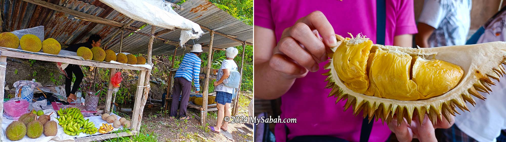
Fruit stall at the roadside of Kampung Sayap. You would find durian and tarap during fruiting season.
If you’re traveling from KK, expect a journey of over two hours. During the durian fruiting season (around August and September), if you’re a durian lover, plan for additional travel time as you might be tempted to stop in Kampung Sayap to shop for cheap durian, pineapples, and tarap. Hence, staying overnight in a nearby homestay like Porohon Garden Lodge is highly recommended. This way, you can avoid the rush and enjoy a leisurely start to your adventure without the need for a long early morning drive.
About Kampung Sayap
The majority of Kampung Sayap’s population comprises the Dusun Tindal community, mainly engaged in farming activities. Originally known as Kampung Minangkob, the name translates to “valley surrounded by hills.” Many years ago, a British military officer visited the village, he rested by a river that was nearly covered with dry leaves because of the drought that time.
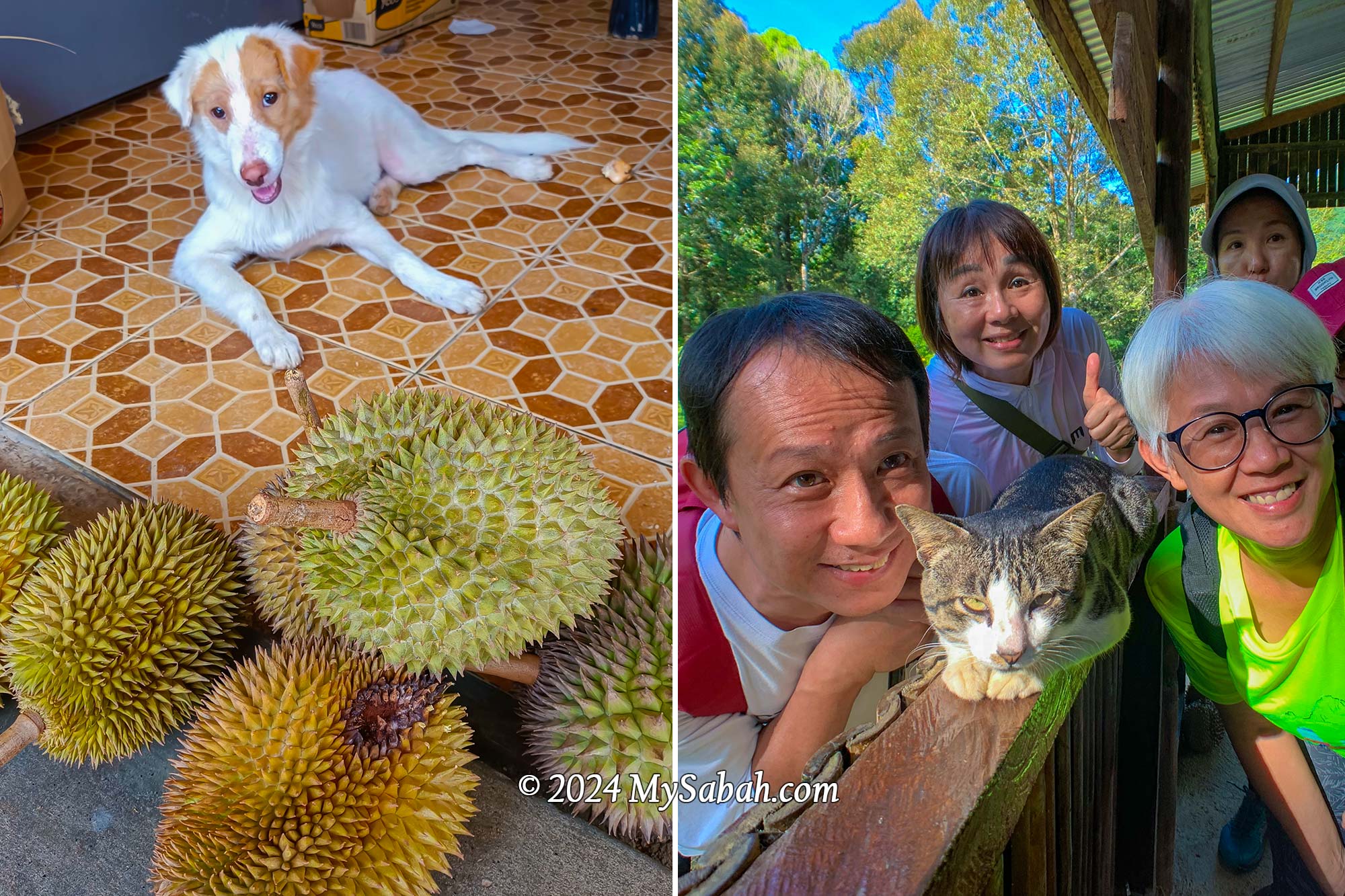
Dog and cat of Kampung Sayap. In the photos are Si Putih (dog) and Stim (cat), they love durian. Here are the proof of Si Putih and Stim eating durians (click the links for video)
Then the British asked a villager, “what is the word for dry leaves in Dusun language?” The villager replied that it was “sahap” (dry leaves). Unfortunately, the officer misheard sahap as sayap (which means wings in English) and document it in his diary. Due to that incident, Kampung Minangkob was renamed to Kampung Sayap.
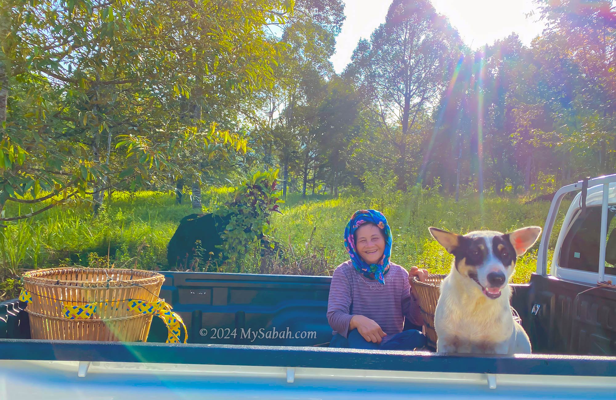
A friendly villager and her dog on the way to their farm in a lovely morning. Note the traditional wakid bamboo baskets in the car and the durian plantation behind them.
Fees and Contacts
The half-day, 6-kilometer hiking tour is priced at RM35 per person for locals and RM80 per person for non-Malaysians. For a group of up to 5 people, the guide fee per group is RM50 for locals and RM100 for non-Malaysians. Food is not included in the cost (but available as an add-on). If needed, you can hire a porter at a rate of RM5 per kilogram to carry your belongings.
Butterflies at the river of Aura Montoria. Left: Terinos clarissa praestigiosa, Right: Bornean Straight Pierrot (Caleta manovus)
A local guide is mandatory for hiking in Aura Montoria. To inquire about updated rates or book a hiking trip in Aura Montoria, you can contact the operator through the following channels: Phone (Whatsapp):+60-136262793 (Madam Sandra Idiam), +60-189650079 (Madam Rina Maratun) Facebook:Aura Montoria Eko-Edu Tourism Kg Sayap Kota Belud Sabah
Things to Bring
Having the following items handy will ensure a more comfortable and enjoyable hiking experience at Aura Montoria! The most important of all is to wear the right hiking gear: quick-dry clothes and good hiking shoes.
Backpack
Drinking Water
Raincoat / Poncho
Insect Repellent
Sunblock Lotion / Spray
Snacks / Energy Bar
Swimwear / Sarong
Extra clothing and towel
Hiking pole
Plastic Bag for soiled clothing
Cash
Optional: dry bag, portable power bank, hat
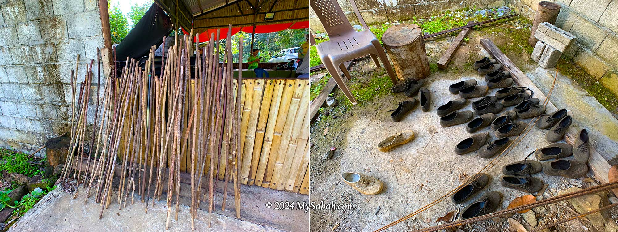
You can rent walking sticks, swimming goggles, Adidas Kampung (waterproof rubber shoes for hiking) for a small fee.
Walking sticks and Adidas Kampung shoes for rent. Adidas Kampung is made of rubber and waterproof, it’s the favourite hiking shoes of locals because it works well on muddy and slippery ground.
Special thanks to Puan Rina Maratun for sharing the backstories of Aura Montoria and Kampung Sayap. I also refer to the book “A Scientific Journey Through Borneo; Sayap-Kinabalu Park Sabah” written by ISMAIL, Ghazally; BIN DIN, Laily and published in 1995.
Photos taken in Kota Belud, Sabah, Malaysia Borneo
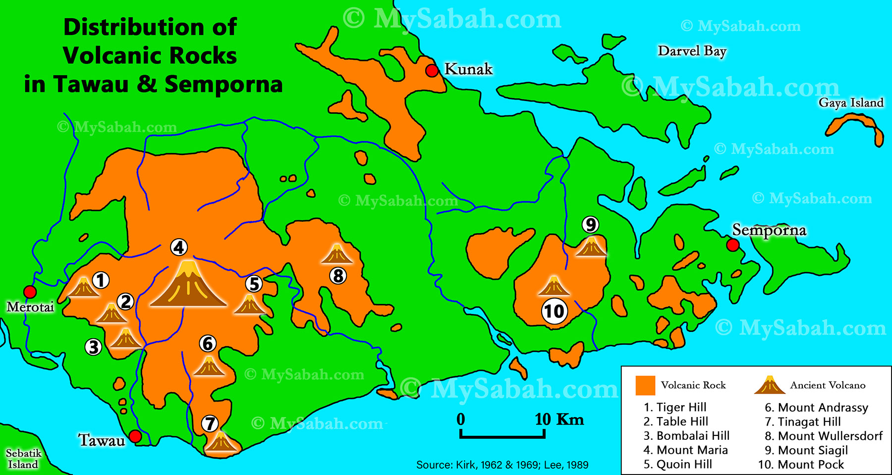
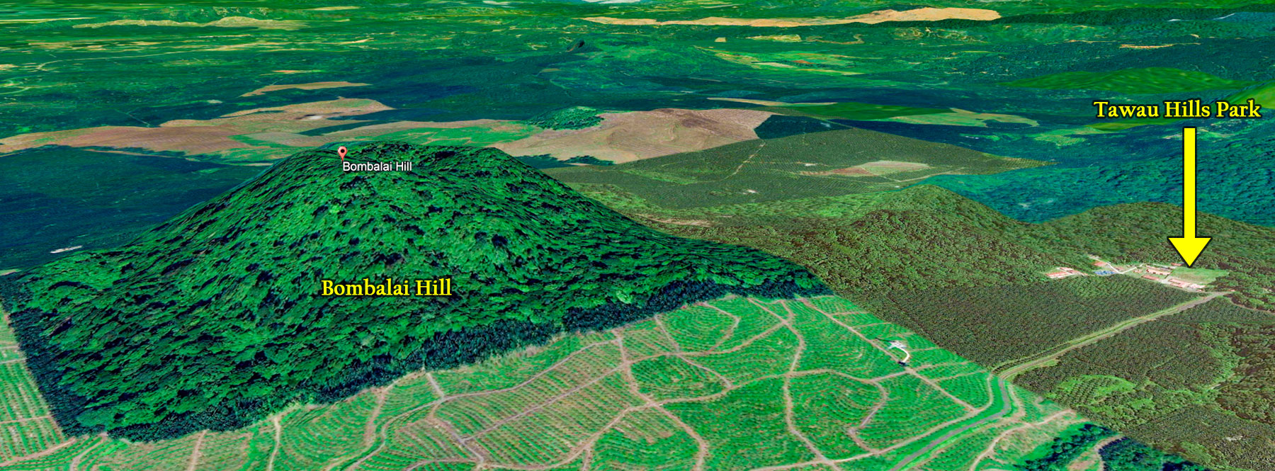
Mount Kinabalu is the sacred mountain of Sabah’s indigenous people. During the active volcanic period from the Early Miocene to the Pleistocene in the eastern part of Sabah, did the people from that era worship these volcanoes? Currently, all volcanoes in Sabah are extinct, and many people are unaware that Tawau has at least 10 volcanoes that became extinct approximately 12,000 years ago. Anyway, a dead volcano is still a volcano. Climbing to the summit of a volcano fulfills my interests in its geological, spiritual, and ecological features.
Distribution of volcanic rocks and ancient volcanoes in Tawau and Semporna (south-east of Sabah). Tinagat Hill is No.7 on the map.
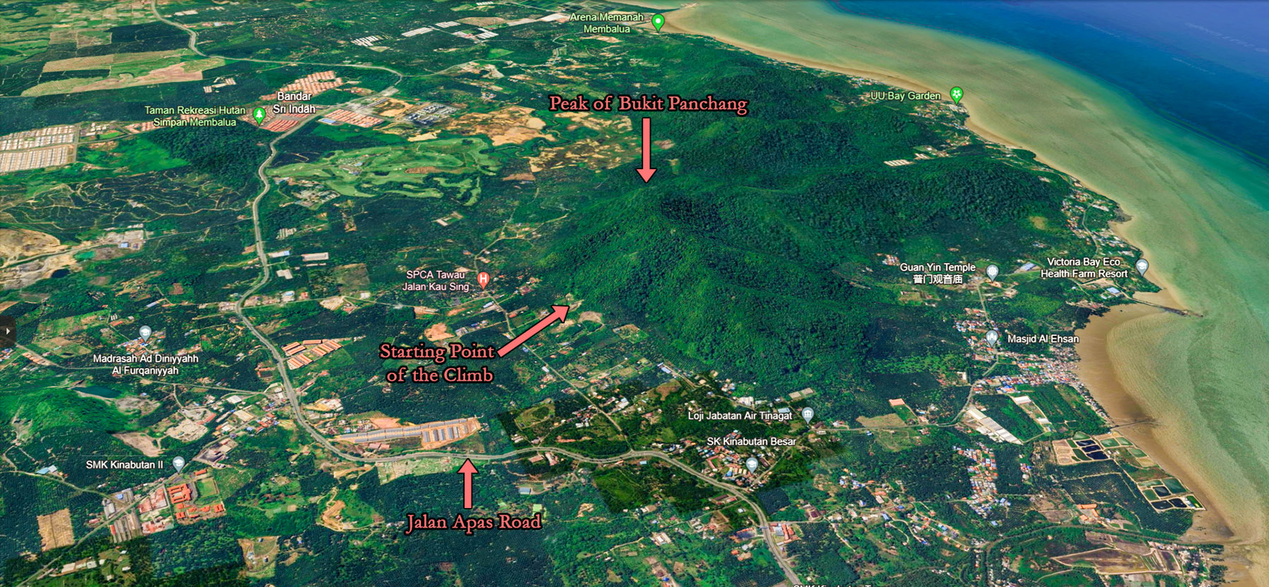
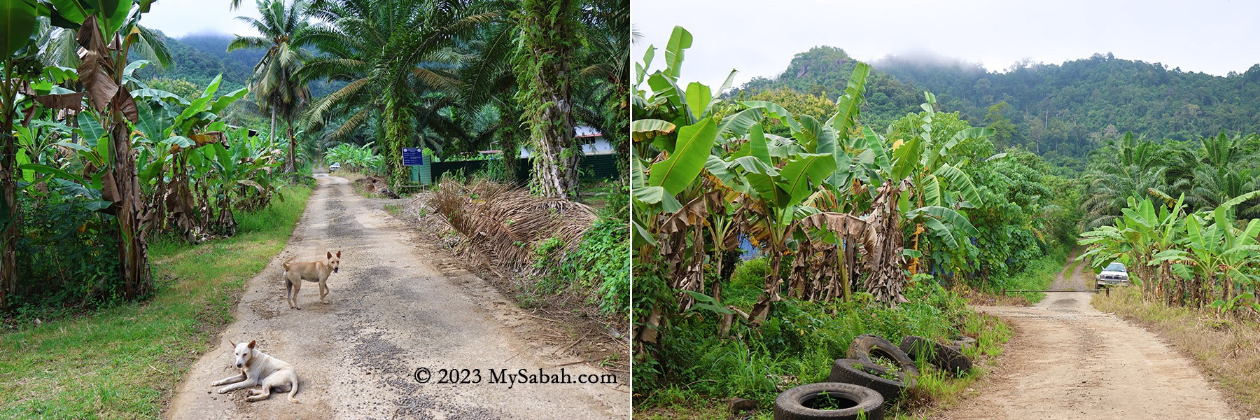
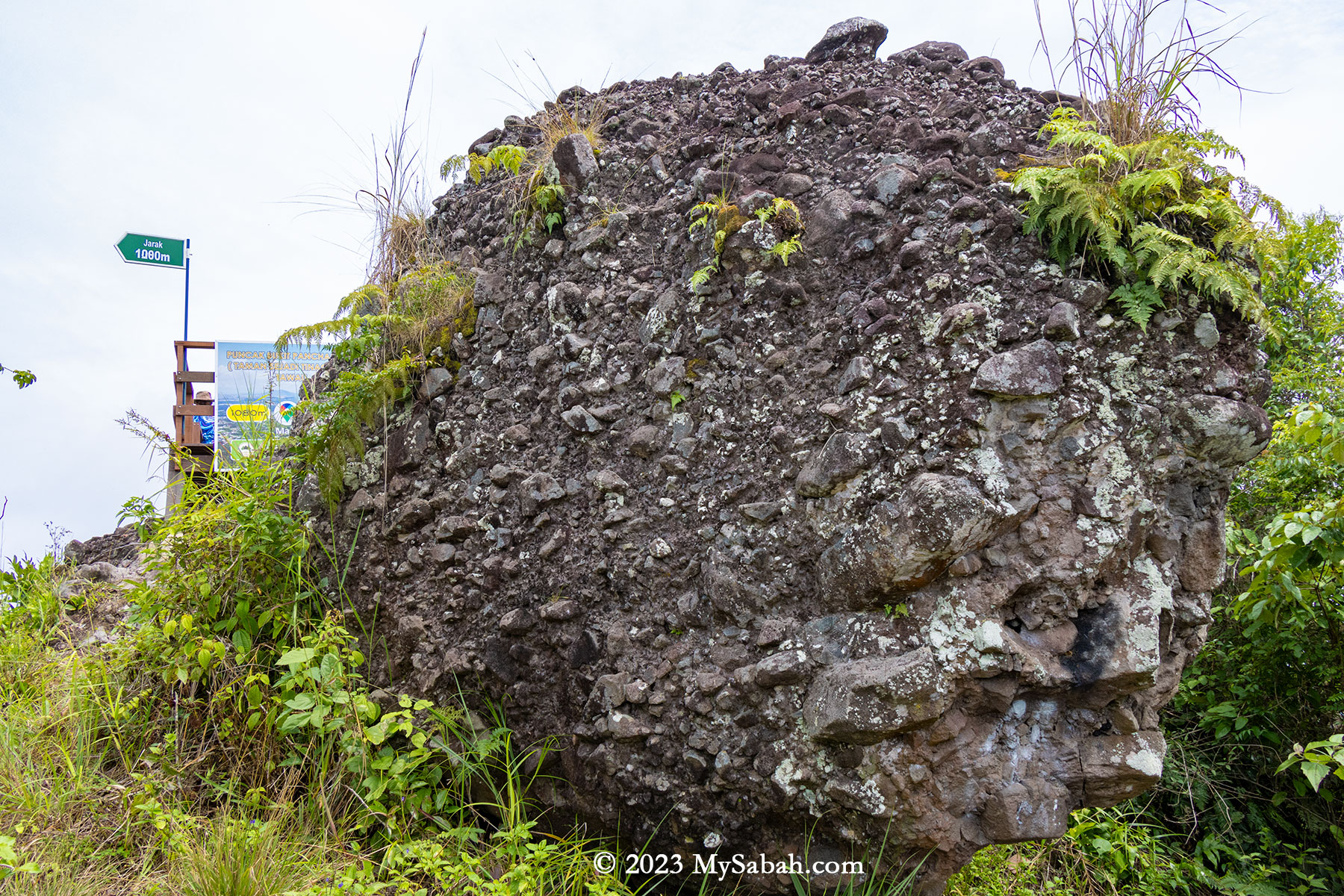
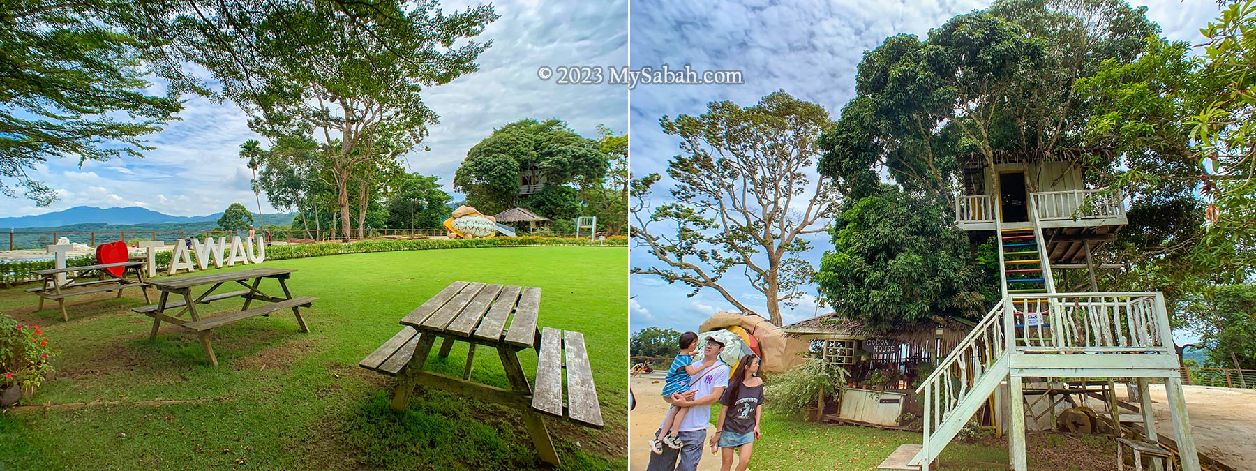
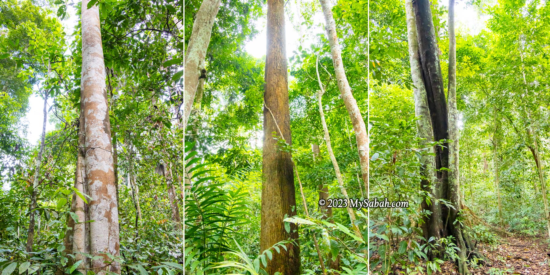
Bukit Panchang (or Panchang Hill, where ‘Bukit’ means ‘Hill’) is the fifth Sabah volcano I’ve climbed, following Bombalai Hill, Mount Wullersdorf, Bukit Tengkorak and Bohey Dulang. Situated in the Tinagat Forest Reserve, Bukit Panchang or Bukit Panchang Tinagat is less than 10 kilometers away from Tawau town.
Tinagat Forest in morning mist
About Tinagat Forest Reserve
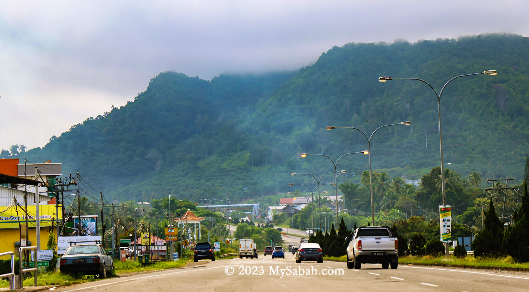
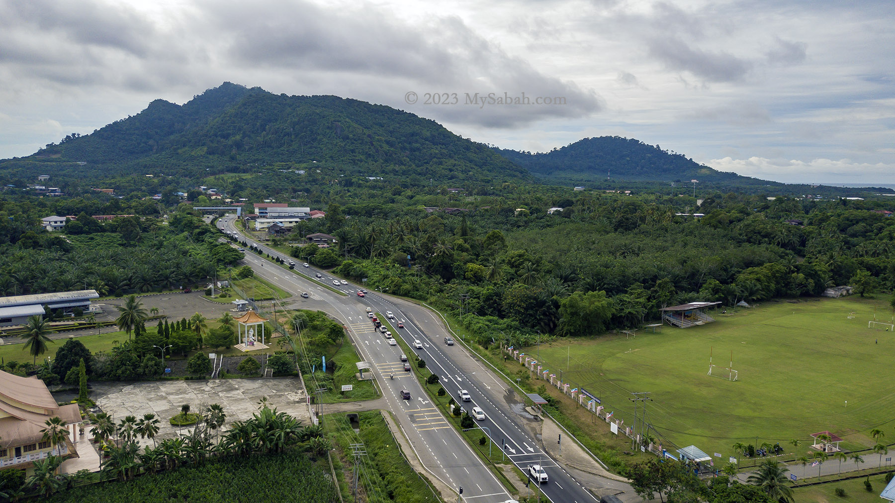
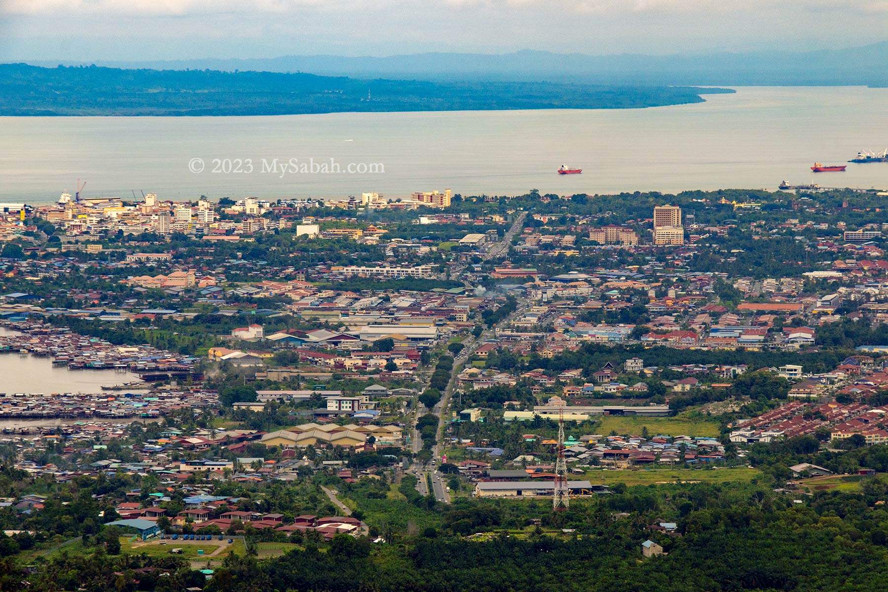
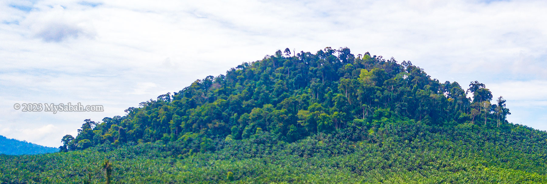
Managed by the Sabah Forestry Department, Tinagat Forest Reserve is classified as a Class-1 (fully protected) forest reserve, covering an area of 1,011 hectares (or 10.11 square kilometers). Traveling along Jalan Apas, one of Tawau’s main roads, in the morning, you’ll witness this lush hilly forest veiled in mist. Amidst the extensive conversion of land around Tawau into oil palm plantations, Tinagat Forest Reserve stands as one of the few remaining forested areas near the town.
3D map of Tinagat forest reserve and its surrounding
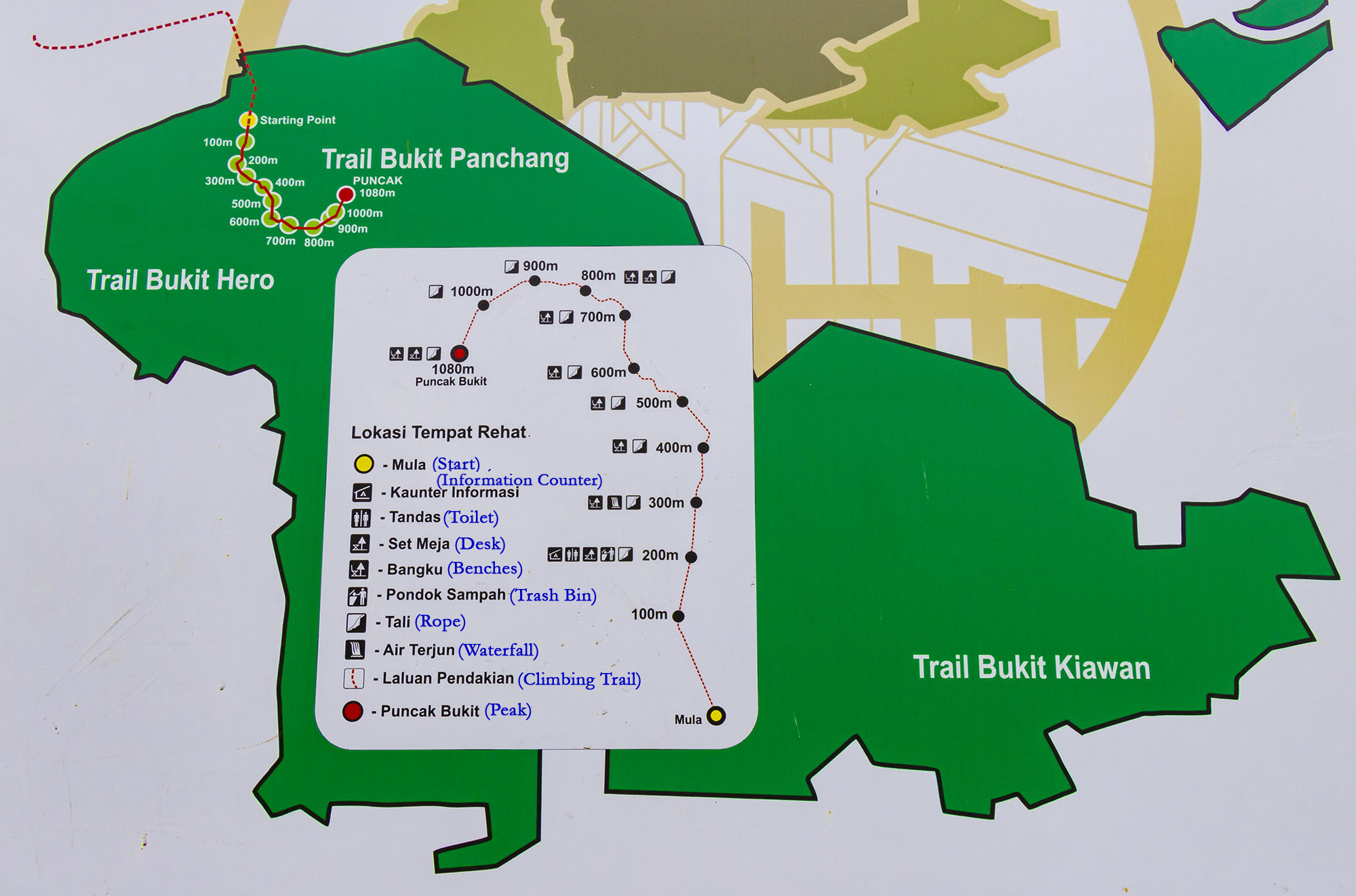
Tinagat essentially represents a multi-peaked ancient volcano blanketed by dense forest cover. Remarkably, numerous climbing trails lead to various peaks on this hill. Among them, Bukit Panchang claims the highest altitude at 398 meters (1,306 feet). Bukit Panchang is probably a new official name, as many locals used to call it Bukit Kinabutan or Bukit Tinagat. Other notable peaks within the Tinagat Forest Reserve include Bukit 38, Bukit Akar, Hero Hill (Batu Payung), Bukit Kayawan, and Bukit Kiawan.
The trail map of Bukit Panchang in Tinagat Forest Reserve (English translation in blue colour). There are more than one hill in this forest.
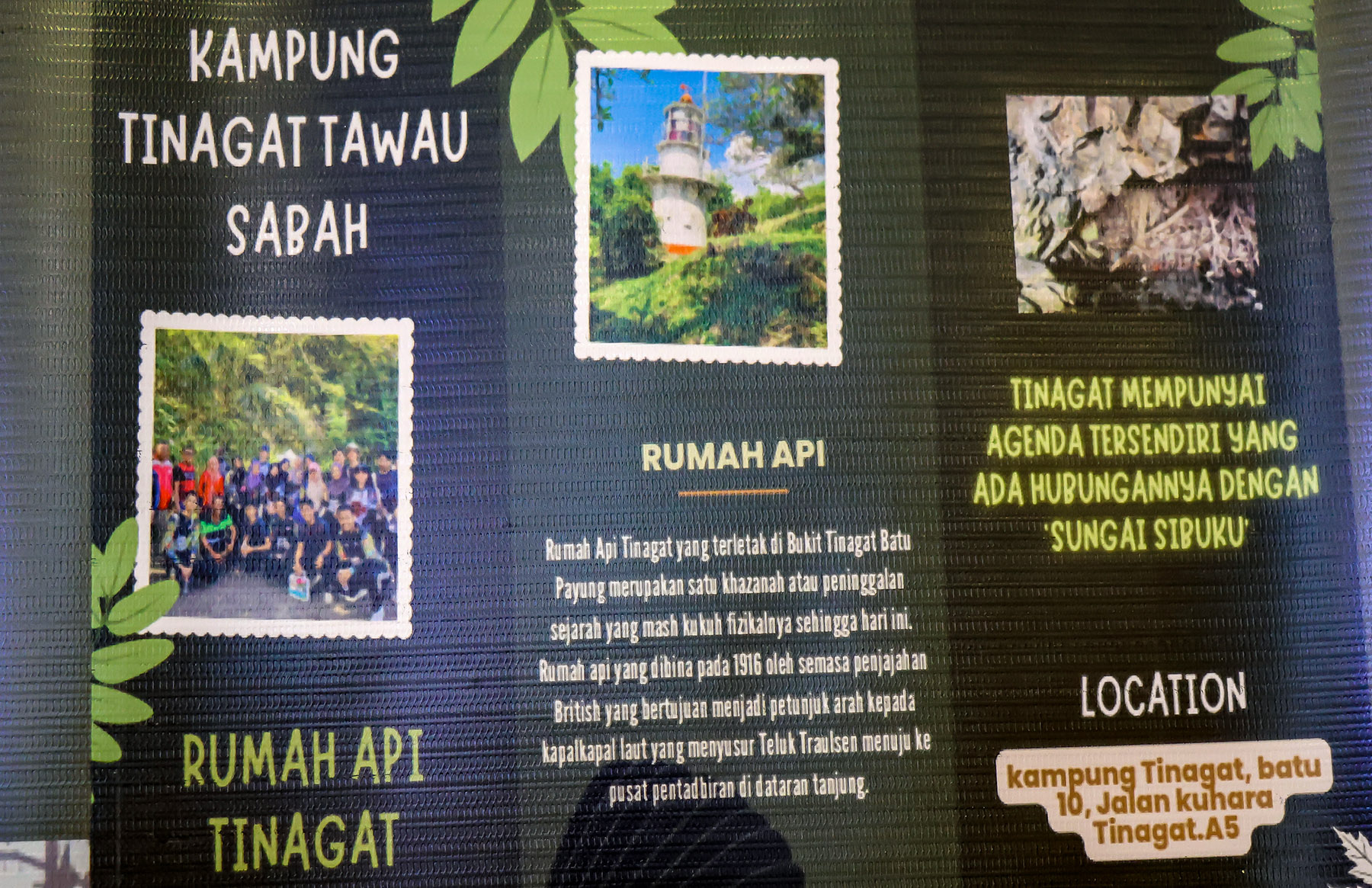
A century-old lighthouse (Rumah Api Batu Tinagat), constructed by the British colonial government in 1916, stands at the foothills facing the sea. This 9-meter-high Batu Tinagat Lighthouse is currently a restricted area. However, PELKO (Pelancongan Komuniti Tawau, associated with Politeknik Tawau) suggests that it will soon be accessible to tourists. On 23rd February 2018, Batu Tinagat Lighthouse was among the 24 heritage sites in the state officially designated by Sabah’s State Heritage Council under the new enactment of the ‘State Heritage Enactment 2017’.
View of Tinagat Forest Reserve from the Jalan Apas Road near to Tawau town
Not far from the Batu Tinagat Lighthouse lies Batu Payung (literally meaning Umbrella Rock), which is tied to a legend that lends Tinagat its name (Tinagat translates to ‘Cut Down’ in the Tidung language). According to the tale, long ago, a young farmer encountered seven heavenly princesses bathing along the beach. Captivated by their beauty, he devised a plan to win one of them over by stealing her clothes. Unable to locate her dress, the youngest princess was stranded on Earth. Eventually, she married the young man and bore him a child.
PELKO (Tawau Community Tourism) is planning to develop and promote the attractions in Tinagat
One day, during a festival, the princess was invited to perform a dance. As she danced in her old attire, hidden from her until then, her body began to levitate and ascended to the top of Batu Payung. In a desperate attempt to get her back, her husband cut down the rock, but she continued to soar away. All that remained was a message she left behind: ‘Please take care of our child. If he cries, bring him to Sungai Sibuku (Sibuku River).’
A walk-through video of climbing Bukit Panchang
Climbing Bukit Panchang
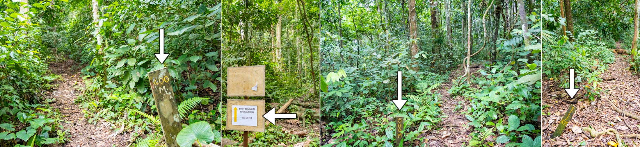
Bukit Panchang is steep but not too difficult to climb. The trail to the peak spans about 1,080 metres one way, typically taking around an hour to complete. Your climb will start with a steep slope, sorry, no warm-up for you.
Starting point from the junction No.10. You can see the forested hill ahead of you. If you are afraid of dog, you may go in group or bring a hiking stick. These dogs were friendly to me when I communicated with positive gesture and voice.
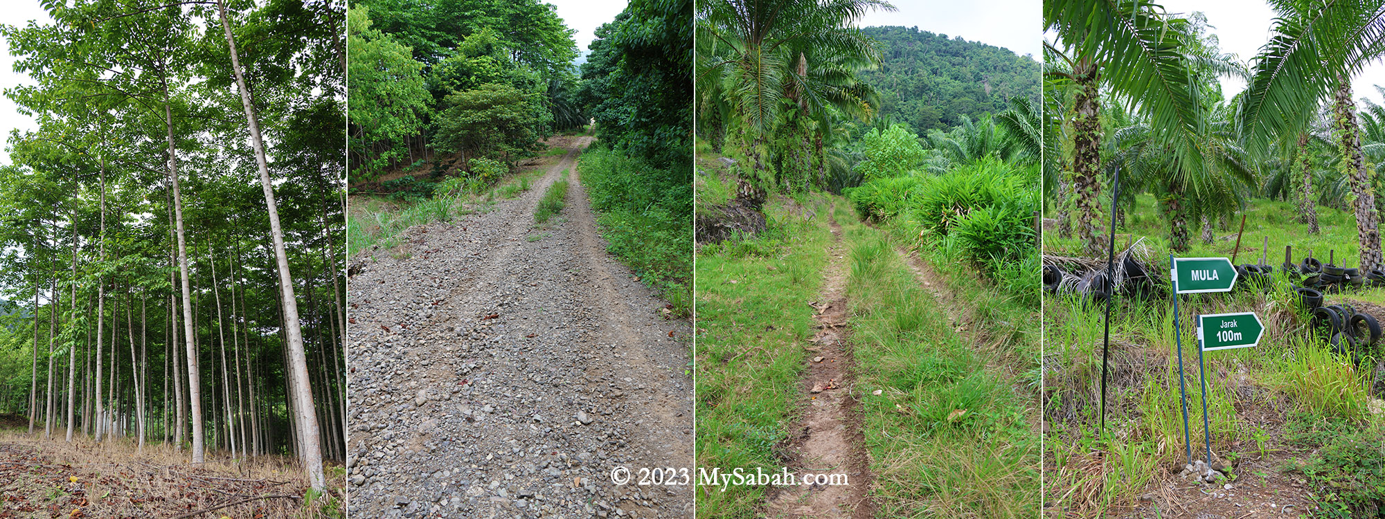
Initially, a 200-metre walk on a gravel road within an oil palm plantation leads to the Sabah Forestry station (or checkpoint) at the foothill. Here, they’ve established amenities like toilets and gazebos. Beware of village dogs, though I found them quite friendly.
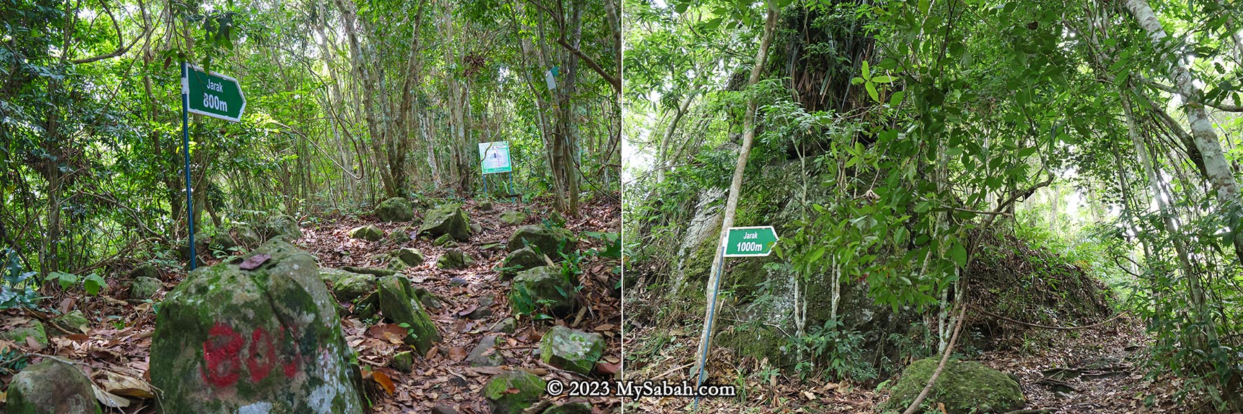
The small road to the Sabah Forestry station. You will pass through oil palm, rubber, coconut and banana plantation. You are almost there if you see the signages at the right. (Mula = Start, Jarak = Distance)
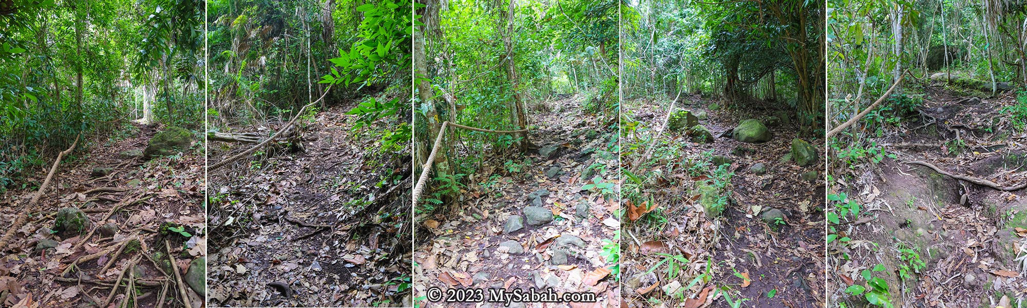
Thanks to the dense forest, the trail offers ample shade. Approximately 90% of the time is spent ascending, with mild to steep slopes. Tawau hikers often describe climbing steep hill as ‘feeling like Panchang,’ signifying its steepness.
Sabah Forestry station or checkpoint at the foothill of Bukit Panchang. Toilet and gazebo are available here.
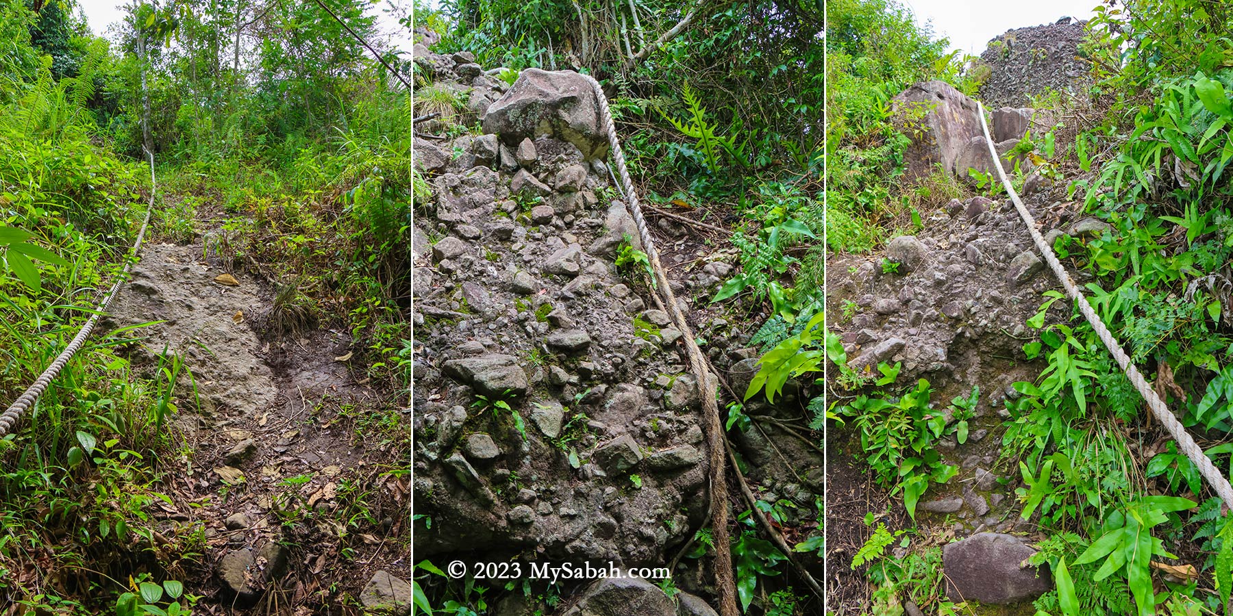
The most challenging segment involves a 200-metre-long steep boulder section at the trail’s onset. After rainfall, this section transforms into a waterfall, so I strongly advise against attempting the climb during the wet season.
The starting point of the climb at the Sabah Forestry Department station
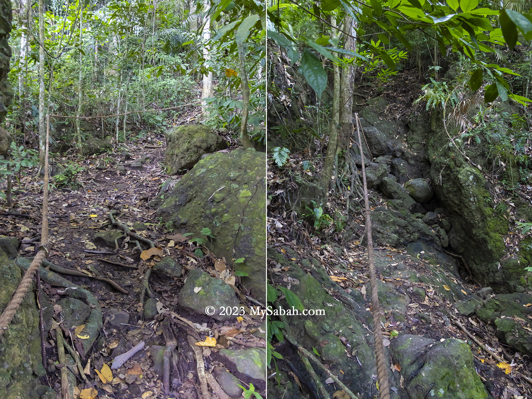
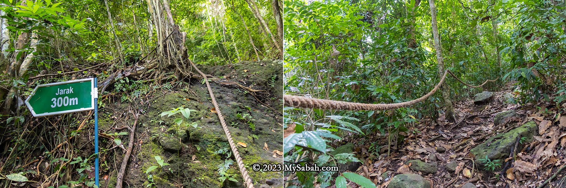
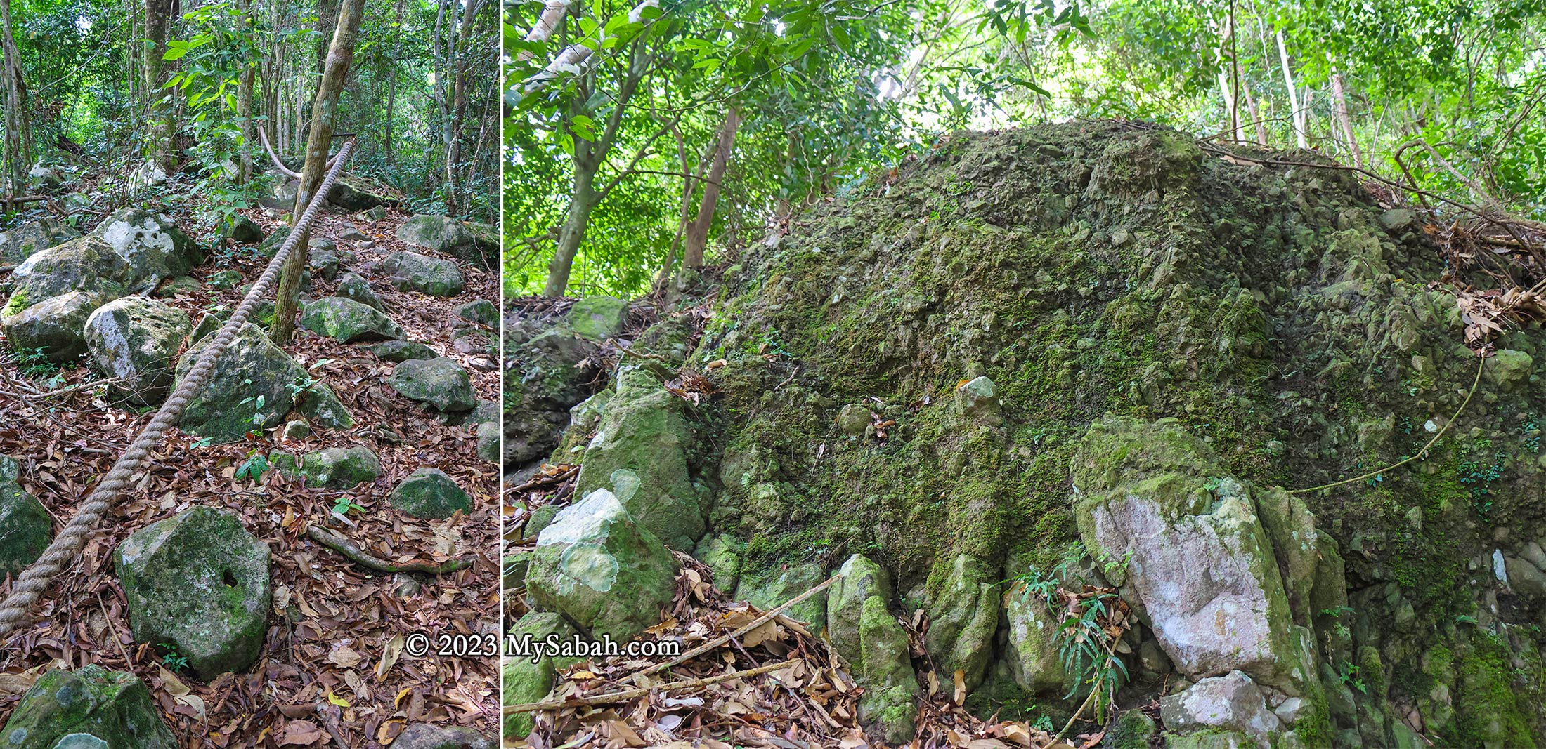
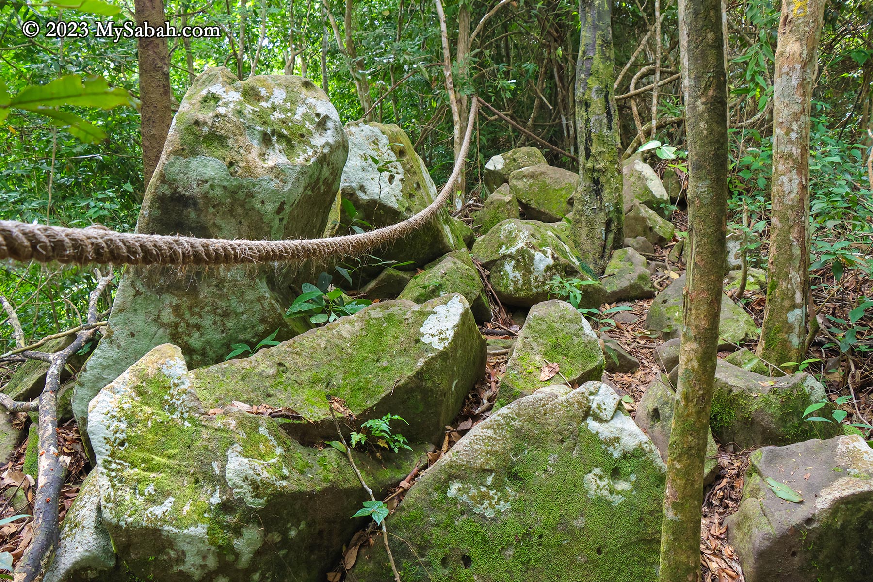
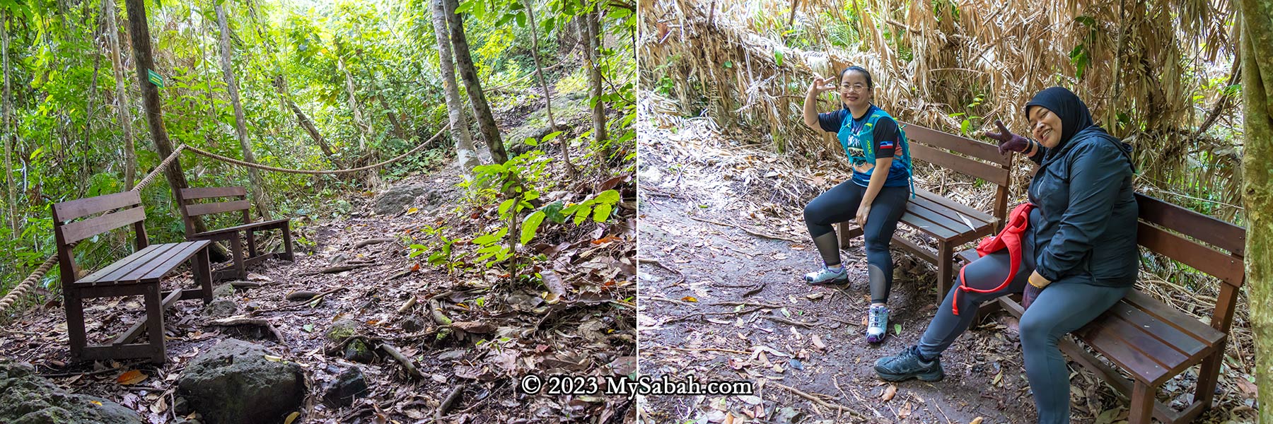
Throughout the climb, numerous exposed volcanic rocks and rockfaces remain visible, indicating Bukit Panchang was used to be a rocky hill. Rope supports are placed along the trail, providing climbing aid. The ropes also serve as guides leading to the summit. Distance markers every 100 meters serve as motivational checkpoints, and some spots have benches for resting. Fortunately, there are no leeches.
Left: start of the climbing trail. Right: the waterfall trail is the steepest section
In 2021, four kindergarten teachers lost their way in the Tinagat forest, but were thankfully rescued the following day. As a safety precaution, the Sabah Forestry Department now requires hikers to enlist a ranger’s guidance. Personally, I believe the hike isn’t dangerous if one exercises caution.
The Vegetations
After volcanic activity stopped thousands of years ago, this hill is covered with trees and plants that thrived in its fertile volcanic soil. While many perceive trees as mere providers of oxygen, the reality is that a rainforest hosts a multitude of plants offering food, medicinal properties, timber, firewood, and more.
Distance marker and rope support. The total climbing distance to the peak is 1,080 metres one way. The distance marker shows you how many metres you have climbed (Jarak = Distance).
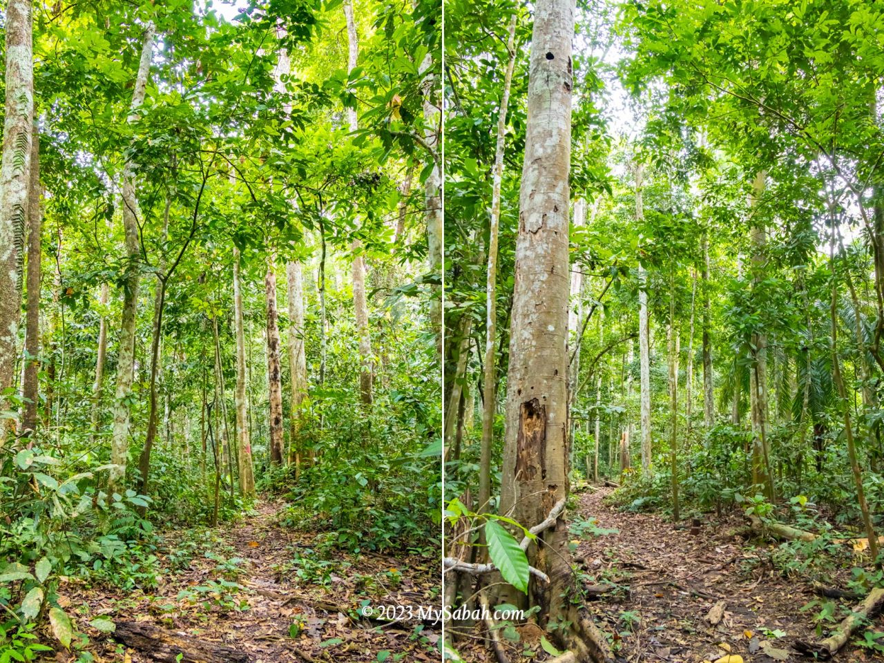
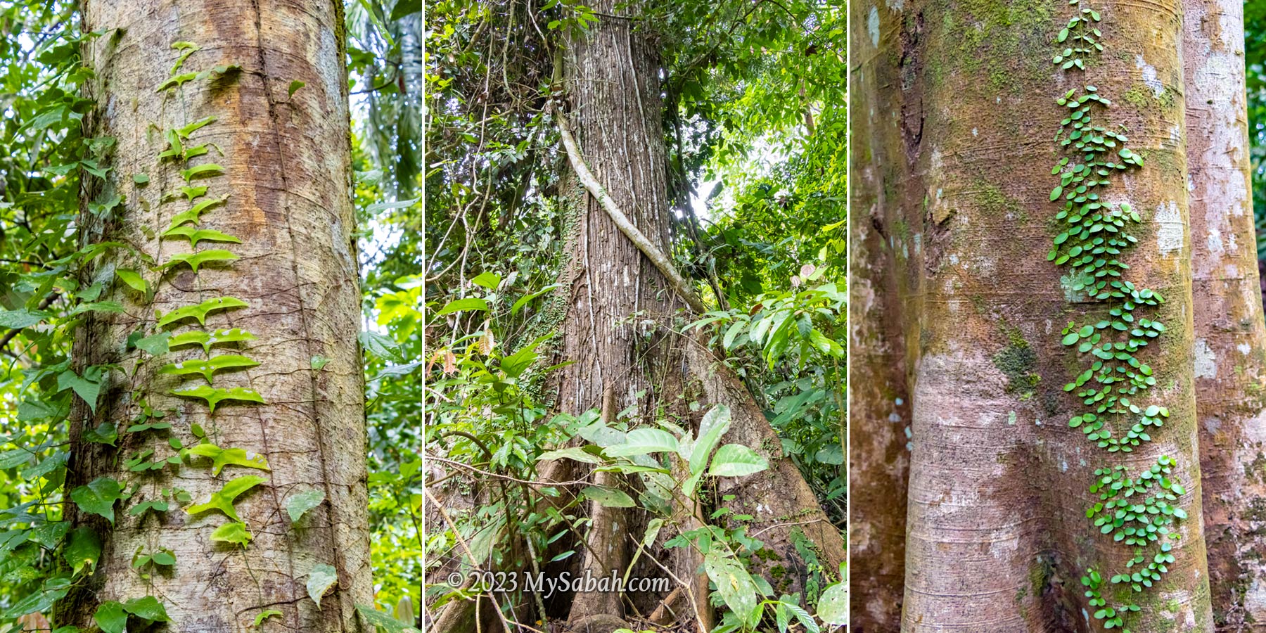
The forest covering the Tinagat hills primarily consists of mixed dipterocarp forest, a typical rainforest found in the hills of Borneo. However, the trees here tend to be relatively smaller, possibly due to the thin layer of soil.
The steep climbing trail of Bukit Panchang. Basically it’s up-up-up all the way and only slightly better after 750 metres.
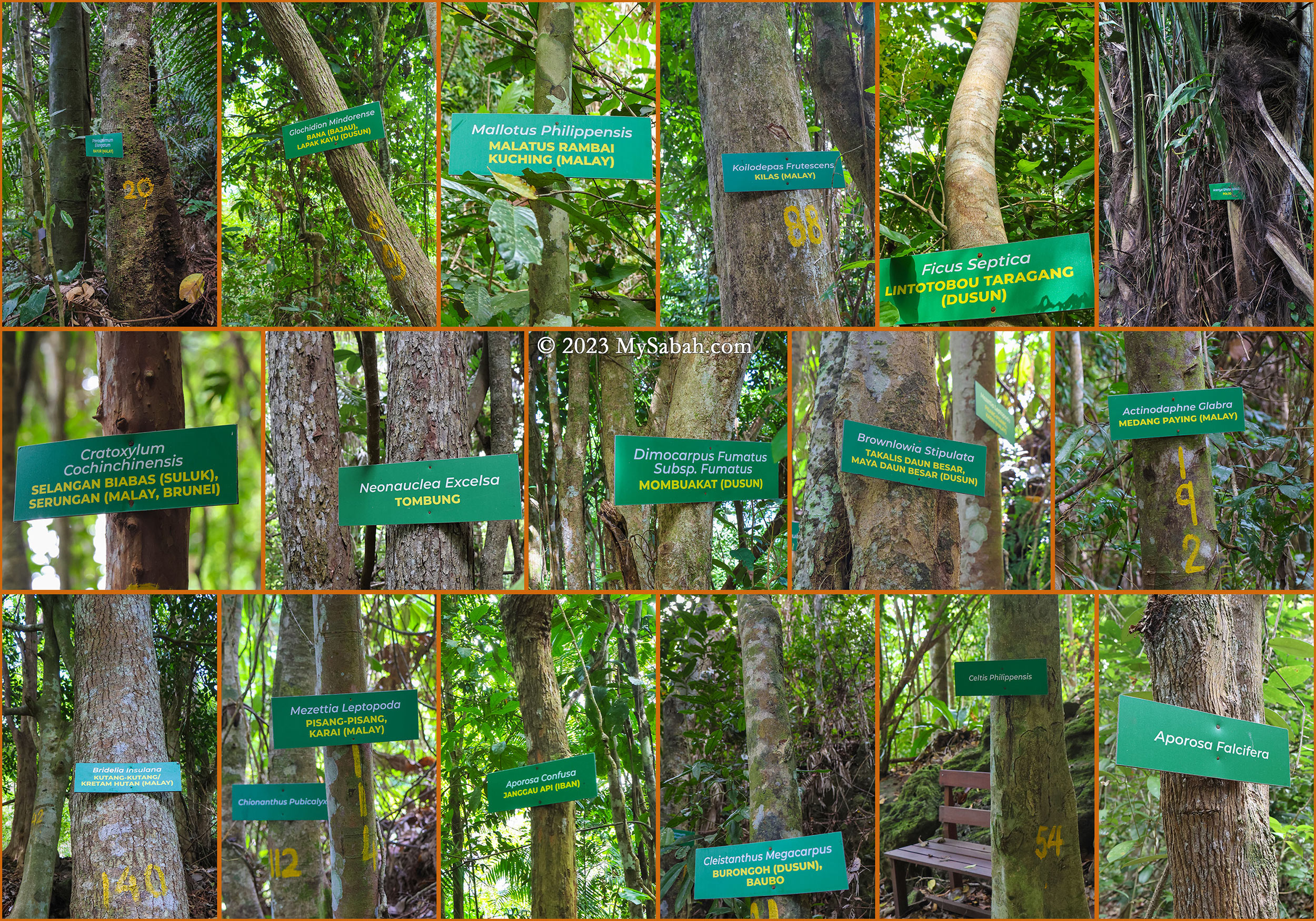
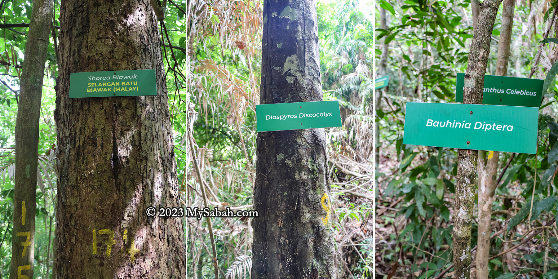
Along the trail to the peak, 30 or more trees are labeled with their scientific and local names. Providing additional information on these labels would greatly benefit non-botanist visitors, who want to learn more about the diverse flora present. I list a few trees that are interesting and useful.
The trees on Bukit Panchang of Tinagat Forest Reserve
Arenga undulatifolia (Polod) is a tree that can feed and kill. Its fruits are poisonous but the apical bud (known as a ‘palm heart’) is edible. The petioles and midribs are used to make darts for blowpipes.
Cratoxylum cochinchinensis, known as Selangan Biabas (Suluk) or Serungan (Malay, Brunei) is probably the most useful tree. Its timber, traded under the name ‘derum,’ is prized for medium to heavy construction. Additionally, its young fruit and shoots are edible, while the young leaves serve as a tea substitute. Its roots, bark, and twigs can treat colds and diarrhea.
Celtis philippensis offers a versatile range of applications: the seed oil finds use in producing lubricants and soap. Its bark supplies valuable fibers utilized in crafting ropes and paper. Furthermore, the wood is used in making poles, tool handles, beams, joists, rafters, cheap furniture, box lumber, and as fuel.
The trail is less steep after 800 metres (Jarak = Distance)
During World War II, villagers relied on their resourcefulness and the abundance of the forest. Many could retreat deep into the jungle, hiding for months as they relied on the forest for sustenance and survival.
Endemic trees of Borneo on Bukit Panchang
There are five or more trees endemic to Borneo on this hill.
Shorea biawak, known as Selangan Batu Biawak in Malay, is assessed as Endangered. It yields quality wood used in handicrafts.
Diospyros discocalyx, deriving its specific epithet from the Latin for ‘disc-shaped calyx,’ thrives in lowland mixed dipterocarp forests
Bauhinia diptera is a climbing shrub primarily found in the wet tropical biome.
Chionanthus pubicalyx is endemic specifically to Borneo.
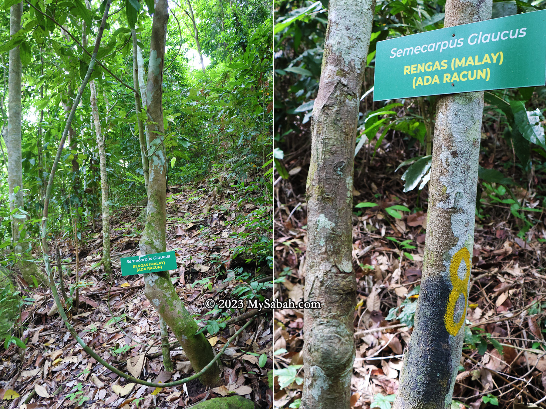
Semecarpus glaucus (Rengas) is a poisonous plant you should avoid. (Ada Racun = Is Poisonous)
For hikers, they need to be cautious to a tree called Semecarpus glaucus (locally referred to as Rengas in Malay). Avoid touching this tree or its sap, as it can lead to severe skin irritations such as rashes and itching.
The exposed volcanic rocks along the trail. Many are weathered and covered by green moss.
Reaching the Peak
As I approached the peak, the trail’s inclination gradually eased, transitioning into a gentle ridge walk leading to the summit of Bukit Panchang. Hikers who had reached earlier cheered to show encouragement. Among them were Suzan and Priscilla, local regulars who’ve conquered most of Tawau’s hills and mountains.
Big volcanic rocks near the peak
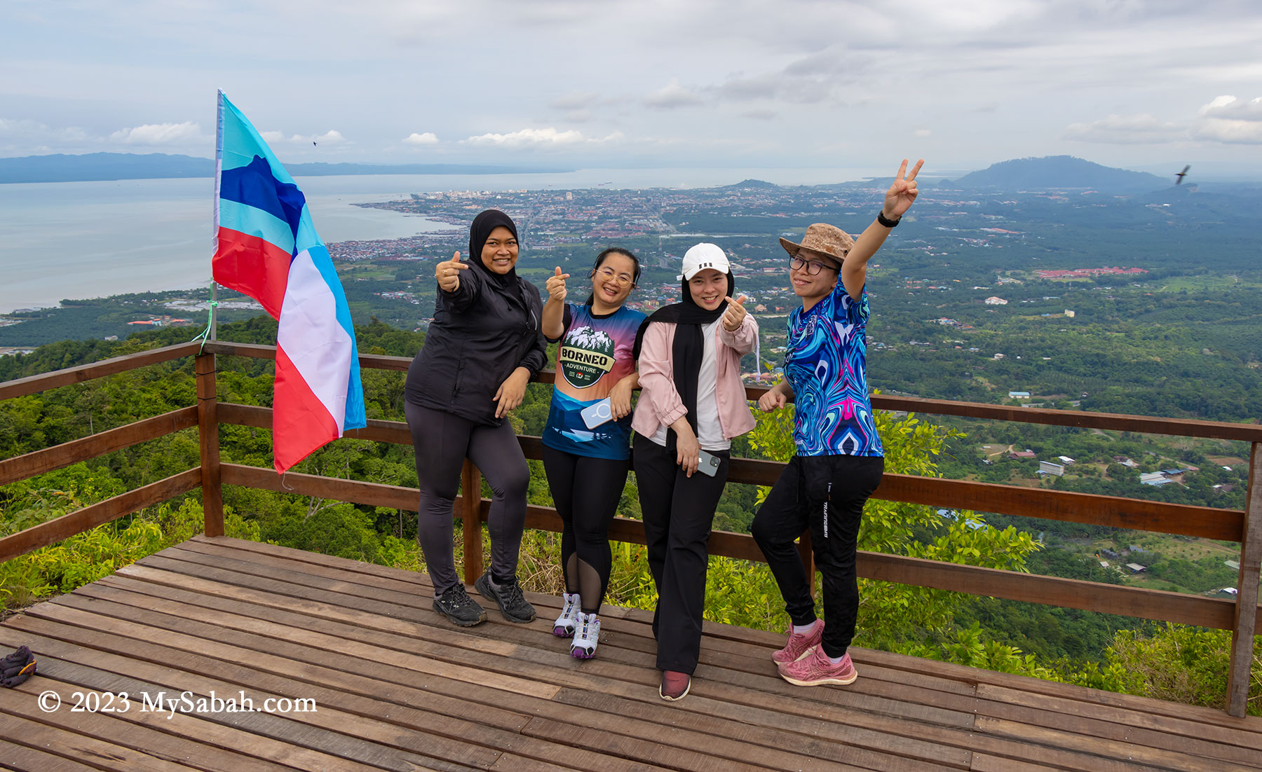
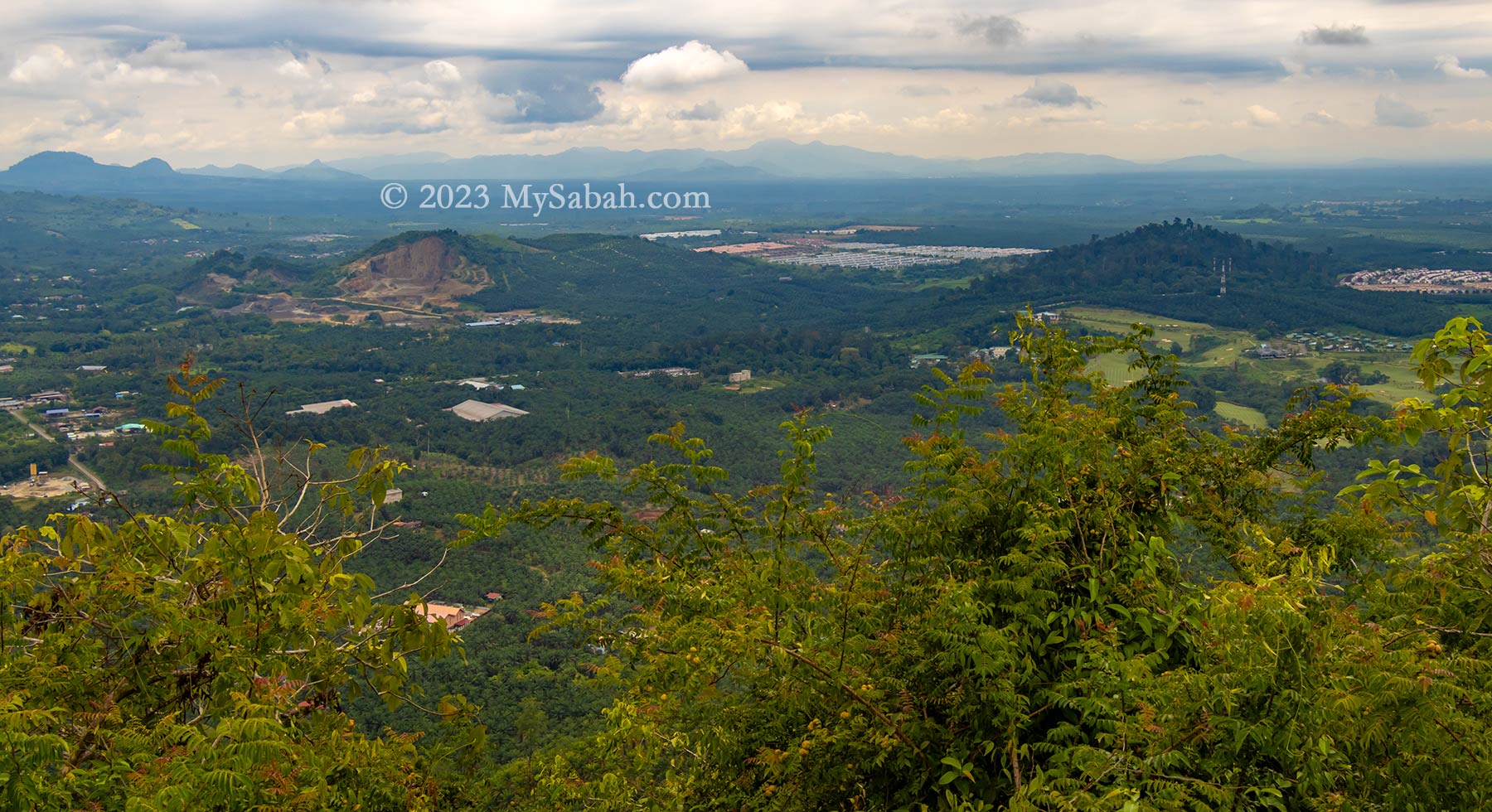
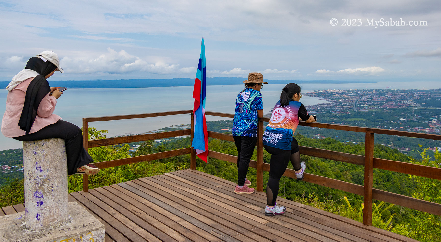
At the peak, a raised wooden platform awaited, inviting a well-deserved rest and the chance to savor the victorious moment from an elevated vantage point. Not gonna lie, the 270 degree panoramic view on the peak is breathtaking. To the left lies the Celebes Sea, while to the right unfolds Tawau town and its surrounding plain. Notably, the sight extends to Pulau Sebatik, an island situated 13 kilometers away, shared nearly evenly between Malaysia and Indonesia.
The last 80 metres of climbing to the peak
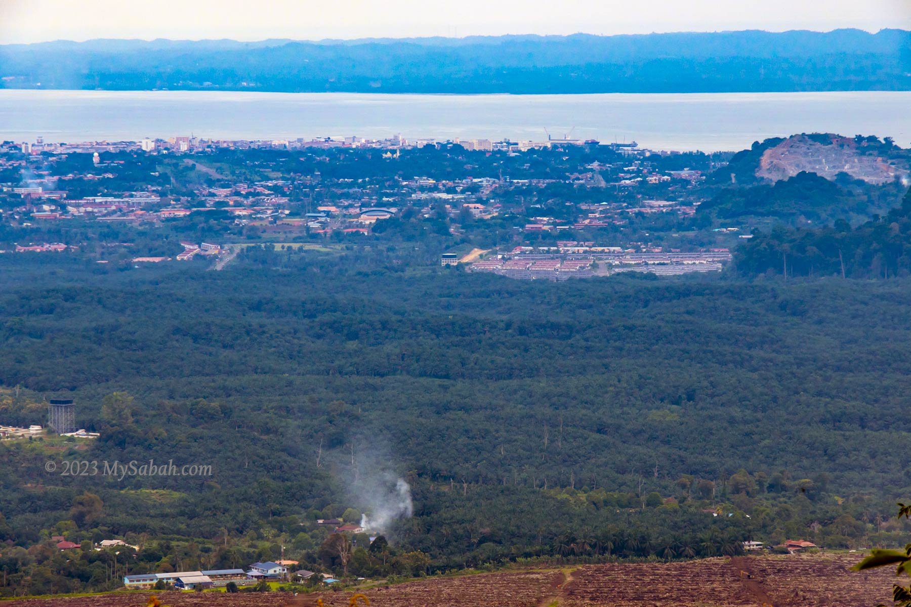
Despite being only 9 kilometers away, Tawau town remains clearly visible even during hazy days. Beyond this bustling coastal town sprawls an extensive area dominated by oil palm plantations, residential areas, and notable landmarks like the Shan-Shui Golf & Country Club.
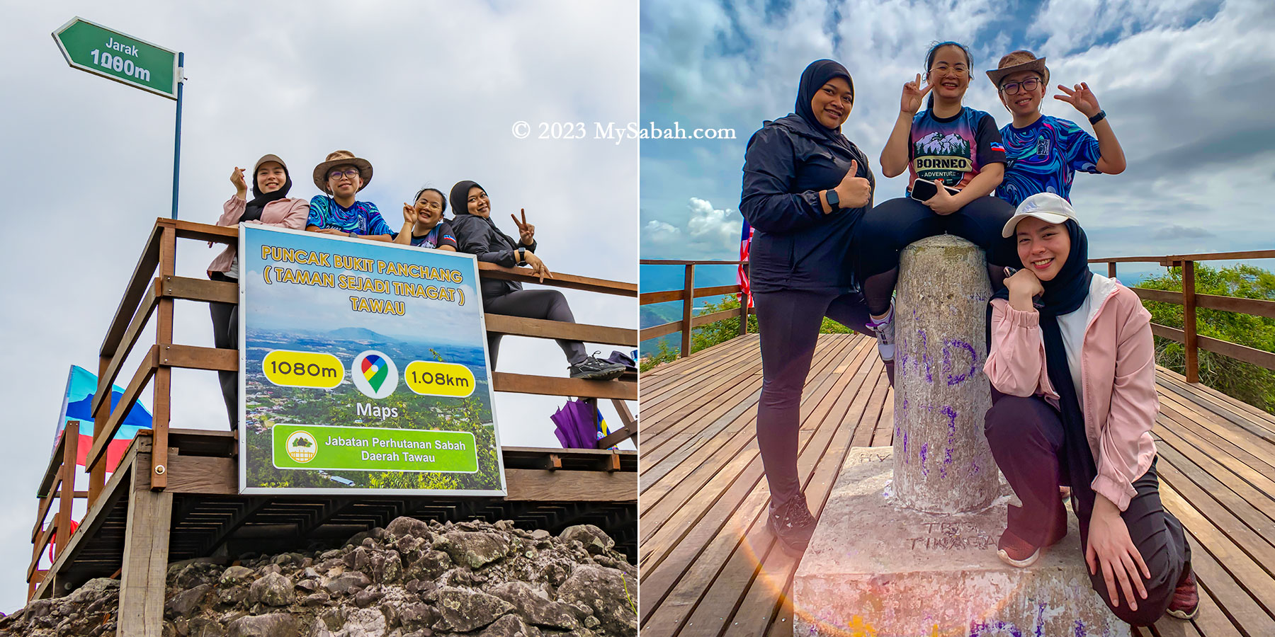
Group photos on the wooden platform and next to the trigonometrical point on the peak
At 398 meters (1,306 feet) above ground level, the peak of Bukit Panchang offers a higher vantage point compared to both the KL Tower and the Eiffel Tower.
Meeting other hikers on the peak
Nestled within this plain are a handful of isolated forested hills, awkwardly encircled by expanses of oil palm. These remaining green hills—Bukit Gemok, Tiger Hill, and Membalua Forest Reserve—stand as vestiges of a volcanic past. I earnestly hope that the people of Tawau will endeavor to protect these fragmented forests, preserving their essence as remnants of past volcanic activity.
View of Tawau town, Celebes Sea and Sebatik Island from the top of Bukit PanchangSadly there is a hill being quarried. You can see Shan-Shui Golf & Country Club at the right.
How to get there
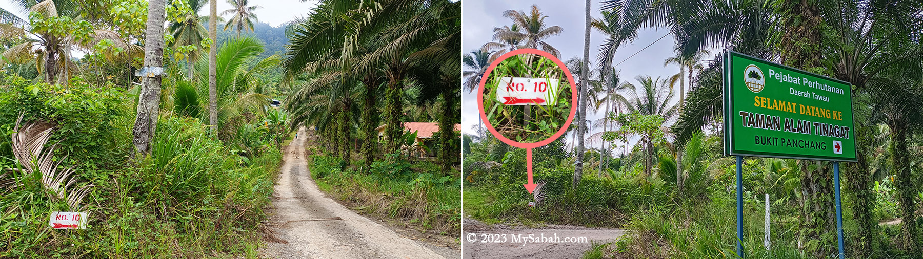
To embark on the Bukit Panchang ascent, navigate towards Tawau town’s Jalan Apas road until reaching Mile 6.5 (Batu 6.5). Look for the junction marked by a white cement signage adorned with prominent red lettering that reads ‘Selamat Datang Ke Kau Sing (高昇)’—translated as ‘Welcome to Kau Sing.’ Turn into this junction to proceed onto a narrow and straight road.
Junction No. 10 and the signboard of Bukit Panchang at the starting point
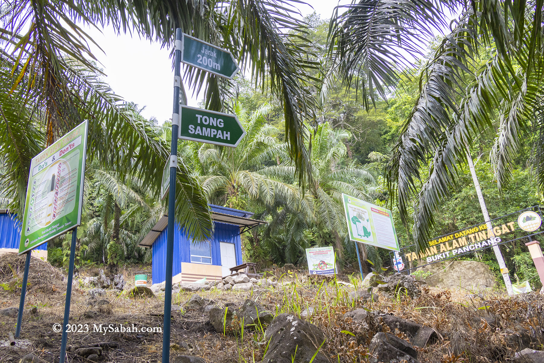
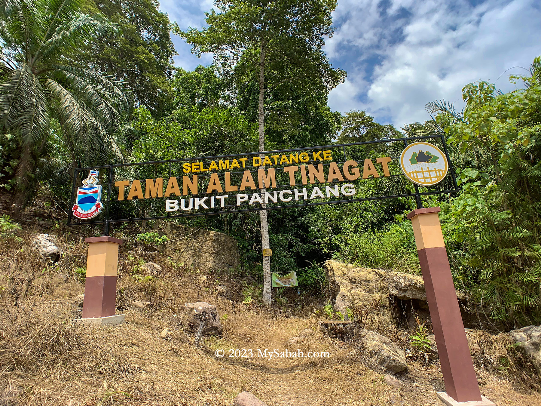
As you drive, maintain a slow pace and keep an eye out on the right-hand side for a small junction labeled No. 10. Adjacent to it (see Location Map), there’s a coloured signboard displaying ‘Taman Alam Tinagat’ (means Tinagat Nature Park). Park your car safely along the roadside, then proceed by foot towards the junction featuring a gravel path that leads directly to the foothill (forest station).
The plain behind Tawau town
Upon entry at the Sabah Forestry station, visitors are required to pay an entry fee of RM5 for Malaysians and RM15 for foreigners. Additionally, hiring a guide is mandatory at RM50, and one guide can accompany up to five climbers. For optimal savings, a team of five climbers can share the cost of one guide. Even solo climbers must pay the full RM50 fee for a guide.
Viewpoint platform and trig point on the top of Bukit Panchang
Unauthorized entry is considered illegal encroachment and can result in severe penalties. Offenders could face fines up to RM50,000, imprisonment for up to 3 years, or both.
A huge volcanic boulder on the peak of Bukit Panchang
Tinagat was once a popular hiking destination among locals. However, the number of regular visitors has significantly declined due to the added guide fee. While Bombalai Hill could be a viable alternative, its distance from Tawau town makes it less accessible for many.
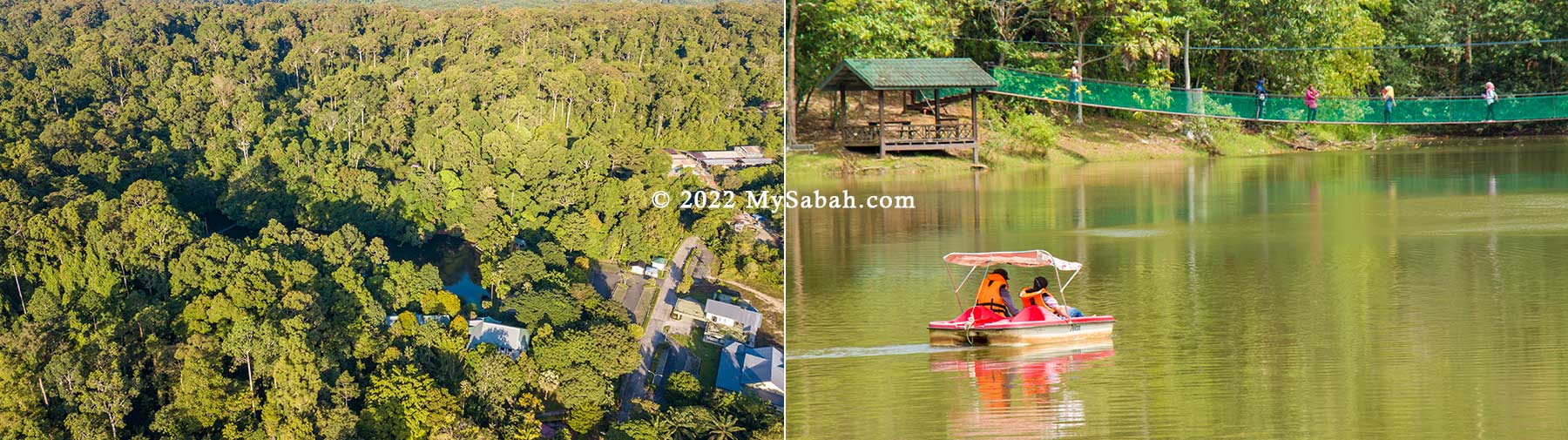
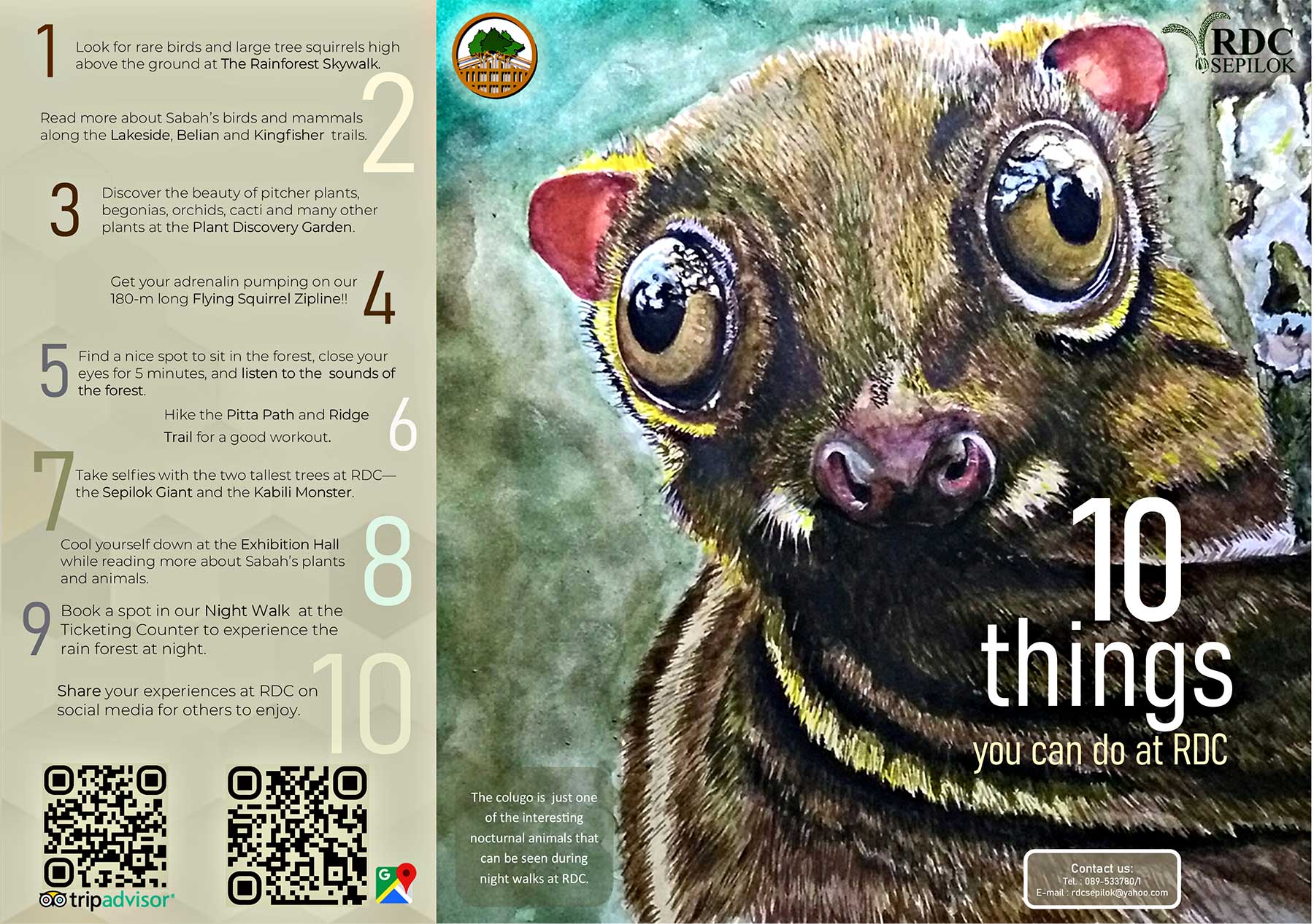
The Rainforest Discovery Center (RDC) is one of the most accessible natural rainforest parks in Sabah. It sits by a lake at the edge of the Kabili-Sepilok Forest Reserve in Sandakan. RDC has been in operation since 1996 for environmental education purposes. Today, it is a 3-in-1 park (i.e. wildlife, bird and botanical) for nature lovers and bird watchers where they can see the unique flora and fauna of Borneo. To students, it’s the best outdoor classroom to learn the rich biodiversity of tropical rainforest.
Rainforest Discovery Center and the adjacent Sepilok-Kabili Forest, and its lake. Boat is available for rent (RM5)
Rainforest Discovery Center (RDC) is managed by the Sabah Forestry Department and one of the most popular Environmental Education (EE) centers in Sabah. A pristine lowland dipterocarp and Mangrove forest with astounding 300 species of birds are recorded in the area.
10 things you can do at Rainforest Discovery Centre (RDC). RDC receives more than 30,000 visitors every year.
The 4,300-hectare Sepilok-Kabili Forest Reserve has gained birders recognition worldwide for its iconic Bornean Bristlehead, Black & Crimson Pitta, Blue-headed Pitta, Giant Pitta, Black Hornbill, Rhinoceros Hornbill and more. The forest of Sepilok is declared as an Important Birding Area (IBA) by Birdlife International in 2009.
Jungle and Nature Trails
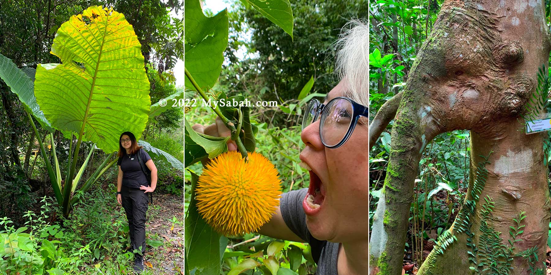
Visitors can walk along the trails and become acquainted with green giants such as the 40-Meter-tall mengaris tree, one of the tallest tree in Borneo. Besides soaking up the sight and getting a good workout, visitors can refer to the interpretive panels along the trail, which has descriptions about the unique residents of the forest.
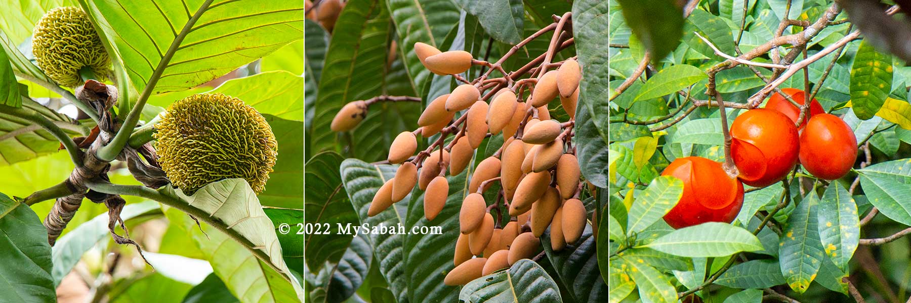
Interesting fruit and plant at RDC. Left: Giant aroid (Alocasia robusta), endemic to Borneo; Middle: an unknown fruit; Right: Elephant tree, locally known as Simpoh Gajah or Ubah Rusa (Species: Dillenia borneensis), endemic to Borneo
Alert the little ones to keep an eye out for darting civets and flying squirrels (which can glide up to 100 Meters)! And lucky visitors have also spotted animals such as the elusive red leaf monkey, gibbon (the fastest moving primate in tree canopy), mouse deer, civet cat and many odd looking insects such as stick insect and lantern bug.
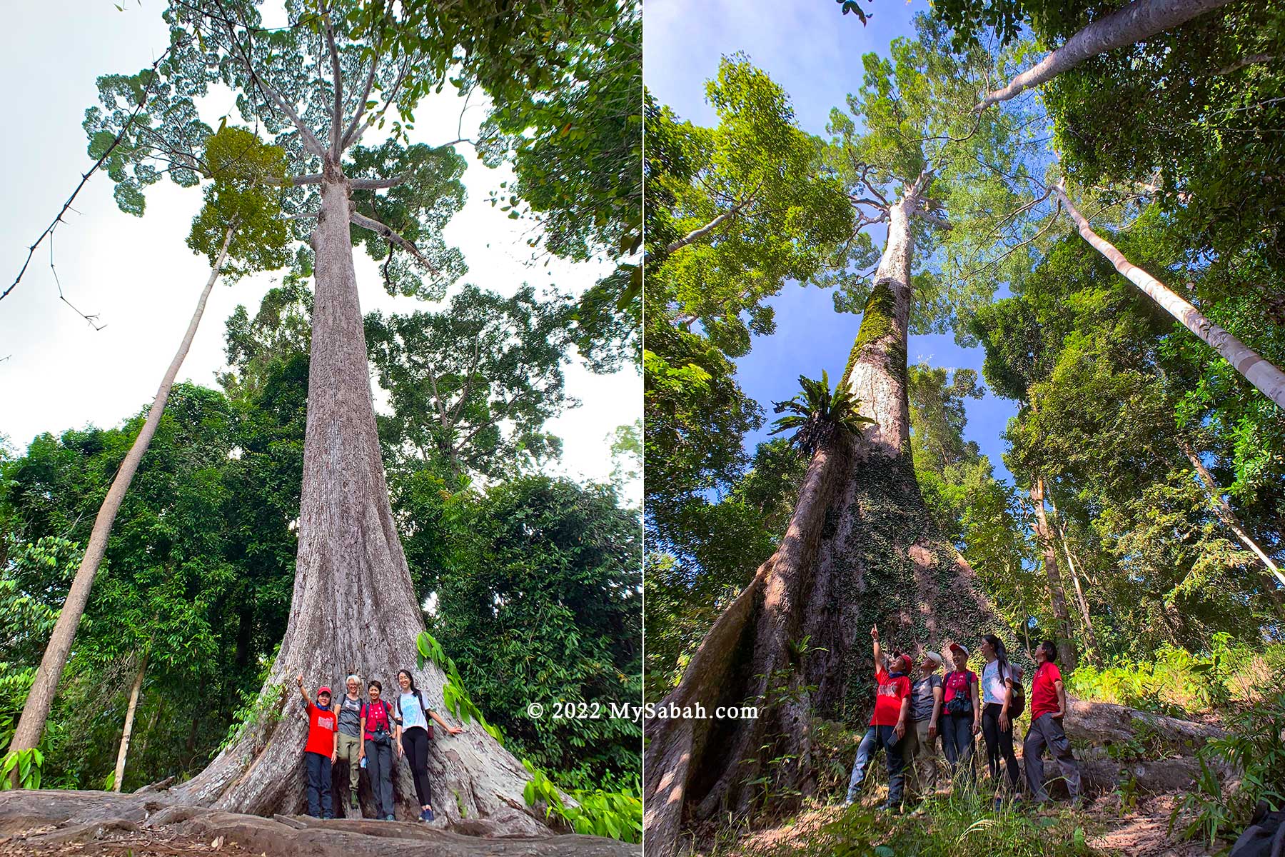
Giant trees of Rainforest Discovery Centre, Sepilok Giant (left) and Kabili Monster (right)
The giant trees that you must check out are Sepilok Giant, a Yellow Seraya tree (Shorea acatissima), which is about 65 Meters in height, with an estimated age of 800-1,000 years old, and the 75-Meter-tall Kabili Monster, an Obah Suluk tree (Shorea pauciflora).
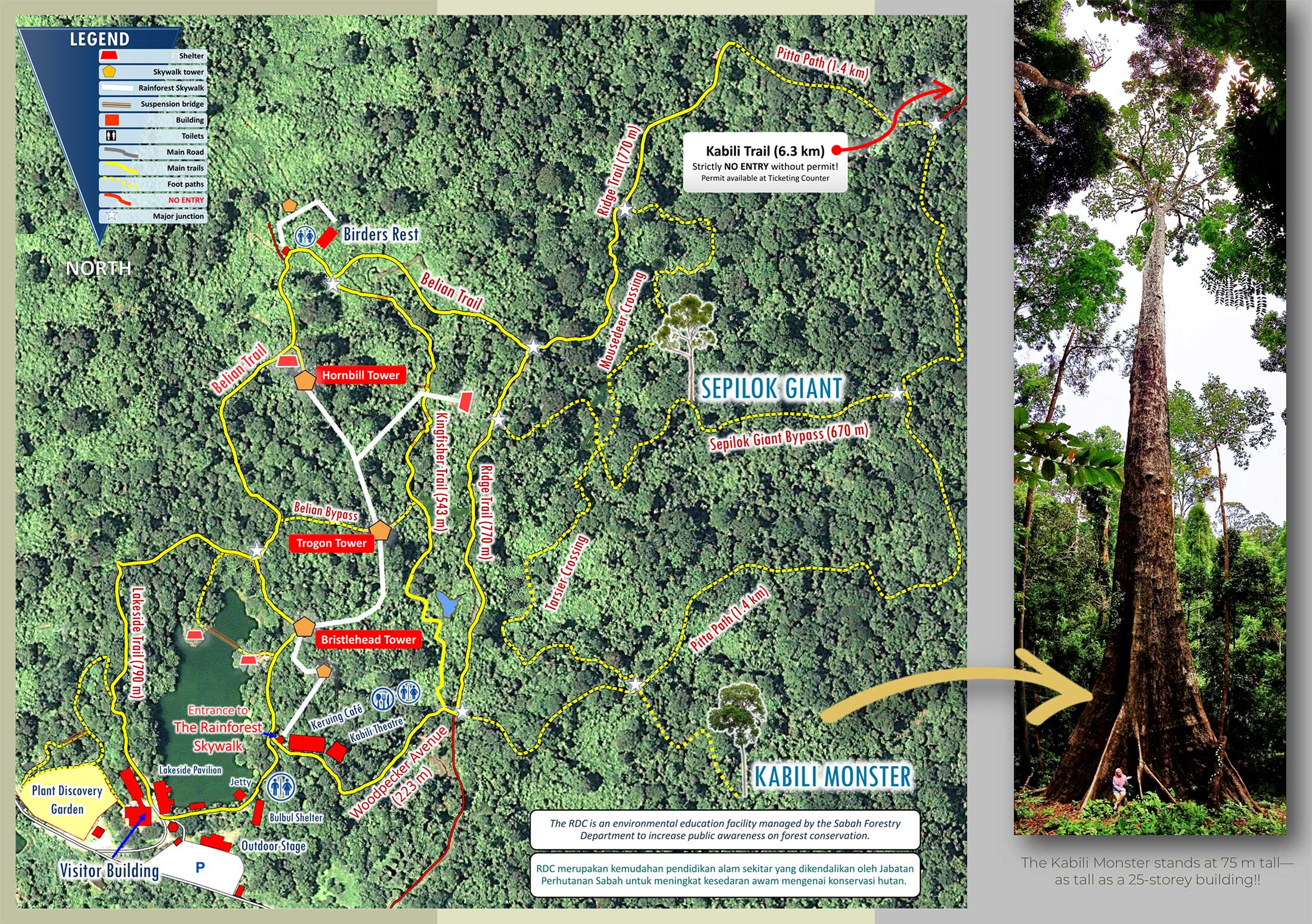
Trail map of Rainforest Discovery Centre (RDC)
Another tree worths a good look is Belian Borneo Ironwood (Eusideroxylon zwageri), the 7th hardest wood in the world. The main trails are gravel path, and some sections are networks of well-trodden nature (soil) trails for you to explore deeper.
Plant Discovery Garden
RDC also has a Plant Discovery Garden, which covers about 3 acres of land. This garden will make any botanist smile with its rich collection of hybrid orchids, arid land plants, aquatic plants, pitcher plants, economic crops and tropical American plants.
Orchid and carnivorous plant (from America) in the Plant Discovery Garden of RDC
There are colourful outdoor interpretive panels with descriptions of all the plants, which are available in English and Bahasa Malaysia languages and makes learning not only easy but fun as well.
Interpretation panels with photographs and interesting facts of fruits and herb, description is available in English and Malay languages.
For serious learners, there are just too many local and exotic plants (flowers, herbs, spices, crops) to look at, just to name a few, peach palm, vanilla, tongkat ali, rubber, cassava, cinnamon, fig, and cycad (a living fossil and food of dinosaur).
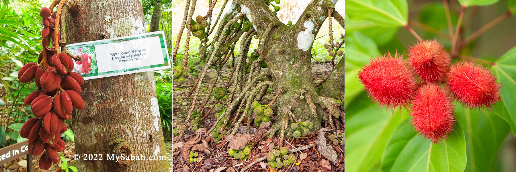
From left: Kelumpang Sarawak (Sterculia megistophylla), fig tree, and red fruit of achiote plant (used as lipstick in the past)
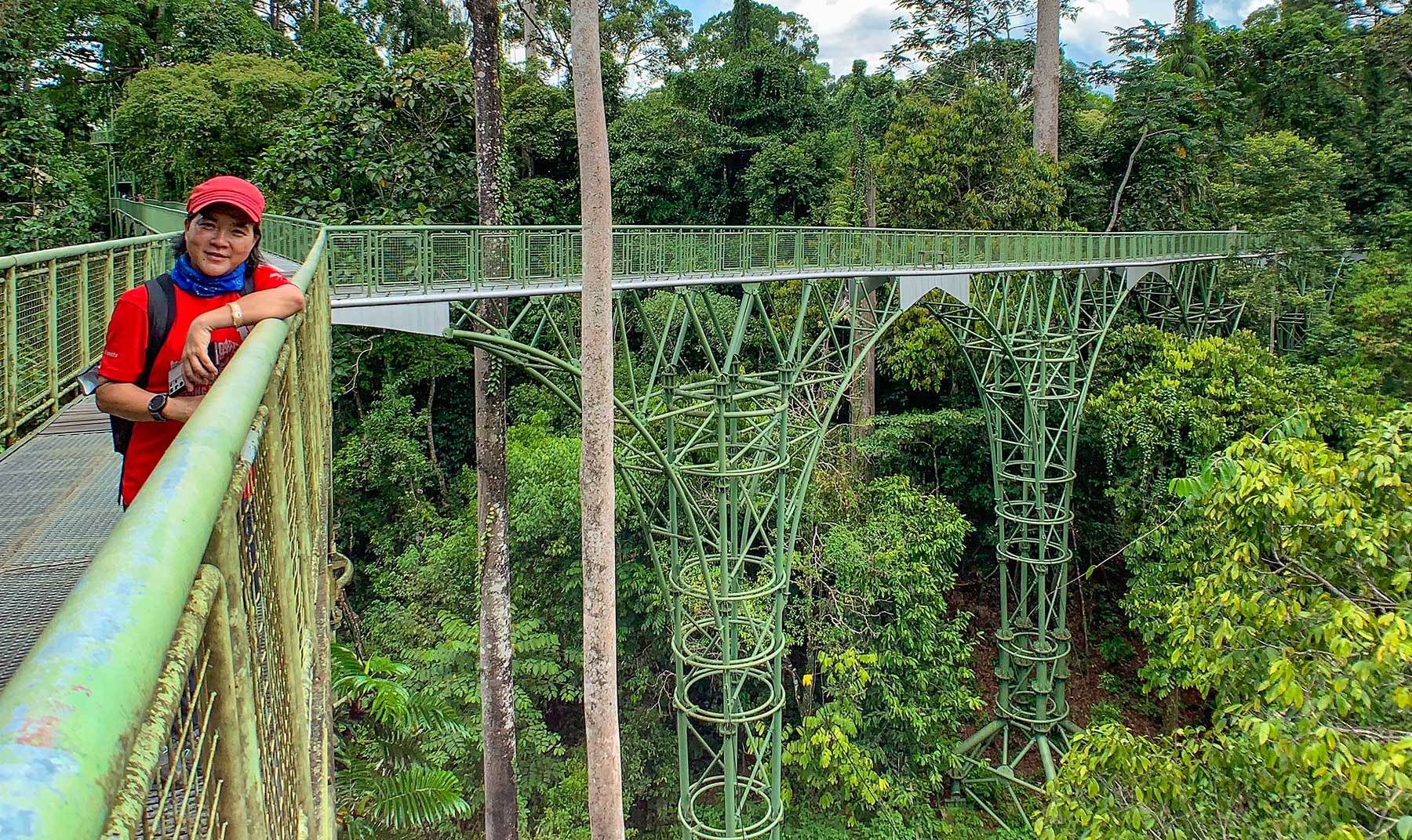
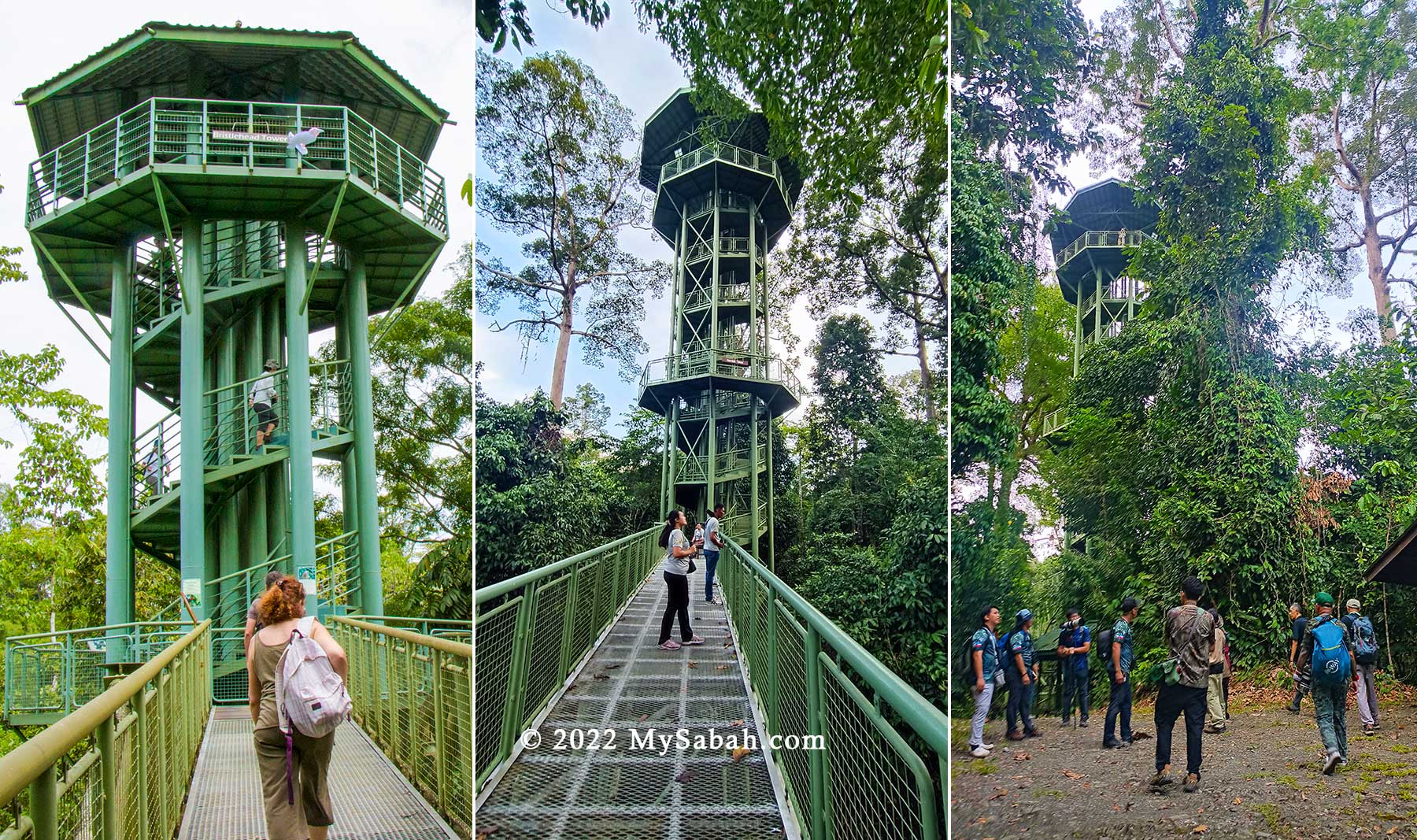
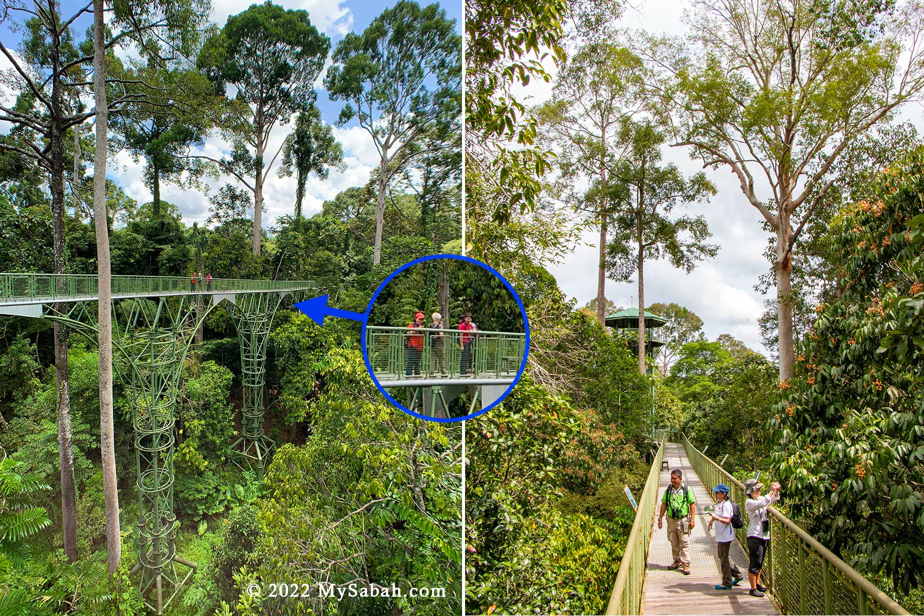
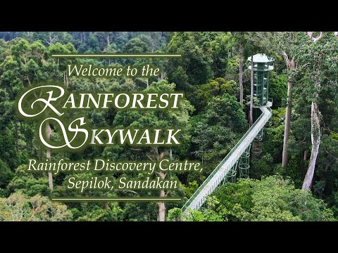
Rainforest Skywalk (Canopy Walk)
The main attraction of RDC is Rainforest Skywalk, the longest Canopy Walkway in Sabah. Visitors can climb to the top of the observation towers and take in the breathtaking view from the 620-Meter-long and 25-meter-high metal platforms and walkway.
Towers of RDC. From left: Bristlehead Tower, Trogon Tower, nature trail under the tower
The walkway is two meters wide, is very sturdy and can hold the weight of a large crowd. RDC has three main towers that are named after the Bristlehead, Hornbill and Trogon and a single-column shelter called the Sunbird. With a height of 26.5 Metres (87 ft), Trogon Tower is the highest tower of RDC.
Rainforest Skywalk of Rainforest Discovery Centre is tall but still lower than many trees. Some of the trees were planted in 1970s and 1980s.
The designers of the canopy walkway made sure that it was not only safe for adults, but also for young children who are at kindergarten-level.
Fruiting next to the Rainforest Skywalk. From left: Artocarpus elasticus (Terap togop), Dacryodes rostrata (or cuspidata), poisonous Lampada Fruit (Tabernaemontana macrocarpa)
To the team at RDC, the younger children are exposed to the wonders of Mother Nature, the more they will appreciate our rainforest. During weekends, some local retired people also come here for birding regularly.
Rainforest Skywalk of RDC is 620 Metres long after an extension of 250 Metres completed in early 2022.
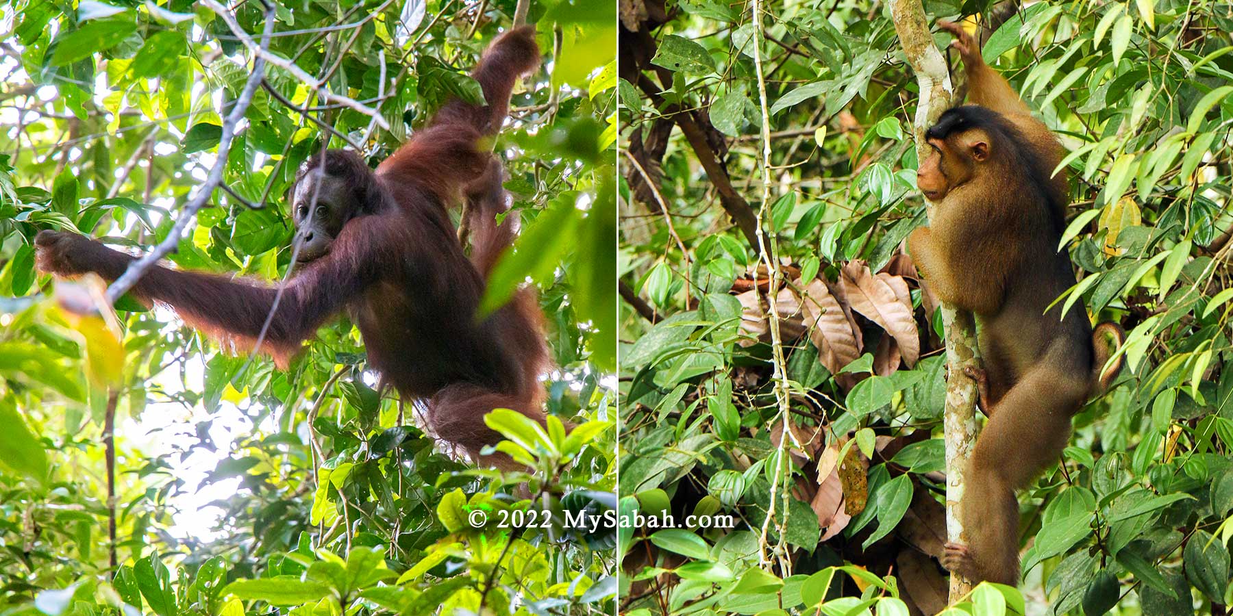
The highest platform of towers is about 26.5 Meters (87 feet) above the ground. Many birds, wildlife, fruits and insects live high on the tree, so these towers provide a great viewing point for bird watching and wildlife sighting. I’ve seen mother orangutan with her baby there before (see video).
Orangutan and Macaque could be seen at RDC, especially during fruiting season. They are not friendly so keep a distance from them.
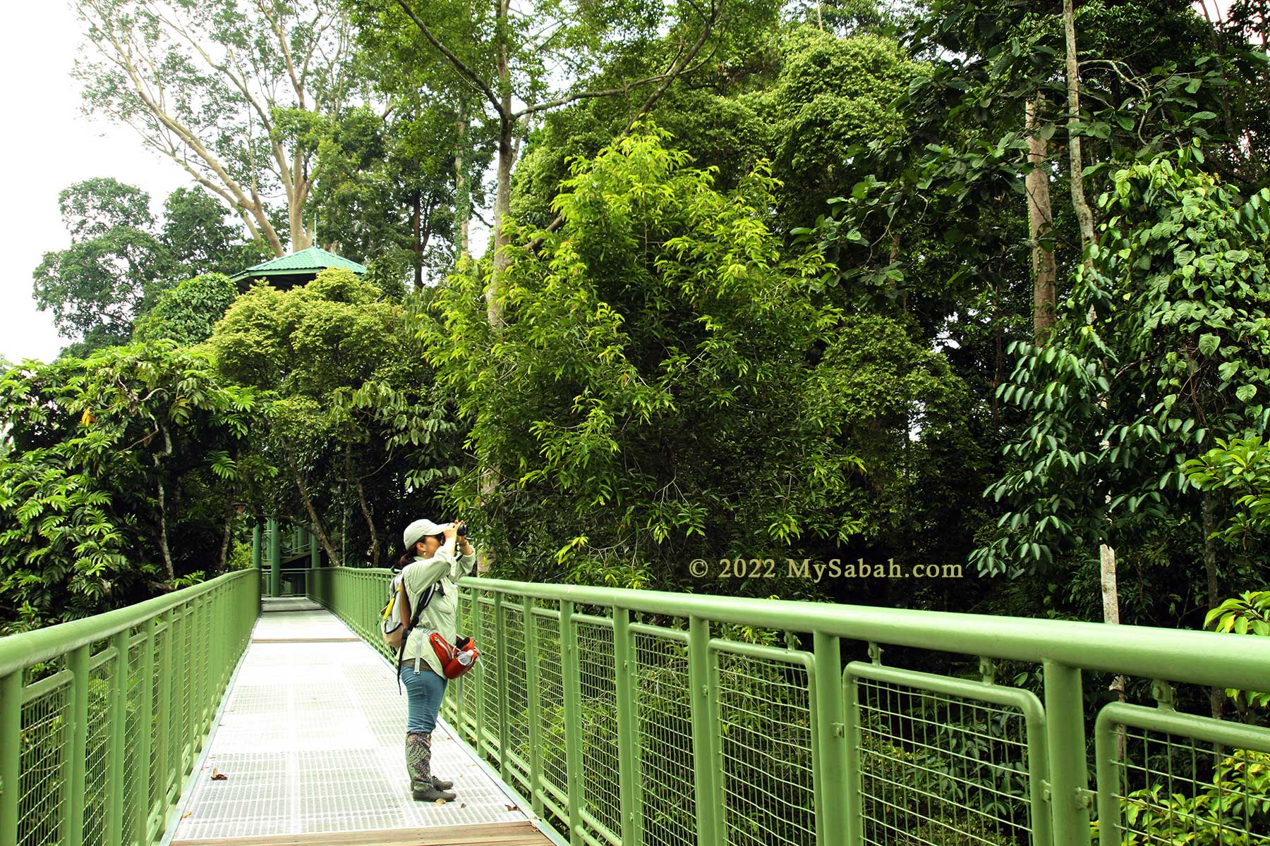
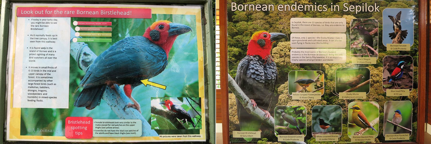
Bornean Bristlehead normally feeds up in the mid and upper layer of tree canopy, and best seen from Canopy Walkway. You have higher chance of seeing them near Bristlehead and Hornbill Towers in RDC. On the skywalk, you don’t need to look up so much that your neck cramps. I’m confident to say that RDC has one of the best setting for bird watching in the world.
Information board about the tall rainforest trees around this area, so you can do a self-guided tour.
Many trees here are very old and over 50 Meters tall, most of these emergent trees are from the family Dipterocarpaceae, the main timber family of Sabah. During fruiting season, you will see many birds and wildlife coming here for feeding.
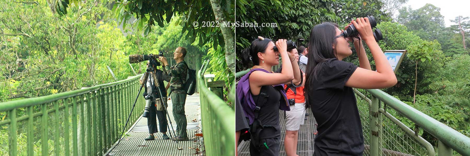
Bird Watching
Due to the tourist-friendly canopy walkway and nearby virgin rainforest where over 300 lowland bird species reside, RDC is really a haven for nature photographers and birdwatchers.RDC is also the most promising spot to see Bornean Bristlehead, the trophy bird species of birders, but you still need some luck. I saw it only once after three visits.
Birdwatching and bird photography are popular activities at RDC. Do bring a binocular with you.
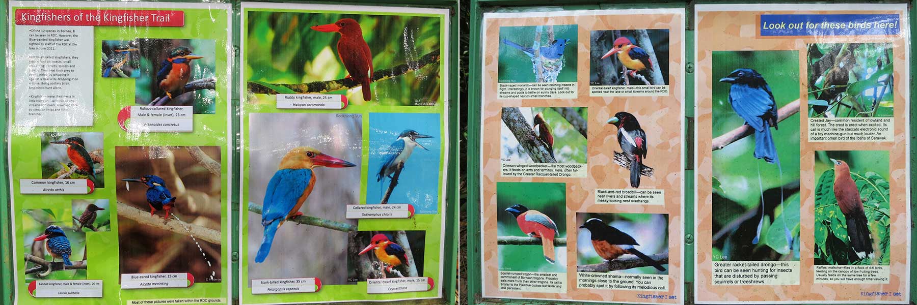
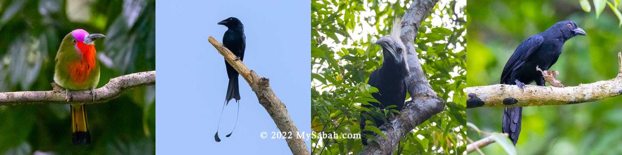
Many endemic (13 species are Borneo endemic), rare and colorful birds are active around RDC, for example, Bornean Bristlehead, Hornbills, Pittas, Kingfisher (8 species), Trogons, Malkohas, Leafbirds, Minivets, Spiderhunters (6 species), Crested Jay, Red-bearded Bee-eater, Broadbills, Woodpeckers, and Bulbuls. For full list, you may see this Checklist of Birds in Sepilok.
Endemic birds of Borneo in Sepilok. The red-headed bird in pictures is Bornean Bristlehead (Nickname: headphone bird)
Therefore, for visitors who don’t want to travel far, RDC is the best alternative birding sites to Danum Valley and Tabin Wildlife Reserve, the world-class birding sites in Lahad Datu.
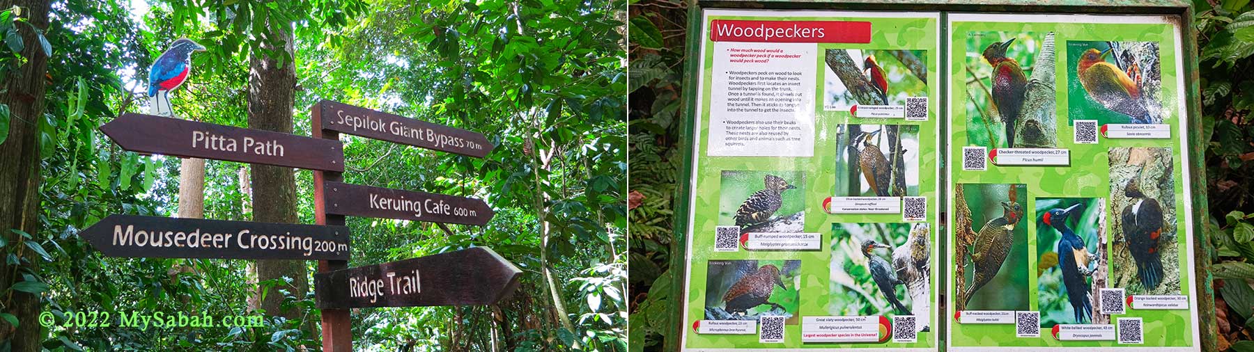
Trail signages and interpretation panel of birds in RDC
Some forest birds spend most of their time on canopy and best to be observed from RDC Canopy Walkway, while some prefers habitat in understorey and forest ground, so you need to explore the jungle trails for such birds. (Note: leeches might present during wet season)
Interpretation panels of birds in RDC are placed at the spots where sighting of birds in the pictures are possible. Some are placed on Rainforest Skywalk for birds that are active on canopy.
According to birding community, the 1.9-KM Kingfisher Trail is very productive (many birds). There are many direction signages in the RDC trail network, so you should have no problem to get around. What I really like is – RDC also places many information panels in different spots to inform you what birds, trees and wildlife are (probable) nearby.
Birds of RDC. From left: Red-bearded bee eater, Racket-tailed drongo, White-crowned hornbill, Bornean black magpie
Inside the forest there are small ponds used by many birds as natural bird bath for bathing and drinking. Most birds only dip their wings to splash water on their backs. Parts of the bath is just about 2 inches deep, just enough for small birds. Keep an eye for Red-eyed Bulbul, Emerald Dove and Hairy-backed Bulbul there. Garden birds such as sunbirds, spiderhunters and flowerpeckers are common visitors too.
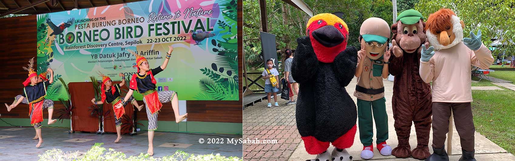
Borneo Bird Festival is packed with activities for birders, children, photographers and tourists.
RDC is a preferred venue for Borneo Bird Festival, which is usually held in Sep or Oct annually, the best visiting time for bird watchers who are looking forward for exciting activities such as bird race, talks, bird photography contest, latest birding gears, and exhibition.
Exhibition Hall
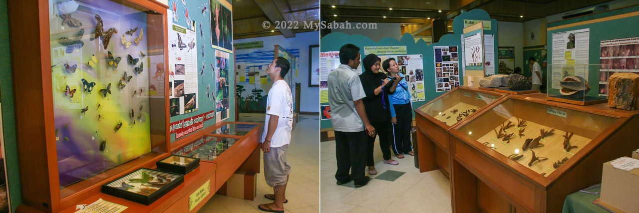
The main visitor building has an exhibition hall that features the unique flora found in Sabah, plus the various icons in our animal kingdom including the Bornean pygmy elephant, orangutan, proboscis monkey and many more.
The Exhibition Hall of RDC is great for learning the biodiversity of Borneo
Visitors can also find information on reptiles and the main groups of birds. The building also has a multi purpose hall, which is often used for talks, screenings and other activities.
Information about flora & fauna of Borneo (available in both English and Malay languages)
Besides animals, visitors can browse good collections of plant, fruit, tree and insect specimens in the hall. The information is presented in gallery style, with a lot of beautiful photographs with minimal text, available in English and Malay languages.
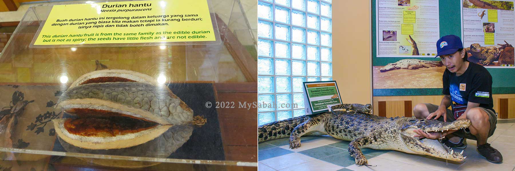
Left: One of the display item: Ghost Durian (Durian Hantu) has no spikes and inedible, though it’s under the same family of Durian fruit. Right: Crocodile specimen in exhibition hall of RDC
This Exhibition Hall is air-conditioned, so I love to come here after a long walk under hot sun outside LOL (and for the toilet too). I must say the Exhibition Hall does a very good job in giving visitors an interesting overview of Borneo’s nature.
Other Facilities
The infrastructure of RDC is quite well-thought, this makes RDC an excellent attraction, as well as a great location to organize mid-scale events. They also added a 180-Metre flying squirrel zipline at the lake area.
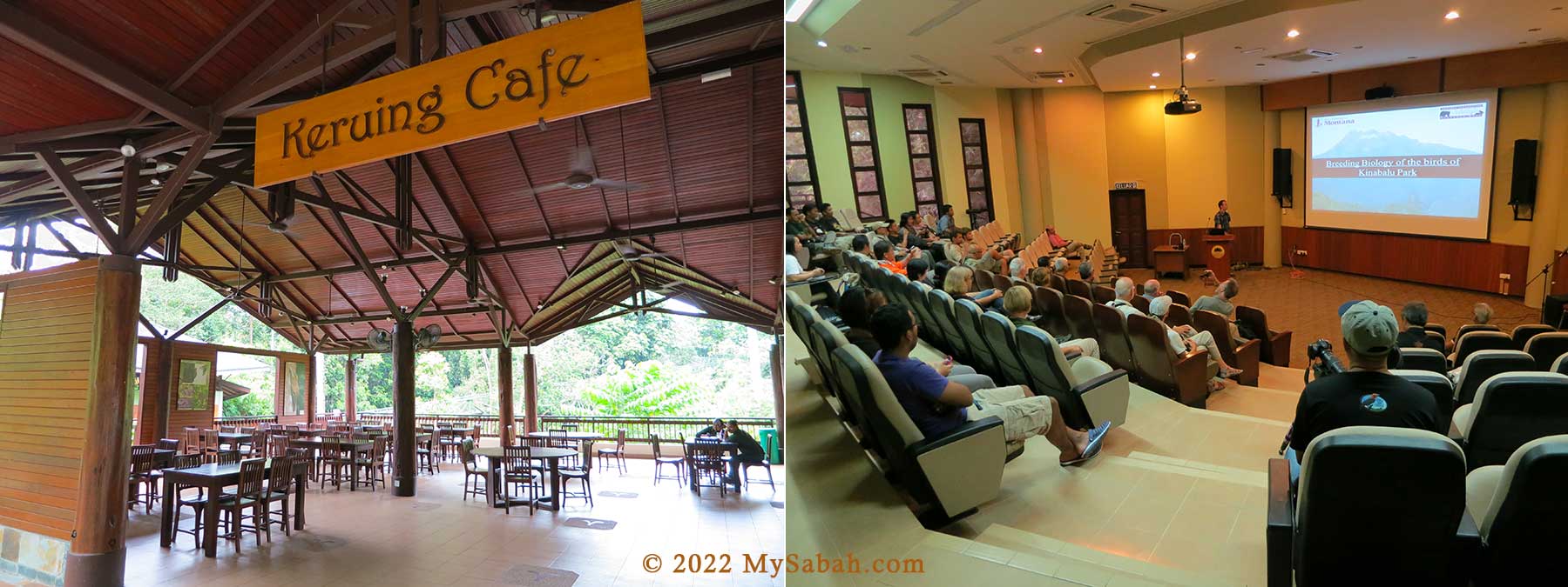
Left: Keruing Cafe of RDC is located at the starting point of Canopy Walk and it serves simple meals and drink. Right: Kabili Mini Theatre for seminar, talks and conferenceLeft: Exhibition about Borneo birds in Drongo House. Right: Birders Rest Complex (toilet available), Both places are good shelters when it rains.
Entrance Fee
Rainforest Discovery Center (RDC) is open from 8am to 5pm every day (include Public Holidays), but the trails and canopy walkway close at 8pm, so some visitors can do night walk and evening birding. RDC is a park opens to public, any walk-in visitor can buy a ticket to enter (see ticket prices below).
Malaysian
Foreigner
Adult (18 & above)
RM7
RM30
5-17 years old
RM3
RM20
Below 5 years old
FREE
FREE
Entrance Fee to RDC (Last updated on 1st April 2024)
All proceeds from ticket sales are used to organize environmental education programs for students, teacher training courses and other environment-related activities.
Night Walk
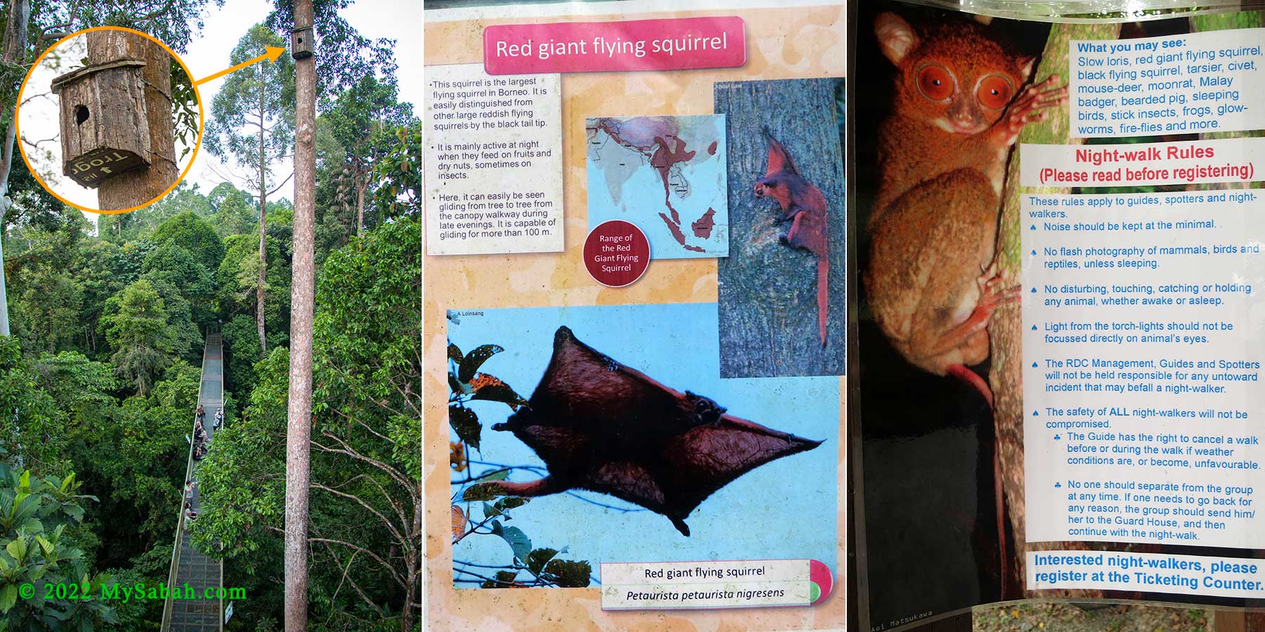
Most wildlife are nocturnal. You may not see a lot of wildlife during daytime in RDC, but a night walk there would probably give you some pleasant surprises. Depend on your luck, you would see civet, moonrat, Malay badger, sleeping birds, glow worm, owls, stick insect, firefly, frog, bearded pig, flying lemur, etc. You hit jackpot if you spot Bornean Tarsier or Slow Loris, the most mysterious primates of Sabah. Known as Ghost Monkey locally, Bornean Tarsier is the smallest primate of Borneo and has huge eyes bigger than its brain.
During dusk, people gather and wait for red giant flying squirrel to come out of the box. Far right: Tarsier
Night Walk is available (conducted between 6pm-8pm), you can register for the walk at ticketing counter (before they close at 5pm). The fee is RM30 (≈USD$8.50) per adult and RM15 (≈USD$4) per child (5-17 years old) for a minimum of 2 hours, RM15/person for each additional hour.
Starting from the 1st June 2024, RDC Night Walk Fee will be increased: Adult (16 years old & above): RM50 Child (5-15 years old): RM25 MAX 7 pax per group Private Group: RM350 (1-5 pax only)
A minimum of 4 visitors (but no more than 10) is required to form the night walking group, or you have to pay for the full amount RM120/group (≈USD$34). Do bring torch-light (flashlight) and raincoat with you. You can take photos but no camera flash is allowed for small animals.
How to get there
The Rainforest Discovery Center is located at Sepilok, Sandakan, Sabah, about 25 KM to the west of Sandakan City (see Location Map). Public transport to Sepilok is available readily and the journey takes about 45 to 50 minutes one way. You can hire a taxi for a return trip for about RM100 per car (≈USD$28)(negotiable).
RDC Shuttle Service (within Sepilok only) is available only when licensed taxi not around and depend on staff availability. It’s no guarantee but good to know this option anyway. The standard rate is RM10 (≈USD$2.50) per car. You can request for transport in following time: 9am-5pm: enquire for taxi or shuttle service at ticketing counter 5pm-8pm: enquire shuttle service at security hut
What food is cool 4,000 years ago and is still cool today? Today it is found in cakes, candy, drinks, desserts, ice-cream and cookies, you name it. In the past, Mayans praised chocolate as the drink of the gods, and the Aztecs (Mexica) believed that cocoa seeds were the gift of Quetzalcoatl, the god of wisdom. Now chocolate is also a food of love that you give to your crushes on Valentines’ Day.
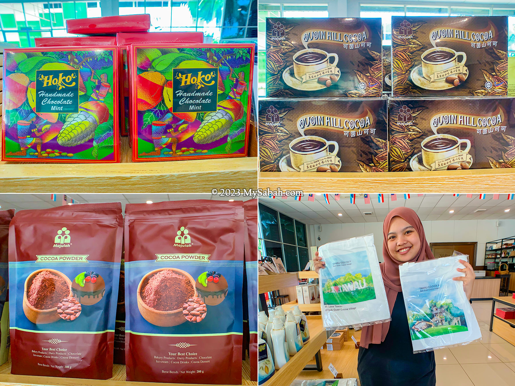
Display at the entrance of Teck Guan Cocoa Village
Cocoa in Sabah
Cocoa is the main ingredient of chocolate. Malaysia is one of the major cocoa-producing countries in Asia, and over 60% of Malaysian cocoa beans are from Tawau of Sabah State. Teck Guan Cocoa Village is one of the earliest plantations to cultivate cocoa in Tawau. This village is also a family-friendly destination opens to public.
Quoin Hill at Teck Guan Cocoa Village is an extinct volcano. Its fertile volcanic soil is ideal for cocoa plantation.
For teachers and parents, a visit to the cocoa village offers an excellent outdoor education to make learning fun to their children. Because of Internet, the new generations spend far more time in virtual world than real world that some of them are even afraid of chicken. Gosh, where’s our hope in future if we have kids who are spooked by “food”? Anyway, adults would find the tour at cocoa village interesting too. Who doesn’t like chocolate?
Left: cold cocoa drink at Cocoa Village. Right: Abiu fruit, also known as “I Love You” fruit
Five Fun Things to Do at Cocoa Village
The tour to Teck Guan Cocoa Village takes about half-day (from 10am to 3pm) and requires booking in advance. The staff there will give you a guided tour to experience the wonders of nature and cocoa fruits. The following is a walk-through of the tour. My guide is Ms. Chida, a friendly sino who can speak English, Chinese and Malay.
You may watch this video for a quick overview of the cocoa village tour
1) Nature Walk in Cocoa Culture Spring
My cocoa journey starts with an one-hour nature walk in the rainforest of Cocoa Culture Spring. Though it’s a hot day, the air in this forested area is so cooling and refreshing. The plantation of Cocoa Village is near to Quoin Hill, an extinct volcano that produced the fertile soil that nurtures the cocoa trees as well as the jungle here.
Taking a nature walk in Cocoa Culture Spring. The green environment is good for our eyes too.
There are six waterfalls in Cocoa Culture Spring that work like giant air ionizers and conditioners that cleanse the air. Most of the trail is paved and easy to walk on. This reminds me of Japan, a well-developed country that coexists well with beautiful nature. Japanese is educated to appreciate nature since young, something we should learn from them.
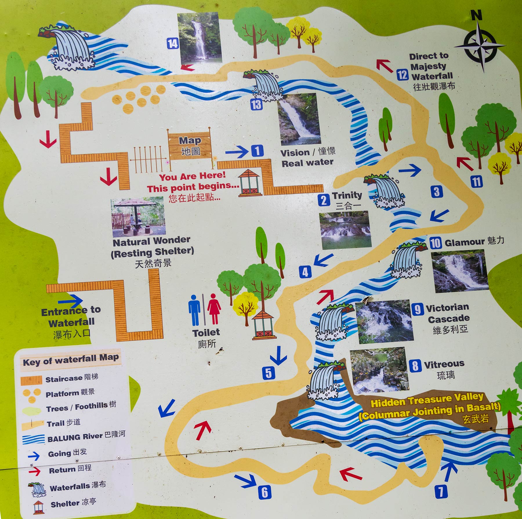
The walk in cocoa culture spring ends at the tallest waterfallThe 75-feet Majesty Waterfall in Cocoa Culture Spring
The highlight is the columnar basalt on the river. These neatly arranged rocks are formed 27,000 years ago from lava flow that is cooled down rapidly by water. It’s a great spot for photo-taking but we didn’t stay long because there were many sandflies. Finally we ended the nature walk at the 75-foot-tall Majesty Waterfall.
Basalt columnar in Cocoa Culture Spring of Teck Guan Cocoa Village. In Malaysia, such volcanism wonder is only found in Tawau.The basalt columnar in cocoa village was formed 27,000 years ago when hot lava was cooled down rapidly by water.
2) Learning about Cocoa
After the nature walk, I’m transferred to the cocoa nursery to learn more about the cocoa cultivation and processing. Our cocoa materials are used by famous brands such as Godiva and M&M to make chocolate.
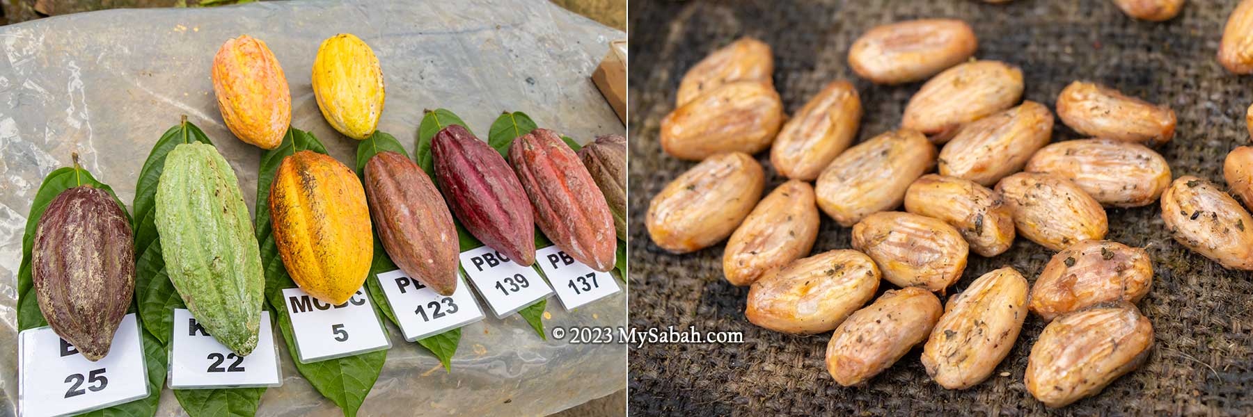
Left: cocoa fruits with different grades and yield. Right: cocoa beans ready for fermentation
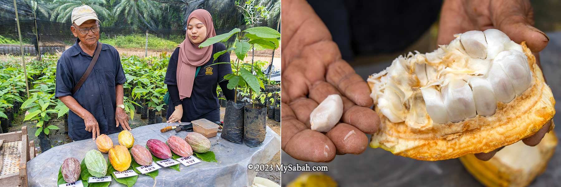
Uncle Mando shows me the variety of cocoa fruits being planted. Most plantations grow at least 6 distinct varietals, each with different grades, yield and resistance to pests. This approach minimizes the risk of cocoa plants being completely decimated by single enemy such as cocoa pod borer and vascular streak dieback. Cocoa is a profitable crop that requires great care, and it’s one of the best fruits to plant in an integrated farmland.
Left: Uncle Mando showing the cultivation and processing of cocoa. Right: cocoa pod (fruit) and its beans are white
I also savour the taste of freshly harvested cocoa pod. The pulp is thin, with sweet and sour taste like mango. After removing the pulp, the cocoa beans are fermented and dried to make cocoa butter and cocoa powder. A pound of chocolate is made from 400 cocoa beans. Each cocoa tree produces an average of 2,500 cacao beans per year.
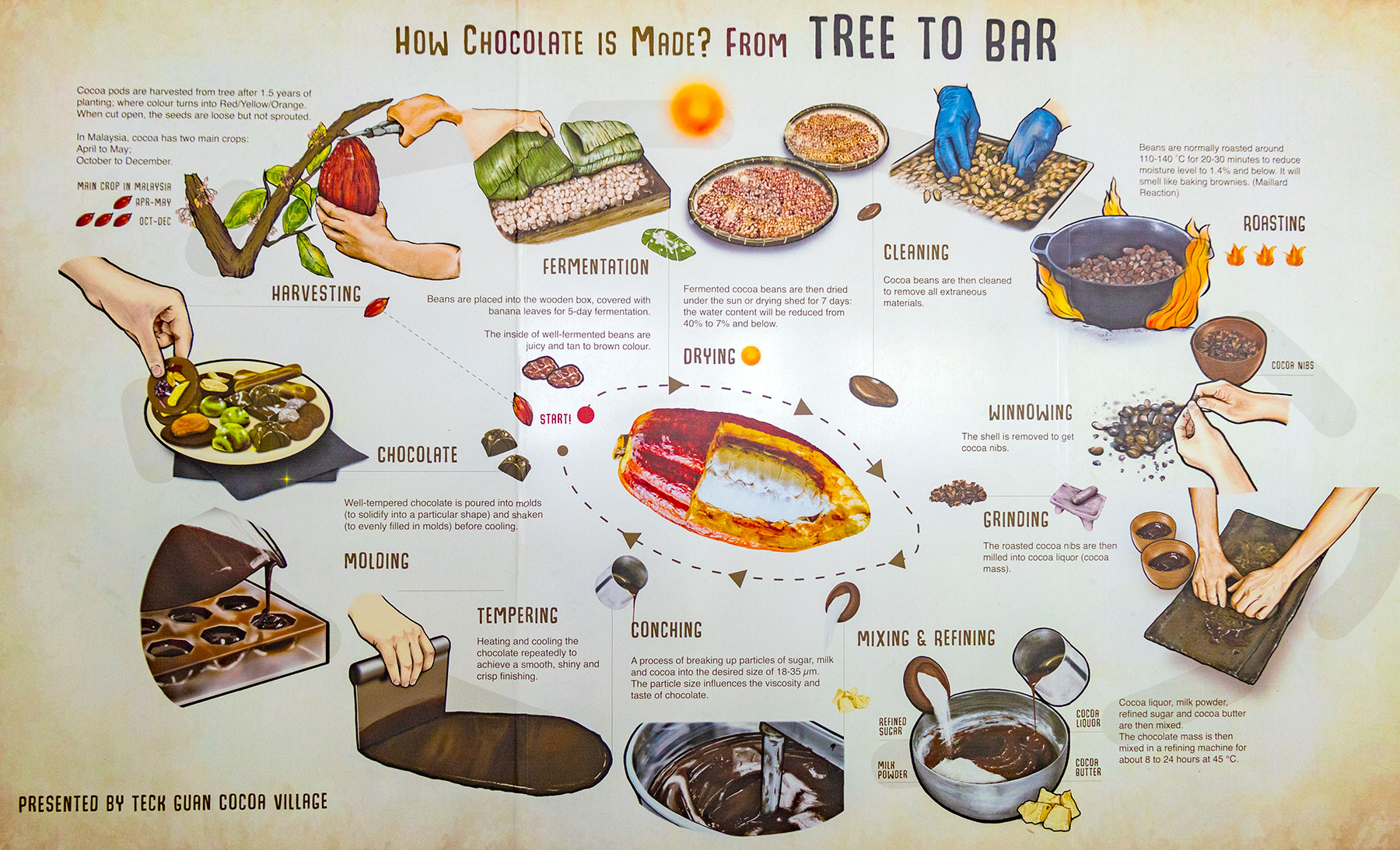
Diagram on processing of cocoa to chocolate
Nine women can’t produce a baby in a month. Then Uncle Mando demonstrates the grafting technique that can make a 3-month-old cocoa seedling starts fruiting in only 2.5 years, which is normally takes 4 to 5 years if grows normally. Besides, these bud-grafted clonal trees are more productive and resistant to disease. That’s the power of science.
3) Enjoy Cocoa Meal and Chocolate Drink
Time flies when I’m having fun. It’s about noon time and the cocoa aroma makes me hungry, so I move to Tawau Cocoa Cafe to enjoy a tasty cocoa lunch that is included in the tour package. This cafe serves many cocoa-inspired dishes, desserts and drinks, as well as nasi kuning (yellow rice) and some western finger food.
Cocoa lunch with chicken katsu and organic cocoa noodle
I have cocoa noodle with chicken katsu (Japanese-style fried chicken cutlet coated with crispy panko) as main dish, cocoa waffle and chocolate ice-cream as desserts, and ice old cocoa drink. I’m quite full after lunch. Otherwise, I would try their cocoa pudding jelly and ice-blended chocolate coffee.
The lawn area at Cocoa Village for photo taking and other family activities
Their cocoa drink is a richer and heathier version of Milo (favourite cocoa drink of Malaysians). Tawau Cocoa Cafe has special cocoa dishes occasionally, you can follow their Facebook at tawaucocoa for the latest cocoa cuisines.
4) Family Time with Children
Next to Tawau Cocoa Cafe is a beautiful lawn and nice garden for your family to explore. Parents can sit at the benches watching their kids running on the lawn, taking family photos at the playground, explore the tree house, and even try the zipline (fee applies) between Durian and Menggaris tree.
Left: the lawn area of Cocoa Village. Right: tree house
5) Shopping for Local Cocoa Products
The last stop of the tour is to see a myriad of Sabah cocoa and chocolate products in their shop, for example, cocoa powder, spread, coffee, noodle, cookies and chocolates. Sabahans should be proud of their cocoa products besides Sabah Tea and Tenom Coffee.
Some cocoa products and souvenirs of Cocoa Village
Some of the items are nicely packaged and hard to find in Kota Kinabalu City so don’t leave empty-handed. I bought some Tawau white coffee to give to my friends. Their handmade chocolate is also one of the best buy.
Booking a Tour to Cocoa Village
The following is the price of the cocoa village tour package (year 2023): Adult @ RM80, Child (Age 6-12) @ RM60, Child (Age 3-5) @ RM40 Infant (Age 0-2) @ Free of charge (no meals provided) Note: A minimum of four (4) adults is required
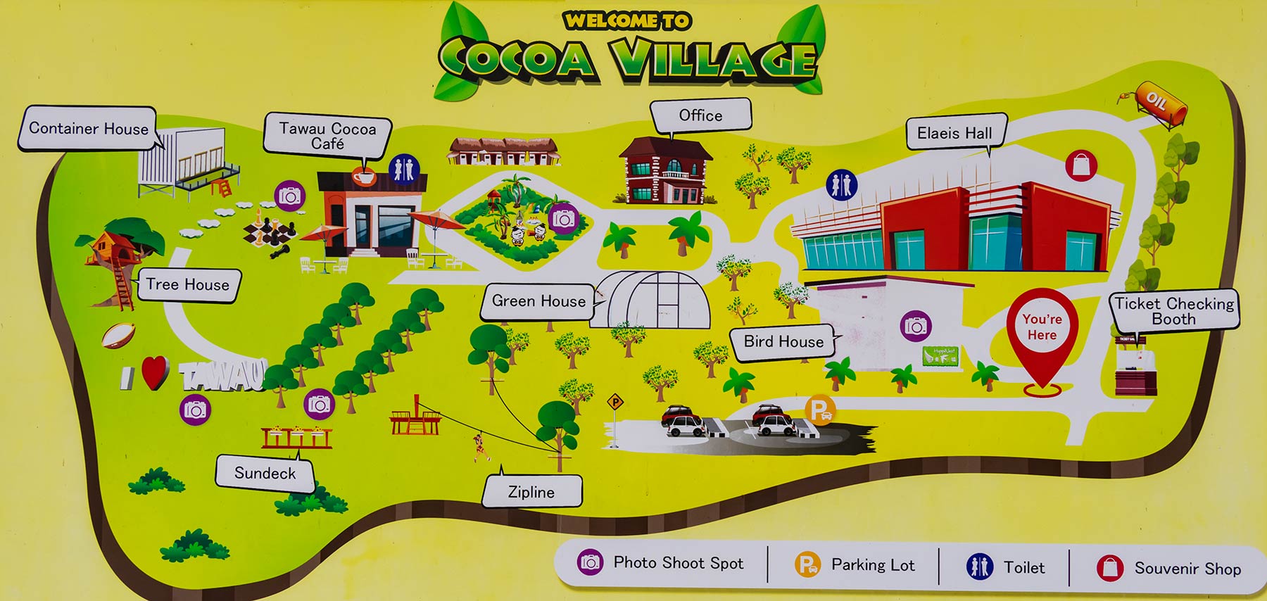
Layout map of Teck Guan Cocoa Village, a cocoa theme park
Itinerary
10:00 Meet at gathering point (Elaeis Hall) 10:05 Depart to Cocoa Culture Spring 10:20 Briefing at Cocoa Cultural Spring 10:35 Jungle Trekking start 11:35 Return to Cocoa Nursery 11:40 Cocoa Grafting Demonstration & Real Cocoa Fruits Tasting 12:30 Lunch at Tawau Cocoa Café 14:00 Shopping time 14:30 Get a takeaway gift from Cocoa Village 15:00 Tour end
Site map of Cocoa Culture Spring, the forest and waterfall garden of Cocoa Village
Package Inclusions
Learn about cocoa cultivation chain through practical demonstration
Opportunity to taste the real Cocoa fruits
Waterfall trekking at Teck Guan Cocoa Culture Spring
Witness the historic columnar-jointing basalt
Entrance ticket to Teck Guan Cocoa Village
One (1) takeaway gift from Cocoa Village
One (1) lunch at Tawau Cocoa Café
Zipline + Abseil Adventure @ RM30/pax (subject to availability)
Cocoa Village is a family-friendly destination in Tawau that both adults and children enjoy.
For booking and enquiry, you can contact Teck Guan Cocoa Village at: Phone:+60 16-8269579 (Whatsapp), +60 89 772277 (office) E-mail:cocoavillage@teckguan.com Facebook:cocoavillagetawau Address (Cocoa Village): Quoin Hill, Miles 15, Jalan Bukit Quoin, 91000 Tawau, Sabah, Malaysia.
Waterfalls in Cocoa Culture Spring
Teck Guan Cocoa Village is about 45 minutes (38 Kilometre) away from Tawau town by driving and highly accessible by asphalt road in good condition (see Location Map). You may visit Cocoa Museum in Tawau town if you are interested in the manufacturing of cocoa powder and cocoa butter at their factory.
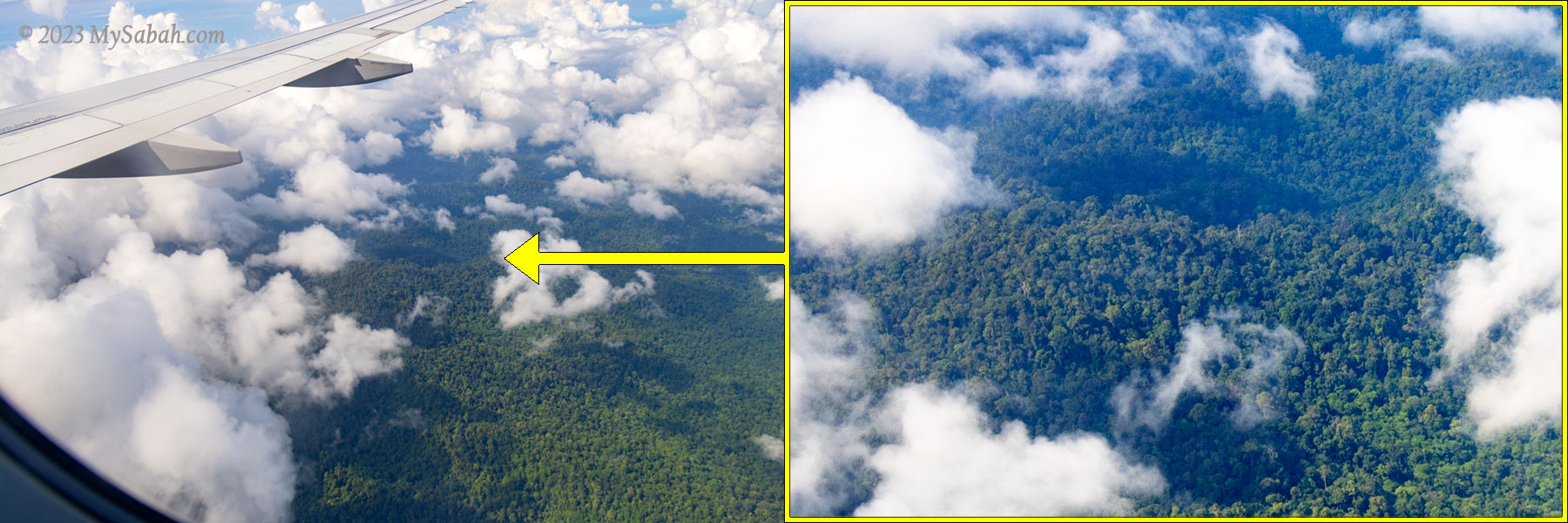
One of the reasons Malaysians visit famous volcanoes such as Mount Fuji and Mount Bromo is they’ve never seen a volcano, and they think that there is no volcano in Malaysia. Wrong! Sabah has over 10 volcanoes, for example, Bohey Dulang Island, Bukit Tengkorak, Mount Wullersdorf. Tawau and Semporna in south-east of Sabah were used to be the volcanic regions from Neogene to Late Pleistocene ages (about 23 million to 11,700 years ago).
Volcano crater view from the plane to Tawau. It’s probably belong to the Mount Maria of Tawau Hills Park.
Don’t worry. All volcanoes in Sabah are extinct (or dead) volcano, which will not erupt anymore. Don’t believe those viral videos which clickbait us by saying that the Bombalai Hill of Sabah is an active or dormant volcano. Some local school teachers tell their students that Mount Kinabalu is a volcano, this is incorrect too.
Bombalai Hill is abundant with volcano rocks ranging in age from Middle Miocene to Quaternary.
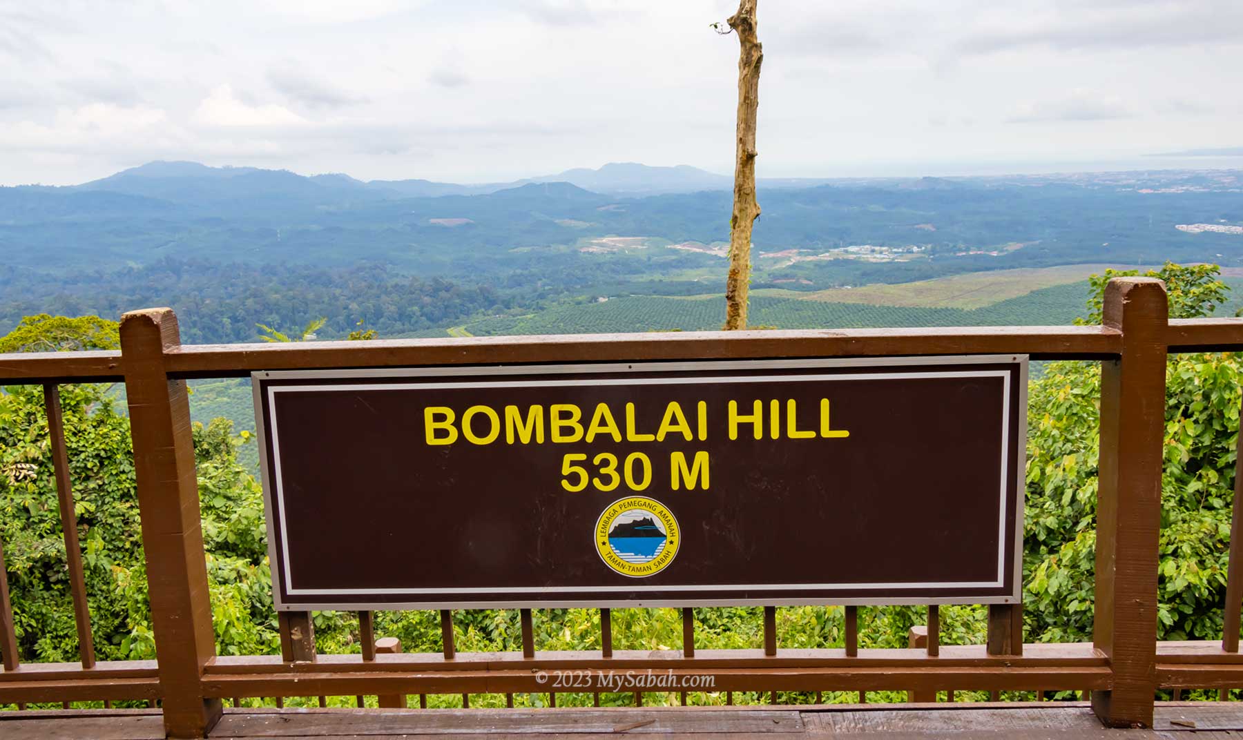
About Bombalai Hill (Bukit Bombalai)
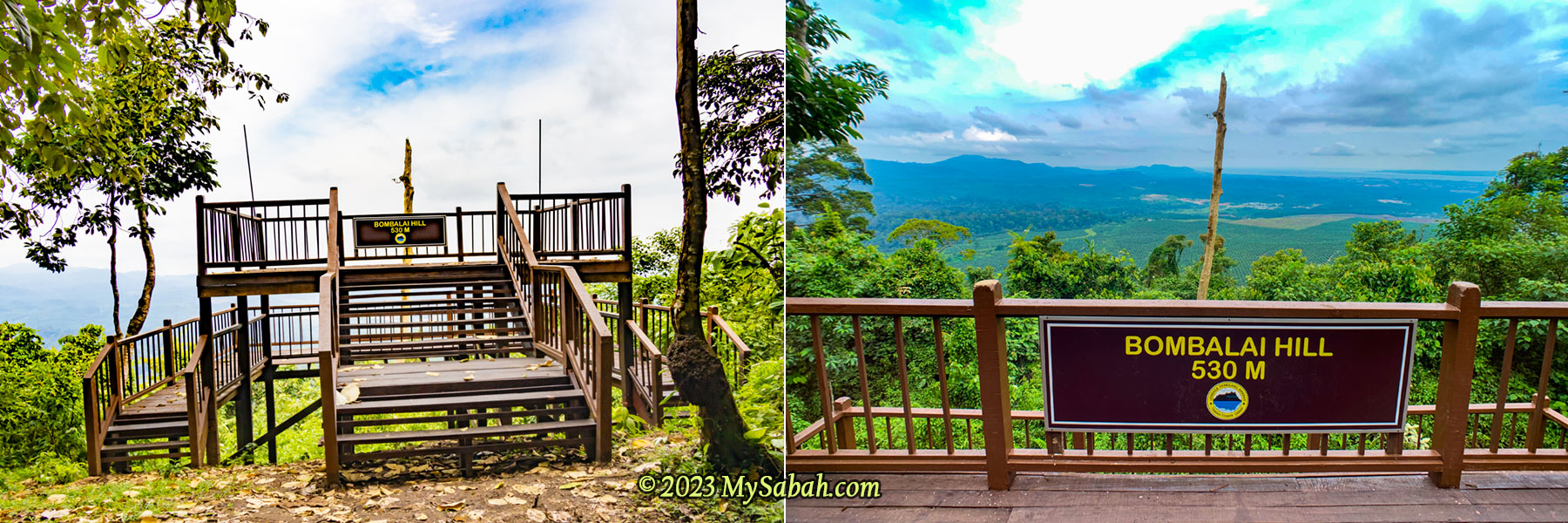
Bombalai Hill (Bukit Bombalai in Malay language) is the most accessible extinct volcano in Sabah. You can park your car near its foothill and hike only an hour to its peak. Though a dead volcano is not as interesting as a smoking active volcano with flowing lava, it is definitely safer to explore.
3D map of Bombalai Hill (left) and Tawau Hills Park (right). Note the caldera on the peak.
Bombalai Hill is an ancient cone volcano that was active during Quaternary. Its last eruption is probably about 129,000 to 11,700 years ago. Though the dense forest on the hill has covered the traces of volcanism, its 300-metre-wide caldera is quite visible from the sky. I saw it once from a plane that flied to Tawau town, the third largest town of Sabah.
Beautiful jungle trail of Bombalai Hill (Bukit Bombalai)
Bombalai Hill is part of Tawau Hills Park (Taman Bukit Tawau), a fully protected forest reserve about 24 km north-west of Tawau (see Location Map) and highly accessible by sealed roads. If Tawau Hills Park is open a million years ago, it would be called “Tawau Volcanoes Park” because the mountains there were used to be active volcanoes from the ages of Miocene to Late Pleistocene.
Hill dipterocarp forest is the most common forest type in Tawau Hills Park (Taman Bukit Tawau)
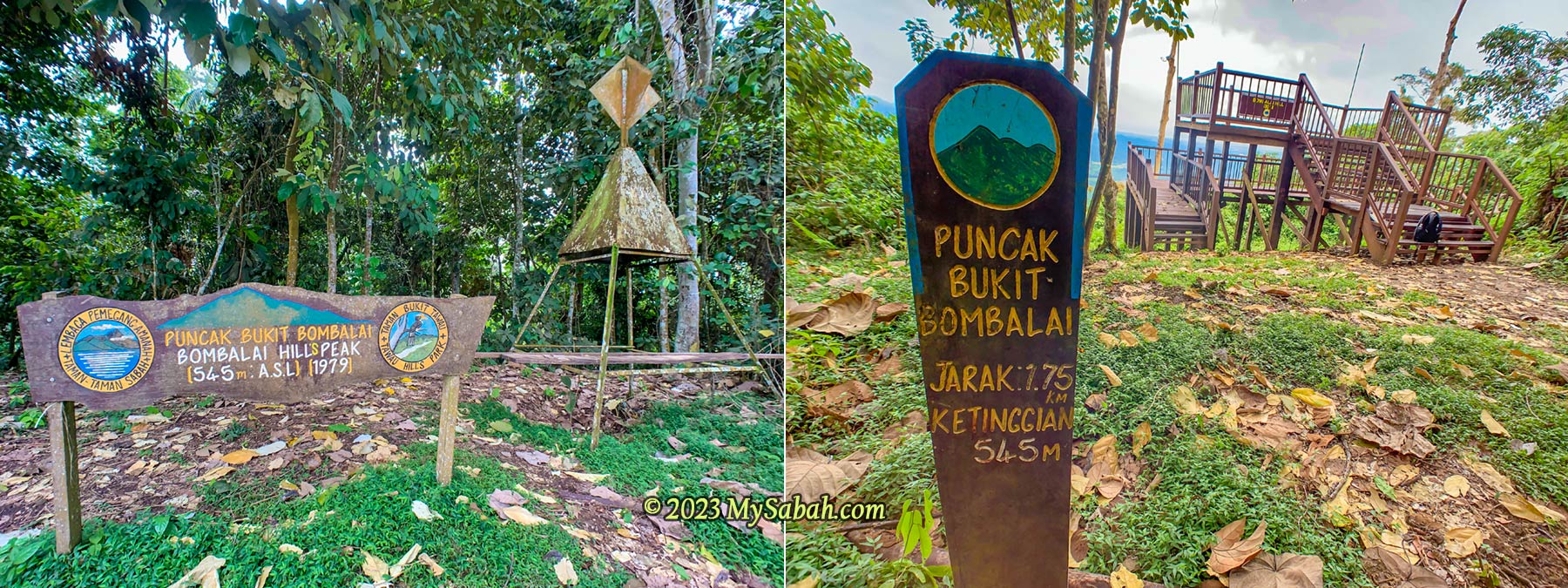
Now these extinct volcanoes become the three highest mountains in Tawau Hills Park, namely, Mount Magdalena (1,310 M), Mount Lucia (1,201 M) and Mount Maria (1,083 M). Mount Lucia has the most distinct volcano crater on the peak and it takes 6 hours to hike, but I climb Bombalai Hill first, because it’s the smaller volcano with the shortest and easiest trail.
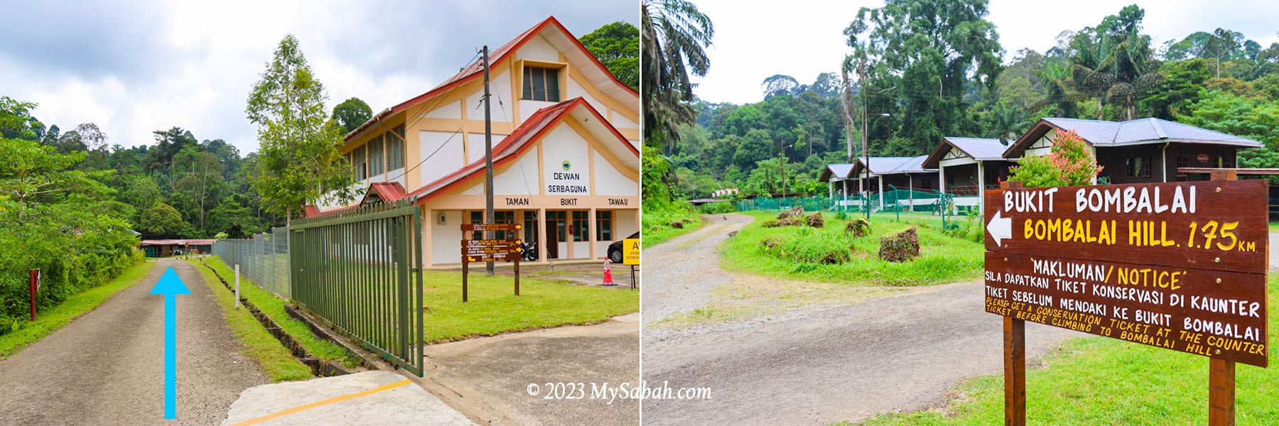
Starting point of the climb to Bombalai Hill (Bukit Bombalai)
Tawau Hills Park opens from 8am to 4pm every day. You can climb Bombalai Hill during the opening hours but I advise you to start before 2pm. Because the dense forest is quite dim after 3pm, when the sun starts sinking behind the hill. You are not required to hire a guide to go with you.
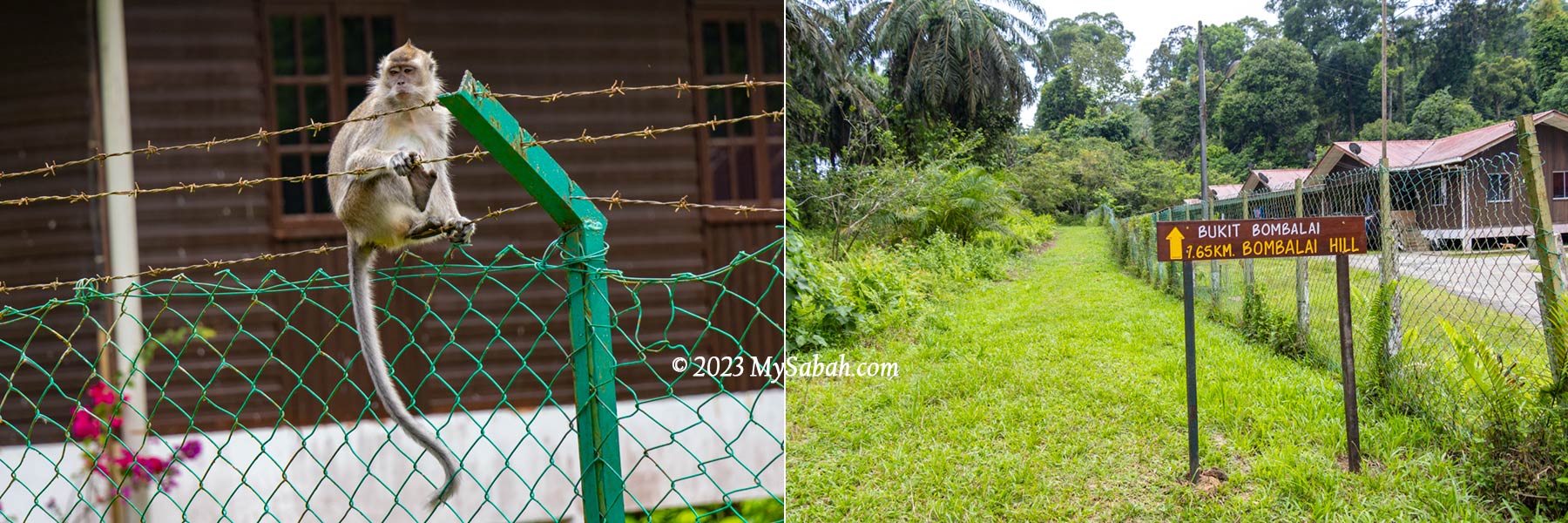
Left: a long-tailed macaque on the fence. Right: grass path to Bombalai Hill
Climbing Bombalai Hill
The starting point is located outside the fenced area of Tawau Hills Park headquarter. The ticket (named as Conservation Fee) costs RM6 for Malaysian adult (18 years old & above) and RM20 for foreign adult (as of year 2023). Some “smart” people would ask you to bypass the ticket counter so you can climb the hill for free. Please don’t do that. In case you are stranded on the hill, nobody would know that you are on the hill. Or you would be mistaken as a poacher by the patrolling rangers there.
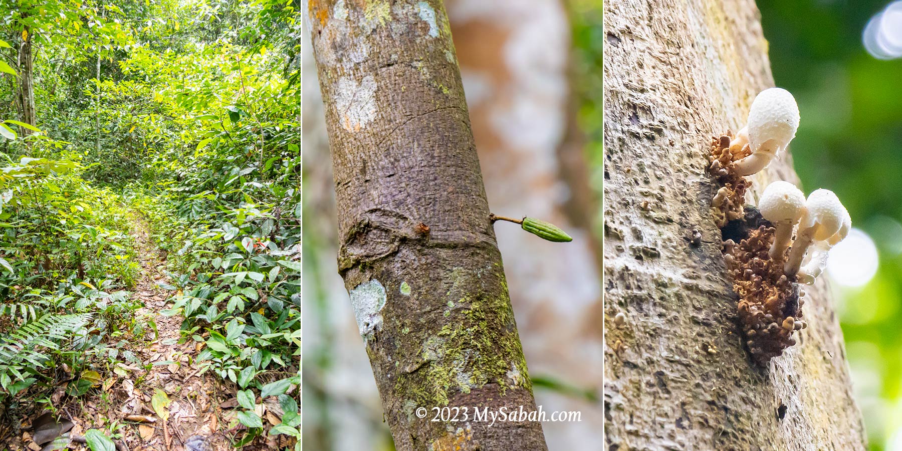
Left: nature trail to the hill. Middle: a cocoa tree. Right: white fungus high on a tree
Though Bombalai Hill is 530 metres above sea level, the hike begins on a higher ground of nearly 300 metres above sea level, so I only need to climb up about 230 metres. The trail to the peak of Bombalai Hill is about 1.9 kilometres one way. Normally it takes about an hour to reach the top. Overall, the climb is not tough, even beginners can do it. Wear a pair of anti-leech socks if you’re afraid of leech bite.
Fruits next to the trail of Bombalai Hill
When you face the front of the park entrance, turn left and walk 150 metres, from car park to the end of the paved road until you reach the building of staff accommodation. You will see a signage to Bombalai Hill, which points to a straight, wide and flat gravel and grass path next to an oil palm plantation.
Left: a weevil beetle. Right: a big fly
Just follow the grass path for less than 10 minutes, you will enter a forest edge with narrow soil trail with bushy sides. You should see a signage that says “Ke Puncak Bukit Bombalai”, which is translated as “To the Peak of Bombalai Hill.” (Bukit means Hill in Malay language)
Signage to the peak of Bombalai Hill (Bukit Bombalai) at the forest edge
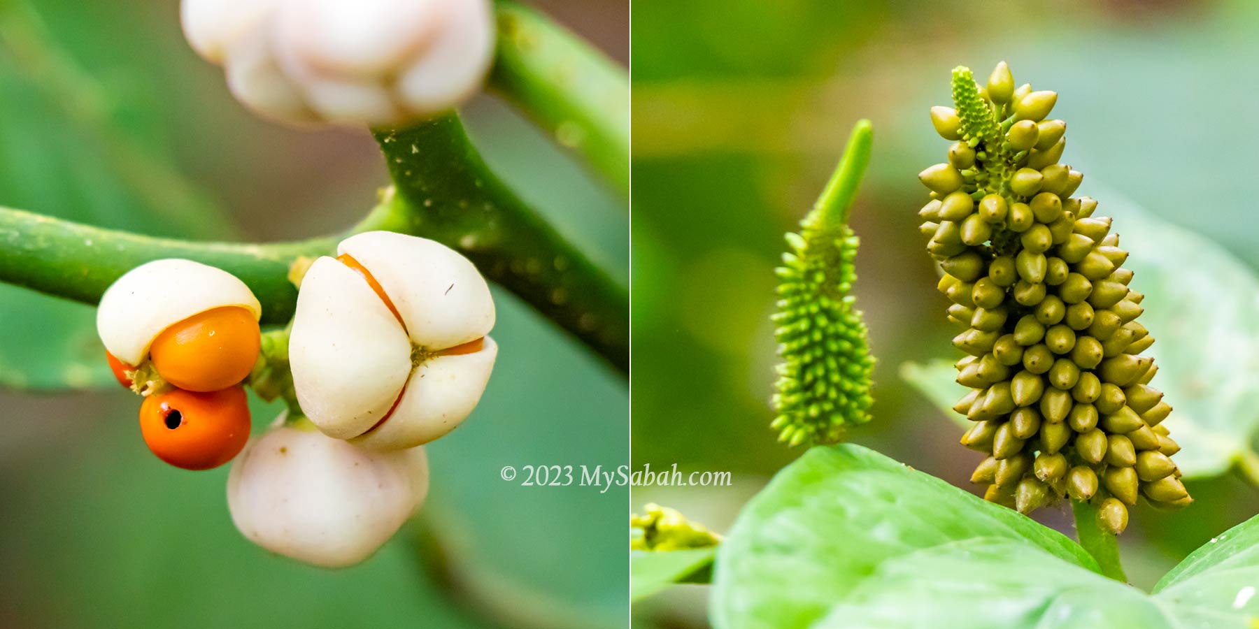
Due to the tree shades, the surrounding is darker and the trail is flanked by dense undergrowth. Walk slowly and scan around, you would find many fruits, herb plants and flowers, e.g. ginger, orchid, begonia, among them. A couple of leeches would welcome you.
Left: Begonia plant. Right: wild “football fruits” or pangi fruits. The fruits are poisonous and can be used for food fermentation after treatment.
The lush rainforest covers all the traces of volcanism. This forested dead volcano is actually a green volcano full of lives. The cicada orchestra and bird calls never stop. My presence causes some commotion among the elusive tree-dwelling primates.
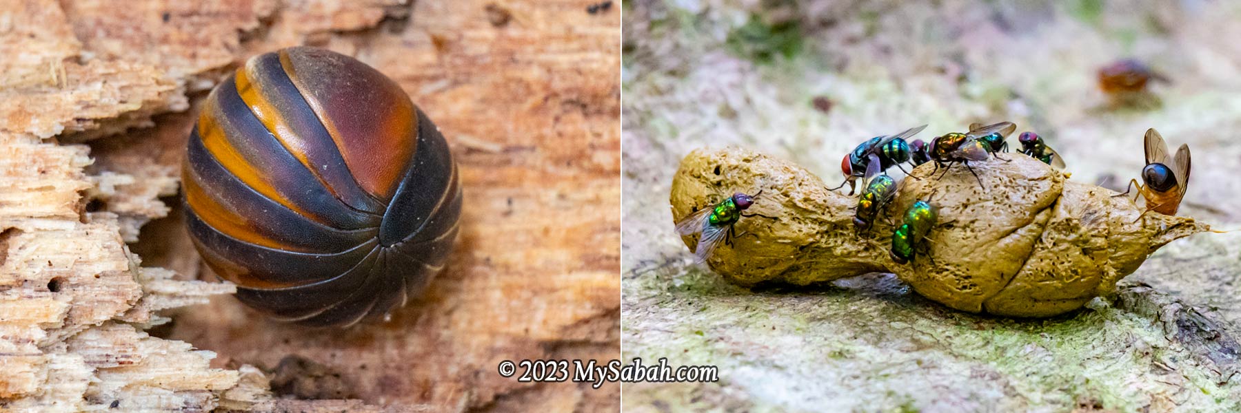
Left: pill millipede curled up as a defense. Right: flies feasting on a dropping (very smelly). Both play important role in decomposing organic matters in forest.
The eight species of primate found in this park are long-tailed macaque, pig-tailed macaque, red-leaf monkey, Borneo gibbons, orang-utans, tarsiers, slow loris and Gray-leaf Monkey. They flee before I can tell what they are, but very likely they are either macaques or red-leaf monkey.
The towering rainforest trees of Bombalai Hill
Tawau Hills Park is also a popular bird-watching site. I can hear the hoarse call and flapping wing of hornbills on the canopy. I recognise the calls of broadbill and pitta too. Of the 8 species of Hornbills known from Sabah, 6 species live here, namely, the Black, Bushy-crested, Helmeted, Rhinoceros, White-crowned and the Wreathed hornbills. Also, 3 species of the rare pheasants occur here, namely, Crested-fireback, Great argus and Malayan peacock pheasants.
Distance markers to the peak of Bombalai Hill (Bukit Bombalai)
The first 1 kilometre of the hike is mainly an easy walk on flat surface, with only a few gentle slopes. The distance markers every 100 metres are the progress bars that keep me motivated. I’m the only climber on the hill, but I don’t feel lonely in nature. I don’t worry about losing my way because the trail is well-trodden.
Vines and creepers on the tree. The left one looks like birds in flight. To survive, these plants need to climb high to reach for more sunlight.
The foothill is mainly lowland and secondary forest. As I climb higher, I see variety of trees, vines, liana, and creepers of hill dipterocarp forest flourishing on the fertile volcanic soil. Unlike the monodominant forests in temperate countries, the vegetation of Borneo rainforest is highly diversified.
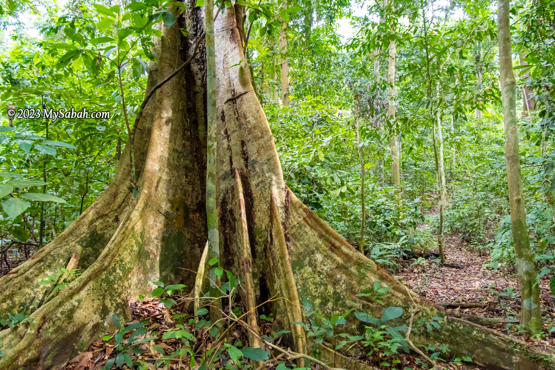
A tree with big buttress on the trail. This structure allows the tree to stand firm on the shallow soil.
Reaching the Peak
The last 400 metres uphill trail to the peak is the most challenging part of the climb. There are some rope support at steep or slippery sections. About 100 metres before the ending point is a leisure walk on a ridge. It takes me 1.5 hour to reach the peak because I walk slowly to take pictures.
The steepest sections to the peak of Bombalai Hill. The rope support and stairway help a lot.0 Meter signage on the peak to mark the end of the climb. The viewpoint platform is a short walk away on a ridge.
At the peak is a 2-level wooden viewpoint platform with an open view facing south-west. It’s a hazy day but I still can see oil palm plantation, Tawau plains, Sulawesi Sea, Sebatik Island, and other places more than 12 kilometres away.
The 2-level wooden viewpoint platform on the peak of Bombalai Hill (Bukit Bombalai)
As Bombalai Hill is surrounded by oil palm plantation from three sides, to be honest the panoramic view on top isn’t really fantastic. Anyway, I feel wonderful and worthwhile conquering an ancient volcano.
The old signages and triangulation station (trigonometrical point) on the peak
Just a trivia of Bombalai Hill. There is a secret cave used by the Japanese or resistance fighters during World War II at the peak of Bombalai Hill. Urban legends from all over the world say Japanese hide their war loot in caves and tunnels during WWII. Some treasure hunters believe this myth and excavate the site, though Sabah Parks has debunked that there is no gold.
View from the peak of Bombalai Hill. You can see large area of oil palm plantation.
The north side of Bombalai Hill is connected to the main forest of Tawau Hills Park, so the wildlife aren’t stuck on an isolated hill. From the high density of the birds and monkey living there, they seem to like Bombalai Hill a lot.
You can see Tawau town and Sebatik Island more than 12 km away from the peak (photo captured by camera with 8x optical zoom)
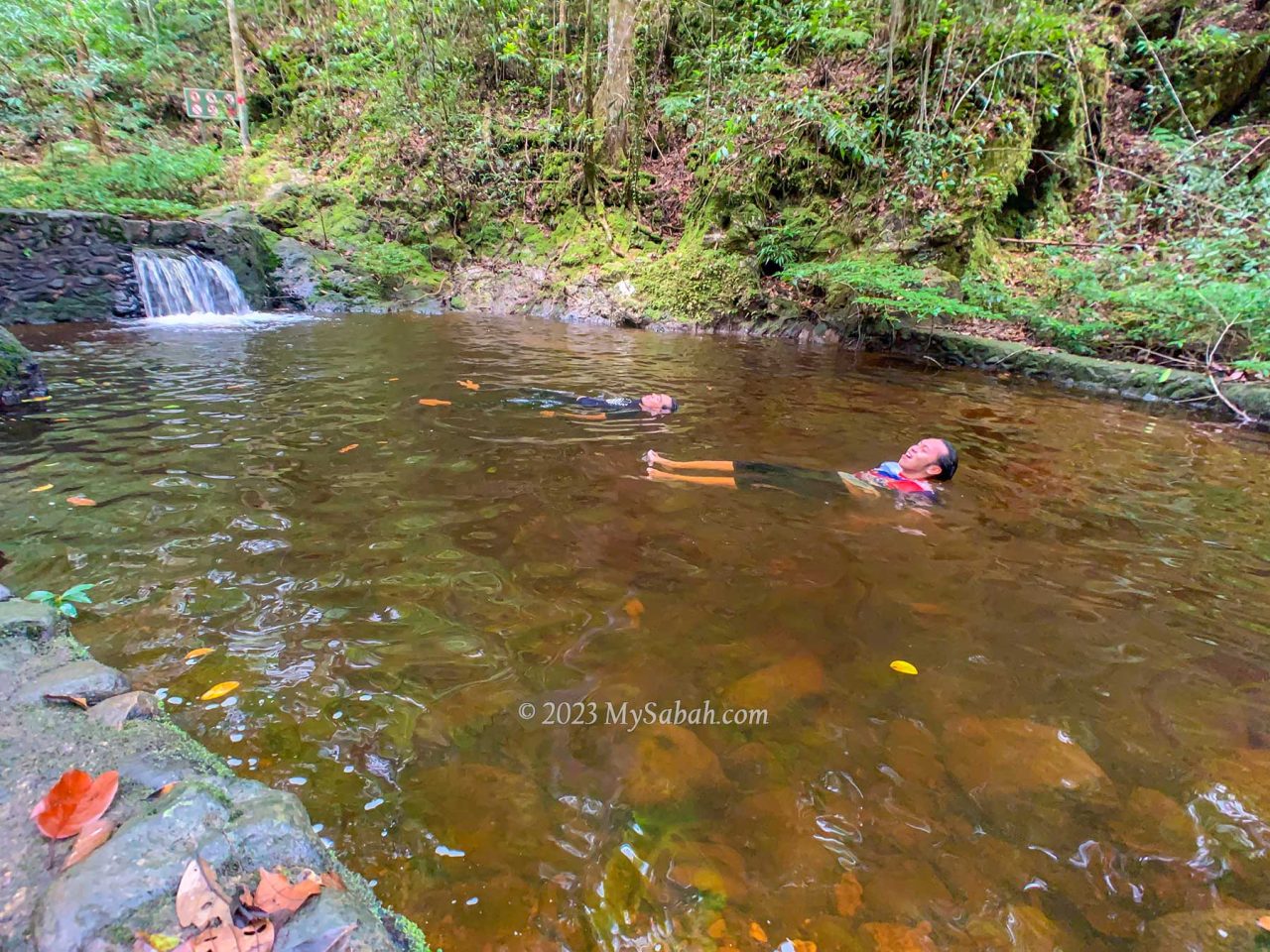
After the climb, don’t throw away your ticket. You can use it to enter the park headquarter (Tawau Hills Park) to take a dip in the river, visit the waterfall, sulphurous springs, botanical garden and one of tallest tropical tree in the world. The park also has toilet and canteen (Kantin Begonia) for visitors. For more information, you can contact Sabah Parks, the government agency that manages Tawau Hills Park.
Imagine you are an adventurer in a role-playing game and given a quest that says, “Find the magic crystals on an extinct volcano mountain, where you will traverse through a dwarf forest with blood-red rivers, mossy rocks and flesh-eating plants.” This scene matches Mount Wullersdorf perfectly. Time for me to walk out of my virtual world and steps into the uncharted territory in Mount Wullersdorf as a real adventurer.
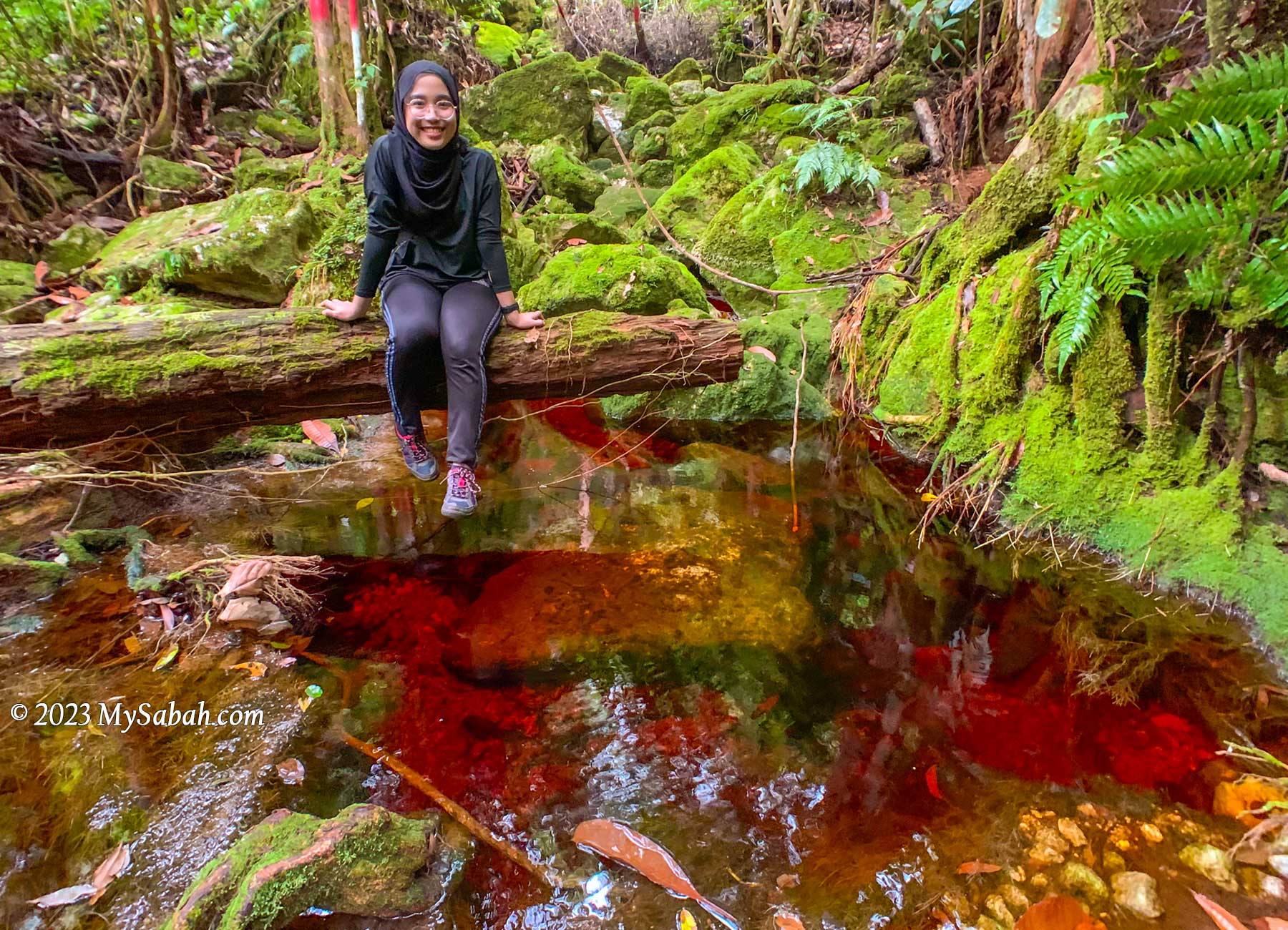
The reddish tea colour stream in Wullersdorf forest is the result of the tanning effect leached out from the thick dead leaves and debris that cover the heath forest floor. The water is acidic but safe to drink.
In terms of geology and vegetation, Mount Wullersdorf is special because it is:-
An extinct volcano, a geological heritage of Sabah
Heath forest with red river and rare plants
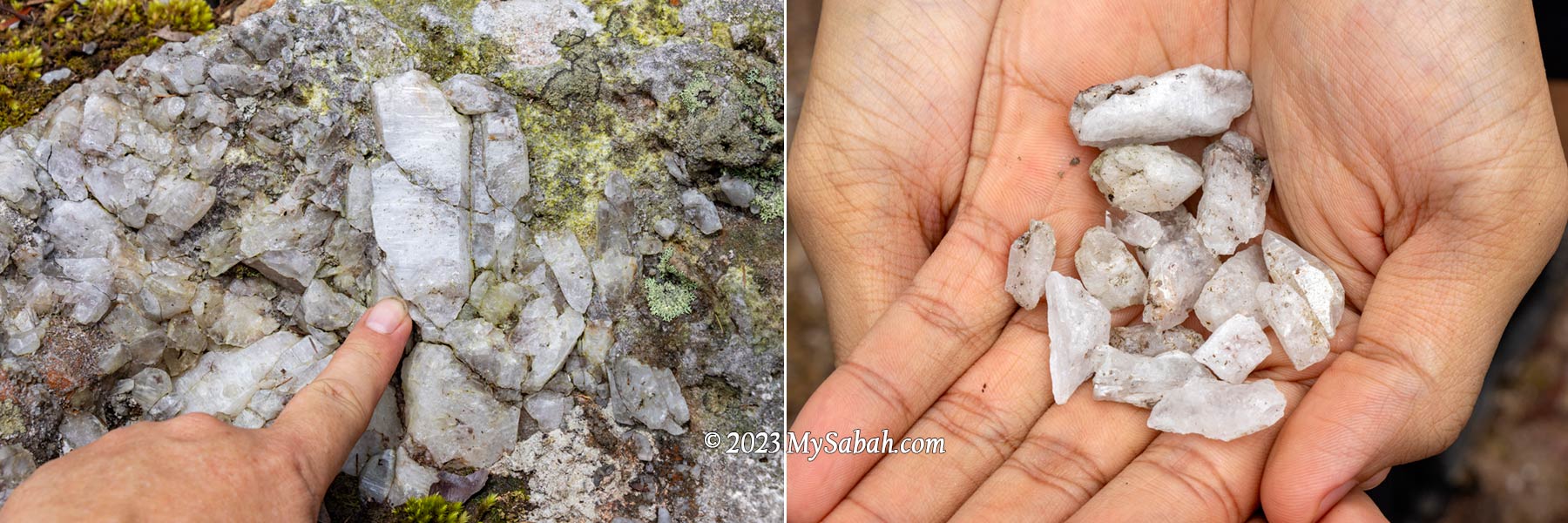
A world of natural crystals in Sabah
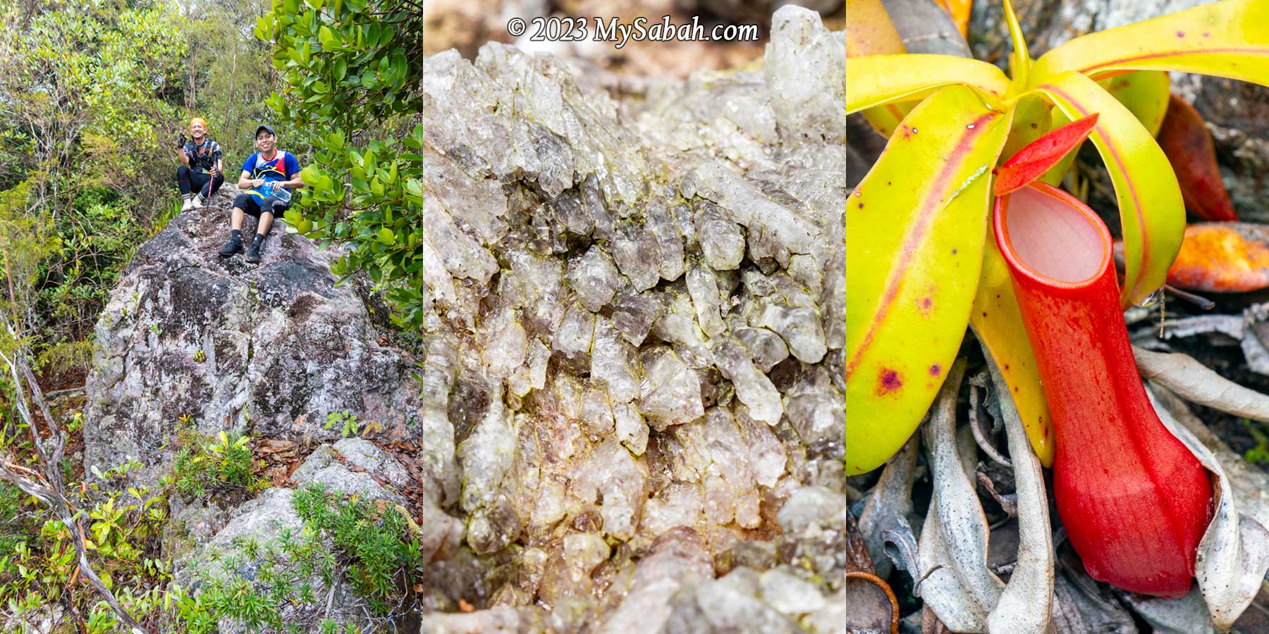
From left: volcanic rocks, crystals and pitcher plant of Mount Wullersdorf
Itinerary
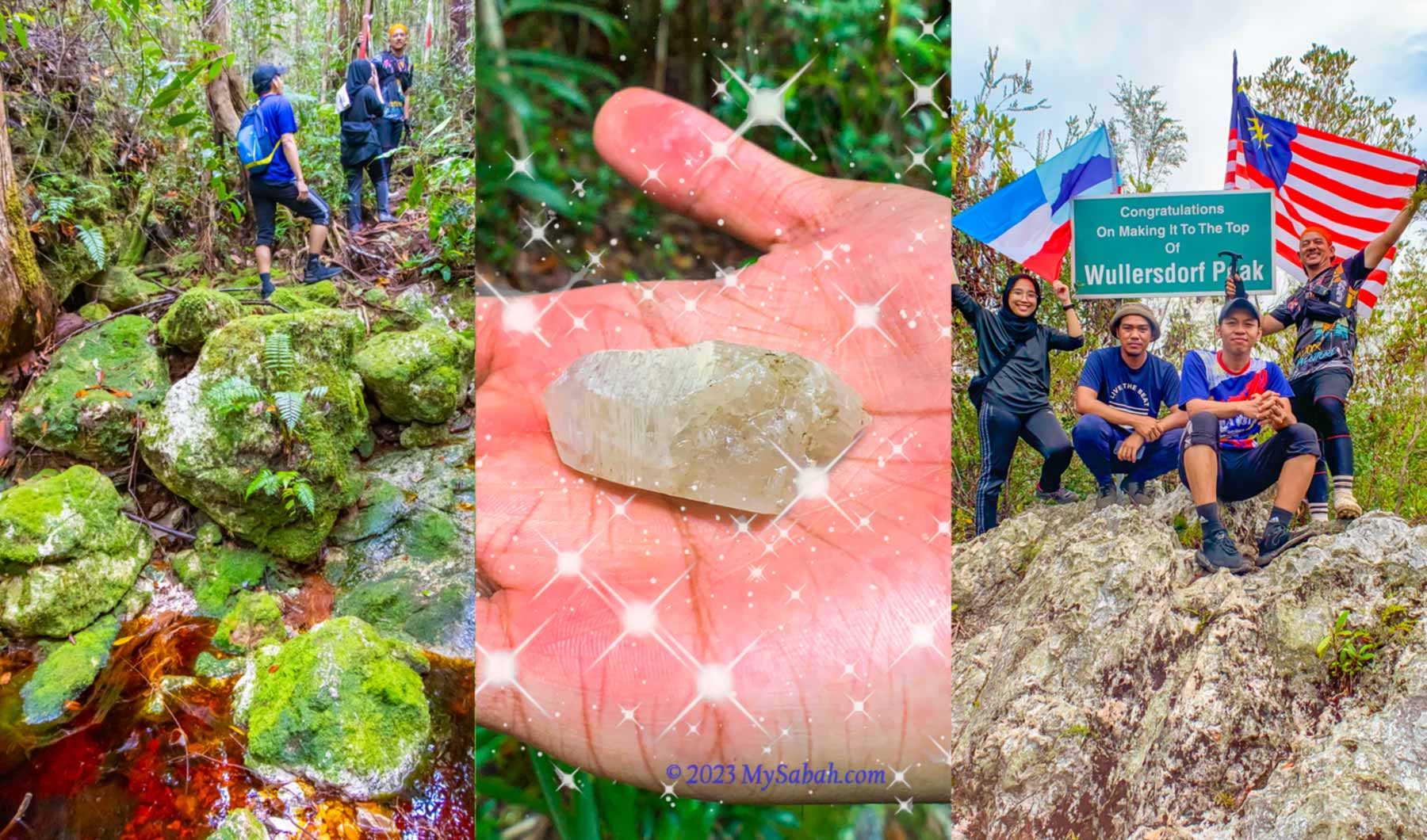
The following is the itinerary of climbing Mount Wullersdorf. It is a day trip with a hiking distance of 7 kilometres. You must book the tour in advance. 7:30am Gather at Dewan Kampung Balung Cocos (Tawau) 8:00am Depart to the Control Post (Sabah Forestry Department) of Wullersdorf, the starting point of the climb 8:30am Start climbing after registration and briefing 9:30am-10:00am Reach the first peak after 30-40 min (2 km) 11:00am-12:00pm Reach the second peak (Wullersdorf Peak) after 4 km. Rest and lunch on summit 1:00pm Hike back to the Control Post via shortcut (1 km for 40 min) 2:30pm End of tour
Walk-through
Are you ready for the epic quest adventurer? Or you can watch the 6-minute video below:
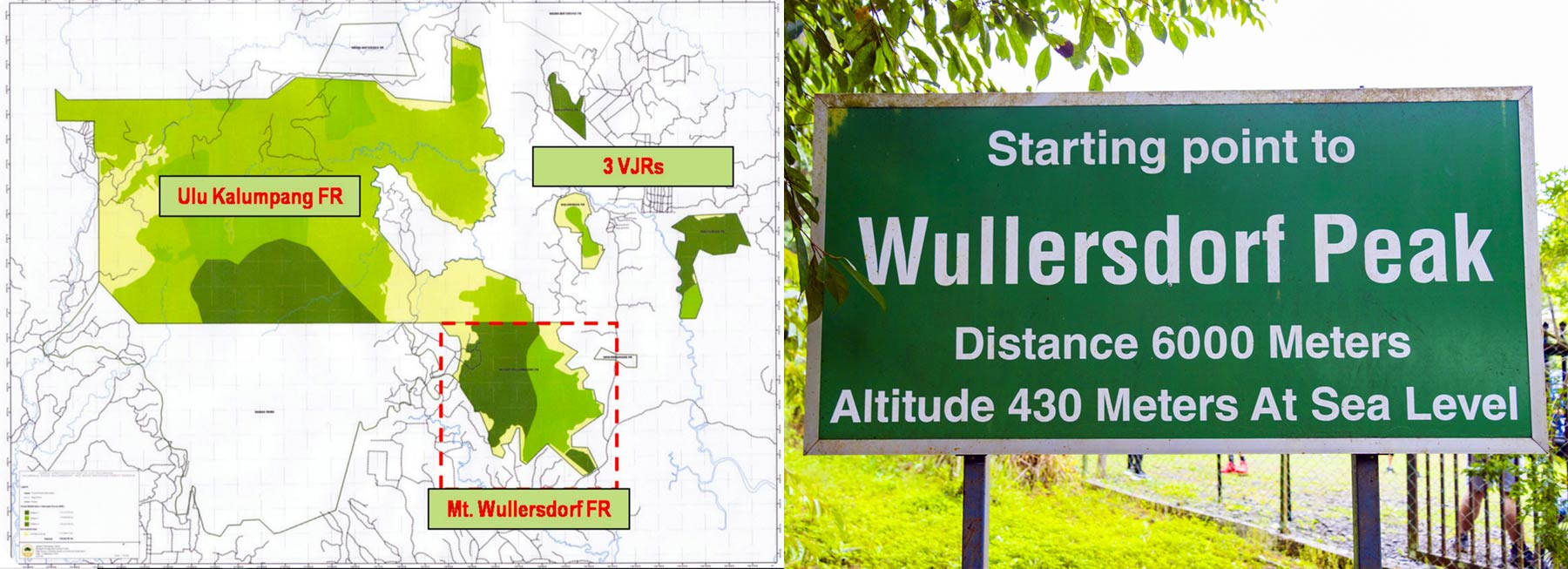
The height of Mount Wullersdorf is 430 metres (1,411 ft) above sea level. The one-way distance to the highest peak is 6 kilometres, which takes about 3 to 4 hours. There is a 1-kilometre shortcut from the peak back to the starting point, so in total it’s a 7-km loop trail.
Going to the Starting Point
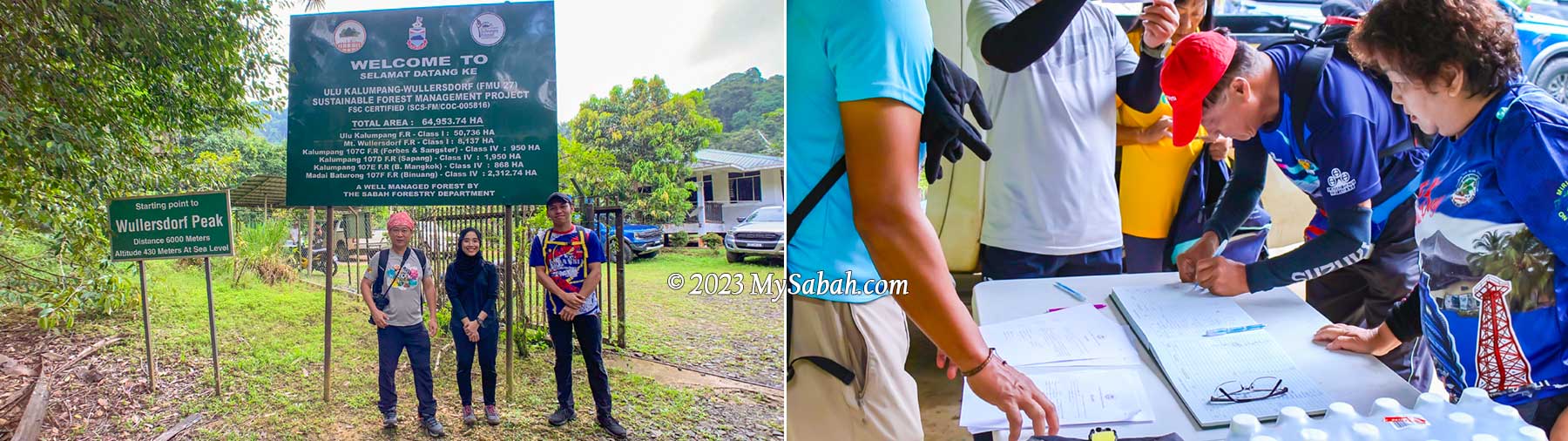
Mount Wullersdorf is located in a Class-1 (fully protected) forest in Kunak (Tawau Division). To enter the mountain, you need a permit from the Sabah Forestry Department. So I get a local agent who can get the permit and arrange the climbing trip for me. Just a few messages back and forth with the agent and I get the booking done. Easy.
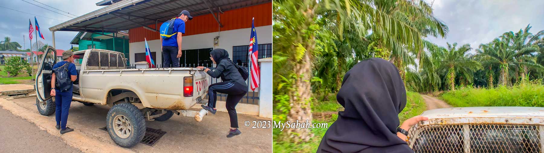
Hop on the pick up truck that sent us to the starting point about 15 minutes away
I meet my guides at Dewan Balung Cocos (Balung Cocos Village Community Hall) around 7:30am. Mr. Eady and Pakri are my guides, who live in this village. Also joining me are Mr. Aidil and Ms Zura, the hikers from Tawau. It’s drizzling in the morning. I’m concern about the gloomy weather but Pakri says that the red river is more beautiful when it has more water.
The Control Post of Mt. Wullersdorf Forest Reserve is the starting point of our climb to Wullersdorf Peak. Visitors need to register before the hike. You can be fined RM10,000 for illegal entry.
We hop on our pick-up truck to depart to the starting point of the climb. It’s a bumpy ride on a gravel road in an oil palm plantation. After 10 to 15 minutes, we reach the control post of Sabah Forestry Department. Besides us, there is team of 20 members from Lahad Datu Hash House guided by another agent, Uncle Mul.
About Wullersdorf
Mount Wullersdorf is part of Mount Wullersdorf Forest Reserve, which is 8,137 hectares in size. It’s linked with five other adjacent forest reserves to form a 64,953.74 Ha of Ulu Kalumpang-Wullersdorf Sustainable Forest Management (SFM) Project. The Class-1 Ulu Kalumpang Forest Reserve which covers an area of 50,736 hectares is the biggest forest reserve under this project. This SFM Project is certified by the Forest Stewardship Council® (FSC) as a well-managed forest.
Mount Wullersdorf Forest Reserve is a fully protected Class-1 forest. Government and WWF is trying to restore the degraded and fragmented forest to re-establish forest connectivity between Mt. Wullersdorf and Ulu Kalumpang Forest Reserves, so wildlife can move freely in the connected forests for more resources.
These forest reserves are also the habitat of threatened animals in Borneo such as orangutan, Bornean Pygmy Elephant, Bornean Sun Bear and Bornean Gibbon. Iconic birds like hornbills and Crested Fireback also nest there. Under good conservation, the mountains also protect the headwaters and water catchment areas that are source of water for Tawau and Kunak Districts. The rangers there also mention the sighting of a golden rat (I assume it’s a Malayan weasel or Yellow Throated Marten), and the tracks of a baby Sumatran rhino many years ago. Sadly this rhino species is declared extinct in the wild in Malaysia in 2015.
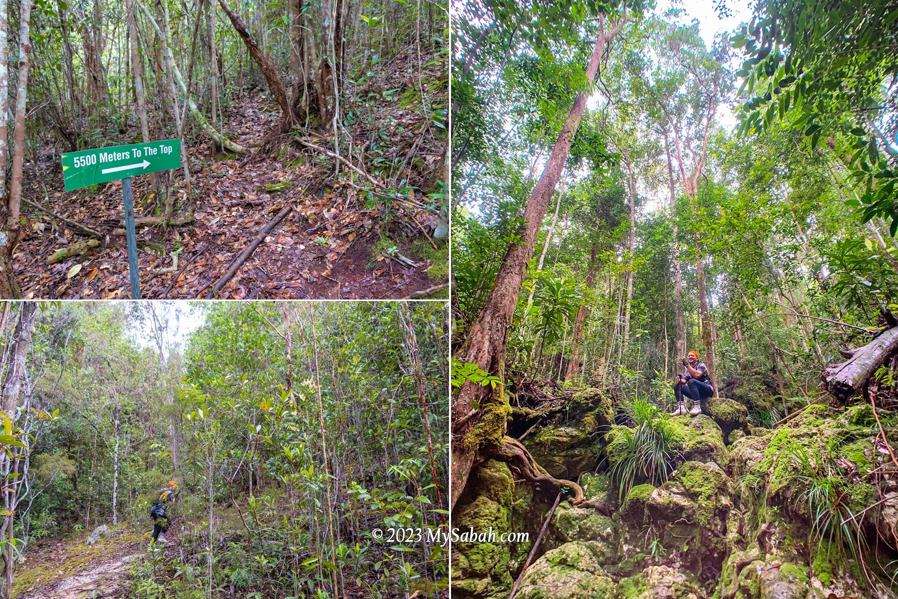
0 to 2 KM
After registration and briefing, we start to hike at 8:30am. FYI, you can use the toilet at the control post before and after the climb. The first 250 metres is a walk on flat ground covered with tall grasses and shrubs. About 10 minutes later we reach a manmade pond, which marks the start of the loop trail at foothill.
The first 250 metres of the hike. We started walking at 8:30am.
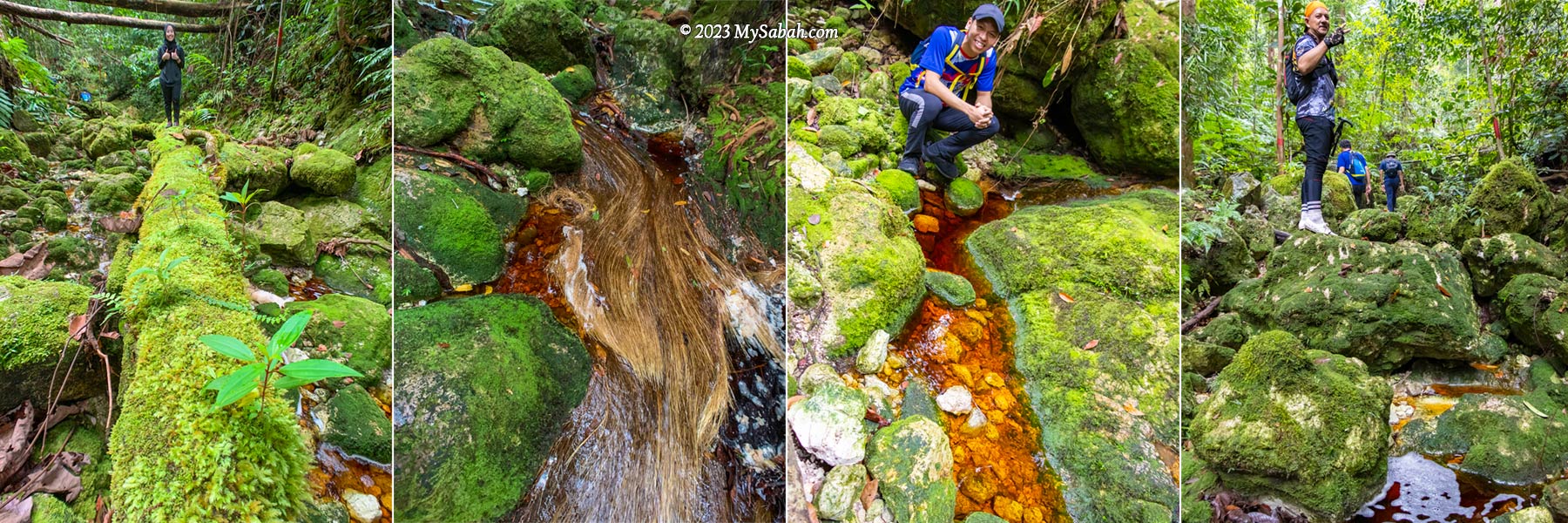
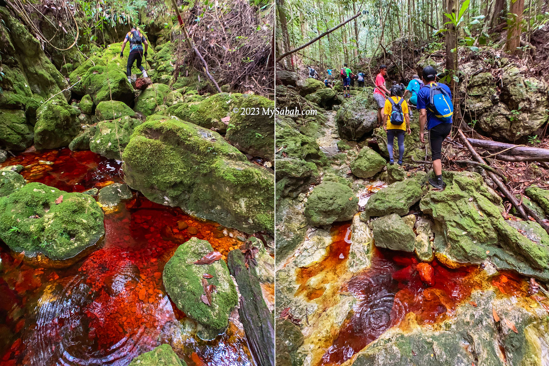
The trees are tall in the beginning and their dense canopy blocks the rain. I see a green path ahead. It’s a rugged riverbed trail littered with green mossy rocks, with red-colored stream flowing between them. The red water and green rock form a very striking contrast, the scenery is out of this world. No wonder they call it the “Lost World of Balung“.
The green mossy rocks and red streams form beautiful contrast along the trail
We climb up and down on these mossy rocks to ascend. Some of the rocks are slippery. It will help a lot if your hiking shoes have good grip, because most of the time we walk on river rocks. Overall, the trail is not really steep, but climbing hundred of rocks will slow you down. I’m the slowest one as I’m already too busy taking pictures in the first two kilometres.
Red River (Local Name: Sungai Merah)
This side of Mount Wullersdorf is dominated by heath forest, which grows on sandy soil with poor nutrients. With infertile environment, plants in heath forest are usually rich in tannins as a defense, which make them toxic or indigestible to plant eaters.
Over 50% of the trail is moving up along a river that is full of mossy boulders with tea-color stream flowing between them.
However, tannin is hard to break down. When water drains through thick dead leaves and debris that cover the forest floor, the tannins and humic acids leach through the porous sandy substrate, finding their way into streams, and dye the water with brownish tea color.
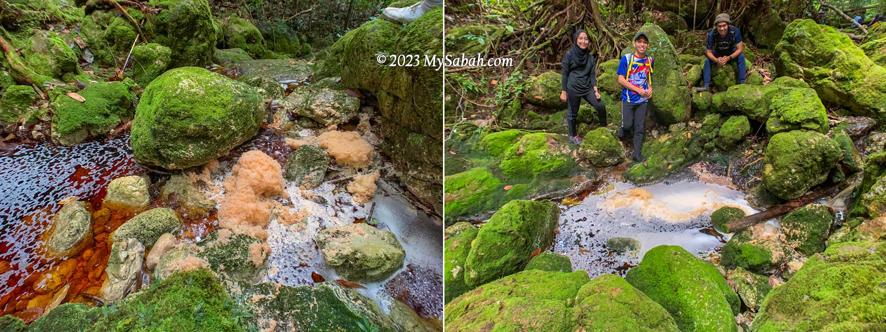
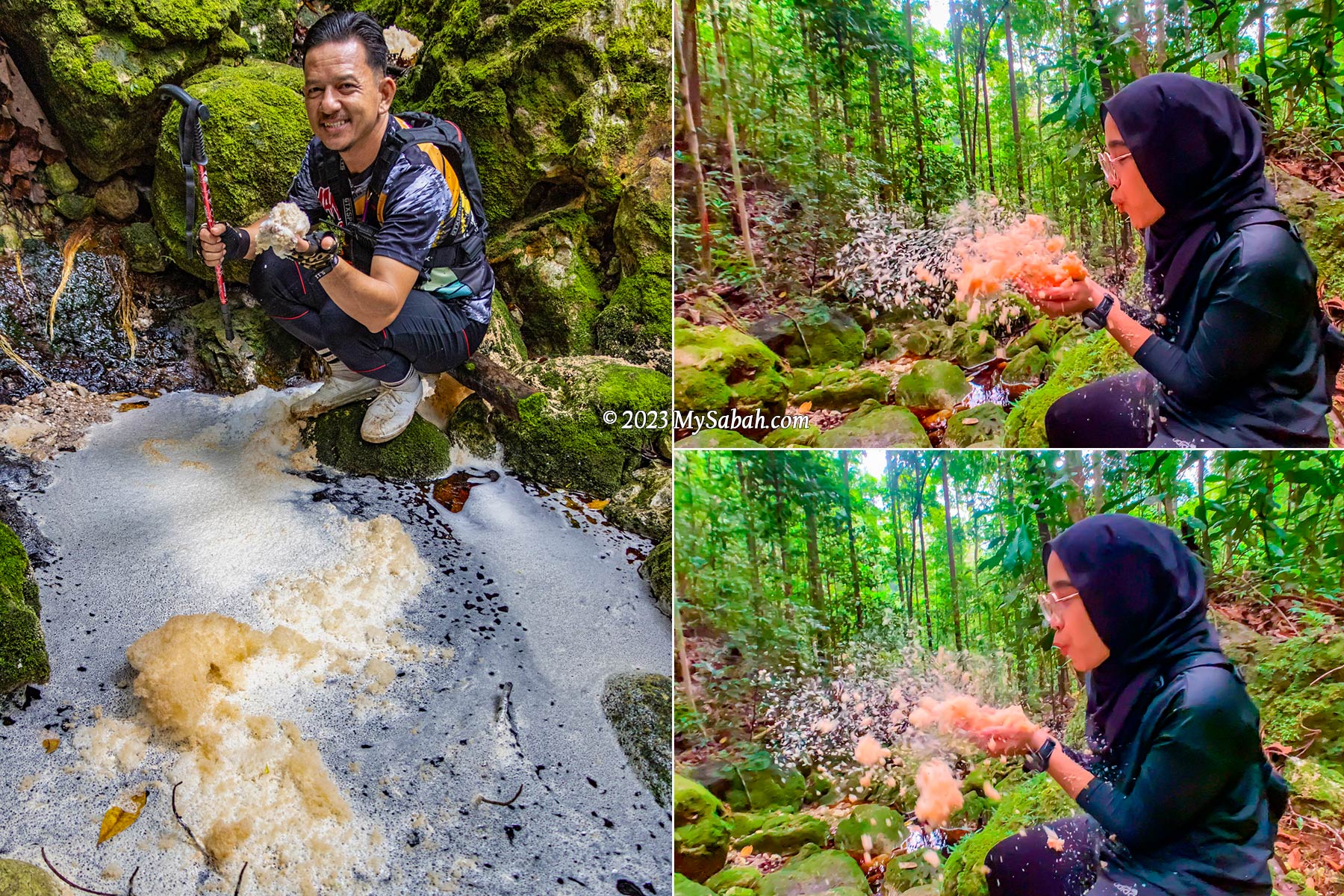
Foaming on the streams is common, due to the saponin and humic composition in the water
Such tea-colored water is also well-known for its foaming nature, probably due to the saponin and humic composition originated from the peat of heath forest. The water is a bit acidic but safe to drink after boiling.
Zura blowing the foam of red river for fun, as if she is in a bubble bath.
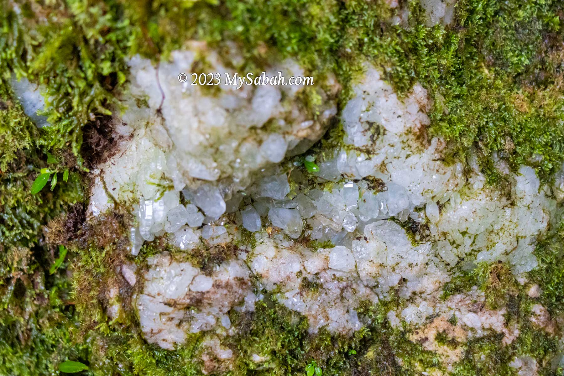
We are excited to see a few river rocks that have cracks with crystals inside them. The guides say there are more crystals on Wullersdorf Peak.
Crystals embedded in a river rock
First Peak
There are two peaks to conquer in our climb. The first peak is only 2 km away. When the peak is getting near, we move away from the river trail and walk up a slope with mild steepness. I notice there are some whitish volcanic rocks on the higher ground. We arrive the first peak at 10am.
An Ancient Volcano
Mount Wullersdorf is an extinct volcano. Such volcanic landscape is only found in Southeastern part of Sabah, where volcanic eruption occurred between 1 to 9 million years ago. Even today we can find the remnants of volcanism in Sabah such as Columnar Basalt at Balung River (Tawau) and Bohey Dulang Island in Semporna.
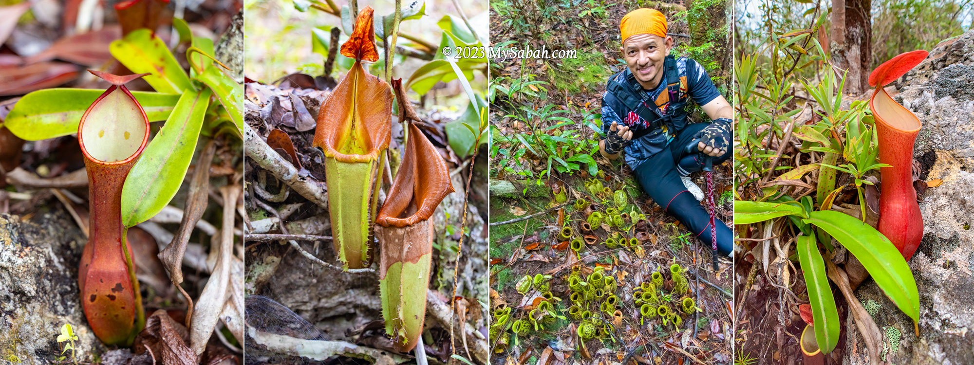
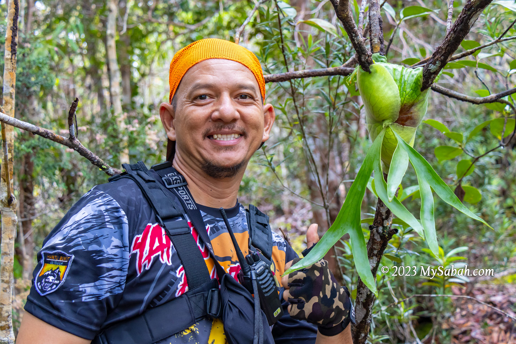
A tree full of pitcher plant before the first peak. You can easily tell that they are Nepenthes reinwardtiana by the two dots on their inner walls.
From Miocene to late Pleistocene, a series of volcanisms creates the major mountainous backbone of the Tawau mountains, which include Mount Wullersdorf, Mount Maria, and Bombalai Hill. The earlier volcanic rocks of andesitic and dacitic composition formed a line of composite volcanoes from Mount Magdalena to Mount Wullersdorf and Mount Pock at Semporna District.
Picture of the first Wullersdorf Peak and a barkless tree nearby
Most climbers wouldn’t realise that Mount Wullersdorf is an extinct volcano since most of the traces and features of volcanism are covered up by dense forest nowadays. I wonder how many people know there are at least 10 extinct volcanoes in Tawau.
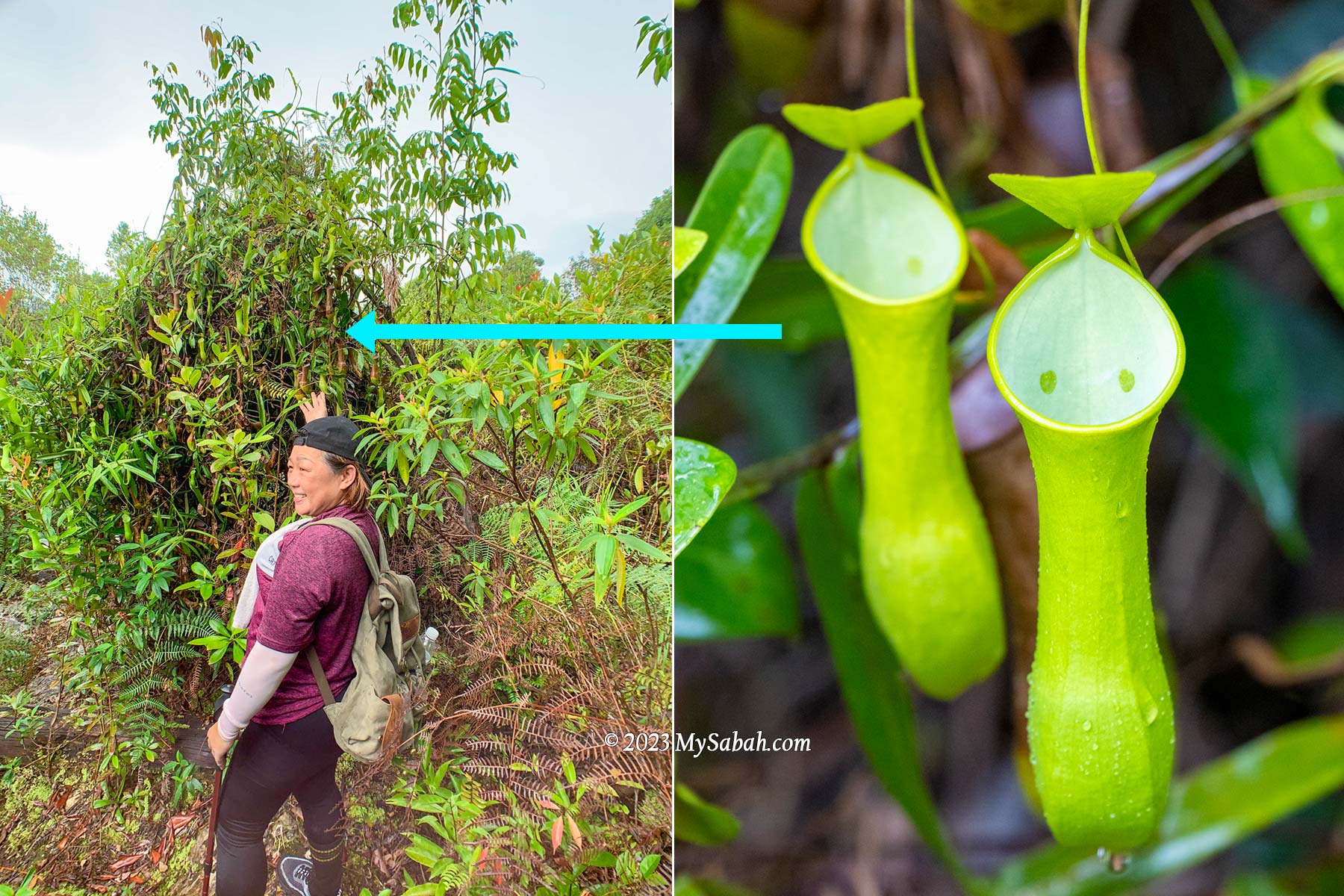
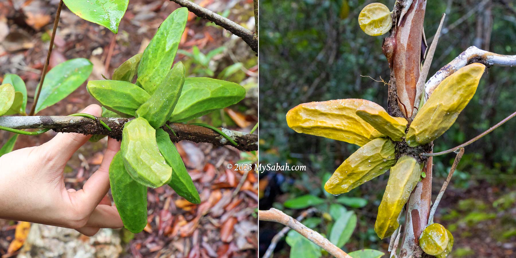
Two variants of Nepenthes ampullaria near the peak of Wullersdorf. These cute pitcher plants have wide open mouth to collect leaf debris as nutrients.
Anyway, it’s easy to spot many pitcher plants around the first peak. Nepenthes ampullaria likes to grow in damp area under trees, where it can collect leaf debris as food with its wide open mouth. Nepenthes reinwardtiana (green variant) is another common pitcher plant on this mountain.
2rd to 6th KM
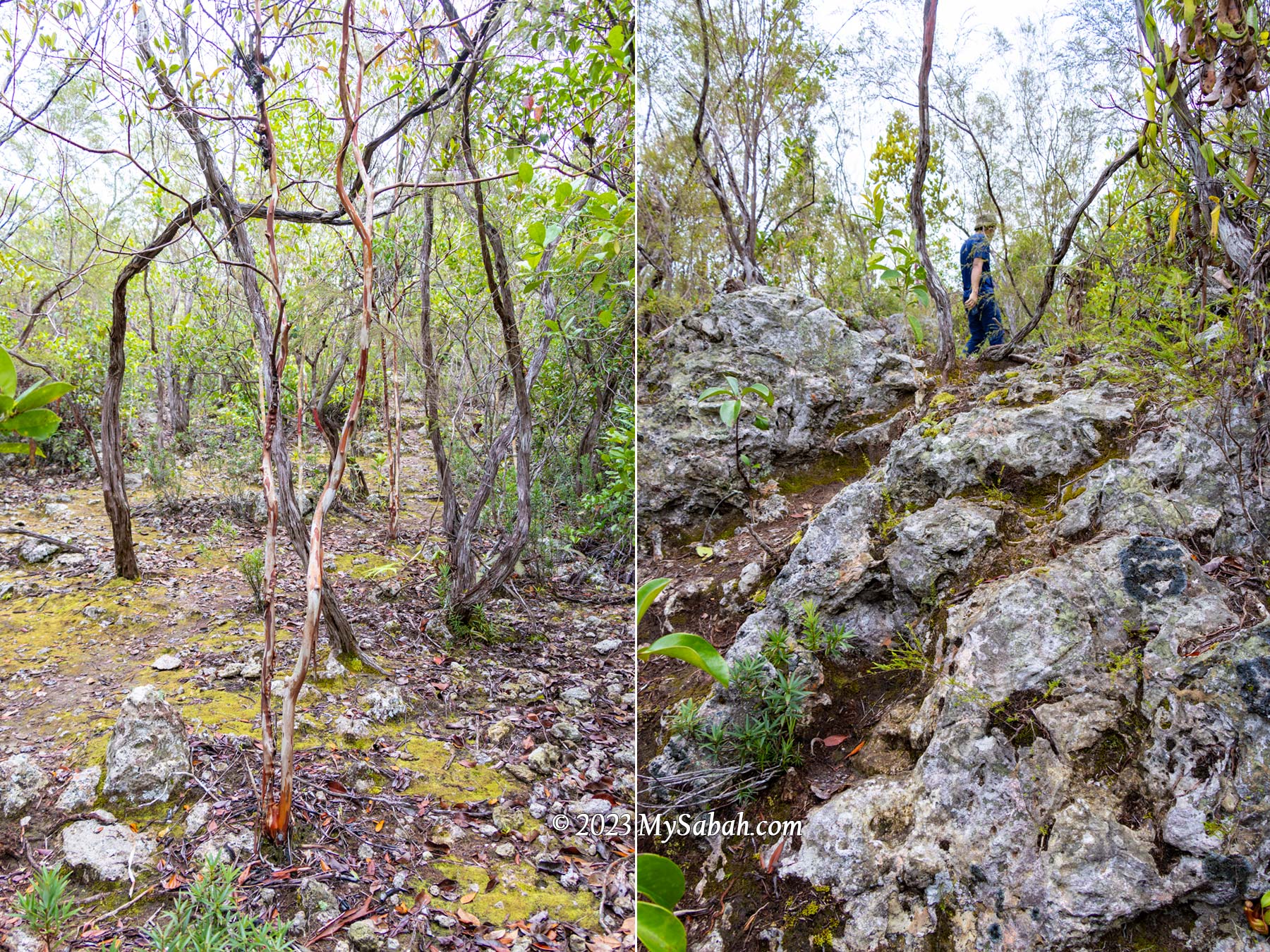
After a short break on the first peak we proceed to the second peak about 4 km away. The trail between the first and second peak is mainly jungle trail with more even surface, which I enjoy more. The peak area is heath forest, a forest type that covers only 2 to 3% of Borneo island, the home to the largest heath forests in Southeast Asia.
Milestone signages that tell us how many metres we have walked. The words are misleading because they make it sounds like a count down, which is not.
Heath Forest (Kerangas)
In contrast to the typical Borneo rainforest with towering trees, heath forests are characterized by shorter, pole-sized trees that are mostly lower than 20 metres with a stem diameter of 10-20 cm. The short-statured trees are a result of inherently infertile, acidic, white sandy soils.
Tropical heath forest of Wullersdorf forest. The soil is sandy and infertile so the vegetation is thinner.
The Iban people of Sarawak call heath forests as “Kerangas”, which means “forest with underlying soils that cannot grow rice”. Only specialized plants can survive such soils with poor nutrients. Though the plant diversity of heath forest is lower than rainforest, it has higher numbers of rare and endemic tree species with high conservation value.
Rhododendron flowers and an unknown fruit on the peak of Wullersdorf
Borneo has the widest variety of heath forest in Asia. Lowland heath forests (below 1,000 metres above sea level) like Wullersdorf are found inland on sandstone plateaus and cuesta formations on the hillsides.
Last 500 metres to the peak of Wullersdorf. The trees become smaller as we moved up.
The surrounding is lit because the small-crowned trees there don’t obstruct much sunlight. The higher the ground, the smaller the trees, to almost shrub-like. We walk in dense thickets of tidy straight bole stem trees with stunted appearance. The forest floor is criss-crossed by tangled roots, making the ground soft to walk on.
Approaching the peak of Wullersdorf, which is dominated by heath forest (kerangas)
One of the special trees we see is Tristaniopsis trees, easy to identify by its orange-brown, smooth and shiny trunk, with scrolls of bark that spontaneously peel-off, hanging as untidy bunches along the trunk and forming a heap at the base of the tree. The forest is quiet. We hear a few hornbills flying over the canopy.
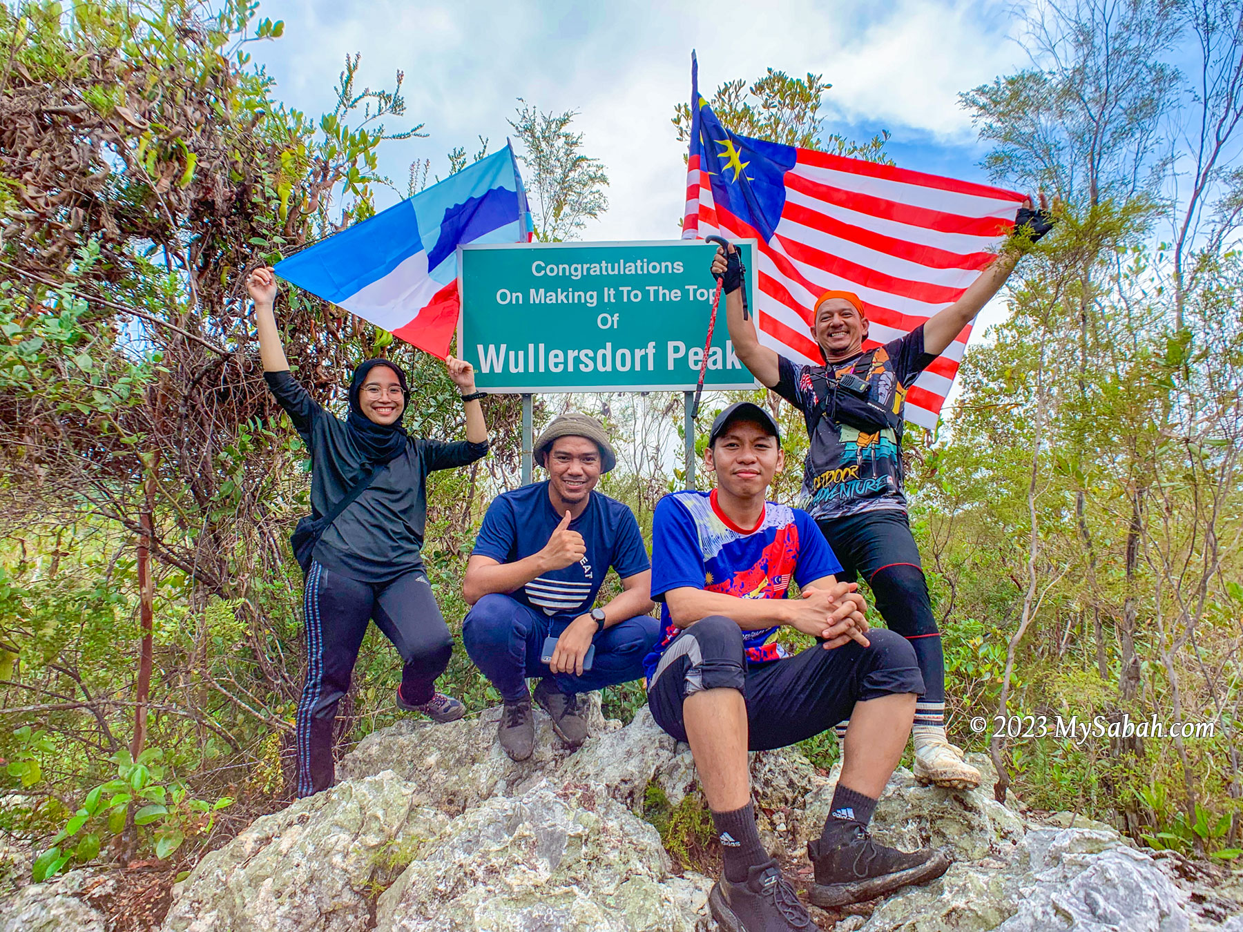
Wullersdorf Peak (Height: 430 Metres)
As we are approaching the second peak, the trees getting sparse, more sandy soil is exposed and the ground is more rocky. Finally we reach Wullersdorf Peak by noon. It’s a rocky peak surrounded by loud cicada calls and greyish volcanic rocks.
We reached the Wullersdorf Peak at noon. The height of Mount Wullersdorf is about 430 metres (1,411 ft) above sea level.
We spend on summit to have our lunch. I decide to explore around the peak as the understory of heath forest is often filled with remarkable plant species.
Pitcher Plant and Ant Plant
Forests thrive on two primary nutrients: nitrogen and phosphorus, what the kerangas is lack of. Under nutrient-deficient environment, carnivorous pitcher plants survive by trapping and digesting insects for additional nutrition.
Different species of pitcher plant on Wullersdorf Peak. From the left: Nepenthes reinwardtiana (red variant), Nepenthes veitchii, Nepenthes ampullaria and Nepenthes gracilis
Uncle Mul told me that there are seven species of pitcher plant in Wullersdorf. I found Nepenthes ampullaria, Nepenthes reinwardtiana (red and green variants) and Nepenthes veitchii (endemic to Borneo).
Dischidia, aka Ant Plant. The pouch-like things are the modified leaves that are hollow inside for ants to nest, so the plant can absorb their waste as nutrients. This is a symbiotic relationship between ants and plant.
Instead of preying on insects, ant-plants choose to work with insects and build a symbiotic relationship with ants. I find a few green and yellow epiphytic ant-plants (Dischidia major) twine around the branches of trees. These ant-plants possess pouch-like modified leaves with hollow inside that acts as a shelter for ants. In exchange for the accommodation, the ants provide the plants with nitrogen-rich debris and feces.
Staghorn ferns of the peak of Wullersdorf Peak. It’s known as Tanduk Rusa (means Deer’s antler), an expensive ornamental plant. Pakri says it’s his first time seeing this fern in Wullersdorf.
Wild staghorn ferns and rhododendron flowers are my other favourite sighting in this kerangas garden. I’m sure there are more to see if I stay longer.
Crystals and Gold of Wullersdorf
The most fascinating feature of Wullersdorf are the crystal rocks, which are abundant on the peak. Quite a number of rocks there are embedded with translucent white and pinkish crystals of different shapes and sizes. I also find many crystal fragments on the ground. I never see anything like this in other places of Sabah.
Pitcher plant growing on a crystal rock
Some believe that crystals have healing powers and able to boost your mood. I don’t know if it’s true. But if you give me crystals, I’ll be in good mood. Don’t worry. I only photograph them and didn’t take any.
Big chunks of crystals on the peak. One has heart shape, some are pink colour and some covered by lichen.
In nature, crystal can form when magma cools and hardens. This glittering beauty is another evidence that proves Mount Wullersdorf was used to be a volcano. Scientists say volcanic crystals is a time capsule of eruption history. Hope we will learn more about this geotourism destination from its crystals.
Crystals are everywhere on Wullersdorf Peak. I took many pictures but didn’t bring home any crystal.
Wait, Wullersdorf has another fabulous mineral, GOLD. It’s estimated that about 30 tons of gold and 19 tons of silver are buried under a parcel of land about 948 hectares in the Mount Wullersdorf area. Well, we better don’t create another disaster like Mamut copper mine.
Return to Starting Point
After taking zillion of photos, I leave Wullersdorf Peak reluctantly. It’s a relief that we don’t need to turn back to the starting point using the same 6-km trail. We use the 1-kilometre shortcut to return to the starting point.
Left: a tree with big buttress at the foothill. Right: thorny chestnuts strewn on the forest floor
The descending trail takes about 40 minutes and it is the steepest part of the climb. Luckily there are some rope support for us to move down safely because part of the trail is quite slippery. We arrive foothill before 2pm as planned. I would say Wullersdorf Peak is one of the best hiking trails in Sabah. FYI, after the climb many hikers take a dip at the river of Batu Bersusun, the only Columnar Basalt in Malaysia, which is only 5 minutes away from Dewan Balung Cocos.
Is Mount Wullersdorf Hard to Climb?
The climbing trail to Wullersdorf Peak is not too steep and difficult, even for beginners. If you do workout regularly, it’s fairly easy. To experienced hikers, it’s just a long hike. The main challenge is to climb over the slippery rocks about half of the time. Wearing a good pair of hiking shoes can make a huge difference. It’s a bonus if the shoes are waterproof too, though you won’t walk in water.
A big and black lichen which is made up from algae and fungus. It only grows in pollution-free environment.
No rope support, stairway and hand rail are available for the first 6 kilometres. Some steep sections in the last 1-km descend have rope support. You would want to wear gloves for roping. Anti-leech socks are not necessary unless you can’t tolerate leech bite at all. According to the guides, for every 20 people, there might be only one or two of them might get leech bite, as leech (pacat) is not common there.
Cooling off in a pond after the climb. The forest of Wullersdorf is warm and humid.
The forest of Wullersdorf is warm and humid, wearing T-shirt and hiking pants is good enough (preferably quick dry). Drinking water is the most important. I finished 1.2 Litre of water. The summit has limited shade to protect you from afternoon sunlight, apply sunscreen if required.
I booked with Biro Pelancongan Koperasi. The fee is RM35 per person but requires a booking of minimum 10 people (or you can pay more). The fee includes permit (to enter forest reserve), vehicle transfer, guide, and certificate. The gathering point is in Kampung Balung Cocos (see Location Map), a village about 14 km from Tawau airport.
About 40 years ago, a young Japanese boy named Satoshi Tajiri was so fascinated by insects that he loved to explore the forest for collecting bugs. In the early 1990s, inspired by the world of insects, Satoshi invented the wildly successful Pokémon video game and you know the rest of the story. If humans are afraid of insects, there would be no Pokémon game, and also no life-changing discoveries such as honey bees and silkworms.
Insect is a source of inspiration for science, artworks, fashion, movies and even games.
Borneo island is the kingdom of insects and bugs, and it offers far more variety of bugs than what Satoshi saw in his childhood. Some of the insects become an attraction, for example, firefly Christmas trees, Gombizau Honey Bee Farm, butod (sago grub).
Insects of Nuluhon Trusmadi forest reserve. In peak seasons, you could see more than 5,000 species of insects there. Photos by LeeLing
The best place to see insects of Borneo is at Borneo Jungle Girl Camp, located in Nuluhon Trusmadi, a 74,736-hectare (747 KM2) Class I (fully protected) forest reserve in Keningau and where Mount Trus Madi, the second highest mountain of Malaysia situated. I had a wonderful time at the camp just two weeks ago.
20 awesome (or weird) things I saw at Borneo Jungle Girl Camp
A trip to Borneo Jungle Girl Camp is a dream vacation for nature lovers, entomologists, and macro photographers. I’ve visited most rainforest of Sabah and thought there would be nothing new. I was wrong. I was awed by the insect world during my 2-day-1-night trip in the forest of Nuluhon Trusmadi. I just share 20 of them below.
1. Jewel Beetles, the gems of rainforest
Many beetles in Nuluhon Trusmadi are endemic to Borneo and some of them are not named yet. Different beetles seem like wearing armoured wings made of various materials such as wood, marble, metals and leather.
Jewel beetles at Borneo Jungle Girl Camp. Photo by LeeLing
The most remarkable group is the jewel beetles that have a metallic iridescence body. Some rhinoceros, stag, scarab and long-horned beetles of Borneo have such shiny shells. Jewel beetles are the most sought-after trophies by insect collectors and the rare ones can be worth as much as jewelry in black market.
Shiny green scarab beetle of Sabah (species: Pseudochalcothes planiuscula). Photo by LeeLing
Note: you are forbidden to collect any specimen in the protected forest.
2. Pitcher plant with “eyes”
On the way to the camp, there is a rockface area that is almost fully covered by clumps of pitcher plant. The species of this carnivorous plant is Nepenthes reinwardtiana, which is native to Borneo and Sumatra and is unique for the two “eye spots” on the inside surface of its pitchers. Nepenthes reinwardtiana has many different colour forms. In Sarawak, it’s red colour.
Nepenthes reinwardtiana can be found in lowland and highland but is fairly uncommon. The eyespots (see red arrow) are its trademark.
3. Meet the most elegant flying insect
Look like a kite, Moon moth or Luna moth (species: Actias selene vandenberghi and Actias maenas diana) is the most elegant flying insect of Borneo and it has the longest wing tails in insect world. Its swaying long tails are to confuse the predators such as bats, which would target its tails instead of the body. Moth moon is quite rare and I’m glad to see it twice at the camp.
Two types of Moon moths. Left: Actias selene vandenberghi. Right: Actias maenas
4. Flying dead leaves?
How on earth can some moths be so identical to dry leaves? The best camouflage trick human can pull off is a ghillie suit and it’s not even close to these dead leaf moths. Some moths even have holes on their wings to mimic a decayed foliage perfectly!
Borneo moths that mimic the shapes and colours of leaf
5. Praying Mantis, the Master of Stealth
The lethal claws makes Kungfu mantis the apex predator of the insect world. Some species take it to next level by being stealth to ambush their prey. They even rock back and forth to imitate the movement of leaves in wind. Praying mantis also can turn their heads 180 degree to scan their surrounding. Insects in range only can pray for their lives.
Praying mantis in different camouflage. Top: Toxodera hauseri, Bottom: Deropatlys truncata
6. Frog with horns. Is it evil?
Before the trip, I haven’t seen any horned frogs that are endemic to Borneo, so it’s high on my bucket list. Believe it or not. In a rainy evening, one of them just jumped to me in the camp. The one I met is known as the rough-backed horned frog (species: Borneophyrs edwardinae). It’s a brown-coloured medium-sized frog with horns above its eyes. Actually the “horn” is a drawn-out, slender, triangular projection from the eyelid. Horned frogs don’t intend to look like a devil, they need that leaf-like horns to hide among foliage.
Rough-backed horned frog (species: Borneophyrs edwardinae) is endemic to Borneo.
7. Hide and seek with leaf mimic pygmy grasshoppers
Though this insect is tiny and not as flamboyant as other famous insects, it’s a superstar among entomologists who love extraordinary insects. There are only four Borneo species of leaf mimic pygmy grasshoppers and you can find 2 or 3 of them just 15 metres outside the camp!
Leaf mimic pygmy grasshoppers (Paraphyllum antennatum) of Borneo. They are about 1cm in size but they have patterns and colouration that look like an art.
This is exciting as they have very limited distribution. However, it’s fairly hard to spot them as their colours blend into rock faces where they feed on algae. Put them under the magnifying glass and you would see something like a Sail-Backed Dimetrodon (dinosaur).
8. Moth that deceives with pictures
Besides camouflage, moths have another mean to fool predators. Many of them have “faked eyes” on their wings so they look like an owl or snake head.
Left: Macrocilix maia, with pictures of feeding flies on its wings. Right: the eye-like marking on the wings of Brahmid Moth (Brahmaea hearseyi) makes it looks like an owl.
The funniest strategy is employed by Macrocilix maia, a moth with wings that feature a picture of two flies feeding on a poo, to show that it is not delicious. It’s always jaw-dropping to see the work of nature. Who knows in future we would find a moth with a painting of Mona Lisa on its wings.
9. Misty cloud forest is a heaven for insects
Borneo Jungle Girl Camp is located about 1,170 metres above sea level, a highland zone dominated by lower montane forest (cloud forest). The dense forest is showered by fog, so the environment is cooling and humid, the most ideal habitat for insects, as many of them migrate uphill due to global warming and pesticides.
Borneo Jungle Girl Camp and its natural surrounding. The white things on the clear ground at the right are light traps.
Even if some tourists are not fond of bugs, they still come here for the refreshing air and nature touch.
10. Light trap, a magnet to insects
One of the fun activities at the camp is to check out the light traps at night. You know insects are attracted to light. Four light traps are set up on four corners of a ridge in the evening, then we went for dinner and waited for the insect show. We might lure some rare bugs out of the wood without searching hard.
There are four entomology light traps about 150 metres away from the camp. Photos by LeeLing
By the time we came back around midnight, the screens were already blanketed by hundreds of nocturnal bugs of different colours, sizes and shapes. Most of them are moths, with stick insects, beetles, mantis, cricket, grasshoppers, cicada, and katydid among them. Jimmy the camp manager, smiled and said, “in peak season between March and May, the screens would be totally covered and swarmed by insects. You couldn’t even walk near them.”
11. Moths are more diverse than butterflies
The light trap is like a stage for a fashion show by moths. Moths form a very large group, with about 10,000 species in Borneo, in different sizes, colours and forms. You are lucky if you see the gigantic Atlas Moth (species: Attacus atlas) with a wing span of 25 cm, which is among the biggest insects in the world.
There are about 10,000 species of moths in Borneo. Many species are yet to be fully described. The picture at the far left shows some big jet moths with aerodynamic shape.
Hawkmoth is a common visitor too, it’s nicknamed as Jet because of its hawk-like aerodynamic shape and super flying speed of 50 KM/H, the fastest in the insect Olympic. Some moths look like they are wearing a fur coat or Halloween costumes.
Altas moth is the largest insect in Borneo. Two variations of Altas Moth can be found at Borneo Jungle Girl Camp. Left: Attacus atlas, Right: Archaeoattacus staudingeri. Note their wing tips look like snake head. Photos by LeeLing
12. Crab + Spider = ?
You know crab and spider have eight legs but they are totally different creatures. If you can “merge” them, it would look like Crab Spider, Jewel Spider, or Parallel-spined Spiny Orbweaver Spider (Gasteracantha diardi). Despite its intimidating appearance, this spider is harmless to humans.
The bright-coloured Crab Spider is one of the most beautiful spiders in nature
Crab spiders fluoresce blue under ultraviolet light, which is to simulate the blooming flowers for luring the insects that use UV vision. You can bring some crab spiders to a disco night to see their cool UV effects.
13. Bird’s dropping that moves
Besides disguising themselves as a dead leaf or the eyes of predators, butterflies and moths have another camouflage tactic called “masquerade,” a defense that helps them look like inedible objects, such as twigs, stones or bird droppings. Bird’s dropping caterpillar is a great example of masquerade, which increases their survival rates by three times.
Bird’s dropping caterpillar looks and poses like a bird poo for a better survival rate. It doesn’t need to hide under the leaves.
Birds have better eyesight than humans, so it’s difficult to fool them. Therefore, a knobbly body with the correct poo colours isn’t enough. Some bird’s dropping caterpillars use bent posture to copy the look of a dollop of excrement.
14. Searching for peace and a sense of purpose? Go Stargazing
City people would think a description like “starry sky studded with diamonds” is just an exaggeration in the romance novels, until they visit a place that has no light and air pollution.
Milky Way in a starry night of Nuluhon Trusmadi Forest Reserve. Photo by LeeLing
Just come to Nuluhon Trusmadi during moonless days and witness it yourself. To see the Milky Way in its brightest time, the best months are between April and September.
15. Butterflies also loves smelly stuffs
Whenever we talk about butterflies, usually what comes to our mind is a picture of a butterfly foraging on a fragrant flower. What if I tell you that butterflies also love dung? On the way to the camp, I saw a group of butterflies sipping pee on the ground.
Butterflies puddling on the animal urine for minerals. The butterflies in the photos are: (1) Commander (Moduza procris agnata), (2) Abnormal Sergeant (Athyma clerica clerica), (3) Straight line mapwing (Cyrestis nivea borneensis), (4) Athyma selenophora amhara, and (5) Athyma assa pseudocama
In addition to the sweet nectar, butterflies also need some minerals (especially salt) and nutrients that are not available in flowers. You guessed it right. They obtain these from the pee and poo left by other animals. This strange behavior is called puddling, and is mostly seen in male butterflies, which need the materials for their reproduction system.
16. Stick insect the walking stick
At Borneo Jungle Girl Camp, don’t be surprised if you see a walking twig. Stick insect, as the name implies, is an insect that resembles a stick or twig, and it’s the longest insect in the world. Phobaeticus chani or Chan’s megastick, the second longest insect in world’s record (567 mm or 22.3 inches), is from Sabah. Their eggs are large and some village kids eat them like a snack.
Stick insect from Nuluhon Trusmadi. This one doesn’t have a name yet.
Some stick insects at the camp still wait to be named. Therefore, you can discover the new species there and name the ugly ones over your mother-in-law or boss. Some stick insects are capable of laying eggs without the need to mate with males to produce offspring. Crazy huh?
17. Birdwatching
Very few people know about this so it’s almost like a little secret. The montane forest near the camp is a great birdwatching site. Avid birders would be thrilled to see Bulwer’s pheasant, Bornean Pitta, Whitehead’s Broadbill, Red-naped Trogon, Red-bearded bee-eater and Black-and-yellow broadbill, just to list a few rare or famous ones.
Birds in Nuluhon Trusmadi forest. From left: Red-billed Malkoha, Crested Serpent-Eagle, Dark-necked tailorbird. Photos by LeeLing
If you are too lazy to walk, Temminck’s Sunbird, Bornean Bulbul and Bornean Laughing-thrush are always wondering near the camp.
18. Monkey loves bugs?
Monkey is omnivorous and banana is not its only food. But it’s only in my last trip that I first saw a pig-tailed macaque eating insects as a source of protein. It’s quite picky and only choose the big and juicy ones. The crunchy cicada sounds like its favourite snack and followed by jet moths.
Left: pig-tailed macaque eating insects. Right: the crime scene. You can tell most of them are big moths.
This monkey is one of the four macaques that always hang around the camp. They are probably old beta males that are expelled from the troop and form their own bachelor group. As a matter of fact, insects are nutrient-efficient compared to meat, and they may be the solution for the world hunger problem. It’s safe if our close cousins can eat it.
19. Cicada, the singing orchestra of rainforest
For the sound of rainforest, cicada is always the lead singer as it can produce a noise over 100 decibels, enough to cause hearing loss if you leave it singing next to your ears for long hours. The most interesting species is Pomponia merula, which is also known as Six O’Clock Cicada because they start buzzing at six. I want one as an alarm clock.
Left: 6 O’ Clock Cicada (Pomponia merula), native to Borneo. Photo by Pavel Kirillov. Right: 7 O’ Clock Cicada (Megapomponia imperatoria), photo by 57Andrew
Their counterpart in Peninsular Malaysia is 7 O’clock Cicada (Megapomponia imperatoria), which sings at 7pm (because sun sets 30 minutes slower in West Malaysia).
20. Borneo Jungle Girl Camp is more than a camp
After all the exciting activities in the forest, I only need a hot shower, some nice food and a cozy bed. I thought I was probably expecting too much from a jungle camp. A camping tent is more realistic in such a remote jungle. To my surprise, Borneo Jungle Girl Camp provides all these. They have clean and spacious bedrooms, and bathroom with hot shower. I have absolutely no problem (in fact, would love to) to stay over a month in the camp.
Borneo Jungle Girl Camp is located at 1,170 metres above sea level and surrounded by mountain range and rainforest
The food was yummy too and the cooling weather there boosted my appetite. During my stay, I had nasi lemak, BBQ, steamboat and even seafood. 4G network is available at certain spots in the camp. Electricity is available from 6pm to 6am.
We had fresh fish, meat, vegetables and fruit as lunch at Borneo Jungle Girl Camp, not instant noodle and canned food. We also had BBQ and steamboat the other day.
About Borneo Jungle Girl Camp
Borneo Jungle Girl Camp was established in 1986. With decades of experience in entomology, the founders believe that Nuluhon Trusmadi forest is the most ideal location for entomology studies and entotourism. During peak season, over 5,000 species of insects can be recorded at the site.
Building of Borneo Jungle Girl Camp. After a few expansion, the campsite is complete with electricity (half-day), bedrooms, dining hall, kitchen, toilets and other amenities.
Therefore, the founders spent most of their personal saving to fund the construction of the entomology camp, and they obtained the operation permit from the Sabah Forestry Department in 2006 for tourism, education and conservation on entomology. After a few phases of upgrade over the years, the humble camping tent is developed into a decent lodge complete with accommodation, dining hall, water and electricity, and other amenities that can host up to 60 guests. The camp has been an academic destination for hundreds of students from overseas universities in China and Japan, as well as local tourists who just want to chill.
Malay civet and porcupine, other residents around the campsite. You would see Kijang (barking deer), pig-tailed macaque, and slow loris too. Photos by LeeLing
As Borneo Jungle Girl Camp is situated in the fully protected Nuluhon Trusmadi forest, entry permits are required for visitors and vehicles, so walk-in tourists are not accepted. You can book a tour with Borneo Jungle Girl Camp and they will get the permit(s) for you. The following is the a list of the fees (USD1.00 is approximately RM4.40). Note: though these prices are valid until the end of 2022, they are subject to change:
Nationality
Entry Permit (per person)
Entry Permit (per vehicle)
Camera
Malaysian
RM15 per day
RM100
RM5
Non-Malaysian
RM30 per day
RM100
RM5
*rates are subject to change
Accommodation (meals included)
Room rates per head on twin-sharing basis:
Visitor Type
Standard Room
VIP Room
Chalet
Malaysian
RM300
RM400
RM450
Non-Malaysian
USD120
USD170
USD190
Room rates of Borneo Jungle Girl Camp (valid until the end of 2022)
Rooms are available at Borneo Jungle Girl Camp. You don’t need to bring your sleeping bag and pillow.
The temperature at the camp can drop to between 10 and 16°C (50 – 61°F) at night, so bring some warming clothing such as a windbreaker. Daytime temperature is between 28 to 30°C (82 to 86°F). To see more wildlife, spending two or more nights is recommended.
Sunrise view from the balcony of VIP rooms at Borneo Jungle Girl Camp
How to get there
The distance between Kota Kinabalu City and Borneo Jungle Girl Camp (GPS Coordinates: 5.443048041703671, 116.45120820208399. See Location Map) is about 160 KM, which takes 3 hours and 30 minutes to travel one way. The first 128 KM is asphalt road with fair condition. The last 32 KM to the camp starts at the junction to Jalan Ranggom Kepayan in Apin-Apin (Keningau), which is an old logging road (mainly gravel road) only accessible by four-wheel drive.
You need a 4-wheel drive to reach Borneo Jungle Girl Camp
Don’t worry if you don’t own a 4WD. You can request the camp for a 4WD return transfer for a fee of RM450 per car (can fit in up to 4 tourists). You can park your car in the village of Apin-Apin, and they will pick you up there. If you want them to fetch you in Kota Kinabalu, the fee is RM1,100 (round trip) per car.
Things to Bring
MyKad / Passport
Cash
Extra clothing (overnight trip)
Jacket or warm clothing
Raincoat / poncho / umbrella
Drinking water
Plastic bags (for soiled clothing)
Toilet paper
Toiletries (toothbrush, tooth paste, face wash, etc.)
Towel
Power bank (portable charger) and phone charging cable
Left: beetle with jewel colours, Right: Ceroplophana modigliani beetle
My Thoughts
Insects being insects, they just do what they ought to do. No insect is bad. Allah / God creates all living things for a purpose. The insects keep our earth balanced and healthy. It’s up to the people to choose if they want to appreciate bugs and become the next Satoshi Tajiri, or let the unjustified fear of insects turns them into a wuss.
“If all insects on Earth disappeared, within 50 years all life on Earth would end. If all human beings disappeared from the Earth, within 50 years all forms of life would flourish.” – Jonas Salk