 by
by How do middle-aged people travel? Most people my age prefer leisure travel, choosing options like safaris or cruises. But can a 50-year-old guy like me climb Malaysia’s 3rd and 5th highest mountains? Everyone says they’re tougher than Mount Kinabalu. Maybe it’s a midlife crisis, I just went for it. I don’t want to wait until I’m 60.
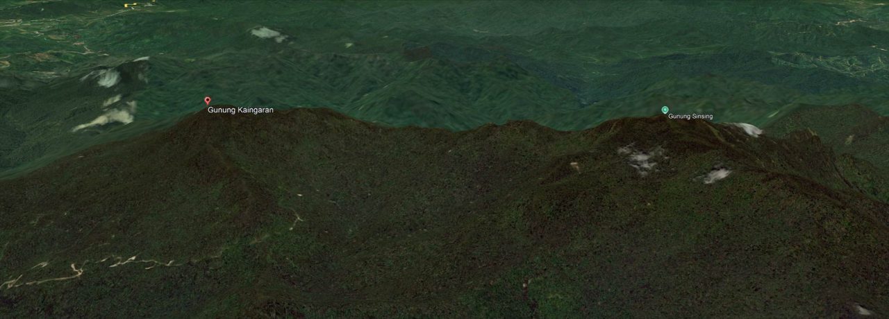
Mount Sinsing (2,586 m) and Kaingaran (2,482 m) sit inside the protected Nuluhon Trusmadi Forest Reserve in Tambunan, Sabah, Malaysia. The vegetation here is a mix of upland dipterocarp and montane forest. To make things easier, I’ll refer to Mount Sinsing and Mount Kaingaran as “Sinkai” throughout this article.
Why Climb Mount Sinsing and Kaingaran (Sinkai)?
Many people spend a fortune to meet their favorite stars. I’m the same, but I spend my energy pursuing beautiful forests. I’m not passionate about the celebrities on the red carpets, but the green carpets in the forest.
My reasons might sound strange. Think of Vincent Munier, the French wildlife photographer who spent five years in the Himalayas just to see a snow leopard. Passion makes sense only to those who appreciate it.
1. Heaven of Nature
Climbing high mountains feels like walking among the clouds, offering a glimpse into a world untouched by humans. The reward is reconnecting with pristine nature and breathing the cleanest air on earth. The Buddha and his disciples often meditated in mountainous forests for stillness and insight. That’s why the Kadazandusun people believe the souls of the dead rest on mountains, the closest thing to heaven.
2. Conquer the 3rd and 5th highest mountains of Malaysia
Mount Sinsing (2,586 m) and Kaingaran (2,482 m) are the 3rd and 5th tallest mountains in Malaysia. Lower than Mount Kinabalu (4,095m), but “Mountains are not feared for height alone, but for the path they hide.” Climbing two mountains in one trip sounds crazy, but it’s a worthy badge of honor.
Every mountain has its own personality. Sinkai’s mountains are made of ancient sedimentary rock, unlike Kinabalu’s granite body. These sedimentary layers were once seafloor deposits uplifted by tectonic forces tens of millions of years ago, forming today’s rugged valleys and sharp ridges
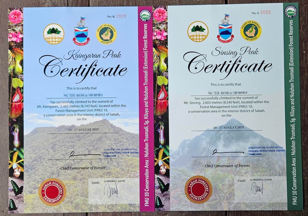
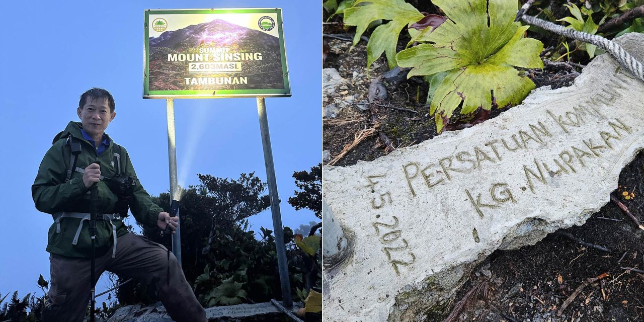
Sinsing’s height was listed as 2,603 m, but that came from an old GPS reading. In May 2023, the Forest Research Centre remeasured it using the Stonex S900A GNSS receiver. The result confirmed Sinsing’s true height at 2,586 m, verified by a licensed surveyor. It remains Malaysia’s 3rd-tallest mountain. Kaingaran’s height is 2,482 m, ranking 5th.
3. Mossy Cloud Forest
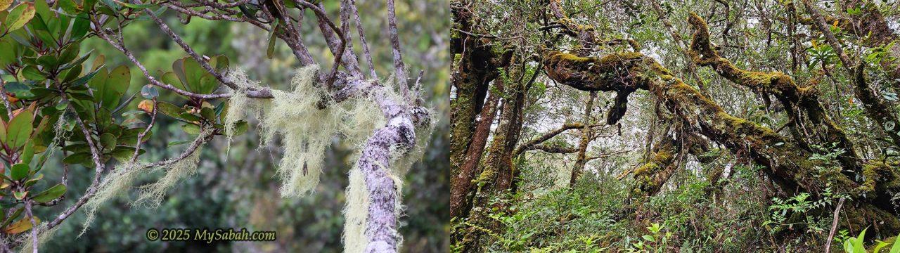
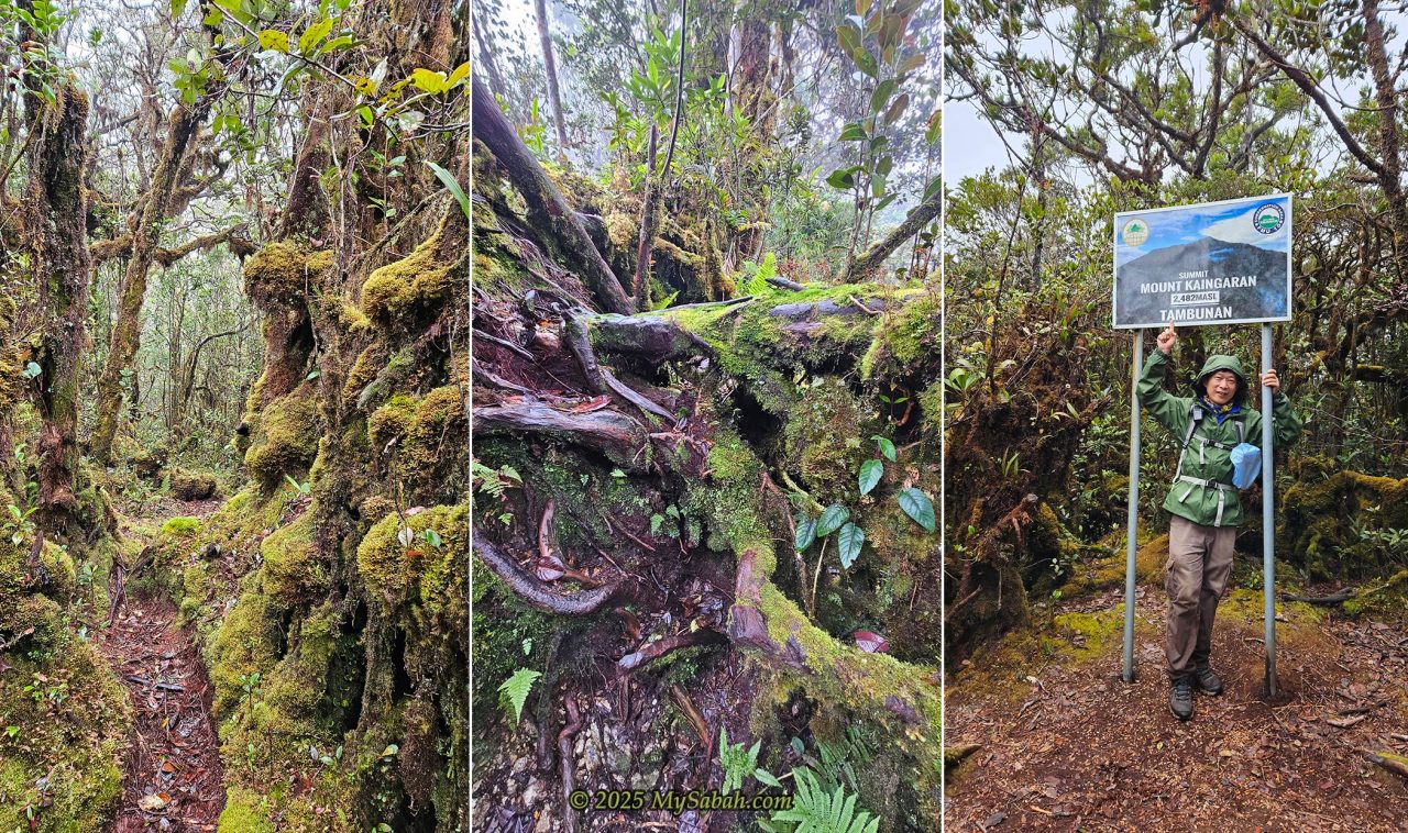
Mount Sinsing’s slopes host lush montane forest between 1,400 m and 2,586 m, often veiled in mist. From afar, its summit is always under clouds. Above 1,800 m, the air grows wet and moss carpets everything. It’s like walking through a fairyland. If you’ve seen Kyoto’s moss temple, Saihō-ji, you’ll understand the magic.
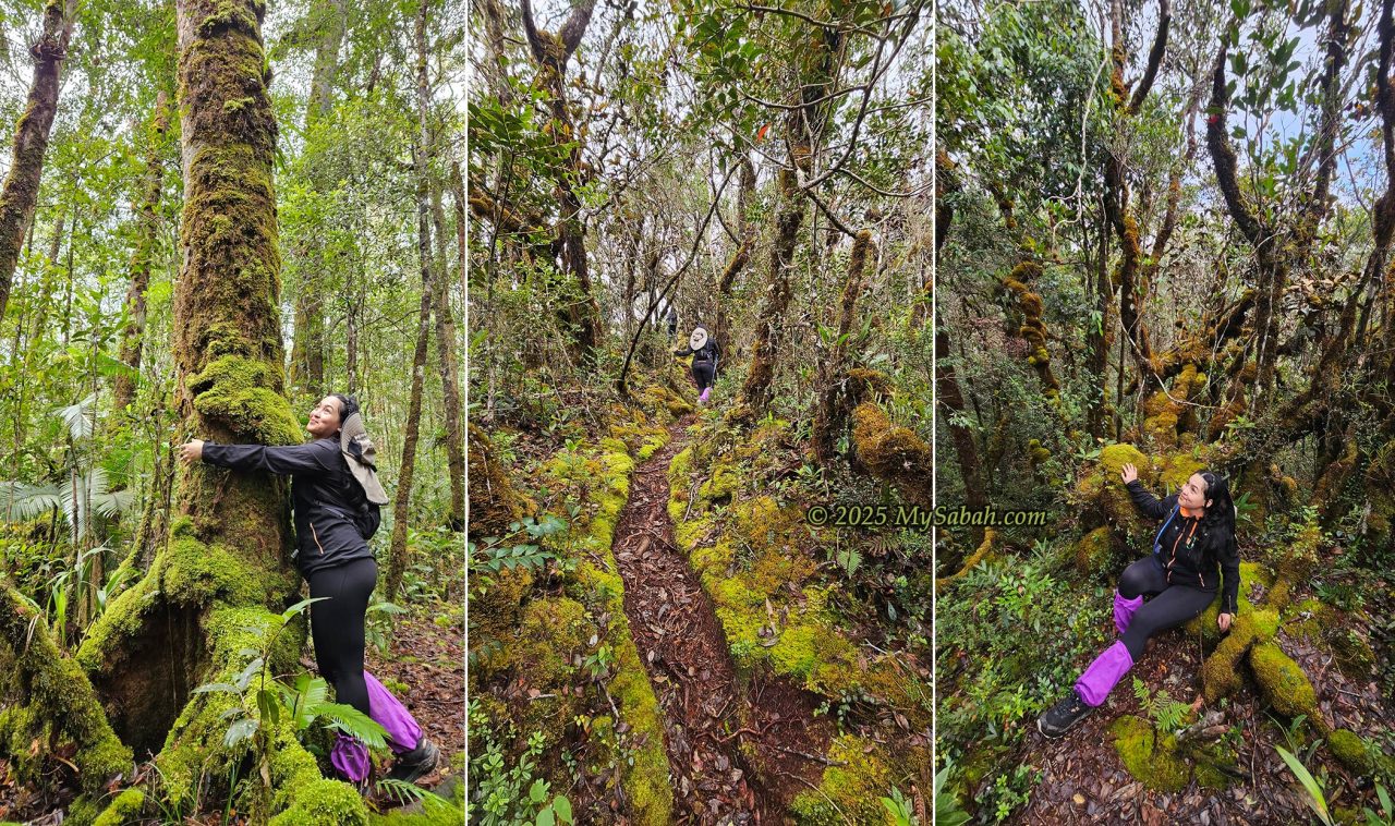
The cloud forest trees are short and crooked, often draped in moss, lichens, orchids, and pitcher plants. They look ancient and enchanted, a stark contrast to the towering trees of lowland rainforests.
Bring a botanist if you dare, but be warned, they may never want to leave. Over 442 plant species have been documented here, including 108 found only in Borneo and 34 unique to Sabah.
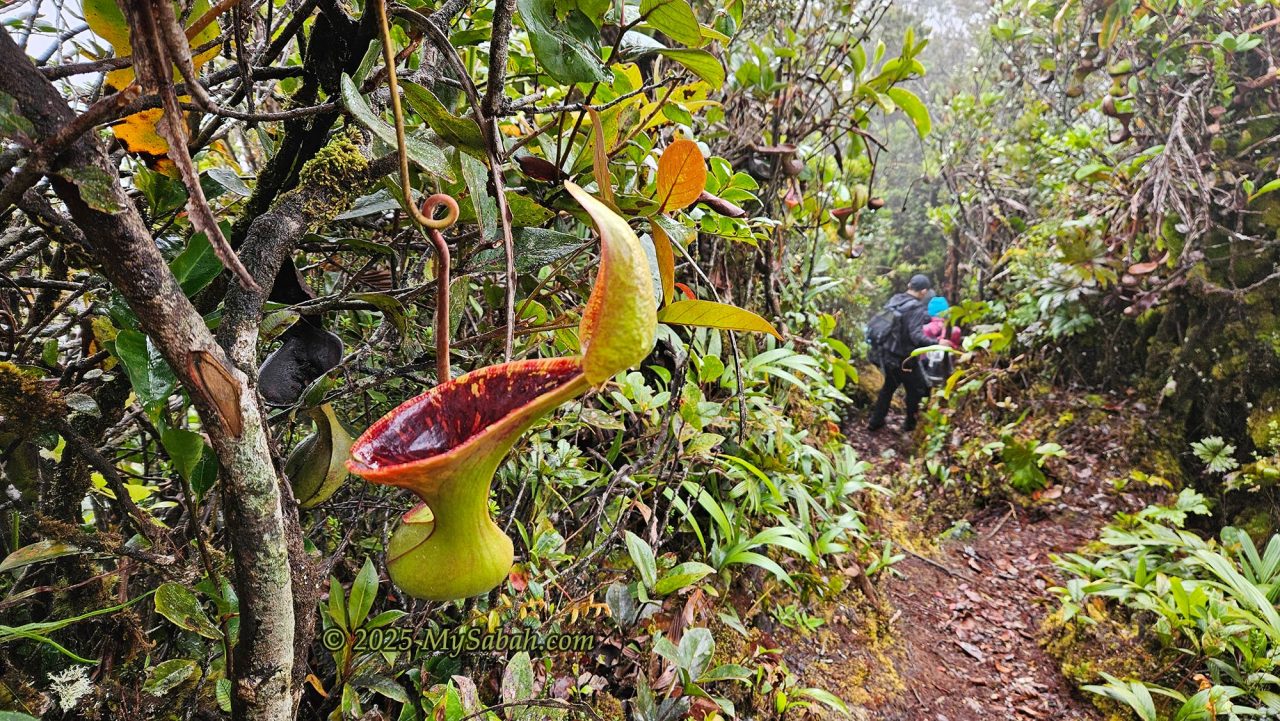
4. Pitcher Plant, the Meat-Eating Plant
Pitcher plants are the stars of Sinkai. The Malay name, Periuk Kera, means “Monkey Pot.” Early European travelers called Nepenthes “monkey cups” because they thought monkeys drank rainwater from the pitchers. Some indigenous beliefs say these plants are cooking pots for forest spirits. Others think they trap restless souls. Old Murut hunters even avoided touching large pitchers.
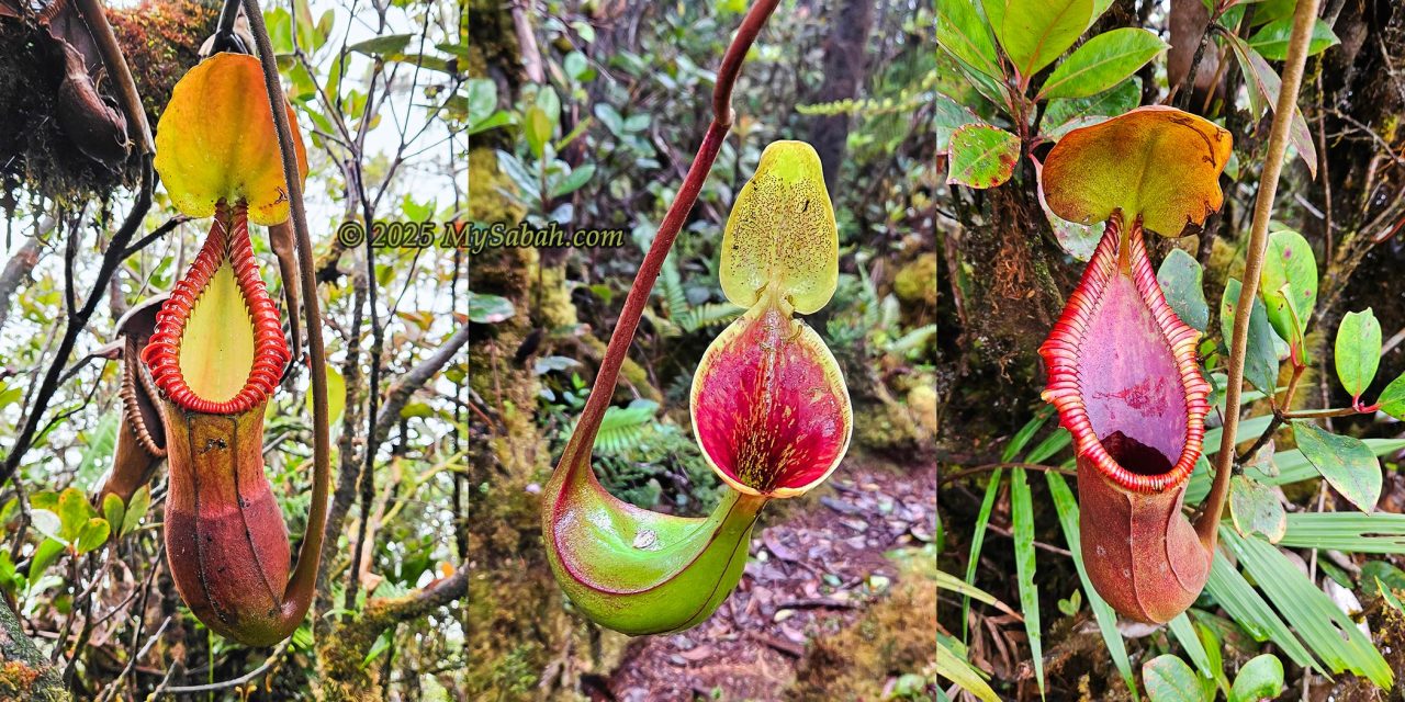
I would say the trail between Sinsing and Kaingaran is the place with the largest number of pitcher plants I’ve ever seen. Among them are large, brightly colored species such as Nepenthes macrophylla, Nepenthes lowii, and Nepenthes × trusmadiensis, all endemic to Borneo. Alfred Russel Wallace, co-founder of the theory of evolution, once called pitcher plants among the most remarkable botanical wonders in The Malay Archipelago (1869).
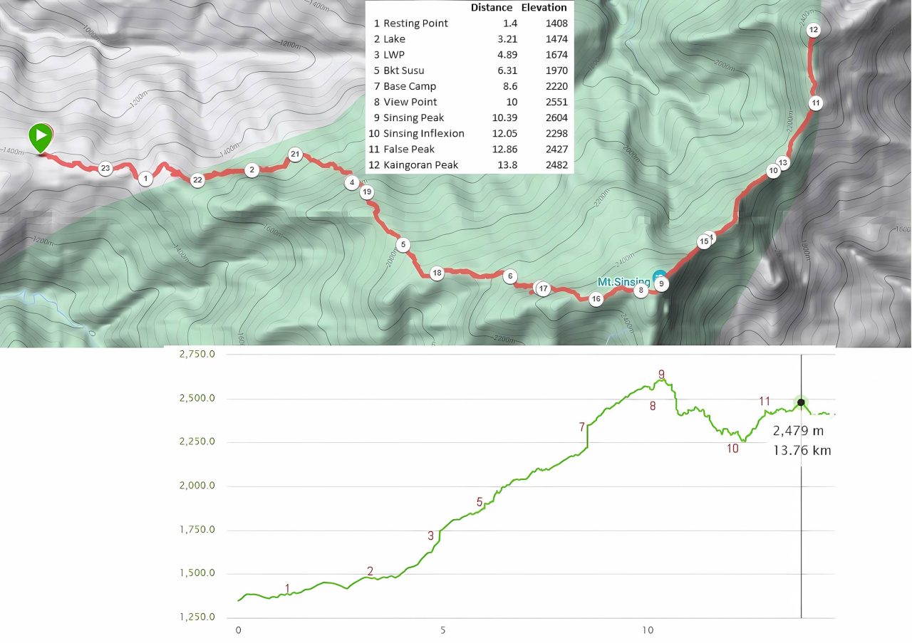
Overview of the Climb (Sinkai)
The Sinkai climb covers about 21 km of rugged terrain for the round trip. I rate it 8.5 out of 10 in difficulty, second only to Mount Tambuyukon (9/10). It’s for fit and experienced hikers. My friends warned me it was tough and damn cold. The trip usually takes 3 to 4 days:
Day 1: Overnight at base camp in Tambunan
Day 2: Climb to Erick Camp on Mount Sinsing
Day 3: Double summit attack
Day 4: Descend and return home
If you prefer a less extreme option, you can climb Mount Sinsing only. It’s doable over a weekend and rated around 6.5/10 in difficulty. Adding Mount Kaingaran triples the effort with an extra 9.2 km of trail.
Walk-through of the Climb
Here’s my detailed account of my 4-day Sinkai experience in August 2025. This would give you a good idea of what to expect and prepare.
Day 1. Overnight at Tambunan Camp
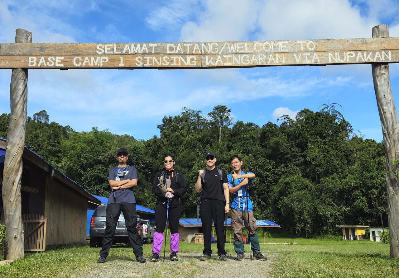
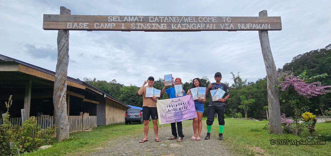
No climbing yet, just driving. From Kota Kinabalu City, it’s a 95 km (2.5-hour) trip to Base Camp 1, also called Kaingaran Camp, in Kaingaran Village about 24 km from Tambunan town. The road is mostly paved and highly accessible.
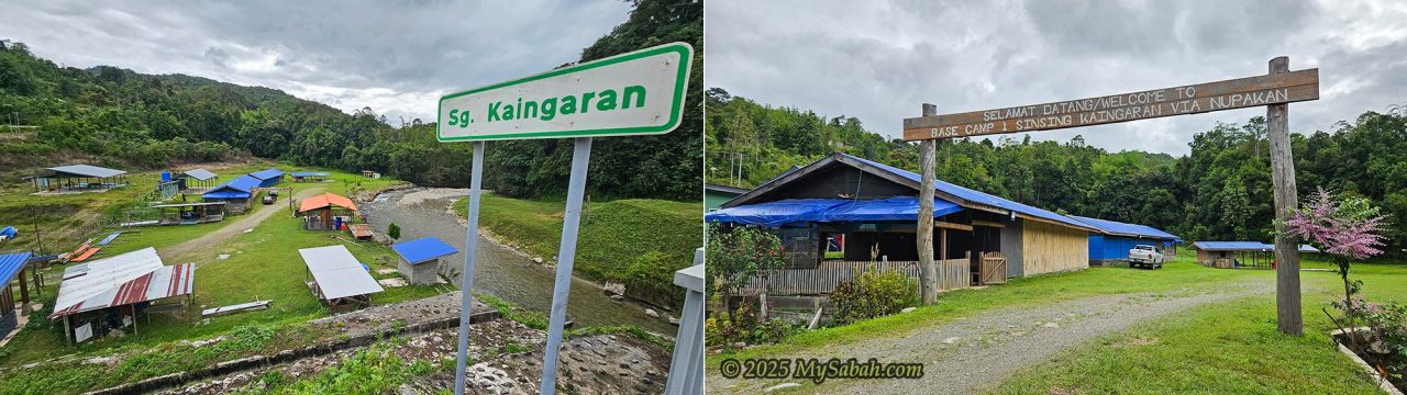
Base Camp 1 is the last stop before the wilderness (See Location Map). It sits beside a clean, fish-filled Kaingaran River where you can soak your tired feet, though fishing is prohibited. I arrived at the camp at 2:27pm. As there is no major activity on day 1, you can check in late.
You can park beside the cabins to unload your bags. No mobile coverage for the Internet, though, you’ll need to walk up a bit to get a signal at higher ground.
Base Camp 1 (Kaingaran Camp)
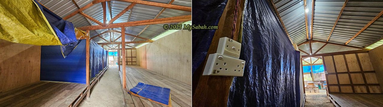
The metal-roofed camp consists of two long wooden buildings with a simple dormitory-style layout. The sleeping areas are divided into two rows of raised wooden platforms, with canvas sheets used as curtains for basic privacy. A central aisle of unpaved dirt runs the full length of the building. No beds or blankets, bring your own mat and sleeping bag. Mosquitoes are present, so pack insect repellent or mosquito coils. The campsite can accommodate about 30 to 40 people.
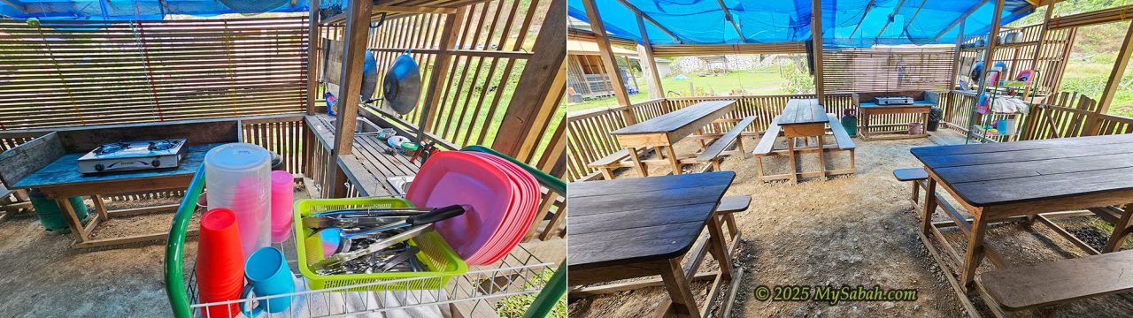
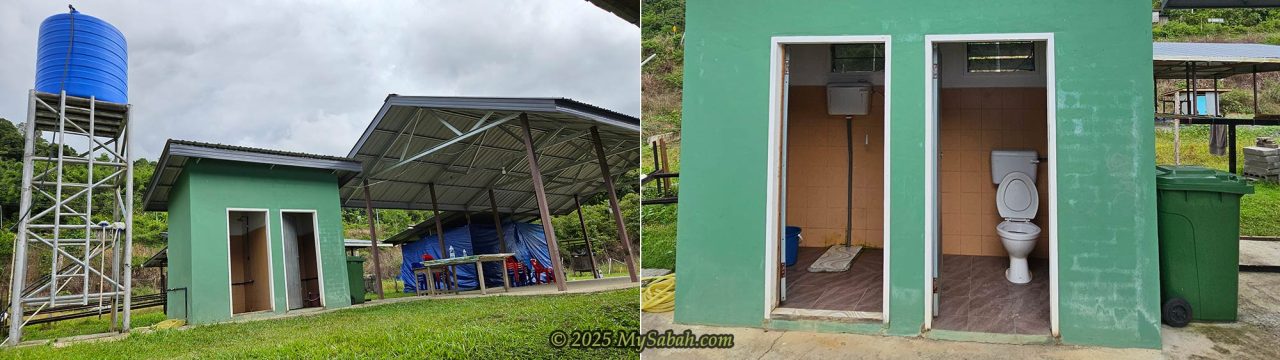
Power outlets, water supply, and lighting are available, and there’s a kitchen with a stove, utensils, cutlery, and a sink. Please cook only halal food. Toilets and showers are behind the buildings, but no hot water.
Stories of the Mountains
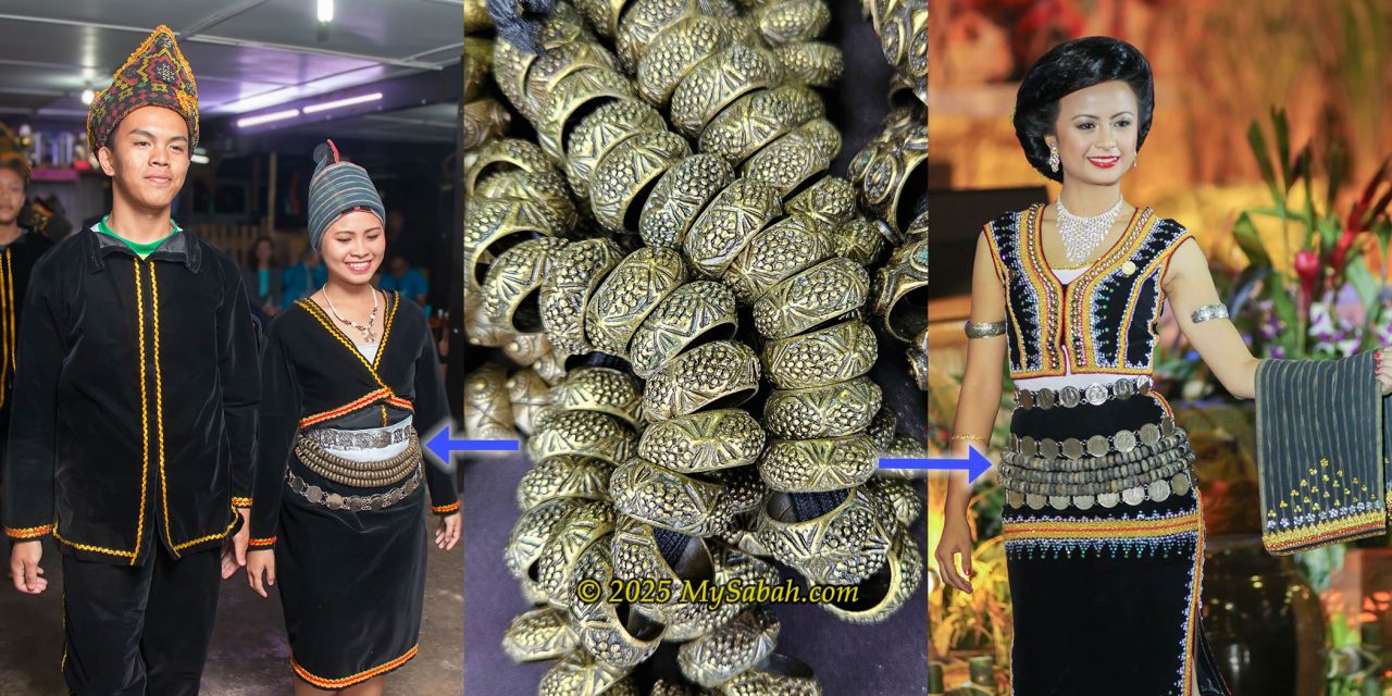
Here’s a bit of folklore for your bedtime stories. Story one: A man once proposed to a girl from Kampung Nupakan, but she rejected him. Heartbroken, he left behind a “Sinsing,” a metal ring belt worn by Dusun women on the mountain. The mountain took its name from that act of sorrow. Mount Sinsing is literally a heartbroken mountain.
Story two: Mount Kaingaran was once called Gunung Gakou, named after an ancestor who hunted there. The range was a hunting and headhunting route long ago.
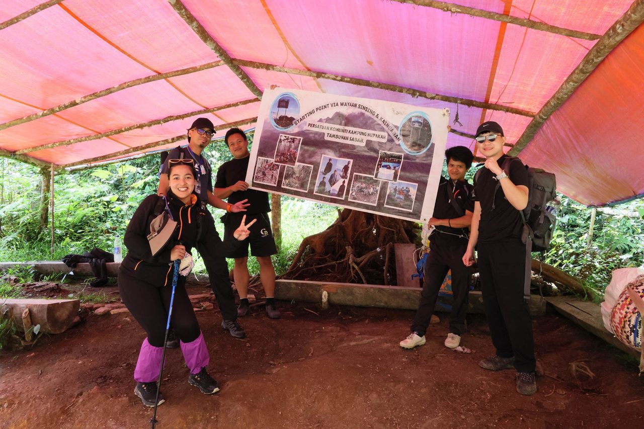
Climbing Team
My team included Nady, Donney, and Firdaus. All seasoned hikers, all nervous. Thankfully, we made it. Firdaus climbed Mount Tambuyukon months later and agreed it was harder than Sinkai.
An officer from the Sabah Forestry Department dropped by our camp to deliver certificates, ID cards, and walkie-talkies. We had to sign indemnity forms too. We joked that we could go home without climbing since we already had the certificates! We went to bed early after dinner.
Day 2. Start of Climb
I woke up at 7 a.m. to a clear sky, a good sign after days of rain. Our guide, Maxwell, and porter-cook, Juan, arrived. We had fried rice for breakfast and packed our lunch boxes. We brought 1.5 liters of water for today’s climb.
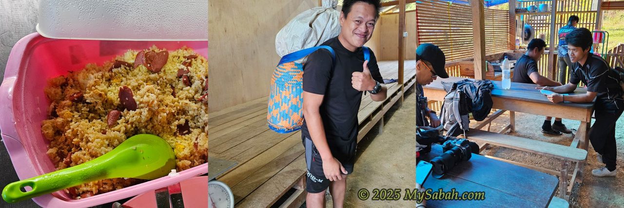
Before some safety briefing by Maxwell, we geared up and handed over some of our things to the porter for weighing. Each of them can carry 20 to 30 Kg but still climb faster than I. The porter fee is RM30 per Kg for the round trip. Normally, I keep my load less than 6 Kg, so I let them carry 10 Kg of my belongings (sleeping bag, clothing, flashlight, power bank, toiletries, food, and snacks). For added protection, pack your things in a plastic bag even if your bags have a rain cover.
Going to the Starting Point
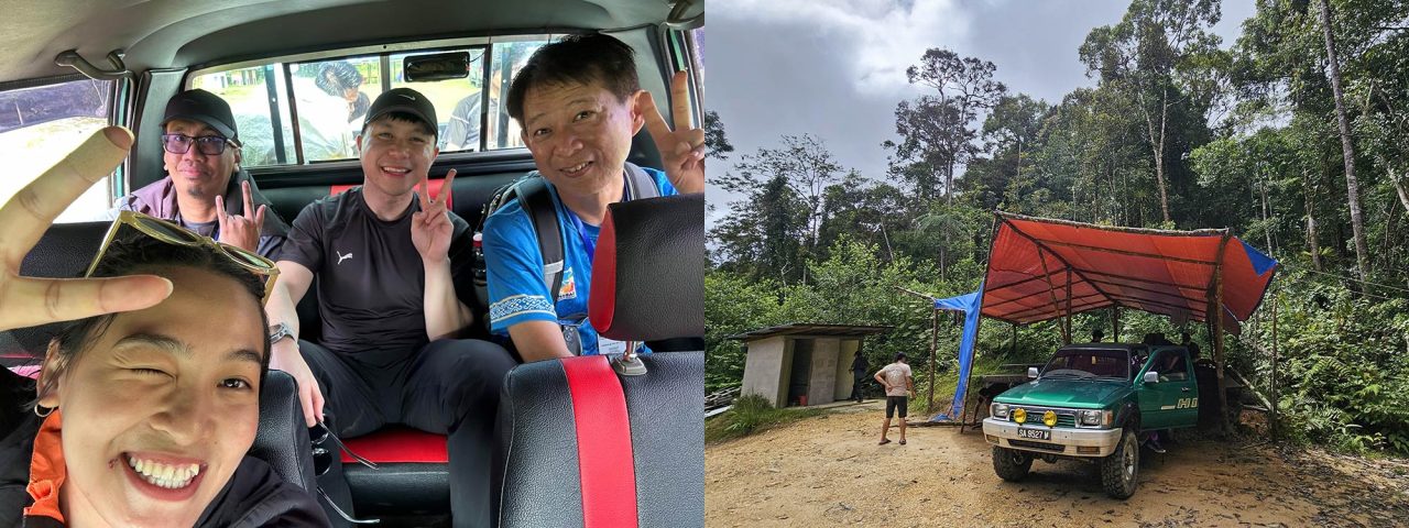
After everything was set, a 4WD drove us 13 km to the starting point at the boundary of the Nuluhon Trusmadi Forest Reserve. We left camp at 9:26 a.m. and reached the starting point by 10:12 a.m.
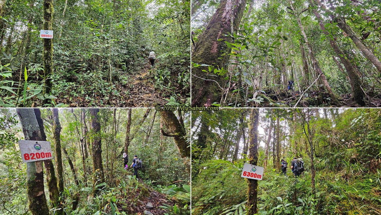
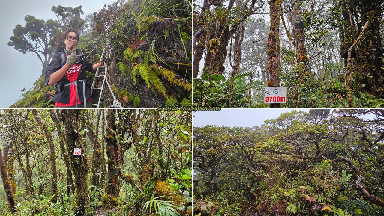
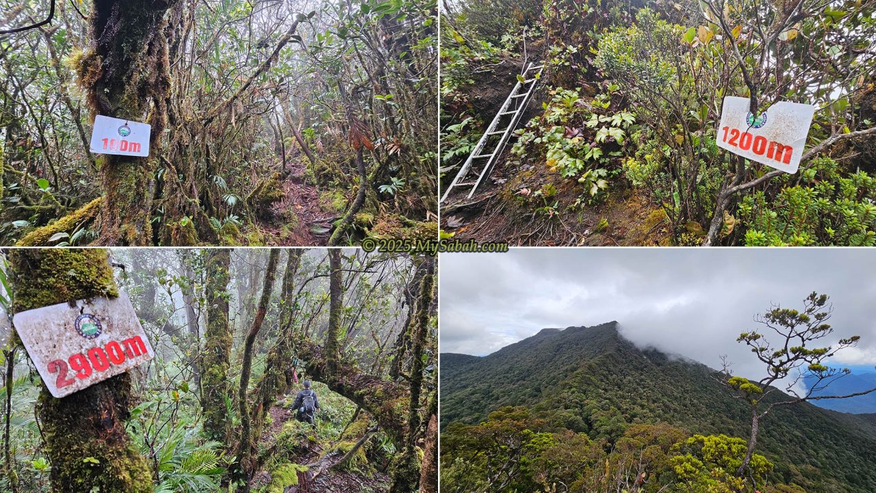
Every 100 to 500 meters, there is a distance marker labeled with a number in meters indicating the remaining distance to the peak of Mount Kaingaran. For example, the 10,700m label at the starting point means we had 10.7 Km left to the peak of Mount Kaingaran. For Day 2, however, we only climbed to Erick Base Camp, about 4.4 Km uphill.
Climbing from the Starting Point to Erick Camp
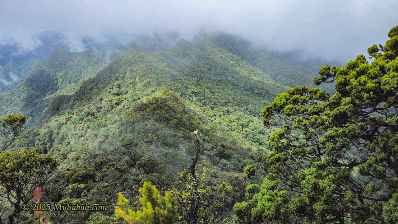
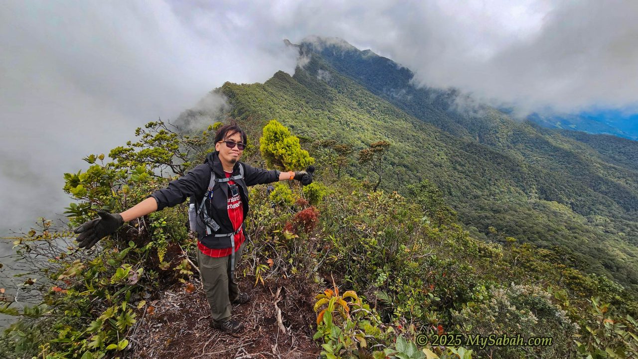
The ascent to Erick Camp on Mount Sinsing began at 10:20 a.m. (10,700m), with a gentle start that quickly gave way to a more challenging trek. The initial kilometers featured a mix of steep slopes (up to 60 degrees) and flat trails, with a key stop at the 9,000m water point (creek). After that, the sound of cicadas filled the air as the forest turned lush and damp, with moss-covered rocks and trees hinting at the higher elevation of the montane forest ahead.
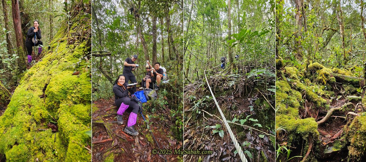
After 9,500m, the trail demanded more effort with 50–70° inclines supported by ropes, and even a few leech encounters along the way. By 11:30am, our group reached a breezy halfway point, followed by a U-shaped trail that dipped before another steep climb. As the path continued past 8,700m, we walked along narrow ridges with cliffs on both sides, surrounded by fog and cool mountain air. The Bukit Susu (Milk Hill) junction at 8,500m offered an optional but tougher viewpoint detour before lunch in the misty highlands.
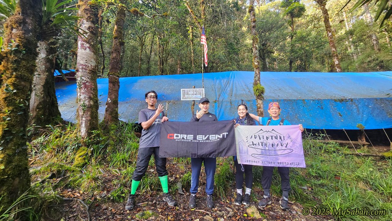
From there, the terrain eased into gentle ups and downs, mixing ridge walks with shaded forest trails. The air grew cooler, the ground more mossy, and the slopes more forgiving. After several rocky stretches and steady climbs, our group finally reached Erick Camp (6,300m) at 2:34pm, completing a roughly four-hour ascent.
Erick Base Camp
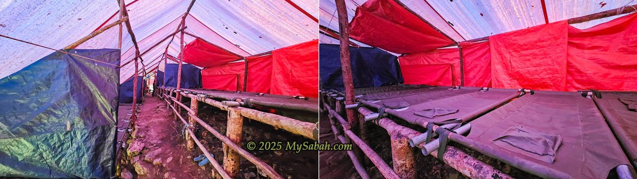
Being a mountain camp isolated from civilization, Erick Camp has no electricity or water heater. The camp has two rows of overhanging beds under canvas roofs. Basically, it’s just a big camping tent that can house about 30 or more climbers. The floor surface is uneven soil. Without lighting in the camp, we had to walk carefully to avoid tripping over a rock. I picked a bed in the middle and laid my belongings on an empty bed next to me.
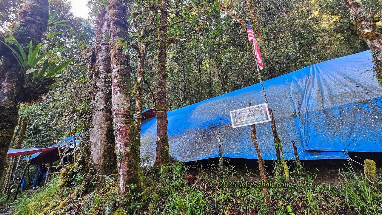
The toilet cum shower rooms is a zinc structure hut about 10 meters away below the campsite. However, the water is freezing cold, and none of us wanted to take a bath. I just used a wet towel to wipe my body. The place is highly humid, so nothing dries here. Do bring enough clothing for 2 days, with 1 comfy set for bedtime.
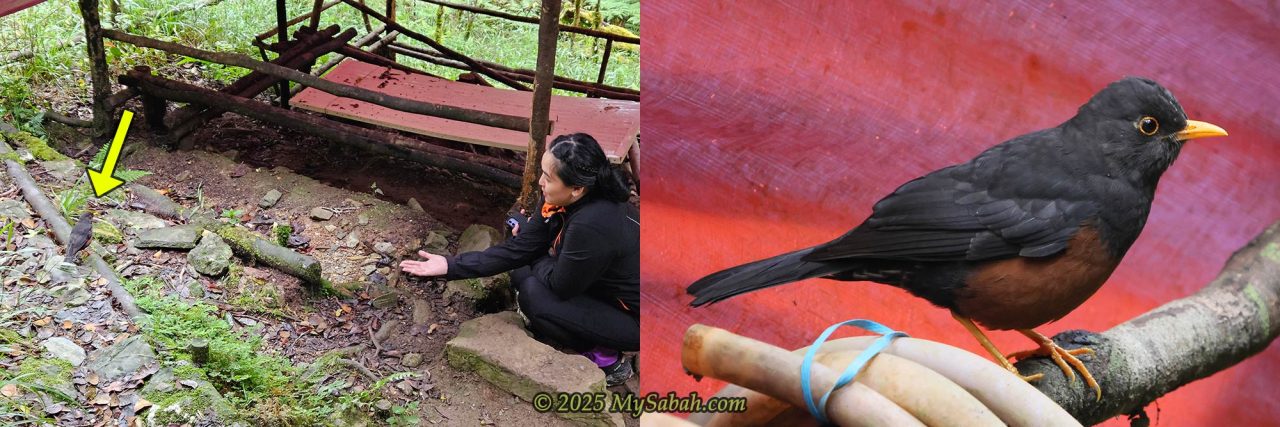
After settling down, Juan prepared our food before dusk. Everyone got hungry fast due to the vigorous climb and the coldness. While we were having some hot coffee in the kitchen, we noticed a few wild animals were also interested in our food. The Bornean Sundaic Island-Thrush (Turdus javanicus seebohmi), a bird endemic to Borneo, wandered around for our food scraps, joined by squirrels and shrews.
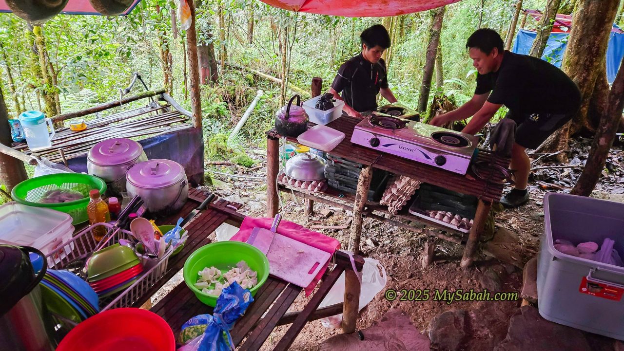
Dinner was ready. Juan placed the dishes on the table buffet-style. We had our dinner with our headlamps locked on the food. We had some rice with meat and vegetables. I was happy that it was a balanced meal.
Without internet or light, there wasn’t much to do, so we went to bed early to prepare for the toughest climb tomorrow. My friends were right: it was cold up here, almost like winter. When we spoke, smoke came out of our mouths as if we were smoking.
At night, cold air can enter through the openings at both ends and under the tents. I still felt cold in my trustworthy sleeping bag that can withstand a low temperature of 7°C. My exposed face even felt a bit numb. Luckily, I listened to my friends and brought a sarong and thick socks for extra warmth.
At midnight, heavy rain pounded the roof. I heard the wind howl and trees swayed violently outside our camp. A part of the roof leaked, and water dripped onto the bed next to me. I couldn’t sleep well and worried that they would cancel the climb.
Day 3. Double Summit Attack
The rain stopped, the climb was on, though it’s still very windy. We woke up around 3 a.m. to take an early breakfast and prepare our lunch boxes. Everyone was quiet. I could feel the tension because we all knew it was gonna be a long and tough day. I only have one word for day 3, HARDCORE. The only good news about the trail is that there are no leeches at this high altitude.
The first target was Mount Sinsing, 1.7 km from Erick Camp, with an elevation gain of 400 m. Maxwell was our guide and a “portable water station”. He carried some water for us so we could pack light. But we still needed to bring at least 3 liters of water, as the climb would last more than 12 hours.
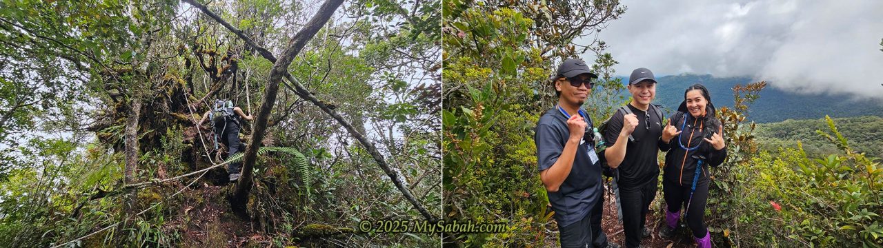
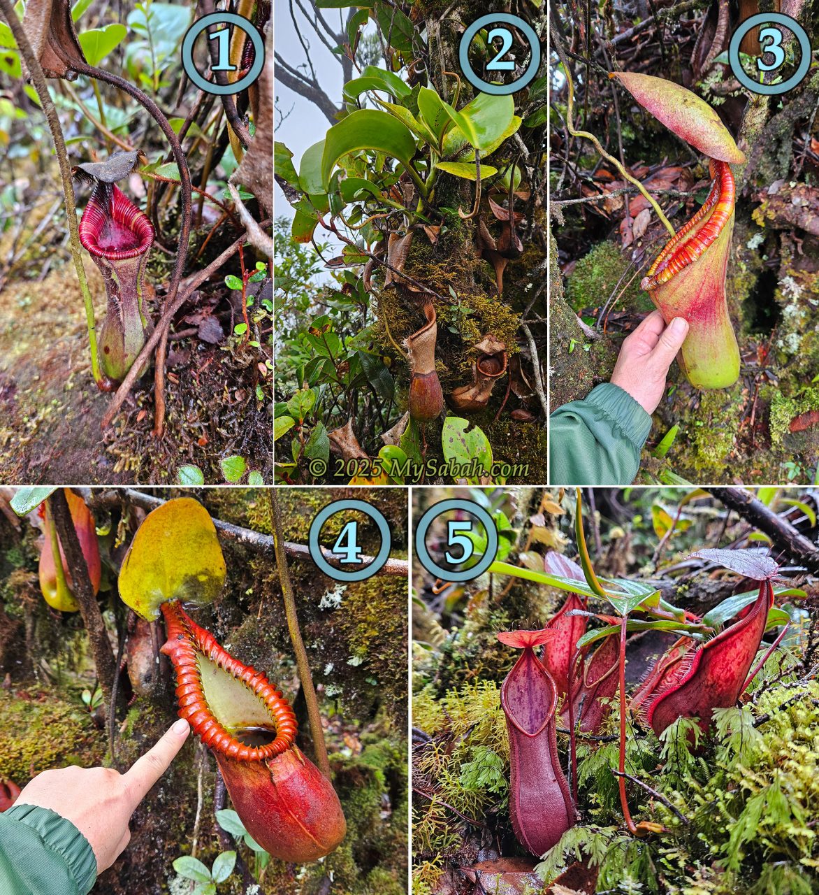
We moved at 4:30 a.m. We climbed quietly with our headlamps on in the dark. The trail was narrow and flanked by dense vegetation. My face bumped into clumps of hanging pitcher plants a few times. The climb wasn’t too difficult; rope support or a ladder was available for the steep sections.
Reaching the Peak of Mount Sinsing
As I neared the first peak, the trail got flatter, fog rolled in with strong wind and mist. I was like being sprayed by mist. My water-resistant windbreaker with a hood served me well. I knew I was near the peak when I heard the distant voices of Nady and Donney.
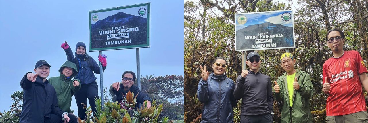
Finally, I reached the summit of Mount Sinsing at 6 a.m. Our initial plan was to wait for the sunrise so we could enjoy a nice view of the sea of clouds and Mount Kinabalu. As it was too foggy, we saw nothing. After taking some photos, we decided to move on to Mount Kaingaran, about 4.6 Km away. “Great! One mountain is off my bucket list,” I thought.
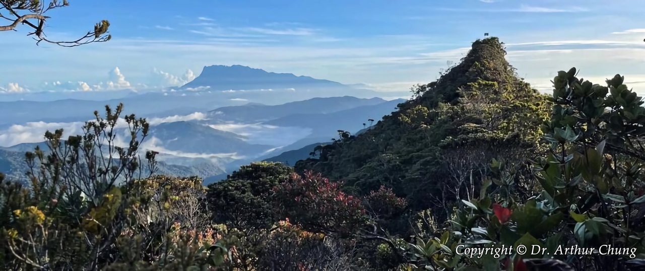
The next 2 km was a long hike along an undulating trail on a forested ridge exposed to strong winds, and we had to cross a few peaks. As we were above 2,000 meters above sea level, we entered the fascinating world of the upper montane forest, which is characterized by a mossy trail, dense epiphytes and lichens, gnarled and twisted trees, and thousands of huge pitcher plants along the trail.
Pitcher Plant Corridor
It’s not too much to call Sinkai the “Pitcher Plant Mountains” because pitchers are all over the place. You would not miss them, as they are big and bright red or green. I was excited to see Nepenthes lowii, Nepenthes macrophylla, and Nepenthes × trusmadiensis (a hybrid of the first two species), all endemic to Sabah/Borneo and thriving only on mountains.
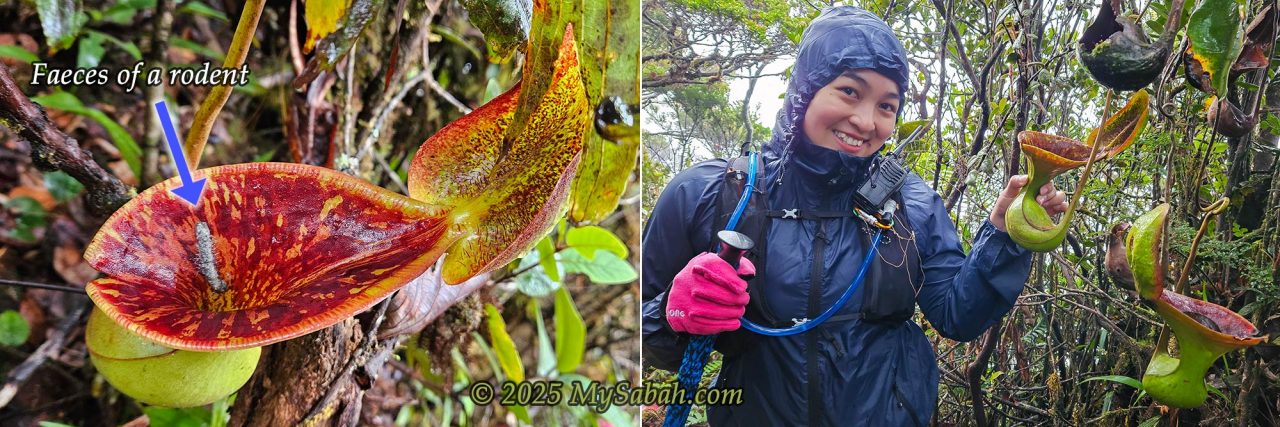
Due to the poor soil nutrients, pitcher plants grow pitchers to trap insects as a food supplement. They are even called “man-eating plants” in urban legends. However, it’s different for Nepenthes lowii, which has a wide-open mouth like a toilet bowl. This is designed to attract shrews to squat and defecate in it while enjoying nectar from the plant. Yes, Lowii is a “shit-eating” pitcher.
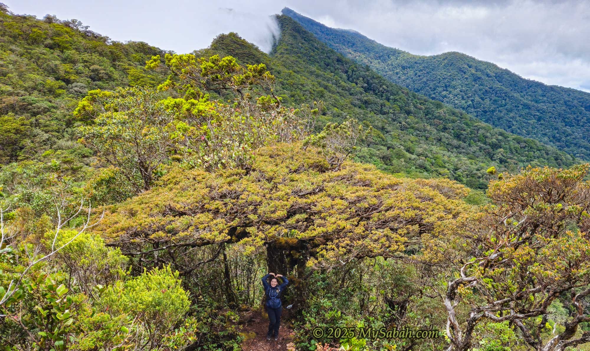
Giant Bonsai Tree
You must take a picture with this cool tree located near the 1,700m signage at the foothill of Mount Kaingaran. They call it the Bonsai Tree because of its broad, flat-topped canopy, but its species is unknown. I would say it’s one of the most photogenic trees in Sabah.
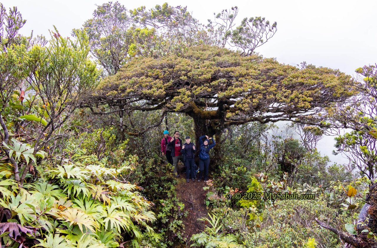
The guide set the cut-off time to reach this spot at 9:30 a.m. Climbers who couldn’t make it would be asked to abort their climb and return to the camp. I reached there at 9:09 a.m., so I was safe. We also dropped some water bottles under the tree to cut down our weight, which we could pick up on the way back.
Conquering Mount Kaingaran
From the Bonsai Tree, the trail got steep and rooty. Even though it’s also a 1.7 Km hike to the peak, it’s more challenging than Mount Sinsing. There was almost no rope support. Each step feels like climbing a staircase built for giants, and I have to grab tree roots to pull myself up.
I fueled up with energy gels. The final 600 m was mercifully gentle, and by 11 a.m., we reached the peak of Mount Kaingaran. No views though, as the summit is surrounded by dense trees. We had an early lunch, then descended after a break.
Returning to Erick Camp
Though we had successfully conquered the mountains, we couldn’t feel relieved yet, as the worst struggle was just beginning. We needed to follow the same trail, walking 7.7 Km back to Erick Camp, and we had to climb over Mount Sinsing again.
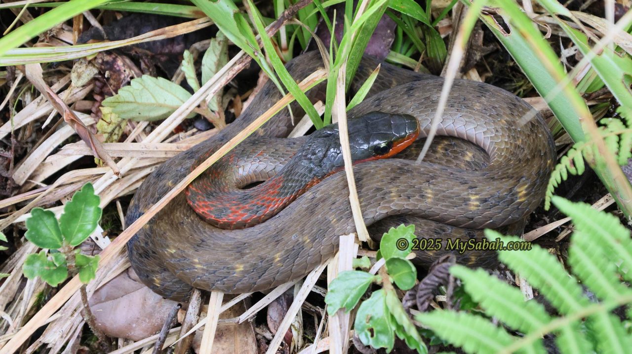
Our guide had warned us to watch our steps while climbing, to avoid stepping on snakes that would come out to bask on the trail. I saw a Fire-lipped Keelback on a narrow trail of a slope. I couldn’t walk around it, so I just jumped over it. It was shocked, coiled into a defensive posture, and then fled. Anyway, I was happy to see it because it is a mountain snake endemic to Borneo.
Halfway through, it started to rain heavily. The rainwater trapped between the tree roots on the ground formed hundreds of puddles on the muddy trail. My feet were completely soaked, even with water-resistant shoes and socks on. I felt so tired and bogged down. I just kept walking like a zombie, noticing the daylight slowly fade as the sun set. Finally, I arrived at the camp at 6:30 p.m. Others had arrived 40 minutes earlier than I, and they were already sleeping soundly on the beds. I was so “battery-low” that I also joined them in the dreamland.
Day 4. Back Home
The dreadful climb was over, and we were happy that we had accomplished our missions. Now, we couldn’t wait to go home. After breakfast, we packed, cleaned the camp, and started the descent at 8 a.m. The trail was still slippery from last night’s rain.
My legs were sore, but I took it slow. After three hours and 4.4 km of descending, we reached the starting point and rode the 4WD back to Kaingaran Camp. That wrapped up the Sinkai adventure.
How to Book?
You may contact Mount Trusmadi Travel & Tours Sdn. Bhd., the most recommended licensed agent for climbing Sinkai. The following is their contact:
Address: Lot No. 5, Kedai Tepi Sungai Tondulu, Majlis Daerah Tambunan, 89657 Tambunan, Sabah, Malaysia.
Whatsapp / Handphones: +60 19-8831568 (Mr. Linus), +60 17-8393815 (Ms. Marylen), +60 13-8723706 (Ms. Ellfy)
E-mail: widuresortbn@yahoo.com, mttrusmaditravel@yahoo.com
A permit from the Sabah Forestry Department and a licensed mountain guide (Malim Gunung) are mandatory. You can book a package through Mount Trusmadi Travel & Tours, which handles all logistics. My 4-day, 3-night full-board package cost RM850 (Price may vary for non-Malaysian climbers) and included permits, guide, insurance, 4WD transport, meals, camping fees, and certificates. I also hired a porter for RM30 per kg to carry 10 kg of gear. Porter service is optional; you can carry everything yourself to save money.
Things to Bring
- Cash
- Identity Card (e.g. MyKad, passport)
- Backpack(s) with rain cover
- Drinking water and bottle(s)
- Raincoat
- Windbreaker / Jacket
- Warm Clothing (e.g. shirts, sweaters, trousers, socks, underwear)
- Anti-Leech Socks
- LED Head Lamp / Flashlight
- Hiking Shoes (water-resistant preferred, e.g. Adidas Kampung)
- Flip-Flop / Sandals
- Mosquito Coil + Lighter / Insect Repellent
- Toiletries (toilet paper, toothbrush/paste, soap, facewash)
- Towel
- Personal Medicines
- Basic First Aid Kit (pain killer, band-aid, anti-septic cream, bandage, altitude sickness pills, etc.)
- Mobile Phone
- Power Bank + charging cable
- Plastic/Garbage bags (for trash and soiled clothing)
- Hiking stick
- Gloves
- Sleeping Bag
- Food and snacks
- Leak-proof food container, cup, and cutlery (e.g. spoon, fork, chopsticks)
- For extra comfort: hot packs, pillow, sarong, camping mat, camping light
- Optional: hat, sunglasses, thermos flask, sanitizer
If you cook, the following are some suggested items to bring. Some cooking wares and cutlery may be available at both camps. Please ask your agent for advice:
- Cooking Wares: portable gas stove, gas cartridge, cooking utensils (e.g. rice pot, wok, pan, spatula, ladle, cutting board, knife), plate & bowl, kettle
- Raw Food: cooking oil, rice, noodles, pasta, eggs, carrots, cabbage, sausage
- Seasonings: small quantity of salt & sugar, onion, ginger, shallot, and chili
- Beverages and Drinks: 3-in-1 coffee, Milo, ginger tea, sports drink
- Ready to Eat: instant noodles, breads, peanut butter & jam, cheese slices, sweet buns, lunch meats, canned food, biscuits, banana, apple
Note: No firewood, as wood cutting in the forest reserve is not allowed. Halal (Muslim-friendly) food only if you cook with the utensils in the camps.
References
- Lucas, J. Jonathan, Sabran, Suzana, and Sugau, John B. (2024). Seed plant diversity and conservation status in Mount Sinsing, Nuluhon Trusmadi Forest Reserve, Sabah: A provisional checklist. Sandakania, Vol.25, page 23 to 60. Published 31 December 2024.
- The Borneo Post. “Mount Sinsing confirmed as third tallest in Malaysia.” 25 Aug. 2023.
Photos taken in Tambunan, Sabah, Malaysia Borneo