Tag Archives: tree

Pig-tailed macaque

Tabin, the Sanctuary of Borneo Wildlife

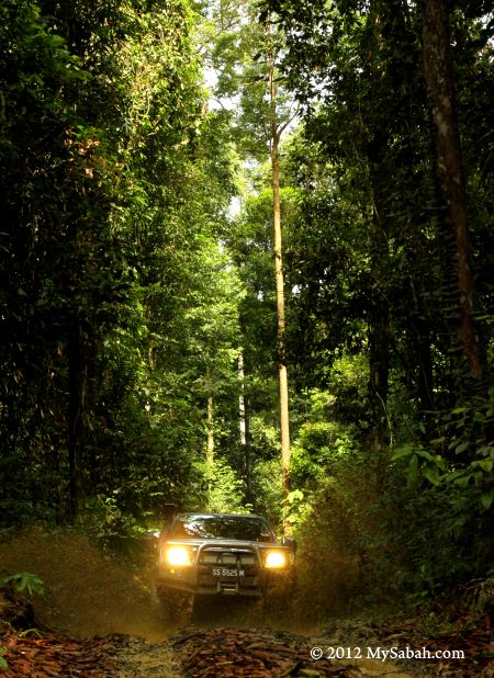
Located in east coast of Sabah, Tabin Wildlife Reserve is one of the best kept lowland rainforest of Borneo. I don’t want to hide the fact that most lowland of Sabah is now blanketed by oil palm. Tabin is surrounded by sea of oil palm, making it an oasis of the ecology desert (oil palm). In fact, this 112,000-hectare protected forest reserve harbors some of the rarest and endangered Bornean animals such as Pygmy Elephant, Sumatran Rhinoceros and Orangutan.


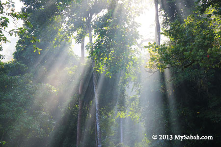
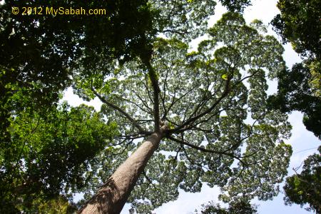
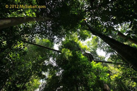
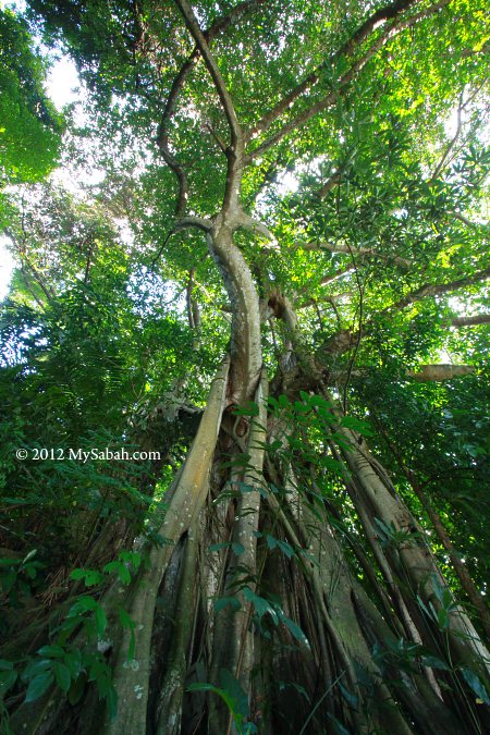
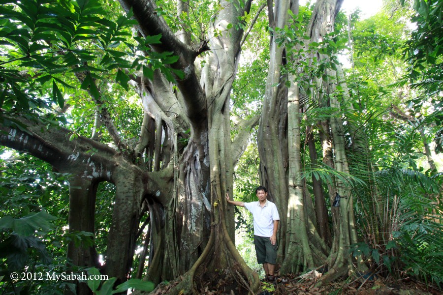
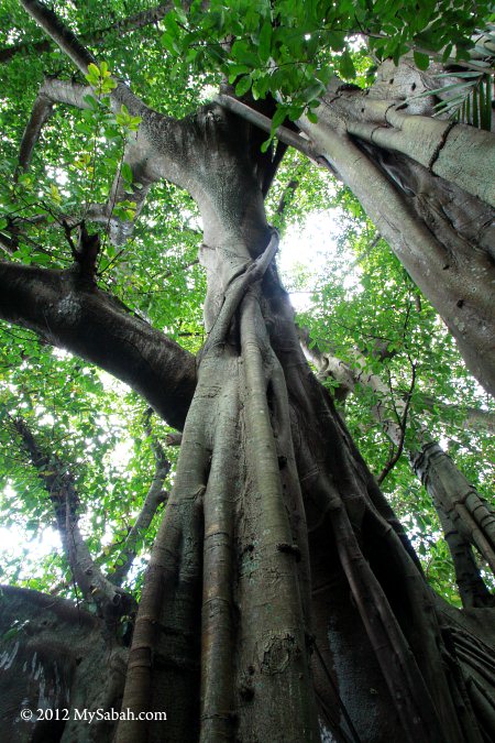
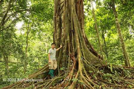
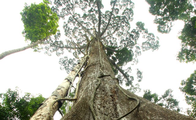
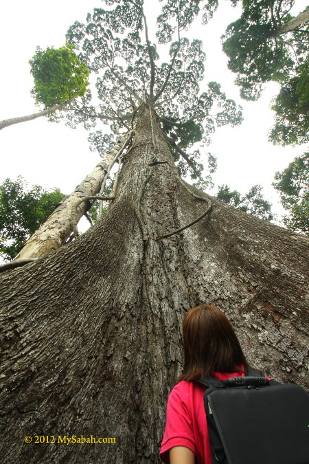
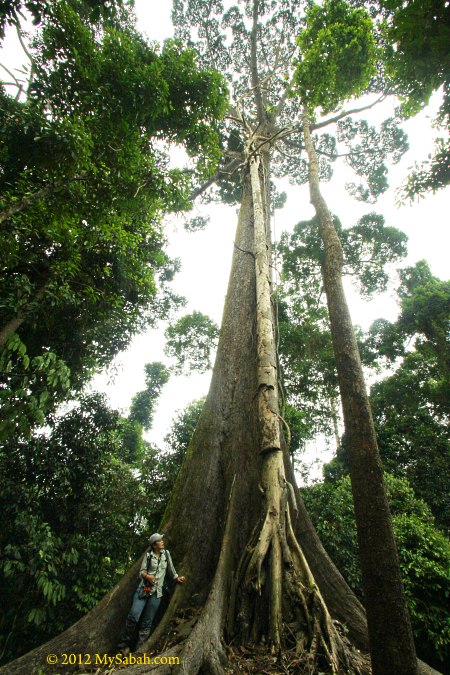
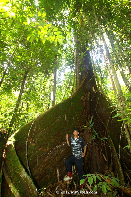
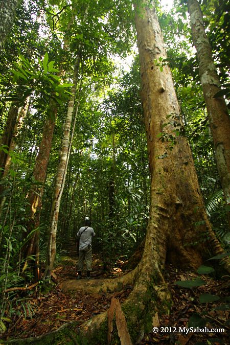
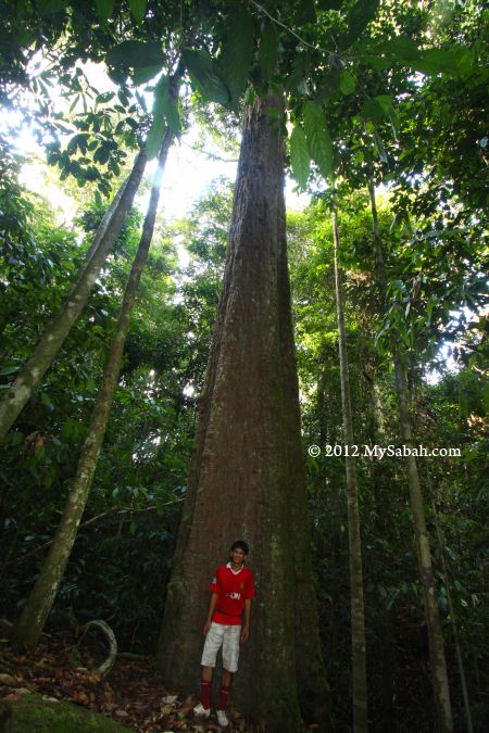
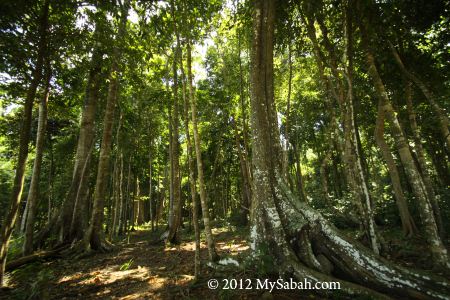
Last month I visited Tabin for 3 days. Though large part of Tabin is secondary rainforest being logged in the past, the forest regenerates really well over the decades. Tabin also has 9,000 hectares undisturbed primary forest known as the Core Area. Do you know that there are nearly 1,000 tree species in 50-hectare area of Borneo rainforest (Temperate Forest is up to 100 species only)?
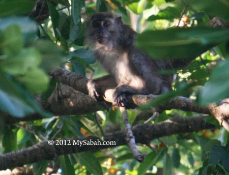
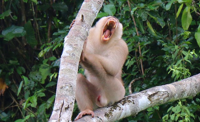
Macaques

Guess what was the first animal I saw in Tabin. Can you recognise the “aliens” below?


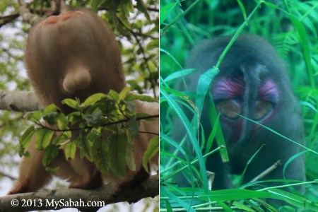
Pic: “Aliens” in Tabin

LOL they are actually the butt of pig-tailed macaques, a common but cheeky monkey. At the left is a male with its testicles, the sexy red butt at the right belongs to a female ready to mate.


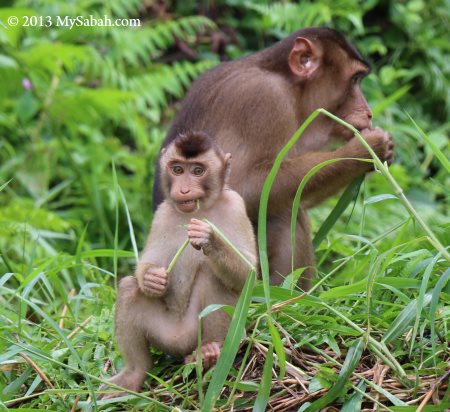
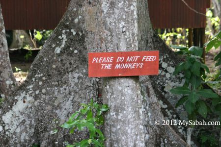
In late afternoon, you would see dozens of macaques gathering on the ground feeding, socializing and grooming one another. Tabin Resort doesn’t feed them so they keep a distance from human. But you better lock the door and leave nothing outside your room, because these monkey know how to open door and ransack your stuffs.


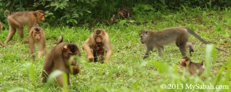
I was surprised to see a long-tailed macaque among a herd of pig-tailed macaques as if it’s one of the members. Wonder if both species speak the same language.


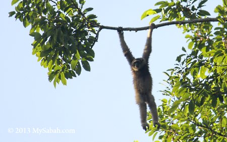
Pic: Bornean Gibbon foraging on a fruit tree. You can always hear their “whoop-whoop” loud and long call early in the morning at Tabin.

There are 9 primate species in Tabin, but gorilla isn’t on the list (though the movie says King Kong is from Borneo). The most famous primate here is Orangutan. Tabin is one of the releasing spots for rehabilitated orphan orangutan from Sepilok. To ensure they can survive in the wild, rangers will track and evaluate the new comers for 2 weeks.

Tabin Wildlife Resort

Tabin Wildlife Resort is the only accommodation and tour operator in Tabin Wildlife Reserve. To visit Tabin, you can book a full board tour package with them (Accommodation, meals, transport, activities and guide services are included). They also offer special tours such as bird-watching and frog camp. Please note walk-in tourist might not be entertained.


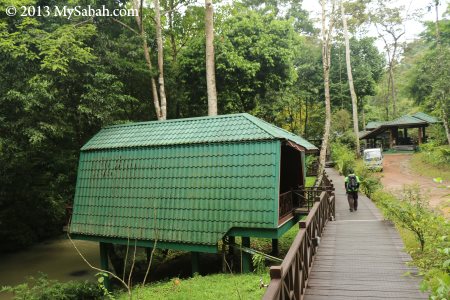
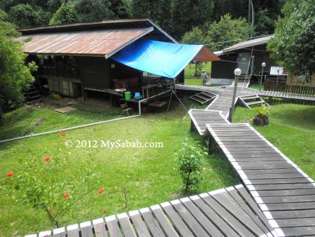
Pic: River Lodge of Tabin Resort

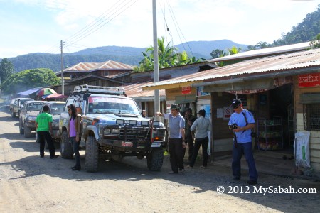
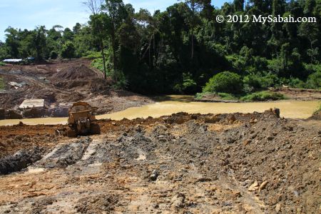
After an hour of bumpy ride on 44-Kilometres of unsealed road from Lahad Datu town, I checked-in to River Lodge of Tabin Resort around noon. River Lodge is just next to Lipad River and you would see foraging animals at the river bank sometimes.


The chalet looks small from outside, but the room is really spacious and completed with attached bathroom/toilet, private balcony, air conditioner, ceiling fan and hot water shower. The accommodation is comfortable and electricity supply is available 24×7. I’m happy.


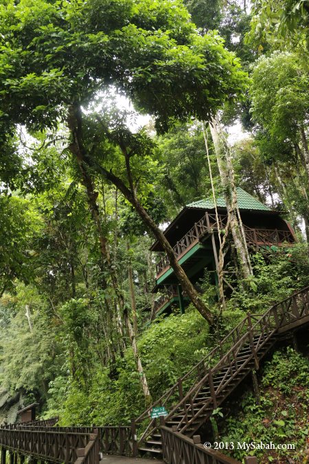
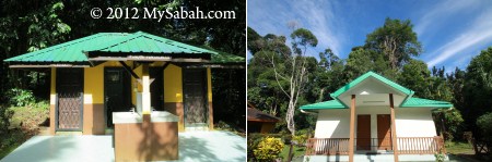
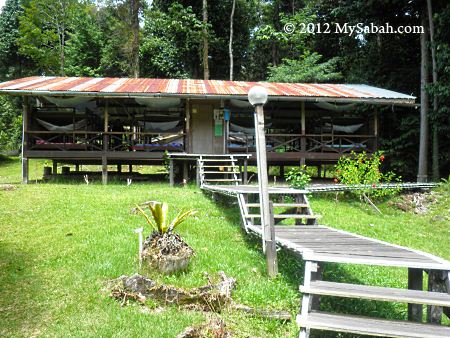
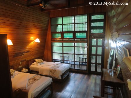
Pic: Hill Lodge of Tabin Resort

For honeymooners, Hill Lodge offers more luxurious and private space, so nobody can hear what you both busy doing in your room. I think it’s great for family too.


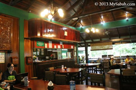
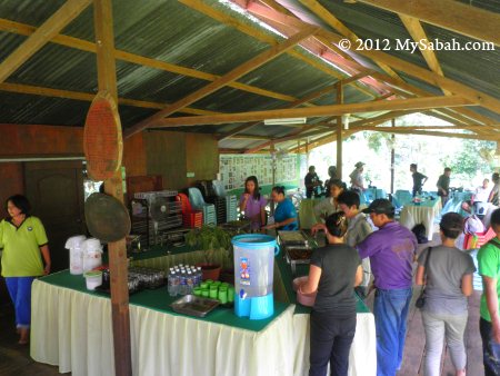
Pic: Sunbird Cafe of Tabin Resort

Sunbird Cafe is where I have my buffet meals (and free flow of coffee) and it is the gathering point for all activities. The cafe has Wifi so you can check your Facebook, but the line would be slow if too many guests are sharing the connection.

Dusk Drive & Night Safari

Compared to my jungle trips in other places of Sabah, the activities at Tabin are really leisure, nothing made me gasping for air there. But I sweated a lot, as rainforest is warm and humid, when the dense trees trap the heat and moisture under their canopy during daytime.


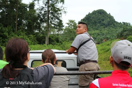
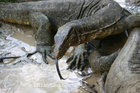
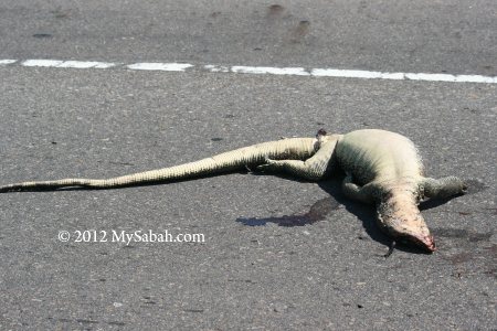
We started our Dusk Drive at 5pm. Unlike Africa, where you can see hundred of animals on open grassland. In Borneo, you need to look quite hard for the animals hiding among the dense wood. Luckily, the guide does the job for us. A napping monitor lizard high on a tree set off the excitement.


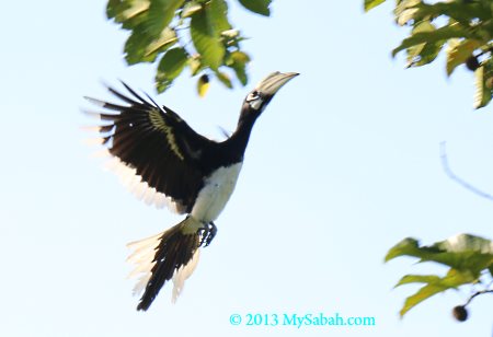
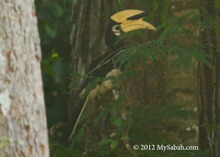
As the habitat of about 260 lowland bird species (FYI, oil palm estate only hosts 9 to 12 species), Tabin is a favorite destination of bird-watchers. Out of 8 hornbill species in Tabin, I saw 4 of them (Oriental Pied Hornbill, Rhinoceros Hornbill, Wrinkled Hornbill and Bushy-crested Hornbill) during my stay. If you are a hardcore birder, they will bring you to Core Area (virgin forest) to look for Blue-headed Pitta and Blue-Banded Pitta, which are endemic to Borneo.


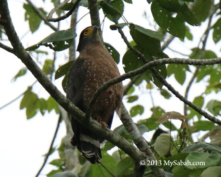
Pic: Crested-serpent eagle is the most common eagle here. We also spotted Wallace’s Hawk-eagle and Changeable Hawk-eagle.


Pic: Bornean Falconet

The highlight is Bornean Falconet (a.k.a. White-fronted Falconet), which is endemic to Sabah and the smallest raptor in the world (about the size of a palm). There was a group of three perching on a tree very far away from us. Fortunately, our guide let us to have a better look with his high-power telescope. I tried to photograph them through the scope but the photo was blur, well. 🙁


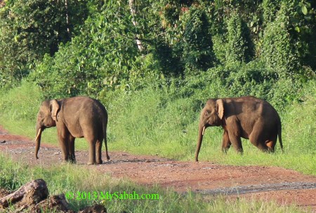
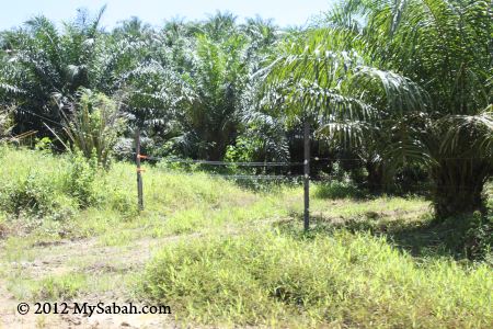
Then we heard a loud roar from the elephants deep in the forest beside us. “It was a mother calling its calf”, our guide said. Though there are 200 to 300 elephants in Tabin, sighting of them is not guaranteed. We waited there for over 15 minutes but no sign of them coming near. When I almost gave up, two Bornean pygmy elephants emerged from the wood behind our truck! After wandering on the gravel road for a while, both of them headed to a neighboring plantation for juicy young shots of oil palm. Somehow this smart mammal figures out the time when electrical fence is being turned off lol.


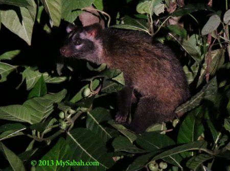
The daylight was out soon and lot of fireflies flickering on the trees, but we didn’t stop the fun drive. On the way back to resort, our guide turned on the spotlight and here we went for a night safari. Besides a pair of sleeping Rhinoceros Hornbill on the tree, we saw other nocturnal animals such as Common Palm Civet and Leopard Cats. We were also watching a red giant flying squirrel took off from a branch, it could glide 100 Metres from tree to tree, we were told.


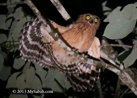
Pic: a Buffy Fish Owl. A Brown Wood Owl was nearby too.

Night Walk

Dusk drive is cool but it would be more thrilling to walk around and search for other forest dwellers in the dark. After dinner, everyone grabbed a flashlight and explored deep in the jungle. We pointed our light to the shrubs, tree top, forest ground, tree bark, etc. and came across something interesting.


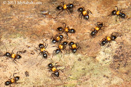
Pic: Crematogaster inflata, these ants look like carrying a “gold” knapsack, which is the enlarged metapleural gland that can secrete whitish defensive fluid and their bites are very itchy. Thank you Arthur Chung for the ID.

A single tree of Borneo can house 1,000 insect species. There are at least 50,000 insect species in Tabin, which is enough for you to explore for a lifetime.


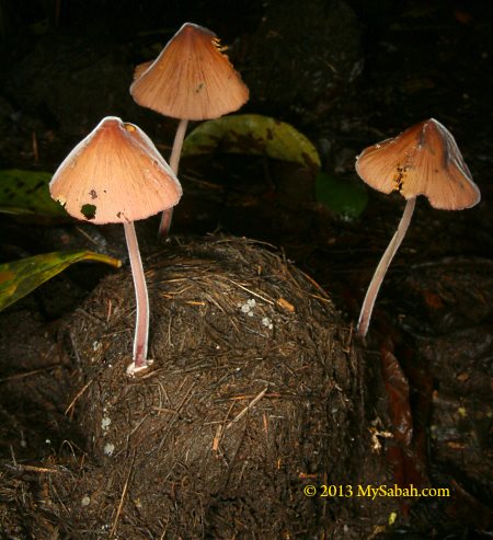
Pic: mushroom growing on an elephant dung. Everything in rainforest is recycled and exist for a reason.


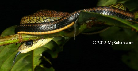
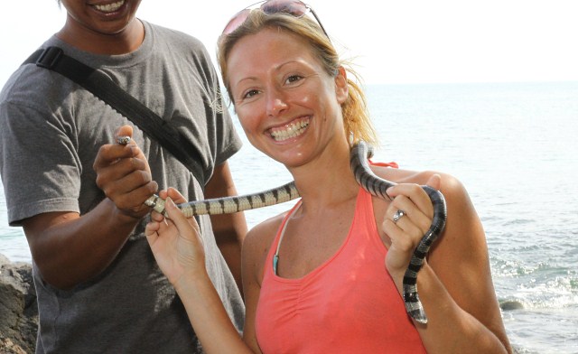
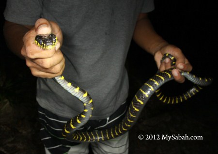
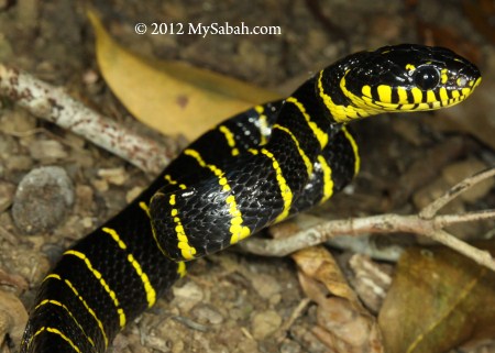
Pic: a small snake waiting quietly for its prey.


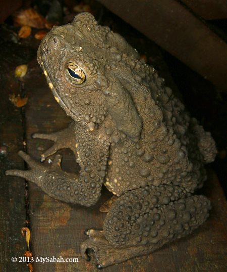
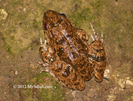
Pic: a giant river toad covered with irregular bumps. The big glands behind its eyes secrete poisonous fluid so don’t touch it!

Lipad Mud Volcano

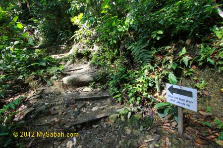
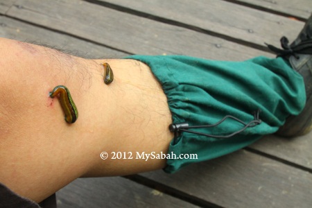
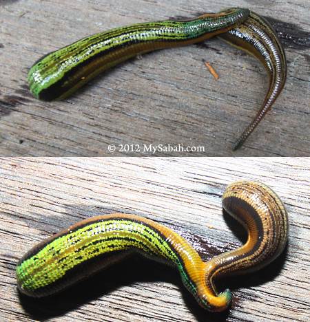
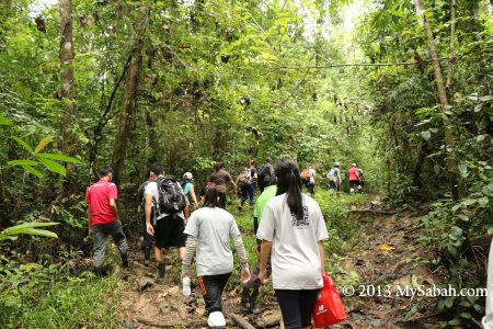
The next morning we went to the Lipad Mud Volcano, something that makes Tabin special. The jungle trail to the mud volcano is 700 Metres and requires only 20 minutes trekking. We saw some fresh and old elephant dungs along the way, an evidence that elephants frequent this area. Anyway, I only found a tiny mouse deer and a few forest leeches.
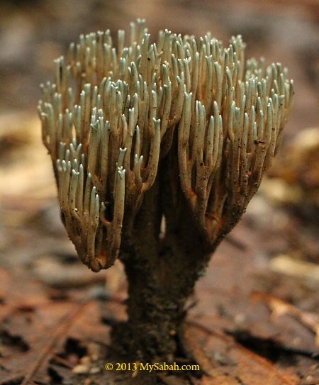
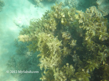

Pic: a coral fungus


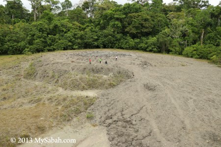
Pic: the Lipad Mud Volcano is as big as a football field and it is still growing. This might be the largest mud volcano of Borneo. Can you spot the tiny people in the photo?


Pic: elephant tracks at mud volcano

Animals love mud volcano as it is rich in sodium and calcium, the vital minerals that are not readily available in their normal diet. That’s why this is a good spot for wildlife sighting, as animals come here regularly for “salt lick” in late afternoon.


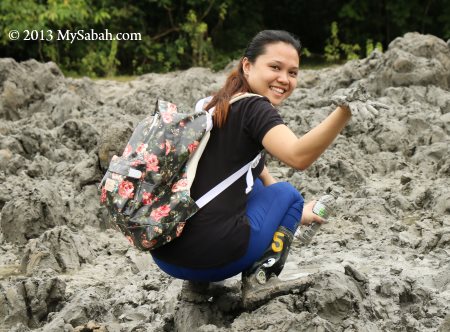
We love mud volcano too, not for salt lick but for skin care. Some says the mud is really good for skin so we collect some for facial SPA later.


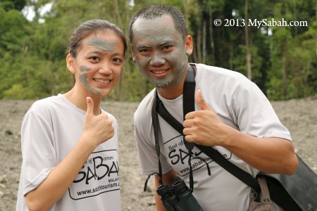
Some prefers to enjoy the muddy face mask on the spot.


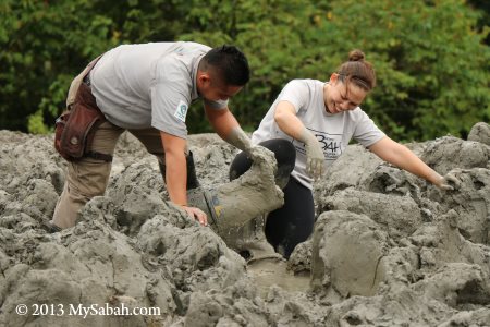
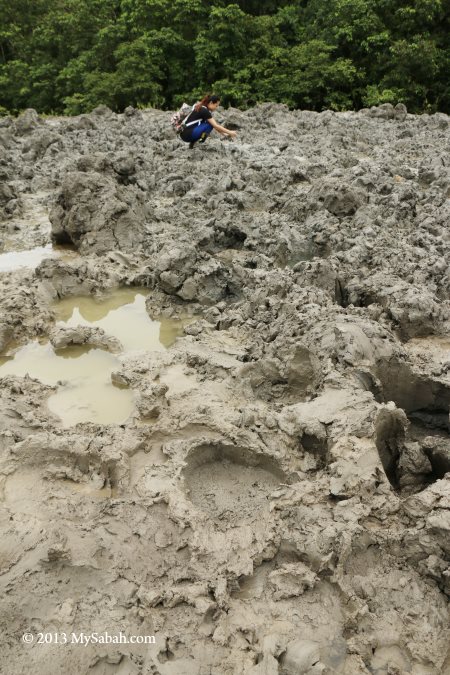
However, the outer ring of mud volcano is dry mud mixed with coarse sand. To collect the finest and silky wet mud, you have to go to the sources located in the centre, where you can see fresh mud burping and bubbling up from the ground. The mud in centre is deep and soft, so your shoes would be trapped in it. Some even lost their pant here (yes, that happened before).


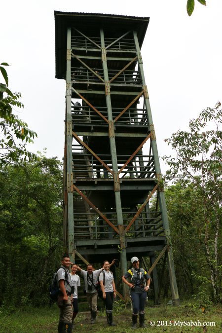
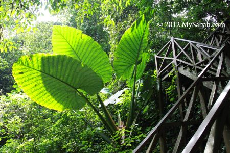
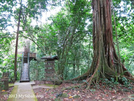
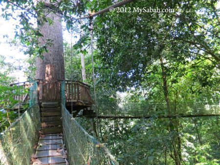
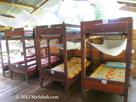
Pic: the 5-storey observation tower next to the mud volcano. You can overnight there for more animal sighting.


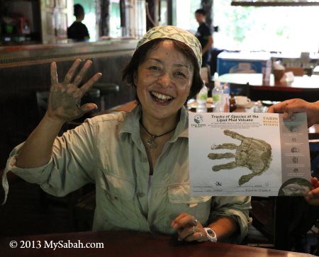
Pic: making handprint certificate with volcano mud.
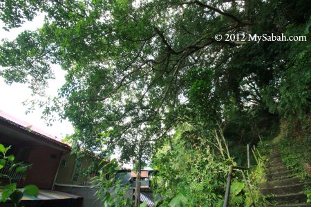
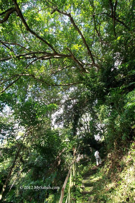
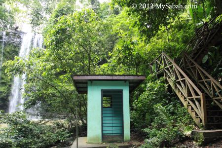
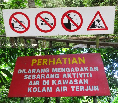
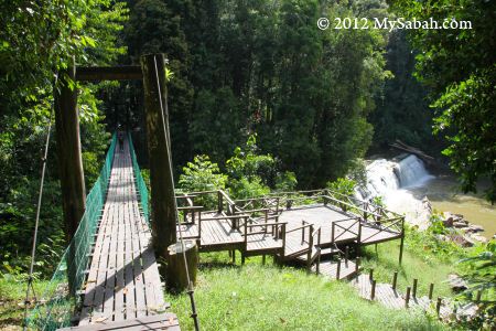
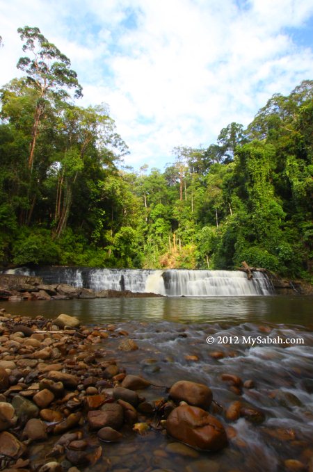
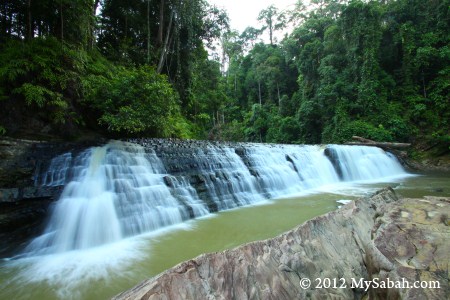
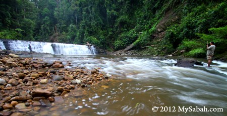
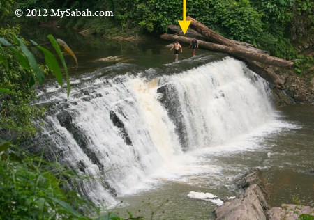
Lipad Waterfall

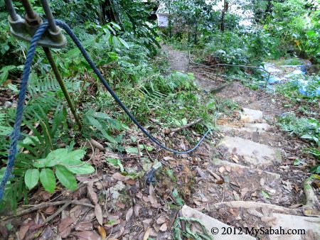
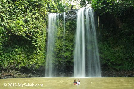
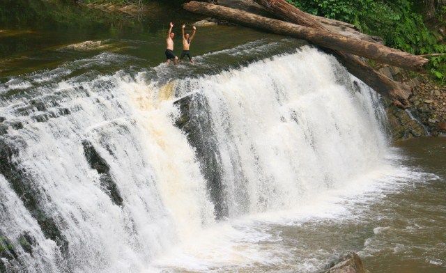
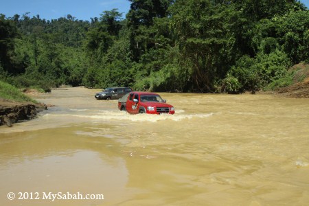
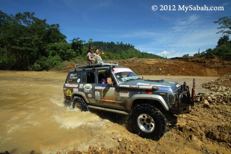
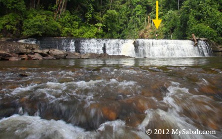
After getting ourselves dirty in mud volcano, we got on our truck and moved to Lipad Waterfall. The nature trail to the waterfall is only 400 Metres but we needed to cross a river as deep as our waist level.


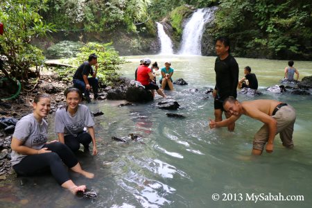
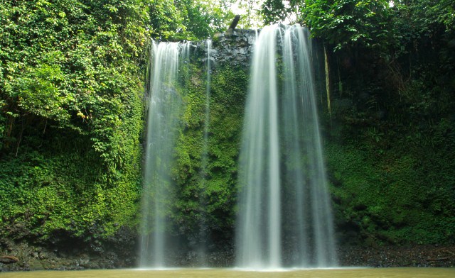
Because of the heavy rain the night before, the water looked a bit murky, but it was clean and cooling. We washed away our mud at the river and took a dip in the waterfall pool.


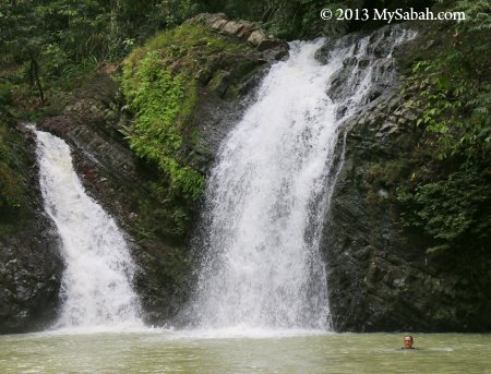
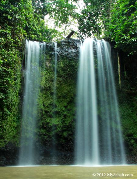
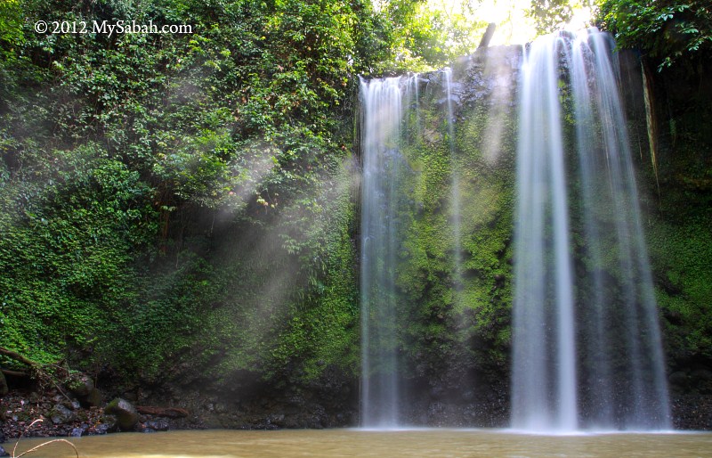
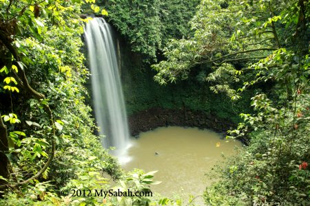
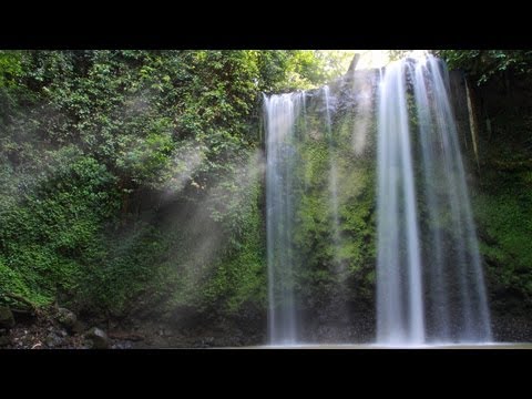
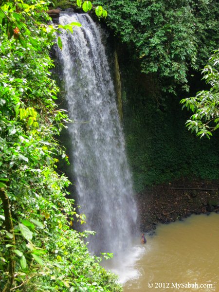
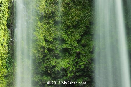
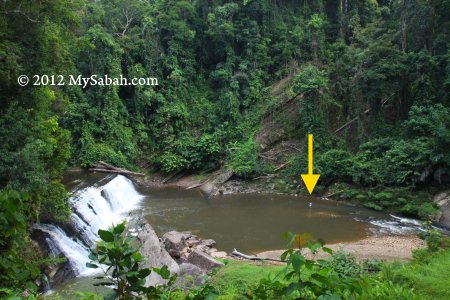
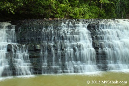
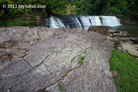
Pic: Lipad Waterfall, pristine and unpolluted.

Other Activities

There are more things to do in Tabin. Just to list a few here.

You may check out the exhibition in Trogon Hall gallery, where they display some photographs and information of Borneo bio-diversity.


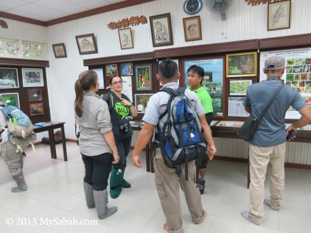
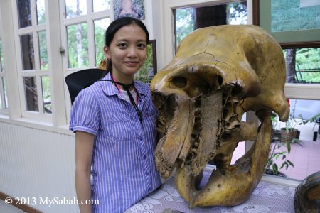
Pic: elephant skull in the Gallery

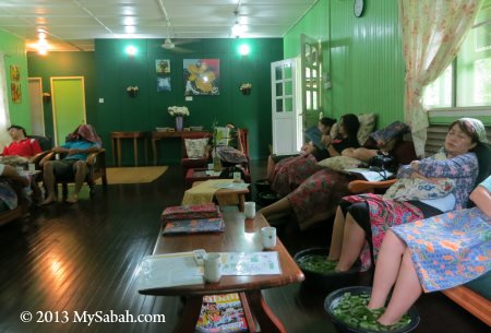
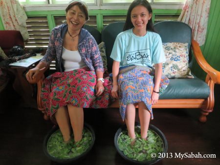
After a long day of trekking, it’s time to relax your tired feet by trying out the Rainforest Foot Soak at Eagle’s Nest. Various traditional tropical herb and plants (e.g. Kaffir lime leaf, Aloe Vera, Lemongrass, Betel Leaf, Pandanus Leaf, Galangal, Tumeric) are put in the hot water, and you can rub your feet against the smooth pebbles at bottom.

So that’s my Tabin trip. You can see that our rainforest is an eco-treasure worths protecting and preserving. The good news is – Sabah government and NGOs are working together to connect all the isolated forest of Sabah, so wildlife can migrate freely among them for food and mates. In future, Tabin forest reserve will be part of the Heart of Borneo.
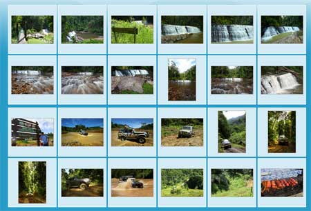
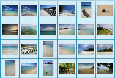
More Photos

Created with flickr badge.

Photos taken in Lahad Datu, Sabah, Malaysia Borneo

Poring Canopy Walkway, the highest in Sabah

Poring Canopy Walkway is not for those who have height phobia. The canopy is over 175 Meters long and 41-43 Meters in height, which is higher than a 8-floor building. I wonder if any 9-life cat can survive the fall. Next to Poring Hot Springs, the Canopy Walkway of Poring is the 2nd favorite activity of tourists.


The entrance to Poring Canopy Walkway is about 835 Meters away from park entrance. It is open from 9am to 4pm daily.


Above: the Ticket Inspection and Registration Counter of Canopy Walk.
Please note this is NOT a ticketing counter. If you didn’t buy any ticket, you will have to turn back to buy it at park entrance, or you can buy the 2-in-1 entrance ticket (Canopy Walkway + Butterfly Garden) from Butterfly Farm about 20 Meters away.


With effect from 1 Jan 2023, the entrance fee of Canopy Walkway is RM5 for Malaysian adult, RM10 (≈USD2.30) for foreigner adult. Add another RM5 (≈USD1.20) camera fee if you bring a camera with you. You can click the signboard picture above for all the fees and detail.


After the ticket inspection, you still need to walk 550 Meters on a gravel trail to go to the starting point of the Canopy Walkway.


The walk to starting point will take about 30 minutes. Just relax and go slow. It will help if you wear comfortable hiking shoes and carry some water. You better bring your umbrella just in case it rains.


Along the way, you will see many trees labeled with species tag. I’m not a botanist, so it’s meaningless to me.


The trail is ascending route but it’s not very steep. As I walk under the shade of dense canopy, I didn’t feel tired.


Above: a tall tree with huge canopy


After 350 Meters, there is a small shelter (named “Pondok Tagaut”, Pondok means Gazebo) for you to sit down and rest.


There was nobody around. I walked quietly, suddenly I heard girls screaming above. I looked up and saw the canopy walkway. No kidding, it’s really high.

Very soon I reached the tower (named “Pondok Manggas”) where the starting point located.


Above: the place where you start your first step
The canopy walkway is narrow and only can take 6-people load at a time.


The canopy walkway is a suspension bridge constructed with ropes, steel cables and a series of aluminum ladders bolted together. Laced with polyester ropes, the open rungs of ladders are covered with walking plank. Netting enclosed both sides for additional security.


The bridge is connected between 3 super-big trees of Borneo rainforest such as Menggaris (species: Kompassia excelsa) and Seraya (Shorea sp). This is the first tree-top platform.


75% of rainforest animals spend their time on forest canopy. Some of them never come to ground, so canopy walkway is great for observing these animals. The tree platform is supposed to be a good spot for bird watching, but I didn’t see much, probably the birds are less active in late morning.


The walkway is an elastic structure, so it will bounce and swing when we walk on it. Some find this thrilling, while some think it’s scary.


Isn’t it exciting to see tree crowns at your eye-level?


Above: My heart skips a beat when I look down
This is what it looks like when you are over 40 Meters off the ground. That’s why people with height phobia, hypertension or heart problem are not advised to try this, though it’s a safe activity. It’s the worst nightmare for height phobia.

However, I notice that kids enjoy canopy walkway more than adults. Most adults just walk carefully and busy imagining that they would fall.

You may watch the 2-minute video below to get a feel of the experience:

Site Map of Poring Hot Springs

You may click the picture above to see bigger map.

More Photos

You may check out my photo album on Poring for more nice pictures:

Other canopy walk in Sabah:
Skybridge of Maliau Basin (longest canopy walk)
Canopy Walk of Danum Valley (award-winning attraction)
Rainforest Discovery Center (best for bird-watching)

Other articles about Poring Hot Springs Park:

  1. Poring Hot Springs bath
  2. Gardens of Poring
  3. The Most Expensive Orchid in the world
  4. Accommodation at Poring
  5. Jackie, orangutan who owns a house
  6. Waterfalls of Poring
  7. Night walk in Poring rainforest

Photos taken in Poring, Sabah, Malaysia Borneo

The Largest Banyan Tree of Kota Kinabalu

Every corner in Kota Kinabalu city (KK) is under pressure for development, and very few things can survive for one century without being removed. Do you know there is a 100-year-old Banyan tree in KK? Not only that, it is also the Largest Banyan Tree in KK.


I was informed that this giant Banyan is just behind Lucy’s Homestay Backpacker Lodge (near to KK Police Station and Australia Place). When I was approaching the site, I noticed the lush tree canopy right behind Lucy’s Home, as if there were many trees. Actually, this dense canopy belongs to ONLY ONE TREE, i.e., KK’s largest Banyan.


Pic: the staircase (note the arrow) leads to the century-old Banyan tree


The canopy of this Banyan tree is like a huge umbrella, spreading out 65 Meters across. Banyan trees are the largest living trees on Earth.


Pic: I took a photo under the tree. See how small I was?

As the tree was too big to fit in one frame, I had to setup my camera and tripod far away, then ran 10 Meters upstair to position myself under the tree, before the timer counted to zero. The camera always shot prematurely, so I had to keep trying. I was so tired to repeat. Luckily I got an aunty to press the shutter for me.


Pic: This Banyan is Ficus tree with heavy branching. Its odd shape and uneven bark surface give it a mysterious character.

In Asia, Banyan is always linked to religions and spiritual world. Some cultures consider Banyan as a sacred tree (FYI, Buddha’s Bo Tree is also Banyan), others think it houses evil spirits. For Sabah, Banyan can be a haunting tree, wishing tree, shade tree and even love tree. Anyway, this large Banyan is definitely a heritage tree that witnesses the growth of our city. However, I don’t think this Banyan is labelled as a Heritage Tree. Hope KK City Hall will gazette it under City Law, so nobody can cut it.


My late grandfather was used to have a big Banyan tree outside his house. He said sometimes he could see white human figure with pointy hat, climbing up and down Banyan whole night long. In Sabah, you can hear many ghost stories related to Banyan.


Pic: It’s me standing next to this Banyan. I couldn’t smile because I sweated profusely and attacked by dozen of mosquitoes. Do bring insect repellent with you for the visit. I estimate this tree is about 15 Meters tall.


Though it was a bright day in the city center, the shade and noisy cicada of this tree made me felt like inside a deep forest.


The branches of this Banyan haven’t touched the building, but it’s root network has reached the shoplot, a local said. The root of Banyan can stretch 200 Meters.

Below is the location map of KK’s Largest Banyan:

View My Sabah Map in a larger map


Pic: The walkway next to this Banyan is the Oldest Track of Kota Kinabalu. Walking up this historical trail will bring you to a paved road to Signal Hill Observatory Tower, where you can get a nice view of KK city. My advice is – don’t go to that tower alone during quiet hours.


Pic: part of the track needs proper maintenance to be safe.

Credit: I would like to thank Outreach Ecology (Tasmania) for sharing the information of this Banyan with the community. However, there is no official record to prove this tree is really 100 years old, otherwise it can be the Oldest Tree of KK too.

Related Posts
The oldest trees of Kota Kinabalu
The oldest tree of Sabah

Photos taken in Kota Kinabalu, Sabah, Malaysia Borneo

Madai Waterfall and Tongkat Ali Hill of Kunak, Sabah

Waterfall is a delightful view and always be part of the painting about paradise. The bigger it is, the happier the visitors. That’s how the 40-Meter Madai Waterfall drew me to Kunak, a small town in Lahad Datu district. In fact, many European and Asian tourists had come for it. I have visited many waterfalls of Sabah, and Madai Fall is one of the most impressive.


The 5-storey high Madai Waterfall is located in 3,436.50-Hectare Madai Baturong Virgin Forest Reserve Nature Center, which is managed by the Sabah Forestry Department and opened to the public since 1999. Madai Cave is also part of this reserve.


Pic: Madai Waterfall is inside Pusat Sejadi Hutan Simpan Madai Baturong (Madai Baturong Forest Reserve Nature Center) of Kunak.

As Madai-Baturong Forest Reserve Nature Center is a public park, anyone can pay a small entrance fee to enjoy Madai Waterfall. Below is the ticket rate:

  • Malaysian: Adult: MYR2.00 (≈USD0.66); Below 18: MYR1 (≈USD0.33)
  • Foreigner: Adult: MYR5.00 (≈USD1.66); Below 18: MYR2 (≈USD0.66)

Madai Waterfall

Madai Waterfall is very accessible. It is so near that you can hear it, once you walk into the park. Remember to bring insect repellent, as mosquitoes might be around.


Pic: the wooden staircase to Madai Fall.


It is only a 1-minute walk. The boardwalk is quite steep, be careful..


Pic: huge Alocasia odora next to staircase. This plant has the largest undivided leaf in the world.


Pic: Madai Waterfall in the sight!


Pic: the “twin” Madai Waterfall. After heavy rain, both will merge into one huge vertical fall. Though the water is murky, it is clean and cooling.


Due to the powerful splash, the air was filled with flying droplets. When the morning light shined through them, it created fascinating rays of light. Such a lovely view.


Pic: the warning sign near the Madai Fall.

Any water activity such as swimming is prohibited, because the waterfall pond is deep. Basically, this waterfall is meant to be watched only. Anyway, you can soak your feet in the shallow water, like most people do. Anything beyond that is on your own risk. There is no lifeguard around to stop you or to save you.


However, some visitors can’t resist to take a swim under this beautiful waterfall. A ranger told me that he saw a very deep hole in the center of waterfall pond after a 8-month drought. Madai is in a limestone area, so I wonder if this hole connects to an underground cave or river. Well, I’m just guessing.

Want to see Madai Waterfall in motion? You may watch the 90-sec video below:


During weekends and holiday, many locals come here to swim and picnic. Some of them taking bath (with soap) or washing their dirty plates in the stream, which flows to Tingkayu River. It’s not right.. 🙁


Pic: dense moss behind the Madai Fall.


The park opens from 8am to 5pm every day. The waterfall is quite crowded afternoon.


Pic: gold found at Madai Fall?

Wishing Tree

Besides Madai Waterfall, I found an interesting tree in Madai-Baturong Nature Center. The local calls it a “Wishing Tree” (Pokok Hajat).


Pic: the wishing tree is standing near the entrance of canopy walk.


It is a tall tree, which is locally known as “Kayu Ara” (Ficus species, Moraceae). Many birds will gather on this tree during its fruiting season.


Every ribbon on the tree root is a wish of the asker. Probably it works, so there are hundred of ribbons on this wishing tree.


Whatever, it is a tall and magnificent tree to look at. I wish it will stay strong and healthy forever.

Bukit Tongkat Ali

Bukit Tongkat Ali (Tongkat Ali Hill) is another attraction in Madai Baturong Forest Reserve. This hill is named after a herb Tongkat Ali (species: Eurycoma longifolia, Nicknamed “Asian Viagra”), which is famous for the medicinal properties of its root that can increase testosterone level and treat erectile dysfunction.


Pic: Tongkat Ali tree


Visitors can hike to Bukit Tongkat Ali via a 1 KM trail in the park. When you enter the park, just turn right and follow a small road that leads you to a small bridge and rest shelter. The trail starts at a paved path behind the shelter.


Though the trail is less than 1 KM, it is steep and tiring. The trail is paved with cement. It is supposed to be a good idea. However, the moss cover on the cement becomes so slippery that, after rain, the trail turns into a skating route. In some sections of the trail, I had to hug the hand rail to descend carefully.


Pic: the last shelter on top of Bukit Tongkat Ali (Height: 169 Meters).

I was told that Bukit Tongkat Ali was abundant with wild Tongkat Ali, but I only saw one or two. Probably some impotent visitors pluck it. I was also told that I could see Madai Hill from the top of Bukit Tongkat Ali, but such view was obstructed by dense trees.

Sorry to say, spending nearly 2 hours walking up and down Bukit Tongkat Ali is simply a waste of time.

Public Amenities

Madai Baturong Nature Center have some basic amenities in place for visitors.


Currently (as of Nov 2012), the canopy walk is closed for maintenance until further notice. Too bad, this 119-Meter long and 40-Meter high canopy walk, which is connected to three giant rainforest trees (Seraya Urat Mata, Oba Suluk and Merbau species), is a main attraction of the park, besides Madai Waterfall.


Pic: public toilet


The toilet is very clean and deserves MYR0.30 (≈USD0.10) per entry.


Pic: the Canteen (named Kantin Sri Baturong Madai) in the park

This canteen sells common food items such as fried rice and noodles, as well as cold and hot drink. It was closed for holiday during my visit.


Pic: there is another small food stall near the gate, but they are selling drink and light snack only.


Pic: (left) shower and changing room, (right) Muslim prayer rooms or Surau


Pic: ample parking space for 20 to 30 cars.

Their rest house is closed and the Exhibition Hall is not ready (as of Nov 2012). You still can camp in the park for a small fee (MYR3 for Malaysian, MYR5 for foreigner). I hope they will upgrade the facilities and amenities there ASAP to attract more tourists.

Wildlife

I heard hornbill near Madai Waterfall. At night, there are mouse deer wandering in the park too. The rangers mentioned a bird with a funny local name “Burung Kopi Susu” (Milk Coffee Bird). According to them, this is a small black bird with white stripes on its wings. This bird is common there and can be seen around 5pm. It sings very well, so people trap and trade them as pet. I wonder what bird it is. Magpie Robin?


Pic: Is Magpie Robin the “Milk Coffee Bird”?

How to Get There

Going to Madai-Baturong Forest Reserve Nature Center is easy but far. Madai Waterfall is 15 KM north of Kunak town and 71 KM southwest of Lahad Datu.


Pic: Madai-Baturong Nature Center is just next to the Lahad Datu↔Tawau highway.

By Bus: If you take Long-Distance Bus from Kota Kinabalu city to Kunak or Tawau, you can ask your bus driver to drop you right in front of the park, which is at the roadside (15 KM before Kunak). The bus fare is MYR50 (≈USD16.67) one way and the ride takes 8 hours.

By Flight: Take a 45-minute flight from Kota Kinabalu to Lahad Datu, then spend an hour on taxi to reach the park.

Below is the location map of the park:

View My Sabah Map in a larger map

For more information, you may contact Kunak Regional Forestry Office:
Address: P.O.Box No 2, 91207 Kunak, Sabah, Malaysia.
Tel: +60 89-851863

Photos taken in Kunak, Sabah, Malaysia Borneo

Borneo Taliban declares war to illegal loggers

Director of Sabah Forestry, Datuk Sam Mannan, showed a cool video to 600 local and foreign participants, during his speech in International Conference on Heart of Borneo (HoB) yesterday.


Illegal logging is a problem in Sabah. 59% of Sabah is covered by forest, and our trees look like standing gold bars to those greedy illegal loggers. Sabah Forestry Department (SFD) has been confiscating illegal logging dozers. In most cases, SFD will auction off the dozer, so the illegal loggers abuse the auction system by appointing a proxy to buy back the dozer and back to business again.


Penalty is not good enough. Datuk Sam Mannan got a few confiscated dozers at his office, and he decided to do something about it. So he burnt it. Hahaha, I was “pleasantly shocked” watching his video. Hopefully he will post this video on YouTube.


Conservation is a challenging journey and a never-ending battle. Sometimes we win some, we lose some. Borneo earns a bad reputation on deforestation. We are doing whatever we can to protect our forest. We even plant forest. The process is slow, let’s hope our future generation will reap the fruits of our efforts.


He said this is the “Taliban” way of dealing with forest rat. Well, I don’t think he is a terrorist. He just wants to send a strong message (i.e. F*ck You) to those illegal loggers, and show his determination to protect the forest. I fully support you, Datuk Sam.


He acknowledged that his action may have gone too far in a civilized society, but “So What?!”, he added. LOL, I like you man, you really have the gut and attitude. 😀


Now I understand why woman loves bad boy, as our society, company and government are just full of big-mouth chicken men, who think that they are smart for not taking risk. I have seen so many cowards who only move their lips but not their hands. Sometimes, it is not cool being nice, just go kick some assess.

Photos taken in Kota Kinabalu, Sabah, Malaysia Borneo

Sepilok Giant, the Oldest Tree of Sabah

With an estimated age of 800 to 1,000 years, the Sepilok Giant, in Rainforest Discovery Center (RDC) of Sepilok, Sandakan, is the oldest tree of Sabah, well, unofficially. Our Borneo rainforest has existed for over 100 millions years, so I have no doubt there might be other older tree standing in an unexplored forest of Sabah.


Reaching this old tree requires no vigorous hiking. Just go to Rainforest Discovery Center (RDC), about 23 KM from Sandakan, and a few KM before the famous Sepilok Orangutan Rehabilitation Center. You need to walk about 2 KM in nature trail under the dense trees.


The jungle trail is mainly used by visitors for bird watching. You will see signages and markers along the way. Though you will walk under the tree shades, the air is warm and humid, you better bring some water with you. During rainy season, a few small forest leeches would lurk under the leaves on your path, but don’t worry too much about them.


Pic: the junction to the Sepilok Giant, we are now only 670 M away from it.

Most tour guides know the shortcut and park near this junction. This will cut half of your walking distance.


Pic: the location map of the trail to Sepilok Giant.


RDC is inside the Kabili-Sepilok Forest Reserve, one of the most well-preserved rainforest of Sabah, so you will see other giant trees too.


Pic: Sepilok Giant? Not yet. But it’s a tall tree anyway.


Pic: Finally, a signage confirms that we find Sepilok Giant. Yes, it is a living tree.


Pic: we look so small under it. Sepilok Giant is 65 Meters in height, as tall as a 19-floor building!

Sepilok Giant is from the Dipterocarpaceae tree family. It is locally known as seraya runcing (Shorea acutissima) and traded under the name yellow seraya.


Other facts about Sepilok Giant:
Girth: 7 Meters
Diameter: 2.2 Meters
Total Height: 65 Meters
Height to Lowest Branch: 32 Meters
Saleable Volume: 82 M
Above Ground Carbon: 28 Tonnes


Pic: another side of Sepilok Giant

By now you should know why it is known as giant.

FYI, the oldest (and largest) tree of Malaysia is a 1,300-year-old Chengal Tree in Pasir Raja Forest Reserve, Terengganu. The oldest living tree in the world is a 9,550 years old spruce in the Dalarna, Sweden.

Related Posts
The Tallest Tropical Tree in the World
Rainforest Discovery Center (RDC)

Photos taken in Sandakan, Sabah, Malaysia Borneo

Imbak Canyon, the Green Canyon of Borneo

Most tourists and researchers, who have visited Danum Valley or Maliau Basin, agree that Sabah has the best Borneo rainforests. Both forest reserves are so pristine that they would become our next UNESCO World Heritage Sites. You will be happy to know that Imbak Canyon, a Class-1 30,000-Ha Forest Reserve in the Heart of Sabah, is as high quality as them.


As seen in the map above, Imbak Canyon is a 3-KM-wide valley about 150 Meters above sea level (asl), flanked by ridges running parallel 25 KM from west to east, which are mainly sandstone cliffs with a height up to 1,500 Meters asl. This impressive landscape is formed by 750 Meters carving of the Sungai Imbak (Imbak River) over thousands of years. Though Imbak Canyon is not as majestic as Grand Canyon, it has dense forest that is over 100 million years old. It is a “Green Canyon”!


Pic: Imbak Canyon is just at the north of Maliau Basin.

Road Trip to Imbak Canyon

However, to get there, you need to drive nearly 300 KM for more than 6 hours from Kota Kinabalu (KK) to this remote forest. The 3.5-hour drive from KK to Telupid town is on paved road, the rest on gravel & muddy road, which can be steep and muddy. Probably that’s why it isn’t a popular destination for ordinary tourists.


Pic: the junction to Imbak Canyon at Tongod. This marks the start of our 3-hour bumpy ride.


Though Imbak Canyon is only accessible by 4-Wheel Drive (4WD), some loves this and call this an adventure. Trust me, this is the most “violent” ride that I ever followed. The feeling is like sitting on the wild horse that tries to throw you out of its back. Thrilling though.


The 4WD needs to be equipped with snorkel (to cross river), locker and jungle trekker tyres (with costs RM1,000 each). Besides, you need a skillful 4WD driver, not those middle-aged uncles who drive 4WD in city street. We are glad to have Gilbert, a North Borneo Safari driver to come with us. His 4WD is unstoppable and he also helped to pull out a few 4WDs stranded in mud during the course.

You can watch the following 2-min video of our 4WD trip:

Click Here for wider video


We stopped by Kampung Imbak (Imbak Village) in Tongod for a short break and buying supplies. This village is the last civilization on the way to Imbak Canyon.


Pic: funny signage that translated as “Attention. Please don’t drive too fast if you know the law. Be careful, this is village area, or else.” Probably the villagers are unhappy of the dust created by passing vehicles.


Pic: red BBQ chicken wing of Kg. Imbak. They apply coloring that looks like roasted pork (??).


Pic: grocery shop that sells chicken meat and seafood.


We continued our journey after shopping. About 13 KM before Imbak Canyon, we need to cross a wide river, which is the biggest obstacle. There is a bridge under construction. Once the bridge is complete in future, Imbak Canyon will be more ready for tourism.

Update (Nov 2012)!

The bridge is completed and can be used now. However, some may still prefer to cross the river for fun.


Luckily the river is not deep so our 4WDs can cross it without problem. Our trip was cancelled once, because this river was flooded during rainy season. Before the bridge is complete, if it rained, we would needed to wait 3 to 4 hours for the flood to subside before crossing.


In worst case, the water level can reach the window of 4WD.


The bumpy ride can freak out faint-hearted passengers. The trick is not to sit stiff and counter the momentum. Just relax your body and let your weight “stick” you to your seat like soft mud. You will find that your fat is so useful in this case.


We passed by oil palm plantation and saw some electric fences that prevent pygmy elephants from entering.


Finally, we arrive Tampoi Base Camp (or Tampoi Research Station) of Imbak Canyon at 12:30pm. Tampoi is the name of a Borneo fruit. We check-in at Tampoi Camp and have our lunch there. The forest and campsites of Imbak Canyon are managed by Yayasan Sabah Foundation.

Imbak Waterfall

After feeding our stomach, we proceeded to the most famous attraction of Imbak Canyon – the Imbak Waterfall. Imbak Waterfall is only 10 KM away from Tampoi Camp, but it took us more than an hour to get there, due to the steep and slippery road. We were told that we would need to walk, if there was any landslide or fallen tree blocking the way.


Pic: the entrance of Big Belian Camp (BBC Camp), where Imbak Waterfall is located. At the right is a wooden staircase to Imbak Waterfall. Our cars can park near the entrance, so it’s only a short walk to the waterfall, very convenient. The Kangkawat suspension bridge at the left leads you to the jungle trail.


Pic: the view of Imbak Waterfall from the viewing platform. Note the man is so small.


Pic: the front view of Imbak Waterfall and Imbak River. The water is in light tea color but it is very clean. The color is caused by the tannins leaching out from the plant growing in Imbak Canyon.


Imbak Waterfall is a must-see if you visit Imbak Canyon. I would say it is one of the most beautiful waterfalls of Sabah.


Imbak Canyon is an important water catchment area. This Imbak River is one of the sources of Kinabatangan, the longest river of Sabah. More than 30 species of amphibians and reptiles live in this river.


Imbak Waterfall is about 80 Meters in wide and 8 Meters in height. The photo above will give you an idea of its scale. It’s very slippery on top. My friend saw a Sambar Deer (largest deer of Sabah) there.


Pic: close-up of Imbak Waterfall

Look closely and you will see hundreds of cascading “miniature waterfalls” on the sandstone or mudstone layers of Imbak Waterfall, a very interesting feature. Yes, I took a bath at the waterfall. The water is so cooling and refreshing. I didn’t use soap b’coz I don’t want to pollute the river.


Pic: piles of sandstone and mudstone rocks next to Imbak Waterfall


Can you spot the man on the waterfall?

Besides Imbak Waterfall, there are other waterfalls such as Kuli Falls, Majau Falls and Pandan Falls in the canyon. Imbak Canyon is a mountainous region so there are many waterfalls to be discovered.

To see more of Imbak Waterfall, you may watch the 1.5-min video below:

Click Here for wider video

Forest of Imbak Canyon

Imbak Waterall is the most popular attraction of Imbak Canyon, but the real gem is the virgin forest there. In short, Imbak Canyon consists of two main vegetation, i.e., Lowland Dipterocarp Rainforest in the valley (Dipterocarp is the most important tree family of Borneo) and Montane Heath Forest (a.k.a. Kerangas, abundant with native orchids and endemic pitcher plants) on the ridges of higher altitude. Over 70% of the forest is unexplored.


Pic: a tree with huge buttress in BBC Camp. The ranger told me there is a tree with buttress that looks like crocodile in Kuli Camp.

There are a few forest trails in the canyon, ranging from 1 KM to 17 KM in distance, for those who want to do jungle trekking. Even though I stayed in Imbak Canyon for a day, I have seen or heard Serpent eagle, Helmeted hornbill and Gibbon. Many wildlife such as pygmy elephant, sambar deer, leopard, sun bear, mouse deer, orangutan, proboscis monkey and Sumatran rhinoceros also live here.


Pic: a dead tree with big hole that can house 3 to 4 people inside.

Tall trees such as Kapur and Keruing are common in the canyon, and Kapur Merah is the “iconic” tree of Imbak. To scientists, this virgin forest is a “botanical gene bank” where we can source for the seeds of rare and endangered plant species, which are considered high in pharmaceutical and biotechnological potential.

Like other primary rainforest, you can see a lot of fungus, mushroom and termite nest along the nature trails. They play an important ecological role in decomposing rotten dead wood/leaf, to recycle the organic nutrients.


Pic: a huge Ironwood (Belian) tree which is about 800 to 900 years old.

For birders, you will be pleased to know that over 200 bird species are found in Imbak. 5 of them are endemic to Borneo, namely, Borneon Bristlehead, Blue-headed Pitta, Black-throated Wren-Babbler, Borneon Blue Flycatcher and White-browed Shama.

Night walk here is fun as you may find vine snake and scorpion. But be careful of the hornet that is attracted by your torchlight, I was stung twice. It’s so painful that I thought it was snake bite.


Pic: a fully-fed Tiger Leech resting on a twig. It’s so fat and full that it ignored me.

Many are afraid of this blood sucker. Anyway, tiger leech is not a tiger, and its bite is not harmful, so no need to get panic if you see one on your skin. The presence of leech means the forest is healthy and full of wildlife (food source).


Pic: the leeches bypass my anti-leech socks and feast on my leg.


After the leeches are full and drop off my skin, they start to get horny and mate. I’m proud to say that my blood donation contributes to the birth of more baby leeches, haha..

Their mating process is so “intense”. You may watch 30-sec of them in video below:

Click Here for wider video

Tampoi Base Camp

Visitors can overnight in Tampoi Base Camp, which provides basic accommodation and facilities. A 3-day-2-night or longer stay is recommended. They also have camping ground for big student or researcher group. Though no mobile phone coverage, they have Wifi and public phone (i-Talk) in camp. For me, that’s really impressive for a campsite deep in the jungle.

Below is the location of Tampoi Camp and Imbak Waterfall:

View My Sabah Map in a larger map


Pic: Dining & Activity Hall of Tampoi Camp

You would see orangutan wandering around the camp in early morning.


Pic: accommodation of Tampoi Camp. It’s divided into male and female sections.


Pic: bunk beds with mosquito net.

It can be chilling at night, so it’s advisable to bring your sleeping bag for extra warmth. However, the night was warm during my stay. The electricity is cut off between 12am to 3am daily.


Pic: bathroom and toilet in Tampoi Camp

More Photos & Info

You can check out my photo album, to know more about what to expect in the trip. If you decide to visit Imbak Canyon Conservation Area (ICCA), you can book the tour with North Borneo Safari, the tour operator who is experienced in adventure tour and provides everything from 4WD transport, tour guide and meals in the tour.

Photos taken in Tongod, Sabah, Malaysia Borneo

Snake Island of Pulau Tiga Park

My day 2 in Pulau Tiga is as exciting as first day. Today I’m going to Snake Island (Pulau Ular or Pulau Kalampunian Damit) of Pulau Tiga Park. I’ve seen the video of dozens of highly venomous Yellow-lipped Sea Kraits or Banded Sea Kraits (species: Laticauda colubrina) roaming on this island. The poison of this sea snake is 3 to 4 times more potent than cobra!

Snake Island (Pulau Ular)

The trip to Snake Island is optional. You can pay RM40 (≈USD12) to visit two islands (Snake Island and Sands Spit Island) of Pulau Tiga Park. The tour also includes a snorkeling trip off the island, so it is a good deal.


We depart at 9am and reach the Snake Island after 15 minutes. They only allow you to go during good weather.


According to a legend, Snake Island is the resting place of a heart-broken princess, whose lover is turned into rock by black magic of her sisters. The angry king penalized the evil sisters by turning their islands into mud volcanoes (Pulau Tiga).


Snake Island is so small that you need only 15 minutes to walk one round of the island.


Besides a jetty and a shelter, there is no other facility on Snake Island.


Pic: a warning sign. Watch your steps! You must be accompanied by a guide. We are happy to have Mr. Mohammad Syaheer, the “snake catcher” from Pulau Tiga Resort, to go with us.


Though Snake Island is tiny, it has interesting plant such as tall Pisonia tree, which has smooth bark and grows well in sandstone, limestone and shale of Snake Island.


At first glance, Snake Island looks like an ordinary island with rocky shore. I saw the feather and dropping of white-bellied sea eagle, a bird that preys on sea snake.


Actually the sea snakes are sleeping in the crevices between the rocks. Mohammad is so brave to pull one of them out of the hole. I can’t forget it’s one of the most poisonous snakes in the world!


He even let us to touch and hold the sea snake. Surprisingly, its skin is dry and feel like plastic. We only saw two sea snakes. The guides say probably it’s not mating season and most sea snakes go hunting in sea during daytime.

You may watch the 2-min video below about Snake Island:

Click Here to see wider video

Sands Spit Island

After the visit to Snake Island, we stop briefly on Sands Spit Island (Pulau Kalampunian Besar), which is only a few Kilometers away.


Pic: old aerial photo of Sands Spit Island (Source: Sabah Parks)

Sands Spit Island was used to be a sand bar in the sea (see photo above). Technically, it didn’t look like an island.


However, over the years, some vegetations such as Casaurine trees and salt-tolerant creeping vine (Beach Morning Glory) set foot on Sands Spit Island, giving this white sand bar a green cover. A new island is born…

Personally, I think Sands Spit Island has the BEST Beach in Sabah. The white sandy beach is long and unspoiled, and the sea water is the clean crystal blue color.


Pic: you can see Pulau Tiga from Sands Spit Island

We enjoy every moment on this lovely island. Our footprints are the only human trace on Sands Spit Island. I don’t mind staying there whole day long, but sadly, we have to leave…

You may watch the following 2-min video of Sands Spit Island:

Click Here to see wider video

A new video taken at another end of the Sands Spit Island:

Click Here to see wider video

Snorkeling

As the last activity of the island tour this morning, our boat sends us to Tiga Trail, a snorkeling point near Pulau Tiga. In lucky day, you can see sea turtle there.


Pic: the dark area in the sea is coral reefs rich with marine creatures


The water is warm and only 1 to 4 Meters deep. The weather is nice, so the visibility underwater is very good. The corals are in healthy state, with many reef fishes foraging among rich variety of seagrass and hard & soft corals.


FYI, you can rent snorkeling gears (snorkel, mask and fins) for RM30 (≈USD9) per day, if you don’t have any. For those who are not a good swimmer, they can use the life jacket from the boat.


Pulau Tiga Resort also has a dive center on island. To go deeper to see more marine creatures such as nudibranchs, cuttlefish, bamboo sharks and marbled stingray, you can arrange with the resort for scuba diving trip in Pulau Tiga Park. For non-divers, they still can experience diving in Discovery Scuba Diving programme (RM200≈USD61 per person, RM300≈USD91 for two).

You may watch the following 1-min video of snorkeling in Pulau Tiga:

Click Here to see wider video

Reptile Paradise

Besides rich marine ecosystems, Pulau Tiga Park is also rich in terrestrial flora and fauna. In fact, Pulau Tiga is first protected as a forest reserve, before it is turned into a marine park. To me, Pulau Tiga is the Kingdom of Reptiles. Other than sea kraits, I saw many other reptiles such as the Yellow-ringed snake below:


Again, Syaheer the snake catcher is in action. Yellow-ringed snake is almost a guaranteed found if you do a night walk in the jungle of Pulau Tiga, especially after rain. Some says its poison is mild and cause only serious headache, but some says it’s fatal. Well, the only way you can find out is to let it bites you, just kidding.


Yellow-ringed snake is passive, so it is never a problem to the guests. FYI, its yellow color will fade if it’s very hungry. Python also lives on this island but I saw only its abandoned nest. I spotted the small Lizard Snake twice, but they flee so fast that I can’t photograph them.


The main predator of Pulau Tiga is Monitor Lizard. You can find a dozen of them wandering at the kitchen area behind the resort. Most of them are 4 to 5 feet long. Normally they stay away from human so they never pose a danger to tourists (as long as they don’t provoke the lizard). Below is a 1-min video of them:


Click Here to see wider video


Monitor lizard lives happily on Pulau Tiga like a king. If it lives in city, it’ll just become one of the road kills or have tyre mark on its long tail.


Skink and lizards are just everywhere. To name a few, I saw or heard Rough-backed ground skink, Striped tree skink, Brown skink, Green tree lizard and Tokay gecko.


Pic: near the coastal area, hermit crab is also everywhere.


You can see Oriental Pied Hornbill early in the morning (6am-7am) around resort. I also saw 4 of them perching on a Casaurina Pine in a night walk. They told me the guide and guest saw a white hornbill 2 years ago, probably an albino. Other birds that you can see on Pulau Tiga are Megapod, Frigate Bird, Magpie Robin, Blue-naped Parrot, Great Egret, White-breasted Woodswallow, Nightjar, etc.


Pic: a crab-eating frog in the mangrove stream outside my room. It’s one of the few frogs that can tolerate saline environment.


Long-Tailed Macaques are present in the island, but they prefer to stay in the wood. They can become a major nuisance if tourists feed them.

Monitor lizard and python also prey on this naughty monkey. You can ask the resort staffs who witnessed the terrible scenes of monkey being consumed alive by those reptiles. I hate monkey, so their stories sound awesome to me, especially the part that monitor lizard swallows the head of a baby monkey. Yes, I’m sick, whatever. Anyway, the island needs predators to control the monkey population.


Pic: Ranggu and Keruing trees dominate the island forest
There are 8 nature trails of different length in Pulau Tiga (see map below). The resort tells me they find pangolin and coconut crab in the forest.


Pic: Putat Laut tree (Species: Barringtonia asiatica) only grows on undisturbed beach. Its huge drift seed can survive for 15 years.

Just walk around the beach, you will see some interesting trees such as Putat Laut, Ketapang (Umbrella Tree) and Penaga Laut.

There are so many more to see in Pulau Tiga. I stayed there for 3 days 2 nights and explored only one-third of the island.

More Photos

You may check out my photo album on Pulau Tiga Island if you would like to see more nice pictures:

Related Posts
Pulau Tiga the Survivor Island
Accommodation on Pulau Tiga
Sands Spit Island

Photos taken in Kuala Penyu, Sabah, Malaysia Borneo