Tag Archives: Ranau / Kundasang

Desa Farm of Mesilau

DESA Cattle Dairy Farm and Milk of Sabah

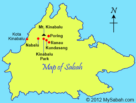
DESA is a household name in Sabah because most Sabahans grow up drinking milk from Desa Dairy Farm, which produces nearly one million liters of fresh milk annually. But Sabah people feel affection for Desa milk because of more reasons. You will know why if you visit Desa Dairy Farm in Mesilau, which is about 100 KM away from Kota Kinabalu City (KK). In fact, this farm has become a well-known tourist attraction. Throngs of tourists go there every day to enjoy the delicious dairy and beautiful scenery.


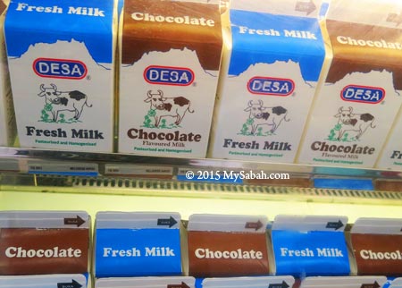
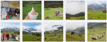
Pic: The fresh milk made in Sabah. They also produce goat milk.


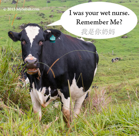
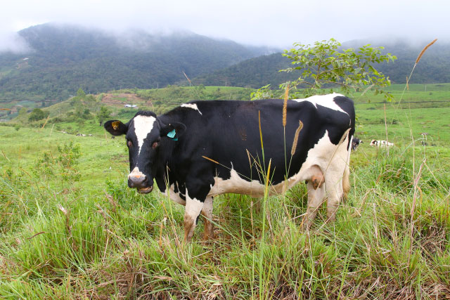
Pic: meeting my “milk mother” in Desa Cattle Farm


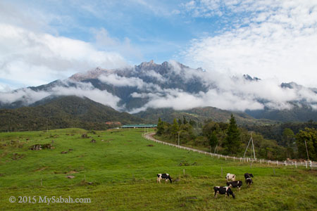
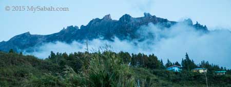
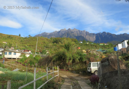
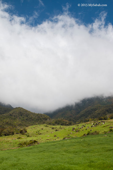
It took me about 2 hours to reach Desa Dairy Farm in Mesilau by car. The green pasture with grazing cows at foothill of Mt. Kinabalu is a sight to behold. Doesn’t the place look like grassland of New Zealand? No wonder locals call it the New Zealand in Sabah. To see Mt. Kinabalu, you need to be there before 8:30am because the mountain will be covered by dense fog.


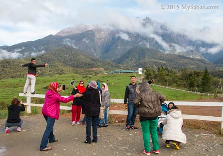
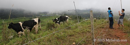
The scene is so breathtaking that many tourists taking selfie and photos. FYI, many photographers also come here to use Mt. Kinabalu as the background for wedding shots of their customers. Photo taking is free outside the fence. The photography permit fee is RM100 (≈US$27) for you to enter the farm for better camera angles. In case you worry that the cows will charge at people who wear red dress. No, they won’t. lol


Pic: the entrance of Desa Dairy Farm (ticket booth at the right). It is open to visitor who purchases a ticket.


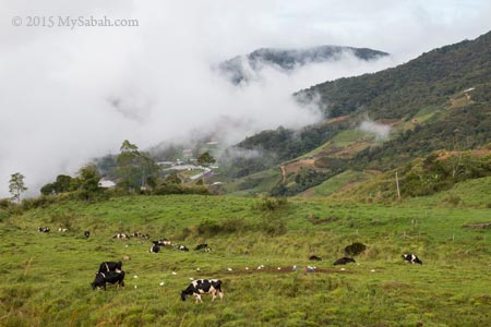
Good Mooorning milk cows and welcome to the Moo-Moo Land of Sabah. The farm is 199 hectares in size and most cows are Holstein Friesian cows imported from New Zealand, the highest milk producers of all cattle breeds. It’s quite cool and windy here (about 20°C / 68°F) so you better put on a jacket or fleece to keep warm.


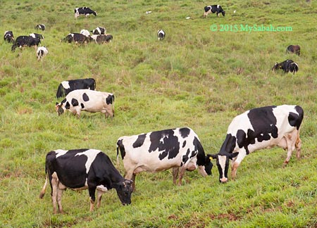
Cows are amazing. They are probably the best workers in the world. They turn grass into milk (and cut the grass). They don’t complain a lot. Instead, they ask for Mooooore.. But that’s why cow has no Mooney because people milk them dry. Ok, it’s a cow pun joke, such life sounds familiar though.


The cows were busy grazing and occasionally staring at tourists with “what you want?” expression. They were all pretty relaxing. I didn’t see any cowboy to look after them. Do these cows know when to clock-in at milking station?
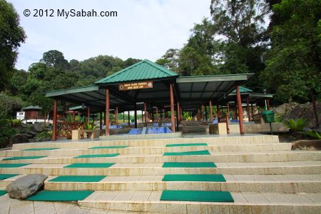
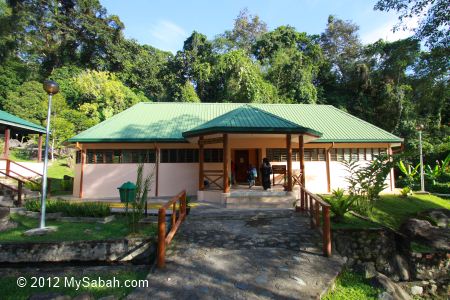
Desa Building

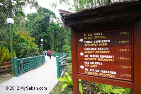
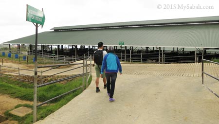
For more things to do, the milk processing plant, milking station, office and shop of Desa is about half a KM from the entrance by gravel road.


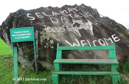
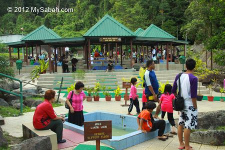
Pic: welcome sign near Desa activity centre


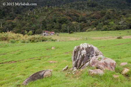
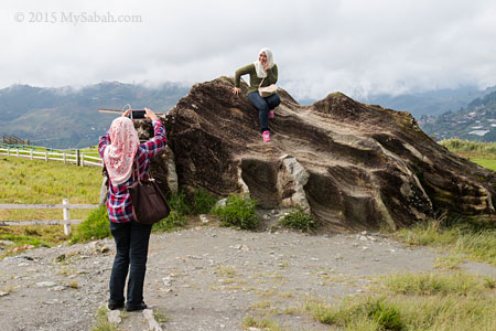
Pic: There are many big and beautiful granite boulders in the farm. A lot of tourists like to climb up to take photos, so Desa has to put a warning sign “Climb at your Own Risk” next to almost every boulder.


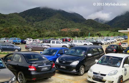
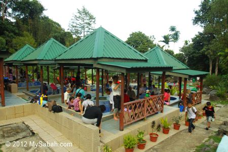
Desa Dairy Farm is more famous than I think. The Desa activity centre was packed with visitors and most parking lots were occupied that day. I chit-chat with some tourists and found that many of them are from Peninsular Malaysia, and some of them are from Hong Kong.


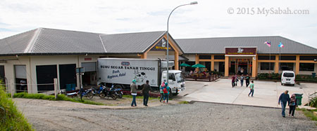
Pic: milk processing plant (left) and shop (right) of Desa

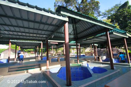
The following are the activities you can do at Desa. Family and student groups would find the tour educational, and it’s important for younger generation to see and learn how food is made and processed.
Milking Process: 2:30pm – 4:30pm (Daily)
Raw Milk Processing: 10am – 3pm (Tue, Thu, Sun)
Calf Feeding: 9am – 4pm (daily)
Toilet is at left-hand side of the building (RM0.30 per entry).
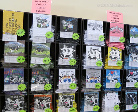

Pic: Desa T-shirts

There is a souvenir kiosk in Desa building where you can buy T-shirt, postcards, fridge magnet, stickers, etc. with Desa branding.


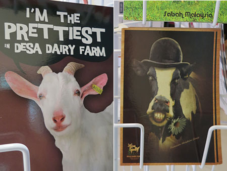
Pic: funny postcards of Desa


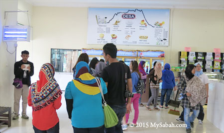
Then a long queue caught my attention. It must be something good, I thought.


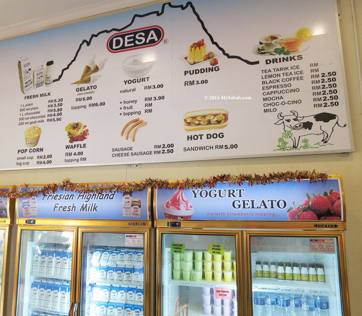
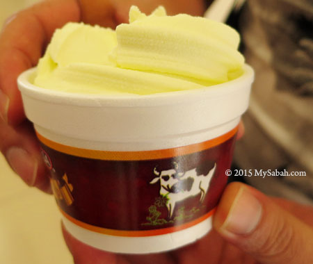
Seem like milk is not the only product being sold there, they have different snacks made of the freshest milk such as ice-cream, yogurt and pudding. I drove 100 KM to this place so it would be a shame if I didn’t try one of these dairy food.


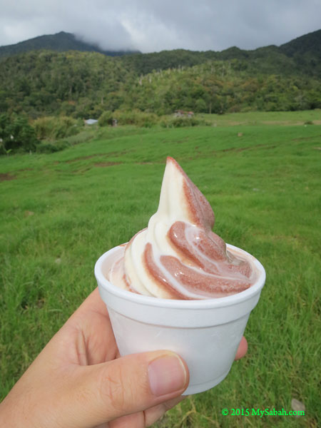
Pic: enjoying Desa’s vanilla & chocolate ice-cream in cooling weather of Mesilau. Couldn’t be better!


Pic: Durian ice-cream

Their ice-cream and yogurt were sold out very fast. I wanted to go for second round and there was no more. 🙁


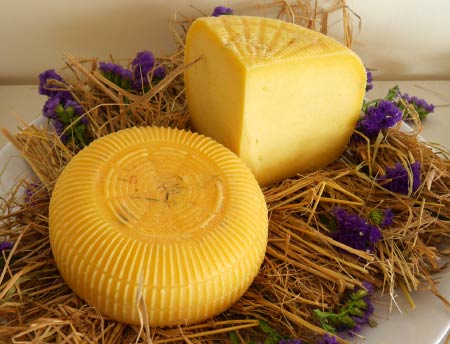
New! (Jul 2015): They have started selling fresh mozarella and ricotta cheese at food kiosk. You also can drop by viewing bay and cheese cellar room to see making of yogurt and cheese.


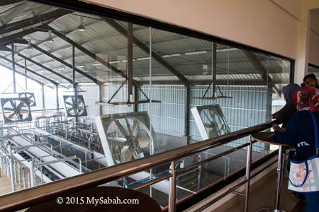
There is a view room for visitors to see milking process through a big window. Too bad I couldn’t wait a few more hours so I moved on.

Calf Pen / Barn

After seeing and eating something at Desa, probably you want to touch something as well. You can head to calf pen next to the main building.


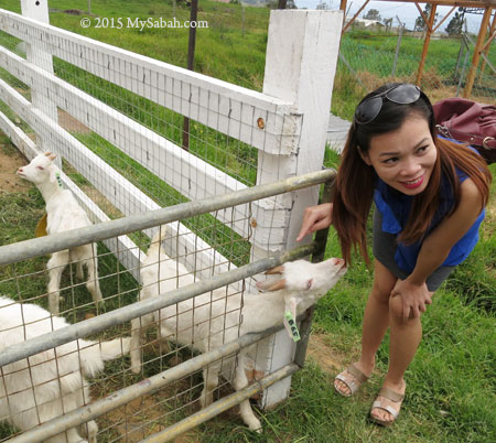
This year is the year of goat, so it would be auspicious to touch goats. Note what the little lamb is doing (see photo above). The farm also rears saanen goats for their milk.


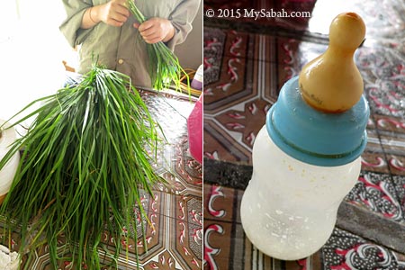
You can buy grass (RM1 per bunch) or milk (RM1.50 per bottle) to feed the calves. They really know how to milk the money of tourists lol.


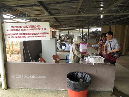
Pic: tourists buying grass and milk. Please note the calf may not take your food when they are full, and there is no refund for that. Anyway, they all looked hungry during my visit.


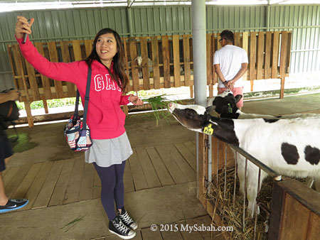
Hold the grass tight while feeding. The calf is quite strong and would pull the grass out of your hand.


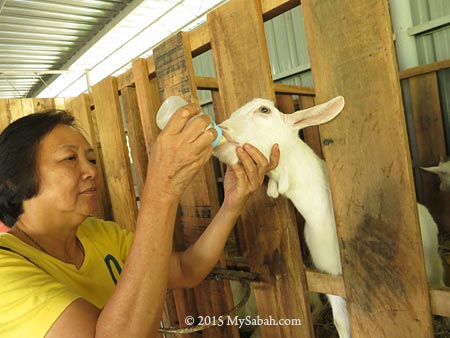
Pic: bottle-feeding the young dairy goat. Oh My Goat, it’s so cute.


Next I went to cow barn where I could see hundred of milk cows laying or standing under the roof. Tourists can only see them from a distance (I believe some curious tourists would squeeze their udders if they are allowed to touch the cows, haha). Milking a cow is not as easy as it looks. If you upset the cow, it would kick the milk bucket, and you.


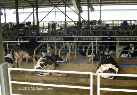
A cow emits nearly 300 Litres (about 80 gallons) of methane a day, which is enough to power up an average size refrigerator for a day. No kidding, cows can turn grass into milk and also bio-fuel. The cows in photo above look dirty because it rained heavily the previous night.


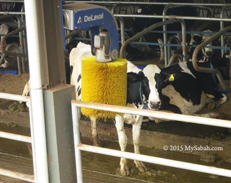
Pic: a cow enjoys rubbing its body against rotating cow brush, which said to make cow healthier and happier thus better milk production.

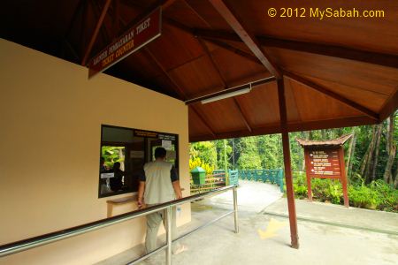
Ticket & Contact Info

The following is more information of Desa Dairy Farm.

Visiting Hours: 8am – 5pm (Daily)
Ticket Fee: RM5 (≈US$1.30) per Adult, RM4 (≈US$1.10) per Child / Student (Free if under 6 years old). Prices as of Jul 2015

Company: Desa Plus Sdn. Bhd.
Address (office): Level 3, West Wing, Wisma 2020, 18, Lorong Belia Karamunsing, 88991 Kota Kinabalu, Sabah, Malaysia.
Website: www.desaplus.com
Facebook: Desa-Cattle-Dairy-Farm-Kundasang-Sabah
Tel: +60 88-889562

How to get there

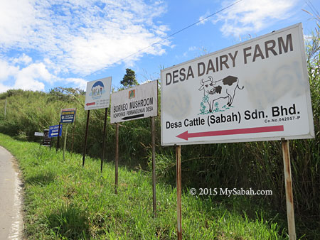
Desa Dairy Farm is in Mesilau and about 100 KM away from KK. Though far, it’s quite accessible if you own / rent a car. There is no bus goes directly to Desa Dairy Farm. However, you can get a bus to Kundasang town, then hire a taxi to go to the farm (you may need to arrange with taxi driver for return trip), which is about 10 KM away from Kundasang.

GPS Coordinates: 6°00’59.0″N 116°35’28.9″E (see Location Map)


Pic: the road to Desa Dairy Farm


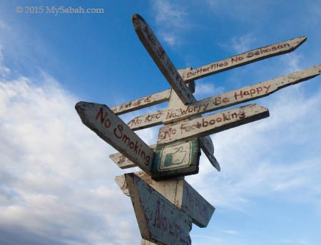
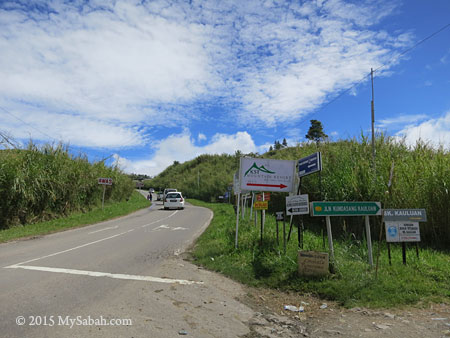
Pic: you will see a few direction signs of Desa next to the road in Mesilau


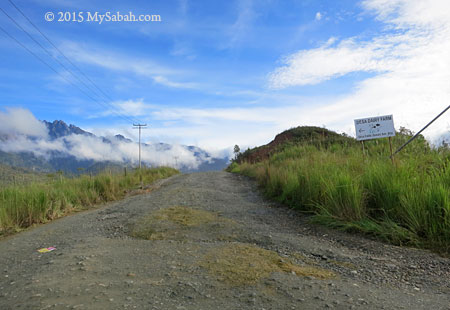
The road to Desa Dairy Farm is mostly on paved road, until you reach the last junction, which is the start of 2 KM gravel road to the farm. The road is not well-maintained but you still can get in easily using standard saloon car. Just drive slowly and carefully.


You may check out my photo album if you want to see more photos.

Photos taken in Mesilau, Sabah, Malaysia Borneo

Little Hut, home sweet home in Mesilau

Travelers always look for good attractions to visit and nice food to eat. After the tour, we all need a great place to stay. It is cool to be served by 5-star hotel but I prefer accommodation with nice surrounding. For me, Little Hut of Mesilau is special, not just because of its cooling temperature of 13-30°C (55-86°F) and spectacular view of Mt. Kinabalu, its homely atmosphere is something unique in homestay of Sabah.


Located at 1,460 Metres above sea level, Little Hut is only 12 KM away from Kinabalu Park and 3 KM from Mesilau Park, a convenient spot for me to stay a night and to enjoy the refreshing air far away from bustling Kota Kinabalu City (KK).


Pic: at the left is my hut (named Incredible Hut)

I checked into my chalet at 8pm and spent a night in Incredible Hut, a small house that have 3 beds and the only hut without kitchen. The tungsten light of the house looked warm and comfy from outside in the cold and windy evening, I really couldn’t wait to get in.


Pic: ground floor of Incredible Hut

After I collected the key from their staff, the 2-storey chalet was all mine. It’s like living in your own house, no room service that reminds you are an outsider. You would appreciate the sense of belonging and freedom here.


Pic: Incredible Hut has one bed in ground floor and two on top floor.

The space in Incredible Hut isn’t spacious, just nice for medium size Asian like me. If you are almost as big as Incredible Hulk, you may not be able to move so freely. Please note they have bigger chalets and I only show the photos of the smaller hut.


Mesilau is cool at night but not down to freezing point. The feeling is like being inside an office with strong air-conditioning. Putting on a jacket or fleece is enough to keep you warm. There is no heater (and not necessary) in house. Don’t worry, hot water shower is available.


The interior is simple and decorated with interesting ornaments. Each chalet has TV (with Astro satellite TV) and DVDs to kill your time. But the best activity to do here is to eat some hot stuffs in cold evening together with your friends and family, e.g. BBQ or steamboat. Little Hut can rent you the equipment but you need to bring your own food, which is readily available in Kundasang town only 6 KM away.


Pic: guess what is inside the treasure chest?


Pic: Toilet paper, shower gel and shampoo are provided. You need to bring your own towel and toothpaste.

Poetic Dream Houses

I had a very good night sleep in Little Hut. When everything lit up by the sunrise, I started to see the beauty of Little Hut. Seem like they “gardenize and villagize” every corner to give an idyllic and nostalgia touch to their place. They also insert some humorous elements for you to discover here and there.


Pic: Little Hut in the morning


The morning view of Mt. Kinabalu is a pleasant surprise. I didn’t know I could see it from Little Hut.


Pic: the view of Mt. Kinabalu and Little Hut. Note the small farm in foreground.


Pic: The little farm + garden in Little Hut is planted with variety of vegetables and flowers such as roses and spring onions. Housewives find this farm intriguing and are excited to tell their children what are those plant.

If I show the photos above to others without saying the location, most would think these are taken in countryside of European countries.


Pic: balcony of Hut Attack


Pic: village and farm view from the balcony


Pic: funny direction signages just to make you smile.


Pic: backyard of Little Hut


Hey, come and meet Miyao, the chubby and friendly 3-color cat of Little Hut. She acts like the owner of Little Hut and loves to hang out with people.


Pic: The Cat Residence. Miyao also has her own Little Hut, but she always looks for a chance to sneak into your hut, probably she enjoys the warm cuddling offered by the guests.


Pic: Miyao lazes around and as relax as the guests.


Little Hut is in Kampung Mesilou Village and surrounded by village houses.


You can take a stroll around the village, a friendly neighbourhood where you can explore around and say Hi to the locals.


Pic: the plantation in village. The property of Sabah city is super expensive nowadays, so I’m kind of envious of the big land they have here. I believe that’s the concept of Little Hut, which allows city people to experience the peaceful rural life once in a while.

The Chalets

Little Hut has a total of 5 chalets, each with different size, theme and amenities, so it’s important that you select the right hut prior to booking. You can visit their website for more photos and details.


Pic: from left: Unbreak My Hut, Incredible Hut, Bizza Hut, Hut Attack. Not seen in this photo is Hut Leluyaa, which is behind Bizza Hut.


Pic: Little Hut uses pun for naming their huts. The names are just for fun and don’t mean anything, so don’t be serious about them.

The following table is a summary of the chalets for your quick reference:

Hut Rate (per day per hut) Remarks
Incredible Hut Mon-Fri: RM150 (≈US$42)

Weekends, Holiday*: RM180 (≈US$50)

Accommodate up to 3 people, suitable for small group of friends and family. No kitchen
Bizza Hut Mon-Fri: RM250 (≈US$70)

Weekends, Holiday*: RM300 (≈US$83)

Accommodate up to 5 people, suitable for family and group of friends. Kitchen available. Good viewpoint for Mt. Kinabalu
Unbreak My Hut Mon-Fri: RM150 (≈US$42)

Weekends, Holiday*: RM180 (≈US$50)

Accommodate up to 2 to 3 people, suitable for couple. Blue & white Greece theme. Kitchen available.
Hut Attack Mon-Fri: RM280 (≈US$78)

Weekends, Holiday*: RM330 (≈US$92)

Accommodate up to 5 people. Kitchen available. View of Kg. Mesilou village and mountain range
Hut Leluyaa Mon-Fri: RM210 (≈US$58)

Weekends, Holiday*: RM250 (≈US$70)

Accommodate up to 2 to 3 people, suitable for couple. Kitchen available. Farm and village view

Rate as of Feb 2015. Please visit their website for latest rate and updated details.
*Public Holiday & School Holiday

Though Little Hut has no restaurant, most chalets have a kitchen with cooking utensils for you to cook, or you can rent BBQ rack and steamboat from them (food not provided).

Contact & Booking

You can book the accommodation with Little Hut up to 6 months in advance by e-mail or phone. You need to pay 50% deposit to secure your booking. The chalets could be full during peak season so it’s better to book earlier.


Tel: +60 16-8601416 (9am-8pm)
E-mail: littlehutmesilou@gmail.com / shiaohan@hotmail.com
Website: littlehutmesilou.blogspot.com
Facebook: mesilou
GPS Coordinates: N 6.014536° E 116.599023° (see Location Map)

Getting there

Little Hut is in Kampung Mesilou Village, about 100 KM away from KK (see Location Map). There is no bus going directly to Little Hut, so you need to get there using your own car or hire a taxi at Kundasang town. Most of the time you will drive on paved asphalt road until you reach Kampung Mesilou. After the village, turn to the 3rd junction at the left (which has two tyres as marker), then you have to drive carefully on the narrow concrete road, which you will reach Little Hut near the end (estimated 600 Meters).

I strongly advise you to go there during daytime so you can see the small road or signages clearly. If your car has low body and you can’t see the road clearly in the dark, the bottom of your car would hit the big rocks. You can find detail picture guide and map in their website and Facebook.

Photos taken in Mesilau, Sabah, Malaysia Borneo

Loop Trail of Mt. Kinabalu, the Best Hiking Route of Sabah

(Update: Mesilau Trail is permanently closed, and day hike to both Timpohon and Mesilau trails is no longer allowed) The space to climb Mt. Kinabalu is always full, so many tourists don’t have the chance to climb the highest mountain of Malaysia. Don’t be disappointed if you are one of them, because you still can try Loop Trail, which allows you to hike up to 2,745 Meters asl (asl = Above Sea Level), about half the height of Mt. Kinabalu (4,095M). The height of Mt. Kinabalu is not the reason why it’s listed as a UNESCO World Heritage site. The real treasure of Kinabalu Park is its high density of endemic flora & fauna, which you can see along the Loop Trail. I would say it’s one of the Best Hiking Trails in Malaysia.

The Loop Trail

Loop Trail is a day-trip easy to arrange and you won’t be under pressure to conquer the mountain. You only need to hire a Mountain Guide and pay a small fee. More on this later. Please note the Loop Trail (in orange color) in the 2D trail map below:

You can pick one of the starting points for Loop Trail, namely, Timpohon Gate and Mesilau Gate, and both trails join at Layang-Layang after 4 KM (2.5 Miles) and 6.2 KM (3.9 Miles) respectively. At Layang-Layang, Loop Trail visitors have two options, (1) turn back to where they begin, or (2) proceed to another Gate. Loop Trail visitors are forbidden to take the Summit Trail after Layang-Layang, and no, you can’t camp in the shelter.

Timpohon Vs. Mesilau Trails

Timpohon Trail is shorter and easier, Mesilau Trail is longer but the view along this trail is more beautiful (EVERYONE says that). Timpohon Trail is mostly uphill trail so descending is fast and easy. In contrast, Mesilau Trail is a series of ascending and descending trails, so turning back is almost as challenging as going up. Anyway, it’s not mandatory to finish the loop trail. You are free to stop at any time and head home.

Below is a table that shows you 3 types of route you can do in Loop Trail:

Route Distance Remark
Timpohon Gate → Layang-Layang → Timpohon Gate 8KM (5 Miles) The Easiest route, take 3 to 5 hours.
Mesilau Gate → Layang-Layang → Timpohon Gate 10.2KM (6.34 Miles) Recommended route to get the most of Loop Trail. Take 5 to 7 hours. Tip: start the climb from Mesilau in the morning, for clear view of Mt. Kinabalu (would be covered by fog after 9am)
Mesilau Gate → Layang-Layang → Mesilau Gate 12.4KM (7.7 Miles) Hardest route. May need over 7 hours. You have to be very fit. Some trail runners do this loop as a training.

*The number of hours taken is highly dependent on your physical fitness.

Though Loop Trail ends at the altitude of 2,745 M (9,006 feet), you already reach a height taller than the second and third highest mountains of Malaysia, i.e. Mt. Trus Madi (2,642M) and Mt. Tambuyukon (2,579M)! Overall, along the trail there are shelters with toilet, water tank to refill water (it’s untreated water from mountain stream, use water purification tablet if you have sensitive stomach) and support such as stairway, hand rail and wooden plank. The trail is well-marked and there is no leech (a blood sucking critter), bear and Bigfoot.

Things to Do

Besides hiking, the following are some fun activities to keep yourselves entertained during the walk:

  • Birdwatching: 17 endemic montane birds of Borneo live in Kinabalu Park, e.g. Chestnut-hooded Laughing Thrush, Friendly Bush Warbler
  • Flora & Fauna Watching: you will find exotic orchids and pitcher plant next to the trail. Some plant may look ordinary but they can’t be found in other parts of the world. Don’t pluck or collect anything. It’s an offense in national park.
  • Photography: The majestic landscape, lush forest, pretty flowers, etc. are good subjects for photo taking.
  • Or just sit and watch, enjoy the nature. A few squirrels will come near to you.

Temperature drops every 1°C for every ascending of 100M, so it’s cooler the more you move up. The temperature ranges from 16 to 25°C (61-77°F), but it can be quite warm in daytime, especially in a vigorous walk. Be warned though, the trail would turn into creek during heavy rain and the experience could be quite awful.

Registration and Fees

The climbing fee for Loop Trail is RM5 for Malaysian and RM10 (≈US$3) for foreigner. You MUST hire a Mountain Guide (from Sabah Parks) to go with you. The service of a Mountain Guide costs RM203 (≈US$57, rate of year 2015) per day and he can bring up to 6 climbers, which means you can share the guide fee with other hikers. For example, there is a group of 6 foreigners, each of them needs to pay RM10 climbing fee and share the cost (about RM34) of hiring one Mountain Guide, so each person only spends RM44 (≈US$12.22). If you go solo, you still have to pay the full amount.


Pic: This is the tag (permit) for Loop Trail visitor. The tag for Summit Climber has photo of Mt. Kinabalu imprinted.


Pic: Kinabalu Park HQ. The registration and payment counter is behind this building, and you can hire transport to Timpohon Gate in the small office at the left.

If you start your Loop Trail from Timpohon Gate, you can register and hire your Mountain Guide at Kinabalu Park HQ. Passport or MyKad is required for the registration. Please note Timpohon Gate is 3.4 KM (2.1 Mile) away from Kinabalu Park HQ (by asphalt road) so you may want to hire a (one-way or return) transport to send you there. The phone number of Kinabalu Park HQ is +60 88-889888 in case you have more questions.


Pic: Mesilau Gate and Sabah Parks are in Mesilau Nature Resort

If you plan to depart from Mesilau Gate, you better inform the Sabah Parks office there by phone (+60 88-871550) so your Mountain Guide will wait for you at Mesilau (as most of them stations in park HQ).

For those who can afford to pay more for a better experience, you may hire tour guide (from travel agent, someone who has good knowledge on flora & fauna). Please note all payment is by Cash Only.

Below are some photo walk-through so you know what to expect.

Timpohon Gate → Layang-Layang (4KM one way)

Timpohon Gate is the trailhead for Timpohon Trail, which is busier and shorter than Mesilau Trail. You will see many climbers start their summit trail here. Porters also use this path to carry supplies (e.g. tourist’s luggage, rice bag, gas tank, water tank) to the accommodation on mountain.


Pic: Timpohon Gate. You can buy snacks, drink and basic supplies (e.g. raincoat) in the building.


Pic: You need to show your tag (permit) to the Checkpoint at the left, before you hit the trail.


After 300M, you will see Carson Waterfall at your left. If you see large volume of water, it might be raining in higher ground.


Pic: the first shelter you will reach is Pondok Kandis (Pondok = Shelter), which is named after an edible but sour mangosteen (in Dusun language). At 1,981.7M asl, you are in the transition zone between lowland rainforest and montane cloud forest, where you start to see mosses, ferns, orchids, etc. Most of the time you will walk on the ground mainly consists of metamorphic rocks from here to Mempening Shelter.


Pic: Ubah Shelter, the 2nd shelter at 2,081.4M asl, it’s named after wild guava tree. The signage says red leaf monkey could be spotted around there, but I never see one.


You can enjoy the scenery better than other climbers as you are not in a hurry to conquer the mountain. Just relax and enjoy the beautiful surrounding.


Pic: 3rd Shelter, Lowii Shelter at 2,267.4M asl, which is named after Nepenthes lowii pitcher plant. You would see some pitcher plant such as Nepenthes tentaculata if you explore the bush next to this shelter.


Pic: distance marker (in Kilometer) and trail map to show your current location.


Pic: Mempening Shelter (2,515M asl), named after a species of Oak (family Fagaceae). In this shelter, you will hear many climbers start mumbling about the exhausting hike. You can tell them they are not even half way yet LOL.


At this point, you have entered the Montane Forest (Cloud Forest) above 2,500M, the surrounding will look misty and mossy, and so distinctly different from vegetation in lowland.


Pic: To survive the long trek, you have to to eat whatever you find along the trail, like the giant earthworm that comes out after heavy rain. Just kidding. If you are very lucky, you will spot Kinabalu Giant Leech, the predator of giant earthworm.


Pic: The last shelter of Timpohon Trail, Layang-Layang Shelter at 2,702M asl, it’s named after a Bornean swiftlet (Collocalia dodgei). This is also where ultrabasic forest begins, which is made up of orange soil that is high in acidity, with high concentration of magnesium and zinc while low in phosphorus. You will see a lot of endemic plant from now on. Unfortunately, you will reach Layang-Layang junction within 10 minutes, where you need to turn back to Timpohon Gate or proceed to Mesilau Gate.

Mesilau Gate → Layang-Layang (6.2KM one way)

Mesilau Gate is 1,933M asl and located in Mesilau Nature Resort. This trail is longer and more challenging than Timpohon Trail, but you will be paid off by nicer view. Only a small number of climbers taking this trail to the summit, so it’s more pristine. The trail is also narrower and not that well labeled. A few sections are steep and slippery (after rain). You will be fine if you are careful.


Pic: Sabah Parks office and Mesilau Gate in Mesilau Nature Resort


Pic: the registration and payment office is just next to Mesilau Gate


Pic: start of Mesilau Trail. Enjoy the 6.2 KM hike!


Pic: mountain and forest in fog

I only tried Mesilau Trail once and it was raining. It was so misty that I wasn’t able to take some good photos to show you. Please believe me that the scenery along Mesilau Trail is better than Timpohon Trail.


Pic: Schima Shelter, the 1st Shelter.


Pic: Bambu Shelter, the 2nd shelter.

In average, there is one shelter for every one KM. All the shelters on Mesilau Trail are smaller and less developed than those on Timophon Trail.


Pic: bridge over West Mesilau River


Pic: Tikalod Shelter


Pic: Don’t ask your guide how many KM left. You will always get the same answer, “We are near”. Read the distance marker.


Pic: Lompoyou Shelter


Pic: There are some viewpoints in open area. Too bad the view was obstructed by dense fog during my visit.


Pic: Magnolia Shelter

After 6KM, you will reach the Layang-Layang junction, where you should descend to Timpohon Gate or turn back to Mesilau Gate.

Layang-Layang

Layang-Layang is the meeting point of Timpohon and Mesilau Trails. The summit trail beyond this junction is off limit for Loop Trail visitors.


Pic: Layang-Layang Shelter (left) and Staff Quarters


Pic: warning to visitors without permit.


Pic: Layang-Layang Shelter. The Layang-Layang junction is less than 10-minute walk further up.


Pic: Layang-Layang junction


Pic: final warning to climbers at Layang-Layang junction. You are not allowed to move further up if you don’t have the permit to climb Mt. Kinabalu.


Pic: signage at Layang-Layang junction (Laban Rata and Gunting Lagadan Hut are the accommodation on the mountain)

Things to Bring

The following is a list of items you should bring. Try to pack light. When you climb a mountain, you can feel every Kilo of the weight. Also, wearing comfortable hiking shoes will help a lot (best if it’s water-proof).

  • Backpack (preferably with rain cover)
  • Water bottle (with water of course)
  • Pack lunch and snacks (no restaurant available on the trail)
  • Fleece or Windbreaker (It can be cold when it’s windy)
  • Raincoat (a Must-Have)
  • Sunblock lotion (UV on mountain is higher)
  • Walking pole
  • Camera (with spare batteries & memory cards)
  • Extra socks
  • Pain killer (for altitude sickness or knee problem)
  • Torchlight or LED Headlamp (just in case the sky turns dark before your trip ends)
  • Cash

Photos taken on Mount Kinabalu, Sabah, Malaysia Borneo

Kundasang BBQ Chicken

It’s always nice to try some local food when you travel. If you visit Kinabalu Park of Sabah, there is a chance that you would drop by Kundasang town, which is 12 Kilometres away, to visit the War Memorial and Fruit & Vegetables stalls there.


Sabah people who visit Kundasang would not leave without trying the famous Kundasang BBQ chicken wings, something that most tourists miss. You can find the stall easily, it’s near the big roundabout of Kundasang and in front of Hidayah Restaurant & Catering (see Location Map), and it’s hard not to notice the excessive CO2 emission (smoke) from this stall.


The face of Kundasang has changed a lot over the years, but this small stall remains the same and still serving one of the best BBQ chicken wings in Sabah. I don’t know why his barbecue chicken tastes so good, probably it’s already great to enjoy sizzling BBQ chicken wings in cool air of Kundasang highland.


I believe this stall sells hundreds of BBQ chicken wings every day. Each piece is sold for RM2 (I’m not sure if this is correct). Though I visited during non-peak hour, the cook never stopped for a break. He himself would smell like chicken wing after long hours of barbecuing haha.


“Chicken wings only? What so special?” you might ask.
Look at the photo above carefully. Do you notice the round things? They are BBQ chicken tails, locally known as Satay Buntut (literally means BBQ chicken butt). Chicken tail is always unwanted part in other places, but it’s a delicacy for Sabahans. After BBQ, the skin of chicken tail becomes crisp and slight burnt, with aroma of charcoal. It’s soft, oily but juicy. Personally I love it. If you never try BBQ chicken tail, be open-minded and try it, before you decide you don’t like it.


Someone says eating Satay Buntut can make you horny, rubbing it on your chest and hair will grow. I don’t know if this is true and I’ll let you to prove it. 😀

Photos taken in Kundasang, Sabah, Malaysia Borneo

Lupa Masa Jungle Camp in Borneo Rainforest

Some people prefer to camp in park equipped with Wifi, air-conditioning and cozy bed. To truly appreciate the nature, some campers want to get away from civilization totally and live among trees and wildlife, like Lupa Masa Jungle Camp. Lupa Masa means Forget Time in Malay language, you would lose sense of time there when you forget about your Facebook, your computer and your boss.


Lupa Masa is located between Borneo rainforest and lower montane forest at the foothill of Mt. Kinabalu, the UNESCO Natural Heritage Site of Sabah. To visit the camp, I met the camp manager, Michael from Scotland, at Poring Hot Springs. He marries a sumandak (girl) from Tamparuli and able to speak Malay fluently. He already blends into the community and now behaves more like a Sabahan wearing a “orang putih” skin (Caucasian). However, he hasn’t fallen in love with Durian yet.


Pic: Michael crossing a stream with a gas tank

Michael got some groceries from Poring and led the way. We walked on a gravel road in village and plantation for about 10 minutes, then we entered a soil trail that took us deep into the forest. The forest is an aged regenerated secondary forest that gives us much needed shade in muggy day. The trail is mostly mildly inclined, with a short section of steep slope.


Pic: nature trail to Lupa Masa

The walk was supposed to take about 30 minutes. I was carrying two bags weighed over 15Kg and one of them broke, so it took me an hour to reach the camp. Since this camp is near the boundary of Kinabalu Park and situated between rainforest and cloud forest, you would see wildlife from both habitats. This attracts naturalists who are expert in snakes, mammals, birds, etc. to stay in Lupa Masa. A snake expert even found 12 snake species in a day. But please note that wildlife sighting is depend on luck.

Camping in Lupa Masa

My “room” is only a basic hut with raised floor and a canvas roof over my head. Albeit being pounded by heavy rain a few times during my stay, the roof didn’t leak. It is near the edge of campsite and far away other shelters, so I feel so alone at night.


Pic: my private “chalet” surrounded by greenery

As there is no wall between me and the wood, I was fully exposed to the wildlife territory. In the morning, I was always waked up by a flock of noisy Buff-rumped Woodpeckers, and countless chirping birds came to check me out. Then cicada took the afternoon shift to continue the rainforest choir, at night it was the sound of frogs and crickets that sent me to dream land. I was like an outsider. Perhaps I should have tried to join their orchestra by making some rhythmic calls too.


Pic: my bed on bamboo floor

My bed is a few camper beds enveloped in mosquito net. Mosquito is the most active during dusk and I would find 4 or 5 of them bumping the net from outside. In other time, there were very few mosquito in the campsite. The temperature here during daytime is about 25°C (77°F) but can drop to 15 (59°F) or below at night. The camp provides blanket or you can bring your own sleeping bag. There are a few wires for me to hang my cloth between the poles in the hut. My clothing never turned dry in cold and humid days though.


Pic: camping tent in longhouse

If you want more privacy, you can choose to stay in shelter that has camping tent. In Lupa Masa, there are 6 shelters that can host up to 25 campers. The accommodation costs about RM70-90 (≈US$22-28) per night. Food is included, mainly vegetarian meals because they don’t have fridge to keep the meat. Some of the food that I had there were rice with curry vegetables, French toast, oat meal with fruits, fried rice, etc.

Night Walk

Night Walk is the highlight of Lupa Masa. You can see far more animals in the dark as most wildlife are nocturnal. You can choose easy walk that takes 2 to 3 hours, or long challenging trek that requires you to cross river and climb steep hill with more rewarding sighting. The guide fee is RM30 (≈US$9.40) per hour, RM75 (≈US$24) if 3 hours. You can share the cost with others if you go in group.


Michael seemed to be more excited than me in night walk. After dinner, we started our night safari on foot at 8pm. Spotting animals in the dark is no easy task because of their camouflage. You need a good torchlight and great eyesight. Anyway, you won’t need both when Michael is around, as he is an excellent spotter. Even if he showed me the things he found, it still took me quite a while to see it. His secret is to look for light reflection in animal’s eyes.


Pic: big juicy stick insect, endemic to Borneo

In case it rains, you better bring a raincoat. Leech is expected, so wear your anti-leech socks. I didn’t get any leech bite though there were many leeches around. We shined our torchlight to every corners to find those critters hiding in burrows, tree holes, bark, river rocks, shrubs and fallen log.


Pic: sleeping birds. Note the kingfisher has only 3 claws.

We saw a number of sleeping birds on the trees. It’s interesting that they turn into “fur ball” while asleep.


Frog are everywhere. I saw and heard many of them after rain, e.g. Lesser River Frog, Black-spotted Rock Frog, Giant River Frog, Montane Litter Frog. Some leaped away before I got close enough to take a photo. “You have to approach them like a Ninja,” Michael said.


Pic: a big long-horned beetle

Other animals that we spotted included Small-toothed palm civet, long-legged millipede, Agamid lizards, white lantern bug, spider, scorpion, tree-hole crab, dead-leaf grasshopper, trilobite, geckos, katydid and a green pit viper.


Pic: a giant forest snail

Suddenly Michael paused and smiled, “How much you would pay me for spotting a horned frog?”


Oh yeah, we found a Bornean Horned Frog, no, two!


Bornean Horned Frog looks like a little devil. Actually it’s a gentle frog. Its “horn” is an extension of its eyelid, to make its body shape looks like a leaf.


From his tattoo, obviously Michael is also a fan of horned frog lol.


Pic: a moth which was infested by parasite fungus which turned it into a “zombie.” This fungi can mind control its host to climb to the higher spot, to spread its spores.


Pic: Beware of aggressive fire ants on forest floor. Their stings can penetrate sock and very painful hence the name.


Pic: animation to show luminous fungus with the light on and off

Then Michael showed me something really special but we needed to turn off our torchlight. It’s luminous fungus that glows like green neon light on a decaying log. The glow is quite bright in the dark. We saw a few glowing mushroom too.

Some “trophy species” of wildlife photographers such as Western Tarsier, Slow Loris, Bornean Leaf Nose (snake), Wallace’s Flying Frog and Caecilian (a limbless amphibian) are known to be present at Lupa Masa, but you will need some luck to see them.

Day Walk

During daytime, you can take a stroll in the campsite or surrounding forest. Walk slowly and quietly in the morning, you would find a lot of birds around the camp. This place is great for birding because flock after flock of sunbirds, flowerpeckers, bulbuls and other forest birds frequent this camp during dawn and dusk. I saw Orange-bellied flowerpecker, Crimson-breasted flowerpecker, Broadbill, Ashy Tailorbird and Kingfisher during my stay.


Lupa Masa campsite is a garden by itself, planted with vegetables, fruit trees and flowers. The blooming orchid here attracts butterflies such as Rajah Brooke butterfly, tree nymph and birdwing butterflies in different colors.


Pic: Ginger flower that looks like a birthday cake (Species: Etlingera fimbriobracteata),


The boundary of Kinabalu Park, the most bio-diversified forest of Borneo, is just a few minutes walk away from the camp. The jungle is well lit by daylight, so you can enjoy the view of standing tall trees. The zappy Pygmy squirrel, the smallest squirrel in the world, is commonly seen busy moving up and down tree trunks. Look high above you would find bird’s nest fern and wild orchid on the trees.


Pic: a fig fruit that looks like red chili

Lupa Masa is one of the few places where you can find three types of corpses flowers, namely Rafflesia, Rhizanthes and Titan Arum (Samurai Flower). Their flowers take many months to bloom, so you should be very happy if you see such rare sighting.

River & Waterfalls

During hot day, one of the favorite activities of their guests is to soak in the icy river or pond of Lupa Masa Waterfall nearby. You can enjoy the cleanest (and Chlorine-free) flowing water from Mt. Kinabalu.


Pic: clean and unpolluted river from Kinabalu Park is only 10 Meters from the camp.

The water is shallow so it is safe for a swim, or you can just sit in the river for a free massage from river current (do bring beer with you).


Pic: you can tell how clean is the water from the photo. It’s so crystal clear that I can’t see the water. Sometimes otters and kingfishers forage for fishes here too.


Pic: Lupa Masa Waterfall near the camp (7 minutes walk)

For those who are adventurous, they can hike one hour uphill to explore the “hidden” waterfall, which is five times bigger than Lupa Masa Waterfall.

Amenities

The camp was started by Tom in 2010, with the concept of providing authentic jungle experience, so the amenity is basic. The campsite has solar panel and power generator but electricity supply is not available most of the time, so you better bring a torchlight (with spare batteries). There is no outlet to charge your phone and battery. No Wifi in camp, but my phone can receive 2G connection, slow but able to use Whatsapp and SMS.


Pic: activity hall where guests can sit around and relax

You can sit at the deck facing the river and dense forest, looking at starry sky and firefly. Tom said, “I’m so glad that this forest wasn’t turned into a paddy plantation.” Looking at the beautiful trees and river, I can’t agree more.


Pic: table where guests can have meal, chit chat and playing cards.


Pic: “mini-bar” for you to buy some soft drink, beer and wine. The hanging object is a shed snakeskin.


Pic: reading corner. Guide books on animals such as birds and snakes are available.


Pic: kitchen. The lucky guest would see Slow Loris around here at night. I saw an ant mimic spider the other day.


Pic: the toilet with creative door design.


Pic: you can choose to sit or squat


Pic: bathroom with bamboo shower head. The water is from the river, very cold and refreshing (I advise you to bath before the cold evening approaches).

Contact

To stay in Lupa Masa, you need to contact the camp to book a place prior to your visit.
Tel: +60 11-32024500
E-mail: LupaMasaBorneo@gmail.com
Website: LupaMasaBorneo.com
Facebook: LupaMasaRainforestCamp
(Now this camp is managed by Top Peak Travel)

The camp also welcomes volunteers. You can get free stay and meal if you contribute some labor work. There is no fixed requirement but you need to have special skill such as cooking, carpenter and house-keeping. You may contact them for more details.


Pic: photos with Michael (left) and Tom (right). I look like a dwarf next to them lol. Thank you for your hospitality!

Tom has stayed in Borneo for 15 years. He is actively helping the local communities across Sabah and Sarawak to develop their local attractions. One of his latest project is Lupa Masa Longhouse in Kudat. You may visit the website of his company (Adventure Alternative) for more info.

Getting there

You can take a bus to Ranau town from Inanam Long Distance Bus Terminal (see Location Map) or Kota Kinabalu Merdeka Field (see Location Map). The fare costs about RM15 one way (≈US$4.65) and the bus reaches Ranau in 2 hours. In Ranau, get a cab or bus at taxi station (see Location Map) / bus terminal (see Location Map) to Poring Hot Springs (where the staff meets you), the fees are RM40 (≈US$12.50) and RM10 (≈US$3.10) one way respectively and the ride takes about 25 minutes. It takes 30 minutes to walk to the camp from Poring.

More Photos

You may check out my photo album to see more pictures of Lupa Masa:

Photos taken in Poring, Sabah, Malaysia Borneo

Sport Climbing on Mt. Kinabalu, the Highest Mountain of Malaysia

Every year more than 50,000 tourists climb Mt. Kinabalu, the highest mountain of Malaysia. Among the climbers are kids, ordinary adult and even old people. Mt. Kinabalu is so conquerable that I think “climbing” is an overstatement. To keep you away from trouble, the park has turned the summit route into something like a super long stairway that is easy to hike.


The majestic Mt. Kinabalu has over 30 peaks, a paradise for rock climbers who thirst for adventure. Isn’t it a “waste” to open the mountain for hiking only?


The good news is – Mountain TORQ sees the potential and starts Alpine Sport Climbing Course on Mt. Kinabalu in 2012. Alpine means the high altitude region above tree line (In Malaysia, only Mt. Kinabalu is high enough to have Alpine zone).


To experience true climbing, I joined their 4-day training two weeks ago. Fred is my trainer. He gave me an introduction and overview of sport climbing on day 1. He is professional, humble and humorous, so the class is kind of fun. When asked what if all safety measures failed, he replied, “Don’t worry. You will fall only ONCE.” So funny. 😀


I also learnt about various climbing gears such as protective helmet, harness and lanyard. In contrast to traditional rock climbing that we always watch in action movies, sport climbing prioritizes maximum safety so adrenaline junkies can enjoy extreme adventure under safe environment.


Rope management is a key part of the course. It is no easy task to run 50 Meters of rope between my fingers inch-by-inch, to detect the damage inside a rope. Sport climbers need a great deal of patience for preparation. I’m a slow learner so I practiced a lot of time making figure of 8 knot and rope coil.


We were supposed to practice rock climbing on day 2, but too bad it was a rainy day. Our climbing site became a valley of giant waterfalls. 🙁

The Climb

Luckily, the weather on day 3 was good. The morning was so cold that both of my ears were numb. We geared up and departed to our climbing site at 6:30am.


After 30 minutes, we came to the starting point. We then proceeded to our climbing site by Via Ferrata (or “iron road” in Italian). Via Ferrata is a protected mountain path comprising a series of rungs, rails and cables embracing the rock face. It’s not sport climbing but I’m excited to have a taste of the highest Via Ferrata in the world, a 2-in-1 climbing experience!


Climbing Via Ferrata doesn’t require special skill, all you need to do is just fasten your carabiners to the cable and move along with climbing aids such as iron pins, hand hooks and carved footholds.


Mt. Kinabalu is such a nice place for rock climbing because the peaks are free of snow and ice, and the temperature is cooling (about 10-25°C or 50-77°F during daytime), and of course the breath-taking view of landscape from the top.


Some sections are quite steep and slippery, but the support from Via Ferrata makes the climb a lot easier.


Pic: the cable bridge of Via Ferrata, a nightmare to height phobia but we love the feeling of hanging in the air.


Pic: taking a break and enjoy the scenery that is available to sport climbers only. The temperature was pleasing when the sun showed up.


After an hour, we arrived our rock climbing site and got ready to climb.


Pic: our climbing site is 3,773 Meters above sea level (below Donkey Ears Peak, see the yellow arrow), about 2 KM away from our accommodation.


Pic: the graph of four climbing routes for us to try, i.e. The Arete, The Good, The Bad, The Ugly and The Forgotten, with different grade of difficulty.


After hearing enough talking and theory in the classroom, we were so eager to be on the field.


Pic: our Belayer. Belayer is the rope man who holds and controls the safety rope connected to climber. He will act upon the instructions of his climber, e.g. climbing, resting, lowering.

After pre-climb check and fastening the rope to your harness, you can ask the belayer, “Am I on Belay?” You can start climbing if he replies, “You are on belay, climb when ready.” He might not respond if you say, “Excuse me, can I climb?” LOL


Pic: the view of our “playground” from the bottom. Trust me, the climbing route is not as simple as it seems.


The climb involves vertical wall, crack, corners, overhangs, slabs, roofs, etc. Each route has its own set of challenges. It’s time to put our skill into test. Albeit the challenging climbs, it’s my happiest moment in the course.


To impress others, I tried to climb like a Spiderman, but I ended up crawling slowly like a frog. Part of The Ugly route was quite tricky and steep that I stuck a few time because I couldn’t find any hole or crevice to grip on, in order to move over the protruding boulders. The route is only 30 Meters but I was so tired and called for a rest once. You can’t grab the rope to move up, which defeats the purpose of rock climbing. You only can climb with hands and feet.


Pic: reaching the end of rope. Safe!

What I really like about the climb on Mt. Kinabalu is the coarse and hard rock face of its granite, which has no slippery soil and loose rocks. And climber is not exposed to extreme weather and natural disaster here.


Pic: abseiling was quite nerve wracking when I had to descend in an upright position to the rock.

“The best climber in the world is the one who’s having the most fun.” — Alex Lowe


To have the greatest fun, just have total faith in your gears and belayer. After all, we want to have some fun during the adventure, right?


I really love the climbing shoes, as it needs only a very small contact point at the tip, to keep climbers stay firmly on the rock. Spiderman probably got one of this.


The mountain turned foggy around noon, then followed by heavy rain. We had to stop climbing. The goal of sport climbing is for satisfaction and enjoyment. I think I have achieved it. And I respect Mt. Kinabalu even more.

More Photos

Created with flickr badge.

Pendant Hut

During the course, sport climbers stays in Pendant Hut, which is 3,289-Meter above sea level and only 100 Meters away from Laban Rata (where ordinary tourists stay). To attend the training, your first challenge is to hike 6 KM to this hut on day 1 (normally take 4 to 6 hours).


Pic: Pendant Hut is one of the accommodations on Mt. Kinabalu


Pic: Pendant Hut and Mt. Kinabalu


Pic: lounge area of the hut. We play board games and have breakfast here. This turns into a classroom during training.


Pic: the view through the window is beautiful, as if our hut is above the cloud.


Pic: our room is basic and dormitory-style. Sleeping bag is provided.

There is no heater in the hut. I visited in the coldest and wettest month (4-6°C / 39-42°F), so I had to keep warm in 3 layers of clothing. In warmer months (around mid-year), the temperature here ranges from 12°C to 20°C (53-68°F) during daytime, which is not too bad.


Pic: Every day I need to use this steep staircase to “climb” to my bedroom, a good training, haha..


Pic: toilet & bathroom in basement, the coldest area of the hut.

The tap is never short of freezing cold water. The shower water is heated by solar power. You get hot water in sunny day. In cloudy or rainy day, it isn’t enough sunlight to power the heater, so at most you will get lukewarm water.


Btw, you will earn a certificate if you complete the course successfully. Besides climbing and practical tests, we need to pass a written test (sorry, no multiple choice), which is not hard as long as you pay attention during the course. Now I’m a “Certified” Beginner Sport Climber. ^_^ I’m quite keen to go for their Advanced Sport Climbing Course.

Be a Sport Climber

You may contact Mountain TORQ (see contact below) if you are interested in sport climbing. The minimum age of joining is 10 and you need to be reasonably fit (super fit does help but not necessary).

Company: Mountain Torq
Address: Unit 3-36, Asia City Complex, 3rd Floor, Jalan Asia City, 88000 Kota Kinabalu, Sabah, Malaysia (see location map).
Tel: +60 88 268 126
Office Hours: Mon to Fri, 9am to 5pm (Time Zone: GMT +8)
Website: www.mountaintorq.com

Photos taken in Kinabalu Park, Sabah, Malaysia Borneo

Poring Canopy Walkway, the highest in Sabah

Poring Canopy Walkway is not for those who have height phobia. The canopy is over 175 Meters long and 41-43 Meters in height, which is higher than a 8-floor building. I wonder if any 9-life cat can survive the fall. Next to Poring Hot Springs, the Canopy Walkway of Poring is the 2nd favorite activity of tourists.


The entrance to Poring Canopy Walkway is about 835 Meters away from park entrance. It is open from 9am to 4pm daily.


Above: the Ticket Inspection and Registration Counter of Canopy Walk.
Please note this is NOT a ticketing counter. If you didn’t buy any ticket, you will have to turn back to buy it at park entrance, or you can buy the 2-in-1 entrance ticket (Canopy Walkway + Butterfly Garden) from Butterfly Farm about 20 Meters away.


With effect from 1 Jan 2023, the entrance fee of Canopy Walkway is RM5 for Malaysian adult, RM10 (≈USD2.30) for foreigner adult. Add another RM5 (≈USD1.20) camera fee if you bring a camera with you. You can click the signboard picture above for all the fees and detail.


After the ticket inspection, you still need to walk 550 Meters on a gravel trail to go to the starting point of the Canopy Walkway.


The walk to starting point will take about 30 minutes. Just relax and go slow. It will help if you wear comfortable hiking shoes and carry some water. You better bring your umbrella just in case it rains.


Along the way, you will see many trees labeled with species tag. I’m not a botanist, so it’s meaningless to me.


The trail is ascending route but it’s not very steep. As I walk under the shade of dense canopy, I didn’t feel tired.


Above: a tall tree with huge canopy


After 350 Meters, there is a small shelter (named “Pondok Tagaut”, Pondok means Gazebo) for you to sit down and rest.


There was nobody around. I walked quietly, suddenly I heard girls screaming above. I looked up and saw the canopy walkway. No kidding, it’s really high.

Very soon I reached the tower (named “Pondok Manggas”) where the starting point located.


Above: the place where you start your first step
The canopy walkway is narrow and only can take 6-people load at a time.


The canopy walkway is a suspension bridge constructed with ropes, steel cables and a series of aluminum ladders bolted together. Laced with polyester ropes, the open rungs of ladders are covered with walking plank. Netting enclosed both sides for additional security.


The bridge is connected between 3 super-big trees of Borneo rainforest such as Menggaris (species: Kompassia excelsa) and Seraya (Shorea sp). This is the first tree-top platform.


75% of rainforest animals spend their time on forest canopy. Some of them never come to ground, so canopy walkway is great for observing these animals. The tree platform is supposed to be a good spot for bird watching, but I didn’t see much, probably the birds are less active in late morning.


The walkway is an elastic structure, so it will bounce and swing when we walk on it. Some find this thrilling, while some think it’s scary.


Isn’t it exciting to see tree crowns at your eye-level?


Above: My heart skips a beat when I look down
This is what it looks like when you are over 40 Meters off the ground. That’s why people with height phobia, hypertension or heart problem are not advised to try this, though it’s a safe activity. It’s the worst nightmare for height phobia.

However, I notice that kids enjoy canopy walkway more than adults. Most adults just walk carefully and busy imagining that they would fall.

You may watch the 2-minute video below to get a feel of the experience:

Site Map of Poring Hot Springs

You may click the picture above to see bigger map.

More Photos

You may check out my photo album on Poring for more nice pictures:

Other canopy walk in Sabah:
Skybridge of Maliau Basin (longest canopy walk)
Canopy Walk of Danum Valley (award-winning attraction)
Rainforest Discovery Center (best for bird-watching)

Other articles about Poring Hot Springs Park:

  1. Poring Hot Springs bath
  2. Gardens of Poring
  3. The Most Expensive Orchid in the world
  4. Accommodation at Poring
  5. Jackie, orangutan who owns a house
  6. Waterfalls of Poring
  7. Night walk in Poring rainforest

Photos taken in Poring, Sabah, Malaysia Borneo

Poring Hot Springs

Poring Hot Springs is one of the “must-visit” attractions, if you ask the locals for recommendations for your Sabah trip. Hot spring is just a small part of Poring, you also can find rafflesia flower, waterfalls, cave, canopy walk, rainforest, orangutan, orchid farm, butterfly garden, etc. there! I’ll cover all these fun activities in 8 articles. For this 1st article, I’ll talk about the hot springs.


Poring is about 43 KM away from Kinabalu Park, the 1st UNESCO World Heritage Site of Malaysia. Japanese also came here to bathe during their occupation in World War II.

1. Outdoor Hot Springs

The hot springs is the most visited area. Once you enter the park (opens from 9am to 5pm daily), just buy a ticket at the counter (RM10 (≈USD2.30), rates with effect from 1 Jan 2023), then you can enjoy the hot spring in open area for first 3 hours (RM10/Hour thereafter). We believe the hot sulphur spring has therapeutic properties that heal certain skin diseases, and the heat and minerals also can soothe muscles and improve blood and lymphatic circulation, thereby improving our health and skin.


Above: the ticket counter at entrance. After 9am, you will see a long queue at this counter.


Then you walk 265 Meters to the hot springs area. You can smell Sulphur when you are getting near.


Above: outdoor bathtubs of Poring hot springs
Be warned, if you go there in weekends, you will see hundreds of tourists, especially during school holiday.


There is a changing room and toilet for you near the hot spring area.


You can soak your feet here if you don’t want to get totally wet.


The outdoor bathtubs are shaded, so you won’t be cooked by hot spring and sunlight at the same time.


There are dozens of bath tubs in open area. Just pick any one that is not occupied and start your hot spring SPA. The standard bathtub can hold about 2 adults.


Above: a few 8-shape bathtubs that is big enough to host your family from grandma to grandchild.


Closer look of the public bath tubs.


Note there are two water taps, one is hot spring, another one is cool water, so you can adjust the temperature. The temperature of hot spring is 45 to 60 degrees Celsius (113-140 degree F).

You may watch the following 3-minute video about Poring hot springs:


Just next to the open-air bathtub area, you would notice a big dark boulder with steaming pond under it. It’s the source of the hot springs (Mata Air Panas in Malay language).


Hot sulphur spring water is formed by the less violent manifestation of volcanic areas, even when the volcanoes are no longer active. They represent the final stage of heat loss by igneous (crystalline rock), masses beneath off high temperature vapor and gases while slowly cooling down. This gaseous phase is composed of primarily of overheated steam that losses part of its heat while coming up to the surface and expands and is transformed into water, forming hot water spring.


You can see hot water flowing out of this hole all the time. Many hot springs contain Carbon Dioxide and Hydrogen Sulfide (H2S) in varying proportions and mineral salt are always dissolved in the thermal spring water, thus you have sulphur in hot spring.


Since this is the hot spring source, you are not allowed to boil eggs, wash towel and soak your feet there. In the past, someone put the egg in the boiling hot spring and it really cooked!


Above: photo of hot spring source and the open bathtubs area.

2. Indoor / Enclosed Bath Tubs

The open bathtub area is always crowded with people and noisy kids. If you want more space and privacy, you can consider Indoor / Enclosed Bathtubs, the fee for Deluxe Bathtub is RM35 (≈USD8.00) per hour, Standard Bathtub is RM25 (≈USD5.70) per hour.


Above: the counter for enclosed bath tub and locker room. They open from 9am to 5pm.
Please note that this is NOT a ticket counter. You must buy the ticket for Indoor bathtub at the park entrance.


After getting the ticket, you just register here with the staff. If you didn’t buy the ticket, you will have to walk back and forth for half a KM (500 Meters) to buy ticket from the Park entrance.


They also have locker service (RM5.00 per day, with effect from 1 Jan 2023), but it’s not necessary for indoor bathtub users. It’s meant for bathers in open bath area.


Show the staff your Enclosed Bathtub ticket and they will bring you to one of these cabins for indoor bathtubs.


Above: the interior of Indoor / Enclosed bathtubs cabin. There is a toilet cum shower room, ceiling fan, two benches and two bath tubs.


Above: filling up the bath tub and enjoy the hot spring. It’s so quiet compared to noisy and crowded open bath area outside. Next time I’ll bring beer and food here for best enjoyment.


Too bad the bath tub is small so I can’t lay inside. Even in relax sitting pose, I can’t fully extend my legs. I am not even 6-feet tall, so this bathtub would be a bit small for big guys. Ok, that’s all about the indoor bathtub. I guess nobody want to see me naked. 🙂

You may watch the 1-minute video below to explore the indoor bathtub:

3. Rock Pool

For those who prefer cold water over hot spring, there is a Rock Pool next to the hot spring area. Just jump into the water, no purchase of another ticket required.


However, try to avoid jumping into the water right after a hot spring bath. A sudden shift from hot to cold water will cause thermal shock. Somebody passes out because of that.

The Rock Pool is divided into two sections. The small and shallow one at the right is for children who don’t know how to swim. The left one is 6-feet in deepest area. Though there is life guard around, you better keep an eye on your child. Buoy is available for rent for RM2 per hour (≈USD0.60).


The water is from the mountain stream so it’s really icy cold that you will shiver in the pool. But you will get used to it after a while. The water is natural stream water so it appears green, unlike the blue-color pool filled with Chlorine.


Same as other facilities, the Rock Pool is also open from 9am to 5pm daily. There is a toilet and changing room next to the pool.

You may watch the following 1-min video about Rock Pool:

4. Slide Pool

Another pool next to the hot spring is the Slide Pool (opens from 9am to 5pm daily too). Same as Indoor Bathtub, you must buy the ticket at Park entrance. The entrance fee is RM3 (?USD0.90) for adult (same rate for local and foreign tourist).

Well, the slide pool is quite ordinary so I won’t cover it in detail.

Site Map of Poring Hot Springs

You may click the picture above to see bigger map.

The hot spring is only 20% of what Poring has to offer. If you care to know more about other interesting activities in Poring, please read the following articles:

  1. Poring Canopy Walkway
  2. Gardens of Poring
  3. The Most Expensive Orchid in the world
  4. Accommodation at Poring
  5. Jackie, orangutan who owns a house
  6. Waterfalls of Poring
  7. Night walk in Poring rainforest

More Photos

You may check out my photo album on Poring for more nice pictures:

Photos taken in Poring, Sabah, Malaysia Borneo