Tag Archives: pitcher plant

climber on Mount Kinabalu

How to Climb Mount Kinabalu and How Much it Cost? [Year 2024]

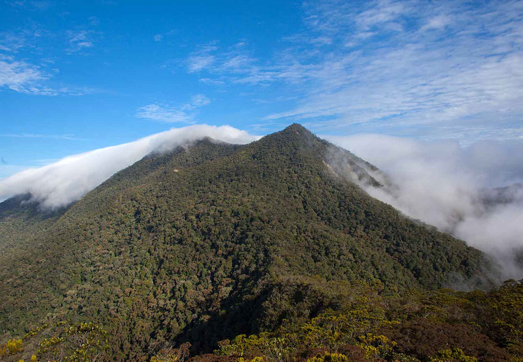
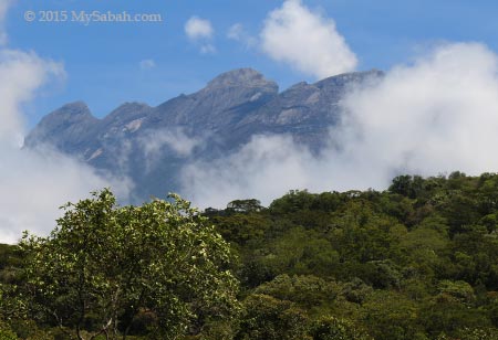
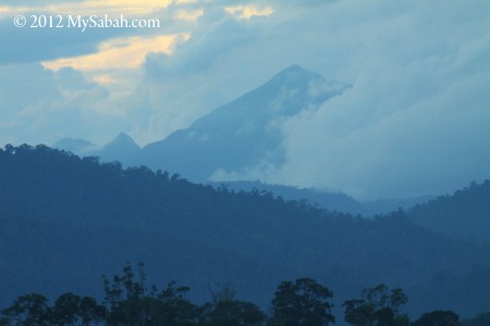
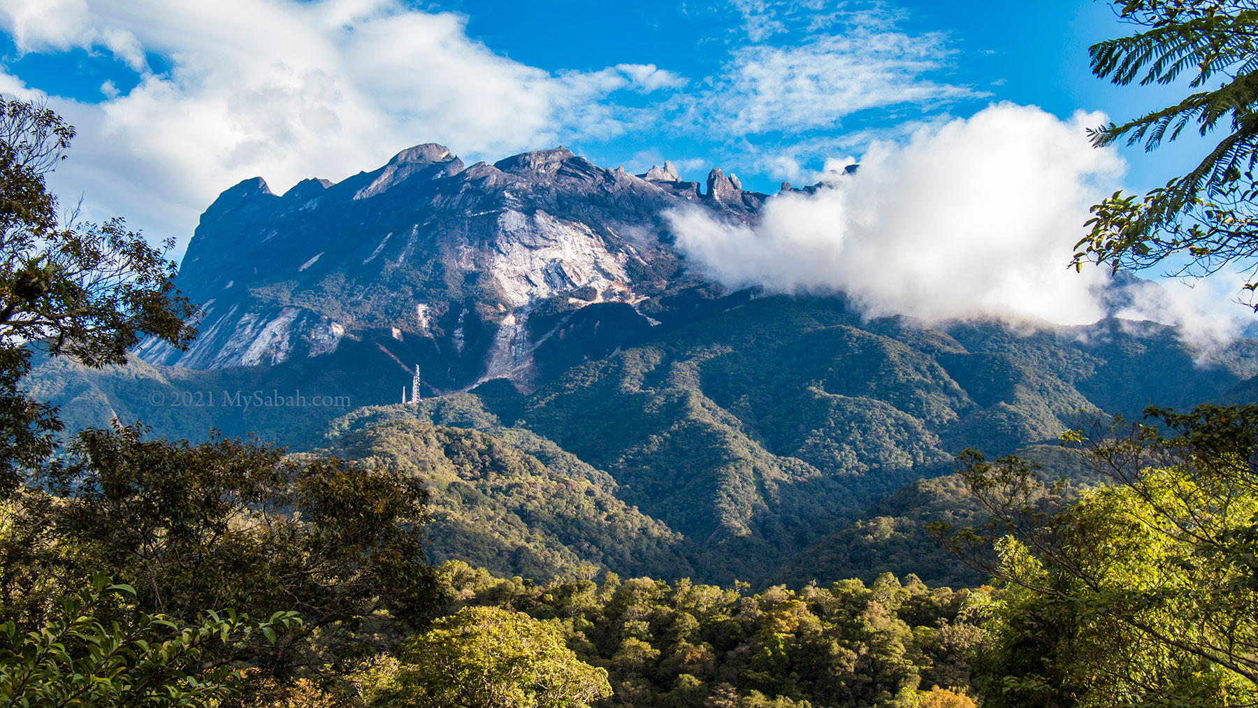
Standing majestically at 4,095 Meters (13,435 feet), Mount Kinabalu is the highest mountain of Malaysia. Mt. Kinabalu derives its name from the Kadazan word, Aki Nabalu, meaning ‘the revered place of the dead’. It is one of the most conquerable peaks in the world. This guide will help you to reach the summit of Mount Kinabalu, with some info that travel agents don’t want you to know.

Mount Kinabalu is the highest mountain of Borneo and Malaysia and part of Kinabalu Park. Kinabalu Park is now a Unesco Global Geopark.
  1. The maximum number of climbers (daily quota) is 165 climbers per day.
  2. Climb Permit fee is now RM400 for foreigner; RM100 for Malaysian. Half price if the climber is below 18 years old.
  3. Child under 16 must be accompanied by a dedicated Mountain Guide. Each Mountain Guide can only take up to 2 children (or up to 5 adult climbers).
  4. Mountain Guide who takes care of children will not guide adult climber. For example, if your group has 3 adult and a child (below 16) climbers, you must hire two mountain guides (one to take care of adults, another one for child only).
  5. The rate of mountain guide service (mandatory) is RM350.
  6. Porter service (optional) costs RM14 per Kilogram (Kg).
  7. You may follow the Facebook of Sabah Parks for latest news and promotion.

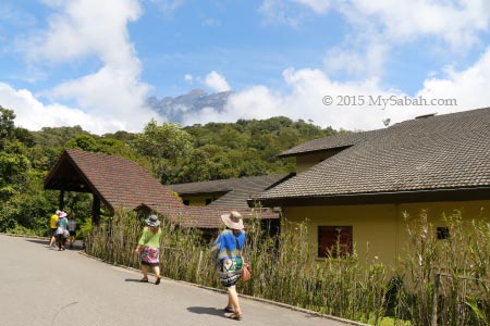
Mount Kinabalu’s specialty lies in its location at a renowned World Heritage Site – Kinabalu Park. Nature lovers will be delighted to be able to witness the many variations of flora and fauna that are to be found on the mountain at different altitudes.

1. How much does it cost?

Quick Answer: The lowest budget for climbing Mount Kinabalu is about RM1,019 (≈USD237) for Non-Malaysian Tourist and RM444 for Malaysian (Based on the rates of year 2023, for adult climber who shares guide fee with others). The cost includes accommodation (at Panalaban), meals, shared mountain guide fee, conservation fee, climb permit, and insurance. Please download the Excel file to see the itemized budget.

  1. The Best Time to climb Mt. Kinabalu is between March and August, which are the dry seasons of Sabah. The peak season is Apr to Jun.
  2. You can climb in other months, but try to avoid Dec and Jan, which are the wettest months, due to the North-East Monsoon
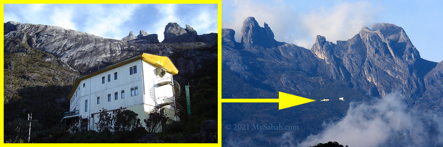
  3. The mountain accommodation area (known as Panalaban), where Laban Rata Rest House and hostels located, is 2.72 KM before the summit of Mt. Kinabalu. Most climbers overnight here before conquering Mt. Kinabalu in next morning.
  4. If you are not allowed to climb to the summit of Mt. Kinabalu due to bad weather, there is No Refund.
Panalaban is the area where mountain accommodations located. It’s called Laban Rata previously.

How to Book a Climb Package

Booking the one-night Accommodation at Panalaban (formerly Laban Rata) is the FIRST step. You can’t climb Mt. Kinabalu if you haven’t reserved any room on the mountain. Camping on the mountain is not allowed.

Important notes:

  1. You must book at least 6 months in advance. The park allows only 80 climbers to climb per day, due to conservation and limited rooms, so the accommodation is always fully booked.
  2. Never, I repeat, never book with any individual who claims that he is a guide and can offer you very low price. Many tourists have been scammed and lost their money. Only book with licensed travel agents and legitimate operators (i.e. Sutera Sanctuary Lodge and Sabah Parks).
  3. Conquering Mt. Kinabalu requires only 2 days 1 night.
  4. However, to let climbers to get used to high altitude, Sutera Sanctuary Lodges (management of Laban Rata Resthouse) usually sells you 3-day-2-night accommodation (with 1 extra night at Kinabalu Park, foothill of Mt. Kinabalu).
  5. The cheaper accommodations, Panar Laban Hut, Waras Hut, Panalaban Hostels and Lemaing Hostel are next to Laban Rata Resthouse.
  6. All accommodation package is inclusive of full meals (buffet style).

There are four ways to book the climb package:

1. Book with Travel Agent

If you can afford, just book the tour package with licensed tour agents of Sabah. Though you will pay more, they will take care of everything, from transportation, registration, to the end of climb. This is the Best option.

2. Book with Sabah Parks

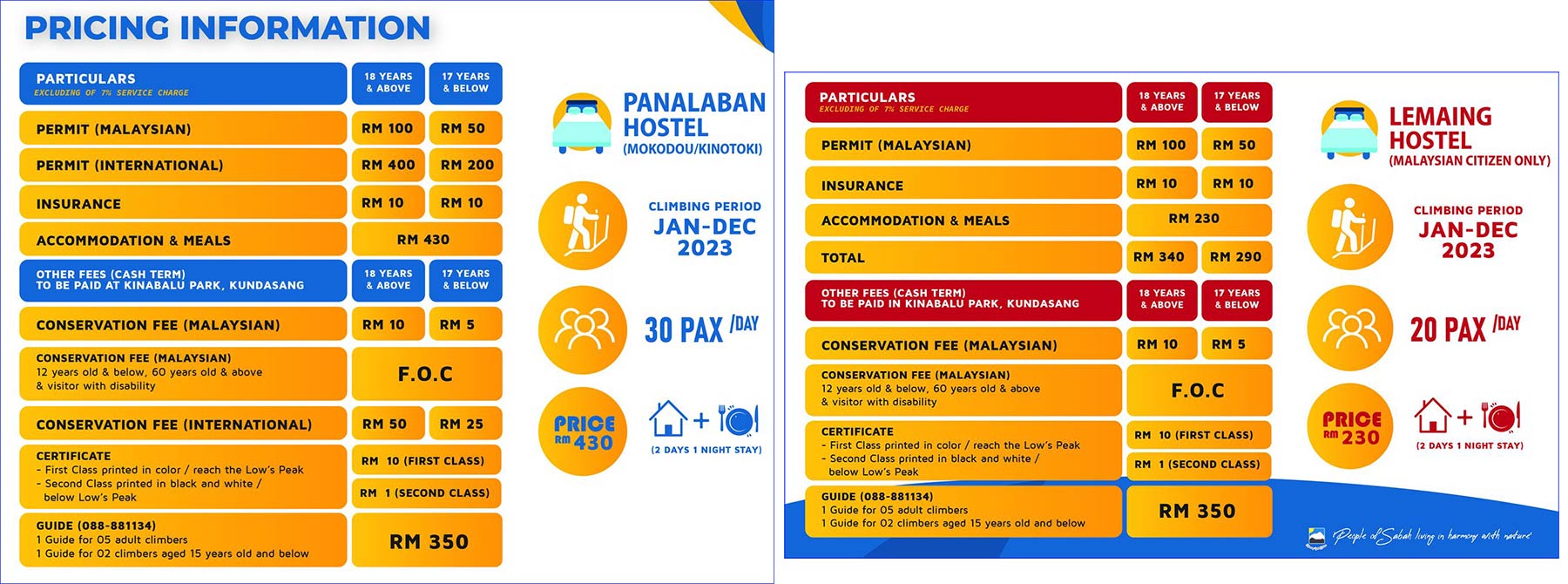
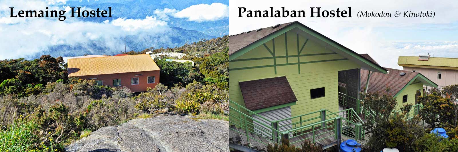
Next to Laban Rata Resthouse, Lemaing Hostel and Panalaban Hostels are new (and cheaper) accommodation available to climbers. Lemaing Hostel is only open to Malaysian climbers, and Panalaban Hostels is open to both Malaysian and international climbers. You can book the accommodation directly with Sabah Parks, the management of these hostels. Please note you need to to pay other mandatory fees such as climb permit, insurance and guide fee, besides the meals and accommodation there.

Accommodations on Mount Kinabalu (Panalaban). Mokodou and Kinotoki are under Panalaban Hostels. Photo courtesy of Sabah Parks.

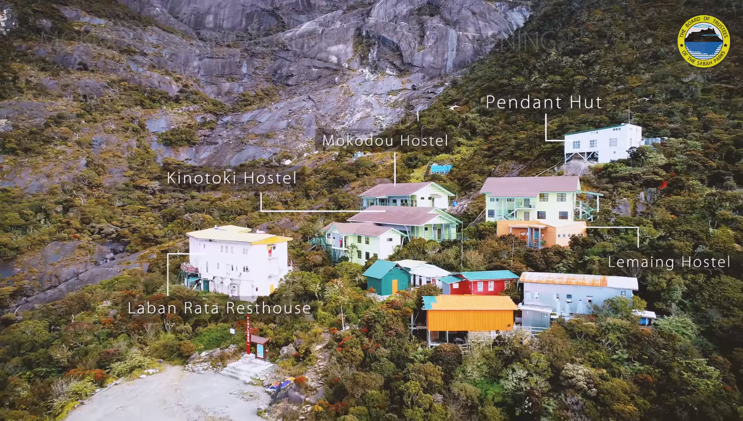
A) Lemaing Hostel (for Malaysian only)

Open in 2014, this hostel has 75 bunk beds . (RM is Malaysian Ringgit (MYR). USD1.00 can exchange about RM4.20)
Accommodation & Meals: RM340
Insurance: RM10
Climb Permit: RM100 (adult), RM50 (below 18)

Left: Bunk Beds of Lemaing Hostel. Right: Beds of Panalaban Hostels. Both hostels have shared bathroom and toilet. Latest check-out time is 10:30am.

B) Panalaban Hostels (for Malaysian and Foreigner)

Open in 2019, Panalaban Hostels (Kinotoki and Mokodou) can accommodate 50 climbers.
Accommodation & Meals: RM430
Insurance: RM10
Climb Permit: (Malaysian rate) RM100 (adult), RM50 (below 18); (Foreigner Rate) RM400 (adult), RM200 (below 18)

Climbing and accommodation fees (year 2023) of Panalaban (left) and Lemaing (right) Hostels. Note: Lemaing Hostel is open for Malaysians only.

Sabah Parks Contact:

You can visit Sabah Parks office located in KK Times Square (Kota Kinabalu City) to book room and make payment:
Opening Hour: 8:00AM – 5:00PM, Mon-Fri (closed on Sat, Sun & Public Holiday)
Phone: +60 88-523531 / +60 88-523572
E-mail: reservation2023@sabahparks.org.my, sabahparks@gmail.com
Website: www.sabahparks.org.my
Facebook: SbhParks
Booking Website: reservation.sabahparks.org.my (Phone: +60 88-273238, E-mail: contactus@terazglobal.com.my)

Left: Lemaing Hostel, Right: Panalaban Hostel (Mokodou & Kinotoki). Photo Credit: Sabah Parks

3. Book with Sutera Sanctuary Lodges (SSL)

SSL is the management of accommodation in Kinabalu Park and Laban Rata Resthouse. For booking, you can contact them at:
E-mail: info@suterasanctuarylodges.com.my
Tel: +60 88 308 914 / 308 915 / 308 916
Website: www.suterasanctuarylodges.com.my
Facebook: SuteraSanctuary
Address: B-G-9, Block B, Ground Floor, Sutera Avenue, Lorong Lebuh Sutera, Kota Kinabalu, Malaysia. (see location map)
Business Hours: 9am-5pm (Mon-Fri), 9am-1pm (Sat), close on Sun & Public Holiday

Online Booking is available in website of Sutera Sanctuary Lodges. You may drop by the office of SSL, which is located in ground floor of Sutera Avenue. Besides booking, the friendly staffs can answer all your questions on the spot. They can arrange full transport service for you too (the fees are quite high though).

4. Mountain TORQ

You can join the Via Ferrata tour by Mountain TORQ (Facebook: @MountainTorqGroup), which has a rock climbing training centre and accommodation (Pendant Hut) at Panalaban. However, you need to be really fit.

Trail map to the summit of Mount Kinabalu. There are two summit routes, Ranau Trail and Kota Belud Trail, and both start from Panalaban. Ranau trail is the default route as it’s easier to climb.

Itinerary of the Climb

Below is a run-down of the 3-day-2-night climbing tour in brief.

Day 1

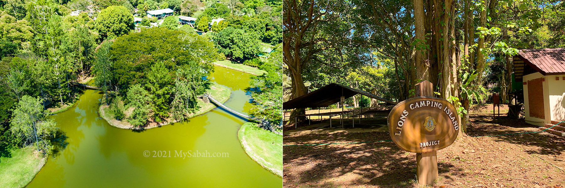
Check-in to overnight at Kinabalu Park (see location map), which is 88 KM away from Kota Kinabalu (KK). The extra night helps your body to adapt to the height so you will be less vulnerable to Altitude Sickness (acute mountain sickness) in the climb next day. Here is a list of accommodations near Kinabalu Park.

Day 2

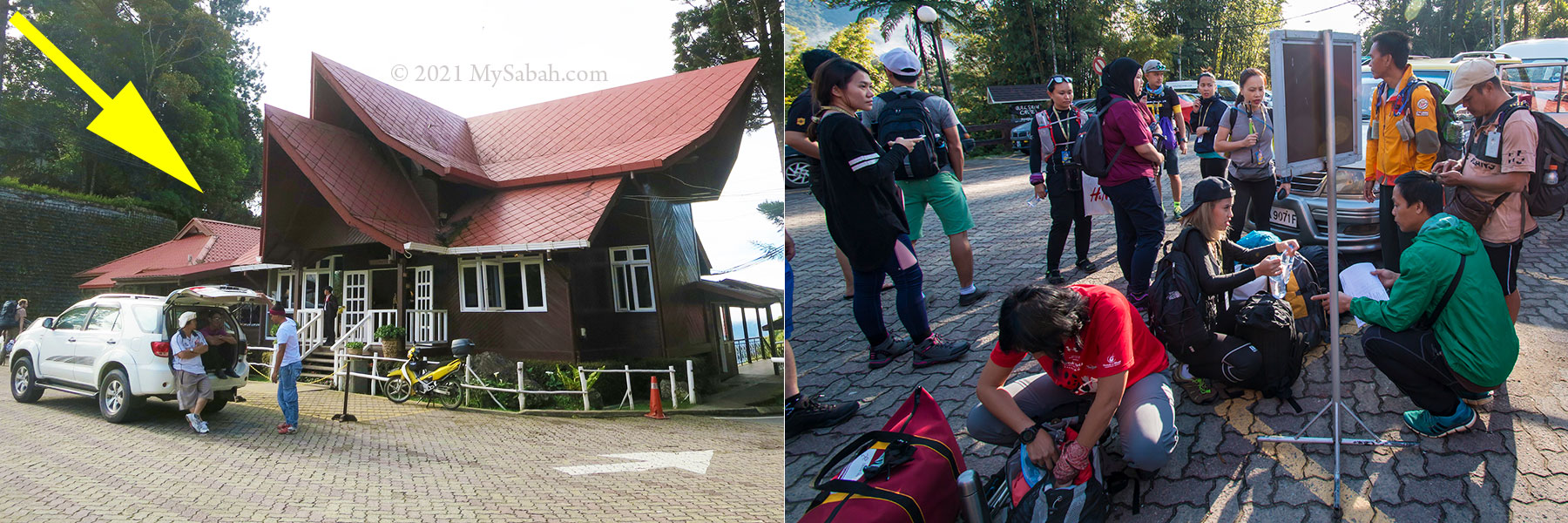
9am: Bring your ID card (e.g. MyKad), invoice and QR Code of confirmed booking. Register and pay fees (climb permit, insurance, guide, etc.) by cash to Sabah Parks at Kinabalu Park HQ. Collect your name tag (climb permit) and packed lunch (usually consists of sandwiches, candy bar and a fruit, with a small bottle of drinking water), then meet your guide and porter (if hired). You also can arrange the return transport (by shuttle van) there to transfer you between gate and park for a fee. Be there before 10:30am or they won’t allow you to climb.
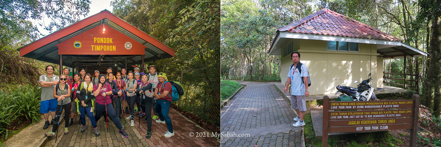
9:30am: Transfer to Timpohon Gate, the starting point of the climb.
10am: Start of Climb, after briefing by guide!
4pm: Reach Panalaban after 6 KM. Usually it takes 6 to 8 hours, depend on your fitness.
– Dinner buffet at Laban Rata Rest House (closed by 7:30pm)
– Overnight at the rest house or hostels of Panalaban

Left: Registration, fee payment, return transport and hiring of guide / porter are done at the left side of Kinabalu Park HQ (see yellow arrow). Right: climbers meet their mountain guide, and hand over part of their baggage to the porters.

Day 3

2am: Gather and having breakfast at Laban Rata Rest House, then head to the summit (2.75 KM one way).
(The park may not allow you to climb in bad weather)
6am: Reaching the summit (Low’s Peak) of Mount Kinabalu
7am: Descending to Panalaban
10am: Check-out and descend to Kinabalu Park
2:00pm: Back to Kota Kinabalu City
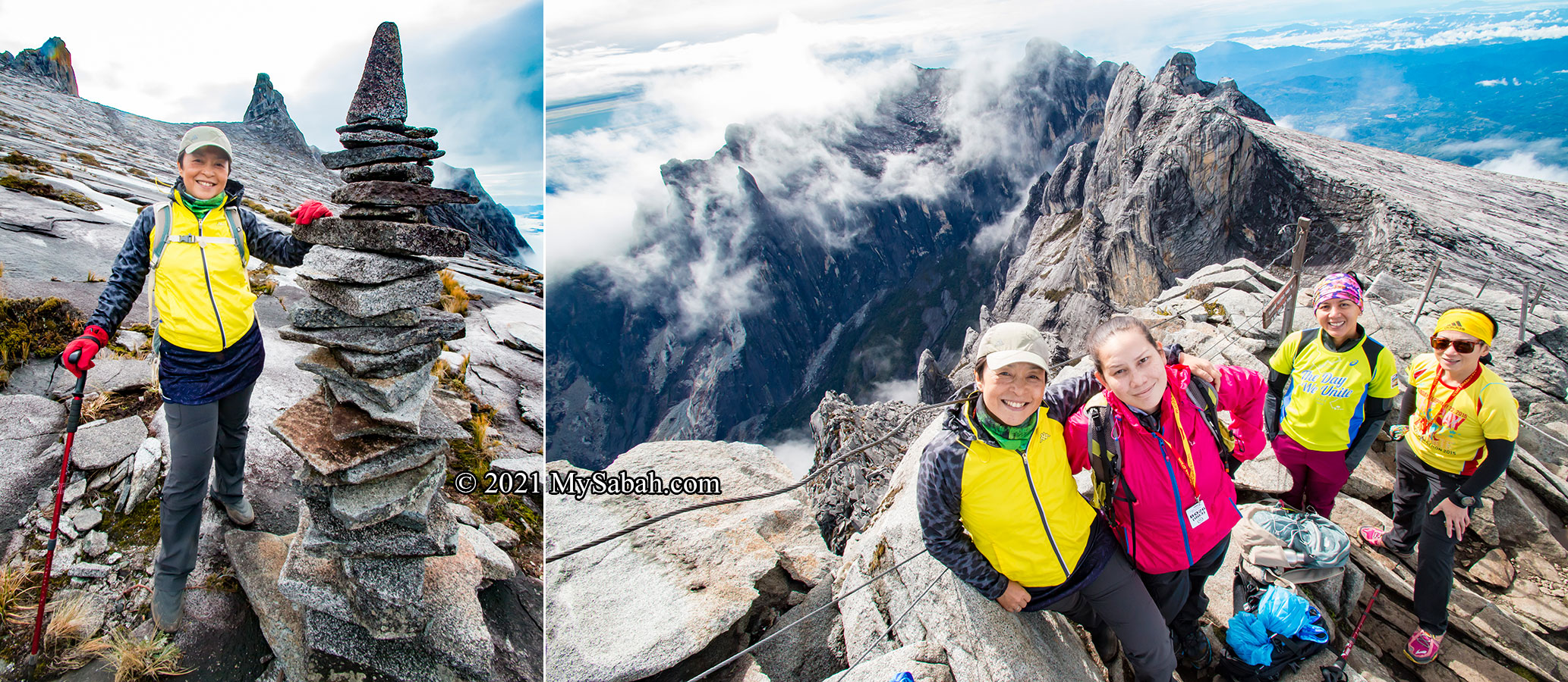
This can be you. Just imagine.

Photo Walk-through

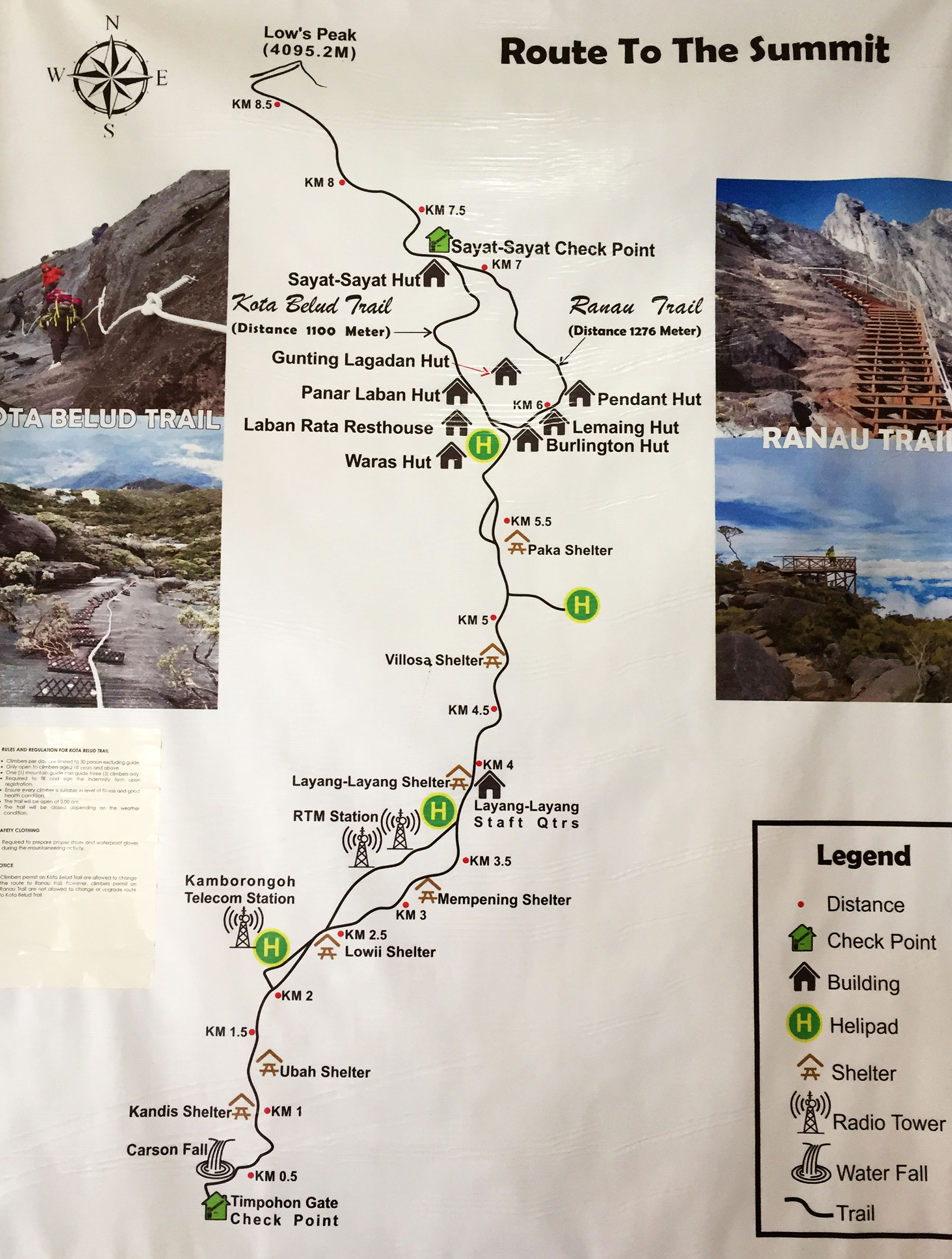
Below are the photo walk-through of the 2-day climb in chronological order. Standard climb will use the Ranau summit trail (open on 1 Dec 2015). Note: The starting point is in Kinabalu Park, not Ranau town! Or you can watch the video below:

Day 1: Climbing to Panalaban

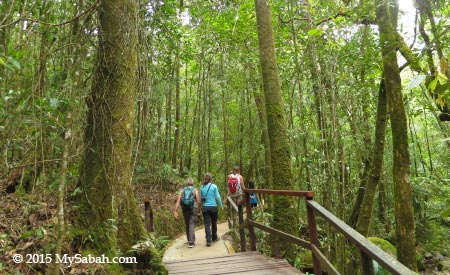
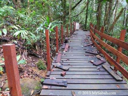
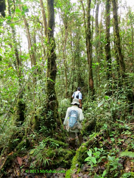
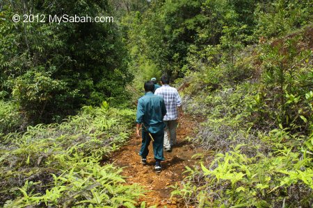
The standard trail starts from the Timpohon Gate (1,800m / 5,906 ft) which is about 4 KM away from the Kinabalu Park Headquarters. The climb from Timpohon Gate to Panalaban (Laban Rata) normally takes 6 to 8 hours (for 6 KM). You can buy basic supply such as snacks, drink and raincoat in the small shop inside the building.

Left: Timpohon Gate, the starting point of the climb. Right: public toilet 50 Metres before Timpohon Gate

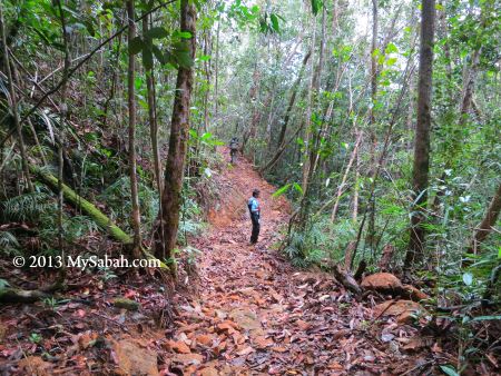
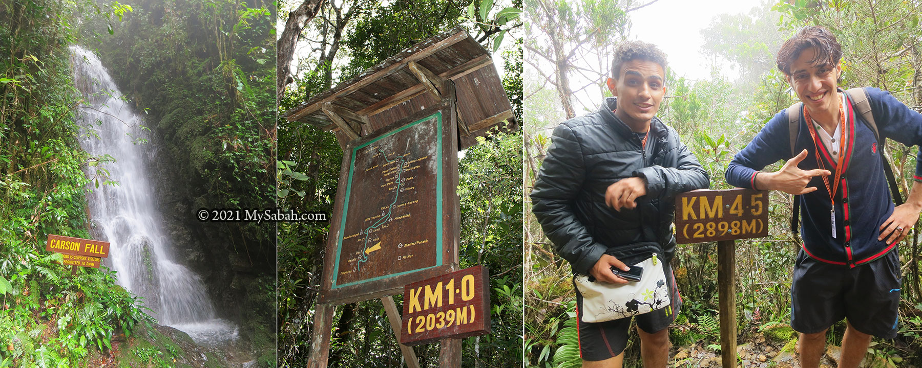
There is a signage or trail marker every 0.5 or 1 KM to show you how far you climb. Use them to motivate yourself.

Left: You will see the small Carson Waterfall fairly soon. Middle & Right: Signage and trail marker along the trail.

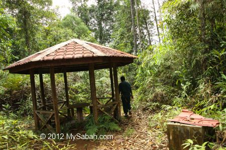
Before reaching Panalaban (3,273m / 10,738 ft above sea level), climbers can stop and rest at seven shelters (pondok) along the way — Pondok Kandis, Pondok Ubah, Pondok Lowii, Pondok Mempening, Layang-Layang, Pondok Villosa, and Pondok Paka.

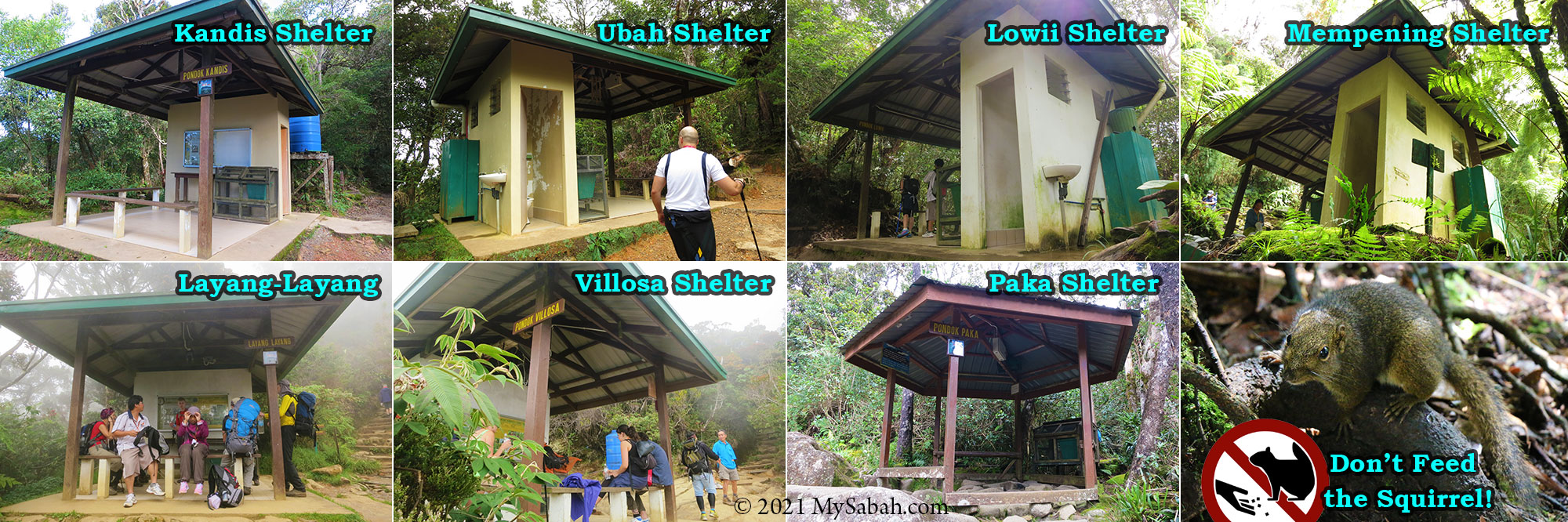
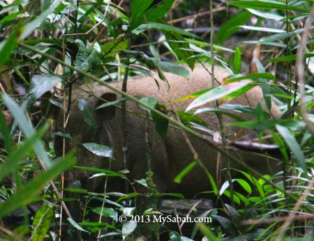
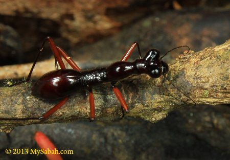
There is a shelter every 1 KM, where you can take a break, refill water (untreated spring water), use the toilet and dump your trash. Around noon time, most climbers are half-way up there and have their lunch at Mempening or Layang-Layang Shelter. The cute and friendly Bornean Mountain Ground Squirrel (Dremomys everetti) would approach you for food. Please don’t feed them!

The trails to Panalaban look like these most of the time.

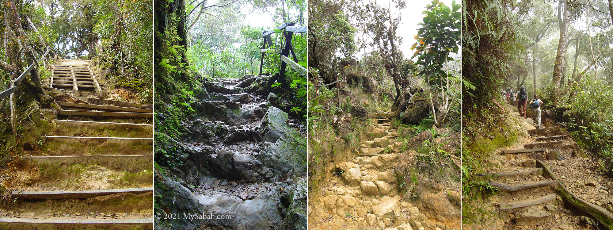
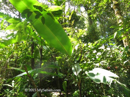
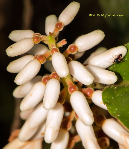
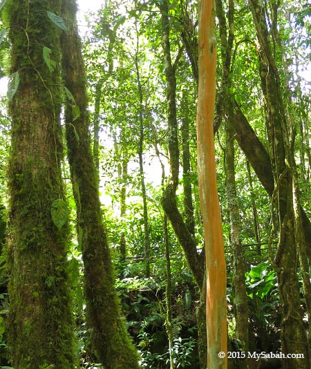
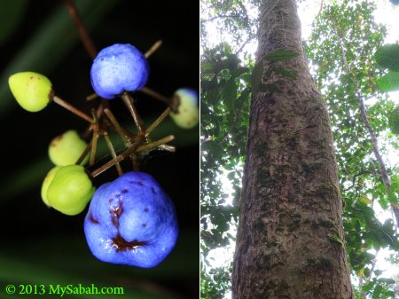
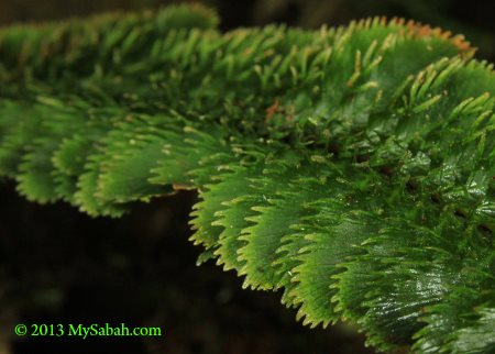
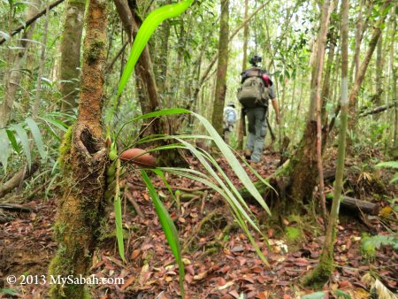
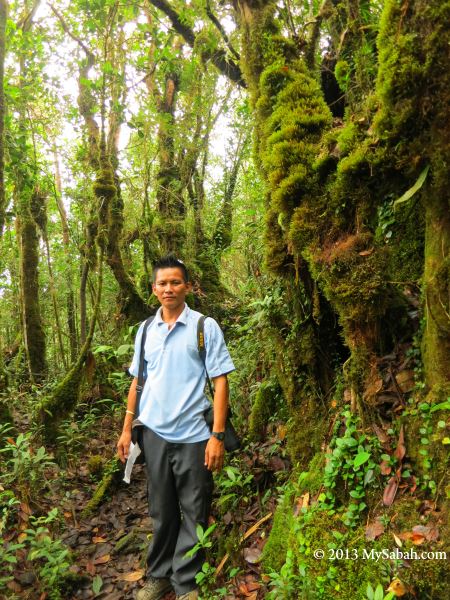
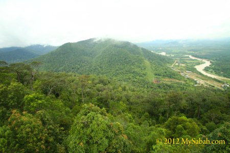
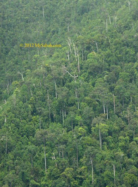
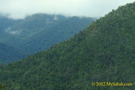
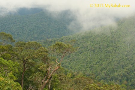
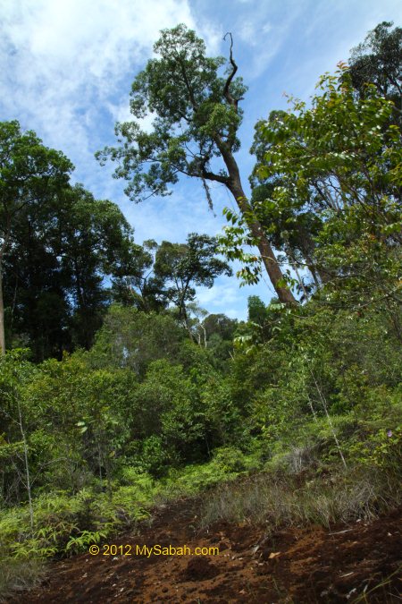
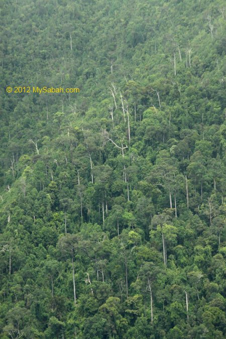
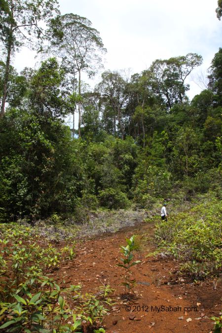
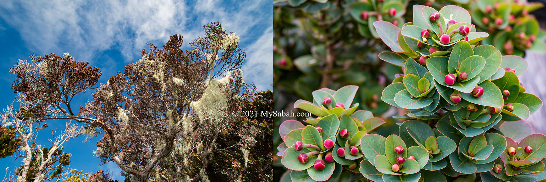
The 6-Kilometre trail to Panalaban is clear and in moderate steepness most of the time. All steep sections have support such as hand rail and stairway. You will feel more like walking on endless staircase than climbing. Just go slow and enjoy the scenic view. As you move higher, you can feel the drop of temperature and the surrounding is getting more and more foggy. The ground is covered with green mosses and many trees and shrubs have epiphytes and lichens on them. What you experience is a walk in the cloud forest (montane forest), which grows above 1,800 Metres above sea level.

Some interesting plant along the summit trail of Kinabalu Park. The pink flower is Kinabalu Balsam (Impatiens kinabaluensis), which is endemic to Borneo and quite common in first 2 KM of summit trail. The highlight is the pitcher plant (Nepenthes villosa).

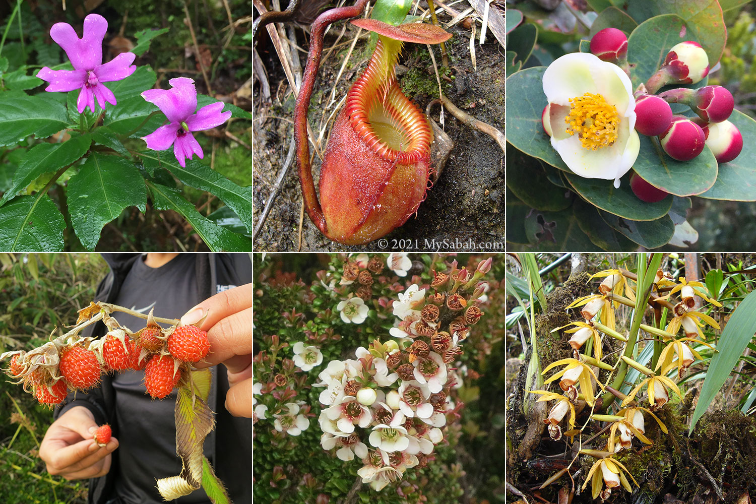
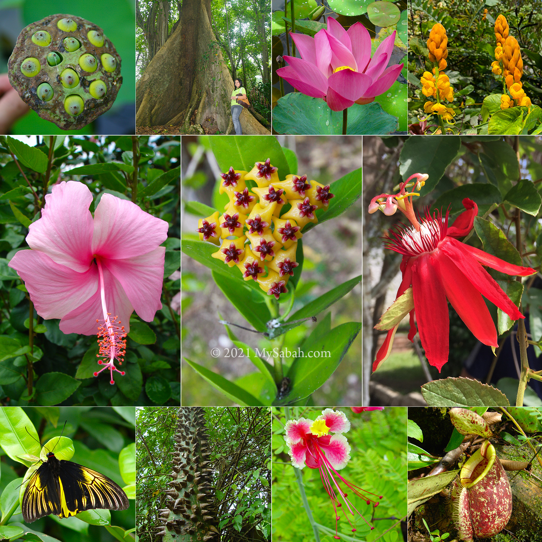
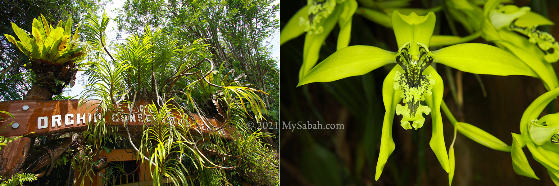
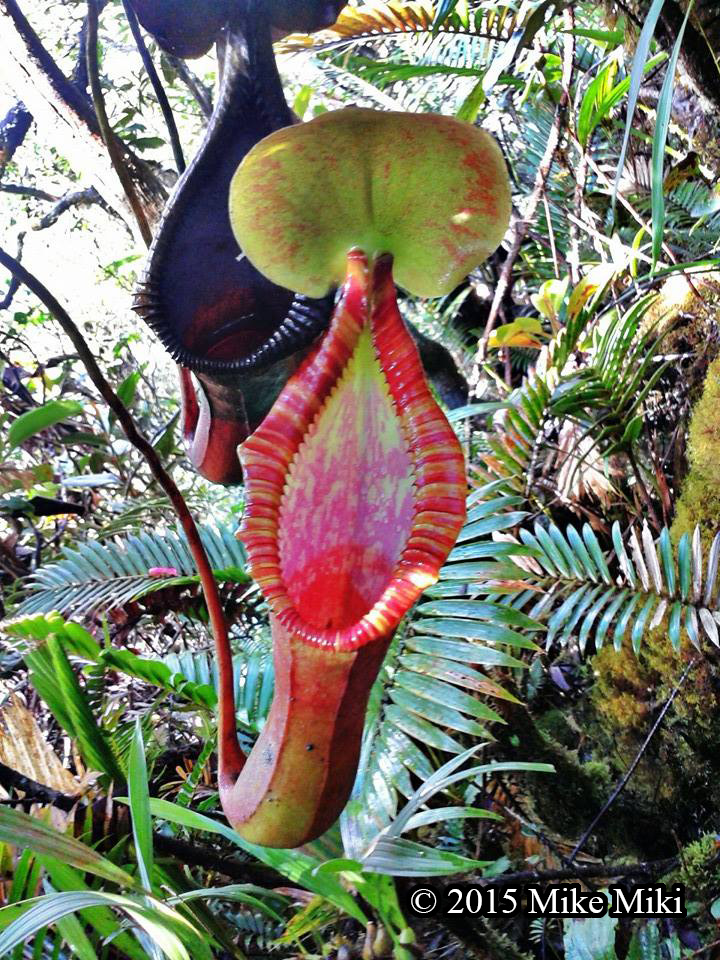
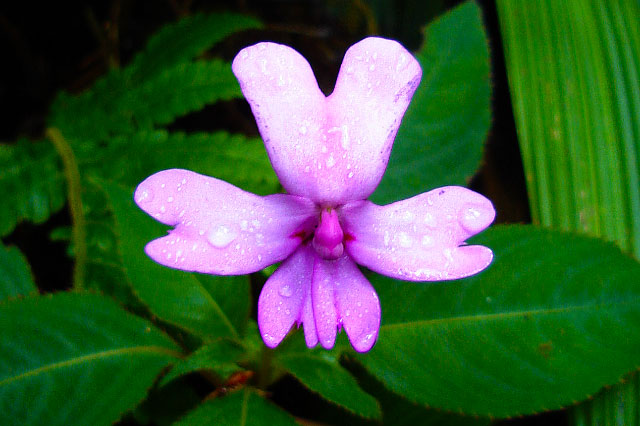
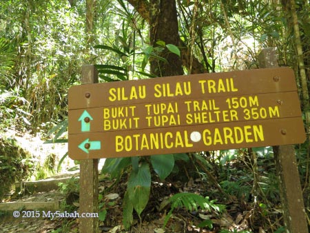
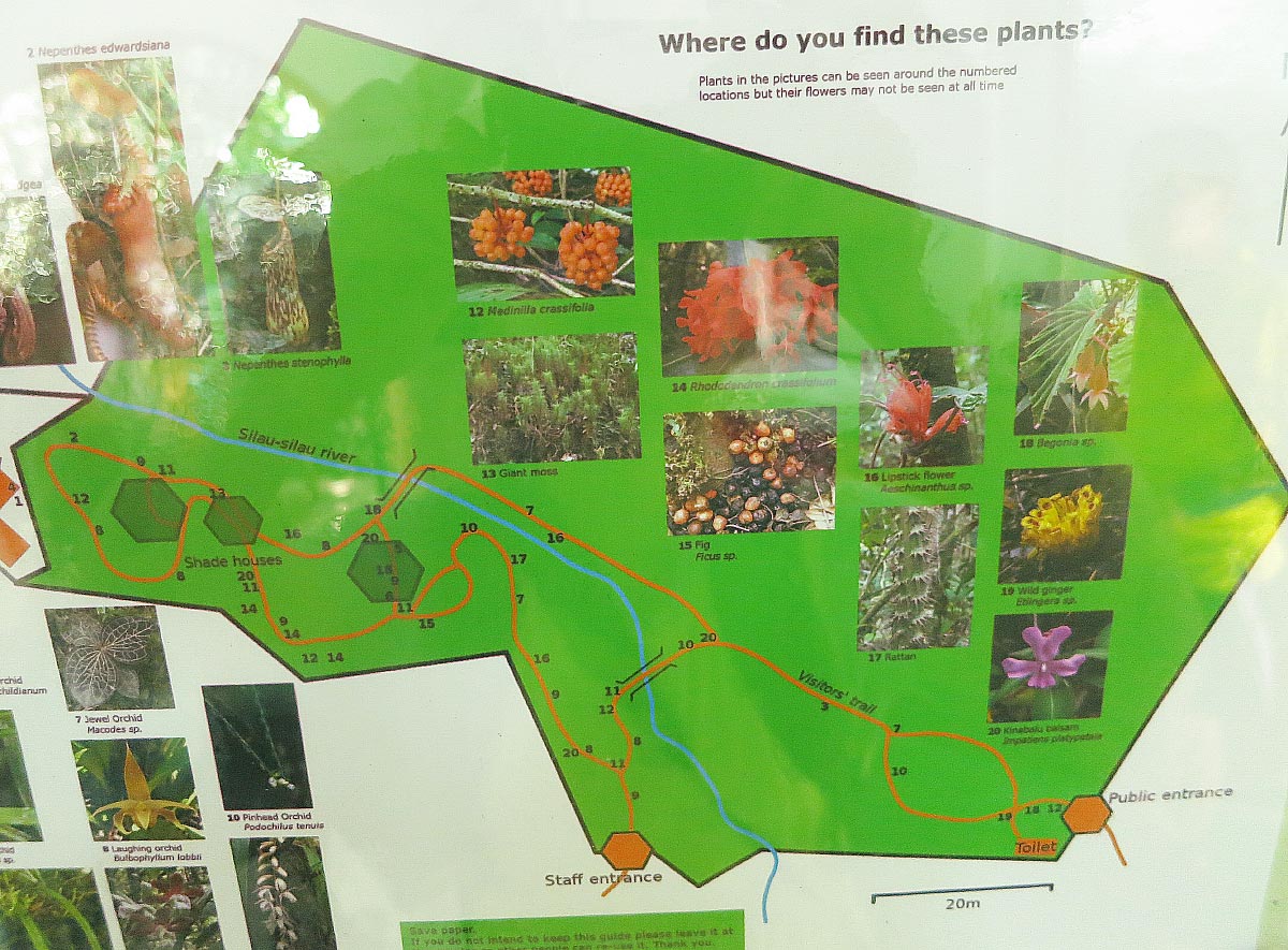
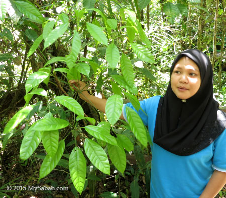
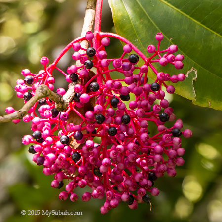
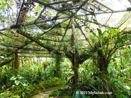
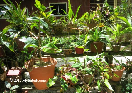
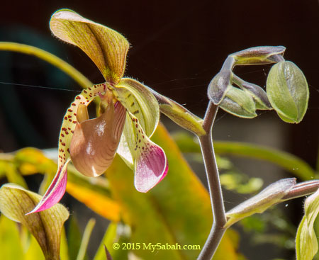
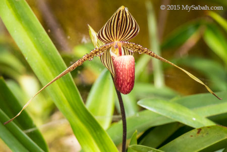
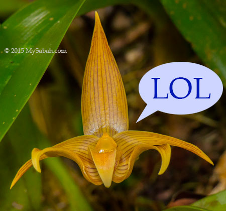
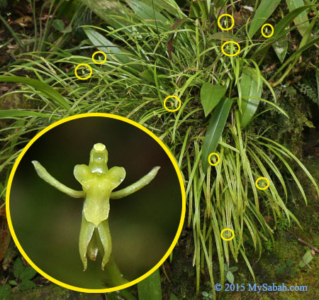
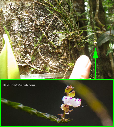
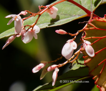
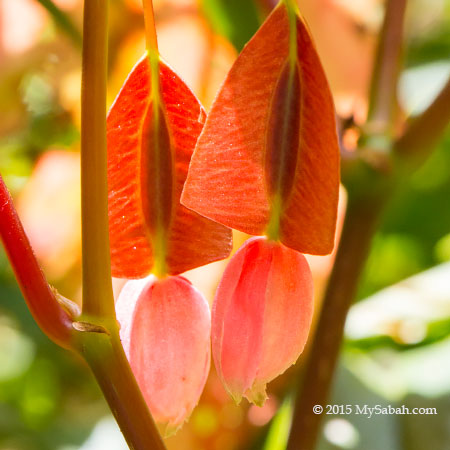
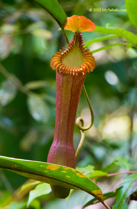
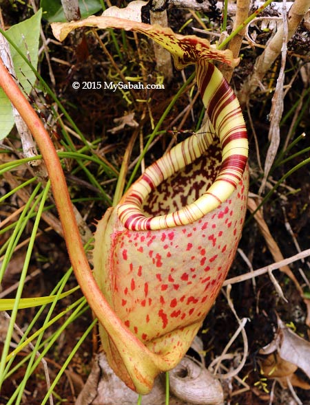
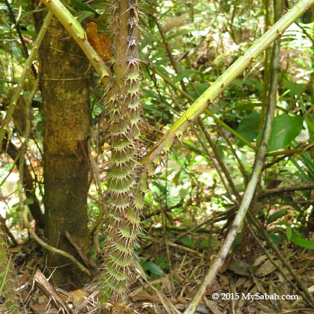
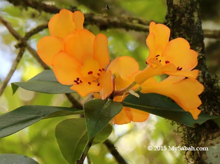
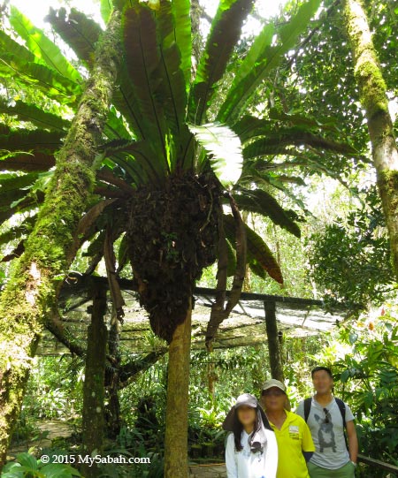
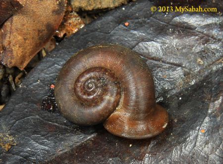
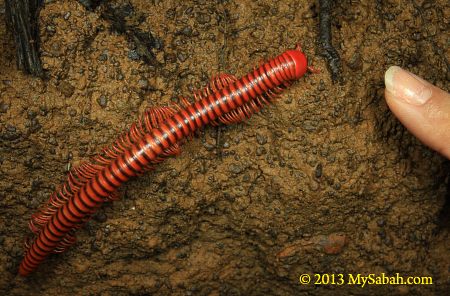
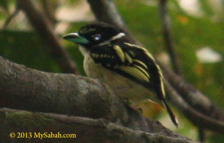
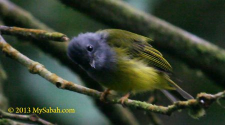
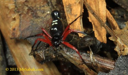
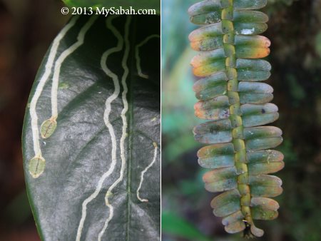
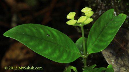
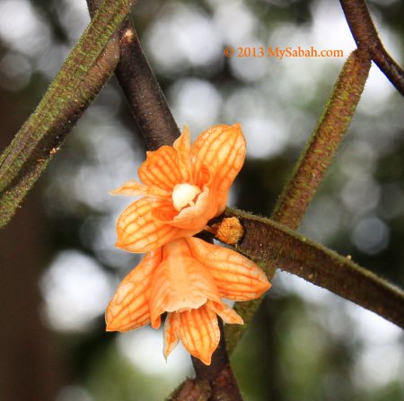
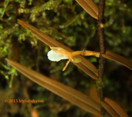
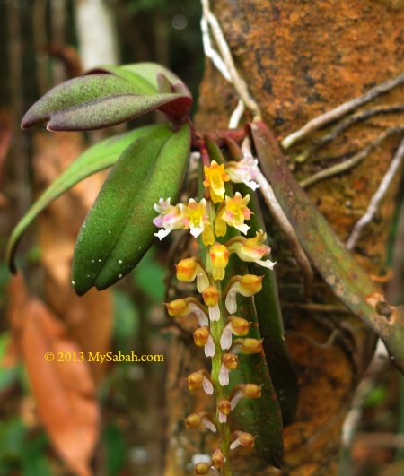
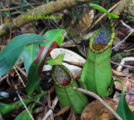
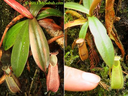
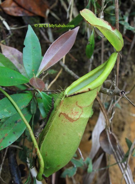
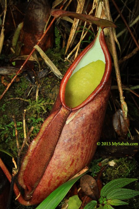
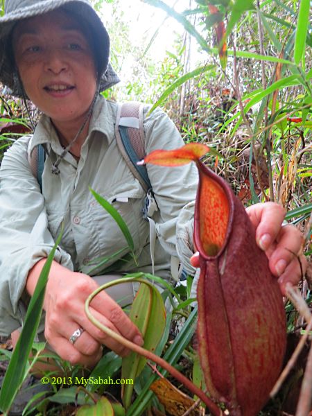
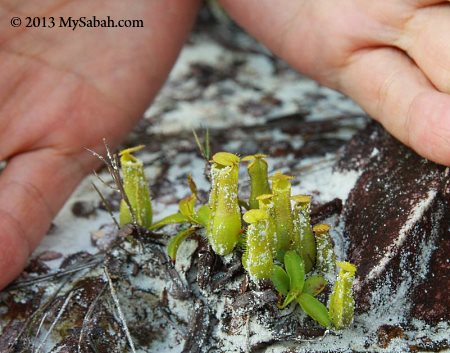
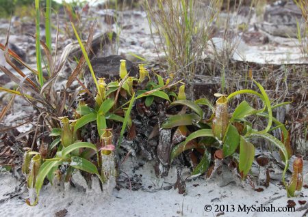
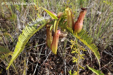
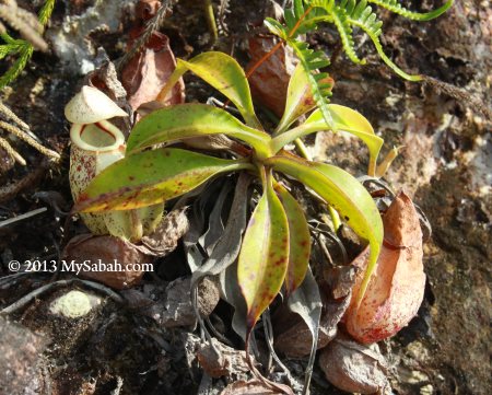
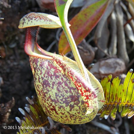
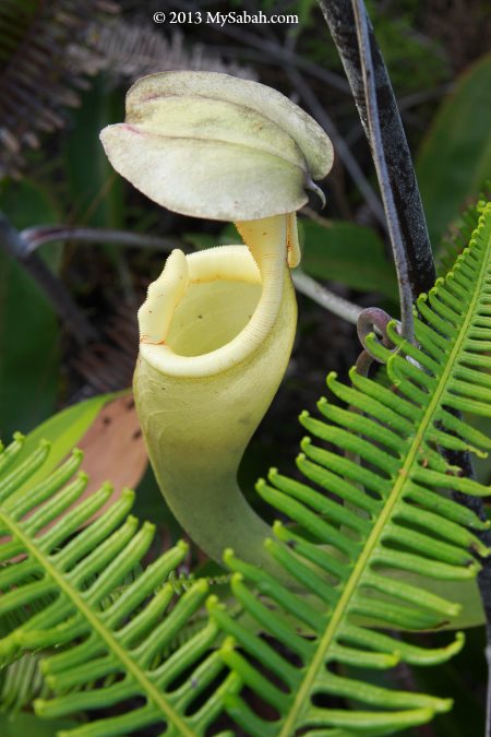
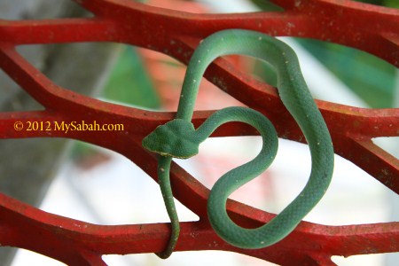
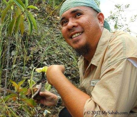
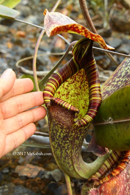
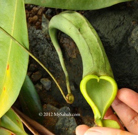
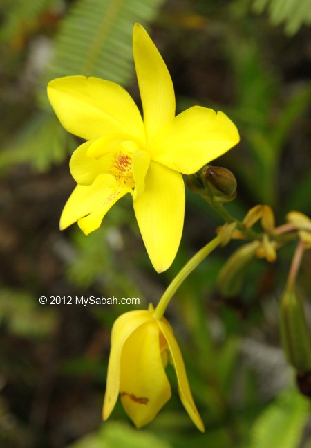
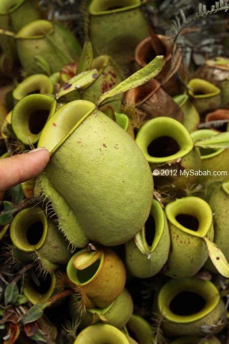
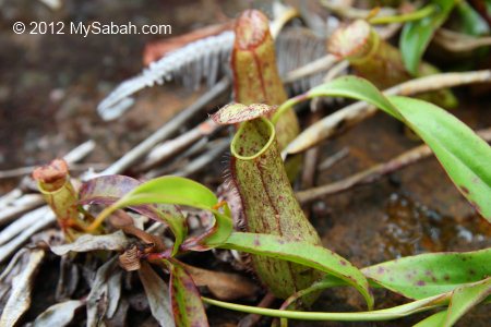
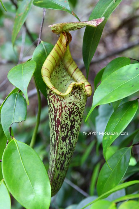
Along the trails, be sure to keep your eyes open for the plenteous interesting vegetation to check out. The unique ecology is what makes Kinabalu Park the UNESCO World Heritage Site, not just the Mt. Kinabalu. Kinabalu Park has the highest density of orchid species in the world. Climbers could spot blooming orchid and rhododendron next to the trail. After 4 KM, pay attention to your left and look for the big and bright-color Nepenthes villosa pitcher plant in the shrubs. This species is endemic to Kinabalu Park of Sabah.

The rocks on the “yellow path” are ancient old rocks.

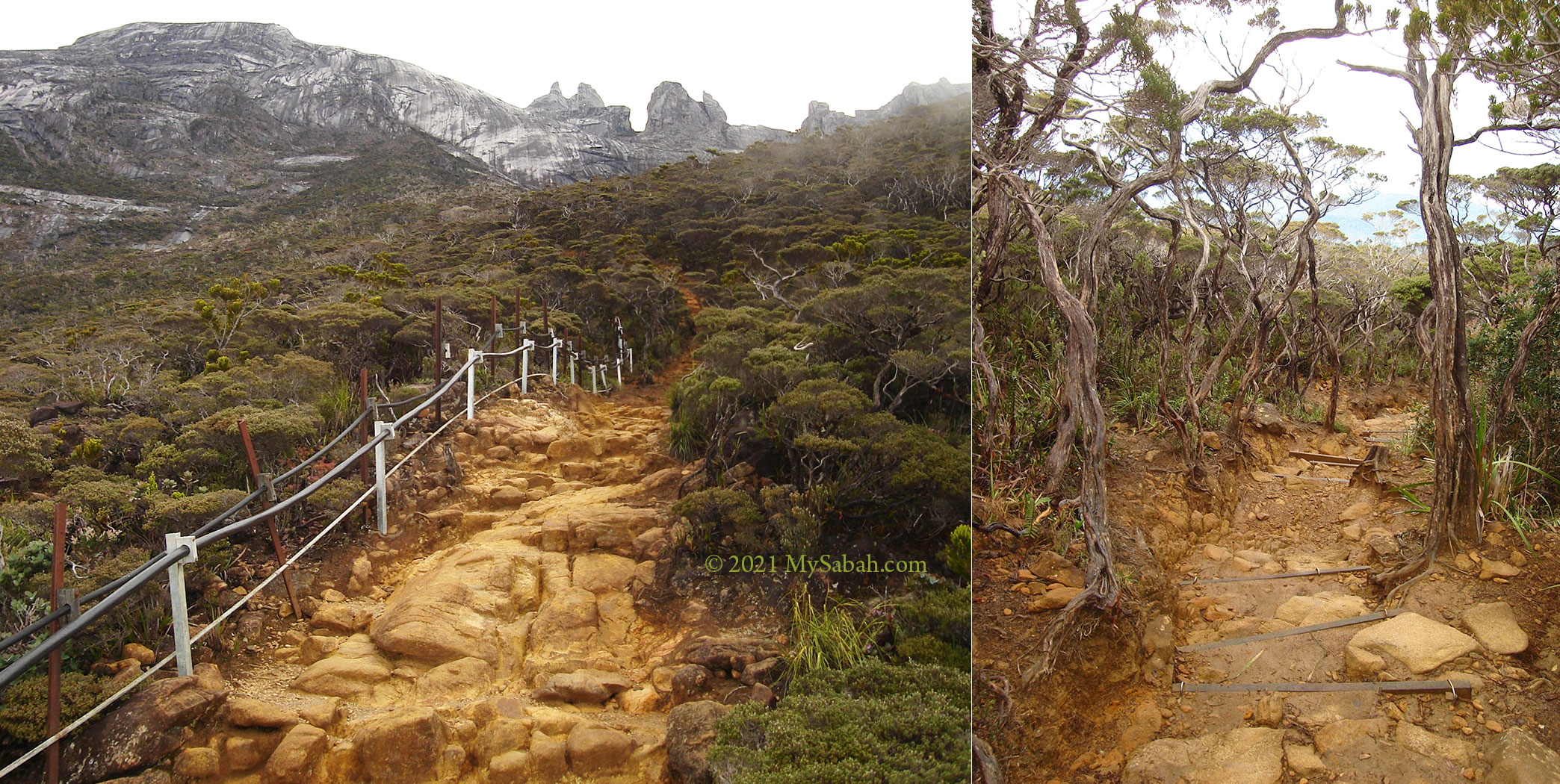
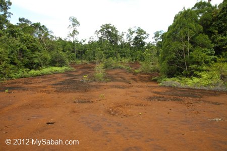
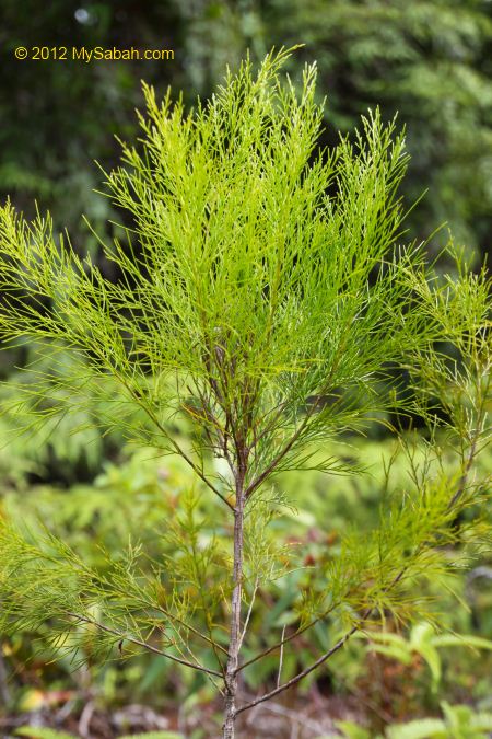
Between 4 and 5 KM is a long section of trail in yellow colour. These yellowish rocks are 40-million-year-old ultrabasic or ultramafic rocks. This area is dominated by dwarf and crooked trees (Leptospermum recurvum), some are over a hundred years old. This tree is one of the few plant that can adapt to the toxic ultrabasic soil.

If you reach the trail with many big granite boulders laying around, you are near to Panalaban.

When you see many big dark-grey boulders on the trail, congratulations! Though Panalaban is only a Kilometre away now, the trail is quite steep from now on. These boulders are slippery after rain so watch your steps. A walking pole will help you to balance.

Panalaban is the ending point of your climb on day 1. The building at the left is Laban Rata Resthouse.

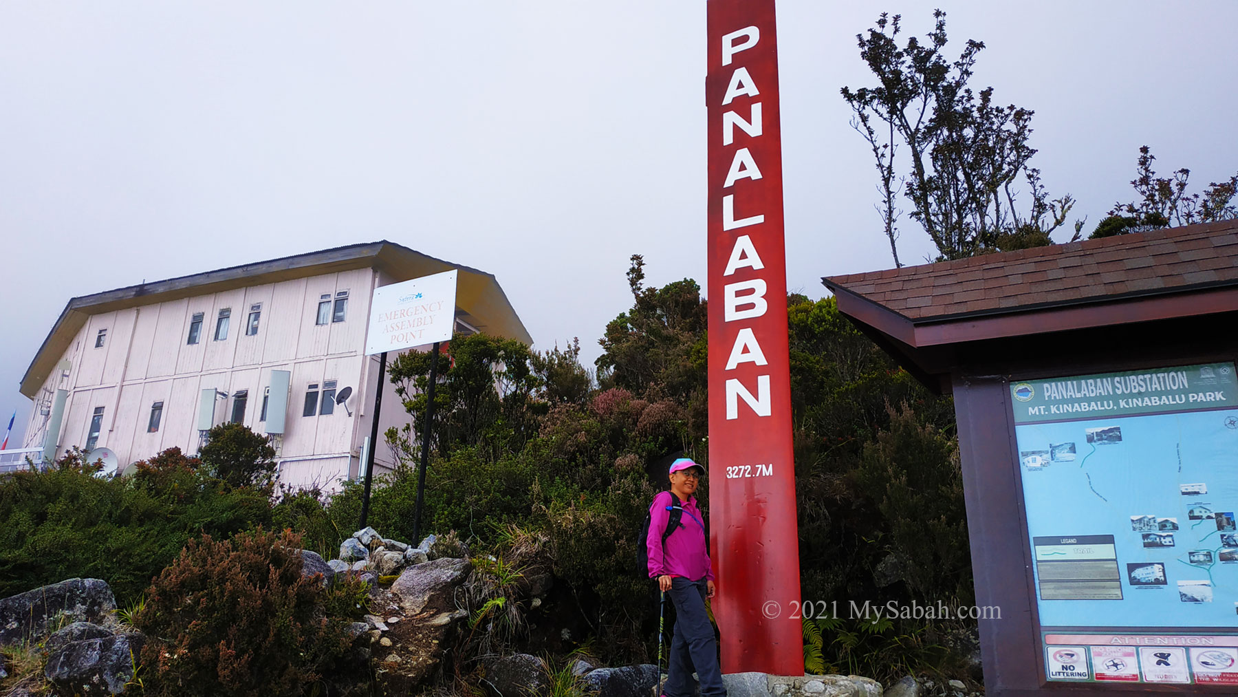
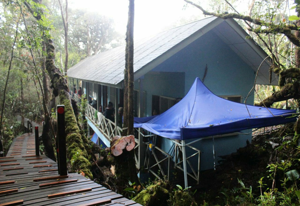
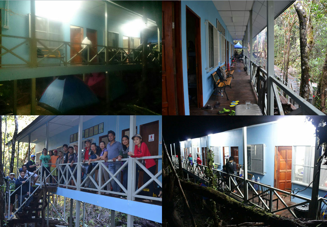
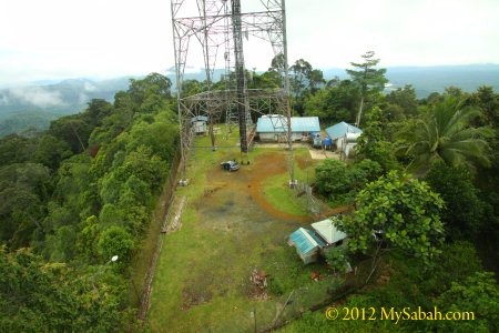
Hooray! You are now 3,272 metres above sea level. This is the place where climbers spend a night. The restaurant of Laban Rata Resthouse is where you claim your warm buffet meals. You better reach Panalaban before the restaurant closes at 7:30pm. Ala carte meals are available too.

Restaurant in Laban Rata Resthouse (Opening Hours: 7:30am-7:30pm and 2:00am-3:30am)

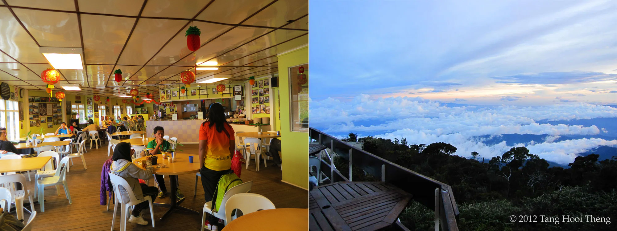
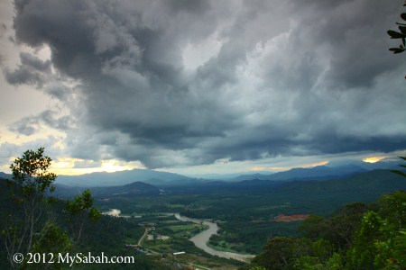
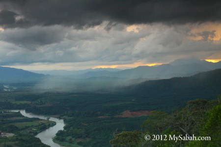
The scenery at Panalaban is fantastic! Just enjoy the view with a cup of coffee at the balcony, and look at the dense cloud under your feet. The sunset view at Panalaban is one of the best in Sabah. There is a small shop in the restaurant that sells items such as snacks, instant noodle, drink, poncho, medicines, postcards, etc. but at a higher price.

Left: sending postcards from the highest postbox in Malaysia. Right: amazing sunset at Panalaban

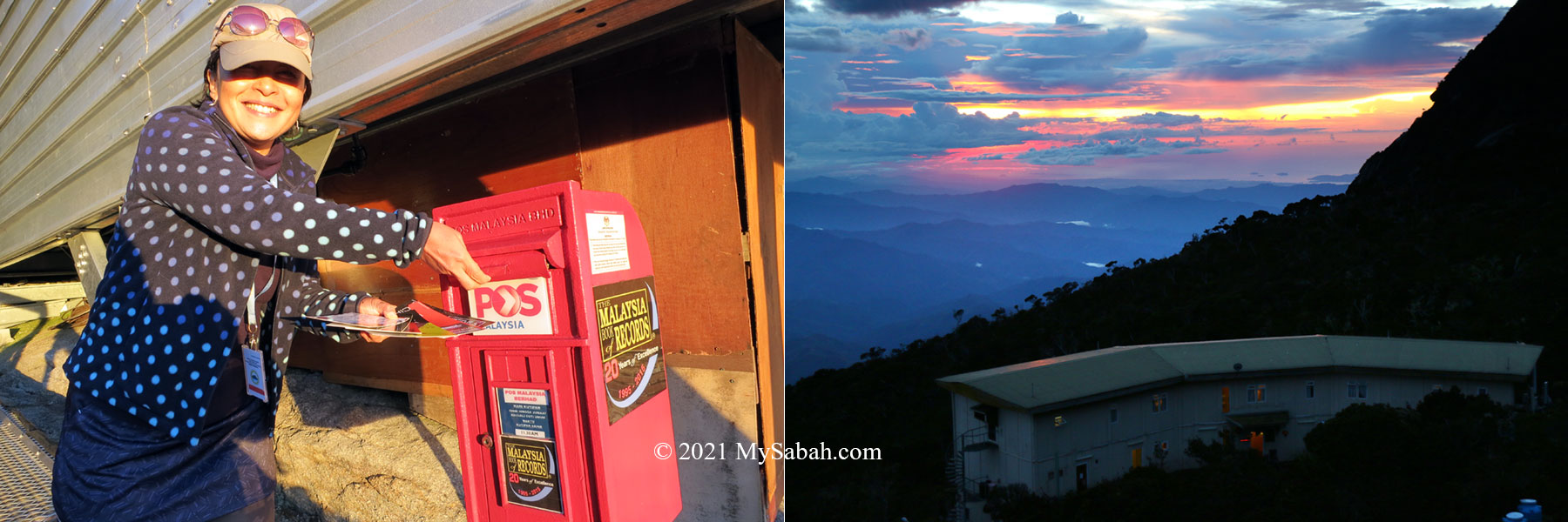
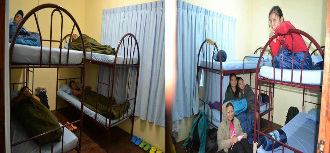
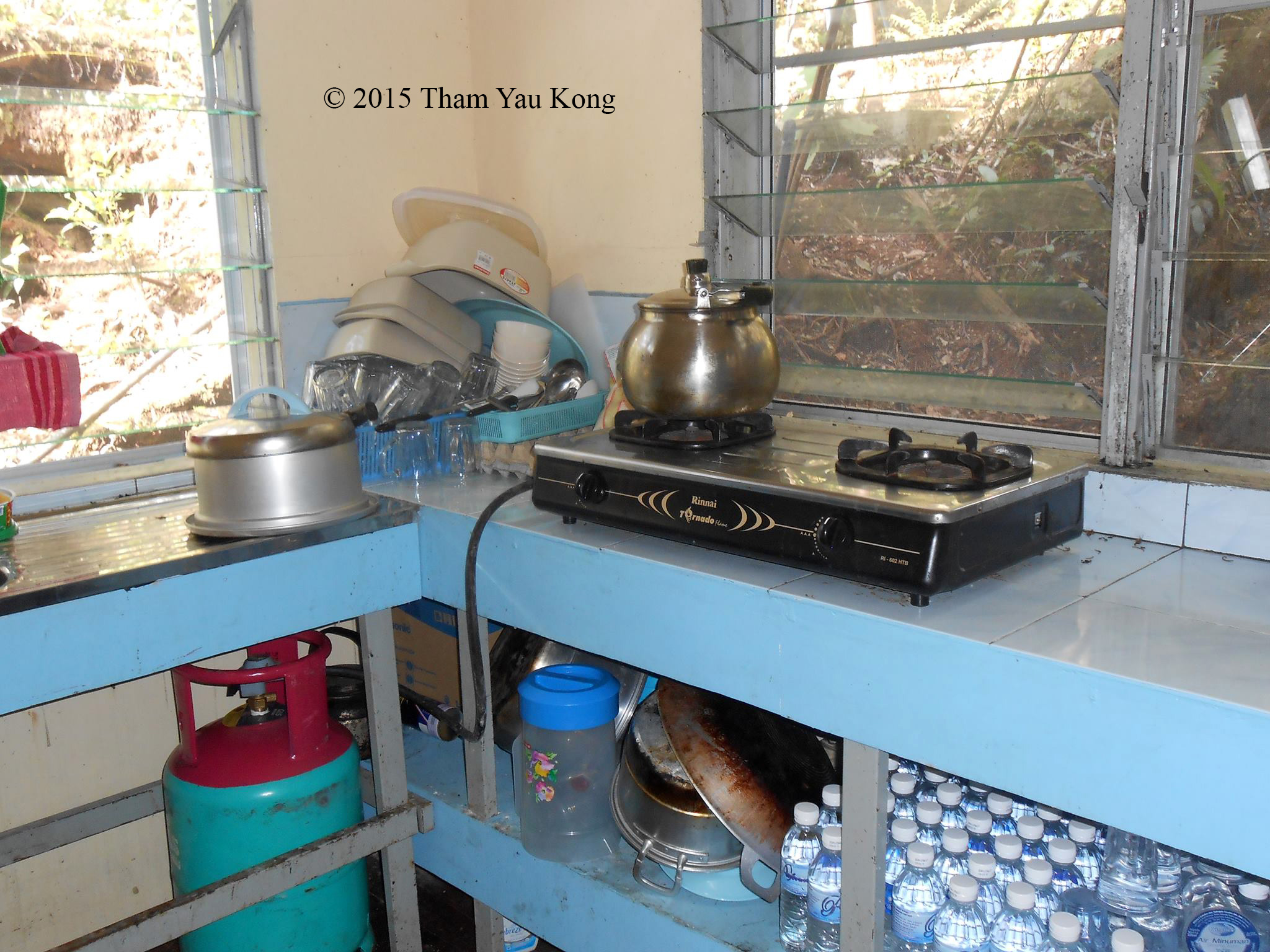
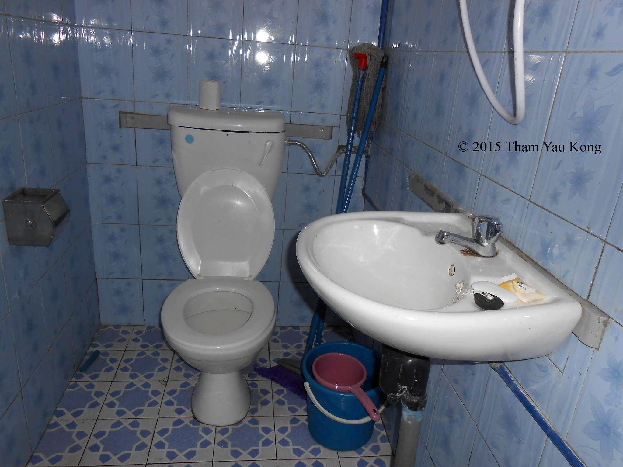
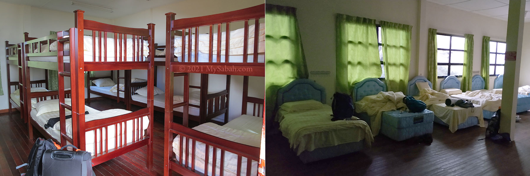
FYI, you can send postcard from the highest post box of Malaysia, which is located next to Pendant Hut in Panalaban. There are overnight accommodations provided for climbers on the mountain (Laban Rata Rest House, Waras Hut, Lemaing Hostel and Panalaban Hostels). The rooms are humbly decorated but are comfortably equipped thick blankets, bunk beds, as well as clean drinking water.

Left: bunk bed of Lemaing Hostel. Right: It’s cold at Panalaban.

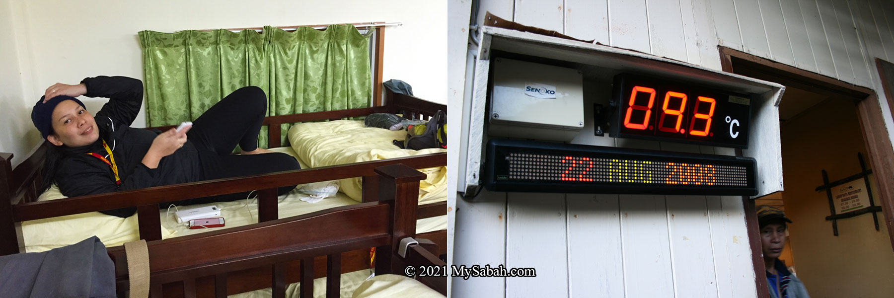
The temperature at Panalaban can drop below 10°C (50°F) and a windy day makes it worse. Except some premium rooms in Laban Rata Resthouse, most rooms don’t have any heater. The water heater doesn’t always work. Tell you a secret. Many climbers skip shower because it’s too cold.

Good Night! Sleep earlier because you need to wake up very early next day.

“Though perhaps not the highest mountain in the world, it is of immense height” (captain Alexander Dalrymple, 1769)

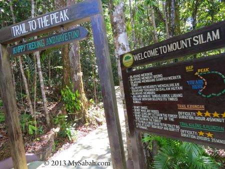
Please note this walk-through only covers the standard summit trail named Ranau Trail. If you want to know more about another new summit trail, which is more challenging, please read this page about Kota Belud Trail.

Day 2: Conquering Mount Kinabalu

The climb to the summit resumes at 2am the next morning. The climb from Panalaban to the summit is about 2.72 KM and normally takes 4 to 5 hours. To cut down weight, you can leave the unnecessary stuffs in your room. There is no water point on the way (except Sayat-Sayat checkpoint). Carrying 1 Litre of water is quite enough as you won’t feel really thirsty under cold temperature. You also need torchlight (or LED headlamp), warm clothing and poncho.

Left: In Ranau Trail, you can see the night view of Ranau town. Right: Boardwalk of Ranau trail

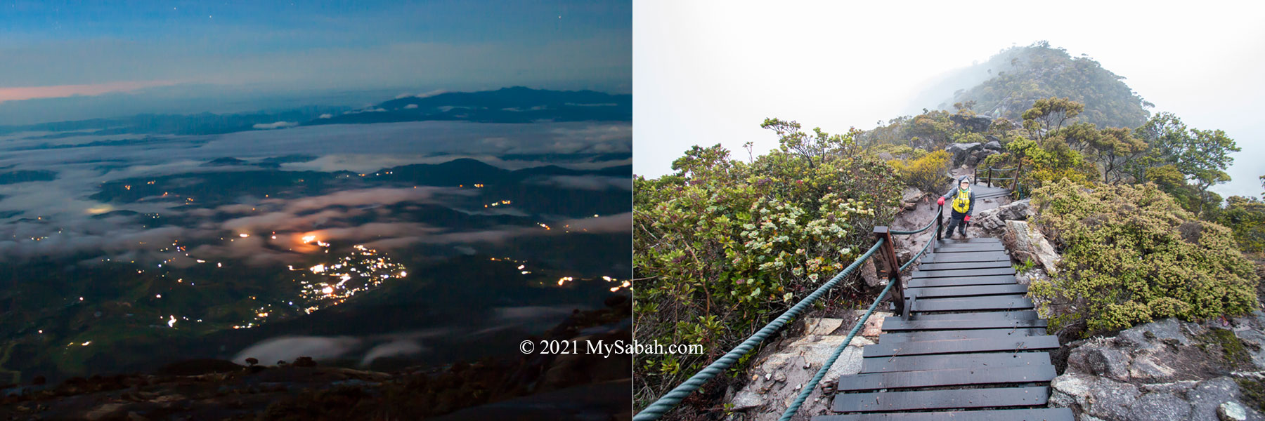
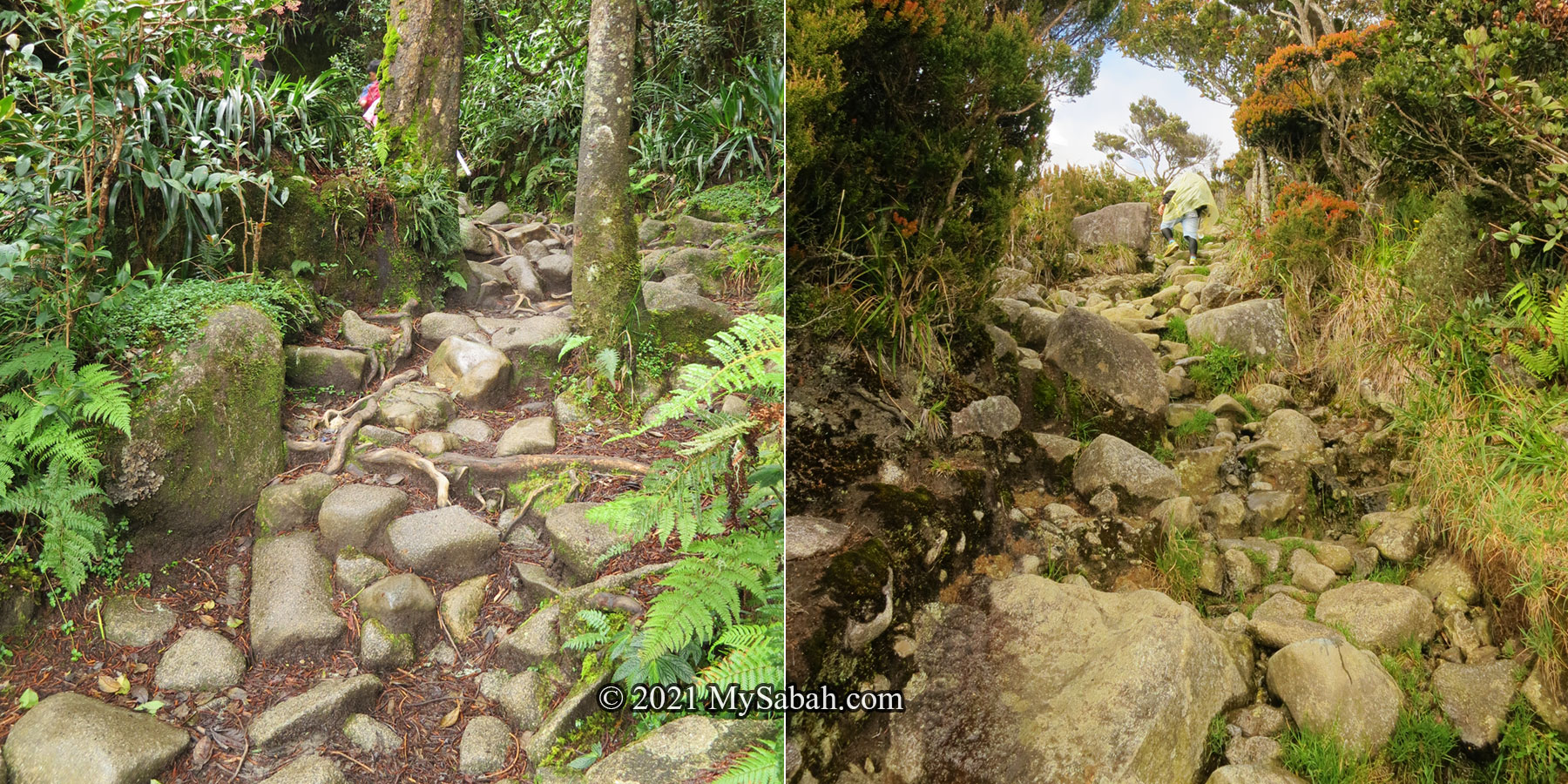
After briefing by your mountain guide, the ascend will start with nearly two hours of steep staircase climbing in the dark. The only way is up. You can see long line of torchlight of other climbers. You will be tired, stop and gasping for air for many times. Without air and light pollution, the sky is full of stars, a beautiful view you will never forget.

Ranau trail of Mount Kinabalu, not difficult but tiring.
Left: The rope section. Right: Sayat-Sayat Checkpoint

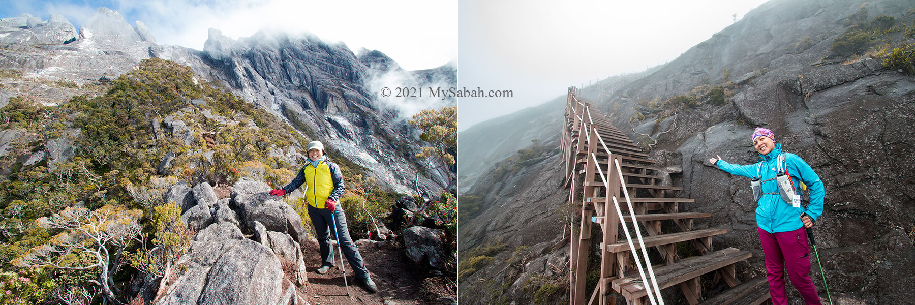
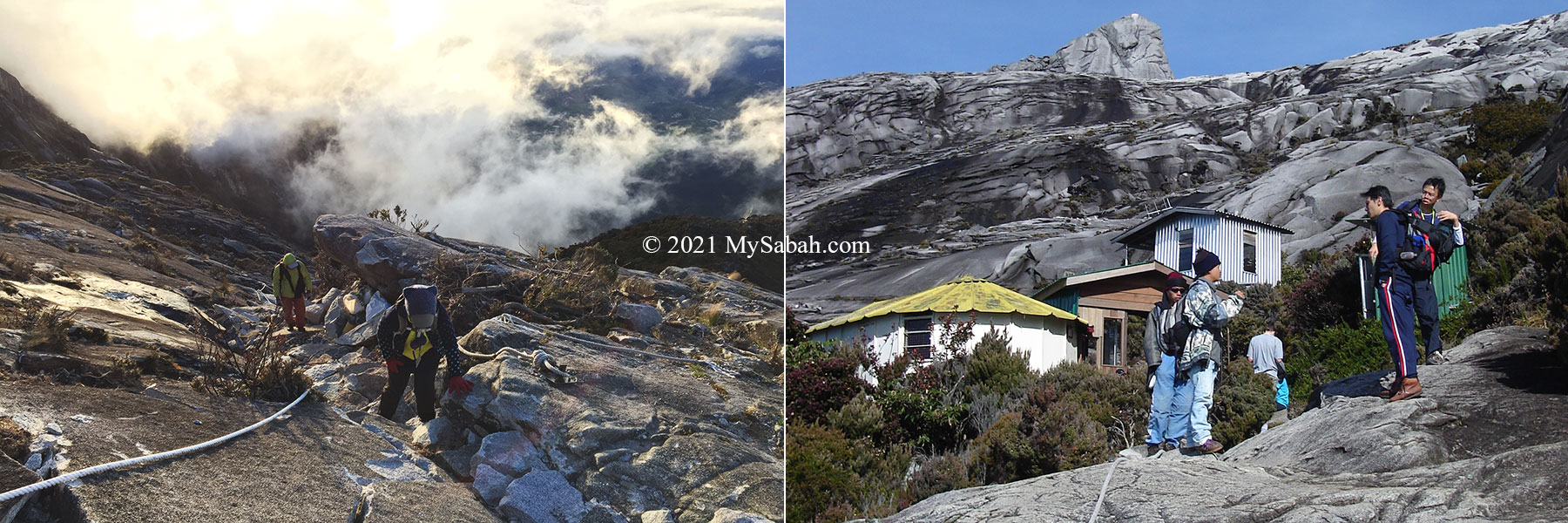
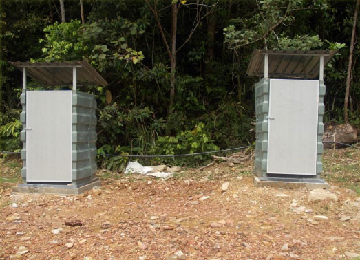
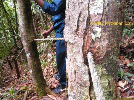
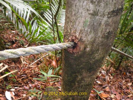
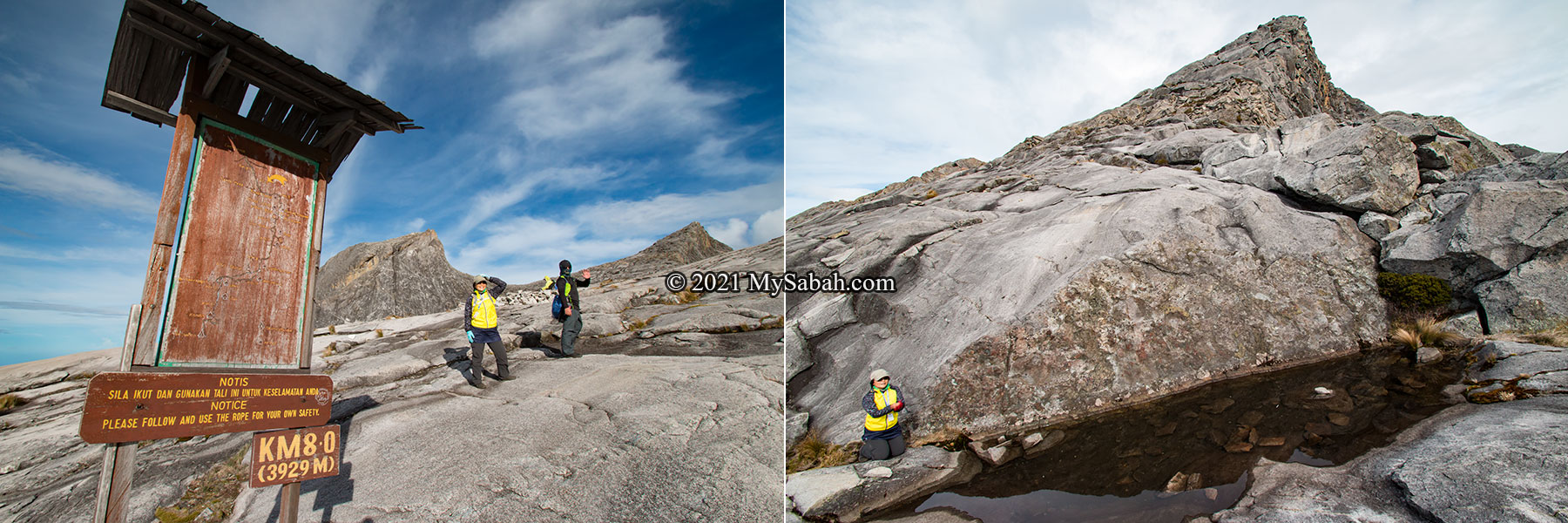
Then you will come to the rope section, the most challenging part that requires you to hold onto a rope to move up for a few hundreds metres. Soon you will be happy to see the Sayat-Sayat checkpoint. Climbers can rest there for a while and use the last toilet on the mountain trail.

Left: Rockface path. Right: The bald surface on Mount Kinabalu

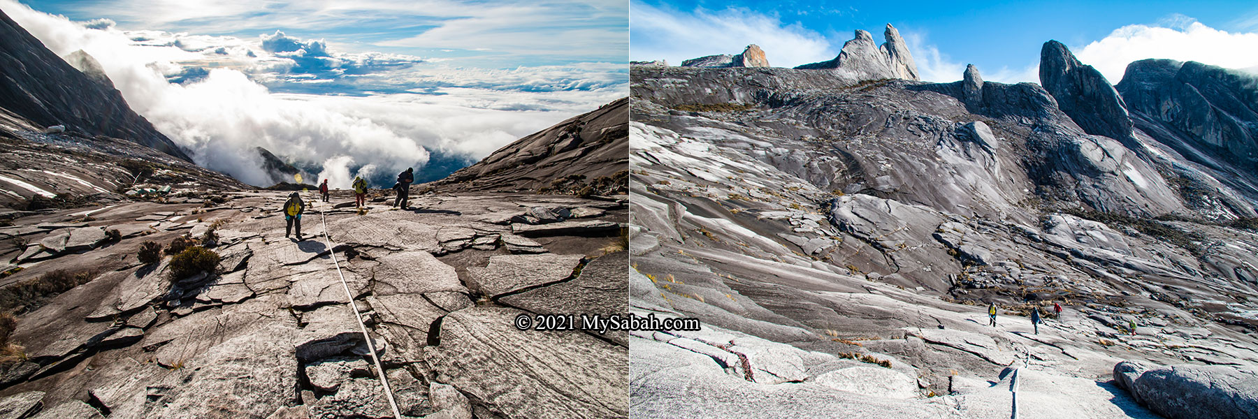
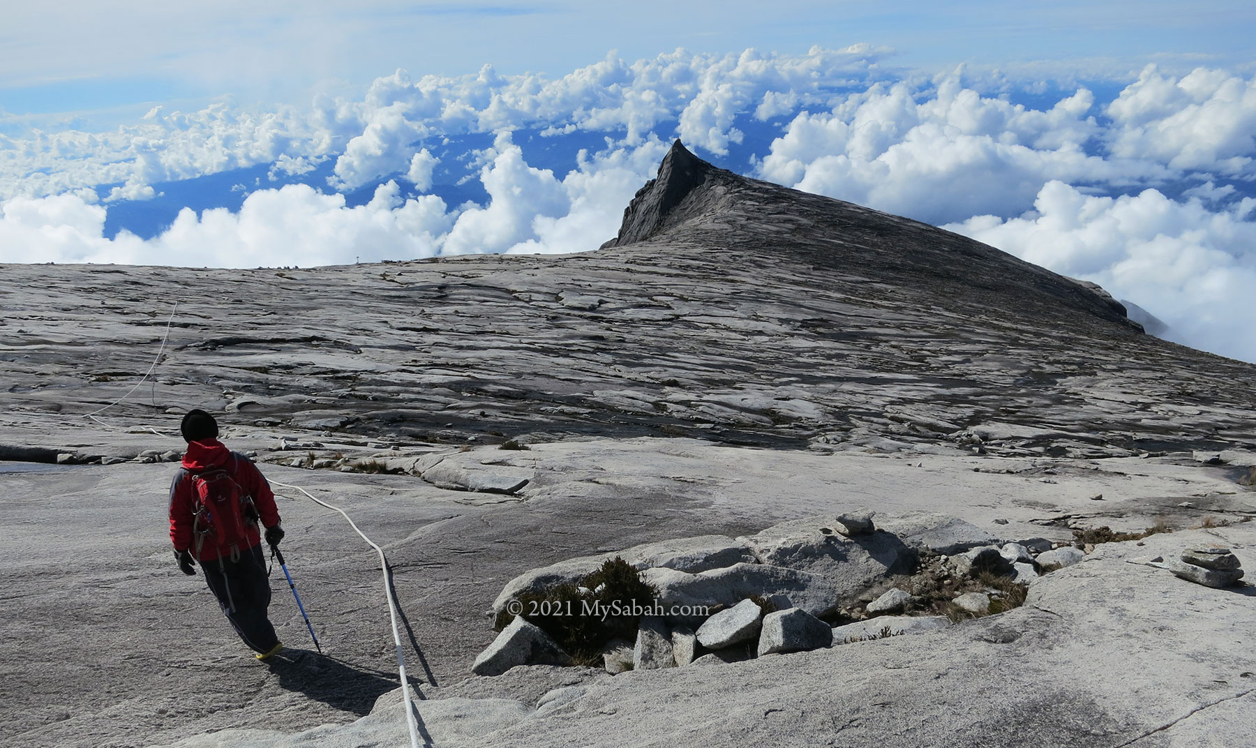
After Sayat-Sayat, the trail will be mainly rock surface with 15 to 20 degrees of inclination. The dense vegetation is replaced by scarce summit plant on the bald granite ground.

Left: South Peak in the RM100 bill of Malaysia. Right: friendly climbers from Peninsular Malaysia

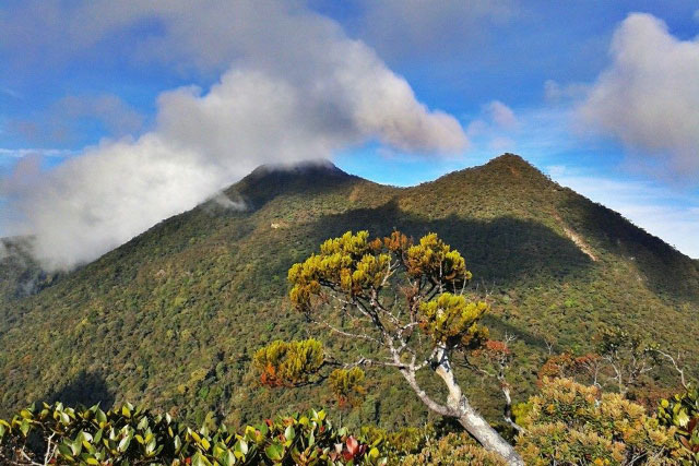
Anyway, the scenery just gets better at this point. In fact, it’s one of the most beautiful places in Malaysia. You are like wandering in another planet and admire the jagged peaks around you. The most photogenic peaks are the Donkey Ears Peak and South Peak.

Left: Signage at 8th KM. Right: Wishing Pool under Low’s Peak, always filled with coins

The air on the mountain is 20% thinner near the top of Mount Kinabalu. You will feel that your body is heavy and every move takes a lot of energy. Due to exhaustion, nine out of ten climbers would start to curse and say “why am I doing here?”. Though they complain, after the climb they will miss this mountain and come back again lol.

Low’s Peak, the highest peak of Mount Kinabalu, and the final ending point of the climb

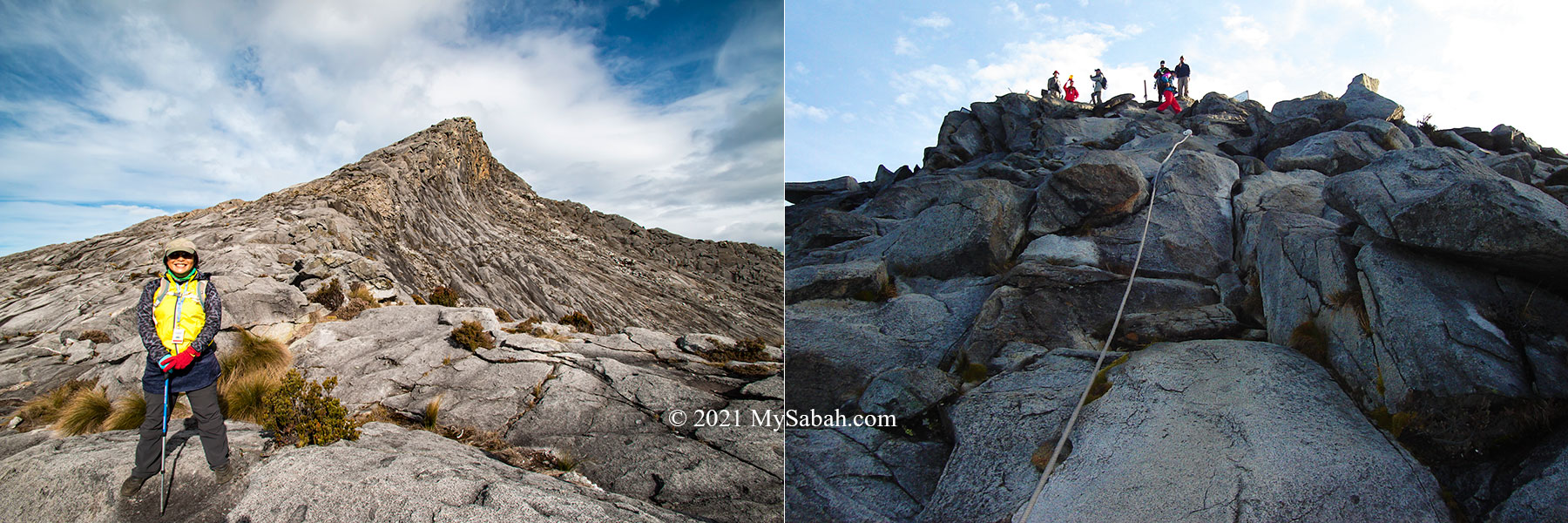
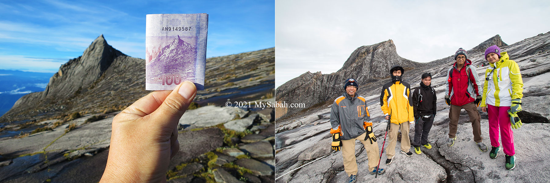
After the 8 KM signage, the summit on Low’s Peak is less than a Kilometre away. Your goal is simple, just keep moving slowly in steady pace. The last two hundreds of rope climbing to this highest peak will drain your last energy reserve. The sweet reward is reserved to those who persist. Conquering Mount Kinabalu is once in a lifetime experience and must be in your bucket list.

Tasting the victory: spectacular view on the summit of Mount Kinabalu. Bonus: If you reach the peak before 6am, you will be rewarded by the beautiful sunrise view on the highest mountain of Borneo.

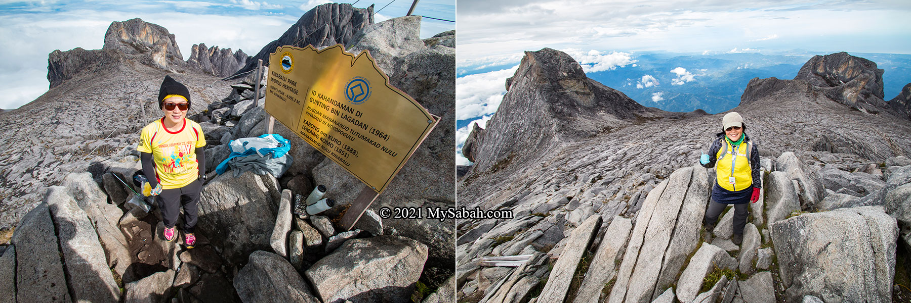
About 50,000 climbers leaves their footsteps on Mount Kinabalu annually. Despite the struggle, none of them shows the face of regret on the top. You have only an hour to enjoy the moment of your sweet victory, because the guide will ask you to leave the summit before 8am, before the mountain covered in dense fog (poor visibility).

Left: sub-alpine vegetation on Mount Kinabalu. Right: Aki View Platform

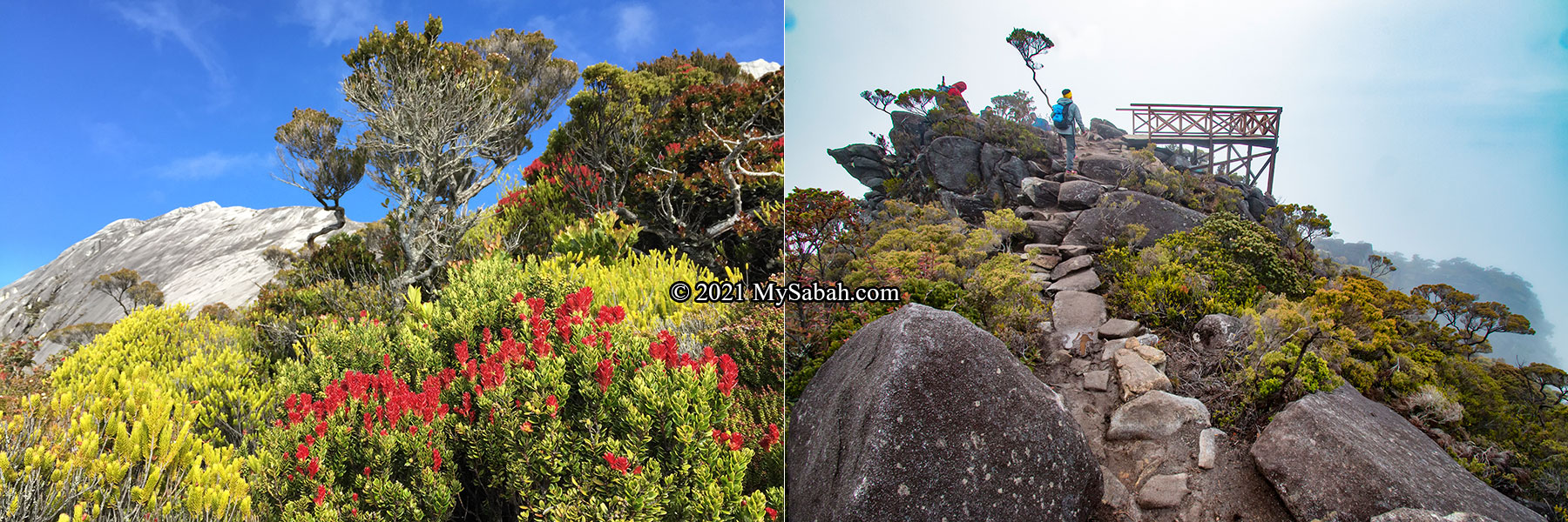
When you hike back to your hostel in Panalaban, do slow down a bit to appreciate the unique plant and flowers during the descend. Without daylight in night climb, you didn’t realise that you were surrounded by the most valuable eco-treasures of Borneo.

Left: Old man’s beard Fruticose lichen (Usnea) on the trees. Right: Kinabalu Park is a garden rich of plant species

Lastly, don’t forget to collect your certificate (for a fee) at Kinabalu Park office as a proof of your successful climb.

Tips and Advice

  1. Pack Light. Don’t carry more than 6 Kg of weight for the climb. Those bringing huge backpacks can hire a porter (for a fee) to reduce the burden. Your porter will head straight to Panalaban in great speed and won’t be walking next to the slow you, so do not let them carry your water and raincoat.
  2. The climate is cool with an average temperature range of 15°C to 24°C (59°F to 75°F) at the Kinabalu Park Headquarters and 6°C to 10°C (42°F to 50°F) on the mountain. It can even go down to freezing point in coldest months (Nov-Dec). Climbers are recommended to wear breathable cotton clothing and comfortable pair of hiking shoes.
  3. Climbers are also reminded to be ready with torch lights, raincoats and warm clothes in case it rains and the temperature drops.
  4. Descending stresses your knee and muscle more than ascending. Try to descend slowly to avoid serious joint and muscle pain later.
  5. Trail can be slippery after rain. Wear comfortable trekking or hiking shoes with good grip (best if it’s waterproof).
  6. Stay with your group and Mountain Guide at all times. Never walk off trail.
  7. Don’t climb if you have ailments such as asthma, hypertension, diabetes, heart disease and other sickness that severely affects your fitness.
  8. Always book the tour with licensed tour agent. There have been many cases tourists cheated by unlicensed agents.
  9. Mt. Kinabalu is the Sacred Mountain (resting place of the deceased) of Sabah. Please be respectful and refrain from doing anything offensive such as taking nude photo.
  10. Follow the social media of Sabah Parks for latest update on travel restriction. Currently, only our locals can climb the mountain.
Climbing outfit: Day 1 vs Day 2. You don’t need thick clothing for climbing on day 1, but pack a warm jacket in your bag. On day 2, you need to prepare for near freezing point temperature. You must have poncho or water resistant clothing in case it rains.

Things to Bring

  • Passport / MyKad (for registration)
  • Proof of Accommodation Booking and Payment
  • Cash (most transactions are by cash)
  • Drinking Water (in Refillable 1 Litre water bottle)
  • LED Headlamp (head torch)
  • Energy Bars / Chocolate Bars
  • Light Backpack (preferably with rain cover)
  • Raincoat / Poncho (Murphy’s Law says it’ll rain if you don’t bring one)
  • Toiletries (e.g. toilet paper, soap, toothbrush, toothpaste)
  • Warm Clothing (e.g. Wind breaker, Fleece, Jacket)
  • Extra clothing and socks
  • Gloves (to keep warm and rope climbing)
  • Ear Warmer
  • Towel
  • Camera and spare Battery
  • Medication such as painkiller, headache or altitude sickness tablet
  • Plastic bags: to store rubbish and soiled clothes
  • Optional: walking pole, sunblock lotion, sunglasses, portable charger

I hope you find this guide useful. Please feel free to comment or ask any question in the Comment section below.

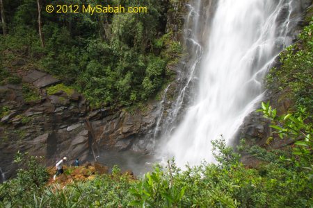
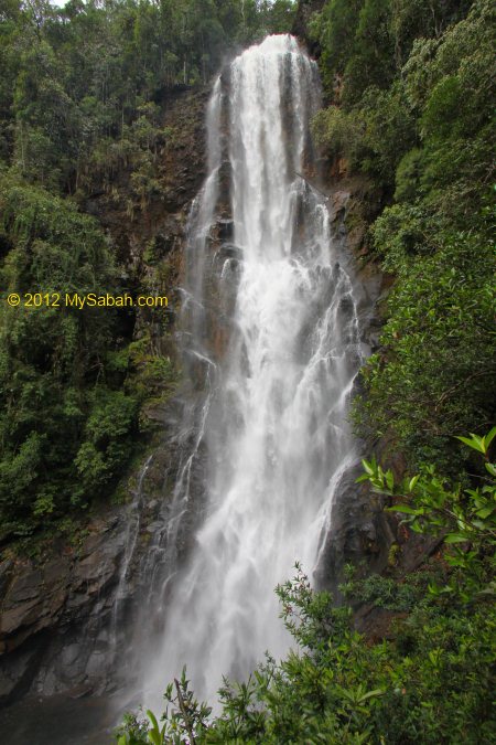
Photos taken in Kinabalu Park and Mount Kinabalu, Sabah, Malaysia Borneo

Sabah Agriculture Park, the largest garden of Sabah

Sabah Agriculture Park (Local Name: Taman Pertanian Sabah), in Tenom district of Sabah interior, is one of the largest garden parks in Malaysia. This attraction is so underrated because people think that it’s only about farming. In fact, Sabah Agriculture Park has a wide range of exotic flowers and fruits origin from the tropical regions of Asia, Central & South America, and Africa.

Sabah Agriculture Park (Taman Pertanian Sabah) in Tenom is one of the largest garden parks in Malaysia.

Furthermore, Sabah Agriculture Park is a 500-acre mega garden with over 20 mini gardens that have special collections categorized by plant families or characteristics. Casual visitors would be dazzled by thousands of flowers, trees, fruits, and vegetables in variety of forms and colors, and enjoy a stroll at the beautiful lakeside and model gardens. If you are an avid botanist, gardener or farmer, you would wish that you discovered this plant kingdom earlier.

Visitor Hall and entrance of Sabah Agriculture Park (Taman Pertanian Sabah)

Tours

Sabah Agriculture Park sprawls over an area of 6 square kilometres, which is too big for visitor to cover everything in a day. The park is like a buffet, you can spend from a few hours to a week, depend on how much you want to see. My favourites are Crops Museum for sampling of tropical fruits, Native Orchid Centre for rare Borneo orchids, and Model Gardens for photo-taking.

Site map of Sabah Agriculture Park (Taman Pertanian Sabah) for paid visitors.

Quick Tour

For a quick tour to experience the highlights, the following activities are suitable for family and normal tourists who want to spend only a few hours:

  1. Take a free ride on a tram-train to visit orchid and models gardens near the end of the park (save a lot of legwork). The tram starts around 9am and operates hourly (depend on the number of visitors).
  2. Check out Crops Museum and Ornamental Gardens near the entrance of the Park.
Tram-train starts around 9am to provide free ride for visitors.

The park used to rent bicycle, which provides an excellent mean to explore the park. Sadly it’s not available now.

Educational Tour

Sabah Agriculture Park is an ideal outdoor classroom for school trips. The educators also can organize knowledge quests for students to learn about plant in a fun way. Who knows this might inspire them to find their passions in agriculture and horticulture (other than becoming a Youtuber, just kidding).

Sabah Agriculture Park is an excellent site for educational tour, to learn about agriculture and horticulture.

Guided Tour

Instead of wandering aimlessly in the park, an interpretation walk by a knowledgeable guide will make a big difference to your experience. They will share interesting stories of the plant, let you sample some foreign fruits and show you some special plant in the park. The guiding service is free. However, you need to request in advance with the Park by phone or through their Facebook (subject to availability).

Family can explore the gardens which have a network of paved trails connected to other gardens.

Tips

  1. There are mosquitoes in areas near to water, you will need insect repellent.
  2. No water station in the Park, bring a bottle of drinking water with you.
  3. Visit in the morning so you don’t exposure to hot day. Use sunblock lotion (or umbrella) to prevent sunburn.
  4. June to August is the best period to visit because of the fruiting season.
  5. Wear comfortable walking shoes, especially the ones with slip resistant.
Left: Cannonball tree (Couroupita guianensis), native plant of South and Central America. Its fruits are edible but don’t taste good. Right: a heart-shaped flower

Gardens of Sabah Agriculture Park

There are over 20 sections that feature different flowers and plant. Every garden has signage, name plates and information panels (most have English version) for your DIY tour. You can walk to one garden to another via the network of paved path that connects most gardens. The following is an overview of the main gardens in the Park.

There are more than 20 small gardens (sections) in Sabah Agriculture Park for visitors to see different categories of plant.

Ornamental Gardens

Ornamental Garden is the best starting point for flower lovers. This super garden has over 20 well-landscaped mini-gardens that showcase different groups of plant and flowers. Fans of Bougainvillea, Hibiscus, Hoya, Ixora, Lily, Clerodendrum, Cactus, Carnivorous or Parasitic plant would be really pleased by the magnificent collection there. Some species are endemic to Borneo.

There are thousands of plant species of different forms and colours in Sabah Agriculture Park

Which flower is the Queen of the Tropical Flowers? What’s a wax plant? You can find the answers in this garden.

Crops Museum

Do you know that coffee was introduced from America and oil palm is the native plant of Africa? Some crops are so useful (or tasty) that they become part of our lives. You would be impressed by 400 tropical fruit trees divided into 15 major sections on this 8-acre ethno-botanical garden. These are cash trees with economic values due to their uses as food, medicines, spices, oil, fibers, cosmetics, handicrafts, etc. Some of them are from South America, Africa, India and Australia. Read more…

Local and non-native fruits in Sabah Agriculture Park. Can you tell which one is used as lipstick? And which one is guajilote fruit from Mexico?

Model Gardens

Model Gardens consist of five small themed gardens to demonstrate different landscaping and gardening styles that serve specific community and environment. For example, City Garden with cooling water fountain and seats, Sabah Garden with common vegetables and local ornamental trees. Sabahans love to plant papaya, pandan, banana and shallot on their yards.

Model Gardens in different themes, which give gardeners some ideas on landscaping.

Hybrid Orchids Centre

70 species of showy hybrid orchids grow here, mainly under genus of Oncidium, Cattleya, Aranda, Renenthera, Mokara, and Doritaenopsis. This is also a great location to take some portrait photos. Read more…

Hybrid Orchid Garden of Sabah Agriculture Park. These orchids have big and showy flowers for better commercial value and are more tolerant to sunlight.

Native Orchids Centre (must visit!)

Next to Hybrid Orchids Centre is the real gem of the Park, the Native Orchids Centre, where 400 species of indigenous Borneo orchids are cultivated. In contrast to the flamboyant hybrid orchids, many native orchids have smaller flowers, and some have smelly flowers. Some rare and endangered species found here include Elephant Ear Orchid, Rat Tail Orchid, Slipper Orchids, Bella Orchid, Giant Orchid and the Rose Orchid.

Native Orchid Centre of Sabah Agriculture Park has some impressive collections of rare Borneo orchids. Note the Giant orchid (Grammatophyllum speciosum) on the arch. This garden is next to the Hybrid Orchid Garden.

Evolution Garden

This garden exhibits how plants evolved and adapted to the environments even before dinosaur age, from pond to semi-arid zone, as well as harsh habitats such as salty and limestone territories. What would catch your attention there are the floating Giant Water lily that can hold a toddler, and the rotting smell of Giant Aristolochia flowers.

Plant Evolution and Adaptation Garden. The Giant water lily (Victoria amazonica) at the right can hold the weight of a small child.

Animal Park

Near the Sapong Lake is a mini zoo that raises some livestock and farm animals, for example, deer, ducks, tortoise, goats, ostrich. Many children are afraid of chicken because they never see one. Time to bring them here to see the real stuffs.

Animal Park of Sabah Agriculture Park

Lakes & Camping Ground

Oddly, lake is not very common in Sabah, so I’m happy to see three lakes in the Park. Visitors can enjoy the view and walk on the suspension bridges, or have a scenic view of the lakes on top of the 4-storey lookout tower. The Park even creates four islands in the lakes, one of them is Camping Island, which has a camping ground with tents and toilets (alert: many mosquitoes).

Bird Island (left) and Padas (right) Island in Sapong Lake of Sabah Agriculture Park

For a permit fee (RM2.00), you can fish at the lake, which has Tilapia, Grass and Common Carp, Patin, Toman, Kalui, and Lampam Jawa, to name a few. You can take home your caught too (for RM8/Kg). Boating is another fun activity in the lake.

Rundum Lake in Sabah Agriculture Park. You can walk up to the 4-floor-high Lookout Tower at the right for a nice view.

Amenities & Accommodation

Overall, Sabah Agriculture Park is a family-friendly park with complete amenities. Lot of parking spaces near the entrance. There are ticket counter, souvenir shop, restaurant, and toilets in the arrival hall.

Camping & Adventure Islands, and camping ground at the lakeside

Decent accommodation is available for those who want to overnight in the Park. However, it’s closed as of this writing. The fees below are for your info. You can follow their Facebook for the reopening date.

Hostel (per night per person): Adult (RM25), Student (RM15)
Chalet: RM150 per Chalet per Night (max 6 people)
Camping: RM 10 per person/night

Opening Hours

The Park is open from Tuesday to Sunday from 9am to 4:30pm. It’s closed every Monday (unless that day falls on a Public Holiday).

Common plant in Sabah Garden. Left: giant Bird’s-nest fern, Right: Doringin (or Simpoh Ayer), its big leaves can be used for packing rice (Linopot)

Entrance Fee

The best deal is family group ticket for parents who bring two children. (For international tourists: Based on currency exchange rate (as of this writing), one USD can exchange for about four Ringgit (RM4 or MYR4).)

CategoryMalaysianForeigner
Adult (13 years and above)RM10RM25
Student (Secondary school / Undergraduates of higher learning)RM7
Child below 13RM5RM10
Accompanied child below 6FreeFree
Government Pensioner / Senior CitizenRM7RM25
Family (2 adults + maximum 2 children below 13 years old)RM20RM50
HandicappedFreeFree
Ticket fee to enter Sabah Agriculture Park

How to get there

Sabah Agriculture Park is about 164 kilometres from Kota Kinabalu City (KK), and 14 kilometres from Tenom town. The Park is highly accessible by highway and paved road, and takes nearly 3 hours of driving from KK. The GPS coordinates of the Park is 5.174728932499501, 115.98344250484831 (see Location Map). Do not rely on public transport to move around Tenom. Use your car or rent one.

Cactus Garden (left) and hanging bridge (right)

The following is the contact of Sabah Agriculture Park:
Address: Taman Pertanian Sabah, WDT, 28, 89909 TENOM, SABAH, MALAYSIA
Facebook: Taman-Pertanian-Sabah
Website: sabah.net.my/agripark
E-mail: agripark@sabah.net.my, tps_tenom@yahoo.com
Phone: +60 87-737952 / 737558

Photos taken in Tenom, Sabah, Malaysia Borneo

Archive

Old photos of Sabah Agriculture Park (year 2006)

Guide to Climbing Mt. Trusmadi (Mt. Trus Madi)

Mount Trus Madi (or Mt. Trusmadi) is the second highest mountain (2,642 Meters or 8,668 ft) of Malaysia. Albeit 1,453 Meters lower than Mount Kinabalu (4,095 Meters), climbing Mt. Trusmadi is more challenging, so it offers a thrilling experience for adventure seekers. Many tourists who have conquered Mt. Kinabalu are also keen to give it a try. If you are physically fit and exercise regularly, you would find Mt. Trus Madi is very climbable even though the trail is less tourist-friendly.

The peaks of Mt. Trus Madi

The facilities of Trusmadi have improved tremendously in past few years (especially the Tambunan side), so it has become a hot destination. Mt. Trus Madi is located in Trus Madi Forest Reserve (Code: FMU-10 = Forest Management Unit No.10), so you need to apply entry permit from Sabah Forestry Department for the climb. This article provides the most complete and updated information to help you planning the climb.

Overview of 3 Summit Trails to Mt. Trus Madi

Climbing Mt. Trus Madi can be done in 2 to 4 days, depends on the trail you pick. There are three summit trails that lead to the highest peak of Mt. Trus Madi, i.e.:

  1. Kaingaran Trail in Tambunan
  2. Mannan Trail in Keningau
  3. Mastan Trail in Sook

Location map of Mt. Trus Madi & starting points of 3 summit trails

These trails have different climbing distance, starting point, road accessibility, level of difficulty and facilities on the mountain. Picking the trail is your first step to plan the climb. Kaingaran Trail (Tambunan) is the most popular choice because its climbing distance is shorter (4.9 KM) and the facilities are the most developed. Mannan Trail (Keningau) is the second best choice. Though the climb takes 4 days, the view along the trail is more beautiful and you don’t need a 4-Wheel Drive.

The following table is a comparison of three trails (can click to enlarge):

Table: Comparison of 3 summit trails to Mt. Trus Madi

Since these three summit trails are connected to one another on the summit, you also can choose to ascend and descend to different points for more fun. For example, you can climb up the mountain via Kaingaran Trail from Tambunan, but climb down via Mannan Trail to Keningau, if you are able to arrange your return transport waits at other end.

Below are more detail reviews of three summit trails to Mt. Trusmadi:

1. Kaingaran Trail

Kaingaran Trail is the oldest and most developed trail. I climbed Mt. Trus Madi via this trail in year 2010. However, the climb is much more enjoyable and easier nowadays because of upgraded trail and accommodation.

Kaingaran Trail of Tambunan

Climbing Distance: 4.9 KM (require 2 day 1 night)
Location: Tambunan District
Starting Point: 27 Km (2.5 hours drive) from Tambunan Town (mainly gravel road. The last 6 KM road trip needs 4-Wheel Drive)
Accommodation: Mirad Irad Base Camp (foothill), Rest House (at 2.9 KM of mountain trail)

Mirad Irad Base Camp of Mt. Trus Madi in Tambunan

You can spend one extra night at Mirad Irad Base Camp of Mt. Trus Madi (7 KM before starting point (20 min drive) and 900 Meters above sea level), if you want to start your climb very early in next morning. The accommodation at Base Camp can accommodate 24 people, and camping (Fee: RM10) is allowed. The room rate is RM20 per night per person. Please note you MUST book 1 month in advance.

Taman Kitingan: Starting point in Tambunan (Kaingaran Trail)

If you start your climb on day 1 from Kota Kinabalu City (KK), you need to drive about 4 hours from KK to starting point in Tambunan, very likely you will start your climb around noon, which is kind of late. That’s why some climbers prefer to stay an extra night in Mirad Irad Base camp or hotel in Tambunan.

Plank walk & boardwalk in summit trail at Tambunan (Kaingaran Trail)

The first 3 KM of Kaingaran Trail is boardwalk. It’s leech-free and makes climbing more like hiking.

Taliban Point, which is named after OKK Taliban, the 1st native chief of Tambunan and has nothing to do with terrorist.

Toilet in summit trail to Mt. Trus Madi

One of the shelters in Kaingaran Trail (Tambunan)

Summit trail to Mt. Trus Madi (Kaingaran Trail, Tambunan)

Mt. Trus Madi Rest House (only available for Kaingaran Trail)

There is only one accommodation on Mt. Trus Madi and about 2.9 KM away from the summit. The Rest House has 5 rooms, each with 4 bunk beds, and able to host 20 people at a time. The fee per person is RM20-RM100 per night per bed. The amenities are quite basic, water supply and lighting are available.

Mt. Trus Madi Rest House looks like a long house

Accommodation on Mt. Trus Madi. Guide and Porter camp under the Rest House if the rooms are full.

Bunk beds in Rest House. It costs RM20-100 per night per person.

Kitchen of the Rest House. only tour operator can cook.

Toilet of the Rest House

Rest House on Mt. Trus Madi

The following video gives a good overview of Kaingaran Trail, with a lot of aerial views of Mirad Irad Base Camp, Mt. Trusmadi Rest House and the summit:

The next two trails are relatively new and located in Keningau District (Sook is a sub-district of Keningau).

Mastan (left) and Mannan (right) Trails at Keningau District

There is no accommodation in Mastan and Mannan Trails, so you will need to bring your own camping and cooking gears. This means you need to carry more weight, making the climb tougher. You can hire porters to share your burden. The camping fees are RM3 and RM5 for Malaysian and foreigner respectively.

2. Mannan Trail

Though Mannan Trail takes the longest time (4 day 3 night), many adventurers love its scenic view and pristine route. Another advantage is – you don’t need a 4-wheel drive to travel to the starting point.

View of Mt Trus Madi from Kg. Sinua (KM2.4 point to summit)

Climbing Distance: 11.6 KM (require 4 day 3 night)
Location: Sinua Village (Kampung Sinua), Sook (Keningau District)
Starting Point: 103 KM of paved road (3 hours drive) from Keningau Town. Good road condition. No need 4-Wheel Drive.
Accommodation: Camping and Resting Platform only

K.S. Khiong Point (4,200M) of Mannan Trail, one of the camping sites

The GoPro video below gives you a good idea of trail condition in Mannan Trail:

If you want the most detail video walk-through, you may check out the 56-minute video below:

3. Mastan Trail

Mastan Trail is very “raw” and the least developed. I have very little information about this trail. Judging from the map, Mastan Trail is the shortest (4.3 KM) but the steepest. You see, Mastan Trail is only 600 Meters shorter than Kaingaran Trail (Tambunan), which has far better trail and facilities, of course most climbers will go for the more relaxing option.

Taman Bunga (Garden Peak) of Mastan Trail

Climbing Distance: 4.3 KM (require 2 day 1 night)
Location: Apin-Apin, Keningau District
Starting Point: 76 KM (4 hours drive) from Keningau Town. Bad road, accessible only by 4-Wheel Drive.
Accommodation: Camping

Toilets in Mastan Trail

Some village folks there have been doing day climb via this trail. Anyway, if you have only 2 days and want to see the most of Mt. Trus Madi, you may ascend via Kaingaran Trail on day 1 and descend via Mastan Trail on day 2.

The Summit

The flora of Trusmadi is very diverse and fascinating, where almost 600 species of 160 families of plants have been recorded here. Remember to get your certificate if you make it to the top (RM10 fee applies).

Nepenthes Trusmadiensis is a pitcher plant endemic to Mt. Trus Madi

Nepenthes trusmadiensis is the natural hybrid between Nepenthes lowii and Nepenthes macrophylla, you would see it when you are close to the summit.

The highest point of Mt. Trus Madi (2,642 Meters)

You can see Mt. Kinabalu clearly on Mt. Trus Madi

When you reach the summit of Mount Trusmadi at dawn, if the weather is good, you will be mesmerized by a breath-taking view of Mount Kinabalu, which lies about 40 KM to the north.

New! 5-Meter Viewpoint Tower 100 Meter from the summit of Mt. Trus Madi (at Jiran Point)

How much does the climbing trip cost?

The total fee varies greatly, depending on the trail and services that you select. Below is a list of basic fees (in Malaysian Ringgit (MYR)).

Malaysian Foreigner
Climb Permit 30 80
Entrance Fee 5 15
Vehicle Permit 100 100
Accommodation (1 night)* 100 100
Forestry Guide (2 days) 100 200
TOTAL: 335 (≈USD$95) 495 (≈USD$140)

*For Rest House only. Replace this with camping fee if you don’t use Tambunan trail

The final cost can range from RM400 to RM800 per person, after you include other variable and optional fees such as rental of 4-Wheel Drive (RM800/day per car), insurance, transport (gasoline), food & personal supplies, porter, certificate (RM10), etc. You can save more money by going in group, so you can split the cost on transportation and guide fee.

Enjoying the mountain view from the tower

If you have more questions, you may contact the Forestry Officers listed below:

1. Tambunan

Contact Person: Mr. Saleh Intang, District Forestry Officer (“DFO”) of Tambunan
Address: Pejabat Perhutanan Daerah Tambunan, Peti Surat No 64, 89657, Tambunan, Sabah, Malaysia
Tel: +60 88-899589
Fax: +60 88-899588
E-mail: saleh.intang@sabah.gov.my

2. Keningau / Sook

Contact Person: Mr. Azman Said, District Forestry Officer (“DFO”) of Keningau
Address: Pejabat Perhutanan Daerah Keningau, Peti Surat No 88, 89007, Keningau, Sabah, Malaysia
Tel: +60 87-331203
Fax: +60 87-338721
E-mail: azman.said@sabah.gov.my

Tour Operators

If your budget permits, you should consider hiring a tour operator to arrange the climbing trip for you. The cost will be higher, but they will save you the problems on paperwork (permit), 4-wheel drive transport, camping, cooking, etc. I strongly recommend the following tour operators, who are experienced in adventure trips:

1. TYK Adventure Tours

Address: Block E, Lot 38, 2nd Floor, Damai Plaza IV, Luyang, Kota Kinabalu, Sabah, Malaysia
Tel: +60 88-232821
Website: www.tykadventuretours.com
E-mail: thamyaukong@gmail.com
Fax: +60 88-232827

2. Mount Trusmadi Travel & Tour Tambunan

Address: Lot No. 5, Kedai Tepi Sungai Tondulu, Majlis Daerah Tambunan, 89657 Tambunan, Sabah, Malaysia
Tel: +60 87–771312
Mobile Phone: +60 19-8831568
E-mail: widuresorttbn@yahoo.com

By the way, currently Sabah Forestry Department only has 16 mountain guides. During peak season, they may not have enough manpower to guide the climbers. They would disapprove your climb in that case. Therefore, I advise you to register a few months before the climb, to secure the limited capacity.

Useful Slides

Most of the information here is extracted from the following slides by Sabah Tourism Board and Sabah Forestry Department. You may download them for further reading. Also special thanks to Mr. Tham Yau Kong and Mike Miki from TYK Adventure Tours for contributing the photos. (Note: some info is inconsistent in different slides. I’ll correct them once I confirm the details).

Overview of Mt. Trusmadi, e.g. photos of road condition, starting points, accommodations, facilities, itineraries.

Useful info for planning the tour, e.g. booking and reservation procedures, various fees (permit, entrance, forestry guides), application forms and checklist of Things to Bring.

This slide contains some latest photos of the trails.

Please feel free to leave your question in comment section below, I’ll try my best to answer.

Photos taken in Sabah, Malaysia Borneo

Mt. Kinabalu Botanical Garden of Kinabalu Park

Kinabalu Park has one of the richest assemblage of flora in the world, with an estimate of 5,000 to 6,000 vascular plant species that cover the habitat from warm lowland forest up to cold alpine mountain zone inside a park area of 754 KM2. Though Kinabalu Park has become the most popular destination of Sabah, most tourists can’t even name 3 plant after a trip there. A short visit to its Botanical Garden will improve their travel experience considerably when they learn the wonders of our flora kingdom.


Pic: Kinabalu Park is an UNESCO World Heritage Site because of its mega flora diversity. Now it’s a Unesco Global Geopark too.

“The interest, and uniqueness of Kinabalu lies largely with its mountain flora.” -van Steenis, plant geographer


Pic: Liwagu Restaurant


Pic: the direction sign to Mountain Garden

Mt. Kinabalu Botanical Garden (a.k.a. Mountain Garden) is completely concealed by dense trees and pretty much neglected by tourists. The “secret” entrance is located in the wood between Liwagu Restaurant and Kinabalu Hall (Dewan Kinabalu). Just follow a small trail to the forest from road side and look for the direction sign. Some locals may have visited the park a dozen time, but they never discover this garden. Like my father, he was so surprised to see this “hidden garden” and didn’t know it has existed since 1981.


Pic: entrance and ticket counter of Mt. Kinabalu Botanical Garden

The garden is about 50 Meters away from the sign and you will see the long stairway leading to the entrance and ticket counter. The surrounding here is quiet, in contrast to other park areas full with noisy tourists. I heard many bird’s chirping and squirrels skulking behind the leaves. The air is cooling and refreshing too, as the garden is about 1,520 Meters above sea level, with a mountain stream named Silau-Silau River (the mean temperature of the water is 16°C) running through it.


Pic: layout map of Botanical Garden

The garden is only 1.4 hectares in size and there is a 700 Meters garden trail (see map above) with labels, so you can explore the garden on your own (but not so advisable). I strongly recommend you to join the 1-hour guided tour (at 9am, 12pm and 3pm daily) for a very small fee, or you will be disappointed and give it a thumbs down in TripAdvisor. Even botanists have difficulty to identify 25% of the flora in Kinabalu Park, so normal visitors won’t have much fun if they wander on their own.


Pic: umbrella tree (Species: Araliaceae)

Mt. Kinabalu Botanical Garden is not only about flowers, it also shows the endemic flora, fruits, ornamental plant, trees, local herbs and other special plant from Kinabalu Park. Though most plants are green, they are not made the same. A guide from Interpretative & Education Unit of Kinabalu Park will provide a 1-hour interpretive walking tour in the garden, in English or Malaysia language (depending on the nationality of the audiences). I forgot the name of my guide. Let’s call her Sumandak here. The first interesting plant that Sumandak presented was an Umbrella Tree, which is used by locals for birth control (female).


The garden trail is paved by concrete and boardwalk. The place looks more like a natural forest than garden. While listening to the guide, we couldn’t help to turn our heads around to appreciate the beautiful lush environment of lower montane forest.


Pic: wild banana tree

There are five wild banana species in Kinabalu Park. Their fruits are edible but contain plenty of oversized seeds, unlike the seedless banana that we buy from supermarket.


Pic: Medinilla Speciosa, with pink pendulous inflorescences

Nicknamed as Showy Asian Grapes, Medinilla Speciosa fruits all year round and its ripe berry (in dark purple) is an important food for birds and wildlife. The fruit is edible with sweet taste and might protect you from eye diseases. Medinilla is also a popular landscaping plant in highland.


It’s an enjoyable experience to hear Sumandak to explain the features of interesting plants. Everything said is in plain English, she didn’t use much scientific names and jargons that only botanists could comprehend (unless you request). You can ask questions too. Many plants are not pretty but very useful. Without an introduction from the guide, you won’t know the awesome things it does. It’s like knowing a new friend who looks low-key from outside but has charming personality.


Then we came to the nursery area of the rarest orchids and pitcher plants of Kinabalu Park. To prevent people to pluck them, the nursery is fenced, but you still can have a good look of them through the wire mesh. These fully protected species are highly sought-after items in black market.


Pic: Low’s slipper orchid (Paphiopedilum lowii) is the only epiphytic slipper orchid of Borneo.

Sabah is well-known among orchid mania, because more than 1,200 orchid species are found in Kinabalu Park. In general, the blooming months for most orchids are between Sep and Dec. However, whatever day you visit, you won’t see them all blooms at the same time.


Pic: Rotchcild’s Slipper Orchid (Paphiopedilum rothschildianum) is the State Flower of Sabah and has many names such as “Aristocrat of all slipper orchids”, Gold of Kinabalu and Sumazau Orchid. It’s endemic to Sabah and a highly endangered species. You have better chance to see it flowering if you visit in Oct or Nov.


Pic: Laughing Orchid (Bulbophyllum lobbii)

When gently shaken by breeze, the moving lip of Laughing Orchid appears like a naughty boy sticking out his tongue repeatedly. Actually the “tongue” is called labellum, which serves as a landing platform for visiting insects (pollinator). The blooming months of Laughing Orchid are Jan, May and Jun.


Pic: The Sexy Lady Orchid or Dancing Lady Orchid (Stikorchis species). I guess you can see how it gets this name lol.


One of the highlight of this tour is sighting of Pinhead Orchid (Podochilus tenuis), the smallest orchid in Borneo (some says it can be the smallest in the world). Its tiny flower is about 2 MM across (note my finger next to it). The funny thing is – it grows on a tree near the entrance but none of us notices it. See, that’s why you need a guide or you will miss many things.

Besides the amazing orchids above, Jewel Orchid (Macodes sp.), Rabbit Orchid (Stikorchis sp.), Necklace Orchid (Coelogyne sp.), Phaius subtrilobus and many other orchids also grow in this garden.


Pic: Begonia has the most variable form of leaves in plant kingdom. Researchers estimate that there should be at least 600 species of Begonia in Borneo but only 194 are scientifically described at present.


Pic: Begonia

Sumandak also showed us some Begonia flowers. There have been many publications about Begonia in recent years because over 50% of Sabah Begonia are unnamed and all Bornean species are endemic. It is an exciting botany territory filled with new discovery and surprise.


Pic: flower buds of Alpinia havilandii, a ginger endemic to Mt. Kinabalu and Crocker Range

Who would relate colorful flower with pungent ginger? I’ve been hiking in many forest of Sabah and always impressed by variety of colors and shapes of ginger flowers in the wild. Without ginger flowers, the view of rainforest will be less spiced up. 30 species of non-edible ginger are planted in Mountain Garden.


Pic: hybrid of Nepenthes lowii and Nepenthes edwardsiana

We entered the pitcher plant section. Suddenly a tour guide broke the silence with a 50-Watt megaphone and introduced a hybrid of Nepenthes lowii and Nepenthes edwardsiana to her tour group. Nepenthes lowii and Nepenthes edwardsiana have highly localized distribution. To see them in the wild, you need to climb Mt. Tambuyukon (a dreadful long climb), so it’s something worth to shout about.


Pic: bloated Nepenthes burbidgeae, the least common species in Kinabalu Park

Pitcher plant (or Monkey Cup) is a peculiar carnivorous plant which traps insects as food. Its genus name, Nepenthes is a Greek word meaning “removing all sorrow” (Go figure). The Mountain Garden has 5 species of them (all endemic to Sabah), including the most magnificent Nepenthes edwardsiana that has the most developed ribs on its peristome (rim), and Nepenthes rajah, the largest pitcher plant in the world (can hold up to 3.5 litres of water. Sometimes rat, lizard or frog is found drowned inside).


The exposed smooth orange-brown trunk of “naked tree” (Species: Tristaniopsis bilocularis) will catch your attention. It is endemic to Kinabalu Park and its bark peels in scrolls constantly. Villagers use its bark as mosquito repellent.


Then Sumandak spotted something moving on the floor. It’s a well-camouflaged stick insect that blends perfectly into mosses. It was busy pressing its tail to the ground to lay eggs. Nobody would see it if it stayed motionless. You may see it in action in following video:


Pic: thorny rattan

The largest of the mountain rattan is Plectocomia elongata (see photo above). Its thorns look so nasty that I want to stay 10 feet away from it. This rattan only flowers once in its life and it’s one of the 40 rattan species live in Kinabalu Park. Malaysian parents like to whip naughty kids with rattan, luckily they don’t use the species that has thorns.


Pic: yellow flower of Rhododendron retivenium

Rhododendron is also called wild rose. There are 24 species of Rhododendron in Kinabalu Park (5 are endemic to Borneo). Observant climbers of Mt. Kinabalu would see at least 6 species along the trail to the summit, if they are keen to stop and smell the roses.


Pic: Bird’s Nest Fern / Crown Fern, a common ornamental plant in Sabah.

608 species of fern are found in Kinabalu Park. Most ferns at or above the altitude of this garden are not found in other parts of Malaysia.

Other remarkable plants you can check out in Mountain Garden are Dawsonia Giant Hairy-cap Moss (world’s tallest land moss), fig, lipstick flower (Aeschynanthus), Kinabalu Balsam, bamboo, Kerosene tree (with combustible oily seeds), aroids (with heart-shaped leaf), wild raspberry, etc. As plants have different flowering and fruiting seasons, you won’t see exactly the same things every month. What I mention here is just a very small fraction of what Mountain Garden has.

Ticket & Info

Ticket Fee: RM5 (≈US$1.50) for Non-Malaysian, RM4 for Malaysian, (50% discount for visitor below 18 years old)
Opening Hours: 9am-1pm and 2pm-4pm daily (Last entry: 3:40pm, Gate closes at 4pm sharp)
Guided Tour: 9am, 12pm and 3pm daily
Location: Kinabalu Park HQ in Kundasang (see Location Map)
Tel: +60 88-8889103
Website: www.sabahparks.org.my

Other Tour

Near to Mountain Garden, there is another nature tour starts at 11am daily. A guide will take you for a 1-hour walk in Silau-Silau Trail nearby, a great bird-watching area. If you are interested, you may purchase ticket and wait at Kinabalu Hall before 11am. The fee is RM3 (≈US$0.90) for Non-Malaysian and RM2 for Malaysian (50% discount for visitor below 18 years old).

There is a Video Show at the theater in ground floor of Liwagu Restaurant at 2pm every day (and 7:30pm on Fri-Mon & Public Holiday). Ticket fee is RM2 (≈US$0.60) for Non-Malaysian and RM1 for Malaysian.

Photos taken in Kinabalu Park, Sabah, Malaysia Borneo

Climbing Mt. Silam with Sabah Crabs

After enjoying the nice view of Darvel Bay on Tower of Heaven, I went to climb Mount Silam. With a height of 884 Meters, Mount Silam is one of the highest mountains in Lahad Datu. Plant and animal enthusiasts will find that a hike on Mt. Silam is filled with pleasure surprises, due to rich variety of unique and endemic flora and fauna here. Thanks to Sabah Forestry Department, who keeps this mountain pristine in its 698-Hectare Sapagaya fully protected forest reserve.


Pic: Mt. Silam and its Tower of Heaven (Menara Kayangan)

Mt. Silam is classified as an Ultramafic Coastal Mountain. In layman’s terms, the soil in Ultramafic environment is reddish brown in color and formed by ultrabasic rock. The soil has high concentration of heavy metals such as magnesium, iron, nickel, chromium and cobalt, but poor in plant nutrients such as nitrogen, phosphorus and potassium. The ultramafic substrates are “toxic” so the plants which can survive here are very different from other vegetations. That’s what makes Mt. Silam so special.

The Summit Trails

Climbing a 884-Meter mountain may sound taxing. But no worry, I started the climb at 620 Meter elevation (near the Tower of Heaven), so going up and down Mt. Silam took me less than 6 hours. Do bring raincoat, water and energy bars with you, as there is no shelter and water station along the way. Wear comfortable hiking shoes, and a trekking pole would help, though the climb is not tough.


Pic: the start of the summit trail is just behind the Tower of Heaven.


Pic: the trail signage. The dig-a-hole instruction makes me laugh. There is no toilet on the mountain.

As shown on the signage above, there are two trails to the summit, i.e. the easy but longer Kalung-Kalungan Trail (estimated 2.5 KM), and the shorter but difficult Kayangan Trail (estimated 1.5 KM). To get the most out of this climb, I did a “loop” climb by ascending via easy Kalung-Kalungan Trail and descending via Kayangan Trail.

The Kalung-Kalungan Trail is fairly easy and I spend most of the time walking. Kayangan Trail is steep and narrow, a bit challenging and it is quite slippery after rain, you need to climb and get dirty, so I only recommend Kayangan Trail to experienced hikers.


Pic: the paved walkway and lower montane forest (cloud forest) at the start of summit trail.

My climb starts at the lower montane forest zone (altitude: 540M – 770M asl), the trees here have relatively shorter and thinner stature than lowland forest. They get even smaller (but denser) when you move up to higher altitude.

Silam Crabs

If you pay attention to the forest floor near the tower, you will see some cute and orange-red Silam crabs foraging among leaf litters. This land crab is endemic to Sabah and only confined to ultramafic forest of Mt. Silam. Personally I call it the “Ruby of Mt. Silam” or you can call it the Sabahan Crab, haha, whatever.


Pic: Silam Crab (Species: Geosesarma aurantium)


Silam Crab can be found up to the peak of Mt. Silam. Isn’t it weird to see seafood living on mountain? The red-orange shell (carapace) of this crab also reminds me of the color of steamed crab served on dish. Most of them are shy and flee to crevices before I can photograph them. A few are bold to face my lens. When threatened, they tap the ground with legs, making sound to warn the invaders.


Pic: boardwalk under construction, watch your steps.

Mt. Silam is open to public in year 2012 so it is still new. Sabah Forestry Department is busy improving the amenities and accommodation.


After 100 Meters of paved walkway and boardwalk, I came to the nature trail, no more man-made structure and support after this point. The air is as cooling as air-cond and I was wearing a thin T-shirt, but I still sweated a lot due to the long hike. The trail is well-maintained and the route is clear, so you won’t lose in the jungle, even without the trail markers. There was no forest leech during my visit. Though the trail is not tourist-friendly, most people won’t find it too hard to hike Kalung-Kalungan trail.

The Animals

Besides Silam Crab, there are some wildlife living in Mt. Silam. However, most of them are small animals.


There are 23 mammal species such as Sambar Deer, Banteng (Wild Ox), Giant Flying Fox, Slow Loris and Bornean Gibbon on Mt. Silam. Bearded pig (wild boar) is the easiest one to spot as they seem to eat day and night. I saw a few groups of macaques on the trees too.


Pic: forest snail that looks like a trumpet


Pic: giant millipede

If you like birdwatching, there is a mix of lowland, sub-montane and coastal birds in this area. A few noteworthy birds are Black-backed Kingfisher, Rufous Piculet, Chestnut-crested Yuhina and Red-bearded Bee Eater. I saw Emerald Dove, Leaf Warbler and Blyth’s Hawk Eagle.


Pic: Black and yellow Broadbill


“Hi!” from a curious warbler.


Pic: Tiger Beetle that looks like an ant

Tiger Beetle is the Olympian runner of insect world. If human is as fast as a Tiger Beetle, he can run at 770 KM per hour, meaning he can run from LA and reach New York within 6 hours on feet.


Pic: an unknown spider

The Plant

The plant biodiversity of Mt. Silam is amazing, as there are 374 tree species in four main forest types on different altitudes of this small mountain, each has its unique characteristics:

  1. 200M – 300M: Lowland ultramafic forest
  2. 330M – 540M: Upland ultramafic forest
  3. 540M – 770M: Lower montane ultramafic forest
  4. 770M+: Upper montana ultramafic forest (Mossy Forest)

Keep your eyes on the grass, flowers, bamboo, trees, etc., they can be endemic plant of Sabah and Borneo.


Pic: strange leaves


Pic: (left) Poisonous berries of Flax Lily, (right) Bangkau-Bangkau, the Enigmatic Bornean Tree endemic to Sabah.

Orchids

Orchids are everywhere, especially around the ridge area at 800M and above. Many orchids here are epiphytic, which means they live on trees that provide them support and more sunlight on higher spot.

They grow on the tree, mossy carpet, slope… Too bad I didn’t visit during the blooming months of orchid, which usually occurs in Feb and Mar after rainy season. Anyway, a few were generous to give us a showtime.


Pic: this orchid grows high on top.


Unlike the flamboyant big commercial orchids, native orchids are generally very small and not easy to spot.


Pic: this heart-shaped Jewel Orchid (Species: Corybas serpentinus) is only found in Sabah and the one I want to see the most, but sadly no blooming.. So I only can show its photo from poster. Another tiny orchid that I want to see is Porpax borneensis, which is also endemic to Sabah.

Pitcher Plants

Pitcher plant is abundant on Mt. Silam, you have to be blind to miss it. Some species such as Nepenthes reinwardtiana, Nepenthes tentaculata, Nepenthes macrovulgaris and Nepenthes stenophylla are endemic to Sabah or Borneo.


Pic: pitcher plant in the garden near the Tower of Heaven.


Pic: The top of Mt. Silam is blanketed by this small Nepenthes tentaculata, the most common montane species in Borneo. Note the hairs on its lid.


Pic: the upper pitcher of Nepenthes macrovulgaris (endemic to Sabah)


Pic: the lower pitcher of Nepenthes macrovulgaris in red color


Pic: just to show you how big is the pitcher plant on Mt. Silam.


Pic: some frog species live and grow inside the pitcher plant. Scientists still try to find out why.

Upper Montane Forest (Mossy Forest)

Mossy forest is normally found from 2,000M up to 2,700M above sea level, but you can find Mossy Forest after 770M elevation on Mt. Silam. Mt. Silam is experiencing Massenerhebung effect, a natural phenomenon that different vegetation zonation “compressed” on a small and isolated mountain.


Pic: the mossy forest of Mt. Silam on higher altitude.

The Mossy Forest is characterized by small pole trees and mossy ground. Cushion moss is important for the water balance of ecosystems in the forests by storing large amounts of water. Such wet environment is important for orchids.


Pic: Vivian, our guide standing next to the the trees full of epiphytes.

The ground, tree trunks and branches of Mossy Forest are covered by thick humus layer and enveloped with mosses.


Pic: a mossy stick insect blends into the mossy environment perfectly.


Pic: walking on the ridge near the summit. You can see the exposed reddish-brown ultrabaisc soil. The fern in the photo is Dicranopteris curranii (local name: paku resam), the most abundant fern species, it is ecologically important for moderating harsh surface temperature environment.

For more reading on natural wonders of Mount Silam, you may download the pamphlet below (published by Sabah Forestry Department):

Personally, for hikers in Sabah’s East Coast, I think Mount Silam is the best mountain for an enjoyable half-day climb, because it is easy and rich in flora and fauna. For more info (accommodation, direction, etc.) about Mt. Silam, you may read my earlier post about Tower of Heaven.

Photos taken in Lahad Datu, Sabah, Malaysia Borneo

Pitcher Plant Hunting in Weston

Insect-eating (carnivorous) plant such as Pitcher Plant always fascinates me, so I’m so happy that Simon from W.P.M.S Tours & Travel took me for a short tour in “Pitcher Plant Garden” of Weston. The density of pitcher plants there is high, or you can say they are everywhere.


With me is a group of local and foreign tourists. The pitcher plant site looks like other places in countryside. When I was wondering where to start, Simon warned everyone, “Watch your step, you might step on it!”


Within a minute, a tourist shouted, “See! There is one here.” Shortly a child also screamed in excitement, “I also found another one!” Soon everyone was so engrossed with pitcher plant hunting.


Though I’ve seen pitcher plant in red Ultramafic soil and heath forest, this is the first time I see pitcher plant choosing sandy area as its natural habitat. This area is sandy and full of white rocks, with patchy dark maroon rocks among.


Pic: family has fun looking for the pitcher plant

Simon is right, there are clusters of pitcher plant grow on the sandy soil, you have to be very careful of your steps.


Pic: Nepenthes gracilis, the most common pitcher plant species of Borneo.

Nepenthes gracilis can be found in secondary forest, peat swamp forest and heath forest of below 500 Meter above sea level. It may not have distinctive feature but it is tiny and cute, its colors vary from green to red. Most pitcher plant we saw in this area is Nepenthes gracilis.


Pic: clusters of Nepenthes gracilis in Weston.


Pic: the red circles are where we saw Nepenthes gracilis. Casual visitors will miss it easily.


Then I started to hunt in grass area. You can tell that the soil here is poor in nutrient from the presence of ferns, shrubs and shorter trees.


The pitcher plant seems to grow larger in grass area, probably due to higher organic substances in the soil.


Pic: Nepenthes xhookeriana

Nepenthes xhookeriana is a special find here. This species is a natural hybrid between Nepenthes ampullaria and Nepenthes rafflesiana (both are abundant in South-West of Sabah). The pitcher is squat, broad and ovoid in shape.


I spotted Nepenthes rafflesiania when I moved deeper into the wood.


Pic: excited kids taking picture with pitcher plant


Pic: the flower of pitcher plant, which is “friendly” to insect (pollinator).


Too bad we had to rush to the next destination, so we only spent 15 minutes in Pitcher Plant Garden. Otherwise I can spend hours exploring this area. I was told that a fireman who put off forest fire here saw a white pitcher plant as long as an arm in deeper part of neighboring forest. I’ll come back again one day to discover more.

How to get there

Weston is a small town at Sabah’s West Coast and 125 KM (2-hour drive) south of Kota Kinabalu city. 400 Meters before Weston, turn to a junction named Jln Lubok at your left, and you will reach the place in a few minutes (see Location Map).


Pic: you will see a Chinese temple (Chinese name: 聖王廟) near the junction.


This place is an open space without gate and fence. But don’t litter around when you visit the land.

Have you visited this place? Please tell me, if you see other species of pitcher plant there.

Photos taken in Weston, Sabah, Malaysia Borneo

Things to do in Telupid, the Heart of Sabah

Telupid is a small town in the central of Sabah. I’ve stopped by Telupid for meals many times, when I was taking long-distance bus to East Coast. In the past, I didn’t care about Telupid, because it looked like another undeveloped remote area in Sabah. However, a few pioneers in tourism sector start to uncover the astonishing nature and historical values of Telupid in recent years.


Most tourists visit Kinabalu Park at the west and Kinabatangan at the east. The Heart of Sabah remains unexplored for decades.


Our State-Level Unduk Ngadau 2012 (Harvest Festival Queen), Melinda Louis, is also from Telupid. That makes me want to see her hometown too, hehe..

Though Telupid is not big, it has turned from a few shoplots to a scale of town over the years. It is a peaceful area surrounded by forested mountains. Probably Telupid is far from sea, it is hotter than Kota Kinabalu in sunny days. Below are a few activities that you can do nearby Telupid.

Microwave Hill (Bukit Microwave)

The sunrise and sunset views in Telupid are spectacular. The best location to see these is on the forest fire observation tower (Menara Api Jabatan Perhutanan Sabah) of Microwave Hill (Bukit Microwave), only 20 minutes by car from Telupid town.


Please note that this tower is locked and managed by Telupid Forestry Department. The tower is meant for monitoring forest fire and not for public access. You need to contact Telupid Forestry Department (Tel: +60 89 521743) during office hours to get the permission to access.


The Microwave Hill is about 422 Meters above sea level and the observation tower is about 20 Meters in height. It takes quite a bit of effort to climb up there.


Pic: a nerve-wracking view for height phobia
Don’t worry, the tower is made of steel and concrete, rock solid enough to support 10 people.


Pic: I saw a poisonous green viper on the tower. It’s a myth how and why it got there. It is locally known as “Ular Kapak” (Axe Snake), a deadly snake.


You can get a breathe-taking view of mountain, forest, river, plantation and Telupid town on the tower. However, if you come in early morning, the surrounding might be too misty for you to see anything.


Pic: misty Ultramafic forest of Tawai in the morning.
Enjoy the view. Sabah has more forest than you think.


The reason this hill is named Microwave Hill is because there are a few telecommunication towers here. 3G broadband is available for Celcom and Maxis network subscribers.

Photos of Telupid during sunset:


Pic: thunderstorm approaching Telupid


Pic: rain in Telupid


Pic: sunset at Telupid

Meliau River (Sungai Meliau), the Cleanest River of Sabah

The Tawai forest near Telupid is a protected water catchment area free of pollution, and the clean mountain streams flow into Meliau River (Sungai Meliau).


Last week I followed the tour organized by North Borneo Safari to get wet in the cleanest river of Sabah. The starting point is only 10 minute drive from Telupid town.


Pic: briefing before the river walk. You can see two photographers at the right busy looking for pitcher plant, which is abundant on the slope.


Pic: Mirwan our guide found a Nepenthes.


Pic: a big Nepenthes rafflesiana. Pitcher plant is everywhere around this area due to the infertile ultramafic soil.


Pic: a heart-shaped pitcher plant. Be careful when handling pitcher plant, its lid (cover) is very fragile.


At this point, you may think this place has no big deal. However, foreigners appreciate this pristine river earlier than we do. The Meliau River is chosen as one of the filming sites for Danish reality show titled “Girls Off The Beaten Track” and broadcasted by Tv2, Denmark’s biggest television network. Basically, 7 spoiled high school Danish girls were sent to this area to test their jungle survival skills, something far beyond their comfort zone.


Pic: river walk along Meliau River
If I’m an advertiser, I’ll surely pick this river for any mineral water ad, as it’s sooooo…… clean.


Pic: crossing the river
Everyone didn’t really want to get wet first. After soaking our body in the cooling water during hot day, we felt great about it and minding no more. The river can be up to 1 Meter in depth, so bring a waterproof bag for your stuffs.


We had a bit of fun at the “No Name” waterfall near to the river. From the smiles of those ladies, you know they enjoy it.


The emerald-color is the sign of clean river, unlike the milk tea color of other Sabah rivers.


I feel the urge to drink the water right away.


Pic: this shot is perfect if they are in bikini
They say there are small fishes biting them.


Pic: SPLASH!!! An ad by Spritzer LOL.


What? Call me for another date at this river?


After the refreshing shower, we walked back to starting point.


The next best thing – cold drink after cooling ourselves in river. You may contact North Borneo Safari at www.northborneosafari.com for a river tour.

Below is the location map of all the places I mention:

View My Sabah Map in a larger map

Other Activities

Above are leisure activities that you can do nearby Telupid town. If you want an adventure, you may try the following:

1. Tawai Waterfall

Visit the 95-Meter Tawai Waterfall and ultramafic forest in Tawai Forest Reserve. Click Here for more info.

2. Death March

Walking the trail used by World War II Prisoner-of-War in Bukit Taviu Forest Reserve. Over 2,000 Australian and British soldiers died in Death March. Contact TYK Adventures Tours for details.

3. Center of Sabah

Visit the exact Center of Sabah mapped by GPS. The point is located in forest reserve of Tongod, so you need to get a permit to enter. Click Here for more info

4. Climbing Mt. Tawai

Take a 5-hour hike from the base of Meliau River to the peak of Mt. Tawai (1,273 Meters). So far I haven’t heard anyone has tried this.

More Photos

You may check out my photo album if you want to see more nice pictures:

Photos taken in Telupid, Sabah, Malaysia Borneo

Gigantic Tawai Waterfall in Telupid, the Heart of Sabah

I love waterfall and I couldn’t wait to see the 95-Meter tall Tawai Waterfall, the biggest waterfall in the Heart of Sabah, after my friend told me about it. Tawai Waterfall is located inside the 22,697-ha Tawai Forest Reserve, a 1st-class protected forest managed by Telupid Forestry Department. You must apply a permit from Sabah Forestry Department HQ before entering this protected area.


To reach this destination, first I needed to drive 200 KM from Kota Kinabalu city to Telupid town, which took me about 4 hours driving on a paved road. There is no gasoline station after Ranau, so make sure you fill up your oil tank. To go to Tawai Waterfall from Telupid, you need 4-wheel drive, as it is only accessible via gravel and muddy road.


Luckily it was weekday and the forestry officers also planned to collect seedling and patrol in Tawai forest, so I just followed their vehicle. Otherwise I had to pay nearly RM1,000 to charter a 4WD and guide. The journey is nearly 3 hours one way and part of the road is steep and muddy. We departed in the morning so we could get back before dark.


Our 4WD crossed 3 rivers easily, as they are not deep during dry season. According to the forestry staffs, the old route to Tawai Waterfall took less than an hour, but a bridge was collapsed and they waited for the fund to repair it. Therefore, we had to take the alternative longer route, like a big U-turn, to enter the place from behind.


I had travelled to almost every corner of Sabah, so nothing in Sabah is really new to me. However, during this long ride, I found that I was in a totally strange environment. The vegetation is so different and the “rusty” soil is reddish in color, so I joked to others, “Are we on Mars planet now?”


The forest is blanketed by ferns and dominated by shrubs shorter than 10 Meters, with low number of tall trees scattered around. They told me these are the characteristics of Ultramafic Forest. More on this topic later.


The new and long route passed through other forest reserves such as Deramakot, Tangkulap and Pinangah. Tawai forest is somewhat connected to Kinabatangan, the wildlife sanctuary in Sandakan, so we saw many fresh elephant dropping along our way. I saw a big wild boar and another car spotted a king cobra. The ranger says orangutan also exists in Tawai, I’m so happy to know that.


Pic: starting point of the walk to Tawai Waterfall.

Finally we reached the starting point of the walk before noon. We parked our cars there and walked to the waterfall. I could hear that it is very near and hidden behind the dense wood.


Once I stepped out of my car, my eyes and camera were getting very busy, because I was dearly amazed by what I saw.

Pitcher Plant Garden

There are pitcher plant (Nepenthes) everywhere! They grow among the dense fern plant, on the ground and shrubs.


Every step I took, I saw a new pitcher plant, so I kept stopping and taking photos while the rest had to wait for me. That’s so crazy.


Tawai also has very high density of nepenthes like the heath forest (Kerangas) of Maliau Basin, but both sites have different variety.


In a few minutes, I saw Nepenthes rafflesiana, Nepenthes ampullaria, Nepenthes gracilis, and other probable hybrids. Next time I want to camp here to see more!

Hello… Tawai Waterfall!

Though I was so obsessed with the pitcher plant, I had to catch up with the rest to Tawai Waterfall.


At first, we went to see the top of Tawai Waterfall.


The walk to the top of Tawai Waterfall is only 5 minutes away. There is a shelter near the waterfall.


There is another smaller waterfall (Meliau Waterfall) about 1-hour trekking from here, but we were short of time (and energy) to explore it. Actually Forestry department calls Tawai as Waterfall A and Meliau as Waterfall B.


What I saw was just a river flew to a cliff. From this location, you can’t see the end and tell that it’s a huge waterfall ahead. The edge is so steep and dangerous to explore.


After the “sneak peek”, we took another 300-Meter trail that descends 70 Meters to a viewing point where we could see the whole waterfall.


The climb only takes 20 minutes, but the trail is very steep with uneven surface. I can’t make it without the rope support. The rangers warned me that the rope is nearly 10 years old and it might snap. We just proceeded slowly and cautiously. Luckily the rope is still very strong.


The rope is so old that, over time it slowly embedded into the tree that it lean against, as if someone drills a hole on the tree to install the rope railing. Once the budget is available, they want to build proper facilities such as stairway and toilet for visitors. For now, it is not ready for normal tourists.


Tawai Waterfall in the view. See how small the people are?


So here is the moment, the gigantic Tawai Waterfall right in front of my eyes!


The splash is so strong that it creates a rainbow.


Tons of unpolluted water flowing through pristine forest, what a view! You can watch the 1-min video below to get a feel of it:

Click Here to watch wider video


Pic: Mr. Ismailey, the Telupid District Forestry Officer, with the Tawai Waterfall.

Mr. Ismailey is a nice and adventurous gentleman. He has a vision to turn Tawai into a new nature attraction. Thank you for sharing the beauty of Tawai with me. I also want to thank other Sabah forestry staffs, Bonaventure, Matthew, Micheal, James, Awang and Mohammad for their hospitality. Thank you Datuk Sam (Director of Sabah Forestry Department) for the permit.

Below is the location map of Tawai Waterfall:


View My Sabah Map in a larger map

Ultramafic Forest

Ok, now come back to Ultramafic Forest. After the visit, I think the ultramafic forest is more significant than the waterfall. We can find bigger waterfalls all over the world, but our ultramafic forest is more unique and one of the least studied terrestrial ecosystems in Borneo.


Ultramafic rocks are formed at very high temperatures and pressures in the absence of water, during the process of upwelling of magma and the cooling of the oceanic crust. The soils of ultramafic zone contain magnesium, chromium, cobalt and nickel, which are toxic to most plant and infertile for agricultural purposes. That explains why pitcher plant, which grows well on soils poor of nutrients such as phosphorus, potassium and calcium, flourishes here.


The ultramafic forest occupies about 3,500 Sq. KM, or 4.6 % of the total land area of Sabah. As a result of the soil conditions, the trees in ultramafic forest are relatively shorter than rainforest. The lack of tall timbers allows this forest gets away from logging, and over 60% of the Tawai Forest Reserve in Telupid is still in pristine condition.


Only certain plant species adapt to such soil. 11 unique plants that are endemic to the ultramafic areas are found in Tawai Forest Reserve, and five are recorded only from Tawai and nowhere else in the world.


The ultramafic forest of Tawai can be sub-divided to Lowland Ultramafic Forest (23%), Upland Ultramafic Forest (49%), Lower Montane Ultramafic Forest (5%) and Ultramafic Heath Forest. This may sound meaningless to you, but it is an exciting playground for naturalists and researchers who love to see unique vegetation of Borneo.


Pic: Sembilu, is endemic to Borneo and abundant in Tawai.


Besides the special forest, more than 100 bird species are found in Tawai and bird watchers have started exploring this area and hope to rediscover birds not documented in Sabah. 26 mammals such as wild boars, barking deer (payau), mouse deer, Red leaf monkeys, clouded leopards and gibbons live in Tawai.


I’m glad that Sabah Forestry Department has gazetted Tawai Forest Reserve as protected forest. Otherwise it would have been engulfed by oil palm plantation.

To visit Tawai Forest Reserve, you need to get a permit from Sabah Forestry Department. The tourist infrastructure there is not ready and they are limiting access to this forest, to avoid any damage caused by recreational activities. In other words, no guarantee they will grant you the entry.

More Photos

You may check out my photo album if you want to see more nice pictures:

Photos taken in Telupid, Sabah, Malaysia Borneo