Tag Archives: Kunak

Adventure to Wullersdorf Peak

Climbing Mount Wullersdorf, the Land of Crystals and Red River

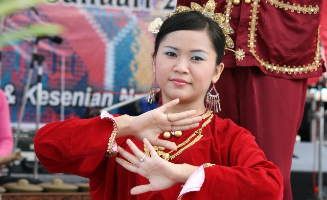
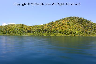
Imagine you are an adventurer in a role-playing game and given a quest that says, “Find the magic crystals on an extinct volcano mountain, where you will traverse through a dwarf forest with blood-red rivers, mossy rocks and flesh-eating plants.” This scene matches Mount Wullersdorf perfectly. Time for me to walk out of my virtual world and steps into the uncharted territory in Mount Wullersdorf as a real adventurer.

The reddish tea colour stream in Wullersdorf forest is the result of the tanning effect leached out from the thick dead leaves and debris that cover the heath forest floor. The water is acidic but safe to drink.

In terms of geology and vegetation, Mount Wullersdorf is special because it is:-

  1. An extinct volcano, a geological heritage of Sabah
  2. Heath forest with red river and rare plants
  3. A world of natural crystals in Sabah
From left: volcanic rocks, crystals and pitcher plant of Mount Wullersdorf

Itinerary

The following is the itinerary of climbing Mount Wullersdorf. It is a day trip with a hiking distance of 7 kilometres. You must book the tour in advance.
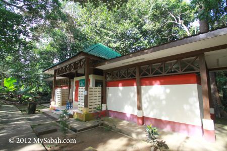
7:30am Gather at Dewan Kampung Balung Cocos (Tawau)
8:00am Depart to the Control Post (Sabah Forestry Department) of Wullersdorf, the starting point of the climb
8:30am Start climbing after registration and briefing
9:30am-10:00am Reach the first peak after 30-40 min (2 km)
11:00am-12:00pm Reach the second peak (Wullersdorf Peak) after 4 km. Rest and lunch on summit
1:00pm Hike back to the Control Post via shortcut (1 km for 40 min)
2:30pm End of tour

Walk-through

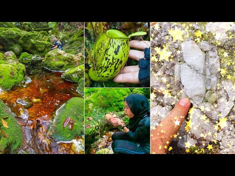
Are you ready for the epic quest adventurer? Or you can watch the 6-minute video below:

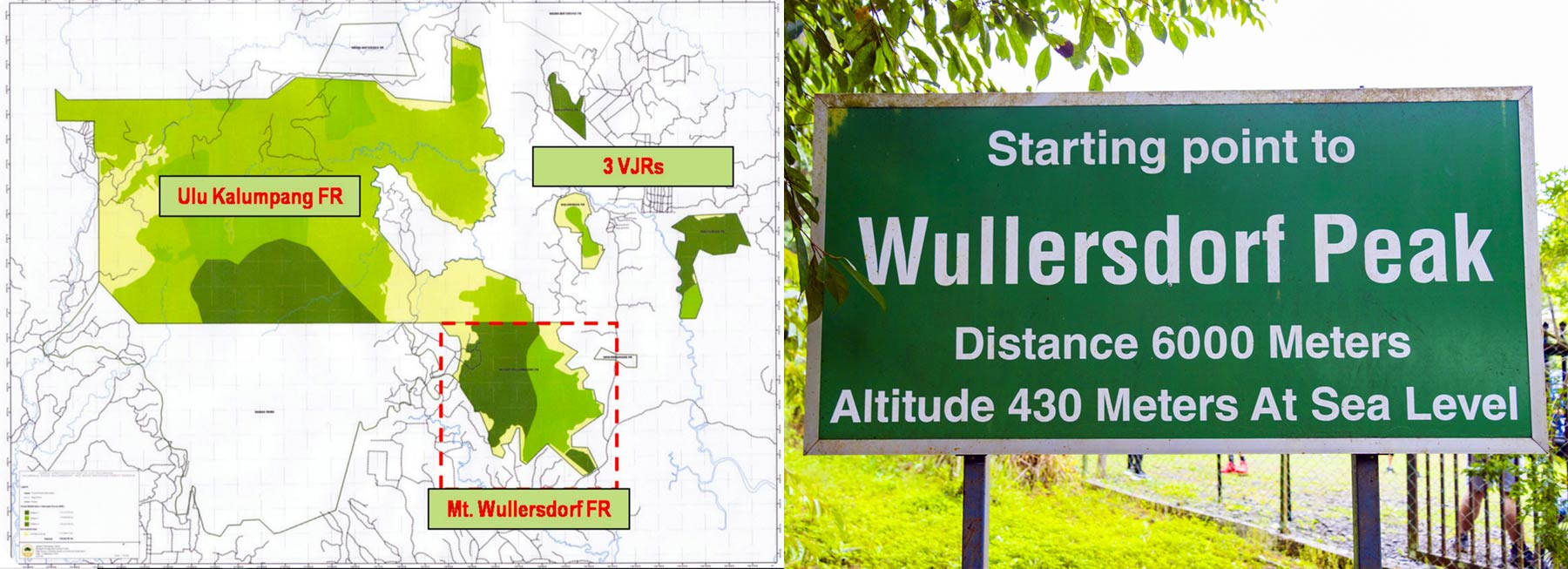
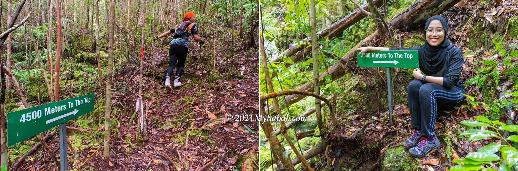
The height of Mount Wullersdorf is 430 metres (1,411 ft) above sea level. The one-way distance to the highest peak is 6 kilometres, which takes about 3 to 4 hours. There is a 1-kilometre shortcut from the peak back to the starting point, so in total it’s a 7-km loop trail.

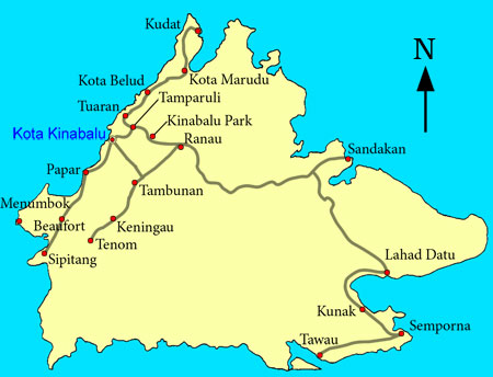
Going to the Starting Point

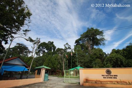
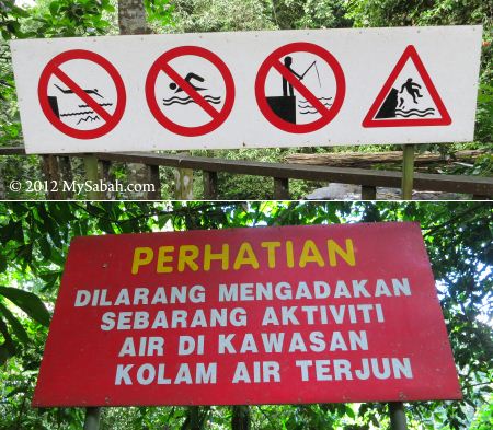
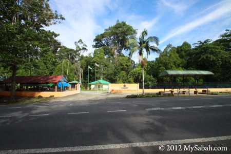
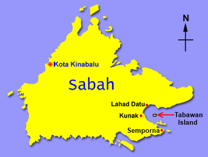
Mount Wullersdorf is located in a Class-1 (fully protected) forest in Kunak (Tawau Division). To enter the mountain, you need a permit from the Sabah Forestry Department. So I get a local agent who can get the permit and arrange the climbing trip for me. Just a few messages back and forth with the agent and I get the booking done. Easy.

Hop on the pick up truck that sent us to the starting point about 15 minutes away

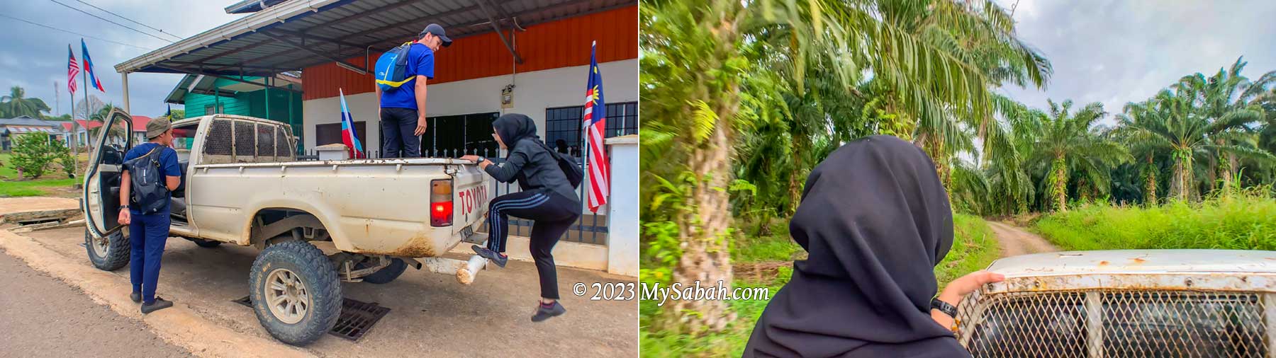
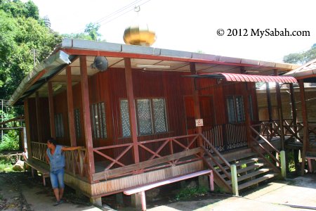
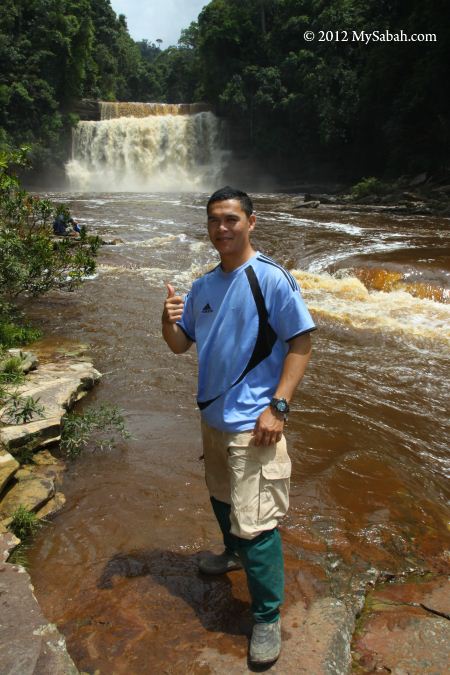
I meet my guides at Dewan Balung Cocos (Balung Cocos Village Community Hall) around 7:30am. Mr. Eady and Pakri are my guides, who live in this village. Also joining me are Mr. Aidil and Ms Zura, the hikers from Tawau. It’s drizzling in the morning. I’m concern about the gloomy weather but Pakri says that the red river is more beautiful when it has more water.

The Control Post of Mt. Wullersdorf Forest Reserve is the starting point of our climb to Wullersdorf Peak. Visitors need to register before the hike. You can be fined RM10,000 for illegal entry.

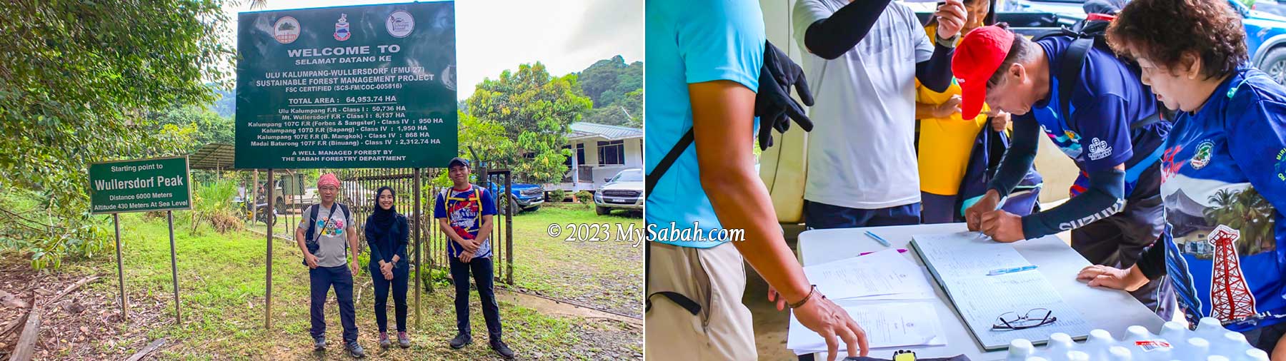
We hop on our pick-up truck to depart to the starting point of the climb. It’s a bumpy ride on a gravel road in an oil palm plantation. After 10 to 15 minutes, we reach the control post of Sabah Forestry Department. Besides us, there is team of 20 members from Lahad Datu Hash House guided by another agent, Uncle Mul.

About Wullersdorf

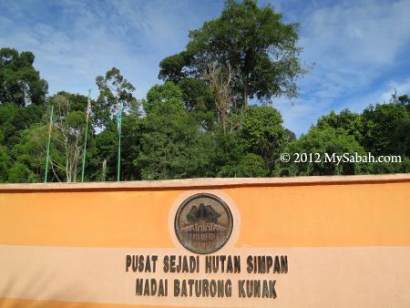
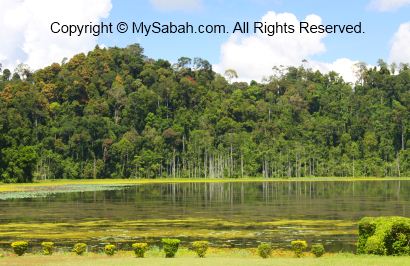
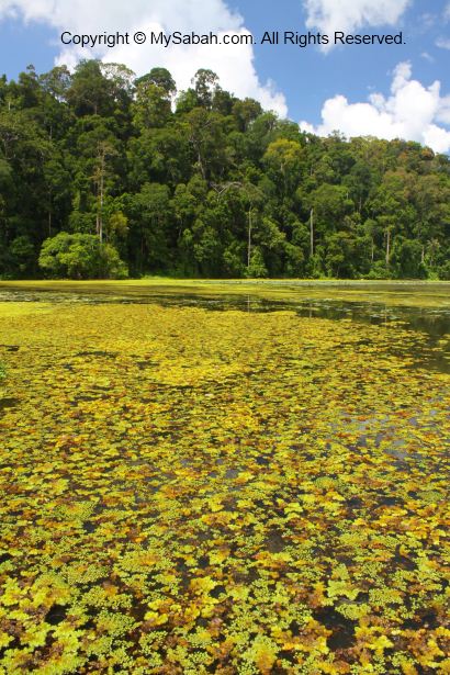
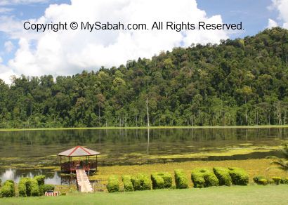
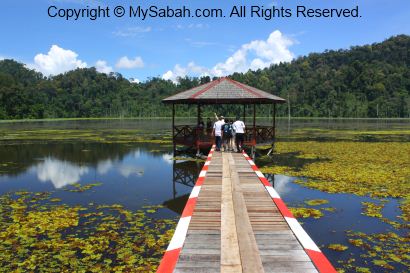
Mount Wullersdorf is part of Mount Wullersdorf Forest Reserve, which is 8,137 hectares in size. It’s linked with five other adjacent forest reserves to form a 64,953.74 Ha of Ulu Kalumpang-Wullersdorf Sustainable Forest Management (SFM) Project. The Class-1 Ulu Kalumpang Forest Reserve which covers an area of 50,736 hectares is the biggest forest reserve under this project. This SFM Project is certified by the Forest Stewardship Council® (FSC) as a well-managed forest.

Mount Wullersdorf Forest Reserve is a fully protected Class-1 forest. Government and WWF is trying to restore the degraded and fragmented forest to re-establish forest connectivity between Mt. Wullersdorf and Ulu Kalumpang Forest Reserves, so wildlife can move freely in the connected forests for more resources.

These forest reserves are also the habitat of threatened animals in Borneo such as orangutan, Bornean Pygmy Elephant, Bornean Sun Bear and Bornean Gibbon. Iconic birds like hornbills and Crested Fireback also nest there. Under good conservation, the mountains also protect the headwaters and water catchment areas that are source of water for Tawau and Kunak Districts. The rangers there also mention the sighting of a golden rat (I assume it’s a Malayan weasel or Yellow Throated Marten), and the tracks of a baby Sumatran rhino many years ago. Sadly this rhino species is declared extinct in the wild in Malaysia in 2015.

0 to 2 KM

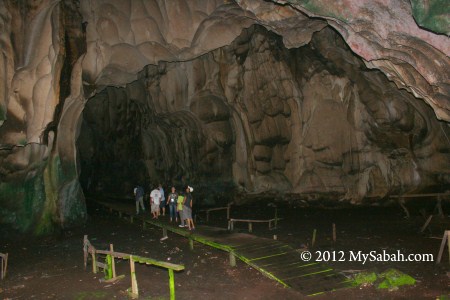
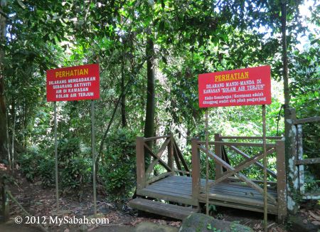
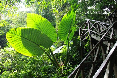
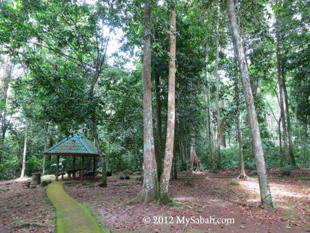
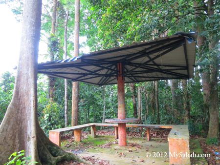
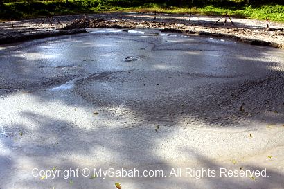
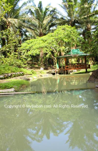
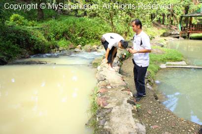
After registration and briefing, we start to hike at 8:30am. FYI, you can use the toilet at the control post before and after the climb. The first 250 metres is a walk on flat ground covered with tall grasses and shrubs. About 10 minutes later we reach a manmade pond, which marks the start of the loop trail at foothill.

The first 250 metres of the hike. We started walking at 8:30am.

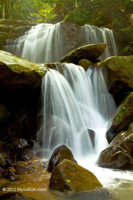
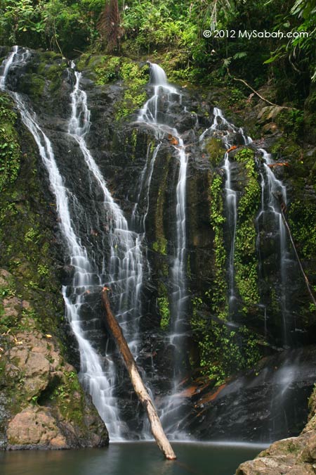
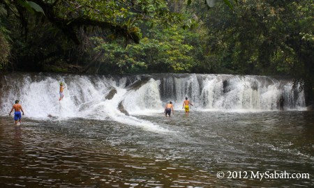
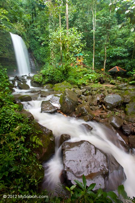
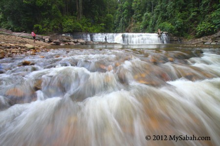
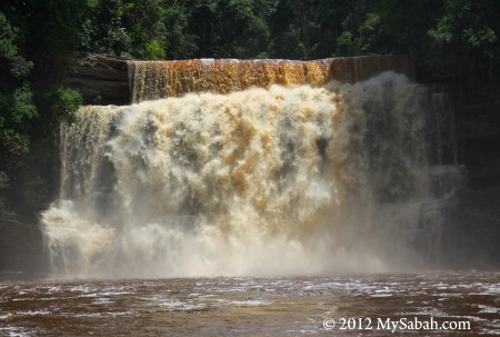
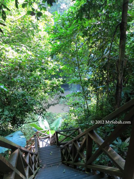
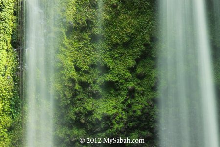
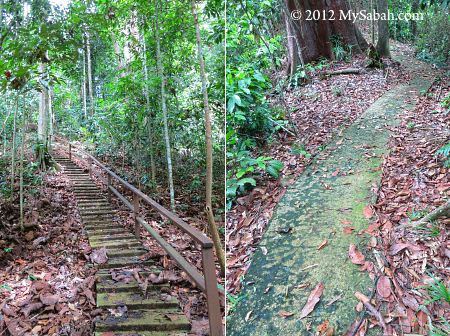
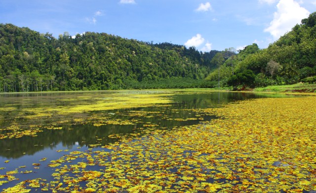
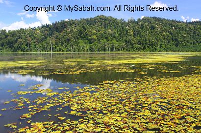
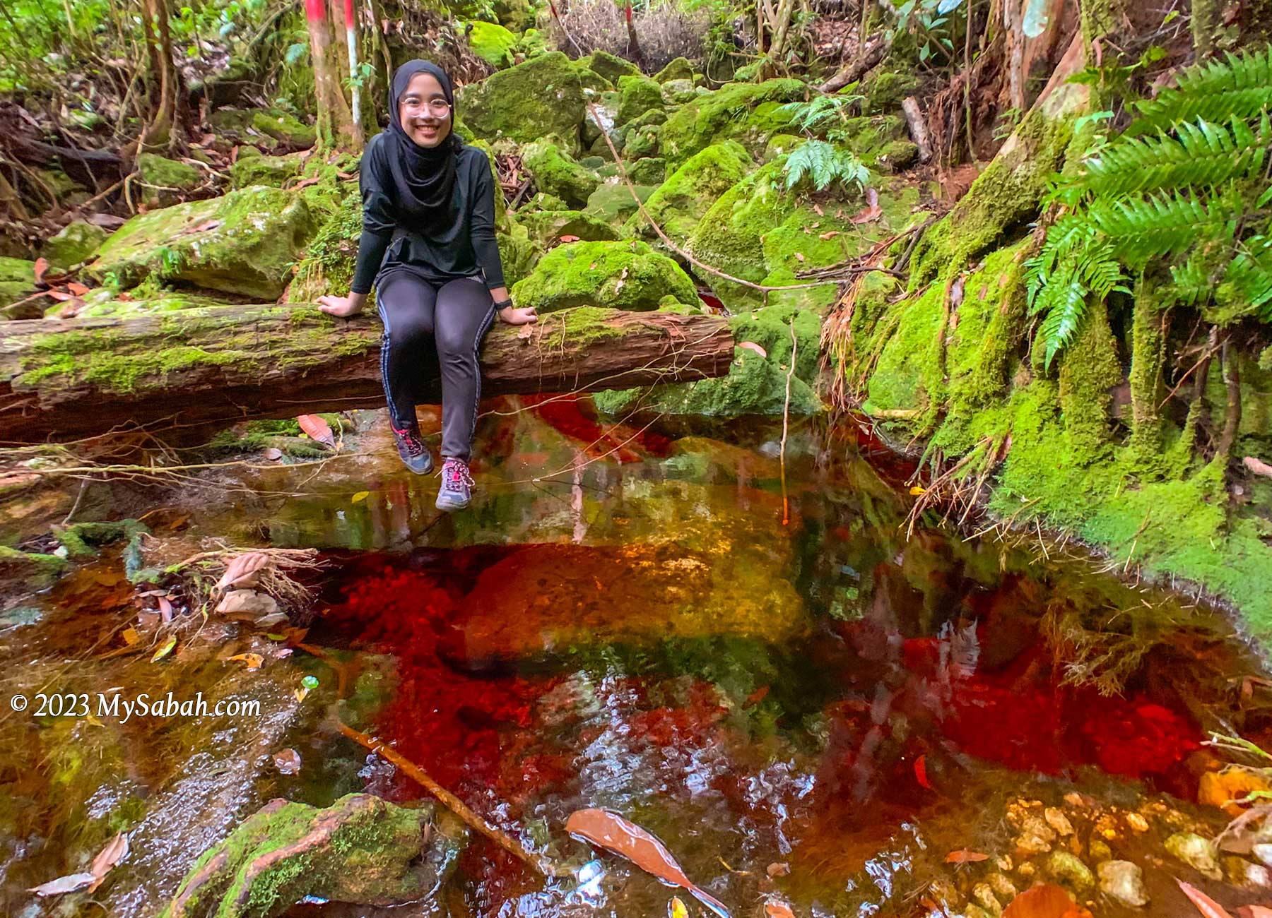
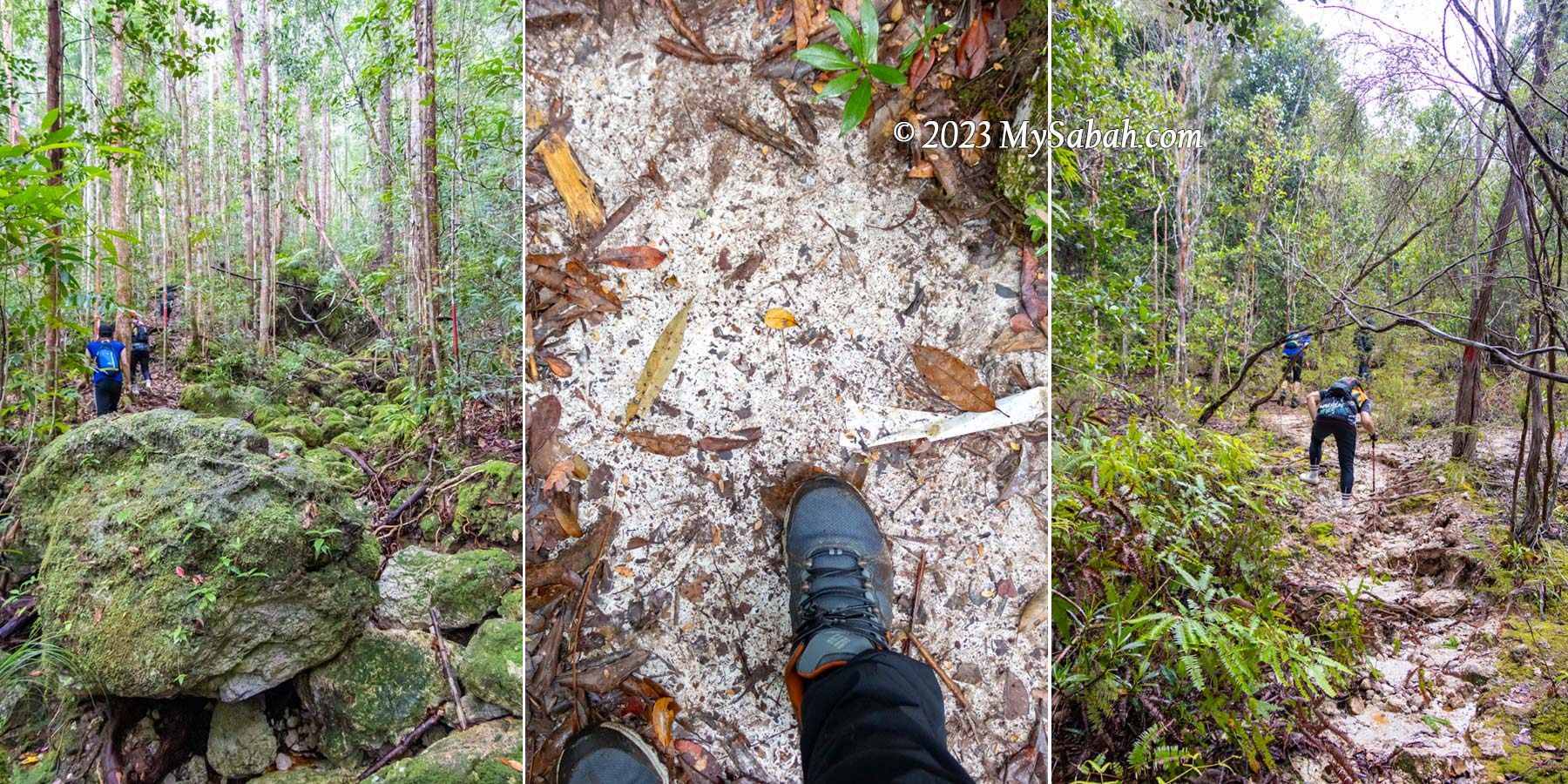
The trees are tall in the beginning and their dense canopy blocks the rain. I see a green path ahead. It’s a rugged riverbed trail littered with green mossy rocks, with red-colored stream flowing between them. The red water and green rock form a very striking contrast, the scenery is out of this world. No wonder they call it the “Lost World of Balung“.

The green mossy rocks and red streams form beautiful contrast along the trail

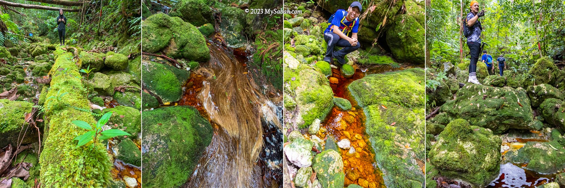
We climb up and down on these mossy rocks to ascend. Some of the rocks are slippery. It will help a lot if your hiking shoes have good grip, because most of the time we walk on river rocks. Overall, the trail is not really steep, but climbing hundred of rocks will slow you down. I’m the slowest one as I’m already too busy taking pictures in the first two kilometres.

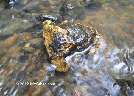
Red River (Local Name: Sungai Merah)

This side of Mount Wullersdorf is dominated by heath forest, which grows on sandy soil with poor nutrients. With infertile environment, plants in heath forest are usually rich in tannins as a defense, which make them toxic or indigestible to plant eaters.

Over 50% of the trail is moving up along a river that is full of mossy boulders with tea-color stream flowing between them.

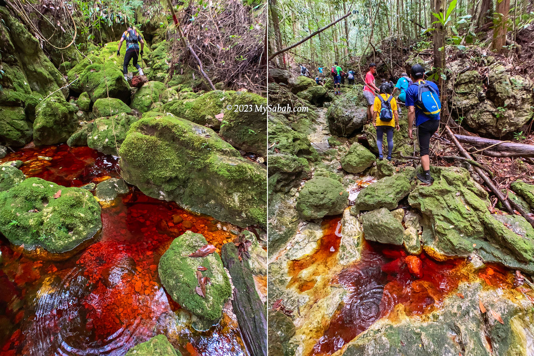
However, tannin is hard to break down. When water drains through thick dead leaves and debris that cover the forest floor, the tannins and humic acids leach through the porous sandy substrate, finding their way into streams, and dye the water with brownish tea color.

Foaming on the streams is common, due to the saponin and humic composition in the water

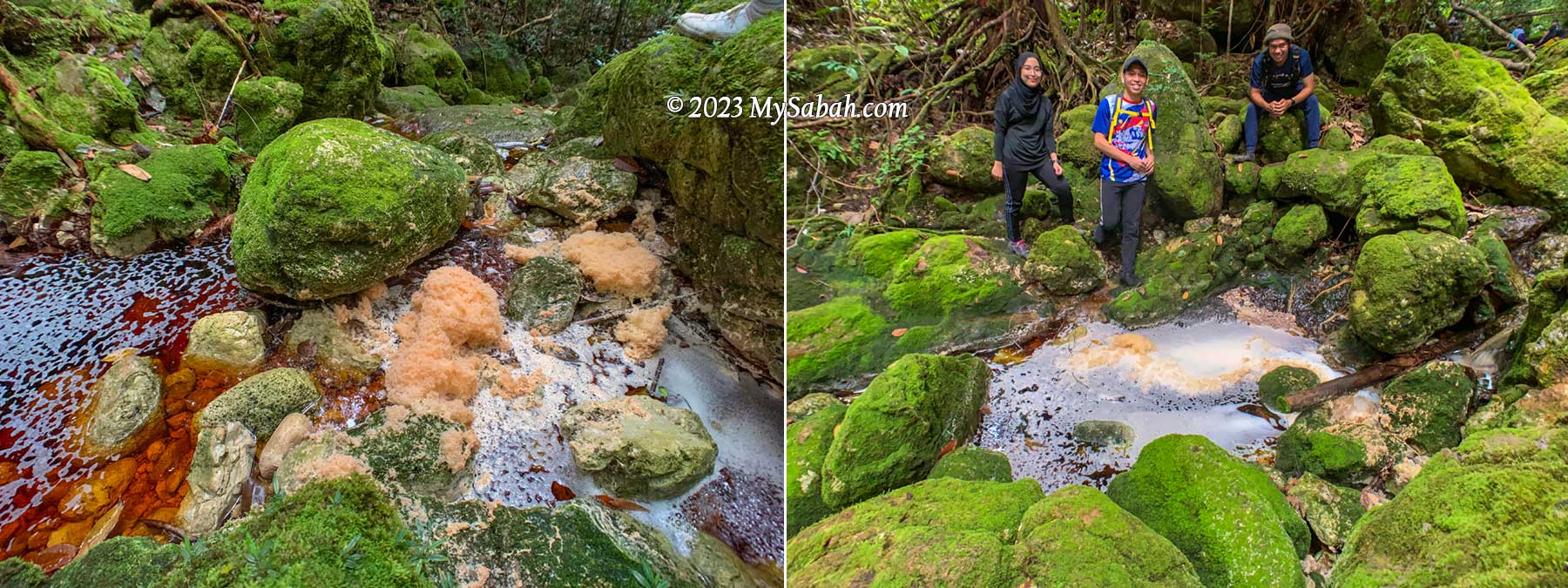
Such tea-colored water is also well-known for its foaming nature, probably due to the saponin and humic composition originated from the peat of heath forest. The water is a bit acidic but safe to drink after boiling.

Zura blowing the foam of red river for fun, as if she is in a bubble bath.

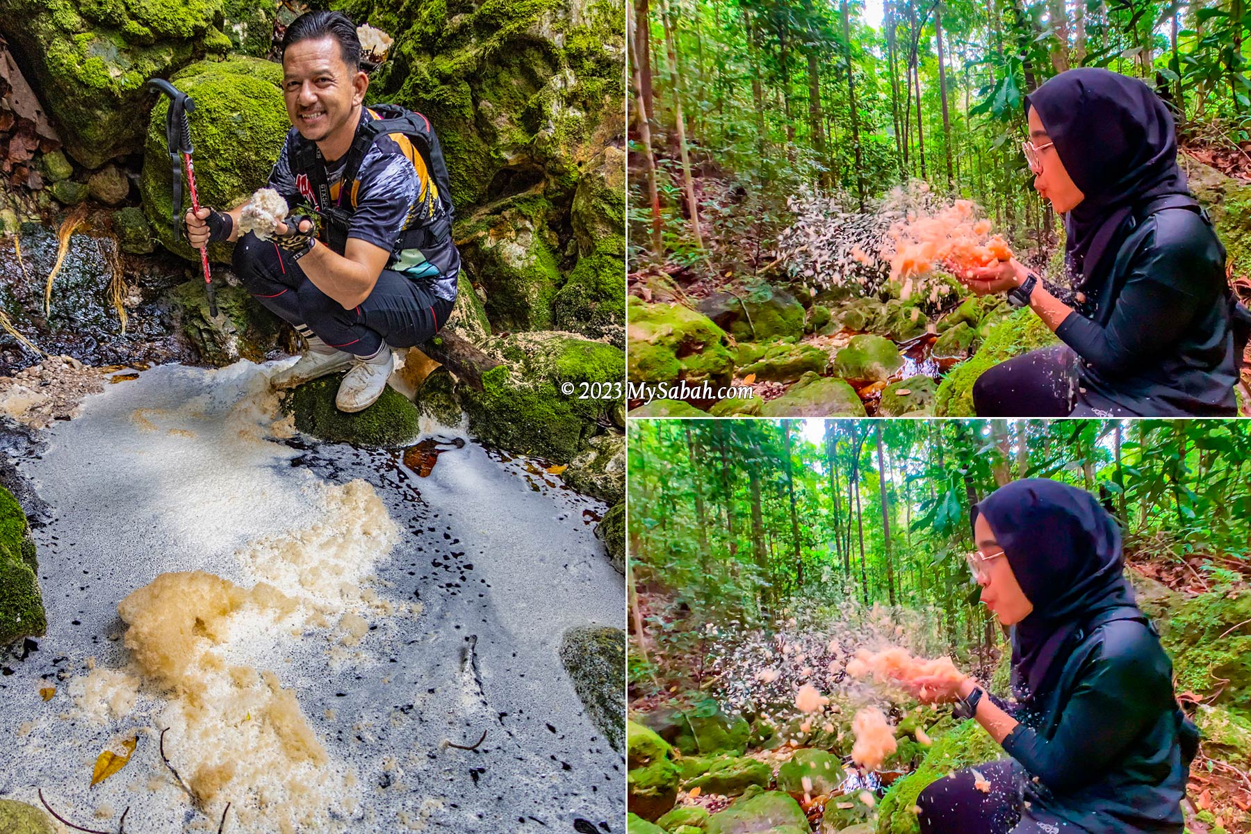
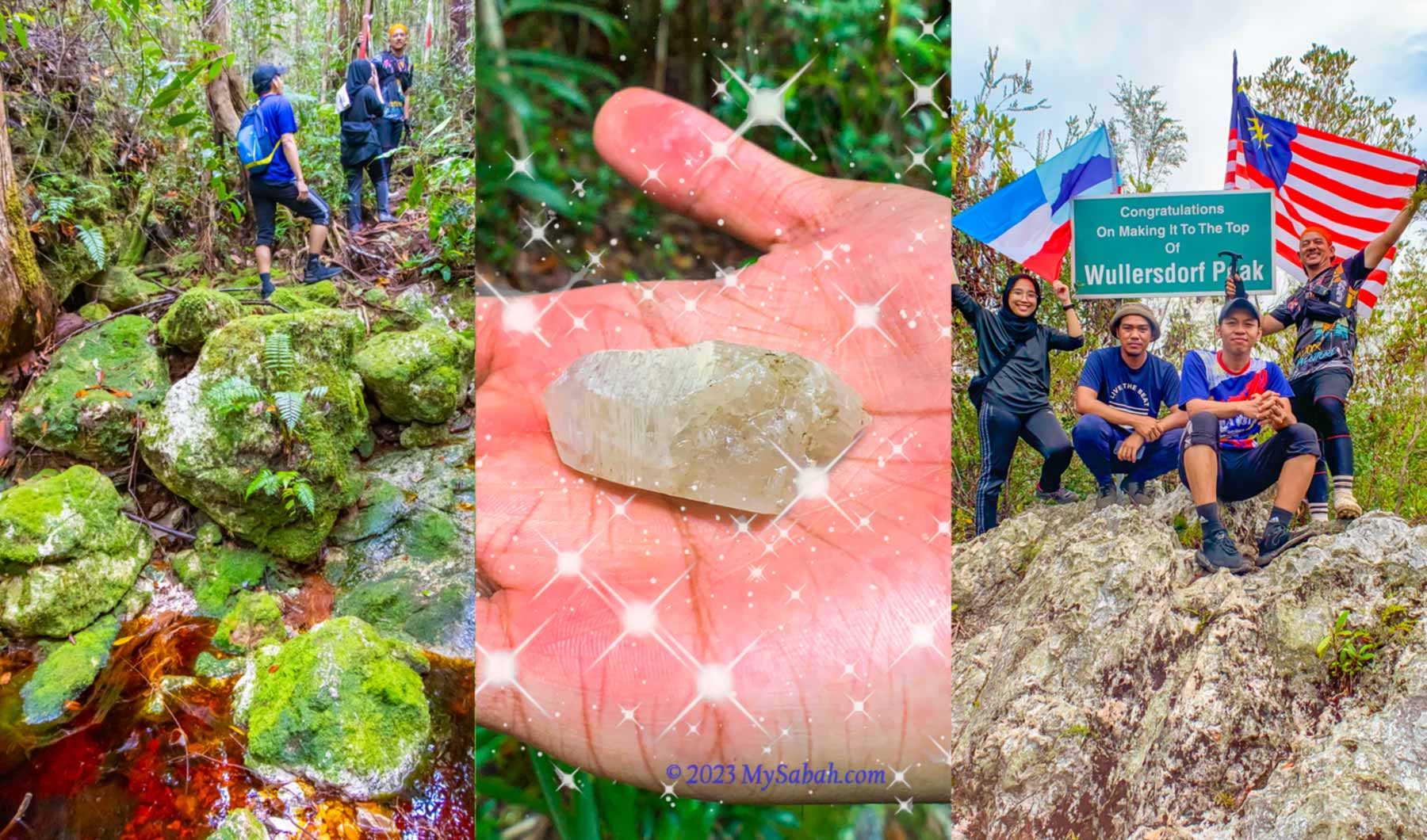
We are excited to see a few river rocks that have cracks with crystals inside them. The guides say there are more crystals on Wullersdorf Peak.

Crystals embedded in a river rock

First Peak

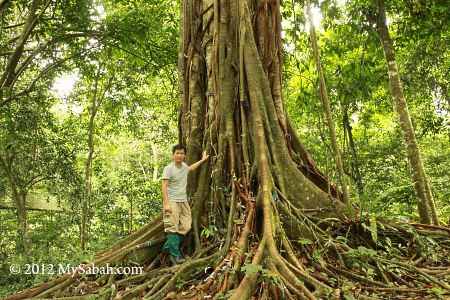
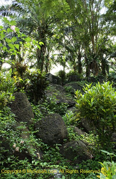
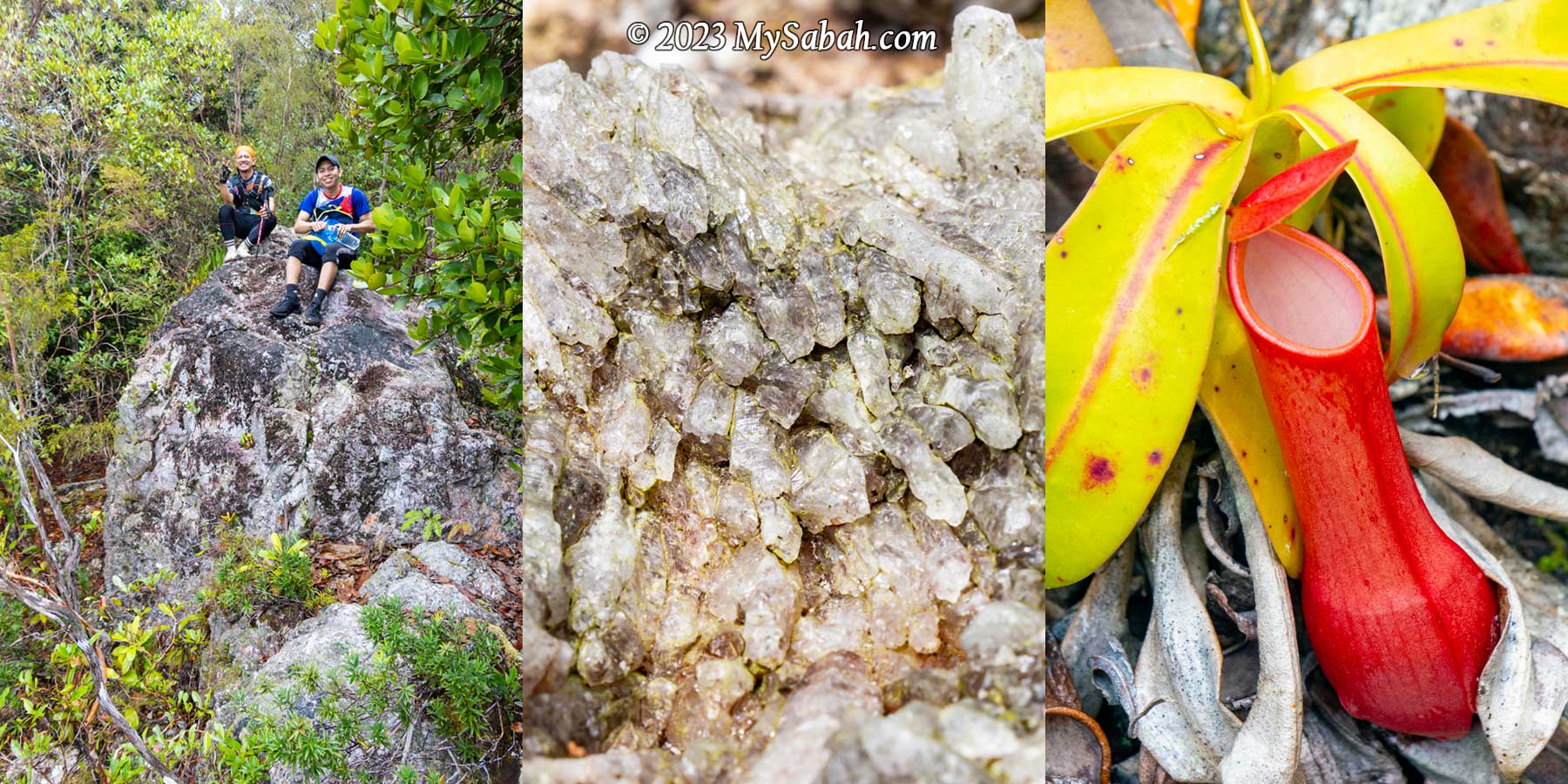
There are two peaks to conquer in our climb. The first peak is only 2 km away. When the peak is getting near, we move away from the river trail and walk up a slope with mild steepness. I notice there are some whitish volcanic rocks on the higher ground. We arrive the first peak at 10am.

An Ancient Volcano

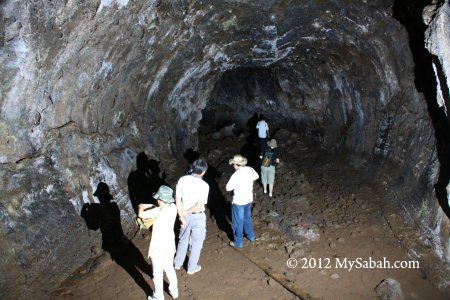
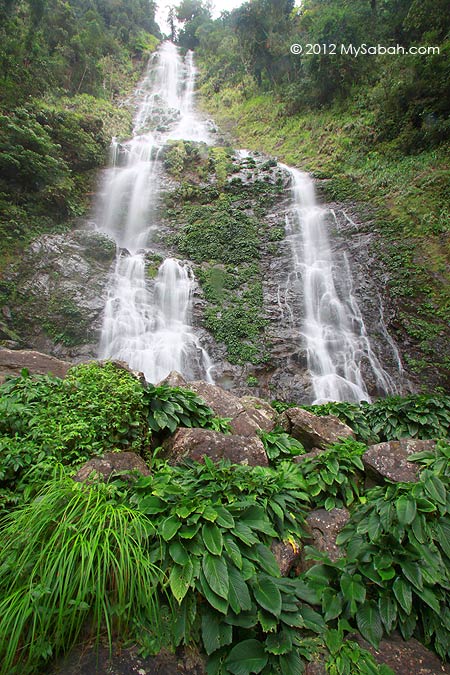
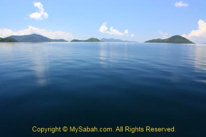
Mount Wullersdorf is an extinct volcano. Such volcanic landscape is only found in Southeastern part of Sabah, where volcanic eruption occurred between 1 to 9 million years ago. Even today we can find the remnants of volcanism in Sabah such as Columnar Basalt at Balung River (Tawau) and Bohey Dulang Island in Semporna.

A tree full of pitcher plant before the first peak. You can easily tell that they are Nepenthes reinwardtiana by the two dots on their inner walls.

From Miocene to late Pleistocene, a series of volcanisms creates the major mountainous backbone of the Tawau mountains, which include Mount Wullersdorf, Mount Maria, and Bombalai Hill. The earlier volcanic rocks of andesitic and dacitic composition formed a line of composite volcanoes from Mount Magdalena to Mount Wullersdorf and Mount Pock at Semporna District.

Picture of the first Wullersdorf Peak and a barkless tree nearby

Most climbers wouldn’t realise that Mount Wullersdorf is an extinct volcano since most of the traces and features of volcanism are covered up by dense forest nowadays. I wonder how many people know there are at least 10 extinct volcanoes in Tawau.

Two variants of Nepenthes ampullaria near the peak of Wullersdorf. These cute pitcher plants have wide open mouth to collect leaf debris as nutrients.

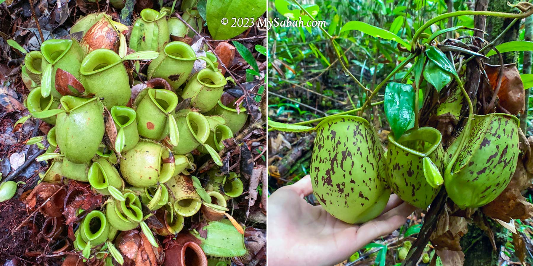
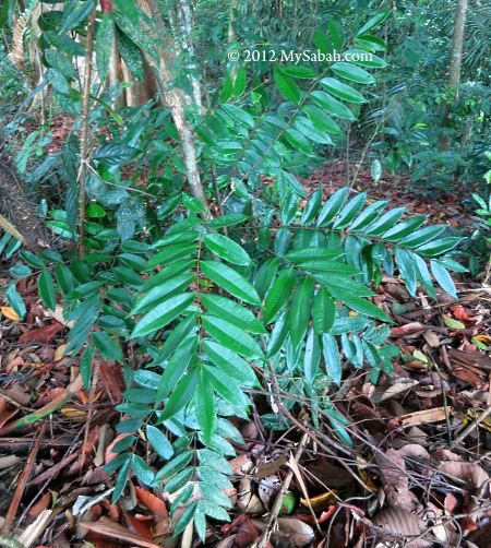
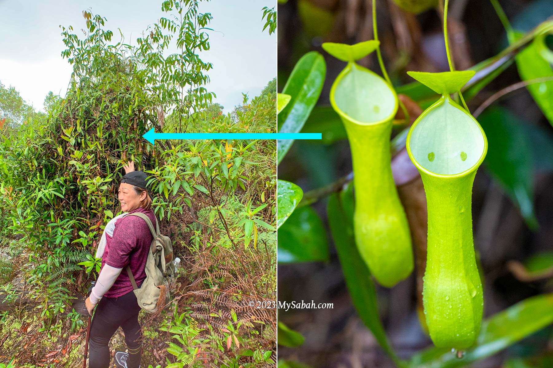
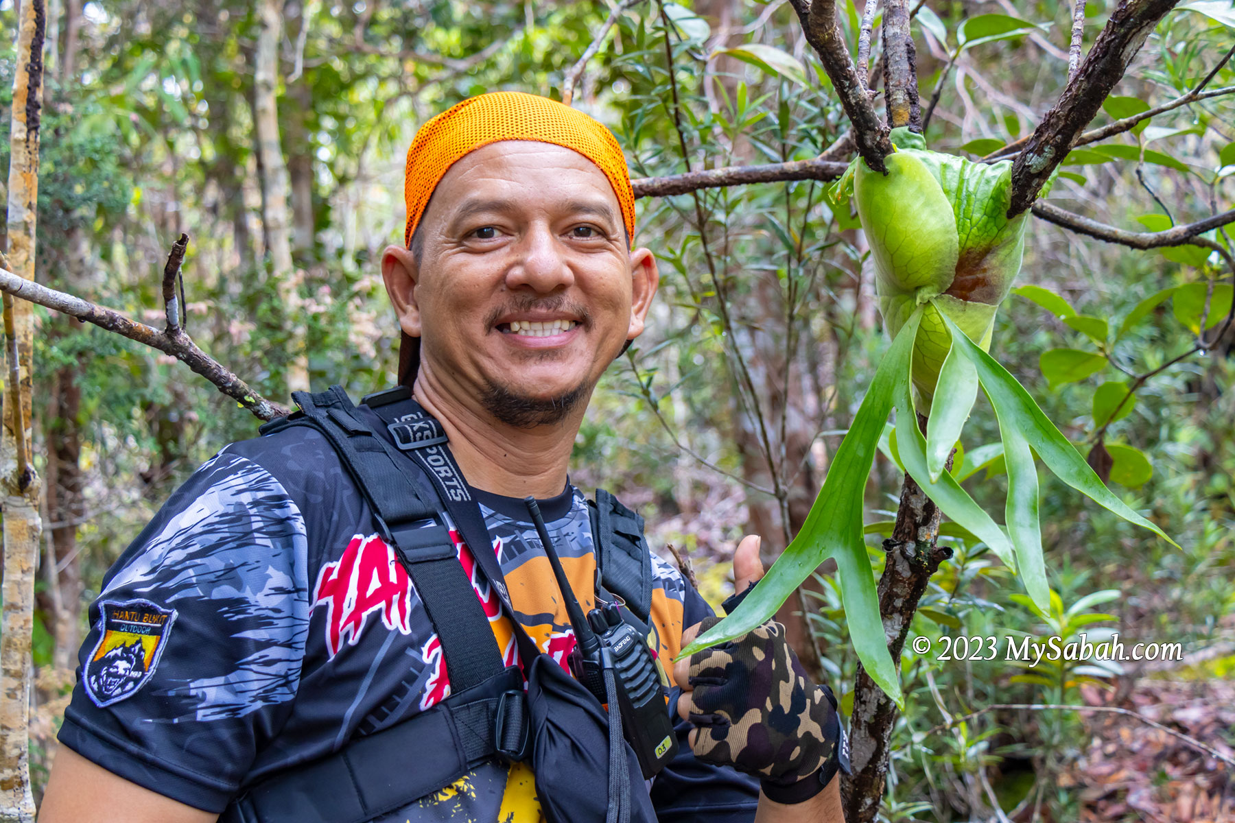
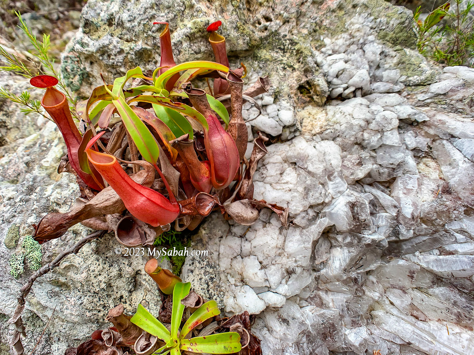
Anyway, it’s easy to spot many pitcher plants around the first peak. Nepenthes ampullaria likes to grow in damp area under trees, where it can collect leaf debris as food with its wide open mouth. Nepenthes reinwardtiana (green variant) is another common pitcher plant on this mountain.

2rd to 6th KM

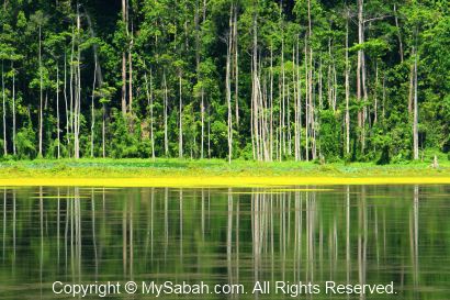
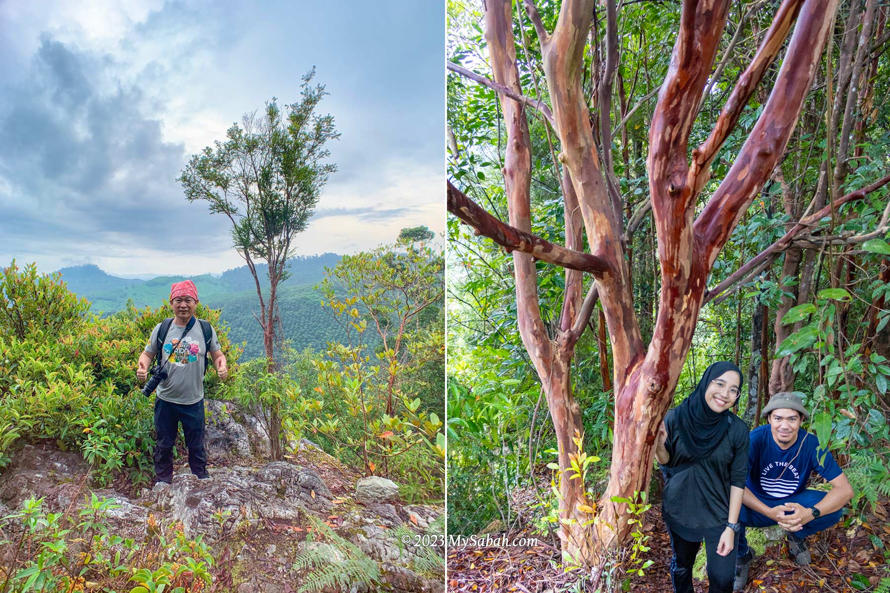
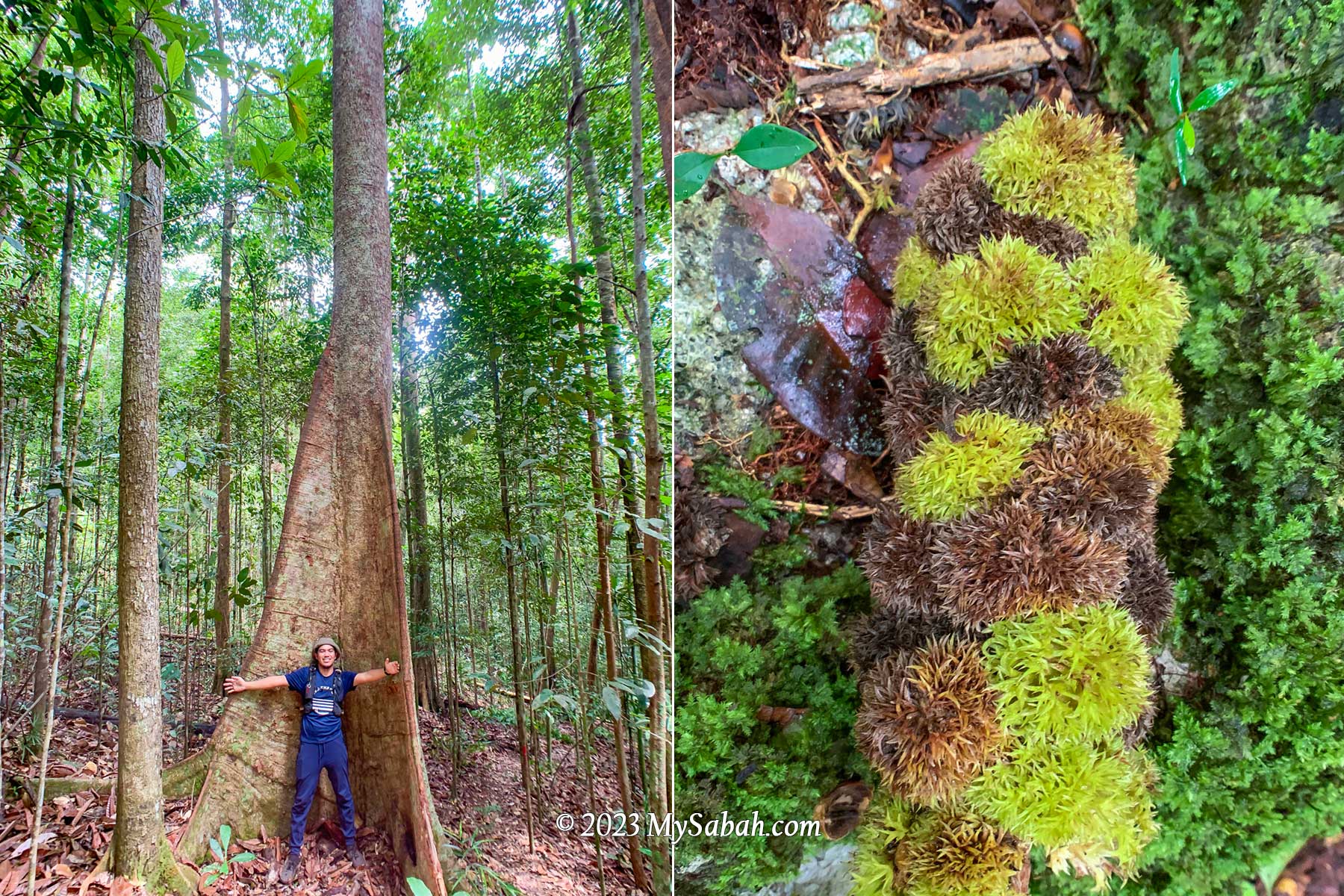
After a short break on the first peak we proceed to the second peak about 4 km away. The trail between the first and second peak is mainly jungle trail with more even surface, which I enjoy more. The peak area is heath forest, a forest type that covers only 2 to 3% of Borneo island, the home to the largest heath forests in Southeast Asia.

Milestone signages that tell us how many metres we have walked. The words are misleading because they make it sounds like a count down, which is not.

Heath Forest (Kerangas)

In contrast to the typical Borneo rainforest with towering trees, heath forests are characterized by shorter, pole-sized trees that are mostly lower than 20 metres with a stem diameter of 10-20 cm. The short-statured trees are a result of inherently infertile, acidic, white sandy soils.

Tropical heath forest of Wullersdorf forest. The soil is sandy and infertile so the vegetation is thinner.

The Iban people of Sarawak call heath forests as “Kerangas”, which means “forest with underlying soils that cannot grow rice”. Only specialized plants can survive such soils with poor nutrients. Though the plant diversity of heath forest is lower than rainforest, it has higher numbers of rare and endemic tree species with high conservation value.

Rhododendron flowers and an unknown fruit on the peak of Wullersdorf

Borneo has the widest variety of heath forest in Asia. Lowland heath forests (below 1,000 metres above sea level) like Wullersdorf are found inland on sandstone plateaus and cuesta formations on the hillsides.

Last 500 metres to the peak of Wullersdorf. The trees become smaller as we moved up.

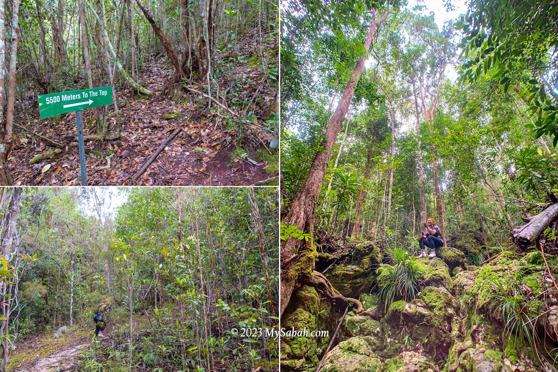
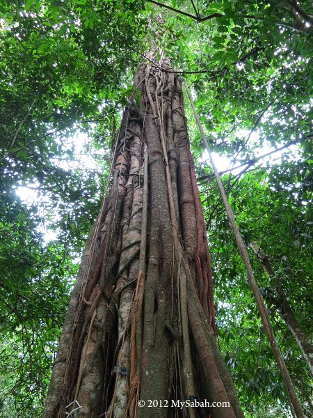
The surrounding is lit because the small-crowned trees there don’t obstruct much sunlight. The higher the ground, the smaller the trees, to almost shrub-like. We walk in dense thickets of tidy straight bole stem trees with stunted appearance. The forest floor is criss-crossed by tangled roots, making the ground soft to walk on.

Approaching the peak of Wullersdorf, which is dominated by heath forest (kerangas)

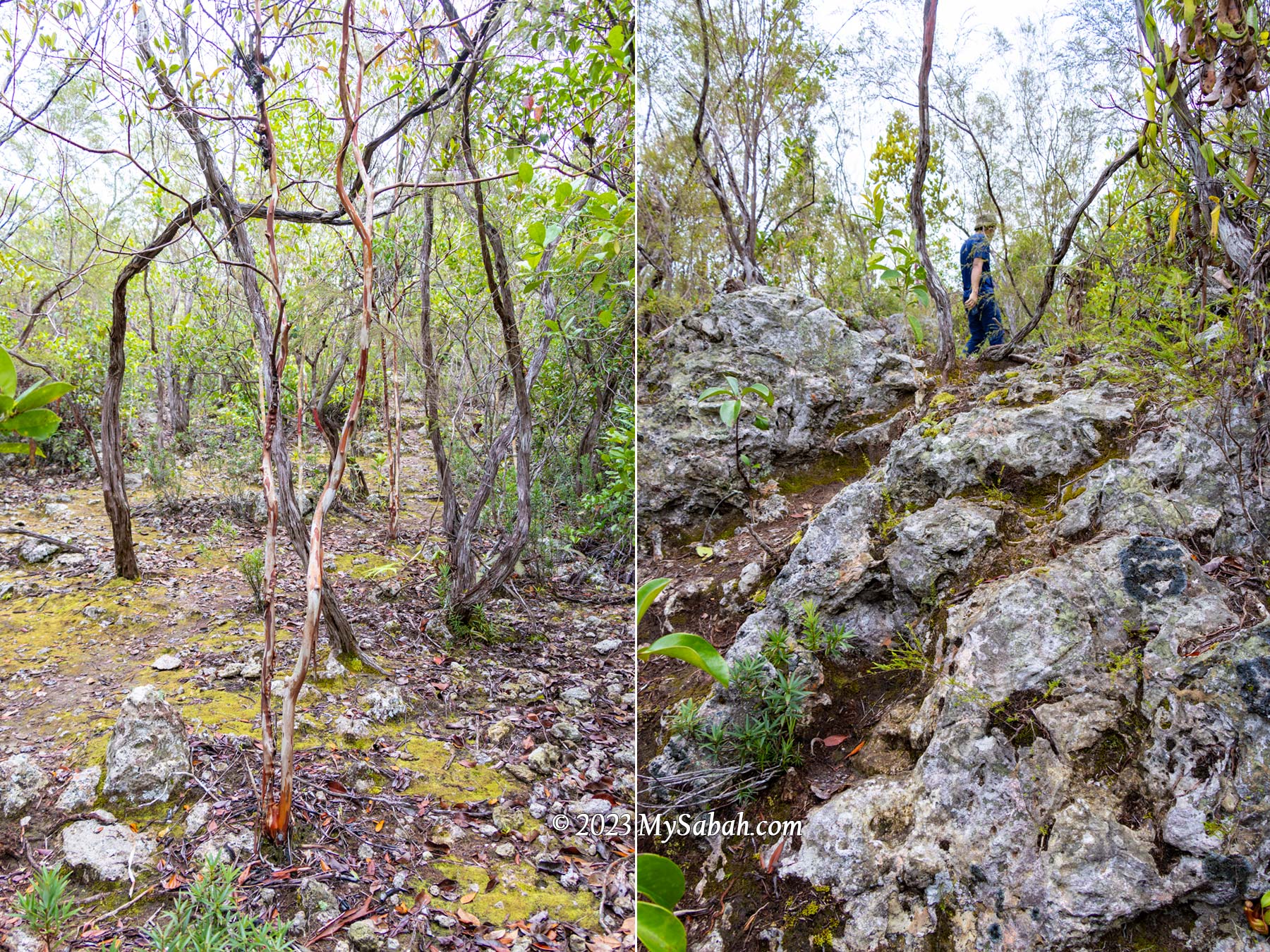
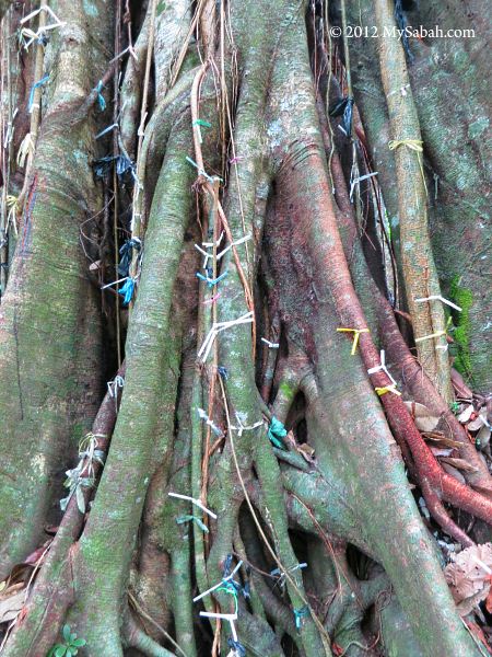
One of the special trees we see is Tristaniopsis trees, easy to identify by its orange-brown, smooth and shiny trunk, with scrolls of bark that spontaneously peel-off, hanging as untidy bunches along the trunk and forming a heap at the base of the tree. The forest is quiet. We hear a few hornbills flying over the canopy.

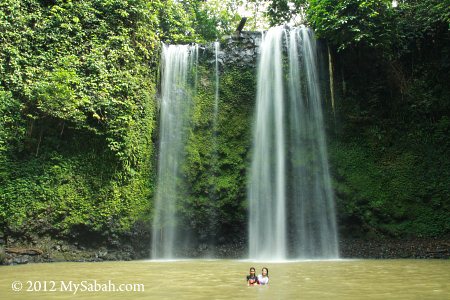
Wullersdorf Peak (Height: 430 Metres)

As we are approaching the second peak, the trees getting sparse, more sandy soil is exposed and the ground is more rocky. Finally we reach Wullersdorf Peak by noon. It’s a rocky peak surrounded by loud cicada calls and greyish volcanic rocks.

We reached the Wullersdorf Peak at noon. The height of Mount Wullersdorf is about 430 metres (1,411 ft) above sea level.

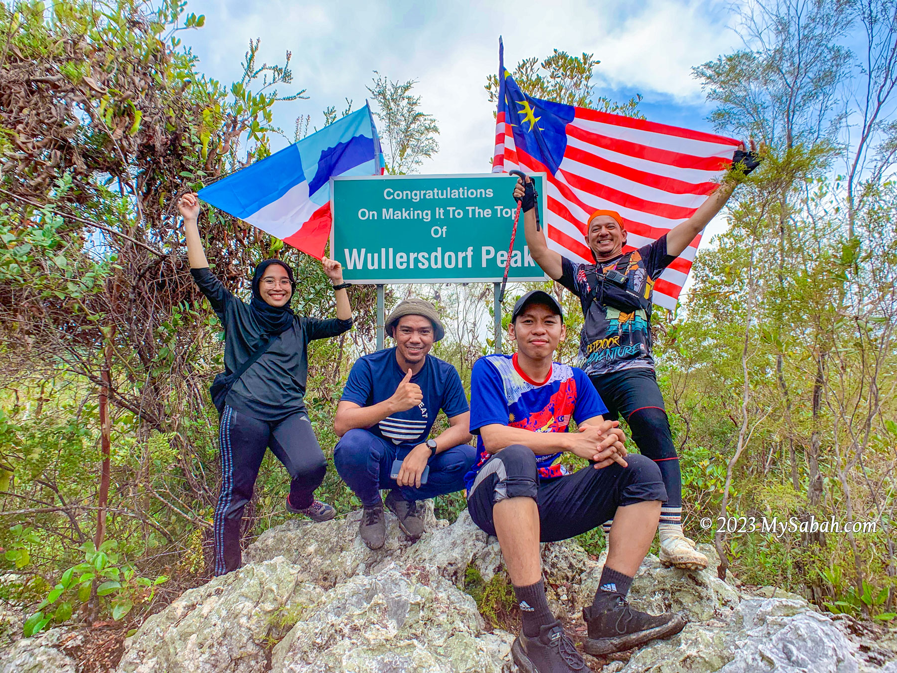
We spend on summit to have our lunch. I decide to explore around the peak as the understory of heath forest is often filled with remarkable plant species.

Pitcher Plant and Ant Plant

Forests thrive on two primary nutrients: nitrogen and phosphorus, what the kerangas is lack of. Under nutrient-deficient environment, carnivorous pitcher plants survive by trapping and digesting insects for additional nutrition.

Different species of pitcher plant on Wullersdorf Peak. From the left: Nepenthes reinwardtiana (red variant), Nepenthes veitchii, Nepenthes ampullaria and Nepenthes gracilis

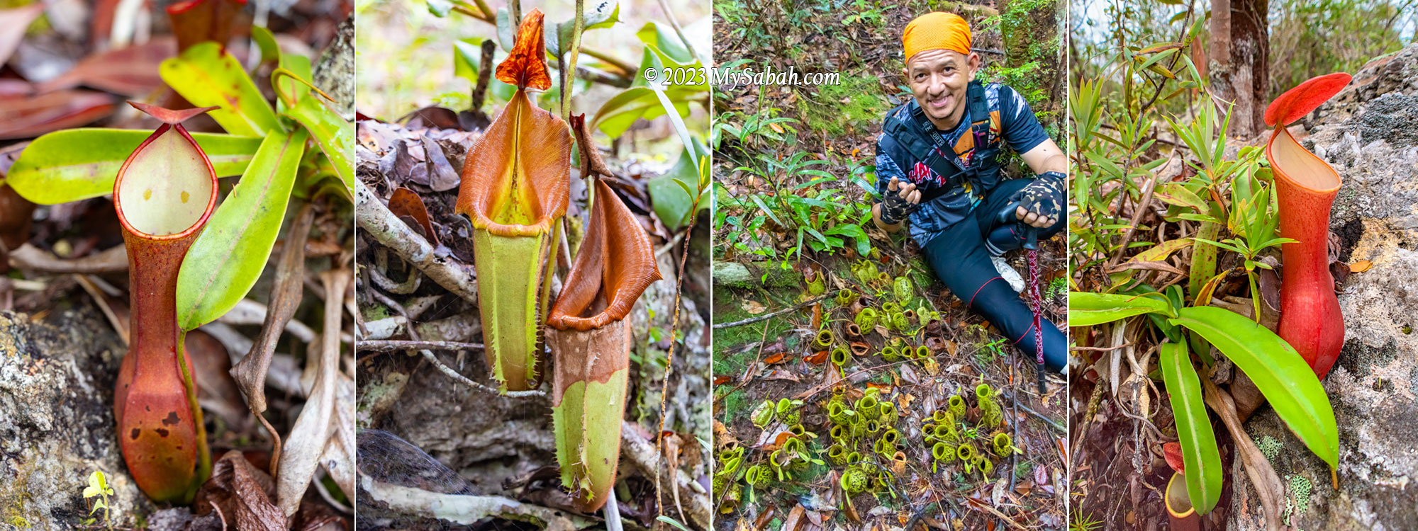
Uncle Mul told me that there are seven species of pitcher plant in Wullersdorf. I found Nepenthes ampullaria, Nepenthes reinwardtiana (red and green variants) and Nepenthes veitchii (endemic to Borneo).

Dischidia, aka Ant Plant. The pouch-like things are the modified leaves that are hollow inside for ants to nest, so the plant can absorb their waste as nutrients. This is a symbiotic relationship between ants and plant.

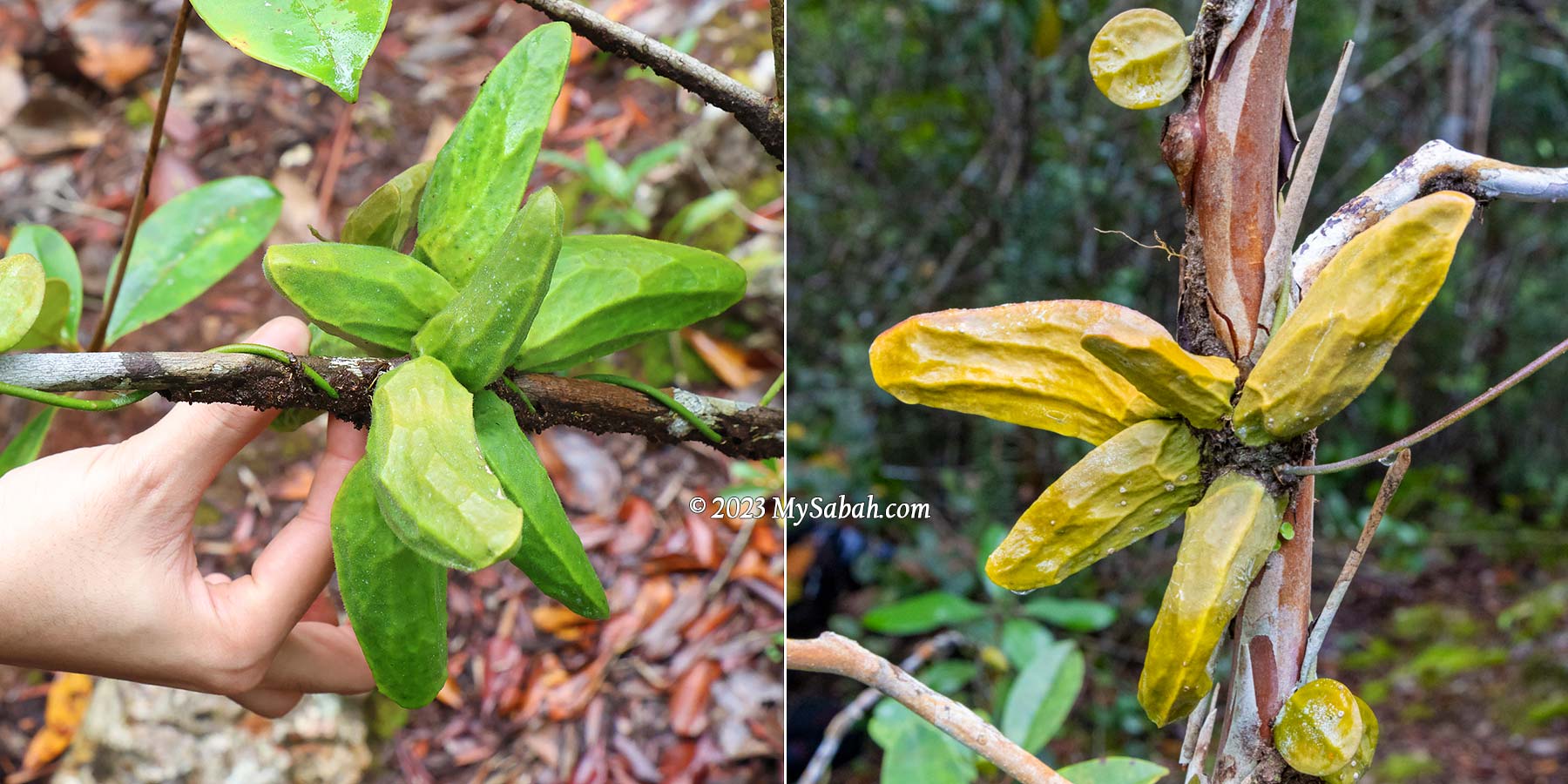
Instead of preying on insects, ant-plants choose to work with insects and build a symbiotic relationship with ants. I find a few green and yellow epiphytic ant-plants (Dischidia major) twine around the branches of trees. These ant-plants possess pouch-like modified leaves with hollow inside that acts as a shelter for ants. In exchange for the accommodation, the ants provide the plants with nitrogen-rich debris and feces.

Staghorn ferns of the peak of Wullersdorf Peak. It’s known as Tanduk Rusa (means Deer’s antler), an expensive ornamental plant. Pakri says it’s his first time seeing this fern in Wullersdorf.

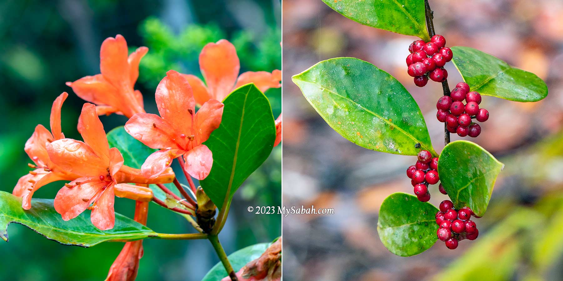
Wild staghorn ferns and rhododendron flowers are my other favourite sighting in this kerangas garden. I’m sure there are more to see if I stay longer.

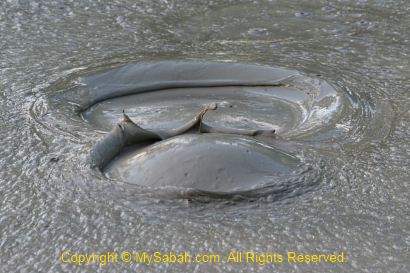
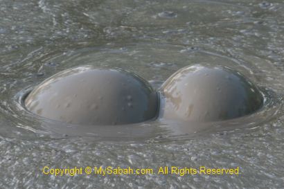
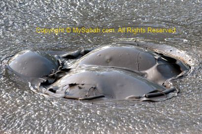
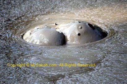
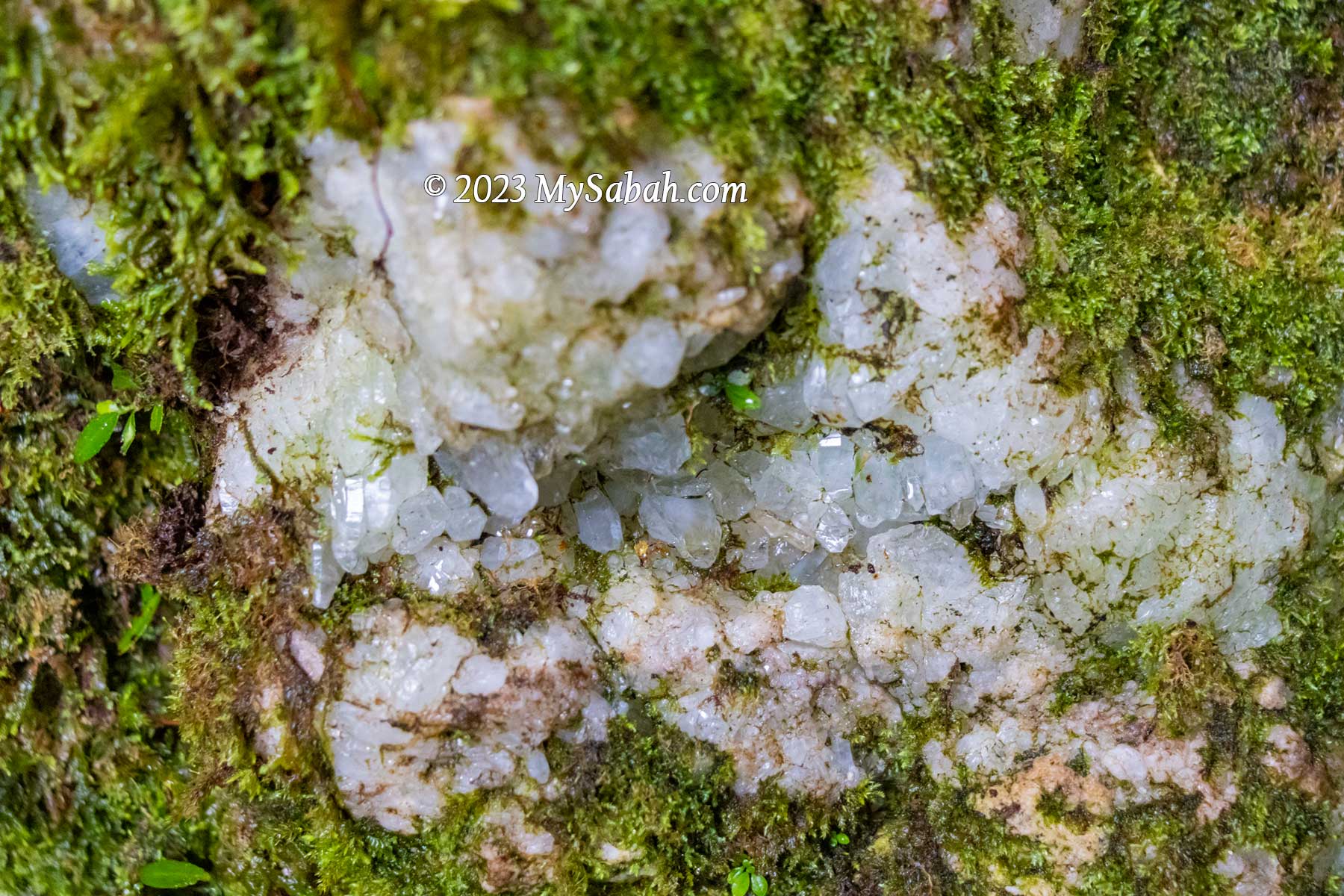
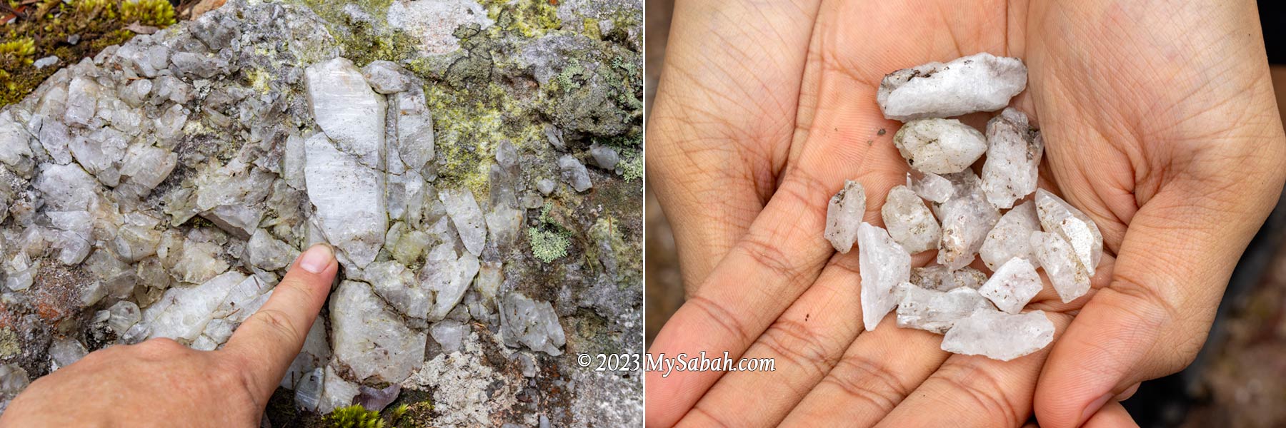
Crystals and Gold of Wullersdorf

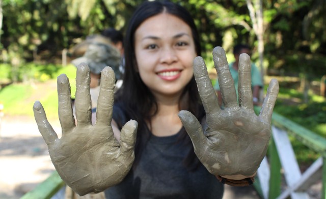
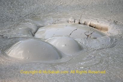
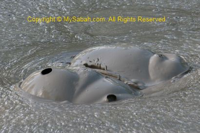
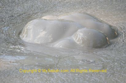
The most fascinating feature of Wullersdorf are the crystal rocks, which are abundant on the peak. Quite a number of rocks there are embedded with translucent white and pinkish crystals of different shapes and sizes. I also find many crystal fragments on the ground. I never see anything like this in other places of Sabah.

Pitcher plant growing on a crystal rock

Some believe that crystals have healing powers and able to boost your mood. I don’t know if it’s true. But if you give me crystals, I’ll be in good mood. Don’t worry. I only photograph them and didn’t take any.

Big chunks of crystals on the peak. One has heart shape, some are pink colour and some covered by lichen.

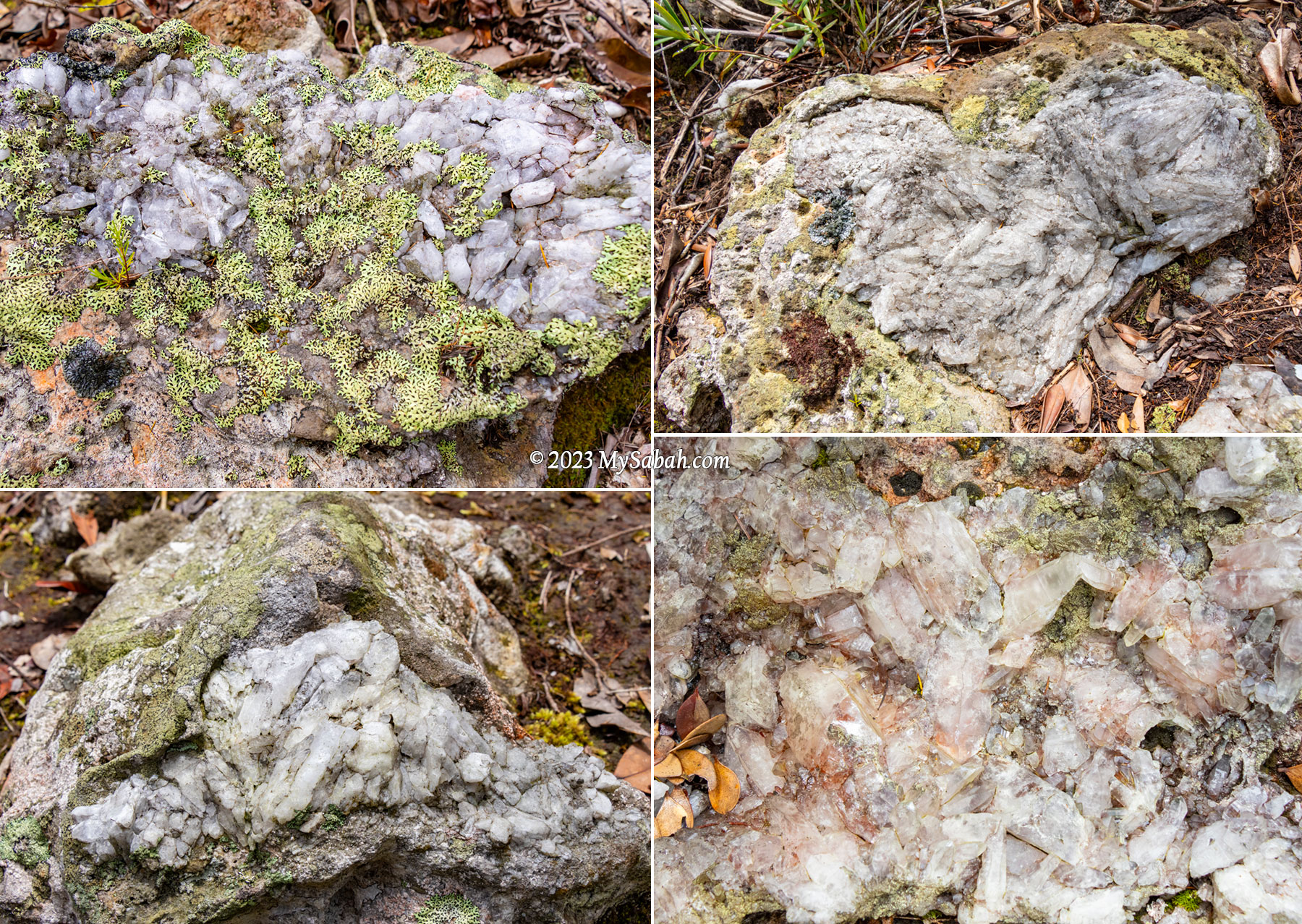
In nature, crystal can form when magma cools and hardens. This glittering beauty is another evidence that proves Mount Wullersdorf was used to be a volcano. Scientists say volcanic crystals is a time capsule of eruption history. Hope we will learn more about this geotourism destination from its crystals.

Crystals are everywhere on Wullersdorf Peak. I took many pictures but didn’t bring home any crystal.

Wait, Wullersdorf has another fabulous mineral, GOLD. It’s estimated that about 30 tons of gold and 19 tons of silver are buried under a parcel of land about 948 hectares in the Mount Wullersdorf area. Well, we better don’t create another disaster like Mamut copper mine.

Return to Starting Point

After taking zillion of photos, I leave Wullersdorf Peak reluctantly. It’s a relief that we don’t need to turn back to the starting point using the same 6-km trail. We use the 1-kilometre shortcut to return to the starting point.

Left: a tree with big buttress at the foothill. Right: thorny chestnuts strewn on the forest floor

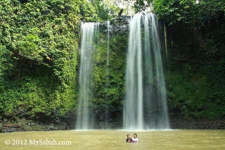
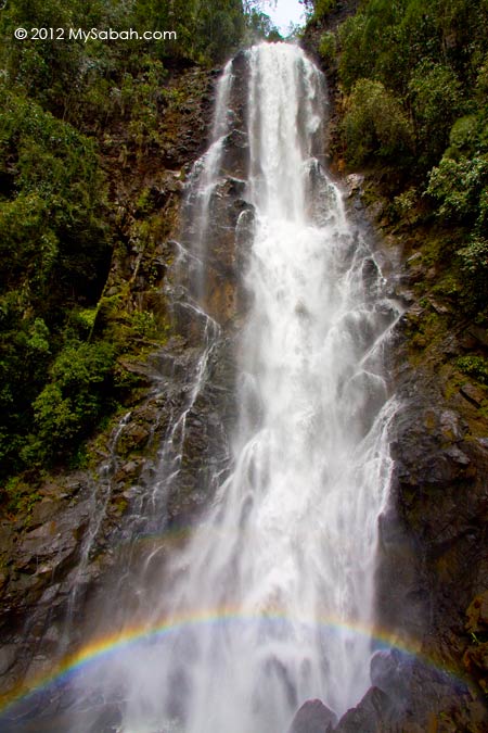
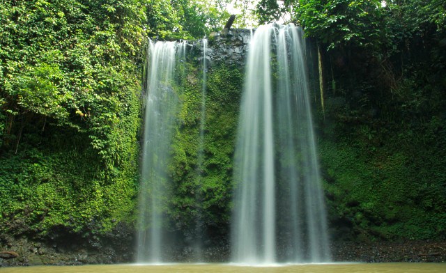
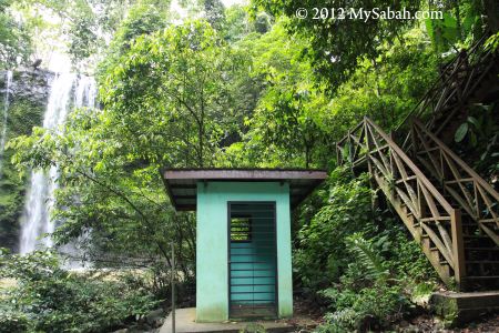
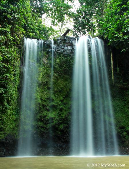
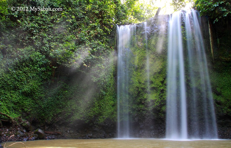
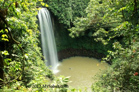
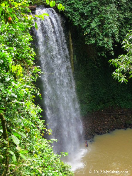
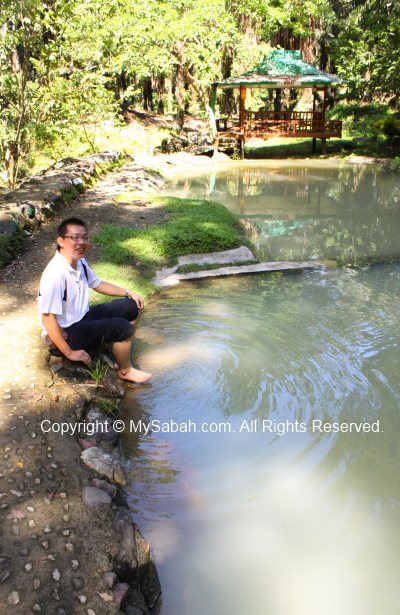
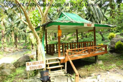
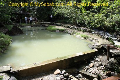
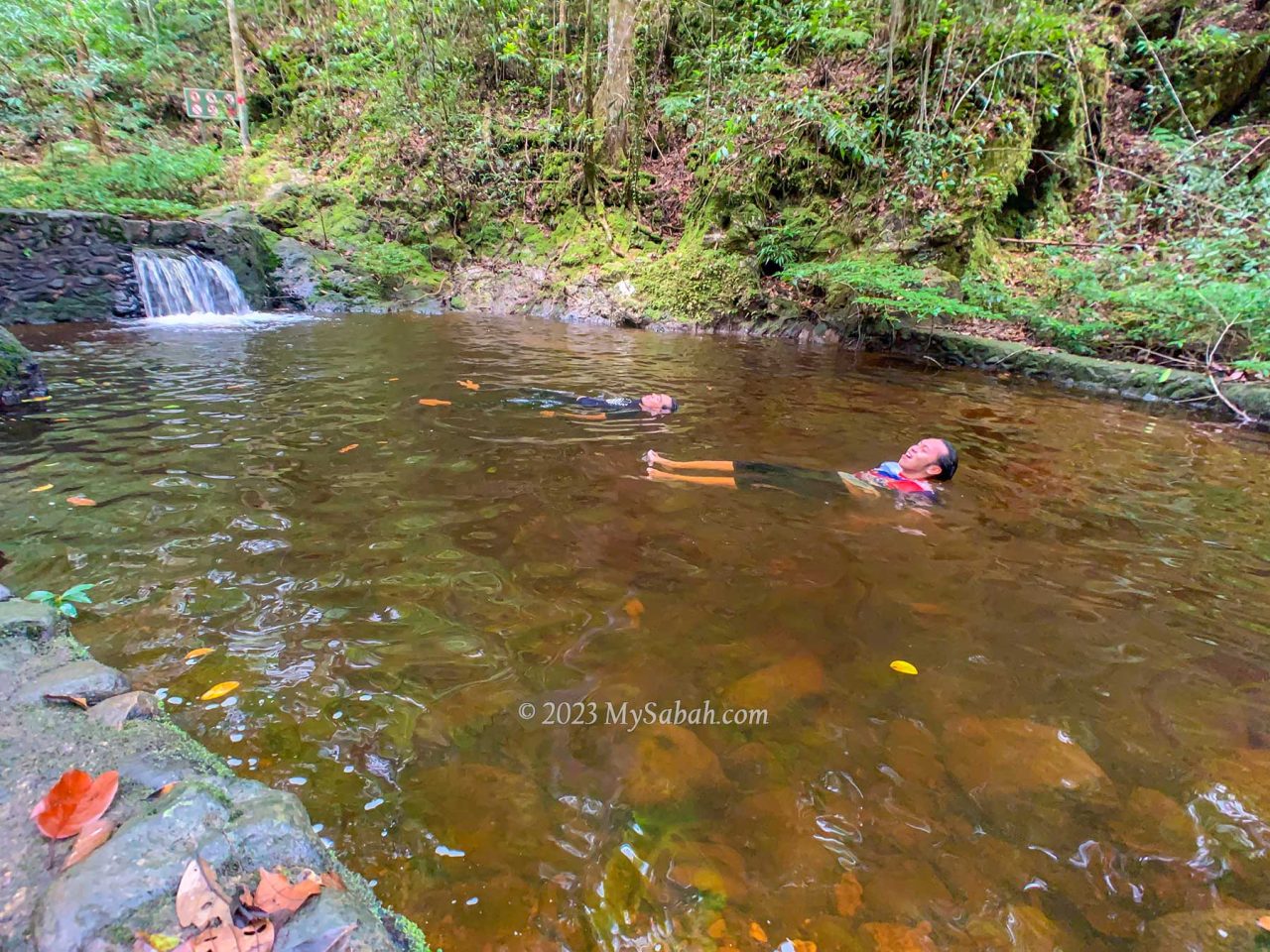
The descending trail takes about 40 minutes and it is the steepest part of the climb. Luckily there are some rope support for us to move down safely because part of the trail is quite slippery. We arrive foothill before 2pm as planned. I would say Wullersdorf Peak is one of the best hiking trails in Sabah. FYI, after the climb many hikers take a dip at the river of Batu Bersusun, the only Columnar Basalt in Malaysia, which is only 5 minutes away from Dewan Balung Cocos.

Is Mount Wullersdorf Hard to Climb?

The climbing trail to Wullersdorf Peak is not too steep and difficult, even for beginners. If you do workout regularly, it’s fairly easy. To experienced hikers, it’s just a long hike. The main challenge is to climb over the slippery rocks about half of the time. Wearing a good pair of hiking shoes can make a huge difference. It’s a bonus if the shoes are waterproof too, though you won’t walk in water.

A big and black lichen which is made up from algae and fungus. It only grows in pollution-free environment.

No rope support, stairway and hand rail are available for the first 6 kilometres. Some steep sections in the last 1-km descend have rope support. You would want to wear gloves for roping. Anti-leech socks are not necessary unless you can’t tolerate leech bite at all. According to the guides, for every 20 people, there might be only one or two of them might get leech bite, as leech (pacat) is not common there.

Cooling off in a pond after the climb. The forest of Wullersdorf is warm and humid.

The forest of Wullersdorf is warm and humid, wearing T-shirt and hiking pants is good enough (preferably quick dry). Drinking water is the most important. I finished 1.2 Litre of water. The summit has limited shade to protect you from afternoon sunlight, apply sunscreen if required.

Things to Bring

  • Backpack
  • Raincoat or poncho
  • Water (at least 1 Litre)
  • Energy bar or snacks
  • Packed lunch
  • Toilet paper
  • Camera

Optional

  • Gloves
  • Sunscreen lotion / spray
  • Foldable hiking stick
  • Anti-leech socks
  • Insect repellent
  • Towel and spare clothing (for swimming or changing after hike)
  • Personal medicine

How to Book

Only two agents are allowed to bring tourists to Wullersdorf Peak. You can contact one of them below.

1) Biro Pelancongan Koperasi

Phone (Whatsapp): +60 11-35485773, +60 10-9540209 (Pakri and Eady)
Facebook: Wullersdorf Peak

2) Uncle Mul

Phone (Whatsapp): +60 19-8233896

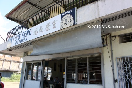
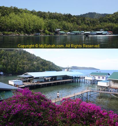
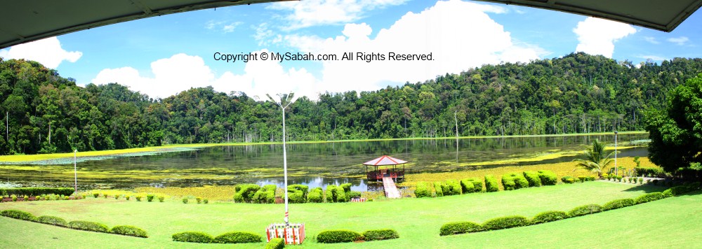
I booked with Biro Pelancongan Koperasi. The fee is RM35 per person but requires a booking of minimum 10 people (or you can pay more). The fee includes permit (to enter forest reserve), vehicle transfer, guide, and certificate. The gathering point is in Kampung Balung Cocos (see Location Map), a village about 14 km from Tawau airport.

References

  1. “Geological heritage features of Tawau volcanic sequence, Sabah.” Sanudin Tahir, Baba Musta & Ismail Abd Rahim. Bulletin of the Geological Society of Malaysia 56 (2010) 79 – 85
  2. Annual Report 2022 by Sabah Forestry Department
  3. Ulu Kalumpang-Wullersdorf Sustainable Forest Management (SFM) Project
  4. Proposed gold mining in Balung Participate in review of draft TOR, folks urged, Daily Express, 13 Feb 2015

Photos taken in Tawau, Sabah, Malaysia Borneo

Where to Travel, Eat and Stay in Kunak town, Sabah

Though one of the oldest civilization of Sabah starts in Kunak, Kunak is not the most developed area of Sabah. Kunak is also where Islam first landed in Sabah, and you still can find traces of Japanese WW2 occupation around. Today, Kunak is a “forgotten” town at Sabah East Coast, and nobody remember its bustling history.


Pic: Islam of Sabah starts in Kunak.

The locals there call Kunak the “Cowboy Town” (Pekan Koboi). Kunak is quite safe and peaceful, and doesn’t look a town of outlaw. With a population of about 50,000, most Kunakians are Bajau, Idahan and Bugis mainly working in oil palm and fishing sectors. The people here are very friendly.

Where to Travel

I don’t like standard sight-seeing tour, so Kunak is a nice town for me to see Sabah in different angle. Kunak is not a popular tourist destination of Sabah, but there are a few interesting places for you to explore.

1. Madai Waterfall

This 40-Meter waterfall is only 15 KM away from Kunak town and next to the main road. It is the favorite recreation site of the locals.

» Read more about Madai Fall

2. Japanese War Tunnel

This war tunnel is a huge underground cave used by Japanese force during World War II. It is located in Mostyn oil palm plantation of Sime Darby about 12 KM away from Kunak.

» Read more about Japanese War Tunnel

3. Madai Cave

Madai Cave is the second largest cave of Sabah and situated in “Swiftlet Mountain”. This cave would be closed in Apr, Aug and Dec for bird nest harvesting by Idahan people.

» Read more about Madai Cave


Pic: Idahan girls are fair-skin and beautiful. May be they eat bird nest soup every day. 🙂

You may read my other blog about Kunak if you want to visit more attractions.

Where to Eat

Kunak is famous for its deer meat and chili paste. Kunak town is near to sea so its seafood is relatively fresh and cheap. Below are a few good places for eat out in Kunak.

1. Fook Seng Restaurant (????)

For me, Fook Seng Restaurant is the No.1 Restaurant in Kunak. It establishes in 1970, the oldest restaurant of Kunak. The taste and variety of food there is good and they serve no pork.


Fook Seng Restaurant is located at: Bahagian Kedai Sedco, Block C, Lot 4, 91207 Kunak, Sabah. They open from 10am to 8pm daily.
Tel: +60 89-852 828, +60 16-831 9828 (mobile phone, look for Ben Poon)


Pic: deer meat (payau) fried in soy sauce and zesty sliced ginger


Pic: air-conditioned room which can host about 20 guests


Pic: sweet and sour garoupa


Pic: deep-fried calamari


Pic: mixed vegetables and mushroom


Pic: fried tofu (stuffed with minced meat) and fried brinjal

2. Vui Kee Seafood Restaurant (??????)

Another restaurant recommended by the locals. They open from 9am to 9:30pm. The food there is quite good too.


Vui Kee is about 4 KM away from Kunak town (See location map) and near (2-min walk) to Mostyn Hotel.


Pic: deer meat (Payau) for RM7 (≈USD2.33)


Pic: seafood Tom Yam soup for RM6 (≈USD2)

Note: prices as of Oct 2012

3. Restoran Cita Rasa Kita (R.C.K.)

This restaurant is very near (1-min walk) to Mostyn Hotel, and they serve Halal food (Muslim-friendly).


Nobody told me about this place. I was attracted by the smoke from their BBQ.


Pic: BBQ chicken wing, not bad.


Pic: BBQ Chicken Tail, anyone?

Where to Stay

Kunak is neither a big city nor popular destination, so they have only 2 hotels. If you plan to stay in Kunak, I will recommend Mostyn Hotel at Simpang Empat (means “Fourth Junction”), which is near the roundabout 4 KM before Kunak town.


Mostyn Hotel is the most decent hotel of Kunak. The accommodation is clean and basic.


Pic: reception counter. The staffs can speak basic English.

Below is their contact:
Address: MDKNK 2360-2363, Simpang Empat, 91200 Kunak, Sabah, Malaysia. (See location map)
Tel: +60 89 853005
Mobile Phone: +60 16 8260105
E-mail: mostynhotelkunak@gmail.com
Fax: +60 89 852699


I stayed in their Standard Room (Twin Bed) on 1st floor, for RM67 (≈USD22) per night.


Pic: attached bedroom & toilet, with water heater


Pic: types of rooms and rates of Mostyn Hotel (as of Oct 2012)

In case you can’t read Malaysian language, Tingkat = Floor, Jenis Bilik = Room Type, RM = Malaysia currency (USD1≈RM3), Harga Bilik = Room Price, Cukai Kerajaan = Government Tax, Jumlah Keseluruhan = Total Price.
Upon check-in, they collect RM100 refundable deposit, so prepare more cash.

Though Mostyn Hotel is not in the town center of Kunak, its location is still quite convenient, as Vui Kee and Cita Rasa Kita restaurants are nearby. If you take long-distance bus to Kunak, you can ask the bus to drop you very near to this hotel.

Going to Kunak

Kunak is 470 KM away from Kota Kinabalu city (KK) and located between Tawau and Lahad Datu (see Sabah map below). Normally, most travellers take a 45-min flight from KK to Tawau or Lahad Datu, then get a taxi to Kunak (Distance: 58KM from Lahad Datu, 83 KM from Tawau).

To save some money, backpackers would take long-distance bus from KK to Kunak. The bus ticket is about RM50 to RM60 (≈USD17-20) one way and the road trip takes 8 hours.


Pic: bus terminal of Kunak, the bus departs as early as 8:00am.

Unfortunately, there is no licensed taxi in Kunak. I rely on their unlicensed taxi (known as Kerata Sapu locally), which is readily available around town (seem like everyone can be a taxi driver there). But be warned, using unlicensed taxi is as risky as hitchhiking. It is quite ok in Kunak, but it is common sense for traveller (especially lady) to be vigilant, no matter where you travel. I requested Mostyn Hotel to get a reliable driver for me, and you can do the same.

There are still a few places such as Salt-water hot spring and 7-Well Waterfall that I want to see, so I’ll visit Kunak again. What do you think of Kunak? Does it have the potential to be a tourism destination? Please share with me if you know other good attractions and food in Kunak.

Photos taken in Kunak, Sabah, Malaysia Borneo

Top 10 Waterfalls of Sabah

The mountainous terrain of Sabah makes us the land of waterfalls. There are thousands of waterfalls in Sabah forest, most are waiting for explorers to name them. Looking at waterfall can calm our minds better than watching the whirling movement in washing machine. So I compile a list of Sabah’s Top 10 Waterfalls for those who want to enjoy heavy doses of negative ions.


Pic: the location of Top 10 Sabah waterfalls.

Besides Scale, this waterfall ranking is also based on Popularity, Accessibility and Travel Experience. That’s why some giant waterfalls are not listed. For example, though Kadamaian Waterfall is the highest waterfall of Sabah, it is too difficult to get there. Please note that most height measurement is by estimation.

No. 10. Kiansom Waterfall

Location: Inanam, Kota Kinabalu
Height: 7-Meter (23 Feet)

Yes, I know, Kiansom is the smallest waterfall in the top 10 list. It is listed because it is the most famous, accessible and visited waterfall in Kota Kinabalu city. I can’t exclude the waterfall that everyone loves.
» Read more about Kiansom Waterfall…

No. 9. Gelas Waterfall

Location: Tawau Hills Park, Tawau
Height: 12 Meters (40 Feet)

Gelas Waterfall is situated in Tawau Hills Park, a lush rainforest zone and source of five rivers. Hiking to Gelas Waterfall is a pleasure to nature lovers, and you also can soak in sulphurous hot springs in the park.
» Read more about Gelas Waterfall…

No. 8. Tawai Waterfall

Location: Tawai Forest Reserve, Telupid
Height: 95 Meters (311 Feet)

Tawai Waterfall is the least-known waterfall, but its view is so spectacular that it will blow you away. The area around this waterfall is full of Borneo pitcher plant. Denmark’s biggest television network, Tv2, has chosen this waterfall for filming of “Girls Off The Beaten Track”.
» Read more about Tawai Waterfall…

No. 7. Madai Falls

Location: Madai-Baturong Forest Reserve, Kunak
Height: 40 Meter (131 Feet)

Madai Falls is probably the first Sabah waterfall visited by human, maybe a caveman about 28,000 years ago. I’m not joking. Archaeologists say Madai-Baturong has the oldest human settlement of Sabah. I believe stone-age people love waterfalls as much as we do.
» Read more about Madai Falls…

No. 6. Fairy Waterfall

Location: Danum Valley, Lahad Datu
Height: 27 Meters (89 Feet)

This shy Fairy Waterfall is hiding deep inside the 130-million Borneo rainforest of Danum Valley. The photo here may not look impressive because it was taken during prolonged drought. Danum Valley will be nominated as the next UNESCO World Heritage Site of Sabah/Borneo.
» Read more about Fairy Waterfall…

No. 5. Fefukan Waterfall

Location: Long Pasia
Wide: 20 Meters (66 Feet)

To see Fefukan, Travellers need to hike a long way to the Heart of Borneo, making it the most remote and least visited waterfall in my list. Camping next to this waterfall is one of my most unforgettable experience. Lucky visitors would see blooming rafflesia around there.
» Read more about Fefukan Waterfall…

No. 4. Mahua Waterfall

Location: Tambunan
Height: 17 Meters (55 Feet)

As part of the Crocker Range Park, Mahua Waterfall is protected as a water catchment area. Hence, visitors can enjoy cooling and refreshing water from clean mountain stream. On the way to Mahua Waterfall, you may drop by Tambunan Rafflesia Center to check if you are lucky enough to see a blooming rafflesia.
» Read more about Mahua Waterfall…

No. 3. Imbak Falls

Location: The Heart of Sabah, Tongod
Wide: 30-Meter (98 Feet)


Even though Imbak Falls is only 6 Meters (20 feet) high, it is the widest waterfall of Sabah. I just love sitting in the river, as the strong current turns its waterfall pond into a Jacuzzi bath area.
» Read more about Imbak Falls…

No. 2. Langanan Waterfall

Location: Poring, Kinabalu Park
Height: 120 Meters (394 Feet)

Located in Poring Hot Springs, the most popular destination of Sabah and 1st UNESCO World Heritage Site of Malaysia, the majestic view of 120-Meter-tall Langanan Waterfall is only saved for those visitors who are keen to hike nearly 4 Kilometers (2.3 Miles). It is more enjoyable to soak yourself in the hot spring after a long walk in the jungle.
» Read more about Langanan Waterfall…

No. 1. Maliau Falls

Location: Maliau Basin, Tawau
Height (of the highest tier): 28-Meter (92 Feet)

Here you go. The No.1 Waterfall of Sabah is the 7-tier Maliau Falls in Maliau Basin, Sabah’s Lost World. To see Maliau Falls, you need to trek 2 days on the treacherous relief and pass through miles and miles of dense pristine rainforest.


With over 30 waterfalls (and counting), Maliau Basin is also known as the Capital of Waterfalls, and Maliau Falls is the most breath-taking among them. Another feature of this waterfall is its tea-color water, which is caused by plant tannin released from heath forest upstream. The magnificent Maliau Falls will leave a beautiful memory in you, a scene that you like to replay in mind from time to time.
» Read more about Maliau Falls…

Which Waterfall is your Favorite?

Do you agree with the Top 10 Waterfalls list? Please vote for your favorite waterfall below. I would love to see if everyone shares the same view. You can even add new waterfall if your favorite is not in the list.

[listly id=”2Tj” layout=”full”]

Below is a montage of Top 10 Sabah Waterfalls (Click it for bigger picture). You may share it in your Facebook.

Thanks to readers who link to me.

Waterfall Safety

Accident is like winning lottery, we get it when we are least expecting it. Waterfall is an inviting dead trap that takes countless lives (especially over-excited kids). Please pay attention to the following precaution if you want to “play” with waterfall:

  1. Don’t swim near to the waterfall. The waterfall pond can be deep, with unseen swift currents underneath.
  2. Don’t climb to the top of waterfall, as the rocks there are usually slippery.
  3. Don’t stand under the waterfall. Even a small stone fallen high from top can cause severe injury.
  4. During wet season, watch out for flash flood. Flash flood can occur even if there is no rain downstream.
  5. Teachers, if you plan to bring a group of pupils to swim at waterfall, equip yourself with lifebuoy, rope and CPR knowledge.

If you know any nice waterfall around your hometown, please share with us by posting the photo in comment box below.

“Life is like a waterfall, it is always moving and there is always an uneven flow to it.” – SooHoo

Photos taken in Sabah, Malaysia Borneo

Madai Waterfall and Tongkat Ali Hill of Kunak, Sabah

Waterfall is a delightful view and always be part of the painting about paradise. The bigger it is, the happier the visitors. That’s how the 40-Meter Madai Waterfall drew me to Kunak, a small town in Lahad Datu district. In fact, many European and Asian tourists had come for it. I have visited many waterfalls of Sabah, and Madai Fall is one of the most impressive.


The 5-storey high Madai Waterfall is located in 3,436.50-Hectare Madai Baturong Virgin Forest Reserve Nature Center, which is managed by the Sabah Forestry Department and opened to the public since 1999. Madai Cave is also part of this reserve.


Pic: Madai Waterfall is inside Pusat Sejadi Hutan Simpan Madai Baturong (Madai Baturong Forest Reserve Nature Center) of Kunak.

As Madai-Baturong Forest Reserve Nature Center is a public park, anyone can pay a small entrance fee to enjoy Madai Waterfall. Below is the ticket rate:

  • Malaysian: Adult: MYR2.00 (≈USD0.66); Below 18: MYR1 (≈USD0.33)
  • Foreigner: Adult: MYR5.00 (≈USD1.66); Below 18: MYR2 (≈USD0.66)

Madai Waterfall

Madai Waterfall is very accessible. It is so near that you can hear it, once you walk into the park. Remember to bring insect repellent, as mosquitoes might be around.


Pic: the wooden staircase to Madai Fall.


It is only a 1-minute walk. The boardwalk is quite steep, be careful..


Pic: huge Alocasia odora next to staircase. This plant has the largest undivided leaf in the world.


Pic: Madai Waterfall in the sight!


Pic: the “twin” Madai Waterfall. After heavy rain, both will merge into one huge vertical fall. Though the water is murky, it is clean and cooling.


Due to the powerful splash, the air was filled with flying droplets. When the morning light shined through them, it created fascinating rays of light. Such a lovely view.


Pic: the warning sign near the Madai Fall.

Any water activity such as swimming is prohibited, because the waterfall pond is deep. Basically, this waterfall is meant to be watched only. Anyway, you can soak your feet in the shallow water, like most people do. Anything beyond that is on your own risk. There is no lifeguard around to stop you or to save you.


However, some visitors can’t resist to take a swim under this beautiful waterfall. A ranger told me that he saw a very deep hole in the center of waterfall pond after a 8-month drought. Madai is in a limestone area, so I wonder if this hole connects to an underground cave or river. Well, I’m just guessing.

Want to see Madai Waterfall in motion? You may watch the 90-sec video below:


During weekends and holiday, many locals come here to swim and picnic. Some of them taking bath (with soap) or washing their dirty plates in the stream, which flows to Tingkayu River. It’s not right.. 🙁


Pic: dense moss behind the Madai Fall.


The park opens from 8am to 5pm every day. The waterfall is quite crowded afternoon.


Pic: gold found at Madai Fall?

Wishing Tree

Besides Madai Waterfall, I found an interesting tree in Madai-Baturong Nature Center. The local calls it a “Wishing Tree” (Pokok Hajat).


Pic: the wishing tree is standing near the entrance of canopy walk.


It is a tall tree, which is locally known as “Kayu Ara” (Ficus species, Moraceae). Many birds will gather on this tree during its fruiting season.


Every ribbon on the tree root is a wish of the asker. Probably it works, so there are hundred of ribbons on this wishing tree.


Whatever, it is a tall and magnificent tree to look at. I wish it will stay strong and healthy forever.

Bukit Tongkat Ali

Bukit Tongkat Ali (Tongkat Ali Hill) is another attraction in Madai Baturong Forest Reserve. This hill is named after a herb Tongkat Ali (species: Eurycoma longifolia, Nicknamed “Asian Viagra”), which is famous for the medicinal properties of its root that can increase testosterone level and treat erectile dysfunction.


Pic: Tongkat Ali tree


Visitors can hike to Bukit Tongkat Ali via a 1 KM trail in the park. When you enter the park, just turn right and follow a small road that leads you to a small bridge and rest shelter. The trail starts at a paved path behind the shelter.


Though the trail is less than 1 KM, it is steep and tiring. The trail is paved with cement. It is supposed to be a good idea. However, the moss cover on the cement becomes so slippery that, after rain, the trail turns into a skating route. In some sections of the trail, I had to hug the hand rail to descend carefully.


Pic: the last shelter on top of Bukit Tongkat Ali (Height: 169 Meters).

I was told that Bukit Tongkat Ali was abundant with wild Tongkat Ali, but I only saw one or two. Probably some impotent visitors pluck it. I was also told that I could see Madai Hill from the top of Bukit Tongkat Ali, but such view was obstructed by dense trees.

Sorry to say, spending nearly 2 hours walking up and down Bukit Tongkat Ali is simply a waste of time.

Public Amenities

Madai Baturong Nature Center have some basic amenities in place for visitors.


Currently (as of Nov 2012), the canopy walk is closed for maintenance until further notice. Too bad, this 119-Meter long and 40-Meter high canopy walk, which is connected to three giant rainforest trees (Seraya Urat Mata, Oba Suluk and Merbau species), is a main attraction of the park, besides Madai Waterfall.


Pic: public toilet


The toilet is very clean and deserves MYR0.30 (≈USD0.10) per entry.


Pic: the Canteen (named Kantin Sri Baturong Madai) in the park

This canteen sells common food items such as fried rice and noodles, as well as cold and hot drink. It was closed for holiday during my visit.


Pic: there is another small food stall near the gate, but they are selling drink and light snack only.


Pic: (left) shower and changing room, (right) Muslim prayer rooms or Surau


Pic: ample parking space for 20 to 30 cars.

Their rest house is closed and the Exhibition Hall is not ready (as of Nov 2012). You still can camp in the park for a small fee (MYR3 for Malaysian, MYR5 for foreigner). I hope they will upgrade the facilities and amenities there ASAP to attract more tourists.

Wildlife

I heard hornbill near Madai Waterfall. At night, there are mouse deer wandering in the park too. The rangers mentioned a bird with a funny local name “Burung Kopi Susu” (Milk Coffee Bird). According to them, this is a small black bird with white stripes on its wings. This bird is common there and can be seen around 5pm. It sings very well, so people trap and trade them as pet. I wonder what bird it is. Magpie Robin?


Pic: Is Magpie Robin the “Milk Coffee Bird”?

How to Get There

Going to Madai-Baturong Forest Reserve Nature Center is easy but far. Madai Waterfall is 15 KM north of Kunak town and 71 KM southwest of Lahad Datu.


Pic: Madai-Baturong Nature Center is just next to the Lahad Datu↔Tawau highway.

By Bus: If you take Long-Distance Bus from Kota Kinabalu city to Kunak or Tawau, you can ask your bus driver to drop you right in front of the park, which is at the roadside (15 KM before Kunak). The bus fare is MYR50 (≈USD16.67) one way and the ride takes 8 hours.

By Flight: Take a 45-minute flight from Kota Kinabalu to Lahad Datu, then spend an hour on taxi to reach the park.

Below is the location map of the park:

View My Sabah Map in a larger map

For more information, you may contact Kunak Regional Forestry Office:
Address: P.O.Box No 2, 91207 Kunak, Sabah, Malaysia.
Tel: +60 89-851863

Photos taken in Kunak, Sabah, Malaysia Borneo

Tabawan the Pearl Island, Lahad Datu, Sabah

(Note: the island resort is closed) Whenever divers come to Sabah, they will think about Semporna and Sipadan only, as if there is no good dive sites in other part of Sabah. FYI, Tabawan Island (Pulau Tabawan), which is also known as Pearl Island, is a new gem inside the Coral Triangle zone of Darvel Bay. For many decades, the pearl farm of Tabawan Island has vigilantly safeguarded the surrounding waters to keep thieves and trespassers away. Recently they start to allow divers to visit the island, and an accommodation, Tabawan Eco Dive Lodge, was built for the tourists.


Click Here to see more photos of Tabawan Island >>

The security of Tabawan is tight. There is a police base, equipped with radar, stations on the island. We even saw a patrol boat on duty. Since no outsiders can come near, the corals are spared from destructive fishing methods such as fish blasting (fish bombing) and cyanide (poison) fishing. The size of the sea fans and various other corals are so big, making Tabawan one of the most impressive scuba diving destinations in Sabah. This is really a good news to people of Kunak town, as they try to promote the tourism in Kunak, and they were lack of island attraction.


Click Here to see more photos of Tabawan Island >>

The tour operator told me that the name “Tabawan” was from Chinese words “大把湾”, which means “so many bays”. It is quite a close description of Tabawan coz this largest island off Kunak really has many bays, with calm water suitable for pearl farming. To go to Tabawan, you could book a diving trip with Sulawesi Sea Safari, which is a dive operator bases in Semporna. By boat, it takes about an hour to reach Tabawan Island from Semporna. For my trip last month, we departed from the jetty in Kunak, so it took only 20 minutes.

Click Here to see more photos of Tabawan Island >>

Because Tabawan Island is located inside the Darvel Bay and surrounded by many islands, the sea is very gentle and suitable for diving all year round, unlike other remote islands which have rough sea and easily affected by bad weather. The boat ride was not very bumpy and the sea was so calm that it even reflected the cloud like a mirror. The sea water is very clean too, another critical requirement for pearl farming. But the sea is dark blue color and look really deep, kind of scaring me a bit.


Click Here to see more photos of Tabawan Island >>

You will see dozens of “bagang” on the way. Bagang is a traditional fishing structure used by the local fishermen (usually Bugis people) to trap the fishes (mainly the small Bilis fishes). They will lower the fishing net into the sea in the evening, use light to attract fishes gathering over the net, then lift the net for the fish caught. I also saw Bagang in the sea near Pitas, they share the same concept but the design look a bit different.


Click Here to see more photos of Tabawan Island >>

Very soon I reached Tabawan Island and saw their pearl farm on the sea. The pearl farm is actually some wooden frame structures float in deeper water, and you could see pearl oyster cages hanging from this structure. The pearl farm is run by a Japanese company, and they have an office on the island. I was told that they will move the pearl farm to other place as this site is less suitable for pearl farming now. But no worry, they may keep the farm around as an attraction. I cannot imagine if government builds the coal power plant near Darvel Bay, as the coal power plant will release water, which contains harmful metals such as mercury, into the sea and pollute the Coral Triangle.

Please join our Facebook anti-coal plant group to oppose coal plant. If the government insists to build coal plant, I will penalise the Barisan Nasional politicians with my vote in next election because long year of ruling has made them arrogant and deaf to the voices of rakyat (citizens). You really think that a new coal plant can solve all the black-out problems? Don’t be so naive.


Click Here to see more photos of Tabawan Island >>

Tabawan Eco Dive Lodge is the only accommodation on the island. Currently they are expanding but a few lodges are already ready to host the tourists. The facilities are quite basic at the moment but they already have a dive center on the island. They will also install air-conditioning in some rooms. The lodge is good enough for a group of 10 to 20 divers. Day trip package, with 2 dives and lunch, is also available. This island has no other resident, so the island forest is mostly intact and we even saw a wild boar hanging around the lodge.


Click Here to see more photos of Tabawan Island >>

We did two dives in House Reef (26 Meters deep) and Turtle Station (15 Meters) around Tabawan. I didn’t dive in Sea Fan Garden and the operator is still trying to discover more dive sites around the island. The visibility was about 5 Meters. This time I rented a camera with underwater housing so you could see the pictures of the dives. Well, I am not so familiar with the setting of this Olympus compact camera and it affected my buoyancy so it was a bit of struggle to take photos under the sea. Ok, after hearing all these excuses, you could expect the quality isn’t good. Anyway, it is better than nothing.


Click Here to see more photos of Tabawan Island >>

Personally I think Tabawan is one of the best place to see coral groups because they are huge, rich in variety and high in density. Many grow bigger than a human. We saw sea fans, black corals (which is not black), table corals, blue corals, staghorn corals, plate corals, brain corals, barrel corals, etc. We didn’t see turtle and barracuda that live here and the fishes are not big. But it is rich of macro-life, we spotted filefish, dancer fishes, convict blenny fish ball, cuttlefish, nudibranch, striped catfish (dangerous!), giant clams, lobster, shrimp fishes, razor fishes, tubeworm, flatworm, starfish, etc. The underwater current was not strong so the dives were quite relaxing. We also dived under the pearl farm and saw the hanging pearl oyster cages.


Click Here to see more photos of Tabawan Island >>

During the diving, Su, one of the divemasters, spotted a Crown-of-Thorns, a weird starfish with 15 thorny legs. He caught it and left it on the shore to perish. According to Su, crown-of-thorns eats corals so it is a pest to coral reef ecosystem. It is also very sly. Once caught, it will release a chemical to warn its kind. If you see many crown-of-thorns, you better organise the elimination with a few divers to catch them all in one go. If you catch only one, the rest will sense the danger and go hiding before you come back for them again. As nasty as it looks, its spines are poisonous. Sound like a sinister creature that deserves to be killed.


Click Here to see more photos of Tabawan Island >>

After the dives, we dropped by the office of the pearl farm. The manager is a gentle Japanese and he is telling us how a pearl oyster is cultivated and harvested. Basically they insert a tiny round-shape “seed” into the oysters to induce them to produce pearls after many years. This is a high risk business that needs years of intensive care and monitoring. He also showed us the specimens of two pearl types, gold and white (creamy white actually). The white pearl is more valuable than the gold one, which is about 10% cheaper. You can tell the color of the pearl inside an oyster from its shell color, which is same as the color of the pearl.

The round pearl is for making jewellery and the irregular-shape pearl is the raw material to make cosmetic powder for smoothening skin. Wow, some pearls cost more than 2 months of my salary and I almost wanted to put them into my pocket while nobody watching. Haha.. just kidding. Someone (not the pearl manager) told me that pearl is like jade, which has “life”. A pearl “grows” over time. It would “die” if a pregnant woman touches it.


Click Here to see more photos of Tabawan Island >>

So that’s all about my pearl adventure. If you want to go to Tabawan Island, you may contact Sulawesi Sea Safari to arrange the diving / snorkelling tour. They also have a lot of info and pictures in their web sites.


Click Here to see more photos of Tabawan Island >>

Photos taken in Kunak, Sabah Malaysia

Mud Pool that traps 3 elephants

Besides hot spring and oil, Sabah also has pond that releases mud. One of the mud pools is located inside the Binaung Oil Palm plantation of Sime Darby in Kunak. After a long drive on the gravel road, we arrived the location of this 15-Meter diameter mud pool. They say its size is gradually growing.


See the observation platform at the right? They say it was used to be in the middle of the pool, but it was pushed to the edge by the mud. The mud pool is quite active and we could hear the loud burping sound when the “mud bubbles” (as big as soccer ball) rises to the surface. The “buuluun.. guluun..” sound is like people fart in the water and multiple that volume by 50 times. Hope you get it.


This mud volcano is not as big as the Lapid mud volcano in Tabin, but it has an interesting feature. Though this mud pool is about 180 Meters above sea level, it seems to have “linkage” to the sea. You know there are many Indonesia workers work for oil palm plantation, and some of them travel by sea back to Sulawesi. They found out if the mud pool is calm, the sea is calm, if the mud pool is very active with big bubbles, then the sea is rough. Before the workers sail home, they would come here to check the “bubbling” for marine forecast, and delay their trip if necessary.


Most bubbling happens near the middle of the pool. The activity brings out the earth materials which is rich of minerals. They say the mud is good for the skin. Some tourists take the mud home to use it as facial mask.


This mud pool can be promoted as an attraction of Kunak. It’ll attract even more tourists, if they could organize mud wrestling of sexy bikini girls. The locals may join the mud fight, why not as the mud is good for the skin.


This mud pool can offer mental therapy to the patient of depression too. The loud burping sound and bursting moment of the big mud bubbles are quite an entertaining show. I won’t feel bored sitting here and watch and listen to the bubbling all day long. It’s kind of… “cleanse” my mind. Below are some photos of mud bubbles…


Above: the “1Malaysia” bubble by Najib.


Above: the “1Malaysia” bubbles burst and vanish like fart, when Deputy PM said MALAY FIRST, not Malaysians.


Wow, this one looks like susu (milk). But how come one D-cup and one G-cup?


Hope you are not bored. May be I should play some sound effects. *bulunn… gurunn.. boooon…*


*guluunn… borrrvuun…*


*BUUuuRuu…*


Okay, no more. Thanks for watching. Are you feeling better now?


The power of mud. This lady is actually 80 years old.

The wild animals have a habit called “salt lick”. Salt is an important diet for their bodies, but salt is very scarce in the forest. If they find a spot that has salty material, they will go there regularly to eat the minerals. Mud pool is such place. There were at least three cases of elephant trapped in this mud pool and needed help from human to pull them out. This may be the same elephant who is crazy for salt lick or facial mask?

Anyway, be careful if you come near to the mud pool for a salt lick. The outer edge of the mud pool is dry and looks like hard surface. But it is still soft and wet under the dry surface. If you step into the mud, due to vacuum effect, the sucking power is very strong and you may have problem to pull your leg out of the mud. They may not find you until you turned into fossil million years later.

Photos taken in Kunak, Sabah Malaysia

Impian Lake, a lake made by volcano

Sabah does not have many natural lakes. The 20-Acre Impian Lake (Tasik Impian) in Kunak is a very special one because it was a volcano crater about 20,000 to 30,000 years ago.


Even though the volcano had long extinguished, the underground thermal activity is still carried on. There is a hot spring just behind the mountain.


Impian means “Dream” in Malaysia language. It is indeed a beautiful lake. The lake view is just not so “Sabah”. Most lakes I saw around Sabah are small, murky and covered with green algae (due to pollution).


Impian Lake also plays a part in shaping the human history of Sabah. If I heard the guide correctly, this lake was used to be a river, but later its exit point was blocked and it became a lake. The water stopped flowing to a very important archeological site of Sabah, i.e. Tingkayu, one of the most advanced civilizations during that time. The Tingkayu Lake dried up, so the people was forced to move to Madai.


Impian Lake is inside the Mostyn Oil Palm Plantation, a private land under Sime Darby. The company turns this area into a golf course and builds a resthouse (Lake View Resthouse) for the members. They do a great job to maintain the area.


The yellow floating plant is Salvinia molesta from South America. It looks pretty but it’s an invasive water weed that spells disaster to the lake ecology, because it can deplete the oxygen of the lake water, threatening the fishes and aqua-animals in the water. They are trying to remove it.


Thanks to Sime Darby for keeping this lake and didn’t destroy it for development.


You would see a big crocodile skull inside the Lake View Resthouse. It is facing the Impian Lake, where it was belong to. The older generation still remember that in 1966, a white man jogged around Impian Lake and saw a white crocodile. He took out his rifle and shot it. After the white crocodile died, it rained so heavily that this area was flooded for 2 days. The people of Borneo believe that white crocodile is the avatar of the supernatural force and they should not harm the white crocodile (or they will be punished by natural disaster).

Photos taken in Kunak, Sabah Malaysia

Kunak Hot Spring

The east coast of Sabah seems to have many underground thermal activities. Besides the sulphurous hot springs in Tawau Hills Park, there is also a hot spring in the Sungang Plantation (oil palm) of Sime Darby near Kunak town. Mosquito is a problem there so you need to bring your insect repellent.


This is the source of the hot spring.


If you look closer, you could see water flowing out of the rocks.


Due to security concern, Sime Darby does not actively promote this attraction. They only try to preserve it.


The water is quite hot, probably hot enough to boil an egg. You can see steam coming out of water.


Vincent could not wait to try the hot spring. Since no bikini babe available, I used him as the model. The water is not very hot if you stay further from the source. The water looked a bit murky. It’s supposed to be clear water.


The volcano boulders around give you a hint about the hot spring. The hot spring is the result of underground thermal activity.


View of the hot spring.


There is a cool stream next to the hot spring. After you have enough fun with the hot spring, you may try the cold water in the stream. Be warned, you would get thermo shock.


Small hut next to the hot spring.


Frankly speaking, this hot spring is not really impressive. I blog it for your info only. A new saltwater hot spring is discovered lately on the high ground at the Sime Darby plantation in Tingkayu at some 650 feet (around 216 metres) from sea level, that one is more unique.

This hot spring is inside the private land of Sime Darby, it is not for walk-in visitors. If you are interested in visiting or look for tour info, please check out www.darvelbay.com.my.

Photos taken in Kunak, Sabah Malaysia