Tag Archives: jungle trekking

Land crab of Mt. Silam

Climbing Mt. Silam with Sabah Crabs

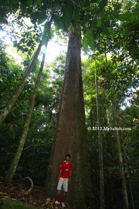
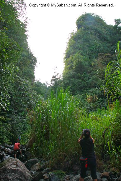
After enjoying the nice view of Darvel Bay on Tower of Heaven, I went to climb Mount Silam. With a height of 884 Meters, Mount Silam is one of the highest mountains in Lahad Datu. Plant and animal enthusiasts will find that a hike on Mt. Silam is filled with pleasure surprises, due to rich variety of unique and endemic flora and fauna here. Thanks to Sabah Forestry Department, who keeps this mountain pristine in its 698-Hectare Sapagaya fully protected forest reserve.


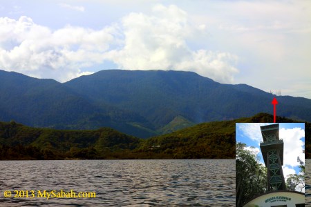
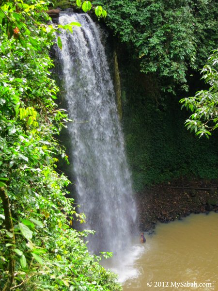
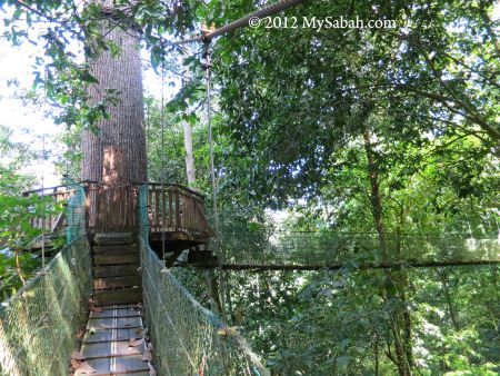
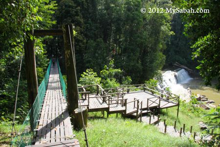
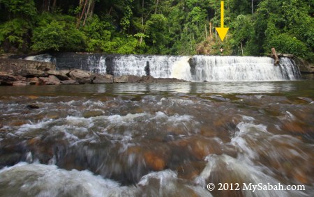
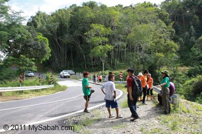
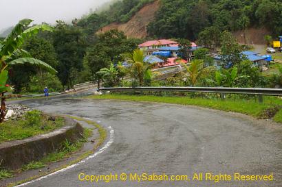
Pic: Mt. Silam and its Tower of Heaven (Menara Kayangan)

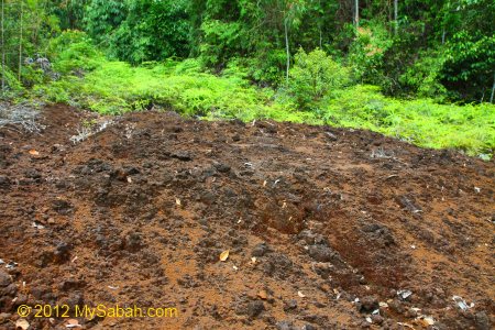
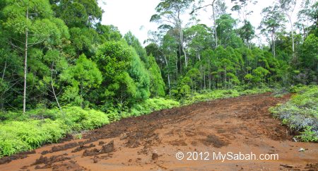
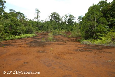
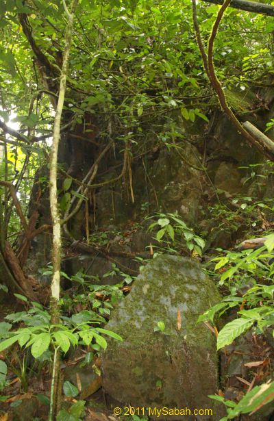
Mt. Silam is classified as an Ultramafic Coastal Mountain. In layman’s terms, the soil in Ultramafic environment is reddish brown in color and formed by ultrabasic rock. The soil has high concentration of heavy metals such as magnesium, iron, nickel, chromium and cobalt, but poor in plant nutrients such as nitrogen, phosphorus and potassium. The ultramafic substrates are “toxic” so the plants which can survive here are very different from other vegetations. That’s what makes Mt. Silam so special.

The Summit Trails

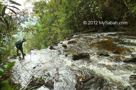
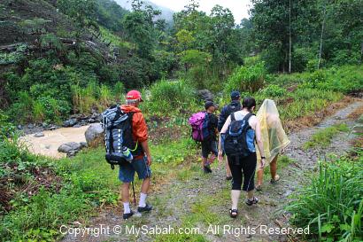
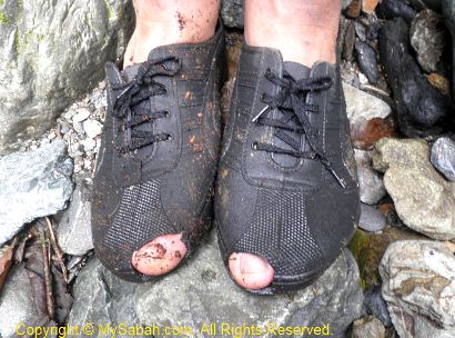
Climbing a 884-Meter mountain may sound taxing. But no worry, I started the climb at 620 Meter elevation (near the Tower of Heaven), so going up and down Mt. Silam took me less than 6 hours. Do bring raincoat, water and energy bars with you, as there is no shelter and water station along the way. Wear comfortable hiking shoes, and a trekking pole would help, though the climb is not tough.


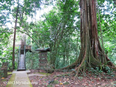
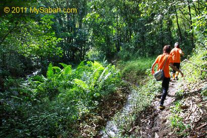
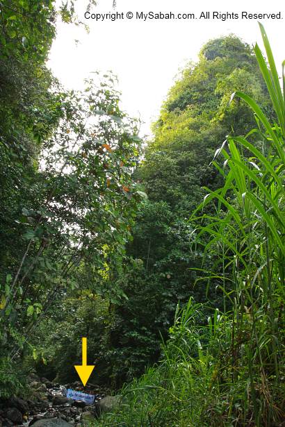
Pic: the start of the summit trail is just behind the Tower of Heaven.


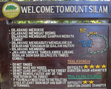
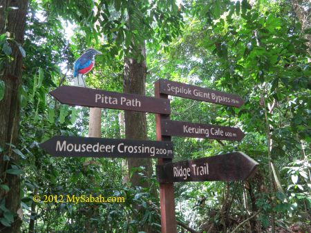
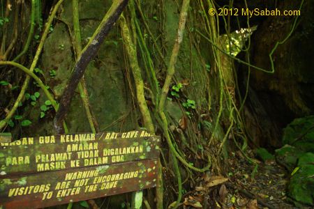
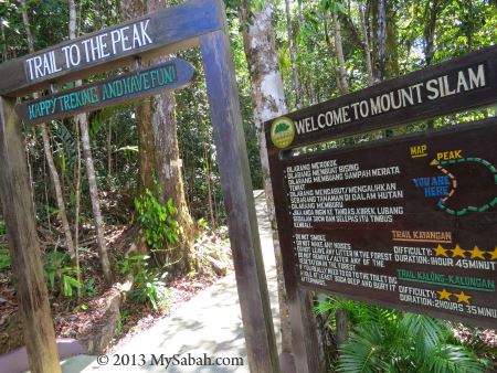
Pic: the trail signage. The dig-a-hole instruction makes me laugh. There is no toilet on the mountain.

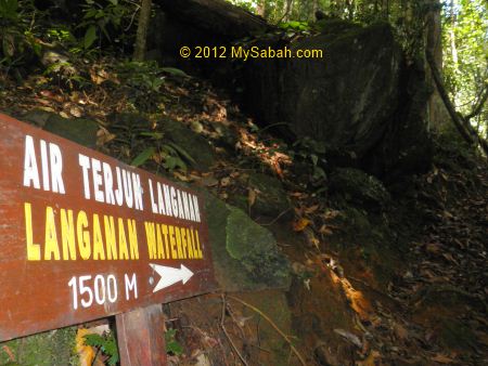
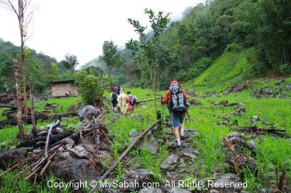
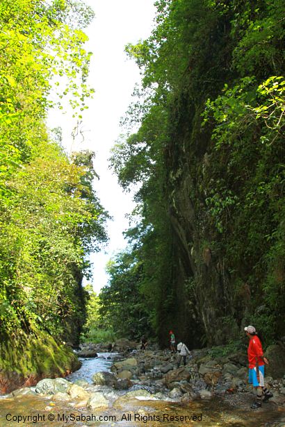
As shown on the signage above, there are two trails to the summit, i.e. the easy but longer Kalung-Kalungan Trail (estimated 2.5 KM), and the shorter but difficult Kayangan Trail (estimated 1.5 KM). To get the most out of this climb, I did a “loop” climb by ascending via easy Kalung-Kalungan Trail and descending via Kayangan Trail.

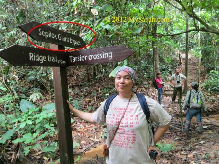
The Kalung-Kalungan Trail is fairly easy and I spend most of the time walking. Kayangan Trail is steep and narrow, a bit challenging and it is quite slippery after rain, you need to climb and get dirty, so I only recommend Kayangan Trail to experienced hikers.


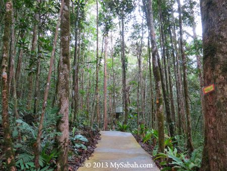
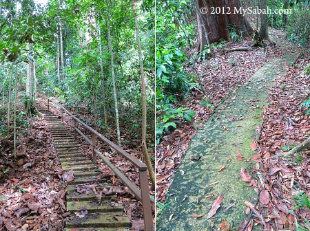
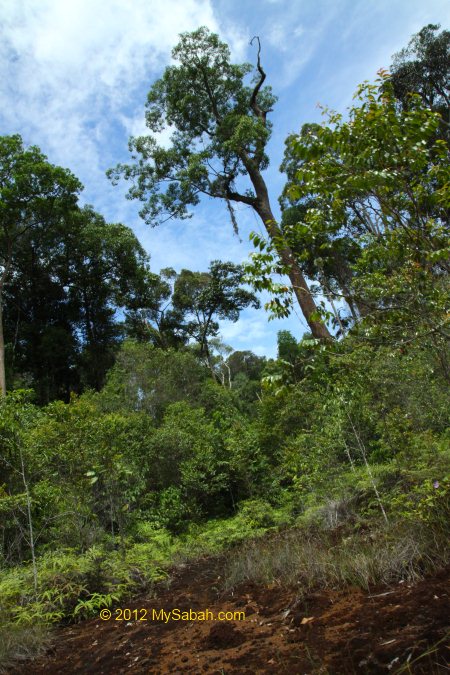
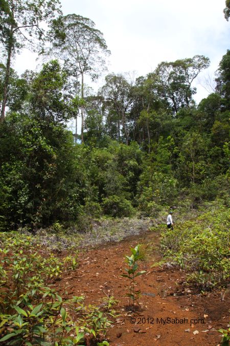
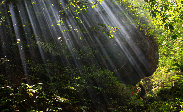
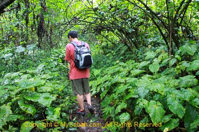
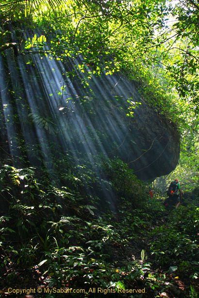
Pic: the paved walkway and lower montane forest (cloud forest) at the start of summit trail.

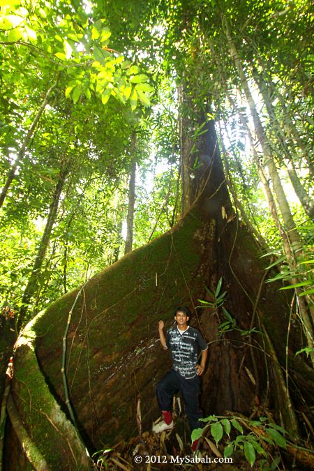
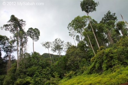
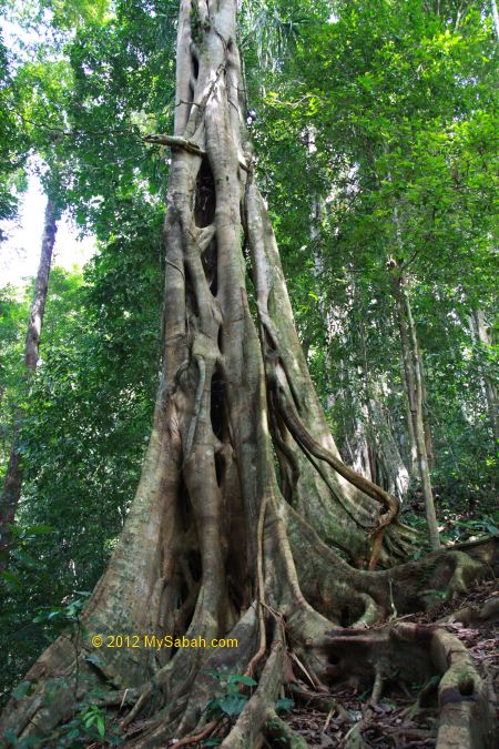
My climb starts at the lower montane forest zone (altitude: 540M – 770M asl), the trees here have relatively shorter and thinner stature than lowland forest. They get even smaller (but denser) when you move up to higher altitude.

Silam Crabs

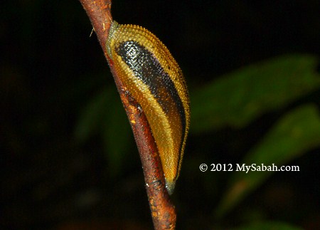
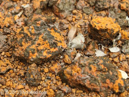
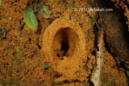
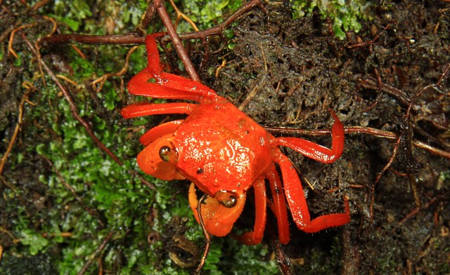
If you pay attention to the forest floor near the tower, you will see some cute and orange-red Silam crabs foraging among leaf litters. This land crab is endemic to Sabah and only confined to ultramafic forest of Mt. Silam. Personally I call it the “Ruby of Mt. Silam” or you can call it the Sabahan Crab, haha, whatever.


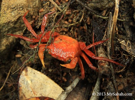
Pic: Silam Crab (Species: Geosesarma aurantium)


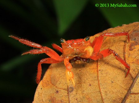
Silam Crab can be found up to the peak of Mt. Silam. Isn’t it weird to see seafood living on mountain? The red-orange shell (carapace) of this crab also reminds me of the color of steamed crab served on dish. Most of them are shy and flee to crevices before I can photograph them. A few are bold to face my lens. When threatened, they tap the ground with legs, making sound to warn the invaders.


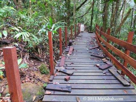
Pic: boardwalk under construction, watch your steps.

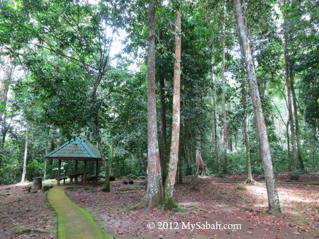
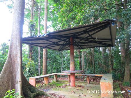
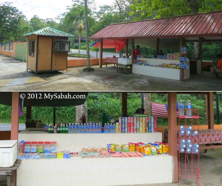
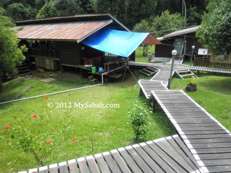
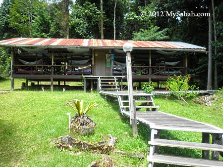
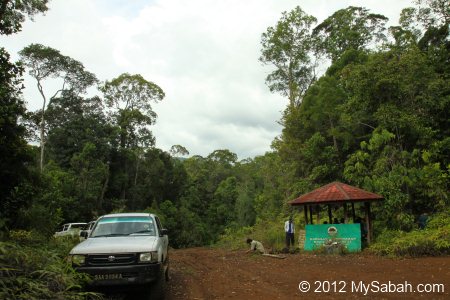
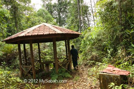
Mt. Silam is open to public in year 2012 so it is still new. Sabah Forestry Department is busy improving the amenities and accommodation.


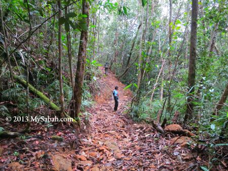
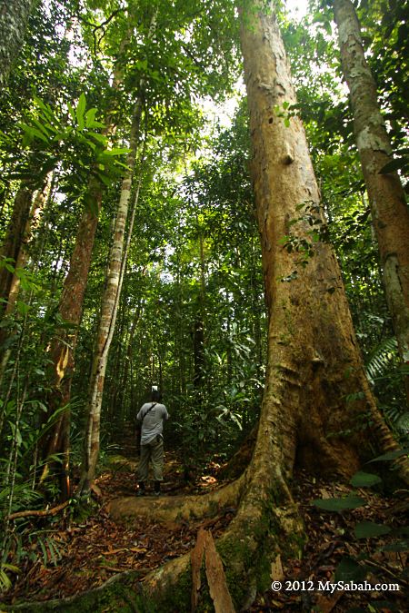
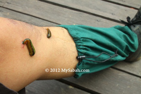
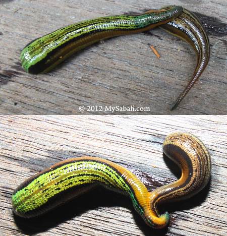
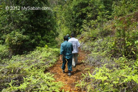
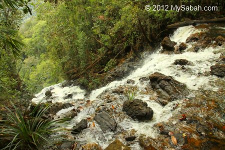
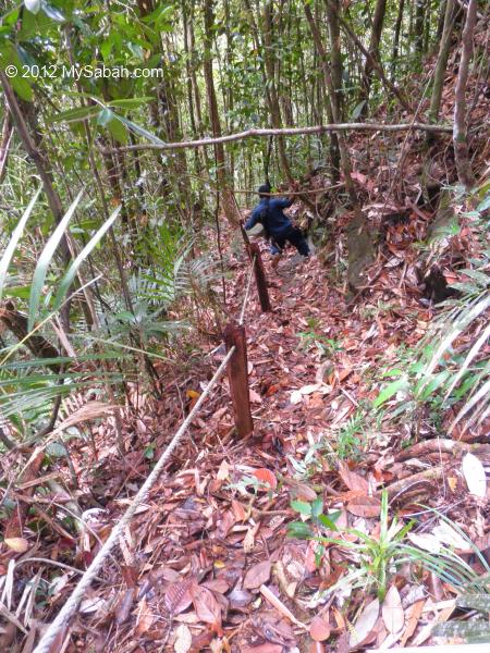
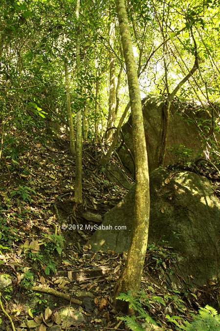
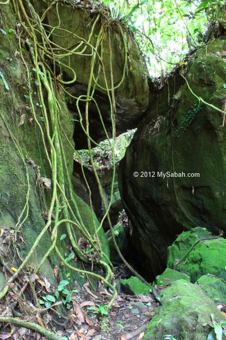
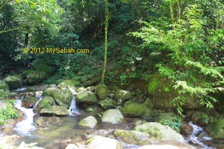
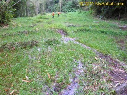
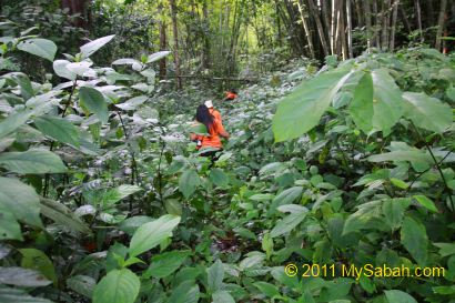
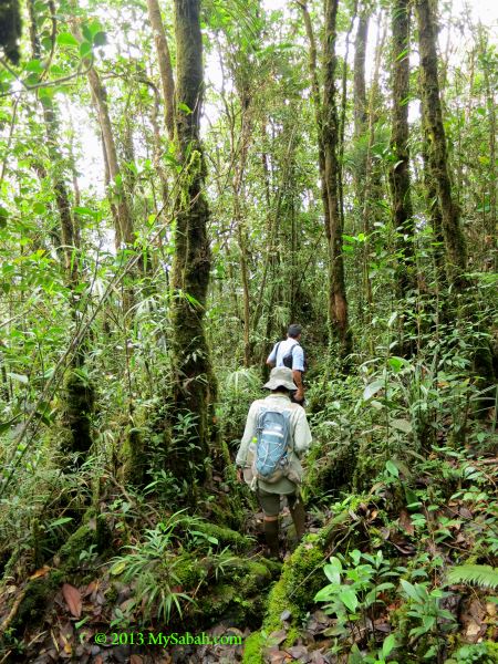
After 100 Meters of paved walkway and boardwalk, I came to the nature trail, no more man-made structure and support after this point. The air is as cooling as air-cond and I was wearing a thin T-shirt, but I still sweated a lot due to the long hike. The trail is well-maintained and the route is clear, so you won’t lose in the jungle, even without the trail markers. There was no forest leech during my visit. Though the trail is not tourist-friendly, most people won’t find it too hard to hike Kalung-Kalungan trail.
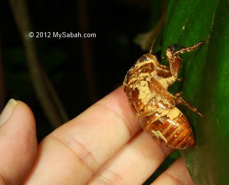
The Animals

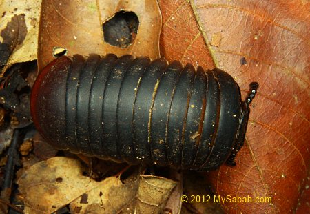
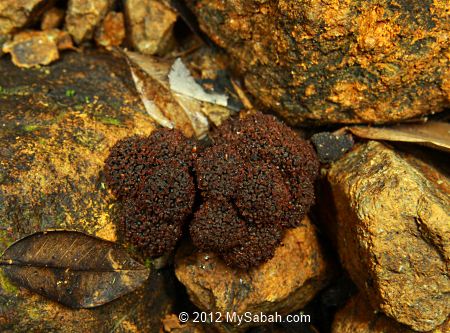
Besides Silam Crab, there are some wildlife living in Mt. Silam. However, most of them are small animals.


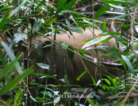
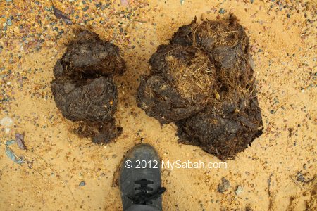
There are 23 mammal species such as Sambar Deer, Banteng (Wild Ox), Giant Flying Fox, Slow Loris and Bornean Gibbon on Mt. Silam. Bearded pig (wild boar) is the easiest one to spot as they seem to eat day and night. I saw a few groups of macaques on the trees too.


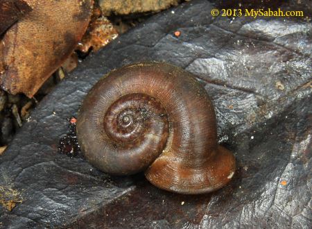
Pic: forest snail that looks like a trumpet


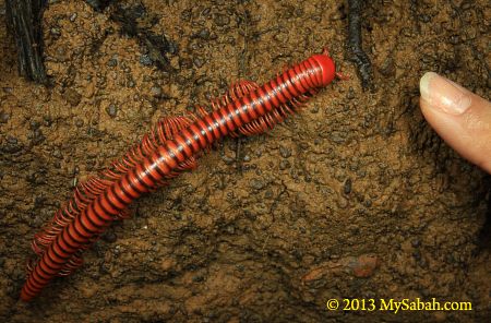
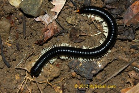
Pic: giant millipede

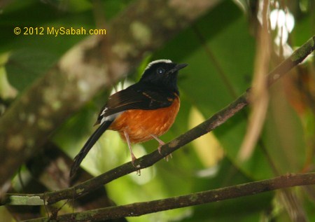
If you like birdwatching, there is a mix of lowland, sub-montane and coastal birds in this area. A few noteworthy birds are Black-backed Kingfisher, Rufous Piculet, Chestnut-crested Yuhina and Red-bearded Bee Eater. I saw Emerald Dove, Leaf Warbler and Blyth’s Hawk Eagle.


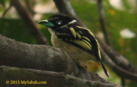
Pic: Black and yellow Broadbill


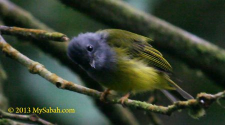
“Hi!” from a curious warbler.


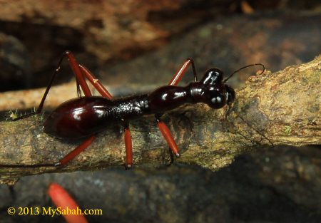
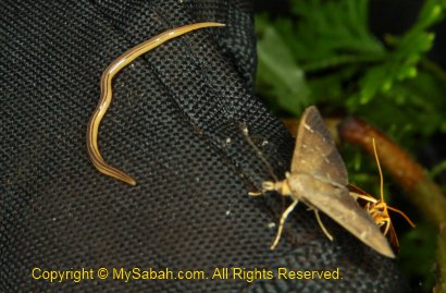
Pic: Tiger Beetle that looks like an ant

Tiger Beetle is the Olympian runner of insect world. If human is as fast as a Tiger Beetle, he can run at 770 KM per hour, meaning he can run from LA and reach New York within 6 hours on feet.


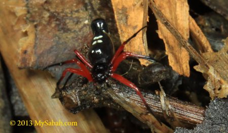
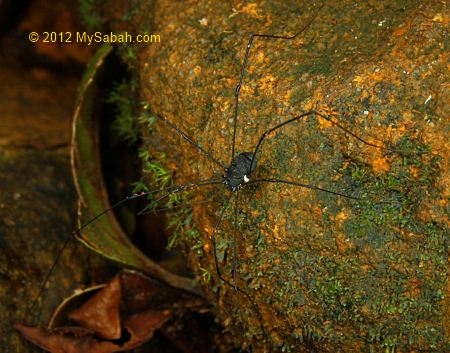
Pic: an unknown spider
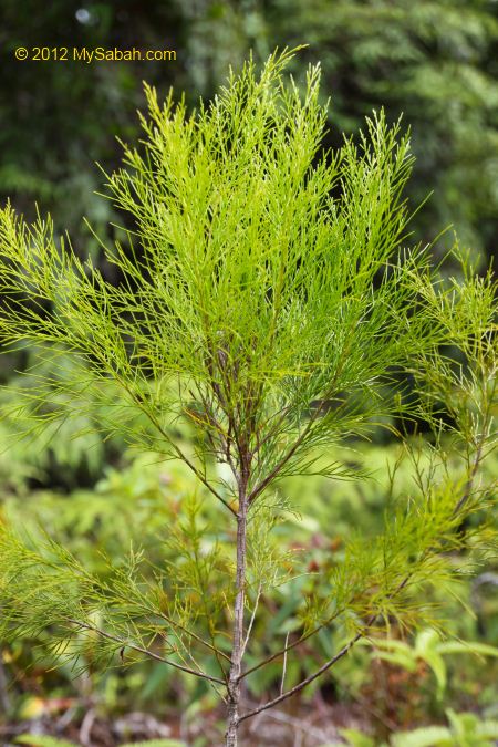
The Plant

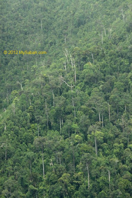
The plant biodiversity of Mt. Silam is amazing, as there are 374 tree species in four main forest types on different altitudes of this small mountain, each has its unique characteristics:

  1. 200M – 300M: Lowland ultramafic forest
  2. 330M – 540M: Upland ultramafic forest
  3. 540M – 770M: Lower montane ultramafic forest
  4. 770M+: Upper montana ultramafic forest (Mossy Forest)

Keep your eyes on the grass, flowers, bamboo, trees, etc., they can be endemic plant of Sabah and Borneo.
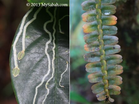
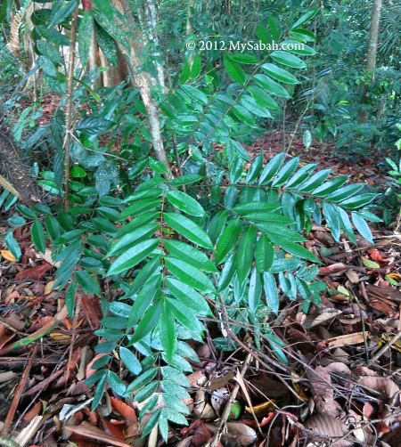
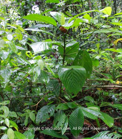

Pic: strange leaves


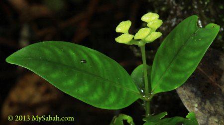
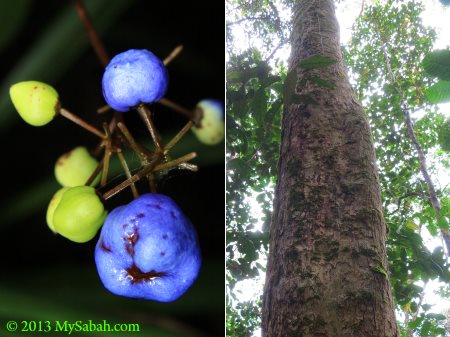
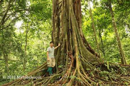
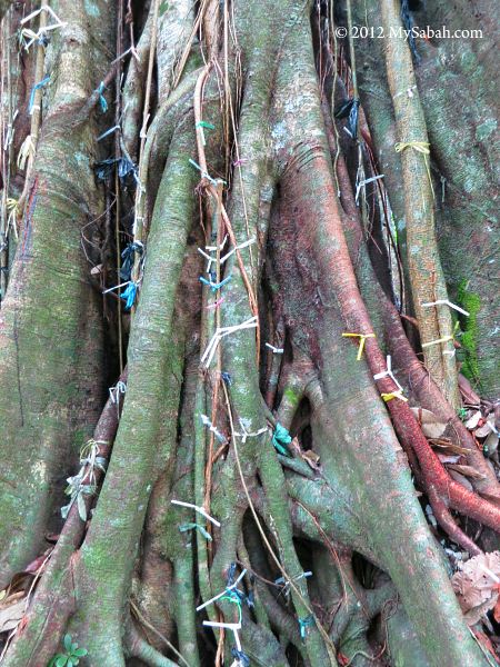
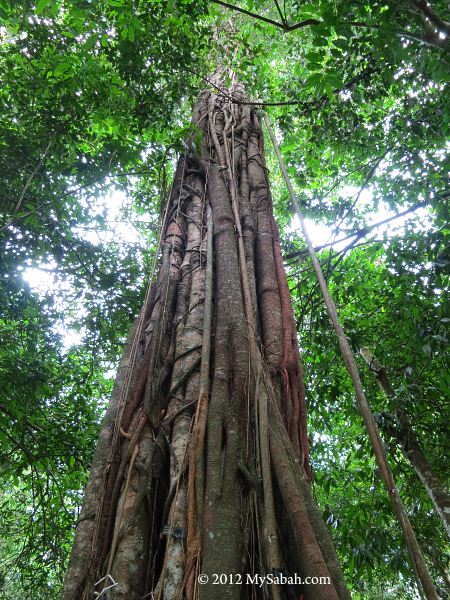
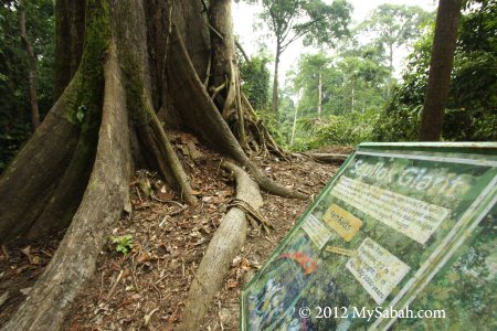
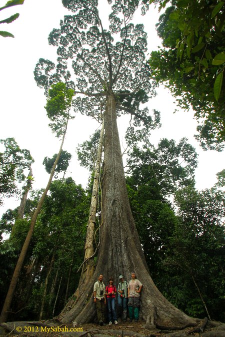
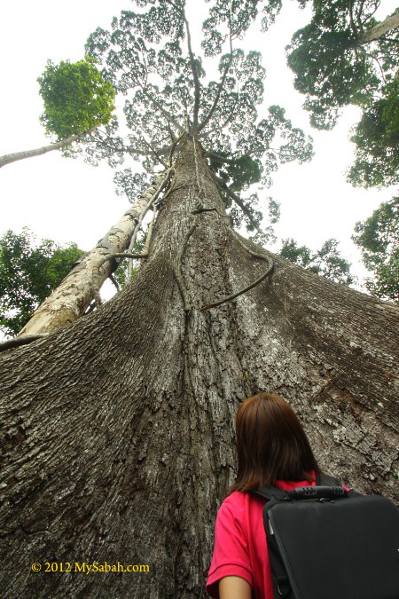
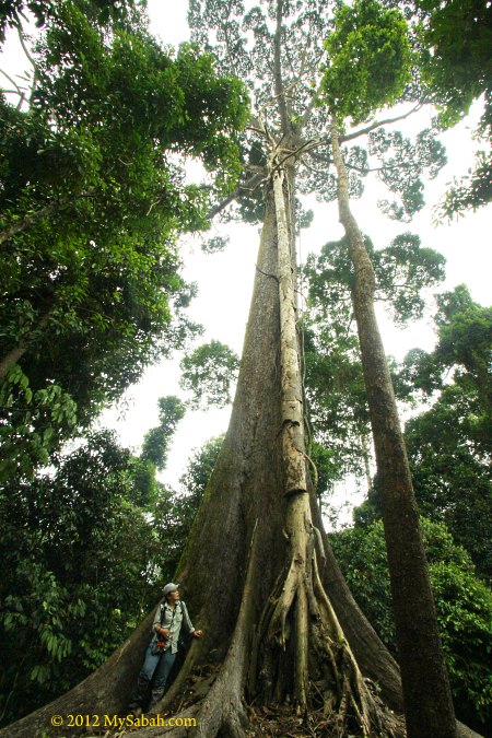
Pic: (left) Poisonous berries of Flax Lily, (right) Bangkau-Bangkau, the Enigmatic Bornean Tree endemic to Sabah.
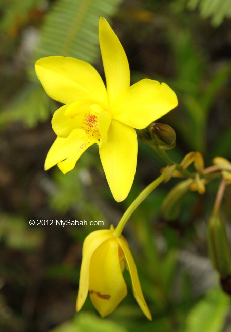
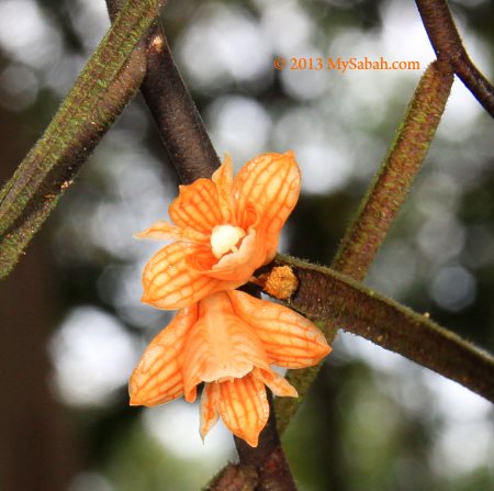
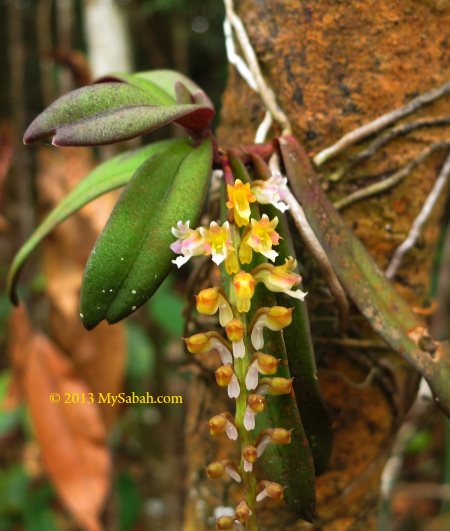
Orchids

Orchids are everywhere, especially around the ridge area at 800M and above. Many orchids here are epiphytic, which means they live on trees that provide them support and more sunlight on higher spot.

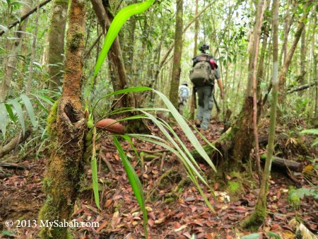
They grow on the tree, mossy carpet, slope… Too bad I didn’t visit during the blooming months of orchid, which usually occurs in Feb and Mar after rainy season. Anyway, a few were generous to give us a showtime.


Pic: this orchid grows high on top.


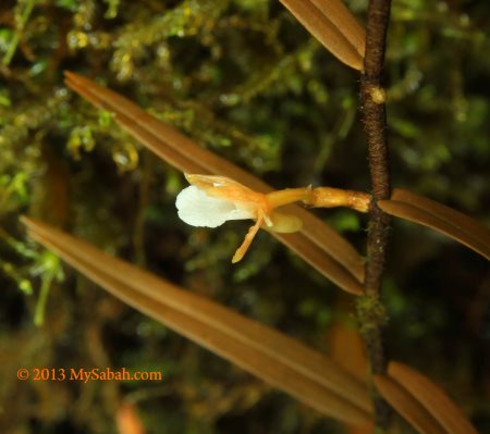
Unlike the flamboyant big commercial orchids, native orchids are generally very small and not easy to spot.


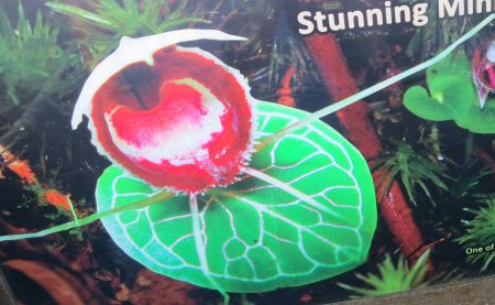
Pic: this heart-shaped Jewel Orchid (Species: Corybas serpentinus) is only found in Sabah and the one I want to see the most, but sadly no blooming.. So I only can show its photo from poster. Another tiny orchid that I want to see is Porpax borneensis, which is also endemic to Sabah.
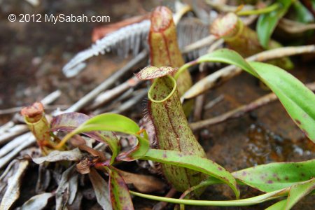
Pitcher Plants

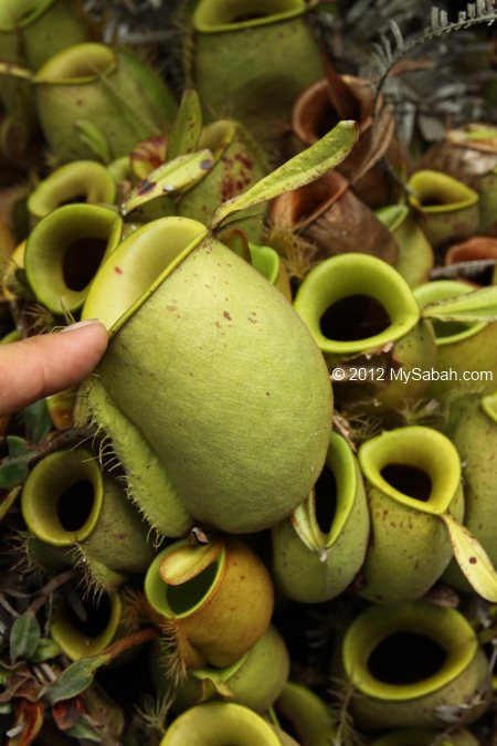
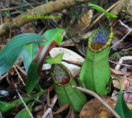
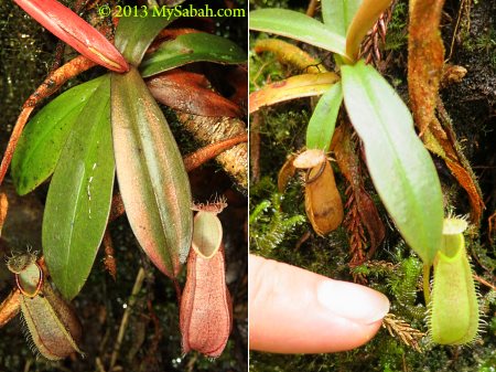
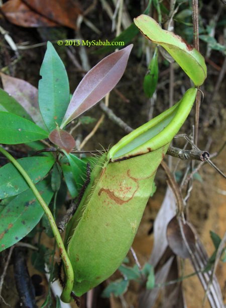
Pitcher plant is abundant on Mt. Silam, you have to be blind to miss it. Some species such as Nepenthes reinwardtiana, Nepenthes tentaculata, Nepenthes macrovulgaris and Nepenthes stenophylla are endemic to Sabah or Borneo.


Pic: pitcher plant in the garden near the Tower of Heaven.


Pic: The top of Mt. Silam is blanketed by this small Nepenthes tentaculata, the most common montane species in Borneo. Note the hairs on its lid.


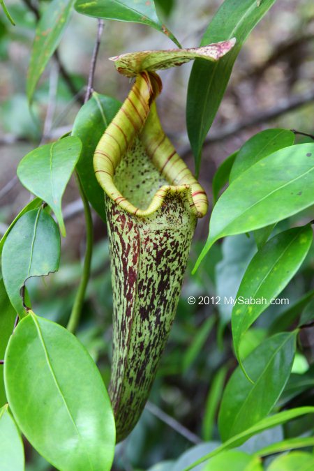
Pic: the upper pitcher of Nepenthes macrovulgaris (endemic to Sabah)


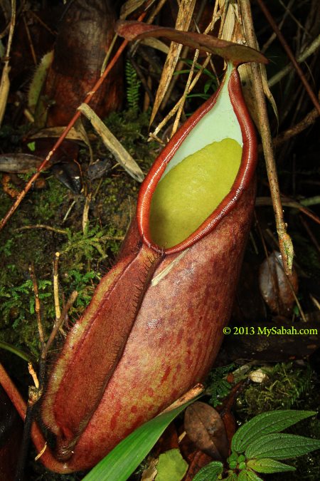
Pic: the lower pitcher of Nepenthes macrovulgaris in red color


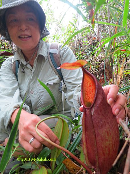
Pic: just to show you how big is the pitcher plant on Mt. Silam.


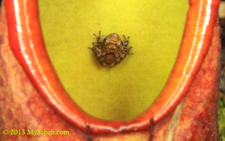
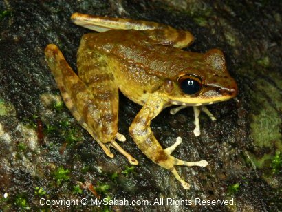
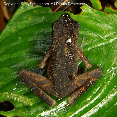
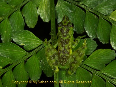
Pic: some frog species live and grow inside the pitcher plant. Scientists still try to find out why.

Upper Montane Forest (Mossy Forest)

Mossy forest is normally found from 2,000M up to 2,700M above sea level, but you can find Mossy Forest after 770M elevation on Mt. Silam. Mt. Silam is experiencing Massenerhebung effect, a natural phenomenon that different vegetation zonation “compressed” on a small and isolated mountain.


Pic: the mossy forest of Mt. Silam on higher altitude.

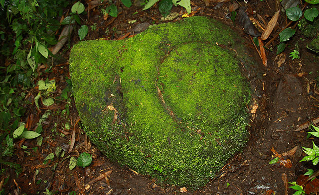
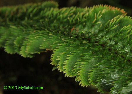
The Mossy Forest is characterized by small pole trees and mossy ground. Cushion moss is important for the water balance of ecosystems in the forests by storing large amounts of water. Such wet environment is important for orchids.


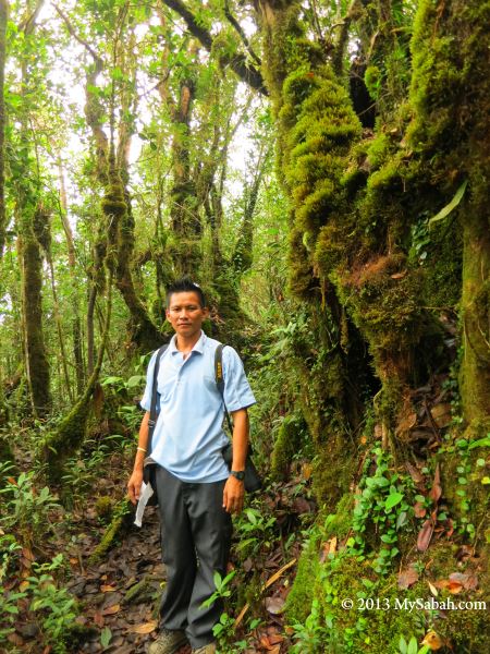
Pic: Vivian, our guide standing next to the the trees full of epiphytes.

The ground, tree trunks and branches of Mossy Forest are covered by thick humus layer and enveloped with mosses.


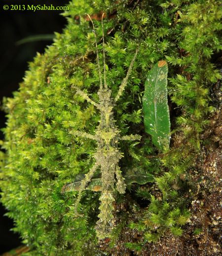
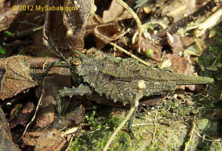
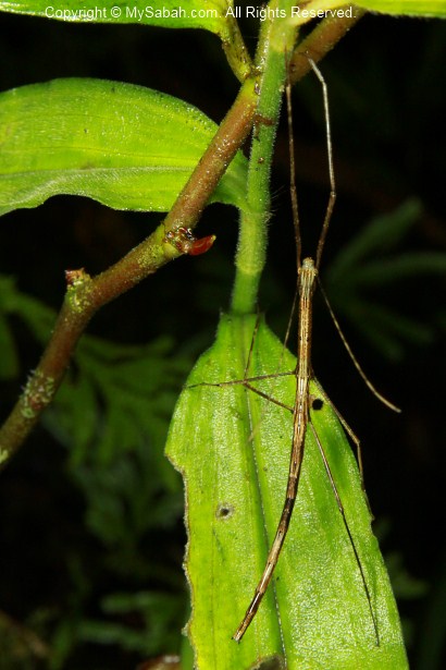
Pic: a mossy stick insect blends into the mossy environment perfectly.


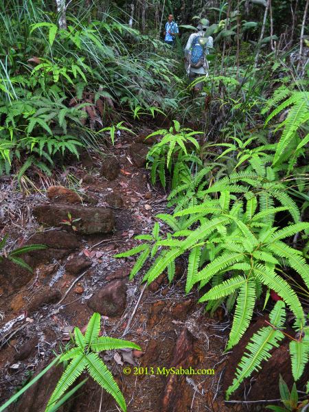
Pic: walking on the ridge near the summit. You can see the exposed reddish-brown ultrabaisc soil. The fern in the photo is Dicranopteris curranii (local name: paku resam), the most abundant fern species, it is ecologically important for moderating harsh surface temperature environment.

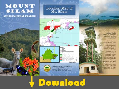
For more reading on natural wonders of Mount Silam, you may download the pamphlet below (published by Sabah Forestry Department):

Personally, for hikers in Sabah’s East Coast, I think Mount Silam is the best mountain for an enjoyable half-day climb, because it is easy and rich in flora and fauna. For more info (accommodation, direction, etc.) about Mt. Silam, you may read my earlier post about Tower of Heaven.

Photos taken in Lahad Datu, Sabah, Malaysia Borneo

Madai Waterfall and Tongkat Ali Hill of Kunak, Sabah

Waterfall is a delightful view and always be part of the painting about paradise. The bigger it is, the happier the visitors. That’s how the 40-Meter Madai Waterfall drew me to Kunak, a small town in Lahad Datu district. In fact, many European and Asian tourists had come for it. I have visited many waterfalls of Sabah, and Madai Fall is one of the most impressive.


The 5-storey high Madai Waterfall is located in 3,436.50-Hectare Madai Baturong Virgin Forest Reserve Nature Center, which is managed by the Sabah Forestry Department and opened to the public since 1999. Madai Cave is also part of this reserve.


Pic: Madai Waterfall is inside Pusat Sejadi Hutan Simpan Madai Baturong (Madai Baturong Forest Reserve Nature Center) of Kunak.

As Madai-Baturong Forest Reserve Nature Center is a public park, anyone can pay a small entrance fee to enjoy Madai Waterfall. Below is the ticket rate:

  • Malaysian: Adult: MYR2.00 (≈USD0.66); Below 18: MYR1 (≈USD0.33)
  • Foreigner: Adult: MYR5.00 (≈USD1.66); Below 18: MYR2 (≈USD0.66)

Madai Waterfall

Madai Waterfall is very accessible. It is so near that you can hear it, once you walk into the park. Remember to bring insect repellent, as mosquitoes might be around.


Pic: the wooden staircase to Madai Fall.


It is only a 1-minute walk. The boardwalk is quite steep, be careful..


Pic: huge Alocasia odora next to staircase. This plant has the largest undivided leaf in the world.


Pic: Madai Waterfall in the sight!


Pic: the “twin” Madai Waterfall. After heavy rain, both will merge into one huge vertical fall. Though the water is murky, it is clean and cooling.


Due to the powerful splash, the air was filled with flying droplets. When the morning light shined through them, it created fascinating rays of light. Such a lovely view.


Pic: the warning sign near the Madai Fall.

Any water activity such as swimming is prohibited, because the waterfall pond is deep. Basically, this waterfall is meant to be watched only. Anyway, you can soak your feet in the shallow water, like most people do. Anything beyond that is on your own risk. There is no lifeguard around to stop you or to save you.


However, some visitors can’t resist to take a swim under this beautiful waterfall. A ranger told me that he saw a very deep hole in the center of waterfall pond after a 8-month drought. Madai is in a limestone area, so I wonder if this hole connects to an underground cave or river. Well, I’m just guessing.

Want to see Madai Waterfall in motion? You may watch the 90-sec video below:


During weekends and holiday, many locals come here to swim and picnic. Some of them taking bath (with soap) or washing their dirty plates in the stream, which flows to Tingkayu River. It’s not right.. 🙁


Pic: dense moss behind the Madai Fall.


The park opens from 8am to 5pm every day. The waterfall is quite crowded afternoon.


Pic: gold found at Madai Fall?

Wishing Tree

Besides Madai Waterfall, I found an interesting tree in Madai-Baturong Nature Center. The local calls it a “Wishing Tree” (Pokok Hajat).


Pic: the wishing tree is standing near the entrance of canopy walk.


It is a tall tree, which is locally known as “Kayu Ara” (Ficus species, Moraceae). Many birds will gather on this tree during its fruiting season.


Every ribbon on the tree root is a wish of the asker. Probably it works, so there are hundred of ribbons on this wishing tree.


Whatever, it is a tall and magnificent tree to look at. I wish it will stay strong and healthy forever.

Bukit Tongkat Ali

Bukit Tongkat Ali (Tongkat Ali Hill) is another attraction in Madai Baturong Forest Reserve. This hill is named after a herb Tongkat Ali (species: Eurycoma longifolia, Nicknamed “Asian Viagra”), which is famous for the medicinal properties of its root that can increase testosterone level and treat erectile dysfunction.


Pic: Tongkat Ali tree


Visitors can hike to Bukit Tongkat Ali via a 1 KM trail in the park. When you enter the park, just turn right and follow a small road that leads you to a small bridge and rest shelter. The trail starts at a paved path behind the shelter.


Though the trail is less than 1 KM, it is steep and tiring. The trail is paved with cement. It is supposed to be a good idea. However, the moss cover on the cement becomes so slippery that, after rain, the trail turns into a skating route. In some sections of the trail, I had to hug the hand rail to descend carefully.


Pic: the last shelter on top of Bukit Tongkat Ali (Height: 169 Meters).

I was told that Bukit Tongkat Ali was abundant with wild Tongkat Ali, but I only saw one or two. Probably some impotent visitors pluck it. I was also told that I could see Madai Hill from the top of Bukit Tongkat Ali, but such view was obstructed by dense trees.

Sorry to say, spending nearly 2 hours walking up and down Bukit Tongkat Ali is simply a waste of time.

Public Amenities

Madai Baturong Nature Center have some basic amenities in place for visitors.


Currently (as of Nov 2012), the canopy walk is closed for maintenance until further notice. Too bad, this 119-Meter long and 40-Meter high canopy walk, which is connected to three giant rainforest trees (Seraya Urat Mata, Oba Suluk and Merbau species), is a main attraction of the park, besides Madai Waterfall.


Pic: public toilet


The toilet is very clean and deserves MYR0.30 (≈USD0.10) per entry.


Pic: the Canteen (named Kantin Sri Baturong Madai) in the park

This canteen sells common food items such as fried rice and noodles, as well as cold and hot drink. It was closed for holiday during my visit.


Pic: there is another small food stall near the gate, but they are selling drink and light snack only.


Pic: (left) shower and changing room, (right) Muslim prayer rooms or Surau


Pic: ample parking space for 20 to 30 cars.

Their rest house is closed and the Exhibition Hall is not ready (as of Nov 2012). You still can camp in the park for a small fee (MYR3 for Malaysian, MYR5 for foreigner). I hope they will upgrade the facilities and amenities there ASAP to attract more tourists.

Wildlife

I heard hornbill near Madai Waterfall. At night, there are mouse deer wandering in the park too. The rangers mentioned a bird with a funny local name “Burung Kopi Susu” (Milk Coffee Bird). According to them, this is a small black bird with white stripes on its wings. This bird is common there and can be seen around 5pm. It sings very well, so people trap and trade them as pet. I wonder what bird it is. Magpie Robin?


Pic: Is Magpie Robin the “Milk Coffee Bird”?

How to Get There

Going to Madai-Baturong Forest Reserve Nature Center is easy but far. Madai Waterfall is 15 KM north of Kunak town and 71 KM southwest of Lahad Datu.


Pic: Madai-Baturong Nature Center is just next to the Lahad Datu↔Tawau highway.

By Bus: If you take Long-Distance Bus from Kota Kinabalu city to Kunak or Tawau, you can ask your bus driver to drop you right in front of the park, which is at the roadside (15 KM before Kunak). The bus fare is MYR50 (≈USD16.67) one way and the ride takes 8 hours.

By Flight: Take a 45-minute flight from Kota Kinabalu to Lahad Datu, then spend an hour on taxi to reach the park.

Below is the location map of the park:

View My Sabah Map in a larger map

For more information, you may contact Kunak Regional Forestry Office:
Address: P.O.Box No 2, 91207 Kunak, Sabah, Malaysia.
Tel: +60 89-851863

Photos taken in Kunak, Sabah, Malaysia Borneo

Sepilok Giant, the Oldest Tree of Sabah

With an estimated age of 800 to 1,000 years, the Sepilok Giant, in Rainforest Discovery Center (RDC) of Sepilok, Sandakan, is the oldest tree of Sabah, well, unofficially. Our Borneo rainforest has existed for over 100 millions years, so I have no doubt there might be other older tree standing in an unexplored forest of Sabah.


Reaching this old tree requires no vigorous hiking. Just go to Rainforest Discovery Center (RDC), about 23 KM from Sandakan, and a few KM before the famous Sepilok Orangutan Rehabilitation Center. You need to walk about 2 KM in nature trail under the dense trees.


The jungle trail is mainly used by visitors for bird watching. You will see signages and markers along the way. Though you will walk under the tree shades, the air is warm and humid, you better bring some water with you. During rainy season, a few small forest leeches would lurk under the leaves on your path, but don’t worry too much about them.


Pic: the junction to the Sepilok Giant, we are now only 670 M away from it.

Most tour guides know the shortcut and park near this junction. This will cut half of your walking distance.


Pic: the location map of the trail to Sepilok Giant.


RDC is inside the Kabili-Sepilok Forest Reserve, one of the most well-preserved rainforest of Sabah, so you will see other giant trees too.


Pic: Sepilok Giant? Not yet. But it’s a tall tree anyway.


Pic: Finally, a signage confirms that we find Sepilok Giant. Yes, it is a living tree.


Pic: we look so small under it. Sepilok Giant is 65 Meters in height, as tall as a 19-floor building!

Sepilok Giant is from the Dipterocarpaceae tree family. It is locally known as seraya runcing (Shorea acutissima) and traded under the name yellow seraya.


Other facts about Sepilok Giant:
Girth: 7 Meters
Diameter: 2.2 Meters
Total Height: 65 Meters
Height to Lowest Branch: 32 Meters
Saleable Volume: 82 M
Above Ground Carbon: 28 Tonnes


Pic: another side of Sepilok Giant

By now you should know why it is known as giant.

FYI, the oldest (and largest) tree of Malaysia is a 1,300-year-old Chengal Tree in Pasir Raja Forest Reserve, Terengganu. The oldest living tree in the world is a 9,550 years old spruce in the Dalarna, Sweden.

Related Posts
The Tallest Tropical Tree in the World
Rainforest Discovery Center (RDC)

Photos taken in Sandakan, Sabah, Malaysia Borneo

Imbak Canyon, the Green Canyon of Borneo

Most tourists and researchers, who have visited Danum Valley or Maliau Basin, agree that Sabah has the best Borneo rainforests. Both forest reserves are so pristine that they would become our next UNESCO World Heritage Sites. You will be happy to know that Imbak Canyon, a Class-1 30,000-Ha Forest Reserve in the Heart of Sabah, is as high quality as them.


As seen in the map above, Imbak Canyon is a 3-KM-wide valley about 150 Meters above sea level (asl), flanked by ridges running parallel 25 KM from west to east, which are mainly sandstone cliffs with a height up to 1,500 Meters asl. This impressive landscape is formed by 750 Meters carving of the Sungai Imbak (Imbak River) over thousands of years. Though Imbak Canyon is not as majestic as Grand Canyon, it has dense forest that is over 100 million years old. It is a “Green Canyon”!


Pic: Imbak Canyon is just at the north of Maliau Basin.

Road Trip to Imbak Canyon

However, to get there, you need to drive nearly 300 KM for more than 6 hours from Kota Kinabalu (KK) to this remote forest. The 3.5-hour drive from KK to Telupid town is on paved road, the rest on gravel & muddy road, which can be steep and muddy. Probably that’s why it isn’t a popular destination for ordinary tourists.


Pic: the junction to Imbak Canyon at Tongod. This marks the start of our 3-hour bumpy ride.


Though Imbak Canyon is only accessible by 4-Wheel Drive (4WD), some loves this and call this an adventure. Trust me, this is the most “violent” ride that I ever followed. The feeling is like sitting on the wild horse that tries to throw you out of its back. Thrilling though.


The 4WD needs to be equipped with snorkel (to cross river), locker and jungle trekker tyres (with costs RM1,000 each). Besides, you need a skillful 4WD driver, not those middle-aged uncles who drive 4WD in city street. We are glad to have Gilbert, a North Borneo Safari driver to come with us. His 4WD is unstoppable and he also helped to pull out a few 4WDs stranded in mud during the course.

You can watch the following 2-min video of our 4WD trip:

Click Here for wider video


We stopped by Kampung Imbak (Imbak Village) in Tongod for a short break and buying supplies. This village is the last civilization on the way to Imbak Canyon.


Pic: funny signage that translated as “Attention. Please don’t drive too fast if you know the law. Be careful, this is village area, or else.” Probably the villagers are unhappy of the dust created by passing vehicles.


Pic: red BBQ chicken wing of Kg. Imbak. They apply coloring that looks like roasted pork (??).


Pic: grocery shop that sells chicken meat and seafood.


We continued our journey after shopping. About 13 KM before Imbak Canyon, we need to cross a wide river, which is the biggest obstacle. There is a bridge under construction. Once the bridge is complete in future, Imbak Canyon will be more ready for tourism.

Update (Nov 2012)!

The bridge is completed and can be used now. However, some may still prefer to cross the river for fun.


Luckily the river is not deep so our 4WDs can cross it without problem. Our trip was cancelled once, because this river was flooded during rainy season. Before the bridge is complete, if it rained, we would needed to wait 3 to 4 hours for the flood to subside before crossing.


In worst case, the water level can reach the window of 4WD.


The bumpy ride can freak out faint-hearted passengers. The trick is not to sit stiff and counter the momentum. Just relax your body and let your weight “stick” you to your seat like soft mud. You will find that your fat is so useful in this case.


We passed by oil palm plantation and saw some electric fences that prevent pygmy elephants from entering.


Finally, we arrive Tampoi Base Camp (or Tampoi Research Station) of Imbak Canyon at 12:30pm. Tampoi is the name of a Borneo fruit. We check-in at Tampoi Camp and have our lunch there. The forest and campsites of Imbak Canyon are managed by Yayasan Sabah Foundation.

Imbak Waterfall

After feeding our stomach, we proceeded to the most famous attraction of Imbak Canyon – the Imbak Waterfall. Imbak Waterfall is only 10 KM away from Tampoi Camp, but it took us more than an hour to get there, due to the steep and slippery road. We were told that we would need to walk, if there was any landslide or fallen tree blocking the way.


Pic: the entrance of Big Belian Camp (BBC Camp), where Imbak Waterfall is located. At the right is a wooden staircase to Imbak Waterfall. Our cars can park near the entrance, so it’s only a short walk to the waterfall, very convenient. The Kangkawat suspension bridge at the left leads you to the jungle trail.


Pic: the view of Imbak Waterfall from the viewing platform. Note the man is so small.


Pic: the front view of Imbak Waterfall and Imbak River. The water is in light tea color but it is very clean. The color is caused by the tannins leaching out from the plant growing in Imbak Canyon.


Imbak Waterfall is a must-see if you visit Imbak Canyon. I would say it is one of the most beautiful waterfalls of Sabah.


Imbak Canyon is an important water catchment area. This Imbak River is one of the sources of Kinabatangan, the longest river of Sabah. More than 30 species of amphibians and reptiles live in this river.


Imbak Waterfall is about 80 Meters in wide and 8 Meters in height. The photo above will give you an idea of its scale. It’s very slippery on top. My friend saw a Sambar Deer (largest deer of Sabah) there.


Pic: close-up of Imbak Waterfall

Look closely and you will see hundreds of cascading “miniature waterfalls” on the sandstone or mudstone layers of Imbak Waterfall, a very interesting feature. Yes, I took a bath at the waterfall. The water is so cooling and refreshing. I didn’t use soap b’coz I don’t want to pollute the river.


Pic: piles of sandstone and mudstone rocks next to Imbak Waterfall


Can you spot the man on the waterfall?

Besides Imbak Waterfall, there are other waterfalls such as Kuli Falls, Majau Falls and Pandan Falls in the canyon. Imbak Canyon is a mountainous region so there are many waterfalls to be discovered.

To see more of Imbak Waterfall, you may watch the 1.5-min video below:

Click Here for wider video

Forest of Imbak Canyon

Imbak Waterall is the most popular attraction of Imbak Canyon, but the real gem is the virgin forest there. In short, Imbak Canyon consists of two main vegetation, i.e., Lowland Dipterocarp Rainforest in the valley (Dipterocarp is the most important tree family of Borneo) and Montane Heath Forest (a.k.a. Kerangas, abundant with native orchids and endemic pitcher plants) on the ridges of higher altitude. Over 70% of the forest is unexplored.


Pic: a tree with huge buttress in BBC Camp. The ranger told me there is a tree with buttress that looks like crocodile in Kuli Camp.

There are a few forest trails in the canyon, ranging from 1 KM to 17 KM in distance, for those who want to do jungle trekking. Even though I stayed in Imbak Canyon for a day, I have seen or heard Serpent eagle, Helmeted hornbill and Gibbon. Many wildlife such as pygmy elephant, sambar deer, leopard, sun bear, mouse deer, orangutan, proboscis monkey and Sumatran rhinoceros also live here.


Pic: a dead tree with big hole that can house 3 to 4 people inside.

Tall trees such as Kapur and Keruing are common in the canyon, and Kapur Merah is the “iconic” tree of Imbak. To scientists, this virgin forest is a “botanical gene bank” where we can source for the seeds of rare and endangered plant species, which are considered high in pharmaceutical and biotechnological potential.

Like other primary rainforest, you can see a lot of fungus, mushroom and termite nest along the nature trails. They play an important ecological role in decomposing rotten dead wood/leaf, to recycle the organic nutrients.


Pic: a huge Ironwood (Belian) tree which is about 800 to 900 years old.

For birders, you will be pleased to know that over 200 bird species are found in Imbak. 5 of them are endemic to Borneo, namely, Borneon Bristlehead, Blue-headed Pitta, Black-throated Wren-Babbler, Borneon Blue Flycatcher and White-browed Shama.

Night walk here is fun as you may find vine snake and scorpion. But be careful of the hornet that is attracted by your torchlight, I was stung twice. It’s so painful that I thought it was snake bite.


Pic: a fully-fed Tiger Leech resting on a twig. It’s so fat and full that it ignored me.

Many are afraid of this blood sucker. Anyway, tiger leech is not a tiger, and its bite is not harmful, so no need to get panic if you see one on your skin. The presence of leech means the forest is healthy and full of wildlife (food source).


Pic: the leeches bypass my anti-leech socks and feast on my leg.


After the leeches are full and drop off my skin, they start to get horny and mate. I’m proud to say that my blood donation contributes to the birth of more baby leeches, haha..

Their mating process is so “intense”. You may watch 30-sec of them in video below:

Click Here for wider video

Tampoi Base Camp

Visitors can overnight in Tampoi Base Camp, which provides basic accommodation and facilities. A 3-day-2-night or longer stay is recommended. They also have camping ground for big student or researcher group. Though no mobile phone coverage, they have Wifi and public phone (i-Talk) in camp. For me, that’s really impressive for a campsite deep in the jungle.

Below is the location of Tampoi Camp and Imbak Waterfall:

View My Sabah Map in a larger map


Pic: Dining & Activity Hall of Tampoi Camp

You would see orangutan wandering around the camp in early morning.


Pic: accommodation of Tampoi Camp. It’s divided into male and female sections.


Pic: bunk beds with mosquito net.

It can be chilling at night, so it’s advisable to bring your sleeping bag for extra warmth. However, the night was warm during my stay. The electricity is cut off between 12am to 3am daily.


Pic: bathroom and toilet in Tampoi Camp

More Photos & Info

You can check out my photo album, to know more about what to expect in the trip. If you decide to visit Imbak Canyon Conservation Area (ICCA), you can book the tour with North Borneo Safari, the tour operator who is experienced in adventure tour and provides everything from 4WD transport, tour guide and meals in the tour.

Photos taken in Tongod, Sabah, Malaysia Borneo

Gigantic Tawai Waterfall in Telupid, the Heart of Sabah

I love waterfall and I couldn’t wait to see the 95-Meter tall Tawai Waterfall, the biggest waterfall in the Heart of Sabah, after my friend told me about it. Tawai Waterfall is located inside the 22,697-ha Tawai Forest Reserve, a 1st-class protected forest managed by Telupid Forestry Department. You must apply a permit from Sabah Forestry Department HQ before entering this protected area.


To reach this destination, first I needed to drive 200 KM from Kota Kinabalu city to Telupid town, which took me about 4 hours driving on a paved road. There is no gasoline station after Ranau, so make sure you fill up your oil tank. To go to Tawai Waterfall from Telupid, you need 4-wheel drive, as it is only accessible via gravel and muddy road.


Luckily it was weekday and the forestry officers also planned to collect seedling and patrol in Tawai forest, so I just followed their vehicle. Otherwise I had to pay nearly RM1,000 to charter a 4WD and guide. The journey is nearly 3 hours one way and part of the road is steep and muddy. We departed in the morning so we could get back before dark.


Our 4WD crossed 3 rivers easily, as they are not deep during dry season. According to the forestry staffs, the old route to Tawai Waterfall took less than an hour, but a bridge was collapsed and they waited for the fund to repair it. Therefore, we had to take the alternative longer route, like a big U-turn, to enter the place from behind.


I had travelled to almost every corner of Sabah, so nothing in Sabah is really new to me. However, during this long ride, I found that I was in a totally strange environment. The vegetation is so different and the “rusty” soil is reddish in color, so I joked to others, “Are we on Mars planet now?”


The forest is blanketed by ferns and dominated by shrubs shorter than 10 Meters, with low number of tall trees scattered around. They told me these are the characteristics of Ultramafic Forest. More on this topic later.


The new and long route passed through other forest reserves such as Deramakot, Tangkulap and Pinangah. Tawai forest is somewhat connected to Kinabatangan, the wildlife sanctuary in Sandakan, so we saw many fresh elephant dropping along our way. I saw a big wild boar and another car spotted a king cobra. The ranger says orangutan also exists in Tawai, I’m so happy to know that.


Pic: starting point of the walk to Tawai Waterfall.

Finally we reached the starting point of the walk before noon. We parked our cars there and walked to the waterfall. I could hear that it is very near and hidden behind the dense wood.


Once I stepped out of my car, my eyes and camera were getting very busy, because I was dearly amazed by what I saw.

Pitcher Plant Garden

There are pitcher plant (Nepenthes) everywhere! They grow among the dense fern plant, on the ground and shrubs.


Every step I took, I saw a new pitcher plant, so I kept stopping and taking photos while the rest had to wait for me. That’s so crazy.


Tawai also has very high density of nepenthes like the heath forest (Kerangas) of Maliau Basin, but both sites have different variety.


In a few minutes, I saw Nepenthes rafflesiana, Nepenthes ampullaria, Nepenthes gracilis, and other probable hybrids. Next time I want to camp here to see more!

Hello… Tawai Waterfall!

Though I was so obsessed with the pitcher plant, I had to catch up with the rest to Tawai Waterfall.


At first, we went to see the top of Tawai Waterfall.


The walk to the top of Tawai Waterfall is only 5 minutes away. There is a shelter near the waterfall.


There is another smaller waterfall (Meliau Waterfall) about 1-hour trekking from here, but we were short of time (and energy) to explore it. Actually Forestry department calls Tawai as Waterfall A and Meliau as Waterfall B.


What I saw was just a river flew to a cliff. From this location, you can’t see the end and tell that it’s a huge waterfall ahead. The edge is so steep and dangerous to explore.


After the “sneak peek”, we took another 300-Meter trail that descends 70 Meters to a viewing point where we could see the whole waterfall.


The climb only takes 20 minutes, but the trail is very steep with uneven surface. I can’t make it without the rope support. The rangers warned me that the rope is nearly 10 years old and it might snap. We just proceeded slowly and cautiously. Luckily the rope is still very strong.


The rope is so old that, over time it slowly embedded into the tree that it lean against, as if someone drills a hole on the tree to install the rope railing. Once the budget is available, they want to build proper facilities such as stairway and toilet for visitors. For now, it is not ready for normal tourists.


Tawai Waterfall in the view. See how small the people are?


So here is the moment, the gigantic Tawai Waterfall right in front of my eyes!


The splash is so strong that it creates a rainbow.


Tons of unpolluted water flowing through pristine forest, what a view! You can watch the 1-min video below to get a feel of it:

Click Here to watch wider video


Pic: Mr. Ismailey, the Telupid District Forestry Officer, with the Tawai Waterfall.

Mr. Ismailey is a nice and adventurous gentleman. He has a vision to turn Tawai into a new nature attraction. Thank you for sharing the beauty of Tawai with me. I also want to thank other Sabah forestry staffs, Bonaventure, Matthew, Micheal, James, Awang and Mohammad for their hospitality. Thank you Datuk Sam (Director of Sabah Forestry Department) for the permit.

Below is the location map of Tawai Waterfall:


View My Sabah Map in a larger map

Ultramafic Forest

Ok, now come back to Ultramafic Forest. After the visit, I think the ultramafic forest is more significant than the waterfall. We can find bigger waterfalls all over the world, but our ultramafic forest is more unique and one of the least studied terrestrial ecosystems in Borneo.


Ultramafic rocks are formed at very high temperatures and pressures in the absence of water, during the process of upwelling of magma and the cooling of the oceanic crust. The soils of ultramafic zone contain magnesium, chromium, cobalt and nickel, which are toxic to most plant and infertile for agricultural purposes. That explains why pitcher plant, which grows well on soils poor of nutrients such as phosphorus, potassium and calcium, flourishes here.


The ultramafic forest occupies about 3,500 Sq. KM, or 4.6 % of the total land area of Sabah. As a result of the soil conditions, the trees in ultramafic forest are relatively shorter than rainforest. The lack of tall timbers allows this forest gets away from logging, and over 60% of the Tawai Forest Reserve in Telupid is still in pristine condition.


Only certain plant species adapt to such soil. 11 unique plants that are endemic to the ultramafic areas are found in Tawai Forest Reserve, and five are recorded only from Tawai and nowhere else in the world.


The ultramafic forest of Tawai can be sub-divided to Lowland Ultramafic Forest (23%), Upland Ultramafic Forest (49%), Lower Montane Ultramafic Forest (5%) and Ultramafic Heath Forest. This may sound meaningless to you, but it is an exciting playground for naturalists and researchers who love to see unique vegetation of Borneo.


Pic: Sembilu, is endemic to Borneo and abundant in Tawai.


Besides the special forest, more than 100 bird species are found in Tawai and bird watchers have started exploring this area and hope to rediscover birds not documented in Sabah. 26 mammals such as wild boars, barking deer (payau), mouse deer, Red leaf monkeys, clouded leopards and gibbons live in Tawai.


I’m glad that Sabah Forestry Department has gazetted Tawai Forest Reserve as protected forest. Otherwise it would have been engulfed by oil palm plantation.

To visit Tawai Forest Reserve, you need to get a permit from Sabah Forestry Department. The tourist infrastructure there is not ready and they are limiting access to this forest, to avoid any damage caused by recreational activities. In other words, no guarantee they will grant you the entry.

More Photos

You may check out my photo album if you want to see more nice pictures:

Photos taken in Telupid, Sabah, Malaysia Borneo

Waterfalls of Poring

How does it feel to stand in front of the majestic 120-Meter Langanan Waterfall in Poring? Langanan Waterfall is one of the tallest waterfalls in Sabah. On the way to this huge waterfall, you will pass by the smaller Kipungit Waterfall and a bat cave, and enjoy nearly 4 Kilometers of nature trail in rainforest. Below is a walk-through for you.


Above: this is the signage at park entrance and where you start your jungle trekking.
As you can see, your first stop Kipungit Waterfall is only 665 Meters away. Please register at the Ticket Counter before you go to Langanan Waterfall.

Kipungit Waterfall

Just follow the path and you will reach Kipungit Recreation Area after 20 minutes. It’s only a relaxing short walk and you are not really in a forest yet.


You would see some tourists playing with water near the Kipungit Waterfall. This is an area for picnic and swimming, and there are a toilet and camping ground nearby. As you are near the river and under the tree shade, the air is more cooling and refreshing.


Kipungit is the most accessible waterfall of Poring. I saw a few girls soaking their feet in calm water, giggling and pull their feet out of water. I tried to do the same and saw many tiny fishes nibble the skin of my feet. Kind of fun, haha.


With a height of only 10 or 12 Meters, Kipungit is nothing if compared to the 120-Meter gigantic Langanan Waterfall. Most tourists are happy with this little waterfall, but I decide to see the bigger Langanan 3.3 KM away.

You may watch the following 40-sec video of Kipungit Waterfall:


One of the birds you would see here is White-crowned shama (see photo above), which is endemic to Borneo and considered as the best singer of rainforest. You could see a dozen of them around the park in early morning. The surrounding rainforest of Poring has over 300 bird species and great for bird watching. Personally I had seen Asian Fairy-bluebird, Yellow-rumped flowerpecker (endemic) and a few types of bulbuls in Poring. Prevost’s Squirrel is also common here.


You will see the signage to Langanan Waterfall near Kipungit Waterfall. At normal walking pace, most people can reach Langanan Waterfall in 2 hours. Before you go, you should have registered first at the Ticket Counter. For safety reason, the Park won’t allow you to go to Langanan Waterfall after 2pm. Do bring water (600-1,000ML), raincoat and snacks (e.g. chocolate, cereal food bar) with you. There are leeches on the jungle trail, so you better put on your anti-leech socks.


After this point, you enter the rainforest and the surrounding won’t be tourist-friendly. The jungle trail to Langanan is quite steep in the first half. Poring is about 400-500 Meters above sea level, and the forest is mainly lowland rainforest and mixed dipterocarp hill forest, characterized by tall and dense tropical trees (20 to 70 Meters high), warm and humid air, and abundant liana and strangler fig tree.

Bat Cave (Gua Kelawar)

After walking for 360 Meters, you will see Bat Cave next to the trail.


There is a broken warning notice sign reads “Visitors are not encouraging to enter the cave” (the grammar sounds funny).


Actually the cave is a deep crevice formed by a few huge boulders that stacked together. The dark and humid space in the cave becomes the ideal roosting spot for bats. You can smell guano from outside.


I tried to go deeper inside the cave. The rock surface is covered with green moss and very slippery, so I don’t recommend you to go in.


There are hundred of bats clinging on the rock wall. The smell of guano was getting stronger so I only stayed shortly.

To see what’s inside Bat Cave, you may watch the 1min-27sec video below:

Rainforest of Poring

I continued my jungle trekking after visiting Bat Cave. The first 1.5 KM of the trail is steepness with 20 to 40 of inclination, like climbing a hill. There is no boardwalk, hand-rail and shelter hut. Part of the trail turned muddy after rain.


You can see some bug along the forested trail, like the 9-inch long millipede above.


I played with a pill millipede that foraged on forest floor.

You can watch the 46-sec video below to see why it is called “Pill” Millipede:


Strangler fig tree is a common sight in Poring rainforest. The host tree is killed by parasitic strangler fig tree that wrap around it.


There is a small stream to cross. The water is shallow with some rocks above water, I can walk on them to cross the river without getting wet.


I saw many burrows on the exposed soil of the slopes. I think they are belong to hornet or wolf spider.


Animal dropping next to a water hole, probably belong to small mammal such as civet.


Shed skin of cicada, can be used as cooling agent for Chinese medicine.


Above: daddy longlegs (harvestmen spider) are everywhere.

Surprisingly, I only saw 3 leeches, far less than I expected. Probably the Park clear the trail twice a month, and leech dislikes ground surface that has no grass and foliage. The buzzing deer flies are more of a concern. They cut a small wound on your skin to suck your blood. The bite will become very itchy for next few days.

Langanan Waterfall

The milestones along the trail have worn out and I had no idea how far I walked. On the way, I saw 2 groups of high school students and 1 group of tourists returning from Langanan. I was dismayed by their answers “the waterfall is still very far away” when I checked my progress with them. 🙁


Anyway, I just kept walking and felt relief to see the signage above. Though I was only half-way there, the trail is not steep anymore from this point on and there are more descending trail.


After long hours of jungle trekking, I heard the thundering sound of Langanan Waterfall not far away. I speed up and finally I reached Langanan Waterfall!!!


This 120-Meter Langanan Waterfall is the tallest waterfall that I’ve ever seen. Before that, the tallest fall I saw was the 38-Meter Takob-Akob Waterfall in Maliau Basin. The huge water volume creates a micro-climate, it was windy there and I was shower by the droplets from splashing water high above.


It’s such a rewarding experience. This huge waterfall really worth my long hours of hiking.

You may watch the 1-min video of Langanan Waterfall below:

Btw, before you leave the Park, don’t forget to sign-off at Ticket Counter to inform the Park that you are back from Langanan safely. Otherwise they will send a search and rescue team to look for you.

More Photos

You may check out my photo album on Poring rainforest for more nice pictures:

Other articles about Poring Hot Springs Park:

  1. Poring Hot Springs bath
  2. Poring Canopy Walkway
  3. Gardens of Poring
  4. The Most Expensive Orchid in the world
  5. Accommodation at Poring
  6. Jackie, orangutan who owns a house
  7. Night walk in Poring rainforest

Photos taken in Poring, Sabah, Malaysia Borneo

Tambunan, Switzerland of the East

If you ask the locals about their impression of Tambunan town, most will answer, “a hilly and tranquil place with beautiful rice fields and surrounded by lush forest.” To me, Tambunan is like a pretty but introvert girl who is shy away from strangers. Only when you care to know her better, you will uncover her hidden gems and fall in love with her.


Above: traditional vs modern houses in Tambunan.


Indeed, Tambunan is so quiet that it gets the least attention from tourists. Tambunan is about 80 Kilometers from Kota Kinabalu city. I went there with a group of friends earlier this month, for a 1-day-1-night homestay program in Tambunan.


There was a twin blooming of rafflesia in Rafflesia Information Center so we dropped by to have a look. You need pure luck to see the blooming of rafflesia coz it has no predictable blooming period and its flower only lasts 6 days. Twin blooming is very rare.


15 Kilometers before Tambunan town, you will see a balustrade at the left of the road, that’s a nice view point of Tambunan Valley with lush paddy fields. By now, you should understand why some calls Tambunan as the “Switzerland of the East”.


Then we come to Timbou Village (Kampung Timbou), which is a homestay venue a few Kilometers away from Tambunan. Datuk Joanna, the coordinator of Tambunan Homestay, introduces us to the guides and villagers of the local community.


They are celebrating Rainforest Festival here, so there is a traditional food competition in their community hall.


We are so lucky that we can sample all traditional dishes prepared by their local best cooks. Frankly, I didn’t have high expectation about those indigenous food coz they are mainly vegetables. But I was wrong. The fresh vegetables taste so delicious that we finish them within 10 minutes and everyone is hungry for more!


To appreciate the traditional music, we are also invited to learn to play gong. It is not as hard as it looks. In 5 minutes, we form a new gong team, haha. You may watch the video below to see our new band in action:

A grandpa and grandma also joined the fun by playing Sompoton (a traditional music instrument of Sabah). Look at the video below. They are so cute.


What I like most is the tree planting program with the community of homestay. Not only they learn the importance of trees, tourists are also welcome to participate in this environmental project, so they can leave something good behind after the visit.


Above: we plant the trees then harvest their fruits in next minute. Just kidding..

Tambunan is also a land full of legend. Every village has its own stories. Like the “pregnant woman” stone (named as “Watu Monontian” in Dusun language) below in Timbou Village. Our guide (and local historian), Regina (right), says, according to local legend, the God turned a pregnant woman into a stone. More on this story later.


As you can see in photo above, the stone really looks like a pregnant woman. I believe this story coz my mom told me that I came from a stone. 😛 This stone was used to be in standing position. But the buffaloes rubbed their bodies on this stone to ease the itch, so it fell one day.


To explore more about the legend of pregnant woman stone, we visit the site where the curse of God started, Wasai Kiukad Waterfall.


However, to reach Wasai Kiukad Waterfall, we need to walk more than 1 hour in a dense secondary forest in Timbou Village. Our destination is a sacred spot with spiritual power, so we are advised not to shout or litter during jungle trekking, or we will be penalized by flood, and only the Bobolian (local priest) can appease the spirits.


The jungle trail is not tourist-friendly. Due to rainy month, part of the trail is really muddy and we need to cross a few streams. Like the photo above, it looks like a grass land, but it has become a “marshland” after heavy rain. At first, I tried to avoid getting wet feet. After my feet sank into deep mud a few times, well, I just forget it. Nobody can stay clean and dry anyway.


When we move deeper into the forest, we see more shrubs and bamboo. There are brown leeches around and some of us are bitten by these little blood suckers. The trail is not challenging but quite tiring. In my heart, I already say, “it’s better to be something really good or I’ll bash the guides.”


After 70 minutes, we reached the site. I didn’t know I had arrived because nobody cheered after the end of long trekking. Everyone avoid making noise to anger the God, as if we are walking into a church. Then I saw a stone “table”. In fact, we also see other stones that look like furniture around this area.

Ms. Kimoi Rugasa (you had seen her in Sompoton video above), a 76-year-old senior from Timbou Village, told me the story about this mysterious site. In the old headhunting era, there was a longhouse situated here. The villagers got really drunk during a festival, so they made fun of animals. They made their dogs and cats danced. Such action angered the God so he sent a heavy storm to flood the longhouse and turned everything into stone. Though a pregnant woman escaped and ran to Timbou Village, she was also turned into a stone, the one that I mention earlier.


Above: a stone that looks like Gong (named Batu Gong). To me, it looks like the shell of a giant snail though. Don’t beat it or do anything funny to it, or you will be penalized by flood, the locals say.


Behind them is the Wasai Kiukad Waterfall.


Above: Wasai Kiukad Waterfall. This place is considered sacred and nobody is allowed to swim here. The water is so clean that you can drink it.


Above: a pile of boulders that locals believe was once a longhouse. That reminds me of Batu Punggul which shares the similar story.


Above: a weird rock in the stream. Look like a snake head?


As it starts to rain, we didn’t stay long, so we leave the forest ASAP. We are transferred to a local family in Keranan Village of Tambunan. Tonight we call it our home.


The “real” homestay of Malaysia is NOT a cheap accommodation with bed & breakfast only. You will stay with a local family house, which is certified by Tourism Malaysia to participate in homestay program. Tourists will live with the family like a friend, not a hotel guest, though the family provides food and bed. The family will make friend and interact with the tourists too, sometimes teaching them farming or making handicraft.


Giro and his sister Katherine are our host. They are really kind and make us feeling at home. Their house and room are very clean too. After having dinner and a couple of rice wine with them, we have a good sleep.


Next morning on our way back to Kota Kinabalu, we drop by a roadside stall (10 Kilometers from Tambunan) to buy some local fruits and fresh vegetables.


FYI, the famous product of Tambunan is Tuhau (pronounced Do-How), a type of sour appetizer made from plant of ginger family. You can find it everywhere in Tambunan.


Tuhau is the favorite food of indigenous people. Actually I dislike it in first try coz it tastes like stink bug. After trying Tuhau a few more times, I can accept it. Well, you should try it at least once, who knows you will like it.

More Photos

You may check out my photo album if you want to see more nice pictures:

Related posts:
Rafflesia Information Center
Mount Trus Madi, the second highest mountain of Malaysia
Mahua Waterfall
Batu Gong (Music Rock)
Kipandi Buttrefly Park

Photos taken in Tambunan, Sabah, Malaysia Borneo

Minitinduk Gorge, ancient gateway to Mt. Kinabalu

Minitinduk Gorge is the ancient gateway to Mt. Kinabalu, as it is on “The Hugh Low Trail”, an original summit trail used by documented first male climbers, Sir Hugh Low (1851) and Sir John Whitehead (1888), and female climber, Lillian Gibbs (1910), of Mt. Kinabalu, the highest peak of Malaysia. After another “tourist” trail opens in 1924 (by R.F. Evan and Sarel), climbers / tourists are no longer using this trail located in Kampung Kiau (Kiau Village) of Kota Belud district.


Last month I joined a 2-day-1-night camping trip organized by The Sabah Society to explore the gorge. The weather was good for the past few days until we departed in the afternoon, but the heavy downpour didn’t hold us back. By 2:30pm, we reached the junction to Kampung Kiau (Kiau Village), which is a few Kilometers (KM) after Nabalu and 29 KM before Ranau, and where we met up with Mr. Martin Moguring, our guide from Kinabalu Park. Dr. Ravi, the co-writer of the book “The Hugh Low Trail”, is the organizer of this trip.


Then we drove to the school in Kiau Village, which takes another 30 minutes. We parked our cars in the village and walked to the starting point, just a stone throw away from the village. We were told in advance that we will cross multiple small rivers, so most of us were wearing short. Our group also hired 3 porters (Rony, Abinus and Bengent) to carry some of our bags and supplies.

Jungle Trekking & River Crossing


The distance from Kiau Village to Minitinduk Gorge is only 3.5 KM and take about 2 hours of trekking. For the first day, we walk 3 KM to Sambatang Cave and camp there. The second day we walk from the cave to the Gorge, which is only 500 Meters away. FYI, the gorge is in a private land outside of the Kinabalu Park boundary.


In the beginning, we passed through the farmland, mainly consists of paddy, maize, ginger and other food crops.


Pretty soon we entered the secondary forest, characterized by dense undergrowth. It is still raining so it’s very humid in the forest and this “activates” the little brown forest leeches that live in deeper jungle and love wet environment (and our blood!). There are not many of them and most are only 1cm in length. I had seen forest leeches 5 times bigger in primary rainforest, so these tiny-sized blood suckers didn’t bother me. I didn’t even feel that I got one leech bite until I saw my leg bleeds.


Though it’s a newly generated forest, there are still potential dangers around. Like the harmless looking plant in photo above, its leaves are poisonous and able to make your skin really painful and itchy when touched. But there are many “good” plant too, Martin shows us some plant that can be used as food, preservatives or herbal medicines by local people.


As I’m an experienced hiker, the trail is not rugged and I consider it as an easy walk, not strenuous and challenging at all. Most of the time, we moved on the nature trail adjacent to the Kadamaian River and its tributaries such as Kolapis, and there are about 10 river crossing. But I’m not so used to river crossing. After heavy rain, the rivers rose, turning swift and deep.


Though the depth of river only reaches our knee level, the current is strong enough to push you down if you don’t stand firm. The worst thing is the murky water caused by heavy rain, we can’t see the irregular bottom. We had to cross slowly, probing the depth in front with one foot to avoid stepping into deeper water. I almost fell into the icy-cold water with my camera once.

My best advise is – Trust NO rock and boulder near the river. They all look deceptively safe to step on, but they offer zero friction, after being “waxed” by the river for a long time!


Our socks are soaking wet. Only Dr. Ravi walks with happy dry feet. He also shows us his simple solution – just drill a hole on the shoe for draining of water, lol.


As we were moving further up the river, the boulders get bigger and bigger and see more and more cascading streams, the characteristics of river upstream. The water is so clean, unlike other milk-tea color rivers caused by excessive logging in upstream area (e.g. Padas) of Sabah.

Sambatang Cave

Finally we reach Sambatang Cave at 5:30pm!


Actually Sambatang Cave is a cavernous space under an overhanging huge boulder. It can accommodate 3 to 4 people.


Since the daylight is vanishing, we quickly setup 3 camping tents on the flat area near the cave.


According to the porters, Sambatang Cave is an ideal natural shelter, even the heaviest rain can’t flood the cave.


The porters collected some wood and started a camp fire to “smoke” the cave, as the smell can keep creepy animals such as snake and centipede away from the cave. I’m so happy to keep my feet dry and warm.


Light not only attract insect, it also draws human. After having instant noodle as dinner and a few rounds of hot coffee, everyone squeezes into this small cave to warm themselves up with camp fire.

Night Walk


When I started to see bugs crawling around the cave, I decided to take a night walk to check out the bug party in forest.


Above: a stick insect pretends or thinks that it’s a stick.


You can hear a lot of frog calls near the river.


Same as frog, toad is everywhere too.


Above: This little green frog is almost invisible on the green fern.


When the night is late, I go to bed in Sambatang Cave, which is also the place the early explorers like Sir John Whitehead and Lilian Gibbs spent their night before heading to the summit, as described in their chronicles more than a hundred years ago. Do remember to bring floor mat and sleeping bag if you plan to sleep inside the cave. Torchlight / LED headlamp is needed if you want to do your business in dark night. The night was so cold that I can feel the chill in my 7°C-grade sleeping bag.

What’s for Breakfast?


My biological clock waked me up at 6am next morning. I saw the porters busy preparing breakfast. From their happy smiles, they must be waiting for something really tasty.


Out of curiosity, I take a look what is inside the pot. Oh dear, those are the frogs they catch. No wonder I saw them searching for something along the river last night. Well, I was there hunting for frog photos but they hunt for the frog meat.


Then they grill the frog over the fire. Please note that only certain frog species are edible as some are poisonous. You can find the edible frogs for sales in local native market called “Tamu”. Species such as Limnonectes ingeri (greater swamp frog), Limnonectes kuhlii (Large-headed Frog) and Limnonectes leporinus (Giant River Frog) yield high demand as food by local people.


Above: almost done…


They gave a frog leg for me to try. Being open-minded and “adventurous”, I eat it. To my surprise, the frog meat is so sweet and tender. It is slightly chewy but taste a lot better than chicken, trust me.

Minitinduk Gorge


After breakfast, we leave our bags in cave and head to Minitinduk Gorge, which is only 500 Meters away. 15 minutes later, we exit the dense canopy and see Minitinduk Gorge is right in front of us! Minitinduk means “the meeting of two beaks” in Dusun language. The gorge looks like a twin towers less than 50 feet from each other, with Kadamaian River flows between them. Someone believe the gap is even narrower and both sides almost touching each other in the past, as a legend says a Kiau couple can jump over to the other side, when they try to escape from a group of headhunters from Bundu Tuhan.


We take a group photo with banner. We look so small in the photo. The gorge is about 150 feet in height. There is a theory saying that the gorge was once a waterfall with a lake at the bottom. One day the waterfall collapsed and creates the gap that bisected the hill, based on a historical record that there should be a lake under Mt. Kinabalu but is never found.


Inside the gorge is an opening with Kadamaian River flows between the vertical rocky cliffs. Even though tourists nowadays don’t use this trail, the Kadazandusun people believe this is still the holy trail for the spirits of the dead to go to their final resting place, the Mount Kinabalu, and this gorge is the gate. It sounds scary when our day of visit coincides with the Chinese ghost festival day.


The water of Kadamaian River is from Mt. Kinabalu. It looks cleaner than our tap water and nice for a dip. Too bad I didn’t bring my swim trunk.


If you follow the ancient trail further upstream, you can reach the summit trail of tourists at Lowii or Paka Shelter of Mt. Kinabalu. On the way, you will see super-huge Kadamaian Waterfall. Someone estimate the height of Kadamaian Waterfall is about 250 to 350 Meters and could be the tallest waterfall of Malaysia.


Enough with photo-taking, we left Minitinduk Gorge. It is really a nice trip over the weekend.


We packed our backpack and go back to Kota Kinabalu city at 11am. Personally I would like to thank The Sabah Society members who spent months of research to retrace this historical trail. You may watch the 6-minute video on our trip to Minitinduk Gorge.

More Photos

You may check out the photo album of Minitinduk Gorge for more nice pictures:

Reference
“The Hugh Low Trail: The Quest for the Historical Trail to the Summit of Kinabalu” by Dr. Ravi Mandalam, Dr. Chin Shui Hiung and Christopher Chin, published by The Sabah Society, Jan 2004

Photos taken in Kota Belud, Sabah, Malaysia Borneo