Tag Archives: climbing

Standing on the peak of Maragang Hill

Why You Should Climb Maragang Hill

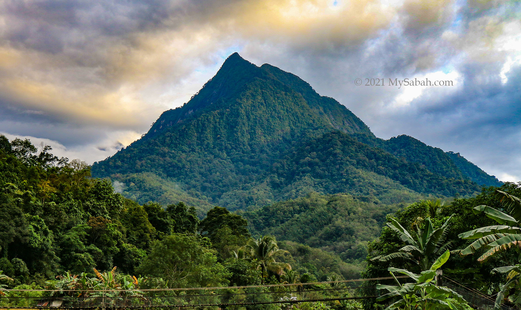
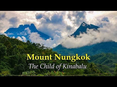
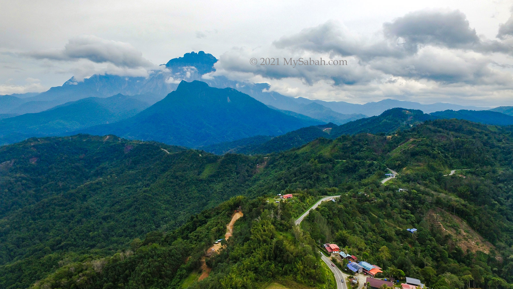
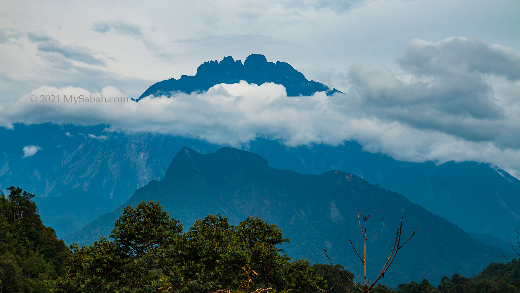
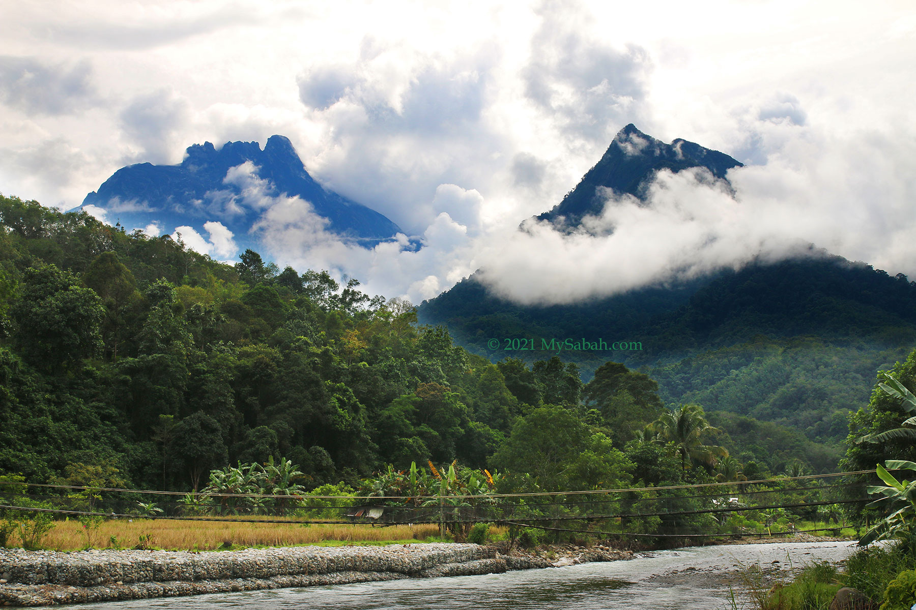
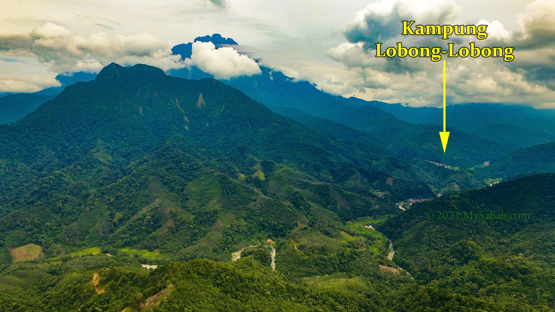
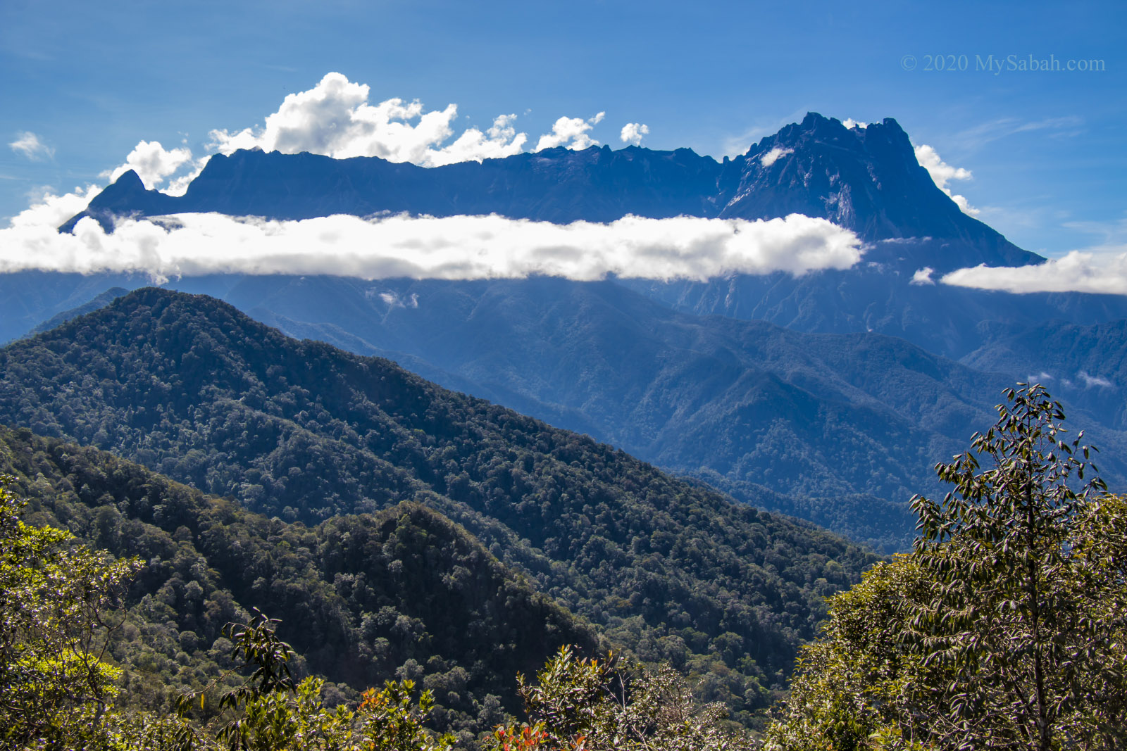
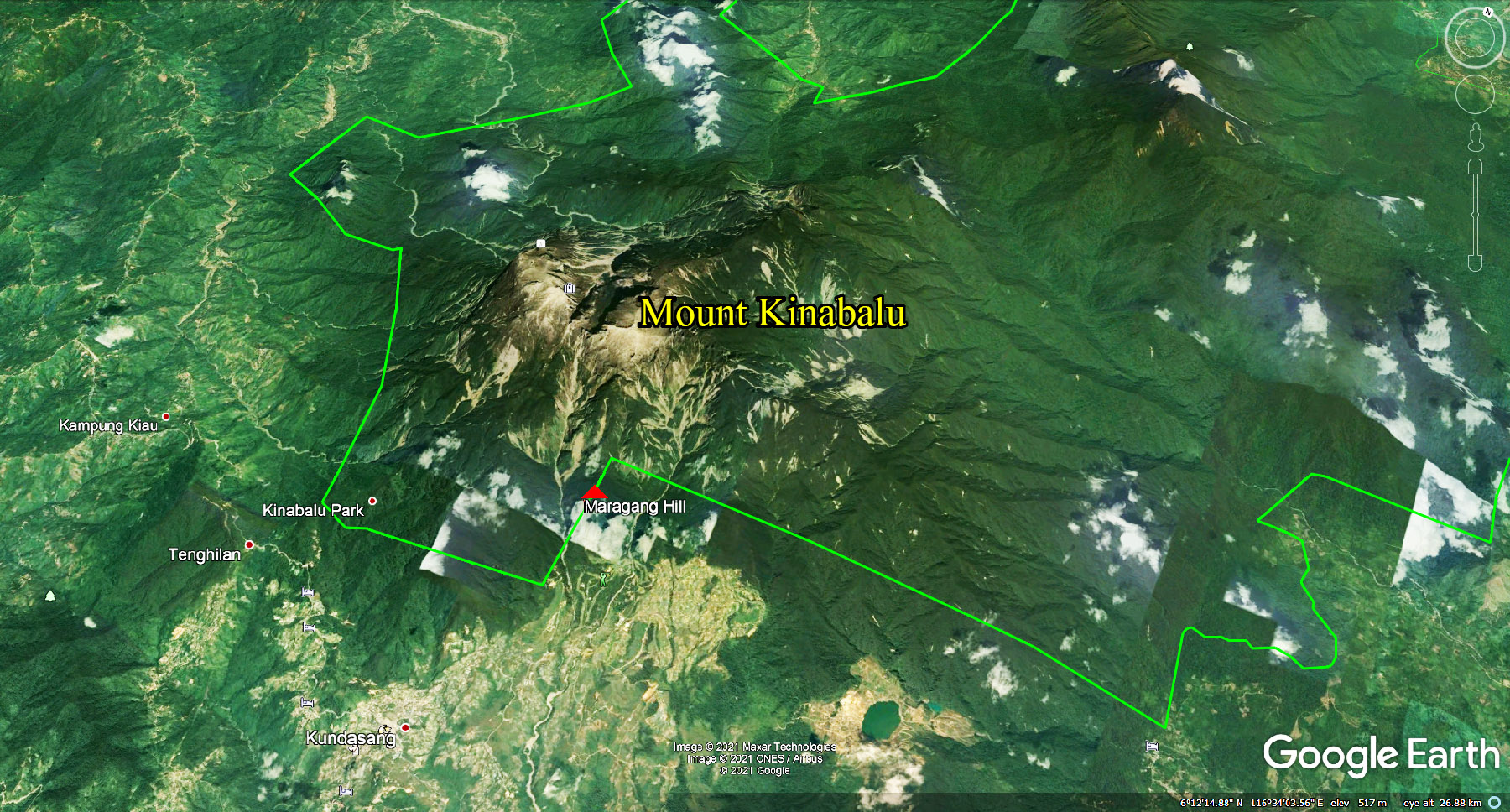
Can you believe that you only need to hike 1.6 Kilometers (about a mile) to the peak of Maragang Hill, for one of the most spectacular views of Mount Kinabalu (the highest mountain of Malaysia)? I felt a bit guilty when I conquered Maragang Hill, so easy that it’s like cheating. The closer you are to Mount Kinabalu, the more stunning her scenery, and Maragang Hill is probably the hill nearest to Mount Kinabalu.

The peaks of the Eastern Plateau of Mount Kinabalu can be seen on Maragang Hill, which is named after the Red (or Maroon) Leaf Monkey endemic to Borneo.

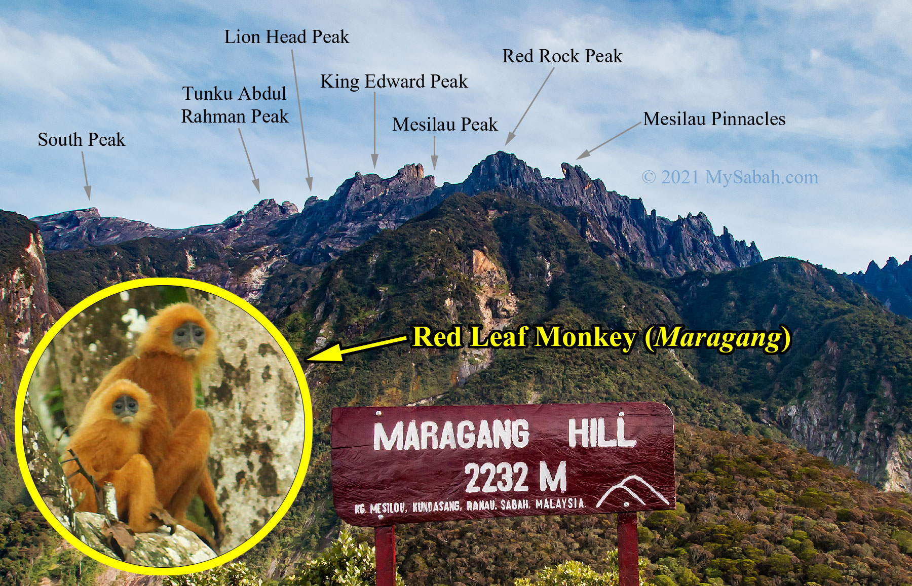
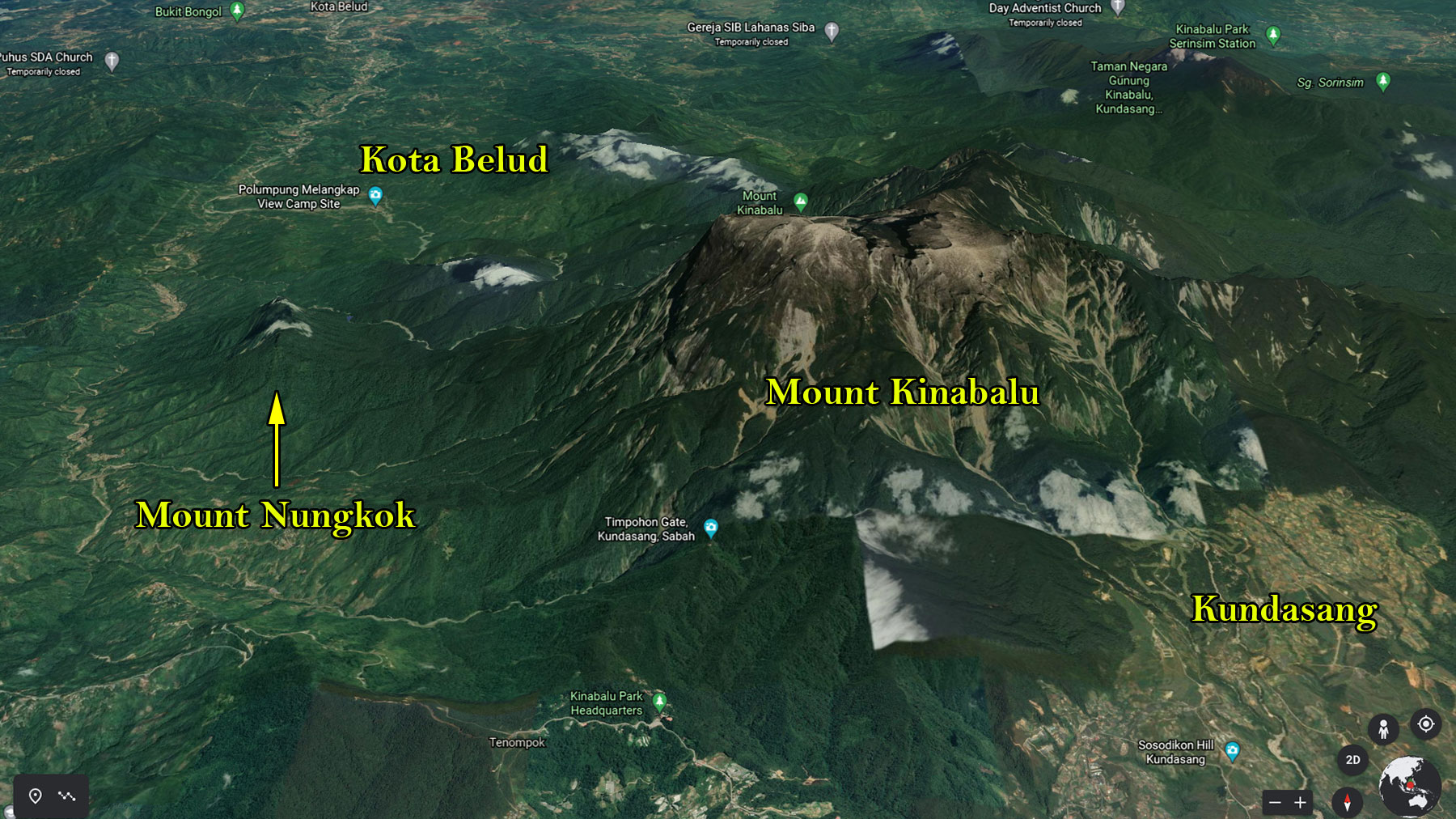
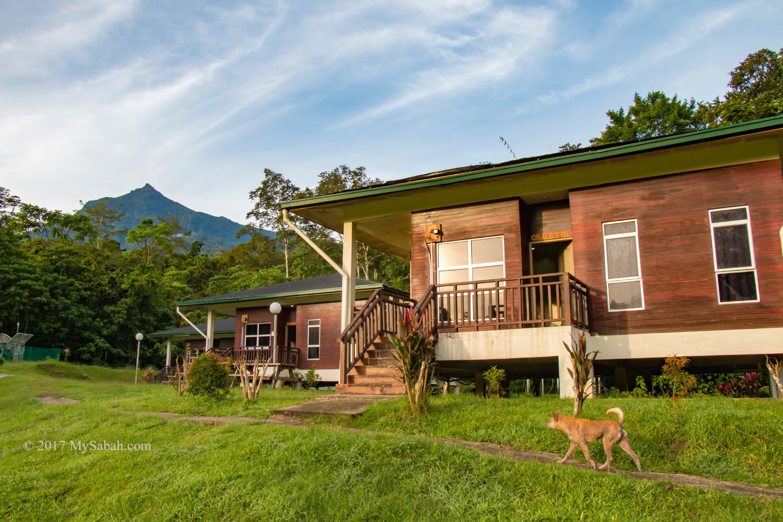
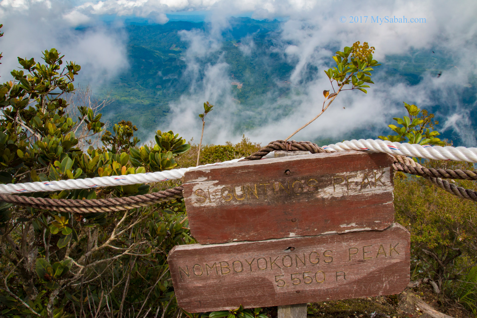
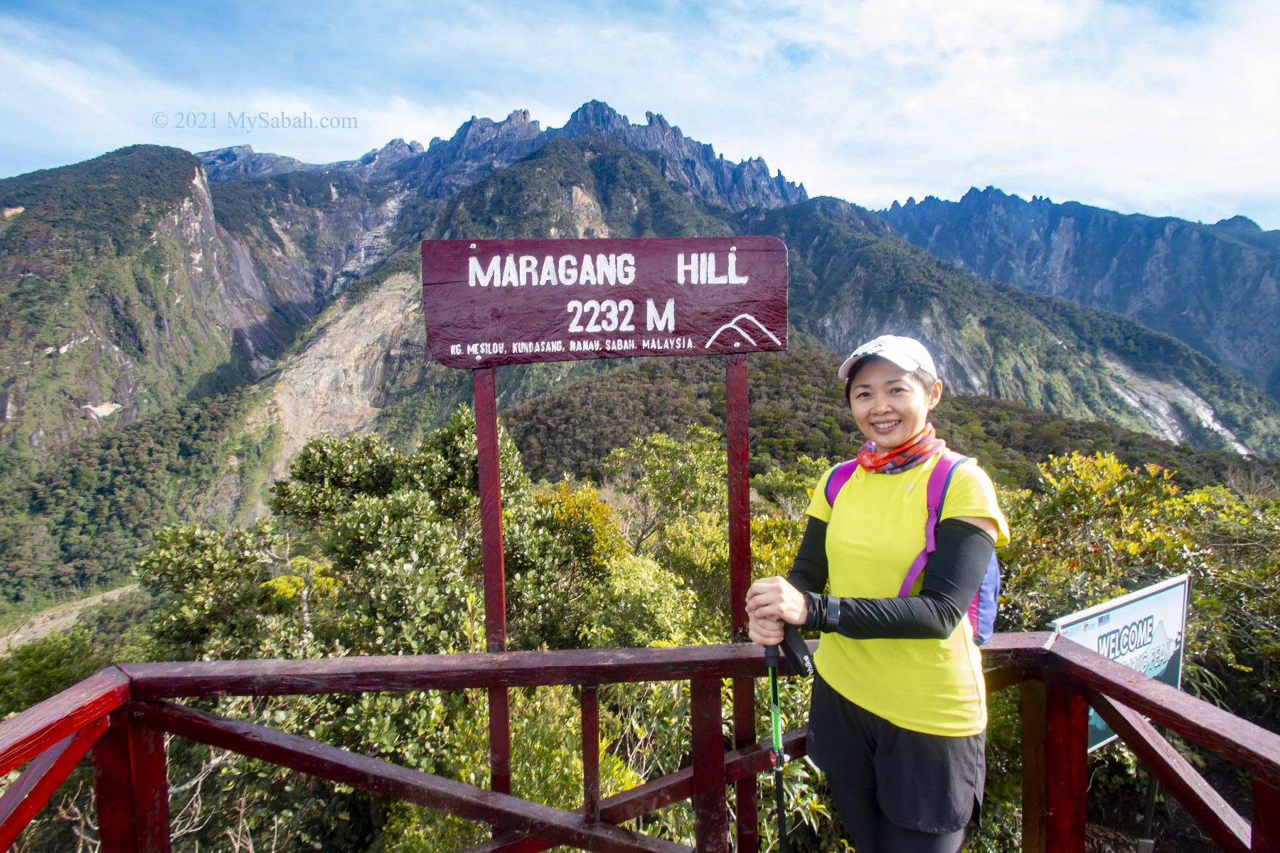
With a height of 2,232 Metres (7,323 Feet) and located in Mesilau (of Kundasang, Sabah), Maragang Hill is a gigantic stairway for climbers to meet our giant mountain up-close. Maragang is the Dusun (Sabah’s native) name of Red or Maroon Leaf Monkey (Scientific Name: Presbytis rubicunda), an elusive monkey endemic to Borneo. You can see Red Leaf Monkey as a “hill monkey”. Unlike other primates which avoid high altitude, Red Leaf Monkey is adapted to the highland habitats. In Jan 2021, four Maragang were spotted in Panalaban (3,272 Metres above sea level!!!) of Mount Kinabalu and the discovery went viral.

Maragang Hill is near the border (light green line) of Kinabalu National Park. The distance between the highest peak of Mount Kinabalu and Maragang Peak is only 5 KM!

About the Climb

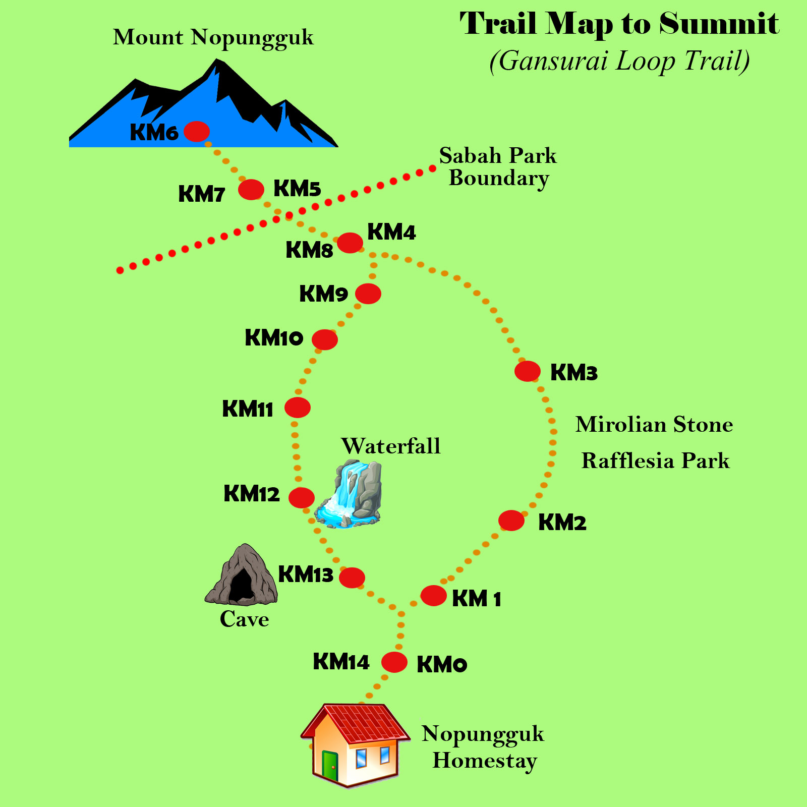
Climbing Maragang Hill requires very little preparation and the trip takes only half-day. You only need to book the tour in advance. The hiking distance to the peak of Maragang Hill is only 1.6 Kilometer one way. You can reach the summit in an hour if you are really fit. Normally most people take 1.5 hours to reach the top. Yes, 2,232 Meters sounds high, but the climb starts at 1,835 Metres above sea level, so you only need to move up 397 Meters to conquer Maragang Hill.

The height of Maragang Hall is 2,232 Meters (7,323 Feet), and the climb starts at 1,835 Meters above sea level.

Time Table

The following is the standard schedule of the climb:

  • 6:00am Registration at the admin office (in Mesilau)
  • 6:30am Transfer to the starting point
  • 6:45am Safety briefing by your guide
  • 7:00am Start climbing
  • 8:30am Reach the peak of Maragang Hill
  • 10:00am Descend to the starting point
  • 11:30am End of climb

Sunrise Hike starts at 3:00am but the flow is the same.

My Climbing Experience

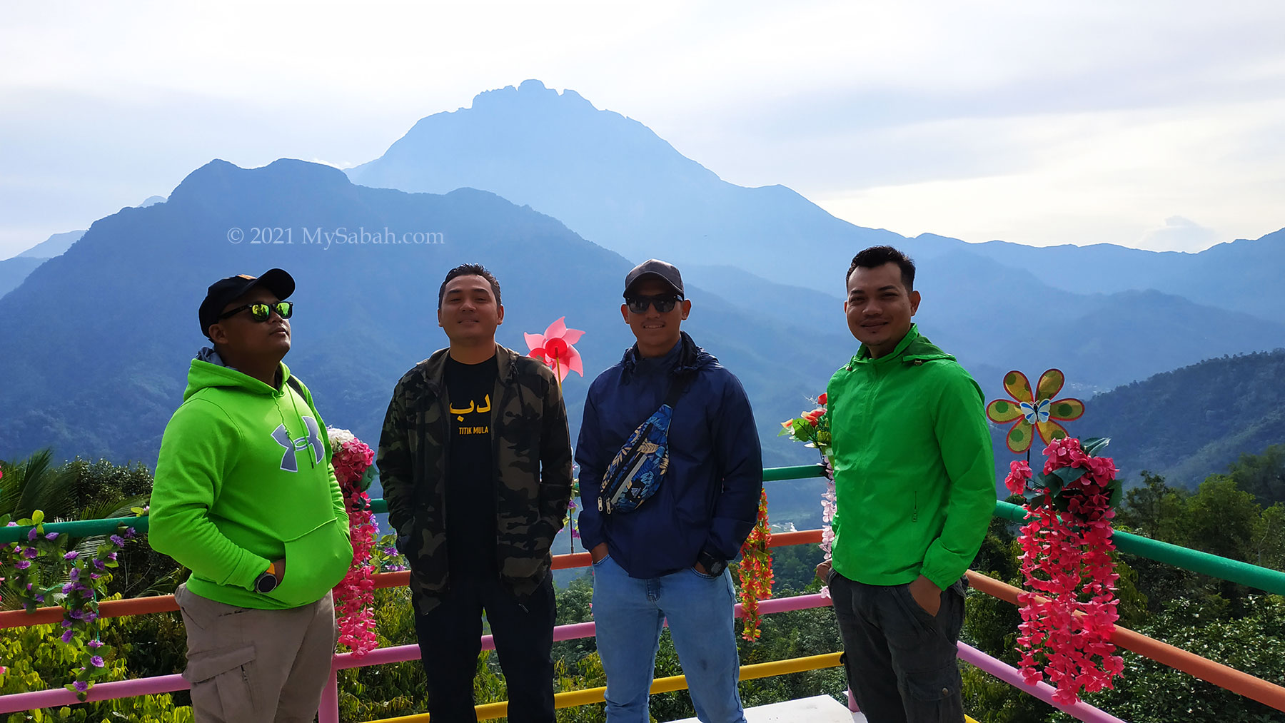
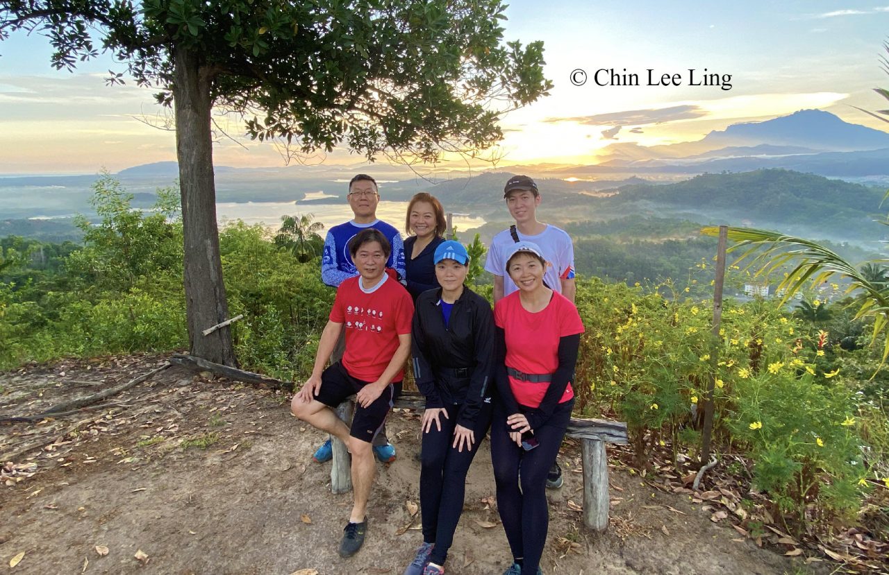
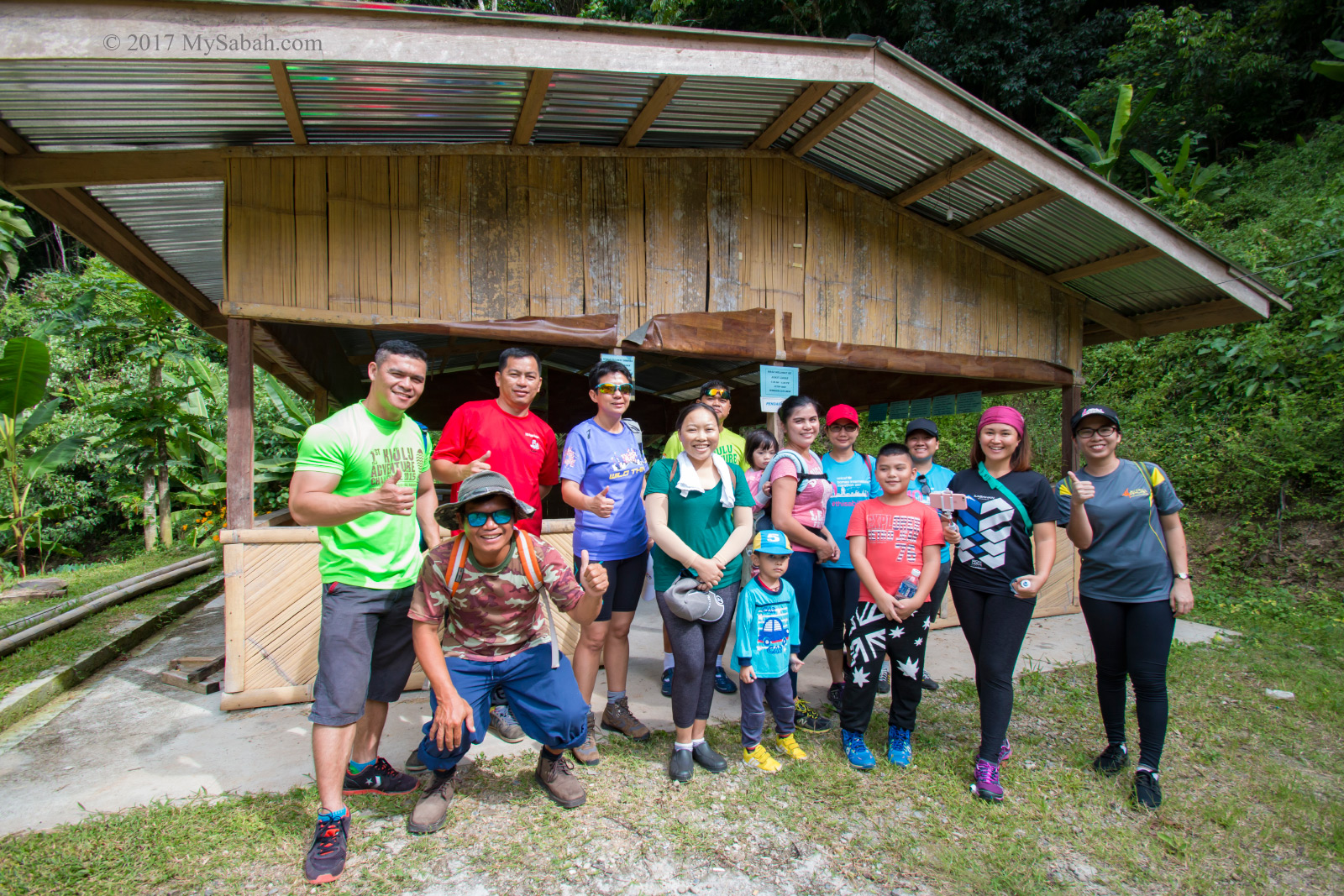
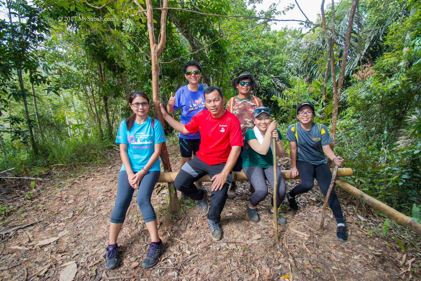
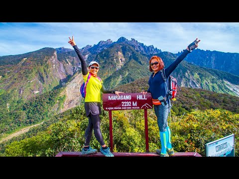
I was climbing Maragang Hill with 4 friends last month. We didn’t want to drive 3 hours in midnight to rush from Kota Kinabalu (KK) to Mesilau, so we spent a night in Kundasang, which is only 15 minutes away from Mesilau by car. Next day we waked up around 5am to prepare for the climb. It was so windy and chilling in the morning. Though it’s only 20°C (68°F), I wore three layers of clothing (two T-shirt and a jacket) to keep warm. You can watch the walkthrough video below if you don’t want to read further.

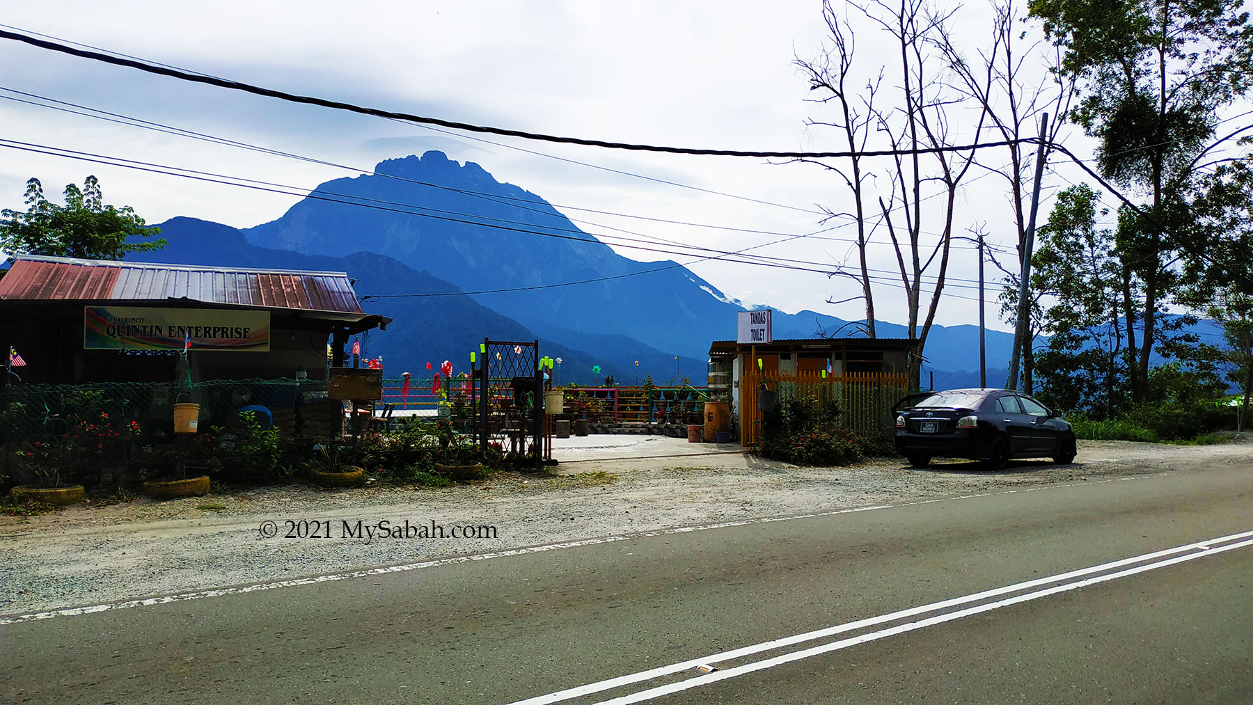
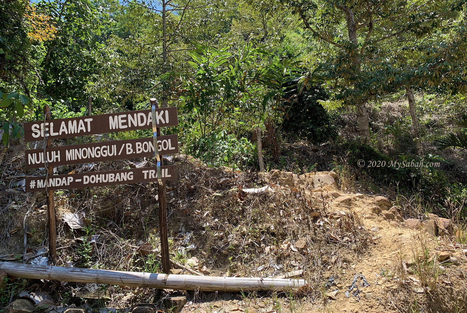
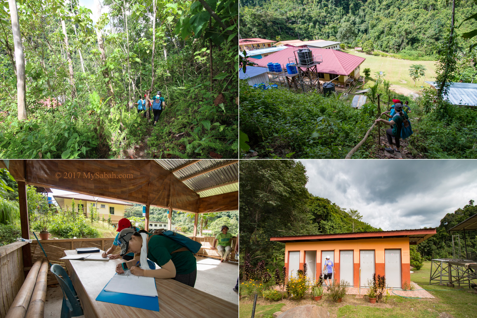
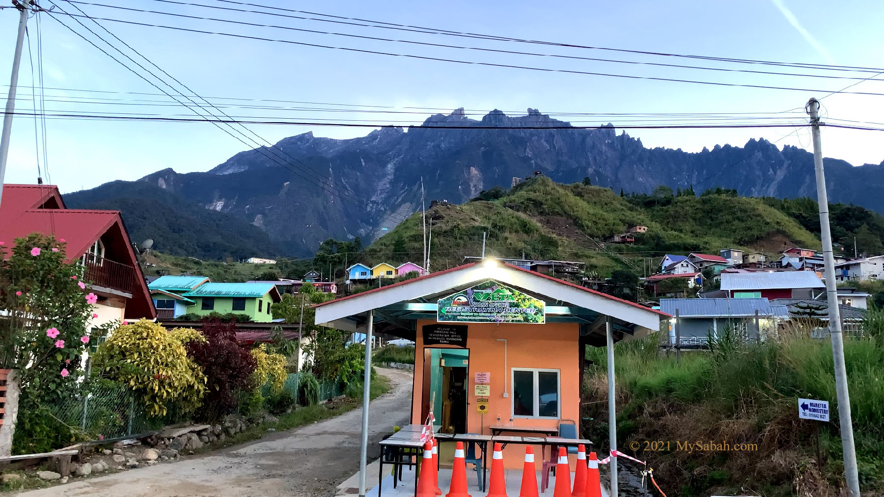
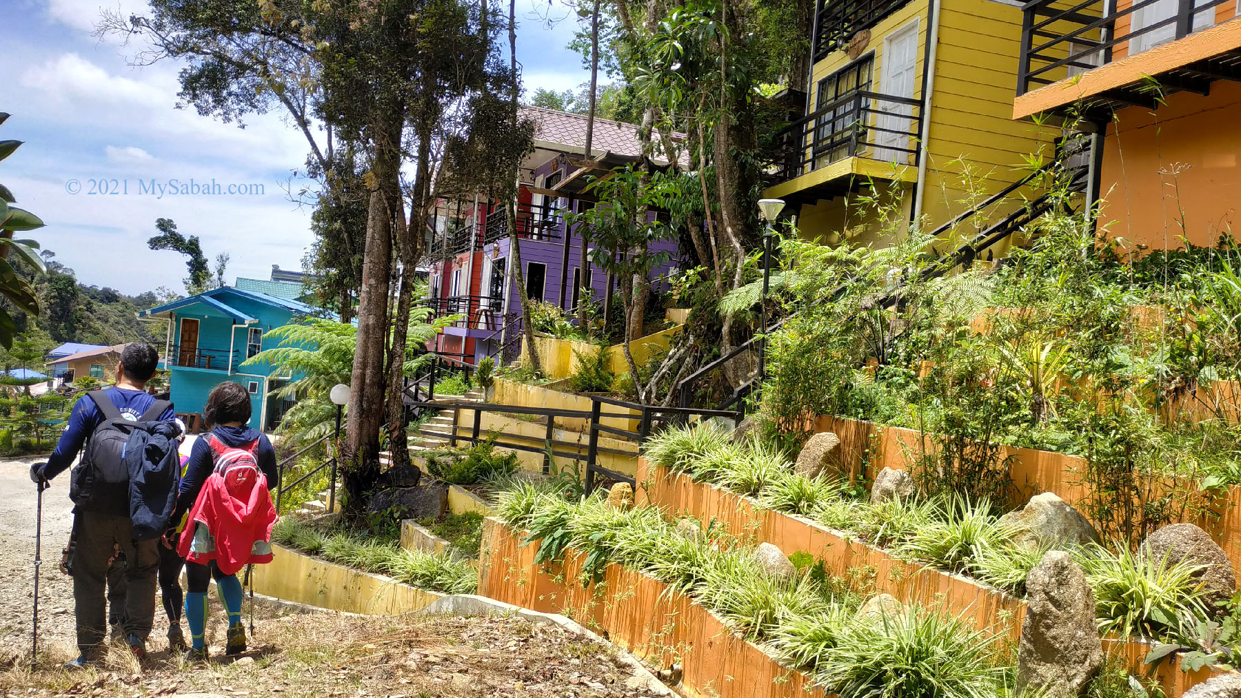
We arrived the registration center (admin office) of Maragang Hill in Kampung Mesilou before 6am. After parking our car in the village, we registered, made payment, met our guide, and signed the indemnity form. Funny thing is, it wasn’t windy at Mesilau.

Registration Center and Admin Office (orange building) for climbing Maragang Hill, with Mount Kinabalu at the background.

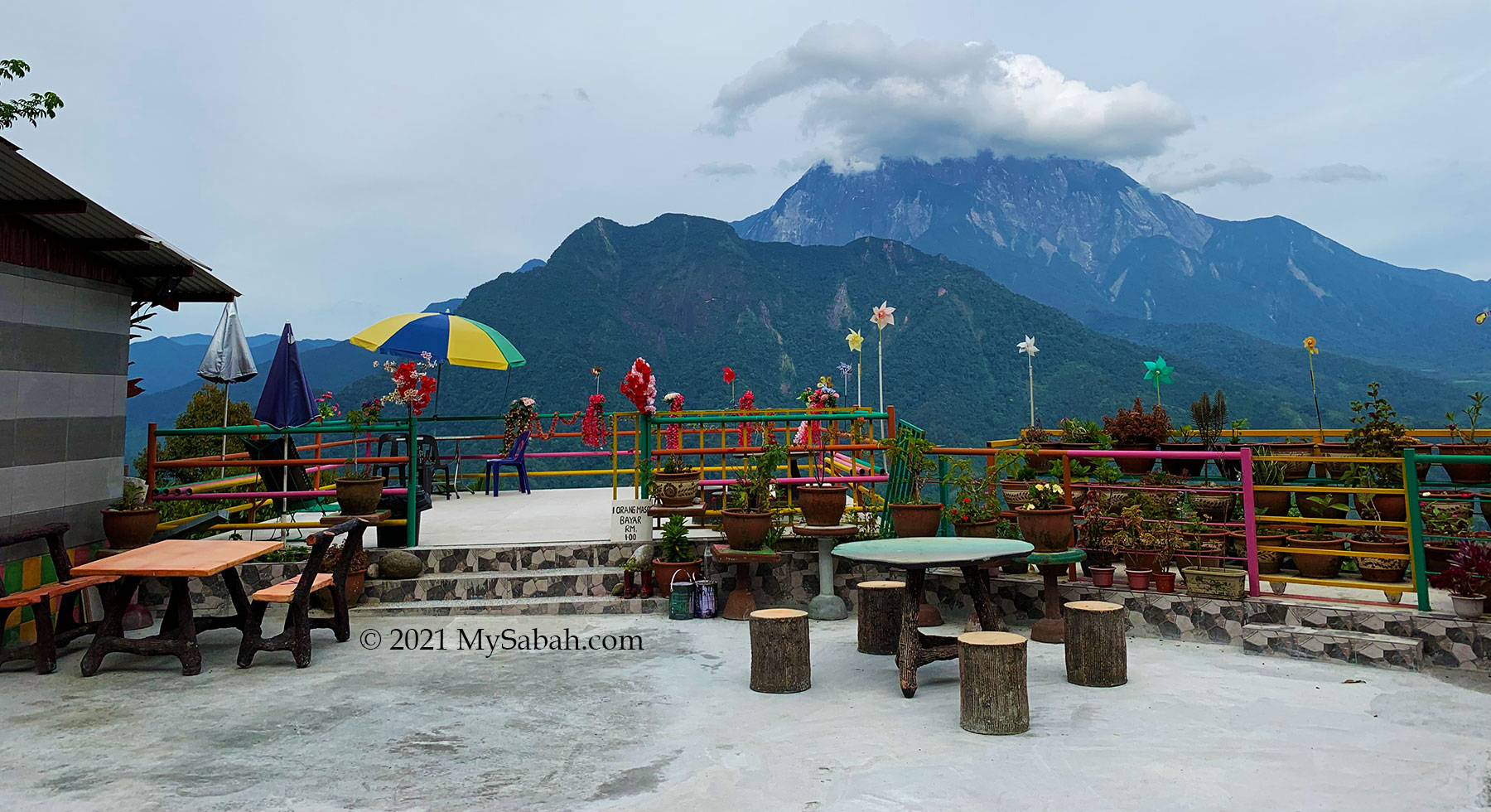
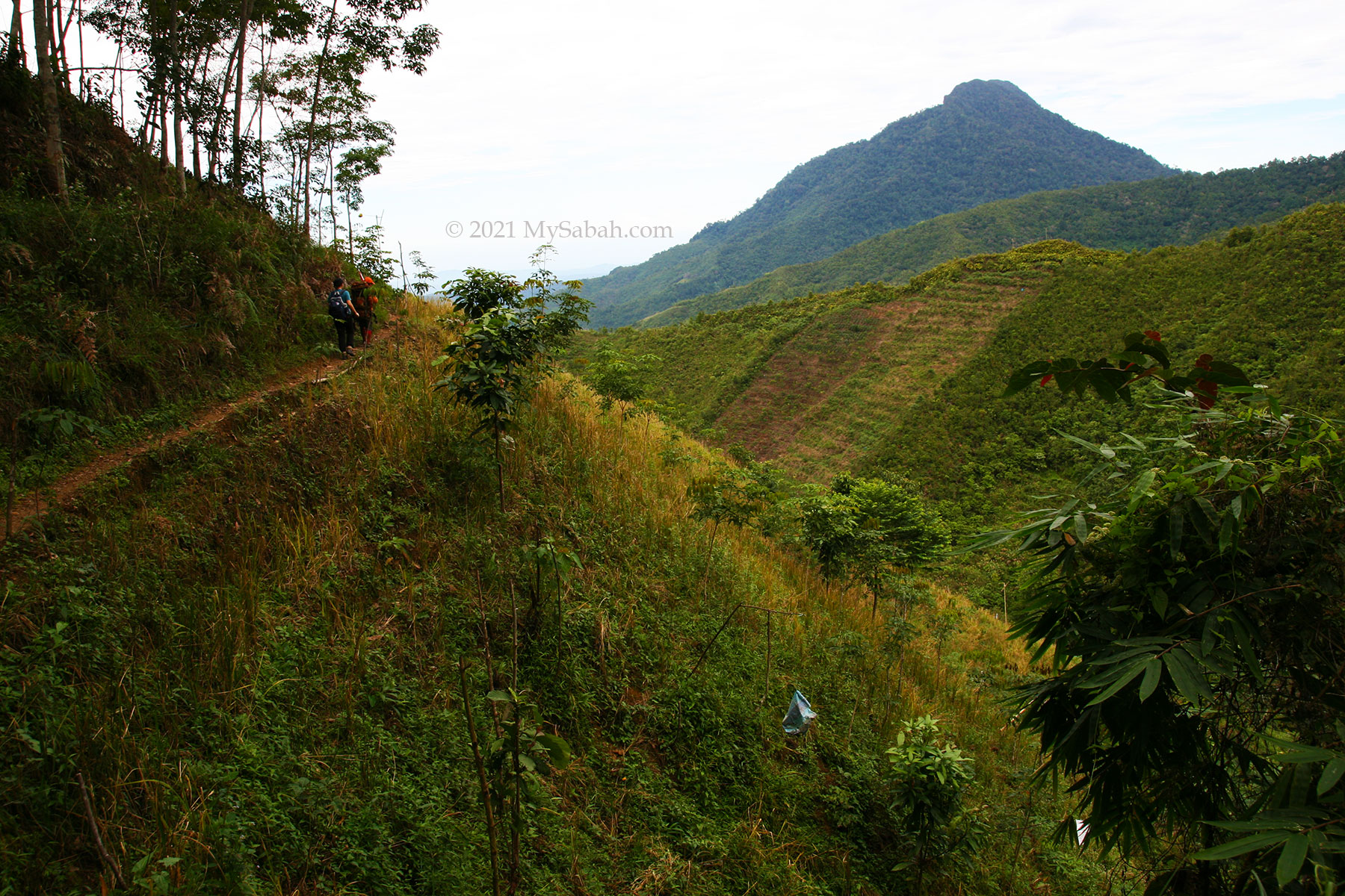
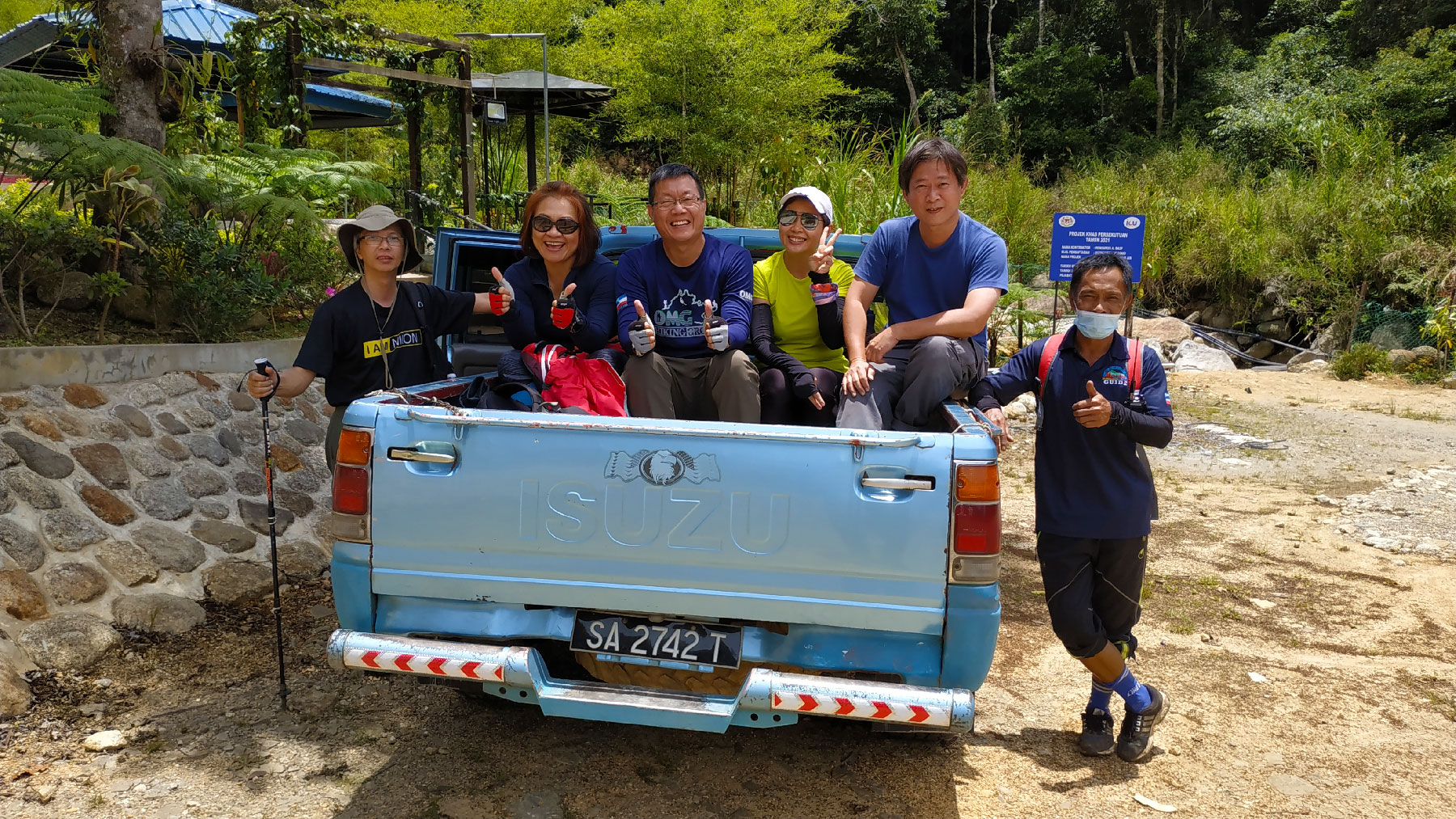
The paper work only took us a few minutes. Then we and our guide were transferred by a 4-wheel drive to the starting point about 4 KM away. On the back of the truck, we had an open view of the scenic mountain and countryside views along the way. We passed through Mount Kinabalu Golf Club and the lovely pine tree road.

We were transferred by 4-wheel drive to the starting point of the climb for Maragang Hill.

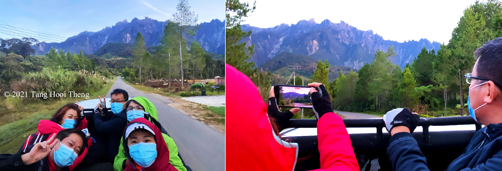
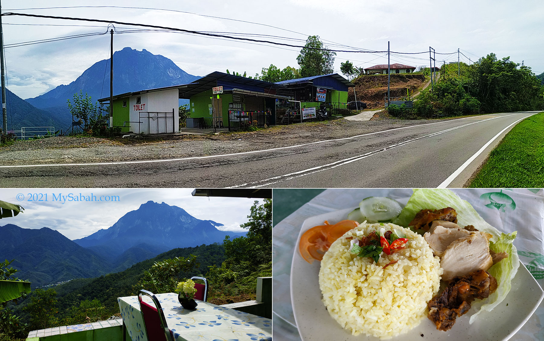
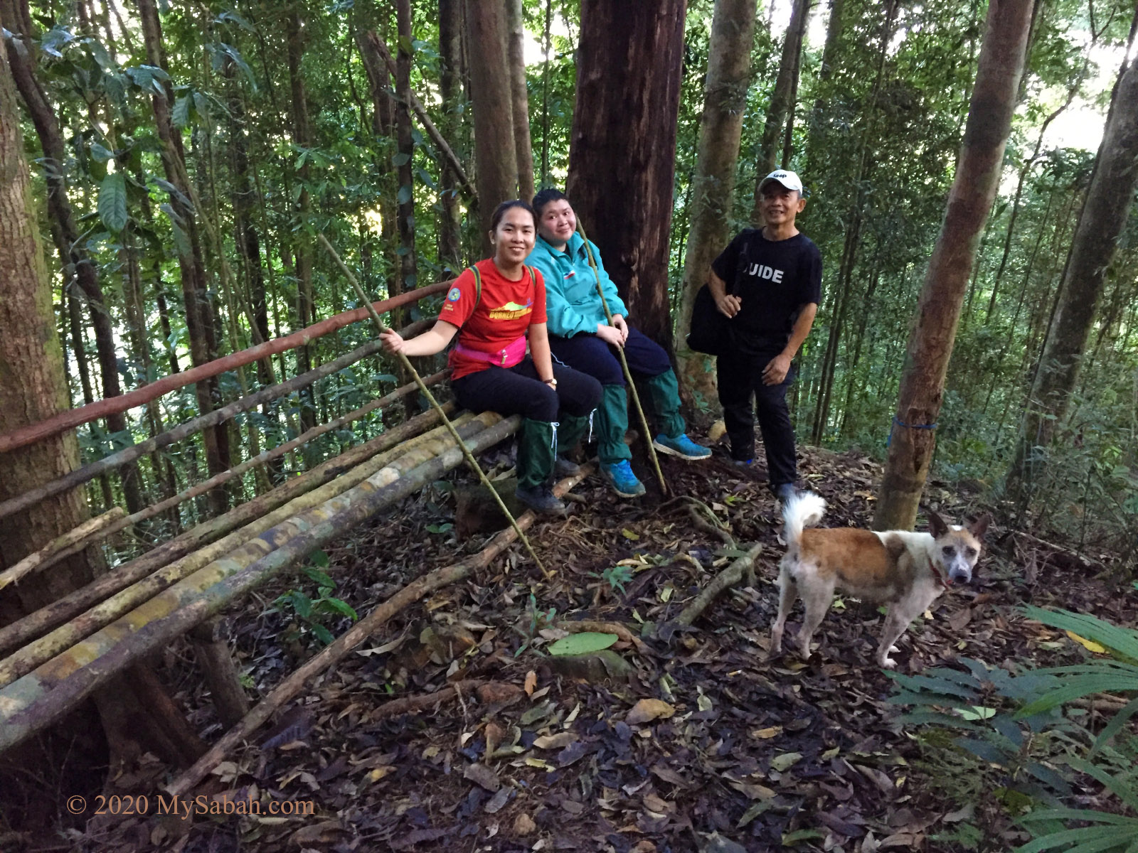
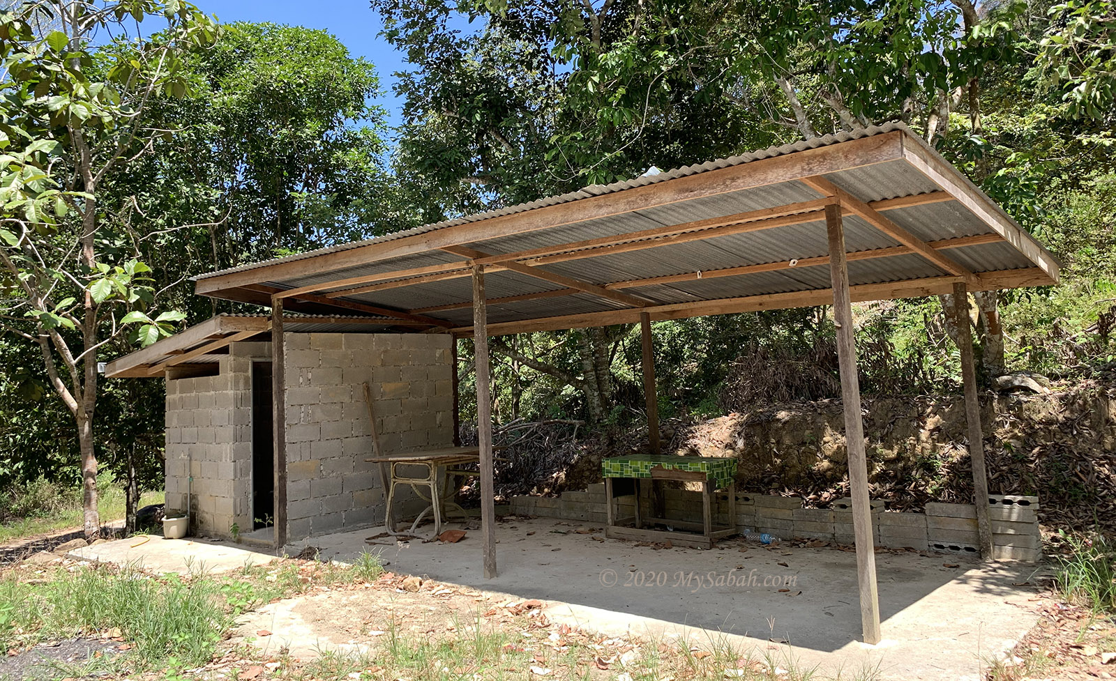
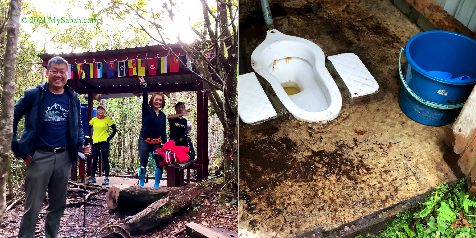
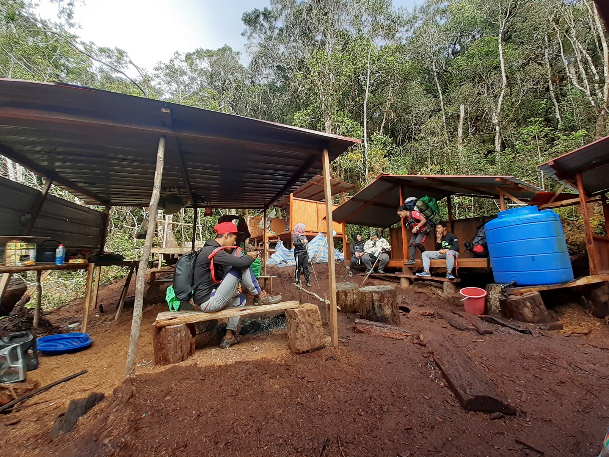
Our vehicle reached the starting point of our climb within 15 minutes. The place is not far away from Mitraville Meditation Centre (慈观法林). There is a toilet for climbers. A mountain guide is assigned to my group because nobody is allowed to climb without a local guide, for your safety. A guide can take care up to 5 climbers.

Moving to the starting point of the climb and reached a viewpoint in one minute.

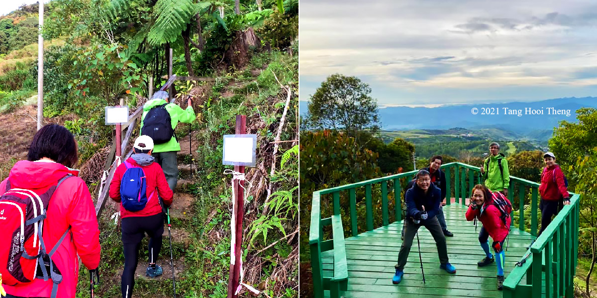
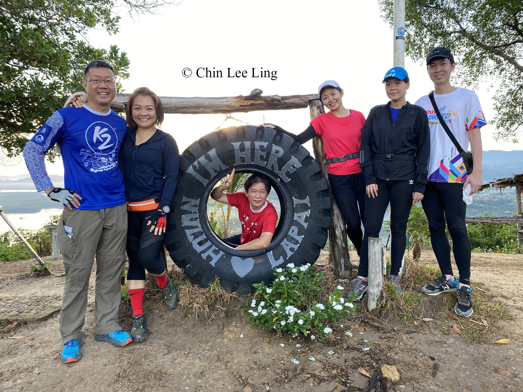
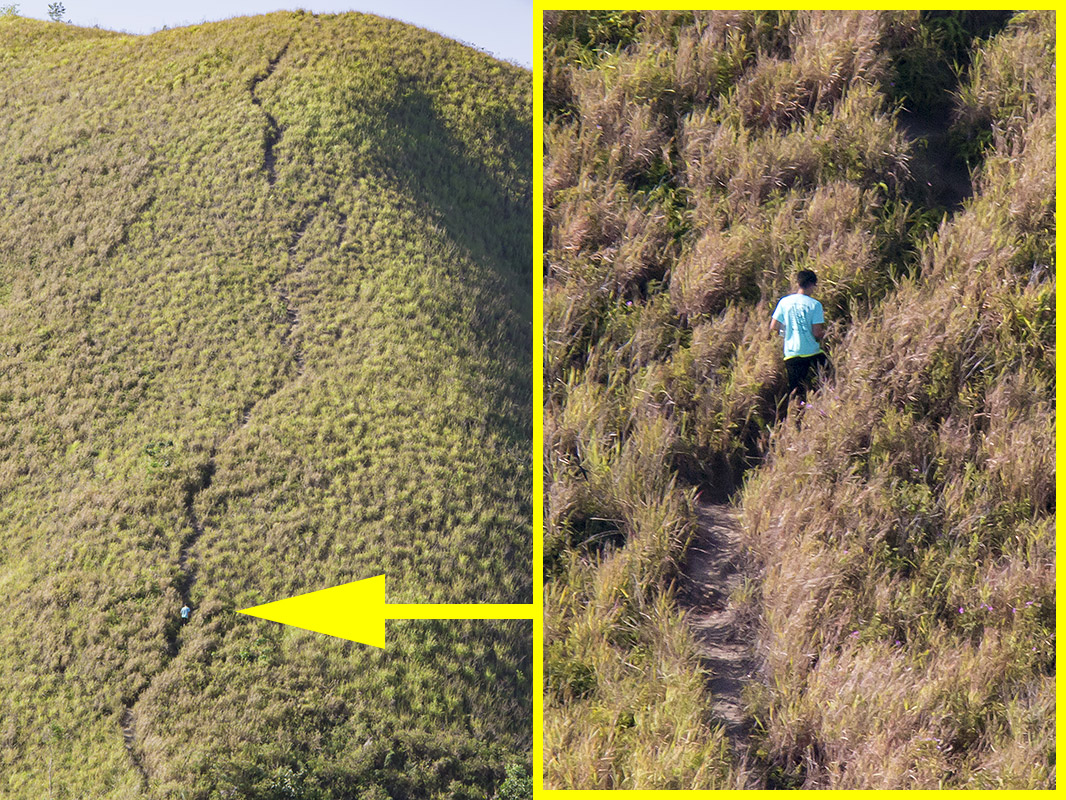
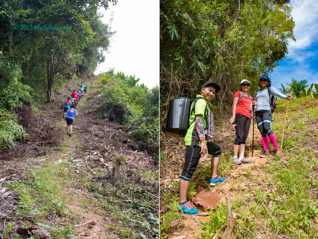
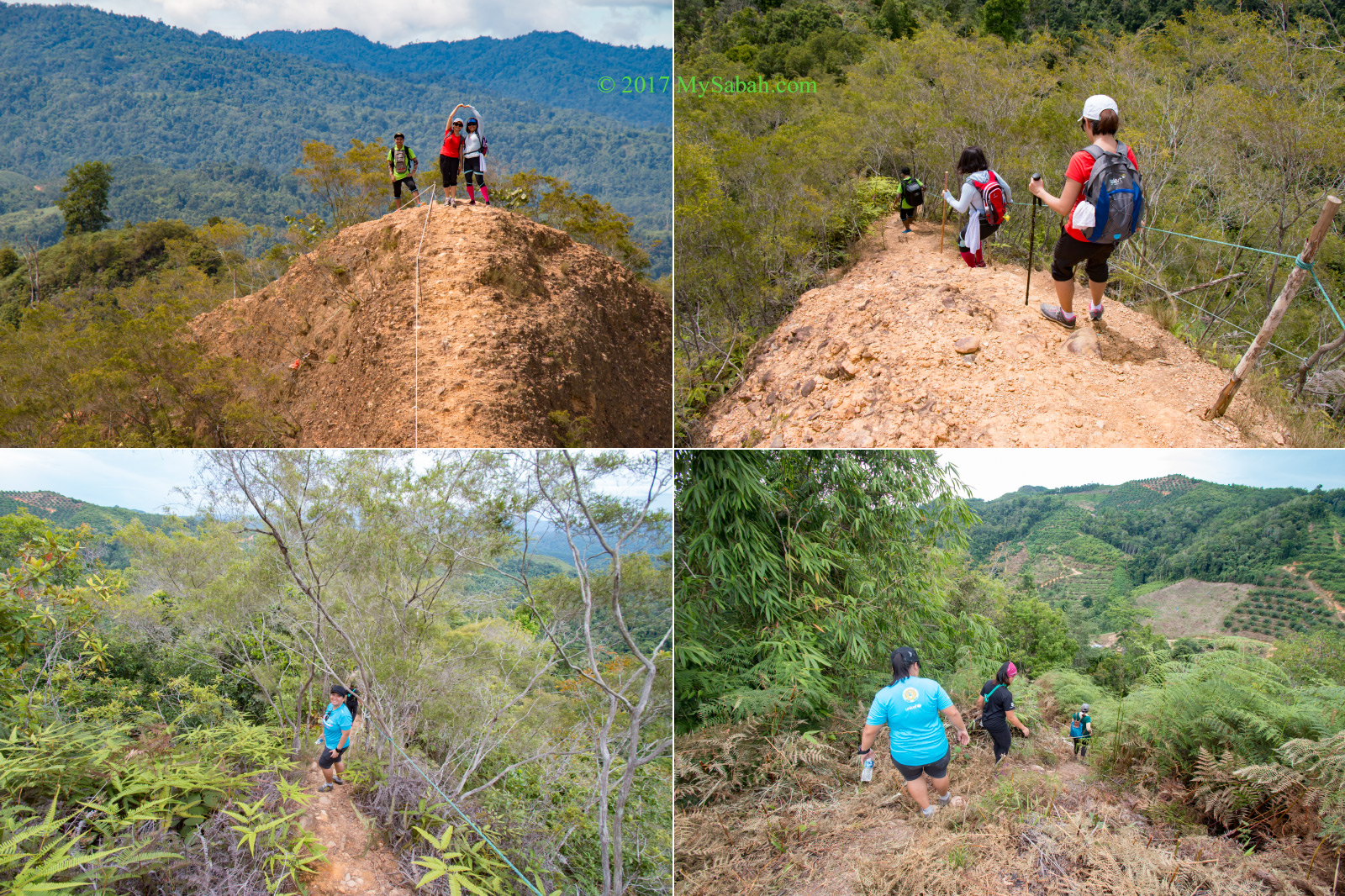
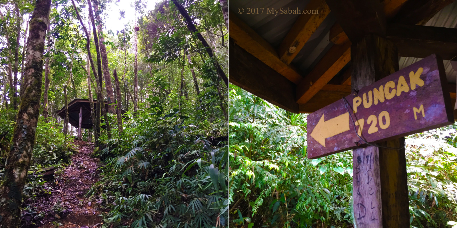
After a short briefing by our guide, we started our 1.6-KM hike at 6:23am. We reached the peak at 8:10am, after 1 hours and 47 minutes, slightly longer than the average 1.5 hours. This is because we went slow and stopped many times to take pictures.

The trail is a bit steep in the beginning, but don’t worry, only a few sections are slightly challenging.

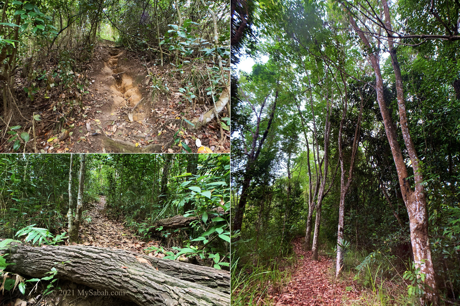
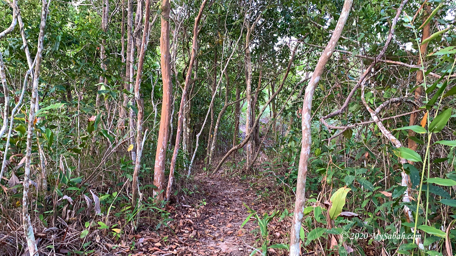
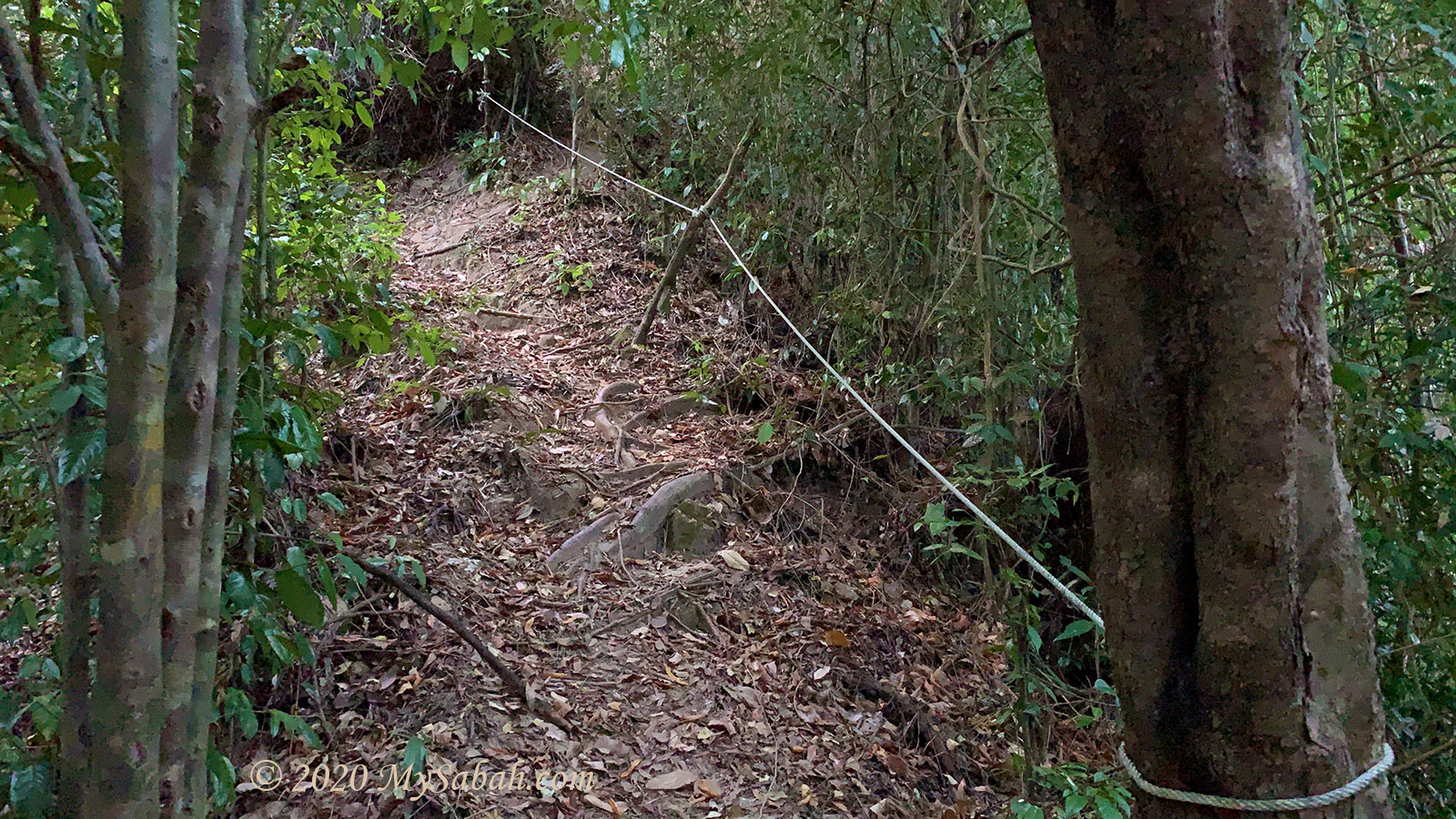
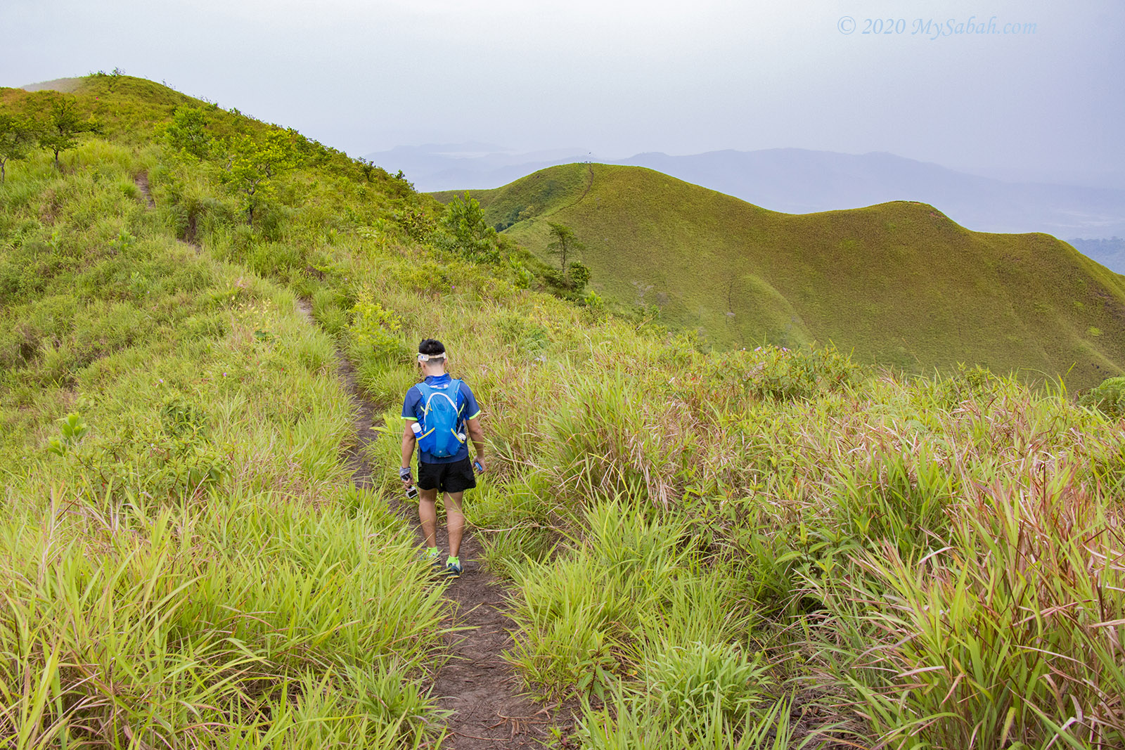
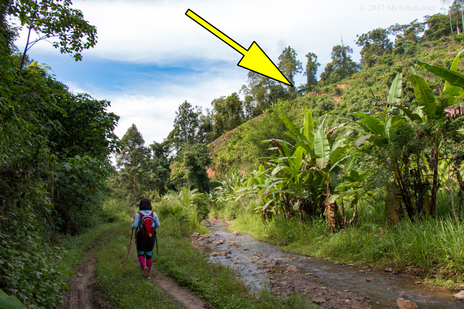
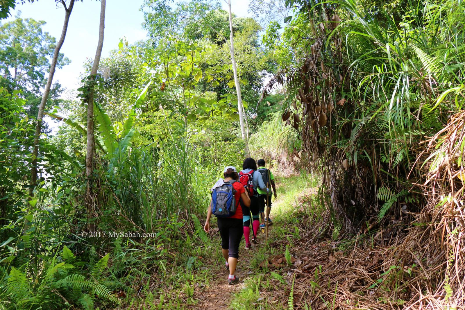
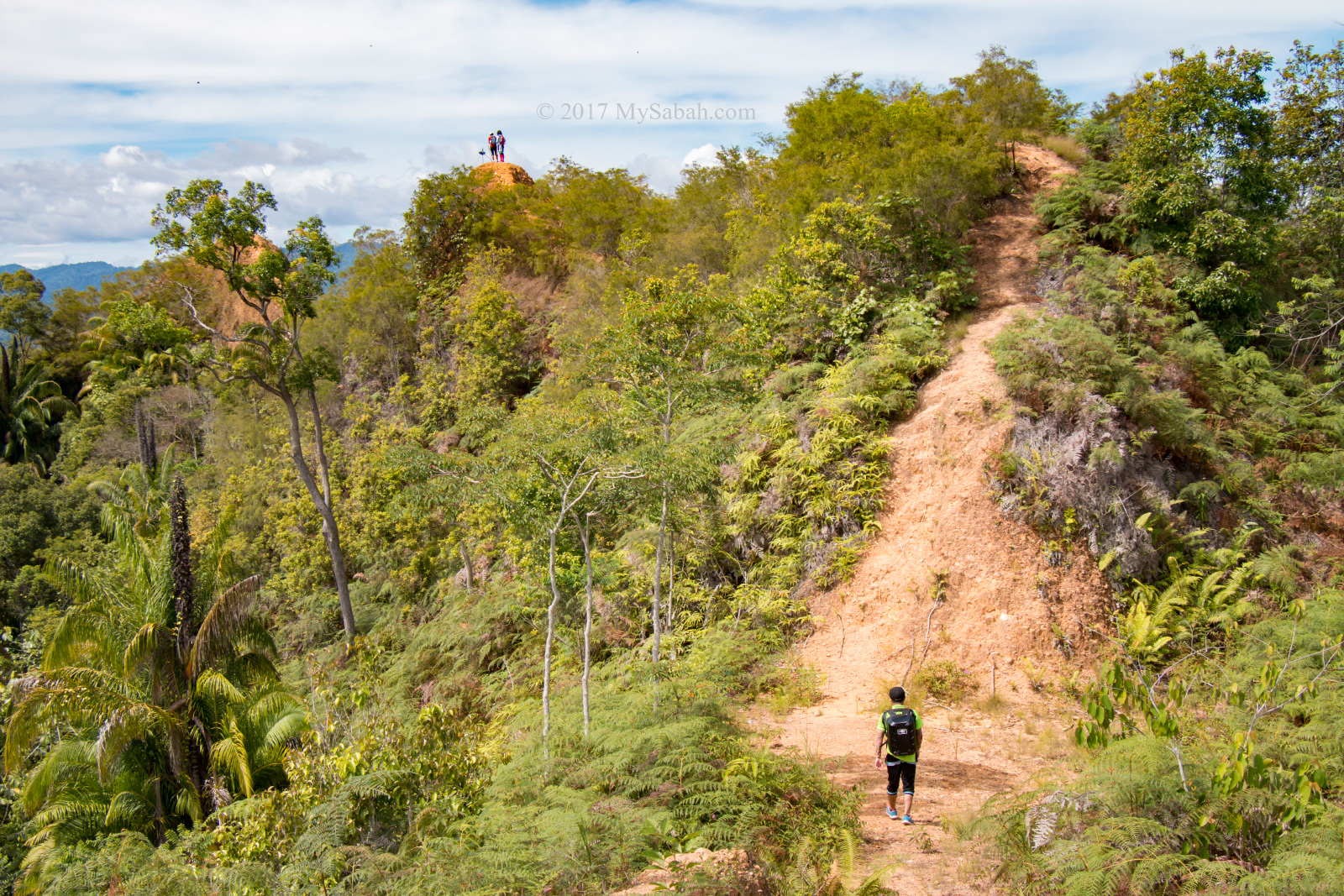
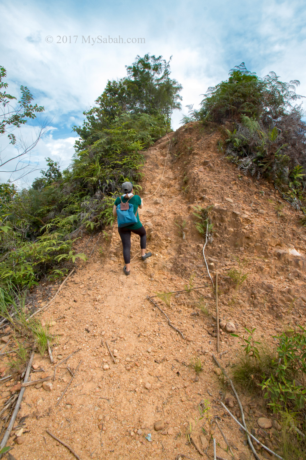
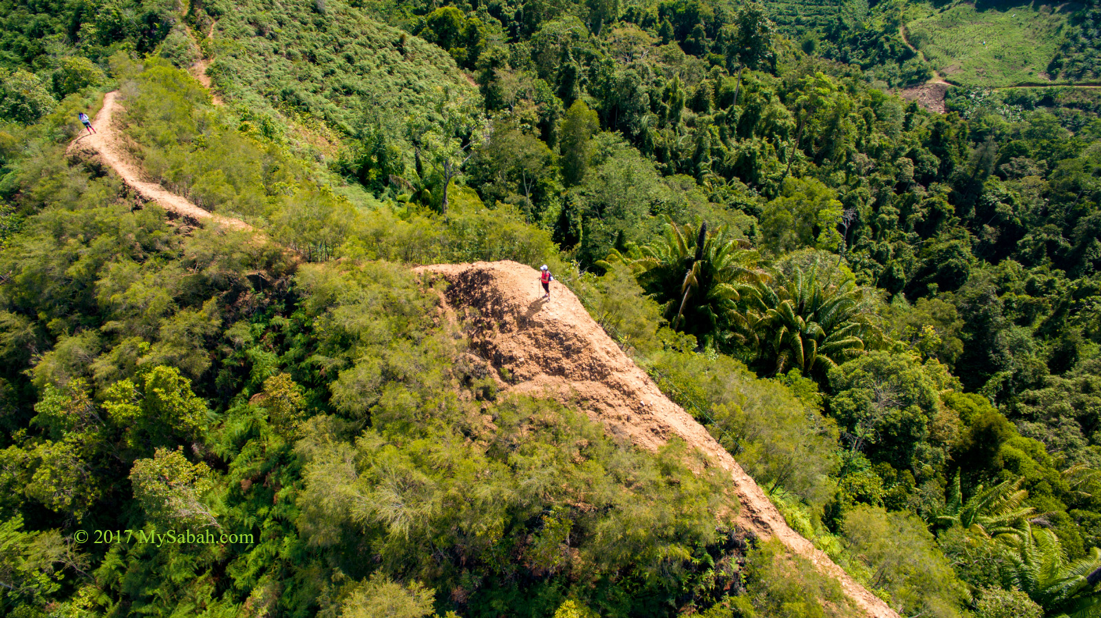
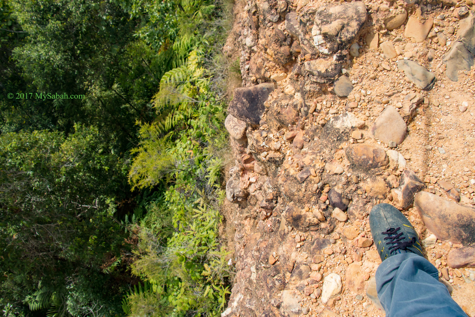
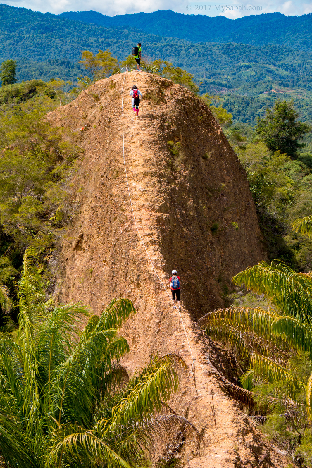
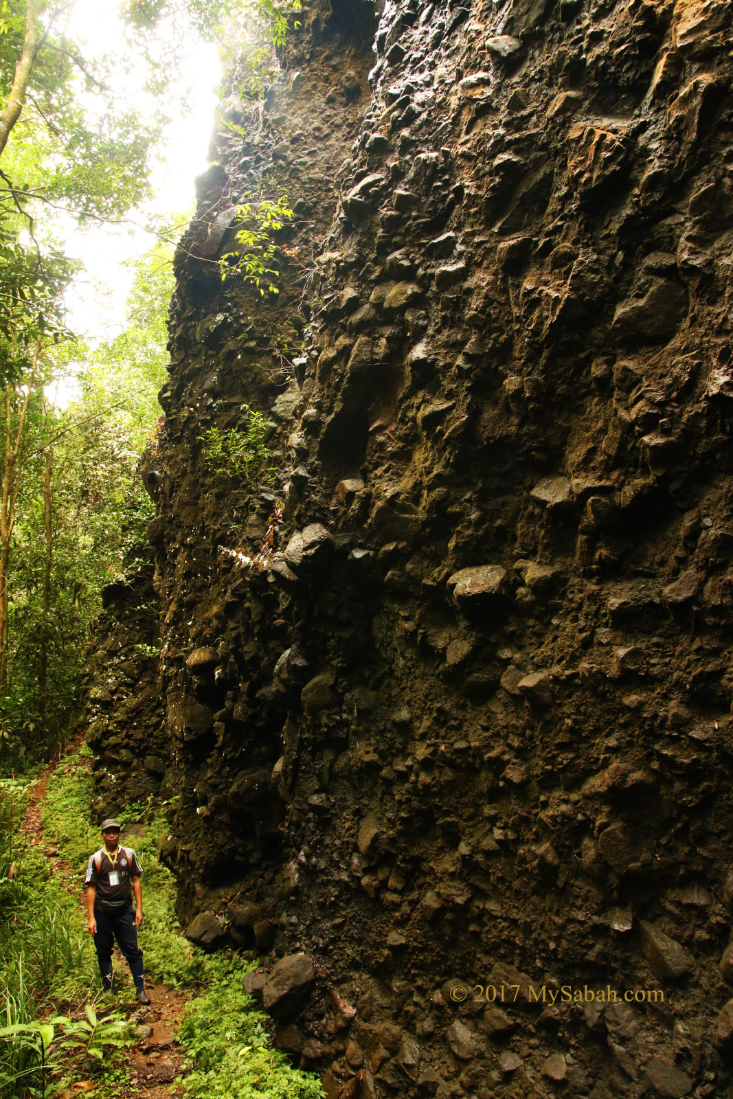
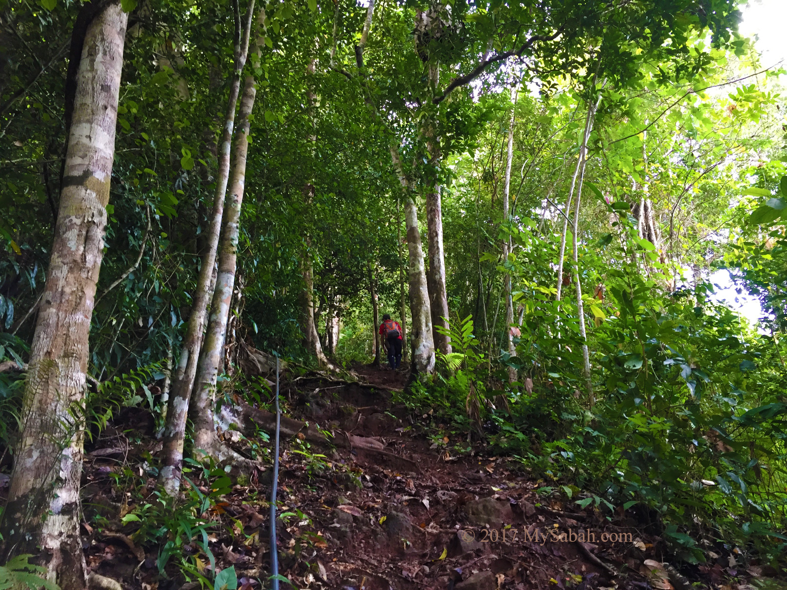
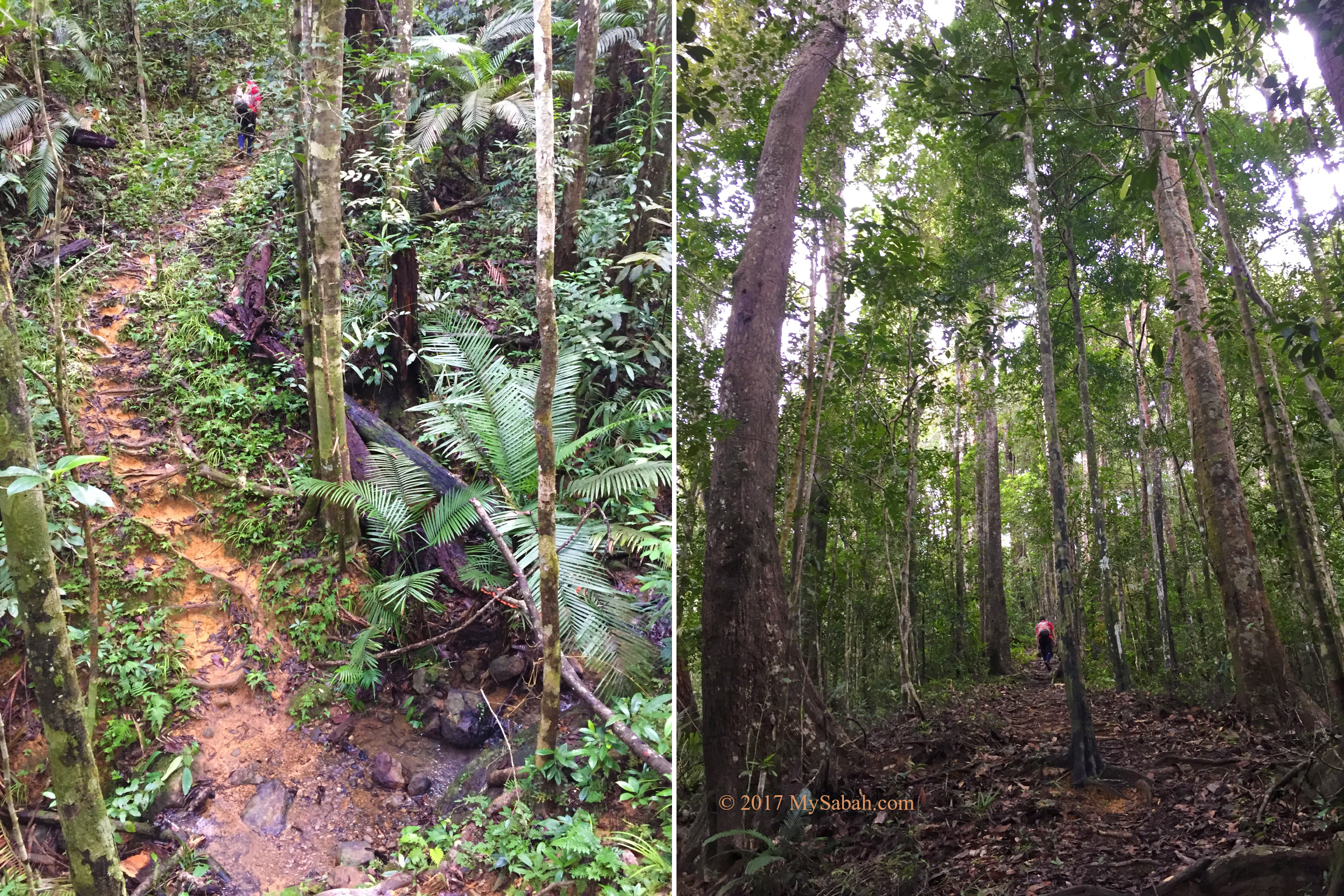
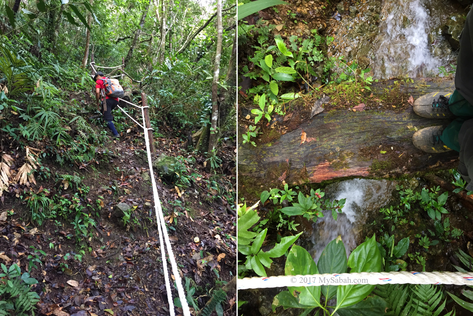
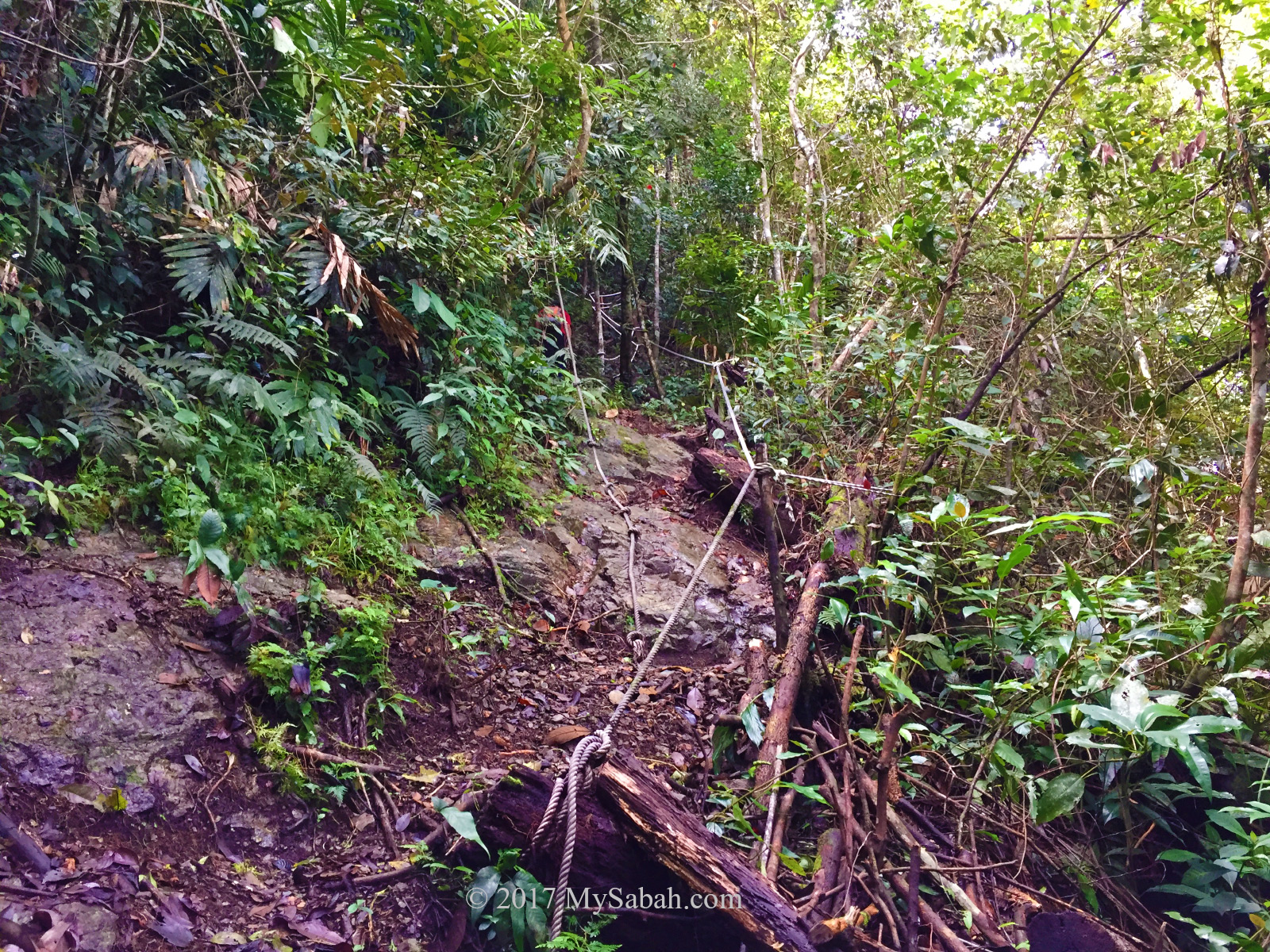
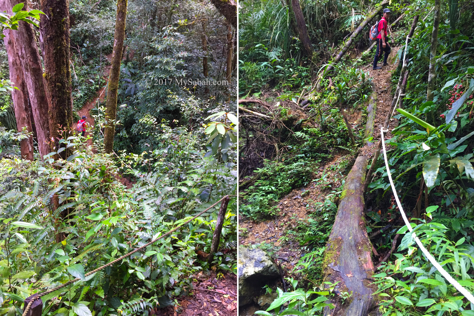
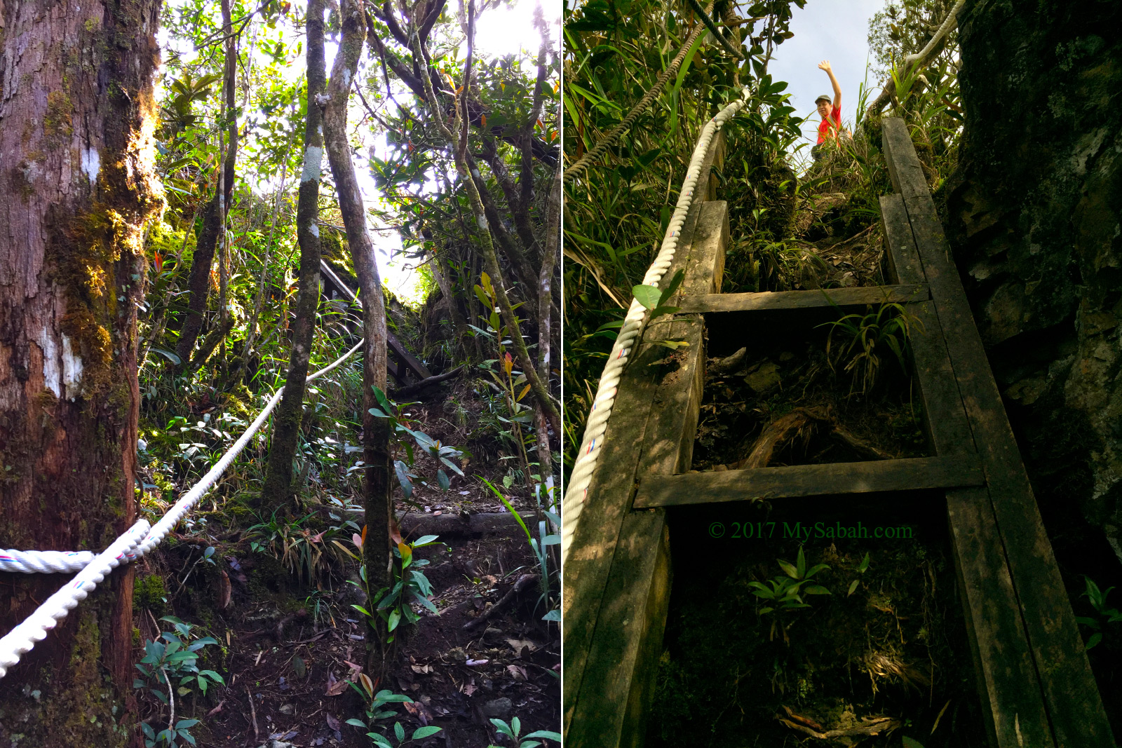
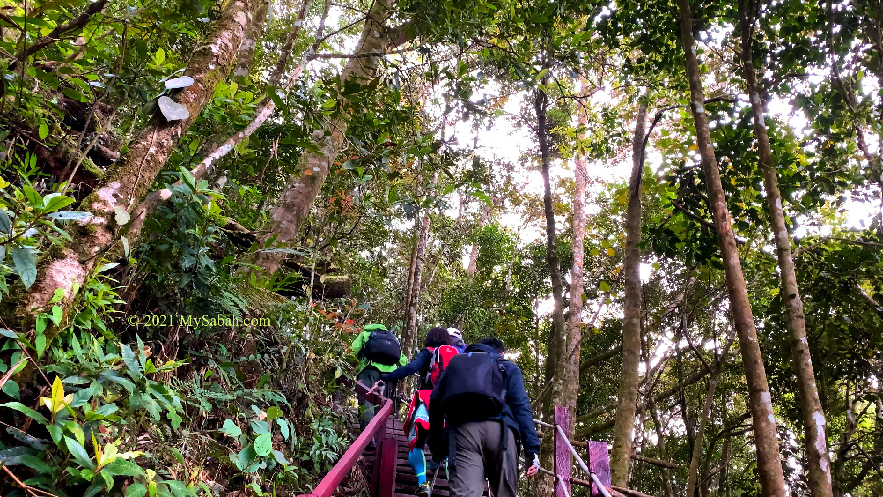
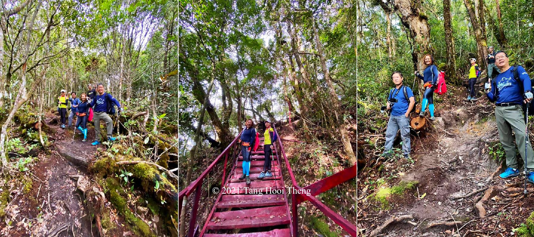
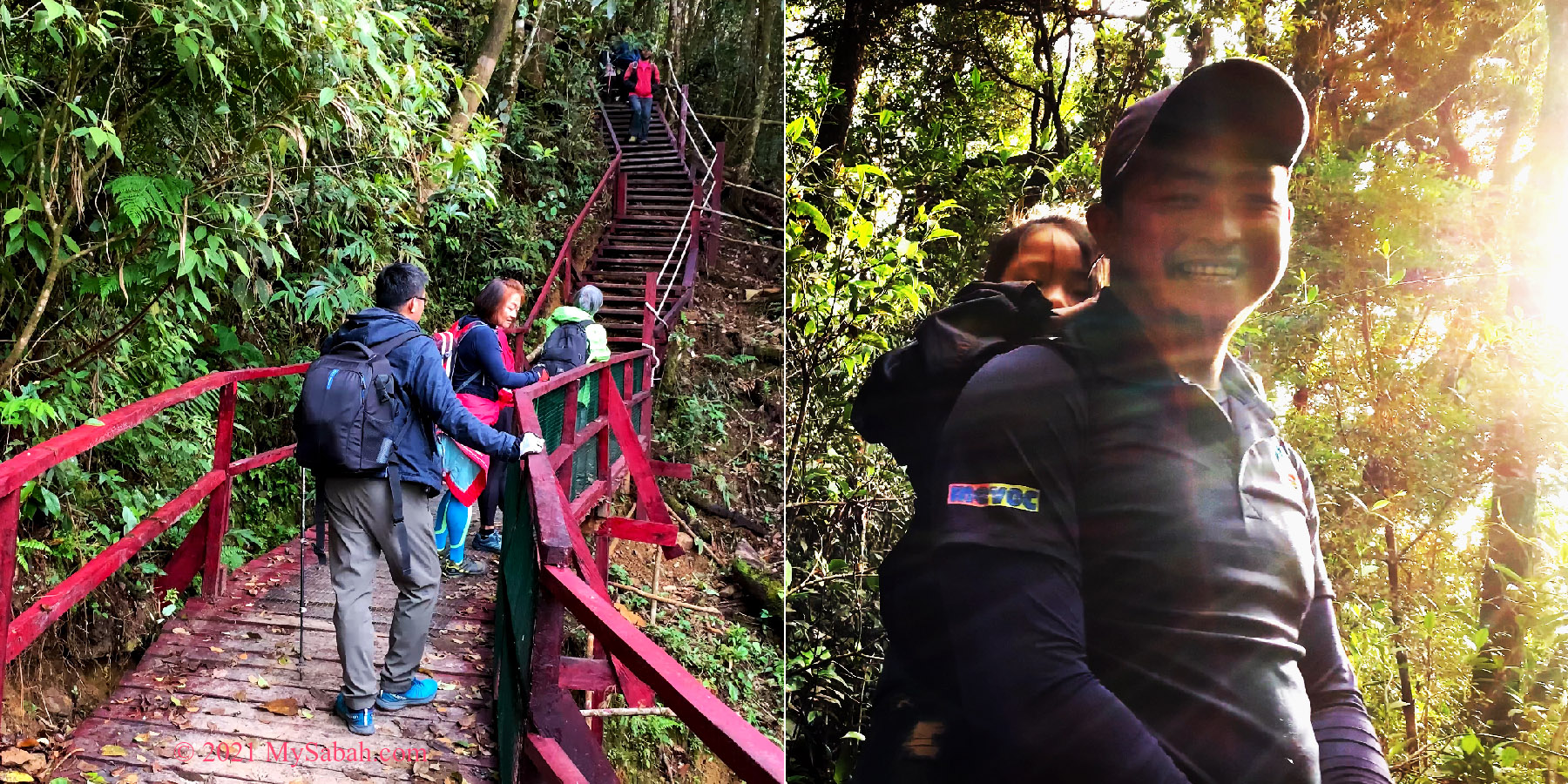
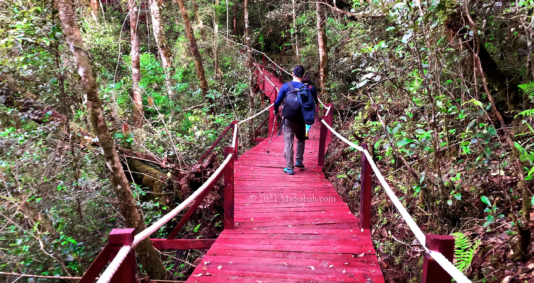
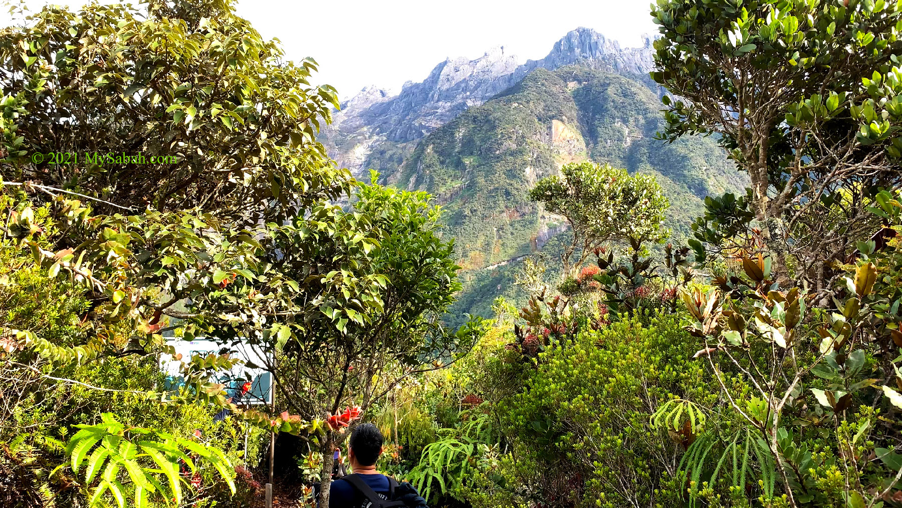
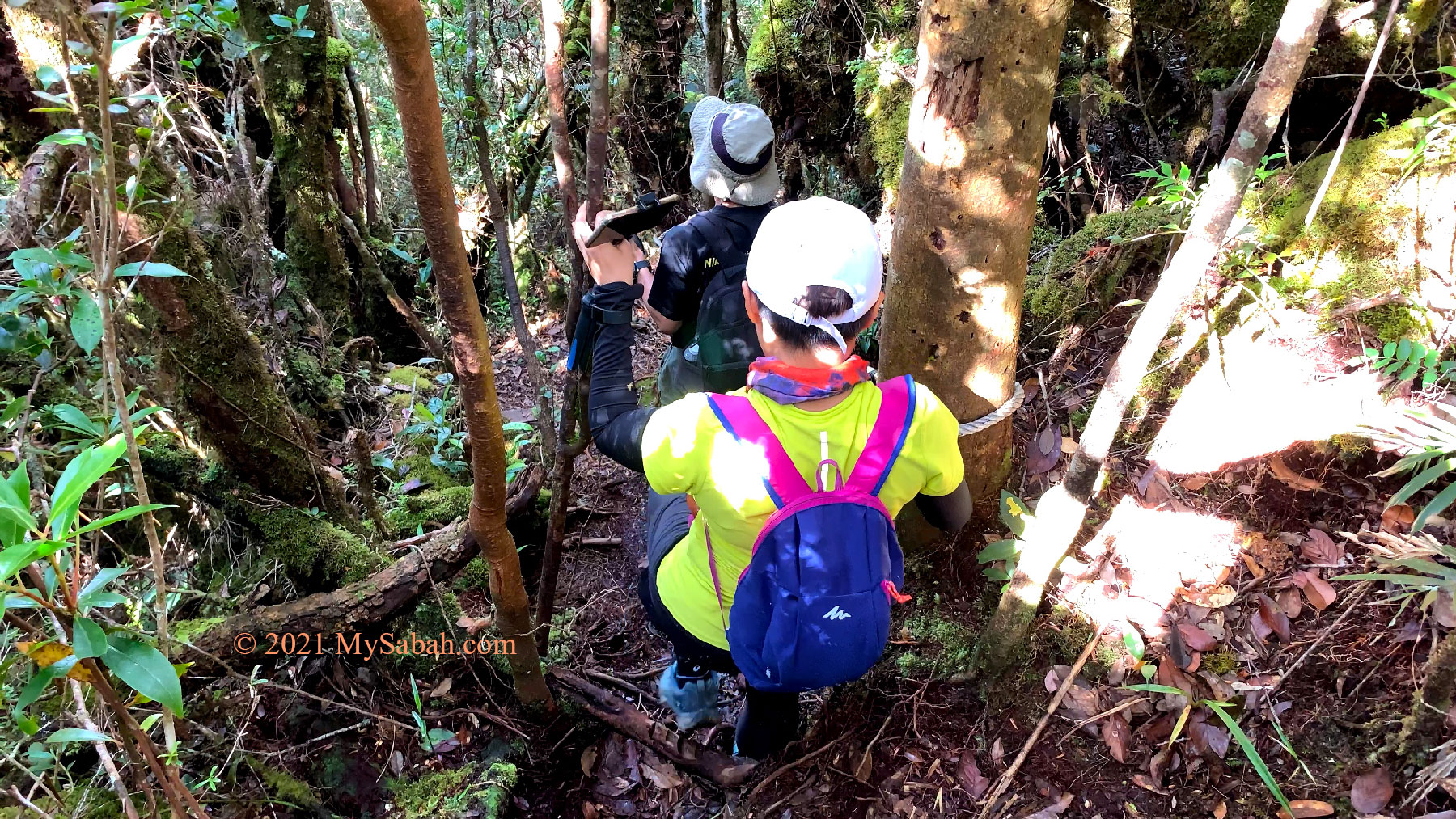
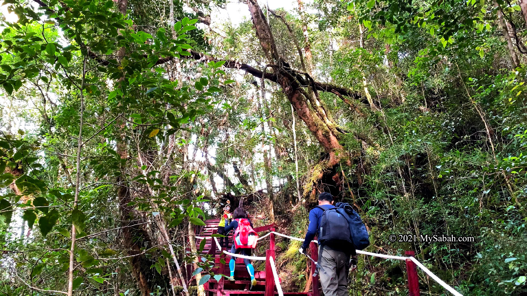
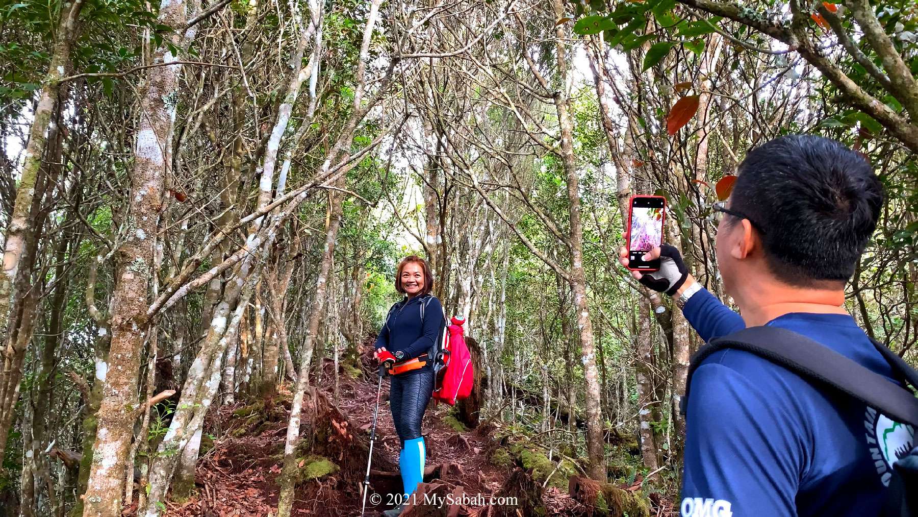
The first 200 Meters of the climb is quite steep but not difficult. In fact, I prefer to call this as hiking, as there was almost no climbing at all. There are support such as boardwalk, ropes and wooden steps at some steep sections. It is not tough, even to people who are lack of exercise.

We can see Mitraville Meditation Centre from the higher ground (note the white stupa).

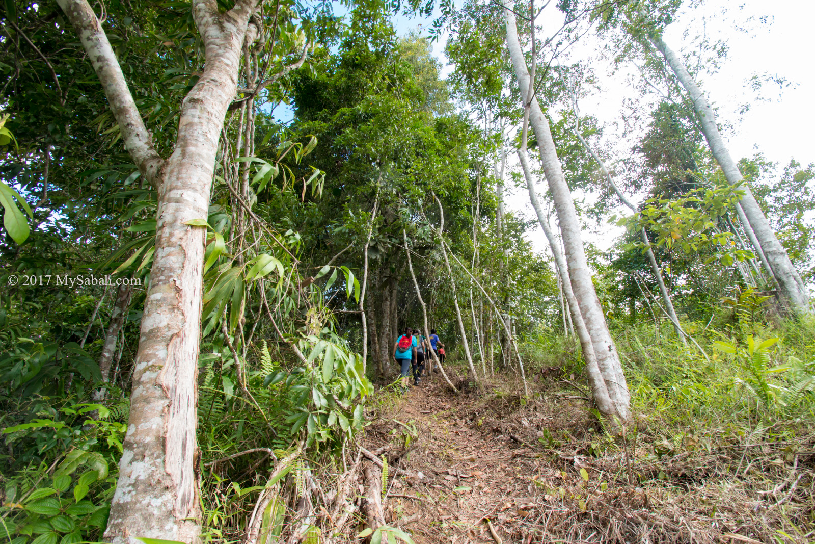
Most of the time we walked under the cover of canopy, which protected us from harsh sunlight. The cooling temperature reduced the fatigue and dehydration of our overheat muscles. 500ML of drinking water is sufficient, which is half the amount of my hike in lowland.

We reached the 200-Meter trail marker after 15 minutes.

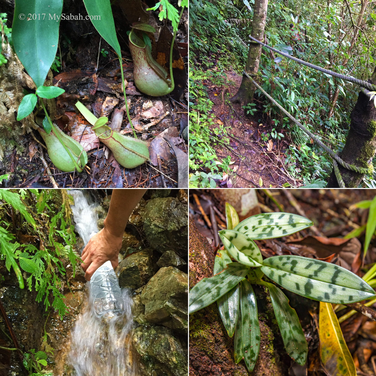
After 500 Meters of hiking, our bodies were getting warm, so everyone took off their jacket. There was no leech (pacat) in our trail. But my sweat attracted a few buzzing and annoying blood sucker, deer flies. They hovered around me, trying to land on my skin for a feast. They lost interest and left when I stopped sweating profusely.

We walked under the shade of dense trees most of the time.

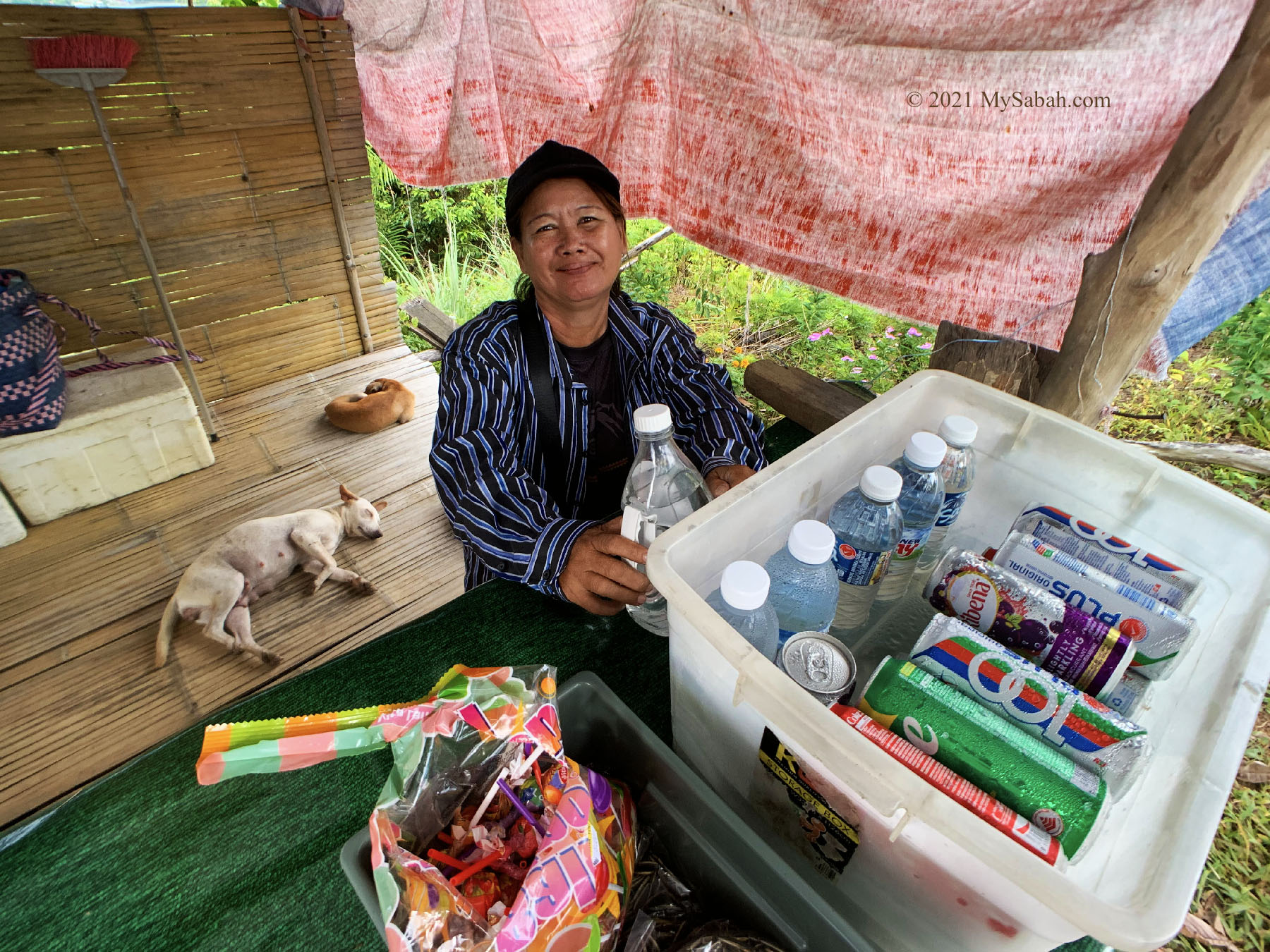
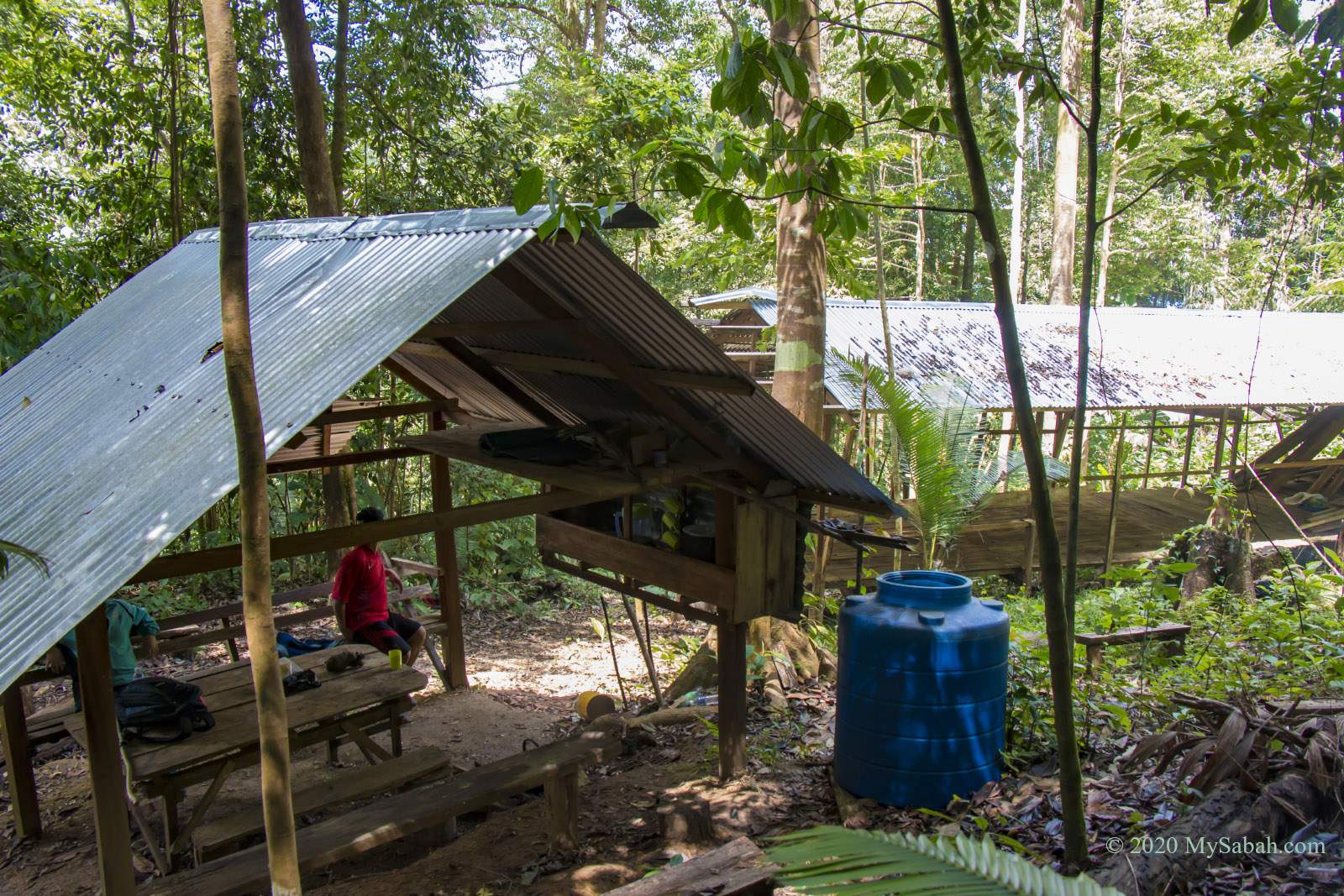
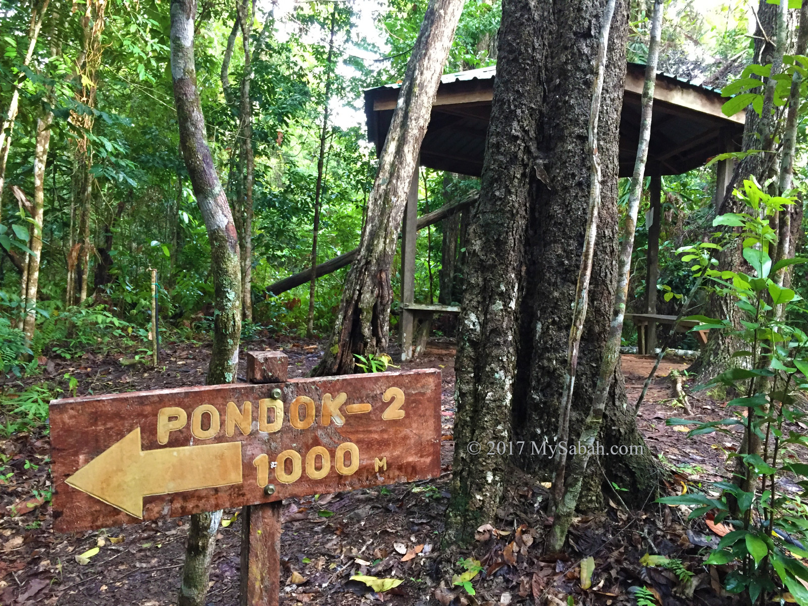
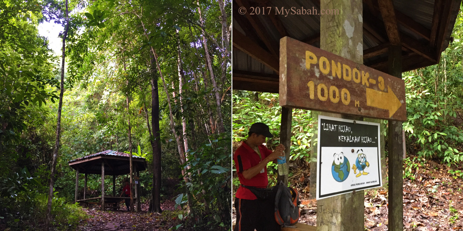
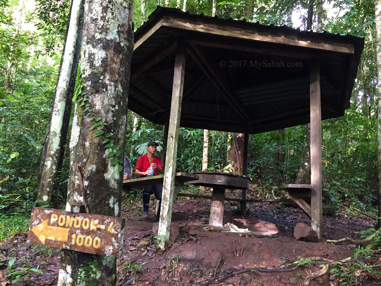
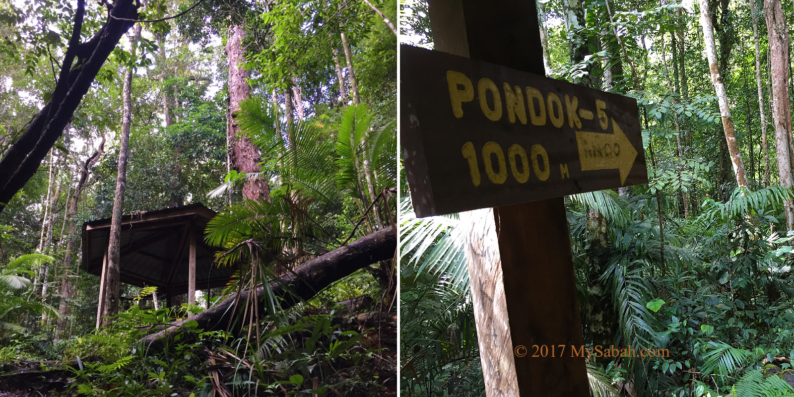
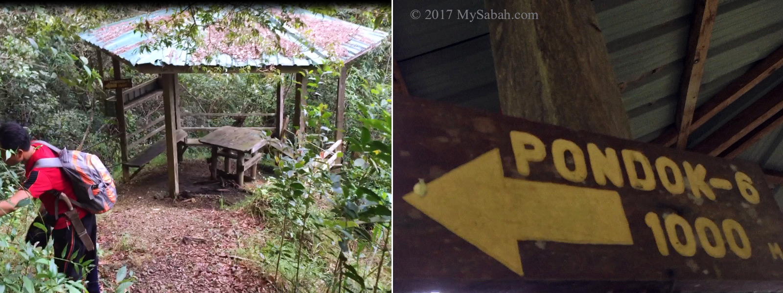
At 6:56am, we took a short break at a gazebo, which has a toilet behind it. You can refill your drinking bottle with untreated water from the big water tank there (not recommended though).

About 20% of the summit trail to Maragang Hill is relatively flat.

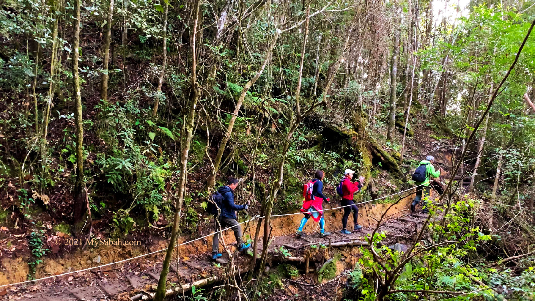
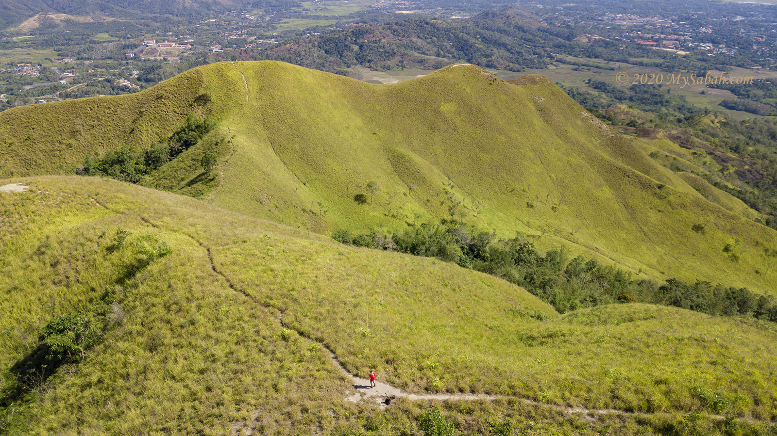
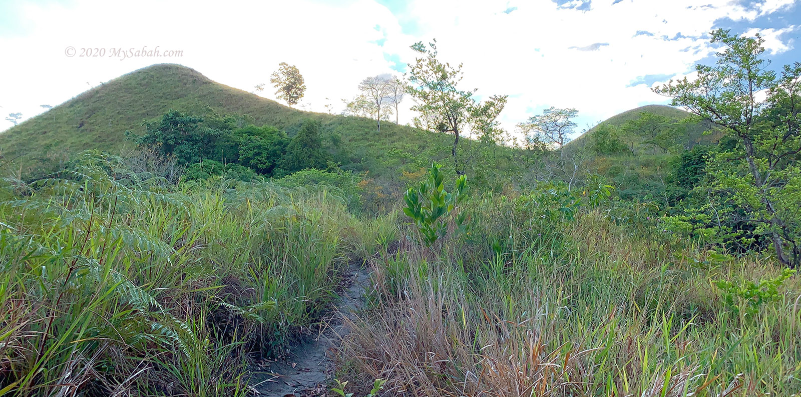
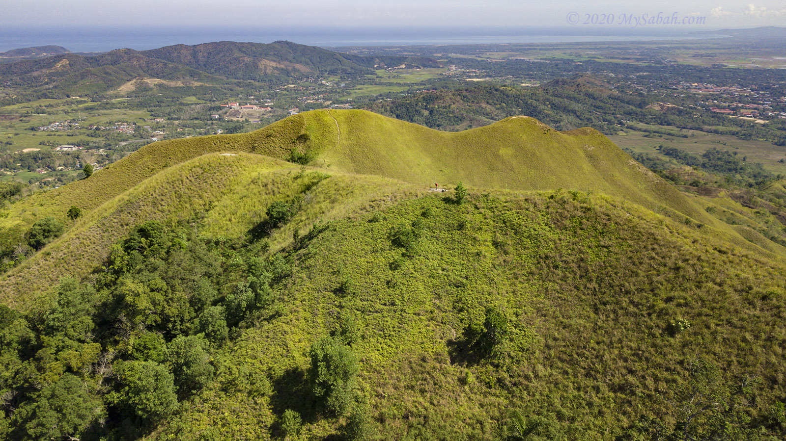
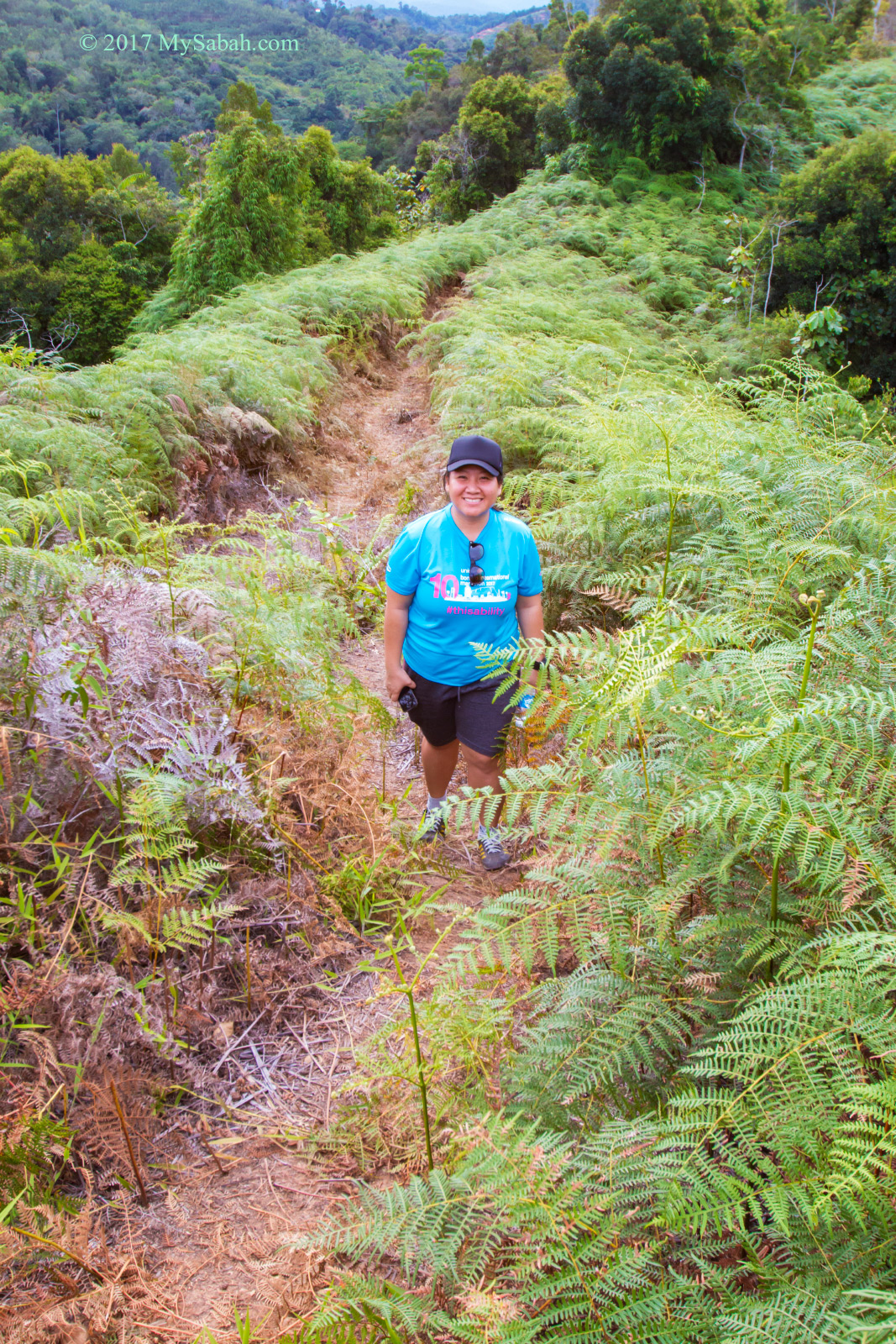
In general it’s an undulating terrain, with flat ground in between. Whenever I was about to get exhausted, a gentle slope or ridge would come next and allowed me to catch my breath.

It took us less than 30 minutes to reach the 500-Meter mark.

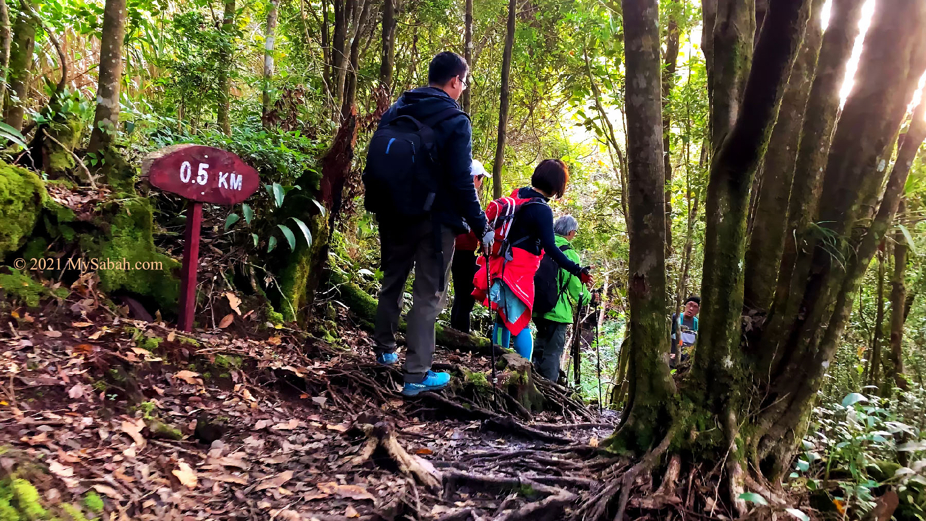
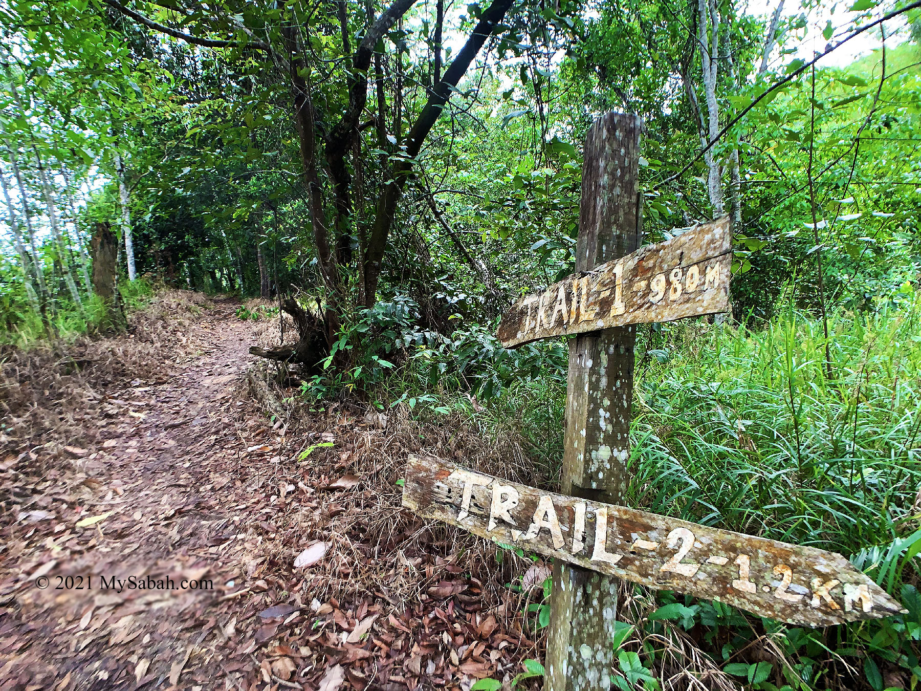
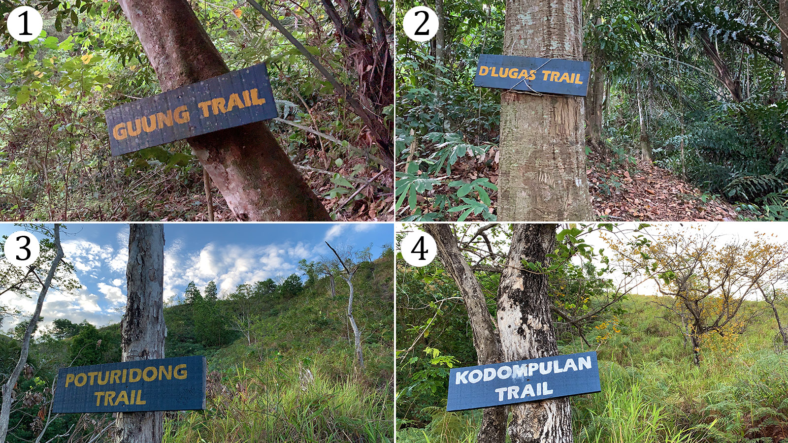
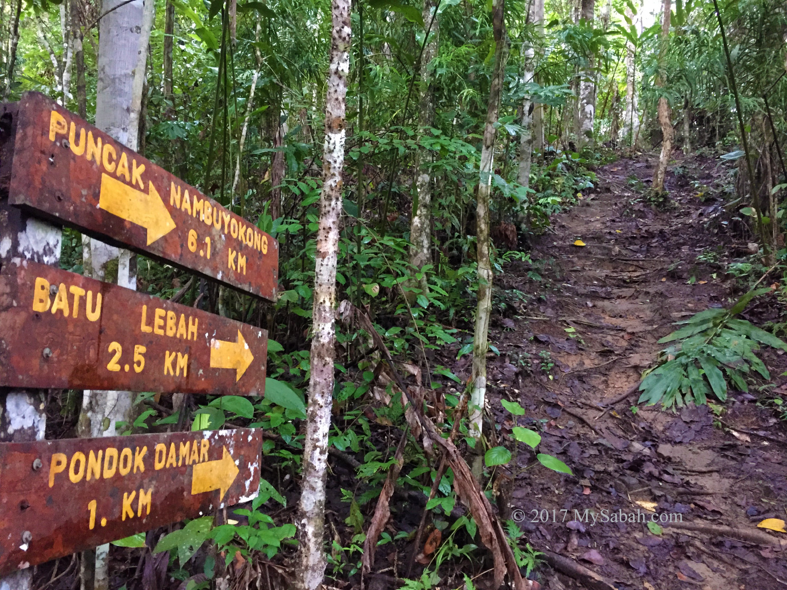
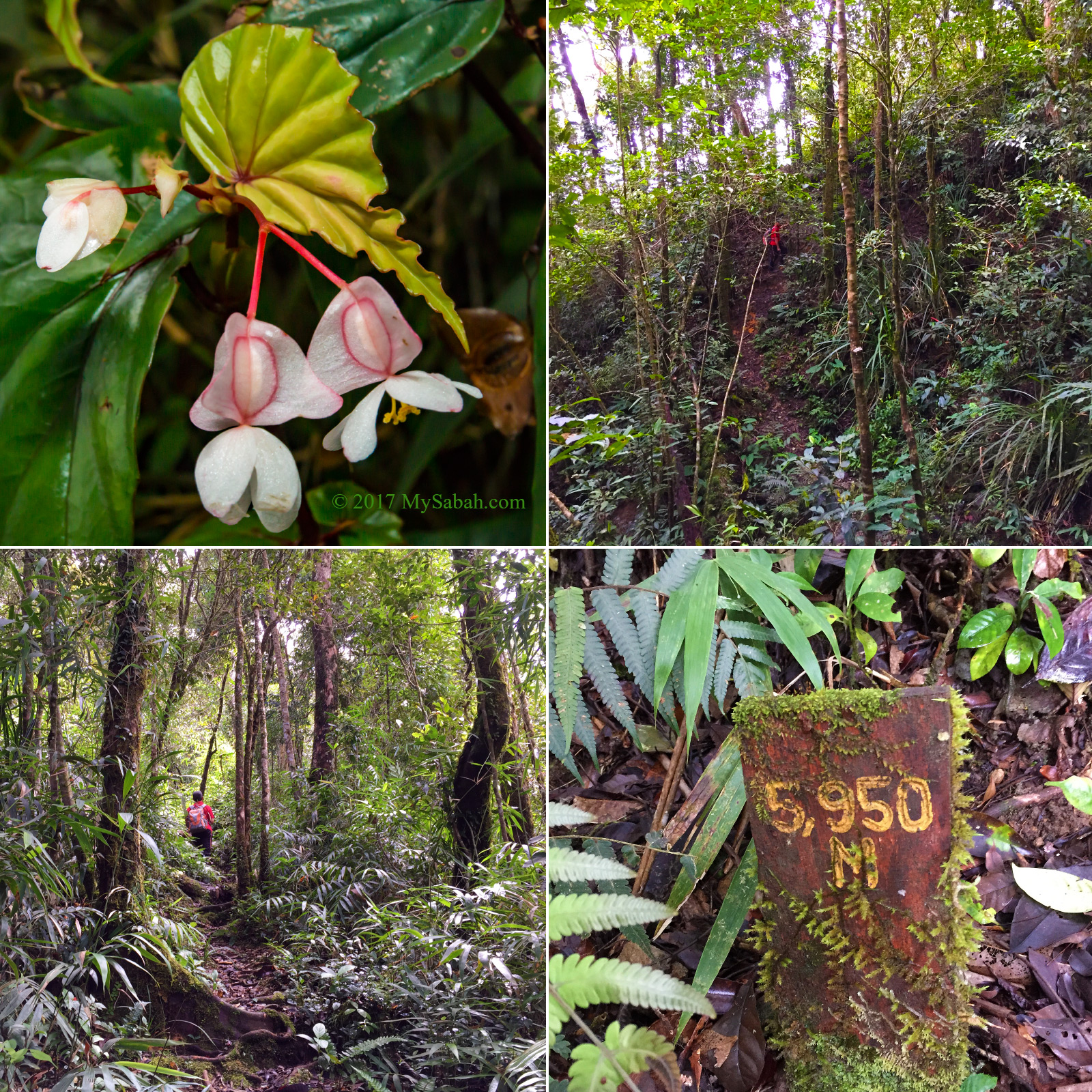
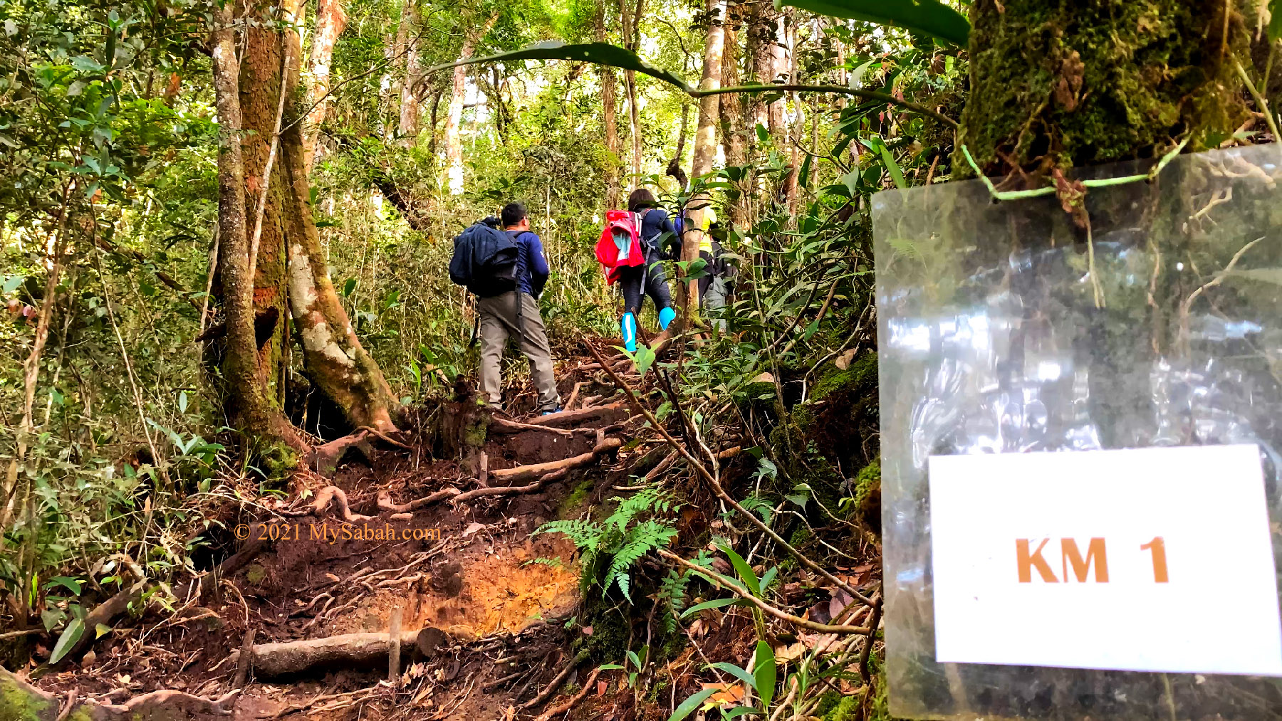
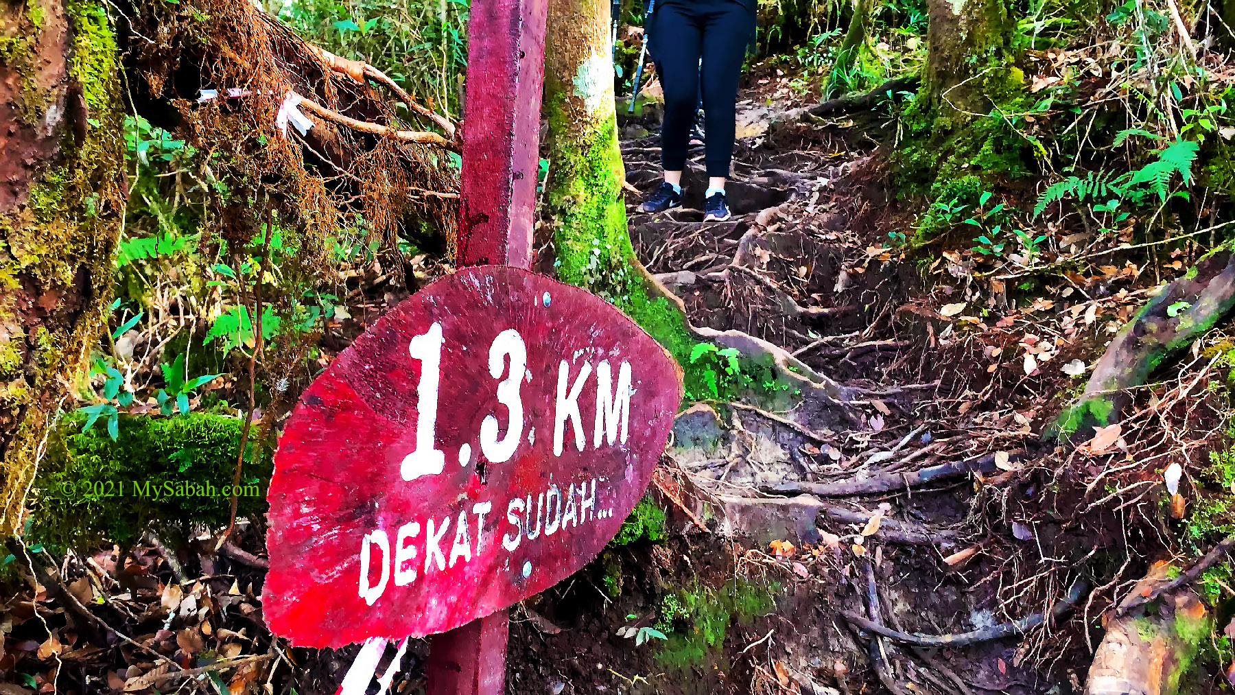
We reached trail markers labelled with 200 M, 500 M, 1 KM, and 1.3 KM, which show the distance we have covered, at 6:38am, 6:51am, 7:21am and 7:51am respectively. For me, they are morale boosters.

The resting gazebo after 500 Meters. There is a squat toilet hut behind it.

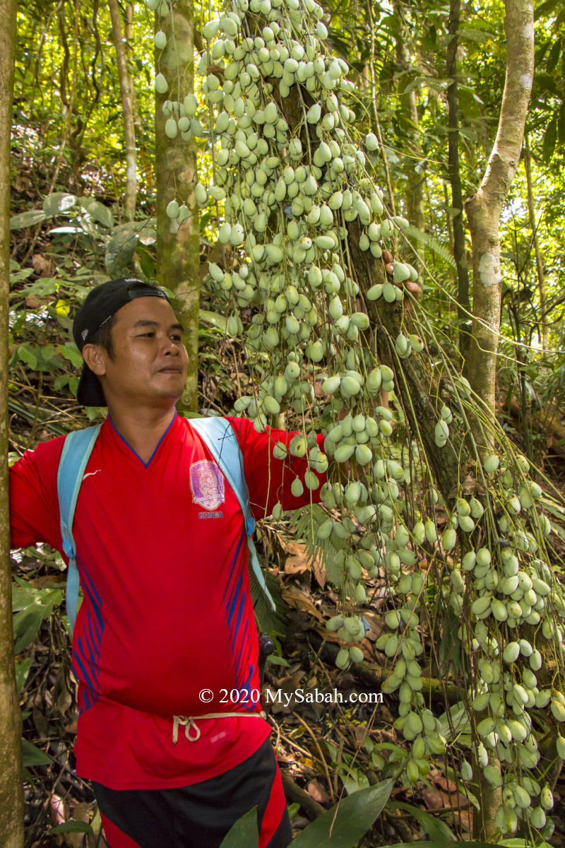
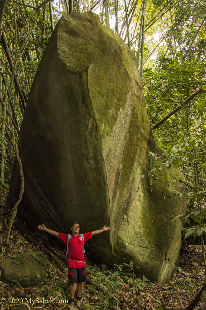
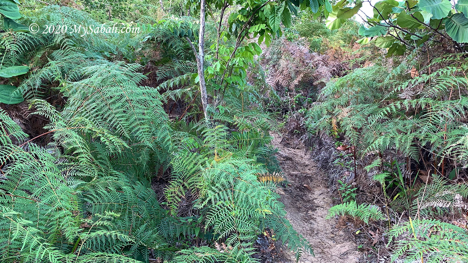
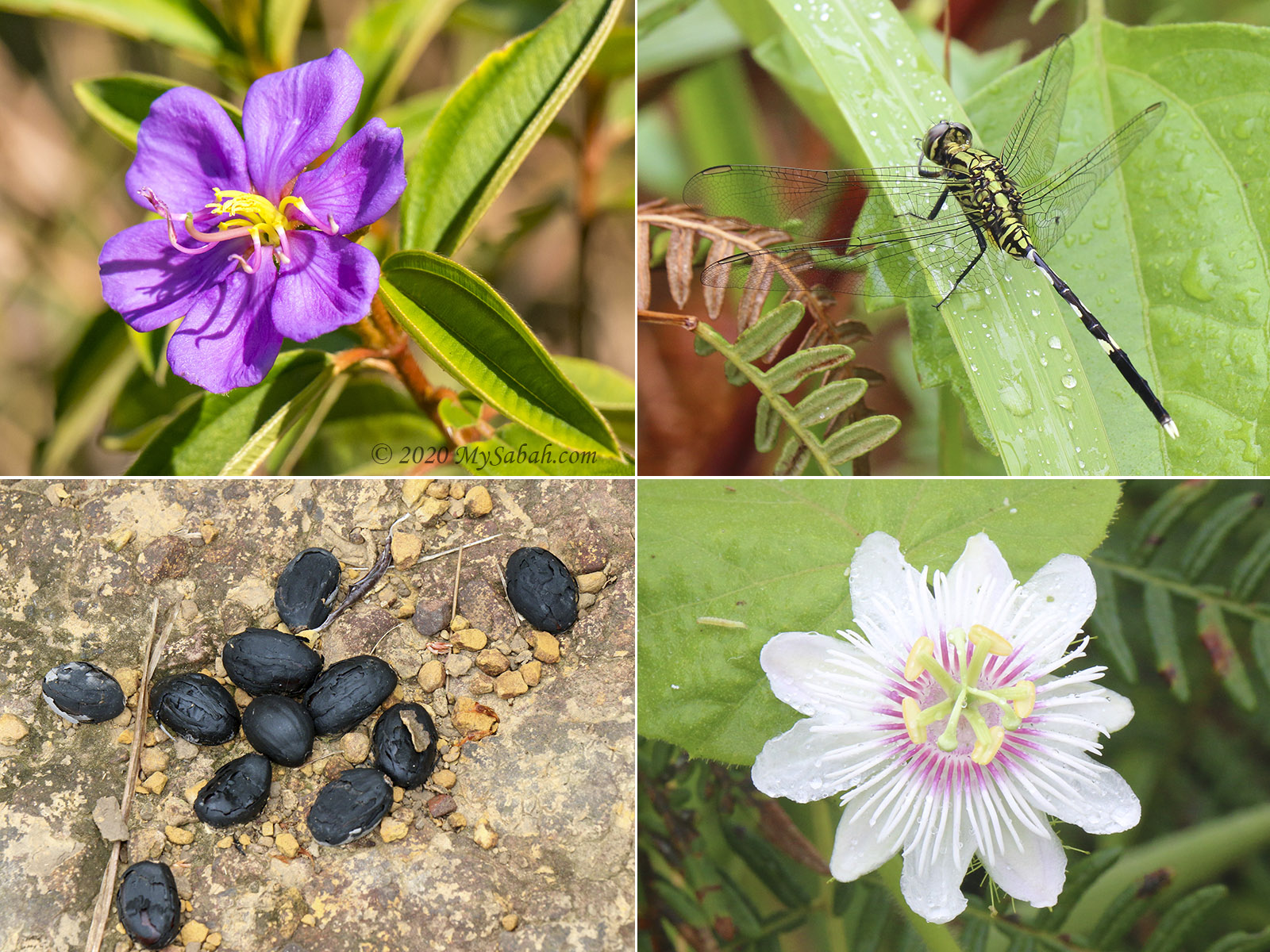
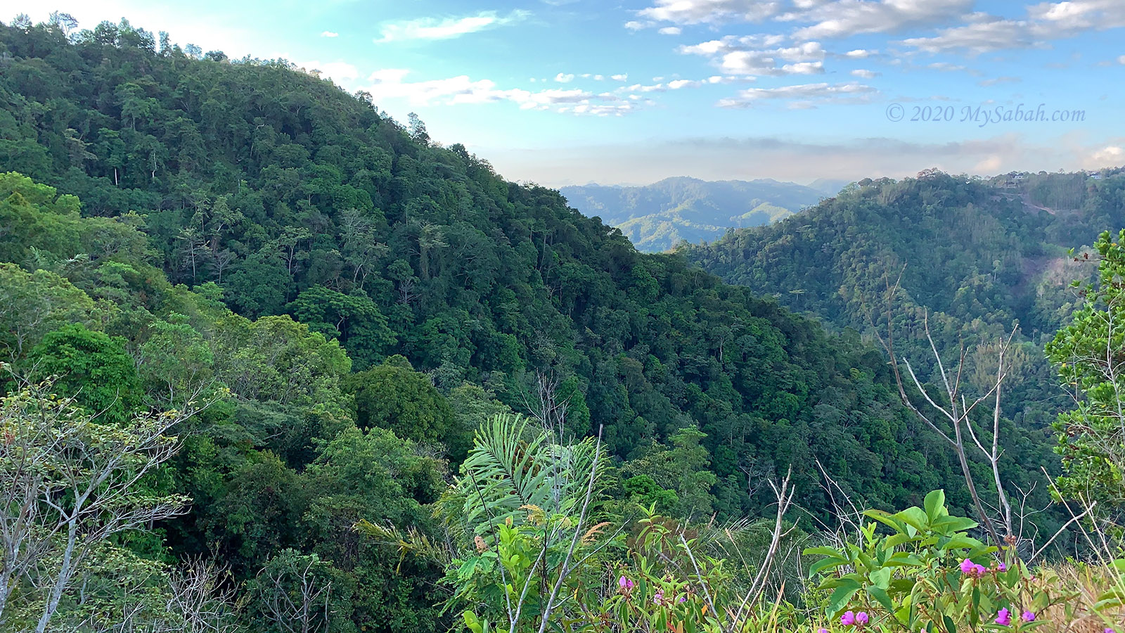
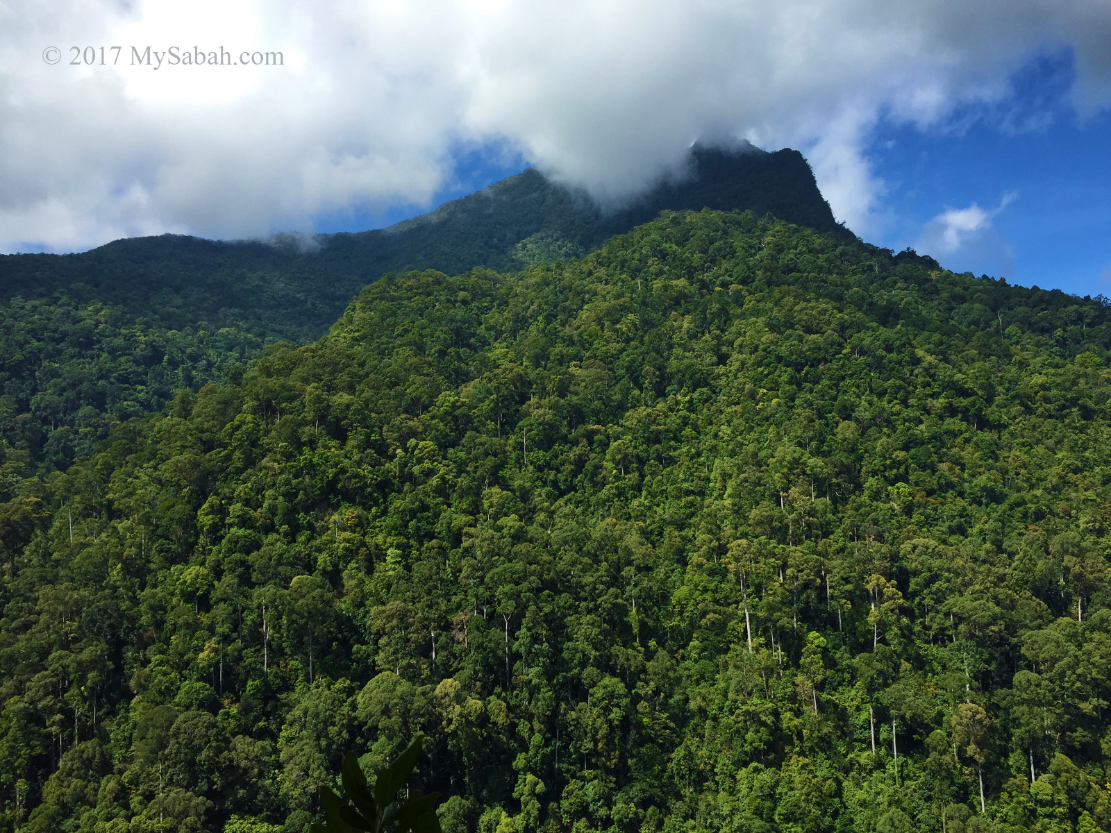
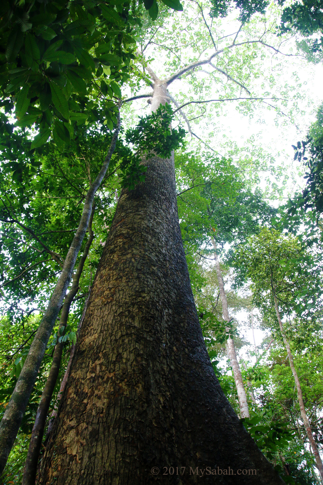
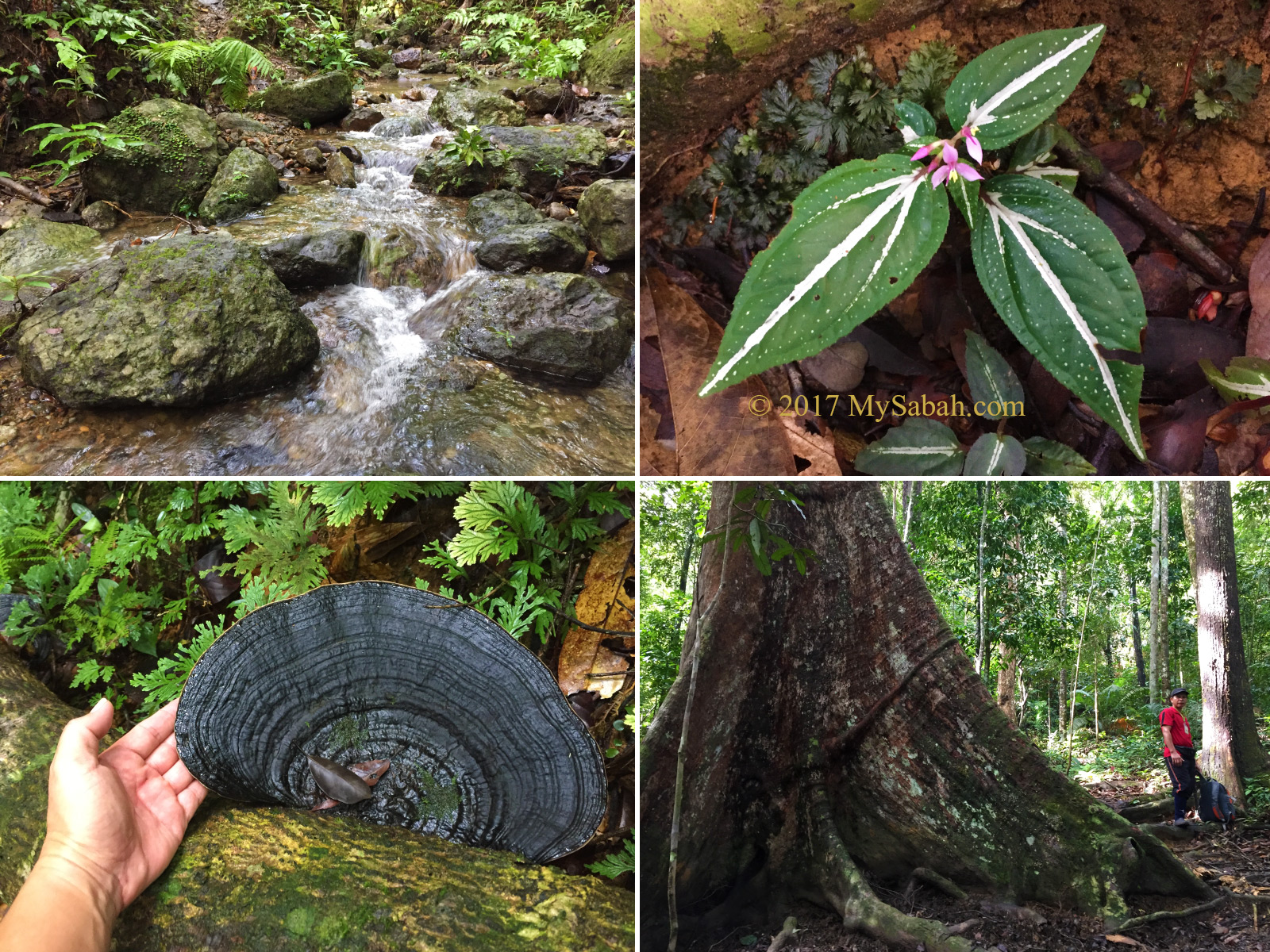
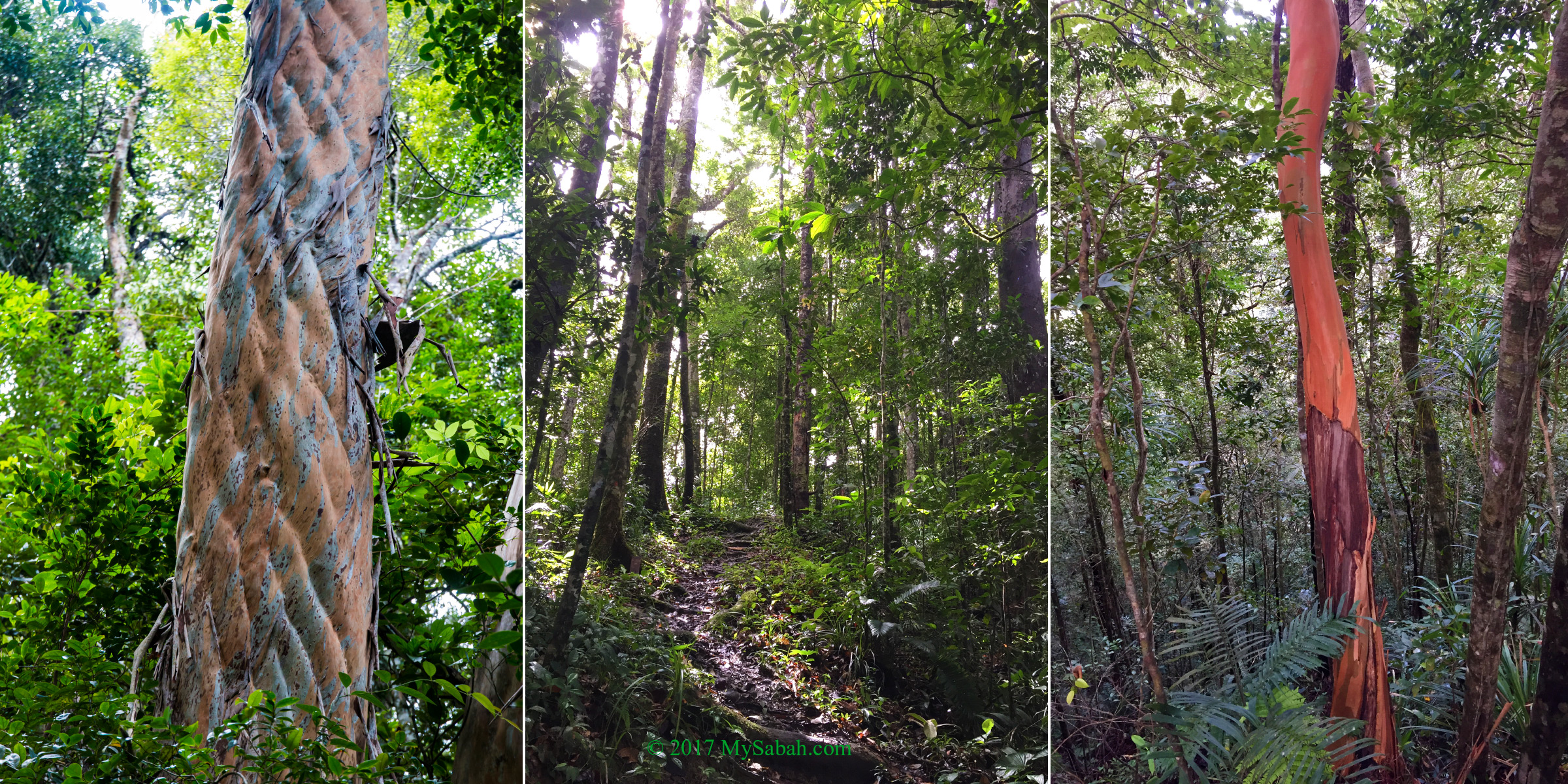
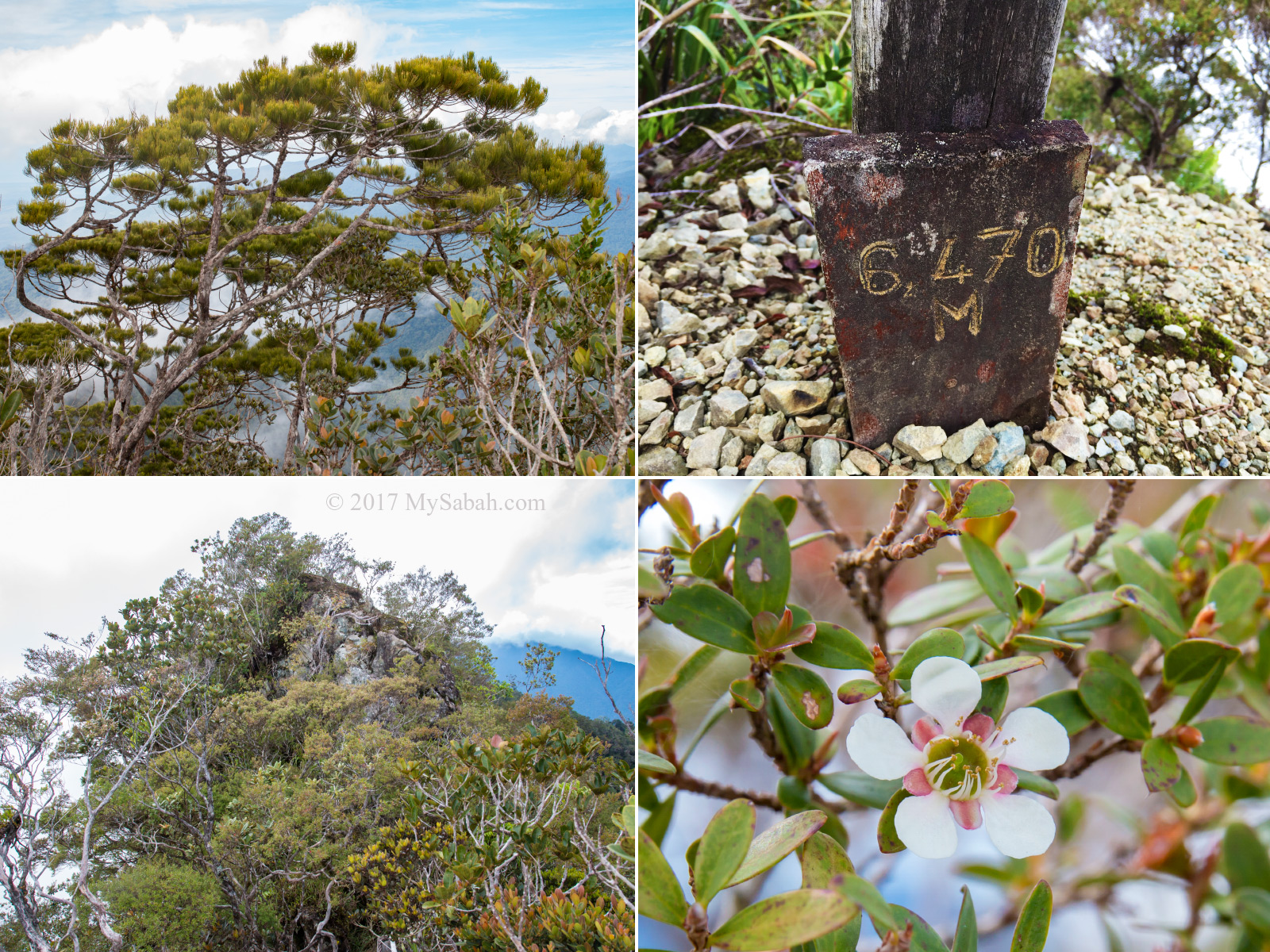
The vegetation on Maragang Hill is tropical montane cloud forest, similar to the high altitude forest of Kinabalu park, a UNESCO World Heritage Site famous for its plant diversity. Most trees in montane forest are shorter than 15 Meters. It’s also known as cloud forest because it’s frequented by mist, and characterized by tree trunks and branches blanketed with ferns, mosses, liverworts, epiphytes and other moist-loving plant.

Group photo in Tropical Montane Forest of Maragang Hill. I’m the uncle in blue short-sleeve T-Shirt lol.
The tropical montane forest (or cloud forest) near the peak of Maragang Hill looks like a garden.

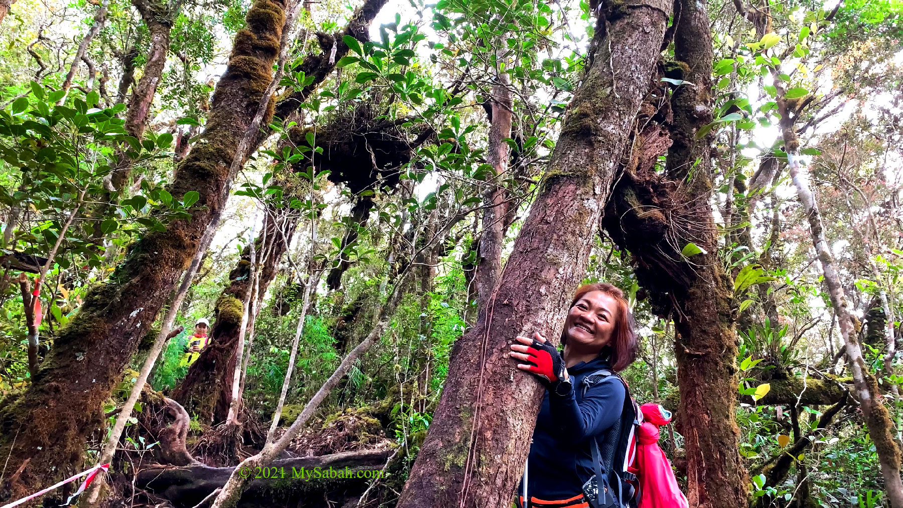
To be specific, Maragang Hall is dominated by Ericaceous Forest thrives between 1,800 and 2,400 Meters. Red Leaf Monkey loves to feed on the nuts from the oak trees here. The gnarled and stunted forms of Leptospermum and Dacrydium plant turn the forest into a strange garden. If it’s flowering season, you would see native orchids and wild rhododendron blooming along the trail.

Pengimpaan Point is translated as Imagination Point.

Occasionally we stopped to give way to the descending climbers who return from their sunrise hike, which started at 3am. I was told that the sunrise hike was fully booked (40 slots) and it’s more popular than standard day hike, which had only 11 climbers that day. We already plan to do sunrise hike in the future before we finish our normal hike.

We met other climbers returning from sunrise hike. One of them carried a toddler on the back.

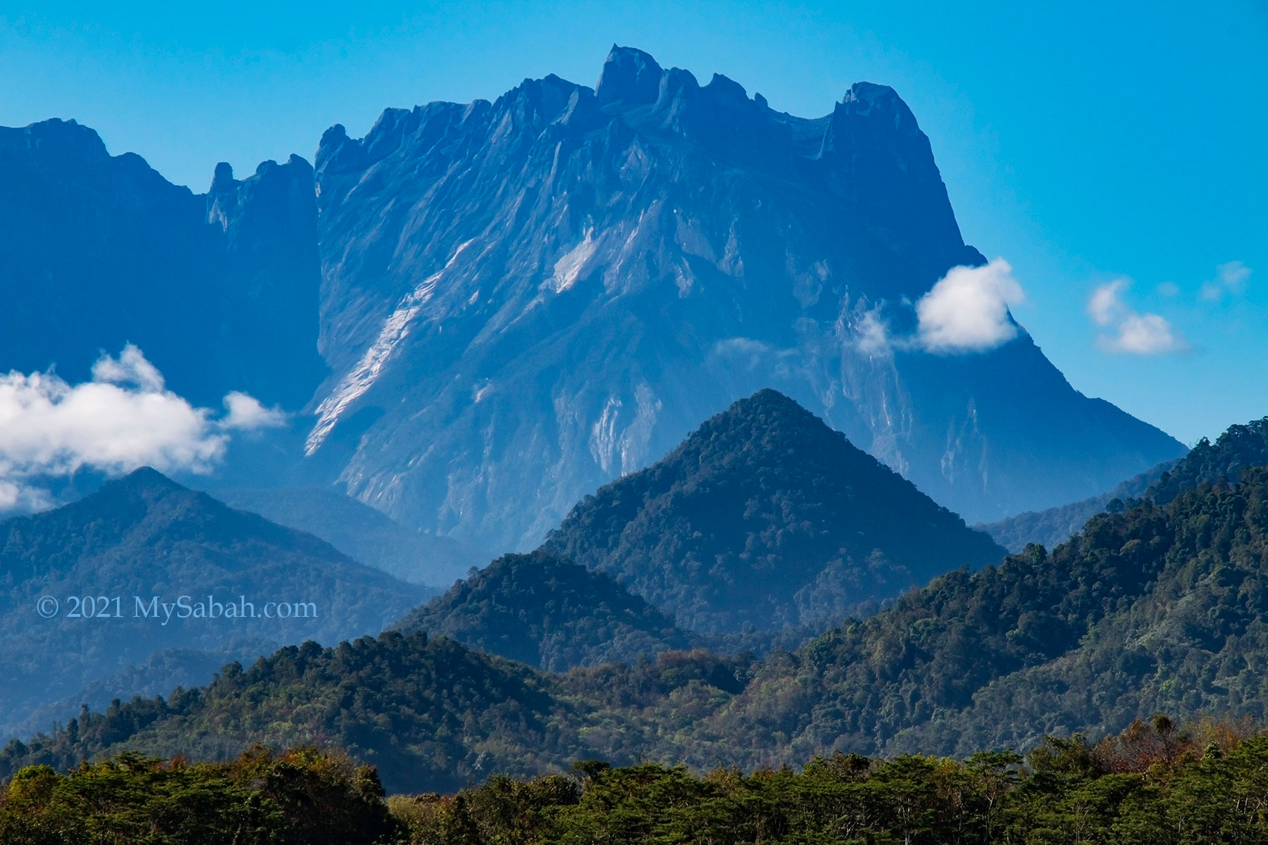
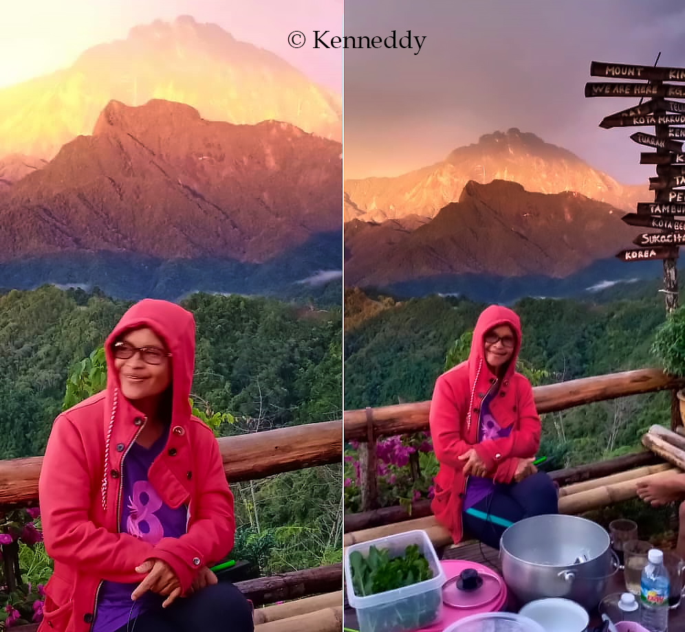
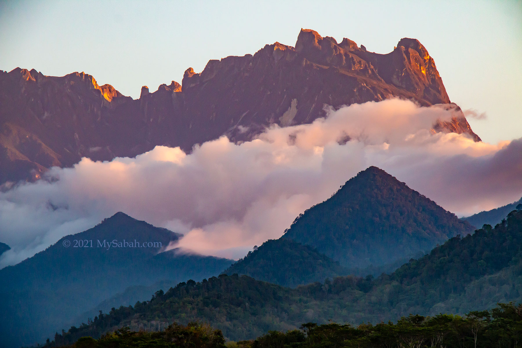
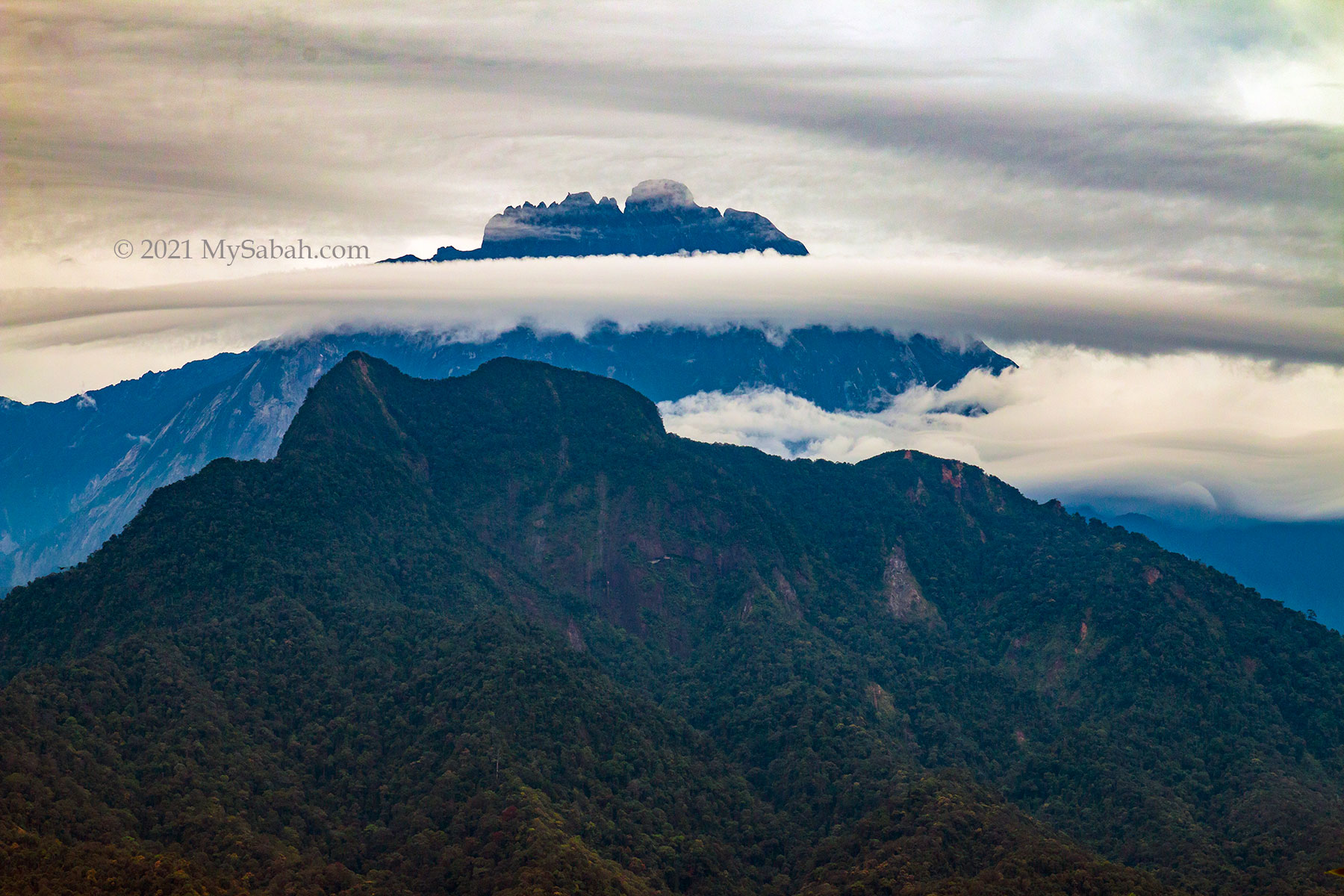
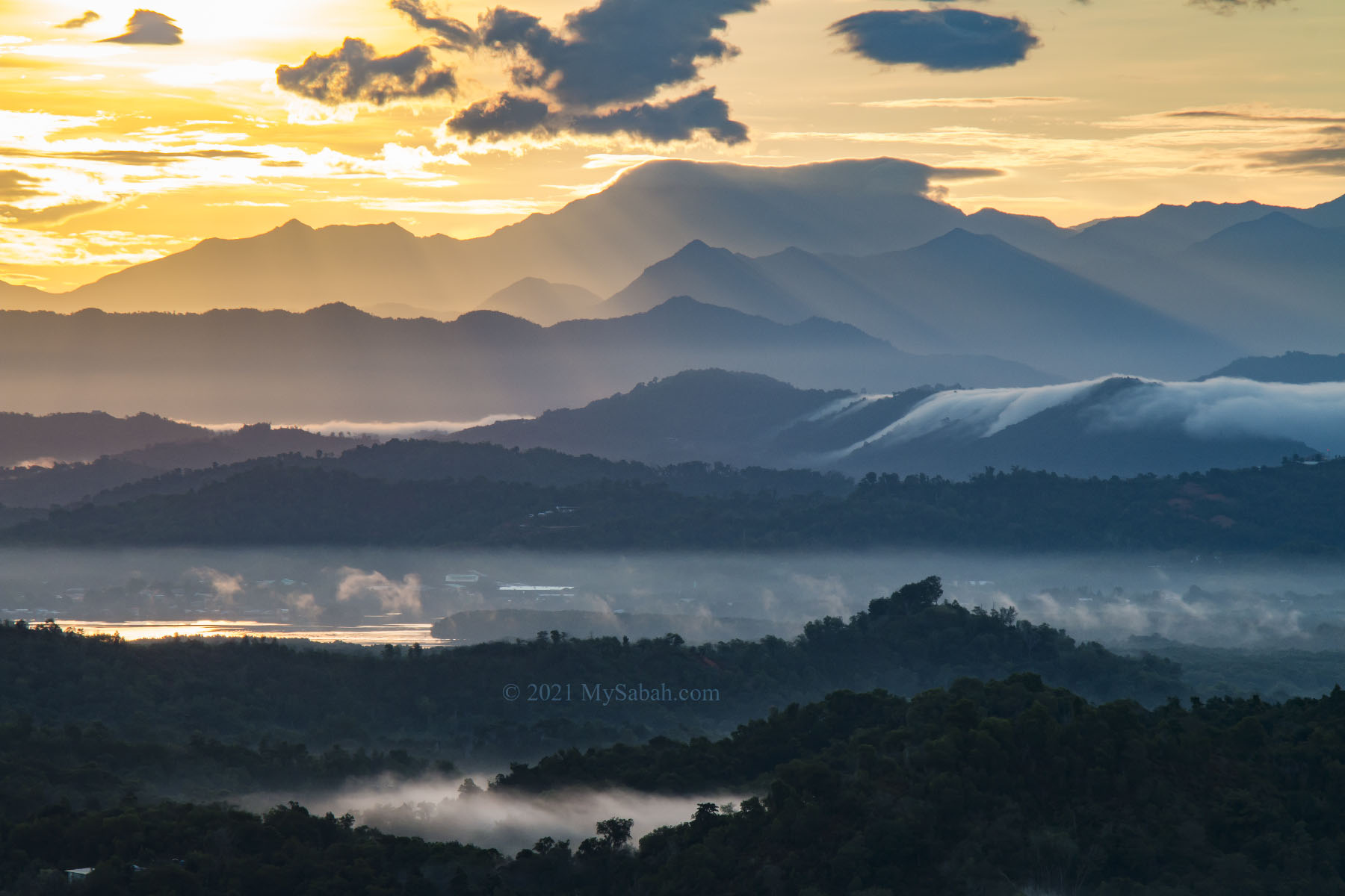
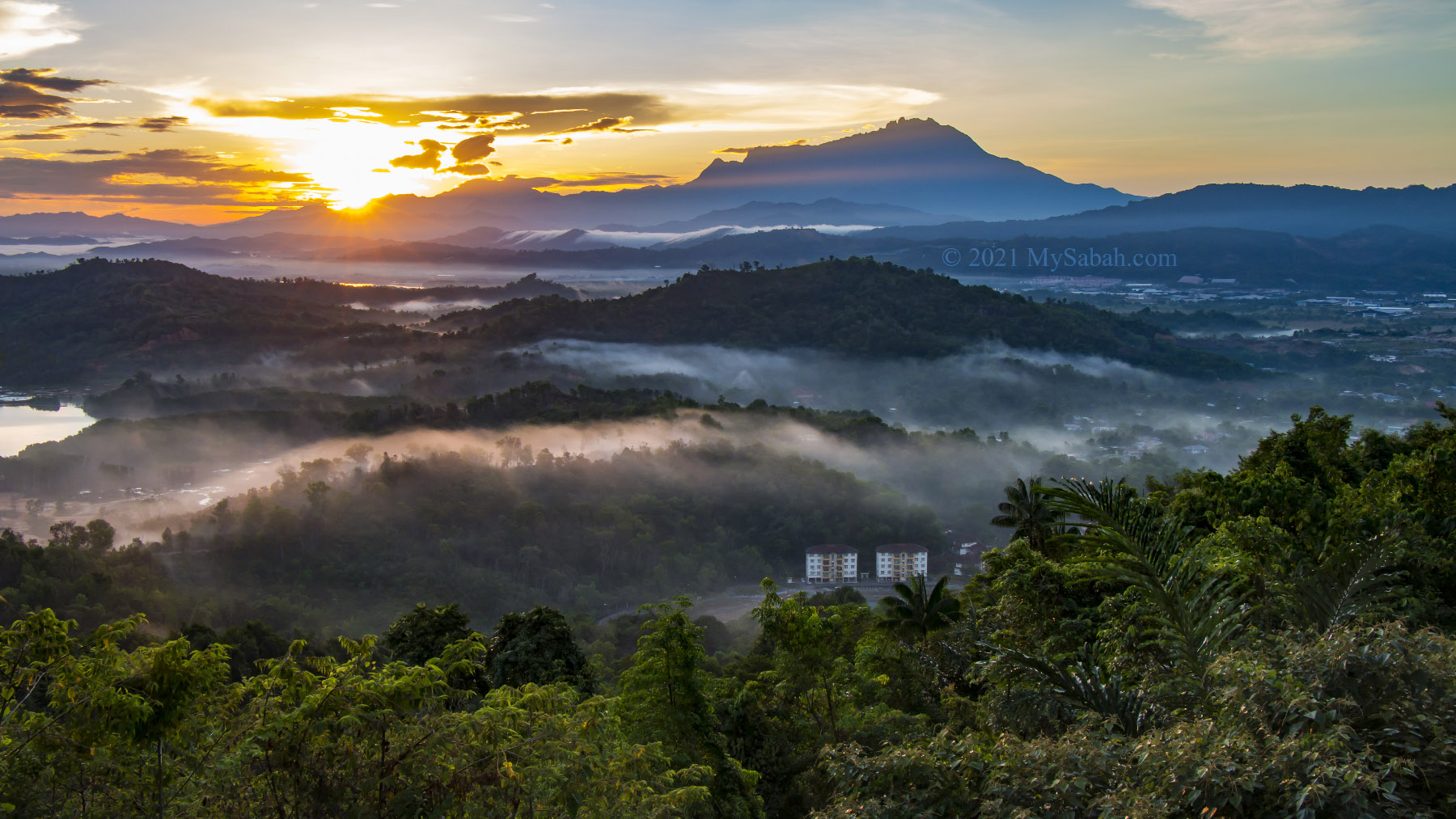
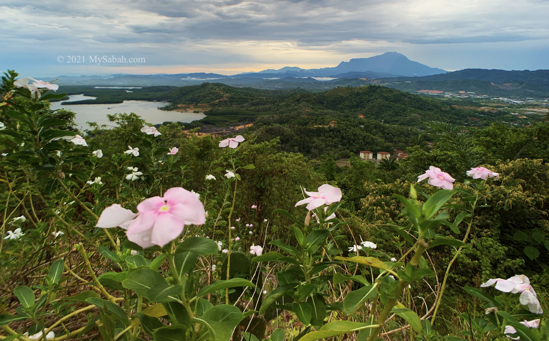
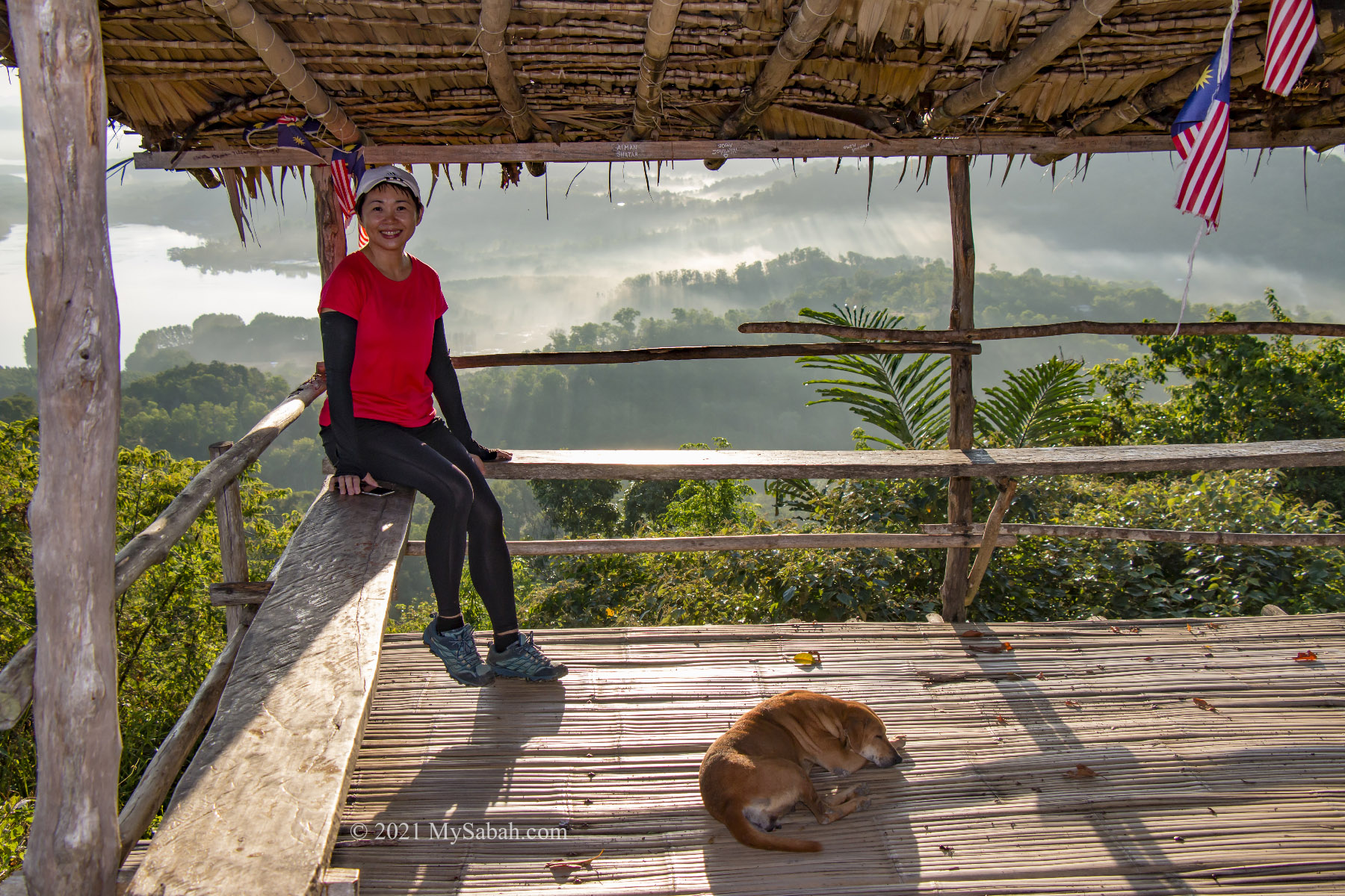
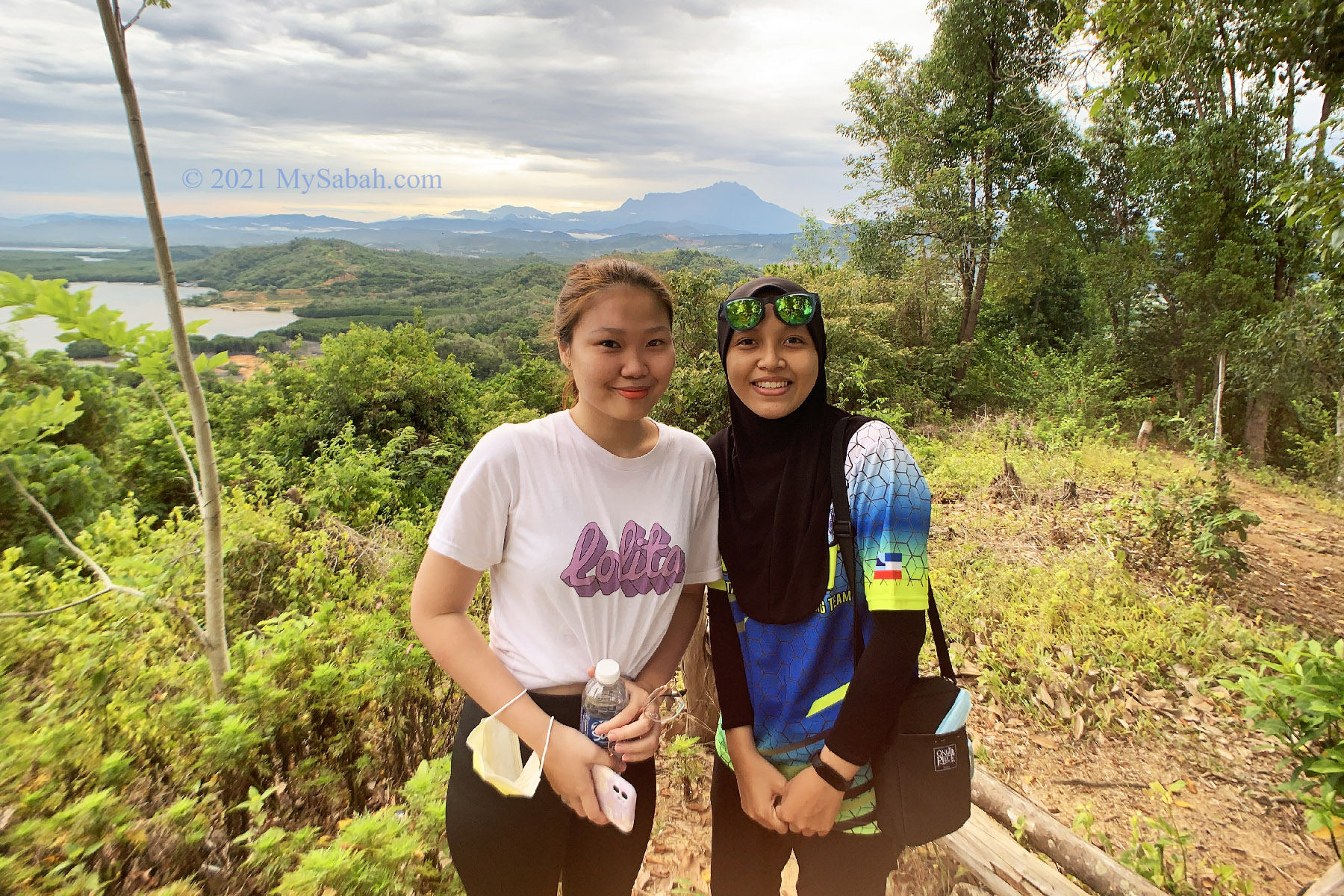
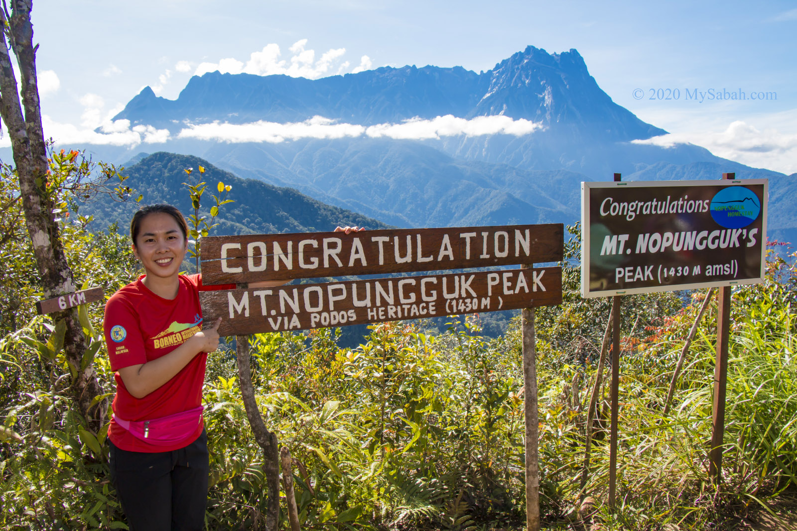
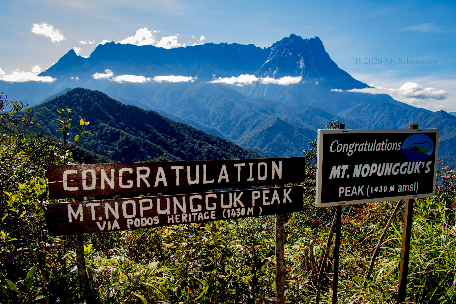
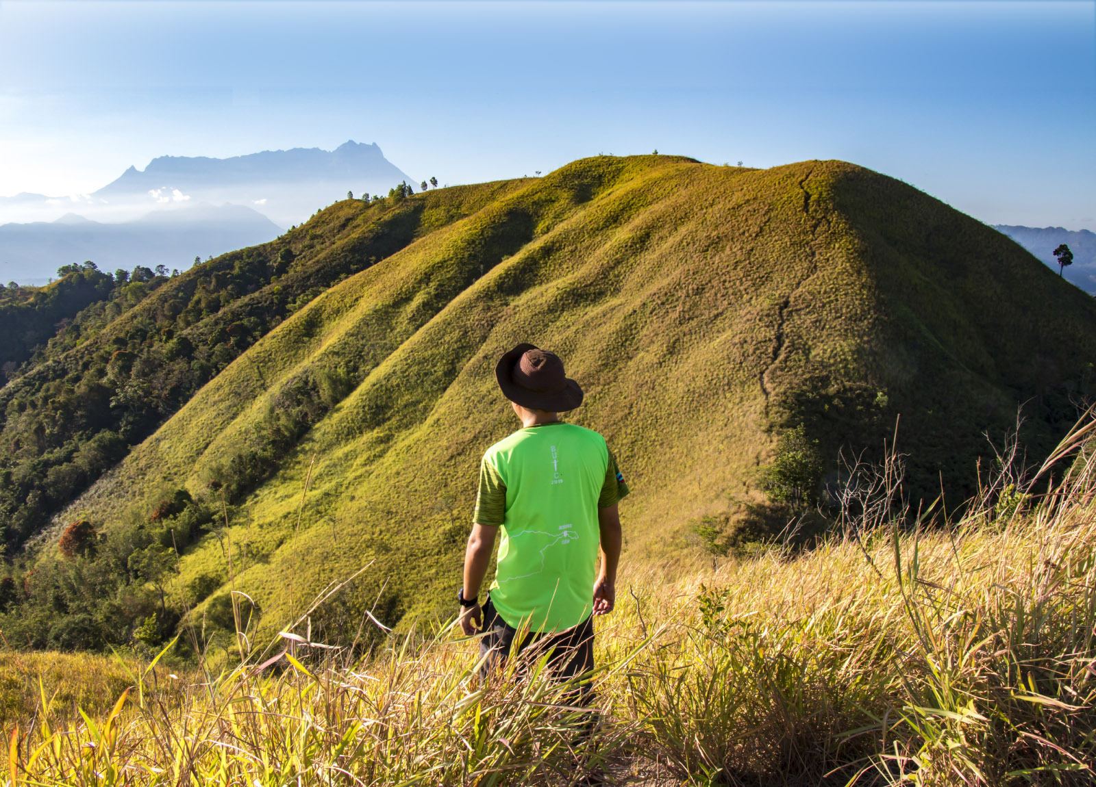
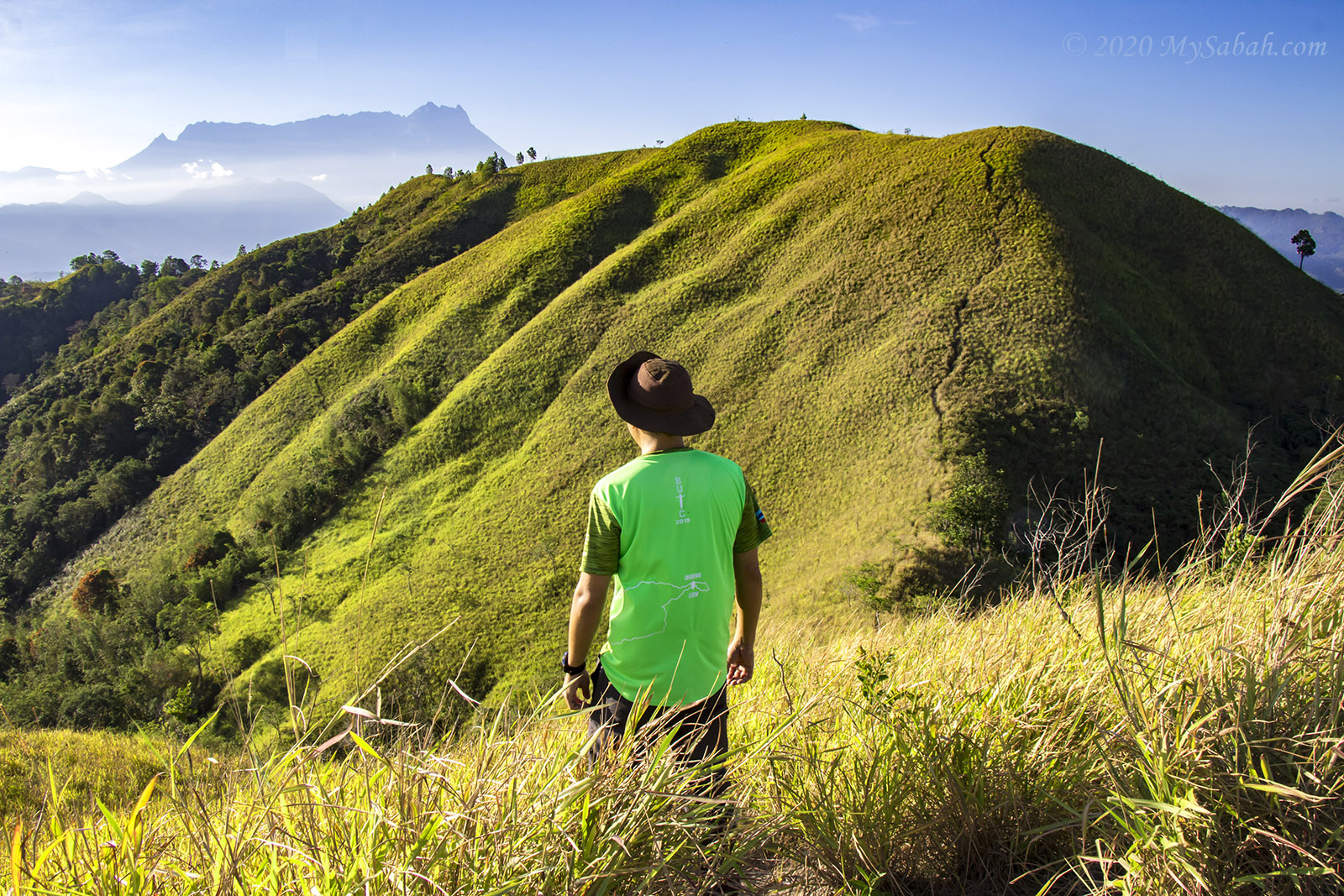
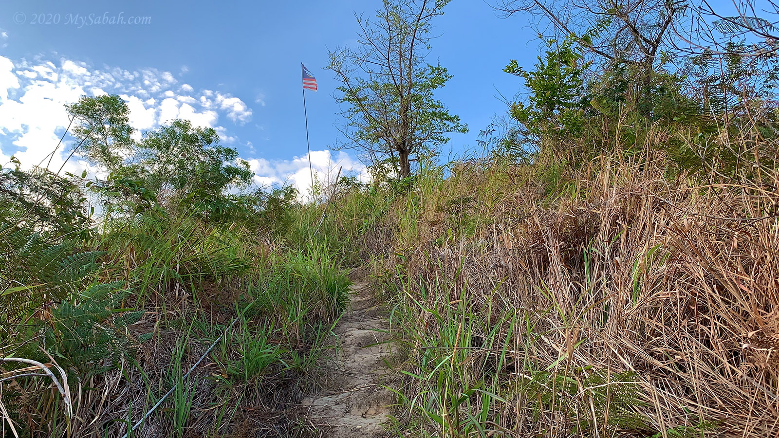
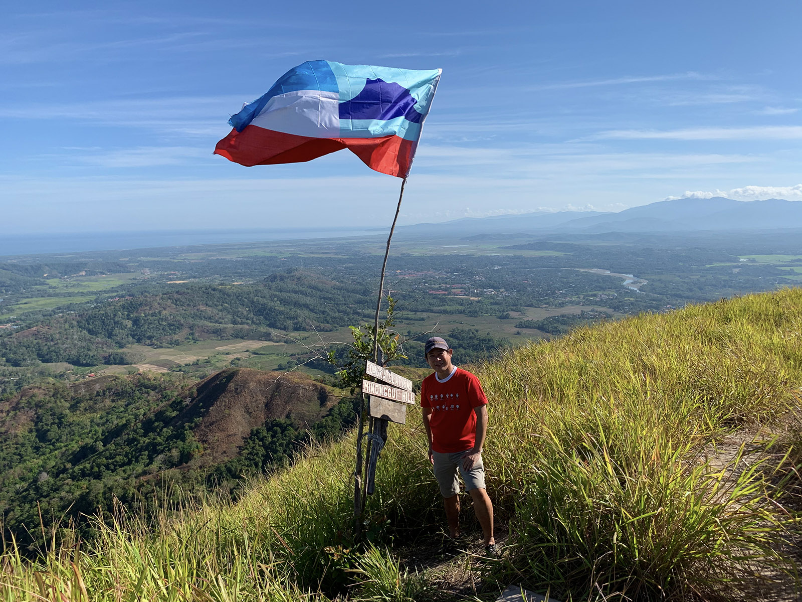
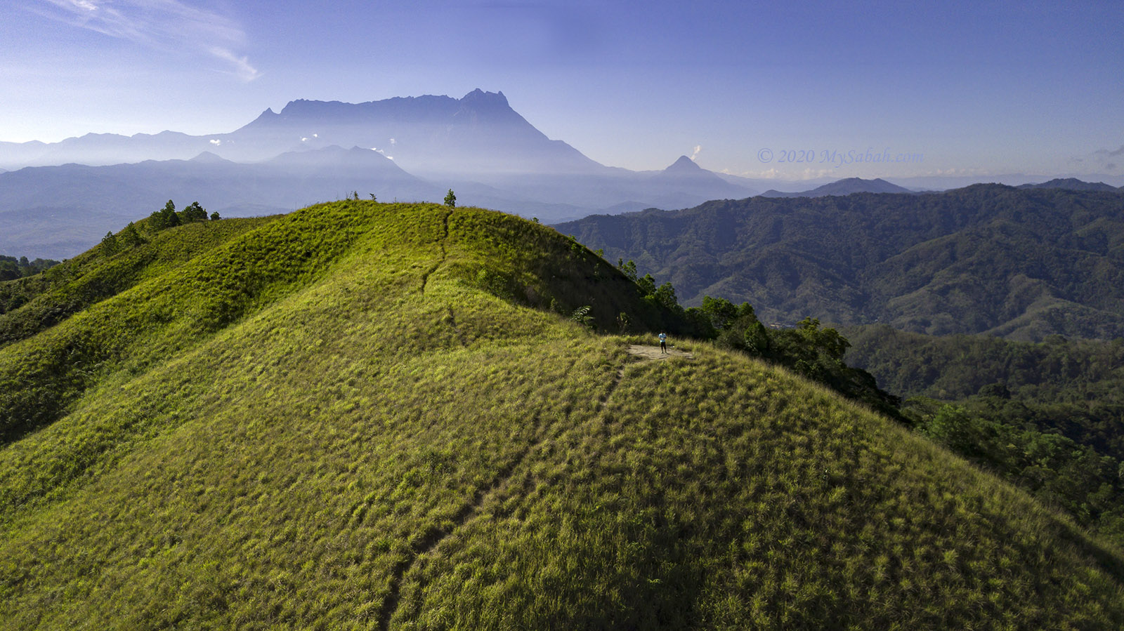
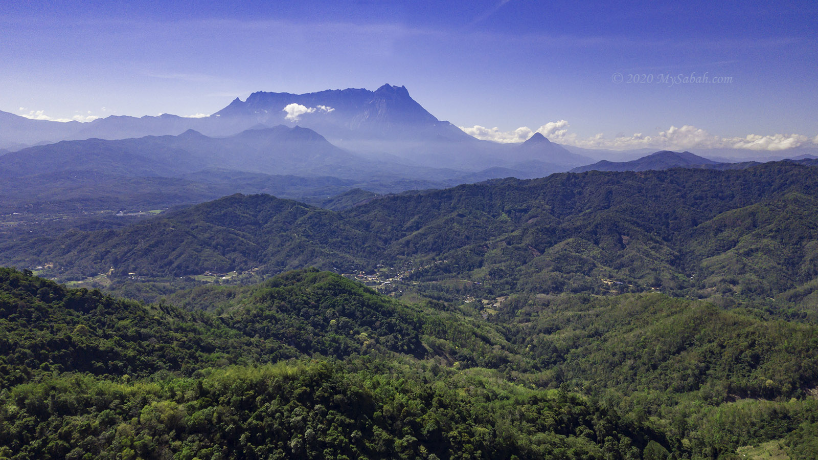
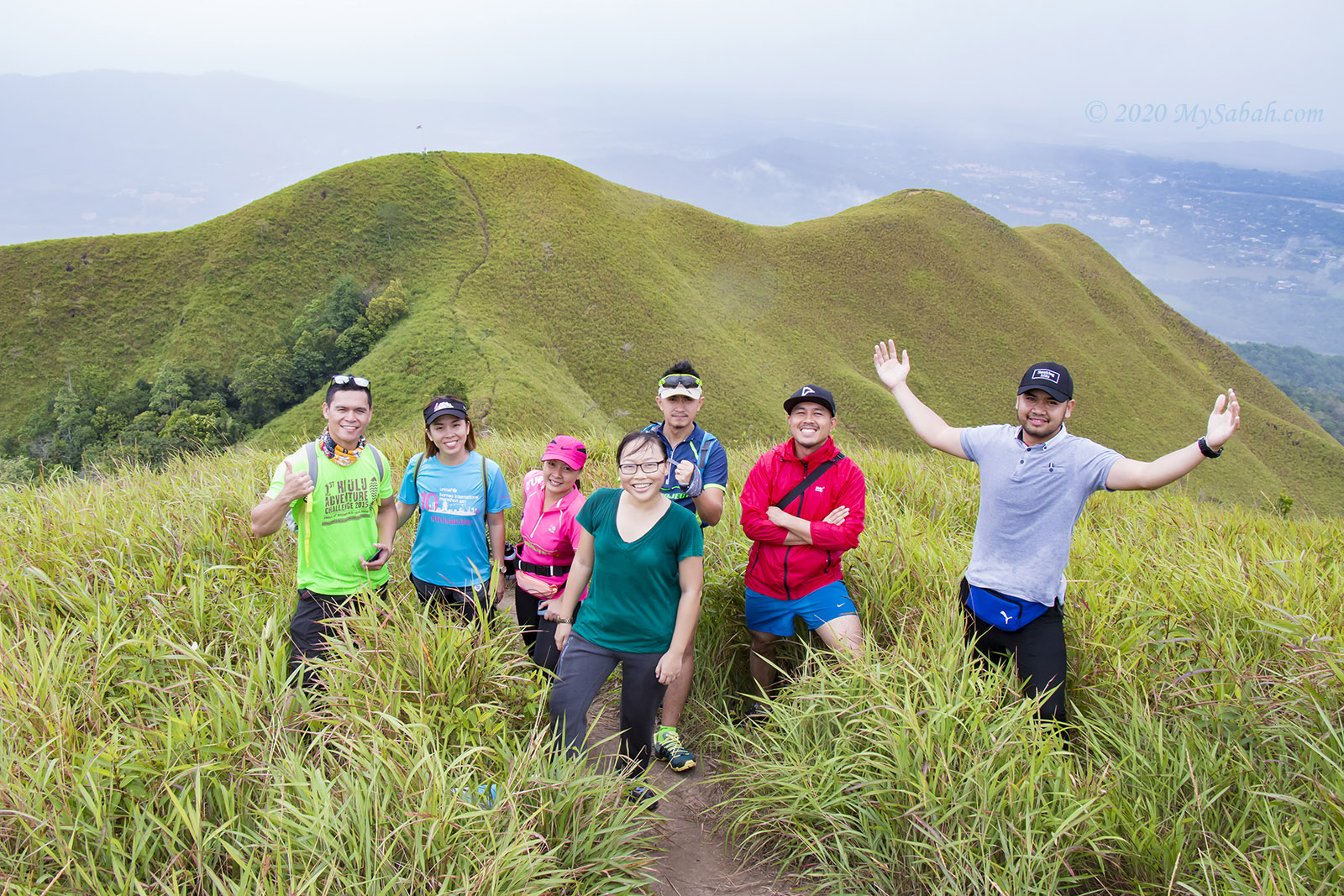
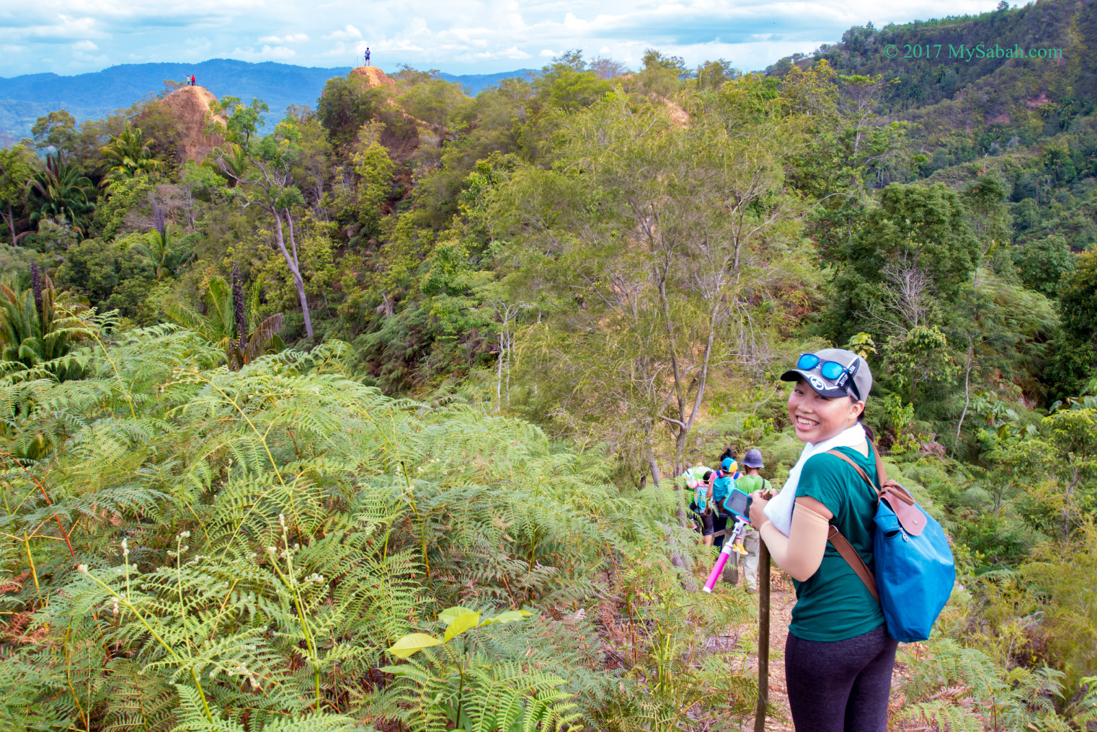
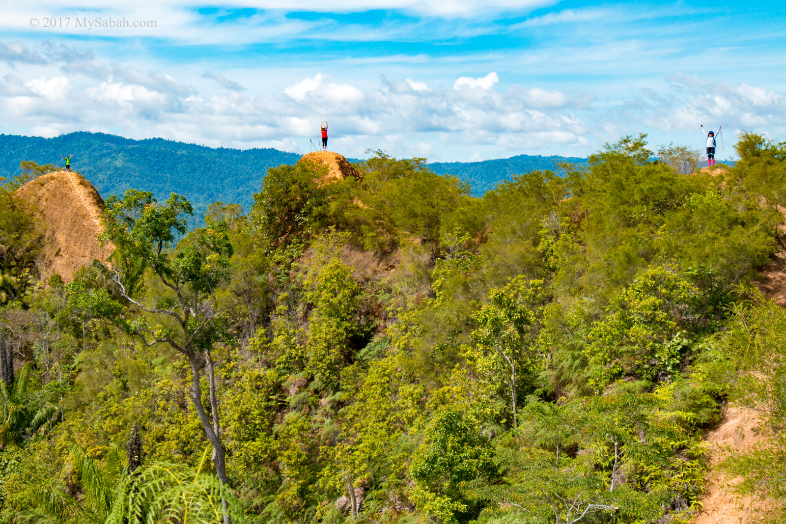
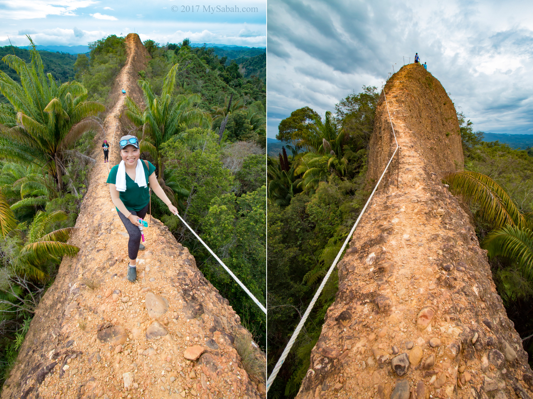
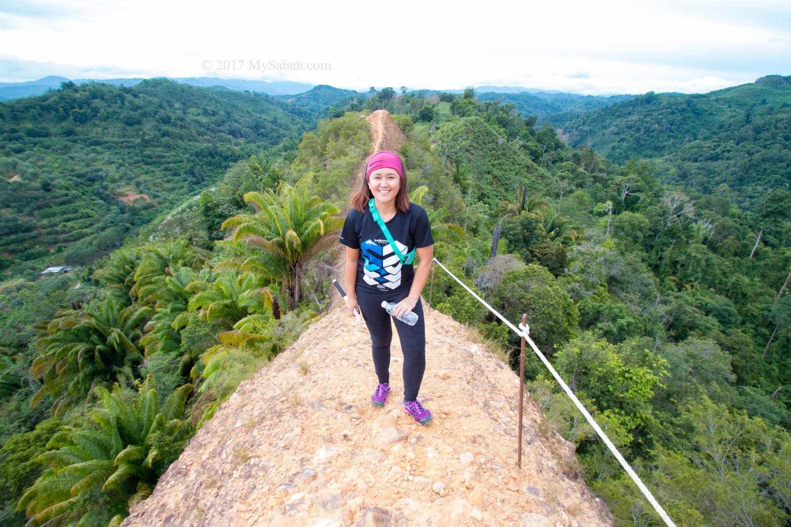
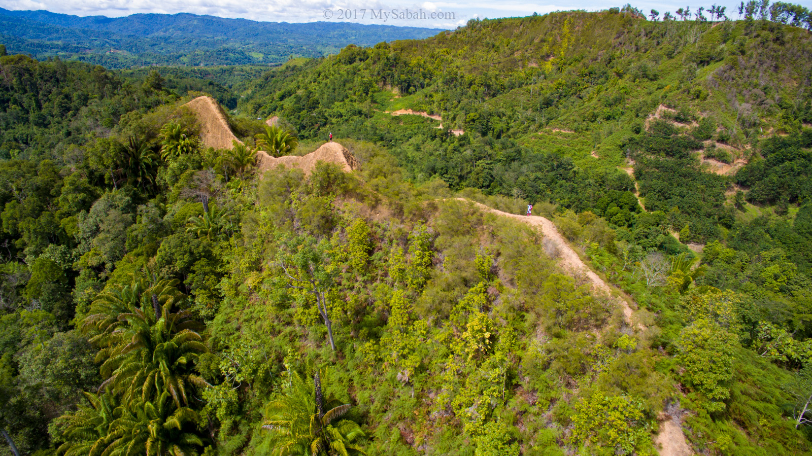
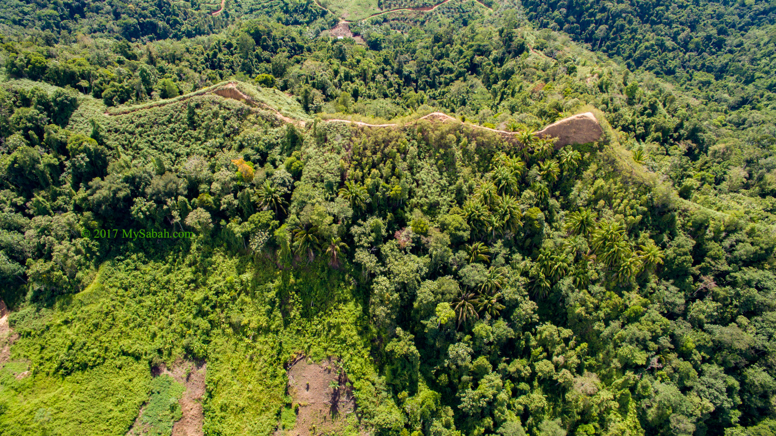
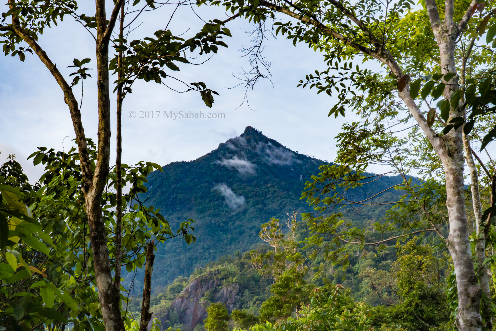
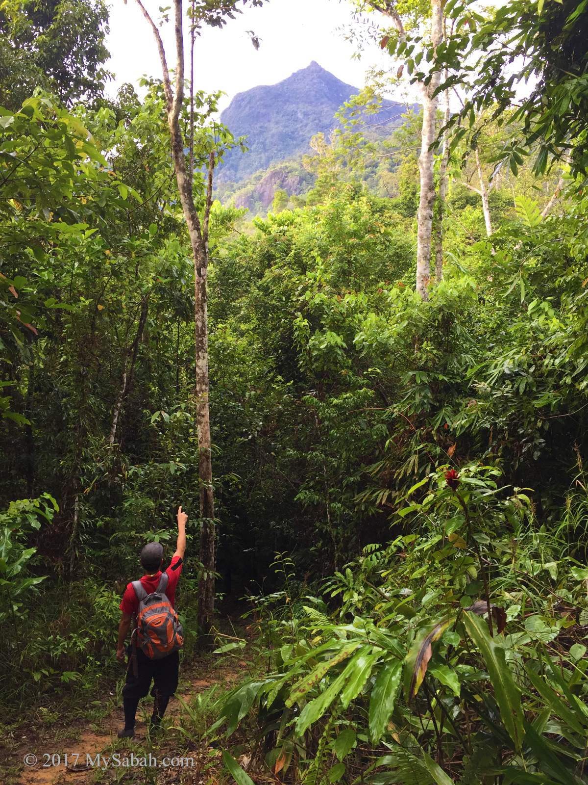
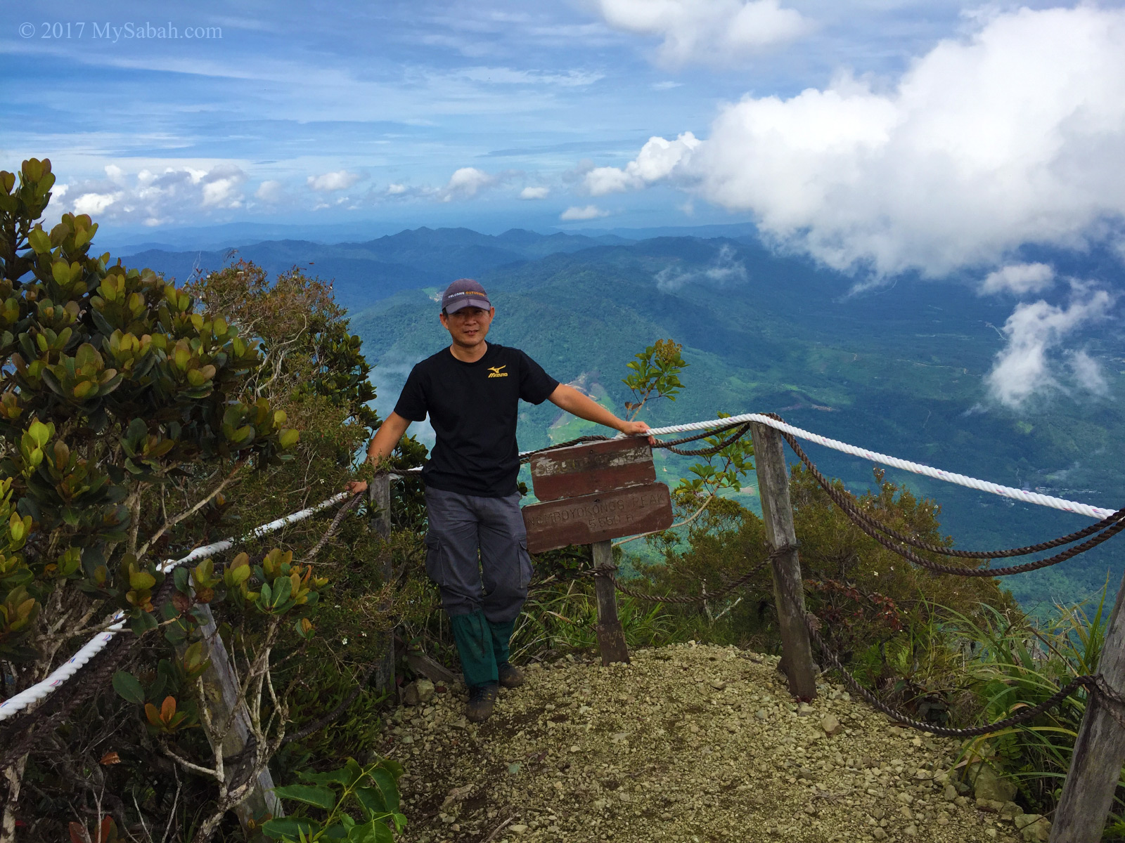
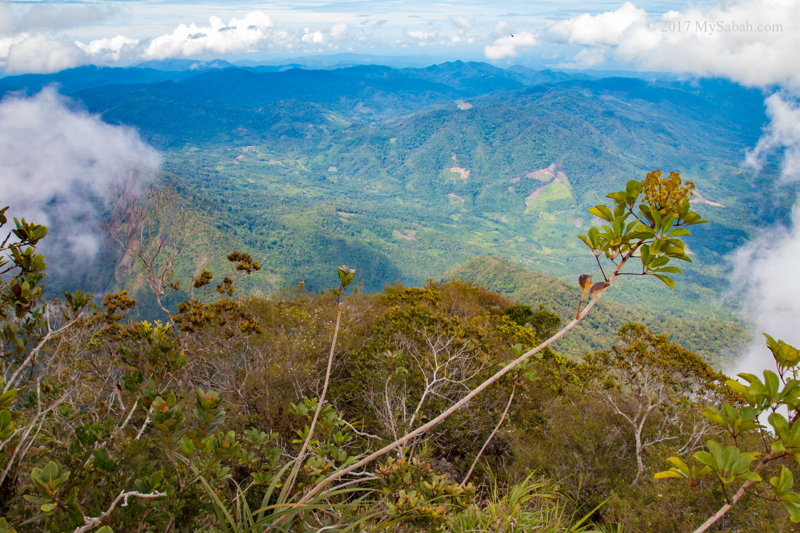
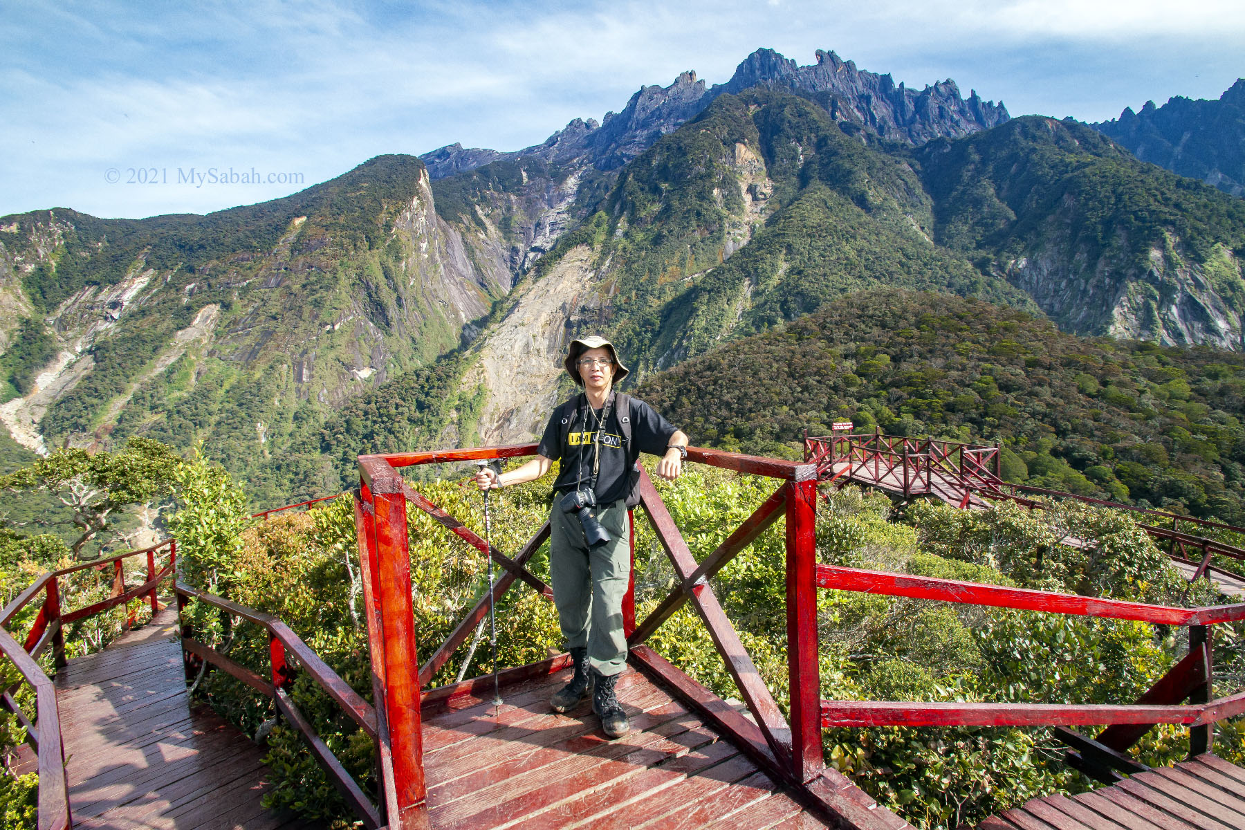
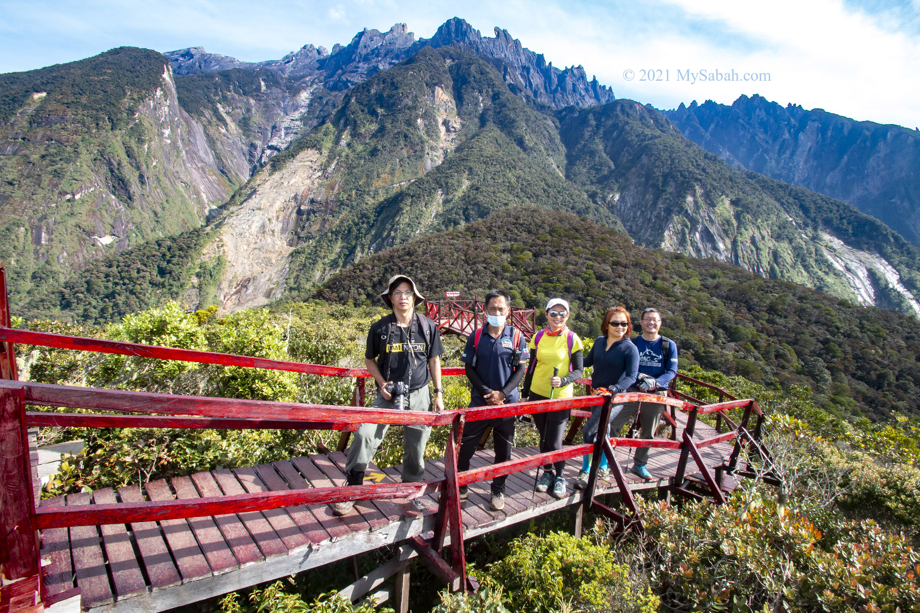
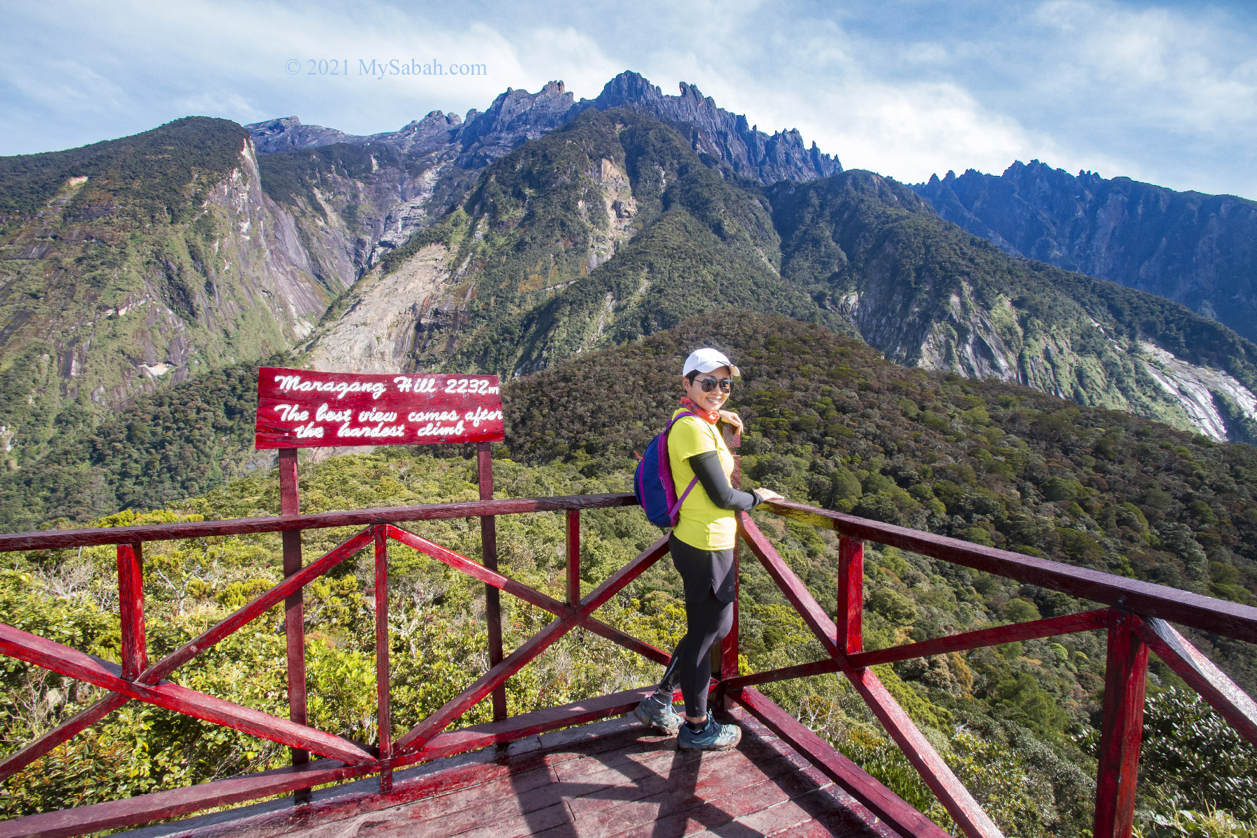
At 7:47am, we came to a long boardwalk that looked like red carpet. A few minutes later we passed by the 1.3 KM marker, and finally we reached the peak after another 20 more minutes. We walked out of the dense bush and greeted by the majestic Mount Kinabalu.

Passing by the 1 Kilometers marker, the peak of Maragang Hill is only 600 Metres ahead.

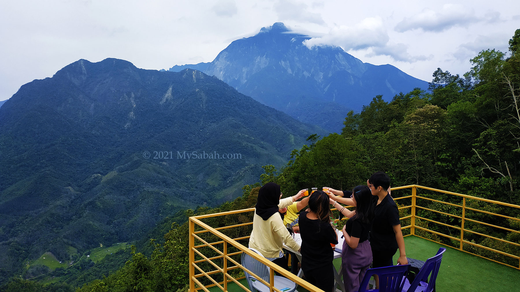
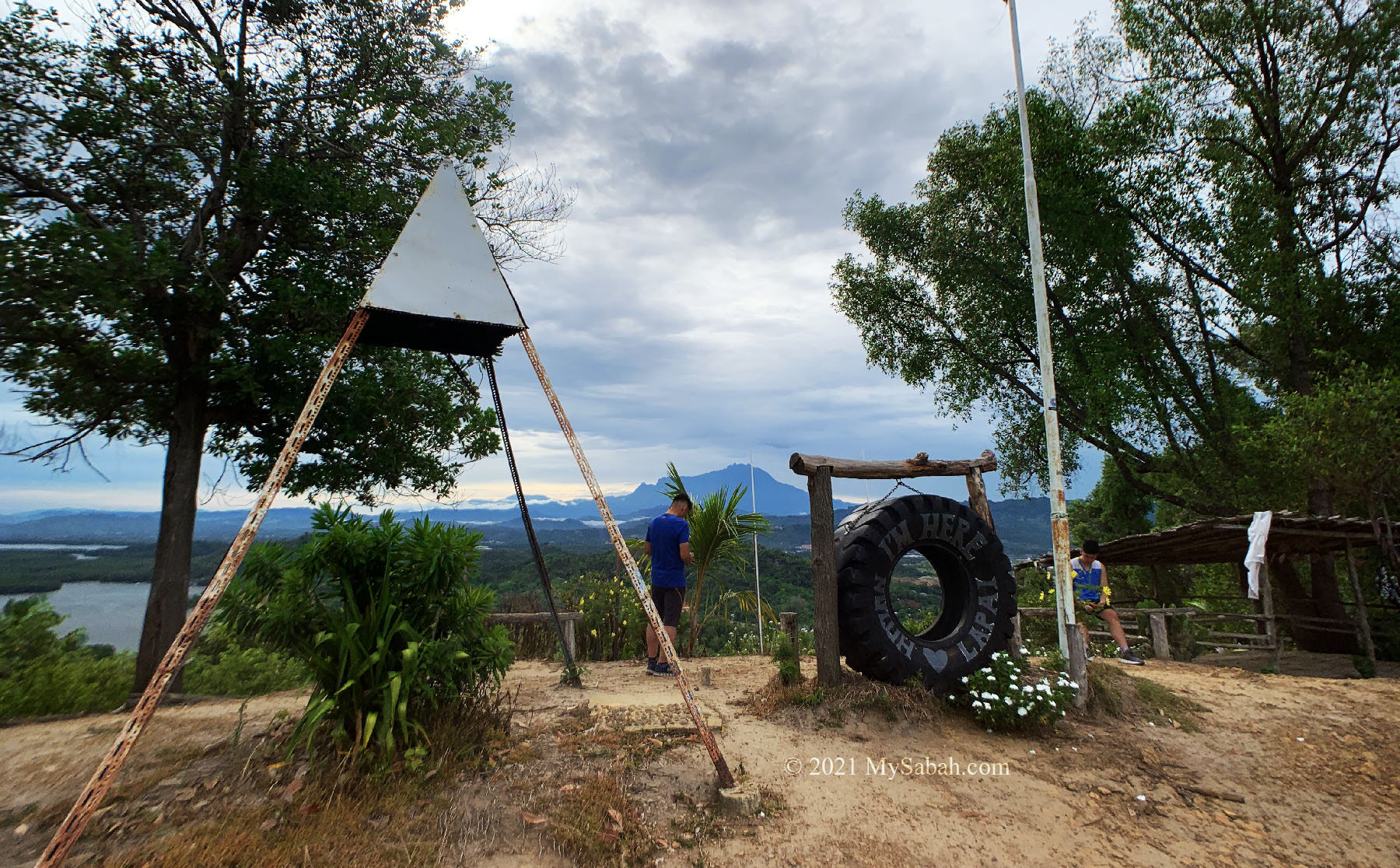
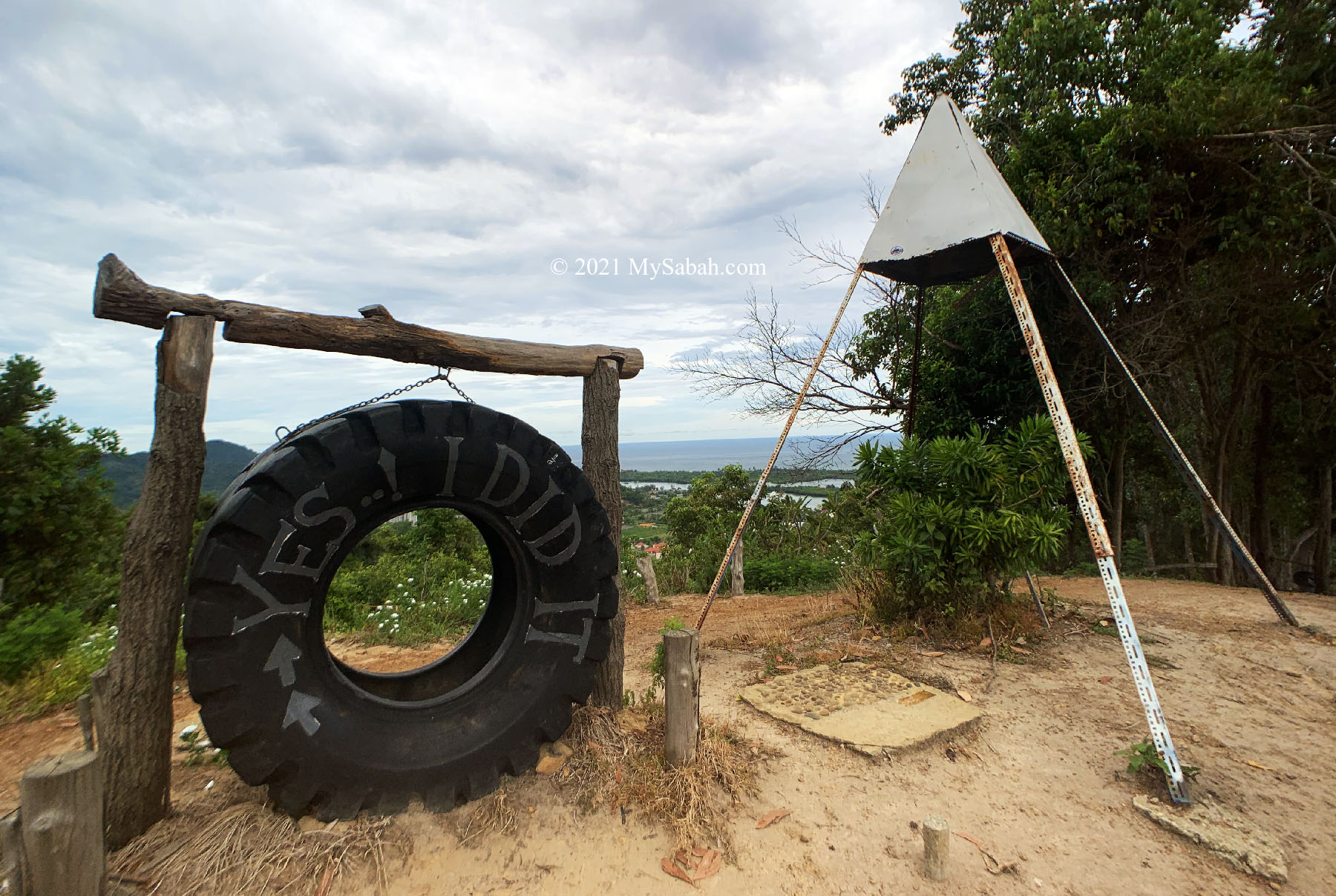
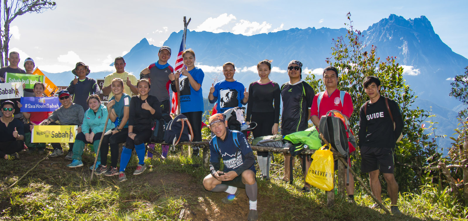
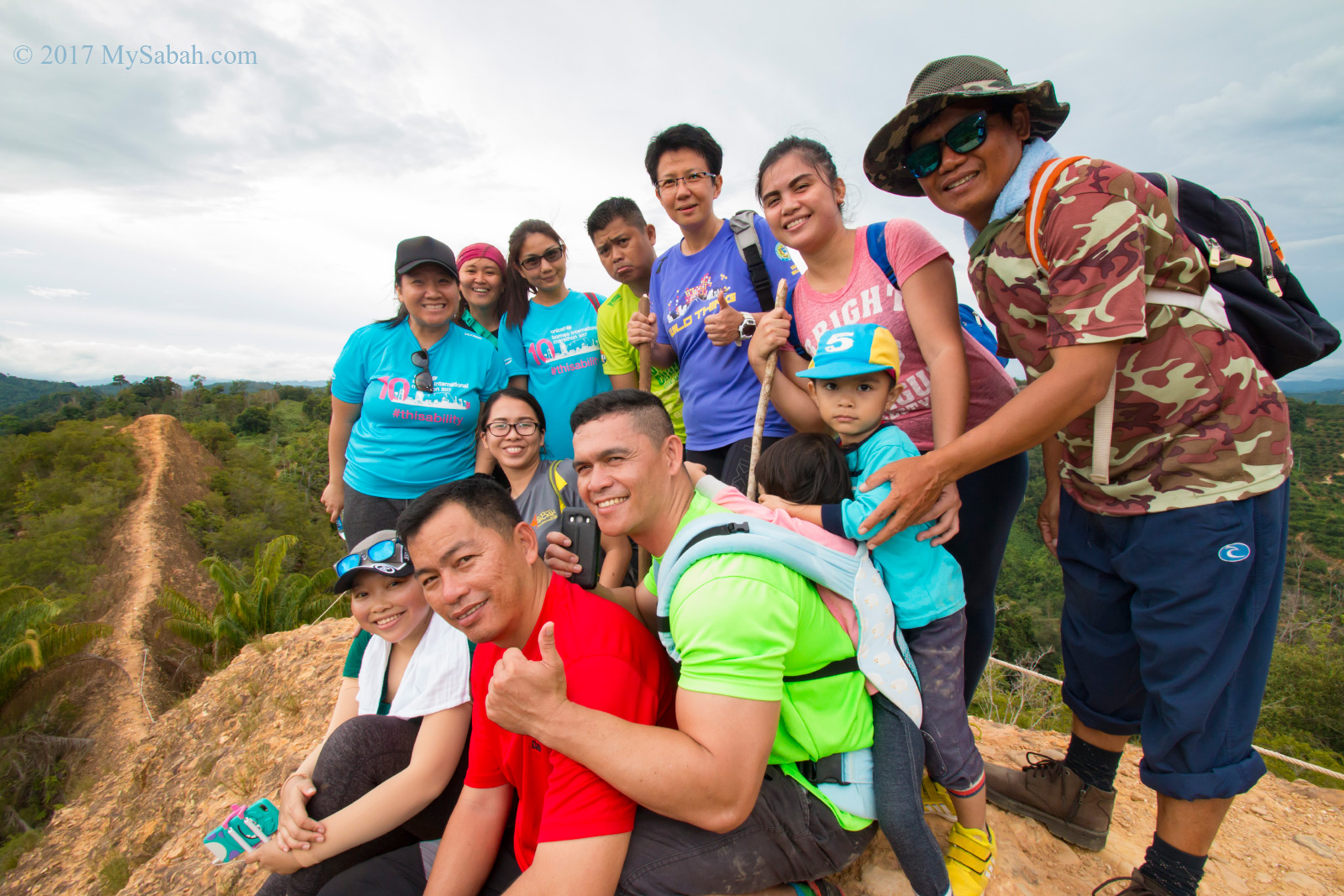
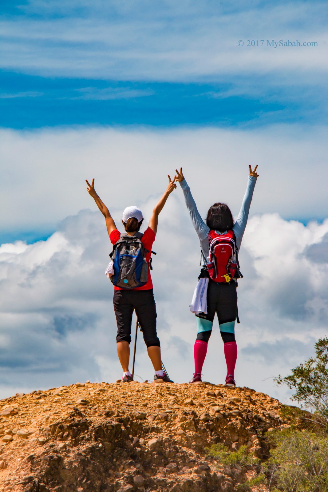
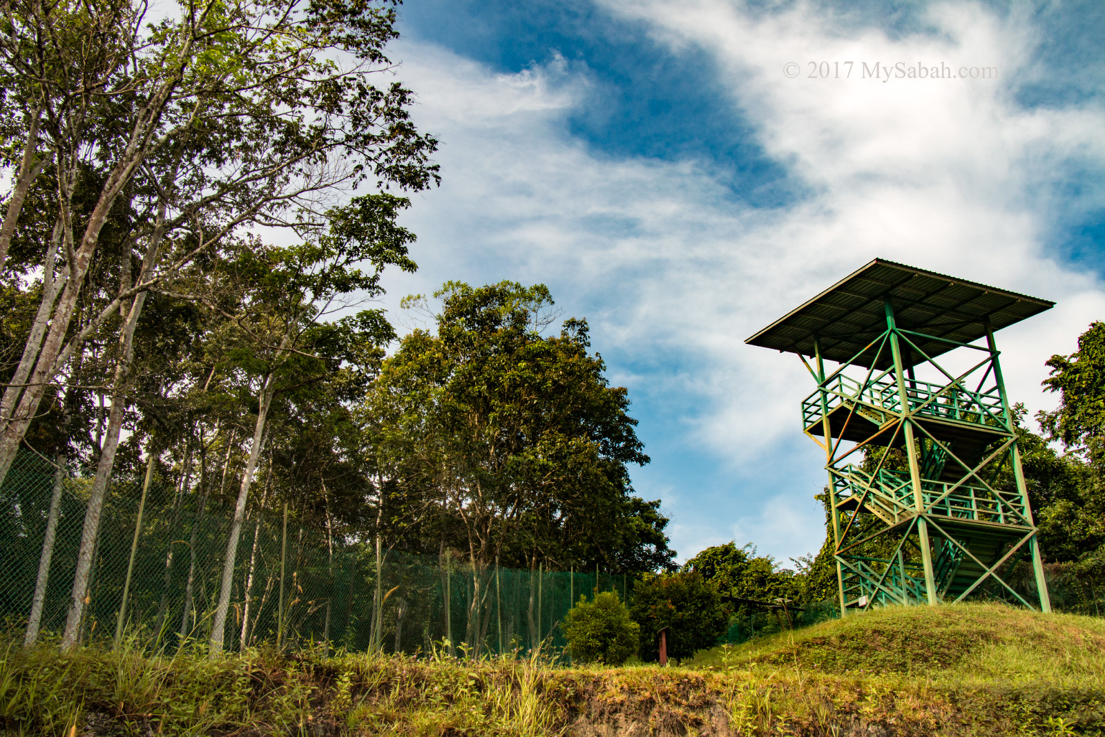
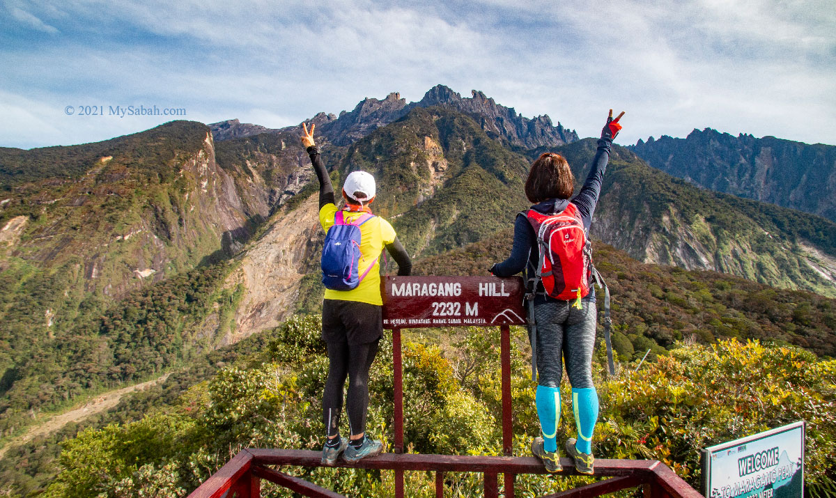
All of us rushed to the platform and took selfie with Mount Kinabalu like crazy, as if we saw a superstar. What a brilliant idea to build 2-Meter raised platform above the summit shrubs, so there is no tall shrub obstructs our 360 degree view.

The longest boardwalk is after 1 KM. Look like a red carpet to the peak.
The 1.3-Kilometer trail mark tells us that there are only 300 Meters left. “Dekat Sudah” means “Almost there” in Malay language.

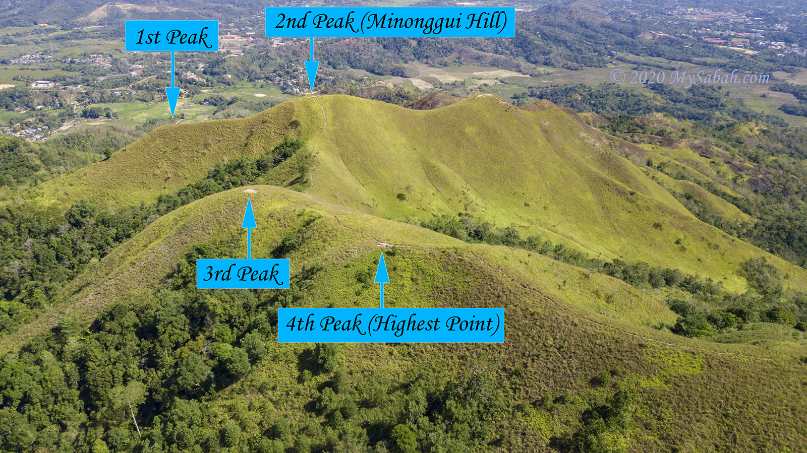
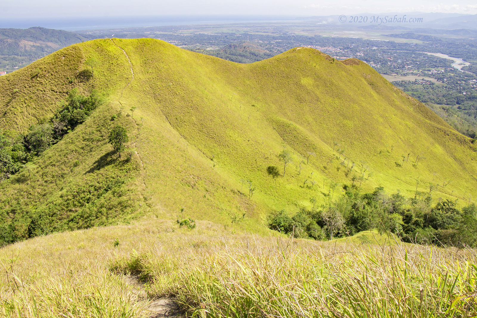
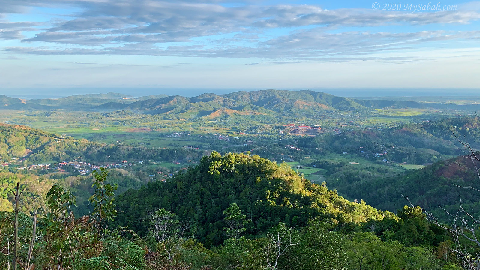
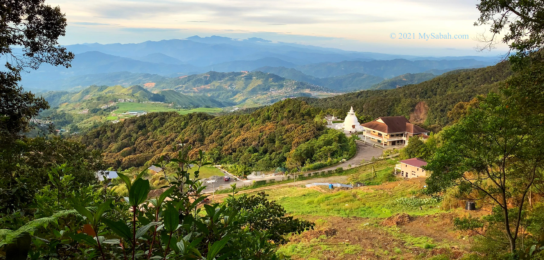
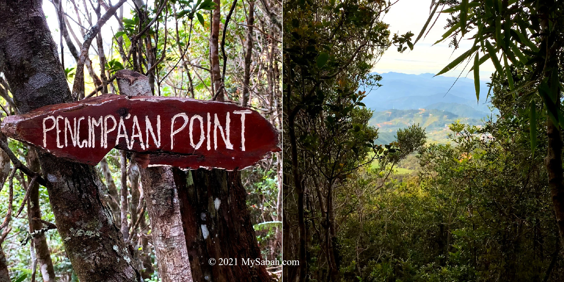
There are three platforms connected to one another by 20 Meters of boardwalk, forming a U-shape walkway. Each platform offers different viewpoint of the mountain and its vast landscape. The second platform gives us a panoramic view of Mesilau and Kundasang from Maragang Hill.

Reaching the peak of Maragang Hill after 1.5 hours of climbing

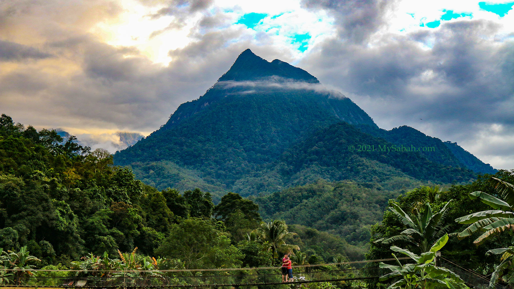
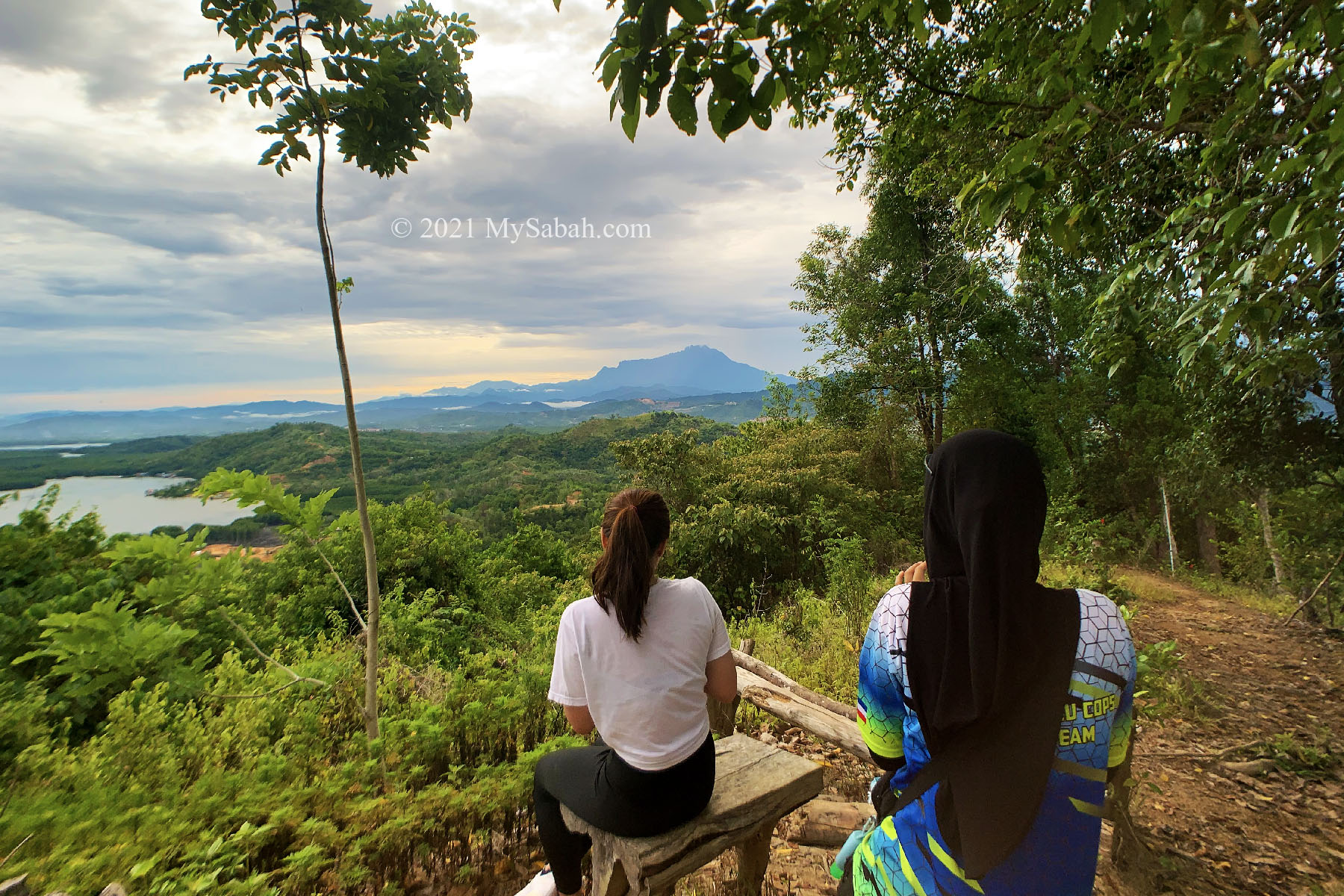
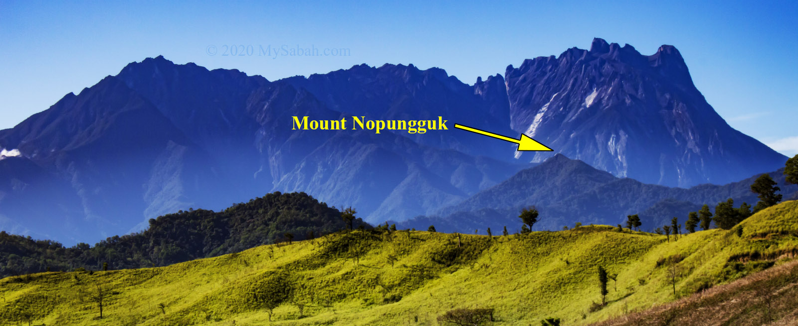
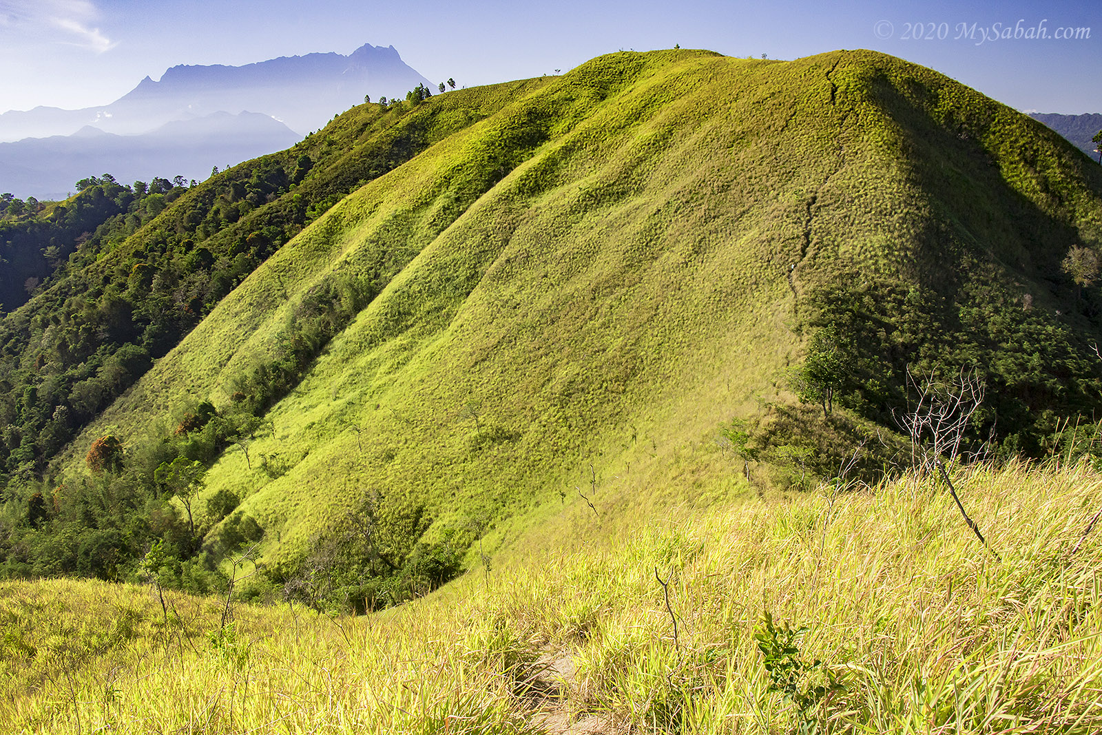
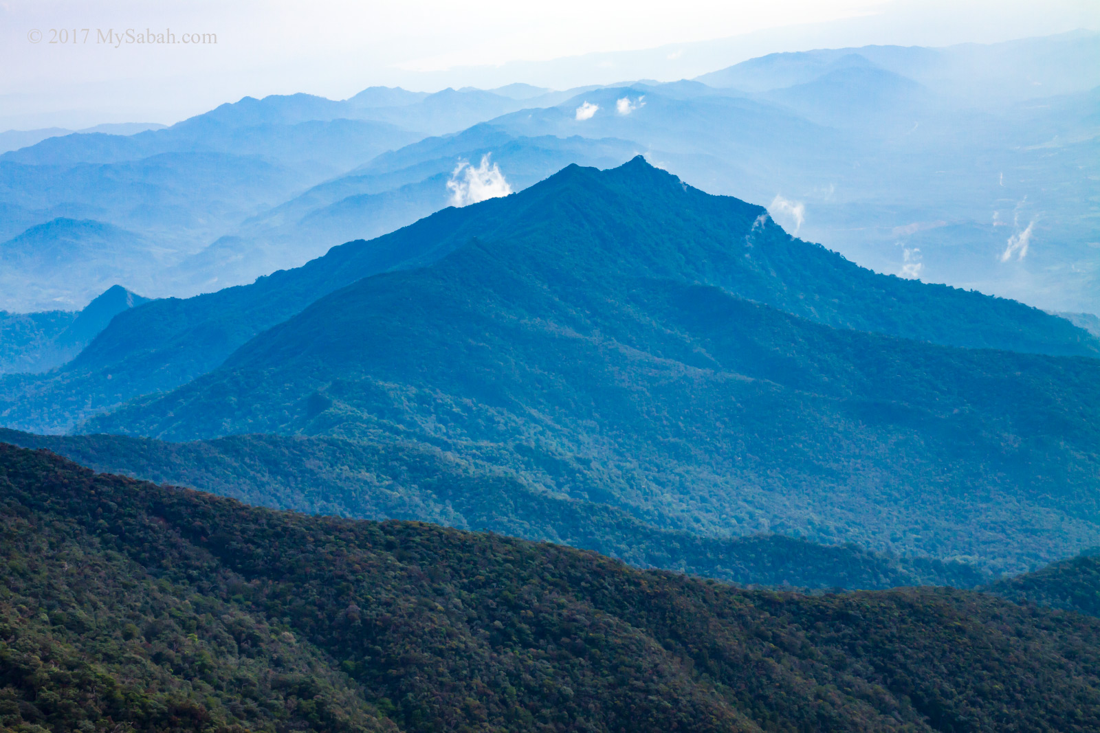
Only on Maragang Hill, climbers can have a good look of the jagged peaks on Eastern Plateau such as Red Rock Peak, Lion Head Peak, King Edward Peak, Mesilau Peak, and Mesilau Pinnacles. Red Rock Peak is the most prominent due to its crown shape.

Hiking only 1.6 Kilometers to get this view? It’s a steal!

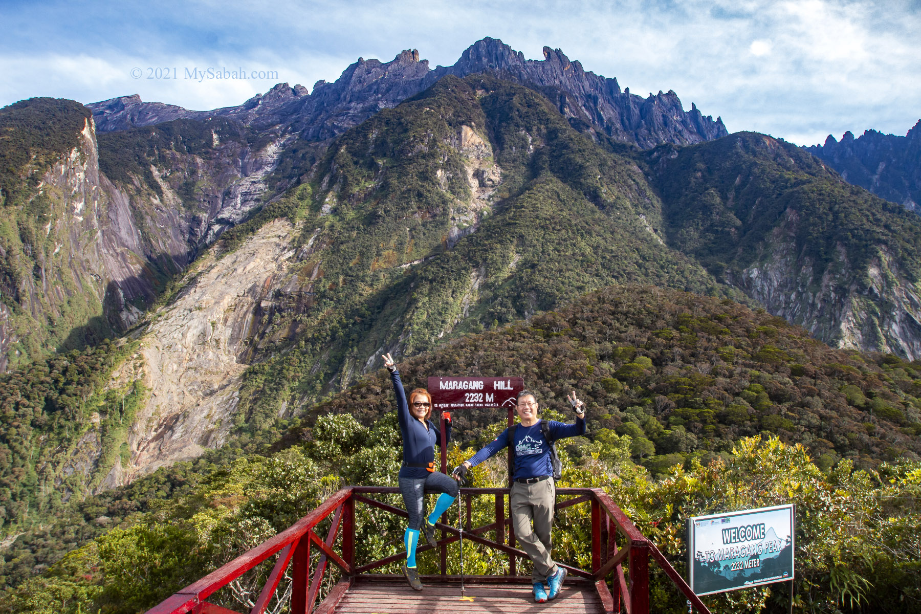
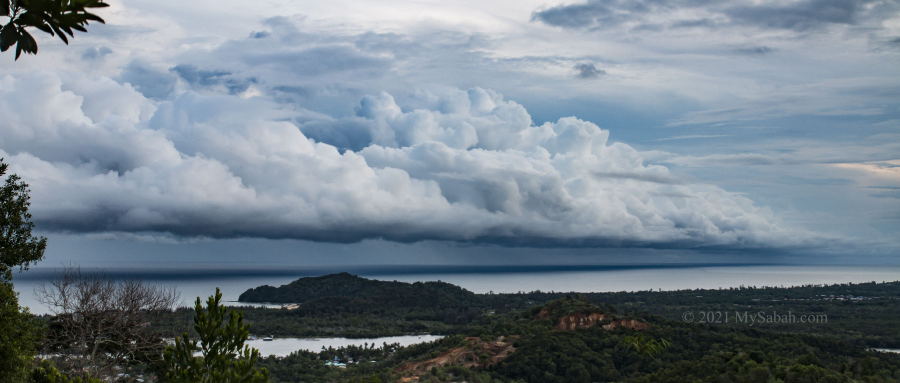
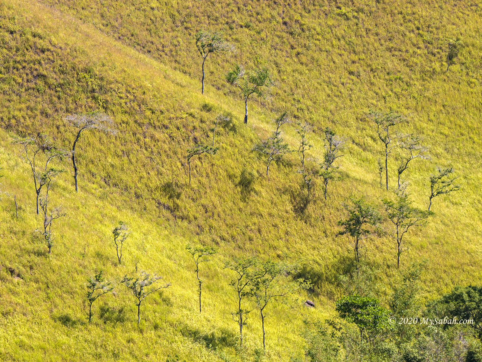
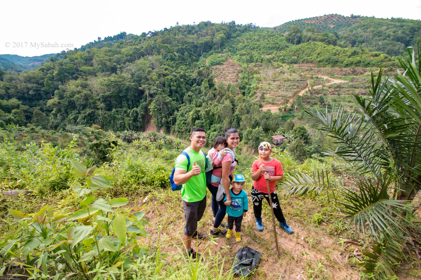
It’s a sea of green carpets the foothill of Mount Kinabalu. The lush rolling hills are dotted with flowering trees. I noticed some exposed rockface in the forested slopes, the scars left by landslide in earthquake of 2015. Sad but our mother mountain will recover.

The raised platform on the peak of Maragang Hill gives you a 360 degree unobstructed view of the surrounding mountains and forest.

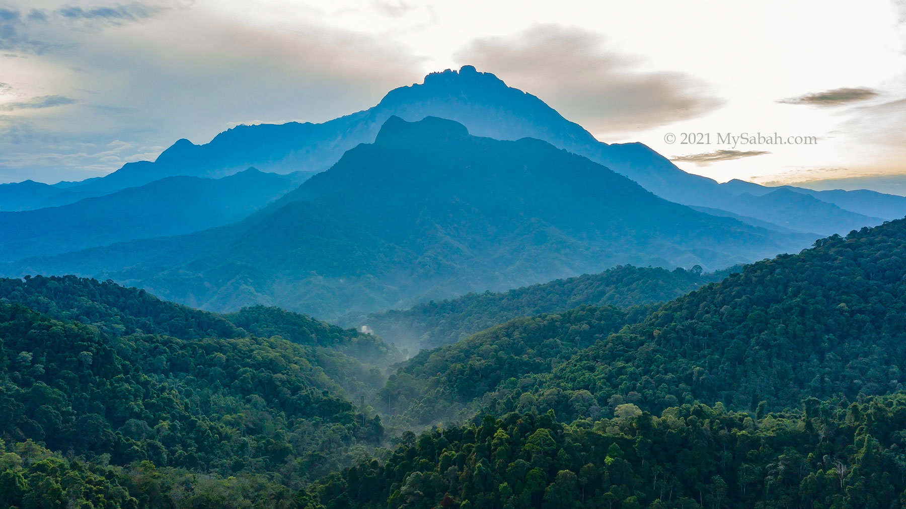
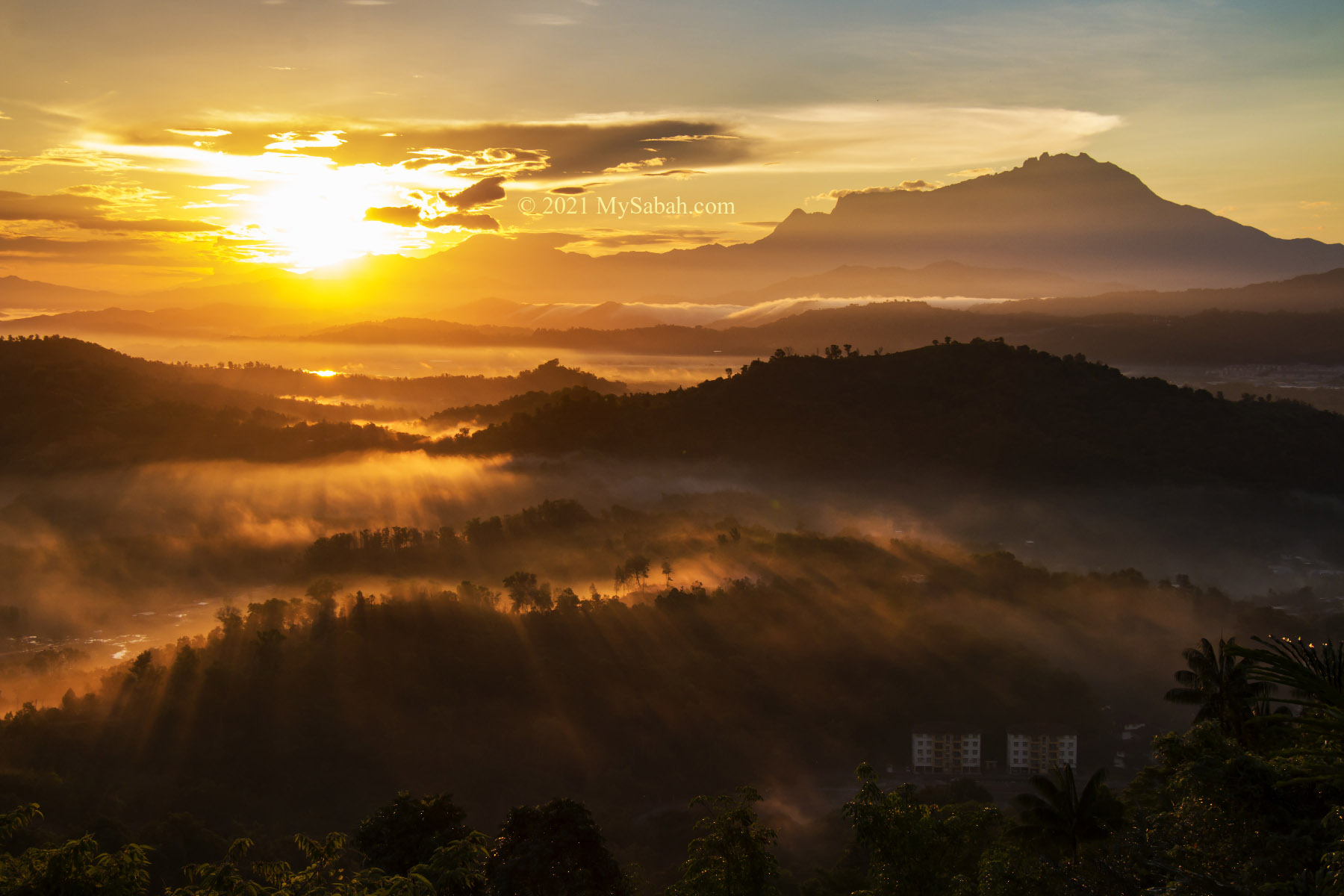
To have better chance of seeing Mount Kinabalu in clear view, it’s advisable to reach the peak of Maragang Hill before 8:30am. In most days, the mountain would be enveloped in dense fog after 9am. Probably that’s why many climbers opt for sunrise hike, so they can get up here as early as possible, and the starry sky is also a bonus view.

We are lucky to have this nice group photo because of the clear day and no other climbers around.

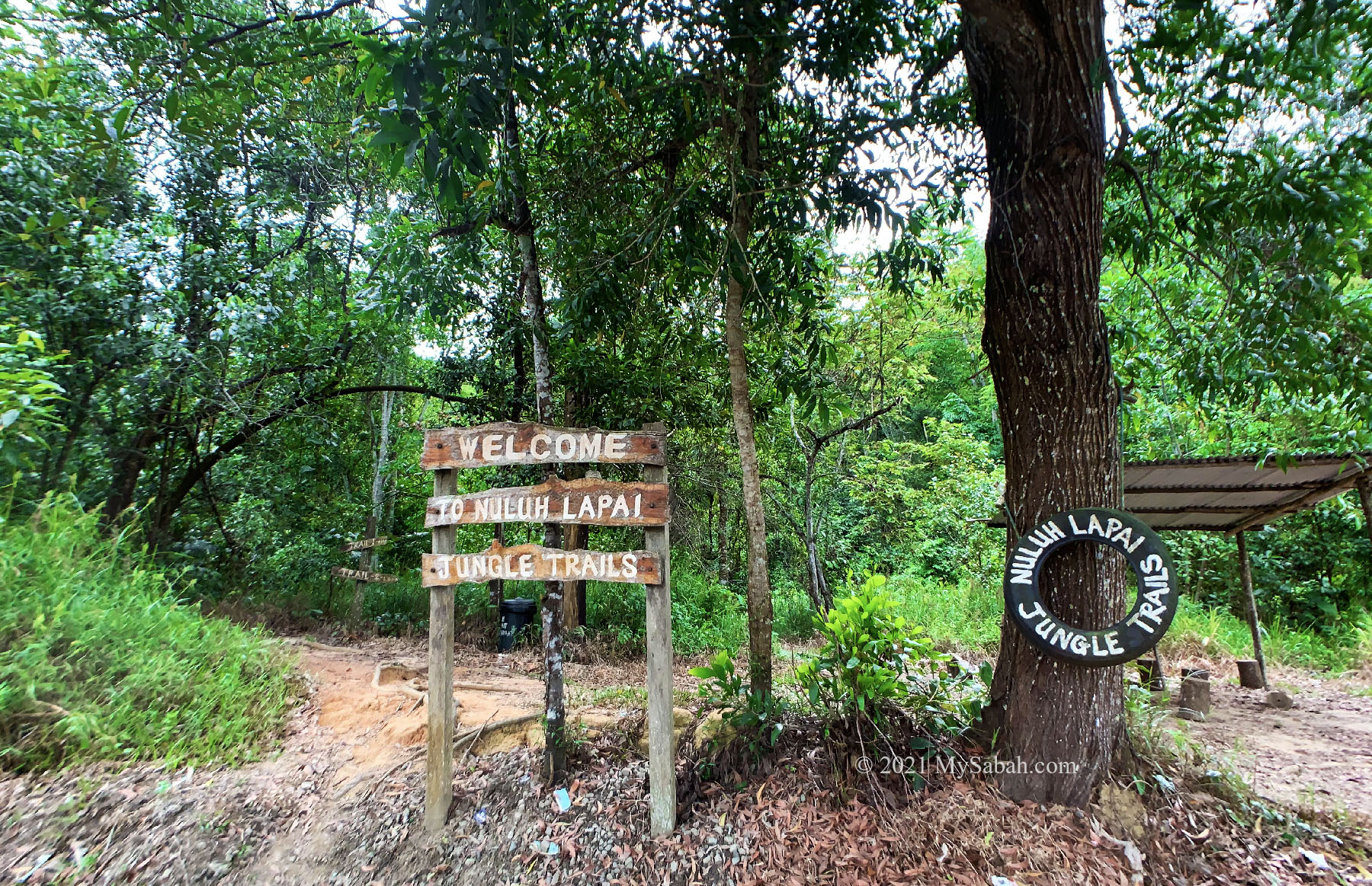
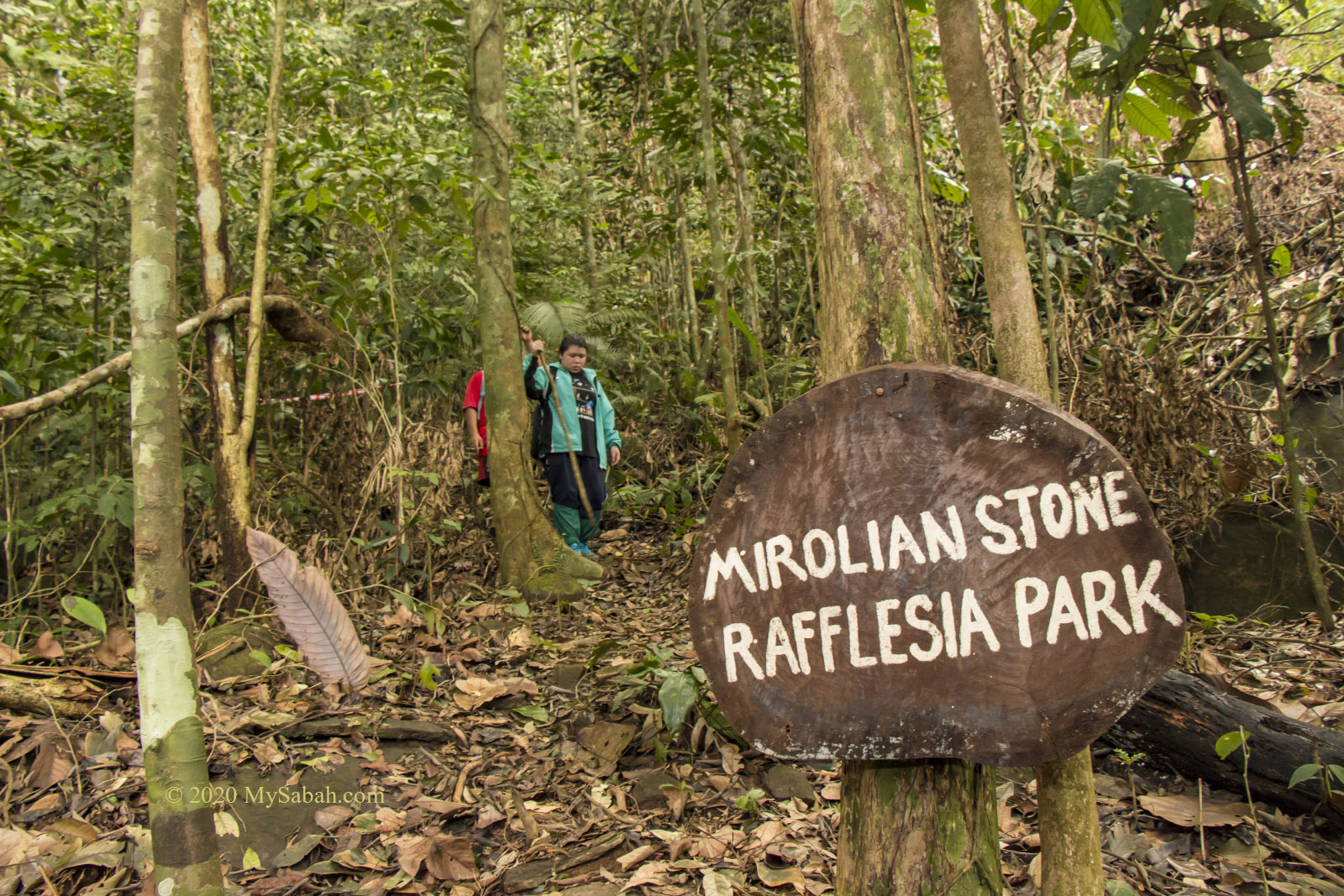
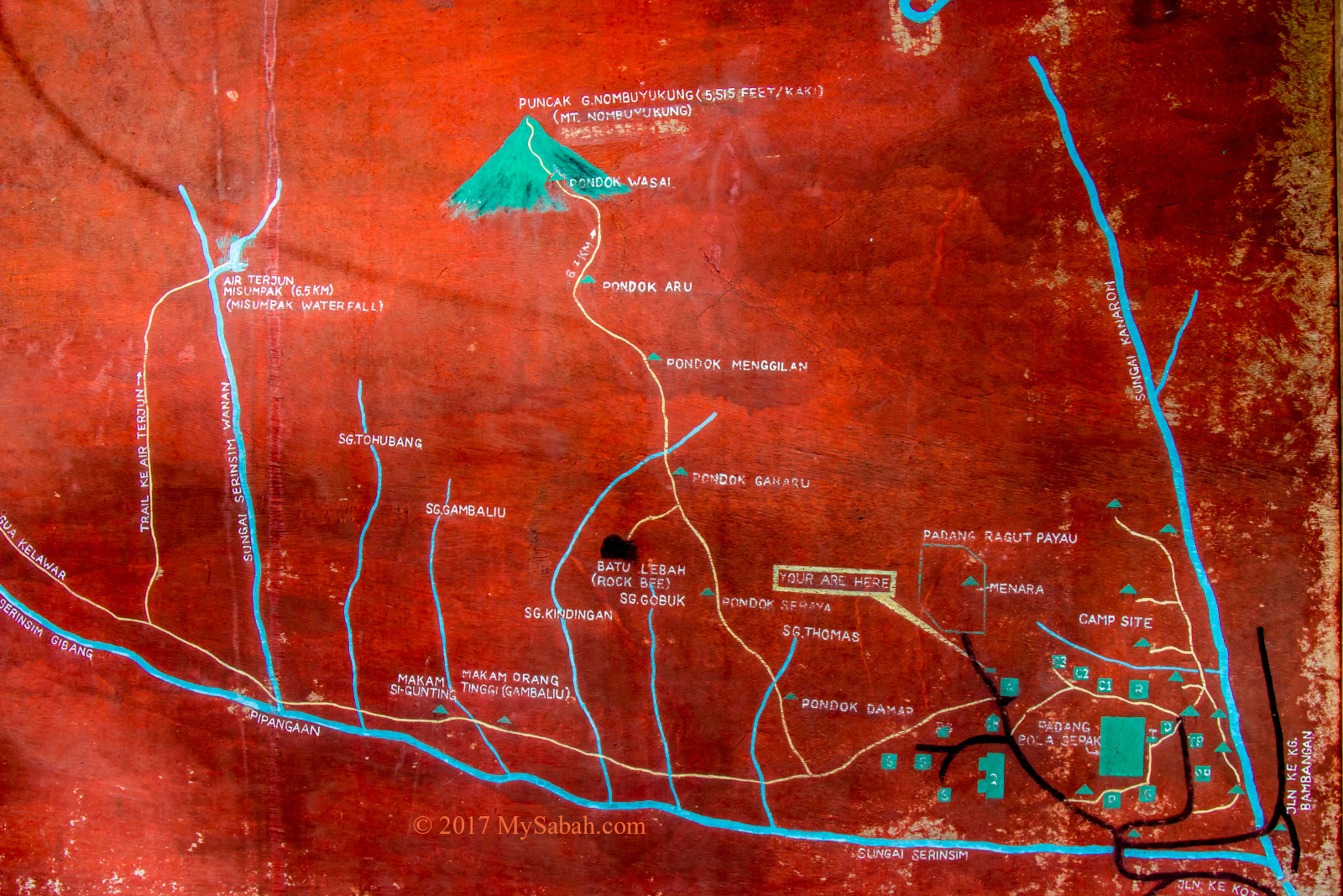
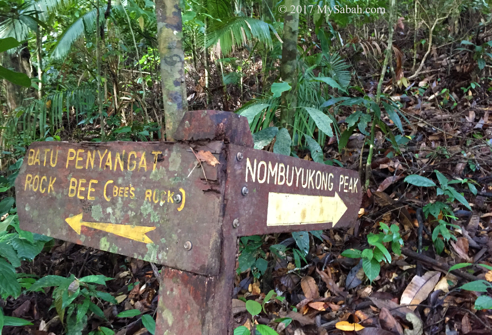
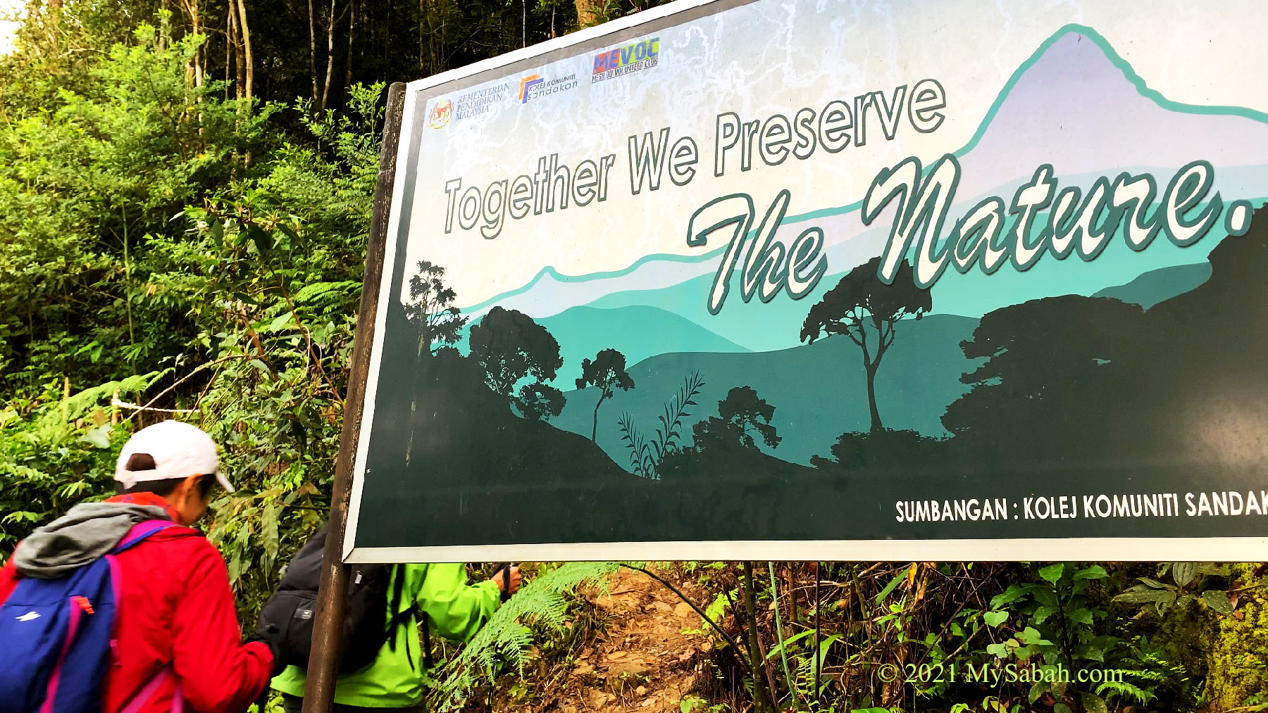
You can fly a drone on the peak as long as it doesn’t fly inside the boundary of Kinabalu Park administered by Sabah Parks. Maragang Hill is managed by Mesilou Ecotourism Association (META) of the local community. They claim Maragang Hill is the highest community nature reserve in Malaysia.

View of the third platform. The signage says “Maragang Hill 2,232M. The best view comes after the hardest climb”.

Loop Trail

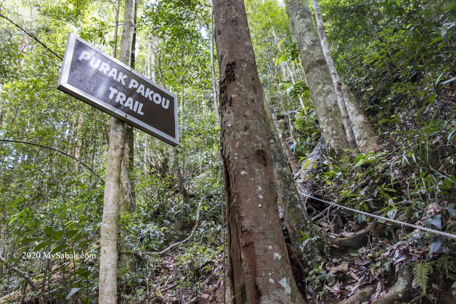
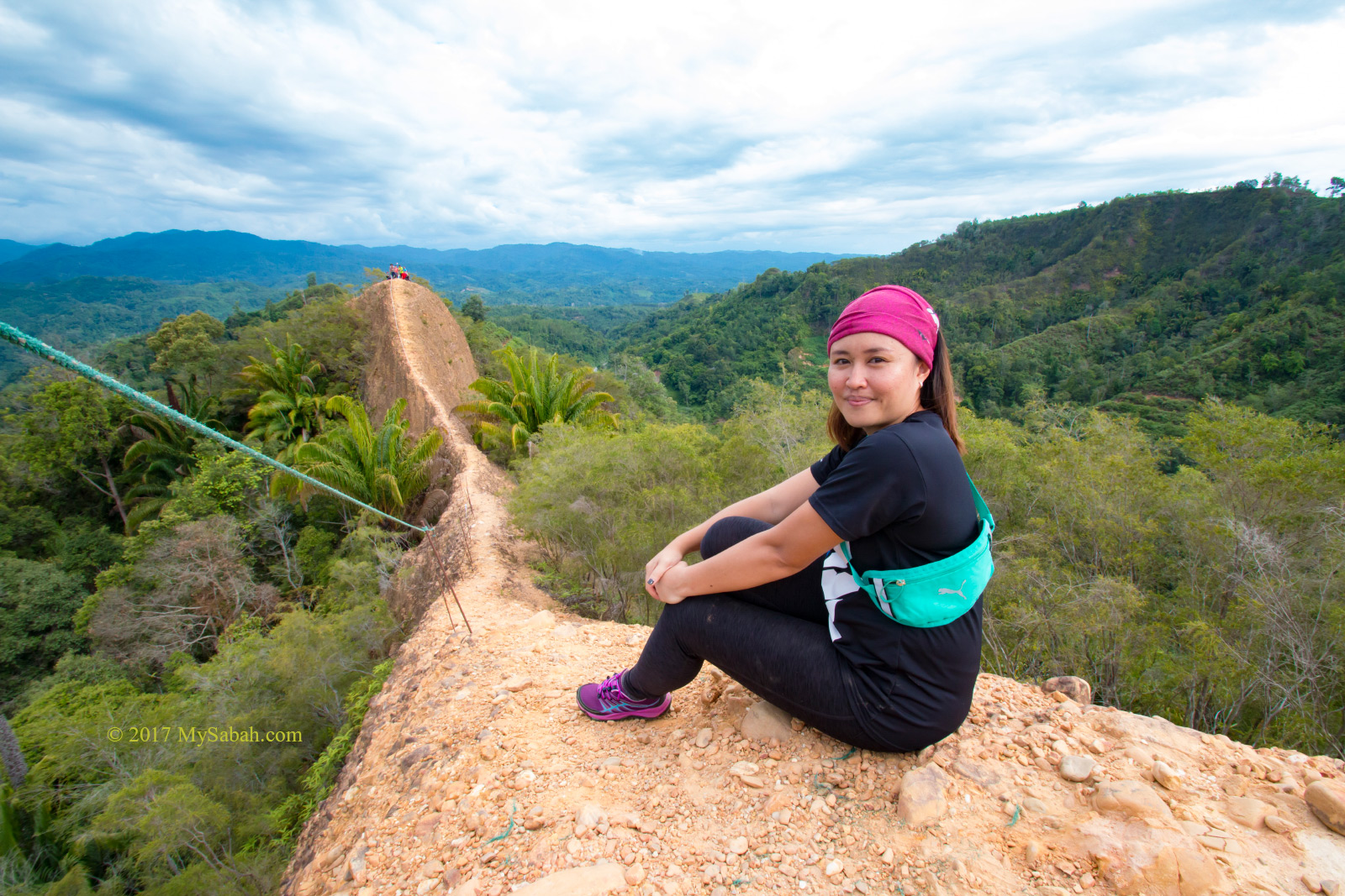
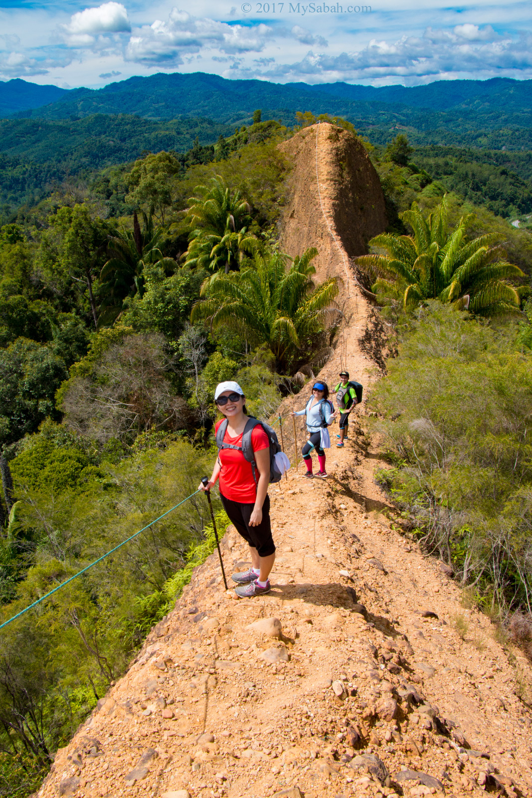
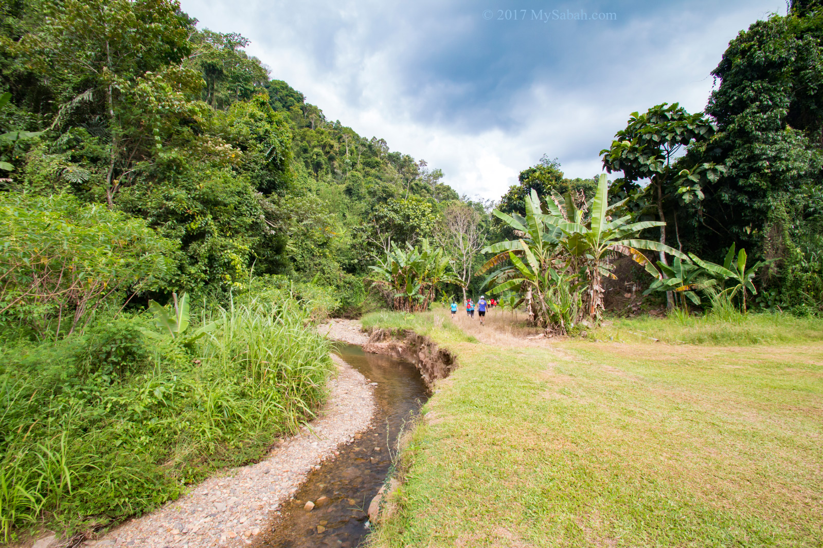
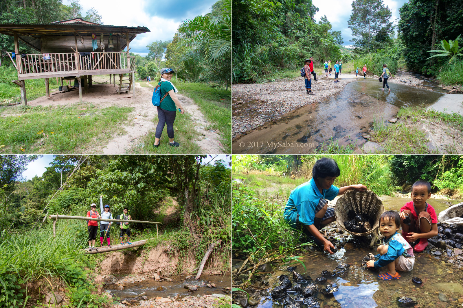
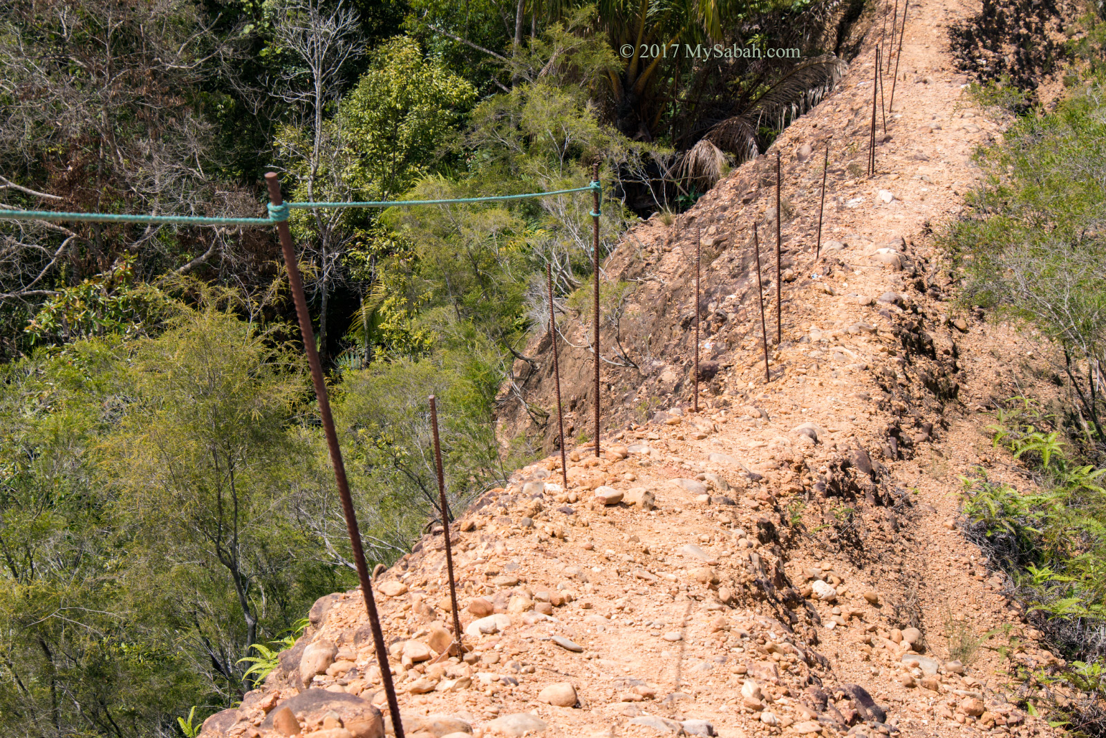
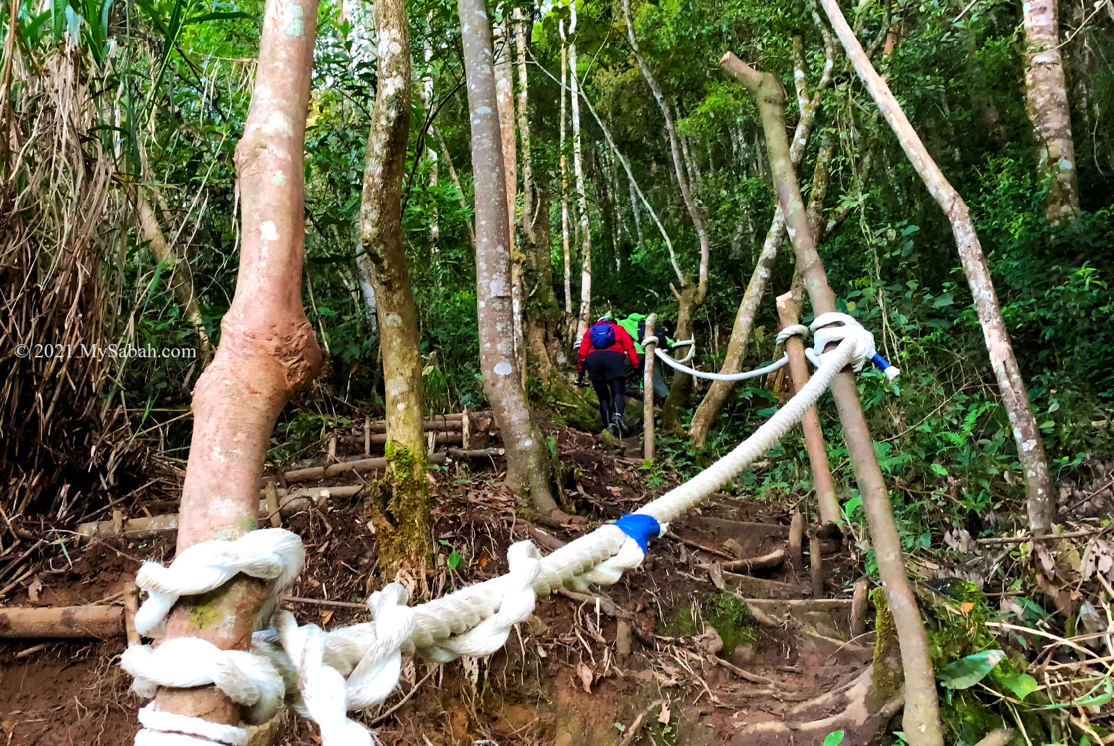
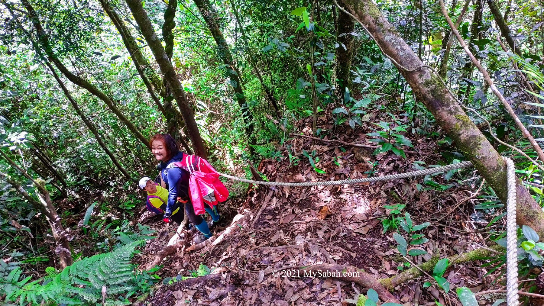
In most cases, climbers choose to descend from the same trail. To explore more, we went for the loop trail (Ascending 1.6 KM to the peak and Descending 2.7 KM via different route), which is more challenging and longer than the ascending trail.

Descending route of the loop trail, which is about 2.7 Kilometers

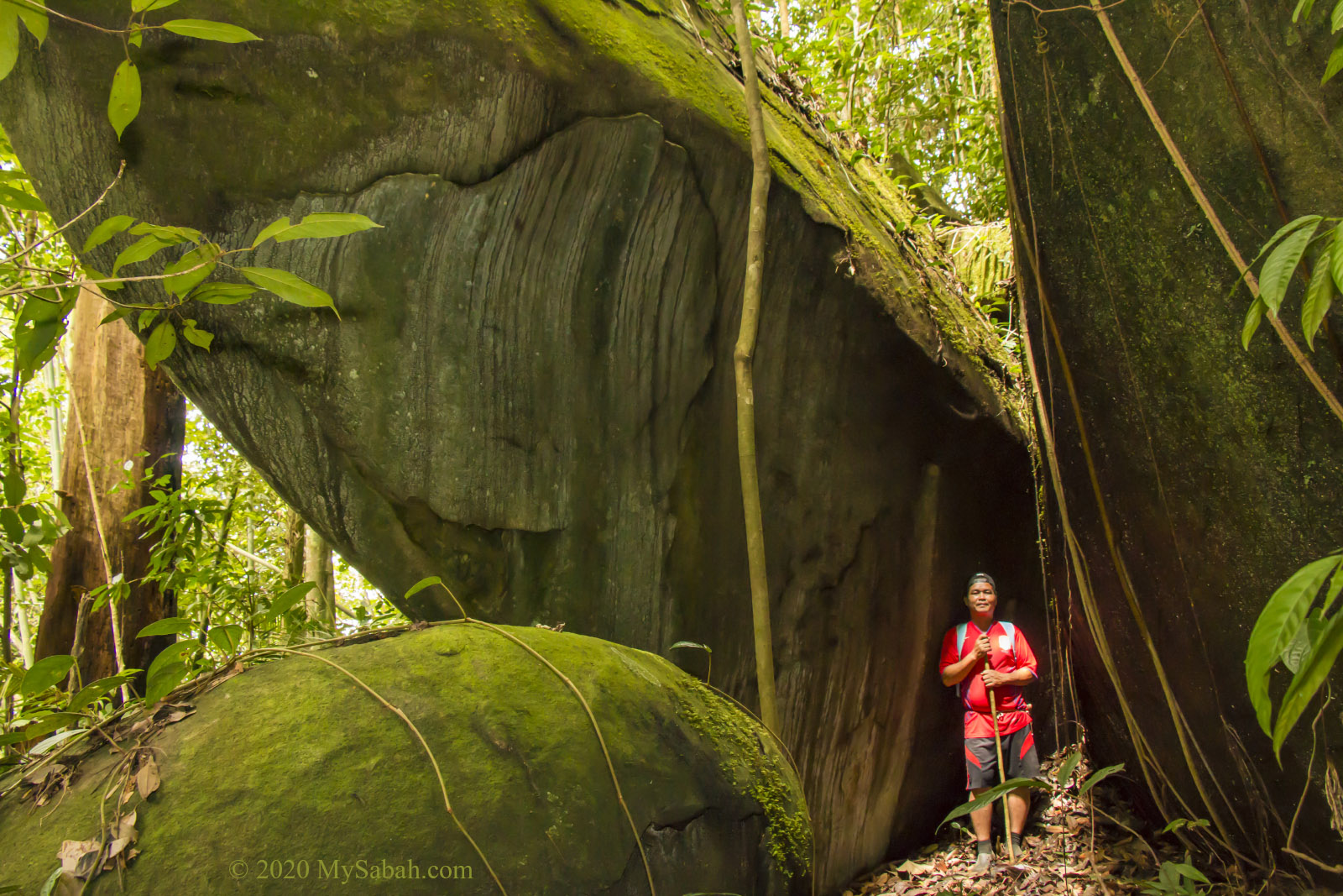
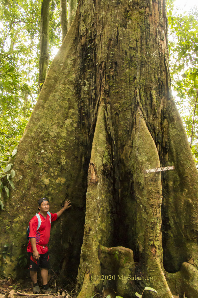
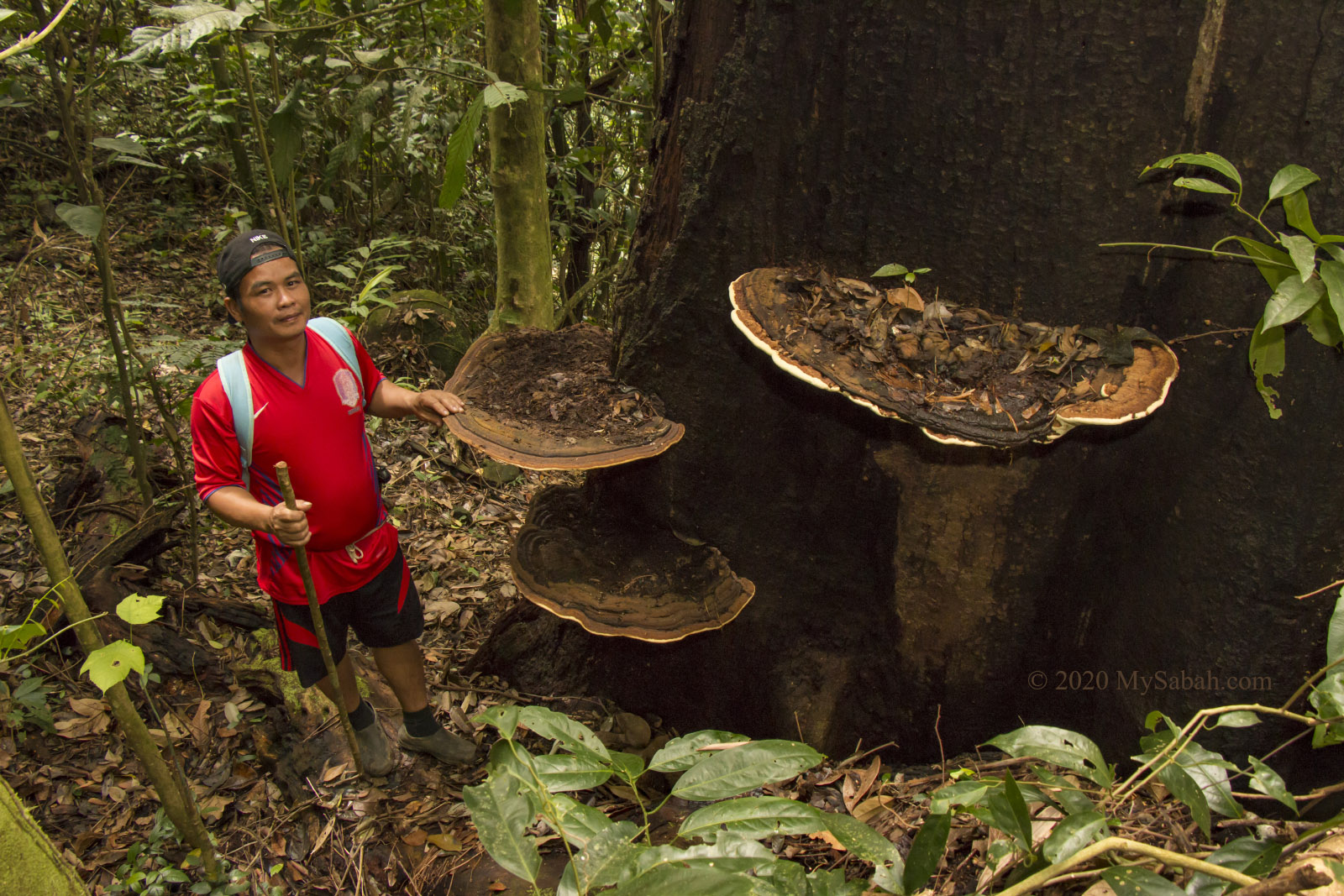
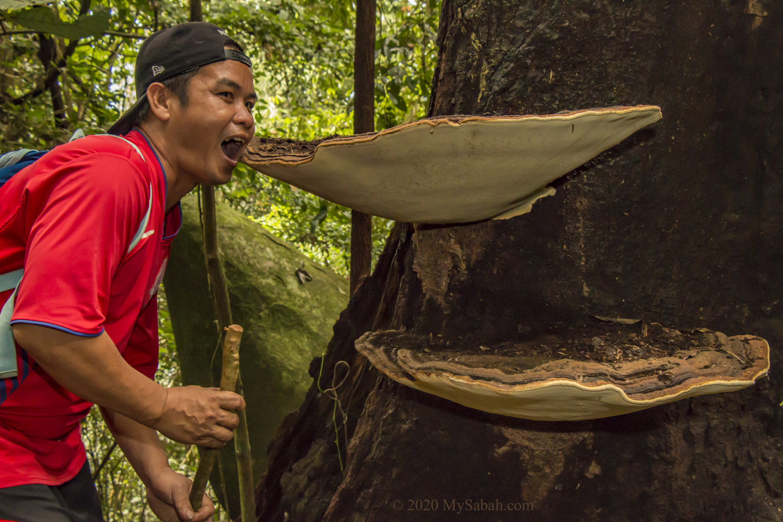
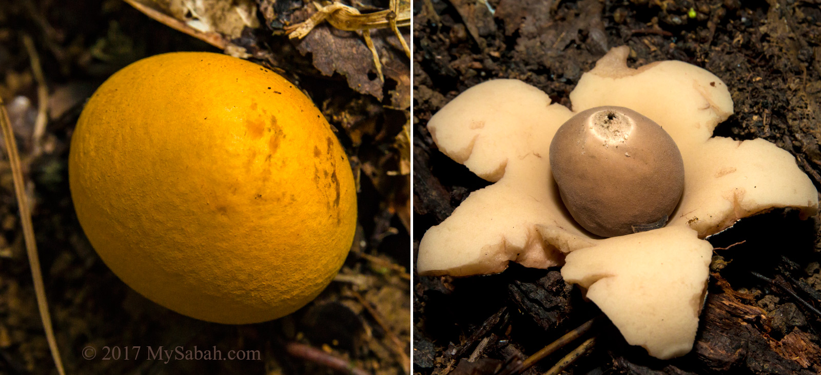
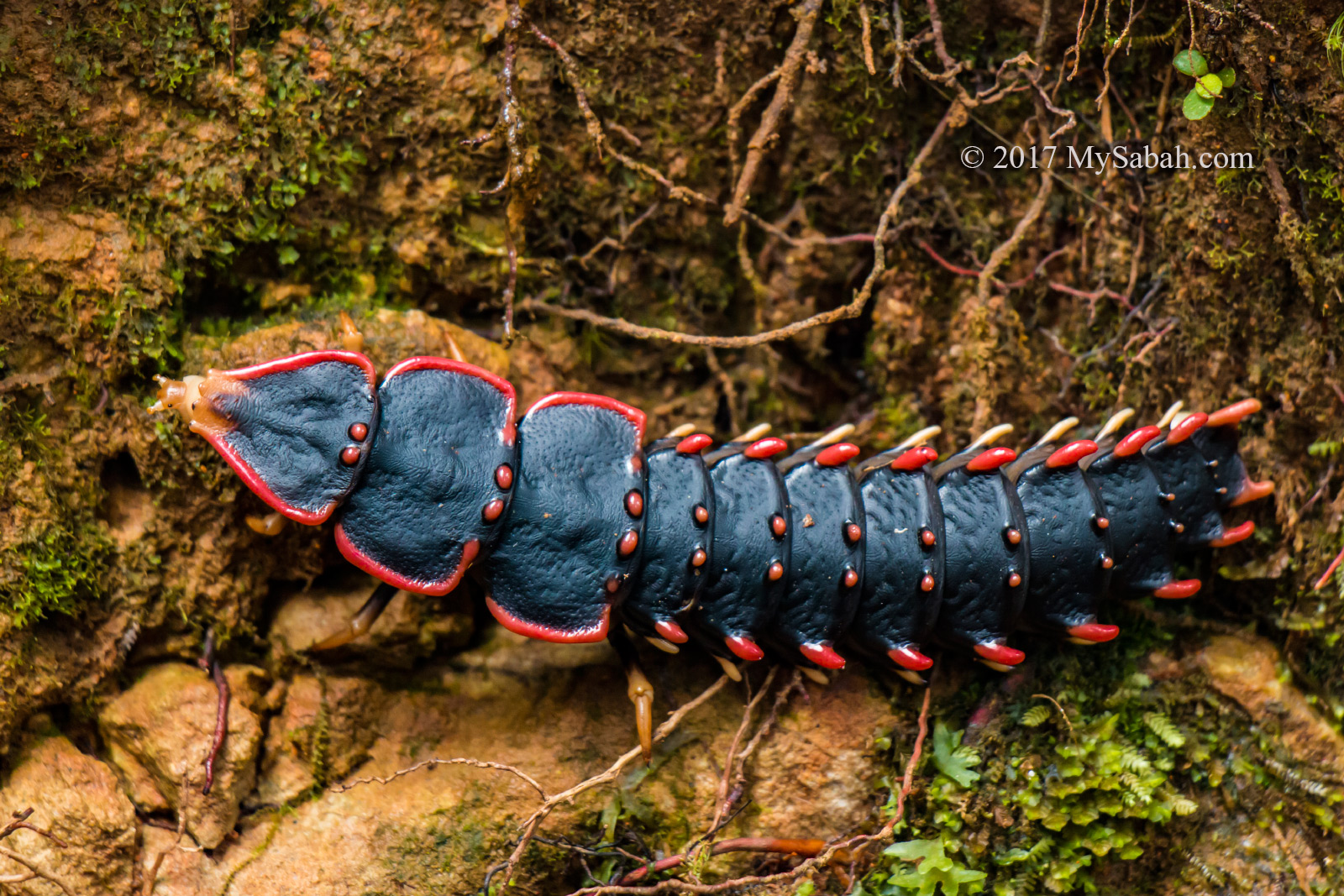
The descending trail is less pristine and looks like a regenerated secondary forest in good condition. The trail is steeper and narrower, with many rope support. Some interesting flora and fauna are spotted on the way down, for example, mushroom and fungus, liana vines, trilobite beetles (Duliticola sp.) feeding on rotten wood. We heard calling of montane birds such as Crested Yuhina, white-throated fantail, Mountain Barbet, Barber and Trogon, and also a wreathed hornbill flied over the canopy.

Interesting flora and fauna on the descending (loop) trail of Maragang Hill. The crimson fruits in top left are earth figs (Ficus malayana). This species is one of the most common figs in the mountain forest of Kinabalu Park and Crocker Range. The dark fungus in lower left is Dead Man’s Finger (species: Xylaria polymorpha). Lower Right: We saw many trilobite beetles (Duliticola sp) feeding on rotting wood.

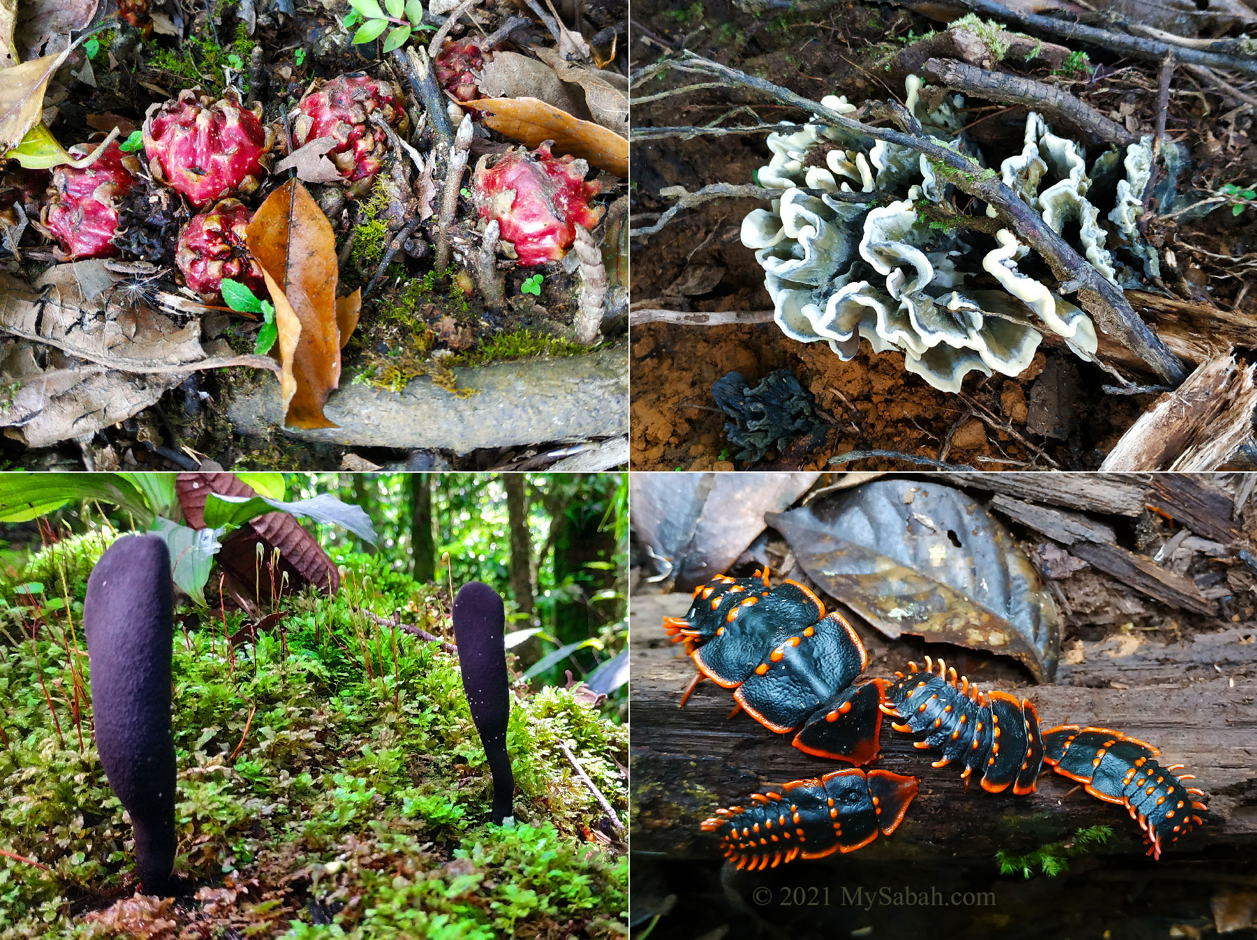
Our guide asked us to watch out for Fire-lipped Keelback (Scientific name: Rhabdophis murudensis), a rare snake endemic to Sabah. When threatened, it can exude a white milky venom from the back of its neck as a defensive mechanism. I wished to see one though.

A clean and cold river in loop trail of Maragang Hill.

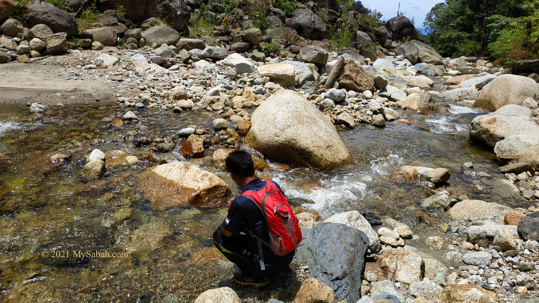
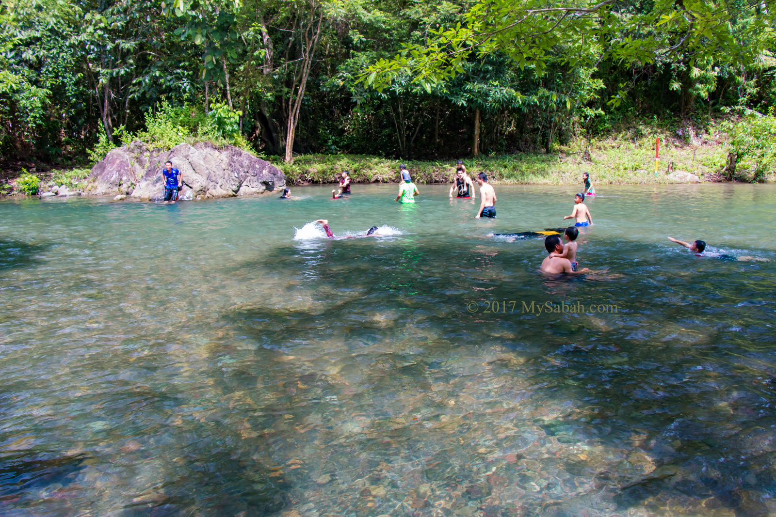
My group descended at 9:16am and arrived the ending point at 11:54am. 800 Meters before the ending point, you will cross a small and crystal clean river and exit through D’La Sri Cottage after 15 more minutes.

The loop trail of Maragang Hill hiking ends at D’La Sri Cottage.

A few advices to those who want to try loop trail:

  • Carry at least 1 Litre of drinking water to stay comfortable and hydrated.
  • Bring some energy snacks with you. You will need these.
  • Loop trail is not suitable for climbers with knee problem.
  • You will use rope to descend a lot so gloves are necessary for soft skin.
  • Hiking pole can help you to move down easier.

How to Book

Maragang Hill is highly rated and should be in the bucket list of Mount Kinabalu fans. Walk-in is not advisable, especially during weekends, as the daily limited slots of 80 to 200 climbers can be fully booked. You can book the tour in advance at maraganghill.com.my or text / Whatsapp them at +60 17-8952753.

There are two types of hikes:

  1. Day Hike (starts at 6am)
  2. Sunrise Hike (starts at 3am)

The starting price for Day and Sunrise Hike are RM115 (about USD27) and RM155 (about USD36) respectively. FYI, you can save a lot more by group booking. You can have up to 5 climbers per group (to share the same guide), and you only top up RM15 for each climber. For example, if you climb alone in Day Hike, you pay RM115. But if you have 5 climbers in your group, the total price is RM175 per group, after dividing the cost among yourselves, each of you only pay RM35.

The boardwalk on Maragang Hill is well-maintained. There are about 150 Metres of them in different spots.

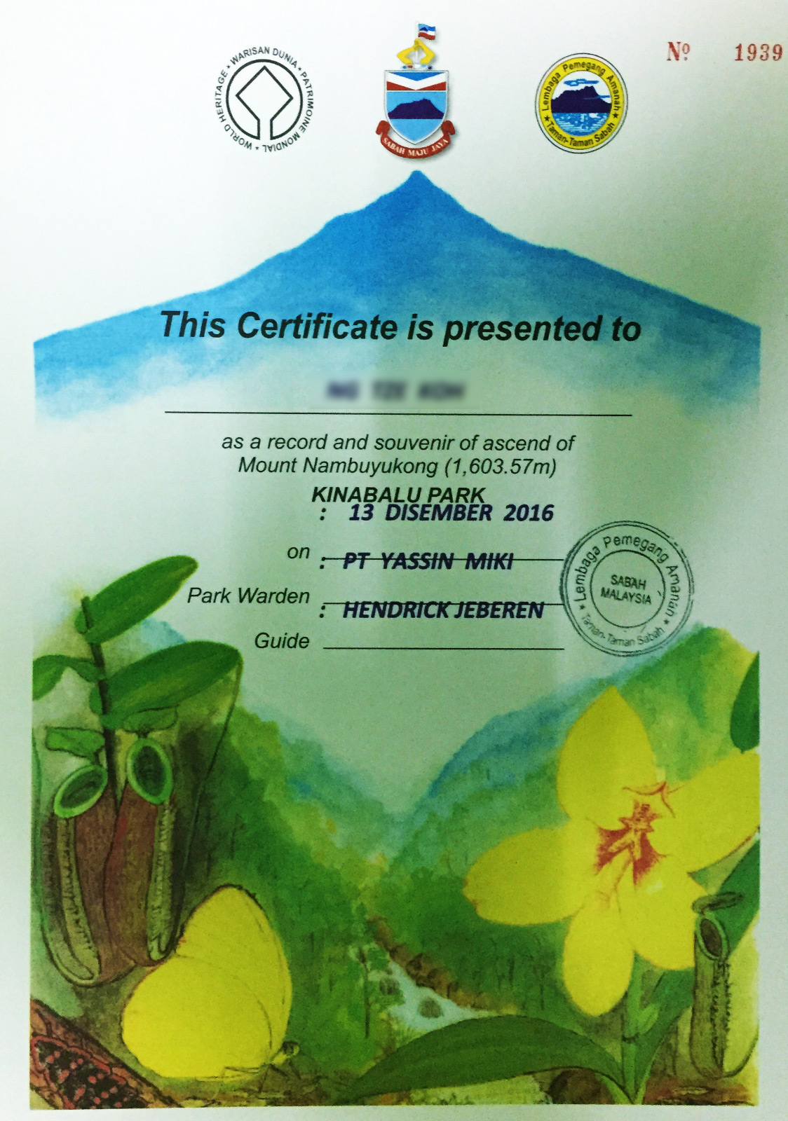
Besides guiding service, the price has included return transfer (usually by 4-wheel drive) for moving climbers between registration office and starting point. Certificate is optional and cost RM5.

A 4-wheel drive picked us up at the ending point

You need to pay RM30 deposit to secure your booking (and settle the rest in registration office before climbing). However, currently their website doesn’t accept payment by credit card and Paypal. You need a bank account (e.g. Maybank, RHB, CIMB, AmBank, UOB) to bank-in the deposit via FPX.

The descending route of loop trail is long and steep

Booking Loop Trail

By default, climbers use the same 1.6-KM trail for ascending and descending (they call it Normal Trail). You can request for Loop Trail when you check-in at their registration office before the climb. There will be an additional fee of RM30 to RM70 per group, depending on the group size. You can check out the price in their website.

Campsite near the peak of Maragang Hill (Picture from the Facebook of Maragang Hill)

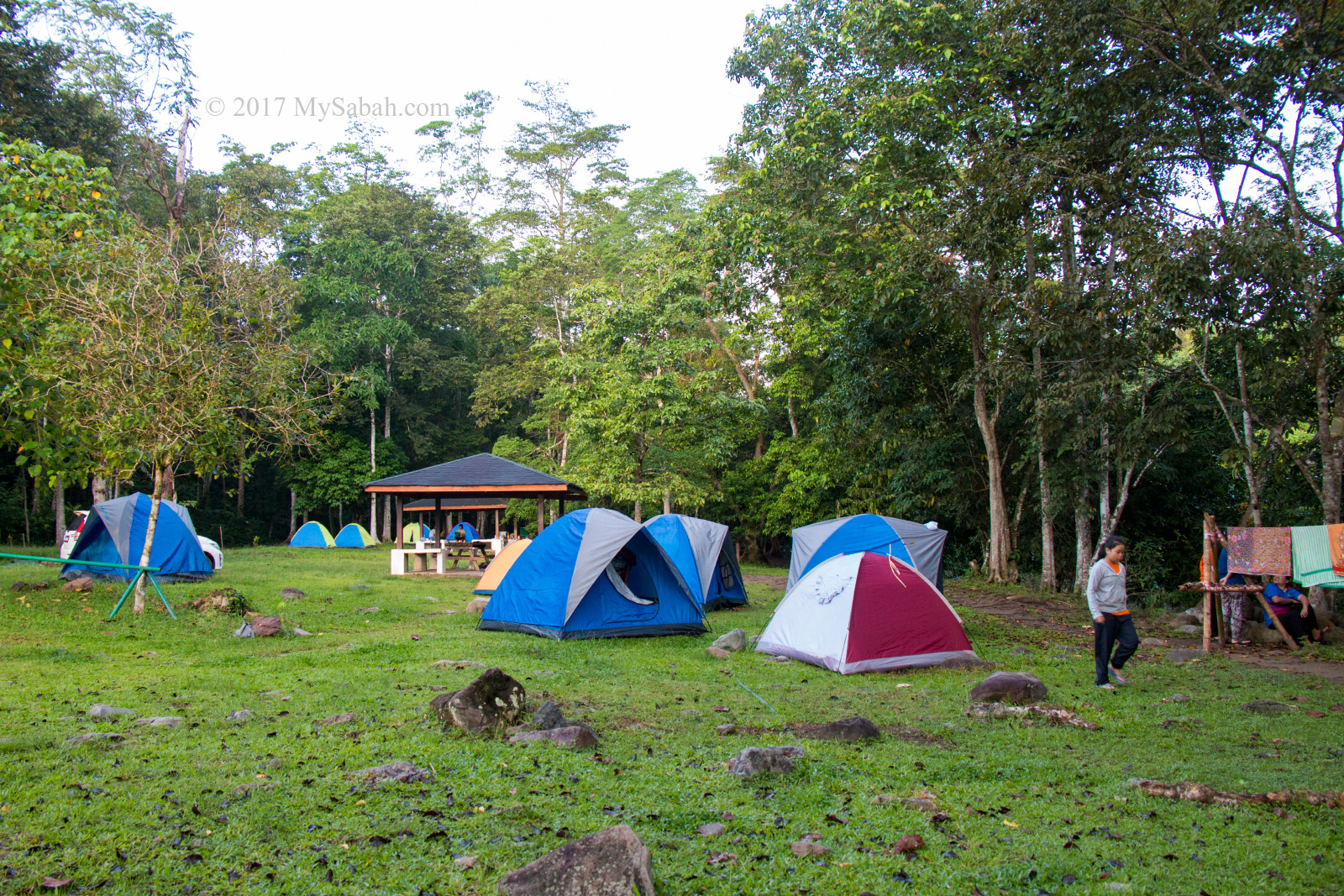
Lastly, they have a campsite with basic amenities near the peak, in case you want to camp on the hill for stargazing. You can message the operator via their Facebook page (@MaragangHill) if you need more information.

Things to Bring

  • Cash
  • Mykad / Passport / Identification document
  • Face masks
  • Warm Clothing (e.g. windbreaker, jacket). Temperature ranges from 15°C to 22°C (59°F to 72°F).
  • Extra clothing for change after climb
  • Sunscreen
  • Hiking outfit & gears (e.g. hiking pole, gloves, hat, hiking shoes)
  • Backpack (best with rain cover)
  • Drinking water and energy snacks
  • Raincoat
  • Camera
  • Phone & power bank
  • Toilet paper
  • Personal medicines if any
  • Optional: LED headlamp (for sunrise hike), sunglasses, selfie stick, tripod

How to get there

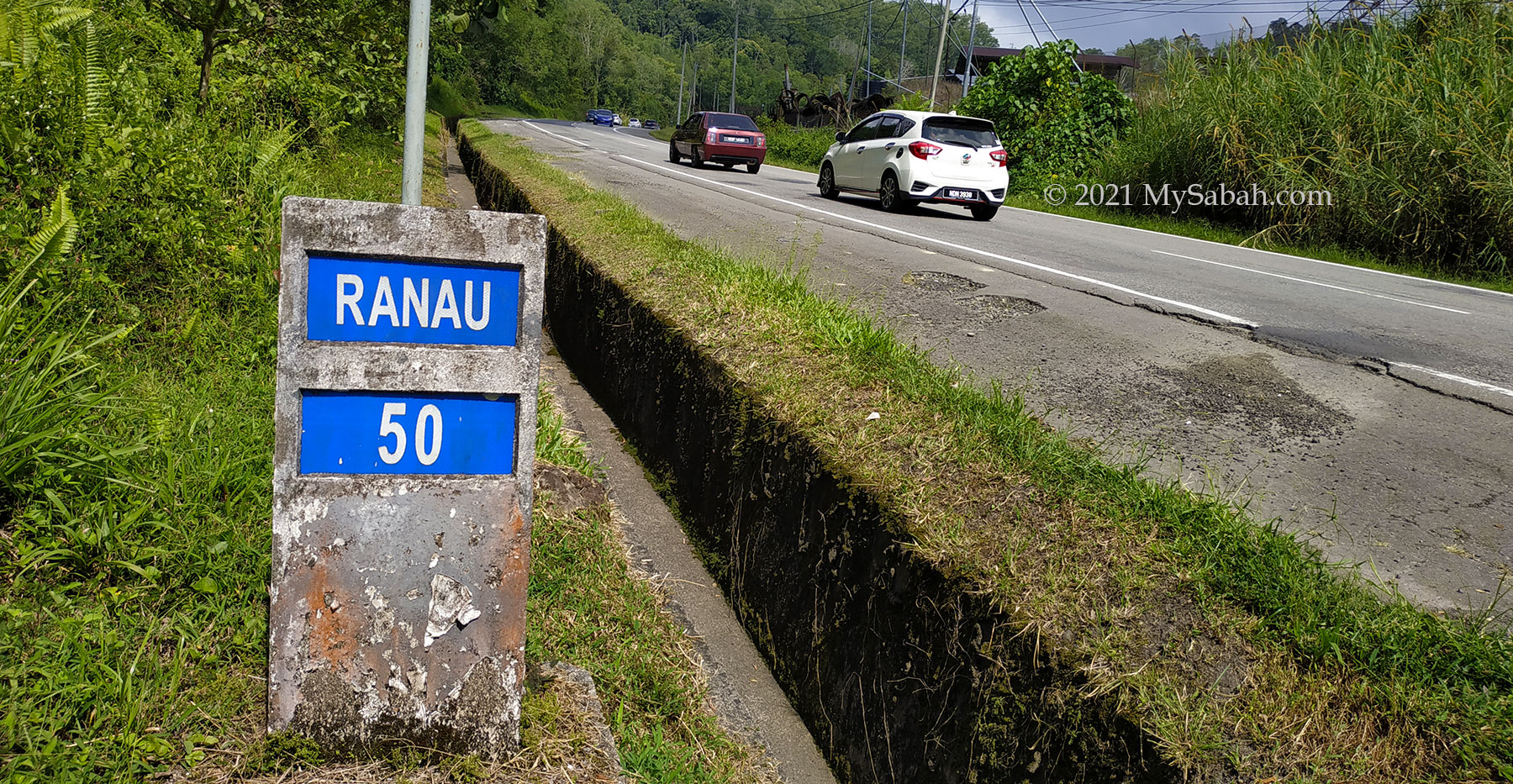
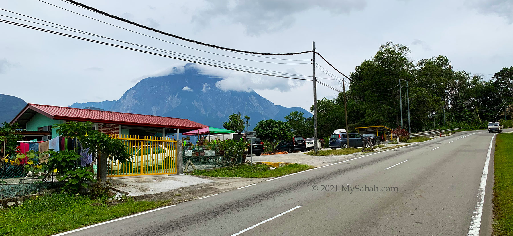
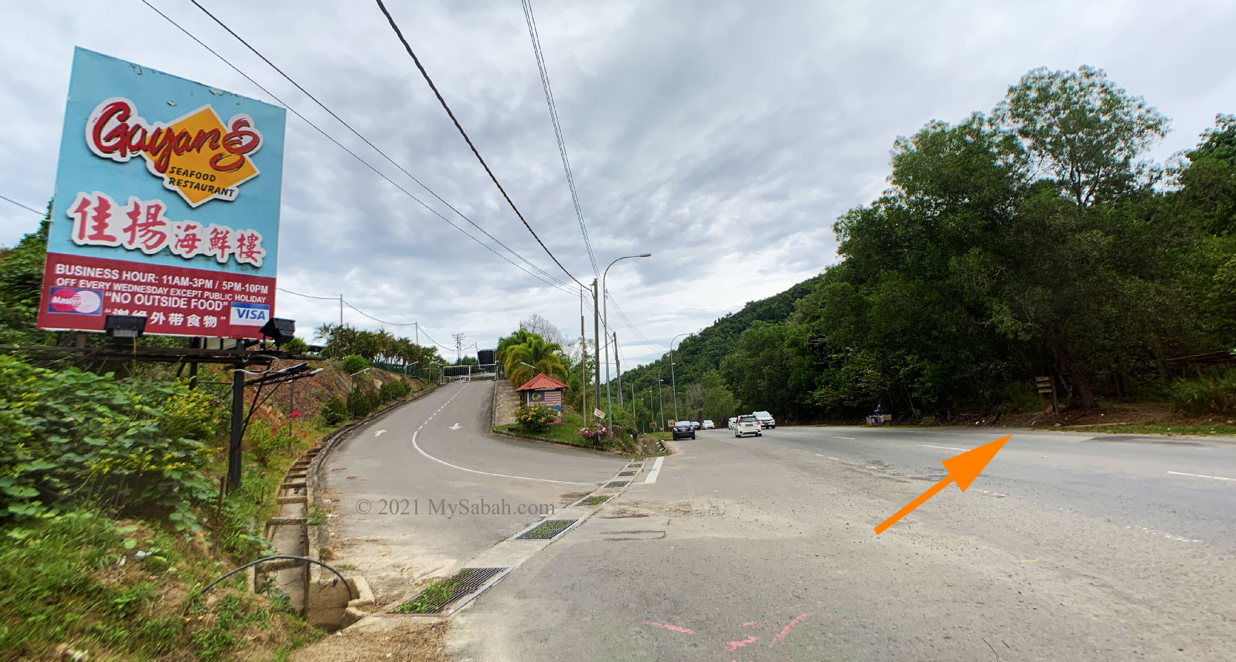
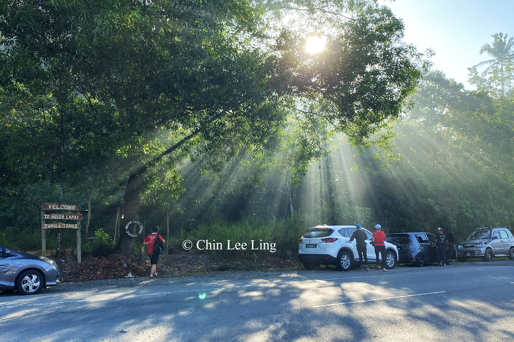
Book the climb in advance. Before you climb, you need to report to the registration office of Maragang Hill (GPS: 6.012919616415158, 116.59744029807099 [see Location Map]) in Kg. Mesilou, which is 97 KM away from Kota Kinabalu city (KK). This location is highly accessible by highway and paved road.

Climbers can find many great spots to take photos with the beautiful montane trees.

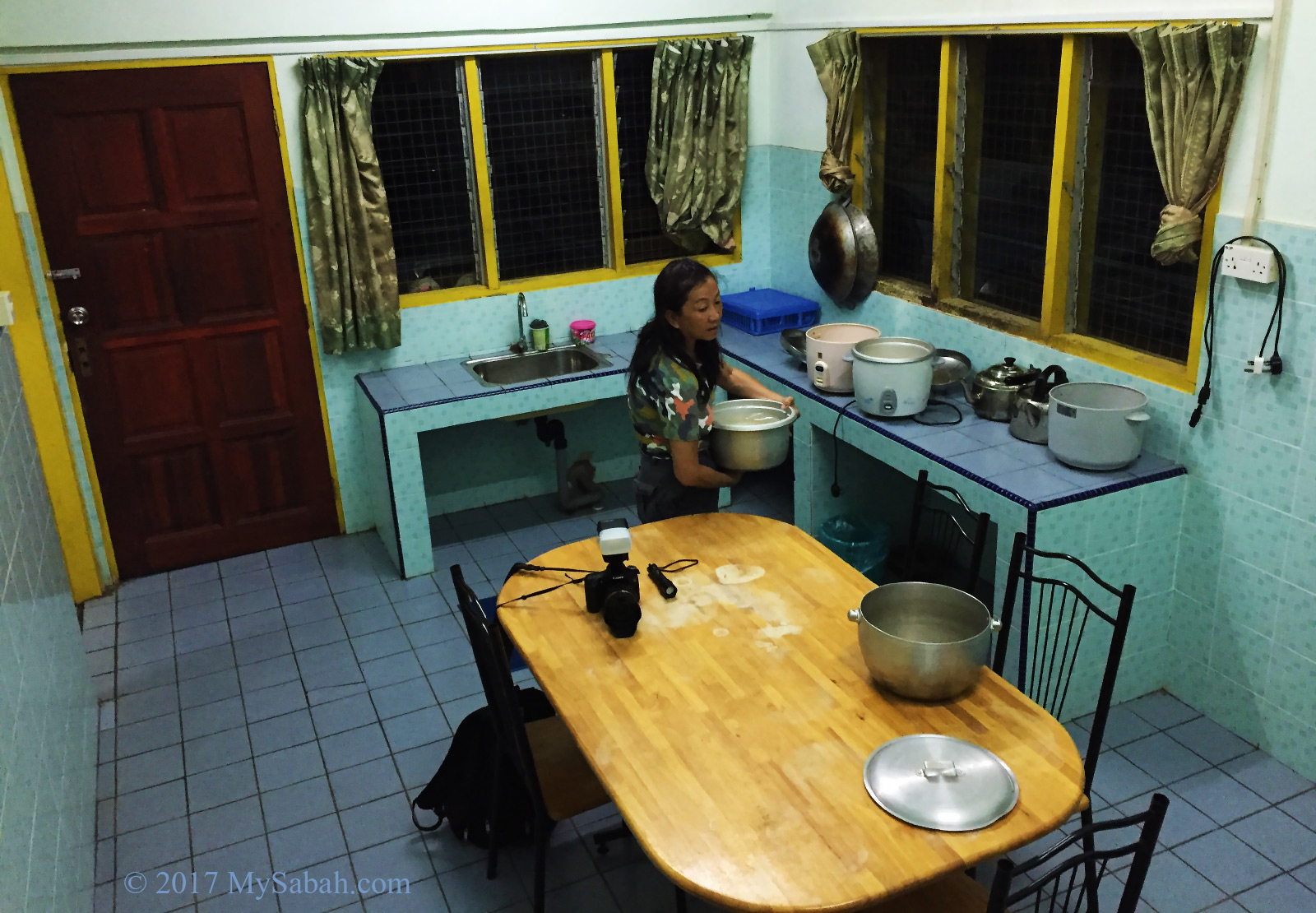
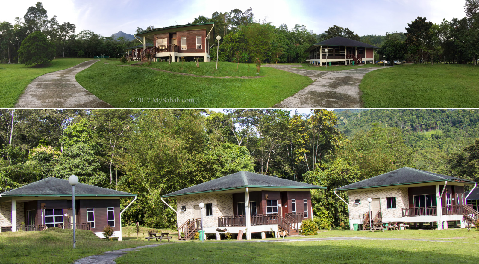
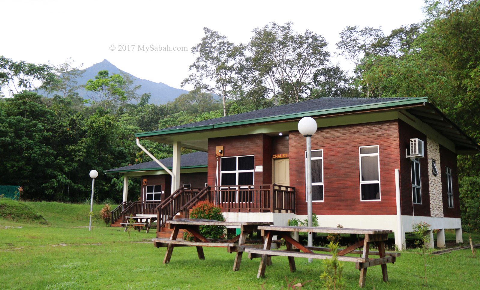
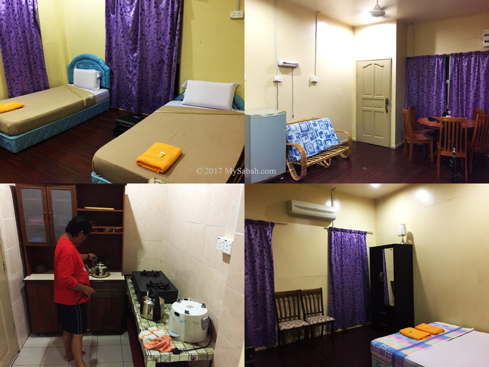
If you don’t want to drive nearly 3 hours in early morning from KK to Mesilau, you can spend a night in Mesilau or Kundasang, which offers variety of accommodation. The accommodation nearest to the registration office is Sulap. After registration, they will provide the return transportation to the starting point (GPS: 6.033364907654647, 116.58989023443904 [see Location Map]).

If you love climbing and hiking, you may check out my article on 10 Breathtaking Hills and Mountains of Sabah.

Photos taken in Mesilau, Sabah, Malaysia Borneo

Mount Nungkok, the Child of Mount Kinabalu

Mount Kinabalu is the highest mountain of Malaysia and Borneo. One of its legend says a woman was turned into Mount Kinabalu by her grief because after many years of waiting, her Chinese husband never returned, thus another nickname for Mount Kinabalu is China widow mountain. The story doesn’t end there. After she becomes rock, another mountain born in her village. That’s Mount Nungkok (Gunung Nungkok in local language), which is also known as Anak Kinabalu, means the Child of Kinabalu.

The distance between Mount Nungkok and Mount Kinabalu is less than 9 Kilometres.

Standing at less than half the height of Mount Kinabalu which is less than 9 Kilometres away, Mount Nungkok does look like a baby sitting at the feet of majestic Mount Kinabalu. Looking from the angle of Kota Belud, the ancient gateway to climb Mount Kinabalu, these two mountains are positioned side by side like twin mountains. No wonder people think they are parent and kid. When Mount Kinabalu is hidden in the cloud, Nungkok is sometimes mistaken as Kinabalu by non-locals.

Mount Nungkok is also part of Kinabalu Park, the first UNESCO Natural Heritage of Malaysia.

However, Mount Nungkok is not as famous as its parent and still a mysterious mountain. Same as Mount Kinabalu, Mount Nungkok is also part of Kinabalu National Park and have its flora and fauna fully protected by conservation laws. Climbers would spot blooming rafflesia flower, exotic orchid and endemic pitcher plant on this mountain, as well as wildlife such as deer and binturong bearcat. In the past someone mined gold in this mountain. I was told by village folk that there is a bat cave in Mount Nungkok too.

Mount Nungkok is located on the western side Mount Kinabalu near Kota Belud, so it is not visible in Kundasang and Ranau town at the east side.

Viewpoints for Mount Nungkok

The most interesting feature of Mount Nungkok is – it differs in shape if viewed from different locations, as shown in the time-lapse video below (I used over 1,200 photos to create this 4K video so please watch):

You don’t need to travel more than two hours to have a spectacular view of Anak Kinabalu. You have better chance of seeing it before 8am during fair weather, both mountains covered in dense mist after 9am in most days.

Mount Kinabalu and Mount Nungkok lit up by the afternoon sunlight. The mountains would turn reddish during sunset.

1. Kota Belud

The view of Mount Nungkok is the most prominent in Kota Belud district, especially at Kampung Tambatuon village, where you can see both mountains up-close. There are dozens of homestay and camping ground around Kota Belud, in case you love mountain and countryside view so much.

Mount Nungkok (Gunung Nungkok) is also known as Anak Kinabalu (Child of Kinabalu). Note the couple taking selfie on the hanging bridge of Tambatuon Village.

In Tambatuon, Mount Nungkok looks like a pyramid mountain with pointy peak. I always imagine that I stand on that tip, it must be a great feeling up there.

View of Mount Nungkok at Tegudon Tourism Village (Kota Belud)

You also can have a clear view of Mount Nungkok at Tegudon Tourism Village and Kampung Kiau.

2. Kota Kinabalu-Tamparuli-Ranau Highway

This is the most convenient option and can be a fun stop for your road trip to Kinabalu Park, Nabalu or Kundasang. For only an hour of driving on a paved road that connects Kota Kinabalu (KK) to Ranau town, you can see Mount Kinabalu and Mount Nungkok from inside your car.

In clear day, you can see Mount Kinabalu and Mount Nungkok from the KK-Ranau highway.

The best viewpoint is along the road about 38 to 42 Kilometres before Ranau town. However, most of the time the view is obstructed by trees and knolls, you can park at one of three toilet stops listed below and use their platforms for an open view. They open from 6:30am to 5pm. The fee to use their toilet is RM0.50. Snacks and drink are available for sale.

The milestone used in Sabah road. For example, this milestone shows the remaining distance to Ranau town is 50 Kilometres. I’m using this to mark the locations and section of the KK-Ranau main road.

1. Quintin Enterprise

Location: 42 KM before Ranau (GPS: 6.088557883280411, 116.43687023602439, see Location Map)

View Point at Quintin Enterprise shop about 42 Kilometres before Ranau town

Besides toilet and a grocery store, this stop has a decorated and Instagramable platform (entry fee is RM1 per person) for a wide and nice open view of Mount Kinabalu and Nungkok. This platform is great for launching and landing my drone safely too.

View point platform of Quintin Enterprise. You can get yourself a cup of hot coffee and sit there to appreciate the view.
Tourists enjoy the twin mountains view on the platform

2. Peranggi View Point

Location: 40 KM before Ranau (GPS: 6.076247258484695, 116.44161145366436, see Location Map)

Toilet stop and grocery shop at Peranggi View Point (in Kampung Kaung Lapai) about 40 Kilometres before Ranau town

Peranggi View Point is a bigger area with many parking lots. They have small grocery store and canteen that sell snacks, buns and drink.

The viewpoint platform of Peranggi View Point

3. Gerai Anna

Location: 38 KM before Ranau (GPS: 6.054505309728095, 116.4479594934989, see Location Map)

Toilet stop of Gerai Anna and Kitchen De Aman about 38 Kilometres before Ranau town. You can enjoy the nice view of Mount Nungkok while dining at Kitchen De Aman.

This site has a restaurant where you can order simple dishes such as chicken rice and fried noodle. The picturesque mountain view at dining area is a bonus.

My favourite spot is near the Kota Belud to Ranau junction (GPS: 6.104156379447983, 116.42378880340594, see Location Map), where both mountains are aligned in center and seem really near to each other.

The KK-Ranau road section about 38 to 42 Kilometres before Ranau offers a good view of Mount Nungkok.

As the KK-Ranau main road is on the highland, you will have a bird’s-eye view of both mountains. From this side, Mount Nungkok is a forested mountain with blunt top. You can see the exposed granite near its top, a result of the landslides caused by earthquake in 2015.

Climbing Mount Nungkok

Mount Nungkok was used to be off-limit to the public as it’s a fully-protected park managed by Sabah Parks. Started in 2017, climbing is allowed for visitors with a permit and licensed guides from the Park. Only up to 15 climbers are allowed per day.

View of Mount Nungkok at Kampung Kiau Nuluh village

Even though Mount Nungkok is about 1,652 Metres (5,420 feet) tall and far lower than Mount Kinabalu (4,095 Metres / 13,435 feet), the climb is more challenging due to its steepness, even to experienced hikers.

Mount Kinabalu and Mount Nungkok, like parent and child. View from Kota Belud junction on KK-Ranau road.

Based on what I found on the Internet, there are three peaks on Mount Nungkok. The highest peak is not open to climbers. There are two climbing routes that started from two different locations in Kota Belud and lead to the other two peaks. You can book the climb with the homestay operators in the villages.

Route No.1: Tambatuon

This is the more popular choice and it can be a day trip. The starting point is in Kampung Tambatuon village about 6.2 KM away from Mount Nungkok. Climbers who are not in a rush would spend a night in the local homestay operated by Tambatuon Eco Tourism Community and start the climb in next morning.

View of Mount Kinabalu (left) and Mount Nungkok (right) at Kampung Tambatuon village of Kota Belud

First the climbers will be transferred by 4-wheel drive to the starting point about 3 KM away around 5am. The summit trail is about 3.43 KM one way, and you can reach the peak at 1,652 Metres (5,420 feet) after 4 to 8 hours, depends on your fitness. For more details, you may check out the blog here and there, and the video of the climb.

Route No.2: Lobong-Lobong

This route takes 2 days 1 night and the total climbing distance is 8.8 KM one way. In day 1, climbers start their climb from Kampung Lobong-Lobong village (or Tanak Nabalu) to reach base camp about 4.4 KM away. After camping there for a night, they continue to climb another 4.4 KM to reach the peak at 1,574 Metres (5,164 feet).

Location of Kampung Lobong-Lobong, one of the starting points to climb Mount Nungkok.

The Lobong-Lobong route takes longer time but it offers more nature experience. For more info, you can watch the walk-through videos (4-minute and 14-minute versions).

Hope I will climb Mount Nungkok one day and blog more about its natural treasures. For now, I just admire its beauty from a distance.

Photos taken in Kota Belud, Sabah, Malaysia Borneo

Amazing Sunrise at Nuluh Lapai Hill

You are a lucky one if you wake up every morning excited about going to work. Well I can’t offer you a dream job, but I can share a gorgeous sunrise view that is worth waking up for. Make an appointment with Nuluh Lapai, a small hill of only 186 Meters (610 ft) high in Tuaran. In Sabah native language, Nuluh means hill, and Lapai means going up and down.

Misty forest of Tuaran in the morning

Nuluh Lapai is easy to hike, the only difficulty is to get off your bed early in the morning, before sun does. As Nuluh Lapai viewpoint is facing the morning sun, everything in front of you will be painted golden by sun ray during sunrise. For now, only some locals and photographers know about Nuluh Lapai, so it is not a tourist attraction yet.

The sunrise view of Mount Kinabalu from Nuluh Lapai hilltop

(Note: some articles say Nuluh Lapai is 1,164 Meters (3,819 ft) in height. That’s definitely incorrect. No normal human can conquer a 1,000-Meter peak in 30 minutes.)

Fun hike to Nuluh Lapai with friends. The guy in red shirt is me. (Photo by Chin Lee Ling)

Best Time for Sunrise Viewing

In Tuaran district, sunrise begins between 5:58am and 6:32am. You can find out the exact time of sunrise in this web site or your favorite weather forecast apps. 30 minutes before the sunrise, the horizon already starts to light up, so you are better be there as early as possible so you won’t miss the beginning of the magic moment.

The rolling hills near Mount Kinabalu

Nuluh Lapai is a 32-minute drive away from Kota Kinabalu City (KK), and you need about 30 to 40 minutes to hike to the peak. To catch the sunrise (assume it starts at 6am), you have to depart from KK before 5am, reach Nuluh Lapai entrance by 5:30am, then walk up to the peak for another 30 minutes. For those who don’t want to work out or wake up too early, Mengkabong Bridge, which is only 3.8 KM away from Nuluh Lapai, is an alternative spot for a breathtaking sunrise view (no hiking required).

Group photo with tyre landmark of Nuluh Lapai (Photo by Chin Lee Ling)

“Climb up on some hill at sunrise. Everybody needs perspective once in a while, and you’ll find it there.” – Robb Sagendorph

Trails

Depend on your fitness, it takes about 30 to 40 minutes to reach the top of Nuluh Lapai. There are two jungle trails lead to the peak:

  1. Short Trail at the left, only 980 Meters, shorter but steeper
  2. Long Trail at the right (behind the hut), 1.2 Kilometers, farther but easier
Trail mark of Nuluh Lapai. Left is the short but steep route (980 Meters), right is the long and easy route (1.2 Kilometer)

You can have more fun exploring by doing loop trail, i.e. ascend and descend via different trail. The trail is narrow soil path flanked by dense shrubs, trees, and fern. You will pass by some rubber and fruit trees and hear loud 3D surround sound by cicada. There are more morning hikers during weekends if you need more people around to feel safe. No leech (pacat) is present in the trails.

The hiking trail of Nuluh Lapai

The steep sections are just tiring instead of challenging. The overall feeling is like climbing the staircase of a 30-floor building, but with flat ground in between. A pair of good hiking shoes will help. You will sweat a lot so carry a bottle of drinking water with you.

The peak of Nuluh Lapai

LED Headlamp or torchlight is a must for the sunrise hike in the dark. Hands-free headlamp is convenient but the light would attract bugs flying to your face and mouth. You would need insect repellent, as mosquitoes are active during dawn. The walk-through video below will show you everything in detail.

The Peak of Nuluh Lapai

Once you reach the clear area on the peak, you will forget about your tiredness, and enjoy the peaceful morning and fresh air. In good days, Mount Kinabalu will show her face. Slowly the cloud catches the warm-orange rays of the rising sun. The honeyed light casts long tree shadows in the flowing morning mist.

Watching sunrise over Mount Kinabalu from Nuluh Lapai
The local community plants some flowers on the peak, making Nuluh Lapai a beautiful viewpoint.

It’s a victorious feeling to enjoy one of the best sunrise views in Sabah, while others are still snoring on their beds. However, stunning sight is not guaranteed. A rainy or really cloudy day (90%+ cloud cover) could screw the scenery. Anyway, you have nothing to lose, just treat this trip as an exercise, and try again next time.

A triangulation station (or trig point) on top of Nuluh Lapai. This structure is commonly seen on the hills of Sabah and is used for surveying.
An arcus cloud, or a roll cloud at the Dalit Beach of Tuaran

There are some wooden benches and an atap hut shelter for visitors to rest and relax. A primitive squat toilet is available near the peak. The local community also plants some flowers such as frangipani, cosmo, periwinkle and marigold on the hilltop, turning this area into a small garden decorated with pink, yellow, purple, orange and white colors.

Friendly hawker and her sleeping dogs
A nice resting hut after the hike. Even dog enjoys the peaceful morning on Nuluh Lapai. The dogs around there are accustomed to hikers.

To cure your thirst and hunger, you can buy light snacks or drink from a bamboo stall there, which opens from 6:30am to 10am on weekends. These hawkers also help to keep the flowers bloom and free from overgrown weeds. You don’t need to pay any entry fee for Nuluh Lapai, but you can show your support by buying something from them, or put some money in their donation box. Or you can follow their Facebook page @NuluhLapai.

Survey markers on Nuluh Lapai
Hikers enjoy the sunrise view of Mount Kinabalu

For such a wonderful sunrise, what I really want are a cup of hot coffee and sunny-side up egg as breakfast lol.

How to get there

Nuluh Lapai is 25 Kilometers from KK and is highly accessible by highway. The entrance of Nuluh Lapai is just next to the Jalan Sulaman road in Tuaran and opposite to Gayang Seafood Restaurant (GPS Coordinates: 6.1148512700105275, 116.15705236503005, see Location Map).

Entrance of Nuluh Lapai (see arrow) is just opposite to Gayang Seafood Restaurant
Starting point of the hiking trails to Nuluh Lapai

Note: Part of the highway in Tuaran is currently under construction, so watch out for bumps and potholes when you drive in the dark. Parking lot is not available, but you can park your car at the roadside. Please note that the road from Tuaran to KK is quite congested from 7am to 9am during weekdays.

Morning light beams through the trees of Nuluh Lapai (Photo by Chin Lee Ling)

Next time, give a big smile when someone say “Good Morning” to you, because morning is such a beautiful thing.

Hiking girls from Sepanggar, which is near to Nuluh Lapai

Photos taken in Tuaran, Sabah, Malaysia Borneo

Climbing Mount Nopungguk, the mini Mt. Kinabalu

Mount Kinabalu is not the only mountain in Kinabalu National Park, a UNESCO World Heritage Site. This highest mountain of Malaysia has many “sibling” mountains, for example, Mount Tambuyukon (2,642 Metres, 3rd highest mountain in Malaysia), Mount Nombuyukong (1,604 Metres).

Mount Nopungguk is only 1/3 the height of Mount Kinabalu. Nopungguk means “Chopped” in local word.
Normally climbers take about 3 hours to reach the peak of Mount Nopungguk

Mount Nopungguk (1,430 Metres or 4,692 Feet) is only about 1/3 the height of Mt. Kinabalu (4,096 Metres). It’s part of Kinabalu Park so climbers need to apply a permit and hire a park guide to enter. The climb is not overly challenging and a taste of botanical tour in this UNESCO site already makes your trip worthwhile. More than 1,000 climbers have climbed Mount Nopungguk. I’m one of them.

The climb usually starts very early in the morning.

The climbing trip is easy to arrange. I stayed one night in Nopungguk Homestay in Kampung Gansurai (Village) of Kota Belud, the starting point of the climb. Next morning around 6am, we gathered for a short briefing by the guide. The mountain guides with us were Disiol Egong, Nickalso Sabin, and David Summoring. Without them, we could lose our way easily in the forest.

Mount Nopungguk is also part of Kinabalu Park, UNESCO World Heritage Site
Close-up view of Mount Kinabalu on Mount Nopungguk

A height of 1,430 Metres may sound too much to beginners. But our starting point is 400 Metres above sea level, so we actually needed to climb up about 1,030M more Metres. Hiking one KM of hilly path to move up is tiring, but not too bad if we go slow. All of us made it to the top.

Taking a rest. The village dog only followed us until this point.

The trail to the summit of Mount Nopungguk is about 6 Kilometres (3.7 Miles) in distance and would take 2 to 3 hours, depends on your fitness. At first we walked in the wood of countryside. The trees got denser and we were moving quietly in the dark. The first 3 KM is quite ok. We passed by Mirolian Stone and Rafflesia Park but didn’t stop to look around because it was still dark. Then we reached the shelter and campsite named Posiduan.

Loop Trail to the summit of Mount Nopungguk
Beautiful green fruits but inedible due to its bad taste.
Hut and campsite on Mount Nopungguk

After short break, we moved on to the steep trails ahead. The steepest section is Purak Pakou trail, which is literally translated as “white buttock trail”. Why? Because in old days, women wore sarong skirt but no underwear inside. When they walked up to the steep slope, the people behind them could see their butt, like what happens to mini-skirt girl who uses escalator lol.

Purak Pakou Trail is the steepest section of the climb
Huge boulder that looks like blue whale

By 8:40am, most of us have reached the peak of Mount Nopungguk and enjoyed the magnificent view of Mt. Kinabalu up-close. It’s a long climb but quite manageable. I would rate the climb as medium in difficulty. The trail could be very slippery after rain. The lurking blood sucking leeches are also a nuisance (can block them with anti-leech socks). The good thing was we were walking in a forested mountain so the tree shade protected us from heat.

Mount Nopungguk is 1,430 Metres (4,692 Feet) in height

After reaching the peak and take some photographs, we will descend via another trail, where we can visit the waterfall and cave on the way back. However, I was descending in the same path where I climbed up, because we have sent one photographer to take photos in another trail.

Mirolian Stone and Rafflesia Park

As more light coming, we explored the attractions such as Mirolian Stone, which is a big three tiers granite boulders. There is a small cave under the rock with a flat stone that looks like a coffin, and hence its name Coffin Cave (Gua Keranda).

Mirolian Stone (Batu Besar Bertingkat)
The small cave under Mirolian Stone
The coffin rock inside Gua Keranda cave
Hundred-year-old tree

The adjacent Rafflesia Park is famous for its Rafflesia keithii, the biggest flower of Sabah and Rhizanthes lowii, another type of corpse flower under same family. However, their blooming flower lasts less than a week so sighting is rare. There are some wild orchid and hundred-year-old tall rainforest trees around.

Titanic Stone that never sinks.

You can play Titanic with your other half with Titanic Stone, which looks like a sinking ship.

Then I saw the freaking giant Lingzhi, the biggest mushroom that I’ve ever see. In Chinese Kungfu drama, I always hear the legend that thousand-year-old Lingzhi is a super herb that can cure any serious illness and even revive the death. According to a lingzhi expert I know, he says lingzhi is not the older the better. Usually 10 years old lingzhi has the best medical properties.

Giant Lingzhi

When morning light hit these lingzhi, I noticed that they were smoking. It’s spore dispersal that releases millions of seeds (spores) to the wild. Awesome!

Pretending to eat the Lingzhi LOL

Besides these amazing nature wonders, visitors can see Goniothalamus Ridleyi tree (pokok tuhub), Panaradan Waterfall, Gua Kinoulawon (cave), and big snake vine in another trail that I didn’t visit. May be next time then.

Pogianadan granite boulder

Itinerary

The following is the standard time table for the climb. If you want to see sunrise on the peak, you would have to move as early as 2am.

4:20am Gather for briefing at Nopungguk Homestay (Starting Point)
5:00am Start hiking
6:00am Reach Mirolian Stone & Rafflesia Park / Mirolian Hut
Titanic Stone, Gua Kelawar, Gua Keranda, Batu Bertingkat (Mirolian Stone), Lingzhi, rafflesia
6:30am Hike to the summit of Mount Nopungguk
8:30am Reach the peak of Mount Nopungguk
10:00am Head back to starting point (via different trail)
1:00pm Reach Panaradan Waterfall *lunch & swimming
2:20pm Reach Gua Kinoulawon (Cave)
3:10pm Reach Nopungguk Homestay
3:30pm High tea at homestay
4:00pm Certificate presentation
4:20pm Go home

Note: Only a maximum of 20 hikers per day can climb Mt. Nopungguk, to minimize the impact to the environment

Titanic Stone

Where to Stay

To start climbing very early in the morning, you are advised to overnight in Kota Belud. Nopungguk Homestay should be your first choice because it’s the starting point and they can get a permit and guide for your climb. This homestay has 18 rooms (dormitory beds and standard rooms) and about 84 KM (52 Miles) away from Kota Kinabalu City.

This green lizard thought I didn’t see it.

Below is more info of Nopungguk Homestay:
GPS Coordinates: 6.202036, 116.488756 (see Location Map)
Website: Facebook, mynopungguk.blogspot.com
Phone: +60 16-8379681 (Mr. Sarun Lambut)
E-mail: sarunlambut@yahoo.com / mynopunggok@gmail.com

Things to Bring

Water + bottle, backpack, anti-leech socks, raincoat / poncho, hiking stick, phone, energy bars, warm clothing (light jacket), swim wear, toiletries (tooth brush, tooth paste, toilet paper, face wash, towel, etc.)

Photos taken in Kota Belud, Sabah, Malaysia Borneo

Climbing Bukit Bongol (Bongol Hill) of Kota Belud

Bukit Bongol (Bongol Hill) is such a photogenic but odd hill. It’s bald and covered by green grasses, like a mountain wearing green fleece. Its name Bongol is originated from the Malay word “Bonggol”, which means Hump, as this hill is characterized by multi-peak landscape. I have to say Bukit Bongol is one of the most beautiful and unique hills of Sabah.

It’s me (in red shirt) flying drone on the highest peak of Bukit Bongol

With a height of 527 Meters (1,730 feet), this midsize hill only needs two hours to conquer and no guide is required. When I was on its top, I wanted to sing The Sound of Music because it reminded me of that musical movie. Sorry, can’t help it. LOL

The Sound of Music Part 2 should be filmed here.

The Climb (via Mandap Trail)

There are 3 starting points to climb Bukit Bongol (More on this later). Last week I started my climb at 6:16am via Mandap-Dohubang Trail (Mandap Trail in short) in Kampung Mandap Doluoh of Kota Belud because it’s the shortest route (2.5 KM or 1.55 Mile one way) which takes about 90 minutes to go up. There are only 4 peaks (see picture below) to cover.

Route to the highest peak of Bukit Bongol via Mandap trail
Toilet at starting point
Starting point to climb Bukit Bongol (Bongol Hill)

The starting point is 88 Meter (290 feet) above sea level. Since there is only ONE toilet around, better do your business before the climb.

Trail in dense wood

The trail starts with dense forest and steep slopes in foothill. In first hour, the slopes are 40 to 60 degree angle of inclination, luckily there are rope support in most challenging sections. I followed the beaten track (or well-trodden path) created by hikers.

Rope support to climb the steep section

Though it is morning and I walk under tree shade, I still sweat profusely. I cross a few dry streams and try to catch my breath if I come to flat surface. It is a lively forest echoed with call of various birds and noisy cicada.

Fern path in high ground

On the way up you will pass-by the signage of Guung, D’Lugas, Poturidong and Kodompulan Trail after 5, 28, 45 and 60 minutes respectively. The most difficult climb is over after you come to an opening and enter the fern path around Kodompulan signage. Very soon you will reach a ridge and second peak (Minonggui Hill) is only 15 minutes away. The breeze in high ground cools off my body.

The signages of Guung, D’Lugas, Poturidong and Kodompulan Trail.
The “Boobs” hills are the peaks of Bukit Bongol

On the ridge is mostly gradual slope of 20 to 40 degree gradient. The grass almost reaches my waist. There are some trees grow sparsely on the hill. Their crowns appear to be denser at one side, as if they are all pointing at the same direction. Not sure if this is caused by wind or sunlight.

One side of every tree has denser leaves and all seem to point to one direction.
After this checkpoint you will walk on the ridge of Bukit Bongol
Reaching Minonggui Hill, but this is not the highest peak
Congratulating signage on Minonggui Hill

On the way I saw Brown Barbet (an endemic Borneo bird), 1-inch giant forest ants (species: Camponotus gigas), grumpy White-breasted Woodswallow, and a few black squirrels. The most common flower is the pink Melastoma flower (Local Name: Senduduk), its leaves and shoots can cure diarrhea and root can relieve toothache.

Pink Melastoma (Senduduk) flower and poo from unknown animal
Best view of Mount Kinabalu on Bukit Bongol (Minonggui Hill)

About 7am, I arrived second peak (Minonggui Hill) at 494M (1,620 Feet). This peak has the BEST view so I spend the most time taking photos there. FYI, the view of green Bukit Bongol with Mount Kinabalu behind is stunning, but you need to reach here latest by 9am, before Mount Kinabalu hidden in cloud.

Climber on the way to the highest peak
Climber is only 150 Meters away from the highest peak

After taking hundreds of photos, I continue to 4th peak, the highest peak of Bukit Bongol (Height: 527M or 1,730 feet), where you can see the whole Bukit Bongol and Mount Kinabalu. Too bad no summit signage to congratulate my conquer.

View of Mount Kinabalu from the highest point of Bukit Bongol

Kota Belud is the cowboy town of Sabah. I’ve never seen so many grasses in my life, enough for all the horses there to eat until they puke. Anyway, Bukit Bongol turned a bit yellowish due to drought, and a few peaks was burnt by forest fire.

Another less common name of Bukit Bongol is Bukit Nuluhan Minonggui

Overall, it’s a delightful trip. I turn back and return to starting point by 11:24am.

Comparison of 3 Starting Points

There are three places where you can start the climb. Which one is the best? In general, if you prefer the shortest route and ok with challenging trail, use Mandap-Dohubang Trail. But if you are keen to go slow with the easiest route, go for Pirasan Trail. Kinasaraban Trail is something in between these two and a popular choice too.

Three starting points to Bukit Bongol: (1) Mandap, (2) Pirasan and (3) Kinasaraban Trails

1. Mandap-Dohubang Trail (Mandap Trail)

GPS Coordinates: 6.315329, 116.398109 (see Location Map)
Mandap Trail is 2.5 KM (1.55 Mile) one way and takes about 90 minutes to reach the summit. I carried over 8Kg of photography and climb like a pregnant woman. For those who are fit and pack light, you might need only an hour. The advantage is you climb in shade half of the time.

You can check out my 6-minute walk-through video below for a virtual tour:

2. Pirasan Trail

GPS Coordinates: 6.312051, 116.431844 (see Location Map)
Pirasan Trail is the longest but easiest route. It is nearly 4 KM (2.5 Mile) one way, which takes 2.5 hours. You would walk under hot sun in return trip though. The route covers about 10 peaks. This way passes through more vegetation, so you see more variety of flowers and plant.

Starting point of Pirasan Trail to Bukit Bongol
Pirasan Trail is freaking far to walk to the summit of Bukit Bongol
Pirasan Trail is the least challenging but the longest trail
Group photo in a misty day on Bukit Bongol

Video walk-through below:

There used to be a D’Hobbit Cafe at this starting point, but now it’s no longer in business (as of Feb 2020). The gate to this cafe is closed too (so is its toilet), so you have to park your car outside.

3. Kinasaraban Trail

GPS Coordinates: 6.332075, 116.403991 (see Location Map)
(Waze’s Where to Keyword: Bangunan Pendaftaran Hikers Bukit Bonggol)
Kinasaraban Trail is about 3KM (1.86 Mile) one way, which takes about 2 hours. Though longer than Mandap Trail, it is not as steep. In short, it’s more relax than Mandap and shorter than Pirasan.

Video walk-through below (in Malay language):

Fee

All starting points ask for an entrance fee of about MYR2-3 per adult or MYR1-2 per child. Please support. But sometimes no villager is there to collect.

Safety and Things to Bring

You don’t need any guide to climb Bukit Bongol but please avoid climbing alone. Going with group of friends is more fun too. The following are some advice:

Aerial view of whole Bukit Bongol

Bee and Wasp

Many bees are present along the trail, but they only mind their own business. They only sting to defend. However, these bees love salt. Your sweat will attract them to land on your skin to sip. Do NOT squish them! The solution is to wear long sleeve and pant to cover your skin. Another problem is the hard-to-spot wasp nest in the shrub. If you are allergy to bee venom, do bring medicine that prevents anaphylactic shock.

Foothill of Bukit Bongol is dense forest

Heat

There are not many tree for shade on the hill, so you would be vulnerable to heatstroke in sunny day. Wear sunblock lotion and bring at least 1.2 Litre of drinking water. Sunhat or umbrella is a great protection too. Try to climb in early morning when it is cooling.

Panoramic view of Kota Belud plain

Trail Condition

Bukit Bongol is not a tourist-friendly destination. The trail can be very slippery after rain. Wear suitable hiking shoes such as Adidas Kampung. If you have tender skin, you need gloves for using ropes (in Mandap). Moreover, don’t step on the dry leaves when you descend, you would slip on them like banana peel.

Other useful things to bring: raincoat, hiking pole, sunglasses, phone, tissue paper, face towel.

How to get there

All starting points are accessible with sedan by paved road (and partially gravel road). You need to drive about 1.5 hours from Kota Kinabalu City to the starting points above near Kota Belud. Mobile apps such as Waze and Google Map can help you to find these places easily. Happy Climbing and Stay Safe!

Photos taken in Kota Belud, Sabah, Malaysia Borneo

Climbing Bukit Lugas (Lugas Hill) in Tambunan

The photos of Bukit Lugas (or Lugas Hill, Bukit means Hill in Malay language) in Tambunan were spreading like wild fire on social media last year. How does a small hill, which was never listed as an attraction, become a hot destination overnight? Just look at the photos below, and you will know why.

Bukit Lugas is on the bucket list of every Sabah hikers

Look like the back of a twin-humped dragon, Bukit Lugas is one of the most awesome hills in Sabah. Some hikers from Kota Kinabalu City (KK) even drive 103 KM to visit Bukit Lugas. Such geological feature resembles what is called “dragon spine”, a king-maker terrain in Chinese Feng Shui. Cool huh?

Bukit Lugas looks like a dragon from the air

Besides its unique landscape, most people think it’s thrilling to walk on the narrow trail on the ridge with cliff only two steps away at both side. Acrophobia (fear of heights) finds even looking at the photo is frightening enough.

Profile of Bukit Lugas

Location: Kampung Kitou, Tambunan (Sabah, Malaysia)
Opening Hours: 7:30am-4:00pm daily, includes public holiday
Height: 600 Meters (1,965 feet) above sea level
Hiking Distance: 1.7 KM one way (Return trip takes about 4 hours)
I would rate its difficulty 2 out of 5, which means easy, because it’s 92% walking and 8% climbing. The climb is more like a mental than physical challenge.

One for the album after the climb

The best time to climb is in early morning. After 9am, there is no shade on the hill for you to hide from the scorching sunlight. Though Bukit Lugas is 600 Meters, the starting point in Tambunan is 430 Meters above sea level, so you only need to ascend 170 Meters. Hope you get what I mean.

Going to Bukit Lugas

In a Saturday morning, I drove 2 hours from KK to the starting point of Bukit Lugas. This was my second visit, and I brought a drone and friends this time.

The entrance to Bukit Lugas is at the road side of Tambunan-Keningau highway

Signage with info on guide’s contact and opening hours (7:30am-4:00pm daily, include public holiday)

After I parked my car, we descend about 40 Meters via a steep slope trail in the wood to campus of SK Kitou, where our guide was already waiting in the bamboo hut named Pondok PIBG.

Going to the registration center next to SK Kitou school before the climb.

After registration and took our number 1 in a school toilet, we started hiking to Lugas Hill. I checked the signal strength on my phone. My Maxis line got good signal (3G), so is my friend with Celcom. Digi doesn’t work well there.

Everyone’s spirit is high

The 1st Kilometer is an easy walk on flat soil trail of countryside. This area is sparsely populated area with plantation of rubber, oil palm, banana, pineapple, tapioca, papaya and other crops along the way. We met a few friendly villagers who were busy harvesting latex and vegetables in the morning.

Start hiking to the hill

We crossed three streams and a small bamboo bridge. The water is very clean, and there was no rubbish. It was quite a wonderful stroll in the cooling morning of Tambunan highland.

Countryside and village view along the trail. Lower Right: The villagers were cleaning the rubber latex in case you wonder what those black stuffs are.

Start of Climb

After 25 minutes, we reached the foothill of Bukit Lugas, and went for a steep ascend on an uphill soil trail. It’s not really tough, just tiring.

Approaching the foothill. The yellow arrow points at the slope of Lugas Hill

View from the slope

Climbing the steepest section

After 100 Meters, we entered a forested zone and rest under the shade for a few minutes. Congratulations! The hardest part of the hike was over. Everything is easy from this point on.

The forested top of Bukit Lugas

Taking a break after the steep climb

We continued our climb after the short break. This part of the hill is quite densely forested. We walked in the shade for another 150 Meters, then we arrived to a fern path with soft and spongy ground.

Walking through the wood

The fern indicates the soil on the hill isn’t fertile. After walking near the end of 150-Meter fern path, we came to an open space, where we could see the exposed yellow rocky peaks of Lugas Hill.

The fern path on Bukit Lugas

At this point, what remained was only a 200 Meters ridge walk on the hill. The trail was quite narrow, so I walked slowly and carefully, as if I wanted to avoid awakening a sleeping dragon.

You can see the double hump of Bukit Lugas from here

Climbers stood on three high points of Lugas Hill

Part of the trail is only wide enough for one climber. I can’t afford to miss a step. I avoid looking at the edges or my feet would turn jello. Luckily, the iron bars and rope support gave me peace of mind.

Start of the ridge of Bukit Lugas

Anyway, the trail on the ridge isn’t very steep. Just be careful and you shall be fine.

This is the only real climbing section on the ridge.

The only problem is the hot sun. Heatstroke is a greater risk than falling, so do apply sunblock lotion and bring enough drinking water.

Enjoying the view on Bukit Lugas

Two climbers on top of the hill

I’m not sure why the top of Lugas Hill is almost bald. Probably it is too steep that all plant falls off, just kidding.

It’s a deep drop at both sides. Doesn’t look forgiving..

I would end up like this if I’m not cautious.

You can bring children to climb with you, as long as they listen to instruction and not running around.

Iron bars and rope support to prevent falling

Going to the highest point

On the top, I could have a panoramic view of surrounding green hills and plantation. It took us about 1 hour 16 minutes to finish the climb.

Approaching the peak of Lugas Hill

Reaching the top

The hill is composed largely of sandstone with interbedded mudstone and dominated by Acrisols and Cambisols soil. The soil is of type Lokan Association (Thanks Dr. Arthur Chung for the info).

Group photo on the highest point

Descending from Bukit Lugas

At last we descended and took less than an hour back to the starting point. The whole tour takes only 8 hours (includes road trip hours).

How to get there

The starting point of Lugas Hill is highly accessible by paved road. It is about 103 KM away from KK and 23 KM from Tambunan town. When you reach Tambunan town, take the Tambunan – Keningau highway, pay attention when you see the milestone with blue label that reads “27 KM Keningau”. You shall see the Bukit Lugas signpost at your left shortly. The GPS coordinate is 5.515174, 116.274475 (see Location Map).

Bukit Lugas looks scary but very easy to climb

Bukit Lugas is part of Kampung Kitou (village) and not a park. However, you need to hire a local guide to climb with you. Just call one of the cellphone numbers below to book a guide before you go:

Disclaimer: Listing of guides’ contact here is FYI only, it doesn’t mean that I recommend them.

Yay! we make it!

The guide fee per group is MYR30 (about USD$7.50). A guide can take up to 10 people. If a group of 10 climbers share a guide, it’ll cost only MYR3.00 per person, so bring more friends with you.

Things to Bring

Wear a pair of comfortable hiking shoes and bring the following things:

  • Drinking water
  • Raincoat / Umbrella
  • Snacks such as energy bar
  • Walking stick
  • Gloves
  • Hat
  • Sunglasses
  • Sunblock lotion
  • Jacket (it’s chilling in early morning of Tambunan highland)
  • Insect repellent

Aerial view of Bukit Lugas

Photos taken in Tambunan, Sabah, Malaysia Borneo

Serinsim, a different face of Kinabalu Park

A family is having a hard time to plan a holiday trip at a destination that makes everyone happy.

Grandfather: “I want to learn some local history and legend.”
Mother: “How about a BBQ feast?”
Father: “Let’s climb a mountain.”
Son: “Camping and jungle trekking will be fun!”
Daughter: “I love swimming in river.”

Location of Serinsim (Sorinsim) and Kinabalu Park

Finally they decide to visit Serinsim (or Sorinsim) in Kota Marudu, which has all these. There is no second place in Sabah where we can find river, waterfall, forest, cave, mountain and historical site in one park.

Signage to different attractions inside Serinsim. It’s ok if you can’t read Malay. I’ll tell you what they are later.

Serinsim is a substation in northern part of Kinabalu Park, the first UNESCO World Heritage Site of Malaysia. Lies between the Serinsim and Kanarom rivers, the river of Serinsim is straight from the undisturbed rainforest and mountain, so its water is crystal clear and almost as good as Spritzer.

Kanarom River in Serinsim (Sorinsim)

You may be familiar with the mountainous zone in Kinabalu Park HQ in Kundasang highland. Serinsim is at opposite side of HQ, which is dominated by lowland rainforest, shows different face of Kinabalu Park. Most locals only come here to enjoy the cooling river, without knowing that Serinsim has the following special attractions:

1. Mount Nombuyukong (Gunung Nombuyukong)

With a height of 1,603.57 Meters, Mt. Nombuyukong is 976 Metres lower than its sister peak, Mt. Tambuyukon, the third highest mountain of Malaysia. Mount Nombuyukong can be conquered within a day.

Mount Nombuyukong in Serinsim

>> Read about the challenging climb to Mt. Nombuyukong…

2. Bat Cave (Gua Kelawar)

Gua Kelawar is a small cave about 200 Meters long, and it is for the adventurous you who like the idea of exploring the unknown. *Hint:* many creeping critters in the darkness. I saw rare mushroom and endemic begonia outside the cave.

The rocky wall of Bat Cave (Gua Kelawar) in Serinsim

>> Read my scary story inside Bat Cave…

3. Misumpak Waterfall

Serinsim is more than a park for swimming and picnic only. Do a jungle trekking to visit the 12-Meter Misumpak Waterfall. Soaking in its cooling ponds will be one of the best nature experience, I promise. You would see hornbill, civet, red leaf monkey, orangutan and other wildlife on the way.

Misumpak Waterfall and its pond

>> Read more about Misumpak Waterfall…

4. Gambaliu, the Tallest Man in the World

According to the local legend, a giant named Gambaliu lived here about two to three thousand years ago. With a height of 24 feet, Gambaliu is taller than giraffe. He was a gentle and helpful giant. However, what his people did after he died was sort of… heartless.

Tomb of Gambaliu, the tallest man

>> See the Tomb of Gambaliu…

5. Sigunting Graveyard

Sick of those cliche movies about superheroes saving the mankind? Let’s hear the story of real Sabah hero, Si-Gunting, who fought British imperialism for 7 years.

Graveyard of Sigunting, a Sabahan hero

>> Read more about Sigunting…

6. Deer Farm

About 120 Meters from the hostel (Asrama Kanarom) is a 0.5-Acre of fenced and forested Deer Farm. The best time to visit is the feeding time at 2pm, the time about 10 Sambar deers show up for jackfruit, tapioca leaves, banana, and fruits given by the Park.

Deer Farm of Serinsim. Visitors can walk up to the tower for better view.

Below is the trail and layout map of Serinsim. Please note that for most jungle trekking activities, you are required to hire a guide from the Park, which can be arranged easily one day in advance.

Trail map to different attractions in Serinsim. Translation: Pejabat = Office, Galeri = Gallery, Pondok = Gazebo, Pelawat = Visitor, Tapak Perkhemahan = Camping Ground, Tandas Awam = Public Toilet, Dapur = Kitchen, Sungai = River, Sg. = River, Anak Sungai = Small River, Jalan Raya = Road, Jambatan Kerata = Bridge for Car, Air Terjun = Waterfall, Makam = Grave, Puncak = Peak, Kem = Camp, Ke = To

Accommodation

Three chalets and one hostel are available to accommodate three families and 24 people respectively in the Park. Below is a quick comparison of the price. The rate is as of July 2017, and GST tax is included.

Accommodation TypeRate per Night
CampingAdult: MYR5.30 (≈USD$1.32)
Below 12: MYR2.15 (≈USD$0.53)
Hostel (Asrama Kanarom)Adult: MYR42.40 (≈USD$10.60)
Below 18: MYR31.80 (≈USD$7.95)
Chalet1 Chalet: MYR318.00 (≈USD$79.50)
1 Room: MYR106 (≈USD$26.50)

Notes: Check-out time is 11:00am. Non-halal food such as pork is forbidden in the accommodation. The accommodation is not well-maintained. Before you unpack your luggage, make sure everything in your room is functioning (e.g. water supply, light, air-cond). Just in case anything is broken, you can change to other room quickly.

Asrama Kanarom Hostel

Asrama Kanarom Hostel is a dormitory-style one storey building which has four bedrooms, common toilet + bathroom and kitchen. Each room has 6 bunk beds, so this hostel can host about 24 people.

Asrama Kanarom Hostel in Serinsim
Interior of Asrama Kanarom Hostel in Serinsim

The fee for each bunk bed in hostel is MYR42.40 for adult and MYR31.80 for kid (below 18 years old). The room has air-conditioner, and pillow and blanket are provided. It’s an economic choice for budget travelers and student group who don’t mind to share room.

Bunk beds in Asrama Kanarom Hostel

The kitchen has gas stove, cooking and dining utensils for use by the guests. Electricity and water supply are available all time.

Kitchen of Asrama Kanarom Hostel

However, there is no private bathroom. Guests can share the common unisex toilet and bathroom. Sorry, no water heater for a hot shower, but you can boil hot water in kitchen like what I did.

Toilet cum shower room, cooking area, utensils and refrigerator in Asrama Kanarom Hostel

One nice thing about this hostel is that it’s located next to the starting point of trail to all nature attractions.

Chalets

There are three chalets in the Park. You can book the whole chalet for MYR318 per night, or rent a room for MYR106. Each chalet has three rooms (two of them are single bed). Each chalet is limited for 6 people. For additional guests, you need to pay extra MYR30 per person.

There are 3 chalets in Serinsim Substation
Chalets of Serinsim

Each room has an attached bathroom cum toilet. Heater for hot shower is not available. Soap and towel are provided for the guest. Every room has air-conditioning.

Chalet of Serinsim (or Sorinsim). At the left is Mt. Nombuyukong
Bedroom, living room and kitchen of Serinsim Chalet

Camping

Camping ground is also available to those who desire a more nature experience. For adult, the camping fee per night is MYR5.30 and MYR2.15 for child below 12. You can rent a camping tent for MYR30/day at Sabah Parks office, or bring your own.

Camping ground of Serinsim
Gazebo and benches at camping site

The campsite is just next to the river. There are gazebos, benches, public toilet and kitchen nearby that area.

Campers in Serinsim
Kitchen near camping ground

There is no lighting at night, so you better bring your camping light and torchlight.

Barbecue party at the hostel

There is no TV, karaoke and night life in the park, so you will get bored in the evening. Do plan some fun activities for the night, for example, board games, BBQ party, strip poker, watch movies on laptop.

Playing Uno in the hostel (Asrama Kanarom)

By the way, Kota Marudu is famous for its maize. You can buy some along the way and grill it, it’s delicious.

Layout Map of Serinsim Substation

Don’t be impressed by the facilities listed in the map above. Everything in Serinsim is basic, nothing 5-star. For example, the so called soccer field is just a grassland. The restaurant never opens and there is no gallery.

How to get there

Serinsim is about 32 KM from Kota Marudu town and 130 KM away from Kota Kinabalu City (capital of Sabah). This substation is now highly accessible after asphalt highway is complete in 2013. The GPS coordinate is 6.293915, 116.707986 (see Location Map).

Asphalt road to Serinsim in Kota Marudu

In the past you needed a 4-wheel drive to get in. That might be the reason why Serinsim is one of the least explored parks in Sabah. There is no bus goes directly to Serinsim.

You will pass through Marak-Parak Village and Sorinsim Village before you reach Serinsim

You also can go to Serinsim from Poring Hot Springs, the 46-KM road is in good condition.

Signage at the entrance. Translation: Welcome to Kinabalu Park, Serinsim Sub-Station, Kota Marudu

Things to Note

For a better travel experience at Serinsim, please take note of the following:

  1. There is no restaurant in the Park. You can prepare your own food in their kitchen, buy food from villages nearby (The shops are usually roadside residential run by villagers with signage such as Gerai Makan (Food Stall) or Kedai Runcit (Grocery Store)), or drive 30 minutes to Kota Marudu town looking for restaurant.
  2. The mobile line coverage is none or poor in the Park. My Maxis line got 0 bar. Celcom may work. Anyway, let’s prepare to be offline there.
  3. Bring insect repellent. There are mosquitoes in shaded area during dusk and dawn.
  4. There is a grocery shop and cafe outside the park entrance.
  5. Most area in Park has no light. Bring a torchlight if you would move around in the Park at night, especially campers.
Sabah Parks office and car park of Serinsim (Sorinsim)

Entrance Fee

The following is the ticket fee to enter the park. They only accept cash in Ringgit Malaysia (MYR).

ItemFee / Rate
Conservation FeeMalaysian: MYR10.00
Foreigner: MYR50.00
Below 18 years old: MYR5.00 and MYR25.00 respectively
Conservation Fee with effect from 1 Jan 2023
Ticket counter at the entrance of Serinsim (Sorinsim)

Serinsim is managed by Sabah Parks. For more information about Serinsim, you may browse www.sabahparks.org.my or call the head office of Sabah Parks in Kota Kinabalu at +60 88-523500.

Photos taken in Kota Marudu, Sabah, Malaysia Borneo

Climbing Mount Nombuyukong (1,603.57 Meters)

In a dreadful climb to Mount Tambuyukon, the third highest mountain of Malaysia, I rested on a high ground where I could enjoy a panoramic view of rolling mountain range. Then I noticed Mt. Nombuyukong (Gunung Nombuyukong), which has a pointy peak like a witch hat. I was bewitched by its beautiful tit tip and wanted to climb it since then, and I did, after 6 years.

View of Nombuyukong Peak from Mt. Tambuyukon

Compared to Mt. Tambuyukon (2,579M), Mt. Nombuyukong’s height at 1,603.57 M is less intimidating and can be conquered within half-day. Since it’s on the same mountain range with higher Mt. Tambuyukon, technically it’s a peak, but people call it Mount Nombuyukong anyway.

View of Mount Nombuyukong behind the chalet in Serinsim park

Managed by Sabah Parks, Mt. Nombuyukong is located in Serinsim Park substation (in Kota Marudu) at north of Kinabalu Park. The park is highly accessible by paved road and about 130 KM away from Kota Kinabalu City (KK), the capital of Sabah, Malaysia. Currently, this mountain is not well-known, and most climbers are hardcore adventurers from Peninsular Malaysia, who would try to conquer Mt. Tambuyukon and Nombuyukong in one trip.

Summary of Mt. Nombuyukong

Height: 1,603.57 Meters (5,261 feet)
Starting Point: Serinsim Park, Kota Marudu. GPS: 6.292631, 116.707422 (see Location Map) (130 KM away from Kota Kinabalu City)
Hiking Distance to Summit: 6.47 KM one way (You will use the same route to ascend & descend)
Time: Return trip (nearly 13 KM) normally takes 9 or more hours

Peak of Mt. Nombuyukong in the cloud

Difficulty: 3.5 out of 5 (I’m a seasoned hiker)
Temperature: about 27C. On the Peak: 20-24C
Minimum Cost of Climbing: MYR59.80 (Malaysian) or MYR146.00 (Non-Malaysian) per adult (approximately USD$15 and 35 respectively). More details on this later.
Notes: Register and pay first before climbing. Sabah Parks requires climbers to start climbing before 7:00am, and you must hire a guide from them.

The 6-min video below will show you how the climb looks like:

How soon you reach the summit is depend on your fitness and “style”. For example, I started climbing at 7:00am, reached the top at 1:15pm, and return to the park at 6:20pm (a total of 11 hours & 20 minutes!). I was slow because I stopped a lot to take photos.

The Climb

The following is my climbing log. You can click any photo in this article to enlarge it.

Trail Map of Mount Nombuyukong

Start of Climb

I met my guide, Mr. Hendrick, at the starting point of the climb, which is just behind my hostel (Name: Asrama Kanarom) in Serinsim Park. After a short briefing, we started the climb at 7:00am. Please note you will pass through 6 gazebos along the way (about one for every 1 KM)(Pondok is Gazebo in Malay language). I use them as markers here.

Starting Point?Gazebo No.1

We reached Gazebo No.1 (Pondok Damar) at 7:25am.

Junction to the peak of Mt. Nombuyukong after 400 Meters

Gazebo No.1: Pondok Damar, 1,000 Meters to Gazebo No.2. (Pondok = Gazebo)

The trail is mostly flat in the beginning and under the shade of lowland rainforest. Mt. Nombuyukong is a mini version of Mt. Tambuyukon. Whatever hardship you experience in climbing Mt. Nombuyukong, multiple it by 3 and that’s what you will face on Mt. Tambuyukon. Both look quite alike in terms of vegetation and trail condition.

Gazebo No.1?Gazebo No.2

We reached Gazebo No.2 (Pondok Seraya) at 7:45am.

Gazebo No.2: Pondok Seraya, 1,000 Meters to gazebo No.3

The peak looks so far away, even for car. But sorry, no shortcut such as cable car and helicopter.

The peak of Mt. Nombuyukong is about 6.47 KM away

With a few gentle slopes, this trail section is relatively flat and a bit muddy. Next to Gazebo No.2 (Pondok Seraya) is a portable toilet (squat type) with a broken door.

Earthstar mushroom (Geastrum sp.) looks like miniature orange before mature (left). When mature (right), the outer layer of its fruiting body splits into segments which turn outward creating a star-like pattern and reveals a smooth, grayish-brown and egg-like spore sac. Then it waits for rain drops on its central pore to force a jet of spores out through a small opening in the middle. They are generally not toxic but inedible.

Gazebo No.2?Gazebo No.3

We reached Gazebo No.3 (Pondok Gaharu) at 8:36am.

Gazebo No.3: Pondok Gaharu, 1,000 Meters to gazebo No.4

We walked in mixed hill dipterocarp and lowland rainforest in the beginning

There are about 300 Meters of steep trail, and the trail is relatively flat after that.

Second junction to Mount Nombuyukong

The popular version of Kinabalu Park is its mossy and foggy montane forest in cooling Kundasang highland. In Serinsim, you will see different face of Kinabalu Park, which is dominated by lowland rainforest and mixed hill dipterocarp abundant with tall trees under warm and humid environment.

Tall tree is common in Serinsim Park

As we were in higher altitude, we were rewarded by soothing breeze and cooling air.

Gazebo No.3?Gazebo No.4

We reached Gazebo No.4 (Pondok Menggilan) at 9:50am. We were only 2.3 KM away from the summit now.

Gazebo No.4: Pondok Menggilan, 1,000 Meters to gazebo No.5

The trail was getting more undulating, and we started to feel like real climbing.

Trail after 3rd gazebo

Things I saw between 3rd and 4th gazebo

From Serinsim Park, you also can walk two days to the Musang Camp about 18 KM away, the last campsite on Mt. Tambuyukon. The distance is longer but less challenging than the standard summit trail to Mt. Tambuyukon, according to Hendrick.

Gazebo No.4?Gazebo No.5

We reached Gazebo No.5 (Pondok Aru) at 11:03am.

Gazebo No.5: Pondok Aru, 1,000 Meters to the last gazebo

After 200 Meters of flat trail, we ascended on a gentle slope to the ridge. The trail 200 Meters before Gazebo No.5 is quite steep.

Big waterfall next to Gazebo No.5 (Pondok Aru)

As we were deep inside the jungle, we saw the holes dug by wild boar, heard woodpecker pecking the wood, and spot a herd of red leaf monkey on the tree. This is a healthy rainforest, so inevitably there are some leeches. Just put on anti-leech socks and you shall be fine.

Beautiful trees and rainforest

Hendrick said if we were lucky, we would see Orangutan, Pygmy Squirrel, Clouded Leopard and Tufted Ground Squirrel.

Interesting plant along the trail. The water of mountain creek is so cold and fresh to drink

Gazebo No.5?Gazebo No.6

We reached Gazebo No.6 (Pondok Wasai) at 11:48am.

Gazebo No.6: Pondok Wasai, 720 Meters to the peak. (Puncak = Peak)

This section is the most difficult part of the climb. Minimal rope support is available along the steep or narrow trail.

The hardest part of the climb begins

Summit trail with rope support

We started to see green moss, lichen and algae on the tree barks and ground, a characteristic of lower montane forest (cloud forest) in mountain region.

Gazebo No.6?Summit

We reached the summit at 1:15pm!

Steep gravel trail

The last 720 Meters to the summit is mainly steep trail with loose soil and gravel, and flanked by dense undergrowth.

View after the last gazebo

There is a camping ground about 200 Meters before the summit. Some climbers camped there so they could catch the sunrise next morning.

Trilobite Beetle (family Lycidae) feeds on rotten wood. Its bright color warns predators of its distastefulness.

The Summit

Finally we were standing on the peak about 1,603.57 Meters (5,261 feet) above sea level.

Approaching the summit

It’s me on the summit of Mount Nombuyukong

It was windy and cooling up there, with dense cloud passing by the peak swiftly.

You can see Kota Marudu, Kota Belud and Poring from the peak

On the summit, you can have a bird-eye view of Kota Belud, Kota Marudu, and Poring. However, sometimes the peak is enveloped by fog then you would see nothing.

Upper Left: pine tree on the peak, Upper Right: marker of ending point, Lower Left: highest point, Lower Right: Sayat-Sayat flower

View from the peak of Mt. Nombuyukong

After taking enough photos and selfie, we descended at 1:53pm and reached the park at 6:20pm (a total of 4 hours 13 minutes).

How to Climb

Easy, just go to the Sabah Parks office in Serinsim Park, register and hire a guide one day in advance.

Item Fee / Rate
Climb Permit Malaysian: MYR31.80
Foreigner: MYR106
Student below 18: MYR12.75
Insurance MYR7.00
Certificate (optional) MYR5.30
Mountain Guide MYR90 (can guide up to 5 people)
Conservation Fee Malaysian: MYR3.00
Foreigner: MYR15.00
Below 18: MYR1.00 and MYR10.00 respectively

Since the Park requires climber to depart at 7:00am, it’ll be easier if you stay in the park. The accommodation fee for adult range from MYR42.40 (per bed in hostel) to MYR106 (per room of chalet) per night. I leave the math of final budget to you.

Certificate for climber who conquers Mount Nombuyukong

Contact of Sabah Parks

For further info, you may contact Sabah Parks:
Tel: +60 88-523500 (KK Head Office)
Website: www.sabahparks.org.my
E-mail: sabahparks@gmail.com / sabahparks@sabah.gov.my
Facebook: Sabah-Parks-122393837931233

If you plan to stay in the park, you should call in advance to check if the accommodation is fully booked, especially during school holiday.

What to Bring

The most important of all is to wear comfortable hiking shoes that work well for muddy and slippery trail.

  • Packed lunch
  • Water
  • Raincoat / Poncho
  • Camera & spare batteries
  • Energy bar
  • Insect repellent
  • Anti-leech socks
  • Toilet paper
  • Walking stick
  • Torchlight (in case you come back really late)

When you go back to KK, you may try using the new highway (asphalt road in great condition) that takes 46 minutes to reach Poring. The view is scenic when you pass through small villages and mountain along the way.

Photos taken in Kota Marudu, Sabah, Malaysia Borneo