 by
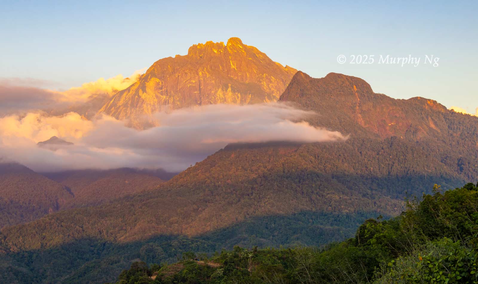
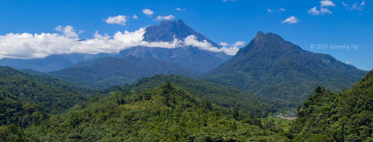
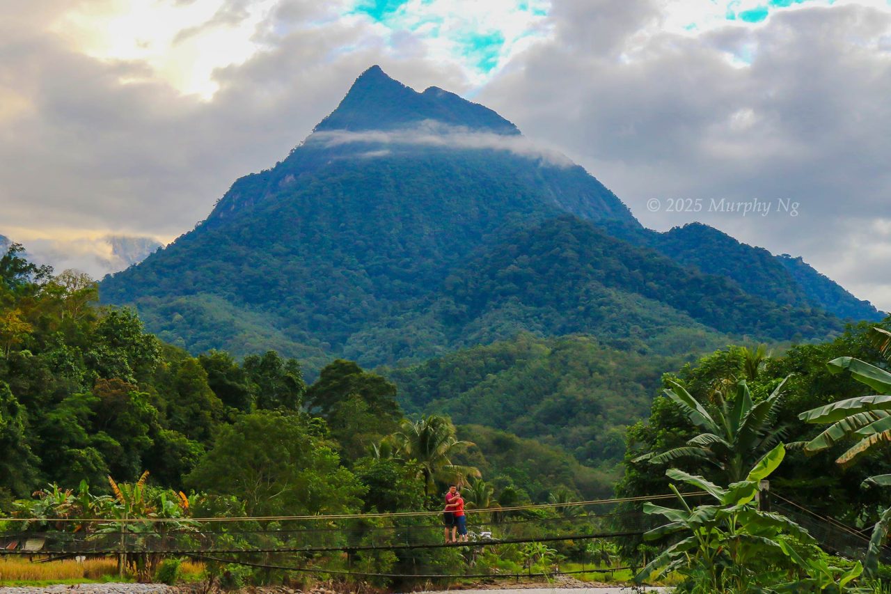
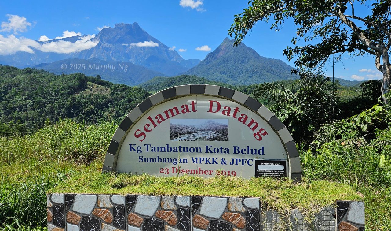
by Tucked beside Mount Kinabalu, Mount Nungkok is one of the most striking peaks in Kota Belud. Often referred to as “Anak Kinabalu” (Child of Kinabalu), this mountain resembles a child next to its towering parent, Mount Kinabalu, the tallest mountain in Malaysia. Depending on where you’re viewing it from, Mount Nungkok takes on different forms: a pointed pyramid from Tambatuon, double peaks from Tuaran, and a rounded summit from Kiau.
Once known as Mount Sadok-Sadok, Nungkok consists of sedimentary rocks from the Crocker Formation. In fact, it may be even many million years older than its parent, Mount Kinabalu. Opened to climbers in 2021, Mount Nungkok has steadily gained popularity among local hiking enthusiasts.
The Legend of Mount Nungkok
According to Kadazandusun beliefs, two kinorohingan (supreme deities who created the world) shaped the Earth. One lived in the east where the sun rises, and the other in the west where it sets. While the world was still soft, they met at its centre. They said, “What about our minorun? (world, ‘something moulded’). It’s too light, we should weigh it down.” The kinorohingan from the west then created Mount Nungkok. But the earth remained unstable. So he said, “I can’t make it firm. You try.” The eastern kinorohingan then formed Mount Kinabalu. Seeing the land was too flat, they gave it a little shake and created the hills.
Source: Story by Gondiab from Tambatuon in the book The Religion of the Tempasuk Dusuns of North Borneo by I. H. N. Evans, 1953.
Another tale says Mount Nungkok is either the son or wife of Mount Kinabalu. Many legends surround Nungkok. Locals believe beings such as “orang halus” (supernatural folk) dwell on the mountain. Hunters say they’ve heard mysterious voices at night.
How Tough is Mount Nungkok?
As a seasoned hiker, I’d rate the difficulty level as intermediate, around 6.7 out of 10. It’s manageable for those who are physically active and used to trekking. Standing at 1,652 metres (5,420 ft) above sea level, Nungkok is less than half the height of Kinabalu, yet the climb is more demanding. You should feel proud if you make it to the top of this mountain crafted, according to legend, by deity from the west.
The one-way trek to the peak is 6.93 km (about 4.31 miles). I used the trail starting from Kg. Tambatuon (Kg. = Kampung = Village) in Kota Belud, which is the most popular and can be completed in half a day. Another option is the trail from Kampung Lobong-Lobong, which is 8 km one way and requires a 2-day, 1-night climb.
The hike usually begins at 4am. Most climbers reach the summit between 10am and 11am (the fastest record is 8am), depending on fitness level, and return to the village by 3pm or 4pm using the same path. Some slower climbers return as late as 8pm. If you haven’t reached Wosoi point (about 500 m before the summit) by 10am, your guide may ask you to turn back.
The biggest challenge lies in the final 2 km of steep ascent. The first 4.5 km is relatively easy, but the long and undulating path will wear you out, so it’s not ideal for beginners who lack stamina.
Walk-Through: Climbing Mount Nungkok (via Kg. Tambatuon)
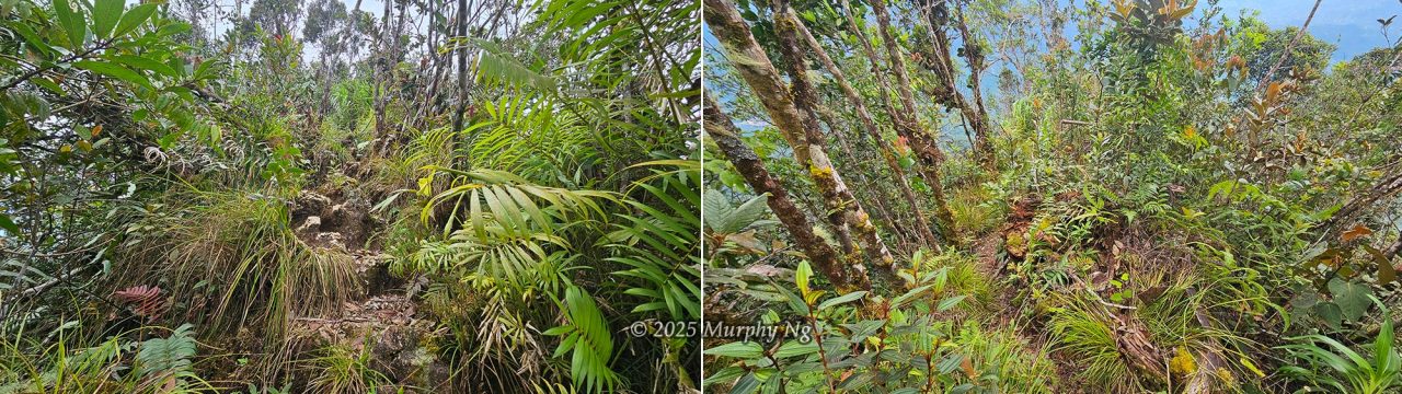
Mount Nungkok lies within Kinabalu Park, a fully protected area managed by the Sabah Parks, so hiring a mountain guide is mandatory. It’s easy to get lost at junctions without one. The trail consists of several stages, each more challenging than the last. The beginning is relatively easy but gets tougher as you go. Here’s a walk-through of my climb.
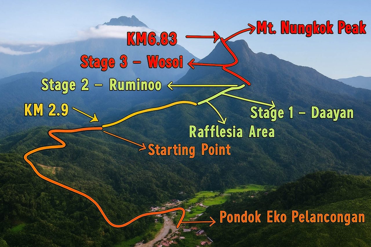
1) Tambatuon Village to The Starting Point (KM 0 to KM 2.9)
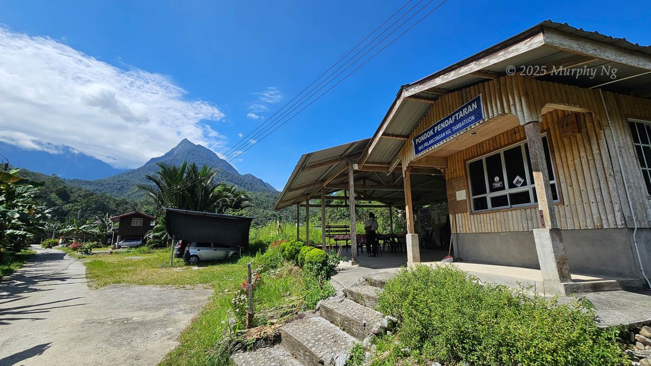
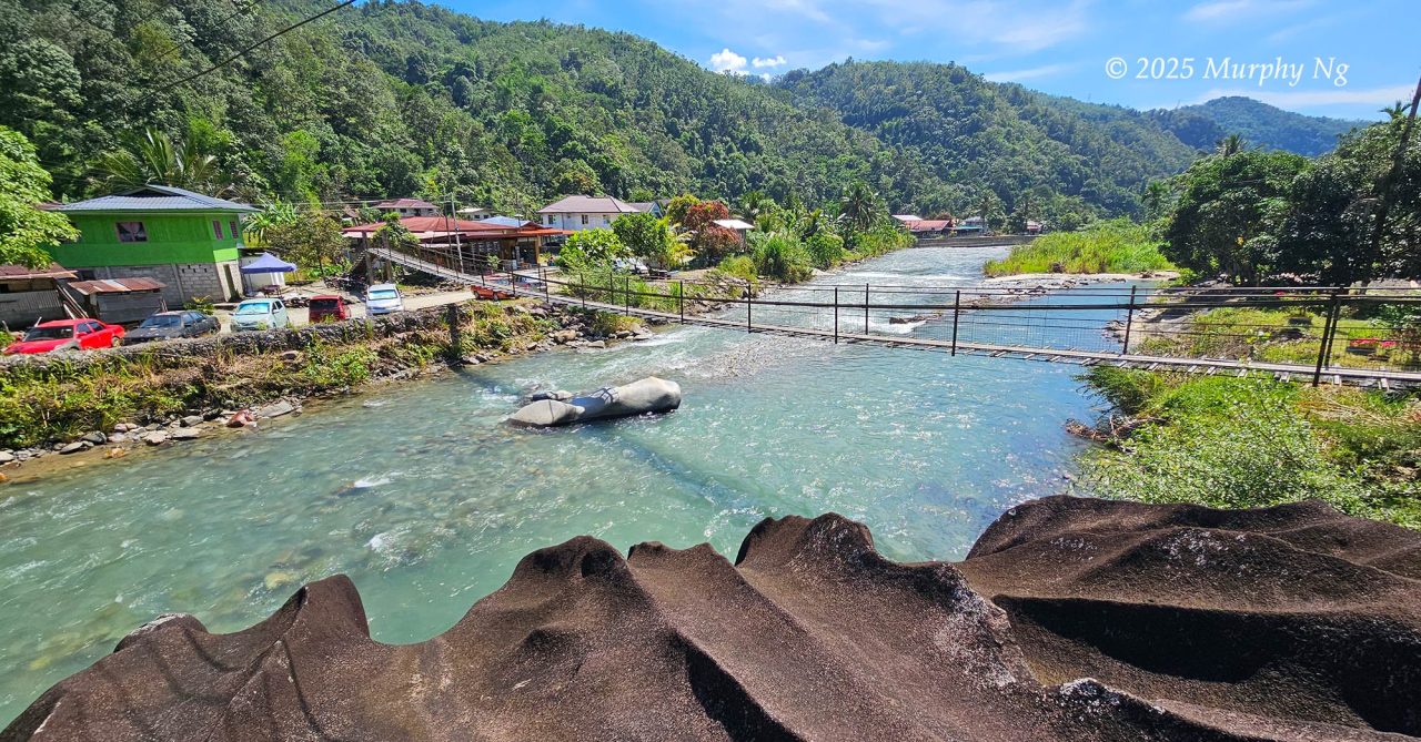
My mountain guide, Mr. Junaidi from Sabah Parks, has climbed Mount Nungkok over 50 times. We met at 4am at the Tambatuon Eco Tourism centre, a short walk from my lodge. After a quick briefing, we set off at 4:21am, crossing a suspension bridge in the dark and heading toward the trailhead behind the village.
Due to soil erosion, the road to the Starting Point was impassable, so we had to walk the 2.9 km to the foothill. (Update: the road has since been repaired, and a 4WD service is available to bypass this (2.9 Km) section for a fee.)
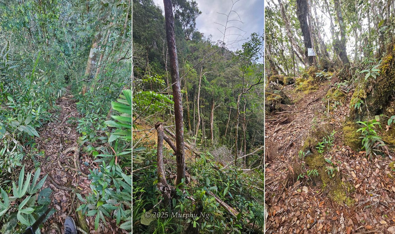
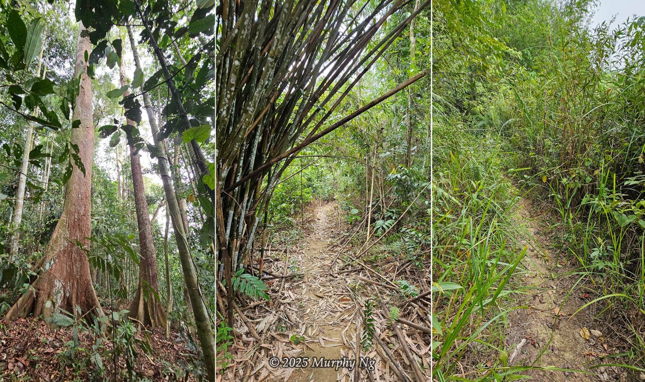
The first stretch was a steep concrete road (inclined 40–50 degrees) for about half an hour. Then it transitioned to a mix of gravel, rocky, grassy, and soil trails, mostly flat or gently sloped.
At one point, we walked along a ridge flanked by two rivers, with the roar of rushing water. We crossed a rubber plantation and heard dogs barking. Some villagers were already tending their farms before sunrise. Suddenly, Junaidi told me to run to avoid a swarm of fire ants crossing the path. There’s no dangerous wildlife on Mount Nungkok, though Junaidi once spotted a baby sun bear. A protective mother bear could pose a real threat.
2) Starting Point to Stage 1 (Daayan)
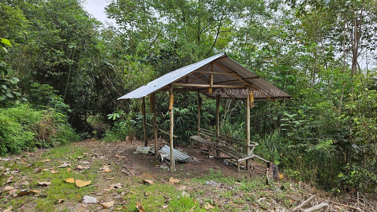
We finally reached the Starting Point shelter at 5:18am, having covered 2.9 km. It was still dark, but Junaidi was pleased, we were ahead of schedule, as most climbers arrive around 6am. We rested for 10 minutes.
There are no toilets on the trail, so I had to do my business in the grass. We resumed hiking at 5:28 a.m., transitioning from a countryside road to a forest trail, with the first light of dawn appearing on the horizon. The path remained mostly flat and grassy. By 5:35 a.m., we reached the 3.43 km marker, indicating the distance remaining to the peak.
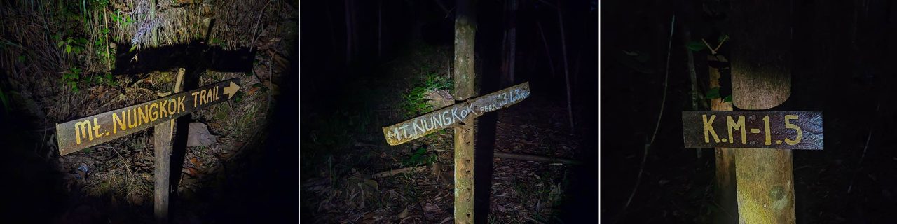
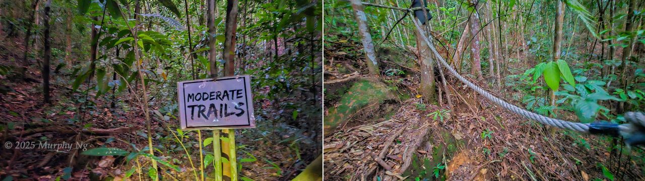
We enjoyed an easy walk along a hilly path until we arrived at the Moderate Trails marker (KM 1.5) at 5:53am. From there, the slope got steeper, like climbing stairs, which slowed me down. Parts of the trail skirted hillsides and ridgelines.
A PVC gravity pipe ran parallel to the trail for several kilometres, delivering water from the highlands to the village. Because it was drought season, there were no leeches. The forest floor was dry and crunchy underfoot. As dawn broke, cicadas began their deafening chorus, joined by birds calling from the treetops.
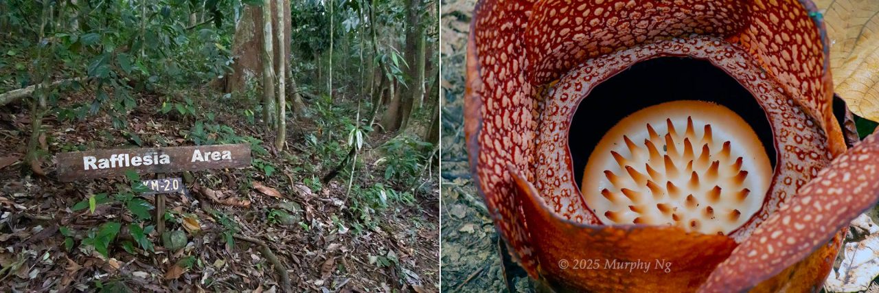
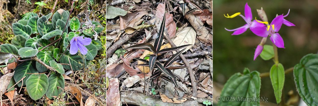
At 6:12am, we entered the Rafflesia Area at KM 2.0, showing the distance we’d covered since the Starting Point. Unfortunately, none of the flowers were blooming. By then, it was bright enough to turn off my flashlight. I was slightly out of breath but feeling okay.
3) Stage 1 (Daayan) to Stage 2 (Ruminoo)
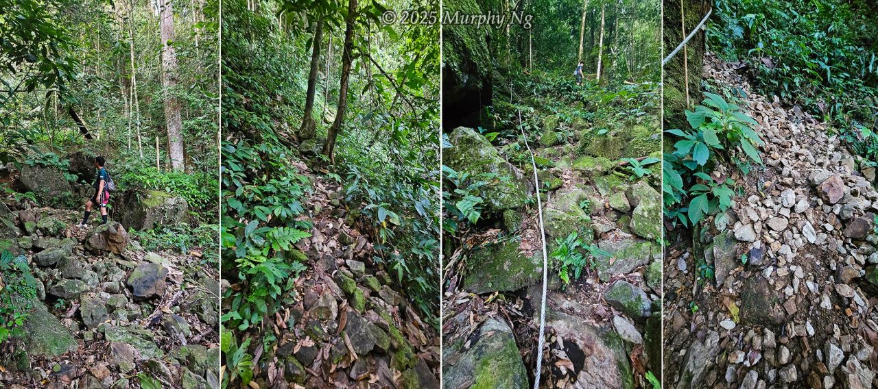
At 6:18am, we reached the start of Stage 1, Daayan, which means a trail full of loose rocks. Large boulders began to appear beside the path, signalling the start of a more difficult stretch. Junaidi explained that this area used to be a village and farmland. Interestingly, our ancestors preferred to settle on hills rather than riversides, any idea why?
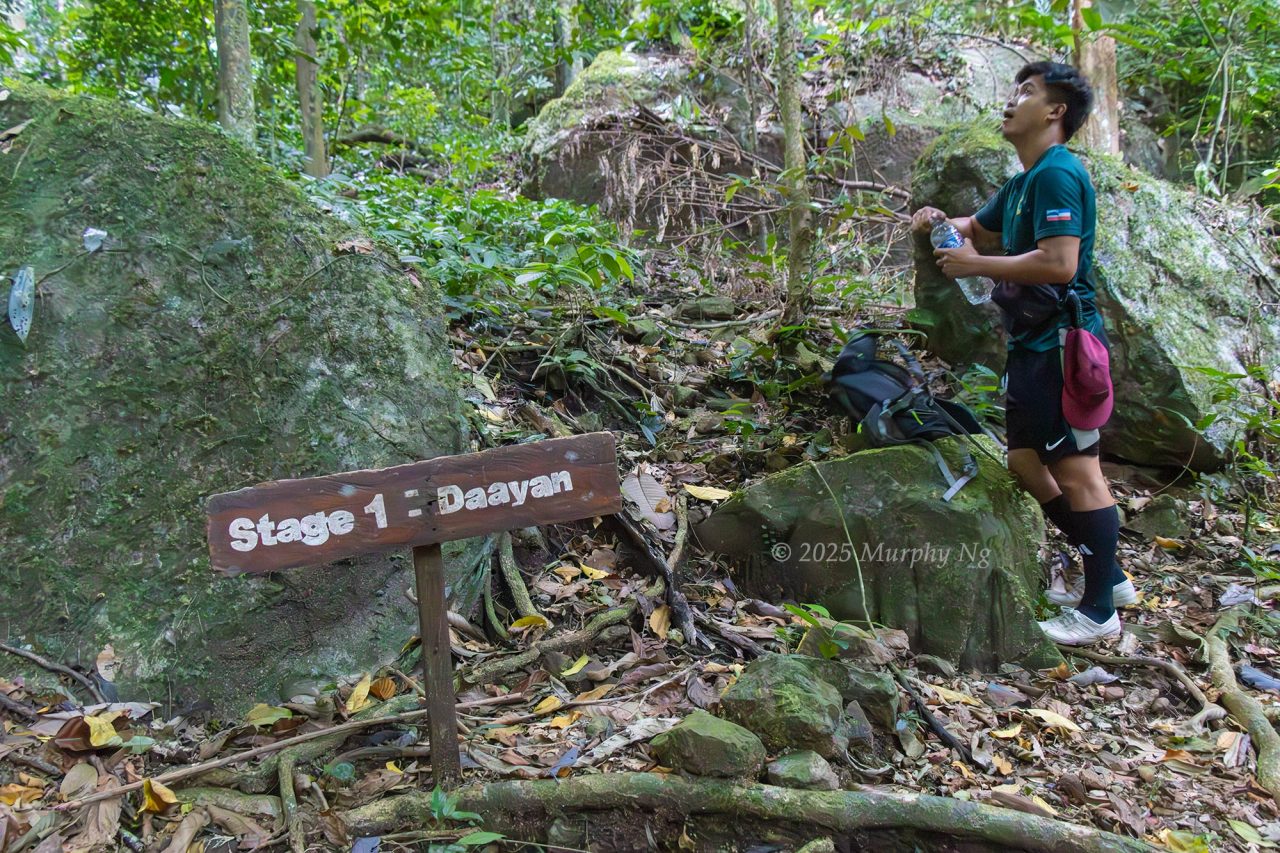
He also told me that during the Japanese occupation, mining activity (possibly for gold) took place in a nearby cave. Operations ceased after World War II, and no locals dare enter it now, believing it to be haunted. Some say the cave appears so clean, it looks inhabited. Urban legend or not, I’m convinced Mount Nungkok holds significant copper deposits.
One elder recounted how a villager once rappelled into the cave to collect edible bird nests, only to be attacked by a swarm of swiftlets. They were so aggressive they bit chunks of flesh from him, as if trying to devour him.
Back to the trail: we resumed our climb at 6:27am. I disliked the rocky terrain, unstable and uneven. I kept dislodging rocks that rolled downhill, posing a risk to anyone behind me. Thankfully, Junaidi kept a safe distance.
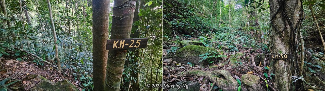
The path improved after about 1 km. It narrowed but became less rocky, though the drop-offs grew steeper. Rope sections were plentiful. I lost count of how many times I had to haul myself up 30–50 degree inclines. After KM 3, it got even steeper, up to 70 degrees. I actually didn’t mind using ropes, it gave my legs a break while my arms did the lifting.
4) Stage 2 (Ruminoo) to Stage 3 (Wosoi)
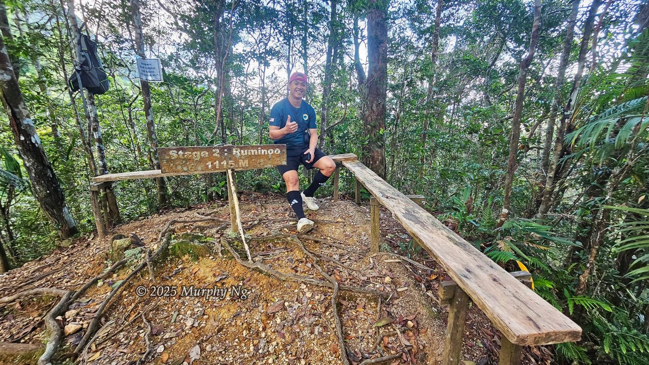
After more ropes and steep climbing, we reached Stage 2 (Ruminoo) at 7:15am. The rocky section had ended, and a cooling breeze set in. I had a few snacks to recharge, by now, we’d been hiking for over three hours. “Ruminoo” means a trail that descends to a saddle before sharply rising again. For the next kilometre, we kept ascending steep slopes using ropes, with gradients of 40 to 70 degrees.
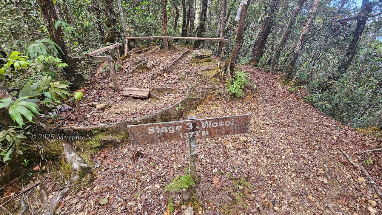
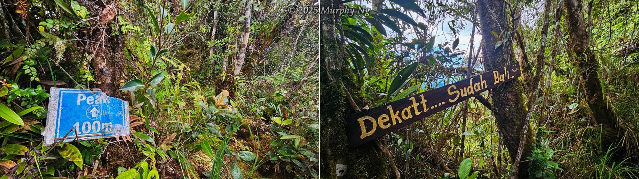
Climbers who fail to reach Stage 3 (Wosoi) by 10am are usually turned back. I made it there by 8:16am, safe! The temperature at this elevation was about 23°C, but it felt closer to 18°C due to the wind. My sweat-soaked shirt made the chilly wind even more biting. I threw on my jacket to keep warm.
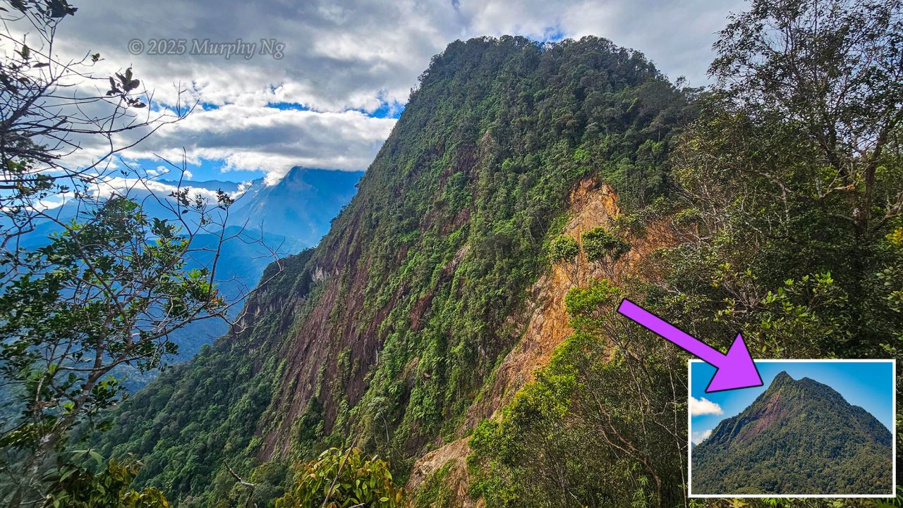
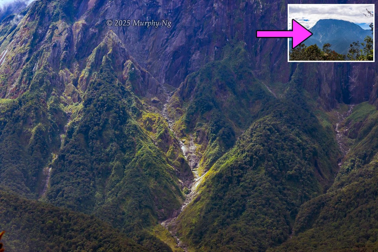
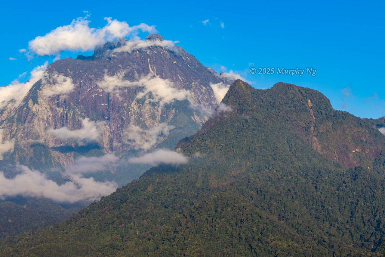
About 10 minutes later, we saw Wosoi, which means “rock face.” This is Mount Nungkok’s best viewpoint. A massive reddish cliff stood before us, with streaks of exposed yellow stone and visible signs of landslides. From here, you can also see Mount Kinabalu in the distance.
Stage 3 is no doubt the hardest part, as most of it is nearly vertical, with inclines of 40 to 80 degrees. You either pull yourself up with ropes or scramble using tree roots.
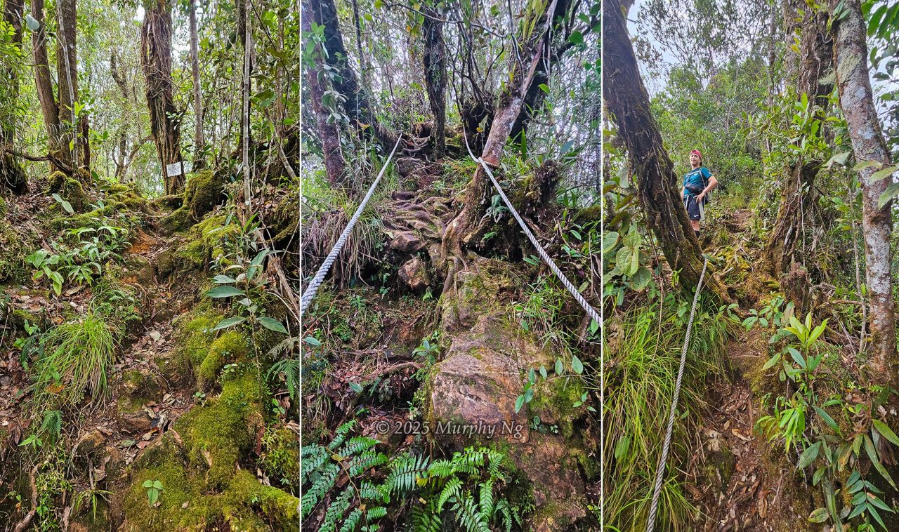
I tried to record Junaidi navigating the tough rope sections where I had struggled. He simply crossed his arms and strolled over the steep slope like it was nothing. What a beast.
The trail narrowed, flanked by dense vegetations like grasses, shrubs, and dwarf trees. Despite my exhaustion, I couldn’t stop admiring the montane forest. The moss- and lichen-covered trees gave the mountain a fairytale-like charm.
5) On the Peak
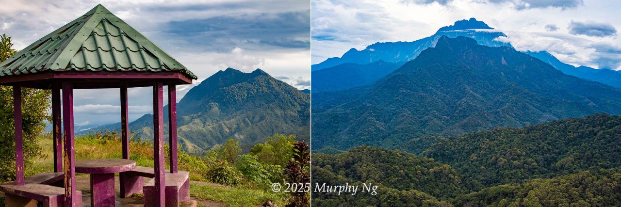
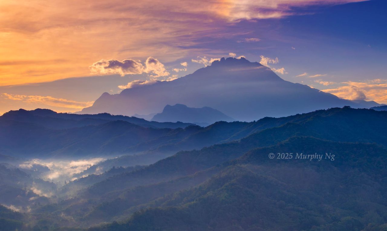
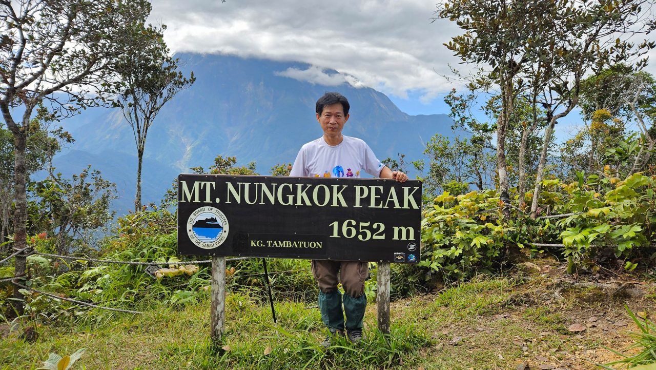
I finally reached the top at 9:32am! It’s a small flat area about 20 metres in diameter, bordered by ropes. From here, you can see the western face of Mount Kinabalu less than 7 km away. Its peak was already partly hidden in clouds. If you arrive too late, all you’ll see is mist, no chance of viewing Nungkok’s towering parent.
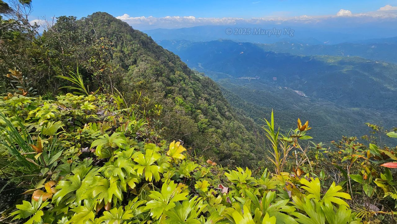
From the summit, I could see Nabalu town and Kg. Lobong-Lobong on the opposite side. Zooming in with my camera, I spotted a massive chasm cutting through Mount Kinabalu, with what was probably the Kilambun River running through it. This deep ravine was carved during ancient glaciation. You can only get a better view of this steep and deep ravine, a spectacular and geologically significant landscape not found elsewhere in Malaysia, from this peak.
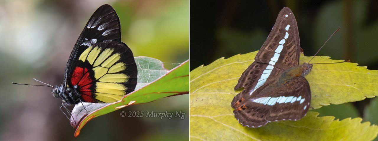
Turning my lens to the butterflies, I was delighted to see many fluttering around thanks to the sunny weather and flowering trees. I’ll return to Mount Nungkok again, next time via Kg. Lobong-Lobong side. Just note: Sabah Parks does not permit climbers to ascend the true summit of Mount Nungkok, as it’s extremely steep and narrow. The highest allowed point is 1,652 metres above sea level, which is just a short distance below the true peak.
6) Back to Village (Kampung Tambatuon)
After spending an hour taking photos and resting at the top, we began descending at 10:26am and reached the village by 3pm. The round-trip of 13.86 km took me 11 hours. It’s a good idea to bring a packed lunch with you.
Descending wasn’t any easier than climbing, especially on the steep, rocky sections. It put a lot of strain on my knees and toes. Thankfully, I wore well-padded hiking shoes; otherwise, I might’ve lost a toenail or two. I was relieved once we got through the rocky Daayan section.
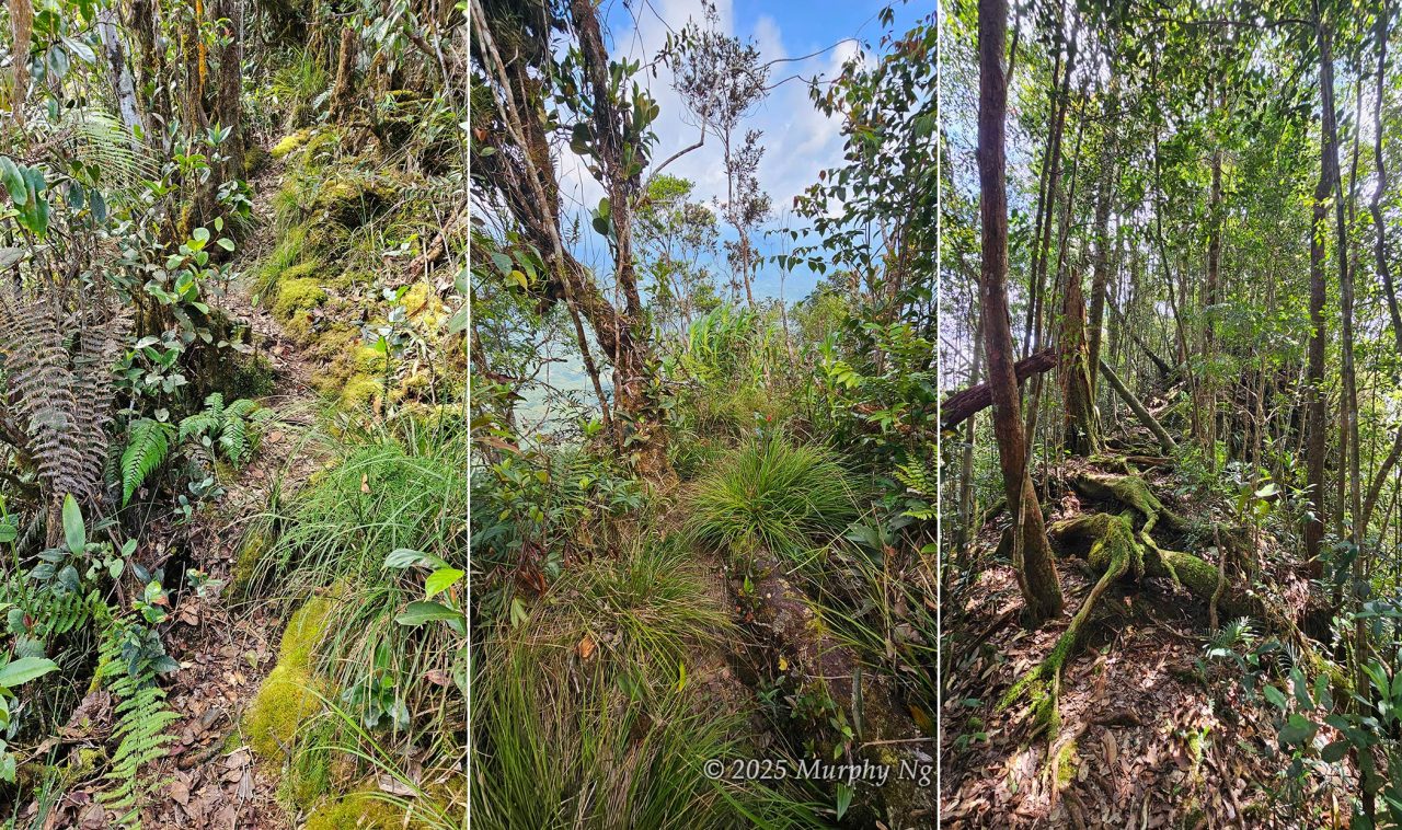
I relied on ropes to make my way down slowly, using small trees and roots for support. Despite their thin trunks, these plants were surprisingly sturdy. I had to tread carefully on moss-covered rocks too, they can be incredibly slippery.
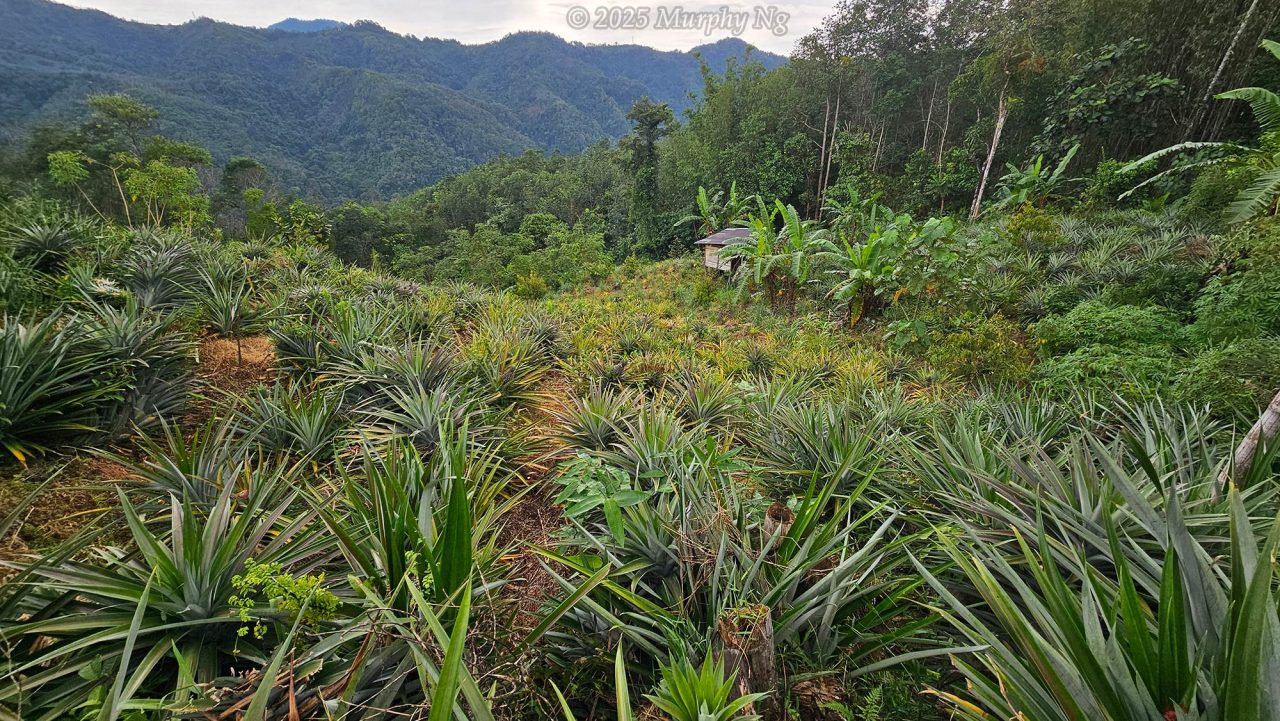
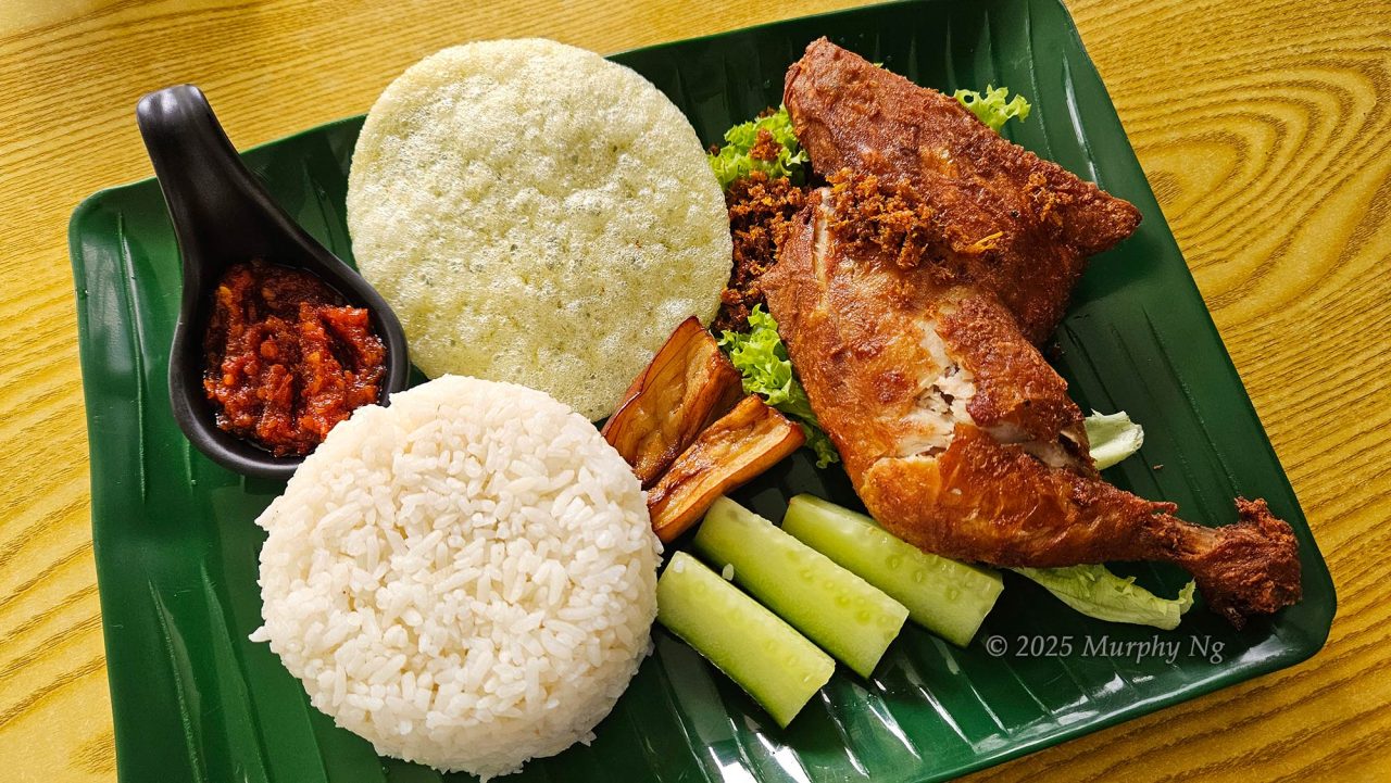
The further we descended, the easier it became. My legs felt like jelly, but I appreciated the overcast sky, it wasn’t scorching hot. The same 4 km of trail that we hiked in total darkness earlier was now bathed in sunlight, offering lovely views of farmland and countryside. Then came the rain, luckily, I had a raincoat. We had fried chicken rice for a late lunch when we returned to the village. The climbing certificate was ready for collection when I got back, so efficient!
I was utterly exhausted and ready to crash. My eyes widened when Junaidi said he was going to drive 90 minutes to Kota Kinabalu to play football with friends at Likas Sports Complex, then come back the same evening. That’s insane! After lunch, I staggered to my lodge like a zombie and collapsed onto the bed for a well-earned nap.
Climbing Fees (as of July 2025)
The climb is easy to arrange. Most homestays in Kg. Tambatuon can help organise your climb, just mention it when booking. Since Mount Nungkok is the main attraction here, they’re well-prepared for it. Take note: only 20 climbers are allowed each day (not including guides), as per Sabah Parks regulations. Spots can run out fast during weekends and holidays, so book early.
1) Climbing Fees (Malaysian Rates)
- Saturdays, Sundays, and Public Holidays: RM76
- Weekdays (Monday to Friday): RM66
(RM = Ringgit Malaysia. USD1 ≈ RM4)
Includes: Climbing certificate, Tambatuon Eco Village entry fee, Sabah Parks conservation fee, and a meal after your climb.
2) Guiding Fee (Mandatory)
- RM150 per guide (for groups of 1–5 climbers)
Note: Overtime charges apply if climbers wish to depart early (before 4 AM) or return late (after 5 PM).
3) Optional Add-Ons
I highly recommend staying at least one night in Kg. Tambatuon. Here are some extras you can consider:
- Accommodation: Homestay / Lodge / Guesthouse
- Transport (round trip) to the starting point: RM100 per 4WD (fits 5 climbers + 1 guide; weather-dependent)
- Breakfast and food supplies for the climb
- Tent & camping site rental
- Full-board meals for a 2D1N stay
For enquiries and bookings, contact Mr. Eyong c Ronn (Mt. Nungkok Crew / Mountain Guide):
📞 WhatsApp: +60 19-588 0776 / +60 14-503 0776
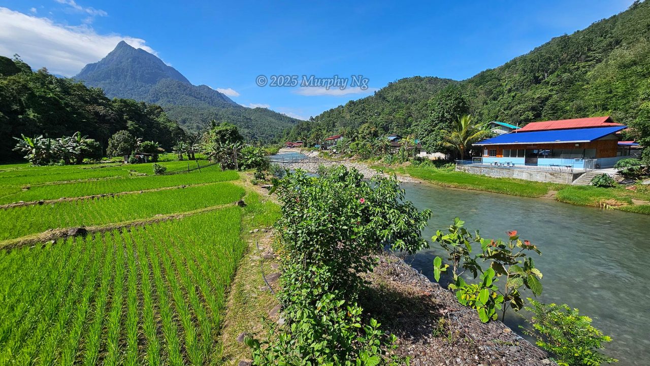
Located about 27 kilometers from Kota Belud town and 72 kilometers (around a 1 hour 40 minute drive) from Kota Kinabalu, Kampung Tambatuon sits in a valley. It’s accessible by car, connected to the main road by a short gravel path. (See Location Map)
Things to Bring
Pack light but come prepared. Here’s a checklist:
- Backpack (preferably with rain cover)
- Raincoat / Poncho
- Flashlight / LED Headlamp
- At least 2 litres of water
- Jacket or Windbreaker
- Packed Lunch
- Snacks / Energy bars
- Anti-leech Socks
- Hiking Stick
- Gloves
- Camera
- Mobile phone
Photo taken in Kota Belud, Sabah, Malaysia Borneo
I recently watched a documentary of someone hiking Mt. Nungkok. The view is majestic!