Category Archives: Mountains

boat to Batu Punggul

Trip to Batu Punggul – Part 1 of 3

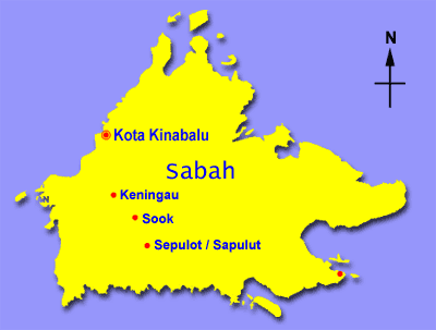
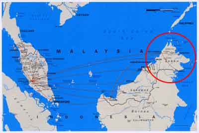
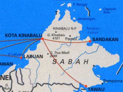
Batu Punggul means “Rock Tree Trunk” coz of the look of this 1,000+ feet (330 Meters) limestone pinnacle in the rainforest. It is located in the rainforest of Sepulot (Sapulut), a very remote area more than 100 KM away from Keningau town (200+ KM from Kota Kinabalu). Batu Punggul was the place I always wanted to go, but now I don’t dare to come back again.


Click Here to see more photos of Batu Punggul >>

Sepulot was once the land of Murut headhunters, and the old legend makes Batu Punggul a very mysterious mountain. The locals believe there are spirits live in it. In the past, the adventurers needed to take 4 to 5 hours of boat ride to reach there. This area has become more accessible when the main road that connects Keningau, Nabawan and Tawau opened. In fact, my father came here many years ago, and he was complaining about the long hours of boat ride (that time the road was not ready) and staying in a haunted accommodation. He is physically fit and he also says the climb is so dangerous that he doesn’t want to try again. If he says tough, it is very though then.


Click Here to see more photos of Batu Punggul >>

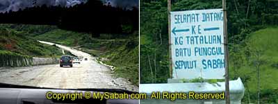
However, large part of the road to Sepulot is covered with gravel, so do expect a long time of bumpy ride, a 4-wheel is more advisable for the visit, though smaller car is still possible. 40 KM after Nabawan town and passing by a bridge, you will see Tataluan Village (Kampung Tataluan) at the left, the starting point of the trip.

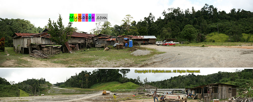
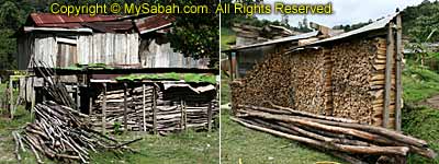
People in Tataluan Village is living a very primitive life, as there is no gas and power. Two shaky public toilets are probably the only facility they have here for travellers. I guess they don’t understand why tourists are so interested in this cursed mountain. They told me that people will be hurt by black magic, if they climb Batu Punggul without permission.


Click Here to see more photos of Batu Punggul >>

FYI, the official name of this place is Sepulot (on road sign), but the media calls it Sepulut and locals call it Sapulut.


Click Here to see more photos of Batu Punggul >>

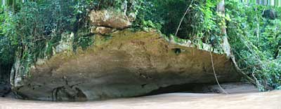
Well, there comes the legend of Batu Punggul (I cut short the long story). A long long time ago, there were two longhouses, namely, Punggul and Tinagas communities, living at each side of Sapulut River. One day the Bunggul community celebrated a wedding. Their fire was put off, and they needed fire to cook. Therefore, the Bunggul people asked Tinagas to tied the fire on the dog (poor dog!) and let it swam across the river. The dog was drowned and they laughed like mad. Then they tried the same thing on a cock and asked it to fly over the other side. The cock managed to cross but the fire was put off by water. Again, these crazy people laughed. Their sneering laughter angered the gods in the jungle, so the people, their longhouses and the cock were turned into stones. The longhouse of Bunggul community became Batu Bunggul.


Click Here to see more photos of Batu Punggul >>

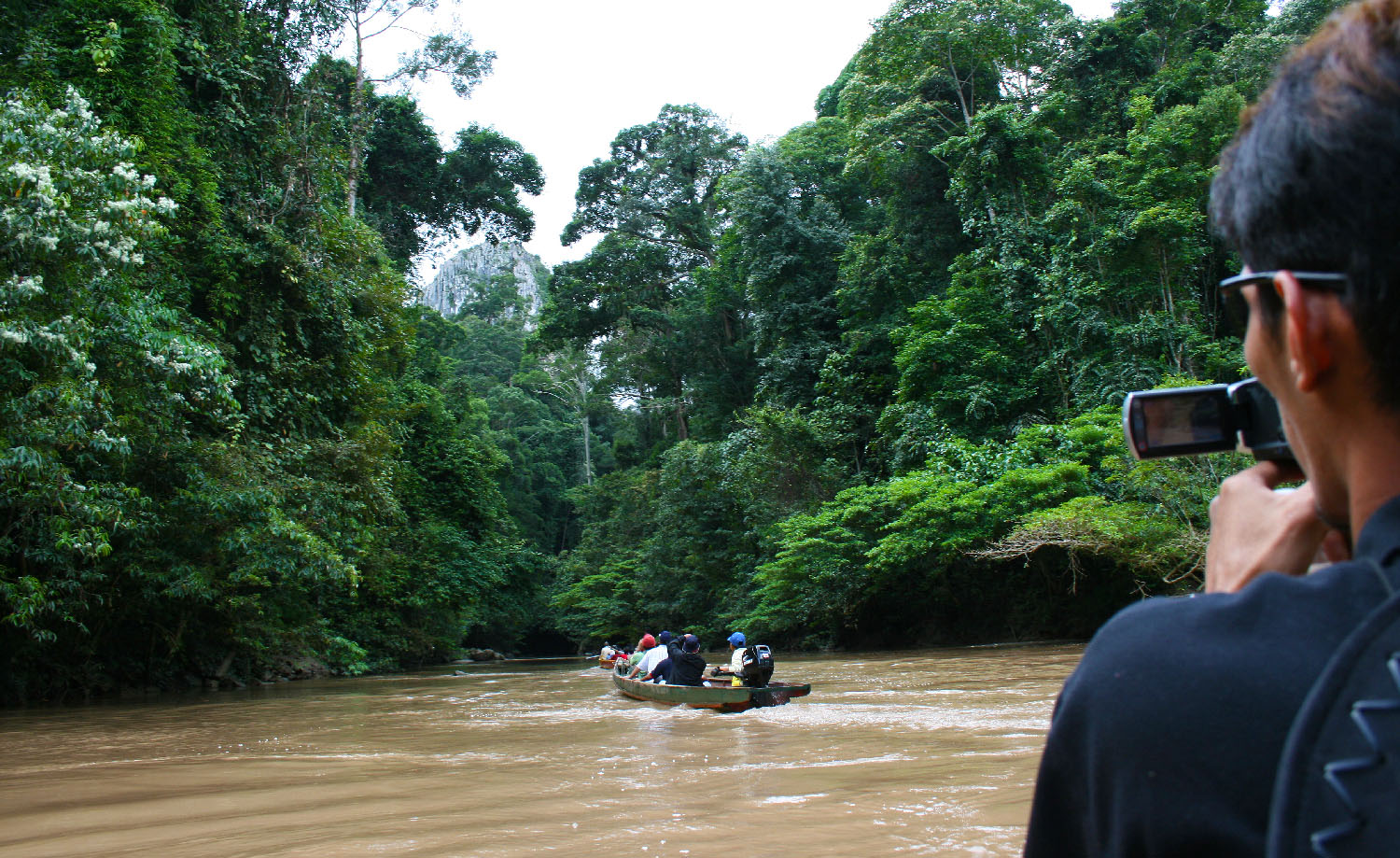
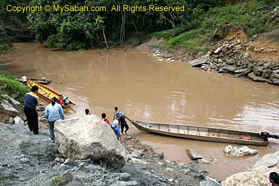
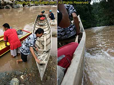
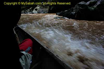
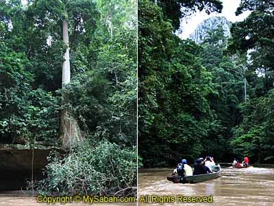
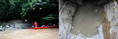
Batu Punggul is next to the Sapulut River, so we needed only 10 minutes of boat ride to reach its foothill. The boats we used were the wooden sampan boats equipped with engine. Hmmm… the boats look like some wooden slats loosely binded together and I could see holes between them. That reminded me of my terrifying first-time experience with sampan many years ago. The boat was only one inch over the surface and it was so unstable, a bit of force and movement would make it capsized.


Click Here to see more photos of Batu Punggul >>

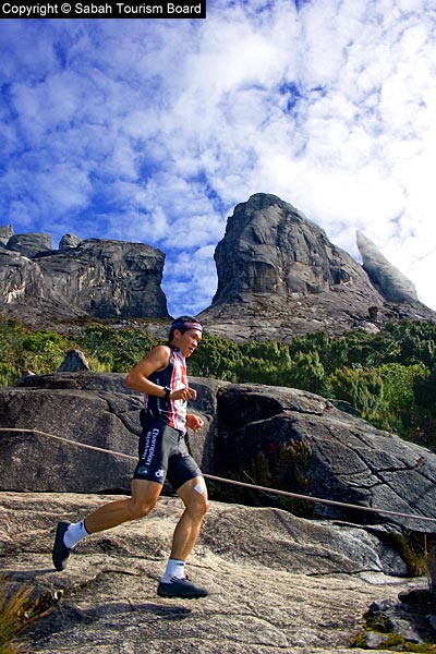
Luckily the river cruise was a smooth one. There were a few rapids but the boats were under good control. The splashes still made me felt uneasy anyway. I think I saw the “cock stone” (mentioned in legend) in the river. Do you see the big tree in the photo below? It grows on top of a very thin layer of rock and doesn’t collapse. Within minutes, we saw Batu Punggul in front of us. This limestone pinnacle, discovered by two Japanese visitors in 1968, Eizo Yogawa and Tamio Yamamoto, is a lot taller and bigger than something that I think I can conquer. But it is so beautiful..


Click Here to see more photos of Batu Punggul >>

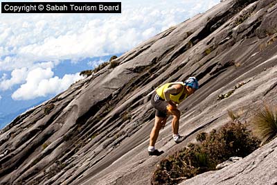
Yayasan Sabah building would look small standing next to it. If going up to the top of Yayasan Sabah by staircase is terrible, what if climbing to the top of this mountain by hand? I was speechless. On the way, I kept on struggling whether I should give up.

Continue to Part 2…

Photos taken in Sepulot, Sabah, Malaysia Borneo

Mt. Kinabalu Climbathon

Mt. Kinabalu Climbathon is the craziest sport in Sabah. In fact, it is known as one of the toughest mountain race in the world. I was one of the volunteer photographers for the Mt. Kinabalu Climbathon 2008. Though taken by me, most of the photos below are now the property of Sabah Tourism Board. I asked their permission to post them in my blog.

Taking photos in cold and humid places on Mount Kinabalu is challenging. Many photographers have warned me that condition would be very bad to my camera. They were right. My camera hanged twice and the auto-focus didn’t work quite well sometimes. We got sunny day in the morning, but it rained in the afternoon and evening. The temperature was below 10 degree most of the time.

The photo above was taken at 7th KM of the summit trail at 6am. The athletes would arrive here after 8am, so there was plenty of time. The density and formation of cloud was so fascinating. I paid a few dollars to the porter, so he would stand there for some shots. You probably can’t get this view anywhere else in Malaysia.

The peaks near the summit are quite feature-less and there were too many climbathon photos were taken there before. Therefore, I decided to explore for good photo shooting points near the Donkey Ear Peak and Tunku Abdul Rahman Peak, somewhere between 6.5 KM and 7.5 KM of the running trail.

Slowly one by one, the athletes showed up. They were so tired that they were half-crawl half-walk, pressing their thigh, trying to push every bit of energy out of their feet.

There was rain at night so the rock surface was slippery. These people are really monsters. It is hard to believe they can complete the 16KM, up and down the mountain, in less than 3 hours. On high altitude like this, the oxygen is 15% less. above is the Women’s Open category champion, Corinne Favre from France, running down the mountain.

Personally I like the photo below. The background is Tunku Abdul Rahman Peak, named after the Father of Malaysia. I was lucky to get this coz the peak was covered by mist a few minutes later. I make some post processing photo enhancements to give it more punch. Take little time coz it was shot in RAW format.

Last photo… at the end is the South Peak, not the summit (at a height of 4,095M, highest in Malaysia). This athlete still had 1.5 KM to go. Due to lack of experience, I didn’t get a lot of good photos. Anyway, it was fun. at least I lost a few KG.

Photos taken on Mt Kinabalu, Sabah, Malaysia Borneo

Mt. Kinabalu = 4,101M?

On 19 Aug 1997, everyone has learnt from the local and national newspapers that the official height of Mount Kinabalu is 4,095.2m (13,432.26 ft), not 4,101m (13,455 ft). After 10 years, someone still hasn’t updated the information. Just grab a copy of “Going Places”, a free inflight magazine for all passengers of MAS Airline. Flip to the page that has the Malaysia map and look at Sabah state.


The Sabah map below is from the Sep 2007 issue of Going Places. As you can see, the height of Mount Kinabalu is still posted as 4,101 M. I think million copies of such mistake had been printed for 10 years. Time to remind MAS to change it.

This error was even more obvious in older issue (see below) of Going Places coz the map of Borneo was taking a full A4 page.

Nevermind lah, people make mistake sometimes. I also thought that Mt. Kinabalu is the highest mountain in Southeast Asia. After doing a search on the net, I found that the Mt. Hkakabo Razi, with a height of 5,881 Metres (19,295 ft), in Myanmar (Burma) is the highest in Southeast Asia. Mt. Carstensz (Puncak Jaya), with a height of 4,884 Metres (16,024 ft), in Indonesia, is the second highest. So Mt. Kinabalu is the 3rd highest in Southeast Asia (but still the highest in Malaysia and Borneo). I also need to update my web site then…

Photos taken in Sabah, Malaysia Borneo

Fake Mt. Kinabalu

This one is fun. Last week I saw TWO Mt. Kinabalu at Nunuk Ragang. They both look so identical that when I asked a few persons on the spot, “Where is the Mount Kinabalu?”, ALL of them pointed the WRONG one.

Make a guess before you click for the answer below. If you got it wrong, don’t call yourself a Sabahan, go home and draw 100 copy of Mount Kinabalu. 🙂

Click Here for the Answer

On Top of Tun Fuad Hill

Today is New Year Eve. You might think that Smoke Head would go celebrate in a big party today. You are wrong. This year is the 1st anniversary of the Tsunami disaster 2004, so seem like everyone wants to keep the Xmas and New Year celebration low key. All hotels come up EXPENSIVE New Year Eve dinner package. Frankly speaking, I think food would not taste better coz of New Year Eve, so no point I pay extra for it.

This morning I went to Tun Fuad Park and walked up to the top of the hill. Why I was going there? This morning I saw a lot of dense cloud floated across lowly on top of KK, so I wanted to see if I could get a nice shot from the top of the hill.

On the way up to the hill, Tun Fuad Park also got some small animals and bugs that can be interesting photography subjects. I remember I saw 1 inch big ants there 2 years ago. I returned to Tun Fuad Park a few times and could not find them again. It is quite hard to take macro shot, as the bugs would run like hell when they see me. Some even bite me.

Bad Experience in Mount Kinabalu Trip

Due to the heavy rain, my trip to Mount Kinabalu was painful. Fortunately I brought my raincoat. But my hair and jean were wet and the temperature was freezing cold. Actually I had already expected the bad weather so I had booked two nights of accommodation at Laban Rata. The first night I was staying in the Gunting Lagadan Hut (3,323m), which has no heater and is quite far away from Laban Rata Resthouse. To get there from Laban Rata, you need to walk 100 Meters of ladder up there. After I finished the climb to summit in the next day, instead of going home directly, I moved to Waras Hut (very near to Laban Rata), where I spent another night. This gave me extra time for contingency. Otherwise the bad day would spoil my photography session in Mount Kinabalu. I found that the rain usually came in the afternoon, so I climbed down at 7:30 AM on third day.

My comment about this trip is “The Mount Kinabalu and Kinabalu National Park are unchanged, like 10 years ago.” Well, if I say the nature is unchanged, it is a compliment coz it means the site is well preserved. If I say this to the park management, it is an insult. Yes, the park is not improved for over 10 years. I am a bit surprised that the BEST Sabah tourism spot is managed by the WORST organisation, Sutera Sanctuary Lodges (If you want to burn their office, it is located at ground floor of Wisma Sabah. And thank you).

There are so many positive reviews about the Mount Kinabalu trip. But I would like to criticise their management. Let me list a few of my frustrations:

1) Low Quality Mountain Guides
Personally I call them “Shepherd”. Basically they do not provide any service or guide you. They just walk around you. Half of the time you don’t see them. In year 2001, there was a young British girl wandered off the group, got lost, and died in Mount Kinabalu. Such a poor girl… Her father did not want to blame anyone. But… I believe this case is more or less the responsibility of their Mountain Guide. Still seeing the sloppy attitude of these guides, I’m afraid the same tragedy will happen again one day. If you bring your kids along, do always keep an eye on them, especially during the thick mist session (Aug – Nov).

If you move slower, they will push you. If you sit in the shelter for too long, you will hear them mumble “Go… Go… Go… Jalan… Jalan… Jalan…” beside you, like a cassette that repeats the same word over and over again. Someone told me that the good mountain guides are reserved for the foreigner tourists, and the locals will get the lousy one. Not sure if this is true. I did see a few mountain guides who were keen to show the foreigner tourists here and there, introduced what were along the trail.

2) Terrible and Expensive Food
Make sure you bring enough cash. A 500ml water costs RM4.60. You better boil your own water in the hut. Remember to bring heat-resistant (not plastic) bottle / container so you can store the boiled water. Tea and coffee costs about RM8. There is only one restaurant in Laban Rata. If you don’t eat there, tree roots will be your only choice (and they know this).

One of the popular dish here is the Fried Rice. This was the first time I paid money to torture myself. Their fried rice is the hardest and the most expensive (cost RM12) in Sabah. It is so difficult to push it down the throat, so I kindly asked them if they could give me a small bowl of soup. They said, “No free soup. You must order it separately.” The soup will cost another RM8. Even the RM3.00 meal in the city comes with free soup. I wish I can throw their boss down the 4,095M mountain.

3) Lack of Heating
If a person takes shower with very hot water during summer, you will say that he is nut. Some huts do not come with heater and hot water. I wonder if their management expects the tourists to take cold water shower under the freezing temperature. I will not advise you to take cold shower even if you are strong. In case you got sick, the climb to the summit will become risky. I think the heater should be a basic facility coz everyone needs it.

The night is freezing cold. Bring extra socks and spare clothing to keep you warm at night. Do not count on their blanket. It is so thin and old. The blanket that I got looked like the same one I used more than 10 years ago, during a school trip to Mount Kinabalu (we also stayed in the same hut).

Because of the heavy rain, my jean, socks and shoes were wet, but I did not have the spare clothing (OH O!). The cloth will take days to dry due to the cold and humid air. I wanted to use the stove in the kitchen to dry my clothing. Then I saw a scolding notice “If you use the stove for purpose other than cooking, you will be fined RM200” (very smart). OK, what to do? Luckily I got a candle, so I used it to dry up my cloth. It worked! I could see the water vaporized from jean like white smoke.

4) Inconsiderate to Tourists’ Well Being
One of the worst experience was caused by their inconsiderate. After I returned from the summit to Laban Rata, I felt really sick. This was because my body absorbed too much cold in the heavy rain, the hut was too cold and I did not sleep well (no heater and warm blanket), and I exhausted all my energy reaching the top.

According to their policy, we should check out before 10:30 AM. I checked out at 10 AM and got ready to move to Waras Hut that I had booked earlier. Then their staff said that the check-in time was at 1 PM. I felt really ill and I needed a bed to rest ASAP, so I asked the staff if I could check-in earlier coz I was sick. She looked at my pale face, just haha and said NO. I had to wait for 3 hours then. I sat in the restaurant coz I was so weak. I wanted to vomit whenever I moved.

After one hour, I asked again, with begging tune, “Please… I was sick and I needed a rest badly. Normally hotel check-out time is 12 and can check-in at 1 or 2 PM. The small hut has nothing much to clean up. Would you please let me in earlier?” She just said, “We only got one housekeeper and your hut is the last one to be cleaned. That’s why it was slow.” I replied, “Then would you please request her to clean my room first, so I could move in soon?” She was speechless and looked at me with a “I am not keen. You must check-in at 1 PM” expression.

Nothing much I could do, so I sat quietly at a corner. During the waiting time, I noticed that whenever foreigner tourists approached her, she smiled like sunshine. She never forgot to ask, “Is there anything else I can do for you?” with seducive eye expression, as if she will not hesitate to lick their shoes if they ask. I believe these tourists would get different answer if they asked the same thing like mine. Finally I got my room at 1 PM. Laying on the bed, I thought I would be sent to the hospital. It was quite scary coz I traveled alone, and their inconsiderate made me felt very insecure. Fortunately I survived.

5) Take Nothing but Photographs. Leave Nothing but your MONEY.
At the park, besides paying RM70 for a Dumb Shepherd, RM30 for Climb Permit, and RM3.50 for Insurance, you also need to pay RM12.50 per way (RM25 for return trip) for the transport from National Park to Timpohon Gate, where you start the climb. I think the transport fee is too high. The distance between National Park and Timpohon Gate is only 5 KM. After paying so many fees, they should at least provide a free shuttle service. Instead, they charge overly high fee to rip off the tourists. FYI, RM25 can buy a bus ticket to go to Sandakan, which is more than 200KM away. What a joke I need to pay RM25 for a 10 KM trip. And they send you there with bus or van, not a big limo. With that money, I expected a plane though.

I believe some of you may have some bad experience too. Please feel free to share it here…