Tag Archives: homestay

longhouse of Rungus

Sabah Longhouse and the Rungus

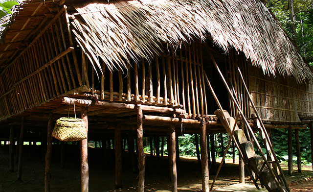
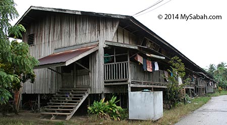
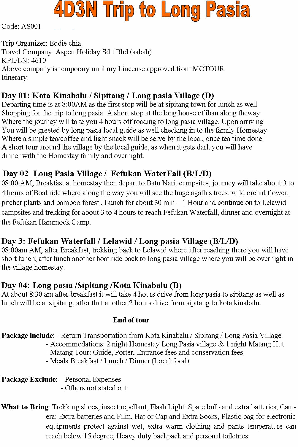
Sabah may not have a lot of tall building, but we have many long building (longhouse). Though other Sabah native tribes such as Murut and Dusun Lotud also build longhouse, larger number of Rungus people, a sub-ethnic of Kadazandusun (largest indigenous group of Sabah) with a population of 80,000*, still practise the traditional lifestyle of living in a longhouse today. In 1930s, there was a Rungus longhouse stretched as long as 5 Kilometers!**


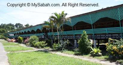
Pic: a traditional Rungus longhouse

A Rungus longhouse (known as Vinataang in local language) is made up of 7 to 15 or more family apartments co-joined laterally. Most residents in a longhouse are relatives among themselves. If new family is added, the owner would extend the longhouse at one end. A Rungus village consists of 1 or more longhouses (usually 5 or 6). Longhouse is common in northern part of Sabah, from Matunggong, Kudat, Kota Marudu to Pitas.


Traditional longhouse is built from wood, bamboo and atap (palm leaves). To avoid flood and wildlife such as snake, the house is lift off the ground by stilts made of hard wood such as bogil, belian ironwood, mangrove wood and manzalangan**. In old day, they also raised pigs under the longhouse. The roof is dry palm leaves of sago or nipah, and needs to be replaced every 3 to 5 years.


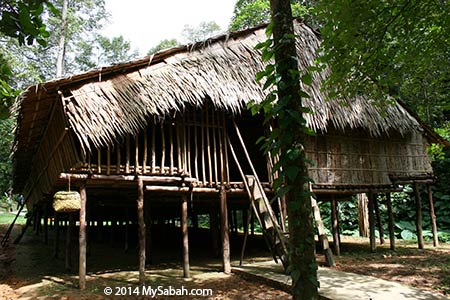
Pic: entry ladder to longhouse

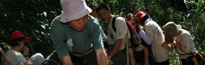
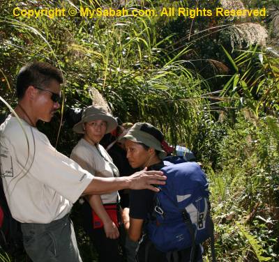
There are many taboos about longhouse. For example, the site of a new longhouse is chosen based on signs such as dream, animals, weather and human behaviour. If a python (which symbolise death in local belief) appears at the construction site, they would not build the longhouse there. In contrast, tortoise is an auspicious sign. Guest who enters apartment under construction, or leaving the house without informing the host will bring bad luck. The wood of toodopon and puvok trees can’t be used in making house, as they will bring illness, disaster or bad luck. Nevertheless, after many Rungus converted to Christian, they may not strictly uphold these belief now.


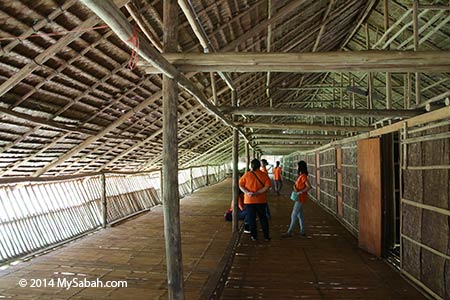
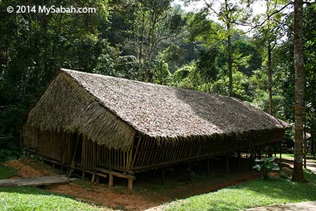
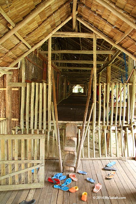
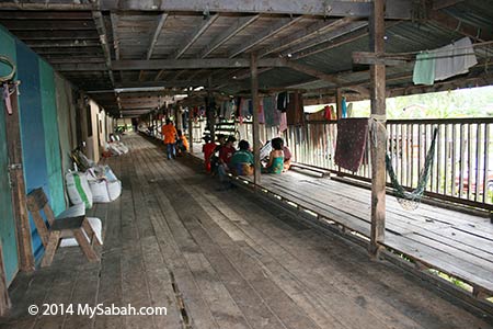
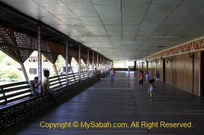
Pic: the long and wide corridor of longhouse. Rungus longhouse is divided into two distinct areas, the apad or common gallery (left), and Ongkob or compartment area (right). Apad is an open area for work and leisure activities such as rice pounding and celebration.


The raised platform (tingkang) of apad is a general working area and sleeping area for older boys.


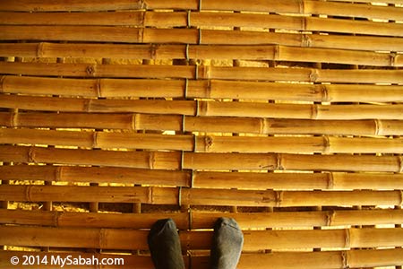
Pic: flooring made of split bamboo or nibung.


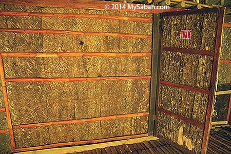
Pic: The wall is created from the bark of manzalangan or tarap tree (Artocarpus odoratissimus). There are some holes on the wall if you want to peek what your neighbour is busy on lol.


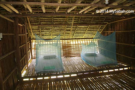
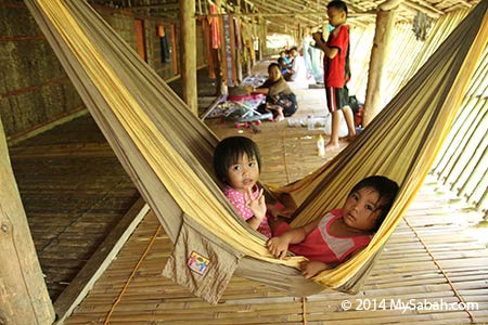
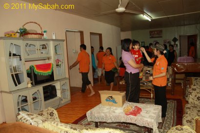
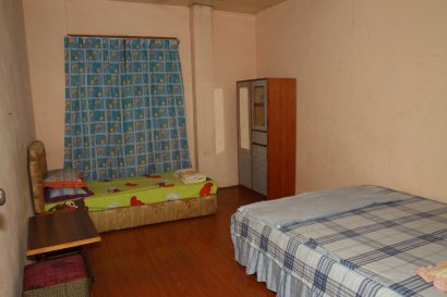
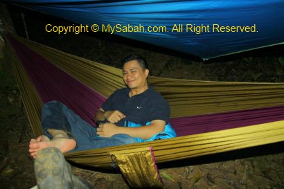
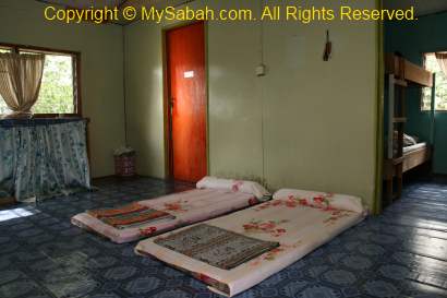
Pic: I was staying in Maranjak Longhouse for a night and this is my bedroom in longhouse. They have electric bulb to light up the room and corridor. The mosquito net can keep hungry mosquito at bay. There were far fewer mosquitoes than I thought because the longhouse is near to the forest. The wall is so thin that I can hear clearly what the girls in next room talking. During bedtime, I can almost hear the girl breathing, as if she was sleeping on my bed. Luckily she didn’t snore (but I did, HAHAHA). The longhouse is a bit warm in daytime, but at night it is quite cooling. In my dream, I heard two geckos fighting near my bed.


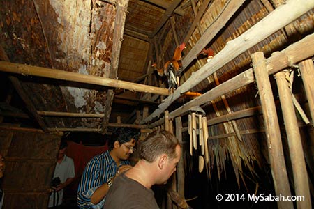
During my stay in Maranjak Longhouse, I took a closer look at the Rungus longhouse.


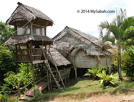
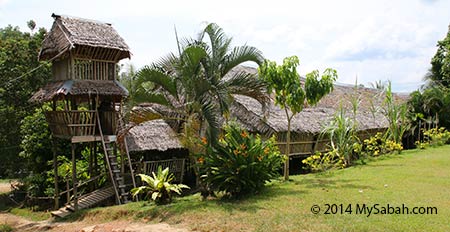
Then I saw a tower at other end of the longhouse. At first I think it’s for the guard. Then they tell me that that tower is called Rorizan, the place to keep the most beautiful girl in the longhouse.


In case you fall in love with the girl in Rorizan… FYI, to marry a Rungus lady, big muscle is not enough. You also need brain and patience.


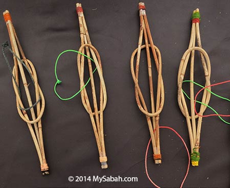
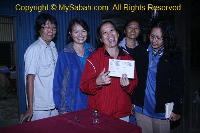
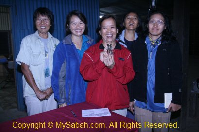
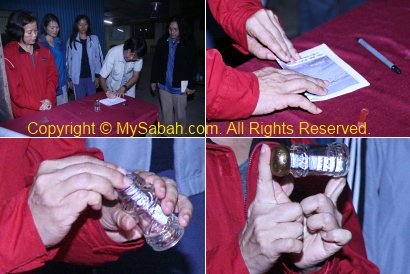
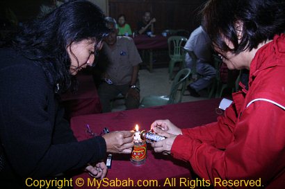
Because, you will be tested by Inuog Dazang (Teka Teki Puteri) puzzle, to free the rope from interlocked rattan knots, without cutting it. If you succeed, you can marry the girl without paying any bride price. You can try until you cry but not getting it. Don’t worry, I already have the formula for you. You can buy me some beers if you win a Rungus bride.


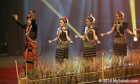
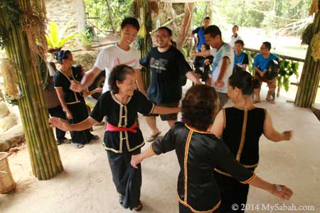
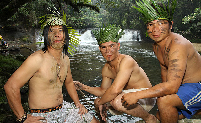
Pic: you may have seen the photo of Rungus people dancing Mongigol Sumandai (a welcoming dance mimic the movement of dragon and the male being the head of dragon) and think that Rungus man can have many wives. Rungus marriage is monogamy. Sex before marriage is strictly prohibited, as Rungus people believe this will bring sickness and death to their village. Besides, girls are kept separate from boys except at work. I’m talking about the old time.

Modern Longhouses

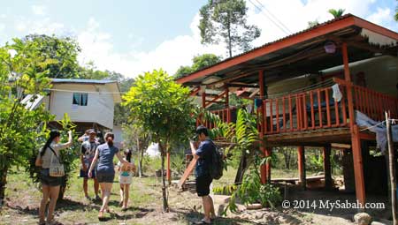
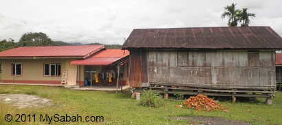
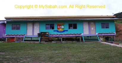
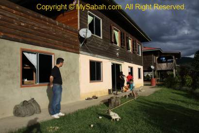
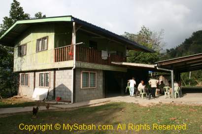
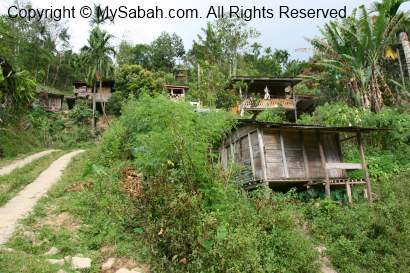
Nowadays each Rungus family prefers to have their own house. Also, it’s rare to see thatched-roof Rungus longhouse as corrugated zinc is preferred roofing material. If you see an authentic longhouse, very likely it is built for the tourists. 😀


Pic: photos of “modernised” longhouse, which is more durable and offers bigger space. More livable but lack of cultural identity.


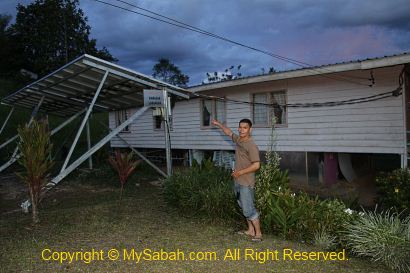
Pic: longhouse with solar panels (certified low-energy green building). This longhouse in KDCA Penampang costs about half a million Ringgit (≈US$157,000) to construct!

The Rungus

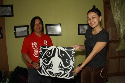
Longhouse is not the only cool thing about Rungus. Rungus is renowned weaver. They produce finely woven textiles, handicraft and beadwork which incorporate intricate traditional motif.


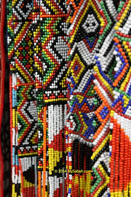
The motif design of Rungus is inspired by animals, plant and other things in their environment. Each piece takes 1 to 7 days to make, depend on its complexity. Some motif carries meaning such as good health.


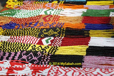
The handmade beadwork of Rungus is so beautiful and colorful that it is one of the most popular souvenirs tourists bring home. It’s also nice as an exotic accessory for lady dress. With prices start from only a few dollars, it’s quite affordable.


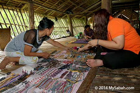
If you go to Kudat, I highly recommend you to buy some handicraft from the locals. In fact, most Rungus handicraft for sale in city shops are from them, but being priced higher by distributors.


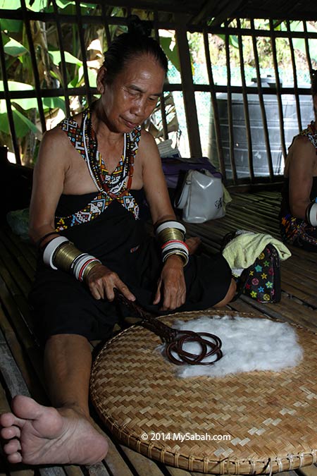
Pic: Rungus woman is also skillful in producing homespun cloth made from cotton (kapok)


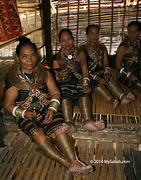
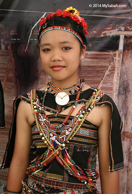
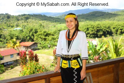
The traditional costume of Rungus is truly unique. I haven’t seen other Borneo tribes that share the similar traits. The photo above is the “most traditional” custome of Rungus women, who wear Ganggalung, disc of brass coil necklace of 40cm in diameter, and Lungkaki, the tightly coiled ornament covering the lower leg. Ganggalung and Lungkaki are seldom worn today. They told me that the brass outfit is heavy and make them lazy to move.


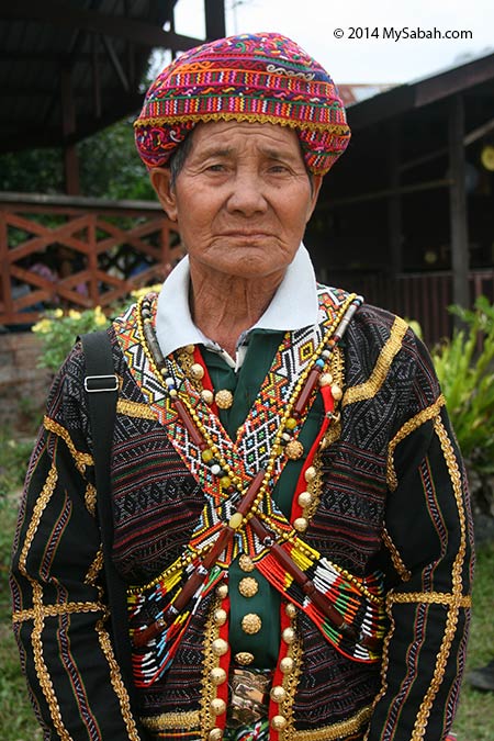
Pic: A Rungus man wearing colorful sash and a sigal, the traditional embroidered headgear. He looks serious but he is very friendly.

Staying in Longhouse

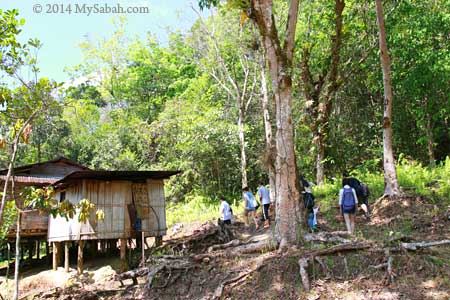
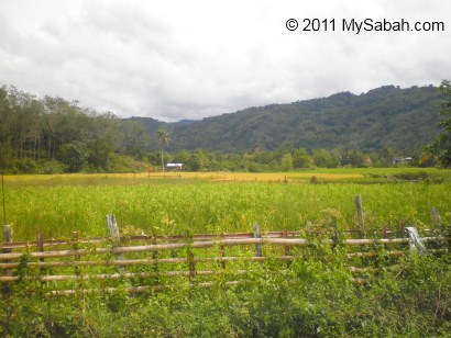
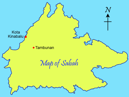
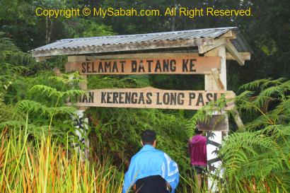
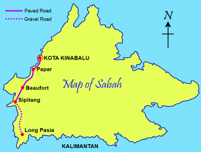
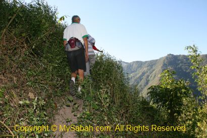
If you would like to experience staying in longhouse, you may visit Kampung Bavanggazo or Maranjak Longhouse Lodge in Matunggong, about 150 KM north of Kota Kinabalu city and 40 KM south of Kudat town (see Location Map). Both longhouses are only a few KM away from each other and their owners are brothers.

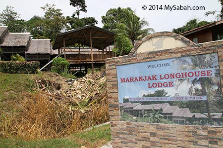
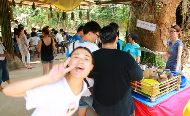
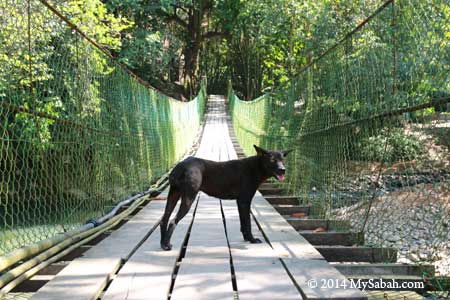
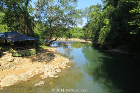
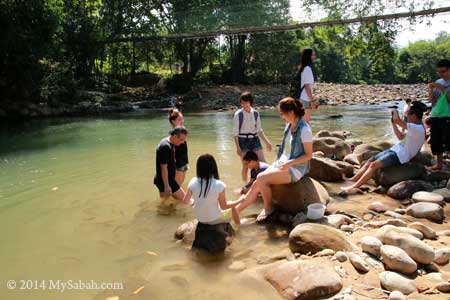
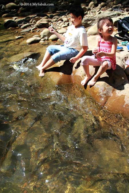
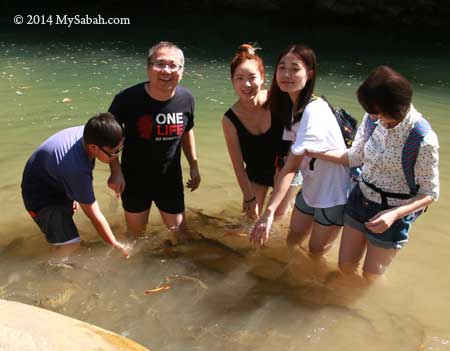
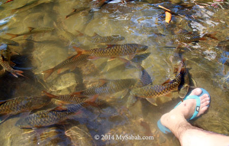
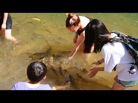
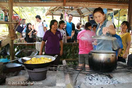
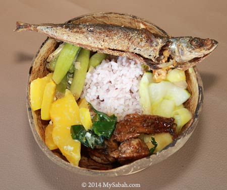
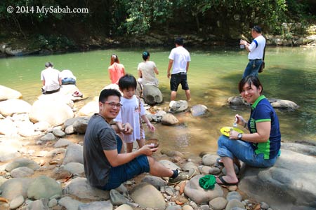
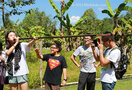
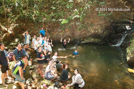
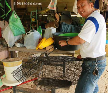
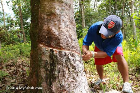
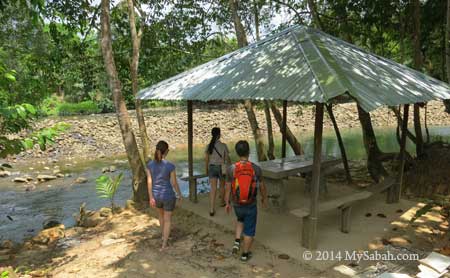
Their longhouse can host about 30 to 40 guests at a time. The accommodation fee is about RM60 – RM80 per night (≈US$19 – 25) and Online Booking is available. You also can sign up for some activities such as fishing, crab catching, hiking and tour around in Kudat.


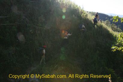
Lastly, mind your head when you visit a longhouse. Incoming! LOL

*Census 2000
**source: Sabah Traditional Ethnic Houses, published by Department of Museums Malaysia (ISBN: 978-967-9935-81-3)

Photos taken in Sabah, Malaysia Borneo

Kiss of Fishes from Tinopikon Park of Moyog River

Water is the source of life. However, keeping a river clean and thriving with lives is one of the most challenging tasks. Nowadays, most rivers are polluted and their ecosystem is unsustainable, as most people is only interested in being a taker. You will see how nature rewards “givers” when you visit Tinopikon Park (Tagal Taman Tinopikon) next to Moyog River, located in Kampung Notoruss, a village 12 Kilometers away from Donggongon town (see location map).


Pic: a friendly village dog welcoming me at the hanging bridge

Tinopikon Park is less than 50 Meters away from the road and highly accessible. Last week I drove about 30 minutes from Kota Kinabalu city, parked my car at the roadside, walked 5 minutes, crossed a suspension bridge and the park was right in front of me.


Pic: Tagal Taman Tinopikon at Moyog River

Most of the population in Kampung Notoruss are Kadazandusun (largest indigenous group of Sabah) and Murut (headhunter tribe in the past).

Tagal = No Fishing Zone

On the bridge, I noticed something astounding in the river. There were dozens of big fishes swimming near the shore. Due to over-fishing, river teeming with fishes is really rare in Malaysia.


The secret word for this success is Tagal, which means “prohibition” in Kadazandusun language. The river is managed by local community / village and fishing is prohibited. You will be fined if you are caught fishing in Tagal area.


Pic: Besides me, there were other visitors who were also impressed by such view and came by the river for a closer look.

Tagal system is a simple concept initiated by a few riparian communities of Babagon in 1997, fishing and littering are prohibited in protected section of river so it allows the fishery to flourish. Villagers are also not permitted to cut the tree and extract stones around the river. As a result, the fishes came back after 2 years and the river was restored to near-pristine condition.


Pic: fishes went frenzy when children fed them with fish pellets

Tinopikon Park covers an area of 15,000 Sq. Meters, all the fishes here know that they are safe and not afraid of human. Instead, they all swam to us wanting us to feed them. To be practical, Tagal area is divided into three 1-KM-long zones, namely, Green Zone (fishing is allowed for own consumption), Orange Zone (fishing is permitted at an interval set by Tagal committee) and Red Zone (as generator of fish stock, fishing is totally prohibited).


Tagal is such a successful conservation and rehabilitation project that Sabah Fisheries Department also implements 511 Tagal zones in nearly 200 rivers in 17 districts of Sabah since 2000! This is a perfect example of how local people can manage and protect the natural environment. Sadly, Tagal never takes off in Peninsular Malaysia.


The fishes are so tame that you can touch and even catch them by hand. When seeing swarm of fishes coming to them like piranha, some visitors were scared at first. Then they found that those fishes are toothless Pelian (official name of Kelah fish in Sabah, a type of Mahseer. Species: Tor duoronensis). The fishes suck our skin with soft mouth, so it is like kissing us. Soon everyone walked into the water to enjoy the “fish massage”. Pelian fish only lives in clean river and it tastes really good, so it is also known as the Gem of the River.

Below is a video showing us having fun with the fishes:

Eat

After we were busy feeding the fishes, the villagers also prepared a lunch buffet to feed us. Everything we experienced in Notoruss Village is 100% “kampung” (village) style. The people are from local community and not actor. They are very friendly villagers and soon we mix well together.


The villagers cooked some delicious food consisted of rice, fresh meat and vegetables. They used firewood so the food has nice aroma, the smell and taste that reminds me of the food cooked by my grandparents in old days.


Pic: traditional food served in coconut shell.


Pic: lunch buffet near to Moyog River


Pic: my food in coconut bowl. Note the rice is hill paddy, more healthy.


Pic: enjoying fresh food, fresh air and fresh water next to river.

Play

With so much energy to spend after lunch, we tried some traditional games such as blowpipe and lastik (slingshot).


Pic: blowpipe was used to be the hunting tool and weapon of headhunters


We also walked 20 minutes on a nature trail to a waterfall nearby. The village is surrounded by lush forest so itself is a park. When I was a boy, I was used to explore the wood with my cousins like “wild kids”. The big nature was our playground, in contrast to young people today, who spend most time exploring virtual world with fingers.


Finally we reached Tombokou Waterfall. Frankly the scale is not impressive, but the waterfall pond looks so inviting. During hot day, it’ll be really refreshing to soak myself in this pond and enjoy a couple of beers with friends. The villagers told me that there was a big waterfall named Wasai Waterfall about 15 minutes away from this pond. They will open the trail soon.

Experience Kampung Life


We also toured around the village and visited some houses. It is a very peaceful place and our presence is welcome. All houses here are build on high stilts to avoid flood and prevent unwanted animals to enter. Most villagers are farmers and many work at office in town too. Every house has a piece of land and I don’t see any fence, a typical Sabah village but foreigners would be surprised.


Pic: The rats in village are so big that they need a giant mouse trap. Just kidding, it’s a trap for squirrel. To you, squirrel is cute. To farmer, squirrel is a pest which can drill a big hole in Durian.


Pic: rubber tapping demo by villager. The white latex from rubber tree was the “platinum blood” of Malaysia in the past.


Pic: pineapple and sugercane from the village. The villagers let us had a taste of their fruits, when we moved from house to house lol.


I drool whenever I see the photo of this green pickle fruit. It is super sour with a slight taste of fresh grass, best if taken with a bit of salt or belacan (shrimp paste). I strongly recommend you to take one if you feel sleepy in a meeting, sure will wake up all your senses, haha.


Want music? Just hit the gong. From the expression of the locals, we know we need more practice.


Dancing Sumazau would be easier. Sumazau is a Kadazandusun dance that imitates the movement of bird in flight. Master it and you can call yourself a half-Sabahan.

Relax & Swim

Moyog River is one of the most beautiful rivers in Sabah, so I spent some time checking it out. Despite the hot day, the tree shade and cool breeze at the riverside make this a nice spot to relax.


The big rocks on river bank indicates that this is an upstream river. Note the water is a bit greenish due to the natural minerals, a sign of clean river.


The river further upstream at Tinopikon Park is shallow (up to chest level) and suitable for swimming. It is like a huge swimming pool with running water, but without Chlorine.


There is a section with cascading mini waterfalls, where you can sit and enjoy the natural Jacuzzi.


Thank you Janice and Hock Song for inviting me to this wonderful trip.

AJ Best Travel is the authorised operator who offers this 3.5-hour experience (9:30am-1pm) to be a kampung folk at Tinopikon Park. The tour will be available in April 2014 and you may contact AJ Best Travel for detail (see contact below):
Address (office): Lot 7, 2nd Floor, Block SH9, (MDP SH9-7-2), Taman Suria Shop Apartment Phase 1B, Jalan Penampang 88300 Kota Kinabalu, Sabah, Malaysia.
Email: ajbestsb2013@gmail.com
Tel / Fax: +60 88-702878
Mobile Phone: +60 17-8623833
Facebook: ajbesttravelsb (many nice photos)

The fee is RM160 (≈USD48) for adult, RM140 (≈USD42) for child and free for 4 years and below. The program includes entrance fee, Fish SPA, Kampung games, visit kampung house, trekking to waterfall, kampung meal with sumazau dance performance.

More Photos

You may check out my photo album if you want to see more pictures:

Photos taken in Penampang, Sabah, Malaysia Borneo

Tambunan, Switzerland of the East

If you ask the locals about their impression of Tambunan town, most will answer, “a hilly and tranquil place with beautiful rice fields and surrounded by lush forest.” To me, Tambunan is like a pretty but introvert girl who is shy away from strangers. Only when you care to know her better, you will uncover her hidden gems and fall in love with her.


Above: traditional vs modern houses in Tambunan.


Indeed, Tambunan is so quiet that it gets the least attention from tourists. Tambunan is about 80 Kilometers from Kota Kinabalu city. I went there with a group of friends earlier this month, for a 1-day-1-night homestay program in Tambunan.


There was a twin blooming of rafflesia in Rafflesia Information Center so we dropped by to have a look. You need pure luck to see the blooming of rafflesia coz it has no predictable blooming period and its flower only lasts 6 days. Twin blooming is very rare.


15 Kilometers before Tambunan town, you will see a balustrade at the left of the road, that’s a nice view point of Tambunan Valley with lush paddy fields. By now, you should understand why some calls Tambunan as the “Switzerland of the East”.


Then we come to Timbou Village (Kampung Timbou), which is a homestay venue a few Kilometers away from Tambunan. Datuk Joanna, the coordinator of Tambunan Homestay, introduces us to the guides and villagers of the local community.


They are celebrating Rainforest Festival here, so there is a traditional food competition in their community hall.


We are so lucky that we can sample all traditional dishes prepared by their local best cooks. Frankly, I didn’t have high expectation about those indigenous food coz they are mainly vegetables. But I was wrong. The fresh vegetables taste so delicious that we finish them within 10 minutes and everyone is hungry for more!


To appreciate the traditional music, we are also invited to learn to play gong. It is not as hard as it looks. In 5 minutes, we form a new gong team, haha. You may watch the video below to see our new band in action:

A grandpa and grandma also joined the fun by playing Sompoton (a traditional music instrument of Sabah). Look at the video below. They are so cute.


What I like most is the tree planting program with the community of homestay. Not only they learn the importance of trees, tourists are also welcome to participate in this environmental project, so they can leave something good behind after the visit.


Above: we plant the trees then harvest their fruits in next minute. Just kidding..

Tambunan is also a land full of legend. Every village has its own stories. Like the “pregnant woman” stone (named as “Watu Monontian” in Dusun language) below in Timbou Village. Our guide (and local historian), Regina (right), says, according to local legend, the God turned a pregnant woman into a stone. More on this story later.


As you can see in photo above, the stone really looks like a pregnant woman. I believe this story coz my mom told me that I came from a stone. 😛 This stone was used to be in standing position. But the buffaloes rubbed their bodies on this stone to ease the itch, so it fell one day.


To explore more about the legend of pregnant woman stone, we visit the site where the curse of God started, Wasai Kiukad Waterfall.


However, to reach Wasai Kiukad Waterfall, we need to walk more than 1 hour in a dense secondary forest in Timbou Village. Our destination is a sacred spot with spiritual power, so we are advised not to shout or litter during jungle trekking, or we will be penalized by flood, and only the Bobolian (local priest) can appease the spirits.


The jungle trail is not tourist-friendly. Due to rainy month, part of the trail is really muddy and we need to cross a few streams. Like the photo above, it looks like a grass land, but it has become a “marshland” after heavy rain. At first, I tried to avoid getting wet feet. After my feet sank into deep mud a few times, well, I just forget it. Nobody can stay clean and dry anyway.


When we move deeper into the forest, we see more shrubs and bamboo. There are brown leeches around and some of us are bitten by these little blood suckers. The trail is not challenging but quite tiring. In my heart, I already say, “it’s better to be something really good or I’ll bash the guides.”


After 70 minutes, we reached the site. I didn’t know I had arrived because nobody cheered after the end of long trekking. Everyone avoid making noise to anger the God, as if we are walking into a church. Then I saw a stone “table”. In fact, we also see other stones that look like furniture around this area.

Ms. Kimoi Rugasa (you had seen her in Sompoton video above), a 76-year-old senior from Timbou Village, told me the story about this mysterious site. In the old headhunting era, there was a longhouse situated here. The villagers got really drunk during a festival, so they made fun of animals. They made their dogs and cats danced. Such action angered the God so he sent a heavy storm to flood the longhouse and turned everything into stone. Though a pregnant woman escaped and ran to Timbou Village, she was also turned into a stone, the one that I mention earlier.


Above: a stone that looks like Gong (named Batu Gong). To me, it looks like the shell of a giant snail though. Don’t beat it or do anything funny to it, or you will be penalized by flood, the locals say.


Behind them is the Wasai Kiukad Waterfall.


Above: Wasai Kiukad Waterfall. This place is considered sacred and nobody is allowed to swim here. The water is so clean that you can drink it.


Above: a pile of boulders that locals believe was once a longhouse. That reminds me of Batu Punggul which shares the similar story.


Above: a weird rock in the stream. Look like a snake head?


As it starts to rain, we didn’t stay long, so we leave the forest ASAP. We are transferred to a local family in Keranan Village of Tambunan. Tonight we call it our home.


The “real” homestay of Malaysia is NOT a cheap accommodation with bed & breakfast only. You will stay with a local family house, which is certified by Tourism Malaysia to participate in homestay program. Tourists will live with the family like a friend, not a hotel guest, though the family provides food and bed. The family will make friend and interact with the tourists too, sometimes teaching them farming or making handicraft.


Giro and his sister Katherine are our host. They are really kind and make us feeling at home. Their house and room are very clean too. After having dinner and a couple of rice wine with them, we have a good sleep.


Next morning on our way back to Kota Kinabalu, we drop by a roadside stall (10 Kilometers from Tambunan) to buy some local fruits and fresh vegetables.


FYI, the famous product of Tambunan is Tuhau (pronounced Do-How), a type of sour appetizer made from plant of ginger family. You can find it everywhere in Tambunan.


Tuhau is the favorite food of indigenous people. Actually I dislike it in first try coz it tastes like stink bug. After trying Tuhau a few more times, I can accept it. Well, you should try it at least once, who knows you will like it.

More Photos

You may check out my photo album if you want to see more nice pictures:

Related posts:
Rafflesia Information Center
Mount Trus Madi, the second highest mountain of Malaysia
Mahua Waterfall
Batu Gong (Music Rock)
Kipandi Buttrefly Park

Photos taken in Tambunan, Sabah, Malaysia Borneo

Long Pasia – Back to Kota Kinabalu (part 5 of 6)

Continued from Part 4…

DAY 4 – Fall in Love with Long Pasia

Taman Kerangas (Heath Forest Garden)

Before we leave Long Pasia, we check out the Heath Forest Garden nearby the village, only a 20-minute walk away. Taman Kerangas is a garden (private land) where locals put all the wild orchids they rescued from logged forest. There are over 320 orchid species found in Long Pasia, and the new species is still being discovered.


>> Click Here to see more photos of Long Pasia

At first I thought Taman Kerangas was a well-maintained garden with all the blooming flora neatly organised and a place great for leisure walk. I was wrong. Taman Kerangas looks more like a forest, with muddy and steep trail, dense undergrowth vegetation and lurking leeches. I was wearing the last set of clean clothing for the last day and didn’t expect to get dirty. After walking nearly 1KM of dirty trail, and with leech crawling on my jacket, to be honest, I was quite angry.


>> Click Here to see more photos of Long Pasia

Anyway, I still got some beautiful flower shots though not many orchids were blooming. Just remember to wear jungle outfit when you come here. Taman Kerangas is so near to the village, so it still worth the time to take a look.

Last Day

I enjoy my last peaceful morning in Long Pasia. Today we are going home, but I don’t really feel happy that it’s over. Instead, I feel a bit sad leaving. As a frequent traveller, I come and go, without leaving my heart behind in other places. I have a special feeling about Long Pasia, and I’ll come back again one day. I feel a connection with this place but not sure what it is.


>> Click Here to see more photos of Long Pasia


Click Here to see bigger video

We have a tea break in the living room before we leave. A black chick comes in, walk around and chirp. Lait says this chick has no mother and always alone. It seems to enjoy being our company and sit quietly on our lap, so Mary decides to take it home and name it “Pasia”. Lat also gives Nova one of his paintings. Seem like everyone got something. I also bag some good photos and sweet memories too.


>> Click Here to see more photos of Long Pasia
Above: we have a new friend going home with us

Good bye Long Pasia. It is wonderful to know you…


>> Click Here to see more photos of Long Pasia

If you would like to go to Long Pasia, please contact Mr. Eddie at 011-12017897. The attractions that I blog here is only a small part of Long Pasia. Long Pasia has many other attractions such as Tiger Hill, Hidden Lake, Maga Waterfall, Crocodile monument, etc. Since Long Pasia is far away, I strongly recommend tourists to have a longer stay. What’s the point of having a 3-day trip but spending 2 days on the road, right? You don’t need to do hardcore adventure like me, as there are many leisure activities such as river cruise around the village too.

>> Read Next Article (Part 6)

Photos taken in Long Pasia, Sabah, Malaysia Borneo

Long Pasia – To the Heart of Borneo (part 3 of 6)

Continued from Part 2…

Fefukan Waterfall is the newest attraction at the south of Long Pasia. There were only 4 foreign tourists (from UK, Denmark, Italy and Holland) have been there, and we are the first group of Sabahan tourists.

Jungle Trekking to Fefukan Waterfall

Even after 3.5 hour of rapid shooting on Matang River, we still need to walk 4 to 5 hours on 10 KM of undulating terrain to get there. We started the jungle trekking at 1PM. Luckily we have a few porters to carry some of our stuffs. In addition to the camping tent and cooking utensil, each of them can take weight as heavy as 50 Kg (but still walk faster than us)!


>> Click Here to see more photos of Long Pasia

Because very few people walked this route before, the trail is in the most pristine and challenging condition. The trail is raw, slippery, muddy, foliaged and dense with undergrowth vegetation. If we are not careful, we will trip over crawling vines, rattan and tree roots on the ground, so be prepared to get dirty. A pair of Addidas Kampung shoes (“Village Addidas”, a water-proof rubber shoes) is highly recommended for such rainforest walk. For the beginning, we need to walk to the highest point, followed by easier up and down trail, then a long and steep descending trail to the campsite.


Above: teasing message on the tree bark

Needless to say, there are hundreds of forest leeches waiting along the trail. Very soon I found a tiger leech crawling on my camera. The good news is – once we move to higher altitude, there will be no more tiger leech but brown leech. Brown leech is much more easier to deal with and its bite is not painful (sometimes I can’t even feel it). Unlike tiger leech, which likes to hide in the shrub & bush, brown leech is mainly active on forest floor, so wearing leech sock is safe enough. I notice that the brown leeches here are so big, as big as tiger leech!


Above: Tiger leech delivers painful bite

With an altitude of 800 Meters above sea level, this forest is mainly a mix of hill dipterocarp forest and lower montane forest. Most trees are slim and no taller than 25 Meters, except the Agathis and Seraya Kuning trees. The jungle trekking reminds me of Maliau Basin, Sabah’s Lost World. Long Pasia is indeed another Lost World of Sabah, but with more cultural and historical heritages. Unfortunately, the forest here is not protected by the government.


Above: Agathis tree only grows between hill forest and montane forest


Above: huge seraya kuning tree

We also stopped occasionally to explore some jungle resources. The guide shows us how to get fresh water from the wild vines. I drank and it tasted fresh, with thin smell of grass. The water also can be used as eye tonic. Then they pluck some wild oranges for us to try, it is very sour but an energy booster.


Above: cutting vine for fresh water


Above: drinking water from vine

>> Click Here to see more photos of Long Pasia


Above: wild orange

We found some big chunk of resin beside an Agathis tree. They are hard and look like crystal. The guide took some with them coz these resins are good fire starter. In old day, they use this resin as torch and candle. It burns like rubber and release black smoke. But be careful not to let the burning liquid drips on your skin, coz it sticks and able to burn you badly.


Above: resin of Agathis tree


Click Here to see bigger video

After passing the highest point, the trail is less rugged and we walk quite fast. Our favourite part is the ridge walk. It is very windy and cooling, like a huge air-cond, and blows away our fatigue. There are supposed to be a lot of wildlife such as deer around, but we see only a few monkey. However, we see the wallow of wild boar and claw marks on the tree bark.


Above: wallow of wild boar


If you are very lucky, you would see blooming rafflesia pricei before Fefukan Waterfall, the one shown in photo above was blooming in April 2012.

As the trail is not clearly visible and no signage, we follow our guide closely, otherwise there is a 100% chance of getting lost here. Sometimes Lait stops and looks around, as if he is trying to recall the right way, making me nervous. “That’s the fun part!” they say. I have no idea how far we go until I hear the distant waterfall. Walking the descending trail is really a knee-breaking experience. The trail is narrow and slippery so we can’t move fast, putting a lot of stress on our knees. I almost want to cry when we saw Fefukan Waterfall at 5:30pm.


Above: Fefukan Waterfall

Campsite of Fefukan Waterfall

Our campsite is only 30 Meters away from Fefukan Waterfall. In fact, we went so far that we were so close to the border of Kalimantan. Another walk for 3 to 4 hours will lead us to the immigration checkpoint at the border. We are at the Heart of Borneo!


Above: campsite at Fefukan Waterfall

It is getting dark soon, so the guide and porters setup our camp and beds next to the river, and prepare our dinner. They don’t want to damage the environment, so there is no permanent facility here, no toilet, no hut, no cabin… All we have are hammock or canvas beds, with a sheet of canvas on top to block the rain. I never slept on a hammock before, so I choose the hammock bed closest to the waterfall.


Above: setting up campsite

Below is a 360 degree view of our campsite:

Click Here to see bigger video


Above: canvas bed


Above: hammock bed

>> Click Here to see more photos of Long Pasia


Above: Mary cooking dinner


Above: there is no light, so we eat in the dark with torchlight

Night Safari

We had some rice, sardine (with onion) and instant noodle as dinner. Everyone was so tired so most went to bed earlier. Lait decided to show me around the campsite and waterfall at night to spot interesting creatures. We found some frogs, insects and fireflies. Though leech is less active at night, I still get 6 of them sneaking into my shoes. Then it started to rain. I had no choice but going to bed.


Above: fireflies playing 3P wild sex


>> Click Here to see more photos of Long Pasia

The Cold Night

Can you imagine sleeping in the forest of Heart of Borneo and next to a waterfall? It just can’t get any better than this. I enjoyed the sound of nature. There are occasionally some twinkling fireflies passing by my tent. I fell asleep very soon. The temperature can plunge to 14 degree Celsius (14°C) at night. It was so cold that I shivered in my thin sleeping bag, then I had to wake up in midnight to wear extra clothing. My knees were quite painful coz of day-long trekking.


Above: my hammock bed

About 2am, in total darkness, my hammock shakes violently, as if a big animal knocks on my tent. I was so shock and pointed my torch light around, but see nothing. I found that my hammock is lowered by a few inches, so I guess the knot got loosen and slide down, phew… scary but funny, haha.


Above: preparing mouse deer meat for tomorrow’s meal

>> Read Next Article (Part 4)

Photos taken in Long Pasia, Sabah, Malaysia Borneo

Long Pasia – adventure to the Heart of Borneo (part 1 of 6)

I’ll pick Long Pasia as my hometown, if I were to born as an “orang kampong” (villager) in Sabah. More than 250KM away from Kota Kinabalu, Long Pasia is located in south-western corner of Sabah, very near to border of Kalimantan (Indonesia). With an altitude of 1,000 Meters above sea level, cool mist frequents Long Pasia, hiding some least-known natural and historical heritages of the Heart of Borneo.

Since year 2005, I have been thinking of visiting Long Pasia. My father had been there and told me about this beautiful and remote place. Finally I had the chance to join a 4-day-3-night adventure with a group of friends in early Nov. Below is the outline of our Long Pasia trip:
Day 1: Depart to Long Pasia homestay
Day 2: Rapid shooting & jungle trekking to (and camping at) Fefukan Waterfall
Day 3: Back to Long Pasia homestay
Day 4: Back to Kota Kinabalu city
You may Click Here to see the detail itinerary.

DAY 1 – GOING TO LONG PASIA

Road Trip to Sipitang

The road trip to Long Pasia took us about 9 hours (8am – 5pm), as we made a few stops. The beginning part is easy; we drove 2.5 hours on a paved road from Kota Kinabalu city to Sipitang town (144KM). At 10:30am, we reached Sipitang, where we had our early lunch and purchased food supplies for camping. Sipitang has undergone some changes and now it has a nice sea-view esplanade.

We also met up with our Long Pasia guide, Lait. At first look, you have no doubt he is a competent “jungle man” coz he is muscular. I’m surprised that he is also a talent artist, and his drawing is so fine and detail, a big contrast to his rugged figure. He always has a mischievous smile on his face, as if he would play a prank on you anytime (and he does!). He is a naughty and playful big boy, this trip would be less fun without this friendly guide as our company.


Above: Lait, our guide


Above: Bestamart Supermarket

After lunch & briefing, we dropped by Bestamart supermarket of Sipitang, to get some stuffs for our camping. We bought biscuit, instant noodle, can food (sardine, curry), 3-in-1 coffee mix, onion, vegetables, water, oat meal, sugar & salt, cooking oil, etc.

Then we loaded our bags and supplies to a 4-wheel drive. Long Pasia is 123 KM away from Sipitang, and it’ll be a 4-5 hours bumpy ride on a hilly gravel road (a logging road in fact). The road was dry and dusty that time. But in rainy season, the road will turn muddy and slippery, only accessible by 4WD. It sounds very isolated, but the most beautiful and pristine places of Sabah are always in remote region.

Iban Longhouse

We visited an Iban longhouse about 15-minutes away from Sipitang. I knew there were some Iban people living in Tawau district (South-east of Sabah), but didn’t know some of them lived in Sipitang too. Though this longhouse is a modern version, it is really long and able to house about 40 families. The veranda is so long and wide that some children have fun racing on it back and forth.

>> Click Here to see more photos of Long Pasia

The most distinct feature of this longhouse is the deer skull decors at each door. I saw the skulls of Sambar Deer and Barking Deer (Kijang). We only stopped here for 10 minutes, and then we continued our journey to Long Pasia.

Road Trip to Long Pasia

Very soon we hit the rough gravel road. We passed by small villages, plantation (e.g. rubber, banana, paddy, tapioca, maize) and rivers, most of the time we were surrounded by lush hill forest and saw no other car. Sadly, we also saw logging trucks and deforestation done by SFI (Sabah Forest Industries). You may watch the video below to get an idea of the road trip.


Click Here to see bigger video

When we were about an hour from Long Pasia, we found that a bridge in front of us collapsed. Luckily a truck and excavator were there to make a new way. Within 30 minutes, we could move on again.

Long Pasia Village

Finally we arrived Long Pasia at 5pm. Long Pasia means “Mouth of the Red River” (though I want to call it “Long….. Passage” due to the long ride). First thing I felt was the fresh and cool air (remind me of Kundasang town decades ago). This highland village is always in dense mist in the morning and late afternoon. Surrounded by mountains, forest and rivers, Long Pasia is the one of the few villages closest to true nature and wilderness. They said an eagle grabbed a chick when we got there.


Above: Long Pasia


Above: Paddy field

Most of the 600 villagers here are Lundayeh people, which means “People of the Interior or Upriver”. In the past, they were headhunters, as well as a strong rival to another headhunting tribe, Murut (means “People of the Hill”). Now most of them are Christians and work as farmers, fishermen and hunters, and they are one of the friendliest people I meet.

>> Click Here to see more photos of Long Pasia

Long Pasia is unlike the typical Malay kampong (village) in other parts of Malaysia. Most villagers still converse in Lundayeh, though they speak fluent Malaysia language. Lundayeh is also found in Sarawak (known as Lumbawang instead) and Kalimantan. To see their differences in costumes, you may see my blog on Lundayeh Festival.

We walked around Long Pasia in late afternoon. We were greeted by friendly villagers and felt so welcomed as a guest. Many were playing soccer and volleyball on the field as past-time. I noticed there were so many dogs, probably as many as the human population here. FYI, you will be fined RM500 (USD$150) for killing a dog, coz many of them are trained as a hunting dog, a loyal partner that follows the hunters in and out forest for days.

Another “feature” of Long Pasia is the Solar Panel outside every house. There is no power line here, so they rely on stored solar electricity for basic lighting and TV. This solar panel costs about RM15,000 (it is funded but I don’t know by who)! If they need more power, they will turn on the generator on demand, so I can charge my camera batteries. You can save a lot on electricity bill by living here, coz we don’t need air-conditioner in cool place like Long Pasia.


Above: Street light powered by solar panel


Above: Huge solar panel

My mobile phone got no line coverage here. I was told that they have Internet connection by satellite in the village, so some of them even have Facebook accounts. Not only that, many houses also have Astro channel (satellite TV).


Above: SK Long Pasia, first school in Long Pasia

Long Pasia Homestay

For first day, we stayed with a local family (Dina & Janet) in Long Pasia. The people here realise the importance of eco-tourism and nature. About 15 houses have registered under the Homestay program. Under the education of environmental bodies, the villagers reduce the cutting of forest and hunting of wildlife, especially in tourist areas, though these have been their traditional practices for centuries.


Above: our homestay in Long Pasia

The standard of living here has improved over the years, and most villagers are self-sufficient. You won’t find yourselves staying under the roof of a water-leaking broken hut. In fact, their houses are spacious, comfortable and well-furnished, just as good as the houses in city. As pamper city people, we only had problem to bathe with icy mountain water. We went into the shower room, screamed then stormed out in 2 minutes, probably the shortest shower that we’ve ever taken, lol…


Above: our bed

The evening was getting cold and it was so nice that the family cooked a hot dinner for us. We ate a lot of delicious fresh vegetables that planted and harvested locally. Do you know that Long Pasia produces the best rice in Sabah? It’s so soft and yummy that I had 3 plates.

>> Click Here to see more photos of Long Pasia

Long Pasia Homestay has been around for some years, but it is under-promoted. Personally I think Long Pasia is the best homestay in Sabah and many will agree with me. Besides accessibility issue, many tour operators (outsiders) are only interested in earning more $$$ by building luxury chalet there then charging tourists a “5-star” price, just like what happens to Mt. Kinabalu now. I will only opt for homestay coz it benefits the local community, not a few blood-sucking tour players.


Above: homestay with Rose’s family

After a briefing by Lait for the trip next day, we went to bed. Tomorrow we will explore one of the most remote places in Borneo, even to the locals, the Fefukan Waterfall. Long Pasia has many attractions such as Tiger Hill and Maga Waterfall, but Fefukan is totally new and far away.

>> Read Next Article (Part 2)

Photos taken in Long Pasia, Sabah, Malaysia Borneo

Expedition: In the Footsteps of Lilian Gibbs

Many know Sir Hugh Low was the first European who conquered Mt. Kinabalu in 1851, but most don’t know Lilian Gibbs was the first European woman who reached the summit of Mt. Kinabalu on February 24th, 1910. Lilian Suzette Gibbs was born in London, England on September 10, 1870. She led a botanical field expedition to Mt. Kinabalu and identified over 15 new plant species. Below is the trail she took. Even today, this trail is not considered as a “tourist-friendly” route. Later she was awarded the Huxley Gold Medal and Prize by the Royal College of Science for her research contributions.

After 100 years, a group of five ladies, from The Sabah Soceity, decided to re-trace the original route taken by Lilian Gibbs. They spent a night on the homestay hostel next to a church (Chapel St. Ireneus) in Kg. Kiau Nuluh (starting point of the climb), Kota Belud, on 20 Feb 2010. In the next morning (21 Feb 2010), they would attend a ritual ceremony before the climb. As a member of The Sabah Society, I was also there to support them and to witness the historical moment.


Click Here to see more photos >>

For those who read my previous blog, you would know that I joined the Miki Survival Camp last year, so this was my second time came to Kg. Kiau Nuluh (Kiau Nuluh Village). I arrived Kiau Nuluh at 3:40pm on 20 Feb 2010, it was still early so I took a walk around the village.


Click Here to see more photos >>

Though a bit shy, the people here are very friendly and always smile to you. Most of them talk to one another in native language (Dusun). In fact, this is the typical look of “real” Sabah village. Since some politicians started to give citizenship to foreigners about 30 years ago, the mushrooming villages in Tawau and Lahad Datu are full of foreigners. They talk and behave differently (some even have very “geli” look).


Click Here to see more photos >>

Hey, it’s Gurak (the dog I met in Miki camp). She looked slimmer and still ran around with the kids around plantation. Miki said she miscarried, so she was a bit weaker. Poor Gurak…


Click Here to see more photos >>

Very soon it turned dark, the climbers had a fellowship dinner with the Kg. Kiau Nuluh villagers and members. There were two short blackout. According to the locals, the drought caused the nearby river to dry up thereby affecting the power supply from hydro electricity.


Click Here to see more photos >>

We tried some local traditional dishes. Got my sour bambangan fruit. I tried some tuhau too, but I still don’t like the smell. The yam rice was wrapped in big kinta leaf and tasted good. This is how farmers pack their rice and bring it to the field. It will last for many hours without turning bad.


Click Here to see more photos >>


Click Here to see more photos >>
After the dinner, the lady climbers were presenting an info sheet, which would be inserted into a glass bottle and hide in Low’s Peak, like what Lilian Gibbs did 100 years ago. Photo Above: from the left, Rina Jamieson, Catherine Chu, Vicky Ng (expedition leader), Jane Chong and Tengku Puteri Soraya Tengku Zainal Adlin.


Click Here to see more photos >>
Hahaha… you will never find this secret bottle.


Click Here to see more photos >>

The all-lady expedition team consists of 5 climbers, namely, Vicky Ng (leader), Tengku Puteri Soraya Tengku Zainal Adlin , Catherine Chu, Jane Chong and Rina Jamieson, one Sabah Parks guide (Rossiti Maineh) and 3 porters (Ritah Moguring, Lotuim Lumadan and Nuriah Lunsin). All of them signed on the info sheet that was inserted into a small glass bottle later.


Click Here to see more photos >>
Sealing the bottle to make it waterproof.


Click Here to see more photos >>
Since they are all lady, they decided to use a bottle from kitchen. This is a preserved beancurd bottle made in ShenZhen China.


Click Here to see more photos >>
Sealing of bottle done. Now it is hidden in Low’s Peak. Next time you climb the Mt. Kinabalu, you can do a “treasure hunt”. The bottle hidden by Lilian Gibbs is still not found. So now you know there are two “secret” bottles hidden in Low’s Peak.

Click the picture above if you want to see what is written on the info sheet. It contains the trail map and info of the expedition, name list and signatures of the lady team members.


Click Here to see more photos >>
It is bed time.. The little hostel could not accommodate too many people, so I had to sleep outside the room. As a frequent traveller, such arrangement is not a problem to me. Only that I was attacked by mosquitoes, and waked up by the people who walked past me to go to the toilet outside the hostel. I didn’t sleep really well.


Click Here to see more photos >>
21st Feb 2010: we were greeted by a nice view of Mt. Kinabalu in the next morning. The sky was clear and the weather seemed good.


Click Here to see more photos >>
7:20AM: after a breakfast, the climbers were busy packing their backpacks. Each of them carried over 10Kg of weight. The 3 porters carried nearly 20Kg of supplies. These porters are tough ladies, and they were always in top 10 runner list of Mt. Kinabalu climbathon.


Click Here to see more photos >>
Look at the photos of other Mt. Kinabalu porters above if you still have doubt. On the way to the summit of Mt. Kinabalu, you will see many of these porters overtake you and walk faster than you, though they carry very heavy stuffs. The climbers also regularly trained themselves for a long period of time in Tun Fuad Stephens Park. They ran a few laps up and down the hill of Tun Fuad, with 5Kg of weight. If you ask me to join the expedition, it would be a suicide mission for weak people like me.


Click Here to see more photos >>
Lady climbers and guide taking group photo for the Centenial Climb.


Click Here to see more photos >>

7:50AM: after the group photos, the climbers departed for the climb, but there was one last thing they needed to do before the ascent. A bobolian (high priest) would perform a ritual ceremony for the climbers. Now everyone walked to the ritual site, which was done inside the forest next to Kg. Kiau Nuluh.


Click Here to see more photos >>

We were told that the ritual site was only 5 minutes away, but the walk took us 40 minutes.


Click Here to see more photos >>


Click Here to see more photos >>

Everyone walked across the forest, slope, dense grasses and plantation. Part of the trail was narrow and on the slopes.


Click Here to see more photos >>
Lastly, we entered a trail with very dense and low grasses.


Click Here to see more photos >>
Finally we arrived the site of the ritual ceremony. The old man, who dressed in black, was the bobolian. He was already there with the offering ready.


Click Here to see more photos >>
The bobolian would appease the mountain god of Mt. Kinabalu and pray for a safe journey for the climbers. The offering included 7 betel nuts, 7 eggs, 7 rolls of tobacco, etc, and there were six white chicken. Ok, everyone would tell you there were 7 chicken. But I counted carefully twice and found only 6 chicken. Probably 7 is a special number in Kadazandusun, so everyone presumed there were 7 chicken without actually verifying the number.


Click Here to see more photos >>
When the group settled down, the bobolian started to pray for the climbers. The prayer took more than 10 minutes. I can’t understand the native language. Later a climber said the bobolian was requesting for protection from the spirit and would go after them if any harm was done to the climbers. Something like that lah. This sort of blessing ritual is common in Sabah. Before any big expedition and sport events that would be done in wilderness, bobolians would be invited to perform a ritual.


Click Here to see more photos >>

Then six chicken were slaughtered to complete the blessing ceremony. The assistant of bobolian did the first 5 kills and Vicky Ng, as the expedition leader, did the last one. The bloody photos are inside the album. Do not look if you don’t think you will be comfortable with the scenes. Blood spit everywhere and even got on my lens and pant.


Click Here to see more photos >>
One by one, six white chicken were slaughtered. Each chicken didn’t seem to aware of what was happening to their peers, until it’s their turn. The ladies also didn’t dare to watch and turned their heads away. After they returned from the expedition, they said all of them heard cackling sound in the bush behind them during that time. Whether it was the spirit, nobody can tell. Well, may be some will say they need to “see” the spirits to believe that spirits exist. Well, you can’t see oxygen then why you believe you inhale oxygen?


Click Here to see more photos >>

Time to say goodbye after the ceremony. The climbers, guide and porters departed for the climb at 9:30am (20 Feb 2010). They successfully reached the summit of Mount Kinabalu at 14:20 on 24 Feb 2010, and came back safely. Congratulations to the ladies, you memang Boleh (can)!

Photos taken in Kota Belud, Sabah Malaysia

Tindakon Cave

Finally, this is my last stop of Misompuru Homestay. We came to Terongkongan Beach (or Tindakon Dazang Beach) to see the Tindakon cave created by sea erosion. Under the rain, we moved slowly, painfully on 1KM of sandy beach to the end of the beach. The lady inside the photo is Mona, one of the local guides. I used her as a free model so many times that she wanted to poke me with her umbrella. Just kidding.


Click Here to see more photos of Terongkongan Beach >>

Though the cave is our target. The view along the shore is wonderful. I saw some weird rock cut by the wind. The best thing was there was no other people around. We walked freely as if this is our private beach. The guide told me that someone would camp here during the nesting session of sea turtles. They will collect the turtle eggs then kill the mother for her shell and meat as well. It is so depressing to imagine this bloody scene taking place in beautiful beach here.


Click Here to see more photos of Terongkongan Beach >>

There are some spiky odd plants grow there too. Their leaves are sharp. Quite hurt to walk among them.

To let you have an idea, below is the diagram of the Tindakon cave. Actually the cave is a deep hole created by the sea, after many years of “digging” by the sea water. The hole got bigger and deeper and became a cave. At the end, it even digs a “tunnel” and connects to the other side of the hill. There is a big opening above the cave. I’m not sure how the opening was formed. I guess it is because the cave under the hill kept on washing soil away from its bottom. At last it collapsed and became a big hole?


Click Here to see more photos of Terongkongan Beach >>

Before I went there, I told the guides that I wanted to go inside the cave. Immediately I saw the expression of reluctant written on their faces. Then they came out all sort of scary reasons why I should not do it. One said there was fierce animals living inside, another said it was dangerous and slippery… Actually the more they tried to stop me, the more I wanted to try.. Later I learnt that this cave was used as a bomb shelter of Japanese during World War II.

Anyway, we went and checked out the big opening behind the hill first (see below). It is quite steep and about 30 feet deep, very hard to go down with a camera with me.


Click Here to see more photos of Terongkongan Beach >>

The cave is about 30 feet away from us. I used the camera zoom to take the photo below. We could see wave movement in the cave and with a bit of light behind. Obviously, this cave connects to the sea at other side of the hill. I saw fear in the eyes of a guide who mumbled, “so creepy… like there is a ghost inside..” The cave is not really big but can fit one person. I didn’t go inside coz the cave was filled with sea water.


Click Here to see more photos of Terongkongan Beach >>

Then we walked to the other side to see the cave entrance facing the sea. If you look at the photo below, the cave is under the “drain” at the right side. I decided to walk nearer to take a look, hoping that I could see the entrance of the cave. This area is called Tindakon Dazang, which means jumping fairies. According to the legend, the lucky ones would see fairies playing on the rock here and swimming at the beach during full moon.


Click Here to see more photos of Terongkongan Beach >>

After I moved closer, I understood why the guides were so concern. The cave was flooded by sea water. I would be drown if I went inside. But someone did manage to walk through the cave during low tide. It was really not my day.


Click Here to see more photos of Terongkongan Beach >>

The wave was quite strong and the rock was slippery. I had to keep an eye on the sea when I walked to the cave. The height of waves seemed to have timing, 1 feet, 1 feet… then 3 feet. About every 15 minutes, there would be a super big wave nearly 5 feet high. It took me by surprise. When mass volume of water rushed to me, I was freak out and thought I would fall.


Click Here to see more photos of Terongkongan Beach >>

They told me there was a whale stuck inside the cave and died in the past. According to the guides, sometimes the waves were so strong that they created loud noise when they hit the cave opening. They even can see the sea water splash at other end. The villages can hear the sound from a far distance and they will know that the sea is rough.


Click Here to see more photos of Terongkongan Beach >>

Now they have built a traditional longhouse nearby. It is a homestay open to tourists and you can find out more on the Facebook of Tindakon Dazang Beach.

Photos taken in Kudat, Sabah, Malaysia Borneo