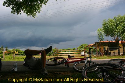
My biological clock wakes me up at 6am. My knee pain is gone after a long rest. I grab my camera and tripod and walk straight to Fefukan Waterfall to take some photos. I didn’t get a good shot of this waterfall yesterday coz it was dark by the time we arrived the campsite. Lait (our guide) also joined me.
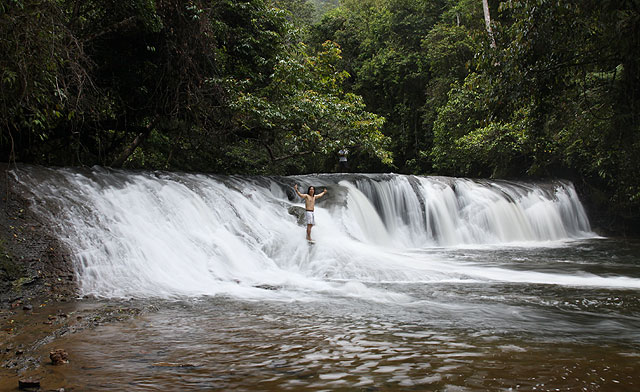
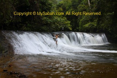
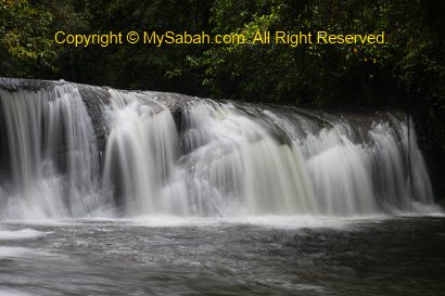
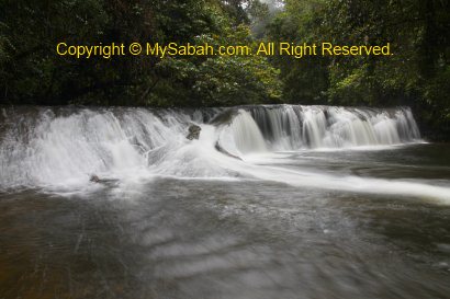
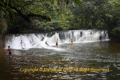
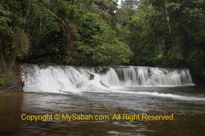
Fefukan Waterfall
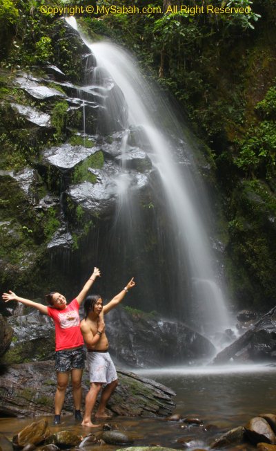
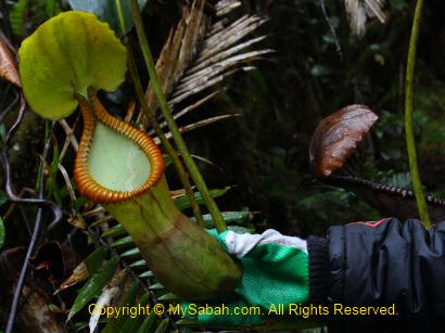
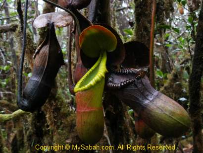
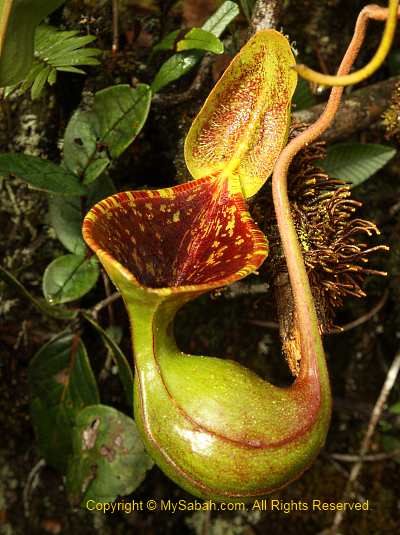
With a wide of 20 Meters and height of about 3 Meters, Fefukan Waterfall is one of the most unique and beautiful waterfalls that I’ve ever seen. I can sit there, staring at it for whole day without getting bored. In local language, Fefukan means the sound of beating. Some fishes try to jump over this waterfall during migration season. The fishermen will wait with a stick and hunt the fishes by beating them.
I’m so proud to be one of the first Sabahan tourists who visit this waterfall. This is probably the first time the photos and video of Fefukan being shared online. The water is freezing cold. Crazy Lait is the only model who is keen to walk into the icy water for me to photograph. Thank you Lait, for helping me to get some excellent shots.
It is a 2-in-1 bonus to come to Fefukan, as there is another waterfall nearby. Without hesitation, I joined Lait to explore the second waterfall, the Mataga Waterfall (Astaga Waterfall? Hehe..). Mataga means “beautiful” in Lundayeh language. It is only a 30-minute walk from Fefukan Waterfall.
Mataga is a newly discovered waterfall. Again, we are the first local tourists who visit it. Most of the time, we walked upstream along a small river to find Mataga Waterfall. We saw a few long-tailed macaques on the trees. To avoid getting wet, I had to remove my leech socks, and later find that two fat leeches sucking my blood between the toes, then followed by hour of bleeding, yaks! The bite marks are still visible after 3 weeks.
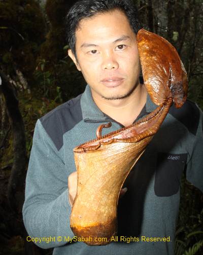
Mataga Waterfall is about 50 feet tall. Though taller than Fefukan, it is lack of character. It is windy around the waterfall with splashing water. I shot only a few photos. One of the guides also collects some plant from the waterfall as herb.
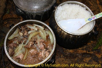
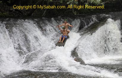
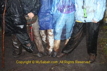
We got back to Fefukan campsite for breakfast at 8:50am. Wow, we have kancil (mouse deer) soup and fried rice as breakfast today! The meat of mouse deer is a bit chewy and taste like beef, nice… Before we left, everyone decided to take a final dip in Fefukan Waterfall. I’ll never forget this beautiful place and joyful moment.
Above: mouse deer soup as breakfast!
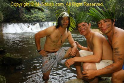
Above: Lait insists we must play the “Wild men of Long Pasia”
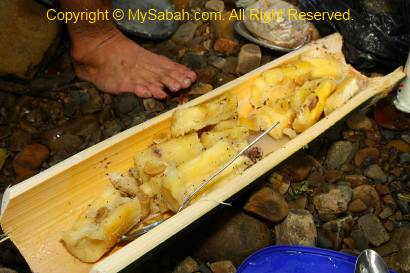
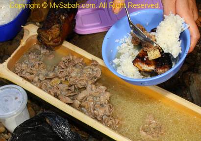
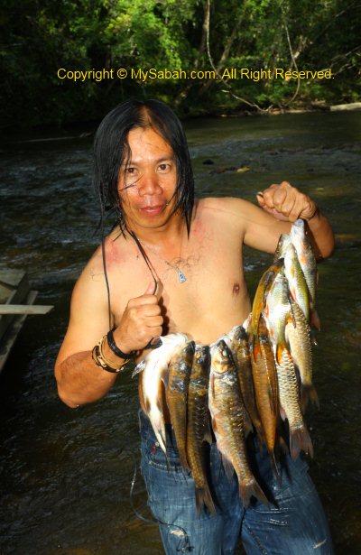
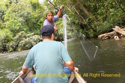
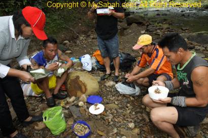
We finished packing our stuffs and headed to Lelawid at 10:30am, where the boats will pick us up. Probably of the mouse deer soup, everyone walks as fast as a deer. We reached the river by 3pm, just on time for our late lunch. This time we had wild boar intestines soup, steamed tapioca and Pelian fishes (which was trapped in fishing net we setup yesterday). Pelian fish can be sold for RM60 (about USD$18) per Kg. It tastes really sweet but has a lot of Y-shaped bones in its meat. The wild boar intestine is as hard as rubber, very hard to chew and smell fishy.
Above: steamed tapioca in bamboo
Above: wild boar intestines soup, dare to try?
Above: Pelian fishes from Matang River
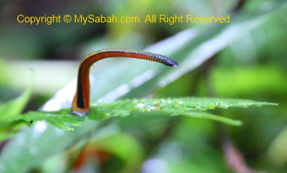
We left by boat at 3:30pm. Coz we follow the stream direction and the water level is higher today, we reach Long Pasia village at 6pm, quick fast. I saw a “moving wire” on the boat. At first I thought it was just a thread being moved by breeze. Then I notice it is a living thing. They call it “Cacing Sungai” (river worm). A search on the Net tells me that it is a horsehair worm or Gordian worm ( Nematomorpha ).
Horsehair worm is a sinister parasite lives in water. If an insect such as cricket, mantis and beetle consumes the water which contains its eggs, the egg will hatch and grow inside its host. After weeks or months, the worm is fully grown (30 to 50cm long) and wants to get back to the water, so it’ll release a chemical to “mind-control” the host to walk into water, and then it crawls out of the butt of the host and swim away. In most cases, their host will die due to serious injury. Infection on human is possible but very rare.
It starts to rain when we walk home. I think we are really blessed. It’ll be terrible if it rains when we are in the jungle or river. However, I still catch a cold and sick for 2 weeks. We are so glad that the trip is mostly over. We are back to our homestay family and go to bed early. Zzzz….
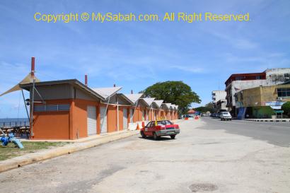
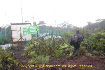
Fefukan Waterfall is the newest attraction at the south of Long Pasia. There were only 4 foreign tourists (from UK, Denmark, Italy and Holland) have been there, and we are the first group of Sabahan tourists.
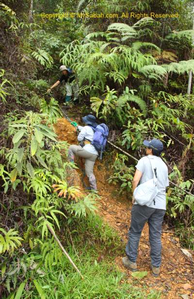
Jungle Trekking to Fefukan Waterfall
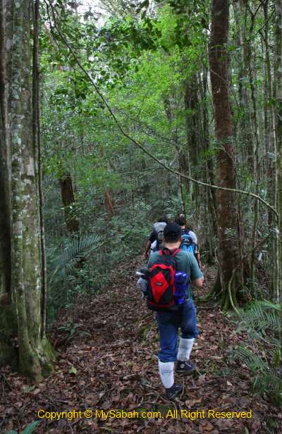
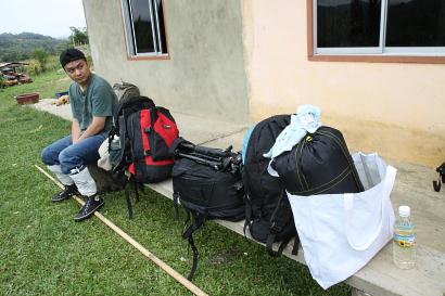
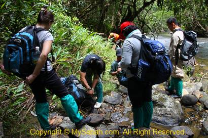
Even after 3.5 hour of rapid shooting on Matang River, we still need to walk 4 to 5 hours on 10 KM of undulating terrain to get there. We started the jungle trekking at 1PM. Luckily we have a few porters to carry some of our stuffs. In addition to the camping tent and cooking utensil, each of them can take weight as heavy as 50 Kg (but still walk faster than us)!
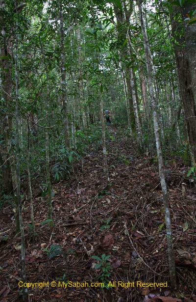
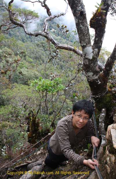
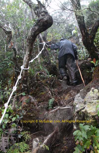
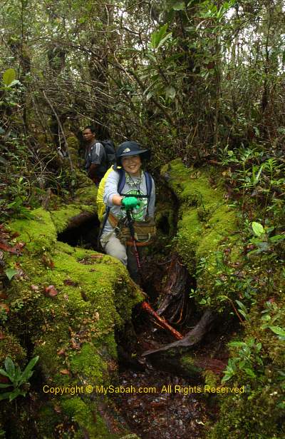
Because very few people walked this route before, the trail is in the most pristine and challenging condition. The trail is raw, slippery, muddy, foliaged and dense with undergrowth vegetation. If we are not careful, we will trip over crawling vines, rattan and tree roots on the ground, so be prepared to get dirty. A pair of Addidas Kampung shoes (“Village Addidas”, a water-proof rubber shoes) is highly recommended for such rainforest walk. For the beginning, we need to walk to the highest point, followed by easier up and down trail, then a long and steep descending trail to the campsite.
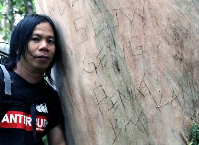
Above: teasing message on the tree bark
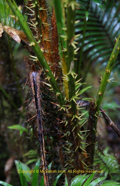
Needless to say, there are hundreds of forest leeches waiting along the trail. Very soon I found a tiger leech crawling on my camera. The good news is – once we move to higher altitude, there will be no more tiger leech but brown leech. Brown leech is much more easier to deal with and its bite is not painful (sometimes I can’t even feel it). Unlike tiger leech, which likes to hide in the shrub & bush, brown leech is mainly active on forest floor, so wearing leech sock is safe enough. I notice that the brown leeches here are so big, as big as tiger leech!
Above: Tiger leech delivers painful bite
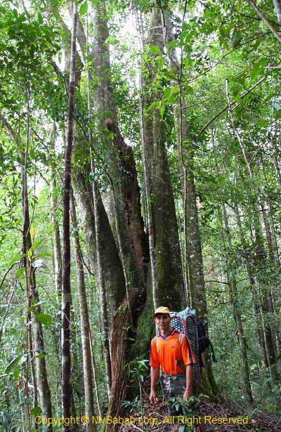
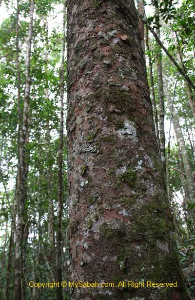
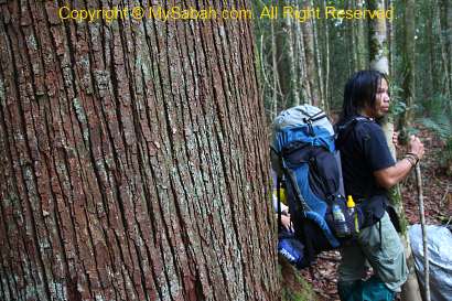
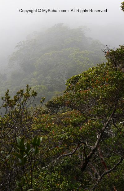
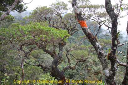
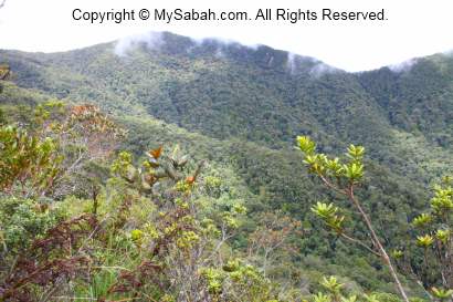
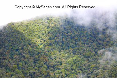
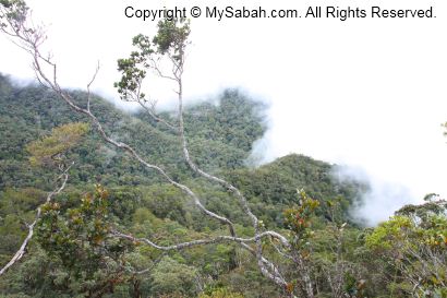
With an altitude of 800 Meters above sea level, this forest is mainly a mix of hill dipterocarp forest and lower montane forest. Most trees are slim and no taller than 25 Meters, except the Agathis and Seraya Kuning trees. The jungle trekking reminds me of Maliau Basin, Sabah’s Lost World. Long Pasia is indeed another Lost World of Sabah, but with more cultural and historical heritages. Unfortunately, the forest here is not protected by the government.
Above: Agathis tree only grows between hill forest and montane forest
Above: huge seraya kuning tree
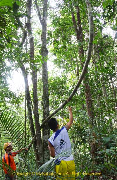
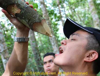
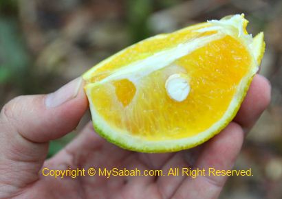
We also stopped occasionally to explore some jungle resources. The guide shows us how to get fresh water from the wild vines. I drank and it tasted fresh, with thin smell of grass. The water also can be used as eye tonic. Then they pluck some wild oranges for us to try, it is very sour but an energy booster.
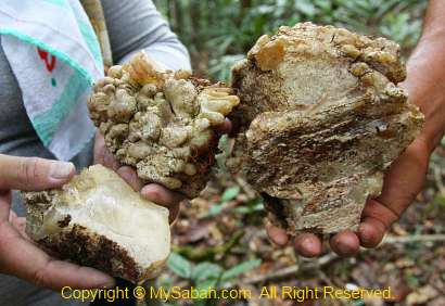
We found some big chunk of resin beside an Agathis tree. They are hard and look like crystal. The guide took some with them coz these resins are good fire starter. In old day, they use this resin as torch and candle. It burns like rubber and release black smoke. But be careful not to let the burning liquid drips on your skin, coz it sticks and able to burn you badly.
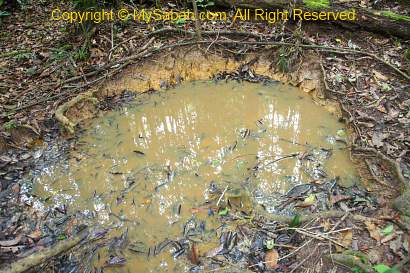
After passing the highest point, the trail is less rugged and we walk quite fast. Our favourite part is the ridge walk. It is very windy and cooling, like a huge air-cond, and blows away our fatigue. There are supposed to be a lot of wildlife such as deer around, but we see only a few monkey. However, we see the wallow of wild boar and claw marks on the tree bark.
Above: wallow of wild boar
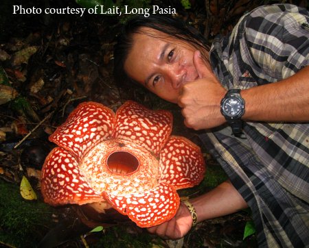
If you are very lucky, you would see blooming rafflesia pricei before Fefukan Waterfall, the one shown in photo above was blooming in April 2012.
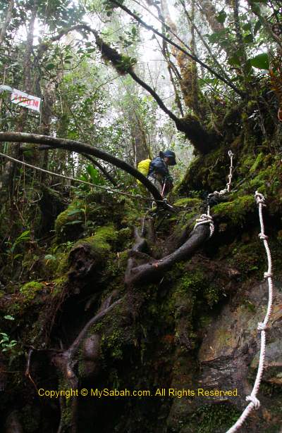
As the trail is not clearly visible and no signage, we follow our guide closely, otherwise there is a 100% chance of getting lost here. Sometimes Lait stops and looks around, as if he is trying to recall the right way, making me nervous. “That’s the fun part!” they say. I have no idea how far we go until I hear the distant waterfall. Walking the descending trail is really a knee-breaking experience. The trail is narrow and slippery so we can’t move fast, putting a lot of stress on our knees. I almost want to cry when we saw Fefukan Waterfall at 5:30pm.
Above: Fefukan Waterfall
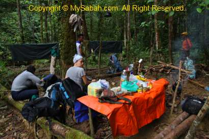
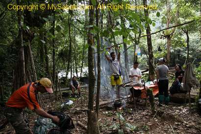
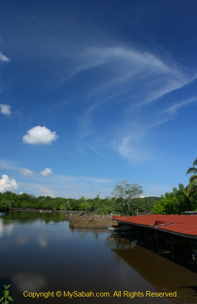
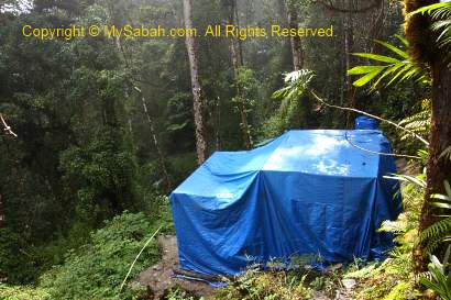
Campsite of Fefukan Waterfall
Our campsite is only 30 Meters away from Fefukan Waterfall. In fact, we went so far that we were so close to the border of Kalimantan. Another walk for 3 to 4 hours will lead us to the immigration checkpoint at the border. We are at the Heart of Borneo!
Above: campsite at Fefukan Waterfall
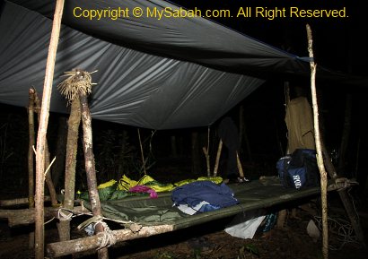
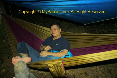
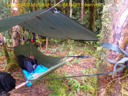
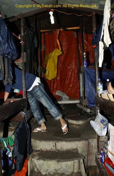
It is getting dark soon, so the guide and porters setup our camp and beds next to the river, and prepare our dinner. They don’t want to damage the environment, so there is no permanent facility here, no toilet, no hut, no cabin… All we have are hammock or canvas beds, with a sheet of canvas on top to block the rain. I never slept on a hammock before, so I choose the hammock bed closest to the waterfall.
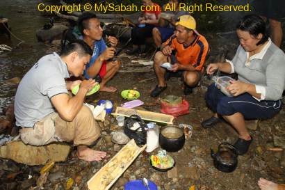
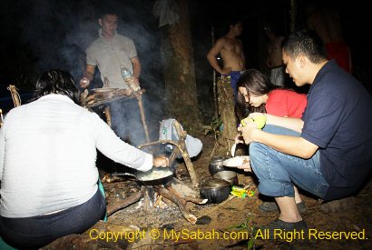
Above: there is no light, so we eat in the dark with torchlight
Night Safari
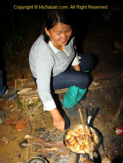
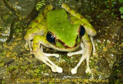
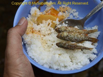
We had some rice, sardine (with onion) and instant noodle as dinner. Everyone was so tired so most went to bed earlier. Lait decided to show me around the campsite and waterfall at night to spot interesting creatures. We found some frogs, insects and fireflies. Though leech is less active at night, I still get 6 of them sneaking into my shoes. Then it started to rain. I had no choice but going to bed.
Can you imagine sleeping in the forest of Heart of Borneo and next to a waterfall? It just can’t get any better than this. I enjoyed the sound of nature. There are occasionally some twinkling fireflies passing by my tent. I fell asleep very soon. The temperature can plunge to 14 degree Celsius (14°C) at night. It was so cold that I shivered in my thin sleeping bag, then I had to wake up in midnight to wear extra clothing. My knees were quite painful coz of day-long trekking.
Above: my hammock bed
About 2am, in total darkness, my hammock shakes violently, as if a big animal knocks on my tent. I was so shock and pointed my torch light around, but see nothing. I found that my hammock is lowered by a few inches, so I guess the knot got loosen and slide down, phew… scary but funny, haha.
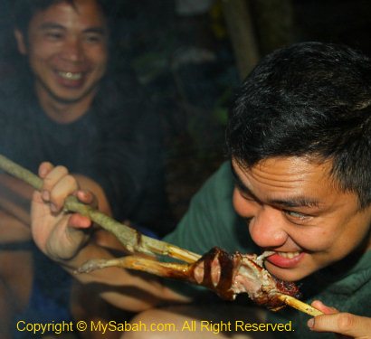
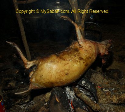
Above: preparing mouse deer meat for tomorrow’s meal
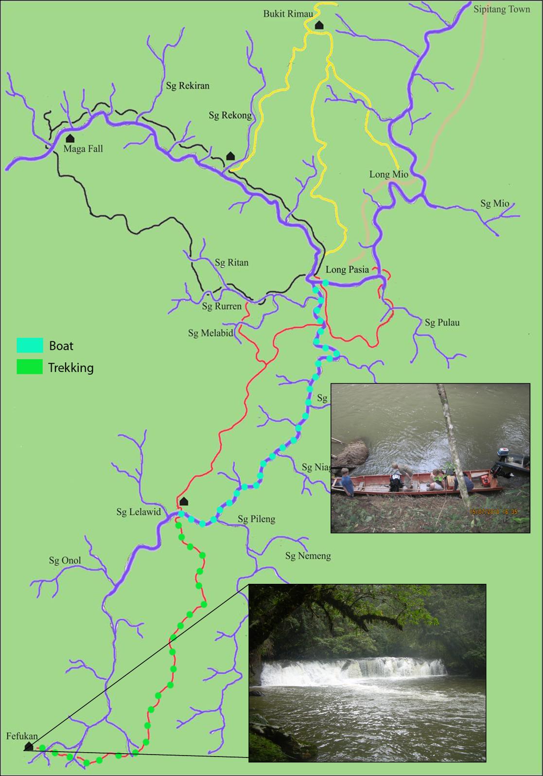
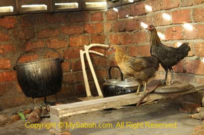
It’s a cold morning in Long Pasia, so cold that all the chicks seek for warmness under the belly of their mother hen. After a heavy breakfast, we got ready for a long trip to Fefukan Waterfall. The journey will start with 3-hour of rapid shooting (river cruise) on Matang River (Sungai Matang) to Lelawid camp, then a 4-5 hours of jungle trekking (about 10 KM).
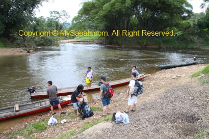
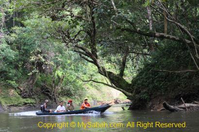
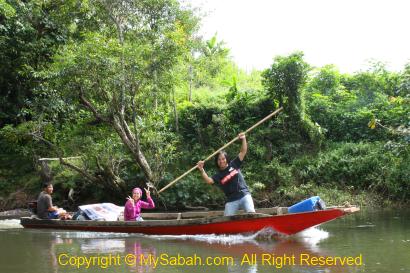
At 8:30am, we gathered at the riverside next to the village. When I saw our boat transport, I felt apprehensive. It’s a wooden long boat powered by an engine at the rear. To me, it is only a bit better than a bamboo raft and its wobbly body does not instil any confidence at all. For newbie who tries to stand on this boat, there is a 90% chance he will fall into river within 3 minutes. The slightest wrong move seems to be able to capsize this boat.
We loaded our backpacks onto the boats then we departed. To keep the boat balance and stable, everyone must sit still in the center. It sounds easy but my butt hurt in long hours of cruising, and I have to shift my weight occasionally (right and left butt haha).
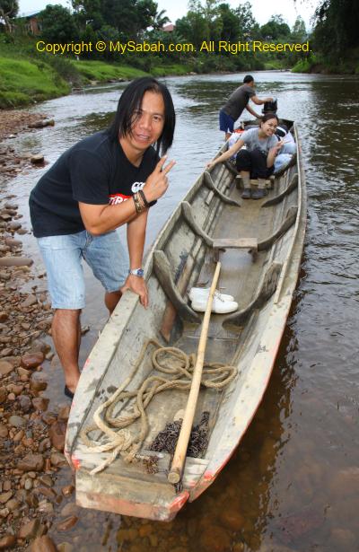
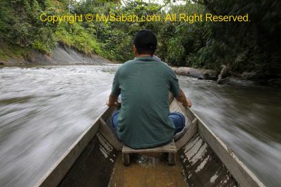
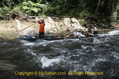
Besides a boatman who controls the engine at the rear, there is a navigator at the front. He will read the river for a safer route and use his long pole to push the boat away from bumping into boulder or to hold the boat in strong current. Only person with strong muscle and balancing skill can handle such tasks.
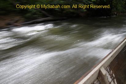
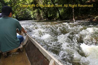
It was quite a smooth ride on Matang River. I enjoyed the cool breeze and beautiful riverine forest view along the river. At first I worried that the water would splash my camera, but very soon I took out my camera and started shooting. For birds, I saw egrets, heron and stork-billed kingfisher. The river is a bit murky but cold and clean.
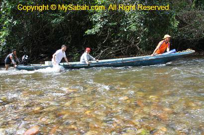
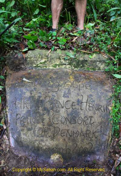
As you can see in the video above, later our wooden boat proved that it’s the best river transport. We got around fallen log, went against stream, moved between rocks, and cutting through numerous rapids. There were a few times we had to get into the water and push the boats over shallow river. After 1.5 hour, we stopped briefly at the monument of Prince Henrik from Denmark, who camped there in year 2002.
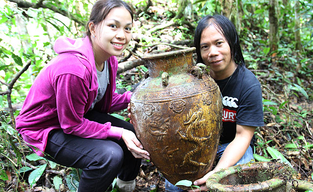
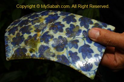
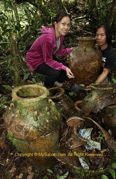
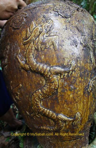
At 11am, we stopped by an ancient burial site next to the river. There are more than 10 “coffin” jars scattered inside the forest. We also found fragment of human skulls and bones. It is a traditional practice for our ancestors to bury the dead inside a big jar, and then they will move the bones into smaller jars. And most of these jars are from China hundred years ago. It is not too hard to tell that the jars are “Made in China” coz some have figure of dragon on them. I am not an expert on antique. I only know jars and ceramics of Ming and Qing Dynasties were widely traded in Borneo in the past.
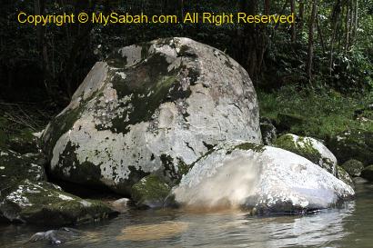
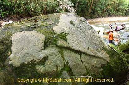
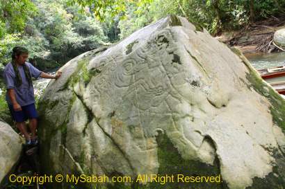
We went on with our rapid shooting. 15 minutes later, a white boulder caught my attention coz its color looked different from other boulders. And I was right. The guide brought us to the opposite side of this boulder and we saw unusual circular carving on the surface.
Lait told me that according to the carbon dating done by a local university, the age of the carving is about 600 years old. The carving is so smooth that they wonder what kind of tool was being used. Based on the legend of Lundayeh, it is a finger-drawing by Upai Semarin, an ancestor giant with super natural power. Another version is – it was carved by a man who missed his deceased wife, so romantic…
This boulder seems to have life (or you may call it my superstitious feeling). I touched it and the surface is a bit soft. Personally, I think it is possible to produce such carving if we use wood with rounded-tip to scratch the rock surface persistently. This historical remnant really needs protection coz the algae is slowing eroding the rock face.
Lunch Break
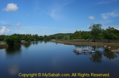
When we were getting closer, there was a rapid almost every 50 Meters. Oh yes, we reached Lelawid, the starting point of our jungle trekking, at 12pm. It is next to a convergence point of two rivers and they lay a fishing net across the river (you will know what we got later).
Later we will need to walk about 4 to 5 hours in jungle to Fefukan Waterfall, so we have our lunch at the riverside first. It is like a picnic, so fun. We had some Long Pasia rice, with curry and hot dog. What I like the most is the small and salty “Ikan Sawah” fish. It’s so soft that you can eat its bone.
Above: Long Pasia rice with salty Ikan Sawah fishes
At last, the toughest activity of the trip is about to start… We will walk to the Fefukan Waterfall campsite.
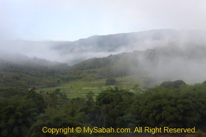
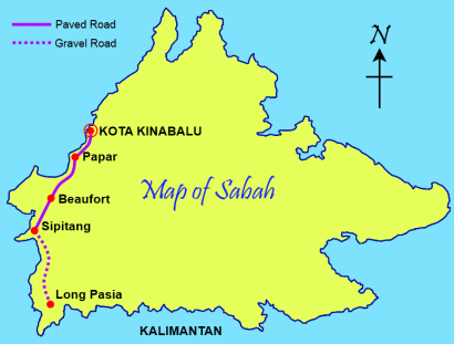
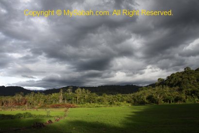
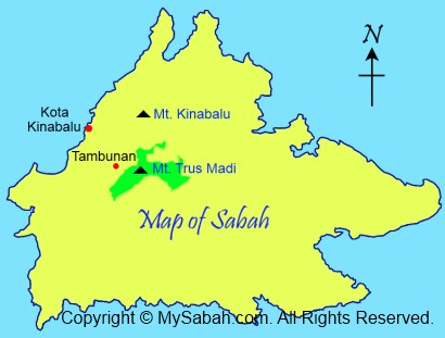
I’ll pick Long Pasia as my hometown, if I were to born as an “orang kampong” (villager) in Sabah. More than 250KM away from Kota Kinabalu, Long Pasia is located in south-western corner of Sabah, very near to border of Kalimantan (Indonesia). With an altitude of 1,000 Meters above sea level, cool mist frequents Long Pasia, hiding some least-known natural and historical heritages of the Heart of Borneo.
Since year 2005, I have been thinking of visiting Long Pasia. My father had been there and told me about this beautiful and remote place. Finally I had the chance to join a 4-day-3-night adventure with a group of friends in early Nov. Below is the outline of our Long Pasia trip: Day 1: Depart to Long Pasia homestay Day 2: Rapid shooting & jungle trekking to (and camping at) Fefukan Waterfall Day 3: Back to Long Pasia homestay Day 4: Back to Kota Kinabalu city
You may Click Here to see the detail itinerary.
DAY 1 – GOING TO LONG PASIA
Road Trip to Sipitang
The road trip to Long Pasia took us about 9 hours (8am – 5pm), as we made a few stops. The beginning part is easy; we drove 2.5 hours on a paved road from Kota Kinabalu city to Sipitang town (144KM). At 10:30am, we reached Sipitang, where we had our early lunch and purchased food supplies for camping. Sipitang has undergone some changes and now it has a nice sea-view esplanade.
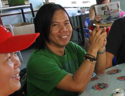
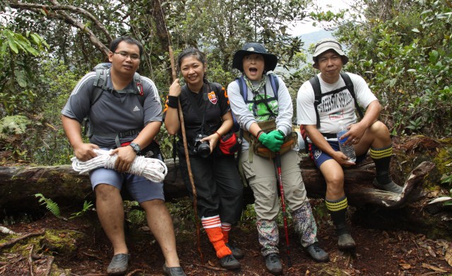
We also met up with our Long Pasia guide, Lait. At first look, you have no doubt he is a competent “jungle man” coz he is muscular. I’m surprised that he is also a talent artist, and his drawing is so fine and detail, a big contrast to his rugged figure. He always has a mischievous smile on his face, as if he would play a prank on you anytime (and he does!). He is a naughty and playful big boy, this trip would be less fun without this friendly guide as our company.
Above: Lait, our guide
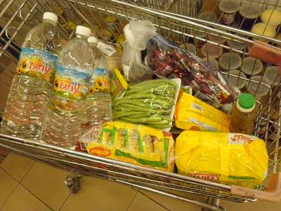
Above: Bestamart Supermarket
After lunch & briefing, we dropped by Bestamart supermarket of Sipitang, to get some stuffs for our camping. We bought biscuit, instant noodle, can food (sardine, curry), 3-in-1 coffee mix, onion, vegetables, water, oat meal, sugar & salt, cooking oil, etc.
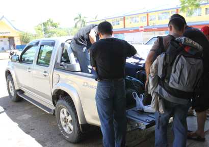
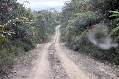
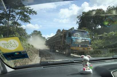
Then we loaded our bags and supplies to a 4-wheel drive. Long Pasia is 123 KM away from Sipitang, and it’ll be a 4-5 hours bumpy ride on a hilly gravel road (a logging road in fact). The road was dry and dusty that time. But in rainy season, the road will turn muddy and slippery, only accessible by 4WD. It sounds very isolated, but the most beautiful and pristine places of Sabah are always in remote region.
Iban Longhouse
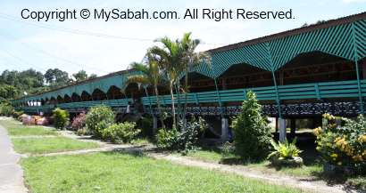
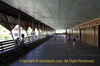
We visited an Iban longhouse about 15-minutes away from Sipitang. I knew there were some Iban people living in Tawau district (South-east of Sabah), but didn’t know some of them lived in Sipitang too. Though this longhouse is a modern version, it is really long and able to house about 40 families. The veranda is so long and wide that some children have fun racing on it back and forth.
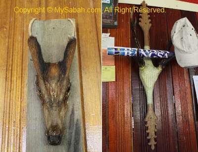
The most distinct feature of this longhouse is the deer skull decors at each door. I saw the skulls of Sambar Deer and Barking Deer (Kijang). We only stopped here for 10 minutes, and then we continued our journey to Long Pasia.
Road Trip to Long Pasia
Very soon we hit the rough gravel road. We passed by small villages, plantation (e.g. rubber, banana, paddy, tapioca, maize) and rivers, most of the time we were surrounded by lush hill forest and saw no other car. Sadly, we also saw logging trucks and deforestation done by SFI (Sabah Forest Industries). You may watch the video below to get an idea of the road trip.
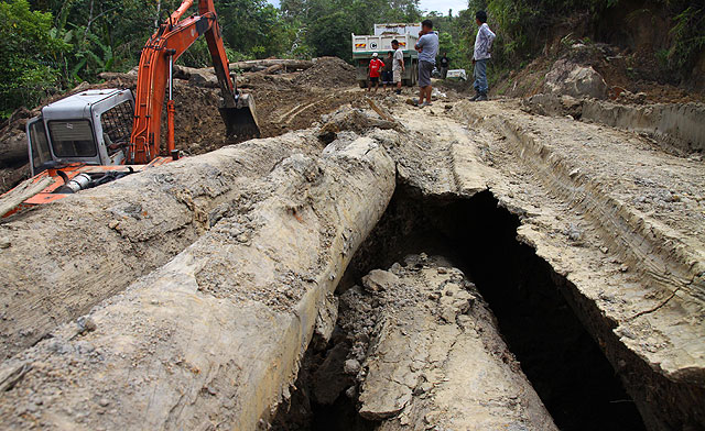
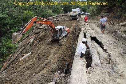
When we were about an hour from Long Pasia, we found that a bridge in front of us collapsed. Luckily a truck and excavator were there to make a new way. Within 30 minutes, we could move on again.
Long Pasia Village
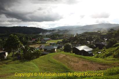
Finally we arrived Long Pasia at 5pm. Long Pasia means “Mouth of the Red River” (though I want to call it “Long….. Passage” due to the long ride). First thing I felt was the fresh and cool air (remind me of Kundasang town decades ago). This highland village is always in dense mist in the morning and late afternoon. Surrounded by mountains, forest and rivers, Long Pasia is the one of the few villages closest to true nature and wilderness. They said an eagle grabbed a chick when we got there.
Above: Long Pasia
Above: Paddy field
Most of the 600 villagers here are Lundayeh people, which means “People of the Interior or Upriver”. In the past, they were headhunters, as well as a strong rival to another headhunting tribe, Murut (means “People of the Hill”). Now most of them are Christians and work as farmers, fishermen and hunters, and they are one of the friendliest people I meet.
Long Pasia is unlike the typical Malay kampong (village) in other parts of Malaysia. Most villagers still converse in Lundayeh, though they speak fluent Malaysia language. Lundayeh is also found in Sarawak (known as Lumbawang instead) and Kalimantan. To see their differences in costumes, you may see my blog on Lundayeh Festival.
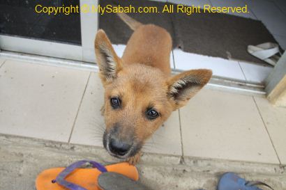
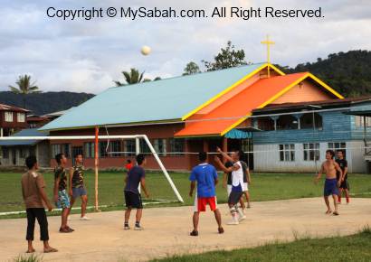
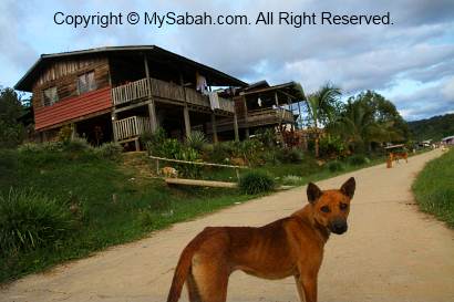
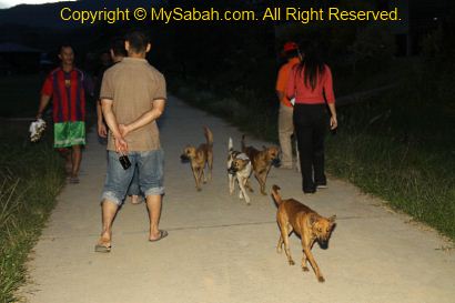
We walked around Long Pasia in late afternoon. We were greeted by friendly villagers and felt so welcomed as a guest. Many were playing soccer and volleyball on the field as past-time. I noticed there were so many dogs, probably as many as the human population here. FYI, you will be fined RM500 (USD$150) for killing a dog, coz many of them are trained as a hunting dog, a loyal partner that follows the hunters in and out forest for days.
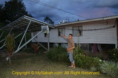
Another “feature” of Long Pasia is the Solar Panel outside every house. There is no power line here, so they rely on stored solar electricity for basic lighting and TV. This solar panel costs about RM15,000 (it is funded but I don’t know by who)! If they need more power, they will turn on the generator on demand, so I can charge my camera batteries. You can save a lot on electricity bill by living here, coz we don’t need air-conditioner in cool place like Long Pasia.
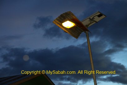
Above: Street light powered by solar panel
Above: Huge solar panel
My mobile phone got no line coverage here. I was told that they have Internet connection by satellite in the village, so some of them even have Facebook accounts. Not only that, many houses also have Astro channel (satellite TV).
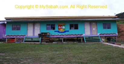
Above: SK Long Pasia, first school in Long Pasia
Long Pasia Homestay
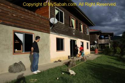
For first day, we stayed with a local family (Dina & Janet) in Long Pasia. The people here realise the importance of eco-tourism and nature. About 15 houses have registered under the Homestay program. Under the education of environmental bodies, the villagers reduce the cutting of forest and hunting of wildlife, especially in tourist areas, though these have been their traditional practices for centuries.
Above: our homestay in Long Pasia
The standard of living here has improved over the years, and most villagers are self-sufficient. You won’t find yourselves staying under the roof of a water-leaking broken hut. In fact, their houses are spacious, comfortable and well-furnished, just as good as the houses in city. As pamper city people, we only had problem to bathe with icy mountain water. We went into the shower room, screamed then stormed out in 2 minutes, probably the shortest shower that we’ve ever taken, lol…
Above: our bed
The evening was getting cold and it was so nice that the family cooked a hot dinner for us. We ate a lot of delicious fresh vegetables that planted and harvested locally. Do you know that Long Pasia produces the best rice in Sabah? It’s so soft and yummy that I had 3 plates.
Long Pasia Homestay has been around for some years, but it is under-promoted. Personally I think Long Pasia is the best homestay in Sabah and many will agree with me. Besides accessibility issue, many tour operators (outsiders) are only interested in earning more $$$ by building luxury chalet there then charging tourists a “5-star” price, just like what happens to Mt. Kinabalu now. I will only opt for homestay coz it benefits the local community, not a few blood-sucking tour players.
Above: homestay with Rose’s family
After a briefing by Lait for the trip next day, we went to bed. Tomorrow we will explore one of the most remote places in Borneo, even to the locals, the Fefukan Waterfall. Long Pasia has many attractions such as Tiger Hill and Maga Waterfall, but Fefukan is totally new and far away.
Owning a car is a “symbol” of freedom to most school leavers. I’ve gotten a taste of freedom at 9 when I got my first bicycle. With a bicycle, 5 KM radius around my house was my territory. I could go fishing and exploration far away from home (parents). Even today I still like bicycle, as it is environmentally friendly and a good exercise. Not only that, I can get in touch with the big world on a bike, because I can see, smell and feel the surrounding. No matter how expensive your car is, the driver is locked in a small space inside a car.
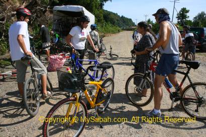
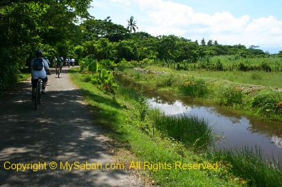
Last month I was invited to join a cycling day trip around Kuala Abai of Kota Belud town. I accepted it without second thought coz I loved to feel the freedom once again. The cycling trip was nearly 30 KM on the countryside road. Since we are beginners, the ride is mainly on flat ground with mountain bike. The organizer got our body height to adjust the mountain bike, so we could peddle with our legs fully extended. Cycling with squatting position is inefficient and waste energy.
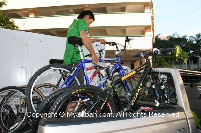
After a short briefing in the morning, we loaded our mountain bikes on a truck. There was a truck to keep our pack-lunch and water in the icebox (I called it “Ice-Cream” truck haha). This truck would follow slowly at a distance behind the cycling group, in case of emergency. Then we departed to Kota Belud.
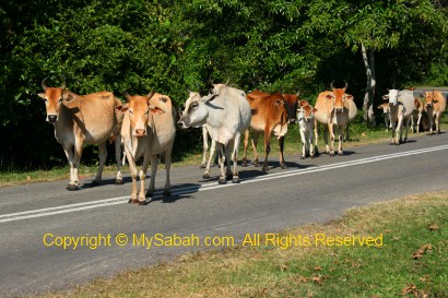
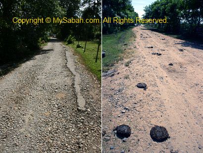
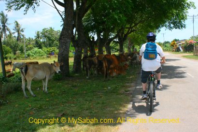
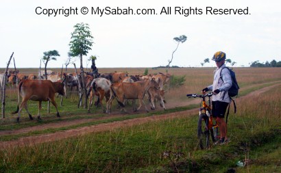
We reached the starting point in Kota Belud after an hour. You know you are in Kota Belud when you see many cattle roaming on the road. They are always on the way, but motorists should not horn them. Or they will turn panic and run like mad cow, endangering everyone on the road.
To avoid absorbing heavy dose of UV ray from the sunlight, we put on our sunblock. We did some final test on our bikes then off we went. Luckily my legs still remember how to ride a bicycle. That brought back my childhood memory! I can even hold the steering with one hand, taking photo with another (don’t try this outside your home).
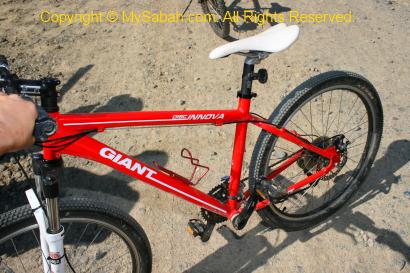
Oh ya, above is my mountain bike that lent by the organizer (Fieldskills). They say this is imported from Australia and costs a few thousands Ringgit.
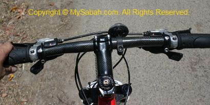
This bike has gear setting next to both handlers to control front and rear wheel chains, for different speed and strength. Honestly, I find it more complicated than my car. Anyway, you can always try to play with the control, to get maximum speed and comfort.
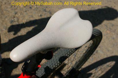
This is a typical sport bike that has no seat padding. I was not wearing a cycling short that has padding and chamois (“shammy”) under my butt. During the bumpy ride later, I was like being sodomized by this egg-crusher seat (just kidding). Because of the extra weight from my camera and bag, my butt was quite painful at the end. Next time I will eat more to get a fat ass for extra padding.
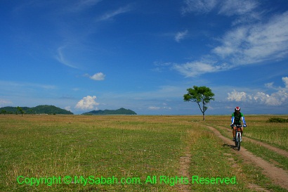
Thanks to the good weather. The sky was so blue and I enjoyed the breeze on the bike. The road in countryside is small but not many cars. Shortly I saw a beautiful river.
As I didn’t want to be left behind by others, I took most of the photos on the bike. I only stopped when the view was really scenic. Actually there is always a staff cyclist follows behind, to take care of those slower movers like me.
Besides paved road, about half of our cycling trip was on bumpy gravel, dusty and sandy roads. It was quite an “egg-crushing” experience. Luckily mountain bike is designed to deal with irregular surfaces. Its absorber kept my eggs intact.
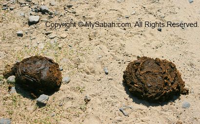
We also needed to keep alert for those “land mines” (cow dropping) that seemed to be everywhere.
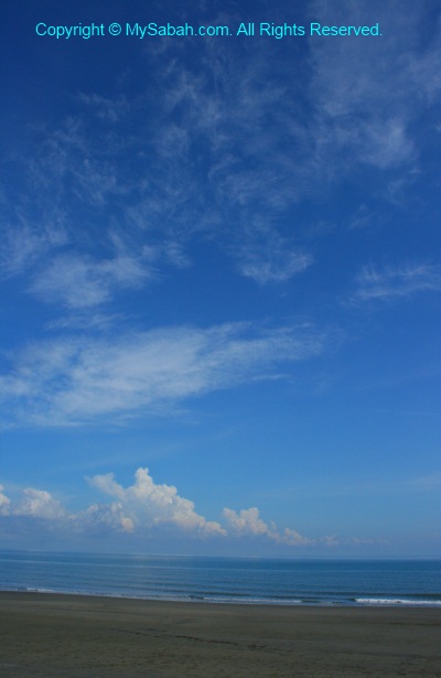
We passed by Pantai Emas (Golden Beach). I didn’t know Kota Belud has such a long and beautiful beach. It is a private land. I think this area can be sold to big hotel for millions. You can see Mantanani Island from there.
Everything is green in countryside, and it becomes a picturesque place with blue sky. There was no busy moving cars and noisy people around, so the time was like frozen, so relaxing that I wanted to play guitar to sing a song or something.
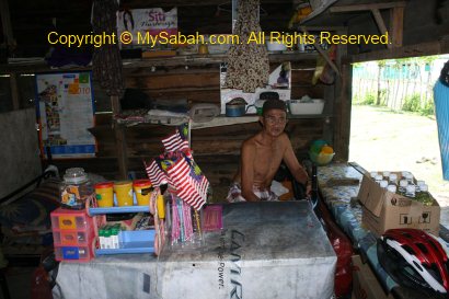
Cycling under the scorching sun for only an hour, everyone was already hot and tired. We stopped briefly at a local grocery store for a short break. We did not even reach quarter way yet. The villagers here were very friendly. They even waved hands at us.
For many years I didn’t cycle around, I live in city, and sharing busy road with cars only means danger. One of the cyclists told me that he ever tried to cycle 11 hours to the Tip of Borneo (in Kudat town). That’s 200 KM! Sound so crazy. If I were him, I’ll cycle with wheelchair the next day.
Sabah doesn’t have any cycling lane for the bicycles. On the road of Malaysia, road users are “expected” to give way to whoever is bigger than their vehicles, so cyclists get the least respect from the trucks, buses, motorcycles and cars. Government is also like that, they even remove the pedestrian lane to expand the road for the cars.
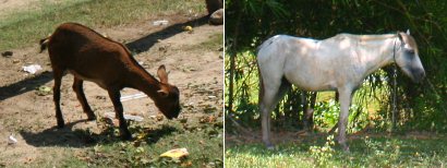
You can see many cattle along the road. Cattle is not meat eater so they will not attack human. But just don’t get too close to their calf. I believe Devil also doesn’t take meat, as any animal with horn is a vegetarian.
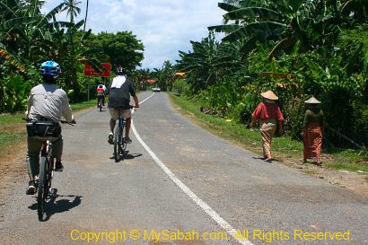
You know you are in a “kampung” (village) when you see people let their livestock roaming freely. If you scare the chicken, they will try to outrun you, heheh.. You also know you enter a Muslim village when you see no dog. Most Bajau people in Kota Belud are Muslims.
We also smiled and waved hands to every villagers we saw along the road. We were acting like peace ambassadors, bringing peace and love wherever we went, haha..
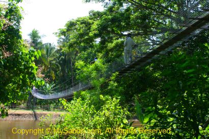
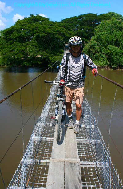
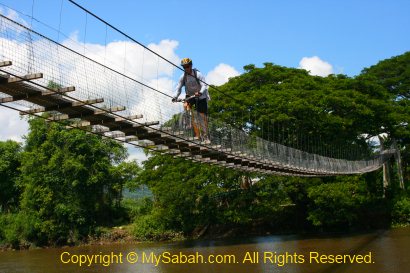
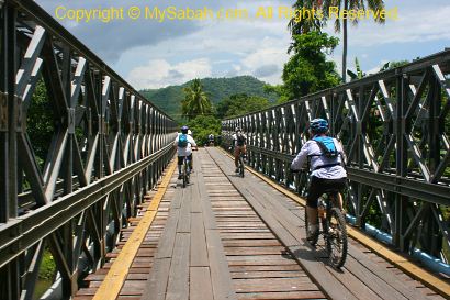
Then we needed to cross a suspension bridge on a wide river.
We got down and walked our mountain bikes to other side of the river.
Then Simon, an advanced biker, showed us the “right” way to cross the bridge. He just ride over this 100-Meter bridge. To beginners like us, this is such a WOW stunt.
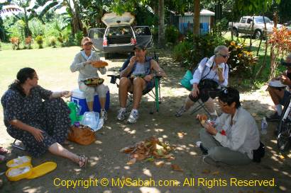
We enjoyed our pack lunch under a tree shade about 12pm in Merabau Village. Gee… it was such a hot day. I drank two bottles of 100Plus to rehydrate myself. Though we were only halfway and exhausted, our spirit was still high. It has been an interesting and fun experience.
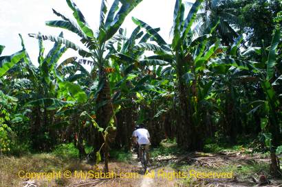
After a short rest, we hit the road again. We even cycled inside a banana plantation. That again reminded me of my naughty boy childhood, when I cycled to any corner, like nobody’s place. The good thing about bike is you can reach any narrow path that no car can get in.
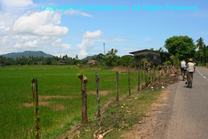
Kota Belud also produces lot of paddy (rice) so do expect to see many paddy fields.
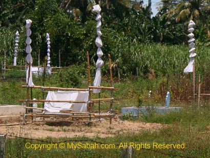
There is a small cemetery next to the road, I don’t know what the white decoration means. Is it a Muslim or Bajau tradition?
We passed by wooden, cement, suspension as well as steel bridges.
The afternoon sun was getting hotter, again we took a nap under a tree around 1pm. This is not a race, why rush to finish the trip, right? Then we heard distant thunders, a dark and dense cloud was coming to our way slowly. The sky became shady, but it was more pleasing for cycling.
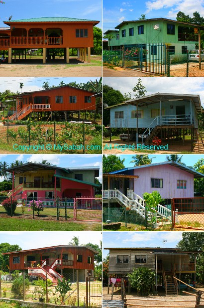
The Bajau people in Kota Belud is the most colorful indigenous tribes of Sabah. They love bright colors such as yellow, red and green. This reflects on their handicraft as well as their houses. If you visit Kota Belud, do pay attention to their traditional stilt houses in different colors. Even though many wooden houses are replaced with cement houses today, they still keep the interesting design and colors.
It started to rain heavily after half an hour. Worry that my camera got wet, I handed it over to our Ice Cream truck. I peddled quickly in the rain. On the way, we saw some cattle taking shelter in veranda of a small shop. It was so funny but the camera was not with me. I got totally wet in the rain, but it also washed away my tiredness. In fact, it was only a few KM left, and we were back to our starting point at 2pm. This ended our trip and we went back to Kota Kinabalu (by car, of course).
Here is a story about myself. Due to a near-to-death cycling accident in Peninsular Malaysia, I didn’t go cycling for many years. Many years ago in Christmas Eve, I was cycling on a road in high speed. Without signaling, the car in front of me made an abrupt left turn. Too late to brake, my bicycle knocked on the left side of the car and the tremendous momentum threw me and my bicycle over to other side of the car. In second, I felt that the world was spinning and I landed on my back. My back was so painful that I thought I would die. Laying on the ground for nearly a minute, finally I managed to stand up. I remember the “Oh sh*t! Oh sh*t!” face of the driver. Only my elbow suffered minor bruise and no bone was broken. He drove away after I assured him that I was fine.
Actually it was partly my fault too, I don’t blame the driver coz my bicycle had no light and I didn’t wear any reflective safety vent, so it was very hard to see me at night. Anyway, just to share the lesson with you. If I landed on my head, the force was enough to break my head. So a helmet is a must for cycling. Nowadays, there are more and more hit-and-run drivers in Sabah after they learn that police has problem to trace them. And also thanks to JPJ for cultivating so many “Kopi-O” licensed drivers on the road, turning driver license into license to kill. In other countries, it is very hard to pass driving test in first time, unlike Malaysia. So be extra careful when you have fun cycling in city.
Photos taken in Kota Belud, Sabah, Malaysia Borneo
Though I didn’t sleep well, my muscles were able to relax and recover. I advise climbers to invest in a good (=expensive) backpack that can spread the weight evenly, otherwise you would have back pain like me. Everyone waked up at 2am, after having some cookies and instant noodles (with curry meat, sardine and tuna) as breakfast, we packed and headed to the summit at 3am. If plan went well, we could reach the summit before 6am to watch the sunrise.
Conquering Mt. Trus Madi
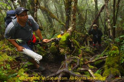
The morning was total darkness. With the aid of LED headlight, I could only see a few feet in front of me. We were only 1.5 KM away from the summit, but most of the trail was over 50 degree of steepness. Certain section was impossible to climb without the help of ropes. My head even knocked on overhanging branches a few times. When I tried to grab anything along the steep trail to support myself, I felt a sharp pain and found that I grabbed on a thorny rattan. This sinister plant is so abundant along the trail to the summit.
With heavy camera, tripod, drinking water, etc., I had over 5Kg of weight on my back so I moved very slowly. Near the top of Taliban Peak, I could see the streetlight of Keningau town far away, it was so beautiful. Thanks to the stupid La Nina phenomenon, it has been raining all night and the trail became muddy and slippery. That’s no way we could avoid contact with mud, so our pants were dirty.
Finally I reached the summit around 6:30am. I didn’t feel excited. Instead, I was glad that it was over. I looked around and found that none of us was clean, our jeans were full of mud stains.
Someone say climbers will be rewarded by the beautiful sunset and close view of Mt. Kinabalu (only 40 KM away). Due to the heavy rain and dense fog, we saw nothing. According to the book “Mountains of Malaysia” by John Brigss, Mt. Trus Madi has “The most beautiful mountains view in Malaysia”.
Above: a marker that divides Mt. Trus Madi into Tambunan and Keningau districts
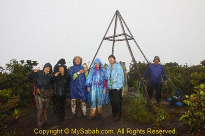
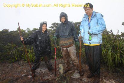
Since we were there anyway, we took some happy faces group photos. FYI, due to a nearby repeater, your mobile phone may get full bar of signal. You can call your love one to say that you call her/him from the top of Mt. Trus Madi. It may sound romantic too if you jump off the peak to prove your love, lol. Or at least you can post an update to your Facebook or Twitter.
Above: Yayasan Sabah repeater. Some say this area is haunted by spirit of a porter who died of malaria
The Summit
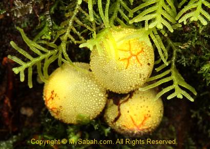
The guide showed us a unique plant (Melastoma minahanse) below, it is only found on Mt. Trus Madi and Papua New Guinea. Apart from Myrtaceae, the summit vegetation is dominated by small, leathery-leafed shrubs such as from the families of Ericaeae, Theaceae, Podocarpaceae.
Above: Melastoma minahanse, this plant only found in Trus Madi and Papua New Guinea
The most special plant community of Trus Madi is the scrub community on the summit. The mix of the montane and subalpine species growing on the summit is unique to Mt. Trus Madi. The shrub species that occur separately as montane and subalpine elements on Mt. Kinabalu are condensed into the same habitat on Trus Madi, and this results in such high species richness. Such coexistence of ecologically divergent species is not found on Mt. Kinabalu!
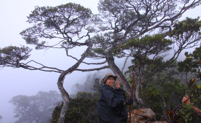
Descending
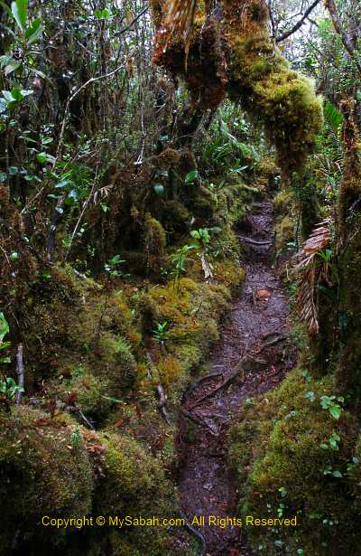
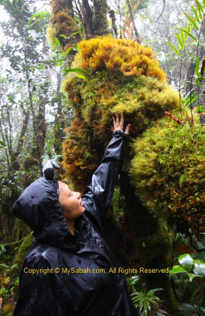
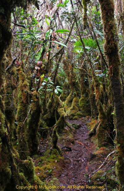
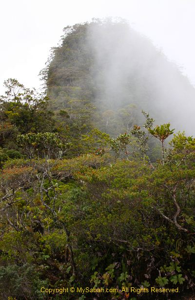
We only stayed about 20 minutes on the summit, then we descended to the cabin. I was not in a mood to rush home, so I walked slowly and took photos on the way. The mossy jungle of upper montane forest looked like an alien world, as one said, we were like entering the world of “Lord of the Rings” movie. Characterized by persistent, frequent or seasonal low-level cloud cover, this moist forest is part of the cloud forest zone. You can see abundance of mosses covering the ground and vegetation, so it is also known as mossy forest.
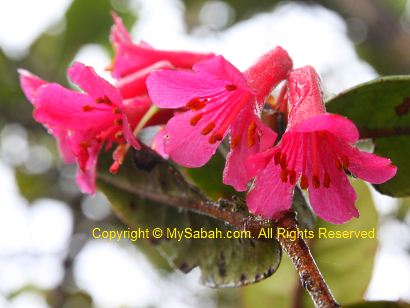
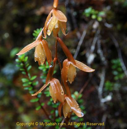
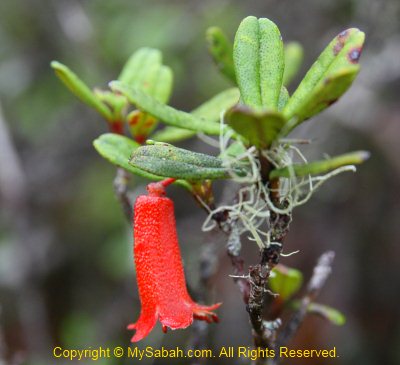
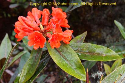
I also photographed some orchid and rhododendron flowers that are only found in higher altitude. The flowers look so nice with raindrops on them. I was told that a Proboscis Monkey was once spotted at 2,000 M above sea level. That’s so unusual, as this monkey only lives around mangrove forest.
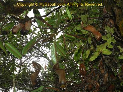
You must check out the Nepenthes macrophylla pitcher plant here, which is a montane species endemic to the upper slopes of Trus Madi. There are so many of them along the trail from summit to the cabin, like a pitcher plant garden.
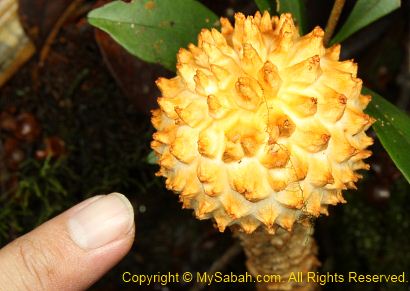
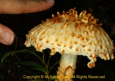
Later we found a Nepenthes xTrusmadiensis pitcher plant on top of a tree near our cabin. Limited to summit ridge from elevations of 2,500 to 2,600 M, Nepenthes xTrusmadiensis is the natural hybrid of Nepenthes lowii and Nepenthes macrophylla. Sadly, this biggest hybrid species is under threat and getting scarce, because tourists pluck them.
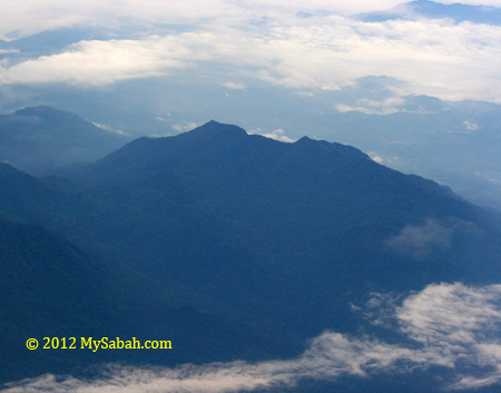
We packed our stuffs and left the cabin at 10am and descend to the starting point. The rain has stopped and we could get a clear view of the surrounding mountains. Trus Madi Range is 80 KM in length, so long and vast that it covers Tambunan, Keningau and Ranau districts. The misty mountain range of Mt. Trus Madi looks like the backbone of a huge green dragon starts and ends in nowhere. I missed this view the previous day due to the dense mist and heavy rain, so I kept shooting photos.
Above: Nepenthes lowii
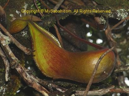
Above: Nepenthes macrophylla
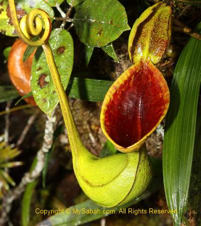
Above: Nepenthes xTrusmadiensis (hybrid of Nepenthes lowii and macrophylla)
I took more than 5 hours to reach the starting point of Mt. Trus Madi from the cabin (3.4 KM). When I was about 30 minutes to the Starting Point, I heard a lady screamed in front. But there was no person in front of me. I ran quickly to check but found nobody. The scream was so loud and clear, so I am sure it was not an illusion. Some say the jungle spirit played a trick on me when I was alone. It still remains as a question mark to me.
Whatever, I was back home in one piece later. Weeks later I was informed by one of the lady climbers that she was pregnant during the climb (she also didn’t know). Phew… that makes me sweat.
May be Mt. Trus Madi does not have astonishing and magnificent landscape like Mt. Kinabalu, but its pristine and unique flora beats Mt. Kinabalu. In fact, Mt. Trus Madi has the potential to become the next UNESCO World Heritage Site of Sabah. It is a must-go for nature lovers.
Lastly, a special thanks to our ethnobotanist guide, Julius Kulip, for identification of the plant species and being our nice company. Julius is one of the few plant experts who is very knowledgeable about Trus Madi and even wrote a few publications about it. I also used some of his info in this blog.
If you are interested in climbing Mt. Trus Madi, the info below might be useful for you.
Planning the Climb
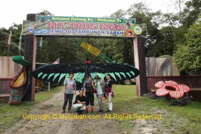
Mt. Trus Madi is a Class 1 protected forest reserve (FMU 10) managed by the Sabah Forestry Department, so you need to apply for the permit to climb. Please note that only a maximum of 16 people (include guide & porter) are allowed to overnight on the mountain every day, so you may need to book the date earlier. Sabah Forestry Department will charge various fees such as Entry Permit, 4-Wheel Drive entry permit, forestry guide, certificate, etc. The rate is higher for foreigner tourists.
One Forestry Guide is required (compulsory) for every 5 or less climbers. For example, you need to hire two forestry guides if you have 7 people in a group. The Forestry Guides are not Tour Guides, they only monitor the tourists (some tourists like to steal the precious Gaharu wood and rare orchids in Trus Madi forest) and take care of their safety.
Working out the budget is a difficult task. Fortunately, the tour operator can register and pay Forestry Department on your behalf, but for a service fee. Usually the tour operator provides the 4-wheel drive transport (a must), 1-night accommodation in Tambunan town, tour guide, insurance, porters and cook, so the cost can vary, depending on what you need and how big is your group (minimum 3 persons. bigger group can get better rate).
Though you can hire porter to carry your bag, you better improve your physical fitness by exercise regularly before the climb. If you think climbing Mt. Kinabalu is hard, don’t even think about Mt. Trus Madi!
The lighter your bag is, the better. In long hours of climbing, every pound counts. You can hire a porter to carry your bag (up to 20 Kg) for about RM150 to 200 per trip. If you spend a night in Tambunan, you can leave those unnecessary things such as used clothing behind.
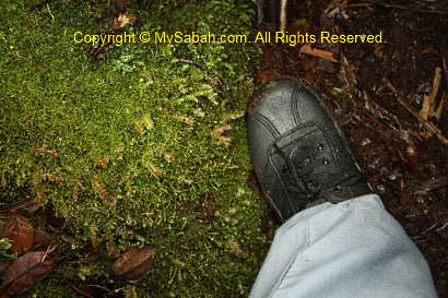
After a group photo at the Starting Point, we started to climb at 10:30am. It was about 26° Celsius and the air was misty and refreshing. It was mainly uphill trail but not very steep. Thick layer of green moss blanket is everywhere on the floor (survival tip: you can lick the water on the wet moss blanket as the last resort, if you run out of water).
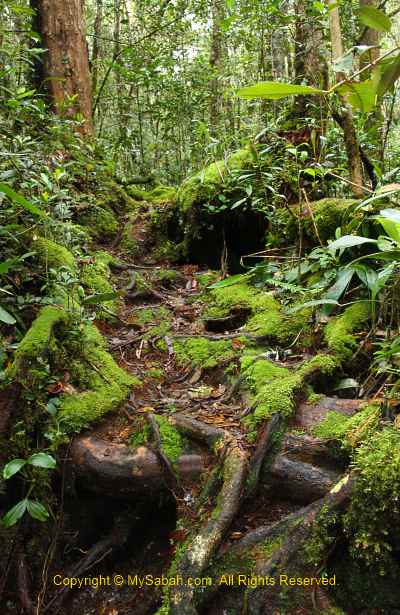
We began our climb in a hill mixed dipterocarp forest, characterized by closed-canopy forest with taller trees. Due to the moist environment, you can see many lichens, liverwort and algae plant. The hill forest is dominated mainly by dipterocarp of genus Shorea, and understorey plants dominated by Rubiaceae with 16 species.
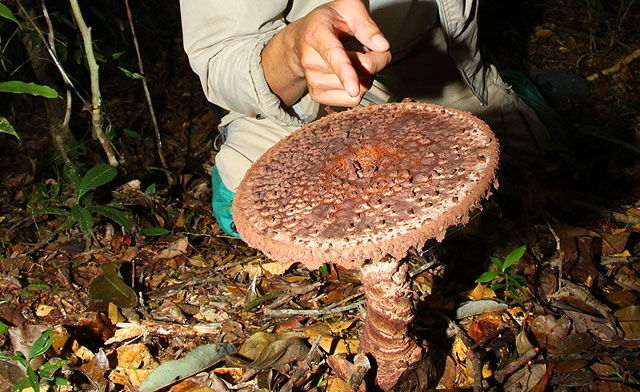
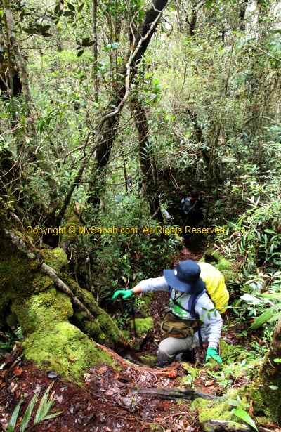
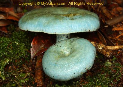
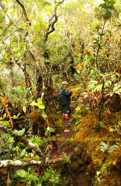
The dim and humid environment also promotes the growth of mushroom and fungus. We saw many of them in different colours and size along the trail. The most special one is the blue mushroom, which is only found in Mt. Trus Madi. Unlike the summit trail of Mt. Kinabalu, the trail is heavily foliaged and we are surrounded by dense vegetation most of the time. The nature trail is narrow, no boardwalk and hand rail, and a lot of overhanging trees and entangled roots. You have to watch your head and steps carefully.
The lower slopes represent a transition zone where dipterocarp species mixed freely with hill non-dipterocarp species. This gradually gives way to lower montane forest vegetation between 1,500 and 2,000 M asl, which is dominated by tree species belonging to families of Fagaceae and Lauraceae, and also the altitude where two species of rafflesia are found (rafflesia tengku adlinii & keithii). More standing trees are densely covered with epiphytic mosses. We saw some orchids (Eria, Dendrochilim, etc.). The flowering season of orchid is from November to December, so we did not see many orchid flowers. Nepenthes tentaculata (small pitcher plant) is quite common here.
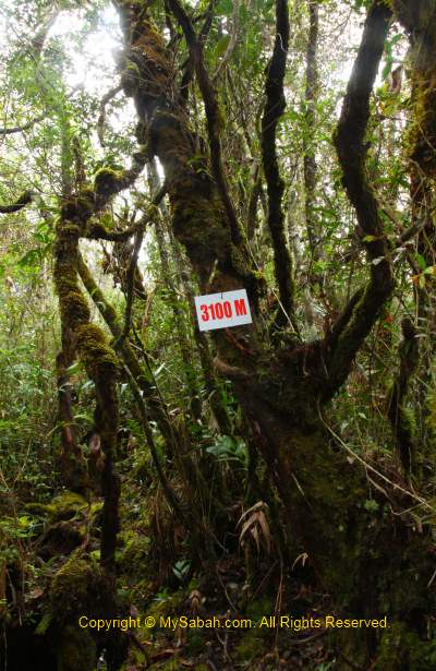
As we moved up, the decreasing number (remaining distance to summit in Meters) on signage motivated us. I also stopped frequently to photograph the interesting plant, most looked new to me. There are two resting huts on the way, one after 1 KM, and another one after 2 KM. You can use the small toilet next to the hut. Water tanks filled with river water are available at the huts if you want to refill your bottle. The water is uncooked but taste really sweet, cold and fresh!
When we had our pack lunch at second hut, we were saying that the first 2 KM was not that challenging and thought that it would be the same later. We were wrong. The last 1.4 KM of trail after second hut was where the nightmare began. The trail was getting steep and required the use of fixed ropes. Then it rained on and off, turning the trail into muddy and slippery path. Luckily, for the first day, we only needed to reach the cabin (1.5 KM away from summit) to stay a night.
We spotted some friendly and colourful birds. One of them is Mountain Black-eye, which is endemic to montane zone 1,800 M above sea level. Some of them were probably Kinabalu Friendly Warblers. The guide said if we sat still for a while, many curious birds would come near us.
Multi-Peak Challenge
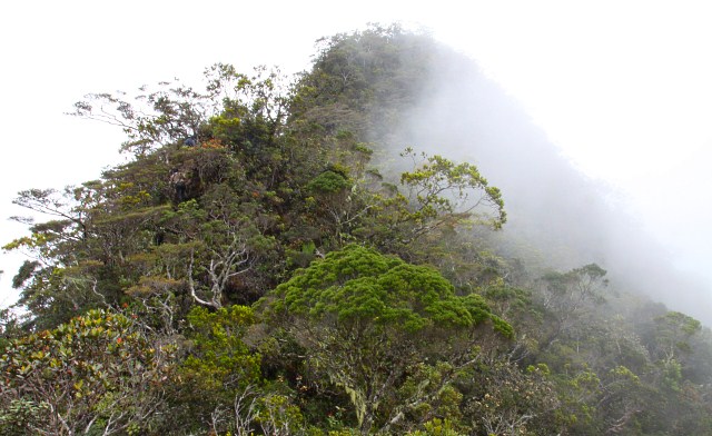
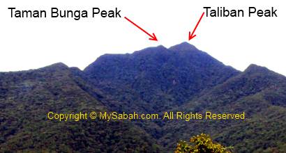
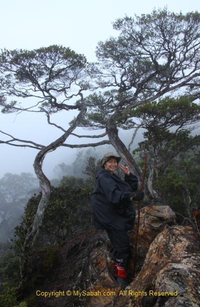
What makes Mt. Trus Madi so tough is its “multi-peak” terrain. To reach the summit of Mt. Trus Madi, there are at least 3 peaks you can’t avoid, namely, Taman Bunga (Flower Garden) Peak, Taliban Peak (which is named after the first Native Chief in Tambunan and has nothing to do with terrorist) and Trus Madi Peak. Slopes become steeper closer to the peaks. When you climb to the top of a peak, you will see another peak in front, you conquer it, then you will see another peak in front again. Taliban Peak is slightly lower than the highest Trus Madi Peak, so someone call it a “faked summit”. There are many ascending as well as descending trail. The descending is not easier than ascending.
Above: the peaks of Mt. Trus Madi. The highest peak is not visible from this side.
The guide also showed us some old trails to Mt. Trus Madi. They looked so narrow, steep and dangerous. The old trail has a few narrow ridge walk with deep drop at both sides. If you slip, nobody will see where you are (no kidding).
The Taman Bunga (Flower Garden) Peak
Though I sound like being tortured, I have a lot of fun in fact. 500M before the cabin (at 2,000M signage), you will enter Taman Bunga Peak, which means Flower Garden. It is an Upper Montane zone about 2,300M asl and a natural garden full of flora. This is one of the few places where you can see the rare pitcher plant, Nepenthes lowii, everywhere. Kinabalu Park was used to have a lot of lowii but most of them were killed by a prolong drought in late 90.
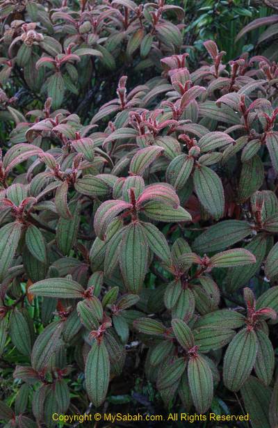
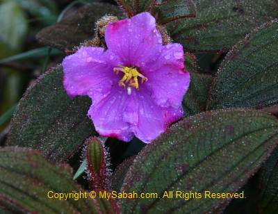
The showiest flower is the bell-shaped rhododendron flower. Wild orchid is easy to find here. Lichen, which is a composite organism of a fungus and a green alga, is abundant around, an evident of zero pollution. I also found many other interesting plants that I’ve never seen. According to the guide, there are different flowering seasons, so you would see different things in every few months.
Our cabin is only 500 Meters away from Taman Bunga Peak. As the rain was getting heavier and the day was turning dark, I speed up my walk and reached the cabin by 6pm. Normal people would reach the cabin latest by 5pm. I was slow because I stopped many times to take photos.
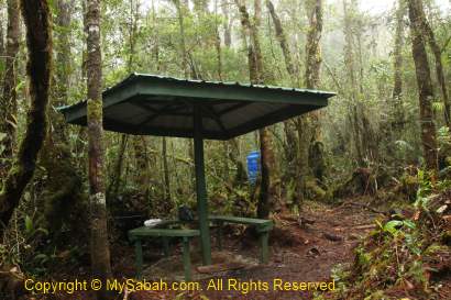
The Cabin
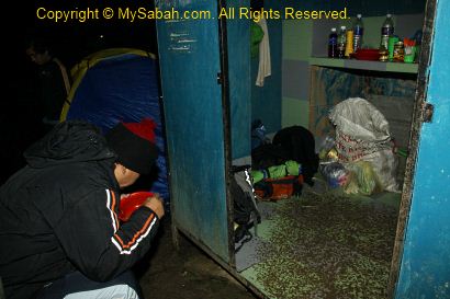
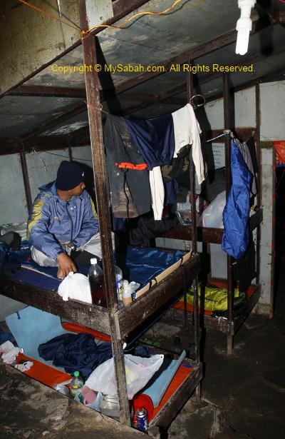
We would spend a night in the cabin in first day. The cabin is built at 2,400 Meters above sea level in year 2008, and the summit is only 1.5 KM away. There are about 7 bunk beds (14 beds) in the cabin. The beds have no mattress and blanket, so you must bring your own sleeping bag. On the bed is a layer of canvas with a zinc plate underneath. Even a bit of movement on the bed will create loud noise, like you are sleeping on a zinc roof, very annoying.
Though this cabin looks more like a refugee camp, it is better than nothing coz it is warmer than sleeping in camp. The bed is quite small too, even for a short guy like me. After putting my backpack and camera bag on the bed, there was not enough room for me to fully extend my legs.
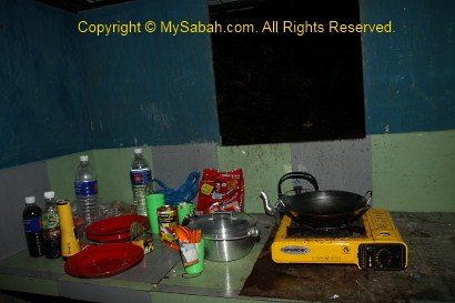
Most of us were cold and wet. Our cook prepared some rice with sardine and black bean salty fish for us as dinner. Though there is a small kitchen next to the cabin, there is nothing inside. We need to carry our own cooking utensils, gas stove, plate, pot, spoon and cup ourselves. I felt better after sipping some hot coffee. There is a gravity pipe that brings river water to a tap, so I could refill my bottle with water. Trust me, the water here tastes far more better than our tap water that is full of chlorine smell. There is a toilet not far from the cabin, but none of us wanted to take a shower as the water was freezing cold.
The guide burnt the mosquito coil to chase away a small and yellow flying bug called Agas. Agas is an insect that sucks your blood and leave an itchy bite mark. Another pest is the mice that running and fighting under our beds and I could hear them all night. The porter had to hang the food high, so these mice couldn’t steal it.
Above: kitchen next to the cabin. Behind is the camp of porters
We were all exhausted and we had to wake up at 2am the next day, so we went to bed early. When I almost fell in sleep, I was splashed by cold dripping water. I checked the ceiling for water leaking but found no crack. Due to the warmer temperature in cabin, water condensation formed on the cold ceiling. For every few minutes, the water droplet dropped on my face. I tried to move my position but still could not avoid the dripping water. The strong smell of mosquito coil also choked me. So for the whole night, I laid on the bed listening to mouse fighting and heavy rain. Not only that, my bags were all wet in next day.
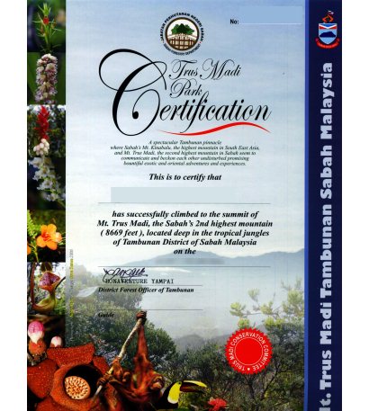
(Note: The trail & accommodation have improved a lot after 2014. Please check out my latest Guide on Climbing Mt. Trusmadi.) God really blesses Sabah, because the top 3 highest mountains of Malaysia are in Sabah. I guess the highest mountain, Mount Kinabalu (height: 4,095M), is no stranger to Sabahans. Many even climb it more than once. But most of us haven’t tried to climb the second highest mountain of Malaysia, Mt. Trus Madi (height: 2,642 Meters or 8,668 feet).
Lack of promotion is responsible for lack of visitors to Mt. Trus Madi. Another reason is – the climb is so challenging that someone even call Trus Madi “Terus Mati” (mean “Die Straight” in Malay language). Of course it is only a joke, as accident in climbing Mt. Trus Madi is rare. Though 1,453 Meters lower than Mt. Kinabalu, Mt. Trus Madi is harder to conquer. Some say if the trail to Mt. Kinabalu is a highway, Trus Madi trail is a countryside road then. The climbers have to be reasonably fit. Personally I would not recommend people younger than 15 years or older than 60 years to challenge the real “mountain power” of Mt. Trus Madi.
Earlier this month, I climbed Mt. Trus Madi with 5 ladies and all of us made it to the top, despite the poor weather. Thanks to the Internet, I can bring my photos and experience to your screen. I strongly recommend Mt. Trus Madi to hardcore hikers and nature lovers. You will be dearly impressed by the pristine conditions of Mt. Trus Madi. At least you will be proud of yourself for conquering this mountain.
About Mt. Trus Madi
The name “Trus Madi” is originated from the Dusun words “pinotorusan Madi”. Pinotorusan means Hunting Ground and Madi is the name of a hunter who was used to hunt in Trus Madi. Due to higher altitude, the temperature on the mountain is about 10 to 25 degree Celsius. The flora of Trus Madi is very rich and unique. About 600 species in 160 families of plants were recorded in forest here.
Mt. Trus Madi encompasses 5 different types of vegetations, i.e. lowland mixed dipterocarp (427-600M), hill mixed dipterocarp forest (600M – 1,500M), lower montane forest (1,500M -2,000M), upper montane forest (2,000M – 2,500M), and summit scrub (2,500M – 2,640M). You will pass through all these vegetation zones during the climb. The hybrid vegetation of montane forest and summit scrub is so unique that it is not even found on Mt. Kinabalu!
The Itinerary
The climb will take 3 days 2 nights. The climb starts in Tambunan (90 KM away from Kota Kinabalu). You can choose not to overnight in Tambunan town, but you need to move early at 6am from Kota Kinabalu, to drive 1.5 hours to meet the tour operator in Tambunan town before 8am. Below is the standard itinerary:
DAY 1
5:00pm
Depart to Tambunan (from Kota Kinabalu city)
6:30pm
Arrive Tambunan town & overnight there
DAY 2
7:00am
Breakfast
8:00am
Briefing and preparation
8:30am
Depart to Mt. Trus Madi’s Starting Point by 4-Wheel
Arrive Starting Point and proceed to Kota Kinabalu
6:30pm
Arrive Kota Kinabalu
For the first day, I stayed in a resort in Tambunan. Its service sucks so bad that I don’t want to mention its name here, coz I don’t want to promote this stupid resort.
Day 2
The next day I wake up around 7am to get prepared for the climb. After I had my breakfast at 8am, the guide and porters met us at the resort. After a short briefing and loading my bags to their 4-wheel, we headed to the starting point of the climb at 8:30am.
Going to Starting Point
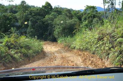
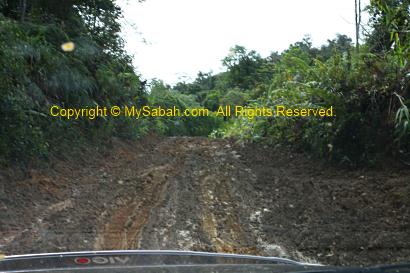
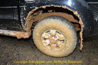
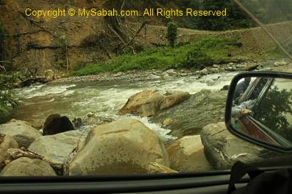
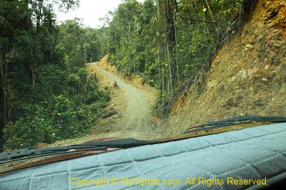
The road, mainly gravel and muddy path, to the starting point is about 30 KM away from Tambunan. The mud is the soft, sticky, smooth and slippery yellow clay soil, so the road is only accessible by four-wheel drive. The engine of our 4-wheel roared and tried really hard to catch very bit of the almost inexistent fiction.
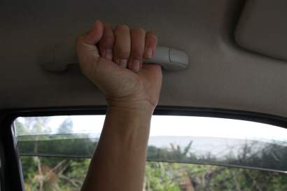
On the muddy road, the car was like gliding and skiing on the mud, and swing violently in zig-zag like a wild bull. The steep slope with loose pebbles also posed a challenge. Our highly-skilled 4-wheel driver shifted gear quickly back and forth, to fight for every inch forward. To be frank, I was freak out. I held the handler so hard that as if I was giving birth a baby. May be I can call it an adventure.
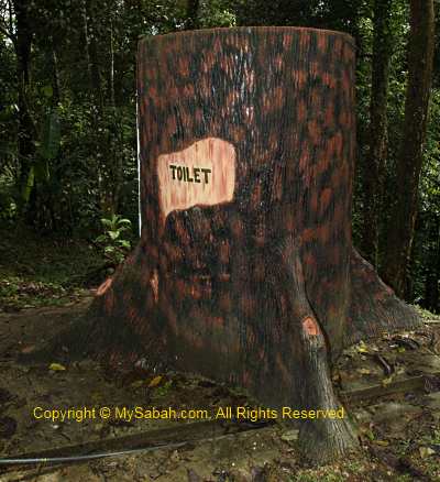
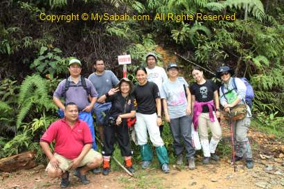
After 35 minutes, we reached the gate of the Forestry Check Point, where everyone was required to register. We also used the “tree” toilet there. It is a man-made structure, not a real tree.
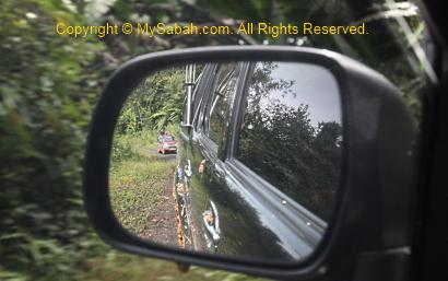
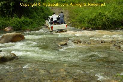
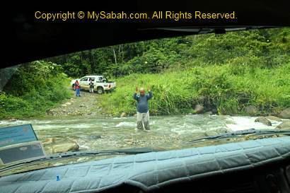
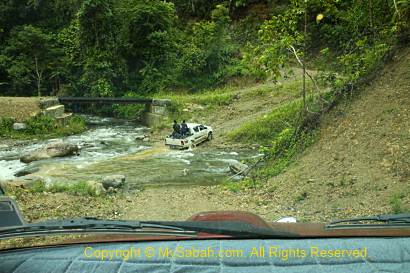
After taking a group photo at the gate, we continued our 4-wheel journey to the starting point. After the checkpoint, the ride was not that bumpy. But then I was terrified when the driver attempted to cross the river. I started to have horrifying imagination of our car being swept away by the river. My worry was needless and we crossed two rivers without any problem. Only now I truly realize the power of 4-wheel drive. Since 4-wheel is meant for adventurers, I wonder why those old aunties and uncles drive 4-wheel in city only and keep it so clean?!!
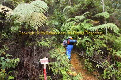
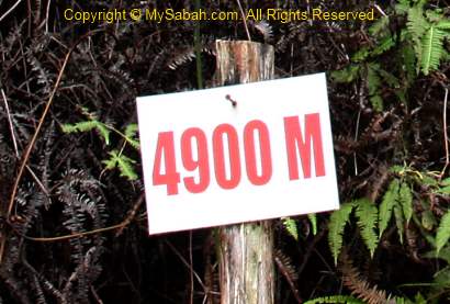
After 40 minutes, we arrived the starting point of the climb. There is nothing there except a “4900 M” signage, which means we are 4.9KM (4,900 Meters) away from the summit of Mt. Trus Madi. 4.9 KM sounds like a short distance on flat ground, but it is not the case for the rugged terrain. They say this is a new starting point, which cut down the distance by 2 hours (about 3 to 4 KM). Many say we would see many blood-sucking leeches at the Starting Point, but luckily we didn’t see any.


