Category Archives: Island & Beach

Bohey Dulang

Bohey Dulang of Semporna Islands Park

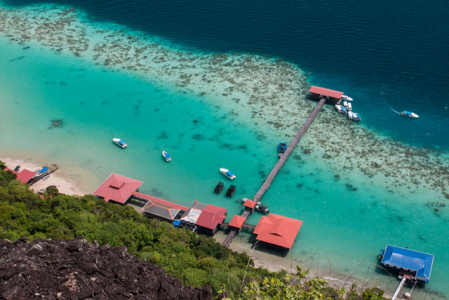
My urge to visit Bohey Dulang Island started with a photo seven years ago. “Nice painting!” I praised a big drawing of islands hanging in the office of my friend. “Actually it’s a PHOTO taken in Sabah,” he replied. I was stunned. The islands look so surreal, such place doesn’t even seem exist. After some lookup in local bookstore, I found that it is the photo of Tun Sakaran Marine Park (or Semporna Islands Park) taken by Michael Patrick Wong.


Pic: aerial photo of Tun Sakaran Park by Michael Patrick Wong

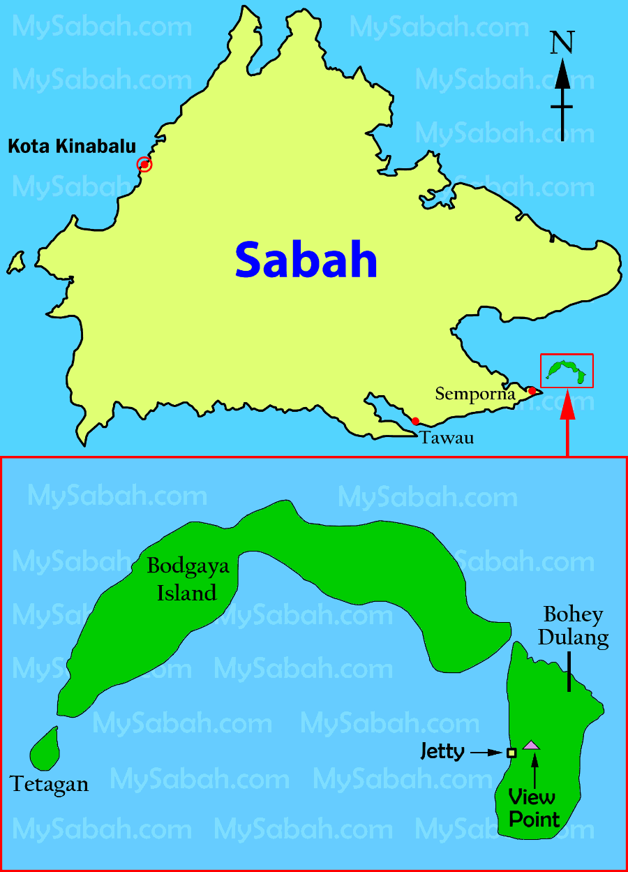
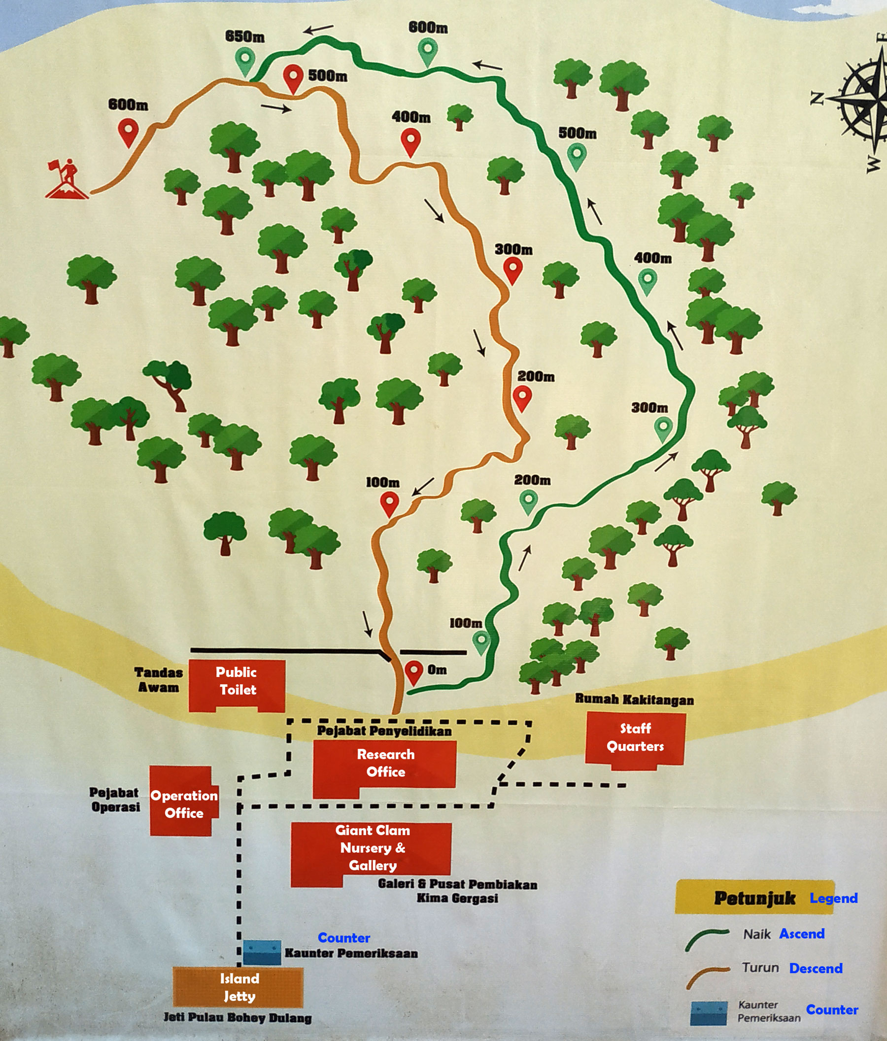
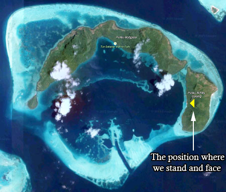
Tun Sakaran Marine Park (TSMP) is located off Semporna at east coast of Sabah and comprises of eight islands – Bohey Dulang, Bodgaya, Tetagan, Sebangkat, Selakan, Maiga, Sibuan and Mantabuan, covering a total land and sea areas of 350 km?.


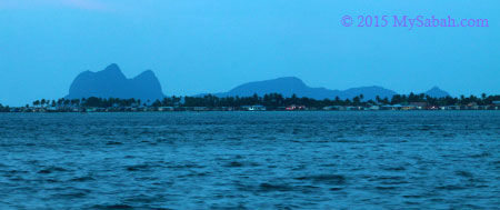
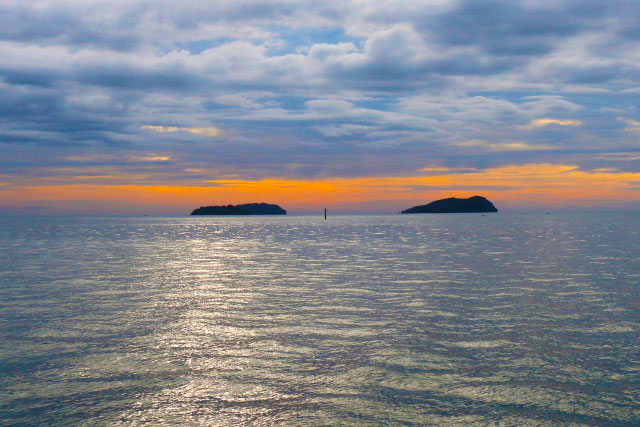
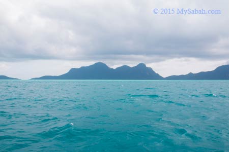
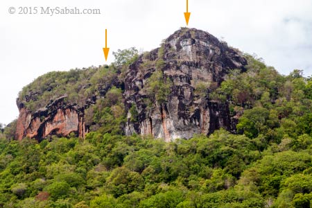
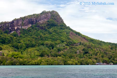
Pic: view of Tun Sakaran Marine Park from Semporna town. Locals call it Sleeping Old Man and I guess you can see why.

TSMP is the largest marine park in Sabah (but will be superseded by 1-million-hectare Tun Mustapha Marine Park soon). I was also told that you can get a fascinating view of TSMP (they call it one of the most beautiful views of Sabah) from the peak of Bohey Dulang Island.

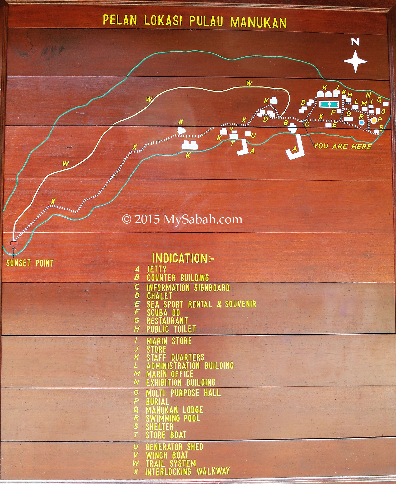
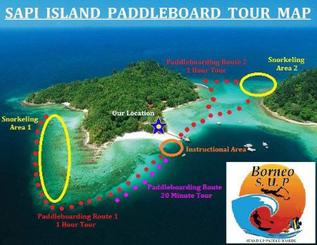
Below is the location map of TSMP. You also can see it in Google Map:

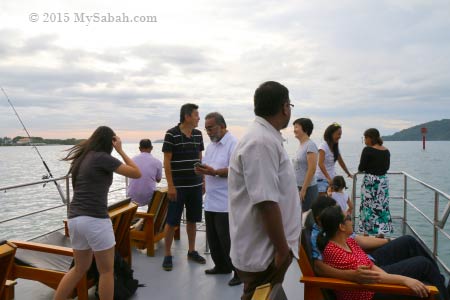
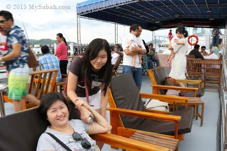
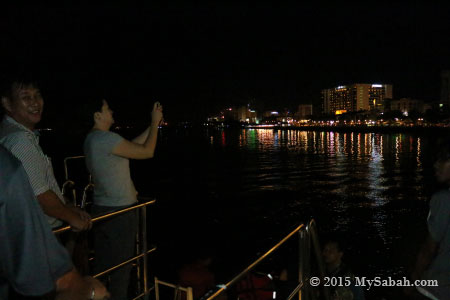
Every now and then I contacted some travel agents for a trip to this park, but they all wanted me to charter the whole boat (for nearly a thousand bucks) if I traveled solo, so the plan was held indefinitely until last month Edward from Borneo Star Cruise texted me, “bro, I’ll visit Bohey Dulang tomorrow. You want to join?” Of course I was more than happy to tag along!

About Bohey Dulang Island

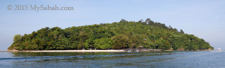
Bohey Dulang (or Boheydulong, Bohaydulong) is the second largest island (size: 313 hectares) of TSMP and about 23 Km away from Semporna. Legend says there lives a beautiful princess named Salamia from Bum-Bum Island. Her family hid her on Bohey Dulang, to avoid a forced marriage by a notorious Sultan from the southern Philippines.


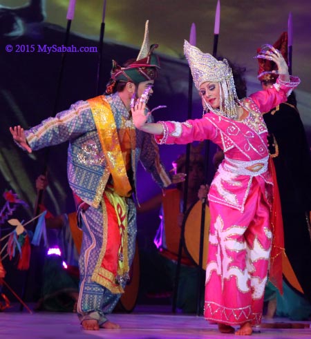
Pic: drama about Princess Salamia in Sabah Fest 2010.

However, she vanished a few days later and believed to be hidden by the spirits of this island and turned into a fairy. Even nowadays, local people say they can hear Princess Salamia singing and her dog barking during the night of full moon. Occasionally, she is seen walking around the island.


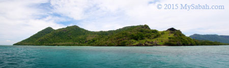
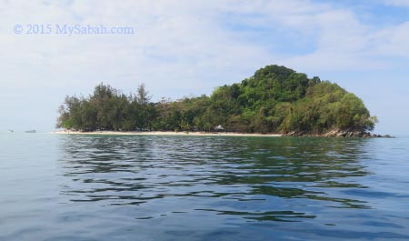
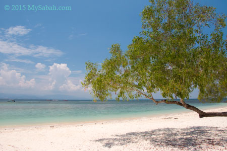
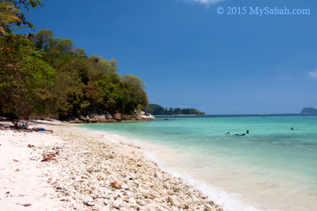
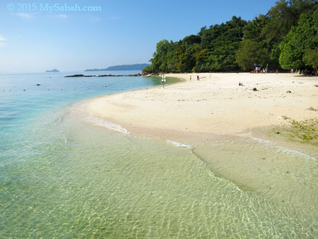
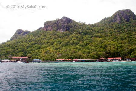
Pic: Bohey Dulang Island

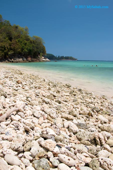
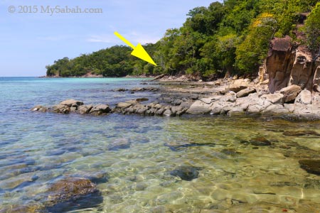
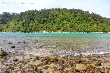
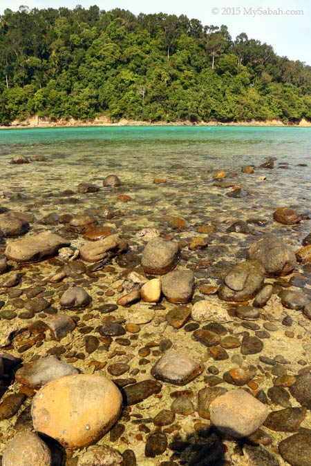
The name Bohey Dulang is derived from bohi (bohey) meaning water and dulang meaning pools or depressions in Bajau language. This may refer to series of oval rock pools, roughly 2-3 m across, along the small waterfalls and main freshwater stream on the eastern side of the island.


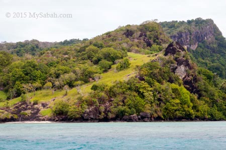
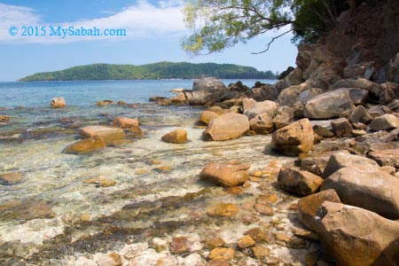
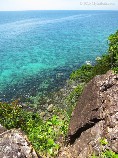
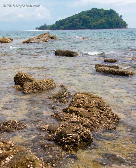
Pic: East side of Bohey Dulang Island

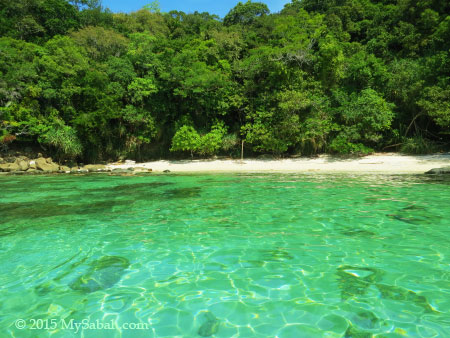
People say these pools are a source of drinking water for Princess Salamia. A document reports a large cave (40 M high and over 20 M long) is situated on the east side of this island too. Could it be the home of Princess Salamia? I wonder.

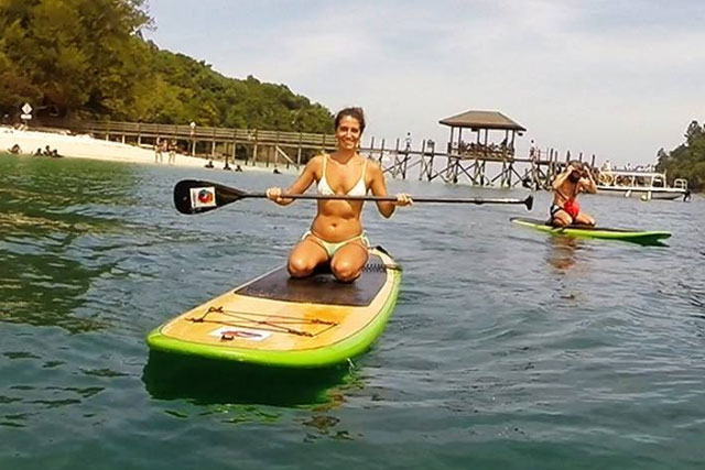
Day Trip to Bohey Dulang

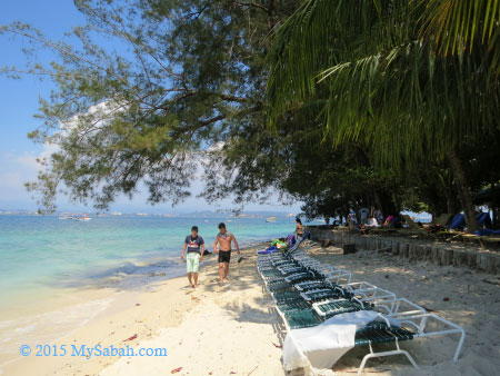
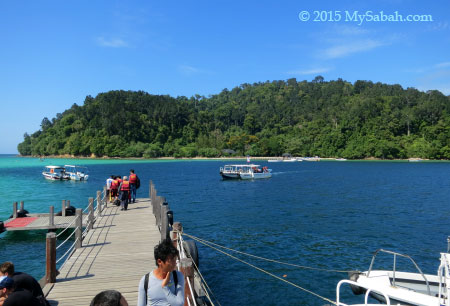
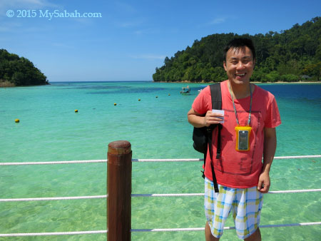
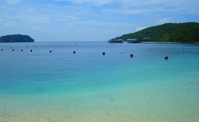
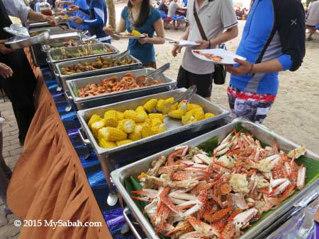
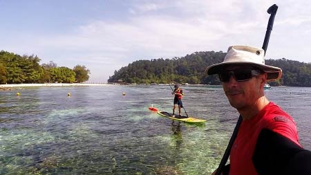
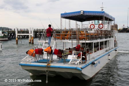
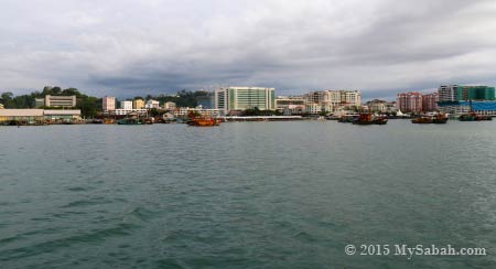
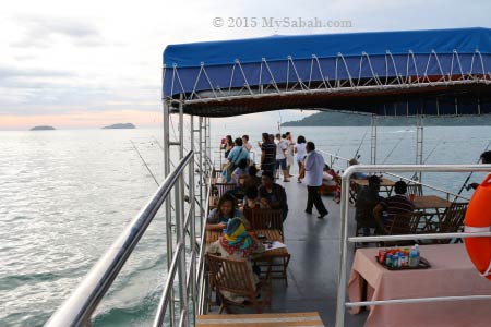
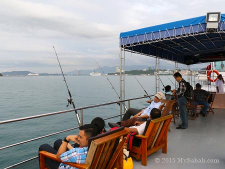
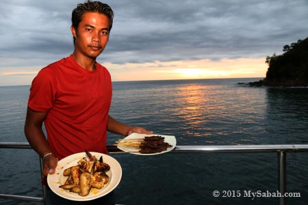
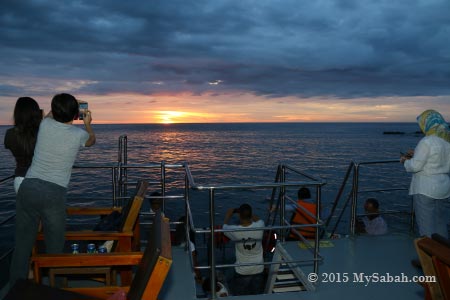
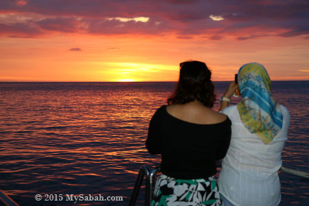
Ok, back to my tour. Edward and I were taking a boat from Semporna town around 11am. The weather was good and we approached TSMP in 15 minutes. The Best Time to visit Bohey Dulang are from February to April (the dry months). If you visit during wetter months like July, August, December and January, your trip would have higher chance of being spoiled by heavy rainstorm of monsoon seasons, or not, depending on your luck. The park would close the climbing trail if the weather doesn’t seem good (even if it’s cloudy and no rain).


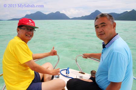
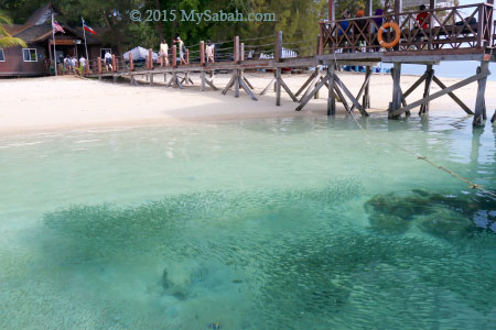
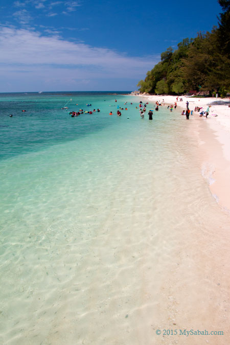
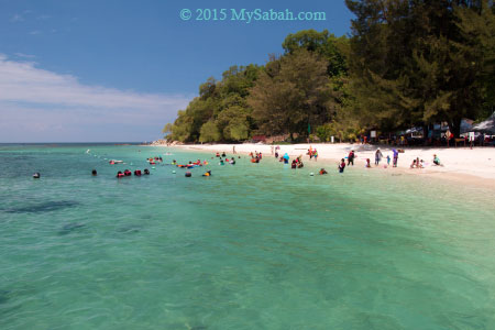
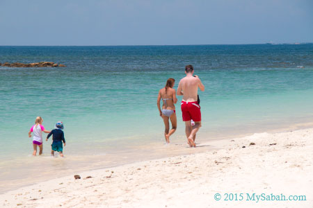
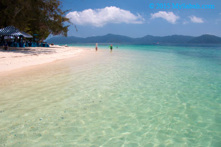
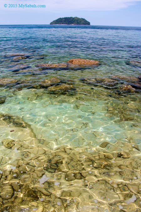
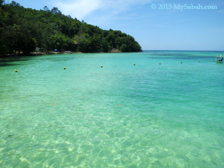
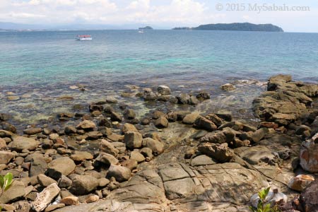
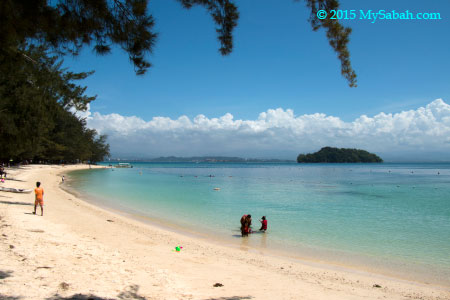
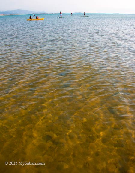
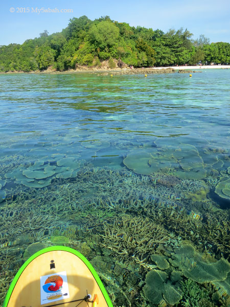
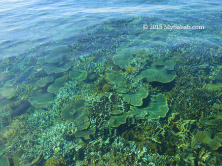
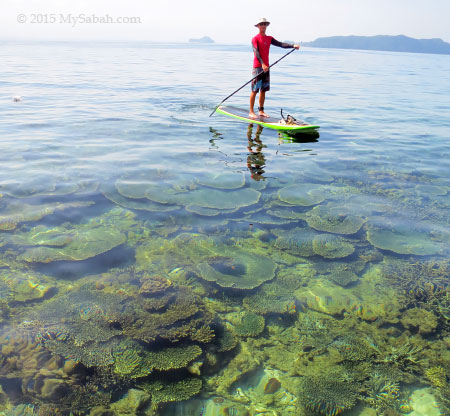
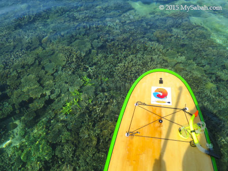
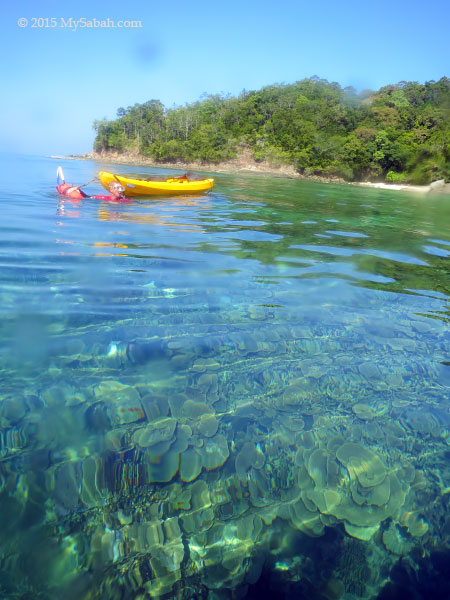
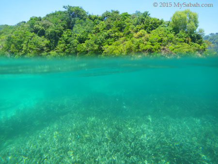
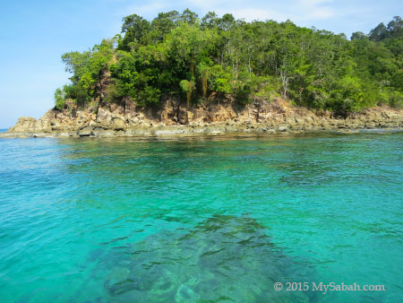
Our boatman showed us a “secret passage” where we could see dozen of sea turtles. We cruised slowly on the sea near TSMP. It was low tide and the water was crystal clear. We could see large area of corals and white sand under the ocean.


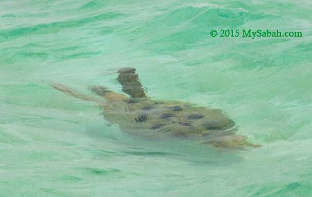
Then we did see over 10 sea turtles passed by our catamaran one by one. Gee… though turtles look heavy and clumsy, they swim as fast as a torpedo in the water. I totally fall in love with the beautiful nature and romantic legend of this island.


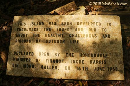
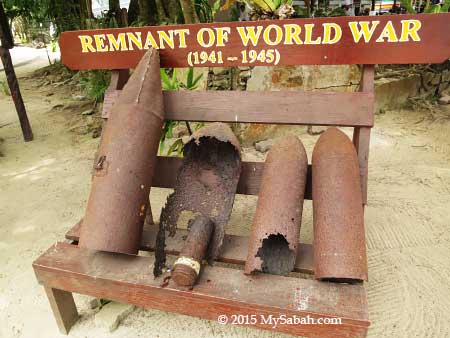
You may ask, “this magical destination should have become very famous for a long time. Why it only rises as a new attraction in recent years?” Good question. In 1963, Bohey Dulang was leased to Kaya Pearl Company to establish the first pearl cultivation center in Malaysia. The island was heavily guarded by armed personnel and stranger was strictly forbidden to enter the island. That’s why Bohey Dulang is nicknamed as the Pearl Island or Treasure Island.


Then the pearl farm was closed in 1993. In 2004, Bohey Dulang, with seven other islands, is gazetted as ?Tun Sakaran Marine Park? (TSMP) by the Sabah Government. As a national park and by word of mouth, it gains more exposure and now it receives hundred of tourists every day.


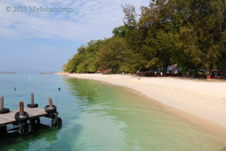
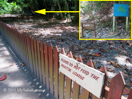
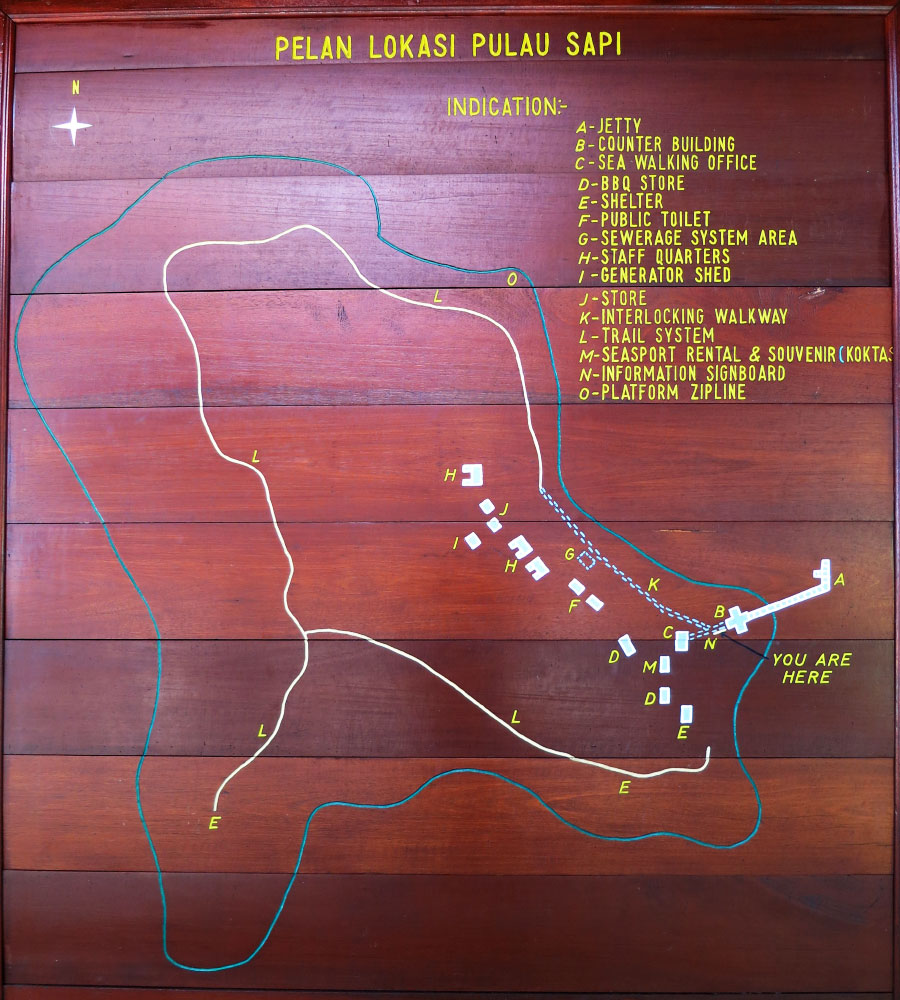
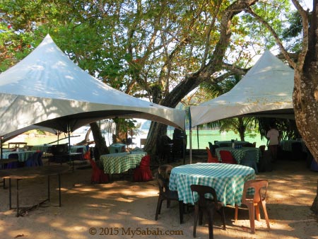
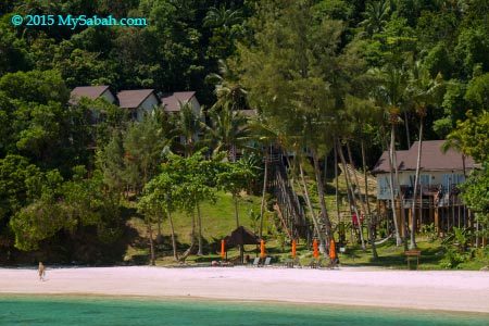
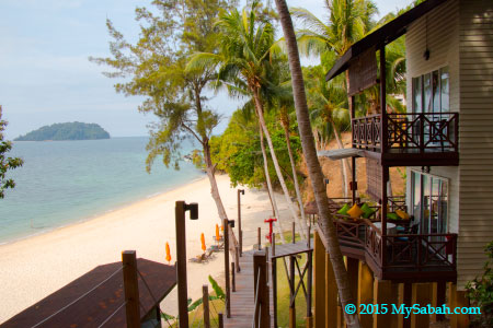
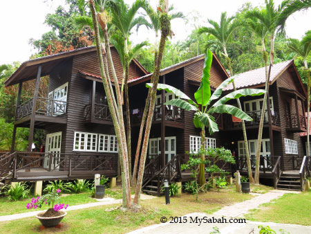
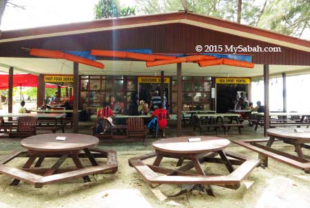
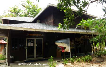
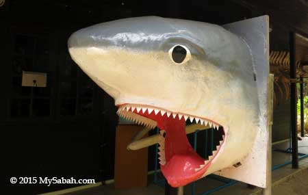
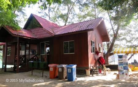
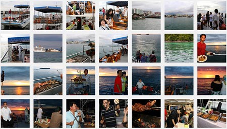
TSMP is managed by Sabah Parks and they have an office and giant clam nursery on Bohey Dulang. Visitors are required to get a permit from them before entering the island. I hope they will make it a public park soon, so tourists only require to buy ticket to enter. Furthermore, Bohey Dulang needs more tourism amenities such as restaurant, watersport center and resort.


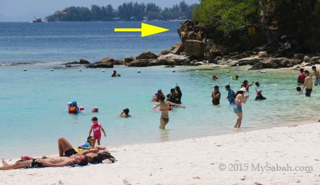
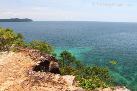
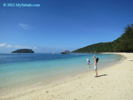
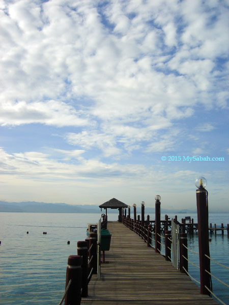
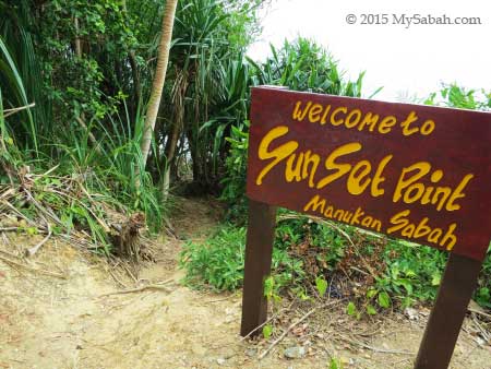
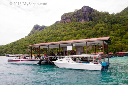
From the jetty, you can see the peak (at left in photo above) that is used as the view point for scenery of TSMP.

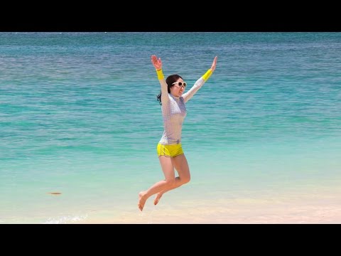
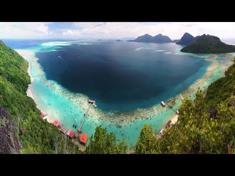
For a fast overview of Bohey Dulang, you may watch the short video below:
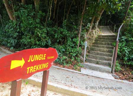
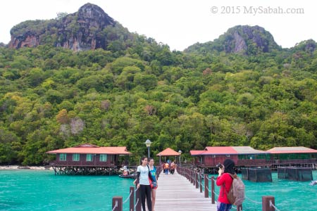
Hiking to the peak

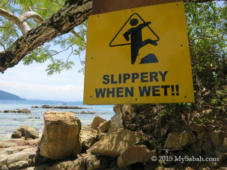
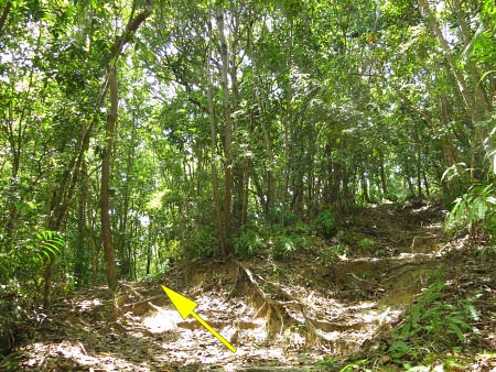
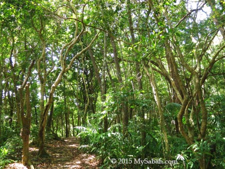
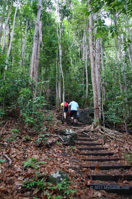
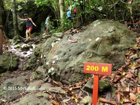
You need to ascend a 800-Meter nature trail to reach the peak with a height of 353 Meters, which normally takes 40 minutes. The climb can be a bit challenging after rain, because some steep areas will become slippery and muddy. Do wear proper walking shoe, I strongly advise against flip-flop. The park will make it compulsory to rent a pair of hiking shoes from them for RM5, if you don’t wear the proper shoes. It’s warm and humid in the forest and hot on the peak, so please bring some drinking water.

Trail map of Bohey Dulang Island (with English translation)


Pic: the view points on the peak. The trail will lead you to the one at right, you can walk 20 Meters to the view point at the left for better sight. The dark grey rocks that form the high cliffs and large shore outcrops are mainly volcanic rocks of late Tertiary (Pliocene) and Quaternary periods. It’s unique because Semporna peninsula is the only place in Sabah where you can see these rocks.


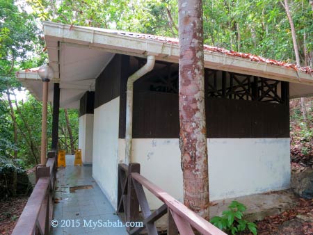
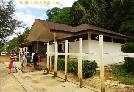
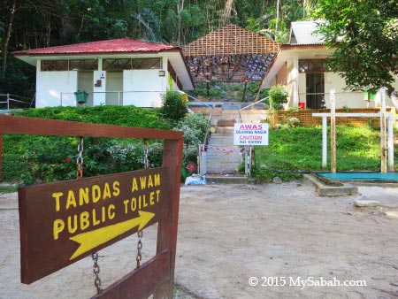
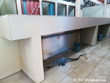
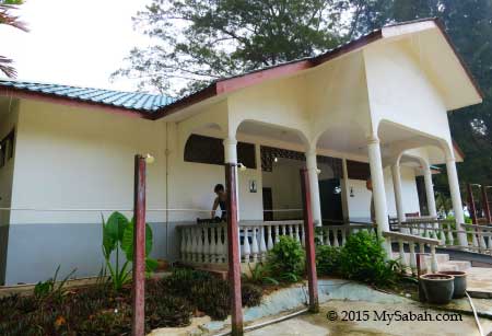
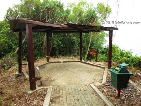
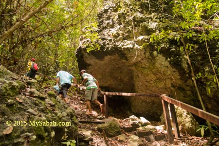
There is a small toilet at the beginning of the trail. It is not so clean and well-maintained, but usable.


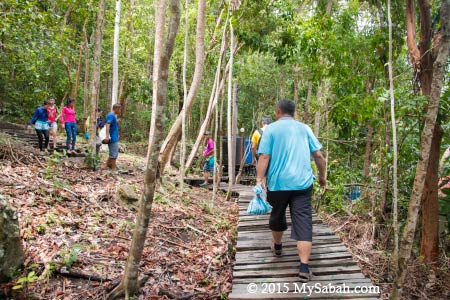
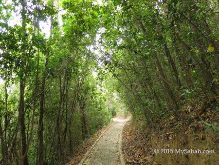
Limited supports such as boardwalk, handrails, ropes, stairway and plank path are available to make your climb easier, but you will walk on soil and rocky path most of the time and busy grabbing the small trees along the trail for support. For safety, a Sabah Parks guide will escort you on the way. Just go slow and everyone can make it quite easily.


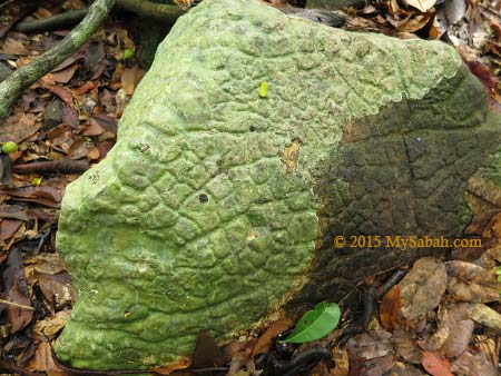
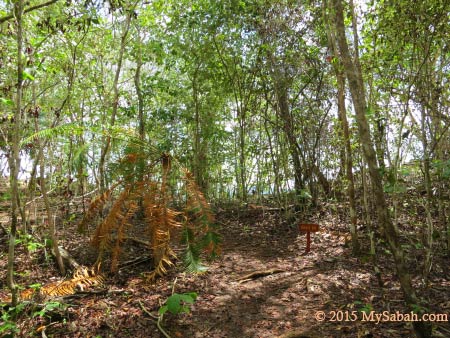
Like other islands in TSMP, Bohey Dulang has one of the most unique and unusual plant communities in Borneo, especially coastal forest and scrub vegetation. Some plant species here are regional endemic to Semporna islands and Philippines, and not found in other locations of Borneo, for example, rare Paraboea leopoldii on cliff faces, Dracaena multiflora monocot, palm-like Cycas rumphii, cactus-like succulent Euphorbia lacei and trichoglottis geminata, a rare epiphytic orchid grows on volcanic rock.


I was looking for Selaginella tamariscina, a small plant of 4-5 cm high like a miniature tree fern. Its leafy distal branches curls inwards under hot sunlight but flattened during rain. This cute plant is a new record to Borneo, and it grows on exposed to partially shaded, gently sloping rockfaces of this island.


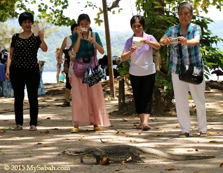
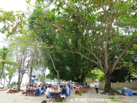
We saw probably nearly a hundred tourists on the way down. They looked tired but really happy. Some even encouraged us, “move on, you are close!”, “it’s awesome up there!”, “it is worth the effort.” A rain earlier turned part of the trail into creeks. Many tourists took off their flip-flop and descended barefooted, when their shoes were too slippery to hold their feet. I sweated a lot but the soothing sea breeze prevented me from overheat.


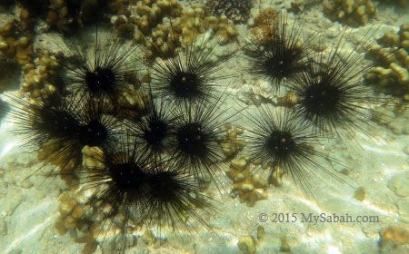
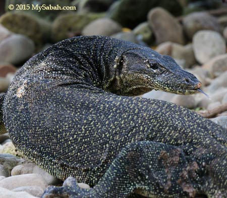
Wildlife such as long-tailed macaque and otter also live on this island but not in great number. A total of 48 bird species comprising mainly resident birds have been recorded around Bohey Dulang. The notable bird species are Metallic Pigeon (Columba vitiensis), Nicobar Pigeon (Caloenas nicobarica), Tabon Scrubfowl and Pied Hornbill. I saw more mosquitoes than other animals though. The good news is – there is no leech.


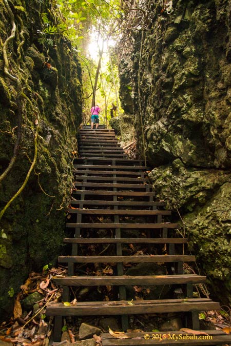
Pic: They call this ladder between boulders “Stairway to Heaven.” You should feel joyful when you reach here. Not because you will go to heaven, the peak is only a very short walk away now.


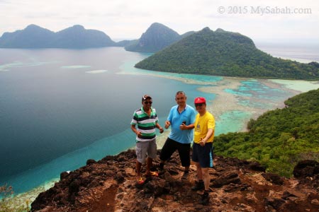
Finally I came to a flat ground and saw the light in front. I could tell the amazing scenery was waiting for me outside the dense bushes.


Hooray…!!! After a taxing climb, it’s time to enjoy the wonderful view and stay as long as you want.

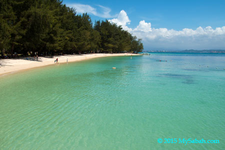
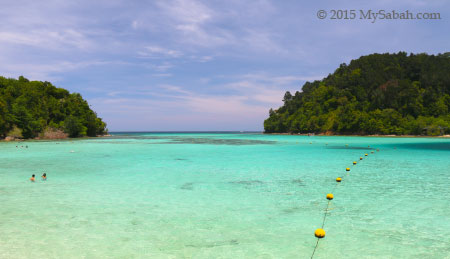
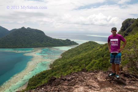
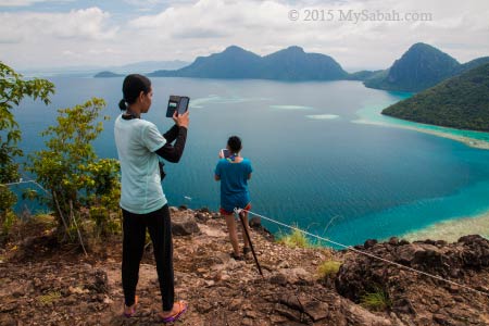
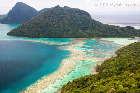
The Most Beautiful Seaview of Sabah

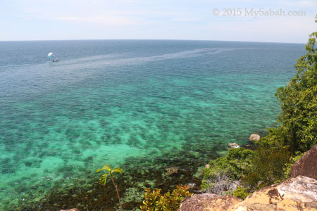
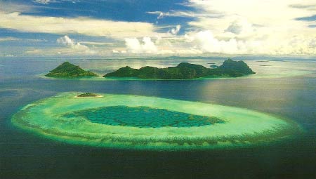
On top of Bohey Dulang, you can have a bird-eye view of the sapphire-colored Bodgaya Lagoon embraced by emerald forest of three central islands (Bodgaya, Bohey Dulang and Tetagan), the only islands in Sabah made of volcanic rock and part of the Sulu volcanic chain. In fact, the lagoon, which is about 6.5 Km across, is a crater of an ancient volcano erupted 2.5 million years ago.


The central islands are the remnants of a Quaternary volcanic crater rim. Part of the “rim” is dissected and inundated by the sea but you can see it from its curved reef formation. I was standing on top of an extinct volcano. You may look at the satellite photo below for a clearer view of the rim.


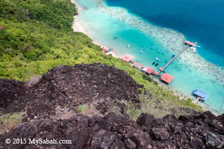
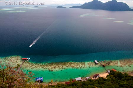
Pic: I could see our boat at the jetty. All boats look like tiny toy from a height of over 260 Meters. The highest point of Bohey Dulang is 353 Meters and situated further south. They might open a new trail to there in future.


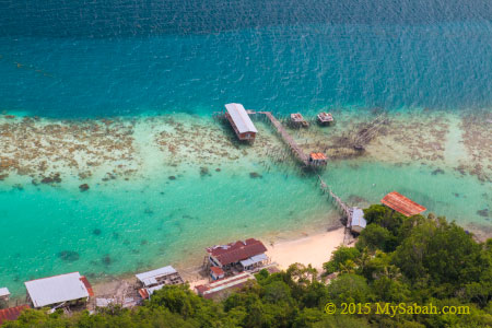
Pic: abandoned pearl farm


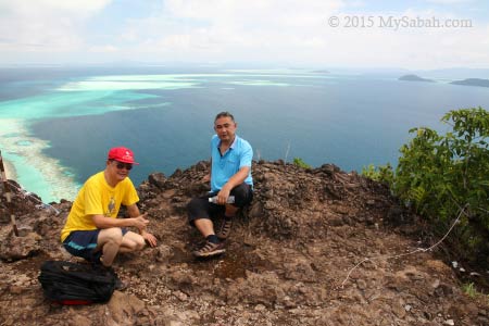
It’s noon time and most tourists have descended. The rest of us were happy to take hundred of photos. They didn’t build any fence, so be careful when you stand on the uneven surface of the cliffs.


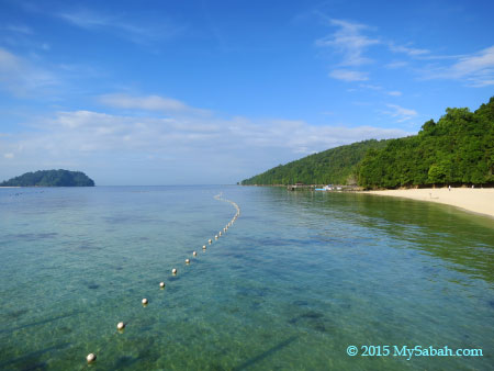
Pic: To your right you can see the 120-Meter long channel between Bodgaya Island and Bohey Dulang. Bodgaya means “impressive mountain” in Bajau language, and it’s the largest island (795 ha) in TSMP and about 8 Km long. You also can see its highest peak, Mt Bodgaya, which is 455 Meters high.


If you say Bohey Dulang has the most beautiful sea view in Sabah, those who had been there won’t argue with you. You may forget many things in life over time, but you will always remember the breathtaking seascape of Bohey Dulang.


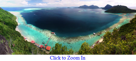
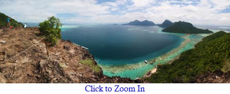
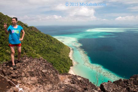
For the best view, you need to walk another 20 Meters to your right for second view point, which offers a truly panoramic view (like photo above). You would miss this spot if nobody tells you. This is the favorite spot of landscape photographers to capture the circular shape of the lagoon and “50 shades of blue” colors.


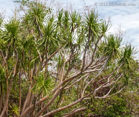
The volcanic rocks and mixture of Bornean and Philippines flora make this park looks a bit “exotic” even to Malaysians. Like the yacca-like Dracaena multiflora in photo above. It is common in summit scrub here but do you know that it’s only found in Philippines and Semporna Islands Park?


It’s hard to say goodbye to Princess Salamia and her lovely islands in Celebes Sea, which can match the beauty of Caribbean Sea.

How to get there

A day trip to Bohey Dulang is possible even if you stay in Kota Kinabalu City (KK). Just take a 50-min morning flight from KK to Tawau City, upon arrival get a 1-hour land transport to Semporna town, then the park is only 20 minutes away by boat. The earliest flight to Tawau departs at 7:25am, and last flight back to KK is at 7:45pm. Both direct routes are served by Malaysia Airlines and available every day. You may use Google Flight to check out the latest prices and other flight alternatives. Please note you need a permit from Sabah Parks prior to visit the island.


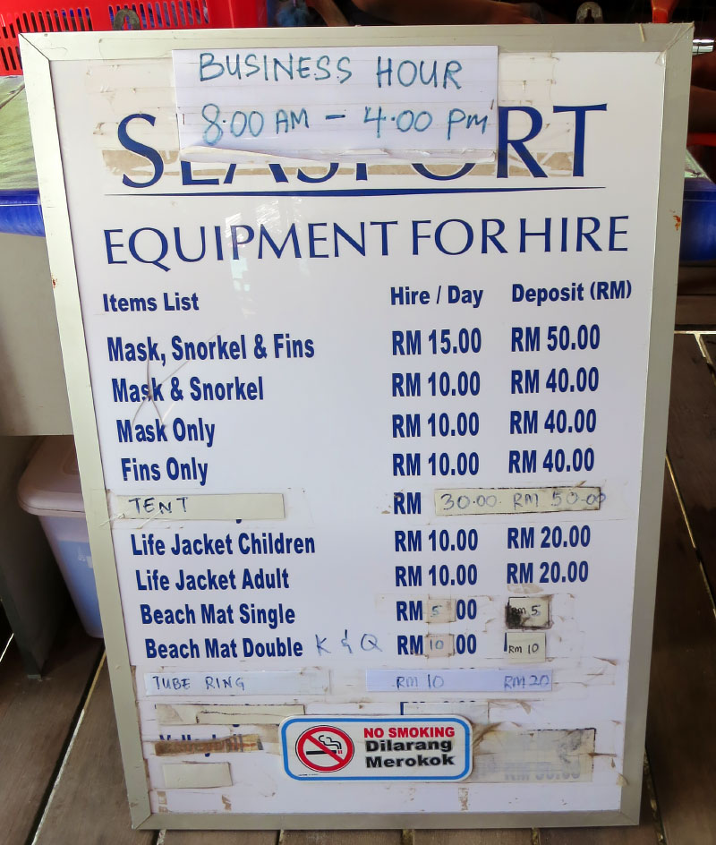
Starting on 1 Feb 2016, visitor will need to pay for entrance ticket to this island (which they call Conservation Fee):

Ticket Rates (in MYR Malaysian Ringgit)

Conservation Fee (to Tun Sakaran Marine Park)AdultBelow 18Below 1260 & Above
MalaysianRM8RM5FreeFree
Non-MalaysianRM20RM12RM12RM20
Climbing Fee (Bohey Dulang)AdultBelow 18Below 1260 & Above
MalaysianRM20RM10FreeFree
Non-MalaysianRM50RM30RM30RM50
Fees to climb Bohey Dulang, rates with effect from 1 Jan 2023


Please feel free to contact Borneo Star Cruise for more info:
E-mail: info@borneostarcruise.com
Phone (24×7): +60 17-820 7911 (also reachable by Text, WhatsApp, Viber, LINE)
Facebook: Borneo-Starcruise-Sdn-Bhd
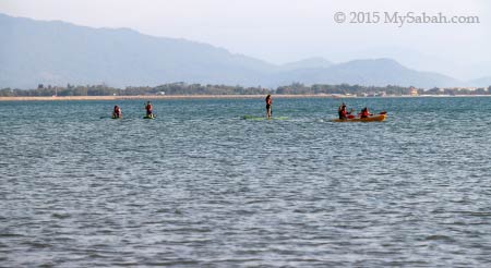
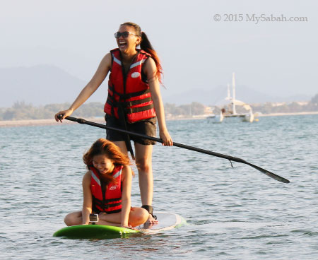
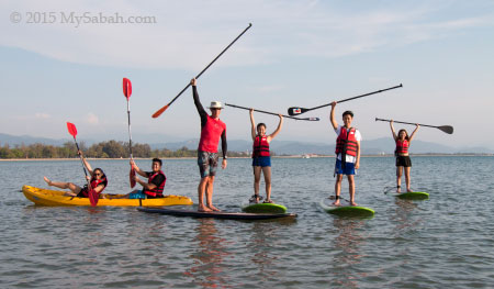
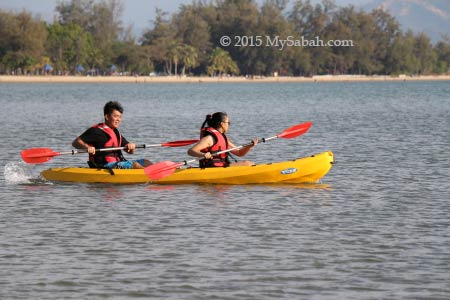
Other Activities

Besides sightseeing at Bohey Dulang, there are a few other activities you can do around Tun Sakaran Marine Park (TSMP).

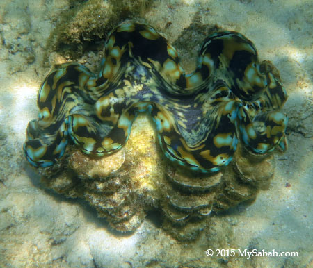
1. Visit Giant Clam Nursery

Due to overfishing, giant clams are highly endangered. TSMP is a refuge for seven species of giant clams (Tridacnidae and Hippopusporcellanus species).


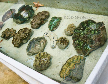
Sabah Parks has a giant clam nursery and hatchery center on Bohey Dulang, where they breed and propagate giant clams inside and outside the Park. The display and settlement tank area, which houses a few species of giant clam (may not open to public and tourists). It’s possible to arrange an educational tour to visit their lab and research center.

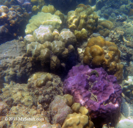
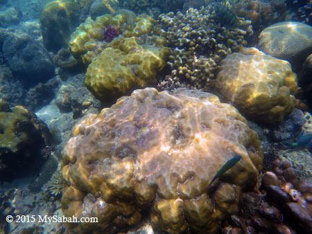
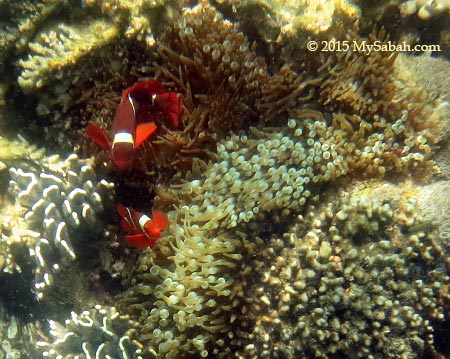
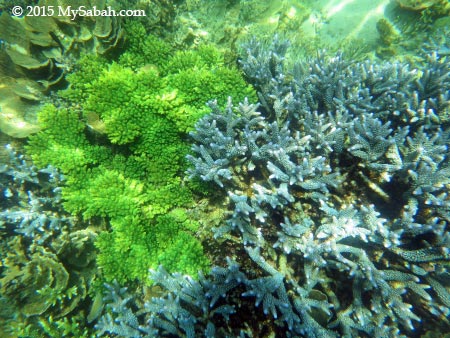
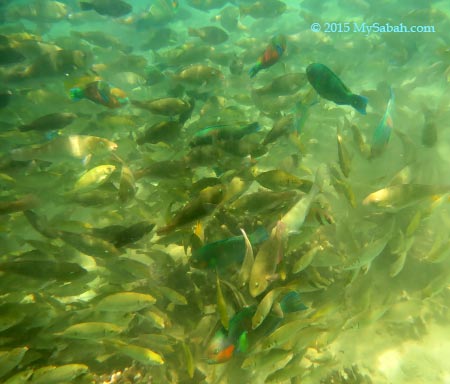
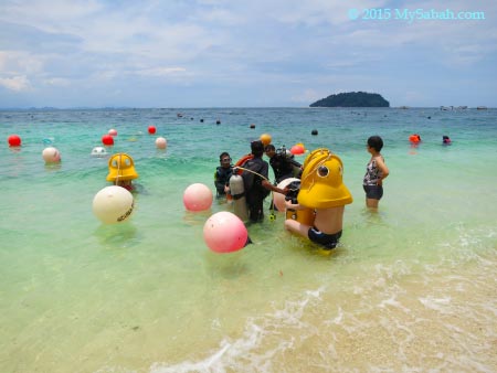
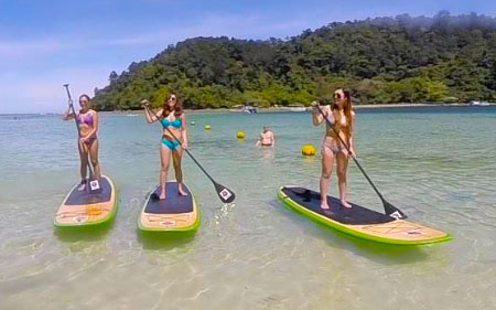
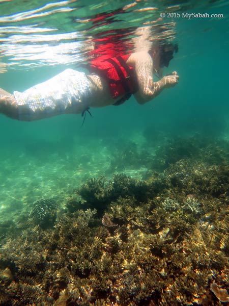
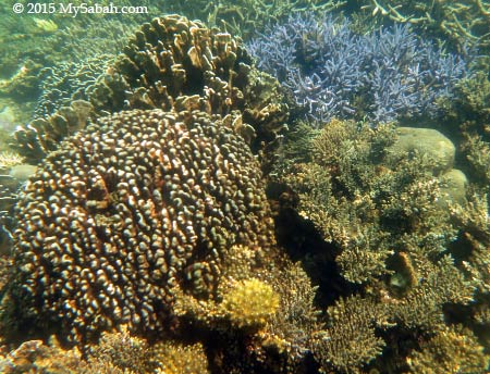
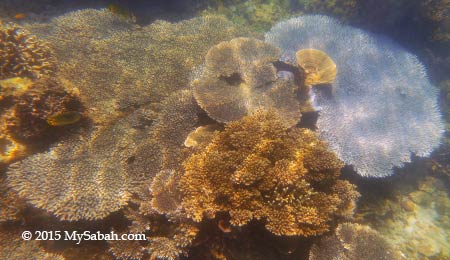
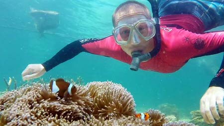
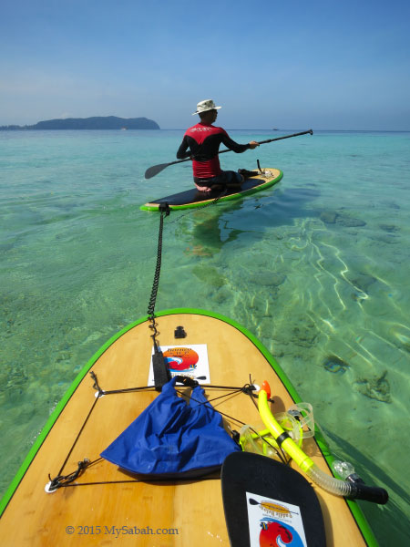
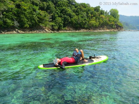
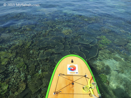
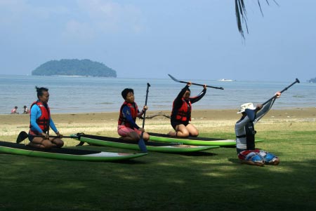
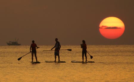
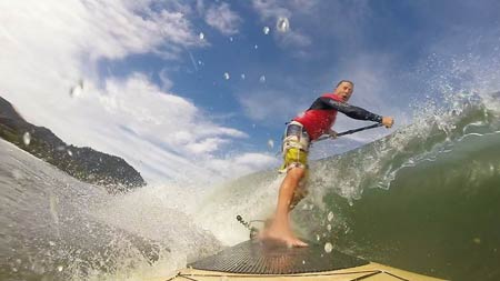
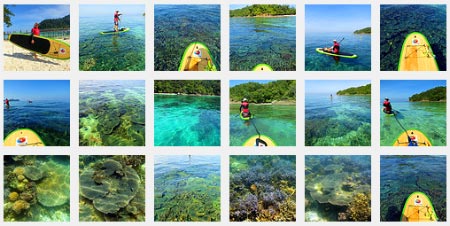
2. Snorkeling & Diving

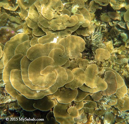
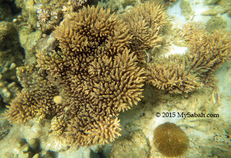
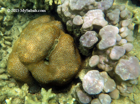
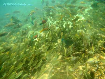
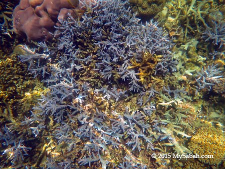
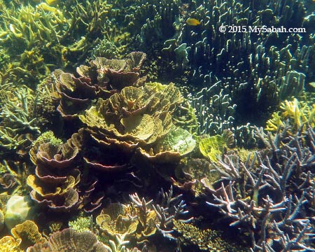
TSMP is located in Coral Triangle (a.k.a. Amazon of the Sea), which supports one of the richest marine ecological zones in Malaysia. 528 species of coral reef fish are found in the park, much more than Sipadan Island (409), Redang (209) and Tioman (233). Teeming with over 320 species of hard and soft corals, and variety of sea creatures such as eagle rays, barracuda, turtles and nudibranchs, this park is getting well-known as a scuba diving and snorkeling site.


Mantabuan Island has the best concentration of corals and marine lives. Sibuan Island is featured as one of the 101 Best Beaches of Malaysia. Therefore, both islands are the favorite picks of travel agents to impress their guests.

3. Photography

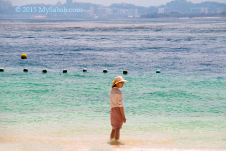
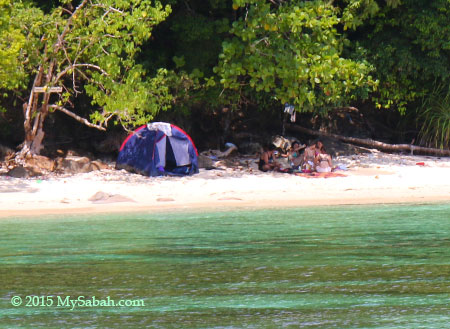
You are wrong if you think that TSMP is only about nature. Many world-renowned photographers have visited this park for human interest shots here and won some international awards. Around the islands, there are about 10 villages of Bajau Laut (a.k.a. Sea Gypsies) people living either in temporary shacks or in their boats. They maintain very traditional lifestyles and possibly the only nomadic seafarers left in the world.


Most of them are fishermen in hardcore poverty. However, when their primitive houses, nude children and pristine sea are being framed into a photo, its visual impact is so overwhelming and so out of this world (though it’s a sad reality). Whenever I drop by Semporna, I never fail to see a few boatloads of photographers heading to TSMP.
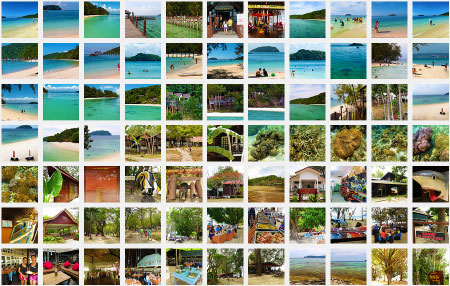
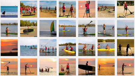
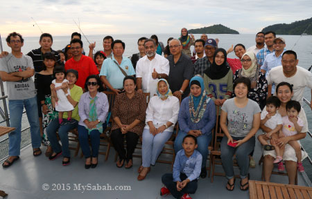
More Photos

For more photos, you may check out my photo album.

.

References

  • New records of Bornean plants from the Semporna Islands off Sabah’s east coast, KM. Wong et al., Sandakania 13 (1999): page 31-40
  • The landscape, vegetation and botany of the Semporna Islands off Sabah, Borneo, KM. Wong et al., Sandakania 13 (1999): page 41-65
  • Semporna Islands Darwin Project (2001 Jan). Management Plan for the Semporna Islands Park

Photos taken in Semporna, Sabah, Malaysia Borneo

Mamutik Island of Sabah, Malaysia

Tourists to Kota Kinabalu City (KK) always ask, out of the five islands of Tunku Abdul Rahman Park (TARP), which one is recommended. My answer is – if you expect a famous and exciting tourist destination, go for Sapi or Manukan. But if you only want a quiet beach to laze around and unwind, Mamutik Island (Pulau Mamutik) is a small island with big space.


Pic: Mamutik Island, looks like a crocodile head isn’t it?

People who want to avoid the crowd will love Mamutik Island, as it is less touristy than Sapi and Manukan, the islands where they would see more people than fishes, and human noise is louder than splashing waves. Being the smallest island of TARP, Mamutik is like an unsophisticated child who doesn’t try to impress you, it may not have charming personality but you feel more open up and relax.


Mamutik is rated by some tourists as an average island because of three reasons. First, the sea there is quite rough and water turns murky sometimes. Second, the strong waves wash many coral fragments to the shore. Stepping on this jagged surface can be a discomfort to sensitive feet. Last, the density and variety of corals isn’t great. All of the above are true.


Pic: school of anchovy fishes (ikan bilis) at the jetty

However, Mamutik still has one of the most beautiful beaches near KK and its photo is good enough to be used as postcard. Though lack of WOW factor, Mamutik isn’t lack of happy customers who appreciate the ambience of tranquillity and privacy offered by this less-crowded island.

The following is a HD video that gives you an overview of Mamutik:

The Beaches

Mamutik Island has long stretch of white sandy beach about 200 Meters in length. The sea can be choppy occassionally and the water is getting deep after 10 Meters from shore, so be careful if you don’t know how to swim.


Pic: note the darker area of the sea, it’s the color of deeper water


Every visitor can get a big share of space, swim freely and won’t collide with others (but watch out for jellyfish). Without many eyes around, tourists here behave relatively more relax.


However, the visitors seem to congregate in one or two places. Probably they feel safer to stay near to one another, or these places are near to toilet. Anyway, there are some sections that has few or no tourist, so feel free to pick a zone as your “private beach”.


Move further away from people, you can find many good photography spots with clean background, as if you are on a remote island. Most coral fragments are concentrated in the water. The beach is still mainly fine sandy beach that is nice to walk on.


Pic: You can count the number of tourists here by fingers. If we are willing to pay more for bigger hotel room, the ample personal space in Mamutik is a great value, isn’t it?


If you go to the east side of Mamutik, there is a more secluded area very well-shaded by tall casuarina trees. The beach chairs are reserved for the hotel guests from Shangri-La’s Tanjung Aru Resort. The place is quite cooling and suitable for chilling out after a swim under hot sun. You may walk or snorkel at the beach there but please keep your voice down. The staff would ask noisy outsiders to leave.


The sea waves at east side is even stronger because it is where open ocean current passing by the island. I call it a “Coral Beach” because the beach here is covered by bigger pieces of coral fragments. I even found giant clam shell once. Probably that’s how Mamutik got its name which means “shell collection”. (Note: collecting shell and anything is forbidden in this protected marine park)


Walking on the coral fragments with barefoot isn’t too bad. Just take it as a reflexology walking therapy lol. My feet have thick skin so it doesn’t hurt at all. You can wear slipper if it’s a problem.


The coral beach is quite well-kept to near pristine state since it’s a semi-private area. Turtles know it. On 26 Dec 2009, a hawksbill turtle landed on this beach to lay its eggs. It’s a good sign that turtles are coming back. We still face a lot of challenges to conserve them due to increasing plastic garbage in our sea.


FYI, if you explore further to the edge of the beach at west side, you will come to a rocky beach with nice view. The rocks in the water is slippery so be cautious when you walk on them.


Mamutik Island is located in the center of TARP, so you can see four other islands clearly from there. In the past, all five islands were part of the mainland. After Ice-Age ended, they were disconnected from mainland about 1 million years ago.

A City Island

Mamutik Island is the second nearest island to KK, so you can have a good view of our city only 3 KM away. Though travellers were away from the city, some can’t take city totally out of their mind.


On Mamutik, I always see people sitting and staring at the sea and city for a long time, or look at the planes flying in and out of KK International Airport. I wonder what’s in their mind. Were they thinking about their relationship, work, future or nothing? Whatever, Mamutik is a good place for daydreaming.


Oh by the way, since Mamutik is nearer to city, your phone may have good access to 3G network (Celcom seems to have the best coverage here).

Snorkelling

Besides sunbathing and swimming at Mamutik, snorkelling is an enjoyable way to see the underwater world. To be honest, I’m a bit disappointed with the experience. Compared to other islands, the variety of corals here isn’t so good (but not bad).


The best location to go snorkelling is the sea in front of the coral beach (another best spot is near rocky beach at the west side). The visibility is ok (about 5 Meters). That area is dominated by brain and boulder corals. They are quite abundant and big in size, often in yellow or brown color. Some have tubeworms (or Xmas Tree Worm) live in them. The most beautiful coral is the purple color Porites coral (see photo above). Not many soft corals are found though.


It’s cool that I found plenty of fishes even in shallow water. I even saw a lonely barracuda. The variety of fishes is good, but I can’t tell their species other than “Nemo” (clownfish), parrot fish and damselfish. A reef fish expert is able to spot 63 fish species in 45 minutes of snorkelling at Mamutik.


Be careful when you snorkel in the sea near the jetty area, there are many sea urchins among the corals. In case you get stung by sea urchin, just keep calm and look for the lifeguards at the beach.


Snorkelling set (snorkel, mask, fin, life jacket) are available for rent on the island, so are beach mat, tube ring, camping tent, volleyball and football. You may check out the price list (as of May 2015).

Facilities

Mamutik definitely has the facilities to fulfil tourists’ two most basic needs, i.e. call of nature (toilet) and food. Changing rooms, picnic shelters, tables and benches are free for public use too. The following is a layout map of the facilities on Mamutik:

Cafe

There is a canteen named Koktas Cafe that sells basic meals and drink. You can get food such as chicken rice, sandwich and fried noodle there. You would spend over RM10 (≈US$3) per meal as everything is priced higher on island. Better bring your own food. You may look at its menu and price list JFYI (prices as of May 2015).


Pic: Koktas Cafe


Pic: there are many lunch buffet stalls on the island. May serve good food but won’t be cheap.

Shop

Next to Koktas Cafe is a grocery and souvenir shop, where you can buy T-shirt, beach wear, slipper, hat, towel, snacks (cookies, potato chips, chocolate bars, nuts, etc.), instant noodle, insect repellent, bottled drinking water, soft drink, ice cream, etc. Beer and cigarette are available. It’s also where you rent snorkelling gear.

Accommodation

There is no hotel, resthouse and accommodation on Mamutik Island now, but a new hostel would be ready by 2017. Camping is allowed under the permission of the park warden. Camping tent is available for rent at RM30 per night (≈US$9). The park requires the camper to pay a small Camping Fee of RM5 (≈US$1.50) for adult and RM2 (≈US$0.60) for child (below 18). Please noted you need to pay additional RM50 (≈US$15) to boat operator for return trip next day. The bonus of camping here is – campers will have a wonderful night view of KK city light and sunrise view of Mt. Kinabalu (if weather is good).


Pic: public toilet with shower heads outside. The toilet on Mamutik is not well-maintained, with some broken door locks and toilet flush, a bit dirty sometimes.

Borneo Divers Dive Academy

Built by Borneo Divers, a PADI 5-star Dive Centre and Instructor Development Centre (IDC), Borneo Divers Dive Academy has started operating on 18 May 2016.

Borneo Divers Dive Academy & Leisure Center

Their main role is to provide beginner and advanced scuba diving courses in this centre completed with swimming pool, dive station (with full range of dive equipment) and classrooms.

Swimming pool for guests and scuba diving courses

If you want to experience scuba diving without a diver license, you can sign up for their Discovery Scuba Diving, which costs about RM300 (≈US$90) per person and includes two dives (guided by dive instructor).


Pic: scuba divers on Mamutik Island

Besides, this Center also has the following facilities (some are open for public):

  • Water sports center
  • Souvenir shop
  • In-door and outdoor restaurants
  • Changing rooms, lockers and shower facilities
  • Marine Research Lab
  • Beach Bar
  • Hostel which can accommodate 80 people (available by end of 2016)
Brochure of Borneo Divers Dive Academy


Pic: old cemetery belongs to the past residents of Mamutik, before the island is gazetted as national park in 1979. The burial ground is inside a fenced area. Just to let you know so you won’t unknowingly camp on a grave.

Jungle Trekking

At the north of Mamutik is a forested ridge. If you have 20 minutes to spare, you may walk its 385-Meter jungle trail. There are a lot of mosquitoes so insect repellent is a must.


However, this regenerated secondary forest is too small to support rich diversity of flora and fauna, so there is nothing much to see.


The only highlight is Philippines Megapod, a red face chicken-like bird that lays its eggs in mounds of sand at the edge of beach. I spotted 3 of them in my last visit. They were busy digging the soil about 5 Meters away from me behind the bush.

How to get there

Mamutik Island (see Location Map) is open from 8:00am to 5pm to public every day. You can hire a boat (for about RM30≈US$9) at one of the boat terminals in KK. The boat transfer is available every hour and the ride to Mamutik takes about 10 minutes.

Entrance Fee to Island

Besides paying for return boat transport (about RM30≈US$8, terminal fee included), you need to buy ticket (known as Conservation Fee) from the park to enter the island. The table below is the ticket rates. Please note if you are on an island-hopping trip, you only need to buy this ticket once, and you can reuse the same ticket to enter other islands of TARP on the same day.

NationalityAdultBelow 18Below 660 & above
MalaysianRM8RM5FreeFree
Non-MalaysianRM25RM20RM20RM20

*Rates updated in July 2021. The entry is free for visitor with disability.

More Photos

For more nice photos, you may browse 100 latest photos of Mamutik Island in my photo album.

Photos taken in Kota Kinabalu, Sabah, Malaysia

Sapi Island (Pulau Sapi) of Sabah, Malaysia

Among all the islands near to Kota Kinabalu City (KK), Sapi Island (Pulau Sapi) wins the most votes as the favorite of tourists. Not only it offers more nature experience, the new activities such as Coral Flyer (longest island to island zipline in the world) make this little island more exciting. After you see all its features and secrets in this article, you will love Sapi even more.


Sapi Island is only 25-acre (10 ha) big and the second smallest island of Tunku Abdul Rahman Marine Park. Though it’s about ⅓ the size of more popular and developed Manukan Island nearby, people like its less commercialized setting and every facility is just a short walk away.


Pic: jetty of Sapi Island, with Gaya Island in the background

Once you arrive Sapi Island, thousands of fishes and beautiful sea view at the jetty already impress you, most will think “it’s gonna to be an awesome tour!” I feel the same no matter how many times I visit Sapi. Sapi is really a gift to KK, how many cities in the world have nice tropical island only 7 KM away?


Pic: my friend was so delighted in his first visit to Sapi Island. He also says he likes Sapi better than Manukan.


Sapi Island has everything it takes to be a cool island destination, i.e. blue sky, white sandy beach, crystal clear seawater, green forest, and… how about some wildlife?


Let’s meet the “dragons” of Sapi. I mean Monitor Lizard. Dozens of monitor lizards roam freely at the forest edge of Sapi and some grows up to 2 Meters long, so big that tourists mistake them as Komodo Dragon. Monitor Lizards are not aggressive and they are never a problem to the tourists. Just ignore them like how they ignore you. They only bite when you leave them no choice.


At first tourists would find these reptiles a bit intimidating, then they will enjoy it as part the nature experience. In fact, this is an attraction to green tourists who love the idea of sharing space with wildlife. Wild boars and macaques are also present occasionally.


You can just laze on the beach or go swimming. If you are not a swimmer, don’t go too far out. Certain sections, especially the area near to jetty, have a sudden incline of 2 to 3 Meters deep. So always keep an eyes on your children, though there are lifeguards around.


The beach of Sapi Island is small so it can be quite crowded during weekends and school holiday. Sapi is a forested island covered by old secondary jungle, the forest is fully protected after this island was gazetted as a national park since 1979. The trees grow very dense and tall, providing good shade behind the beach. The best months to visit Sapi are from Feb to May.

Below is a short video that shows what Sapi Island has (and its least explored corners):

Snorkelling

Fire your tour guide if he doesn’t recommend you to snorkel in Sapi Island. It’s a must-try. The best concentration of corals is located at southern side of the island. You won’t see much coral if you snorkel near the beach full with tourists.


You don’t need to make any appointment with Nemo. They are always there. Sapi Island seems to have more fishes than other islands of KK. If you want to go fishing near to KK, experienced anglers will bring you to water around Sapi Island.


Most corals I saw during snorkelling are hard corals such as lettuce and staghorn corals. During low tide, they are just a few feet under my belly. In sunny day, the visibility is excellent. Corals also need sunlight like plant, the clear water helps them to flourish.


Pic: This giant clam is about 1-feet wide, about 4 to 6 years old I think.

You can rent a life jacket for snorkelling if you don’t know how to swim.

Ok, no picture, no evidence, so the following is the moving pictures of my snorkelling in Sapi:

Besides snorkelling, there are many other fun things you can try on Sapi Island, for example, Coral Flyer (World’s longest island to island zipline), Sea Walking, Scuba diving.

Hidden Beaches

As I said, the beach can be packed with tourists in peak season. Since you can’t ask everyone on the beach to keep quiet, you can move to “hidden” beaches at other side of the island for more tranquility. It’s also the area that faces the rich corals I mentioned above.


Pic: the way (yellow pointer) to hidden beaches are behind the rock outcrop next to tourist beach


But there is a little obstacle course for you to cross to other side. The rocks in the water are quite slippery. For me, climbing over the dry boulders along the rocky shore is easier.


It’s a walk of about 200 Meters that worths your effort. Bring some water (and snorkelling gears) with you. Otherwise it’s very troublesome to walk back to tourist area to get it.


Pic: there are two hidden beaches on the same side. Some locals also don’t know this. They are all yours. You are welcome.


Pic: campers at the secret beach

Secret Cliff

Here is another secret location with rewarding view, only for those who are keen to walk 800 Meters to higher ground. Your friends who are lazy to follow you will regret, after they see the nice photos you share on Instagram.


The starting point of the trail is next to a fenced area behind tourist beach and a shelter named “Pondok Tenggiri”. It’s guarded by a few dragons. Don’t worry, they (monitor lizards) will flee when you approach lol. You will spot a not-so-useful trail map at forest edge.


The route starts with steep ascend in the beginning. After 486 Meters, you will reach a Y junction, follow the trail at the left. There is no direction sign along the trail, keep your eyes wide open so you won’t miss the junction.


After 300 Meters, you will come to an open area with exposed sedimentary rocks and greeted by a few noisy White-breasted woodswallow (bird). Congratulations! You have discovered the secret cliff that is unseen by 99.9% of the tourists. Even though it’s only a 25 minutes walk, it feels like a major achievement for getting there.


The cliff gives you a magnificent view of rocky shore facing the vast blue ocean behind Sapi Island. Watch your footing as there is no fence. A fall from this 50 feet cliff is hazardous to your health, and there are very few people come here, in case you need help badly. Anyway, this cliff could be a potential spot for recreational abseiling.


Pic: view of Manukan Island from the cliff

You can see more photos of this secret cliff in my photo album. I also recorded the panoramic scene of secret cliff in my video.


On another side of the secret cliff is a descending path leads to a rocky beach, where you can get very clear view of hidden beaches.


You may turn back to the starting point after taking some photos on secret cliff, or you can continue to explore another route at the junction, by walking another 500 Meters on the ridge to complete the loop trail of Sapi Island. The remaining jungle trail is not well-maintained. Unless you are very interested in trees, there are some big Keruing and other beautiful trees to see, otherwise don’t waste your time.


Pic: a monument near the end of jungle trail. How many typo do you spot? If this thing happens today, sure it’ll go viral on the Net.

Rocky Beach

Another beach worths checking out is the Rocky Beach at the 200-Meter narrow channel between Sapi and Gaya Island. During low tide, you can even walk to Gaya Island, the biggest island of Tunku Abdul Rahman Marine Park. Wildlife also uses this as a migration shortcut between islands.


The shore is blanketed by tens of thousands of sandstone pebbles and rocks, this likes an upstream river in interior of Sabah.


The 235-Meter zipline Coral Flyer can be seen from here.

Facilities on Sapi

The amenities for tourists are basic but quite complete on Sapi Island. Jetty, toilets / changing rooms, benches, cafe, grocery shop and shelters are available for public access. The only thing that Sapi doesn’t have is island accommodation. Camping is allowed but you must inform the Park Warden at reception counter for the permission.


Pic: above is the layout map of Sapi Island. You can click to enlarge it.


Pic: public toilets of Sapi Island. Thank you for not peeing in the sea. There are shower heads outside for you to rinse your body.


Pic: I was so shocked to see this monitor lizard in man’s toilet because it’s a female. An awkward moment when we both were speechless and stared at each other. Nature, remember this is Nature. Wildlife has the right to enjoy the amenities like human does. Just kidding.


Sapi Cafe is open from 8am to 4pm every day, and they serve common food and drink such as fried rice from RM7 to RM23 (≈US$2-7). You can click here to see their menu (prices as of Apr 2015), which has good variety of choices (Note: Some food items may not available sometimes).


Pic: lunch buffet stalls on the island, usually run by travel agent for their tour groups, but they might accept walk-in customers.


You can rent snorkelling gears (RM25/day≈US$7.60/day for snorkel, mask, fins & life jacket), beach mat, camping tent, etc. from a shop in island. Small locker is available for rent for RM10 (≈US$3) a day. Refundable deposit applies so bring extra cash. You may click here to see the list of items and their rental/deposit rates (prices as of Apr 2015).


Pic: island grocery shop, opens from 8am to 4pm, some items sold include snacks, soft drink, beer, sunblock lotion, insect repellent, soap & shampoo, batteries, medicines.

Travel Fees

Sapi Island is a public marine park managed by the government (Sabah Parks) and open to walk-in local and international tourists every day. After you pay for the return boat transfer, you need to purchase ticket (which is called Conservation Fee) to enter the island. The table below is the ticket rates.

NationalityAdultBelow 18Below 660 & above
MalaysianRM8RM5FreeFree
Non-MalaysianRM25RM20RM20RM20
Conservation fee, with effect from 1 Jan 2023

*Rates updated in Jan 2023. The entry is free for visitor with disability.

Some travel agents may charge you RM150 to RM180 (≈US$45-55) per person for a tour package (include land/boat transfer, lunch, entrance fee, snorkelling gears, guide service) to Sapi Island. If you arrange the trip on your own, it’ll cost only RM100 (≈US$24) or less. For example, let’s say you are a foreign adult tourist, below is the sample budget:

  • Return Boat Transfer (& Terminal Fee): RM30
  • Island Entrance Fee: RM25 (non-Malaysian adult)
  • Snorkelling Gears: RM25 (rent from shop in island)
  • Lunch: RM15 (bring your own lunch)

Camping Fee

For camper, the park imposes a small Camping Fee of RM5 (≈US$1.50) for adult and RM2 (≈US$0.60) for child (below 18). Please be informed that you need to pay additional RM50 (≈US$15) to boat operator for next-day pickup. Camping tent (fit 4 people) is available for rent at RM30/day (≈US$9/day) on the island. The island shops close at 4pm, so you better take out your belonging from locker or buy your last-minute supply such as food before they close.

How to get there

Sapi Island (see Location Map) is only 10 to 15 minutes away from KK by boat. You can hire a boat at any one of the boat terminals in KK City (open from 8am to 4pm). Please note the last boat returning to KK City departs at 4pm or 4:30pm.

More Photos

Please feel free to browse 100 latest and bigger photos of Sapi Island:

Photos taken in Kota Kinabalu, Sabah, Malaysia

Manukan Island, the Most Popular Island of Sabah

With over 200,000 visits annually, Manukan (Pulau Manukan) is the most frequented island by domestic and international tourists. It is only 15-minute away by boat ride, almost a no-brainer choice for people who want an island day trip near to Kota Kinabalu City (KK).


However, to be fair, the reason Manukan Island becomes the most famous island is not just because it’s “convenient.” It does have three other outstanding factors that make this beautiful island of South China Sea a favorite destination.

Factor #1. Manukan has long stretch of white sandy beach

Its long beach spans about 1,500 Meter at southern side of the island, facing a bay of crystal clear and tranquil sea. The water is so calm and shallow that it’s also suitable for non-swimmers. Families feel safe to let their kids playing in the water. No matter how far their children go, parents still can have a clear open view on what’s going on.


Manukan is the second largest island of Tunku Abdul Rahman Marine Park (TARP in short), and its beach is vast. Though Manukan has hundreds of visitors every day, there is still enough big space for everyone. You won’t accidentally trip over a carpet of tourists sunbathing on the beach.

Factor #2. Manukan has the Most Developed Facilities

Tourists can find almost everything they need there, from toilet, shower room, restaurants, water sport activities, souvenir shop to accommodation. You can go to Manukan empty-handed (must bring cash!) and buy your things such as food, sunscreen and beachwear on the island. But please be informed nothing is cheap on the island.


Another thing I like about Manukan is its forested shore. After a swim in hot day, we can retreat to the shade, rest on the bench and enjoy the gentle sea breeze. It can be quite cooling under the trees.


There are a few lifeguards keeping an eye on the sea. They also know how to deal with injury caused by jellyfish sting and sea urchin. For crime prevention, there are some police on the island too.

Factor #3. Manukan Island has the Best Snorkelling Spot

Among the five islands of TARP, Manukan Island ranks top as a snorkelling site. Though its coral reef is not of world class, it’s still a wonderful treat to nature lovers. Sighting of Nemo is guaranteed. You can even see Nemo from the jetty, with thousands of other fishes.


In fact, many Hong Kong celebrities have been to Manukan Island. Usually they come to Manukan as personal trip and try to stay low profile. Don’t be surprised if you find WuChun or other superstars laying just next to you in Manukan.

The following is a 3-min video for you to see more beauty of Manukan:

Entrance Fee

You need to purchase ticket (which they call Conservation Fee) to enter the island. The table below is the ticket rates. Don’t forget to add return boat transfer and terminal fee (about RM30 in total, ≈US$9) to your travel budget.

NationalityAdultBelow 18Below 660 & above
MalaysianRM8RM5FreeFree
Non-MalaysianRM25RM20RM20RM20
Conservation fee with effect from 1 Jan 2023

*Rates updated in Jan 2023. The entry is free for visitor with disability.


Pic: the jetty of Manukan Island, you can see many fishes under it.

Activities

You can have fun with many water sports on Manukan Island. The most popular and recommended activity on Manukan is Snorkelling. You can rent the snorkelling gears easily on Manukan or boat terminal on mainland. It’s ok if you don’t know how to swim, just wear a life jacket.


Consider this island is only 7 KM away from KK City Center, the variety of soft and hard corals on Manukan is really impressive. Nevertheless, you need to know where to look for them. Do not snorkel at the side full of people. The Best Snorkelling Location is in deeper water at the left of the jetty (when you face Manukan Island) and far away from “tourist beach.”


When you enter the water, you will see mainly sandy bottom for the first 10 Meters, then the corals become denser and denser, at last you will reach a large “coral garden” about 25 Meters away from shore. The water is only 4 to 7 Meters deep at this distance so the visibility is very good in sunny day.


Corals are the home of fishes, of course you will see many types of fishes such as Sergeant major, Trigger fish, Parrot fish, Butterfly fish and Cleaner Wrasse. The coral area is big and got so many stuffs to see, sometimes I spend 2 to 3 hours have fun snorkelling.


Last year, I bumped into a huge school of foraging fishes, thousands of fishes formed a long line and swam in same direction. I followed them and they didn’t seem to mind. On the way, many other fishes in different colors and species also joined the group. This is such an incredible phenomenon!


Pic: tourist trying out Scuba-doo (underwater “scooter”)

Below is a list of activities and prices just FYI. Get extra cash ready if you plan to play these:

ActivityFee per person
(in RM)
Fee (in US$)Duration
Sea Walking250≈7630 Min
Scuba-Doo250≈7630 Min
Parasailing90≈2715 Min
Banana Boat Ride40≈1215 Min
Flying Fish70≈2115 Min
Jet Ski165≈5030 Min
Discovery Scuba Diving300≈912 dives

Tip: These are just Listed Prices. No harm to haggle.

Ladies, be careful when some “friendly” locals approach you and offer “snorkelling tour.” There were cases these so-called guides took their female guests to deeper water, making them panic, then took the opportunity to molest them. Just report to the police on the island if that happens.

Manukan Island Resort

You can overnight on Manukan Island if you love it so much. Manukan Island Resort is the only accommodation on Manukan and they have about 20 units of single and double storey chalets. The accommodation fees* range from RM560 (≈US$170) per room to RM1,500 (≈US$450) per chalet. You may look at their online booking page for room details and updated prices.
*full board package which includes accommodation, meals, island entrance fee and boat transfer


Pic: Hill Side Chalets near the beach

There are two types of villa, i.e. Hill Side Chalet and Beach Chalet. Hill Side Chalets have sea view but Beach Chalets don’t. FYI, camping is not allowed on Manukan Island.


Pic: Hill Chalets are on a slope and have fantastic sea view


Pic: Beach Chalets can be a bit noisy when tourists walking pass the place during daytime (8:30am-4:30pm)

For reservation, you may book the room online or contact Sutera Sanctuary Lodges (management of the resort) at:
Website: www.suterasanctuarylodges.com.my
E-mail: info@suterasanctuarylodges.com.my
Phone: +60 88-308914, +60 88-308915, +60 88-308916
Cellphone: +60 17-8335022
They also have a reservation center for walk-in guests (opposite to reception / ticket counter of Manukan).

Restaurants

Food and drink are readily available on Manukan Island but sold at “tourist price”. If you are price-conscious, I would advise you to bring your own food. Barbecue (BBQ) is forbidden on Manukan (some outdated websites say you can BBQ on the island).


Pic: Koktas Cafe offers the cheapest food. You can have rice and fried noodle from RM4 to RM14.50 (≈US$1.30-4.40). Light meals are also available for a few dollars. You may look at their list of food and prices (as of Apr 2015). Koktas Cafe opens from 8:30am to 4pm daily.


You will find many outdoor food stalls behind the beach. I asked one of the buffet stalls that seem to serve decent food. The price is RM86 (≈US$26, 6% GST tax included) per head and walk-in customer is accepted. They open from 11am to 2pm.


There are dozens of other makeshift food stalls belong to travel agents. They normally sell it as part of island tour package which costs about RM150 (≈US$45), which includes boat transfer, lunch buffet and snorkelling gears. They would accept walk-in customers if there is enough food.


Another restaurant, Arang Barbecue House also sells lunch buffet for RM86 per person. They open from 11am to 2pm.


Pic: Perahu Restaurant

Perahu Restaurant is the most established restaurant on Manukan Island. You can dine in their air-conditioning room. Sometimes they close for group function. They open from 11:30am to 4pm. Yes, beer and alcoholic drink are available here. Below is a summary of their menu (Prices as of Apr 2015 and subject to 6% GST tax) for your quick reference:

  • Fried Noodle, Nasi Lemak, Chicken Rice: RM26 (≈US$8)
  • Sandwich, Burger, Fish & Chips: RM35 (≈US$11)
  • Coffee: RM14 (≈US$4.30)
  • Tea: RM12 (≈US$3.60)
  • Soda Drink (e.g. Coke): RM10 (≈US$3)
  • Fruit Juice (Orange, Pineapple, Watermelon): RM19 (≈US$5.80)
  • Beer: RM28 per tin (≈US$8.50)
  • Cocktail, Wine, Whisky, Vodka, etc.: RM28 (≈US$8.50) per glass

Other Facilities

This section is an overall of other facilities on Manukan Island. You may refer to the following layout map for location of these amenities:


Snorkelling gears can be rent next to Koktas Cafe. The rental fee for a set of snorkel, mask, fins and life jacket cost RM25 per day (≈US$7.60). You need to deposit RM70 (≈US$21), which is refundable when items return in good condition. Do bring more cash. Here is a list of all items available for rent (prices as of Apr 2015). You also can purchase other things such as beach wear, snacks, ice-cream, potato chips, instant noodle and cookies from the same shop.


Pic: public toilet and shower room of Manukan Island. It is divided into male and female sections, each has about 10 rooms. There are some shower heads outside to rinse yourselves. Two things I don’t like about this toilet – it is a bit too far away from the beach, and its floor is always wet. I wish it has dry surface for me to put my bag. Anyway, it’s not too bad.


Pic: toilet and shower room. Some doors have broken locks.


Pic: interlock walkway on Manukan, quite well-maintained


Pic: WW2 bombshells


The Marine Education Center of Manukan Island is used to exhibit some marine specimens such as seashells, turtle and corals. Currently it is close (since 25 Mar 2015) for construction of a Marine Touch Pool and may open again in June 2015. Now what they show are only a skeleton of Bryde’s whale and a shark head photo booth outside the hall.


FYI, there is no man-eating shark at Manukan Island.

Besides, there are football and volleyball fields in the center of island. For Muslims, Surau (prayer room) is available too. I wish they have locker service so I can store my belonging because I can’t bring my wallet to snorkelling. Without locker, life will be a bit difficult for solo traveler to Manukan.

Sunset Point

If you like jungle and have time to spare, you may go to Sunset Point in western edge of Manukan Island. Day trip tourists have to leave the island before 5pm so most of them don’t bother to walk 1.5 KM to Sunset Point that has no sunset. I’m not sure whether that can motivate them, if I tell them two rare mangrove trees, which are critically endangered and only 200 of them left in the wild, are found at Sunset Point.


There are two ways to reach Sunset Point, one by rugged and unpaved jungle trail and another one by jogging track. Do you love bugs and birds? If it’s a BIG yes, take the jungle trail, otherwise follow the jogging track. The bonus of exploring jungle trail is a chance for sighting of Philippine Megapode, a chicken-like bird with red face. If you are the first one entering the jungle trail in the morning, you would spot this elusive bird.


The jogging track is mostly flat path and probably accessible by wheelchair. Along the way, you would see some beautiful trees with interesting barks. The soil on Manukan is not fertile, so most trees are short and slim, with dense ferns, palms and vines growing among them. By the way, swarm of mosquitoes is present during wet season but can be none in dry month. Bring your insect repellent just in case.


Pic: the broken shelter at Sunset Point


After 45 minutes, I arrived Sunset Point. I didn’t even sweat because the track is well-shaded by tree canopy. Look at the photo above, do you see a narrow path at the left? Just follow that narrow route under dense Pandanus trees to descend to the beach. It’s a bit steep so please proceed cautiously.


Pic: view of Sulug Island from the Sunset Point. It is a rocky shore without nice beach. The scenery is nice anyway.


Pic: rare mangrove trees

Finally I saw the rare mangrove trees. They are locally known as Berus Mata Buaya (means “Eye of the Crocodile”). Its scientific name is Bruguiera hainesii, and only about 200 of them left in the world (mainly in Indonesia and Malaysia). I’m so happy that we have two on Manukan. I have no idea how they got here. These two trees look like a couple. Perhaps they purposely chose this sunset viewpoint as their landing spot? So romantic. There are two seedlings growing next to them. Seem like they are starting a family. Not only that, both trees were flowering and fruiting during my visit. Singaporean plant scientist Prof Dr Jean Yong said, “having the tree here is equivalent to China having pandas.” I got close-up video of these trees if you want to see more.

Overall, Manukan Island is a wonderful destination. I recommend it to tourists who don’t want to travel far to our east coast for island trip.

How to get there

Manukan Island (see Location Map) is a public marine park which accepts walk-in tourists. You don’t need to apply a permit or book any tour package to go to Manukan Island. Return boat transfer to Manukan is readily available from 8am to 4pm at any one of the boat terminals in KK City. Please note the last boat returning to KK City departs at 4pm or 4:30pm (unless you stay in resort).

More Photos

For better and bigger photos, please check out 100 latest photos of Manukan Island in my photo album:

Photos taken in Kota Kinabalu, Sabah, Malaysia

Sunset Standup Paddleboarding at Tanjung Aru Beach

(Update (Jul 2015): This activity has stopped until further notice.) Everyone from Kota Kinabalu City (KK) loves Tanjung Aru Beach, a place filled with sunshine and laughters. If Mt. Kinabalu is like our father, Tanjung Aru Beach is an affectionate mother. In late afternoon, many couples, families, picnickers, tourists, joggers and photographers congregate at the beach, and they won’t miss one of the most beautiful sunset of Sabah, which marks a perfect ending to their busy days.


Though a lot of locals walk and frolick on this golden beach, most of them stay away from the inviting seawater as if it is a boundary. However, I have no doubt that they have ever imagined themselves cruising freely on the sea and sailing to the sunset.


People doing pretty much the same things there every day like what our grandparents did 50 years ago. Then in 2014, beachgoers started to see someone “standing” and paddling in the open sea. FYI, it is a fast growing global sport called Standup Paddleboarding (S.U.P in short).


The cool thing about S.U.P is – you can hit the water only after 10 minutes of training, without the need to operate a bulky sailboat or master the skill to maneuver a wobbly windsurfing board.


I’ve tried S.U.P on Sapi Island and like it very much, so I strongly recommend you to experience a different way of enjoying sunset hour in Tanjung Aru Beach.


Paddle Below the Wind conducts sunset S.U.P session at Tanjung Aru First Beach around 4pm almost every day, and you are just a call away to join them (Phone: +60 17-8960341).

You may watch the following video of excited students in S.U.P:

There are Three Good Reasons why you should give Standup Paddleboarding a shot.

1. “Reconnect” with Friends and Nature

Nowadays we are so hyper-connected, we have Facebook, WhatsApp, E-mail, WeChat, Snapchat, Line, Twitter, etc. Ain’t you upset when you gather with friends, but they just busy poking their phones?


We can’t create cherishable moments with friends on social media, we will forget what we say on Facebook shortly, but we won’t forget the time we were doing something fun together. Let’s talk with our mouth, not fingers. Be more likeable by being there for them, not just posting food photo.


Let’s disconnect from virtual world on small screen and see the real beauty of our big world. Feel the sand between your toes and gentle breeze from the ocean.


Pic: the moment before falling into water. It’s just part of the fun.


The one smiling face of your friend is better than 100 smiley emoji in messenger apps, isn’t it? When people type LOL on screen, how many of them are really laughing?


Another nice feature of S.U.P is you can do it in a group, but able to stay close and chat with one another. Everyone has story in Tanjung Aru Beach. What’s yours?

2. Exercise for Fun

For me, I like the idea that exercise keeps me healthy, but most sport is just boring. For example, jogging, the boredom kicks in much sooner than the fatigue. :-p In contrast, stand-up paddle-boarding is super fun and I’m pleased to do it every day. If big waves come, I can even surf. Did you know Tanjung Aru also has very nice corals? You can reach it easily with S.U.P.


Stand-up paddle-boarding is a good exercise for our limbs and abdominal muscles due to constant paddling and balancing. S.U.P may seem very pleasant and relaxing, but you can go as extreme as Justin DeBree, who paddled all the way up from Florida to Georgia (USA) for a total of 676 KM (420 miles) and set the world record for the Longest Stand Up Paddle Board journey. Some adventurers even ride on S.U.P in Arctic expedition.


Pic: you can mount your GoPro camera on S.U.P board

You might be able to paddle from KK to Brunei (remember to bring your passport hehe..) if you are extremely fit and the sea condition is good. Richard, our S.U.P instructor, says we can paddle to Sapi Island in 1.5 hours.


Pic: you can go very far away from shore with S.U.P in just minutes

However, not everyone wants to be an athlete, so you can choose to drift in placid water, just to get in touch with nature and unwind yourselves. In USA, Stand-up paddleboarding had the highest percentage of new participants in 2012. It has become a trendy sport in Australia, USA, Canada, Germany and Australia. Paddle board yoga is also getting popular.


Pic: Paddle Below the Wind also provides kayak

3. Watching Sunset

To break out of monotony, it’s human nature to constantly explore new sources of happiness. You may have already long retired from the age of building sand castle, so Tanjung Aru Beach can’t be a playground to grow-up like you? Wrong.


Why not paddling out to the sea to enjoy the mesmerizing sunset view this time? When was the last time you did something for the First Time? It could be your best day ever in Tanjung Aru Beach.


To release your stress after work, you need to move your body, to detach your mind from work. Then go rinse yourself in the warm seawater, harvest the negative ions in the air and embrace the healing power of nature to detox.


Life is too short. Let’s try different things at least once in a while. You also can try S.U.P with your spouse and kid. They will thank you.


Pic: this sunset group photo will make your other friends envy


One day perhaps the face of Tanjung Aru Beach would change dramatically if Tanjung Aru Eco Development (TAED) takes over the place and develop it into resort area. I don’t know whether that day will come. For now, let’s enjoy what this beloved beach offers. Enough talking, below are more sunset photos for your viewing pleasure.

Contact

To join S.U.P session, you may book with Paddle Below the Wind:
Mobile Phone: +60 17-8960341 (Nora / Richard)
Facebook: BorneoSUPpaddlebelowthewind (many photos!)
Website: www.paddlebelowthewind.com
E-mail: paddlebelow@gmail.com


The S.U.P lesson at Tanjung Aru Beach takes about 1 hour and costs RM80 (≈US$24). The S.U.P session costs RM50 (≈US$15) and RM40 (≈US$12) for adult and kid respectively (No 6% GST tax). Life jackets, stand up paddle board and paddle are provided. Besides training, the instructor will guide you on the sea. They also offer Snorkelling with S.U.P at Sapi Island.


The meeting point is next to the yellow lifeguard building in a small stretch of picnic area near to Kinabalu Yacht Club in Tanjung Aru First Beach.


Pic: lifeguard building

More Photos

You may check out my photo album for more photos of S.U.P:

Photos taken in Kota Kinabalu, Sabah, Malaysia

Stand-Up Paddle Boarding in Sapi Island, Sabah

(Update (Jul 2015): This activity has stopped until further notice.) I wish I had tried it earlier. Stand-Up Paddleboarding (S.U.P in short) is such a fun new way to explore the beauty of our sea and corals, as if it is specifically designed for beautiful islands of Sabah. Imagine how it feels to ride on a “sea bicycle” that allows us to cruise around the island freely, even for non-swimmers. Stand-Up Paddleboarding is getting popular in many countries and Paddle Below the Wind has introduced this trendy watersport to Sabah since Aug 2014.


Pic: The sea of Sapi and Gaya Islands look impressive, but S.U.P will let you see something better than this.

Stand-Up Paddleboard uses surf style board and an adjustable long paddle, like a cross between kayak and surfboard. Besides paddling to any spot you like, you also can surf with S.U.P. It’s a great exercise too because you can paddle, surf and snorkel with S.U.P. I tried it the first time with my brother-in-law from Australia and S.U.P is his favorite trip during his 2-week stay in Sabah.


Now you can experience Stand Up Paddle Boarding in Sapi Island, which is only 10-minute boat ride from Kota Kinabalu City (KK). The best time for Stand Up Paddle Boarding is between 9am and 11am, when the sea is calm and clear. The visibility is superb when the morning sun lights up everything under the sea at 45° angle.

If you prefer watching video, you may check out this 3-min video of my SUP trip in Sapi Island:

S.U.P at Sapi Island

To go to Sapi Island is easy, just hire a boat from one of the 3 boat terminals in KK City. Though Paddle Below the Wind accepts walk-in customers, it’s better you tell them what time you come in advance (see contact info near the end of this article).


Pic: The S.U.P booth of Paddle Below the Wind is just next to the reception building at the entrance of Sapi Island.


Pic: S.U.P booth on Sapi Island. Kayak is also available for rent there. Just approach their staff to sign up for a S.U.P tour. You will fill up an indemnity form and meet your S.U.P instructor.


Pic: the route of S.U.P at Sapi Island. I tried Area 1 (left in yellow circle), which has a lot of corals, an excellent location for snorkelling.


My instructor is Richard from Wales UK and also the owner of Paddle Below the Wind. He has been kayaking and surfing all over the world for many years. While travelling in Sabah, he fell in love with Nora, a Sabahan, now they are married with two lovely kids. Before the 1-hour S.U.P tour, we walked to the beach 10 Metres away for a 10-minute S.U.P lesson in shallow water.


Stand Up Paddle Board is wider than surfboard, it’s about 10 to 12 feet long and weighs about 10Kg, light enough to be carried by most girls in one hand. This cool toy costs more than RM4K.


Pic: you can secure your snorkel gears, water bottle and other things under the diagonal strings. Note the small black socket where you can mount your GoPro camera for action shots.


Pic: A long leash links the board to my ankle, making S.U.P my personal life raft.


Richard taught us the basic paddling techniques and poses (standing, kneeling and sitting). I prefer to stand because it gives me a higher vantage point to see the underwater world better.


As a beginner, at first I struggled a bit to stand on the floating board. To balance well, you have to look at your front instead of your feet. We got used to it within 10 minutes and paddled away. The board becomes more stable while moving. The sea was calm so I didn’t fall into the water even once.


Very soon we were already far away from the shore. It was a sunny day and I could see everything more than 5 Meters deep under the surface. I could even see scuba divers.


It’s a wonderful experience to be able to look at the thriving corals under my feet. My S.U.P was like gliding on a glass on top of a coral garden. My first reaction was, “WOW! I didn’t know Sapi has so many corals”. Boat is forbidden to enter this zone (but S.U.P can) because it’ll crush the corals in shallow sea.


Pic: It was me busy taking photos far behind Richard. Thanks Richard for being patient lol.

I was so excited by the stunning view. It’s nature in its best. The coral area is big and dense, probably spanning across a sea area of over 200 Meters. Despite going to Sapi Island so many times, this is something totally new to me. I stopped paddling many times to take photos like crazy. Remember to bring your smartphone or camera (with Waterproof Case) or you will regret.


It’s so hard for me to keep calm seeing these blooming corals, which is far away from beach and unnoticed by ordinary tourists who are already happy with white sandy beach.

Snorkelling

We paddled to a few best snorkelling spots about half a KM from “tourist beach”. The corals there are mostly pristine and not damaged by any tourist activity.


Pic: you can pick your favorite snorkelling spot.


Pic: Be careful with where you enter the water, avoid stepping on corals in shallow water or you will risk damaging the corals and cut yourselves.


The water is so crystal clear that we can take decent photos of coral even with cellphone. There are corals in variety of shapes and colors. I saw table corals, staghorn corals, yellow spiral corals, lettuce corals, brain corals, etc. and many schools of fishes foraging among them.


I’m so happy to see Nemo, parrot fishes and giant clam.


Our S.U.P also reached a few “hidden” beaches without much effort, which is only accessible to tourists who are willing to trek a long distance on slippery rocky trail along the coast. If you want, you can make a round trip to explore the whole Sapi Island, which takes about 20 to 30 minutes by S.U.P.


When I indulged in photographing the corals and fishes, Richard signaled me to come to him, like he found something interesting. We saw a big monitor lizard in the water, with a fish in its mouth. We tried to get closer to have a good look then we found another small monitor lizard sunbathed on a boulder on the beach. This is a view you won’t find near the beach full of tourists.


Pic: You also can rest on the board.

Stand-Up Paddle Boarding is addictive. Honestly I didn’t have enough of it and wish to do it all day long.

Info & Booking

The fee to experience Stand-Up Paddle Boarding by Paddle Below the Wind in Sapi Island is RM130 (≈US$40) per person, which includes:

  • 10-minute lession
  • 1-hour of guided S.U.P
  • Snorkel, mask and life jacket

Note: Entrance ticket to Sapi Island and Return boat transfer (between Sapi Island and KK) are not included.

S.U.P tour is available from 9am to 1:30pm on Sapi Island. You may contact Nora or Richard for info and booking:
Tel: +60 17-8960341
E-mail: paddlebelow@gmail.com
Website: www.paddlebelowthewind.com
Facebook: BorneoSUPpaddlebelowthewind
To stay comfortable during S.U.P, please wear sunblock lotion, hat and sunglass.

S.U.P at Tanjung Aru First Beach

Paddle Below the Wind also offers S.U.P and surfing lessons at Tanjung Aru First Beach (required booking in advance). For only RM40 (≈US$12) for a 45-min trial session, you can “de-stress” yourselves after work and enjoy the sunset view.

More Photos

Please feel free to check out my photo album if you want to see more photos:

Photos taken in Kota Kinabalu, Sabah, Malaysia Borneo

Top 10 Hotels / Resorts of Sabah

Do you like to stay next to beach, rainforest, mountain or city? Below is the list of Top 10 accommodation in Sabah, based on my years of observation and tourist feedbacks.

Your vote and comment will perfect the list, so please feel free to contribute to this open list.

[listly id=”2AF” layout=”full”]


Click Here to see more Hotels in Sabah.

Other Sabah’s Top 10

Island Sunset Cruise off Kota Kinabalu City

Sunlight can’t enter a room full of furniture, similarly, we need more spaces sometimes to light up our hearts. That’s why I like the sense of freedom in sunset cruise. The feeling of watching sunset from the vast open sea is very different. On the land, sunset is only a nice background to mark the end of day. On the ocean, you are like an audience standing on the stage of sunset for its magic moment.


Pic: our cruise boat, Hydian Way

Kota Kinabalu City (KK) has nice sunset and our beautiful islands are just a few Kilometers away, so all we need is a boat for the trip. For the New Year Sunset Cruise Gathering, Sabah Wetlands Conservation Society chartered a cruise boat which could accommodate up to 50 people.


Hydian Way looks like a double-decker bus of the sea. It’s a 60-feet passengers cruise boat designed for short distance tour cruise. The lower and upper decks are flat surface with many chairs and tables, so passengers can carry out any activity and enjoy open view of the sea, exactly what we need for a leisure ride. Most area is sheltered from rain and hot sun, another plus.


Pic: lower and upper decks of Hydian Way. The toilet and bathroom are at the rear of lower deck.

We departed around 5pm from Jesselton Point Ferry Terminal and headed to the sea and islands of Tunku Abdul Rahman Park. Everyone was so excited onboard, we explored around as this was our first time experience on sunset cruise. The boat has an area of 1,500 square feet.


Most seemed to like upper deck better, where we could see the surrounding on higher vantage point and enjoyed the sea breeze. Lower deck is more stable and suitable for those who are prone to seasick. Anyway, the swaying motion wasn’t strong when the boat was moving.


I also walked around to find the best viewpoint. After a while, everyone was settling down and started their romantic or family time.


Pic: our boat leaving KK and head to the sun!


Pic: a cruise ship in Sabah Port. I wonder how it feels to see sunset from that huge ship.


It had been raining in past few days, we didn’t know if the sunset view would be nice. The sky was cloudy, so I didn’t expect a spectacular sunset. As long as it didn’t rain, I was happy.


Even if the sunset wasn’t nice, we still had nice food onboard. Yeah, check out that BBQ lamb, it’s the one of the highlight man.


Everyone’s spirit is high. For company annual dinner, you may consider organizing a sunset cruise party. Conventional dinner in hotel is just boring and everyone wants to leave after meal.


Pic: the sunset is about to start. When the sun moved closer to the horizon, the sea water turned into silvery blue, an interesting color that only can be seen from open sea.


Then the boat brought us behind Sapi Island, where we could snorkel (snorkelling gears provided onboard). It was a bit cool probably due to the recent rainy season, so only one person doing it. Just to let you know that you can have this activity, and the boat can take you to snorkelling spot far away from crowded tourist area. If it was a hot day, I would take a swim.


Our barbecue chicken wings and satay were ready, just in time for the sunset. With free flow of soft drink, it couldn’t be better.


Pic: satay for the sunset!


Pic: more BBQ food. Wish you were there.


We were so happy about the exceptional view of sunset. In fact, we thought of postponing the trip because of the possible bad weather, now we have no regret.


Alex, the owner of the boat, was happy too. We were the only group on the open sea that day, this sunset view was exclusively for us.


We were busy taking and posting sunset photos to our Facebook. Some even updated their profile photos with sunset as background. Bet these photos got many likes and made their friends envious.


Pic: the magic moment with the most intense colors, cloud and sea were painted with rosy colors but only lasted a few minutes.


After the sunset was over, our boat moved further and anchored in open sea for next activity, fishing. The crews had prepared fishing rods and bait for us.


We caught a few snapper and grouper. However, the fishes were too small, so we released them back into the sea after photo taking. If we were lucky, we would have BBQ fishes.


Though we have no BBQ fish, there’s something better waiting for us. Our BBQ lamb is ready. We started second round of feasting. The lamb was roasted slowly, so the meat was kept juicy inside, very yummy.


For buffet dinner, we also had fried noodles, curry chicken, butter prawns, mixed vegetables, salad and sweet & sour fish. The BBQ just now was more like high tea lol.


Our eyes and mouth were satisfied, next it’s the turn for our ears. Let’s have some music. The boat has karaoke set in lower deck, so you can show your talent. Your voice will be broadcast to upper deck too, so nobody could escape from your performance, unless they jump into the sea. Sing as loud as you can, because there no neighbour will complain you.


We had fun until 8:30pm, then we had to go home at last. Watching night view of KK city is the last part of our trip. The bustling KK looks like a sleepy city from a distance.


Instead of heading straight to the port, our boat cruised slowly along the shoreline of KK, to have closer look of KK city night.


To be honest, though lovely, the night view of KK is not as magnificent as big cities. Anyway, I don’t see this every day, so I still enjoy the moment.


Pic: Le Meridien Hotel and Sinsuran Night Market are the brightest section of the KK night view.


Pic: Sinsuran Night Market with busy hawkers and customers. Guess they didn’t know they were being watched.


Pic: KK Waterfront Esplanade won my award as the most colorful night view of KK, haha.

Overall, this is a delightful trip and a luxury to me, who spend most of my time living and working in a world as small as an office cubicle and bedroom. I bet you will enjoy such tour.


Pic: 40 passengers and 40 happy faces

Joining a Sunset Cruise

You can either join a tour or organize a party yourselves. The following are the packages and prices for tours by Hydian Way (as of Jan 2015). You can download their brochure for full details.

Type of Tour Activities Fee
Morning Cruise
(10am-2pm)
Snorkeling, Fishing, Lunch with free flow of drinks RM249 per person (≈US$70)
Sunset Cruise
(5pm-7pm)
Night Cityscape, Sunset Viewing, Refreshments RM199 per person (≈US$56)
Sunset Cruise with Fishing
(4pm-8pm)
Fishing, Night Cityscape, Sunset Viewing, Refreshments RM249 per person (≈US$70)
Private Chartered Customized
Hydian Way can host up to 50 people (30 would be the most comfortable size)
Rental Fee: RM2,500 to RM5,000 (≈US$700 to 1,400) for 4 hours

For booking and enquiry, please contact Huang Long Travel & Tour (皇龙旅行社) at:
E-mail: info.hydianway@gmail.com
Tel:: +60 16-557-0211 (Terita – Marketing Manager), +60 13-863-1982 (Melessa – Sales Manager)
Address: Ground Floor, Premier Golf Center, Jalan Istiadat, Kompleks Sukan Likas, 88400 Kota Kinabalu, Sabah, Malaysia.

More Photos

The photos in this article are small. You may browse my photo album for bigger and better photos:

Related Posts

I had tried sunset cruise with different types of boats too. You may check them out and compare the experience:

Photos taken in Kota Kinabalu, Sabah, Malaysia Borneo