Tag Archives: rock

Peak of Bukit Panchang Tinagat

Bukit Panchang, the Volcanic Hill of Tawau

Mount Kinabalu is the sacred mountain of Sabah’s indigenous people. During the active volcanic period from the Early Miocene to the Pleistocene in the eastern part of Sabah, did the people from that era worship these volcanoes? Currently, all volcanoes in Sabah are extinct, and many people are unaware that Tawau has at least 10 volcanoes that became extinct approximately 12,000 years ago. Anyway, a dead volcano is still a volcano. Climbing to the summit of a volcano fulfills my interests in its geological, spiritual, and ecological features.

Distribution of volcanic rocks and ancient volcanoes in Tawau and Semporna (south-east of Sabah). Tinagat Hill is No.7 on the map.

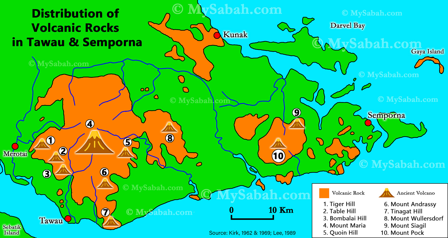
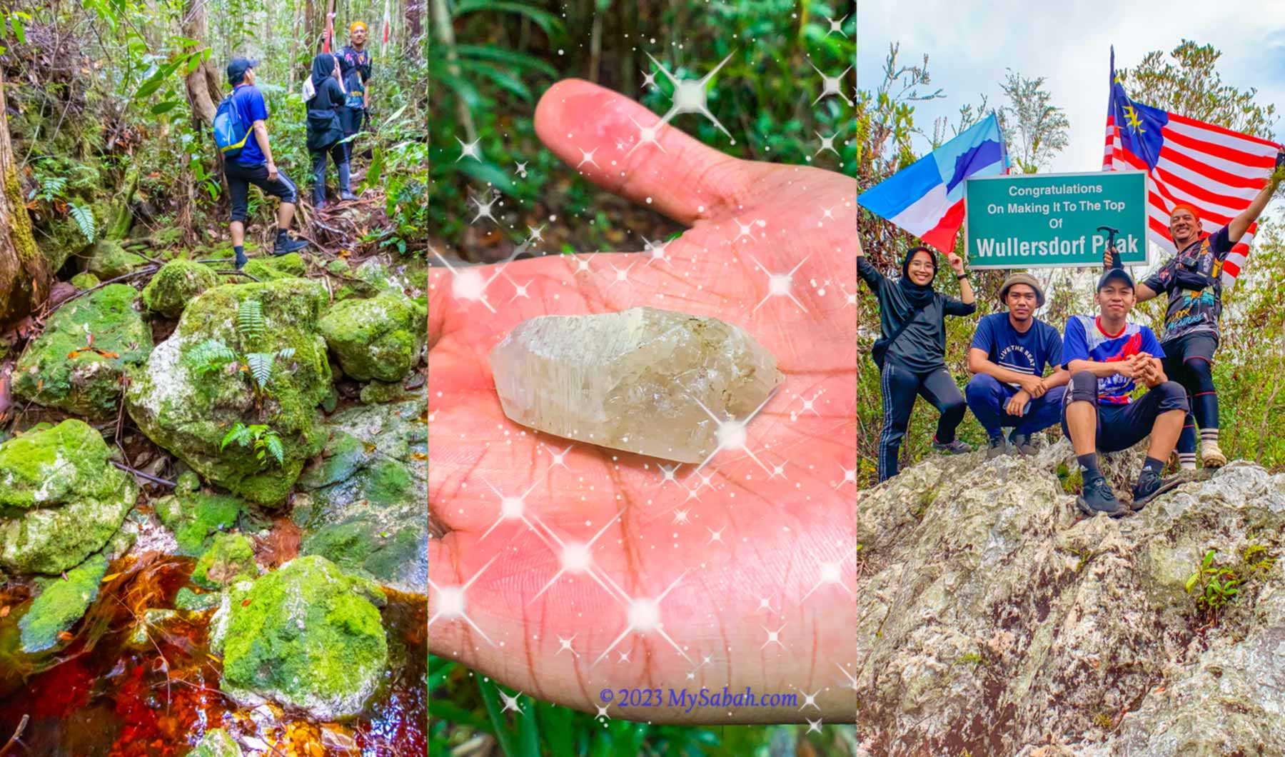
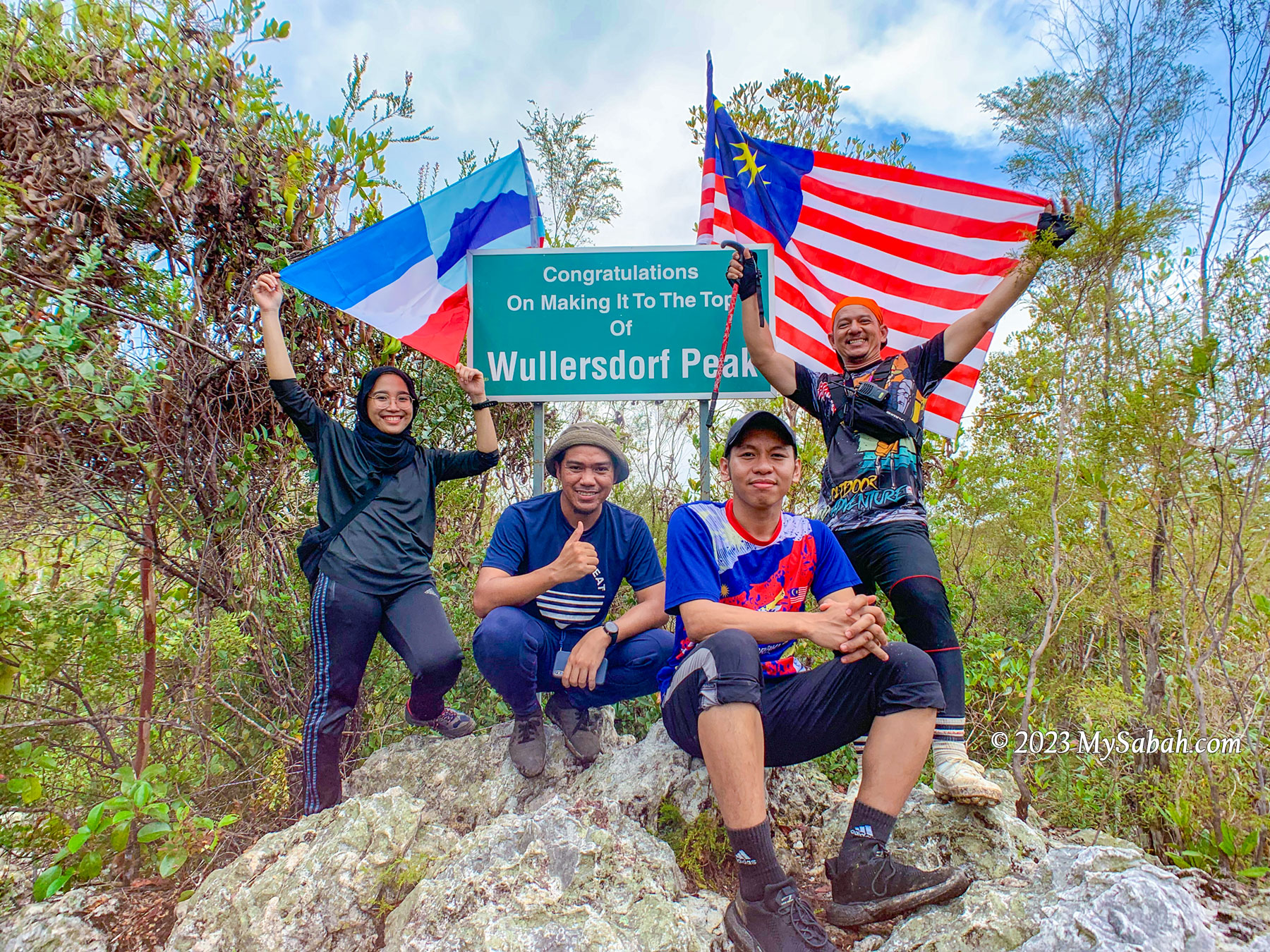
Bukit Panchang (or Panchang Hill, where ‘Bukit’ means ‘Hill’) is the fifth Sabah volcano I’ve climbed, following Bombalai Hill, Mount Wullersdorf, Bukit Tengkorak and Bohey Dulang. Situated in the Tinagat Forest Reserve, Bukit Panchang or Bukit Panchang Tinagat is less than 10 kilometers away from Tawau town.

Tinagat Forest in morning mist

About Tinagat Forest Reserve

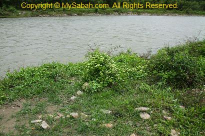
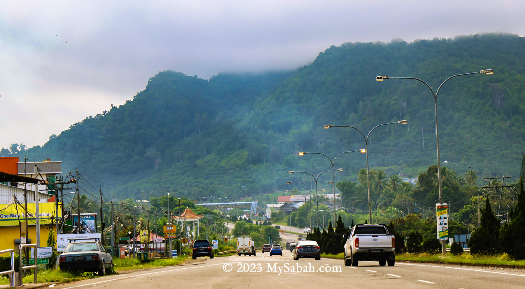
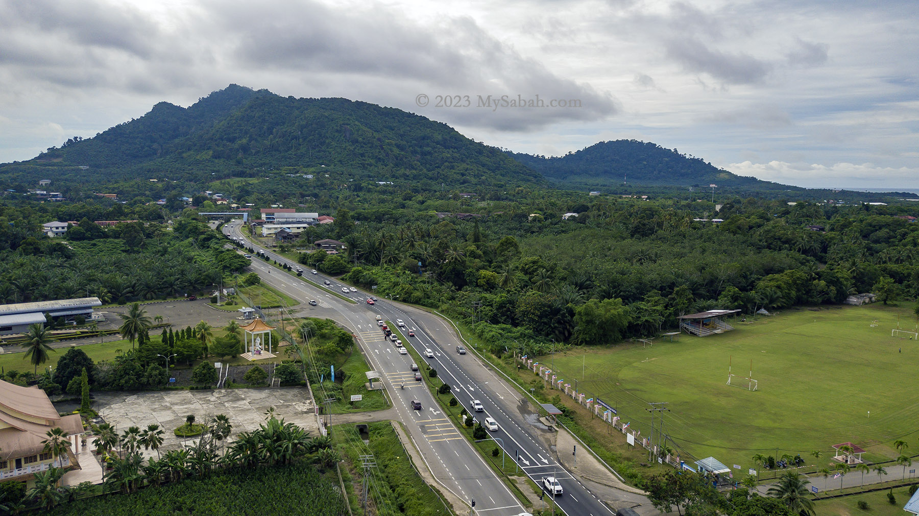
Managed by the Sabah Forestry Department, Tinagat Forest Reserve is classified as a Class-1 (fully protected) forest reserve, covering an area of 1,011 hectares (or 10.11 square kilometers). Traveling along Jalan Apas, one of Tawau’s main roads, in the morning, you’ll witness this lush hilly forest veiled in mist. Amidst the extensive conversion of land around Tawau into oil palm plantations, Tinagat Forest Reserve stands as one of the few remaining forested areas near the town.

3D map of Tinagat forest reserve and its surrounding

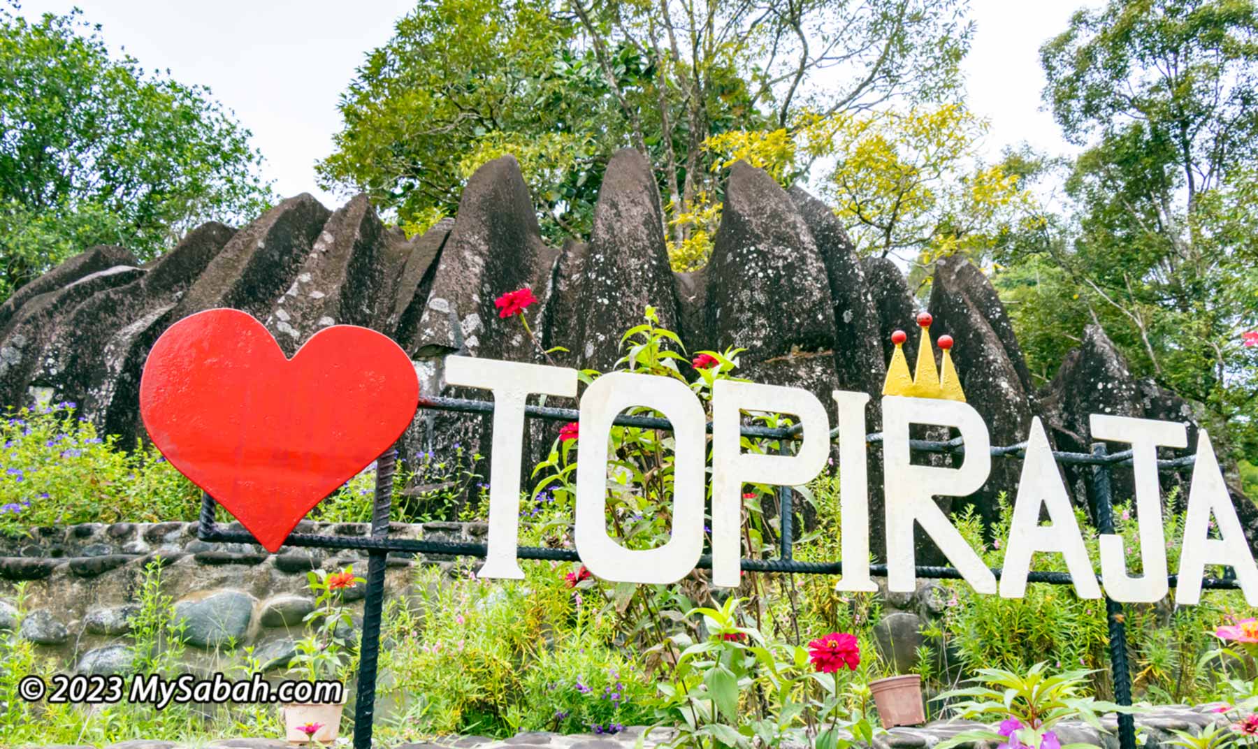
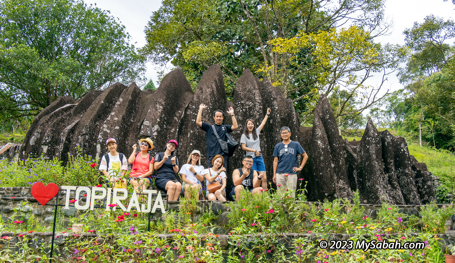
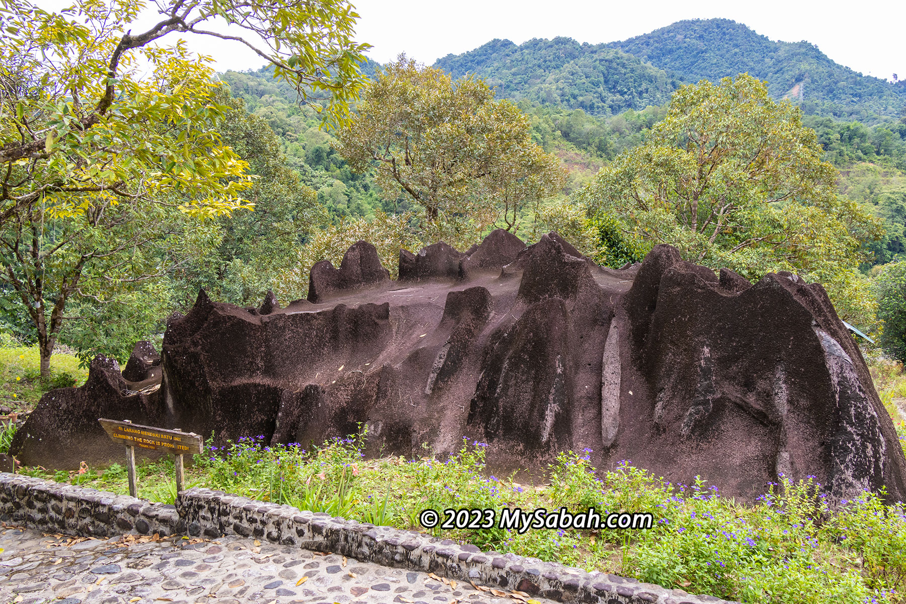
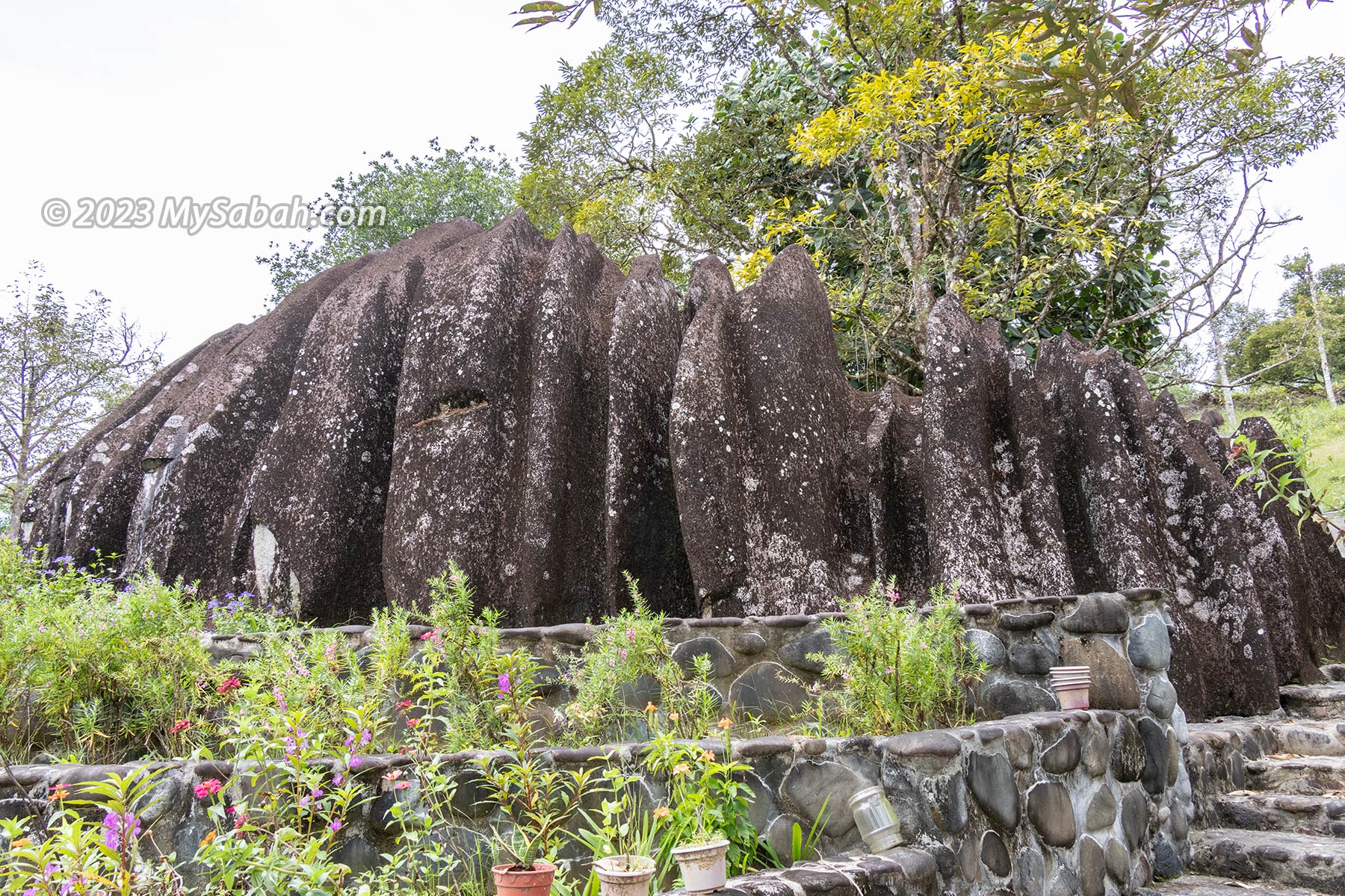
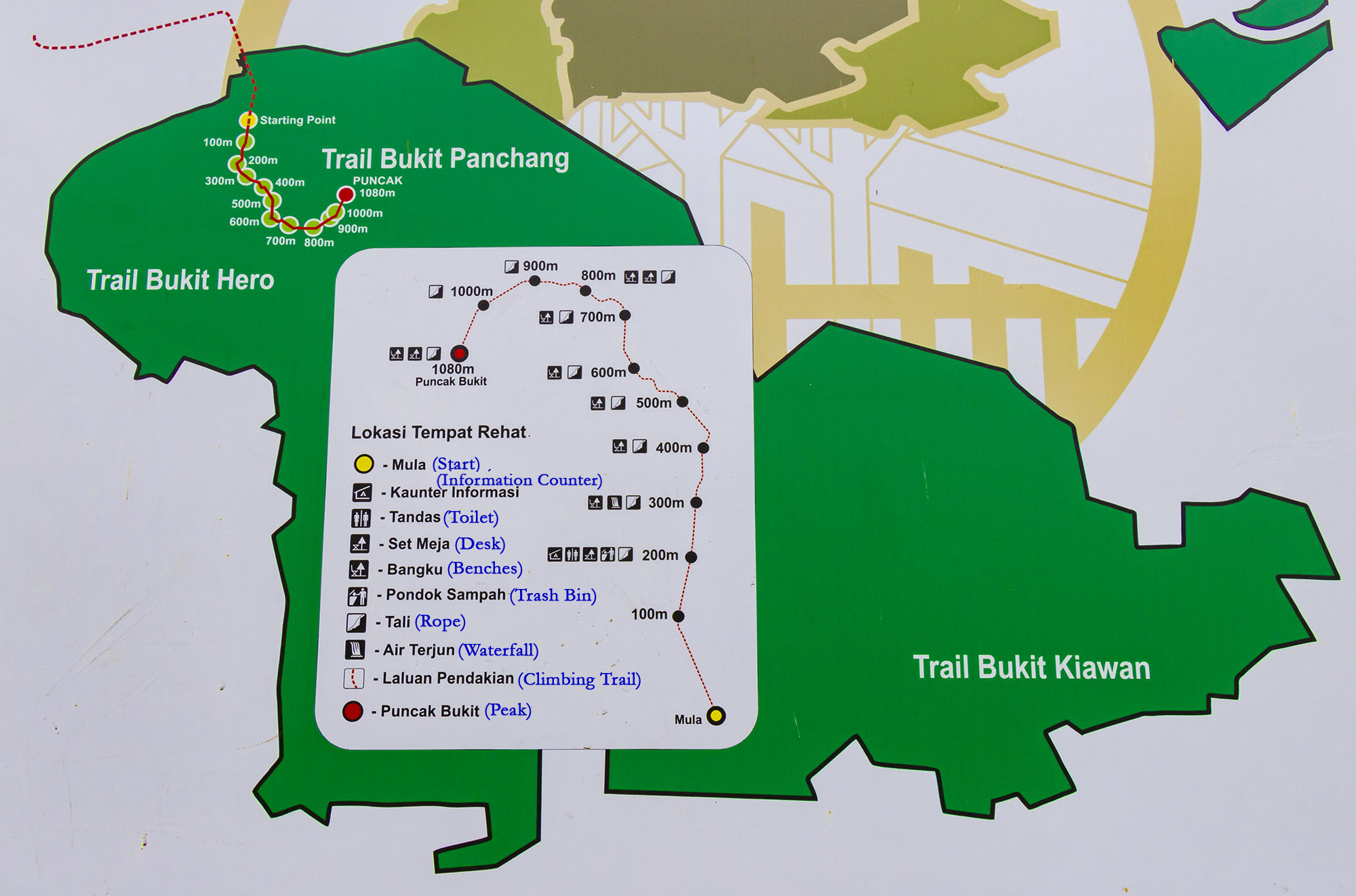
Tinagat essentially represents a multi-peaked ancient volcano blanketed by dense forest cover. Remarkably, numerous climbing trails lead to various peaks on this hill. Among them, Bukit Panchang claims the highest altitude at 398 meters (1,306 feet). Bukit Panchang is probably a new official name, as many locals used to call it Bukit Kinabutan or Bukit Tinagat. Other notable peaks within the Tinagat Forest Reserve include Bukit 38, Bukit Akar, Hero Hill (Batu Payung), Bukit Kayawan, and Bukit Kiawan.

The trail map of Bukit Panchang in Tinagat Forest Reserve (English translation in blue colour). There are more than one hill in this forest.

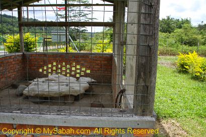
A century-old lighthouse (Rumah Api Batu Tinagat), constructed by the British colonial government in 1916, stands at the foothills facing the sea. This 9-meter-high Batu Tinagat Lighthouse is currently a restricted area. However, PELKO (Pelancongan Komuniti Tawau, associated with Politeknik Tawau) suggests that it will soon be accessible to tourists. On 23rd February 2018, Batu Tinagat Lighthouse was among the 24 heritage sites in the state officially designated by Sabah’s State Heritage Council under the new enactment of the ‘State Heritage Enactment 2017’.

View of Tinagat Forest Reserve from the Jalan Apas Road near to Tawau town

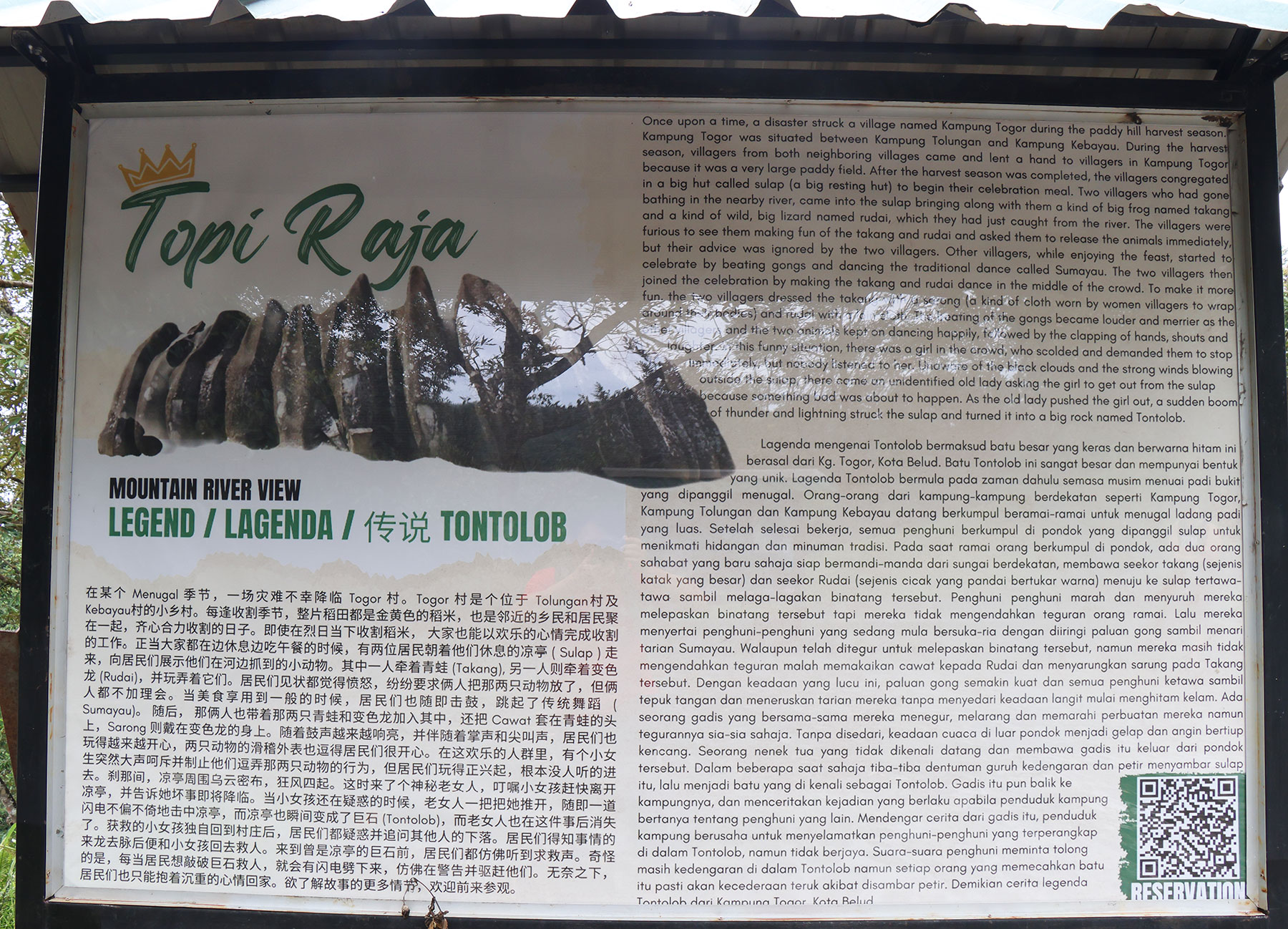
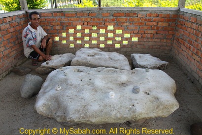
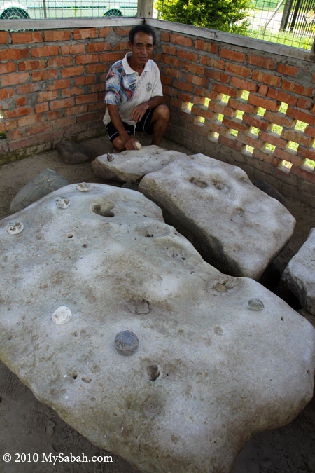
Not far from the Batu Tinagat Lighthouse lies Batu Payung (literally meaning Umbrella Rock), which is tied to a legend that lends Tinagat its name (Tinagat translates to ‘Cut Down’ in the Tidung language). According to the tale, long ago, a young farmer encountered seven heavenly princesses bathing along the beach. Captivated by their beauty, he devised a plan to win one of them over by stealing her clothes. Unable to locate her dress, the youngest princess was stranded on Earth. Eventually, she married the young man and bore him a child.

PELKO (Tawau Community Tourism) is planning to develop and promote the attractions in Tinagat

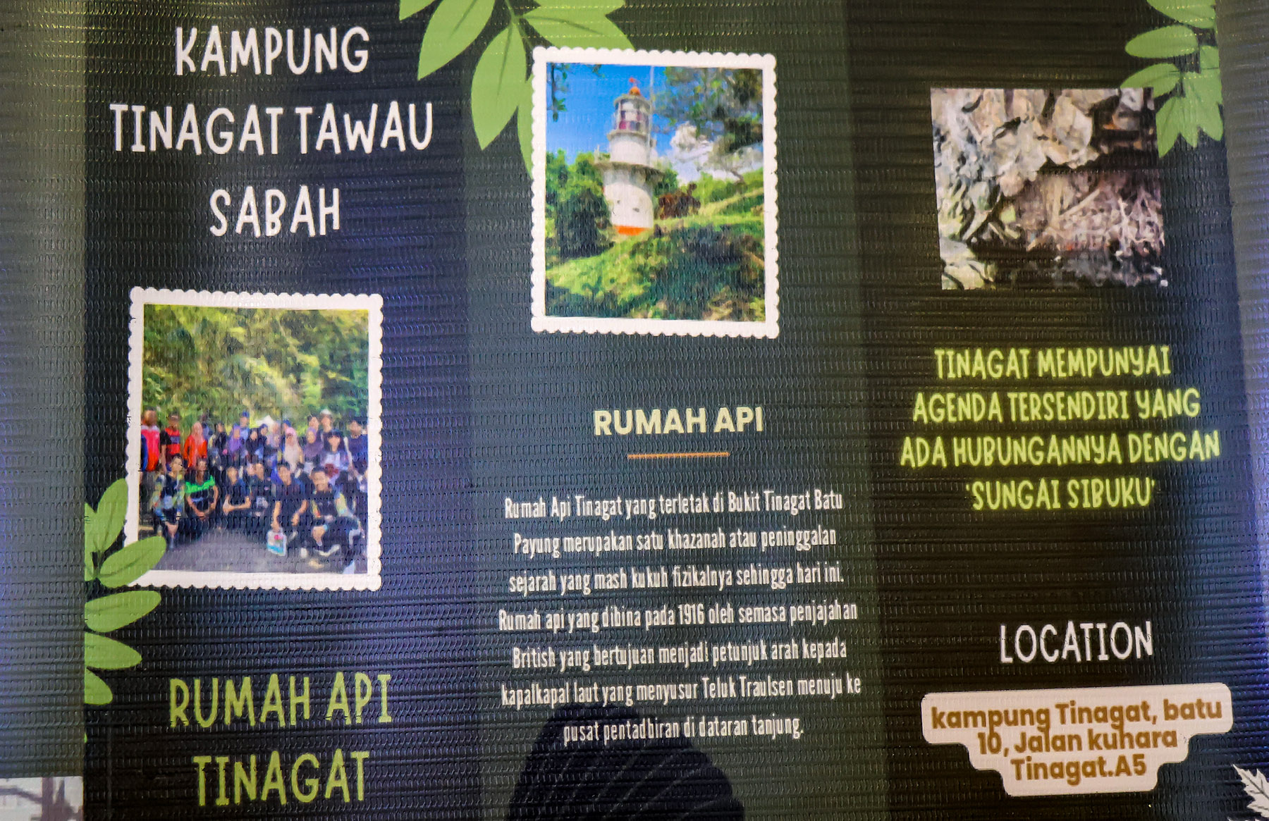
One day, during a festival, the princess was invited to perform a dance. As she danced in her old attire, hidden from her until then, her body began to levitate and ascended to the top of Batu Payung. In a desperate attempt to get her back, her husband cut down the rock, but she continued to soar away. All that remained was a message she left behind: ‘Please take care of our child. If he cries, bring him to Sungai Sibuku (Sibuku River).’

A walk-through video of climbing Bukit Panchang

Climbing Bukit Panchang

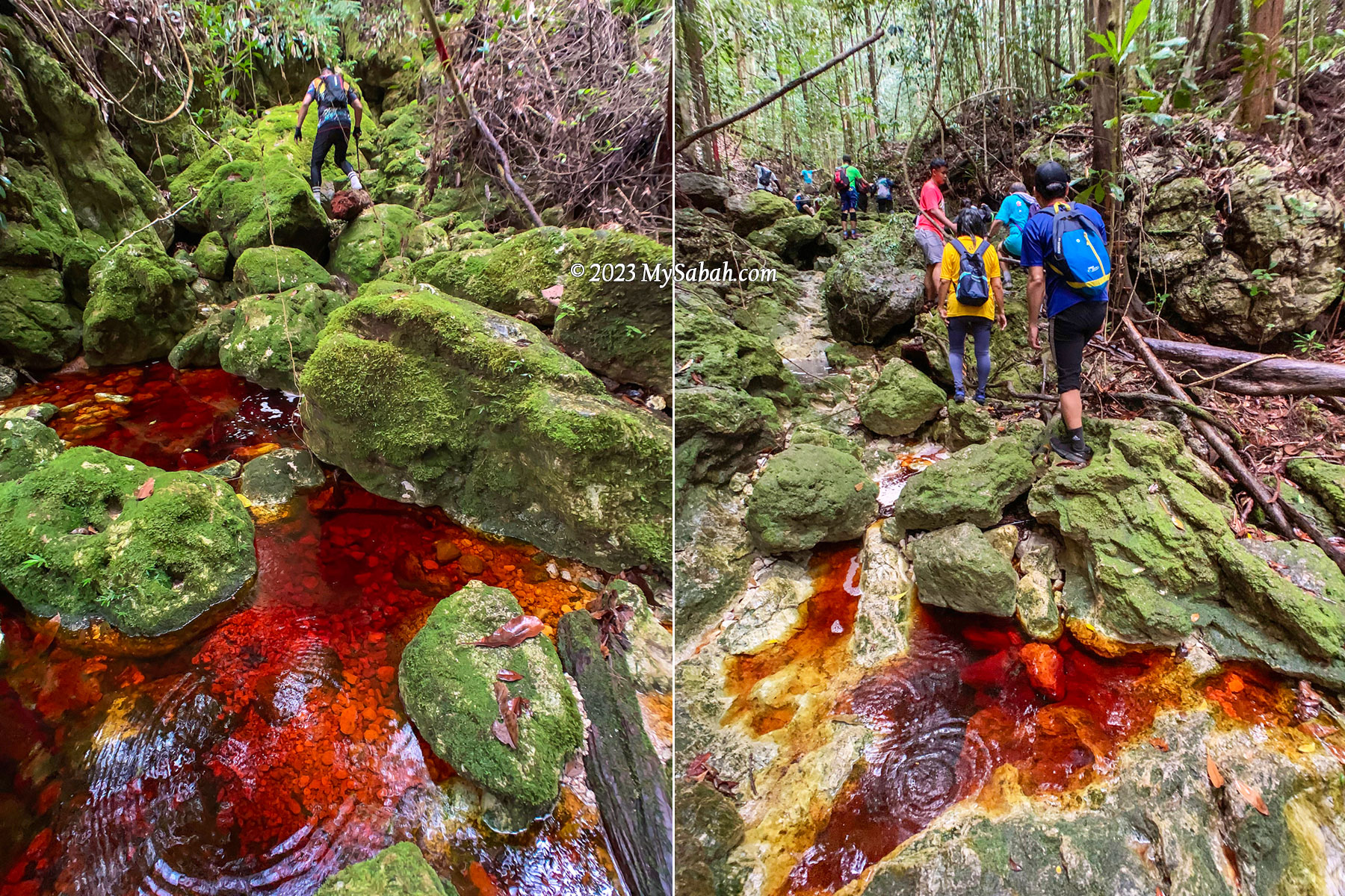
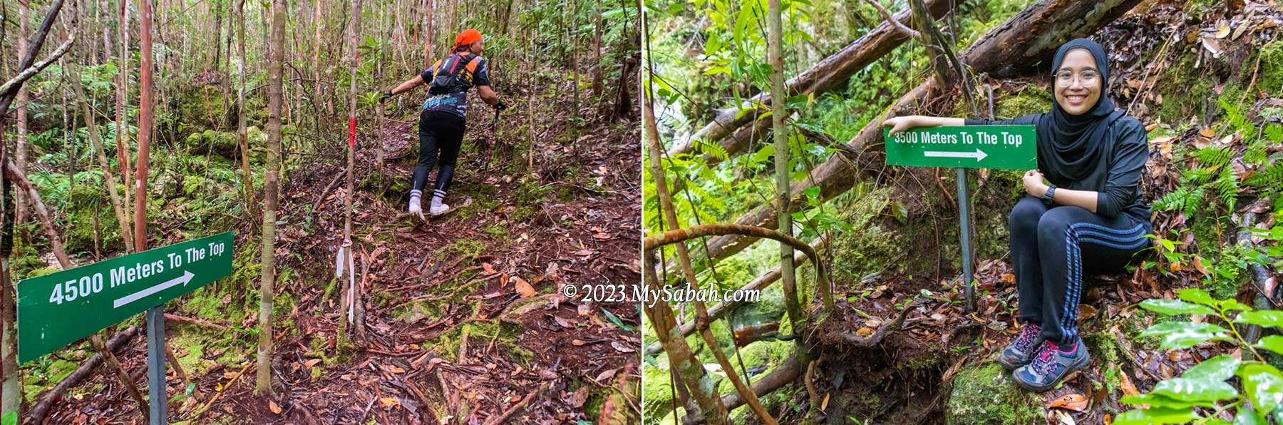
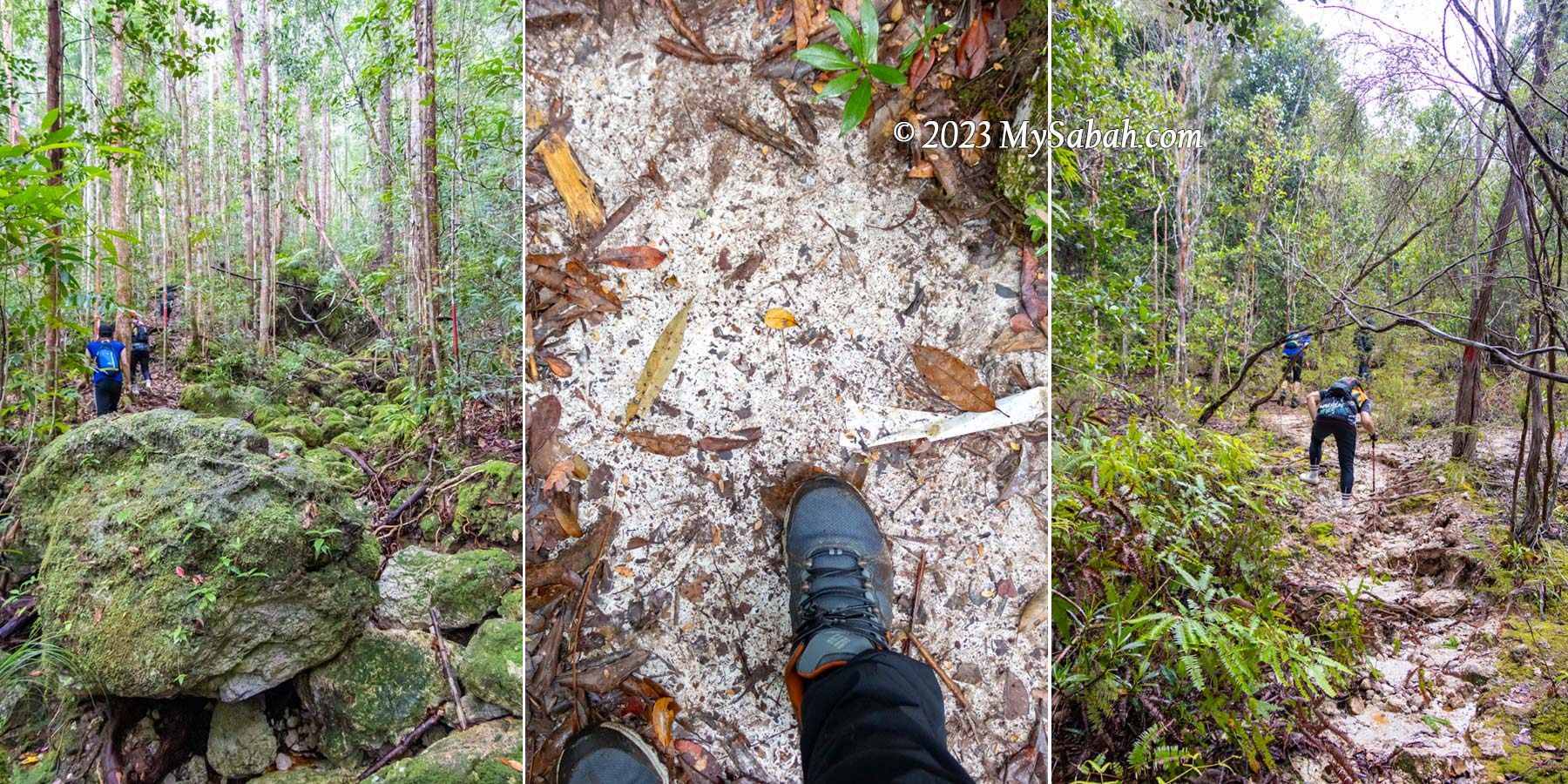
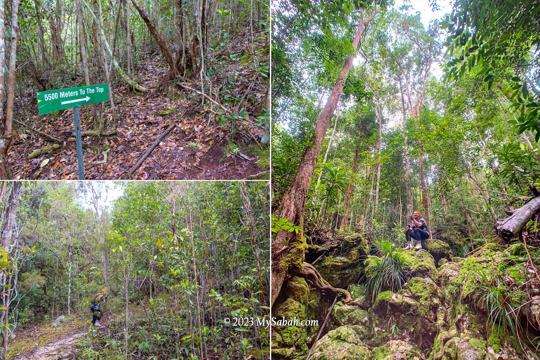
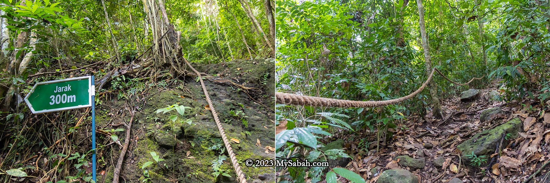
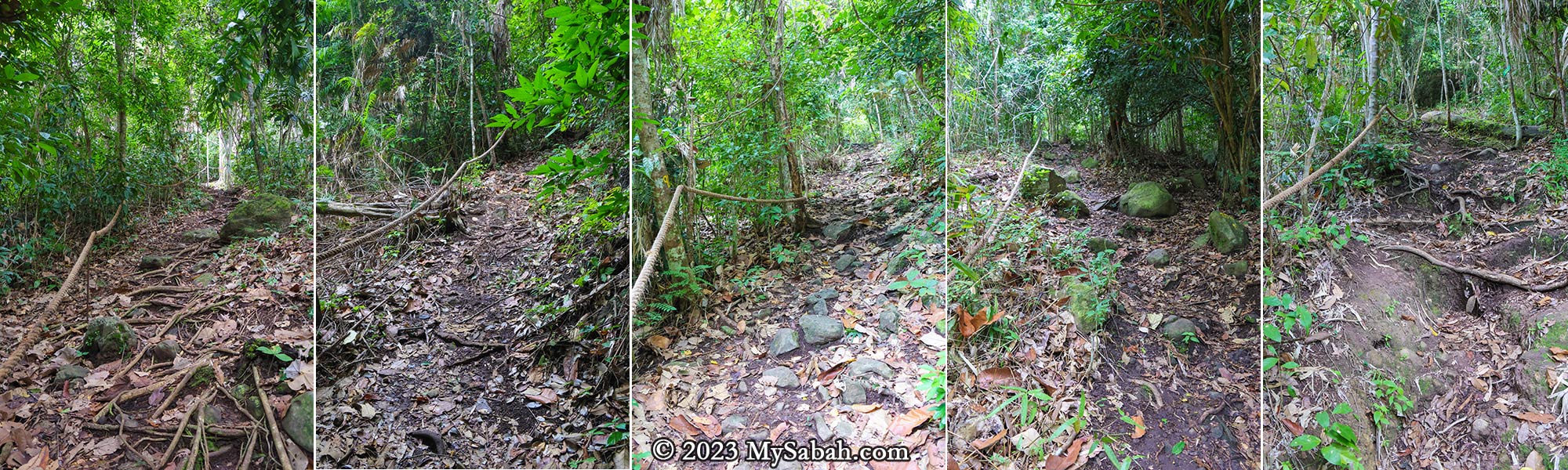
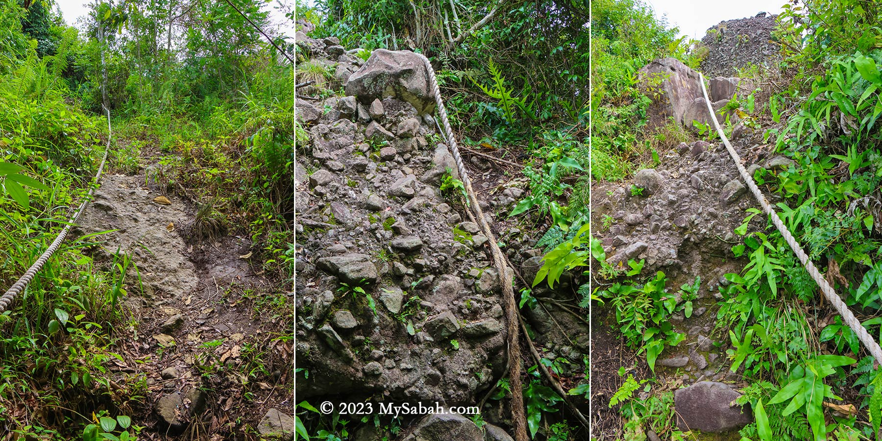
Bukit Panchang is steep but not too difficult to climb. The trail to the peak spans about 1,080 metres one way, typically taking around an hour to complete. Your climb will start with a steep slope, sorry, no warm-up for you.

Starting point from the junction No.10. You can see the forested hill ahead of you. If you are afraid of dog, you may go in group or bring a hiking stick. These dogs were friendly to me when I communicated with positive gesture and voice.

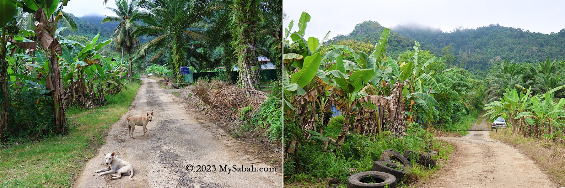
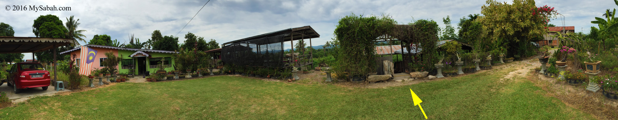
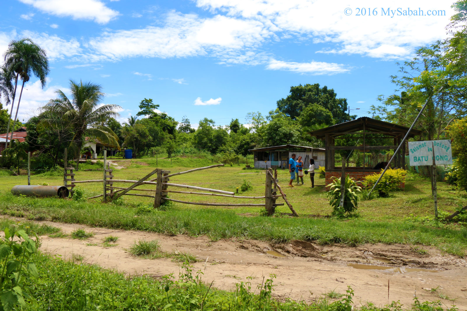
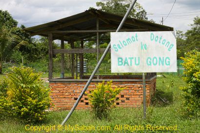
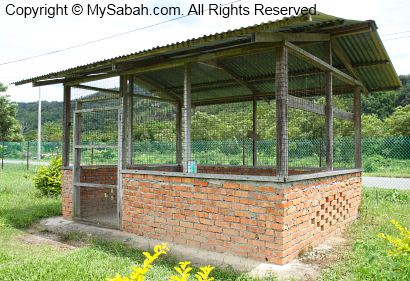
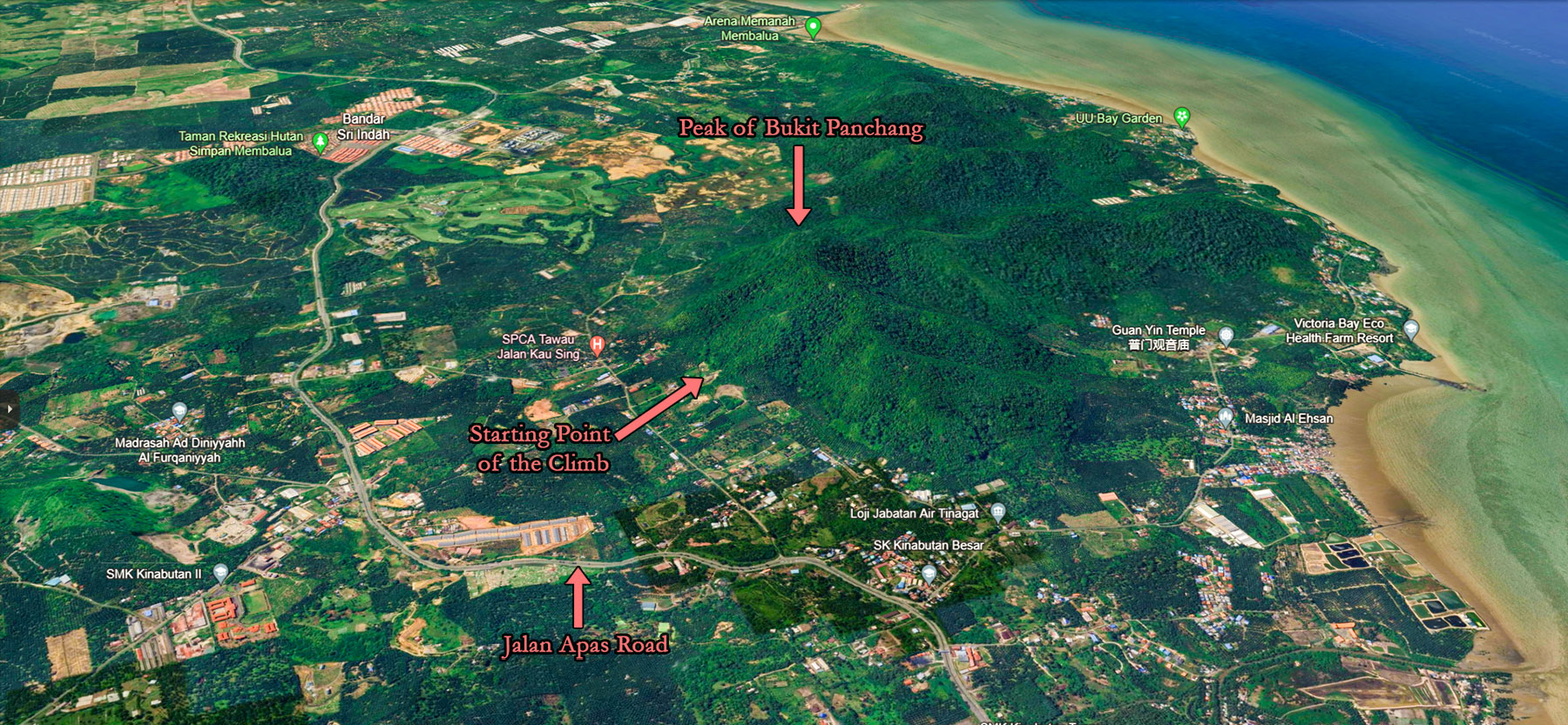
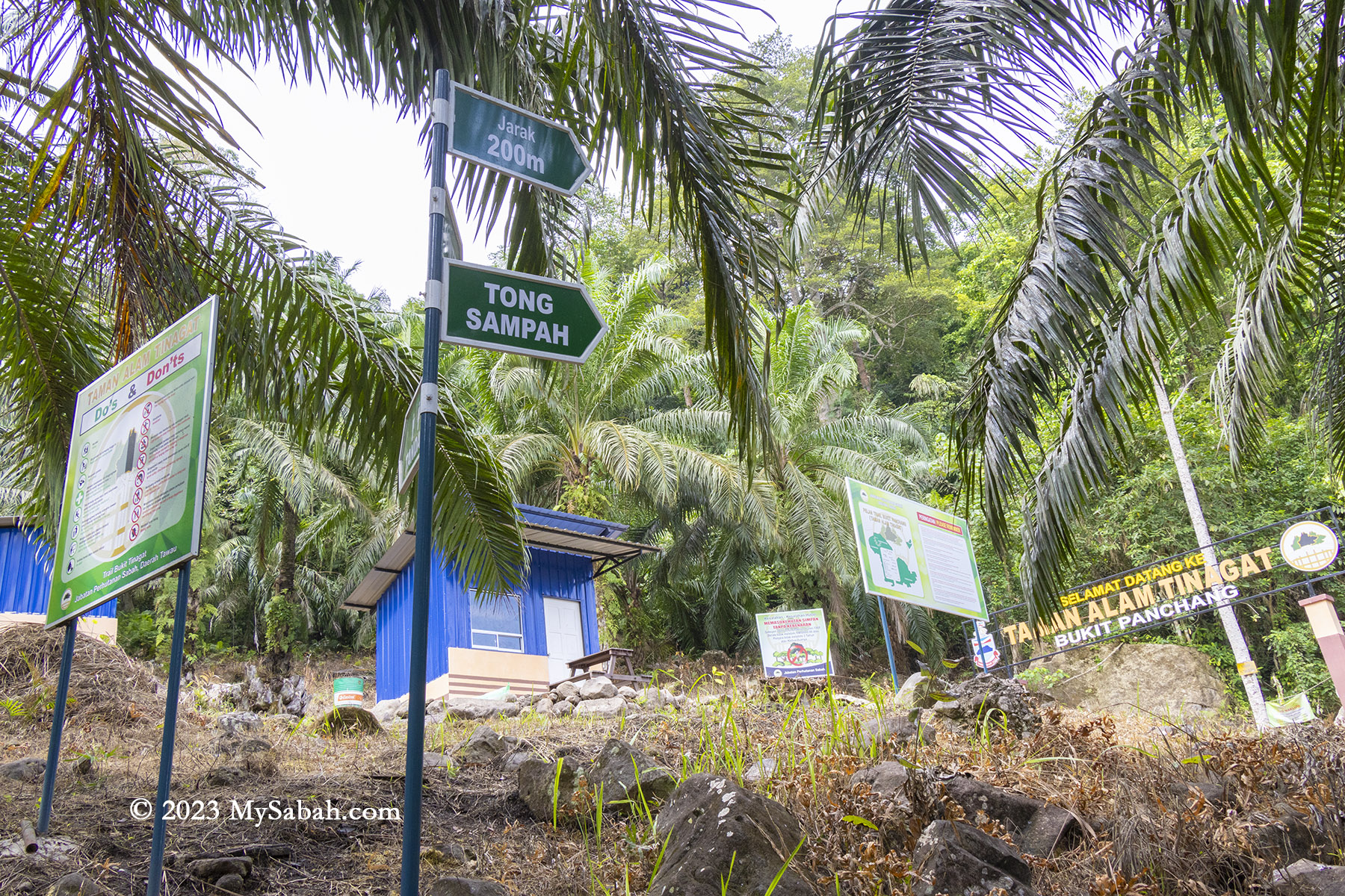
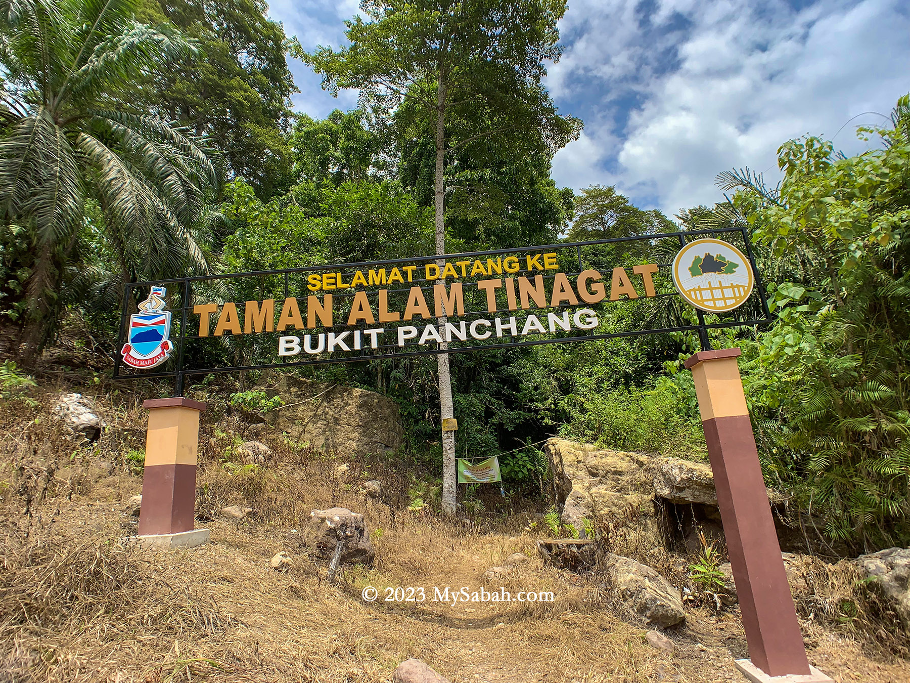
Initially, a 200-metre walk on a gravel road within an oil palm plantation leads to the Sabah Forestry station (or checkpoint) at the foothill. Here, they’ve established amenities like toilets and gazebos. Beware of village dogs, though I found them quite friendly.

The small road to the Sabah Forestry station. You will pass through oil palm, rubber, coconut and banana plantation. You are almost there if you see the signages at the right. (Mula = Start, Jarak = Distance)

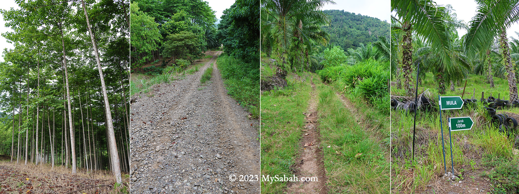
Thanks to the dense forest, the trail offers ample shade. Approximately 90% of the time is spent ascending, with mild to steep slopes. Tawau hikers often describe climbing steep hill as ‘feeling like Panchang,’ signifying its steepness.

Sabah Forestry station or checkpoint at the foothill of Bukit Panchang. Toilet and gazebo are available here.

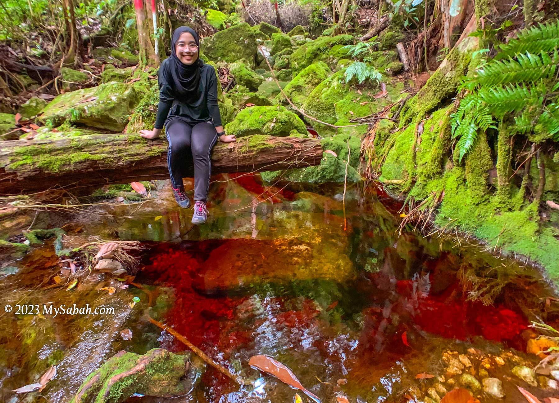
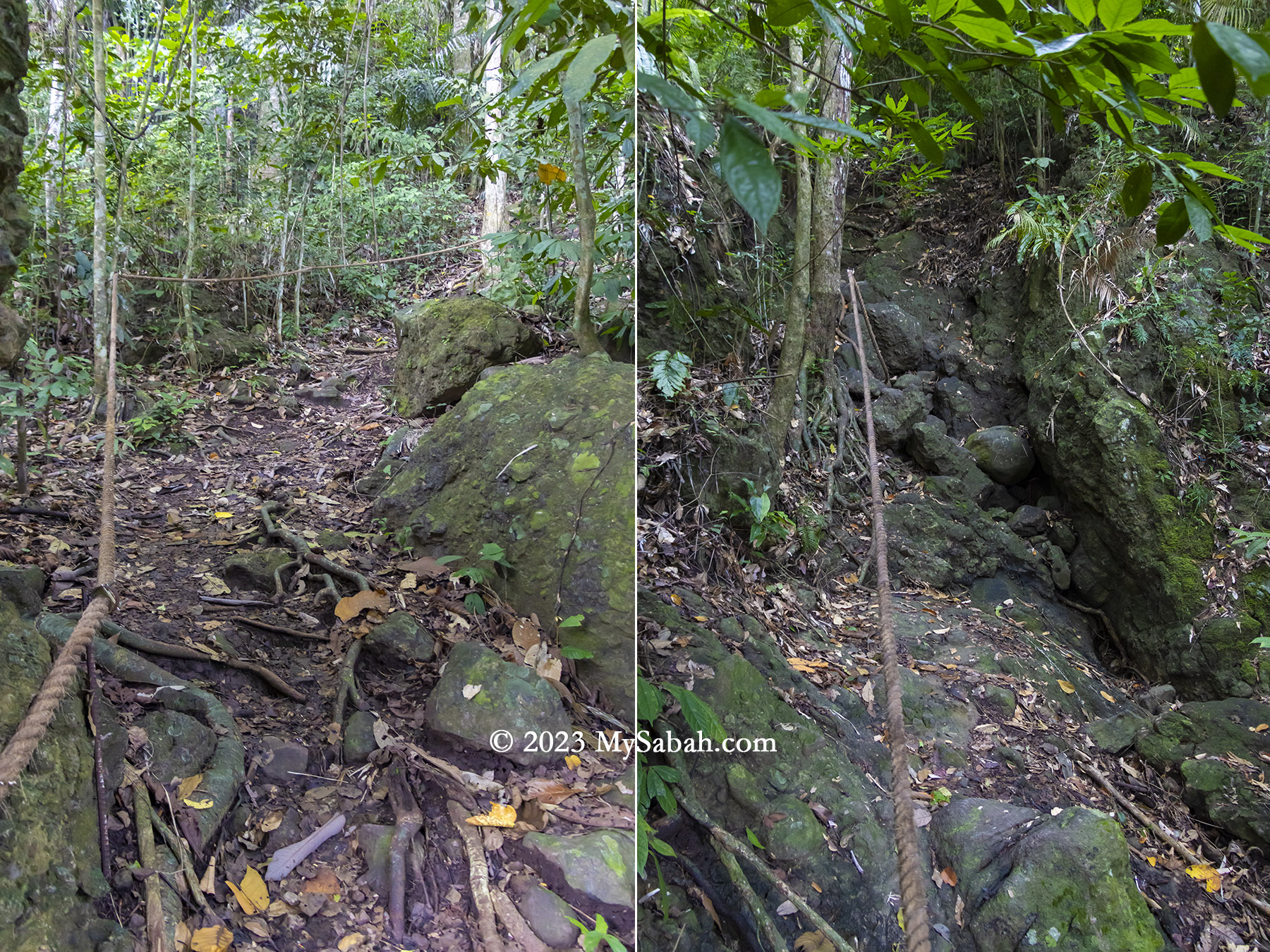
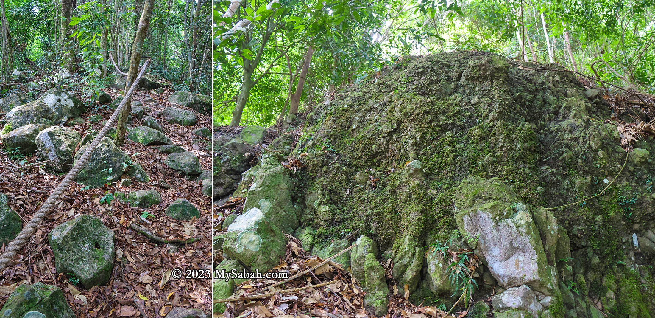
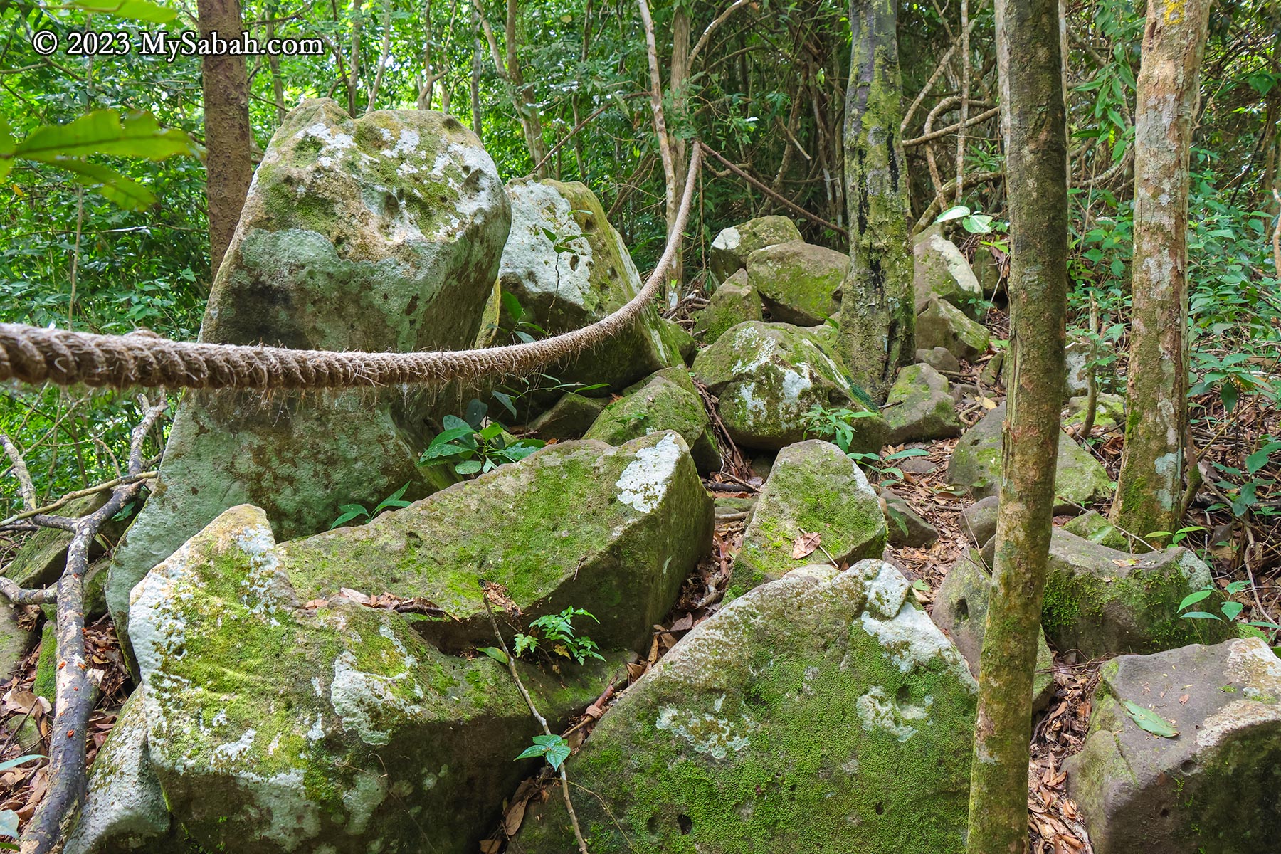
The most challenging segment involves a 200-metre-long steep boulder section at the trail’s onset. After rainfall, this section transforms into a waterfall, so I strongly advise against attempting the climb during the wet season.

The starting point of the climb at the Sabah Forestry Department station

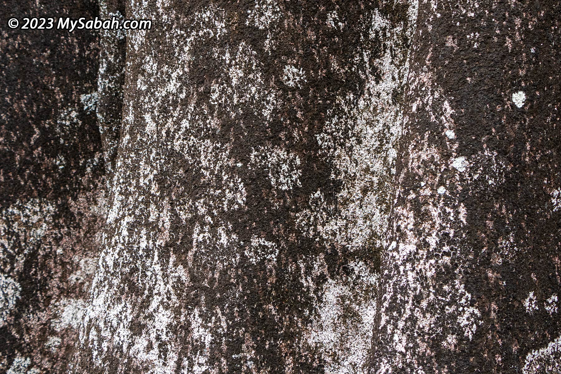
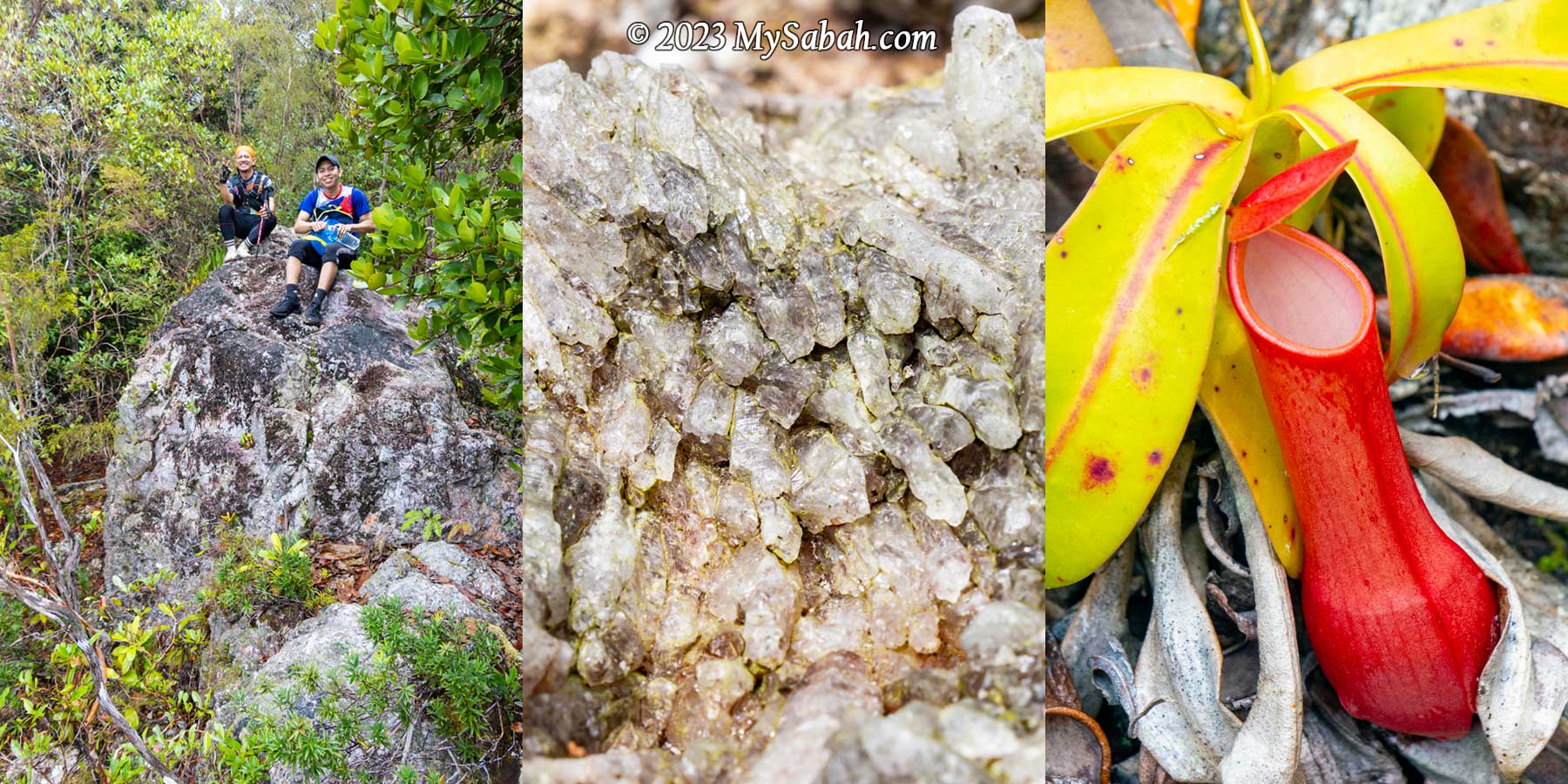
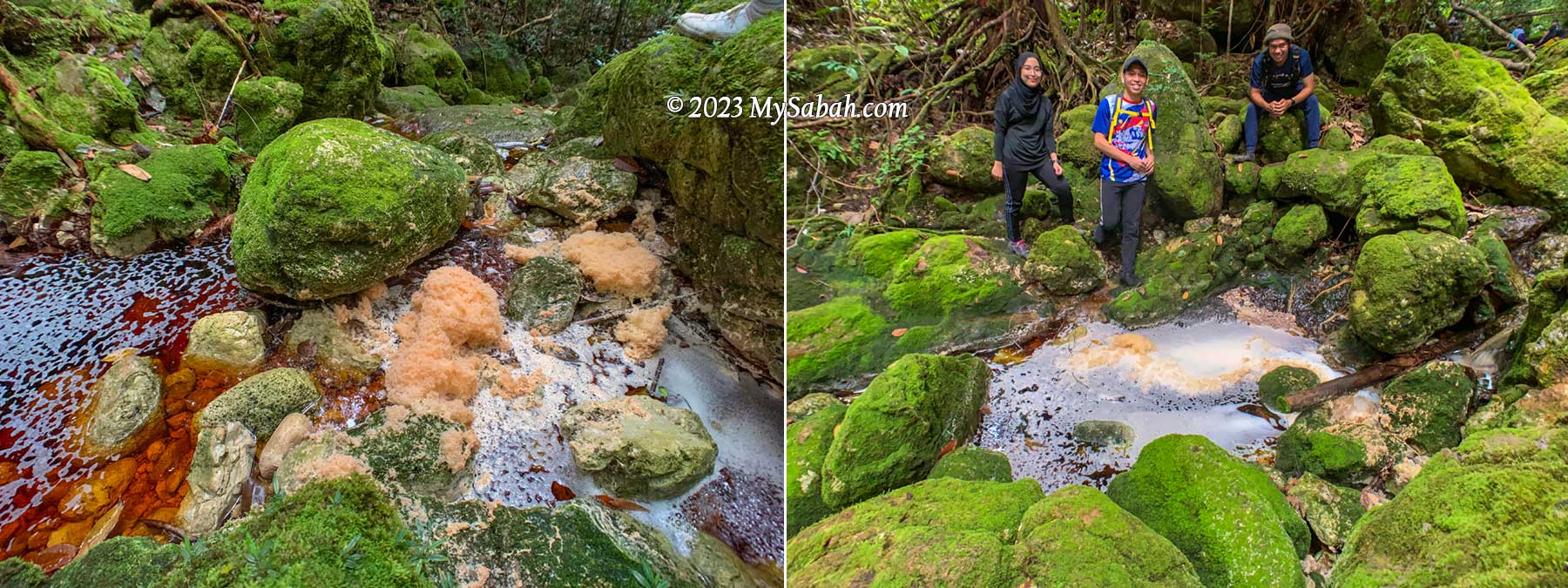
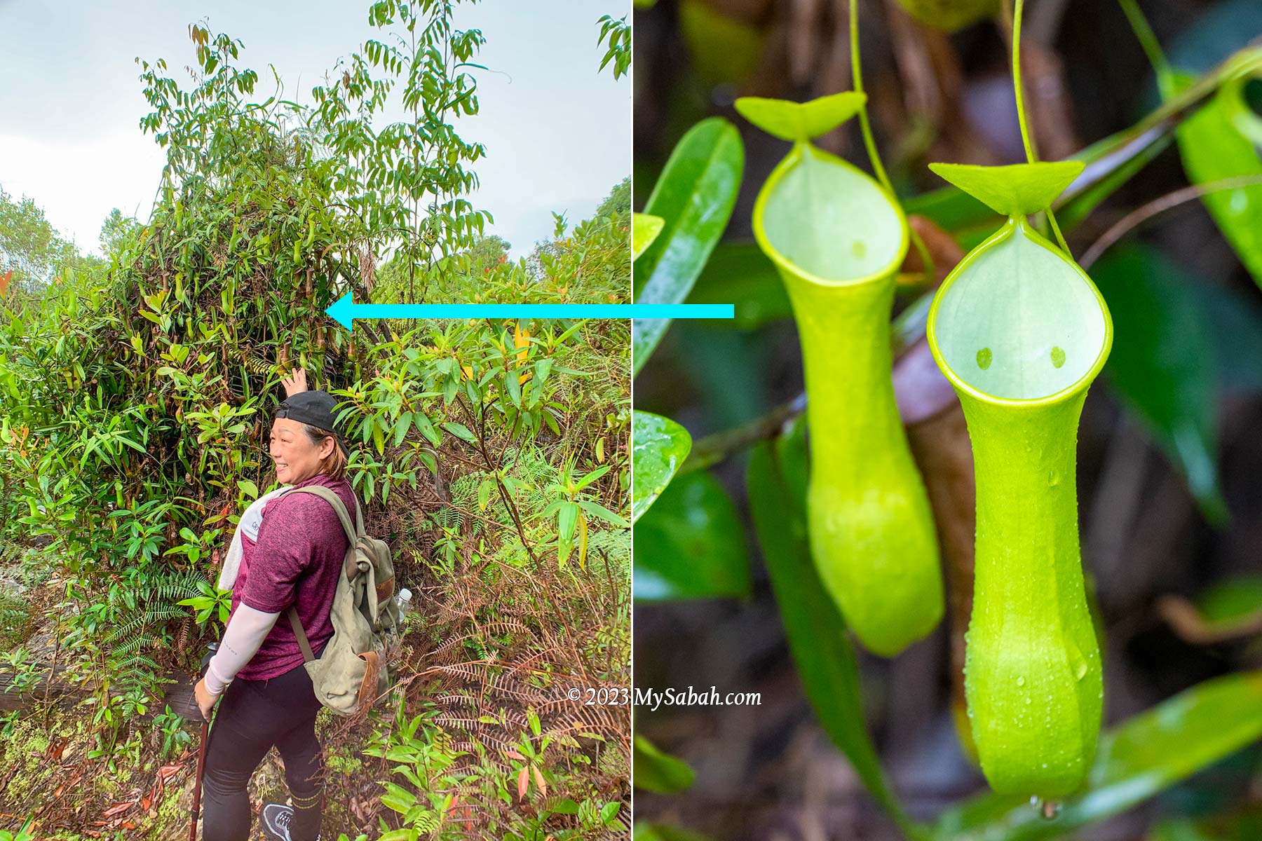
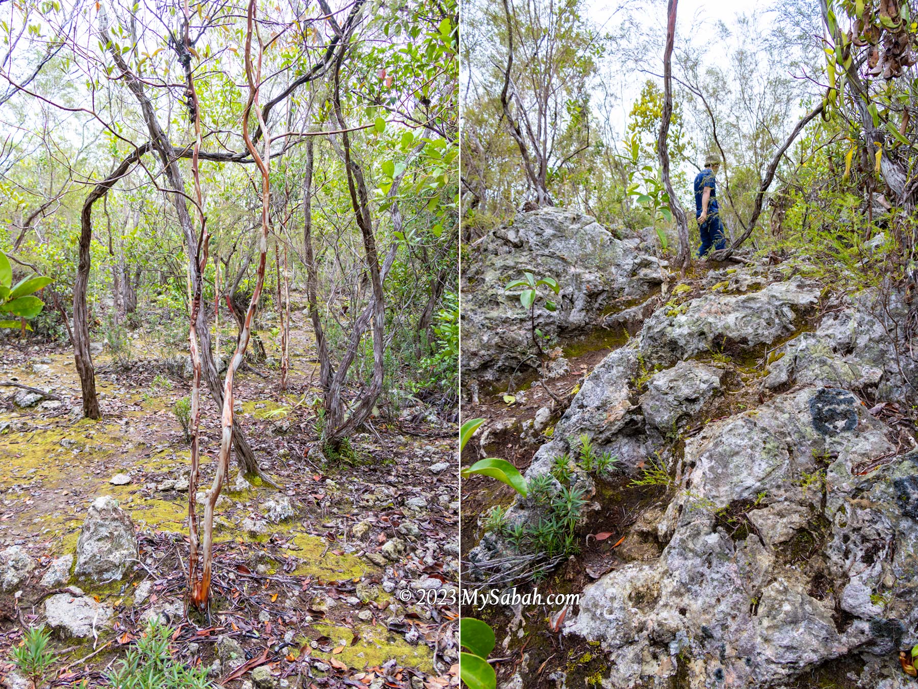
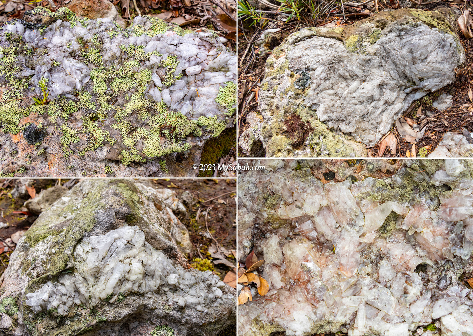
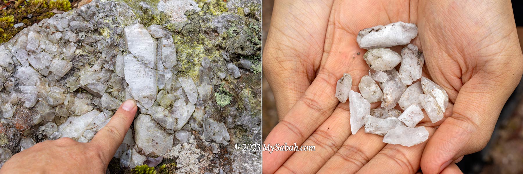
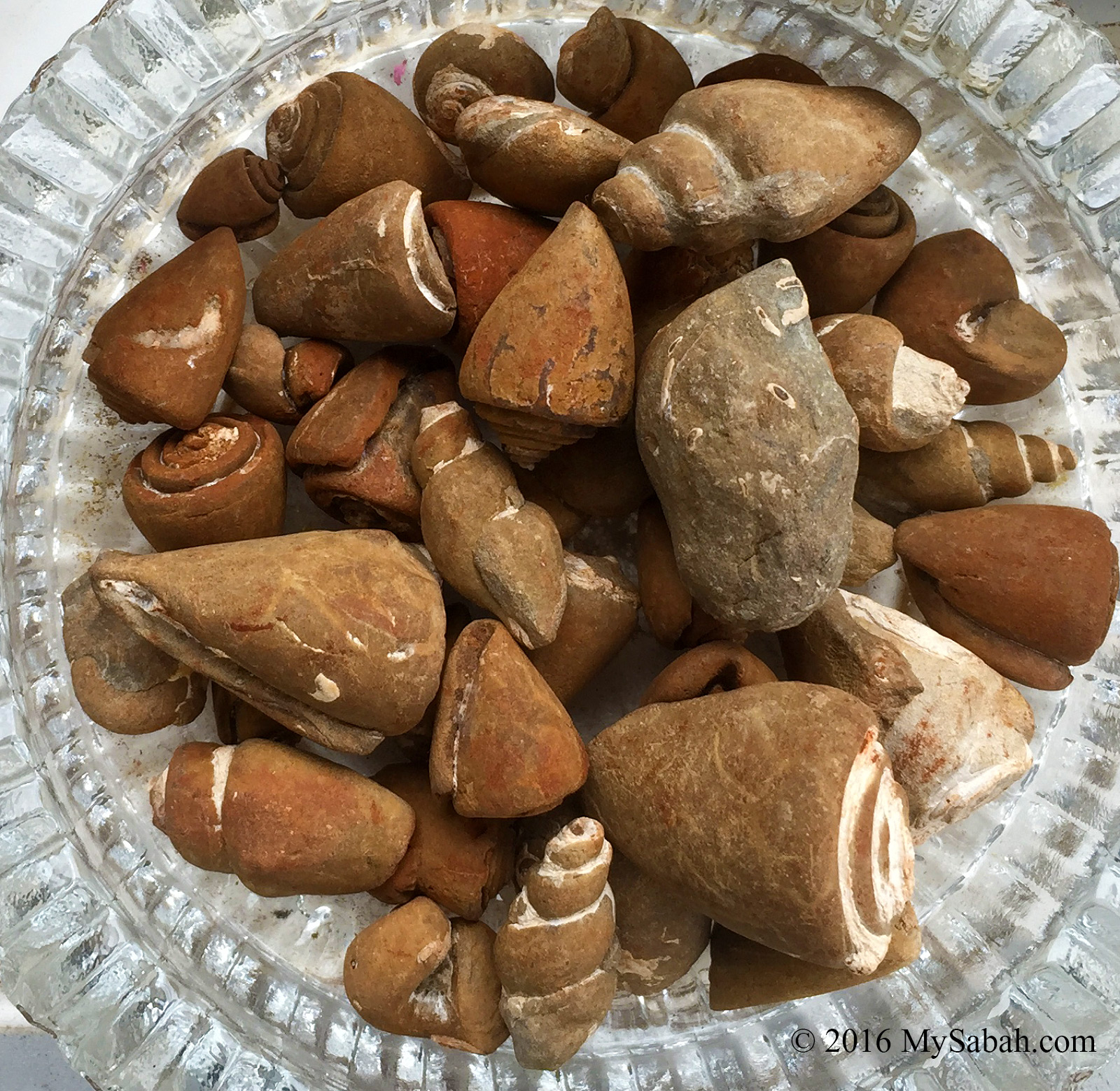
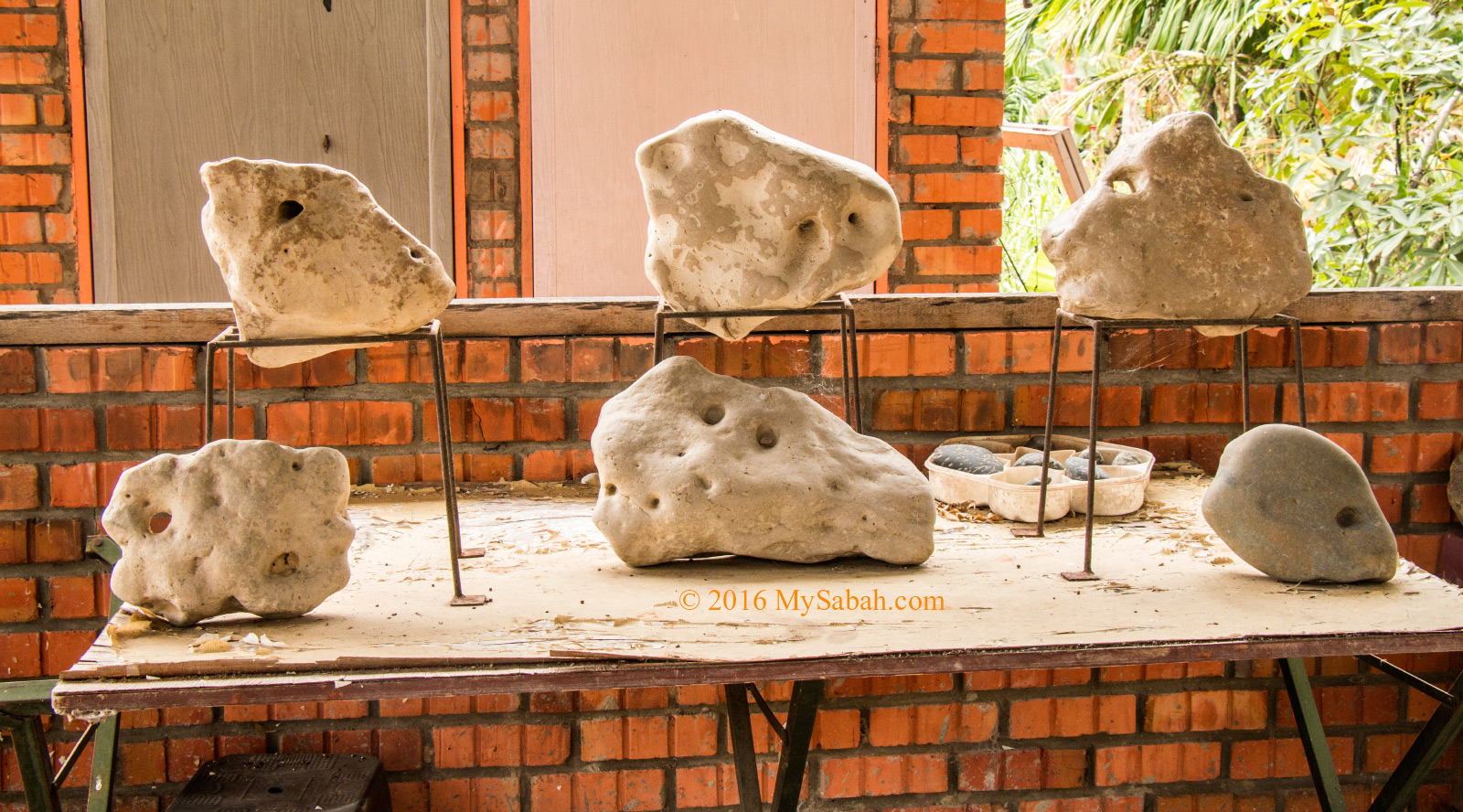
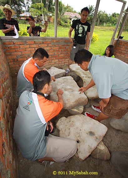
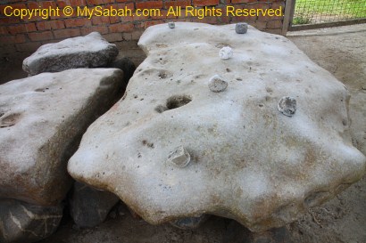
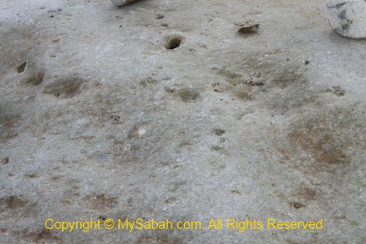
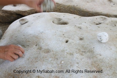
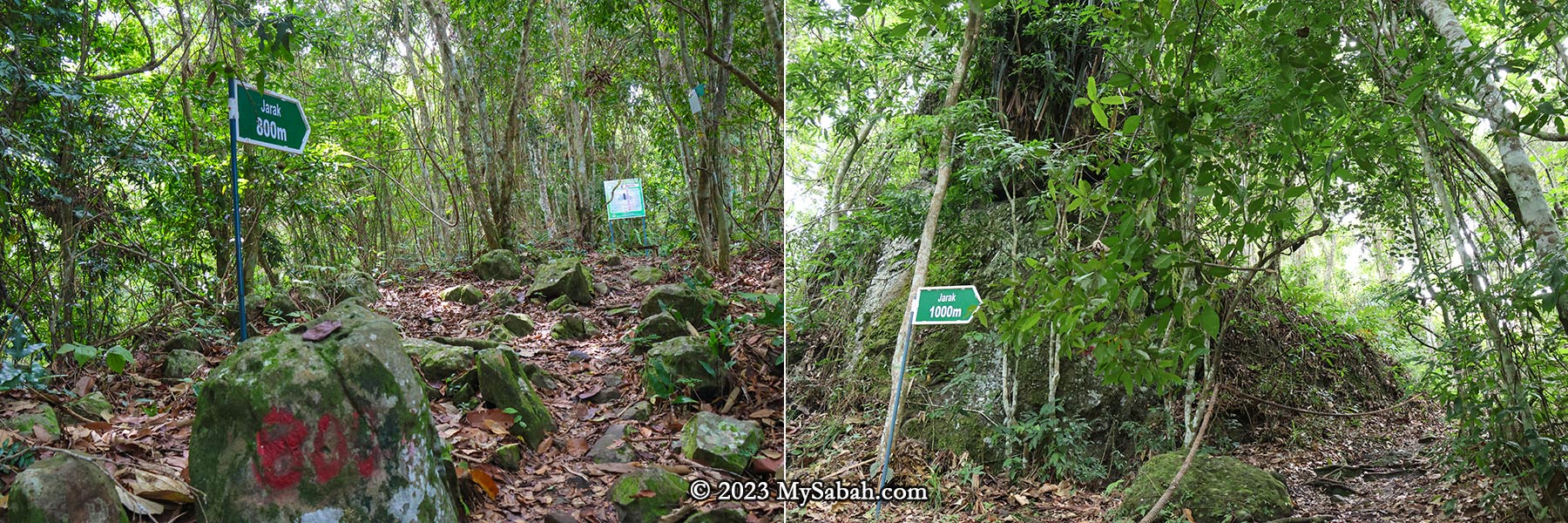
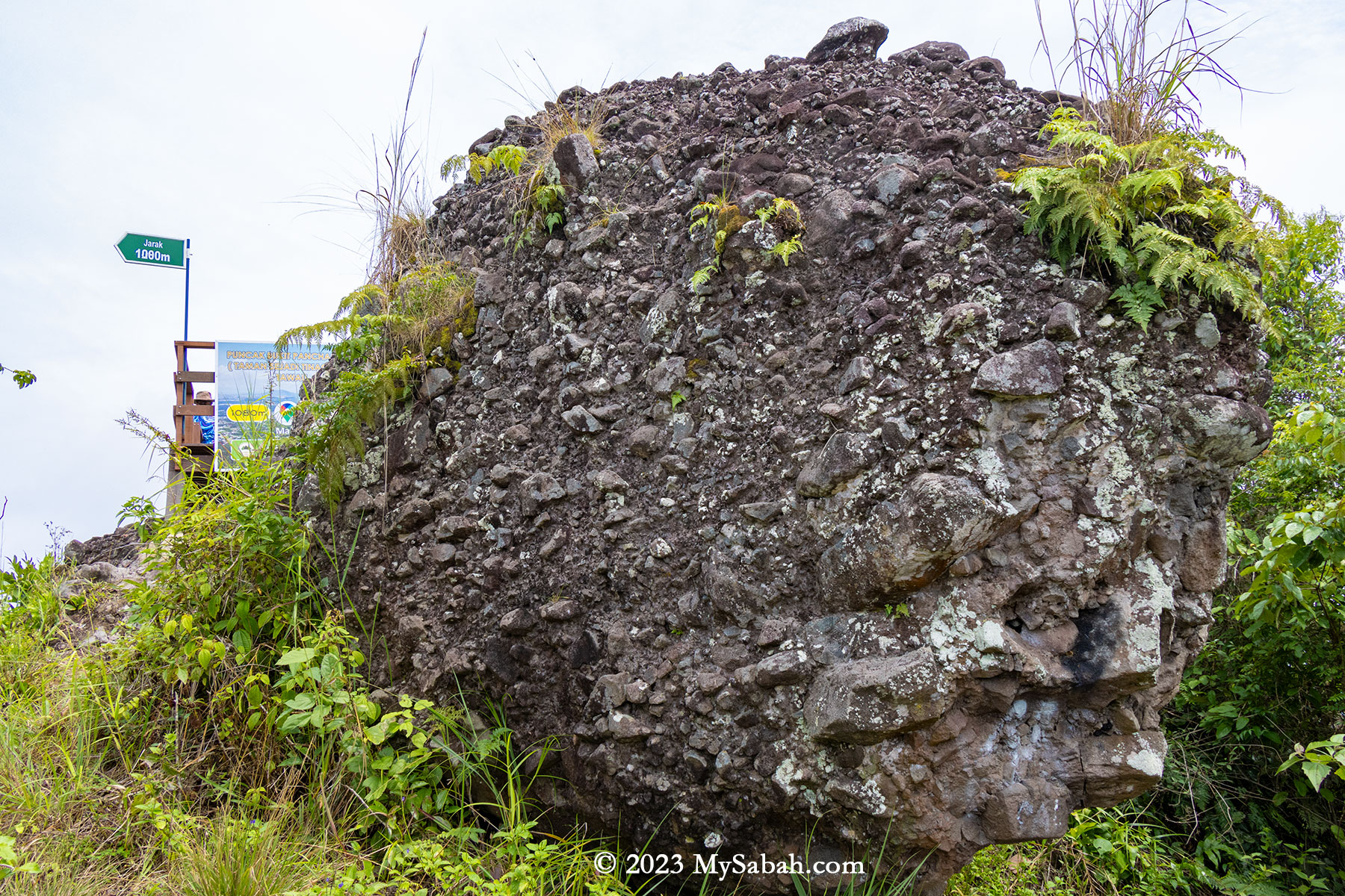
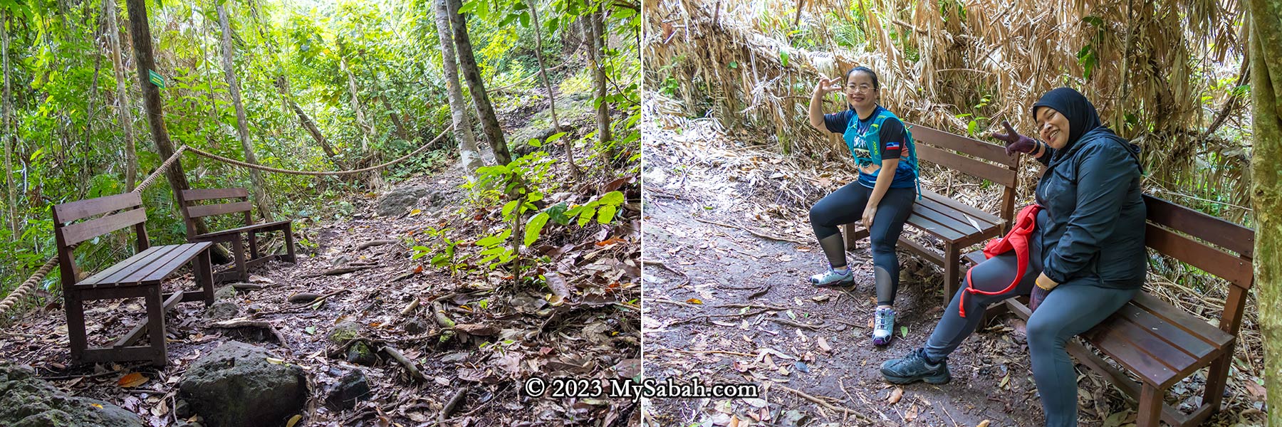
Throughout the climb, numerous exposed volcanic rocks and rockfaces remain visible, indicating Bukit Panchang was used to be a rocky hill. Rope supports are placed along the trail, providing climbing aid. The ropes also serve as guides leading to the summit. Distance markers every 100 meters serve as motivational checkpoints, and some spots have benches for resting. Fortunately, there are no leeches.

Left: start of the climbing trail. Right: the waterfall trail is the steepest section

In 2021, four kindergarten teachers lost their way in the Tinagat forest, but were thankfully rescued the following day. As a safety precaution, the Sabah Forestry Department now requires hikers to enlist a ranger’s guidance. Personally, I believe the hike isn’t dangerous if one exercises caution.

The Vegetations

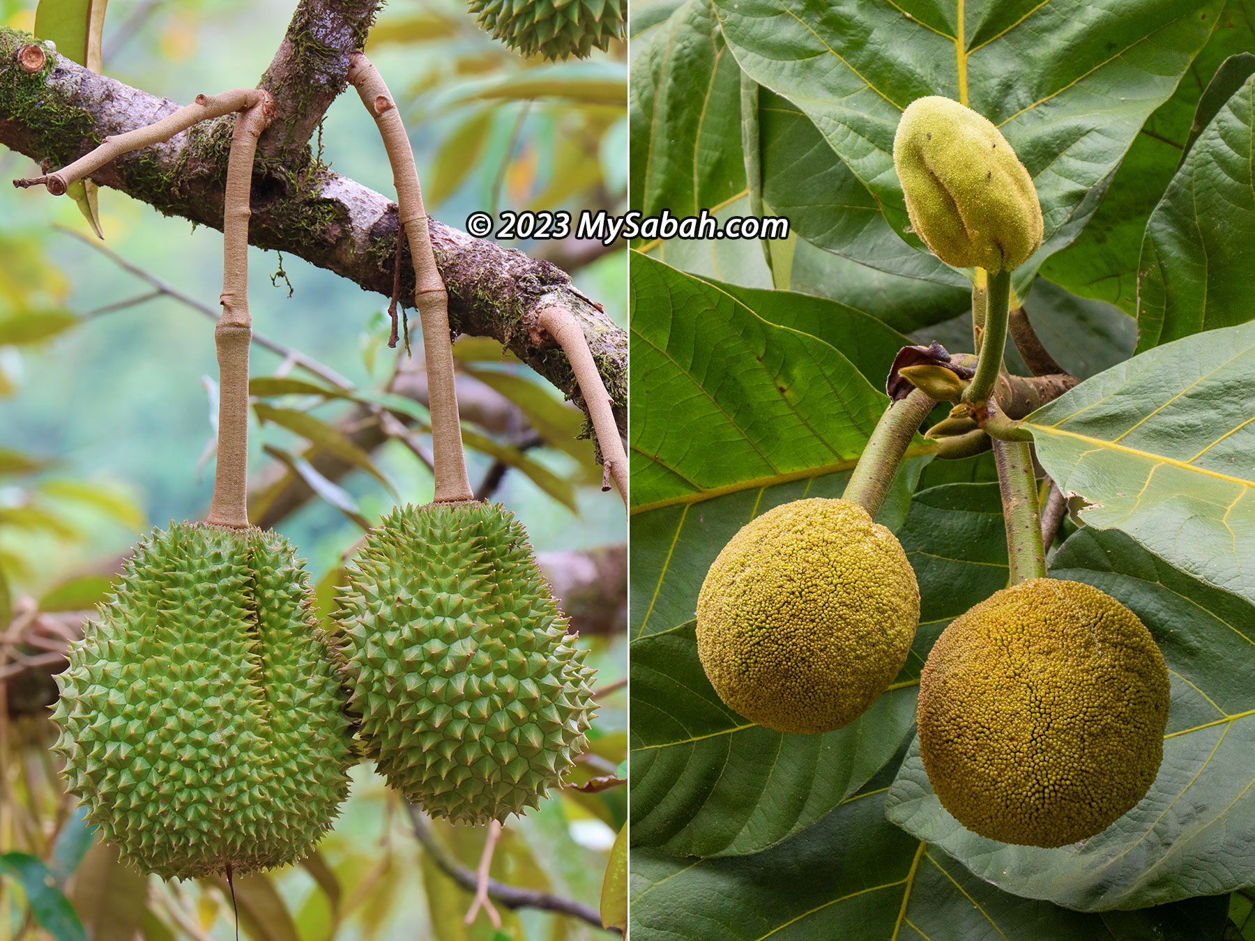
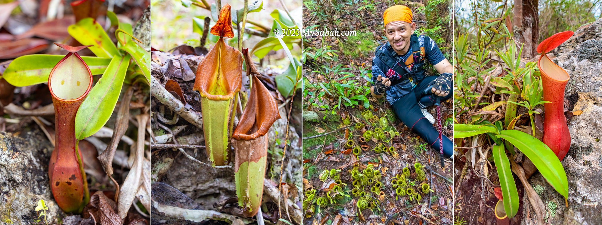
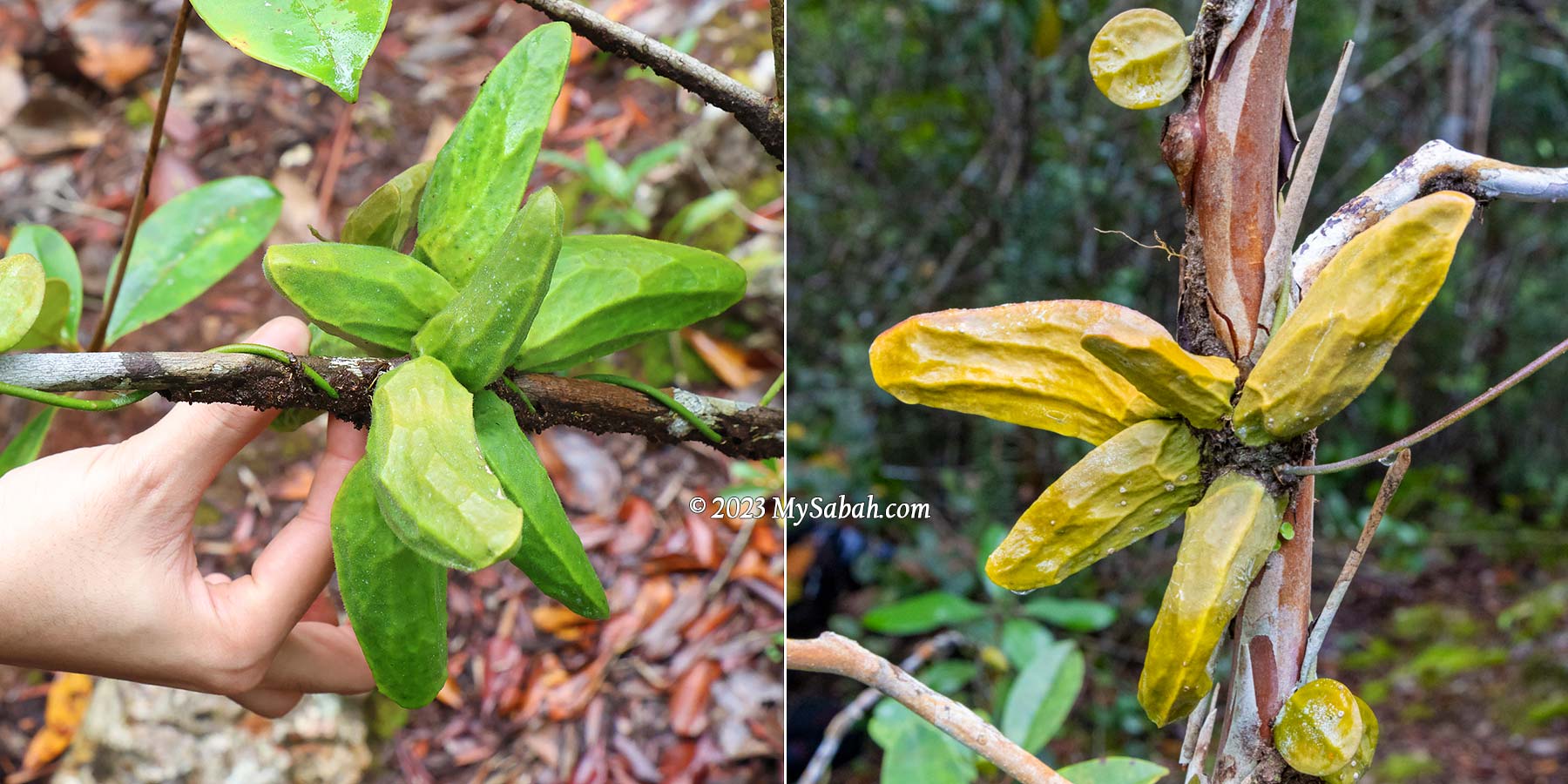
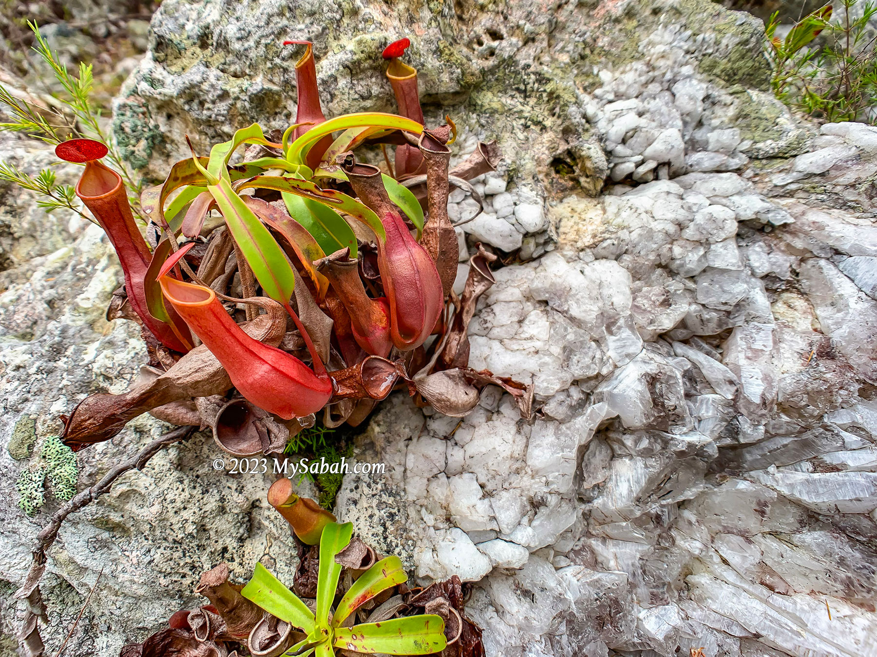
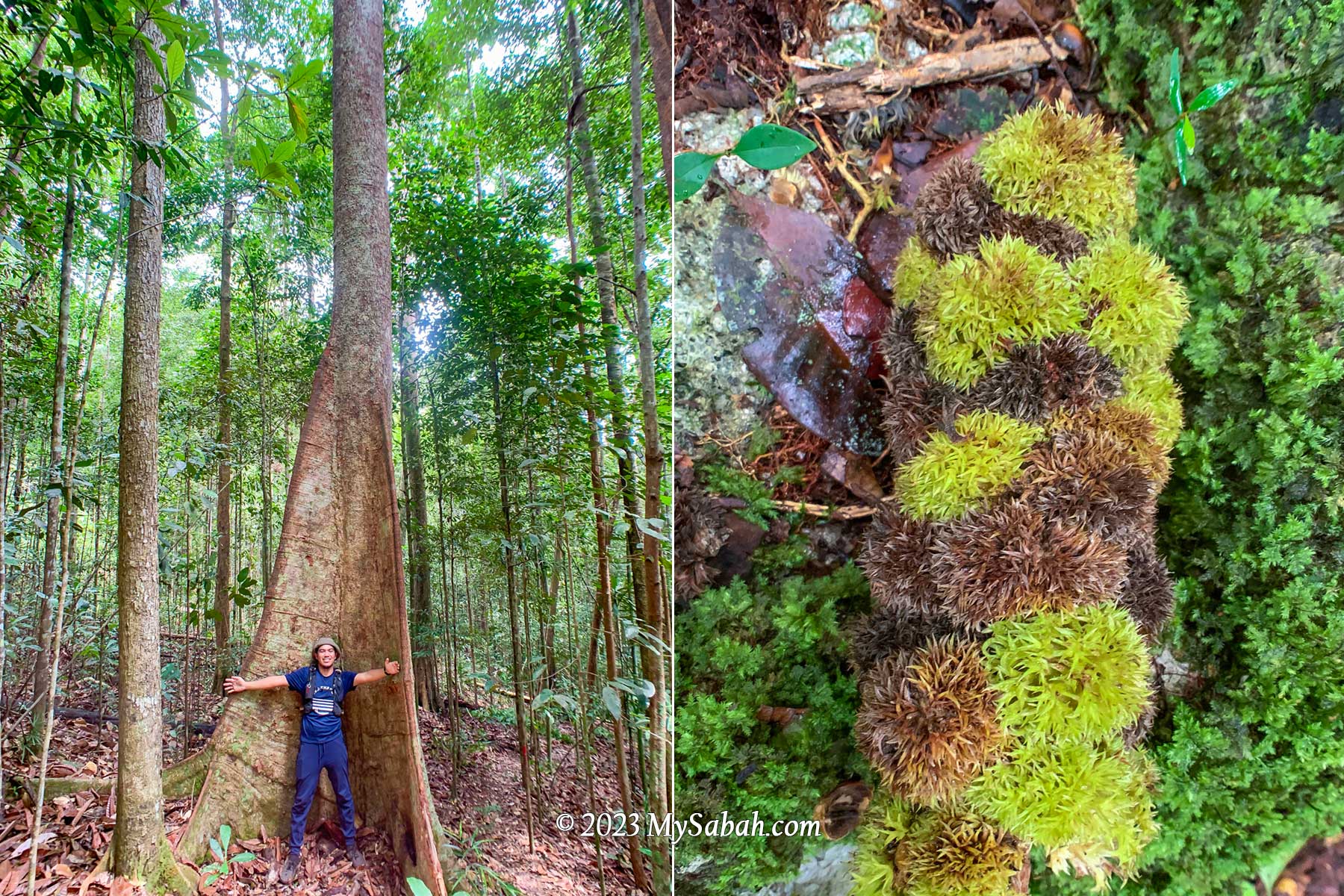
After volcanic activity stopped thousands of years ago, this hill is covered with trees and plants that thrived in its fertile volcanic soil. While many perceive trees as mere providers of oxygen, the reality is that a rainforest hosts a multitude of plants offering food, medicinal properties, timber, firewood, and more.

Distance marker and rope support. The total climbing distance to the peak is 1,080 metres one way. The distance marker shows you how many metres you have climbed (Jarak = Distance).

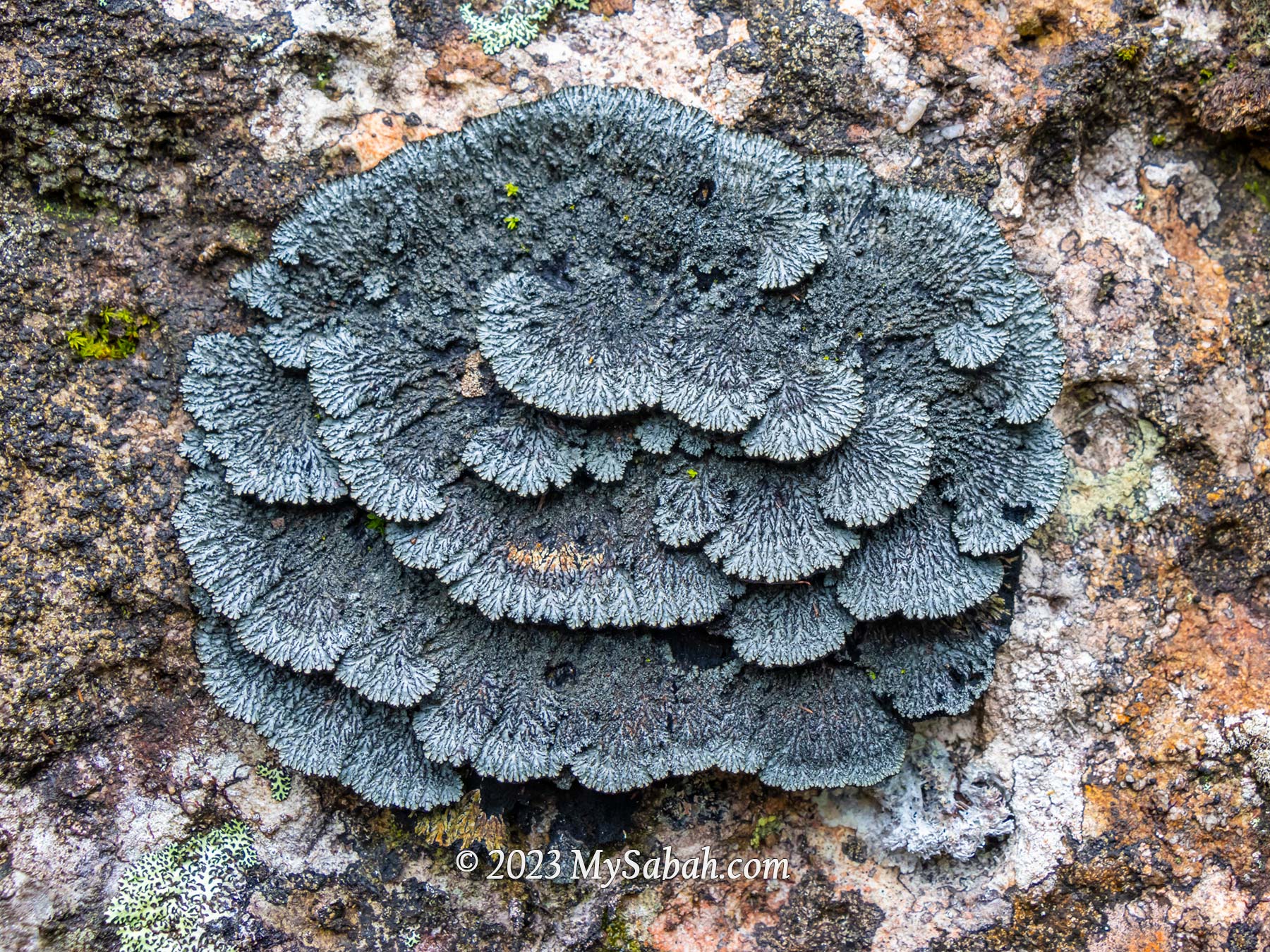
The forest covering the Tinagat hills primarily consists of mixed dipterocarp forest, a typical rainforest found in the hills of Borneo. However, the trees here tend to be relatively smaller, possibly due to the thin layer of soil.

The steep climbing trail of Bukit Panchang. Basically it’s up-up-up all the way and only slightly better after 750 metres.

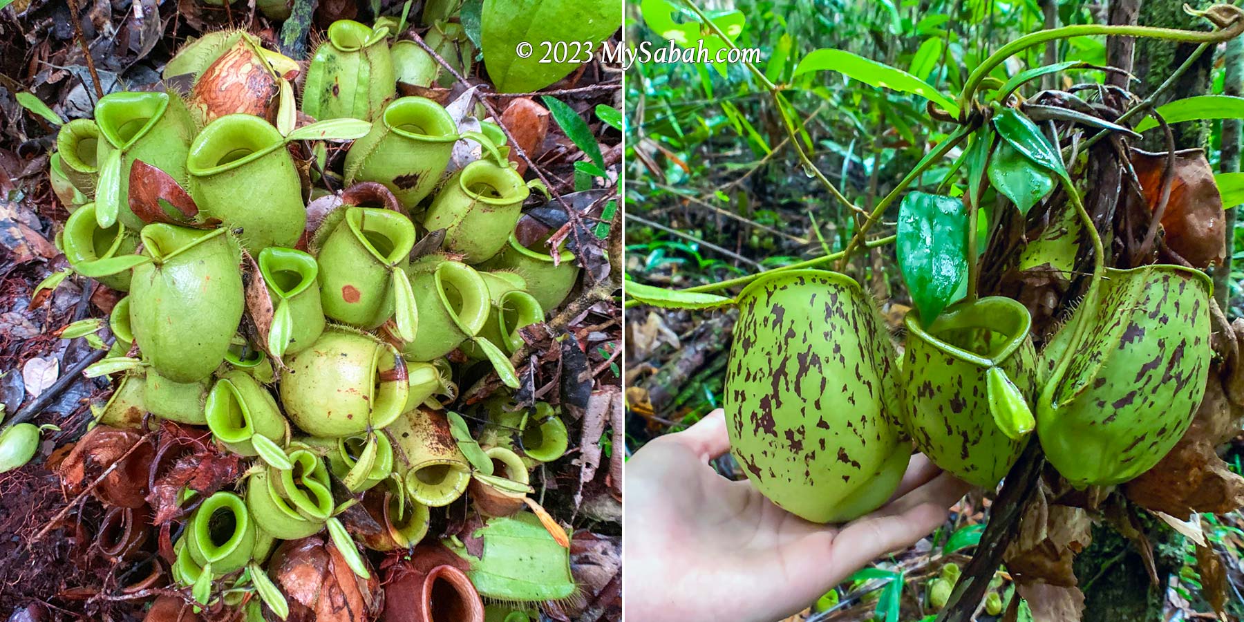
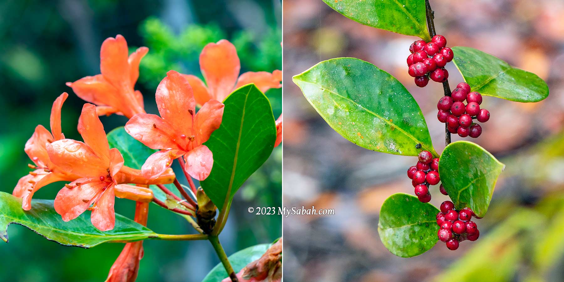
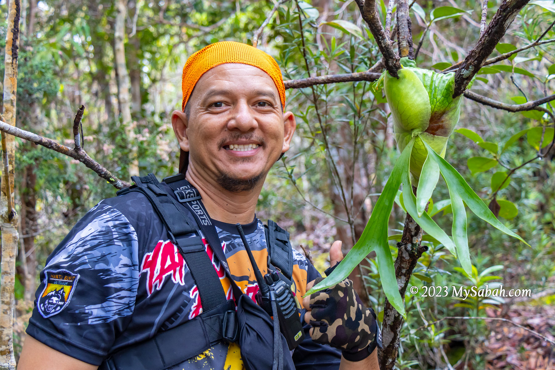
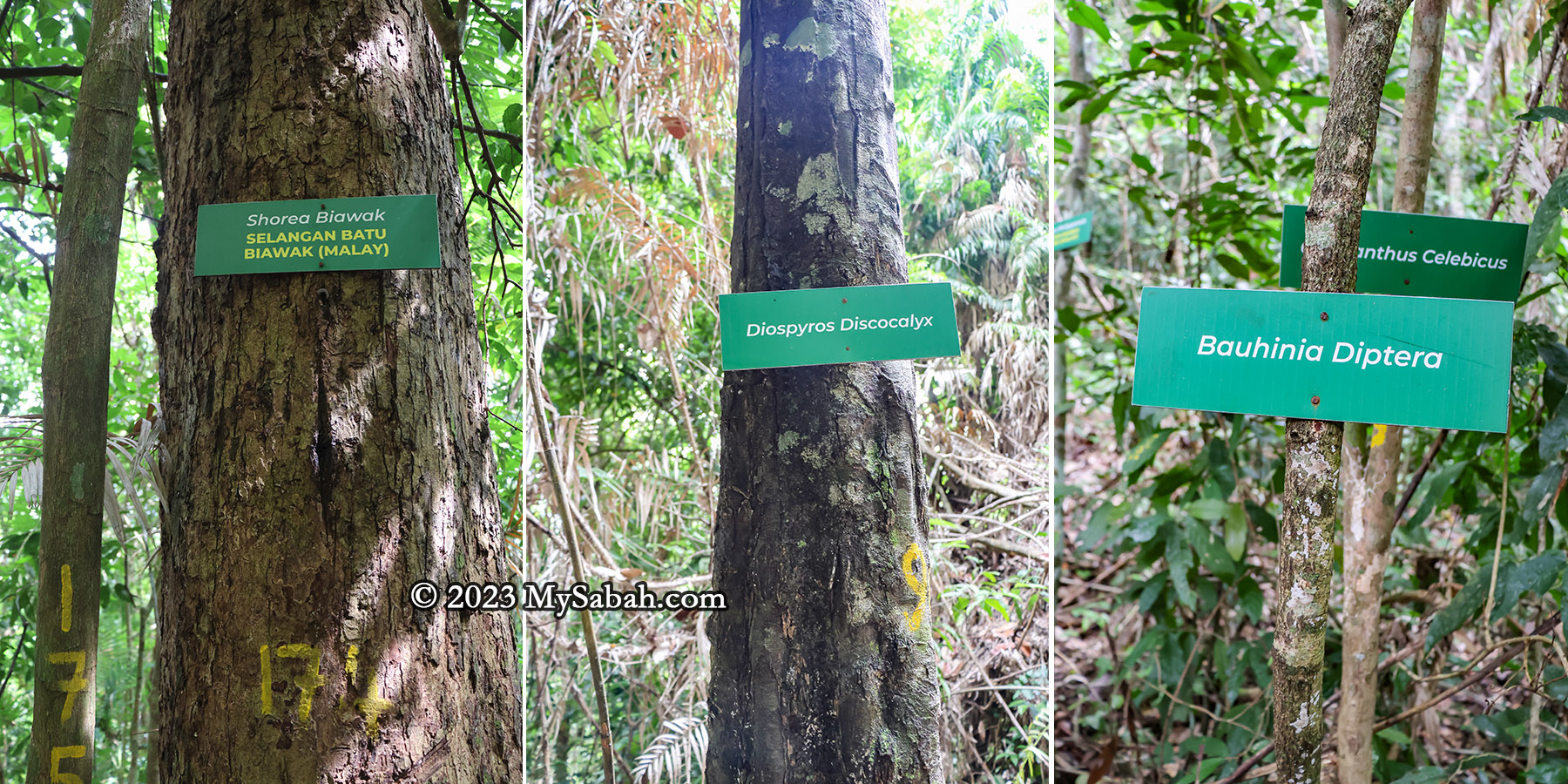
Along the trail to the peak, 30 or more trees are labeled with their scientific and local names. Providing additional information on these labels would greatly benefit non-botanist visitors, who want to learn more about the diverse flora present. I list a few trees that are interesting and useful.

The trees on Bukit Panchang of Tinagat Forest Reserve
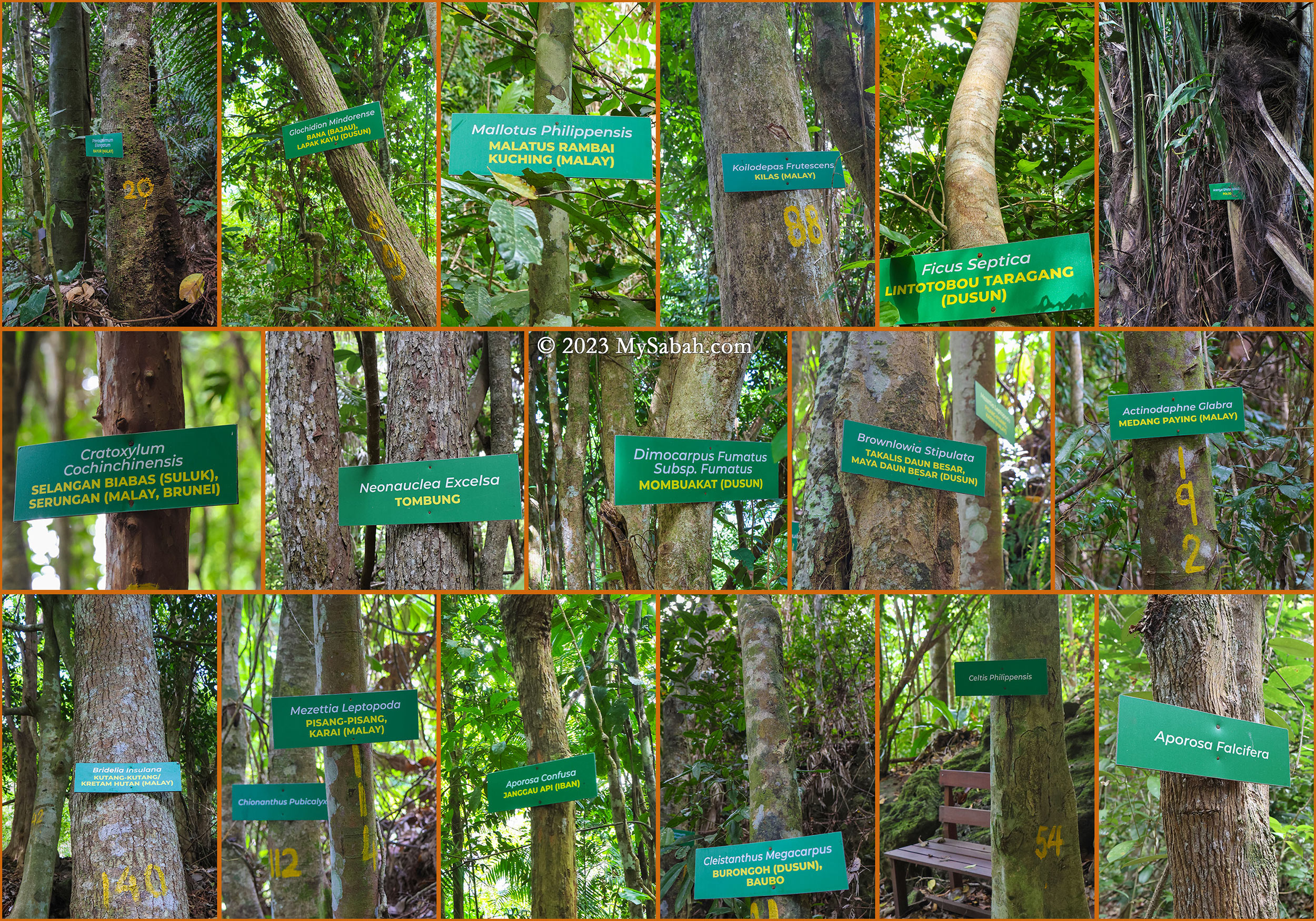
  • Arenga undulatifolia (Polod) is a tree that can feed and kill. Its fruits are poisonous but the apical bud (known as a ‘palm heart’) is edible. The petioles and midribs are used to make darts for blowpipes.
  • Cratoxylum cochinchinensis, known as Selangan Biabas (Suluk) or Serungan (Malay, Brunei) is probably the most useful tree. Its timber, traded under the name ‘derum,’ is prized for medium to heavy construction. Additionally, its young fruit and shoots are edible, while the young leaves serve as a tea substitute. Its roots, bark, and twigs can treat colds and diarrhea.
  • Celtis philippensis offers a versatile range of applications: the seed oil finds use in producing lubricants and soap. Its bark supplies valuable fibers utilized in crafting ropes and paper. Furthermore, the wood is used in making poles, tool handles, beams, joists, rafters, cheap furniture, box lumber, and as fuel.
The trail is less steep after 800 metres (Jarak = Distance)

During World War II, villagers relied on their resourcefulness and the abundance of the forest. Many could retreat deep into the jungle, hiding for months as they relied on the forest for sustenance and survival.

Endemic trees of Borneo on Bukit Panchang

There are five or more trees endemic to Borneo on this hill.

  • Shorea biawak, known as Selangan Batu Biawak in Malay, is assessed as Endangered. It yields quality wood used in handicrafts.
  • Diospyros discocalyx, deriving its specific epithet from the Latin for ‘disc-shaped calyx,’ thrives in lowland mixed dipterocarp forests
  • Bauhinia diptera is a climbing shrub primarily found in the wet tropical biome.
  • Chionanthus pubicalyx is endemic specifically to Borneo.
Semecarpus glaucus (Rengas) is a poisonous plant you should avoid. (Ada Racun = Is Poisonous)

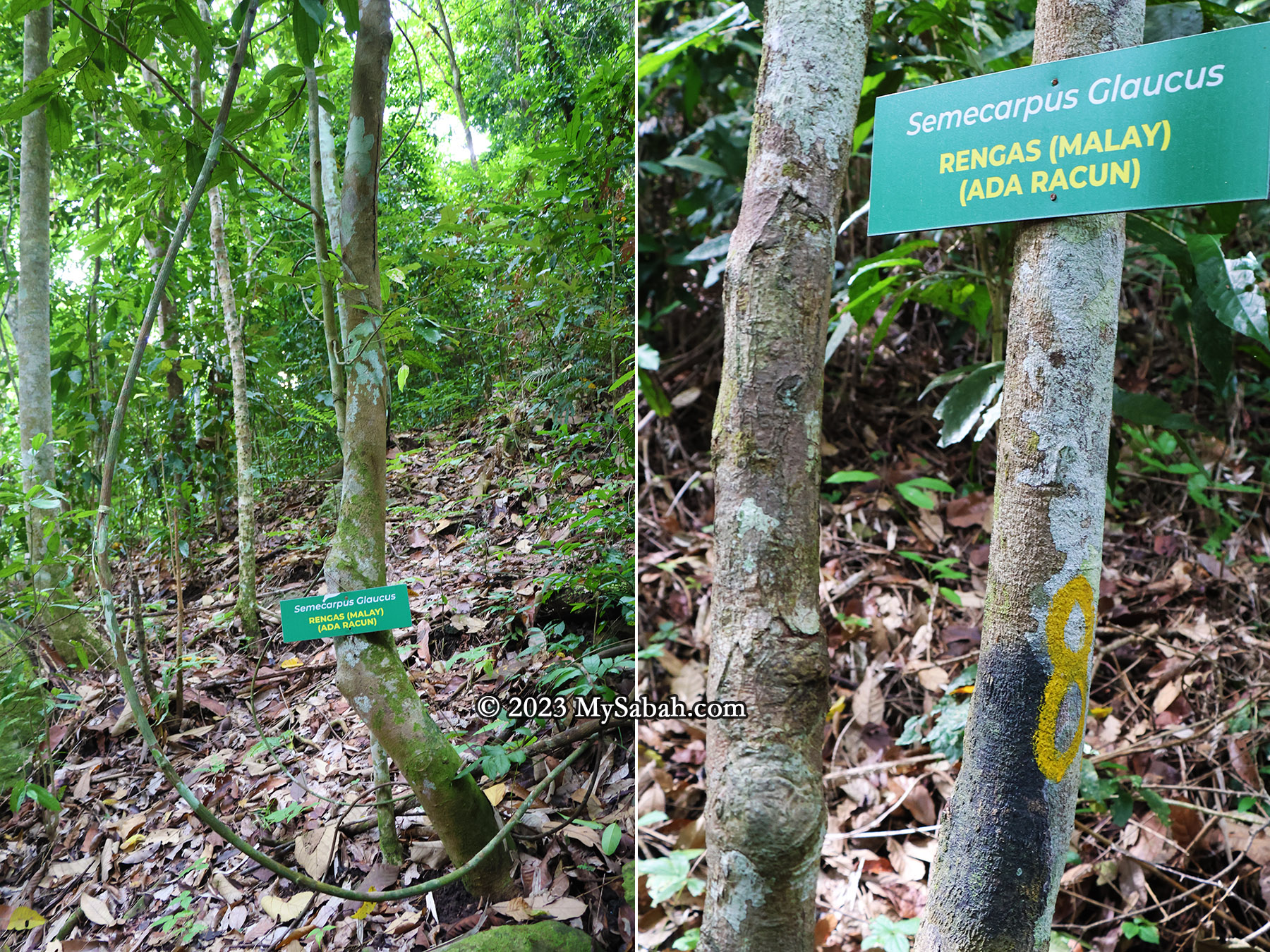
For hikers, they need to be cautious to a tree called Semecarpus glaucus (locally referred to as Rengas in Malay). Avoid touching this tree or its sap, as it can lead to severe skin irritations such as rashes and itching.

The exposed volcanic rocks along the trail. Many are weathered and covered by green moss.

Reaching the Peak

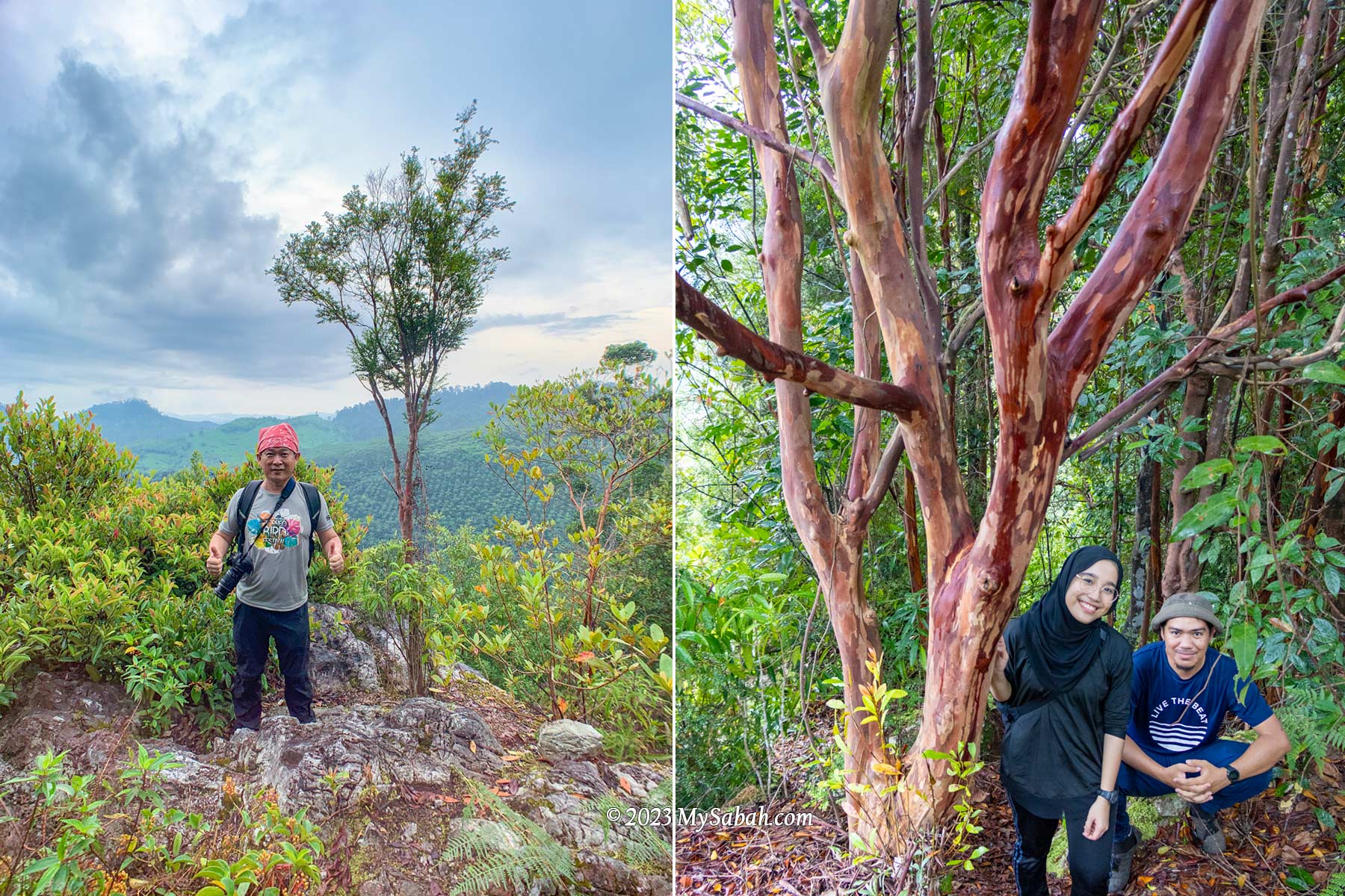
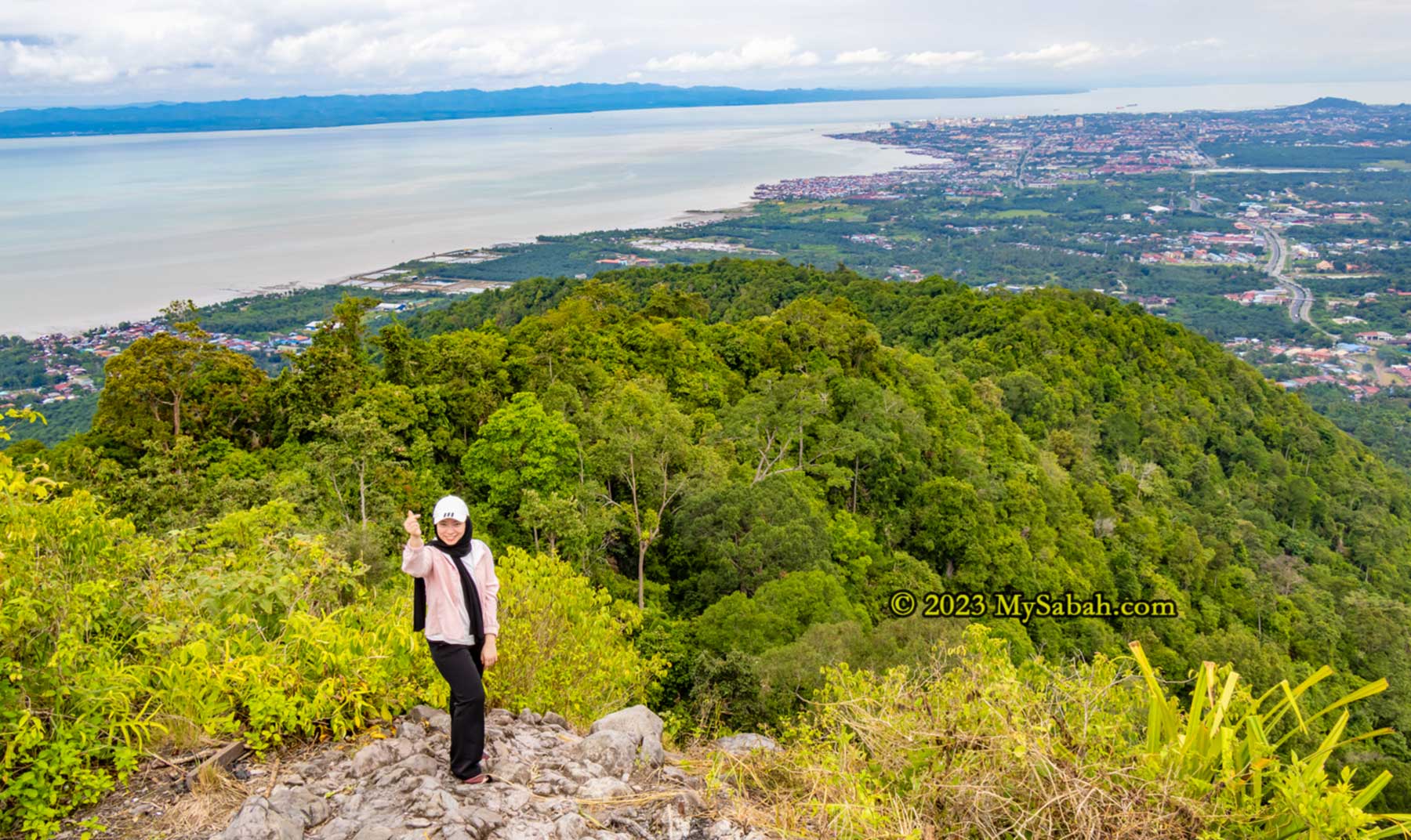
As I approached the peak, the trail’s inclination gradually eased, transitioning into a gentle ridge walk leading to the summit of Bukit Panchang. Hikers who had reached earlier cheered to show encouragement. Among them were Suzan and Priscilla, local regulars who’ve conquered most of Tawau’s hills and mountains.

Big volcanic rocks near the peak

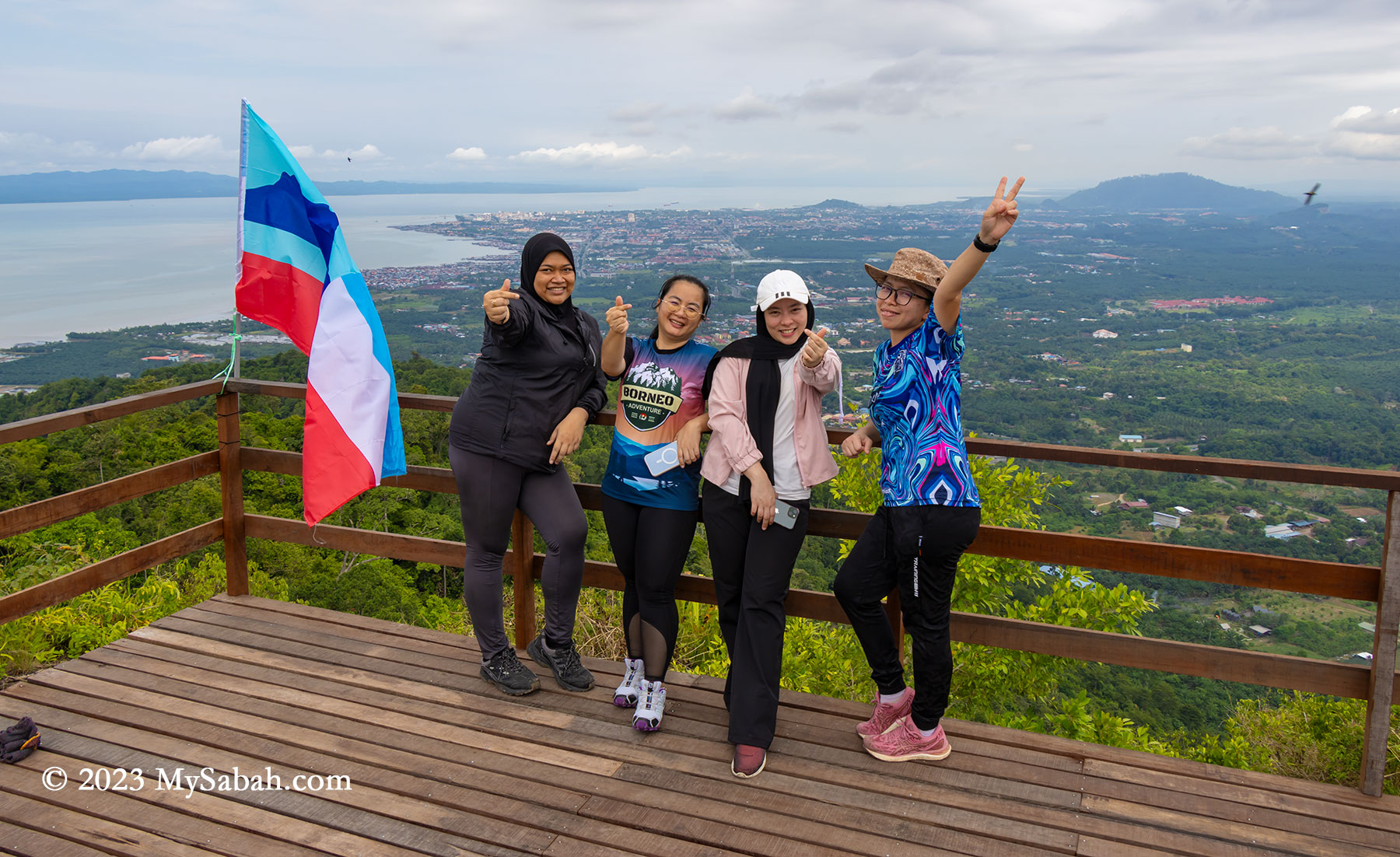
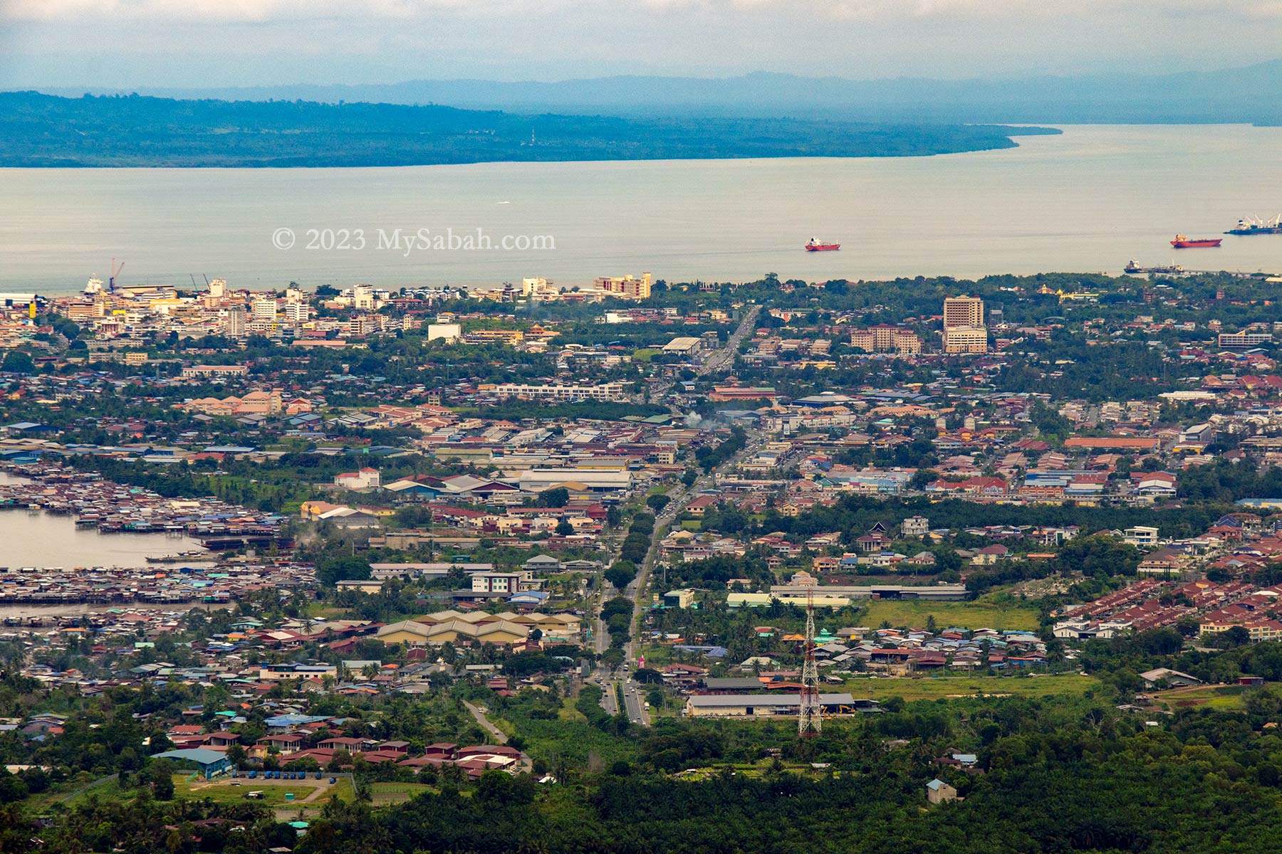
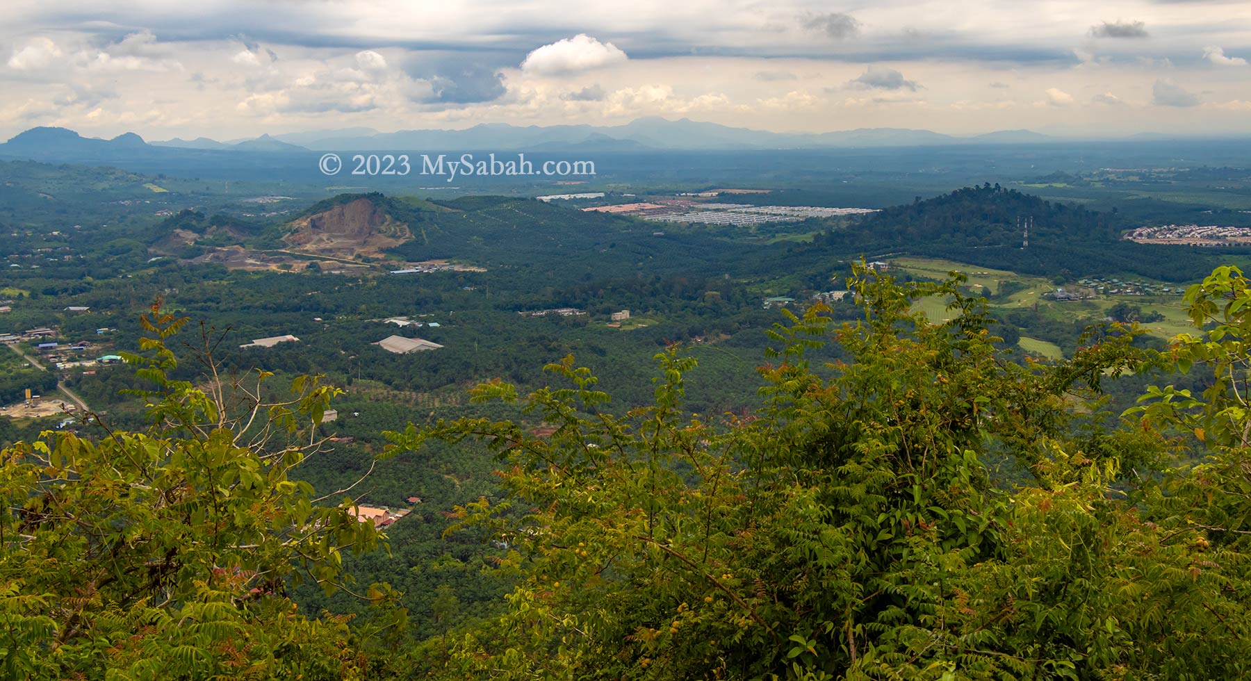
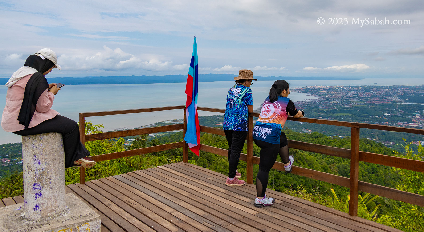
At the peak, a raised wooden platform awaited, inviting a well-deserved rest and the chance to savor the victorious moment from an elevated vantage point. Not gonna lie, the 270 degree panoramic view on the peak is breathtaking. To the left lies the Celebes Sea, while to the right unfolds Tawau town and its surrounding plain. Notably, the sight extends to Pulau Sebatik, an island situated 13 kilometers away, shared nearly evenly between Malaysia and Indonesia.

The last 80 metres of climbing to the peak

Despite being only 9 kilometers away, Tawau town remains clearly visible even during hazy days. Beyond this bustling coastal town sprawls an extensive area dominated by oil palm plantations, residential areas, and notable landmarks like the Shan-Shui Golf & Country Club.

Group photos on the wooden platform and next to the trigonometrical point on the peak

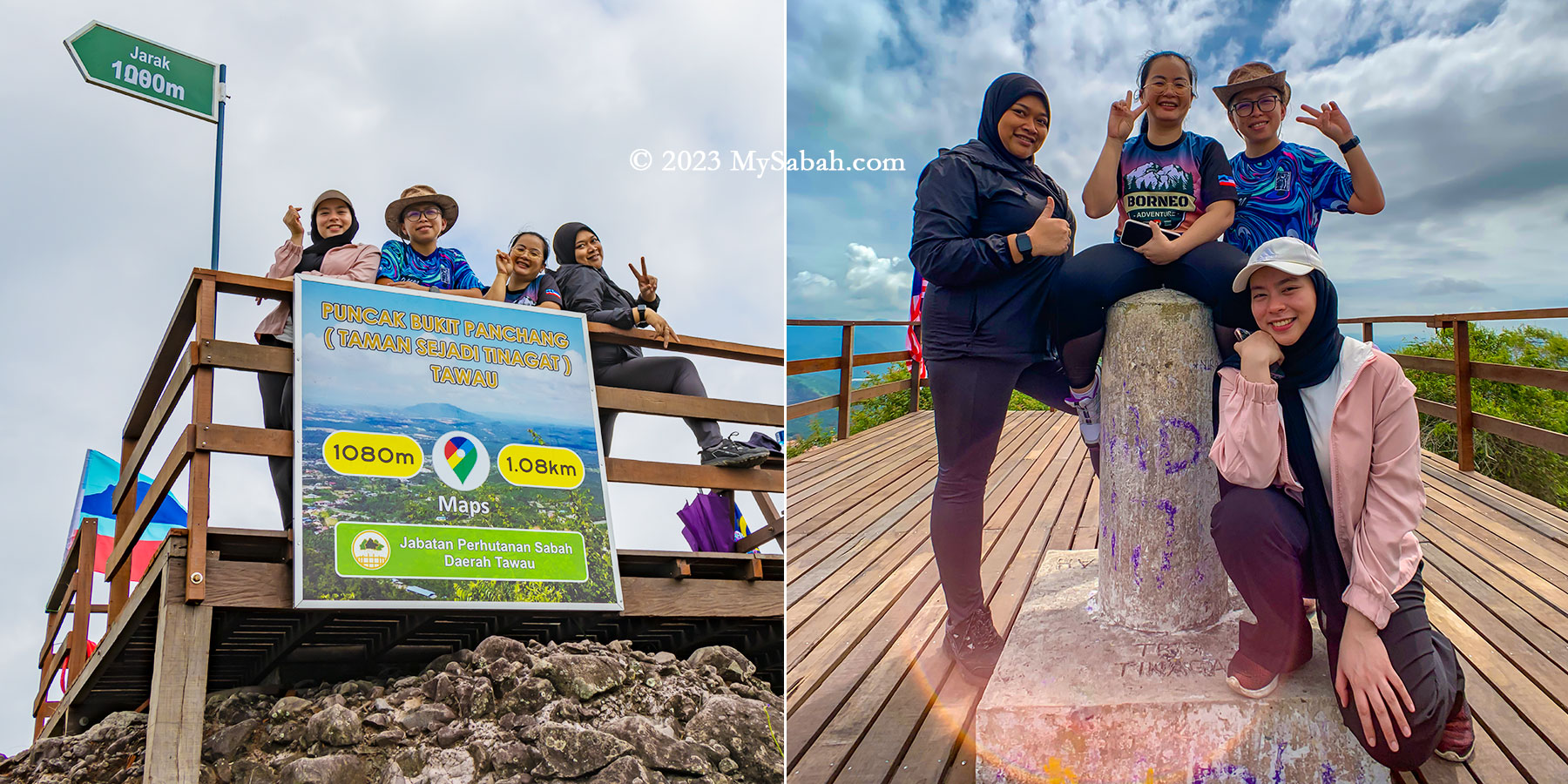
At 398 meters (1,306 feet) above ground level, the peak of Bukit Panchang offers a higher vantage point compared to both the KL Tower and the Eiffel Tower.

Meeting other hikers on the peak

Nestled within this plain are a handful of isolated forested hills, awkwardly encircled by expanses of oil palm. These remaining green hills—Bukit Gemok, Tiger Hill, and Membalua Forest Reserve—stand as vestiges of a volcanic past. I earnestly hope that the people of Tawau will endeavor to protect these fragmented forests, preserving their essence as remnants of past volcanic activity.

View of Tawau town, Celebes Sea and Sebatik Island from the top of Bukit Panchang
Sadly there is a hill being quarried. You can see Shan-Shui Golf & Country Club at the right.

How to get there

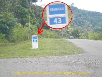
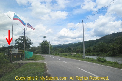
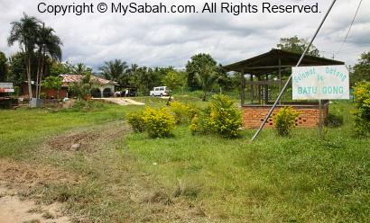
To embark on the Bukit Panchang ascent, navigate towards Tawau town’s Jalan Apas road until reaching Mile 6.5 (Batu 6.5). Look for the junction marked by a white cement signage adorned with prominent red lettering that reads ‘Selamat Datang Ke Kau Sing (高昇)’—translated as ‘Welcome to Kau Sing.’ Turn into this junction to proceed onto a narrow and straight road.

Junction No. 10 and the signboard of Bukit Panchang at the starting point

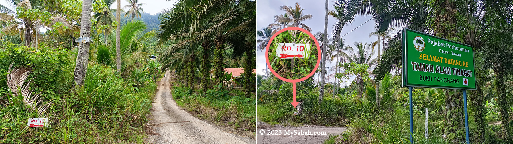
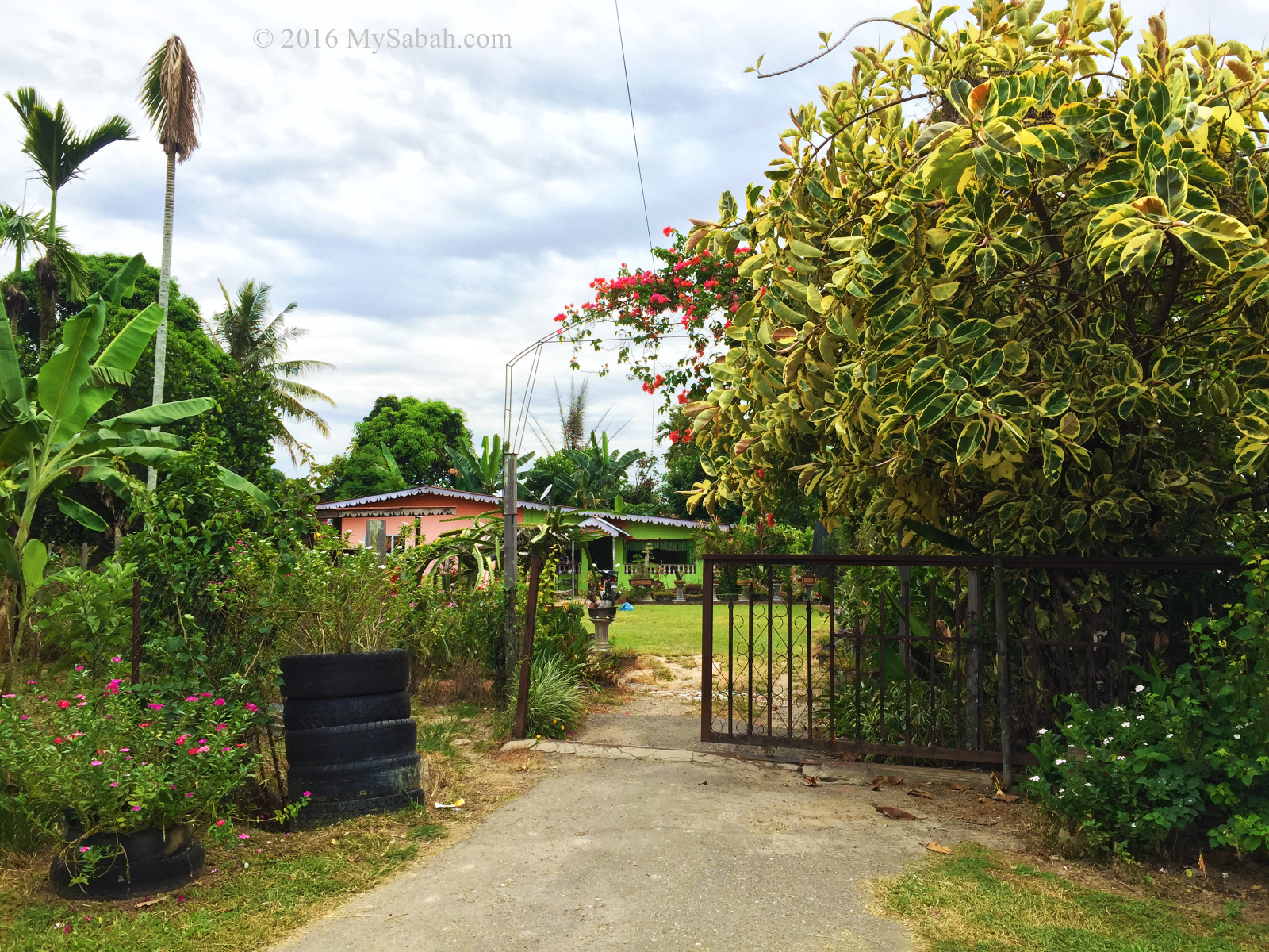
As you drive, maintain a slow pace and keep an eye out on the right-hand side for a small junction labeled No. 10. Adjacent to it (see Location Map), there’s a coloured signboard displaying ‘Taman Alam Tinagat’ (means Tinagat Nature Park). Park your car safely along the roadside, then proceed by foot towards the junction featuring a gravel path that leads directly to the foothill (forest station).

The plain behind Tawau town

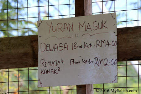
Upon entry at the Sabah Forestry station, visitors are required to pay an entry fee of RM5 for Malaysians and RM15 for foreigners. Additionally, hiring a guide is mandatory at RM50, and one guide can accompany up to five climbers. For optimal savings, a team of five climbers can share the cost of one guide. Even solo climbers must pay the full RM50 fee for a guide.

Viewpoint platform and trig point on the top of Bukit Panchang

Unauthorized entry is considered illegal encroachment and can result in severe penalties. Offenders could face fines up to RM50,000, imprisonment for up to 3 years, or both.

A huge volcanic boulder on the peak of Bukit Panchang

Tinagat was once a popular hiking destination among locals. However, the number of regular visitors has significantly declined due to the added guide fee. While Bombalai Hill could be a viable alternative, its distance from Tawau town makes it less accessible for many.

Some spots have benches for the climbers to rest

You can contact Sabah Forestry Department of Tawau district via the following channels for more information:
Facebook: Destinasi Rekreasi Hutan Simpan Perhutanan Daerah Tawau
Phone: +60 89-761833
E-mail: trhsm2021@gmail.com

Things to Bring

Besides wearing a pair of comfortable hiking shoes, you should bring the following items:

  • Cash
  • MyKad or identity card
  • Drinking water (1 Litre)
  • Raincoat / Poncho
  • Insect repellent
  • Sunscreen lotion
  • Snack or energy bars
  • Hiking stick (Trekking pole)

Photos taken in Tawau, Sabah, Malaysia Borneo

Topi Raja, the King’s Crown Rock

Sabah people were so excited to see Agong (King of Malaysia) who toured around Sabah recently. A lyrics in our national anthem says “Rahmat bahagia. Tuhan kurniakan Raja kita selamat bertakhta” which means “With God’s blessings of grace and happiness, may our King be safely enthroned.” Malaysians really love their king. A king rock in Sabah would amaze them?

Topi Raja literally means ‘King’s Crown’. It’s 100% made by nature.

The majestic Mount Kinabalu, the highest mountain of Malaysia, crafted a giant crown with fire, ice and water thousand of years ago. It’s “Topi Raja” (translated as King’s Crown in English), a granite boulder located in Kampung Lingkungan (Kampung means Village), Kota Belud. Topi Raja got this name because its pointy spikes that looks like a crown. Some say Topi Raja also resembles a dinosaur with spikes on its back.

The top of Topi Raja also looks like the slates on the back of a Stegosaurus dinosaur

The Origin of Topi Raja

Granite rock is formed from hot magma that slowly cooled far below the Earth’s surface. Topi Raja was lifted to the surface as part of Mount Kinabalu about 7 to 9 million years ago. Until 10,000 years ago, the end of the ice age, this huge granite boulder was swept down Mount Kinabalu by the force of melting glaciers to Kota Belud, got buried underground. Then powerful flushes of subsurface water (e.g. ground water) after heavy rain eroded this weathered rock creating those sharp spikes.

The jagged peaks on Mount KInabalu is the work of glacial erosion during ice age. Kota Belud is at the left side of this photo.

Actually the similar boulder is also found in Kampung Podos, Kampung Sayap, Kampung Langat, and Kampung Lobong-Lobong in Kota Belud. However, only Topi Raja is listed as one of the 30 geosites of Kinabalu Geopark because of its cultural heritage value.

Location map of 30 geosites (with geological, biological or cultural heritage value) under Kinabalu UNESCO Global Geopark

You may ask, why cultural value and not geological value? Because the story of Topi Raja teaches an important moral lesson that reflects the value of Sabah natives.

The Legend of Topi Raja

During a harvest season at the large paddy field of Kampung Togor (Kampung is Village in Malay language), villagers from neighboring Kampung Tolungan and Kampung Kebayau came to help Kampung Togor on harvesting. After they finished works, they congregated and feast in a big hut called sulap (a big resting hut) to celebrate. Two villagers, who bathed in the nearby river, brought back a takang (a kind of big frog) and a rudai (a big lizard that can change colours) that they caught at the river.

Climbing on Topi Raja is prohibited. Please respect it like a king.

The villagers were furious to see them making fun of the takang and rudai and asked them to free the animals at once, but their advice was ignored by the two villagers. Other villagers, while enjoying the feast, started to celebrate by beating gongs and dancing the traditional dance called Sumayau. The two villagers then joined the celebration by making the takang and rudai dance in the middle of the crowd.

Takang (horned frog) and Rudai (lizard). Did Takang escape, take the crown and become a Frog Prince? I don’t know.

For more party fun, these two villagers dressed the takang with a sarong (a kind of cloth worn by women villagers to wrap around their bodies) and rudai with a cawat (loin cloth). The beating of the gongs got louder and merrier as the villagers and the two animals kept on dancing, the amused villagers clapped, shouted and laughed.

Groundwater erosion led to the formation of craggy grooves on Topi Raja. This process is similar to the formation of the sharp spikes on limestone rocks such as the Mulu Pinnacles in Sarawak.

Unhappy of this situation, a girl among them scolded and demanded the villagers to stop this farce immediately, but nobody listened to her. Then black clouds approached and strong winds blowing outside the sulap, a mysterious old lady appeared and asked the girl to leave the sulap because something bad was about to happen. As the old lady pushed the girl out, a sudden boom of thunder and lightning struck the sulap and turned it into a big rock named Tontolob.

Topi Raja is a granitic boulder eroded from Mount Kinabalu and transported down the mountain by moving glaciers about 10,000 years ago.

The girl returned to her village and told the villagers what was happening. Though they heard the cry for help in the rock, they failed to rescue the people trapped inside, because whoever tried to break the big rock would be hit by lightning and injured badly. The villagers who rocked and rolled with the poor animals turned into rock forever.

White mold on granite. Granite is commonly used in construction and building materials because it is a hard and tough rock.

The lesson is – never make fun of animals, which is a taboo in the cultures of Kadazandusun and Murut people in Sabah. In our belief, people who do this will anger the God. Batu Punggul pinnacle also has a similar story that involves a dog and chicken, and Watu Monontian (pregnant woman) stone is a result of forcing dogs and cats to dance.

Visit Topi Raja

Topi Raja is highly accessible by paved road (see Location Map), about 27 KM from Kota Belud town and 79 KM away from Kota Kinabalu City. The rock is situated on a 9-acre private land owned by a couple, Mr. Hsu Han Chun and Madam Agnes, who bought this land in 1961 and developed it into a recreation site named Topi Raja Mountain River View since 2014.

Fruits at Topi Raja Mountain River View. You would see durian and tarap fruits if you visit at the right time.

The entry fee to Topi Raja, which comes with a welcome drink, is RM5 per person. Besides photo taking with Topi Raja, you can visit around this place to explore the hanging bridge, swimming and fish feeding at river (but don’t catch any frog and lizard), garden and orchard (durian, tarap, pineapple, sacha inchi, etc.). You must apply mosquito repellent though.

Information board about the legend of Topi Raja in 3 languages (English, Malay and Chinese)

The place is completed with amenities (e.g. toilet, dining hall, cafe, gazebo, camping ground) and accommodation for tourists. For group activities. You may contact the owner in advance to prepare the services for you.

For contact and more info, the following are the channels to get in touch with Topi Raja:
Facebook: Topi Raja Mountain River View
Instagram: topirajamountainriverview
Phone (Whatsapp): +60 10-5578983
E-mail: topiraja.tourism@gmail.com
Website: topiraja.wixsite.com/topiraja

Photos taken in Kota Belud, Sabah, Malaysia Borneo

Climbing Mount Wullersdorf, the Land of Crystals and Red River

Imagine you are an adventurer in a role-playing game and given a quest that says, “Find the magic crystals on an extinct volcano mountain, where you will traverse through a dwarf forest with blood-red rivers, mossy rocks and flesh-eating plants.” This scene matches Mount Wullersdorf perfectly. Time for me to walk out of my virtual world and steps into the uncharted territory in Mount Wullersdorf as a real adventurer.

The reddish tea colour stream in Wullersdorf forest is the result of the tanning effect leached out from the thick dead leaves and debris that cover the heath forest floor. The water is acidic but safe to drink.

In terms of geology and vegetation, Mount Wullersdorf is special because it is:-

  1. An extinct volcano, a geological heritage of Sabah
  2. Heath forest with red river and rare plants
  3. A world of natural crystals in Sabah
From left: volcanic rocks, crystals and pitcher plant of Mount Wullersdorf

Itinerary

The following is the itinerary of climbing Mount Wullersdorf. It is a day trip with a hiking distance of 7 kilometres. You must book the tour in advance.
7:30am Gather at Dewan Kampung Balung Cocos (Tawau)
8:00am Depart to the Control Post (Sabah Forestry Department) of Wullersdorf, the starting point of the climb
8:30am Start climbing after registration and briefing
9:30am-10:00am Reach the first peak after 30-40 min (2 km)
11:00am-12:00pm Reach the second peak (Wullersdorf Peak) after 4 km. Rest and lunch on summit
1:00pm Hike back to the Control Post via shortcut (1 km for 40 min)
2:30pm End of tour

Walk-through

Are you ready for the epic quest adventurer? Or you can watch the 6-minute video below:

The height of Mount Wullersdorf is 430 metres (1,411 ft) above sea level. The one-way distance to the highest peak is 6 kilometres, which takes about 3 to 4 hours. There is a 1-kilometre shortcut from the peak back to the starting point, so in total it’s a 7-km loop trail.

Going to the Starting Point

Mount Wullersdorf is located in a Class-1 (fully protected) forest in Kunak (Tawau Division). To enter the mountain, you need a permit from the Sabah Forestry Department. So I get a local agent who can get the permit and arrange the climbing trip for me. Just a few messages back and forth with the agent and I get the booking done. Easy.

Hop on the pick up truck that sent us to the starting point about 15 minutes away

I meet my guides at Dewan Balung Cocos (Balung Cocos Village Community Hall) around 7:30am. Mr. Eady and Pakri are my guides, who live in this village. Also joining me are Mr. Aidil and Ms Zura, the hikers from Tawau. It’s drizzling in the morning. I’m concern about the gloomy weather but Pakri says that the red river is more beautiful when it has more water.

The Control Post of Mt. Wullersdorf Forest Reserve is the starting point of our climb to Wullersdorf Peak. Visitors need to register before the hike. You can be fined RM10,000 for illegal entry.

We hop on our pick-up truck to depart to the starting point of the climb. It’s a bumpy ride on a gravel road in an oil palm plantation. After 10 to 15 minutes, we reach the control post of Sabah Forestry Department. Besides us, there is team of 20 members from Lahad Datu Hash House guided by another agent, Uncle Mul.

About Wullersdorf

Mount Wullersdorf is part of Mount Wullersdorf Forest Reserve, which is 8,137 hectares in size. It’s linked with five other adjacent forest reserves to form a 64,953.74 Ha of Ulu Kalumpang-Wullersdorf Sustainable Forest Management (SFM) Project. The Class-1 Ulu Kalumpang Forest Reserve which covers an area of 50,736 hectares is the biggest forest reserve under this project. This SFM Project is certified by the Forest Stewardship Council® (FSC) as a well-managed forest.

Mount Wullersdorf Forest Reserve is a fully protected Class-1 forest. Government and WWF is trying to restore the degraded and fragmented forest to re-establish forest connectivity between Mt. Wullersdorf and Ulu Kalumpang Forest Reserves, so wildlife can move freely in the connected forests for more resources.

These forest reserves are also the habitat of threatened animals in Borneo such as orangutan, Bornean Pygmy Elephant, Bornean Sun Bear and Bornean Gibbon. Iconic birds like hornbills and Crested Fireback also nest there. Under good conservation, the mountains also protect the headwaters and water catchment areas that are source of water for Tawau and Kunak Districts. The rangers there also mention the sighting of a golden rat (I assume it’s a Malayan weasel or Yellow Throated Marten), and the tracks of a baby Sumatran rhino many years ago. Sadly this rhino species is declared extinct in the wild in Malaysia in 2015.

0 to 2 KM

After registration and briefing, we start to hike at 8:30am. FYI, you can use the toilet at the control post before and after the climb. The first 250 metres is a walk on flat ground covered with tall grasses and shrubs. About 10 minutes later we reach a manmade pond, which marks the start of the loop trail at foothill.

The first 250 metres of the hike. We started walking at 8:30am.

The trees are tall in the beginning and their dense canopy blocks the rain. I see a green path ahead. It’s a rugged riverbed trail littered with green mossy rocks, with red-colored stream flowing between them. The red water and green rock form a very striking contrast, the scenery is out of this world. No wonder they call it the “Lost World of Balung“.

The green mossy rocks and red streams form beautiful contrast along the trail

We climb up and down on these mossy rocks to ascend. Some of the rocks are slippery. It will help a lot if your hiking shoes have good grip, because most of the time we walk on river rocks. Overall, the trail is not really steep, but climbing hundred of rocks will slow you down. I’m the slowest one as I’m already too busy taking pictures in the first two kilometres.

Red River (Local Name: Sungai Merah)

This side of Mount Wullersdorf is dominated by heath forest, which grows on sandy soil with poor nutrients. With infertile environment, plants in heath forest are usually rich in tannins as a defense, which make them toxic or indigestible to plant eaters.

Over 50% of the trail is moving up along a river that is full of mossy boulders with tea-color stream flowing between them.

However, tannin is hard to break down. When water drains through thick dead leaves and debris that cover the forest floor, the tannins and humic acids leach through the porous sandy substrate, finding their way into streams, and dye the water with brownish tea color.

Foaming on the streams is common, due to the saponin and humic composition in the water

Such tea-colored water is also well-known for its foaming nature, probably due to the saponin and humic composition originated from the peat of heath forest. The water is a bit acidic but safe to drink after boiling.

Zura blowing the foam of red river for fun, as if she is in a bubble bath.

We are excited to see a few river rocks that have cracks with crystals inside them. The guides say there are more crystals on Wullersdorf Peak.

Crystals embedded in a river rock

First Peak

There are two peaks to conquer in our climb. The first peak is only 2 km away. When the peak is getting near, we move away from the river trail and walk up a slope with mild steepness. I notice there are some whitish volcanic rocks on the higher ground. We arrive the first peak at 10am.

An Ancient Volcano

Mount Wullersdorf is an extinct volcano. Such volcanic landscape is only found in Southeastern part of Sabah, where volcanic eruption occurred between 1 to 9 million years ago. Even today we can find the remnants of volcanism in Sabah such as Columnar Basalt at Balung River (Tawau) and Bohey Dulang Island in Semporna.

A tree full of pitcher plant before the first peak. You can easily tell that they are Nepenthes reinwardtiana by the two dots on their inner walls.

From Miocene to late Pleistocene, a series of volcanisms creates the major mountainous backbone of the Tawau mountains, which include Mount Wullersdorf, Mount Maria, and Bombalai Hill. The earlier volcanic rocks of andesitic and dacitic composition formed a line of composite volcanoes from Mount Magdalena to Mount Wullersdorf and Mount Pock at Semporna District.

Picture of the first Wullersdorf Peak and a barkless tree nearby

Most climbers wouldn’t realise that Mount Wullersdorf is an extinct volcano since most of the traces and features of volcanism are covered up by dense forest nowadays. I wonder how many people know there are at least 10 extinct volcanoes in Tawau.

Two variants of Nepenthes ampullaria near the peak of Wullersdorf. These cute pitcher plants have wide open mouth to collect leaf debris as nutrients.

Anyway, it’s easy to spot many pitcher plants around the first peak. Nepenthes ampullaria likes to grow in damp area under trees, where it can collect leaf debris as food with its wide open mouth. Nepenthes reinwardtiana (green variant) is another common pitcher plant on this mountain.

2rd to 6th KM

After a short break on the first peak we proceed to the second peak about 4 km away. The trail between the first and second peak is mainly jungle trail with more even surface, which I enjoy more. The peak area is heath forest, a forest type that covers only 2 to 3% of Borneo island, the home to the largest heath forests in Southeast Asia.

Milestone signages that tell us how many metres we have walked. The words are misleading because they make it sounds like a count down, which is not.

Heath Forest (Kerangas)

In contrast to the typical Borneo rainforest with towering trees, heath forests are characterized by shorter, pole-sized trees that are mostly lower than 20 metres with a stem diameter of 10-20 cm. The short-statured trees are a result of inherently infertile, acidic, white sandy soils.

Tropical heath forest of Wullersdorf forest. The soil is sandy and infertile so the vegetation is thinner.

The Iban people of Sarawak call heath forests as “Kerangas”, which means “forest with underlying soils that cannot grow rice”. Only specialized plants can survive such soils with poor nutrients. Though the plant diversity of heath forest is lower than rainforest, it has higher numbers of rare and endemic tree species with high conservation value.

Rhododendron flowers and an unknown fruit on the peak of Wullersdorf

Borneo has the widest variety of heath forest in Asia. Lowland heath forests (below 1,000 metres above sea level) like Wullersdorf are found inland on sandstone plateaus and cuesta formations on the hillsides.

Last 500 metres to the peak of Wullersdorf. The trees become smaller as we moved up.

The surrounding is lit because the small-crowned trees there don’t obstruct much sunlight. The higher the ground, the smaller the trees, to almost shrub-like. We walk in dense thickets of tidy straight bole stem trees with stunted appearance. The forest floor is criss-crossed by tangled roots, making the ground soft to walk on.

Approaching the peak of Wullersdorf, which is dominated by heath forest (kerangas)

One of the special trees we see is Tristaniopsis trees, easy to identify by its orange-brown, smooth and shiny trunk, with scrolls of bark that spontaneously peel-off, hanging as untidy bunches along the trunk and forming a heap at the base of the tree. The forest is quiet. We hear a few hornbills flying over the canopy.

Wullersdorf Peak (Height: 430 Metres)

As we are approaching the second peak, the trees getting sparse, more sandy soil is exposed and the ground is more rocky. Finally we reach Wullersdorf Peak by noon. It’s a rocky peak surrounded by loud cicada calls and greyish volcanic rocks.

We reached the Wullersdorf Peak at noon. The height of Mount Wullersdorf is about 430 metres (1,411 ft) above sea level.

We spend on summit to have our lunch. I decide to explore around the peak as the understory of heath forest is often filled with remarkable plant species.

Pitcher Plant and Ant Plant

Forests thrive on two primary nutrients: nitrogen and phosphorus, what the kerangas is lack of. Under nutrient-deficient environment, carnivorous pitcher plants survive by trapping and digesting insects for additional nutrition.

Different species of pitcher plant on Wullersdorf Peak. From the left: Nepenthes reinwardtiana (red variant), Nepenthes veitchii, Nepenthes ampullaria and Nepenthes gracilis

Uncle Mul told me that there are seven species of pitcher plant in Wullersdorf. I found Nepenthes ampullaria, Nepenthes reinwardtiana (red and green variants) and Nepenthes veitchii (endemic to Borneo).

Dischidia, aka Ant Plant. The pouch-like things are the modified leaves that are hollow inside for ants to nest, so the plant can absorb their waste as nutrients. This is a symbiotic relationship between ants and plant.

Instead of preying on insects, ant-plants choose to work with insects and build a symbiotic relationship with ants. I find a few green and yellow epiphytic ant-plants (Dischidia major) twine around the branches of trees. These ant-plants possess pouch-like modified leaves with hollow inside that acts as a shelter for ants. In exchange for the accommodation, the ants provide the plants with nitrogen-rich debris and feces.

Staghorn ferns of the peak of Wullersdorf Peak. It’s known as Tanduk Rusa (means Deer’s antler), an expensive ornamental plant. Pakri says it’s his first time seeing this fern in Wullersdorf.

Wild staghorn ferns and rhododendron flowers are my other favourite sighting in this kerangas garden. I’m sure there are more to see if I stay longer.

Crystals and Gold of Wullersdorf

The most fascinating feature of Wullersdorf are the crystal rocks, which are abundant on the peak. Quite a number of rocks there are embedded with translucent white and pinkish crystals of different shapes and sizes. I also find many crystal fragments on the ground. I never see anything like this in other places of Sabah.

Pitcher plant growing on a crystal rock

Some believe that crystals have healing powers and able to boost your mood. I don’t know if it’s true. But if you give me crystals, I’ll be in good mood. Don’t worry. I only photograph them and didn’t take any.

Big chunks of crystals on the peak. One has heart shape, some are pink colour and some covered by lichen.

In nature, crystal can form when magma cools and hardens. This glittering beauty is another evidence that proves Mount Wullersdorf was used to be a volcano. Scientists say volcanic crystals is a time capsule of eruption history. Hope we will learn more about this geotourism destination from its crystals.

Crystals are everywhere on Wullersdorf Peak. I took many pictures but didn’t bring home any crystal.

Wait, Wullersdorf has another fabulous mineral, GOLD. It’s estimated that about 30 tons of gold and 19 tons of silver are buried under a parcel of land about 948 hectares in the Mount Wullersdorf area. Well, we better don’t create another disaster like Mamut copper mine.

Return to Starting Point

After taking zillion of photos, I leave Wullersdorf Peak reluctantly. It’s a relief that we don’t need to turn back to the starting point using the same 6-km trail. We use the 1-kilometre shortcut to return to the starting point.

Left: a tree with big buttress at the foothill. Right: thorny chestnuts strewn on the forest floor

The descending trail takes about 40 minutes and it is the steepest part of the climb. Luckily there are some rope support for us to move down safely because part of the trail is quite slippery. We arrive foothill before 2pm as planned. I would say Wullersdorf Peak is one of the best hiking trails in Sabah. FYI, after the climb many hikers take a dip at the river of Batu Bersusun, the only Columnar Basalt in Malaysia, which is only 5 minutes away from Dewan Balung Cocos.

Is Mount Wullersdorf Hard to Climb?

The climbing trail to Wullersdorf Peak is not too steep and difficult, even for beginners. If you do workout regularly, it’s fairly easy. To experienced hikers, it’s just a long hike. The main challenge is to climb over the slippery rocks about half of the time. Wearing a good pair of hiking shoes can make a huge difference. It’s a bonus if the shoes are waterproof too, though you won’t walk in water.

A big and black lichen which is made up from algae and fungus. It only grows in pollution-free environment.

No rope support, stairway and hand rail are available for the first 6 kilometres. Some steep sections in the last 1-km descend have rope support. You would want to wear gloves for roping. Anti-leech socks are not necessary unless you can’t tolerate leech bite at all. According to the guides, for every 20 people, there might be only one or two of them might get leech bite, as leech (pacat) is not common there.

Cooling off in a pond after the climb. The forest of Wullersdorf is warm and humid.

The forest of Wullersdorf is warm and humid, wearing T-shirt and hiking pants is good enough (preferably quick dry). Drinking water is the most important. I finished 1.2 Litre of water. The summit has limited shade to protect you from afternoon sunlight, apply sunscreen if required.

Things to Bring

  • Backpack
  • Raincoat or poncho
  • Water (at least 1 Litre)
  • Energy bar or snacks
  • Packed lunch
  • Toilet paper
  • Camera

Optional

  • Gloves
  • Sunscreen lotion / spray
  • Foldable hiking stick
  • Anti-leech socks
  • Insect repellent
  • Towel and spare clothing (for swimming or changing after hike)
  • Personal medicine

How to Book

Only two agents are allowed to bring tourists to Wullersdorf Peak. You can contact one of them below.

1) Biro Pelancongan Koperasi

Phone (Whatsapp): +60 11-35485773, +60 10-9540209 (Pakri and Eady)
Facebook: Wullersdorf Peak

2) Uncle Mul

Phone (Whatsapp): +60 19-8233896

I booked with Biro Pelancongan Koperasi. The fee is RM35 per person but requires a booking of minimum 10 people (or you can pay more). The fee includes permit (to enter forest reserve), vehicle transfer, guide, and certificate. The gathering point is in Kampung Balung Cocos (see Location Map), a village about 14 km from Tawau airport.

References

  1. “Geological heritage features of Tawau volcanic sequence, Sabah.” Sanudin Tahir, Baba Musta & Ismail Abd Rahim. Bulletin of the Geological Society of Malaysia 56 (2010) 79 – 85
  2. Annual Report 2022 by Sabah Forestry Department
  3. Ulu Kalumpang-Wullersdorf Sustainable Forest Management (SFM) Project
  4. Proposed gold mining in Balung Participate in review of draft TOR, folks urged, Daily Express, 13 Feb 2015

Photos taken in Tawau, Sabah, Malaysia Borneo

Rohaimin’s Rock Gallery, a wonder that rocks you

When is your last time picking up a stone and have a good look at it? Cavemen from stone age probably know rocks better than us because they constantly look for the best ones to make axe and cutting tools. Nowadays the only rocks that piqued people interest are rock concert and gemstones.

The Sakag Rohaimin’s Unique Rock Gallery (Galeri Batu Unik Sakag Rohaimin)

Though rocks are everywhere, each rock is unique. For 20 years, Mr. Rohaimin Ariffin has been collecting special rocks in Keningau, and he is rewarded by thousand of intriguing rocks, which are beautiful, weird or ugly.

Can you see the face of a demon?

90% of his collection come from Sungai Pegalan (Pegalan River) near to his house, and the rest are from Banggi Island, Lahad Datu, Kunak, Kinabatangan, etc. His friends also give him some rocks from New Zealand and Indonesia.

A rock with the word “Allah” in Jawi

In 2008, Rohaimin spent RM40,000 (≈US$10,000) to build a Rock Gallery named Galeri Batu Unik Sakag Rohaimin next to his house. From this, I can tell he must have a very nice wife who doesn’t nag at his hobby (just kidding). To hobbyists, rocks are priceless. To those who don’t appreciate, a rock, eh, is just a rock.

Clam and coral fossils from Sabah

Anyway, whether you are a collector, you will be amazed by his Rock Gallery. I would say this is the biggest gallery dedicated to rocks in Sabah so far. And he doesn’t sell any ticket to guest, it’s free to visit. Based on how he places the rocks, I roughly categorize his rock collections in following groups.

Music Rocks

Batu Gong (Gong Music Rock) forms one of his major collection. When you hit it, the rock will produce a gong like metallic sound. I had seen Batu Gong in Tambunan, but Rohaimin has larger collection!

This rock gallery costs more than RM40,000 to build and is totally self-funded

The “stage” of the gallery where you can perform a rock concert with music rocks.

There are hundred of Batu Gong laying around. He labels some rocks in different tones and group them on a stage. Below is a short video of Rohaimin playing “Rock Music” with Batu Gong:

Rohaimin can play very nice Twinkle, Twinkle, Little Star and Mary had a Little Lamb song with these rocks. A guest was so impressed by the music that he wanted to buy this rock music set.

Religion

One of the most famous rocks he got is the one with the word Allah in Jawi. He also has other rocks with figures of praying muslims, Buddha, Mary, and Satan.

Al-Quran verse on the rock

According to him, the best time to hunt for rocks is after flood and storm, which expose new rocks under the soil. His rocks are not for sale. He even buys rock from others if it’s a nice addition to his collection.

The face of Mary, Mother of God in the rock

A stone that looks like a Buddha

Growing Rocks

Personally I think the most bizarre rocks in his gallery are the “growing rocks”. Over time, some hair-like substance would grow on these rocks, like some kind of crystallization. The “hair” is fragile and can break into powder when touched.

The “growing” rocks

The needle-like crystals keep growing on these rocks, probably a form of crystallization, like how fuzzy rocks formed.

According to Rohaimin, even the box that stores these rocks also has hair grown on the surface, so peculiar. He welcomes Tourism Ministry, Sabah Museum and Geoscience Department to find the answer of this odd phenomenon.

White crystalline hair or fuzz growing on the rocks. It is very fragile.

Fossils & Petrified Wood

The next eye openers are fossils and petrified wood. All the seashells, clam and coral fossils are from the center of Sabah. This proves that Sabah is under the ocean in the past.

Sabah has a lot of fossil shells even in interior, because our land was underwater millions years ago

I used to collect some fossils of Sabah, but they are not as impressive as his collection.

Fossil shells found in Sabah interior

Petrified wood is actually fossilized wood, and its organic part is replaced by other minerals, so only the shape of wood stays. That’s really cool.

This Petrified wood glitters if you light it with torch light

Petrified wood is fossilized wood

A beautiful petrified wood which costs Rohaimin RM800

Animal Heads and Shapes

Occassionally you would notice some rocks that look somewhat familiar to an animal. Rohaimin has some animal rocks that don’t need much imagination for you to tell they are puppy, proboscis monkey, fish, gorilla, Flowerhorn cichlid, sheep and chicken.

Rocks that looks like animal heads. I see a lion head among them.

Rohaimin says this looks like puppy, but it looks like Bulbasaur Pokemon to me lol

Nature Art

Rohaimin started his collection with a few odd and small black stones in 1996. Beautiful stones that have special shapes, materials, colors or patterns are also his target.

Various types of unique rocks

Stones with interesting shapes

Some of his most prized collections are stored in drawer or locker to prevent thievery. He would show them to you if he is around and you ask. Currently his rocks are laying around on the floor or being placed on surfaces of chair, desk and rack. He really needs adequate funding to setup showcase and display stands with proper lighting, to present his collections like art items.

Did you see the stone with Olympic logo?

Bone-shaped rock from Indonesia

Other Non-rocks

Besides rocks, Rohaimin also have other interesting items such as fossil deer horns, WW2 bombshells and old coins. The most impressive is his Bonsai that he has been nurturing for 20 years and some are award winners.

Other items on display. Note the WWII bombshells

Unusual horn of deer

“I don’t want the wives to feel bored, when their men are looking at rocks. These bonsai shall keep them busy,” Rohaimin says. That’s very considerate.

Bonsai tree cultivation at Rohaimin’s place. The unique rocks really enhance their artistry.

A remnant of bomb from WWII

Rohaimin is planning to move his rock and bonsai gallery to a place near to SK Binaong school, which is more accessible by big bus. He would need to apply for another loan for the new gallery building.

The antique bark cloth beater. In old days, people made clothing from tree bark, and this beater was used to beat the bark to make the material soft.

At the moment he is not collecting any visitor fee, so this is totally a self-funded project. If you visit his gallery, it’ll be nice if you would donate some money, no matter how small it is, that’ll bring him closer to his dream.

How to get there

Galeri Batu Unik Sakag Rohaimin (Rohaimin’s Rock Gallery) is about 12 KM away from Keningau town. It’s located in housing area of Kampung Baginda (Baginda Village). There is no direction signage and not all villagers there know this gallery.

Signage to Baginda Village at roundabout

However, you can find his gallery easily if you read the guide here. When you drive away from Keningau using the road heading to Tambunan town, you will reach a roundabout after 9 KM (see Location Map or 3D Street View). Take the road to Kampung Baginda (the sign is just next to the big blue sign of St. Mary’s Church).

Many cows and landmines (cow dung) on the road of Baginda Village

You will enter a small and paved countryside road. Drive carefully to avoid the roaming cows, dungs and speed bumps along the way. Follow the main road for about 3 KM and you will reach a Y junction at the end of paved road. Turn left to the road labeled as JLN. Binaong Baginda (see Street View).

The rock gallery is at the house of Mr. Rohaimin

Keep driving on the gravel road. In a minute or two, turn left to a small path before a downward slope. You will enter residential area with a few houses, and Rohaimin’s house is at the end (GPS Coordinate: 5.375564, 116.204871, see Location Map)

The house of Rohaimin. The entrance to the Rock Gallery is where the yellow arrow points.

Rock is more important than we think. For example, without ultrabasic rocks that promote the growth of endemic plant, Kinabalu Park would not become an UNESCO World Heritage Site. Hope more people will find some fun in this little wonder of geotourism. For more info on the gallery, you may text (Whatsapp available) or call Rohaimin at +60-13-8730559. Please note this is a personal number and he has a daytime job, so use it discreetly and don’t disturb him.

Photos taken in Keningau, Sabah, Malaysia Borneo

Batu Gong (Music Rock)

Years ago I was told by a friend about the amazing Batu Gong (Music Rock) in Kampung Solibog (Solibog Village) of Tambunan. In Malay language, Batu means Rock and Gong is an idiophones musical instrument. Gong (photo below) is made of galvanized iron sheets and a backbone traditional music instrument for indigenous tribes of Sabah. In fact, gong is also commonly found in South East Asia countries such as the Philippines, Indonesia and Brunei.

Our people play gong in important social events such as wedding, festivals and celebrations. Usually gongs in various sizes were beaten by a group of players, in different rhythm to produce a harmonious orchestra. If you hit Batu Gong, it also produces sounds resemble to gong.

To see Batu Gong, I drove 1.5 hours to Tambunan town, which is about 81 KM away from Kota Kinabalu. I asked the Tambunan people how to get there. Though most of them know about Batu Gong, they don’t know the exact location. They only gave me a vague direction and advised me to ask the villagers when I passed by a golf course.

Going from the main road of Tambunan to the direction of Keningau town for about 7 KM, you will see a golf course named TNGC (Tambunan Golf & Country Club) at the left of the road within 10 minutes. Then turn left to a junction just before the milestone labeled “Keningau 43” (see photo above).

At this junction, you will also see the street sign “JLN. BATU GONG” (Batu Gong Road) with a signpost that reads “Golf View Villa” behind (see photo above). Just follow the small road.

After a while, I reached a T junction. I turned to right and it is a correct way. The GPS location of Batu Gong is 5.623135, 116.339694 (see Location Map or Street View)

Minutes later I came to the road with river at the right. I drove slowly and saw a white sign “Batu Gong” behind a gate at my left.

Location of Batu Gong

Pretty sure that I found the place. I parked my car and walked to the gate. I was a bit surprised that Batu Gong is inside a private housing area.

Though a bit hesitated, I opened the gate to enter. Then I saw a hut with a sign “Selamat Datang Ke Batu Gong” (Welcome to Batu Gong). Since it says Welcome, I guess it’s ok to go in.

Here it is! They store Batu Gong inside a simple hut built with zinc roof, brick wall and iron fence.

Looking into the hut, I was happy to see Batu Gong inside.

However, this place is a private property, probably I should ask for owner’s approval to enter. I walked to a house nearby. I met the owner, Uncle Yaman, and introduced myself.

Uncle Yaman is very friendly and more than happy to show me his Batu Gong. The Batu Gong are a few boulders that look like natural ordinary rocks. Judging by their look, I can’t spot anything unusual. The discovery of Batu Gong is also by accident.

According to Yaman, there was a straightening project of Pegalan River in front of his house in year 1995. A few boulders were dug out from the river and placed at the river bank. Nobody bothered about those rocks.


Some village kids like to bathe in this river. Then one day, the adults found that the kids playing with the boulder by hitting it with stone, to produce Gong-like sound. They were so amazed by these magic rocks, so they relocated them to his house for everyone to see.

Above: a closer look of the rock. Can you see anything special? Yaman said a Japanese scientist came here before to check out Batu Gong. This scientist believes Batu Gong has high level of iron, thereby giving it a metal property.


Above: so heavy, 3 men also can’t lift it.

There was someone offered to buy Batu Gong, but the villagers refused, as Batu Gong is such a unique and priceless natural wonder. See 8 small stones on Batu Gong? Batu Gong can produce 8 different tones. Each stone places on the spot that has a unique tone (but a few tones sound the same to me).

Traveling nearly 100 KM to see Batu Gong, I already couldn’t wait to beat it hard.

Wow, I can’t believe it. When being hit, Batu Gong sounds like gong (but not very much). Its sounds are crisp and high-pitched. Just imagine you hit the iron bar with a small hammer. My sense of rhythm is poor, anyway, I had so much fun hitting different spots to hear different tones. You can watch the video below to see what I mean. Near the end of video, I also include the sound and music of real gong for you to compare.

I always wanted to see Batu Gong years ago. I only did it after I got my compact camera with HD movie recording function, because I could not show the sounds with photos.

Above: the river where Batu Gong was found. This river is just in front the house of Uncle Yaman. 15 years ago, a project changed the course of this river to free up some land, which included the current housing area of Uncle Yaman. During rainy season, this overflow river still can flood the road next to it, in case you wonder why Yaman built his house so far away from the gate.

Ticket Fees (written in Malay): Adult (18 and above): RM4.00 (≈US$1), Kid (below 18): RM2.00 (≈US$0.50). Note: rates as of May 2016


Above: to show some appreciation, you can put money in this rusted tin. Of course you can give more.

There is a notice in the hut (no longer there, as of May 2016). I didn’t pay much attention to it until I opened the photos later at home. These are “visiting rules” written in Malay language. The first one says “No Smoking”, which is understandable as the holes on Batu Gong look like convenient ash tray. The second rule is odd, it says “Woman in pregnancy and menstruation are prohibited to enter”. Probably Batu Gong is considered as a sacred rock with spirit resides in it?

Just an extra info, music rocks like Batu Gong are also found in Kg. Baginda of Keningau, but I haven’t seen it yet.

Photos taken in Tambunan, Sabah, Malaysia Borneo