Category Archives: Adventure

Orange mushroom

Part 1 of 8. Trip to Maliau Basin, Sabah’s Lost World

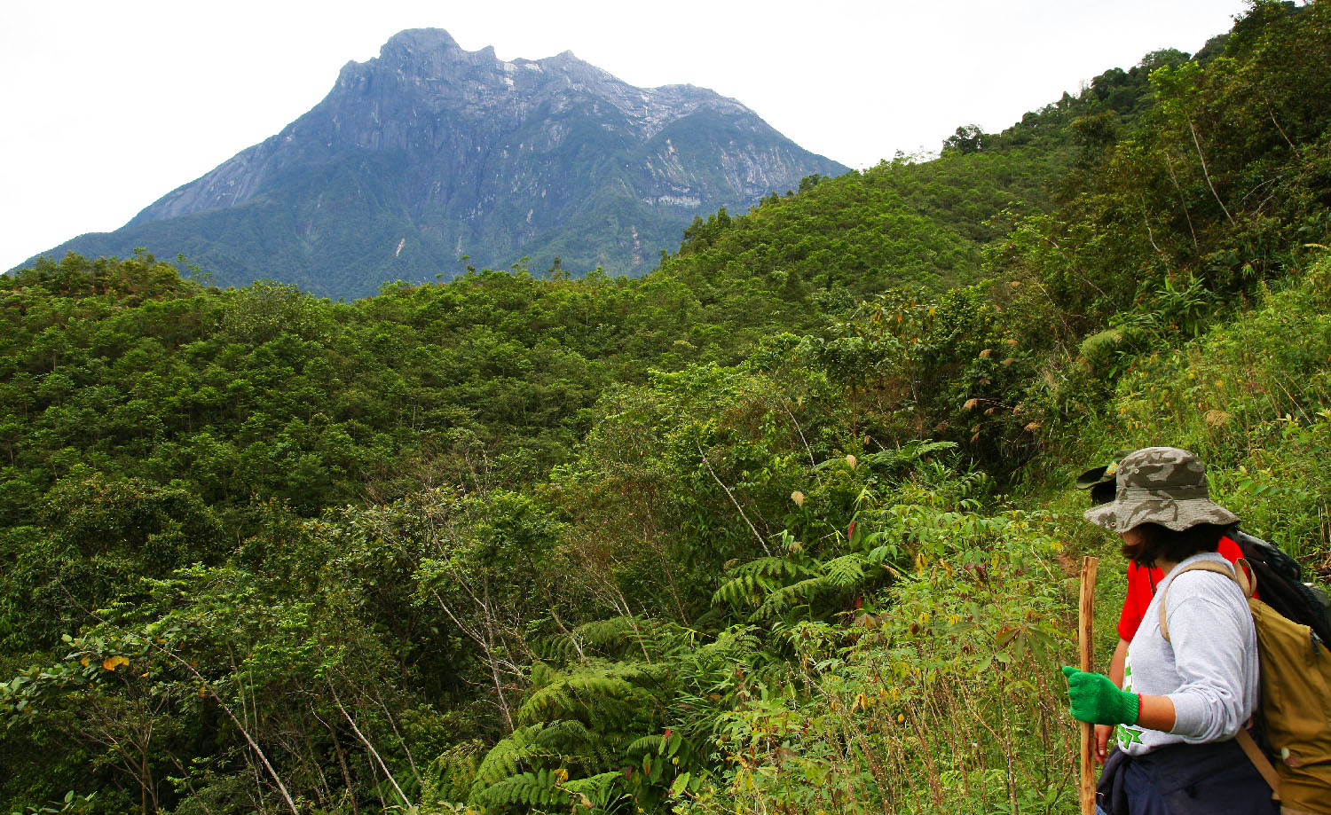
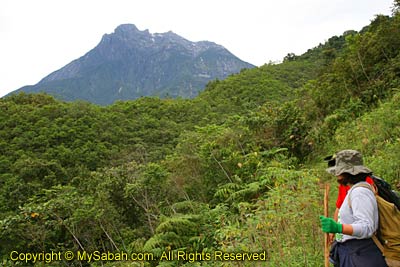
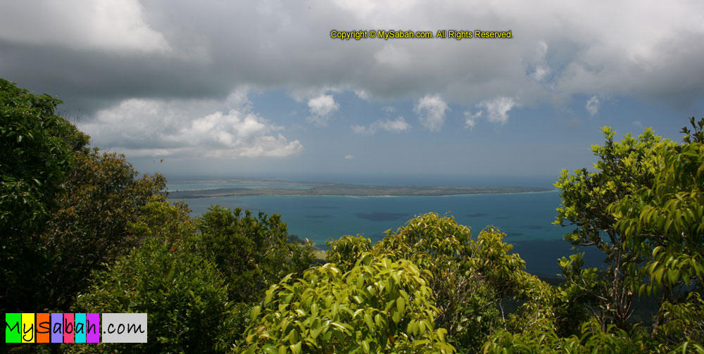
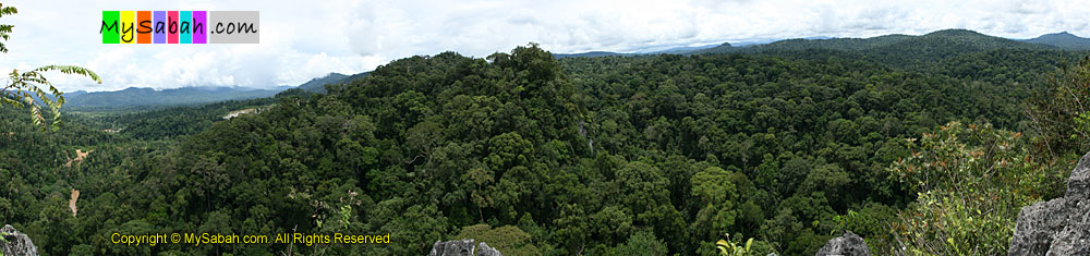
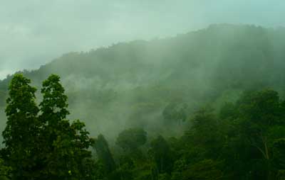
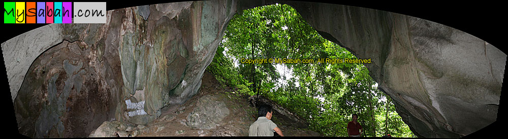
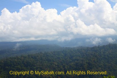
Also known as “Sabah’s Lost World“, Maliau Basin looks like a huge volcanic caldera from the aeroplane, which spans 25 Kilometers in diameter. This saucer-shaped geological structure, which is formed about 5 million years ago, is not the remnant of a dead volcano. In fact, it is a plateau gradually uplifted by volcanic & tectonic movements, and the middle was eroded to a basin due to weathering. The basin is a sedimentary formation comprised mainly of gently inclined beds of sandstone and mudstone, deposited between 15 million and 9 million years ago when Maliau was a coastal delta.

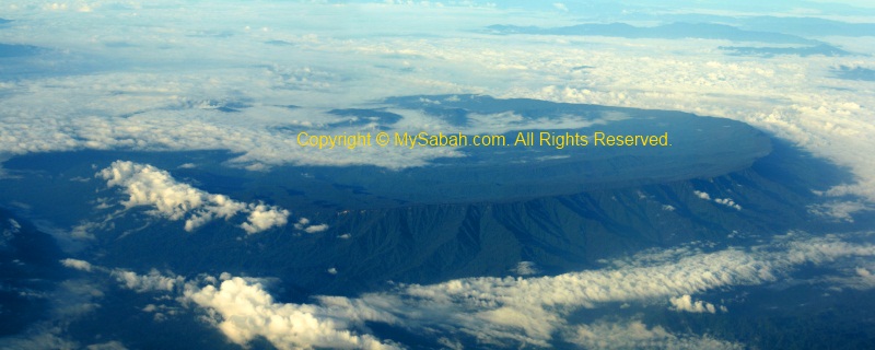
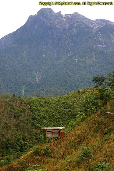
Maliau means “Land of the Giant Staircase” in Murut language. The reason Maliau Basin is called Sabah’s Lost World is because of its almost circular outer rim, with steep slopes and cliffs range from 300 to 1,600 Meters in height, creating a natural barrier that isolates the basin from the world (and “gene exchange”). Some flora and fauna, which are “trapped” in the basin for millions of years, may have evolved into new species. The only “opening” of Maliau is via Maliau Gorge, a narrow gap to South East, where Maliau River flows and joins Kuamut River outside basin, then to Kinabatangan River, the longest river of Sabah.

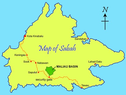
The Maliau Basin Conservation Area covers an area of sprawling 588.4 square Kilometers (nearly the size of Singapore!) in Tawau district, at the South Central Part of Sabah. The Basin itself is about 390 sq. KM in size, the additional 200 sq. KM is the buffer zones surrounding the basin for extra protection. The highest point of Maliau is Gunung Lotung (Mt. Lotung) on the north rim, which is over 1,676 m in elevation.

Sorry if you are bored with the geography stuffs above. However, those are the basic knowledge for you to really understand why Maliau Basin is such a special place.

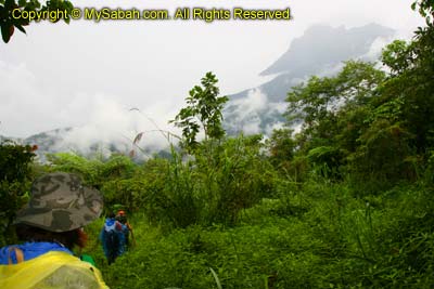
Below is a 5-minute video of jungle trekking in Maliau Basin:

Forest Types & Vegetation

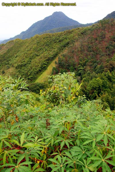
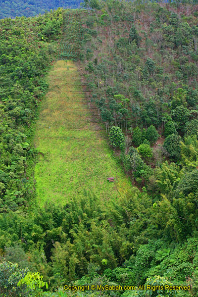
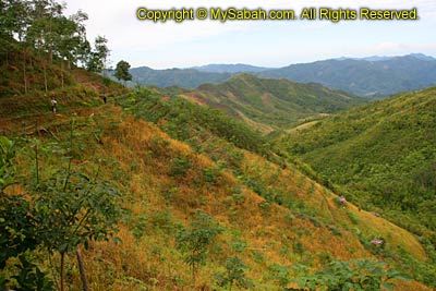
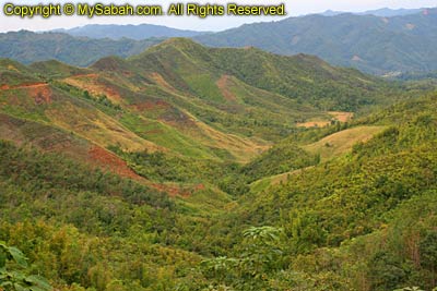
Because of its unique geology, topography, soils & range of altitudes from 215 Meters to over 1,650 Meters above sea level, Maliau Basin houses at least 12 forest types. They can be divided into 4 main groups:

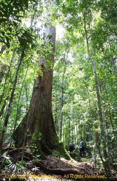
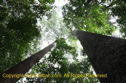
  1. Mixed dipterocarp forest
    Occupy 12% of Maliau Basin. Tall rainforest trees with 25M-45M in height, greatest plant & animal diversity, dipterocarp means “two-winged fruit” in Greek, lianas & rattan crawling plant prevail.
  2. Lowland dipterocarp forest
    Occupy 11% of Maliau Basin. Tropical rainforest with abundant commercial timbers such as menggaris, seraya and ironwood.
  3. Lower montane forest
    750M – 850M asl, trees are only 15-30M high, fewer big tree but more epiphytes, conspicuous mossiness.
  4. Tropical Heath forest (kerangas)
    Occupy 21% of Maliau Basin between 900M and 1,600M asl. In Iban language, kerangas means underlying soils are unsuitable for growing rice, dense stands of smaller sized, small-crowned & shorter trees, up to 20M high.


Above: dipterocarp rainforest

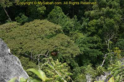
Their distribution is complex, with many overlapping and transitional zones, which are called “ecotone” by the scientists. Researchers are pretty excited by ecotone, because the hybrid conditions produce unique plant form, some can be new to science. For travellers like me, walking from one zone to another is like entering a different world each time.

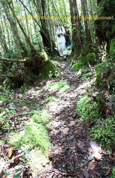
Above: heath forest (kerangas)

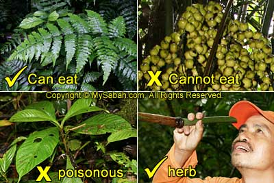
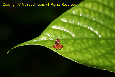
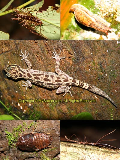
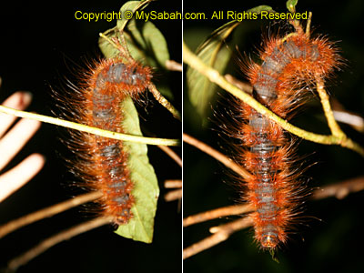
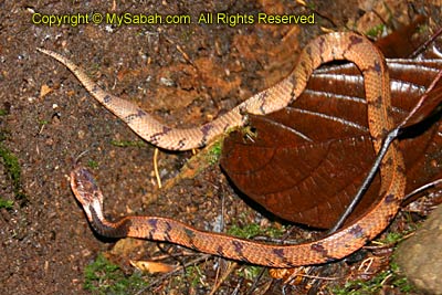
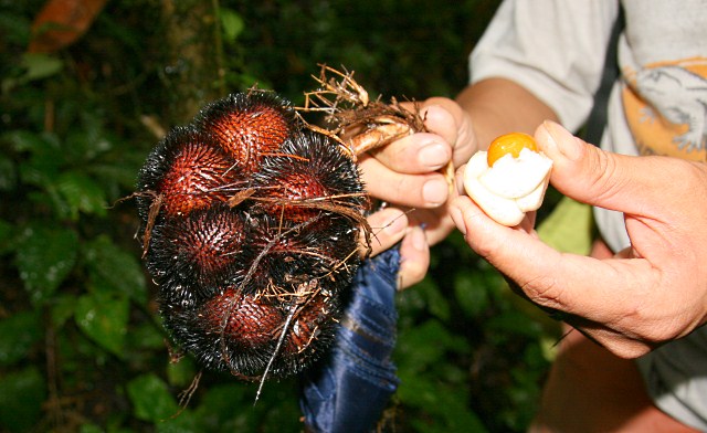
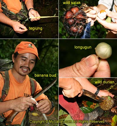
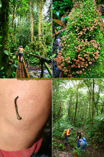
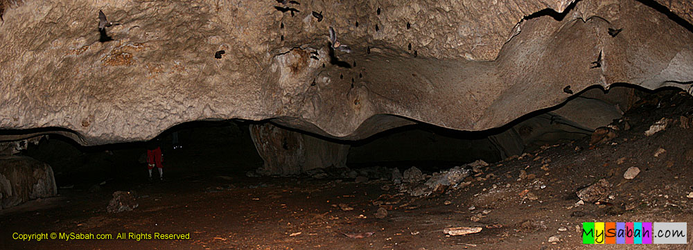
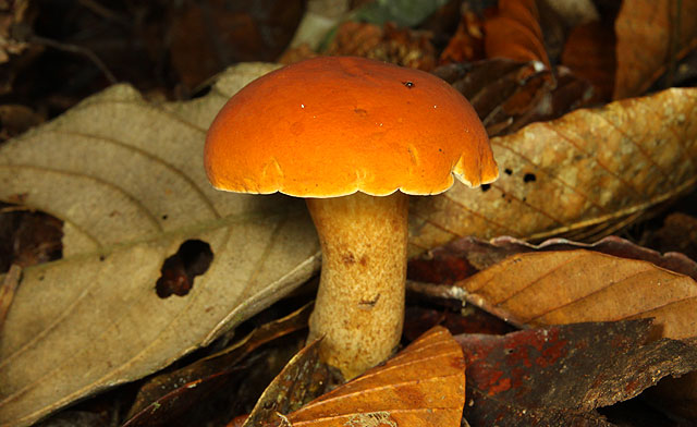
Over 1,900 species types of plant have been identified in Maliau Basin, including 9 species of pitcher plants, 440 tree species and 80 species of orchid. 54 plant species are endangered. For fauna, over 69 mammal species, 290 bird species and over 35 species of amphibians are recorded so far. A rare Rafflesia tengku-adlinii flower has been spotted in Maliau Basin.
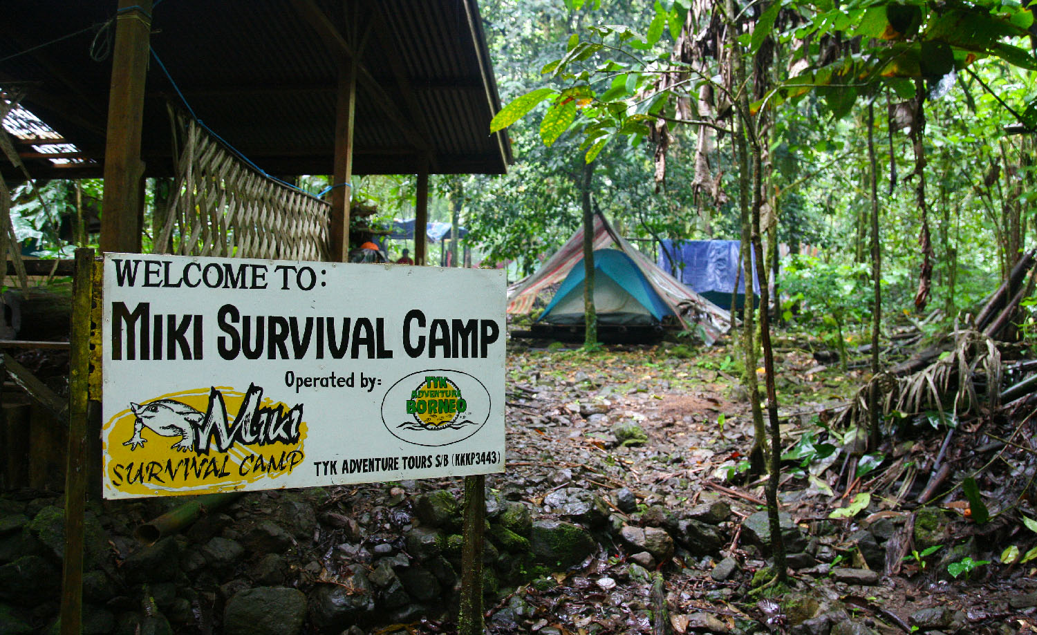
Why Maliau Basin?

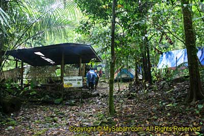
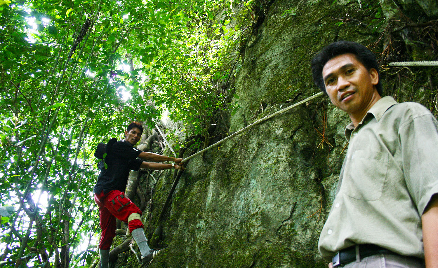
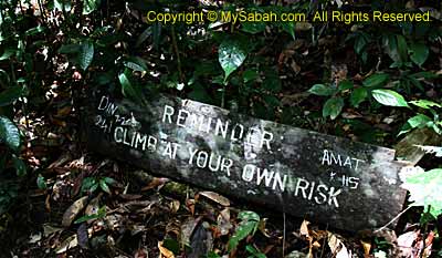
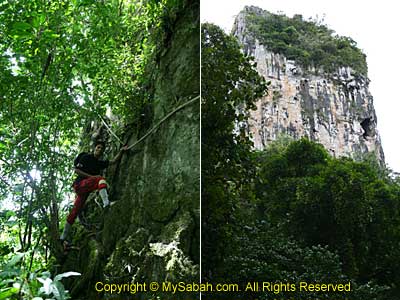
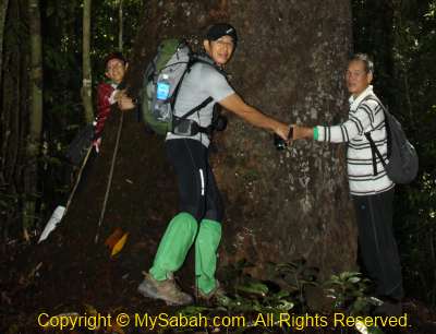
A 6-day-5-night “Full Loop” tour package to Maliau Basin costs me about RM2,000 (about USD$630) even after deep discount and exemption of some fees. Wow, with RM2,000, I can go to China, Bali, Thailand, Vietnam and other foreigner countries already. Going to Maliau Basin is like paying $ to buy suffering, as the trip demands a lot of physical strength. Exploring Maliau is more like an achievement, an adventure, than a trip.

Why didn’t I use that $$$ to go to more popular tourist destinations? The first reason is, to me, popular means “many had seen it”, I dislike places that are too commercialized or frequented by millions of tourists. For example, just do a Internet search on Great Wall of China or Phuket of Thailand, you will find tons of info and photos. I want to see something pristine and less popular.

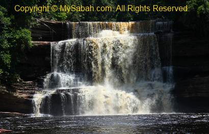
Above: Maliau Waterfall

For second reason, I love Sabah, so I would like to promote Maliau Basin to more nature lovers. To promote an attraction, we need a lot of beautiful photos and interesting info. Since not many photographers are keen to go deep inside the forest with heavy camera equipments, probably I can help to present Maliau Basin to the world with my blog.

However, it’ll be too lengthy to cover the 6-day trip in one single blog, so I break the stories into 8 parts like below:
Part 1. Introduction to Maliau Basin (this blog)
Part 2. Day 1 in Maliau Basin
Part 3. Day 2 in Maliau. Trekking to the 1st camp
Part 4. Day 3 in Maliau. Maliau Waterfall
Part 5. Day 4 in Maliau. Entering the garden of pitcher plant
Part 6. Day 5 in Maliau. Skybridge & Night Safari
Part 7. Day 6 in Maliau. Leaving Maliau
Part 8. Conclusion & Notes. Useful if you plan to visit Maliau
BONUS! More photos of Maliau Basin…

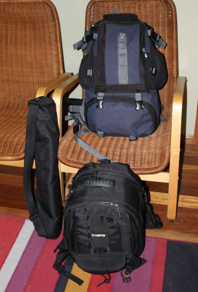
Below are some important items that you should pack for the Maliau Basin trip.

Things to Bring

  • Backpack (avoid the bulky one. Best if come with raincover)
  • Torchlight
  • Clothing (T-shirts, jeans, socks, underwear, etc.)
  • Light sleeping bag
  • Mini towel
  • Anti-Leech Socks
  • Insect repellent (Mosiguard with anti-leech formula)
  • Raincoat
  • Water container / bottle (1 Litre or more)
  • Lunch box & spoon (for packed lunch enroute). Can seal to avoid leaking
  • Snacks and High energy bars
  • Cash
  • Personal toiletries (e.g. tooth brush & paste, soap, cloth pegs)
  • Adidas Kampung (rubber hiking shoes) or other good hiking shoes
  • Sandals / slippers
  • Plastic bags (to store dirty clothing or waste)
  • Hand glove (I’m ok without it. Recommended for lady with “soft” palm)

Camera & Accessories

  • Canon EOS 50D DSLR camera (LCD screen protector is a MUST!)
  • Lens: Tamron 17-50mm f/2.8 VC, Canon EFS 55-250mm f/4-5.6 IS.
  • Memories cards (a total of 18GB)
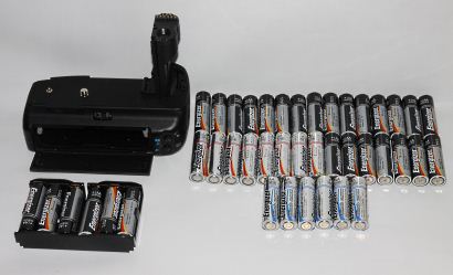
  • External Flash 580 EX II
  • Battery Grip (Phottix brand) and 50+ AA batteries
  • Tripod (ball head): Manfratto
  • Filters: UV, GND, ND8, CPL
  • Camera bag (with raincover)

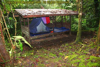
After I packed everything, the total weight is about 17 Kg (about 10Kg are camera stuffs!). I hired a porter to carry 12Kg, so I only carried about 5Kg of weight, coz shooting photos around with 17Kg on my back was not very convenient. 3 day of porter service costs me RM300 (less than USD$100).

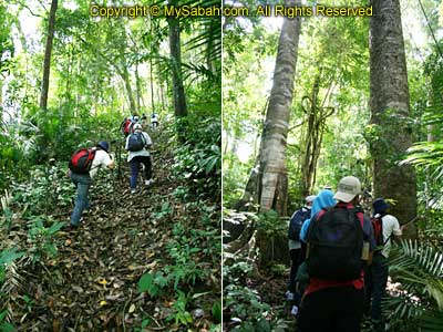
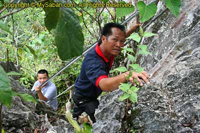
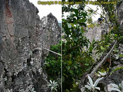
For long hours of jungle trekking, every pound counts. Keep your burden as light as possible or hire a porter. If you plan to carry everything yourself, I strongly recommend you to keep the weight between 6 to 8Kg only. 10Kg and above is for those who are really tough and experienced. You can wash your clothing so you can bring less clothing. I wore the same jean for 5 days. You think this is terrible? One of us wore the same cloth & jean for 5 days, I had to stay 10 feet away from this person while trekking, due to the strong smell like sour rotten food.

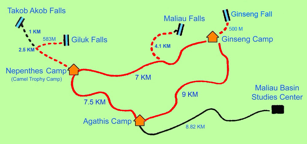
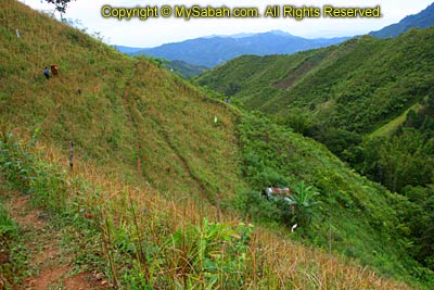
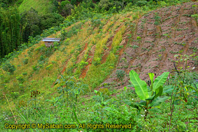
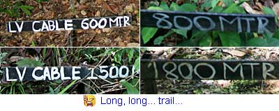
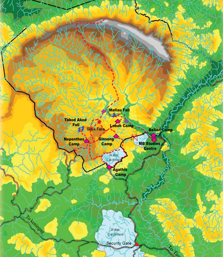
Above: the trail in red color was the trail I covered in 4 days.

Physical Exercise

Everyone says the Maliau Basin trip is tough and physically demanding. I was very lazy and never did any exercise for years, and I knew Maliau Basin trip was no joking matter. I felt really apprehensive when the Maliau Basin trip was only a month ahead and I was running out of time. Without hesitation, I started my intensive training. If weather permitted, I would jog about 4 KM every day. I also did some push-up and sit-up to strengthen my muscles, so I could carry heavy stuffs. Though the training was only one month, it did help me a lot. The Maliau Basin was not as terrible as it sounded. The trip was tiring but I was not totally exhausted, and that extra energy kept my photography going. Taking photos really can drain your energy. What I can tell is Maliau Basin is a nightmare to those who are lack of exercise.

More Photos

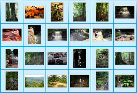
You may check out my Maliau Basin photo album for more pictures:

>> Next Article (Part 2)

Miki Survival Camp – Part 3 of 3

Continued from Part 2…

Day 2

The next morning we waked up quite early. Jimmy brought back more wild durians. Compared to durian on the market, wild durian is smaller. Its meat is thinner but tastes good. After having some fried noodle as breakfast, we started our last program at 8:30am.


Click Here to see more photos of Miki Survival Camp >>

Jimmy taught us more survival skills. The most useful one is starting fire without a lighter. Just stack two flat bamboo wood, hold some coconut husk in between, cut a small air hole and “fiction rail” on top of a wood, then rub the opening hard and fast, up and down, on another dry wood. We saw smoke in a matter of seconds. The drilling-hole method we saw on TV is so slow and stupid. I bet many had tried drilling the wood but it never worked right?


Click Here to see more photos of Miki Survival Camp >>

Another useful skill is making a bamboo rice cooker. Just cut an opening on young bamboo, put rice and water in it, then boil it on the fire. You also can boil the water in same way, as uncooked water is not clean. It is really handy if metal container such as empty tin is not available. Jimmy also showed us how to make a bamboo cup and pop-gun. It is not as easy as we imagine.


Click Here to see more photos of Miki Survival Camp >>

Lastly we “graduated” and left the camp at 9:30am. Though cloudy, the rain stopped and it was a good weather. This time we were walking non-stop so we reached Kiau Village in about 2 hours.


Click Here to see more photos of Miki Survival Camp >>

Mount Kinabalu showed her face clearly that day, forming a nice backdrop.


Click Here to see more photos of Miki Survival Camp >>

Yesterday I missed the photography opportunity, now I could shoot happily. We passed through the farm land and saw many crops grew on the slope.


Click Here to see more photos of Miki Survival Camp >>

Tapioca, banana, rubber, pineapples, hill paddy and vegetables are common crops in Kiau. Besides for self-consumption, they also sell them in market.


Click Here to see more photos of Miki Survival Camp >>

Nothing much I need to say already. We arrived Kiau at 11:30am. After having delicious lunch with Miki and other guides, we headed back to Kota Kinabalu, took a shower and went to bed.


Click Here to see more photos of Miki Survival Camp >>


Click Here to see more photos of Miki Survival Camp >>

Personally, I am a bit concern about the clearing of forest on the slope. At the moment it is still ok. Hope it won’t be overdeveloped, which would cause flood, soil erosion and landslide.


Click Here to see more photos of Miki Survival Camp >>


Click Here to see more photos of Miki Survival Camp >>

Miki Survival Camp not only shows us how to survive in jungle, it also makes us appreciate the nature a lot more, as we know more clearly how resourceful a jungle can be. People could get almost anything (food, herb, building and handicraft materials) from the jungle. If done in sustainable manner, there is almost an unlimited supply of food and raw materials.

I believe this is how Penan people in Sarawak live in jungle. Sadly, the greedy logging companies come in and destroy their forest and living. The Sarawak government doesn’t do anything to stop this. Instead, the politicians try to label the Penan people as rebel. No newspaper speak up for them. This is what happens if voters give Barisan Nasional the full power. Absolute ruling by one party will bring only corruption.

Photos taken in Kiau, Sabah, Malaysia Borneo

Miki Survival Camp – Part 2 of 3

Continued from Part 1…

Miki Survival Camp is a tourism project initiated by the community of Kiau. After they ran the project, villagers started to realize the benefits of the conservation. Instead of clearing the forest for farming, they keep the jungles, especially those near to Miki camp. Personally I like to visit those pristine places other than those attractions developed by blood-sucking and money-minded tour operators, who only want to build luxury chalets and charge tourists by thousand$$$.


Click Here to see more photos of Miki Survival Camp >>

TOUR AROUND CAMPSITE

After having warm porridge as lunch, our guide, Jimmy, led us for the afternoon education tour. He showed us some of the common traps used by the locals to catch wild animals. All traps are cleverly designed, with ropes, wood, strings, gravity and spring force as mechanism, no battery required. They either setup the trap in the animal path or put bait inside the trap. Jimmy also blew a folded ginger leaf, making sound to lure kijang (a lamb like small deer).


Click Here to see more photos of Miki Survival Camp >>

Few traps can be quite nasty, like the Vunsoi trap, if the wild boar or deer trips on a string, it will release a wooden bow spring that swing a spear. They even have smaller traps for snake, squirrel, mouse and jungle fowl. To avoid being wordy, I put more photos in album with captions, for your further reading. Tourists who join Miki Camp will get a small book, with info on trap setting. Besides the traps, Jimmy also told us the edible stuffs such as wild ginger fruit (tampo) and fern (pakis), herbal plant such as wadan vine, poisonous plant such as tohipoi, wild plum and bekago. It is interesting and useful to know all these.


Click Here to see more photos of Miki Survival Camp >>

Because of the wet forest floor, as we moved deeper inside the jungle, we were attacked by legion of tiger leeches. The leeches were hiding in the vegetation next to the trail, as we walked by, our raincoats were also sweeping the plant, harvesting leeches like vacuum. Haha… this is also part of the experience. We checked on each other regularly, remove leeches on our raincoat, so nobody got bitten (miracle!). Jimmy collected over 10 leeches and rub them in his palm, the heat killed all the leeches, and he showed me the “leech ball”, iyaak!


Click Here to see more photos of Miki Survival Camp >>

Later we were back to the campsite and Jimmy demo some craft works and skills, like making bamboo mat and roof, splitting firewood (in fastest and effortless way), creating bamboo fish trap (berusat), using blowpipe, etc. While we were happily sharing our excitement of the day, Rayner had started cooking our dinner, probably lizard soup and worm noodles, just kidding..


Click Here to see more photos of Miki Survival Camp >>

Early dinner in jungle is advisable. If you eat at night with light on, it will attract all sorts of flying bugs from the forest. We had fried rice, mixed vegetables, ketchup chicken and crab soup as our dinner. Rayner is such a good cook, or we were too hungry. It was also nice to have a cup of coffee or tea in the cold.


Click Here to see more photos of Miki Survival Camp >>

Jungle seemed to get dark sooner. The cold night kicked in, after a heavy meal, everyone already felt sleepy next to the fire place.

NIGHT WALK

The next programme was the one I anticipated the most, the night walk. In daytime, we didn’t see a lot of wild things, I only saw a huge stink bug and a Daddy Long Legs (Harvestmen Spider). However, the jungle is a extremely busy world at night. We started the night walk at 7:00pm and the noisy surrounding sounded very promising. In search of rare and weird bug, some foreigner photographers had visited this site much more earlier than me. In fact, this area is the buffer zone between Kiau Village and Kinabalu Park that is rich in biodiversity. With the aid of torchlight, we slowly walked across the jungle and scanned the plant and trees like treasure hunt.


Click Here to see more photos of Miki Survival Camp >>

After a short walk, the guide said, “turn off your light.” “Huh? what?” I replied but did so anyway. Then we saw patches of glowing green in total darkness (see photo above). “That’s a glowing fungus,” Jimmy said. When we turned on the light again, we only saw very ordinary green fungus on a rotten tree log. I was really thrilled and setup my tripod, attempting to capture the glow. I only took one shot coz I didn’t want everyone waited for me. Later we also spotted glowing mushroom.


Click Here to see more photos of Miki Survival Camp >>

Then the next interesting creature we saw was a very tiny frog (see photo above). It is so small that any normal frog can swallow it in one snap. It was sitting on a ordinary-size leaf. We carried on and saw more bugs, most were creepy types that could make girls screamed. I didn’t stop clicking my camera, every few steps there would be new things, like firefly, frogs (some are poisonous), stick insect, cricket, grasshopper, forest cockroaches, gecko, cave centipede, big snail, etc.


Click Here to see more photos of Miki Survival Camp >>

Guess what was the biggest bug we saw that night? It was not frog and lizard. The jackpot of this night walk was a giant caterpillar (see photo below)! This caterpillar is longer than my palm, probably about 7 inches long. Jimmy said, “I also never see anything like this before. You are so lucky.” Anyone can tell me what it is? We tried to look for the horned frog but didn’t find any. I was so happy already anyway. The cold weather drained the power of my camera battery very fast. My last battery only had two bars of power left. I needed to save it for next day. Damn… otherwise I would have spent more time and shot more…


Click Here to see more photos of Miki Survival Camp >>

About an hour later, we returned to our camp. There was no electricity and TV, so we went to bed, without taking a bath, lol… Though our camps were not too far apart, it was totally dark and I felt that my camp was alone. It was so noisy at night, with sounds from frogs, bugs and birds. Some lame writers like to describe this as the “orchestra” of jungle sounds. To me, it is just plain noisy. Since I was so tired, that didn’t really bother me. In midnight, I was waked up by a loud bang. Next day the guide told me it was bamboo “exploding”, it is common and can be as loud as gun shot.


Click Here to see more photos of Miki Survival Camp >>

Temperature still dropped in late night. So cold that everyone of us waked up and put on more clothing. Very soon I wanted to pee. I grabbed my torchlight and walked to the toilet. On the way back, I saw something moving slowly on a log. It was a very beautiful snake, with gold color and tiger-like stripes on its body, and got red eyes! It saw me and stayed motionless. Quickly I ran to my camp, took my camera and shot some photos. I was so glad I didn’t step on this snake by accident. When I was back to town, a snake expert told me that it’s a Bornean Dark-necked Slug Snake (Asthenodipsas borneensis) which feeds on snails and slugs. It’s endemic to Borneo and I’m very lucky to see one.

Click Here to continue to Part 3…

Photos taken in Mohan Tuhan, Sabah, Malaysia Borneo

Miki Survival Camp – Part 1 of 3

Rainforest is one of the worst places to get lost and there was one recent case in Sandakan. To learn the skills of a jungle man would make a difference. If you know how to use the resources of the jungle, the forest will be a buffet place, which offers plenty of food. That’s why I joined the Miki Survival Camp, a 2 day 1 night programme in Kiau last week. In Kiau, we still needed to walk to the forest in Mohan Tuhan, at the foothill of Mt. Kinabalu. The low mountain forest looks like the photo below, cool huh?


Click Here to see more photos of Miki Survival Camp >>

Kiau Village (Kampung Kiau) is 29KM away from Ranau town. If you drive to Kinabalu Park, you will see a junction at your left, somewhere between Nabalu and Kundasang towns. There is a brown sign of Miki Camp. Kiau Village is under Kota Belud district. I waited at the junction, and Mr. Sadib Miki, the owner of the camp, picked up me and drove another 30 minutes of bumpy road to the starting point (Kiau Nuluh Village). Most people in Kiau are Kadazandusun work as farmers and civil servants. Every house seems to have a farm there.


Click Here to see more photos of Miki Survival Camp >>


Click Here to see more photos of Miki Survival Camp >>

However, the weather started to turn bad, and the rain was kind of putting off my passion on photography. Below is a photo of the Miki team. From left, Jimmy, Sadib Miki (owner), Maik (his brother) and Danson. The rain didn’t seem to stop, so I had no choice but to proceed at 10:20am. Jimmy, Maik and Danson were our guides. They were so nice and helped to carry my heavy tripod. Thank you!


Click Here to see more photos of Miki Survival Camp >>

TREKKING

Walking from Kiau Village to Miki Survival Camp (in Mohan Tuhan, foothill of Mount Kinabalu) takes about 2 hours. We would stay in the forest for a night and came back in next morning. At first I was disappointed with the poor weather and hang my camera under the raincoat. Suddenly I saw a 5-inch earthworm crawling near the trail. Grew up as half a village boy, I noticed this earthworm crawled in an unusual way. After a closer look, I almost screamed, “that’s a giant Kinabalu Leech!!!” Giant Kinabalu Leech can grow up to 30cm long and we saw the baby leech. As sighting of this leech is very rare, I was as happy as a lottery winner. Giant leech only comes out after heavy rain, to chase for its prey – earthworm. Once it finds the earthworm, it will swallow the earthworm like a snake. Surprisingly, it doesn’t suck blood. Miki says such leech can be found in Kinabalu Park and Kota Belud, but it lives in very confined area. Very little is known about this creature. I should thank the rainy day.


Click Here to see more photos of Miki Survival Camp >>

Beginning of the trail was to walk pass a farm land for about an hour. Due to the cooling fresh air, I didn’t feel really tired or dehydrated. Then we walked into the dark, humid and dense low mountain forest. With an altitude of 1,000 Metres, this forest is characterized by abundant amount of mosses, lichen, algae, fungus, and mushroom on the tree and forest floor. Frequented by fog and mist, some trees even have hanging long roots that can absorb moisture from the air.


Click Here to see more photos of Miki Survival Camp >>

During the trekking, Jimmy, the Bear Grylls of Sabah, would stop occasionally, showing us some of the edible and herbal plant in forest, more like an interpretation walk. We didn’t only see, but also touch, smell and taste the forest produces such as wild durian and salak (snake skin fruit). Whenever Jimmy talked, I would take note. Otherwise I will forget what he says. I decide to post these info in my blog here. It is only a record, do not use my info as a forest eatery guide ok! Some food still needs special handling in order to consume safely. Don’t blame me if you get ill.


Click Here to see more photos of Miki Survival Camp >>

According to the guide, sometimes honeymooners also had their vacation in Miki Camp. A couple once carried a 2-year baby into the jungle. The 2-hour walk made us sweat but it was not too physically demanding. A walking stick and “kampung addidas” shoes (Village Addidas, a Malaysia made rubber shoes) will be your best friends. The forest floor can be wet, muddy and slippery, and you also need to cross a river. If you wear your hundreds dollar hiking shoes such as Camel and Timberland, you will soon find your shoes soaked with water and its bottom sticks a thick layer of mud. Kampung Addidas costs only RM3 (USD $1) but it is sold for RM7 (USD$2.20) in city. It is easy to dry and have firm grip on slippery rocks, but will not stick mud. Most guides wear it to climb Mt. Kinabalu and even won climbathon race.


Click Here to see more photos of Miki Survival Camp >>

Friends, I have 1 good news and 1 bad news for you. Good news – even though the forest is dark and wet, there was no mosquito. Bad news is – there are plenty of blood-thirsty slimy leeches, 90% of them are tiger leech. If you stop walking, they can crawl on your shoes in seconds, moving up and sucking blood on your feet, legs, neck and armpit. I was wearing leech socks with anti-leech spray on it, so I was safe. If you are a leech-phobia like me, you can wear leech socks or come in dry season. We crossed Hoya-Hoya, Inokok and Mohan Tuhan Rivers on the way, by slippery bamboo bridge, swinging suspension bridge and on foot (3 methods!).


Click Here to see more photos of Miki Survival Camp >>

CAMPSITE

Finally, after nearly 3 hours, we arrived Miki Survival Camp at 12:45pm in Muhan Tuhan. Actually the trekking took 2 hours, but we stopped many times for learning thus taking longer time. Probably coz of the rich negative ions, I didn’t feel exhausted, and the chocolate bars and 100Plus that I brought were untouched.

Miki Survival Camp started in year 2000. They have about 1 thousand tourists every year, mainly from UK. Miki Camp is in the middle of a forest, which was considered a sacred forest in the past. The hunters always buried some offering near the river, wishing for a safe and fruitful hunting trip. There are about 6 or 7 scattered raised floor huts, which house 1 or 2 camping tents. The campsite can accommodate 40 people at a time. Sleeping bag and carpet are provided, but this is not quite enough to fight the cold night. Besides, they have a kitchen that uses wood and gas for cooking.


Click Here to see more photos of Miki Survival Camp >>

Electricity and warm water are not available in the jungle. Since the camp has no attached bathroom, you have to walk to the toilet nearby. You shall not expect a 5-star toilet in a jungle right? In my previous camping, we only dag a hole, surrounded it with canvas and called it our toilet. I posted some more photos of the campsite in photo album, in case you like to see more. The guides said primates like orangutan, slow loris and tarsier were spotted in deeper site of this jungle. Wild boar and monkey were living around but they seldom come to the campsite.


Click Here to see more photos of Miki Survival Camp >>

They also have bathroom, but it is “underutilized”. It is so cold that none of us took a shower, haha… The temperature can drop to 8 degree Celsius, between wet and dry season. The Mohan Tuhan River is only a stone throw from our campsite. It is so clean that you can drink it right away, and the water is also freezing cold. Jimmy said we could take shower in this river, but I’m afraid I would never see my “little brother” again if I did so. In fact, this area is an important water catchment area, with unpolluted water straight from our majestic Mount Kinabalu.


Click Here to see more photos of Miki Survival Camp >>

Besides the guide, our cook, Rayner and his daughter, Diana also came in earlier. Dinomysia, the little daughter of Sadib Miki, was there too. The girls were very shy, probably I am too handsome, hehe… And their dog, Kurak (means white in local language), was a friendly company too. Kurak likes to hang around with Dinomysia and Diana, following them in and out of forest.


Click Here to see more photos of Miki Survival Camp >>

Another heavy rain approached, making afternoon even colder. We setup a fire place and sat next to it, to keep ourselves warm and dry. Same as us, Kurak also loved to stay near the fire, so near that I worried she would become a hot dog. If she was not sleeping, she would patrol around in the campsite, keeping wild animals at bay.

Click Here to continue to Part 2…

Photos taken in Kiau, Sabah, Malaysia Borneo

Cave of Balambangan Island

Pulau Balambangan (Balambangan Island) looks so big on Sabah map. However, very little is known about this island. The British East India Company built their first establishment in Sabah hundred years ago as a trading post. Unfortunately, it was attacked by Sulu pirates and British had to move their base to Kudat.

Someone call Balambangan Island a “Treasure Island,” as they believe there was an old Chinese/British ship, carried plenty of gold and other precious, was sunk by storm around this island but yet to be found. Anyway, I was not there for the treasure. I just want to document the caves, before they are gone. There are over 20 limestone caves on Balambangan Island and none of them is named, and only four are studied. I went to this island by following a boat departed from Banggi Island (Pulau Banggi), which is about 10KM away from this island. I stopped by Kg. Selamat (Selamat Village), which has abalone farming (at the left in photo below). Kg Selamat is not so “selamat” (safe) because sometimes you can find aggressive crocodiles swimming under the houses.

Talking about the salt-water crocodile, a local said the crocodiles were used to live in peace with the people here. One day, a fisherman caught some fishes and left them at the shore. When he came back, he saw a crocodile was eating his caught. In anger, he shot the crocodile. Probably the crocodiles also have “feeling”, so they started to attack the human. Some fishermen were eaten when they setup the fish trap in the water. Nevermind if you don’t believe this story. Below is a photo of limestone hills on the island.

Then we proceeded to other side of the island, with mangrove area infested with crocodiles. Probably they all went to church on Sunday, so I didn’t see any of them around. There was no nice beach for landing, so I crossed the sharp limestones around the shore to get to land.


Click Here to see more photos of Balambangan Island >>


Click Here to see more photos of Balambangan Island >>

After a 10 minutes walk through a dense forest, I reached the limestone cave, where prehistoric human stayed here about 200,000 years ago. Archaeological findings from the Pleistocene era (the Ice Age – between 1.75 million to 11,000 years ago) was discovered in the cave of Balambangan Island. I also wonder if the Japanese had stationed here during the World War II, like the local mentioned.


Click Here to see more photos of Balambangan Island >>

This cave is very big and deep. I saw many unique cave formations consisting of stalactites, stalagmites, flow stone and many other speleotems. I wished I could stay longer to see the art of nature that takes thousands years to form. I started taking photos like crazy, while others kept on yelling, “Hurry Up!! There were more stuffs here!” Busy, busy, busy…


Click Here to see more photos of Balambangan Island >>

There were many stalactites on top and stalagmites on the ground, making the cave looked like a big mouth of a monster with sharp teeth. You do not need to be a geologist to appreciate the beauty. These caves are not protected though they are considered as a natural and historic heritage. In the future, some developers would build a clinker plant to mine the limestone, the major raw ingredient of cement. So sad huh. It is like burning our house to keep ourselves warm.


Click Here to see more photos of Balambangan Island >>

Some swiftlets and bats made noise to warn the “intruders”. The cave is dark and the floor is uneven, so I have to walk slowly. Otherwise I would step on a stalagmite that takes hundreds years to form (FYI, it grows only 0.5 inch every 100 years). The cave got a few tunnels that went very deep and narrow. None of us had the time and gut to explore the cave network. I also saw some ball-like “Cave Pearls” inside the stream of the cave. I shared over 50 photos in the album, so you can see more about the cave.


Click Here to see more photos of Balambangan Island >>

Undoubtedly, this cave is a promising spot as a geo-tourism attraction. Tip of Borneo is nothing if compared with it. To go to this island, you can hire a boat in Banggi Island, which will cost about RM200-300 (for day trip). Who knows you might find treasures in those unexplored caves.

Photos taken in Balambangan Island of Kudat, Sabah, Malaysia Borneo

Climbing Senambung Hill

Bukit Senambung (Senambung Hill) is the highest point of Pulau Banggi (Banggi Island). This pyramid-shape hill is covered with dense forest and its top offers an irresistible aerial view of whole Pulau Banggi, so you will get both climbing + jungle trekking experiences.

Bukit Senambung is located in Kalangkaman, about an hour drive from Karakit. It is advisable to use 4-wheel to run on this bumpy gravel path full of mud.


Click Here to see more photos of Bukit Senambung >>

You know you enter a very remote area when you see many Dusun Bonggi huts, which are made of wood and dry leaves, along the way. These are probably one of the few places you can see such primitive houses in Sabah. My car is probably the only vehicle on the road, and my camera caught a lot of dust while shooting. There are hundreds of coconut trees that seem like the primary crop of the locals.


Click Here to see more photos of Senambung Hill >>

Senambung Hill is a class II forest reserve (commercial logging) managed by forestry department. The hill doesn’t look tall and steep, but this is a wrong impression. As we moved closer, we felt that we were so small. My expectation of a leisure and easy hiking was definitely too much.


Click Here to see more photos of Bukit Senambung >>

After registered with the ranger at the foothill, we started the climb. I was warned that the slope was quite steep and I should proceed cautiously and don’t try anything uncertain. The guide said we needed only 30 minutes to reach the top but we took over 2 hours!


Click Here to see more photos of Senambung Hill >>

Most of the time we were climbing the slope with a steep of about 40 to 70 degree. Though tired, there were cool breezes that made me felt much better. I saw only one small leech on the way. Well, it will be very minor problem to bother with, when you feel so exhausted. Only one person was bitten.


Click Here to see more photos of Bukit Senambung >>

The trail was slippery, muddy and not tourist-friendly. Forget about your hundred dollar branded shoes such as Timberland and Camel, as they are not as good as a pair of RM7 (USD$2) “Kampung Addidas” (Village Addidas), a local made rubber shoe. The expensive hiking shoe is prone to catching mud, and it will become a “skiing shoe” in such trail condition. The worst thing was – I brought a fragile camera, so I had to walk like a pregnant woman. A walking stick can make a difference too.

Most already started to feel the body stress after 500 Meters, and we didn’t know how long was the trail ahead. To maintain my determination, I didn’t dare to look up. I only focused on the part in front, walked and climbed slowly. I thought the trail was only 1KM and it was a 1.8KM. I could see the beautiful blue sea through the trees. That motivated me to move on.


Click Here to see more photos of Senambung Hill >>

“Why still hasn’t arrived? How far are we?” we kept on asking the guides. I brought two small bottles of water and one 100Plus (which helped a lot!), and a few energy bar. I finished all of them. Finally, I was so glad I made it to the top. “Is it the top?” I asked the guide, as if it was hard to believe that the hardship was over. I was rewarded a nice view from the top.

^dGJ$82^%&2XYZ…!!! Why they call Bukit Senambung a “Hill”? Senambung Hill is 529 Meters high so it needs another 71 Meters to qualify as a Mountain (600M), in UK standard. However, it is considered as a Mountain under USA standard (1,000 feet). Whatever, I am happy to reach the top of it.

Photos taken in Banggi Island of Kudat, Sabah, Malaysia Borneo

Trip to Batu Punggul – Part 3 of 3

Continued from part 2…

Finally we were ready to climb Batu Punggul. At the beginning point of the climb, we could take a short trail nearby and “preview” Batu Punggul. Everyone was warned not to proceed when they felt they were not feeling confident to make it. Most chose to stay back.


Click Here to see more photos of Batu Punggul >>

Unfortunately, my greed was stopping me to think twice about the challenge, as I had climbed Mt. Kinabalu a few times without problem. I didn’t foresee I would be defeated by a mountain that was so much lower. Look at the start of the trail (photo at left below), so scary man…


Click Here to see more photos of Batu Punggul >>

The guide said it was only a 30 minutes route. However, that is their time, not ours. It was a climbing route almost vertically upward. We were really climbing with hands and ropes, soemtimes tree roots. Tell you, there is NO trail that is flat for walking. Probably the guides were trying to motivate us. They always said the top was only a few minutes ahead, so I climbed… I climbed… and I climbed, but I still didn’t see the top. The rock was hard and sharp. We just tried to get firm grip of it and pulled ourselves up inch-by-inch to the top slowly.


Click Here to see more photos of Batu Punggul >>

This was one of the most punishing moment in my life. I started to be dehydrated after 30 minutes coz I was running out of water. However, I didn’t want to give up at this point so I just disregarded the warning from my body. This place is the worst nightmare for height phobia. A single mistake you would fall all the way down the hundreds foot drop under your feet. The guide kept on reminding us not to look under our feet, to ensure that we wouldn’t lose strength due to fear.


Click Here to see more photos of Batu Punggul >>

Without the guide, I doubt if I can make that far. There were many “traps” along the climb. Some small tree branches fell between the rocks, then covered by leaves on top over time, forming a very weak structured often mistaken as firm ground. I once stepped on it and missed the step, causing my both legs hanging in the air. There were lot of vegetation that cut my jean and almost poked my eyes while climbing.


Click Here to see more photos of Batu Punggul >>

After nearly an hour of climbing, the afternoon sun was shooting hot beam to us. At last I reached the top of Batu Punggul, but the highest point was still 30 minutes away. I was sitting at the edge of the cliff. The tree canopy and river looked so small under my feet, and I could see Tataluan Village far way. Due to dehydration, I felt that I was overheated and would pass out if I forced myself to continue.

Therefore, I had to admit that I was defeated by Batu Punggul at 12:45pm, though the highest point was not too far away. Actually anyone who regularly exercises can make it. It is only that I am too weak and seldom work out. I was making a few wrong decisions too, e.g. didn’t bring enough water, wearing heavy hiking shoes. It is also advisable to climb as early as possible in the morning so you won’t be exposed under harsh sunlight.

To get up there is challenging, but moving down is another nightmare. To prevent dehydration worsen, I had to stopped very often and rest under the shade, waiting for body to cool off to proceed. Facing down to see the height was so demotivating, I relied on the energy of desire for survival and back in one piece. Later the elder villager told me that the spirit didn’t permit me to climb. Somehow I had started climbing before he managed to bring me this message. They also said it would rain for 2 days if someone conquered the mountain, and it did rain heavilt later. Don’t know if these are true. Anyway, this shows that the locals strongly believe there are spirits living in Batu Punggul.


Click Here to see more photos of Batu Punggul >>

Don’t worry. I am ok. Though I didn’t conquer Batu Punggul, at least I won’t regret for not trying. The next morning when I waked up for work, I found that the force of gravity has tripped. Driving a small car was like driving a 16-ton truck. I have uploaded all the photos of this trip. Hope you will like the photos that I “risked” my life to take.

Photos taken in Sepulot, Sabah, Malaysia Borneo

Trip to Batu Punggul – Part 2 of 3

Continued from part 1…

We reached the foothill of Batu Punggul after 10 minutes of boat ride. We walked and climbed slowly uphill. Probably due to the rainy season, the forest floor was wet and the surrounding air was humid. At the beginning of the trail, I saw a few ground leeches fully extended their slimy and elastic bodies to the air, wiggling in excitement. But they were no longer a concern when we moved further away from the river side. I wished I could spend more time in this dense jungle coz you would find rafflesia here (biggest flower in the world).


Click Here to see more photos of Batu Punggul >>

After 15 minutes of walking, we saw the entrance of a cave. This cave may have existed for thousands of years and created by limestone erosion. It is quite a big and deep cave. You can walk straight to the end without climbing up and down.


Click Here to see more photos of Batu Punggul >>

There is a broken coffin of an ancestor near the entrance. Too bad it was not preserved properly and I wonder how it looked. But this tells us there were people lived here before. FYI, there is another Batu Tinahas about 20 minutes walk away from Batu Punggul. It has more complex (and dangerous!) cave system, which may interest hardcore climbers.

About 10 Meters inside is a low opening. I had to lower my body to go continue. It was very dark so I just followed the light of people in front of me. I heard a few bats flapping their wings flying near me. The air was getting stuffy, with smell of amonia came from the bat guan.

Then I entered a space as big as a hall. I could see light coming from the holes on top. According to the legend, Batu Punggul is a fossilized longhouse, so this cave is probably its rooms. A old monument-like object (photo at right below) was built to mark the territory of the past residents. In the dark, I was sure that I saw a white and blur figure walked into this pile of rocks, but nobdoy would believe what I’ve seen.


Click Here to see more photos of Batu Punggul >>

We only wandering in the cave for 10 minutes then we moved on. You see. It was such a rush. I really had no time to explore this place in detail, not to mention setting up a tripod to shoot better photos. Anyway, I still took a lot of photos and I will show you the photo gallery tomorrow.


Click Here to see more photos of Batu Punggul >>

Bird nest is no longer available in this cave. Very likely the nests were over-harvested, before the broods had a chance to grow and reproduce. However, the interesting rock formation inside is already worth a visit.


Click Here to see more photos of Batu Punggul >>

Haha… a heart-shaped hole on top. But this place is not romantic at all. The locals told us that in the very old day, some people dragged the women to this cave, rapped and killed them. I might have just seen one of the spirits lingering in this cave. At this point, the journey was fun until I climbed Batu Punggul.

Continue to Part 3…

Photos taken in Sepulot, Sabah, Malaysia Borneo