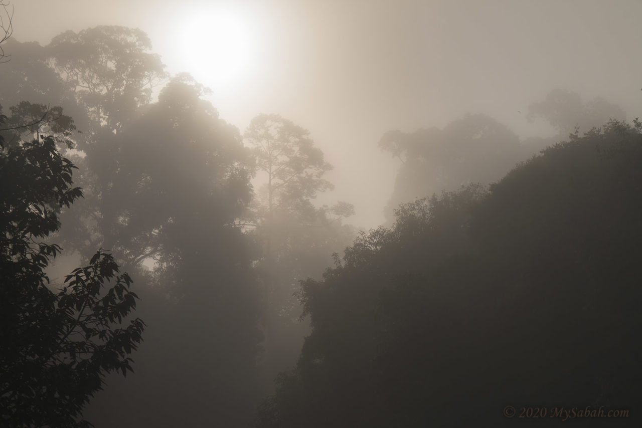
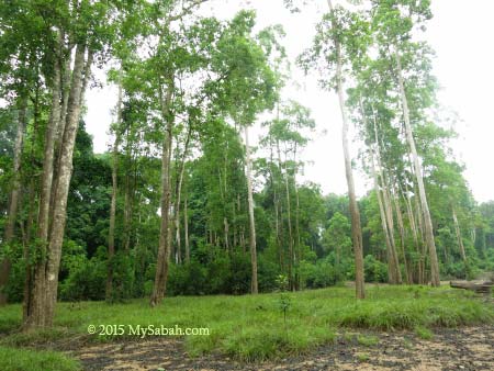
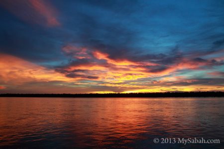
Tawau is crying. Because once tourists land on the airport of Tawau, they quickly head to Semporna, the diving paradise of Sabah. This makes Batu Bersusun the most neglected attraction, though it’s the only columnar basalt in Malaysia and 14 kilometres away.
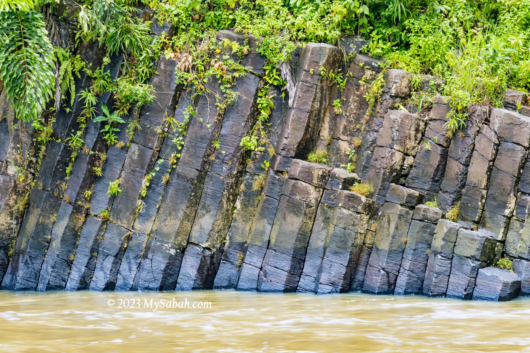
Columnar joints of Batu Bersusun were formed during the cooling of hot lava about 27,000 years ago. The cooling process causes the rocks to form hexagonally extended columns.
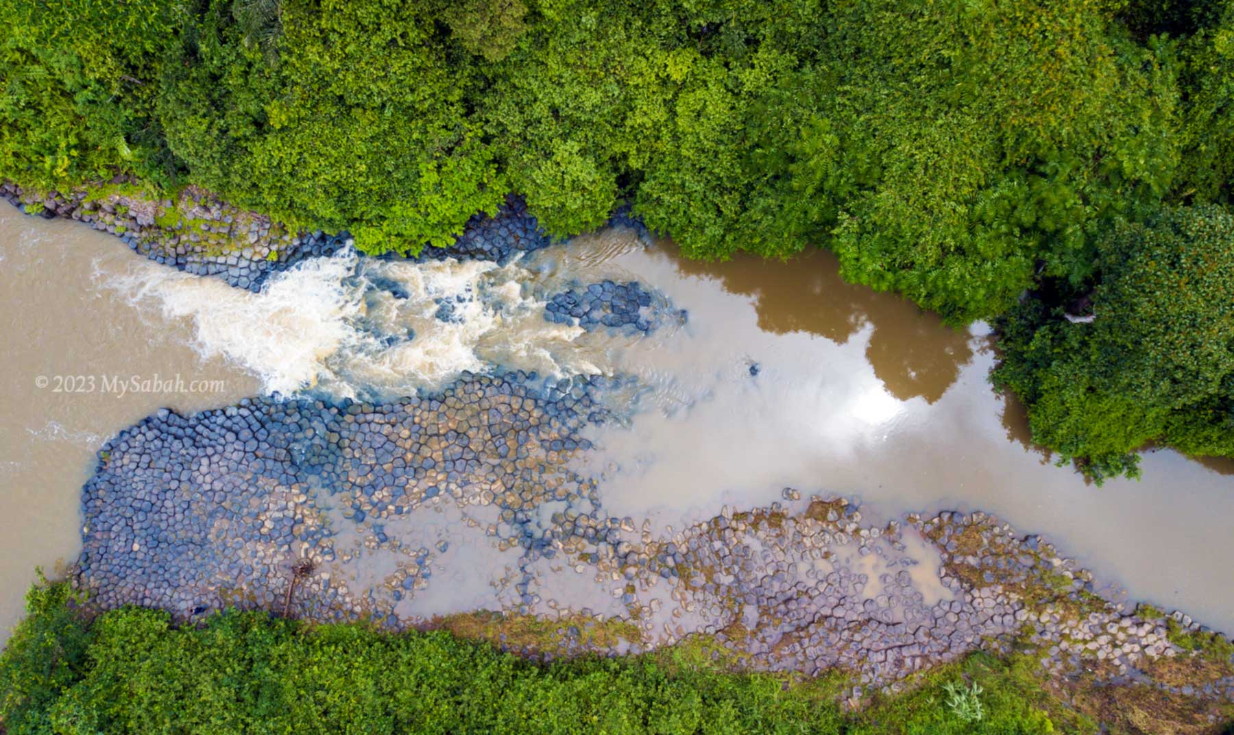
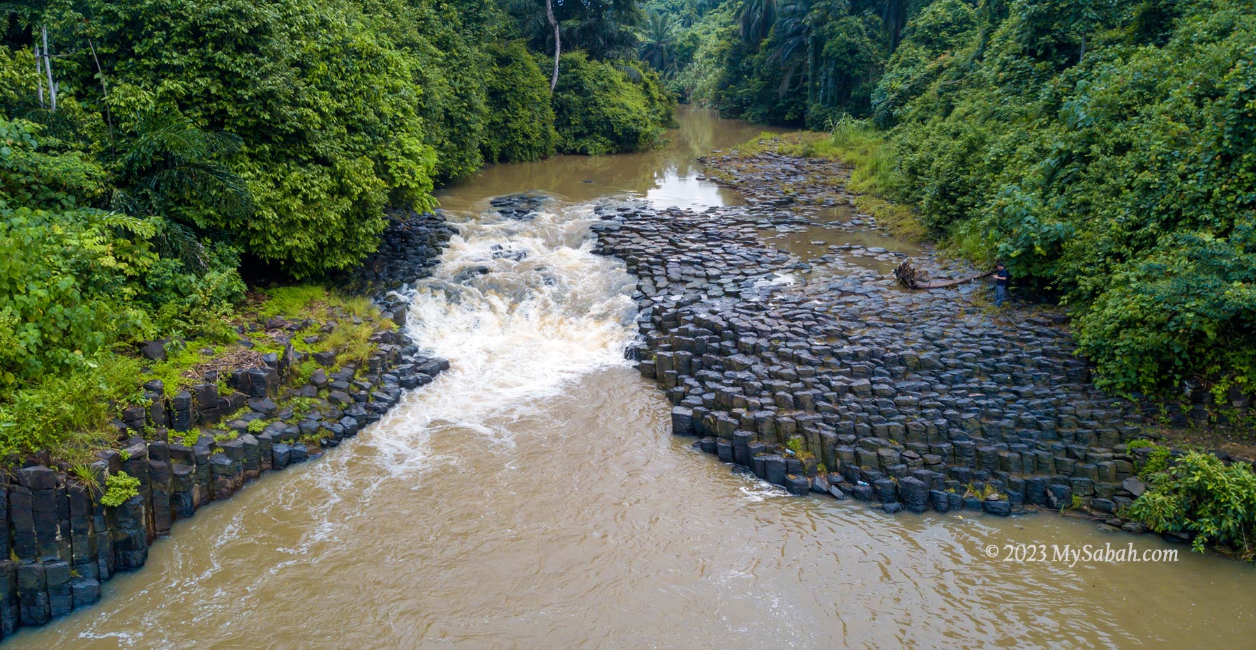
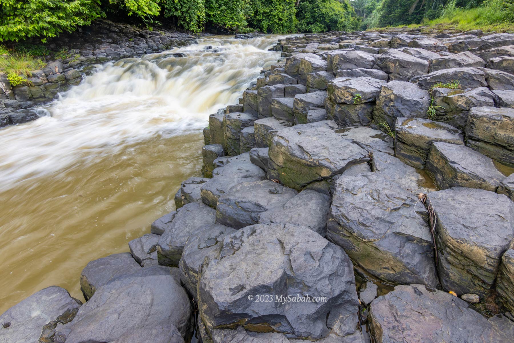
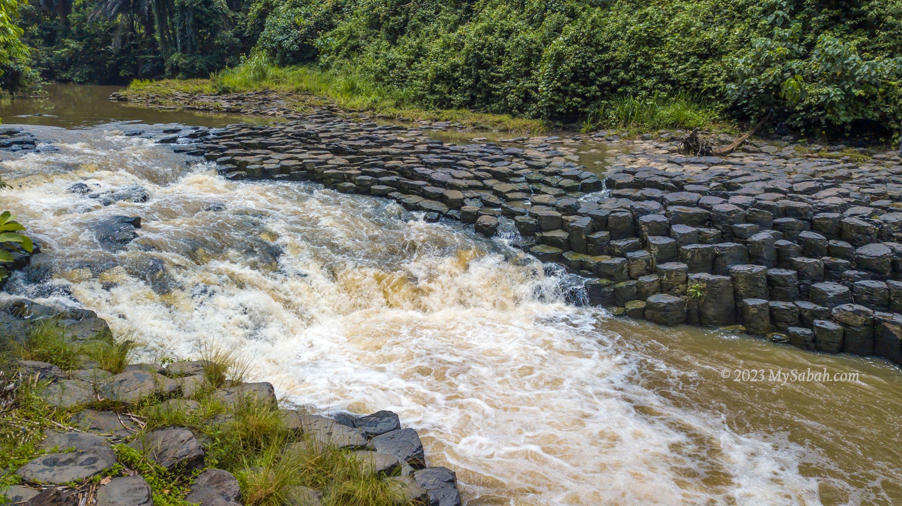
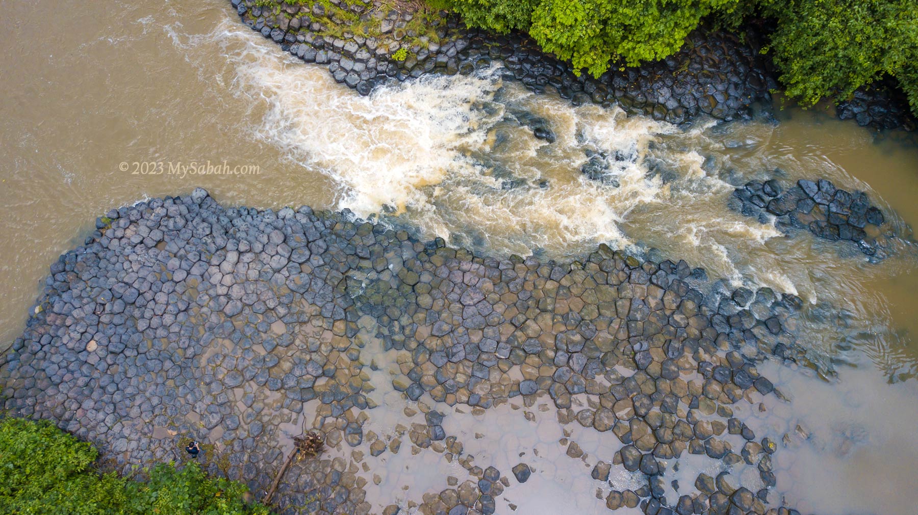
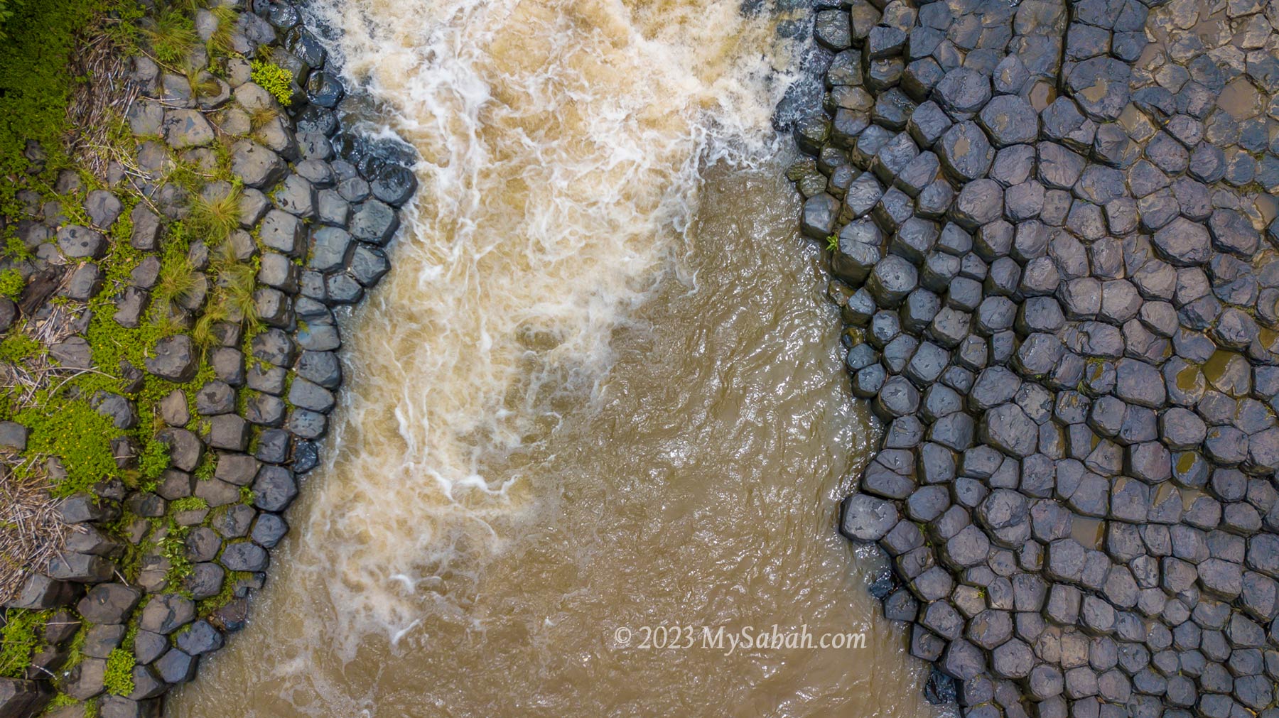
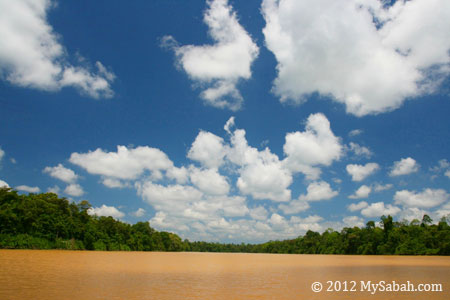
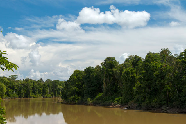
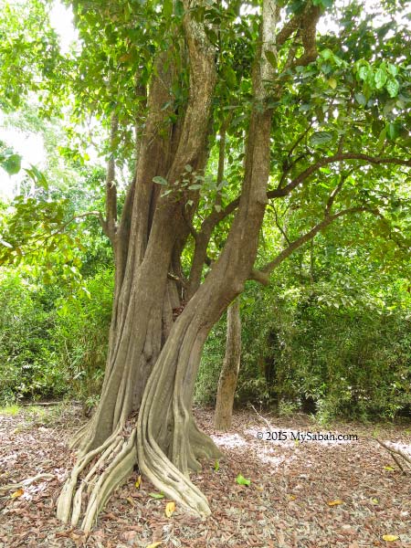
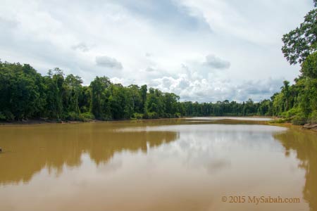
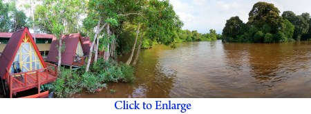
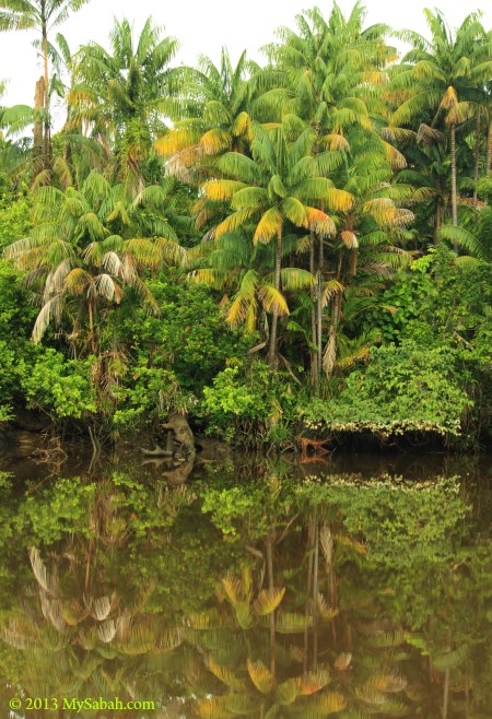
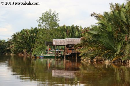
“Batu Bersusun” means neatly arranged rocks. Along 100 metres of river bank at Balung River in Kampung Balung Cocos (Kampung means Village), thousands of interlocking and greyish rock pillars lined up tidily on both side of the river, like two rows of manmade wall. The natural wonder of this volcanic remnant is called columnar jointing. The local villagers call it Giram Nek Legek.
Batu Bersusun (Columnar Basalt) of Kampung Balung Cocos in Tawau, East Coast of Sabah
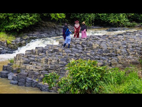
A quick look of Batu Bersusun (4K video)
The Formation of Batu Bersusun
Batu Bersusun is the only Columnar Basalt in Malaysia. In ancient time, Tawau was a land of volcanoes, the last volcanic eruption happened about 11,650 years ago. The columnar joints at Batu Bersusun were formed during the rapid cooling of hot lava, which was flowing from the eruption of Mount Maria about 27,000 years ago.
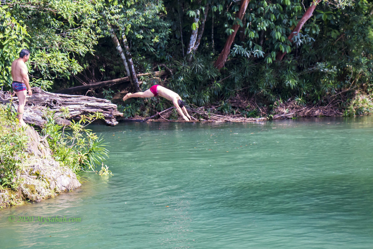
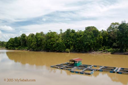
Batu Bersusun is open to public since year 2016. Visitors can come here to take photos, swim and camp around the river.
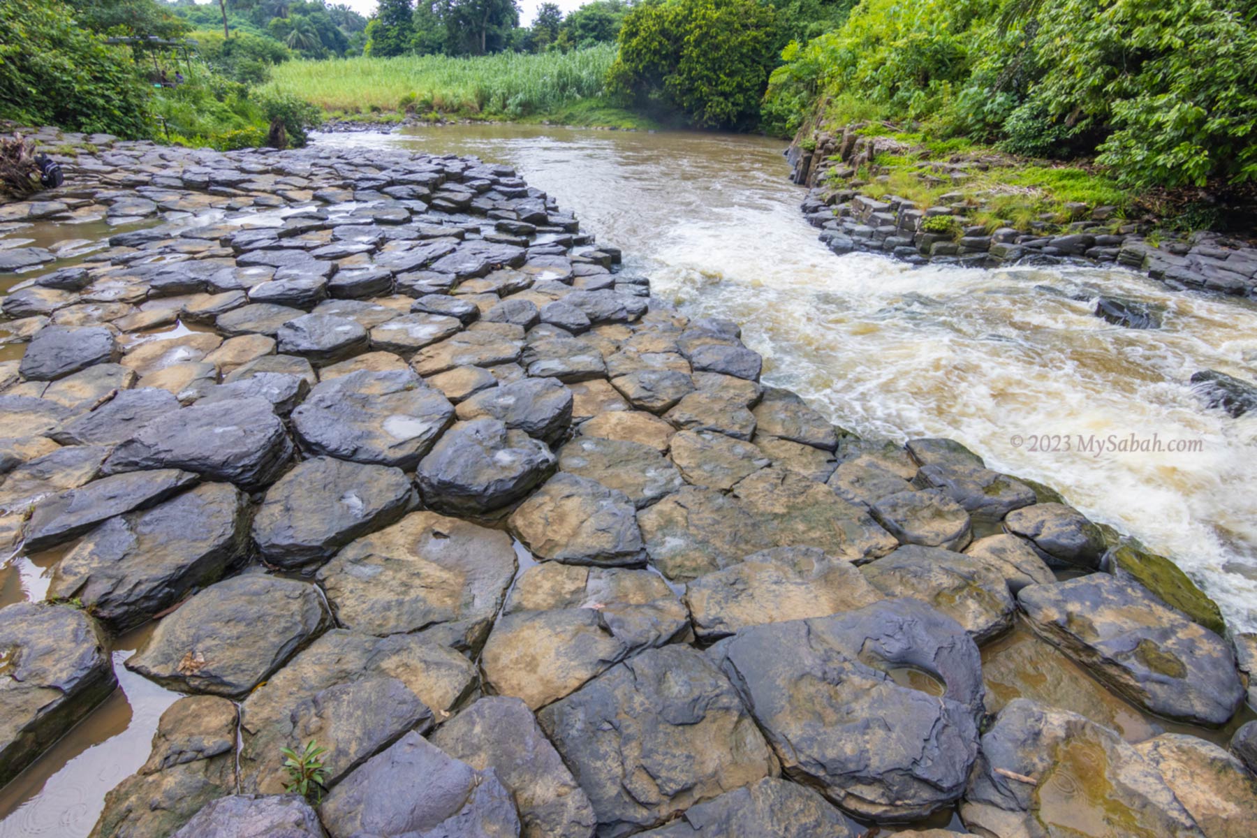
When the lava flow was cooling down fast by water, the contraction causes fracturing that split the hardened lava rocks into hexagonal columns, though some have 4, 5, 7, or 8 sides. The columnar basalt is about the same size, with a diameter about 30-40 cm, and uniformly arranged. The size of the columns was primarily determined by the speed at which lava cooled.
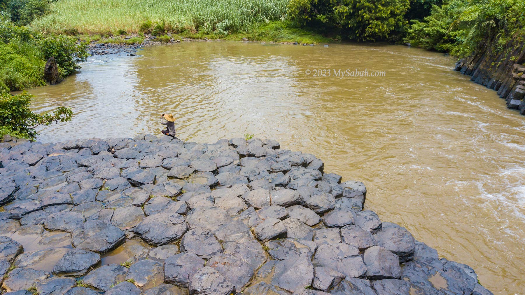
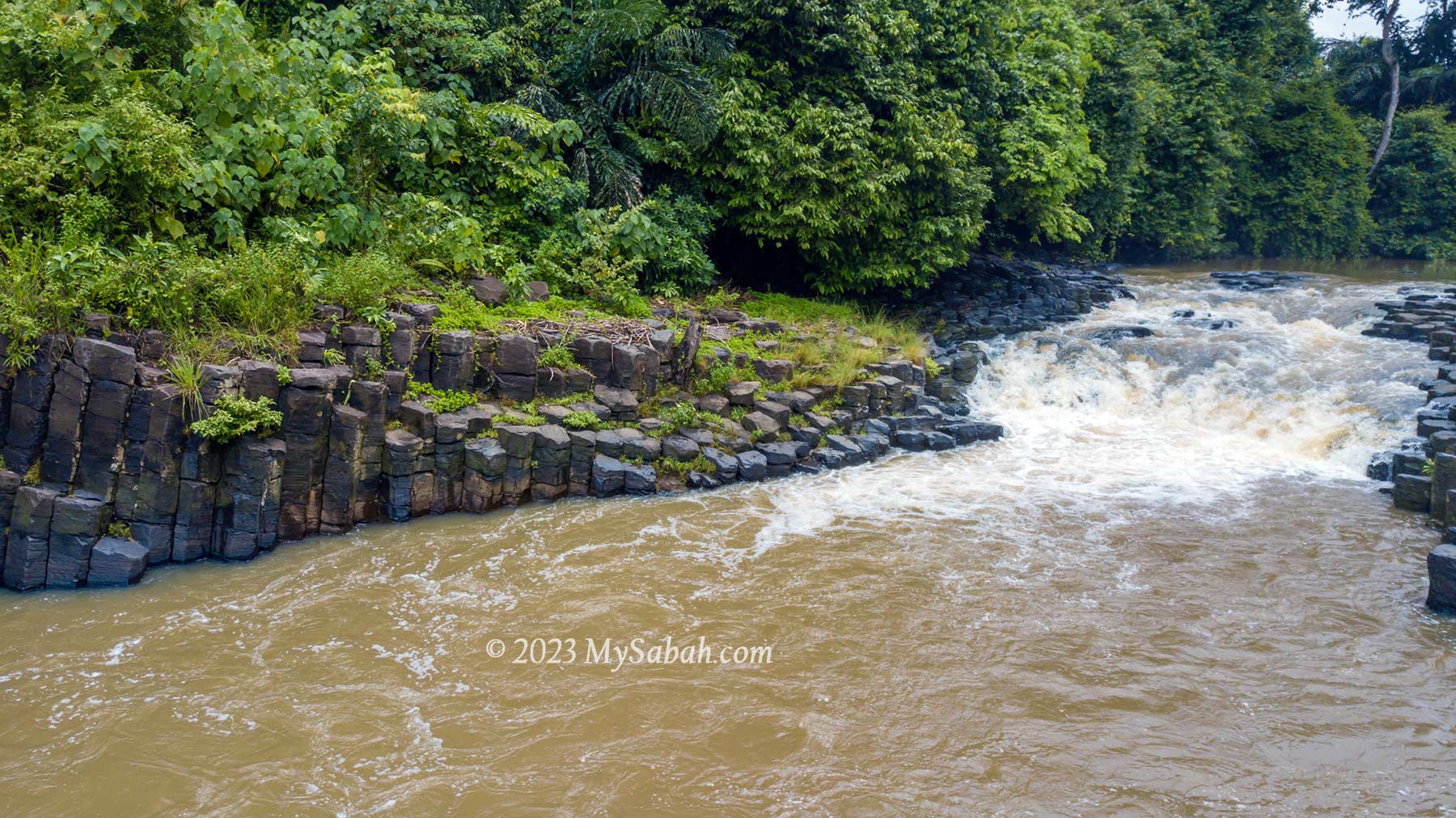
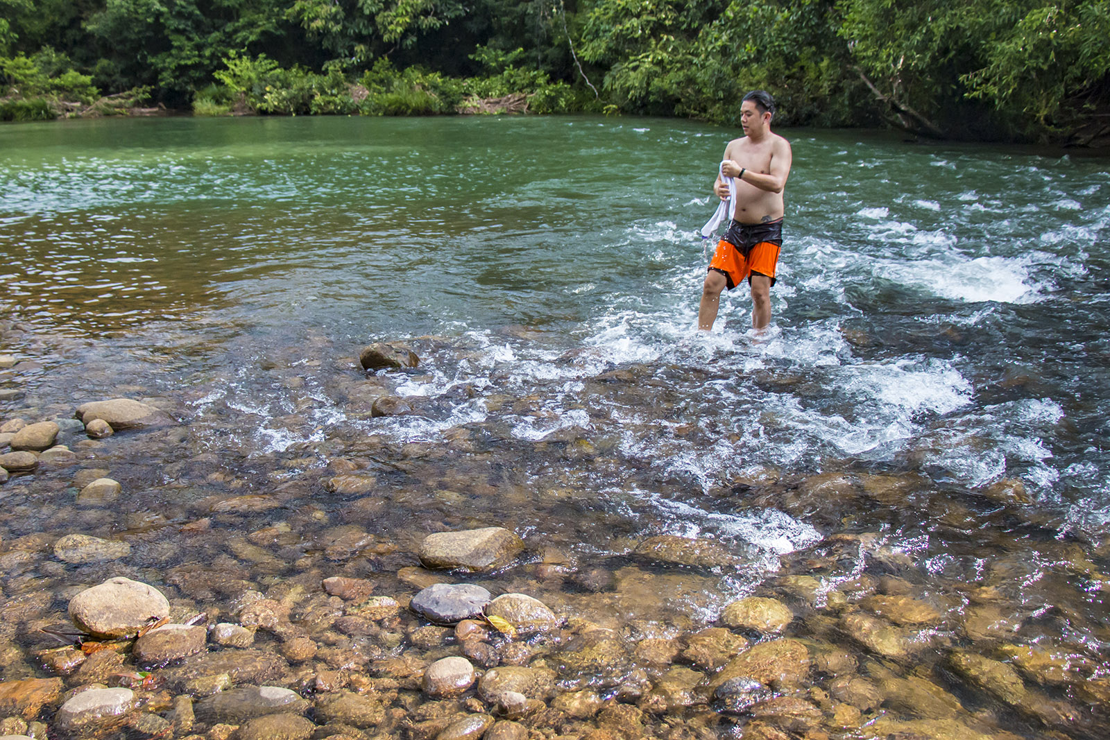
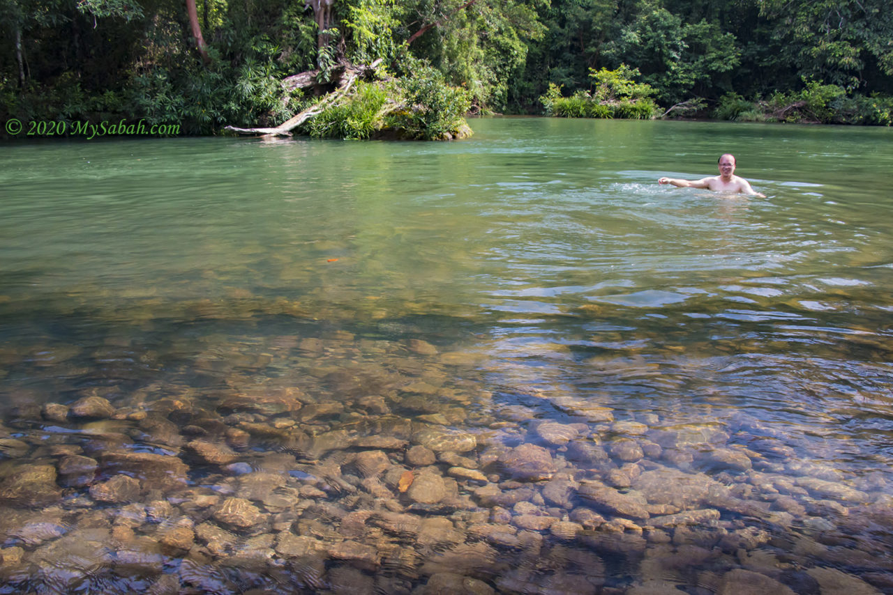
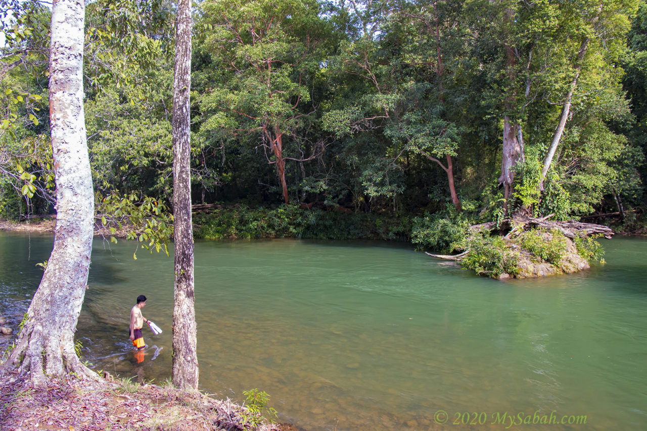
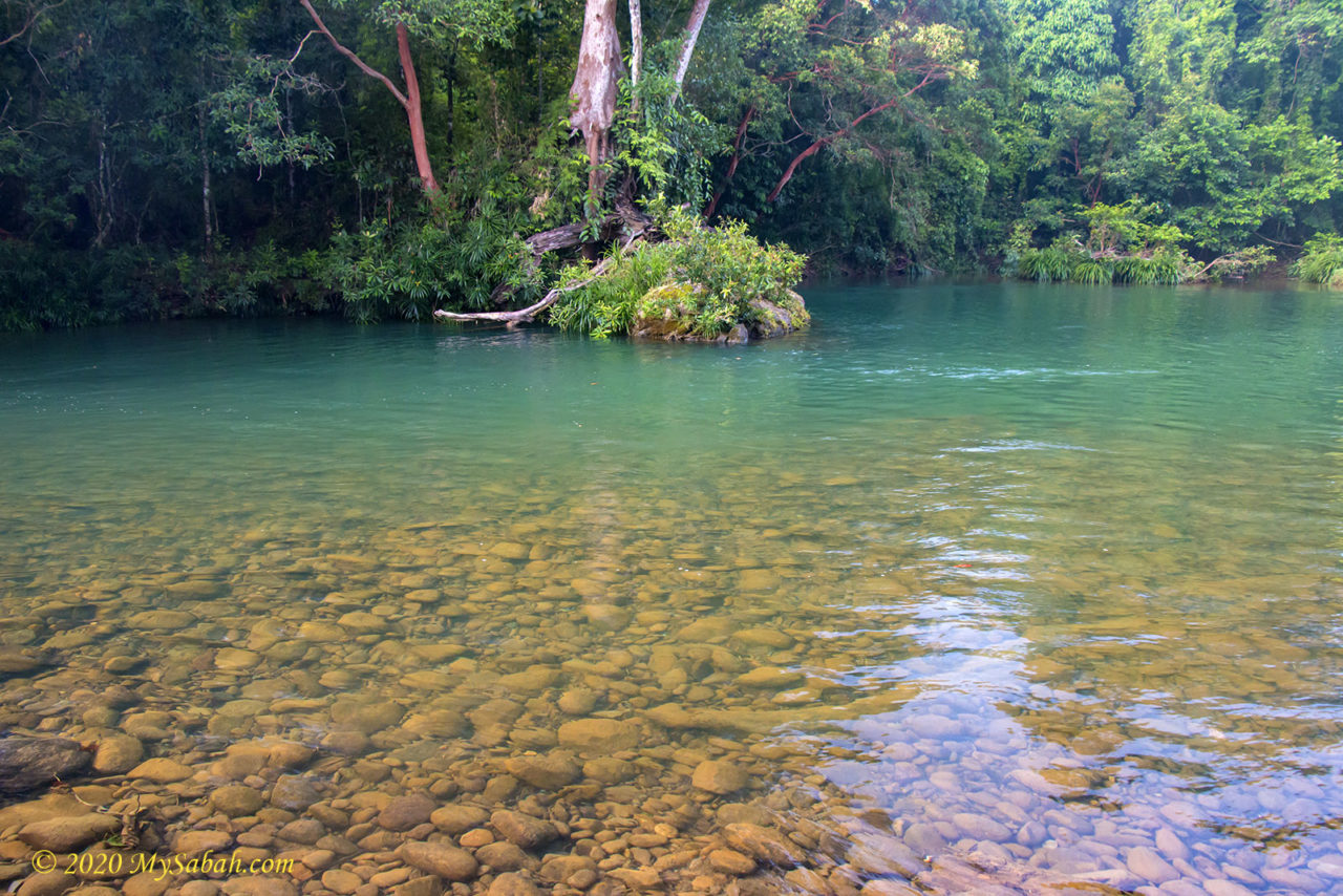
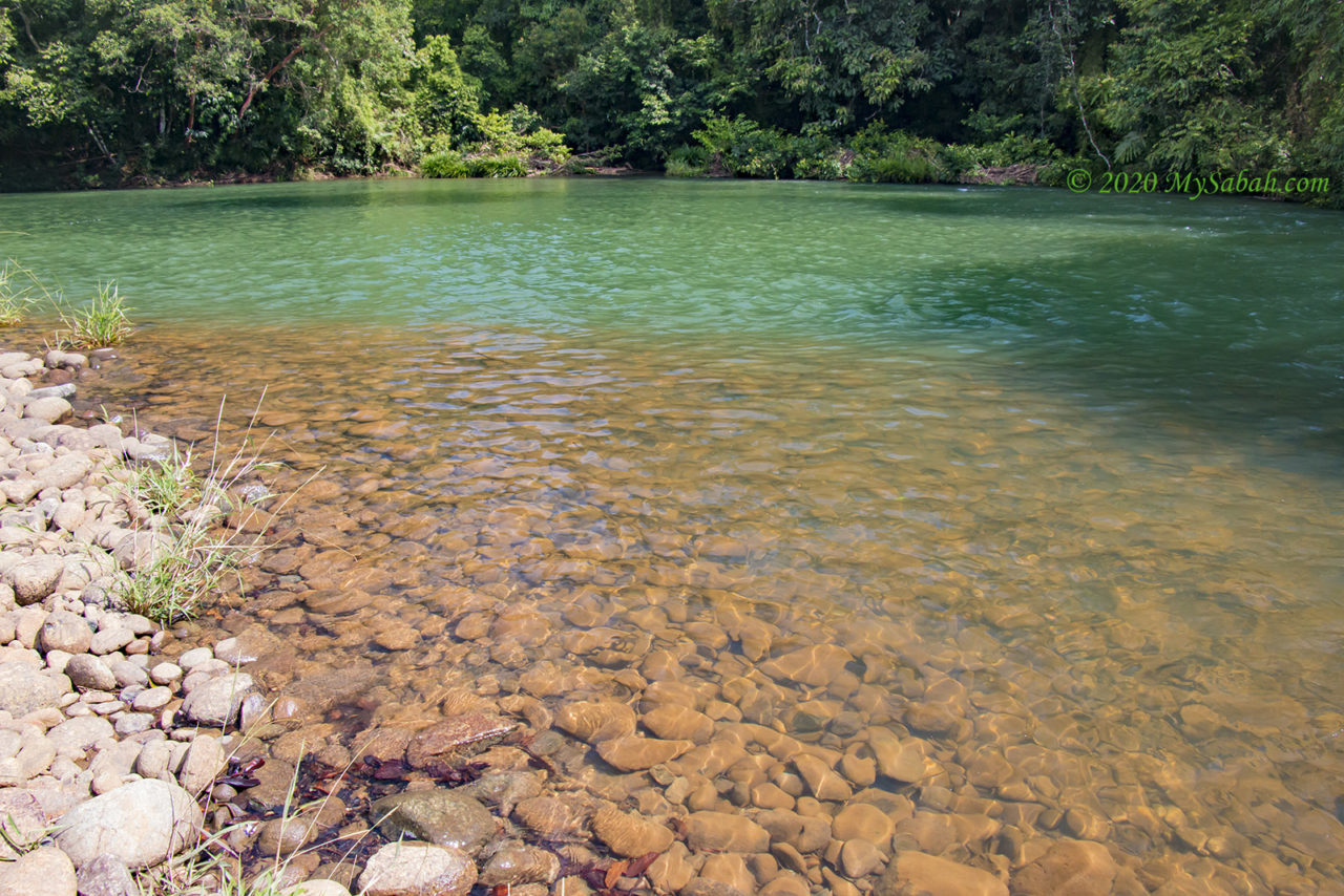
The water is murky after rain. In dry season, the water is clear and teal in colour. The water at waterfall is about 20 feet deep.
Actually, in East Malaysia, columnar basalt are also exposed in few locations such as Tatau and Kapit, but they are far smaller and less impressive than Batu Bersusun. The rock is classified as extrusive igneous with andesitic to basaltic compositions. It is one of the youngest volcanic eruptions during Quaternary (spans from 2.58 million years ago to the present).
The Batu Bersusun at Balung River of Tawau is the only columnar basalt in Malaysia
A Geotourism Destination
Columnar jointing of volcanic rocks is a unique geological feature only found in Sabah (and Malaysia). Sabah is rich in interesting geographical attractions such as Mount Kinabalu, Gomantong Cave, Poring Hot Springs and Imbak Canyon. Volcano remnants like Batu Bersusun will add more variety to our geotourism destinations.
Most of the columns are hexagonal, though some have 4, 5, 7, or 8 sides. During weekends, many locals come to swim in the pond
The most well-known columnar basalts are the Giant’s Causeway in Ireland and the Devils Tower in United States. Giant’s Causeway is a UNESCO World Heritage Site and one of the most popular tourist attractions in Northern Ireland. Devils Tower is the first United States national monument and a sacred place to native Americans.
The Columnar Basalt area is about 100 metres long
Even though the Batu Bersusun is smaller than Giant’s Causeway and Devils Tower, a waterfall columnar basalt in river is rare. Kampung Balung Cocos also has other nature attractions (e.g. Tagal river, Wullersdorf Peak, Pyramid Hill) that can be bundled with Batu Bersusun to turn this village into a must-visit place.
Basalt columns are natural pillars made of hardened lava. The dark line above water surface shows the depth of water during flood.
At the same period when Batu Bersusun was formed (27,000 years ago), megafauna such as tiger, tapir and giant pangolin (3 metres long) were present in Borneo, so were some Stone Age settlements of Australoid or Negrito people.
The columnar basalt, of pentagonal and hexagonal columns appears to be of about the same size and uniformly arranged.
During that time, sea level was decreased by 30–40 metres or more in the last glacial period (from approximately 110,000 to 12,000 years ago). Sabah and the rest of Borneo island was connected to Java, and Sumatra to the Malay Peninsula and mainland Asia in a landmass known as the Sundaland. If you were born that time, you can walk from Sabah to Kuala Lumpur on foot.
“Batu Bersusun” means neatly arranged rocks.
Visit Batu Bersusun
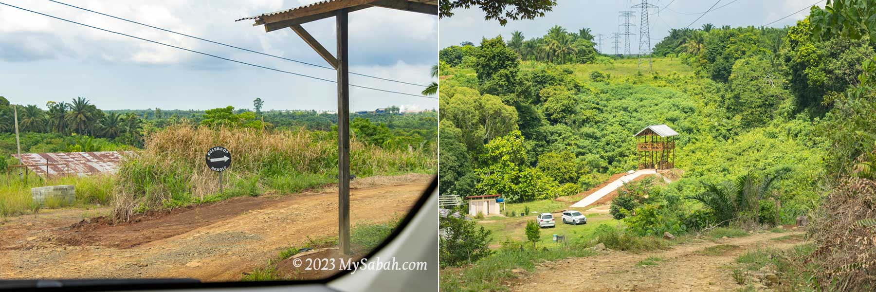
Batu Bersusun (see Location Map) is located in Kampung Balung Cocos, which is about 14 km from Tawau Airport and 39 km from Tawau town. The site is fairly accessible by paved road and navigable by Google Map and Waze apps. However, the last 600 metres is a descending and narrow gravel road that passes through an oil palm plantation. Anyway I can get there with a small Sedan (Axia).
The last 600-metre road to Batu Bersusun is a descending gravel road pass through an oil palm plantation.
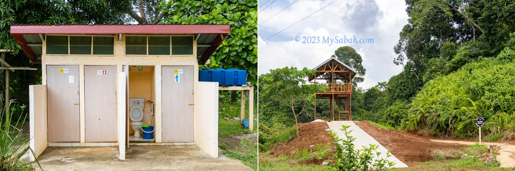
Batu Bersusun is open to the public since 2016. It’s in a private property (of Mr. Muhammad) and the entry fee is RM3.00 per person. Walk-in visitor is welcome. You can park your car in front of owner’s house. Toilet and changing rooms are available, where you can change to swimwear or take a shower.
Left: Most population of Kampung Balung Cocos are Cocos Malay. The Cocos people originally settled on the Cocos or Keeling Islands, which are part of Australia. Right: Columnar Basalt is also found in Teck Guan Cocoa Village (Tawau), but in smaller size and scale.
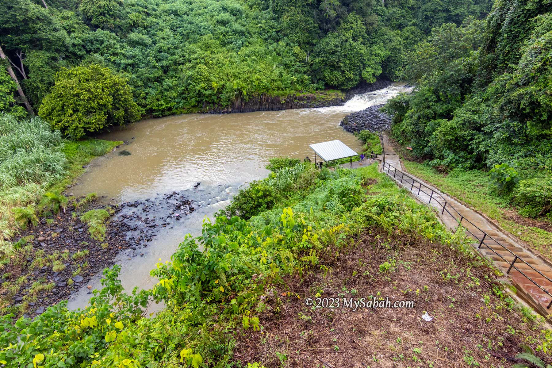
There is a 100-metre stairway to go down to the river with columnar basalt. You can walk or relax on the volcanic rocks to take pictures but be careful of the slippery rock surface.
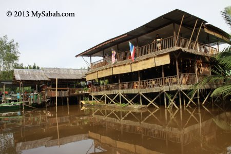
Left: toilet and changing rooms. Right: 2-floor view tower
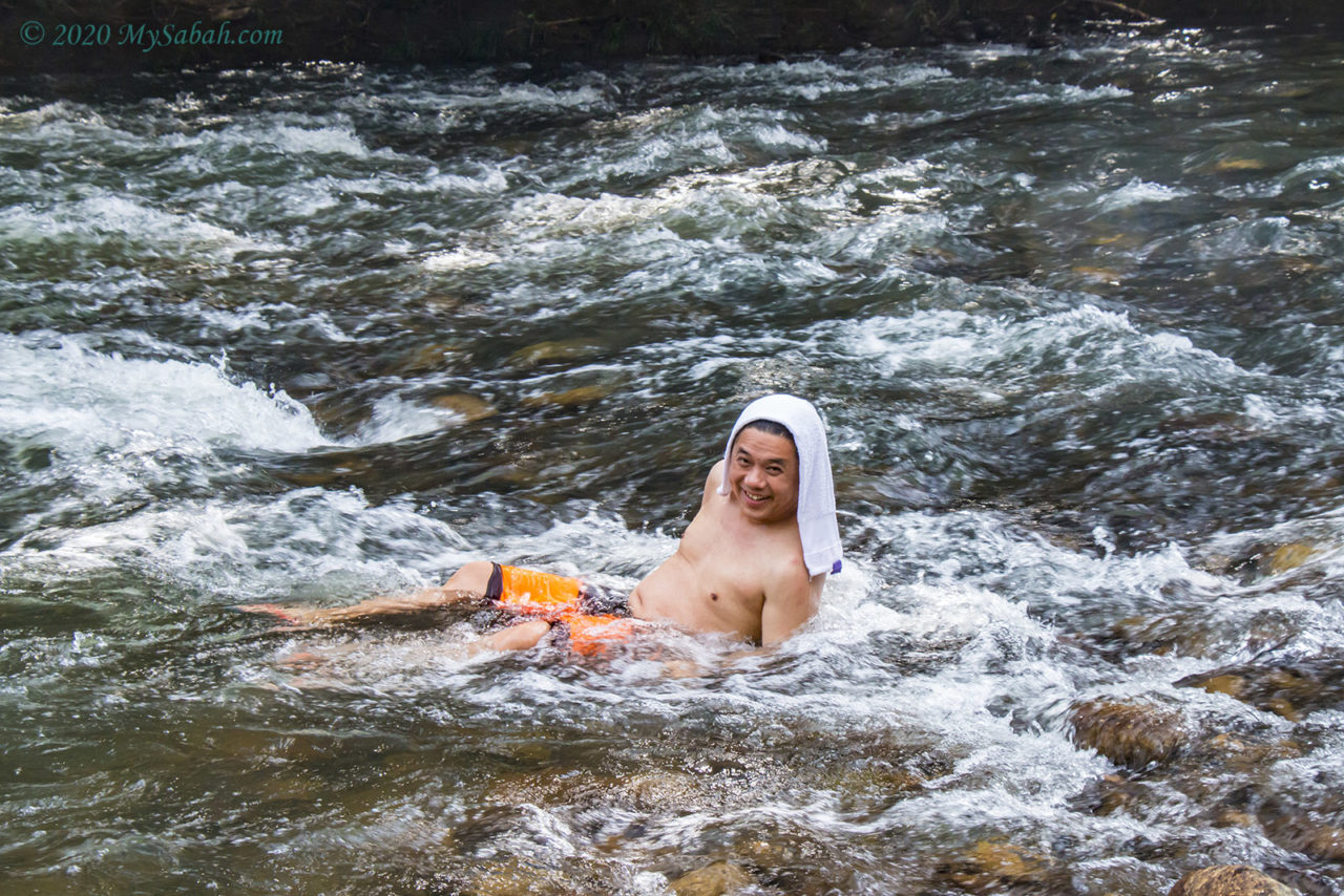
Most locals come here to swim in the waterfall pond and enjoy “jacuzzi” massage by the waterfall. The water level is about 4 to 10 feet. The deepest part is 20 feet under the waterfall. In dry season, the water is clear and the pond is in teal colour. I took the photos after rain so it’s murky.
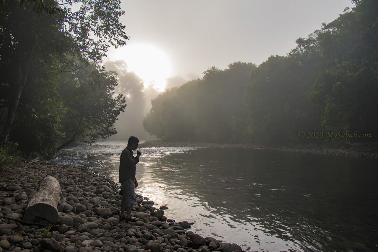
The 100-metre stairway to Batu Bersusun at Balung River. Note there is a shelter where you can rest or camp.
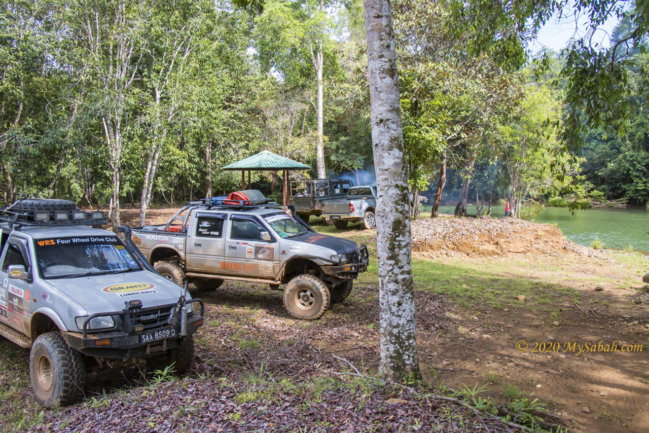
You can camp under the view tower or shelter near the river. Never camp on the columnar basalt because the rocks would be flooded after heavy rain. There is no shop and restaurant nearby. Bring your own food and drink if you plan to have a riverside picnic.
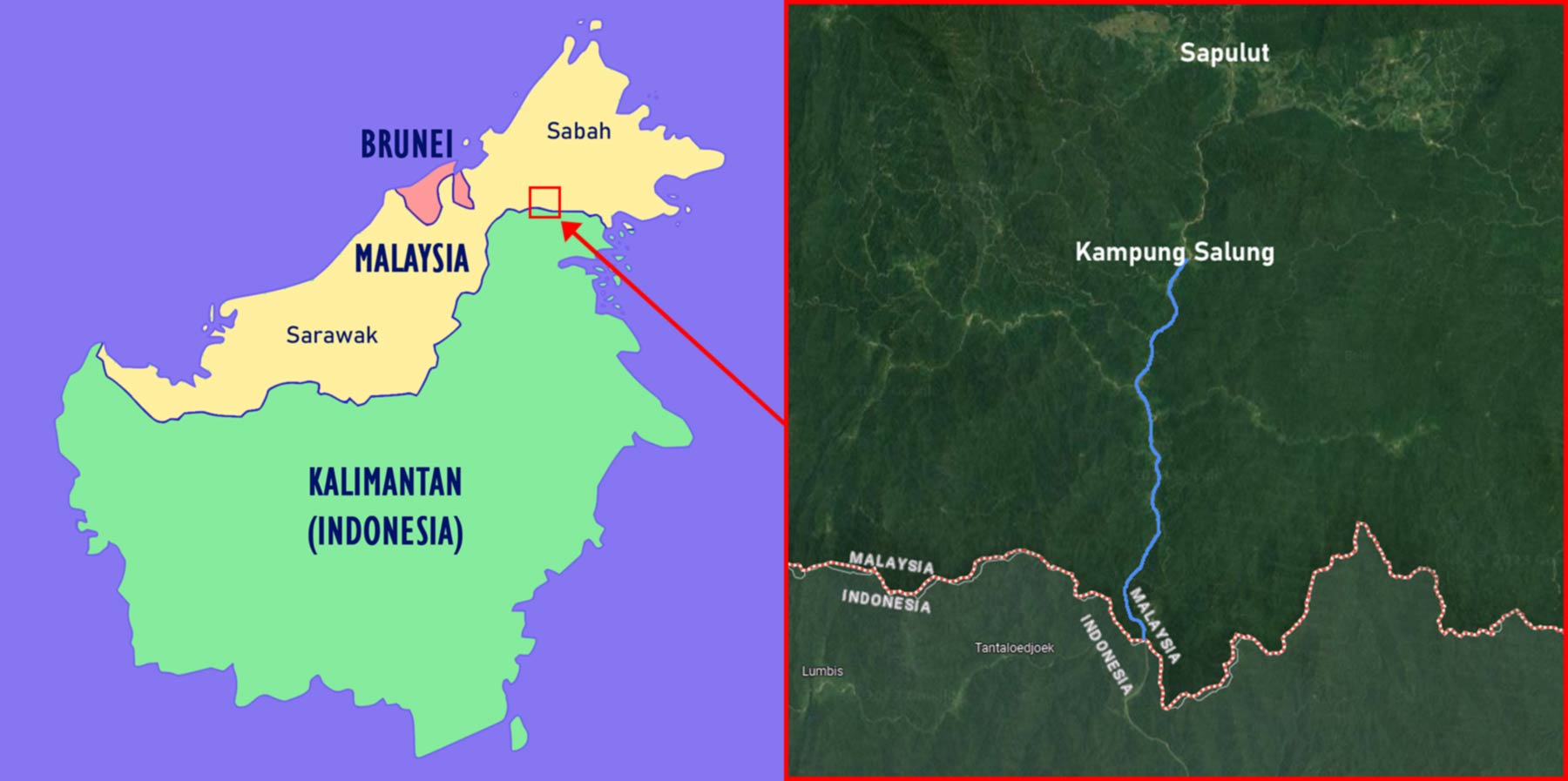
Borneo Island is the third largest island in the world, and its territory is shared by three countries, i.e. Malaysia (Sabah & Sarawak States), Indonesia, and Brunei. Though the land border of Sabah and Kalimantan (Indonesian portion of Borneo) spans more than 300 KM, there is no highway to connect both sides.
Left: Map of Borneo and its countries. Right: river passage from Sapulut to Kalimantan (North Kalimantan Province)
However, for thousand of years, people of Sabah have been going in and out of Kalimantan freely. Dense forest and treacherous terrain form the natural barriers between Malaysian and Indonesian Borneo, but human can get around these by network of rivers that cover the inland of Borneo. For example, you can reach Kalimantan from Sapulut, a small district in Sabah interior.
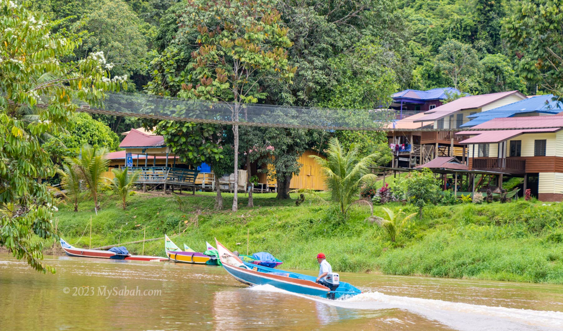
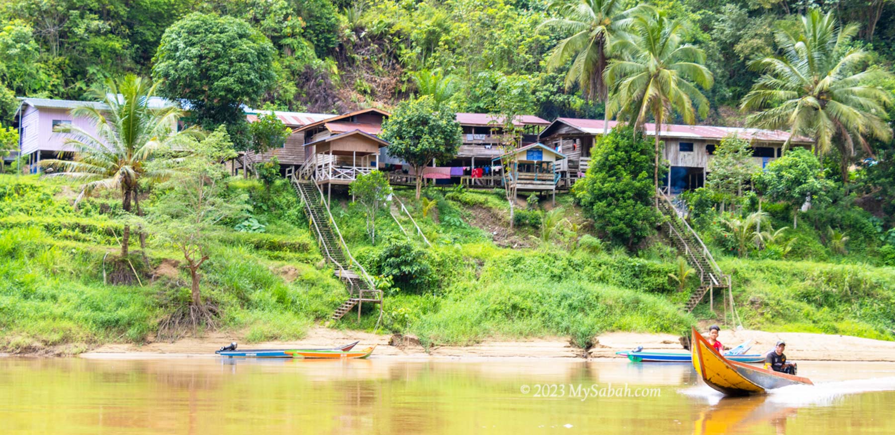
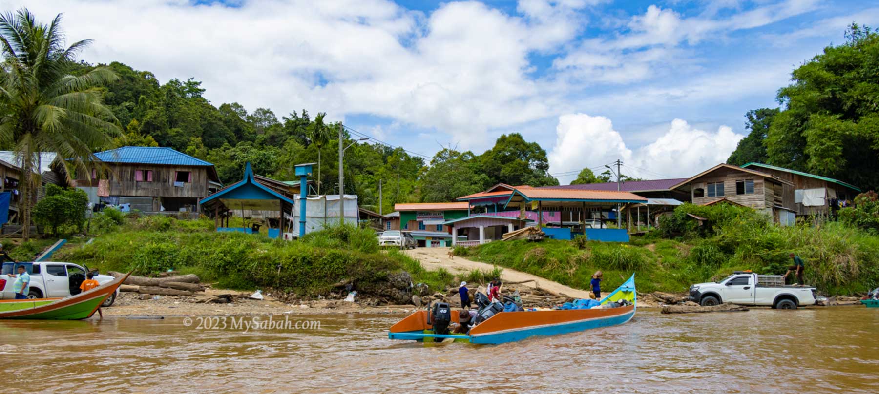
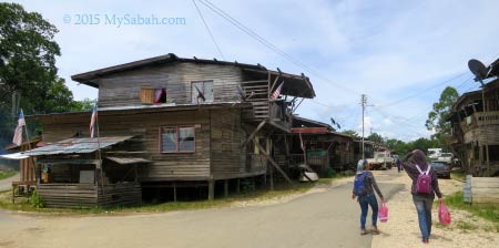
Village next to the river
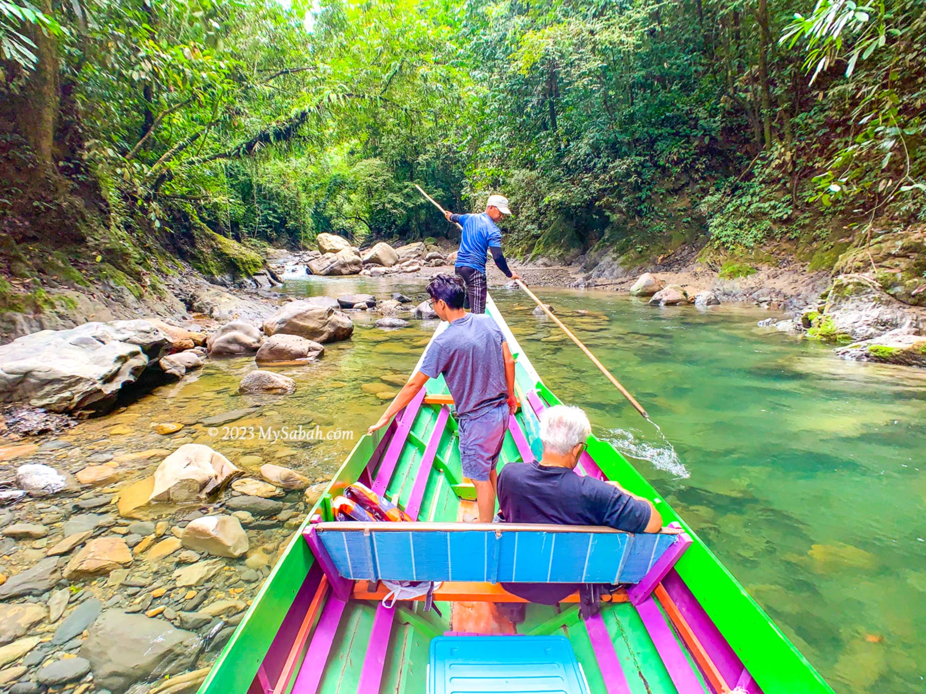
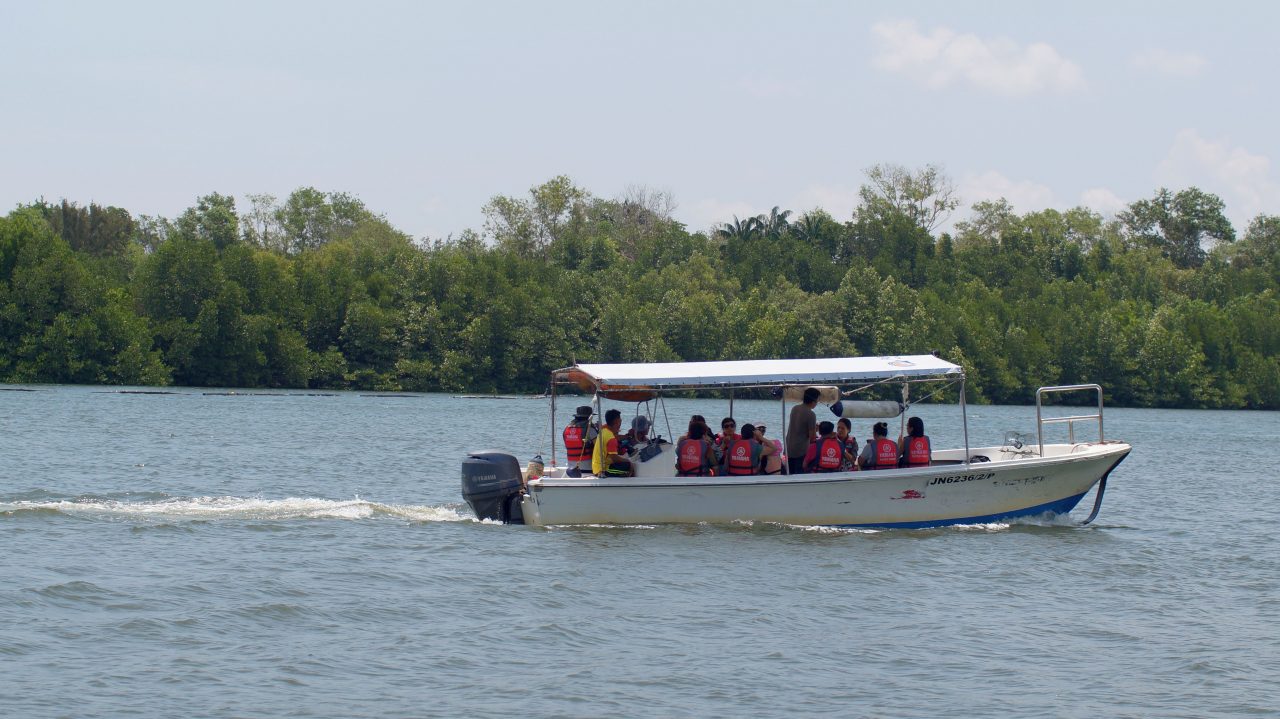
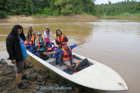
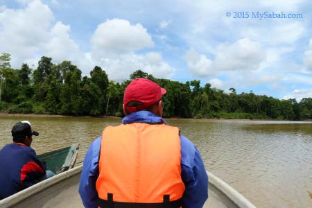
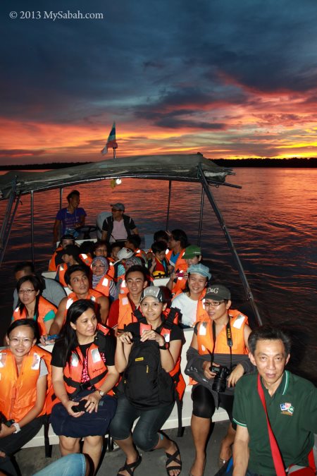
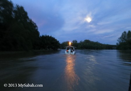
I’ve tried the boat ride from Sabah to Kalimantan, which takes only 1.5 hours, to experience the ancient river passage in the Heart of Borneo. Overall, it’s a fun river cruise to explore the scenic countryside of two countries. Please read on if you want to know how I travelled between two countries in half a day.
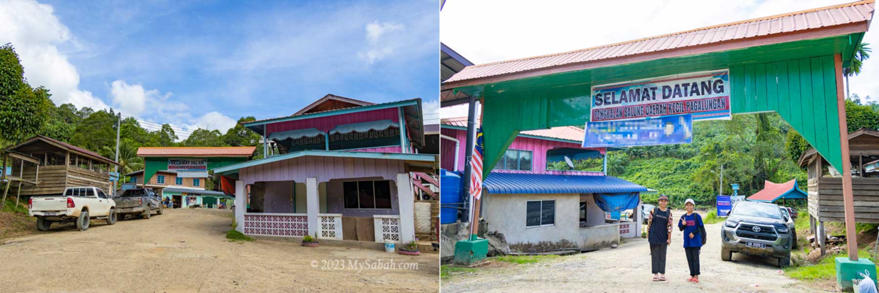
Kampung Salung Jetty
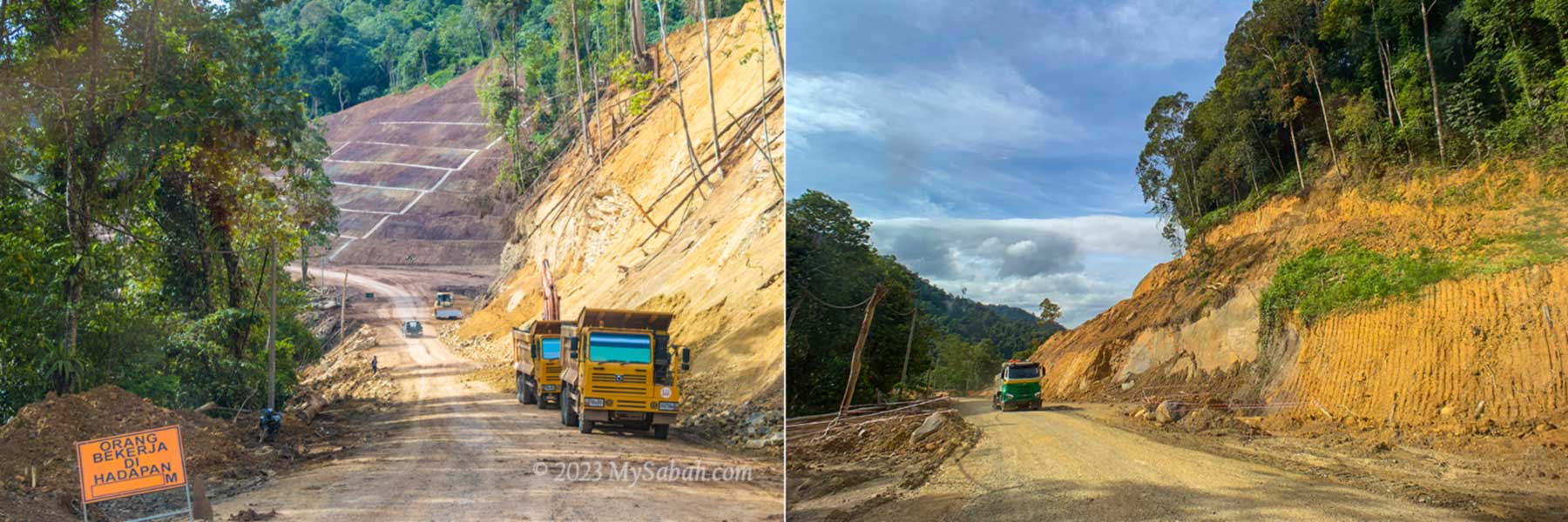
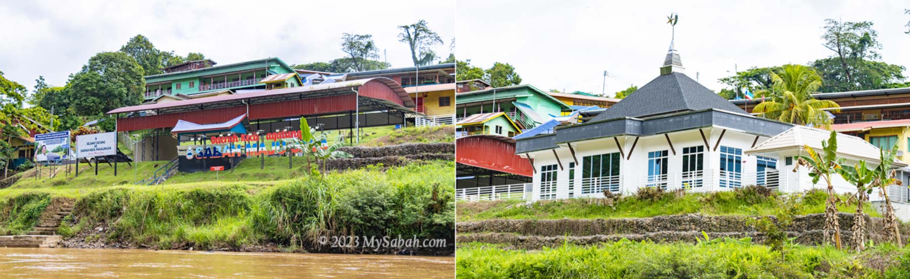
First we drive about an hour on the gravel road from Sapulut town to the jetty of Kampung Salung (Kampung means Village). On the way, you would see dozers and trucks are busy upgrading the 38-Kilometre road from Sapulut to Pagalungan town. Salung Village is somewhere in the midpoint.
Road between Sapulut and Pagalungan town under construction
The road is located near the Sapulut River, which flows to Kalimantan. As Sapulut is a mountainous region, road is expensive to construct. Though this road may eventually connect to Kalimantan, that would be an ambitious project that needs a lot of time and fund to complete.
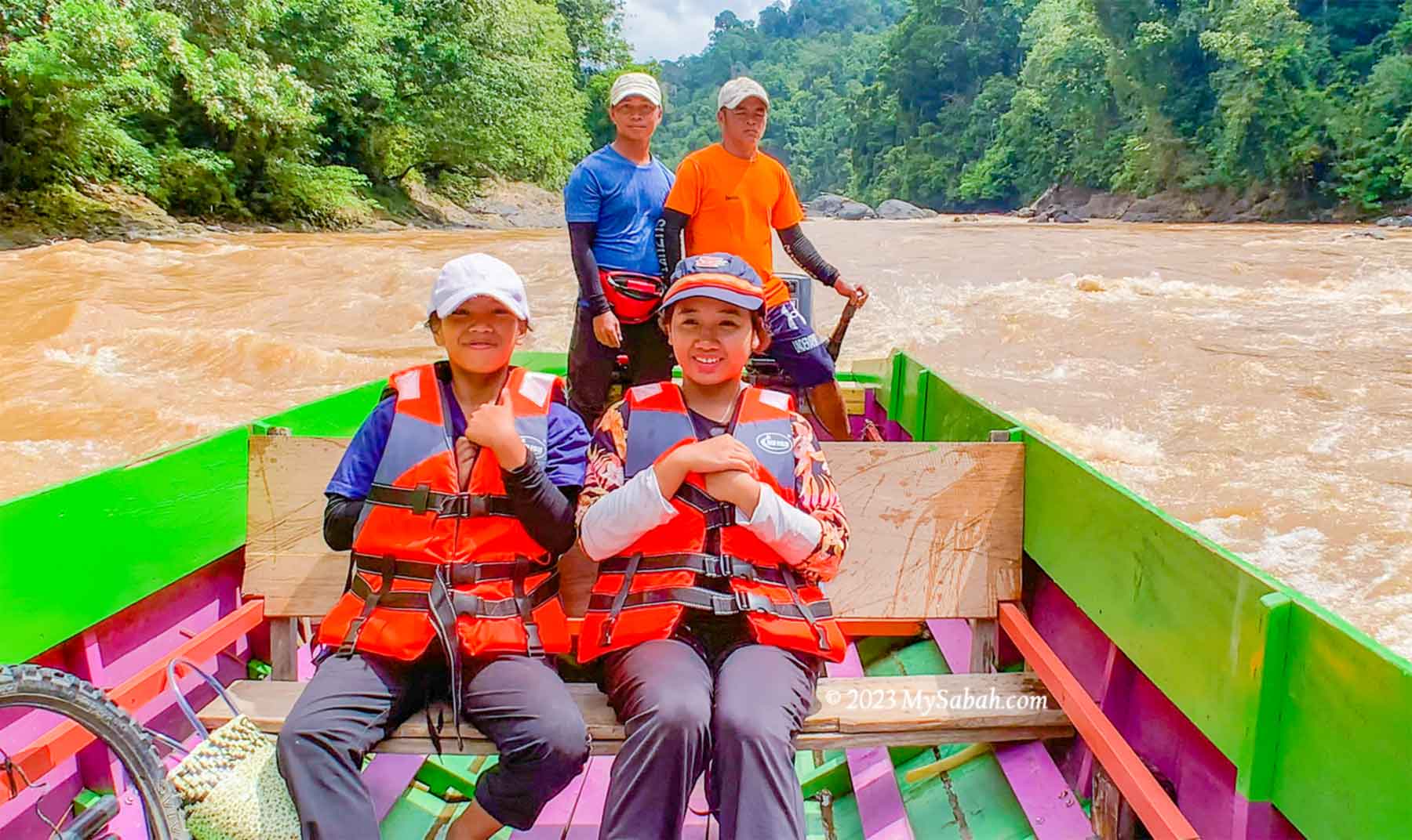
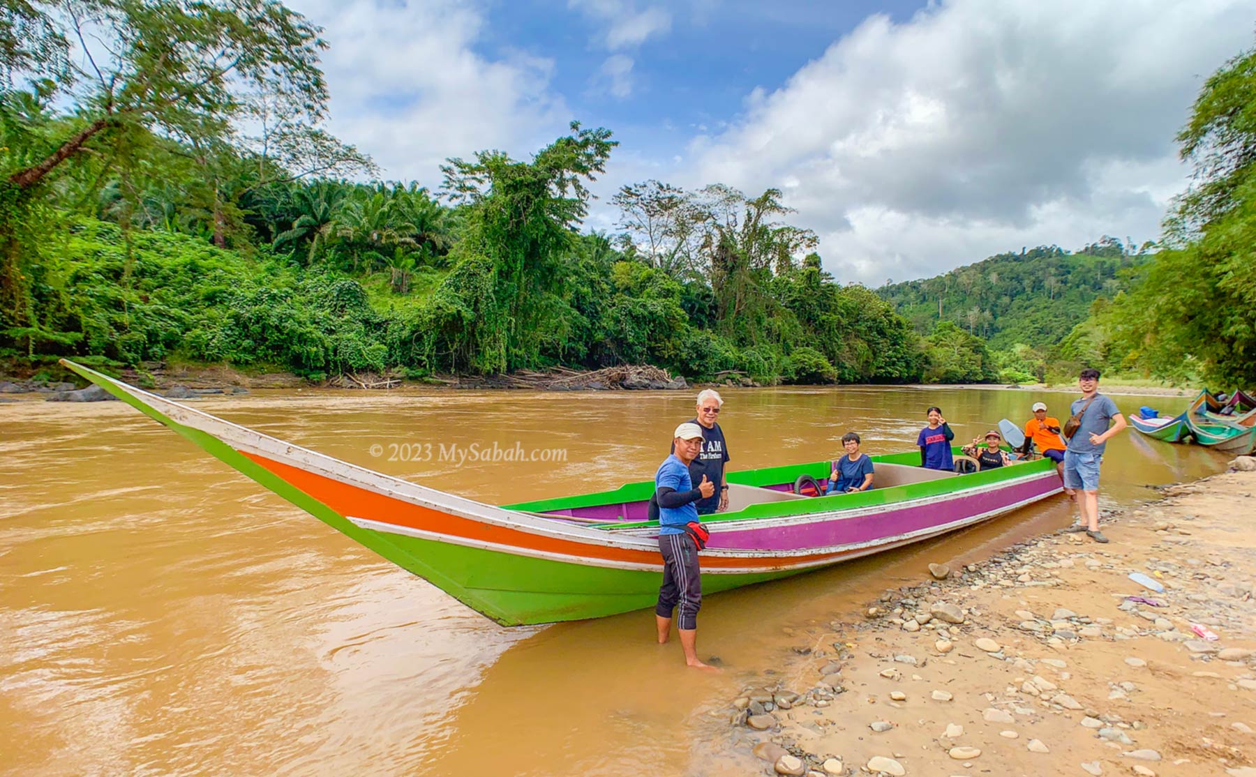
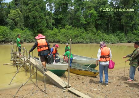
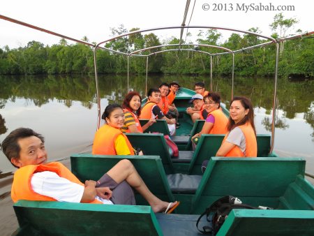
Kampung Salung, starting point of the river cruise. Mia and Barbara follow us for the rapid shooting.
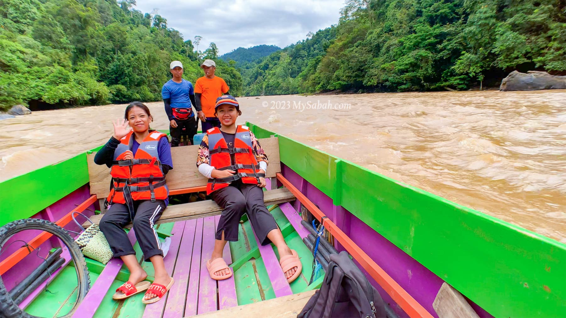
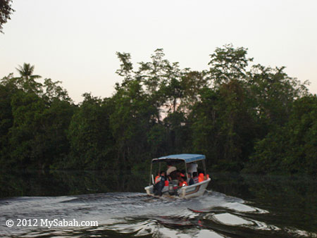
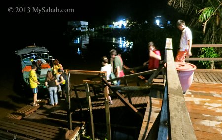
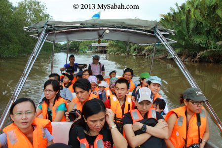
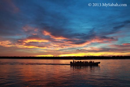
Kampung Salung is a peaceful village next to a big river. After we park our car and take a toilet break, we depart at 10am on a 20-feet-long traditional wooden boat that is powered by two engines.
Ready to depart from Kampung Salung jetty on a twin engine long boat
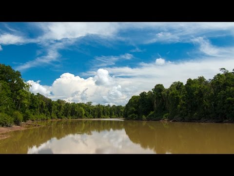
A 7-minute video to show you what you would see in the river cruise
Going to Kalimantan, the Indonesian Borneo
The name Kalimantan is derived from the Sanskrit word Kalamanthana, which means “burning weather island”, because of its warm and humid tropical climate. As the boat has no sun cover (Bimini top), applying sunblock lotion will prevent sunburnt.
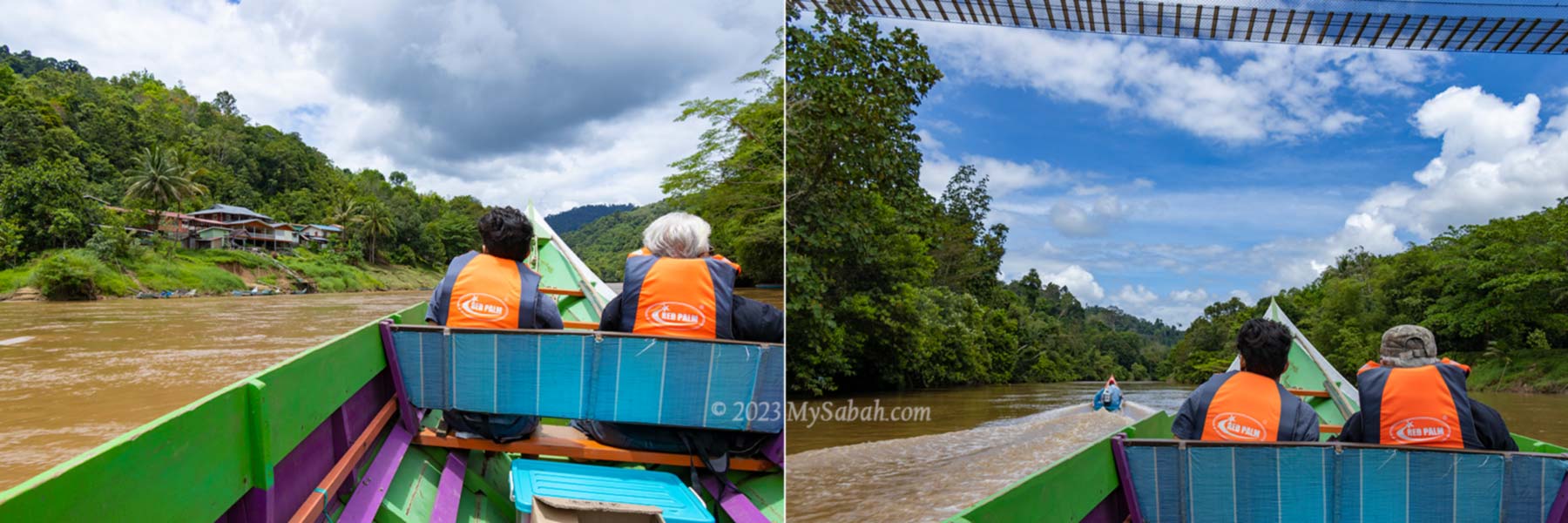
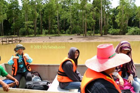
Village and nature view along the river. In front seat are Virgil (left) and Dr. Richard (right)
When the long boat speeds and glides on the river, it’s breezy, too comfortable for a nap, but I was busy being thrilled by the scenic view along the river.
A peek to the stilt houses and lifestyle of locals
Joining me are Dr. Richard and his son, Virgil from Orou Sapulut, Ms Wong from media and two local girls, Mia and Barbara. The ladies and me are first timers on a boat trip to Kalimantan.
Barbara (left) and Mia (right) seem to enjoy the ride
It takes about 1.5 hours to travel about 25 KM from Salung Jetty to Kalimantan border. The river is about 20-50 metres wide, part of it could be shallow during drought and you would need to get into water to push the boat.
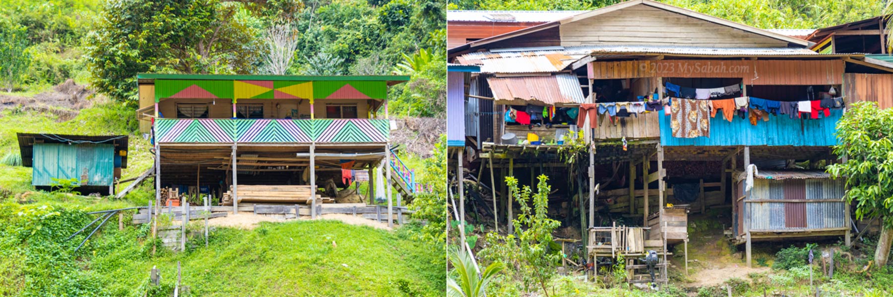
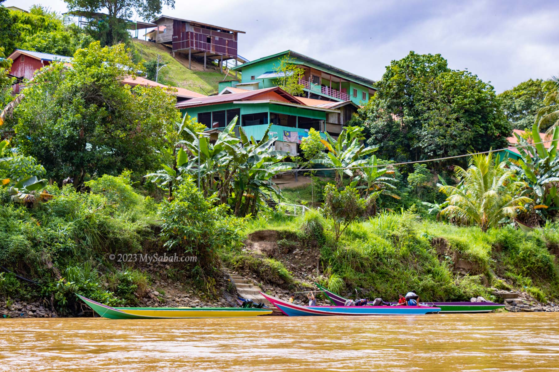
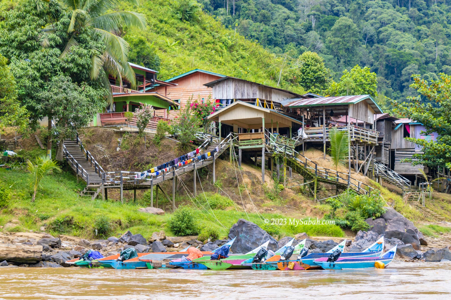
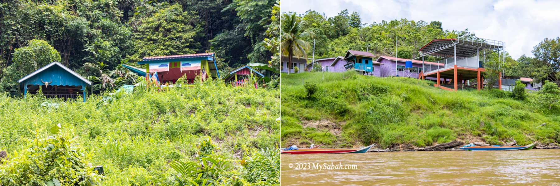
Longhouses and building on the slope
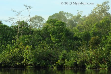
The land at both sides of the river is mostly lush forest, slopes and high ground, where villagers build their houses, schools and farms. The riverside view is interesting as our boat passed by many longhouses and villages such as Kampung Binanding, Kampung Silungai and Kampung Babalitan. Virgil said he saw a group of hunting dogs chasing a deer at the river once.
Longhouses and boats parking at the river is a common view
Most of the population along the river are Murut, which means “the People of the Hill”, and they are the third largest indigenous people of Sabah. Majority of them here are farmers, fishermen and hunters. Travel agents like to advertise Murut as the descendants of headhunters. Nowadays most of them are educated and live a modern life just like others. Many are converted to Christians or Muslims too.
Left: Traditional graves of Murut. Right: Sekolah Kebangsaan Babalitan (school)
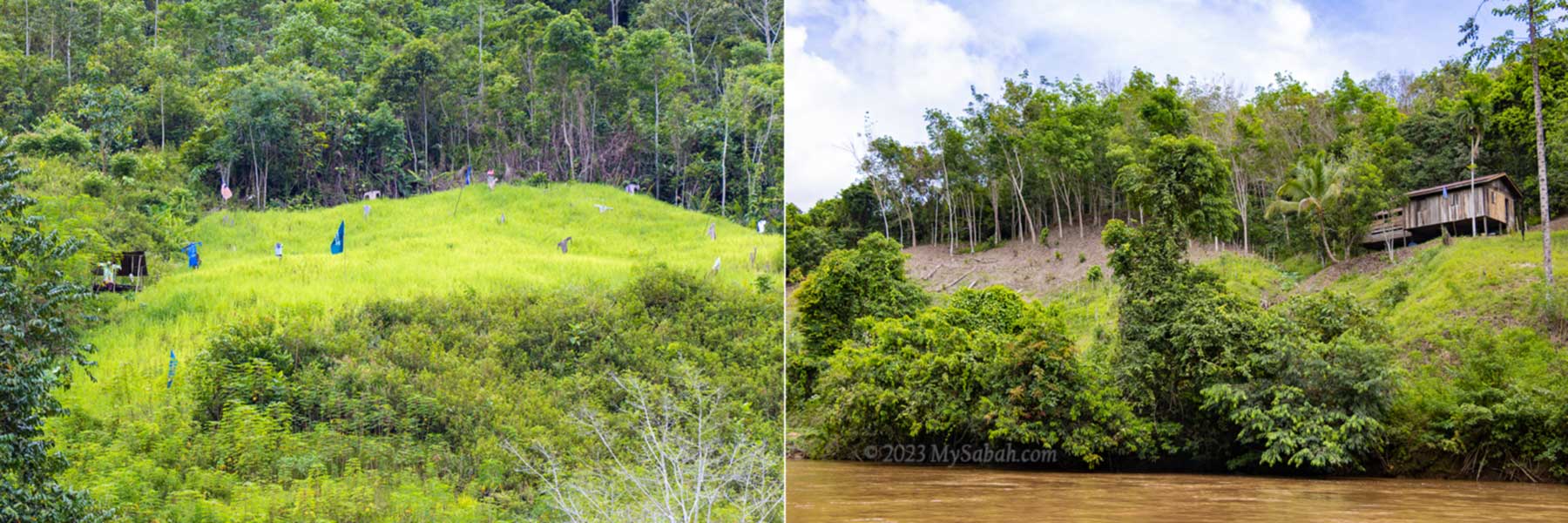
Part of the forested hills are clear for planting hill paddy, tapioca, banana, rubber and other crops. Many Murut live in longhouse and I see almost every house has more than one boat parked on the river.
Pagalungan township and the mosque
Anyway, when the new road to Pagalungan town is fully upgraded, longhouses at river side would be gone slowly when more people move to roadside for better accessibility.
Left: hill paddy. Right: rubber plantation
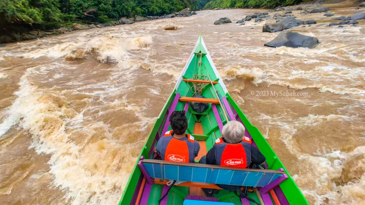
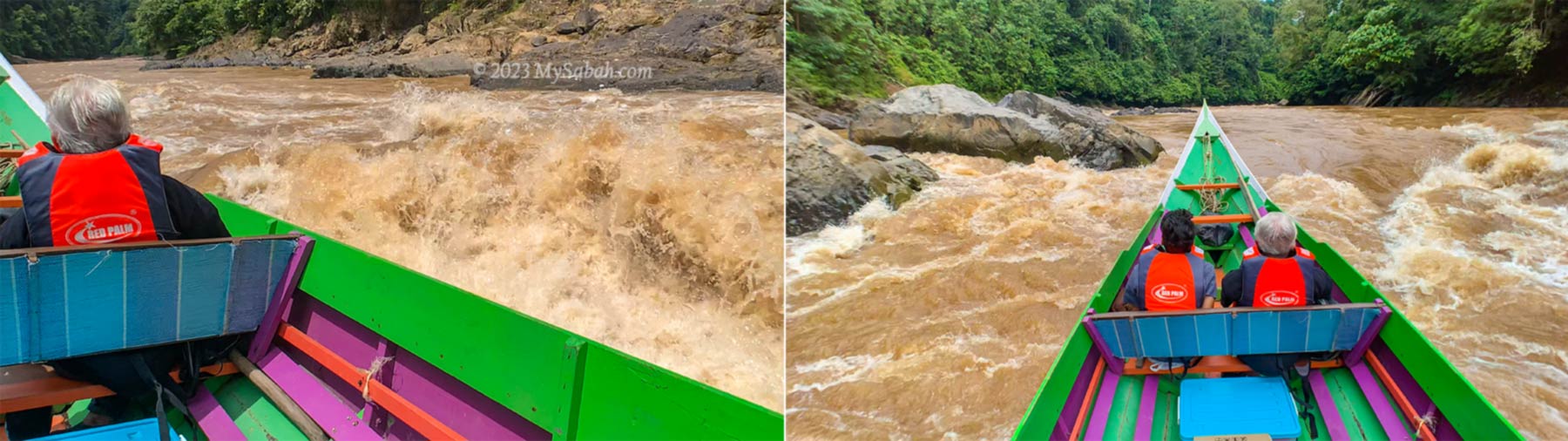
In general, the river is calm, only a few sections are slightly bumpy due to the swift rapids, I’m only hit by the splashes twice. We go through more than 10 rapids and pass through the narrow gaps between boulders couple of times.
Long boat cutting through the strong rapid
The boatmen are really skillful and experienced, so our boat navigate in the raging currents smoothly. So that’s why they call it rapid shooting huh. I really appreciate that whenever my camera points at something, the boatman will slow down the boat until I’m done shooting.
Scary or thrilling moments? Left: big waves hitting the boat, Right: speeding toward the boulders in a rapid
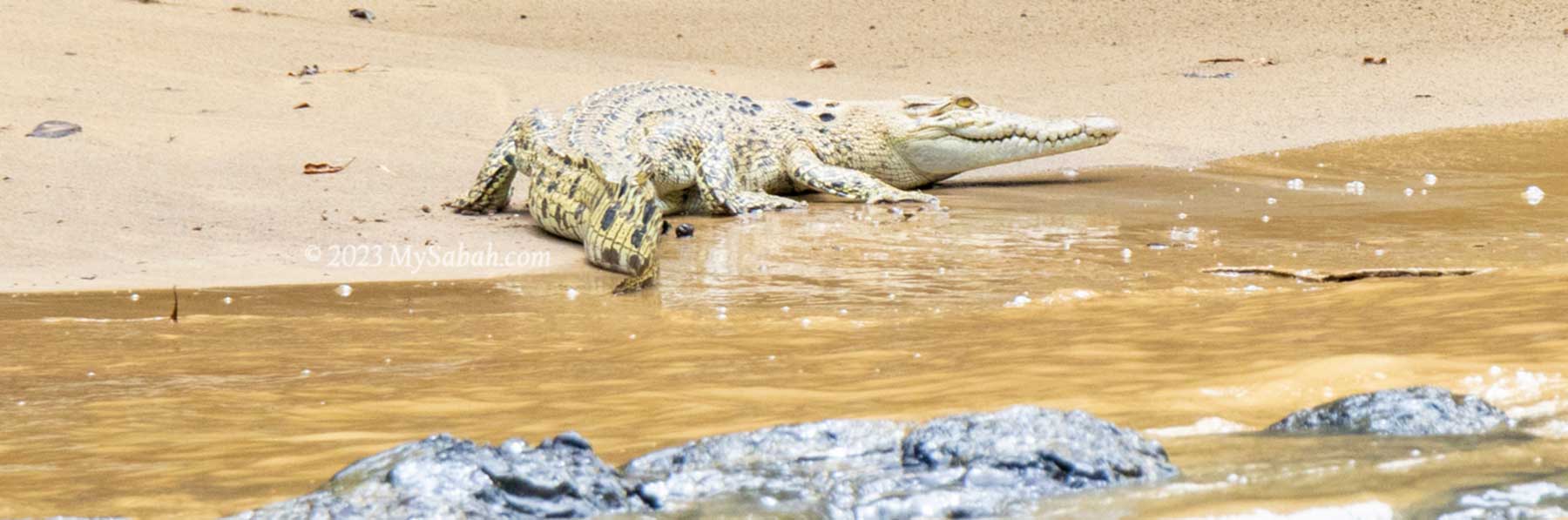
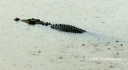
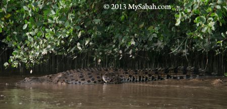
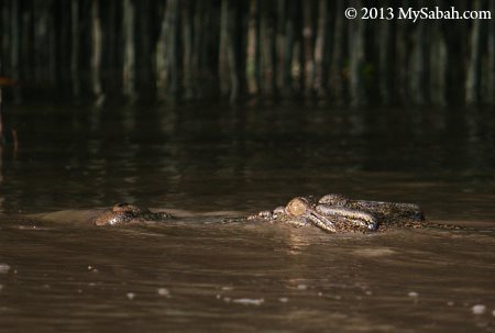
We have our life vests on and feel totally safe. By the way, swimming in this river isn’t a great idea as there are crocodiles. We find only one juvenile crocodile resting on the river bank anyway.
A juvenile crocodile (species: Crocodylus siamensis) on the river bank
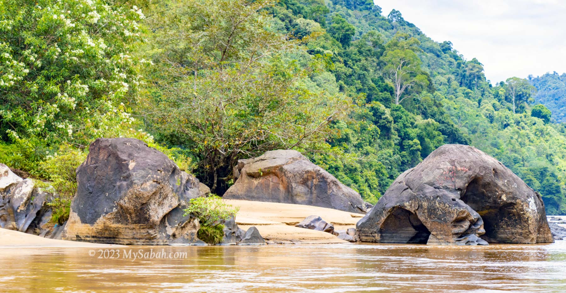
We see a lot of volcanic rocks and boulders of different shapes on the river bank. They are probably 4 or 5 million years old, giving this river more vibes of ancestry. Some rocks look like an animal and probably have a story to tell.
Volcanic rocks at the river
Crossing the Border
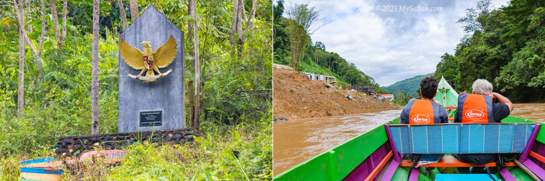
After passing by Bantul, the last Malaysian village before Kalimantan, we see the Garuda Pancasila monument, the National emblem of Indonesia. I know we have arrived Kalimantan.
Left: National emblem of Indonesia. Right: CIQS complex of Indonesia is under construction
Unlike other border controls that are usually guarded by unfriendly armed force and officers, there is no fence and checkpoint that stops our boat. We just go in like an outlaw. However, such relaxation is only applicable to Malaysians. They would stop foreigners to enter even if they have a passport.
CIQS (Customs, Immigration, Quarantine and Security complex) of Indonesia at the Kalimantan border
They are probably watching us but too busy working on some modern structures. According to Virgil, Indonesia is building a CIQS complex (Customs, Immigration, Quarantine and Security complex) there. It’ll be finished in 1.5 years, and operational in 2 years.
It’s my first visit to Indonesia but there is no proof on paper. When their CIQS is ready, I want them to stamp on my passport, and I would spend a few days in Kalimantan. Currently the proper way to enter Kalimantan from Sabah by water is taking a ferry from Tawau town and land on Nunukan or Tarakan of North Kalimantan Province.
Most of the villagers are Murut people who have been staying here for thousand of years
In fact, there were time when Borneo was under one ruler or government (e.g. Brunei Kingdom and British North Borneo Colony) so there was no boundary. People could move freely between Sabah and Kalimantan during that period.
After “trespassing” Kalimantan for a short distance, we make a U-turn at the Luyu rapid and head back to Sabah. Return trip will take 2 hours, longer time because the boat goes against the river current.
River Picnic
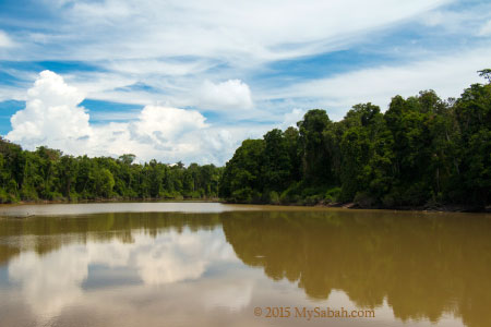
I know we will have our lunch picnic by the river but didn’t expect it comes with a surprise. The colour of main river is like milk tea, a characteristics of the downstream river, which collects silt washed down to the water on its course.
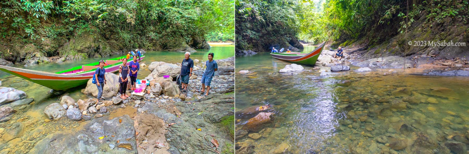
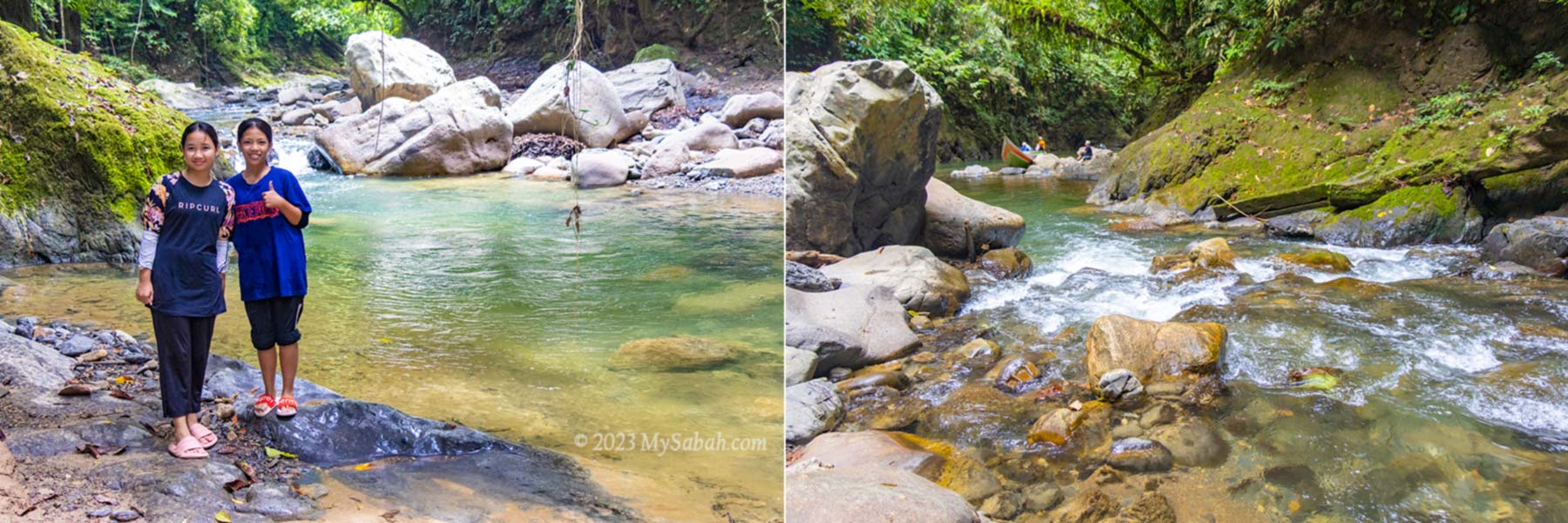
Entering Sumandapiravuhus River
When our boat enters a tributary of the big river, I look at the water in disbelief because it’s crystal clear. “This is Sumandapiravuhus River. We will have our lunch here.” Dr. Richard says. He smiles at me, as if he knows that I’m impressed by the beautiful river.
Sumandapiravuhus River. Far behind is the exit to main river
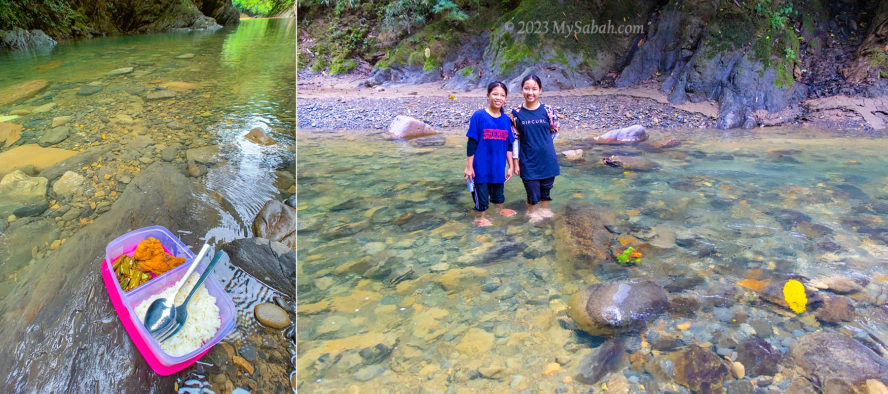
I don’t know how they find this perfect spot for picnic. The surrounding dense trees shade us from the hot sun, and our presence spooks a flock of Bushy-crested hornbill flying over the canopy. I sit on a rock, soak my feet in the cool water, and enjoy my lunch and soda drink.
Lunch picnic at Sumandapiravuhus River
Too bad I don’t have any swim wear with me or it’ll be refreshing to bath in this clean river. Well, maybe next time.
Returning to the Kampung Salung Jetty by 1pm
About Sapulut (or Sapulot)
For a tour in Sapulut, you can contact Borneo Outback Tours Sdn Bhd (Licenses: Co. No. 846369-H / KPK / LN:9247) at: Website:www.borneo.tours Facebook:orou.sapulot Instagram:@orousapulot Phone:+60 19 2277077 (Whatsapp), +60 87 337 277 Address: A-7-2, Apollo Atrium, 89008 Keningau, Sabah, Malaysia
Crystal clear water of Sumandapiravuhus River is so inviting. You can bath in the river or small waterfall there.
The tourism operations in Sapulot are managed by Orou Sapulot (means the Sun of Sapulot), a community based project to promote tourism and in sustainable manner.
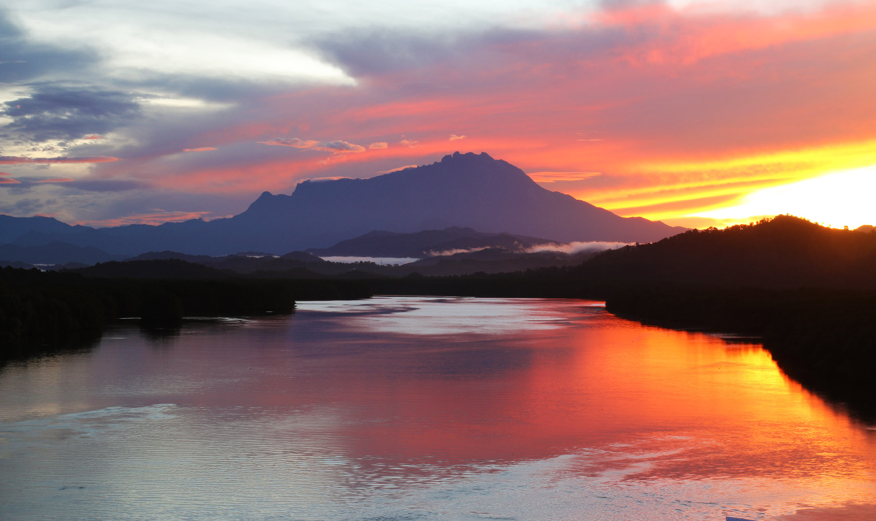
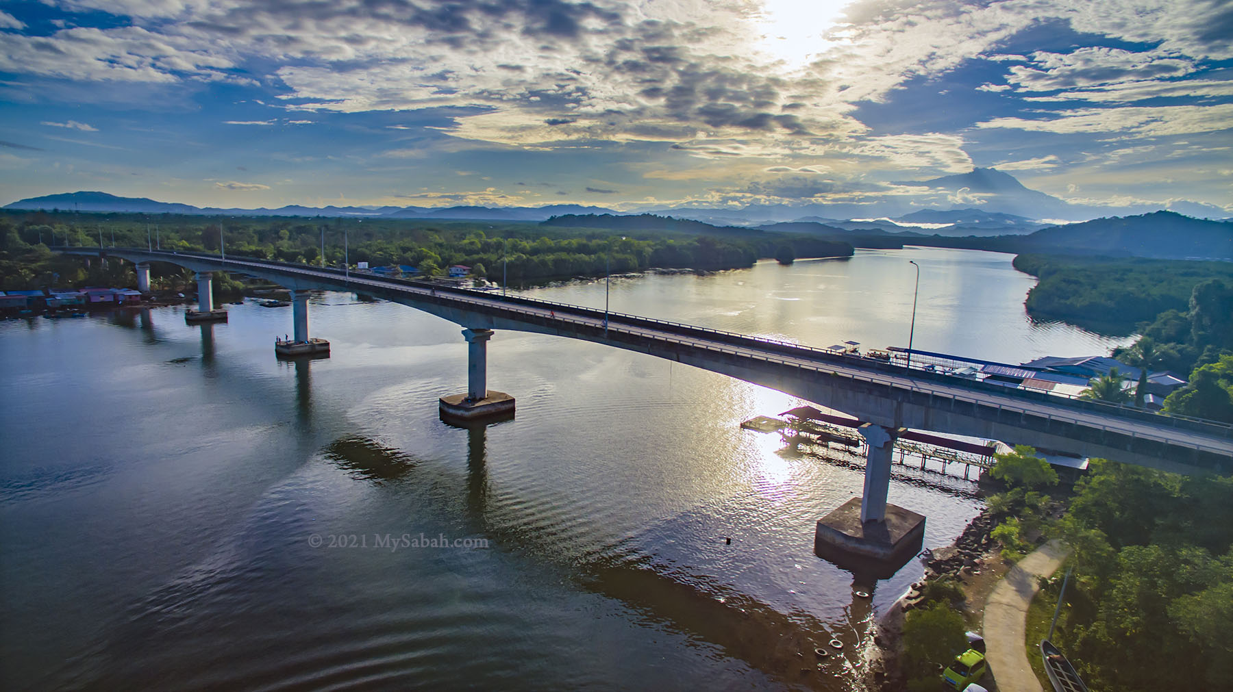
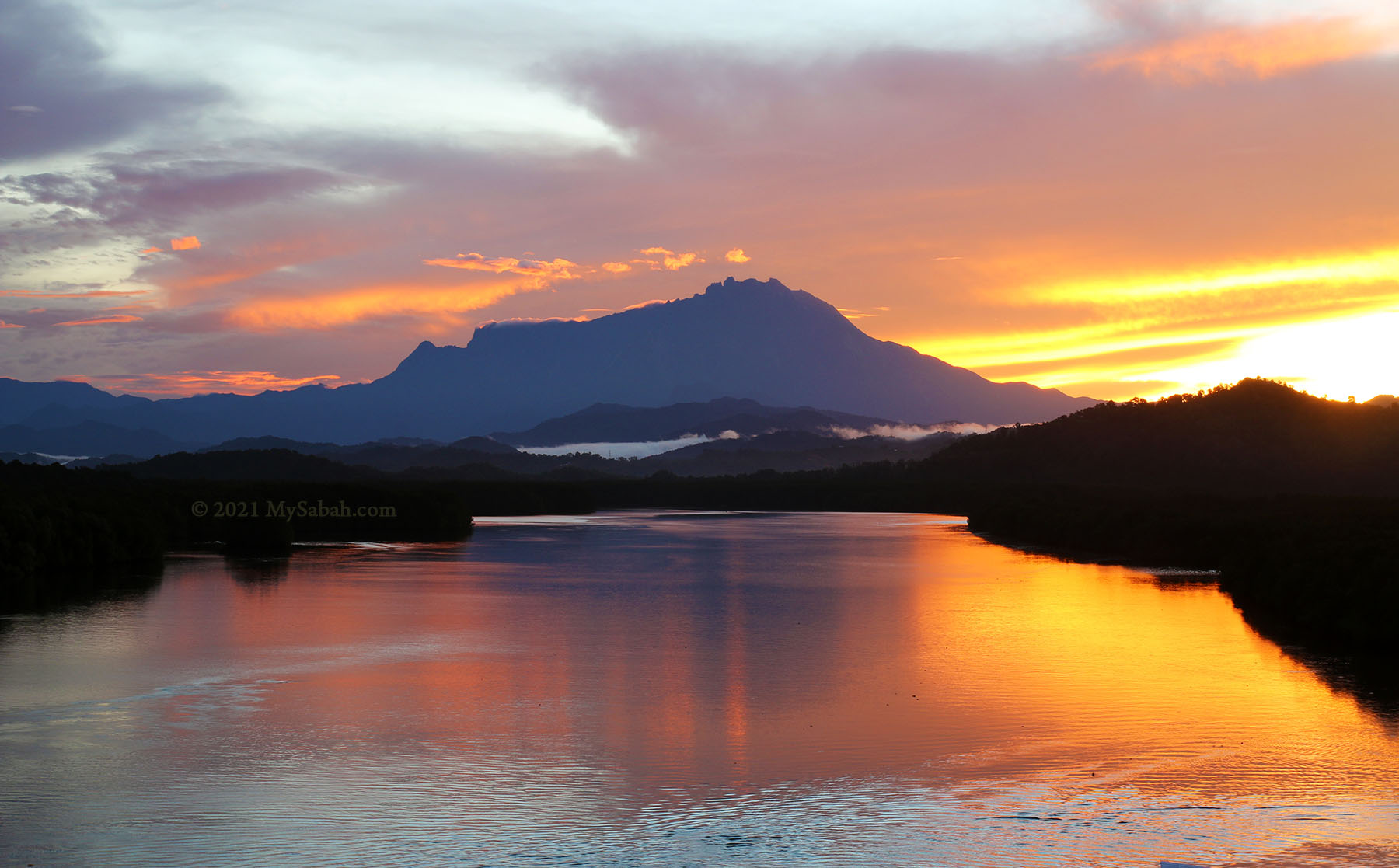
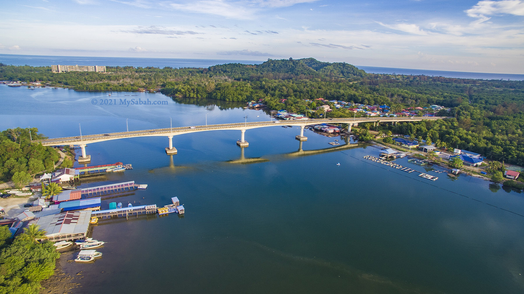
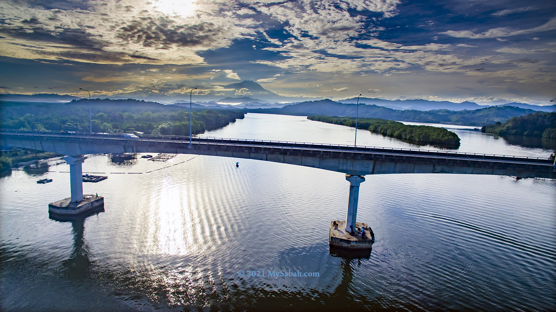
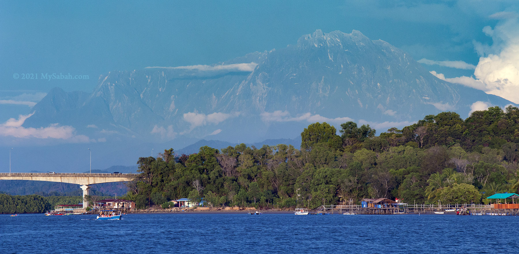
In year 2000, Mengkabong River Bridge (or Jambatan Gayang) is constructed to connect both sides of the Mengkabong River in Tuaran. Probably a bonus by accident, this longest bridge of Sabah also connects us to the perfect sunrise view of Mount Kinabalu, the highest mountain of Malaysia. When motorists cross this bridge, they would have a 330+ Metres (1,080 ft) of enjoyable ride because of the beautiful scenery.
Mengkabong River Bridge is a popular photography spot for Sabah sunrise
Best Sunrise View of Mount Kinabalu
Mengkabong River Bridge is a landmark and attraction well-known among Sabahans, who have seen its amazing sunrise photos many times in photography contest, tourism calendar, social media, etc. The high vantage point of Mengkabong River Bridge allows photographers to fit Mount Kinabalu, sunrise, rolling hills, mangrove forest and river into one frame.
Breathtaking sunrise over Mount Kinabalu at Mengkabong River Bridge
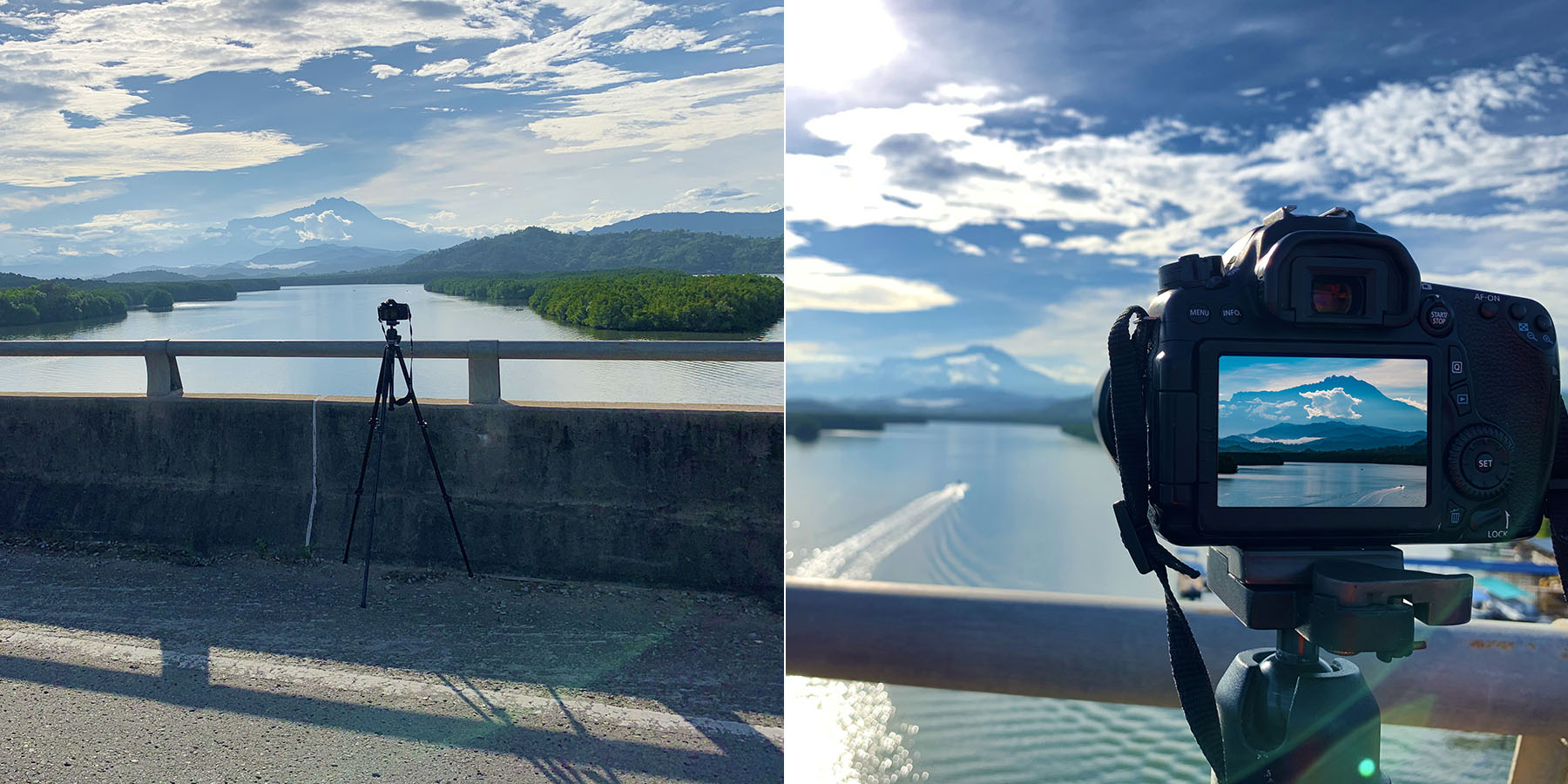
In most days you have a good chance of seeing Mount Kinabalu in the morning. Just standby on the bridge by 5:30am or earlier, before sunrise starts between 5:59am and 6:33am. The sun rises from different spots in different time of the year, creating more variation of sunrise view. I did a Facebook Live Stream there for fun too.
My camera and tripod on the bridgeAnother sunrise shot of Mount Kinabalu at Mengkabong
Fishing and Mangrove
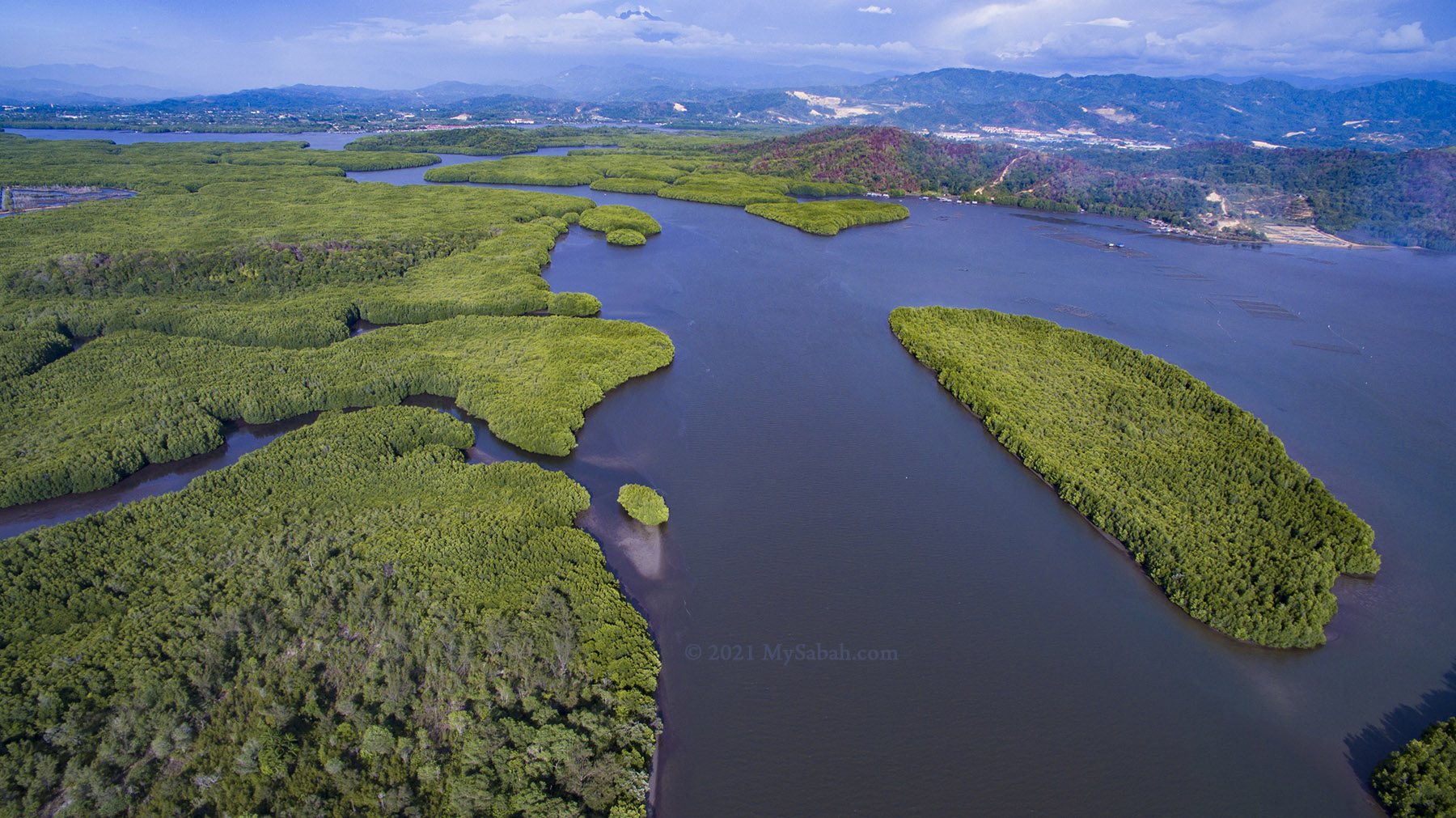
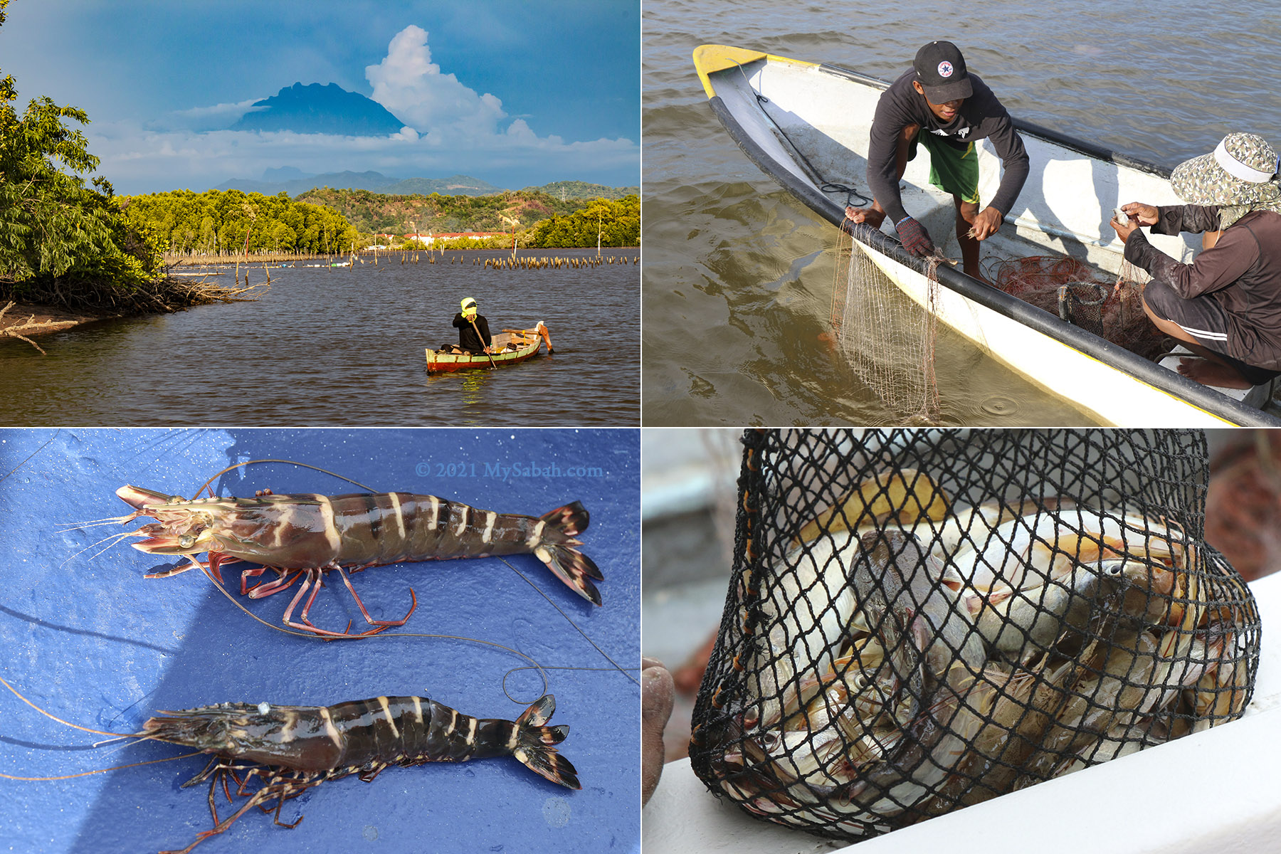
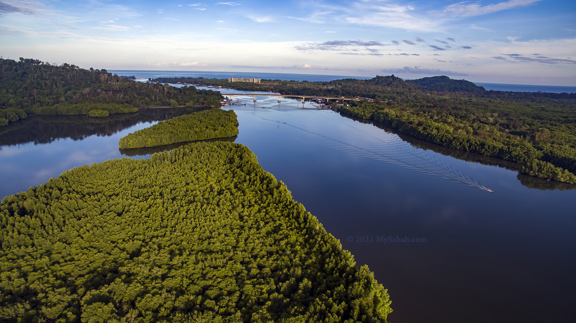
Mengkabong River is an estuarine fish habitats where fresh water from river mixes with the saltwater from the South China Sea only 2 Kilometres away. The lush mangrove forest and brackish water of this river provide important feeding, spawning and nursery sites for some palatable marine fishes. Crabs and prawns grow bigger in such environment too.
Mengkabong River is where saltwater and freshwater meet. Crabs and prawns grow well in such brackish water.
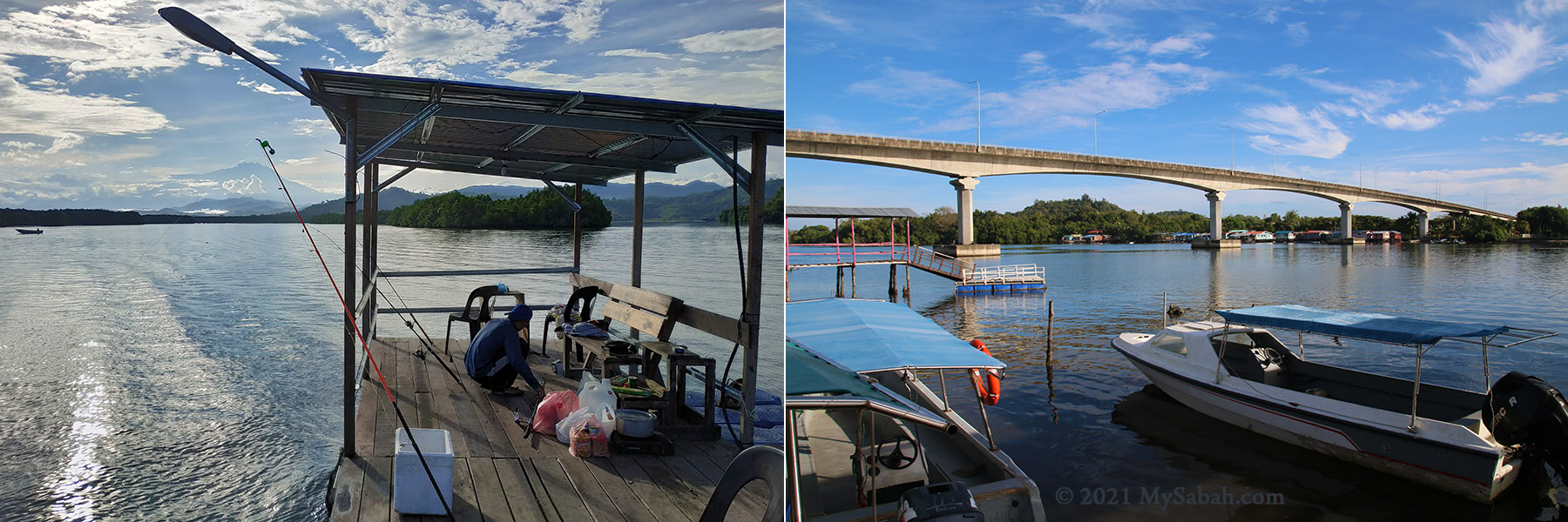
During high tide, sea fishes follow the current to forage in Mengkabong River. Therefore, the bridge becomes a hot area to catch high-valued marine fishes such as barracuda, snapper, grouper, sea brass (selunsung / siakap), trevallies and Jack fish. Local anglers love to erect a few fishing rods at the jetties under the bridge.
Mengkabong River Bridge is over 300 Metres long. Note the jetties and fishing platforms at lower left and the floating fish farm at the right.
Before sunrise, the fishermen from nearby water villages has started their day fishing in Mengkabong River. You can bargain with them and buy their fresh caught for a good price on the spot.
Mengkabong River is a famous fishing spot. You can pay a small fee to use the sheltered fishing platform at the jetty.
Do take some moment to appreciate the mangrove forest in the river there. The net fisheries contribution from 1 ha of mangrove forest amounted to US$846 year (RM3,500 per year). According to a study by Omar et al, in 2017, Sabah had about 378,195 hectares of mangroves which covered about 60 per cent of total mangrove areas in Malaysia (and 7.6 percent of the global mangroves)!
You can buy fresh seafood from the fishermen on the spot in Mengkabong River. The tiger prawn is sold for RM15 each.
Firefly and proboscis monkey, the residents of mangrove wetlands in Borneo, also attract thousands of tourists and generate a lot of income for Sabah every year. Mangrove forest are really our money trees.
Note: There might be crocodile around there, so do not wander mindlessly on the river bank or swim in the river.
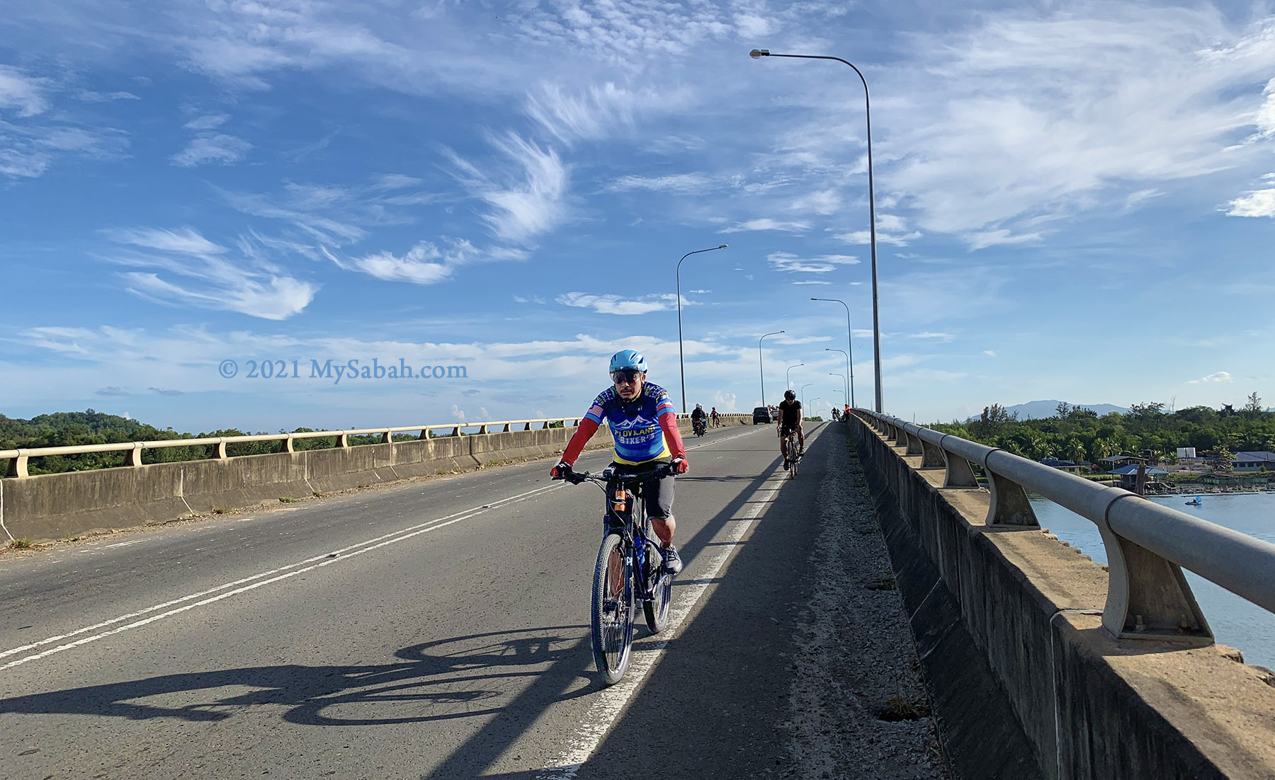
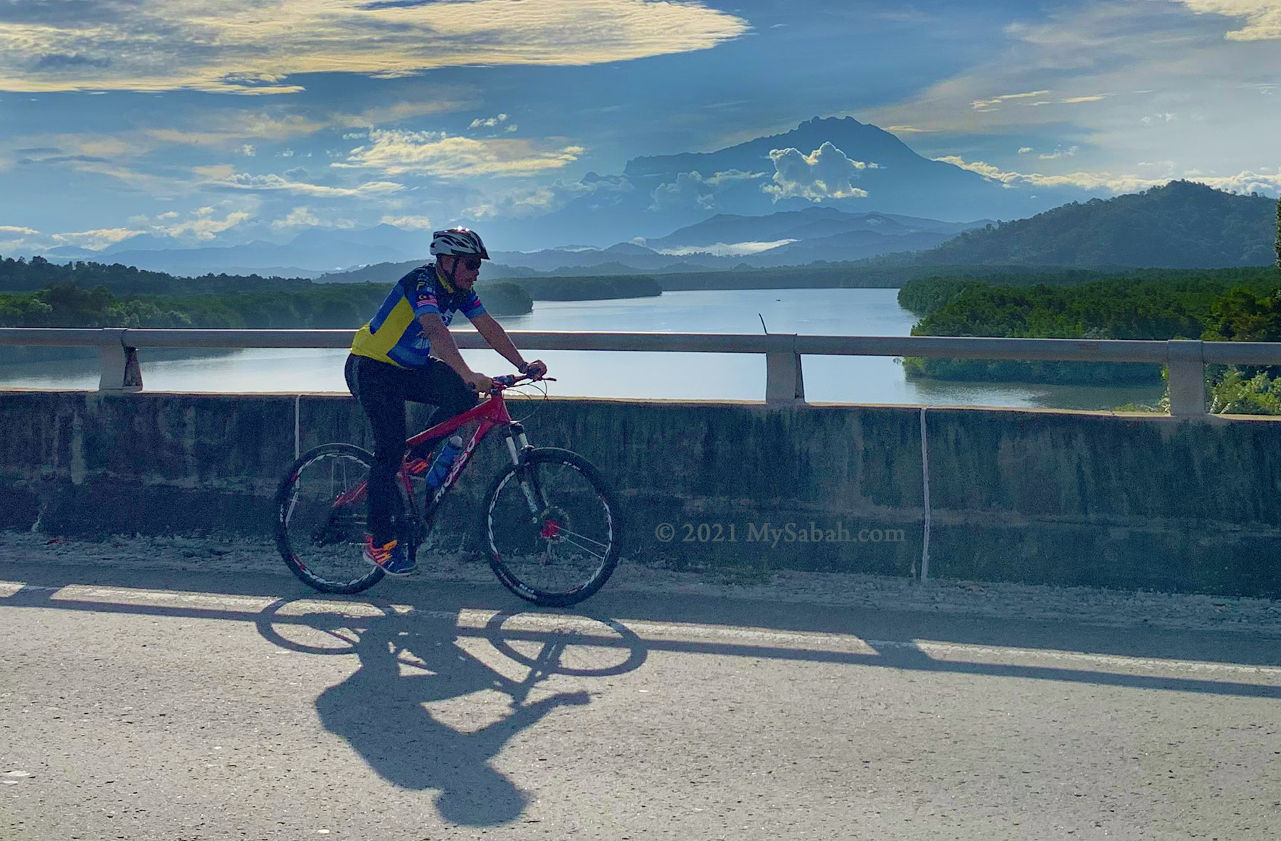
Cycling
Cycling is a popular sport of Sabah now, thanks to our scenic countryside. Mengkabong River Bridge is one of the favourite routes of cyclists, without doubt, is due to the spectacular sunrise.
Mengkabong River Bridge is a busy cycling route in the morning
Hundred of cyclists cross this bridge every morning. They would get off their bicycle in the middle of the bridge and selfie with Mount Kinabalu, to show the world how beautiful their lives are.
You have a good chance of seeing Mount Kinabalu from the bridge if the weather is goodThe view of Mount Kinabalu is the highlight for cyclists here
Sunset Tour
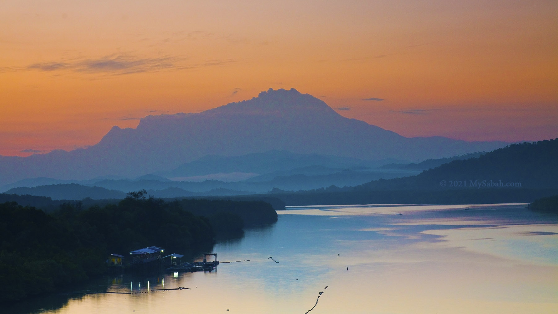
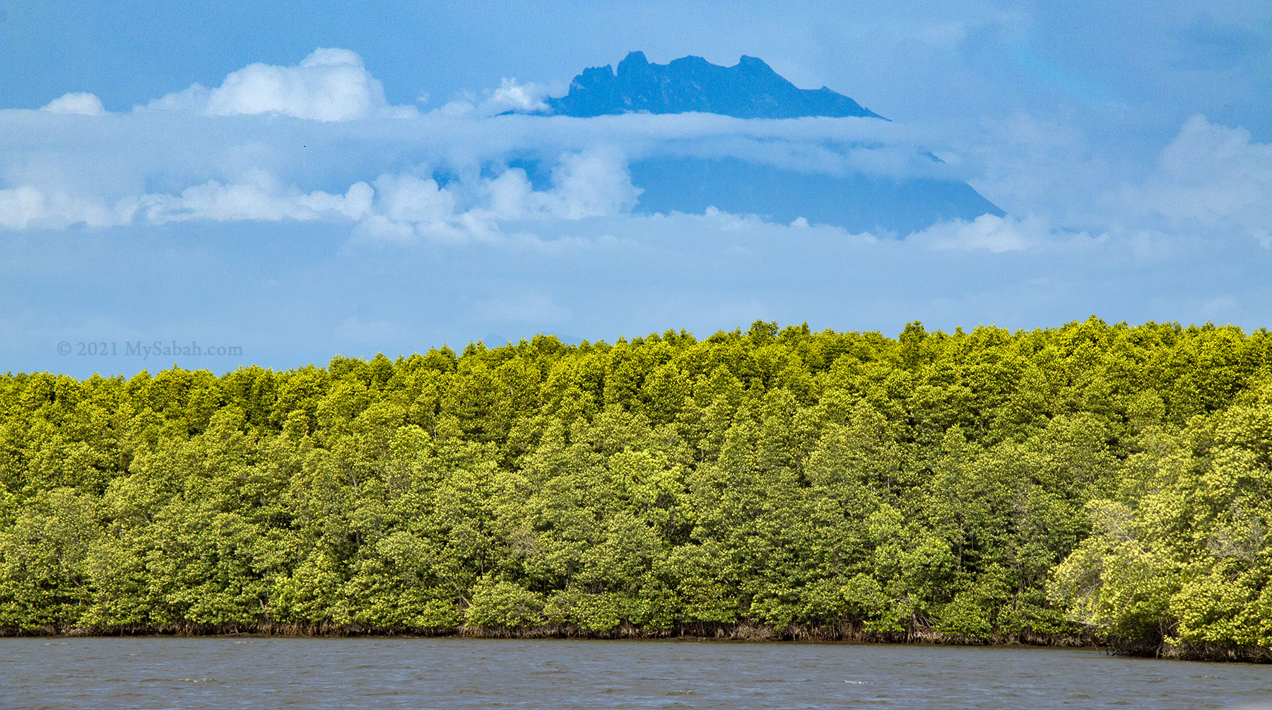
If the sunlight is strong, you could have a nice sunset view of Mengkabong River after 6pm, with the sky of Mount Kinabalu being illuminated by pinkish or reddish color of sunset from opposite side, a phenomenon called alpenglow. The colors are less intense but a preference for those who are not early bird and always miss the sunrise.
Large area of mangrove trees in Mengkabong River
Personally I would recommend you to join the sunset tour below that can send you to Dalit Beach at river mouth of Mengkabong River for a magnificient sunset view. (This is not a sponsored post. I don’t get paid to promote this.) This tour is managed by Kinabalu Heritage Tours, a licensed travel agent owned by my friend.
Tour Package: Mengkabong Fireflies & Sunset River Cruise with BBQ Seafood Dinner
Mount Kinabalu and the mangrove forest of Mengkabong
Tour Info & Activities
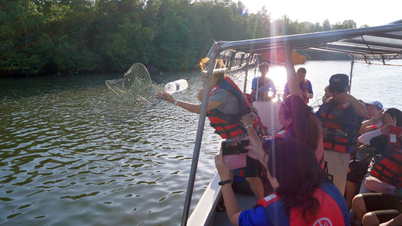
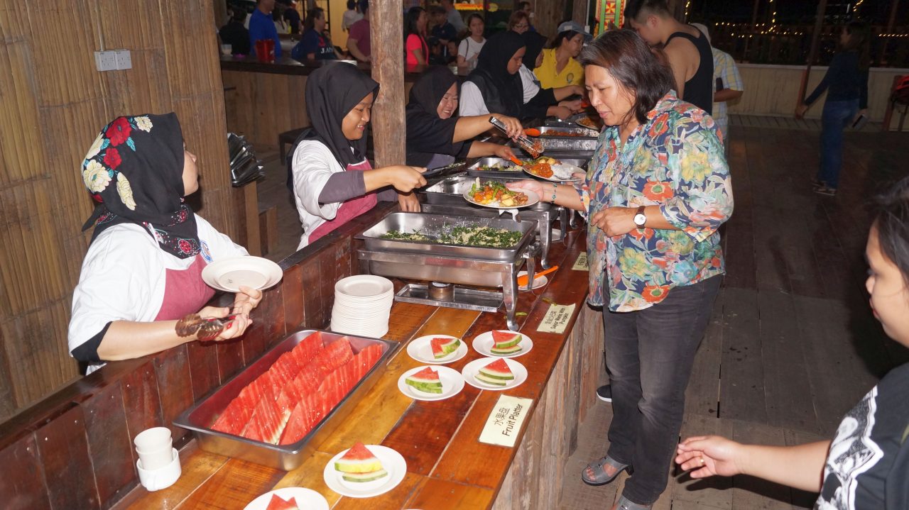
Mengkabong Village is part of the Tuaran district and home of the Bajau Sea Gypsies Malay Fishing Village. Experience the memorable and educational river tour about the importance of Mangrove forest with beautiful natural scenery along the river where water streams peacefully and see sea real-life one of our famous indigenous tribe Bajau fisherman lifestyle who still live in water village (i.e. house build on stilts and connected by narrow wooden planks) formerly known as the Sea Gypsies. Experience our local ways of crab catching activities during the cruise and visit the local Oyster and Fish Farm before heading to the river mouth to catch the spectacular view of sunset on the white sandy beach. After the tour, enjoy our BBQ SEAFOOD Dinner before returning to your respective home.
River cruise by boat
Crab catching
Dinner
Visit fish farm
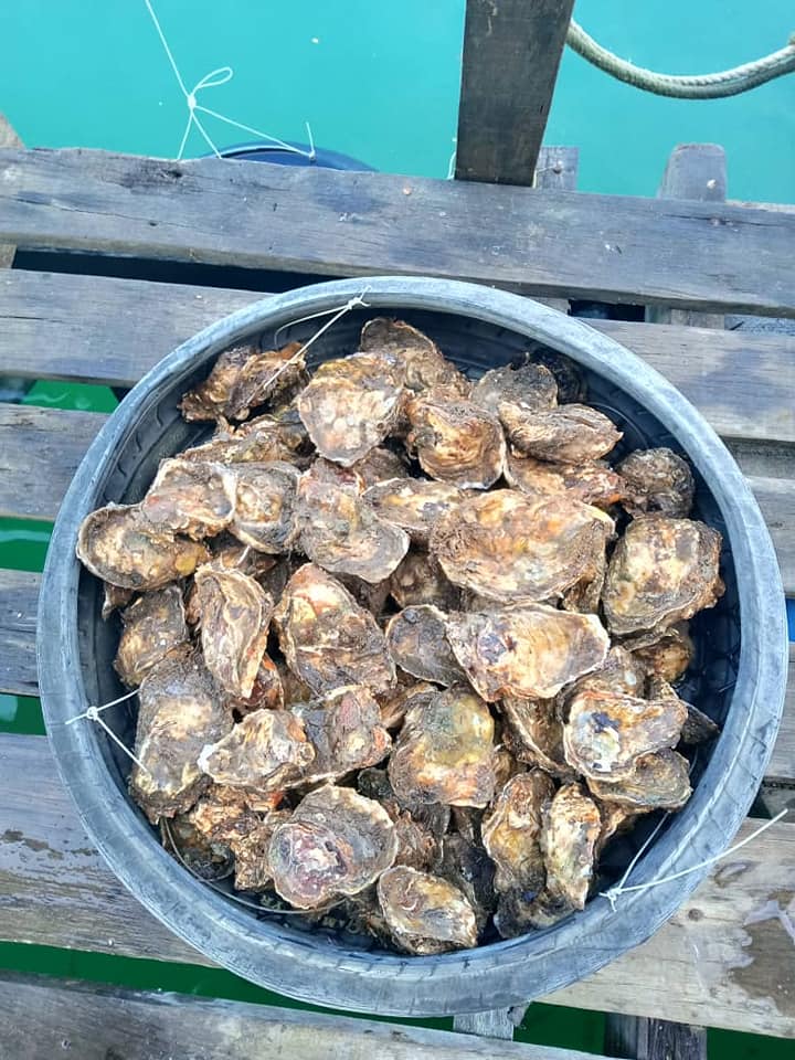
Oyster
Photos of the tour activities (by Kinabalu Heritage Tours)
Tour Fare Inclusive: Land Transport, River Cruise, Fun Fishing using hand lines, Crab Catching, High Tea, Dinner and English Speaking licensed tourist guide
Promotion Rate!!! RM50 per person (Minimum 4 people). Rate is valid until 31 Dec 2021. You can book now travel later.
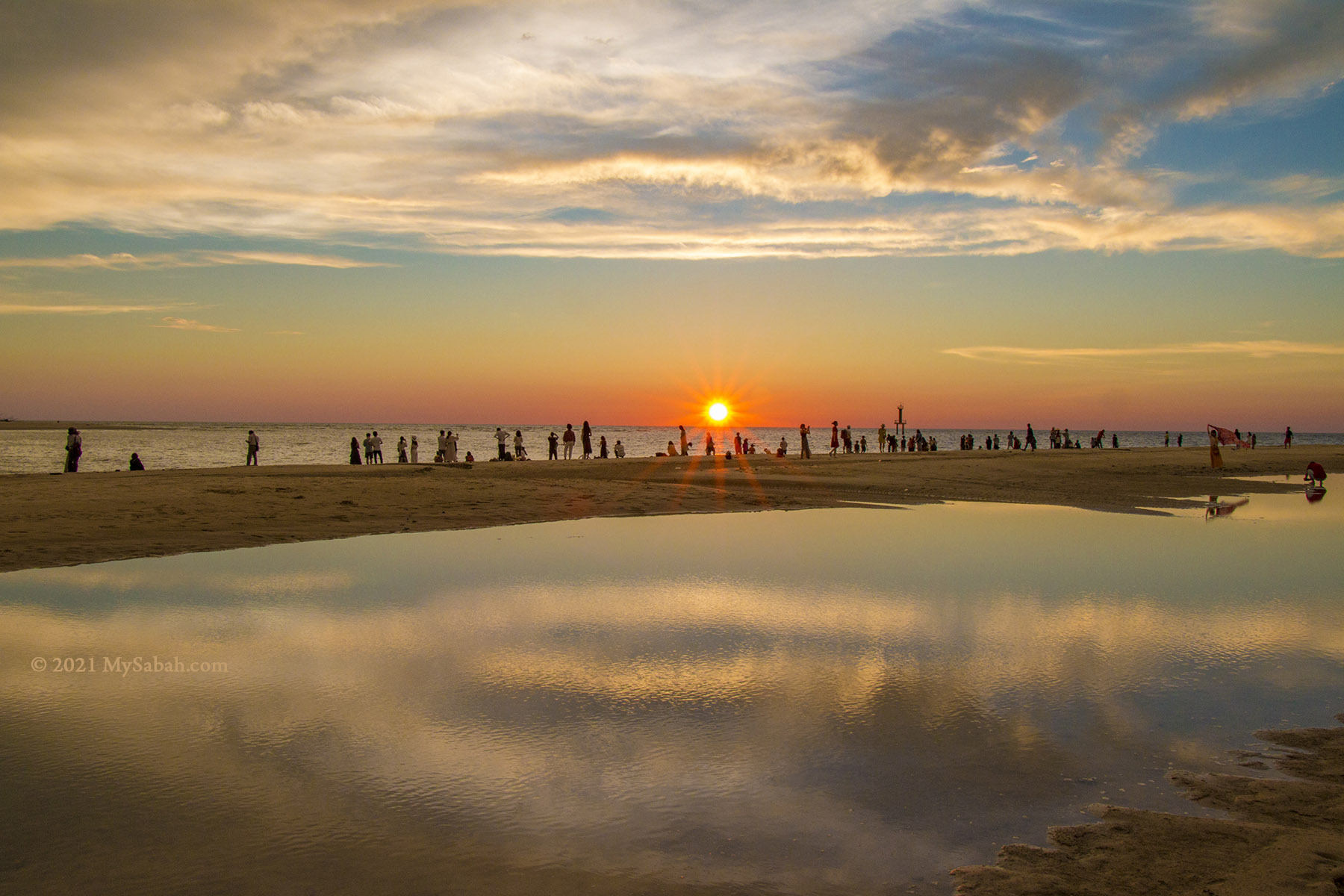
Tourists watching sunset at Dalit Beach, where Mengkabong River meets the sea
The tour is on deep discount now. I’ve taken the tour before. It’s fun and I even saw “Blue Tears” (Bioluminescent Sea) in the river. The sea water glowed when it’s disturbed by a wave breaking or a splash in the water by our boat at night.
The following is their contact for booking tour: Hotline:+60 13-6068333 (Whatsapp available) Company: Kinabalu Heritage Tours & Car Rental Sdn. Bhd. KKKP/PLN (Tour License No.): 5189 (683895-A) Address: Lot E–2-7, Block E, 2nd Floor, Tanjung Aru Plaza, Jalan Mat Salleh, 88100 Kota Kinabalu, Sabah, Malaysia. Phone:+60 88–318311 E-mail:info@sabahborneotours.com Facebook:KinabaluHeritageTours
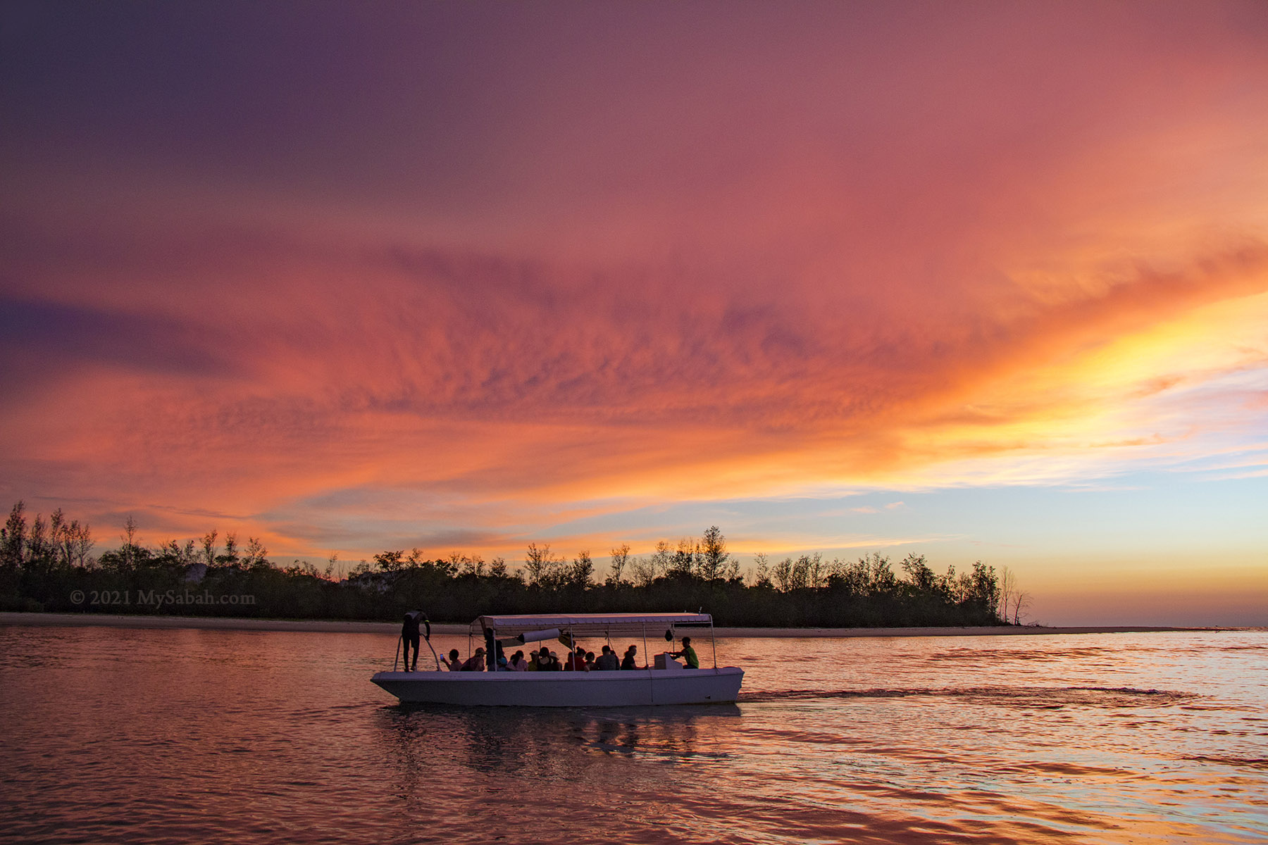
Fiery sunset at the river mouth of Mengkabong River
How to get there?
Mengkabong River Bridge is about 29 Kilometres away from Kota Kinabalu City (KK) and highly accessible by highway (about 35 minutes by car). The bridge is never closed, so you can visit anytime, and you don’t need a tour company to bring you there. Just depart from KK at 5am, set your destination as “Mengkabong River Bridge” in Waze, Google Map or other navigation apps.
View of Mount Kinabalu from Dalit Beach, at the end of Mengkabong River
Once you arrive, park your car at roadside before or after the bridge, and walk up to this bridge. There are lampposts on the bridge to lit the way. The 5-feet-wide pedestrian lane on the bridge can keep you safe from busy traffic, but always keep an eye on incoming bicycles that use the same space as cycling lane.
After sunrise, you can drop by Tuaran town nearby to have the famous Tuaran Fried Noodle as breakfast. Please note the highway from Tuaran to KK is quite congested when people rush to work in the morning of weekdays. It’s also advisable to check weather forecast of Tuaran in advance, so you won’t waste your time and disappointed by the bad weather. Toilet is available in the building behind the jetties.
To live happily, we need food for our body, love for our soul, and money for our security. However, one ingredient is always not listed in our source of happiness, though it’s a desire rooted in human genes for 7 million years. In 1984, Edward O. Wilson coined the term Biophilia, which suggests that humans possess an innate tendency to seek connections with nature and other life forms (not Wifi and phone!). Therefore, living without “Vitamin N(ature)” is unhealthy to our mind and body. That may explain why we feel happy after an outdoor activity in greenery. The worrying trend is the increasing “Nature deprivation” when 68% of the world population projected to live in urban areas by 2050.
My travel buddies driven by Biophilia
Camping at Kun-Kun Campsite
Now I know Biophilia makes me wanting to own a villa next to a river with beautiful scenery. I can’t afford to buy one, but Sabah has plenty of natural attractions open to public. Let’s check out Kun-Kun River, which scores high as the location of my dream villa.
A study conducted by psychologists found that creative problem solving can be drastically improved by both disconnecting from technology and reconnecting with nature.
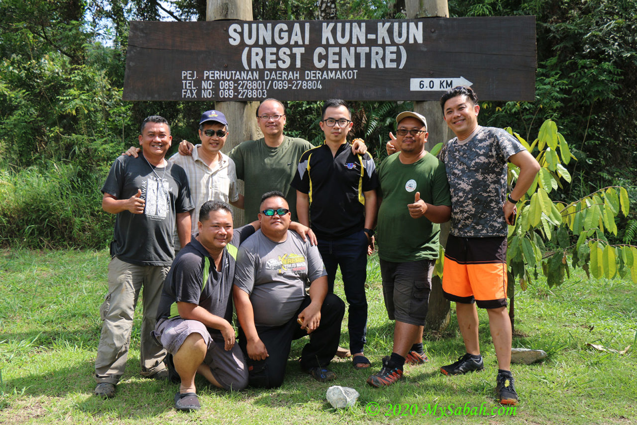
Just kidding. Kun-Kun River (Sungai Kun-Kun) is situated deep inside of Deramakot Forest (in Sandakan, Sabah, Malaysia) and has no electricity supply. I travelled there with group of friends by 4-wheel drive (and chased by an elephant) and camped at the river side for a 100% nature experience.
?Nothing makes you feel more childlike than being outdoors.? – Dr. Pamela Peeke, author of Fit to Live.
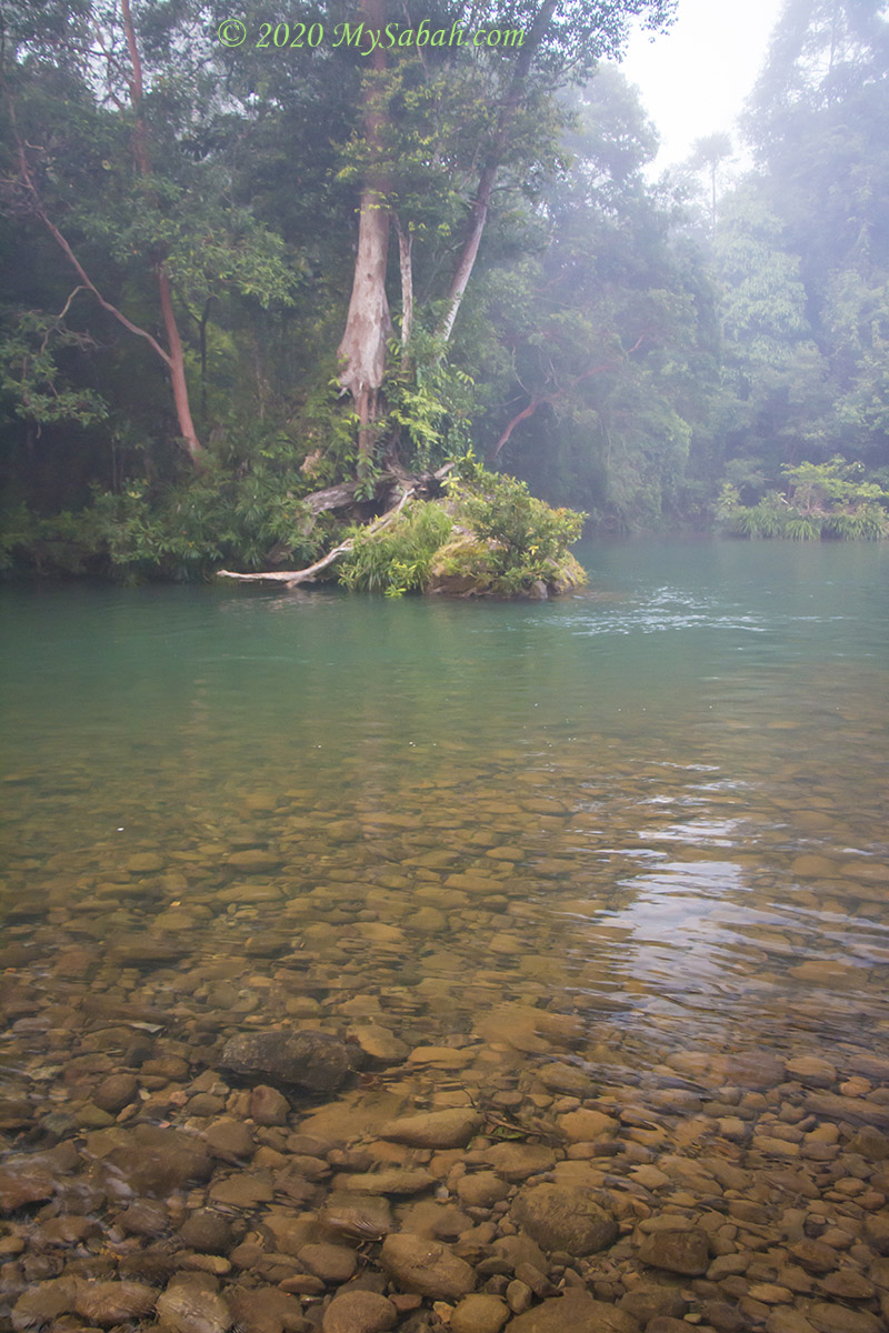
The jade-color river is so clean and pristine. Even though Deramakot Forest is a logged forest, they practice Reduced Impact Logging, which minimize the negative impact to the environment. For example, they only harvest the forest partially, give logged forest many years to regenerate and have reforestation projects in place.
Biophilia makes Sabahans “itchy” if we are away from nature for too long.
Otherwise, logging will pollute the river and the water turns murky, because the land loses its natural green carpet to filter soil and debris from washing into the river. After some time, the river will become shallower and flood would happen after heavy rain.
Spending more time in nature can greatly benefit our psychological and physical well-being.
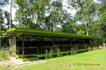
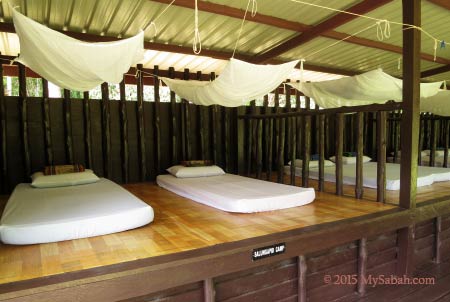
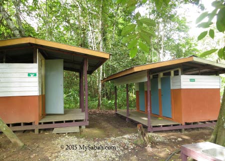
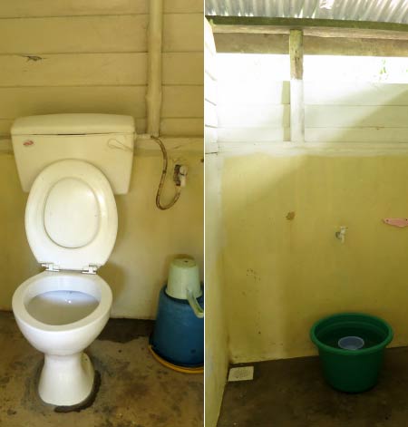
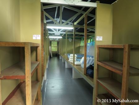
The amenities there are very basic. All we got is a camping grassland next to the river, with fire pit, toilet and benches. As this is a protected forest, the nearest village is over 30 Kilometres away, so secluded that some elephants left their dungs here.
Parking our 4-Wheel drive at Kun-Kun
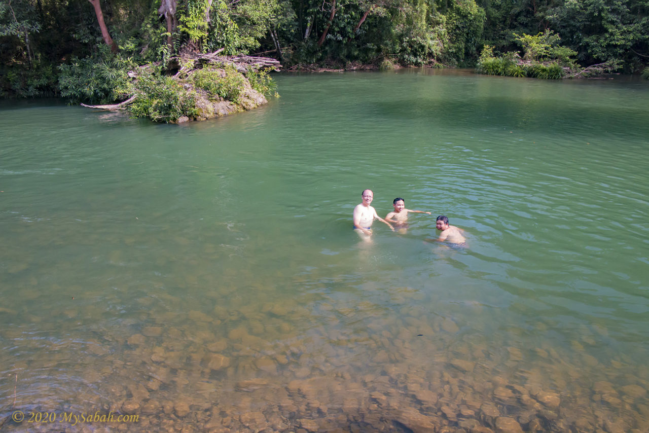
The day was really warm and the crystal clear water is so inviting. In no time everyone went swimming and frolicking like kids.
Natural Jacuzzi in Kun-Kun River
On another end of the camp is a shallow rapid, where we could sit in the water and enjoy the natural Jacuzzi.
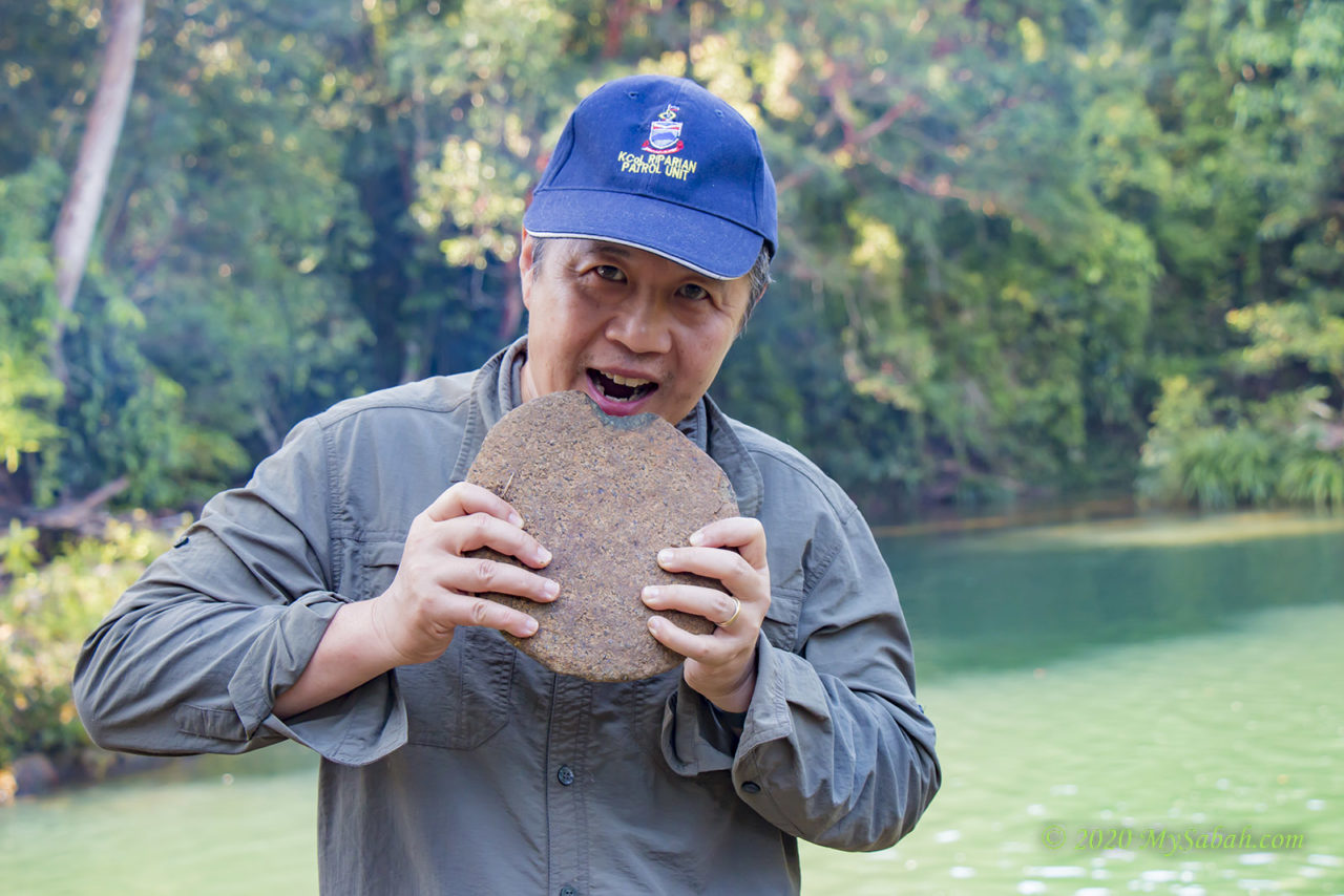
A funny flat rock that looks like a big biscuit. Found near the river.
After dinner, without Internet, everyone slept early under the stars and got fully recharged over the night. Disconnect with technology allows us to reconnect with nature to find inner peace and energy.
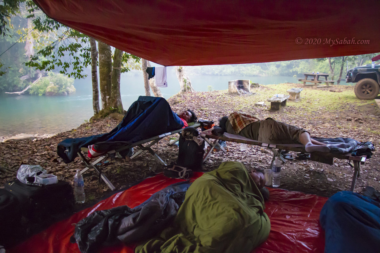
Everyone seems to sleep well Sleeping next to Kun-Kun River
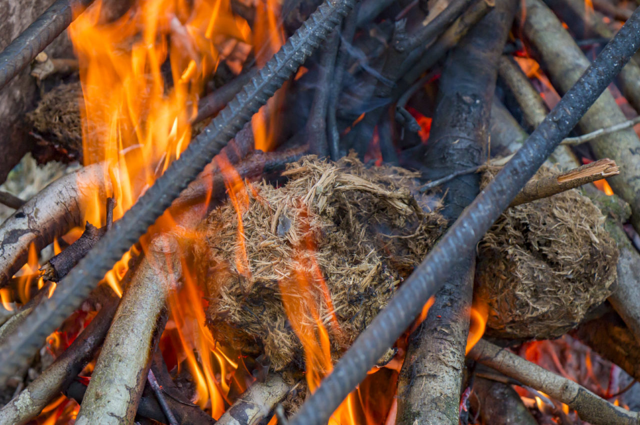
When we were packing to leave in next morning, we did a silly thing out of curiosity. We burnt some elephant dungs to see if it can work as a fuel like cow dung, and it does. One of our guys was freak out and almost screamed out hey dude what the heck are you doing. Locals believe this would attract elephant. The elusive Bornean pygmy elephant is not famous to be friendly. Anyway, no elephant showed up.
Elephant dung burns quite well in fire
When I’m back to civilization with 4G, my phone kept vibrating and tons of messages came in. Looking at the “999+ Unread” WhatsApp messages, guess what, I ignored them all, except a few from someone close. Our world is just full of meaningless words and it’s safe to disregard most of them.
You may wonder why our DNA programs us to connect to nature. Dr Qing Li, a Japanese Forest Medicine expert and author of the book The Art and Science of Forest Bathing, has the answer. Japanese has been practicing an activity called forest bathing, or shinrin-yoku. Shinrin in Japanese means “forest”, and yoku means “bath”. Forest Bathing can lower our blood pressure, strengthen our immune system, prevent cancer and depression.
Forest Bathing unlocks the healing power of the forest.
Then how to do forest bathing? Bury ourselves under the leaves and wood, or take a shower in the jungle? No. It’s not even an exercise. It is simply being in nature, use our five senses (i.e. sight, hearing, taste, smell and touch) to feel and connect with the nature.
Kun-Kun is an ideal place for forest bathing
Just spend 30 to 40 minutes to explore around forest or nature park casually, aimlessly and slowly. Open all your senses. Look, listen, sniff, touch, and taste the surrounding. Relax your minds and let nature enter through your ears, eyes, nose, mouth, hands and feet, for example, listen to cicada singing, look at flowing water, smell the flowers, lay down to breathe in fresh air, dip your toes in a stream, looking at the swaying trees.
Forest Bathing can reduce the stress hormone cortisol and increase your immune defense system.
Do inhale more fresh air of forest, which contains Phytoncide, an aromatic compounds emitted by plants & trees that can boost your natural killer immune cells to reduce cancer risk.
Phytoncides released by plant can reduce cancer risk
To make the experience more powerful, you can do more things that connect to your happy memory or childhood. For me, it’s listening to rustling leaves, because this was what I liked to do outdoor when I was a kid.
Enjoy the moment without having our eyes glued to the phone
In Japan, they even has the certification program to register a “Forest Therapy Base” and over 62 sites have been registered across Japan. Since over half of Sabah is forest, a qualified Forest Therapy Base is probably just a stone’s throw away from your home.
“Firefly was so common and abundant during my childhood,” my mom said, “I even collected them into a glass jar and made a ‘firefly lamp’.” Unfortunately, I don’t grow up with firefly. Most city people nowadays only have imagination, rather than vivid memory, of a flickering firefly. So where are our fireflies?! Well, they still exist today, but you have to travel far and pay to see them (in most case).
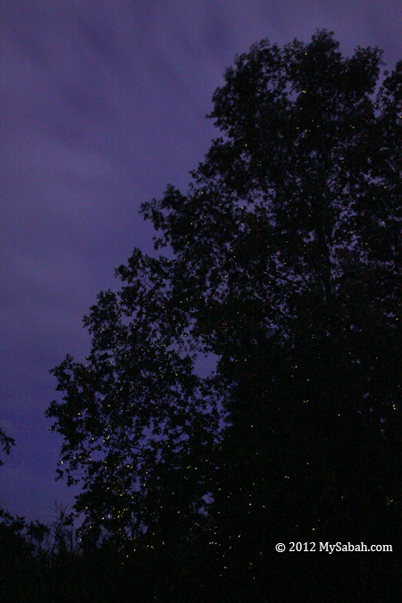
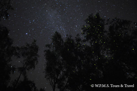
Pic: a tree full with twinkling fireflies in Abai
Firefly Tourism
Firefly watching has become a big business in Malaysia as well as Sabah. For example, firefly generated a total of RM7.3 million (USD2.4 million) income for Kuala Selangor in year 2000, from the tour, employment, F&B, transportation, etc. In average, each firefly there carries a RM2,000 price tag. In Sabah, Klias wetland is the hot spot for firefly watching. Just do a simple math, 100 tourist/day x RM180/tour x 365 days, and you will get the figure RM6.57 million/year!
Pic: tourists looking at the fireflies. Note the dotted firefly trails.
Congregating Fireflies
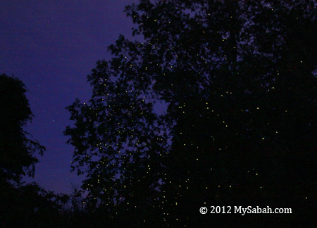
There are over 2,000 firefly species in the world. But what impresses tourists the most is Congregating Firefly, which is mainly Pteroptyx genus (Family: Lampyridae). Fireflies gather and flash on a display tree in mangrove forest, by a number of hundreds, even thousands, to create a phenomena like Summer Christmas Tree, one of the most beautiful natural wonders of Sabah.
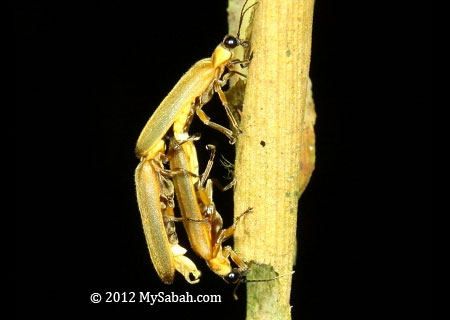
Pic: firefly specimen
8 species of Pteroptyx are recorded in Malaysia, and 5 of them are found in Sabah, namely, P. tener, P. gelasina, P. similis, P. malaccae and P. valida. I won’t talk much about the Roving Firefly, which is solitary.
Why Firefly Glow?
Actually firefly flashes (not glow). Flashing, in different pulse and pattern, allows fireflies to communicate and attract the right species to mate. The presence of artificial light such as street light will disturb their communication. That’s why firefly lives far away from city, to avoid the light pollution. Some tour guides know such behaviour and flash their torchlight purposely to attract fireflies coming to their boats (to impress their customers!). Such practice is wrong and shall not be encouraged.
According to an article “Firefly Synchrony: A Behavioral Strategy to Minimize Visual Clutter” published in the prestigious journal Science in 2010, researchers Moiseff and Copeland found that when fireflies light up at random times, the likelihood of a female responding to a male is only 3 percent. But when the fireflies light up together, the likelihood of females responding is 82 percent.
Where is our Firefly?
You can find Congregating Firefly Zones (CFZ) in the following locations of Sabah. The best time to see firefly tree is between 7pm and 10pm in moonless night. The number and view during rainy or full moon night are not so fascinating.
Best spot: Klias, Beaufort. – P. tener
Kampung Sabandar, Tuaran. – P. similis & P. gelasina
Sungai Beringis (Beringis River), Kinarut. – P. similis
Kinabatangan Floodplain, Sandakan. – P. tener
Danau Pitas, an ox-bow lake in Kampung Abai. – P. tener
Others: Garama River, Binsuluk River, Weston.
Source: Mahadimenakbar bin Mohamed Dawood, Fiffy Hanisdah binti Saikim and Elia Godoong from Institute for Tropical Biology and Conservation, Universiti Malaysia Sabah.
Pic: Kinabatangan Floodplain
The firefly trees are usually located at both side of the river in mangrove. Fireflies seem to prefer to congregate on Sonneratia caseolaris (Berembang tree). You can read my other articles about fireflies in Sabah.
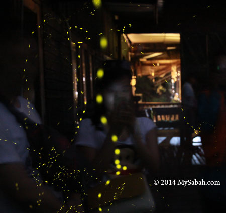
Pic: the common way to see firefly is by night river cruise
Interesting Facts of Firefly
Firefly is not a fly, it’s a beetle (group: Coleoptera).
The light of firefly is “Cold” light (2% heat and 98% light).
Adult firefly lives less than 1 month.
The firefly is a Bioluminescent Beetle, Bioluminescent means “direct production of light from a chemical reaction occurring within a living organism.”
Pic: firefly party after sunset
Love our Firefly
The declining of firefly population is primarily caused by the clearing of their wetland habitat for various development purposes such as housing, agriculture and aquaculture. According to the laws, the riparian must not be clear, and river bank is where firefly larva lives. Sadly, most orchard and oil palm plantation are oblivious about it, and their pesticides kill the babies of firefly. Furthermore, the increasing stray light from human settlement leaves firefly little space for survival. For example, the mangrove of Likas was used to have a lot of fireflies. After decades of forest clearing and encroachment, only a small colony of fireflies are left inside Kota Kinabalu Wetlands.
Pic: mangrove and river bank are habitat of firefly
Well, firefly watching was used to be FREE. After people destroy their habitat, firefly becomes rare and now we have to pay to see them. You see, eventually people will have to pay for their wrongdoing to the environment. Due to the destruction we did in the past, our children are no longer seeing this little elf everywhere. Instead of feeling sorry about no firefly to light up the childhood of our future generation, let’s start to protect what we have now. Be nice to nature and it’ll repay you.
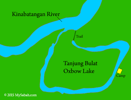
I bet you love the beautiful seas and rivers of Sabah. The flowing water invites you for a playtime. But when I say “lake”, you would feel different emotions, like calm, laid-back and peaceful. These are exactly how I describe the beauty of Tanjung Bulat, one of the largest oxbow lakes in Sabah. An oxbow lake was used to be part of a big river in U-shaped. As river changes course, a body of water is cut off naturally from the main river and forms a lake.
Pic: ready to depart
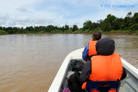
To go to Tanjung Bulat Oxbow Lake (see Location Map), you can take a 25-minute boat ride from Bukit Garam, which is a riverside village 75 Km from Sandakan City and accessible by road. For my tour, I took the boat from Balat Jetty of Deramakot Forest and the ride took about 2 hours.
Bukit Garam Village
Bukit Garam (literally means Salt Hill) is a small village at upstream of Kinabatangan River. We stopped there shortly to buy some stuffs before going to Tanjung Bulat. I saw power line but electricity wasn’t fully utilized. Almost every house has satellite TV, but every grocery stores have no light on, except refrigerators that keep the soda drink cold.
Pic: the most interesting house in Bukit Garam
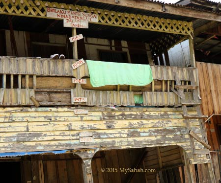
Bukit Garam is just next to Kinabatangan River (Sungai Kinabatangan), the longest river of Sabah, and it was flooded occasionally during heavy rain season. I even saw a house with water level markers of all major floods happened between 1963 and 2010.
Most of the land around Bukit Garam is clear for plantation, so very little forest cover is left. I noticed some tree replanting going on in a few sections of riparian to restore the forest along the river.
You can see from the diagram above that Tanjung Bulat Oxbow Lake has a small tributary that connects to Kinabatangan River. If the water level is high, our boat can send us straight to the camp. However, it’s dry season so we had to get off our boat, walked 450 Meters to the oxbow lake, then take another boat to the camp.
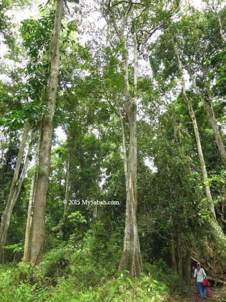
The walk takes about 20 minutes on a soil trail. Luckily the staffs of Tanjung Bulat Jungle Camp helped us to carry our heavy luggage. The trees near the lake is so dense and tall. It’s part of a forest reserve where logging, hunting and farming are off limit.
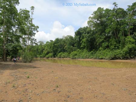
Tanjung Bulat Oxbow Lake
It’s an easy walk and we came to an open area at the edge of Tanjung Bulat oxbow lake. This is the second Oxbow Lake I visit after Uncle Tan Camp in Danau Girang but the first time I was being so close to the lake. During rainy season, the Kinabatangan River will flood this lake and brings in fresh water.
Pic: silungapid tree next to the lake
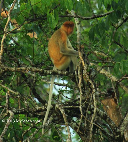
I admire the beautiful tree trunk of silungapid tree, which is abundant around the lake. This tree can survive the flood in wetland and its fruit is an important food source for proboscis monkey, the endemic monkey of Borneo.
Pic: transit to another boat to jungle camp
When I was still busy enjoying the scenery, everyone was already waiting for me onboard.
You may check out the short video below to know why I like this place so much
For those of you who spent your childhood in outdoor, you would understand why lake holds such a special place in my memory. Every kids that time had a “secret” corner where they loved to hang around in group, and lake is the coolest place because we could swim and fish in it. Unfortunately, today most of my old-day nature playground has been cleared to make way for estate and agriculture.
That’s why I was so excited to see that Tanjung Bulat Oxbow Lake is kept in near pristine condition. It’s like a hidden lake in a dense jungle and it’s huge. The lake surface is about 95 hectares, with depth up to 30 Meters.
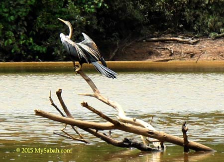
We saw 4 or 5 Oriental Darters (Anhinga melanogaster) on the way to jungle camp. Also known as Snake Bird, Oriental Darter spears fishes with its long and sharp beak. It’s a threatened bird species, but you can find a good number of them at Tanjung Bulat. Great egret is also common here.
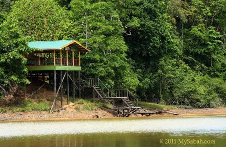
Tanjung Bulat Jungle Camp
Here is a brief but inspiring story about the camp. Tanjung Bulat Oxbow Lake is well-preserved as a marvelous destination because of one fisherman, Mr. Malik, who started the jungle camp in year 2010. Malik is born 40 years ago in a fisherman family of Orang Sungai community. He was used to swim (that time had no crocodile) and fish in this lake since he was six. During that time, fishes were plentiful and wild elephants were everywhere.
Pic: Tanjung Bulat Oxbox Lake
However, over the three decades, the well-being of the lake was gradually compromised when people used destructive fishing methods such as poisoning, and the forest was encroached for plantation. The situation became so severe that the lake got no fish for a year, so Malik decided to protect his beloved lake from further deterioration. We both share the similar childhood so I fully understand his sentiment.
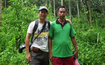
Pic: photo of me and Mr. Malik (right). He looks serious but he is a friendly guy who is passionate about his work.
The lake and its adjacent land is a 450-hectare area under multi-layer land title of State Government, oil palm company and villagers, so Malik had to work with the authorities and different parties to conserve the oxbow lake. Some villagers were so unhappy initially.
With the support of native chief, Tanjung Bulat was included as part of the 1 Village 1 Product Rural Campaign and helped the village won the national and international championship in Gerakan Desa Wawasan (Rural Vision Movement). And villagers saw the fishes coming back, so they turn from against to acceptance. Now the fish stock gets a 60% recovery.
Back to our tour. Within 10 minutes, Tanjung Bulat Jungle Camp was in sight. The wooden building with stilts in the photo above is the dining and activity hall. The camp is built on high ground so it is safe from flood even during wettest season.
Located in high point, the camp overlooks Tanjung Bulat oxbow lake. Every visitor is automatically drawn to this hall for this panoramic killer view. I would say Tanjung Bulat has one of the most spectacular lake view in Sabah. Without other man-made structure at the lake, it’s a 100% wilderness.
You can see half of the lake from the camp. At the left of photo above is an isolated (almost) forest surrounded by the lake. It’s mainly marshland with dense wetland trees, which is a little paradise for birds, reptiles and arboreal animals.
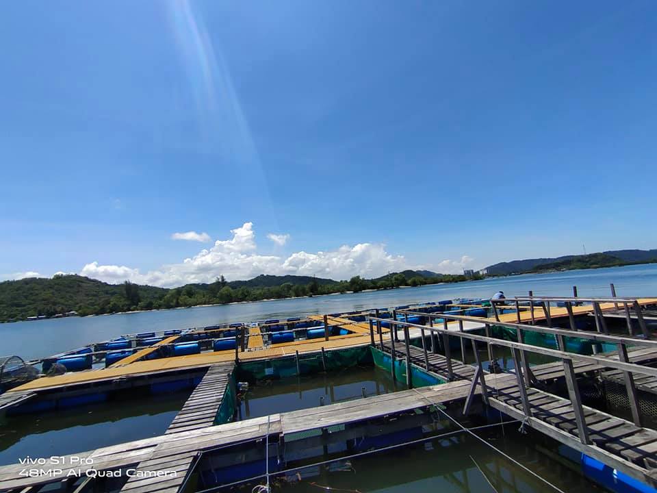
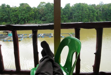
Pic: fish farm with black and red Tilapia (freshwater cichlid fish). Two Little Herons were fighting there for this prime fishing spot. The highly sought after seafood such as udang galah (giant river prawn) and Freshwater Gobi also found in this lake.
The weather was so good and we could see the reflection of cloud on the lake surface. I was completely immersed myself in this tranquil environment as if the clock had stopped ticking.
Pic: a 2-Meter monitor lizard that wanders near the camp. Monitor lizard always avoids human contact so it isn’t a threat (except infant).
There is also a 3-Meter crocodile living in the lake. It is wary of the human presence and keep a distance from our camp. It always patrols in the water, and its movement is so slow that it looks more like a floating log. We like this croc so much that we name it “Dicky”.
After we checked in, a tasty lunch buffet was already waiting for us, and it’s really nice to enjoy our meals next to a lake.
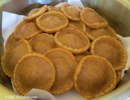
Pic: Panjaram Pancake, a famous local snack of Bajau people
We had fried noodle, chicken wings, tomato fish, local vegetables (fern) and a deep-fried pancake called panjaram (a.k.a. UFO Pancake).
We were supposed to have a river cruise in late afternoon to check out the crocodiles, proboscis monkey and other wildlife around the lake, but it was raining dog and cat. So I just grabbed a coffee, enjoyed the nice breeze and view. It was so relaxing that I fell asleep. During dusk, I saw Rhinocerous and Oriental Pied Hornbills, Brahminy Kites and Blue-eared Kingfisher. I also heard screeching of proboscis monkey in the forest across the lake. Tip: bring a binocular for more excitement.
Accommodation and Amenities
Though the accommodation of Tanjung Bulat Jungle Camp is basic, it is clean and comfortable. We got mobile phone network coverage. The signal is weak but we can call and text the outside world.
The camp can fit about 15 people at a time. Electricity by generator is available from 7am to 9pm. You can even ask them to on it until 11pm. But noisy generator is too near the camp so it’ll be off during bedtime.
Pic: our bed with mosquito net. It was warm during daytime but cooling at night. We all had a good night sleep.
Toilet and bathroom are only 15 Meters away. The water from the lake is crystal clear. Malik told us that he used stones, sand and cotton to filter the water, a simple but effective technique he learnt from a Japanese engineer. The water of the lake looks murky, but it is almost as clean as the tap water, because it’s from the upstream of Kinabatangan River.
The toilet and bathroom are clean and basic too (no funny smell). Hot shower is not available but you will love the freshness of having a cold shower in hot day. As there is no lighting, you better bring a flashlight so you can find your way to toilet in the dark.
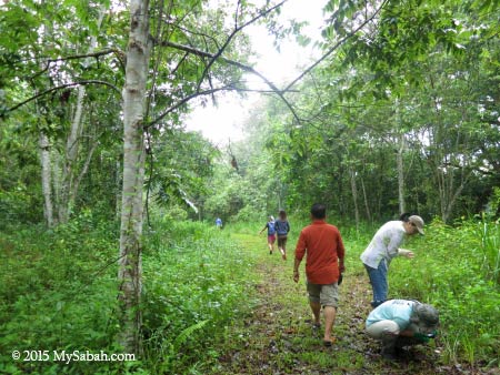
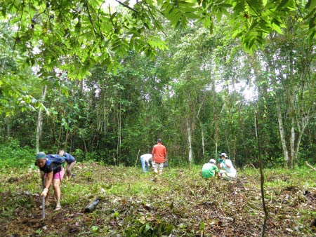
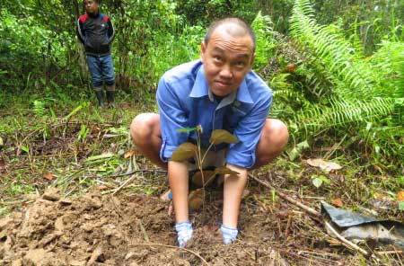
Tree Planting
Since the camp started 5 years ago, over 500 trees were planted to contribute to the Corridor of Life project. Basically it’s a long term conservation effort to restore the forest along the riparian of Kinabatangan River, to connect the fragmented forests, so the wildlife can use the forested river bank to move freely to other forest for food and mates.
The next morning we were brought to the tree re-planting area just behind the camp, to plant some trees before we left. Many trees have grown tall over years and some have bear fruits. This dense wood also becomes home for some birds such as Hooded Pitta. During fruiting season (especially in August), orangutan would be sighted here.
Actually the staffs had done the hard work for us. They cleared an area for the tree planting. All we needed to do is to dig two holes and planted two seedling. The common trees chosen for replanting are Pokok Bayur and Asam-Asam (wild mango), which provide nesting place and food for orangutan respectively.
As a city folk who seldom uses hoe, it’s no easier than I think. The soil is held firm by many tree roots. Just digging two small holes already made me sweated in the morning. Anyway, I’m glad that I’ve left some green footprints, a perfect way to end my journey here.
“The best time to plant a tree was 20 years ago. The second best time is now.”
To visit Oxbow Lake Tanjung Bulat Jungle Camp (or Danau Tanjung Bulat Jungle Camp), you can book the tour with Aseh Travel & Tours, a licensed travel agent which practices Responsible Tourism.
Proboscis Monkey is the superstar of Klias Wetland. Every evening Klias River is like a busy canal, when hundreds of tourists come to visit this peculiar monkey. One guest even said, “there were more tourists than monkey.”
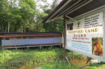
Therefore, the Best Time to see Proboscis Monkey is in the morning, when there are very few tourists around. The monkey is less stressful and you can get really close to them. That’s why I spent a night Firefly Eco Camp.
Pic: Firefly Eco Camp
Firefly Eco Camp is located next to Klias River. Staying there will allow you to see what other ordinary tourists miss – the starry night and misty morning over Klias River.
I checked in to the camp around 6pm. After the dinner, we started our night river cruise at 8pm to look for firefly Xmas trees and crocodile, when other tourists had left. Though we didn’t find any crocodile, we saw many “summer Xmas trees”, where hundreds of fireflies congregated and flashing in synchronized manner like heart-beating.
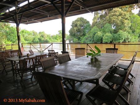
Hour later we returned to the activity hall next to the jetty, to enjoy a serene evening next to Klias River.
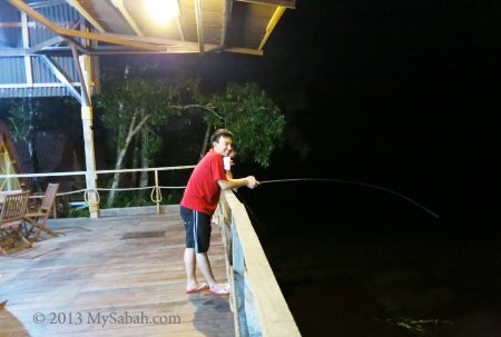
Night Fishing in Klias
Klias River is inside Peat Swamp Forest with brackish water, which looks murky all the time. The river seems lifeless, but you will know that you are wrong when you fish.
Klias River is connected to the sea. During high tide, fishes will follow the current entering the river for feeding. If you fish during that time, you will catch something in minutes.
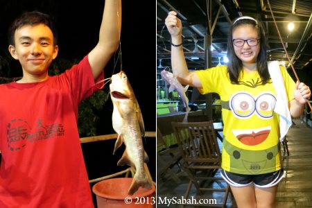
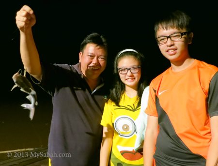
Pic: our fishing bait is hot dog LOL. But it works well!
Most of us are first-time anglers. We were so excited when it was almost effortless to catch big fish in a few minutes.
Pic: one caught to make one family happy
May be you want to watch our fishing video below:
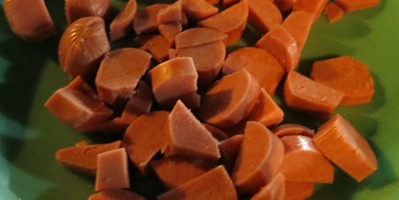
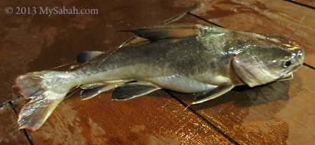
All the fishes we caught that evening was catfish (暗钉 in Chinese, means “Hidden Nail”). It is a very common fish, though edible, locals consider it a lower-grade (dirty) fish, due to the impression that it eats human dung fallen from riverside toilet. It has venomous thorns on its pelvic and dorsal fins, which can cause severe pain when poke into your skin. Be careful when you remove the fishing hook.
Actually we targeted for Giant Freshwater Prawn (Udang Galah) that night, so we released all the catfishes. It was fun anyway.
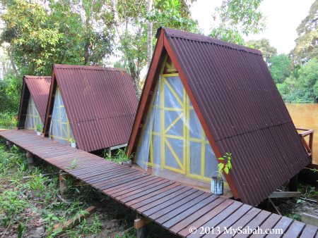
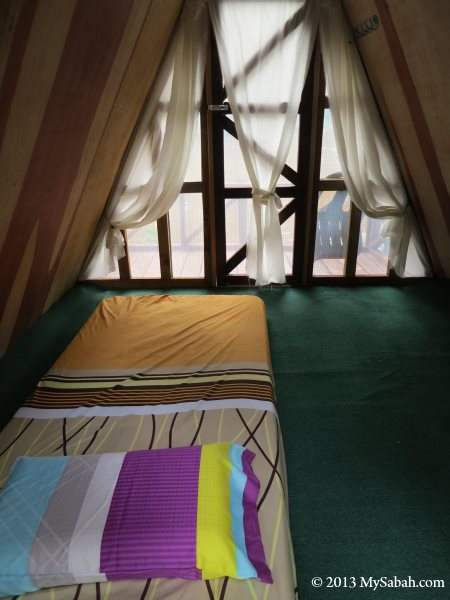
Pic: the hut where I slept
We had a couple of beer while fishing at river side. We talked until late night. I couldn’t wait to enter my small hut as it was so cool.
The hut may look small from outside, but it can fit two people comfortably. Though there are only bed, light and fan inside, to me it’s a “luxurious camp”. I slept really well throughout the night.
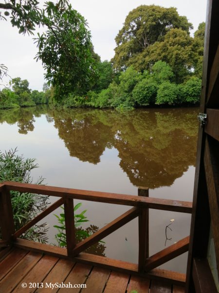
Morning River Cruise in Klias
The next day I waked up early, sat at the small balcony to enjoy the nice river view. It was quiet in the morning and I saw some movement in the canopy. The monkey had waked up earlier than I did.
After having some light breakfast, we were ready for a morning river cruise on Klias River.
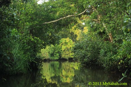
Pic: the misty swamp forest in the morning
Pic: the calm river of Klias with beautiful reflection on water
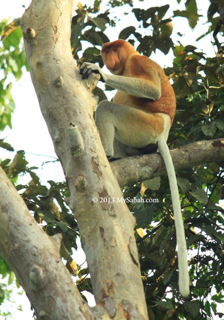
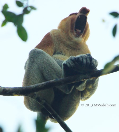
Very soon we spotted the first proboscis monkey. It’s a female with pointy nose.
Then we saw the male proboscis monkey with big nose. From their eyes, we could see that they were not quite concern about our presence, a big contrast to evening time when there were too many tourists and boats around. We were the only tourist boat on the river that morning.
So we could get really close to them for a good look. One of them was so relax and even yawned. This one was just on top of our heads. I was so worry that it would poo. Our boat found about 5 to 6 herds of proboscis monkey.
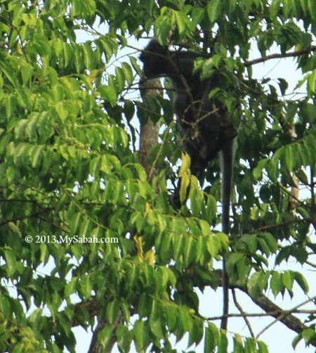
Pic: silver-leaf monkey. There were some macaques too.
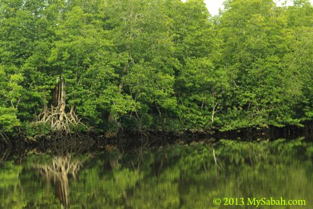
Pic: the mangrove trees of Klias River.
Pic: Peat Swamp Forest is an important habitat for rare Borneo wildlife
Pic: Nibung Palm, a tree that grows between swamp and dryland. Its straight and strong trunk can be used for building houses and bridges.
Pic: fruits are abundant in the swamp but no monkey eating them, probably they are poisonous.
Pic: mangrove trees that can survive in the water during high tide.
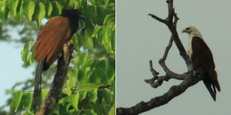
I saw some birds such as Brahminy Kite, Oriental Darter (Snake Bird), Stork-Billed Kingfisher, Hill Myna and Greater Coucal. Sometimes you can see hornbill and woodpecker around this area too.
Below is a short video of our Morning River Cruise:
How to get there
Firefly Eco Camp is about 80 Kilometers away from Kota Kinabalu (capital city). It is very accessible, just next to the road (left side) to Kuala Penyu (see location map).
Pic: the signage and entrance of the camp at roadside. You won’t miss it.
Pic: the dining and activity hall of Firefly Eco Camp
Below is a short video of the camp and its dining hall:
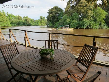
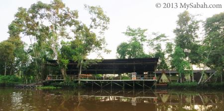
Pic: view of Firefly Eco Camp from the river
If you have a big group such as 20 students, you can book the long house dormitory.
The room rate starts from RM68 (≈USD20, as of Aug 2013) per head per night. You also can consider a 2-day-1-night full-board tour package for RM298 (≈USD90, as of Aug 2013) per head, which includes transportation, meals, accommodation, 3 river cruises, etc. They also offer optional tour to Sands Spit Island and other places.
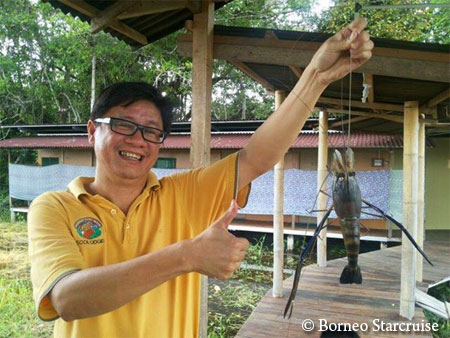
For booking or latest info about Firefly Eco Camp, you may contact Borneo Starcruise (星程生态旅游公司) at: E-mail:info@borneostarcruise.com / borneostarcruise@gmail.com Website:www.borneostarcruise.com Facebook:Click Here Address: Ground Floor, Lot 7, Jalan Pasar Baru, Kampung Air, 88000 Kota Kinabalu, Sabah, Malaysia. Tel: +60 88-212009 / +60 17-8137911 (hotline)
Sabah has many beautiful places which are only reserved for people actively seeking for them. I noticed Weston when I saw many stunning sunset photos of Weston being shared everywhere on Facebook and Twitter. That’s why I traveled 125 Kilometers from Kota Kinabalu to Weston town last month, to see the magical moment with my eyes. However, I find more interesting things than a nice sunset.
Weston the Historical Town
Named after a railway engineer, Arthur J. West in 1889, Weston town was an important meeting point for trains and ships, due to its strategic location back in the old days of British colony era. Today it becomes just another “remote” Sabah town between Beaufort and Sipitang. Few knows that Weston is the town which North Borneo Railway first constructed.
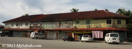
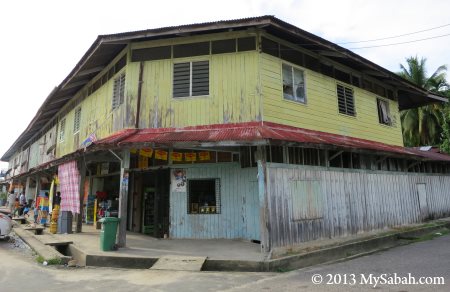
Pic: the old wooden shoplot built during British time over 50 years ago.
Pic: such shophouses are getting less and replaced by cement building.
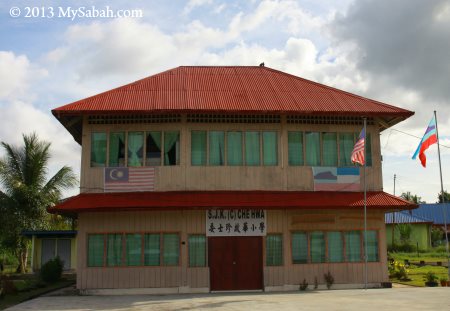
Pic: SJK (C) Che Hwa (委士珍 启华小学 in Chinese), a primary school in Weston
Probably one of the oldest wooden school of Borneo, Che Hwa school is a two-storey building constructed in 1932, and funded by donations from timber tycoons, charcoal merchants and shopkeepers of Chinese community*. In 1930s, many Chinese lived in Weston, the period when Weston was a key hub. Now this school has only 5 teachers and 7 students.
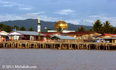
Pic: water village of Weston
Weston River was used to be called “Jump-Jump” River because of the mudskippers here. In late afternoon, you would see many villagers gather around the boardwalk, fishing and playing RC speedboats there.
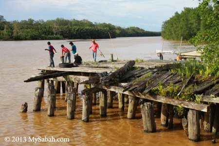
Pic: this old timber jetty exists since 1896, another legacy of British.
British government abandoned Weston port when they learnt that the shallow water of Weston is unfit as a deep sea wharf. Now this jetty is a favorite spot for local anglers.
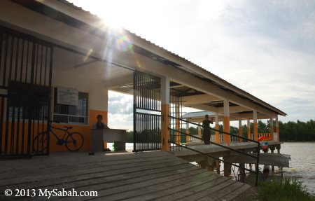
Pic: the new jetty built next to the old timber jetty
After a short tour in Weston town, I got on a boat arranged by W.P.M.S. Tours & Travel and headed to their Weston Jaafar River Lodge nearby (see Location Map).
Weston Jaafar River Lodge
The lodge is a 2-storey wooden building built on riverside and surrounded by dense Nypa palm (or Nipah). Nipah swamp forest, which has existed over 70 million years, is one of the oldest forest type in the world.
Pic: Weston Jaafar River Lodge
Pic: Eric, the lodge owner is looking at us from top floor
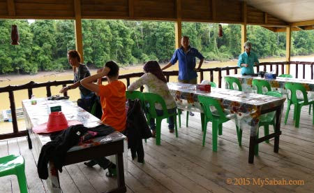
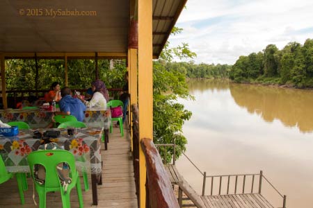
With me is another group of tourists in the Weston tour. We first dropped by the lodge for a hi-tea before our sunset river cruise. It is a great experience to enjoy afternoon tea next to a river.
Pic: top floor of the lodge. There are sofa if you want to laze around.
We had some fried noodle with tea/coffee. I really love the traditional desserts made by the locals.
Pic: a Paradise Tree Snake in the display tank. It is a common snake in mangrove.
Pic: kids checking out the local fishes in aquarium tank. If I’m right, the fishes at the bottom right are Marbled Goby, a highly-priced freshwater fish and delicacy.
River Safari & Wildlife
It was around 5pm after we were done with tea break, everyone couldn’t wait to start the river cruise. The cool thing about wildlife sighting here is – we don’t even need to move our legs to look for animals.
Weston River is part of the largest wetland (Klias Peninsula) in Sabah. Wetland is a generic term that covers different aqua-ecologies such as coastal areas, river, lakes, mangrove, peat swamp, nypa swamp, etc., and it is the important habitat for some endangered Borneo wildlife such as Proboscis Monkey.
Very soon our guide spotted a saltwater crocodile taking a nap on the muddy river bank. It is about 3 Meters in length.
Couple of months ago, a 1-Meter crocodile was found in city drain and made news headline. Haha, compared to this beast, that city croc looks more like a gecko. FYI, crocodile never ceases growing throughout its life, it can reach massive size if it lives long enough.
Please don’t go, Mr. Crocodile…
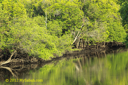
The Nipah forest along Weston River is in great shape. Nipah trees grow very well in estuary, where sea and river meet, sometimes they are even dense enough to form a mini island in the river. Locals use the leaves of Nipah Palm to make roof and its sap to create sugar.
The water of Weston River is a mixture of saline and freshwater, so it is a bit murky. However, crabs and prawns grow faster and bigger in brackish water like this, a reason why Weston is famous for its seafood. During high tide, groupers and snappers will swim to estuary, something that the local anglers are really happy about.
During our river cruise, we saw the superstar of Borneo, the peculiar Proboscis Monkey on the trees along the river. There were about 20 of them in a few herds far apart from one another. Some of them looked at us with catch-me-if-you-can expression on their faces. The long nose of male proboscis monkey is a symbol of sexiness to turn on female. They have big belly with very long intestines inside to digest the tough cellulose of tree leaves.
Proboscis Monkey is only found in Borneo and only 7,000 of them left in Sabah (and another 5,000 in other parts of Borneo), an endangered species. Another unfortunate thing is – they have low survival rate if held in zoo.
If you are a bird-watcher, you will be pleased to know that there is a small population of Lesser Adjutant resides in Weston wetland. It is an ugly big bird with bald head.
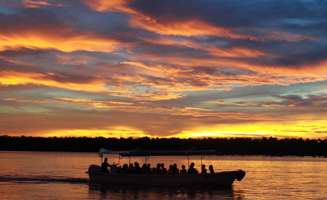
Magical Sunset
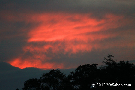
The sunset that I have been waiting for was coming, the sun was sinking slowly to the horizon. My guide, Simon was a bit worried because the dense cloud of earlier rain would spoil the moment. In Sabah, normally you get either the worst or best sunset after rain, it’s a 50-50 bet. Clear sky in sunny days usually doesn’t end with beautiful sunset, as sunset needs cloud and humid air as canvas, to paint its colorful light.
Pic: the start of sunset, the colors are dull and not so promising…
When our hope was low, the colors on the dense cloud gradually turned intense. The “Magic Moment” of sunset only lasts a few minutes, so everyone keeps their eyes wide open, to enjoy every second of the view.
A splendid sunset over a horizon of mangrove trees, a view that I’ll miss forever! I believe the reason why Weston has nicer sunset than other places of Sabah is because it is nearer to the Equator.
Everyone onboard is happy. The sunset is really one of the highlight of our trip.
Again, it is meal time after sunset. We went back to Weston Jaafar River Lodge for dinner buffet.
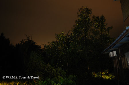
Fireflies!
Right behind the lodge are a few trees lit up by fireflies like Christmas trees. Eric planted some mangrove trees around the lodge to attract Proboscis Monkey, what he didn’t expect was these trees also became a magnet for fireflies.
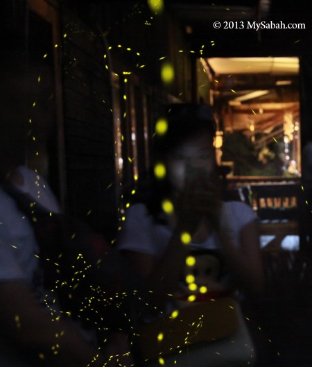
I noticed a girl next to me taking photo of fireflies that circling around her, so I got an interesting photo (see above).
We started our night river cruise after dinner.
Many mangrove trees on the riverbank were full of fireflies! Hundreds of them synchronized their twinkling like the pace of heartbeat. Most city people never saw a firefly before, so they were really excited, especially kids.
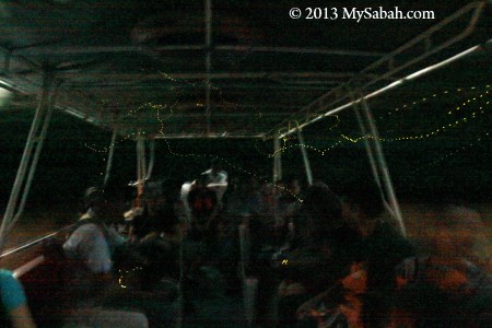
The fireflies even flied into our boat (noted the dotted light trail).
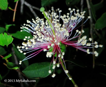
At the end, Eric showed us a pretty mangrove flower that only blooms at night, as it relies on bats to pollinate. It is an Apple Mangrove (Species: Sonneratia caseolaris), locally known as Perepat. Its young fruit is edible and can be used as a traditional medicine to cure coughing.
Though artificial and colorful city light is cool, it is lifeless and empty, only the light of nature can shine through our heart.
How to Join the Tour
If you want to join this half-day Weston trip, you may contact W.P.M.S. Tours & Travel for information and booking. Below is their contact: Address: Lot 4, 2nd Floor, Block 9, Damai Point Commercial Centre, Kota Kinabalu, Sabah, Malaysia. Tel:+60 12-8463321 (Simon Choo) Website:westonpms.tripod.com E-mail:westonpms@gmail.com
*Reference: “Colonial Townships In Sabah: West Coast”, written by Richard Nelson Sokial (PAM Sabah Chapter) in year 2012, (ISBN: 978-983-40734-4-2).