Tag Archives: cave

Gomantong Cave

Gomantong Caves, the Largest Cave of Sabah

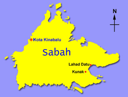
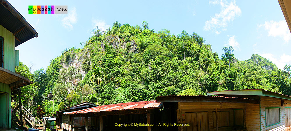
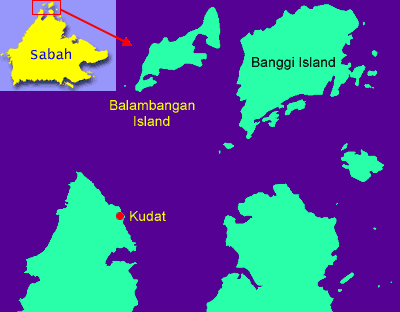
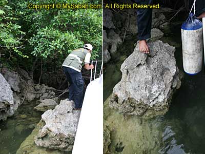
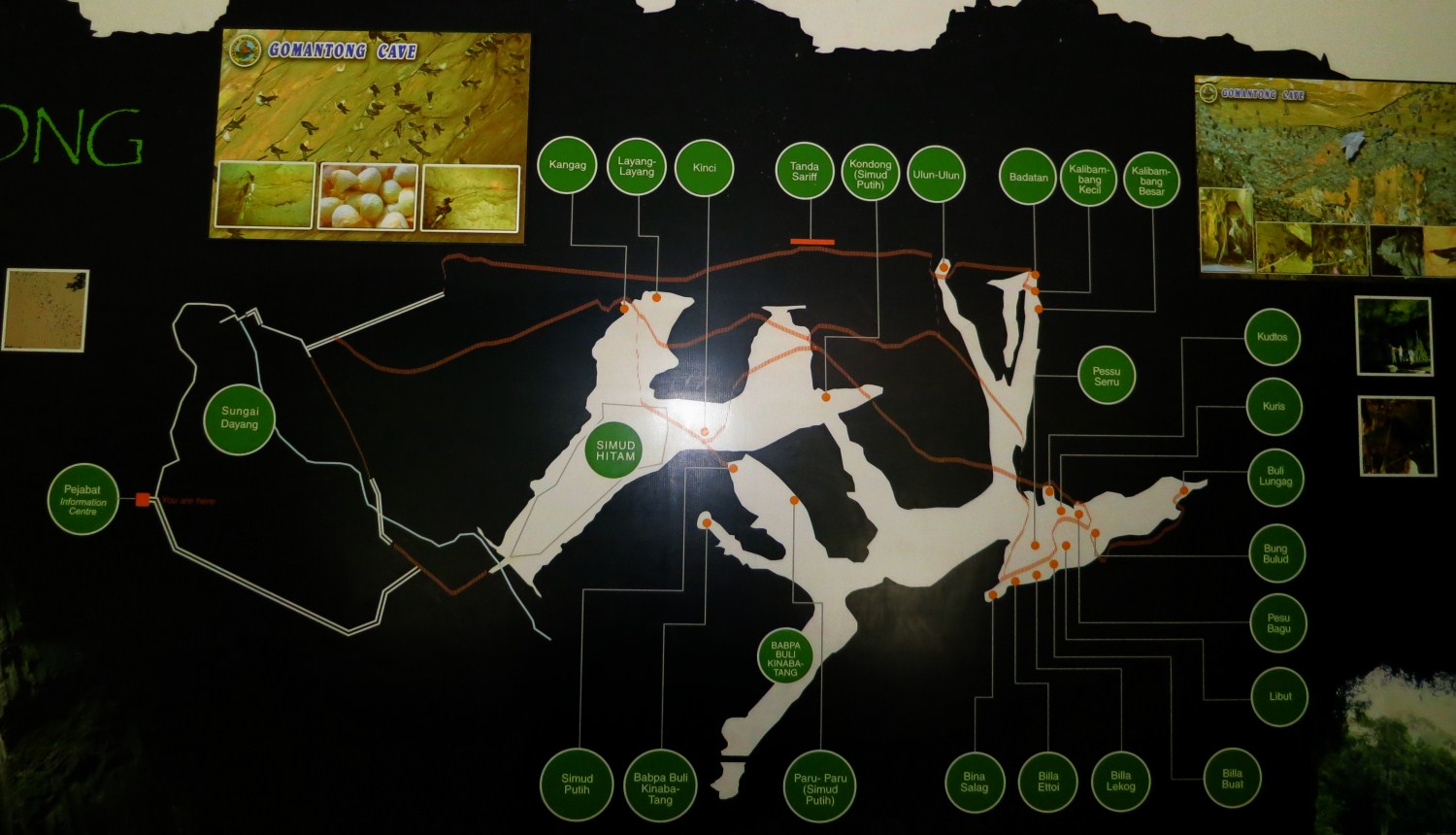
Gomantong Caves (Gua Gomantong) is the largest cave and the most important source of edible birds’ nest in Sabah. The cave is located in 3,297-Hectares Gomantong Forest Reserve of Kinabatangan district, about 85 KM away from Sandakan city. In fact, Gomantong Caves is a limestone cave system consists of 9 caves, and the two largest caves are Simud Putih (White Cave) and Simud Hitam (Black Cave). You can see the map of cave complexes below:

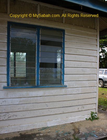
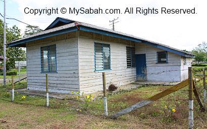
Gomantong Cave is managed by Sabah Wildlife Department, and Sumid Hitam cave is open for public from 8am to 6pm daily. The entrance fee is RM5 (≈USD1.70) for Malaysian adult and RM30 (≈USD10) for foreign visitor. For visitors who want to explore Sumit Putih cave, they need to get a permit and climb 30 minutes of steep hill to reach there.


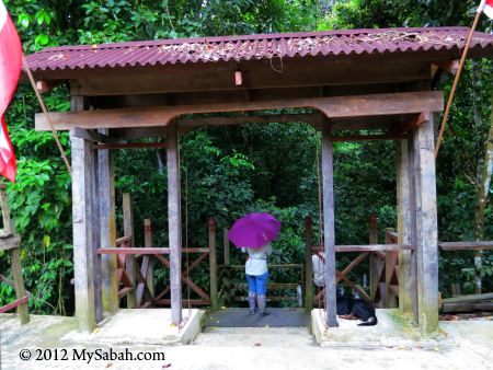
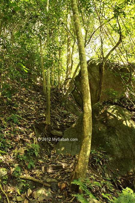
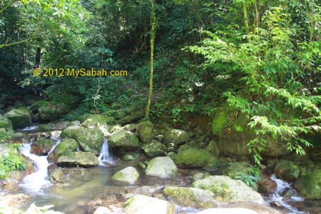
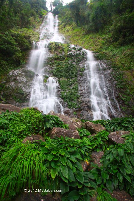
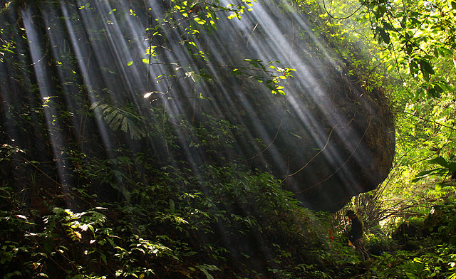
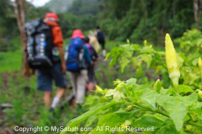
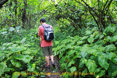
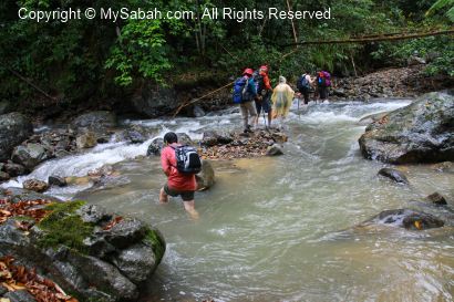
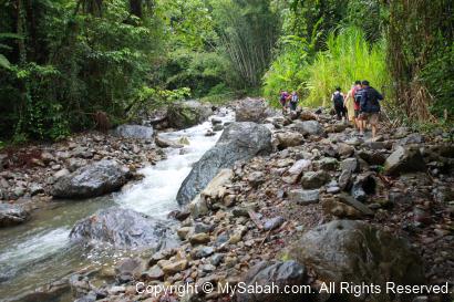
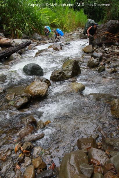
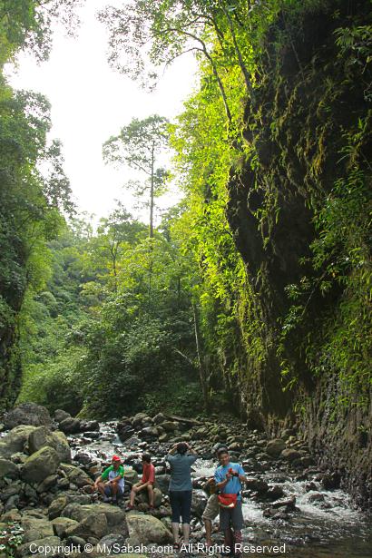
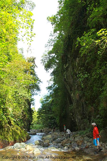
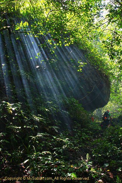
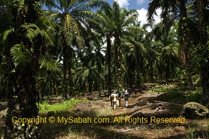
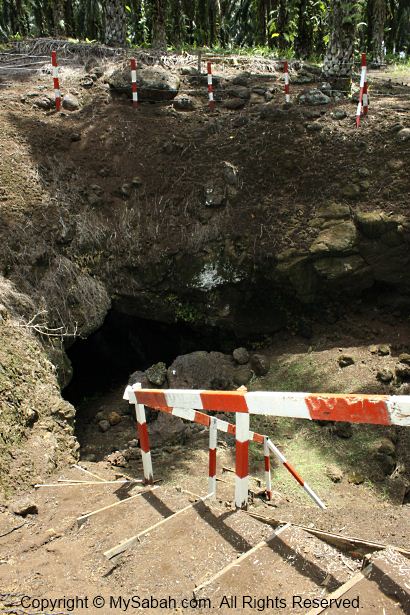
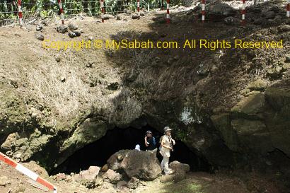
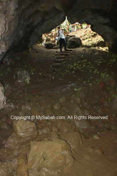
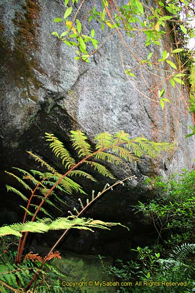
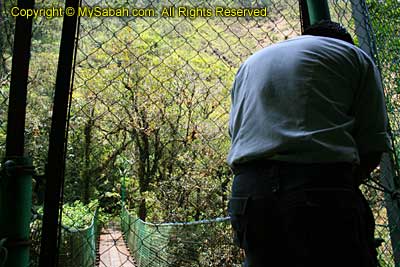
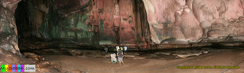
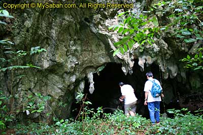
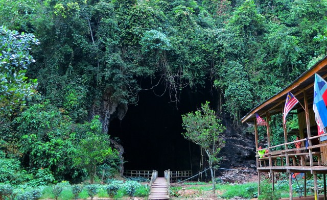
For normal tourists, the smaller and more accessible Sumid Hitam cave is a better choice. The wooden boardwalk to this cave will take you less than 10 minutes. You will pass through the dense trees of Gomantong rainforest, and spot orangutan or red-leaf monkey if it’s your lucky day.


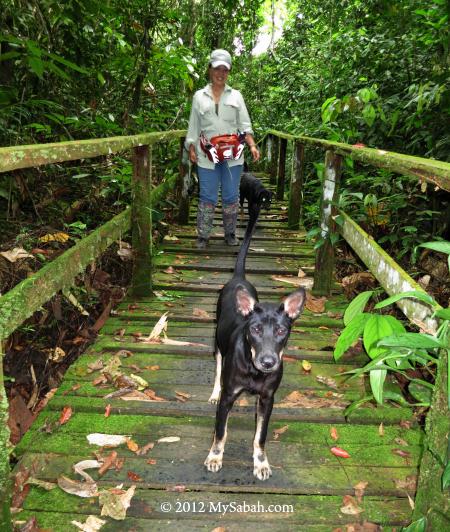
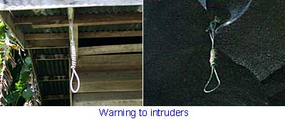
We were “escorted” by a group of dogs to the cave, haha. A few planks on the boardwalk have rotten or gone, so watch out for the holes. Other than this, it’s a leisure walk.


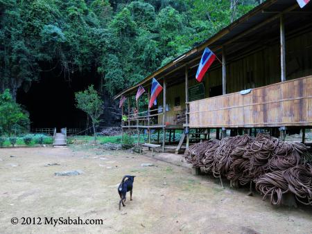
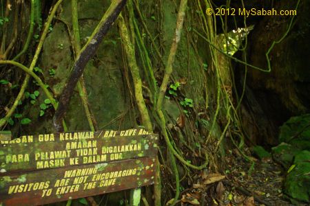
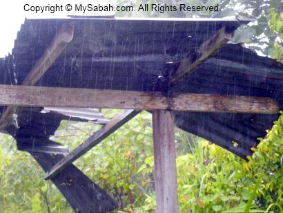
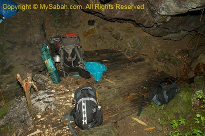
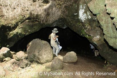
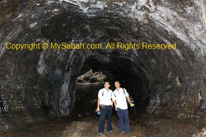
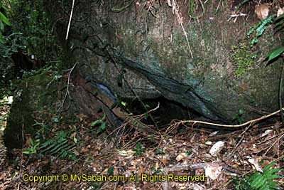
Very soon we reach the Gomantong Cave (Sumid Hitam). We saw some rolled-up ropes at the workers longhouse. During harvest seasons for birds’ nest, the collectors will stay here and guard the cave.


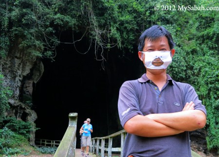
Before I entered the cave, I already smelled the strong odor of amonia from bird and bat dropping. Fortunately I was well-prepared LOL.


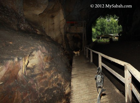
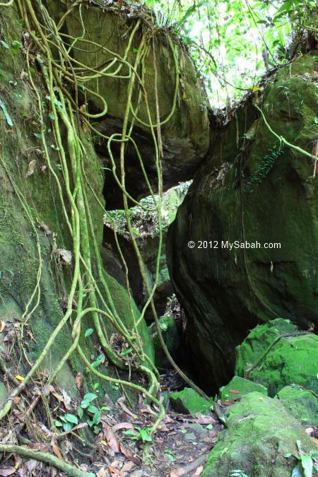
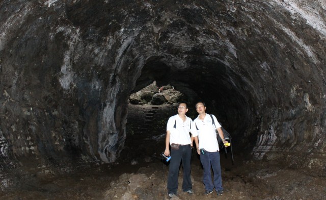
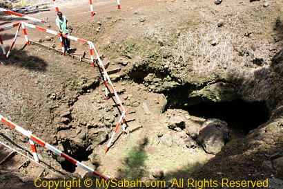
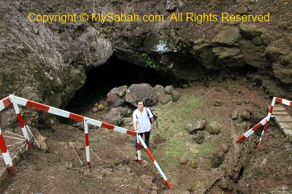
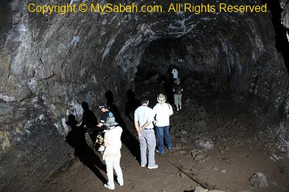
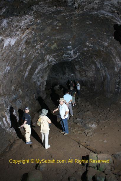
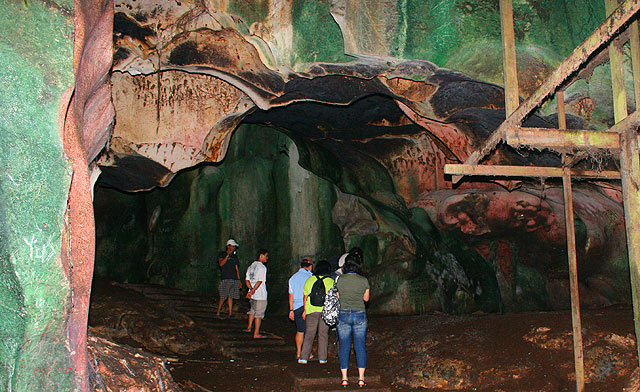
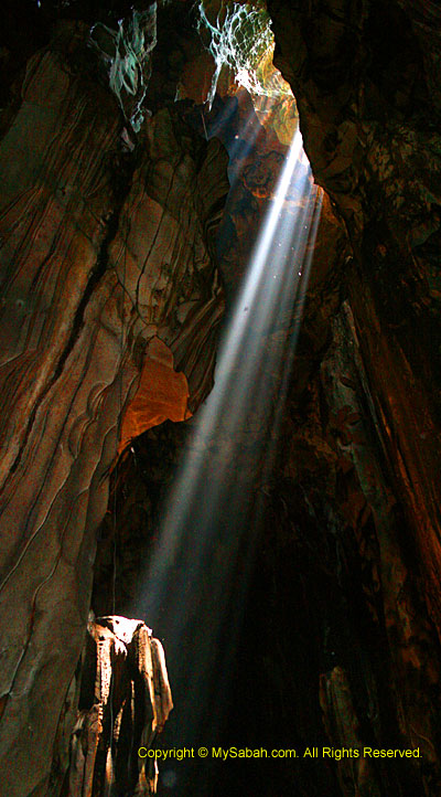
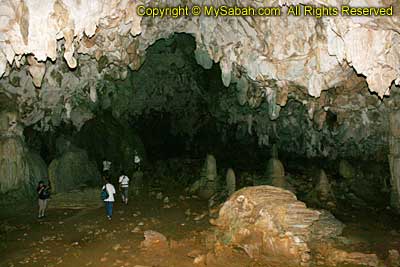
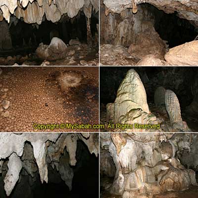
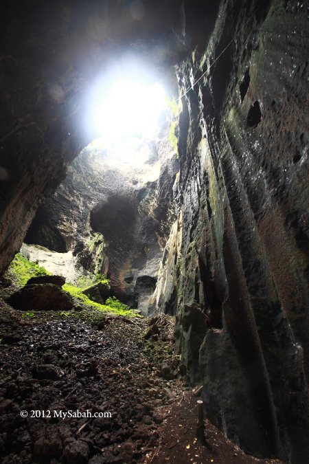
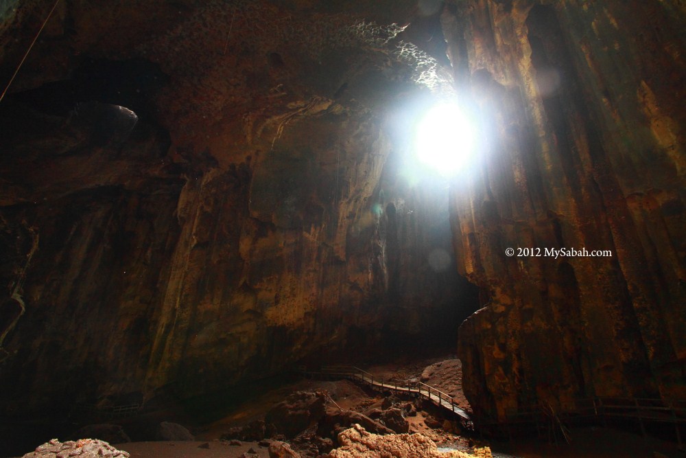
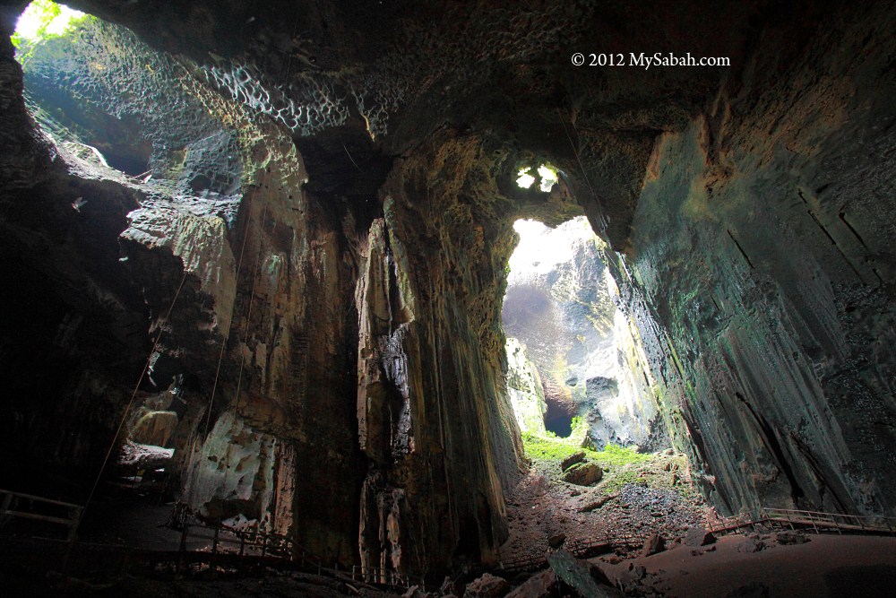
The friendly dogs also followed me into the cave. The raised boardwalk in the cave keeps visitors from deep layer of guano and creepy cave bug, which I’ll show you later. The cave is really dark so you better bring a torch light with you. Though the cave is very dark, it’s a lively and busy world. The cave amplified the squawks of thousands of swiftlet and bat, and millions of bugs were crawling everywhere.


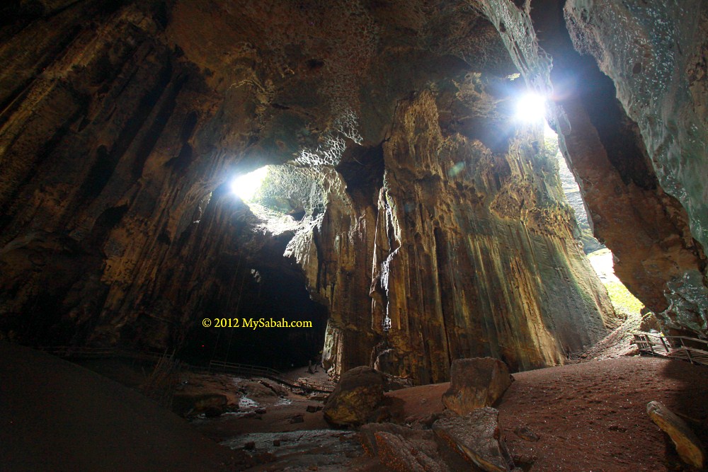
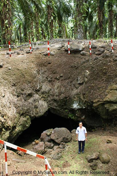
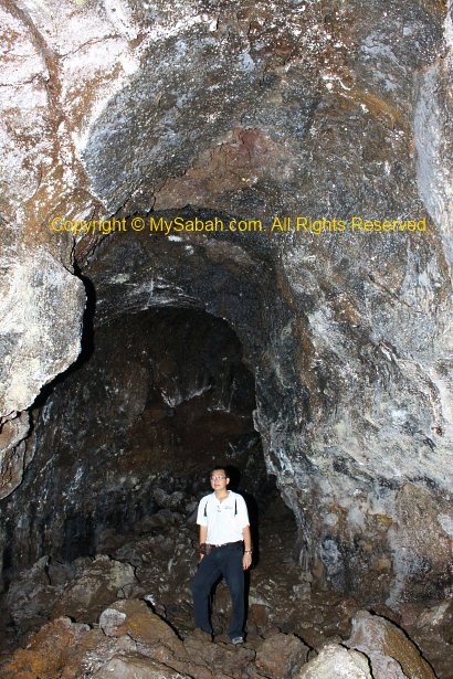
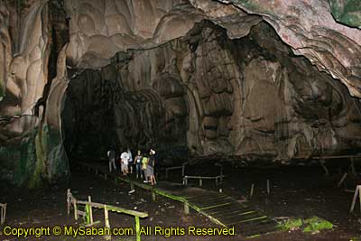
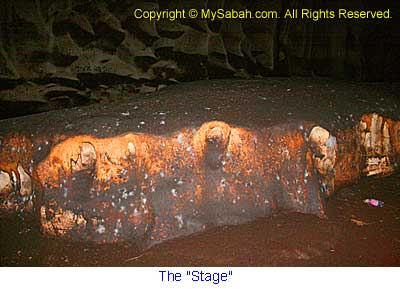
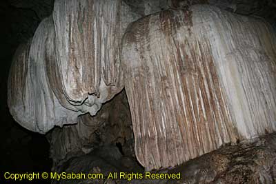
When my eyes got used to the dim environment, I started to see the vastness of Gomantong Cave. The cave is 90 Meters in height.


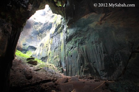
See the boardwalk in photo above? It looks so small. Now you know the scale of the cave.


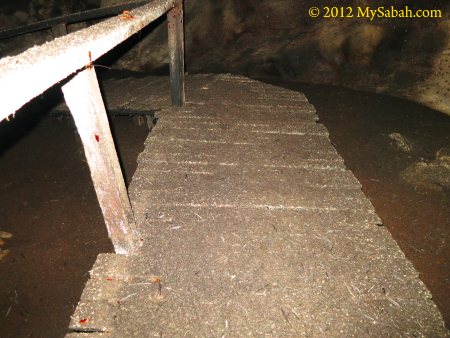
The thick layer of guano also makes the boardwalk slippery. Watch your steps. Don’t look up either. Do you know your mouth will open when you look up? Then the bird poo will fall into your mouth, hahaha! Seriously, do wear a hat in the cave.

Bird’s Nest Soup

To most people, this cave is smelly, dirty and warm. To some, Gomantong Cave is a filthy gold mine due to its highly-priced bird nest. Since the 13th century, China traders have been buying birds’ nest from here, for making of bird nest soup, a delicacy for nobles and royal family. Some China emperors may had tasted the bird’s nest from Gomantong. A funny description by Chinese for an upstart is “he rinses his mouth with bird’s nest and shark fin soup”.


Even today, bird nest soup is an expensive cuisine. As China people are getting affluent, demand always exceeds supply. Someone even builds “swiftlet hotel” to farm for birds’ nest. However, edible bird nest from the caves is still considered as the best grade by consumers, as it contains minerals. Farmed bird’s nest is softer and disintegrates very fast after being cooked for a long time.


Whatever, research says that bird nest is just swiftlet saliva consists of water-soluble glyco-protein. Bird’s nest contains no secret ingredient to make you look younger. If women want to stay young, just eat healthy food and exercise regularly, a far more cheaper option. If a lady tells you that bird nest works for her, she is just showing off her wealth. If you still think saliva is good for you, I can sell you my saliva for half price, as it makes no difference.

Harvesting Edible Bird’s Nest

For conservation and sustainability of swiftlet population, the birds’ nest of Gomantong Caves is only harvested twice a year, i.e., Feb-Apr and Jul-Sep. You may see collectors at work if you visit during these months.

Two types of birds’ nest are harvested in Gomantong:

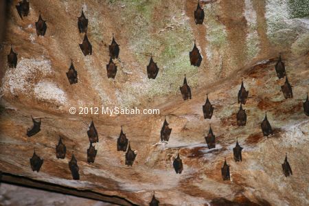
  1. White Nest of Edible-Nest Swiftlet (Aerodramus fuciphagus): the most expensive bird nest (about USD2,000 per KG), mainly swiftlet saliva. More abundant in Sumid Putih Cave.
  2. Black Nest of Black-Nest Swiftlet (Aerodramus maximus): more common but only priced at 20% of white nest, due to excessive impurity such as feather and plant materials in nest, labor-intensive to clean.


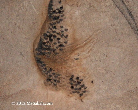
The swiftlet is not stupid. It builds its nest high on the ceiling of the cave. Swiftlet is an amazing bird. Not only people want to taste its saliva, it can fly so well that it can mate in flight. The echo-locating ability of these swiftlet allows them to navigate in cave and find their nests in total darkness. However, its sonar is not as accurate as bat hence not good enough to hunt for insects at night.


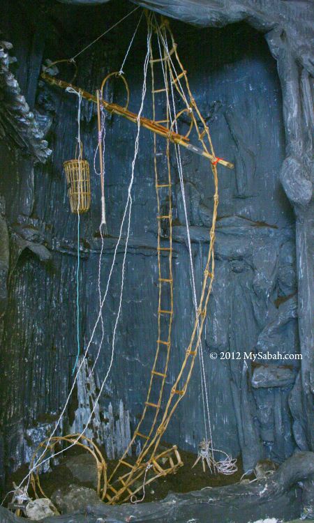
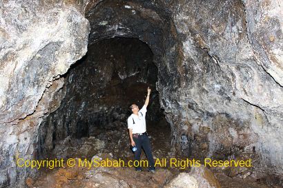
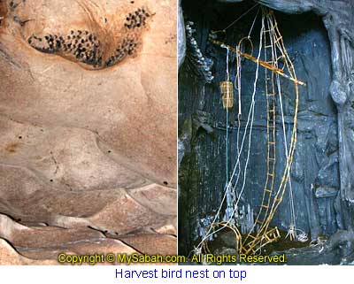
To harvest bird nests about 100 Meters above ground, the workers use the traditional setup in photo above.

Basically it’s a flimsy climbing structure supported by ropes, rattan ladders and bamboo poles. The workers risk their lives by climbing to the top, scratch the bird nest from the wall and put it in basket. Accident does happen sometimes, and in worst case, they fall and die in deep shit (guano).

The Ecology of Cave

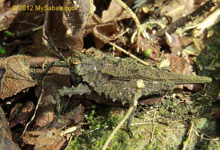
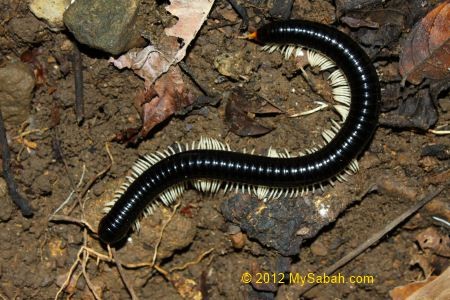
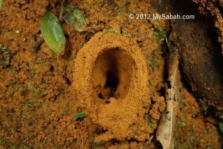
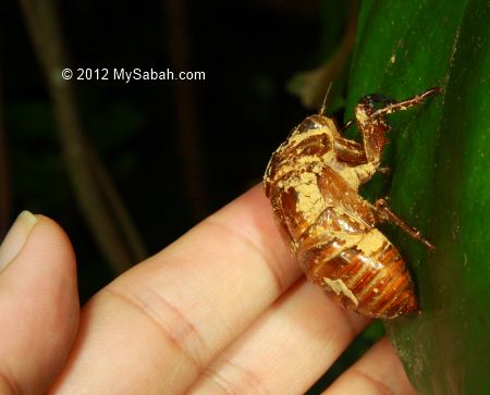
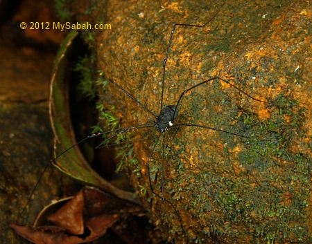
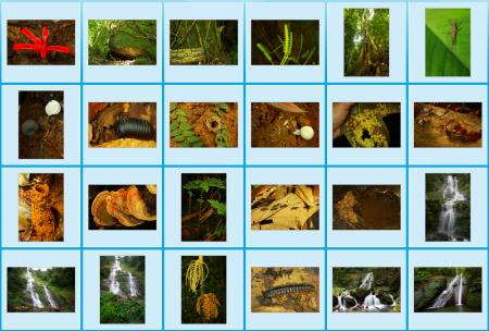
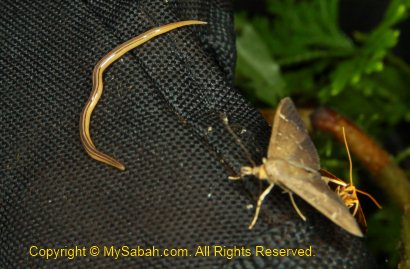
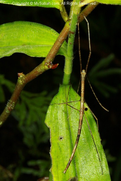
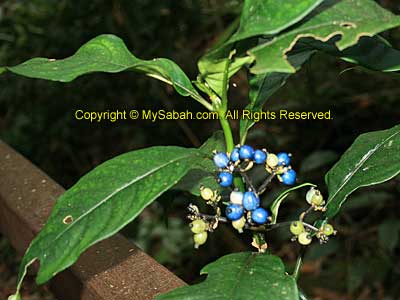
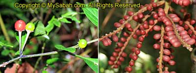
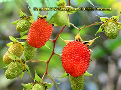
Cave is a lightless world with unique ecology. Besides the noisy birds and bats, there are many ugly creatures call Gomantong their ideal home. Cave is the worst nightmare for Entomophobia (bug phobia).


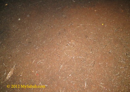
The cave ecosystem is powered by shit guano of swiftlets and bats. After thousands years of accumulation, the guano is a few feet deep and becomes the all-you-can-eat food source of cave residents. FYI, this manure makes good fertilizer.


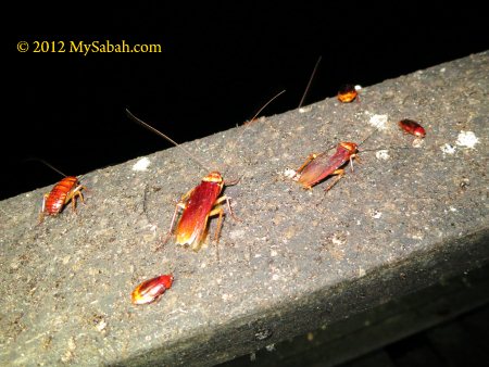
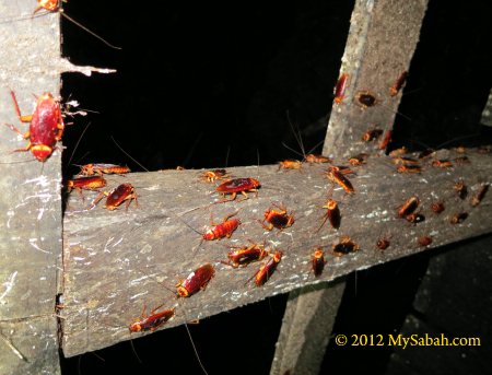
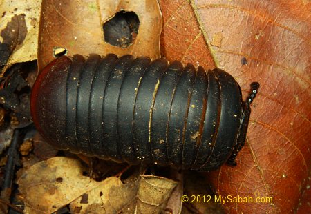
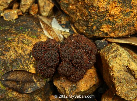
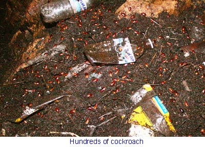
The cave floor, even the boardwalk, is carpeted by millions of cockroaches. They feed on the guano, and occasionally, the fallen fledgling. Sound bad but they help to clean up the mess, with dung beetles.


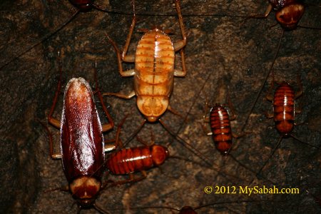
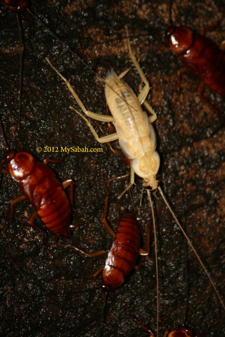
Because of the darkness, being colorful is pointless. Over time, some cockroaches lose their pigment and evolve to white color. Aren’t they cute?


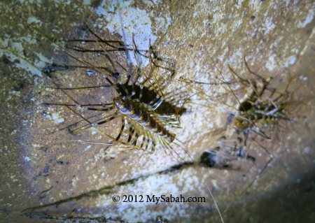
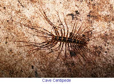
The wall gets venomous cave centipedes (or Scutigera Centipede) everywhere. Their bites are as nasty as their look, and no other creatures dare to stay near them, so don’t lean on the cave wall. They hate light and fled into darkness, seconds after my torchlight beamed on them.


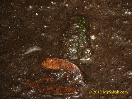
Pic: can you spot the crab? Many crabs live in guano pool here.

I hope I don’t scare you more, when I say racer snakes and giant centipedes also live in Gomantong Caves. Well, freaks just like to live together.
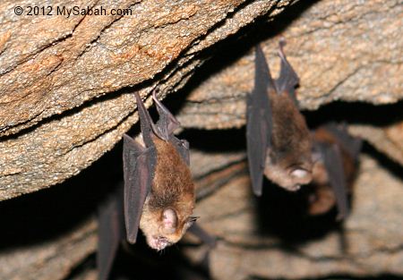
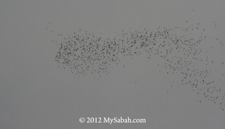
Bat Swarm

A least-known feature of Gomantong Cave is its bat swarm during dusk, when 2 millions bats fly out of the caves to start their day. Though the scale is not as spectacular as Mulu in Sarawak, the show is still quite a treat.


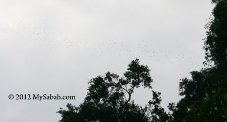
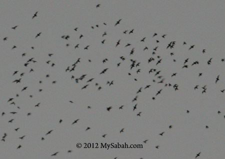
Just wait outside the cave around 5:30pm (they may not come out in rainy day). I saw wave after wave of bat swarms flying across the sky. If you want to see bat swarm up-close, the best spot is Sumid Putih Cave, where millions of bats flying just next to you, swarm after swarm.


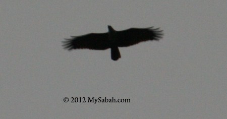
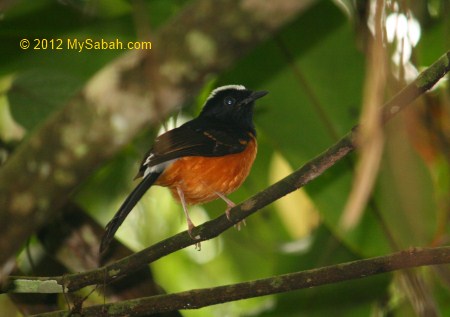
I was not the only one waiting for the bats. Their predators also know this. When the bat swarm starts, a few Bat Hawks will prey on the bats. Other raptors such as Wallace’s Hawk Eagle and Crested Serpent Eagle also join the hunt. Many birdwatchers come to Gomantong for this action scene, after they see other birds such as kingfishers, leafbirds and flycatchers in forest nearby.

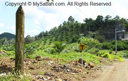
Gomantong Caves is a public park and very accessible. You only need to drive 1.5 hours from Sandakan to there on a paved road. The only problem is there is no bus going there. If you don’t want to hire a taxi or tour guide, you can rent a car and go there. Below is the location map:


View My Sabah Map in a larger map

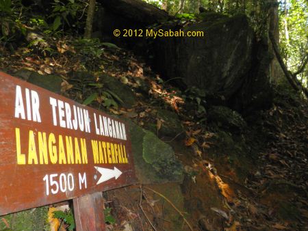
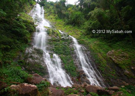
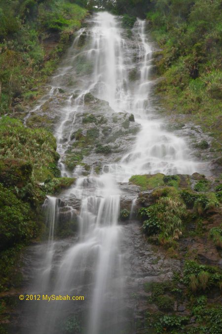
Photos taken in Sandakan, Sabah, Malaysia Borneo

Waterfalls of Poring

How does it feel to stand in front of the majestic 120-Meter Langanan Waterfall in Poring? Langanan Waterfall is one of the tallest waterfalls in Sabah. On the way to this huge waterfall, you will pass by the smaller Kipungit Waterfall and a bat cave, and enjoy nearly 4 Kilometers of nature trail in rainforest. Below is a walk-through for you.


Above: this is the signage at park entrance and where you start your jungle trekking.
As you can see, your first stop Kipungit Waterfall is only 665 Meters away. Please register at the Ticket Counter before you go to Langanan Waterfall.

Kipungit Waterfall

Just follow the path and you will reach Kipungit Recreation Area after 20 minutes. It’s only a relaxing short walk and you are not really in a forest yet.


You would see some tourists playing with water near the Kipungit Waterfall. This is an area for picnic and swimming, and there are a toilet and camping ground nearby. As you are near the river and under the tree shade, the air is more cooling and refreshing.


Kipungit is the most accessible waterfall of Poring. I saw a few girls soaking their feet in calm water, giggling and pull their feet out of water. I tried to do the same and saw many tiny fishes nibble the skin of my feet. Kind of fun, haha.


With a height of only 10 or 12 Meters, Kipungit is nothing if compared to the 120-Meter gigantic Langanan Waterfall. Most tourists are happy with this little waterfall, but I decide to see the bigger Langanan 3.3 KM away.

You may watch the following 40-sec video of Kipungit Waterfall:


One of the birds you would see here is White-crowned shama (see photo above), which is endemic to Borneo and considered as the best singer of rainforest. You could see a dozen of them around the park in early morning. The surrounding rainforest of Poring has over 300 bird species and great for bird watching. Personally I had seen Asian Fairy-bluebird, Yellow-rumped flowerpecker (endemic) and a few types of bulbuls in Poring. Prevost’s Squirrel is also common here.


You will see the signage to Langanan Waterfall near Kipungit Waterfall. At normal walking pace, most people can reach Langanan Waterfall in 2 hours. Before you go, you should have registered first at the Ticket Counter. For safety reason, the Park won’t allow you to go to Langanan Waterfall after 2pm. Do bring water (600-1,000ML), raincoat and snacks (e.g. chocolate, cereal food bar) with you. There are leeches on the jungle trail, so you better put on your anti-leech socks.


After this point, you enter the rainforest and the surrounding won’t be tourist-friendly. The jungle trail to Langanan is quite steep in the first half. Poring is about 400-500 Meters above sea level, and the forest is mainly lowland rainforest and mixed dipterocarp hill forest, characterized by tall and dense tropical trees (20 to 70 Meters high), warm and humid air, and abundant liana and strangler fig tree.

Bat Cave (Gua Kelawar)

After walking for 360 Meters, you will see Bat Cave next to the trail.


There is a broken warning notice sign reads “Visitors are not encouraging to enter the cave” (the grammar sounds funny).


Actually the cave is a deep crevice formed by a few huge boulders that stacked together. The dark and humid space in the cave becomes the ideal roosting spot for bats. You can smell guano from outside.


I tried to go deeper inside the cave. The rock surface is covered with green moss and very slippery, so I don’t recommend you to go in.


There are hundred of bats clinging on the rock wall. The smell of guano was getting stronger so I only stayed shortly.

To see what’s inside Bat Cave, you may watch the 1min-27sec video below:

Rainforest of Poring

I continued my jungle trekking after visiting Bat Cave. The first 1.5 KM of the trail is steepness with 20 to 40 of inclination, like climbing a hill. There is no boardwalk, hand-rail and shelter hut. Part of the trail turned muddy after rain.


You can see some bug along the forested trail, like the 9-inch long millipede above.


I played with a pill millipede that foraged on forest floor.

You can watch the 46-sec video below to see why it is called “Pill” Millipede:


Strangler fig tree is a common sight in Poring rainforest. The host tree is killed by parasitic strangler fig tree that wrap around it.


There is a small stream to cross. The water is shallow with some rocks above water, I can walk on them to cross the river without getting wet.


I saw many burrows on the exposed soil of the slopes. I think they are belong to hornet or wolf spider.


Animal dropping next to a water hole, probably belong to small mammal such as civet.


Shed skin of cicada, can be used as cooling agent for Chinese medicine.


Above: daddy longlegs (harvestmen spider) are everywhere.

Surprisingly, I only saw 3 leeches, far less than I expected. Probably the Park clear the trail twice a month, and leech dislikes ground surface that has no grass and foliage. The buzzing deer flies are more of a concern. They cut a small wound on your skin to suck your blood. The bite will become very itchy for next few days.

Langanan Waterfall

The milestones along the trail have worn out and I had no idea how far I walked. On the way, I saw 2 groups of high school students and 1 group of tourists returning from Langanan. I was dismayed by their answers “the waterfall is still very far away” when I checked my progress with them. 🙁


Anyway, I just kept walking and felt relief to see the signage above. Though I was only half-way there, the trail is not steep anymore from this point on and there are more descending trail.


After long hours of jungle trekking, I heard the thundering sound of Langanan Waterfall not far away. I speed up and finally I reached Langanan Waterfall!!!


This 120-Meter Langanan Waterfall is the tallest waterfall that I’ve ever seen. Before that, the tallest fall I saw was the 38-Meter Takob-Akob Waterfall in Maliau Basin. The huge water volume creates a micro-climate, it was windy there and I was shower by the droplets from splashing water high above.


It’s such a rewarding experience. This huge waterfall really worth my long hours of hiking.

You may watch the 1-min video of Langanan Waterfall below:

Btw, before you leave the Park, don’t forget to sign-off at Ticket Counter to inform the Park that you are back from Langanan safely. Otherwise they will send a search and rescue team to look for you.

More Photos

You may check out my photo album on Poring rainforest for more nice pictures:

Other articles about Poring Hot Springs Park:

  1. Poring Hot Springs bath
  2. Poring Canopy Walkway
  3. Gardens of Poring
  4. The Most Expensive Orchid in the world
  5. Accommodation at Poring
  6. Jackie, orangutan who owns a house
  7. Night walk in Poring rainforest

Photos taken in Poring, Sabah, Malaysia Borneo

Minitinduk Gorge, ancient gateway to Mt. Kinabalu

Minitinduk Gorge is the ancient gateway to Mt. Kinabalu, as it is on “The Hugh Low Trail”, an original summit trail used by documented first male climbers, Sir Hugh Low (1851) and Sir John Whitehead (1888), and female climber, Lillian Gibbs (1910), of Mt. Kinabalu, the highest peak of Malaysia. After another “tourist” trail opens in 1924 (by R.F. Evan and Sarel), climbers / tourists are no longer using this trail located in Kampung Kiau (Kiau Village) of Kota Belud district.


Last month I joined a 2-day-1-night camping trip organized by The Sabah Society to explore the gorge. The weather was good for the past few days until we departed in the afternoon, but the heavy downpour didn’t hold us back. By 2:30pm, we reached the junction to Kampung Kiau (Kiau Village), which is a few Kilometers (KM) after Nabalu and 29 KM before Ranau, and where we met up with Mr. Martin Moguring, our guide from Kinabalu Park. Dr. Ravi, the co-writer of the book “The Hugh Low Trail”, is the organizer of this trip.


Then we drove to the school in Kiau Village, which takes another 30 minutes. We parked our cars in the village and walked to the starting point, just a stone throw away from the village. We were told in advance that we will cross multiple small rivers, so most of us were wearing short. Our group also hired 3 porters (Rony, Abinus and Bengent) to carry some of our bags and supplies.

Jungle Trekking & River Crossing


The distance from Kiau Village to Minitinduk Gorge is only 3.5 KM and take about 2 hours of trekking. For the first day, we walk 3 KM to Sambatang Cave and camp there. The second day we walk from the cave to the Gorge, which is only 500 Meters away. FYI, the gorge is in a private land outside of the Kinabalu Park boundary.


In the beginning, we passed through the farmland, mainly consists of paddy, maize, ginger and other food crops.


Pretty soon we entered the secondary forest, characterized by dense undergrowth. It is still raining so it’s very humid in the forest and this “activates” the little brown forest leeches that live in deeper jungle and love wet environment (and our blood!). There are not many of them and most are only 1cm in length. I had seen forest leeches 5 times bigger in primary rainforest, so these tiny-sized blood suckers didn’t bother me. I didn’t even feel that I got one leech bite until I saw my leg bleeds.


Though it’s a newly generated forest, there are still potential dangers around. Like the harmless looking plant in photo above, its leaves are poisonous and able to make your skin really painful and itchy when touched. But there are many “good” plant too, Martin shows us some plant that can be used as food, preservatives or herbal medicines by local people.


As I’m an experienced hiker, the trail is not rugged and I consider it as an easy walk, not strenuous and challenging at all. Most of the time, we moved on the nature trail adjacent to the Kadamaian River and its tributaries such as Kolapis, and there are about 10 river crossing. But I’m not so used to river crossing. After heavy rain, the rivers rose, turning swift and deep.


Though the depth of river only reaches our knee level, the current is strong enough to push you down if you don’t stand firm. The worst thing is the murky water caused by heavy rain, we can’t see the irregular bottom. We had to cross slowly, probing the depth in front with one foot to avoid stepping into deeper water. I almost fell into the icy-cold water with my camera once.

My best advise is – Trust NO rock and boulder near the river. They all look deceptively safe to step on, but they offer zero friction, after being “waxed” by the river for a long time!


Our socks are soaking wet. Only Dr. Ravi walks with happy dry feet. He also shows us his simple solution – just drill a hole on the shoe for draining of water, lol.


As we were moving further up the river, the boulders get bigger and bigger and see more and more cascading streams, the characteristics of river upstream. The water is so clean, unlike other milk-tea color rivers caused by excessive logging in upstream area (e.g. Padas) of Sabah.

Sambatang Cave

Finally we reach Sambatang Cave at 5:30pm!


Actually Sambatang Cave is a cavernous space under an overhanging huge boulder. It can accommodate 3 to 4 people.


Since the daylight is vanishing, we quickly setup 3 camping tents on the flat area near the cave.


According to the porters, Sambatang Cave is an ideal natural shelter, even the heaviest rain can’t flood the cave.


The porters collected some wood and started a camp fire to “smoke” the cave, as the smell can keep creepy animals such as snake and centipede away from the cave. I’m so happy to keep my feet dry and warm.


Light not only attract insect, it also draws human. After having instant noodle as dinner and a few rounds of hot coffee, everyone squeezes into this small cave to warm themselves up with camp fire.

Night Walk


When I started to see bugs crawling around the cave, I decided to take a night walk to check out the bug party in forest.


Above: a stick insect pretends or thinks that it’s a stick.


You can hear a lot of frog calls near the river.


Same as frog, toad is everywhere too.


Above: This little green frog is almost invisible on the green fern.


When the night is late, I go to bed in Sambatang Cave, which is also the place the early explorers like Sir John Whitehead and Lilian Gibbs spent their night before heading to the summit, as described in their chronicles more than a hundred years ago. Do remember to bring floor mat and sleeping bag if you plan to sleep inside the cave. Torchlight / LED headlamp is needed if you want to do your business in dark night. The night was so cold that I can feel the chill in my 7°C-grade sleeping bag.

What’s for Breakfast?


My biological clock waked me up at 6am next morning. I saw the porters busy preparing breakfast. From their happy smiles, they must be waiting for something really tasty.


Out of curiosity, I take a look what is inside the pot. Oh dear, those are the frogs they catch. No wonder I saw them searching for something along the river last night. Well, I was there hunting for frog photos but they hunt for the frog meat.


Then they grill the frog over the fire. Please note that only certain frog species are edible as some are poisonous. You can find the edible frogs for sales in local native market called “Tamu”. Species such as Limnonectes ingeri (greater swamp frog), Limnonectes kuhlii (Large-headed Frog) and Limnonectes leporinus (Giant River Frog) yield high demand as food by local people.


Above: almost done…


They gave a frog leg for me to try. Being open-minded and “adventurous”, I eat it. To my surprise, the frog meat is so sweet and tender. It is slightly chewy but taste a lot better than chicken, trust me.

Minitinduk Gorge


After breakfast, we leave our bags in cave and head to Minitinduk Gorge, which is only 500 Meters away. 15 minutes later, we exit the dense canopy and see Minitinduk Gorge is right in front of us! Minitinduk means “the meeting of two beaks” in Dusun language. The gorge looks like a twin towers less than 50 feet from each other, with Kadamaian River flows between them. Someone believe the gap is even narrower and both sides almost touching each other in the past, as a legend says a Kiau couple can jump over to the other side, when they try to escape from a group of headhunters from Bundu Tuhan.


We take a group photo with banner. We look so small in the photo. The gorge is about 150 feet in height. There is a theory saying that the gorge was once a waterfall with a lake at the bottom. One day the waterfall collapsed and creates the gap that bisected the hill, based on a historical record that there should be a lake under Mt. Kinabalu but is never found.


Inside the gorge is an opening with Kadamaian River flows between the vertical rocky cliffs. Even though tourists nowadays don’t use this trail, the Kadazandusun people believe this is still the holy trail for the spirits of the dead to go to their final resting place, the Mount Kinabalu, and this gorge is the gate. It sounds scary when our day of visit coincides with the Chinese ghost festival day.


The water of Kadamaian River is from Mt. Kinabalu. It looks cleaner than our tap water and nice for a dip. Too bad I didn’t bring my swim trunk.


If you follow the ancient trail further upstream, you can reach the summit trail of tourists at Lowii or Paka Shelter of Mt. Kinabalu. On the way, you will see super-huge Kadamaian Waterfall. Someone estimate the height of Kadamaian Waterfall is about 250 to 350 Meters and could be the tallest waterfall of Malaysia.


Enough with photo-taking, we left Minitinduk Gorge. It is really a nice trip over the weekend.


We packed our backpack and go back to Kota Kinabalu city at 11am. Personally I would like to thank The Sabah Society members who spent months of research to retrace this historical trail. You may watch the 6-minute video on our trip to Minitinduk Gorge.

More Photos

You may check out the photo album of Minitinduk Gorge for more nice pictures:

Reference
“The Hugh Low Trail: The Quest for the Historical Trail to the Summit of Kinabalu” by Dr. Ravi Mandalam, Dr. Chin Shui Hiung and Christopher Chin, published by The Sabah Society, Jan 2004

Photos taken in Kota Belud, Sabah, Malaysia Borneo

Japanese War Tunnel

The 3-year-8-month Japanese occupation in Borneo was a nightmare for our people. Many have heard the terrible things that they had done, but there is so little documentation about the bloody history. However, whatever you did and wherever you went, you would leave traces behind. That’s why I visited a few ex Japanese war attractions in Kunak (a town near to Lahad Datu of Sabah east coast).


The first stop is an ex Japanese administration office built in 1942 (during World War II) and located inside Mostyn oil palm plantation which belongs to Sime Darby.


Actually this small house was built by British, if I am not mistaken.


You might wish to find gold inside but it is empty, FYI.


The view from the rear. That’s it. Nobody knows much about it.


Just a stone throw from the administration office is an ex site of a Japanese temple. Sadly, only two wooden poles, which were the gate of the temple, stand until today.


Front view of the “temple”. Every year there is a bus load of Japaneses comes to this site. They pray here then proceed to the Japanese war tunnel. They seem to know something about the history.


See the hill at the right? During WWII Japanese occupation, if anyone did anything wrong, the Japanese would hang them on top of that hill for everyone to see, to serve as a warning. Of course the gallows is no longer there as nobody needs it.


After touring around the ex Japanese administration office and temple, we went to the ex Japanese war tunnel (about 12KM from Kunak town), which is more than an hour drive away. We are still inside the area of Sime Darby oil palm plantation.


The entrance of the war tunnel. It is fenced to prevent people fall into this big hole.


Nobody knew about this war tunnel until part of the tunnel collapsed and revealed an opening to the tunnel. An Iban worker saw the tunnel in 1970s when he cleared the forest there.


See the dark cave at the bottom? It’s the opening to the tunnel. The staircase was the structure built later for visitors to enter the tunnel.


Another view of the entrance to the tunnel.


Chua, one of the guides, stood there to show you the scale of the cave.


Another angle of the entrance.


The brave ladies entering the tunnel. I was told that someone used that tunnel as black magic site. So do not enter if you have “weak spirit / aura”.


The tunnel is totally dark. Bring a torchlight before you go inside. Smoking is not allowed in the tunnel coz we are not sure if there is any flammable gas inside.


After getting in from the small opening, we were impressed by the size of the tunnel. It’s so spacious. I saw a few bats flying around and the air is very humid, with a bit of smell of guano. I’m not sure if this is a man-made cave. Kunak was a active volcano site in the past, so it could be a natural lava tube. Most caves in Sabah are limestone caves created by prolong erosion. Huge and long lava cave is very rare in Sabah.


The floor is wet, muddy, slippery and full of rocks and rubble, so watch your step. There is a group of Japanese comes to this tunnel every year. At least one of them was a student studied in Kunak during WWII. They even have the map of this tunnel but they decline to disclose more information. Before Japan invaded Borneo, Japan sent many citizens to work in plantation and business sectors in east coast of Sabah. These Japanese in Sabah may have “special mission”, so there is no surprise they worked with the army. But this is only a guess by the historians. This tunnel leaves more question marks as there is no documentation.


You may ask, “why don’t you just explore and do the mapping yourselves?” So far there is nobody fully explores the tunnel, because the air is very thin deep inside and all failed to do a full survey. We already felt a bit of breathing difficulty even a short distance away from the entrance. We only went in for about 50 feet. From what I read, the tunnel has 5 junctions which led to different exits. One links to a beach, one links to Madai forest 8 KM away, and one links to a private house (the family seals the exit). Some even said one of them links to Sulawesi sea. If you are interested in caving and history, we welcome you to survey the war tunnel. There might be some interesting discovery such as hidden gold treasure? The Japanese might use it as secret passage and arsenal.


Most felt uncomfortable and went out. The guides and me decided to explore a bit more deeper for photography. Due to the irregular and slippery surface, it was a bit hard to walk. In the photo is Vincent, one of the guides. The tunnel is so high and wide that a car can drive through. Part of the tunnel allows 10-wheel truck to pass through.


Vincent did the Cuti-Cuti Malaysia (Malaysia holiday ad) pose. Actually there is nothing on top, except the dripping water.


Scribble left in the tunnel. Written in 1974?


Doesn’t the war tunnel look like the throat of a huge monster? At their back is the entrance. Hopefully this attraction will bring more tourists to Kunak. Since this war tunnel is inside private land of Sime Darby, it is not open for walk-in visitors. If you are interested in visiting or looking for tour info, please check out www.darvelbay.com.my.

Photos taken in Kunak, Sabah Malaysia

Mermaid Island – Mantanani

I thought all the beautiful island in west coast of Sabah was gone until I met Mantanani Islands (Pulau Mantanani). Sapi and Manukan Islands? They are not even in top 10 most beautiful islands of Sabah (but they were, 30 years ago), and it is funny that most tourists flow to these islands. That would make them think that all islands of Sabah are dirty, polluted and lack of corals. Local divers also expresses their concern about the dwindling corals and fish species in Tunku Abdul Rahman Park. Due to increasing pollution and garbage from the shore (especially Gaya Island), very soon swimming in Sapi Manukan will be same as swimming in toilet bowl.


Click Here to see more photos of Mantanani >>

Mantanani is fairly accessible (prior booking with travel agent is required). Just drive 1 hour to the jetty of Kampung Kuala Abai in Kota Belud, then take a boat to Mantanani. The boat ride takes 40 to 50 minutes depending on the sea condition. If the weather is bad, they might cancel the trip. Mantanani consists of 3 islands, namely, Mantanani Besar (the biggest) Island, Mantanani Kecil (Kechil) Island and Lingisan Island (smallest). Above is the map to Mantanani. In fact, these islands are so tiny that they are not appear in most Sabah map. I draw the map myself just for you to get an idea, the shape and scale are not accurate, so don’t use it in textbook ye.


Click Here to see more photos of Mantanani >>

Above is the view of Kg Kuala Abai (Kuala Abai Village) fishing willage. To go to Mantanani, you need to arrange the tour with the island operator prior to the visit. I went 2-day-1-night with Mari Mari Dive Lodge (of Traverse Tours), the sole operator of Mantanani Kecil Island. On Mantanani Besar, there are a few operators such as Mantanani Resort.


Click Here to see more photos of Mantanani >>

Lucky tourists would see dolphin in the boat ride. They usually follow behind the fishing boats. This is no guarantee and too bad I didn’t see any. Though it was a sunny day, the sea was so choppy that I felt the boat was riding on something rock solid and I got free shower from splashes. After 45 minutes, I arrived the jetty of Mari Mari Dive Lodge (MMDL). MMDL is built 400 Meters away from the shore of Mantanani Kecil. If not, tourists will have to walk extra 400 M from the island to jetty during low tide, which is too shallow for boat to enter. You can walk from MMDL to the island when it is low tide, but watch out for the venomous stonefishes and stingray that can hide really well in the sand. Better way is to snorkel to the island during high tide or ask the boatman to send you there. MMDL is a structure of 3 stilt houses joined together, i.e., a 4-room twin-bed accommodation, a dive lodge and a dining area.


Click Here to see more photos of Mantanani >>

Manatanani is also known as “Mermaid Island”, due to the presence of an endangered sea cow “dugong / duyung”, which is occasionally found grazing on the sea grass around the island. Sighting is rare and the most recent sighting was reported last month. Taking beautiful photos of Mantanani is so easy, coz everything is like a picture, the blue sky, crystal clear sea and white sandy beach… The visibility of the water can reach 20 Meters, so clean that as if it is drinkable.


Click Here to see more photos of Mantanani >>

Though very few Sabahans know about Mantanani, many tourists from Europe, Hong Kong, China, Japan and Korea had discovered this pristine island by words of mouth. You would be impressed if you see the photos. FYI, the dark patches under the sea are rocks and corals, in case you misunderstand they are something dirty.

The photo above is Lingisan Island, which is named after frigate birds that fly around there in the evening. Lingisan is very small and nobody lives on it. The big island behind it is Mantanani Besar. Personally I call it “flower pot” island coz of its round shape and dense vegetation on top. I was so curious what was inside its cave.


Click Here to see more photos of Mantanani >>

Before I came, I was not too excited about this trip coz I heard about the fish bombing activity in Mantanani, thinking that it was a degraded island. However, what I saw in snorkelling and diving was a huge number of corals like an underwater garden. Since the setup of a police base on Mantanani Besar, the fish bombing is greatly reduced. Some fishing boats like to come here to fish. There are over 15 dive sites in Mantanani, more adventurous divers can try out muck diving and wreck diving. You would see turtles, bumphead parrot fish, big stingray, giant clam, moray and eagle eel, nudibranch, finger corals and many other marine life.

The underwater current is quite strong under the sea. Instead of fighting it, divers can use the current as an “escalator”, go with the flow to “glide” above the corals. In one of the dives, my dive group was swept to 1.5 KM away within an hour! The boat man took nearly an hour to locate us. Honestly, I was quite pissed, but forgot it soon.


Click Here to see more photos of Mantanani >>

Besides the sandy beach, Mantanani Kecil has a nice view behind. You can walk to a small cliff behind the island and enjoy a bird view of its rocky shore (see photo above). The sea under the cliff looks deep and rough, so it is meant for watching only. There are only a few MMDL workers live on Mantanani Kecil, and they look after the power generators and water supply on this island. All communication is cut off on Mantanani Kecil, so no need to worry about phone call from your office. Kayaking is allowed if the sea is calm.


Click Here to see more photos of Mantanani >>

Mantanani Besar is a few KM away from Mantanani Kecil and mainly resided by local fishermen. The people there are very friendly and I saw some youngsters were playing volley ball in the evening. I visited there briefly to buy something, as there is no shop on Mantanani Kecil and Lingisan. Sadly, Mantanani Besar didn’t give me a good impression coz I saw rubbish everywhere on the beach. There were many cows wandering along the beach but too bad they were not the sea cow that I was looking for.


Click Here to see more photos of Mantanani >>

After the shopping, I toured around the islands and checked out the other side of Mantanani Besar. It is a rocky shore with interesting mushroom rock formation, probably the collaborative work of wind and water over years. I climbed onto the rock and walked around. The surface was slippery, rough and sharp, so I moved carefully with naked feet. Do visit this when you come to Mantanani.


Click Here to see more photos of Mantanani >>

Lingisan Island is the one I most eager to check out because of its big cave. A closer look reveals that it is not a deep cave and its bottom only submerges a few feet under the water during high tide. The staff told us that only swiftlets and bats live inside, and the owner comes to collect edible bird nest from the cave sometimes. It is a small but very unique island.


Click Here to see more photos of Mantanani >>

Sunset was approaching and we returned to MMDL. Everything was painted with gold color. Jesus light came out at north, later I had to call it a day. Most tourists only opt for day trip so most of them had left around 3:30pm. Unlike honeymoon couple who can make baby at night, I got nothing to do. But hey, this is a holiday, so I shouldn’t do anything right? Living in city for too long, I was not used to leaving my brain stops thinking for a moment.


Click Here to see more photos of Mantanani >>

Whole day of water sports already made me so tired. Surprisingly, Mantanani is supplied with 24-hour of pleasing sea breeze, so I don’t feel warm even in hot afternoon. I even slept a while on the veranda, just to enjoy the gentle wind, sound of ocean and freedom. The next morning I waked up very early to take sunrise photos and was rewarded by magnificent view of Mt. Kinabalu.


Click Here to see more photos of Mantanani >>

Hopefully government will gazette Mantanani as a National Park, so we could preserve its beauty and marine ecology for future generations to enjoy. There aren’t many pristine islands left in Sabah west coast.

However, with weak enforcement of Sabah government, who recently denied the presence of illegal coral mining that destroyed tons of coral reef in Tawau and release of effluents into Segaliud River by oil palm mills nearby, I am not so optimistic about our conservation.

Related Post
Mantanani Besar Island

Photos taken off Kota Belud, Sabah, Malaysia Borneo

The Biggest pitcher plant in the world

This pitcher plant is Nepenthes Rajah and yes it is in Sabah! The best place to see Nepenthes Rajah is in Mesilau, about 2-hour drive from Kota Kinabalu (12 KM away from Kundasang town). All you need to do is just going to Mesilau Nature Resort and register for a 2-hour guided tour that is started at 11:30am. For Malaysian adults, the fee is only RM5 (RM10 for foreigner tourists). A park ranger will walk you to the natural habitat of Rajah pitcher plant.

Mesilau is nearly 2,000 Metres above sea level so the air is a bit cooling. You don’t feel really warm when you walk in the first 20 minutes of Mesilau trail, which is under the shade of sub-montane forest. The first thing you pass by is the Mesilau cave. It is not so deep anyway.

Sabah Parks ranger, Mr. Sukaibin, was very knowledgeable and introducing the plants that we saw along the trail. Above is a coffee plant that probably we can call it “Mesilau Coffee”? We also saw a bush warbler bird just feet away.

Photo at left above is a tomato plant, the left is wild pinang (betel nut). We saw a few ginger flowers too. It is such a lovely nature garden. Too bad I didn’t see any red-lipped snake, which is endemic to Sabah only. It likes to warm itself on the rock exposed to morning sunlight. Its kiss of death is 3 times more venomous than cobra. Sukaibin said someone cooked and ate the snake before, and got tummy ache, in a way suggesting that its meat is poisonous too.

Juicy wild berry (photo above) is abundant in Mesilau. It looks tasty but we are not sure if it is edible. Look safe to me. Then we came to a big boulder (photo below) with soil seemed to be removed at the bottom, enough to fit a few people. According to the guide, this huge rock was coming from top of Mt Kinabalu due to a landslide some 50,000 years ago during ice age. Legend passed down from ancestors said the space under this boulder was a temporary hiding place for villagers who were trying to escape from a plague.

Finally we arrived a locked gate. Sukaibin opened the gate and we crossed a small river on a hanging suspension bridge.

When you see many big rocks and boulders in river, that means it is an upstream. This ordinary river was how Mesilau got its name. During rainy day, the water will wash the soil down into this river, turning it into yellowish colour. Mesilau means “Yellow River.”

Then the next minute it was a walk to the trail uphill. The slope was created by landslide. Most part does not have boardwalk and railing for walking, so you need to walk carefully and make sure you wear suitable shoes.

Every soon I saw the first pitcher plant. It is quite big but it is not Nepenthes Rajah that I looked for. However, it is Nepenthes burbidgeae discovered in 1800’s and only found in Kinabalu Park of Sabah. The dark dots make this pitcher looks so cute.

“Monkey Cup” is another nickname for pitcher plants. In early days, researchers saw a group of monkeys sitting next to pitcher plant, making it looked like the cup of monkeys thus giving this name. I doubt if monkey really drinks the water in the cup coz the fluid is acidic and poisonous. Pitcher plants normally grow on the soil which is very poor in nutrients. As you can see in the photo below, the soil in Mesilau is dry and yellow and mixed with rocks and sand. Even the trees here are few and short, an obvious sign of infertile soil. The grass doesn’t look so green either.

Besides Nepenthes burbidgeae and Nepenthes rajah, smaller pitchers such as Nepenthes fusca and Nepenthes tentaculata could be seen in Mesilau. Part of the trail is off-limit to tourists so I think there are more species available here. Besides the standard 11:30am guided tour, visitors can request for another tour at 2.30pm a few hours in advance. I do not recommend this. Due to little shady area on the slope, it is quite hot on the slope in the afternoon, and we want to minimise disturbance to the pitchers. BTW, you could enjoy a breath-taking view of Mt Kinabalu foothill on top of the slope (like photo below).

Walking further up and finally I saw the huge Rajah Pitcher Plant! Most of them were laying on the ground and waited for the bugs to crawl into its pitfall trap. The nectar inside pitcher lures the foraging insects to climb into pitcher, fall into the fluid and drown, then slowly digested and consumed by pitcher plant. Pitcher is not a fruit or flower, it is a modified leaf.

Young Nepenthes rajah is quite bright in colours. It will turn to reddish brown when grows older. To let you get an idea how big it is, I place a 1-foot ruler next to it. Sukaibin was glad to be the scale model in my photo too. Rajah can grow up to 16-inch long and hold 2.5 Litres of water. It is really the king of pitcher plant, on top of 80 Nepenthes species.

Many think that pitcher plant can move its lid up and down to chew its preys. Some even call it a man-eater. I placed my hands to its mouth and nothing happened, so you have to believe me that pitcher can’t move. I didn’t insert my hand into its mouth coz pitcher plant is sensitive. Even too many camera flash light can make it to dry up sooner, the guides told me.

January to May is wet season so it is the best time to see pitcher plant. The pitcher can last 2 to 6 months, depending on the species. Even I went in Aug, there are still plenty of them around in Mesilau. Insects and bugs are the main food of pitchers. There are two documented cases of mouse corpses found in pitcher plant. Other small animals such as frog, lizard and snail were found too. Sorry, no baby monkey was found, like the myth claimed.

Inside pitchers is a murky and acidic liquid, which contains digestive fluid, wetting agents (to make escape harder) and rainwater. The pH can reach 1.90, so it can burn you badly if you drink it. All pitcher plants in Sabah are protected species. You can get fined RM5,000 and 2-year jail, or both, for stealing, owning and trading pitcher plant. In serious cases, the penalty can go up to RM100,000. In Sabah, there are more than 20 species of pitcher plant and many are endemic species.

Even though the fluid in pitcher plant is very acidic, some insects are adapted to it, as shown in the photo of mosquito larvae above. Certain mosquito spends its juvenile stage in pitcher, breaking down the death insect so the pitcher plant can digest it more efficiently. Once the larva grows up, they will leave forever and never come back except laying eggs. By sharing food, the larvae can help to keep the pitcher clean inside.

Pitcher plants kill insects but they have their own flowers that attract different kinds of insects, so they don’t go extinct by killing their pollinators every time. The seed will be distributed by wind. Surprisingly, the guide says nepenthes edwardsiana species is rarer and more sought after than rajah. It is very hard to find it and he hopes it still grows well somewhere in the park. Now I know what is my next target.

Sabah Parks tries to transplant some pitcher plants into the garden behind Mesilau Nature Resort but with little success. A long drought period can massacre pitcher plants in large number. For example, the droughts in 1997 and 1998 killed most nepenthes lowii in Mt. Kinabalu. Now we are even dealing with global warming problem, lets wish the pitchers still have a bright future.

Related posts
Lowland pitcher plants
Pitcher in Kinabalu Park

Photos taken in Mesilau, Sabah, Malaysia Borneo

Madai Cave

Chinese loves bird nest. Actually the nest is made of saliva from swiftlets. I have plenty of saliva in thick and thin forms for sale, if you are fond of eating saliva. Chinese says the bird nest contains minerals, rare protein and nutrients that keep you young and make your skin shines. There are two kinds of bird nests, i.e., (1) black bird nest, which contains 30% to 70% of feather, and (2) white bird nest, which has less feather and more expensive.

Madai Cave (Gua Madai), which is known as “Swiftlet Mountain” by locals, is one of the important producers of high-quality black bird nest in Sabah. You can see the limestone outcrop, where Madai Cave located, next to the road of Kunak, a small town between Tawau and Lahad Datu. It is the second biggest cave in Sabah.


Click Here to see more photos of Madai Cave >>

Idahan people are the traditional owner of Madai Cave. For profit sharing, the cave is divided logically into different sections, which have different owner and can be passed on to their next generation. To visit the cave, you need to get a visitor pass at the security gate before you enter the village in the foothill. A guide will accompany you for a guided tour inside the cave, which is only a 10-minute away from the village.


Click Here to see more photos of Madai Cave >>

Don’t worry if you see the hangman noose on the way. This is the sign to warn those bad people who want to steal their property. If you read the news, you would know that there were many armed foreigners tried to rob their bird nest. Tourists are very welcome here. Bird nest can fetch hundreds of dollars per Kg, so each swiftlet is a goose that lays gold egg (bird nest). The interesting thing about the baby swiftlet is – it always position its butt outside the nest to poo (then the nest can remain clean), so… visitors should not talk when they look to top, unless you want something drop into your mouth.


Click Here to see more photos of Madai Cave >>

Though the cave is huge, the air in the cave is warm and humid, and full with amonia smell coming from the bats and birds guano that accummulated over hundreds of years. You could walk on the boardwalk so you don’t need to step on soft and soggy guano of 1 foot deep. It is total darkness deeper inside. Point your torchlight to the darkest spot and you will find many cave centipedes on the wall. As they dislike light, they will escape from your light. This dark-side dweller looks very nasty, like the creature in horror movie, luckily this long-leg species is not venomous. But just watch out where you lean in the dark ok.


Click Here to see more photos of Madai Cave >>

Girls who are very afraid of cockroach could find their nightmare here, coz there are probably millions of them living in this cave. It is not too bad if you follow the boardwalk and you can’t really see them in the dark. But when I moved off-trail to take photos, WOW, there are hundreds of them in every square Meter (note the number of red dots in the photo above). They can hide themselves quickly into guano. These cockroaches eat the guano and corposes of dead birds, and become an essential part of the cave ecology.


Click Here to see more photos of Madai Cave >>

Besides the cave, I was also shown the “Stage,” a flat rock surface that temporarily placed the dead before they are transferred to other cave in the old day. The artefacts (e.g. coffin) of their ancestors were moved to the museum. The cave is very noisy with chirping of hundreds of swiftlets, which have the ability to use voice to “see” and navigate in the dark. The edible bird nest swiftlets use the same echo-location mechanism like bats, the only difference the pitch is in lower frequency and audible. The Idahan people setup a few security huts inside and outside a few cave opening, to prevent some outsiders come in to steal the precious bird nest.


Click Here to see more photos of Madai Cave >>

Knowing that I was photographing, the guides were trying to show me where were the good spots. But the cave is so dark that my camera couldn’t focus on anything, until they helped to light up the area with their torchlight (Thank you!). During non-harvest season, the locals also earn some side-income from tourists (need to arrange in advance). They were very keen to show me around. Since I only dropped by shortly this time, I will come back again.


Click Here to see more photos of Madai Cave >>

April, August and December are the harvesting months, you could see them harvest the bird nest, the bird nest is harvested on a sustainable manner, that means the broods have a chance to grow up and fly away before their nests are taken. The photo on left above is the photo of bird nests, the right is the traditional harvesting tool. The swiftlets are not stupid. They always build their nests on highest spot, safe from predators.

To harvest the nest, the workers need to climb up the ladders, which are made of rotan (rattan wood), with a basket to store the nest. It is a very dangerous job and carpet of guano can’t save a person falling from hundred-feet high. They also need to detach the nest carefully and don’t break it, as a flawless whole nest can get the best price in market.

Photos taken in Kunak, Sabah, Malaysia Borneo

Cave of Balambangan Island

Pulau Balambangan (Balambangan Island) looks so big on Sabah map. However, very little is known about this island. The British East India Company built their first establishment in Sabah hundred years ago as a trading post. Unfortunately, it was attacked by Sulu pirates and British had to move their base to Kudat.

Someone call Balambangan Island a “Treasure Island,” as they believe there was an old Chinese/British ship, carried plenty of gold and other precious, was sunk by storm around this island but yet to be found. Anyway, I was not there for the treasure. I just want to document the caves, before they are gone. There are over 20 limestone caves on Balambangan Island and none of them is named, and only four are studied. I went to this island by following a boat departed from Banggi Island (Pulau Banggi), which is about 10KM away from this island. I stopped by Kg. Selamat (Selamat Village), which has abalone farming (at the left in photo below). Kg Selamat is not so “selamat” (safe) because sometimes you can find aggressive crocodiles swimming under the houses.

Talking about the salt-water crocodile, a local said the crocodiles were used to live in peace with the people here. One day, a fisherman caught some fishes and left them at the shore. When he came back, he saw a crocodile was eating his caught. In anger, he shot the crocodile. Probably the crocodiles also have “feeling”, so they started to attack the human. Some fishermen were eaten when they setup the fish trap in the water. Nevermind if you don’t believe this story. Below is a photo of limestone hills on the island.

Then we proceeded to other side of the island, with mangrove area infested with crocodiles. Probably they all went to church on Sunday, so I didn’t see any of them around. There was no nice beach for landing, so I crossed the sharp limestones around the shore to get to land.


Click Here to see more photos of Balambangan Island >>


Click Here to see more photos of Balambangan Island >>

After a 10 minutes walk through a dense forest, I reached the limestone cave, where prehistoric human stayed here about 200,000 years ago. Archaeological findings from the Pleistocene era (the Ice Age – between 1.75 million to 11,000 years ago) was discovered in the cave of Balambangan Island. I also wonder if the Japanese had stationed here during the World War II, like the local mentioned.


Click Here to see more photos of Balambangan Island >>

This cave is very big and deep. I saw many unique cave formations consisting of stalactites, stalagmites, flow stone and many other speleotems. I wished I could stay longer to see the art of nature that takes thousands years to form. I started taking photos like crazy, while others kept on yelling, “Hurry Up!! There were more stuffs here!” Busy, busy, busy…


Click Here to see more photos of Balambangan Island >>

There were many stalactites on top and stalagmites on the ground, making the cave looked like a big mouth of a monster with sharp teeth. You do not need to be a geologist to appreciate the beauty. These caves are not protected though they are considered as a natural and historic heritage. In the future, some developers would build a clinker plant to mine the limestone, the major raw ingredient of cement. So sad huh. It is like burning our house to keep ourselves warm.


Click Here to see more photos of Balambangan Island >>

Some swiftlets and bats made noise to warn the “intruders”. The cave is dark and the floor is uneven, so I have to walk slowly. Otherwise I would step on a stalagmite that takes hundreds years to form (FYI, it grows only 0.5 inch every 100 years). The cave got a few tunnels that went very deep and narrow. None of us had the time and gut to explore the cave network. I also saw some ball-like “Cave Pearls” inside the stream of the cave. I shared over 50 photos in the album, so you can see more about the cave.


Click Here to see more photos of Balambangan Island >>

Undoubtedly, this cave is a promising spot as a geo-tourism attraction. Tip of Borneo is nothing if compared with it. To go to this island, you can hire a boat in Banggi Island, which will cost about RM200-300 (for day trip). Who knows you might find treasures in those unexplored caves.

Photos taken in Balambangan Island of Kudat, Sabah, Malaysia Borneo