Tag Archives: camping

Taliwas Recreational Park

Taliwas Forestry & Recreation Area, the Best Camping Site of Sabah

Personally, I think Taliwas Forestry & Recreation Area (or Taliwas Park) in Lahad Datu is the Best Camping Site in Sabah. Whether you like rainforest, river, waterfall or lake, Taliwas Park has all these. The park is also very well-managed (by Yayasan Sabah Foundation) and camper-friendly.


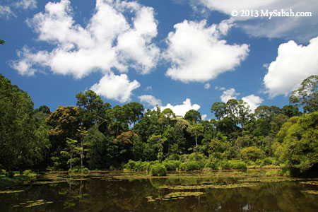
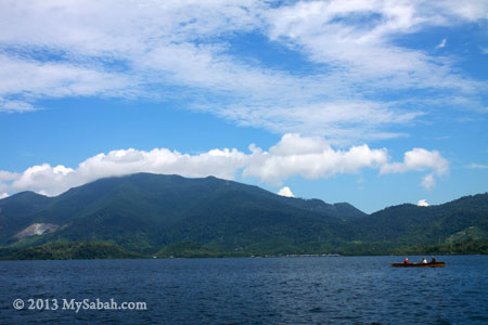
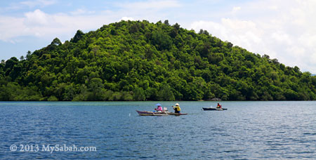
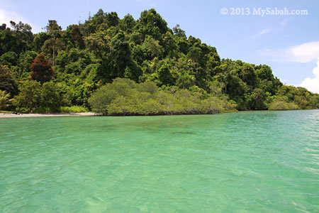
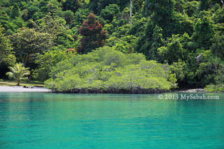
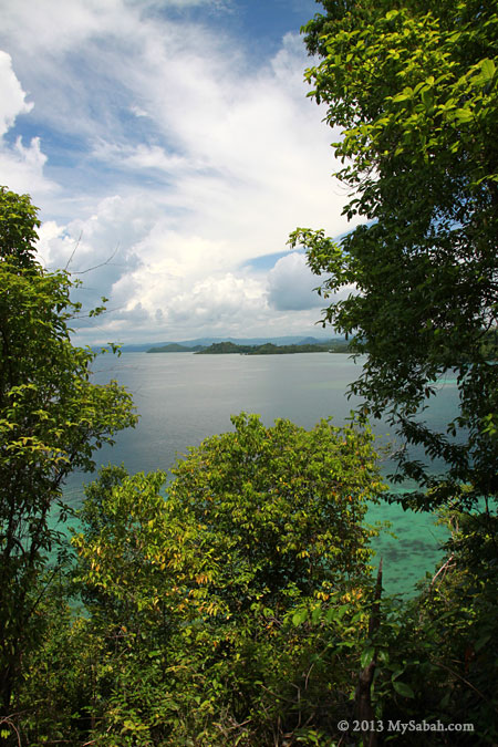
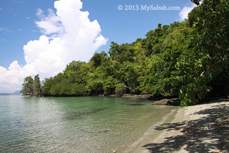
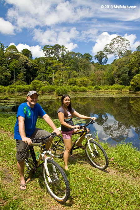
Pic: beautiful Pandan Lake of Taliwas Park

However, Taliwas Park is not commercialized, so very few hear about it. Actually I learnt about Taliwas Park by accident, when I was cycling there last year.


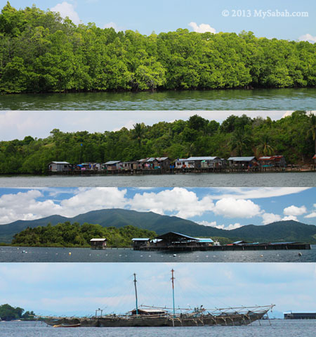
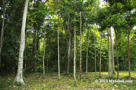
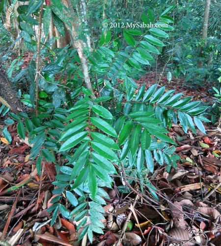
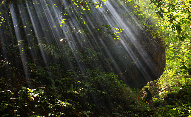
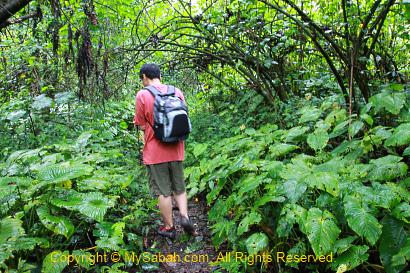
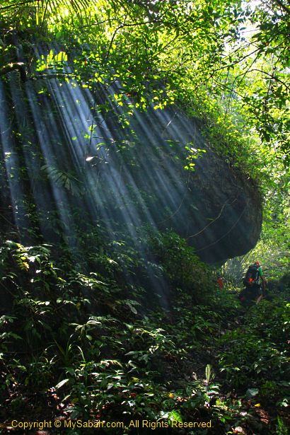
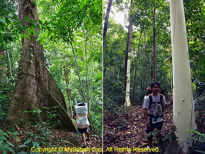
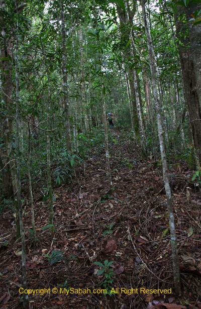
Last year I went to Taliwas Park for a cycling trip. I did a few photo-shooting near the camping ground, because the rainforest there looked so fresh and lively under the morning rays. Taliwas Park itself is a fully-protected forest reserve.


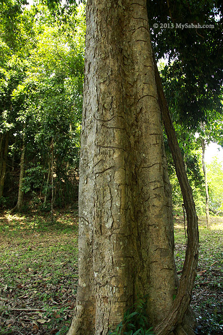
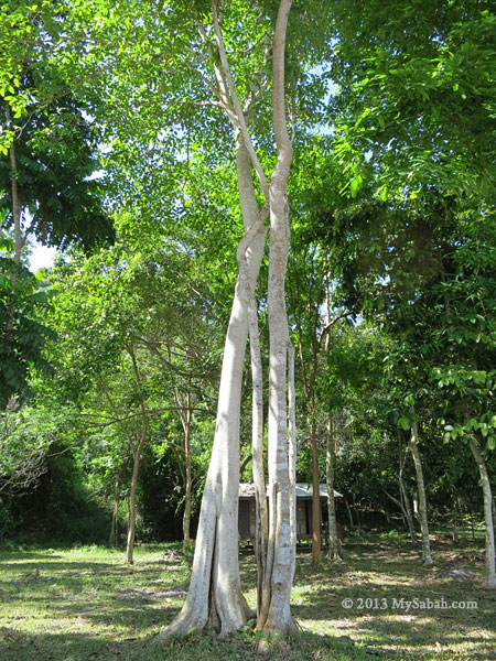
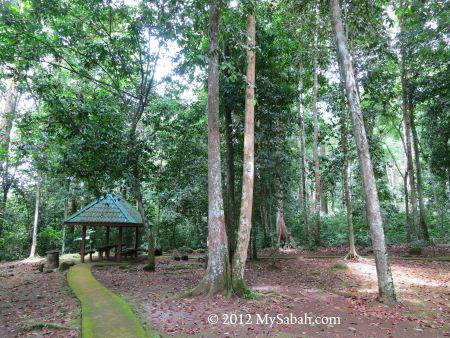
Pic: check out the tall and dense trees above our heads!

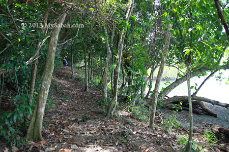
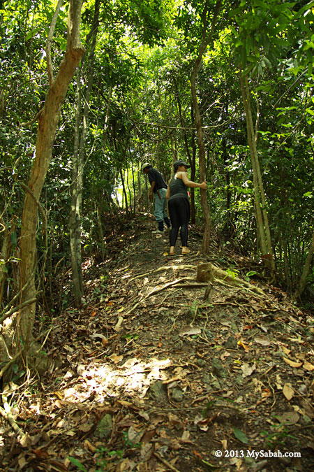
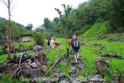
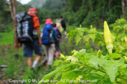
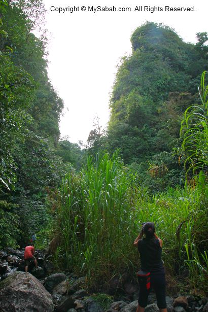
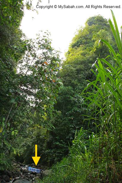
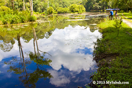
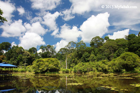
We followed a gravel trail from the campsite of Taliwas. In about 300 Meters, we arrived an open space and Pandan Lake was just in front of us.

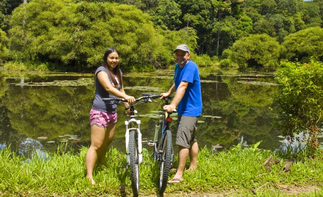
I was so excited about the scenery (really, because there aren’t many nature lakes in Sabah). The weather was perfect, I love the reflection of lush trees and blue sky in the lake, so I took a lot of pictures. You can click the photos to enlarge them.

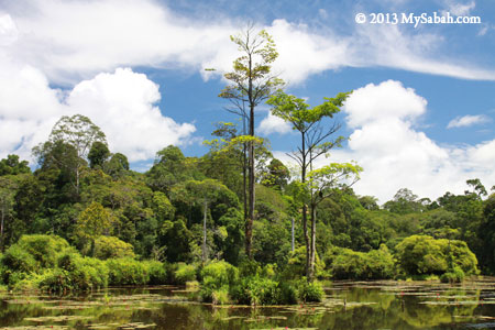
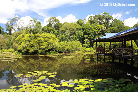
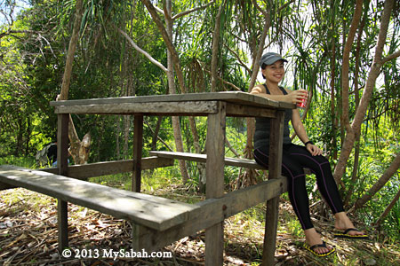
Pandan Lake is a great place for picnic. Visitors also come here for bird watching, wildlife sighting and kayaking.


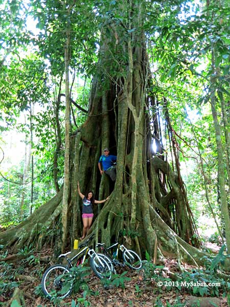
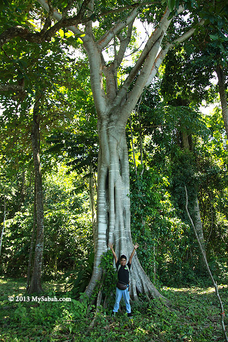
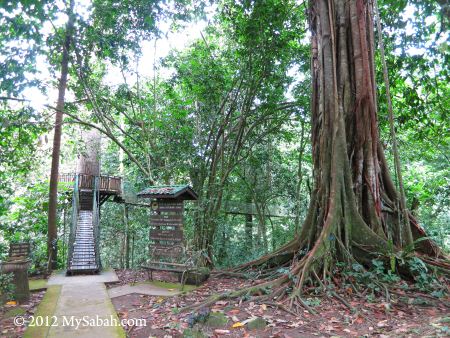
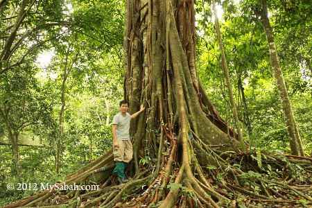
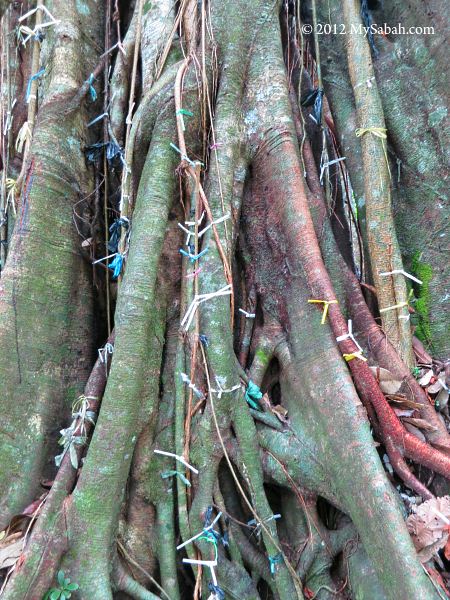
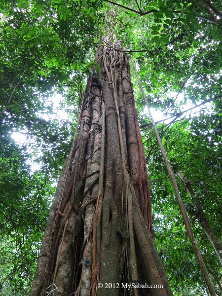
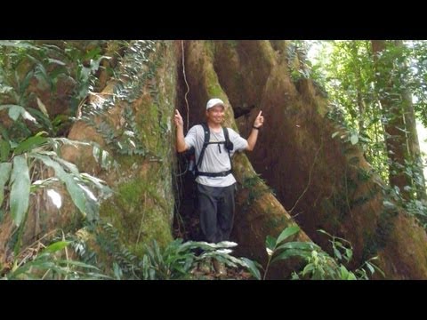
Pic: a huge and old strangler fig tree in the park

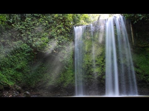
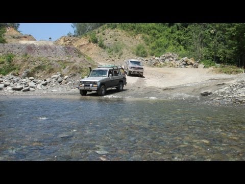
Below is a video of Pandan Lake:


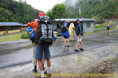
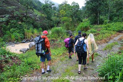
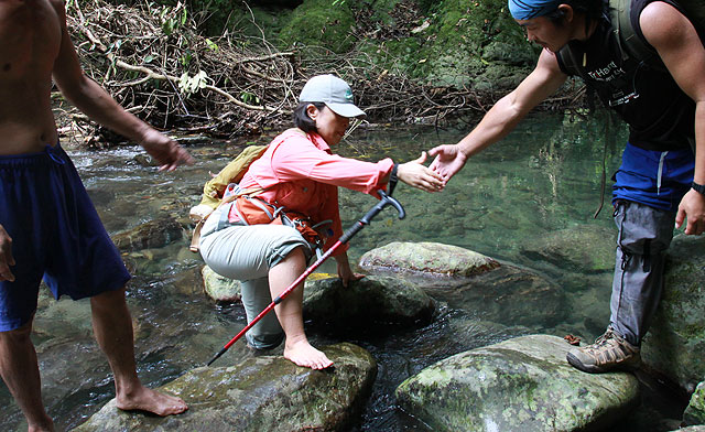
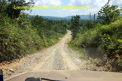
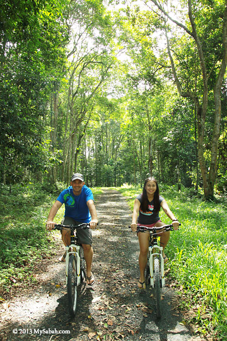
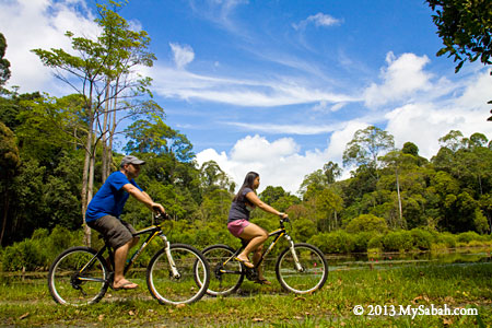
My “discovery” of Taliwas Park was started with a cycling tour with Bike and Tours in Lahad Datu. We started at Silam junction which led to a long gravel road flanked by dense wood, oil palm plantation and village houses. For safety, a 4WD will accompany the cyclists.


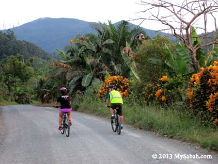
Pic: cycling in the countryside of Lahad Datu


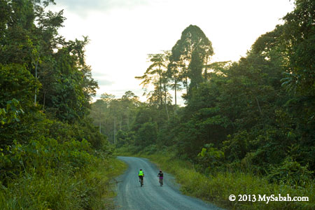
This area is very near to the forest reserves. If you are lucky, you would see herd of Bornean pygmy elephants on the road. The cycling distance was about 20 KM and we stopped at Taliwas Park for a dinner.


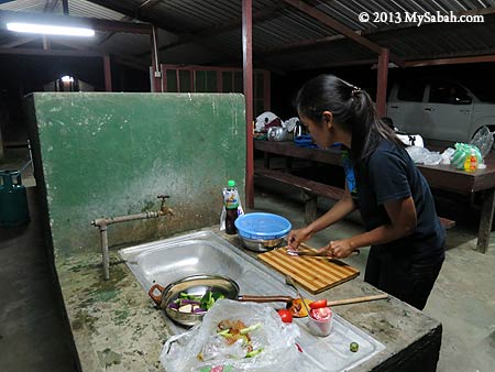
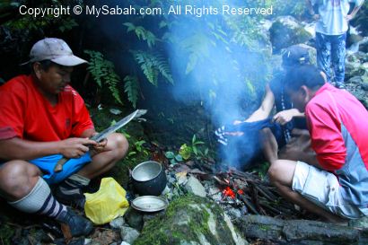
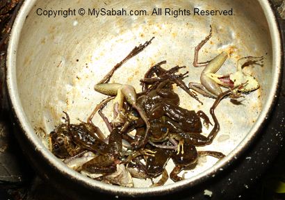
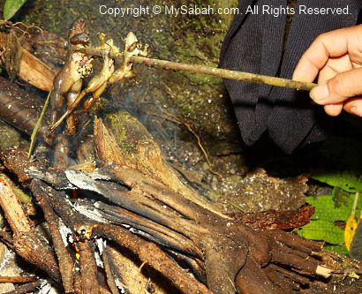
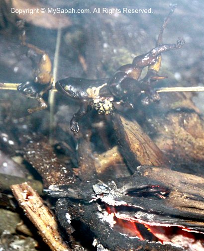
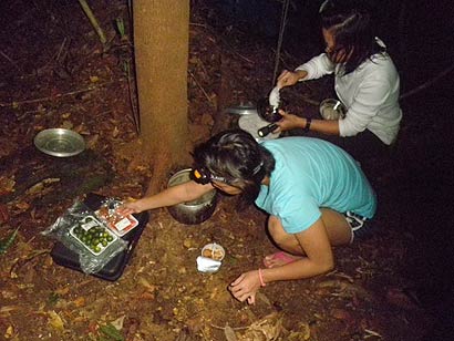
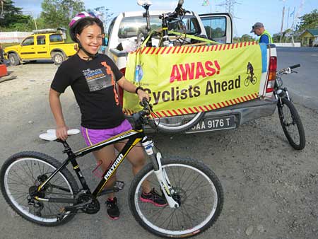
Pic: Tisha busy cooking food in Taliwas Park


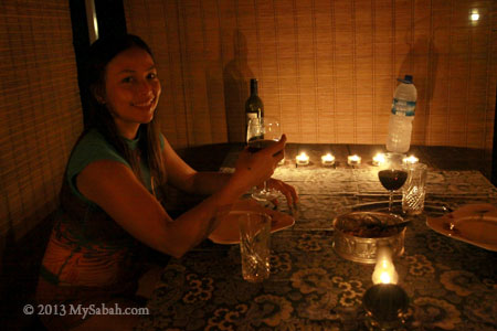
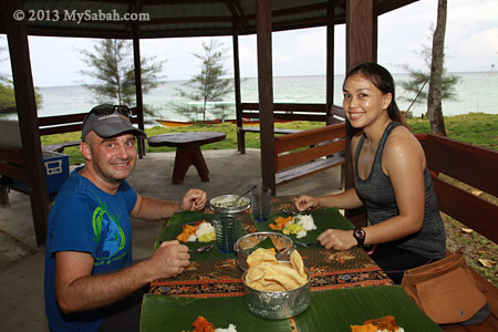
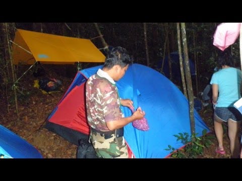
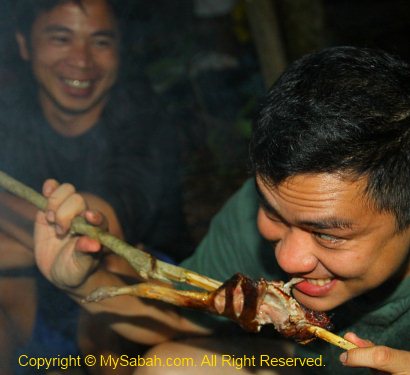
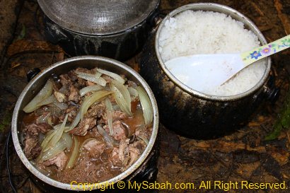
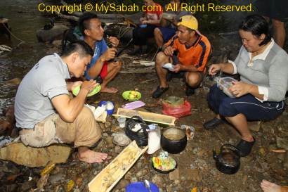
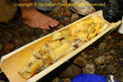
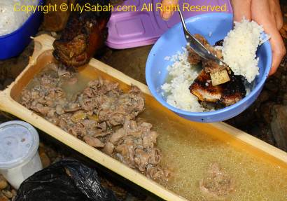
Then you can enjoy a candle light dinner next to the river of Taliwas. There is no restaurant in the park, so Simon and Tisha (from Bike and Tours) prepared the food and setup the table for us. They made some BBQ seafood, mashed potato and chicken wings, which were really delicious. It’s a very creative way of dining for honeymooners lol.

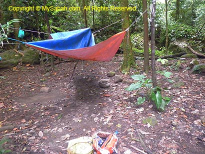
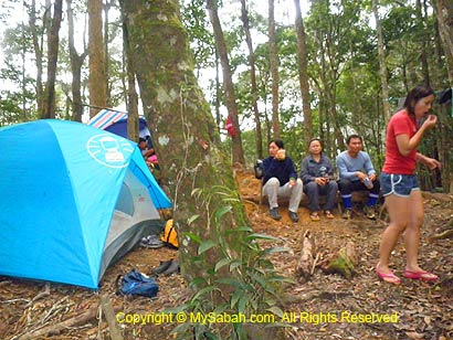
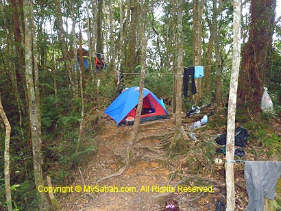
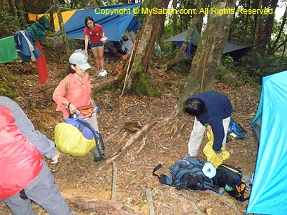
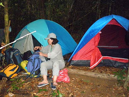
Camping Ground & Amenities

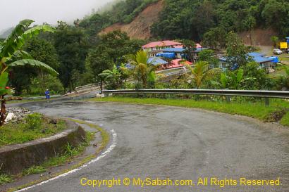
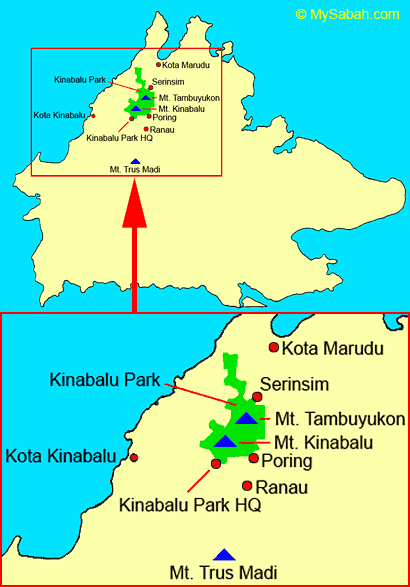
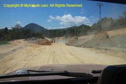
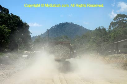
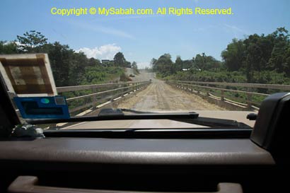
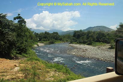
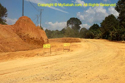
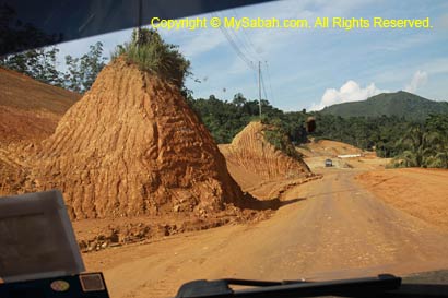
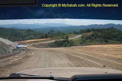
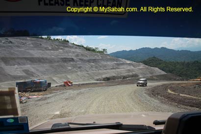
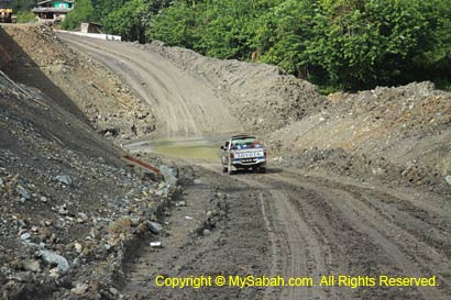
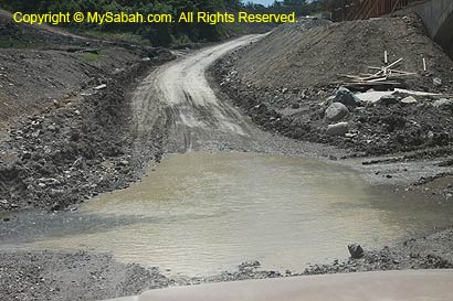
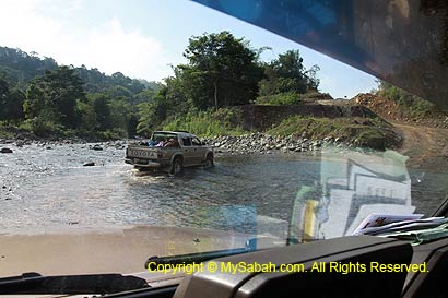
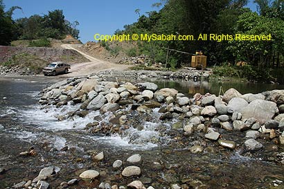
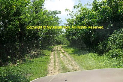
Ok, let’s see more about Taliwas Forestry & Recreation Area (Taliwas Park), so you know why it is an excellent camping site. Taliwas Park is 39 KM away from Lahad Datu town (see Location Map). The road 20 KM before Taliwas Park is unsealed and can be muddy in wet season, so you better go there by 4-Wheel Drive (or by cycling like what I did). The park has water and electricity supply.


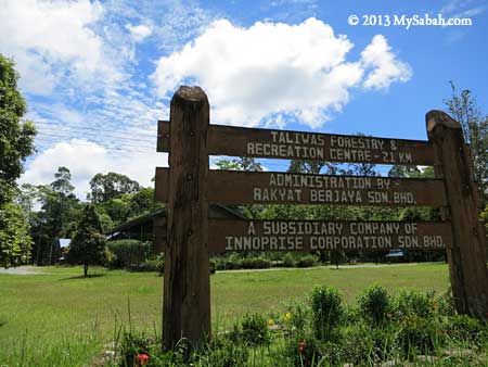
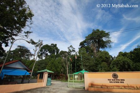
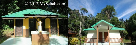
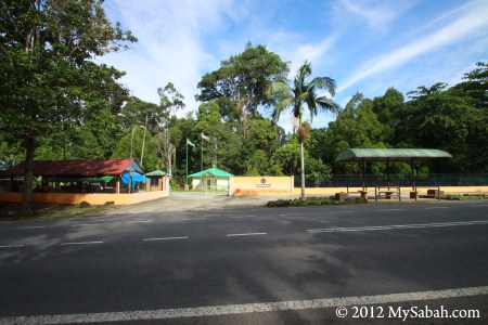
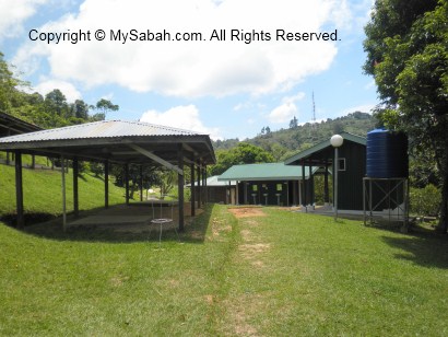
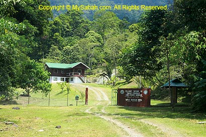
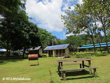
Pic: entrance of Taliwas Forestry & Recreation Area


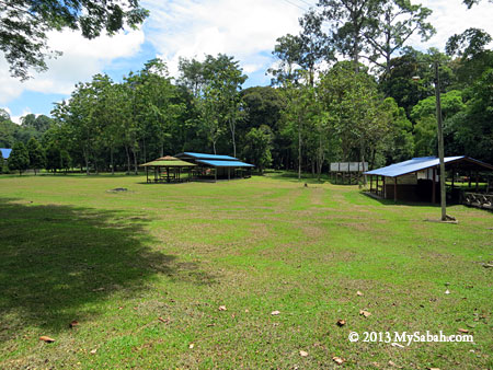
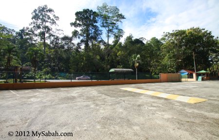
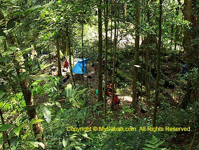
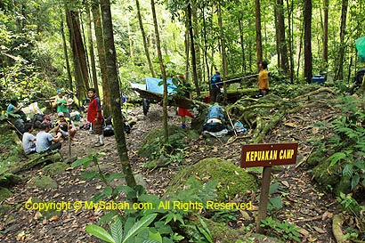
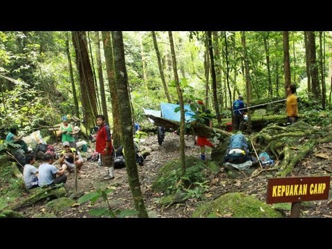
Pic: the camping ground of Taliwas Forestry & Recreation Area is vast and can accommodate hundred of campers.


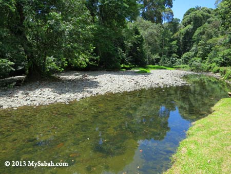
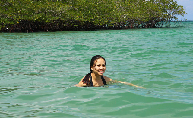
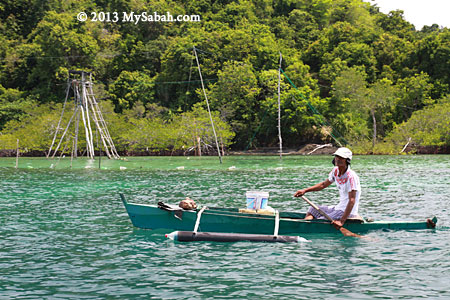
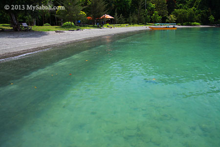
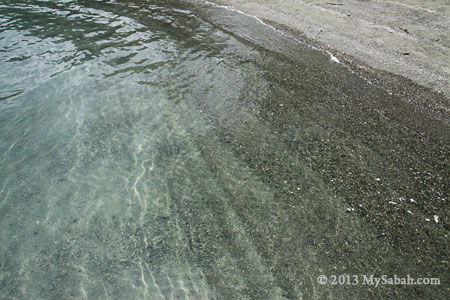
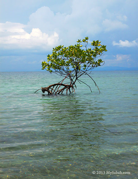
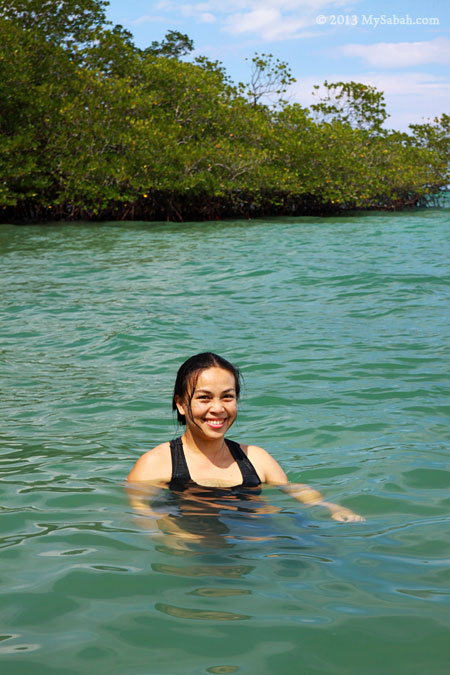
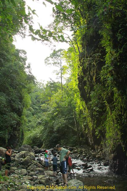
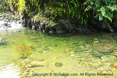
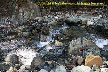
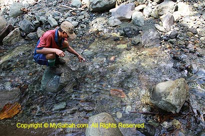
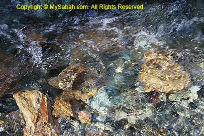
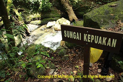
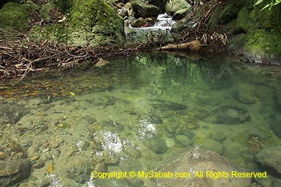
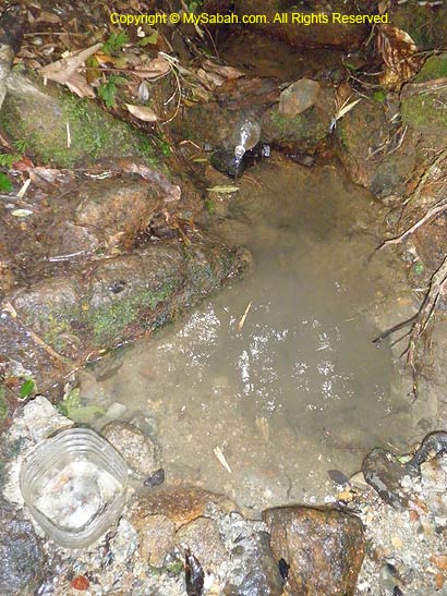
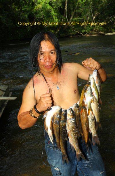
Pic: the river in Taliwas Park is shallow and clean, very suitable for a swim. The water is so clear that I can see many big fishes swimming. Sorry, we are not allowed to catch them.


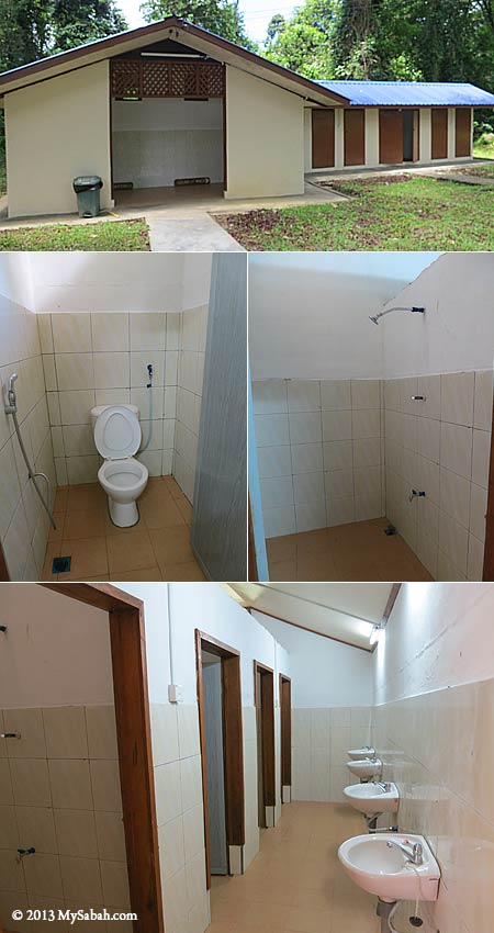
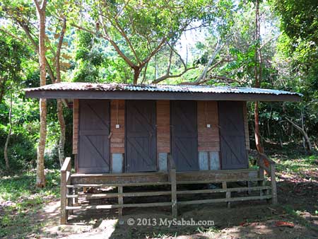
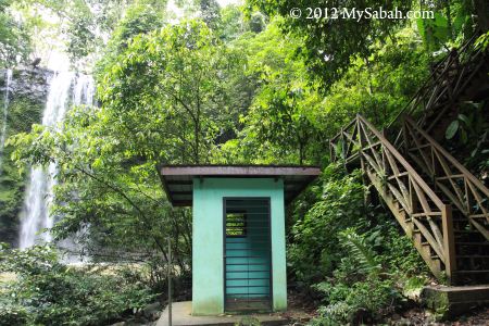
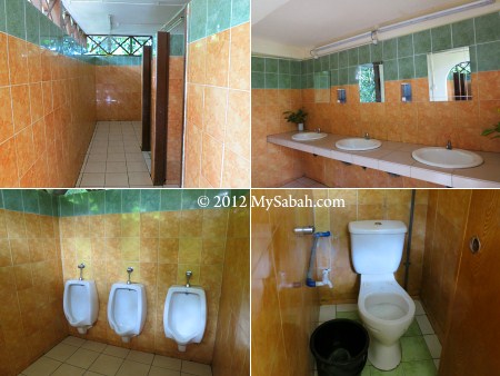
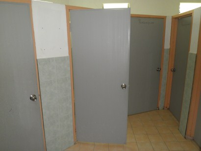
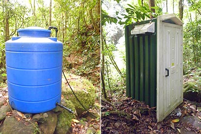
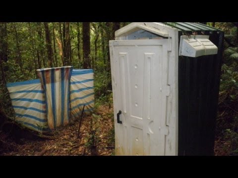
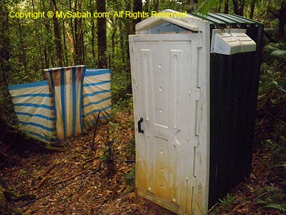
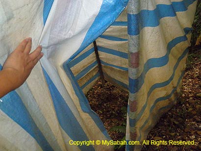
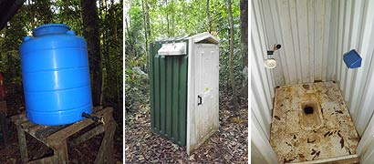
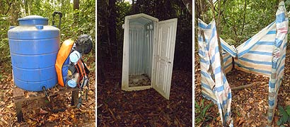
Pic: the toilet and bathroom of Taliwas Forestry & Recreation Area


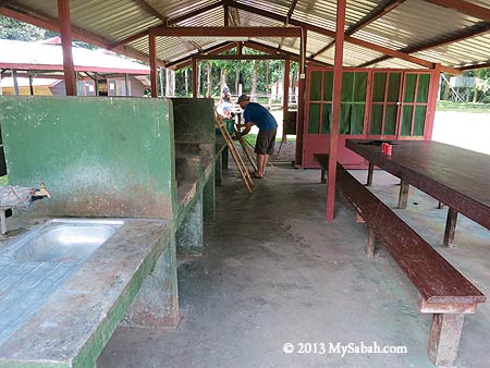
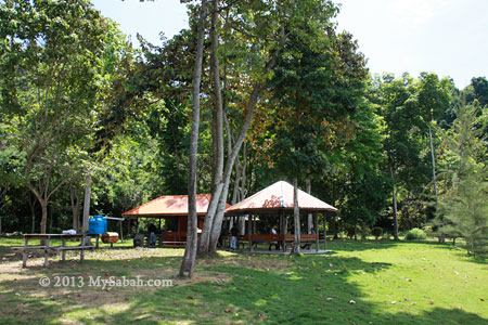
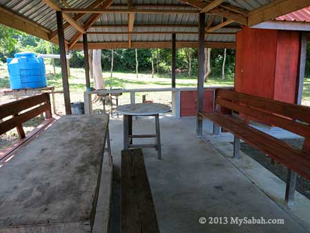
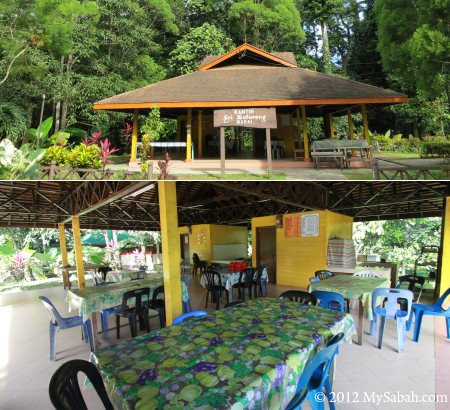
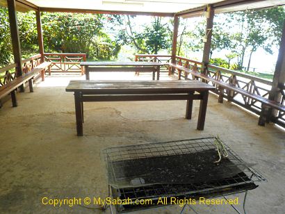
Pic: the cooking and dining area of Taliwas Forestry & Recreation Area


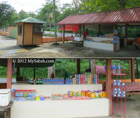
Pic: Barbecue grill stand and bench in the park


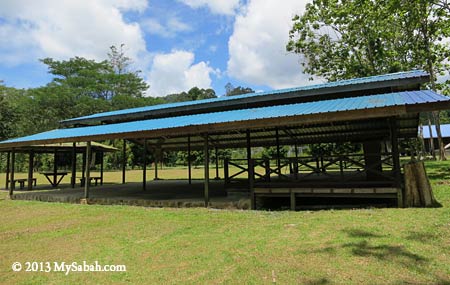
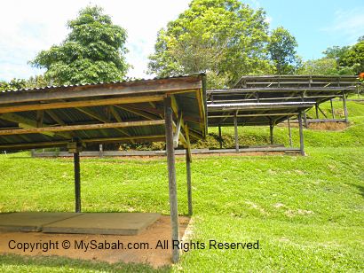
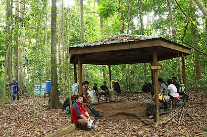
Pic: the activity area, where group of campers can gather here to do some activities.


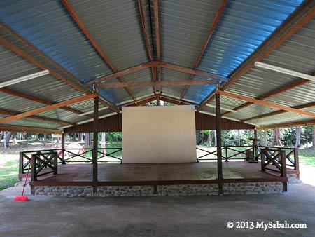
Pic: they even have a small stage for function


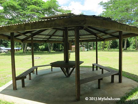
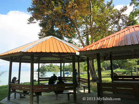
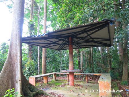
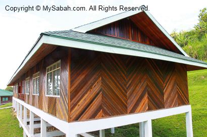
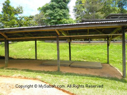
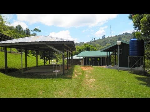
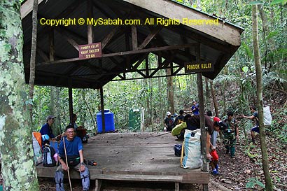
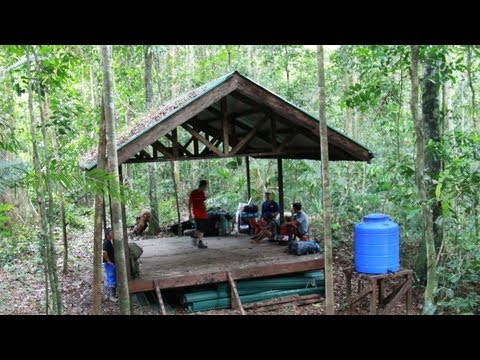
Pic: shelter in Taliwas Forestry & Recreation Area
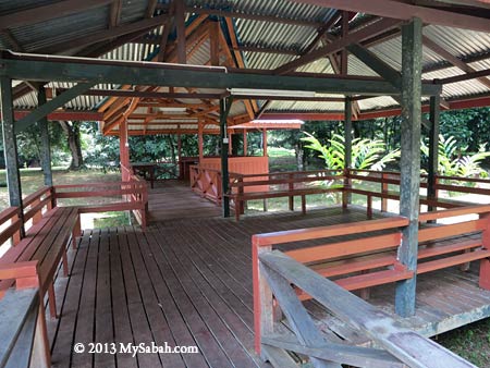
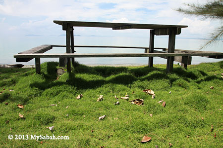
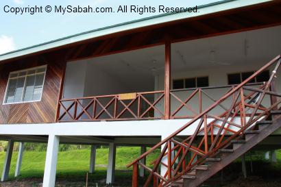
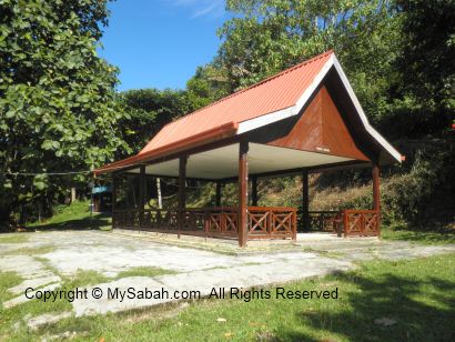

Pic: verandah


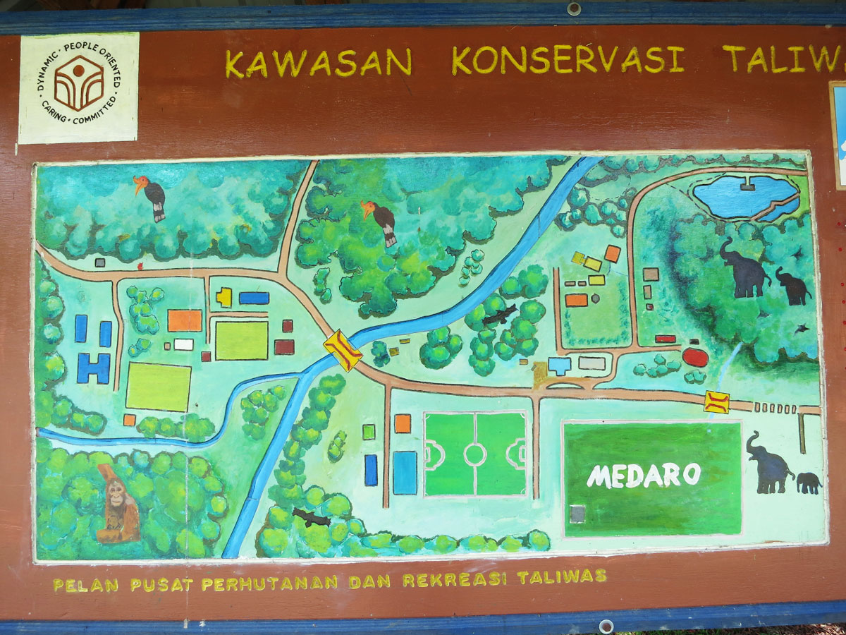
Pic: above is the layout map of Taliwas Park, you can click it to enlarge.

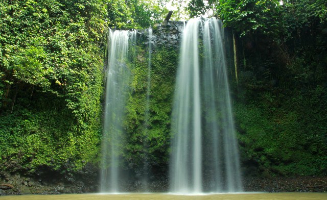
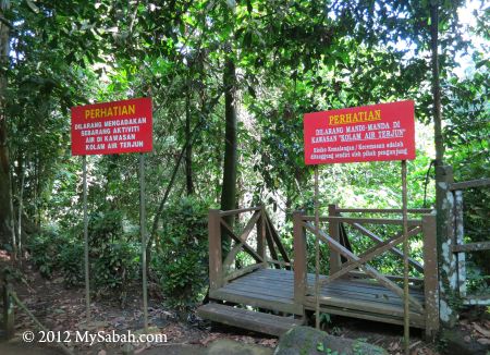
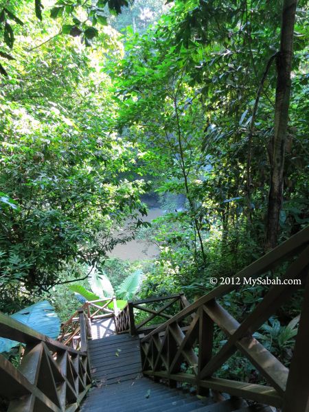
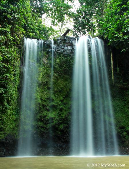
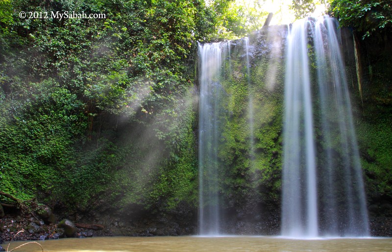
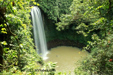
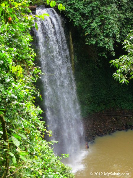
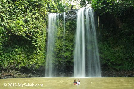
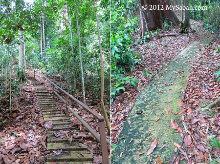
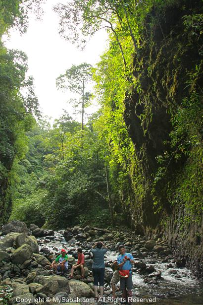
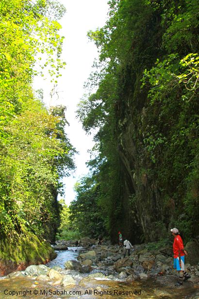
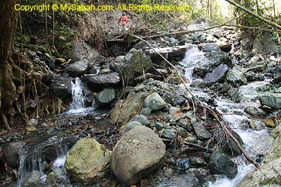
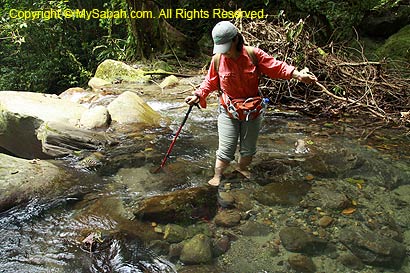
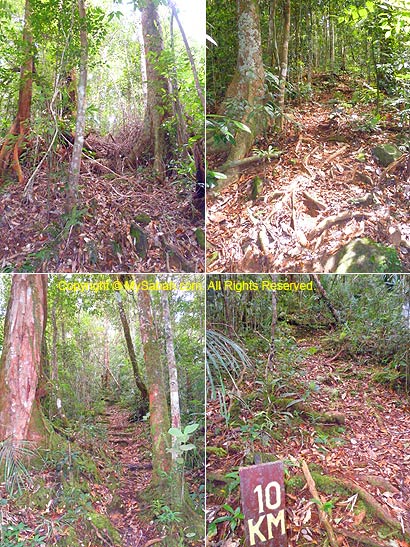
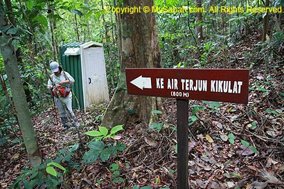
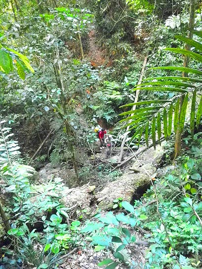
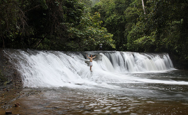
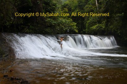
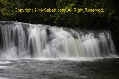
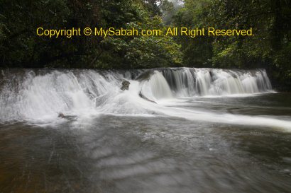
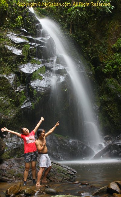
If you like waterfall, you can trek an hour in a jungle trail to reach there. Someone posted some nice photos of camping and Taliwas Waterfall, which I don’t have.

Fees & Contact


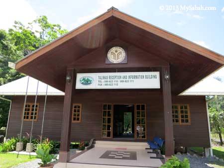
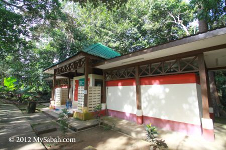
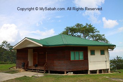
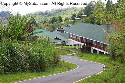
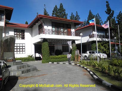
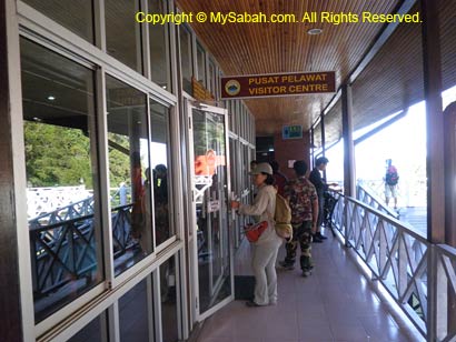
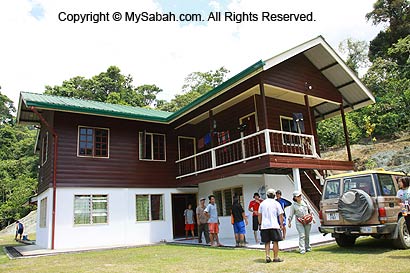
Pic: Reception and Information Building at Taliwas Park. You must check-in here before you enter the campsite. For booking and enquiry, please call them at +60 89-880825 / +60 89-823110 / +60 89-823111, or e-mail to Ms Fevayati Jimang (feva_fj@yahoo.com) / Ms Zalilah Ali (alizalilah@yahoo.com).


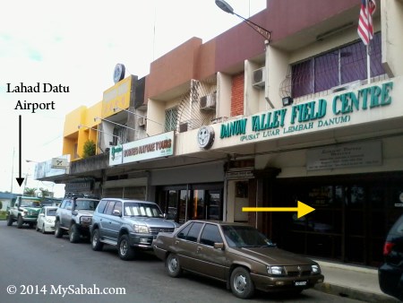
Pic: office of Taliwas management (named Danum Valley Field Centre)

The management of Taliwas Park also has an office opposite to Lahad Datu Airport. Below is their opening hours:
Mon-Thu: 8am-1pm, 2pm-5pm
Friday: 8am-11.30am, 2pm-5pm
Sat & Sat: closed
Taliwas Forestry & Recreation Area has a Facebook page too if you want to in touch with them online.

Please note Malaysia school holiday is the peak season for schools and nature clubs to organise holiday camp or educational tours in Taliwas Park. The park can be crowded and noisy during that period. Anyway, the park is quite empty in other times.


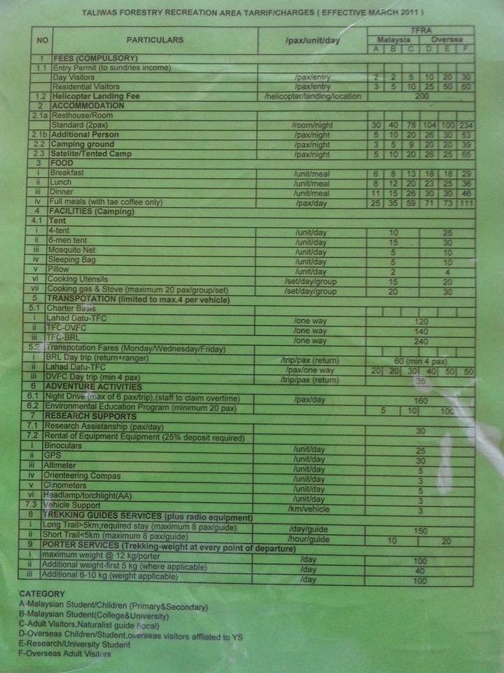
Above is the list of services and charges (fee in Malaysian currency (RM), RM1 ≈ USD$0.33) I copied from their Facebook page, quite exhaustive. They really know what campers need and cover everything from charter transport, renting camping tent, guide service, cooking utensils, packed meals, pillow, sleeping bag, etc. The camper almost can come here without bringing anything (except some clothing to change, cash and personal toiletries).
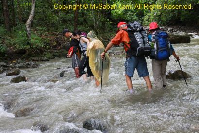
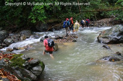
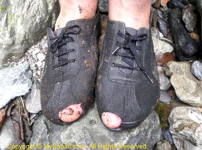
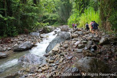
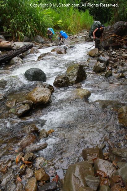
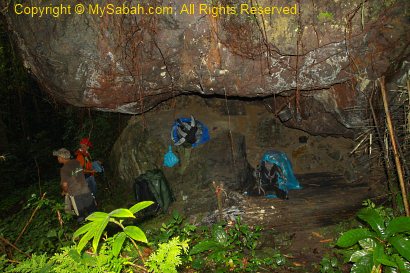
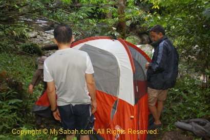
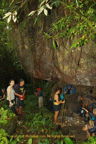
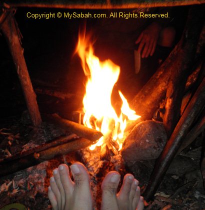
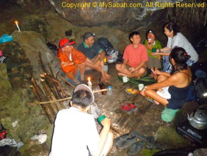
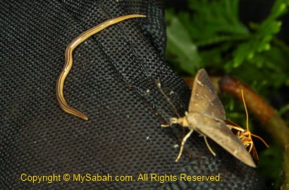
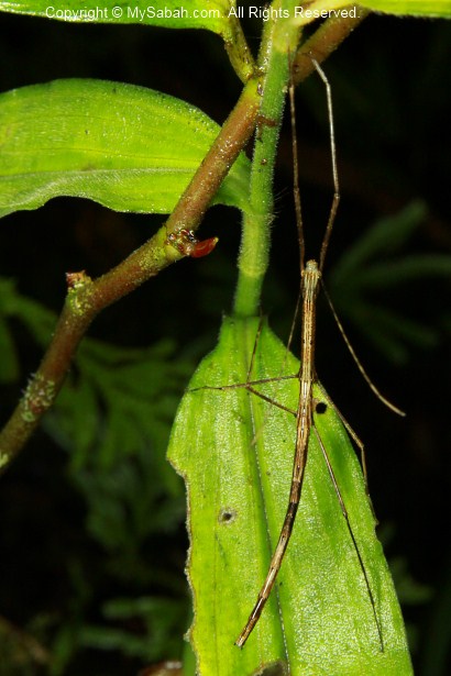
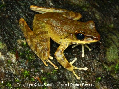
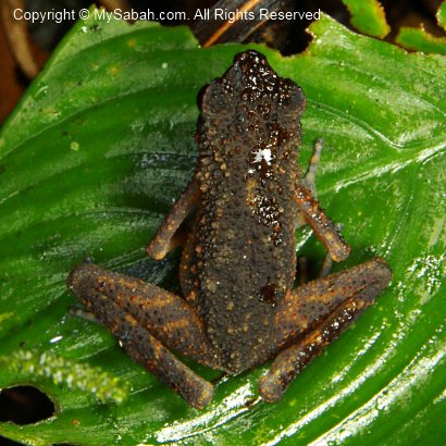
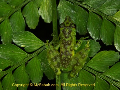
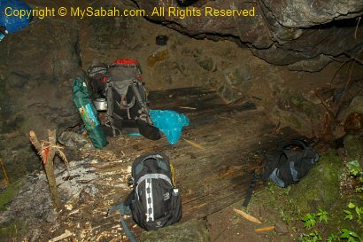
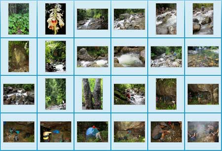
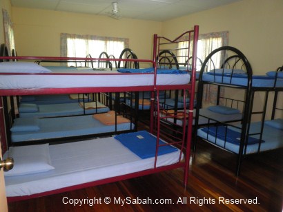
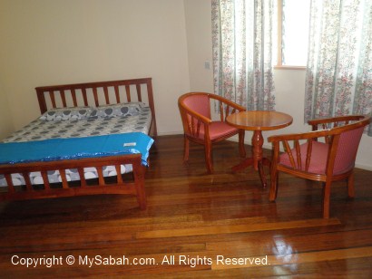
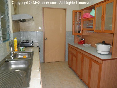
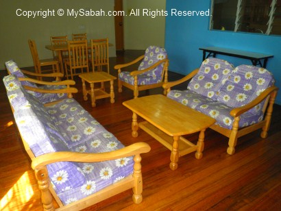
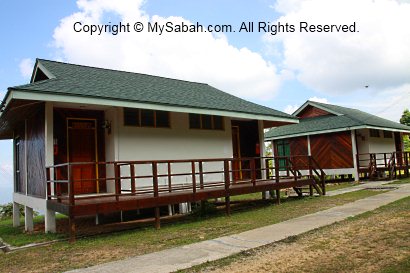
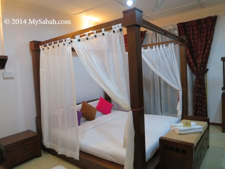
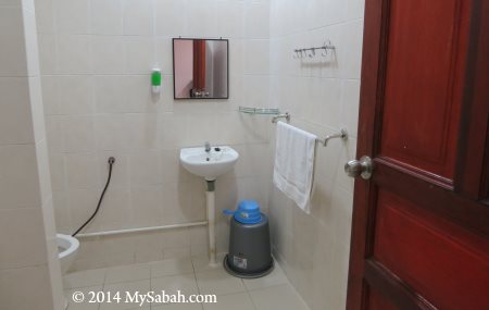
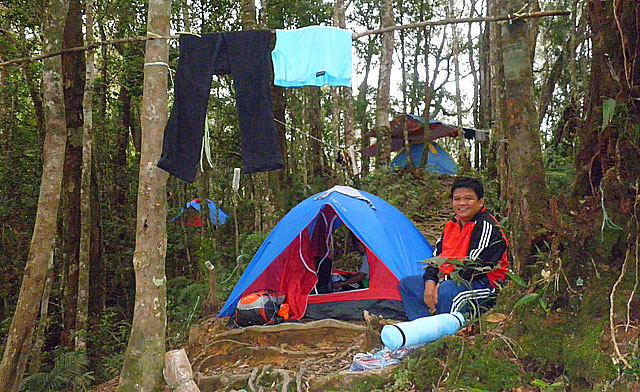
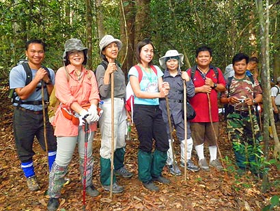
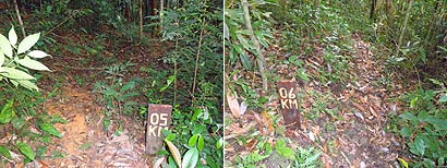
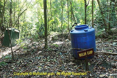
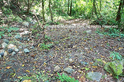
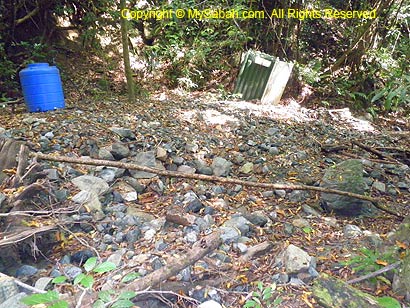
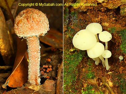
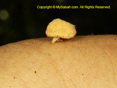
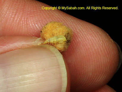
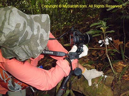
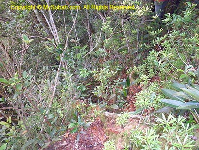
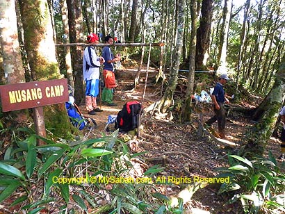
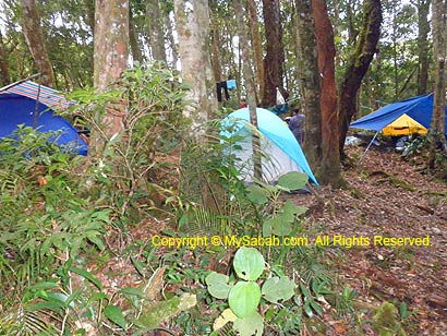
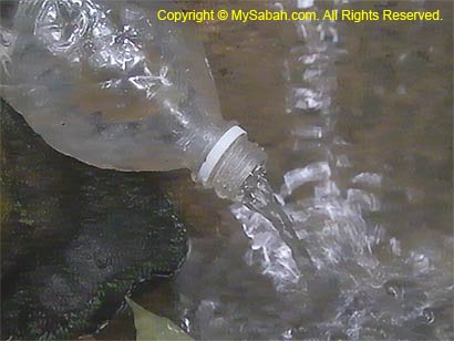
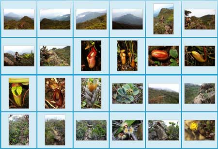
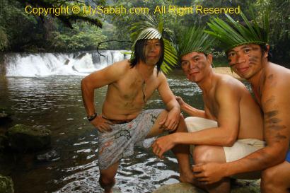
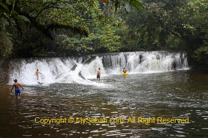
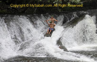
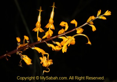
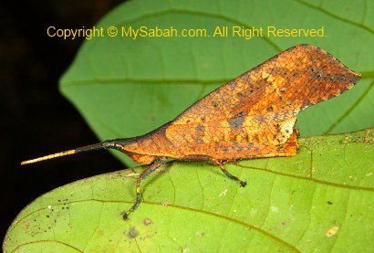
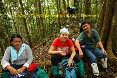
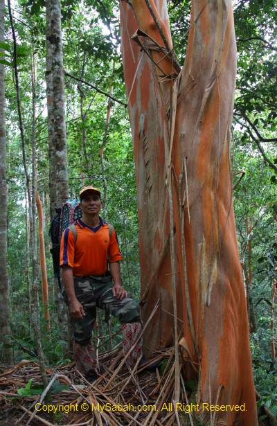
More Photos

Created with flickr badge.

Do you know any other nice camping ground in Sabah? Please share with me.

Photos taken in Lahad Datu, Sabah, Malaysia Borneo

Tumunong Hallu Beach, the Coastal Forest of Borneo

Whenever people talk about forest conservation, they would think that only the inland rainforest is worth protecting. Malaysian estate developers love to build condominium and resorts along seaside, as the sea view property is more marketable. As a result, there are very few pristine “beach forest” (coastal forest) left in Sabah, and most of us don’t know that the coastal forest of Borneo is also an important part of our forest ecology matrix.


Pic: Tumunong Hallu is at the coast of Darvel Bay, far behind is Mt. Silam.

Tumunong Hallu Conservation Area, which is along the coast of Darvel Bay, Lahad Datu (see location map), is one of the best examples of Borneo coastal forest and the first coastal conservation area. This 5.8-KM² fully protected forest is managed by Yayasan Sabah Foundation for research and education purposes. They consider opening the area for tourism too in future, as the beautiful beaches there are suitable for recreational activities. For now, it is a hidden treasure.


Thanks to Bike and Tours, I learnt about Tumunong Hallu last year. Tumunong Hallu is about 20 KM from Lahad Datu town and accessible by road, but we go by boat so we could cruise around the islands of Darvel Bay. We saw mangrove forest, water villages, fish farms and fishing platform on the way.


Then a marine police patrol approached our boat. I sweated a bit because I thought we entered the restricted area.


Well, it happens that they know our boatman and would like him to help sending something to Tumunong Hallu, phew…


I also saw a lot of fishermen and fishing structure named Selambau (see photo below). Seem like everyone lives in Darvel Bay fish for a living.


Pic: Selambau fishing structure built by Sea Bajau fishermen

The Beach of Tumunong Hallu

After an hour, we arrived the beach of Tumunong Hallu.


Pic: Tumunong Hallu and its beautiful sea water.

Since you can view the following photos, I don’t need to write too much to describe how inviting and tranquil the sea water is…

The seabed is rocky with layer of smooth silt, and the beach is covered by dark sand, all these are the characteristics of forested beach.

Besides the land, Tumunong Hallu also includes the sea area with rich marine biodiversity such as coral reef, and two nearby islands, i.e. Saranga and Tabun Islands, into its 1,600-Hectare conservation area.


Pic: shelter and kitchen near the beach. This place is nice for camping too.


Pic: The shore is carpeted by lush Silam grass.

Hiking

The researches show that Tumunong Hallu has 81 plant species comprising coastal and inland vegetation. The best way to explore the interesting mixture of mangrove and dipterocarp forest here is by jungle trekking.

We tried the shorter nature trail that is only 3 KM one way (then taking a boat back to starting point). If you have more time, you can hike the longer trail to the hilltop, which takes 4 to 5 hours, to have a nice view of the beach and forest.

Two forestry rangers, Yapdi and Azwan, were accompanying us and share some interesting facts about this forest. The trail is easy to walk and the jungle is not warm and humid as the rainforest, due to the sea breeze.


The soil here is quite fertile, evidenced by a big earthworm I found on forest floor.


Pic: we took a short climb to Ara Viewpoint, which is a knoll near to a beach.

There was strong scent of Kayu Malam tree in the air of this slope. This wood is a famous aphrodisiac among local ladies if I’m not mistaken.


Pic: Nova cooling off on Ara Viewpoint. Note the dense Pandanus trees at her background.


Pic: nice sight from Ara Viewpoint

We also checked out the Nunuk Beach not far away.


Pic: Nunuk Beach


Pic: a lonely mangrove tree

The coastal forest is not just a collection of dull trees. Among mangrove, seaside hill and beach forests, there are some interesting and unique trees, such as the Keruing tree below.


Pic: this Keruing tree looks like being vandalized. Actually the “cut” is a natural feature of its bark.


Pic: the tree in the coastal forest can be big and tall too, like the Nunuk Tree shown in photo above.


Pic: beautiful white stripes on the bark of Nunuk Tree.


Pic: Bao-Bao tree, a softwood with white bark

If there are trees, there must be wildlife. I didn’t see a lot of wildlife, but studies say some birds (e.g. Great slaty woodpecker) and mammals (Long-tailed Macaque, Barking deer, Sambar deer) are the residents of this forest. We were hungry after one hour of hiking, so we took a boat back to the starting point for lunch.

Amenities at Tumunong Hallu

As this beach is not frequented by tourists, the facilities are basic but good enough for camping. There is no resort, restaurant and shop here. If you want to cook, you have to bring your own cooking utensils and gas stove.


Pic: shelter and a kitchen (at the right)


Pic: toilet and changing room


Pic: small kitchen with sink and water supply, benches and table for dining.


Pic: enjoying lunch with Nova, my partner in crime, and Simon from Bike and Tours. Don’t know why. Food always tastes great at seaside.


Pic: Yummy Indian food prepared by Tisha and Simon from Bike and Tours, the curry and sour vegetables were so appetizing… They really know how to cook and present the food. This friendly couple receives a lot of positive feedbacks at TripAdvisor.


Hey, we were at the beach so we must soak ourselves in warm tropical sea water to conclude the tour. The whole beach was ours to enjoy. Overall, it’s a wonderful experience.

The video below shows the beach of Tumunong Hallu:

More Photos

Created with flickr badge.

Even though Tumunong Hallu is not a popular destination now, being unfamous doesn’t mean that it has no potential. If it is open to public in future, you must visit this place. At the moment, you can arrange a tour with Bike and Tours for a trip to Tumunong Hallu.

Photos taken in Lahad Datu, Sabah, Malaysia Borneo

Madai Waterfall and Tongkat Ali Hill of Kunak, Sabah

Waterfall is a delightful view and always be part of the painting about paradise. The bigger it is, the happier the visitors. That’s how the 40-Meter Madai Waterfall drew me to Kunak, a small town in Lahad Datu district. In fact, many European and Asian tourists had come for it. I have visited many waterfalls of Sabah, and Madai Fall is one of the most impressive.


The 5-storey high Madai Waterfall is located in 3,436.50-Hectare Madai Baturong Virgin Forest Reserve Nature Center, which is managed by the Sabah Forestry Department and opened to the public since 1999. Madai Cave is also part of this reserve.


Pic: Madai Waterfall is inside Pusat Sejadi Hutan Simpan Madai Baturong (Madai Baturong Forest Reserve Nature Center) of Kunak.

As Madai-Baturong Forest Reserve Nature Center is a public park, anyone can pay a small entrance fee to enjoy Madai Waterfall. Below is the ticket rate:

  • Malaysian: Adult: MYR2.00 (≈USD0.66); Below 18: MYR1 (≈USD0.33)
  • Foreigner: Adult: MYR5.00 (≈USD1.66); Below 18: MYR2 (≈USD0.66)

Madai Waterfall

Madai Waterfall is very accessible. It is so near that you can hear it, once you walk into the park. Remember to bring insect repellent, as mosquitoes might be around.


Pic: the wooden staircase to Madai Fall.


It is only a 1-minute walk. The boardwalk is quite steep, be careful..


Pic: huge Alocasia odora next to staircase. This plant has the largest undivided leaf in the world.


Pic: Madai Waterfall in the sight!


Pic: the “twin” Madai Waterfall. After heavy rain, both will merge into one huge vertical fall. Though the water is murky, it is clean and cooling.


Due to the powerful splash, the air was filled with flying droplets. When the morning light shined through them, it created fascinating rays of light. Such a lovely view.


Pic: the warning sign near the Madai Fall.

Any water activity such as swimming is prohibited, because the waterfall pond is deep. Basically, this waterfall is meant to be watched only. Anyway, you can soak your feet in the shallow water, like most people do. Anything beyond that is on your own risk. There is no lifeguard around to stop you or to save you.


However, some visitors can’t resist to take a swim under this beautiful waterfall. A ranger told me that he saw a very deep hole in the center of waterfall pond after a 8-month drought. Madai is in a limestone area, so I wonder if this hole connects to an underground cave or river. Well, I’m just guessing.

Want to see Madai Waterfall in motion? You may watch the 90-sec video below:


During weekends and holiday, many locals come here to swim and picnic. Some of them taking bath (with soap) or washing their dirty plates in the stream, which flows to Tingkayu River. It’s not right.. 🙁


Pic: dense moss behind the Madai Fall.


The park opens from 8am to 5pm every day. The waterfall is quite crowded afternoon.


Pic: gold found at Madai Fall?

Wishing Tree

Besides Madai Waterfall, I found an interesting tree in Madai-Baturong Nature Center. The local calls it a “Wishing Tree” (Pokok Hajat).


Pic: the wishing tree is standing near the entrance of canopy walk.


It is a tall tree, which is locally known as “Kayu Ara” (Ficus species, Moraceae). Many birds will gather on this tree during its fruiting season.


Every ribbon on the tree root is a wish of the asker. Probably it works, so there are hundred of ribbons on this wishing tree.


Whatever, it is a tall and magnificent tree to look at. I wish it will stay strong and healthy forever.

Bukit Tongkat Ali

Bukit Tongkat Ali (Tongkat Ali Hill) is another attraction in Madai Baturong Forest Reserve. This hill is named after a herb Tongkat Ali (species: Eurycoma longifolia, Nicknamed “Asian Viagra”), which is famous for the medicinal properties of its root that can increase testosterone level and treat erectile dysfunction.


Pic: Tongkat Ali tree


Visitors can hike to Bukit Tongkat Ali via a 1 KM trail in the park. When you enter the park, just turn right and follow a small road that leads you to a small bridge and rest shelter. The trail starts at a paved path behind the shelter.


Though the trail is less than 1 KM, it is steep and tiring. The trail is paved with cement. It is supposed to be a good idea. However, the moss cover on the cement becomes so slippery that, after rain, the trail turns into a skating route. In some sections of the trail, I had to hug the hand rail to descend carefully.


Pic: the last shelter on top of Bukit Tongkat Ali (Height: 169 Meters).

I was told that Bukit Tongkat Ali was abundant with wild Tongkat Ali, but I only saw one or two. Probably some impotent visitors pluck it. I was also told that I could see Madai Hill from the top of Bukit Tongkat Ali, but such view was obstructed by dense trees.

Sorry to say, spending nearly 2 hours walking up and down Bukit Tongkat Ali is simply a waste of time.

Public Amenities

Madai Baturong Nature Center have some basic amenities in place for visitors.


Currently (as of Nov 2012), the canopy walk is closed for maintenance until further notice. Too bad, this 119-Meter long and 40-Meter high canopy walk, which is connected to three giant rainforest trees (Seraya Urat Mata, Oba Suluk and Merbau species), is a main attraction of the park, besides Madai Waterfall.


Pic: public toilet


The toilet is very clean and deserves MYR0.30 (≈USD0.10) per entry.


Pic: the Canteen (named Kantin Sri Baturong Madai) in the park

This canteen sells common food items such as fried rice and noodles, as well as cold and hot drink. It was closed for holiday during my visit.


Pic: there is another small food stall near the gate, but they are selling drink and light snack only.


Pic: (left) shower and changing room, (right) Muslim prayer rooms or Surau


Pic: ample parking space for 20 to 30 cars.

Their rest house is closed and the Exhibition Hall is not ready (as of Nov 2012). You still can camp in the park for a small fee (MYR3 for Malaysian, MYR5 for foreigner). I hope they will upgrade the facilities and amenities there ASAP to attract more tourists.

Wildlife

I heard hornbill near Madai Waterfall. At night, there are mouse deer wandering in the park too. The rangers mentioned a bird with a funny local name “Burung Kopi Susu” (Milk Coffee Bird). According to them, this is a small black bird with white stripes on its wings. This bird is common there and can be seen around 5pm. It sings very well, so people trap and trade them as pet. I wonder what bird it is. Magpie Robin?


Pic: Is Magpie Robin the “Milk Coffee Bird”?

How to Get There

Going to Madai-Baturong Forest Reserve Nature Center is easy but far. Madai Waterfall is 15 KM north of Kunak town and 71 KM southwest of Lahad Datu.


Pic: Madai-Baturong Nature Center is just next to the Lahad Datu↔Tawau highway.

By Bus: If you take Long-Distance Bus from Kota Kinabalu city to Kunak or Tawau, you can ask your bus driver to drop you right in front of the park, which is at the roadside (15 KM before Kunak). The bus fare is MYR50 (≈USD16.67) one way and the ride takes 8 hours.

By Flight: Take a 45-minute flight from Kota Kinabalu to Lahad Datu, then spend an hour on taxi to reach the park.

Below is the location map of the park:

View My Sabah Map in a larger map

For more information, you may contact Kunak Regional Forestry Office:
Address: P.O.Box No 2, 91207 Kunak, Sabah, Malaysia.
Tel: +60 89-851863

Photos taken in Kunak, Sabah, Malaysia Borneo

Minitinduk Gorge, ancient gateway to Mt. Kinabalu

Minitinduk Gorge is the ancient gateway to Mt. Kinabalu, as it is on “The Hugh Low Trail”, an original summit trail used by documented first male climbers, Sir Hugh Low (1851) and Sir John Whitehead (1888), and female climber, Lillian Gibbs (1910), of Mt. Kinabalu, the highest peak of Malaysia. After another “tourist” trail opens in 1924 (by R.F. Evan and Sarel), climbers / tourists are no longer using this trail located in Kampung Kiau (Kiau Village) of Kota Belud district.


Last month I joined a 2-day-1-night camping trip organized by The Sabah Society to explore the gorge. The weather was good for the past few days until we departed in the afternoon, but the heavy downpour didn’t hold us back. By 2:30pm, we reached the junction to Kampung Kiau (Kiau Village), which is a few Kilometers (KM) after Nabalu and 29 KM before Ranau, and where we met up with Mr. Martin Moguring, our guide from Kinabalu Park. Dr. Ravi, the co-writer of the book “The Hugh Low Trail”, is the organizer of this trip.


Then we drove to the school in Kiau Village, which takes another 30 minutes. We parked our cars in the village and walked to the starting point, just a stone throw away from the village. We were told in advance that we will cross multiple small rivers, so most of us were wearing short. Our group also hired 3 porters (Rony, Abinus and Bengent) to carry some of our bags and supplies.

Jungle Trekking & River Crossing


The distance from Kiau Village to Minitinduk Gorge is only 3.5 KM and take about 2 hours of trekking. For the first day, we walk 3 KM to Sambatang Cave and camp there. The second day we walk from the cave to the Gorge, which is only 500 Meters away. FYI, the gorge is in a private land outside of the Kinabalu Park boundary.


In the beginning, we passed through the farmland, mainly consists of paddy, maize, ginger and other food crops.


Pretty soon we entered the secondary forest, characterized by dense undergrowth. It is still raining so it’s very humid in the forest and this “activates” the little brown forest leeches that live in deeper jungle and love wet environment (and our blood!). There are not many of them and most are only 1cm in length. I had seen forest leeches 5 times bigger in primary rainforest, so these tiny-sized blood suckers didn’t bother me. I didn’t even feel that I got one leech bite until I saw my leg bleeds.


Though it’s a newly generated forest, there are still potential dangers around. Like the harmless looking plant in photo above, its leaves are poisonous and able to make your skin really painful and itchy when touched. But there are many “good” plant too, Martin shows us some plant that can be used as food, preservatives or herbal medicines by local people.


As I’m an experienced hiker, the trail is not rugged and I consider it as an easy walk, not strenuous and challenging at all. Most of the time, we moved on the nature trail adjacent to the Kadamaian River and its tributaries such as Kolapis, and there are about 10 river crossing. But I’m not so used to river crossing. After heavy rain, the rivers rose, turning swift and deep.


Though the depth of river only reaches our knee level, the current is strong enough to push you down if you don’t stand firm. The worst thing is the murky water caused by heavy rain, we can’t see the irregular bottom. We had to cross slowly, probing the depth in front with one foot to avoid stepping into deeper water. I almost fell into the icy-cold water with my camera once.

My best advise is – Trust NO rock and boulder near the river. They all look deceptively safe to step on, but they offer zero friction, after being “waxed” by the river for a long time!


Our socks are soaking wet. Only Dr. Ravi walks with happy dry feet. He also shows us his simple solution – just drill a hole on the shoe for draining of water, lol.


As we were moving further up the river, the boulders get bigger and bigger and see more and more cascading streams, the characteristics of river upstream. The water is so clean, unlike other milk-tea color rivers caused by excessive logging in upstream area (e.g. Padas) of Sabah.

Sambatang Cave

Finally we reach Sambatang Cave at 5:30pm!


Actually Sambatang Cave is a cavernous space under an overhanging huge boulder. It can accommodate 3 to 4 people.


Since the daylight is vanishing, we quickly setup 3 camping tents on the flat area near the cave.


According to the porters, Sambatang Cave is an ideal natural shelter, even the heaviest rain can’t flood the cave.


The porters collected some wood and started a camp fire to “smoke” the cave, as the smell can keep creepy animals such as snake and centipede away from the cave. I’m so happy to keep my feet dry and warm.


Light not only attract insect, it also draws human. After having instant noodle as dinner and a few rounds of hot coffee, everyone squeezes into this small cave to warm themselves up with camp fire.

Night Walk


When I started to see bugs crawling around the cave, I decided to take a night walk to check out the bug party in forest.


Above: a stick insect pretends or thinks that it’s a stick.


You can hear a lot of frog calls near the river.


Same as frog, toad is everywhere too.


Above: This little green frog is almost invisible on the green fern.


When the night is late, I go to bed in Sambatang Cave, which is also the place the early explorers like Sir John Whitehead and Lilian Gibbs spent their night before heading to the summit, as described in their chronicles more than a hundred years ago. Do remember to bring floor mat and sleeping bag if you plan to sleep inside the cave. Torchlight / LED headlamp is needed if you want to do your business in dark night. The night was so cold that I can feel the chill in my 7°C-grade sleeping bag.

What’s for Breakfast?


My biological clock waked me up at 6am next morning. I saw the porters busy preparing breakfast. From their happy smiles, they must be waiting for something really tasty.


Out of curiosity, I take a look what is inside the pot. Oh dear, those are the frogs they catch. No wonder I saw them searching for something along the river last night. Well, I was there hunting for frog photos but they hunt for the frog meat.


Then they grill the frog over the fire. Please note that only certain frog species are edible as some are poisonous. You can find the edible frogs for sales in local native market called “Tamu”. Species such as Limnonectes ingeri (greater swamp frog), Limnonectes kuhlii (Large-headed Frog) and Limnonectes leporinus (Giant River Frog) yield high demand as food by local people.


Above: almost done…


They gave a frog leg for me to try. Being open-minded and “adventurous”, I eat it. To my surprise, the frog meat is so sweet and tender. It is slightly chewy but taste a lot better than chicken, trust me.

Minitinduk Gorge


After breakfast, we leave our bags in cave and head to Minitinduk Gorge, which is only 500 Meters away. 15 minutes later, we exit the dense canopy and see Minitinduk Gorge is right in front of us! Minitinduk means “the meeting of two beaks” in Dusun language. The gorge looks like a twin towers less than 50 feet from each other, with Kadamaian River flows between them. Someone believe the gap is even narrower and both sides almost touching each other in the past, as a legend says a Kiau couple can jump over to the other side, when they try to escape from a group of headhunters from Bundu Tuhan.


We take a group photo with banner. We look so small in the photo. The gorge is about 150 feet in height. There is a theory saying that the gorge was once a waterfall with a lake at the bottom. One day the waterfall collapsed and creates the gap that bisected the hill, based on a historical record that there should be a lake under Mt. Kinabalu but is never found.


Inside the gorge is an opening with Kadamaian River flows between the vertical rocky cliffs. Even though tourists nowadays don’t use this trail, the Kadazandusun people believe this is still the holy trail for the spirits of the dead to go to their final resting place, the Mount Kinabalu, and this gorge is the gate. It sounds scary when our day of visit coincides with the Chinese ghost festival day.


The water of Kadamaian River is from Mt. Kinabalu. It looks cleaner than our tap water and nice for a dip. Too bad I didn’t bring my swim trunk.


If you follow the ancient trail further upstream, you can reach the summit trail of tourists at Lowii or Paka Shelter of Mt. Kinabalu. On the way, you will see super-huge Kadamaian Waterfall. Someone estimate the height of Kadamaian Waterfall is about 250 to 350 Meters and could be the tallest waterfall of Malaysia.


Enough with photo-taking, we left Minitinduk Gorge. It is really a nice trip over the weekend.


We packed our backpack and go back to Kota Kinabalu city at 11am. Personally I would like to thank The Sabah Society members who spent months of research to retrace this historical trail. You may watch the 6-minute video on our trip to Minitinduk Gorge.

More Photos

You may check out the photo album of Minitinduk Gorge for more nice pictures:

Reference
“The Hugh Low Trail: The Quest for the Historical Trail to the Summit of Kinabalu” by Dr. Ravi Mandalam, Dr. Chin Shui Hiung and Christopher Chin, published by The Sabah Society, Jan 2004

Photos taken in Kota Belud, Sabah, Malaysia Borneo

Crocker Range Park (part 4 of 4)

Continued from Part 3…

(You may start reading from Part 1)

You may skip this article if you don’t plan to stay in Crocker Range Park. Please refer to the layout map below for the location of the accommodation in the Park:

The altitude of Crocker Range Park HQ is 850 to 1,000 Meters, with temperature ranges from 18°C to 26°C (64°F to 79°F). As it’s highland, it is cool in the morning, quite similar to Kinabalu Park. Please do bring warm clothing with you.

To stay in the Park, you have a choice of dormitory room, standard room, luxury room and camping. In total, the park has 4 chalets, 1 detached house (4 rooms for 22 pax), 60 dormitory beds, and a big camping ground.

Kayu Manis Lodge (Asrama Kayu Manis)

This cabin is the most suitable for a group of students and teachers up to 40 people. There are 2 family rooms with queen-sized bed and 2 single beds, 3 rooms with 6 single beds, 2 rooms with 8 singles beds, common bathroom with hot shower, spacious living room and a kitchen with complete cooking and dining facilities.


Pic: Bunk-beds Dormitory, RM30 (≈USD9) per bed per night


Pic: Family Room, RM125 (≈USD38) per room per night

You may watch the 1-min video of Kayu Manis Lodge below:

Click Here to see bigger video

Chalets

Bayan and Pine Chalets are just next to Kayu Manis Lodge. There are 4 units of chalets with king sized bed and attached bathroom (with hot shower).


Pic: Room of Chalet, RM180 (≈USD55) per room per night

Lodges

Orchid and Rafflesia Lodges are also next to Kayu Manis Lodge.


Pic: Orchid and Rafflesia Lodges of Crocker Range Park


Pic: Rafflesia Lodge has 1 family room with a queen size bed and 2 single beds, 3 rooms with 6 single beds, 2 rooms with 12 bunk beds, and common bathroom with hot shower.


Pic: Orchid Lodge has 1 family room with a queen size bed and 2 single beds, 3 rooms with 6 single beds, 2 rooms with 8 sinle beds, and common bathroom with hot shower.


Family Room of Orchid and Rafflesia Lodges costs RM150 (≈USD45) per room per night. Single Bed Dormitory costs RM40 per bed per night.

You may watch the 1-min video of hostels below:

Click Here to see bigger video

Camping Ground

The four huts of camping ground can accommodate about 20 people. There are male and female toilets+shower rooms nearby. Camping fee is about RM20 (≈USD6) per person per night. You need to bring your own camping tent.

There is a shelter nearby for group activity and BBQ.


You may watch the 1-min video of camping site below:

Booking

You can book the rooms online or contact Manis Manis Rooftop of Borneo Resort (see contact below) for accommodation booking or updated room rates. Their rooms can be fully booked during peak season and school holiday.

Manis Manis Rooftop of Borneo Resort
Address: Batu 8, Taman Banjaran Crocker, Jalan Kimanis-Keningau, Sabah, Malaysia.
Resort Mobile: +60 19-809 8683
Sales Office (KK): +60 88-719900, +60 88-719911
E-mail: sales@manismanisresort.com
Facebook: Manis Manis ‘Rooftop of Borneo’ Resort – Crocker Range National Park

Bus to Crocker Range Park

You may take a bus to Keningau in bus station at Merdeka Field (Padang Merdeka) in Kota Kinabalu city. Ask the bus driver to drop you in front of Crocker Range Park (Taman Banjaran Crocker), which is 14 Kilometers before Keningau town. The bus fare costs about RM15 one way and depart in morning (the earliest is 7am or 7:30am) and afternoon. To go home, you may arrange with the same bus company on the returning trip. They can pick you up in front of the Park when they head to Kota Kinabalu. FYI, you also can find their phone number on the bus ticket.

More Photos

You may check out the photo album of Crocker Range Park for more nice pictures:

All Articles

Part 1: Crocker Nature Center, Insectarium, Fern Garden & Rafflesia Plot
Part 2: Crocker Trail, Pine Trail & Observatory Tower
Part 3: Night Walk
Part 4: Accommodation in the Park (this article)

Photos taken in Keningau, Sabah, Malaysia Borneo

Climbing Mt. Tambuyukon (part 2 of 5), the 4th highest mountain of Malaysia

Continued from Part 1…

DAY 2. From KM5 to KM10.8


We wake up at 7am to have chicken porridge as our breakfast and trekked 5KM to Musang Campsite (KM10.8) at 7:45am for day 2. Please refer to trail map for the location.

Wuluh Campsite (KM6)

KM5 to KM6 is mainly steep descending trail and we reached Wuluh Campsite (KM6) after an hour. Wuluh Campsite is next to Wuluh River and has large clearing that can house 4 to 5 camps.

If the mobile toilet and water tank there are not in bad shape, Wuluh Campsite can be the best camping spot on summit trail. We continued our climb after a brief stop at Wuluh Camp.


Above: Camping ground of Wuluh Campsite

Below: Wuluh River next to the camp


You can watch 1.5-min video below to see the surrounding of Wuluh Camp:

The undulating terrain between KM6 and KM7 was punishing and I was told that the narrow walk along the hillside at KM6.5 took a life of a foreigner who fell. We rest a while on a high point at KM7, then descended one hour to Kepuakan Campsite (KM8).


Above: probably an ant-snatching assassin bug that likes to pile stuffs behind its back to confuse preys and predators

Kepuakan Campsite (KM8)

Around 11:30am, we arrived Kepuakan Campsite, where we had Maggi instant noodle and fried rice as our lunch.

You can watch 1-min video below to see the surrounding of Kepuakan Camp:


Above: Kepuakan River next to the camp


The Kepuakan River next to the campsite is bigger than Wuluh River, but the camping ground is a smaller area which can fit only 3 camping tents. Mobile toilet and water tank are available in the site. Gaining more energy from lunch and rest, we crossed Kepuakan River to head to Musang Campsite (KM10.8) at 12:30pm.


Above: Crossing Kepuakan River

Tough! KM8 – KM10

80% of the trail between KM8 and KM10 is over 50 degrees of steepness and the worst part for day two. The climb is twice the difficulty of previous day.

Things got better after KM10. The trail is relatively flat and the air is cooling and refreshing, as we reach 1,400M above sea level. From the misty air, mossy carpet and slimmer trees around, we can see the switch of hill forest to montane vegetation. 10 minutes later, we came to a junction that can take us to Serinsim Substation in Kota Marudu. According to the ranger, the journey to Serinsim takes 5 days.


Above: Junction to Serinsim substation in Kota Marudu

We knew Musang Campsite was only a few hundreds Meters away so we speed up, then the ranger advised us to be cautious and stick to the right. Because a few steps to the left of the narrow trail is a sheer drop. A lady from Peninsular Malaysia fell here just a month ago and luckily stopped by trees from a fatal plunge.


Above: Entering lower montane forest (above 1,000M)


Above: I’m only one step away from the cliff at the left

About 200M before Musang Camp, we were surrounded by 3 to 4 species of birds. Probably they never seen a human before, so they perched on the trees and made calls to us, as if they were asking who we were. I only can tell there were an Ashy Drongo and a Magpie Robin among them.

Musang Campsite (KM10.8)

Situated at 1,445M above sea level, Musang Campsite gets its name from the presence of civets around the site. Though the ground is not so wide and flat, Musang Campsite is quite spacious and able to host more than 4 camping tents on a long ridge that overlooks deep valley at both sides.

We overnight here on day 2 and 3. The canopy of montane forest is thinner, allowing more light to enter, so the surrounding is brighter here.

You can watch 1-min video below to see the surrounding of Musang Camp:

However, the only available water source is a small stream that requires 5 minutes walk on a steep descending trail (10 minutes to come back). I checked out the stream and found that its volume is only slightly better than tap water.

Climbers can take shower there by scooping water from a small pond, though icy cold but still bearable. May be leeches exist in this wetter area, so few are keen to come here. I also saw an abandoned mobile toilet and shower area not far from the stream.


Above: small stream for taking shower (icy cold water)

You can watch 40-sec video below to see the stream:


Above: check if any girl taking shower

Our makeshift toilet is 15-second walk from our camp. Basically it is just a deep hole with rotten wood plank cover on top, and 3-side surrounded by canvas as wall. The toilet is really smelly after everyone “contributes” their bit for 2 days.

For dinner, we had rice served with dried anchovy fishes and mixed vegetables. It was a bit warm tonight and we were bitten by tiny sandflies (agas). The bites are very itchy and can last for days (The itches worsen if you scratch). There were a few leeches in the campsite, presumably brought in by porters who took water from the stream.

Tomorrow is the day to climb to the summit, so we went to bed earlier. The late night was windy, we heard loud rustling leaves and felt the howling strong wind shaking our tents. Mt. Tambuyukon is like a living monster that breathes.


Above: someone bitten by leech and bleed inside the camp

Click Here to read Next article…

More Photos

You may check out the photo album of Mt. Tambuyukon trip for more nice pictures:

All Articles:

Related Posts:

Photos taken in Ranau, Sabah, Malaysia Borneo

Climbing Mt. Tambuyukon (part 1 of 5), the 4th highest mountain of Malaysia

Top 5 highest mountains of Malaysia are all in Sabah. After conquering the Mt. Kinabalu (4,095M) and Mt. Trus Madi (2,642M), last month I climbed Mt. Tambuyukon (2,579M), which is the 4th highest mountain and the hardest one. I’ll share my experience in 5 articles, 300 photos and 16 videos here, so you know what I went through in this 5-day trip.

Below is the structure of my blog on Mt. Tambuyukon trip:

About Mt. Tambuyukon (Gunung Tambuyukon)

With a height of 2,579.22 Meters (8,462 Feet) and lies northeast of Mount Kinabalu, Mt. Tambuyukon is the 4th highest mountain of Sabah and Malaysia. It is part of the Kinabalu Park and managed by Sabah Parks. Tambuyukon means “cheating” in Dusun language. The origin of the name is – during the climb, a guide named Tam keeps on cheating other climbers that the summit is not far ahead but it is still a long way.

There are two climbing routes to Mt. Tambuyukon, namely, the northern entry from Serinsim Substation in Kota Marudu, and southern entry in Monggis Substation, situated about 35 KM from Poring. We started our climb at Monggis as the summit trail is 14KM (Kilometers) and shorter than northern trail (over 20KM).

DAY 1. Start of Climb


Register at Kinabalu Park HQ

On day 1, we departed from Kota Kinabalu at 6:30am and reached Kinabalu Park HQ (Kundasang) at 7:45am. Even though we have booked the climb 1 month earlier, we still need to register in Kinabalu Park administration office before the climb, and fill up the indemnity form (MyKad / Passport is required for identification).


Above: Sabah Parks administration office (Kinabalu Park)


Above: Visitor Center of Kinabalu Park

Then we proceeded to Kinabalu Park visitor center to pay for climb permit and insurance, and collect our climber tags. We met our tour guides and transferred our luggage and supplies to their 4-Wheel drives (4WD). After having breakfast and buying packed lunch (fried rice) at a restaurant nearby, we headed to Monggis Substation at 10am. We stopped briefly at G*Mart Supermarket at 10:30am to purchase last-minute supply.

Road to Monggis Substation

The road journey from Kinabalu Park to Monggis Substation takes 1.5 to 2 hours (for 60KM). At first we drove on an asphalt road. After a roundabout near Poring Hot Springs (13KM from Ranau), we turned to Bongkud, the start of a long and dusty gravel road and the point we are about 35KM from Monggis Substation. We saw dozens of heavy trucks and dozers busy building this Ranau – Kota Marudu highway.


The gravel road can turn muddy and slippery during rainy season. With heavy trucks moving around, it is dangerous for vehicles to lose control on slippery surface. You must use 4WD to go to Monggis. The highway is supposed to be ready by April 2011, but it seems like it is far from completion and less than 5KM of this highway is paved (as of June 2011).


Then we passed through Kampung Pinawantai (village) on a narrower and bumpy gravel road. We crossed 3 small streams on the way. According to the guide, the streams would flood and become big rivers during rainy season, and only 4WD can cross them. We drove through a few single-lane bridges and saw two new bridges under construction.


About 10KM before Monggis substation, we came to a small countryside track of Kampung Monggis (Monggis Village). Finally, we arrived Monggis Substation (of Kinabalu Park) at 12pm, about an hour late to our planned schedule.


You may watch the 3-min video below to see the overall road condition:

Start of Climb

Our Sabah Parks rangers and porters already waited for us at the substation. We unloaded our bags and supplies, and did the final packing. Since it is noon time, we decided to have our lunch before the climb.


At 1pm, everyone put on their leech socks and joined the short briefing by Sabah Park ranger, Mr. Wasidi Wasli. The starting point is just next to the substation, which is 267M above sea level. The total distance to the summit is 14KM, and we plan to arrive Wuluh Camp at KM6 before 5pm today. You may check out the trail map. You will need to refer to this trail map again for the rest of the articles.


Below is the summit trail map of Mt. Tambuyukon. Click it for bigger picture:


We walked slowly under the tall and dense canopy of lowland and hill dipterocarp rainforests. Even though the climb just began, the air was so warm and humid that we felt a bit short of breath during jungle trekking. Then the rain showers came on and off, fortunately they were blocked by dense canopy. We didn’t see any big animals but we know the presence of sun bear, wild boar and deers from the claw marks on the tree trunk, or the footprint. Hornbills and monkey are also spotted or heard on the way. If we are lucky, we might see orangutan before KM11, the ranger said.


Above: Now I know bear also knows how to write ABC

KM0 – KM4

To experienced hikers, the first 4KM of the trail is not tough (and thanks to our porters who carried over 100Kg of our bags & supplies). But due to the warm environment, we sweated a lot, so we ran out of water very soon. You can refill water at two shelters, i.e. (1) Kulat Shelter (at KM2.2), and (2) Kera Shelter (at KM4), but the water tanks may not have water sometimes. There are small mobile toilets next to both shelters too.

Kulat Shelter (KM2.2). We reached Kulat Shelter (Pondok Kulat) at 2:30pm. Climbers may explore a trail that takes them to Kikulat Waterfall about 800M away. Due to time constraint, we didn’t visit the waterfall.


You may watch the 45-sec video of Kulat Hut:

Kera Shelter (KM4). The 2nd and also the last shelter. A shower area surrounded by canvas is found next to the water tank, but its pipe is not working. A wide and flat open space beside Kera Shelter is big enough to fit 3 to 4 camping tents, making this area a suitable camping site.


You may watch the 40-sec video of Kera Hut:

It’s dry season so we didn’t see many leeches, the little blood suckers that live in wet environment of rainforest. The trees are tall (30+ Meters) and many have huge buttress. The most interesting tree is the Seraya Putih trees with white-color trunk.

You may watch the 2-min video of the rainforest trees in Mt. Tambuyukon:

Camping at KM5

It is after KM4 where our hardship starts, the trail doubles in steepness and we were slowing down. We were supposed to camp at Wuluh Campsite (KM6), but had to stay at KM5 at 5pm, due to the vanishing daylight.


Above: view from KM5. The climbers are crossing a small stream

KM5 campsite is an irregular slope area with lot of shrubs and heavily foliaged ground. The area has less clearing and less suitable for camping. The only good thing is – a small stream is only a 30-second descending walk from the campsite, so most of us can take a shower that evening.

You may watch the 30-sec video of KM5 camp:

Our tour guides setup 3 dome camps for us and also cooked our dinner. Wood cutting is not allowed so they cooked with portable cooking stove. We had rice and porridge as dinner. No bench is available so we have to sit on the forest floor to enjoy our meals.


Without toilet, we have to do our business a distance away from our camp and river. This is the first time I digging a hole to do my number 2. I covered my “stuff” with soil and leaves, put a tissue paper on top as a marker, so others won’t step on it. Luckily, leech is not around here during dry season, so my private part is safe from leech attack, haha.

This is only day 1 so we went to sleep very early, hoping to fully recharge for the next 3 days. Due to painful toes and the loud snores in the camp, I didn’t sleep well. In midnight, I heard my friend sleeping next to me talking in his dream. I turned over to other side, trying to ignore the noise. Then he talked louder and louder, to the level that he’s like shouting and struggling. I quickly turned on the torchlight and he stopped shouting, opened his eyes and said “shit!”. Seemed like he was having a nightmare. After the trip, he told us that he experienced incubus and he couldn’t move his body, as if “someone” was pressing him. Spooky… many had told me that Mt. Tambuyukon is a place full of spirits.

Click Here to read Next article…

More Photos

You may check out the photo album of Mt. Tambuyukon trip for more nice pictures:

All Articles:

Related Posts:

Photos taken in Ranau, Sabah, Malaysia Borneo

Long Pasia – Fefukan & Mataga Waterfalls (part 4 of 6)

Continued from Part 3…

DAY 3 – RETURNING TO LONG PASIA VILLAGE

My biological clock wakes me up at 6am. My knee pain is gone after a long rest. I grab my camera and tripod and walk straight to Fefukan Waterfall to take some photos. I didn’t get a good shot of this waterfall yesterday coz it was dark by the time we arrived the campsite. Lait (our guide) also joined me.

Fefukan Waterfall

With a wide of 20 Meters and height of about 3 Meters, Fefukan Waterfall is one of the most unique and beautiful waterfalls that I’ve ever seen. I can sit there, staring at it for whole day without getting bored. In local language, Fefukan means the sound of beating. Some fishes try to jump over this waterfall during migration season. The fishermen will wait with a stick and hunt the fishes by beating them.

>> Click Here to see more photos of Long Pasia

I’m so proud to be one of the first Sabahan tourists who visit this waterfall. This is probably the first time the photos and video of Fefukan being shared online. The water is freezing cold. Crazy Lait is the only model who is keen to walk into the icy water for me to photograph. Thank you Lait, for helping me to get some excellent shots.


Click Here to see bigger video

Mataga Waterfall

It is a 2-in-1 bonus to come to Fefukan, as there is another waterfall nearby. Without hesitation, I joined Lait to explore the second waterfall, the Mataga Waterfall (Astaga Waterfall? Hehe..). Mataga means “beautiful” in Lundayeh language. It is only a 30-minute walk from Fefukan Waterfall.

Mataga is a newly discovered waterfall. Again, we are the first local tourists who visit it. Most of the time, we walked upstream along a small river to find Mataga Waterfall. We saw a few long-tailed macaques on the trees. To avoid getting wet, I had to remove my leech socks, and later find that two fat leeches sucking my blood between the toes, then followed by hour of bleeding, yaks! The bite marks are still visible after 3 weeks.


>> Click Here to see more photos of Long Pasia

Mataga Waterfall is about 50 feet tall. Though taller than Fefukan, it is lack of character. It is windy around the waterfall with splashing water. I shot only a few photos. One of the guides also collects some plant from the waterfall as herb.


Click Here to see bigger video

Going Home

We got back to Fefukan campsite for breakfast at 8:50am. Wow, we have kancil (mouse deer) soup and fried rice as breakfast today! The meat of mouse deer is a bit chewy and taste like beef, nice… Before we left, everyone decided to take a final dip in Fefukan Waterfall. I’ll never forget this beautiful place and joyful moment.


Above: mouse deer soup as breakfast!


Above: Lait insists we must play the “Wild men of Long Pasia”


>> Click Here to see more photos of Long Pasia


>> Click Here to see more photos of Long Pasia

We finished packing our stuffs and headed to Lelawid at 10:30am, where the boats will pick us up. Probably of the mouse deer soup, everyone walks as fast as a deer. We reached the river by 3pm, just on time for our late lunch. This time we had wild boar intestines soup, steamed tapioca and Pelian fishes (which was trapped in fishing net we setup yesterday). Pelian fish can be sold for RM60 (about USD$18) per Kg. It tastes really sweet but has a lot of Y-shaped bones in its meat. The wild boar intestine is as hard as rubber, very hard to chew and smell fishy.


Above: steamed tapioca in bamboo


Above: wild boar intestines soup, dare to try?


Above: Pelian fishes from Matang River

We left by boat at 3:30pm. Coz we follow the stream direction and the water level is higher today, we reach Long Pasia village at 6pm, quick fast. I saw a “moving wire” on the boat. At first I thought it was just a thread being moved by breeze. Then I notice it is a living thing. They call it “Cacing Sungai” (river worm). A search on the Net tells me that it is a horsehair worm or Gordian worm ( Nematomorpha ).


Click Here to see bigger video

Horsehair worm is a sinister parasite lives in water. If an insect such as cricket, mantis and beetle consumes the water which contains its eggs, the egg will hatch and grow inside its host. After weeks or months, the worm is fully grown (30 to 50cm long) and wants to get back to the water, so it’ll release a chemical to “mind-control” the host to walk into water, and then it crawls out of the butt of the host and swim away. In most cases, their host will die due to serious injury. Infection on human is possible but very rare.

It starts to rain when we walk home. I think we are really blessed. It’ll be terrible if it rains when we are in the jungle or river. However, I still catch a cold and sick for 2 weeks. We are so glad that the trip is mostly over. We are back to our homestay family and go to bed early. Zzzz….

>> Read Next Article (Part 5)

Photos taken in Long Pasia, Sabah, Malaysia Borneo