Tag Archives: Birds

Loop trail of Mt. Kinabalu

Loop Trail of Mt. Kinabalu, the Best Hiking Route of Sabah

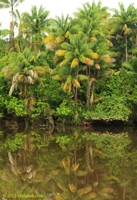
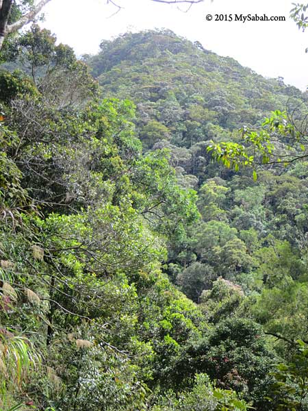
(Update: Mesilau Trail is permanently closed, and day hike to both Timpohon and Mesilau trails is no longer allowed) The space to climb Mt. Kinabalu is always full, so many tourists don’t have the chance to climb the highest mountain of Malaysia. Don’t be disappointed if you are one of them, because you still can try Loop Trail, which allows you to hike up to 2,745 Meters asl (asl = Above Sea Level), about half the height of Mt. Kinabalu (4,095M). The height of Mt. Kinabalu is not the reason why it’s listed as a UNESCO World Heritage site. The real treasure of Kinabalu Park is its high density of endemic flora & fauna, which you can see along the Loop Trail. I would say it’s one of the Best Hiking Trails in Malaysia.

The Loop Trail

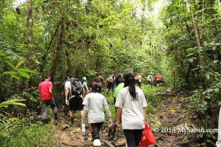
Loop Trail is a day-trip easy to arrange and you won’t be under pressure to conquer the mountain. You only need to hire a Mountain Guide and pay a small fee. More on this later. Please note the Loop Trail (in orange color) in the 2D trail map below:

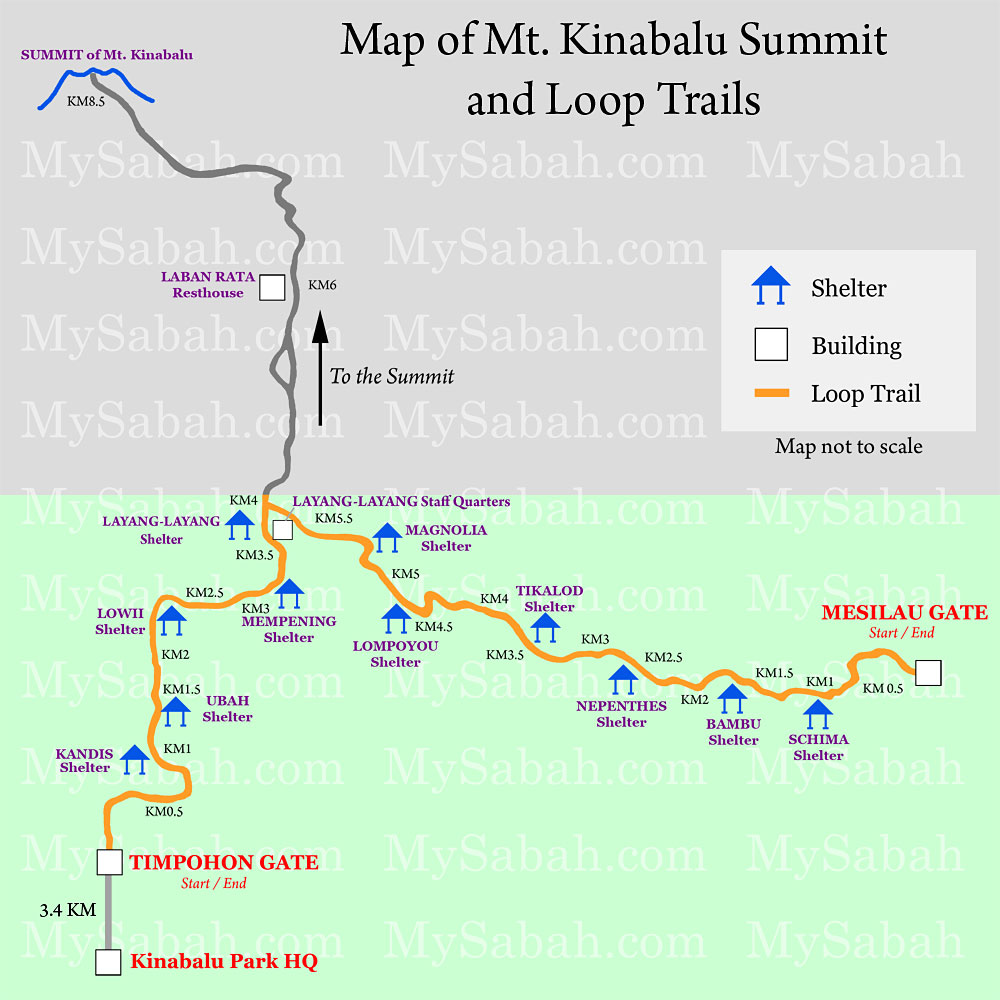
You can pick one of the starting points for Loop Trail, namely, Timpohon Gate and Mesilau Gate, and both trails join at Layang-Layang after 4 KM (2.5 Miles) and 6.2 KM (3.9 Miles) respectively. At Layang-Layang, Loop Trail visitors have two options, (1) turn back to where they begin, or (2) proceed to another Gate. Loop Trail visitors are forbidden to take the Summit Trail after Layang-Layang, and no, you can’t camp in the shelter.

Timpohon Vs. Mesilau Trails

Timpohon Trail is shorter and easier, Mesilau Trail is longer but the view along this trail is more beautiful (EVERYONE says that). Timpohon Trail is mostly uphill trail so descending is fast and easy. In contrast, Mesilau Trail is a series of ascending and descending trails, so turning back is almost as challenging as going up. Anyway, it’s not mandatory to finish the loop trail. You are free to stop at any time and head home.

Below is a table that shows you 3 types of route you can do in Loop Trail:

Route Distance Remark
Timpohon Gate → Layang-Layang → Timpohon Gate 8KM (5 Miles) The Easiest route, take 3 to 5 hours.
Mesilau Gate → Layang-Layang → Timpohon Gate 10.2KM (6.34 Miles) Recommended route to get the most of Loop Trail. Take 5 to 7 hours. Tip: start the climb from Mesilau in the morning, for clear view of Mt. Kinabalu (would be covered by fog after 9am)
Mesilau Gate → Layang-Layang → Mesilau Gate 12.4KM (7.7 Miles) Hardest route. May need over 7 hours. You have to be very fit. Some trail runners do this loop as a training.

*The number of hours taken is highly dependent on your physical fitness.

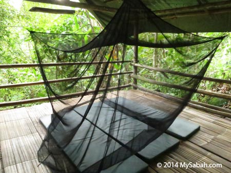
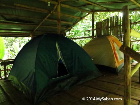
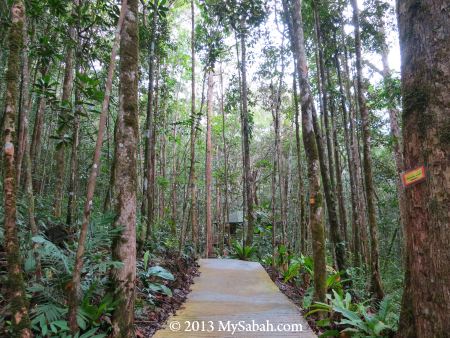
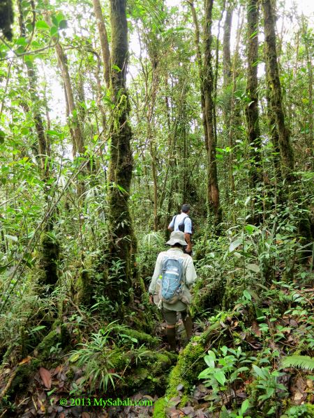
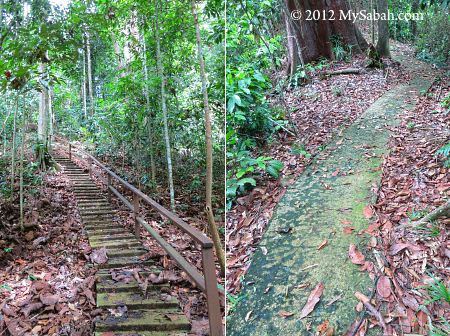
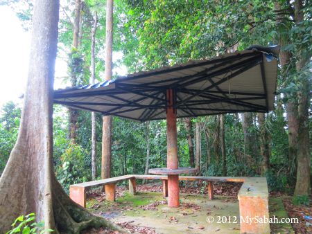
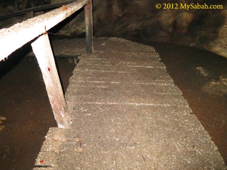
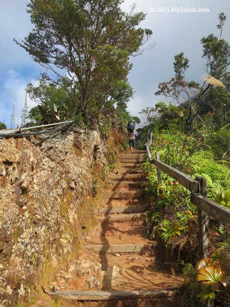
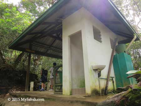
Though Loop Trail ends at the altitude of 2,745 M (9,006 feet), you already reach a height taller than the second and third highest mountains of Malaysia, i.e. Mt. Trus Madi (2,642M) and Mt. Tambuyukon (2,579M)! Overall, along the trail there are shelters with toilet, water tank to refill water (it’s untreated water from mountain stream, use water purification tablet if you have sensitive stomach) and support such as stairway, hand rail and wooden plank. The trail is well-marked and there is no leech (a blood sucking critter), bear and Bigfoot.

Things to Do

Besides hiking, the following are some fun activities to keep yourselves entertained during the walk:

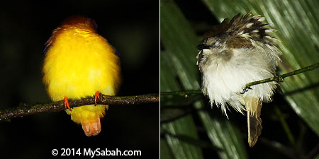
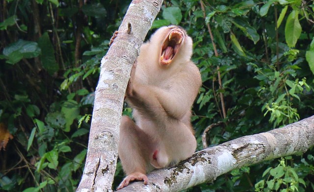
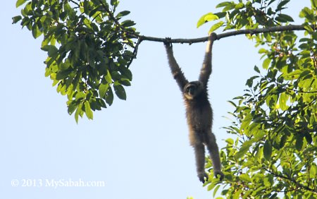
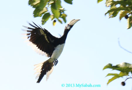
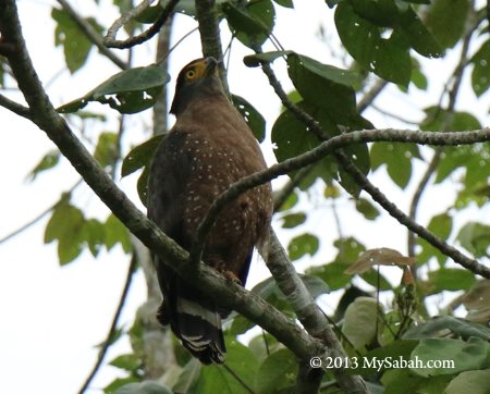
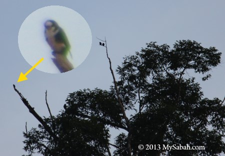
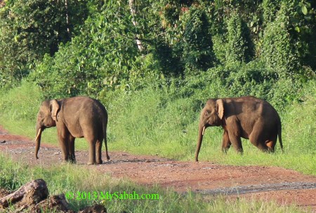
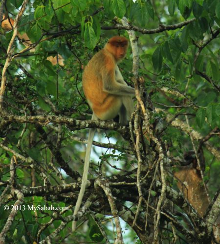
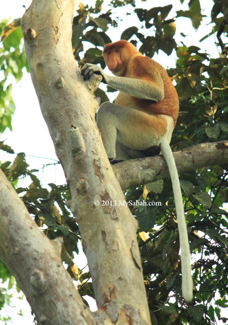
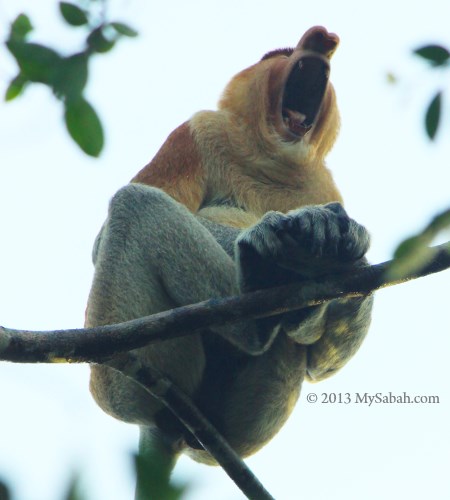
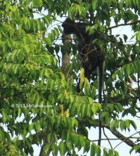
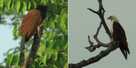
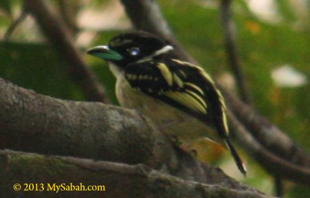
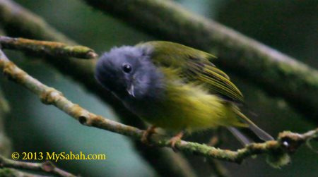
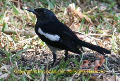
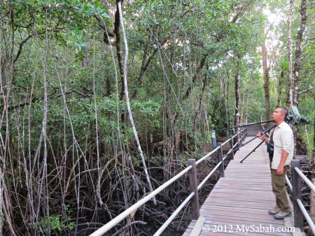
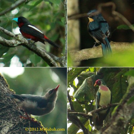
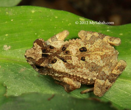
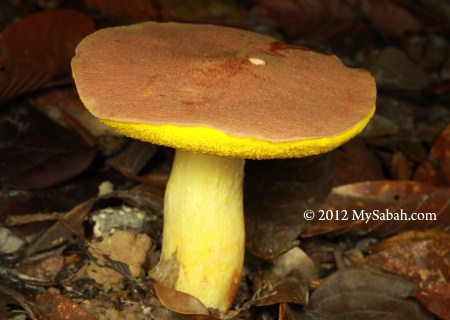
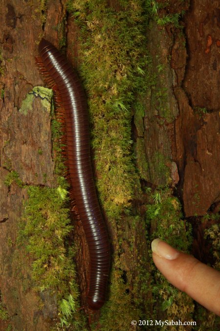
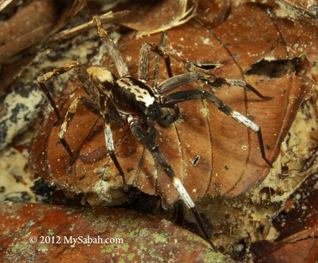
  • Birdwatching: 17 endemic montane birds of Borneo live in Kinabalu Park, e.g. Chestnut-hooded Laughing Thrush, Friendly Bush Warbler
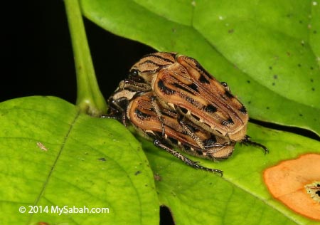
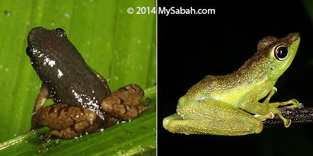
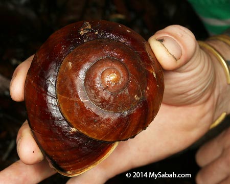
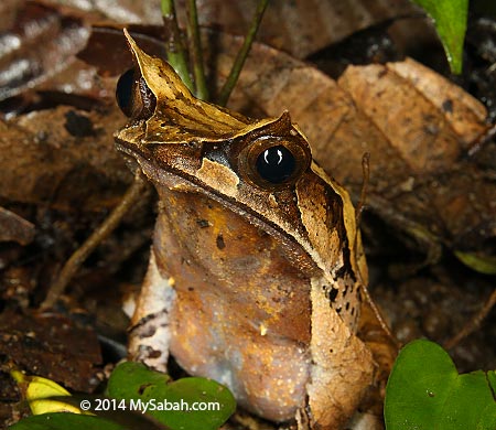
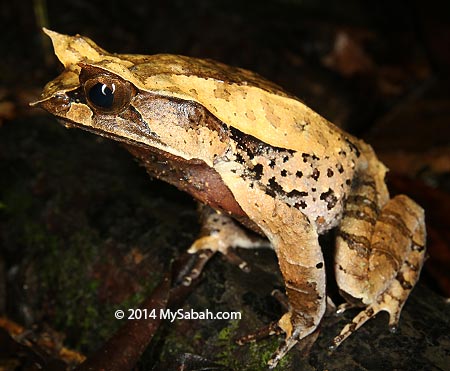
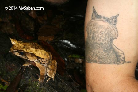
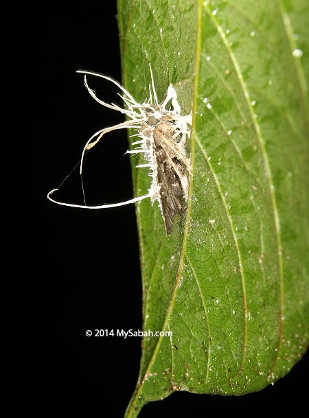
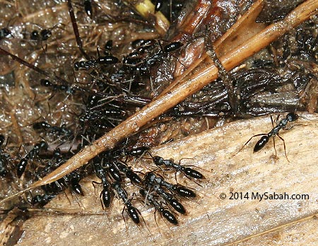
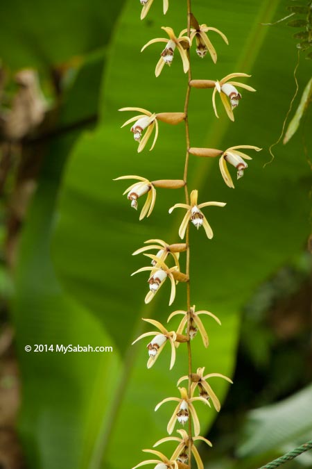
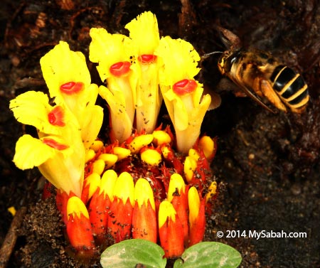
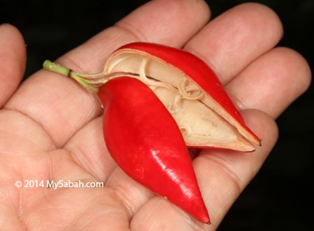
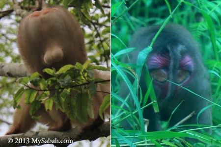
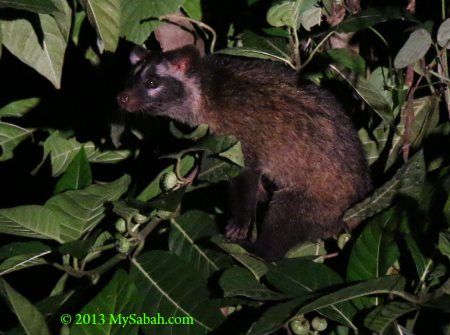
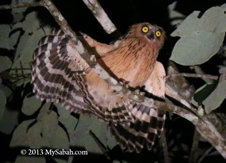
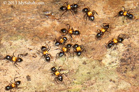
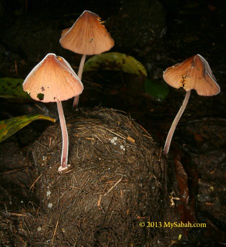
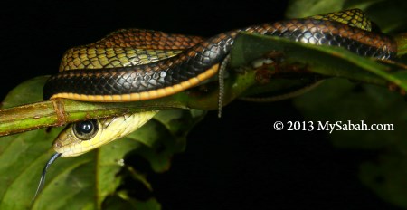
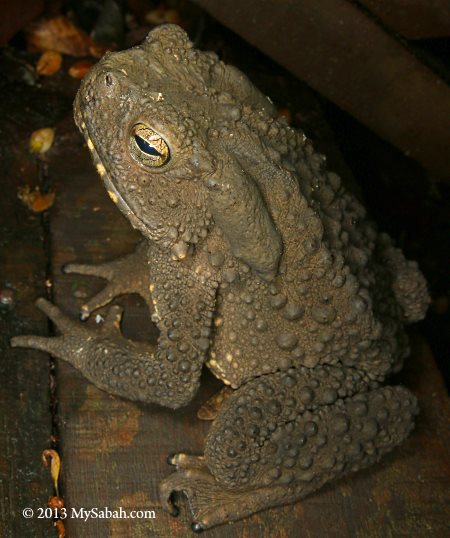
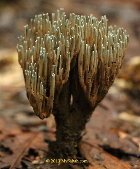
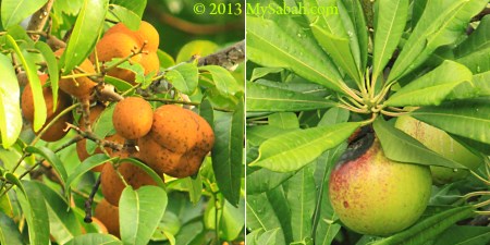
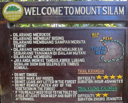
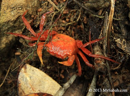
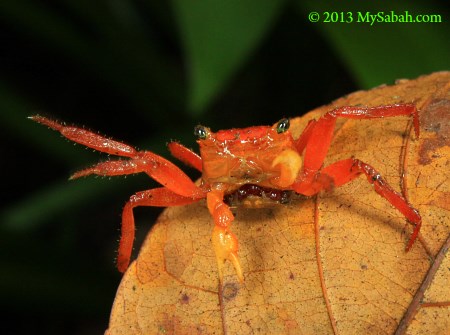
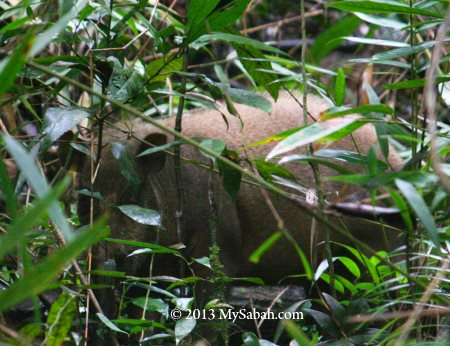
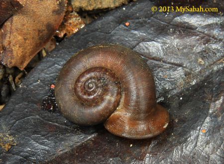
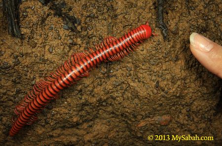
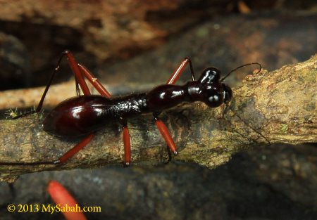
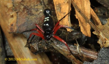
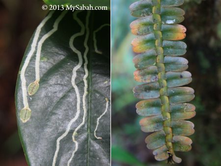
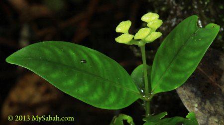
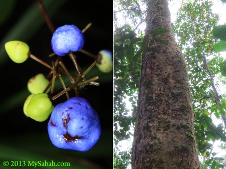
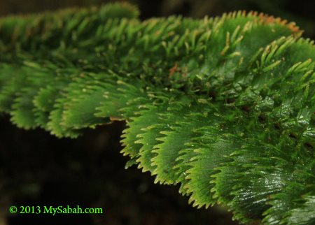
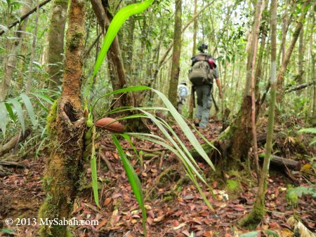
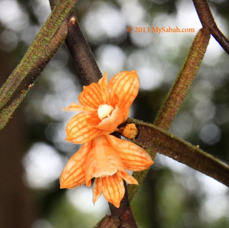
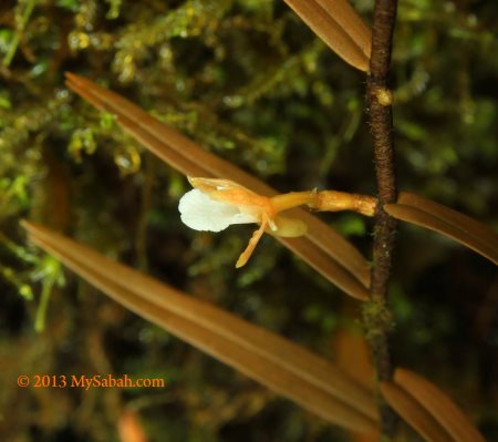
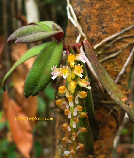
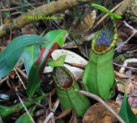
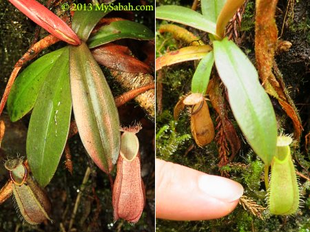
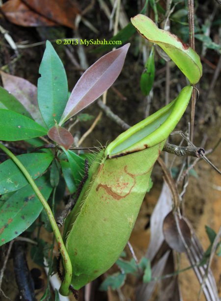
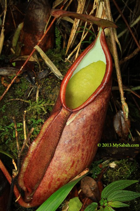
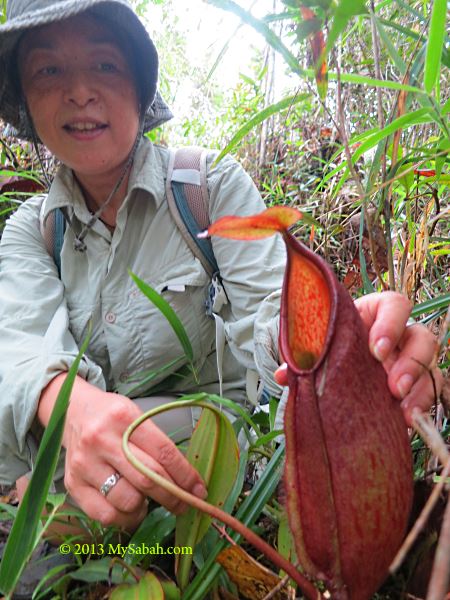
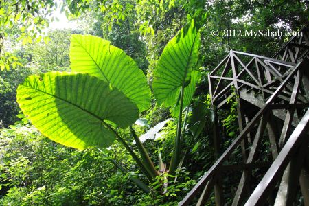
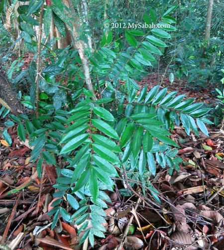
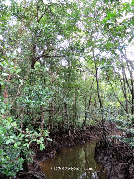
  • Flora & Fauna Watching: you will find exotic orchids and pitcher plant next to the trail. Some plant may look ordinary but they can’t be found in other parts of the world. Don’t pluck or collect anything. It’s an offense in national park.
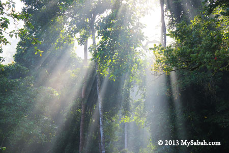
  • Photography: The majestic landscape, lush forest, pretty flowers, etc. are good subjects for photo taking.
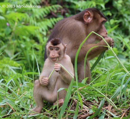
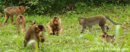
  • Or just sit and watch, enjoy the nature. A few squirrels will come near to you.

Temperature drops every 1°C for every ascending of 100M, so it’s cooler the more you move up. The temperature ranges from 16 to 25°C (61-77°F), but it can be quite warm in daytime, especially in a vigorous walk. Be warned though, the trail would turn into creek during heavy rain and the experience could be quite awful.

Registration and Fees

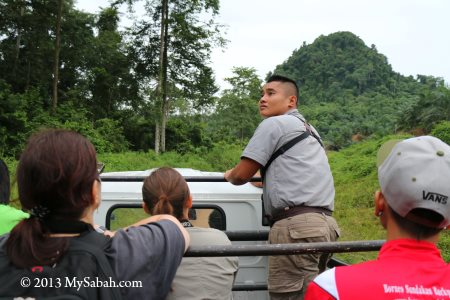
The climbing fee for Loop Trail is RM5 for Malaysian and RM10 (≈US$3) for foreigner. You MUST hire a Mountain Guide (from Sabah Parks) to go with you. The service of a Mountain Guide costs RM203 (≈US$57, rate of year 2015) per day and he can bring up to 6 climbers, which means you can share the guide fee with other hikers. For example, there is a group of 6 foreigners, each of them needs to pay RM10 climbing fee and share the cost (about RM34) of hiring one Mountain Guide, so each person only spends RM44 (≈US$12.22). If you go solo, you still have to pay the full amount.


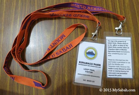
Pic: This is the tag (permit) for Loop Trail visitor. The tag for Summit Climber has photo of Mt. Kinabalu imprinted.


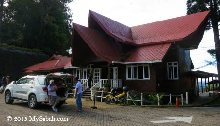
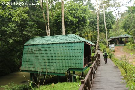
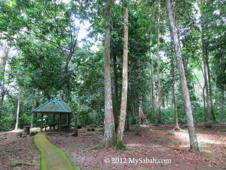
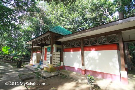
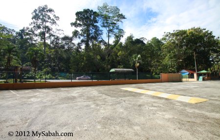
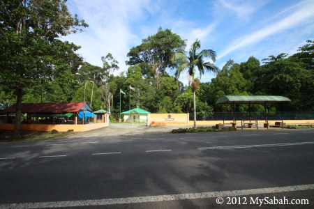
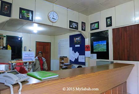
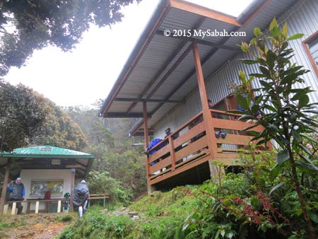
Pic: Kinabalu Park HQ. The registration and payment counter is behind this building, and you can hire transport to Timpohon Gate in the small office at the left.

If you start your Loop Trail from Timpohon Gate, you can register and hire your Mountain Guide at Kinabalu Park HQ. Passport or MyKad is required for the registration. Please note Timpohon Gate is 3.4 KM (2.1 Mile) away from Kinabalu Park HQ (by asphalt road) so you may want to hire a (one-way or return) transport to send you there. The phone number of Kinabalu Park HQ is +60 88-889888 in case you have more questions.


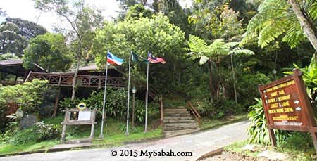
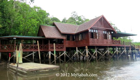
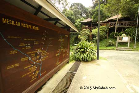
Pic: Mesilau Gate and Sabah Parks are in Mesilau Nature Resort

If you plan to depart from Mesilau Gate, you better inform the Sabah Parks office there by phone (+60 88-871550) so your Mountain Guide will wait for you at Mesilau (as most of them stations in park HQ).

For those who can afford to pay more for a better experience, you may hire tour guide (from travel agent, someone who has good knowledge on flora & fauna). Please note all payment is by Cash Only.

Below are some photo walk-through so you know what to expect.

Timpohon Gate → Layang-Layang (4KM one way)

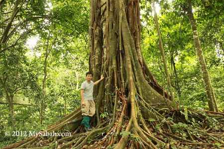
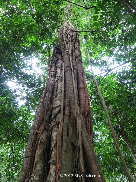
Timpohon Gate is the trailhead for Timpohon Trail, which is busier and shorter than Mesilau Trail. You will see many climbers start their summit trail here. Porters also use this path to carry supplies (e.g. tourist’s luggage, rice bag, gas tank, water tank) to the accommodation on mountain.


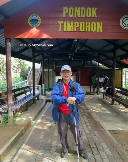
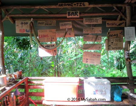
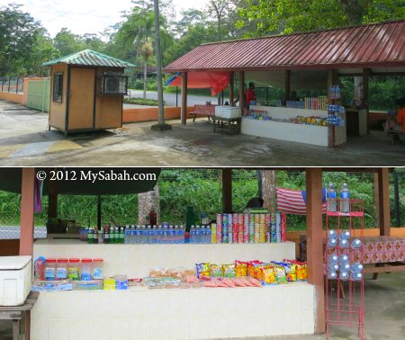
Pic: Timpohon Gate. You can buy snacks, drink and basic supplies (e.g. raincoat) in the building.


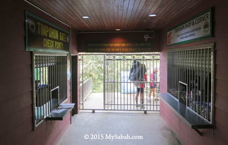
Pic: You need to show your tag (permit) to the Checkpoint at the left, before you hit the trail.


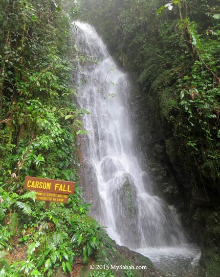
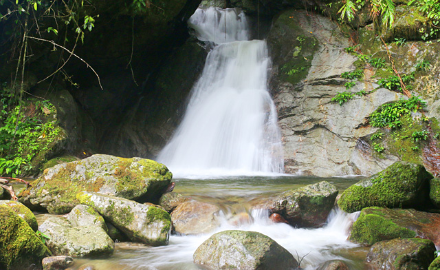
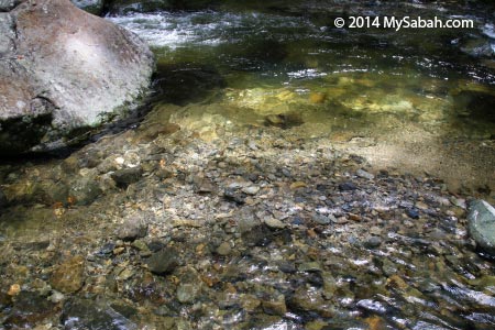
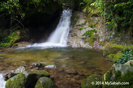
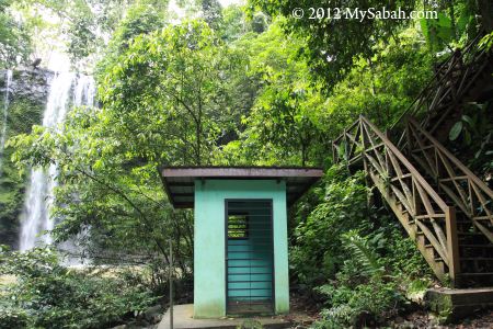
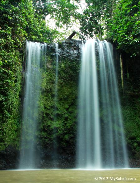
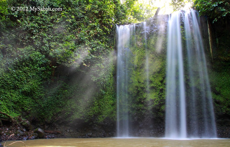
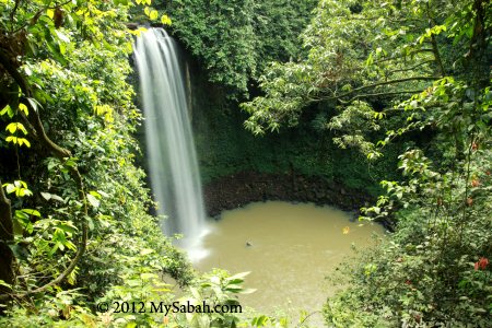
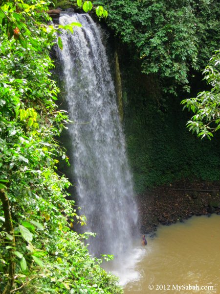
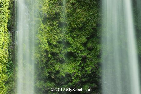
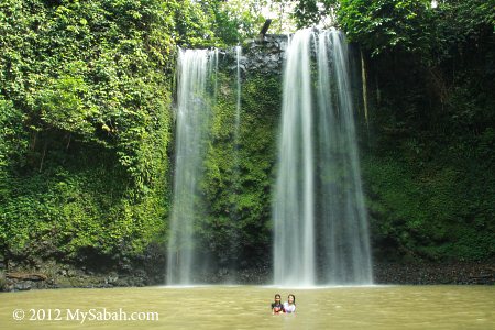
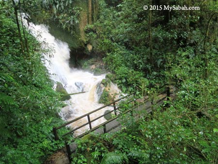
After 300M, you will see Carson Waterfall at your left. If you see large volume of water, it might be raining in higher ground.


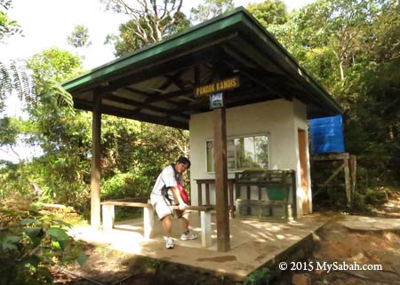
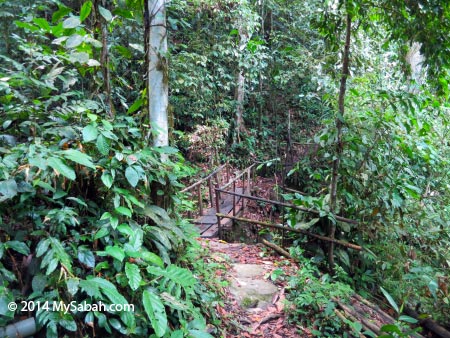
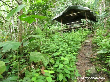
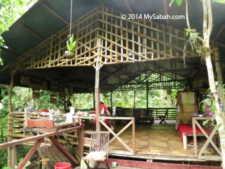
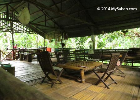
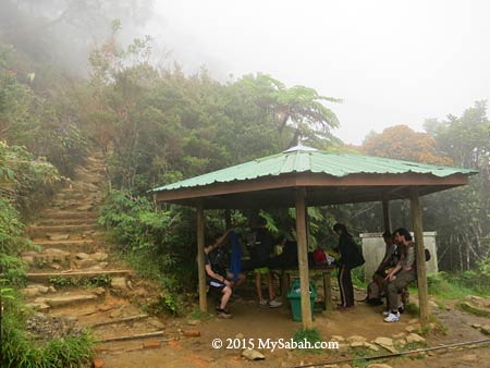
Pic: the first shelter you will reach is Pondok Kandis (Pondok = Shelter), which is named after an edible but sour mangosteen (in Dusun language). At 1,981.7M asl, you are in the transition zone between lowland rainforest and montane cloud forest, where you start to see mosses, ferns, orchids, etc. Most of the time you will walk on the ground mainly consists of metamorphic rocks from here to Mempening Shelter.


Pic: Ubah Shelter, the 2nd shelter at 2,081.4M asl, it’s named after wild guava tree. The signage says red leaf monkey could be spotted around there, but I never see one.


You can enjoy the scenery better than other climbers as you are not in a hurry to conquer the mountain. Just relax and enjoy the beautiful surrounding.


Pic: 3rd Shelter, Lowii Shelter at 2,267.4M asl, which is named after Nepenthes lowii pitcher plant. You would see some pitcher plant such as Nepenthes tentaculata if you explore the bush next to this shelter.


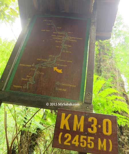
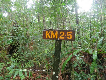
Pic: distance marker (in Kilometer) and trail map to show your current location.


Pic: Mempening Shelter (2,515M asl), named after a species of Oak (family Fagaceae). In this shelter, you will hear many climbers start mumbling about the exhausting hike. You can tell them they are not even half way yet LOL.


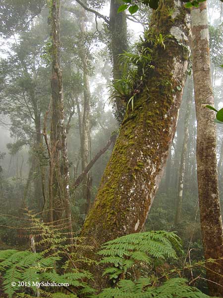
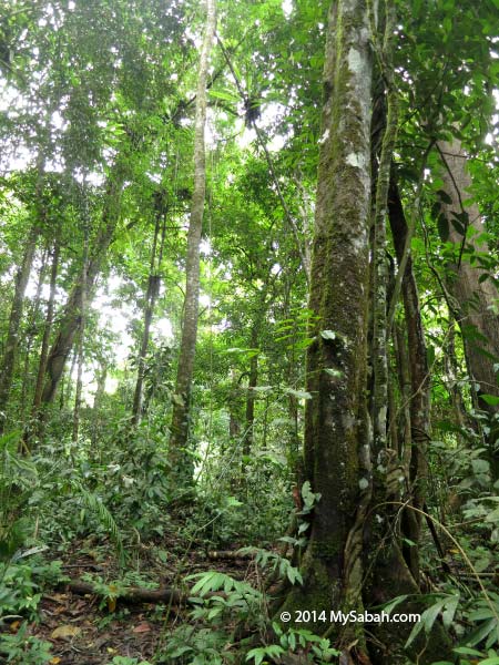
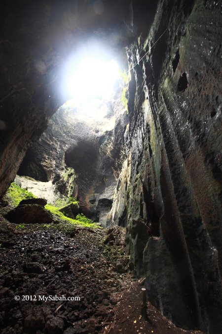
At this point, you have entered the Montane Forest (Cloud Forest) above 2,500M, the surrounding will look misty and mossy, and so distinctly different from vegetation in lowland.


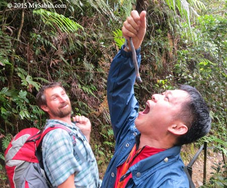
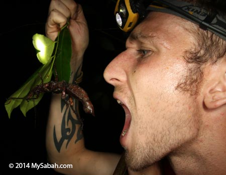
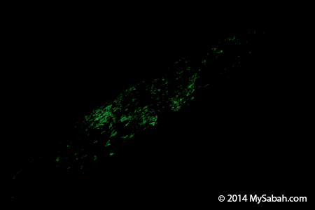
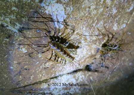
Pic: To survive the long trek, you have to to eat whatever you find along the trail, like the giant earthworm that comes out after heavy rain. Just kidding. If you are very lucky, you will spot Kinabalu Giant Leech, the predator of giant earthworm.


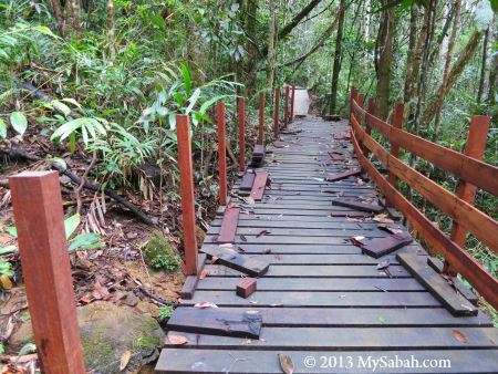
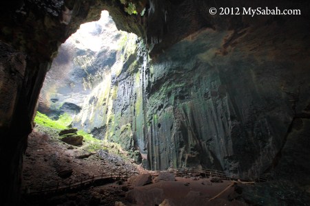
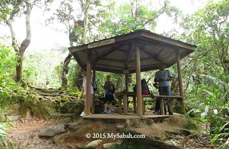
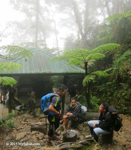
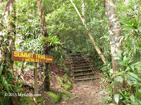
Pic: The last shelter of Timpohon Trail, Layang-Layang Shelter at 2,702M asl, it’s named after a Bornean swiftlet (Collocalia dodgei). This is also where ultrabasic forest begins, which is made up of orange soil that is high in acidity, with high concentration of magnesium and zinc while low in phosphorus. You will see a lot of endemic plant from now on. Unfortunately, you will reach Layang-Layang junction within 10 minutes, where you need to turn back to Timpohon Gate or proceed to Mesilau Gate.

Mesilau Gate → Layang-Layang (6.2KM one way)

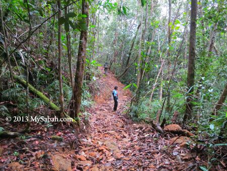
Mesilau Gate is 1,933M asl and located in Mesilau Nature Resort. This trail is longer and more challenging than Timpohon Trail, but you will be paid off by nicer view. Only a small number of climbers taking this trail to the summit, so it’s more pristine. The trail is also narrower and not that well labeled. A few sections are steep and slippery (after rain). You will be fine if you are careful.


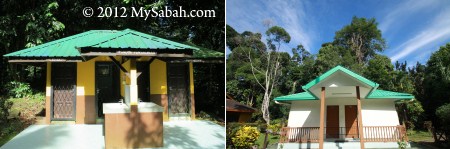
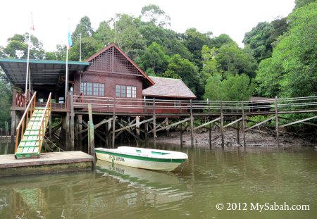
Pic: Sabah Parks office and Mesilau Gate in Mesilau Nature Resort


Pic: the registration and payment office is just next to Mesilau Gate


Pic: start of Mesilau Trail. Enjoy the 6.2 KM hike!


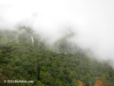
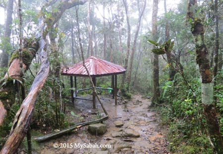
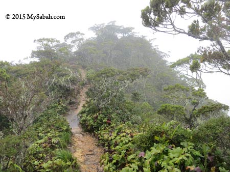
Pic: mountain and forest in fog

I only tried Mesilau Trail once and it was raining. It was so misty that I wasn’t able to take some good photos to show you. Please believe me that the scenery along Mesilau Trail is better than Timpohon Trail.


Pic: Schima Shelter, the 1st Shelter.


Pic: Bambu Shelter, the 2nd shelter.

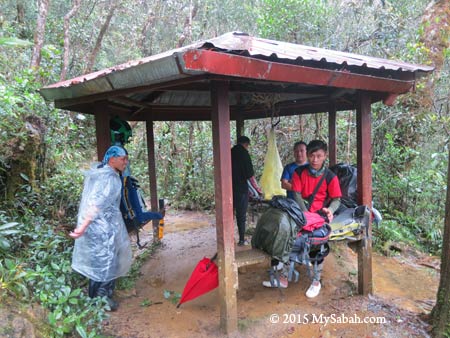
In average, there is one shelter for every one KM. All the shelters on Mesilau Trail are smaller and less developed than those on Timophon Trail.


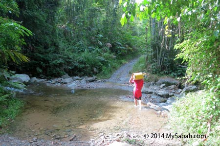
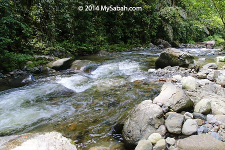
Pic: bridge over West Mesilau River


Pic: Tikalod Shelter


Pic: Don’t ask your guide how many KM left. You will always get the same answer, “We are near”. Read the distance marker.


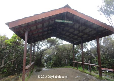
Pic: Lompoyou Shelter


Pic: There are some viewpoints in open area. Too bad the view was obstructed by dense fog during my visit.


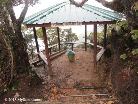
Pic: Magnolia Shelter

After 6KM, you will reach the Layang-Layang junction, where you should descend to Timpohon Gate or turn back to Mesilau Gate.
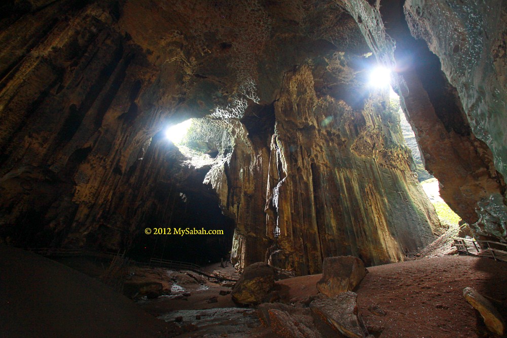
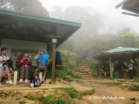
Layang-Layang

Layang-Layang is the meeting point of Timpohon and Mesilau Trails. The summit trail beyond this junction is off limit for Loop Trail visitors.


Pic: Layang-Layang Shelter (left) and Staff Quarters


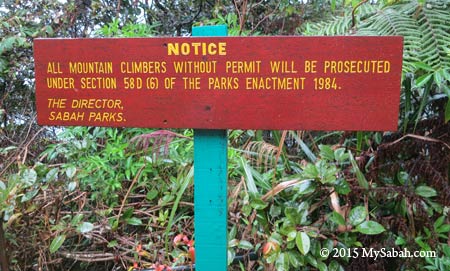
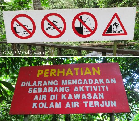
Pic: warning to visitors without permit.


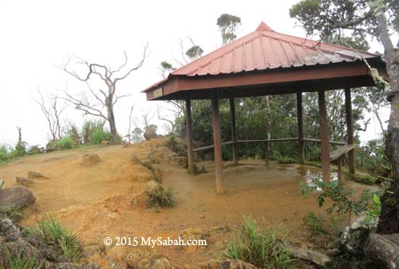
Pic: Layang-Layang Shelter. The Layang-Layang junction is less than 10-minute walk further up.


Pic: Layang-Layang junction


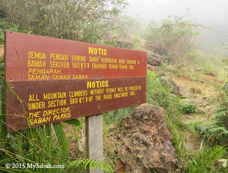
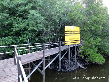
Pic: final warning to climbers at Layang-Layang junction. You are not allowed to move further up if you don’t have the permit to climb Mt. Kinabalu.


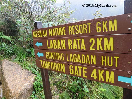
Pic: signage at Layang-Layang junction (Laban Rata and Gunting Lagadan Hut are the accommodation on the mountain)

Things to Bring

The following is a list of items you should bring. Try to pack light. When you climb a mountain, you can feel every Kilo of the weight. Also, wearing comfortable hiking shoes will help a lot (best if it’s water-proof).

  • Backpack (preferably with rain cover)
  • Water bottle (with water of course)
  • Pack lunch and snacks (no restaurant available on the trail)
  • Fleece or Windbreaker (It can be cold when it’s windy)
  • Raincoat (a Must-Have)
  • Sunblock lotion (UV on mountain is higher)
  • Walking pole
  • Camera (with spare batteries & memory cards)
  • Extra socks
  • Pain killer (for altitude sickness or knee problem)
  • Torchlight or LED Headlamp (just in case the sky turns dark before your trip ends)
  • Cash

Photos taken on Mount Kinabalu, Sabah, Malaysia Borneo

Lupa Masa Jungle Camp in Borneo Rainforest

Some people prefer to camp in park equipped with Wifi, air-conditioning and cozy bed. To truly appreciate the nature, some campers want to get away from civilization totally and live among trees and wildlife, like Lupa Masa Jungle Camp. Lupa Masa means Forget Time in Malay language, you would lose sense of time there when you forget about your Facebook, your computer and your boss.


Lupa Masa is located between Borneo rainforest and lower montane forest at the foothill of Mt. Kinabalu, the UNESCO Natural Heritage Site of Sabah. To visit the camp, I met the camp manager, Michael from Scotland, at Poring Hot Springs. He marries a sumandak (girl) from Tamparuli and able to speak Malay fluently. He already blends into the community and now behaves more like a Sabahan wearing a “orang putih” skin (Caucasian). However, he hasn’t fallen in love with Durian yet.


Pic: Michael crossing a stream with a gas tank

Michael got some groceries from Poring and led the way. We walked on a gravel road in village and plantation for about 10 minutes, then we entered a soil trail that took us deep into the forest. The forest is an aged regenerated secondary forest that gives us much needed shade in muggy day. The trail is mostly mildly inclined, with a short section of steep slope.


Pic: nature trail to Lupa Masa

The walk was supposed to take about 30 minutes. I was carrying two bags weighed over 15Kg and one of them broke, so it took me an hour to reach the camp. Since this camp is near the boundary of Kinabalu Park and situated between rainforest and cloud forest, you would see wildlife from both habitats. This attracts naturalists who are expert in snakes, mammals, birds, etc. to stay in Lupa Masa. A snake expert even found 12 snake species in a day. But please note that wildlife sighting is depend on luck.

Camping in Lupa Masa

My “room” is only a basic hut with raised floor and a canvas roof over my head. Albeit being pounded by heavy rain a few times during my stay, the roof didn’t leak. It is near the edge of campsite and far away other shelters, so I feel so alone at night.


Pic: my private “chalet” surrounded by greenery

As there is no wall between me and the wood, I was fully exposed to the wildlife territory. In the morning, I was always waked up by a flock of noisy Buff-rumped Woodpeckers, and countless chirping birds came to check me out. Then cicada took the afternoon shift to continue the rainforest choir, at night it was the sound of frogs and crickets that sent me to dream land. I was like an outsider. Perhaps I should have tried to join their orchestra by making some rhythmic calls too.


Pic: my bed on bamboo floor

My bed is a few camper beds enveloped in mosquito net. Mosquito is the most active during dusk and I would find 4 or 5 of them bumping the net from outside. In other time, there were very few mosquito in the campsite. The temperature here during daytime is about 25°C (77°F) but can drop to 15 (59°F) or below at night. The camp provides blanket or you can bring your own sleeping bag. There are a few wires for me to hang my cloth between the poles in the hut. My clothing never turned dry in cold and humid days though.


Pic: camping tent in longhouse

If you want more privacy, you can choose to stay in shelter that has camping tent. In Lupa Masa, there are 6 shelters that can host up to 25 campers. The accommodation costs about RM70-90 (≈US$22-28) per night. Food is included, mainly vegetarian meals because they don’t have fridge to keep the meat. Some of the food that I had there were rice with curry vegetables, French toast, oat meal with fruits, fried rice, etc.

Night Walk

Night Walk is the highlight of Lupa Masa. You can see far more animals in the dark as most wildlife are nocturnal. You can choose easy walk that takes 2 to 3 hours, or long challenging trek that requires you to cross river and climb steep hill with more rewarding sighting. The guide fee is RM30 (≈US$9.40) per hour, RM75 (≈US$24) if 3 hours. You can share the cost with others if you go in group.


Michael seemed to be more excited than me in night walk. After dinner, we started our night safari on foot at 8pm. Spotting animals in the dark is no easy task because of their camouflage. You need a good torchlight and great eyesight. Anyway, you won’t need both when Michael is around, as he is an excellent spotter. Even if he showed me the things he found, it still took me quite a while to see it. His secret is to look for light reflection in animal’s eyes.


Pic: big juicy stick insect, endemic to Borneo

In case it rains, you better bring a raincoat. Leech is expected, so wear your anti-leech socks. I didn’t get any leech bite though there were many leeches around. We shined our torchlight to every corners to find those critters hiding in burrows, tree holes, bark, river rocks, shrubs and fallen log.


Pic: sleeping birds. Note the kingfisher has only 3 claws.

We saw a number of sleeping birds on the trees. It’s interesting that they turn into “fur ball” while asleep.


Frog are everywhere. I saw and heard many of them after rain, e.g. Lesser River Frog, Black-spotted Rock Frog, Giant River Frog, Montane Litter Frog. Some leaped away before I got close enough to take a photo. “You have to approach them like a Ninja,” Michael said.


Pic: a big long-horned beetle

Other animals that we spotted included Small-toothed palm civet, long-legged millipede, Agamid lizards, white lantern bug, spider, scorpion, tree-hole crab, dead-leaf grasshopper, trilobite, geckos, katydid and a green pit viper.


Pic: a giant forest snail

Suddenly Michael paused and smiled, “How much you would pay me for spotting a horned frog?”


Oh yeah, we found a Bornean Horned Frog, no, two!


Bornean Horned Frog looks like a little devil. Actually it’s a gentle frog. Its “horn” is an extension of its eyelid, to make its body shape looks like a leaf.


From his tattoo, obviously Michael is also a fan of horned frog lol.


Pic: a moth which was infested by parasite fungus which turned it into a “zombie.” This fungi can mind control its host to climb to the higher spot, to spread its spores.


Pic: Beware of aggressive fire ants on forest floor. Their stings can penetrate sock and very painful hence the name.


Pic: animation to show luminous fungus with the light on and off

Then Michael showed me something really special but we needed to turn off our torchlight. It’s luminous fungus that glows like green neon light on a decaying log. The glow is quite bright in the dark. We saw a few glowing mushroom too.

Some “trophy species” of wildlife photographers such as Western Tarsier, Slow Loris, Bornean Leaf Nose (snake), Wallace’s Flying Frog and Caecilian (a limbless amphibian) are known to be present at Lupa Masa, but you will need some luck to see them.

Day Walk

During daytime, you can take a stroll in the campsite or surrounding forest. Walk slowly and quietly in the morning, you would find a lot of birds around the camp. This place is great for birding because flock after flock of sunbirds, flowerpeckers, bulbuls and other forest birds frequent this camp during dawn and dusk. I saw Orange-bellied flowerpecker, Crimson-breasted flowerpecker, Broadbill, Ashy Tailorbird and Kingfisher during my stay.


Lupa Masa campsite is a garden by itself, planted with vegetables, fruit trees and flowers. The blooming orchid here attracts butterflies such as Rajah Brooke butterfly, tree nymph and birdwing butterflies in different colors.


Pic: Ginger flower that looks like a birthday cake (Species: Etlingera fimbriobracteata),


The boundary of Kinabalu Park, the most bio-diversified forest of Borneo, is just a few minutes walk away from the camp. The jungle is well lit by daylight, so you can enjoy the view of standing tall trees. The zappy Pygmy squirrel, the smallest squirrel in the world, is commonly seen busy moving up and down tree trunks. Look high above you would find bird’s nest fern and wild orchid on the trees.


Pic: a fig fruit that looks like red chili

Lupa Masa is one of the few places where you can find three types of corpses flowers, namely Rafflesia, Rhizanthes and Titan Arum (Samurai Flower). Their flowers take many months to bloom, so you should be very happy if you see such rare sighting.

River & Waterfalls

During hot day, one of the favorite activities of their guests is to soak in the icy river or pond of Lupa Masa Waterfall nearby. You can enjoy the cleanest (and Chlorine-free) flowing water from Mt. Kinabalu.


Pic: clean and unpolluted river from Kinabalu Park is only 10 Meters from the camp.

The water is shallow so it is safe for a swim, or you can just sit in the river for a free massage from river current (do bring beer with you).


Pic: you can tell how clean is the water from the photo. It’s so crystal clear that I can’t see the water. Sometimes otters and kingfishers forage for fishes here too.


Pic: Lupa Masa Waterfall near the camp (7 minutes walk)

For those who are adventurous, they can hike one hour uphill to explore the “hidden” waterfall, which is five times bigger than Lupa Masa Waterfall.

Amenities

The camp was started by Tom in 2010, with the concept of providing authentic jungle experience, so the amenity is basic. The campsite has solar panel and power generator but electricity supply is not available most of the time, so you better bring a torchlight (with spare batteries). There is no outlet to charge your phone and battery. No Wifi in camp, but my phone can receive 2G connection, slow but able to use Whatsapp and SMS.


Pic: activity hall where guests can sit around and relax

You can sit at the deck facing the river and dense forest, looking at starry sky and firefly. Tom said, “I’m so glad that this forest wasn’t turned into a paddy plantation.” Looking at the beautiful trees and river, I can’t agree more.


Pic: table where guests can have meal, chit chat and playing cards.


Pic: “mini-bar” for you to buy some soft drink, beer and wine. The hanging object is a shed snakeskin.


Pic: reading corner. Guide books on animals such as birds and snakes are available.


Pic: kitchen. The lucky guest would see Slow Loris around here at night. I saw an ant mimic spider the other day.


Pic: the toilet with creative door design.


Pic: you can choose to sit or squat


Pic: bathroom with bamboo shower head. The water is from the river, very cold and refreshing (I advise you to bath before the cold evening approaches).

Contact

To stay in Lupa Masa, you need to contact the camp to book a place prior to your visit.
Tel: +60 11-32024500
E-mail: LupaMasaBorneo@gmail.com
Website: LupaMasaBorneo.com
Facebook: LupaMasaRainforestCamp
(Now this camp is managed by Top Peak Travel)

The camp also welcomes volunteers. You can get free stay and meal if you contribute some labor work. There is no fixed requirement but you need to have special skill such as cooking, carpenter and house-keeping. You may contact them for more details.


Pic: photos with Michael (left) and Tom (right). I look like a dwarf next to them lol. Thank you for your hospitality!

Tom has stayed in Borneo for 15 years. He is actively helping the local communities across Sabah and Sarawak to develop their local attractions. One of his latest project is Lupa Masa Longhouse in Kudat. You may visit the website of his company (Adventure Alternative) for more info.

Getting there

You can take a bus to Ranau town from Inanam Long Distance Bus Terminal (see Location Map) or Kota Kinabalu Merdeka Field (see Location Map). The fare costs about RM15 one way (≈US$4.65) and the bus reaches Ranau in 2 hours. In Ranau, get a cab or bus at taxi station (see Location Map) / bus terminal (see Location Map) to Poring Hot Springs (where the staff meets you), the fees are RM40 (≈US$12.50) and RM10 (≈US$3.10) one way respectively and the ride takes about 25 minutes. It takes 30 minutes to walk to the camp from Poring.

More Photos

You may check out my photo album to see more pictures of Lupa Masa:

Photos taken in Poring, Sabah, Malaysia Borneo

Tabin, the Sanctuary of Borneo Wildlife

Located in east coast of Sabah, Tabin Wildlife Reserve is one of the best kept lowland rainforest of Borneo. I don’t want to hide the fact that most lowland of Sabah is now blanketed by oil palm. Tabin is surrounded by sea of oil palm, making it an oasis of the ecology desert (oil palm). In fact, this 112,000-hectare protected forest reserve harbors some of the rarest and endangered Bornean animals such as Pygmy Elephant, Sumatran Rhinoceros and Orangutan.


Last month I visited Tabin for 3 days. Though large part of Tabin is secondary rainforest being logged in the past, the forest regenerates really well over the decades. Tabin also has 9,000 hectares undisturbed primary forest known as the Core Area. Do you know that there are nearly 1,000 tree species in 50-hectare area of Borneo rainforest (Temperate Forest is up to 100 species only)?

Macaques

Guess what was the first animal I saw in Tabin. Can you recognise the “aliens” below?


Pic: “Aliens” in Tabin

LOL they are actually the butt of pig-tailed macaques, a common but cheeky monkey. At the left is a male with its testicles, the sexy red butt at the right belongs to a female ready to mate.


In late afternoon, you would see dozens of macaques gathering on the ground feeding, socializing and grooming one another. Tabin Resort doesn’t feed them so they keep a distance from human. But you better lock the door and leave nothing outside your room, because these monkey know how to open door and ransack your stuffs.


I was surprised to see a long-tailed macaque among a herd of pig-tailed macaques as if it’s one of the members. Wonder if both species speak the same language.


Pic: Bornean Gibbon foraging on a fruit tree. You can always hear their “whoop-whoop” loud and long call early in the morning at Tabin.

There are 9 primate species in Tabin, but gorilla isn’t on the list (though the movie says King Kong is from Borneo). The most famous primate here is Orangutan. Tabin is one of the releasing spots for rehabilitated orphan orangutan from Sepilok. To ensure they can survive in the wild, rangers will track and evaluate the new comers for 2 weeks.

Tabin Wildlife Resort

Tabin Wildlife Resort is the only accommodation and tour operator in Tabin Wildlife Reserve. To visit Tabin, you can book a full board tour package with them (Accommodation, meals, transport, activities and guide services are included). They also offer special tours such as bird-watching and frog camp. Please note walk-in tourist might not be entertained.


Pic: River Lodge of Tabin Resort

After an hour of bumpy ride on 44-Kilometres of unsealed road from Lahad Datu town, I checked-in to River Lodge of Tabin Resort around noon. River Lodge is just next to Lipad River and you would see foraging animals at the river bank sometimes.


The chalet looks small from outside, but the room is really spacious and completed with attached bathroom/toilet, private balcony, air conditioner, ceiling fan and hot water shower. The accommodation is comfortable and electricity supply is available 24×7. I’m happy.


Pic: Hill Lodge of Tabin Resort

For honeymooners, Hill Lodge offers more luxurious and private space, so nobody can hear what you both busy doing in your room. I think it’s great for family too.


Pic: Sunbird Cafe of Tabin Resort

Sunbird Cafe is where I have my buffet meals (and free flow of coffee) and it is the gathering point for all activities. The cafe has Wifi so you can check your Facebook, but the line would be slow if too many guests are sharing the connection.

Dusk Drive & Night Safari

Compared to my jungle trips in other places of Sabah, the activities at Tabin are really leisure, nothing made me gasping for air there. But I sweated a lot, as rainforest is warm and humid, when the dense trees trap the heat and moisture under their canopy during daytime.


We started our Dusk Drive at 5pm. Unlike Africa, where you can see hundred of animals on open grassland. In Borneo, you need to look quite hard for the animals hiding among the dense wood. Luckily, the guide does the job for us. A napping monitor lizard high on a tree set off the excitement.


As the habitat of about 260 lowland bird species (FYI, oil palm estate only hosts 9 to 12 species), Tabin is a favorite destination of bird-watchers. Out of 8 hornbill species in Tabin, I saw 4 of them (Oriental Pied Hornbill, Rhinoceros Hornbill, Wrinkled Hornbill and Bushy-crested Hornbill) during my stay. If you are a hardcore birder, they will bring you to Core Area (virgin forest) to look for Blue-headed Pitta and Blue-Banded Pitta, which are endemic to Borneo.


Pic: Crested-serpent eagle is the most common eagle here. We also spotted Wallace’s Hawk-eagle and Changeable Hawk-eagle.


Pic: Bornean Falconet

The highlight is Bornean Falconet (a.k.a. White-fronted Falconet), which is endemic to Sabah and the smallest raptor in the world (about the size of a palm). There was a group of three perching on a tree very far away from us. Fortunately, our guide let us to have a better look with his high-power telescope. I tried to photograph them through the scope but the photo was blur, well. 🙁


Then we heard a loud roar from the elephants deep in the forest beside us. “It was a mother calling its calf”, our guide said. Though there are 200 to 300 elephants in Tabin, sighting of them is not guaranteed. We waited there for over 15 minutes but no sign of them coming near. When I almost gave up, two Bornean pygmy elephants emerged from the wood behind our truck! After wandering on the gravel road for a while, both of them headed to a neighboring plantation for juicy young shots of oil palm. Somehow this smart mammal figures out the time when electrical fence is being turned off lol.


The daylight was out soon and lot of fireflies flickering on the trees, but we didn’t stop the fun drive. On the way back to resort, our guide turned on the spotlight and here we went for a night safari. Besides a pair of sleeping Rhinoceros Hornbill on the tree, we saw other nocturnal animals such as Common Palm Civet and Leopard Cats. We were also watching a red giant flying squirrel took off from a branch, it could glide 100 Metres from tree to tree, we were told.


Pic: a Buffy Fish Owl. A Brown Wood Owl was nearby too.

Night Walk

Dusk drive is cool but it would be more thrilling to walk around and search for other forest dwellers in the dark. After dinner, everyone grabbed a flashlight and explored deep in the jungle. We pointed our light to the shrubs, tree top, forest ground, tree bark, etc. and came across something interesting.


Pic: Crematogaster inflata, these ants look like carrying a “gold” knapsack, which is the enlarged metapleural gland that can secrete whitish defensive fluid and their bites are very itchy. Thank you Arthur Chung for the ID.

A single tree of Borneo can house 1,000 insect species. There are at least 50,000 insect species in Tabin, which is enough for you to explore for a lifetime.


Pic: mushroom growing on an elephant dung. Everything in rainforest is recycled and exist for a reason.


Pic: a small snake waiting quietly for its prey.


Pic: a giant river toad covered with irregular bumps. The big glands behind its eyes secrete poisonous fluid so don’t touch it!

Lipad Mud Volcano

The next morning we went to the Lipad Mud Volcano, something that makes Tabin special. The jungle trail to the mud volcano is 700 Metres and requires only 20 minutes trekking. We saw some fresh and old elephant dungs along the way, an evidence that elephants frequent this area. Anyway, I only found a tiny mouse deer and a few forest leeches.


Pic: a coral fungus


Pic: the Lipad Mud Volcano is as big as a football field and it is still growing. This might be the largest mud volcano of Borneo. Can you spot the tiny people in the photo?


Pic: elephant tracks at mud volcano

Animals love mud volcano as it is rich in sodium and calcium, the vital minerals that are not readily available in their normal diet. That’s why this is a good spot for wildlife sighting, as animals come here regularly for “salt lick” in late afternoon.


We love mud volcano too, not for salt lick but for skin care. Some says the mud is really good for skin so we collect some for facial SPA later.


Some prefers to enjoy the muddy face mask on the spot.


However, the outer ring of mud volcano is dry mud mixed with coarse sand. To collect the finest and silky wet mud, you have to go to the sources located in the centre, where you can see fresh mud burping and bubbling up from the ground. The mud in centre is deep and soft, so your shoes would be trapped in it. Some even lost their pant here (yes, that happened before).


Pic: the 5-storey observation tower next to the mud volcano. You can overnight there for more animal sighting.


Pic: making handprint certificate with volcano mud.

Lipad Waterfall

After getting ourselves dirty in mud volcano, we got on our truck and moved to Lipad Waterfall. The nature trail to the waterfall is only 400 Metres but we needed to cross a river as deep as our waist level.


Because of the heavy rain the night before, the water looked a bit murky, but it was clean and cooling. We washed away our mud at the river and took a dip in the waterfall pool.


Pic: Lipad Waterfall, pristine and unpolluted.

Other Activities

There are more things to do in Tabin. Just to list a few here.

You may check out the exhibition in Trogon Hall gallery, where they display some photographs and information of Borneo bio-diversity.


Pic: elephant skull in the Gallery

After a long day of trekking, it’s time to relax your tired feet by trying out the Rainforest Foot Soak at Eagle’s Nest. Various traditional tropical herb and plants (e.g. Kaffir lime leaf, Aloe Vera, Lemongrass, Betel Leaf, Pandanus Leaf, Galangal, Tumeric) are put in the hot water, and you can rub your feet against the smooth pebbles at bottom.

So that’s my Tabin trip. You can see that our rainforest is an eco-treasure worths protecting and preserving. The good news is – Sabah government and NGOs are working together to connect all the isolated forest of Sabah, so wildlife can migrate freely among them for food and mates. In future, Tabin forest reserve will be part of the Heart of Borneo.

More Photos

Created with flickr badge.

Photos taken in Lahad Datu, Sabah, Malaysia Borneo

Firefly Eco Camp – Good Morning to Borneo monkey

Proboscis Monkey is the superstar of Klias Wetland. Every evening Klias River is like a busy canal, when hundreds of tourists come to visit this peculiar monkey. One guest even said, “there were more tourists than monkey.”

Therefore, the Best Time to see Proboscis Monkey is in the morning, when there are very few tourists around. The monkey is less stressful and you can get really close to them. That’s why I spent a night Firefly Eco Camp.


Pic: Firefly Eco Camp

Firefly Eco Camp is located next to Klias River. Staying there will allow you to see what other ordinary tourists miss – the starry night and misty morning over Klias River.

I checked in to the camp around 6pm. After the dinner, we started our night river cruise at 8pm to look for firefly Xmas trees and crocodile, when other tourists had left. Though we didn’t find any crocodile, we saw many “summer Xmas trees”, where hundreds of fireflies congregated and flashing in synchronized manner like heart-beating.


Hour later we returned to the activity hall next to the jetty, to enjoy a serene evening next to Klias River.

Night Fishing in Klias

Klias River is inside Peat Swamp Forest with brackish water, which looks murky all the time. The river seems lifeless, but you will know that you are wrong when you fish.


Klias River is connected to the sea. During high tide, fishes will follow the current entering the river for feeding. If you fish during that time, you will catch something in minutes.


Pic: our fishing bait is hot dog LOL. But it works well!


Most of us are first-time anglers. We were so excited when it was almost effortless to catch big fish in a few minutes.


Pic: one caught to make one family happy

May be you want to watch our fishing video below:


All the fishes we caught that evening was catfish (暗钉 in Chinese, means “Hidden Nail”). It is a very common fish, though edible, locals consider it a lower-grade (dirty) fish, due to the impression that it eats human dung fallen from riverside toilet. It has venomous thorns on its pelvic and dorsal fins, which can cause severe pain when poke into your skin. Be careful when you remove the fishing hook.


Actually we targeted for Giant Freshwater Prawn (Udang Galah) that night, so we released all the catfishes. It was fun anyway.


Pic: the hut where I slept

We had a couple of beer while fishing at river side. We talked until late night. I couldn’t wait to enter my small hut as it was so cool.


The hut may look small from outside, but it can fit two people comfortably. Though there are only bed, light and fan inside, to me it’s a “luxurious camp”. I slept really well throughout the night.

Morning River Cruise in Klias

The next day I waked up early, sat at the small balcony to enjoy the nice river view. It was quiet in the morning and I saw some movement in the canopy. The monkey had waked up earlier than I did.


After having some light breakfast, we were ready for a morning river cruise on Klias River.


Pic: the misty swamp forest in the morning


Pic: the calm river of Klias with beautiful reflection on water


Very soon we spotted the first proboscis monkey. It’s a female with pointy nose.


Then we saw the male proboscis monkey with big nose. From their eyes, we could see that they were not quite concern about our presence, a big contrast to evening time when there were too many tourists and boats around. We were the only tourist boat on the river that morning.


So we could get really close to them for a good look. One of them was so relax and even yawned. This one was just on top of our heads. I was so worry that it would poo. Our boat found about 5 to 6 herds of proboscis monkey.


Pic: silver-leaf monkey. There were some macaques too.


Pic: the mangrove trees of Klias River.


Pic: Peat Swamp Forest is an important habitat for rare Borneo wildlife


Pic: Nibung Palm, a tree that grows between swamp and dryland. Its straight and strong trunk can be used for building houses and bridges.


Pic: fruits are abundant in the swamp but no monkey eating them, probably they are poisonous.


Pic: mangrove trees that can survive in the water during high tide.


I saw some birds such as Brahminy Kite, Oriental Darter (Snake Bird), Stork-Billed Kingfisher, Hill Myna and Greater Coucal. Sometimes you can see hornbill and woodpecker around this area too.

Below is a short video of our Morning River Cruise:

How to get there

Firefly Eco Camp is about 80 Kilometers away from Kota Kinabalu (capital city). It is very accessible, just next to the road (left side) to Kuala Penyu (see location map).


Pic: the signage and entrance of the camp at roadside. You won’t miss it.


Pic: the dining and activity hall of Firefly Eco Camp

Below is a short video of the camp and its dining hall:


Pic: view of Firefly Eco Camp from the river


If you have a big group such as 20 students, you can book the long house dormitory.


The room rate starts from RM68 (≈USD20, as of Aug 2013) per head per night. You also can consider a 2-day-1-night full-board tour package for RM298 (≈USD90, as of Aug 2013) per head, which includes transportation, meals, accommodation, 3 river cruises, etc. They also offer optional tour to Sands Spit Island and other places.

For booking or latest info about Firefly Eco Camp, you may contact Borneo Starcruise (星程生态旅游公司) at:
E-mail: info@borneostarcruise.com / borneostarcruise@gmail.com
Website: www.borneostarcruise.com
Facebook: Click Here
Address: Ground Floor, Lot 7, Jalan Pasar Baru, Kampung Air, 88000 Kota Kinabalu, Sabah, Malaysia.
Tel: +60 88-212009 / +60 17-8137911 (hotline)

Photos taken in Beaufort, Sabah, Malaysia Borneo

Climbing Mt. Silam with Sabah Crabs

After enjoying the nice view of Darvel Bay on Tower of Heaven, I went to climb Mount Silam. With a height of 884 Meters, Mount Silam is one of the highest mountains in Lahad Datu. Plant and animal enthusiasts will find that a hike on Mt. Silam is filled with pleasure surprises, due to rich variety of unique and endemic flora and fauna here. Thanks to Sabah Forestry Department, who keeps this mountain pristine in its 698-Hectare Sapagaya fully protected forest reserve.


Pic: Mt. Silam and its Tower of Heaven (Menara Kayangan)

Mt. Silam is classified as an Ultramafic Coastal Mountain. In layman’s terms, the soil in Ultramafic environment is reddish brown in color and formed by ultrabasic rock. The soil has high concentration of heavy metals such as magnesium, iron, nickel, chromium and cobalt, but poor in plant nutrients such as nitrogen, phosphorus and potassium. The ultramafic substrates are “toxic” so the plants which can survive here are very different from other vegetations. That’s what makes Mt. Silam so special.

The Summit Trails

Climbing a 884-Meter mountain may sound taxing. But no worry, I started the climb at 620 Meter elevation (near the Tower of Heaven), so going up and down Mt. Silam took me less than 6 hours. Do bring raincoat, water and energy bars with you, as there is no shelter and water station along the way. Wear comfortable hiking shoes, and a trekking pole would help, though the climb is not tough.


Pic: the start of the summit trail is just behind the Tower of Heaven.


Pic: the trail signage. The dig-a-hole instruction makes me laugh. There is no toilet on the mountain.

As shown on the signage above, there are two trails to the summit, i.e. the easy but longer Kalung-Kalungan Trail (estimated 2.5 KM), and the shorter but difficult Kayangan Trail (estimated 1.5 KM). To get the most out of this climb, I did a “loop” climb by ascending via easy Kalung-Kalungan Trail and descending via Kayangan Trail.

The Kalung-Kalungan Trail is fairly easy and I spend most of the time walking. Kayangan Trail is steep and narrow, a bit challenging and it is quite slippery after rain, you need to climb and get dirty, so I only recommend Kayangan Trail to experienced hikers.


Pic: the paved walkway and lower montane forest (cloud forest) at the start of summit trail.

My climb starts at the lower montane forest zone (altitude: 540M – 770M asl), the trees here have relatively shorter and thinner stature than lowland forest. They get even smaller (but denser) when you move up to higher altitude.

Silam Crabs

If you pay attention to the forest floor near the tower, you will see some cute and orange-red Silam crabs foraging among leaf litters. This land crab is endemic to Sabah and only confined to ultramafic forest of Mt. Silam. Personally I call it the “Ruby of Mt. Silam” or you can call it the Sabahan Crab, haha, whatever.


Pic: Silam Crab (Species: Geosesarma aurantium)


Silam Crab can be found up to the peak of Mt. Silam. Isn’t it weird to see seafood living on mountain? The red-orange shell (carapace) of this crab also reminds me of the color of steamed crab served on dish. Most of them are shy and flee to crevices before I can photograph them. A few are bold to face my lens. When threatened, they tap the ground with legs, making sound to warn the invaders.


Pic: boardwalk under construction, watch your steps.

Mt. Silam is open to public in year 2012 so it is still new. Sabah Forestry Department is busy improving the amenities and accommodation.


After 100 Meters of paved walkway and boardwalk, I came to the nature trail, no more man-made structure and support after this point. The air is as cooling as air-cond and I was wearing a thin T-shirt, but I still sweated a lot due to the long hike. The trail is well-maintained and the route is clear, so you won’t lose in the jungle, even without the trail markers. There was no forest leech during my visit. Though the trail is not tourist-friendly, most people won’t find it too hard to hike Kalung-Kalungan trail.

The Animals

Besides Silam Crab, there are some wildlife living in Mt. Silam. However, most of them are small animals.


There are 23 mammal species such as Sambar Deer, Banteng (Wild Ox), Giant Flying Fox, Slow Loris and Bornean Gibbon on Mt. Silam. Bearded pig (wild boar) is the easiest one to spot as they seem to eat day and night. I saw a few groups of macaques on the trees too.


Pic: forest snail that looks like a trumpet


Pic: giant millipede

If you like birdwatching, there is a mix of lowland, sub-montane and coastal birds in this area. A few noteworthy birds are Black-backed Kingfisher, Rufous Piculet, Chestnut-crested Yuhina and Red-bearded Bee Eater. I saw Emerald Dove, Leaf Warbler and Blyth’s Hawk Eagle.


Pic: Black and yellow Broadbill


“Hi!” from a curious warbler.


Pic: Tiger Beetle that looks like an ant

Tiger Beetle is the Olympian runner of insect world. If human is as fast as a Tiger Beetle, he can run at 770 KM per hour, meaning he can run from LA and reach New York within 6 hours on feet.


Pic: an unknown spider

The Plant

The plant biodiversity of Mt. Silam is amazing, as there are 374 tree species in four main forest types on different altitudes of this small mountain, each has its unique characteristics:

  1. 200M – 300M: Lowland ultramafic forest
  2. 330M – 540M: Upland ultramafic forest
  3. 540M – 770M: Lower montane ultramafic forest
  4. 770M+: Upper montana ultramafic forest (Mossy Forest)

Keep your eyes on the grass, flowers, bamboo, trees, etc., they can be endemic plant of Sabah and Borneo.


Pic: strange leaves


Pic: (left) Poisonous berries of Flax Lily, (right) Bangkau-Bangkau, the Enigmatic Bornean Tree endemic to Sabah.

Orchids

Orchids are everywhere, especially around the ridge area at 800M and above. Many orchids here are epiphytic, which means they live on trees that provide them support and more sunlight on higher spot.

They grow on the tree, mossy carpet, slope… Too bad I didn’t visit during the blooming months of orchid, which usually occurs in Feb and Mar after rainy season. Anyway, a few were generous to give us a showtime.


Pic: this orchid grows high on top.


Unlike the flamboyant big commercial orchids, native orchids are generally very small and not easy to spot.


Pic: this heart-shaped Jewel Orchid (Species: Corybas serpentinus) is only found in Sabah and the one I want to see the most, but sadly no blooming.. So I only can show its photo from poster. Another tiny orchid that I want to see is Porpax borneensis, which is also endemic to Sabah.

Pitcher Plants

Pitcher plant is abundant on Mt. Silam, you have to be blind to miss it. Some species such as Nepenthes reinwardtiana, Nepenthes tentaculata, Nepenthes macrovulgaris and Nepenthes stenophylla are endemic to Sabah or Borneo.


Pic: pitcher plant in the garden near the Tower of Heaven.


Pic: The top of Mt. Silam is blanketed by this small Nepenthes tentaculata, the most common montane species in Borneo. Note the hairs on its lid.


Pic: the upper pitcher of Nepenthes macrovulgaris (endemic to Sabah)


Pic: the lower pitcher of Nepenthes macrovulgaris in red color


Pic: just to show you how big is the pitcher plant on Mt. Silam.


Pic: some frog species live and grow inside the pitcher plant. Scientists still try to find out why.

Upper Montane Forest (Mossy Forest)

Mossy forest is normally found from 2,000M up to 2,700M above sea level, but you can find Mossy Forest after 770M elevation on Mt. Silam. Mt. Silam is experiencing Massenerhebung effect, a natural phenomenon that different vegetation zonation “compressed” on a small and isolated mountain.


Pic: the mossy forest of Mt. Silam on higher altitude.

The Mossy Forest is characterized by small pole trees and mossy ground. Cushion moss is important for the water balance of ecosystems in the forests by storing large amounts of water. Such wet environment is important for orchids.


Pic: Vivian, our guide standing next to the the trees full of epiphytes.

The ground, tree trunks and branches of Mossy Forest are covered by thick humus layer and enveloped with mosses.


Pic: a mossy stick insect blends into the mossy environment perfectly.


Pic: walking on the ridge near the summit. You can see the exposed reddish-brown ultrabaisc soil. The fern in the photo is Dicranopteris curranii (local name: paku resam), the most abundant fern species, it is ecologically important for moderating harsh surface temperature environment.

For more reading on natural wonders of Mount Silam, you may download the pamphlet below (published by Sabah Forestry Department):

Personally, for hikers in Sabah’s East Coast, I think Mount Silam is the best mountain for an enjoyable half-day climb, because it is easy and rich in flora and fauna. For more info (accommodation, direction, etc.) about Mt. Silam, you may read my earlier post about Tower of Heaven.

Photos taken in Lahad Datu, Sabah, Malaysia Borneo

Madai Waterfall and Tongkat Ali Hill of Kunak, Sabah

Waterfall is a delightful view and always be part of the painting about paradise. The bigger it is, the happier the visitors. That’s how the 40-Meter Madai Waterfall drew me to Kunak, a small town in Lahad Datu district. In fact, many European and Asian tourists had come for it. I have visited many waterfalls of Sabah, and Madai Fall is one of the most impressive.


The 5-storey high Madai Waterfall is located in 3,436.50-Hectare Madai Baturong Virgin Forest Reserve Nature Center, which is managed by the Sabah Forestry Department and opened to the public since 1999. Madai Cave is also part of this reserve.


Pic: Madai Waterfall is inside Pusat Sejadi Hutan Simpan Madai Baturong (Madai Baturong Forest Reserve Nature Center) of Kunak.

As Madai-Baturong Forest Reserve Nature Center is a public park, anyone can pay a small entrance fee to enjoy Madai Waterfall. Below is the ticket rate:

  • Malaysian: Adult: MYR2.00 (≈USD0.66); Below 18: MYR1 (≈USD0.33)
  • Foreigner: Adult: MYR5.00 (≈USD1.66); Below 18: MYR2 (≈USD0.66)

Madai Waterfall

Madai Waterfall is very accessible. It is so near that you can hear it, once you walk into the park. Remember to bring insect repellent, as mosquitoes might be around.


Pic: the wooden staircase to Madai Fall.


It is only a 1-minute walk. The boardwalk is quite steep, be careful..


Pic: huge Alocasia odora next to staircase. This plant has the largest undivided leaf in the world.


Pic: Madai Waterfall in the sight!


Pic: the “twin” Madai Waterfall. After heavy rain, both will merge into one huge vertical fall. Though the water is murky, it is clean and cooling.


Due to the powerful splash, the air was filled with flying droplets. When the morning light shined through them, it created fascinating rays of light. Such a lovely view.


Pic: the warning sign near the Madai Fall.

Any water activity such as swimming is prohibited, because the waterfall pond is deep. Basically, this waterfall is meant to be watched only. Anyway, you can soak your feet in the shallow water, like most people do. Anything beyond that is on your own risk. There is no lifeguard around to stop you or to save you.


However, some visitors can’t resist to take a swim under this beautiful waterfall. A ranger told me that he saw a very deep hole in the center of waterfall pond after a 8-month drought. Madai is in a limestone area, so I wonder if this hole connects to an underground cave or river. Well, I’m just guessing.

Want to see Madai Waterfall in motion? You may watch the 90-sec video below:


During weekends and holiday, many locals come here to swim and picnic. Some of them taking bath (with soap) or washing their dirty plates in the stream, which flows to Tingkayu River. It’s not right.. 🙁


Pic: dense moss behind the Madai Fall.


The park opens from 8am to 5pm every day. The waterfall is quite crowded afternoon.


Pic: gold found at Madai Fall?

Wishing Tree

Besides Madai Waterfall, I found an interesting tree in Madai-Baturong Nature Center. The local calls it a “Wishing Tree” (Pokok Hajat).


Pic: the wishing tree is standing near the entrance of canopy walk.


It is a tall tree, which is locally known as “Kayu Ara” (Ficus species, Moraceae). Many birds will gather on this tree during its fruiting season.


Every ribbon on the tree root is a wish of the asker. Probably it works, so there are hundred of ribbons on this wishing tree.


Whatever, it is a tall and magnificent tree to look at. I wish it will stay strong and healthy forever.

Bukit Tongkat Ali

Bukit Tongkat Ali (Tongkat Ali Hill) is another attraction in Madai Baturong Forest Reserve. This hill is named after a herb Tongkat Ali (species: Eurycoma longifolia, Nicknamed “Asian Viagra”), which is famous for the medicinal properties of its root that can increase testosterone level and treat erectile dysfunction.


Pic: Tongkat Ali tree


Visitors can hike to Bukit Tongkat Ali via a 1 KM trail in the park. When you enter the park, just turn right and follow a small road that leads you to a small bridge and rest shelter. The trail starts at a paved path behind the shelter.


Though the trail is less than 1 KM, it is steep and tiring. The trail is paved with cement. It is supposed to be a good idea. However, the moss cover on the cement becomes so slippery that, after rain, the trail turns into a skating route. In some sections of the trail, I had to hug the hand rail to descend carefully.


Pic: the last shelter on top of Bukit Tongkat Ali (Height: 169 Meters).

I was told that Bukit Tongkat Ali was abundant with wild Tongkat Ali, but I only saw one or two. Probably some impotent visitors pluck it. I was also told that I could see Madai Hill from the top of Bukit Tongkat Ali, but such view was obstructed by dense trees.

Sorry to say, spending nearly 2 hours walking up and down Bukit Tongkat Ali is simply a waste of time.

Public Amenities

Madai Baturong Nature Center have some basic amenities in place for visitors.


Currently (as of Nov 2012), the canopy walk is closed for maintenance until further notice. Too bad, this 119-Meter long and 40-Meter high canopy walk, which is connected to three giant rainforest trees (Seraya Urat Mata, Oba Suluk and Merbau species), is a main attraction of the park, besides Madai Waterfall.


Pic: public toilet


The toilet is very clean and deserves MYR0.30 (≈USD0.10) per entry.


Pic: the Canteen (named Kantin Sri Baturong Madai) in the park

This canteen sells common food items such as fried rice and noodles, as well as cold and hot drink. It was closed for holiday during my visit.


Pic: there is another small food stall near the gate, but they are selling drink and light snack only.


Pic: (left) shower and changing room, (right) Muslim prayer rooms or Surau


Pic: ample parking space for 20 to 30 cars.

Their rest house is closed and the Exhibition Hall is not ready (as of Nov 2012). You still can camp in the park for a small fee (MYR3 for Malaysian, MYR5 for foreigner). I hope they will upgrade the facilities and amenities there ASAP to attract more tourists.

Wildlife

I heard hornbill near Madai Waterfall. At night, there are mouse deer wandering in the park too. The rangers mentioned a bird with a funny local name “Burung Kopi Susu” (Milk Coffee Bird). According to them, this is a small black bird with white stripes on its wings. This bird is common there and can be seen around 5pm. It sings very well, so people trap and trade them as pet. I wonder what bird it is. Magpie Robin?


Pic: Is Magpie Robin the “Milk Coffee Bird”?

How to Get There

Going to Madai-Baturong Forest Reserve Nature Center is easy but far. Madai Waterfall is 15 KM north of Kunak town and 71 KM southwest of Lahad Datu.


Pic: Madai-Baturong Nature Center is just next to the Lahad Datu↔Tawau highway.

By Bus: If you take Long-Distance Bus from Kota Kinabalu city to Kunak or Tawau, you can ask your bus driver to drop you right in front of the park, which is at the roadside (15 KM before Kunak). The bus fare is MYR50 (≈USD16.67) one way and the ride takes 8 hours.

By Flight: Take a 45-minute flight from Kota Kinabalu to Lahad Datu, then spend an hour on taxi to reach the park.

Below is the location map of the park:

View My Sabah Map in a larger map

For more information, you may contact Kunak Regional Forestry Office:
Address: P.O.Box No 2, 91207 Kunak, Sabah, Malaysia.
Tel: +60 89-851863

Photos taken in Kunak, Sabah, Malaysia Borneo

Sepilok Laut Reception Centre (SLRC) in mangrove forest of Sandakan

Here are some updates of the new upgrade of Sepilok Laut Reception Centre (SLRC) in Feb 2012. If you plan your trip to Sepilok Laut based on my earlier blog about SLRC, you may need to read the following changes.


Pic: Sepilok Laut Reception Centre (SLRC)

1. New Boardwalk of SLRC

Sabah Forestry Department has constructed a 700-Meter Belian (Ironwood) boardwalk to connect existing SLRC to camping ground in Kabili-Sepilok Forest Reserve in early 2012.


The new boardwalk will allow you to explore the pristine mangrove forest of Sepilok Laut, without walking in this muddy swamp.


Pic: Mangrove Discovery Centre and the new boardwalk


Pic: This 700-Meter boardwalk is built 2 Meters above the ground.


I visited the new boardwalk a month ago and found that this new boardwalk is great for bird-watching, as you can enter deep into the mangrove forest to look for mangrove bird species.


During my 1-day birding tour there, I spotted the following birds along the boardwalk.

  1. Black-and-Red Broadbill
  2. Black Drongo
  3. Bornean Whistler
  4. Buff-necked Woodpecker
  5. Common Iora
  6. Copper-throated Sunbird
  7. Hill Myna
  8. Jambu Fruit Dove
  9. Kingfishers (5 species!): Ruddy Kingfisher, Collared Kingfisher, Oriental-Dwarf Kingfisher, Blue-eared Kingfisher, Stork-billed Kingfisher
  10. Lesser Green Leafbird
  11. Mangrove Blue Flycatcher
  12. Mangrove Whistler
  13. Red-billed Malkoha
  14. White-chested Babbler (not confirm)
  15. Yellow-bellied Bulbul
  16. Velvet-fronted Nuthatch


The boardwalk is also a nice way to see mangrove ecology and wildlife upclose. You would see proboscis monkey, macaques, monitor lizard, crocodile and mangrove viper here, depends on your luck.


Pic: Mangrove Reception next to SLRC boardwalk.


The main mangrove species in Sepilok Laut are bangkita (Rhizophora apiculata), tengar (Ceriops tagal), nyireh (Xylocarpus granatum) and geriting (Lumnitzera littorea).


Mosquitoes are active here during dawn and dusk. Do bring insect repellent. You will be deep in the forest, so there is no shop around to sell you this.


After 30 minutes of leisure walk, you will reach a Camping Ground at the end of the boardwalk. In year 2011, I had to walk nearly 1 KM from this camping ground to SLRC on a rugged forest trail. Now hikers can take the new boardwalk to SLRC, which is easier.

2. Trail to SLRC

In the past, for tourists who wanted to do a jungle trekking from Sepilok to SLRC, the trail started at Sepilok Orangutan Rehabilitation Centre. This trail is poorly-maintained and turns muddy after rain.


Now the new 7-KM trail starts at Rainforest Discovery Centre (RDC) and passes by two waterfalls. I haven’t tried it but I assume it is better. You may click the trail map above for more details.


Other than what I mentioned above, nothing much is changed in Sepilok Laut Mangrove Discovery Centre. The naughty long-tailed macaques are still around. I miss them so much. But I didn’t see Paul, the alpha male this time.

3. Night Walk at SLRC

Again, I did a night walk at SLRC. I started my walk on a rainforest trail from SLRC to Camping Ground, then return to SLRC via the boardwalk. By doing so, I could see nocturnal animals of rainforest and mangrove forest. Cool huh? Unfortunately, it rained that night so I had to rush back. Anyway, I still photographed some interesting flora.

The new facilities of SLRC definitely made my experience there more enjoyable.


After enjoying the view of misty mangrove forest in the morning, I headed back to Sandakan city by speed boat.

If you love being in touch with forest, Sepilok Laut Reception Centre (SLRC) is really worth a visit, as it allows you to see two ecosystems, i.e., rainforest and mangrove, in one place. Have you been there? Please share your experience with me.

Photos taken in Sandakan, Sabah, Malaysia Borneo

Gomantong Caves, the Largest Cave of Sabah

Gomantong Caves (Gua Gomantong) is the largest cave and the most important source of edible birds’ nest in Sabah. The cave is located in 3,297-Hectares Gomantong Forest Reserve of Kinabatangan district, about 85 KM away from Sandakan city. In fact, Gomantong Caves is a limestone cave system consists of 9 caves, and the two largest caves are Simud Putih (White Cave) and Simud Hitam (Black Cave). You can see the map of cave complexes below:

Gomantong Cave is managed by Sabah Wildlife Department, and Sumid Hitam cave is open for public from 8am to 6pm daily. The entrance fee is RM5 (≈USD1.70) for Malaysian adult and RM30 (≈USD10) for foreign visitor. For visitors who want to explore Sumit Putih cave, they need to get a permit and climb 30 minutes of steep hill to reach there.


For normal tourists, the smaller and more accessible Sumid Hitam cave is a better choice. The wooden boardwalk to this cave will take you less than 10 minutes. You will pass through the dense trees of Gomantong rainforest, and spot orangutan or red-leaf monkey if it’s your lucky day.


We were “escorted” by a group of dogs to the cave, haha. A few planks on the boardwalk have rotten or gone, so watch out for the holes. Other than this, it’s a leisure walk.


Very soon we reach the Gomantong Cave (Sumid Hitam). We saw some rolled-up ropes at the workers longhouse. During harvest seasons for birds’ nest, the collectors will stay here and guard the cave.


Before I entered the cave, I already smelled the strong odor of amonia from bird and bat dropping. Fortunately I was well-prepared LOL.


The friendly dogs also followed me into the cave. The raised boardwalk in the cave keeps visitors from deep layer of guano and creepy cave bug, which I’ll show you later. The cave is really dark so you better bring a torch light with you. Though the cave is very dark, it’s a lively and busy world. The cave amplified the squawks of thousands of swiftlet and bat, and millions of bugs were crawling everywhere.


When my eyes got used to the dim environment, I started to see the vastness of Gomantong Cave. The cave is 90 Meters in height.


See the boardwalk in photo above? It looks so small. Now you know the scale of the cave.


The thick layer of guano also makes the boardwalk slippery. Watch your steps. Don’t look up either. Do you know your mouth will open when you look up? Then the bird poo will fall into your mouth, hahaha! Seriously, do wear a hat in the cave.

Bird’s Nest Soup

To most people, this cave is smelly, dirty and warm. To some, Gomantong Cave is a filthy gold mine due to its highly-priced bird nest. Since the 13th century, China traders have been buying birds’ nest from here, for making of bird nest soup, a delicacy for nobles and royal family. Some China emperors may had tasted the bird’s nest from Gomantong. A funny description by Chinese for an upstart is “he rinses his mouth with bird’s nest and shark fin soup”.


Even today, bird nest soup is an expensive cuisine. As China people are getting affluent, demand always exceeds supply. Someone even builds “swiftlet hotel” to farm for birds’ nest. However, edible bird nest from the caves is still considered as the best grade by consumers, as it contains minerals. Farmed bird’s nest is softer and disintegrates very fast after being cooked for a long time.


Whatever, research says that bird nest is just swiftlet saliva consists of water-soluble glyco-protein. Bird’s nest contains no secret ingredient to make you look younger. If women want to stay young, just eat healthy food and exercise regularly, a far more cheaper option. If a lady tells you that bird nest works for her, she is just showing off her wealth. If you still think saliva is good for you, I can sell you my saliva for half price, as it makes no difference.

Harvesting Edible Bird’s Nest

For conservation and sustainability of swiftlet population, the birds’ nest of Gomantong Caves is only harvested twice a year, i.e., Feb-Apr and Jul-Sep. You may see collectors at work if you visit during these months.

Two types of birds’ nest are harvested in Gomantong:

  1. White Nest of Edible-Nest Swiftlet (Aerodramus fuciphagus): the most expensive bird nest (about USD2,000 per KG), mainly swiftlet saliva. More abundant in Sumid Putih Cave.
  2. Black Nest of Black-Nest Swiftlet (Aerodramus maximus): more common but only priced at 20% of white nest, due to excessive impurity such as feather and plant materials in nest, labor-intensive to clean.


The swiftlet is not stupid. It builds its nest high on the ceiling of the cave. Swiftlet is an amazing bird. Not only people want to taste its saliva, it can fly so well that it can mate in flight. The echo-locating ability of these swiftlet allows them to navigate in cave and find their nests in total darkness. However, its sonar is not as accurate as bat hence not good enough to hunt for insects at night.


To harvest bird nests about 100 Meters above ground, the workers use the traditional setup in photo above.

Basically it’s a flimsy climbing structure supported by ropes, rattan ladders and bamboo poles. The workers risk their lives by climbing to the top, scratch the bird nest from the wall and put it in basket. Accident does happen sometimes, and in worst case, they fall and die in deep shit (guano).

The Ecology of Cave

Cave is a lightless world with unique ecology. Besides the noisy birds and bats, there are many ugly creatures call Gomantong their ideal home. Cave is the worst nightmare for Entomophobia (bug phobia).


The cave ecosystem is powered by shit guano of swiftlets and bats. After thousands years of accumulation, the guano is a few feet deep and becomes the all-you-can-eat food source of cave residents. FYI, this manure makes good fertilizer.


The cave floor, even the boardwalk, is carpeted by millions of cockroaches. They feed on the guano, and occasionally, the fallen fledgling. Sound bad but they help to clean up the mess, with dung beetles.


Because of the darkness, being colorful is pointless. Over time, some cockroaches lose their pigment and evolve to white color. Aren’t they cute?


The wall gets venomous cave centipedes (or Scutigera Centipede) everywhere. Their bites are as nasty as their look, and no other creatures dare to stay near them, so don’t lean on the cave wall. They hate light and fled into darkness, seconds after my torchlight beamed on them.


Pic: can you spot the crab? Many crabs live in guano pool here.

I hope I don’t scare you more, when I say racer snakes and giant centipedes also live in Gomantong Caves. Well, freaks just like to live together.

Bat Swarm

A least-known feature of Gomantong Cave is its bat swarm during dusk, when 2 millions bats fly out of the caves to start their day. Though the scale is not as spectacular as Mulu in Sarawak, the show is still quite a treat.


Just wait outside the cave around 5:30pm (they may not come out in rainy day). I saw wave after wave of bat swarms flying across the sky. If you want to see bat swarm up-close, the best spot is Sumid Putih Cave, where millions of bats flying just next to you, swarm after swarm.


I was not the only one waiting for the bats. Their predators also know this. When the bat swarm starts, a few Bat Hawks will prey on the bats. Other raptors such as Wallace’s Hawk Eagle and Crested Serpent Eagle also join the hunt. Many birdwatchers come to Gomantong for this action scene, after they see other birds such as kingfishers, leafbirds and flycatchers in forest nearby.

Gomantong Caves is a public park and very accessible. You only need to drive 1.5 hours from Sandakan to there on a paved road. The only problem is there is no bus going there. If you don’t want to hire a taxi or tour guide, you can rent a car and go there. Below is the location map:


View My Sabah Map in a larger map

Photos taken in Sandakan, Sabah, Malaysia Borneo