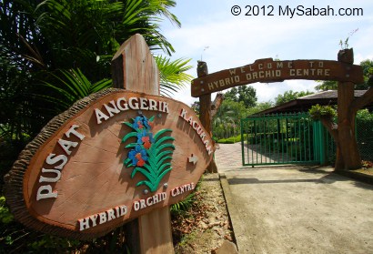
Orchid is such a charismatic flower that some enthusiasts would risk their lives to collect it in the wild. Luckily, you can see many precious orchid species in Sabah Agriculture Park (Taman Pertanian Sabah) in Tenom, without putting your life in danger. There are two orchid gardens there, namely, Native Orchid Center and Hybrid Orchid Center.
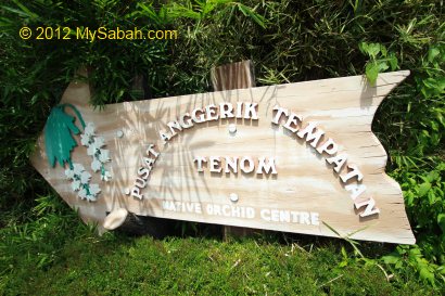
1. Native Orchid Center
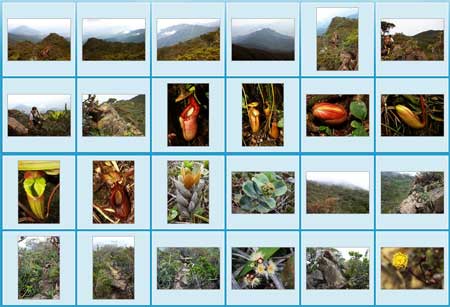
Borneo island has about 1,500 species of orchid, and you can see more than 350 indigenous orchid species in Native Orchid Center, making Sabah Agriculture Park one of the world’s famous orchid centers.
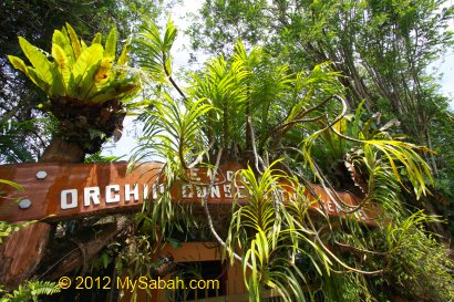
This orchid conservation center is housing some of the most valuable orchid species in the world, which include a slipper orchid (species: Paphiopedilum rothschildianum) endemic to Sabah and nicknamed “Gold of Kinabalu”. Valued at USD5,000 per stem in black market, this slipper orchid is known to be the most expensive orchid in the world. It’s also our Sabah state flower and locally known as “Sumazau Orchid”.
To protect those expensive and rare native Borneo orchid from being plucked, the park has to keep this garden locked and visitors must be accompanied by a guide from the park.
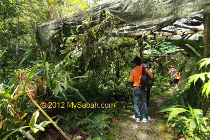
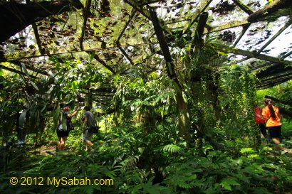
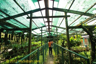
Most orchid collection of Native Orchid Garden are from lowland rainforest, which is a warm, humid and dim environment.
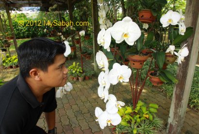
Therefore, the native orchid garden is also simulating the rainforest environment. The orchid nursery is shaded to avoid direct sunlight. You may not see any blooming orchid in photo above. Actually there are many of them but most of them are very tiny (only a few MM) and they are unlike the commercial orchids which are generally bigger and have bright colors.
In average, there are 30 orchid flowering per day in this garden. Some orchids have very interesting characteristics.
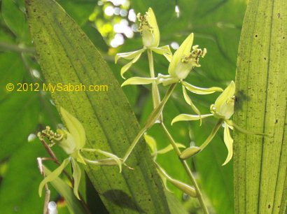
Have you ever seen a green orchid?
This orchid is known as “Bottle-Brush Orchid”. Go figure.
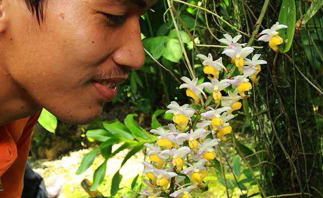
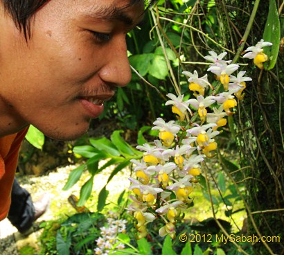
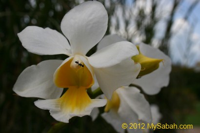
The orchid above have very strong and sweet aroma.
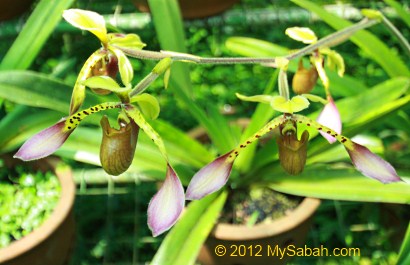
Above: Paphiopedilum lowii, a type of slipper orchid.
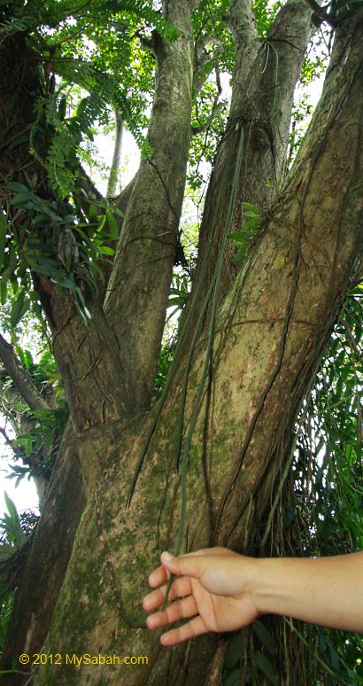
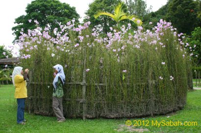
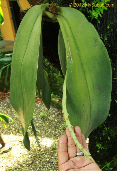
Above: “Rat Tail” orchid (Ekor Tikas) has the longest orchid leaf in the world. Click Here for more info
2. Hybrid Orchid Center
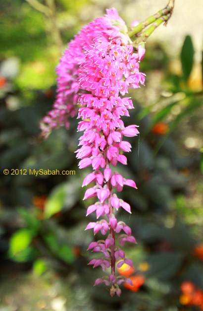
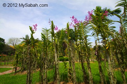
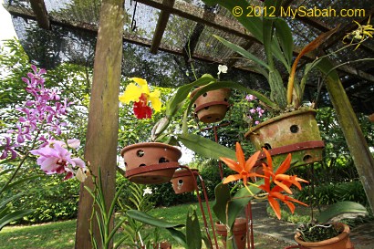
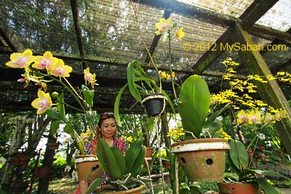
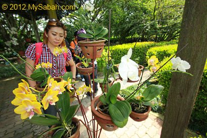
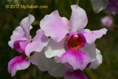
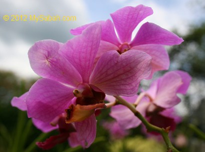
The orchids in Hybrid Orchid Center may look more familiar to you, because they are those large, colorful and showy orchids commercially sold in flora garden. These are the end product of cross-breeding of orchids.
The hybrid orchids are usually tougher and easier to plant. Native orchids are very sensitive to change of environment.
In contrast to Native Orchid Center, hybrid orchids have bigger and denser blooming clusters.
As you can see, both orchid gardens are very different. I believe botanists will love Native Orchid Center and gardeners love Hybrid Orchid Center.
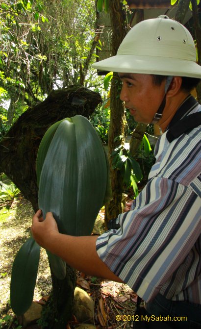
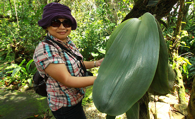
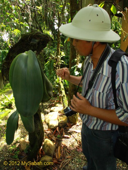
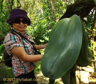
Our guide says, Elephant ear orchid is only found in Sabah and Kalimantan of Borneo island and it is very rare.
The leaves of Elephant Ear Orchid are so huge that no wonder it gets its name. I know there are a few lowland forest in Sabah where you can see this orchid but I haven’t seen one in the wild so far. In the Botanical Garden of Tawau Hills Park, there was one cultivation that has leaf measured 60.5 x 22.5 CM.
Based on my understanding, flower usually spends the most resources on fruiting, so it makes me wonder that why this orchid wants to develop huge & thick leaves, so big that it’s inflorescences are hidden behind the leaf.
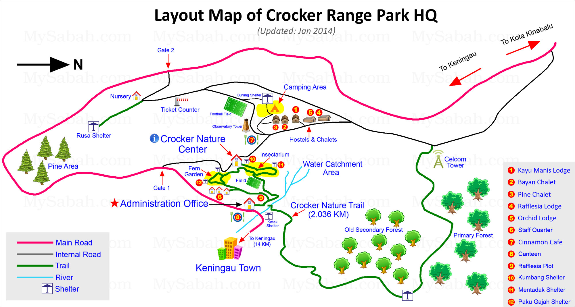
You may skip this article if you don’t plan to stay in Crocker Range Park. Please refer to the layout map below for the location of the accommodation in the Park:
The altitude of Crocker Range Park HQ is 850 to 1,000 Meters, with temperature ranges from 18°C to 26°C (64°F to 79°F). As it’s highland, it is cool in the morning, quite similar to Kinabalu Park. Please do bring warm clothing with you.
To stay in the Park, you have a choice of dormitory room, standard room, luxury room and camping. In total, the park has 4 chalets, 1 detached house (4 rooms for 22 pax), 60 dormitory beds, and a big camping ground.
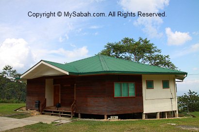
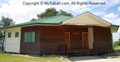
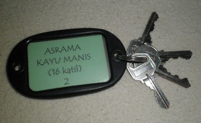
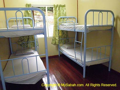
Kayu Manis Lodge (Asrama Kayu Manis)
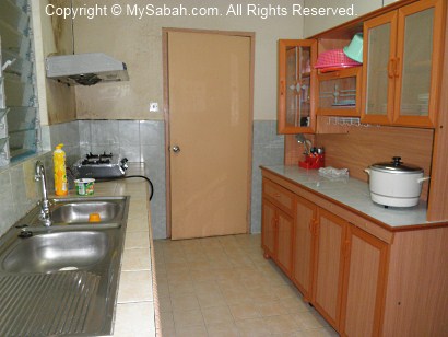
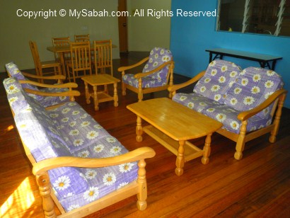
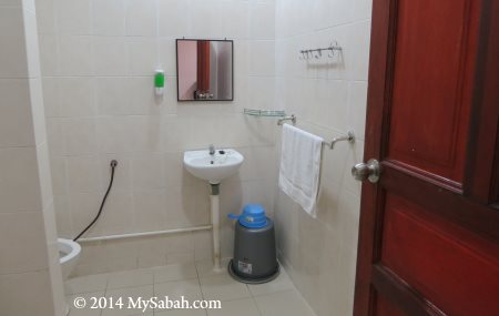
This cabin is the most suitable for a group of students and teachers up to 40 people. There are 2 family rooms with queen-sized bed and 2 single beds, 3 rooms with 6 single beds, 2 rooms with 8 singles beds, common bathroom with hot shower, spacious living room and a kitchen with complete cooking and dining facilities.
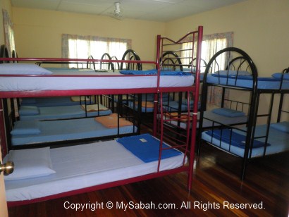
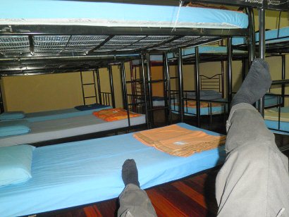
Pic: Bunk-beds Dormitory, RM30 (≈USD9) per bed per night
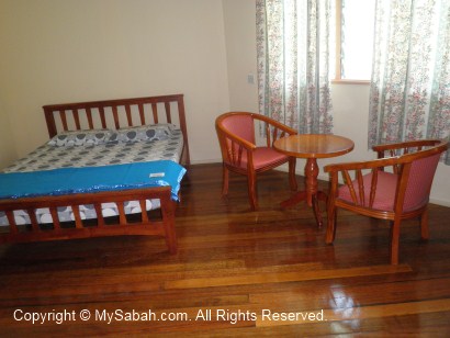
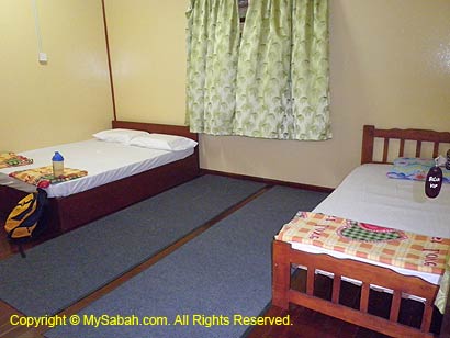
Pic: Family Room, RM125 (≈USD38) per room per night
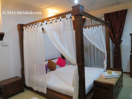
Bayan and Pine Chalets are just next to Kayu Manis Lodge. There are 4 units of chalets with king sized bed and attached bathroom (with hot shower).
Pic: Room of Chalet, RM180 (≈USD55) per room per night
Lodges
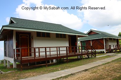
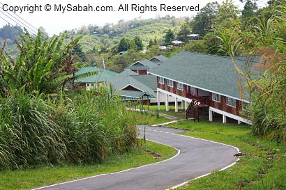
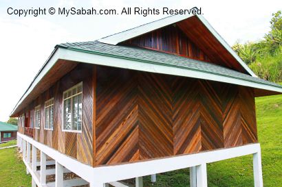
Orchid and Rafflesia Lodges are also next to Kayu Manis Lodge.
Pic: Orchid and Rafflesia Lodges of Crocker Range Park
Pic: Rafflesia Lodge has 1 family room with a queen size bed and 2 single beds, 3 rooms with 6 single beds, 2 rooms with 12 bunk beds, and common bathroom with hot shower.
Pic: Orchid Lodge has 1 family room with a queen size bed and 2 single beds, 3 rooms with 6 single beds, 2 rooms with 8 sinle beds, and common bathroom with hot shower.
Family Room of Orchid and Rafflesia Lodges costs RM150 (≈USD45) per room per night. Single Bed Dormitory costs RM40 per bed per night.
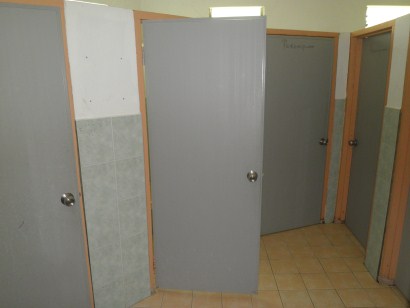
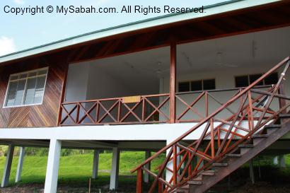
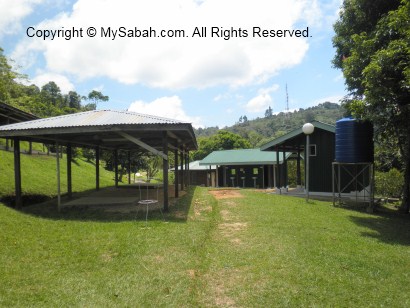
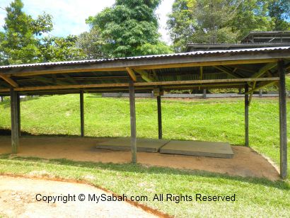
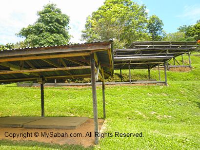
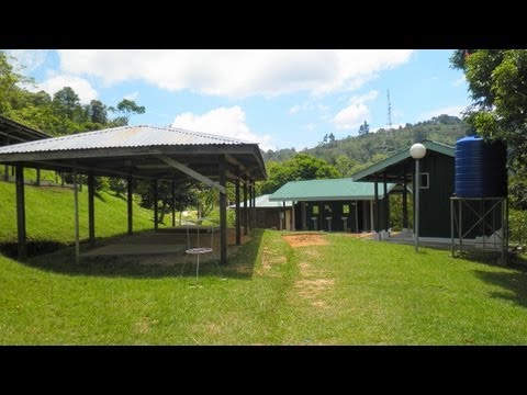
The four huts of camping ground can accommodate about 20 people. There are male and female toilets+shower rooms nearby. Camping fee is about RM20 (≈USD6) per person per night. You need to bring your own camping tent.
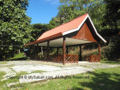
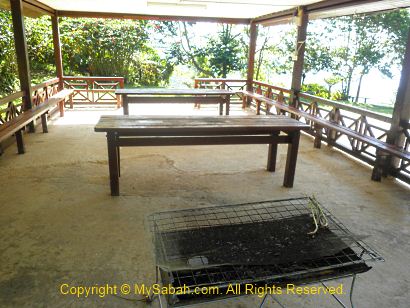
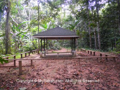
There is a shelter nearby for group activity and BBQ.
You may watch the 1-min video of camping site below:
Booking
You can book the rooms online or contact Manis Manis Rooftop of Borneo Resort (see contact below) for accommodation booking or updated room rates. Their rooms can be fully booked during peak season and school holiday.
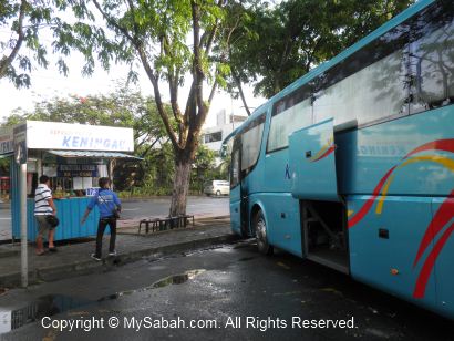
You may take a bus to Keningau in bus station at Merdeka Field (Padang Merdeka) in Kota Kinabalu city. Ask the bus driver to drop you in front of Crocker Range Park (Taman Banjaran Crocker), which is 14 Kilometers before Keningau town. The bus fare costs about RM15 one way and depart in morning (the earliest is 7am or 7:30am) and afternoon. To go home, you may arrange with the same bus company on the returning trip. They can pick you up in front of the Park when they head to Kota Kinabalu. FYI, you also can find their phone number on the bus ticket.
Here comes the highlight of my trip in Crocker Range Park, the night walk! I did two night walks, 1st night in Insectarium, and 2nd night in 2.036KM Crocker trail. You see nothing much in both places during daytime, but they turn into a busy world when night falls. If you are interested in night walk, you can arrange in advance with the Park at Administration Office or Crocker Nature Center during office hours. They will send a ranger to guide you. Usually the walk starts at 7:30pm.
Night Walk in Insectarium
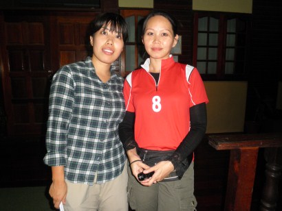
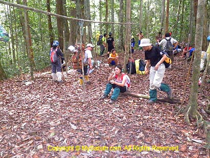
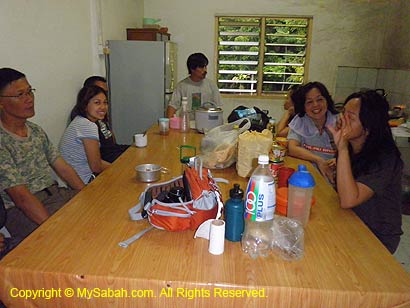
For my 1st night walk in Insectarium, the Park sends two ladies to accompany me, wow. They asked, “would you mind if the guide is female?” I smiled and replied, “No… Of course not” (why should I, hehe..). Oh, by the way, the lady at the left is Tomomi Kan, a Japanese volunteer from JICA. At the right is Lucy Suin, a Sabah Parks staff.
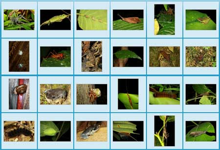
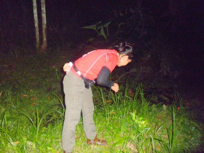
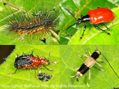
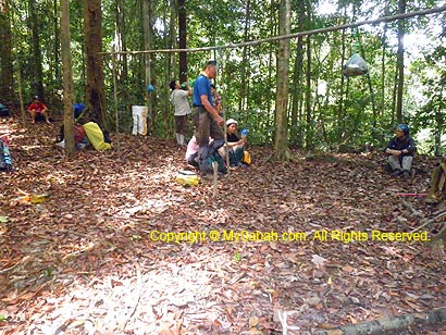
No kidding… these girls have sharp eyes. They started to discover bugs the moment we stepped into Insectarium. Normally girls will scream when they see bugs. However, these girls are so happy to find creepy creatures in the dark, like enjoying a treasure hunt. With the aid of torchlight, we search every inch of Insectarium and left no leaf unturned.
One by one, the bugs reveal themselves under their torchlight. I wonder how they did it. Probably they are so used to insect collection. Crocker Range Park has over 400 species of insects, making the Park one of the best spots for collecting specimen.
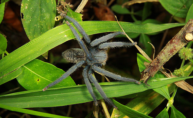
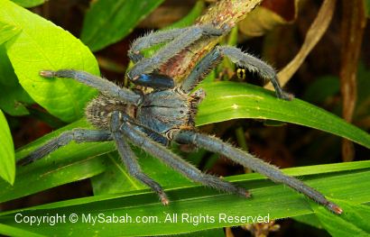
Above: this might be a Malaysian Earth Tiger (Cyriopagopus thorelli) tarantula spider
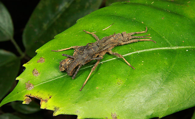
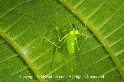
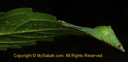
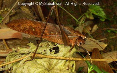
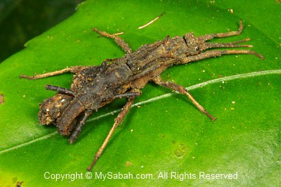
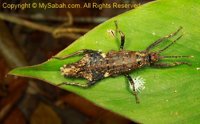
Above: a cricket disguised as the tip of leaf!
There are more bugs discovered when we moved closer to the pond and stream areas. It was such a joyful experience!
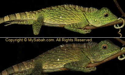
Above: an agamid that can change color in minute
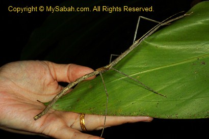
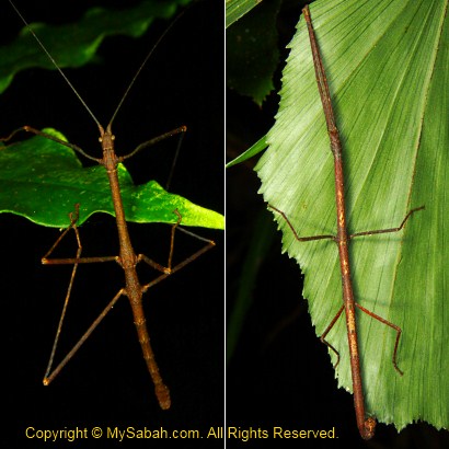
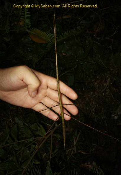
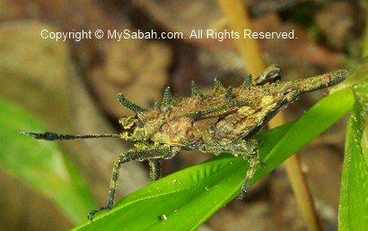
Above: a very long stick insect found by Lucy, the highlight of the 1st night walk.
It started to rain at 10pm, so we had to stop our night walk and said goodbye to each other. Anyway, I’m really happy to bag so many good shots.
Night Walk in Crocker Trail
Because of the exciting experience, I decided to arrange another night walk in Crocker Trail (2.036 KM) next day. This time the Park sends Mr. Rosandy Angkusup to guide me. I feel sorry to make them work until late night in fasting month (Puasa), so I tipped all the guides. Same as the lady guides, Rosandy has a trained eyes to beat the smart camouflage by bugs, especially stick insects.
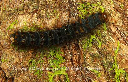
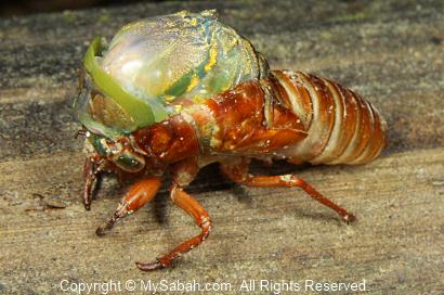
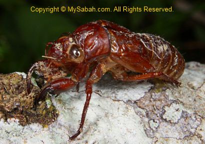
Above: a moulting cicada. The moulting was so slow that we couldn’t wait until it finished.
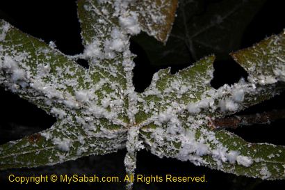
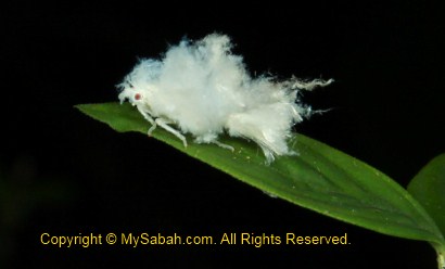
Above: the cotton-like substance is a group of Wooly aphid insect, amazing…
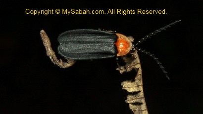
We saw at least 3 fireflies in the jungle.
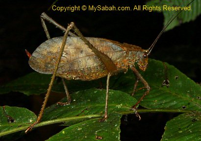
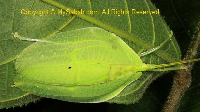
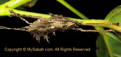
It is so impressive that crickets can look so different to one another.
Above: this alien-like cricket was shown in National Geographic channel before. The Crocker Trail is far more promising because the trail is inside the real forest.
Besides bugs, we also saw a Shama bird sleeping on tree, a mouse deer, heard the loud barking of a barking deer (probably smell our presence) and 2 civets at the edge of primary rainforest. We would get some if we carry hunting rifle, haha. Of course, poaching is prohibited in national park.
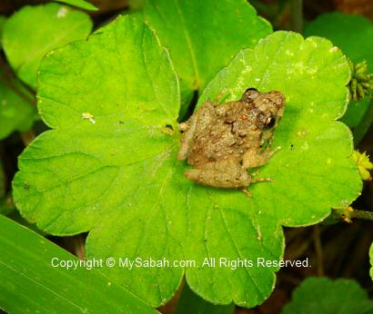
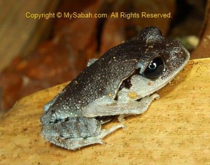
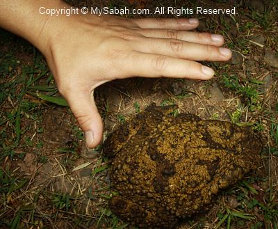
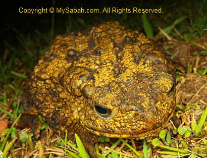
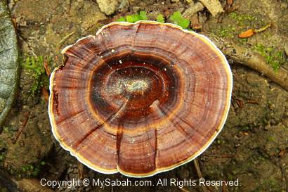
Above: giant river toad
Stick Insects
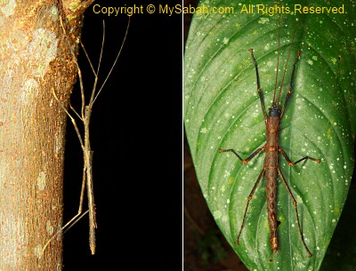
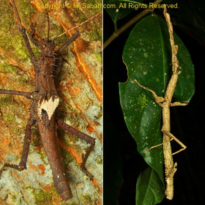
Rosandy is so professional in spotting stick insects (I always miss it!). I never saw so many stick insects in one night, nor do I know stick insects have so many species and variety. Some can play dead and some can release foul smell as a defense. Some can fly while some can’t. But all of them have one thing in common – they look like stick.
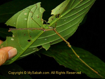
Above: very long stick insect
We moved so slowly that the night walk ended at 12:30am and our torchlight was almost out of battery. This is the best night walk I’ve had. I’ll be back one day.
WARNING: I know this blog would attract insect collectors. Please be informed that collection of any flora & fauna in national park without a permit, whether the subject is dead or alive, is a serious offense. You will be fined heavily or even jailed for illegal collection. Crocker Range National Park is NOT a place for you to look for toy pet!!!
Crocker Range Park is one of the most important national parks of Sabah, due to its rich biodiversity and ecology values. About 500 plant species (1/3 of Borneo’s species), 107 mammal, 67 amphibian, 52 reptile and 26 species of freshwater fishes are found in this Park. There are two nature trails in the Park.
Please refer to the layout map below for the location of both trails:
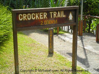
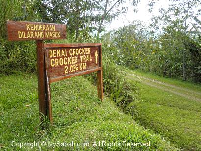
Crocker Trail (2.036 KM)
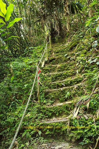
Nature lovers should talk a walk in the 2.036-Kilometer Crocker Range. The starting point is just next to the Administration Office. It’s quite a leisure jungle trekking for less than 3 hours and ends at a point which is 500 Meters from accommodation area (hostels/chalets). You also can start the trekking from opposite direction (i.e. from ending to starting point).
The trail is a nature route but in fairly good condition, so you won’t lose your way. The terrain is not challenging though there are a few mildly steep path.
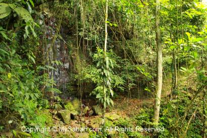
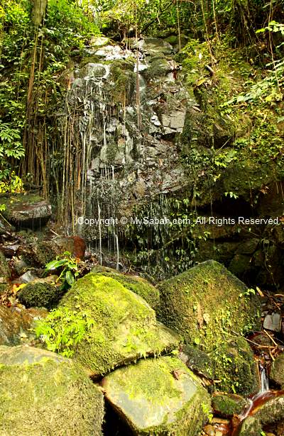
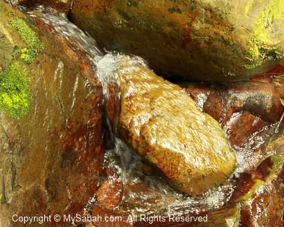
In the begining of the trail is a waterfall and small stream.
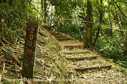
There is a signage in every 100 Meters. You should bring raincoat, insect repellent and a bottle of water with you. There might be forest leeches around in wet season, so you may put on your leech socks. It was very dry during my visit, so I didn’t see any leech.
The first half of the trail is inside old secondary forest, which was used to be a plantation, so you will see rubber, bamboo and banana trees.
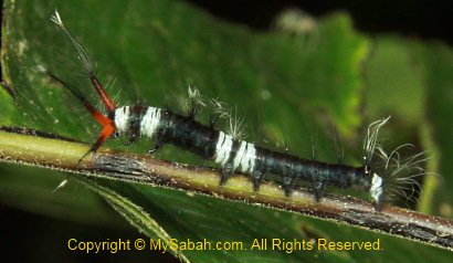
Then you will come to the zone between secondary and primary rainforests. At night, if you are lucky, you would see wildlife such as sambar deer, sun bear, barking deer, mouse deers, wild boar or civets around this area. In daytime, I’m afraid you won’t see any big animal. I only saw a few birds, squirrels and treeshrews. You can pay attention to the shrubs along the trail, you might spot some interesting insects and plant.
Above: the moult skin of cicada. Cicada spends 12 to 13 years underground. If your child is as old as this cicada, he is in high school already.
Above: At 1,150th Meter, about halfway of the trail, there is a shelter for you to rest.
Above: the ending point of the Crocker trail. Just follow the gravel road and you will see your accommodation in 10 minutes. To be honest, this trail is less impressive than other forest trails I try in other national parks. But in night time, this trail offers so much to see. Read the next article to find out.
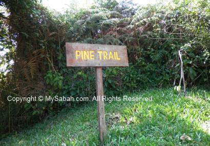
Pine Trail
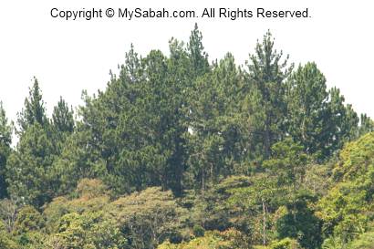
The second trail, which I don’t recommend, is the Pine Trail near the ticket counter (refer to map for location). It is very poorly maintained and look more like an abandoned trail.
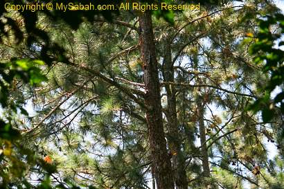
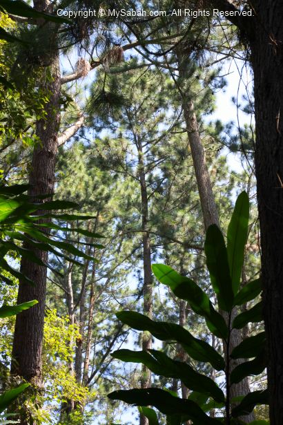
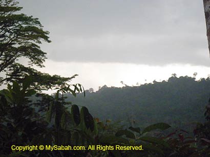
The dense pine woods look so beautiful from a distance. That’s why I decide to check out the Pine Trail. The pine trees were planted by the previous land owner. The Sabah Parks staff did advise me that the pine trail is in less than ideal condition and he doesn’t encourage me to explore.
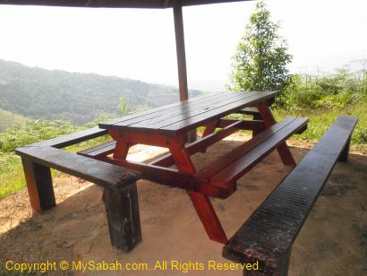
The 1st 150 Meters walk to the Rusa Shelter (Pondok Rusa) is quite ok. I had a good opening view of Crocker Range and Keningau valley from the shelter.
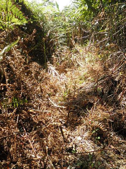
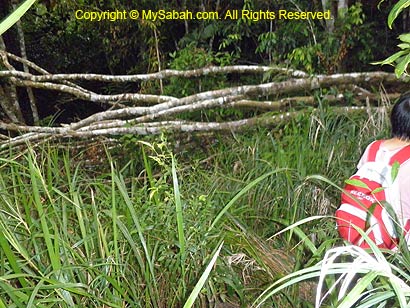
Driven by curiosity, I proceed deeper to the pine trail, where the trail condition gets quite uninviting. The trail was almost unrecognizable and covered by long grass and dense shrubs, and some parts are so narrow. I feel very uncomfortable walking on grass stack with shrubs so near to me, coz that’s where the snakes like to lurk. Though I was hesitating, I was still moving in and I had no idea where is the end.
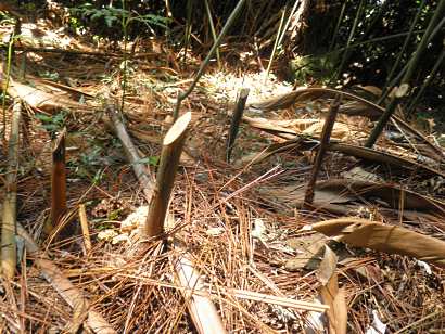
You also need to be very careful not to trip and fall on the sharp incisions of Acasia shrubs. Such “trap” is everywhere on the trail.
Above: the needle-like pine leaves
It took me more than 30 minutes to reach the pine tree area.
The trail disappears, so I assume I have reached the ending point.
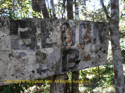
Above: anyone can read what is written on the signage?
Here I am, under the pine trees and surrounded by dense undergrowth. But what’s the point? What am I doing here?
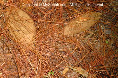
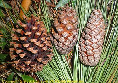
Well, there are a lot of pine fruits on the ground. Someone like to collect this, but not me. Now you know what is the pine trail about.
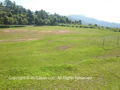
On the way back to my cabin, I passed by a soccer field, which is worth a mention here.
Soccer Field
The football/soccer field is quite near the camping ground. The Sabah Parks guides tell me that I can see deers playing soccer here at night. Just kidding.
Yes, you can see Sambar Deers (Payau) and Barking Deers (Kijang) wandering in this field at night. Sabah Parks is trying to plant fruit and food crop to attract more deers. In future, they will open a new “Deer Trail” as a new attraction for deer sighting.
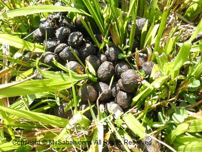
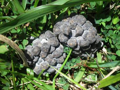
If you walk around, you would see deer dropping on the field, an evidence of their visit.
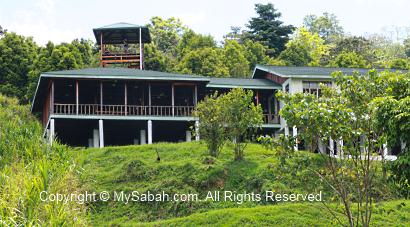
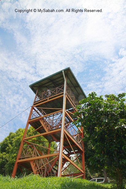
Observatory Tower
Another point of interest you should check out is the 20-Meter observatory tower next to the restaurant in Crocker Range Park. It is just a stone throw from the Crocker Nature Center.
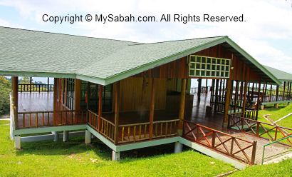
Above: the restaurant (Cinnamon Cafe) next to the tower, opens from 8am to 9pm daily.
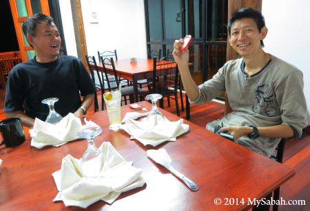
Above: having dinner in Cinnamon Cafe
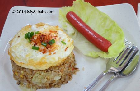
Above: Cinnamon Cafe doesn’t have many choices of food but it tastes ok.
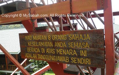
The notice says the tower only allows a maximum of 8 visitors at a time and use it at your own risk.
The structure of the tower is mainly steel and very solid.
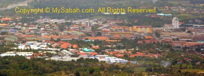
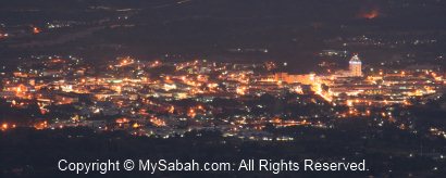
The feature of this tower is – you can get a very nice view of Keningau town from the top. I took the following photos on the tower. You can see the Juta Hotel clearly, the highest building of Keningau.
Crocker Range Park (Taman Banjaran Crocker) is the largest terrestrial park of Sabah. The Park spreads over 139,919 hectares of densely forested terrain, mainly lowland, hill and montane forests, and covering an area of 1,399 sq. Kilometers, which is twice the size of Singapore! As Crocker Range Park has many species of flora and fauna endemic to Borneo, I had a 4-day-3-night tour there last month.
Crocker Range Park is approximately 75 KM in length and 15 KM wide, run along northeast-southwest axis in west coast of Sabah. The altitude of the Park is 100 to 2,076 Meters at the peak of Minduksirung, with temperature ranges from 18°C to 26°C (64°F to 79°F).
As shown in the map above, Crocker Range Park spans across 8 districts. The Park is so big that it has 10 substations, such as the Rafflesia Information Center and Mahua Waterfall in Tambunan. Sabah Parks manages this Park since 1984 to protect its ecosystem of forest and watersheds of rivers.
Being a significant biodiversity site, the Park is also an important water catchment area as the sources of 12 major rivers. These rivers supply clean drinking water to the people in west coast and interior of Sabah. If I pee in these rivers, half of Sabah people will have a taste of my urine. Just kidding..
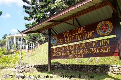
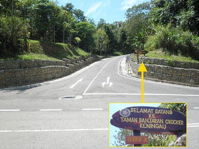
The headquarter (HQ) of Crocker Range Park in Keningau district is 105 KM from Kota Kinabalu city and very accessible. Just drive on the new Kimanis-Keningau road to Keningau town, in less than 2 hours (about 14 KM before Keningau), you will see the Park office is just next to the road side. I reached there at 9:30am by a bus and it only costs me RM15 (about USD$4.50) one way.
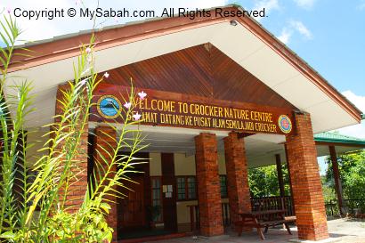
You may watch the 30-sec video of Crocker Range Park entrance below:
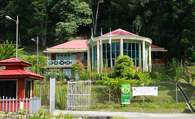
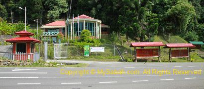
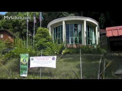
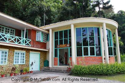
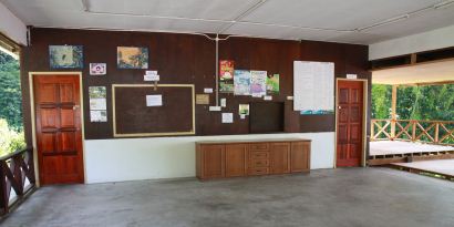
Compared to other substations, Crocker Range Park HQ (main station) has better facilities and is more “tourist-ready”. In contrast to our noisy and overcrowded Kinabalu Park, this Park is very quiet, when my visit was on Sunday of Muslim fasting month, and I was the only tourist (I like it though). Just remember the Administration office building in photo above, because EVERYTHING (i.e. booking, registration, check-in/out, operation, activities) is done there.
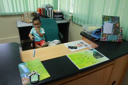
The Sabah Parks staff, Ms Ridianna, was expecting my arrival coz I had booked the room by phone earlier. I registered in the reception office and got my room key from a boy (just joking, he is the son of Ridianna). For 16-bunk-bed dormitory room in Kayu Manis Cabin (Asrama Kayu Manis), it costs only RM20 (about USD$6) per night, quite affordable if compared to the minimum RM100 (USD$30) per bed per night room rate of Kinabalu Park, under the blood-sucking management company named Sutera Sanctuary Lodges.
I also got a layout map of Crocker Range Park. You may click the map below to download it.
Actually I modify the original map and translate the Malaysia language terms to English and add more details to it. Other park maps you find on the Internet are outdated. You may need to refer to this map when you read the rest of my articles.
After checking in, I face my first problem. My accommodation is 3 KM away from the administration office and I didn’t bring my car. For you who plan to stay in the Park, please take note that you need to drive to your hostels/chalets at Gate No. 2 (refer to map).
Above: Kayu Manis Cabin
Luckily Sabah Parks has office vehicles move and work around the Park, and they are very keen to give me a lift to my cabin. FYI, there is a Celcom telecomunication tower nearby so my mobile phone got nearly full bar of signal anytime.
Instead of one room key, they hand me all the keys which allow me to access all the rooms in this cabin, include the better rooms.
Anyway, being an honest traveller (cough…), I stay in what I pay for, the cheaper dormitory room with 16 bunk beds. Guess what? I own the whole room/cabin as there was no other tenant during fasting month.
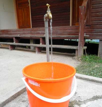
Then came the second problem, I was informed that the water pump was malfunction so there was no water. Fortunately, I managed to collect two buckets of water remained in the pipes. The plumber fixed the pump on next day.
Third problem, there was no restaurant in the Park and the only canteen in front of the Park was closed for fasting month.
Above: I only brought a small amount of food such as biscuits, oatmeal, instant noodle cups, creamy soup, can, 3-in-1 Nescafe and some chocolate bars, which are not enough for 3 days. Again, luckily Ridianna lives in Keningau and she helped me to buy some food supplies such as rice. The Sabah Parks staffs there are “naturally” friendly and helpful. Thanks for their help, all my problems were no longer the problems.
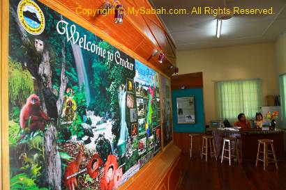
Crocker Nature Center (CNC)
Now everything is settled, I start to tour inside the Park. Crocker Nature Center (CNC), which is 500 Meters away from accommodation zone, is the second most important building you should remember, as it’s the Exhibition Center and the starting point of most activities. You may Click Here to see its opening hours.
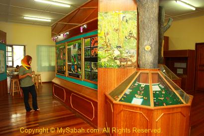
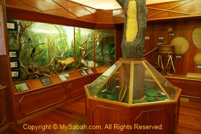
Crocker Nature Center exhibits some information, specimens and photographs about the flora & fauna of the Park. Some traditional farming and fishing tools are also on display.
You may watch the 2-minute video of Crocker Nature Center below:
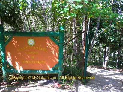
Crocker Range Park is famous for its rich variety of insects, so I checked out the Insectarium, just behind CNC.
The ranger told me that an Asian Paradise Flycatcher (a beautiful bird with long tail looks like paradise bird) nested here before and attracted a lot of bird watchers. I saw magpie robin, buff-rumped woodpecker, bulbul, sunbirds, and flowerpeckers around this area. Besides, I also spotted hornbill, white-breasted waterhen (Ruak in Malay), Cuckoo doves, Emerald doves, green pigeon, white-breasted woodswallow, yellow-vented bulbul, orange-bellied flowerpecker, Pacific swallow, Barn swallow, pied fantail and chestnut munia near my cabin.
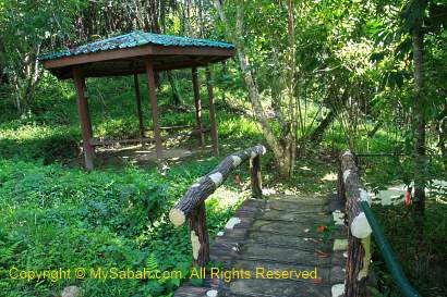
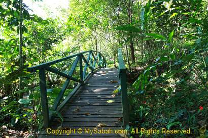
The walk in Insectarium takes less than 30 minutes on cement or paved walkway inside a wood, which used to be a farm land. There are shelters, pond and some flowers, but too bad I didn’t see any interesting insect. Instead, the most common insect here is mosquito, and a lot of them. Do take insect repellent with you if you come here. However, this place will turn into a party ground of various bugs and insects at night. More on this later.
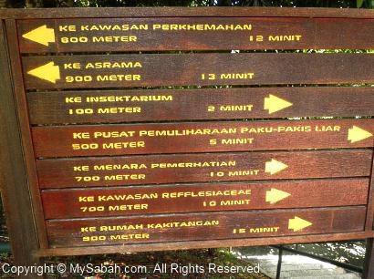
FYI, if you see a field like photo above, you can turn left to follow the trail to the Administration Office, which is about a 10 minutes walk (500 Meters).
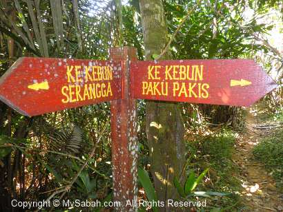
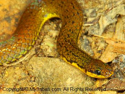
Above: junction to Insectarium and Fern Garden
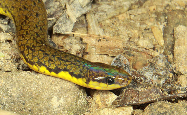
Reed Snake (Calamaria grabowskyi) spotted at the junction. It’s neither venomous nor aggressive.
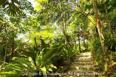
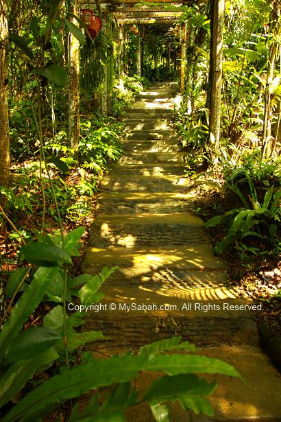
Fern Garden (Kebun Paku Pakis)
55 species of ferns can been found in Crocker Range Park. These includes the endemic and newly described species of Adiantum lamrianum, found near the Mahua waterfall.
You can find hundreds of fern plant, in different sizes and shapes, in the Fern Garden of Crocker Range Park. Many would look familiar to you as they are commonly used as ornament plant in local gardens. The huge elephant fern is also in their collection.
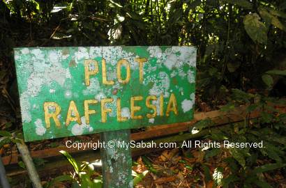
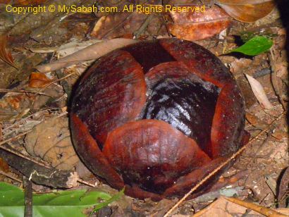
Rafflesia Plot
About 100 Meter behind the Administration Office is a Rafflesia Plot area for the biggest rafflesia species of Sabah, rafflesia keithii. There were about 4 rafflesia buds during my visit. The biggest bud is still 3 months away from blooming. You can Click Here to see the blooming rafflesia.
Rafflesia flower doesn’t have predictable blooming period and the flower lasts less than a week, so you need luck to see the blooming flower.
This article tells you how to organize a climbing trip to Mt. Tambuyukon. You may skip this if you don’t plan to climb the mountain. Please note that planning and preparation for Mt. Tambuyukon trip is tedious and time-consuming. If you have little spare time, getting a tour operator to arrange everything is a good option, but the cost will double or even triple.
Planning & Preparation for the Climb
Step 1. Gather the Climbers
First, you need to decide the number of climbers and the climbing date. Prepare a name list (with Full Name, MyKad/Passport No. and Phone contact) and confirm a date with all the climbers. Usually May to July are dry months and best time to climb. However, the global climate has gone haywire, for example, the La Nina or El Nino phenomenon would change weather pattern. Nobody can predict the weather, so you better be prepared for the worst. But try to avoid Dec and Jan, which are the wettest months.
Normally, you need 5-day-4-night to complete the climb. For experienced and fit climbers, 4-day-3-night is possible. If you are unsure, just plan for a 5-day climb.
Step 2. Book the Date with Sabah Parks
You need to book the climb with Sabah Parks at least 1 month in advance. All the paperwork and registration are done with Sabah Parks office in Kinabalu Park (Tel: +60 88-889888). Later, you will still need to communicate with Sabah Parks back and forth on various arrangement, more on this later.
Under Sabah Parks policy, only a maximum of 9 climbers (exclude Sabah Park rangers and porters) are permitted in one trip. Inform Sabah Parks your climbing date and submit your name list. They will mark the date for you if no other group climbing.
Step 3. Plan the Itinerary
Once the climbing date is confirmed, you may plan your itinerary.
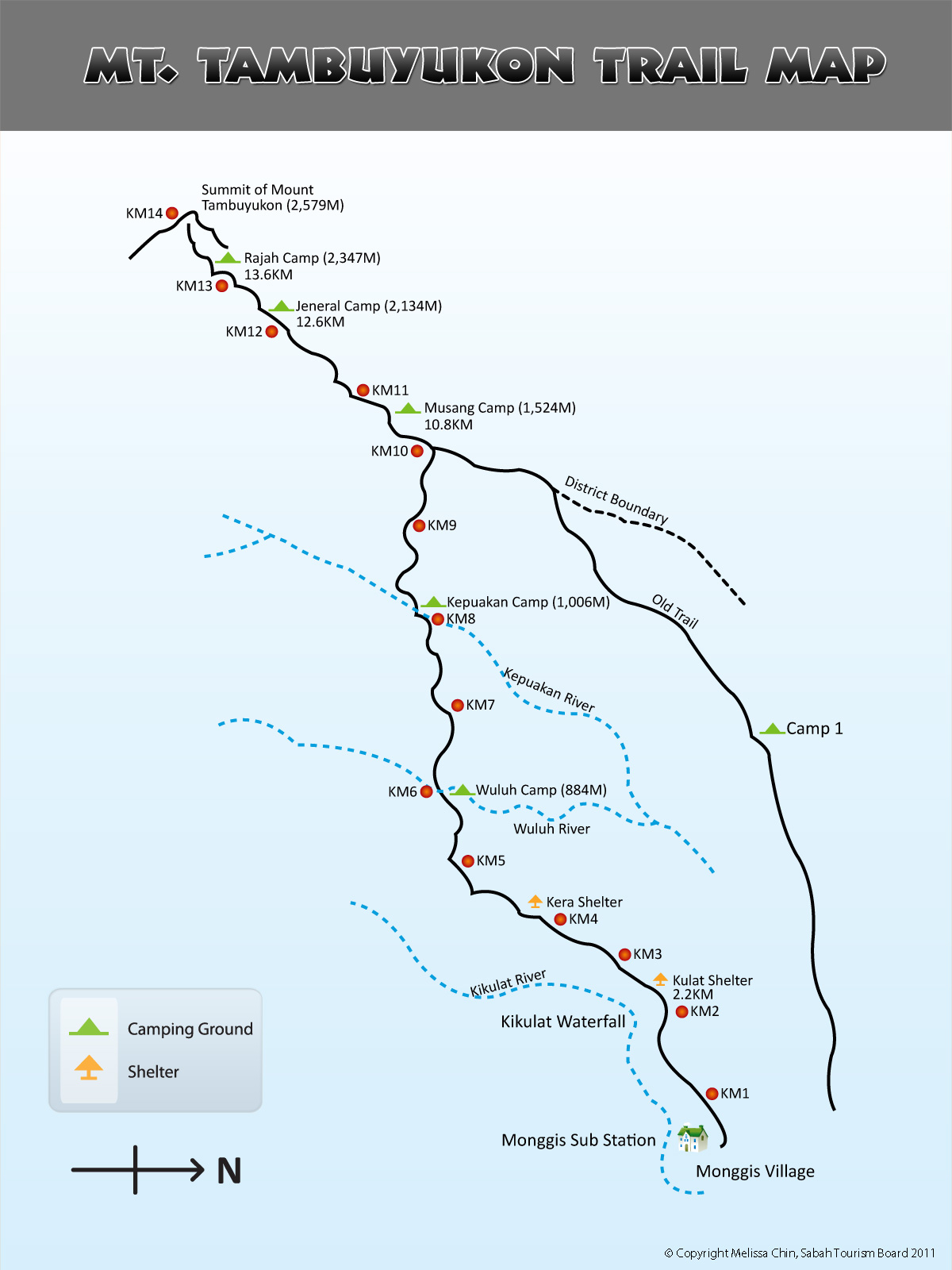
Below is the summit trail map of Mt. Tambuyukon. Click it for bigger picture:
Below is a standard 5-day schedule (for reference only. You may adjust it):
Day 1
6:00am
Depart from Kota Kinabalu to Kinabalu Park
8:00am
Register at Kinabalu Park. Fill up climber & Indemnity forms. Pay for climb permit & insurance. Collect climber tags.
9:00am
Transfer into 4WD to Monggis Substation
10:30am
Register at Monggis Substation. Meet porters & Briefing by guide.
11:00am
Start trekking to Wuluh Camp (KM6)
4:00pm
Arrive Wuluh Campsite for camping overnight
Day 2
7:00am
Breakfast
8:00am
Trekking 4.8KM to Musang Camp (KM10.8) for camping overnight
3:00pm
Arrive Musang Campsite
Day 3
3:30am
Breakfast
4:00am
Trek up to summit of Mt. Tambuyukon
10:00am
Reach the Summit (KM14)
5:00pm
Back to Musang Campsite for dinner & overnight
Day 4
7:30am
Breakfast
8:30am
Descend 13 KM (via old trail) to Monggis sub station. Overnight in Monggis Sub Station
Day 5
8:00am
Breakfast
9:00am
4WD transfer back to Kota Kinabalu
1:00pm
Arrive KK
Below is a 4-day itinerary (for very tough climbers only):
Day 1
Depart to Kinabalu Park
Register at Kinabalu Park.
Go to Monggis substation by 4WD
Overnight in Monggis
Day 2
8am: Breakfast
Start climbing to Musang Camp (13KM old trail recommended)
Overnight in Musang Camp
Day 3
Breakfast
Climb to the Summit (KM14)
Back to Musang Camp for overnight
Day 4
Breakfast
Back to Monggis via 13KM old trail
Go to Ranau (by 4WD)
Back to Kota Kinabalu
Of course there are other variations of itinerary, depends on your needs.
Step 4. Working out the Budget
This part is not easy… You only know the exact amount spent after the trip.
Mandatory Expenses
Climb Permit: RM100 for Malaysian, RM200 for foreigner
4-Wheel-Drive (4WD) Transport (Ranau-Monggis Substation return trip): RM400-500 per car
Sabah Parks Ranger Guide Fee: RM70/day (Policy: 1 ranger is required for every 3 climbers)
Conservation Levy: RM3 for Malaysian, RM10 for foreigner
Insurance: RM7 per day (you must insure the porters & rangers too)
Camping Fee: RM10 per pax
Food: estimated RM20/day per pax
Optional Expenses
Tour Guide: RM100-150 per day. Besides guiding, they can cook & setup camp for you.
Porter: RM70/day (carry up to 20Kg)
Cooking service: extra charge if you also want tour guide to cook for you
Accommodation (Monggis Substation): RM10/pax per night (not so sure the rate)
Use of cooking facilities (e.g. gas) in Monggis Substation: RM50
Certificate: RM5
Misc. Expenses
Individual / group may purchase the items below:
Camping tent
Portable cooking stove & utensils
Cooking gas cylinder, RM5 each (for portable cooking stove)
Personal medication (e.g pain-killer, anti-septic cream) & 1st Aid Kit (for minor cut & injury)
Insect repellent, mosquito coils (anti-sandfly)
For example, there are 3 Malaysian climbers who would like to hire one 4WD and two porters for a 5-day trip. The budget will look like table below (all fees in Malaysian Ringgit (RM), USD1 = RM3.3):
Item
Price
Qty.
Total (RM)
Climber Permit*
100
3
300
4WD Transport
500
1
500
Sabah Parks guide fee (RM70 x 4 day)
280
1
280
Camping Fee
10
3
30
Conservation Levy*
3
3
9
Porter (RM70 x 4 day)
280
2
560
Insurance (RM7 x 4 days x 6 pax)
28
6
168
Food (RM20 x 5 day)
100
3
300
Accommodation (Monggis)
10
3
30
Certificate
5
3
15
GRAND TOTAL:
2,192
*Malaysian rate
So the basic fee is about RM731 (=RM2,192/3 pax) per climber. Please note that optional, individual and misc expenses are not included in this calculation, so the final cost will be more than this.
Step 5. Physical Training
Very Important! Ask your climbers to start physical training. Climbing Mt. Tambuyukon is a few times harder than Mt. Kinabalu, and it is no joking matter. Climbers who never exercise regularly is almost guaranteed failure. You just can’t hide your weakness from Mt. Tambuyukon. The climber must jog at least 15KM per week for consecutive 3 months, the more the merrier. The more pain you get in training, the more relaxing your climb will be. The most suitable training track is the hilly trail. Do exercise the muscles of arm and waist, because the extra strength will help you a lot on carrying bag and free climbing.
For elder climbers, you may advise them to take glucosamine daily supplement before the climb. That can help preventing serious knee pain after climb.
Step 6. Briefing & Discussion with Climbers
Have at least one meeting with all the climbers and do the following:
Briefing: Tell them what they should prepare (see “Things to Bring” below) and what to expect (better if you can show them my blog about Mt. Tambuyukon, haha).
You may start collecting money from all climbers, so you can start purchasing food & supplies for the group, also as a non-refundable “deposit” to avoid inconsiderate people withdraw in last minute.
Get the mobile phone number of everyone to keep in touch.
Assign one or more members to help you on food preparation.
Step 7. Booking Porters & 4WD Transport
Though it’s possible to carry the bags and supplies yourselves during the climb, hiring porters will greatly reduce your burden and the climbers will have better chance of reaching the summit. During emergency situation, porters will be the extra hands that save life. Besides your personal backpack, do not forget you also need someone to carry your camping tents, food & supplies, portable cooking stove, cooking utensils, etc.
You can contact Kinabalu Park to arrange for the porters and 4WD transport. Each porter can carry up to 20Kg of stuffs. Just call Kinabalu Park about 1 week before the climb and tell them how many porters you need. Most of them are villagers from Monggis Village near to the Substation. Usually they will wait for your group at Monggis Substation.
Step 8. Guidelines for Food
You may start buying food 1 or 2 weeks before the climb. Below are some tips:
Our warm and humid climate causes food to spoil quickly and you can get food poisoning. Avoid bringing “wet” food (e.g. fresh meat & fish), which is prone to growth of bacteria.
Avoid food that needs a long time to cook coz it will consume more cooking gas.
You don’t need to prepare food for porters and rangers.
Instant noodle is a poor choice for breakfast (before the climb) coz the excessive salt dehydrates you. Personally I highly recommend Oat meal coz it releases energy for many hours. You may mix oat meal with sugar & milk powder to make it tastes better.
Avoid heavy or canned food. You also can’t dump the empty can in the camp. No, you can’t bury them.
You may bring frozen meat so you can have meat in day 1.
Remove food packing to reduce weight & size.
Every day the climb starts from morning and ends at evening, so you can’t stop to cook lunch. You need to prepare packed lunch in the morning.
Ration, organize, pack and label the food nicely in plastic bags (prevent getting wet).
Store all the food in a proper backpack for porter to carry.
Hang the food on air to prevent rats and civets having a buffet.
Prepare food menu list so you knows what to cook each day. It is taxing if you only start sorting out what to cook, after a long tiring climb.
You can refill water at the rivers / streams (KM5, KM6, KM8 & KM10.8), but bring a few bottles just in case.
Bring a few garbage bags for disposal of leftover food.
Please find out if anyone has any food preference (allergy, vegetarian and religion).
Control the weight of your food. Don’t bring tons of food!
Step 9. Final Check
To make sure everything is in place, you should do the following a few days before your climb:
Pack and weight your food to check if you have hired enough porters to carry it.
Remind Kinabalu Park again on the climbing date and number of porters you need.
Sabah Parks may send their Ranger from Poring. Confirm with them if the ranger will wait for you at Poring or Monggis.
Confirm with 4WD driver on the pick-up date & time.
Send a friendly reminder to all the climbers (e.g. date of departure & gathering time).
Things to Bring
MyKad/Passport: required for registration at Kinabalu Park
Camping tent
Sleeping bag (the temperature can drop to 10°C at night)
Optional: energy bars, hand glove, pen & notepad, lighter, camping light
Tips & Advices
Keep your backpack light. I repeat, keep it LIGHT!
The temperature of Mt. Tambuyukon ranges from 6°C – 30°C (43°F – 86°F). of course, the higher the altitude, the colder. It’s quite windy near the summit.
If you hire a porter to carry your bag. Don’t let him carry everything. He might be very far ahead. Bring raincoat and water with you in a small bag.
If you plan to overnight in Monggis Substation in last day, you may leave a set of clean clothing (and some food) in their storeroom. Pointless to bring unused stuffs up and down the mountain.
Don’t bring too many clothing. Keep 1 set of clean clothing for bedtime
One of the best shoes for trekking in wet tropical forest trail is “Adidas Kampung” rubber shoes, available locally for RM6–7 a pair only and water-proof.
Hygiene: wash your hands before meal and try to drink only boiled water.
Drinking unboiled river water is quite unavoidable. Prepare some water purification tablets to sterilize river water. Available in outdoor shops.
Trim your fingernail & toenail before the climb.
Potential Problems / Dangers
Below are a list of issues you should prepare to prevent/rectify:
Diarrhea: use handwash sanitizer for cleaning before meal. Bring medicines just in case.
Leech Bites: wear leech socks
Wasp / Bee / Hornet: bring medicines if any climber allergy to bee stung
Deer Fly / Sandfly: apply insect repellent with DEET formula or burn mosquito coils
Thorny rattan & poisonous plant along the trail: look before you grab anything for support
Snake: just watch out under the rocks / log
Dehydration: bring enough water. Rehydration salt is useful.
Fall / Slip: be extra careful at slippery or steep trail
Sprained ankle: watch your steps
Blister & small cut: use anti-septic cream
Losing way: stick with the group
Falling tree branches: pray!
Tour Packages
Now you can see that it’s a lot of work and preparation. If you don’t want to do the tedious planning, you may hire TYK Adventure Tours (Tel: (6088) 232821, 238702 Email:tykadto@gmail.com) to arrange everything for you, from transport, meals, registration, porters, guides to camping tents. Of course it’ll be more costly.
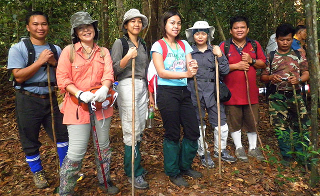
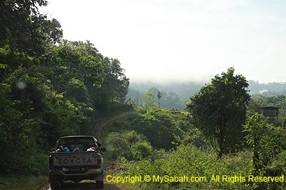
After spending 3 days of camping inside the forest, we go back to Monggis Substation (starting point of the climb) today. Please refer to trail map for the location.
DAY 4. Back to Starting Point
Descending to Monggis Substation
We are going home. When we worried that we needed to go through the same dreadful 10KM undulating trail again, Maik said we would use the old 13KM trail (some says 15KM), which is longer but mostly flat and descending route. We packed our stuffs and left Musang Campsite at 7:30am.
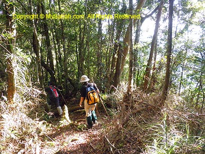
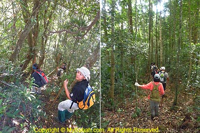
Maik was right, the walk on old trail is a heaven compared to previous 3 days. We only climbed over a few mildly steep slopes and hardly called these a challenge.
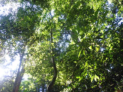
In contrast to the dim new trail, there are more sunlight came in from the open canopy.
You may watch the 2.5-min video below to see the jungle trekking via old trail:
Track marks and footprints of wild boars and deers are found along the way. I could hear hornbills flied over the canopy too.
Above: hole dug by wild boar
Camp 1
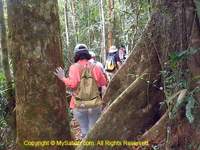
By 11:30am, we arrived Camp 1 (altitude 578M), a large flat ground that can accommodate 6 camping tents and under a canopy of tall oak trees. There is a stream nearby for refilling our water. We had some fried rice as lunch there, rest a while then moving again.
Above: Camp 1 on old trail
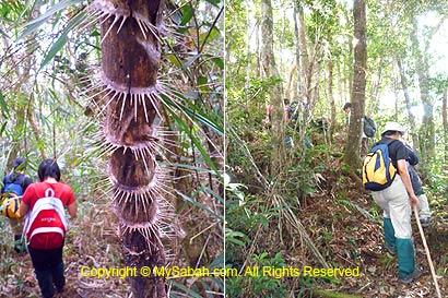
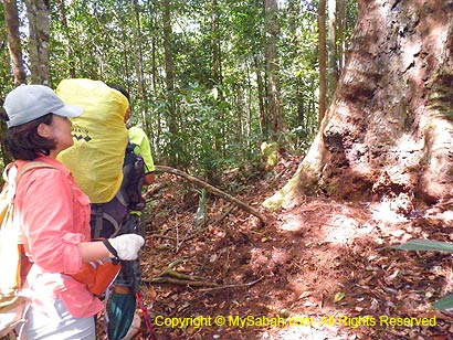
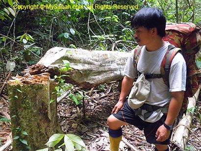
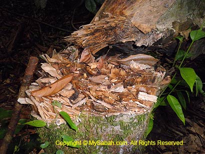
Not a single signage is found along this 13KM old trail, so we had no idea how far we went. After Camp 1, the trail is narrower and nearly unrecognizable. The old trail is poorly maintained and flanked by dense undergrowth. During rainy season, the climbers will harvest dozens of leeches while walking and brushing through the dense shrubs. On the way, we saw a wild Agarwood (gaharu) has been cut and left to dry by thief. Gaharu is a highly precious fragrant wood, which can fetch for RM5,000 per Kg.
Above: Agarwood cut down by thief
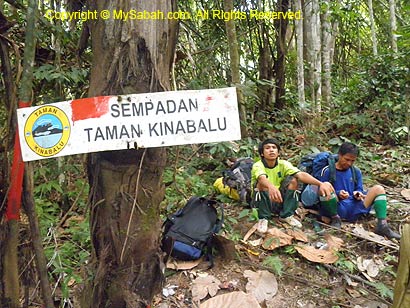
By 2:30pm, we reached the Kinabalu Park boundary which means we are only 2-hour away from Monggis Substation.
Above: Boundary of Kinabalu Park
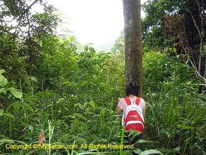
After this point, we were walking on private land and passed through rubber plantation, farm land and orchards. The trail is inside private land and not maintained at all. We trekked inside bushes and occasionally moved around the fallen trees that blocked our way. All of us made it to Monggis Substation around 4:30pm, right before the pouring heavy rain.
Above: heavy rain coming
Overnight in Monggis Substation
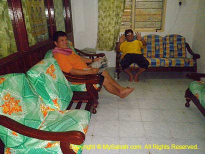
Most of us have been wearing the same trekking outfit since day 1 and didn’t take shower, so everyone smells funny. We took a shower in Monggis Substation and put on clean clothing.
We are also glad that we can sit on a proper chair to rest our exhausted legs and bodies. After I settled the payment for porters and guides, I submitted the name list of climbers to Justin, manager of substation, for printing of certificates.
You may watch the 40-sec video below to see Monggis Substation:
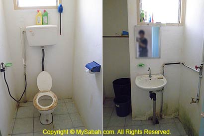
Monggis Substation is a two-storey administration building and accommodation of Sabah Parks. In ground floor, there is a bathroom, toilet, park office, kitchen, living room (with TV) and a bedroom.
Above: standard room with bunk beds
In first floor, there is a living room (with TV), 3 bedrooms with bunk beds and one VIP room with two beds. Electricity is only available from 6pm to 11pm and powered by generator. The accommodation can accommodate up to 20 visitors for a small fee. My room has a ceiling fan, wardrobe and bunk beds come with pillow. To us, this is a 5-star accommodation compared to camping. By the way, you better close the windows, otherwise your room will be full with hundreds of insects attracted by the room light.
Above: VIP room of Monggis Substation
No, there is no restaurant here and neighborhood, so you need to prepare your own meals. The kitchen in substation is quite well-equipped, common items such as refrigerator, cooking stove, gas, cooking utensils, dining table and tableware are available. Visitor is required to pay a fee of RM50 for using the gas and cooking facilities. We had rice, chicken, curry, sardine and mixed vegetables as dinner, reminisced about our experience, then crawled to our beds.
Above: kitchen
DAY 5. Going Home
Back to Kota Kinabalu
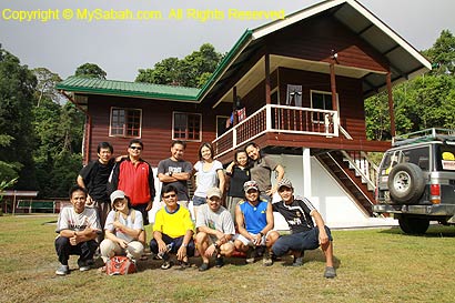
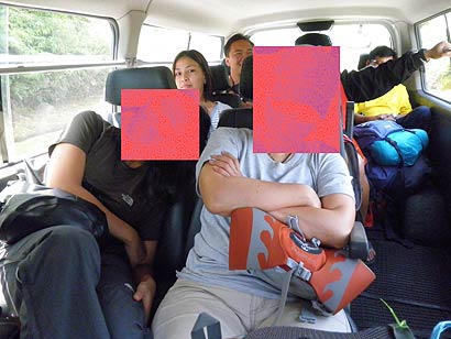
Last day is a happy day for everyone. Climbers are happy that they will be back to civilization soon; guides and porters are happy to receive their tips. After a few rounds of photo sessions, we say good bye to Monggis and Mt. Tambuyukon. Despite the muddy road caused by heavy rain last night, it was a smooth ride to head back home.
Bye bye Mt. Tambuyukon!!!
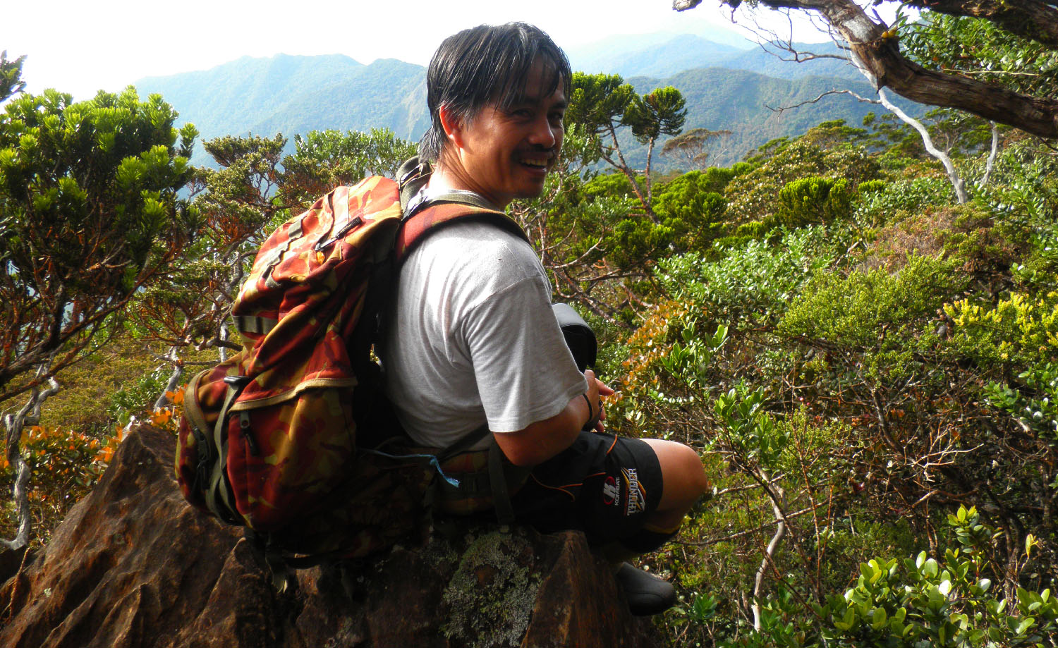
Above: Exhausted climbers. Better not showing their faces or I’ll be skinned alive. :p
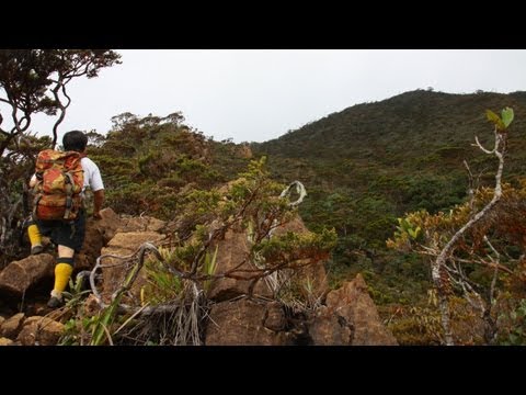
Mt. Tambuyukon Vs. Mt. Kinabalu
Many ask me, “Mt. Kinabalu and Mt. Tambuyukon, which one is harder to climb?”
I can tell you, though Mt. Tambuyukon is about half the height of Mt. Kinabalu, it’s 3 times harder (multiply 2 if the weather is bad) to climb. IMHO, “Mt. Kinabalu is for kids, Mt. Tambuyukon is for men.” After the climb, whenever I see online travelogue that says climbing Mt. Kinabalu is “extremely challenging”, I laugh my ass off. One advice – do not try Mt. Tambuyukon if you think climbing Mt. Kinabalu is hard!
You may watch the 5-min video below to see our climb from the start to the summit:
In contrast to Mt. Kinabalu, Mt. Tambuyukon is a forested mountain. The climbing route is pure nature trail, full of leeches and no boardwalk, rope, hand rail and other support. In our team, one member stung by wasp, two got swollen finger/arm caused by poisonous plant, one suffered altitude sickness, and one got sore knees. Overall, it’s impossible to came back from Mt. Tambuyukon without any cut, wound, bruise, pain and leech / sandfly bites on our bodies.
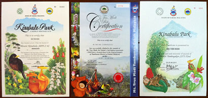
Above: Now I have climbing certificates of Malaysia’s top 3 mountains. From left to right: Mt. Kinabalu, Mt. Trus Madi & Mt. Tambuyukon.